MIDDLE SCHOOL CURRICULUM TR AILING ICE AGE M YST ERI E S ICE AGE TREKKING
|
|
|
- Moses Flowers
- 6 years ago
- Views:
Transcription


1 MIDDLE SCHOOL CURRICULUM TR AILING ICE AGE M YST ERI E S ICE AGE TREKKING
2 CONTENTS I. Enduring Knowledge... 3 II. Teacher Background... 3 III. Before Viewing this Video... 5 IV. Viewing Guide... 5 V. Discussion Guide... 6 VI. Evaluation... 6 Curriculum Standards... i, ii, iii Note: This topical must be accompanied with the Overview for complete understanding. 2
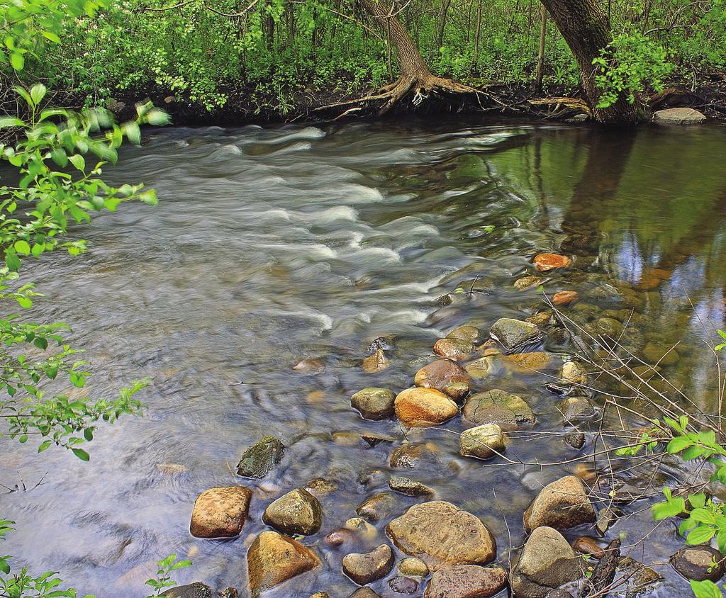
3 Overview: During the past 2.5 million years, numerous continental glaciers advanced and retreated across much of the upper Midwest, with the last glaciers retreating some 10,000 years ago. All this glacial activity shaped and deposited both the topography and soil types that we see today. Combined, they greatly influence regional water cycle activity, lakes, rivers, forest cover, and land use. One way for students to gain first-hand knowledge and visual understanding of the features formed during glaciation is to walk sections of the Ice Age Trail. Planning a hike along the trail requires a combination of using common sense, safety, and research. I. Enduring Knowledge: Students will learn how to plan and prepare for a safe and smart field expedition. Learning Targets: 1. Students should learn that a field expedition is important in any geological study. 2. Students should learn how to set up steps to prepare for the trip. 3. Students should learn the steps to consider: maps, safety, supplies, preservation, and record keeping. II. Teacher Background: A glacier is made up of thick layers of compressed ice formed from repeated snowfalls that has the ability to move. It flows like a slow river of putty and physically changes the shape of the land in the process. The size of a glacier can vary from as small as a football field to hundreds of kilometers. A glacier forms when the amount of accumulating snow is greater than the amount that melts. This accumulation remains year-round and compresses the lower layers into ice. The extreme weight of the glacier deforms the lower layers of ice similar to putty, and this characteristic, along with the pull of gravity, causes the ice to move through mountain valleys or across plains. It can change speed and at times retreat, altering the land beneath by a combination of forces. As a glacier moves, it carves away land by erosion and also sculpts and deposits new landforms. During the Wisconsin glaciation, continental glaciers formed moraines, kettles, drumlins, and eskers. These features are formed with glacial drift that is made up of sand, gravel, rocks, and boulders created and transported by the forces of the moving ice. The glacial melt water is a key component in the creation of depositional features, and also creates rivers and lakes. 3
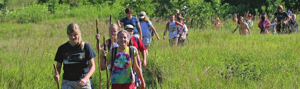
4 A field expedition is an excellent way to view landforms created by glaciers. The Ice Age Trail is an excellent place to explore these features. After choosing a specific area, the hiker needs to make a list of tasks to complete to prepare for the trip. These tasks encompass safety, supplies, researching the conditions, rules, and plans for recording information. 1. Safety: adult supervision, plans left with someone, cell phone, maps, weather 2. Supplies: clothes, footwear, food, water, flashlights, matches, First Aid kits, whistles 3. Leave No Trace: take out waste; don t disturb nature or other hikers 4. Record: camera and journal for features, plants, wildlife Online Resources: - information about Wisconsin glaciers, also vocabulary - about the Ice Age Trail itself - leave no trace principles for low-impact hiking - quick background info Vocabulary: 1. field expedition: a trip to the actual site of the study, in this case the Ice Age Trail to study glacier features 2. GPS: (Global Positioning Satellite) tool to give exact location using satellites 3. Alpine glacier: glacier that is formed in a mountain valley 4. continental glacier: glacier formed as ice fans out across the land These are much larger than alpine glaciers. 5. moraine: a ridge-like landform consisting of glacial debris that is created along the edges of a glacier 6. kettle: a depression formed when glacial ice breaks off and is buried Over time the ice melts, creating a small depression. 7. esker: long ridge of gravel deposited in a tunnel under the glacier by its melt waters 4
5 8. drumlin: long, teardrop-shaped glacial drift formations that run parallel to the glacier s flow It is unclear whether it forms from dragging sediment or from melt water movement. 9. dell: small valley 10. foot: the bottom (terminal) edge of the glacier the edge that creates the terminal moraine 11. geomorphology: the study of the physical features of the surface of the Earth and how they formed or change 12. terminal moraine: a moraine deposited at the point of furthest advance ( terminus ) of a glacier, forming a ridge 13. kame: a mound-shaped deposit of sand and gravel formed by glacial melt water flowing into a hole in the glacier. III. Before Viewing this Video: Ask students to: Think of a trip or vacation you have taken with your family. Make a list of all the things you needed to do in preparation for the trip. Share with the class. What are some scientific observations we are likely to make when looking at a glacial landform? How can we tell one landform from another? Share with the class. IV. Viewing Guide: Ask students to answer the following questions while you watch the video: 1. What are 2 safety precautions you should take before your expedition? (Take an adult, leave planned trek time and location with 2 adults, carry cell phone, check weather) 2. What are the 3 important clothing items to pack? (long pants, hiking boots, rain gear) 3. What do you need so you don t get lost? (map, compass, GPS) 4. Name 1 other item you should take along (water, flashlight, matches, First Aid kit, whistle) 5. Name one way to show respect for nature. (Don t pick plants, don t leave any garbage, don t get off the trail, don t alter nature) 6. What should you record in your journal? (description of glacial features, plants, animals, take photographs or make sketches) 5
6 V. Discussion Points: Discuss questions from viewing guide In small groups, plan a field expedition along the Ice Age Trail. Make sure each group member writes down the information for one of the questions below. Include: A. Section to hike (use Ice Age Trail website). Download map B. Safety preparation (leave info with adult, take map, compass, cell phone, GPS, check for decent weather) C. Supplies to pack (hiking clothes, adequate food and water, flashlight, matches, First Aid kit, whistle) D. Rules to follow while hiking (stay on trail, carry out garbage, don t disturb nature or take anything, respect other hikers, be aware that additional rules may apply to each section) E. Set up page for recording information in a journal (date, location, observations, sketches, photos) F. Be prepared to share with class VI. Evaluation: Review small group activity based on the following criteria: 1. Complete information in Section V 2. Contribution of each member one section written by each 3. Ability to work together as a group (Use 21 st Century Skills Rubric) 4. Use of time (Use 21 st Century Skills Rubric) 5. Active participation in discussions and in a group. Suggestions for extended learning: 1. Act on the plan you created and share your scientific observations with the class. 2. While sitting for 20 minutes each day, write a 5-day journal recording plants and wildlife you see in a nearby park or in your backyard. Include at least 2 sketches. 3. Write a short guide of do s and don ts on the Ice Age Trail. Look at other sources. 4. Plan a 2-day expedition to look at geological features in Yellowstone Park. Get maps and plan which sites you would visit and materials you would need to take with you. Evaluate similarities and differences between visiting the geological features of Yellowstone National Park and the features of Wisconsin. 6
7 STUDENT PROFICIENCY STANDARDS ICE AGE TREKKING The following Wisconsin Student Proficiency Standards can be met by teaching Ice Age Trekking: SCIENCE 1. Connections: How evidence explains phenomena 2. Inquiry: Understanding how questions direct research 3. Earth Science: Earth history & structure of Earth 4. Physical Science: Motion & Forces SOCIAL STUDIES A. Geography: Students in Wisconsin will learn about geography through the study of the relationships among people, places, and environments. 8 th grade: A.8.1, A.8.6, A.8.8 B. History: Students in Wisconsin will learn about the history of Wisconsin, the United States, and the world, examining change and continuity over time in order to develop historical perspective, to explain historical relationships, and analyze issues that affect the present and the future. 8 th grade: B.8.8, B.8.12 i
8 NATIONAL COMMON CORE STANDARDS ICE AGE TREKKING Language Arts Reading - Informational Text Key Ideas and Details 8.Rit.3 Craft and Structure 8.Rit.4, 8.Rit.5 Integration of Knowledge and Ideas 8.Rit.7, 8.Rit.9 Writing Text Types and Purposes 8.W.2, 8.W.3, Production and Distribution of Writing 8.W.4, 8.W.5, 8.W.6, Research to Build and Present Knowledge 8.W.7, 8.W.8, 8.W.9, Speaking and Listening Comprehension and Collaboration 8.Sl.1, 8.Sl.2 Presentation of Knowledge and Ideas 8.Sl.4, 8.Sl.6 Language Conventions of Standard English 8.L.1, 8.L.2 Knowledge of Language 8.L.3 Vocabulary Acquisition and Use 8.L.4, 8.L.5 ii
9 WISCONSIN TEACHER STANDARDS ICE AGE TREKKING Wisconsin Teacher Standards which can be met with this curriculum Standard 1: Subject matter This curriculum provides information not readily available in other forms. A teacher using this material will be well-informed about the subject matter. Standard 2: Broad range of ability This curriculum provides instruction that supports their intellectual, social, and personal development. Standard 3: Adapt instruction This curriculum provides suggestions for learners with a variety of intelligences and levels of ability. Standard 4: Instructional strategies This curriculum includes the use of technology to gain information and suggestion for using research in extending learning. Standard 5: Individual and group motivation Both prior knowledge and carefully designed group projects promote motivation for students to learn. Standard 6: Verbal and nonverbal communications Instructional media and technology that promote active learning are key parts of this curriculum. Standard 7: Organizes and plans systematic instruction This curriculum is organized to support teacher knowledge, to draw on and motivate students to engage in active learning, and promotes active inquiry, collaboration, and supportive interaction in the classroom. Standard 8: Formal and informal assessments Suggestions for a variety of assessments, both formal and informal, are offered in the curriculum. iii
MIDDLE SCHOOL CURRICULUM TR AILING ICE AGE M YST ERI E S SEARCHING GLACIAL FEATURES
 MIDDLE SCHOOL CURRICULUM TR AILING ICE AGE M YST ERI E S SEARCHING GLACIAL FEATURES CONTENTS I. Enduring Knowledge... 3 II. Teacher Background... 3 III. Before Viewing the Video... 5 IV. Viewing Guide...
Teacher s Guide For. Glaciers
 Teacher s Guide For Glaciers For grade 7 - College Program produced by Centre Communications, Inc. for Ambrose Video Publishing, Inc. Executive Producer William V. Ambrose Teacher's Guide by Mark Reeder
READING QUESTIONS: Glaciers GEOL /WI 60 pts. a. Alpine Ice from larger ice masses flowing through a valley to the ocean
 READING QUESTIONS: Glaciers GEOL 131 18/WI 60 pts NAME DUE: Tuesday, March 13 Glaciers: A Part of Two Basic Cycles (p. 192-195) 1. Match each type of glacier to its description: (2 pts) a. Alpine Ice from
1 Glacial Erosion and
 www.ck12.org Chapter 1. Glacial Erosion and Deposition CHAPTER 1 Glacial Erosion and Deposition Lesson Objectives Discuss the different erosional features formed by alpine glaciers. Describe the processes
READING QUESTIONS: Chapter 7, Glaciers GEOL 131 Fall pts. a. Alpine Ice from larger ice masses flowing through a valley to the ocean
 READING QUESTIONS: Chapter 7, Glaciers GEOL 131 Fall 2018 63 pts NAME DUE: Tuesday, October 23 Glaciers: A Part of Two Basic Cycles (p. 192-195) 1. Match each type of glacier to its description: (2 pts)
Please make sure that all teachers and chaperones attending the field study are aware of the following information:
 Dear Teacher, Thank you for signing up for The Ice Age at the Lost Valley Visitor Center in Glacial Park. The visitor center is located in the middle of Glacial Park. Follow the signs from the Harts Road
The Physical Geography of Long Island
 The Physical Geography of Long Island A Bit About Long Island Length 118 miles Brooklyn to Montauk Geo202 Spring 2012 Width 23 miles at it s widest Area 1,400 square miles Formation of Long Island River
Lesson. Glaciers Carve the Land A QUICK LOOK. Overview. Big Idea. Process Skills Key Notes
 EARTH S CHANGING SURFACE CLUSTER 2 HOW THE EARTH S SURFACE CHANGES Lesson 62 Glaciers Carve the Land A QUICK LOOK Big Idea Moving water, ice, and wind break down rock, transport materials, and build up
Glaciers. Chapter 17
 Glaciers Chapter 17 Vocabulary 1. Glacier 2. Snowfield 3. Firn 4. Alpine glacier 5. Continental glacier 6. Basal slip 7. Internal plastic flow 8. Crevasses 9. Glacial grooves 10. Ice shelves 11. Icebergs
glacier Little Ice Age continental glacier valley glacier ice cap glaciation firn glacial ice plastic flow basal slip Chapter 14
 Little Ice Age glacier valley glacier continental glacier ice cap glaciation firn glacial ice plastic flow basal slip glacial budget zone of accumulation zone of wastage glacial surge abrasion glacial
Glaciers. Reading Practice
 Reading Practice A Glaciers Besides the earth s oceans, glacier ice is the largest source of water on earth. A glacier is a massive stream or sheet of ice that moves underneath itself under the influence
Recrystallization of snow to form LARGE. called FIRN: like packed snowballs. the weight of overlying firn and snow.
 Chapter 11 Glaciers BFRB P. 103-104, 104, 108, 117-120120 Process of Glacier Formation Snow does NOT melt in summer Recrystallization of snow to form LARGE crystals of ice (rough and granular) called
Glaciers Earth 9th Edition Chapter 18 Mass wasting: summary in haiku form Glaciers Glaciers Glaciers Glaciers Formation of glacial ice
 1 2 3 4 5 6 7 8 9 10 11 12 13 14 15 Earth 9 th Edition Chapter 18 Mass wasting: summary in haiku form Ten thousand years thence big glaciers began to melt - called "global warming." are parts of two basic
LAB P - GLACIAL PROCESSES AND LANDSCAPES
 Introduction LAB P - GLACIAL PROCESSES AND LANDSCAPES Ice has been a significant force in modifying the surface of the earth at numerous times throughout Earth s history. Though more important during the
1.4 Understand how moving ice acts as an agent of erosion and deposition. (Chap. 2)
") 1.4 Understand how moving ice acts as an agent of erosion and deposition. (Chap. 2) There are two types of glaciation. Alpine Glaciation Continental Glaciation Distinguish between the terms alpine glaciation
1.4 Understand how moving ice acts as an agent of erosion and deposition. (Chap. 2) There are two types of glaciation. Alpine Glaciation Continental Glaciation Distinguish between the terms alpine glaciation
Glaciers. Glacier Dynamics. Glacier Dynamics. Glaciers and Glaciation. Types of Glaciers. Chapter 15
 Chapter 15 Glaciers and Glaciation Glaciers A glacier is a large, permanent (nonseasonal) mass of ice that is formed on land and moves under the force of gravity. Glaciers may form anywhere that snow accumulation
Gifts of the Glaciers
 Gifts of the Glaciers Gifts of the Glaciers Moving ice of glacier was responsible for water, landforms, and soil characteristics and patterns of today Sculpturing of bedrock materials Glacial Landforms
Did It. naturalists. Young. Moving and melting ice shaped many of Minnesota s land features. 30 Minnesota Conservation Volunteer
 Young naturalists by Mary Hoff Photography by Gary Alan Nelson T he Glacier Did It Moving and melting ice shaped many of Minnesota s land features. Shut your eyes. Imagine that it s a sunny summer day
Glaciers. Glacier Dynamics. Glaciers and Glaciation. East Greenland. Types of Glaciers. Chapter 16
 Chapter 16 Glaciers A glacier is a large, permanent (nonseasonal) mass of ice that is formed on land and moves under the force of gravity. Glaciers may form anywhere that snow accumulation exceeds seasonal
GLACIATION. The Last Ice Age (see Chapter 12) and. Pleistocene Ice Cap. Glacial Dynamics 10/2/2012. Laurentide Ice Sheet over NYS
 and. Pleistocene Ice Cap. Glacial Dynamics 10/2/2012. Laurentide Ice Sheet over NYS") GLACIATION and New York State Prof. Anthony Grande The Last Ice Age (see Chapter 1) The Pleistocene Epoch began 1.6 mya. During this time, climates grew colder. There were numerous ice ages starting 100,000000
GLACIATION and New York State Prof. Anthony Grande The Last Ice Age (see Chapter 1) The Pleistocene Epoch began 1.6 mya. During this time, climates grew colder. There were numerous ice ages starting 100,000000
glacial drift: all deposits associated with glaciation; covers 8% of Earth s surface above sealevel, and 25% of North America
 Glacial depositional features glacial drift: all deposits associated with glaciation; covers 8% of Earth s surface above sealevel, and 25% of North America i) nonstratified drift till: transported & deposited
Lesson 5: Ice in Action
 Everest Education Expedition Curriculum Lesson 5: Ice in Action Created by Montana State University Extended University and Montana NSF EPSCoR http://www.montana.edu/everest Lesson Overview: Explore glaciers
Great Science Adventures
 Great Science Adventures Lesson 18 How do glaciers affect the land? Lithosphere Concepts: There are two kinds of glaciers: valley glaciers which form in high mountain valleys, and continental glaciers
Glaciers and Glaciation Earth - Chapter 18 Stan Hatfield Southwestern Illinois College
 Glaciers and Glaciation Earth - Chapter 18 Stan Hatfield Southwestern Illinois College Glaciers Glaciers are parts of two basic cycles: 1. Hydrologic cycle 2. Rock cycle A glacier is a thick mass of ice
Shaping of North America. Physical Geography II of the United States and Canada. The Last Ice Age. The Ice Age. Pleistocene Polar Ice Cap 2/14/2013
 Physical Geography II of the United States and Canada Prof. Anthony Grande AFG 2012 Shaping of North America The chief shaper of the landscape of North America is and has been running water. Glaciation
I. Types of Glaciers 11/22/2011. I. Types of Glaciers. Glaciers and Glaciation. Chapter 11 Temp. B. Types of glaciers
 Why should I care about glaciers? Look closely at this graph to understand why we should care? and Glaciation Chapter 11 Temp I. Types of A. Glacier a thick mass of ice that originates on land from the
Glacial Origins and Features of Long Island
 Glacial Origins and Features of Long Island Interior Coastal Plain Continental Shelf Long Island s Geology 0 Ma Phanerozoic 540 Ma Proterozoic 2500 Ma Archean 3800 Ma Hadean 4600 Ma C M P Geologic Time
PHYSICAL GEOGRAPHY GEOGRAPHY EARTH SYSTEMS COASTAL SYSTEMS FLUVIAL SYSTEMS
 PHYSICAL GEOGRAPHY EARTH SYSTEMS FLUVIAL SYSTEMS COASTAL SYSTEMS PHYSICAL GEOGRAPHY CORRIES / CIRQUES A Corrie or Cirque is the armchair shaped hollow that was the birthplace of a glacier. It has steep,
Dynamic Planet Practice Test Written by Samuel Bressler
 Dynamic Planet Practice Test 2013 Written by Samuel Bressler Part 1: Multiple Choice 1. Which of the following is NOT related to alpine glaciation? a) Serac b) Kame c) Col d) Paternoster Lake 2. The common
ENVI2030L - ALPINE AND CONTINENTAL GLACIATION
 NAME ENVI2030L - ALPINE AND CONTINENTAL GLACIATION I. Introduction Glaciers are slowly moving ice sheets. They are very effective erosional agents and can drastically modify the landscapes over which they
Mapping the Snout. Subjects. Skills. Materials
 Subjects Mapping the Snout science math physical education Skills measuring cooperative action inferring map reading data interpretation questioning Materials - rulers - Mapping the Snout outline map and
Chapter 16 Glaciers and Glaciations
 Chapter 16 Glaciers and Glaciations Name: Page 419-454 (2nd Ed.) ; Page 406-439 (1st Ed.) Part A: Anticipation Guide: Please read through these statements before reading and mark them as true or false.
2. (1pt) From an aircraft, how can you tell the difference between a snowfield and a snow-covered glacier?
 From an aircraft, how can you tell the difference between a snowfield and a snow-covered glacier?") 1 GLACIERS 1. (2pts) Define a glacier: 2. (1pt) From an aircraft, how can you tell the difference between a snowfield and a snow-covered glacier? 3. (2pts) What is the relative size of Antarctica, Greenland,
1 GLACIERS 1. (2pts) Define a glacier: 2. (1pt) From an aircraft, how can you tell the difference between a snowfield and a snow-covered glacier? 3. (2pts) What is the relative size of Antarctica, Greenland,
Glaciers. Clicker Question. Glaciers and Glaciation. How familiar are you with glaciers? West Greenland. Types of Glaciers.
 Chapter 21 Glaciers A glacier is a large, permanent (nonseasonal) mass of ice that is formed on land and moves under the force of gravity. Glaciers may form anywhere that snow accumulation exceeds seasonal
Dynamic Planet: Glaciers
 Team Name+Number Teammate 1 name Teammate 2 name Dynamic Planet: Glaciers (by Shad160) The following test is 80 questions long, split up into four different sections. The first 20 questions are worth 40
THE DEPARTMENT OF HIGHER EDUCATION UNIVERSITY OF COMPUTER STUDIES FIFTH YEAR
 THE DEPARTMENT OF HIGHER EDUCATION UNIVERSITY OF COMPUTER STUDIES FIFTH YEAR (B.C.Sc./B.C.Tech.) RE- EXAMINATION SEPTEMBER 2018 Answer all questions. ENGLISH Time allowed: 3 hours QUESTION I Glaciers A
Glaciers. Valley or Alpine glaciers. Ice sheets. Piedmont - foot of the mountain glaciers. Form in mountainous areas Move downslope in valleys
 Glaciers & Ice Ages Glaciers Valley or Alpine glaciers Form in mountainous areas Move downslope in valleys Ice sheets Move outward from center Continental glaciers - large scale, ice age type. Presently
Glacial Geomorphology Exercise
 James Madison University Field Course in western Ireland Glacial Geomorphology Exercise 3-day road log (abbreviated) Striations Large kame terrace Cirque with moraines Kame delta Striations Eskers Raised
Arthur Carhart National Wilderness Training Center s Wilderness Investigations High School
 Arthur Carhart National Training Center s Investigations High School 101/Lesson 2 (OPTION 2B) Introducing the Act Goal: Students will understand the difference between wild spaces and federally designated
Geography 120, Instructor: Chaddock In Class 13: Glaciers and Icecaps Name: Fill in the correct terms for these descriptions: Ablation zone: n zne:
 Geography 120, Instructor: Chaddock In Class 13: Glaciers and Icecaps Name: Fill in the correct terms for these descriptions: Ablation zone: The area of a glacier where mass is lost through melting or
Alpine Glacial Features along the Chimney Pond Trail, Baxter State Park, Maine
 Maine Geologic Facts and Localities September, 2009 Alpine Glacial Features along the Chimney Pond Trail, Baxter State Park, Maine 45 54 57.98 N, 68 54 41.48 W Text by Robert A. Johnston, Department of
NYS Invitational Science Olympiad April 2005 DYNAMIC PLANET: GLACIERS
 NYS Invitational Science Olympiad April 2005 School Team # DYNAMIC PLANET: GLACIERS 1. What type of glacier is shown in the photo? 2. a. What is the name of the feature labeled A? b. How did feature A
Pterosaur Glider Experiment
 Your web browser (Safari 7) is out of date. For more security, comfort and Activityengage the best experience on this site: Update your browser Ignore Pterosaur Glider Experiment How might having a head
The Summits of Canada Expedition Information and Education Summary
 The Summits of Expedition Information and Education Summary A historic Canadian adventure, the Summits of Expedition, will take place in 2006 to put the first Canadian Team on the highest point of s thirteen
Glaciers and Glaciation
 Chapter 18 Lecture Earth: An Introduction to Physical Geology Eleventh Edition Glaciers and Glaciation Tarbuck and Lutgens Glaciers: A Part of Two Basic Cycles A glacier is a thick mass of ice that forms,
12: MELTWATER LANDFORM IDENTIFICATION
 Glacial Geology 12. Meltwater Landform Identification 12: MELTWATER LANDFORM IDENTIFICATION 60 Points Objective: learn how to identify meltwater landforms and their characteristics in photos and on topographic
Chapter 14. Glaciers and Glaciation
 Chapter 14 Glaciers and Glaciation Introduction Pleistocene Glaciations: A series of "ice ages" and warmer intervals that occurred 2.6 million to 10,000 years ago. The Little Ice Age was a time of colder
Making glacial connections
 Student task A 1. Cut and arrange the cards below to make four sets of four connections: Four connections Matterhorn drumlin lateral U-shaped valley outwash plain truncated spur Lauterbrunnen ground medial
Landscapes in the UK: Glaciation 1. Extent of ice cover across the UK during the last ice age.
 Landscapes in the UK: Glaciation 1. Extent of ice cover across the UK during the last ice age. Key idea: Ice was a powerful force in shaping the landscape of the UK. In the past the climate has got colder
Banff National Park Learn to Hike ESL Activity #3 Plan Ahead and Be Prepared
 Banff National Park Learn to Hike ESL Activity #3 Plan Ahead and Be Prepared Activity #3 - Plan Ahead and Be Prepared Hiking Knowledge Objective: Increase knowledge of appropriate articles to bring on
Kindergarten Science Unit C: Earth Science Chapter 5: Our Land, Air, and Water Lesson 1: What makes up the Earth?
 Insert Photo or Graphic for Unit or Lesson Theme Kindergarten Science Unit C: Earth Science Chapter 5: Our Land, Air, and Water Lesson 1: What makes up the Earth? Insert Photo/Graphic Earth Insert Photo/Graphic
A trip to Steindalen. - geology and landscape on the way to the glacier. Geoffrey D. Corner
 A TRIP TO STEINDALEN Excursion guide Please take this with you on your trip, but don t leave it behind as litter. A trip to Steindalen - geology and landscape on the way to the glacier A part of Geologiskolen,
INVESTIGATING THE GRANDE ECORE & RED RIVER: A HANDS- ON INQUIRY
 INVESTIGATING THE GRANDE ECORE & RED RIVER: A HANDS- ON INQUIRY Paul Nagel, PhD Coordinator, Louisiana Geography Education Alliance Jacqueline L. Mason, Ed.D Assistant Professor, Science Education Northwestern
Geoscape Toronto The Oak Ridges Moraine Activity 2 - Page 1 of 10 Information Bulletin
 About 13,000 years ago as the Laurentide Ice Sheet melted, glacial meltwater accumulated between the ice sheet and the Niagara Escarpment. This formed a lake basin into which gravel and sand were deposited.
Geomorphology. Glacial Flow and Reconstruction
 Geomorphology Glacial Flow and Reconstruction We will use simple mathematical models to understand ice dynamics, recreate a profile of the Laurentide ice sheet, and determine the climate change of the
Oak Ridges Moraine: Southern Ontario's Sponge
 Oak Ridges Moraine: Southern Ontario's Sponge Lesson Overview Students will examine the location and the importance of the Oak Ridges Moraine and investigate ongoing conflicts concerning its development.
Geologic Trips, Sierra Nevada
 ISBN 0-9661316-5-7 GeoPress Excerpt from Geologic Trips, Sierra Nevada by Ted Konigsmark All rights reserved. No part of this book may be reproduced without written permission, except for critical articles
Mighty Glaciers. Mighty Glaciers. Visit for thousands of books and materials.
 Mighty Glaciers A Reading A Z Level M Leveled Reader Word Count: 684 LEVELED READER M Mighty Glaciers Written by Ned Jensen Visit www.readinga-z.com for thousands of books and materials. www.readinga-z.com
GC 225 Lecture Exam #2
 GC 225 Lecture Exam #2 Direction- path along which something is moving. 3 Types; - COMPASS DIRECTIONAL NAME (32 in total) - BEARING (four 0 o - 90 o ) - AZIMUTHS (0 o - 360 o ) Compass (32 named points)
Mearns Castle High School. Geography Department. Glaciated Landscapes
 Mearns Castle High School Geography Department Glaciated Landscapes Lesson One: Location of Glaciated Uplands in the British Isles The Ice Age in Britain began about 1,000,000 years ago and lasted until
THE INFLUENCE OF DEBRIS ON THE FLOW OF GLACIERS.
 THE INFLUENCE OF DEBRIS ON THE FLOW OF GLACIERS. THE behavior of ice under various conditions is frequently illustrated by experiments with pitch or other similar viscous fluids or plastic solids. If sand
TEACHER PAGE Trial Version
 TEACHER PAGE Trial Version * After completion of the lesson, please take a moment to fill out the feedback form on our web site (https://www.cresis.ku.edu/education/k-12/online-data-portal)* Lesson Title:
Physical Geography: Learning and teaching in a discipline so dynamic that textbooks can t keep up!
 MATTERS Physical Geography: Learning and teaching in a discipline so dynamic that textbooks can t keep up! PETER G. KNIGHT ABSTRACT: Physical geography is a dynamic discipline. This makes geography exciting,
Red Tarn, Lake District They are all features of glacial erosion
 Ribbon Lake Lake Windermere, Lake District Arete Striding Edge, Lake District 1 2 3 Pyramidal Peak Corrie & Tarn 4 Matterhorn, Switzerland Red Tarn, Lake District They are all features of glacial erosion
ESS Glaciers and Global Change
 ESS 203 - Glaciers and Global Change Friday January 5, 2018 Outline for today Please turn in writing assignment and questionnaires. (Folders going around) Questions about class outline and objectives?
The Northeast: America's Gateway to the World
 The Northeast: America's Gateway to the World Living in the Shadow of the Ice a lesson on the impact of glaciation on Northeast landscapes INTRODUCTION: The region we call the Northeast has a very long
Landscapes in the UK: Glaciation 1. Extent of ice cover across the UK during the last ice age.
 Landscapes in the UK: Glaciation 1. Extent of ice cover across the UK during the last ice age. Key idea: Ice was a powerful force in shaping the landscape of the UK. As the climate has changed in the past,
Andra Beames Sawgrass Springs Middle School West Sample Road Coral Springs, FL
 Andra Beames Sawgrass Springs Middle School 12500 West Sample Road Coral Springs, FL 33065 754.322.4500 andra.beames@browardschools.com Let s Take A Hike For information concerning IMPACT II opportunities
Design Challenge: Building a Roller Coaster
 Design Challenge: Building a Roller Coaster Focus: Students explore materials and tools then use the design process to build their own roller coasters. Specific Curriculum Outcomes Students will be expected
Drawing Conclusions and Making Inferences
 Drawing Conclusions and Making Inferences G TO THE STUDENT In this book, you will learn how to use the reading strategy called Drawing Conclusions and Making Inferences. With your teacher s help, you will
INTERPRETING TOPOGRAPHIC MAPS (MODIFIED FOR ADEED)
") INTERPRETING TOPOGRAPHIC MAPS (MODIFIED FOR ADEED) Science Concept: Topographic maps give information about the forces that shape the features of Earth. Objectives: The student will: identify land features
INTERPRETING TOPOGRAPHIC MAPS (MODIFIED FOR ADEED) Science Concept: Topographic maps give information about the forces that shape the features of Earth. Objectives: The student will: identify land features
Glacier National Park
 Glacier National Park West Glacier, MO Page 1 Page 3-6 Report Rough Draft Glacier National Park Glacier National Park is located in the northwest corner of Montana and extends into Canada. It is located
What would you say was the extend of the ice cover? 100%? 50%? A third? 2/3?
 This map shows the maximum extent of ice cover during the last ice age, 20,000 years ago. What would you say was the extend of the ice cover? 100%? 50%? A third? 2/3? KEY IDEAS & QUESTIONS What is a glacier?
STANDARDS MAP Basic Programs 1 and 2 English Language Arts Content Standards Grade Five
 : Pearson Program Title: Pearson California and Pearson California Components: : Teacher s Edition (TE), Student Edition (SE), Practice Book (PB); : Teacher s Edition (TE), Student Edition (SE), Transparencies
Mackinnon Esker Ecological Reserve Draft - Management Plan
 Mackinnon Esker Ecological Reserve Draft - Management Plan May 2011 Photo Credit: This document replaces the direction provided in the Carp Lake Provincial Park and Protected Area and Mackinnon Esker Ecological
Potomac Gorge. Resource Booklet. A Natural Monument in the Shadow of National Monuments. Bridging the Watershed. Potomac Gorge 75
 Potomac Gorge Potomac Gorge A Natural Monument in the Shadow of National Monuments Resource Booklet Bridging the Watershed An outreach program of the Alice Ferguson Foundation in partnership with the National
Chapter 17. Glacial & Periglacial Landscapes
 Chapter 17 Glacial & Periglacial Landscapes Cryosphere Cryosphere - the portions of Earth's surface where water is in solid form, including sea ice, lake ice, river ice, snow cover, glaciers, ice caps,
Glaciers Earth Chapter 18 Chapter 18 Glaciers & Glaciation Glaciers: A Part of Two Basic Cycles Glaciers: A Part of Two Basic Cycles Valley Glacier
 1 2 3 4 5 6 7 8 9 10 11 12 Glaciers Earth Chapter 18 Chapter 18 Glaciers & Glaciation A glacier is a thick mass of ice that forms, over hundreds and thousands of years, by the accumulation, compaction,
Name Team Number. 1. The famous question: What percent of Earth's surface is covered by glaciers? A) 5% D) neve
 5% D) neve") Part I: Multiple Choice (30pts) Directions: Please choose the best answer for each question. There is only one correct answer for each question unless otherwise stated. There are 30 questions. Each one
Part I: Multiple Choice (30pts) Directions: Please choose the best answer for each question. There is only one correct answer for each question unless otherwise stated. There are 30 questions. Each one
Q: What is a period of time whereby the average global temperature has decreased? Q: What is a glacier?
 Q: What is a glacier? A: A large sheet of ice which lasts all year round. Q: What is a period of time whereby the average global temperature has decreased? A: A glacial. Q: What is an interglacial? Q:
Descent into the Ice PROGRAM OVERVIEW
 PROGRAM OVERVIEW NOVA follows glaciologists into the underworld of Mont Blanc, where they search for internal lakes. The program: revisits the 1892 disaster in which a hidden lake burst forth from a glacier
47I THE LAS ANIMAS GLACIER.
 THE LAS ANIMAS GLACIER. ONE of the largest of the extinct glaciers of the Rocky Mountains was that which occupied the valley of the Las Animas river. This stream originates in the San Juan mountains in
Outdoor Education - Backpacking/Hiking
 Outdoor Education - Backpacking/Hiking Elementary - Curricular 2017 Single-day or multi-day trips from school or base camp, that travel within 2 hours of the arrival of emergency medical assistance. Multi-day
Camping. Council Approval: Not required
 Camping Council Approval: Not required Activity Permitted For: D B J C S A About Camping Camping, a great Girl Scout tradition, is one of the very first activities that Girl Scouts founder Juliette Gordon
Walking and Hiking in Tirol
 Walking and Hiking in Tirol Emergency app Tirolean Mountain Rescue Service There is a lot to learn about mountain climbing and that takes time! Just like skiing, initial climbing experiences should be
Storybook Theme Park Ride
 Storybook Theme Park Ride Level: Elementary School Type of Contest: Team Composition of Team: 2 4 students per team Number of Teams: One entry per school Next Generation Science Standards: 3-5-ETS1-1.,
Ancient Greece. Written by: Marci Haines. Sample file. Rainbow Horizons Publishing Inc. ISBN-13:
 Ancient Greece Written by: Marci Haines Rainbow Horizons Publishing Inc. Tel: 1-800-663-3609 Fax: 1-800-663-3608 Email: service@rainbowhorizons.com www.rainbowhorizons.com ISBN-13: 978-1-55319-085-1 Copyright
AGAP Antarctic Research Project Visualizing Data Learning About Antarctica From RADAR Data? Student Version
 AGAP Antarctic Research Project Visualizing Data Learning About Antarctica From RADAR Data? Student Version Name Date Image of Subglacial Lake network courtesy of NSF Ice Sheet: A large glacier that covers
Education Programs Moose Mountain Provincial Park
 Education Programs Moose Mountain Provincial Park 2018 Programs Bring your class to our outdoor classroom! Guided school programs are offered in the spring at Moose Mountain Provincial Park. Booking: Park
Open Polar Expedition Training USA. Turpin Meadow Ranch
 Open Polar Expedition Training USA Turpin Meadow Ranch The purpose of the Polar Training Course is to prepare individuals for participation in a polar expedition such as skiing long distance or last degree
How Glaciers Change the World By ReadWorks
 How Glaciers Change the World How Glaciers Change the World By ReadWorks Glaciers are large masses of ice that can be found in either the oceans or on land. These large bodies of frozen water have big
Rationale or Purpose: This lesson will demonstrate several properties of water and bring awareness of what global warming may do to the sea level.
 Title: Glaciers and Icebergs Grade Level: 5th Objectives: Students will be able to: Identify the differences and similarities between a glacier and an iceberg; Recall the density of water and ice; Observe
E arth s climate strongly influences
 Section 7.1 7.1 Glaciers 1 FOCUS Section Objectives 7.1 Describe the different types of glaciers and where each type is found. 7.2 Explain how glaciers move and describe the different types of glacial
Recreation 200: Introduction to Backpacking
 Recreation 200: Introduction to Backpacking INSTRUCTOR: Clayton Sheehan csheehan@siu.edu 618.638.3682/618.453.1122 *220 Pulliam 217B/Touch of Nature Admin Office COURSE DESCRIPTION: You ll be amazed at
LESSON 9 Recognizing Recreational Benefits of Wilderness
 LESSON 9 Recognizing Recreational Benefits of Wilderness Objectives: Students will: study, analyze, and compare recreation visitor days (RVD s) for Wilderness areas adjacent to their homes or nearest state,
KS3 KIDZANIA POST-VISIT LEARNING RESOURCES KIDZANIA POST-VISIT LESSON PLAN
 KS3 KIDZANIA POST-VISIT LEARNING RESOURCES KIDZANIA POST-VISIT LESSON PLAN KS3 KIDZANIA POST-VISIT LESSON PLAN ThIs lesson should be completed in the classroom after you visit KidZania. LEARNING OBJECTIVES
GEOMORPHOLOGY EXAM #3
 Formation of Glaciers GEOMORPHOLOGY EXAM #3 - Transformation of snow into glacial ice - Density; SNOW = 0.07 0.18 g/cc FIRN(Neve) = 0.4 0.8 g/cc (Pellets) GLACIAL ICE = 0.8 0.9 g/cc - Firn / Ice Boundary
CBD 2014 Spring Camporee. Backpacking Merit Badge Course Description and Bring With List
 Backpacking Merit Badge Course Description and Bring With List This course is intended for scouts ages 13 or older who want an introduction to backpacking. It is good preparation for an upcoming first
AVALANCHE SKILLS TRAINING 1 MOUNT CAIN
 Thank you for choosing Island Alpine Guides for your Avalanche Skills Training. This package contains some background information to help you prepare, including meeting times and places, and a complete
Outdoor Education in Montgomery County
 Outdoor Education in Montgomery County Nothing is real until it is experienced Providing opportunities for all students in Montgomery County to engage in authentic learning outside of the four walls of