BACKCOUNTRY PROGRAM WATERSHED REPORT 2002
|
|
|
- Godwin Harrington
- 6 years ago
- Views:
Transcription

1 BACKCOUNTRY PROGRAM WATERSHED REPORT 2002 Pfeifferhorn Peak, Lone Peak Wilderness Area Salt Lake Ranger District, Wasatch Cache National Forest Prepared by Backcountry Rangers: Joelle Dickson, Greg Hilbig and Sean Wetterberg
2 TABLE OF CONTENTS INTRODUCTION...1 GOALS, OBJECTIVES AND ACCOMPLISHMENTS...1 WATERSHED PROGRAM STATISTICS...5 RECOMMENDATIONS FOR THE WATERSHED PROGRAM...7 CONCLUSION...8 MAP FIGURES...10 APPENDIX
3 INTRODUCTION The Salt Lake City watersheds in Big and Little Cottonwood Canyons are an invaluable community resource located in the Wasatch-Cache National Forest. Within the Canyons, there are four ski resorts, five picnic areas, five campgrounds and many miles of trails that are used regularly by local residents and visitors for recreation. This November marked the end of another very successful year that Salt Lake City Public Utilities and the US Forest Service have been partners in protecting this watershed resource. Because recreation and culinary water are the primary uses of the canyons, the watershed management program at the Salt Lake Ranger District (SLRD) focuses its efforts on minimizing recreation impacts to water quality. To fulfill the partnership, Backcountry Rangers patrol the City watersheds on a regular basis. Patrols are conducted to educate the public about watershed issues, to ensure regulation compliance, and to protect and improve the quality of National Forest System (NFS) lands. New this season, were some additions to the program that should improve the management and protection of the resource. The SLRD reorganized its staff allowing us to have another Ranger to assist in the work. This improved the program s ability to reach its goals. Rangers collect information regarding visitor use, violations and work completed. A database was created for managing that information. Data can now be queried for up to the minute totals and statistics. A campsite inventory and monitoring program was developed. Methods were adapted from published US Forest Service research methods. The inventory will allow the SLRD to locate, evaluate and manage the impacts associated with backcountry camping in the watersheds. It will serve as a baseline of recreation impact data by which to measure change. A volunteer program was developed to assist in restoration and rehabilitation projects. Volunteers help the program by increasing our ability to maintain and improve the quality of NFS lands. This paper is presented in four sections to report on the status of the watershed program. First, it details the goals, objectives and accomplishments of the 2002 season. Second, it presents and discusses statistics for visitor use numbers and preliminary results of the campsite inventory. It concludes with recommendations and ideas for program improvements followed by the campsite inventory map, figures and an appendix. GOALS, OBJECTIVES AND ACCOMPLISHMENTS Goals and objectives were set by the Backcountry Rangers to guide their actions in the field. The goals, objectives and accomplishments for the 2002 season were as follows: Goal 1. To improve public awareness of watershed issues and ensure public compliance with watershed regulations on U.S. Forest Service lands. Objectives Include watershed issues as topics of conversation when making public contacts.
4 Educate the public about Leave No Trace hiking and camping techniques. Distribute educational literature to the public if needed. Erect and maintain watershed posters and signs at all trailheads and lakes. Make contact with members of the public observed in violation of watershed restrictions. Issue Warnings/Violations for watershed regulations when necessary. Accomplishments While on patrol Backcountry Rangers made frequent casual contacts with the public. A total of 4,926 people were encountered this season. The majority of the visitors contacted were unaware that Big and Little Cottonwood Canyons are municipal watersheds or what that meant. Backcountry Rangers made a concerted effort this season to educate as many people encountered as possible about the watershed. Approximately 359 campers and hikers contacted this season received a fiveminute Leave No Trace (LNT) educational message. Boy Scout troops in particular were quizzed on their knowledge of LNT principles. Literature about watershed and LNT hiking and camping techniques were given to many individuals as well as groups affiliated with organizations such as church groups, boys and girls clubs, and hiking clubs. Most posters and signs were maintained or replaced and others are scheduled for replacement next year. Additional signs were placed at problem areas. This season Backcountry Rangers installed large No Swimming and No Dogs signs at the trailhead for the Lake Mary Trail near the Wasatch Mountain Club lodge. This is a very popular swimming area, as well as a popular place for out-of-town visitors who may not be aware of watershed regulations. This year rangers contacted Alta Dispatch to have No Swimming and No Dogs messages added to the electronic sign at the mouth of Little Cottonwood Canyon. Our goal is always to try education rather than issuing citations. All violators received watershed educational messages and/or literature. Rangers did issue 77 warnings or violations. Most visitors who were in violation of watershed regulations were receptive to educational messages and/or issuance of citations. Pet owners were asked to take their animals out of the canyon immediately and some were cited. Swimming in lakes and streams is the most frequently violated watershed regulation. Many contacts were made with people whose appearances indicated an intention to swim. Forest Service Law Enforcement Officers, Salt Lake County Sheriffs and Alta Town Marshals also issued numerous watershed citations this season. To help prevent swimming violations, rangers bolted a metal No Swimming sign to a concrete wall at a particularly popular area on Little Cottonwood Creek. Within two days, the sign was destroyed. The Little Cottonwood Trail continues to be a popular gathering area for swimming, wading, picnicking and partying. In addition to resource violations, criminal acts such as underage drinking, drug use, sexual assaults and gang activity have been reported in the area. Backcountry Rangers are coordinating with Forest Service Law Enforcement, Salt Lake County Sheriffs and Alta Town Marshals to control these problems. Problems in this area are widespread and difficult to control as the area has a 2
5 long history of these types of uses and enforcement personnel is limited. Camping too close to water is also an ongoing problem facilitated by the fact that previously impacted illegal sites exist. Most campers tend to choose these impacted sites, a common Leave No Trace technique, and most people are attracted to water. Signs directing users to camp away from water sources are less effective given these conditions. Rangers advised campers of watershed regulations and the location of legal campsites as well as the rational for camping away from water. Goal 2. To protect and improve the quality of U.S. Forest Service lands within Salt Lake City watershed. Objectives Rehabilitate all campsites located within 200 feet of water and any other heavily impacted sites. Maintain and improve existing trails to prevent excessive wear and erosion. Close social trails to concentrate use on existing trails to prevent additional erosion. Accomplishments Nine campsites around Red Pine Lake and a very popular site adjacent to Lake Martha were rehabilitated using a technique called icebergs. Icebergs are large buried rocks, with only a small percentage of the rock exposed above ground. This technique deters campers from using an area by making the campsite less hospitable. Icebergs are especially appropriate in the backcountry because they preclude the use of intrusive signs. However, the site adjacent to Lake Martha was too large and popular, and our rehabilitation techniques were unsuccessful, so a sign stating, No camping, No campfires was erected. A heavily impacted illegal site at Red Pine Lake was closed to camping during the 2000 season and signed during the 2001 season. The site has recovered significantly and is being monitored for further change. Trail maintenance was performed on a regular basis over the course of the season. Water bars and check dams were cleaned to mitigate erosion. Trails were cleared to keep new social trails from forming. Much of the trail maintenance was accomplished with the help of volunteers this season. Trail maintenance and campsite rehabilitation are ongoing projects. Goal 3. To develop and implement a Backcountry inventory and monitoring program. Objectives Train personnel in the inventory procedure. Collect data in a standardized and reproducible way. Locate campsites, signs and structures using a Global Positioning System (GPS) and transfer all data into a Geographic Information System (GIS) database for mapping and spatial analysis. Evaluate each campsite s level of impact based on data. 3
6 Determine condition and necessity of all signs and structures. Complete the inventory of the Lone Peak Wilderness (SLRD portion only). Accomplishments Wilderness campsite inventories are a common and accepted method of measuring and monitoring backcountry recreation impacts. The US Forest Service has published methods and many inventories are in process nationally. The SLRD modeled this inventory after inventories being done on the Sawtooth National Forest and others in the Greater Yellowstone Area. Examples of the types of data collected are: size of camp area, size of barren core (area devoid of vegetation), amount of tree damage, distance to water and trails, number of social trails, and percentage of vegetation and soil exposure compared to similar nonimpacted areas. Campsites are evaluated based on the data. Each parameter is weighted based on its environmental impact and an impact index is calculated. For example, the parameter of cleanliness has an impact weight of 1, whereas size of barren core has a weight of 3 because a site may be cleaned up easily, but the barren core will require years to recover. The impact index ratings are scaled 1-4, from light to an extreme level of impact. All campsite locations are mapped using a GPS. The data and locations are stored and analyzed in a GIS. We were successful in the completion of the inventory of the Lone Peak Wilderness area in Little Cottonwood Canyon (Map 1). Through monitoring, we can watch to see how camping affects the quality of NFS lands in the watersheds and how our educational efforts affect that change. Additionally, the data will help to direct rehabilitation and restoration projects on the most heavily impacted or illegal sites. The inventory will continue through next summer and follow up inventories will be done every 5-10 years depending on the anticipated rate of change in backcountry conditions. Another component of the inventory is to locate, photograph and map all signs and structures in the backcountry. This will help us to prioritize maintenance and give us perspective as to where, how many and the necessity of the permanent man-made structures. We were successful in inventorying many signs and structures but work will continue through next summer. Goal 4. To develop and implement a consistent volunteer program utilizing local interest groups and individuals. Objectives Coordinate with interest groups and individuals and schedule volunteer work projects at least once per month. Educate volunteers about the effects of their work to watershed, Wilderness and forest health. Solicit volunteer suggestions to determine potential work projects. Conduct training sessions with volunteers that prepare them for project work. Topics include, but are not limited to, tool use, trail construction and maintenance, rehabilitation, use of GPS and inventory, and personal safety. 4
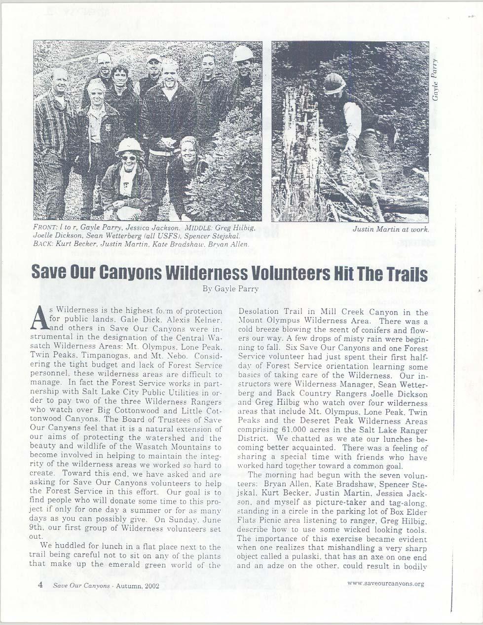
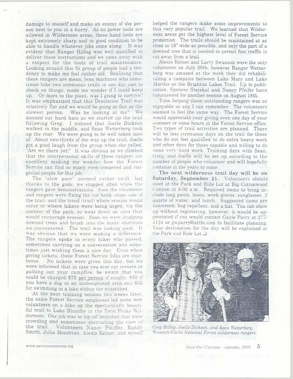
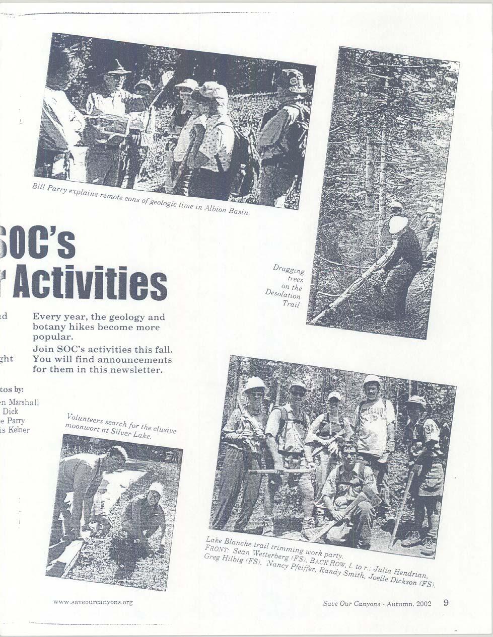
7 Accomplishments This season we were successful in developing a volunteer program that had outstanding results. Two local organizations active in the Wasatch Mountains were targeted, Save Our Canyons (SOC) and the Wasatch Mountain Club (WMC) as well as interested individuals. Volunteer projects were developed with the assistance of the volunteer coordinators of each organization. In the case of Save Our Canyons, two radio spots were aired on local radio stations to advertise the program. These messages not only requested volunteers, but also included a lengthy description of the values of Wilderness and watershed protection. With the help of volunteers, Backcountry Rangers were able to undertake sizeable maintenance and rehabilitation projects identified last season. With continued participation, many more such projects will be completed in future seasons. Volunteers donated 375 hours to the Backcountry Program. Seven volunteer work projects were accomplished, five with Save Our Canyons and two with the Wasatch Mountain Club. Volunteers who opted to work with us individually donated a total of 169 hours. Volunteer duties included trail maintenance, data gathering for the campsite inventory project, sign installation, campsite rehabilitation, and clean-up projects. They helped us to cut back trailside vegetation on 2 miles of the Lake Blanche Trail in Big Cottonwood Canyon. We also placed icebergs in nine campsites adjacent to Red Pine Lake in Little Cottonwood Canyon. They were a tremendous help rehabilitating a campsite adjacent to Lake Martha in Big Cottonwood Canyon. They assisted in repairing 160 feet of trail. Rangers ensured that volunteer experiences contained structured opportunities for watershed education. Each volunteer project was preceded by a short talk about the values of the Wasatch Canyons to the Salt Lake Valley as watershed, wildlife habitat, open space, and as a recreational resource. While working, volunteers invariably questioned the relevance of the work to watershed protection. The impacts of recreation were discussed and at the end of the workday, volunteers had the satisfaction of seeing the difference their work made in protecting the resource. In addition to educating the volunteers, the program s educational efforts reached many other canyon users. Thanks to Save Our Canyons, the Backcountry Ranger Program was given favorable press in the form of the two radio spots mentioned earlier and a two-page article in their autumn newsletter. The article, written by volunteer coordinator Gayle Perry, included discussions of watershed regulations and the value of trail work to resource protection, as well as giving readers her perspective of a volunteer s experience. The SOC newsletter is published quarterly and sent to all of their 910 members, and 400 copies are distributed to other locations around the Salt Lake Valley. This type of press really helps get the watershed message out. See Appendix 1 for a copy of the article. WATERSHED PROGRAM STATISTICS This season a database was created to manage the information collected by Backcountry Rangers. Types of information collected include: Numbers of users (hikers, bikers, campers, etc) Numbers of Leave No Trace contacts 5
8 Numbers of Warnings/Violations issued Work completed/needed Volunteer hours Numbers of cars at trailheads Trails hiked and miles logged Previously this data was stored on hand-written forms in a log, making it difficult to compile and compare to previous years. The database will provide the Backcountry Program with up-to-date use numbers and statistics, as well as an increased ability to monitor its activities over time. Program statistics discussed here apply to the time frame beginning June 5 and ending September 22, 2002 (last year s data is included for comparison). Differences in some of the terms need to be clarified. Use numbers are the number of encounters. Encounters are observations of visitors made by Rangers in the backcountry. They do not represent actual use. Rather, they reflect a relative level of use for each trail. Encounters are different from contacts. Contacts are those encounters in which a minimum five-minute Leave No Trace specific conversation took place. For this reason, contact numbers this season are significantly lower than last season, when we defined a contact as any conversation with a user. Next season, the number of watershed specific contacts will also be documented. To simplify the information, discussion is limited to use numbers and contacts on the four most heavily used trails. The remaining trails are combined into one group. Preliminary results of the campsite inventory are also discussed. Figure 1 shows total use numbers per trail as a percentage of the total use recorded. Lake Blanche, Red Pine and Lake Mary were overwhelmingly the most heavily used in the watershed receiving almost 75% of all visitor use. Accordingly, these trails are targeted specifically for visitor contact and regulation enforcement. Lake Mary received the highest level of overall use, 1,152 encounters (Figure 2). This is probably due to its relatively easy access and its lake destination. The trails with the highest use have lake destinations, suggesting a visitor preference for areas with water as an amenity resource. Five-minute Leave No Trace contacts were made whenever appropriate throughout the season. The majority of the contacts (110) were made on the Lake Blanche trail (Figure 3). Again, the high number of contacts at Lake Blanche, Mary and Red Pine, versus the low numbers of contacts on Catherine Pass and the other trails may reinforce a visitor preference for trails with lake destinations. A comparison of use numbers between the 2001 and 2002 seasons is useful in monitoring change in the level of backcountry recreation. Figure 4 compares only the three most heavily used trails. The other trails were excluded because changes in the data collected between seasons caused inconsistency between them. Generally, the chart shows an increase in use over time, suggesting that more people visited these trails in 2002 than in The biggest disparity is between the seasonal totals recorded for the Lake Mary trail. Perhaps the increase can be accounted for by the addition of another Ranger to patrol and count visitors. Possibly this trail was hiked more often this season. The actual trend in use numbers will become more evident as data is collected 6
9 consistently throughout the seasons to come. The use of automatic trail counters would be helpful in improving accuracy in determining a trend as well as capturing actual use. Currently, visitors are only counted if they happen to be hiking the same day and time as a Ranger. Actual use is likely to be much higher; unfortunately, that use is not being documented. Analysis of the data collected during the campsite inventory of the Lone Peak Wilderness revealed some interesting results. Fifty-four campsites were mapped and evaluated. The average impact index for all sites is 2-moderately impacted. On a scale of 1 to 4, where 4 is extremely impacted, a 2 was better than anticipated. The level of campsite impacts could be much worse. Of the 54 campsites, 93% (all but 4) are illegal either due to their proximity to water or the trail. Given visitor preference to be near water and terrain limitations (e.g. steep slopes), a high percentage of illegal sites were expected. This presents a significant issue from a management standpoint as to how to best deal with illegal camping. Sites within 200 feet of water or the trail have a higher potential to negatively effect watershed and Wilderness values. The level of use associated with a campsite can increase sedimentation and pollution. Sites near trails can influence the backcountry experience and visitor s perceptions of crowding. It will be useful to complete the campsite inventory to get a broader idea of the spatial and environmental conditions of backcountry campsites throughout the Canyons. This information will be used to guide management actions to improve watershed conditions. RECOMMENDATIONS FOR THE WATERSHED PROGRAM Based on the types of violations and associated impacts observed over the course of the season, the following recommendations are intended to help improve the effectiveness of the Backcountry Program. These recommendations could be carried out by the Forest Service or Salt Lake City Public Utilities, depending on funding and/or feasibility. 1. Signage a. Watershed information should be on the electronic signs at the mouth of Big Cottonwood Canyons. b. Roadside watershed regulatory signs should utilize no dog and no swimming symbols instead of or in addition to text messages to make them easier for motorists to notice and understand. c. Signs with watershed messages should be placed at entrances to all major public areas. 2. Education a. Circulate watershed regulation literature in a blanket mailing such as with private water bills. b. Mail all employers and residents in the canyons watershed regulation information. c. Coordinate with non-profit organizations that have interest in recreational use in the canyons to distribute information to their members. d. Ensure that all canyon concessionaires receive education and literature about watershed issues. 7
10 e. Create a watershed bulletin board display for the Park and Ride lots at the base of each canyon. Highlight personal responsibility and the effects that individual actions have on shared water resources. f. Place interpretive roadside signs at significant watershed locations. g. Provide watershed literature to all outdoor recreational supply stores. h. Include watershed information in hunting and fishing proclamations. i. Incorporate watershed education into public school science curriculum. j. Increase presence of regulatory officers in the canyons. 3. Develop a monitoring plan to monitor watershed conditions: a. Visitor Use purchase trail counters to monitor use levels b. Campsite impacts inventory, evaluate and map backcountry campsites c. Water quality develop and implement a sampling program for alpine lakes d. Staff hire a volunteer/intern to improve the program 4. Use area restrictions a. Implement voluntary registration program for overnight backcountry users. b. Provide watershed regulation and Leave No Trace information at registration boxes. c. Post maps at trailheads indicating both the 200-foot no camping buffer around water and trail as well as the location of inventoried legal campsites to encourage their use. d. Restore riparian areas where watershed is compromised and provide interpretive information of the restoration process. CONCLUSION Big and Little Cottonwood Canyons are vital resources to the Salt Lake valley, not only as watershed, but also as recreation areas for the valley s rapidly expanding urban population. Due to the ease of access into the canyons from Salt Lake City, pressure from public recreational use will continue to increase. Maintenance of the quality of the Salt Lake City watershed is dependent on the continued coordination of planning and activities between Salt Lake City Public Utilities, the Wasatch-Cache National Forest, the Salt Lake County Sheriff, Alta Town Marshals, and other agencies responsible for watershed protection. The cooperation of businesses operating in the canyons, interested non-profit organizations, and the general public is also necessary to protect the watersheds of Big and Little Cottonwood Canyons. The Backcountry program came a long way this season, thanks mostly to the enthusiastic and dedicated Rangers. With some of the new aspects of the program now in place, next season should be even more successful. Hopefully, the volunteer program will grow and all those involved will continue to support it, as it is truly an effective way of involving the public in stewardship of the resource. Being a presence, contacting the public, enforcing laws, monitoring use and improving the quality of NFS lands in the watersheds of Salt Lake City are important. Salt Lake City Public Utilities and the US Forest Service are ensuring that happens. We look forward to continuing our partnership next summer and for summers to come. 8
11 9
12 Percentage of Watershed Backcountry Use by Trail Catherine Pass 27% 7% 21% Lake Blanche Lake Mary Trail 22% 23% Red Pine All Other Trails Figure 1. Percentage of use by trail for the Salt Lake City Watershed s backcountry during the 2002 field season. Use numbers reflect the number of public encounters made by Forest Service Backcountry Rangers. Total Use Numbers Number of Encounters Tot al Users Cat herine Pass Lake Blanche Lake Mary Trail Red Pine All Ot her Trails Trail Name Figure 2. Total number of encounters made by Forest Service Backcountry Rangers by trail in the Salt Lake City Watersheds during the 2002 field season. 10
13 Leave No Trace Contacts Number of Contacts Tot al Cont act s 20 0 Cat herine Pass Lake Blanche Lake Mary Trail Red Pine All Ot her Trails Trail Name Figure 3. Total number of contacts made by Forest Service Backcountry Rangers by trail in the Salt Lake City Watersheds during the 2002 field season. Contacts are 5 minutes or longer specifically regarding Leave No Trace (LNT) backcountry ethics. Comparison of Use Numbers Number of users Total Users 2001 Total Users Lake Blanche Lake Mary Trail Red Pine Lake Trail Name Figure 4. Comparison of the total number of encounters made by Forest Service Backcountry Rangers on heavily used trails in the Salt Lake City Watersheds during the 2001 and 2002 field seasons. 11
14 12
15 13
16 14
17 15
18 16
PROPOSED ACTION South 3000 East Salt Lake City, UT United States Department of Agriculture
 United States Department of Agriculture Forest Service Uinta-Wasatch-Cache National Forest Salt Lake Ranger District 6944 South 3000 East Salt Lake City, UT 84121 801-733-2660 File Code: 1950/2300 Date:
Decision Memo for Desolation Trail: Mill D to Desolation Lake Trail Relocation
 for Salt Lake County, Utah Uinta-Wasatch-Cache National Forest Salt Lake Ranger District 1. Background The present location of the Desolation Trail (#1159) between Mill D and Desolation Lake follows old
Preferred Recreation Recommendations Stemilt-Squilchuck Recreation Plan March 2018
 Preferred Recreation Recommendations Stemilt-Squilchuck Recreation Plan March 2018 Below are the recommended recreation ideas and strategies that package together the various recreation concepts compiled
RE: Access Fund Comments on Yosemite National Park Wilderness Stewardship Plan, Preliminary Ideas and Concepts
 September 30, 2016 Superintendent Yosemite National Park Attn: Wilderness Stewardship Plan P.O. Box 577 Yosemite, CA 95389 RE: Access Fund Comments on Yosemite National Park Wilderness Stewardship Plan,
A GIS Analysis of Probable High Recreation Use Areas in Three Sisters Wilderness Deschutes and Willamette National Forests
 Lindsey Kiesz Geo 565 Term Project 3/15/2010 A GIS Analysis of Probable High Recreation Use Areas in Three Sisters Wilderness Deschutes and Willamette National Forests Introduction The Three Sisters Wilderness
LEAVE NO TRACE CENTER FOR OUTDOOR ETHICS CONSULTING SERVICES
 LEAVE NO TRACE CENTER FOR OUTDOOR ETHICS CONSULTING SERVICES LEAVE NO TRACE PURPOSE Americans love the outdoors. Today, more than 300 million people visit America s national parks and another 150 million
Theme: Predominately natural/natural appearing; rustic improvements to protect resources. Size*: 2,500 + acres Infrastructure**:
 Recreation Opportunity Spectrum (ROS) Classes The Recreation Opportunity Spectrum (ROS) provides a way to describe the variations in the degree of isolation from the sounds and influences of people, and
Rogue River Access and Management Plan Draft Alternatives
 Rogue River Access and Management Plan Draft Alternatives The Rogue River Access and Management Plan was initiated in December, 2011 and is being led by Jackson County Parks (JCP) and Oregon Department
City of Durango 5.8 FUNDING TRAILS DEVELOPMENT
 5.8 FUNDING TRAILS DEVELOPMENT The City has been successful in establishing dedicated local funding sources as well as applying for grants to develop the City s trail system, having received nearly $2.4
Thank you for the opportunity to comment on the proposed action to add trails and trailheads to the Red Rock District trail system.
 July 14, 2010 Jennifer Burns Red Rock Ranger District PO Box 20429 Sedona, AZ 86341 Flagstaff Biking Organization PO Box 23851 Flagstaff, AZ 86002 Dear Jennifer- Thank you for the opportunity to comment
Opportunities for Solitude in Salt Lake Ranger District Wilderness Areas; Uinta-Wasatch-Cache National Forest
 Opportunities for Solitude in Salt Lake Ranger District Wilderness Areas; Uinta-Wasatch-Cache National Forest Prepared by: Henry Lilly (graduate research assistant) Jeff Rose (co-investigator) Matthew
USDA Trails Strategy WRI: ENGLISH PEAK SURVEY. Theodore Mendoza San Diego State University June 6 th 2016 August 18 th Advisor: Sam Commarto
 WRI: ENGLISH PEAK SURVEY Theodore Mendoza San Diego State University June 6 th 2016 August 18 th 2016 Advisor: Sam Commarto Klamath National Forest Submitted: March 21, 2017 Table of Contents Acknowledgements
South Colony Basin Recreation Fee Proposal
 South Colony Basin Recreation Fee Proposal Purpose and Need for Collecting Fees in South Colony Basin: Forest Service appropriated funds have not been sufficient to maintain current recreational services
Logo Department Name Agency Organization Organization Address Information 5700 North Sabino Canyon Road
 Logo Department Name Agency Organization Organization Address Information United States Forest Coronado National Forest 5700 North Sabino Canyon Road Department of Service Santa Catalina Ranger District
SEGMENT ASSESSMENT REPORT
 2017 SEGMENT ASSESSMENT REPORT SEGMENT 3: MT ROSE / TAHOE MEADOWS TO SPOONER SUMMIT REPORT SUMMARY This report is a compilation of information collected on the Tahoe Rim Trail during assessments performed
ROAD AND TRAIL PROJECT APPROVAL
 ROAD AND TRAIL PROJECT APPROVAL www.marincountyparks.org Marin County Parks, 3501 Civic Center Dr, Suite 260, San Rafael, CA 94903 DATE: July 12, 2017 PRESERVE: Gary Giacomini Open Space Preserve PROJECT:
Mt. Hood National Forest
 United States Department of Agriculture Forest Service Mt. Hood National Forest Zigzag Ranger District 70220 E. Highway 26 Zigzag, OR 97049 503-622-3191 Fax: 503-622-5622 File Code: 1950-1 Date: June 29,
Risk Assessment in Winter Backcountry Travel
 Wilderness and Environmental Medicine, 20, 269 274 (2009) ORIGINAL RESEARCH Risk Assessment in Winter Backcountry Travel Natalie A. Silverton, MD; Scott E. McIntosh, MD; Han S. Kim, PhD, MSPH From the
LESSON 9 Recognizing Recreational Benefits of Wilderness
 LESSON 9 Recognizing Recreational Benefits of Wilderness Objectives: Students will: study, analyze, and compare recreation visitor days (RVD s) for Wilderness areas adjacent to their homes or nearest state,
State Park Visitor Survey
 State Park Visitor Survey Methods, Findings and Conclusions State s Department of Recreation, Park and Tourism Management surveyed state park visitor and trip characteristics, and collected evaluations
MASTER PLAN EXECUTIVE SUMMARY
 Biscuit Run State Park Scottsville Road (State Route 20) Charlottesville, VA 22902 Biscuit Run State Park MASTER PLAN EXECUTIVE SUMMARY Department of Conservation and Recreation Division of Planning and
RECREATION. Seven issues were identified that pertain to the effects of travel management on outdoor recreation within portions of the project area.
 RECREATION Seven issues were identified that pertain to the effects of travel management on outdoor recreation within portions of the project area. OPPORTUNITIES FOR SOLITUDE / QUIET TRAILS. One attraction
St. Joe Travel Management EA CULTURAL RESOURCES
 St. Joe Travel Management EA CULTURAL RESOURCES Bruce Gibson May 2015 Regulatory Framework Forest Plan The Idaho Panhandle National Forests (IPNF) Forest Plan requires systematic cultural resource inventory
BACKCOUNTRY TRAIL FLOOD REHABILITATION PROGRAM
 BACKCOUNTRY TRAIL FLOOD REHABILITATION PROGRAM Backcountry Trail Flood Rehabilitation A June 2013 Flood Recovery Program Summary In June 2013, parts of Southern Alberta were devastated from significant
Uinta-Wasatch-Cache National Forest Salt Lake Ranger District
 United States Department of Agriculture Forest Service Uinta-Wasatch-Cache National Forest Salt Lake Ranger District 6944 South 3000 East Salt Lake City, UT 84121 801-733-2660 File Code: 1950/2300 Date:
Discussion Topics. But what does counting tell us? Current Trends in Natural Resource Management
 Discussion Topics What are the outputs of natural resource management How do we measure what we produce What are the outputs of resource recreation management Ed Krumpe CSS 287 Behavioral approach to management
Photopoint Monitoring in the Adirondack Alpine Zone
 Photopoint Monitoring in the Adirondack Alpine Zone Julia Goren (PI) and Seth Jones Adirondack High Peaks Summit Steward Program Adirondack Mountain Club summit@adk.org PO Box 867, Lake Placid, NY 12946
Strategies & Tactics for Managing Social Impacts in Wilderness
 Strategies & Tactics for Managing Social Impacts in Wilderness Dr. Troy E. Hall University of Idaho April 14, 2009 Overview Common concerns related to experience quality Illustrations from interviews with
Daisy Dean Trail 628/619 ATV Trail Construction
 Background and Purpose and Need The Daisy Dean ATV Trail Construction Project is located in the Little Belt Mountains, Musselshell Ranger District, Lewis and Clark National Forest approximately 32 miles
Alternative 3 Prohibit Road Construction, Reconstruction, and Timber Harvest Except for Stewardship Purposes B Within Inventoried Roadless Areas
 Roadless Area Conservation FEIS Summary Table S-1. Comparison of Key Characteristics and Effects by Prohibition Alternative. The effects summarized in this table A would occur in inventoried roadless areas
Understanding the caring capacity of the visitor experience Provide facilities to support a high level user experience Address visual quality through
 Understanding the caring capacity of the visitor experience Provide facilities to support a high level user experience Address visual quality through recreation ecological restoration opportunities Collaboration
January 14, Orange County Transportation Authority Attn: M2 NCCP/HCP 550 South Main Street P.O. Box Orange, CA
 Equestrian Trails, Inc. Corral 357 P.O. Box 1026 Trabuco Canyon, CA 92678 http://saddlebackcanyonriders.com/ President: James Iacono... 714-612-1789 January 14, 2016 Orange County Transportation Authority
Worksheet: Resolving Trail Use(r) Conflict March 27, 2010
 Conflict March 27, 2010") RI Land & Water Summit Worksheet: Resolving Trail Use(r) Conflict March 27, 2010 John Monroe National Park Service, Rivers & Trails Program 617 223 5049 John_Monroe@nps.gov www.nps.gov/rtca In one sentence,
RI Land & Water Summit Worksheet: Resolving Trail Use(r) Conflict March 27, 2010 John Monroe National Park Service, Rivers & Trails Program 617 223 5049 John_Monroe@nps.gov www.nps.gov/rtca In one sentence,
Leave No Trace. Prepared for Boy Scout Troop 63 Woodbridge, CT
 Leave No Trace Prepared for Boy Scout Troop 63 Woodbridge, CT What is Leave No Trace? Leave No Trace is a program that evolved from outdoor codes taught by the United States Forest Service, the Bureau
MRO 2017 Stakeholder Survey
 MRO 2017 Stakeholder Survey Summary Results Conducted in October 2017 MIDWEST RELIABILITY ORGANIZATION 380 St. Peter Street, Ste.800 St. Paul, MN 55102 P: 651.855.1760 F: 651.855.1712 www.midwestreliability.org
Strategies & Tactics for Managing Social Impacts in Wilderness
 Strategies & Tactics for Managing Social Impacts in Wilderness Dr. Troy E. Hall University of Idaho Overview Common concerns related to experience quality & their causes Illustrations from interviews with
Fossil Creek Wild & Scenic River Comprehensive River Management Plan Forest Service Proposed Action - details March 28, 2011
 Fossil Creek Wild & Scenic River Comprehensive River Management Plan Forest Service Proposed Action - details March 28, 2011 Primary Goals of the Proposed Action 1. Maintain or enhance ORVs primarily by
National Park Authority Board Meeting
 Paper for decision 1. Introduction 1.1 Preparations for the introduction of four Camping Management Zones (covering less than 4% of the National Park) have progressed significantly since Scottish Ministers
CHAPTER 5. Chapter 5 Recreation Element
 CHAPTER 5 Recreation Element Chapter 5 Recreation Element The Recreation Element of the Meyers Area Plan is a supplement to the Recreation Element of the TRPA Regional Plan and the El Dorado County General
As outlined in the Tatshenshini-Alsek Park Management Agreement, park management will:
 Management Strategy General Strategy The priority management focus for the park is to ensure that its internationally significant natural, cultural heritage and recreational values are protected and that
Decision Memo Broken Wheel Ranch Equestrian Outfitter Special-Use Permit Proposed Action
 Decision Memo Broken Wheel Ranch Equestrian Outfitter Special-Use Permit USDA Forest Service Mississippi Bluffs Ranger District, Shawnee National Forest Jackson and Union Counties, Illinois Proposed Action
Discussion Paper: Development of a Plan for Trails on Public Land
 Discussion Paper: Development of a Plan for Trails on Public Land APRIL 2017 The purpose of this Discussion Paper is to summarize the status & issues relating to District trails and feedback to date, and
Wallowa Falls Hydroelectric Project FERC Project No. P-308 Proposed Study Plans - Recreation August 2011
 Wallowa Falls Hydroelectric Project FERC Project No. P-308 August 2011 Prepared by: PacifiCorp Energy Hydro Resources 825 NE Multnomah, Suite 1500 Portland, OR 97232 For Public Review Wallowa Falls Hydroelectric
USDA TRAILS STRATEGY PROGRAM
 USDA TRAILS STRATEGY PROGRAM WRPI Program: English Peak Survey Jorge D. Briceño Southwestern Community College Internship Time Period: June 6, 2016 August 8, 2016 Advisor: Sam Commarto Recreation Officer
Central Wasatch Visitor Use Study STEVEN W. BURR, PH.D. AND CHASE C. LAMBORN, M.S. INSTITUTE FOR OUTDOOR RECREATION AND TOURISM UTAH STATE UNIVERSITY
 Central Wasatch Visitor Use Study STEVEN W. BURR, PH.D. AND CHASE C. LAMBORN, M.S. INSTITUTE FOR OUTDOOR RECREATION AND TOURISM UTAH STATE UNIVERSITY Utah State University s Institute for Outdoor Recreation
Bear Creek Watershed Restoration Project Final Project Report December 21, 2016
 Bear Creek Watershed Restoration Project Final Project Report December 21, 2016 Dedicated to the conservation and stewardship of public lands in Southern Colorado Rocky Mountain Field Institute 815 South
Exemplar for Internal Achievement Standard Geography Level 1. Conduct geographic research, with direction
 Exemplar for internal assessment resource Geography for Achievement Standard 91011 Exemplar for Internal Achievement Standard Geography Level 1 This exemplar supports assessment against: Achievement Standard
SOCIAL CONFLICT BETWEEN MOTORIZED AND NON-MOTORIZED RECREATIONAL ACTIVITIES.
 SOCIAL CONFLICT BETWEEN MOTORIZED AND NON-MOTORIZED RECREATIONAL ACTIVITIES. There is a great disparity in opinions about the effects on a person s recreational experience when they encounter others on
National Wilderness Steering Committee
 National Wilderness Steering Committee Guidance White Paper Number 1 Issue: Cultural Resources and Wilderness Date: November 30, 2002 Introduction to the Issue Two of the purposes of the National Wilderness
Response to Public Comments
 Appendix D Response to Public Comments Comment Letter # Response 1, 2, 3, 4, 5, 7, 8, 9, 10, 11, 12, 13, 14, 15, 16, 17, 18, 19, 20, 22, 23, 24, 25, 26, 27, 29, 30, 31, 32, 33, 34, 35, 36, 37, 38, 39,
Maine Policy Scholarship Memorandum 2014
 Maine Policy Scholarship Memorandum 2014 To: Will Harris, Tom Morrison, Matt LaRoche From: Kale O Leary: UMFK Policy Scholar 14 / A.W.W. Assistant Ranger Date: April 4, 2014 Topic: Increasing Use on the
National Forests and Grasslands in Texas
 United States Department of Agriculture Forest Service National Forests and Grasslands in Texas Sam Houston NF 394 FM 1375 West New Waverly, Texas 77358 Phone 936-344-6205 Dear Friends, File Code: 1950
Proposed Action. Payette National Forest Over-Snow Grooming in Valley, Adams and Idaho Counties. United States Department of Agriculture
 United States Department of Agriculture Forest Service January 2012 Proposed Action Payette National Forest Over-Snow Grooming in Valley, Adams and Idaho Counties Payette National Forest Valley, Adams
Sawtooth National Forest Fairfield Ranger District
 United States Department of Agriculture Forest Service Sawtooth National Forest Fairfield Ranger District P.O. Box 189 Fairfield, ID. 83327 208-764-3202 Fax: 208-764-3211 File Code: 1950/7700 Date: December
Non-motorized Trail Plan & Proposal. August 8, 2014
 Town of Star Valley Ranch, Wyoming and the Star Valley Ranch Association in partnership with the USDA Forest Service, Bridger-Teton National Forest, Greys River Ranger District Non-motorized Trail Plan
Word Count: 3,565 Number of Tables: 4 Number of Figures: 6 Number of Photographs: 0. Word Limit: 7,500 Tables/Figures Word Count = 2,250
 Katherine F. Turnbull, Ken Buckeye, Nick Thompson 1 Corresponding Author Katherine F. Turnbull Executive Associate Director Texas Transportation Institute Texas A&M University System 3135 TAMU College
Connie Rudd Superintendent, Black Canyon of the Gunnison National Park
 National Park Service U.S. Department of the Interior Black Canyon of the Gunnison National Park and Curecanti National Recreation Area Information Brochure #1 Wilderness and Backcountry Management Plan
Flow Stand Up Paddle Board Parkway Plan Analysis
 Regional Parks Department Jeffrey R. Leatherman, Director County of Sacramento Divisions Administration Golf Leisure Services Maintenance Rangers Therapeutic Recreation Services Flow Stand Up Paddle Board
Visitors Experiences and Preferences at Lost Lake in Clatsop State Forest, Oregon
 Visitors Experiences and Preferences at Lost Lake in Clatsop State Forest, Oregon Final Report Mark D. Needham, Ph.D. Assistant Professor Recreation Resource Management Program Department of Forest Resources
USDA Forest Service Deschutes National Forest DECISION MEMO. Round Lake Christian Camp Master Plan for Reconstruction and New Facilities
 USDA Forest Service Deschutes National Forest DECISION MEMO Round Lake Christian Camp Master Plan for Reconstruction and New Facilities Jefferson County, Oregon T. 13 S., R. 8 E., Section 16, W.M. Background:
Camp Kawartha Structure. Roles & Responsibilities
 Camp Kawartha Structure Team Work At Camp Kawartha every staff member is committed to creating the best summer possible for each and every camper. By working closely with each other towards this common
1987 SUMMER USE SURVEY OF MINNESOTA STATE PARK VISITORS
 This document is made available electronically by the Minnesota Legislative Reference Library as part of an ongoing digital archiving project. http://www.leg.state.mn.us/lrl/lrl.asp (Funding for document
Camper Cabins in National Forest Campgrounds. Jon Benson Recreation Specialist USDA Forest Service Superior National Forest
 Camper Cabins in National Forest Campgrounds Jon Benson Recreation Specialist USDA Forest Service Superior National Forest Superior National Forest The Superior National Forest is known locally, regionally,
Evaluating Lodging Opportunities
 Evaluating Lodging Opportunities This section explores market opportunities for new lodging accommodations in the downtown area. It will help you understand travel and visitation trends, existing competition,
Wilderness Research. in Alaska s National Parks. Scientists: Heading to the Alaska Wilderness? Introduction
 Wilderness Research in Alaska s National Parks National Park Service U.S. Department of Interior Scientists: Heading to the Alaska Wilderness? Archeologist conducts fieldwork in Gates of the Arctic National
5.0 OUTDOOR RECREATION OPPORTUNITIES AND MANAGEMENT
 5.0 OUTDOOR RECREATION OPPORTUNITIES AND MANAGEMENT 5.1 Introduction This section describes the range of recreational activities that currently take place in Marble Range and Edge Hills Parks, as well
Rule Governing the Designation and Establishment of All-Terrain Vehicle Use Trails on State Land
 Rule Governing the Designation and Establishment of All-Terrain Vehicle Use Trails on State Land 1.0 Authority 1.1 This rule is promulgated pursuant to 23 V.S.A. 3506. Section 3506 (b)(4) states that an
Sierra National Forest
 Sierra National Forest Summer 2018 Wilderness Ranger Intern Application Wilderness Intern Rangers are integral members of the wilderness team working in the Sierra National Forest s spectacular wilderness
GREENWOOD VEGETATION MANAGEMENT
 APPENDIX G GREENWOOD VEGETATION MANAGEMENT PROJECT RECREATION RESOURCE REPORT Prepared by: Laurie A. Smith Supervisory Forester Stearns Ranger District Daniel Boone National Forest August 4, 2016 The
Keeping Wilderness Wild: Increasing Effectiveness With Limited Resources
 Keeping Wilderness Wild: Increasing Effectiveness With Limited Resources Linda Merigliano Bryan Smith Abstract Wilderness managers are forced to make increasingly difficult decisions about where to focus
System Group Meeting #1. March 2014
 System Group Meeting #1 March 2014 Meeting #1 Outcomes 1. Understand Your Role 2. List of Revisions to Existing Conditions 3. Information Sources Study Area The Purpose of Mountain Accord is to Preserve
MANAGEMENT DIRECTION STATEMENT June, 1999
 Thompson River District MANAGEMENT DIRECTION STATEMENT June, 1999 for Roche Lake Provincial Park Ministry of Environment Lands and Parks BC Parks Division Table of Contents I. Introduction A. Setting
Stein Valley Nlaka pamux Heritage Park
 Stein Valley Nlaka pamux Heritage Park - Trail Information Update and Winter Advisory November 2017 March 2018 Welcome to Stein Valley Nlaka pamux Heritage Park! **This trail update is to inform park users
Susitna-Watana Hydroelectric Project (FERC No ) Recreation Resources Study Study Plan Section Study Implementation Report
 Recreation Resources Study Study Plan Section Study Implementation Report") (FERC No. 14241) Recreation Resources Study Study Plan Section 12.5 2014 Study Implementation Report Prepared for Prepared by AECOM November 2015 TABLE OF CONTENTS 1. Introduction... 4 2. Study Objectives...
(FERC No. 14241) Recreation Resources Study Study Plan Section 12.5 2014 Study Implementation Report Prepared for Prepared by AECOM November 2015 TABLE OF CONTENTS 1. Introduction... 4 2. Study Objectives...
Kit Carson-Challenger Ridge Trail Project Annual Performance Report-2014 October 22, 2014
 1 Kit Carson-Challenger Ridge Trail Project Annual Performance Report-2014 October 22, 2014 Willow Lake and Kit Carson Peak 2 SUMMARY The Rocky Mountain Field Institute began Phase 1 of a multi-phase,
Eastern Lake Ontario Beach User Survey 2003/2004.
 Eastern Lake Ontario Beach User Survey 2003/2004. Introduction The eastern shore of Lake Ontario is a Biodiversity Investment Area that features a 17-mile long barrier beach of Great Lakes dunes and a
Appalachian Trail Sustainability Research Study
 Appalachian Trail Sustainability Research Study Appalachian National Scenic Trail 2,175 mile footpath from Maine to Georgia Crosses 14 states, 6 NPS units, and 8 National Forests, Managed by the NPS A.T.
Briefing Paper: USFS Wilderness and Other Federal Designations
 Briefing Paper: USFS Wilderness and Other Federal Designations Purpose and Audience The purpose of this briefing paper is to provide information on the potential designations for additional USFS land protection.
TRUCK MANAGEMENT PLAN
 West Oakland TRUCK MANAGEMENT PLAN APPENDIX D Enforcement of Parking Regulation and Truck Routes Technical Memorandum A joint plan by the City of Oakland and Port of Oakland ENFORCEMENT of PARKING REGULATIONS
U.S. Forest Service National Minimum Protocol for Monitoring Outstanding Opportunities for Solitude
 U.S. Forest Service National Minimum Protocol for Monitoring Outstanding Opportunities for Solitude Element 5 of the 10-Year Wilderness Stewardship Challenge May 15, 2014 1 Solitude Minimum Protocol Version
DIRECTOR S ORDER #41: Wilderness Preservation and Management
 These are relevant sections about Wilderness Management Plans from National Park Service 2006 Management Policies, Director s Orders #41 and Reference Manual 41. National Park Service U.S. Department of
VISITOR RISK MANAGEMENT APPLIED TO AVALANCHES IN NEW ZEALAND
 VISITOR RISK MANAGEMENT APPLIED TO AVALANCHES IN NEW ZEALAND Don Bogie*, Department of Conservation, Christchurch, New Zealand Mike Davies, Department of Conservation, Wellington, New Zealand ABSTRACT:
Bob Marshall Wilderness Foundation
 About the Bob Marshall Wilderness Complex Considered by many to be the crown jewel of the wilderness preservation system, the Bob Marshall Wilderness Complex located in Northwestern Montana, is the third
PROPOSED PARK ALTERNATIVES
 8 Chimne y Rock State Park M a ster Pl an 2011 PROPOSED PARK ALTERNATIVES Introduction Three different park development concepts were prepared and presented to the citizens of North Carolina through a
Watchorn Provincial Park. Management Plan
 Watchorn Provincial Park Management Plan 2 Watchorn Provincial Park Table of Contents 1. Introduction... 3 2. Park History... 3 3. Park Attributes... 3 3.1 Natural... 4 3.2 Recreational... 4 3.3 Additional
Trail Assessment Report
 Trail Assessment Report Trail Options for the Bear Creek Canyon located in Pikes Peak Ranger District, Pike National Forest and on Colorado Springs Utility Lands Due to the presence of a unique species
Sierra National Forest 2015 Wilderness Program Accomplishment Report
 Sierra National Forest 2015 Wilderness Program Accomplishment Report The Sierra National Forest wilderness program provided stewardship and trail maintenance in the Ansel Adams, Dinkey Lakes, John Muir,
CRANE LAKE TRAILS NETWORK AND SPACES
 CRANE LAKE TRAILS NETWORK AND SPACES AREA TRAILS COMMUNITY TRAILS GOLD COAST TRAIL LAKE PARK OPTION ONE LAKE PARK OPTION TWO OVERFLOW TRAILHEAD PARKING THE GATE AREA TRAILS Trails are a major resource
White Mountain National Forest. Appendix E Wilderness Management Plan
 White Mountain National Forest Appendix E Wilderness Management Plan Contents 1.0 Introduction... 3 2.0 Zoning... 4 2.1 Zone Descriptions... 5 3.0 Indicators and Standards... 10 3.1 Wilderness Indicators...
EXECUTIVE SUMMARY PROGRAM DEVELOPMENT REPORT PURPOSE EXISTING SETTING EXPANDING PARKLAND
 EXECUTIVE SUMMARY PROGRAM DEVELOPMENT REPORT PURPOSE As the culmination of the first phase of the master planning process, this Program Development Report creates the framework to develop the Calero County
CAMPER CHARACTERISTICS DIFFER AT PUBLIC AND COMMERCIAL CAMPGROUNDS IN NEW ENGLAND
 CAMPER CHARACTERISTICS DIFFER AT PUBLIC AND COMMERCIAL CAMPGROUNDS IN NEW ENGLAND Ahact. Early findings from a 5-year panel survey of New England campers' changing leisure habits are reported. A significant
WILDERNESS PLANNING. Wilderness. Interagency Regional Wilderness Stewardship Training. Alamosa, Colorado - March 26-29, 2007
 WILDERNESS PLANNING Interagency Regional Wilderness Stewardship Training Alamosa, Colorado - March 26-29, 2007 Suzanne Stutzman Lead Planner/Wilderness Coordinator National Park Service, Intermountain
Thank you for this second opportunity to comment on the proposed revisions to the Coconino National Forest Management plan.
 March 8, 2011 Flagstaff Biking Organization PO Box 23851 Flagstaff, AZ 86002 Yewah Lau Coconino National Forest Attn: Plan Revision 1824 South Thompson Street Flagstaff, Arizona 86001 Sent via electronic
Yard Creek Provincial Park. Management Plan
 Yard Creek Provincial Park Management Plan Draft January 2010 Yard Creek Provincial Park Management Plan Approved by: telàlsemkin/siyam/chief Scott Benton Bill Williams Squamish Executive Director ation
San Juan Resource Area Recreation Impact Inventory/Monitoring
 San Juan Resource Area Recreation Impact Inventory/Monitoring Indian Creek Climbing Area Overview & Summary of Findings 2007 Pam Foti, Professor Aaron Divine, Lecturer Janet Lynn, Program Coordinator Northern
13.1 REGIONAL TOURISM ISSUES AND SUMMARY OF FINDINGS
 13 REGIONAL TOURISM T he County of Mariposa s recreation needs and facilities fall within two categories: regional tourism and local recreation. This Element focuses on regional tourism issues related
DECISION MEMO. Rawhide Trail #7073 Maintenance and Reconstruction
 Page 1 of 6 Background DECISION MEMO USDA Forest Service Jefferson Ranger District Jefferson County, Montana Rawhide Trail #7073 is located in the Elkhorn Mountain Range approximately 10 miles east of
Blueways: Rivers, lakes, or streams with public access for recreation that includes fishing, nature observation, and opportunities for boating.
 Parks, Open Space and Trails PRINCE WILLIAM COUNTY 2008 COMPREHENSIVE PLAN TRAILS PLAN CONTENTS The components of the trails plan are: Intent Definitions Goals, Policies, and Action Strategies Trails Map
Coronado National Forest Santa Catalina Ranger District
 United States Department of Agriculture Forest Service Coronado National Forest Santa Catalina Ranger District File Code: 1950 Date: October 14, 2015 Dear Interested Party: The Santa Catalina Ranger District
Welcome and thank you for being here! Kick-Off Public Workshop November 19, 2014
 Welcome and thank you for being here! Kick-Off Public Workshop November 19, 2014 OPEN SPACE MATTERS: Boise s First Reserve Master Plan Julia Grant Foothills and Open Space Manager City of Boise Ellen Campfield