Members of the York Region Accessibility Advisory Committee. Accessibility Design Guidelines for York Regional Forest Trails
|
|
|
- Cassandra Shields
- 6 years ago
- Views:
Transcription
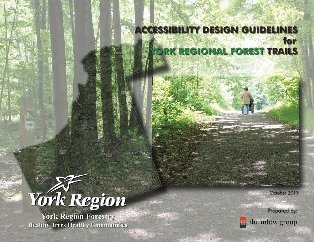
1 Environmental Services Department Environmental Promotion and Protection Branch MEMORANDUM TO: FROM: Members of the York Region Accessibility Advisory Committee Ian Buchanan, Manager, Natural Heritage and Forestry DATE: October 30, 2013 RE: Accessibility Design Guidelines for York Regional Forest Trails We are pleased to provide members of the York Region Accessibility Advisory Committee with the final Accessibility Design Guidelines for York Regional Forest Trails. Input received from the Accessibility Advisory Committee has been incorporated into the final guidelines. These design guidelines incorporate both the legislative requirements of the Accessibility for Ontarians with Disabilities Act and best practices for trail design, construction and maintenance. Implementation of the guidelines will ensure that the York Regional Forest is accessible to all residents while protecting the natural environmental. We would like to thank the Accessibility Advisory Committee for their assistance in the development of these design guidelines. If you require further information on the guidelines or accessibility initiatives in the York Regional Forest please contact myself or James Lane, Program Manager, Forestry at extension Ian Buchanan Manager, Natural Heritage and Forestry Phone Number: extension 5271 IB/jl Attachment YORK-# v1-Memo_from_Ian_Buchanan_to_YRAAC Final_Accessiblity_Design_Guidelines_for_York_Regional_Forest_Trails
2
3 TABLE OF CONTENTS 1. Introduction Criteria for Exceptions General Design Guidelines Accessible Parking Facilities Accessible Routes Accessible Parking Spaces Parking Space Size Number of Parking Spaces Accessible Trail Design Trail Width and Passing Spaces Turning Radius Intersection with Non-Accessible Trails Trail Route Gradient Running Slope Cross Slope Trail Drainage Resting Intervals Seating Requirements Trail Surface Trail Hazards, Safety Measures, and Obstacles Edge Protection and Safety Shoulder Tread Obstacles on Trails Protruding Objects and Clearances Openings on Trail Surface Multi-use Trails Accessible Multi-use Trails Trail Furniture Waste Receptacles Benches APPENDICIES Appendix A: Accessible Trail Design Guidelines Summary Appendix B: Typical Trail Details Appendix C: Material Specifications Appendix D: Sustainability Appendix E: Low Impact Construction REFERENCES Signage Requirements General Requirements Off-Trail Signs On-Trail Signs
4 1.0 INTRODUCTION The York Regional Forest (YRF) contains over 120km of mapped forest access trails and provides opportunities for a variety of passive recreational activities including hiking, mountain biking, equestrian, cross country skiing, snowshoeing, and nature appreciation. The following accessibility design guidelines for YRF trails, including best practices for multi-use trails and accessible trail design, incorporate the policies related to providing equal access for all trail activities. An important goal of these guidelines is to provide integrated recreational experiences for all visitors, with and without disabilities. Therefore, these guidelines should be used for all trails, when possible. Where full compliance with these accessibility guidelines is determined to be not feasible, trails and trail facilities will incorporate those accessible features that can be reasonably accommodated in order to provide the greatest degree of accessibility for the widest range of abilities. However, only those trails who meet all the standards can be identified as accessible. Although the building blocks of the YRF accessibility design guidelines are mostly based on wheelchair dimensions, clear space and maneuvering room, and arm reach ranges, the guidelines are intended to accommodate older adults, people with low vision, or people with other disabilities. These guidelines also provide design standards for multi-use trails to accommodate permitted uses including, but not limited to, mountain biking, walking, strollers, equestrian, and authorized motorized vehicle access. The accessible trail design guidelines have been structured in four (4) Sections: 1. General Design Guidelines 2. Accessible Parking Facilities 3. Accessible Trail Design 4. Signage Requirements The guidelines and standards provided in this document have been developed in consultation with the York Region Accessibility Advisory Committee, and meet or go beyond the requirements of the AODA Integrated Accessibility Standards. 2
5 2.0 CRITERIA FOR EXCEPTIONS Characteristics of the natural environment, such as terrain, soils, and hydrology, could prevent compliance with some of the technical provisions provided in the Accessibility Design Guidelines for York Regional Forest Trails. Allowing some deviation is essential, as the outdoor environment is very different from a constructed indoor environment. Factors that influence the ability to provide fully accessible facilities, such as soil, surrounding vegetation, hydrology, terrain, and surface characteristics, are fundamental to outdoor areas. Without deviations from the technical provisions, compliance could significantly and unacceptably alter the nature of the outdoor experience. For recreational trails that are designated for pedestrian use, regardless of the surface material used (boardwalk, pavement, dirt, concrete, asphalt, etc.), the specifications of Trail Design Sections 5.1 through 5.11 shall be met on the trail and the connecting surfaces to the trail, except where the following criteria for exception would occur: 1. The requirements, or some of them, would likely affect the cultural heritage value or interest of a property identified, designated or otherwise protected under the Ontario Heritage Act as being of cultural heritage value or interest. 2. The requirements, or some of them, would affect the preservation of places set apart as National Historic Sites of Canada by the Minister of the Environment for Canada under the Canada National Parks Act (Canada). 3. The requirements, or some of them, would affect the national historic interest or significance of historic places marked or commemorated under the Historic Sites and Monuments Act (Canada). 4. The requirements, or some of them, might damage, directly or indirectly, the cultural heritage or natural heritage on a property included in the United Nations Educational, Scientific and Cultural Organisation s World Heritage List of sites under the Convention Concerning the Protection of the World Cultural and Natural Heritage. 5. There is a significant risk that the requirements, or some of them, would adversely affect water, fish, wildlife, plants, invertebrates, species at risk, ecological integrity or natural heritage values, whether the adverse effects are direct or indirect. 3
6 6. It is not practicable to comply with the requirements, or some of them, because existing physical or site constraints prohibit modification or addition of elements, spaces or features, such as where surrounding rocks bordering the recreational trail or beach access route impede achieving the required clear width. Where an exception is permitted to a requirement that applies to a trail, the exception applies solely, to the particular requirement for which the exception is allowed and not to any other requirement that applies to the trail; to the portion of the trail for which it is claimed and not to the trail in its entirety; to the shortest section of trail where trail cannot comply. The exceptions provided in this section are based on AODA Integrated Accessibility Standards. 4
7 3.0 GENERAL DESIGN GUIDELINES Whether a new accessible trail is planned to be constructed or an existing recreational trail is intended to be redeveloped to become accessible, the general design guidelines stipulated in this section should be utilized for accessible trail design. This will help identify the best routes for construction of the trail, and the most suitable surface type and slopes to minimize environmental disturbance, while creating an enjoyable experience for all permitted users. 3.1 Site Character The following site characteristics should be reviewed and analyzed before designing a trail: a. Site Topography and Grading b. Existing Drainage Patterns c. Existing Surface and/or Base Material d. Existing Trail Uses e. Soil Type f. Eroding and Hazardous Edges g. Proximity to Wetlands and Water Courses h. Sensitive Wildlife Habitat and Plant Communities i. Other Ecological and Environmental Factors 3.2 Trail Route Selection When selecting trail routes, the following criteria should be adhered to: a. environmental disruption and removal should be minimized. b. environmental sensitive areas should be avoided. c. when accessible trails exceed 2km in length, relief routes should be considered. d. forks and cross roads should be avoided to minimize confusion (if unavoidable, ensure clear signage and wayfinding) e. where possible, consideration should be given to upgrading existing trails instead of constructing new routes, f. where possible, locations with minimal slopes/topography should be used for accessible trail construction. However, sufficient slope shall be provided to allow adequate drainage of the trail while achieving these guidelines. 5
8 4.0 ACCESSIBLE PARKING FACILITIES Accessible parking spaces shall be provided at each tract with an accessible trail. An accessible route shall be provided to connect the accessible parking to the accessible trail entrance. In this section, we overview the requirements of accessible routes and design requirements for accessible parking spaces, including: location, size, slopes, clearances, and required number of parking spaces. 4.1 Accessible Routes An accessible route shall: a. be provided from the accessible trail parking to the accessible trail entrance and be part of the shortest accessible route possible to the entrance. b. be a maximum of 30m in length, where possible, from the accessible parking spaces to the accessible trail entrance. c. wherever possible, be designed to avoid entering the vehicular entry routes and drives. d. wherever possible, be designed to ensure clear and unobstructed views from accessible parking spaces to the accessible trail entrance. e. have a firm, stable, and slip resistant surface. f. have a minimum clear width of 1800mm, where possible, with an absolute minimum width of 1200mm. g. have a height clearance of at least 2750mm. h. have a running slope: not exceeding 1:20 (5%), unless one or more of the criteria for exceptions applies as noted in Section 2.0, Criteria for Exceptions, and in no case exceeding 1:10 (10%). equal to or less than the cross slope, where possible, to maintain sheet drainage. i. have a cross slope not exceeding 1:20 (5%), unless one or more of the criteria for exceptions applies as noted in Section 2.0, Criteria for Exceptions, and in no case exceeding 1:10 (10%). j. have a total slope of - running slope plus cross slope - not exceeding 1:6.67 (15%). 6


9 4.0 ACCESSIBLE PARKING FACILITIES 4.2 Accessible Parking Spaces Accessible parking spaces shall: a. be located on an accessible route to the trail and, where possible, be provided within 30m of the main accessible trail entrance. b. have a firm, stable, and slip resistant surface. c. have a maximum running slope of 1:20 (5%). d. have a maximum cross slope of 1:20 (5%). e. incorporate post-mounted designated signage according to the requirements of Section 6.2, Parking Signs. f. maintain minimum 1.0m clearance zone from surrounding forest/ vegetation. g. provide sturdy bumper stop at 300mm and 600mm above ground 7
10 4.0 ACCESSIBLE PARKING FACILITIES 4.3 Parking Space Size The following two types of parking spaces shall be provided at each Accessible Trail Parking: a. Type A, a wider parking space which has a minimum width of 3400mm and signage that identifies the space as Van Accessible. b. Type B, a standard parking space which has a minimum width of 2400mm. Accessible parking spaces shall: c. be at least 5385mm long. d. have an access aisle of at least 1500mm wide, which may be shared by two parking spaces. e. have a height clearance of at least 2750mm for Type A and 2100mm for Type B at the parking space and along accessible route to trail entrance. 4.4 Number of Parking Spaces Provide a minimum number of accessible parking spaces in each parking area as follows: Total Parking Spaces Provided Minimum Accessible Parking Spaces Required (1 Type A and 2 Type B ) Over 75 Min. 4% Accessible (50% Type A & 50% Type B ) 8


11 5.0 ACCESSIBLE TRAIL DESIGN This section provides detailed technical information for design of accessible trails including trail width, slopes, surface type, safety measures and clearances, resting intervals and seating requirements, trail furniture, and site drainage. In addition, technical requirements for design of accessible multi-use trails have been provided in this section. 5.1 Trail Width and Passing Spaces a. The entrance to a trail must provide a clear opening of between 850mm and 1000mm, whether the entrance includes a gate, bollard or other entrance design. b. The minimum width of the trail surface shall be 1500mm. This is the space required for a wheelchair to make a 180-degree turn in a clear space, or the width required for two wheelchairs to pass comfortably and safely on a trail. c. Should one or more of the criteria for exception outlined in Section 2.0, Criteria for Exception, be met, the trail width may be reduced to 1200mm provided that passing spaces are provided at intervals not to exceed 100m and the reduced width shall occur for the shortest distance possible. d. Passing spaces shall be at least 1500mm wide and 1500mm long. e. The cross slope of passing spaces shall not exceed 1:20 (5%). 9
 can also be used as a passing space, provided that the arms of the intersection extend at least 1200mm")


12 5.0 ACCESSIBLE TRAIL DESIGN f. An intersection of two trails ( T or + shaped) can also be used as a passing space, provided that the arms of the intersection extend at least 1200mm beyond intersection with a slope not exceeding 1:20 (5%) in any direction. 5.2 Turning Radius a. The turning radius or turning circle of a mobility device is the size of the smallest circular turn that the mobility device is capable of making. The minimum turning radius required at the centre of the trail shall be 1500mm. 5.3 Intersection with Non-Accessible Trails a. Where an accessible trail meets a non-accessible trail, signage shall be posted according to Section 6.0, Signage Requirements. b. If an arm of a non-accessible route is used as a passing space, it shall meet the slope, width, and surface type requirements of an accessible trail for the portion used as a passing space according to Section 5.1.f. 10
 and in no case greater than 1:10 (10%), unless one ore more of the criteria for exceptions outlined in Section 2.")
 for up to maximum 30m. ii. 1:10 (10%) for up to maximum 9m. c.")
13 5.0 ACCESSIBLE TRAIL DESIGN 5.4 Trail Route Gradient Running Slope a. The running slope is recommended to be maximum 1:20 (5%) and in no case greater than 1:10 (10%), unless one ore more of the criteria for exceptions outlined in Section 2.0, Criteria for Exceptions, applies. b. Where a greater slope than 5% is used, resting spaces shall be provided according to the requirements of Section 5.6, Resting Intervals, for the slopes noted below: i. 1:12 (8%) for up to maximum 30m. ii. 1:10 (10%) for up to maximum 9m. c. At the bottom of open drainage structure, the running slope may be a maximum of 1:7.1 (14%) for a distance of 1500mm where cross slope does not exceed 1:10 (10%). d. No more than 30% of the total length of the trail may exceed a grade of 1:12 (8%) e. The total slope of running and cross slopes shall not exceed 1:6.67 (15%). For example, a trail surface having a running slope of 6% cannot have a cross slope greater than 9% (6%+9%=15%). 11
 and in no case greater than 1:10 (10%), unless one ore more of the criteria for exceptions outlined in Section 2.")
. c. Where the trail cross slope exceeds 5%, a level rest area shall be provided every 100m according to the requirements of Section 5.")
14 5.0 ACCESSIBLE TRAIL DESIGN Cross Slope a. The cross slope is recommended to be maximum 1:20 (5%) and in no case greater than 1:10 (10%), unless one ore more of the criteria for exceptions outlined in Section 2.0, Criteria for Exceptions, applies. b. The total slope of running and cross slopes shall not exceed 1:6.67 (15%). c. Where the trail cross slope exceeds 5%, a level rest area shall be provided every 100m according to the requirements of Section 5.6, Resting Intervals. 5.5 Trail Drainage a. Where possible, the cross slope shall be equal or greater than the running slope to maintain sheet drainage from one side of the trail to the other. The trail can also be crowned along the centre line to drain water away to either side of the trail. 12
15 5.0 ACCESSIBLE TRAIL DESIGN b. Swales can be used to drain water away from the trail and to facilitate runoff infiltration into the soil. c. Culverts can be used to allow water to flow under the trail, where trail is acting as an obstruction to water flow. 13
, a level rest area shall be provided according to the distance specified in Clause 5.")
16 5.0 ACCESSIBLE TRAIL DESIGN 5.6 Resting Intervals a. Where the trail running slope exceeds 1:20 (5%), resting intervals shall be provided according to the distances specified in Clause b. b. Where the trail cross slope exceeds 1:20 (5%), a level rest area shall be provided according to the distance specified in Clause c. c. Resting intervals shall be at least 1500mm long and at least as wide as the trail leading into it. Depending on the design and location, the intersection of two trails may act as a resting interval. d. The slopes of a resting interval shall not exceed 1:20 (5%) in any direction. 5.7 Seating Requirements a. Intervals for bench spacing should respect the requirements of the permitted trail user groups, with no intervals longer than 350m. 14


. e. Please refer to Appendix B for Typical Trail Details and refer to Appendix C for Material Specifications. f. Trail surfaces are to be constructed to minimize maintenance requirements while providing a firm and stable surface.")
17 5.0 ACCESSIBLE TRAIL DESIGN 5.8 Trail Surface a. The surface of the trail shall be firm, stable, and produce minimal glare. b. The surface of the trail shall be resistant to damage by normally occurring weather conditions and able to sustain the wear and tear produced by normally permitted uses between planned maintenance cycles. c. Paving with asphalt or concrete is appropriate for highly developed areas. For less developed settings (natural areas), recycled/crushed concrete, crushed gravel, packed soil, and other natural materials can provide a firm and stable surface suitable for accessible trails. Natural materials also can be combined, if suitable, with synthetic bonding materials that provide stability and firmness. d. Crushed aggregate treads can be constructed by mechanically compacted crushed rock that contains a range of particle sizes (typically 2 cm or less, including a proportion of crushed fines). e. Please refer to Appendix B for Typical Trail Details and refer to Appendix C for Material Specifications. f. Trail surfaces are to be constructed to minimize maintenance requirements while providing a firm and stable surface. For crushed aggregate trails, ensure that sufficient drainage is provided through grading to minimize erosion. For asphalt or concrete surfaces ensure that an appropriate aggregate base is provided to minimize winter heaving. Asphalt Recycled Concrete Concrete Crushed Gravel Limestone Screenings 15

18 5.0 ACCESSIBLE TRAIL DESIGN 5.9 Hazards, Safety Measures, and Obstacles Edge Protection and Safety Shoulder a. Edge protection shall be provided on boardwalks, bridges, culvert crossings, or other trails or paths adjacent to water. Edge protection can be a raised curb, wall, railing, or other projecting surface that defines the edge of a travel surface and helps keep people and assistive devices from accidentally falling off the edge. b. When an accessible trail is located adjacent to a slope, for the safety of the users, a safety shoulder - with a material different from the trail surface material - or edge protection shall be provided between the edge of the trail and top of slope. c. Where edge protection is provided, the edge shall: i. be at least 100mm high, since a lower surface might not be obvious or detectable to people with limited vision, those who walk with the assistance of canes, or persons using wheeled mobility devices. ii. ii. have a colour contrasted from the background and comply with Section 6.1.2, Colour/Tonal Contrast. be designed so as not to impede drainage of the trail surface. 16


19 5.0 ACCESSIBLE TRAIL DESIGN d. If a trail is adjacent to a slope of between 10:1 (10%) and 3:1 (33%), a 300mm wide safety shoulder or a 100mm high edge protection shall be provided. 17
 and 2:1 (50%), a 100mm high")
 or greater, a guard rail with a")
20 5.0 ACCESSIBLE TRAIL DESIGN e. If a trail is adjacent to a slope of between 3:1 (33%) and 2:1 (50%), a 100mm high edge protection shall be provided. f. If a trail is adjacent to a slope of 2:1 (50%) or greater, a guard rail with a minimum height of 1070mm shall be provided with a setback of at least 1.0m from the trail tread. 18

21 5.0 ACCESSIBLE TRAIL DESIGN g. A 100mm high edge protection shall be provided where there is a grade differential between 200mm and 600mm. h. Where there is a fall height of 600mm or greater, a guard rail with a minimum height of 1070mm shall be provided with a setback of at least 1.0m from the trail tread Tread Obstacles on Trails a. A tread obstacle is anything that interrupts the evenness of the tread surface. On trails, tread obstacles often occur as a result of roots, ruts, and rocks in the tread surface. Tread obstacles cannot be more than 50mm in height. This requirement minimizes the chance that someone who uses a mobility device, or a person who shuffles their feet while walking, falling over or turning an ankle when crossing a tread obstacle. 19


22 5.0 ACCESSIBLE TRAIL DESIGN Protruding Objects and Clearances a. Protruding objects extend into the clear width area of a trail from beside or above the trail. Leaning tree trunks, rock ledges, and branches are common protruding objects. There shall be at least 2100mm of clear headroom above trails Openings on Trail Surface a. Openings in the trail surface (e.g., grates or spaces between boards on a boardwalk) shall be designed so as not to allow any permitted users or their assistive devices to sink below the level of the surrounding trail surface. b. Elongated openings shall be placed so that the long dimension runs perpendicular or diagonal to the primary direction of travel. The opening shall not allow passage of a sphere 20mm in diameter. i. Elongated openings are permitted to be parallel to the dominant direction of travel where opening does not allow passage of a 6.5mm diameter sphere and surface is constructed to ensure adequate drainage of water and debris from the trail tread. 20
23 5.0 ACCESSIBLE TRAIL DESIGN 5.10 Multi-use Trails The guidelines provided in this document are intended to provide guidance for designing accessible trails for pedestrians, with or without disabilities. These guidelines also provide design standards for multi-use trails to accommodate permitted uses such as mountain biking, equestrian, hiking, strollers, and authorized motorized vehicle access. Where accessible trails are multi-use, the following guidelines should apply and proper signage shall be provided according to Section 6.0, Signage Requirements Accessible Multi-use Trails The guidelines for accessible multi-use trails are, in general, the same as those for accessible pedestrian trails, as these users will address requirements of most other users. However, the following recommendations for designing safe and enjoyable trails for mountain bicyclists and equestrians should also be considered when designing accessible multi-use trails in York Regional Forest: a. Width: The width of the multi-use trail surface is recommended to be minimum 3000mm to accommodate maintenance and emergency vehicles. Where providing 3000mm trail width is not practical, it may be reduced to a minimum of 2400mm. b. Running Slope: The running slope of multi-use trails shall be governed by Section 5.4.1, Running Slope. c. Cross Slope: The trail shall be sloped in one direction rather than having a crown in the middle of the trail. The cross slope of multi-use trails shall be governed by Section 5.4.2, Cross Slope. d. Edge Protection: Some types of edge protection may be hazardous to bicyclists, particularly raised surface elements, curbs or rails that are located immediately adjacent to the travel surface. Multi-use trails proposed in York Regional Forest should consider the safety needs of these users. As a general rule, curbs should not be less than 100mm in height. If guardrails are desired for safety reasons, they should be at least 1070mm high and set back minimum 1.0m from the tread. 21


24 5.0 ACCESSIBLE TRAIL DESIGN e. Obstacles: Bicyclists and equestrians tend to have a higher vertical profile than do other trail users. As a result, the vertical clearance on multi-use trails shall be: i. a minimum of 3600mm to accommodate equestrian trail users. Where providing 3600mm vertical clearance is not practical, it may be reduced to a minimum of 3000mm. ii. a minimum of 3000mm to accommodate mountain bicycles. Where providing 3000mm vertical clearance is not practical, it may be reduced to a minimum of 2400mm. 22


25 5.0 ACCESSIBLE TRAIL DESIGN iii. iv. while tread obstacles, as explained in Section 5.9.3, Tread Obstacles on Trails, are often barriers to trail users in wheelchairs, they are hazardous to bicyclists and should be avoided on multiuse trails. the number of openings in multi-use trail surfaces should be minimized and openings, large enough to permit a bicycle wheel to enter, should be avoided. v. vegetation on either side of the trail shall be cleared for a minimum of 600mm Trail Furniture Waste Receptacles Trash and recycling containers should be located at the trailheads. a. Controls: In order to be easily operable with one hand, controls must not require tight grasping, pinching or twisting. This does not apply to hinged lids and controls that are designed to keep out large animals such as bears. b. Opening: The waste receptacle opening is recommended to be no higher than 1065mm from grade, but it is acceptable for the opening to be higher to a maximum of 1300mm from grade. c. Clear Ground Space: A clear ground space that is at least 850mm by 1370mm shall be provided in front of the containers. The surface of the clear space must be firm and stable with a slope that does not exceed 2% in any direction. 23


26 5.0 ACCESSIBLE TRAIL DESIGN Benches a. Where permanent benches are provided, they shall: i. be 510mm to 610mm deep, 430mm to 460mm above the finished grade, with a backrest of 762mm in height. ii. iii. provide minimum 1 arm rail. provide a backrest for entire length of bench, if bench is 1200mm in length or less, unless the bench is permanently located against an upright structure. iv. provide a backrest which is minimum 900mm in length, if bench is longer than 1200mm. v. have a colour (not green) contrasted from the background and comply with Section 6.1.2, Colour/Tonal Contrast. 24

27 5.0 ACCESSIBLE TRAIL DESIGN b. At least one clear ground space that is at least 850mm x 1370mm shall be provided at one end of the bench and positioned to allow wheelchair users to be seated shoulder-to-shoulder with an individual seated on the bench. The surface of the clear space shall be firm and stable, and have no slope exceeding 2% in any direction. Maintain minimum 1.0m clearance zone from surrounding forest/vegetation. 25
28 6.0 SIGNAGE REQUIREMENTS In this section, general technical requirements for signage design have been provided. Required signage includes parking, directional, information, warning, and wayfinding signs. Except where noted, all signs in this section have been customized for YRF Trails. 6.1 General Requirements Signage for general orientation and the provision of information shall: a. use letters that are universal, specifically sans serif font upper and lower case. b. use numbers that are universal, specifically Arabic font and have a widthto-height ratio between 3:5 and 1:1. c. have a stroke-width-to-height ratio between 1:5 and 1:10. d. have letters, numbers, pictograms, and symbols that comply with the following Table for height and viewing distance: Minimum Character Height (mm) Maximum Viewing Distance (mm) 200 mm 6000 mm 150 mm 4600 mm 100 mm 2500 mm 75 mm 2300 mm 50 mm 1500 mm 25 mm 750 mm 26

29 6.0 SIGNAGE REQUIREMENTS e. be finished with a matte or other glare-free surface. f. be positioned to avoid shadow areas and glare. g. have a colour contrasted from the background and comply with Section 6.1.2, Colour/Tonal Contrast. i. the centre of all directional signage and location signage should be mounted at eye-level, between 1370mm and 1525mm high Colour/Tonal Contrast a. Where high visual colour/tonal contrast is required to distinguish an element from its surroundings, the difference in tone shall be at least 70%, and this may be achieved through the use of either light on dark or dark on light. b. Yellow is the most visible color from a distance and, since it also traditionally signals caution, it can be used for warning signs and in objects that are used to caution approaching persons. 27

30 6.0 SIGNAGE REQUIREMENTS 6.2 Off-Trail Signs Roadside Accessible Trail Sign A Roadside Accessible Trail Sign shall be placed at the entrance to the York Regional Forest Tract from the main road to inform that an accessible trail exists in the tract. Signage shall: a. incorporate the International Symbol of Access. b. be at least 300mm wide and 450mm high. c. meet the requirements of Section 6.1, Signage Requirements Directional Signage to Accessible Trail Parking Where the location of designated accessible parking spaces is not obvious or is distant from the approach viewpoints, directional signage shall: a. be placed along the route leading to the designated parking spaces. b. incorporate the International Symbol of Access and the appropriate directional arrows. c. be at least 300mm wide and 450mm high. d. meet the requirements of Section 6.1, Signage Requirements. 28
31 6.0 SIGNAGE REQUIREMENTS Directional Signage to Accessible Trail Location Where the location of the accessible trail is not obvious or is distant from the approach viewpoints, and/or the accessible parking spaces, directional signs shall: a. be placed along the route leading to the nearest accessible trail entrance. b. incorporate the International Symbol of Access and the appropriate directional arrows. c. be at least 300mm wide and 450mm high. d. meet the requirements of Section 6.1, Signage Requirements Accessible Parking Signage Placement Each accessible parking space shall be designated with signage that is: a. mounted vertically on a post that is colour contrasted with the surrounding and background environment. b. colour contrasted from the background and complies with Section 6.1.2, Colour/Tonal Contrast. c. at least 300mm wide and 450mm high. Ontario Traffic Manual (OTM) Sign# Rb-93 29
32 6.0 SIGNAGE REQUIREMENTS d. installed at a height of 1500mm to 2500mm from the ground/floor surface to the centre line of the sign. e. for perpendicular or angled parking, centred on and at the front of the parking space. f. for parallel parking, located adjacent to and toward the front of the parking space. g. where possible, incorporated with pavement markings that: i. are located near the back of the designated parking space for 90 or angled parking, and centered on the parking space for parallel parking spaces. ii. iii. iv. are 1525mm wide by 1525mm deep. have a white border with a blue background filled colour. contain the International Symbol of Access. 30
. ii.")

33 6.0 SIGNAGE REQUIREMENTS 6.3 On-Trail Signs a. Information shall be provided at each designated entry point to a trail, that: i. objectively describes the typical conditions of the trail tread (length of trail, average and maximum running slope and cross slope, average and minimum width, and type and firmness of surface). ii. iii. iv. objectively describes any extreme conditions (e.g., steep slopes, narrow widths) or obstacles that occur on the trail. Where an aerial map of the trail is provided, the location of specific trail conditions and obstacles should be identified on the map. states the condition of the trail when it was constructed or assessed including the construction or assessment date. shows current location on a map of the trail (i.e. You Are Here ). v. shows location of amenities, where provided. vi. can be independently accessed by users of all abilities before the user embarks on the trail. a) where possible, provide a tactile map (e.g. map with a raised outline) of all trails and features at the start of the trail. b. Accessible Trail Parking Distance Sign shall be provided at major trail intersections, to identify the direction and distance back to the parking lot. 31

34 6.0 SIGNAGE REQUIREMENTS c. Accessible Trail Direction Sign shall be provided at intersections of accessible trails with non-accessible trails, to identify accessible trail routes. In addition to trail signage, a distinct change in surface type shall be provided at the intersection of accessible and non-accessible trails to further identify accessible trail routes. d. Where provided, interpretative sign panels should show current location on a map of the trail (i.e. You Are Here ), and identifying all accessible and non-accessible routes, parking lot, and seating/resting areas. e. Where regulatory signage is provided for trail users or signage that is not regulatory is provided to indicate risks, it shall be designed to be easily understood and detectable by users of all abilities (i.e. people with limited vision can independently know that the sign exists and what it says and people with limited language skills can understand the meaning), and shall meet the requirements of Section 6.1, Signage Requirements. 32
35 6.0 SIGNAGE REQUIREMENTS Schematic Trail Signage Layout Plan 33
36 Appendix A - Accessible Trail Design Guidelines Summary Accessible Parking Facilities AODA Integrated Accessibility Standards York Region Guidelines Guideline Page Description Requirement Requirement Exceptions Allowed Reference ACCESSIBLE PARKING FACILITIES Accessible Routes 4.1.b 6 Distance from Accessible Parking to Entrance - 30m Max. (Recommended) Yes ABES / TADG 4.1.f 6 Accessible Route, Clear Width mm Min. 1200mm Min. ABES 4.1.g 6 Accessible Route, Clear Height mm Min. - TADG 4.1.h 6 Accessible Route, Running Slope - 5% Max. 10% Max. ABES 4.1.i 6 Accessible Route, Cross Slope - 5% Max. 10% Max. ABES 4.1.j 6 Accessible Route, Running Slope + Cross Slope - 15% Max. - ABES Accessible Parking Spaces 4.2.c 7 Accessible Parking Space, Running Slope - 5% Max. - ABES 4.2.d 7 Accessible Parking Space, Cross Slope - 5% Max. - ABES 4.2.f 7 Clearance Zone from Surrounding Vegetation - 1m Min Parking Space Size 4.3.a 8 Type 'A' Parking Space, Width 3400mm Min. 3400mm Min. - IAS 4.3.b 8 Type 'B' Parking Space, Width 2400mm Min. 2400mm Min. - IAS 4.3.c 8 Parking Space, Length mm Min. - TADG 4.3.d 8 Parking Space, Access Aisle 1500mm Min. 1500mm Min. IAS 4.3.e 8 Parking Space, Clear Height mm (Type B) / 2750mm Min. (Type A) - ABES / TADG Number of Parking Spaces Min. (1) Type 'A' for 1-12 Spaces Min. (3) Accessible for 1-75 Spaces (1 Type 'A' & 2 Type 'B') - IAS Min. 4% for over Spaces Min. 4% Accessible for over 75 Spaces 1+Min. 3% for over Spaces 2+Min. 2% for over Spaces 11+Min. 1% for over 1000 Spaces LEGEND IAS: AODA Integrated Accessibility Standards TADG: Toronto Accessibility Design Guidelines ABES: Accessible Built Environment Standards 34
37 Appendix A - Accessible Trail Design Guidelines Summary Accessible Trail Design AODA Integrated Accessibility Standards York Region Guidelines Guideline Page Description Requirement Requirement Exceptions Allowed Reference ACCESSIBLE TRAIL DESIGN Trail Width and Passing Spaces 5.1.a 9 Entrance to Trail, Clear Width 850mm mm 850mm -1000mm - IAS 5.1.b 9 Trail Width 1000mm 1500mm Min. 1200mm Min. IAS 5.1.c 9 Passing Space, Intervals - 100m Max. - ABES 5.1.d 9 Passing Space, Size mm x 1500mm Min. - ABES 5.1.e 9 Passing Space, Cross Slope - 5% Max. - FSTAG 5.1.f 9 Passing Space at Intersection, Arm Extension mm Min. - FSTAG 5.1.f 9 Passing Space at Intersection, Slopes - 5% Max. in any direction - FSTAG Turning Radius mm Min Intersection with Non-Accessible Trails Passing Space at Intersection, Arm Extension mm Min. - FSTAG Passing Space at Intersection, Slopes - 5% Max. in any direction - FSTAG Trail Route Gradient Running Slope a 11 Running Slope - 5% Max. 10% Max. ABES b 11 Trail Length, for Running Slopes 5.1%-8% - 30m Max. - FSTAG b 11 Trail Length, for Running Slopes 8.1%-10% - 9m Max. - FSTAG c 11 Open Drainage, Running Slope - 14% Max. - ABES c 11 Open Drainage, Cross Slope - 10% Max. - FSTAG c 11 Open Drainage, Length mm Max. - ABES d 11 Total Trail Length with Running Slopes Exceeding 8% - Max. 30% of Total Length of Trail - FSTAG e 11 Trail, Running Slope + Cross Slope - 15% Max. - ABES Cross Slope a 12 Cross Slope - 5% Max. 10% Max. ABES b 12 Trail, Running Slope + Cross Slope - 15% Max. - ABES c 12 Trail Length, for Cross Slopes Exceeding 5% - 100m Max. - ABES Trail Drainage - Cross Slope >= Running Slope - ABES (Where Possible) Resting Intervals a 14 Resting Intervals, for Running Slopes 5.1%-8% - 30m Max. - FSTAG a 14 Resting Intervals, for Running Slopes 8.1%-10% - 9m Max. - FSTAG b 14 Resting Intervals, for Cross Slopes Exceeding 5% - 100m Max. - ABES c 14 Resting Intervals, Length mm Min. - FSTAG d 14 Resting Intervals, Slopes - 5% Max. in any direction - FSTAG Seating Requirements 5.7.a 14 Bench Spacing Intervals - 350m Max. - IAS Trail Surface Firm & Stable Firm & Stable - IAS LEGEND IAS: AODA Integrated Accessibility Standards TADG: Toronto Accessibility Design Guidelines OBT: Ontario's Best Trails FSTAG: U.S. Forest Service Trail Accessibility Guidelines FSTAG: U.S. Forest Service Outdoor Recreation Accessibility Guidelines FSEDG: U.S. Forest Service Equestrian Design Guidelines PBIC: Pedestrian and Bicycle Information Centre ABES: Accessible Built Environment Standards 35
38 Appendix A - Accessible Trail Design Guidelines Summary Accessible Trail Design AODA Integrated Accessibility Standards York Region Guidelines Guideline Page Description Requirement Requirement Exceptions Allowed Reference Hazards, Safety Measures, and Obstacles Edge Protection and Safety Shoulder c.i 16 Edge Protection, Curb Height 50mm Min. 100mm Min. - ABES / OBT d 17 Trail Adjacent to a 10%-33% Slope - 300mm Min. Shoulder / 100mm Min. Ht. Edge Protection e 18 Trail Adjacent to a 33%-50% Slope - 100mm Min. Ht. Edge Protection f 18 Trail Adjacent to a Slope Greater Than 50% - Guardrail (1070mm Ht. Min.) w/ 1m Min. Setback g 19 Levels Grade Differential, 200mm-600mm - 100mm Min. Ht. Edge Protection - ABES h 19 Levels Grade Differential, Greater Than 600mm - Guardrail (1070mm Ht. Min.) w/ 1m Min. Setback - ABES Tread Obstacles on Trails a 19 Tread Obstacles, Height - 50mm Max. - FSTAG Protruding Objects and Clearances a 20 Overhead Clearance 2100mm Min. 2100mm Min. - IAS Openings on Trail Surface b 20 Opening Size, Perpendicular to Direction of Travel 20mm Max. 20mm Max. - IAS b.i 20 Opening Size, Parallel to Direction of Travel - 6.5mm Max. - FSTAG Multi-Use Trail Accessible Multi-Use Trails a 21 Trail Width mm Min. 2400mm Min. PBIC b 21 Running Slope - 5% Max. 10% Max. ABES c 21 Cross Slope - 5% Max. 10% Max. ABES d 21 Edge Protection, Curb Height - 100mm Min. - ABES / OBT d 21 Edge Protection, Guardrail Height mm Min. - ABES e.i 22 Overhead Clearance, Equestrian mm Min. 3000mm Min. FSEDG e.ii 22 Overhead Clearance, Mountain Bicycles mm Min. 2400mm Min. PBIC e.v 23 Clearance Zone from Surrounding Vegetation - 600mm Min. - PBIC e.vi 23 Horizontal Clearance from Lateral Obstructions mm Min. - PBIC Trail Furniture Waste Receptacle b 23 Opening Height Max Max. TADG c 23 Ground Space, Clearance Size for Wheelchair - 850mm x 1370mm Min. - ABES c 23 Ground Space, Slopes - 2% Max. in any direction - FSORAG Bench a.i 24 Bench, Depth - 510mm - 610mm - ABES a.i 24 Bench, Seat Height - 430mm - 460mm - ABES a.i 24 Bench, Backrest Height - 762mm - ABES a.ii 24 Arm Rail - 1 Min. - ABES a.iii 24 Bench Length Less Than 1200mm - Backrest Req'd for Entire Length a.iv 24 Bench Length Greater Than 1200mm - Backrest Length to be 900mm Min b 25 Ground Space, Clearance Size for Wheelchair - 850mm x 1370mm Min. - ABES b 25 Ground Space, Slopes - 2% Max. in any direction - FSORAG b 25 Clearance Zone from Surrounding Vegetation - 1m Min. - - LEGEND IAS: AODA Integrated Accessibility Standards TADG: Toronto Accessibility Design Guidelines OBT: Ontario's Best Trails FSTAG: U.S. Forest Service Trail Accessibility Guidelines FSTAG: U.S. Forest Service Outdoor Recreation Accessibility Guidelines FSEDG: U.S. Forest Service Equestrian Design Guidelines PBIC: Pedestrian and Bicycle Information Centre ABES: Accessible Built Environment Standards 36
39 Appendix A - Accessible Trail Design Guidelines Summary Signage Requirements AODA Integrated Accessibility Standards York Region Guidelines Guideline Page Description Requirement Requirement Exceptions Allowed Reference SIGNAGE REQUIREMENTS General Requirements Signage for General Orientation and Information a 26 Font - Sans Serif - ABES b 26 Numbers, Width to Height Ratio - 3:5 to 1:1 - ABES c 26 Stroke Width to Height Ratio - 1:5 to 1:10 - ABES d 26 Min. Character Height / Max. Viewing Distance - 25mm/750mm to 200mm/6000mm - ABES i 27 Signage Mounting, Height mm-1525mm - ABES Colour/Tonal Contrast a 27 Contrast for distigushing elements from surroundings - 70% - ABES Off-Trail Signs Roadside Accessible Trail Sign b 28 Size - 300mm x 450mm Min Directional Signage to Accessible Trail Parking b 28 Size - 300mm x 450mm Min Directional Signage to the Nearest Accessible Trail Entrance c 29 Size - 300mm x 450mm Min Accessible Parking Signage Placement c 29 Size - 300mm x 450mm Min. - ABES d 30 Placmenet mm mm Above Gound ABES g.ii 30 Pavement Marking Size mm x1525mm - ABES On-Trail Signs 6.3.b 31 Accessible Trail Parking Distance Sign, Size - 150mm x 300mm Min c 32 Accessible Trail Direction Sign, Size - 150mm x 300mm Min. - - LEGEND ABES: Accessible Built Environment Standards 37
40 Appendix B - Typical Trail Details The following typical details can be used for construction of York Regional Forest trails subject to review and approval of Geotechnical Engineer in charge of the project: Pedestrian Trail Typical Profile Notes to Typical Details: 1. Excavation to be minimum 250mm depth for pedestrian trails and 375mm depth for multi-use trails, or as required by Geotechnical Engineer. Contractor shall contact the Region immediately if unsuitable or unstable subgrade is encountered, such as excess topsoil, soft spots, and/or organic matter. Method and/or material must be approved by the Region prior to commencement of work. 2. Subgrade preparation should remove all vegetation and topsoil from the proposed pathways. The exposed subgrade surface should be thoroughly compacted and proofrolled with a heavy roller and examined by Geotechnical Engineer. Any soft areas detected during proofrolling process should be subexcavated and replaced with imported granular material such as OPSS Granular B compacted to 98% S.P.D. Any areas requiring filling can be brought up to final subgrade level with approved on-site or imported material placed in lifts not exceeding 300mm and compacted to 98% S.P.D. Compaction of subgrade and granular materials to conform with OPSS Where the subgrade comprised saturated soil, it is recommended that a filter fabric be provided beneath the granular base layer. 4. Granular materials to conform with OPSS Construction and installation to conform with OPSS Depths indicated are after compaction. Multi-Use Trail Typical Profile 38
41 Appendix C - Material Specifications Binding or stabilization materials create a solid and unified surface when mixed with natural soil or crushed aggregate. Binding agents should be carefully selected, based on the climate and other characteristics of the trail environment, because most will work best under particular conditions. The following bonding agent can be used in construction of York Regional Forest trails: Bonding Agent: Organic-Lock from Envirobond Products Corporation Organic-Lock is made from 100% naturally occurring materials. It is designed to be combined with crushed aggregate screenings to create a stabilized surface that resists erosion and reduces maintenance while maintaining a natural look and feel. Important features of a surface stabilized with Organic-Lock include: Erosion Control: Organic-Lock stabilized surfaces offer significantly improved resistance to erosion over unstabilized surfaces. When activated by water, Organic-Lock forms an adhesive gel which bonds sand particles together. In addition, this gel creates a thin film on the surface of the joint when wet. This film acts as a buffer zone which water can slide over, preventing washouts. Organic-Lock is particularly effective on sloped surfaces as these areas are the most prone to washout and rutting due to fast moving water. Self-Healing: Organic-Lock stabilized surfaces remain completely flexible to withstand thermal movement or settlement of the sub base materials. Additionally, the gelling ability of Organic-Lock allows the surface to self-heal. In conditions where cracking or movement may occur, rain water reactivates the Organic-Lock, allowing the surface to fill any cracks. Simple Surface Maintenance: The self-healing ability of Organic-Lock means that any maintenance that is required to the surface or below the surface is simple. Material can be shifted and reused by reactivating the Organic-Lock with water and re-compacting. For more information, contact Envirobond at
42 Appendix D - Sustainability The following sustainable design principles should be adhered to when designing trails, to maximize benefits to user groups while minimizing the use of resources: a. Minimize potentially harmful inputs such as toxins from pressure-treated wood, herbicides, insecticides, and chemical fertilizers. b. Minimize the use of natural resources such as water, wood and petroleum based products. c. Investigate the use of alternative materials that minimize the output of waste and harmful by-products during manufacturing. d. Minimize waste outputs, such as water runoff and construction wastes. e. Maximize natural capital, such as reusable materials and on-site water. f. Maximize opportunities to enhance natural systems and wildlife habitats. g. Maximize pedestrian and cyclist access and enjoyment to encourage healthier lifestyles and reduce dependence on cars for transportation. h. Find solutions that balance economic, environmental and cultural priorities. i. Maximize opportunities for shared systems and multi-purposing while providing flexibility for change over time. 40
43 Appendix D - Sustainability Construct a Sustainable Tread Remove the brush and vegetation from the cut bank and fill slope: It is important to ensure that fill is not placed on top of existing vegetation because the filled area will become unstable and irregular (causing drainage problems) when the vegetation underneath the fill eventually rots. Shape and compact the bench: Establish the slopes required for the final tread by shaping and compacting the subgrade. The trail bench should be mechanically compacted, with a vibratory plate or roller compactor, to ensure that the slopes of the bench will be retained once final compaction of the trail surface material has been completed. Remove organic material from in, on and over the trail tread: All organic material (leaf debris, vegetation, loose topsoil) should be removed from the trail tread. Organic material left in the trail tread will eventually rot, leaving depressions that will alter drainage across the tread and make the tread more difficult to negotiate safely. Vegetation should also be removed from above the trail tread to create a clear, vegetation-free corridor for all trail users. Vegetation that is in the way of trail users is at risk of being broken or stripped in a way that will damage its health. In areas with deep layers of topsoil, only the loose soils should be removed. Construct the tread with a consistent outslope: The side-to-side slope of the tread should allow water to drain quickly across the tread and then continue down the adjacent slope. The steepness of the outslope will be determined by the tread material and surrounding terrain. The designed outslope should represent the best compromise between providing adequate drainage and enhancing access for all trail users. Compact the tread material: Mechanically compact the tread material with a vibratory plate or roller compactor. A minimum of 4 to 5 passes should be completed so that the finished surface becomes smooth, free of depressions and provides the required outslope and grade. 41
DATE: 23 March, 2011 TO: Communities FROM: BlazeSports America. RE: Accessible Trails Checklist 1
 M E M O R A N D U M DATE: 23 March, 2011 TO: Communities FROM: BlazeSports America RE: Accessible Trails Checklist 1 The purpose of the Accessible Trails Checklist (below) is to help the community review
Design Considerations For Accessible Parks & Trails
 Design Considerations For Accessible Parks & Trails Measuring Up: Campbell River 2008 Dave Calver Consulting City of Campbell River Legacies Now: Measuring Up Design Guidelines Design Considerations for
K SIGNAGE & TRAFFIC CONTROL. Table of Contents
 Table of Contents K1. ACCOMMODATION OF TRAFFIC... 1 K2. MINIMUM CONSTRUCTION SIGNING... 1 K3. SUBDIVISION SIGNS... 2 K4. TRAFFIC CONTROL DEVICES... 2 K4.1 Traffic Signs Regulations... 2 K4.2 Materials...
CITY OF WATERLOO ACCESSIBILITY STANDARDS. FINAL ACCESSIBILITY STANDARDS June 20, 2016
 CITY OF WATERLOO ACCESSIBILITY STANDARDS FINAL ACCESSIBILITY STANDARDS June 20, 2016 Waterloo City Centre 100 Regina Street South, Waterloo, ON N2J 4A8 P. 519.886.1550 F. 519.747.8760 TTY. 1.866.786.3941
Permeable RECREATIONAL TRAILS
 SMART EARTH SOLUTIONS Permeable RECREATIONAL TRAILS GEOWEB GEOPAVE GEOTERRA Innovative Solutions for Designing & Building Trails. Trail Surface Stabilization The key to planning and building trails into
Outdoor Developed Areas
 The United States Access Board is an independent federal agency that promotes equality for people with disabilities through leadership in accessible design and the development of accessibility guidelines
What s covered. What s not covered. Options for those not covered. ABA Coverage
 The United States Access Board is an independent federal agency that promotes equality for people with disabilities through leadership in accessible design and the development of accessibility guidelines
Picnic Units A picnic unit is a part of a picnic area
 Grab Bars Grab bars are usually provided in buildings to provide stability and allow a person to use his or her arms to assist in movement over short distances. The most common location for grab bars is
Location: Cariboo, Williams Lake, Cariboo Chilcotin Coast - Recreation : Site (Heritage Discovery Circle Route)
") Mt Robson Visitors Centre Information Date of Audit: 2016-07-28 Park Name: Dugan Lake Key Features: View_Point,Camping,Picnic_Site,Playground,Fishing Location: Cariboo, Williams Lake, Cariboo Chilcotin
Mt Robson Visitors Centre Information Date of Audit: 2016-07-28 Park Name: Dugan Lake Key Features: View_Point,Camping,Picnic_Site,Playground,Fishing Location: Cariboo, Williams Lake, Cariboo Chilcotin
INTRODUCTION. Mailing address: Burke County Community Development Attn: Tim Johnson P. O. Box 219 Morganton, NC
 REQUEST FOR QUALIFICATIONS: PROFESSIONAL, EXPERIENCED TRAIL BUILDERS FOR THE CONSTRUCTION OF THE FONTA FLORA STATE TRAIL LAKE JAMES SECTION BURKE COUNTY COMMUNITY DEVELOPMENT INTRODUCTION Burke County
MORGAN CREEK GREENWAY Final Report APPENDICES
 APPENDICES MORGAN CREEK GREENWAY Appendix A Photos of Existing Conditions in Trail Corridor Photos of existing conditions Main trail corridor - February 2009 Photos of existing conditions south bank Morgan
Understanding user expectations And planning for long term sustainability 1
 Understanding user expectations And planning for long term sustainability 1 What is a natural surface trail? It can be as simple has a mineral soil, mulched or graveled pathway, or as developed as elevated
Who is Beneficial Designs?
 Who is Beneficial Designs? Beneficial Designs works towards universal access through research, design, and education. We believe all individuals should have access to the physical, intellectual, and spiritual
Appendix 3. Greenway Design Standards. The Whitemarsh Township Greenway Plan
 Appendix 3 Greenway Design Standards This chapter discusses two design standards for the greenway types discussed above. First, trail design standards are presented together with trailhead facilities and
Provincial Railway Technical Standards
 GENERAL: INDEX: The standards and requirements listed in this document are intended for use on provincially regulated railway public grade crossings. These standards are considered the minimum requirements
APPENDIX D: SUSTAINABLE TRAIL DESIGN. APPENDICES Town of Chili Parks and Recreation Master Plan Update
 APPENDIX D: SUSTAINABLE TRAIL DESIGN APPENDICES Town of Chili Parks and Recreation Master Plan Update Sustainable Trail Construction Sustainable trails are defined by the US Forest Service as trails having
Proposed Architectural Barriers Act Accessibility Guidelines for Outdoor Developed Areas
 Proposed Architectural Barriers Act Accessibility Guidelines for Outdoor Developed Areas Outdoor Developed Areas Homepage Guidelines and Standards Published in the Federal Register on June 20, 2007. PDF
Forest Service Outdoor Recreation Accessibility Guidelines (FSORAG)
") United States Department of Agriculture Forest Service Outdoor Recreation Accessibility Guidelines (FSORAG) Pocket Version Forest Service National Technology & Development Program 1523 2811 MTDC Recreation
United States Department of Agriculture Forest Service Outdoor Recreation Accessibility Guidelines (FSORAG) Pocket Version Forest Service National Technology & Development Program 1523 2811 MTDC Recreation
WASHINGTON STATE PARKS AND RECREATION COMMISSION POLICY/PROCEDURE
 WASHINGTON STATE PARKS AND RECREATION COMMISSION POLICY/PROCEDURE 65-13-1 Use of Other Power-Driven Mobility Devices by Persons with Mobility Disabilities at State Park Facilities See Also: 28 CFR 35 Title
The Baker/Carver Regional Trail is intended to
 Section V Design Guidance The Baker/Carver Regional Trail is intended to safely accommodate 183,000 annual visits, an array of non-motorized uses, a variety of skill levels, and persons with special needs.
Location: Central Coast, Bella Coola, Cariboo Chilcotin Coast - Provincial : Campground (Discovery Coast Circle Route)
") Mt Robson Visitors Centre Information Date of Audit: 2016-08-26 Park Name: Fisheries Pool Campground Key Features: Camping,Picnic_Site,Beach,Fishing Location: Central Coast, Bella Coola, Cariboo Chilcotin
Mt Robson Visitors Centre Information Date of Audit: 2016-08-26 Park Name: Fisheries Pool Campground Key Features: Camping,Picnic_Site,Beach,Fishing Location: Central Coast, Bella Coola, Cariboo Chilcotin
DRAFT FINAL ACCESSIBILITY GUIDELINES FOR OUTDOOR DEVELOPED AREAS
 Date: October 19, 2009 DRAFT FINAL ACCESSIBILITY GUIDELINES FOR OUTDOOR DEVELOPED AREAS Introduction Background Whom Guidelines Apply To How to Submit Comments Contact for Further Information General Issues:
FEASIBILITY CRITERIA
 This chapter describes the methodology and criteria used to evaluate the feasibility of developing trails throughout the study areas. Land availability, habitat sensitivity, roadway crossings and on-street
Rule Governing the Designation and Establishment of All-Terrain Vehicle Use Trails on State Land
 Rule Governing the Designation and Establishment of All-Terrain Vehicle Use Trails on State Land 1.0 Authority 1.1 This rule is promulgated pursuant to 23 V.S.A. 3506. Section 3506 (b)(4) states that an
Those with Interest in the City of Cambridge Trail System
 Community Services Department City Hall 50 Dickson Street, P.O. Box 669 Cambridge ON N1R 5W8 Tel: 519-740-4681 July 20, 2010 To: Re: Those with Interest in the City of Cambridge Trail System City of Cambridge
Attachment No. 20 RRLRT No. 1. Committee. Busway Grade Crossings STATUS/DATE OF ACTION
 Attachment No. 20 RRLRT No. 1 TECHNICAL COMMITTEE: Railroad / Light Rail Transit Technical Committee TOPIC: Busway Grade Crossings STATUS/DATE OF ACTION RRLRT TC Draft: 06/23/2011 RRLRT TC Approval: 06/27/2014
The Whitefish Trail
 The Trail - 2017 Trail Construction Specifications & Scope of Services The Lower Haskill section of Trail construction will take place on two different land ownerships: City of and Iron Horse. This section
Procedure for the Use of Power-Driven Mobility Devices on Mass Audubon Sanctuaries 1 September 17, 2012
 Procedure for the Use of Power-Driven Mobility Devices on Mass Audubon Sanctuaries 1 September 17, 2012 Background As part of Mass Audubon s mission to preserve the nature of Massachusetts for people and
Trails Classification Steering Team Alberta Tourism, Parks and Recreation Alberta Sustainable Resource Development Alberta TrailNet Society
 Acknowledgements Alberta Recreation Corridor and Trails Designation Program Alberta Recreation Corridors Coordinating Committee Trails Classification Steering Team Alberta Tourism, Parks and Recreation
CHAPTER III: TRAIL DESIGN STANDARDS, SPECIFICATIONS & PERMITS
 CHAPTER III Trail Design Standards, Specifications & Permits This chapter discusses trail standards, preferred surface types for different activities, permits, and other requirements one must consider
DRAFT. Dorabelle Campground Rehabilitation
 DRAFT Dorabelle Campground Rehabilitation September 2012 1.1 REGIONAL SETTING AND PROJECT LOCATION The Dorabelle Campground is located on the western shore of Shaver Lake in Fresno County, California (Section
ROAD AND TRAIL PROJECT APPROVAL
 ROAD AND TRAIL PROJECT APPROVAL www.marincountyparks.org Marin County Parks, 3501 Civic Center Dr, Suite 260, San Rafael, CA 94903 DATE: July 12, 2017 PRESERVE: Gary Giacomini Open Space Preserve PROJECT:
ADA Checklist for Emergency Shelters
 U.S. Department of Justice Civil Rights Division Disability Rights Section Americans with Disabilities Act ADA Checklist for Emergency Shelters July 26, 2007 Reproduction Reproduction of this document
Appendix A Appendix A (Project Specifications) Auk Auk / Black Diamond (Trail 44) Reroute
 Auk Auk / Black Diamond (Trail 44) Reroute") Appendix A (Project Specifications) Auk Auk / Black Diamond (Trail 44) Reroute I. Proposed Action: This project proposes to reroute approximately 1,800 feet of a 50 inch wide trail, off of private property
Appendix A (Project Specifications) Auk Auk / Black Diamond (Trail 44) Reroute I. Proposed Action: This project proposes to reroute approximately 1,800 feet of a 50 inch wide trail, off of private property
2. STAKEHOLDER FEEDBACK // What We Heard
 1. QUARRY ROAD TRAIL // Welcome to the Information Session PROJECT DESCRIPTION WHY WE ARE HERE Quarry Road Trail is a popular commuter trail and recreational area for Calgarians. 1. To report citizen feedback
Simcoe County Accessible Trails. March 25, 2015
 Simcoe County Accessible Trails March 25, 2015 Agenda 9:30 9:40 Introduction 9:40 10:00 Geordie Gibbon, Accessibility Directorate 10:00 10:30 Patrick Connor, OTC 10:30 10:55 Jay Cranstone, MMM Group 10:55
Northumberland County Forest Universal Trail Plan
 Northumberland County Forest Universal Trail Plan Draft Mar. 4, 2014 Contents Introduction... 4 Scope... 5 Target Audience... 5 Site considerations... 6 Natural Heritage... 8 Cultural Heritage... 9 Trail
Buena Vista Community Trails Plan
 Buena Vista Community Trails Plan Prepared by the Buena Vista Trails Advisory Board For the Buena Vista Board of Trustees May 2008 Table of Contents Acknowledgments 1 Introduction 1 I. Trails and the Town
City of Durango 5.8 FUNDING TRAILS DEVELOPMENT
 5.8 FUNDING TRAILS DEVELOPMENT The City has been successful in establishing dedicated local funding sources as well as applying for grants to develop the City s trail system, having received nearly $2.4
Location: Kitimat-Stikine, Terrace, Northern BC - Provincial : Park (Heritage Discovery Circle Route)
") Mt Robson Visitors Centre Information Date of Audit: 2016-08-09 Park Name: Lakelse Lake Provincial Group Camping Key Features: Camping,Picnic_Site,Beach,Trails Location: Kitimat-Stikine, Terrace, Northern
Mt Robson Visitors Centre Information Date of Audit: 2016-08-09 Park Name: Lakelse Lake Provincial Group Camping Key Features: Camping,Picnic_Site,Beach,Trails Location: Kitimat-Stikine, Terrace, Northern
Lake Apopka Trail Loop Design Guidelines
 November 2002 Prepared for 14908 Tilden Road Winter Garden, FL 34787 Prepared by 140 North Orlando Avenue Suite 295 Winter Park, FL 32789 November, 2002 I. INTRODUCTION...1 II. DESIGN GUIDELINES FOR TRAILS...3
ETOBICOKE CREEK NORTH TRAIL PROJECT. May 18, 2017 at Michael Power High School 105 Eringate Drive, Etobicoke ON M9C 3Z7
 ETOBICOKE CREEK NORTH TRAIL PROJECT May 18, 2017 at Michael Power High School 105 Eringate Drive, Etobicoke ON M9C 3Z7 1 Purpose of Open House The purpose of today s open house is to present the design
Brampton, Ontario REQ. no.: PLANNING, DESIGN & DEVELOPMENT COMMITTEE
 ftorontoand REGION rv~ Conservation for The Living City May 22,2009 2I22V,5L CFN 42397 CLERK S DEPT. Mr. Peter Fay City Clerk, City of Brampton MAY 2 7 2008 2 Wellington Street West Brampton, Ontario REQ.
How to Build Shelters Along the Appalachian National Scenic Trail to Meet Accessibility Guidelines
 ATC LMPG-Appendix I How to Build Shelters Along the Appalachian National Scenic Trail to Meet Accessibility Guidelines Simple shelter designs are very easy to make accessible it only takes a little extra
Aspen Skiing Company Policy for Use of Other Power-Driven Mobility Devices And Service Animals
 Aspen Skiing Company Policy for Use of Other Power-Driven Mobility Devices And Service Animals Introduction New rules under the Americans with Disabilities Act (ADA), Titles II and III, went into effect
FINCH HYDRO CORRIDOR TRAIL PROJECT
 FINCH HYDRO CORRIDOR TRAIL PROJECT Pharmacy Avenue to Birchmount Road January 29 th, 2018 L Amoreaux Community Centre (2000 McNicoll Avenue) 1 Purpose of Drop In Event The purpose of today s drop-in event
Longmont to Boulder Regional Trail Jay Road Connection DRAFT FINAL REPORT
 Longmont to Boulder Regional Trail Jay Road Connection DRAFT FINAL REPORT December 2018 Project Summary Boulder County, Colorado, in partnership with the City of Boulder, is evaluating options for multi-use
METROPOLITAN COUNCIL 390 North Robert Street, St. Paul, MN Phone (651) TDD (651)
 TDD (651)") METROPOLITAN COUNCIL 390 North Robert Street, St. Paul, MN 55101 Phone (651) 602 1000 TDD (651) 291 0904 DATE: June 19, 2007 TO: Metropolitan Parks and Open Space Commission FROM: Jan Youngquist, Senior
METROPOLITAN COUNCIL 390 North Robert Street, St. Paul, MN 55101 Phone (651) 602 1000 TDD (651) 291 0904 DATE: June 19, 2007 TO: Metropolitan Parks and Open Space Commission FROM: Jan Youngquist, Senior
Part 26 CAA Consolidation 25 March 2010 Additional Airworthiness Requirements
 Part 26 CAA Consolidation 25 March 2010 Additional Airworthiness Requirements Published by the Civil Aviation Authority of New Zealand DESCRIPTION Part 26 prescribes rules for airworthiness requirements
Port Gamble Shoreline Area Conceptual Trail Proposal
 The North Kitsap Trails Association is pleased to be a partner to the Kitsap Forest and Bay Project and assist Kitsap County, Forterra, Olympic Property Group, Great Peninsula Conservancy and the Port
Assessing Your Trails, Keeping Them Safe and Enjoyable
 Jon Wood, PLA, ASLA Associate Vice President Stewart Bert Lynn, PLA, ASLA, LEED AP Project Manager Mecklenburg County Asset and Facility Management Assessing Your Trails, Keeping Them Safe and Enjoyable
County of Elgin Tourism Signage Policy Addendum A
 1.0 INTRODUCTION County of Elgin Tourism Signage Policy Addendum A 1.1 PURPOSE OF ELGIN TOURISM SIGNAGE POLICY To define the eligibility, use, design and authority for tourism oriented directional signage
Walking Track Classification System Parks and Wildlife Service
 Appendix A Walking Track Classification Specifications Walking Track Classification System Parks and Wildlife Service This Walking Track Classification System is the outcome of a review of the track classifications
ADA Checklist for Emergency Shelters
 U.S. Department of Justice Civil Rights Division Disability Rights Section Americans with Disabilities Act ADA Checklist for Emergency Shelters July 26, 2007 Reproduction Reproduction of this document
The National Path Demonstration Site
 The National Path Demonstration Site at Battleby an introductory guide Good paths are essential if people are to enjoy the outdoors. Thoughtful path design really opens up access but there s more to building
DD FORM 3009, FEB 2016 REPLACES DA FORM 1247, WHICH IS OBSOLETE. Page 1 of 6 Pages Adobe Professional X
 ROUTE CLASSIFICATION For use of this form, see ATP 3-34.81/MCWP 3-17.4; the proponent agency is TRADOC. SECTION I 1. SERIAL NUMBER 2. TO 3. FOR INFORMATION 4. DATE/TIME GROUP 5. NUMBER OF SHEETS OR ENCLOSURES
Welcome to the Pacific Spas family!
 Welcome to the Pacific Spas family! Your Pacific Spa has been engineered and built to the highest standards. Enjoy it regularly and experience the serenity and satisfaction that you ve wanted. The information
If we make accessibility an up-front consideration that guides our planning & design efforts.
 Cindy Burkhour, MA, CTRS, CPRP AccessRecreationGroup@juno.com 616-560-2378 Accessibility invites more trail users & their $$ to your community! If we make accessibility an up-front consideration that guides
Accessibility Guidelines for Outdoor Recreation and Trails
 Accessibility Guidelines for Outdoor Recreation and Trails Association of Conservation Engineers September 17, 2007 Accessibility Guidelines for Outdoor Recreation and Trails Access Board is the independent
2.2 For these reasons the provision of tourist signing will only be considered:
 TOURIST SIGNING POLICY 2015 1. DEFINITION 1.1 A tourist destination is defined as a permanently established attraction which attracts or is used by visitors to an area and is open to the public without
No 30 x 48 space is provided for a wheelchair under the picnic table.
 ITEM: LLOYD PARK PICNIC TABLE ADA GUIDELINE: 305, 902.2 No 30 x 48 space is provided for a wheelchair under the picnic table. Remove one of the picnic table arms. Photo of Picnic Table on the bluff PARK:
Welcome to the AccessibilityOnline Webinar Series. Listening to the Webinar. Listening to the Webinar, continued
 Welcome to the AccessibilityOnline Webinar Series A collaborative program between the ADA National Network and the U.S. Access Board The Session is Scheduled to begin at 2:30pm Eastern Time We will be
HOME OWNER PRE- DELIVERY INSTRUCTIONS
 Congratulations on your decision to enjoy the finest spas available Welcome to the growing family of Sundance Spa owners HOME OWNER PRE- DELIVERY INSTRUCTIONS Please take the time to read these instructions
SCHOOL ACCESS AUDIT CHECKLIST
 SCHOOL ACCESS AUDIT CHECKLIST School Access Audit Checklist The Echelford Primary School Question / Details Checklist 1 - Approach Routes & Street Furniture 1.1 - Is the school within convenient walking
Mt. Hood National Forest
 United States Department of Agriculture Forest Service Mt. Hood National Forest Zigzag Ranger District 70220 E. Highway 26 Zigzag, OR 97049 503-622-3191 Fax: 503-622-5622 File Code: 1950-1 Date: June 29,
EAST DON TRAIL ENVIRONMENTAL ASSESSMENT. Community Liaison Committee Meeting #3 July 15, :30 to 8:30 pm Flemingdon Park Library
 EAST DON TRAIL ENVIRONMENTAL ASSESSMENT Community Liaison Committee Meeting #3 July 15, 2013 6:30 to 8:30 pm Flemingdon Park Library Agenda 1. Welcome 2. Housekeeping and Updates a) Housekeeping b) CLC
Felixstowe Branch Line FAQ
 Felixstowe Branch Line FAQ How was the location of the track doubling work decided? We undertook a study to identify how to meet the freight demand along the Felixstowe Branch Line by modelling the route.
TRAFFIC CONTROL DEVICES MANUAL FOR WORK ZONES
 TRAFFIC CONTROL DEVICES MANUAL FOR WORK ZONES SUMMARY Work zone activities often create conditions on the travelled way that are hazardous particularly at night when the ability of motorists to see is
Blue River Trail Master Plan JSA to Town Hall June 2004
 Blue River Trail Master Plan JSA to Town Hall June 2004 Prepared for: Silverthorne Town Council Silverthorne SPORT Committee Department of Recreation and Culture Silverthorne Public Works Silverthorne
Office of Aviation Enforcement and Proceedings
 Office of Aviation Enforcement and Proceedings Webinar on the Requirements of the Final Rule on Kiosk Accessibility Hosted by Airports Council International-North America (ACI-NA) December 17, 2013 2:00
Consideration will be given to other methods of compliance which may be presented to the Authority.
 Advisory Circular AC 139-10 Revision 1 Control of Obstacles 27 April 2007 General Civil Aviation Authority advisory circulars (AC) contain information about standards, practices and procedures that the
Blueways: Rivers, lakes, or streams with public access for recreation that includes fishing, nature observation, and opportunities for boating.
 Parks, Open Space and Trails PRINCE WILLIAM COUNTY 2008 COMPREHENSIVE PLAN TRAILS PLAN CONTENTS The components of the trails plan are: Intent Definitions Goals, Policies, and Action Strategies Trails Map
RIO VISTA MUNICIPAL AIRPORT
 DRAINAGE TECHNICAL MEMORANDUM RIO VISTA MUNICIPAL AIRPORT RIO VISTA, CALIFORNIA Prepared for: City of Rio Vista 1 Main Street Rio Vista, CA 94571 (707) 374-5337 Prepared by: August 2012 Copyright 2012
Greenbelt Route Signage Guidelines
 Greenbelt Route Signage Guidelines Revised March 31, 2015 Waterfront Regeneration Trust (416) 943-8080 info@wrtrust.com Greenbelt Foundation (416) 960-0001 info@greenbelt.ca www.greenbeltcycles.com Greenbelt
HUT POINT, ROSS ISLAND
 Measure 2 (2005) Annex K Management Plan for Antarctic Specially Protected Area No. 158 HUT POINT, ROSS ISLAND (including Historic Site and Monument No. 18, the historic Discovery hut of Captain R F Scott)
ROAD TRAFFIC (PEDESTRIAN CROSSINGS) (JERSEY) ORDER 1982
 (JERSEY) ORDER 1982") ROAD TRAFFIC (PEDESTRIAN CROSSINGS) (JERSEY) ORDER 1982 Revised Edition Showing the law as at 1 January 2016 This is a revised edition of the law Road Traffic (Pedestrian Crossings) (Jersey) Order 1982
ROAD TRAFFIC (PEDESTRIAN CROSSINGS) (JERSEY) ORDER 1982 Revised Edition Showing the law as at 1 January 2016 This is a revised edition of the law Road Traffic (Pedestrian Crossings) (Jersey) Order 1982
Preliminary Findings of Proposed Alternative
 Preliminary Findings of Proposed Alternative The attached drawing provides a schematic layout of the proposed alternative that will be discussed on July 27, 2010. A full report will follow and should be
Sandbag Barrier. Suitable Applications Sandbag barriers may be suitable: As a linear sediment control measure:
 Categories EC Erosion Control SE Sediment Control TC Tracking Control WE Wind Erosion Control Non-Stormwater NS Management Control Waste Management and WM Materials Pollution Control Legend: Primary Category
Loop Walks Key Criteria
 Loop Walks Key Criteria 1/31/2012 CONTENTS Mission... 3 Background... 3 Phase 1... 3 Guidelines... 3 Occasional Walker... 5 Level of Difficulty... 5 Loop Furniture... 6 1. Mapboard... 6 2. Waymarkers...
Peter Axelson. Beneficial Designs, Inc. Minden, NV
 Peter Axelson Beneficial Designs, Inc. Minden, NV Arroya Sit Ski Mono Ski Dynamic Seating Spring Assist Cross Country Ski Hand Bike Adaptive Canoe Seating Available from Chosen Valley Canoe Accessories
Flying Cloud Airport (FCM) Zoning Process: Informing a Mn/DOT Path Forward
 Zoning Process: Informing a Mn/DOT Path Forward") : Informing a Mn/DOT Path Forward A Review of the Flying Cloud Airport (FCM) Joint Airport Zoning Board (JAZB) Process and the Draft Airport Zoning Ordinance B A RPZ RPZ A B C Zone Chad E. Leqve Director
: Informing a Mn/DOT Path Forward A Review of the Flying Cloud Airport (FCM) Joint Airport Zoning Board (JAZB) Process and the Draft Airport Zoning Ordinance B A RPZ RPZ A B C Zone Chad E. Leqve Director
Chorley Park Trail Connection New Design Options. Information Booklet Prepared for June 9, 2014 Public Meeting
 Chorley Park Trail Connection New Design Options Information Booklet Prepared for June 9, 2014 Public Meeting Chorley Park Trail Booklet June 9, 2014 Page 1 of 12 Our Goals for the Chorley Park Trail Connection
Auburn Trail / Ontario Pathways Trail Connector Feasibility Study Public Information Meeting Wednesday, August 22, 2012
 Auburn Trail / Ontario Pathways Trail Connector Feasibility Study Public Information Meeting Wednesday, August 22, 2012 Purpose of Feasibility Study Purpose Evaluate the feasibility of constructing a multiuse
POLICY DCS-04: Tourism Directional Sign Policy. Development and Cultural Services
 DCS-04 Page 1 of 8 POLICY DCS-04: Tourism Directional Sign Policy Development and Cultural Services Approval Date: March 11, 2008 Approval Authority: Council, Resolution No. 7 Effective Date: March 11,
River Parks Trail: Tulsa, Oklahoma
 River Parks Trail: Tulsa, Oklahoma Purpose: The purpose of the River Parks Trail is to maintain, preserve, develop, and promote the Arkansas River for the economic and cultural benefit of the community.
Citrus Heights Creek Corridor Trail Project Trail Advisory Group Field Trip #2 September 11, :00 11:00 am Trellis Hall, Citrus Heights
 September 11, 2013 9:00 11:00 am Trellis Hall, Citrus Heights Project Overview The City of Citrus Heights is studying the feasibility of establishing a multi use trail system within the City s 26 miles
Group similar facilities together separate dissimilar facilities.
 Park design Principle #1 Group similar facilities together separate dissimilar facilities. Why do we do this? Safety Differences in admission fees Differences in seasonal use Reduce user conflicts Principle
SUMMER VILLAGE OF SILVER SANDS. Municipal Development Plan
 SUMMER VILLAGE OF SILVER SANDS Municipal Development Plan Bylaw 253-2014 Adopted August 22, 2014 Summer Village of Silver Sands Municipal Development Plan Bylaw No. 253-2014 Page 2 1 INTRODUCTION 1.1 SETTING
Great Pond Mountain Conservation Trust Request for Bids Wildlands Hillside Trail Relocation and Restoration Project
 Great Pond Mountain Conservation Trust Request for Bids Wildlands Hillside Trail Relocation and Restoration Project Project Description: Great Pond Mountain Conservation Trust (GPMCT), a nonprofit land
Part 77 CAA Consolidation 1 April 2014 Objects and Activities Affecting Navigable Airspace
 Part 77 CAA Consolidation 1 April 2014 Objects and Activities Affecting Navigable Airspace Published by the Civil Aviation Authority of New Zealand DESCRIPTION Part 77 prescribes rules for persons proposing
Installation manual. Awning. V480 Cannes
 Installation manual Awning V480 Cannes Installation manual awning V480 Cannes Content 1. Awning * 2. Wall supports 3. Extra support(s) (with an awning bigger than 350 cm) 4. Mounting plates (optional)
Section 61 Recreational Vehicle Park / Campground (Bylaw No. 2012/10)
") Part 7 General Regulations Section 61 Recreational Vehicle Park / Campground (Bylaw No. 2012/10) 61.1 A comprehensive site plan shall be provided to the satisfaction of the Development Authority that shows
Part 7 General Regulations Section 61 Recreational Vehicle Park / Campground (Bylaw No. 2012/10) 61.1 A comprehensive site plan shall be provided to the satisfaction of the Development Authority that shows
TRAILS INTERSECTION SIGNS
 TRAILS INTERSECTION SIGNS Intersection signs shall be placed at all trail intersections and located a minimum of 3 from the edge of trail. The top of the post shall pitch away from the sign and trail.
10.3 TRAIL DESIGN STANDARDS
 10.3 TRAIL DESIGN STANDARDS BICYCLE AND PEDESTRIAN MASTER PLAN Introduction This chapter provides guidelines to both public and private entities for the future development of various types of trails. The
Spencer Environmental Appendix A: Alternative Analysis for Construction Access Route
 Spencer Environmental Appendix A: Alternative Analysis for Construction Access Route February 2015 Valley ine-stage 1 RT EISA Update FINA REPORT Page A1 Memorandum AECOM ConnectEd Transit Partnership 10235
Moraine Valley Community College Campus Tree Care Plan Table of Contents
 Moraine Valley Community College Campus Tree Care Plan 2016-2021 Table of Contents I. CAMPUS TREE CARE PLAN PURPOSE:... 1 II. RESPONSIBLE DEPARTMENT... 1 III. THE CAMPUS TREE ADVISORY COMMITTEE... 1 IV.
Snowmobile GUIDELINES FOR TRAIL SIGNING
 STATE OF NEW HAMPSHIRE BUREAU OF TRAILS Snowmobile GUIDELINES FOR TRAIL SIGNING TRAIL FUNDED BY REGISTRATION FEES Table of Contents Introduction... Some Things to Take Into Consideration... BOT Provided
I507 Devonport Naval Base Precinct
 I507. Devonport Naval Base I507.1. Precinct Description The Devonport Naval Base precinct covers most of the land held by the Crown for the HMNZ Naval Base (south yard) in Devonport. It incorporates the
Becker County Trail Routing Feasibility Study
 2016 Becker County Trail Routing Feasibility Study CONNECTING DETROIT MOUNTAIN AND MOUNTAIN VIEW RECREATIONAL AREA TO THE HEARTLAND TRAIL BECKER COUNTY ULTEIG ENGINEERS Contents Acknowledgements...2 INTRODUCTION...3
CIVIL AVIATION REQUIREMENTS SECTION 4 AERODROME STANDARDS & LICENSING SERIES 'B' PART VI 22 ND MARCH 2012 EFFECTIVE: FORTHWITH
 GOVERNMENT OF INDIA OFFICE OF DIRECTOR GENERAL OF CIVIL AVIATION TECHNICAL CENTRE, OPP SAFDARJANG AIRPORT, NEW DELHI CIVIL AVIATION REQUIREMENTS SECTION 4 AERODROME STANDARDS & LICENSING SERIES 'B' PART