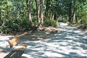
PLACES TO WALK IN PORT COQUITLAM
|
|
|
- Timothy Baldwin
- 6 years ago
- Views:
Transcription


 Castle Park-Citadel Landing Loop 2 Cedar Creek 3")


1 Places to Walk in Port Coquitlam Port Coquitlam is a walker s paradise, whether you re looking for a leisurely stroll or a challenging trek. Lace up your sneakers and try out these 18 walks submitted by residents and members of the City s walking program. The map below shows route starting points and page numbers PLACES TO WALK IN PORT COQUITLAM PORT COQUITLAM experience it! PARKS AND RECREATION EASY (up to 3.5K) Castle Park-Citadel Landing Loop 2 Cedar Creek 3 Citadel Landing 4 Coquitlam River Park 5 Downtown Heritage Walking Tour 6 Hyde Creek-Chelsea Park Loop 7 Hyde Creek to Victoria Drive 8 Leigh Square to Gates Park Gym 9 Northside Heritage Walking Tour 10 Peace Park Multiple entry points along the Shaughnessy Dog Off-Leash Area 12 Wilson Centre-Gates Park Loop 13 MODERATE (up to 6.5K) Colony Farm Regional Park 14 DeBoville Slough 15 Wilson Centre to Patricia Bridge 16 ADVANCED (up to 25K) Coquitlam River Loop Westwood Park to Pitt River Bridge 19


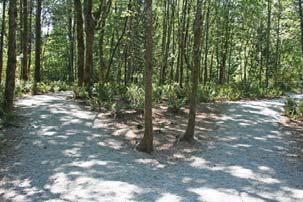
2 Castle Park Citadel Landing Loop Castle Park Citadel Landing Loop Castle Park, 2252 Castle Crescent From the Castle Park parking lot, take the gravel pathway to your left follow it to the Castle Park pedestrian bridge and onward to Argue Street and the Citadel Landing boardwalk From here, you can access the, west towards Colony Farm Regional Park or east toward Peace Park On your way back, follow the path on your left to enjoy the fields of wildflowers 1.5-km loop Moderate elevation change Walking bridge Citadel Landing boardwalk Views of Fraser River Wildflowers View of Mount Baker 2


3 Cedar Creek Cedar Creek Cedar Park, 950 Prairie Avenue From Cedar Park, follow the trail on your right past the athletic field Follow the trail to Coast Meridian Road Return 3.1 km Level hard-packed dirt/gravel with paved sections Creekside trail Wildflowers and grasses 43


4 Citadel Landing Citadel Landing The parking lot on Argue Street near the Mary Hill Bypass and Shaughnessy Street intersection Head east on the gravel path on the south side of Argue Street, along the Fraser River Relax at the scenic Citadel Landing boardwalk Return 3 km Level gravel path Scenic walk along the Fraser River Boardwalk Views of Mount Baker Part of the 4


5 Coquitlam River Park Coquitlam River Park Enter off Lincoln Avenue at Flint Street From the entrance, walk straight ahead and follow the trail to Shaughnessy Street There are many options to extend your walk through the park s many trails along with the adjoining 1.2 km Level gravel pathway Woodland forest walk 5


 8 1912 classic box-style")
 13 City Hall (1914, Edwardian style) 14 Make sure to check out the historical")


6 Downtown Heritage Walking Tour Downtown Heritage Walking Tour Downtown Port Coquitlam This self-guided tour includes some of the first homes and important buildings in the community Start at any point on the map (opposite page) and plan your own route 3-km loop Level paved roads, sidewalks and walkways HERITAGE WALKING TOUR STOPS Terry Fox Library 1 Rowland Lacrosse Box 2 City s first vicarage (1911) pioneer-style cottage pioneer-style cottage classic box-style home 6 Late 1800s Queen Anne Victorian 7 Site of Alderman Lobb home (1911) classic box-style home Craftsman-style home Craftsman bungalow frame-style home 12 Central School (1914, 4 rooms) 13 City Hall (1914, Edwardian style) 14 Make sure to check out the historical murals and other points of interest in the downtown core, as marked on the map above. Various first homes and important buildings Important points of interest and historical murals INTERACTIVE MAP GUIDED WALKING TOURS The Port Coquitlam Heritage and Cultural Society offers free guided walking tours of this route. For more information, pocoheritage@portcoquitlam.ca or call


7 Hyde Creek Chelsea Park Loop Hyde Creek Chelsea Park Loop Hyde Creek Recreation Centre, 1379 Laurier Avenue From Hyde Creek Centre, take the path on your right toward Cedar Drive Cross the pedestrian bridge on your left and follow the trail, keeping to the right and then left after you pass another bridge leading to a cul de sac. You will come to Chelsea Park From Chelsea Park, follow the sidewalk on Lincoln Avenue and take a pathway to your left opposite Ulster Street Cross the pedestrian bridge and stay left to return to Hyde Creek Centre 2.6-km loop Packed gravel and dirt trail with some exposed roots Creek-side trail Forest walk Part of the Hyde Creek Education Centre and Hatchery 7


8 Hyde Creek to Victoria Drive Hyde Creek to Victoria Drive Hyde Creek Recreation Centre, 1379 Laurier Avenue From Hyde Creek Recreation Centre, follow the path to Cedar Drive Take the pedestrian bridge over the creek and follow the path along Cedar Drive to Victoria Drive Return 3.5 km Level packed dirt/gravel Creek-side trail Hyde Creek Education Centre and Hatchery Forest walk Part of the 8


9 Leigh Square to Gates Park Outdoor Gym Leigh Square to Gates Park Outdoor Gym Leigh Square Community Arts Village, 2253 Leigh Square From the Arts Village, walk west on Whyte Avenue west towards the Coquitlam River Turn left onto the and follow the paved pathway to the free Gates Park outdoor gym 2 km Level and paved Beautiful Leigh Square Community Arts Village and murals Scenic route along the Coquitlam River 13-unit outdoor fitness circuit Part of the 9
 and plan")


10 Northside Heritage Walking Tour Northside Heritage Walking Tour Northside Port Coquitlam This self-guided tour includes some of the first homes and important buildings in the community Start at any point on the map (opposite page) and plan your own route 2.4-km loop Level and paved Some first homes and important buildings Learn about the history of Port Coquitlam HERITAGE WALKING TOUR STOPS Site of Agricultural Hall (1912) classic box-style home pioneer-style home classic box-style home Craftsman bungalow classic box-style home 6 Classic heritage bungalow Craftsman-inspired home 8 CP Rail worker home, circa pioneer cottage Craftsman bungalow classic shingle-style home 12 Bungalow-style house, circa pioneer cottage-style home Craftsman bungalow Dutch Colonial variation Queen Anne-inspired home 17 Site of commercial hotel (1913) 18 INTERACTIVE MAP GUIDED WALKING TOURS The Port Coquitlam Heritage and Cultural Society offers free guided walking tours of this route. For more information, pocoheritage@portcoquitlam.ca or call


11 Peace Park Peace Park Peace Park, 1470 Kebet Way From Peace Park, walk along the riverside until the trail leaves the river Return 2.5 km Level and packed gravel Home of the Rivers & Trails Festival Riverside walk Mountain views Part of 11
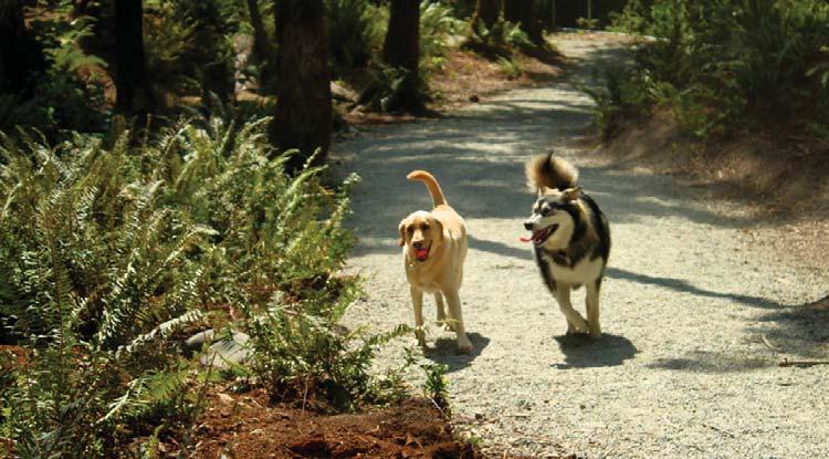
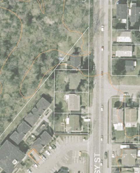


12 Shaughnessy Dog Off-Leash Area Shaughnessy Dog Off-Leash Area Shaughnessy Dog Off-Leash Area, 3300-block Shaughnessy Street From the entrance, follow the forested loop trail 0.4-km loop Level packed gravel Off-leash area for dogs Enclosed small-dog area Forested trail WEBSITE 12


13 Wilson Centre Gates Park Loop Wilson Centre Gates Park Loop Wilson Centre, 2150 Wilson Avenue Follow Wilson Avenue west and turn left onto the Donald Street Walkway Turn right at Elks Park Cross Shaughnessy Street at the Kelly Avenue crosswalk and continue along Kelly Avenue to enter Gates Park Follow path to where it joins the, turn north and follow the trail to McAllister Street Take McAllister Street to the Leigh Square Community Arts Village, through to Wilson Avenue and back to Wilson Centre 3.3 km Level paved Gates Park and Outdoor Gym Donald Street Walkway features Port Coquitlam s official flower, the Pride of PoCo Azalea. This semi-double flower blooms in mid-may, has a sweet fragrance and a shrimp pink colour. 13


 B Argue Street to Millennium Bridge Start")


14 Colony Farm Regional Park Colony Farm Regional Park C B A S, S AND S A Shaughnessy to Millennium Bridge Start at the entrance off Shaughnessy Street and follow the Pumphouse Trail. Turn left at the and proceed to the bridge (2.2 km return) B Argue Street to Millennium Bridge Start at the parking lot on Argue Street near Mary Hill Bypass. Cross at the light (left side) to access the trail entering Colony Farm and follow it to the bridge (3 km return) C Red Bridge to Millennium Bridge Start at the Red Bridge parking lot and cross under Pitt River Road. Follow the trail through the Kwikwetlem First Nation reserve into Colony Farm to the bridge (6.5 km return) to moderate Level, packed gravel Former farmland that is now habitat for over 180 species of birds and wildlife, including coyotes, song birds, birds of prey, waterfowl, beaver and river otter Wildflowers and grasses Perch poles Scenic grassland and riverside trail Part of and access to many other trails 14


15 DeBoville Slough DeBoville Slough DeBoville Slough entrance/parking lot at Victoria Drive and Cedar Drive Walk along the south side of the dike trail to where the slough meets the Pitt River Return Moderate 3.9 km Level packed dirt/gravel Wildlife Owls Waterfowl Riverside trail Pitt River views Mountain views Part of the 15


16 Wilson Centre to Patricia Bridge Wilson Centre to Patricia Bridge Wilson Centre, 2150 Wilson Avenue From Wilson Centre, follow Wilson Avenue west to Gates Park and turn right (north) onto the PoCo Trail Follow the trail to Lions Park and onward to the Patricia Avenue pedestrian bridge Return Moderate 6.3 km Level paved sidewalks and walkways with packed dirt trail sections Lions and Gates Parks Riverside trail Forest walk River views from pedestrian bridge Part of 16


17 Coquitlam River Loop Coquitlam River Loop Westwood Park, 2399 Patricia Avenue From Westwood Park, follow the Trans Canada Trail across the Patricia Avenue pedestrian bridge Take the path along the Coquitlam River, passing through Lions and Gates Parks Turn around at the Red Bridge at Pitt River Road, follow the trail back to the Patricia Avenue pedestrian bridge and cross to the other side Follow Ticehurst Lane to Kingsway Avenue, take the trail under the bridge and continue to Westwood Park Route accessible from many points Advanced 7.8 km Level paved and hard-packed dirt/gravel Lions and Gates Parks Riverside trails Forest walk Trans Canada Trail Part of the Pedestrian bridge 17


18 PoCoTrail Multiple entry points The circles the city The loop trail will bring you back to your starting point Advanced 25-km loop Mostly level with paved and packed dirt/gravel Multiple entry points along the Traverses forests, creeks, rivers, meadows, marshes, riverfront and urban development Lions, Gates, Peace, Coquitlam River Parks and others Citadel Landing boardwalk DeBoville Slough Hyde Creek nature reserve Views of the Coquitlam, Fraser and Pitt Rivers Mountain views 18


19 Westwood Park to Pitt River Bridge Westwood Park to Pitt River Bridge Westwood Park, 2399 Patricia Avenue From Westwood Park, follow the as it winds along the Coquitlam River, through Wellington Park, past the Hyde Creek Education Centre and Hatchery, to the south side of the DeBoville Slough Once the trail arrives at the Pitt River, follow the dike to the Pitt River Bridge Return Advanced 20.2 km Level packed dirt/gravel with some paved roadways Part of the and the Trans Canada Trail Riverside trails Forest walk Hyde Creek nature reserve Mountain views Waterfowl Wildlife Farmland 19


20 WHY VISIT FIND INFORMATION ON: Getting active Healthy eating Walking resources Workplace wellness PoCoMotion projects and events Links to other informative websites How you or your organization can get on board with PoCoMotion & more CHECK OUT OUR OTHER HANDBOOKS! Walking Handbook Walk Leader Handbook Pedometer Handbook Find these and other walking resources at the Healthy Resource Centre Hyde Creek Recreation Centre 1379 Laurier Avenue Visit the Healthy Resource Centre at Hyde Creek Recreation Centre, 1379 Laurier Avenue, or call
CAPITAL PROGRAM SUMMARY
 2017 2018 CAPITAL PROGRAM SUMMARY MISC A 2017 NEIGHBOURHOOD REHABILITATION Pitt River Road - Mary Hill to Kingsway Victoria Drive - Toronto to Holtby Pooley Avenue - High Pressure Watermain Culvert Replacement
Centred Outdoors is an open invitation for people of all ages and fitness levels to explore ten outdoor destinations in Centre County, Pennsylvania,
 Centred Outdoors is an open invitation for people of all ages and fitness levels to explore ten outdoor destinations in Centre County, Pennsylvania, throughout the summer of 2018. Together, we ll stress
To Wellness. To Wellness PASSPORT PASSPORT. Partners. Partners. Ashland County Health & Human Services 630 Sanborn Avenue, Ashland, WI
 Partners Ashland County Health & Human Services 630 Sanborn Avenue, Ashland, WI Ashland Bretting Center 320 4th Avenue W., Ashland, WI PASSPORT Bayfield County Health Department 117 E. 6th Street, Washburn,
Baltimore County Nature Quest NEW TRAILS 2014
 Baltimore County Nature Quest NEW TRAILS 2014 Nature Quest Park Locations Robert E. Lee Park Cromwell Valley Park Agricultural Ctr. & Farm Park Honeygo Regional Park Marshy Point Park and Nature Center
This Passport: Revised October 20, 2017, EAM # Discovering the Trails of Penfield, NY
 This Passport: Revised October 20, 2017, EAM #161922 Discovering the Trails of Penfield, NY The Town of Penfield is fortunate to have a wide variety of natural resources which make for many unique and
Calvert Regional Park - Tari Moore Recreational Trail. Calvert Regional Park - Woodland Trail. miles from Rising Sun
 Calvert Regional Park - Tari Moore Recreational Trail 304 Brick Meeting House Road, North East, MD 21901 5.2 about 1.1 mile Paved parking lot, plentiful Easy, paved path with slight incline. Easy, paved
Langton Lake Park Implementation Planning Session One 6 June Attendees signed in
 27 Attendees signed in Meeting summary Following an overview of the Parks and Recreation Renewal Program and the key directions of the Parks and Recreation System Master Plan, meeting participants were
Trail Accessibility Guide
 Trail Accessibility Guide Programs and Events The s will make every effort, with two weeks advance notice, to provide reasonable accommodations so that people with disabilities may participate in special
County of Peterborough Active Transportation Master Plan
 The TMP developed a conceptual AT/cycling network for Peterborough County that identified both on-road and off-road (trail) AT facilities. This was a coarse network based on the existing trails and off-road
PASSPORT. Discovering the Trails of Webster, NY
 PASSPORT to family wellness Discovering the Trails of Webster, NY Join the Friends of Webster Trails, Webster Health and Education Network, The Town of Webster and Wegmans to get moving more and enjoy
Nature is for everyone to enjoy, so let your followers experience the beauty.
 POCKET GUIDE WHILE YOU RE HIKING For your safety, please watch for loose rocks, tree roots, and other obstacles along the trails. Please park in designated parking areas only. Stay on the marked trail;
IOWA ORNITHOLOGISTS' UNION - Birding Sites in Dallas County
 IOWA ORNITHOLOGISTS' UNION - Birding Sites in Dallas County Printed on 7/19/2018 Beaver Bottoms Wetland (restricted) (Important Bird Area) GPS Coordinates:, Ownership: Private (see directions for access)
Delaware Wildlife Area
 Delaware Wildlife Area 8 miles away from Delaware 4,670 acre Wildlife Area 1) Take Rt. 36/East Williams Street eastward 2) Take left onto Rt. 42/Lake Street 3) Slight left onto Horseshoe Rd./CR. 220 4)
F.O.K.O.S. Friends of Kingston Open Space A GUIDE TO KINGSTON OPEN SPACE
 F.O.K.O.S. Friends of Kingston Open Space A GUIDE TO KINGSTON OPEN SPACE Friends of Kingston Open Space (FOKOS) was formed when a handful of concerned citizens joined together to learn what could be done
TART Trails, Inc. (231)
") TART Trail System TART Trails, Inc. www.traversetrails.org (231) 941-4300 Leelanau Trail Stretching 15 miles along a former railroad corridor, the TART-owned Leelanau Trail connects Traverse City and Suttons
TART Trail System TART Trails, Inc. www.traversetrails.org (231) 941-4300 Leelanau Trail Stretching 15 miles along a former railroad corridor, the TART-owned Leelanau Trail connects Traverse City and Suttons
Trail Etiquette. Hours of Operation. Trail Accessibility
 Trail Guide The Elmhurst Park District, with 28 parks and over 460 acres of land, offers nearly six miles of paved or asphalt park trails and maintains an additional 3.6 miles of trails within Elmhurst.
(/ 12 (/ 18 (/ 18 (/ 12 (/ 51 (/ 14 Æ%106 Æ% 106 Æ% 213 Æ% 104 Æ% 89 Æ% 26 Æ% 73 Æ% 59 Æ% 138 Æ% 92 Æ% 26 Æ% 67 Æ% 11 Æ% 11 Æ% 11. Æÿ H Æÿ Z.
 WAUKESHA Existing Ice Age Trail, subject to change as it evolves toward completion Glacial Drumlin Rail-Trail 94 Ice Age Trail Rock, Walworth and Jefferson Counties Other Trail Unofficial Connecting Route
Hudson Highlands Fjord Trail Draft Master Plan. April 29, 2015
 Hudson Highlands Fjord Trail Draft Master Plan April 29, 2015 Agenda Route Overview Proposed Segment Results of Community Survey on that Segment Next Steps Municipal Endorsement Environmental Review Implementation
This Passport: Revised October 20, 2017, EAM # Discovering the Trails of Webster, NY
 This Passport: Revised October 20, 2017, EAM #161923 Discovering the Trails of Webster, NY The Town of Webster invites you to explore and experience our diverse outdoor adventures! Here s your opportunity
proof Northwest District
 1 Northwest District The Northwest Florida Water Management District is the most rural of all five water management districts. From just east of Tallahassee west to the Florida/Alabama line, and from the
BRR Leg 1 (3.9 miles, Easy)
") BRR Leg 1 (3.9 miles, Easy) Min 3901 Max 4919 Ascent +21 Descent -1031 0.0 Start (Grayson Highlands State Park Visitor Center) 3.9 Grayson Highlands State Park Office & Gate, on R (EZ 1) Leg Notes: Minimal
BRR Leg 1 (3.9 miles, Easy) Min 3901 Max 4919 Ascent +21 Descent -1031 0.0 Start (Grayson Highlands State Park Visitor Center) 3.9 Grayson Highlands State Park Office & Gate, on R (EZ 1) Leg Notes: Minimal
M. Spina, Councillor J. Cowden, School District No. 73 N. DeCicco, Projects and Planning Supervisor, City of Kamloops
 MINUTES OF A MEETING OF THE KAMLOOPS PARKS AND RECREATION COMMITTEE HELD ON WEDNESDAY, NOVEMBER 26, 2014, AT 7:00 AM IN THE TOURNAMENT CAPITAL CENTRE, MEETING ROOM "D" RECOMMENDATION: That Council authorize
National Recreation Trail Application for Designation
 National Recreation Trail Application for Designation Introduction Thank you for your interest in the National Recreation Trail (NRT) program. Completed NRT application packages must be submitted by December
Beaver Creek State Park
 GENERAL INFORMATION Name of Park/Forest/Facility: Beaver Creek State Park County: Columbiana (St. Clair Township) Address: 12816 Sprucevale Road (ie County Rd 428) (street #, city) East Liverpool, Ohio
Bike Routes of Sault Ste Marie 2017
 Bike Routes of Sault Ste Marie 2017 East Portage - Riverside - Nicolet - Scenic (15-20 miles, mostly flat) Proceed east on Portage Ave. Portage Ave becomes Riverside Drive at Mission Rd. Portage is a wide
KETTLE CREEK CONSERVATION AUTHORITY TRAIL GUIDE.
 KETTLE CREEK CONSERVATION AUTHORITY TRAIL GUIDE www.kettlecreekconservation.on.ca EXPLORE OUR TRAILS HIKE OUR TRAILS Kettle Creek Conservation Authority (KCCA) proudly supports and promotes an active lifestyle
FEASIBILITY CRITERIA
 This chapter describes the methodology and criteria used to evaluate the feasibility of developing trails throughout the study areas. Land availability, habitat sensitivity, roadway crossings and on-street
MONTGOMERY TOWNSHIP OPEN SPACE & PATHWAYS COMMITTEE
 MONTGOMERY TOWNSHIP OPEN SPACE & PATHWAYS COMMITTEE Meetings: 2 nd Wednesday of each month @ 6:30 PM in the Municipal Building Questions? Call the Open Space Coordinator, Lauren Wasilauski, at (908) 359-8211
National Recreation Trail Update Form
 National Recreation Trail Update Form Introduction Thank you for taking the time to complete this form. Your assistance will help ensure that the National Recreation Trail (NRT) database is complete and
BETTER BUSINESS BUREAU 2015
 BONSOR COMMUNITY CENTRE 6550 BONSOR AVE BURNABY CAMERON RECREATION CENTRE 9523 CAMERON ST BURNABY CONFEDERATION COMMUNITY CENTRE FOR 55+ 4585 ALBERT ST BURNABY EDMONDS COMMUNITY CENTRE 7433 EDMONDS STREET
B10. Agate Beach State Recreation Site
 B10. Agate Beach State Recreation Site Location Within the City of Newport, just south of the Yaquina Head Outstanding Natural Area. The park is located along the west side of Highway 101 at the mouth
Windsor Kingsville Essex Tour:
 An Ontario's Southwest Cycling Itinerary Windsor Kingsville Essex Tour: Pedal into the Heart of Southern Ontario s Wine Country CYCLE LOTS TO SEE AND LOTS TO DO IN ONTARIO S SOUTHWEST Total Distance: 130
ASRA 2018 Hike Schedule
 ASRA 2018 Hike Schedule Date/Day Destination Hike Info Meeting Info Leader Feb 10, Saturday Stagecoach and 9:00 at the Confluence kiosk. Manzanita trails Parking fee required. We ll hike along the trail
NEWBORO AND PORTLAND HARBOUR REDVELOPMENT PLANS
 INTRODUCTION The Municipal docks in both Newboro and Portland were transferred to the Township of Rideau Lakes by Parks Canada in 2002. Little has been done to improve the docks physical condition or role
Interpreting the Lagan Valley Regional Park. The Lagan Navigation: The unfolding story of a proud heritage Dr Andy Bridge
 Interpreting the Lagan Valley Regional Park The Lagan Navigation: The unfolding story of a proud heritage Dr Andy Bridge A bit about us Designated an AONB under the Amenity Lands Act (NI) 1965 The Regional
San Luis Obispo. Bishop Peak Felsman Loop Eagle Rock Maino Open Space Poly Canyon Poly P Other Areas
 San Luis Obispo Bishop Peak Felsman Loop Eagle Rock Maino Open Space Poly Canyon Poly P Other Areas 1 JCT. ELEV. 72 400 00 0 FELSMAN LOOP GATE LOOP RIDGE 600 FENCE JCT. ELEV. 860 1000 1200 BISHOP PEAK
A leisurely one mile stroll through the history of Aldershot s Manor park, considered by many as the most attractive and pleasant parts of our town.
 Figure 1 Entrance to Park from the Aldershot Green/Churchill road end A leisurely one mile stroll through the history of Aldershot s Manor park, considered by many as the most attractive and pleasant parts
Asheville & WNC Hikes
 Asheville & WNC Hikes Amazingly, we have 3,000+ miles of free public hiking trails near Asheville, including 1,600 miles in the Pisgah and Nantahala National Forests, 850 miles in Great Smokey Mountains
NORTHWEST SECTION CONTENTS: CLEVELAND PARK FOLWELL PARK RYAN LAKE PARK VICTORY PRAIRIE DOG PARK VICTORY PARK
 NORTHWEST SECTION CONTENTS: CLEVELAND PARK FOLWELL PARK RYAN LAKE PARK VICTORY PRAIRIE DOG PARK VICTORY PARK LUCY LANEY COMMUNITY SCHOOL N 33RD AVE N 33RD AVE SINGLE-FAMILY RESIDENTIAL MULTI-USE DIAMOND
PHOENIX PARK INCORPORATING THURNSCOE COMMUNITY WOODLAND
 PHOENIX PARK INCORPORATING THURNSCOE This popular site is known for its sculptures and climbing wall which can be seen as you meander around the park. Walking towards the top of the woodland you will pass
Acquisition in fee simple of approximately one-half acre of property on the shore of Spring Lake to expand the Lakeside Beach Park.
 Lakeside Beach TF00-136 $122,550.00 in fee simple of approximately one-half acre of property on the shore of Spring Lake to exp the Lakeside Beach. 2000 River Ravines TF00-150 $910,000.00 in fee simple
18 day Spectacular Canada and Luxury Alaska Cruise
 18 day Spectacular Canada and Luxury Alaska Cruise International airfares All transfers 8 days touring the Rocky Mountains 8 day 5 star Alaska Cruise All meals on-board your luxury cruise In depth sight
SOUTH WALTON TRAILWAYS
 SOUTH WALTON TRAILWAYS 13 14 15 10 1 2 11 12 3 5 6 4 3 7 9 8 Nestled throughout Walton County are 200 miles of hiking and biking trails winding through state forests, state parks and public-private greenways.
1. Drive to Lake Cowichan via Highway 18 (which connects to the Trans-Canada Highway just north of Duncan)
") Driving Instructions to the Walbran Valley via Lake Cowichan (updated July 2018) 1. Drive to Lake Cowichan via Highway 18 (which connects to the Trans-Canada Highway just north of Duncan) 2. At the traffic
Driving Instructions to the Walbran Valley via Lake Cowichan (updated July 2018) 1. Drive to Lake Cowichan via Highway 18 (which connects to the Trans-Canada Highway just north of Duncan) 2. At the traffic
The Vision for the San Juan Islands Scenic Byway
 The Vision for the San Juan Islands Scenic Byway 2 Judd Cove, Orcas Island, Courtesy of Kurt Thorson (kurtthorson.com) and San Juan County Land Bank Vision for the San Juan Islands Scenic Byway The San
Bikes talk to each other like dogs, they wag their wheels and tinkle their bells, the riders let their mounts mingle.
 Bikes talk to each other like dogs, they wag their wheels and tinkle their bells, the riders let their mounts mingle. Daniel Behrman, The Man Who Loved Bicycles W hitmore Lake Loop route: Dexter, the corner
This page helps you find out more about Bute Park. (Including Coopers Field and Blackweir)
") This page helps you find out more about Bute Park. (Including Coopers Field and Blackweir) Bute Park Useful information is set out under the following headings: Summary Features of interest Facilities
This page helps you find out more about Bute Park. (Including Coopers Field and Blackweir) Bute Park Useful information is set out under the following headings: Summary Features of interest Facilities
RAY YENKANA Willowbrook Cr, Dawson Creek BC Canada $2,847,000
 1716 Willowbrook Cr, Dawson Creek BC Canada For SALE $2,847,000 This is a rare find, 32 townhomes in Dawson Creek, BC. Excellent investment in a single title multi family complex. Vendor has upgraded this
3. COLTA / HUGA CONNECTIONS - PRELIMINARY
 9 3. COLTA / HUGA CONNECTIONS - PRELIMINARY 3.1 COLTA The Chain of Lakes Trail Association (COLTA) trail, formerly identified as the Chester Spur Line, was completed and opened for use in June 2011. The
DAY 3: Huntleys Point Wharf to Balmain East Wharf
 DAY 3: Huntleys Point Wharf to Balmain East Wharf Total Distance: 14.5km Time: Approximately 5 hours Walk Notes in Five Sections Section Name Length Time 3:1 Huntleys Point Wharf to Iron Cove Bridge 4km
Guide to. Suffolk. Walking. Trails. Lake Meade Park
 Walking Lake Meade Park Guide to Suffolk Trails Lake Meade Park Lonestar Lake Regional Park Walking Safety Tips Avoid walking alone on trails. Walking with friends is recommended. Tell someone where you
throu Booth Hill Green Belt
 s k r a p s l l u b m u r T Explore gh Geocaching throu Booth Hill Green Belt This was originally a concept to try and preserve some of the land in our town, without hurting the developers that are creating
The Narrows Waterfront Park A Crown Jewel for Southern Brooklyn
 The Narrows Waterfront Park A Crown Jewel for Southern Brooklyn In New York, the unquestioned popularity of urban spaces such as Riverside Park, the High Line, Brooklyn Bridge Park and others has demonstrated
MPRB: Southwest LRT Community Advisory Committee Issues and Outcomes by Location Current to: 12 November 2010
 MPRB: Southwest LRT Community Advisory Committee Issues and Outcomes by Location Current to: 12 November 2010 This is a compilation of issues and outcomes identified by the CAC. It is a work in progress,
A Publication of Friends of Sleeping Bear Dunes
 A Publication of Friends of Sleeping Bear Dunes 2014, Friends of Sleeping Bear Dunes, P.O. Box 545, Empire, MI 49630 www.friendsofsleepingbear.org info@friendsofsleepingbear.org Learn more about the Friends
IOWA ORNITHOLOGISTS' UNION - Birding Sites in Cerro Gordo County
 IOWA ORNITHOLOGISTS' UNION - Birding Sites in Cerro Gordo County Printed on 11/17/2018 Blue-wing Marsh GPS Coordinates: 43.0834956379463,-93.4430980682373 Pure natural area primarily used for hunting.
Appendix 3. Greenway Design Standards. The Whitemarsh Township Greenway Plan
 Appendix 3 Greenway Design Standards This chapter discusses two design standards for the greenway types discussed above. First, trail design standards are presented together with trailhead facilities and
AGENDA REGULAR PARKS COMMISSION MEETING May 26, :15 A.M Monticello Public Works Office
 Park Commission Agenda: 05/26/2016 AGENDA REGULAR PARKS COMMISSION MEETING May 26, 2016 9:15 A.M Monticello Public Works Office To enhance community pride through developing and maintaining city parks
Aeron & Arth walks 4 walks for all the family to enjoy
 Aeron & Arth walks walks for all the family to enjoy Please take note that the maps illustrating these walks are intended as a rough guide only. You should use the most recent version of the relevant Ordnance
Crystal Lake Area Trails
 Lake Area Trails Welcome to the Lake area of the Big Snowy Mountains! This island mountain range in central Montana features peaks reaching to 8,600 feet and long, high ridges from which vistas of the
Topsham Trail Guide.
 Topsham Trail Guide A guide to the walking, hiking, biking, water and ATV trails of Topsham, Maine and surrounding towns $4.95 Developed by the www.greatertopshamtrailalliance.org The Greater Topsham Trail
Double Bar Z Ranch 8,690 ± California. Mariposa County Exclusive Agents Allen Alsobrook Jim Watson. Sierra Foothills. La Grange
 Double Bar Z Ranch 8,690 ± California. Mariposa County Exclusive Agents Allen Alsobrook Jim Watson Sierra Foothills. La Grange The Double Bar Z Ranch is a spectacular working cattle ranch. It has been
Janitorial Service Needed
 HEPATITIS A - HAND WASHING STATIONS (HWS) - PLACEMENT LIST - OCTOBER 6, 2017 By Date and Method of Placement No. Site Address Jurisdiction 1 Balboa Park - Cabrillo Bridge / Museum of Man 1329 El Prado,
VANCOUVER PRIVATE SHORE EXCURSIONS
 VANCOUVER PRIVATE SHORE EXCURSIONS Vancouver is a grand international city. Even if you re just passing through as you embark or disembark an Alaska cruise, we can make the transition from the airport
Photo Credit: Banff Lake Louise Tourism / Paul Zizka Photography MOUNTAIN ADVENTURES
 Photo Credit: Banff Lake Louise Tourism / Paul Zizka Photography MOUNTAIN ADVENTURES MOUNTAIN ADVENTURE PROGRAM Operated by Fairmont Chateau Lake Louise Fairmont Chateau Lake Louise has a long and proud
how it started where we are now what is coming up NEW WESTMINSTER WATERFRONT PARK THE RIVER THE PAST THE PEOPLE
 how it started Downtown Waterfront Park How It Started March 2009 City of New Westminster Purchases 3.2 Hectare Westminster Pier Site March 2009 City of New Westminster and Design Team develop plan for
Penn Common and Bramshaw Wood
 Trail Activity Type Terrain Author Distance Ascent Location : HAMPTR0025 : Walk : Pub : Towpaths and Cycle Tracks : Anne-Marie Edwards : 5.3 miles / 8.5 kms : 381 feet / 116 metres : SU253173 / SP5 2BZ
July rails MASTER PLAN. prepared by: peter j. smith & company, inc. Grounds for Play. Culture. programs EVENTS. festivals.
 July 2014 T rails MASTER PLAN prepared by: peter j. smith & company, inc. Grounds for Play programs festivals Culture SPORTS trails health Recreation waterfront EVENTS Parks iipeter j. smith & company,
Sunrise Ranch 6890 acres, Jeff Davis County, Texas On the Fort Davis Scenic Loop
 Sunrise Ranch 6890 acres, Jeff Davis County, Texas On the Fort Davis Scenic Loop 432-386-2821 Cell 432-426-2024 Office james@kinglandwater.com King Land & Water LLC P.O. Box 109, 600 State Street, Fort
SIMON CANYON AREA OF CRITICAL ENVIRONMENTAL CONCERN (ACEC)
") SIMON CANYON AREA OF CRITICAL ENVIRONMENTAL CONCERN (ACEC) Activities: Facilities: Season / Hours: Description: Hiking, backpacking, fishing, picnicking, watchable wildlife. A graveled parking area, picnic
SIMON CANYON AREA OF CRITICAL ENVIRONMENTAL CONCERN (ACEC) Activities: Facilities: Season / Hours: Description: Hiking, backpacking, fishing, picnicking, watchable wildlife. A graveled parking area, picnic
BIRDING Lake Fayetteville
 BIRDING Lake Fayetteville Lake Fayetteville is an impoundment of Clear Creek, created as a water supply for Fayetteville in 1949. With development of other water supplies, especially Beaver Lake, Lake
DIRECTIONS TO THE FIELDS
 DIRECTIONS TO THE FIELDS Northwest Connecticut Babe Ruth League AVON AVON HIGH SCHOOL -Traveling east on Route 44, take a right onto Route 167. Continue on Route 167 past the Avon Middle School. The field
THOMAS A. SWIFT METROPARK Introductions History Present Conditions Future Development Plans Implementation Strategies Statistics
 THOMAS A. SWIFT METROPARK Introductions History Present Conditions Future Development Plans Implementation Strategies Statistics Introduction As an open meadow park positioned along the Mahoning River,
Microsoft Enterprise Agreement Renewal and Software License Management Awarded to Softchoice Corporation
 City of Coquitlam Closed Bids 2010 Closed Request for Information (RFI) 84431 - Engineering Consultant Design Services 2010/2011 Infrastructure Projects Kerr Wood Leidal Associates Ltd. Dayton and Knight
Northeast Quadrant Distinctive Features
 NORTHEAST QUADRANT Northeast Quadrant Distinctive Features LAND USE The Northeast Quadrant includes all the area within the planning area that is east of Interstate 5 and to the north of State Route 44.
CLEARWATER CREEK MASTER PLAN
 CLEARWATER CREEK MASTER PLAN CLEARWATER CREEK PRESERVE HUGO, MN 55038 December, 2018 Prepared for: City of Hugo 14669 Fitzgerald Ave North Hugo, MN 55038 WSB PROJECT NO. 11947 Table of Contents Executive
VANCOUVER PRIVATE SHORE EXCURSIONS
 VANCOUVER PRIVATE SHORE EXCURSIONS Vancouver is a grand international city. Even if you re just passing through as you embark or disembark an Alaska cruise, we can make the transition from the airport
Dryden Rail Trail Friends and Task Force Monday, January 21, :00 9:00 p.m. Dryden Town DPW 61 East Main Street, Dryden
 Agenda Dryden Rail Trail Friends and Task Force Monday, January 21, 2019 7:00 9:00 p.m. Dryden Town DPW 61 East Main Street, Dryden Call to order (7:00 p.m.) Bob Beck Additions to agenda Approval of December
ONTARIO TRAILS COUNCIL FAQ
 Trail Facts Ontario has some of the most treasured and protected outdoor areas in the world with: 329 Provincial Parks 400 Conservation Areas 292 Conservation Reserves Many people link trails with recreation
Cumberland County Hiking Marathon Trail Descriptions
 Cumberland County Hiking Marathon Trail Descriptions 8/28/2017 Welcome to the 2017 Cumberland County Hiking Marathon. As you hike these trails you will enjoy a wide variety of terrain and geographical
LOYALISTS COME WEST 2015 CONFERENCE-UELAC
 LOYALISTS COME WEST 2015 CONFERENCE-UELAC Be Sure to Visit Vancouver City, the home of the Vancouver Branch UELAC Vancouver Branch UELAC invite attendees to be sure and plan a stopover in Vancouver City,
4.19 Parks, Recreation, and Conservation Lands
 interchange would have on the Reed Paige Clark Homestead located on the north side of Stonehenge Road. Alternative D would also affect Palmer Homestead, E.F. Adams House, and Knapp Brothers Shoe Manufacturing
Lava Mountain Trail Distance: Elevation Range: Trail Type: Difficulty: Season: Driving Distance: Driving Time: USGS Maps: Pros Cons
 Lava Mountain Trail Distance: 13.4 miles (including the side trip to North Star Lake) Elevation Range: 5900'-8330' Trail Type: singletrack Difficulty: moderate Season: late June-October Driving Distance:
South Texas Plains. Texas, Our Texas
 South Texas Plains This is a region characterized by considerable variety. Climatically, the South Texas Plains region is sub-humid to dry. The in the north part of the South Texas, erosion of the Edwards
Area Organization Project Name Project Description Funding Amount Castlegar Castlegar Nordic Ski Club
 BACKGROUNDER RECREATION INFRASTRUCTURE GRANTS 2018 INTAKE: LIST OF PROJECTS APPROVED FOR FUNDING Area Organization Project Name Project Description Funding Amount Castlegar Castlegar Nordic Ski $12,000
DRAFT Scenic Byways & Regional Tourism
 11 Scenic Byways & Regional Tourism 2016 Regional Transportation Plan 11 Scenic Byways and Regional Tourism The five scenic byways in Franklin County play an important role in regional tourism. The five
IOWA ORNITHOLOGISTS' UNION - Birding Sites in Linn County
 IOWA ORNITHOLOGISTS' UNION - Birding Sites in Linn County Printed on 6/15/2018 Bever Park (ebird Hotspot) GPS Coordinates: 41.9851219,-91.6269125 Restrooms Parking Trails ADA Accessible Trails Boyson Trail
DISTRICT OF NORTH COWICHAN. Dated: May Municipal Parks. Prepared By Ernie Mansueti, Parks and Recreation Director
 Dated: May 2006 Municipal Parks Prepared By Ernie Mansueti, Parks and Recreation Director TABLE OF CONTENTS PARK NAME Page # Abbey Road Park...4-5 Alan Wilson Park...6-7 Art Mann Park...8-9 Askew Creek
All Groups. Conserve/
 All Groups Total stickers Large Open Small Multifamily Conserve/ Lot Space Lot Res Total Park Downtown 1 5 25 31 11 Fringe East 5 30 7 42 13 Fringe West 2 9 35 17 63 11 Rural Topsham 14.5 21.5 5 41 26
Walk 1. Cotswold Water Park. Gateway Centre to Cerney Wick, railway track to Lake 6, Gateway Centre.
 Cotswold Water ark Walk way A Swindon/ Cirencester Thomas and Severn Canal way to Cerney Wick, railway track to Lake, way. Spine Road East Hotel Time: hours (short walk km) Distance: km A level walk along
SATURDAY 2ND EARLY MORNING WALKS
 MARCH SATURDAY 2 ND 6 am - WHITES HILL LAGOON WALK a walk along the trail through bushland to the lagoon. Meet Corner Samuel Street & Boundary Rd, Camp Hill UBD Map 181 C 5 some uphill walking 7.30 am
Access Statement for Ynys-hir RSPB Reserve
 This access statement does not contain personal opinions as to our suitability for those with access needs, but aims to accurately describe the facilities and services that we offer all our guests/visitors.
KEY. Physical Activity Levels. Low = Medium = Creative = High = Accommodation Types. = Camping (Tents) = Hard Top
 = Hard Top") Program Calendar July December 2018 KEY Physical Activity Levels Low = Medium = High = Creative = Accommodation Types = Camping (Tents) = Hard Top JULY Tuesday 5 Yarra River Walk - Ideal for new participants
Program Calendar July December 2018 KEY Physical Activity Levels Low = Medium = High = Creative = Accommodation Types = Camping (Tents) = Hard Top JULY Tuesday 5 Yarra River Walk - Ideal for new participants
District: 4815 Departing: Sunday 18th of November Patagonia Duration: 17 Days. Destinations: PROGRAM: 18/11 Cordoba - Puerto Madryn:
 District: 4815 Departing: Sunday 18th of November 2018 Patagonia Duration: 17 Days Destinations: Puerto Madryn, Calafate, Ushuaia, Esquel & San Carlos de Bariloche. PROGRAM: 18/11 Cordoba - Puerto Madryn:
Frederickson LUAC. Community Plan Update. Parks & Recreation. September 25, 2017
 Frederickson LUAC Community Plan Update Parks & Recreation September 25, 2017 Kimberly Freeman Resource Stewardship Superintendent kimberly.freeman@co.pierce.wa.us 253-798-4261 Joseph Coppo Senior Parks
Wildlife Tour of South India
 Day 1: Bangalore Wildlife Tour of South India Itinerary Details Duration: 14 Nights/15 Days After arrival, complete the check-in formalities at your hotel. Later, leave for an excursion to Mysore (Drive
The lands of Dagger Deep Dagger Deep is a 24 acre. were founded in Jared immersive fantasy setting
 What is Dagger Deep? A Brief History The lands of Dagger Deep Dagger Deep is a 24 acre were founded in 2005. Jared immersive fantasy setting Williams, the owner of with over a dozen creative Dagger Deep,
A number of goals were identified during the initial work on this Big Lake Transportation Plan.
 C. Transportation General Background Information Big Lake s transportation system includes all the roads, paths and facilities that allow the movement of private vehicles, trains and planes, as well as
GOLDEN BACKCOUNTRY RECREATION ADVISORY COMMITTEE (GBRAC)
") GOLDEN BACKCOUNTRY RECREATION ADVISORY COMMITTEE (GBRAC) MINUTES from November 1, 2006 Meeting Attending: Sector / Stakeholder GBRAC Commercial Aerial Motorized Sector GBRAC Habitat Protection; Sport Fishing
GOLDEN BACKCOUNTRY RECREATION ADVISORY COMMITTEE (GBRAC) MINUTES from November 1, 2006 Meeting Attending: Sector / Stakeholder GBRAC Commercial Aerial Motorized Sector GBRAC Habitat Protection; Sport Fishing
Streets, the south side of West Cleveland Street between Broadway and Olive
 Published in The Morning Sun on September 25th, 2015) ORDINANCE NO. G- 1230 AN ORDINANCE amending Section 78-116 of the Pittsburg City Code to prohibit parking on both sides of East 10th Street between