Where the Sidewalk [Literally] Ends
|
|
|
- Felix Burns
- 6 years ago
- Views:
Transcription
![Where the Sidewalk [Literally] Ends by Edie Creter May 1, 2017, another perfect biking day. In the spring of 2013 I wrote a pictorial Breeze article (Where the Sidewalk Begins.](/docs-images/74/71371935/images/1-0.jpg ".. ) after my first visit to Clam Bayou Nature Preserve, accessed at the end of 34th Avenue S (off 37th Street S) behind the Wal-Mart/Ceridian area.")
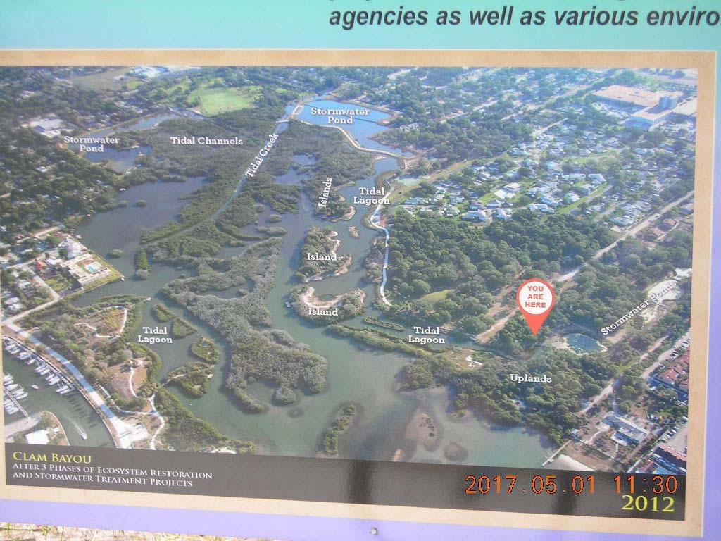
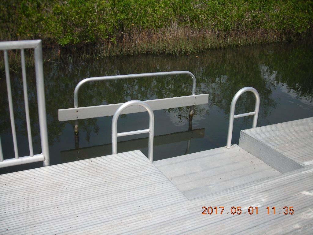
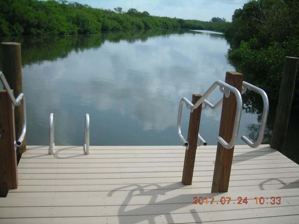
1 Where the Sidewalk [Literally] Ends by Edie Creter May 1, 2017, another perfect biking day. In the spring of 2013 I wrote a pictorial Breeze article (Where the Sidewalk Begins... ) after my first visit to Clam Bayou Nature Preserve, accessed at the end of 34th Avenue S (off 37th Street S) behind the Wal-Mart/Ceridian area. In the 4 years since that article, a new south side has been built and there is an addition to the north side. Finding an updated map of St. Petersburg's portion of Clam Bayou Preserve was challenging. Phil found a recent photo on Google Earth. He added numbers to the photo that correspond to specific areas mentioned in this article. A 2014 map is at The northern portion (at bottom of the map) has added a small bridge (#1 on map) that leads to a grass-trampled trail winding around to the right until you find a small boat/fishing dock (#2 on map). Although it is tempting to jump in for a quick dip, swimming is discouraged in bayou waters. On our way out we meet up with two bicycle policemen just finishing up their trek through the north trails.
 and a kayak/canoe launch (#4 on map) (within carrying distance from the roundabout).")
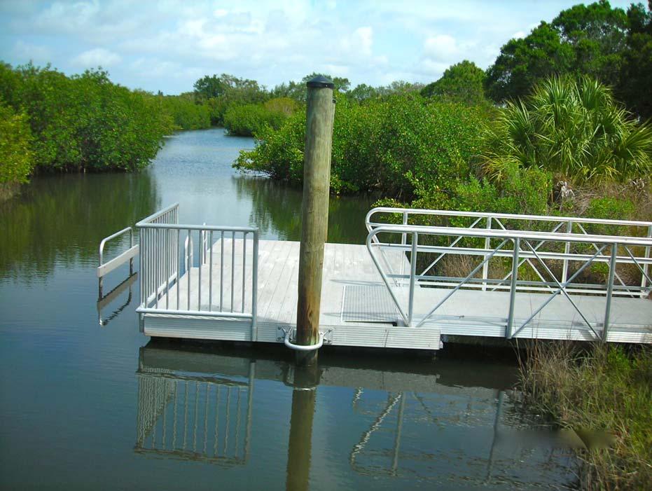
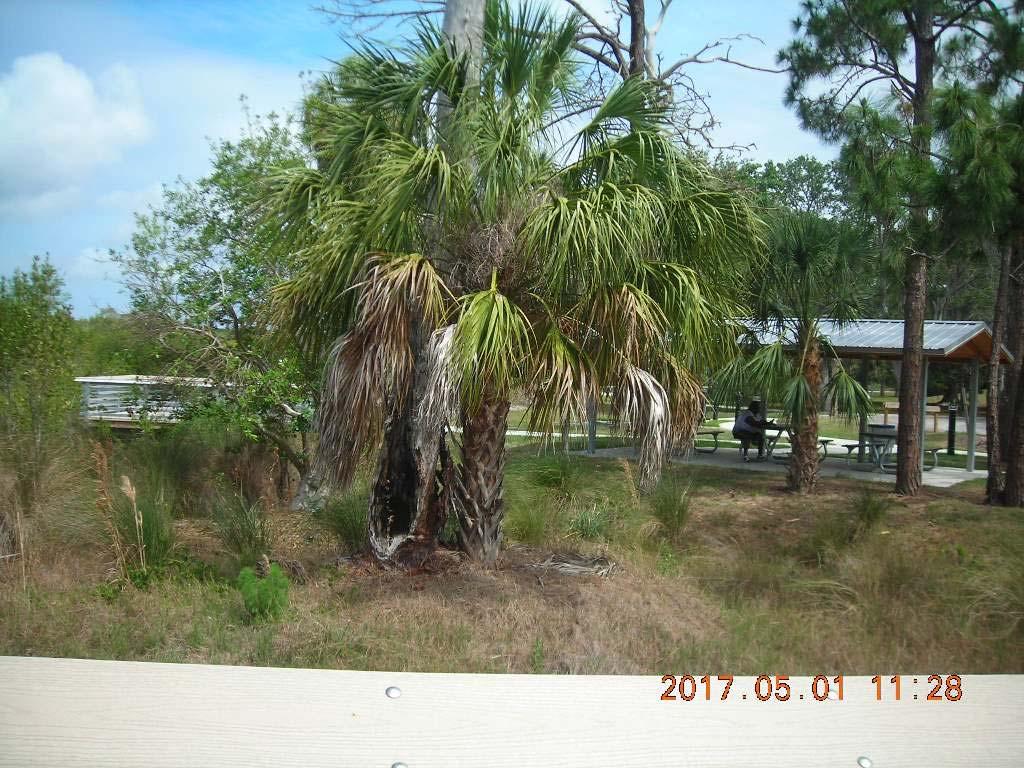
2 Today is our first visit to the newer south portion of the Preserve and we have no idea what to expect. This south side includes bathrooms, a parking area, a roundabout, a picnic table shelter (all in area #3 on map) and a kayak/canoe launch (#4 on map) (within carrying distance from the roundabout). At the head of the trail we meet a woman peacefully reading her summer novel and eating lunch under the shade of the new picnic shelter. She has come by car to just enjoy her surrounds.
3

. No concrete here.")
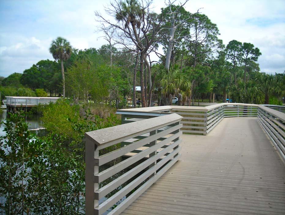
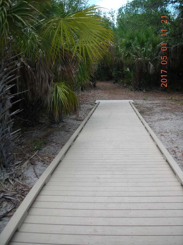
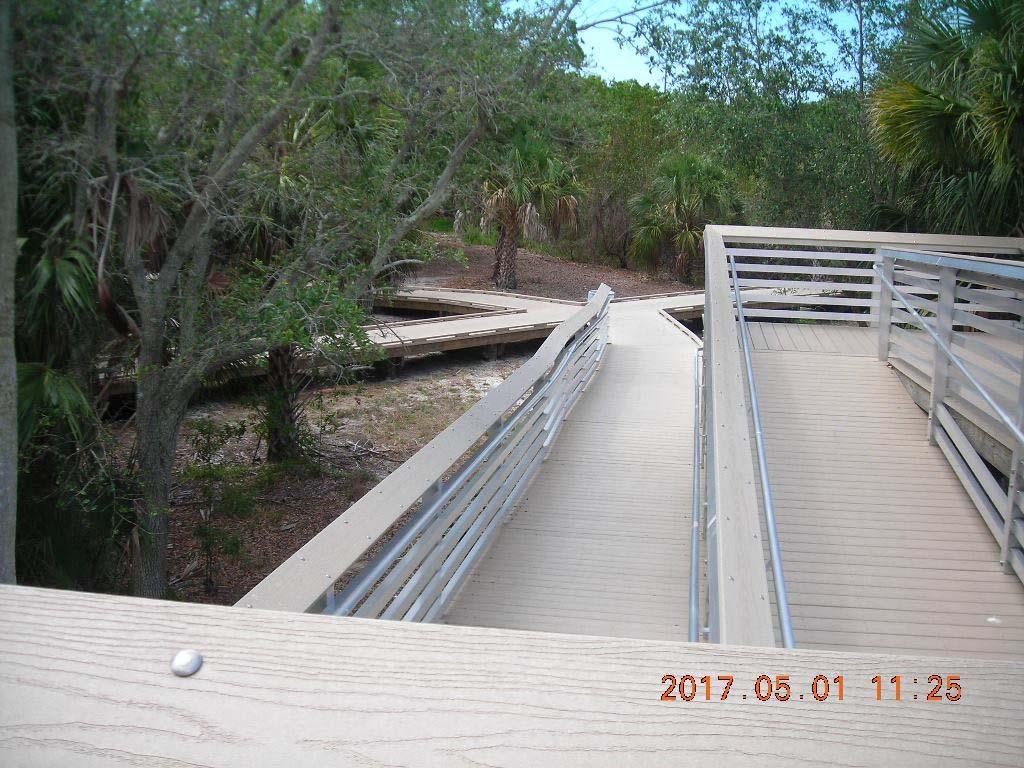
4 This south portion of the Preserve has been left almost entirely as a natural coastal habitat. Egrets, ibis, osprey and owls greet walkers and bicyclists. Unlike the cement trails on the north side, the trails here are wood and end in natural pine needle underbrush or at picturesque bridges over the marsh/bayou water areas (#5 on map). No concrete here. I would guess 98 percent of the trails are handicap accessible, staying on either the concrete paths in the northern section or the wood trails in this newer section.

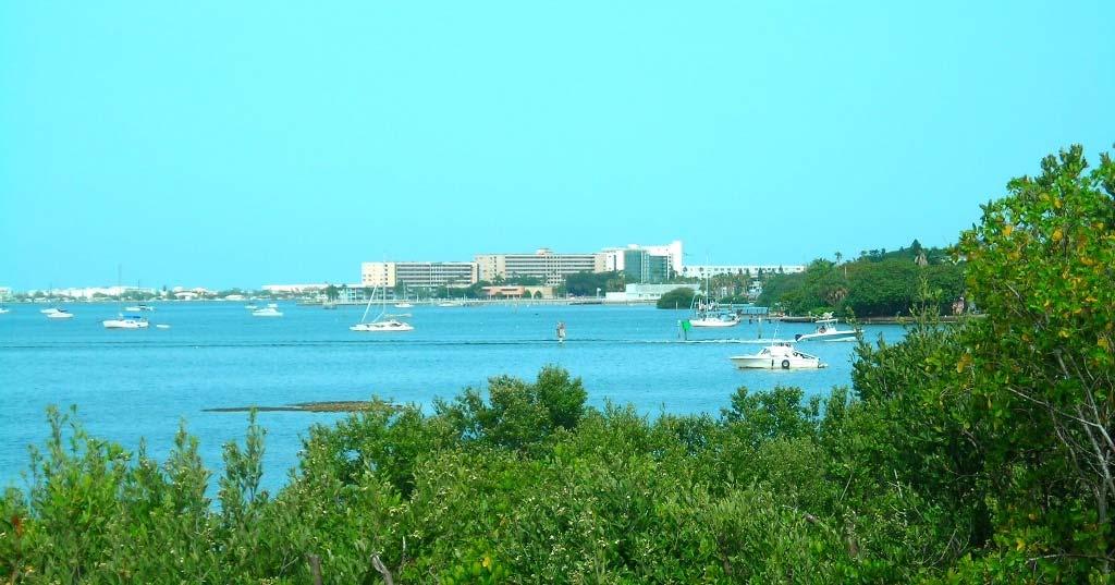
5 The trails continue expanding southward along the bayou, allowing many different directions to explore. One direction leads to an elevated switchback trail (#6 on map) with an observation deck. From atop that deck, a beautiful overview of Boca Ciega Bay awaits you. Today when we reach the top lookout, one gentleman in a dress suit and tie has already taken his place ahead of us on the bench. He is deep in paperwork and thought and so we take our photos and leave quietly.

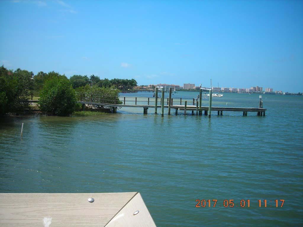
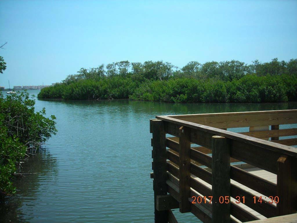
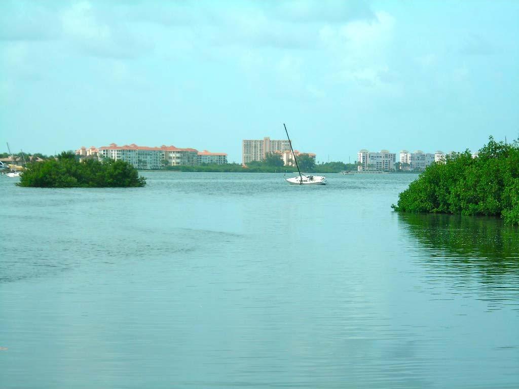
6 Today we meet only walkers, of both speed and leisurely varieties. We are the only ones on bicycles. We talk to a "regular." She's here for her daily jog through the Preserve and told us she has made fast friends with the maintenance man and looks forward to his greeting as she enters the parking lot. Another couple we meet is a grandfather with his young granddaughter exploring together. We ride to the southern-most trail where a very big surprise awaits us. The trail literally ends out over Boca Ciega Bay (#7 on map)! We were not expecting anything so grand.


7 Can't ride any further, but still there is something interesting to see. Looking straight down into the Bay at the end of that bridge, you will see several man-made oyster domes (off area #7 on map). They look like cement donuts. Most likely these were handmade and placed here by Tampa Bay Watch, a non-profit organization that performs a variety of habitat restoration and estuary protection activities throughout Tampa Bay.

8 The area is officially named the "Ecosystem Restoration and Stormwater Treatment Projects for the Clam Bayou Nature Preserve." Since the 1940s, dredging and filling and stormwater runoff have degraded the bayou. In an effort to improve it, habitat restoration and stormwater treatment projects were built by the Surface Water Improvement and Management (SWIM) Program of the Southwest Florida Water Management District in partnership with the Cities of St. Petersburg and Gulfport and the Florida Department of Environmental Protection. The projects were done through the cooperation and funds of over 21 local, state, and federal agencies as well as various environmental and civic groups and over 500 volunteers. Clam Bayou Trail connects to the Pinellas Trail in Childs Park, and runs through Clam Bayou and along 37th St. South to the Bayway, where you can connect with the Pinellas Bayway bike routes to Fort De Soto, the beaches, or the Sunshine Skyway Bridge.
9
10

11

12
13
14

15
16
Appendix E. Inventory of Pinellas County Blueways Launch Sites. Recreation, Open Space & Culture Element E-1
 Appendix E Inventory of Pinellas County Blueways Launch Sites Recreation, Open Space & Culture Element E-1 1 2 3 4 5 6 7 8 APPENDI E John Chestnut Park 2200 East Lake Rd., Palm Harbor Al Anderson Park
Pinellas County Environmental Lands
 Pinellas County Environmental Lands In addition to traditional parks and recreation facilities, Pinellas County owns and manages a system of environmental lands that provides specialized resource-based
Webber Park Master Plan Charrette Summary
 SMALL GROUP #1 - September 29, 2011 Webber Park Master Plan Charrette Summary More trash cans, especially near picnic grounds A year round pool is very needed-physical & mental health are significantly
Port Gamble Shoreline Area Conceptual Trail Proposal
 The North Kitsap Trails Association is pleased to be a partner to the Kitsap Forest and Bay Project and assist Kitsap County, Forterra, Olympic Property Group, Great Peninsula Conservancy and the Port
Langton Lake Park Implementation Planning Session One 6 June Attendees signed in
 27 Attendees signed in Meeting summary Following an overview of the Parks and Recreation Renewal Program and the key directions of the Parks and Recreation System Master Plan, meeting participants were
There are lots of things to see here. It might be bright or hurt my eyes in places where I see this. I can wear sunglasses or cover my eyes.
 There are lots of things to see here. It might be bright or hurt my eyes in places where I see this. I can wear sunglasses or cover my eyes. There are lots of things to hear here. It might be loud in places
Acquisition in fee simple of approximately one-half acre of property on the shore of Spring Lake to expand the Lakeside Beach Park.
 Lakeside Beach TF00-136 $122,550.00 in fee simple of approximately one-half acre of property on the shore of Spring Lake to exp the Lakeside Beach. 2000 River Ravines TF00-150 $910,000.00 in fee simple
Schoolcraft Township is located in northeast Houghton County. A portion of the township borders Keweenaw County and Lake Superior.
 COMMUNITY DESCRIPTION Schoolcraft Township is located in northeast Houghton County. A portion of the township borders Keweenaw County and Lake Superior. The township is largely rural but has one main population
Toll Rates for Florida Turnpike System and Florida Department of Transportation (FDOT) Toll Facilities. West Central Florida
 Toll Facilities. West Central Florida") Toll Rates for Florida Turnpike System and Florida Department of Transportation (FDOT) Toll Facilities West Central Florida Effective: October 29, 20 Veterans (SR 589) Hillsborough County Veterans SunPass
Toll Rates for Florida Turnpike System and Florida Department of Transportation (FDOT) Toll Facilities West Central Florida Effective: October 29, 20 Veterans (SR 589) Hillsborough County Veterans SunPass
APPENDIX D: Open Water Strata and Land Site Locations and Descriptions
 APPENDIX D: Open Water Strata and Land Site Locations and Descriptions Open Water Strata: Marine Waters W1 St. Joseph Sound W3 Clearwater Harbor south W5 Long Bayou/Cross Bayou W7 Boca Ciega Bay central
Walking Tips. Locations. Good luck on your journey to better health! Earleigh Heights Ranger Station
 Walking Tips Dress in Layers The weather and even your own body temperature can fluctuate as you walk or hike. Layering allows you to comfortably add or remove clothing as needed during your activity.
BRYAN REGIONAL PARK. Presented by: Burditt Consultants November 13, 2018
 BRYAN REGIONAL PARK Presented by: Burditt Consultants November 13, 2018 AGENDA 1. Project Purpose & Mission 2. Project Vision & Goals 3. Stakeholder Feedback 4. Program Overview 5. Phase A Plan Overview
Guide to Your Adventure Walk
 Guide to Your Adventure Walk 7 Are you ready to search for some Michigan plants and animals? Grab your backpack, or borrow one from the garden store, and let s get started! On this hike you will see many
Guide to Pinellas County. Blueways. Prepared by THE PINELLAS COUNTY PLANNING DEPARTMENT December, 2006
 Guide to Pinellas County Blueways Prepared by THE PINELLAS COUNTY PLANNING DEPARTMENT December, 2006 P inellas County has miles of beautiful shoreline, providing paddlers with a variety of opportunities
BEAVER LAKE ACCESS AREA SUMMARY 2017 Edition
 BEAVER LAKE ACCESS AREA SUMMARY 2017 Edition DEVELOPED BY THE BEAVER LAKE PROPERTY and SAFETY COMMITTEE 2 October 2017 1 NOTICE: This document supersedes and nullifies all previous versions of Beaver Lake
Access & Parking. Emerson Park Master Plan Summary of Public Input through June 2014
 Emerson Park Master Plan Summary of Public Input through June 2014 A second public participation meeting was held at the Emerson Pavilion on Wednesday, June 11, 2014. Staff from the Cayuga County Department
THE PINELLAS COUNTY PLANNING DEPARTMENT
 Guide to Pinellas County Blueways Prepared by THE PINELLAS COUNTY PLANNING DEPARTMENT December, 2006 Revised April, 2010 P inellas County has miles of beautiful shoreline, providing paddlers with a variety
Conservation Lands. Conservation Lands Advisory Committee October 19, 2005
 Conservation Lands Advisory Committee October 19, 2005 Roland DeBlois Chief of Environmental Planning & Code Enforcement Community Development Department Beth Powell Conservation Lands Manager Parks Division
2. Goals and Policies. The following are the adopted Parks and Trails Goals for Stillwater Township:
 D. PARKS AND TRAILS 1. Introduction Stillwater Township s population is relatively low, with most residents living on rural residences on large lots. The need for active park space has been minimal in
TRUCKEE TAHOE AIRPORT DISTRICT BOARD OF DIRECTOR STAFF REPORT
 AGENDA ITEM: 11 TRUCKEE TAHOE AIRPORT DISTRICT BOARD OF DIRECTOR STAFF REPORT AGENDA TITLE: MEETING DATE: January 24, 2018 PREPARED BY: NTPUD Agency Partnership Opportunity, Multi-Use Trailhead Access
Welcome to Marco Island
 Marco Island is located in Southwest Florida, on the Gulf of Mexico, 178 miles south of Tampa,16 miles south of Naples, and 104 miles due west of Miami. Marco is the northern most and largest of the famous
Citrus Heights Creek Corridor Trail Project Trail Advisory Group Field Trip #2 September 11, :00 11:00 am Trellis Hall, Citrus Heights
 September 11, 2013 9:00 11:00 am Trellis Hall, Citrus Heights Project Overview The City of Citrus Heights is studying the feasibility of establishing a multi use trail system within the City s 26 miles
Southwest Quadrant Distinctive Features
 SOUTHWEST QUADRANT Southwest Quadrant Distinctive Features LAND USE The 31.17 square mile Southwest Quadrant includes all the area within the planning area west of I-5 and south of the Sacramento River.
Welcome to the future of Terwillegar Park a Unique Natural Park
 Welcome to the future of Terwillegar Park a Unique Natural Park 1 Introduction The Terwillegar Park Concept Plan study will develop an overall concept plan, management objectives and development guidelines
Public Comment. Comment To consider extending State Park lands above River Mile 7.0
 Public To consider extending Park lands above River Mile 7.0 on the Little Spokane River for the conservation and limited recreation qualities they contain is this request. Could this be included in your
Clam Harbour Provincial Park
 Clam Harbour Provincial Park Public Engagement Session Thursday, September 14 th, 2017 5:30pm 7:30pm Webbers Store 11470 Nova Scotia Trunk 7 Lake Charlotte, NS Agenda Overview of the Provincial Parks System
INFILL HARD CORNER & REDEVELOPMENT OPPORTUNITY 731 PROBANDT and 134 & 138 KING ROGER ST
 INFILL HARD CORNER & REDEVELOPMENT OPPORTUNITY 731 PROBANDT and 134 & 138 KING ROGER ST First American Commercial Property Group 18618 Tuscany Stone, Ste. 210, San Antonio, TX 78258 Ph: 210.496.7775 Fx:
Rating: 5.0 (scale of 1-10)
") 95 Community Trail System Groundcover: 2-metre paved path, 1- metre grass buffer on either side. Location: Fort St. John Ownership: City of Fort St. John Rating: 5.0 (scale of 1-10) Strategic value: Linear
95 Community Trail System Groundcover: 2-metre paved path, 1- metre grass buffer on either side. Location: Fort St. John Ownership: City of Fort St. John Rating: 5.0 (scale of 1-10) Strategic value: Linear
San Luis Obispo. Bishop Peak Felsman Loop Eagle Rock Maino Open Space Poly Canyon Poly P Other Areas
 San Luis Obispo Bishop Peak Felsman Loop Eagle Rock Maino Open Space Poly Canyon Poly P Other Areas 1 JCT. ELEV. 72 400 00 0 FELSMAN LOOP GATE LOOP RIDGE 600 FENCE JCT. ELEV. 860 1000 1200 BISHOP PEAK
Public Works Department. Fiscal Year 2019 Projects
 Public Works Department Fiscal Year 2019 Projects Palm Avenue Drainage Improvements Description: Neighborhood drainage improvement and flood abatement Phase: Currently in design (began FY18) Schedule:
4MRV Parks Master Plan: Site Analysis
 4MRV Parks Master Plan: Site Analysis Lardner/Klein Landscape Architects in association with: RK&K Grimm + Parker Kittelson & Associates Partners for Economic Solutions RIB U.S.Cost Civil Engineering Architecture
2009 Summary Report for: Courtney Campbell
 Page 1 of 7 2009 Summary Report for: Courtney Campbell Contact Information Full Name: Lori Snively Address: 11201 N. McKinley Drive, MS 7-500 City: Tampa State: FL Zip: 33612 Phone: 813-975-6405 Fax: 813-975-6443
Natural and Cultural Resources
 Natural and Cultural Resources The Denham Strong Natural and Cultural Resources Team is composed of City staff and community volunteers who are working together to protect and expand on our natural resources,
Concert Tent Anderson Building Entry
 Anderson Park Renovation Concept #1 Concert Tent Anderson Park Renovation Concept #2 Concert Tent Anderson Park Renovation Concept #3 Concert Tent Anderson Park Renovation Concept Tally Renovation Concept
Capital Prioritization
 14 Capital Prioritization 279 279 280 Park & Recreation CAPITAL PRIORITIZATION As described in Chapter 8, the recommendations presented in Chapter 9 are prioritized to provide a guide for future capital
Corabelle Park. Inventory. Future Development
 Corabelle Park Size: Approximately 4 acres Site Description: Corabelle Park is a relatively new park within the Murray County Park System. It is located on the south side of Corabelle Lake just off gravel
Queen Elizabeth II Diamond Jubilee Herne Bay Coastal Park Action Plan. Kings Hill slopes, Beacon Hill, The Downs, Bishopstone Glen and Reculver
 Appendix 3 Queen Elizabeth II Diamond Jubilee Coastal Park Action Plan Kings Hill slopes, Beacon Hill, The, Bishopstone Glen and Reculver This area moves from the commercial centre of the Coastal Park
City of Haslett. City of East Lansing. City of East Lansing
 Central Park North (Nancy L. Moore Park) Lake Park North Expansion White Park Expansion #2 White Park Expansion #1 County East East Haslett East East TF87-212 Acquisition $90,000.00 Park. TF08-138 Acquisition
Hemisfair Civic Park. Vision and Program Plan
 Hemisfair Civic Park Vision and Program Plan OCTOBER 2013 Hemisfair Civic Park Vision and Program Plan Prepared under the direction of the Hemisfair Park Area Redevelopment Corporation. Planning assistance
Appendix 3. Greenway Design Standards. The Whitemarsh Township Greenway Plan
 Appendix 3 Greenway Design Standards This chapter discusses two design standards for the greenway types discussed above. First, trail design standards are presented together with trailhead facilities and
North Shore Lacamas Lake
 North Shore Lacamas Lake January 27, 2017 A Vision for Conservation and Recreation Acknowledgements Funding Funding for this planning effort was provided by the City of Camas and the Columbia Land rust
A Vision for South Skunk River and Chichaqua Bottoms Greenbelt
 A Vision for South Skunk River and Chichaqua Bottoms Greenbelt Photo: Jim Pease Chichaqua Bottoms Booklet 7 of 8 Greater Des Moines Water Trails and Greenways 1 2016 Table of Contents Booklet 1: Water
17 Mathilda Welmering Park Planning Zone 3
 17 Mathilda Welmering Park Planning Zone 3 8301 Mathilda Visit Date: September 2016 St. Louis County Parks Master Plan Page 1 Description: The six acre Mathilda Welmering Park is named for two streets
Physical Activity Resource Assessment (PARA) Form Protocol and Operational Definitions
 Form Protocol and Operational Definitions") Physical Activity Resource Assessment (PARA) Form Protocol and Operational Definitions Protocol General Directions At an indoor facility, stop at the reception area and introduce yourself to desk staff
Physical Activity Resource Assessment (PARA) Form Protocol and Operational Definitions Protocol General Directions At an indoor facility, stop at the reception area and introduce yourself to desk staff
CHALET DALMORE. OVERVIEW Sleeps up to 10 guests 535 sq. m living area 3 levels Fully Staffed
 OVERVIEW Sleeps up to 10 guests 535 sq. m living area 3 levels Fully Staffed CHALET DALMORE This luxurious alpine chalet in Chamonix sleeps up to ten guests in five stunning bedrooms, all with en-suite
Arrival and Check In
 Dear Cub Scout Leaders and Parents, First, we would like to thank you for all you do in Scouting, volunteering, and bringing your Scouts to summer camp. We hope you find that each year, your Pack can come
Existing Facilities. Current and Forecast Demand
 Existing Facilities Albert Whitted Airport is owned and operated by the City of St. Petersburg ( City ). The airport property encompasses approximately 119 acres. The airport is served by two intersecting
PARKS & BEACHES PROJECTS
 #18 72ND STREET PARK, LIBRARY, #19 BLUEWAYS & AQUATIC CENTER $1.1 MILLION $60 MILLION New facility to include: Create Kayak Launches with All Wheels Skate Park Floating Docks and Seating at: Library/Media
Galveston Bay Estuary Program. Carla G. Guthrie, Ph.D. Galveston Bay Council Member Texas Water Development Board
 Galveston Bay Estuary Program Carla G. Guthrie, Ph.D. Galveston Bay Council Member Texas Water Development Board The statements contained in this presentation are my current views and opinions and are
LANDING S PARK CONCEPTUAL PLAN HAMILTON ANDERSON JANUARY City of Novi, Michigan. The Park at 13 Mile and Old Novi Road
 HAMILTON ANDERSON JANUARY 2012 LANDING S PARK CONCEPTUAL PLAN January 2012 Page 1 of 15 January 2012 PROJECT GOALS Activate the park by introducing new elements Provide clear access to the water and enhance
RIVER ACCESS STRATEGY
 RIVER ACCESS STRATEGY The River Access Strategy is a 10-year plan the City of Edmonton is developing to inform future programming, operations and infrastructure improvements that support access to the
Welcome to GERBER TABLES. Your campground and rv park essentials company. Meeting the needs of the leisure industry since 1969
 Welcome to GERBER TABLES Your campground and rv park essentials company Meeting the needs of the leisure industry since 1969 Why professionals in the industry choose GERBER picnic tables One-piece welded
This Passport: Revised October 20, 2017, EAM # Discovering the Trails of Webster, NY
 This Passport: Revised October 20, 2017, EAM #161923 Discovering the Trails of Webster, NY The Town of Webster invites you to explore and experience our diverse outdoor adventures! Here s your opportunity
Classifications, Inventory and Level of Service
 Classifications, Inventory and Level of Service Section 3 Kenmore Park, Recreation and Open Space Plan 1 P a g e Classifications and Inventory Park Classifications Kenmore classifies its parks based upon
2019 DAY HIKE AT IRON MOUNTAIN SATURDAY, JANUARY 19
 WHERE? In Google Maps, paste the following coordinates for Iron Mountain: 32.978215,-116.972593 or CLICK ON THIS LINK. I. Purpose of the Day Hike A. THE WBC Day Hike is a relatively short trail hike to
NORTH OF BROADWAY SECTION CONTENTS: COTTAGE PARK FARVIEW PARK GLEN GALE PARK IRVING TRIANGLE JORDAN PARK NEWTON PARK PERKINS HILL PARK
 NORTH OF BROADWAY SECTION CONTENTS: COTTAGE PARK FARVIEW PARK GLEN GALE PARK IRVING TRIANGLE JORDAN PARK NEWTON PARK PERKINS HILL PARK N ILIO NA VE N JAM ES AV E PLAYGROUND PAR K PRO PER TY B OUN DAR Y
Cottonwood Creek Beach Rules and Regulations:
 Cottonwood Creek Beach Rules and Regulations: General Facility Rules PLAY AT YOUR OWN RISK; NO DRUGS, ALCHOHOL, TOBACCO, PROFANITY, FIGHTING, SHIRTLESS PLAY, OR GLASS CONTAINERS. EVERYONE WHO ENTERS THE
St. Pete Beach enews. The Official Electronic Newsletter of St. Pete Beach. April 13, 2017
 St. Pete Beach enews The Official Electronic Newsletter of St. Pete Beach April 13, 2017 POOL INFORMATION Water temp. always 82! POOL HOURS January 1st May 15th ADULT LAP SWIM Mon-Fri: 7a-11a Mon-Fri:
Stephens State Park Trails
 TRAILS OF ALLAMUCHY MOUNTAIN & STEPHENS STATE PARKS Allamuchy Mountain and Stephens State Parks contain 28 marked trails providing access to diverse landscapes for walking, hiking, biking, bird-watching,
Fun Facts. How many Baseball fields do we have? a. 2 b. 14 c. 16 d. 21
 It Starts in Parks Fun Facts How many Baseball fields do we have? a. 2 b. 14 c. 16 d. 21 Fun Facts How many people visit Central Winds Park Annually? a. Over 100,000 b. 20,000 c. 10,000 d. 1,000 It Starts
Metro Gold Line Eastside Extension Review Advisory Committee October 9, 2008
 Review Advisory Committee October 9, 2008 6 Mile Alignment 1.7 Miles of Tunnel 8 Stations (6 At-grade & 2 Underground) Park & Ride Facility Direct Connection to the Pasadena Metro $898.8 million On-Time/Within
2017 TBARTA Future Regional Priority Projects Adopted by TBARTA Board, December 9, 2016
 2017 TBARTA Future Regional Priority Projects Adopted by TBARTA Board, December 9, 2016 Project numbers do not signify ranking they are for mapping identification purposes only. 1. 15th Street East The
Pinellas Tourist Development Council
 Network USA 2013 Air Service Development Conference St. Pete Pride Parade National Tourism Week Tony Jannus Aviation Summit - 2013 Tampa International Airport Volunteer Ambassadors Air Service Development
Shining STARS. City of Ormond Beach. City Commission Members. Mayor Bill Partington. Zone 1 Dwight Selby. Zone 2 Troy Kent
 PAGE 1 City of Ormond Beach City Commission Members Mayor Bill Partington Zone 1 Dwight Selby Zone 2 Troy Kent Zone 3 Rick Boehm Zone 4 Rob Littleton City Attorney Randy Hayes City Manager Joyce Shanahan
PASSPORT. Discovering the Trails of Webster, NY
 PASSPORT to family wellness Discovering the Trails of Webster, NY Join the Friends of Webster Trails, Webster Health and Education Network, The Town of Webster and Wegmans to get moving more and enjoy
Do you have a nonskid mat or no-slip strips in the bathtub? A shower or tub seat with a strap may be of help.
 SafetyTips Tipsfor forchildren Children Safety who use Mobility Devices These tips can help you keep your child safe and add to general safety advice for your child s stage of development. Use this guide
CLIPPER COVE PROMENADE & MARINA DEVELOPMENT
 CLIPPER COVE PROMENADE & MARINA DEVELOPMENT Treasure Island / Yerba Buena Island Citizen Advisory Board Review May 05 2015 CLIPPER COVE PROMENADE & MARINA DEVELOPMENT TREASURE ISLAND TI YBI CAB Review
Bike Routes of Sault Ste Marie 2017
 Bike Routes of Sault Ste Marie 2017 East Portage - Riverside - Nicolet - Scenic (15-20 miles, mostly flat) Proceed east on Portage Ave. Portage Ave becomes Riverside Drive at Mission Rd. Portage is a wide
The Narrows Waterfront Park A Crown Jewel for Southern Brooklyn
 The Narrows Waterfront Park A Crown Jewel for Southern Brooklyn In New York, the unquestioned popularity of urban spaces such as Riverside Park, the High Line, Brooklyn Bridge Park and others has demonstrated
Villages at Buffalo Run East
 Villages at Buffalo Run East Neighborhood Park Subhead to title page goes here. Public Design Meeting April 9, 2015 Capital Improvement Program Commerce City s $137 million CIP is the result of a 2013
FINAL TESTIMONY 1 COMMITTEE ON RESOURCES UNITED STATES HOUSE OF REPRESENTATIVES. July 13, 2005 CONCERNING. Motorized Recreational Use of Federal Lands
 FINAL TESTIMONY 1 STATEMENT OF DALE BOSWORTH CHIEF Of the FOREST SERVICE UNITED STATES DEPARTMENT OF AGRICULTURE Before the SUBCOMMITTEE ON FORESTS AND FOREST HEALTH And the SUBCOMMITTEE ON NATIONAL PARKS,
Asheville & WNC Hikes
 Asheville & WNC Hikes Amazingly, we have 3,000+ miles of free public hiking trails near Asheville, including 1,600 miles in the Pisgah and Nantahala National Forests, 850 miles in Great Smokey Mountains
Summary of Small Group Discussion Notes
 THE CORPORATION OF THE CITY OF WINDSOR Parks and Facilities/ Windsor Essex Local Immigration Partnership Community Consultation: Parks for Today-Planning for Tomorrow Dec 9, 2014 Windsor Public Library
Welcome. to Osprey Waters. The Mirvac Difference
 The Mirvac Difference For 45 years we have been reimagining urban life in Australia creating exceptional living experiences through the pursuit of quality and care in every little detail. You can benefit
In partnership with The Flight Academy ALASKA ADVENTURE
 C I R R U S L I F E A D V E N T U R E S E R I ES A U G U ST 1 1 1 6, 2 0 1 6 In partnership with The Flight Academy ALASKA ADVENTURE TRIP ITINERARY DAY 1: SEATTLE, WA 1400 Arrive at Boeing Field (KBFI),
NORTHWEST SECTION CONTENTS: CLEVELAND PARK FOLWELL PARK RYAN LAKE PARK VICTORY PRAIRIE DOG PARK VICTORY PARK
 NORTHWEST SECTION CONTENTS: CLEVELAND PARK FOLWELL PARK RYAN LAKE PARK VICTORY PRAIRIE DOG PARK VICTORY PARK LUCY LANEY COMMUNITY SCHOOL N 33RD AVE N 33RD AVE SINGLE-FAMILY RESIDENTIAL MULTI-USE DIAMOND
CITY OF MANVEL Parks & Recreation Master Plan Community Meeting Summary
 CITY OF MANVEL Parks & Recreation Master Plan Community Meeting Summary The City of Manvel hosted a Community Meeting on June 23, 2016 at the Church of the Harvest. Over 25 community members attended and
TBARTA: 2015 Master Plan and Tampa Bay Express Project
 TBARTA: 2015 Master Plan and Tampa Bay Express Project The Real Story Who: Tampa Bay Area Regional Transportation Authority What: Develop and implement a Regional Transportation Master Plan for the seven-county
Exclusive Riverfront Guest Lodge
 Exclusive Riverfront Guest Lodge On The Little Salmon River Kayla Adams Real Estate Professional Cell: 208-891-4669 Jaclyn Truppi Real Estate Professional Office: 208-628-4222 SalmonRiverProperties.com
= Stops. = Restrooms
 = Stops = Restrooms Restrooms are located near the Lake Elkhorn pavilion Safety Tips 1.Be courteous. 2.Travel at a safe speed. 3.Use your bell or announce: passing on your left. 4.Remember there are people
Quality Inn Conference Center at Citrus Hills 350 E. Norvell Bryant Highway Hernando, FL, US, Phone: (352) Fax: (352)
 Fax: (352)") Introduction: The Hernando, FL Quality Inn Conference Center at Citrus Hills hotel is in the heart of Citrus County, minutes from: Homosassa Springs State Park Crystal River Florida's Gulf Coast Cross
Introduction: The Hernando, FL Quality Inn Conference Center at Citrus Hills hotel is in the heart of Citrus County, minutes from: Homosassa Springs State Park Crystal River Florida's Gulf Coast Cross
Westshore Development Forum April 9, 2014
 Florida Department of TRANSPORTATION Westshore Development Forum April 9, 2014 District Seven Secretary Paul Steinman Agenda D7 Overview Current Projects Future Projects Vision Florida Department of TRANSPORTATION
Bell s Travel Guides
 Bell s Travel Guides Top of the World Highway Road Log Mile by Mile Description of the Top of the World Highway so you always know what lies ahead. Dawson City, Yukon to Tetlin Junction on the Alaska Highway
City of Durango 5.8 FUNDING TRAILS DEVELOPMENT
 5.8 FUNDING TRAILS DEVELOPMENT The City has been successful in establishing dedicated local funding sources as well as applying for grants to develop the City s trail system, having received nearly $2.4
2016 PARKS UPDATE YOUR PARKS!
 2016 PARKS UPDATE YOUR PARKS! #ThatsMy PARK DEAR PARK SUPPORTER, Our state parks and beaches are healing places of beauty, solace and renewal. They provide opportunites for exercise, recreation and learning.
GOOSENECK SWAMP INFORMATION DAY - Saturday 14 th December 2013
 GOOSENECK SWAMP INFORMATION DAY - Saturday 14 th December 2013 Progress of a restoration trial at Gooseneck Swamp - Grampians National Park, Victoria Gooseneck Swamp is situated at the far south-eastern
COCONUT GROVE WATERFRONT MASTER PLAN. ERA / Curtis Rogers / ConsulTech / Paul George Ph.D.
 COCONUT GROVE WATERFRONT MASTER PLAN ERA / Curtis Rogers / ConsulTech / Paul George Ph.D. Agenda City's Vision & Community Input Framework Concepts December 2006 Schemes Draft Final Plan Waterfront Open
Providence Rowing Camp at Brown University
 RESIDENTIAL CAMPER CHECK-IN/OUT (Time & Location) Time Date Location Monday 1:00 2:00 pm August 13 (Monday) Hunter S. Marston Boathouse Friday Check out no earlier than 12:00 pm on Friday (Campers will
WALKING IBIZA & YOGA RETREAT
 WALKING IBIZA & YOGA RETREAT 28. MARCH - 4. APRIL 2015 SPECIAL OFFER PRICE FROM 1845 WITH TOBY CLARKE & NICOLE GIBBARD Enjoy Ibiza, the undiscovered walkers paradise! WALK. A UNIQUE SENSE. EXPERIENCE.
AUTUMN 2016 WILLIAMS LANDING NEWS
 AUTUMN 2016 WILLIAMS LANDING NEWS EDITOR S NOTE FEATURE The latest edition of Williams Landing news has landed. We re very pleased to announce that in partnership with Future Kids, a new childcare centre
JULY 2018 SFBWMAG.COM $7.95. MIA s New Leader Tells What s Ahead
 JULY 2018 SFBWMAG.COM $7.95 MIA s New Leader Tells What s Ahead Lester Sola charts the flight path for MIA By Kevin Gale Portrait Photography by Patrick Clinton ester Sola might be dubbed the Mr. Fix-it
Bayshore Boulevard: A Brief Look at its Historic Past
 Sunland Tribune Volume 20 Article 8 1994 Bayshore Boulevard: A Brief Look at its Historic Past Charles A. Brown Follow this and additional works at: http://scholarcommons.usf.edu/sunlandtribune Recommended
Suncoast Treasured Times
 Suncoast Treasured Times Suncoast Research & Recovery Club Newsletter Website: www.srarc.com Volume: 26 Issue: 5 Date: May, 2016 Meeting Date: May 23, 2016 Hayes and Susan Kennedy It is with great sadness
GIFFORD PINCHOT NATIONAL FOREST
 GIFFORD PINCHOT NATIONAL FOREST 9341 Wright Meadow 93 Spencer Meadow Spencer Butte 4247' 30 30A 19 24 80 31C Lewis River Lower Falls 5 Quartz Creek 90 Taidnapam Falls Upper Falls 31 Spencer Peak 3861'
Suncoast Treasured Times
 Suncoast Treasured Times Suncoast Research & Recovery Club Newsletter Website: www.srarc.com Volume: 27 Issue: 3 Date: March, 2017 Tom s Tips Meeting Well I guess our recent cold snap proved once and for
how it started where we are now what is coming up NEW WESTMINSTER WATERFRONT PARK THE RIVER THE PAST THE PEOPLE
 how it started Downtown Waterfront Park How It Started March 2009 City of New Westminster Purchases 3.2 Hectare Westminster Pier Site March 2009 City of New Westminster and Design Team develop plan for
City of Galion Park Satisfaction Survey Results
 City of Galion Park Satisfaction Survey Results Dec. 5, 2016 Goal: To get feedback from the community on: 1. General satisfaction of city-owned parks 2. How to improve park facilities and recreation opportunities
Merritts Traverse. 1928m
 Merritts Traverse 3 hrs Hard track 5.8 km Circuit 4 167m This walk starts with a scenic journey to the top of the hill on the chairlift. Starting along Merritts Nature walk, this walk soon detours down
Courtney Campbell Scenic Highway Corridor Advisory Committee (CAC) MINUTES
 MINUTES") Courtney Campbell Scenic Highway Corridor Advisory Committee (CAC) MINUTES Regular Meeting at URS Corporation 7 th Floor Board Room 7650 West Courtney Campbell Causeway Tampa, FL June 15, 2012 10:00 a.m.
Courtney Campbell Scenic Highway Corridor Advisory Committee (CAC) MINUTES Regular Meeting at URS Corporation 7 th Floor Board Room 7650 West Courtney Campbell Causeway Tampa, FL June 15, 2012 10:00 a.m.
Summary of Recreation Sites Development Name:
 Development Name: Eau Pleine Site Number: 1 Owner: WVIC Eau Pleine Tailwater Boat Launch Lanes 1 Concrete plank landing, access to Eau Pleine tailwater & Lake DuBay. (45 planks long, 62.5') Picnic Tables