2012 Squaw Butte Trail Warriors
|
|
|
- Easter Leonard
- 5 years ago
- Views:
Transcription

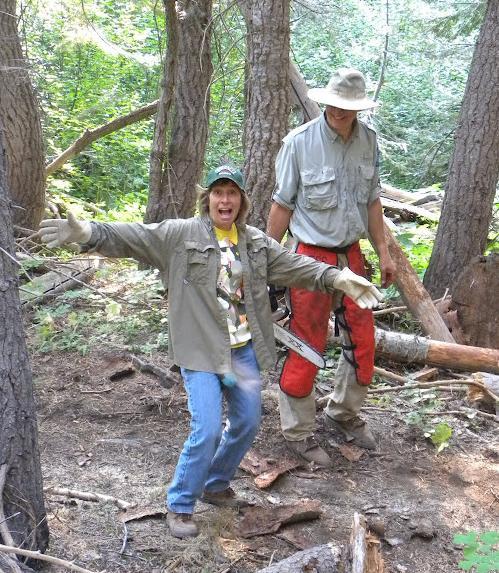
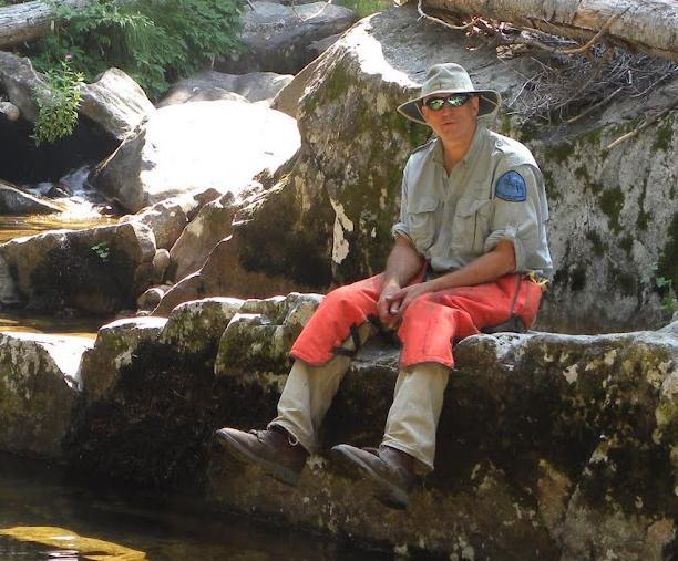
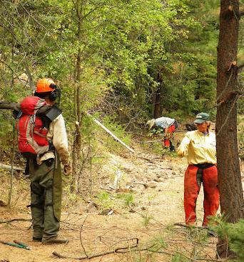
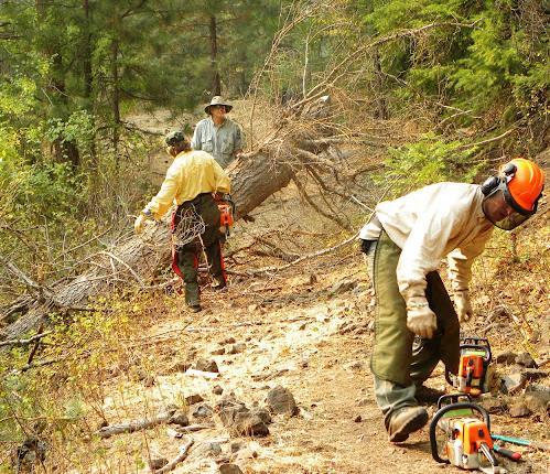
1 2012 Squaw Butte Trail Warriors Between June 1 st and September 30 th 2012 Squaw Butte supported nine trail maintenance projects. These projects covered a large section of south western Idaho, taking place in the Boise & Payette National Forests and the Frank Church Wilderness. They were in partnership with the Emmett and Weiser Ranger Districts and the Selway-Bitterroot Frank Church Foundation. The work covered a large spectrum of activities, from packing, to rock rolling, but mostly entailed the removal of a very large amount of blow down and pruning. We also did some major tread improvement removing a rotted log bed section through a bog and replaced it with a gravel trail bed.


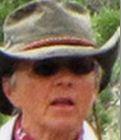


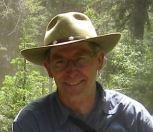
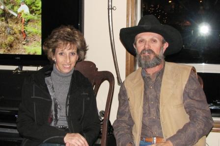
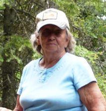
2 Squaw Butte Members who participated in work projects this summer. Janine Laurie Shannon LouAnn Lorraine Ellen Charles Chick Rob Robbin Jake Phil Bill Linda Devon Mildred

3 June 7, 2012 National Trails Day, Payette National Forest Boundary Trail tread project Laurie, Shannon, Janine & Rob 2012 National Trails day was a project coordinated with the Payette National Forest. The project was on Cuddy Mountain, west of Cambridge, ID. Boundary Creek Trail is a scenic trail that provides a gate way to a number of trails on Cuddy Mountain. A boggy area had a corduroy section that was in bad shape. The goal was to provide drainage and a rock and gravel trail bed.

4 June 23, 2012 Boise National Forest Summit Creek Trail project Phil, Robbin, Chick, Lorraine & Rob Summit Creek Trail was part of an effort to open the Bull Creek trail system in the Boise National forest. The Bull Creek Trail system has been closed for a number of years due to erosion damage.


5 July 1, 2012 Sand Creek Trail Boise National Forest Phil Sand Creek trail runs between a good horse trailer camping area and snowshoe Cabin trail head, where the upper end of Pistol Creek Canyon trail starts. Phil made sure the trail was open as we would be using it a number of time supporting the Selway-Bitterroot Foundation Trail crew the week after.


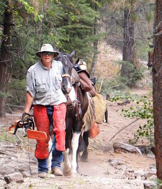
6 July 7, 2012 Frank Church Wilderness Pistol Creek Canyon Trail crew packing support. Phil, Robbin, Rob and Bill


7 We spent five days packing and cooking for the Selway-Bitterroot Foundation & Idaho Hikers Association Crew. We transported more than 800 pounds of equipment and food and provide meal for 16 people during the project.

8 July 14, 2012 Payette National Forest Boundary and East Pine Creek Trails Laurie, Shannon, Devon, Linda, Mildred, Rob & Bill East Pine Creek Trail head up the eastern slope of Cuddy Mountain following East Pine creek through a rocky canyon and as you gain altitude you ride through a series of meadows. The project was to prune, remove blow down and to place a trail sign at the intersection of two trails.


9 August 4, 2012 Frank Church Wilderness Marble Creek Packing Support Project Phil, Janine and Jake The work projects were on Pistol Creek and Marble Creek on the west side of the Middle Fork of the Salmon River. Both projects had volunteers from the Idaho Trail Association and Idaho Parks and Recreation along with the pack support and camp cooks from BCHI members from both the Squaw Butte and Treasure Valley chapters. Eric Melson of the SBFC (Selway Bitterroot Frank Church Foundation) was the project organizer for both projects.

10 August 4, 2012 Boise National Forest Wilson Corral & Gabe s Peak Trails Chick, Lorraine, Ellen, Charles, LouAnn, Laurie & Rob Big winds happen in Idaho, and in 2010 & 2011 we had a couple. Evidence of their effect was all over West Mountain. In the 12 years I have been riding there, I have never seen so many large trees down. Over the weekend of August 4&5 seven members of Squaw Butte open two trails that had been closed by this downfall, and had a great time doing it. Riding out of the Rammage Meadows camping area they spend Saturday on Wilson Corral trail and Sunday riding a loop of Wilson Corral Up and Gabe s Peak trail down.


11 August 81, 2012 Boise National Forest Squaw Creek Trail LouAnn, Laurie and Rob The signature trail on West Mountain, Squaw Creek Trail head up a canyon to the head waters of the creek in Wilson meadows. The trail is very scenic and also quite technical with cliff bands and some very rocky areas. Last year's microburst storms took a toll on a number of very big trees which all seemed to fall on the trail.
12

13 September 22, 2012 Payette National Forest West Brownlee Creek Janine, Laurie and Rob Our project at West Brownlee Creek was unique. It was a new area for Squaw Butte, south of Cuddy Mountain. We were working with a new seasonal, Ryan from the Weiser Ranger district, and the trail was down in a canyon from the trail head. Most of our rides you climb up most of the day while working, with a ride down the mountain at the end. Here you ride down a steep side canyon to the creek and the trail is more or less flat along the river. The trail is also unique. It is along an old wagon road and is wide and open. Mostly we removed Hawthorn trees that were blocking the way.
14

15 As this summary of the summer project shows, members worked hard this summer, made a difference, and had a great time doing it. If you didn t have a change to participate in a trail project this summer we hope you will join us next season. It will be some of the best weekends you have ever spent in the back country with your horses.
Back Country Horsemen of Idaho. Squaw Butte Chapter Emmett Idaho. Summary of Activities February Celebration Park Snake River Birds of Prey
 Back Country Horsemen of Idaho Squaw Butte Chapter Emmett Idaho Summary of Activities 2016 Fun Rides & Membership Recruitment February Celebration Park Snake River Birds of Prey March Diamond Basin Silver
part in a five day Back Country Skills clinic for Forest Service Personnel. This clinic was held at the Nampa Horse Center and was a huge success gett
 The year 2007 was very busy for the Squaw Butte chapter of the Backcountry Horsemen of Idaho. The chapter had two major goals for the year. One goal was to increase our outreach efforts to the public and
Trail Beginning Elevation: 7553 ft The Poison Creek Trailhead is located at the end of National Forest Road 646E (NF-646E).
.") West Mountain Trails Poison Creek Trail #134 Length: 2.9 miles (4.7 km) Difficulty Horseback: A good trail for the first time west mountain rider, some steep sections Hiking: Most Difficult USGS Maps:
West Mountain Trails Poison Creek Trail #134 Length: 2.9 miles (4.7 km) Difficulty Horseback: A good trail for the first time west mountain rider, some steep sections Hiking: Most Difficult USGS Maps:
Non-motorized Trail Plan & Proposal. August 8, 2014
 Town of Star Valley Ranch, Wyoming and the Star Valley Ranch Association in partnership with the USDA Forest Service, Bridger-Teton National Forest, Greys River Ranger District Non-motorized Trail Plan
State Comm., this is Back Country Horsemen Mobile Two, over!
 State Comm., this is Back Country Horsemen Mobile Two, over! With this simple statement spoken into hand held radios, a whole series of events were put in motion. What events led up to this radio call?
Mission & Goals Stewardship Partnerships University of Idaho Wilderness Lecture 18 February 2014 Mission
 Mission & Goals Stewardship Partnerships University of Idaho Wilderness Lecture 18 February 2014 Mission 2 1 Who We Are: 501(c)3 non-profit wilderness stewardship organization Non-political non-advocacy
Mission. Purpose. Idaho Trails Association promotes the continued enjoyment of Idaho s hiking trails.
 The Idaho Trails Association (ITA) is a non-profit 501(c)3. Mission Idaho Trails Association promotes the continued enjoyment of Idaho s hiking trails. Purpose To facilitate the active enjoyment of Idaho
2017 BCHI State Convention Annual Business Meeting March 11, 2017, Hosted by Boise BCH in Boise, ID
 2017 BCHI State Convention Annual Business Meeting March 11, 2017, Hosted by Boise BCH in Boise, ID State Chairperson, Bob Savage called the BCHI business portion of the Convention to order with the Pledge
Twin Shaw Lakes. The girls at Upper Shaw Lake
 Twin Shaw Lakes 11 th Annual Daddy-daughter Adventure The girls at Upper Shaw Lake On Aug. 14-15, 2017 we (Brynn, Hailey, Kylie & Madilyn) decided to hike into Twin Shaw Lakes near McCall, ID. This was
Idaho Trails Association
 Idaho Trails Association 2010 Annual Report Photo by John McCarthy A Letter From the President Contents Mission & Purpose.2 Accomplishments 3 Financial Report.. 6 New Year Resolutions....7 Volunteers 9
Date Name Trail Segment Conditions, Hazards and General Notes on Trails
 Trail Reports for Sawtooth NRA ***Unless otherwise reported-expect high creeks, snow levels at 7900 ft. and trees on trails. Due to high winds in the area, if trees were previously reported removed there
Date Name Trail Segment Conditions, Hazards and General Notes on Trails
 Trail Reports for Sawtooth NRA ***Unless otherwise reported-expect high creeks, snow levels at 7900 ft. and trees on trails. Due to high winds in the area, if trees were previously reported removed there
Oregon Equestrian Trails Mt. Hood Chapter
 Oregon Equestrian Trails Mt. Hood Chapter November 17, 2010 To: Michelle Lombardo, Mt. Hood National Forest From: Barb Adams, Oregon Equestrian Trail, Mt. Hood Chapter Re: Barlow and Hood River Ranger
CIEC 9 PEAKS AWARD SUPPLEMENT POSSIBLE ROUTES FOR THE 9 PEAKS AWARD TRIP
 CIEC 9 PEAKS AWARD SUPPLEMENT POSSIBLE ROUTES FOR THE 9 PEAKS AWARD TRIP As you plan your trip, be aware of 3 regulations in this wilderness: 1. Camp only in designated campsites. 2. No campfires allowed.
Date Name Trail Segment Conditions, Hazards and General Notes on Trails
 Trail Reports for Sawtooth NRA ***Unless otherwise reported-expect high creeks, snow levels at 7900 ft. and trees on trails. Due to high winds in the area, if trees were previously reported removed there
GIFFORD PINCHOT NATIONAL FOREST
 GIFFORD PINCHOT NATIONAL FOREST 9341 Wright Meadow 93 Spencer Meadow Spencer Butte 4247' 30 30A 19 24 80 31C Lewis River Lower Falls 5 Quartz Creek 90 Taidnapam Falls Upper Falls 31 Spencer Peak 3861'
Twin Rivers BCH Annual Report 2010
 Twin Rivers BCH Annual Report 2010 January We got started early this year with our first work project January 6 th. Washington Dept. of Fish & Wildlife agreed to let us improve the parking area and make
WILDERNESS RANGER SELWAY - BITTERROOT. FRANK CHURCH - RIVER OF NO RETURN WILDERNESS AREAS of Idaho and Montana. INTERNSHIP OPPORTUNITIES in the
 Summer 2015 Photo: Rachel Kaufman, 2010 Indian Ridge, Selway-Bitterroot Wilderness INTERNSHIP OPPORTUNITIES in the SELWAY - BITTERROOT and FRANK CHURCH - RIVER OF NO RETURN WILDERNESS AREAS of Idaho and
Willow Creek Horse Camp Reconstruction
 Performance Period: 04/15/2017-12/31/2017 The following is a summary of hours and work completed on the Black Hills National Forest and other public lands during the reporting period for 2017 by the Black
Date Name Trail Segment Conditions, Hazards and General Notes on Trails
 Trail Reports for Sawtooth NRA ***Unless otherwise reported-expect high creeks, snow levels at 7500 ft. and trees on trails. Due to high winds in the area, if trees were previously reported removed there
Date Name Trail Segment Conditions, Hazards and General Notes on Trails
 Trail Reports for Sawtooth NRA ***Unless otherwise reported-expect high creeks, snow levels at 7900 ft. and trees on trails. Due to high winds in the area, if trees were previously reported removed there
USDA Trails Strategy WRI: ENGLISH PEAK SURVEY. Theodore Mendoza San Diego State University June 6 th 2016 August 18 th Advisor: Sam Commarto
 WRI: ENGLISH PEAK SURVEY Theodore Mendoza San Diego State University June 6 th 2016 August 18 th 2016 Advisor: Sam Commarto Klamath National Forest Submitted: March 21, 2017 Table of Contents Acknowledgements
Table of Contents. page 3 Long term Goals Project Scope Project History. 4 User Groups Defined Trail Representative Committee. 5 Trail Users Breakdown
 Launched April 27th, 2010 1 Table of Contents page 3 Long term Goals Project Scope Project History 4 User Groups Defined Trail Representative Committee 5 Trail Users Breakdown 13 Trail Users Desires 16
WILDERNESS RANGER SELWAY - BITTERROOT. FRANK CHURCH - RIVER OF NO RETURN WILDERNESS AREAS of Idaho and Montana. INTERNSHIP OPPORTUNITIES in the
 Summer 2014 Photo: Rachel Kaufman, 2010 Indian Ridge, Selway-Bitterroot Wilderness INTERNSHIP OPPORTUNITIES in the SELWAY - BITTERROOT and FRANK CHURCH - RIVER OF NO RETURN WILDERNESS AREAS of Idaho and
Twin Rivers Annual Report 2017
 Twin Rivers Annual Report 2017 Summary of our volunteer efforts for 2017 Volunteer Hours 2249 hours Trail Miles Cleared 37 miles Vehicle Miles Driven 10198 miles Equipment Hours 79 hours Stock Days 193
Driving Time: 3 hours (allow extra time for stops)
") Scenic Byways loop This journey takes visitors through the eastern edge of Mt. Rainier National Park and along two of Washington s most beloved scenic byways, the Chinook Byway and the White Pass Scenic
Scenic Byways loop This journey takes visitors through the eastern edge of Mt. Rainier National Park and along two of Washington s most beloved scenic byways, the Chinook Byway and the White Pass Scenic
Hiking Las Vegas.com
 Hike: Mt. Wilson via First Creek Canyon route Trailhead: First Creek marked Distance: 10 miles up and back Elevation gain: 3,400 feet Elevation of Peak: 7,070 feet Time: 7 to 9 hours (up and back) Difficulty:
U.S.D.A. FOREST SERVICE KETCHUM RANGER DISTRICT 206 SUN VALLEY ROAD P.O. BOX 2356 KETCHUM, ID (208)
") U.S.D.A. FOREST SERVICE KETCHUM RANGER DISTRICT 206 SUN VALLEY ROAD P.O. BOX 2356 KETCHUM, ID 83340 (208) 622-5371 Road and Trail Report 05/8/2015 More trails opened in Greenhorn this week. Only high elevation
U.S.D.A. FOREST SERVICE KETCHUM RANGER DISTRICT 206 SUN VALLEY ROAD P.O. BOX 2356 KETCHUM, ID 83340 (208) 622-5371 Road and Trail Report 05/8/2015 More trails opened in Greenhorn this week. Only high elevation
Squaw Butte Back Country Horsemen
 Squaw Butte Back Country Horsemen September 2006 Ellen, Warrior and Chet at Ingeborg Lake In August SBBCH members made two rides into the Sawtooth Wilderness. One ride was by Charles Lox and Ellen Knapp.
Trail Phasing Plan. Note: Trails in the Clear Creek Canyon area (Segments will be finalized in the future to minimize wildlife impacts
 Note: Trails in the Clear Creek Canyon area (Segments 2 5 and a future JCOS connection) will be finalized in the future to minimize wildlife impacts Trail Phasing Plan P Parking 3 Easy Trail Intermediate
Marble: 7:09 am Creede: 1:01 pm Today s Airtime: 5.8 hrs Cartographic length 351 miles. Total PIC Time: Total Logged Time 1623.
 Monday, September 11, 2017 Cobra flight #600, PIC #613, 1 landings Misty Meadows, Clear Creek Falls, Lost Lakes, Ute Ridge, Silex, Rio Grande Pyramid, Hossick Lake, Pagosa Peak, Chama Headwaters and Falls,
South Colony Basin Recreation Fee Proposal
 South Colony Basin Recreation Fee Proposal Purpose and Need for Collecting Fees in South Colony Basin: Forest Service appropriated funds have not been sufficient to maintain current recreational services
BCHI State Convention November 6, 2010 Elks Lodge, Grangeville, Idaho Hosted by North Central BCH
 BCHI State Convention November 6, 2010 Elks Lodge, Grangeville, Idaho Hosted by North Central BCH North Central BCH President Linda Cooper welcomed the delegates to the 2010 BCHI State Convention. The
Anderson Mt. Proposed Wilderness Additions to the Rogue-Umpqua Divide Wilderness-- T30S R3E (mostly) Sections 4 & 9, and T29S R3E Section 33
 Sections 4 & 9, and T29S R3E Section 33") Anderson Mt. Proposed Wilderness Additions to the Rogue-Umpqua Divide Wilderness-- T30S R3E (mostly) Sections 4 & 9, and T29S R3E Section 33 When the 35,701 acre Rogue-Umpqua Divide Wilderness was designated
Anderson Mt. Proposed Wilderness Additions to the Rogue-Umpqua Divide Wilderness-- T30S R3E (mostly) Sections 4 & 9, and T29S R3E Section 33 When the 35,701 acre Rogue-Umpqua Divide Wilderness was designated
Brinker Creek Ranch. Colorado - Routt County - Yampa
 Located at the base of the Flattops Range in the Steamboat/Vail corridor, Brinker Creek Ranch consists of 1,451 acres ideally suited for high country grazing and native grass hay production. Traditionally
USDA TRAILS STRATEGY PROGRAM
 USDA TRAILS STRATEGY PROGRAM WRPI Program: English Peak Survey Jorge D. Briceño Southwestern Community College Internship Time Period: June 6, 2016 August 8, 2016 Advisor: Sam Commarto Recreation Officer
American Conservation Experience
 ACE Project Report For Tonto National Forest, Arizona Trail Association and Arizona State Parks Title of Project: 4 Peaks Trail Maintenance Award Contract Number: ASP NM11021 Project Partner: Paul Burghard
BOISE RIDGE TO RIVERS FOURTH QUARTER PARTNERSHIP MEETING DEPARTMENT OF PARKS AND RECREATION TUESDAY, JULY 25 TH :00 A.M.
 BOISE RIDGE TO RIVERS FOURTH QUARTER PARTNERSHIP MEETING DEPARTMENT OF PARKS AND RECREATION TUESDAY, JULY 25 TH 2017 8:00 A.M. Partners present: Sara Arkle, Boise City Parks and Recreation (City); Doug
 Hike date Exertion Destination/ Leader(s) Description and Contact info Rating Hike Name 7/8-12/10 S+ Extreme Pleinair Sandy Compton Contact info: 208-290-1281 or sandy@scotchmanpeak.org This hike is nearly
GOLDEN EARS PROVINCIAL PARK
 GOLDEN EARS PROVINCIAL PARK Trail Information as of October 10 th 2015 Do not underestimate the mountainous wilderness of Golden Ears Provincial Park. The combination of rugged terrain and rapidly changing
National Recreation Trail Update Form
 National Recreation Trail Update Form Introduction Thank you for taking the time to complete this form. Your assistance will help ensure that the National Recreation Trail (NRT) database is complete and
2019 Work Week Crew. Schedule and Descriptions
 2019 Work Week Crew WAWONA WW1 Mariposa Grove Restoration and Invasive Plant Removal June 2 June 8 YOSEMITE VALLEY YV1 Washington Column Climber s Trail Rehabilitation June 9 June 15 YV2 Weed Warriors/
Trail Assessment Report
 Trail Assessment Report Trail Options for the Bear Creek Canyon located in Pikes Peak Ranger District, Pike National Forest and on Colorado Springs Utility Lands Due to the presence of a unique species
Kit Carson-Challenger Ridge Trail Project
 Kit Carson-Challenger Ridge Trail Project Project Accomplishments Report-USFS December 15, 2015 Photo courtesy of Justin Peterson 815 South 25 th Street, Suite 101 Colorado Springs, CO 80904 Dedicated
Piestewa Peak/Dreamy Draw Trail Guide
 Piestewa Peak/Dreamy Draw Trail Guide Trail #1A - Perl Charles Memorial Trail Length: 4.8 miles Elevation: 2,200 ft. - 1,340 ft. Difficulty: Moderate to difficult The Perl Charles trailhead is located
August 22, Carol Prentice
 Sacajawea s Bitterroot Field Summary Report MOSQUITO CONSOLIDATED GOLD MINES, LTD. CUMO MINERALS EXPLORATION PROJECT IDAHO CITY RANGER DISTRICT, BOISE NATIONAL FOREST August 22, 2011 Carol Prentice This
Selway-Bitterroot Foundation
 Selway-Bitterroot Foundation Autumn/Winter 2007 Newsletter Thanks to all the supporters of the Selway-Bitterroot Foundation. It is through your generous contributions of money, time, wares, and services
Arches of the. Sandflats Area. By Virginia Allen
 Arches of the Sandflats Area By Virginia Allen TABLE OF CONTENTS Introduction Dedication Road Log Arches 1. Perforated View Arch 2. Fee Booth Arch 3. Windsong Arch 4. Weird Arch 5. Resting Arch 6. Bike
SEGMENT ASSESSMENT REPORT
 2017 SEGMENT ASSESSMENT REPORT SEGMENT 3: MT ROSE / TAHOE MEADOWS TO SPOONER SUMMIT REPORT SUMMARY This report is a compilation of information collected on the Tahoe Rim Trail during assessments performed
HORSEBACK RIDING. All rates are subject to service charges
 HORSEBACK RIDING The Local Loop Ride - A family-friendly 45-minutes to one hour ride around Dunton s east property. Perfect for children and adults who are new to riding. Easy terrain and beautiful views.
National Recreation Trail Application for Designation
 National Recreation Trail Application for Designation Introduction Thank you for your interest in the National Recreation Trail (NRT) program. Completed NRT application packages must be submitted by December
August 4-8, 2003 Collecting Cambrian Trilobites in the Bob Marshall Wilderness Area
 August 4-8, 2003 Collecting Cambrian Trilobites in the Bob Marshall Wilderness Area "The Bob". For the rest of my life those two words will conjure up images of pristine forests, beautiful scenery, and
Description of the Proposed Action for the Big Creek / Yellow Pine Travel Plan (Snow-free Season) and Big Creek Ford Project
 and Big Creek Ford Project") Description of the Proposed Action for the Big Creek / Yellow Pine Travel Plan (Snow-free Season) and Big Creek Ford Project Payette National Forest Krassel Ranger District Valley and Idaho Counties, Idaho
Description of the Proposed Action for the Big Creek / Yellow Pine Travel Plan (Snow-free Season) and Big Creek Ford Project Payette National Forest Krassel Ranger District Valley and Idaho Counties, Idaho
September 14, Comments of the Colorado Trail Foundation On the USFS Scoping Notice of August 13, 2010 RE: the relocation of the CDNST/CT Page 1
 THE COLORADO TRAIL FOUNDATION Comments on the U.S. Forest Service Scoping Notice of August 13, 2010 Regarding the Relocation of THE COLORADO TRAIL AND CONTINENTAL DIVIDE NATIONAL SCENIC TRAIL From La Garita
BRYCE CANYON COUNTRY Boulder Mountain Scenic backways itinerary
 BRYCE CANYON COUNTRY Boulder Mountain Scenic backways itinerary Boulder Mountain Area The high plateaus of the Aquarius Plateau (Boulder Mountain), are heavily forested and covered in countless winding
P.O. Box Emmett, ID July August 2010
 P.O. Box 293 - Emmett, ID. 83617 July August 2010 President Musings Article from the Idaho Statesman Notes from BCHI meeting Priest River Boulder White Clouds Mountain Trip Grand Canyon Trip Continued
YOSEMITE ON HORSEBACK: THREE RIDES ALONG TIOGA ROAD Cindy Casey White Wolf Area, May Lake Loop, Ragged Peak Loop
 YOSEMITE ON HORSEBACK: THREE RIDES ALONG TIOGA ROAD Cindy Casey White Wolf Area, May Lake Loop, Ragged Peak Loop The high country along Tioga Road presents us with some of the most dramatic scenery in
Road and Trail Report 05/25/2015
 U.S.D.A. FOREST SERVICE KETCHUM RANGER DISTRICT 206 SUN VALLEY ROAD P.O. BOX 2356 KETCHUM, ID 83340 (208) 622-5371 Road and Trail Report 05/25/2015 Trail and Road conditions remain much the same as last
Road and Trail Report 04/02/2015
 U.S.D.A. FOREST SERVICE KETCHUM RANGER DISTRICT 206 SUN VALLEY ROAD P.O. BOX 2356 KETCHUM, ID 83340 (208) 622-5371 Road and Trail Report 04/02/2015 o Dry weather and a dwindling snowpack continue to bring
Proposed Action. Payette National Forest Over-Snow Grooming in Valley, Adams and Idaho Counties. United States Department of Agriculture
 United States Department of Agriculture Forest Service January 2012 Proposed Action Payette National Forest Over-Snow Grooming in Valley, Adams and Idaho Counties Payette National Forest Valley, Adams
Meadow Creek and Goat Creek pass through Goat Falls Ranch & Alpine Peak
 Henri W. LeMoyne 1346 Fillmore Street Post Office Box 5225 Phone: (208) 733-0874 Fax: (208) 733-8475 E-mail: henri@lemoynerealty.com Twin Falls, Idaho 83303-5225 Location: The Goat Falls Ranch is located
Rogue Gorge (Mt. Stella) Roadless Area-- T30S R3E (primarily in portions of Sections 23, 26, 33, 34 & 35)
 Roadless Area-- T30S R3E (primarily in portions of Sections 23, 26, 33, 34 & 35)") Rogue Gorge (Mt. Stella) Roadless Area-- T30S R3E (primarily in portions of Sections 23, 26, 33, 34 & 35) Rogue River-Siskiyou National Forest--High Cascades Ranger District Upper, higher elevation trail
Rogue Gorge (Mt. Stella) Roadless Area-- T30S R3E (primarily in portions of Sections 23, 26, 33, 34 & 35) Rogue River-Siskiyou National Forest--High Cascades Ranger District Upper, higher elevation trail
Colorado Mountain Club 2015 Stewardship Team Program Accomplishments
 Summary In 2015, CMC launched a new Stewardship Team program and hired a crew of young (25 and under), natural resource professionals to increase capacity of public land management agencies and coordinate
Three Sisters Wilderness Oct. 2009
 Three Sisters Wilderness Oct. 2009 I was in Bend, OR and had the whole day to travel back to Boise so I decided to take a hike to the popular Green Lakes and summit the South Sister in Three Sisters Wilderness.
San Juan Hut Systems Telluride To Moab Route Description. Adventure without the weight
 San Juan Hut Systems Telluride To Moab Route Description Due to the inaccuracies caused by varying calibrations in odometers, you may notice some inaccuracies in the mileages listed for the Standard Route
Hiking California's Trinity Alps Wilderness: A Guide To The Area's Greatest Hiking Adventures (Regional Hiking Series) By Dennis Lewon READ ONLINE
 By Dennis Lewon READ ONLINE") Hiking California's Trinity Alps Wilderness: A Guide To The Area's Greatest Hiking Adventures (Regional Hiking Series) By Dennis Lewon READ ONLINE With over 600 miles of trails and 500000 acres of wilderness
Hiking California's Trinity Alps Wilderness: A Guide To The Area's Greatest Hiking Adventures (Regional Hiking Series) By Dennis Lewon READ ONLINE With over 600 miles of trails and 500000 acres of wilderness
Crystal Lake Area Trails
 Lake Area Trails Welcome to the Lake area of the Big Snowy Mountains! This island mountain range in central Montana features peaks reaching to 8,600 feet and long, high ridges from which vistas of the
Beaver Creek State Park
 GENERAL INFORMATION Name of Park/Forest/Facility: Beaver Creek State Park County: Columbiana (St. Clair Township) Address: 12816 Sprucevale Road (ie County Rd 428) (street #, city) East Liverpool, Ohio
St. Joe Travel Management Inventoried Roadless Area Report
 St. Joe Travel Management Inventoried Roadless Area Report Lynette Myhre and Tracy Gravelle July 2015 Regulatory Framework Idaho Roadless Rule Roadless area descriptions from the Idaho Roadless Conservation
GOODRICH CREEK RANCH & RETREAT
 GOODRICH CREEK RANCH & RETREAT A Livestock Grazing Ranch & Hunting Retreat With 1+ miles of beautiful Goodrich Creek, Cambridge, Idaho EXECUTIVE SUMMARY The Goodrich Creek Ranch & Retreat is a very secluded
County Line trail - Miller Peak to Little Navaho
 County Line trail - Miller Peak to Little Navaho 7-17-2008 This hike features a portion of the County Line trail in the Teanaway that receives extremely little use despite offering a spectacular ridge-run
Hiking Las Vegas.com
 Hike: Juniper Peak up and back Trailhead: Oak Creek Canyon marked Distance: 5.5 miles round trip Elevation gain: 2,200 feet Elevation peak: 6,109 feet Time: 4 to 5 hours - Up and back Difficulty: 3 Danger
GUIDED HIKING. *Guests need to bring seasonally appropriate layers, hat, sun glasses, water bottle and sunscreen. Cancellation Policy
 GUIDED HIKING Hiking around Dunton into the beautiful San Juan Mountains is the quintessential wilderness experience. Trails lead you through exquisite high alpine basins blanketed in wildflowers amidst
HAVE A GREAT HIKE AND ENJOY!
 BAKER LAKE HIKE #5634 & #234 (Moderate to Strenuous walking sticks recommended) DIRECTIONS TO TRAILHEAD: From Triple Creek s driveway, turn left on West Fork Road and drive about 1.3 miles (just past mile
Weston County, Wyoming
 The Sweet 200-Acre Property Weston County, Wyoming A unique opportunity to own a little piece of the old West, where one can experience unparalleled scenery, adventure and history walk in the footsteps
APPENDIX G. The WAP Conservation Landscape and Focal Areas
 APPENDIX G The WAP Conservation Landscape and Focal Areas Focal areas were identified as discrete landscape units using the natural basin and range geography of the Nevada landscape. These units were prioritized
A Publication of Friends of Sleeping Bear Dunes
 A Publication of Friends of Sleeping Bear Dunes 2014, Friends of Sleeping Bear Dunes, P.O. Box 545, Empire, MI 49630 www.friendsofsleepingbear.org info@friendsofsleepingbear.org Learn more about the Friends
National Trails Day Squaw Butte Style
 National Trails Day Squaw Butte Style In celebration of the 2012 National Trails Day theme: America s Largest TRAILgating Party, members of the Squaw Butte Back Country Horseman of Idaho set out to conquer
3.12 Roadless Areas and Unroaded Areas
 3.12 Roadless Areas and Unroaded Areas Introduction This analysis focuses on the direct and indirect effects of activities proposed in the Como Forest Health project on roadless area values, including
Wilderness Specialist s Report
 United States Department of Agriculture Forest Service July 2009 Wilderness Specialist s Report Travel Management Rule EIS USDA Forest Service Southwestern Region Apache-Sitgreaves National Forests Prepared
The Frank Church River of No Return Wilderness
 ALLIANCE FOR WILDERNESS EDUCATION AND STEWARDSHIP PO Box 2667, Bellingham, WA 98227-2667 Tele: 360-927-1804 Fax: 360-527-9679 bradt@wildernessalliance.org www.wildernessalliance.org STEWARDS OF AMERICA
Sierra National Forest 2015 Wilderness Program Accomplishment Report
 Sierra National Forest 2015 Wilderness Program Accomplishment Report The Sierra National Forest wilderness program provided stewardship and trail maintenance in the Ansel Adams, Dinkey Lakes, John Muir,
SPA: 16CS
 Interim Report 2016 Summer Wilderness Stewardship Performance (WSP) Grants Submitted by: National Wilderness Stewardship Alliance P.O. Box 5293 Reno, Nevada, 89513 SPA: 16CS-11132423-143 2016 Wilderness
Mountain Footsteps. Photo: Ric Carless
 ho: Ric Carless Road Directions Middle White River FS Roads Deep Lake and Driftwood Lake see page 101, Connor Lakes along Maiyuk Creek see page 105, and for access Top of the World rovincial ark see page
April 10, Mark Stiles San Juan Public Lands Center Manager 15 Burnett Court Durango, CO Dear Mark,
 Mark Stiles San Juan Public Lands Center Manager 15 Burnett Court Durango, CO 81301 Dear Mark, We are pleased to offer the following comments on the draft San Juan Public Lands Center management plans
Bradshaw Trails Series
 Bradshaw Trails Series Curtis James Troop 7014 Curtis.James@erau.edu My Motto: Never get lost! Hiking Rules Bradshaw Hiking Patch Series Hiking Tools Hiking Rules Hiking Merit Badge* Take five 10-mile
FLY FISHING. Half Day $400 for one person -or- $275 per person for 2+ people Full Day $550 for one person -or- $350 per person for 2+ people
 FLY FISHING Enjoy classic western fly fishing on the West Fork of the Dolores River. Both the Dunton Hot Springs and Dunton River Camp offer anglers a combination of meadow oxbows and pocket water canyons.
Squaw Creek TR131 Poison Creek Trails TR134. ~How to break in a new member of the SBBCHI~ Is there an App for that?
 Squaw Creek TR131 Poison Creek Trails TR134 ~How to break in a new member of the SBBCHI~ Is there an App for that? What is the best way to break in a new member of the SBBCHI? Strap a pair of saw chaps
SBBCH Newsletter March 2009
 By Robbin Schindele elebration Park was the first SBBCH ride of the season. It was originally scheduled for C February but, as happens in winter, the day came in stormy and cold with snow so it was put
Colorado s forests are slated to lose thousands of miles of roads through the new OHV Route Designation process. DON T LET IT HAPPEN!
 Colorado s forests are slated to lose thousands of miles of roads through the new OHV Route Designation process. DON T LET IT HAPPEN! This packet identifies many roads that you may lose if you don t act.
Cataloochee. Fishing Species Rainbow Trout and Brook Trout. Recreation
 Cataloochee River Information The Cataloochee River is located in the historic Cataloochee Valley--a relatively remote part of Smoky Mountain National Park. The campground is a secluded setting and offers
Telluride-to-Moab Alternative Singletrack Options
 Telluride-to-Moab Alternative Singletrack Options Day 1 Day 1 Alternate 1: Galloping Goose to Deep Creek. 18.4 miles, ascent 3,530ft, descent 1,388ft. This is fun, flowey, moderate to intermediate singletrack
SOUTH NEW MEADOWS R-1 R-3 PRIME DEVELOPMENT LAND FOR SALE. S Norris Ave South End Rd. prime residential growth location. for sale 69.
 S Norris Ave South End Rd SUBSTATION ROAD new meadows, idaho 83654 prime residential growth location R-1 R-3 for sale 69.15 acres total CONTACT: Lenny Nelson 208.947.0806 lenny@ Sam McCaskill 208.947.0804
PROJECT REPORT Alaska Volunteer Trip Juneau Ranger District, Tongass National Forest and Klondike Gold Rush National Historical Park June 12-22, 2017
 PROJECT REPORT Alaska Volunteer Trip Juneau Ranger District, Tongass National Forest and Klondike Gold Rush National Historical Park June 12-22, 2017 SUMMARY Sixteen Conservation Volunteers International
Squaw Butte Back Country Horsemen February 2006
 January 5...Chapter Meeting 7...Board Meeting February 2...Chapter Meeting 17-19...Horse Affair (Back Country Horsemen of Idaho Booth) 25...SBBCH Dutch Oven BBQ & Ride (Spirit Horse Ranch) March 2...Chapter
GUIDED HIKING. Cancellation Policy. Cancellations within 72 hours of the scheduled activity will result in full payment
 GUIDED HIKING Hiking around Dunton and the beautiful San Juan Mountains, is the quintessential wilderness experience. You ll walk through exquisite high alpine basins blanketed in wildflowers amidst high
HIKING IN THE CANADIAN ROCKIES
 HIKING IN THE CANADIAN ROCKIES Distance Time Elevation y MORAINE LAKE TRAILS THE ROCKPILE 0.8 km (0.5 mi) 20 min 30 m (98 ft) Located adjacent to the Lodge, the short interpretive trail up the Rock Pile
Lake Wissota Access Locations within the LaFayette Township. By Chad Martin
 Lake Wissota Access Locations within the LaFayette Township By Chad Martin Anson/ Wissota Access Point # 1 Road: 195 th St. Associated Fire Numbers: 13294 Defining Characteristics: Forested from road
Wild Sky Wilderness Area
 Wild Sky Wilderness Area M T. B A K E R - S N O Q U A L M I E N A T I O N A L F O R E S T S K Y K O M I S H R A N G E R D I S T R I C T USDA FOREST SERVICE WILD SKY WILDERNESS AREA TRAIL PLAN On May 8,
MP : Snowy Range Road and the Hoop Creek Bridge
 MP 246 247: Snowy Range Road and the Hoop Creek Bridge This section of U. S. Highway 40 contains a Colorado treasure, a great photo op, and a historical landmark all at one stop. It s the Hoop Creek Stone