ABOUT METROGREEN. Marlene Nagel Director of Community Development Mid-America Regional Council
|
|
|
- Colin Strickland
- 5 years ago
- Views:
Transcription


1 1


2 ABOUT METROGREEN Marlene Nagel Director of Community Development Mid-America Regional Council 2


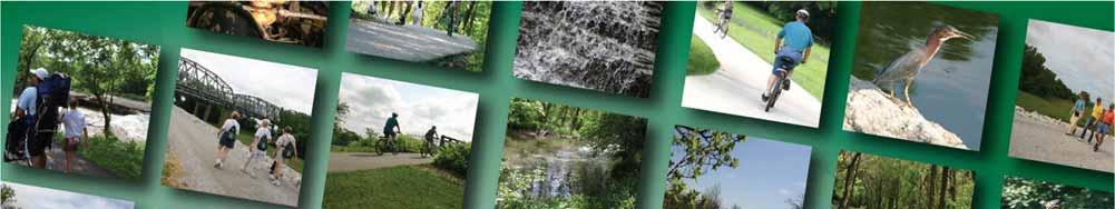
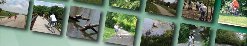
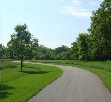
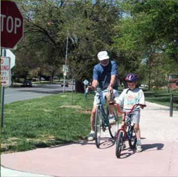
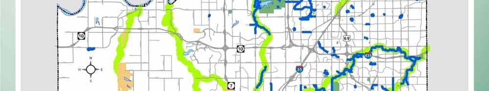
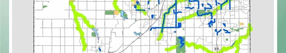
3 what is METROGREEN? A proposed 1,440-mile interconnected system of public and private open space, greenways and trails Connects urban and rural communities Protects and preserves natural areas Provides health, transportation, and economic benefits 3


4 A REGIONAL SYSTEM Designed to link the seven counties in the Kansas City region CURRENTLY: 85 corridors over 200 trail miles completed 90,000 acres of protected stream corridors 4


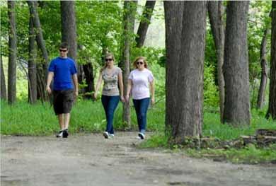
5 PLAN HISTORY: 1894 George Kessler s vision of a system of parks and boulevards Studied with Fredrick Law Olmsted City Beautiful movement 5


6 PLAN HISTORY: 1991 ASLA Prairie Gateway Chapter enlarged Kessler s concepts Created MetroGreen, a system of trails, open space and parklands 6


7 PLAN HISTORY: 2001 MARC expanded the plan Environmental stewardship Urban growth management Future development strategy 7
8 SIMPLE CONCEPT Hubs and Spokes system Hubs of community destination points Spokes of stream corridors, abandoned rails and landscaped parkways HUB: Metro Park SPOKE: River/Stream Corridor Farmland SPOKE: Rail-Trail Sensitive Habitat Residential Neighborhood School HUB: City Park Workplace or Center City Shopping Center SPOKE: Landscaped Roadway HUB: County Or State Park 8


9 MANY BENEFITS Transportation Health, Safety and Welfare Economic Water Quality and Environmental Education 9


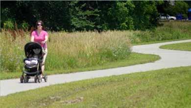
10 TRANSPORTATION Environmentally friendly transportation choices Unique experiences not possible by automobile Alternative for commuting to the places we live work and play 10


11 TRANSPORTATION local example: Indian Creek Greenway provides connectivity among neighborhoods, Corporate Woods Business Park, shopping centers and public parks 11


12 HEALTH recreational opportunities Encourage physical activity Mental relaxation Connect people to nature 12


13 SAFETY & WELFARE Safe off-street access to places Increase the visibility in an area (proven method to prevent crime and increase public security) 13

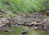
14 WATER QUALITY Prevent flood damage Conserve water quality and remove pollutants in urban stormwater Provide stream bank stability Provide habitat 14


15 ENVIRONMENTAL EDUCATION Outdoor classrooms Stream Teams Individual discovery Address Nature Deficit Disorder 15


16 ECONOMIC BENEFITS business development Attract an innovative, highly educated workforce to our region Compete with other urban communities that have an extensive trail system used by residents and visitors Create tourism attractions like the Katy Trail in Missouri 16

 Property values are 32 percent higher for locations")
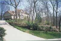
17 ECONOMIC BENEFITS increased property value $10,000 or more in Virginia (Tippett et al., 1999) Value of homes increase as far as three blocks from the greenway (Vince Graham, ION Development) Property values are 32 percent higher for locations adjacent to a greenbelt buffer in Boulder, Colo. (Correll et al., 1978) 17
18 PLATTE COUNTY UPDATE Brian Nowotny Director of Parks and Recreation Platte County, Missouri 18
19 NEW PARK PLAN FOUNDATIONS Protect our natural resources Improve community health and wellness Provide safe places for kids to grow and develop 19


20 PLATTE COUNTY: A GREAT PLACE TO LIVE 20


21 NEW TRAILS & GREENWAYS Missouri Riverfront Weston Bluffs Southern Platte Pass Prairie Creek 21
22 USAGE OF PARKS, TRAILS, COMMUNITY CENTERS PARK / FACILITY Parks & Sports Complexes Trails & Greenways 2010 USAGE/PARTICIPATION Baseball/Softball/Football/Soccer Youth League Participants: 7,200 Youth Tournaments: 29 Adult Tournaments: 11 Visitors by Trail Prairie Creek Greenway 110,613 Missouri Riverfront 101,592 Southern Platte Pass 100,733 Weston Bluffs 57,275 22


23 on the drawing board: SOUTH PLATTE COUNTY LOOP TRAIL 23


24 on the drawing board: TRAILS IN PLATTE LANDING PARK Partners Platte County City of Parkville Army Corps of Engineers Others 130-Acre County Parkland Amenity Ideas Walking & Biking Trail Nature Trail Water Trails 24


25 on the drawing board: PRAIRIE CREEK GREENWAY TRAILS 25


26 on the drawing board: WESTON BLUFFS TRAIL EXTENSION TO LEAVENWORTH, KAN. 26


27 KANSAS CITY, MO. Mark McHenry Director of Parks and Recreation Kansas City, Missouri 27


28 LINE CREEK 1.08 miles N. 68 th to NW Platte Brooke Drive 28

29 LINE CREEK TRAIL 29

30 EARTH RIDERS TRAIL ASSOCIATION (ERTA) TRAIL SWOPE PARK +/- 16 miles of planned single track 10-year period Northern end of the Blue-Swope Connector Trail System Old rock quarry grounds Very sustainable and fast-drying trails 30
 Phase Three: 2-mile beginner loop, 0.")
31 EARTH RIDERS TRAIL ASSOCIATION (ERTA) TRAIL SWOPE PARK Wudchuk Run: 1.5 miles 8-pin alley: 1.8 miles) Phase Three: 2-mile beginner loop, 0.75-mile alternate technical line 31
 TRAIL SWOPE PARK")

32 EARTH RIDERS TRAIL ASSOCIATION (ERTA) TRAIL SWOPE PARK Example of cities/counties partnering with community organizations 32
 TRAIL SWOPE PARK HIKING")
33 EARTH RIDERS TRAIL ASSOCIATION (ERTA) TRAIL SWOPE PARK HIKING BIKING 33


34 HILLCREST 34


35 INDIAN CREEK 3.77 miles State Line Road to 103 rd St. Locust to the Blue River 35


36 BRIARCLIFF GREENWAY 36


37 BRIARCLIFF GREENWAY 37

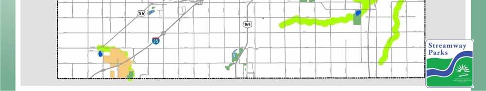
38 JERRY SMITH TRAIL 38


39 BRUSH CREEK 2.42 miles Roanoke to Troost Olive to Agnes 39


40 RIVERFRONT HERITAGE TRAIL 1 mile 40


41 LITTLE BLUE TRACE Being extended to entire length of Little Blue Trace Park South and west to Lee s Summit Road Adds four miles for total of 14 miles one way Crushed-gravel, mainly flat 41


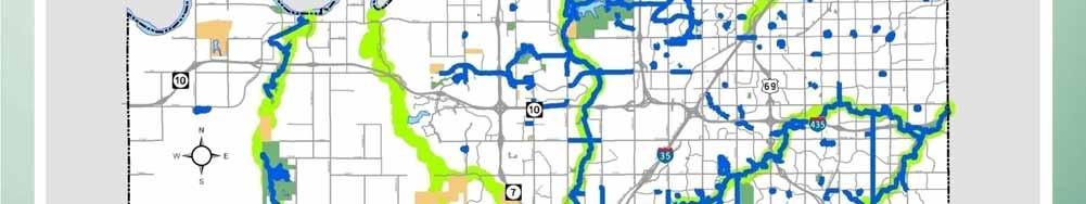
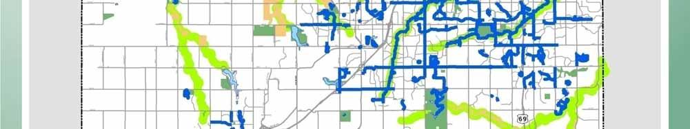
42 LITTLE BLUE TRACE 42
43 BLUE RIVER Four miles Alex George Lake to I-435 I-435 to Bannister (Design) 63 rd St to Swope Park Swimming Pool 43


44 BLUE RIVER 44

45 SHOAL CREEK 1.5 miles Hodge Park Trail 96 th St. to NE Barry Road 45
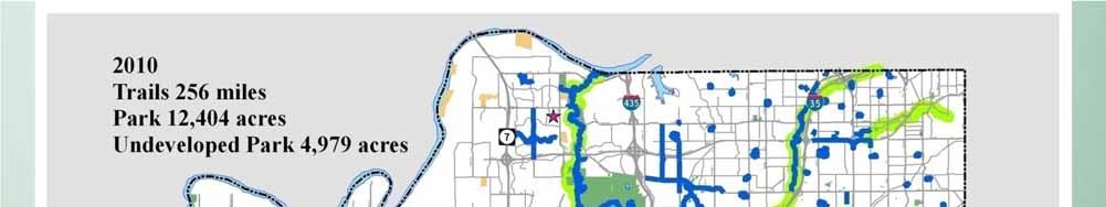
46 FORMER ROCK ISLAND R.R. CORRIDOR Katy Trail Connector to KC Funding to complete final design, acquire land and secure the railroad corridor through rail-banking for public control Construct 30 miles of multi-use trail necessary to connect Pleasant Hill, Mo., to Kansas City, Mo. Construction of trailheads to allow residents to gain access to and use the trail corridor 46


47 FORMER ROCK ISLAND R.R. CORRIDOR Katy Trail Connector to KC Critical link in the MetroGreen regional greenway trails plan Links Kansas City to the Missouri KATY Trail Important transportation corridor for potential public transit use 47

48 FORMER ROCK ISLAND R.R. CORRIDOR Katy Trail Connector to KC Challenges with road and other public improvements due to ownership of the corridor by Union Pacific Railroad Residents along this corridor and visitors to the region will benefit from this project 48

49 STREAMWAY PARKS SYSTEM JOHNSON COUNTY, KAN. Bill Maasen Johnson County Park & Recreation District Superintendent of Parks and Golf Courses 49


50 50


51 PUBLIC VOTE 51


52 55.7% VOTER APPROVAL All municipalities approved the issue Only unincorporated areas rejected the question 52

53 STREAMWAY PARKS SYSTEM Eight major streams: Mill Creek Indian Creek Tomahawk Creek Turkey Creek Bull Creek Cedar Creek Kill Creek Blue River 53
54 54
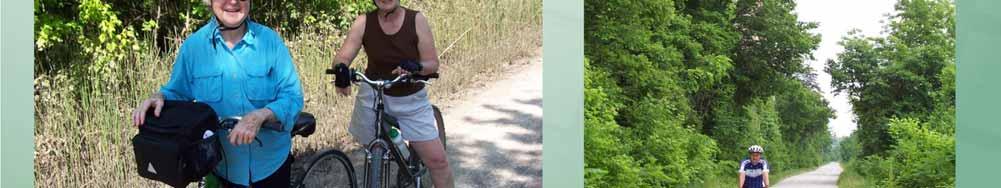
55 55
56 56
57 HISTORY Approximately 40 miles of trails, constructed by Overland Park, Leawood and JCPRD Approximately 120 miles of multi-use trails Over 256 miles of paved trails, equestrian trails, single track trails and bike lanes 2011 Trails are being constructed and maintained by JCPRD, Leawood, Lenexa, Overland Park, Olathe, Merriam, Gardner, Shawnee and Mission 57


58 COLLABORATION The Streamway Parks funds have been shared with Overland Park, Leawood, Lenexa, Gardner, Merriam, Shawnee, Olathe and Mission with the addition of Rock Creek. JCPRD Streamway funds have been leveraged with local budgets to share expenses on federal projects constructing enhancement projects in many of these cities. 58


59 HOME BUYERS SURVEY Trails ranked second behind highway access when recent home buyers were asked about the importance of community amenities. The amenities the homebuyers ranked next in importance were: 1. Sidewalks 2. Parks 3. Playgrounds National Association of Home Builders and National Association of Realtors Survey (2002) 59

 and everyone is talking about green space.")

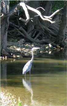
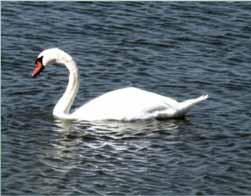
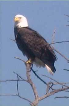
60 RESIDENTS WANT GREEN SPACE Green space is the hot product today. Now, you open up the new home guides (in Kansas City) and everyone is talking about green space. There is a sizable portion of the housing market to whom trees and land are important, and they re willing to pay for it. David Gale, Gale Communities 60

61 We are charged with the duty of developing a plan that shall not only meet present, but future wants. To undertake important work in a halfhearted manner is the poorest economy, it is far better to plan comprehensively and broadly and proceed with actual construction leisurely than to attempt economy in original plans. - George Kessler, circa


62 METROGREEN : A USER S PERSPECTIVE Richard Ballentine and Dr. William Eddy co-authors, Hiking Kansas City: The Complete Guide to More Than 125 Hiking and Walking Trails in the Kansas City Area 62
63 HOW HIKING KANSAS CITY CAME INTO BEING In 1987 Bill Eddy and I set out to find all the hiking and walking trails within a 50-mile radius of downtown Kansas City. There was no single source of information available. After a year with help from trail sponsors and others we declared victory. We discovered 45 hiking and walking trails! In 1989 we published a guide to the trails that became a bestseller. There have been five editions each describing more trails. 63

64 HIKING KANSAS CITY Trail numbers grew in each edition Fifth edition 64


65 THE KANSAS CITY AREA a great place to HIKE WALK and BIKE 65


66 WHAT MAKES IT GREAT? Variety of: o o o o Terrains Surfaces Seasons Wildlife, flora, rural and urban sights Exercise outdoors with friends and family Safe bicycle pathways for transportation Opportunities to explore and experience the metro area 66


67 VARIETY OF TERRAINS HILLY FLAT ROCKY Larry Mattonen Memorial Trail, Jackson County, Mo. English Landing Park Trail, Parkville, Mo. Glades Trail, Swope Park 67


68 VARIETY OF TRAIL SURFACES NATURAL CRUSHED ROCK Eddy-Ballentine Trail, Swope Park Little Blue Trace, Jackson County, Mo. 68


69 VARIETY OF TRAIL SURFACES PAVED RAILS-TO-TRAILS Westboro /Canterbury Greenway, Liberty, Mo. Prairie Spirit Rail Trail, Kansas 69


70 VARIETY OF SEASONS SPRING SUMMER Blue River North Trail, Jackson County, Mo. Little Blue Trace, Jackson County, Mo. 70


71 VARIETY OF SEASONS FALL WINTER Shawnee Mission Park, Kan. Hollis Renewal Center, Wyandotte County, Kan. 71


72 VARIETY OF WILDLIFE 72


73 VARIETY OF FLORA 73


74 VARIETY OF RURAL AND URBAN EXPERIENCES Blue River Trace, Jackson County, Mo. Kaw Point Kansas City, Kan. 74


75 VARIETY OF RURAL AND URBAN EXPERIENCES Kill Creek Park Trail, Johnson County, Kan. Triangle Trails path, Kansas City, Mo. 75


76 VARIETY OF RURAL AND URBAN EXPERIENCES Prairie Spirit Rail Trail, Kan. Berkeley Riverfront Park, Kansas City, Mo. 76


77 VARIETY OF RURAL AND URBAN EXPERIENCES Haller Trail, Johnson County, Kan. Theis Park, Kansas City, Mo. 77


78 VARIETY OF RURAL AND URBAN EXPERIENCES Overland Park Arboretum, Johnson County, Kan. Brush Creek, Kansas City, Mo. 78


79 BENEFITS EXERCISE & FITNESS TIME WITH FAMILY & FRIENDS 79

80 OFF-ROAD BICYCLE PATHS RECREATION 80


81 OPPORTUNITIES TO EXPLORE THE REGION FROM THE NORTHEAST Smithville Lake Little Blue Trace 81


82 OPPORTUNITIES TO EXPLORE THE REGION TO THE SOUTHEAST Indian Creek Blue River 82


83 OPPORTUNITIES TO EXPLORE THE REGION TO THE SOUTHWEST AND THE NORTHWEST Haller Trail, Johnson County, Kan. Prairie Creek Greenway, Platte County, Mo. 83


84 OPPORTUNITIES TO EXPLORE THE REGION ALONG A RIVER English Landing Park, Parkville, Mo. 84


85 OPPORTUNITIES TO EXPLORE THE REGION ON AN URBAN ROUTE Trolley Track Trail, Kansas City, Mo. 85


86 OPPORTUNITIES TO EXPLORE THE REGION AND BEYOND Flint Hills annual spring burning Miola Lake, Paola, Kan. 86

87 NUMEROUS TRAIL SPONSORS Cities Counties State of Missouri State of Kansas Federal: o U.S. Army Corps of Engineers, Dept. of Fish & Wildlife, National Park Service Private organizations: o Powell Gardens, Unity Village, Nature Conservancy, others 87

88 HIKING KANSAS CITY Goal of the book was to provide essential information Where the trails are How to find trailheads Quadrant maps show location of TRAIL SITES 88


89 HIKING KANSAS CITY 89


90 HIKING KANSAS CITY Trails beyond the metro area 90

91 HIKING KANSAS CITY Goal of the book was to provide essential information Where the trails are How to find trailheads Trail length Level of difficulty Trail surface Time it takes to hike the trail Water availability Handicapped accessibility Maps Describe the hike 91


92 Wherever you live in the metro area or wherever you d like to explore, there are great trails for hiking, walking and bicycling in Kansas City and thanks to MetroGreen, more are on the way! 92


 Emily")
93 METROGREEN : A USER S PERSPECTIVE Bill and Linda Eddy (and Chief) Emily and Dick Ballentine 93


94 94


95 GREATER KANSAS CITY NATIONAL TRAILS DAY SATURDAY, JUNE 4, 2011 Complete list of participating communities, events and an interactive map available at 95
City Council Workshop July 26, 2010
 Des Moines Trails Connecting a Community City Council Workshop July 26, 2010 1 OVERVIEW Trail Benefits Trails Progress How We Fund Trails What s Next for Trails 2 What is a trail? Paved Trails 10 wide
SITE FOR SALE. Race Track Development Land. Bank Owned 78 +/- Acres on Parallel Parkway 123rd Street & Parallel Parkway (SWC), Kansas City, Kansas
, Kansas City, Kansas") FOR SALE Race Track Development Land Bank Owned 78 +/- Acres on Parallel Parkway 123rd Street & Parallel Parkway (SWC), Kansas City, Kansas Supercenter SITE Parallel Parkway 40,000 cars per day PLAZA AT
FOR SALE Race Track Development Land Bank Owned 78 +/- Acres on Parallel Parkway 123rd Street & Parallel Parkway (SWC), Kansas City, Kansas Supercenter SITE Parallel Parkway 40,000 cars per day PLAZA AT
SITE HOTEL PROPERTY. For Sale. I-70 & 7 Highway (NEC) 3.99+/- Acres Total NW 7 Highway, Blue Springs, Missouri A GREATER KANSAS CITY SUBURB
 3.99+/- Acres Total NW 7 Highway, Blue Springs, Missouri A GREATER KANSAS CITY SUBURB") 63,000 cars per day HOTEL PROPERTY 1110 NW 7 Highway, Blue Springs, Missouri A GREATER KANSAS CITY SUBURB N For Sale I-70 & 7 Highway (NEC) 3.99+/- Acres Total 29,000 cars per day SITE Estimated Population
63,000 cars per day HOTEL PROPERTY 1110 NW 7 Highway, Blue Springs, Missouri A GREATER KANSAS CITY SUBURB N For Sale I-70 & 7 Highway (NEC) 3.99+/- Acres Total 29,000 cars per day SITE Estimated Population
OR MISSION TRAIL ELEMENTARY
 Leawood: overview OVERLAD PARK 24: p.70 I-LA PARK 32: p.72 TOMAHAWK PARK 23: p.69 31: p.71 GEZER PARK OR MISSIO TRAIL ELEMETARY 22: p.68 W 133rd St W 135th St KASAS CITY MO - other segments Beginning/end
PAD SITE FOR SALE. Hard Corner of 159th Street & Metcalf Avenue. One Acre Pad Site Available NEC 159th Street & Metcalf Avenue, Overland Park, Kansas
 PAD FOR SALE Hard Corner of 159th Street & Metcalf Avenue One Acre Pad Site Available NEC 159th Street & Metcalf Avenue, Overland Park, Kansas 3 3, 0 0 0 c a r s p e r d a y Nall Avenue 6,000 cars per
TABLE 1: STARTER PROJECTS YEARS SERVICES THAT CONTINUE IN EXISTING FORM
 Appendix A: Projects by Phase Fixed Route and Demand Response Projects TABLE 1: STARTER PROJECTS YEARS 0-5 + SERVICES THAT CONTINUE IN EXISTING FORM Non-ADA Paratransit Demand Response $600,000 $700,000
NNN INVESTMENT PROPERTY FOR SALE. Jose Pepper s on Shopping Center Pad Site New Long Term Lease
 NNN INVESTMENT PROPERTY FOR SALE Jose Pepper s on Shopping Center Pad Site New Long Term Lease 6,369 Sq Ft Freestanding Building on 1.68 Acres NEW LISTING 1100 E. North Avenue, Belton, Missouri A Greater
SOUTHRIDGE RETAIL CENTER
 SOUTHRIDGE RETAIL CENTER Retail Space For Lease 1,432-7,492 SF; 5,025 SF End Cap Restaurant w/patio Available 121st St. & Metcalf Ave. (NWC), Overland Park, KS A Greater Kansas City Suburb ROSANA SQUARE
950 MINNESOTAKANSAS CITY 2020 HOWELL 3750 STATE AVEKANSAS CITY 1147 NW SOUTH SHORE DRIVE
 Take Back Day: Saturday, April 28, 2018 10:00 am 2:00 pm CHILDREN'S MERCY KC 2401 GILLHAM ROAD MO, 64108 CVS 950 MINNESOTAKANSAS KS, 66101 NORTH NORTH PD 2020 HOWELL NORTH KANSAS MO, 64116 CVS 4300 RAINBOW
Wilds. Headwaters. Lakes. Oxbows. Falls
 56 5 4 3 Wilds Headwaters Lakes Oxbows Falls 57 Zones It could be said the on-the-ground essence of this master plan appears within the next 6 pages of this report. As we learned in the preceding Cultural
Gardner: overview. Santa Fe, Oregon, and California National Historic Trails UNINCORPORATED JOHNSON COUNTY OLATHE UNINCORPORATED JOHNSON COUNTY
 Santa Fe, Oregon, and California ational Historic Trails : overview 99: p.134 100: p.135 GARDER JUCTIO 102: p.137 56: p.126 EDGERTO Burlington orthern Intermodal and Logistics 98: p.133 101: p.136 S Waverly
Freight Directory KC REGIONAL FREIGHT OUTLOOK. July What is the Freight Directory? Using the Directory s Maps. What is included?
 Freight Directory July 009 What is the Freight Directory? The Freight Directory is an inventory of the Kansas City Region s Freight Zones. Within the 8-county study area, Presence of a Foreign Trade Zone
2. Goals and Policies. The following are the adopted Parks and Trails Goals for Stillwater Township:
 D. PARKS AND TRAILS 1. Introduction Stillwater Township s population is relatively low, with most residents living on rural residences on large lots. The need for active park space has been minimal in
$866,000. $1,400,000 Health Benefits $13,156,000 TOTAL ANNUAL DIRECT BENEFITS. $10,890,000 Economic Benefits
 SINGING RIVER TRAIL Trails Create Value + Generate Economic Activity Trails generate economic returns through improved health, safety, and environmental conditions, raise property values, and attract visitors.
GLENWOOD PLAZA SHOPPING CENTER Space For Lease
 GLENWOOD PLAZA SHOPPING CENTER Space For Lease 2,000 Sq Ft to 40,105 Sq Ft Spaces Available Metcalf Avenue at 91st Street (NWC), Overland Park, Kansas Up to 40,105 +/- sq ft of contiguous space available
NEW PROPOSED WESTPORT DEVELOPMENT
 NEW PROPOSED WESTPORT DEVELOPMENT Build-To-Suit 2,400 Sq Ft Building plus Patio & Deck 4114 Broadway Boulevard, Kansas City, Missouri Premier restaurant location Estimated Population 273,992 Average Household
EVERknowledgeable EVERresponsive EVERhonorable EVERGREEN.
 7021 Johnson Drive Johnson County, KS 8450 & 8500 State Line Rd. Johnson County, Leawood, KS Property ID Size 48223 R1 34848 $100,000 Ryan Robertshaw allows for Group Home Smaller child care facility also
The Missouri Department of Transportation is proposing to amend the state's five-year Statewide Transportation Improvement Program (STIP).
.") The Missouri Department of Transportation is proposing to amend the state's five-year Statewide Transportation Improvement Program (STIP). A 7-day public comment period regarding the amendment begins January
The Missouri Department of Transportation is proposing to amend the state's five-year Statewide Transportation Improvement Program (STIP). A 7-day public comment period regarding the amendment begins January
THE PLAZA AT SHOAL CREEK 175,000 Sq Ft Retail Development
 THE PLAZA AT 175,000 Sq Ft Retail Development Rare 2,415 Sq Ft Retail End Cap Space - FOR LEASE Available Soon 152 Highway & Flintlock Road (SWC), Kansas City/Liberty, Missouri Natural Bowl N XO Nails
Chapter 6. Action Program. Heart of the Lakes Area Recreation Plan
 Heart of the Lakes Area Recreation Plan 1. Design and construct the following trails (please see the following map): a. the Speedway Trail 1) primary pathway the main trail 2) secondary pathway the proposed
Chapter 2: Summary of Existing Open Space System
 Chapter 2: Summary of Existing Open Space System In 1976, the Wake County Board of Commissioners established the Wake County Parks and Recreation Department in order to provide park facilities and programs
The Master Plan, Walkability, and Trails in the City of Solon. April 23, 2018
 The Master Plan, Walkability, and Trails in the City of Solon April 23, 2018 Tonight s topics 1. Existing trail options in the City of Solon 2. Potential trail options 3. How trails and walkability converge
Northeast Quadrant Distinctive Features
 NORTHEAST QUADRANT Northeast Quadrant Distinctive Features LAND USE The Northeast Quadrant includes all the area within the planning area that is east of Interstate 5 and to the north of State Route 44.
Airport Planning Area
 PLANNING AREA POLICIES l AIRPORT Airport Planning Area LOCATION AND CONTEXT The Airport Planning Area ( Airport area ) is a key part of Boise s economy and transportation network; it features a multi-purpose
CHAPTER 5. Chapter 5 Recreation Element
 CHAPTER 5 Recreation Element Chapter 5 Recreation Element The Recreation Element of the Meyers Area Plan is a supplement to the Recreation Element of the TRPA Regional Plan and the El Dorado County General
TRAFALGAR PARK. 78: p.140 W 99th St FLAT ROCK CREEK PARK. W 103rd St OVERLAND PARK. Quivira Rd. College Blvd. Shared use path. Mountain bike trail
 Lenexa: overview TRAFALGAR PARK 78: p.140 As the Westport Route crosses over Lenexa's boundaries with Olathe and Overland Park several times, approximately 2.75 or 3 miles of the historic route of the
Waukee Trailhead Public Art and Amenities Project
 Waukee - Trailhead Public Art and Amenities Project Sponsor Waukee Project Title Waukee Trailhead Public Art and Amenities Project Termini Description ( i.e. Park Avenue to 19th Street) NE Intersection
SANTA FE. 82: p.108 POLLINATOR PRAIRIE PARK. 86: p : p : p.113. ARROWHEAD PARK 151st St. 41: p.102. Indian Creek Greenway PARK
 Santa Fe, Oregon, and California ational Historic Trails Olathe: overview W 135th St W 143rd St GARDER 91: p.117 SATA FE UICORPORATED JOHSO COUTY W Santa Fe St ELM GROVE CAMPGROUD OREGO TRAIL W Dennis
Southwest Quadrant Distinctive Features
 SOUTHWEST QUADRANT Southwest Quadrant Distinctive Features LAND USE The 31.17 square mile Southwest Quadrant includes all the area within the planning area west of I-5 and south of the Sacramento River.
The Impact of Trails on Communities. Jim Wood Chief, Office of Greenways & Trails Division of Recreation and Parks
 The Impact of Trails on Communities Jim Wood Chief, Office of Greenways & Trails Division of Recreation and Parks Why Trails and Greenways? Resolution of the Florida Greenways and Trails Council Recognizing
Blueways: Rivers, lakes, or streams with public access for recreation that includes fishing, nature observation, and opportunities for boating.
 Parks, Open Space and Trails PRINCE WILLIAM COUNTY 2008 COMPREHENSIVE PLAN TRAILS PLAN CONTENTS The components of the trails plan are: Intent Definitions Goals, Policies, and Action Strategies Trails Map
ADVENTURE PLAN EXPLORE PARK
 ADVENTURE PLAN ROANOKE COUNTY S EXPLORE PARK ROANOKE COUNTY PARKS, RECREATION AND TOURISM 1206 KESSLER MILL RD SALEM, VA 24153 (540) 387-6078 WHAT S INCLUDED? Explore Park Adventure Plan - Guided by extensive
The Atlanta BeltLine. & Sustainable Development GAFM Conferance. // March 25, 2014
 The Atlanta BeltLine & Sustainable Development GAFM Conferance // March 25, 2014 04/22/2014 Atlanta BeltLine // 2013 Page 1 // Organizational Structure Project Owner and Sponsor Redevelopment Authority
INDEPENDENCE (KANSAS CITY), MISSOURI
, MISSOURI") INDEPENDENCE (KANSAS CITY), MISSOURI KANSAS CITY A WEALTH OF OPPORTUNITY The Kansas City Metro Area is a prosperous, culturally rich market with an influential economy. Home to three robust major league
INDEPENDENCE (KANSAS CITY), MISSOURI KANSAS CITY A WEALTH OF OPPORTUNITY The Kansas City Metro Area is a prosperous, culturally rich market with an influential economy. Home to three robust major league
Chapter 6: POLICY AND PROCEDURE RECOMMENDATIONS
 Chapter 6 POLICY AND PROCEDURE RECOMMENDATIONS FOR SRRA Below are seven policy elements that should be considered for adoption by the Southwest Regional Recreation Authority of Virginia: 1. Develop strategies
A CASE FOR COMPLETING THE JORDAN RIVER PARKWAY: A
 A CASE FOR COMPLETING THE JORDAN RIVER PARKWAY: A safe crossing at 9000 South and 850 West Proposed 9000 South Underpass Parkway Timeline Parkway, Trail, and Tourism Facts Blueprint Jordan River 1971 1973
CITY OF CHASKA PEDESTRIAN MOVEMENT / TRAILS PLAN FINAL CHAPTER 7 PEDESTRIAN MOVEMENT / TRAILS PLAN. Page 1 of 19, Chapter 7
 FINAL CHAPTER 7 PEDESTRIAN MOVEMENT / TRAILS PLAN Page 1 of 19, Chapter 7 ORDER OF CONTENTS I. INTRODUCTION... 3 II. PURPOSE... 3 III. 2030 COMMUNITY TRAILS SYSTEM PLAN... 4 IV. TRAIL TYPES... 7 A. Regional
The Recreational Trail along Cushing Park road has been a successful addition to the city
 The Recreational Trail along Cushing Park road has been a successful addition to the city Trails TRAILS, PATHS, ROUTES AND CONNECTORS Citizen input pointed to trails, paths, bike routes, and other non-motorized
SERVICE AREA BOUNDARIES Beginning SFY2018
 SERVICE AREA BOUNDARIES Beginning SFY2018 Service Area A (1) Boundaries -- all of Ray County Ray County Fellowship Senior Center 1015 West Royle Richmond, Missouri 64085 Service Area B Beginning at I-435
Southwest LRT Alignment Video Narration
 Southwest LRT Alignment Video Narration September 2015 Southwest Light Rail Transit, a proposed extension of the METRO Green Line, will serve Minneapolis, St. Louis Park, Hopkins, Minnetonka and Eden Prairie.
Zip Name Address City St Phone Number
 Zip Name Address City St Phone Number 63084 County Seat Senior Center MEAAA 1329 North Union Union MO (636) 583-5432 63084 Union City Hall 500 East Locust Street Union MO (636) 583-3600 64014 BS South
City of Durango 5.8 FUNDING TRAILS DEVELOPMENT
 5.8 FUNDING TRAILS DEVELOPMENT The City has been successful in establishing dedicated local funding sources as well as applying for grants to develop the City s trail system, having received nearly $2.4
Lawrence Loop SWOT Analysis
 Alignment: D1 (Map Color: Dark Blue) Description: This alignment connects to the north end of the Burroughs Creek Trail and continues along the west side of the Railroad to 8 th Street. Strengths: - This
Assessing Your Trails, Keeping Them Safe and Enjoyable
 Jon Wood, PLA, ASLA Associate Vice President Stewart Bert Lynn, PLA, ASLA, LEED AP Project Manager Mecklenburg County Asset and Facility Management Assessing Your Trails, Keeping Them Safe and Enjoyable
Clackamas County Development Agency
 Clackamas County Development Agency Development Services Building, 150 Beavercreek Rd., Oregon City, OR 97045 www.clackamas.us/transportation/renewal 503-742-4323 The Clackamas County Board of Commissioners
Raytown: overview. map. Santa Fe, Oregon, and California National Historic Trails KANSAS CITY KANSAS CITY. 38 Trail alignments: Raytown.
 Raytown: overview Blue Ridge Cut-off map 18: p.42 RICE- TREMOTI HOME Raytown Tfwy KASAS 17: p.41 JUCTIO WITH ROCK ISLAD LIE RIGHT OF WAY 16: p.40 BUS STOP AT E 51ST AD BLUE RIDGE (KASAS ) Sterling Ave
CHAPTER ONE LITERATURE REVIEW
 CHAPTER ONE LITERATURE REVIEW LITERATURE REVIEW This chapter summarizes the most recently published community impact studies and articles that relate to multiuse trails. The review focuses on publications
Port Gamble Shoreline Area Conceptual Trail Proposal
 The North Kitsap Trails Association is pleased to be a partner to the Kitsap Forest and Bay Project and assist Kitsap County, Forterra, Olympic Property Group, Great Peninsula Conservancy and the Port
MAPLEWOOD VILLAGE CENTRE AND INNOVATION DISTRICT IMPLEMENTATION PLAN & DESIGN GUIDELINES. November 6, 2017 Regular Meeting of Council
 MAPLEWOOD VILLAGE CENTRE AND INNOVATION DISTRICT IMPLEMENTATION PLAN & DESIGN GUIDELINES November 6, 2017 Regular Meeting of Council Recommendation THAT Council: Approve the Maplewood Village Centre and
Red Lobster Single Tenant Triple Net Lease Investment
 Red Lobster Single Tenant Triple Net Lease Investment Net Lease Real Estate Investment For Sale 4% CAP Rate I-435 & Parallel Parkway, Kansas City, Kansas A Suburb of Greater Kansas City PLAZA AT THE SPEEDWAY
Welcome to the Cross County Trail Public Input Session!
 Welcome to the Cross County Trail Public Input Session! Please sign in on the table below! What are we doing here? Camden County has proposed a bicycle and pedestrian trail spanning across the entire county.
Projects Awarded GOCO Funding in El Paso County
 Grant Type Fiscal Year Sponsor Title Grant Amount Acres Conserved Inspire 2016 City of Colorado Springs Out the Door Pikes Peak! $75,000.00 0 Parks 2016 Colorado State Parks 2016 City of Manitou Springs
Dover Park Master Plan. Community Design Event Tuesday, May 22, 5 7 pm
 Dover Park Master Plan Community Design Event Tuesday, May 22, 5 7 pm Agenda I. Introduction / Overview 20 minutes II. Small Group Design Activity 60 minutes III. Small Group Report Out IV. Conclusion
City of Haslett. City of East Lansing. City of East Lansing
 Central Park North (Nancy L. Moore Park) Lake Park North Expansion White Park Expansion #2 White Park Expansion #1 County East East Haslett East East TF87-212 Acquisition $90,000.00 Park. TF08-138 Acquisition
Kansas Trails News. Flint Hills Nature Trail construction moving forward. Rail-trail from Marysville, Kansas to Lincoln, Nebraska now Open!
 Kansas Trails News Sunflower Rail-Trails Conservancy 12/28/2015 Rail-trail from Marysville, Kansas to Lincoln, Nebraska now Open! The 19.5-mile Chief Standing Bear Trail which links Beatrice, Neb. to the
Public Informational Meeting
 Public Informational Meeting April 17, 2007 Bow-Concord I-93 I Transportation Planning Study Bow-Concord Interstate 93 Transportation Planning Study Context Sensitive Solutions Planning Steps Screen Alternatives
Lafourche Parish Government REQUEST FOR QUALIFICATIONS. Landscape Architectural Services
 Lafourche Parish Government REQUEST FOR QUALIFICATIONS Landscape Architectural Services Bayou Lafourche Parish Multi-Use Path Feasibility Study Phase 1 And Bayou Lafourche Parish Multi-Use Path Feasibility
Part Three : COMMUNITY PLAN AREAS AND SPECIAL STUDY AREAS SACRAMENTO 2030 GENERAL PLAN. Introduction
 Special study Areas Part Three : COMMUNITY PLAN AREAS AND SPECIAL STUDY AREAS SACRAMENTO 2030 GENERAL PLAN Introduction Beyond the boundaries of the 2030 General Plan, the City has defined Special Study
MASTER PLAN EXECUTIVE SUMMARY
 Biscuit Run State Park Scottsville Road (State Route 20) Charlottesville, VA 22902 Biscuit Run State Park MASTER PLAN EXECUTIVE SUMMARY Department of Conservation and Recreation Division of Planning and
FEASIBILITY CRITERIA
 This chapter describes the methodology and criteria used to evaluate the feasibility of developing trails throughout the study areas. Land availability, habitat sensitivity, roadway crossings and on-street
County of Peterborough Active Transportation Master Plan
 The TMP developed a conceptual AT/cycling network for Peterborough County that identified both on-road and off-road (trail) AT facilities. This was a coarse network based on the existing trails and off-road
October 23, 2017 Council Workshop
 MAPLEWOOD VILLAGE CENTRE AND INNOVATION DISTRICT IMPLEMENTATION PLAN & DESIGN GUIDELINES October 23, 2017 Council Workshop COMMUNITY PLAN Purpose of Council Workshop Highlight What We Heard Phase 3 & Key
Preferred Recreation Recommendations Stemilt-Squilchuck Recreation Plan March 2018
 Preferred Recreation Recommendations Stemilt-Squilchuck Recreation Plan March 2018 Below are the recommended recreation ideas and strategies that package together the various recreation concepts compiled
Georgetown-Lewes Rail/Trail Study. Rail/Trail Study: Cool Spring to Cape Henlopen State Park New Road Extension (House Resolution No.
 Georgetown-Lewes Rail/Trail Study Rail/Trail Study: Cool Spring to Cape Henlopen State Park New Road Extension (House Resolution No. 47) August 22, 2011 Presentation Outline Background Benefits Statewide
Partners: Michigan California Timber Company Shasta-Trinity National Forest Pacific Crest Trail Association The Trust for Public Land
 Partners: Michigan California Timber Company Shasta-Trinity National Forest Pacific Crest Trail Association The Trust for Public Land Describe the project location, size, opportunities, and timing. Provide
Stuart Thain. Elizabeth Leader Cameron Simonsen
 I-15 AND SOUTHERN PARKWAY ST GEORGE, UT Developed by: Desert Color is a master-planned community built around a plan of connectivity, community and sustainability. It is a place where you will find the
This Passport: Revised October 20, 2017, EAM # Discovering the Trails of Penfield, NY
 This Passport: Revised October 20, 2017, EAM #161922 Discovering the Trails of Penfield, NY The Town of Penfield is fortunate to have a wide variety of natural resources which make for many unique and
SOUTH INTERCHANGE AREA
 Santaquin City General Plan 1 Location and Characteristics The South Interchange Area of Santaquin is located west of Interstate 15 and south of 500 South (Figure 1). It includes properties already annexed
BICYCLE AND PEDESTRIAN COUNT PROGRAM 2016 Annual Report
 BICYCLE AND PEDESTRIAN COUNT PROGRAM 2016 Annual Report TABLE OF CONTENTS A Message from the Mayor... 4 Data Count Reports... 5 Count Locations... 6 Count Locations Map... 7 Trail Data... 8 International
DRAFT - APRIL 13, 2007 ROUTING STUDY FOR TRAIL CONNECTIONS BETWEEN CALAIS AND AYERS JUNCTION
 DRAFT - APRIL 13, 2007 ROUTING STUDY FOR TRAIL CONNECTIONS BETWEEN CALAIS AND AYERS JUNCTION Abstract The vision for the East Coast Greenway is an off-road urban trail system running from Calais, Maine
Chapter 1: Introduction
 Chapter 1: Purpose of the Comprehensive Plan The purpose of the Comprehensive Plan of the City of Rockaway Beach is to provide a policy guide for the growth and future development of the City. Section
Section 3.6. Parklands & Recreation Areas
 Section 3.6: Parklands & Recreation Areas Section 3.6 Parklands & Recreation Areas 3.6 PARKLANDS AND RECREATION AREAS 3.6.1 Introduction to Analysis This section provides an overview of parklands and recreational
This Passport: Revised October 20, 2017, EAM # Discovering the Trails of Webster, NY
 This Passport: Revised October 20, 2017, EAM #161923 Discovering the Trails of Webster, NY The Town of Webster invites you to explore and experience our diverse outdoor adventures! Here s your opportunity
Company Timeline. Hunt Midwest leases its 126,000 square foot spec building in SubTropolis to Pure Fishing.
 Company Timeline Since 1931, Hunt Midwest and its predecessor companies have had a significant impact on the Kansas City area, as well as throughout the states of Missouri and Kansas. The following highlights
Silver Lake Park An Environmental Jewel for the Citizens of Prince William County
 Silver Lake Park An Environmental Jewel for the Citizens of Prince William County The Prince William Park Authority Mission Statement states: The Prince William County Park Authority will create quality
PASSPORT. Discovering the Trails of Webster, NY
 PASSPORT to family wellness Discovering the Trails of Webster, NY Join the Friends of Webster Trails, Webster Health and Education Network, The Town of Webster and Wegmans to get moving more and enjoy
Segment 2: La Crescent to Miller s Corner
 goal of the USFWS refuges is to conserve, protect and enhance fish, wildlife and plants and their habitats for the continuing benefit of the American people. Refuge lands are used largely for fishing,
Stephens State Park Trails
 TRAILS OF ALLAMUCHY MOUNTAIN & STEPHENS STATE PARKS Allamuchy Mountain and Stephens State Parks contain 28 marked trails providing access to diverse landscapes for walking, hiking, biking, bird-watching,
The Vision for the San Juan Islands Scenic Byway
 The Vision for the San Juan Islands Scenic Byway 2 Judd Cove, Orcas Island, Courtesy of Kurt Thorson (kurtthorson.com) and San Juan County Land Bank Vision for the San Juan Islands Scenic Byway The San
Chapter eight. Parks and Recreation. Introduction. Crystal Lake Park District
 Chapter eight Parks and Recreation Introduction One of the indicators of quality of life in a city is the parks and recreation system. The City of Crystal Lake is fortunate to have an excellent parks and
University Region Non-Motorized Plan 2015
 Non-Motorized Transportation Non-motorized facilities are important components to the transportation system. They provide an environmentally-friendly, low-cost mode of travel. Some of the facilities can
Figure 1: Little Dry Creek Trail Crossing
 Figure 1: Little Dry Creek Trail Crossing Figure 2: Little Dry Creek Trail Crossing Northwest Rail Environmental Evaluation Temporary Trail Detour Concurrence Form Adams County, Little Dry Creek Trail
4.19 Parks, Recreation, and Conservation Lands
 interchange would have on the Reed Paige Clark Homestead located on the north side of Stonehenge Road. Alternative D would also affect Palmer Homestead, E.F. Adams House, and Knapp Brothers Shoe Manufacturing
Each picture below has a brief explanation of the alignment. Please review and feel free to send any questions you might have.
 TO: Golden Parks, Recreation and Museums Advisory Board FR: Al Head & Ben Davis, Golden Giddyup Tim Waters & Jerry Harcek, Golden Community Members RE: Singletrack Sidewalks Pilot Proposal 3.0, January,
Non-Motorized Transportation
 Non-Motorized Transportation Non-motorized facilities are important components to the transportation system. They provide an environmentally-friendly, low-cost mode of travel. Some of the facilities can
RATTLESNAKE HILL PHILLIPS, HARRIS FARM, LIME KILN & QUARRY
 Town of, MA Trails Map 6a SPLIT ROCK PRIMARY SECONDARY PRIVATE PRIVATE PROPERY STAY ON HEAD FUTURE TO SKINNER (NOT MARKED) 0 miles 0.25 0.250 0.5 Mapbox, Data Odbl, OpenStreetMap contributors primary use
Webinar Series for Comprehensive Plan Updates. Making Your Plan a Walk in the Park
 Webinar Series for Comprehensive Plan Updates Making Your Plan a Walk in the Park Presented by Jan Youngquist and Michael Peterka September 15, 2016 Today s Presentation Importance of Parks and Trails
J. Recreation Plan of Conservation and Development. The Town of Hebron. Section 2. Preservation of Unique Assets. 1 P a g e
 The Town of Hebron Section 2 2014 Plan of Conservation and Development Preservation of Unique Assets J. Recreation Open spaces, parks, sports fields, and recreational programs are considered essential
Independence: overview
 : overview Kentucky Ave 8: p.30 SUGAR CREEK SATA FE. OREGO, CALIFORIA 7: p.29 6: p.28 9: p.31 10: p.32 Square, Jackson County Courthouse. Photo: Vireo Trail swale area, Santa Fe Trail. Photo: Vireo HISTORIC
STITCH TRANSFORMATIVE IDEA 3. SHORELINE STITCH. Re-connect the city to the waterfront and link the east and west Core Circle landscapes
 SHORE STITCH TRANSFORMATIVE IDEA 3. SHORELINE STITCH Re-connect the city to the waterfront and link the east and west Core Circle landscapes 126 LINE PUBLIC WORK 127 TRANSFORMATIVE IDEA 3. SHORELINE STITCH
Confluence of Long Creek. Bellhaven Road. Approximate Corridor Length: 1.5 miles. Mecklenburg County Greenway Master Plan
 Gum Branch Gum Branch is a northwest-southeast trail corridor that is located in the Southwest Park District. This corridor s endpoints are the confluence of Long Creek in the northwest and Bellhaven Road
MORGAN CREEK GREENWAY Final Report APPENDICES
 APPENDICES MORGAN CREEK GREENWAY Appendix A Photos of Existing Conditions in Trail Corridor Photos of existing conditions Main trail corridor - February 2009 Photos of existing conditions south bank Morgan
MEETING MINUTES District 1 Trail Planning Meeting 1
 MEETING MINUTES District 1 Trail Planning Meeting 1 June 1, 2017 2:00 PM 3:30 PM City of Two Harbors 2:00 Introductions Attendees: Lisa Austin, MnDOT Bryan Anderson, MnDOT Jasna Hadzic-Stanek, MnDOT Justin
Brentsville Courthouse
 46 Prince William County Proposed FY 2014-2019 Capital Improvement Program Brentsville Courthouse Existing budget will complete the jail restoration. There is no additional funding allocated to projects
Trails. Lois Jensen Nature Preserve is a 30 acre parcel on the north end of the city. It provides unspoiled wooded paths.
 Trails Lois Jensen Nature Preserve is a 30 acre parcel on the north end of the city. It provides unspoiled wooded paths. TRAIL S, PATHS, ROUTES AND CONNECTORS Citizen input pointed to trails, paths, bike
Evergreen Trail School
 Evergreen Trail School Making Washington a Better Place to Ride Preston, WA & Tiger Mt. Sat, April 9, 2015 8-11:45am: Classroom 11:45-12:45pm: Lunch 12:45-4pm: Trail Work Classroom Agenda Introduction
Benefits of Trails and Greenways. Dr. Chuck Nelson Dept. Community, Agriculture, Recreation and Resource Studies Michigan State University
 Benefits of Trails and Greenways Dr. Chuck Nelson Dept. Community, Agriculture, Recreation and Resource Studies Michigan State University Benefits from Trails and Greenways Physical Psychological Knowledge
ZoPath Trail. Extreme Park. Group III. Brendan Pillar, Conor Coakley James Amendola, & Mark McDermott. May 4, 2006
 ZoPath Trail & Extreme Park Group III Brendan Pillar, Conor Coakley James Amendola, & Mark McDermott May 4, 2006 HOW TO GET FROM THE TOWPATH S NORTHERN TRAILHEAD TO HERE? Bridging Two 1 st -Class Regional
Sidewalk. Summer Kids Camp
 Sidewalk Toronto Summer Kids Camp October 2018 Contents About Kids Camp 05 Curriculum 07 Detailed Program 09 Campers Reflections 13 4 About Kids The Sidewalk Toronto Summer Kids Camp was created for children
Alliant Energy Center Visioning Workshop Input Madison, WI July 20, 2017
 Alliant Energy Center Visioning Workshop Input Madison, WI July 2, 217 A neighborhood meeting was held on July 18 and 19 th, 217 to gather community feedback on the topics of connections, destination district,