Astoria District Recreation Management Plan
|
|
|
- Maximilian Richards
- 5 years ago
- Views:
Transcription

1 Astoria District Recreation Management Plan September 2000
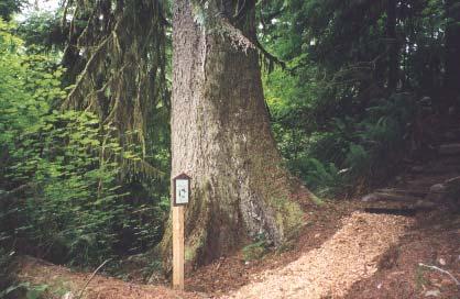
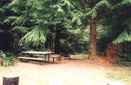
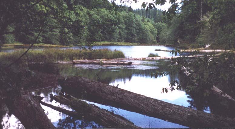
2 Photos on Cover: Gnat Creek Campground hiking trail (top) Soapstone Lake (middle) Gnat Creek Campground (bottom) ii
3 Foreword Clatsop State Forest encompasses more than 154,000 acres in the northwest corner of Oregon, primarily in the eastern third of Clatsop County. The State Board of Forestry sets management direction, and the Oregon Department of Forestry (ODF) manages the forest. The Astoria District administers approximately 137,000 acres of Clatsop State Forest, and Forest Grove and Tillamook districts administer the remainder of the forest. In the past, as a result of county initiative and legislative action, tax-delinquent lands were acquired by the county, transferred to the state, and reforested by ODF. The state made an agreement with the county to return percent of all future revenues to the local county, schools, and other taxing districts. Today, the forest is a major contributor to local county government and taxing district budgets, and the state-wide Common School Fund. Clatsop State Forest also makes a significant contribution to regional timber supply. It encompasses some of the most fertile land in Oregon, with approximately 96 percent of the forest classified as production and 4 percent as non-production lands. The forest is predominantly Douglas-fir and hemlock, with many diverse plant, fish, and wildlife species. Traditionally recreation has been limited to dispersed hunting, fishing, camping, and offhighway vehicle use by local residents and visitors from the Willamette Valley. However, public values have changed in recent years, and the public has developed a much stronger interest in the recreation and cultural resources on Clatsop State Forest. Active planning and management are taking place to protect all resources and to integrate the management of these resources with the values of this working forest. The Clatsop State Forest Recreation Management Plan outlines the implementation of recreation management on the state forest through objectives and actions, activity zoning, and the type of facilities the Department will develop and manage for. i
4 Acknowledgements The Oregon Department of Forestry prepared the Clatsop State Forest Recreation Management Plan 2000 with the assistance from a Citizen Advisory Committee and Technical Planning Team. Citizen Advisory Committee Geographic Representatives County Representative - Steve Butsko (Fishhawk/Jewell area) - George Kiepke (County Commissioner) - Frank Little (Cannon Beach area) - Roger Rocka (Chamber of Commerce) - Troy Lindgren (Knappa/Svensen area) - Chet Loving (Seaside/Gearhart area) Private Non-Industrial Landowner - John Christie User Group Representatives - Ron Tyson (Mountain Biking) - Tony White (ATV/Motorcylces/4-WD) - Diane Berry/Ashley Lertora (Equestrian Riding) - Steve Jurgensen (Hunting) - Craig Holt (Hiking) Technical Planning Team Herman Biederbeck Oregon Department of Fish and Wildlife Jeffrey Birmingham Clatsop County Parks Bill Lecture - Oregon Department of Forestry Pat Lines Oregon State Parks and Recreation Department Tom Parke Private Industrial Landowner Liisa Penner Clatsop County Historical Society Joe Sheahan Oregon Department of Fish and Wildlife The following ODF staff assisted in the preparation of the Plan: Becky Cooper (Recreation Specialist) John D. Barnes (NWOA Public Use Coordinator) ii
5 Table of Contents Foreword i Acknowledgements ii Table of Contents iii Location Map iv The Clatsop State Forest Recreation Management Plan Section I: Introduction Goals and Strategies Planning Process Section II: Short-Term Action Plan Recreation Management Motorized Recreation Non-Motorized Recreation Camping Day-Use Activities Hunting and Fishing Section III: The Role of Clatsop State Forest as a Recreation Provider Section IV: Designation of Activity Zoning Activity Zoning Map iii
6 Location Map CLATSOP COLUMBIA TILLAMOOK WASHINGTON MULTNOMAH YAMHILL CLACKAMAS MARION POLK LINCOLN BENTON LINN N Astoria District Northwest Oregon State Forests Miles iv
7 SECTION I: Introduction The Oregon Department of Forestry manages its lands for their Greatest Permanent Value. This management focus is to actively manage the forests as healthy, productive, and sustainable forest ecosystems that over time and across the landscape provide a full range of social, economic, and environmental benefits to the people of Oregon by providing sustainable timber harvest, maintaining and restoring aquatic habitats, protecting, maintaining, and enhancing native wildlife habitats, protecting soils, water, and air, and providing outdoor recreation while generating revenues to the state, counties, and local taxing districts, and at the same time maintaining the lands as forest lands. The department is conducting an intensive long-range planning process for the Northwest Oregon State Forests. This process will be completed with a Forest Management Plan and Habitat Conservation Plan that will guide state forest management. Strategies set forth in the Forest Management Plan require that a comprehensive Recreation Management Plan (RMP) be developed for Clatsop State Forest. In 1998, the Astoria District of the Oregon Department of Forestry undertook a public planning process to develop a RMP for Clatsop State Forest. The RMP identifies opportunities associated with recreation in the forest and outlines specific actions for recreation management and facility development. Some opportunities will be further evaluated and prioritized based on feasibility, staffing, and budget authorization, with a goal to accomplish the RMP in the next 10 years. As a result of this public input process, a draft RMP was distributed and available for a 60-day written comment and review period, which began June 19 th and ended August 17 th, In addition, five informational public meetings were held in Astoria, Seaside, Knappa, Jewell and Forest Grove through June and July to distribute the draft RMP. This Plan is the compilation of comments that were generated from the public and final edits of the draft RMP. The Recreation Management Plan is the foundation for implementing recreation management on Clatsop State Forest. Goals and Strategies Recreation goals and strategies were identified in the Northwest Oregon State Forests Management Plan that guide the recreation planning process. The Recreation Goals and Strategies are the following: Goals Goal 1: Provide diverse forest recreation opportunities that supplement, rather than duplicate, opportunities available in the region. Goal 2: Goal 3: Provide opportunities for interpretation and outdoor education on state forest lands. Manage recreational use of the forests to minimize adverse impacts to other resources and adjacent ownerships. 1
8 Goal 4: Minimize conflict among user groups. Goal 5: Maintain compatibility with Oregon s Statewide Planning Goal 8 (Recreational Needs). Strategy 1: Strategy 2: Strategy 3: Strategy 4: Strategy 5: Strategies Develop a set of standards and guidelines to govern recreation management activities and facility development and maintenance. Complete development of a coordinated volunteer program for the northwest Oregon state forests to maximize the efficient use of volunteers in recreation management efforts. Pursue cooperative agreements with user groups, and other agencies and organizations, to diversify the funding for recreation management projects and programs. Develop consistent themes and interpretive media for informing the public about the management of state forest land. Apply Oregon Administrative Rules (Chapter 629, Division 25) governing recreational use, combined with an effective law enforcement program designed to meet each district s needs. Planning Process The recreation planning process began in the fall of A five stage planning process progressed with the goal for completion and approval in October The process was objective driven with specific work tasks to be accomplished for each stage. The following chart provides an overview of the five stage process. Clatsop State Forest Recreation Planning Process Stage 1 Stage 2 Stage 3 Stage 4 Stage 5 Convene Review Develop Complete Collect Citizen Advisory Opportunities and Short-term Final RMP Information Committee Desired Action and Conditions Plan Technical Planning Team Analyze Identify interest Evaluate existing Establish actions Final draft existing groups and recreation sites for that will take place Recreation information, stakeholders, use and access, in the district's Management Plan research update create evaluate areas, sites Recreation Management is approved information, nomination and features for Plan on current recreation form for potential recreational and potential potential, interested use and access, recreation sites demand, and groups, define evaluate concerns based on priority or conflicts. expectations with the working need and with Finalize forest and other available funding assessment recreational users 2
9 To complete Stage 1, existing information was analyzed, updated, and incorporated into the Clatsop State Forest Recreation and Cultural Resource Inventory and Assessment Report. This report has been the foundation of information used to begin the intensive planning effort. Information was collected on Clatsop State Forest from and was analyzed and incorporated into an inventory and assessment report. The assessment is a component of the RMP and provides information regarding the following: Historical Overview of Clatsop State Forest Resource Description Current Resource Use and Management Recreation Supply and Demand Recreation Resource Needs and Opportunities Current Recreation Use on the Forest Cultural Resources on the Forest Findings about Recreation and Cultural Resources Oregon Administrative Rules that Apply to Recreation and Cultural Resources on the State Forest Copies of the report are available at the ODF Astoria District office: Hwy 202, Astoria, Oregon, The convening of a Citizen Advisory Committee (CAC) and Technical Planning Team (TPT) occurred in Stage 2. The CAC reviewed recreational opportunities and desired future conditions in Stage 3. In addition, five public meetings were held to gather input from the general public. In Stage 4, ODF staff developed objectives and the CAC assisted in creating action statements that would be incorporated into the RMP. These action statements were analyzed by staff, then organized into a draft Short-Term Action Plan for the Clatsop State Forest Recreation Management Plan. The actions are in a menu-style format as a way to consider each action based on feasibility, priority, and funding availability. Multiple draft plans were developed, reviewed, and refined by the CAC. A public draft was completed in July 2000, offered for review over a 60-day comment period, and presented at five public meetings. Two comments were received and addressed. The RMP was reviewed and approved, in Stage 5 of the planning process, by the Astoria Assistant District Operations Manager, Astoria District Forester and the Northwest Oregon Area Director. The RMP focuses on a short-term action plan, describes the role of Clatsop State Forest as a recreation provider, and provides a map of the designated activity zone boundaries. With the completion and approval of the Clatsop State Forest Recreation Management Plan, the district will hire permanent recreation personnel and consult with an advisory group to help advise district staff with establishing priorities for the recreation program. 3
10 This process will address topics relative to accomplishing the actions stated in the recreation plan, such as: staffing, funding, priority of projects, short and long term goals, budget proposals, sources of labor, and volunteer projects. The 12 member Citizen Advisory Committee (CAC) successfully functioned as a sounding board to assist the department in identifying potential recreation opportunities for the forest. The CAC represented geographic areas of Clatsop County, countywide interests, non-motorized constituents, and motorized constituents. A Technical Planning Team (TPT) also assisted the process with technical expertise and knowledge. The TPT was made up of stakeholders ranging from state agencies, county agencies, and private organizations. A quarterly newsletter, The Clatsop Forest Outlook, was utilized during the entire planning effort and was distributed to over 100 interested individuals and organizations. It provided updates of what stage the planning process was in, communicated public meeting schedules, and general information relating to recreation in Clatsop State Forest. The following diagram illustrates how the planning process has proceeded and will continue to proceed over time. Seasonal/Temporary Staffing Clatsop State Forest Recreation and Cultural Resource Inventory and Assessment Report Citizen Advisory Committee and Technical Planning Team Conducted Public Input Meetings Staffing Final/Approved RMP Follow-up public comment period and meetings -DRAFT- Clatsop State Forest Recreation Management Plan Preliminary Action Plan CSF Recreation Advisory Committee Budget to fund activities Accomplishing the RMP 4
11 SECTION II: Short-Term Action Plan The Short-Term Action Plan identifies six themes. The Recreation Management theme addresses objectives at a broad level relating to all recreation activities, rather than being activity specific. The remaining five themes focus on specific recreation activities. Each theme is organized to provide objectives relating to that theme. For each objective, actions are identified. These actions will be implemented based on priority and with available funding, and through input from an ongoing recreation advisory committee. The actions are not listed in priority. RECREATION MANAGEMENT Objective #1- Implement maintenance standards and procedures regarding public use activities on the forest. a) Implement ODF s Facility Standard s Manual on Clatsop State Forest. b) Redesign, upgrade, and build designated trails to minimize adverse resource impacts. c) Inventory and identify abandoned trails, roads, sites, and historic routes that can be utilized as trails and trail linkages, and provide opportunities for loop trails. d) Implement a district wide trash and garbage clean-up program. Objective #2- Enforce statutes and rules governing recreation use of state land. a) Utilize the Oregon State Police and Clatsop County Sheriffs Department to patrol the forest and enforce recreation rules and regulations governing recreation. b) Utilize ODF employees to make public contacts to promote compliance with regulations and raise awareness of forest management contributions. Objective #3- Establish a program of informing and educating users about recreation rules, opportunities, and a general orientation to the forest. a) Develop a program to educate the forest users on forest etiquette, the working forest concept, and compliance with the recreational activity. 5
12 b) Construct and install informational kiosks at day-use areas, campgrounds, staging areas, and trailheads describing ODF activities and interpreting cultural and natural history of the forest. c) Include the use of yield signs to improve public awareness of trails that specific activities can use. d) Develop a process to name and map established trails. e) Establish a district policy for publicizing of recreation opportunities, and evaluate the need for developing and publishing guides, brochures, and/or maps. f) Establish a Clatsop State Forest website. Incorporate recreation opportunities within the forest including GIS maps and links to complimentary sites. Objective #4- Increase user group participation in recreation projects in the forest. a) Form a Recreation Advisory Committee to help advise the district in development and implementation of the action plan and update activity zoning. b) Implement a volunteer program with user groups to establish, develop, maintain sites and facilities, and patrol trails and other high use areas. Objective #5- Improve the safety and management of recreational target shooting in the forest. a) Inventory, evaluate, and designate areas of the forest for target shooting. b) Establish no shooting zones around day-use areas, campgrounds, trailheads, and staging areas. Objective #6- Integrate recreation management with forest operations, fire season, regulations, adjacent landowners, and other management activities. a) Coordinate with other state lands programs to integrate all management activities. b) Promote an open gate policy on state land, wherever feasible and reasonable. Evaluate seasonal road closures in non-motorized zones during hunting season. c) Identify and mark property boundaries in critical or sensitive areas. 6
13 Objective #7- Determine desirability and feasibility of collecting recreational fees. a) Conduct a study to assess the feasibility of implementing user fees. Assess similar programs in other public land management agencies and in other states. Objective #8- Pursue acquisitions and land exchanges that promote unique recreation opportunities. a) Resolve ownership issues in Astoria Basin concerning Pipeline Road and land consolidation that would result in more diverse recreation opportunities, efficient recreation management, and effective land management strategies. b) Promote efforts to acquire high priority recreational sites adjacent to state land. 7
14 MOTORIZED RECREATION Objective #1- Establish motorized use zones to separate conflicting users and provide motorized recreation opportunities. a) Designate activity zones that identify types of activities and/or facilities provided. b) Conduct a planning process to determine activity zoning within the Astoria Basin. Resolve safety and environmental concerns associated with Pipeline Road. Objective #2- Establish a system of designated trails and road classes to better manage motorized use and redesign, upgrade, and/or build designated trails to minimize adverse resource impacts. a) Construct, upgrade, or re-route OHV trails consistent with ODF s Facility Standards Manual. b) Develop an OHV trails inventory and comprehensive trails plan that considers designated trails that: - may be located in the Nicolai, Knappa/Svensen, and Walluski areas - provide loop trails - provide perimeter trails in Gnat, Lousignot, Fishhawk, and Plympton Basins - evaluate potential areas for designated 4-wheel drive mud bog features near Knappa/Svensen - incorporate viewpoints into trail system design - keep trails rustic - minimize the amount of intersections for motorized use trails with mainlines - provide rock crawl features for 4-wheel drive vehicles c) Install barriers on motorized trails to eliminate impact from vehicles not capable of safely using the trail. d) Monitor and evaluate OHV impacts on riparian areas and sensitive habitats and adapt management plans accordingly. e) Reduce OHV use of active quarries, pits, road banks and sensitive areas. 8
15 Objective #3- Provide trailheads and staging areas to reduce conflicts and improve user experience. a) Apply a standard design for staging areas that provides ample parking and trail/visitor information. Consider installing loading and unloading ramps, restroom facilities at high use areas, and garbage containers. b) Consider staging areas in the following locations: - Knappa/Svensen - Nicolai Mountain - Walluski 9
16 NON-MOTORIZED RECREATION Objective #1- Upgrade existing trails to comply with ODF s Facility Standards Manual. Establish ongoing inspection and maintenance program to keep trails up to standards. a) Continue trail system development by Oregon Equestrian Trails behind Clatsop County Fairgrounds for horse trails and other non-motorized use. b) Explore the feasibility of designating the Taylorville Mountain Bike trails for all non-motorized activities. Objective #2- Provide trailheads and staging areas to reduce conflicts and improve user experience. a) Apply a standard design for staging areas that provides ample parking and trail/visitor information. Also include: - restroom facilities at high use areas - make staging areas for horse areas adequate for many trailers (group rides) along with manure disposal area - garbage containers b) Consider trailheads and staging areas in the following locations: - Jewell: equestrian - Shingle Mill Road: all non-motorized uses - Quartz Creek Bridge area: all non-motorized uses - Along Hwy 53 near Soapstone Lake trail Objective#3- Establish new or connector trails within areas identified for potential hiking, equestrian, and mountain bike use. Develop comprehensive trails plans. a) Develop more opportunities for non-motorized activities in Astoria Basin. - Explore North of Hwy 30 near John Day for hiking/day-use/boating - Mountain bike opportunities along Pipeline Road (above Emerald Heights) - Fairgrounds horse trail system that would go from Hwy 202 to Hwy 30 b) Expand Spruce Run Park in linear park concept along the Lower Nehalem River to include non-motorized trails. - Trail along Nehalem River near Spruce Run Park c) Develop hiking trails in Soapstone and Bloom Lake areas. 10
17 d) Build a non-motorized trail from Gnat Creek Fish Hatchery to Gnat Creek Falls. - Develop trail along Gnat Creek to Gnat Creek Falls e) Consider the following trail development locations and attributes: - North Fork Nehalem River (hiking/fishing access) - Fertile Valley - Knappa/Svensen (equestrian) - Northrup Creek Meadows (equestrian) - Elk Mountain - Maintain access and use of the Walluski and Powerline trails - Incorporate viewpoints into trail system design 11
18 CAMPING Objective #1- Provide low amenity, high quality camping facilities in accordance with ODF s Facility Standards Manual. a) Designate and manage Gnat Creek Park as an undeveloped semi-primitive campground with walk-in tent sites and hiking trails within area, and establish a non-motorized trail to Gnat Creek Fish Hatchery. b) Expand Spruce Run Park in linear park concept along the Lower Nehalem River providing opportunities for camping sites on west side of Nehalem River for canoeing/kayaking. c) Designate and manage Bloom Lake for semi-primitive camping with access by foot or horse trails. d) Designate and manage North Fork Nehalem River bridge area as undeveloped semi-primitive camping with access by foot or horse trails (camping along Sweethome area). e) Explore Jewell area for camping and trail opportunities. Designate Northrup Creek Meadows for camping Explore Jewell area for a horse camp and staging area - Explore developing a horse camp at Side Camp on Beneke Creek Road with linking trails - Explore Jewell area for equestrian trail system f) Provide dispersed camping in conjunction with non-motorized trails near Soapstone Lake. g) Explore Plympton Basin for potential camping opportunities. Repair and continue area of the Plympton Basin as a Boy Scout/Youth semi-primitive camp h) Evaluate east county for suitable horse camp. Coordinate with equestrian user groups. i) Develop a process to close certain areas of the forest to promote reserved camping and/or the use of a staging area, and charge a recreational permit fee. Objective #2- Establish a maintenance and operation program to prevent deterioration and to maintain standards of camping areas. a) Apply procedures, schedules, and processes consistent with ODF s Facility Standards Manual. 12
19 b) Install boulders for barriers at campgrounds and campsites to reduce impact of areas. Install fire rings at dispersed campsites. c) Implement a fee system for overnight use at developed campgrounds. DAY-USE ACTIVITIES Objective #1- Address need for day-use areas near Highways 26 and 30. a) Designate and establish day-use areas adjacent or near to current or potential campgrounds close to Hwy 26 and 30 (Spruce Run Park and Gnat Creek Park). Provide group picnic areas and information kiosks. Objective #2- Improve access to the Nehalem River. a) Locate and develop potential drift boat sites on the Nehalem River. Objective #3- Establish future direction for archery range. a) Work with the Saddle Mountain Archers to develop future strategies for management of archery range. HUNTING and FISHING Objective #1- Coordinate with ODF&W to maintain hunting and fishing opportunities. a) Continue to provide open areas for hunting and establish Travel Management Areas that are consistent with non-motorized activity zones. b) Evaluate seasonal road closures to improve quality of experience and escapement for animals. c) Communicate with ODF&W on stocking of fish on or adjacent to ODF recreation sites. 13
20 SECTION III: The Role of Clatsop State Forest as a Recreation Provider Recreational use is more than just the demand for a specific activity. It is also a demand for a physical setting conducive to that activity and to the particular experience desired by the recreationist. The recognized system for classifying settings and the experience they provide is the Recreation Opportunity Spectrum (ROS). The ROS is a continuum of recreational settings ranging from primitive (Wilderness) at one end and urban (cities) at the other. It is a common method of defining a provider s role and is used extensively by federal, state, and local agencies. Clatsop State Forest will be managed to provide settings that lie at the mid-range of the spectrum within the categories of Roaded-Natural and Roaded-Modified. Roaded-Natural: Forest settings that generally appear natural or slightly altered. Access is by highway, road and trail. Users can expect to meet moderate numbers of other people. Facilities such as developed campgrounds, trailheads, and trails are present but widely distributed. Occasional use of off-highway vehicles occurs. There are ample opportunities to seek solitude and participate in activities where there are no facilities and few people. Roaded-Modified: Forest settings that have obviously been altered by timber harvesting. Access is by highway, road and trail. Users can expect to meet a high level of other people in concentrated locations along rivers, peaks, and developed sites. Facilities such as developed campgrounds, trailheads, and day use areas are numerous. Frequent and concentrated use of off-highway vehicles occurs. There are limited opportunities to seek solitude and participate in activities where there are no facilities or other people. Managing the landscape to accomplish the general description of recreational settings above, Oregon state forest lands will provide rustic, natural, but high quality facilities in locations where resource compatibility permit and the need for development has been identified. Managers will apply the following general approaches when developing facilities for recreation: 1. Campgrounds fees are charged for overnight use all have barrier-free vault toilets, designated campsites, and ADA compliant trails where feasible drinking water is available from a centralized well with a hand pump where ground water and geology allow campsites are equipped with fire grates, picnic tables, tent pads, and site markers 14
21 2. Day-use Areas Day-use areas are located to maximize a specific recreation opportunity unique to an area. They are physically separated from camping areas using available terrain and natural and placed barriers generally include space for parking, information boards, and picnic tables vault toilets may be available at heavily used areas 3. Staging Areas A staging area is a facility for accommodating a specific trail-oriented recreation activity. The area meets the minimum requirements of a campground but generally does not have drinking water. Fees may be charged for overnight use. Off-highway Vehicle Staging Area: Parking area large enough for turn around space for OHV trailers Vault toilet facilities Campground area is designed for OHV use Equestrian Staging Area: Parking area large enough for turn around space for stock trailers Vault toilet facilities Provide day-use access to equestrian trail Campground area is designed for equestrian use pull through sites, corrals, and manure bins Trailheads: A developed area, which includes a parking area, trail information, trash receptacles, and vault toilet facilities at heavily used sites. 15
22 SECTION IV: Designation of Activity Zones The designation of activity zones is a method commonly used to allocate recreational use, facilities, and settings throughout a working forest. The goals for activity zone designations are to minimize resource impacts, reduce conflicts between different users, reduce conflicts between users and forest management activities, and to strive to accommodate recreation demands. Both motorized and non-motorized activities affect other forest resources. Some of the affects are increased water turbidity, soil compaction, erosion, sanitation problems, litter, reduction of understory vegetation, and reduced site productivity. Designating activity zones will contribute to the minimization of these affects across the forest. In addition, it will focus certain activities in areas that are most suitable for a particular activity. The designation of the zone boundaries involved many components. First, the staff reviewed all of the ideas generated, compiled and prioritized from Stage 3 and proposed an initial map to the Citizen Advisory Committee. Then, the CAC provided feedback on the draft preliminary zones. The following criteria were used to arrive at the proposed activity zoning map for CSF: Existing use patterns Protection of natural resources Soil and topography constraints Consideration of private landowners and inholdings Location and level of activity zoning in adjacent state forests Equitable balance among users Location of sensitive, threatened, or endangered wildlife species For example, areas of topography and soil conditions least sensitive to motorized use were zoned for motorized activities. Whereas, areas sensitive to motorized activity due to soil conditions were zoned for non-motorized activities. Note, too, that areas of the forest known to contain sensitive, threatened, and/or endangered wildlife species will be managed in a manner to protect those species, and were zoned for non-motorized activities. In some areas of the forest, consideration for private landowners and residents was weighed heavily in designating the area for non-motorized activities to reduce the noise levels that are associated with motorized activities. The activity zone boundaries include three categories: (1) non-motorized, (2) motorized, and (3) not designated. Trails developed and designated in a non-motorized zone will only be for hiking, mountain biking, and equestrian riding. Opportunities exist for all non-motorized uses to occur on a single trail, however, there are special occasions where use is limited to a single activity. Motorized use in the non-motorized zone of the forest is to be confined to gravel roads only. Trails designated in a motorized zone will focus on motorcycles, all-terrain vehicles (ATV) and four-wheel drive vehicles. Trails may be designated for all three activities or 16
23 or ATV and motorcycle only. Motorized use in the motorized zone of the forest is to be confined to gravel roads and officially designated, signed trails. The Astoria Basin and isolated scattered parcels surrounded by private land have not been designated as motorized or non-motorized zones. Consideration of zoning will be done in the future, after issues concerning access and impacts to private landowners are resolved. Motorized use in areas not designated (unzoned) will be confined to gravel roads only. 17
24 Recreation Activity Zoning Clatsop State Forest HWY 101 # Astoria HWY 30 # Knappa ÆQ Gnat Creek Campground # # Wauna # Westport HWY 202 # Nicolai Mtn # Seaside Cannon Beach # HWY 26 # Jewell HWY 53 LEGEND Basin Boundaries Highways Activity Zoning Non-Motorized - 99,531 acres Motorized - 29,081 acres Unzoned - 8,253 acres ÆQ Spruce Run Campground # To Portland Miles N
Preferred Recreation Recommendations Stemilt-Squilchuck Recreation Plan March 2018
 Preferred Recreation Recommendations Stemilt-Squilchuck Recreation Plan March 2018 Below are the recommended recreation ideas and strategies that package together the various recreation concepts compiled
Rogue River Access and Management Plan Draft Alternatives
 Rogue River Access and Management Plan Draft Alternatives The Rogue River Access and Management Plan was initiated in December, 2011 and is being led by Jackson County Parks (JCP) and Oregon Department
Theme: Predominately natural/natural appearing; rustic improvements to protect resources. Size*: 2,500 + acres Infrastructure**:
 Recreation Opportunity Spectrum (ROS) Classes The Recreation Opportunity Spectrum (ROS) provides a way to describe the variations in the degree of isolation from the sounds and influences of people, and
Logo Department Name Agency Organization Organization Address Information 5700 North Sabino Canyon Road
 Logo Department Name Agency Organization Organization Address Information United States Forest Coronado National Forest 5700 North Sabino Canyon Road Department of Service Santa Catalina Ranger District
Continental Divide National Scenic Trail Legislative History and Planning Guidance
 Continental Divide National Scenic Trail Legislative History and Planning Guidance Legislation, Policy, and Direction Regarding National Scenic Trails The National Trails System Act, P.L. 90-543, was passed
Understanding the caring capacity of the visitor experience Provide facilities to support a high level user experience Address visual quality through
 Understanding the caring capacity of the visitor experience Provide facilities to support a high level user experience Address visual quality through recreation ecological restoration opportunities Collaboration
Proposed Action. Payette National Forest Over-Snow Grooming in Valley, Adams and Idaho Counties. United States Department of Agriculture
 United States Department of Agriculture Forest Service January 2012 Proposed Action Payette National Forest Over-Snow Grooming in Valley, Adams and Idaho Counties Payette National Forest Valley, Adams
City of Durango 5.8 FUNDING TRAILS DEVELOPMENT
 5.8 FUNDING TRAILS DEVELOPMENT The City has been successful in establishing dedicated local funding sources as well as applying for grants to develop the City s trail system, having received nearly $2.4
Fossil Creek Wild & Scenic River Comprehensive River Management Plan Forest Service Proposed Action - details March 28, 2011
 Fossil Creek Wild & Scenic River Comprehensive River Management Plan Forest Service Proposed Action - details March 28, 2011 Primary Goals of the Proposed Action 1. Maintain or enhance ORVs primarily by
Flow Stand Up Paddle Board Parkway Plan Analysis
 Regional Parks Department Jeffrey R. Leatherman, Director County of Sacramento Divisions Administration Golf Leisure Services Maintenance Rangers Therapeutic Recreation Services Flow Stand Up Paddle Board
MANAGEMENT DIRECTION STATEMENT June, 1999
 Thompson River District MANAGEMENT DIRECTION STATEMENT June, 1999 for Roche Lake Provincial Park Ministry of Environment Lands and Parks BC Parks Division Table of Contents I. Introduction A. Setting
White Mountain National Forest Saco Ranger District
 United States Department of Agriculture Forest Service White Mountain National Forest Saco Ranger District 33 Kancamagus Highway Conway, NH 03818 Comm: (603) 447-5448 TTY: (603) 447-3121 File Code: 1950
Rule Governing the Designation and Establishment of All-Terrain Vehicle Use Trails on State Land
 Rule Governing the Designation and Establishment of All-Terrain Vehicle Use Trails on State Land 1.0 Authority 1.1 This rule is promulgated pursuant to 23 V.S.A. 3506. Section 3506 (b)(4) states that an
RE: Access Fund Comments on Yosemite National Park Wilderness Stewardship Plan, Preliminary Ideas and Concepts
 September 30, 2016 Superintendent Yosemite National Park Attn: Wilderness Stewardship Plan P.O. Box 577 Yosemite, CA 95389 RE: Access Fund Comments on Yosemite National Park Wilderness Stewardship Plan,
5.0 OUTDOOR RECREATION OPPORTUNITIES AND MANAGEMENT
 5.0 OUTDOOR RECREATION OPPORTUNITIES AND MANAGEMENT 5.1 Introduction This section describes the range of recreational activities that currently take place in Marble Range and Edge Hills Parks, as well
Buford / New Castle Motorized Trail
 Buford / New Castle Motorized Trail Rifle Ranger District, White River National Forest Garfield County, Colorado Comments Welcome The Rifle Ranger District of the White River National Forest welcomes your
EXECUTIVE SUMMARY PROGRAM DEVELOPMENT REPORT PURPOSE EXISTING SETTING EXPANDING PARKLAND
 EXECUTIVE SUMMARY PROGRAM DEVELOPMENT REPORT PURPOSE As the culmination of the first phase of the master planning process, this Program Development Report creates the framework to develop the Calero County
April 10, Mark Stiles San Juan Public Lands Center Manager 15 Burnett Court Durango, CO Dear Mark,
 Mark Stiles San Juan Public Lands Center Manager 15 Burnett Court Durango, CO 81301 Dear Mark, We are pleased to offer the following comments on the draft San Juan Public Lands Center management plans
Wallace Falls State Park Classification and Management Planning Stage 3 Preliminary Recommendations July 18, 2018 Sultan City Hall
 Wallace Falls State Park Classification and Management Planning Stage 3 Preliminary Recommendations July 18, 2018 Sultan City Hall Thanks for coming! This document contains State Parks preliminary recommendations
January 14, Orange County Transportation Authority Attn: M2 NCCP/HCP 550 South Main Street P.O. Box Orange, CA
 Equestrian Trails, Inc. Corral 357 P.O. Box 1026 Trabuco Canyon, CA 92678 http://saddlebackcanyonriders.com/ President: James Iacono... 714-612-1789 January 14, 2016 Orange County Transportation Authority
Creating a User-Driven Long-Distance OHV Trail Through Partnering
 Joseph Raffaele Outdoor Recreation Planner U.S. Bureau of Land Management Yuma, Arizona Creating a User-Driven Long-Distance OHV Trail Through Partnering BLM is a multiple-use land management agency within
F. Forest Recreation Management
 F. Forest Recreation Management F.1) Park and Recreation Management F.1.A. Program Overview. The park and recreation program has been in existence since 1980. With ever increasing outdoor recreation demands
Land Management Summary
 photo credit: ANGAIR Anglesea Heath Land Management Summary The Anglesea Heath (6,501 ha) was incorporated into the Great Otway National Park in January 2018. This provides an opportunity to consider the
Welcome to the future of Terwillegar Park a Unique Natural Park
 Welcome to the future of Terwillegar Park a Unique Natural Park 1 Introduction The Terwillegar Park Concept Plan study will develop an overall concept plan, management objectives and development guidelines
Wallowa Falls Hydroelectric Project FERC Project No. P-308 Proposed Study Plans - Recreation August 2011
 Wallowa Falls Hydroelectric Project FERC Project No. P-308 August 2011 Prepared by: PacifiCorp Energy Hydro Resources 825 NE Multnomah, Suite 1500 Portland, OR 97232 For Public Review Wallowa Falls Hydroelectric
Watchorn Provincial Park. Management Plan
 Watchorn Provincial Park Management Plan 2 Watchorn Provincial Park Table of Contents 1. Introduction... 3 2. Park History... 3 3. Park Attributes... 3 3.1 Natural... 4 3.2 Recreational... 4 3.3 Additional
Recreation Opportunity Spectrum for River Management v
 Recreation Opportunity Spectrum for Management v. 120803 Introduction The following Recreation Opportunity Spectrum (ROS) characterizations and matrices mirror the presentation in the ROS Primer and Field
Decision Memo Broken Wheel Ranch Equestrian Outfitter Special-Use Permit Proposed Action
 Decision Memo Broken Wheel Ranch Equestrian Outfitter Special-Use Permit USDA Forest Service Mississippi Bluffs Ranger District, Shawnee National Forest Jackson and Union Counties, Illinois Proposed Action
2. Goals and Policies. The following are the adopted Parks and Trails Goals for Stillwater Township:
 D. PARKS AND TRAILS 1. Introduction Stillwater Township s population is relatively low, with most residents living on rural residences on large lots. The need for active park space has been minimal in
13.1 REGIONAL TOURISM ISSUES AND SUMMARY OF FINDINGS
 13 REGIONAL TOURISM T he County of Mariposa s recreation needs and facilities fall within two categories: regional tourism and local recreation. This Element focuses on regional tourism issues related
Outdoor Recreation Opportunities Management
 Outdoor Recreation Opportunities Management Introduction The natural features of Height of the Rockies and Elk Lakes provincial parks provide a wide variety of outdoor recreational activities. However,
Sibley LUPA. Board Executive Committee Meeting December 7, 2017
 Sibley LUPA Board Executive Committee Meeting December 7, 2017 Project Location & Project Area 1,318-acre Robert Sibley Volcanic Regional Preserve Project Area Purpose Project Purpose & Goals Append the
Yard Creek Provincial Park. Management Plan
 Yard Creek Provincial Park Management Plan Draft January 2010 Yard Creek Provincial Park Management Plan Approved by: telàlsemkin/siyam/chief Scott Benton Bill Williams Squamish Executive Director ation
WORKSHEET 1 Wilderness Qualities or Attributes Evaluating the Effects of Project Activities on Wilderness Attributes
 WORKSHEET 1 Wilderness Qualities or Attributes Evaluating the Effects of Project Activities on Wilderness Attributes Date: 3/7/2017 Roadless Area: Ruby South Description of Project Activity or Impact to
APPENDIX C RECREATION OPPORTUNITY SPECTRUM PROCESS AND CLASSES
 APPENDIX C RECREATION OPPORTUNITY SPECTRUM PROCESS AND CLASSES RECREATION OPPORTUNITY SPECTRUM PROCESS Recreation area management objectives are defined through a planning process referred to as the Recreation
Discussion Topics. But what does counting tell us? Current Trends in Natural Resource Management
 Discussion Topics What are the outputs of natural resource management How do we measure what we produce What are the outputs of resource recreation management Ed Krumpe CSS 287 Behavioral approach to management
Silver Lake Park An Environmental Jewel for the Citizens of Prince William County
 Silver Lake Park An Environmental Jewel for the Citizens of Prince William County The Prince William Park Authority Mission Statement states: The Prince William County Park Authority will create quality
Proposal to Redevelop Lower Kananaskis River-Barrier Lake. Bow Valley Provincial Park. Frequently Asked Questions
 Proposal to Redevelop Lower Kananaskis River-Barrier Lake Bow Valley Provincial Park Frequently Asked Questions What is being proposed? What are the details of the proposal? Where is the project area located?
Final Recreation Report. Sunflower Allotment Grazing Analysis. July 2015
 Final Recreation Report Sunflower Allotment Grazing Analysis July 2015 Table of Contents Introduction... 3 Affected Environment... 3 Four Peaks Wilderness Area... 3 Dispersed Recreation... 3 Environmental
National Recreation Trail Application for Designation
 National Recreation Trail Application for Designation Introduction Thank you for your interest in the National Recreation Trail (NRT) program. Completed NRT application packages must be submitted by December
Sawtooth National Forest Fairfield Ranger District
 United States Department of Agriculture Forest Service Sawtooth National Forest Fairfield Ranger District P.O. Box 189 Fairfield, ID. 83327 208-764-3202 Fax: 208-764-3211 File Code: 1950/7700 Date: December
DIRECTOR S ORDER #41: Wilderness Preservation and Management
 These are relevant sections about Wilderness Management Plans from National Park Service 2006 Management Policies, Director s Orders #41 and Reference Manual 41. National Park Service U.S. Department of
Procedure for the Use of Power-Driven Mobility Devices on Mass Audubon Sanctuaries 1 September 17, 2012
 Procedure for the Use of Power-Driven Mobility Devices on Mass Audubon Sanctuaries 1 September 17, 2012 Background As part of Mass Audubon s mission to preserve the nature of Massachusetts for people and
METROPOLITAN COUNCIL 390 North Robert Street, St. Paul, MN Phone (651) TDD (651)
 TDD (651)") DATE: March 27, 2012 METROPOLITAN COUNCIL 390 North Robert Street, St. Paul, MN 55101 Phone (651) 602-1000 TDD (651) 291-0904 TO: Metropolitan Parks and Open Space Commission FROM: Arne Stefferud, Planning
DATE: March 27, 2012 METROPOLITAN COUNCIL 390 North Robert Street, St. Paul, MN 55101 Phone (651) 602-1000 TDD (651) 291-0904 TO: Metropolitan Parks and Open Space Commission FROM: Arne Stefferud, Planning
Whitefish Range Partnership Tentatively Approved by WRP 11/18/2013!Rec. Wilderness Page 1
 Whitefish Range Partnership Tentatively Approved by WRP 11/18/2013!Rec. Wilderness Page 1 Recommended Wilderness Background The Whitefish Range has a long management and legislative history associated
Special Recreation Management Areas Extensive Recreation Management Areas Public Lands Not Designated as Recreation Management Areas
 From the Proposed RMP: Special Recreation Management Areas SRMAs are an administrative unit where the existing or proposed recreation opportunities and recreation setting characteristics are recognized
MONTEREY REGIONAL AIRPORT MASTER PLAN TOPICAL QUESTIONS FROM THE PLANNING ADVISORY COMMITTEE AND TOPICAL RESPONSES
 MONTEREY REGIONAL AIRPORT MASTER PLAN TOPICAL QUESTIONS FROM THE PLANNING ADVISORY COMMITTEE AND TOPICAL RESPONSES Recurring topics emerged in some of the comments and questions raised by members of the
MASTER PLAN EXECUTIVE SUMMARY
 Biscuit Run State Park Scottsville Road (State Route 20) Charlottesville, VA 22902 Biscuit Run State Park MASTER PLAN EXECUTIVE SUMMARY Department of Conservation and Recreation Division of Planning and
Nantucket Memorial Airport Master Plan Update
 Nantucket Memorial Airport Master Plan Update CHAPTER 1 - INTRODUCTION & PUBLIC OUTREACH PROGRAM REVIEW DRAFT SUBJECT TO CHANGE Prepared for: Nantucket Memorial Airport Commission 14 Airport Road Nantucket,
RECREATION. Seven issues were identified that pertain to the effects of travel management on outdoor recreation within portions of the project area.
 RECREATION Seven issues were identified that pertain to the effects of travel management on outdoor recreation within portions of the project area. OPPORTUNITIES FOR SOLITUDE / QUIET TRAILS. One attraction
Daisy Dean Trail 628/619 ATV Trail Construction
 Background and Purpose and Need The Daisy Dean ATV Trail Construction Project is located in the Little Belt Mountains, Musselshell Ranger District, Lewis and Clark National Forest approximately 32 miles
Outdoor Recreation Opportunities Management
 Outdoor Recreation Opportunities Management Introduction A major role of a management plan is to provide direction regarding the types of recreation that are appropriate, and to outline the steps that
Criddle/Vane Homestead Provincial Park. Management Plan
 Criddle/Vane Homestead Provincial Park Management Plan 2 Criddle/Vane Homestead Provincial Park Table of Contents 1. Introduction... 3 2. Park History.... 3 3. Park Attributes.... 4 3.1 Natural.... 4 3.2
Wilderness Areas Designated by the White Pine County bill
 Wilderness Areas Designated by the White Pine County bill SEC. 321. SHORT TITLE. This subtitle may be cited as the `Pam White Wilderness Act of 2006'. SEC. 322. FINDINGS. Congress finds that-- The White
FINAL TESTIMONY 1 COMMITTEE ON RESOURCES UNITED STATES HOUSE OF REPRESENTATIVES. July 13, 2005 CONCERNING. Motorized Recreational Use of Federal Lands
 FINAL TESTIMONY 1 STATEMENT OF DALE BOSWORTH CHIEF Of the FOREST SERVICE UNITED STATES DEPARTMENT OF AGRICULTURE Before the SUBCOMMITTEE ON FORESTS AND FOREST HEALTH And the SUBCOMMITTEE ON NATIONAL PARKS,
Dumont Dunes Special Recreation Management Area (SRMA)
") Dumont Dunes Special Recreation Management Area (SRMA) RMA/RECREATION MANAGEMENT ZONE (RMZ) OBJECTIVE(S) DECISIONS Objective Statement: Designate this area as a Special Recreation Management Area. To manage
Dumont Dunes Special Recreation Management Area (SRMA) RMA/RECREATION MANAGEMENT ZONE (RMZ) OBJECTIVE(S) DECISIONS Objective Statement: Designate this area as a Special Recreation Management Area. To manage
Business Item No XXX. Proposed Action That the Metropolitan Council approve the Coon Creek Regional Trail Master Plan.
 Business Item No. 2015-XXX Metropolitan Parks and Open Space Commission Meeting date: July 7, 2015 For the Community Development Committee meeting of July 20, 2015 For the Metropolitan Council meeting
BACKCOUNTRY TRAIL FLOOD REHABILITATION PROGRAM
 BACKCOUNTRY TRAIL FLOOD REHABILITATION PROGRAM Backcountry Trail Flood Rehabilitation A June 2013 Flood Recovery Program Summary In June 2013, parts of Southern Alberta were devastated from significant
Connie Rudd Superintendent, Black Canyon of the Gunnison National Park
 National Park Service U.S. Department of the Interior Black Canyon of the Gunnison National Park and Curecanti National Recreation Area Information Brochure #1 Wilderness and Backcountry Management Plan
PROPOSED PARK ALTERNATIVES
 8 Chimne y Rock State Park M a ster Pl an 2011 PROPOSED PARK ALTERNATIVES Introduction Three different park development concepts were prepared and presented to the citizens of North Carolina through a
PURPOSE AND NEED. Introduction
 Public Scoping: Allocation of Recreation Capacity for Commercial Outfitter Guide Services on North Kruzof Island Trails (Kruzof Island Outfitter Guide) PURPOSE AND NEED Introduction The U.S. Department
CHAPTER 5. Chapter 5 Recreation Element
 CHAPTER 5 Recreation Element Chapter 5 Recreation Element The Recreation Element of the Meyers Area Plan is a supplement to the Recreation Element of the TRPA Regional Plan and the El Dorado County General
Kelly Motorized Trails Project Proposed Action
 Kelly Motorized Trails Project Proposed Action November 28, 2011 The Flagstaff Ranger District of the Coconino National Forest is seeking public input on the proposed Kelly Motorized Trails Project (formerly
Criddle/Vane Homestead Provincial Park. Draft Management Plan
 Criddle/Vane Homestead Provincial Park Draft Management Plan 2 Criddle/Vane Homestead Provincial Park Table of Contents 1. Introduction... 3 2. Park History.... 3 3. Park Attributes.... 3 3.1 Natural....
Business Item No
 Metropolitan Parks and Open Space Commission Meeting date: February 6, 2018 For the Community Development Committee meeting of February 20, 2018 For the Metropolitan Council meeting of February 28, 2018
As outlined in the Tatshenshini-Alsek Park Management Agreement, park management will:
 Management Strategy General Strategy The priority management focus for the park is to ensure that its internationally significant natural, cultural heritage and recreational values are protected and that
MUNICIPALITY OF ANCHORAGE
 MUNICIPALITY OF ANCHORAGE ANCHORAGE PARKS & RECREATION Memorandum PRC 08-56 DATE: 5 August 2008 TO: FROM: SUBJECT: Parks & Recreation Commission Holly Spoth-Torres, Park Planner PRC 08-56 Far North Bicentennial
PROPOSED ACTION South 3000 East Salt Lake City, UT United States Department of Agriculture
 United States Department of Agriculture Forest Service Uinta-Wasatch-Cache National Forest Salt Lake Ranger District 6944 South 3000 East Salt Lake City, UT 84121 801-733-2660 File Code: 1950/2300 Date:
St. Joe Travel Management EA CULTURAL RESOURCES
 St. Joe Travel Management EA CULTURAL RESOURCES Bruce Gibson May 2015 Regulatory Framework Forest Plan The Idaho Panhandle National Forests (IPNF) Forest Plan requires systematic cultural resource inventory
Steer Creek Campground Corral
 Steer Creek Campground Corral Purpose and Need The purpose of this project is to increase the availability of camping experiences and services for equestrians at the Steer Creek Campground in the Samuel
JOSLIN FIELD, MAGIC VALLEY REGIONAL AIRPORT DECEMBER 2012
 1. Introduction The Federal Aviation Administration (FAA) recommends that airport master plans be updated every 5 years or as necessary to keep them current. The Master Plan for Joslin Field, Magic Valley
RUSHMORE CONNECTOR TRAIL PROPOSAL
 PURPOSE AND NEED Background The U.S. Forest Service, Black Hills National Forest (Forest Service) has received a special use permit application from the State of South Dakota Department of Game, Fish and
Chapter 6: POLICY AND PROCEDURE RECOMMENDATIONS
 Chapter 6 POLICY AND PROCEDURE RECOMMENDATIONS FOR SRRA Below are seven policy elements that should be considered for adoption by the Southwest Regional Recreation Authority of Virginia: 1. Develop strategies
Appendix A BC Provincial Parks System Goals
 Appendix A BC Provincial Parks System Goals The British Columbia Provincial Parks System has two mandates: To conserve significant and representative natural and cultural resources To provide a wide variety
Blueways: Rivers, lakes, or streams with public access for recreation that includes fishing, nature observation, and opportunities for boating.
 Parks, Open Space and Trails PRINCE WILLIAM COUNTY 2008 COMPREHENSIVE PLAN TRAILS PLAN CONTENTS The components of the trails plan are: Intent Definitions Goals, Policies, and Action Strategies Trails Map
Welcome and thank you for being here! Kick-Off Public Workshop November 19, 2014
 Welcome and thank you for being here! Kick-Off Public Workshop November 19, 2014 OPEN SPACE MATTERS: Boise s First Reserve Master Plan Julia Grant Foothills and Open Space Manager City of Boise Ellen Campfield
Aitkin County Comprehensive Recrea5on Trail Plan. May 2010
 Aitkin County Comprehensive Recrea5on Trail Plan May 2010 Overview and Goals of the Plan Why do a plan? Who is responsible for the plan How the plan has been developed What is in the plan Ac#on Steps &
Final Environmental Impact Statement for the Merced Wild and Scenic River. Comprehensive Management Plan, Yosemite National Park, Madera and Mariposa
 This document is scheduled to be published in the Federal Register on 02/26/2014 and available online at http://federalregister.gov/a/2014-04061, and on FDsys.gov DEPARTMENT OF THE INTERIOR 4312-FF NATIONAL
Central Cascades Wilderness Strategies Project
 Central Cascades Wilderness Strategies Project Wilderness is Unique What makes designated Wilderness different from other national forest lands? Wilderness Act of 1964 to assure that an increasing population
Percentage Participation
 1. Sustainable Recreation Sustainable Recreation is defined as the set of recreation settings and opportunities on the National Forest System that is ecologically, economically, and socially sustainable
Coronado National Forest Santa Catalina Ranger District
 United States Department of Agriculture Forest Service Coronado National Forest Santa Catalina Ranger District File Code: 1950 Date: October 14, 2015 Dear Interested Party: The Santa Catalina Ranger District
Project Planning, Compliance, and Funding
 Project Planning, Compliance, and Funding The plans above offer high level guidance to ensure that the A.T. is managed effectively as a whole unit in a decentralized management structure. Cooperative management
Dungeness Recreation Area County Park Master Plan
 Dungeness Recreation Area County Park Public Outreach Meeting October 10, 2007 Project Overview USFWS Site Dungeness Recreation Area County Park Meeting Objectives: Re-Introduce project; provide status
Accessibility Guidelines for Outdoor Recreation and Trails
 Accessibility Guidelines for Outdoor Recreation and Trails Association of Conservation Engineers September 17, 2007 Accessibility Guidelines for Outdoor Recreation and Trails Access Board is the independent
White Mountain National Forest Saco Ranger District
 United States Department of Agriculture Forest Service White Mountain National Forest 33 Kancamagus Highway Conway, NH 03818 Comm: (603) 447-5448 TTY: (603) 447-3121 File Code: 1950 Date: February 26,
The Roots of Carrying Capacity
 1 Applying Carrying Capacity Concepts in Wilderness 1872 1964...shall be preserved for the use & enjoyment of the American people...in such manner as will leave them unimpaired for future generations...
Bradley Brook Relocation Project. Scoping Notice. Saco Ranger District. United States Department of Agriculture Forest Service
 Bradley Brook Relocation Project United States Department of Agriculture Forest Service Scoping Notice White Mountain National Forest February 2011 For Information Contact: Jenny Burnett White Mountain
Visitors Experiences and Preferences at Lost Lake in Clatsop State Forest, Oregon
 Visitors Experiences and Preferences at Lost Lake in Clatsop State Forest, Oregon Final Report Mark D. Needham, Ph.D. Assistant Professor Recreation Resource Management Program Department of Forest Resources
Executive Summary. MASTER PLAN UPDATE Fort Collins-Loveland Municipal Airport
 Executive Summary MASTER PLAN UPDATE Fort Collins-Loveland Municipal Airport As a general aviation and commercial service airport, Fort Collins- Loveland Municipal Airport serves as an important niche
DECISION MEMO. Rawhide Trail #7073 Maintenance and Reconstruction
 Page 1 of 6 Background DECISION MEMO USDA Forest Service Jefferson Ranger District Jefferson County, Montana Rawhide Trail #7073 is located in the Elkhorn Mountain Range approximately 10 miles east of
Chapter 1 Introduction and Project Overview
 Chapter 1 Introduction and Project Overview Kittitas County in cooperation with the Federal Aviation Administration (FAA) is updating the Airport Master Plan for Bowers Field Airport (FAA airport identifier
National Forests and Grasslands in Texas
 United States Department of Agriculture Forest Service National Forests and Grasslands in Texas Sam Houston NF 394 FM 1375 West New Waverly, Texas 77358 Phone 936-344-6205 Dear Friends, File Code: 1950
PROPOSAL FOR RECLASSIFICATION, BOUNDARY AMENDMENT AND DRAFT CONCEPT PLAN FOR SASKATOON MOUNTAIN NATURAL AREA. Frequently Asked Questions
 PROPOSAL FOR RECLASSIFICATION, BOUNDARY AMENDMENT AND DRAFT CONCEPT PLAN FOR SASKATOON MOUNTAIN NATURAL AREA 1. Why is this proposal being put forward? Frequently Asked Questions For many years, Alberta
ROBERTS CREEK PROVINCIAL PARK MASTER PLAN. November, 1981
 Ministry of Lands, Parks and Housing Parks and Outdoor Recreation Division Park Operations Branch North Vancouver, B. C. ROBERTS CREEK PROVINCIAL PARK MASTER PLAN November, 1981 Mr. G. Trachuk Director
Mt. Hood National Forest
 United States Department of Agriculture Forest Service Mt. Hood National Forest Zigzag Ranger District 70220 E. Highway 26 Zigzag, OR 97049 503-622-3191 Fax: 503-622-5622 File Code: 1950-1 Date: June 29,
PROUDLY BRINGING YOU CANADA AT ITS BEST. Management Planning Program NEWSLETTER #1 OCTOBER, 2000
 PROUDLY BRINGING YOU CANADA AT ITS BEST VUNTUT NATIONAL PARK Management Planning Program NEWSLETTER #1 OCTOBER, 2000 INTRODUCTION This newsletter launches the development of the first management plan for
System Group Meeting #1. March 2014
 System Group Meeting #1 March 2014 Meeting #1 Outcomes 1. Understand Your Role 2. List of Revisions to Existing Conditions 3. Information Sources Study Area The Purpose of Mountain Accord is to Preserve
A GIS Analysis of Probable High Recreation Use Areas in Three Sisters Wilderness Deschutes and Willamette National Forests
 Lindsey Kiesz Geo 565 Term Project 3/15/2010 A GIS Analysis of Probable High Recreation Use Areas in Three Sisters Wilderness Deschutes and Willamette National Forests Introduction The Three Sisters Wilderness
Rockin River Ranch State Park. TAC Meeting No. 2
 Rockin River Ranch State Park TAC Meeting No. 2 ASPT Welcome Skip Varney Deputy Director of Operations and Development Rockin River Ranch State Park Workshop Outline Planning Process/Schedule Overview
3.0 LEARNING FROM CHATHAM-KENT S CITIZENS
 3.0 LEARNING FROM CHATHAM-KENT S CITIZENS An important aspect in developing the Chatham-Kent Trails Master Plan was to obtain input from stakeholders and the general public. Throughout the course of the