TRANSMITTAL. Please contact me with any questions. 7 Spruce Road, Freeport, ME T: (207)
|
|
|
- Clara Tucker
- 5 years ago
- Views:
Transcription

1 BAKER DESIGN CONSULTANTS Civil, Marine and Structural Engineering To: Alex Jaegerman FAICP Director of Planning & Development Town of Yarmouth 200 Main Street PO Box 907 Yarmouth, ME From: Barney Baker, PE Date: May 31, 2016 Subject: Shoreland Application Sullivan Embankment Copy: File, Wendy & JB Sullivan-Applicants, Tony Cowles- Cowles Studio Job No: Reviewed For your use As per your request VIA: Personal Delivery Special Delivery Messenger U.S. Mail U.S. Express Mail Overnight Express UPS Separate Cover Fax Modem TRANSMITTAL \BDC-SRV\Projects\14\14-65 JB Sullivan Embankment\Permits\Yarmouth Shoreland\14-65 T-AJ-1.docx \ Attached is one (1) copy of a Shoreland application for a program of erosion control repairs to the on the property together with an application Fee of $250. Thirteen (13) additional sets, (four with full size drawings) will be provided under separate cover. My understanding is that the Town will provide me with a notification letter and a list of abutter addresses so that I can notify abutting property owners by certified mailing. On behalf of my clients, I would like to have this project placed on the Planning Board agenda for June 22. Please contact me with any questions. 7 Spruce Road, Freeport, ME T: (207) b.baker@bakerdesignconsultants.com
2 Shoreland Application May 31, 2016 Sullivan Embankment Stabilization & Rehabilitation Yarmouth, Maine Applicant: Wendy & John B Sullivan 247 Sea Meadows Lane Yarmouth, Maine Submitted To: Alex Jaegerman FAICP Director of Planning & Development Town of Yarmouth 200 Main Street PO Box 907 Yarmouth, ME BAKER DESIGN CONSULTANTS Civil, Marine and Structural Engineering 7 Spruce Road; Freeport, Maine 04096
3 14-65 Sullivan Embankment TABLE OF CONTENTS SHORELAND APPLICATION APPLICATION... 1 Project Narrative... 5 Agent Authorization... 7 Property Deeds... 8 Site Pictures APPENDIX A State & Federal Regulatory Correspondence APPENDIX B Project Drawings \\BDC-SRV\Projects\14\14-65 JB Sullivan Embankment\Permits\Yarmouth Shoreland\14-65 Sullivan Shoreland Application docx
4 14-65 Sullivan Embankment APPLICATION Yarmouth Shoreland Application Page 1
5 14-65 Sullivan Embankment Yarmouth Shoreland Application Page 2

6 14-65 Sullivan Embankment Yarmouth Shoreland Application Page 3
7 14-65 Sullivan Embankment Yarmouth Shoreland Application Page 4
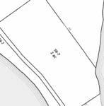
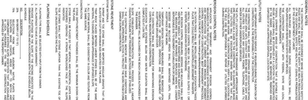
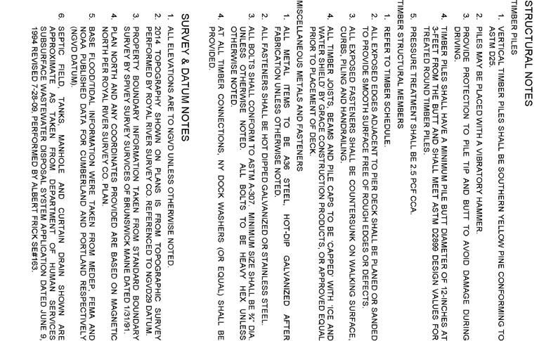
8 14-65 Sullivan Embankment Project Narrative The Sullivan property is located on Sea Meadows Lane and includes approximately 500 LF of shore frontage on Casco Bay. The residential home on the property is part of a well-established neighborhood. The entire property is zoned as low Density Residential and is entirely within the Shoreland Overlay District. Refer to the Site Pictures that start on page 10 and plans located in APPENDIX B Project Drawings that start on page 13. The project includes the stabilization of an existing coastal slope with geotextile, plantings and coir logs to address active erosion. The work serves to protect from further property loss that would eventually encroach upon the existing septic system. A. PURPOSE AND NEED OF PROPOSED IMPROVEMENTS An overview of site work is provided on Sheet C-0 SITE PLAN OVERVIEW. The primary activity stabilizes a section of the coastal embankment on the Sullivan property that is located on Sea Meadows Lane in Yarmouth. Several coastal trees are in danger of failing due to undermining of the roots system. If coastal erosion proceeds unchecked, the coastal trees and septic system will eventually be impacted. The proposed work also improves an existing access to the shore that will be used temporarily for construction access for the bank stabilization work. The access is necessary to maintain a safe passage to the shore for use by the property owner. Improvements are also made to the front lawn to control runoff on the property from Sea Meadows Lane. B. EMBANKMENT STABILIZATION The major elements of the proposed embankment stabilization are discussed below and shown on Drawing C-1 EXISTING CONDITIONS, with the proposed improvements shown on C-2 SITE PLAN and C-3 TYPICAL SECTION. Embankment regrading- The existing slope will be cutback to a 1.75: 1 slope. Excess material will be removed from the property. Slope Reinforcement and Plantings- The slope is further stabilized with a soil mat geotextile and plantings. Coir Logs-The toe of the slope is reinforced with biodegradable coir logs placed parallel to the slope. These densely packed jute tubes protect the slope from wave action in the short-term to minimize damage while the plantings get established. Less resilient than stone, but more cost effective, they need to be replaced periodically to function in the long-term. When replacement is required, they can be carried to the site and staked without the need for heavy equipment. Vertical Drains- Vertical drains are added where surface or groundwater is encountered. These are placed to collect and transport water to the toe of the slope. C. CHECK DAM WALKWAY Route (Refer to Sheet S-1). There is a natural drainage channel that transports runoff to the beach area. This is also the traditional access to the beach for the property and is currently improved with a timber walkway. In order to prevent damage to trees at the top of the coastal slope from construction activity all regrading operations will be undertaken from the beach. The Page 5 Yarmouth Shoreland Application
9 14-65 Sullivan Embankment existing channel will be used to get construction equipment onto the beach for the regrading operation and at the completion of the work will be improved as shown on the plan. To minimize damage to the beach and adjacent marsh during construction, the work will be undertaken by wide tracked vehicles during the winter and the vehicle path will be temporarily stabilized with mats at turning locations. D. VISUAL IMPACT CONSIDERATIONS The proposed embankment stabilization is a vegetated solution without the impact of stone armor or structure. Yarmouth Shoreland Application Page 6
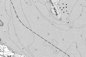
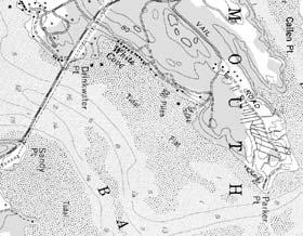
10 14-65 Sullivan Embankment Agent Authorization John and Wendy Sullivan 247 Sea Meadows Lane Yarmouth, ME By signing below, I authorize Barney Baker, PE of Baker Design Consultants to act as agent for the purpose of permit communication on applications filed for improvements to our property at 247 Sea Meadows Lane on Cousins Island in Yarmouth. Yarmouth Shoreland Application Page 7
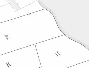
11 14-65 Sullivan Embankment Property Deeds The following documents are provided to show right, title or interest for the project. Warranty Deed CCRD Document Deed Book 29193, Page 84 Yarmouth Shoreland Application Page 8
12 14-65 Sullivan Embankment Yarmouth Shoreland Application Page 9


13 14-65 Sullivan Embankment Site Pictures Sullivan Embankment South End North End Bing Maps Bird s Eye View April Recent erosion at Tree Base Yarmouth Shoreland Application Page 10


14 14-65 Sullivan Embankment May 2016 View of section of eroding slope near south end of property Existing Boardwalk to shore Yarmouth Shoreland Application Page 11
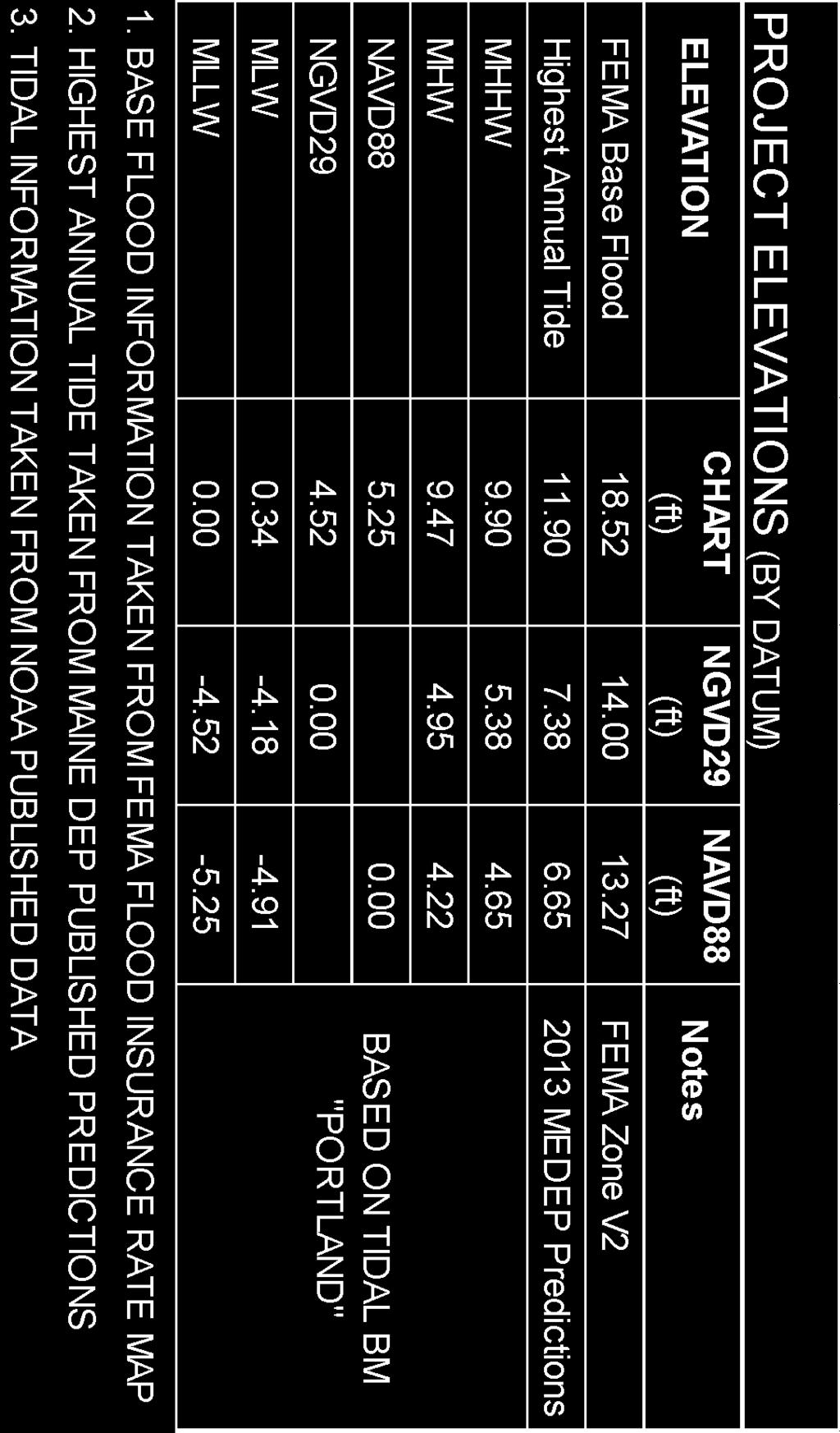
15 APPENDIX A State & Federal Regulatory Correspondence Sullivan Embankment An NRPA Permit has been filed with Maine DEP and the Army Corps of Engineers. A copy of the permits received for the work will be provided to the Town as soon as they are received. DEP regulates work within 75-ft of the coastal wetland as defined by the Highest Annual Tide (HAT) line. The Army Corps of Engineers jurisdiction extends to work that is seaward of the HAT line. A letter of project notification has been sent to the Maine State Historic Preservation office for comment in accordance with Shoreland Application requirements. The response will be copied to the Town as soon as it is received. Based on a preapplication meeting with DEP (Chris Coppi) and discussion with the Yarmouth Code Enforcement Officer (Bill Longley), the removal of the trees whose root systems have been compromised and the drainage improvements to the front lawn are entirely within the purview of the Yarmouth Shoreland Ordinance. It is requested that the Town consider a Shoreland permit that is conditional on receiving the state and Federal permits so that the trees that are in danger of falling and creating additional erosion) and the drainage work to the front yard can be completed. Yarmouth Shoreland Application Page 12
16 14-65 Sullivan Embankment APPENDIX B Project Drawings G-1 Cover Sheet G-2 Notes C-0 Site Plan Overview C-1 Existing Conditions C-2 Slope Stabilization Plan C-3 Typical Sections C-4 Details S-1 Check Dam Walkway X-1 Existing Sections L-1 Landscape Plan Yarmouth Shoreland Application Page 13


17
18


19
20
21
22
23
24
25
26
Bear Creek Habitat Improvement Project
 06/10/10 Bear Creek Habitat Improvement Project El Paso County, Colorado Pike National Forest and Colorado Springs Utilities Owned Land Report prepared by: Eric Billmeyer Executive Director Rocky Mountain
AGAWAM CONSERVATION COMMISSION April 26, 2018
 MEMBERS PRESENT: Henry A. Kozloski, Chairman Sheryl Becker S. Page Fallon Frank Meagher MEMBERS ABSENT: Magda Galiatsos Jill Messick ALSO PRESENT: Pamela R. Kerr AGAWAM CONSERVATION COMMISSION Mr. Kozloski
Ditch flows slowly to the north
 Ditch flows slowly to the north Photo 1. Wetland DE: Looking west across Wetland DE from upslope. Ponded water, mucky mineral soils, and patches of emergent vegetation observed. Wetland DE appears to be
MORGAN CREEK GREENWAY Final Report APPENDICES
 APPENDICES MORGAN CREEK GREENWAY Appendix A Photos of Existing Conditions in Trail Corridor Photos of existing conditions Main trail corridor - February 2009 Photos of existing conditions south bank Morgan
RIO VISTA MUNICIPAL AIRPORT
 DRAINAGE TECHNICAL MEMORANDUM RIO VISTA MUNICIPAL AIRPORT RIO VISTA, CALIFORNIA Prepared for: City of Rio Vista 1 Main Street Rio Vista, CA 94571 (707) 374-5337 Prepared by: August 2012 Copyright 2012
Agenda Report. Spruce Street Outlet Drainage Improvements Tower Road Relief Sewer
 Agenda Report Subject: Prepared By: Spruce Street Outlet Drainage Improvements Tower Road Relief Sewer Steven M. Saunders, Director of Public Works/Village Engineer Date: August 12, 2012 On March 8, 2012
Appendix C. Tenderfoot Mountain Trail System. Road and Trail Rehabilitation Plan
 Appendix C Tenderfoot Mountain Trail System Road and Trail Rehabilitation Plan All rehabilitation work would be under the direction of the District Fisheries Biologist, the Forest Hydrologist, and/or the
The Galveston Seawall
 Coastal and Ocean Engineering ENGI.8751 Undergraduate Student Forum Faculty of Engineering and Applied Science, Memorial University, St. John s, NL, Canada. March, 2013 The Galveston Seawall Mark Harvey
Update Report - Etobicoke Creek and South Mimico Creek Trails
 REPORT FOR ACTION Update Report - Etobicoke Creek and South Mimico Creek Trails Date: October 23, 2017 To: Etobicoke York Community Council From: General Manager, Parks Forestry and Recreation Wards: Ward
Permeable RECREATIONAL TRAILS
 SMART EARTH SOLUTIONS Permeable RECREATIONAL TRAILS GEOWEB GEOPAVE GEOTERRA Innovative Solutions for Designing & Building Trails. Trail Surface Stabilization The key to planning and building trails into
Draft Length 10 Thorness Bay to Cowes Chain Ferry
 Draft Length 10 Thorness Bay to Cowes Chain Ferry Introduction The southern section of this length of coast is largely (mud and sand) beach edged with landslip. Landward of this is agricultural land with
Appendix A Appendix A (Project Specifications) Auk Auk / Black Diamond (Trail 44) Reroute
 Auk Auk / Black Diamond (Trail 44) Reroute") Appendix A (Project Specifications) Auk Auk / Black Diamond (Trail 44) Reroute I. Proposed Action: This project proposes to reroute approximately 1,800 feet of a 50 inch wide trail, off of private property
Appendix A (Project Specifications) Auk Auk / Black Diamond (Trail 44) Reroute I. Proposed Action: This project proposes to reroute approximately 1,800 feet of a 50 inch wide trail, off of private property
ARTICLE 7 MOBILE HOME AND RECREATIONAL VEHICLE PARKS AND CAMPGROUNDS
 ARTICLE 7 MOBILE HOME AND RECREATIONAL VEHICLE PARKS AND CAMPGROUNDS Section 701. APPLICABILITY Where a municipality has no subdivision or land development ordinance the provisions of this article shall
Guide to Siting of Seawalls January 13, 2014 by Michael Walther, P.E., D.CE, President - Coastal Tech
 January 13, 2014 by Michael Walther, P.E., D.CE, President - Coastal Tech mwalther@coastaltechcorp.com Prepared for the Sea Turtle Conservancy http://www.conserveturtles.org/ Introduction Overview: This
PLANNING BOARD MINUTES March 13, 2017 CASCO COMMUNITY CENTER 7:00 P.M. MEMBERS PRESENT: Stan Buchanan, Ray Grant & Lynne Potter Bob Barnes, Ted
 PLANNING BOARD MINUTES March 13, 2017 CASCO COMMUNITY CENTER 7:00 P.M. MEMBERS PRESENT: Stan Buchanan, Ray Grant & Lynne Potter MEMBERS ABSENT: Bob Barnes, Ted Beckner & Jim Macklin STAFF PRESENT: James
Santa Cruz Wharf Improvement Project. Briefing Paper. Prepared by City of Santa Cruz. for
 Santa Cruz Wharf Improvement Project Briefing Paper Prepared by City of Santa Cruz for U.S. Army Corps of Engineers Interagency Meeting 12 November 2014 Santa Cruz Wharf Improvement Project Constructed
Peace Project Water Use Plan
 Peace Project Water Use Plan Williston Reservoir Trial Tributaries Implementation Year 5 Reference: GMSWORKS-19 6 Mile 2016 Engineering Inspection Report Study Period: 2016 KERR WOOD LEIDAL Site Inspection
DAMAGE ASSESSMENT OF SAND FENCING GARDEN CITY, NORTH LITCHFIELD AND LITCHFIELD BEACH GEORGETOWN COUNTY, SC
 OF SAND FENCING GARDEN CITY, NORTH LITCHFIELD AND LITCHFIELD BEACH GEORGETOWN COUNTY, SC June 07, 2017 PREPARED FOR: GEORGETOWN COUNTY DEPARTMENT OF PUBLIC SERVICES PREPARED BY: The EARTHWORKS Group 11655
The Corporation of the Township of Wollaston By-law Being a by-law to licence recreational vehicles and tents in the Township of Wollaston
 By-law 38-17 Being a by-law to licence recreational vehicles and tents in the Township of Wollaston WHEREAS Section 164 of the Municipal Act, 2001 as amended, authorizes the municipality to prohibit or
ORDINANCE NO. C-16- WHEREAS, the proposed minimum seawall elevation exceeds the current maximum by 0.7 feet (8.4 inches); and
; and") ORDINANCE NO. AN ORDINANCE AMENDING THE UNIFIED LAND DEVELOPMENT REGULATIONS OF THE CITY OF FORT LAUDERDALE, FLORIDA, AMENDING SECTION 47-19.3, BOAT SLIPS, DOCKS, BOAT DAVITS, HOISTS AND SIMILAR MOORING
ORDINANCE NO. AN ORDINANCE AMENDING THE UNIFIED LAND DEVELOPMENT REGULATIONS OF THE CITY OF FORT LAUDERDALE, FLORIDA, AMENDING SECTION 47-19.3, BOAT SLIPS, DOCKS, BOAT DAVITS, HOISTS AND SIMILAR MOORING
Non-motorized Trail Plan & Proposal. August 8, 2014
 Town of Star Valley Ranch, Wyoming and the Star Valley Ranch Association in partnership with the USDA Forest Service, Bridger-Teton National Forest, Greys River Ranger District Non-motorized Trail Plan
Rye Planning Board_. Saturday, April 17, 2010 MINUTES OF THE SITE WALK
 Rye Planning Board_ Saturday, April 17, 2010 MINUTES OF THE SITE WALK Members Present: Chairman, Jaci Grote; Vice-Chair, Donald Cavallaro, Clerk, Martin Zivic; Mel Low; Selectmen s Rep. Priscilla Jenness;
MEETING MINUTES 7:00 p.m. May 16, 2013 LOCATION: MONTVILLE TOWN HALL, Council Chambers
 TOWN OF MONTVILLE INLAND WETLANDS COMMISSION 310 NORWICH NEW LONDON TURNPIKE UNCASVILLE, CONNECTICUT 06382 PHONE (860) 848-8549 - FAX (860) 848-2354 MEETING MINUTES 7:00 p.m. May 16, 2013 LOCATION: MONTVILLE
^ox, 7. Environment Agency. Hayling Island North Strategy *. M ^, v. * > -.
 ^ox, 7 Environment Agency Hayling Island North Strategy *. M ^, v. * > -. Consultation Document for Preferred Coastal Defence Options - Septem ber 2005 We are the Environment Agency. It s our job to look
Using Managed Retreat to Address Coastal Erosion in Brewster
 Using Managed Retreat to Address Coastal Erosion in Brewster Chris Miller, Director, Brewster Department of Natural Resources CMiller@brewster-ma.gov Brewster, Massachusetts Almost 1/3 of town preserved
ROAD AND TRAIL PROJECT APPROVAL
 ROAD AND TRAIL PROJECT APPROVAL www.marincountyparks.org Marin County Parks, 3501 Civic Center Dr, Suite 260, San Rafael, CA 94903 DATE: July 12, 2017 PRESERVE: Gary Giacomini Open Space Preserve PROJECT:
APPENDIX D: SUSTAINABLE TRAIL DESIGN. APPENDICES Town of Chili Parks and Recreation Master Plan Update
 APPENDIX D: SUSTAINABLE TRAIL DESIGN APPENDICES Town of Chili Parks and Recreation Master Plan Update Sustainable Trail Construction Sustainable trails are defined by the US Forest Service as trails having
Understanding user expectations And planning for long term sustainability 1
 Understanding user expectations And planning for long term sustainability 1 What is a natural surface trail? It can be as simple has a mineral soil, mulched or graveled pathway, or as developed as elevated
Flood History. Floodplain Descriptions
 Flood History The worst flooding in the area took place in 1966, 1969, 1971, 1995 and 1998. The storms in 1966 and 1969 caused considerable damage throughout the area due to flooding, erosion and debris
American Conservation Experience
 ACE Project Report For Tonto National Forest, Arizona Trail Association and Arizona State Parks Title of Project: 4 Peaks Trail Maintenance Award Contract Number: ASP NM11021 Project Partner: Paul Burghard
Runway Roughness Evaluation- Boeing Bump Methodology
 FLIGHT SERVICES Runway Roughness Evaluation- Boeing Bump Methodology Michael Roginski, PE, Principal Engineer Boeing Airport Compatibility Engineering ALACPA XI Seminar, Santiago, Chile September 1-5,
USDA TRAILS STRATEGY PROGRAM
 USDA TRAILS STRATEGY PROGRAM WRPI Program: English Peak Survey Jorge D. Briceño Southwestern Community College Internship Time Period: June 6, 2016 August 8, 2016 Advisor: Sam Commarto Recreation Officer
1. Call to order. Acting Chair John D. Wilson called the meeting to order at 7:00 p.m. in the Veterans' Meeting Room.
 Town ofstafford Inland Wetlands Commission Regular Meeting November 15, 2017 7:00 p.m. - Warren Memorial Town Hall RECEIVED STAFFORD. CT znn NOV tbps: a8 Members Present: John D. Wilson, Acting Chairman
Conservation of Critical Environmental Resources in Chatham Park
 Conservation of Critical Environmental Resources in Chatham Park Elaine Chiosso, Haw Riverkeeper Haw River Assembly Haw River As Seen From Chatham Park "Spreading southwestward from the banks of the Haw
Reduction of Wave Runup on a Revetment by Addition of a Berm
 REMR Technical Note CO-RR-1.3 (Supersedes CO-RR-1.3 1986) Reduction of Wave Runup on a Revetment by Addition of a Berm Purpose To provide design guidance for reducing wave runup on a riprap revetment by
ATVANS Trail Assessment for Five Bridge Lakes Wilderness Area Report and Recommendation. December 28, Prepared by.
 ATVANS Trail Assessment for Five Bridge Lakes Wilderness Area Report and Recommendation December 28, 2011 Prepared by Peter Bush Background This report documents the results and recommendations of an all-terrain
Hydraulic Report. Trail 5 Snowmobile Trail Over Mulligan Creek. Prepared By: COLEMAN ENGINEERING COMPANY Karisa V. Falls, P.E.
 Prepared for: Prepared by: Marquette County Road Commission Coleman Engineering Company Marquette, Michigan Iron Mountain, MI December 2011 Hydraulic Report Trail 5 Snowmobile Trail Over Mulligan Creek
80' MIN 100'-0" 15'-0" 2 FEDERALLY DREDGED NAVIGATION CHANNEL MEASURED AT EL -10' (NOTE 4) NAVIGATION CHANNEL EXISTING YACHT CLUB FLOATS
 NAVIGATION CHANNEL EXISTING YACHT CLUB FLOATS") 11 3 1 6 9 4 5 4 8 7 7 9 ' MUDLINE ELEVATION 8 1 6 11 6 1 7 8 5 7 7 12 11 5 12 7 8 9 5 11 8 REVISED FEDERAL LIMIT FOR DREDGING FEDERAL LIMIT FOR DREDGING 12 1 11 7 1 4 8 5 8 5 14 4 14 3 9 3 8 5 1 5 11
11 3 1 6 9 4 5 4 8 7 7 9 ' MUDLINE ELEVATION 8 1 6 11 6 1 7 8 5 7 7 12 11 5 12 7 8 9 5 11 8 REVISED FEDERAL LIMIT FOR DREDGING FEDERAL LIMIT FOR DREDGING 12 1 11 7 1 4 8 5 8 5 14 4 14 3 9 3 8 5 1 5 11
CITY PLANNING COMMISSION AGENDA ITEM NOS: 5.A, 5.B STAFF: MICHAEL SCHULTZ
 CPC Agenda Page 83 CITY PLANNING COMMISSION AGENDA ITEM NOS: 5.A, 5.B STAFF: MICHAEL SCHULTZ FILE NO(S): CPC DP 03-00259-A5MN11 QUASI-JUDICIAL AR NV 11-00538 QUASI-JUDICIAL PROJECT: BROADMOOR TEMPORARY
Villiers Scheme Phases III & IV
 PRIME DEVELOPMENT SITE FOR SALE Planning approval for 10,250 sq ft retail and 72,000 sq ft residential Previous approval for 74,000 sq ft offices Villiers Scheme Phases III & IV Loch Promenade, Douglas,
PRELIMINARY STAFF PLANNING REPORT TO THE WALWORTH COUNTY ZONING AGENCY X CONDITIONAL USE
 This report was prepared prior to the public hearing. This report may be supplemented or amended to reflect the review of additional information presented at the public hearing and written material submitted
STAFF REPORT. Airport Land Use Consistency Determination Betteravia Plaza. MEETING DATE: January 21, 2016 AGENDA ITEM: 8D
 STAFF REPORT SUBJECT: Airport Land Use Consistency Determination Betteravia Plaza MEETING DATE: AGENDA ITEM: 8D STAFF CONTACT: Andrew Orfila RECOMMENDATION: Adopt findings for the Betteravia Plaza project
Shapleigh Planning Board Minutes Tuesday, August 14, 2018
 Shapleigh Planning Board Minutes Tuesday, August 14, 2018 Members in attendance: Roger Allaire (Chairman), Steve Foglio (Vice Chairman), Madge Baker, Roland Legere, Maggie Moody and Alternate Ann Harris.
October 7, 2016 Hurricane Matthew Rakes the East Coast of Flagler County for 18.1 Miles
 October 7, 2016 Hurricane Matthew Rakes the East Coast of Flagler County for 18.1 Miles Hammock Dunes Suffers Penetration of the Ocean into the Community; has a 15-30 ft. Wide Triangular Section of the
Community Development
 Community Development City & Borough of Juneau Community Development 155 S. Seward Street Juneau, AK 99801 (907) 586 0715 Phone (907) 586 4529 Fax DATE: February 11, 2016 TO: FROM: Planning Commission
Great Pond Mountain Conservation Trust Request for Bids Wildlands Hillside Trail Relocation and Restoration Project
 Great Pond Mountain Conservation Trust Request for Bids Wildlands Hillside Trail Relocation and Restoration Project Project Description: Great Pond Mountain Conservation Trust (GPMCT), a nonprofit land
COOPERATIVE LAKES MONITORING PROGRAM TRAINING FOR. Score the Shore
 COOPERATIVE LAKES MONITORING PROGRAM TRAINING FOR Score the Shore Paul Steen Huron River Watershed Council psteen@hrwc.org 734-769-5123 x601 Jo Latimore Michigan State University 517-432-1491 latimor1@msu.edu
Rule Governing the Designation and Establishment of All-Terrain Vehicle Use Trails on State Land
 Rule Governing the Designation and Establishment of All-Terrain Vehicle Use Trails on State Land 1.0 Authority 1.1 This rule is promulgated pursuant to 23 V.S.A. 3506. Section 3506 (b)(4) states that an
Figure 1 shows the evaluation area around Tailings Basin Cells 2E/1E. Two areas were evaluated for potential wetland impacts including:
 Barr Engineering Company 4700 West 77th Street Minneapolis, MN 55435-4803 Phone: 952-832-2600 Fax: 952-832-2601 www.barr.com An EEO Employer Minneapolis, MN Hibbing, MN Duluth, MN Ann Arbor, MI Jefferson
BID FORM. Bid by: Name of Bidder. Address: Address: To the Texas Department of Transportation hereinafter called the Agent.
 BID FORM TxDOT CSJ No. Project Description: This project includes reconstruction of a hangar access taxiway with trench drain and pipe drainage system; local reconstruction of failing pavement on Taxiway
COOPERATIVE LAKES MONITORING PROGRAM TRAINING FOR. Score the Shore
 COOPERATIVE LAKES MONITORING PROGRAM TRAINING FOR Score the Shore Paul Steen Huron River Watershed Council psteen@hrwc.org 734-769-5123 x601 Jo Latimore Michigan State University 517-432-1491 latimor1@msu.edu
City of Fort Lauderdale. Frequently Asked Questions. Proposed Sea Wall Ordinance
 City of Fort Lauderdale Frequently Asked Questions Proposed Sea Wall Ordinance The City of Fort Lauderdale is considering amending the Unified Land Development Regulations of the City of Fort Lauderdale
Open Meeting. To update the Board on issues arising from the previous meeting.
 Open Meeting To Raglan Community Board From Tony Whittaker General Manager Strategy & Support Date 28 August 2017 Prepared by Sharlene Jenkins PA General Manager Strategy & Support Chief Executive Approved
how it started where we are now what is coming up NEW WESTMINSTER WATERFRONT PARK THE RIVER THE PAST THE PEOPLE
 how it started Downtown Waterfront Park How It Started March 2009 City of New Westminster Purchases 3.2 Hectare Westminster Pier Site March 2009 City of New Westminster and Design Team develop plan for
Lincoln Village Pedestrian Bicycle Bridge Community Meeting September 13th, 2016
 Lincoln Village Pedestrian Bicycle Bridge Community Meeting September 13th, 2016 Purpose of the Meeting Introduce the project and the proposed improvements Review existing conditions Discuss the needs
Proposed Arthurs Point Special Housing Area. Housing Accords and Special Housing Areas Act Expression of Interest
 Proposed Arthurs Point Special Housing Area Housing Accords and Special Housing Areas Act 2013 Expression of Interest 1.0 APPLICANT The applicant for the proposed Arthurs Point Special Housing Area is
LOUGHBOROUGH INLET. Jason Zroback. Direct Line: (604) TOLL FREE:
 TOLL FREE:") LOUGHBOROUGH INLET www.landquest.com Jason Zroback Direct Line: (604) 414-5577 101-313 Sixth Street, New Westminster, BC V3L 3A7 Phone: (604) 664-7630 Fax: (604) 516-6504 TOLL FREE: 1-866-558-5263 Loughborough
LOUGHBOROUGH INLET www.landquest.com Jason Zroback Direct Line: (604) 414-5577 101-313 Sixth Street, New Westminster, BC V3L 3A7 Phone: (604) 664-7630 Fax: (604) 516-6504 TOLL FREE: 1-866-558-5263 Loughborough
Lake Wissota Access Locations within the LaFayette Township. By Chad Martin
 Lake Wissota Access Locations within the LaFayette Township By Chad Martin Anson/ Wissota Access Point # 1 Road: 195 th St. Associated Fire Numbers: 13294 Defining Characteristics: Forested from road
City of College Park s Update to the Zoning Ordinance
 Comparison table for the City s Zoning Ordinance Residential s R-1 Single Family R-2 Single Family Single family uses 24,000 sq ft lot size 90 ft lot width Front 60 ft Side 15 ft Rear 40 ft Minimum floor
COMMUNITY MEETING NOVEMBER 1, Wheaton Regional Park Pine Lake Trail
 COMMUNITY MEETING NOVEMBER 1, 2012 MEETING AGENDA I. Introduction of Project Team II. Trail Renovation Process III. Wheaton Regional Park IV. Pine Lake Trail Renovation Project V. Comments and Questions
Version Isolated & Non-Waters Only 1 of 3
 APPROVED JURISDICTIONAL DETERMINATION FORM U.S. Army Corps of Engineers SECTION I: BACKGROUND INFORMATION A. REPORT COMPLETION DATE FOR APPROVED JURISDICTIONAL DETERMINATION (JD): July 6, 2010. B. DISTRICT
March 2, The Honorable Mayor Williams D. Sessoms, Jr. Members of City Council. Subject: Coastal CIP Presentation to City Council - March 6, 2018
 OFFICE OF THE CITY MANAGER (757) 385-4242 (757) 427-5626 FAX MUNICIPAL CENTER BUILDING 1, ROOM 234 2401 COURTHOUSE DRIVE VIRGINIA BEACH, VA 23456-9001 March 2, 2018 The Honorable Mayor Williams D. Sessoms,
Southsea Flooding and Coastal Erosion Risk Management Scheme
 Southsea Flooding and Coastal Erosion Risk Management Scheme Public Consultation Report 3 rd November 29th December 2014 TABLE OF CONTENTS 1 INTRODUCTION... ERROR! BOOKMARK NOT DEFINED. 1.1 Purpose of
Request for Proposal National Tropical Botanical Garden Lower Limahuli Preserve Emergency Stream Debris Removal
 Request for Proposal National Tropical Botanical Garden Lower Limahuli Preserve Emergency Stream Debris Removal I. Summary of Work Bids are solicited for the emergency removal of debris deposited in the
SHAPLEIGH PLANNING BOARD MINUTES Tuesday, April 10, 2018
 SHAPLEIGH PLANNING BOARD MINUTES Tuesday, April 10, 2018 Members in attendance: Roger Allaire (Chairman), Madge Baker, Roland Legere, Maggie Moody, as well as Barbara Felong (Secretary). Code Enforcement
FARMINGTON PLANNING BOARD 153 Farmington Falls Road March 14, :00 P.M. Minutes
 FARMINGTON PLANNING BOARD 153 Farmington Falls Road March 14, 2016 6:00 P.M. Minutes Planning Board members present were Clayton King, Donna Tracy, Lloyd Smith, Tom Eastler, Bill Marceau, Craig Jordan,
STRATEGIES FOR PROTECTING YOUR PROPERTY
 STRATEGIES FOR PROTECTING YOUR PROPERTY A Homeowner s Guide for Flood, Debris, and Erosion Control after the High Park Fire (Includes tips on how to properly use sandbags) Larimer County Engineering Department
Triangle Land Conservancy Conservation Area Monitoring Report Carolina North
 Triangle Land Conservancy Conservation Area Monitoring Report Carolina North Property Name: Crow Branch Conservation Area Date of visit: 4/8/2015 County: Orange Property Type: Restrictive Covenants Local
Chesapeake Bay Preservation Area Board
 City of Chesapeake MINUTES The Chesapeake Bay Preservation Area Board Planning Department 306 Cedar Road PO Box 15225 Chesapeake, Virginia 23328 (757) 382-6176 FAX: (757) 382-6406 Chesapeake Bay Preservation
Front Carport Design Standards, Requirements & Application
 Front Carport Design Standards, Requirements & Application THIS PAGE INTENTIONALLY LEFT BLANK. Carport: A structure designed or used to shelter vehicles that is open on at least two sides. Carport shall
Electric System Serving Pierce County Current system and future investments
 Electric System Serving Pierce County Current system and future investments Janet Olsen Project Manager Steve Botts Real Estate / Rights-of-Way April 13, 2011 Presentation overview Information requested
Initial OPW Designation APSR AFRR IRR Co-ordinates Easting: Northing: River / Catchment / Sub-catchment Type of Flooding / Flood Risk
 Location: Shannon International Airport, Co. Clare Unique ID: 275484 (from PFRA database) Initial OPW Designation APSR AFRR IRR Co-ordinates Easting: 137674 Northing: 161045 River / Catchment / Sub-catchment
CRAZY HORSE TRAIL GUIDE
 CRAZY HORSE TRAIL GUIDE Abridged Version: July 2016 This is a short form of our interpretive trail guide for the Crazy Horse Trail. The full version of the guide has a more detailed description of the
Project Planning, Compliance, and Funding
 Project Planning, Compliance, and Funding The plans above offer high level guidance to ensure that the A.T. is managed effectively as a whole unit in a decentralized management structure. Cooperative management
COON CREEK WATERSHED DISTRICT Request for Board Action
 Item 13: Request to Award Work on Woodcrest Creek Bank Stabilization Project Page 1 of 6 COON CREEK WATERSHED DISTRICT Request for Board Action MEETING DATE: December 8, 2014 AGENDA NUMBER: 13 ITEM: Request
CITY COUNCIL AGENDA MEMORANDUM
 To: Mayor and City Council From: Charles Ozaki, City and County Manager Prepared By: Kevin Standbridge, Deputy City and County Manager Katie Allen, City and County Engineer David Shinneman, Community Development
GILBERT & WEST TOWN INTERCOUNTY DRAIN Windsor Township, Eaton County and City of Lansing, Delhi Township, Ingham County, Michigan
 GILBERT & WEST TOWN INTERCOUNTY DRAIN Windsor Township, Eaton County and City of Lansing, Delhi Township, Ingham County, Michigan PRELIMINARY ENGINEERING REPORT Abigail Eaton, Chair Intercounty Drains
Specification for Grip blocking using Peat Dams
 Technical Guidance Note 1 Specification for Grip blocking using Peat Dams 1. Introduction Moorland drains (grips) have been dug across much of the Yorkshire upland peatlands. Many of these grips have become
12, 14 and 16 York Street - Amendments to Section 16 Agreement and Road Closure Authorization
 REPORT FOR ACTION 12, 14 and 16 York Street - Amendments to Section 16 Agreement and Road Closure Authorization Date: April 27, 2018 To: Toronto and East York Community Council From: Senior Strategic Director,
I-3 DFW Extension Public Hearing. June 2, 2011
 1 I-3 DFW Extension Public Hearing June 2, 2011 2 DFW LRT Extension Agenda: Introductions Service Plan Amendment Alignment, Grade Separations, Station, Yard Environmental Assessment Environmental Impacts/Mitigation
TOWNSHIP OF GEORGIAN BAY COMMITTEE OF ADJUSTMENT
 TOWNSHIP OF GEORGIAN BAY COMMITTEE OF ADJUSTMENT Minutes of the meeting of June 12, 2006, held in the Council Chambers, Baxter Ward Community Centre, Township of Georgian Bay, Port Severn, Ontario. MEMBERS
Falmouth Zoning Board of Appeals DRAFT Minutes February 23, 2017 at 6:00 p.m. Selectmen s Meeting Room, Falmouth Town Hall
 Continuation: 117-16 Falmouth Hospitality LLC, (556 Main Street, Falmouth) Voting Members: Kim Bielan, Ken Foreman, TJ Hurrie, Paul Murphy, TJH read the request for a continuation due to the lack of a
Proposed Cherry Grove Canals Dredging Project
 Proposed Cherry Grove Canals Dredging Project 1 Development of Cherry Grove C.D. Nixon inherited 9,940 acres of land 1924 Nixon family began planning subdivision of Cherry Grove 1950 Mr. Nixon closed natural
Peter Axelson. Beneficial Designs, Inc. Minden, NV
 Peter Axelson Beneficial Designs, Inc. Minden, NV Arroya Sit Ski Mono Ski Dynamic Seating Spring Assist Cross Country Ski Hand Bike Adaptive Canoe Seating Available from Chosen Valley Canoe Accessories
Mr. Michael Malone CPS Energy 145 Navarro Street San Antonio, Texas Project No
 January 15, 2016 Mr. Michael Malone 145 Navarro Street San Antonio, Texas 78205 Project No. 0328985 Environmental Resources Management CityCentre Four 840 West Sam Houston Pkwy N. Suite 600 Houston, Texas
Rocky Mountain Field Institute
 Rocky Mountain Field Institute Palmer Park Stewardship Project 2016 Annual Project Report December 20, 2016 Report prepared by: Andy Riter, Program Coordinator and Alex Hladkyj, Field Instructor 815 South
Changing Lanes. Click to edit Master title style. Community Consultation Meeting #1. Second level Third level. Fourth level.
 Changing Lanes The Click City of to Toronto edit Master Review text of styles Laneway Suites Community Consultation Meeting #1 November 30, 2017 Agenda 6:30 Introductions Councillor Ana Bailão (Ward 18)
3.0 EXISTING PARK & RECREATION SPACE
 3.0 EXISTING PARK & RECREATION SPACE TOWN PARK & RECREATION SPACE An inventory of current parks and recreation area in the Town of Cedarburg is shown in Table 3. These areas total roughly 381.89 acres.
Public Notice ISSUED: December 10, 2018 EXPIRES: January 9, 2019
 APPLICANT: REFER TO: St. Louis and Lake Counties Regional Rail Authority 2018-01942-ARC Public Notice ISSUED: December 10, 2018 EXPIRES: January 9, 2019 SECTION:404 - Clean Water Act 1. APPLICATION FOR
AIRPORT MASTER PLAN. Newport State Airport. Draft. (Colonel Robert F. Wood Airpark) THE Louis Berger Group, INC. Prepared for: Prepared by:
 THE Louis Berger Group, INC. Prepared for: Prepared by:") Draft AIRPORT MASTER PLAN Newport State Airport () Prepared for: 2000 Post Road Warwick, Rhode Island 02886-1533 THE Louis Berger Group, INC. 20 Corporate Woods Boulevard Albany, New York 12211-2370 Prepared
Draft AIRPORT MASTER PLAN Newport State Airport () Prepared for: 2000 Post Road Warwick, Rhode Island 02886-1533 THE Louis Berger Group, INC. 20 Corporate Woods Boulevard Albany, New York 12211-2370 Prepared
Movement Strategy. November On behalf of Barton Oxford LLP
 Movement Strategy November 2014 On behalf of Barton Oxford LLP BARTON PARK, OXFORD. Movement Strategy 17/11/2014 Quality Management Issue/revision Issue 1 Revision 1 Revision 2 Revision 3 Remarks Date
KP Lasnaya 1 River
 KP 370.2 Lasnaya 1 River The Lasnaya 1 River crossing is protected by Reno mattings and a gabion wall on the north bank (Photo 1). The south bank consists of natural river gravel deposits on top of Reno
MP : Headwaters of the Fraser River
 MP 236 237: Headwaters of the Fraser River The mile between these two mileage posts is often just referred to as the bottom switchback or the curve at the bottom of Berthoud Pass. For many locals this
2. STAKEHOLDER FEEDBACK // What We Heard
 1. QUARRY ROAD TRAIL // Welcome to the Information Session PROJECT DESCRIPTION WHY WE ARE HERE Quarry Road Trail is a popular commuter trail and recreational area for Calgarians. 1. To report citizen feedback
Appendix 4 St. Charles Basin
 Appendix 4 St. Charles Basin The St. Charles hurricane protection system (HPS), shown in Figure 1, was designed as part of the Lake Pontchartrain, LA, and Vicinity Hurricane Protection Project. The St.
City of Surrey PLANNING & DEVELOPMENT REPORT File:
 City of Surrey PLANNING & DEVELOPMENT REPORT File: 7917-0297-00 Planning Report Date: September 11, 2017 PROPOSAL: Amend CD By-law No. 18795 (based on RH-G). to allow for an increased house size on thirteen
Sandbag Barrier. Suitable Applications Sandbag barriers may be suitable: As a linear sediment control measure:
 Categories EC Erosion Control SE Sediment Control TC Tracking Control WE Wind Erosion Control Non-Stormwater NS Management Control Waste Management and WM Materials Pollution Control Legend: Primary Category
Morrison County Board of Adjustment. Minutes. July 7, 2015
 Morrison County Board of Adjustment Minutes July 7, 2015 Chairman Charlie Gunderson called the meeting of the Morrison County Board of Adjustment to order at 7:00 P.M. Members Present: Charlie Gunderson,
City of Madison, Buckeye Road Monona Drive to Stoughton Road County AB Dane County Public Involvement Meeting
 City of Madison, Buckeye Road Monona Drive to Stoughton Road County AB Dane County Public Involvement Meeting Wednesday, May 31, 2017 6:30 to 8 P.M. Frank Allis Elementary School 4201 Buckeye Road Madison,
Maine Historical Society. Coll Casco Bay Island Development Association Collection
 Maine Historical Society Coll. 2724 Casco Bay Island Development Association Collection 1958-2001 Accession #: 2013.271, 2015.003 Processed: February 2014-September 2014 by Lucinda Gannon, MHS Volunteer,