Travel Plan For Proposed Nishkam School West London Prepared on behalf of BAM Construction Ltd Nishkam School West London, Syon Lane, Hounslow
|
|
|
- Adrian Carr
- 6 years ago
- Views:
Transcription

1 For Proposed Nishkam School West London Prepared on behalf of BAM Construction Ltd Nishkam School West London, Syon Lane, Hounslow
2 Acknowledgements: The TRICS database has been used in this report to assess vehicular and multimodal trip rates and calculate traffic and multimodal generations. Disclaimer The methodology adopted and the sources of information used by Sanderson Associates (Consulting Engineers) Ltd in providing its services are outlined within this Report. Any information provided by third parties and referred to herein has not been checked or verified by Sanderson Associates (Consulting Engineers) Ltd, unless otherwise expressly stated within this report. This report was checked and approved on the 5 th June 2015 and the Report is therefore valid on this date, circumstances, regulations and professional standards do change which could subsequently affect the validity of this Report. Copyright All intellectual property rights in or arising out of or in connection with this report are owned by Sanderson Associates (Consulting Engineers) Ltd. The report has been prepared for BAM Construction Ltd (the Client ) who has a licence to copy and use this report only for the purposes for which it was provided. The licence to use and copy this report is subject to other terms and conditions agreed between Sanderson Associates (Consulting Engineers) Ltd and the Client. This document cannot be assigned or transferred to any third party and no third party may rely upon this document without the express written agreement of both Sanderson Associates (Consulting Engineers) Ltd and the Client. Report Ref: 8571/003/04 June 2015 Author: S Burkinshaw Checked & Approved: David Colley Date: 5 June 2015 Report Ref: 8571/003/04 2 June 2015
3 Contents Page No 1 Executive Summary Introduction Multi Modal Assessment Objectives Roles & Responsibilities Sustainable Travel Enforcement, Monitoring and Targets Conclusions Report Ref: 8571/003/04 3 June 2015
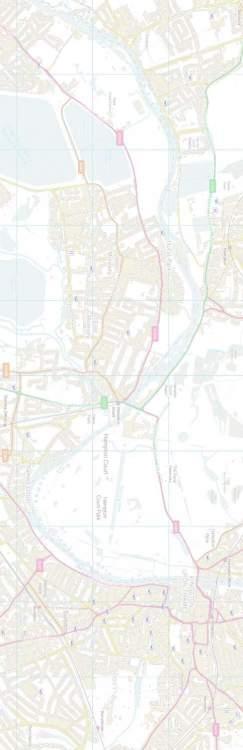
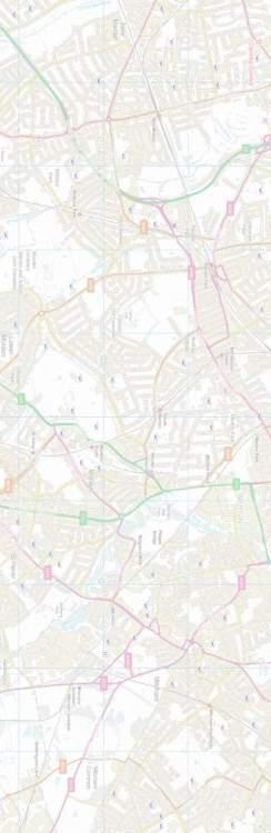
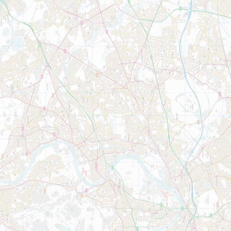
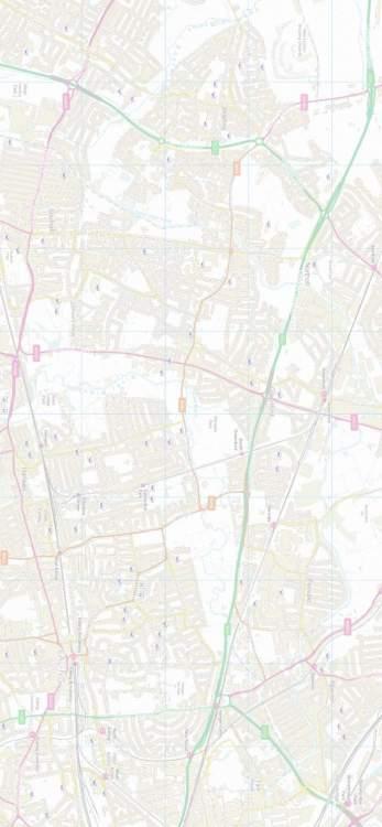
4 Appendices APPENDIX A Figure 1 Site Location Plan Figure 2 800m, 1.5km & 2km Walking Radii from the Site Figure 3A Bus Stop Locations and Bus Routes Figure 4 2.5km & 5km Cycling Radii from the Site Figure 5 Bus Routes and School Location Plan Figure 8A School Pupil Postcodes APPENDIX B Site Plan APPENDIX C Travel Information Pack Osterley Bus Route Map Rail and Tube Map APPENDIX D Mode split data from travel surveys of 4 schools in Hounslow Postcode Distribution Data APPENDIX E PTAL Report Summary APPENDIX F Local and London Cycle Network Routes APPENDIX G School Travel Charter Report Ref: 8571/003/04 4 June 2015
5 1 Executive Summary 1.1 This (TP) seeks to encourage staff and pupils of Nishkam School West London, in Isleworth, Hounslow to use alternative sustainable means of travel to and from school in such a way so as to reduce car borne trips. 1.2 The key actions arising from this plan are:- A Coordinator will be appointed by the school. The Coordinator (TPC) will be appointed prior to the school commencing in September The TPC will undertake the specific tasks outlined in this. The TPC should register with the London Borough of Hounslow at the web site for access to the schools travel plan and arrange a meeting with the Council s Officer Kieran Toms who can be contacted by at kieran.toms@hounslow.gov.uk The TPC will undertake a travel survey of pupils and staff shortly after the school commences to establish current travel patterns and supply the results to the London Borough of Hounslow through the Council s website ( ). The TPC will prepare an updated after the initial travel surveys have been conducted and analysed and present the results. The shall review the measures and targets once the school opens and these shall be submitted to London Borough of Hounslow. Report Ref: 8571/003/04 5 June 2015
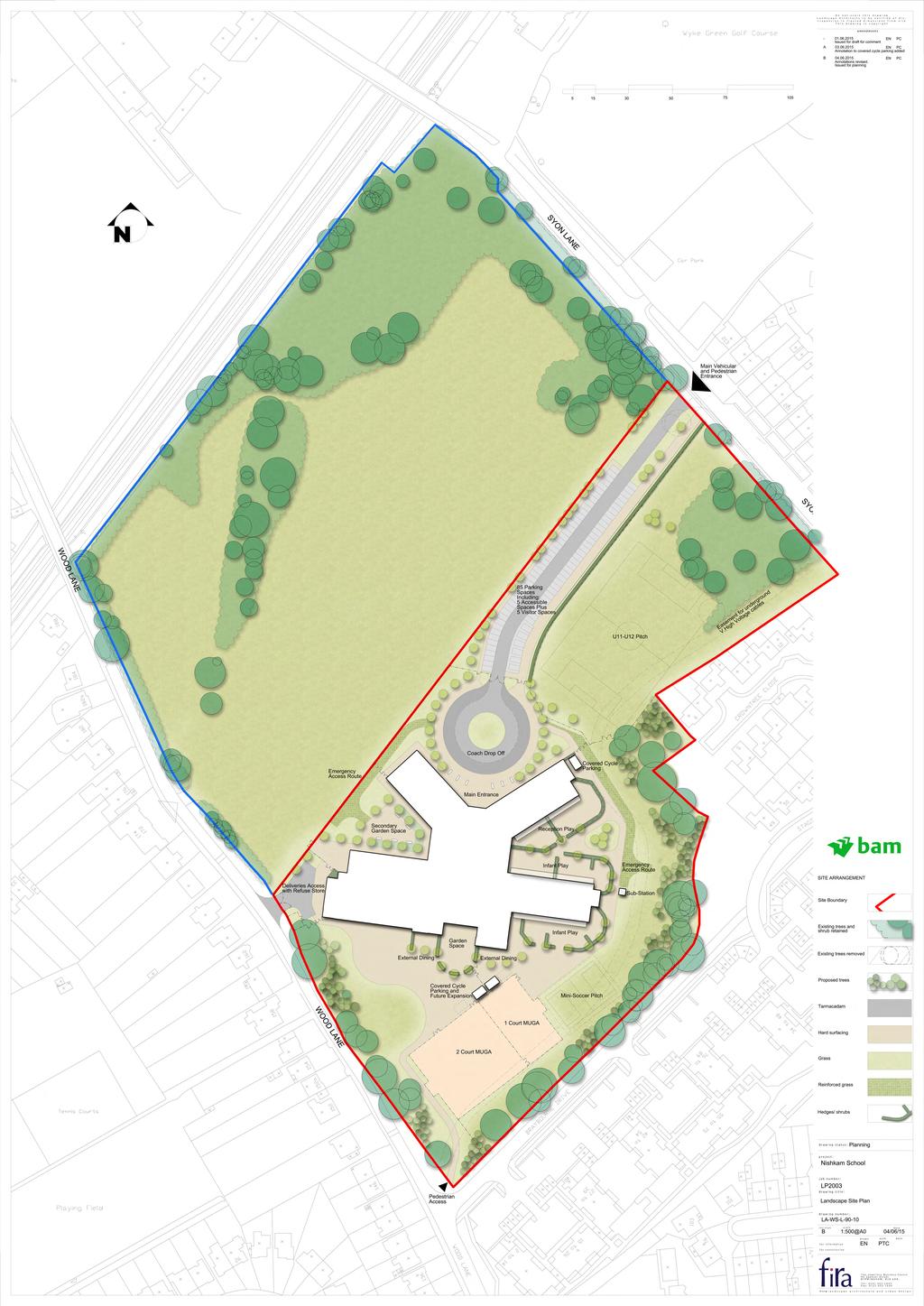
6 2 Introduction 2.1 Sanderson Associates have been appointed by BAM Construction Ltd to advise on traffic and transportation issues relating to the development of a new school for Nishkam School West London to occupy part of the wider grounds of the former White Lodge Club. A Transport Assessment has also been prepared to support the planning application for the school and this should be read in conjunction with that document. The location of the site is identified at Appendix A (Figure 1). 2.2 The application site is part of a wider allocation of Metropolitan Open Land (MOL) which is bounded by the Piccadilly railway line to the north Syon Lane and Wood Lane to the eastern and western boundaries respectively and residential properties off Braybourne Drive / Stags Way / Crowntree Close to the southern and western boundaries. Only the southern part of this allocation will be used for the school development. A copy of the proposed site layout is included at Appendix B for reference. 2.3 The envisaged opening hours for the school are as follows:- Primary school 8.45 to (breakfast club facilities may be offered from 08.00) Secondary school 8.30 to From experience of the primary school in Birmingham around 22% of pupils may attend breakfast club. The staggered start and finish times will help to reduce the effect of pupils arriving and departing school. 2.5 The school facilities may also be available after school for community use. This could include use of the sports Hall, junior MUGA and football pitches. 2.6 The proposed Primary and Secondary School facilities would cater for up to 1400 pupils although it is envisaged that nursery facilities for 97 children could be added in the future (subject to gaining planning permission) but this does not form part of Report Ref: 8571/003/04 6 June 2015
7 the current application proposals. The number of pupils would gradually increase to reach the full school roll and a phasing schedule is shown in the table below:- Year 2017/ / / / / / /24 Nursery Primary Secondary Total Primary & Secondary The number of staff would also increase and this is summarised below: / / / / / / / Guidance from the London Borough of Hounslow indicates that School Travel Planning is a process of looking at travel to and from schools during the day, and then putting together a package of measures to help reduce the negative effects of this daily flow of pupils, staff and parents. Solutions put forward in travel plans should concentrate on making the journey to school more sustainable (less polluting and damaging to the environment), healthier (using active transport methods such as walking or cycling which provide children with valuable exercise) and safer for all children and adults. 2.9 Hounslow s Local Implementation Plan suggests that in Hounslow 85% of primary pupils (age 3-11) live within 20 minute walk of their school yet 27% travel Report Ref: 8571/003/04 7 June 2015
8 by car. Hounslow is working with schools in the Borough to develop school travel plans for all schools in the Borough with the aim of reducing travel by car. This is therefore consistent with this objective In accordance with Local and National Government Policies to protect and enhance the environment and to reduce reliance on the private car, this Travel Plan assesses the current situation in the vicinity of the site, and proposes initiatives and measures to encourage accessibility via a variety of transport modes. The school will undertake a travel survey of pupils and staff utilising the London Borough of Hounslow s website ( after the school commences in September 2017 to establish travel patterns for the school and inform the measures and targets to be included in the school travel plan. This includes: Clear and unambiguous objectives to influence a lifestyle less dependent upon the private car; Details of the travel surveys and monitoring. A package of measures to encourage and facilitate less car dependant living; and, A time bound programme of implementation This will be further developed following discussions with the Local Authority, and other relevant bodies, once the site is occupied and specific travel needs have been identified Pupils and staff of the school will be made fully aware of the commitment of the school towards the use of sustainable transport. At the earliest possible stage they will be provided with detailed information which sets out the intentions of the Travel Plan and its obligations. This will be achieved by including a copy of the Travel Plan within the School s offices and providing a travel information pack to staff and to pupils that have enrolled at the school. A copy of the sample Travel Information Pack can be found at Appendix C. Report Ref: 8571/003/04 8 June 2015
9 2.13 Information regarding the will be included on the School s website The Nishkam School West London acknowledges their wider responsibilities to encourage sustainable school travel which will contribute to reducing congestion and help the viability and attractiveness of the school. In a wider sense the Travel Plan will also aid in protecting the general environment and will encourage and engage staff and pupils in playing their part in addressing sustainability issues This sets out the facilities which will be provided at the School to encourage future staff and pupils to use sustainable transport along with the initiatives that should be adopted by the staff and pupils of the School. Report Ref: 8571/003/04 9 June 2015
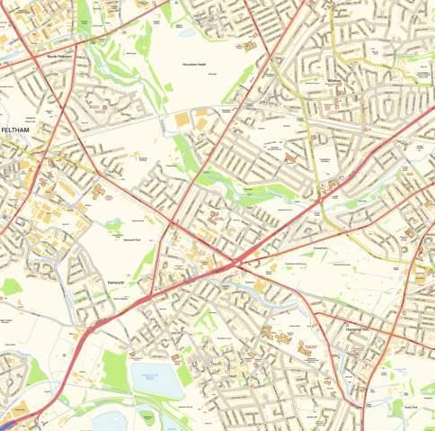
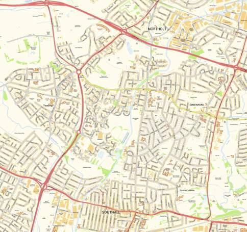
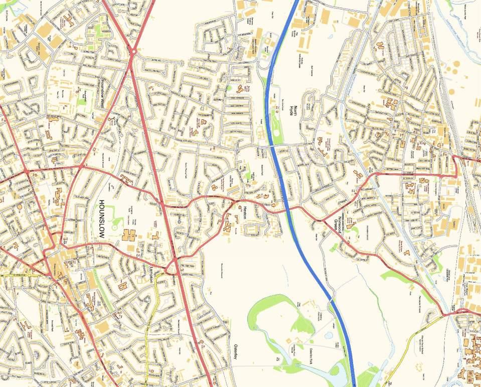
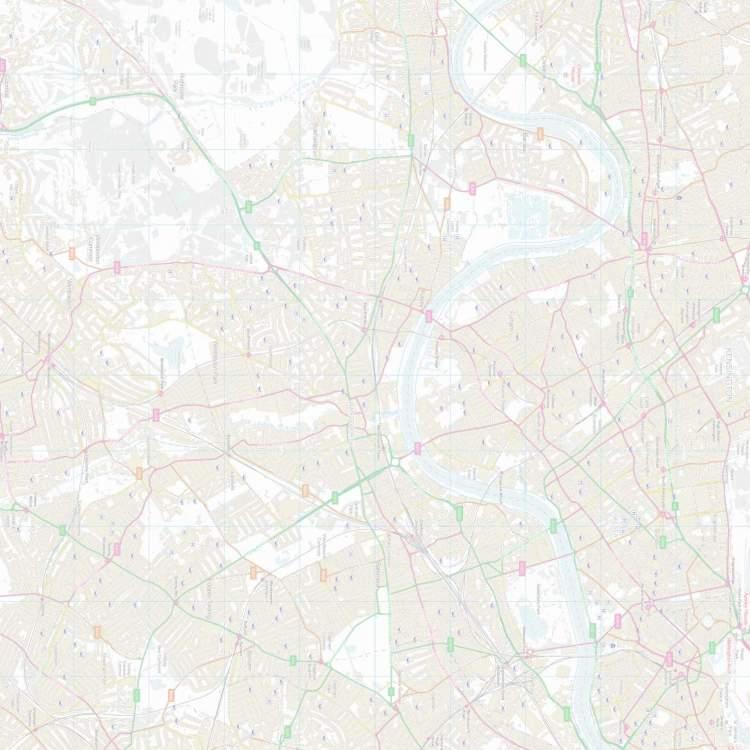
10 3 Multi Modal Assessment 3.1 Introduction Understanding how pupils and staff travel to the School is a fundamental aspect in assessing the overall travel demands of the School and this will be determined from travel surveys once the school opens. However, for the purpose of preparing this an estimate of the travel mode split has been considered using a travel survey of existing primary aged pupils attending the existing temporary school facilities at London Road and two other sources of information. This comprises of mode split data from five secondary and four primary school travel plans in Hounslow and data obtained from the TRICS database. An assessment of the potential modal split of the 700 pupils forming the primary and secondary cohorts has been undertaken on this basis in the absence of actual mode split data for the new school site Staff and pupils will be made aware of both the opportunities that will be available for alternative sustainable travel and of the measures to be included within the. 3.2 Where Pupils Live - Pupil Postcode Data The School provided a list of postcodes for 136 actual pupils attending the temporary school accommodation at London Road as well as 49 pupils offered a place for the academic year 2015/16 giving a total of 185. These have been assessed to consider where pupils live. Out of these 185 pupils 44 pupils, some 23.8% live more than 3 miles from the school with 20.5% living within 1.6km (1 mile) of the proposed School at Syon Lane, 23.2% within 2.0km and 41.6% within 3km (1.86 miles). A plot of the postcodes (Figure 8A) is attached and shows the postcode locations of the 48 reception pupils, 49 year 1, 39 year 2 and 49 pupils offered places for September The average distance travelled is 3.89KM (2.42 miles). The admissions process does contain a distance criteria where applications to the school are oversubscribed. It should also be noted that the school would not be part of other Local Education Authority lists for admission Report Ref: 8571/003/04 10 June 2015
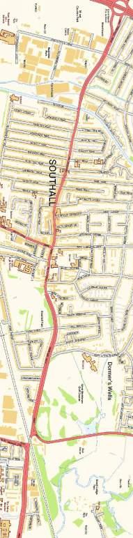
11 purposes with the school being in the Hounslow Borough area. A summary of the distance pupils live from the proposed school is provided in the table below:- 1.6km 2.0km 3.0km 0 to 800 to 1k to >3 to to to >6.0km Total 800m 1km 1.6km miles 2.0km 3.0km 6.0km Reception (Recpt) Year Year Offered Place Total Recpt, 1, 2 & Offered Percentage 10.3% 3.8% 6.5% 2.7% 18.4% 45.4% 13.0% 100.0% 23.8% Total Recpt, yr 1 & Percentage 10.3% 3.7% 5.9% 2.2% 16.9% 45.6% 15.4% 100.0% 25.0% Table Pupil Distance from the Proposed School A breakdown of the proportion of pupils by postcode district is provided in the table in Appendix D. The postcode information has been used to consider the broad vehicular trip distribution for travel routes from the postcode areas / districts. The overall proportion of pupils in the TW postcode is 83 2%. Reference to Figure 8A shows the main focus of where pupils live, this being to the south and west straddling the Great West Road (A4). This road would therefore be attractive in terms of traffic routing from the west with those from the UB postcode area (post towns Southall, Hayes, Northolt, Greenford & West Drayton) some 15.7% of pupils approaching from the north via Jersey Road or Windmill Lane, those from the east (SE, W, NW) some 1.1%, via Syon Lane from the Great West Road and some of the Twickenham postcode sectors (TW7 5, TW7 6, TW7 7, TW7 11 & TW7 17) via Syon Lane south of the Great West Road. Some postcode districts and sectors (TW13 & TW7 4) could take a route from the south west and joining the Great West Road to travel east at several locations. 3.3 Hounslow School Data Mode split data from school travel plans in Hounslow have been obtained from the Council s website ( for five secondary Report Ref: 8571/003/04 11 June 2015
12 schools (Isleworth Syon Boys, Lampton, Heston, Gumley and Heathland) together with four primary schools these being Hounslow Town, Isleworth Town, Alexandra and Spring Grove and this is compared to the data obtained from the TRICS database. The two tables in Appendix D show the travel plan mode split data for the secondary and primary schools and an average of the data for each. The average data from the tables in Appendix D and applying this to 700 pupils is shown in the table below: Travel To School average 700 Pupils Mode Number of Responses Percentage % Car/Taxi Car Share Bus Train / Tube Cycle Walk Park & Stride Scooting Total Total by non car modes Table 3.3.1a Secondary School multi modal split and generation for 700 pupils Report Ref: 8571/003/04 12 June 2015
13 Travel To School average 700 Pupils Mode Number of Responses Percentage % Car/Taxi Car Share Bus Train / Tube Cycle Walk Park & Stride Scooting Total Total by non car modes Table 3.3.1b Primary School multi modal split and generation for 700 pupils Reference to the 2012 for Gumley House School (secondary) indicates that the Borough average distance travelled to school is 2.6 miles with 7% of pupils being with 0.5 miles, 16% within 0.5 to 1 mile, 27% within 1 to 2 miles, 17% within 2 to 3 miles, 11% within 3 to 4 miles and 22% more than 4 miles. From this some 23% of secondary pupils might be expected to be with 1 mile (1.609km) of the school. The average distance travelled to Gumley RC House convent School is 3.85 miles. The corresponding split for Gumley House School is as follows:- 2% of pupils being within 0.5 miles, 7% within 0.5 to 1 mile, 10% within 1 to 2 miles, 14% within 2 to 3 miles, 19% within 3 to 4 miles and 47% more than 4 miles Reference to the 2012 for Hounslow Town School (Primary) indicates that the Borough average distance travelled to school is 1.18 miles with 32% of pupils being with 0.5 miles, 31% within 0.5 to 1 mile, 23% within 1 to 2 miles, 6% within 2 to 3 miles, 2% within 3 to 4 miles and 4% more than 4 miles. From this some 63% of pupils might be expected to be within 1 mile (1.609km) of the school. Report Ref: 8571/003/04 13 June 2015
14 3.3.4 The equivalent pupil distance proportions for the proposed school for comparison are 10.3% of pupils being within 0.5 miles, 10.3% within 0.5 to 1 mile, 29.2% within 1 to 2 miles, 26.5% within 2 to 3 miles, 14.1% within 3 to 4 miles and 9.7% more than 4 miles. Only 20.6% live within 1 mile and 76.2% within 3 miles As can be seen from this data the proposed school has a more dispersed distance pattern than a LEA primary school and also from the data the proposed school exhibits the catchment pattern of a LEA secondary school in Hounslow, but better than the Gumley House RC convent School Reference to the IHT document Providing for Journeys On Foot indicates that approximately 80% of walk journeys and walk stages in urban areas are less than one mile (1.609km) with the average length of a walk journey being 1km (0.6 miles) and this differs little by age or gender. However, this varies according to location with average walking distances being longer in London The document also provides some guidance on acceptable walking distances with commuting / school trips noted as 500m desirable, 1000m acceptable and preferred maximum 2000m. The plan attached at Appendix A (Figure 2) shows the walking radii for approximately 800m, 1.5km and 2km With regard to typical walking speeds the TfL PTAL (Public Transport Accessibility Level) assessment uses a value of 1.33m/sec (4kph) and from this the walking time for 1.5km would be 19 mins (approximately 18.7% of pupils) and for up to 2.0km it would be 25 mins (approximately 23% of pupils) Given the source of the data and that it relates to schools in the Borough it is considered that this data is likely to be more representative of the potential modal split for the school until actual data is obtained from surveys utilising the Council s travel plan website. Report Ref: 8571/003/04 14 June 2015
15 3.4 Pupil Travel Survey for the London Road Temporary School Accommodation A Pupil Hands Up travel survey has been undertaken in May 2015 of the pupils at the London Road temporary school accommodation. It should be noted that this currently comprises of 3 year groups Reception, and years 1 and 2 in the age range 4 to 6. The survey comprised of 113 respondents and the results are summarised in the table below. How do pupils usually travel to school? Car (inc Taxi) 26 responses (23%) Car Share (with non family members) Motorcycle 22 responses (19%) Nil Bus (Public) 19 responses (17%) Dedicated School Bus N/A at present Rail / Overground 2 responses (2%) Tube Nil Bicycle 2 responses (2%) Walking 22 responses (20%) Park and Stride 11 responses (10%) Scooting (non-powered) 9 responses (8%) Total 113 responses Table Pupil Travel Survey results As can be seen from the table 47.8% travel by non car modes, which excludes car share and park and stride. Car sharing is 19% which is significantly above the average level from section 3.3 of 1.4%. Travel by car (inc taxi) is 23% in comparison to 15.53% for the average from the Hounslow primary schools considered in section 3.3. Report Ref: 8571/003/04 15 June 2015
16 3.5 TRICS Database The Multimodal trip generation for the development have been estimated for the primary school and secondary school using the TRICS database. The search parameters have been refined to select school sites which closely match the development and its locational characteristics. Only sites within the London area have been selected. The TRICS data is contained at Appendix H of the Transport Assessment prepared in support of the planning application and summarised below:- Two Way Trips Trip Rate (Per Pupil) Percentage 700 Pupils AM Peak Hour ( ) Pedestrians Cyclists Public Transport Vehicle Occupants % 1.0% 31.1% 22.2% Total People % 559 PM Peak Hour ( ) Pedestrians Cyclist Public Transport Vehicle Occupants % 1.3% 40.1% 9.2% Total People % 556 Table 3.5.1a Secondary School Proposed TRICS Multi Modal Generations Two Way Trips Trip Rate (Per Pupil) Percentage 700 Pupils AM Peak Hour ( ) Pedestrians Cyclists Public Transport Vehicle Occupants % 17.7% 34.0% 8.9% Total People % 1047 PM Peak Hour ( ) Pedestrians Cyclist Public Transport Vehicle Occupants % 17.4% 32.9% 7.2% Total People % 1360 Table 3.5.1b Primary School Proposed TRICS Multi Modal Generations Report Ref: 8571/003/04 16 June 2015
17 3.5.2 No comparable multimodal sites for the nursery use in the London area have been identified Based on the TRICS data the Secondary school could be expected to generate 77.8% travel by walking, cycling and public transport modes in the AM peak hour and 90.8% in the PM peak hour Based on the TRICS data the Primary school could be expected to generate 91.1% travel by walking, cycling and public transport modes in the AM peak hour and 92.8% in the PM peak hour Actual peak hour demand from the school for walking, cycling and public transport is modest as might be expected for a school. Walking and cycling infrastructure is good although some improvements are proposed on Wood Lane and Syon Lane. No parking or arrangements for pupil pick-up and drop-off are proposed on site at this time with the exception for pupils with disabilities or other mobility impairment. There will be 85 parking spaces (inclusive of 6 disabled spaces) on the vehicular access to the school from Syon Lane and an area for school buses to drop-off and pick up pupils. The School is proposing to introduce a school bus facility, initially operating 3 routes and has also sought to secure up to three locations, in close proximity to the school, for a pupil Park and Stride scheme. The operators of two properties, the Osterley Hotel on Wood Lane and the Wyevale Garden Centre on Windmill Lane have indicated in writing their permission to use their car parks for school drop-off and pick-up at the beginning and end of the school day. Reference to the for Reach Academy Feltham indicates that they successfully made arrangements with the local Tesco store opposite the school for school pupil drop-off and pick-up The school mini-buses / coaches would drop off and pick-up from various points along a route ending within the school grounds. Initially 3 routes are proposed one operating from the Heston area and along Jersey Road, one from Martindale Road, Hounslow and along London Road and one from the Cranford Area. Arrangements Report Ref: 8571/003/04 17 June 2015
18 for school buses at the school grounds would be managed at the beginning and end of the school day. Report Ref: 8571/003/04 18 June 2015
19 4 Objectives 4.1 The includes realistic and appropriate objectives and targets for the School. s exist to influence the behaviour towards the use of more sustainable methods of travel using a mixture of increased transportation opportunity, providing information, persuasion, incentive and coercion. 4.2 The objectives are as follows: To minimise single occupancy vehicle trips created by school staff and To encourage staff and pupils to travel by sustainable modes including the school bus and use of the park and stride facilities. 4.3 The London Borough of Hounslow is promoting sustainable travel for the journey to school through its Sustainable Modes of Travel Strategy (SMOTS) and believes several benefits will be achieved through this for example:- Providing benefits to public health by improving air quality around schools. Increasing the amount of exercise undertaken by school children - in particular in terms of active travel methods such as walking and cycling thus helping to reduce the incidence of obesity. Reducing trips to school by motorised means will act to reduce our carbon footprint and reduce congestion on the roads around schools. Improving the road awareness of pupils by giving them the opportunity to practice navigating our roads by walking, cycling and public transport to primary school better equipping them for the journey to secondary school. Reduce congestion on the wider road network. Reduce anti-social parking outside school gates which is frequently identified as being one of the primary conflict areas between the school and local residents, and between individual parents. Improved accessibility of schools- removing barriers to sustainable school travel. Report Ref: 8571/003/04 19 June 2015
20 4.4 The London Borough of Hounslow in its Local Implementation Plan for Transport is promoting that all schools should have a travel plan. Targets for travel to school modal shift are outlined in section and the overall targets are summarised below:- Travel To Primary School Mode 2010 % 2031 % Car Car Share Bus Train / Tube Cycle Walk Total Total by non car modes Table 4.4 Hounslow LIP Mode percentages for travel to primary school - proposed targets to Staff and pupils will be made aware of both the opportunities that will be available for alternative sustainable travel and of the measures to be included within the. The pick-up and drop-off of pupils will be discouraged within information provided by the school. 4.6 Annual monitoring of the effectiveness of the initial measures contained within the can identify examples of good practice. These can be refined over time to ensure that a reduction in vehicular trips to the school is likely to be achieved. 4.7 An Action Plan (see section 7.7) will be prepared and agreed with the Local Planning Authority s Travel Team. The Action Plan will contain an annual program of measures designed to help achieve the School s future targets on travel mode share. It will clearly set out the tasks involved, the person(s) Report Ref: 8571/003/04 20 June 2015
21 responsible, and dates by which the measures will be achieved over the next 12 months. Targets for the school are stated in Section As part of the school admissions and induction process the School will explain to parents and families the School s policies and expectations for pupil travel to and from school. 4.9 The School proposes to ask all parents to sign a school travel charter setting out the schools expectations. The charter sets out the aims of the school and the reasons for it together with the support put in place by the School for families to help them uphold the charter. The charter is included in Appendix G and asks parents to confirm to agree: a. I agree to support my child in walking to school or cycling to school. b. I agree that where walking or cycling are not possible I will support my child in taking public transport to school or the school bus. c. I understand that when visiting Nishkam School West London as a parent, I should always walk or cycle, and where that is not possible I should take public transport The School proposes to supervise pupil movements to and from the school premise by having a number of staff at the school access points in high visibility jackets monitoring drop-off / pick-up by parents as well as pupils behaviour. The School would regularly seek to remind parents of their obligations under the School s Travel Charter and emphasising the facilitates put in place by the School for Park and Stride and the school bus facility to reduce travel by car It may be necessary for some parents to drive to school, for example, if a pupil has an injury or other mobility issues. It may also be the case that some parents persistently drop their child off by car despite all the measures put in place to discourage this. The school, may be en-route to their place of work and in this situation these parents will be encouraged to use the Park and Stride facilities and walk to the school from there. In most cases where this may happen these do Report Ref: 8571/003/04 21 June 2015
22 not constitute additional cars on the highway network as these are parents who are already driving to work in any case. Parents will be guided by highly visible school marshalls to the Park and Stride locations unless the child has a disability or other mobility impairment. Report Ref: 8571/003/04 22 June 2015
23 5 Roles & Responsibilities 5.1 It is generally accepted that the success of a relies heavily on the appointment of a Coordinator whose duties normally include liaison with staff, pupils, Local Authority and Local Transport Operators. 5.2 The role of Coordinator is unlikely to require a full time equivalent position. The Coordinator will act as a point of contact and will oversee the implementation, operation and monitoring of the. 5.3 The role of the Co-ordinator will initially be undertaken by the School s Deputy Headteacher. Contact details of the School s Coordinator will be provided to London Borough of Hounslow and updated as necessary. 5.4 The Coordinator will contact London Borough of Hounslow to advise that work has commenced on delivering the. Any change in contact details will also be passed to London Borough of Hounslow. The TPC should register with the London Borough of Hounslow at the website for access to the school s travel plan and arrange a meeting with the Council s Officer Kieran Toms who can be contacted by at kieran.toms@hounslow.gov.uk. 5.5 The Co-ordinator will ensure that all staff and pupils of the school receive sustainable travel information as early as possible so that informed travel choices can be made. 5.6 The duties of the Coordinator include: Leading on the delivery of the travel plan once approved or, if appointed earlier, inputting to its formation; Representing the human face of the travel plan explaining its purpose and the opportunities on offer. The Coordinator will also play a central role in Report Ref: 8571/003/04 23 June 2015
24 liaison with staff, pupils, steering groups, management committees and the Council; Promoting the individual measures in the travel plan; Liaising with LB Hounslow and TfL - it is helpful if Coordinators initiate contact early so as to obtain travel information about services and fares. At a later point, the Coordinator can also feedback staff and pupils opinions to the Council and TfL. Ensuring the approved travel plan and its component parts are being actioned; Monitoring the travel plan implementation; Taking a key role in review of the travel plan. 5.7 A Travel Information Pack will be provided for staff and pupils which will set out details of available sustainable travel alternatives. 5.8 This contains specific measures designed to meet the needs of the staff and pupils and thus attempt to influence their travel modes and to reduce the numbers of car-borne trips to and from the development. 5.9 As part of this procedure it is particularly important that staff and pupils are made aware of the sustainable transport alternatives that are available and of aspects of the School s infrastructure that have been designed to assist and encourage their use. Regular reviews of the sustainable travel opportunities are therefore necessary and this will be achieved by consultation between the Coordinator and the Council The London Borough of Hounslow have requested that the should be managed and monitored through their Website at The shall be monitored and reviewed on this basis. The pupil and staff travel surveys shall be carried out at the beginning of each academic year and then on an annual basis utilising the travel plan website. For the first year the surveys shall be undertaken within 3 months of the school Report Ref: 8571/003/04 24 June 2015
25 opening in September 2017 and the results provided to the London Borough of Hounslow though the website within three months of the survey being undertaken. As will be appreciated this is a new school and will also the first year of operation at this location so pupils and staff will be getting familiar to the new surroundings and facilities An analysis of the review by the Coordinator shall be provided to the Council within 8 months of the school opening and this will include a monitoring report which includes all the survey data, any proposed revisions to the and the annual Action Plan for the remainder of the year. The reporting will be undertaken via the Council s travel plan website. After the first year the travel surveys, utilising the Council s website, will be undertaken within 2 months of the new academic year starting with the analysis from the travel plan website provided to the Council within 4 months of the school starting for that year. Report Ref: 8571/003/04 25 June 2015
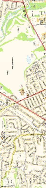
26 6 Sustainable Travel 6.1 Introduction This Sustainable Travel section comprises of an assessment of accessibility for Nishkam School West London and relates to the following Travel modes. Walking Cycling Public Passenger Transport Bus and Train facilities and services Motor Cycling and Mopeds Car Sharing 6.2 Public Transport Accessibility Level PTAL (Public Transport Accessibility Level) is a widely adopted methodology in Greater London for quantifying a site s accessibility to public transport and is considered to be a usable measure of relative accessibility to public transport at any location within a London borough and provides a general comparison of a site s accessibility relative to another PTAL is used to calculate the distance from a site to the nearest bus and rail facilities. The PTAL methodology assumes a maximum walk distance / time of 640 metres / 8 minutes to bus services and 960 metres / 12 minutes to rail services The PTAL rating has been calculated for the school returning a PTAL rating of 1b. A copy of the output is included in Appendix E. The rating system ranges from 1 which is classed as very poor up to 6 classed as excellent. A rating of 1b is considered very poor according to TfL guidelines. 6.3 Walking Accessibility Walking is the most important mode of transport at the local level and offers the greatest potential to replace short car trips in journeys under 2km. Report Ref: 8571/003/04 26 June 2015
27 6.3.2 Walkable neighbourhoods are typically characterised by having a range of facilities within 10 minutes (up to about 800 m) walking distance of residential areas which residents may access comfortably on foot. However, this is not an upper limit and PPS13 states walking offers the greatest potential to replace short car trips, particularly those under 2 km. MfS encourages a reduction in the need to travel by car through the creation of mixed-use neighbourhoods with interconnected street patterns, where daily needs are within walking distance of most residents The IHT publication Providing for Journeys on Foot identifies suggested acceptable walking distances for commuting, school and sight-seeing as follows with times based on a walking speed of (1.4m/s). Desirable 500m Acceptable 1000m Preferred maximum 2000m 6 minutes 12 minutes 24 minutes A plan indicating the 800m, 1.5km and 2km walking radii is available in Appendix A (Figure 2) In relation to the application site, there is a Tesco Supermarket to the southeast of the site with residential areas broadly to the south, east and west of the site. There are footways on all roads surrounding the site with pedestrian refuge islands that have tactile paving and central islands provided on Syon Lane. Signalised crossing facilities are provided at the signal controlled junctions of Syon Lane and Wood Lane with the A4 to the south east and south west of the site. Approximately 550m to the south east of the site there is a zebra crossing on Syon Lane. The signalised junction of Syon Lane and the A4 is also provided with a pedestrian underpass on the eastern side of the junction. Report Ref: 8571/003/04 27 June 2015
28 6.3.6 The IHT publication Guidelines for Planning for Public Transport in Developments identifies maximum walking distances to bus stops as 400m with a 300m desirable value. PTAL also identifies bus stops within 640m (8 minutes walk) and underground station with 960m (12 minutes walk) as being accessible Bus stops are located on the Wood Lane (H28 service) overall site frontage within approximately 150m of the centre of the building and on Great West Road (H91 service) approximately 400m from the centre of the building. The H28 service on Wood Lane also terminates adjacent to the Tesco Supermarket (see Figure 3A) The bus stops are readily accessible using existing streets and the footpath network and are within the desirable recommended walking distance identified in the IHT guidance and within the PTAL assessment area It is therefore considered that journeys on foot are a realistic prospect for future pupils, staff and visitors to the site. 6.4 Measures in relation to walking facilities Pedestrian access will be provided from both Syon Lane and Wood Lane. The width of the footway on Syon Lane will be increased in front of the school to join with the internal facilities. Also a footway will be provided on part of the Wood Lane frontage to join with the internal provision and existing footway on the eastern side adjacent to Braybourne Drive. The proposed pedestrian / cycle access point will be gated and access managed at the beginning and end of the school day. This will also allow access to bus stops on Wood Lane. The existing pedestrian refuge facility on Syon Lane adjacent to the school (Staggs Way) together with one on Wood Lane will be upgraded The Coordinator will promote the benefits of walking in relation to general health and well-being and will promote walking to staff and pupils. Report Ref: 8571/003/04 28 June 2015
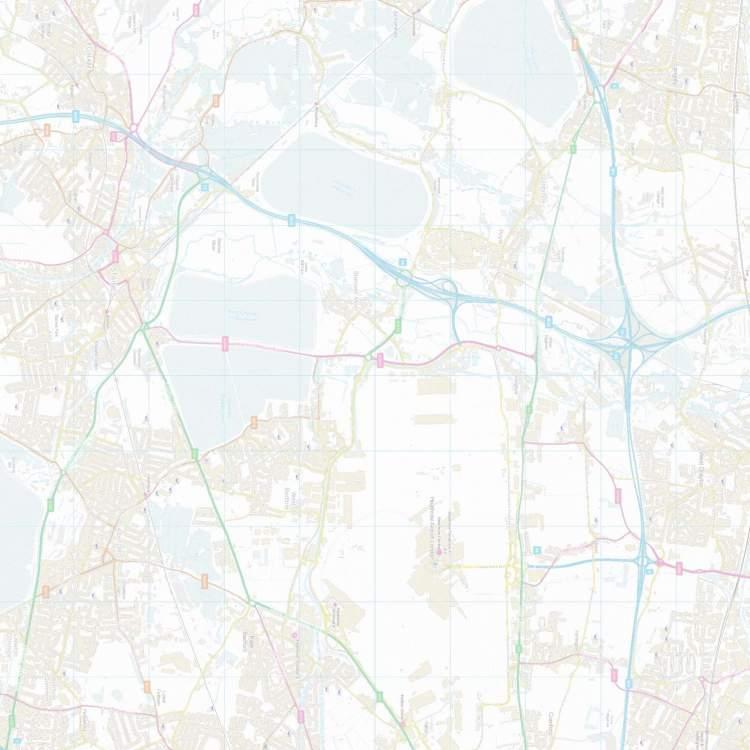
29 6.4.3 The Coordinator will promote the use of the free walking journey planner to staff and pupils, within the Travel Information Pack and promotional material The Coordinator will encourage pupils to walk with other pupils to assist in reducing safety concerns for this mode of travel. A walking buddy scheme will be promoted to pupils. If required the Coordinator will seek information and training for pupils about road safety from the Local Authority. 6.5 Cycling Accessibility Cycling has the potential to substitute for short car trips, particularly those under 5km and to form part of a longer journey by public transport. The plan attached at Appendix A (Figure 3) details a 2.5km and 5km radius indicating the extent to which the local area can be accessed by cycle. Given the age of some pupils it is unlikely that cycling will be attractive to younger pupils but older pupils can be encouraged to cycle. Staff would be encouraged to cycle A list of destinations within 5km, along with the corresponding cycle time based on 12 km per hour is summarised below: Origin/Destination Distance Time Syon Lane Over Ground Station 1.1km 5 ½minutes Osterley Underground Station 1.3km 6 ½minutes Brentford 2.6km 13 minutes Norwood Green 3.8km 19 minutes Hounslow Centre 3.9km 19 ½minutes Hanwell 4.4km 22 minutes Southall 4.8km 24 minutes Kew 4.8km 24 minutes Within the vicinity of the site Wood Lane is shown on TfL Local Cycling Guide 6 as a quiet road recommended for cyclists. Wood Lane connects to Jersey Road to the north and Great West Road to the south. Jersey Road is a signposted route that runs south towards Isleworth. Off road routes in the form of shared cycle footways are provided on Great West Road and these can be followed east toward Report Ref: 8571/003/04 29 June 2015
30 the centre of London and west to the centre of Hounslow. An extract from the TfL Local Cycle Guide is included at Appendix F Young cyclists need training to prepare for riding on roads. Most Local Authority Road Safety Departments offer cycle training for children aged 10 and above. Further advice can be obtained from the Council s school travel plan team cycle training officer can be contacted by at sta@hounslow.gov.uk or by telephone on Research shows that the most effective courses are those which include on-road training The proposed development is to be provided with adequate cycle storage provision on site with good cycle accessibility from local areas and connectivity to public transport. 6.6 Measures in relation to cycle facilities The School is accessible by cycle. Staff and pupils will have the opportunity to store cycles within the school grounds. Access by cycle will be available from Syon Lane and Wood Lane Staff facilities are to be provided together with staff showers The Coordinator will advise staff and pupils that information on London Borough of Hounslow cycle training in schools service is available at Information for cyclists including details of routes, cycle training and details of cycle facilities will be included within the Travel Information Pack. Further information on cycling can be found at the following websites: Report Ref: 8571/003/04 30 June 2015
31 Free cycle maps are available at The Coordinator will advise staff and pupils that a cycle journey planner is available from Transport for London at the following website:- A cycle journey planner for smartphones is available from Cyclestreets The Coordinator will be responsible for obtaining and updating information relating to cycling The Coordinator will promote the benefits of cycling in relation to general health and wellbeing and will promote cycling to staff and pupils within the Travel Information Pack. 6.7 Bus Accessibility The nearest bus stops located in close proximity to the site are located on Wood Lane adjacent to the western site boundary. Further bus stops are located within 500m of the site along the A4 Great West Road. The H28 terminates in the Tesco supermarket within 500m of the centre of the site. A plan indicating the location of the immediate bus stops and those in proximity to the site is available in Appendix A (Figure 3A). Details of the facilities provided at each of the stops along with the available services are provided below:- Wood Lane Location: Direction of travel: Facilities: Bus services: A4 Great West Road Location: Direction of travel: Site Frontage South and North Bound Pole and timetable information, H28 A4 Great West Road (south of site) East and West bound Report Ref: 8571/003/04 31 June 2015
32 Facilities: Bus services: Shelters with seating and timetable information H A summary of the bus services which operate at the above stops is provided below. H28 Bulls Bridge Tesco Hounslow Osterley Tesco Monday Saturday Daytime 20 minutes Sunday 30 minutes H28 Osterley Tesco Bulls Bridge Tesco Hounslow Monday Saturday Daytime 20 minutes Sunday 30 minutes H91 Hounslow West Chiswick Hammersmith Monday Friday 8-12 Minutes Saturday 9-12 Minutes Sunday 15 Minutes H91 Hammersmith Chiswick Hounslow West Monday Friday 8-12 Minutes Saturday 9-13 Minutes Sunday Minutes A bus route map for Osterley is included in Appendix C and the route local to the site is shown on Figure 3A. The H28 bus currently comprises of a short wheel base single decker bus with maximum capacity of 45. The H91 bus is a double decker type bus with a typical maximum capacity of 87 passengers As can be seen from the above, a frequent level of service is available from existing bus stops within 200m walking distance of the site. These stops provide a connection from the site to various local areas. Report Ref: 8571/003/04 32 June 2015
33 6.7.5 The school is proposing the introduction of a school bus to encourage travel by this mode at the beginning and end of the school day and to assist in reducing travel by car. This has been successfully introduced at one of the School Trust s schools in Birmingham. 6.8 Measures in relation to bus facilities Information about all available forms of public passenger transport including routes and destinations, service frequencies, locations of nearest bus stops and sources of other travel information shall be provided within the Travel Information Pack. In addition, the physical connections from the school to these facilities will be identified and made known to all staff and pupils. As mentioned previously it will be the responsibility of the Coordinator to ensure that this information is kept up-to-date and reported in each review The Coordinator will advise staff and pupils that information is available via the internet and up to date bus timetables and a journey planner can be found at Introduce school bus service. The actual routes will depend on where pupils live although it is envisaged that routes will primarily target those living further away where the number of bus or tube / rail changes may be 1 or more Live bus arrival times provide the wait time of the next bus at any bus stop in Greater London. This enables users to find out the scheduled or real time for any bus, at any stop in Greater London. This service is available by texting the bus stop number to (text costs the standard network rate, plus a 12p charge to receive the response) and is also available at and free of charge. Furthermore there are apps available for smart phones providing bus and tube travel information. Report Ref: 8571/003/04 33 June 2015
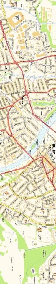
34 6.8.5 The Coordinator will inform pupils (5 10 year olds) that they can travel free on buses at all times and free on tube, DLR and London Overground using a 5 10 Zip Oyster Photocard. Pupils (11 16) are also allowed to travel free on buses and at child rate on tube, DLR and London Overground and most National Rail services in London with a 11 to 15 Oyster Photocard. All year olds are eligible for a 16+ Zip Oyster photocard. This allows 16 to 17 year olds free bus and tram travel if they are in full time education and reside in a London Borough or half adult fare on tube, DLR and London Overground and most National Rail services in London. Further details regarding travel for young people can be found at 18s/zip-oyster-photocards The School is well placed to publicise bus services to parents and children. Timetables and leaflets can be displayed in the school foyer and sent home on a regular basis. Timetables can be hard to understand but by involving students in the design of information, schools may be able to produce materials that are more readable and more appealing. It is also helpful if children can be taught how to use timetables. 6.9 Rail and Underground Accessibility The closest Overground train station to the development site is Syon Lane Railway Station which is located approximately 1100m south east of the site, whilst the nearest Underground Station is Osterley Underground Station, located approximately 1.3km west of the site. Appendix A (Figure 3A) shows the location of these stations. A rail network plan is included in Appendix C. Syon Lane National Rail Network This station has two platforms and is under the management of South West Trains This station provides services to London Waterloo, and Weybridge together with more local destinations of Hounslow and Richmond. Report Ref: 8571/003/04 34 June 2015
35 6.9.3 This station is within the preferred maximum walking distance as detailed by the IHT publication Providing for Journeys on Foot and cycle parking is provided at the station, this makes it possible to access the station by bicycle. The station is also served by the H28 bus which terminates at the Tesco Supermarket. Osterley Underground Station This station has two platforms above ground on the Piccadilly line This station is within the preferred maximum walking distance as detailed by the IHT publication Providing for Journeys on Foot and cycle parking is provided at the station, this makes it possible to access the station by bicycle. The station is also served by the H91 bus which travels along the Great West Road Measures in Relation to Rail and Underground Facilities Information about all available forms of public passenger transport including routes and destinations, service frequencies, locations of nearest bus stops and railway station as well as other travel information shall be provided within the Welcome Pack. In addition the physical connections from the school to these facilities will be identified and made known to all staff and pupils. It will be the responsibility of the Coordinator to ensure that this information is kept up-to-date and reported in each review The Coordinator will advise staff and pupils that information is available via the internet and up to date rail timetables can be found at: The coordinator will advise staff and pupils that London travel information is available at Report Ref: 8571/003/04 35 June 2015
36 6.11 Motor cycling and Mopeds There are several benefits that may be derived from the use of this form of travel. Motor cycles by their very size create less congestion and are more likely to have less environmental impact than a single occupancy car journey. This mode of travel will not be suitable for most pupils but can be promoted to staff Concern is however often raised over the safety of these vehicles and it is therefore important that any promotion of this form of travel includes the need to inform prospective riders of their statutory obligations to obtain proper training by a recognised training organisation or trainer and the correct protective equipment before use of the vehicle Further information about the use a motorcycle or moped can be the Department of Transports website at The website includes useful information including equipment, testing and training Car Sharing Existing Car Share schemes will be promoted to further encourage car sharing for staff. Further detail can be found at Car Share schemes can: Provide a cheap way to get around Reduce levels of traffic and congestion Reduce C02 emissions and pollution Reduce parking problems Create opportunities for business and the local community to work together Create opportunities to meet other people from the local area Improve relations with the local community Parents and pupils will be encouraged to car share as much as possible to reduce pupil drop off and pick up activity at the school and hence safety around the school. Report Ref: 8571/003/04 36 June 2015
37 As can be seen from the existing pupil travel survey 19% of pupils already car share and this activity will be encouraged. Assistance will be available from the School s Co-ordinator to help match potential car share pupils Marketing and Communication Strategy All staff and pupils will be made aware of both the opportunities that will be available for alternative sustainable travel and of the likely measures to be included within this by providing them with a Travel Information Pack. This will ensure that all staff and pupils will be aware of the availability and benefits of sustainable travel at the time of occupation Transport for London is able to provide, posters, leaflets and timetables for display on notice boards / display units in communal areas The Coordinator will promote local and national events promoting sustainable travel to staff and pupils. Internet forums such as a facebook page, a school intranet etc will be investigated to encourage staff travel travel arrangements The Coordinators contact information including a telephone number and address will be included within the Travel Information Pack to allow staff and pupils to contact the TPC Other Measures - School Bus and Park and Stride No parking or arrangements for pupil pick-up and drop-off are proposed on site with the exception for pupils with disabilities or other mobility impairment. There will be 85 parking spaces (inclusive of 6 disabled spaces) on the vehicular access to the school and an area for school buses to drop-off and pick up pupils. The School is proposing to introduce a school bus facility which has support from present parents and is also seeking to secure up to three locations, in close proximity to the school for a Park and Stride scheme. Report Ref: 8571/003/04 37 June 2015
38 7 Enforcement, Monitoring and Targets 7.1 The operation of this is likely to be a condition of the planning permission and S106 agreement. 7.2 A copy of the approved will be provided to the School, it is then the School s responsibility to appoint a Coordinator prior to the school opening. The role of Coordinator will initially be undertaken by the School s Deputy Headteacher. 7.3 With respect to timescales, the will be monitored and reviewed as detailed below. A travel survey will be undertaken at the beginning of each academic year utilising the Council s travel plan website and then on an annual basis to determine staff and pupil travel modal split. A written analysis of the surveys, through the Council s travel plan website, shall be provided to the Local Authority by the Coordinator within 3 months of the completion and collation of each survey. As will be appreciated this is a new school, so pupils and staff will be getting familiar to the new surroundings and facilities. For the first year the surveys shall be undertaken within 3 months of the school opening in September 2017 and the results provided to the London Borough of Hounslow within three months of the survey being undertaken. A written analysis (from the Council s travel plan website) of the review shall be provided to the Council by the Coordinator within 8 months of the school opening for the first year. After the first year the Travel questionnaire / Hands up surveys will be undertaken within 2 months of the new academic year starting with the written analysis provided to the Council within 4 months of the school starting for that year both utilising the Councils travel plan website. 7.4 The review of school travel shall include details of the monitoring process undertaken. This report should also contain reference to any outside influence, such as changes to bus/train services. Report Ref: 8571/003/04 38 June 2015
39 7.5 The will be reviewed in co-operation with the Local Authorities Travel Plan Officer (Kieran Toms) An Action Plan will be prepared containing a programme of measures designed to help achieve the targets on travel mode share for the second year. It will clearly set out the tasks involved, the person(s) responsible, and dates by which the measures will be achieved. 7.6 The School and the appointed Coordinator will use their reasonable endeavours to ensure that the is successful. The Coordinator maintains responsibility for distributing information and promoting the. 7.7 A table summarising how the travel plan will be delivered with actions, timescales and who is responsible can be found below: Report Ref: 8571/003/04 39 June 2015
40 Action Timescales Who is responsible Appoint a Prior to the opening of the school The School Coordinator (TPC) Produce Travel Information Prior to the opening of the school Coordinator Pack Information Included within enrolment and included on the school s website. Regular newsletter to staff, parents and pupils providing updates. Coordinator/ The School Undertake baseline travel questionnaire surveys (staff / pupils) utilising the Council s travel plan website Surveys supplied once the school accommodation is operational Coordinator Annual questionnaire Annually Coordinator Supply results of questionnaire to LPA through website Within 3 months of undertaking the hands-up and questionnaire surveys Coordinator Review After surveys and annually Coordinator/ Local Authority Include travel matters in parents evenings and include travel information on school web site. Coordinator/ The School Set up travel notice board. Prior to the opening of the school Coordinator/ The School Begin WOW (Walk on a Monthly Coordinator Wednesday) initiative. Take part in walk to school week and run other walking events. Annually and walking events throughout year Coordinator Take part in Cycle to work week (staff). Annually Coordinator/ The School Encourage staff and visitors Throughout year Coordinator to cycle to school. Encourage car sharing. Throughout year Coordinator Investigate scoot to school initiative. After travel surveys Coordinator / The School Seek STAR accreditation to sustainable level. End of year Coordinator / The School Seek Eco schools and Healthy schools Accreditation. End of year Coordinator / The School Table 7.7 Summary of actions and timescales 7.8 Initially it is difficult to be precise about the targets for modal split until the travel surveys have been undertaken and because of the phased intake, however the school would work towards achieving a shift of travel by car (car & taxi 23%) plus Report Ref: 8571/003/04 40 June 2015
41 Park and Stride (10%)) from 32.7% to 25.5% a reduction of 22% for primary school children up to It should be noted that for a three year horizon from September 2017 to September 2020 primary school pupils will rise from 350 to 550. Mode Travel To School average (Hounslow Primary Schools) Number of Responses Current Modal Split at London Road Proposed Target Proposed pupils (700) Percentage Percentage Percentage Pupils % % % Car/Taxi Car Share Bus School bus Train / Tube Cycle Walk Park & Stride Scooting Total % 700 Table Primary School Targets 7.9 With regard to Secondary school pupils the targets (up to 2020) will be set based on the Hounslow average data provided in section 3.3 and the existing travel survey information. The number of pupils in September 2017 is 100 rising to 400 in The proposed targets would be reviewed after the school travel survey results are known after September Report Ref: 8571/003/04 41 June 2015
42 Mode Travel To School average (Hounslow Secondary Schools) Number of Responses Proposed Target Proposed Pupils (700) Percentage Percentage Pupils % % Car/Taxi Car Share Bus School bus Train / Tube Cycle Walk Park & Stride Scooting Total % 700 Table Secondary School Targets 7.10 With regard to staff targets these would be set after the travel surveys have been undertaken. However, the aim would be to reduce single occupancy car trips in the longer term and increase car sharing although the scope for this will be limited because of the small number of staff initially The school would monitor pupil drop-off and pick-up activity on-street around the school grounds. The streets under consideration would be Wood Lane from the Piccadilly line to Great West Road, Braybourne Drive and Syon Lane from the Piccadilly line to the MacFarlane Lane. This would consist of on-street parking observations at the beginning and end of the school day for one day each term. Report Ref: 8571/003/04 42 June 2015
43 8 Conclusions 8.1 This sets out a series of measures which will encourage changes in the travel habits of staff and pupils and to travel in such a way so as to reduce car borne trips together with the use of more sustainable forms of travel to and from the school. 8.2 The includes reference to compliance and enforcement of the Travel Plan and to the required monitoring, review and reporting. 8.3 It is considered that these measures will help to reduce the reliance on the private car, particularly single-person trips in the peak hours. In turn the numbers of trips by other modes of transport should increase thereby contributing to an improvement in both the operation of the local highway network and in the general environment. 8.4 Information about all available forms of walking, cycling and public passenger transport information including routes and destinations, service frequencies, locations of nearest bus stops and sources of other travel information shall be provided within the Schools Travel Information Pack. The Coordinator will promote the benefits of walking and cycling in relation to general health and well-being and will promote walking and cycling to staff and pupils. 8.5 Nishkam School West London is committed to encouraging positive changes to the modes of transport used in connection with the school. These measures will help the viability and attractiveness of the overall site to the benefit of all occupiers. 8.6 This will be further developed in conjunction with the London Borough of Hounslow as specific travel needs are identified. Report Ref: 8571/003/04 43 June 2015
44 APPENDIX A Figure 1 Site Location Plan Figure 2 800m, 1.5km & 2km Walking Radii from the Site Figure 3A Bus Stop Locations and Bus Routes Figure 4 2.5km & 5km Cycling Radii from the Site Figure 5 Bus Routes and School Location Plan Figure 8A School Pupil Postcodes

")
45 Sanderson Associates (Consulting Engineers) Ltd.

")
46 Sanderson Associates (Consulting Engineers) Ltd.

")
47 Sanderson Associates (Consulting Engineers) Ltd.
48 Sanderson Associates (Consulting Engineers) Ltd.
49 Sanderson Associates (Consulting Engineers) Ltd.
50 Sanderson Associates (Consulting Engineers) Ltd.
51 APPENDIX B Site Plan
52
53 APPENDIX C Travel Information Pack Osterley Bus Route Map Rail and Tube Map

54 Sustainable Travel Information Pack Nishkam School West London, Syon Lane, Hounslow All staff and pupils of the school are encouraged to use sustainable modes of travel to and from the school. This document has been produced to inform all staff and pupils about local facilities and travel options available surrounding the site. We can all see the effects of the way we travel on our environment, our health and our quality of life. Increases in road traffic have produced unsustainable levels of congestion and pollution. Sustainable travel can reduce congestion, improve local environments and encourage healthier and safer lifestyles. Pupil drop-off and pick-up is discouraged by the school to reduce congestion around the school and help road safety for all pupils. By promoting walking, cycling, public transport and responsible car use this Travel Information Pack has been prepared to encourage the use of Sustainable Travel to and from Nishkam School West London Bus facilities Bus stops can be found within the vicinity of the school, both along Great West Road and Wood Lane. As a summary guide, the available services at all of these stops are provided in the following table. The bus stop reference number for each bus stop which serves the available services has also been provided and a map detailing their locations has been included to the rear of this Travel Information Pack. Summary of services Frequency Route Number H28 H91 Bus stop Ref. Number G (northbound, F (Southbound to Tesco) L, V (to Chiswick Overall Route Daytime Frequency (Mon - Sat) Evening Frequency (Mon Sat) Sunday Frequency Bulls Bridge - Osterley 20mins 30mins 30mins Hounslow West Chiswick Hammersmith 8-12mins 9-10mins 13-15mins Bus timetable information and Journey Planners can be found at Travel information by telephone can be obtained from London Travel Information tel (information available 24 hours a day). Staff and pupils are also encouraged to utilise the service which provides live bus arrival times from the selected bus stop. This service is available by texting the bus stop number to (text costs the standard network rate, plus a 12p charge to receive the response) and is also available at free of charge. Other Apps are available for smartphones. Rail facilities Syon Lane railway station is located approximately 1.2km from the school and is under the management of South Western Trains. This station provides services to and from London Waterloo. The station can be be accessed by bus using Service H28 and the journey only takes a few minutes from the Osterley Tesco to the station. Cycle parking is provided at the station. 1
55 Rail service information and timetables can be found at with further information available at and Cycle facilities Cycling is a healthy and sustainable mode of travel, information on cycling, cycle training and local route maps are available from and Bicycle journey planning is also available and further information can be found The London Borough of Hounslow provides cycling tuition (certain ages only) in conjunction with local schools during term-time and school holidays. Further information regarding this scheme is available at The school is accessible by cycle, covered cycle spaces are available for staff and pupils within the school grounds. Walking facilities There are pedestrian routes and junction crossings provided with dropped kerbs and tactile paving. There are pedestrian islands on Syon Lane and Wood Lane on the route to the school. Traffic calming is provided on Wood Lane on the school frontage. Approximately 300m to the south of the school there are signalised crossing facilities on Great West Road adjacent to the Wood Lane junction. Approximately 760m to the south east of the school there is a pedestrian under pass and signalised crossing facilities incorporated in the Syon Lane signalised junction. Car Sharing Staff and parents who drop off and pick up pupils are encouraged to car share. There is a car share scheme for London details of which can be found at with national details at Travel Information Details of facilities in the vicinity of the school are indicated in this Travel Information Pack and on the attached plans. Staff and pupils will be encouraged to complete a Travel Questionnaire to assist in assessing the modes of travel to the school. The School will be reviewed annually and again staff and pupils will be encouraged to participate. The results of the survey along with details of any specific initiatives and the targets for modal shift will be contained within the School. Coordinator For further information please contact the Coordinator at or by telephone on. 2
56 Buses from Osterley H28 Bulls Bridge Tesco HAMMERSMITH H91 Hammersmith Bus Station Key O Connections with London Underground o Connections with London Overground R Connections with National Rail Ravenscourt Park Southall Lane Stamford Brook Bus Garage Cranford High Street Cranford Community School Brabazon Road Cranford Lane Somerset Waye CRANFORD HESTON The yellow tinted area includes every bus stop up to about one-and-a-half miles from Osterley. Main stops are shown in the white area outside. CHISWICK Gunnersbury Chiswick Roundabout Great West Road Boston Manor Road Gunnersbury Chiswick High Road Chiswick Police Station Turnham Green Church Route finder Day buses Bus route Towards Bus stops H28 Bulls Bridge GHJKW Osterley Tesco CDEFY H91 Hammersmith QSTUV Hounslow LMNPR Summerhouse Avenue The Crossways The Warren The Crossways Sutton Way Jersey Road Great West Road West Cross Way Upper Sutton Lane Ridgeway Road North Ridgeway Road Wood Lane Railway Bridge (towards Bulls Bridge only) Wood Lane Conquest Club Great West Road West Cross Centre Great West Road Gillette Corner Osterley H28 Tesco H91 Hounslow West Sutton Lane Willow Gardens/Great West Road Great West Road Burton Gardens Great West Road Sutton Lane Great West Road Lampton Road Q STUCLEY ROAD R PENWERRIS AVENUE Sports Ground Osterley S GREAT P Subway OSTERLEY AVENUE WEST THORNBURY AVENUE P1ndar Sports Ground THORNBURY ROAD C D T J K N ST MARYS E CRESCENT ROAD OSTERLEY ROAD H U M CHURCH ROAD Jersey Gardens RIDGEWAY ROAD G V WOOD F LANE W BOROUGH RD YL Great West Road St Francis of Assisi Church Syon Lane Syon Lane Marlborough Road Sutton Lane Queenswood Avenue HOUNSLOW Spring Grove Road Worton Way Spring Grove Road Worton Gardens Spring Grove Road Witham Road Thornbury Road Eversley Crescent Wood Lane Borough Road Wood Lane Hartham Road London Road Busch Corner Twickenham Road Park Road Kingsley Road Kings Avenue Amhurst Gardens Alton Close West Middlesex Hospital Wellington Road North Hounslow East Hounslow Bus Station Wellington Road South Hanworth Road Douglas Road Hanworth Road Grove Road Transport for London Information correct from October 2014 TFL (P)
57 London s Rail & Tube services Key to lines and symbols Special fares Archway Bakerloo Central Circle District District (limited service) Hammersmith & City Jubilee Metropolitan Northern Piccadilly Victoria Waterloo & City Docklands Light Railway London Overground London Tramlink Emirates Air Line Chiltern Railways c2c First Capital Connect First Capital Connect (limited service) First Great Western Greater Anglia Heathrow Connect Heathrow Express London Midland Southern Southern (limited service) Southeastern Southeastern (limited service) Southeastern high speed South West Trains Interchange stations Airport Riverboat services Emirates Air Line Station in both fare zones Tramlink fare zone Emirates Air Line fare zone Pay as you go fares are available between all stations within the black broken line except for travel on: Southeastern high speed, Heathrow Express and Heathrow Connect between Hayes & Harlington and Heathrow. For fares information visit tfl.gov.uk/tickets Tube stations affected by engineering works Bond Street Central line trains will not stop at this station until late June and Jubilee trains will not stop from early July until early December 2014 Covent Garden Exit only until mid-november Also, on Saturdays and Sundays, westbound trains will not stop. Please use Leicester Square instead. Embankment Bakerloo and Northern line trains will not stop at this station until early November 2014 Gloucester Road Piccadilly line trains will not stop at this station until mid-december 2014 Towards 1 High Wycombe Heathrow Terminal 5 Towards Aylesbury Towards Slough Uxbridge ZONE 6 Heathrow Terminals 1, 2, 3 Towards Staines West Drayton Towards Shepperton Amersham ZONE 5 ZONE 9 Chalfont & Latimer Chorleywood Rickmansworth West Ruislip Hillingdon Ickenham Hayes & Harlington Ruislip Gardens South Ruislip Northolt ZONE 4 Hounslow East Hounslow Central Hounslow West Hatton Cross Heathrow Terminal 4 Feltham Hampton A B C D E F G H Towards Towards Towards Towards Towards Hemel Hempstead Luton Airport Parkway Welwyn Garden City Hertford North Hertford East and Stansted Airport Chesham Southall Fulwell ZONE 8 Northolt Park Ruislip Greenford South Greenford Castle Bar Park Drayton Green Hanwell Boston Manor Osterley Hounslow Whitton Watford Croxley Isleworth Twickenham Strawberry Hill Teddington Hampton Court Towards Woking and Guildford Moor Park ZONE 7 Ruislip Manor Eastcote South Harrow Perivale Northwood Northwood Hills Hanger Lane West Ealing Rayners Lane Sudbury Hill Sudbury Town Alperton Park Royal North Ealing Ealing Broadway Ealing Common South Ealing Northfields Syon Lane Brentford St. Margarets Hampton Wick Thames Ditton ZONE 8 Harrowon-the-Hill ZONE 3 Watford Junction Bushey Harrow & Wealdstone Pinner North Harrow Kenton West Harrow Chiswick Park Kew Bridge Sudbury Hill Harrow West Acton Kingston Sudbury & Harrow Road Acton Main Line Acton Town Richmond Acton Central South Acton Turnham Green Gunnersbury Kew Gardens Surbiton Watford High Street Stamford Brook Carpenders Park Hatch End Headstone Lane Northwick Park South Kenton North Wembley Wembley Central Stonebridge Park Harlesden North Sheen ZONE 2 Wood Lane Shepherd s Bush Market Goldhawk Road Chiswick Barnes Bridge Norbiton Berrylands Towards Guildford Willesden Junction North Acton East Acton Latimer Road White City Hammersmith Ravenscourt Park Mortlake Raynes Park New Malden Motspur Park Malden Manor Tolworth Chessington North Chessington South Preston Road Wembley Stadium Kensal Green Queen s Park ZONE 8 Stanmore Canons Park Queensbury Kingsbury Kilburn Park Maida Vale Warwick Avenue Royal Oak West Kensington Parsons Green Putney Bridge River Thames Barnes Putney East Putney Southfields Wimbledon Park Wimbledon Ewell West Kensal Rise Westbourne Park Ladbroke Grove Shepherd s Bush Holland Park Kensington (Olympia) Barons Court Wimbledon Chase Worcester Park Stoneleigh Edgware ZONE 7 Brondesbury Park Kilburn High Road Earl s Court Edgware Road Wandsworth Town Notting Hill Gate High Street Kensington Gloucester Road Haydons Road ZONE 6 ZONE 5 ZONE 4 Wembley Park Hendon Neasden Dollis Hill West Brompton Fulham Broadway Imperial Wharf Burnt Oak Bayswater Dundonald Road ZONE 3 Brondesbury ZONE Paddington Queensway 2 South Hampstead ZONE 1 Lancaster Gate Hyde Park Corner Knightsbridge South Kensington Clapham Junction Earlsfield Merton Park Ewell East Colindale Willesden Green Kilburn Pimlico Battersea Park Marble Arch Sloane Square Wandsworth Common Bond Street Green Park Colliers Wood South Wimbledon Cheam Marylebone Belmont Banstead Elstree & Borehamwood Mill Hill Broadway Hendon Central Cricklewood Edgware Road Balham West Hampstead Victoria Finchley Road Baker Street St. James s Park Queenstown Road (Battersea) Wandsworth Road Oxford Circus Piccadilly Circus Clapham High Street Clapham North Tooting Bec Tooting Broadway Morden Road Morden Phipps Bridge Belgrave Walk Mitcham South Merton Morden South Mitcham Junction St. Helier Sutton Common West Sutton Sutton Brent Cross Golders Green Finchley Road & Frognal Swiss Cottage St. John s Wood Regent s Park Vauxhall Hampstead Beddington Lane Therapia Lane Warren Street Tottenham Court Road Clapham Common Clapham South Tooting Hackbridge Carshalton Belsize Park Great Portland Street Westminster Carshalton Beeches ZONE 2 Oval ZONE 3 ZONE 4 ZONE 4 ZONE 5 Chipstead ZONE Kingswood 6 Tadworth Camden Town Ampere Way Brixton Waddon Marsh Goodge Street Herne Hill Gospel Oak Euston Square High Barnet Totteridge & Whetstone Hampstead Heath Chalk Farm Waterloo and Waterloo East Mornington Crescent Mitcham Eastfields Euston Holborn Leicester Square Charing Cross Kennington Stockwell Loughborough Junction Streatham Hill Waddon Wallington Woodmansterne Woodside Park West Finchley Mill Hill East Finchley Central Southwark Reeves Corner East Finchley Highgate Archway Kentish Town West Covent Garden Camden Road St. Pancras International Embankment Lambeth North Kentish Town Chancery Lane Temple Tulse Hill Russell Square Blackfriars Borough Streatham Thornton Heath Wandle Park City Thameslink Norbury Selhurst Denmark Hill West Norwood Centrale Church Street Upper Holloway Tufnell Park King s Cross Elephant & Castle Streatham Common Coulsdon Town Angel Farringdon Gipsy Hill Hadley Wood New Barnet Oakleigh Park Caledonian Road London Bridge Barbican Mansion House East Dulwich North Dulwich St. Paul s West Dulwich Wellesley Road George Street Caledonian Road & Barnsbury Bank Cockfosters Oakwood Southgate Arnos Grove Alexandra Palace Crouch Hill Arsenal Holloway Road Moorgate Cannon Street West Croydon Reedham Coulsdon South New Southgate Peckham Rye Crystal Palace Purley Oaks Purley Kenley Drayton Park Whyteleafe Hornsey Harringay Old Street Bounds Green Essex Road Liverpool Street Monument ZONE 1 Aldgate River Thames Bermondsey Queens Road Peckham Norwood Junction Nunhead East Croydon South Croydon Sydenham Hill Whyteleafe South Fenchurch Street South Bermondsey Highbury & Islington Tower Hill Anerley Lebanon Road Crews Hill Gordon Hill Enfield Chase Grange Park Winchmore Hill Palmers Green Bowes Park Wood Green Turnpike Lane Harringay Green Lanes Manor House Finsbury Park Canonbury Haggerston Hoxton Shoreditch High Street Aldgate East Wapping Rotherhithe Canada Water Surrey Quays Penge West Sandilands Dalston Junction New Cross Gate Brockley Honor Oak Park Forest Hill Sydenham Sanderstead Tower Gateway Arena Woodside Blackhorse Lane Addiscombe Lloyd Park Coombe Lane Riddlesdown Upper Warlingham Edmonton Green Silver Street White Hart Lane Dalston Kingsland Gravel Hill Bruce Grove Bethnal Green Enfield Town Bush Hill Park Avenue Road ZONE 7 London Fields Cambridge Heath Bethnal Green Stepney Green Whitechapel Shadwell Harrington Road Addington Village Seven Sisters Stamford Hill Stoke Newington Birkbeck Rectory Road Hackney Downs Mile End Deptford New Cross Bow Church ZONE 2 ZONE 8 Theobalds Grove Turkey Street Southbury Tottenham Hale South Tottenham Clapton Hackney Central Westferry Canary Wharf St. Johns Homerton Beckenham Road Broxbourne Cheshunt Waltham Cross Enfield Lock Brimsdown Ponders End Angel Road Northumberland Park St. James Street Hackney Wick Bow Road Devons Road Langdon Park All Saints Blackwall North Greenwich Deptford Bridge Elverson Road Blackheath Stratford Pudding Mill Lane Bromley by-bow East India Maze Hill Shortlands ZONE 8 Chingford Highams Park Wood Street Walthamstow Central Walthamstow Queen s Road Leyton Midland Road Westcombe Park Kidbrooke Hither Green Ladywell Crofton Park Lee Catford Catford Bridge Bellingham Lower Sydenham Beckenham Hill Penge East Sundridge Park New Beckenham Kent House Bromley North Ravensbourne Eden Park West Wickham Hayes Fieldway King Henry s Drive Limehouse New Addington West India Quay Heron Quays South Quay Crossharbour Mudchute Island Gardens Lewisham Clock House Elmers End Poplar Blackhorse Road Cutty Sark for Maritime Greenwich Greenwich Beckenham Junction Stratford International Emirates Greenwich Peninsula Leyton Maryland Stratford High Street Abbey Road Plaistow West Ham Star Lane Canning Town Bromley South Charlton Eltham Upton Park Mottingham ZONE 3 Royal Victoria Grove Park ZONE 7 Buckhurst Hill Woodford South Woodford Snaresbrook Leytonstone High Road Forest Gate Woolwich Dockyard New Eltham Elmstead Woods Chislehurst Bickley Leytonstone East Ham Loughton Custom House for ExCeL Emirates Royal Docks London City Airport Petts Wood King George V Orpington Falconwood Roding Valley Sidcup Theydon Bois Debden Redbridge Chigwell Grange Hill Seven Kings Wanstead Park Ilford Manor Park Woodgrange Park Plumstead Abbey Wood Welling Albany Park Epping Hainault Fairlop Barkingside Newbury Park Goodmayes Upney Prince Regent Royal Albert Beckton Park Cyprus Pontoon Dock Gallions Reach Epsom Downs Tattenham Corner Caterham Towards Epsom and Towards Towards East Grinstead Transport for London and ATOC May 2014 poster Dorking Gatwick Airport and Uckfield A B C D E F G H West Silvertown Wanstead Woolwich Arsenal Chelsfield Knockholt Gants Hill Beckton St. Mary Cray Barking ZONE 4 Bexleyheath Bexley Towards Sevenoaks Chadwell Heath Becontree Dagenham East Dagenham Heathway Belvedere Erith Barnehurst Romford Dagenham Dock ZONE 5 Slade Green Crayford Gidea Park Elm Park Harold Wood Emerson Park Hornchurch Upminster Bridge ZONE 6 Brentwood Upminster Shenfield 1 Towards Chelmsford and Southend Towards Southend and Shoeburyness Ockendon Chafford Hundred Towards Southend Rainham Purfleet Grays Towards Swanley and Sevenoaks Towards Ebbsfleet International Towards Dartford and Gravesend
58 APPENDIX D Mode split data from travel surveys of 4 schools in Hounslow Postcode Distribution Data
59 Travel To School Isleworth syon boys Travel To School Lampton Travel To School heston Travel To School Gumley Travel To School The Heathland Travel To School average Mode Number of Percentage Number of Percentage Number of Percentage Number of Percentage Number of Percentage Number of Percentage Responses % Responses % Responses % Responses % Responses % Responses % Car/Taxi Car Share Bus Train / Tube Cycle Walk Park & Stride Scooting Total Total by non car modes
60 Travel To School Hounslow Town (2012) Travel To School Isleworth Town (2010) Travel To School Alexandra (2009/10) Travel To School Spring Grove (2010) Travel To School average Mode Number of Percentage Number of Percentage Number Percentage Number of Percentage Number of Percentag Responses % Responses % of % Responses % Responses % Car/Taxi Car Share Bus Train / Tube Cycle Walk Park & Stride Scooting Total Total by non car modes
61 Postcode Number of Pupils Percentage Travel Route Designation TW 1 TW 2 TW % N3 w TW % N3 w TW % N2 TW % TW % See Below TW % E TW % E TW % E TW % SS TW % TW % N3 ss TW % N3 w TW % TW % TW % SS TW % N3 w TW % N3 w UB % N1 UB % N1 UB % N2 UB % N2 UB % N2 UB % N2 UB % N2 HP % N1 W % E SE % E NW % E Total % TW District Number of Pupils Split of postcode TW7 Percentage Travel Route Designation TW % N3 ss TW % SS TW % SS TW % SS Total % N 1 N 2 N 3 w N 3 ss SS E Key Remarks Windmill Lane Jersey Road from West of Thornbury Road Great West Road from West split 50/50 to Jersey Road / Syon Lane at Thornbury Road junction Thornbury Road from south to Jersey Road Syon Lane from south of Great West Road Great West Road from East on to Syon Lane
62 APPENDIX E PTAL Report Summary
63 PTAI Study Report File Summary PTAI Run Parameters PTAI Run Description Run by user PTAL web application Date and time 26/05/ :24 Walk File Parameters Walk File PLSQLTest Day of Week M-F Time Period AM Peak Walk Speed 4.8 kph BUS Walk Access Time (mins) 8 BUS Reliability Factor 2.0 LU LRT Walk Access Time (mins) 12 LU LRT Reliability Factor 0.75 NATIONAL_RAIL Walk Access Time (mins) 12 NATIONAL_RAIL Reliability Factor 0.75 Coordinates: , Mode Stop Route Distance (metres) Frequency (vph) Weight Walk time (mins) SWT (mins) TAT (mins) EDF AI OSTERLEY FOUR BUS PILLARS H BUS Wood Lane Club House H LT SAP Points Not Found
64 NR SAP Points Not Found Total AI for this POI is PTAL Rating is 1b.
65 APPENDIX F Local and London Cycle Network Routes
")
66 Sanderson Associates (Consulting Engineers) Ltd.

67 APPENDIX G School Travel Charter
Arcadis LLP Proposed Secondary School (Bolder Academy) Macfarlane Lane, Isleworth Access Management Strategy. June 2017
 Macfarlane Lane, Isleworth Access Management Strategy. June 2017") traffic engineering and transport planning Arcadis LLP Proposed Secondary School () June 2017 Armstrong House, The Flemingate Centre, Beverley, HU17 0NW 01482 679 911 info@local-transport-projects.co.uk
traffic engineering and transport planning Arcadis LLP Proposed Secondary School () June 2017 Armstrong House, The Flemingate Centre, Beverley, HU17 0NW 01482 679 911 info@local-transport-projects.co.uk
Proposed Lidl Food store West Hendford, Yeovil
 Proposed Lidl Food store West Hendford, Yeovil Lidl Travel Plan October 2015 CONTENTS Page 1.0 INTRODUCTION 1 1.1 Background 1 1.2 Aim of Travel Plan 1 1.3 Contents 2 2.0 TRANSPORT CONTEXT 3 2.1 Site Location
Riverside Heights, Norwich. Travel Plan
 RIVERSIDE HEIGHTS, NORWICH Client: Engineer: Taylor Wimpey East Anglia Create Consulting Engineers Limited Hungate House Princes Street Norwich Norfolk NR3 1AZ Tel: 08454507908 Email: enquiries@createconsultingengineers.co.uk
Movement Strategy. November On behalf of Barton Oxford LLP
 Movement Strategy November 2014 On behalf of Barton Oxford LLP BARTON PARK, OXFORD. Movement Strategy 17/11/2014 Quality Management Issue/revision Issue 1 Revision 1 Revision 2 Revision 3 Remarks Date
John Betts School Crossing Review
 John Betts School Crossing Review Paddenswick Road London Borough of Hammersmith & Fulham August 2015 DOCUMENT CONTROL Project Centre has prepared this report in accordance with the instructions from the
Queen s Circus Roundabout
 Stage 2 Road Safety Audit Ref: 1128-RSA-01 Prepared for: Steer Davies Gleave By: Capital Traffic Prepared by: Checked by: Approved by: Andy Haunton, Audit Team Leader Jonathan Thompson, Audit Team Member
TRANSPORT FOR GREATER MANCHESTER COMMITTEE REPORT FOR RESOLUTION
 TRANSPORT FOR GREATER MANCHESTER COMMITTEE REPORT FOR RESOLUTION DATE: 11 November 2011 SUBJECT: REPORT OF: Proposed making of a Quality Partnership Scheme for the A6 corridor between Manchester and Hazel
Travel Plan Revised by Steiner Academy Exeter July 2015
 Revised by Steiner Academy Exeter July 2015 Steiner Academy Exeter Thomas Hall Cowley Bridge Rd EXETER EX4 5AD Devon Original Hydrock Ref: R/13670/003 Originally prepared by: DOCUMENT CONTROL SHEET Hydrock
Chapter 6 Route Window NE5 Seven Kings station. Transport for London
 Chapter 6 Route Window NE5 Seven Kings station Transport SEVEN KINGS STATION 6 Route Window NE5 Seven Kings Station Transport Introduction 6.1 All construction activities in this route window are associated
Citycourt Developments Ltd
 ouse Citycourt Developments Ltd Proposed Lidl Foodstore,, Dover Interim Travel Plan REPORT CONTROL Document: Travel Plan Project: Client: Citycourt Developments Ltd Job Number: 152045 File Origin: Document
Scotchbarn Lane, Prescot Accessibility Statement
 Scotchbarn Lane, Prescot Accessibility Statement Lancashire Mortgage Corporation Ltd August 2012 Issue R001B 9X0789 All rights reserved. No part of this publication may be reproduced in any form, including
Saighton Camp, Chester. Technical Note: Impact of Boughton Heath S278 Works upon the operation of the Local Highway Network
 Technical Note: Impact of Boughton Heath S278 Works July 2013 SAIGHTON CAMP CHESTER COMMERCIAL ESTATES GROUP TECHNICAL NOTE: IMPACT OF BOUGHTON HEATH S278 WORKS UPON THE OPERATION OF THE LOCAL HIGHWAY
London Borough of Barnet Traffic & Development Design Team
 London Borough of Barnet Traffic & Development Design Team AERODROME ROAD PEDESTRIAN FACILITY AND BUS STOP INTRODUCTION FEASIBILITY REPORT Job Number: 60668 Doc Ref: S106/12-13/60668 Author: Manoj Kalair
Proposals for the Harrogate Road / New Line Junction Improvement Scheme. August / September Supported by:
 Proposals for the Harrogate / New Line Junction Improvement Scheme August / September 2016 Supported by: Introduction Key Benefits Proposals are currently being developed for changes to the junction of
Scrappage for Equality
 Scrappage for Equality Calls continue to be made for the Government to sponsor a vehicle scrappage scheme to remove the most polluting vehicles from the parc. Previous RAC Foundation research has revealed
Response to the London Heathrow Airport Expansion Public Consultation
 Response to the London Heathrow Airport Expansion Public Consultation Summary This report sets out the response to the Heathrow Airport s consultation on airport expansion and airspace change. The consultation
Commissioning Director - Environment
 Finchley and Golders Green Area Committee 27 April 2017 Title Report of Wards Status Urgent Key Enclosures Summers Lane,N12 Request for Pedestrian Improvements Commissioning Director - Environment Woodhouse
Date 24/10/2011. Date 04/11/2011. Date 25/10/2011. Date 10/11/2011. Date 25/10/2011. Date 25/10/2011. Date 10/11/2011.
 DELEGATED POWERS REPORT NO. 1489 SUBJECT: Traffic Signal Review, Junction of Oakleigh Road North and the A1000 Control sheet All of the following actions MUST be completed at each stage of the process
Sky Temporary Car Park Transport Statement
 001 Issue 26 August 2016 This report takes into account the particular instructions and requirements of our client. It is not intended for and should not be relied upon by any third party and no responsibility
WELSH GOVERNMENT RESPONSE P Ensure Disabled People can Access Public Transport As and When They Need it
 WELSH GOVERNMENT RESPONSE P-05-710 Ensure Disabled People can Access Public Transport As and When They Need it The petition submitted by Whizz Kidz seeking action to ensure that disabled people can access
Land at Burton Road, Tutbury - Residential
 Land at Burton Road, Tutbury - Residential Prepared by: Developer Eyes 16 Brooklands Court Kettering Venture Park Kettering Northamptonshire NN15 6FD Author: Hannah Weston Our Ref: PS-120 Date: 28/07/2016
TRAVEL PLAN MONITORING REPORT LONDON GATEWAY LOGISTICS HUB
 TRAVEL PLAN MONITORING REPORT LONDON GATEWAY LOGISTICS HUB January 2017 Contents Page 1. Introduction 1.1 Overview 2 1.2 The Development 2 1.3 Planning Context 3 1.4 Reporting Requirements 3 2. Staff Movements
SCHOOL TRAVEL PLAN ROSLIN PRIMARY SCHOOL
 SCHOOL TRAVEL PLAN ROSLIN PRIMARY SCHOOL 2018 INTRODUCTION Purpose Midlothian Council have prepared this School Travel Plan for the development of a new Roslin Primary School to replace the existing school.
Report to: Greater Cambridge Partnership Joint Assembly 18 January A10 Foxton level crossing bypass and travel hub
 Report to: Greater Cambridge Partnership Joint Assembly 18 January 2018 Lead officer: Chris Tunstall GCP Director of Transport A10 Foxton level crossing bypass and travel hub 1. Purpose 1.1 The list of
Perth and Kinross Council Development Management Committee 20 February 2013 Report of Handling by Development Quality Manager
 Perth and Kinross Council Development Management Committee 20 February 2013 Report of Handling by Development Quality Manager 4(4)(ii) 13/80 Replacement and re-positioning of street furniture, The Birks,
The decision on whether to take enforcement action falls outside the scope of delegated powers.
 5k 16/0031 Reg d: 19.01.2016 Expires: 15.03.201 6 Ward: Nei. 24.02.201 BVPI Full Number of 11/8 On Con. 6 Target Weeks on Target? Exp: Cttee Day: GE No LOCATION: PROPOSAL: TYPE: Phillips Court, 32 Goldsworth
in Southwark: EXECUTIVE SUMMARY a survey and report
 Taxicard in Southwark: a survey and report 2002-2003 EXECUTIVE SUMMARY Taxi art displayed in a shopping centre Research into the London Borough of Southwark s Taxicard Scheme Alistair Beattie and Daniel
Table 1 overleaf summarises the changes in planned growth between the 2016 and 2017 iterations of the plan.
 Addendum to Guildford Borough Proposed Submission Local Plan June 2016 Strategic Highway Assessment Report: High level review of potential of key changes in the Guildford borough Proposed Submission Local
TOWN TRUST. Bury St Edmunds Railway Station
 BURY ST EDMUNDS TOWN TRUST conserving buildings of historic interest The future of Bury St Edmunds Railway Station Part I Report October 2015 1 The future of Bury St Edmunds Railway Station NOTE: This
West London Economic Prosperity Board. 21 March Summary. Title Orbital Rail in West London
 West London Economic Prosperity Board 21 March 2017 Title Orbital Rail in West London Report of Status Urgent Enclosures Officer Contact Details Amar Dave (LB Brent) Public No Appendix 1: Specification
Come on board. An introduction to accessible transport in London MAYOR OF LONDON. Transport for London
 Come on board An introduction to accessible transport in London MAYOR OF LONDON Transport for London Contents 4 Plan your journey 6 Help from staff 8 Learning to use public transport 9 Fares and tickets
Chapter 4 Route Window NE3 Manor Park station. Transport for London
 Chapter 4 Route Window NE3 Manor Park station MANOR PARK STATION 4 Route Window NE3 Manor Park station 4.7 Highway access to Manor Park station is very good. A117 Station Road connects with A116 to the
Your Transport Levy Your Transport Future. Sunshine Coast Council Transport Levy Annual Report
 Your Transport Levy Your Transport Future Sunshine Coast Council Transport Levy Annual Report 2016-2017 www.sunshinecoast.qld.gov.au T 07 5475 7272 F 07 5475 7277 Locked Bag 72 Sunshine Coast Mail Centre
were these made available?
 (1) What publicity was undertaken across LB Brent by TfL and by Brent? No information is held by Brent Council as to what publicity TfL undertook in the London Borough of Brent. No publicity was undertaken
Environment Committee 24 September 2015
 Environment Committee 24 September 2015 Title Enforcement of Single Yellow Lines on Bank Holidays Report of Commissioning Director - Environment Wards All Status Public Urgent No Enclosures Key No Appendix
All reports. 1. Governance Service receive draft report Name of GSO DPR
 DELEGATED POWERS REPORT NO. SUBJECT: Redevelopment at Grahame Park Estate, NW9, Phase 1B Sub-phase 1 Highways Agreement under Sections 38 and 278 of the Highways Act 1980. Control sheet All of the following
HOUSEHOLD TRAVEL SURVEY
 HOUSEHOLD TRAVEL SURVEY Household Travel Survey i TABLE OF CONTENTS Page 1.0 INTRODUCTION... 1 2.0 SUMMARY OF TRAVEL... 2 2.1 All-Day Travel Patterns... 2 2.1.1 Automobile Availability... 2 2.1.2 Trip
IRISH PARKING ASSOCIATION. The use of Pay and Display in Traffic Management in Kilkenny City
 IRISH PARKING ASSOCIATION The use of Pay and Display in Traffic Management in Kilkenny City Kilkenny City and Environs Draft Mobility Management Plan 2009-2014 2014 Draft Mobility Management Plan Background
INTERNATIONAL FIRE TRAINING CENTRE
 INTERNATIONAL FIRE TRAINING CENTRE RFFS SUPERVISOR INITIAL LICENSING OF AERODROMES CHAPTER 8 THE MINIMUM REQUIREMENTS TO BE MET IN THE PROVISION OF RESCUE AND FIRE FIGHTING SERVICES AT UK LICENSED AERODROMES
Gold Coast. Rapid Transit. Chapter twelve Social impact. Chapter content
 Gold Coast Rapid Transit Chapter twelve Social impact Chapter content Social impact assessment process...235 Existing community profile...237 Consultation...238 Social impacts and mitigation strategies...239
WELCOME TO PROJECT EVERGREEN 3 CHILTERN S PROPOSED NEW OXFORD TO LONDON ROUTE
 PROJECT EVERGREEN 3 WELCOME TO PROJECT EVERGREEN 3 CHILTERN S PROPOSED NEW OXFORD TO LONDON ROUTE Chiltern Railways is proposing a railway improvement scheme between Oxford and Bicester (the Evergreen
Rail Delivery Group. Consultation on the future of the East Midlands rail franchise
 Rail Delivery Group Response to: Department for Transport Consultation on the future of the East Midlands rail franchise Date: 11 October 2017 Rail Delivery Group Limited Registered Office, 2nd Floor,
Hertford Way, Knowle, Solihull - Residential
 Hertford Way, Knowle, Solihull - Residential Prepared by: Developer Eyes 16 Brooklands Court Kettering Venture Park Kettering Northamptonshire NN15 6FD Author: Grant Morgan Our Ref: PS-150 Date: 14/04/2016
Old Limberlost Sports Club, Butlers Road, Handsworth Wood, Birmingham, B20 2NT
 Committee Date: 07/03/2013 Application Number: 2012/07986/PA Accepted: 29/11/2012 Application Type: Variation of Condition Target Date: 24/01/2013 Ward: Handsworth Wood Old Limberlost Sports Club, Butlers
Cuadrilla Elswick Ltd
 Cuadrilla Elswick Ltd Tewmporary Shale Gas Exploration Description Roseacre Wood, Lancashire Planning Inspectorate Reference APP/Q2371/W/15/3134385 Local Authority Reference: LCC/2014/0101 CE 1/3 Summary
Roundhouse Way Transport Interchange (Part of NATS City Centre Package)
") Roundhouse Way Transport Interchange (Part of NATS City Centre Package) 15/16 16/17 17/18 18/19 19/20 Total TOTAL COST Roundhouse Way Transport Interchange 0.5m 0.5m FUNDING CIL 0.05m 0.05m Growth Deal
Roundhouse Way Transport Interchange (Part of NATS City Centre Package) 15/16 16/17 17/18 18/19 19/20 Total TOTAL COST Roundhouse Way Transport Interchange 0.5m 0.5m FUNDING CIL 0.05m 0.05m Growth Deal
APPENDIX 1 Background to the Bower Ashton Residents' Parking Scheme proposals The RPS proposals meet the objectives of the Council's overall transport
 APPENDIX 1 Background to the Bower Ashton Residents' Parking Scheme proposals The RPS proposals meet the objectives of the Council's overall transport strategy as set out in the Joint Local Transport Plan
TfL Planning. 1. Question 1
 TfL Planning TfL response to questions from Zac Goldsmith MP, Chair of the All Party Parliamentary Group on Heathrow and the Wider Economy Heathrow airport expansion proposal - surface access February
JOINT CORE STRATEGY FOR BROADLAND, NORWICH AND SOUTH NORFOLK EXAMINATION MATTER 3C EASTON/COSTESSEY
 Matter 3C Easton/Costessey Representor No. 8826 JOINT CORE STRATEGY FOR BROADLAND, NORWICH AND SOUTH NORFOLK EXAMINATION MATTER 3C EASTON/COSTESSEY SUBMISSION ON BEHALF OF TAYLOR WIMPEY DEVELOPMENTS AND
TRAVEL PLAN MONITORING REPORT LONDON GATEWAY PORT
 TRAVEL PLAN MONITORING REPORT LONDON GATEWAY PORT November 2017 Contents Page 1. Introduction 1.1 Overview 2 1.2 The Development 2 1.3 Planning Context 3 1.4 Reporting Requirements 3 2. Staff Movements
Finchley and Golders Green Area Committee 27 April 2017
 Finchley and Golders Green Area Committee 27 April 2017 Title Report of Wards Status Urgent Key Enclosures Officer Contact Details Junction of Regents Park Road / Tillingbourne Gardens, N3 Commissioning
Chapter 2 Route window W25 Maidenhead station. Transport for London
 Chapter 2 Route window W25 Maidenhead station MAIDENHEAD STATION 2 Route window W25 Maidenhead station 2.6 The drawings provided at the end of this chapter present the main features of the route window,
Non-technical summary
 Introduction NTS1 NTS2 NTS3 Troika Developments Ltd (Troika) has submitted a planning application to Bournemouth Borough Council (BBC) for an extension of time to implement planning permission 7/2004/16450/G,
Perth & Kinross Council. Community Planning Partnership Report June 2016
 Perth & Kinross Council Community Planning Partnership Report June 2016 Contents Foreword... 3 Section 1: Spring 2016 destination follow up of 2014/15 school leavers... 4 Background... 4 Section A: Initial
Haworth Tr T avel Plan r 10th February 2006
 Haworth Travel Plan 10th February 2006 Haworth Travel Plan has been prepared for: Contents 1 Why have Haworth Travel Plan?... 3 2 Who will benefit from Haworth Travel Plan?... 4 3 What actions will be
IOW Ramblers Submission Paper to the Sept 2016 ROW Improvement Plan Consultation.
 IOW Ramblers Submission Paper to the Sept 2016 ROW Improvement Plan Consultation. The current Island Rights of Way Improvement Plan is a comprehensive document and much of its content is still relevant
Calderdale MBC. Wards Affected: Town. Economy and Investment Panel: 20 October Halifax Station Gateway Masterplan
 Calderdale MBC Wards Affected: Town Economy and Investment Panel: 20 October 2016 Halifax Station Gateway Masterplan Report of the Acting Director, Economy and Environment 1. Purpose of the Report 1.1
PERTH AND KINROSS COUNCIL. Housing and Health Committee. 25 May Perth and Kinross Local Housing Strategy
 PERTH AND KINROSS COUNCIL 7 16/234 Housing and Health Committee 25 May 2016 Perth and Kinross Local Housing Strategy 2016-2021 Report by Director (Housing and Social Work) PURPOSE OF REPORT This report
Proposal for gypsy and traveller accommodation on land at Lower Hollow Copse (Pot Common), Copthorne. Statement of Community Involvement
, Copthorne. Statement of Community Involvement") Proposal for gypsy and traveller accommodation on land at Lower Hollow Copse (Pot Common), Copthorne Statement of Community Involvement Prepared by WYG Environment Planning Transport Ltd on behalf of the
Proposal for gypsy and traveller accommodation on land at Lower Hollow Copse (Pot Common), Copthorne Statement of Community Involvement Prepared by WYG Environment Planning Transport Ltd on behalf of the
ACORNS PROJECTS LIMITED
 ACORNS PROJECTS LIMITED A4 London Road, M4 J5 to Sutton Lane, Slough, Berkshire Combined Stage 1 and 2 Road Safety Audit For Slough Borough Council Prepared by Acorns Projects Limited Safety Traffic Project
NEW BRIGHTON Travel Plan October 2008
 FLORAL PAVILION NEW BRIGHTON Travel Plan October 2008 1 FLORAL PAVILION comprises FLORAL PAVILION THEATRE Capacity 814 seats FLORAL PAVILION CONFERENCE CENTRE Tivoli Suite maximum capacity 50 Tower Room
MEMORANDUM OF UNDERSTANDING WITH BUSINESS IMPROVEMENT DISTRICTS WITHIN BIRMINGHAM
 MEMORANDUM OF UNDERSTANDING WITH BUSINESS IMPROVEMENT DISTRICTS WITHIN BIRMINGHAM For services in respect of: Highway Maintenance and Management Car Parking Traffic Management Signatories: For Birmingham
Active Travel Strategy for Perth and Kinross
 Appendix 1 Active Travel Strategy for Perth and Kinross 1. Background The Active Travel Strategy for Perth and Kinross has been developed to encourage, enhance and monitor physical active travel modes
M20 junction 10a improvement scheme. We want to hear your views
 M20 junction 10a improvement scheme We want to hear your views March 2016 2 About us Highways England, formerly the Highways Agency, is a government run company. We are responsible for operation, maintenance
TRANSPORT & INFRASTRUCTURE PLANNING NSPORT & INFRASTRUCTURE PLANNING SOWDEN TRANSPORT GROUP AND INFRASTRUCTURE PLANNING WINDMILL PLACE, LOUGHBOROUGH
 TRANSPORT & INFRASTRUCTURE PLANNING SOWDEN TRANSPORT GROUP AND INFRASTRUCTURE PLANNING WINDMILL PLACE, LOUGHBOROUGH NSPORT & INFRASTRUCTURE PLANNING TRAVEL Wilson Bowden PLAN Developments Woodhouse Park
Perth and Kinross Council Development Control Committee 27 August 2008 Recommendation by Development Quality Manager
 Perth and Kinross Council Development Control Committee 27 August 2008 Recommendation by Development Quality Manager 5(7) 08/414 Erection of kennels and cattery at Baltree Farm, Hatchbank, Kinross, KY13
REPORT ON CHARGING FOR CAR PARKING AND THE IMPLEMENTATION OF CEL1 (2008) WITHIN NHS LOTHIAN
 WITHIN NHS LOTHIAN") NHS Lothian John Jack Director of Facilities 5th June 2008 REPORT ON CHARGING FOR CAR PARKING AND THE IMPLEMENTATION OF CEL1 (2008) WITHIN NHS LOTHIAN 1 Purpose of the Report 1.1 The purpose of this report
NHS Lothian John Jack Director of Facilities 5th June 2008 REPORT ON CHARGING FOR CAR PARKING AND THE IMPLEMENTATION OF CEL1 (2008) WITHIN NHS LOTHIAN 1 Purpose of the Report 1.1 The purpose of this report
Considering Access to Healthcare Services Bus Planning
 Appendix 1 Considering Access to Healthcare Services Bus Planning Transport for London Buses Directorate Network Development February 2014 The Role of Buses Buses often provide the main public transport
ARRIVAL CHARACTERISTICS OF PASSENGERS INTENDING TO USE PUBLIC TRANSPORT
 ARRIVAL CHARACTERISTICS OF PASSENGERS INTENDING TO USE PUBLIC TRANSPORT Tiffany Lester, Darren Walton Opus International Consultants, Central Laboratories, Lower Hutt, New Zealand ABSTRACT A public transport
Schedule of Planning Applications Committee Date: 23 May Reference: 06/18/0064/F Great Yarmouth Officer: Mr J Beck Expiry Date:
 Schedule of Planning Applications Committee Date: 23 May 2018 Reference: 06/18/0064/F Great Yarmouth Officer: Mr J Beck Expiry Date: 24-04-2018 Applicant: Proposal: Site: Mr Mavroudis Clear weather hoardings
Chapter 8 Route Window NE7 Chadwell Heath station. Transport for London
 Chapter 8 Route Window NE7 Chadwell Heath station Transport CHADWELL HEATH STATION 8 Route Window NE7 Chadwell Heath station Baseline conditions 8.6 This route window lies within the London Boroughs of
3. Coach Supporting Statement
 3. Coach Supporting Statement Content 1. Setting the Scene 2. Vision 3. Coaches and the Shared Priorities 4. Issues 5. Delivery Programme in the first Plan Period 2001/02 2005/06 6. Good Practice 7. Strategy
Update on the Thameslink programme
 A picture of the National Audit Office logo Report by the Comptroller and Auditor General Department for Transport Update on the Thameslink programme HC 413 SESSION 2017 2019 23 NOVEMBER 2017 4 Key facts
Tesco Express, Alcester Road South, Kings Heath, Birmingham, B14 6EB
 Committee Date: 27/11/2014 Application Number: 2014/06477/PA Accepted: 09/09/2014 Application Type: Variation of Condition Target Date: 09/12/2014 Ward: Brandwood Tesco Express, 281-289 Alcester Road South,
Pre-application submission for Committee: Phase 4 development at West Hendon
 Pre-application submission for Committee: Phase 4 development at West Hendon 1. Development Details Phase 4 of the West Hendon Estate Regeneration. 2. Background The redevelopment of the West Hendon Estate
Date: 22 September Grove Vale parking consultation. East Dulwich, South Camberwell. Head of Public Realm
 Item. 11 Report title: Ward(s) or groups affected: From: Classification: Open Date: 22 September 2011 Decision Taker: Camberwell Community Council Grove Vale parking consultation East Dulwich, South Camberwell
Coomb House, 7 St. John s Road, Isleworth, London, TW7 6NH
 Coomb House, 7 St. John s Road, Isleworth, London, TW7 6NH West London Development Opportunity Coomb House, 7 St. John s Road, Isleworth, London, TW7 6NJ Executive Summary Consented hotel development opportunity
Next Generation Cycleway Design. Improving connectivity and cycling behaviours through design
 Next Generation Cycleway Design Improving connectivity and cycling behaviours through design Safe segregation between Place Users to offer improved safety and a defined space for each user group Elevated
TRANSPORT AND WORKS ACT Proof of Evidence. Andrew Wright Planning and Design Manager Taylor Wimpey East Anglia
 TRANSPORT AND WORKS ACT 1992 Proof of Evidence Andrew Wright Planning and Design Manager Taylor Wimpey East Anglia The Network Rail (Suffolk Level Crossing Reduction Order) Site at Elmswell Development
Guildford Borough Transport Strategy 2017, Topic Paper: Transport, June 2017 (accompanying Local Plan 2017) Local Plan Transport Strategy 2017
 Local Plan Transport Strategy 2017") Guildford Society Transport Group Position Paper August 2017 Based on submissions in response to the June/July 2017 Local Plan consultation including material presented to Drop-in Session 15 July 2017.
Guildford Society Transport Group Position Paper August 2017 Based on submissions in response to the June/July 2017 Local Plan consultation including material presented to Drop-in Session 15 July 2017.
Regulatory Committee
 Page 1 - Proposed Turning Movement Bans at South Gate Junction, Dorchester Regulatory Committee Date of Meeting 16 March 2017 Officer Subject of Report Executive Summary Andrew Martin Service Director
Commissioning Director - Environment. Officer Contact Details Jane Shipman;
 Chipping Barnet Area Committee 6 July 2016 Title Report of Wards Status Urgent Key Enclosures The Avenue Zebra crossing and pedestrian improvements Commissioning Director - Environment Chipping Barnet
Major Scheme Business Case Summary Report for Programme Entry
 Paper A Heart of South West Local Transport Board Major Scheme Business Case Summary Report for Programme Entry M5 Junction 25, Taunton July 2016 1 SCHEME SUMMARY Scheme Name M5 Junction 25, Taunton Date
Kent Pedestrian Guard Railing Assessment
 Kent Pedestrian Guard Railing Assessment Canterbury - Consultation Report November 2010 Project Number B1555300 Jacobs Eng UK Ltd, Miller House, Lower Stone Street, Maidstone, Kent ME15 6GB Document control
Kent Pedestrian Guard Railing Assessment
 Kent Pedestrian Guard Railing Assessment Canterbury Final Report for JTB March 2012 Project Number B1649000 Jacobs Eng UK Ltd, Miller House, Lower Stone Street, Maidstone, Kent ME15 6GB Document control
Team London Bridge Response to the Department for Transport Consultation on the combined Thameslink, Southern and Great Northern franchise
 Team London Bridge Response to the Department for Transport Consultation on the combined Thameslink, Southern and Great Northern franchise 23 August 2012 Table of Contents 1. Executive Summary 2. Introduction
TRAVEL PLAN. Kendal Close Reigate Surrey RH2 0LR
 TRAVEL PLAN Kendal Close Reigate Surrey RH2 0LR Autumn 2015 Julie Newton-Business Manager jnewton@wray-common.surrey.sch.uk Travel planning policy Management of transport generated by developments is included
PORTABLE LIGHT SIGNALS
 ROADS AUTHORITIES & UTILITIES COMMITTEE (SCOTLAND) ADVICE NOTE 8 PORTABLE LIGHT SIGNALS Version 1.20 December 2006 VERSION HISTORY Version Date Notes PORTABLE LIGHT SIGNALS 1.00 Mar 05 Approved by RAUC(S)
Belfast HSC Trust Travel Plan. September 2011
 Belfast HSC Trust September 2011 1 Belfast Trust Contents Section Page Executive Summary 3 1. Introduction 7 2. Development 9 Benefits of Developing a 9 Scope 9 Site Assessments 9 Smarter Working Methods
HEAD OF ECONOMIC PROMOTION AND PLANNING Nathan Spilsted, Senior Planning Officer Tel:
 7. TRAVELLER SITES ALLOCATIONS DOCUMENT REPORT OF: Contact Officer: Wards Affected: Key Decision: Report to: HEAD OF ECONOMIC PROMOTION AND PLANNING Nathan Spilsted, Senior Planning Officer Email: nathan.spilsted@midsussex.gov.uk
7. CONSULTATION ON THE TRAVELLER SITES ALLOCATIONS DOCUMENT
 7. CONSULTATION ON THE TRAVELLER SITES ALLOCATIONS DOCUMENT REPORT OF: HEAD OF ECONOMIC PROMOTION AND PLANNING Contact Officer: Nathan Spilsted, Senior Planning Officer Email: nathan.splistead@midsussex.gov.uk
CAA Consultation on issues affecting passengers access to UK airports: a review of surface access
 Edinburgh Airport EH12 9DN Scotland T: +44 (0)844 448 8833 W: edinburghairport.com CAA Consultation on issues affecting passengers access to UK airports: a review of surface access CAP 1364 Edinburgh Airport
Supporting information to an application for preapplication 3 rd February 2017
 Development Services, West Lindsey District Council, Guildhall, Marshall s Yard, Gainsborough DN21 2NA Supporting information to an application for preapplication advice. 3 rd February 2017 Proposal for
Seek the Board s approval for the Donald Place kerb and channel renewal to progress to final design, tender and construction; and
 3. DONALD PLACE - KERB AND CHANNEL RENEWAL General Manager responsible: General Manager City Environment Officer responsible: Transport and City Streets Manager Author: Michelle Flanagan, Streets Capital
THE LONDON BOROUGH OF HOUNSLOW (HOUNSLOW HIGH STREET QUARTER) COMPULSORY PURCHASE ORDER 2015 THE LONDON BOROUGH OF HOUNSLOW
 COMPULSORY PURCHASE ORDER 2015 THE LONDON BOROUGH OF HOUNSLOW") THE LONDON BOROUGH OF HOUNSLOW (HOUNSLOW HIGH STREET QUARTER) COMPULSORY PURCHASE ORDER 201 THE LONDON BOROUGH OF HOUNSLOW RESPONSE TO WRITTEN REPRESENTATIONS BY LEGAL AND GENERAL ASSURANCE SOCIETY LIMITED
THE LONDON BOROUGH OF HOUNSLOW (HOUNSLOW HIGH STREET QUARTER) COMPULSORY PURCHASE ORDER 201 THE LONDON BOROUGH OF HOUNSLOW RESPONSE TO WRITTEN REPRESENTATIONS BY LEGAL AND GENERAL ASSURANCE SOCIETY LIMITED
TOWN PLANNING SUBMISSION TO THE GREATER SYDNEY COMMISSION LANDS AT ARTARMON
 TOWN PLANNING SUBMISSION TO THE GREATER SYDNEY COMMISSION LANDS AT ARTARMON March 2017 TABLE OF CONTENTS 1.0 INTRODUCTION 3 2.0 THE SUBJECT SITE 4 3.0 STRATEGIC PLANNING CONTEXT 6 4.0 SUMMARY AND CONCLUSIONS
COMMISSION IMPLEMENTING REGULATION (EU)
") 18.10.2011 Official Journal of the European Union L 271/15 COMMISSION IMPLEMENTING REGULATION (EU) No 1034/2011 of 17 October 2011 on safety oversight in air traffic management and air navigation services
18.10.2011 Official Journal of the European Union L 271/15 COMMISSION IMPLEMENTING REGULATION (EU) No 1034/2011 of 17 October 2011 on safety oversight in air traffic management and air navigation services
2015/16. Council LOGO ATTRACTIVE SEAMLESS RELIABLE IMPROVED CONNECTIVITY ACCESS FOR ALL REDUCED EMISSIONS
 2015/16 Council LOGO 0 ABOUT US Strathclyde Partnership for Transport (SPT) is the Regional Transport Partnership for the west of Scotland and is a partnership of twelve councils. SPT was established by
Integration of Pedestrian Traffic Signal Control within SCOOT-UTC Systems
 Traffic Advisory Leaflet 2/09 April 2009 Integration of Pedestrian Traffic Signal Control within SCOOT-UTC Systems Introduction SCOOT 1,2,3 (Split Cycle and Offset Optimisation Technique) is an adaptive
20mph Speed Limit Zones
 Traffic Advisory Leaflet 7/91 May 1991 20mph Speed Limit Zones Summary This leaflet illustrates the main steps in the procedures for the implementation of 20mph zones. It provides brief details on: the