Christ Church Grammar School, Claremont
|
|
|
- Magnus Chase
- 5 years ago
- Views:
Transcription
1 Christ Church Grammar School, Claremont TRAFFIC MANAGEMENT AND TRANSPORT PLAN Prepared for CHRIST CHURCH GRAMMAR SCHOOL Prepared by Uloth and Associates 11 Sep 2014; Updated 17 Aug 2015; 29 July 2016, 18 August 2016, and 8 September 2016
2 EXECUTIVE SUMMARY INTRODUCTION Uloth and Associates was initially appointed by Christ Church Grammar School in 2008 to investigate the provision of a warden-controlled school crossing in Queenslea Drive, and the crossing was approved by the Children s Crossing and Road Safety Committee in July Uloth and Associates was then appointed by Christ Church Grammar School to prepare a Traffic Management and Transport Plan in consultation with the community, as part of a condition of approval for the addition and alteration to the existing R-Block development, and an initial report was published in August After a review by Town of Claremont, the initial report was then updated and expanded in September 2014 to include additional background information, while also taking into account a number of changes that have occurred since that time. An additional update was then carried out, to incorporate the modifications to the Stirling Highway - Queenslea Drive - Stirling Road traffic signals, and to also provide further detail regarding existing bus routes in the vicinity of Christ Church Grammar School. A further update was then requested, to address parking requirements for a proposed increase in overall student numbers, and to also include data regarding private bus services (a jointly funded initiative by Christ Church Grammar School and Methodist Ladies College), which have now been introduced to assist in the reduction of private vehicle travel to and from the 2 schools. EXISTING SITUATION In order to obtain good data regarding traffic flows and pedestrian movement at the School, video traffic surveys at 5 locations along Queenslea Drive were taken on Thursday 4 April 2013, during both the AM and PM peak periods. A bicycle parking demand survey was also carried out, at 12 noon on Tuesday 14 May The traffic surveys confirmed that school traffic generated along Queenslea Drive represents a high proportion of the total traffic for the very short pick-up and drop-off periods, but only a very small contribution (just 15 percent) of the overall traffic flow on Queenslea Drive throughout the day. It was also noted that the capacity of Queenslea Drive is very much a function of the amount of Green Time allocated to Queenslea Drive at the Stirling Highway traffic signals. With priority given to the major traffic flows along Stirling Highway, it is therefore important to understand that as traffic flows along Stirling Highway continue to grow, and as further development occurs within the Claremont Town Centre and along Stirling Road, the amount of Green Time available to Queenslea Drive may be reduced. This may result in reduced capacity and therefore increased levels of congestion within Queenslea Drive, even if the actual traffic volumes remain unchanged. It is also important to note that the most significant pedestrian movement was observed at the northern end of Queenslea Drive, on the eastern side where large groups of students were seen walking to and from bus stops along Stirling Highway or from Claremont Train Station, north-east of the school during both peak periods but this was more predominant in the AM peak. EXISTING TRANSPORT PLANNING INITIATIVES AND RECOMMENDATIONS Christ Church Grammar School is already very proactive and successful in managing the traffic impacts of the School, with a number of existing initiatives already in place to reduce the number of private vehicle trips occurring.
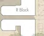
3 However several traffic management and safety issues have also been identified and analysed for possible modifications as part of previous studies and reviews, which were included in this current assessment for possible inclusion into the Traffic Management and Transport Plan, with the view to reducing the number of vehicle trips generated by the school. A community workshop was also held at Christ Church Grammar School on the evening of Wednesday 15 May 2013 in order to give the community an opportunity to provide input on these identified traffic management and safety issues, and to voice their concerns over the existing situation. The previously identified issues and analyses are presented in Chapter 3, followed by an overall summary of the Community Workshop in Chapter 4, and further assessment and discussion of possible solutions in Chapter 5. RECOMMENDATIONS The recommendations for the Christ Church Grammar School Traffic Management and Transport Plan are documented in Chapter 6, as follows: 1. It is recommended to install a Type A Children s Crossing in Queenslea Drive at the previously approved location in front of house number 10, with no median island, as shown in Figure 3, and as discussed in Section 5.1. It is important to note that Main Roads WA and the Children s Crossing and Road Safety Committee have granted In-Principle approval for this proposed plan. It is also important to note that the recent modification to the Stirling Highway - Queenslea Drive - Stirling Road intersection does not remove the need for this proposed crossing. The approved plan includes a reduction of the existing embayment in Queenslea Drive by approximately 15 metres, and the introduction of a 20 metre No Standing zone (to be applicable only during times that the crossing is manned). 2. It is recommended that the School enforce pedestrian access between R-Block and S-Block in order to direct students to and from the proposed crossing, as noted in Figure 3. (The School has already commenced this enforcement by having School Prefects on location to ensure that students cross at the site of the proposed crossing. The Prefects are supported by the School Marshall to ensure compliance). 3. It is recommended to formalise a new student pick-up/drop-off area at the western end of the Staff car park accessed off the northern end of Queenslea Drive, as indicated in Figure 4 and as discussed in Section 5.4. (This may require a formal Development Application to Town of Claremont, but is only expected to require signage and pavement markings, and is not expected to result in any loss of existing parking). 4. It is recommended that Town of Claremont continue to actively monitor and enforce the new Clearway at the southern end of the Church parking area adjacent to the Staff car park access in Queenslea Drive. 5. It is recommended to pursue the re-opening of the left-turn exit from the northern Staff car park onto Stirling Highway, as indicated in Figure 4 and as discussed in Section 5.5, in order to reduce the amount of traffic exiting the school onto Queenslea Drive. It is also acknowledged that a formal application will need to be made through Town of Claremont and Main Roads WA, including justification regarding possible impacts to traffic flows along Stirling Highway and at the adjacent access road to Methodist Ladies College, as well as impacts on cyclists using the dual use path, and access to properties on the opposite side of Stirling Highway. 6. It is recommended that Christ Church Grammar School actively continue the current transport initiatives, while also introducing new initiatives, as listed below in Recommendations 7 to 11 (and as discussed in Section 5.6), in order to reduce reliance on private vehicle travel to/from the School, with an initial aim of reaching the travel mode targets identified in Table 1 in Chapter 6.
4 7. It is recommended that Christ Church Grammar School work closely with Town of Claremont and Public Transport Authority to identify all alternative means of transport to and from the school, and to advise students/parents and staff of the available options prior to the start of each school year, with periodic reminders in weekly newsletters, in order to help reduce the number of vehicle trips generated by the school as detailed below in Items It is recommended to identify and promote all available public transport options to and from the school, including information regarding safety improvements offered by various initiatives. It is anticipated that public transport usage (Bus and Train) can be increased from the existing 23.2 percent to an initial target of 27 percent (as shown in Table 1), and a possible long term target of up to 30 percent, with actual improvements to be determined by undertaking updated travel surveys 2 years after Council s final adoption of this report. 7.2 It is recommended to promote car-pooling as an additional way to reduce private vehicle travel. It is therefore recommended to advise families across all Year Groups (taking into account possible privacy concerns) of other school families living close by, who may not otherwise be aware of each other, and to provide a means of contact between them for car-pooling. It is anticipated that carpooling can be increased from the existing 2.9 percent to an initial target of 5 percent (as shown in Table 1), and a possible long term target of up to 10 percent. 7.3 It is recommended that the School should continue to promote its Walk a Little Way scheme, but to also investigate possible additional pick-up and drop-off locations as part of this scheme. It is anticipated that the percentage of students walking to/from school can be increased from the existing 9.8 percent to an initial target of 12 percent (as shown in Table 1), and a possible long term target of up to 15 percent. 7.4 It is recommended that the School also continue to encourage students to cycle to school, and to ensure that the supply of bicycle parking continues to exceed demand. It is anticipated that the percentage of students cycling to/from school can be increased from the existing 6.3 percent to an initial target of 8 percent (as shown in Table 1), and a possible long term target of up to 10 percent 8. It is recommended (and agreed) that Christ Church Grammar School will play an active role in the preparation of any plan to address traffic and parking congestion in streets surrounding schools in the locality resulting from the initiatives being promoted by the Western Suburbs School Traffic Committee. This includes assisting with any survey of parents required to implement a plan, assisting in the development of plans and once endorsed, actively implementing the plans for a common CAT Bus Service or any other measure identified and adopted by the Councils of the Committee as a solution to traffic congestion relating to schools in the locality. It is noted that the School has already commenced jointly-funded private bus services in conjunction with MLC, including a recent extension of services to Shenton Park and Subiaco. It is also noted that the School is currently already involved in a MRWA-funded study of traffic congestion in the local area, together with Methodist Ladies College and Scotch College. The School has also recently agreed to participate in Public Transport Education sessions to promote public transport awareness for Year 6 students before they start High School.
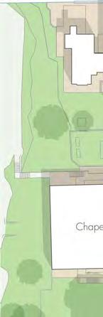
5 TABLE OF CONTENTS 1. INTRODUCTION Study Objectives 1 2. EXISTING SITUATION Existing Site Plan and Adjacent Roads Data Collection and Analysis Existing Traffic Flows Surveyed Bicycle Parking Observed Pedestrian Flows Existing Public Transport Services Transperth Bus Services Private Bus Services Existing Transport Planning Initiatives Existing Travel Mode Surveys Modifications at Stirling Highway - Queenslea Drive - Stirling Road 7 3. PREVIOUSLY IDENTIFIED ISSUES AND ANALYSES Possible School Crossing in Queenslea Drive Parking at Church Access off Stirling Highway 8 4. COMMUNITY WORKSHOP FURTHER ASSESSMENT AND DISCUSSION School Crossing in Queenslea Drive Parking in Queenslea Drive at Church Congestion at Queenslea Drive - Victoria Avenue Roundabout New Pick-Up/Drop-Off Area in North Car Park Access off Stirling Highway Travel Demand Management Increase in Student Numbers Overall Parking Requirements On-Street Parking Parking Management For Events At the School Chapel RECOMMENDATIONS 18 Page TECHNICAL APPENDIX A-1 A.1 EXISTING SITUATION A-2 A.1.1 Weekday Traffic Flows A-2 i
6 A.1.2 Cycle Facilities and Pedestrian Flows A-3 A.1.3 Existing Bus Routes and Bus Stops A-4 A.1.4 Existing Traffic Initiatives A-5 A.1.5 Existing Mode of Travel A-7 A.1.6 Stirling Highway - Queenslea Drive - Stirling Road A-7 A.2 PREVIOUSLY APPROVED SCHOOL CROSSING A-8 A.3 PARKING AT CHURCH A-8 A.4 ACCESS OFF STIRLING HIGHWAY A-8 A.5 ADDITIONAL ON-SITE PARKING A-9 A.6 ON-STREET PARKING A-9 A.7 COMMUNITY WORKSHOP A-10 LIST OF TABLES 1. Existing and Future Student and Staff Numbers 14 Christ Church Grammar School 2. Existing Mode of Travel and Future Travel Mode Targets 19 Christ Church Grammar School Page TECHNICAL APPENDIX A.1 Summary of Existing Traffic Management Initiatives A-5 Christ Church Grammar School A.2 Existing Mode of Travel to/from School A-7 Christ Church Grammar School - May 2014 A.3 Summary of Issues Raised and Reponses Received A-11 Community Workshop - Wednesday 15 May 2013 ii
7 LIST OF FIGURES Follows Page 1. Locality Plan Christ Church Grammar School 2 2. Existing Situation Christ Church Grammar School 2 3. Recommended School Crossing Queenslea Drive at Christ Church Grammar School Recommended Traffic Management Modifications Christ Church Grammar School 19 TECHNICAL APPENDIX A.1 Video Camera Locations Christ Church Grammar School A-2 A.2 Video Camera Locations Christ Church Grammar School A-2 A.3 Vehicular Access Christ Church Grammar School A-2 A.4 Existing Daily Traffic Queenslea Drive at Christ Church Grammar School A-2 A.5 Existing Weekday Traffic Flows Entering Stirling Hwy - Queenslea Dr Intersection A-2 A.6 Existing Weekday Traffic Flows A-2 Entering Stirling Hwy - Queenslea Dr Intersection from Queenslea Drive A.7 Existing Weekday Traffic Flows A-2 Entering Stirling Hwy - Queenslea Dr Intersection from Queenslea Drive A.8 Existing Pedestrian and Cycle Facilities To/From Christ Church Grammar School A-3 A.9 Observed AM and PM Pedestrian Flows Queenslea Drive at Victoria Avenue A-3 A.10 Observed AM and PM Pedestrian Flows Queenslea Drive South of Stirling Highway A-3 A.11 Pedestrian Flows Across Queenslea Dr Christ Church Grammar School A-3 A.12 Existing Bus Stops and Train Station In the Vicinity of Christ Church Grammar School A-4 A.13 Existing Bus Routes Servicing Christ Church Grammar School A-4 A.14 Modified Intersection Layout A-7 Stirling Highway - Queenslea Drive - Stirling Road A.15 Previously Approved School Crossing A-8 Queenslea Drive at Christ Church Grammar School A.16 Possible Queuing at Staff Car Park Queenslea Drive at Christ Church Grammar School A-8 iii ( Cont d)
8 LIST OF FIGURES (CONT D) Follows Page A.17 Congestion Issues on Queenslea Drive Due to Parking in Front of Church A-8 A.18 Existing Access off Stirling Highway Christ Church Grammar School A-8 A.19 North Car Park Access onto Stirling Highway Christ Church Grammar School A-8 A.20 Additional On-Site Parking A-9 Christ Church Grammar School A.21 Existing On-Street Parking A-9 In the Vicinity of Christ Church Grammar School iv
9 1. INTRODUCTION Uloth and Associates was initially appointed by Christ Church Grammar School in 2008 to investigate the introduction of a warden-controlled school crossing in Queenslea Drive, and the crossing was approved by the Children s crossing and Road Safety Committee in July Then in August 2013, when Christ Church Grammar School was in the final stages of additions and alterations to the existing R-Block, Uloth and Associates published the initial version of this Traffic Management and Transport Plan, which was required as part of the conditions of approval for this development. After a review by Town of Claremont, the initial report was then updated and expanded in September 2014 to include additional background information, while also taking into account a number of changes that have occurred since that time. An additional update was then carried out, to incorporate the modifications to the Stirling Highway - Queenslea Drive - Stirling Road traffic signals, and to also provide further detail regarding existing bus routes in the vicinity of Christ Church Grammar School. A further update was then requested, to address parking requirements for a proposed increase in overall student numbers, and to also include data regarding private bus services (a jointly funded initiative by Christ Church Grammar School and Methodist Ladies College), which have now been introduced (in 2016) to assist in the reduction of private vehicle travel to and from the 2 schools. 1.1 STUDY OBJECTIVES The overall study objective is to carry out a detailed assessment of traffic management matters relating to the school pick-up and drop-off periods, and to identify transport planning initiatives to help reduce the number of vehicle trips generated by the School. It is then necessary to prepare a Traffic Management and Transport Plan in consultation with the community, to the satisfaction of Town of Claremont. Specific objectives are as follows: Identify and assess the existing situation at the School, in regard to traffic flows, pedestrian movements, mode of travel to and from school, and current travel demand management initiatives. Identify safety issues and other shortcomings that may be affecting decisions regarding mode of travel to and from school. Identify additional travel management initiatives with a view to reducing the number of vehicle trips generated by the school. Carry out a community workshop to seek input from the community regarding traffic and transport matters relating to the school. Review and assess the existing situation, possible additional initiatives, and input from the community to develop specific recommendations for inclusion in the overall Traffic Management and Transport Plan. 1
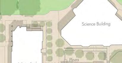
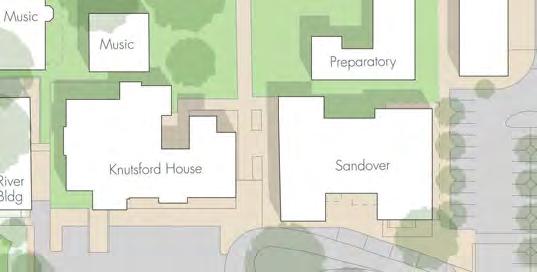
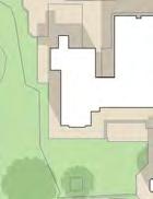
10 2. EXISTING SITUATION Christ Church Grammar School is located adjacent to the Stirling Highway - Queenslea Drive - Stirling Road signalised intersection, as shown in the Locality Plan in Figure 1, in close proximity to the Claremont Town Centre and Claremont Train Station. At the time of the various surveys carried out, the school catered for a student population of 1,600 students, with a total of 252 staff (but a maximum of 215 staff on-site at any one time). 2.1 EXISTING SITE PLAN AND ADJACENT ROADS The existing site plan for the School (as at 2013 when the various surveys were carried out) is shown in Figure 2, together with a topographic plan of the adjacent roads and intersections. It can be seen in Figure 2 that Stirling Highway is a 4 lane undivided carriageway west of Queenslea Drive becoming a 4 lane divided carriageway with a raised central median east of Queenslea Drive. Traffic signals at the Stirling Highway - Queenslea Drive - Stirling Road intersection provide diamond right-turn phasing for vehicles in Stirling Highway, but split phases for Queenslea Drive and Stirling Road due to the shared lanes on each of these approaches. However, the separate left-turn lane within Queenslea Drive allows this left turn to operate together with the right-turn into Queenslea Drive from Stirling Highway west. Stirling Highway is classified as a Primary Distributor road in the Main Roads WA Functional Road Hierarchy, while Queenslea Drive is classified as District Distributor B. Queenslea Drive is a 2 lane undivided road with a speed limit of 50 kilometres per hour and is a significant road access onto Stirling Highway for traffic travelling to and from the Nedlands and Dalkeith catchment area. There is also a 40 kilometre per hour School Speed Zone along Queenslea Drive adjacent to the School. There is an existing embayment approximately 120 metres in length along the west side of Queenslea Drive adjacent to the school. Between 7:00am and 3:00pm vehicles can park within the embayment for a maximum of 5 minutes, whilst between 3:00pm and 6:00pm the embayment can only be used by school buses. No Standing signs are located on the east side of Queenslea Drive prohibiting dropoffs and pick-up along this side of the road. The car parking area adjacent to the Church at the north end of Queenslea Drive currently has no line markings, but allows parking at 90 degrees to the kerb. However, Clearway conditions operate from 7:30 to 9:00am and from 2:30 to 3:30pm. Vehicular access to the school site is via 3 driveways off Queenslea Drive and 1 driveway off Stirling Highway, as indicated in Figure A.3 in Chapter A.1 in the Technical Appendix. Driveways 1 and 2 off Queenslea Drive provide the only public access into the site (to the 2 main parking areas), while the third driveway provides access to a small staff-only parking area adjacent to the administration area. Driveway 3 (off Stirling Highway) is blocked by retractable bollards, with access currently restricted to Emergency Vehicles only. Existing (2013) on-site parking facilities are also shown in Figure A.3, identifying a total of 249 parking spaces (incl. 2 motorcycle spaces) in 5 distinct locations, thus satisfying the Town Planning Scheme parking requirement of 1 bay per full-time staff member. Existing queuing locations for pickup and drop-off within the site are also shown in Figure A.3, noting that the potential maximum queuing capacity for these areas is 57 vehicles, bringing the overall on-site parking and queuing capacity to 306 spaces. (However it is also important to note that an additional 13 spaces (incl. 2 motorcycle spaces) have been added adjacent to the administrative building since 2013, bringing the total on-site parking capacity in 2016 to 319 vehicles, as also noted in Figure A.3). 2


11 0 N 250 SOURCE: STREETSMART 500 METRES SCALE 1 : 15,000 Christ Church Grammar School Locality Plan CHRIST CHURCH GRAMMAR SCHOOL FIG. 1


12
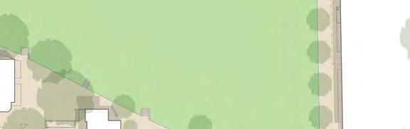
13 Additional on-street parking capacity in the vicinity of Christ Church Grammar School is presented and discussed in Section 5.9. There are footpaths on both sides of both Stirling Highway and Queenslea Drive, adjacent to the school, linking to the pedestrian crossing facilities at the Stirling Highway - Queenslea Drive signalised intersection. Pedestrian access to the school site is via a number of locations along Queenslea Drive, as shown in Figure A.8 in Chapter A.1 of the Technical Appendix. Kerb ramps, indicating an informal crossing point, are provided just north of the roundabout at the southern end of Queenslea Drive. However, the location and design of the roundabout splitter island means that some pedestrians and cyclists experience difficulties when crossing at this point. The Perth Bicycle Network (PBN) identifies the paths along the west side of Queenslea Drive then west along the south side of Stirling Highway as Shared Paths accommodating PBN route NW19. Cycle parking facilities available on the school site are also shown in Figure A.8 in Chapter A.1 of the Technical Appendix, with parking for 165 bicycles currently provided. Bus stops are located in Stirling Highway on either side of Queenslea Drive, as also shown in Figure A.8, with Bus routes servicing the school discussed below in Section DATA COLLECTION AND ANALYSIS In order to obtain good data regarding traffic flows and pedestrian movement at the School, video traffic surveys at 5 different locations along Queenslea Drive were taken on Thursday 4 April 2013, during both the AM and PM peak periods. A bicycle parking demand survey was also carried out, at 12 noon on Tuesday 14 May Town of Claremont has since advised that the Stirling Road subway under the railway line was closed for roadworks on that day, which may have affected traffic patterns at Stirling Highway - Queenslea Drive. A comparison of SCATS traffic count data has therefore been carried out between Thursday 4 April 2013 and Thursday 21 March 2013, with the following results confirming no significant impact on the conclusions drawn for this study: - The closure of the subway caused a reduction of traffic in Stirling Road (north of Stirling Highway) by approximately 14 percent. - However, there was no change in total flows on Queenslea Drive. - Except that left-right turns between Queenslea Drive and Stirling Highway west were approximately 6 percent higher (with corresponding reductions of the through movements to/from Stirling Road). Figure A.1 in Chapter A.1 in the Technical Appendix shows the video survey locations at the southern end of Queenslea Drive with south facing cameras located at the Victoria Avenue - Queenslea Drive roundabout and within Queenslea Drive itself. Figure A.2 shows the video survey locations at the northern end of Queenslea Drive, with north facing cameras located midway along Queenslea Drive and at the access to the staff car park. The fifth camera was located at the Stirling Highway - Queenslea Drive intersection Existing Traffic Flows Figure A.3 in Chapter A.1 in the Technical Appendix shows the vehicular access locations for Christ Church Grammar School. The plan shows all possible entry and exit routes to / from the school grounds together with the different car park areas and existing car parking available on-site. The main school access is at the south end of Queenslea Drive at the roundabout, with a secondary access via the staff car park at the north end of Queenslea Drive. 3
14 By analysing the video footage, together with additional information obtained from Main Roads WA, the existing total traffic flows adjacent to the school were determined, together with the traffic volumes and traffic distribution specifically relating to the School as shown in Figure A.4 in the Technical Appendix. It can be seen in Figure A.4 that Queenslea Drive carries a total of 8,700 vehicles per day at the northern end, reducing to 7,900 vehicles per day at Victoria Avenue. It can also be seen that School traffic comprises just 1,300 vehicles per day out of the 8,700 vehicles per day at the northern end, a contribution of just 15 percent of the overall traffic flow on Queenslea Drive. It is also important to note that during the PM peak hour, a total of 41 vehicles were observed turning left to exit the Staff car park at the northern end of Queenslea Drive and then turning left into Stirling Highway. These 41 vehicles could make use of the proposed left-turn exit onto Stirling Highway discussed below in Sections 3.3 and 3.5. The traffic fluctuations throughout the day at the Stirling Highway traffic signals were also assessed and are shown in Figures A.5 to A.7 in the Technical Appendix. Figure A.5 shows the traffic flows for the entire intersection for a school day and a day during the school holidays. The graph shows a significant reduction of traffic through the intersection during both the morning and afternoon peak periods. However it also shows that traffic flows on Queenslea Drive represent a very small proportion of the overall traffic flows using the traffic signals. Figure A.6 then shows the Queenslea Drive traffic at a larger scale for both a school day and a non school day while Figure A.7 shows the Queenslea Drive traffic again, but this time just for a school day with actual school traffic identified from the video surveys along Queenslea Drive also shown. The reduction in traffic flows for the AM and PM peak periods during school holidays is again evident in Figure A.6. However, it can be seen that significant traffic flows also occur on Queenslea Drive throughout the day, with very little change during school holidays, thus suggesting that Queenslea Drive is well utilised by non-school traffic, with steady non-school traffic flows between 9am and 6pm. Figure A.7 also confirms that the school traffic generated along Queenslea Drive is a high proportion of the total traffic for the very short pick-up and drop-off periods, but only a very small portion of the total traffic throughout the day. However, it is interesting to note that there is very little non-school traffic on Queenslea Drive at the peak pick-up and drop-off times for the school, but significantly higher non-school flows on either side of these peaks. This suggests that there is a limit on the capacity of Queenslea Drive, and that non-school traffic avoids using Queenslea Drive at these times due to the awareness that the available capacity is fully utilised by the school for these short pick -up and drop-off periods. In this regard, it is important to note that the capacity of Queenslea Drive is very much a function of the amount of Green Time allocated to Queenslea Drive at the Stirling Highway traffic signals. However, with priority given to the major traffic flows along Stirling Highway, the amount of time available for Queenslea Drive (and Stirling Road) will always be limited. It is therefore important to understand that as traffic flows along Stirling Highway continue to grow, and as further development occurs within the Claremont Town Centre and along Stirling Road, the amount of Green Time available to Queenslea Drive may be reduced (and may have already been reduced in the past). This reduction of available Green Time reduces the traffic capacity of Queenslea Drive, and therefore increases the level of congestion within Queenslea Drive, even if the actual traffic volumes remain unchanged Surveyed Bicycle Parking Figure A.8 in the Technical Appendix shows the existing pedestrian and cycle facilities to/from Christ Church Grammar School, including the location of bicycle parking within the site. 4
15 It can be seen in Figure A.8 that bicycle parking is currently provided in 3 locations, with a total provision for 165 bicycles. It is important to note that at 12 noon on Tuesday 14 May 2013 there were a total of 67 bicycles plus 4 scooters parked within the 165 parking spaces, suggesting that there is significant parking already available for increased bicycle ridership Observed Pedestrian Flows Figures A.9 and A.10 in the Technical Appendix show the observed pedestrian flows at each end of Queenslea Drive, during the combined AM and PM peak periods, noting that the current pedestrian flows are very similar to flows identified in a previous survey undertaken in Flows were seen to reach a total of 380 pedestrians during the observed AM and PM peak hour on the northern footway along Victoria Avenue, at the southern end of Queenslea Drive, due to students walking to school after being dropped off east of the school along Bayview Terrace and Freshwater Parade. The most significant pedestrian movement however was at the northern end of Queenslea Drive, on the eastern side, with a total flow of 580 pedestrians during the observed AM and PM peak hour. While small groups of students were seen crossing just north of Queenslea Drive - Victoria Avenue roundabout, it was at the northern end of Queenslea Drive where large groups of students were seen, walking from bus stops along Stirling Highway or from Claremont Train Station, north-east of the school, as can be seen in the photos in Figure A.11 in the Technical Appendix. This occurred on many occasions during both peak periods, however was more predominant in the AM peak. 2.3 EXISTING PUBLIC TRANSPORT SERVICES Christ Church Grammar School is well serviced by existing public transport services, including Transperth Bus Routes along both Bayview Terrace and Stirling Highway, and Train Services on the Fremantle Line stopping at Claremont Train Station. In 2016, private bus services have also commenced, jointly funded by Christ Church Grammar School and Methodist Ladies College Transperth Bus Services There are 10 Transperth Bus Routes operating within 400 metres of the site, and Claremont Train Station is approximately 500 metres away, as shown in Figure A.12 in Section A.1.3 in the Technical Appendix. The closest Bus stops are located in Stirling Highway on either side of Queenslea Drive, as shown in Figure A.12. These bus stops are serviced by Routes 103 and 107, which run along Stirling Highway, as well as Routes 98 and 99 (the Circle Route), which is a high frequency route that runs through Perth s inner suburbs and connects Perth s suburban railway lines. Bus Routes 23, 24, 25, 27, 28 and 102 are also located close by, with Bus stops in Stirling Road and Bayview Terrace, providing connections to and from Claremont Train Station. Figure A.13 in the Technical Appendix then shows the broader catchment areas of the existing Bus Routes providing services to Christ Church Grammar School, to/from the adjoining suburbs Private Bus Services As a jointly funded project with Methodist Ladies College, Christ Church Grammar School has commenced operation of 3 additional bus services, servicing Nedlands/Dalkeith/Subiaco/Shenton Park, Floreat/City Beach, and Booragoon/Attadale/East Fremantle. The new services include 2 morning runs and 3 afternoon runs on the Floreat route, 2 morning and 2 afternoon runs on the Nedlands route, and 1 morning and 1 afternoon run on the Booragoon route. 5
16 The selected routes were chosen based on a review of student numbers living in the various suburbs, noting that this review is ongoing and has resulted in several changes being made to the existing routes and stops. Operating statistics between March and June 2016 show that the combined routes already carry (on average) a total of 83 students each morning and 65 students each afternoon. This includes 54 and 39 students on the Floreat service, 6 and 11 students to and from Nedlands, plus 23 and 15 students to and from Booragoon. 2.4 EXISTING TRANSPORT PLANNING INITIATIVES In 2013, when this study commenced, Christ Church Grammar School was already very proactive and successful in managing the traffic impacts of the School, with a number of existing initiatives already in place to reduce the number of private vehicle trips occurring at the School, and to spread out the timing of trips as much as possible. The School regularly communicates with the school community regarding parking restrictions on-site and in the vicinity of the school, and encourages the use of alternative modes of transport in order to ease traffic congestion. The Walk a little way slogan, which encourages parents to pick-up and drop-off students within a short walking distance from the school is a successful scheme that continues to be encouraged. The school also encourages cycling to school by providing bicycle facilities at various locations around the school and offering prizes to students who bike to school on various occasions. Bicycle education classes are also conducted on a regular basis. An official pick-up/drop-off point is provided at the south end of the school for younger students, with prefects on hand to assist them, ensuring a faster turnaround. Prefects are also used to provide assistance when crossing Queenslea Drive just north of the Victoria Avenue - Queenslea Drive roundabout. In addition, the school has now commenced the jointly-funded private bus runs to/from school, as described above in Section The school also spends significant funds on Buswest buses to provide travel to and from the school, 4 days of the week, as part of the sports programme. School start and finish times are also staggered in order to spread the traffic demand on Queenslea Drive as much as possible. The Preparatory School currently starts at 8.20am, while the Senior School starts at 8.30am. Current finish times are as follows: - Pre-Primary 2.45pm - Year pm - Year pm - Years pm - Senior School 3.05pm Further details of the existing traffic management measures introduced by Christ Church Grammar School are provided in Section A.1.3 in the Technical Appendix. 2.5 EXISTING TRAVEL MODE SURVEYS In order to provide a benchmark for future assessment of ongoing transport planning initiatives and travel demand management, Christ Church Grammar School carried out a travel mode survey of all families at the School during May The survey results are detailed in Table A.2 in Section A.1.4 in the Technical Appendix, showing that approximately 61 percent of students currently travel by car, while 23 percent travel by train or bus, and 16 percent walk or cycle. 6
17 On the basis of the school s location compared to its broad catchment, and its proximity to bus and train services, these figures appear quite reasonable for the existing situation. 2.6 MODIFICATIONS AT STIRLING HIGHWAY - QUEENSLEA DRIVE - STIRLING ROAD Town of Claremont worked with Main Roads WA in 2015 to identify modifications at the Stirling Highway - Queenslea Drive - Stirling Road signalised intersection, with a view to improving traffic flows in Stirling Road (by adding a left turn lane under Give Way control), and improving the standard of the existing pedestrian crossing facilities. The modified intersection layout is shown in Figure A.14 in Section A.1.6 in the Technical Appendix. The work was carried out in late 2015 and completed in The improved standard of pedestrian crossing facilities resulting from this intersection upgrade is acknowledged. However, it is important to note that although the intersection modification improved safety for pedestrians crossing the road, this does not remove the need for the proposed School Crossing within Queenslea Drive which is discussed below in Section PREVIOUSLY IDENTIFIED ISSUES AND ANALYSES Several traffic management and safety issues have already been identified and analysed for possible modifications as part of previous studies and reviews. These issues are identified and background information summarised within this chapter, for further assessment and discussion in Chapter POSSIBLE SCHOOL CROSSING IN QUEENSLEA DRIVE Uloth and Associates prepared a report in March 2008 on behalf of Christ Church Grammar School as part of an application for a school crossing. The report investigated pedestrian activity in Queenslea Drive and showed that the warrants for a warden-controlled school crossing were satisfied in 2 locations, just south of the staff car park access at the northern end of Queenslea Drive, and just north of the Victoria Avenue roundabout at the southern end of Queenslea Drive. In December 2010 Christ Church Grammar School submitted an application for a Type A/B Crossing on Queenslea Drive in response to findings from the March 2008 report. Further surveys were conducted in February 2011 and April 2011 by the Student Pedestrian Policy Unit to confirm that a Type A/B crossing was warranted, and in May 2011 the Children s Crossing and Road Safety Committee (CC&RSC) recommended the establishment of a Type A children s crossing. An onsite meeting was then held in June 2011 to discuss and confirm the location of the crossing and the required infrastructure, and in July 2011 the school received a letter from the CC&RSC confirming the requirement for a Type A children s crossing on Queenslea Drive. In August 2011 the school contacted Town of Claremont regarding the progress of the design and plans for the crossing and received a response that there would be a delay until a new engineering technical officer was appointed. The position was filled in November 2011 and design plans were prepared for the crossing with the preferred location on Queenslea Drive opposite Number 10. It is important to note that the initial plan prepared by Town of Claremont did not include a median island, however in response to 7
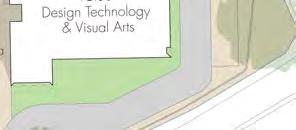
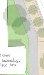
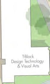
18 initial comments from Main Roads WA the plan was revised to include an island, as shown in Figure A.12 in Chapter A.2 in the Technical Appendix. The recommendation for a Traffic Warden controlled pedestrian crossing was finally put forward to Town of Claremont Council in September 2012 but was refused on the basis that the treatment did not recognise the impact that the proposed crossing (with a median island) would have on traffic flows both in Queenslea Drive and Stirling Highway. The Mayor then met with the headmaster of Christ Church Grammar School in October 2012 to discuss the school s request for a pedestrian crossing on Queenslea Drive. The recommendation was again put forward at the December 2012 Town of Claremont Council Meeting and a 3 month trial was approved with conditions. However a notice of revocation for the trial was submitted in January 2013 following concerns raised by residents in the subject area and in turn by council members, regarding the practicality of implementing the trials. In February 2013 the Town of Claremont Council revoked the proposal for a 3 month trial of the school crossing in order to allow consultation with the residents likely to be affected by this proposal and to establish how works would be reversed after the trial period if it is deemed that the trial was unsatisfactory. On 14 February 2013 Town of Claremont wrote to the Children s Crossing and Road Safety Committee to advise them that the installation of the crossing would not proceed. In May 2013 the chair of the Children s Crossing and Road Safety Committee wrote a letter to the Minister for Police and Road Safety, noting that this is the first children s crossing to have been rejected by a local council and voicing concern that the safety of student pedestrians could be compromised if Local Councils are allowed to stop children s crossings from being installed. As noted above in Section 2.6, the recent modification to the Stirling Highway - Queenslea Drive - Stirling Road intersection does not remove the need for the proposed School Crossing within Queenslea Drive, and should not be used by Town of Claremont as a reason to prevent the installation of the approved crossing. The design and recommended installation of a warden-controlled school crossing is further discussed in Section PARKING AT CHURCH There are currently no line markings for the car parking area adjacent to the Church at the northern end of Queenslea Drive, however the configuration suggests that 90 degree parking is appropriate. Unfortunately, vehicles parking at 90 degrees at the southern end of this parking area stick out into the travel lane and prevent southbound traffic from passing vehicles waiting to turn right into the staff car park, as indicated in Figures A.13 and A.14 in the Technical Appendix. This results in congestion and queuing within Queenslea Drive, and worsens an already unsafe situation for pedestrians crossing Queenslea Drive at this location. Following initial discussions with Town of Claremont in 2013, signage has now been installed to introduce a Clearway along this section of Queenslea Drive during school pick-up and drop-off times, with reportedly significant improvements as a result. 3.3 ACCESS OFF STIRLING HIGHWAY Figure A.15 in Chapter A.4 in the Technical Appendix shows the existing access driveway off Stirling Highway but with restricted use for emergency vehicles only, as part of a previous condition for the Design Technology and Visual Arts building. This condition was stipulated by Town of Claremont 8
19 partly due to poor visibility at this location resulting from walls and other structures that existed at that time. In September 2008, prior to the completion of the adjacent parking area, Uloth and Associates prepared a letter on behalf of Christ Church Grammar School requesting approval to retain the crossover with left-in/left-out access, in light of concerns over existing traffic congestion already experienced at peak times on Queenslea Drive. This letter was submitted on the basis that Town of Claremont officers had indicated their support for the crossover to remain open to all traffic, as long as access was limited to left-turn traffic only. It is important to note that the walls and obstructions that previously resulted in poor visibility have since been removed, as can be seen in the aerial photo in Figure A.19 in the Technical Appendix. Furthermore, at an on-site meeting in June 2011 a Main Roads WA representative confirmed that there should be no issue with the reinstatement of the access on the grounds of visibility. The school therefore contacted Town of Claremont in July 2011 seeking advice on how to proceed with the potential reopening of the Stirling Highway access driveway. No formal response has been received, however it is understood that the Town is happy to support a left-turn exit onto Stirling Highway, as long as the existing path along the Highway is deviated into the school grounds to assist in providing adequate sight lines towards the east. This will need to be addressed in detail as part of a formal application, as discussed further in Section 5.5. However, it should be noted that this may require the relocation of part of the existing boundary fence, and the introduction of a pedestrian easement. 9
20 4. COMMUNITY WORKSHOP In order to give the community an opportunity to voice their concerns over the existing situation, and to provide input regarding possible traffic management measures and transport initiatives, a community workshop was held at Christ Church Grammar School on the evening of Wednesday 15 May The workshop was presented by Uloth and Associates, as a starting point to address issues of school traffic management and seek input from the community to help guide the preparation of the Traffic Management and Transport Plan for Christ Church Grammar School. The aim of the workshop was to present traffic data, provide background information and highlight issues along Queenslea Drive based on observations made of the existing situation. Possible treatments and measures were also identified and discussed. The workshop was attended by 29 people, including 12 parents from the School, 10 local residents, 3 School staff, 2 Town of Claremont councillors and 2 Town of Claremont staff Of the 10 residents, 8 live in Queenslea Drive and 2 live in Victoria Avenue. 10 of the 12 parents, 1 of the 2 school staff and the 2 Town of Claremont Councillors live locally in the Claremont, Nedlands or Dalkeith area, while all remaining attendees were non-local. To ensure that everyone had the opportunity to be heard a feedback form was provided to each attendee, with the option to provide comments and hand back the form at the end of the workshop, or to /mail the form to Uloth and Associates by the end of the week. 13 feedback forms were received, 7 from residents (6 from Queenslea Drive and 1 from Victoria Avenue), 5 from parents (3 of which live locally) and 1 from a Town of Claremont Councillor. A summary of all feedback/comments received from the Workshop is provided in Table A.3 in Chapter A.7 in the Technical Appendix, with comments made in relation to the following issues: - School Crossing in Queenslea Drive - Parking in Queenslea Drive - Access off Stirling Highway - Rat-running via Princess Road and Victoria Avenue - Dedicated School Buses - General Congestion - Roundabout at Queenslea Drive - Victoria Avenue - Stirling Highway - Queenslea Drive traffic signals - Cycling - Public Transport - Access to staff car park - Pedestrian Overpass/Underpass on Stirling Highway The workshop discussions, together with the specific responses received have all been taken into account in the preparation of the proposed Traffic Management and Transport Plan, as discussed below in Chapter 5. 10
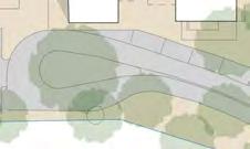
21 5. FURTHER ASSESSMENT AND DISCUSSION This chapter documents the further assessment and discussion of possible solutions, taking into account the issues raised and responses received from the community Workshop. 5.1 SCHOOL CROSSING IN QUEENSLEA DRIVE As discussed in Section 3.1, the need for a warden-controlled school crossing in Queenslea Drive has already been identified, confirmed, and recommended by the Children s Crossing and Road Safety Committee. A preferred location has also been identified, and design drawings prepared. The installation of the crossing is considered to be crucial for the safety of students currently crossing Queenslea Drive, and also as a critical component to encouraging more students to walk, ride or catch public transport to school by improving safety at this key location. The recent modification to the Stirling Highway - Queenslea Drive - Stirling Road intersection does not remove the need for the proposed school crossing. As noted in Table A.3 in Chapter A.5 in the Technical Appendix, local residents were generally not in favour of the proposed crossing, due to an expectation that queuing will result within Queenslea Drive (and even extending back into Stirling Highway), and concerns that the proposed refuge island within Queenslea Drive will restrict traffic flow, while also requiring the removal of the existing cycle lane along the eastern side. It was suggested that a crossing is not required because students should use the existing crossing facility at the Stirling Highway traffic signals, and that a crossing should only be provided if there is a history of pedestrian accidents. In response to these concerns, it is important to reiterate that the need for the crossing has been identified and confirmed and recommended, in addition to the existing crossing facility at Stirling Highway. Whilst the initial proposal was for a crossing to be located immediately south of the staff car park access, the currently recommended location was preferred after taking into account the possible queuing within Queenslea Drive, the required sight lines for both the crossing warden and the approaching traffic, and the possible impacts on access to adjacent properties. It is also important to note that wardens are trained to consider impacts on traffic flows when operating the crossing, so queuing within Queenslea Drive can be controlled. The school has also confirmed that the proposed location aligns well with the pedestrian access between R-Block and S-Block, and has committed to ensuring that students will be instructed (and managed) to use this access and the proposed crossing. In regard to the proposed design of the crossing, it is agreed that the provision of a refuge island would restrict traffic flows along Queenslea Drive. It is also important to note that a refuge island is not necessary under Australian Standard AS An alternative plan was therefore prepared and discussed with Main Roads WA and members of the Children s Crossing and Road Safety Committee. After further modifications a final concept plan was submitted and Main Roads WA has now granted In-Principle approval for the proposed crossing without a median island. It is therefore recommended that a warden-controlled crossing should be introduced at the proposed location (at Number 10 Queenslea Drive), as soon as possible. The crossing should be installed as a permanent fixture, without any suggestion of a trial period, with the cost of installation already agreed to be paid by the School. The approved plan includes a reduction of the existing embayment in Queenslea Drive by approximately 15 metres, and the introduction of a 20 metre No Standing zone (to be applicable only during times that the crossing is manned) as shown in Figure 3 in Chapter 6 Recommendations. 11
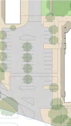
22 5.2 PARKING IN QUEENSLEA DRIVE AT CHURCH As noted in Section 3.2, 90-degree parking in front of the church creates congestion and queuing in Queenslea Drive by blocking southbound traffic that is trying to pass vehicles waiting to turn right into the School staff car park. It is also important to note that none of the existing parking area is compliant with the cross sectional requirements of Australian Standard AS It was suggested at the Workshop that the staff car park access should be closed. However this is impossible as it is the only access possible for this car park unless full access was provided off Stirling Highway. Alternative suggestions were to introduce clearway conditions to prevent parking in this location at peak times, or to accommodate parallel parking instead of 90-degree parking. As noted above in Section 3.2, Clearway conditions have now been introduced to prevent parking in this location during school pick-up and drop-off times. Both Christ Church Grammar School and Town of Claremont representatives have agreed that this has significantly improved things, although ongoing enforcement by the Town s Ranger should be actively addressed. 5.3 CONGESTION AT QUEENSLEA DRIVE - VICTORIA AVENUE ROUNDABOUT Congestion currently occurs at the Queenslea Drive - Victoria Avenue roundabout, primarily in relation to vehicles accessing the student pick-up and drop-off area accessed off this roundabout. While modifications to the roundabout infrastructure were suggested and discussed at the Workshop, it is clear that significant modifications (such as a suggested free-flow left turn lane for southbound traffic) would not be possible without land take from adjacent properties, which is not viable. 5.4 NEW PICK-UP/DROP-OFF AREA IN NORTH CAR PARK In order to relieve congestion along Queenslea Drive, it has been suggested that a new pick-up/dropoff area could be formalised within the northern car park. This would allow school traffic to enter the car park and queue within the site, rather than travel the full length of Queenslea Drive (potentially twice). It would also provide a convenient pick-up/drop-off location for vehicles seeking to exit onto Stirling Highway west, as discussed below in Section 5.5. It is noted that a formal Development Application would need to be lodged with Town of Claremont for any physical changes to the car park. However, it is also noted that there would be no loss of parking associated with this proposal. Rather, the potential queuing capacity for up to 28 vehicles (as indicated in Figure A.3 in the Technical Appendix) would be formalised. 5.5 ACCESS OFF STIRLING HIGHWAY As noted in Section 3.3, Town of Claremont has previously indicated support for access onto Stirling Highway for left-turn movements only, and MRWA has confirmed that the previous sight-line concerns should no longer be an issue. In order to reduce the amount of traffic exiting the School onto Queenslea Drive, it is therefore recommended to permit a left-turn exit from the Staff car park onto Stirling Highway, with the installation of a raised kerb within the existing painted median to prevent right turns. 12
23 The provision of this left turn movement will also improve the operation of the proposed new pickup/drop-off area within this car park (discussed above in Section 5.4), to further relieve existing congestion within Queenslea Drive. An alternative treatment has been suggested to link the car parks between Methodist Ladies College (MLC) and Christ Church Grammar School in order to make use of the existing Stirling Highway access driveway serving MLC. However, a review of topography and existing infrastructure suggests that a loop road linking with the MLC car park and access road is not viable. It is acknowledged that the design of the proposed access driveway off Stirling Highway will need to consider safety for cyclists along the shared path on Stirling Highway, although an acceptable outcome can be achieved by limiting the access to a left-turn exit only and possibly deviating the shared path into the school grounds (with an easement) to assist in providing adequate sight lines towards the east. It is also acknowledged that a formal application will need to be made through Town of Claremont and Main Roads WA, including justification regarding possible impacts to traffic flows along Stirling Highway and at the adjacent access road to Methodist Ladies College, as well as impacts on cyclists using the dual use path, and access to properties on the opposite side of Stirling Highway. The specific design of the proposed modifications will need to be determined as part of this formal application process. However, it should be noted that this may require the relocation of part of the existing boundary fence, and the introduction of a pedestrian easement. 5.6 TRAVEL DEMAND MANAGEMENT In addition to the above physical traffic management measures, it is also noted that the School will continue to increase its efforts to reduce the overall number of private vehicle trips generated by the school during peak times. The provision of the new school crossing in Queenslea Drive should be seen as a significant catalyst to encouraging more students to catch public transport to and from school, given the improved safety the crossing will provide for students walking to/from Bus Stops and the Train Station. It is therefore recommended that Christ Church Grammar School should work closely with Town of Claremont and Public Transport Authority to identify all available public transport options to and from school, and to advise students and families of the available options prior to the start of each school year, with ongoing reminders and encouragement in monthly newsletters and on the School website. It is also suggested that the School could increase the occurrence of car-pooling, by sharing information across the School community so families are made aware of other school families living close by, and are provided with a means of contacting those families for car-pooling opportunities. The Walk a Little Way scheme should continue to be promoted for those unable to avoid the use of private vehicles, however additional pick-up and drop-off locations could also be identified in order to spread the traffic impact away from residential areas. Cycling should also continue to be encouraged, and the number of bicycle parking spaces should be monitored to ensure that supply remains ahead of demand. Town of Claremont suggested that the introduction of a shared bus service with other private schools within the area should be investigated. It was recommended that the Town should facilitate an investigation into the viability of such a scheme, and Christ Church Grammar School was encouraged to actively participate. Christ Church Grammar School is supportive of such a service and looks forward to the process commencing. In the meantime, the School has already commenced a jointlyfunded bus service shared with Methodist Ladies College, as described in Section
24 Town of Claremont has also suggested that joint forums may be established to investigate possible further improvements to pedestrian and cyclist facilities in the broader area including along and across Stirling Highway. It is recommended that Christ Church Grammar School should actively participate in any such forum. By implementing the above initiatives, in addition to those currently in place, it is anticipated that the number of private vehicle trips to and from school can be reduced, with initial targets as shown in Table 1 in Chapter 6 Recommendations. 5.7 INCREASE IN STUDENT NUMBERS When the school starting age was changed in 2001, it resulted in a half year group of students that had then progressed through to Year 12 in When this group (136 students) departed at the end of 2014, it was replaced by a standard size cohort of 185 students progressing through from the younger age groups. As a result, total student numbers increased in 2015 by approximately 50 students (from 1,600 to 1,650 students), but with no change to existing staff numbers (and hence no change in required overall parking provision). It is important to note that the Town of Claremont s 2012 Planning Approval for the construction of R-Block included a condition limiting student enrolments to 1,600. However, since there are currently 100 boarders included within the current 1,650 enrolments, and therefore only 1,550 students contributing to the overall traffic impact of the site, it is considered that the intent of the cap on student enrolments has not been breached. With additional classrooms currently also proposed, it is planned to increase student numbers to approximately 1,750 students by 2018, with a possible further increase beyond 2018 to 1,800 students. This growth of overall student numbers, together with the corresponding number of staff is as shown below in Table 1, while the corresponding impacts on overall parking demands are discussed below in Section 5.8. TABLE 1 EXISTING AND FUTURE STUDENT AND STAFF NUMBERS CHRIST CHURCH GRAMMAR SCHOOL ITEM AMOUNT Existing (2013) Future Number of Students - Pre-Primary Primary (Years 1 to 6) Secondary (Years 7 to 12) 1,100 1) 1,200 2) - Total Students 1,600 1,800 - Total Non-Boarders 1,500 1,690 Number of Staff - Full Time Staff Total Staff (FTE) On-site at one time Notes: 1) Existing situation includes 100 boarders. 2) Future situation includes 110 boarders. Source: Christ Church Grammar School 14
25 5.8 OVERALL PARKING REQUIREMENTS Recommended parking ratios for the determination of parking requirements at Christ Church Grammar School (in accordance with ratios identified under the Road Safety Around Schools programme) are as follows: 14 spaces per 100 Primary School students + 7 spaces per 100 Secondary School students + 1 space per staff member Staff parking should be all-day parking provided on-site, while the remaining parking demand is for pick-up/drop-off activity, and can be a combination of parking spaces and queuing capacity either onsite or within the adjacent streets. Existing parking demands at Christ Church Grammar School at the time of the various surveys (2013) can therefore be calculated, as follows: - Primary: /100 students = 70 spaces - Secondary (excl. boarders): 1,000 7/100 students = 70 spaces - Total Pick-up/Drop-off Parking = 140 spaces - Staff: 201 1/1 staff = 201 spaces - Total Parking Requirement = 341 spaces With a total existing parking and queuing provision for 306 vehicles on-site at the time of the various surveys, as noted above in Section 2.1, this suggests that there would have been 49 vehicles either parking or queuing within Queenslea Drive and the surrounding streets at that time. Taking into account the proposed increases in student and staff numbers, as noted above in Section 5.7, the future parking demands for Christ Church Grammar School will be as follows: - Primary: /100 students = 84 spaces - Secondary (excl. boarders): 1,090 7/100 students = 76 spaces - Total Pick-up/Drop-off Parking = 160 spaces - Staff: 211 1/1 staff = 211 spaces - Total Parking Requirement = 371 spaces As noted above in Section 2.1, the existing on-site parking and queuing capacity in 2016 has increased to 319 vehicles (incl. motorcycles). However, with the construction of the proposed new classrooms referred to above in Section 5.7, it is also proposed to construct an additional 49 on-site parking spaces and increased queuing capacity for 16 additional vehicle (as shown in Figure A.20 in Chapter A.5 in the Technical Appendix), bringing the overall on-site parking and queuing capacity to 384 vehicles, which is an excess of 13 spaces compared to the total requirement of 371 spaces. It is also important to note that there is on-street parking capacity for approximately 80 vehicles (50 percent of the total on-street parking provision) within a short walking distance of the School, as discussed below in Section ON-STREET PARKING In order to assess the availability of on-street parking within a reasonable walking distance of Christ Church Grammar School, the existing characteristics of Queenslea Drive, Victoria Avenue, Freshwater Parade, Park Lane and Bay View Terrace have been identified, as described in this section and shown diagrammatically in Figure A.21 in Chapter A.6 in the Technical Appendix. 15
26 Queenslea Drive The physical characteristics of Queenslea Drive adjacent to the School are already discussed above in Section 2.1. The car parking area adjacent to the Church at the north end of Queenslea Drive currently has no line markings, but allows 90-degree for up to 15 vehicles. However, since this area is denoted as a Clearway during both the morning (7:30 to 9:00 am) and evening (2:30 to 3:30 pm) peak periods, it makes no contribution to the available parking provision for school pick-up or drop-off. The existing bus embayment on the western side can accommodate up to 18 cars with a 5 minute time limit, acting as a drop-off zone during the morning peak. However, parking is not permitted during the afternoon peak. As noted above in Section 5.1, the recommended provision of a Type A Children s Crossing on Queenslea Drive involves a reduction of the existing embayment by approximately 15 metres and the introduction of 20 metre No Standing zone during the manned crossing times. This will have no impact on the amount of on-street parking available during the PM Peak period, but will reduce the AM peak parking capacity by 6 spaces. Victoria Avenue Queenslea Drive continues south to become Victoria Avenue, which is a 2 lane divided road with a functional classification of a District Distributor B under the Main Roads WA Functional Road Hierarchy, with a speed limit of 50 kilometres per hour. On-street parking is not allowed on the southern section of Queenslea Drive between the roundabout and Victoria Avenue, with No- Stopping signs in place. The overall road pavement in Victoria Avenue is 11 metres wide with a 1 metre wide painted/paved central median, 3 metre wide traffic lanes in each direction and 2 metre wide parallel on-street parking lanes on either side (with 2-hour parking restrictions). The property access driveways are denoted with No Stopping painted on the pavement. The parking lane on the southern side of the road is denoted as a Clearway during the morning peak (7:30 to 9:00 am), while the northern side is denoted as a Clearway in the evening peak (3:00 to 4:00 pm). The section of Victoria Avenue between Queenslea Drive and Bay View Terrace provides on-street parking for 12 vehicles during the AM peak, and for 14 vehicles during the PM peak as indicated in Figure A.21 in Chapter A.6 in the Technical Appendix. Freshwater Parade Freshwater Parade is a 2 lane undivided residential access road located to the east of Queenslea Drive, with a speed limit of 50 kilometres per hour. It is an 8 metre wide road with 1.6 metre footpaths on each side. Freshwater Parade is currently a No Through Road at the southern end. However, is connected to Queenslea Drive via a 1.6 metre wide footpath. On-street parking is permitted on either side with 2-hour parking restrictions during the day (although vehicles with residential parking permits are exempt). There are 65 on-street parking spaces currently available on Freshwater Parade that could potentially be used for school pick-up/drop-off. Park Lane Park Lane is a 2 lane undivided residential access road connecting Freshwater Parade and Bay View Terrace, with a speed limit of 50 kilometres per hour. It is a 6 metre wide road with on-street parking permitted on the southern side, with 2 hour parking restrictions during the day, and a total parking capacity of 10 vehicles. Footpaths are also provided on both sides. 16
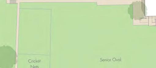
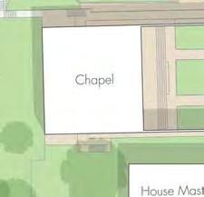
27 Bay View Terrace Bay View Terrace, south of Stirling Highway is a 2-lane road which runs parallel and to the east of Freshwater Parade and Queenslea Drive. It is classified as a District Distributor B under the Main Roads WA Functional Road Hierarchy, and has a speed limit of 50 kilometres per hour, but with a School Speed Zone adjacent to Freshwater Bay Primary School. Bay View Terrace is a 13 metre wide road with a 2 metre wide median, 3 metre wide traffic lanes, and 2.5 metre wide parallel parking spaces on each side, with 2 hour parking restrictions during the day. It also provides 1.7 metre wide footpaths on both sides. On-street parking is provided on either side of the road with 2P restrictions during the day. There are currently 70 on-street parking spaces provided along Bay View Terrace between Stirling Highway and Victoria Avenue. Total On-Street Parking The total number of existing on-street parking spaces in close proximity of Christ Church Grammar School is therefore 175 spaces during the AM peak period, and 159 spaces during the PM peak period, as indicated in Figure A.21 in Chapter A.6 in the Technical Appendix. However, as noted above, the AM peak parking capacity will be reduced by 6 spaces (to 169 spaces) as a result of the introduction of the Type A Children s Crossing in Queenslea Drive. It is therefore reasonable to expect that 84 on-street spaces will be available during the AM peak period, with 80 spaces available during the PM peak period, being 50 percent of the overall parking capacity (as previously noted by Town of Claremont regarding the Scotch College TMTP) PARKING MANAGEMENT FOR EVENTS AT THE SCHOOL CHAPEL Following an application for refurbishment works at the School Chapel, concern was raised by Town of Claremont regarding the possible impact of events/activities at the Chapel on existing parking and traffic congestion during school pick-up and drop-off times. In this regard, the School has advised that the Chapel will continue to be used almost exclusively for school events. Approximately 3 to 4 times per year the school is asked to conduct a significant funeral service. On these occasions the school opens the top and bottom ovals to allow parking to be contained on site. These events rarely occur during times of peak congestion on Queenslea Drive. Town of Claremont has confirmed that Chapel use outside of School peak periods is not a concern. 17
28 6. RECOMMENDATIONS The recommendations for the Christ Church Grammar School Traffic Management and Transport Plan are made on the basis of the surveys and analyses in Chapters 2 and 3, the workshop discussions and responses in Chapter 4, and the follow up assessment in Chapter 5. The recommendations are as follows: It is recommended to install a Type A Children s Crossing in Queenslea Drive at the previously approved location in front of house number 10, with no median island, as shown in Figure 3, and as discussed in Section 5.1. It is important to note that Main Roads WA and the Children s Crossing and Road Safety Committee have granted In-Principle approval for this proposed plan. It is also important to note that the recent modification to the Stirling Highway - Queenslea Drive - Stirling Road intersection does not remove the need for this proposed crossing. The approved plan includes a reduction of the existing embayment in Queenslea Drive by approximately 15 metres, and the introduction of a 20 metre No Standing zone (to be applicable only during times that the crossing is manned). It is recommended that the School enforce pedestrian access between R-Block and S-Block in order to direct students to and from the proposed crossing, as noted in Figure 3. (The School has already commenced this enforcement by having School Prefects on location to ensure that students cross at the site of the proposed crossing. The Prefects are supported by the School Marshall to ensure compliance). It is recommended to formalise a new student pick-up/drop-off area at the western end of the staff car park accessed off the northern end of Queenslea Drive, as indicated in Figure 4 and as discussed in Section 5.4. (This may require a formal Development Application to Town of Claremont but is only expected to require signage and pavement markings and is not expected to result in any loss of existing parking). It is recommended that Town of Claremont continue to actively monitor and enforce the new Clearway at the southern end of the Church parking area adjacent to the staff car park access in Queenslea Drive. It is recommended to pursue the introduction of a left-turn exit from the northern Staff car park onto Stirling Highway, as indicated in Figure 4 and as discussed in Section 5.5, in order to reduce the amount of traffic exiting the school onto Queenslea Drive. It is also acknowledged that a formal application will need to be made through Town of Claremont and Main Roads WA, including justification regarding possible impacts to traffic flows along Stirling Highway and at the adjacent access road to Methodist Ladies College, as well as impacts on cyclists using the dual use path, and access to properties on the opposite side of Stirling Highway. It is recommended that Christ Church Grammar School actively continue the current transport initiatives, while also introducing new initiatives, as listed below in Recommendations 7 and 8 (and as discussed in Section 5.6), in order to reduce reliance on private vehicle travel to/from the School, with an initial aim of reaching the travel mode targets identified in Table 2. It is recommended that Christ Church Grammar School work closely with Town of Claremont and Public Transport Authority to identify all alternative means of transport to and from the school, and to advise students/parents and staff of the available options prior to each school year, with periodic reminders in weekly newsletters, in order to help reduce the number of vehicle trips generated by the school as detailed below in Items 7.1 to It is recommended to identify and promote all available public transport options to and from the school, including information regarding safety improvements offered by various other initiatives. It is anticipated that public transport usage (Bus and Train) can be increased from the existing 23.2 percent to an initial target of 27 percent (as shown in Table 2), and a possible long term target of up to 30 percent, with actual improvements to be determined by undertaking updated travel surveys 2 years after Council s final adoption of this report. 18
29 7.2 It is recommended to promote car-pooling as an additional way to reduce private vehicle travel. It is therefore recommended to advise families across all Year Groups (taking into account possible privacy concerns) of other school families living close by, who may not otherwise be aware of each other, and to provide a means of contact between them for carpooling. It is anticipated that carpooling can be increased from the existing 2.9 percent to an initial target of 5 percent (as shown in Table 2), and a possible long term target of up to 10 percent. 7.3 It is recommended that the School should continue to promote its Walk a little way scheme, but to also investigate possible additional pick-up and drop-off locations as part of this scheme. It is anticipated that the percentage of students walking to/from school can be increased from the existing 9.8 percent to an initial target of 12 percent (as shown in Table 2), and a possible long term target of up to 15 percent. 7.4 It is recommended that the School also continue to encourage students to cycle to school, and to ensure that the supply of bicycle parking continues to exceed demand. It is anticipated that the percentage of students cycling to/from school can be increased from the existing 6.3 percent to an initial target of 8 percent (as shown in Table 2), and a possible long term target of up to 10 percent. 8. It is recommended (and agreed) that Christ Church Grammar School will play an active role in the preparation of any plan to address traffic and parking congestion in streets surrounding schools in the locality resulting from the initiatives being promoted by the Western Suburbs School Traffic Committee. This includes assisting with any survey of parents required to implement a plan, assisting in the development of plans and once endorsed, actively implementing the plans for a common CAT Bus Service or any other measure identified and adopted by the Councils of the Committee as a solution to traffic congestion relating to schools in the locality. It is noted that the School has already commenced jointly-funded private bus services in conjunction with MLC, including a recent extension of services to Shenton Park and Subiaco. It is also noted that the School is currently already involved in a MRWA-funded study of traffic congestion in the local area, together with Methodist Ladies College and Scotch College. The School has also recently agreed to participate in Public Transport Education sessions to promote public transport awareness for Year 6 students before they start High School. TABLE 2 EXISTING MODE OF TRAVEL AND FUTURE TRAVEL MODE TARGETS CHRIST CHURCH GRAMMAR SCHOOL MODE OF TRAVEL EXISTING PERCENTAGE (2014) FUTURE PERCENTAGES Possible Long Initial Target (2019) Term Target (2024) Family Car 57.8% 48% 35% Car Pool 2.9% 5% 10% Bus 15.0% 17% 19% Train 8.2% 10% 11% Walk 9.8% 12%` 15% Cycle 6.3% 8% 10% Source: Uloth and Associates 100% 100% 100% 19
30 STIRLING METRES SCALE 1 : 500 SOURCE: ULOTH & ASSOCIATES DATE: 14 MARCH 2014 N Christ Church Grammar School Reduce Reduce length length of of existing existing embayment by 15 metres by 15 tometres to accommodate proposed crossing, crossing as shown. as shown. School to enforce pedestrian access between R-Block and S-Block in order to direct students to and from the proposed crossing. DRIVE HIGHWAY KEEP CLEAR 20m QUEENSLEA No. 12 No. 10 No. 8 No metre 20m No Standing no standing zone as zone specified as specified in in MRWA MRWA standard standards drawings, but applicable only only during during times times that that crossing crossing is manned. is manned. Install school crossing at location previously agreed, but without central refuge island. Clearway during school pick-up and drop-off times. Recommended School Crossing QUEENSLEA DRIVE AT CHRIST CHURCH GRAMMAR SCHOOL FIG. 3
31 METRES SCALE 1 : 1,250 SOURCE: ULOTH & ASSOCIATES STIRLING N Formalise Formalise new new pick-up/ pick-up/ drop-off location (providing queuing capacity for for up up to to 28 vehicles) 28 vehicles) to reduce to reduce traffic along full full length of of Queenslea Drive. Queenslea Drive. Further investigate opportunity to re-open existing crossover for left-turn exit only with raised kerb in median to prevent right turns. Christ Church Grammar School HIGHWAY Install Install school school crossing crossing but without central island, as shown as shown in Figure in Figure CLEAR KEEP DRIVE QUEENSLEA Actively enforce new Clearway conditions. Recommended Traffic Management Modifications CHRIST CHURCH GRAMMAR SCHOOL FIG. 4
32 TECHNICAL APPENDIX The Technical Appendix documents the existing situation at Christ Church Grammar School, the traffic management initiatives already in place, several issues previously identified and analysed, and a summary of comments received following the Community Workshop. A-1
33 A.1 EXISTING SITUATION Figures A.1 and A.2 show the location and position of video cameras set up to identify existing traffic and pedestrian flows within Queenslea Drive on Thursday 4 April An additional camera was also used to observe traffic and pedestrian flows at the Stirling Highway - Queenslea Drive intersection. A.1.1 WEEKDAY TRAFFIC FLOWS Figure A.3 shows the vehicular access points serving Christ Church Grammar School, including 2 main driveways and 1 minor driveway off Queenslea Drive, plus one driveway off Stirling Highway (restricted for use by emergency vehicles only). Existing on-site parking facilities are also shown, indicating a total of 215 parking spaces. Existing weekday traffic flows on Queenslea Drive are as shown on the left side of Figure A.4, while the centre and right diagrams show the daily traffic flows separated into School Traffic and Non-School Traffic. Figures A.5 to A.7 show the hourly fluctuation of traffic flows entering the Stirling Highway - Queenslea Drive signalised intersection throughout the day. Figure A.5 shows the traffic flows for the entire intersection (including both a school day and a day during school holidays), as well as the traffic flows entering the intersection from Queenslea Drive only. Figure A.6 then shows the Queenslea Drive traffic at a larger scale, again with both a school day and a non-school day for comparison purposes. Figure A.7 shows the Queenslea Drive traffic again, but this time together with the actual school traffic (identified from the video surveys along Queenslea Drive) and resulting non-school traffic. It is clear from each of these comparisons that the school traffic generated along Queenslea Drive is a high proportion of the total traffic during the very short pick-up and drop-off peak periods, but only a very small proportion of the total traffic flows throughout the day. A-2


34 SOURCE: ULOTH & ASSOCIATES LOCATION 1: VICTORIA AVENUE - QUEENSLEA DRIVE ROUNDABOUT LOCATION 2: QUEENSLEA DRIVE (SOUTH FACING) Video Camera Locations FIG. CHRIST CHURCH GRAMMAR SCHOOL A.1
 LOCATION")

35 SOURCE: ULOTH & ASSOCIATES LOCATION 3: QUEENSLEA DRIVE (NORTH FACING) LOCATION 4: STAFF CAR PARK ACCESS Video Camera Locations FIG. CHRIST CHURCH GRAMMAR SCHOOL A.2
36 DWY LEGEND METRES SCALE 1 : 1,250 N Christ Church Grammar School STIRLING HIGHWAY Existing (2013) Parking Spaces Additional Parking Spaces 2016 ACROD Parking Spaces Motorcycle Parking On-Site Queueing Storage Capacity Access Routes Bus Parking SOURCE: ULOTH & ASSOCIATES Staff Parking (18 Spaces) DWY 3 Access restricted to Emergency vehicles only. Pick-up / Drop-off Queue for up to 11 vehicles. Pick-Up / Drop-Off and Staff / Resident Parking (37 Spaces) Staff / Visitor Parking (75 Spaces) On-Site Parking: 249 Parking Spaces (excl. Bus Parking) + 57 Queuing Spaces 306 Spaces (in 2013) + 13 Spaces Additional 319 Spaces (in 2016) (incl. 4 motorcycle spaces) Staff Parking (112 Spaces) Possible Pick-up / Drop-off Queue (up to 28 vehicles) STIRLING ROAD Staff Parking (7+13 Spaces) Pick-up/ Drop-off Lane QUEENSLEA DRIVE DWY 2 CLEAR KEEP Pick-up / Drop-off Queue for up to 18 vehicles. VICTORIA AVENUE Existing (2013) Vehicular Access and On-Site Parking CHRIST CHURCH GRAMMAR SCHOOL FIG. A.3
37 KEEP 7,900 QUEENSLEA DRIVE Total School Traffic = 2,250 vpd ,140 QUEENSLEA DRIVE 6,760 QUEENSLEA DRIVE N STIRLING ROAD 40,600 17,800 31,800 8,700 STIRLING HIGHWAY 33% STIRLING ROAD % 1, % STIRLING HIGHWAY STIRLING ROAD 39,850 17,500 31,560 7,410 STIRLING HIGHWAY 270 DWY 2 CLEAR 270 DWY KEEP CLEAR 1,080 KEEP CLEAR ,580 DWY 1 7,100 VICTORIA AVENUE 1,580 DWY % 960 6,140 VICTORIA TOTAL DAILY TRAFFIC DAILY SCHOOL TRAFFIC AVENUE NON-SCHOOL TRAFFIC VICTORIA AVENUE Existing Daily Traffic QUEENSLEA DRIVE AT CHRIST CHURCH GRAMMAR SCHOOL FIG. A.4
38 1000 Significant reduction of peak period traffic flows during school holidays NUMBER OF VEHICLES AM 2.00 AM 3.00 AM 4.00 AM 5.00 AM 6.00 AM 7.00 AM 8.00 AM 9.00 AM AM AM PM 1.00 PM 2.00 PM 3.00 PM 4.00 PM 5.00 PM 6.00 PM 7.00 PM 8.00 PM 9.00 PM PM PM AM TIME Whole Intersection - All Traffic - School Day Whole Intersection - All Traffic - School Holidays Queenslea Drive - All Traffic - School Day Queenslea Drive - All Traffic - School Holidays Queenslea Drive - School Traffic Only Existing Weekday Traffic Flows ENTERING STIRLING HWY - QUEENSLEA DR INTERSECTION FIG. A.5
39 Only small changes in overall traffic flows on Queenslea Drive throughout the day. Significantly reduced traffic flows during school holidays. NUMBER OF VEHICLES Significantly reduced traffic flows during school school holidays. holidays AM 2.00 AM 3.00 AM 4.00 AM 5.00 AM 6.00 AM 7.00 AM 8.00 AM 9.00 AM AM AM PM 1.00 PM 2.00 PM 3.00 PM 4.00 PM 5.00 PM 6.00 PM 7.00 PM 8.00 PM 9.00 PM PM PM AM TIME Queenslea Drive - All Traffic - School Day Queenslea Drive - All Traffic - School Holidays Existing Weekday Traffic Flows ENTERING STIRLING HWY - QUEENSLEA DR INTERSECTION FROM QUEENSLEA DR FIG. A.6
40 120 Very low non-school traffic at peak pick-up and drop-off times, but significantly higher non-school flows on either side of these peaks. 100 NUMBER OF VEHICLES AM PM PM 9.00 PM 8.00 PM 7.00 PM 6.00 PM 5.00 PM 4.00 PM 3.00 PM 2.00 PM 1.00 PM PM AM AM 9.00 AM 8.00 AM 7.00 AM 6.00 AM 5.00 AM 4.00 AM 3.00 AM 2.00 AM 1.00 AM TIME Queenslea Drive - All Traffic - School Day Queenslea Drive - School Traffic Only Queenslea Drive - Non -School Traffic Only Existing Weekday Traffic Flows ENTERING STIRLING HWY - QUEENSLEA DR INTERSECTION FROM QUEENSLEA DR FIG. A.7
41 A.1.2 CYCLE FACILITIES AND PEDESTRIAN FLOWS Figure A.8 shows the existing cycle parking facilities available on the school site and the existing bus stop locations along Stirling Highway. Figure A.8 also shows pedestrian access into the school and available footpaths in the vicinity. Figures A.9 and A.10 shows the observed pedestrian flows at each end of Queenslea Drive. Figure A.11 shows snap shots from the video surveys of groups of students crossing Queenslea Drive north-east of the school, from bus stops along Stirling Highway or from Claremont Train Station, during the AM peak period. A-3
42 CLEAR KEEP LEGEND Paths and Controlled Road Crossings: Footpaths Shared Paths School Entry Points 57B Bus Stop Bicycle Parking SOURCE: ULOTH & ASSOCIATES METRES SCALE 1 : 1,250 N STIRLING Christ Church Grammar School HIGHWAY 57B STIRLING ROAD An internal path links each of these Entry Points. 56B 52B QUEENSLEA DRIVE VICTORIA AVENUE Existing Pedestrian and Cycle Facilities TO / FROM CHRIST CHURCH GRAMMAR SCHOOL FIG. A.8
43 N METRES SCALE 1 : 750 QUEENSLEA DRIVE LEGEND below 100 pedestrians pedestrians pedestrians pedestrians SOURCE: ULOTH & ASSOCIATES Christ Church Grammar School VICTORIA AVENUE Observed AM & PM Pedestrian Flows FIG. QUEENSLEA DRIVE AT VICTORIA AVENUE (APRIL 2013) A.9
44 N METRES SCALE 1 : 750 ROAD STIRLING HIGHWAY STIRLING KEEP CLEAR Christ Church Grammar School QUEENSLEA DRIVE LEGEND below 100 pedestrians pedestrians pedestrians pedestrians SOURCE: ULOTH & ASSOCIATES Observed AM & PM Pedestrian Flows FIG. QUEENSLEA DRIVE SOUTH OF STIRLING HIGHWAY (APRIL 2013) A.10


45 SOURCE: ULOTH & ASSOCIATES 04/04/13 8:16AM 04/04/13 8:18AM Pedestrian Flows Across Queenslea Dr FIG. CHRIST CHURCH GRAMMAR SCHOOL A.11
46 A.1.3 EXISTING BUS ROUTES AND BUS STOPS Figure A.12 shows the location of Bus Stops (and the Train Station) within walking distance of the School, together with the various Transperth Bus Routes that service the School. Figure A.13 then shows the catchment areas of these existing Transperth Bus Routes within the adjoining suburbs. Additional privately-funded bus routes also operate to and from the School, as described in Section A-4
47 Claremont SHENTON ROAD PRINCESS N LEGEND 102 B * Bus Route and Number Bus Stops Fremantle Railway Line and Station SOURCE: ULOTH & ASSOCIATES Christ Church Grammar School Existing Bus Stops and Train Station FIG. IN THE VICINITY OF CHRIST CHURCH GRAMMAR SCHOOL A metres STIRLING HIGHWAY B B B B B B B BAYVIEW TERRACE Train Station * ROAD QUEENSLEA DRIVE STIRLING ROAD B B B B B B B LEURA AVENUE B 400 metres
48 MARINE WEST COAST HIGHWAY BAYVIEW ALEXANDER ROAD ADELMA ROAD MOUNTJOY BROADWAY LEGEND 102 Bus Route and Number N 102 * Fremantle Railway Line and Station SOURCE: TRANSPERTH TIMETABLES ULOTH AND ASSOCIATES 102 NORTH STREET 102 GRANT STREET AVENUE * SHENTON ROAD * DAVIS ROAD * Claremont Station TERRACE * HIGHWAY PRINCESS BAY ROAD * RAILWAY ROAD 25 MELVISTA ROAD ROAD AVENUE MONASH BRUCE STREET 23 AVENUE PARADE * CURTIN STIRLING 711 VIEW STREET Christ Church Grammar School GALLOP ROAD WARATAH AVENUE BEATRICE 23 ROAD Existing Bus Routes SERVICING CHRIST CHURCH GRAMMAR SCHOOL FIG. A.13
49 A.1.4 EXISTING TRAFFIC INITIATIVES Christ Church Grammar School has actively investigated the possibility of upgrading the existing 40km/hr school zone signage to new electronic solar powered signs which would provide improved visibility and awareness for vehicles. The school was informed however that the new technology was prioritised to schools adjacent to roads at 60km/hr while Christ Church Grammar School is in a 50km/hr built-up area. The school has also pursued possible improvements to the crossing environment on Queenslea Drive by reducing the cycle time at the Stirling Highway - Queenslea Drive intersection in order to reduce delays for students crossing Queenslea Drive to access the school. This was discussed with Main Roads WA, however the school was informed that priority is to traffic on Stirling Highway therefore the cycle time could not be changed during the school traffic peak. Whilst the above measures could not be introduced, Christ Church Grammar School has also identified a number of other traffic management initiatives, which have already been included as part of the existing school operations, as shown below in Table A.1. TABLE A.1 SUMMARY OF EXISTING TRAFFIC MANAGEMENT INITIATIVES CHRIST CHURCH GRAMMAR SCHOOL TRAFFIC MANAGEMENT INITIATIVE Parking allocations within the site allocate most convienient spaces to highest priority users. Restricted use of embayment on western side of Queenslea Drive with priority to school buses during the peak period. Provision of additional parking for events by using the top oval to ensure school traffic and parking does not have an impact on the neighbourhood. Events organised for mid-morning when non-school traffic is not at its peak. Traffic demand on Queenslea Drive is managed by only permitting 2 year groups per event to take place to prevent possible queues into/out of school. School spends significant funds on Buswest buses to provide travel to and from the school 4 days of the week as part of their sports programme. The school has also recently commenced jointly-funded private bus services, shared with MLC. Introduction of the Walk a Little Way initiative to encourage pick-up/drop-off within walking distance of the school. ISSUE ADDRESSED Parking Congestion Congestion Walking COMMENT Highest priority users to use the most convenient parking spaces quickly and efficiently. Parking management within the school. Reduction in School Traffic. Reduction in School Traffic. Encourage walking to school. A-5 (...cont d)
50 TABLE A.1 (CONT D) SUMMARY OF EXISTING TRAFFIC MANAGEMENT INITIATIVES CHRIST CHURCH GRAMMAR SCHOOL TRAFFIC MANAGEMENT INITIATIVE Provision of bike racks at various locations around the school. Bike to School initiatives with prizes to students who bike to school. Arranged with Town of Claremont a trialling of a pick-up/drop-off zone in Bayview Terrace at the Victoria Avenue end. This is ongoing and has proved successful in reducing the traffic demand on Queenslea Drive. Staff actively making sure that school access for pick-up/drop-off is primarily for younger students and older students are expected to be dropped off further afield and walk to school. Students are taken to sports grounds via bus. Parents are encouraged to pick up students from the sports grounds rather than at Queenslea Drive. Buses taking students back to School after sports are staggered to reduce the traffic impact they have on Queenslea Drive. School had located existing lockers near exit closest to lights and plan a further 600 lockers to be located in this position. Prefects are used to help students crossing along Queenslea Drive just north of Victoria Avenue Roundabout School prefects are used to assist pickup/drop-off at the designated zones to speed the interchange / turnaround process. Finish times at the primary school are staggered. Traffic Management measures are posted on the School website and are regularly included in the newsletter to remind parents. Source: Compiled by Uloth and Associates ISSUE ADDRESSED Cycling Congestion Road Safety Congestion Congestion Traffic Management A-6 COMMENT Encourage cycling to school. Alternative pick-up/drop-off location to reduce traffic disruption on Queenslea Drive Encourage use of particular school exits to manage people movement entering and exiting the school. Improve turnaround of vehicles at designated drop off points to reduce queuing into school site and blocking non-school traffic on Victoria Avenue and Queenslea Drive. Stagger school traffic demand Encourage use of roundabout at the southern end of Queenslea Drive. Discourage 3 point turns or U-turn movements along Queenslea Drive. Inform parents that the eastern side of Queenslea Drive is not a picking up/dropping off point. Inform parents that they should not pick up their child too early.
51 A.1.5 EXISTING MODE OF TRAVEL Table A.2 summarises the results of the existing travel mode surveys carried out by Christ Church Grammar School in May It is important to note, however, that this was prior to the introduction of the additional jointly-funded bus services, shared with MLC. All families at the school were requested to take part in an online survey regarding travel behaviour and transport choices, including a question specific to the number of times each travel mode was used both to and from school over a week. The data in Table A.2 shows the average results across the week. TABLE A.2 EXISTING MODE OF TRAVEL TO/FROM SCHOOL CHRIST CHURCH GRAMMAR SCHOOL - MAY 2014 MODE OF TRAVEL TO SCHOOL FROM SCHOOL No. % No. % TOTAL % Family Car % % 57.8 % Car Pool (Friend s Car) % % 2.9 % Bus % % 15.0 % Train % % 8.2 % Walk % % 9.8 % Cycle % % 6.3 % Total Responses % % % Source: Christ Church Grammar School A.1.6 STIRLING HIGHWAY - QUEENSLEA DRIVE - STIRLING ROAD Figure A.14 shows the modifications to the Stirling Highway - Queenslea Drive - Stirling Road intersection, as carried out in late 2015 to improve traffic flows in Stirling Road and to improve the standard of the existing pedestrian crossing facilities. A-7


52 SOURCE: NEARMAP PTY LTD N METRES SCALE 1 : 1,000 ROAD STIRLING QUEENSLEA DRIVE STIRLING HIGHWAY PREVIOUS LAYOUT STIRLING ROAD QUEENSLEA STIRLING HIGHWAY DRIVE MODIFED LAYOUT (JULY 2016) Modified Intersection Layout FIG. STIRLING HWY - QUEENSLEA DVE - STIRLING RD A.14
53 A.2 PREVIOUSLY APPROVED SCHOOL CROSSING Figure A.15 shows the previously approved plan for the proposed children s crossing following modifications by Main Roads WA, with the preferred location on Queenslea Drive opposite house number 10. The plan indicates an extension of the paved verge on the western side, but would have required the removal of the existing cycle lane on the eastern side to accommodate the then proposed pedestrian refuge island. A.3 PARKING AT CHURCH Figure A.16 identifies the possible queuing that currently occurs southbound on Queenslea Drive when there is 90 degree parking adjacent to the Church, combined with a vehicle waiting to turn right into the Staff Car Park at the northern end of Christ Church Grammar School. Figure A.17 shows pictures taken on site where 90 degree parking was observed and also includes a snap shot of the video survey showing southbound queues starting along Queenslea Drive. A.4 ACCESS OFF STIRLING HIGHWAY Figure A.18 shows a plan of the existing access off Stirling Highway, which is restricted for emergency vehicle use only, as part of a previous condition for the Design Technology and Visual Arts building. Figure A.19 shows an aerial view of Stirling Highway and the north car park for Christ Church Grammar School, where it can be seen that there is now good visibility along Stirling Highway at the access driveway. A-8
54 STIRLING N METRES SCALE 1 : 500 SOURCE: ULOTH & ASSOCIATES Christ Church Grammar School Extension of paved verge. HIGHWAY CLEAR KEEP DRIVE QUEENSLEA No. 12 No. 10 No. 8 No. 6 Removal of existing painted shoulder to accommodate refuge island. Previously Approved School Crossing QUEENSLEA DRIVE AT CHRIST CHURCH GRAMMAR SCHOOL FIG. A.15
55 DRIVE N METRES SCALE 1 : 500 SOURCE: ULOTH & ASSOCIATES STIRLING HIGHWAY QUEENSLEA Insufficient space to pass vehicle waiting to turn right, if Clearway conditions are not enforced. Christ Church Grammar School KEEP CLEAR Possible Queuing at Staff Car Park FIG. QUEENSLEA DRIVE AT CHRIST CHURCH GRAMMAR SCHOOL A.16


56 SOURCE: ULOTH & ASSOCIATES PARKED CARS OVERHANG INTO TRAVEL LANE SOUTHBOUND VEHICLES UNABLE TO PASS Congestion Issues on Queenslea Drive FIG. DUE TO PARKING IN FRONT OF CHURCH A.17
57 N METRES SCALE 1 : 750 SOURCE: ULOTH & ASSOCIATES STIRLING ROAD QUEENSLEA DRIVE Bollards Bollards restrict restrict access for Emergency Vehicles Vehicles only. only. HIGHWAY STIRLING Christ Church Grammar School KEEP CLEAR Existing Access off Stirling Highway CHRIST CHURCH GRAMMAR SCHOOL FIG. A.18

58 SOURCE: ULOTH & ASSOCIATES Access currently restricted restricted for for Emergency Emergency Vehicles only. only. Possible new pick-up / drop-off location. North Car Park Access onto Stirling Highway CHRIST CHURCH GRAMMAR SCHOOL FIG. A.19
59 A.5 ADDITIONAL ON-SITE PARKING Figure A.20 shows the preliminary concept plans for additional parking to be provided within the School site as part of the currently proposed new development. The plans indicate an increase of 49 spaces compared to the existing situation. A.6 ON-STREET PARKING Figure A.21 shows the available on-street parking capacity in the vicinity of Christ Church Grammar School, as discussed in Section 5.9. A-9

60 N METRES SCALE 1 : 750 SOURCE: DONALDSON + WARN Proposed Future Parking: 63 spaces Less Existing Situation: -14 spaces Total Additional: +49 spaces Future Queuing Capacity = 27 vehicles Less Existing Situation = 11 vehicles Total Additional = 16 vehicles Additional On-Site Parking Capacity FIG. CHRIST CHURCH GRAMMAR SCHOOL A.20
London Borough of Barnet Traffic & Development Design Team
 London Borough of Barnet Traffic & Development Design Team AERODROME ROAD PEDESTRIAN FACILITY AND BUS STOP INTRODUCTION FEASIBILITY REPORT Job Number: 60668 Doc Ref: S106/12-13/60668 Author: Manoj Kalair
Finchley and Golders Green Area Committee 27 April 2017
 Finchley and Golders Green Area Committee 27 April 2017 Title Report of Wards Status Urgent Key Enclosures Officer Contact Details Junction of Regents Park Road / Tillingbourne Gardens, N3 Commissioning
John Betts School Crossing Review
 John Betts School Crossing Review Paddenswick Road London Borough of Hammersmith & Fulham August 2015 DOCUMENT CONTROL Project Centre has prepared this report in accordance with the instructions from the
Saighton Camp, Chester. Technical Note: Impact of Boughton Heath S278 Works upon the operation of the Local Highway Network
 Technical Note: Impact of Boughton Heath S278 Works July 2013 SAIGHTON CAMP CHESTER COMMERCIAL ESTATES GROUP TECHNICAL NOTE: IMPACT OF BOUGHTON HEATH S278 WORKS UPON THE OPERATION OF THE LOCAL HIGHWAY
Seek the Board s approval for the Donald Place kerb and channel renewal to progress to final design, tender and construction; and
 3. DONALD PLACE - KERB AND CHANNEL RENEWAL General Manager responsible: General Manager City Environment Officer responsible: Transport and City Streets Manager Author: Michelle Flanagan, Streets Capital
Pedestrian Safety Review Spadina Avenue
 STAFF REPORT ACTION REQUIRED Pedestrian Safety Review Spadina Avenue Date: October 13, 2015 To: Toronto and East York Community Council From: Director, Transportation Services, Toronto and East York District
Sky Temporary Car Park Transport Statement
 001 Issue 26 August 2016 This report takes into account the particular instructions and requirements of our client. It is not intended for and should not be relied upon by any third party and no responsibility
12, 14 and 16 York Street - Amendments to Section 16 Agreement and Road Closure Authorization
 REPORT FOR ACTION 12, 14 and 16 York Street - Amendments to Section 16 Agreement and Road Closure Authorization Date: April 27, 2018 To: Toronto and East York Community Council From: Senior Strategic Director,
Port Macquarie-Hastings Pedestrian Access and Mobility Plan. Working Paper COMMUNITY ENGAGEMENT
 Port Macquarie-Hastings Pedestrian Access and Mobility Plan Working Paper COMMUNITY ENGAGEMENT December 2014 Table of Contents Table of Contents... 2 1 Introduction... 3 2 Submissions... 3 2.1 Stakeholder
Queen s Circus Roundabout
 Stage 2 Road Safety Audit Ref: 1128-RSA-01 Prepared for: Steer Davies Gleave By: Capital Traffic Prepared by: Checked by: Approved by: Andy Haunton, Audit Team Leader Jonathan Thompson, Audit Team Member
5.7 Local road upgrades
 5.7 Local road upgrades Local roads around the St Peters interchange and the intersection of Campbell Road and Euston Road would be upgraded to ensure safe and efficient connections with the New M5, and
JOINT CORE STRATEGY FOR BROADLAND, NORWICH AND SOUTH NORFOLK EXAMINATION MATTER 3C EASTON/COSTESSEY
 Matter 3C Easton/Costessey Representor No. 8826 JOINT CORE STRATEGY FOR BROADLAND, NORWICH AND SOUTH NORFOLK EXAMINATION MATTER 3C EASTON/COSTESSEY SUBMISSION ON BEHALF OF TAYLOR WIMPEY DEVELOPMENTS AND
A. CONCLUSIONS OF THE FGEIS
 Chapter 11: Traffic and Parking A. CONCLUSIONS OF THE FGEIS The FGEIS found that the Approved Plan will generate a substantial volume of vehicular and pedestrian activity, including an estimated 1,300
Proposals for the Harrogate Road / New Line Junction Improvement Scheme. August / September Supported by:
 Proposals for the Harrogate / New Line Junction Improvement Scheme August / September 2016 Supported by: Introduction Key Benefits Proposals are currently being developed for changes to the junction of
Movement Strategy. November On behalf of Barton Oxford LLP
 Movement Strategy November 2014 On behalf of Barton Oxford LLP BARTON PARK, OXFORD. Movement Strategy 17/11/2014 Quality Management Issue/revision Issue 1 Revision 1 Revision 2 Revision 3 Remarks Date
Proposed Bicycle Lanes on Yonge Street from Queens Quay to Front Street
 STAFF REPORT ACTION REQUIRED Proposed Bicycle Lanes on Yonge Street from Queens Quay to Front Street Date: March 12, 2007 To: From: Toronto and East York Community Council Director, Transportation Infrastructure
BUSINESS ZONE - OPTION 400 (Western footpath) Have your say. Love the Bay Delivering on the Cycleway
 Have your say. Love the Bay Delivering on the Cycleway") BUSINESS ZONE - OPTION 400 (Western footpath) Have your say Love the Bay Delivering on the Cycleway Consultation open from 31 July to 13 August 2017 1 Introduction After the Love the Bay community-based
BUSINESS ZONE - OPTION 400 (Western footpath) Have your say Love the Bay Delivering on the Cycleway Consultation open from 31 July to 13 August 2017 1 Introduction After the Love the Bay community-based
Bloor Street West Rezoning Application for a Temporary Use By-law Final Report
 STAFF REPORT ACTION REQUIRED 3741 3751 Bloor Street West Rezoning Application for a Temporary Use By-law Final Report Date: June 12, 2007 To: From: Wards: Reference Number: Etobicoke York Community Council
Item 3.1 Attachment 1
 Island Bay Cycleway-Working Party Report Purpose 1. To report on the outcomes of the Island Bay Cycleway community working party. Summary 2. At its 30 April 2015 meeting, Council agreed that a working
9 CONSTRUCTION OF BATHURST STREET FROM GREEN LANE WEST TO SOUTH OF HIGHWAY 11, TOWN OF EAST GWILLIMBURY AND TOWNSHIP OF KING
 Clause No. 9 in Report No. 9 of Committee of the Whole was adopted, without amendment, by the Council of The Regional Municipality of York at its meeting held on May 15, 2014. 9 CONSTRUCTION OF BATHURST
November 11, 2009 BY . Planning and Growth Management Department 110 Laurier Avenue West, 4 th Floor Ottawa, Ontario K1P 1J1. Dear Mr.
 November 11, 2009 Planning and Growth Management Department 110 Laurier Avenue West, 4 th Floor Ottawa, Ontario K1P 1J1 BY E-MAIL Attention: Mr. Don Herweyer Dear Mr. Herweyer: Reference: Abbott-Fernbank
University of Wollongong Innovation Campus Masterplan
 University of Wollongong Innovation Campus University of Wollongong Innovation Campus Masterplan Traffic and Transport Assessment Traffic and Transport Assessment Prepared for University of Wollongong
Chapter 8 Route Window NE7 Chadwell Heath station. Transport for London
 Chapter 8 Route Window NE7 Chadwell Heath station Transport CHADWELL HEATH STATION 8 Route Window NE7 Chadwell Heath station Baseline conditions 8.6 This route window lies within the London Boroughs of
Commissioning Director - Environment
 Finchley and Golders Green Area Committee 27 April 2017 Title Report of Wards Status Urgent Key Enclosures Summers Lane,N12 Request for Pedestrian Improvements Commissioning Director - Environment Woodhouse
Greater Shepparton City Council Planning Scheme Amendment C192 and C193 VicRoads Submission to Traffic Conclave
 Greater Shepparton City Council Planning Scheme Amendment C192 and C193 VicRoads Submission to Traffic Conclave Prepared by: Raelene Stratton Team Leader Integrated Transport and Land Use, North Eastern
Capital & Counties. October 2007
 Capital & Counties October 2007 Contents!" # $ % % $ & ' "&( # Appendix 1 Appendix 2 1 Introduction 1.1.1 Wincheap regeneration scheme proposes a 600 space Park and Ride facility to replace the existing
Part four. In this part you will find: The next steps to deliver the master plan
 Part four NEXT STEPS In this part you will find: The next steps to deliver the master plan 6. How COULD the Master Plan be delivered? There are a number of steps required to take the proposals in the master
We further recognise that some pain and changes are required from the entire City in order to construct and deliver the project.
 70 Merivale Street PO Box 2001 South Bank QLD 4101 Ph: 07 3846 5191 Email: janinew@businesssouthbank.com.au www.businesssouthbank.com.au ABN 28 285 012 048 21 May 2018 The Right Honourable Lord Mayor Councillor
Open Report on behalf of Richard Wills, Executive Director for Environment and Economy
 Agenda Item 7 Executive Open Report on behalf of Richard Wills, Executive Director for Environment and Economy Report to: Executive Date: 02 September 2014 Subject: Lincoln East West Link Road Phase 1
This report recommends that Council approve concept plan 021-CP-001-B (see Attachment 1), for detailed design and delivery this financial year.
, for detailed design and delivery this financial year.") FPOL1711-9 HILTON TOWN CENTRE PROJECT SCOPE Meeting Date: 0 Responsible Officer: Manager Infrastructure Engineering Decision Making Authority: Council Agenda Attachments: 1. Concept Plan no 021-CP-001-B
FPOL1711-9 HILTON TOWN CENTRE PROJECT SCOPE Meeting Date: 0 Responsible Officer: Manager Infrastructure Engineering Decision Making Authority: Council Agenda Attachments: 1. Concept Plan no 021-CP-001-B
Chapter 2 Route window W25 Maidenhead station. Transport for London
 Chapter 2 Route window W25 Maidenhead station MAIDENHEAD STATION 2 Route window W25 Maidenhead station 2.6 The drawings provided at the end of this chapter present the main features of the route window,
BUSINESS OF THE CITY COUNCIL CITY OF MERCER ISLAND, WA
 BUSINESS OF THE CITY COUNCIL CITY OF MERCER ISLAND, WA December 1, 2008 Public Hearing TOWN CENTER PARKING TIME LIMITS (FIRST READING) Proposed Council Action: Conduct public hearing and first reading
Glasgow Street Traffic Review
 Glasgow Street Traffic Review Recommendation That the Standing Policy Committee on Transportation recommend to City Council: 1. That the Administration proceed with removing the pinch points installed
LLANBEDR ACCESS IMPROVEMENTS
 LLANBEDR ACCESS IMPROVEMENTS NON-MOTORISED USER SUPPLEMENTARY REPORT CPF: 5111 Client: Gwynedd Council Document Control Sheet Document Title: Document Author: Project Manager: Project Title: A496 Llanbedr
Regulatory Committee
 Page 1 - Proposed Turning Movement Bans at South Gate Junction, Dorchester Regulatory Committee Date of Meeting 16 March 2017 Officer Subject of Report Executive Summary Andrew Martin Service Director
Submission to Infrastructure Victoria s Draft 30-Year Infrastructure Strategy
 Submission to Infrastructure Victoria s Draft 30-Year Infrastructure Strategy 1. Introduction This submission is a response to Infrastructure Victoria s assessment of the need to construct a heavy rail
Date 24/10/2011. Date 04/11/2011. Date 25/10/2011. Date 10/11/2011. Date 25/10/2011. Date 25/10/2011. Date 10/11/2011.
 DELEGATED POWERS REPORT NO. 1489 SUBJECT: Traffic Signal Review, Junction of Oakleigh Road North and the A1000 Control sheet All of the following actions MUST be completed at each stage of the process
Construction Staging Adelaide Street West
 REPORT FOR ACTION Construction Staging Adelaide Street West Date: October 6, 2016 To: Toronto and East York Community Council From: Acting Director, Transportation Services, Toronto and East York District
PART VIII APPLICATION FOR REVISED SOUTH SIDE TRAFFIC MANAGEMENT WORKS TO FACILITATE LUAS BXD PLANNING REPORT ROADS & TRAFFIC DEPARTMENT
 PART VIII APPLICATION FOR REVISED SOUTH SIDE TRAFFIC MANAGEMENT WORKS TO FACILITATE LUAS BXD PLANNING REPORT ROADS & TRAFFIC DEPARTMENT NOVEMBER 2012 1.0 INTRODUCTION This report has been prepared in support
Lake Erie Commerce Center Traffic Analysis
 LOCATION: East of NYS Route 5 at Bayview Road Town of Hamburg Erie County, New York PREPARED BY: Wendel Companies 140 John James Audubon Parkway Suite 200 Amherst, New York 14228 January 2012 i ii Table
The Point Roundabout Improvement Scheme
 The Point Roundabout Improvement Scheme Background and Existing Situation The junction of North Wall Quay, East Wall Road and the East Link Bridge, also known as the Point roundabout, is located in the
Gold Coast. Rapid Transit. Chapter content. Chapter four Route selection and staging
 Chapter four Route selection and staging Gold Coast Rapid Transit Chapter four Route selection and staging Chapter content Route selection...73 Section one: Helensvale to Griffith University...74 Section
Gold Coast. Rapid Transit. Chapter twelve Social impact. Chapter content
 Gold Coast Rapid Transit Chapter twelve Social impact Chapter content Social impact assessment process...235 Existing community profile...237 Consultation...238 Social impacts and mitigation strategies...239
Launceston City Council. Kings Meadows Traffic Management Report for Public Consultation
 Launceston City Council Kings Meadows Traffic Management Report for Public Consultation November 2013 This report: has been prepared by GHD for Launceston City Council and may only be used and relied on
5 Rail demand in Western Sydney
 5 Rail demand in Western Sydney About this chapter To better understand where new or enhanced rail services are needed, this chapter presents an overview of the existing and future demand on the rail network
8 CROSS-BOUNDARY AGREEMENT WITH BRAMPTON TRANSIT
 8 CROSS-BOUNDARY AGREEMENT WITH BRAMPTON TRANSIT The Transportation Services Committee recommends the adoption of the recommendations contained in the following report dated May 27, 2010, from the Commissioner
REVIEW OF GOLD COAST AIRPORT Noise Abatement Procedures
 REVIEW OF GOLD COAST AIRPORT Noise Abatement Procedures Introduction The purpose of this document is to present an overview of the findings of the review of the Noise Abatement Procedures (NAPs) in place
Open Report on behalf of Richard Wills, Executive Director for Environment & Economy. Nettleham Village Centre - Proposed Parking Restrictions
 Agenda Item 4.3 Regulatory and Other Committee Open Report on behalf of Richard Wills, Executive Director for Environment & Economy Report to: Planning & Regulation Committee Date: 16 February 2015 Subject:
ACORNS PROJECTS LIMITED
 ACORNS PROJECTS LIMITED A4 London Road, M4 J5 to Sutton Lane, Slough, Berkshire Combined Stage 1 and 2 Road Safety Audit For Slough Borough Council Prepared by Acorns Projects Limited Safety Traffic Project
Interstate 90 and Mercer Island Mobility Study APRIL Commissioned by. Prepared by
 Interstate 90 and Mercer Island Mobility Study APRIL 2017 Commissioned by Prepared by Interstate 90 and Mercer Island Mobility Study Commissioned by: Sound Transit Prepared by: April 2017 Contents Section
Perth and Kinross Council Development Control Committee 27 August 2008 Recommendation by Development Quality Manager
 Perth and Kinross Council Development Control Committee 27 August 2008 Recommendation by Development Quality Manager 5(7) 08/414 Erection of kennels and cattery at Baltree Farm, Hatchbank, Kinross, KY13
Response to the London Heathrow Airport Expansion Public Consultation
 Response to the London Heathrow Airport Expansion Public Consultation Summary This report sets out the response to the Heathrow Airport s consultation on airport expansion and airspace change. The consultation
JOINT TRANSPORTATION BOARD. 10 June Non-key. That subject to the views of the Board,
 JOINT TRANSPORTATION BOARD 10 June 2008 Subject: Director/Head of Service: Decision Issues: Decision: CCC Ward/KCC Division: Summary: To Resolve: Southern Gas Networks Gas Main Replacement Scheme - Broad
Roundhouse Way Transport Interchange (Part of NATS City Centre Package)
") Roundhouse Way Transport Interchange (Part of NATS City Centre Package) 15/16 16/17 17/18 18/19 19/20 Total TOTAL COST Roundhouse Way Transport Interchange 0.5m 0.5m FUNDING CIL 0.05m 0.05m Growth Deal
Roundhouse Way Transport Interchange (Part of NATS City Centre Package) 15/16 16/17 17/18 18/19 19/20 Total TOTAL COST Roundhouse Way Transport Interchange 0.5m 0.5m FUNDING CIL 0.05m 0.05m Growth Deal
FEDERAL BUDGET PRIORITIES FOR THE SOUTH WEST METROPOLITAN REGION 2018 TO 2022
 A Co-operative venture of the municipalities of: Cockburn, East Fremantle, Fremantle, Kwinana, Melville & Rockingham Tuesday, 5 December 2017 Enquiries: Mick McCarthy 9364 0631 Our Ref: Federal Budget
Map showing location of public transport projects in vicinity of railway station
 Map showing location of public transport projects in vicinity of railway station Market Town Transport Strategy 2013 39 ID PT1a Specific Location Approach at Detail of Project Develop Area Master plan
20mph Speed Limit Zones
 Traffic Advisory Leaflet 7/91 May 1991 20mph Speed Limit Zones Summary This leaflet illustrates the main steps in the procedures for the implementation of 20mph zones. It provides brief details on: the
TORONTO TRANSIT COMMISSION REPORT NO.
 Revised: March/13 TORONTO TRANSIT COMMISSION REPORT NO. MEETING DATE: November 18, 2013 SUBJECT: ISLINGTON STATION TEMPORARY BUS TERMINAL ACTION ITEM RECOMMENDATIONS It is recommended that the Board: 1.
Traffic calming on major roads: a traffic calming scheme at Costessey, Norfolk
 Traffic Advisory Leaflet 14/99 December 1999 Traffic calming on major roads: a traffic calming scheme at Costessey, Norfolk Introduction This leaflet summarises the impact of a traffic calming scheme on
TABLE OF CONTENTS. Coral Springs Charter High School and Middle School Job No Page 2
 Job No. 15-019 Page 2 TABLE OF CONTENTS 1.0 INTRODUCTION... 4 2.0 EXISTING CONDITIONS... 5 3.0 TRAFFIC GENERATION... 7 4.0 TRIP DISTRIBUTION... 8 5.0 FUTURE CONDITIONS... 8 6.0 SITE ACCESS...13 7.0 CONCLUSION...13
MEMORANDUM OF UNDERSTANDING WITH BUSINESS IMPROVEMENT DISTRICTS WITHIN BIRMINGHAM
 MEMORANDUM OF UNDERSTANDING WITH BUSINESS IMPROVEMENT DISTRICTS WITHIN BIRMINGHAM For services in respect of: Highway Maintenance and Management Car Parking Traffic Management Signatories: For Birmingham
Transport Impact Assessment
 Transport Impact Assessment Springbok Hotel Erf 5206, Springbok Northern Cape March 2018 5th Floor Imperial Terraces Carl Cronje Drive Tyger Waterfront Bellville, 7530 (021) 914 6211 (T) e mail: mail@itsglobal.co.za
Bridge School, Longmoor Campus, Coppice View Road, Sutton Coldfield, Birmingham, B73 6UE
 Committee Date: 22/01/2015 Application Number: 2014/05949/PA Accepted: 08/12/2014 Application Type: Full Planning Target Date: 02/02/2015 Ward: Sutton Vesey Bridge School, Longmoor Campus, Coppice View
Report to: Greater Cambridge Partnership Joint Assembly 18 January A10 Foxton level crossing bypass and travel hub
 Report to: Greater Cambridge Partnership Joint Assembly 18 January 2018 Lead officer: Chris Tunstall GCP Director of Transport A10 Foxton level crossing bypass and travel hub 1. Purpose 1.1 The list of
Proposed Lidl Food store West Hendford, Yeovil
 Proposed Lidl Food store West Hendford, Yeovil Lidl Travel Plan October 2015 CONTENTS Page 1.0 INTRODUCTION 1 1.1 Background 1 1.2 Aim of Travel Plan 1 1.3 Contents 2 2.0 TRANSPORT CONTEXT 3 2.1 Site Location
MEMORANDUM. for HOV Monitoring on I-93 North and the Southeast Expressway, Boston Region MPO, November, 2011.
 MEMORANDUM Date: January 12, 2012 To: Congestion Management Process Files From: Seth Asante, Ryan Hicks, and Efi Pagitsas MPO Staff Re: Historical Trends: Travel Times and Vehicle Occupancy Levels for
The decision on whether to take enforcement action falls outside the scope of delegated powers.
 5k 16/0031 Reg d: 19.01.2016 Expires: 15.03.201 6 Ward: Nei. 24.02.201 BVPI Full Number of 11/8 On Con. 6 Target Weeks on Target? Exp: Cttee Day: GE No LOCATION: PROPOSAL: TYPE: Phillips Court, 32 Goldsworth
Commissioning Director - Environment. Officer Contact Details Jane Shipman;
 Chipping Barnet Area Committee 6 July 2016 Title Report of Wards Status Urgent Key Enclosures The Avenue Zebra crossing and pedestrian improvements Commissioning Director - Environment Chipping Barnet
Major Scheme Business Case Summary Report for Programme Entry
 Paper A Heart of South West Local Transport Board Major Scheme Business Case Summary Report for Programme Entry M5 Junction 25, Taunton July 2016 1 SCHEME SUMMARY Scheme Name M5 Junction 25, Taunton Date
TRUMPINGTON MEADOWS COMMUNITY MEETING (MEETING 1) held at Trumpington Meadows Primary School Meeting Room 2 on 27th November 2017, 19:30 21:00 MINUTES
 held at Trumpington Meadows Primary School Meeting Room 2 on 27th November 2017, 19:30 21:00 MINUTES") TRUMPINGTON MEADOWS COMMUNITY MEETING (MEETING 1) held at Trumpington Meadows Primary School Meeting Room 2 on 27th November 2017, 19:30 21:00 MINUTES Guests Tim Watkins Project Manager, Western Orbital,
TRUMPINGTON MEADOWS COMMUNITY MEETING (MEETING 1) held at Trumpington Meadows Primary School Meeting Room 2 on 27th November 2017, 19:30 21:00 MINUTES Guests Tim Watkins Project Manager, Western Orbital,
TORONTO TRANSIT COMMISSION REPORT NO.
 Revised: March/13 TORONTO TRANSIT COMMISSION REPORT NO. MEETING DATE: November 18, 2013 SUBJECT: YONGE-EGLINTON AND EGLINTON WEST INTERCHANGE STATIONS METROLINX EGLINTON CROSSTOWN LIGHT RAIL TRANSIT PROJECT
Re: Item 7- PR13.{)35 - Region of York Municipal Parbtership Grant Application and Approval of Two Grade-Separated Underpasses
35 - Region of York Municipal Parbtership Grant Application and Approval of Two Grade-Separated Underpasses") Office of the Clerk John D. Leach Director of Customer and Legislative Servicesffown Clerk 905-727-3123 ext. 4771 jleach@aurora.ca Town of Aurora 100 John West Way, Box 1000 Aurora, ON L4G 6J1 August 14,
Office of the Clerk John D. Leach Director of Customer and Legislative Servicesffown Clerk 905-727-3123 ext. 4771 jleach@aurora.ca Town of Aurora 100 John West Way, Box 1000 Aurora, ON L4G 6J1 August 14,
Madison Metro Transit System
 Madison Metro Transit System 1101 East Washington Avenue Madison, Wisconsin, 53703 Administrative Office: 608 266 4904 Fax: 608 267 8778 TO: FROM: SUBJECT: Plan Commission Timothy Sobota, Transit Planner,
Planning Committee. Thursday, 26 May 2016
 Planning Committee Thursday, 26 May 2016 Attendees: Substitutes: Councillor Lyn Barton (Member), Councillor Helen Chuah (Member), Councillor Theresa Higgins (Chairman), Councillor Brian Jarvis (Member),
Appendix 6 Fulbourn Greenway Review
 Appendix 6 Fulbourn Greenway Review Nigel Brigham & Associates A report for 1 Introduction This report is based on fieldwork carried out in 2016 to review the Greenway network around Cambridge as shown
Grade Crossing Regulations
 Grade Crossing Regulations An Overview of Municipal Roles and Responsibilities at Federally Legislated Grade Crossings March 21, 2017 presentation to Alberta Municipal Supervisor Association, Edmonton,
Chapter 6 Route Window NE5 Seven Kings station. Transport for London
 Chapter 6 Route Window NE5 Seven Kings station Transport SEVEN KINGS STATION 6 Route Window NE5 Seven Kings Station Transport Introduction 6.1 All construction activities in this route window are associated
Public Document Pack MINUTES OF THE HARLOW LOCAL HIGHWAYS PANEL HELD ON. 18 February pm
 Public Document Pack MINUTES OF THE HARLOW LOCAL HIGHWAYS PANEL HELD ON 18 February 2014 7.00-8.12 pm PRESENT Committee Members Councillor Eddie Johnson, Essex County Council (Chairman) Councillor Mike
Date: 11 th January, From: Plaistow & Ifold Parish Neighbourhood Plan - Steering Group. Plaistow & Ifold Parish Council
 Date: 11 th January, 2017 From: Plaistow & Ifold Parish Neighbourhood Plan - Steering Group To: Plaistow & Ifold Parish Council Re: Neighbourhood Plan Report to Parish Council Meeting 17 Jan 2017 The Steering
CITY OF EDINBURGH COUNCIL WRITTEN SUBMISSION
 CITY OF EDINBURGH COUNCIL Summary WRITTEN SUBMISSION Waverley and Haymarket are significant stations for Scotland as well as Edinburgh. The number of passengers using them has grown substantially in recent
Report on the Crafthole Traffic Light Project 3 rd July th September 2017
 Report on the Crafthole Traffic Light Project 3 rd July 2017 4 th September 2017 Brief History The village of Crafthole sits on the B3247 road, one of the 2 Gateways to the Rame Peninsula, the other being
Memorandum. Roger Millar, Secretary of Transportation. Date: April 5, Interstate 90 Operations and Mercer Island Mobility
 Memorandum To: From: The Honorable Dow Constantine, King County Executive; The Honorable Ed Murray, City of Seattle Mayor; The Honorable Bruce Bassett, City of Mercer Island Mayor; The Honorable John Stokes,
Team London Bridge Response to the Department for Transport Consultation on the combined Thameslink, Southern and Great Northern franchise
 Team London Bridge Response to the Department for Transport Consultation on the combined Thameslink, Southern and Great Northern franchise 23 August 2012 Table of Contents 1. Executive Summary 2. Introduction
As the Toronto Transit Commission (TTC) operates a transit service on Bay Street, City Council approval of this report is required.
 operates a transit service on Bay Street, City Council approval of this report is required.") REPORT FOR ACTION Construction Staging Area - 81 Bay Street Date: December 11, 2017 To: Toronto and East York, Community Council From: Acting Director, Transportation Services Toronto and East York District
REPORT FOR ACTION Construction Staging Area - 81 Bay Street Date: December 11, 2017 To: Toronto and East York, Community Council From: Acting Director, Transportation Services Toronto and East York District
Appendix 9 Melbourn Greenway Review
 Appendix 9 Melbourn Greenway Review Nigel Brigham & Associates A report for 1 Introduction This report is based on fieldwork carried out in 2016 to review the Greenway network around Cambridge as shown
4. The Council s LTCCP decision on 30 June 2009 confirmed the extended tram route and funding.
 145 11. TRAM EXTENSION PROJECT PROPOSED PARKING CHANGES AND STREET MODIFICATIONS IN LICHFIELD STREET, MANCHESTER STREET, HIGH STREET, TUAM STREET, ASH STREET, BEDFORD ROW AND OXFORD TERRACE General Manager
PERTH-ADELAIDE CORRIDOR STRATEGY
 INTRODUCTION The Royal Automobile Association of SA Inc (RAA), the State s principal advocate for motorists on a broad range of motoring-related issues, represents the views of more than 560,000 South
4. Safety Concerns Potential Short and Medium-Term Improvements
 NH Route 104 Access Management Study Page 19 4. Safety Concerns Potential Short and Medium-Term Improvements Potential safety improvement strategies are listed by priority based on field observations by
REVIEW OF PERTH AIRPORT Noise Abatement Procedures
 REVIEW OF PERTH AIRPORT Noise Abatement Procedures Contents SUMMARY... 3 Summary of Review Findings... 3 BACKGROUND... 4 Noise Abatement Procedures... 4 Perth Airport Noise Abatement Procedures... 4 Noise
Frequently Asked Questions on the Route 29 Solutions Improvements Projects
 Frequently Asked Questions on the Route 29 Solutions Improvements Projects Background What are the Route 29 Solutions improvement projects? These projects include the Route 29/250 Interchange ( Best Buy
Construction Staging Area Blue Jays Way (357 King Street West)
") REPORT FOR ACTION Construction Staging Area Blue Jays Way (357 King Street West) Date: June 8, 2018. To: Toronto and East York Community Council From: Acting Director, Transportation Services, Toronto
REPORT FOR ACTION Construction Staging Area Blue Jays Way (357 King Street West) Date: June 8, 2018. To: Toronto and East York Community Council From: Acting Director, Transportation Services, Toronto
Arcadis LLP Proposed Secondary School (Bolder Academy) Macfarlane Lane, Isleworth Access Management Strategy. June 2017
 Macfarlane Lane, Isleworth Access Management Strategy. June 2017") traffic engineering and transport planning Arcadis LLP Proposed Secondary School () June 2017 Armstrong House, The Flemingate Centre, Beverley, HU17 0NW 01482 679 911 info@local-transport-projects.co.uk
traffic engineering and transport planning Arcadis LLP Proposed Secondary School () June 2017 Armstrong House, The Flemingate Centre, Beverley, HU17 0NW 01482 679 911 info@local-transport-projects.co.uk
SANDY BAY RETAIL PRECINCT STREETSCAPE REVITALISATION - PALM TREES AND BANNER POLES - RESPONSE TO PETITION
 Page 41 REPORT TITLE: SANDY BAY RETAIL PRECINCT STREETSCAPE REVITALISATION - PALM TREES AND BANNER POLES - RESPONSE TO PETITION REPORT PROVIDED BY: Road Services Engineer Director City Infrastructure 1.
Development Committee on 3 December 2013;
 7 2. Endorses the bus route for the new free City Connector bus service as set out in Attachment B to Item 9 on the Agenda for the meeting of the City Planning & Development Committee on 3 December 2013;
1.2 Corridor History and Current Characteristics
 SECTION 1 Description and Background of Study Area 1.1 Introduction This preliminary engineering report was prepared for the Alaska Department of Transportation and Public Facilities (ADOT&PF). It is part
TERMINAL DEVELOPMENT PLAN
 5.0 TERMINAL DEVELOPMENT PLAN 5.0 TERMINAL DEVELOPMENT PLAN Key points The development plan in the Master Plan includes the expansion of terminal infrastructure, creating integrated terminals for international,
Old Limberlost Sports Club, Butlers Road, Handsworth Wood, Birmingham, B20 2NT
 Committee Date: 07/03/2013 Application Number: 2012/07986/PA Accepted: 29/11/2012 Application Type: Variation of Condition Target Date: 24/01/2013 Ward: Handsworth Wood Old Limberlost Sports Club, Butlers
A303. Sparkford to Ilchester Dualling Scheme. Public consultation. Welcome. Highways England -- creative MCR18_0016
 Sparkford to Ilchester Dualling Scheme Public consultation Welcome Background The /A358 corridor provides vital east-west connectivity between the south west and London and the south east for people, communities
To: Members of the staff at Headquarters From: The Under-Secretary-General for the Department of Safety and Security
 United Nations ST/IC/2009/35 Secretariat 14 September 2009 Information circular* To: Members of the staff at Headquarters From: The Under-Secretary-General for the Department of Safety and Security Subject:
Cabinet. The Future of Wareham Foot Level Crossing. Date of Meeting 24 February 2016
 Page 1 The Future of Wareham Foot Level Crossing Cabinet Date of Meeting 24 February 2016 Cabinet Member(s) Peter Finney Cabinet Member for Environment Colin Jamieson - Cabinet Member for Economy and Growth