Sheboygan River Area of Concern: Moving Towards Recovery
|
|
|
- John Goodman
- 5 years ago
- Views:
Transcription


1 Sheboygan River Area of Concern: Moving Towards Recovery 2018 Wisconsin Lakes Partnership & Water Action Volunteers Symposium Amy Kretlow WI Department of Natural Resources

2 What s Ahead What is an AOC Sheboygan River AOC Restoring an AOC Habitat Restoration River Habitat Big Projects Monitoring/Assessment Maintenance-Long Term Care Learned Lessons


3 What is an Area Of Concern (AOC)? In a 1987, forty-three locations were identified as AOCs by Canada and the United States A geographic area where significant impairment of beneficial uses has occurred as a result of human activities at the local level. Photo Credit:

 Eutrophication or undesirable algae (removed) Degradation of phytoplankton and zooplankton populations Loss of fish and")
4 Sheboygan River AOC Identified by US-EPA as a priority AOC 9 out of 14 Beneficial Use Impairments (BUIs) Lower 14 miles of the Sheboygan River Restrictions on fish and wildlife consumption Degradation of fish and wildlife populations Fish tumors or other deformities Bird or animal deformities or reproductive problems Degradation of benthos Restrictions on dredging activities (removed) Eutrophication or undesirable algae (removed) Degradation of phytoplankton and zooplankton populations Loss of fish and wildlife habitat


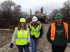
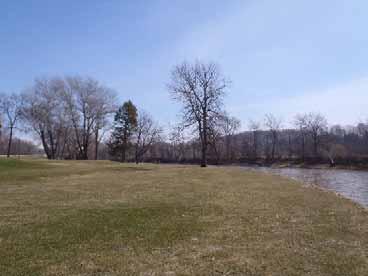
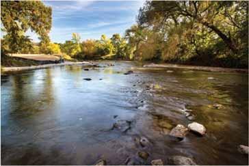
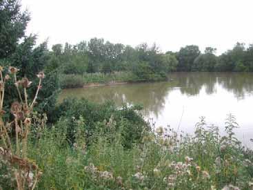
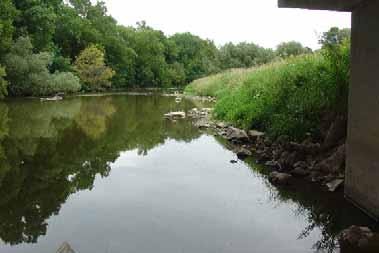
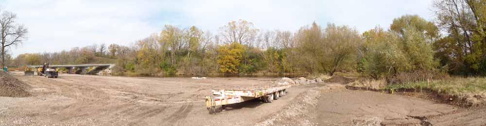
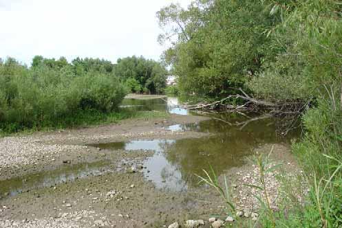
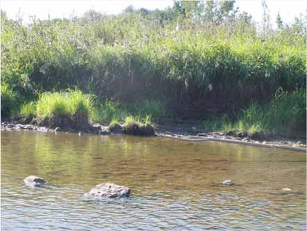
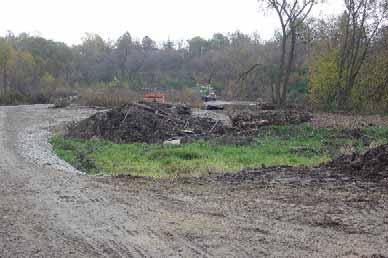
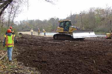
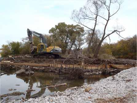
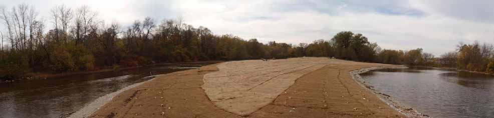
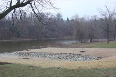
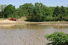
5 Restoring an AOC Dredging Habitat Restoration Monitoring/ Assessment Photos by Stacy Hron, WDNR

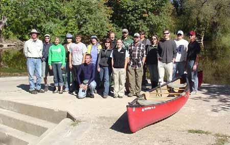
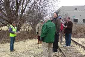
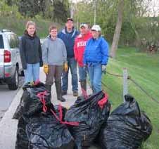
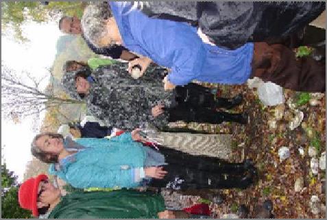


6 You Need A Lot Of People!


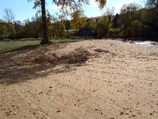
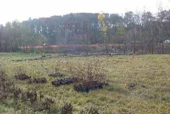
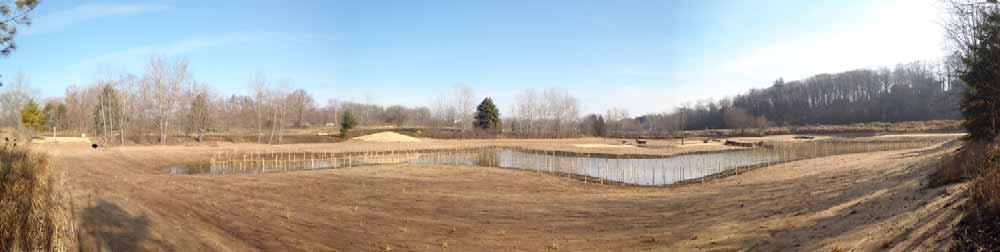
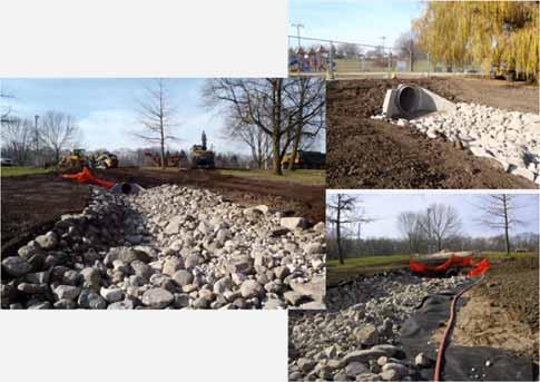
7 Habitat Restoration Approximately $5.7 million in funds from the Great Lakes Restoration Initiative (GLRI) were approved for habitat restoration in the Sheboygan AOC in Vetting to completion in under 2 years! Projects evaluated by Fish & Wildlife TAC 7 projects implemented by DNR and partners 5 major project sites 41 acres 18,300 feet of shoreline.

 Assessed benthic")


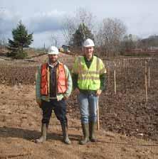
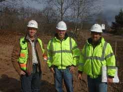
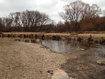
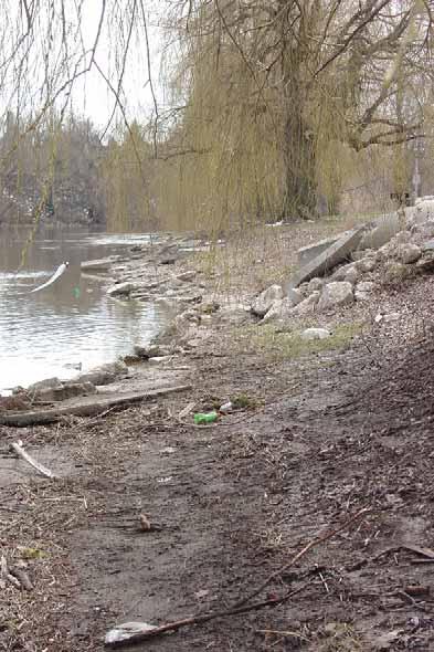
8 In-stream Habitat Improvements 2 sites in the upper river (Sheboygan Falls and Kohler) Assessed benthic habitat of entire 14 mile stretch of river Added boulder habitat in river and woody debris along shorelines Photos by Stacy Hron, WDNR


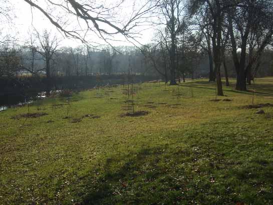
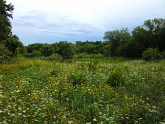
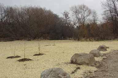
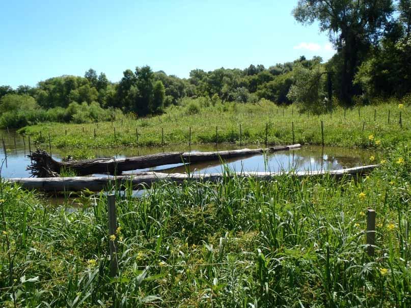
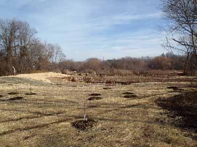
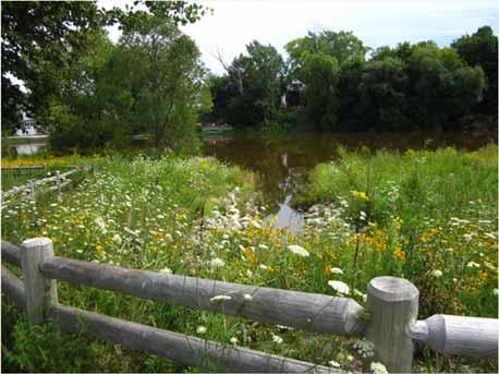
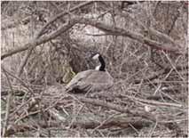
9 Habitat Restoration Goals of the Habitat Restoration Restore native plant communities Improve existing wetlands Provide shoreline naturalization Invasive species removal Bank stabilization Habitat connectivity


10 Targeted Invasive Species Control 58 sites along the 14 mile long AOC Corridor Japanese Knotweed, Phragmites, Garlic Mustard, Buckthorn Photo by DNR Photo by Deb Beyer


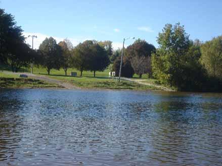
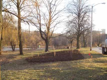
11 Roy Sebald Sheboygan River Natural Area The Big Projects


12 Esslingen Park Taylor Drive Wetland Area Roy Sebald Sheboygan River Natural Area


13 Esslingen Park


14 Esslingen Park


15 Esslingen Park


16 Taylor Drive Wetland Area


17 Taylor Drive Wetland Area


18 Taylor Drive Wetland Area


19 Roy Sebald Sheboygan River Natural Area


20 Roy Sebald Sheboygan River Natural Area


21 Roy Sebald Sheboygan River Natural Area

22 Wildwood Island Area Restoration

23 Wildwood Island Area Restoration

24 Wildwood Island Area Restoration


25 Photos by Deb Beyer, UWEX Wildwood Island Area Restoration

26 Wildwood Island Area Restoration Photo by Stacy Hron, WDNR

27 Wildwood Island Area Restoration

28 Kiwanis Park

29 Kiwanis Park


30 Kiwanis Park


31 Kiwanis Park Photo by Stacy Hron, WDNR

32 Kiwanis Park
 Plankton & Benthos Tree")


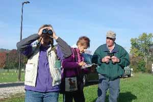
33 Monitoring/Assessment Pre/during Waterfowl Tissue (Advisory) Fish Tumors Fish Tissue (Advisory) Plankton & Benthos Tree Swallows Fish Community Macroinvertebrates Aquatic Habitat Herptiles Breeding Birds Bats Mussels Wintering Birds Fish-Eating Birds Small Mammals and Mink Natural Community/Rare Plant/Invasive Plant Post Waterfowl Tissue (Advisory) Fish Tissue (Advisory) Plankton & Benthos Tree Swallows Mink Fish Community Macroinvertebrates Aquatic Habitat Passive Samplers Invasive Plant


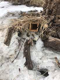
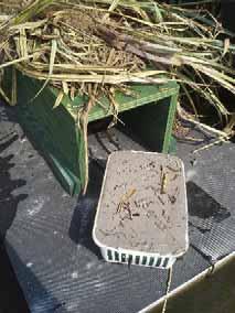
34 Maintenance And Long Term Mussels Frogs and Toads Bats Birds and Nest Box Surveys Invasive Species Maintenance Plan City of Sheboygan County of Sheboygan Camp Y-Koda Etc. Who ever else involved
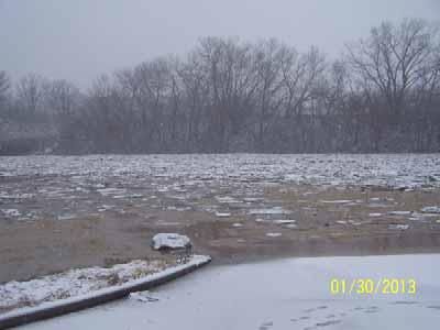
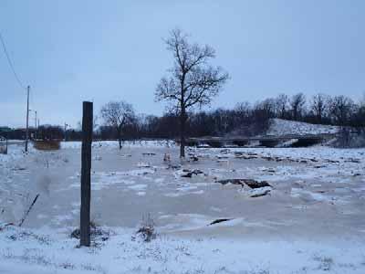
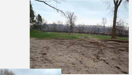
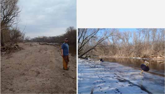
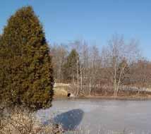
35 Problems Encountered - Ice Dams/Flooding
36 Problems Encountered


37 Any Questions?? Planted to establish 102 species of native plants: 42,940 native trees, shrubs, wildflowers, grasses, and sedges 180 pounds of native seed Contaminated sediment removed: Approximately 15,000 dump-truck loads Equivalent to 400,000 cubic yards 2,600 pounds of PCBs were removed from the river The goal of the AOC is to bring the PCB levels down to 1ppm to be in balance with Lake Michigan

38 2018 Great Lakes Areas Of Concern Conference Wednesday May 16 th and Thursday May 17 th Blue Harbor Hotel and Conference Center, Sheboygan, WI The cost to attend the conference is $80 Registration Deadline: Friday May 11, 2018 Optional Pre-Conference Tour of Sheboygan River AOC Tuesday, May 15, 2:00 pm to 4:00 pm See how the Sheboygan River was transformed through remediation and restoration investments under the Great Lakes Restoration Initiative. Registration for this event is limited to 100 people; transportation will be provided.
An Introduction. The Saginaw River/Bay Area of Concern
 Saginaw River & Bay Area of Concern: Looking Forward Continued Partnerships in the Restoration of Saginaw Bay Michelle Selzer Lake Huron Coordinator & Interim AOC Coordinator Saginaw Bay Watershed Conference
Cat Island Chain Background & Access Guide
 Cat Chain Background & Access Guide Brown County Port & Resource Recovery Department 2561 S. Broadway, Green Bay, WI 54304 (920) 492-4950 www.portofgreenbay.com January 2018 1 Restoration of the Cat Chain
Anglian Water Flourishing Environment Fund
 Anglian Water Flourishing Environment Fund Anglian Water is the largest water and water recycling company in England and Wales by geographic area. The company employs over 4,000 people and supplies water
The Chippewas of Georgina Island First Nation At A Glimpse
 Located in Lake Simcoe approximately100 km north of the Greater Toronto Area (GTA) in Ontario Canada. Consisting of 3 separate Islands, Georgina, Snake and Fox with 2 mainland access points.. Georgina
Environmental Geotechnical Planning Construction Testing & Inspection Building Science Duty To Consult
 About Me? 2 Member of the Chippewas of Georgina Island FN Worked in my Community for 17+ years in various capacities Childcare, Council, Housing, Bylaws, Waste Management, Environment, Climate Change 2011
Wetlands Reservoirs of Biodiversity. Billy McCord, SCDNR
 Wetlands Reservoirs of Biodiversity Billy McCord, SCDNR Estuaries Tidal Deepwater Intertidal Salt Marsh Tidal Riverine Fresh & Brackish Deepwater Tidal Emergent Marsh Freshwater Riverine Seasonally Flooded
Virginian Atlantic (Ecoregion 8)
") Virginian Atlantic (Ecoregion 8) Background The Virginian Atlantic Ecoregion extends from the south side of Cape Cod to Cape Hatteras in North Carolina. The waters of the ecoregion are a mix of cold and
Virginian Atlantic (Ecoregion 8) Background The Virginian Atlantic Ecoregion extends from the south side of Cape Cod to Cape Hatteras in North Carolina. The waters of the ecoregion are a mix of cold and
SAN ANTONIO RIVER IMPROVEMENTS PROJECT. April 27, 2009
 SAN ANTONIO RIVER IMPROVEMENTS PROJECT April 27, 2009 1 Project Limits 2 Project Partners City of San Antonio Provides project funding for project amenities (i.e.. Sidewalks, Landscaping, Lighting, etc.)
Galveston Bay Estuary Program. Carla G. Guthrie, Ph.D. Galveston Bay Council Member Texas Water Development Board
 Galveston Bay Estuary Program Carla G. Guthrie, Ph.D. Galveston Bay Council Member Texas Water Development Board The statements contained in this presentation are my current views and opinions and are
Conservation Results In An Urban Environment Through Public-Private Partnerships
 Conservation Results In An Urban Environment Through Public-Private Partnerships James Boase, U.S. Fish and Wildlife Service Supporting Contributors John Hartig, USFWS Allison Krueger, USFWS Ed Roseman,
STREAKED HORNED LARK. Conservation of a threatened species in an industrial landscape. Cat Brown US Fish and Wildlife Service
 STREAKED HORNED LARK Conservation of a threatened species in an industrial landscape Cat Brown US Fish and Wildlife Service HISTORICAL & CURRENT RANGE Streaked Horned Lark Distribution Historical Range:
Alaskan/Fjordland Pacific (Ecoregion 22)
") Alaskan/Fjordland Pacific (Ecoregion 22) Background The Alaskan/Fjordland Pacific Ecoregion is an area of abundant marine resources. The ecoregion begins at Vancouver Island and moves up the Gulf of Alaska
Alaskan/Fjordland Pacific (Ecoregion 22) Background The Alaskan/Fjordland Pacific Ecoregion is an area of abundant marine resources. The ecoregion begins at Vancouver Island and moves up the Gulf of Alaska
Paul Sturm Roberto Viqueira Ríos
 Paul Sturm Roberto Viqueira Ríos In this talk Brief Background on Land Based Sources Historical Perspective Guánica watershed characteristics/ issues High priority restoration projects Other key issues
Dryden Rail Trail Friends and Task Force Monday, January 21, :00 9:00 p.m. Dryden Town DPW 61 East Main Street, Dryden
 Agenda Dryden Rail Trail Friends and Task Force Monday, January 21, 2019 7:00 9:00 p.m. Dryden Town DPW 61 East Main Street, Dryden Call to order (7:00 p.m.) Bob Beck Additions to agenda Approval of December
BA Collaborators. Driftless Area Initiative The Prairie Enthusiasts Trout Unlimited TNC TCF Natural Resources Foundation of Wisconsin
 BA Collaborators Driftless Area Initiative The Prairie Enthusiasts Trout Unlimited TNC TCF Natural Resources Foundation of Wisconsin The mission of the of the Blufflands Alliance is to actively conserve
ISLAND PARK MANAGEMENT PLAN AND GUIDELINES
 ISLAND PARK MANAGEMENT PLAN AND GUIDELINES - 2015 Introduction Island Park was a sand dune on the edge of Lake Huron 12,000 years ago. As the lake receded, it left a river channel, the Thunder Bay River.
Pinellas County Environmental Lands
 Pinellas County Environmental Lands In addition to traditional parks and recreation facilities, Pinellas County owns and manages a system of environmental lands that provides specialized resource-based
3.0 EXISTING PARK & RECREATION SPACE
 3.0 EXISTING PARK & RECREATION SPACE TOWN PARK & RECREATION SPACE An inventory of current parks and recreation area in the Town of Cedarburg is shown in Table 3. These areas total roughly 381.89 acres.
Appendix C. Tenderfoot Mountain Trail System. Road and Trail Rehabilitation Plan
 Appendix C Tenderfoot Mountain Trail System Road and Trail Rehabilitation Plan All rehabilitation work would be under the direction of the District Fisheries Biologist, the Forest Hydrologist, and/or the
OPG, Nuclear 2
 B iodiversity Assessment Building a Biodiversity Management Plan November 24, 2011 OPG, Nuclear 2 Biodiversity Assessment What habitat, or your site? potential habitat, is available on What species of
DeKalb County Government Sycamore, Illinois. Forest Preserve District Committee Minutes August 22, 2017
 Note: These minutes are not official until approved by the Forest Preserve District Committee at a subsequent meeting. Please refer to the meeting minutes when these minutes are approved to obtain any
Margaret N. Rees University of Nevada, Las Vegas,
 Get Outdoors Nevada Public Lands Institute 6-30-2011 Nevada Interagency Volunteer Program: Helping Hands Across Public Lands Phase II: Quarterly Progress Report, Period Covering April 1, 2011-June 30,
BURGES JAMES GADSDEN PROVINCIAL PARK PURPOSE STATEMENT AND ZONING PLAN
 BURGES JAMES GADSDEN PROVINCIAL PARK PURPOSE STATEMENT AND ZONING PLAN February 2003 BURGES JAMES GADSDEN PROVINCIAL PARK Purpose Statement and Zoning Plan Primary Role The primary role of Burges James
Manresa Association Annual Meeting. June 15, 2016
 Manresa Association Annual Meeting June 15, 2016 6/20/2016 2 Agenda Timeline Objectives & Membership Wetlands Remediation Update LIS Sediments Testing NRG Update Economic Impact Analysis 2015/2016 Accomplishments
ETOBICOKE CREEK NORTH TRAIL PROJECT. May 18, 2017 at Michael Power High School 105 Eringate Drive, Etobicoke ON M9C 3Z7
 ETOBICOKE CREEK NORTH TRAIL PROJECT May 18, 2017 at Michael Power High School 105 Eringate Drive, Etobicoke ON M9C 3Z7 1 Purpose of Open House The purpose of today s open house is to present the design
Great Lakes Waterways Conference
 Great Lakes Waterways Conference David Wright U.S. Army Corps of Engineers Chief of Operations Detroit District US Army Corps of Engineers Agenda FY14 Maintenance Dredging Key FY14 Needs/Projects Duluth-Superior
Mount Revelstoke and Glacier National Parks of Canada State of the Park Assessment (2018)
") Mount Revelstoke and Glacier National Parks of Canada State of the Park Assessment (2018) Prepared by: Nicholas Irving, Field Unit Superintendent, Mount Revelstoke and Glacier Field Unit Approved: Dave
Mount Revelstoke and Glacier National Parks of Canada State of the Park Assessment (2018) Prepared by: Nicholas Irving, Field Unit Superintendent, Mount Revelstoke and Glacier Field Unit Approved: Dave
BOULDER CREEK CATTLE FENCING FOR KOKANEE HABITAT ENHANCEMENT 2010
 BOULDER CREEK CATTLE FENCING FOR KOKANEE HABITAT ENHANCEMENT 2010 Prepared for the: FISH & WILDLIFE COMPENSATION PROGRAM, NELSON, B.C. Prepared by: Marc André Beaucher CRESTON VALLEY WILDLIFE MANAGEMENT
Thanks to all the Sponsors. Thanks to all the Exhibitors 3/19/2012
 WELCOME! Greetings from Sue Fortune, East Michigan Council of Governments Background on EMCOG Thanks for coming Wide range of stakeholder groups represented: Water quality organizations Local government
Engineering With Nature Geographic Project Mapping Tool (EWN ProMap)
") Engineering With Nature Geographic Project Mapping Tool (EWN ProMap) Cynthia Banks Program Manager Burton Suedel, PhD Research Biologist Michelle Bourne Research Biologist U.S. Army ERDC 23 June 2015 Dredging
Engineering With Nature Geographic Project Mapping Tool (EWN ProMap) Cynthia Banks Program Manager Burton Suedel, PhD Research Biologist Michelle Bourne Research Biologist U.S. Army ERDC 23 June 2015 Dredging
Phoenix Habitat Restoration Projects
 Phoenix Habitat Restoration Projects Spur Cross Ranch Cave Creek (Estergard) Regional Tree and Shade Summit March 9, 2010 Desert Riparian Ecosystems Healthy riparian areas like this once existed along
Cleveland Harbor Dredged Material Management
 Cleveland Harbor Dredged Material Management Requirements, Capacity Issues, and Placement Alternatives Brent R. Leslie, CPA Chief Financial Officer Cleveland-Cuyahoga County Port Authority Brent.Leslie@portofcleveland.com
TRINITY RIVER CORRIDOR
 TRINITY RIVER CORRIDOR MODIFIED DALLAS FLOODWAY PROJECT UPDATE May 12, 2015 Jon Loxley Project Manager Dallas Floodway Project Fort Worth District U.S. Army Corps of Engineers US Army Corps of Engineers
SF1363 / HF 1061: Legacy Funding; Conference Agreement
 - Conference 1 Art 1 - Outdoor Heritage Fund 2 3 Prairies 4 WMA, SNA, & Prairie Bank Easement Acq. Phase III 5 Accelerated Prairie Restoration - Phase III 6 MN Buffers for Wildlife & Water 7 Northern Tallgrass
W E L C OM E TO BAC K Y AR D N AT U R E C E N TER S SITE R E SOURCE PAC K E T S!
 LITTLE HOUSE OF GLENCOE Last updated September 7, 2011 W E L C OM E TO BAC K Y AR D N AT U R E C E N TER S SITE R E SOURCE PAC K E T S! BackYard Nature Center (BYNC) has selected and described six nature
Buffalo District Navigation Program Overview
 Buffalo District Navigation Program Overview 16 FEB 2011 US Army Corps of Engineers Buffalo District Area of Operations Our Facilities District Headquarters 2 Area Offices 3 Regulatory Field Offices Lake
Waukegan Harbor Citizens Advisory Group P.O. Box 297 Waukegan, Illinois 60079
 Waukegan Harbor Citizens Advisory Group P.O. Box 297 Waukegan, Illinois 60079 http://waukeganharborcag.com Minutes of the February 19, 2015, CAG meeting held at Lilac Cottage, Waukegan Park District, Waukegan
X. WHATCOM CREEK SMA. X.1 Watershed Analysis. X.1.1 Landscape Setting
 X. WHATCOM CREEK SMA Summary: The entire length of Whatcom Creek is located within the City of Bellingham. SMA jurisdiction associated with this creek is approximately 300 acres. Land use is dominated
Guánica Bay Watershed Initiative
 Guánica Bay Watershed Initiative Prepared by Center for Watershed Protection For NOAA and PRDNER NOAA circulated plan to all agencies USDA/ NRCS entered As commitment to Coral Reef Task Force How did
The Nature Conservation Society of Japan
 Forest management project based on the partnership among local community, Forestry Agency and NGO (AKAYA-project) CBD-COP10 side event The Nature Conservation Society of Japan Mr. Ryuichi Yokoyama, Director
Otter Lake Landowners Association (OLLA) Otter Lake News
 Otter Lake News") Otter Lake Landowners Association (OLLA) Otter Lake News Visit our website: www.otterlake.org Spring 2018 Follow us on Facebook: Otter-Lake-Landowners-Association IN THIS ISSUE: FROM THE PRESIDENT S DESK...
Otter Lake Landowners Association (OLLA) Otter Lake News Visit our website: www.otterlake.org Spring 2018 Follow us on Facebook: Otter-Lake-Landowners-Association IN THIS ISSUE: FROM THE PRESIDENT S DESK...
Colorado Mountain Club 2015 Stewardship Team Program Accomplishments
 Summary In 2015, CMC launched a new Stewardship Team program and hired a crew of young (25 and under), natural resource professionals to increase capacity of public land management agencies and coordinate
Appendix 1: Best Management Practices For Hang Gliding and Paragliding in Jasper National Parks
 Appendix 1: Best Management Practices For Hang Gliding and Paragliding in Jasper National Parks Name of Best Management Practice Best Management Practices for Hang Gliding and Paragliding in Jasper National
An NPS Wetland of International Significance!
 An NPS Wetland of International Significance! A World Class Tourism Destination Linda Friar Chief of Public Affairs 305-242-7714 Linda_Friar@nps.gov The Everglades - International Recognition as a special
The Conservation Contributions of Ecotourism Cassandra Wardle
 The Conservation Contributions of Ecotourism Cassandra Wardle PhD Candidate, Gold Coast, Australia Supervisors: Ralf Buckley, Aishath Shakeela and Guy Castley State of the Environment State of the Environment
Great Lakes Navigation System Dredging Update
 Great Lakes Navigation System Dredging Update Marie Strum U.S. Army Corps of Engineers Great Lakes Navigation Team June 3, 2015 US Army Corps of Engineers Great Lakes Dredging Team Annual Meeting Great
Bon Portage Island Conservation Campaign
 Bon Portage Island Conservation Campaign Protecting a Coastal Treasure Final Report to Nova Scotia Habitat Conservation Fund September 2012 Protection of Bon Portage Island Over the course of this two-year
OAK RIDGES MORAINE FOUNDATION
 June 2009 OAK RIDGES MORAINE FOUNDATION The Oak Ridges Moraine Foundation was created in 2002 to help preserve, protect and restore the environmental integrity of the Oak Ridges Moraine, a prominent geological
Elkhorn Slough Tidal Wetland Project
 Elkhorn Slough Tidal Wetland Project Joint Meeting Strategic Planning Team and Science Panel September 23, 2009 Funding National Oceanic and Atmospheric Admin. David and Lucille Packard Foundation Resources
Cultural Resource Management Report Deer Valley 4wd Restoration and Blue Lakes Road Maintenance Project R
 Cultural Resource Management Report R2015-05-03-10005 Undertaking Description: The proposes to perform road maintenance and meadow restoration on the Deer Valley 4wd trail and road maintenance on the Blue
DECISION MEMO. Rawhide Trail #7073 Maintenance and Reconstruction
 Page 1 of 6 Background DECISION MEMO USDA Forest Service Jefferson Ranger District Jefferson County, Montana Rawhide Trail #7073 is located in the Elkhorn Mountain Range approximately 10 miles east of
BEFORE PROJECT THE BEGINNING
 BEFORE PROJECT THE BEGINNING SWBNP is a final sample of the former Lakes of Danube. On an area of 241 km2, PN-BmB retain 10% of the former Inland River Delta, the former Lake of Brăila and Ialomiţei, who
APPENDIX F List of Commitments
 APPENDIX F List of Commitments s Table F.1 Standard Mitigation Measures Mitigation Measure MnDOT Specification Number Status Update Description Status Update Utilities Provide early notice to utility operators
10/25/2013. What is the SCORP?! 2013 Local Government Survey 2013 Statewide Public Survey Advisory Group Priority Areas Your Suggestions!
 COLORADO OUTDOOR RECREATION TRENDS RESULTS FROM THE SCORP AND STATEWIDE Colorado Outdoor Recreation Resource Partnership September 2013 PRESENTATION What is the SCORP?! 2013 Local Government Survey 2013
By the Numbers. Medina County Park District. Annual Report
 2016... By the Numbers Medina County Park District Annual Report From the Director Walking in nature provides many benefits to each of us who take the time to have that experience. Lowered blood pressure,
Niagara Natural Heritage Park
 A Future Proposal For the Niagara-on-the-Lake DND Lands....... Parks Canada Lakeshore Road Property 1 May, 2016 The Harmony Residents Group We are proposing a Natural Heritage Park be established on the
MAA 5 Year Approved Projects List FY through FY
 MAA 5 Year Approved Projects List FY 2018 19 through FY 2022 23 AA01 Miramontes Ridge: Gateway to the Coast Public Access, Stream Restoration and Agriculture Enhancement AA01 Miramontes Ridge: Gateway
Lower Apple River Action Plan
 Lower Apple River Action Plan Partner Strategies for Water Quality, Habitat, and Natural Beauty September 2011 Partner Organizations Citizen Volunteers Martells Landing National Park Service Polk County
ROUGE RIVER REPORT CARD
 ROUGE RIVER REPORT CARD Noel Mullett, Wayne County Rouge River Report Card The Rouge River communities, residents and partners continue to address watershed issues Water quality and ecosystem health continues
EAST DON TRAIL ENVIRONMENTAL ASSESSMENT. Community Liaison Committee Meeting #3 July 15, :30 to 8:30 pm Flemingdon Park Library
 EAST DON TRAIL ENVIRONMENTAL ASSESSMENT Community Liaison Committee Meeting #3 July 15, 2013 6:30 to 8:30 pm Flemingdon Park Library Agenda 1. Welcome 2. Housekeeping and Updates a) Housekeeping b) CLC
COOPERATIVE LAKES MONITORING PROGRAM TRAINING FOR. Score the Shore
 COOPERATIVE LAKES MONITORING PROGRAM TRAINING FOR Score the Shore Paul Steen Huron River Watershed Council psteen@hrwc.org 734-769-5123 x601 Jo Latimore Michigan State University 517-432-1491 latimor1@msu.edu
Conservation Area Management Statement
 Conservation Area Management Statement Miller Creek Wildlife Area Resolution #: Approval: Issue Date: Date of Last Revision: Table of Contents 1. Purpose....... 1 2. Property Description...... 1 2.1. Legal
Waukegan Harbor Citizens Advisory Group P.O. Box 297 Waukegan, Illinois 60079
 Waukegan Harbor Citizens Advisory Group P.O. Box 297 Waukegan, Illinois 60079 http://waukeganharborcag.com Minutes of the March 19 2015, CAG meeting held at Lilac Cottage, Waukegan Park District, Waukegan
Pine Swamp Wildlife Corridor
 AVALONIA LAND CONSERVANCY, Inc. P.O. Box 49, Old Mystic, CT 06372 Phone 860-884-3500 Send email to avalonialc@yahoo.com Website: http://www.avalonialandconservancy.org. Pine Swamp Wildlife Corridor Property
IMPACTS OF THE RECENT TSUNAMI ON THE BUNDALA NATIONAL PARK THE FIRST RAMSAR WETLAND IN SRI LANKA
 IMPACTS OF THE RECENT TSUNAMI ON THE BUNDALA NATIONAL PARK THE FIRST RAMSAR WETLAND IN SRI LANKA by C.N.B. Bambaradeniya, IUCN The World Conservation Union, Sri Lanka Country Office (Email: cnb@iucnsl.org)
2018 Summer Day Camps
 2018 Summer Day Camps At the Dorothy Pecaut Nature Center Sponsored by the Woodbury Co. Cons. Board and Woodbury Co. Cons. Foundation 712-258-0838 -- www.woodburyparks.org General Information Woodbury
2011 Lake Minnetonka Zebra Mussel Study Summary December 8, 2011
 2011 Lake Minnetonka Zebra Mussel Study Summary December 8, 2011 Zebra mussels were discovered in Lake Minnetonka on July 27, 2010. Quickly, MCWD and the Minnesota Department of Natural Resources (MN DNR)
Hawke s Bay Regional Parks Network. Pekapeka Regional Park Individual Park Plan
 Hawke s Bay Regional Parks Network Pekapeka Regional Park Individual Park Plan 2015-2024 Hawke s Bay Regional Council 159 Dalton Street Private Bag 6006 Napier 4110 Hawke s Bay New Zealand Telephone: 0800
Agenda. City of Ocean Shores City Council Study Session. Monday August 8, :00 PM
 Agenda City of Ocean Shores City Council Study Session Monday August 8, 2011 1:00 PM Ocean Shores Convention Center 120 Chance A La Mer Ocean Shores, Washington Call to Order Discussion 1. Weatherwax Wetland
STONE MOUNTAIN PROVINCIAL PARK Purpose Statement and Zoning Plan
 1 STONE MOUNTAIN PROVINCIAL PARK Purpose Statement and Zoning Plan Stone Mountain Provincial Park is situated 140 km west of Fort Nelson at Kilometre 595 of the Alaska Highway. The 25 690 ha park is located
Superstorm Sandy: State of New Jersey Waterway Debris Removal Project. ~For Official Use Only~
 MEMORANDUM From: On behalf of: Dewberry New Jersey Department of Environmental Protection Environmental Management - Assistant Commissioner's Office Mail Code: 401-03B PO Box 420 Trenton, NJ 08625 (609)
Rogue River Access and Management Plan Draft Alternatives
 Rogue River Access and Management Plan Draft Alternatives The Rogue River Access and Management Plan was initiated in December, 2011 and is being led by Jackson County Parks (JCP) and Oregon Department
PRESPA BIOSPHERE RESERVE MANAGEMENT MACEDONIAN PERSPECTIVE
 PRESPA BIOSPHERE RESERVE MANAGEMENT MACEDONIAN PERSPECTIVE Secretariat by Ohrid, 10.03.2016 Prespa Ohid TBB reserve Biodiversity richness trans-boundary level Total Species richness Registered over 1500
MCARTHUR SWAMP PLANNING UNIT Pit-McCloud River Watershed
 Existing Conditions & Uses Overview Spring-fed lake and rivers; valuable grazing lands and important waterfowl area Planning unit provides the only public access to Ahjumawi Lava Springs State Park 7,596
Prepared by Cathy Quinlan & Brad Hertner Upper Thames River Conservation Authority. For the City of Woodstock
 Prepared by Cathy Quinlan & Brad Hertner Upper Thames River Conservation Authority For the City of Woodstock Burgess Park and Standard Tube Parks in the west end of Woodstock Pittock Reservoir Along the
Green Legacy. Securing our. Greenlands Strategy
 Greenlands Strategy Securing our Green Legacy Together we can create an interconnected network of Greenlands for the health and well-being of the environment and future generations Caring for the Credit
Access: The rocky shoreline is only accessible via private property.
 10. Whale Cove Site description: Whale Cove is a small cove fringed by private homes and condominiums with diverse and relatively undisturbed rocky intertidal and subtidal habitat located approximately
4.0 Context for the Crossing Project
 4.0 Context for the Crossing Project This section provides background information about key features of the North Douglas Crossing project area, and opportunities and constraints. This information is important
Decision Memo for Desolation Trail: Mill D to Desolation Lake Trail Relocation
 for Salt Lake County, Utah Uinta-Wasatch-Cache National Forest Salt Lake Ranger District 1. Background The present location of the Desolation Trail (#1159) between Mill D and Desolation Lake follows old
Decision Memo Ice Age Trail Improvement (CRAC 37)
") Decision Memo Ice Age Trail Improvement (CRAC 37) U.S. Forest Service Chequamegon-Nicolet National Forest, Medford-Park Falls Ranger District Taylor County, Wisconsin T32N, R2W, Town of Grover, Section
Decision Memo Ice Age Trail Improvement (CRAC 37) U.S. Forest Service Chequamegon-Nicolet National Forest, Medford-Park Falls Ranger District Taylor County, Wisconsin T32N, R2W, Town of Grover, Section
The Alliance Story. A City of Fort Worth and Hillwood Partnership
 The Alliance Story A City of Fort Worth and Hillwood Partnership August 31, 2018 Public/Private Partnership FAA, City of Fort Worth and Hillwood July 9, 1988 Mayor Bob Bolen Fort Worth Alliance Airport
Needs for UAS in Response
 UAS Potential Uses and Limitations October 21, 2015 Michele Jacobi Office Response and Restoration 10/27/2015 1 Needs for UAS in Response Limited access to areas of interest (distance, safety concerns,
Capital Springs State Recreation Area. Master Plan and Environmental Assessment. October, 2010
 Capital Springs State Recreation Area Master Plan and Environmental Assessment October, 2010 Wisconsin Department of Natural Resources / Dane County Parks Division Capital Springs State Recreation Area
Cedar Run Wildlife Refuge s GO WILD Summer Camp Guide 2019
 Cedar Run Wildlife Refuge s GO WILD Summer Camp Guide 2019 Educate - Fascinate - Engage Dear Parent/Guardians, We re so excited you ve chosen to come to camp at Cedar Run this summer! There s so much to
Greening Project Status Report: Grand Canyon National Park
 Greening Project Status Report: Grand Canyon National Park Prepared for the Federal Energy Management Program U.S. Department of Energy February 2001 iii Contents Page 1. Introduction... 1 2. Context of
List of Challenges. Draw a Map of Your Hike
 List of Challenges Junior Ranger Wildlife Adventures Draw a Map of Your Hike Explore Pella Crossing Hey kids! Do you love animals as much as the Boulder County Park Rangers? Join us on Saturday, June 2
Pecos River Advisory Committee Meeting. Monahans Convention Center Monahans, Texas 1:30 P.M. April 19, 2006
 Pecos River Advisory Committee Meeting Monahans Convention Center Monahans, Texas 1:30 P.M. April 19, 2006 In Attendance: Cindy Breiten Reeves County Landowner & Concerned Citizen Alan Zeman Reeves County
MINIMUM REQUIREMENTS DECISION GUIDE WORKSHEETS
 ARTHUR CARHART NATIONAL WILDERNESS TRAINING CENTER MINIMUM REQUIREMENTS DECISION GUIDE WORKSHEETS Prescribed burning of islands within Okefenokee Wilderness Area.... except as necessary to meet minimum
INFORMATION NOTICE 15-2 Limited & Excluded Lands
 INFORMATION NOTICE 15-2 Limited & Excluded Lands Schedule 1 (Land Description) of onshore petroleum Agreements issued by the Department of Energy details the total hectares calculated. Total hectares are
Silver Creek Plunge Campground Reconstruction
 Silver Creek Plunge Campground Reconstruction PROPOSED ACTION REPORT Emmett Ranger District Boise National Forest 1805 Highway 16, Room 5 Emmett, Idaho 83617 November 2009 Silver Creek Plunge Campground
Wilds. Headwaters. Lakes. Oxbows. Falls
 56 5 4 3 Wilds Headwaters Lakes Oxbows Falls 57 Zones It could be said the on-the-ground essence of this master plan appears within the next 6 pages of this report. As we learned in the preceding Cultural
Meeting Agenda. Why are we here? Getting Started. Designated Uses. Water Quality Standards
 Upper Basin Total Maximum Daily Load Study and Rapidan Technical Advisory Committee Meetings July 27, Meeting Agenda Water Quality Assessments and TMDL Process Bryant Thomas, VA DEQ Overview of 16 TMDL
Stephens Rd. Nature Preserve
 Stephens Rd. Nature Preserve History Stephens Road Nature Preserve (SRNP) is a 350-acre nature preserve in Huntersville that comprises nine properties purchased between 1994 and 2008. Parcels included
Riding Mountain National Park and East Gate NHS. Management Plan Implementation Update
 Riding Mountain National Park and East Gate NHS Management Plan Implementation Update 1 Management Plan Update: 2015 Management Plans: Identify long term direction and management actions Consistent with
BIRDING Lake Fayetteville
 BIRDING Lake Fayetteville Lake Fayetteville is an impoundment of Clear Creek, created as a water supply for Fayetteville in 1949. With development of other water supplies, especially Beaver Lake, Lake
U.S. Army Corps of Engineers Fiscal Year 2013 Handshake Program Application
 U.S. Army Corps of Engineers Fiscal Year 2013 Handshake Program Application Please review instructions before completing application! Corps Lake/Project Name:Rathbun Lake/ North Shore Trail Handshake Proposal
KASKASKIA RIVER NAVIGATION POOL Compartment 12 UNIT 1 Kaskaskia Lock and Dam Lands These lands are now being managed by the Carlyle Lake project
 KASKASKIA RIVER NAVIGATION POOL Compartment 12 UNIT 1 Kaskaskia Lock and Dam Lands These lands are now being managed by the Carlyle Lake project office. Sections 1-4 in this plan present Kaskaskia River
USDA Forest Service Deschutes National Forest DECISION MEMO. Round Lake Christian Camp Master Plan for Reconstruction and New Facilities
 USDA Forest Service Deschutes National Forest DECISION MEMO Round Lake Christian Camp Master Plan for Reconstruction and New Facilities Jefferson County, Oregon T. 13 S., R. 8 E., Section 16, W.M. Background:
VARGAS ISLAND PROVINCIAL PARK
 VARGAS ISLAND PROVINCIAL PARK PURPOSE STATEMENT AND ZONING PLAN February 2003 VARGAS ISLAND PROVINCIAL PARK Purpose Statement and Zoning Plan Primary Role The primary role of Vargas Island Park is to protect
Overview of Protected Areas Management in Nepal. Hari Bhadra Acharya Under Secretary Department of National Parks and Wildlife Conservation, Nepal
 Overview of Protected Areas Management in Nepal Hari Bhadra Acharya Under Secretary Department of National Parks and Wildlife Conservation, Nepal July 17, 2014 Contents Contents History of Protected Area