how it started where we are now what is coming up NEW WESTMINSTER WATERFRONT PARK THE RIVER THE PAST THE PEOPLE
|
|
|
- Leonard Bridges
- 5 years ago
- Views:
Transcription


1 how it started Downtown Waterfront Park How It Started March 2009 City of New Westminster Purchases 3.2 Hectare Westminster Pier Site March 2009 City of New Westminster and Design Team develop plan for Waterfront Park April 2009 Federal Provincial Build Canada Grant is secured to construct Waterfront Park November 2009 Westminster Pier Park Public Workshop where we are now The Park Master Plan Where We are Now January to February 2010 Design team starts process of Further Defining Theme, Character and Activities Downtown Waterfront Park Master Plan March 2010 Downtown Waterfront Park Master Plan Open House what is coming up project start, grant approval feb 1/2010 we are here march 17/2010 park masterplan completion BEGIN SITE CLEAN-UP START construction drawings construction APRIL 2010 MAY 2010 MAY 2010 AUGUST 2010 project completion MARCH 2011 PROJECT TIMELINE


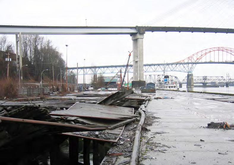
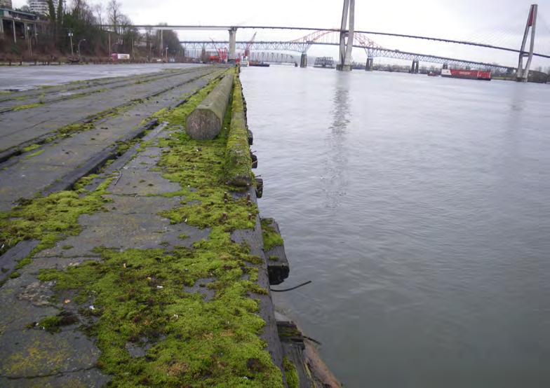
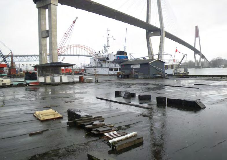
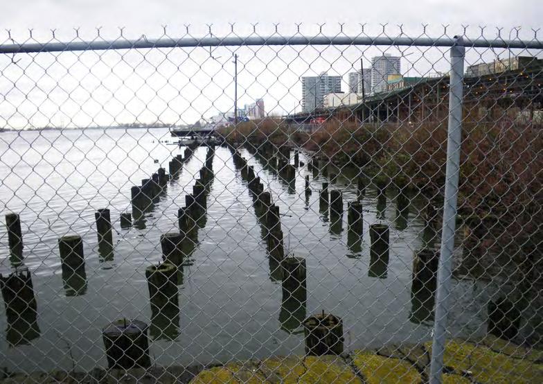
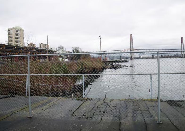
2 elloit st. merivale st. 4th St. 6th St. SHEET PILE BULKHEAD PROPERTY LINE EXISTING CONDITIONS


3 DESIGN PRINCIPLES 1. CREATE AN EXPERIENCE UNIQUE TO THE FRASER RIVER THAT SPEAKS TO THE HERITAGE OR NEW WESTMINSTER. 2. ENSURE STRONG PEDESTRIAN AND BICYCLE CONNECTIONS TO COLUMBIA STREET, THE DOWNTOWN, ALONG THE RIVER TO THE ESPLANADE, THE MARKET, SAPPERTON LANDING AND BEYOND. 3. CREATE OPPORTUNITIES FOR VISUAL CONNECTIONS TO COLUMBIA STREET, ALONG THE WATERFRONT AND ACROSS THE FRASER RIVER. 4. CREATE OPPORTUNITIES TO EXPERIENCE THE TIDAL ACTIVITY AND TOUCH THE WATER. 5. CREATE OPPORTUNITIES TO CELEBRATE THE ENDS OF SIXTH, FOURTH, MERIVALE AND ELLIOT STREET. POSSIBLE ACTIVITIES OPPORTUNITIES INCLUDE; COMMUNITY GATHERING SPACE, VIEWS TO THE WATER, WASHROOM, WATERFRONT RESTAURANT OR CAFÉ 6. REDUCE THE VISUAL AND AUDITORY IMPACT OF THE RAIL LINES AND FRONT STREET. 7. CREATE A VARIETY OF RIVER EDGE EXPERIENCES. POSSIBLE EXPERIENCES INCLUDE; RIPARIAN EDGE, HISTORIC PIER EDGE, AND OVERLOOK EDGE. 8. MAXIMIZE THE OPEN SPACE AREA AND CREATE A VARIETY OF PLACES AND ACTIVITIES FOR VISITORS OF ALL AGES AND ABILITIES. WHEREVER POSSIBLE THESE SPACES AND ACTIVITIES SHOULD ENGAGE THE RIVER AND RELATE TO THE HERITAGE OF NEW WESTMINSTER. 9. USE PLANT MATERIAL TO REINFORCE HABITAT VALUES, CREATE SHADE, FORM SPACES AND REINFORCE THE IMAGE OF A GARDEN CITY. 10. USE MATERIALS THAT ARE DURABLE AND RESPOND TO NEW WESTMINSTER S WATERFRONT HERITAGE. DESIGN PRINCIPLES


 Rivers Day (September 27) Partner with FRDC")
 *Possible New Event Could Tie Into New Westminster s Cultural")


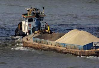
4 h i s t o r i c a l Historical References that could be expressed using words in pavement, markers, naming of places within the park. H I S T O R Y Founding of New Westminster - Colonel Moody and the Royal Engineers (Sappers) British Columbia is formed - Capital of BC is New Westminster until s to 1890 s - Waterfront uses include lumber and fishing 1850 s to 1860 s - China Town at the foot of 6th Street - Chinese workers building the railway Gold Rush staging area Angus Grant/K de K (Knyvett de Knyvett) Ferry to Surrey from downtown waterfront wharf Old Fraser River shoreline northern edge of Front Street expansion of Front Street on piles and fill into the River Front Street lands pushed out to 75 from original shoreline 1892 Farmers Market Building - Distribution center for surrounding community Four canneries, feed and milling operation and a creamery on the pier Great Fire - Downtown New Westminster Canneries close, buildings used for warehouse and manufacturing 1920 s - Pacific Coast Terminals (Just down river of the park site) 1950 s - Overseas Transport - constructs major dock warehouse and rail spur on site c u l t u r a l cultural events that could have a presence at the New Westminster Waterfront Park. C U L T U R E E x i s t i n g f e s t i v a l s Hyack Festival (May) Arts in the Park Canada Day Fireworks Family Day Celebrations (October Weekend) Rivers Day (September 27) Partner with FRDC Fraserfest (July) BC Day Festival (August) P O T E N T I A L f e s t i v a l s Carol Tugboat Festival Harvest Festival Art in the Park (July) *Possible New Event Could Tie Into New Westminster s Cultural Crawl TALL SHIP FESTIVAL e c o l o g i c a l ECOLOGICAL AND GEOGRAPHICAL CHARACTERISTICS OF THE NEW WESTMINSTER WATERFRONT AND THE FRASER WHICH WILL INFORM THE DESIGN PROCESS. E C O L O G Y Fluvial processes of the Fraser River - Flooding - Sediment Depositing Marine processes of the Fraser River - Tides Groundwater processes of the Fraser River - Runoff Water Quality Habitat - Historical Habitat/Native Vegitation - Creation of Bird and Fish Habitat - 24 Fish Species - Many Different Bird Species HISTORICAL, CULTURAL & BIOLOGICAL CONTEXTS


")


5 BLACKWOOD TO 4TH STREET 1910 NEW WESTMINSTER 1886 SCHAAKE MACHINE WORKS - BRACKMAN-KER MILLING CO th St. (MARY STREET) 4th St. (MARY STREET) new westminster waterfront VULCAN IRON WORKS CANNERY 1889 LYTTON SQUARE 1867 CITY MARKET AT LYTTON SQUARE HISTORICAL CONTEXT
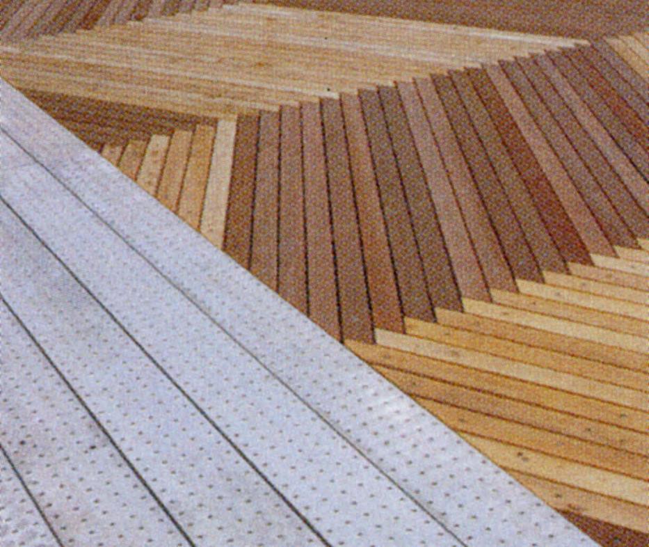

6 PRECEDENCE IMAGERY

 6th Street Plaza/ Park Service Vehicle Access Location for Future Commercial Use (6th Street End) Water Playground Water")
 Riverfront Walkway (Entire Park) Passive Lawn Area Passive Lawn")
 Perimeter Pathway Perimeter Pathway (Creating Looping Path System) 3-0 Height Berm With Tree Buffer (Along North Edge")
7 merivale st. node CITY PLAY ROOM CITY LIVING ROOM - 6TH STREET PLAZA/park service vehicle access - location for future commercial use 6th st. node marine habitat 4th st. node timber boardwalk public wasrooms future commercial use Marine habitat - BOARDWALK - BIKE/WALK PATH - WATER EXPERIENCE BARGE PERSON CAPACITY PASSIVE LAWN AND EVENT SPACE - fishing pier - covered picnic area - YOUTH PLAY, HARD SURFACE SPORT COURTS FRONT PORCH Riverfront walkway/bikeway with access for service vehicles Program - March Grant Sc heme Program - Park Master Plan th Street Plaza/ Turnaround Waterfront Restaurant and Patio (6th Street End) 6th Street Plaza/ Park Service Vehicle Access Location for Future Commercial Use (6th Street End) Water Playground Water Discovery (Eastern Barge) th th Marine Habitat (Between 6 and 4 ) Marine Habitat (6th to 4th and Merviale to Elliot) Riverfront Walkway/Bikeway With Access For Service Riverfront Walkway/Bikeway With Access For Vehicles Service Vehicles Day Moorage Marina Removed for Safety Reasons th th Riverfront Walkway (6 Street to 4 Street) Riverfront Walkway (Entire Park) Passive Lawn Area Passive Lawn Areas Timber Boardwalk Timber Boardwalk Pedestrian Plaza/ Service Vehicle Staging Area (Located Washroom, Concession, Park Maintenance Storage/ Plaza (Located at 4th Street Node) at 4th Street Node) Passive Lawn/ Outdoor Events Area Passive Lawn Outdoor Events Area (2,000 People) Perimeter Pathway Perimeter Pathway (Creating Looping Path System) 3-0 Height Berm With Tree Buffer (Along North Edge of 3 Foot to 10 Foot High Berm with Tree Buffer Park) (Along North Edge of Park) Hard Surface Sports Court Area Hard Surface Sports Court Areas Flexible Lawn Area for Sporting Activity Flexible Lawn for Sporting Activity Additions From Nov Public Work shop Fishing Pier Covered Picnic Area elliot st. node Riverfront walkway/bikeway with access for service vehicles RAILSPUR WALK Water Front Park Master Plan Theme The River, the Past and the People Theme Elements From Nov Public Workshop Included in Design of Waterfront Park Master Plan Healthy Individuals Appeals to a wide range of abilities Encourage physical activity Opportunities for Passive Reflection Healthy Community Emphasize heritage River/ People/ Place Pedestrian and Bike Connections Appeal to all ages Create opportunities for community gathering Sustainable Environment Ecological Restoration of Waterfront Connections between People, Water, Tides and Ecosystem Additional Theme Elements Heritage of the Working Water Front Stories of the people of New Westminster PROGRAM ORGANIZATION
 Perimeter Pathway System 3 Foot")
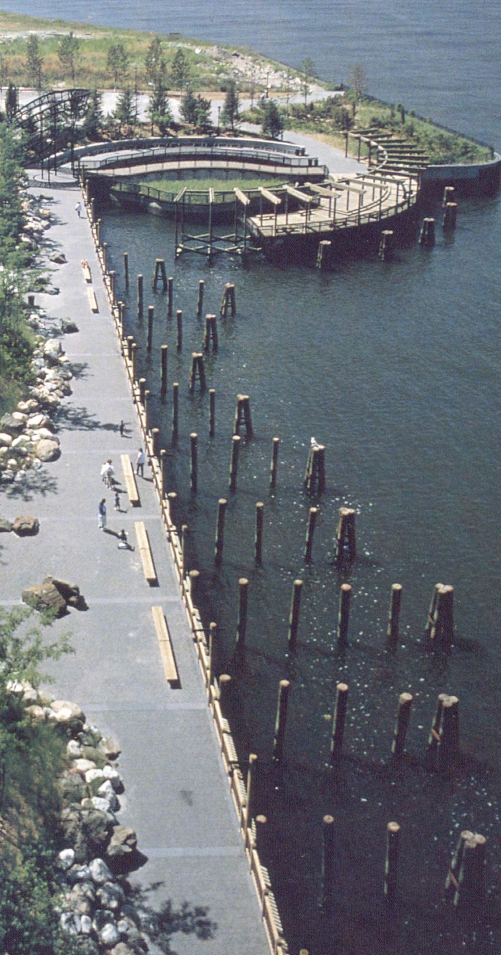
8 PARK FEATURES KEY th Street Landing Location for Future Commercial Use Shoreline Habitat Riverfront Walkway/Bikeway "Riverfront Promenade" Passive Lawn Areas Potential Commercial Water Taxi Float Washroom, Concession, Park Maintenance Storage/ Plaza "Festival Lawn" (2,000 People) Perimeter Pathway System 3 Foot to 10 Foot High Berm with Tree Buffer (Along North Edge of Park) Hard Surface Sports Court Areas Flexible Lawn for Sporting Activity Fishing Pier "Touch the River" Pile Forest Lytton Square "Remnant" City Market Structure 4th Street Pier Merrivale Street Pier Elliott Street Pier Urban Beach / Beach Volleyball "Railspur Walk" "Discovery Grove" "Natural Playground" "Floating Park" on Barge


9 CONCEPT MASTERPLAN


10 CIRCULATION LEGEND CIRCULATION PEDESTRIAN ROUTE BIKE ROUTE SERVICE/POLICE/AMBULANCE FIRE FUTURE BIKE CONNECTION FUTURE PEDESTRIAN CONNECTION TEMPORARY BIKE LOOP CHILDREN/YOUTH PLAY YOUTH PRECINCT WITH BASKETBALL COURT AND URBAN PLAY ZONE natural children's play environment with low boulder walls HERITAGE DISCOVERY ALCOVES URBAN BEACH/ SANDBOX heritage pile runabout heritage pile runabout UNIQUE AND SPECIAL FEATURES UPLAND FOREST "pile forest" "TOUCH THE RIVER" OPEN LAWN FOR ACTIVE PLAY OPEN LAWN FOR ACTIVE PLAY PERFORMANCE ZONE 4TH STREET STEPS LYTTON SQUARE 6TH STREET LANDING heritage pile runabout BEACH VOLLEYBALL "RAILSPUR WALK" RIPARIAN HABITAT URBAN BEACH UPLAND FOREST "RIVERFRONT WALK" RIPARIAN HABITAT "4TH STREET PIER" URBAN UPLAND HABITAT "FESTIVAL LAWN" "RIVERFRONT WALK" "MERRIVALE PIER" "DISCOVERY GROVE" FLOATING PARK ON BARGE, "TOUCH THE RIVER" ELLIOT ST. PIER FUCTIONAL OVERLAYS


 Existing")


11 Green = low habitat productivity & diversity Red = high productivity & diversity Yellow = moderate productivity & diversity fraser river estuary management plan (fremp) habitat Existing site habitat new habitat area new habitat area precedent riparian images ECOLOGICAL SYSTEMS
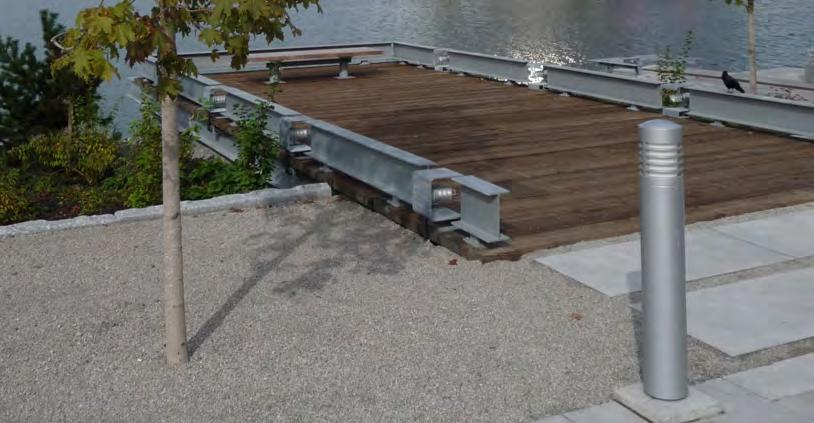
12 WHAT IS THE PARK BUILT ON Environmental: Soil, sediment and groundwater sampling is now largely completed Some upland soils are contaminated and will be removed Park structures: Existing timber pier structures will be removed New pier structures of steel and concrete will be constructed in place of the existing and to suit the new arrangements Geotechnical issues: The upland soils and river sediments will be densified to stabilize the embankment for earthquakes Flood Management: The park land and new marine structures will be raised to above current flood levels Flood control structure for the adjacent Front Street will not be part of the park development, though the site improvements will provide flood protection WHAT THE PARK is BUILT ON... PARK ON LAND PARK PIER DECK WATER FLOATING STRUCTURE ENGINEERING PLAN
THAT the Board approve the final proposed concept plan for the Jericho Marginal Wharf site as shown in Figure C-4 of Appendix C.
 Date: January 17, 2012 TO: Board Members Vancouver Park Board FROM: General Manager Parks and Recreation SUBJECT: Jericho Marginal Wharf Phase 2 Concept Plan RECOMMENDATION THAT the Board approve the final
LANDING S PARK CONCEPTUAL PLAN HAMILTON ANDERSON JANUARY City of Novi, Michigan. The Park at 13 Mile and Old Novi Road
 HAMILTON ANDERSON JANUARY 2012 LANDING S PARK CONCEPTUAL PLAN January 2012 Page 1 of 15 January 2012 PROJECT GOALS Activate the park by introducing new elements Provide clear access to the water and enhance
places Mooloolaba s heart five
 five places the mooloolaba heart 1 Flexible community event use of school oval 2 Enhanced streetscape District cycle route Future cross-block pedestrian link 5 Existing school buildings New signalised
NORTH HEMPSTEAD BEACH PARK MASTER PLAN
 NORTH HEMPSTEAD BEACH PARK MASTER PLAN COMMUNITY DESIGN CHARRETTE Supervisor Judi Bosworth Viviana L. Russell Peter J. Zuckerman Angelo P. Ferrara Anna M. Kaplan Lee R. Seeman Dina M. De Giorgio VISIONING
Welcome to the future of Terwillegar Park a Unique Natural Park
 Welcome to the future of Terwillegar Park a Unique Natural Park 1 Introduction The Terwillegar Park Concept Plan study will develop an overall concept plan, management objectives and development guidelines
M E S T I Z O C U R T I S P A R K
 ARAPAHOE CONNECTION TO BUS ROUTE AT ND AND LAWRENCE, FUTURE LIGHT RAIL STATION LEGEND SOCIAL TRAIL FLAGSTONE PAVING TO RESTORE/MAINTAIN CONCRETE PAVING DIAGONAL CURVILINEAR SOCIAL ROUTE IS OUT OF HISTORIC
Lake Waconia Regional Park 6. Lake Waconia Regional Park
 Lower Lakeshore Trail Interpretive/Adventure Trail Multiple Seating & Observation Areas Flexible Day Use Recreation Area Docks/Fishing Group Camping Group Day Use Space Winter Gathering/Event Space -Season
Walk-On Waterfront Executive Home Qualicum Beach, BC
 Walk-On Waterfront Executive Home Qualicum Beach, BC Jamie Zroback jamie@landquest.com 1 (604) 483-1605 Jason Zroback jason@landquest.com 1 (604) 414-5577 Marketing British Columbia to the World The Source
Waterfront Concept Plan: Community Survey Summary
 Waterfront Concept Plan: Community Survey Summary Published April 20, 2016 #1100085 Introduction The survey was one component of the public consultation process endorsed by Council in October, 2015. This
River First Initiative and Waterworks Park
 River First Initiative and Waterworks Park The RiverFIRST proposal is critical to the creation of a larger regional parks and trails network, as well as ecological and infrastructure system. When realized,
POLICY & STRATEGIES The Vancouver Park Board approves major changes in Vancouver parks, including the design and development of parks.
 September 8, 2017 TO: Park Board Chair and Commissioners FROM: General Manager Vancouver Board of Parks and Recreation SUBJECT: Brewers Park and Clinton Park Renewal Concept Plans RECOMMENDATION THAT the
Central Alberta Destination Management Plan. CARL Presentation May 14, 2016 Sylvan Lake, AB
 Central Alberta Destination Management Plan CARL Presentation May 14, 2016 Sylvan Lake, AB Tourism in Central Alberta Understanding Central Alberta s Visitation Central Alberta DMP - Destination Overview
Home of Southbank Partners. Riverfront Commons. Southbank Partners. Covington Newport Bellevue Ft. Thomas Dayton Ludlow
 Home of Southbank Partners Riverfront Commons Southbank Partners Covington Newport Bellevue Ft. Thomas Dayton Ludlow Riverfront Commons Fostering a vision of Northern Kentucky s Future Riverfront Commons
The Narrows Waterfront Park A Crown Jewel for Southern Brooklyn
 The Narrows Waterfront Park A Crown Jewel for Southern Brooklyn In New York, the unquestioned popularity of urban spaces such as Riverside Park, the High Line, Brooklyn Bridge Park and others has demonstrated
NEWBORO AND PORTLAND HARBOUR REDVELOPMENT PLANS
 INTRODUCTION The Municipal docks in both Newboro and Portland were transferred to the Township of Rideau Lakes by Parks Canada in 2002. Little has been done to improve the docks physical condition or role
Waterfront and Marina Strategic Plan. May 26, 2015 Infrastructure, Investment & Development Committee
 Waterfront and Marina Strategic Plan May 26, 2015 Infrastructure, Investment & Development Committee 1 Purpose Background Update work completed or underway Vision & principles Balanced plan with opportunities
Pattullo Bridge Replacement Project
 Pattullo Bridge Overview This document will: Explain the challenges facing the Pattullo Bridge today Share how we propose moving forward translink.ca PAGE 1 History By Order of the Lieutenant Governor
SOUTH LAKE TAHOE, CALIFORNIA REGAN BEACH PRELIMINARY DESIGN NOVEMBER 2015
 SOUTH LAKE TAHOE, CALIFORNIA REGAN BEACH PRELIMINARY DESIGN NOVEMBER 2015 Contents BACKGROUND...1 CONTEXT MAP....2 PROJECT BACKGROUND....3 AERIAL TIMELINE....4 HISTORIC PHOTOS...5 EXISTING CONDITIONS
COCONUT GROVE WATERFRONT MASTER PLAN. ERA / Curtis Rogers / ConsulTech / Paul George Ph.D.
 COCONUT GROVE WATERFRONT MASTER PLAN ERA / Curtis Rogers / ConsulTech / Paul George Ph.D. Agenda City's Vision & Community Input Framework Concepts December 2006 Schemes Draft Final Plan Waterfront Open
PIONEER PARK. City of Des Peres Parks Master Plan. SWT Design 46 INTRODUCTION
 PIONEER PARK INTRODUCTION Pioneer Park is a 7 acre neighborhood park located east of Interstate 270 and south of Manchester Road along Tallie Road. The park is situated in a residential neighborhood with
TEMPE BEACH PARK - RECOMMENDATIONS
 TEMPE BEACH PARK - RECOMMENDATIONS Tempe Beach Park has the potential to become a regional destination park, but it suffers from a host of physical and operational problems, as well as structural flaws.
CLIPPER COVE PROMENADE & MARINA DEVELOPMENT
 CLIPPER COVE PROMENADE & MARINA DEVELOPMENT Treasure Island / Yerba Buena Island Citizen Advisory Board Review May 05 2015 CLIPPER COVE PROMENADE & MARINA DEVELOPMENT TREASURE ISLAND TI YBI CAB Review
places esplanade Distinctive Destinations Healthy,Active and Event Ready Family Friendly Foreshore Evolution five
 five places 1 6 2 4 3 14 5 7 8 9 13 Foreshore & esplanade Healthy,Active and Event Ready Parkland planning for enhanced triathlon competitor and spectator experience, as well as catering for everyday exercise
City of Haslett. City of East Lansing. City of East Lansing
 Central Park North (Nancy L. Moore Park) Lake Park North Expansion White Park Expansion #2 White Park Expansion #1 County East East Haslett East East TF87-212 Acquisition $90,000.00 Park. TF08-138 Acquisition
Acquisition in fee simple of approximately one-half acre of property on the shore of Spring Lake to expand the Lakeside Beach Park.
 Lakeside Beach TF00-136 $122,550.00 in fee simple of approximately one-half acre of property on the shore of Spring Lake to exp the Lakeside Beach. 2000 River Ravines TF00-150 $910,000.00 in fee simple
City of Chelan Shoreline Public Access Plan
 City of Shoreline Public Access Plan This City of Shoreline Public Access Plan documents how the City has planned for parks and recreation in the community, particularly along Lake and the River. This
Lake Myra County Park. Wake County, North Carolina Community Forum #2 June 12, 2008
 Lake Myra County Park Wake County, North Carolina Community Forum #2 June 12, 2008 Welcome and Introduction Meeting Agenda Welcome Introductions of Project Team Master Plan Process Community Forum #1 Updates
Task Force Meeting #2
 Task Force Meeting #2 July 9, 2013 Project Precedents Granville Island, Vancouver B.C. South Waterfront, Portland OR Jack London Square, Oakland CA Brooklyn Basin, Oakland CA Chula Vista Bayfront, Chula
The "M.V. Fintry Queen" Executive Summary - Business Plan 2017
 The "M.V. Fintry Queen" Okanagan Lake Boat Company Inc. www.fintryqueen.ca For information purposes only: DRAFT Jan 2017 Executive Summary - Business Plan 2017 The M.V. Fintry Queen is a 325 passenger
RIVERFRONT REVITALIZATION PLAN
 PROJECT SITE River s Edge North 75 ac Lewis & Clark Landing 36 ac Gene 9.6 ac River s Edge South 36 ac Heartland of America Park 42 ac CENTURY LINK GALLUP CONAGRA TOM HANAFAN RIVER S EDGE THE BREAKERS
WORKING DRAFT (DECEMBER 2016) - FOR COMMUNITY REVIEW BY
 - FOR COMMUNITY REVIEW BY") PURPOSE The purpose of this Working Draft Spatial Framework summary is to facilitate additional public and stakeholder feedback following the public meetings and reference group workshops held in November
PURPOSE The purpose of this Working Draft Spatial Framework summary is to facilitate additional public and stakeholder feedback following the public meetings and reference group workshops held in November
SAN ANTONIO RIVER IMPROVEMENTS PROJECT. August 6, 2008
 SAN ANTONIO RIVER IMPROVEMENTS PROJECT August 6, 2008 1 History of the SA River Improvements 1921 Flood Olmos Dam Complete in 1929 Downtown Flood Relief Projects in 1950 s Dams on the River Channel and
WATER PETALUMA TRAIL WATER WAYS PROJECT PORTFOLIO. petalumawaterways.org OVERVIEW
 WATER TRAIL PROJECT PORTFOLIO OVERVIEW Thirteen miles upstream of San Pablo Bay, Petaluma is the northern point on the San Francisco Bay Water Trail, a network of access points throughout the region. Most
INNOVATIVE MARINE DESIGNS PND ENGINEERS, INC. January 14, 2016
 INNOVATIVE MARINE DESIGNS PND ENGINEERS, INC. January 14, 2016 PND Engineers, Inc. Founded in 1979 Headquartered in Anchorage, Alaska with offices in Juneau, Seattle, Houston and Vancouver, B.C. International
The Falls: A Visitor & Interpretive Center for the Upper Lock
 The Falls: A Visitor & Interpretive Center for the Upper Lock Image courtesy of Northern Spark Surface by Aaron Dysart Illuminate the Lock is a program of Mississippi Park Connection The Falls Initiative
18. EXAMPLES OF URBAN RENEWAL PROJECTS
 TOPIC SUMMARY WORKSHEETS FOR STAGE 1 WORKING GROUPS & STEERING COMMITTEE Version 1 (2 September 2014) for development and discussion This worksheet has been prepared as background for the Stage 1 Working
NEW MEADOWS PARK PROPOSED MASTER PLAN
 NEW MEADOWS PARK PROPOSED MASTER PLAN A vision for your neighborhood park, the draft master plan is ready for your review. Tuesday September 12 th, 2017 5:30-7:00 PM Hellgate School District #4 middle
MASTER PLAN July 24, 2014
 MASTER PLAN July 24, 2014 Vision Statement The newly expanded Rif Curaçao Seaport will enhance the island s ability to welcome guests to a vibrant and entertaining waterfront. The Rif Seaport Curaçao development
Welcome! INTRODUCTION. Tell us what you think! Comment forms are provided for your feedback
 Welcome! Comment forms are provided for your feedback Tell us what you think! INTRODUCTION The City of Salmon Arm s O cial Community Plan (OCP) and its Parks and Recrea on Master Plan (2012) both iden
A PRIME WATERFRONT INVESTMENT OPPORTUNITY
 A PRIME WATERFRONT INVESTMENT OPPORTUNITY HAMILTON WEST HARBOUR CONTENTS 4 A Brief History of Hamilton s West Harbour 6 Hamilton s Waterfront Playground Today 10 A Vision for West Harbour 15 Engaging the
Corktown Parks. Public Meeting. City of Toronto
 Corktown Parks Public Meeting City of Toronto 15-04-20 Agenda 1. Reasons for Study 2. Consultation to Date 3. Parks Evaluation 4. Community Context 5. Bright St. Playground 6. Orphans Green (Dog Off Leash)
Appendix 3. Greenway Design Standards. The Whitemarsh Township Greenway Plan
 Appendix 3 Greenway Design Standards This chapter discusses two design standards for the greenway types discussed above. First, trail design standards are presented together with trailhead facilities and
PARKS & BEACHES PROJECTS
 #18 72ND STREET PARK, LIBRARY, #19 BLUEWAYS & AQUATIC CENTER $1.1 MILLION $60 MILLION New facility to include: Create Kayak Launches with All Wheels Skate Park Floating Docks and Seating at: Library/Media
TIMBERMAN TRAIL CHAMPFER WOONERF AUGUST 14, 2014 AMENITIES DEVELOPMENT DIAGRAM 50' 25' SCALE: 1" = 100' 100'
 TIMBERMAN TRAIL CHAMPFER WOONERF N AUGUST 14, 2014 AMENITIES DEVELOPMENT DIAGRAM 0 50' 25' 100' SCALE: 1" = 100' Public Realm: Community Gathering Spaces The descriptions below are intended to provide
Wilds. Headwaters. Lakes. Oxbows. Falls
 56 5 4 3 Wilds Headwaters Lakes Oxbows Falls 57 Zones It could be said the on-the-ground essence of this master plan appears within the next 6 pages of this report. As we learned in the preceding Cultural
and plant some trees, but that was only accomplished through state and federal work-relief programs.
 PEAVEY LOCATION AND HISTORY Peavey Park sits in the Phillips Community on a large block bounded by major streets: Franklin Avenue, Chicago Avenue, and Park Avenue. The southern continue through to Chicago
SAN ANTONIO RIVER IMPROVEMENTS PROJECT. April 27, 2009
 SAN ANTONIO RIVER IMPROVEMENTS PROJECT April 27, 2009 1 Project Limits 2 Project Partners City of San Antonio Provides project funding for project amenities (i.e.. Sidewalks, Landscaping, Lighting, etc.)
RIVER ACCESS STRATEGY
 RIVER ACCESS STRATEGY The River Access Strategy is a 10-year plan the City of Edmonton is developing to inform future programming, operations and infrastructure improvements that support access to the
Dufferin Jog Elimination Project
 Project Project Status Update November 14 2007 Project History Planning Alternatives Criteria Measured Project Benefits Structural Configurations Considered Structural Design Considerations The Preferred
Santa Cruz Wharf Improvement Project. Briefing Paper. Prepared by City of Santa Cruz. for
 Santa Cruz Wharf Improvement Project Briefing Paper Prepared by City of Santa Cruz for U.S. Army Corps of Engineers Interagency Meeting 12 November 2014 Santa Cruz Wharf Improvement Project Constructed
NORTHWEST SECTION CONTENTS: CLEVELAND PARK FOLWELL PARK RYAN LAKE PARK VICTORY PRAIRIE DOG PARK VICTORY PARK
 NORTHWEST SECTION CONTENTS: CLEVELAND PARK FOLWELL PARK RYAN LAKE PARK VICTORY PRAIRIE DOG PARK VICTORY PARK LUCY LANEY COMMUNITY SCHOOL N 33RD AVE N 33RD AVE SINGLE-FAMILY RESIDENTIAL MULTI-USE DIAMOND
Everett Riverwalk Life style explore
 Life style explore Project Overview The 217-acre Everett Riverfront redevelopment is visible from I-5 with traffic counts charted at 170,000+ vehicles per day with direct freeway access from 4-way interchange.
Manhattan s Premiere Waterfront Destination
 Venue Guide 2018 Manhattan s Premiere Waterfront Destination Hudson River Park, the longest waterfront park in the United States is an urban Park for Play. Attracting over 17 million visits each year,
Appendix A BC Provincial Parks System Goals
 Appendix A BC Provincial Parks System Goals The British Columbia Provincial Parks System has two mandates: To conserve significant and representative natural and cultural resources To provide a wide variety
Clam Harbour Provincial Park
 Clam Harbour Provincial Park Public Engagement Session Thursday, September 14 th, 2017 5:30pm 7:30pm Webbers Store 11470 Nova Scotia Trunk 7 Lake Charlotte, NS Agenda Overview of the Provincial Parks System
TITLE. Bullet Bullet Bullet Bullet
 TITLE Bullet Bullet Bullet Bullet AGENDA Presentation Questions & Answers Review Drawings Complete Comment Card WHY NOW? Voter Approved Funding Safety Concerns City Park Train Club Tico Improvements GOALS
The GREEN NET SHEET LIST:
 Copyright 2016/2017 Design Engine Architects - Concept by Mark Wassung - Registered Architect First Issue - 6 December 2016 The GREEN NET SHEET LIST: The Green Net Bike Mount - The Mount Bike Mount - Bayfair
COCONUT GROVE WATERFRONT MASTER PLAN. ERA / Curtis Rogers / ConsulTech / Paul George Ph.D.
 COCONUT GROVE WATERFRONT MASTER PLAN ERA / Curtis Rogers / ConsulTech / Paul George Ph.D. JULY 2008 Coconut Grove Waterfront Master Plan Master Plan Principles Strengthen connection between Center Grove
False Creek Harbour Authority Fishermen s Wharf
 False Creek Harbour Authority Fishermen s Wharf 42 nd Annual Conference of Pacific Coast Congress of Harbormasters & Port Managers Vancouver, British Columbia Welcome PCC Members, Sustaining Members, Exhibitors,
Yuba Creek Natural Area Acquisition. Acme Township. Acme Township. TF Acquisition $1,576, Grand Traverse
 Yuba Creek Natural Area TF00-162 $1,576,021.00 in fee simple of 403 acres of critical wetls upl habitat with over 5,000 feet of frontage on Yuba Creek, a tributary to the east arm of Bay. 2000 Petobago
River Parks Trail: Tulsa, Oklahoma
 River Parks Trail: Tulsa, Oklahoma Purpose: The purpose of the River Parks Trail is to maintain, preserve, develop, and promote the Arkansas River for the economic and cultural benefit of the community.
Park Design and Location Criteria
 Park Design and Location Criteria This section is presented in the interest of assisting park and recreation agencies in the development of a system of parks and recreation areas. A recreation system is
Stittsville Parks Information Session
 Stittsville Parks Information Session Amberway Park, Blackstone Park, Bryanston Gate Park & William Bradley Park Thursday, February 8, 2018 Open House 6:30-8:45pm Presentation 7pm Goulbourn Recreation
Ralph C. Wilson, Jr. Centennial Park Ralph C. Wilson, Jr. Foundation University at Buffalo Regional Institute 17 January 2019
 Ralph C. Wilson, Jr. Centennial Park Ralph C. Wilson, Jr. Foundation University at Buffalo Regional Institute 17 January 2019 Michael Van Valkenburgh Associates Inc. Who is MVVA? Brooklyn Bridge Park,
Date: Tuesday, September 11, 2018 Time: 6:00pm 8:00pm Location: Raleigh Convention Center, Room 302
 Date: Tuesday, September 11, 2018 Time: 6:00pm 8:00pm Location: Raleigh Convention Center, Room 302 6:00pm 6:15pm 6:40pm 7:10pm 8:00pm Check-in, refreshments and browse project boards Programming Brainstorming
The Vision for the San Juan Islands Scenic Byway
 The Vision for the San Juan Islands Scenic Byway 2 Judd Cove, Orcas Island, Courtesy of Kurt Thorson (kurtthorson.com) and San Juan County Land Bank Vision for the San Juan Islands Scenic Byway The San
Staff Report. Re: National Park Service Ferry Landing Facilities at Piers 31, 31½ and 33 Joint Meeting with BCDC Design Review Board
 Port of San Francisco Waterfront Design Advisory Committee Agenda Item No. 1 Meeting Date: Staff Report To: From: Waterfront Design Advisory Committee: Laura Crescimano Jeff Joslin Marsha Maytum Kathrin
Port Gamble Shoreline Area Conceptual Trail Proposal
 The North Kitsap Trails Association is pleased to be a partner to the Kitsap Forest and Bay Project and assist Kitsap County, Forterra, Olympic Property Group, Great Peninsula Conservancy and the Port
EXISTING CONDITIONS AND CHARACTER
 DEMING HEIGHTS PARK LOCATION AND HISTORY Located in the Audubon Park neighborhood, Deming Heights Park is surrounded by a residential area. The first land for the park was acquired in 1913 along with the
Public Event Day. 1. Community visioning 2. Street activation 3. Interactive feedback 4. Survey questionnaire and social media feedback
 Project Background Four Big Ideas. The Healthy Thriving Place. An International Focus. Reclaiming Mooloolaba. The Resort Heart of the Coast In November a big ideas workshop was held involving members from
Xaman-Ha city, an answer to the poor growth and spread population
 Xaman-Ha city, an answer to the poor growth and spread population Global aspect In The Mexican Republic we can found three zones with an important tourist movement; the metropolitan area of Mexico City,
Hemisfair Civic Park. Vision and Program Plan
 Hemisfair Civic Park Vision and Program Plan OCTOBER 2013 Hemisfair Civic Park Vision and Program Plan Prepared under the direction of the Hemisfair Park Area Redevelopment Corporation. Planning assistance
Update: Manhattan Community Board 1 Land Use, Economic Development & Zoning committee February 12, 2018
 Update: Manhattan Community Board 1 Land Use, Economic Development & Zoning committee February 12, 2018 1 GOVERNORS ISLAND IS FOR NEW YORKERS 2 WE RE MOVING TOWARDS A YEAR-ROUND, 24 HOUR COMMUNITY 3 Governors
F6. Coastal Ferry Terminal Zone
 F6. Coastal Ferry Terminal Zone F6.1. Zone description The purpose of the Coastal Ferry Terminal Zone is to provide for the integrated and efficient operation and development of ferry terminal facilities.
PASSENGER TRANSPORTATION BRANCH MINISTRY OF TRANSPORTATION AND INFRASTRUCTURE LICENCE. Passenger Transportation Licence COPY
 SPECIAL AUTHORIZATION Page 1 of 6 PASSENGER TRANSPORTATION BRANCH MINISTRY OF TRANSPORTATION AND INFRASTRUCTURE LICENCE Passenger Transportation Licence Licence Holder: NEW WESTMINSTER, BC Trade Name(s):
LEASING OPPORTUNITIES
 LEASING OPPORTUNITIES ROB CHASMAR Personal Real Estate Corporation 1 604 661 0822 rob.chasmar@colliers.com JASON TEAHEN Personal Real Estate Corporation 1 604 661 0847 jason.teahen@colliers.com HIGHLIGHTS
BRYAN REGIONAL PARK. Presented by: Burditt Consultants November 13, 2018
 BRYAN REGIONAL PARK Presented by: Burditt Consultants November 13, 2018 AGENDA 1. Project Purpose & Mission 2. Project Vision & Goals 3. Stakeholder Feedback 4. Program Overview 5. Phase A Plan Overview
STITCH TRANSFORMATIVE IDEA 3. SHORELINE STITCH. Re-connect the city to the waterfront and link the east and west Core Circle landscapes
 SHORE STITCH TRANSFORMATIVE IDEA 3. SHORELINE STITCH Re-connect the city to the waterfront and link the east and west Core Circle landscapes 126 LINE PUBLIC WORK 127 TRANSFORMATIVE IDEA 3. SHORELINE STITCH
Aid to Local Ports FY19 Requests
 City Accomack- Greenbackville Harbor Phase III Accomack-Quinby Harbor Bulkhead Cape Charles- Installation of 4 th breakwater Total Project Cost Amount Requested Proposed Allocation Carryover Request $260,000.00
STATION QUARTER NORTH
 This is an historic landscape of escarpment, wooded valley, green open fields, streams, springs and ponds all gently sloping towards the waters of the River Test estuary. 1810: A sketch view of Southampton
Pier Enhancements April 6, 2017
 Pier Enhancements April 6, 2017 Pier Enhancement Categories Pier Plaza Improvements Contingency Play Elements Destination Differentiators Water Recreation Zone Furniture, Fixtures & Equipment Transportation
Parks & Recreation Master Plan Steering Committee Meeting to be held at City of Penticton, Committee Room A 171 Main Street, Penticton, BC
 Agenda Parks & Recreation Master Plan Steering Committee Meeting to be held at City of Penticton, Committee Room A 171 Main Street, Penticton, BC Wednesday, July 27, 2016 at 3:00 p.m. 1. Call Regular Committee
BOAT DOCKS AND LAUNCHES. Public Engagement Report July 2015
 BOAT DOCKS AND LAUNCHES Public Engagement Report July 2015 TABLE OF CONTENTS BACKGROUND 3 STAKEHOLDER CONSULTATION 6 PARTICIPANT PROFILE 7 RESPONSE THEMES 8 CONCLUSION 16 BACKGROUND The North Saskatchewan
PLUMPER COVE MARINE PARK MASTER PLAN
 Lower Mainland Region Park Operations Branch Parks and Outdoor Recreation Division Ministry of Lands, Parks and Housing North Vancouver, B.C. PLUMPER COVE MARINE PARK MASTER PLAN DECEMBER, 1980 PLUMPER
COASTAL CONSERVANCY. Staff Recommendation October 21, 2010 PETALUMA TRESTLE REHABILITATION DESIGN
 COASTAL CONSERVANCY Staff Recommendation October 21, 2010 PETALUMA TRESTLE REHABILITATION DESIGN Project No.: 10-017-01 Project Manager: Deborah Hirst RECOMMENDED ACTION: Authorization to disburse up to
PIER 44. Premiere Waterfront Retail & Restaurant Opportunities & 4625 Admiralty Way Marina Del Rey, CA 90292
 Premiere Waterfront Retail & Restaurant Opportunities PIER 44 Greg Eckhardt gecko@parcommercial.com 310.395.2663 x101 LIC# 01068613 4635 & 4625 Admiralty Way Marina Del Rey, CA 90292 PIER 44 PROJECT DESCRIPTION:
A CONCEPT FOR F.H. BARBER PROVINCIAL PARK.
 A CONCEPT FOR F.H. BARBER PROVINCIAL PARK. 2-7-4-101-27 APPROVAL This Concept for F.H. Barber Provincial Park has been reviewed and is approved. Lower Mainland Region Parks and Outdoor Recreation Division
Victor Lake Park. Management Plan
 Victor Lake Park Management Plan November 2012 Victor Lake Park Management Plan Approved by: Jeff Leahy, Regional Director Thompson Cariboo Region BC Parks March 28, 2012 Date Brian Bawtinheimer, Executive
David Tickle, Principal, Urban Design, Hassell
 David Tickle, Principal, Urban Design, Hassell August 2015 NEWCASTLE URBAN TRANSFORMATION & TRANSPORT PROGRAM REVITALISATION POTENTIAL Establishing a Vision and Objectives VISION: RE-ESTABLISH NEWCASTLE
2.1 HISTORIC CONTEXT. View looking South from Main & 6th circa Typical logging scene with bullocks and skid road, 1885
 2.1 HISTORIC CONTEXT View looking North from Main & 7th circa 1889 View looking South from Main & 6th circa 1893 Typical logging scene with bullocks and skid road, 1885 The history of the Mt. Pleasant
COMMITTEE OF THE WHOLE MEETING AGENDA
 COMMITTEE OF THE WHOLE MEETING AGENDA Tuesday, May 23, 2017-9:00 AM Council Chambers Municipal Hall, 13211 Henry Ave. Summerland, BC Page 1. Call to Order 2. Adoption of Agenda 2.1 Adopt Agenda 3. Delegations
Clearwater Lake Provincial Park. Draft Management Plan
 Clearwater Lake Provincial Park Draft Management Plan Clearwater Lake Provincial Park Draft Management Plan Table of Contents 1. Introduction... 3 2. Park History... 4 3. Park Attributes... 4 3.1 Location/Access...4
35 Bee Tree Park Planning Zone 3
 35 Bee Tree Park Planning Zone 3 2701 Finestown Road Visit Date: August 2016 St. Louis County Parks Master Plan Page 1 35 Bee Tree Park 2701 Finestown Road St. Louis County Parks Master Plan Planning Zone
Welcome! metrovancouver.org. Aldergrove Regional Park - Management Plan
 Welcome! Aldergrove Regional Park - Management Plan The process to create a Management Plan for Aldergrove Regional Park is underway and we would like your input on the draft Vision, Framework and Concept.
BACK COUNTRY UNIT PREFERRED ALTERNATIVE
 BACK COUNTRY UNIT PREFERRED ALTERNATIVE San Francisco (118 mi) Carmel-By-The-Sea Carmel River Carmel Valley Road State Beach Private Property Point Lobos State Reserve Point Lobos Ranch RUSTIC CAMPING
Iberville International Maritime Terminal and Alexandra Pier
 PLANNING & COMPETITION Location: Montreal, Canada Iberville International Maritime Terminal and Alexandra Pier Design Date: 2013 Master Planning: Provencher_Roy Last April 25, the Montreal Port Authority
Begin developing a vision and objectives for the future for each park;
 FEEDBACK SUMMARY REPORT Public Event #1 Ideas Workshop & Questionnaire Nunns Creek and Frank James Park Masterplans 1.0 OVERVIEW The City of Campbell River (the City) is developing masterplans for two
WATERFRONT PROGRAM PROGRESS REPORT
 WATERFRONT PROGRAM PROGRESS REPORT 2016 (April - June) Highlights from 2016 In April, released the Supplemental Draft Environmental Impact Statement (EIS) for the Alaskan Way, Promenade, and Overlook Walk.
Parks and Recreation Master Plan
 Emerging Themes Parks and Recreation Master Plan City of Mount Dora, Florida September 17, 2018- Revised October 1, 2018 Agenda Welcome & duction Master Plan The Inventory & Existing Community Overview
Alexandra pier: New terminal in an old port
 TOPOS Alexandra pier: New terminal in an old port 30.08.201630.08.2016 < GO TO BLOG OVERVIEW Last April the Montreal Port Authority (MPA) officially unveiled its plans for the restoration of Alexandra