10th Street and Monroe Drive
|
|
|
- Mitchell Barnett
- 6 years ago
- Views:
Transcription
1
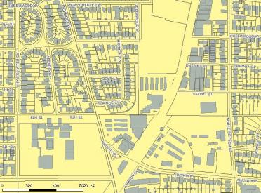
2 Theme The 10th and Monroe node is located in the area surrounding the intersection of 10th Street and Monroe Drive. The boundary of the node is roughly formed by 10th Street, Monroe Drive, Cooledge Avenue, Virginia Avenue, Ponce De Leon Place, the Southern Railway Line, and 8th Street. Historic sites in the node include Grady High School, Piedmont Park, the Piedmont Park Club House. Contributing commercial buildings include Woodyís, Sig Samuelís, and the Silver Grill. Adjacent areas include Piedmont Park, the Virginia- Highland district, Orme Park, North Boulevard Park, and Midtown. The Beltline runs northwest through the area bisecting the node. The 10th and Monroe node is very important to Atlantaís history for two main reasons. Since the 1880ís, the area has been valued for its scenic beauty and recreational qualities. This area also provides an example of how Atlantaís turn of the century developers adapted land to transportation, as they still do today. The 10th and Monroe node has served as Atlantaís middle and upper class playground since the first trolleys transported people to the area as a weekend retreat or picnic destination. The area serves the same purpose today. The Midtown Promenade commercial center serves as a retail outlet for the surrounding residential areas. The area as a whole serves as Atlantaís intown playground, a place to enjoy the outdoors through the park for its scenery and for the many events and festivals held there throughout the year. The transportation theme is apparent when examining the patterns of residential development within and just outside the node. The planning process and itís emphasize on transportation is apparent when looking at land development in the node in the first half of the twentieth century. Developmental History Prior to white settlement, the 10th and Monroe area was forestland and was sparsely settled. The land was hilly with ravines and streams. The area was desirable because it had an ample water supply and overlooked surrounding land. Prior to 1900 the area was used for farming. As late as 1900, Monroe Drive was known as East Avenue, marking the east boundary of the city. The street name was changed from East Avenue to Boulevard then to Monroe Drive. In 1812 William Zachary purchased the first 202 acres of what would become the area known as Virginia-Highland. The land was farmed until 1822 when it was sold to Richard Copeland Todd, who built a farmhouse at what is today 816 Greenwood Avenue. In 1910 the Todd farmhouse was destroyed by fire. Twelve years later, Sam Walker, a pioneer citizen, purchased land in the Midtown area. Walkerís land would later become the site of Piedmont Park. Perhaps the most important and influential people to the development of the area were George W. Adair and Richard Peters. An affiliation with the Georgia Railroad brought both men to Atlanta. In the mid 1850s Richard Peters purchased 200 acres of property of what is currently known as Midtown. Peters purchased the property to use for timber to fuel the steam engines that powered his flourmill. Petersí mill failed to make a profit and was sold to the Confederate government. About the same time Adair was purchasing pieces of property in the area of the present day Virginia- Highland neighborhood. Several businesses existed along the rail line at this time. The buildings were industrial in nature and oriented to the railroad. They were predominately masonry buildings, one story in height with a flat roof and a parapet. 45
3 In 1871, Peters and Adair purchased a streetcar company and founded the Atlanta Street Railway Company which laid the tracks for the 9 Mile Trolley Line. The line traveled from the Central Business District to the Highland farming area. The route followed Broad Street to Peachtree Street to J.W. Dobbs (formerly Houston) to Highland Avenue and then onto Virginia Avenue. From Virginia the cars continued to Monroe (North Boulevard), back to Highland and then back downtown. The trolley line created the sweeping curves at Virginia and Monroe Drive. Additional lines were added and eventually the trolley passed by Peterís residence, constructed in 1881 and terminated near Adairís residence on Rupley Drive. By 1872 the trolley line had been extended to Ponce de Leon Springs a popular weekend picnic destination. Adair and Peters recognized that the rail and trolley lines would provide the impetus for growth and the infrastructure crucial to their real estate plans and Atlantaís expansion northward. The rural nature of the area changed dramatically as Peters began selling lots to the white, upper class. Peterís son, Edward C. Peters constructed his home, Ivy Hall, on such a lot on Ponce de Leon Avenue in In 1887, a group known as the Gentlemenís Driving Club, which later became the Piedmont Driving Club, purchased 189 acres of rural land from Benjamin Walker. The sale included a stone residence on Plaster Bridge Road (now Piedmont Avenue) that Walker constructed in 1868, which became the nucleus of the Driving Club. The Piedmont Driving Club was comprised of Atlantaís elite who desired the spot for a place to race their horses. The area which would become Piedmont Park also served as a destination spot for two major expositions and for many recreational purposes in Atlantaís foreseeable future. By the early 1900ís significant development began taking place around the 10th and Monroe node. Streetcars were running as far north as the current day Piedmont Park and the area that would become known as Virginia- Highland was changing rapidly. Multiple real estate developers developed both the present day districts of Virginia-Highland and Midtown. The platting of each development was influenced by the natural terrain and existing transportation infrastructure. Real estate value was often determined by the proximity of the lot to the trolley line. This valuation resulted in the location of the oldest, existing homes along the trolley line. The area now known as Midtown developed just prior to the platting of the Virginia-Highland district. Stately homes began increasing along Piedmont and the northern section of the district. With the Petersí Mansion as a southern anchor and the Piedmont Driving Club as the northern anchor, the area of Midtown became a focal point for social life in Atlanta. The areas of Midtown within close proximity of the 10th and Monroe node were developed later, from the year 1910 to The Virginia-Highland area subdivisions were platted by George Adair beginning the early 1900s. Oddly enough, the area was developed for the trolley at the same time the automobile was introduced to Atlanta. The Virginia Avenue portion of the trolley track was abandoned just ten years later and used as a service line only. In the 1910s the city of Atlanta extended its city limits to the areas just south of Piedmont Park. Shortly after, a development group known as the North Boulevard Park Corporation purchased 64 acres of land east of Piedmont Park, which the City of Atlanta annexed in A subdivision was planned for the site but was delayed by the outbreak of World War I. Anticipating the commencement of residential construction after the War, the developers began site work constructing the Park Drive Bridge, linking the future 1919 Birds Eye View Map, 10th and subdivision with Piedmont Park, laying utilities, grading streets, etc. By the early 1920s, 80% of the lots of North Boulevard Park were sold and over half occupied by houses. The subdivision was expanded in the late 1920s to the northeast to include the land known as Orme Park. 46
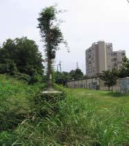
4 Between the 1910s and 1930s, apartment buildings appeared in the Midtown and Virginia-Highland districts. This development indicates the trend in multi-family housing prior to and after World War I. During this period both areas began to experience increasing population density. The southern portion of the Virginia-Highland district, the closest in proximity to the Beltline, developed between the 1910 and Apartment dwellings proliferated among the streets in the southern section of the district. The southern section of Virginia-Highland had a much more urban feel than those areas developed closer to the Beltline. In the 1920s, smaller Craftsman influenced houses and commercial blocks appeared in the Midtown district. Also in the 1920s, a small African American community was located on Drewry Street. In 1922, the City of Atlanta annexed all remaining sections of the Virginia-Highland district. The trolley which had made the neighborhoods in the node a possibility ceased to run during the 1940s due to the impact of the automobile. The residents of the 10th and Monroe area began to rely on their automobiles thus eliminating the necessity to live close to downtown and their jobs. By the 1960s the neighborhoods were suffering from neglect and disinvestment of both commercial and residential properties. Many of the large homes were subdivided for rental property as the more affluent population shifted to the areas outside the central intown area. Middle class families migrated to the suburbs resulting in not only decreased income levels and property values of residential properties inside the city but of commercial areas as well. Many commercial establishments that had existed to serve the middle class inhabitants of the area vacated their spaces allowing low rent retail establishments to move in. In the 1960s, middle class residents began reclaiming intown neighborhoods. During the height of the movement the Georgia Department of Transportation proposed the construction of Interstate 485. The proposed route was designed to connect Interstate 285 with Interstate 20 and would have divided many intown neighborhoods in the process. The threat of the new interstate galvanized the residents of the reclaimed neighborhoods resulting in the formation of many civic associations intent to protect the character and cohesiveness of the historic districts. Physical Description The topography of the 10th and Monroe node is hilly, with ravines and streams. Prior to late nineteenth century the land was used primarily for farmland and only a few farmhouses existed within the vicinity of the node. The first evidence of a large industrial structure appeared in the node in The building was the Virginia Avenue Car Barn located on Virginia Avenue and the Beltline. The site portrays a symbolic role in Atlantaís transportation history. The building was constructed around 1860 and the Barn was originally designed as the shop and car barn of the Fulton County Street Railroad Company. Trolleys were assembled at the location until the mid- 1920s. The Virginia Avenue Trolley Barn changed hands over the years as a result of the various railroad mergers and was owned by Georgia Power at one time. The building housed trolleys and later served as a garage and repair shop for buses. Marta owned the building from the early 1970s to the mid 1980s. Marta sold the property to a development company in 1985 and it was unfortunately demolished in 1987 following a lengthy City Council battle. 47

5 The next structures along the rail line were designed for industrial purposes and were constructed within the node, many predating the trolley line. The structures were oriented to the Beltline and were typical of late nineteenth/early twentieth century industrial buildings. The structures were located on the Beltline. The industrial buildings were masonry with loading docks oriented to the railroad line. No such building exists within the defined 10th and Monroe node today however several exist just outside the node along the Beltline and Ponce de Leon Place. Prior their demolition, the 10th and Monroe node was the location that served as home to businesses such as the AC&J Walters Building Materials, Hunter Coal Company, Carroll Coal Company, and the Watson Company. Existing just outside the node along the Beltline and Ponce de Leon Place were industrial buildings housing such businesses as Linde Air Products, the B. Mifflin Hood Brick Co., All-Metal Cooler Corp, Wizard Products Co, Martin-Parry Corp., Universal Motor Co, Inc., Ansley Garage, Nehi Bottling Co., Zachary Manufacturing Co, and Krigshaber & Son. With the exception of the Virginia Avenue Trolley Barn, the Dejarnette Supply Company was the last industrial business to exist within the defined boundaries of the node. The firm was founded by J.T. DeJarenette in 1919 and sold building materials until Perhaps the most identifiable physical resource in the 10th and Monroe node is Piedmont Park. The Park was the site of some of Atlantaís major historical events. The Park is roughly 185 acres and occupies the triangular shaped area between Piedmont Road and the Southern Railway. Purchased by the Gentlemanís Driving Club in the late 1880ís, the Park was used as an in-city location to ride horses and was planned as the site for the Piedmont Exposition in The Piedmont Exposition lost no time building the structures necessary for showcasing the resources of the Piedmont region. Piedmont Park Plan for Cotton States Exposition showing the Southern Railway In 1895, the site was home to the Cotton States and International Exposition. The ìnew Southî movement and the City of Atlanta mobilized to create an exposition to promote the post-civil War South as a place ripe for resources and manufacturing. The Piedmont Driving Club was chosen as the site for such an Exposition. The Cotton States Exposition served as a symbol that the South and the City of Atlanta were rebounding from the Civil War and ready to join the Union. The planning and siting of major structures were symbolic of this ambition. The most prominent structure, the U.S. Government building, stood on top of the hill near the present day Botanical Gardens. Buildings devoted to manufacturing were given high visibility while those exhibiting agriculture were hidden. This strategy highlighted the Southís desire to enter the industrialization and deemphasize its dependence on agriculture. A Womenís building and Negro building were added to demonstrate the New Southís attempts to overcome the reputation of racism and sexism. The highlight of the Exposition was Booker T. Washingtonís ìseparate but Equalî speech which took place near the present day 14th Street entrance to the Park. Sadly, the buildings of the 1895 Exposition were condemned as deteriorated to a state beyond repair and required demolition in A fire in 1906 claimed other existing structures. Following the purchase of Piedmont Park by the City of Atlanta in 1904, the Olmstead brothers immediately began preparing a comprehensive plan for reclaiming the Park. The only remnants of the Expositionsí structures were the stone stairways that formerly led to buildings. The Olmstead plan called for paths and formal gardens to contrast with informal elements arranged along meandering paths. Sections along the park were planned for various recreational fields. Included in the 10th and Monroe node is the former Piedmont Park Golf Course Clubhouse, now part of the Park Tavern. The Clubhouse was constructed of stone in 1928 and features an arched entry with terra cotta tile hipped roof and large wood windows. Piedmont Park Clubhouse 48

6 The physical appearance of the residential developments in closest proximity to the 10th and Monroe node began to take shape in the early part of the twentieth century. The developments within the closes proximity of the Beltline include ìthe Vedadoî and the ìseal Placeî sections of Midtown along with the southern section of the Virginia-Highland district and eastern North Boulevard Park and Orme Park section of the Virginia-Highland district. The first residential section around the 10th and Monroe section to develop was the southern section of the Virginia-Highland district, east of the Beltline. This section was the first in the district to be annexed into the City of Atlanta. The section possesses the oldest and largest homes in the area. Most of the residential homes are Queen Ann Cottages and New South Cottages. The first residential section to develop west of the Railroad was ìthe Vedadoî in the Midtown area. Edwin Ansley laid out the Vedado in The development consisted of a curvilinear plan with a combination of large foursquare houses and bungalows. The foursquares were constructed first around 1910 and the bungalows followed in the 1920s. Platted in the 1920ís, Seal Place was developed east of Monroe Drive by Seals and Peacock. This development also features bungalows, mostly with Craftsman details. The North Boulevard Park section of the Virginia Highland district, located west of Monroe Drive and Orme Park, located on the west side of Monroe, were both developed as bungalow neighborhoods. The majority of the homes were Craftsman style with a limited number of English Vernacular Revival, Colonial Revival and Mediterranean styles. Both of these later developments provided modern amenities such as electricity, water and sewer lines, and telephone service. The developments also provided a driveway to accommodate an automobile. Another important physical feature of this area was the Park Bridge constructed to connect Park Drive to Piedmont Park. The bridge is an impressive feature serving both Piedmont Park and the North Boulevard Park neighborhood. C.E. Kauffman of the Atlanta Department of Construction constructed the bridge in The contractor for the project was Case and Cochran of Atlanta. Aesthetic design was an important consideration when planning the bridge. The total length is 625 feet including four concrete girder spans and a central arch. The bridge features a paneled red brick railing with inlaid colored tiles in the main piers of the structure. An interesting historical note on the bridge is that the granite blocks utilized were also used in the paving of Atlantaís first streets in The Beltline runs under the bridge. The late 1910s/early 1920s realized the proliferation of muti-family units in both the Midtown and Virginia-Highland neighborhoods. This development was representative of the trend both in Atlanta and the nation to provide affordable housing at a greater density. The apartments often integrated architectural features common to the single family dwellings around them such as craftsman details, double hung windows and landscaped courtyards. 49


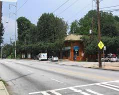
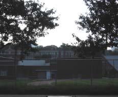
7 The only evidence of an African American community existing in the 10th and Monroe area was found in the National Register file for the Virginia-Highland district. The National Register District file makes reference to an African American community located on Drewry Street. The community consisted of 8-10 wood homes and was demolished some time in the late 1950s Commercial strips such as the one still present between Monroe Drive were constructed in the 1920s. This specific strip is located very close to the 10th and Cooledge Avenue and is very typical of 1920s commercial construction. The strip is constructed of brick with a terra-cotta parapet, cornices, brackets, and other features representing the period. The commercial structure would have housed businesses servicing the residential neighborhoods. An example of such a structure exists today as Sig Samuels, located Sig Samuels, 906 Monroe Drive at 906 Monroe Drive. Sig Samuel, an Atlanta entrepreneur and real estate developer, constructed the building. Following prohibition, Mr. Samuel was the original Schlitz beer distributor in Atlanta and owner of the Loewís Grand Theater. The building is rumored to have been a drugstore until the 1930s when Mr. Samuel turned it over to his brother-in-law for operation as a dry cleaner. The current tenants have owned the building since 1962 when they purchased it from Mr. Samuelís estate. Later commercial structures developed in the strip include a filling station located in the triangle formed by Monroe Drive, Virginia Avenue and Kanuga. Although the exact construction date is unknown the filling station first appears on the 1932 Sanborn Map. In the mid-1920s, Boys High/Tech High School was constructed at 929 Charles Allen Drive. The firm of Hentz, Reid & Adler was selected to build Boys High but the original design was never completed because an underground creek was discovered on the property. This discovery deemed the ground unstable for the building and the construction budget could not permit the extensive site work required. The original section of design features brick construction and Classical Revival style. The plan is rectangular Grady High School in shape and the building is 2 stories tall. Atlanta architect Philip Shutze worked on the original design as an apprentice. Additions to the site included a print shop (1934), auditorium and gym (1938). In 1947 the school was renamed Grady High School for Henry Grady, the former editor of the Atlanta Constitution and promoter of the New South movement. The school was made coeducational in the same year. In 1949, the stadium Grady High School Stadium located at the corner of Monroe Drive was constructed. The stadium was designed by Atlanta architect Richard L. Aeck. 50

8 Several existing institutions were constructed in the 10th and Monroe node around The buildings, including the Silver Grill, constructed in the mid-1940s, and Woodyís, constructed 1953, still continue to serve the area. The structure now occupied by the Silver Grill was constructed in 1949 by Sargent Crenshaw who served in the Pacific Theater of World War II. Sgt Crenshaw, a real estate developer by trade, felt that the metal Quonset huts that he built during the war would also be ideal for commercial structures in Atlanta. According to the current owner, the Silver Grill is corrugated metal underneath the existing cladding. It was built as a temporary structure and originally had a tin roof. The building was purchased in 1945 by the current ownerís family and has operated as the Silver Grill since the late 1940s. Woodyís has been in existence since 1975 but the building was constructed in Woodyís Silver Grill Prior to becoming a restaurant the building housed a locksmith operation. The structure is wood-framed with a wrap-around porch and is sited in the middle of an island formed by Monroe Drive, Virginia Avenue and Kanuga Street. As it exists today, the 10th and Monroe node incorporates a large amount of public/institutional land including Grady High School and Piedmont Park. Other sites include a large commercial shopping center, the Midtown Promenade, as well as a large storage facility, and single and multi-family residential properties. The area contains several historic sites including Grady High School, Piedmont Park, Piedmont Park Clubhouse, and contributing commercial buildings (Woodyís, Silver Grill, Sig Samuels). Early 20th century residential areas that have generally maintained their historic character and context surround the area. Conclusion The 10th and Monroe node consists of several well-documented historic resources. Two National Register listed sites, Piedmont Park and Grady High School, form the intersection of 10th Street and Monroe Drive along with two National Register listed neighborhoods, Midtown and the Virginia-Highland district. The sites and districts are intact for the most part and have maintained their historic character. Several intrusive buildings exist such as the Midtown Promenade and the storage units on Virginia Avenue. These sites may provide possible locations for redevelopment. Due to the fact that the area is well documented, and historically significant in the eyes of most citizens and residents, the 10th and Monroe node may be in better position than other nodes in terms of maintaining its historic context and character. In addition, the community is very protective of their assets and wary of the intense pressure development may place on the node in regards to increased traffic and incompatible new construction. The Atlanta Urban Design Commission does not currently review projects in the 10th and Monroe neighborhoods of Midtown and Virginia Highland. Protection under the AUDC would provide for a mechanism of review and guidance and could protect historic resources from incompatible new projects that may be too dense or out of scale with the area. 51
Fletchertown (71A-022)
") Fletchertown (71A-022) Fletchertown is a late-nineteenth-century rural African-American community in northeastern Prince George s County. The community is located south of Huntington and northwest of Bowie.
Fletchertown (71A-022) Fletchertown is a late-nineteenth-century rural African-American community in northeastern Prince George s County. The community is located south of Huntington and northwest of Bowie.
Airport Planning Area
 PLANNING AREA POLICIES l AIRPORT Airport Planning Area LOCATION AND CONTEXT The Airport Planning Area ( Airport area ) is a key part of Boise s economy and transportation network; it features a multi-purpose
Eli Pousson Baltimore Heritage in partnership with the National Trust for Historic Preservation May 27, 2010
 Eli Pousson Baltimore Heritage in partnership with the National Trust for Historic Preservation May 27, 2010 DRAFT Report on 3000 block of North Avenue DRAFT The Dr. Zepp Mansion is a late 19th century
RAY YENKANA Willowbrook Cr, Dawson Creek BC Canada $2,847,000
 1716 Willowbrook Cr, Dawson Creek BC Canada For SALE $2,847,000 This is a rare find, 32 townhomes in Dawson Creek, BC. Excellent investment in a single title multi family complex. Vendor has upgraded this
MASTER PLAN EXECUTIVE SUMMARY
 Biscuit Run State Park Scottsville Road (State Route 20) Charlottesville, VA 22902 Biscuit Run State Park MASTER PLAN EXECUTIVE SUMMARY Department of Conservation and Recreation Division of Planning and
The Atlanta BeltLine. Project Overview Map
 The Atlanta BeltLine Project Overview Map The Atlanta BeltLine is a dynamic and transformative project for Atlanta. Through the development of a new transit system, multi-use trails, greenspace, and affordable
1 Gildersleeve Wood (DHR # )
") GILDERSLEEVE WOOD 1 Gildersleeve Wood (DHR # 104-5092-0012) STREET ADDRESS: 1 Gildersleeve Wood MAP & PARCEL: 11-20 PRESENT ZONING: R-1U ORIGINAL OWNER: Lindsay Family ORIGINAL USE: PRESENT USE: PRESENT
GILDERSLEEVE WOOD 1 Gildersleeve Wood (DHR # 104-5092-0012) STREET ADDRESS: 1 Gildersleeve Wood MAP & PARCEL: 11-20 PRESENT ZONING: R-1U ORIGINAL OWNER: Lindsay Family ORIGINAL USE: PRESENT USE: PRESENT
East Melbourne Precinct HO2. March 2015
 East Melbourne Precinct HO2 March 2015 Local Heritage Planning Policy Review Statements of Significance Melbourne s Local Heritage Planning Policy Review project includes the preparation of statements
// LEARN // ENGAGE // VOLUNTEER // DONATE // PROJECT OVERVIEW MAP
 // LEARN // ENGAGE // VOLUNTEER // DONATE // PROJECT OVERVIEW MAP PROJECT OVERVIEW MAP The Atlanta BeltLine is a dynamic and transformative project for Atlanta. Through the development of a new transit
Part Three : COMMUNITY PLAN AREAS AND SPECIAL STUDY AREAS SACRAMENTO 2030 GENERAL PLAN. Introduction
 Special study Areas Part Three : COMMUNITY PLAN AREAS AND SPECIAL STUDY AREAS SACRAMENTO 2030 GENERAL PLAN Introduction Beyond the boundaries of the 2030 General Plan, the City has defined Special Study
A History of the Detroit Riverfront. From 1760 though to the
 A History of the Detroit Riverfront From 1760 though to the Detroit attracts immigrant workers 176o-1800 AD 1805 AD A devastating fire sweeps through Detroit, destroying all 200 of its structures except
ROYAL GORGE PARK and RECREATION AREA. A Feat of Natural and Man-Made Engineering
 ROYAL GORGE PARK and RECREATION AREA A Feat of Natural and Man-Made Engineering As Growth Resumed in the 1870 s Town Leaders Began to Envision a Tourist Industry. The Arkansas River Canyon was advertised
ARLINGTON COUNTY, VIRGINIA
 ARLINGTON COUNTY, VIRGINIA County Board Agenda Item Meeting of April 16, 2005 DATE: March 28, 2005 SUBJECTS: A. Adoption of the Fort Myer Heights North Plan. B. GP-300-04-1 Adoption of the following General
URBAN DESIGN REPORT. Proposed Residential Development, Old Church Road, Caledon East
 Proposed Residential Development, Old Church Road, Caledon East TABLE CONTENTS: 1.0 DEVELOPMENT 1.1 Introduction-Analysis of Guiding Principles and Documents 1.2 Community Design and Architectural Design
MINNESOTA ARCHITECTURE - HISTORY INVENTORY FORM Property Location
 MINNESOTA ARCHITECTURE - HISTORY INVENTORY FORM ------ - Property Location -- ---- Property Name: Washington Park Address: 215 N 4th Street County: Blue Earth City/Twp: Mankato PIN: R01.09.07.461.001 Legal
KAMPALA: THE GARDEN CITY
 KAMPALA: THE GARDEN CITY Kampala is urbanizing rapidly. The city has a population of over three million people and accounts for over sixty percent of Uganda's GDP. According the to the Kampala City Council
APPENDIX K: BUILT HERITAGE AND CULTURAL HERITAGE LANDSCAPES
 APPENDIX K: BUILT HERITAGE AND CULTURAL HERITAGE LANDSCAPES TABLE 1: Built Resources (BHR) and Cultural Heritage Landscapes (CHL) Within and Adjacent to the West Whitby Secondary Plan Area Site # 1. CHL
301 7½ Street SW
 301 7½ Street SW 104-0213-0072 Primary Resource Information: Single Dwelling, Stories 2.00, Style: Other, ca 1890 July 2006: This late-19th-century, 3-bay, 2-story, hip-roofed frame I-house features projecting
North 16 th Street Historic District
 North 16 th Street Historic District Historic District Physical Description and Boundaries The North 16 th Street Historic District is located in the northern portion of Sacramento s original 1848 street
 The Atlanta BeltLine is actively transforming Atlanta s neighborhoods, consumption habits, and travel and transit routes. Stream Realty Partners seized the opportunity to invest in the Westside Trail and
Spadina Avenue Built Form Study Preliminary Report
 STAFF REPORT ACTION REQUIRED Spadina Avenue Built Form Study Preliminary Report Date: July 9, 2014 To: From: Wards: Reference Number: Toronto and East York Community Council Director, Community Planning,
THE BARNACLE 3485 MAIN HIGHWAY
 THE BARNACLE 3485 MAIN HIGHWAY Designation Report City of Miami REPORT OF THE CITY OF MIAMI PLANNING AND ZONING DEPARTMENT TO THE HISTORIC AND ENVIRONMENTAL PRESERVATION BOARD ON THE POTENTIAL DESIGNATION
FLAGLER WORKER S HOUSE FORT DALLAS PARK S.E. 4 STREET
 FLAGLER WORKER S HOUSE FORT DALLAS PARK 60-64 S.E. 4 STREET Designation Report City of Miami REPORT OF THE CITY OF MIAMI PLANNING DEPARTMENT TO THE HERITAGE CONSERVATION BOARD ON THE POTENTIAL DESIGNATION
808 Cherry Avenue
 808 Cherry Avenue 104-0213-0059 Primary Resource Information: Single Dwelling, Stories 2.00, Style: Other, ca 1900 July 2006: This 2-story, 3-bay frame I-house features a central-front gable, a brick pier
PROPOSED ALTERATION AND EXPANSION OF THE MOUNT PEARL MUNICIPAL BOUNDARY TO INCLUDE THE AREA OF THE FORMER PEARL ESTATE LANDS & ENVIRONS
 PROPOSED ALTERATION AND EXPANSION OF THE MOUNT PEARL MUNICIPAL BOUNDARY TO INCLUDE THE AREA OF THE FORMER PEARL ESTATE LANDS & ENVIRONS JANUARY 4, 2007 INTRODUCTION In accordance with Sections 3 to 6 inclusive
Mankato s Transportation Heritage
 Mankato s Transportation Heritage City of Mankato Mankato Heritage Preservation Commission May 11, 2017 1. Union Depot, 112 S. Riverfront Drive, c. 1896. The railroads were Mankato s dominant transportation
SOUTH INTERCHANGE AREA
 Santaquin City General Plan 1 Location and Characteristics The South Interchange Area of Santaquin is located west of Interstate 15 and south of 500 South (Figure 1). It includes properties already annexed
ADDENDUM. Chain of Title. Block C, Lot 8-9. Adrian I. Velthuis and Floyd T. Grant to Lottie Thompson
 Chain of Title Block C, Lot 8-9 NLP 5175:842 October 18, 1979 NLP 4979:58 October 5, 1977 NLP 4763:448 May 11, 1977 Adrian I. Velthuis and Floyd T. Grant to Lottie Thompson Gentlemens II Properties, Inc.,
TENNESSEE MOUNTAIN LIVING
 NOVEMBER 2016 Featuring Jasper Highlands TNLand.com END of the YEAR December 26th to Land Sale December 31st See back cover for more info... TENNESSEE MOUNTAIN LIVING JASPER HIGHLANDS - TENNESSEE'S MOST
D1 January 8, 2014 Public Hearing APPLICANT: HUNT CLUB FARM
 D1 January 8, 2014 Public Hearing APPLICANT: HUNT CLUB FARM PROPERTY OWNER: HUNT CLUB A-1- A, LLC. STAFF PLANNER: Kevin Kemp REQUEST: Modification of a Conditional Use Permit approved by the City Council
Pacific Street, North Side, Bond to Hoyt
 Proposed Proposed Boerum Boerum Hill Hill Historic Historic District District Expansion Expansion Ib: Pacific Street, North Side, Bond to Hoyt Proposed Boerum Hill Historic District Expansion Ib: Pacific
THE ALBERTA GAZETTE, SEPTEMBER
 VILLAGE OF CEREAL Order No. 16915 IN THE MATTER OF THE "Municipal Government Act": File No. 241(A)3 AND IN THE MATTER OF an application by the Council of the Village of Cereal, in the Province of Alberta,
SUMMER VILLAGE OF SILVER SANDS. Municipal Development Plan
 SUMMER VILLAGE OF SILVER SANDS Municipal Development Plan Bylaw 253-2014 Adopted August 22, 2014 Summer Village of Silver Sands Municipal Development Plan Bylaw No. 253-2014 Page 2 1 INTRODUCTION 1.1 SETTING
2.1 HISTORIC CONTEXT. View looking South from Main & 6th circa Typical logging scene with bullocks and skid road, 1885
 2.1 HISTORIC CONTEXT View looking North from Main & 7th circa 1889 View looking South from Main & 6th circa 1893 Typical logging scene with bullocks and skid road, 1885 The history of the Mt. Pleasant
Appendix L Technical Memorandum Aesthetics
 Technical Memorandum Aesthetics 1.0 AESTHETICS This section provides a discussion of the aesthetic resources in the vicinity of ARTIC. Aesthetics pertain to the elements that make a certain view pleasing
Director, Community Planning, Toronto and East York District
 STAFF REPORT October 25, 2005 To: From: : Subject: Toronto and East York Community Council Director, Community Planning, Toronto and East York District Status Report OPA & Rezoning Application 05 117524
September 13, Presented by: Jeremy Parsons PLANNING & ECONOMIC DEVELOPMENT DEPARTMENT
 Recommendation to Designate Property Located at 828 Sanatorium Road, Hamilton (Mountain Sanatorium Brow Campus) Under Part IV of the Ontario Heritage Act () September 13, 2018 Presented by: Jeremy Parsons
Chapter 1: Introduction
 Chapter 1: Purpose of the Comprehensive Plan The purpose of the Comprehensive Plan of the City of Rockaway Beach is to provide a policy guide for the growth and future development of the City. Section
STREET STATEMENT OF SIGNIFICANCE MARCH 2017
 1195 12 TH STREET STATEMENT OF SIGNIFICANCE MARCH 2017 HISTORIC CONTEXT The Rush House is located in the historic Ambleside neighbourhood of West Vancouver. Due to its position along the Burrard Inlet,
Holmesburg 1860 to 1900
 Holmesburg 1860 to 1900 Holmesburg continued to grow rapidly during and after the Civil War. The 1862 map below shows the village scurrying with life. There were stores and businesses on Main St from Decatur
July 19, Last Hampton Streetcar Returns Home for Restoration --Welcome Event August 2 at Fort Monroe--
 Media Release FOR IMMEDIATE RELEASE July 19, 2017 Contact: Ryan Downey, 757/728-5328 ryan@hamptoncvb.com Seamus McGrann, 757/727-6841 mmcgrann@hampton.gov Last Hampton Streetcar Returns Home for Restoration
SUBTROPOLIS INDUSTRIAL DEVELOPMENT COMMERCIAL & RETAIL DEVELOPMENT MIXED-USE DEVELOPMENT DEVELOPMENT SERVICES RESIDENTIAL DEVELOPMENT
 SUBTROPOLIS INDUSTRIAL DEVELOPMENT COMMERCIAL & RETAIL DEVELOPMENT MIXED-USE DEVELOPMENT DEVELOPMENT SERVICES RESIDENTIAL DEVELOPMENT TRADITION, INNOVATION AND GROWTH Established in 1985 with the founding
Tower Above DOWNTOWN ATLANTA
 Tower Above DOWNTOWN ATLANTA Two Towers, Boundless Opportunity + EXIT 249C WILLIAMS ST 249C M EXIT 249A COURTLAND ST 249A PINE ST. 1 MILE RADIUS PONCEY- HIGHLAND All Access IVAN ALLEN JR. BLVD. RALPH MCGILL
CHAPTER 6 NOISE EXPOSURE
 CHAPTER 6 NOISE EXPOSURE FAA requires that the NEM submitted for review represent the aircraft noise exposure for the year of submittal (in this case 2008) and for a future year (2013 for OSUA). However,
United States Department of the Interior National Park Service. Boundary Expansion Listed in National Register January 11, 2017
 NPS Form 10900-a (Rev. 8/2002) OMB No. 10240018 United States Department of the Interior National Park Service Boundary Expansion Listed in National Register January 11, 2017 National Register of Historic
Berwyn Heights (67-022)
") Berwyn Heights (67-022) Berwyn Heights was established as a late-nineteenth-century railroad and streetcar suburb, located in northwestern Prince George s County, approximately eight miles northeast of
Berwyn Heights (67-022) Berwyn Heights was established as a late-nineteenth-century railroad and streetcar suburb, located in northwestern Prince George s County, approximately eight miles northeast of
Alternative Highest & Best Use Analysis Boutique Hotel
 Alternative Highest & Best Use Analysis In response to numerous comments received from the public, as well as issues raised by the CCC in the Appeal Staff Report Substantial Issue Determination, the following
St. Patrick s Street Development Brief
 St. Patrick s Street Development Brief Bardas Chorcai Cork Corporation August 2001 Contents Introduction and background The Development Brief Area Protected and valuable buildings Urban context Objectives
Baslow & Bubnell Page 1 of 5 A Comparison
 Baslow & Bubnell Page 1 of 5 Introduction This paper describes the number of houses in Baslow and Bubnell from 1670 up to the present day. Most of the data was obtained by counting the buildings on a series
Zoning Use Table. SU SU SU SU SU SU P Temporary Conversions to Allow Accessory Apartments
 Zoning Use Table Single-Family Dwellings P P P P P P P P Single-Family, Two-Family, and Multi-Family Dwellings P Temporary Conversions to Allow Accessory Apartments Open Space Subdivisions Cluster Subdivisions
Redevelopment Site 3933 Main Street Dallas, TX FOR SALE Property Overview List Price Land Size Building Size Mark O Briant Tonia Stevens
 Property Overview List Price $1,625,000 Land Size Building Size ±.10,000SF ±1,584 SF Mark O Briant 972.419.4081 obriant@henrysmiller.com Tonia Stevens 972.386.1460 tstevens@henrysmiller.com FOR SALE Demographics
Walk-On Waterfront Executive Home Qualicum Beach, BC
 Walk-On Waterfront Executive Home Qualicum Beach, BC Jamie Zroback jamie@landquest.com 1 (604) 483-1605 Jason Zroback jason@landquest.com 1 (604) 414-5577 Marketing British Columbia to the World The Source
Dufferin Jog Elimination Project
 Project Project Status Update November 14 2007 Project History Planning Alternatives Criteria Measured Project Benefits Structural Configurations Considered Structural Design Considerations The Preferred
Lawrence Loop SWOT Analysis
 Alignment: D1 (Map Color: Dark Blue) Description: This alignment connects to the north end of the Burroughs Creek Trail and continues along the west side of the Railroad to 8 th Street. Strengths: - This
500 Preston Place. Garages PRESENT USE: Garages PRESENT OWNER: Preston Court Limited Partnership ADDRESS:
 PRESTON PLACE 500 Preston Place STREET 500 Preston Place MAP & PARCEL: 5-116 Garages Garages PRESENT OWNER: Preston Court Limited Partnership 413 7 th Street NE Charlottesville, Va. 22902 DATE/ PERIOD:
Where Business and Nature thrives
 Where Business and Nature thrives WHERE BUSINESS AND NATURE THRIVES Situated on a picturesque 43-acre forested hillside in the center of Tulsa, Warren Place offers an ideal location, incomparable amenities,
North & West Melbourne Precinct HO3. March 2015
 North & West Melbourne Precinct HO3 March 2015 Local Heritage Planning Policy Review Statements of Significance Melbourne s Local Heritage Planning Policy Review project includes the preparation of statements
Washington Township MASTER PLAN. Addendum: Washington Township Master Plan
 Washington Township MASTER PLAN Addendum: Washington Township Master Plan CHAPTER XI RECREATION CORE DISTRICT Introduction The Recreation Core District generally encompasses the areas north of 30 Mile
ABOVE AND BEYOND 1100 Peachtree St. NE Atlanta, Georgia, 30309
 ABOVE AND BEYOND 1100 Peachtree St. NE Atlanta, Georgia, 30309 Ideally situated in prominent Midtown Atlanta, 1100 Peachtree is a 28 story high-rise with prime office space available, a block from MARTA
The Recreational Trail along Cushing Park road has been a successful addition to the city
 The Recreational Trail along Cushing Park road has been a successful addition to the city Trails TRAILS, PATHS, ROUTES AND CONNECTORS Citizen input pointed to trails, paths, bike routes, and other non-motorized
Recent EconomicTrends
 Recent EconomicTrends in South Florida by REINHOLD P. WOLFF* OR THE LAST FIFTY YEARS the history of South Florida hlas been closely connected with the history of transportation in the United States. The
TEMPE BEACH PARK - RECOMMENDATIONS
 TEMPE BEACH PARK - RECOMMENDATIONS Tempe Beach Park has the potential to become a regional destination park, but it suffers from a host of physical and operational problems, as well as structural flaws.
Blueways: Rivers, lakes, or streams with public access for recreation that includes fishing, nature observation, and opportunities for boating.
 Parks, Open Space and Trails PRINCE WILLIAM COUNTY 2008 COMPREHENSIVE PLAN TRAILS PLAN CONTENTS The components of the trails plan are: Intent Definitions Goals, Policies, and Action Strategies Trails Map
Figure San Dimas Bonita at San Dimas Avenue (view looking west)
") The adjoining neighborhood has an eclectic assortment of building types and uses, including: the historically significant but not architecturally or visually noteworthy San Dimas Lemon Association Packing
The adjoining neighborhood has an eclectic assortment of building types and uses, including: the historically significant but not architecturally or visually noteworthy San Dimas Lemon Association Packing
Historic District Commission January 14, 2016 City of Hagerstown, Maryland
 Michael Gehr, chair, called the meeting to order at 4:30 p.m. on Thursday, January 14, 2016, in the Council Chamber, Second Floor, City Hall. A roster of the members of the commission and the technical
 Page 1 Original Update HISTORICAL STRUCTURE FORM FLORIDA MASTER SITE FILE Consult Guide To Historical Structure Forms for detailed instructions Site # 8OR9844 Recorder # 26 Recorder Date 2/20/08 Site Name
Slide 1. Waterfront Plan Land Use Subcommittee. Port Seawall Lots
 Slide 1 Waterfront Plan Land Use Subcommittee Port Seawall Lots June 7, 2017 Slide 2 Discussion of Seawall Lots 1 Brief history on North of China Basin seawall lots 2 Waterfront Plan Use policies and current
ABOUT MIDLAND. Key Demographic Information MICHIGAN
 ABOUT MIDLAND Midland is located 130 miles northwest of Detroit. Together with Saginaw, Bay City and Mount Pleasant, Midland is part of the Great Lakes Bay region of Northeast Michigan. As the home of
A number of goals were identified during the initial work on this Big Lake Transportation Plan.
 C. Transportation General Background Information Big Lake s transportation system includes all the roads, paths and facilities that allow the movement of private vehicles, trains and planes, as well as
State Level Historic Documentation Report. John Blue Bridge Hampshire County
 State Level Historic Documentation Report State Project No. S314-28-22.27 Federal Project No. BR-0028(058)D John Blue Bridge Hampshire County Prepared by: Randy Epperly, Historian Department of Transportation
Welcome! August 14, 2015
 Welcome! August 14, 2015 On behalf of the Piedmont Park Summer Arts & Crafts Festival host committee, thank you for joining us this year. The Piedmont Park Festival is organized by the Atlanta Foundation
Eagle Harbor (PG 87B-038)
") Eagle Harbor (PG 87B-038) The resort community of Eagle Harbor began to develop in the 1920s at the site of an ancient river port, Trueman Point (87B-028), on the Patuxent River. 1 Eagle Harbor is located
Eagle Harbor (PG 87B-038) The resort community of Eagle Harbor began to develop in the 1920s at the site of an ancient river port, Trueman Point (87B-028), on the Patuxent River. 1 Eagle Harbor is located
STUDENT NAME: Nakeita Clarke INTRODUCTION. Learning Places Fall 2018 SITE REPORT #la Zuccotti Park
 Learning Places Fall 2018 SITE REPORT #la Zuccotti Park An example of the typical usage of Zuccotti Park in lower Manhattan. Some people use the park as a shortcut, while others use it as an area for eating
PROJECT: Rehabilitate Historic Bathhouses for Adaptive Use
 LOCATION: Hot Springs National Park, Hot Springs Arkansas SIZE: Approximately 105,000 sf among six buildings DATE: 2003-present ROLE: Project Manager for Historic Structure Reports, pre-design through
CHAPTER 1 INTRODUCTION MORENO VALLEY GENERAL PLAN 1. INTRODUCTION. 1.1 What is a General Plan?
 1. INTRODUCTION 1.1 What is a General Plan? A General Plan is a comprehensive long-term strategy for the physical development of a city. It determines how land may be used and the infrastructure and public
National Register of Historic Places Continuation Sheet
 Section number N/A Page 1 Proposed Amendment to Wichita, Sedgwick County, Kansas The owner of the building at 141 S. Rock Island Avenue requests amendment to the boundaries of the East Douglas Historic
CLEVELAND PARK LOCATION AND HISTORY EXISTING CONDITIONS AND CHARACTER LOCATION
 CLEVELAND PARK LOCATION LOCATION AND HISTORY Attempts to create a neighborhood park and playground in the Cleveland neighborhood began in 1926, when the park board designated for acquisition the block
Subject(s): Century II (aka Auditorium, Cultural Center, Civic Center, Civic Cultural Center)
: Century II (aka Auditorium, Cultural Center, Civic Center, Civic Cultural Center)") Tihen Notes Subject Search, p. 1 Dr. Edward N. Tihen (1924-1991) was an avid reader and researcher of Wichita newspapers. His notes from Wichita newspapers -- the Tihen Notes, as we call them -- provide
Tihen Notes Subject Search, p. 1 Dr. Edward N. Tihen (1924-1991) was an avid reader and researcher of Wichita newspapers. His notes from Wichita newspapers -- the Tihen Notes, as we call them -- provide
STAFF REPORT. Airport Land Use Plan Consistency Review: Old Town Village Mixed Use Project City of Goleta. MEETING DATE: June 18, 2015 AGENDA ITEM: 5M
 STAFF REPORT SUBJECT: Airport Land Use Plan Consistency Review: Old Town Village Mixed Use Project City of Goleta MEETING DATE: AGENDA ITEM: 5M STAFF CONTACT: Peter Imhof, Andrew Orfila RECOMMENDATION:
Piscataway (84-023) Mary Quarterly, 3rd Ser., Vol. 36, No. 4. (Oct., 1979), pp Preservation Section, 1.
 Mary Quarterly, 3rd Ser., Vol. 36, No. 4. (Oct., 1979), pp Preservation Section, 1.") Piscataway (84-023) Piscataway, located in southwestern Prince George s County, is one of the oldest villages in the county. Piscataway takes its name from a Native American tribe of the same name that
Piscataway (84-023) Piscataway, located in southwestern Prince George s County, is one of the oldest villages in the county. Piscataway takes its name from a Native American tribe of the same name that
APPENDIX OFFICIAL MAP ORDINANCE OF HAMILTONBAN TOWNSHIP OFFICIAL MAP NARRATIVE
 APPENDIX A OFFICIAL MAP ORDINANCE OF HAMILTONBAN TOWNSHIP OFFICIAL MAP NARRATIVE INTRODUCTION: The Official Map of Hamiltonban Township has been prepared to identify those lands and features that Hamiltonban
THOMAS AND TALBOT REAL ESTATE A Staunch Supporter of Land Easements
 For more information please contact John Coles at 540.270.0094 THOMAS AND TALBOT REAL ESTATE A Staunch Supporter of Land Easements Land and Estate Agents since 1967 Middleburg, VA 20118 540.687.6500 www.thomas-talbot.com
OFFERING MEMORANDUM. Applebee s - Ground Lease Walmart Supercenter Outparcel Warren, MI
 Applebee s - Ground Lease Walmart Supercenter Outparcel Warren, MI Florida Investment Sales Exclusively Retail. Extensive Solutions. JOHN ARTOPE Executive Vice President, Market Leader D 407.902.2621 john.artope@srsre.com
The East Hills Mall. r e s t a u r a n t s t h e a t e r s h o p p i n g l i f e s t y l e c o m m u n i t y
 FEATURES Formerly The East Hills Mall to be renamed by the citizens of NE Bakersfield at a future date r e s t a u r a n t s t h e a t e r s h o p p i n g l i f e s t y l e c o m m u n i t y Formerly the
Northeast Quadrant Distinctive Features
 NORTHEAST QUADRANT Northeast Quadrant Distinctive Features LAND USE The Northeast Quadrant includes all the area within the planning area that is east of Interstate 5 and to the north of State Route 44.
MONTGOMERY COUNTY PLANNING DEPARTMENT THE MARYLAND-NATIONAL CAPITAL PARK AND PLANNING COMMISSION
 MONTGOMERY COUNTY PLANNING DEPARTMENT THE MARYLAND-NATIONAL CAPITAL PARK AND PLANNING COMMISSION Three Sisters Road: Abandonment No. AB740 MCPB Item No. 11 Date: 5-1-14 Katherine Holt, Senior Planner,
Clackamas County Development Agency
 Clackamas County Development Agency Development Services Building, 150 Beavercreek Rd., Oregon City, OR 97045 www.clackamas.us/transportation/renewal 503-742-4323 The Clackamas County Board of Commissioners
Westbrook Station. Transit Oriented Development Opportunity
 DEVELOPM Westbrook Station Transit Oriented Development Opportunity OPPOR Table of Contents Prime Real Estate Development Opportunity page 1 Calgary City of Opportunity page 3 What is Transit Oriented
and plant some trees, but that was only accomplished through state and federal work-relief programs.
 PEAVEY LOCATION AND HISTORY Peavey Park sits in the Phillips Community on a large block bounded by major streets: Franklin Avenue, Chicago Avenue, and Park Avenue. The southern continue through to Chicago
At the time, the portion of the line through Eagle County remains wholly under the ownership of Union Pacific Railroad (UP).
.") Chapter 5 The Railroad Corridor as a Trail Corridor The intent of this chapter is to identify how the rail corridor, if available for lease or purchase in all or part, could be incorporated into the core
Chapter 5 The Railroad Corridor as a Trail Corridor The intent of this chapter is to identify how the rail corridor, if available for lease or purchase in all or part, could be incorporated into the core
RED HOUSE FARM NORTH NEWBALD, BEVERLEY, EAST YORKSHIRE
 RED HOUSE FARM NORTH NEWBALD, BEVERLEY, EAST YORKSHIRE Tel: 01653 697820 CHARTERED SURVEYORS AUCTIONEERS VALUERS LAND & ESTATE AGENTS FINE ART & FURNITURE RED HOUSE FARM NORTH NEWBALD BEVERLEY, EAST YORKSHIRE
Appendix B. Cultural Heritage Properties
 Appendix B Cultural Heritage Properties Existing Conditions Report Page 1 1. CHL Industrial Port Lands Industrial District. Bounded by Lake Shore Boulevard on the north, Leslie Street on the east, Inner
New Orleans Historic District Landmarks Commission Nomination Report 210 State Street, former NOAH Campus July 17, 2014
 New Orleans Historic District Landmarks Commission Nomination Report 210 State Street, former NOAH Campus July 17, 2014 Meeting Date: July 17, 2014 Property Address: Owner: 210 State Street Children s
chapter - Hex Highway Touring Route Hamburg to Strausstown Overview
 chapter - 2 Hex Highway Touring Route Hamburg to Strausstown Overview The on-road Hex Highway automobile and bicycle touring route begins on State Street in downtown Hamburg. The route continues west on
Society Member to Supervise the Building of James Monroe s Birthplace House Charles Belfield, a councilor of the War of 1812 Society in the
 Society Member to Supervise the Building of James Monroe s Birthplace House Charles Belfield, a councilor of the War of 1812 Society in the Commonwealth of Virginia has been designated as the supervisor
Other Principle Arterials Minor Arterial Major Collector Minor Collector Local
 CHAPTER 10 TRANSPORTATION Introduction The system of public roads in East Pikeland Township is decidedly rural in character. Since the 1984, the road network has remained much the same, with the addition
The Atlanta BeltLine. & Sustainable Development GAFM Conferance. // March 25, 2014
 The Atlanta BeltLine & Sustainable Development GAFM Conferance // March 25, 2014 04/22/2014 Atlanta BeltLine // 2013 Page 1 // Organizational Structure Project Owner and Sponsor Redevelopment Authority
The Master Plan, Walkability, and Trails in the City of Solon. April 23, 2018
 The Master Plan, Walkability, and Trails in the City of Solon April 23, 2018 Tonight s topics 1. Existing trail options in the City of Solon 2. Potential trail options 3. How trails and walkability converge
Section II. Islesboro 2030 Guiding Statement
 Section II. Islesboro 2030 Guiding Statement Section II. Islesboro 2030 Guiding Statement 6 A. CHARACTER OF THE COMMUNITY Islesboro is an island community with unsurpassed natural beauty. Its history is
SPARTA Finding treasures off the beaten path just got a lot easier.
 FIND TREASURES OFF THE BEATEN PATH IN WHITE CO., TN By Amy Davis, Herald Citizen Staff Herald Citizen, Cookeville, TN Thursday, 23 February 2012, pg. A 9 SPARTA Finding treasures off the beaten path just