Disaster Skokomish Indian Tribe. Photos of Roads around the Core Reservation Area. December 2007 Storm: Skokomish Tribe
|
|
|
- Bruce Wilcox
- 5 years ago
- Views:
Transcription
1 Disaster 1734 Skokomish Indian Tribe Photos of Roads around the Core Reservation Area

2 Monday, 12/03/07: Agency Road / Tribal Center Road intersection.

 and Canoe Shed")
3 Monday, 12/03/07: Flood waters rising in front of Tribal Administrative Building (N. 80 Tribal Center Road) and Canoe Shed (and Legal Dept. trailer beyond).
 and Maintenance Shed (red building in background).")
4 Monday, 12/03/07: Flood waters in corridor between Tribal Administrative Building (left foreground), Legal Dept. trailer (on right) and Maintenance Shed (red building in background). Ball field is beyond these buildings.
.")
5 Monday, 12/03/07: Tribal Center Road (photo taken in center of the road, in front of the Tribal Administration Center).

6 Monday, 12/03/07: Tribal Center Road at south end of Skabob Creek looking toward the Shaker Church [Delbert Miller s red house beyond (171 N. Tribal Center Road)]

7 Monday, 12/03/07: Skabob Creek (looking north).

8 Monday, 12/03/07: Tribal Center Road, north of Scabob Bridge [Guy Miller house on right (301 N. Tribal Center Road)]
 to Skokomish Fisheries building.")
9 Monday, 12/03/07: Looking across Tribal Center Road from Mark & Darlyn Warren s home (390 Tribal Center Road) to Skokomish Fisheries building.

10 Monday, 12/03/07: Tribal Center Road, just north of Skabob Creek. (Photo taken from Mark & Darlyn Warren s house. Matt Warren in road/water.)

11 Monday, 12/03/07: Looking south on Tribal Center Road [(photo taken from Mark & Darlyn Warren s front yard 390 Tribal Center Road)]

12 Pot hole at Reservation Road and Twin Totems annex road (looking south)
")
13 Pot hole at Reservation Road and Twin Totems annex road (looking toward Reservation Road)

14 Monday, 12/03/07: Hwy 101 at Reservation Road
15 Disaster 1734 Skokomish Indian Tribe Photos of Buildings, Structures and Grounds around the Core Reservation Area
 Wednesday, 12/05/07")
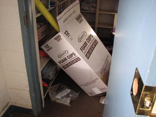
16 Tribal Gym flooded (you can see the water line on the far wall) Wednesday, 12/05/07

 water damaged.")
17 Tribal Gym youth program supplies and equipment water damaged. Appliances (refrigerator/freezer and range) water damaged. Wednesday, 12/05/07


18 Wednesday 12/05/07: Tribal Gym

19 Wednesday, 12/0/07: Youth recreation supplies in Tribal Gym floated toward the door.

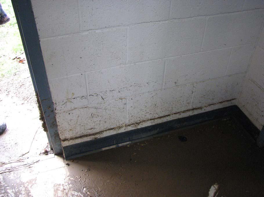
20 Wednesday, 12/0/07: Tribal Administrative Center flood waters reached 7 feet in the lower level.

21 Wednesday, 12/0/07: Tribal Administrative Center water in lower level being pumped out. (Note high water mark on Tribal Gym building in background.)

22 Wednesday, 12/0/07: Chain link fencing around Tribal Ballfield destroyed by flood waters/debris.

23 Wednesday, 12/0/07: view to Tribal Ballfield. A lot of debris was deposited on the Ballfield.

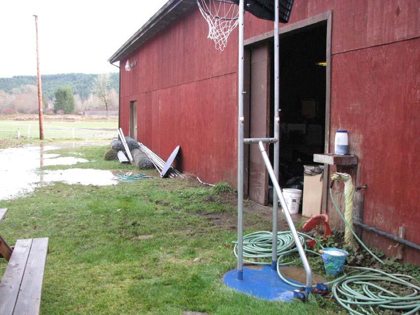
24 Wednesday, 12/0/07: Tribal Maintenance Shed

25 Wednesday, 12/0/07: Back of Maintenance Shed.

26 Wednesday, 12/0/07: Yard tractors housed in Maintenance Shed were flooded

 scoured")
27 Wednesday, 12/0/07: New sidewalks in front of Tribal Administrative Building (N. 80 Tribal Center Road) scoured and undermined


28 Wednesday, 12/0/07: Soil foundation of the ADA ramp in front of Legal Dept. washed out.

29 Wednesday, 12/0/07: Water seeped in to Legal Department triple-wide trailer.

30 Wednesday, 12/0/07: Utility trenches opened by flood waters.

31 Wednesday, 12/0/07: ADA ramp in front of Legal Department.

32 Wednesday, 12/0/07: Agency Road and Tribal Ballfield scoured by flood waters. Water seeped into Tribal buses.

33 Wednesday, 12/0/07: pavement debris collected at road side of Agency Road


34 Dec. 3, 2007: Mark Warren at home on Tribal Center Road.

35 Monday, 12/03/07: Tribal Center Road

36 Storm Dec 07\Storm Flood Dec 2007\December 2007 flood\2007 Dec 3 flood\dari's pics\dsc_6975.jpg
37 Web hyperlinks to more photos &bgcolor=black &bgcolor=black


38 Skokomish t3ba das New Housing Development


39 Road photos prior to December 2007 storm event (t3ba das Housing Development)


40 Saturday, 12/01/08: The snow fall began (t3ba das Housing Development)
")
41 Photo taken from Phase II looking back to Manhole #1 (t3ba das Housing Development)
")
42 Stevens Road at beginning of Phase One (t3ba das Housing Development)


43 Sediment from up the Stevens Road (t3ba das Housing Development)


44 Sta 37+00: South side of Parkway looking north (t3ba das Housing Development)

45 Can see high water line on Parkway at Sta (t3ba das Housing Development)

46 Erosion on South Loop Drive at Parkway at end of Phase I (t3ba das Housing Development)

47 Erosion at Sta /- (t3ba das Housing Development)
 (t3ba das Housing")
48 A lot of water rushed down Steven s Road (an emergency route) (t3ba das Housing Development)


49 Erosion from Steven s Road (an emergency road) runoff (t3ba das Housing Development)
 BELOW: South Loop near cul-de-sac")
50 More erosion related to Steven s Road runoff (t3ba das Housing Development) BELOW: South Loop near cul-de-sac
51 Erosion on South Loop Drive (t3ba das Housing Development)
Mount Rainier National Park November 2006 Flood Damage
 On November 6 and 7, 2006, Mount Rainier National Park received 18 inches of rain in 36 hours. This presentation summarizes the extensive flood damage that occurred throughout the park. Updated November
City of Olathe, Kansas Capital Improvement Plan Projects 2016 thru 2020
 Capital Improvement Plan Projects ECONOMIC VIABILITY PROJECTS 2016 2017 2018 2019 Page Coffee Creek Regional Detention 20905B 1,688,005 - - - - 1,688,005 31 Hedge Lane Relocation - Olathe Schools 3-B-080-13
Capital Planning City of Ocean City 1
 City of Ocean City Capital Planning 2015-2019 City of Ocean City 1 Road Improvements Project Completion Date 2012 Fall Road Improvement Spring, 2014 Program - (Paving 7 th Street, 8 th Street, 800 Block
July 2, 1873, Evansville Review, p. 4, col. 2, Evansville, Wisconsin
 The Storm. We understand that the storm in Porter was quite severe. A house was unroofed, fences were prostrated, and crops injured to some extent. At Fulton the dam across the Catfish was carried away.
Second Street Improvements Project Project Update Archive
 Second Street Improvements Project Project Update Archive 12/03/18: In observance of the Holiday Moratorium, crews have paused a majority of construction activity on 2nd Street until January 2, 2019. A
Public Service Department MONTHLY REPORT November 2017
 - Public Service Department MONTHLY REPORT Professionalism Integrity Be inspired. Reliability Quality Pride Inside This Issue: Department Highlights 2 Project Planning Updates 3 City Construction Projects
Route 141 and I-44 Design-Build Project Community Involvement Group. March 21, 2016
 Route 141 and I-44 Design-Build Project Community Involvement Group March 21, 2016 Purpose of CIG 1. Share information with major stakeholders 2. Keep stakeholders informed of the process 3. Reduce uncertainty
Capital Improvement Program Fiscal Year
 Capital Improvement Program Fiscal Year 2013-2014 Tustin City Council Mayor Al Murray Mayor Pro Tem Charles E. Chuck Puckett Council Members John Nielsen Rebecca Beckie Gomez Allan Bernstein CITY OF TUSTIN
17 Mathilda Welmering Park Planning Zone 3
 17 Mathilda Welmering Park Planning Zone 3 8301 Mathilda Visit Date: September 2016 St. Louis County Parks Master Plan Page 1 Description: The six acre Mathilda Welmering Park is named for two streets
THREE MILE PLAN TOWN OF SUPERIOR COLORADO
 THREE MILE PLAN TOWN OF SUPERIOR COLORADO February 23, 2015 INTRODUCTION This document has been prepared by the Town of Superior, Colorado, to address the existing and proposed land uses within an approximate
Welcome KROSNO CREEK DIVERSION PROJECT CLASS ENVIRONMENTAL ASSESSMENT
 Welcome KROSNO CREEK DIVERSION PROJECT PUBLIC INFORMATION CENTRE # 1 Tonight s Presentation Study Overview Background Existing Conditions Alternative Solutions Preliminary Preferred Solution Next Steps
ETOBICOKE CREEK NORTH TRAIL PROJECT. May 18, 2017 at Michael Power High School 105 Eringate Drive, Etobicoke ON M9C 3Z7
 ETOBICOKE CREEK NORTH TRAIL PROJECT May 18, 2017 at Michael Power High School 105 Eringate Drive, Etobicoke ON M9C 3Z7 1 Purpose of Open House The purpose of today s open house is to present the design
NAPAIMUTE TRIBAL SAFETY PLAN Tribal Transportation Program
 Adopted and Approved April 30, 2015 Amended August 2016 NAPAIMUTE TRIBAL SAFETY PLAN Tribal Transportation Program Native Village of Napaimute Napaimute Traditional Council INTRODUCTION The Native Village
APPENDIX F List of Commitments
 APPENDIX F List of Commitments s Table F.1 Standard Mitigation Measures Mitigation Measure MnDOT Specification Number Status Update Description Status Update Utilities Provide early notice to utility operators
Appendix A: San Francisco River Photos Gila National Forest
 Appendix A: San Francisco River Photos Gila National Forest These photos accompany our request for closure to demonstrate both the the outstanding ecological values associated with this area, as well as
MORGAN CREEK GREENWAY Final Report APPENDICES
 APPENDICES MORGAN CREEK GREENWAY Appendix A Photos of Existing Conditions in Trail Corridor Photos of existing conditions Main trail corridor - February 2009 Photos of existing conditions south bank Morgan
Decision Memo for Desolation Trail: Mill D to Desolation Lake Trail Relocation
 for Salt Lake County, Utah Uinta-Wasatch-Cache National Forest Salt Lake Ranger District 1. Background The present location of the Desolation Trail (#1159) between Mill D and Desolation Lake follows old
THE BIG PICTURE. Week of March 11, City of Buda Accepting Applications For Boards and Commissions
 City of Buda Accepting Applications For Boards and Commissions The deadline is approaching to submit applications for the City of Buda's various boards and commissions. Deadline to submit a completed application
Chuckanut Ridge Fairhaven Highlands EIS Scoping Concerns
 Chuckanut Ridge Fairhaven Highlands EIS Scoping Concerns Coalition of Southside Neighborhoods CSN Comments for Fairhaven Highlands EIS Scope Hearing, Jan 16, 2008 1 Chuckanut Ridge Hilly Terrain: Potential
Town of Luray ADA Status Research
 ID PROBLEM DESCRIP SEPARA COMPLE 1 S Sidewalk - 1005 E. Main St. EAST MAIN ST 2 A Meter Box Gap - 1016 E. Main St. 32" EAST MAIN ST 3 S Sidewalk - 1005 E. Main St. EAST MAIN ST 4 S Sidewalk - across from
Appendix E. Inventory of Pinellas County Blueways Launch Sites. Recreation, Open Space & Culture Element E-1
 Appendix E Inventory of Pinellas County Blueways Launch Sites Recreation, Open Space & Culture Element E-1 1 2 3 4 5 6 7 8 APPENDI E John Chestnut Park 2200 East Lake Rd., Palm Harbor Al Anderson Park
Langton Lake Park Implementation Planning Session One 6 June Attendees signed in
 27 Attendees signed in Meeting summary Following an overview of the Parks and Recreation Renewal Program and the key directions of the Parks and Recreation System Master Plan, meeting participants were
MONTGOMERY COUNTY PUBLIC SCHOOLS BETHESDA-CHEVY CHASE MIDDLE SCHOOL #2 SAMAHA ASSOCIATES, PC
 SITE B-CC MS #2 SITE ANALYSIS PROGRAM CONCEPT OPTIONS PRESENTED DEVELOPED CONCEPT OPTIONS 4, 5, AND 6 FEASIBILITY STUDY PLAN OPTION 1 FEASIBILITY STUDY SITE SECTION OPTION 1 FEASIBILITY STUDY SITE SECTION
MUNICIPAL DISTRICT OF GREENVIEW NO. 16
 MUNICIPAL DISTRICT OF GREENVIEW NO. 16 Spring Flooding Impacted Roads in Greenview Master List Total Flood Locations in All Areas: 34 hazards, 17 roads closed as of May 4, 2018 New Fish Creek Range Road
A BOAT RAMP TO NOWHERE
 A BOAT RAMP TO NOWHERE A PROPOSAL FOR ACCESS TO HARVIE PASSAGE A Presentation to the City of Calgary December 2017 Presented by: Peter Crowe-Swords Bow River Trout Foundation Background: The Bow River
CITY COUNCIL AGENDA MEMORANDUM
 To: Mayor and City Council From: Charles Ozaki, City and County Manager Prepared By: Kevin Standbridge, Deputy City and County Manager Katie Allen, City and County Engineer David Shinneman, Community Development
CAPITAL IMPROVEMENT PLAN
 CITY OF SOLDOTNA CITY HALL 77 N BIRCH ST. SOLDOTNA, AK 99669 STEPHANIE QUEEN, AICP SOLDOTNA CITY MANAGER SQUEEN@SOLDOTNA.ORG 907.714.1240 866.593.6994 KYLE KORNELIS, P. E., PUBLIC WORKS DIRECTOR KKORNELIS@SOLDOTNA.ORG
Planners slam pipeline permit applications
 Planners slam pipeline permit applications January 31, 2018 BY JOHN BRUCE STAFF WRITER Dominion employees were present to answer planning commission questions and comment about the construction storage
All Groups. Conserve/
 All Groups Total stickers Large Open Small Multifamily Conserve/ Lot Space Lot Res Total Park Downtown 1 5 25 31 11 Fringe East 5 30 7 42 13 Fringe West 2 9 35 17 63 11 Rural Topsham 14.5 21.5 5 41 26
Winnebago County Community Park
 Directions to Community Park From Interstate Hwy. 41 to Oshkosh exit 124, which is Hwy. 76/Jackson Street. East on Hwy 76/ Jackson Street to left on County Road Y, 1/4 mile. Winnebago County Park is on
Long water shutdown scheduled for Tuesday, September 18
 Thank you for your interest in the Center City Connector Streetcar. In this weekly update, you ll find information about ongoing construction for the 1st phase of utility work in Pioneer Square. Utility
Town of Danvers Planning Board
 Town of Danvers Planning Board Danvers Town Hall One Sylvan Street Danvers, MA 01923 www.danvers.govoffice.com Margaret Zilinsky, Chair Kristine Cheetham William Prentiss Aaron Henry James Sears John Farmer,
Cat Island Chain Background & Access Guide
 Cat Chain Background & Access Guide Brown County Port & Resource Recovery Department 2561 S. Broadway, Green Bay, WI 54304 (920) 492-4950 www.portofgreenbay.com January 2018 1 Restoration of the Cat Chain
CAPITAL ASSET MANAGEMENT PLANNING Updated February 26, Bridges & Large Culverts Storms Sewers Vehicles (Rolling Stock), Machinery & Equipment
, Machinery & Equipment") CAPITAL ASSET MANAGEMENT PLANNING Updated February 26, 2019 Plan Includes: Other Capital Assets: Other Assets: Roads Bridges & Large Culverts Storms Sewers Vehicles (Rolling Stock), Machinery & Equipment
CAPITAL ASSET MANAGEMENT PLANNING Updated February 26, 2019 Plan Includes: Other Capital Assets: Other Assets: Roads Bridges & Large Culverts Storms Sewers Vehicles (Rolling Stock), Machinery & Equipment
Daisy Dean Trail 628/619 ATV Trail Construction
 Background and Purpose and Need The Daisy Dean ATV Trail Construction Project is located in the Little Belt Mountains, Musselshell Ranger District, Lewis and Clark National Forest approximately 32 miles
Public Notice ISSUED: December 10, 2018 EXPIRES: January 9, 2019
 APPLICANT: REFER TO: St. Louis and Lake Counties Regional Rail Authority 2018-01942-ARC Public Notice ISSUED: December 10, 2018 EXPIRES: January 9, 2019 SECTION:404 - Clean Water Act 1. APPLICATION FOR
DATE: October 13, 2016 SUBJ:
 TAHOE CITY PUBLIC UTILITY DISTRICT MEMORANDUM TO: FROM: Cindy Gustafson General Manager Bob Bolton Director of Parks and Recreation DATE: October 13, 2016 SUBJ: Monthly Report September 8 October 13, 2016
Appendix A Appendix A (Project Specifications) Auk Auk / Black Diamond (Trail 44) Reroute
 Auk Auk / Black Diamond (Trail 44) Reroute") Appendix A (Project Specifications) Auk Auk / Black Diamond (Trail 44) Reroute I. Proposed Action: This project proposes to reroute approximately 1,800 feet of a 50 inch wide trail, off of private property
Appendix A (Project Specifications) Auk Auk / Black Diamond (Trail 44) Reroute I. Proposed Action: This project proposes to reroute approximately 1,800 feet of a 50 inch wide trail, off of private property
PARKS & BEACHES PROJECTS
 #18 72ND STREET PARK, LIBRARY, #19 BLUEWAYS & AQUATIC CENTER $1.1 MILLION $60 MILLION New facility to include: Create Kayak Launches with All Wheels Skate Park Floating Docks and Seating at: Library/Media
Completion: August 2011 LS #321 Design LS #8
 1 CIPNumber c350406 2 c350302 3 c350902 LEGEND PERMITTING/ BIDDING CHARLOTTE COUNTY UTILITIES Burnt Store Water Reclamation Facility (Expansion to 0.75 MGD) East Port Expansion Water Reclamation Facility
Porter Fk. #1. All unauthorized items removed as per FS & Rec Res guidelines. Footbridge may be needed for wheel chair access and for safety
 APPENDIX D Lot Specific Permit Compliance & Forest Plan (FP) Requirements Porter Fork Recreation Residence Tract (Items noted were documented in compliance letter, 8/12/2005, sent to all Rec. Residence
TOWN OF SWANSBORO Planning Board Regular Meeting Community Room AGENDA
 TOWN OF SWANSBORO Planning Board Regular Meeting Community Room April 4, 2016 Monday 6:00 pm Town Hall 601 W. Corbett Ave. AGENDA 1. Call to Order 2. Roll Call and Quorum Verification 3. Approval of Meeting
Village of Lombard, Illinois Capital Improvement Plan FUNDING SOURCE SUMMARY
 Village of Lombard, Illinois Capital Improvement Plan FY 15 FY 24 thru FUNDING SOURCE SUMMARY Source FY 15 FY 16 FY 17 FY 18 FY 19 FY 20 FY 21 FY 22 FY 23 FY 24 Construction Fund 6,318,700 2,354,800 2,430,800
Town of Queen Creek Park and Facility Rentals Click on each park or facility for additional information
 Town of Queen Creek Park and Facility Rentals Click on each park or facility for additional information Queen Creek Library Ocotillo Road Hawes Road Desert Mountain Park Ellsworth Loop Road Ellsworth Road
OYSTER HARBOR CITIZEN S ASSOCIATION Board of Directors Board Meeting Thursday, December 3, 2015 at 7:00 PM Eastport Library
 1 OYSTER HARBOR CITIZEN S ASSOCIATION Board of Directors Board Meeting Thursday, December 3, 2015 at 7:00 PM Eastport Library Present: Eric Epstein Nick Jones Calvin Kidd Joe Matta Nancy Plaxico Joan Shifflett
Bear Creek Habitat Improvement Project
 06/10/10 Bear Creek Habitat Improvement Project El Paso County, Colorado Pike National Forest and Colorado Springs Utilities Owned Land Report prepared by: Eric Billmeyer Executive Director Rocky Mountain
Capital Prioritization
 14 Capital Prioritization 279 279 280 Park & Recreation CAPITAL PRIORITIZATION As described in Chapter 8, the recommendations presented in Chapter 9 are prioritized to provide a guide for future capital
ADDITIONAL INFORMATION
 ADDITIONAL INFORMATION These schedules provide additional fiscal data considered valuable in meeting other informational needs and in providing a better understanding of the finances of the City and Borough.
USDA Forest Service Deschutes National Forest DECISION MEMO. Round Lake Christian Camp Master Plan for Reconstruction and New Facilities
 USDA Forest Service Deschutes National Forest DECISION MEMO Round Lake Christian Camp Master Plan for Reconstruction and New Facilities Jefferson County, Oregon T. 13 S., R. 8 E., Section 16, W.M. Background:
NFTA Access Enhancement Study for Canalside and Cobblestone Alternatives Discussion. Alternative A South Park Avenue
 Alternative A South Park Avenue Alternative A Summary Alternative A extends Metro Rail service around the foot of Main Street east along South Park Avenue to serve a new station platform located along
Greenways Commission Meeting Agenda Monday, March 20, 2017; 4:00 pm 7:00 pm Town Hall, Parking Lot
 Greenways Commission Meeting Agenda Monday, March 20, 2017; 4:00 pm 7:00 pm Town Hall, Parking Lot I. 4:00 4:05 pm Leave Town Hall Parking Lot for Briar Chapel II. III. IV. 4:30 pm Site Visit - Briar Chapel
New Orleans Municipal Yacht Harbor
 New Orleans Municipal Yacht Harbor 2018 Capital Projects Construction Updates MYH Floating Marina Community Sailing Center (Coordination with) MYH Boat Launch (MYHMC) MYH Administration Building (CPA &
e 2 design season three New Orleans: The Water Line Episode Summary
 e 2 design season three New Orleans: The Water Line Episode Summary After the devastation of Hurricane Katrina, which hit the southern coast of the United States on August 28, 2005, the residents of the
District of Squamish Financial Plan for the Years Capital Revenues and Expenditures
 Reserves 2007 Budget Reserves C 118 Application of Capital Funding: C 119 C 124 Buildings C 129 Municipal Hall - Outside Paint / Canopy 3,148 3,148 2,300 2,300 C 134 Total Buildings 3,148 3,148 - - - -
Northeast Quadrant Distinctive Features
 NORTHEAST QUADRANT Northeast Quadrant Distinctive Features LAND USE The Northeast Quadrant includes all the area within the planning area that is east of Interstate 5 and to the north of State Route 44.
Hospital Link Project Project Update Winter 2018
 Hospital Link Project Project Update Winter 2018 General The project provides a link from Riverside Drive and the Transitway to the Hospital Link Road. Construction of the Hospital Link facility is open
June 2013: Capital Improvements Update. through $ 126,196,202 Available Funding through 2018 $ 149,783,656. Staff s Recommendation
 Capital Improvements Update June 2013: Pl dp j t Planned Projects through 2018 - $ 126,196,202 Available Funding through 2018 $ 149,783,656 pp p,, Un-appropriated - $ 23,587,454 Staff s Recommendation
NEWBORO AND PORTLAND HARBOUR REDVELOPMENT PLANS
 INTRODUCTION The Municipal docks in both Newboro and Portland were transferred to the Township of Rideau Lakes by Parks Canada in 2002. Little has been done to improve the docks physical condition or role
MT. Shasta Sno-Mobilers
 MT. Shasta Sno-Mobilers P.O. Box 341 Mt. Shasta, CA 96067 Snow Phone: (530) 926-2824 www.snowcrest.net/mssc January 31, 2007 Ed Hatakeda, Recreation Forester Mt. Shasta RD Shasta-Trinity NF 204 E. Alma
National Forests and Grasslands in Texas
 United States Department of Agriculture Forest Service National Forests and Grasslands in Texas Sam Houston NF 394 FM 1375 West New Waverly, Texas 77358 Phone 936-344-6205 Dear Friends, File Code: 1950
Blue River Trail Master Plan JSA to Town Hall June 2004
 Blue River Trail Master Plan JSA to Town Hall June 2004 Prepared for: Silverthorne Town Council Silverthorne SPORT Committee Department of Recreation and Culture Silverthorne Public Works Silverthorne
Kansas (KAW) River History
 River History") Kansas (KAW) River History The first map of the Kansas River is dated back to 1718. Lewis and Clark spent 3 days camped at Kaw Point at the confluence of the Kansas and Missouri Rivers. Kansas (KAW) River
Kansas (KAW) River History The first map of the Kansas River is dated back to 1718. Lewis and Clark spent 3 days camped at Kaw Point at the confluence of the Kansas and Missouri Rivers. Kansas (KAW) River
Before the meeting began, Chairwoman Cipriani thanked all our veterans mentioning Mayor Herbert and Dan Grescavage for their service.
 West Wyoming Boro-Minutes November 11, 2013 Before the meeting began, Chairwoman Cipriani thanked all our veterans mentioning Mayor Herbert and Dan Grescavage for their service. The regular monthly meeting
The Physical Geography of Long Island
 The Physical Geography of Long Island A Bit About Long Island Length 118 miles Brooklyn to Montauk Geo202 Spring 2012 Width 23 miles at it s widest Area 1,400 square miles Formation of Long Island River
Citrus Heights Creek Corridor Trail Project Trail Advisory Group Field Trip #2 September 11, :00 11:00 am Trellis Hall, Citrus Heights
 September 11, 2013 9:00 11:00 am Trellis Hall, Citrus Heights Project Overview The City of Citrus Heights is studying the feasibility of establishing a multi use trail system within the City s 26 miles
Project Update Utah Water Users Workshop March 14, 2012
 Project Update Utah Water Users Workshop March 14, 2012 Jeffrey D. Budge, P.E. Operations and Engineering Manager Steven H. Cain Facilities and Lands Manager Organized in 1935 Deer Creek Division of the
SECTION VII - LOCAL COMMITMENT AND CONSULTATION
 SECTION VII - LOCAL COMMITMENT AND CONSULTATION INTRODUCTION The LWRP Advisory Committee was comprised of ten persons, representing different interests in the community. These persons included municipal
TRAFFIC ALERT FOR FEBRUARY 11-15, 2019 Highway Work Zones in the Staunton District
 RELEASE: IMMEDIATE February 8, 2019 CONTACT: Sandy Myers 540-332-9201 (office) STA19 027 540-292-2500 (cell) Sandy.Myers@VDOT.virginia.gov Ken Slack 540-332-9264 (office) 540-414-5670 (cell) Ken.Slack@VDOT.virginia.gov
Application for Permit to Develop in a Floodplain Area
 Application for Permit to Develop in a Floodplain Area The undersigned hereby makes application for a permit to develop in a designated floodplain area. The work to be performed is described below and
90 I-90 Snoqualmie Pass East September Annual Mega-Project Report. Project Benefits
 90 I-90 Snoqualmie Pass East September 2015 Annual Mega-Project Report Purpose of this Report The financial and schedule information in this document will assist the Office of Financial Management in meeting
City of Grand Island Tuesday, December 12, 2017 Council Session
 City of Grand Island Tuesday, December 12, 2017 Council Session Item E-3 Public Hearing on One & Six Year Street Improvement Plan Council action will take place under Resolution item I-1. Staff Contact:
ADDITIONAL INFORMATION
 ADDITIONAL INFORMATION These schedules provide additional fiscal data considered valuable in meeting other informational needs and in providing a better understanding of the finances of the City and Borough.
City of Durango 5.8 FUNDING TRAILS DEVELOPMENT
 5.8 FUNDING TRAILS DEVELOPMENT The City has been successful in establishing dedicated local funding sources as well as applying for grants to develop the City s trail system, having received nearly $2.4
Conservation of Critical Environmental Resources in Chatham Park
 Conservation of Critical Environmental Resources in Chatham Park Elaine Chiosso, Haw Riverkeeper Haw River Assembly Haw River As Seen From Chatham Park "Spreading southwestward from the banks of the Haw
1.2 Corridor History and Current Characteristics
 SECTION 1 Description and Background of Study Area 1.1 Introduction This preliminary engineering report was prepared for the Alaska Department of Transportation and Public Facilities (ADOT&PF). It is part
Major Projects Overview
 Major Projects Overview Miami-Dade Expressway Authority February 2018 About MDX MDX operates 5 roads in Miami Dade County SR 924, SR 112, SR 836, SR 874 and SR 878 MDX Primary Source of Revenue: User Fees-Tolls
RELEASE: IMMEDIATE September 14, 2012 CONTACT: Sandy Myers (office) STA (cell)
 STA (cell)") RELEASE: IMMEDIATE September 14, 2012 CONTACT: Sandy Myers 540-332-9201 (office) STA12-130 540-292-2500 (cell) Sandy.Myers@VDOT.Virginia.gov Marshall Barnhill 540-332-9264 (office) 540-414-5670 (cell)
RELEASE: IMMEDIATE September 14, 2012 CONTACT: Sandy Myers 540-332-9201 (office) STA12-130 540-292-2500 (cell) Sandy.Myers@VDOT.Virginia.gov Marshall Barnhill 540-332-9264 (office) 540-414-5670 (cell)
FY Transportation Improvement Program Basic Project List (in Thousands)
") FY2010-2014 Transportation Improvement Program Basic Project List (in Thousands) Project Name Key # Year Project Cost 16th Avenue North, 7th Street North to Garrity Boulevard GU09308 2011 $592 21st Avenue
FY2010-2014 Transportation Improvement Program Basic Project List (in Thousands) Project Name Key # Year Project Cost 16th Avenue North, 7th Street North to Garrity Boulevard GU09308 2011 $592 21st Avenue
MPRB: Southwest LRT Community Advisory Committee Issues and Outcomes by Location Current to: 12 November 2010
 MPRB: Southwest LRT Community Advisory Committee Issues and Outcomes by Location Current to: 12 November 2010 This is a compilation of issues and outcomes identified by the CAC. It is a work in progress,
Interoffice Memorandum
 Supplemental Information Agenda Item No. 5.1 May 1, 2014 Interoffice Memorandum May 1, 2014... Date Honorable Planning Commission... To Rick Carter, PE... From Agenda Item 5.1-2014-2019 Capital Improvement
COUNTY OF SAN MATEO Parks Department
 COUNTY OF SAN MATEO Parks Department DATE: September 23, 2014 COMMISSION MEETING DATE: October 2, 2014 TO: FROM: SUBJECT: Parks and Recreation Commission Scott Lombardi, Park Superintendent Superintendent
Borough of Shippensburg
 Borough of Shippensburg www.borough.shippensburg.pa.us Fall Newsletter, 2017 New Year s Day Holiday Monday, January 1, 2018 Monday s route will be collected on Tuesday, January 2, 2018. Tuesday s route
District Construction Progr am. John R. Kasich, Ohio Governor Jerry Wray, ODOT Director Steve Mary, P.E., District Deputy Director
 District 8 2014 Construction Progr am Preble Greene Butler Warren Clinton Lebanon Hamilton Clermont Serving Butler, Clermont, Clinton, Greene, Hamilton, Preble and Warren Counties. John R. Kasich, Ohio
Exit 136 (Centreport Parkway/Stafford County) to Exit 130 (Route 3/Fredericksburg)
 to Exit 130 (Route 3/Fredericksburg)") RELEASE: IMMEDIATE Feb. 22, 2019 CONTACT: Darragh Frye 540-907-8409 (mobile) VDOT HOT SPOTS IN THE FREDERICKSBURG DISTRICT Feb. 24 March 2, 2019 All work is scheduled weather permitting. Real-time information
RELEASE: IMMEDIATE Feb. 22, 2019 CONTACT: Darragh Frye 540-907-8409 (mobile) VDOT HOT SPOTS IN THE FREDERICKSBURG DISTRICT Feb. 24 March 2, 2019 All work is scheduled weather permitting. Real-time information
Public Works Department. Fiscal Year 2019 Projects
 Public Works Department Fiscal Year 2019 Projects Palm Avenue Drainage Improvements Description: Neighborhood drainage improvement and flood abatement Phase: Currently in design (began FY18) Schedule:
SEQR = State Environmental Quality Review PB = (Town of Bolton) Planning Board WCPS = Warren County Planning Board
 Planning Board WCPS = Warren County Planning Board") Town of Bolton SEQR = State Environmental Quality Review PLANNING BOARD PB = (Town of Bolton) Planning Board MINUTES WCPS = Warren County Planning Board Thursday APA = Adirondack Park Agency 6:00 p.m.
Town of Bolton SEQR = State Environmental Quality Review PLANNING BOARD PB = (Town of Bolton) Planning Board MINUTES WCPS = Warren County Planning Board Thursday APA = Adirondack Park Agency 6:00 p.m.
Henry s Fork Angler Access. Above Mesa Falls
 Henry s Fork Angler Access Above Mesa Falls Table of Contents 1. Frome Park 2. Henry s Lake Fish Hatchery 3. Henry s Lake State Park 4. Highway 20 Bridge 5. Flat Ranch 6. Big Springs 7. Big Springs Water
Wayzata Parks and Trails Board Meeting Agenda
 Wayzata Parks and Trails Board Meeting Agenda Wednesday, July 19, 2017 6:00 pm Wayzata City Hall, Conference Room 600 Rice Street East Wayzata, Minnesota 1. Call to Order, Roll Call 2. Approval of Minutes
Tahoe Donner Trails Update
 Tahoe Donner Trails Update B O A R D O F D I R E C TO R S M E E T I N G J U LY 2 9, 2 0 1 7 Trails Guiding and Planning Documents TRAILS MASTER PLAN 5-YEAR IMPLEMENTATION PLAN Trails Master Plan Projects
Project Start Date: Project Completion Date: July 1, Contractor: Mattson Construction Contact Information: Nate Lillemon
 Date: 06-24-16 To: Derek Hackett, Public Information Officer From: Sunil Jeboo, Traffic Engineer Re: Road Closure for the Week of 06-27-16 (3236.1) 6 th Pump Station Western Ave. and 6 th SW Western Ave.
HWY 7 COMMERCIAL PROPERTY 1135 W. Highway 7, Hutchinson, MN 55350
 OFFERING SUMMARY SALE PRICE: $825,000 LOT SIZE: 2.03 Acres YEAR BUILT: 2006 BUILDING SIZE: 11, 640 PROPERTY OVERVIEW Commercial Office, Warehouse Building with superior highway visibility and easy access
Kansas Department of Transportation DISTRICT TE / TA-T043(301) Project(s): Min: Max:
 Project(s): Min: Max:") Page 1 of 20 518045 SECTION: 01 COMMON ITEMS 1 020100 CONTRACTOR CONSTRUCTION STAKING 2 025600 FIELD OFFICE AND LABORATORY (TYPE A) 3 012340 FOUNDATION STABILIZATION (SET PRICE) 4 025323 MOBILIZATION 5
Page 1 of 20 518045 SECTION: 01 COMMON ITEMS 1 020100 CONTRACTOR CONSTRUCTION STAKING 2 025600 FIELD OFFICE AND LABORATORY (TYPE A) 3 012340 FOUNDATION STABILIZATION (SET PRICE) 4 025323 MOBILIZATION 5
Permeable RECREATIONAL TRAILS
 SMART EARTH SOLUTIONS Permeable RECREATIONAL TRAILS GEOWEB GEOPAVE GEOTERRA Innovative Solutions for Designing & Building Trails. Trail Surface Stabilization The key to planning and building trails into
 203.0100 Removing Small Pipe Culverts CATEGORY STATION LOCATION EACH 0010 2+00-16+50 0010 7+13-8+41 LT. 155 3 0010 4+42 CL 1 10,660 9+90-13+73 RT. 390 3 7+63'SB' 67' LT. 1 14+25'GV' 49' LT. 1 17+05'GV'
CAPITAL IMPROVEMENT PLAN
 RACINE, WISCONSIN CAPITAL IMPROVEMENT PLAN 2010. 2011. 2012. 2013. 2014 TABLE OF CONTENTS Summary of C.I.P. Expenditures by Department 1 Methods of C.I.P. Financing 2 General Administration 5 Fire Department
AGENDA. WEDNESDAY, SEPTEMBER 23, :00 PM or immediately after the ICTC meeting
 AGENDA WEDNESDAY, SEPTEMBER 23, 2015 6:00 PM or immediately after the ICTC meeting County Administration Building, 2 nd Floor Board of Supervisors Chambers 940 W. Main St. El Centro, CA 92243 CHAIRPERSON:
ABINGDON v ELEMENTARY SCHOOL
 JULY 31 2017 ABINGDON v ELEMENTARY SCHOOL FCA LISTENING SESSION CONSTRUCTION UPDATE PROJECT UPDATE SUMMARY 1. Two four-plex relocatables removed, ten to stay in place; Temporary Parking lot in place and
Fossil Creek Wild & Scenic River Comprehensive River Management Plan Forest Service Proposed Action - details March 28, 2011
 Fossil Creek Wild & Scenic River Comprehensive River Management Plan Forest Service Proposed Action - details March 28, 2011 Primary Goals of the Proposed Action 1. Maintain or enhance ORVs primarily by
Meshach Browning Trail System at the Deep Creek Lake Lion s Club Park on Bumble Bee Rd.
 Meshach Browning Trail System at the Deep Creek Lake Lion s Club Park on Bumble Bee Rd. The Meshach Browning trail system will be a public, non-motorized, multi-use (running, dog-walking, cross country
Dawlish & South West rail
 Dawlish & South West rail restoring the railway 19 February 2014 1 Dawlish storm 5 February Dawlish sea wall breached on 5 th Feb the most destruction caused since Victorian times 19 February 2014 2 Dawlish