EXECUTIVE SUMMARY. Partial Amended Submission to the Commission on the Limits of the Continental Shelf in Respect of the North Area
|
|
|
- Amice Joseph
- 5 years ago
- Views:
Transcription
1
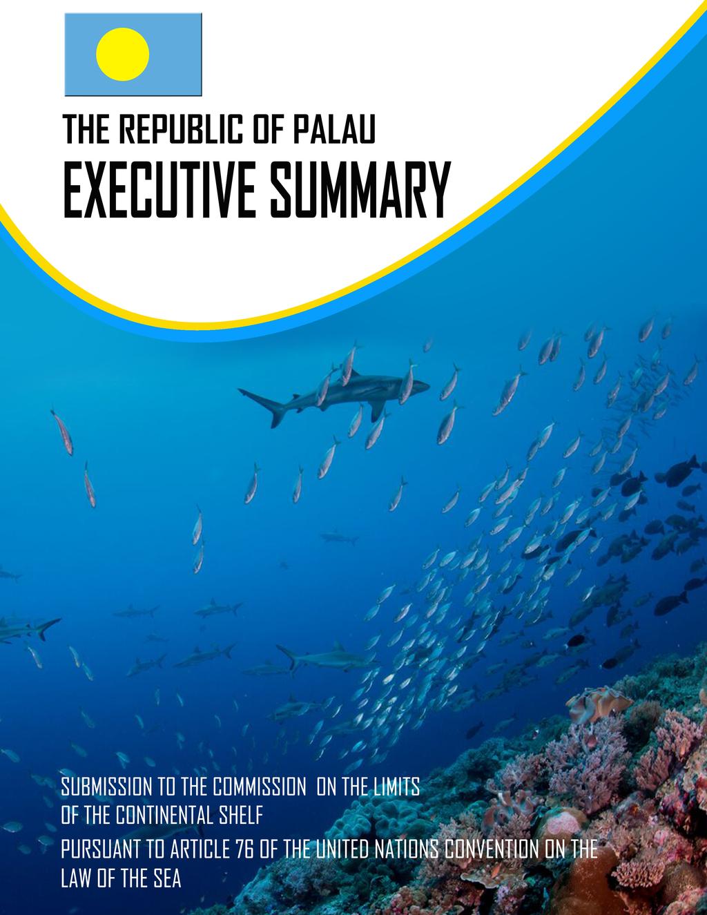
2 EXECUTIVE SUMMARY Partial Amended Submission to the Commission on the Limits of the Continental Shelf in Respect of the North Area Pursuant to Article 76 of the United Nations Convention on the Law of the Sea by The Republic of Palau October 12, 2017
3 TABLE OF CONTENTS pg. 1 Introduction 1 2 Maritime Area and Maps 3 3 Provisions of Article 76 Invoked 3 4 Outstanding Maritime Delimitations 4 5 Commission Members who Assisted on this Submission 4 6 State Bodies Responsible for the Preparation of this Submission 4 7 Extended Continental Shelf of Palau 5 Figures Figure 1 Figure 2 Three-dimensional bathymetric image of the North Area as viewed from the southwest towards the northeast Colored bathymetric map showing an overview of the extended continental shelf of Palau in the North Area Annex List of the fixed points defining the outer limits of the extended continental shelf of the Republic of Palau
4 1 Introduction 1.1 The Republic of Palau (hereinafter Palau ) is a group of islands located in the western Pacific Ocean, to the east of the Republic of the Philippines, to the north of the Republic of Indonesia, to the west of the Federated States of Micronesia, and to the south of Japan. Palau became an independent nation on 1 October It became a member of the United Nations on 15 December 1994, and ratified the United Nations Convention on the Law of the Sea (hereinafter the Convention ) on 30 September Article I, Section 1(a) of the Constitution of Palau, as amended, states that Palau shall have jurisdiction and sovereignty over its territory which shall consist of all the islands [ ] and water areas extending to a two hundred (200) nautical miles exclusive economic zone [ ]. Article I, Section 2(a) of the Constitution of Palau, as amended, extends this jurisdiction to the continental shelf in accordance with international law. Palau National Code; Title 27 Fishing; Section 141 defines the baselines from which the breadth of its territorial sea is measured (hereinafter territorial sea baselines ) and Section 144 establishes a 200 nautical mile (hereinafter M ) exclusive economic zone. 1.2 In this partial amended submission (hereinafter this Submission ), the area of continental shelf extending beyond 200 M from the territorial sea baselines is referred to as the extended continental shelf. 1.3 In accordance with Article 4 of Annex II to the Convention, as supplemented by the decisions of the Eleventh Meeting of State Parties (SPLOS/72) and the Eighteenth Meeting of State Parties (SPLOS/183) regarding the ten-year period established by Article 4 of Annex II to the Convention, a coastal State for which the Convention entered into force before 13 May 1999 is required to submit particulars of the outer limits of the continental shelf to the Commission on the Limits of the Continental Shelf (hereinafter the Commission ), together with supporting scientific and technical data, by 13 May The original submission made by Palau on 8 May 2009 (hereinafter the Original Submission ) satisfied that requirement. 1.4 The Original Submission was composed of three extended continental shelf areas that extend beyond 200 M from the territorial sea baselines of Palau, as follows: the North Area, the Southeast Area, and the West Area. 1.5 In its Note Verbal No of 4 August 2009 to the Secretary General of the United Nations, the Republic of the Philippines stated that [ ] the Philippines and Palau have overlapping maritime jurisdictions in term of their 200 M Exclusive Economic Zones (EEZ) and 200 M Continental Shelves, which, as of this date have 1 E xecutive Summary
5 yet to be resolved by the two countries and requested the Commission to refrain from considering the aforementioned Submission by the Republic of Palau, unless and until after the parties have discussed and resolved their disputes. 1.6 In its Note Verbal No. 030/PMSG/10 of 22 July 2010 to the Secretary General of the United Nations, Palau responded that, notwithstanding the position of the Republic of the Philippines, the Commission could and should proceed with considering the Original Submission. 1.7 Notwithstanding Palau s view, the Commission decided to defer further consideration of the Original Submission. This Submission would be next in line for consideration as currently queued. (CLCS/68; paragraph 31) 1.8 Since lodgment of the Original Submission, Palau decided to further improve the data and other material contained within the Original Submission in accordance with Annex I to the Rules of Procedure of the Commission on the Limits of the Continental Shelf (hereinafter the Rules of Procedure ) (CLCS/68; paragraph 19), in particular paragraph 3 of Annex I to the Rules of Procedure. Accordingly, Palau established, under the Office of the President, the Territory and Boundary Task Force (hereinafter the TBTF ) charged with taking the appropriate steps to achieve this for the North Area, the Southeast Area, and the West Area. The TBTF has thus far successfully conducted an updated compilation of public and non-public domain bathymetric data to better support the delineation of the outer limit of the extended continental shelf of Palau for the North Area. 1.9 This Submission concerns the area of extended continental shelf of Palau associated with the bathymetric feature commonly known as the Palau-Kyushu Ridge (hereinafter the PKR ) (also referred to as the Kyushu-Palau Ridge). This seafloor high extends from the main islands of Palau to over 3,000 km to the north where it merges with the continental margin of Kyushu Island of Japan. The main islands landmass of Palau sits atop the PKR (Figure 1). This Submission presents new and additional data and analysis providing substantive evidence for geomorphological, geophysical and geological continuity from the main islands landmass of Palau north along the PKR This Submission consists of three separate parts comprising this Executive Summary; the Main Body containing a core analytical and descriptive part; and an appendix section containing all data referred to in the Main Body, in accordance with the specifications of the Commission set out in Annex III to the Rules of Procedure and paragraphs to of the Scientific and Technical Guidelines of the 2 E xecutive Summary
6 Commission on the Limits of the Continental Shelf. This Submission replaces all documents and data pertaining to the North Area of the Original Submission In accordance with paragraph 3 of Annex I to the Rules of Procedure, a partial amended submission(s) for the Southeast Area and the West Area contained within the Original Submission shall be made at a later date. As the current and future partial submissions of Palau are all amendments to areas contained within the Original Submission, they should all retain their current position in the submission queue in line with the practice of the Commission. 2 Maritime Area and Maps 2.1 The data and information contained in this Submission pertain to the outer limits of the continental shelf of Palau, specifically where those limits extend beyond 200 M from the territorial sea baselines in the North Area. 2.2 Figure 1 is a three-dimensional bathymetric image of the North Area as viewed from the southwest to the northeast. Figure 2 is a colored bathymetric map showing an overview of the extended continental shelf of Palau in the North Area. It indicates the location of the fixed points that comprise the line of the outer limits of the relevant area of the extended continental shelf of Palau in accordance with the provisions of Article 76 of the Convention (hereinafter Article 76 ) as contained within this Submission. 3 Provisions of Article 76 Invoked Palau invokes paragraphs 1, 3, 4, 5, and 7 of Article 76 in support of the delineation of the outer limits of the continental shelf beyond the line at a distance of 200 M from the territorial sea baselines (hereinafter a 200 M Line ). The outer edges of the continental margin are established only by reference to fixed points not more than 60 M from the foot of the continental slope as provided in paragraph 4(a)(ii) of Article 76. Paragraph 6 of Article 76 does not apply to the continental margin of Palau because the PKR is classified as a submarine elevation that is a natural component of the continental margin of Palau. This classification is supported by geomorphological, geophysical and geological data and information contained within the various parts of this Submission. The outer limits of the continental shelf are delineated by fixed points connected by straight lines not exceeding 60 M in length in accordance with paragraph 7 of Article E xecutive Summary
7 4 Outstanding Maritime Delimitations 4.1 In accordance with paragraph 2 of Annex I to the Rules of Procedure, Palau wishes to inform the Commission that the area of extended continental shelf in this Submission is affected by outstanding delimitations with opposite or adjacent coastal States as detailed in this section. 4.2 The extension of Palau s continental shelf in the North Area is limited to the south in part by the 200 M Line of the Federated States of Micronesia. In 2006, a treaty between the two countries was executed, ratified by Palau in 2006, and ratified by the Federated States of Micronesia in 2014, which defines the equidistance line as the agreed boundary between the two countries out to their 200 M Lines. Accordingly, this Submission is submitted without prejudice to the question of the delimitation of the continental shelf beyond the 200 M Line of the Federated States of Micronesia in this area pursuant to paragraph 10 of Article 76 and paragraph 2(b) of Annex I to the Rules of Procedure. 4.3 The extension of Palau s continental shelf in the North Area northward along the PKR potentially overlaps with the extended continental shelf of Japan. This matter is the subject of ongoing consultations between Palau and Japan. Palau s submission of, and the Commission s consideration of and its resulting recommendation on, this area are without prejudice to the question of the delimitation of the continental shelf beyond the 200 M Lines of Palau and Japan. 5 Commission Members who Assisted on this Submission Palau was assisted in the preparation of both the Original Submission and this Submission by Dr. Philip A. Symonds, a past member of the Commission from 2002 to No advice was provided by any other past or current member of the Commission. 6 State Bodies Responsible for the Preparation of this Submission The TBTF was responsible for the preparation of this Submission, including access to and compilation of modern multi-beam bathymetric data 1. The technical preparation of this 1 Palau would like to acknowledge Japan s generous authorization of the use of unpublished, high quality bathymetric data in the North Area. These data were highly useful and valuable in delineating the extended continental shelf that is the subject of this Submission. 4 E xecutive Summary
8 Submission, including creating maps, figures and charts, and the compilation of databases 2, was carried out by the Palau Automated Land and Resource Information System, under the Bureau of Budget and Planning within the Ministry of Finance. 7 Extended Continental Shelf of Palau 7.1 The continental margin in the North Area is located to the north of the main islands of Palau, along the PKR, the southernmost part of which forms the main islands landmass of Palau. This area is a submerged prolongation of the main islands landmass of Palau. Moreover, the PKR is a submarine elevation that is a natural component of the continental margin, therefore both the distance constraints and the depth constraints can be applied in the North Area. 7.2 The outer limits of the extended continental shelf of Palau in the North Area are defined by the 200 M Lines of the Federated States of Micronesia and Japan and by straight lines not exceeding 60 M in length that connect 320 fixed points (Figure 2). These points are grouped into six categories as follows (see Annex): one hundred seventy (170) points are defined by arcs of 60 M from the foot of the slope (paragraph 4(a)(ii) of Article 76); one hundred forty-five (145) points are defined by the constraint lines of 100 M from the 2500 meter isobath (paragraph 5 of Article 76); one (1) point is defined by the constraint line of 350 M from the territorial sea baselines of Palau (paragraph 5 of Article 76); one (1) point is on the 200 M Line of Palau; one (1) point is where the outer limit of the extended continental shelf of Palau intersects the 200 M Line of the Federated States of Micronesia; and 2 Palau would like to recognize the training and support received from Geoscience Australia; the University of Sydney; the UNEP Shelf Programme; and SPC-Geoscience Division (SOPAC), together with the following individuals: Dr. Elaine Baker, UNEP-GRID / University of Sydney; Mr. Yannick Beaudoin, UNEP-GRID; Dr. Rosemary Rayfuse, University of New South Wales; Mr. Joshua Brien, Commonwealth Secretariat; Mr. Peter M. Hunter, UNCLOS Group United Kingdom; Mr. Scott Sweet and Mr. Harald Sund, Geocap; Mr. Mark Alcock and Dr. Philip A. Symonds, Geoscience Australia; Ms. Robyn Frost, Australian Attorney General s Department; Mr. Andrick Lal and Ms. Emily Artack, SPC- Geoscience Division (SOPAC). Palau would like to also acknowledge financial support for this project from the Government of Turkey and the United Nations Trust Fund. 5 E xecutive Summary
9 two (2) points are where the outer limit of the extended continental shelf of Palau intersects the 200 M Line of Japan 6 E xecutive Summary

10 Figure 1 Three dimensional bathymetric image of the North Area as viewed from the southwest towards the northeast. Vertical exaggeration is 10x. 1 Executive Summary Figure


11 Figure 2 Colored bathymetric map showing an overview of the North Area of the extended continental shelf of Palau. It indicates the location of the fixed points that comprise the line of the outer limits of the relevant area of extended continental shelf of Palau in accordance with the provisions of Article 76 as contained within this Submission to the Commission. 2 E xecutive Summary Figure
12 Annex Fixed Coordinates of Extended Continental Shelf (Republic of Palau) ECS-ID Longitude Latitude FOS ID Distance to Next Point Remarks (M) ECS-W FOS-W M from FOS and Palau's 200M line ECS-W FOS-W M from FOS ECS-W FOS-W M from FOS ECS-W FOS-W M from FOS ECS-W FOS-W M from FOS ECS-W FOS-W M from FOS ECS-W FOS-W M from FOS ECS-W FOS-W M from FOS ECS-W FOS-W M from FOS ECS-W FOS-W M from FOS ECS-W FOS-W M from FOS ECS-W FOS-W M from FOS ECS-W FOS-W M from FOS ECS-W FOS-W M from FOS ECS-W FOS-W M from FOS ECS-W FOS-W M from FOS ECS-W FOS-W M from FOS ECS-W FOS-W M from FOS ECS-W FOS-W M from FOS ECS-W FOS-W M from FOS ECS-W FOS-W M from FOS ECS-W FOS-W M from FOS ECS-W FOS-W M from FOS ECS-W FOS-W M from FOS ECS-W FOS-W M from FOS ECS-W FOS-W M from FOS ECS-W FOS-W M from FOS ECS-W FOS-W M from FOS ECS-W FOS-W M from FOS ECS-W FOS-W M from FOS ECS-W FOS-W M from FOS ECS-W FOS-W M from FOS ECS-W FOS-W M from FOS ECS-W FOS-W M from FOS ECS-W FOS-W M from FOS ECS-W FOS-W M from FOS ECS-W FOS-W M from FOS ECS-W FOS-W M from FOS ECS-W FOS-W M from FOS ECS-W FOS-W M from FOS ECS-W FOS-W M from FOS 1 E xecutive Summary Annex
13 ECS-ID Longitude Latitude FOS ID Distance to Next Point (M) Remarks ECS-W FOS-W M from FOS ECS-W FOS-W M from FOS ECS-W FOS-W M from FOS ECS-W FOS-W M from FOS ECS-W FOS-W M from FOS ECS-W FOS-W M from FOS ECS-W FOS-W M from FOS ECS-W FOS-W M from FOS ECS-W FOS-W M from FOS ECS-W FOS-W M from FOS ECS-W M from territorial sea baselines ECS-W M from 2500m isobath ECS-W M from 2500m isobath ECS-W M from 2500m isobath ECS-W M from 2500m isobath ECS-W M from 2500m isobath ECS-W M from 2500m isobath ECS-W M from 2500m isobath ECS-W M from 2500m isobath ECS-W M from 2500m isobath ECS-W M from 2500m isobath ECS-W M from 2500m isobath ECS-W M from 2500m isobath ECS-W M from 2500m isobath ECS-W M from 2500m isobath ECS-W M from 2500m isobath ECS-W M from 2500m isobath ECS-W M from 2500m isobath ECS-W M from 2500m isobath ECS-W M from 2500m isobath ECS-W M from 2500m isobath ECS-W M from 2500m isobath ECS-W M from 2500m isobath ECS-W M from 2500m isobath ECS-W M from 2500m isobath ECS-W M from 2500m isobath ECS-W M from 2500m isobath ECS-W M from 2500m isobath ECS-W M from 2500m isobath ECS-W M from 2500m isobath ECS-W M from 2500m isobath ECS-W M from 2500m isobath ECS-W M from 2500m isobath 2 E xecutive Summary Annex
14 ECS-ID Longitude Latitude FOS ID Distance to Next Point (M) Remarks ECS-W M from 2500m isobath ECS-W M from 2500m isobath ECS-W M from 2500m isobath ECS-W M from 2500m isobath ECS-W M from 2500m isobath ECS-W M from 2500m isobath ECS-W M from 2500m isobath ECS-W M from 2500m isobath ECS-W M from 2500m isobath ECS-W M from 2500m isobath ECS-W M from 2500m isobath ECS-W M from 2500m isobath ECS-W M from 2500m isobath ECS-W M from 2500m isobath ECS-W M from 2500m isobath ECS-W M from 2500m isobath ECS-W M from 2500m isobath ECS-W M from 2500m isobath ECS-W M from 2500m isobath ECS-W M from 2500m isobath ECS-W M from 2500m isobath ECS-W M from 2500m isobath ECS-W M from 2500m isobath ECS-W M from 2500m isobath ECS-W M from 2500m isobath ECS-W M from 2500m isobath ECS-W M from 2500m isobath ECS-W M from 2500m isobath ECS-W M from 2500m isobath ECS-W M from 2500m isobath ECS-W M from 2500m isobath ECS-W M from 2500m isobath ECS-W M from 2500m isobath ECS-W M from 2500m isobath ECS-W M from 2500m isobath ECS-W M from 2500m isobath ECS-W M from 2500m isobath ECS-W M from 2500m isobath ECS-W M from 2500m isobath ECS-W M from 2500m isobath ECS-W M from 2500m isobath ECS-W M from 2500m isobath ECS-W M from 2500m isobath 3 E xecutive Summary Annex
15 ECS-ID Longitude Latitude FOS ID Distance to Next Point (M) Remarks ECS-W M from 2500m isobath ECS-W M from 2500m isobath ECS-W M from 2500m isobath ECS-W M from 2500m isobath ECS-W M from 2500m isobath ECS-W M from 2500m isobath ECS-W M from 2500m isobath ECS-W M from 2500m isobath ECS-W M from 2500m isobath ECS-W M from 2500m isobath ECS-W M from 2500m isobath ECS-W M from 2500m isobath ECS-W M from 2500m isobath ECS-W M from 2500m isobath ECS-W M from 2500m isobath ECS-W M from 2500m isobath ECS-W M from 2500m isobath ECS-W M from 2500m isobath ECS-W M from 2500m isobath ECS-W M from 2500m isobath ECS-W M from 2500m isobath ECS-W M from 2500m isobath ECS-W M from 2500m isobath ECS-W M from 2500m isobath ECS-W M from 2500m isobath ECS-W M from 2500m isobath ECS-W M from 2500m isobath ECS-W M from 2500m isobath ECS-W M from 2500m isobath ECS-W M from 2500m isobath ECS-W M from 2500m isobath ECS-W M from 2500m isobath ECS-W M from 2500m isobath ECS-W M from 2500m isobath ECS-W M from 2500m isobath ECS-W M from 2500m isobath ECS-W M from 2500m isobath ECS-W M from 2500m isobath ECS-W M from 2500m isobath ECS-W M from 2500m isobath ECS-W M from 2500m isobath ECS-W M from 2500m isobath ECS-W M from 2500m isobath 4 E xecutive Summary Annex
16 ECS-ID Longitude Latitude FOS ID Distance to Next Point (M) Remarks ECS-W M from 2500m isobath ECS-W M from 2500m isobath ECS-W M from 2500m isobath ECS-W M from 2500m isobath ECS-W M from 2500m isobath ECS-W M from 2500m isobath ECS-W M from 2500m isobath ECS-W M from 2500m isobath ECS-W M from 2500m isobath ECS-W M from 2500m isobath ECS-W M from 2500m isobath ECS-W M from 2500m isobath ECS-W M from 2500m isobath ECS-W M from 2500m isobath ECS-W M from 2500m isobath ECS-W M from 2500m isobath ECS-W M from 2500m isobath ECS-W M from 2500m isobath ECS-W M from 2500m isobath ECS-W M from 2500m isobath ECS-W M from 2500m isobath ECS-W M from 2500m isobath ECS-W M from 2500m isobath ECS-W M from 2500m isobath ECS-W M from 2500m isobath ECS-W FOS-W M from FOS ECS-W FOS-W M from FOS ECS-W FOS-W M from FOS ECS-W FOS-W M from FOS ECS-W FOS-W M from FOS ECS-W FOS-W M from FOS ECS-W FOS-W M from FOS ECS-W FOS-W M from FOS ECS-W FOS-W M from FOS ECS-W FOS-W M from FOS ECS-W FOS-W M from FOS ECS-W FOS-W M from FOS ECS-W FOS-W M from FOS ECS-W FOS-W M from FOS ECS-W FOS-W M from FOS ECS-W FOS-W M from FOS ECS-W FOS-W M from FOS and Japan's 200M line 5 E xecutive Summary Annex
17 ECS-ID Longitude Latitude FOS ID Distance to Next Point (M) ECS-E FOS-E Remarks ECS-E FOS-E M from FOS ECS-E FOS-E M from FOS ECS-E FOS-E M from FOS ECS-E FOS-E M from FOS ECS-E FOS-E M from FOS ECS-E FOS-E M from FOS ECS-E FOS-E M from FOS ECS-E FOS-E M from FOS ECS-E FOS-E M from FOS ECS-E FOS-E M from FOS ECS-E FOS-E M from FOS ECS-E FOS-E M from FOS ECS-E FOS-E M from FOS ECS-E FOS-E M from FOS ECS-E FOS-E M from FOS ECS-E FOS-E M from FOS ECS-E FOS-E M from FOS ECS-E FOS-E M from FOS ECS-E FOS-E M from FOS ECS-E FOS-E M from FOS ECS-E FOS-E M from FOS ECS-E FOS-E M from FOS ECS-E FOS-E M from FOS ECS-E FOS-E M from FOS ECS-E FOS-E M from FOS ECS-E FOS-E M from FOS ECS-E FOS-E M from FOS ECS-E FOS-E M from FOS ECS-E FOS-E M from FOS ECS-E FOS-E M from FOS ECS-E FOS-E M from FOS ECS-E FOS-E M from FOS ECS-E FOS-E M from FOS ECS-E FOS-E M from FOS ECS-E FOS-E M from FOS ECS-E FOS-E M from FOS ECS-E FOS-E M from FOS ECS-E FOS-E M from FOS ECS-E FOS-E M from FOS ECS-E FOS-E M from FOS ECS-E FOS-E M from FOS ECS-E FOS-E M from FOS Straight line between 60M points from FOS and Micronesia's 200M line 6 E xecutive Summary Annex
18 ECS-ID Longitude Latitude FOS ID Distance to Next Point (M) Remarks ECS-E FOS-E M from FOS ECS-E FOS-E M from FOS ECS-E FOS-E M from FOS ECS-E FOS-E M from FOS ECS-E FOS-E M from FOS ECS-E FOS-E M from FOS ECS-E FOS-E M from FOS ECS-E FOS-E M from FOS ECS-E FOS-E M from FOS ECS-E FOS-E M from FOS ECS-E FOS-E M from FOS ECS-E FOS-E M from FOS ECS-E FOS-E M from FOS ECS-E M from 2500m isobath ECS-E M from 2500m isobath ECS-E FOS-E M from FOS ECS-E FOS-E M from FOS ECS-E FOS-E M from FOS ECS-E FOS-E M from FOS ECS-E FOS-E M from FOS ECS-E FOS-E M from FOS ECS-E FOS-E M from FOS ECS-E FOS-E M from FOS ECS-E FOS-E M from FOS ECS-E FOS-E M from FOS ECS-E FOS-E M from FOS ECS-E FOS-E M from FOS ECS-E FOS-E M from FOS ECS-E FOS-E M from FOS ECS-E FOS-E M from FOS ECS-E FOS-E M from FOS ECS-E FOS-E M from FOS ECS-E FOS-E M from FOS ECS-E FOS-E M from FOS ECS-E FOS-E M from FOS ECS-E FOS-E M from FOS ECS-E FOS-E M from FOS ECS-E FOS-E M from FOS ECS-E FOS-E M from FOS ECS-E FOS-E M from FOS ECS-E FOS-E M from FOS ECS-E FOS-E M from FOS ECS-E FOS-E M from FOS 7 E xecutive Summary Annex
19 ECS-ID Longitude Latitude FOS ID Distance to Next Point (M) Remarks ECS-E FOS-E M from FOS ECS-E FOS-E M from FOS ECS-E FOS-E M from FOS ECS-E FOS-E M from FOS ECS-E FOS-E M from FOS ECS-E FOS-E M from FOS ECS-E FOS-E M from FOS ECS-E FOS-E M from FOS ECS-E FOS-E M from FOS ECS-E FOS-E M from FOS ECS-E FOS-E M from FOS ECS-E FOS-E M from FOS ECS-E FOS-E M from FOS ECS-E FOS-E M from FOS ECS-E FOS-E M from FOS ECS-E FOS-E M from FOS ECS-E FOS-E M from FOS ECS-E FOS-E M from FOS ECS-E FOS-E M from FOS ECS-E FOS-E M from FOS ECS-E FOS-E M from FOS ECS-E FOS-E M from FOS and Japan's 200M line 8 E xecutive Summary Annex
The following ministries, departments and agencies of the Government of the Solomon Islands involved in the preparation of the Submission:
 Joint Submission to the Commission on the Limits of the Continental Shelf concerning the Ontong Java Plateau by the Federated States of Micronesia, Papua New Guinea and the Solomon Islands The Joint Submission
PART 1. EXECUTIVE SUMMARY. English Translation of the Russian Original
 REVISION OF THE PARTIAL SUBMISSION OF THE RUSSIAN FEDERATION TO THE COMMISSION ON THE LIMITS OF THE CONTINENTAL SHELF RELATED TO THE CONTINENTAL SHELF IN THE SEA OF OKHOTSK PART 1. EXECUTIVE SUMMARY English
UNITED REPUBLIC OF TANZANIA
 UNITED REPUBLIC OF TANZANIA Partial Submission on the Continental Shelf beyond 200 Nautical Miles to the Commission on the Limits of the Continental Shelf Pursuant to Part VI of and Annex II to the United
Submission of REPUBLICA ORIENTAL DEL URUGUAY. to the COMMISSION ON THE LIMITS OF THE CONTINENTAL SHELF
 Submission of REPUBLICA ORIENTAL DEL URUGUAY to the COMMISSION ON THE LIMITS OF THE CONTINENTAL SHELF pursuant to provisions of article 76, paragraph 8, of the United Nations Convention on the Law of the
The Senate and the Chamber of Representatives of the Eastern Republic of Uruguay, meeting in general assembly, decree:
 Page 1 Act 17.033 of 20 November 1998 establishing the boundaries of the territorial sea, the adjacent zone, the exclusive economic zone, and the continental shelf The Senate and the Chamber of Representatives
Taken from UNITED STATES OF AMERICA
 UNITED STATES OF AMERICA SUMMARY OF CLAIMS TYPE DATE SOURCE LIMITS NOTES TERRITORIAL SEA Dec 88 Presidential Proclamation No. 5928 12nm Territorial Sea extension from 3 to 12 nm. Also applies to territories
Washington College of Law Library. This Book Belonged to The Private Collection
 THE AMERICAN UNIVERSITY Washington College of Law Library This Book Belonged to The Private Collection of Judge Richard R, Baxter THEAMERICANUNWERm Washington College of Law Law Library Washington, D.C.
Law on the boundaries of the maritime tract, 10 March 1993
 Page 1 Law on the boundaries of the maritime tract, 10 March 1993 Article 1 In the present law, the maritime tract shall be determined to be the part of the sea which is bordered by the mainland and falls
UNCLOS Law of the Seas. Student Activity. That s not a rock in my water!
 UNCLOS Law of the Seas Student Activity That s not a rock in my water! http://www.un.org/depts/los/convention_agreements/texts/unclos/closindx.htm Ludi Law of the Seas Student Activity Nautical Miles
Cooperation Agreements for SAR Service and COSPAS-SARSAT SEARCH AND RESCUE AGREEMENTS: OVERVIEW. (Presented by United States)
") SAR/NAM/CAR/SAM IP/16 International Civil Aviation Organization 12/05/09 Search and Rescue (SAR) Meeting for the North American, Caribbean and South American Regions (SAR/NAM/CAR/SAM) (Puntarenas, Costa
SAR/NAM/CAR/SAM IP/16 International Civil Aviation Organization 12/05/09 Search and Rescue (SAR) Meeting for the North American, Caribbean and South American Regions (SAR/NAM/CAR/SAM) (Puntarenas, Costa
BARBADOS NATIONAL REPORT
 BARBADOS NATIONAL REPORT TO THE 10 TH MEETING OF THE MESO-AMERICA AND CARIBBEAN HYDROGRAPHIC COMMISSION BRIDGETOWN, BARBADOS 3 RD 6 TH NOVEMBER 2009 HYDROGRAPHIC OFFICE: Establishment Barbados is an associate
Marine Protection Rules Part 141 Ship Design, Construction, Equipment and Operation Noxious Liquid Substances in Bulk
 Marine Protection Rules Part 141 Ship Design, Construction, Equipment and Operation Noxious Liquid Substances in Bulk ISBN 978-0-947527-48-8 Published by Maritime New Zealand, PO Box 25620, Wellington
(i) Adopted or adapted airworthiness and environmental standards;
 Adopted or adapted airworthiness and environmental standards;") TECHNICAL ARRANGEMENT FOR THE ACCEPTANCE OF AIRWORTHINESS AND ENVIRONMENTAL APPROVAL OF CIVIL AERONAUTICAL PRODUCTS BETWEEN THE CIVIL AVIATION BUREAU, MINISTRY OF LAND, INFRASTRUCTURE AND TRANSPORT, JAPAN
TECHNICAL ARRANGEMENT FOR THE ACCEPTANCE OF AIRWORTHINESS AND ENVIRONMENTAL APPROVAL OF CIVIL AERONAUTICAL PRODUCTS BETWEEN THE CIVIL AVIATION BUREAU, MINISTRY OF LAND, INFRASTRUCTURE AND TRANSPORT, JAPAN
Decrees, orders, circulars
 1 OFFICIAL GAZETTE OF THE FRENCH REPUBLIC Decrees, orders, circulars Ministry of Overseas Territories Decree No. 2015-551 of 18 May 2015 defining the baselines from which the breadth of the French territorial
Maritime Areas Act, 1983 (1)(Act No. 15 of 19 May 1983)
(Act No. 15 of 19 May 1983)") Page 1 Maritime Areas Act, 1983 (1)(Act No. 15 of 19 May 1983) An act to declare the Maritime Areas and for matters incidental thereto and connected therewith. 1. This Act may be cited as the Maritime
Page 1 Maritime Areas Act, 1983 (1)(Act No. 15 of 19 May 1983) An act to declare the Maritime Areas and for matters incidental thereto and connected therewith. 1. This Act may be cited as the Maritime
ARTWEI ARTWEI ARTWEI
 Protection / Management Plans for Natura 2000 areas and Maritime Spatial Plan for internal sea waters - including the Szczecin Lagoon Szczecin, 7th May 2011 Andrzej Zych Inspectorate of Coast Protection
OFFICIAL GAZETTE OF THE REPUBLIC OF KOSOVA PRISTINA
 OFFICIAL GAZETTE OF THE REPUBLIC OF KOSOVA PRISTINA ---------- No. 20 / 05 AUGUST 2015 THE OFFICIAL GAZETTE OF THE REPUBLIC OF KOSOVO The Official Gazette of the Republic of Kosovo is published by: The
Official Journal of the European Union
 L 73/98 COMMISSION IMPLEMTING REGULATION (EU) 2019/413 of 14 March 2019 amending Implementing Regulation (EU) 2015/1998 as regards third countries recognised as applying security standards equivalent to
GEOPOLITICAL INDICATORS OF THE OCEANS. World Percentage Earth 29,6 Percentage oceans 36,2. 0,009 million km²
 EXCLUSIVE ECONOMIC ZONE (EEZ) World Percentage Earth 29,6 Percentage oceans 36,2 Highest and lowest value United States Jordan 12,2 million km² 0,009 million km² EEZ by developement level Number of countries
Overview ICAO Standards and Recommended Practices for Aerodrome Mapping Data reported to AIM
 Overview ICAO Standards and Recommended Practices for Aerodrome Mapping Data reported to AIM References ICAO SARPS Annex 14 Vol. I, 7 th Edition, July 2016 ICAO SARPS Annex 15, 15 th Edition, July 2016
Report on Geographic Scope of Market-based Measures (MBMS)
") Report on Geographic Scope of Market-based Measures (MBMS) Analysis of proposed approaches for the coverage of international aviation emissions under a market-based measure This report is intended to address
Report on Geographic Scope of Market-based Measures (MBMS) Analysis of proposed approaches for the coverage of international aviation emissions under a market-based measure This report is intended to address
COMMISSION OF THE EUROPEAN COMMUNITIES. Draft. COMMISSION REGULATION (EU) No /
 No /") EN EN EN COMMISSION OF THE EUROPEAN COMMUNITIES Draft Brussels, C COMMISSION REGULATION (EU) No / of [ ] laying down requirements and administrative procedures related to Air Operations pursuant to Regulation
EN EN EN COMMISSION OF THE EUROPEAN COMMUNITIES Draft Brussels, C COMMISSION REGULATION (EU) No / of [ ] laying down requirements and administrative procedures related to Air Operations pursuant to Regulation
Official Gazette of the French Republic No of 1 November Text No. 6
 1 Translated from French 20 December 2017 Official Gazette of the French Republic No. 0256 of 1 November 2017 Text No. 6 Decree No. 2017-1511 of 30 October 2017 defining the baselines from which the breadth
Seychelles Annex VII. National data and information management plan
 Seychelles Annex VII. National data and information management plan TABLE OF CONTENTS 1. National D&I Coordinator and institutional contact details. 2. List of specialists for the national MEDA development.
International Civil Aviation Organization REVIEW OF STATE CONTINGENCY PLANNING REQUIREMENTS. (Presented by the Secretariat) SUMMARY
 SUMMARY") BBACG/16 WP/4 31/01/05 International Civil Aviation Organization The Special Coordination Meeting for the Bay of Bengal area (SCM/BOB) and The Sixteenth Meeting of the Bay of Bengal ATS Coordination Group
BBACG/16 WP/4 31/01/05 International Civil Aviation Organization The Special Coordination Meeting for the Bay of Bengal area (SCM/BOB) and The Sixteenth Meeting of the Bay of Bengal ATS Coordination Group
Meeting Information and Working Papers Date of Agenda
 TECHNICAL AND COMPLIANCE COMMITTEE Ninth Regular Session 26 September- 1 October 2013 Pohnpei, Federated States of Micronesia LIST OF DOCUMENTS WCPFC-TCC9-2013-05_rev5 25 September 2013 Meeting Information
The Antarctic Treaty System
 Secretariat of the Antarctic Treaty Secrétariat du Traité sur L Antarctique Secretaría del Tratado Antártico Ceкpeтapиaт Дoгoвopa об Aнтapктикe The Antarctic Treaty System There are few places in the world
TENTH SESSION OF THE STATISTICS DIVISION
 International Civil Aviation Organization STA/10-WP/18 07/10/09 WORKING PAPER TENTH SESSION OF THE STATISTICS DIVISION Montréal, 23 to 27 November 2009 Agenda Item 8: Civil aircraft on register and data
Delegations will find attached document D042244/03.
 Council of the European Union Brussels, 25 January 2016 (OR. en) 5513/16 AVIATION 7 COVER NOTE From: European Commission date of receipt: 22 January 2016 To: No. Cion doc.: D042244/03 Subject: General
FIG Congress 2010 Facing the Challenges Building the Capacity Sydney, Australia, April
 The Challenge of Hydrographic Surveying & Charting the Antarctic FIG Congress, Sydney, 11-16 April 2010 The need for accurate surveying & charting Vessel size & traffic; environmental protection; safety
International Boundary Study. Tanzania Uganda Boundary
 International Boundary Study No. 55 September 1, 1965 Tanzania Uganda Boundary (Country Codes: TZ-UG) The Geographer Office of the Geographer Bureau of Intelligence and Research INTERNATIONAL BOUNDARY
SUMMARY REPORT ON THE SAFETY OVERSIGHT AUDIT FOLLOW-UP OF THE CIVIL AVIATION AUTHORITY OF SLOVENIA
 ICAO Universal Safety Oversight Audit Programme SUMMARY REPORT ON THE SAFETY OVERSIGHT AUDIT FOLLOW-UP OF THE CIVIL AVIATION AUTHORITY OF SLOVENIA (Ljubljana, 7 to 8 March 2002) International Civil Aviation
Application for a Research Cruise within Waters under Ireland s Jurisdiction
 Ref.id.: KS&SMS-5-4-10 Skjema Side 1 av 12 Department of Foreign Affairs Application for a Research Cruise within Waters under Ireland s Jurisdiction Note: This form must be delivered, through official
EUROPEAN COMMISSION DIRECTORATE-GENERAL MOBILITY AND TRANSPORT
 Ref. Ares(2013)362601-18/03/2013 EUROPEAN COMMISSION DIRECTORATE-GENERAL MOBILITY AND TRANSPORT Directorate E Aviation and International Transport Affairs E2 Single European Sky Brussels, 8 March 2013
The Aegean Maritime Disputes and International Law
 The Aegean Maritime Disputes and International Law YÜCELACER BA, LIM, PhD. ASHGATE Contents Preface Acknowledgements Table of Abbreviations ix x xi INTRODUCTION 1 PART I: THE AEGEAN SEA IN ITS CONTEMPORARY
SCIENTIFIC COMMITTEE FIFTH REGULAR SESSION August 2009 Port Vila, Vanuatu
 SCIENTIFIC COMMITTEE FIFTH REGULAR SESSION 10-21 August 2009 Port Vila, Vanuatu PTTP WORK PLAN 2009-10 WCPFC-SC-2009/ GN-IP-1 S. Nicol 1, J. Hampton 1, B. Leroy 1, B. Kumasi 1, A. Lewis 1, D. Itano 2 1
Kermadec. Ocean Sanctuary
 Kermadec Ocean Sanctuary Kermadec Ocean Sanctuary, New Zealand Pacific Remote Islands National Marine Monument, United States Coral Sea Marine Reserve, Australia Proposed Pitcairn Marine Reserve, United
Baltic Marine Environment Protection Commission
 Baltic Marine Environment Protection Commission Group of Experts on Safety of Navigation Copenhagen, Denmark, 3 December 2014 SAFE NAV 5-2014 Document title Revision of HELCOM Recommendation 25/7 Safety
CHAPTER 37 AN ACT TO AMEND THE LABRADOR INUIT LAND CLAIMS AGREEMENT ACT NO. 2. Analysis
 CHAPTER 37 AN ACT TO AMEND THE LABRADOR INUIT LAND CLAIMS AGREEMENT ACT NO. 2 (Assented to December 22, 2009) Analysis 1. Sch. Amdt. Schedule 2-A 2. Sch. Amdt. Schedule 19-A 3. Sch. Amdt. Schedule 24 Added
IHO Capacity Building in the South West Pacific Region NZ Perspective. Adam Greenland National Hydrographer Land Information New Zealand
 IHO Capacity Building in the South West Pacific Region NZ Perspective Adam Greenland National Hydrographer Land Information New Zealand Overview Introduction to Capacity Building IHO Strategy, Plan and
LATVIA. Report by Janis Garjans, Division of Museums of Ministry of Culture of Latvia. Introduction Key issues
 LATVIA Report by Janis Garjans, Division of Museums of Ministry of Culture of Latvia Introduction Key issues Gathering of statistics in Latvia is determined by the Law of Statistics. Its implementation
Draft LAW. ON SOME AMENDAMENTS IN THE LAW No.9587, DATED ON THE PROTECTION OF BIODIVERSITY AS AMENDED. Draft 2. Version 1.
 Technical Assistance for Strengthening the Capacity of the Ministry of Environment, Forests and Water Administration in Albania for Law Drafting and Enforcement of National Environmental Legislation A
Official Journal of the European Union L 7/3
 12.1.2010 Official Journal of the European Union L 7/3 COMMISSION REGULATION (EU) No 18/2010 of 8 January 2010 amending Regulation (EC) No 300/2008 of the European Parliament and of the Council as far
Copyright is owned by the Author of the thesis. Permission is given for a copy to be downloaded by an individual for the purpose of research and
 Copyright is owned by the Author of the thesis. Permission is given for a copy to be downloaded by an individual for the purpose of research and private study only. The thesis may not be reproduced elsewhere
LAWS OF DOMINICA TERRITORIAL SEA, CONTIGUOUS ZONE, EXCLUSIVE ECONOMIC AND FISHERY ZONES ACT CHAPTER 1:11. Act 26ofl981
 LAWS OF DOMINICA TERRITORIAL SEA, CONTIGUOUS ZONE, EXCLUSIVE ECONOMIC AND FISHERY ZONES ACT CHAPTER 1:11 Act 26ofl981 Current Authorised Pages Pages Authorised (inclusive) by LR.a. 1-6 111991 2 Chap. 1:11
Questionnaire on possible legal issues with regard to aerospace objects: replies from Member States
 United Nations A/AC.105/635/Add.8 General Assembly Distr.: General 17 February 2003 Original: English Committee on the Peaceful Uses of Outer Space Questionnaire on possible legal issues with regard to
L 342/20 Official Journal of the European Union
 L 342/20 Official Journal of the European Union 24.12.2005 COMMISSION REGULATION (EC) No 2150/2005 of 23 December 2005 laying down common rules for the flexible use of airspace (Text with EEA relevance)
PART 71. Designation Of Class A And C Airspace; Air Traffic Service Routes; Designation Of Airways; And Reporting Points
 PART 71 Designation Of Class A And C Airspace; Air Traffic Service Routes; Designation Of Airways; And Reporting Points This new part of Jordanian Civil Aviation Regulations is hereby adopted under the
Explanatory Note to Decision 2015/013/R. Additional airworthiness specifications for operations CS-26
 Additional airworthiness specifications for operations CS-26 RELATED NPA/CRD 2012-13 OPINION NO 08/2013 RMT.0110 (21.039(K)) 8.5.2015 EXECUTIVE SUMMARY In the Joint Aviation Authorities (JAA) system, Joint
Assembly Resolutions in Force
 Doc 9790 Assembly Resolutions in Force (as of 5 October 2001) Published by authority of the Secretary General International Civil Aviation Organization PREFACE The present document contains the texts of
SITE ELEVATION AMSL...Ground Elevation in feet AMSL STRUCTURE HEIGHT...Height Above Ground Level OVERALL HEIGHT AMSL...Total Overall Height AMSL
 ******************************************** * Federal Airways & Airspace * * Summary Report * ******************************************** File: User Assigned File Name Latitude: NAD83 Coordinate Longitude:
Analysing data on protected areas
 Analysing data on protected areas International goals The OECD is developing an improved method to generate more detailed indicators on protected areas, both terrestrial and marine, for countries across
9 June I:\CIRC\MSC\01\1305.doc INTERNATIONAL MARITIME ORGANIZATION 4 ALBERT EMBANKMENT LONDON SE1 7SR
 INTERNATIONAL MARITIME ORGANIZATION 4 ALBERT EMBANKMENT LONDON SE1 7SR Telephone: 020 7735 7611 Fax: 020 7587 3210 IMO E Ref. T2-MSS/2.11.1 MSC.1/Circ.1305 9 June 2009 REVISED GUIDANCE TO MASTERS, COMPANIES
REPORT 2014/065 INTERNAL AUDIT DIVISION. Audit of air operations in the United. Nations Assistance Mission in Afghanistan
 INTERNAL AUDIT DIVISION REPORT 2014/065 Audit of air operations in the United Nations Assistance Mission in Afghanistan Overall results relating to the effective management of air operations in the United
4.6 Other Aviation Safety Matters FLAGS OF CONVENIENCE. (Presented by the Secretariat)
") International Civil Aviation Organization 23/07/09 North American, Central American and Caribbean Office (NACC) Tenth Meeting of Directors of Civil Aviation of the Central Caribbean (C/CAR/DCA/10) Grand
International Civil Aviation Organization 23/07/09 North American, Central American and Caribbean Office (NACC) Tenth Meeting of Directors of Civil Aviation of the Central Caribbean (C/CAR/DCA/10) Grand
Agreement. between. the Federal Minister of Transport, Innovation and Technology of the Republic of Austria. and
 BGBl. III - Ausgegeben am 18. Dezember 2017 - Nr. 235 1 von 12 Agreement between the Federal Minister of Transport, Innovation and Technology of the Republic of Austria and the Civil Aviation Authority
COMMISSION REGULATION (EU)
") L 176/38 Official Journal of the European Union 6.7.2012 COMMISSION REGULATION (EU) No 593/2012 of 5 July 2012 amending Regulation (EC) No 2042/2003 on the continuing airworthiness of aircraft and aeronautical
L 176/38 Official Journal of the European Union 6.7.2012 COMMISSION REGULATION (EU) No 593/2012 of 5 July 2012 amending Regulation (EC) No 2042/2003 on the continuing airworthiness of aircraft and aeronautical
Introduction to the Data Catalogue
 AIS-AIMSG/11-SN /11 22/04/15 AERONAUTICAL INFORMATION SERVICES-AERONAUTICAL INFORMATION MANAGEMENT STUDY GROUP (AIS-AIMSG) ELEVENTH MEETING Montreal, 27 April to 1 May 2015 Agenda Item 2: AIM Domain Scope
Etihad Airways P.J.S.C.
 UNITED STATES OF AMERICA DEPARTMENT OF TRANSPORTATION OFFICE OF THE SECRETARY WASHINGTON, D.C. Order 2009-5-20 Issued by the Department of Transportation on the 17 th day of May, 2010 Served: May 17, 2010
Solomon Islands Maritime Safety Administration
 SI M SA Solomon Islands Maritime Safety Administration Solomon Islands Government SOLOMON ISLANDS HYDROGRAPHIC UNIT National Report for the 13 th SOUTH WEST PACIFIC HYDROGRAPHIC COMMISSION MEETING RAROTONGA,
7696/12 GL/mkl 1 DG C I C
 COUNCIL OF THE EUROPEAN UNION Brussels, 19 March 2012 7696/12 AVIATION 45 COVER NOTE from: European Commission date of receipt: 9 March 2012 to: General Secretariat of the Council No Cion doc.: D018701/01
37 th Annual Conference on the Law of the Sea and Ocean Policy Seoul, 1-3 May Cooperation in the Straits of Malacca & Singapore
 37 th Annual Conference on the Law of the Sea and Ocean Policy Seoul, 1-3 May 2013 Cooperation in the Straits of Malacca & Singapore Leonardo Bernard Research Fellow Centre for International Law, NUS Outline
LAW ON THE AGENCY FOR PRESCHOOL, PRIMARY AND SECONDARY EDUCATION
 Pursuant to Article IV.4.a) of the Constitution of Bosnia and Herzegovina, at the 16th session of the House of Representatives, held on October 11th and 30th, 2007, and at the 9th session of the House
Search and Rescue Coordination in the Ross Sea Region
 Presented by: NZ/US/Italy/Korea/China Search and Rescue Coordination in the Ross Sea Region Introduction Between 2004 and 2016, Rescue Coordination Centre New Zealand (RCCNZ) has either coordinated or
(Presented by Secretariat) EXECUTIVE SUMMARY
 EXECUTIVE SUMMARY") 19/02/15 Second NAM/CAR Air Navigation Implementation Working Group (ANI/WG) Air Traffic Services Inter-facility Data Communication (AIDC) Task Force (AIDC/TF/2) Meeting Mexico City, Mexico, 27 February
19/02/15 Second NAM/CAR Air Navigation Implementation Working Group (ANI/WG) Air Traffic Services Inter-facility Data Communication (AIDC) Task Force (AIDC/TF/2) Meeting Mexico City, Mexico, 27 February
International Boundary Study
 International Boundary Study Series A Limits in the Seas No. 3 January 23, 1970 Ireland Straight Baselines: Ireland (Country Codes: EI) The Geographer Office of the Geographer Bureau of Intelligence and
CARNIVAL AUSTRALIA UPDATE ON Activities IN the south west pacific
 CARNIVAL AUSTRALIA UPDATE ON Activities IN the south west pacific objectives - General update since Noumea, SWPHC14 November 2016 - Overview of some operational experiences with ENC in the region - Regional
International Civil Aviation Organization SECRETARIAT ADMINISTRATIVE INSTRUCTIONS ON THE IMPLEMENTATION OF THE ICAO CIVIL AVIATION TRAINING POLICY
 International Civil Aviation Organization SECRETARIAT ADMINISTRATIVE INSTRUCTIONS ON THE IMPLEMENTATION OF THE ICAO CIVIL AVIATION TRAINING POLICY 1. INTRODUCTION (22 July 2015) 1.1 These administrative
2004 SOUTH DAKOTA MOTEL AND CAMPGROUND OCCUPANCY REPORT and INTERNATIONAL VISITOR SURVEY
 2004 SOUTH DAKOTA MOTEL AND CAMPGROUND OCCUPANCY REPORT and INTERNATIONAL VISITOR SURVEY Prepared By: Center for Tourism Research Black Hills State University Spearfish, South Dakota Commissioned by: South
ANNEX 7. RESOLUTION MSC.343(91) (adopted on 30 November 2012)
 (adopted on 30 November 2012)") Annex 7, page 1 ANNEX 7 RESOLUTION MSC.33(91) (adopted on 30 November 2012) ADOPTION OF AMENDMENTS TO THE PROTOCOL OF 1978 RELATING TO THE INTERNATIONAL CONVENTION FOR THE SAFETY OF LIFE AT SEA, 197 THE
Annex 7, page 1 ANNEX 7 RESOLUTION MSC.33(91) (adopted on 30 November 2012) ADOPTION OF AMENDMENTS TO THE PROTOCOL OF 1978 RELATING TO THE INTERNATIONAL CONVENTION FOR THE SAFETY OF LIFE AT SEA, 197 THE
Assembly Resolutions in Force
 Doc 10022 Assembly Resolutions in Force (as of 4 October 2013) Published by authority of the Secretary General International Civil Aviation Organization Published in separate English, Arabic, Chinese,
(Non-legislative acts) REGULATIONS
 REGULATIONS") 16.11.2011 Official Journal of the European Union L 298/1 II (Non-legislative acts) REGULATIONS COMMISSION REGULATION (EU) No 1149/2011 of 21 October 2011 amending Regulation (EC) No 2042/2003 on the continuing
16.11.2011 Official Journal of the European Union L 298/1 II (Non-legislative acts) REGULATIONS COMMISSION REGULATION (EU) No 1149/2011 of 21 October 2011 amending Regulation (EC) No 2042/2003 on the continuing
MERCHANT SHIPPING (PREVENTION OF POLLUTION BY GARBAGE) REGULATIONS 2005 BR 48 / 2005 MERCHANT SHIPPING ACT : 35
 REGULATIONS 2005 BR 48 / 2005 MERCHANT SHIPPING ACT : 35") BR 48 / 2005 MERCHANT SHIPPING ACT 2002 2002 : 35 MERCHANT SHIPPING (PREVENTION OF POLLUTION BY ARRANGEMENT OF REGULATIONS 1 Short title 2 Interpretation 3 Application 4 Disposal of garbage outside Special
BR 48 / 2005 MERCHANT SHIPPING ACT 2002 2002 : 35 MERCHANT SHIPPING (PREVENTION OF POLLUTION BY ARRANGEMENT OF REGULATIONS 1 Short title 2 Interpretation 3 Application 4 Disposal of garbage outside Special
DECISION NUMBER NINETEEN TO THE TREATY ON OPEN SKIES
 DECISION NUMBER NINETEEN TO THE TREATY ON OPEN SKIES OSCC.DEC 19 12 October 1994 SUPPLEMENTARY PROVISIONS FOR THE COMPLETION OF THE MISSION PLAN AND FOR THE CONDUCT OF AN OBSERVATION FLIGHT The Open Skies
AIM WG: Contributing to ATM Success. Roland Baumann Head Planning & Development AIM skyguide
 AIM WG: Contributing to ATM Success Roland Baumann Head Planning & Development AIM skyguide AIM Contributing to ATM Success change of the value proposition towards ATM Information Management Services the
Official Journal of the European Union L 186/27
 7.7.2006 Official Journal of the European Union L 186/27 COMMISSION REGULATION (EC) No 1032/2006 of 6 July 2006 laying down requirements for automatic systems for the exchange of flight data for the purpose
Order on the discharge of oil from ships in the exclusive economic zone around Greenland
 Translation: Only the Danish document has legal validity. Order no. 589 of 22 May 2017 issued by the Ministry of Environment and Food of Denmark Order on the discharge of oil from ships in the exclusive
The Republic of Latvia and the Russian Federation Treaty on the State Border of Latvia and Russia
 The Republic of Latvia and the Russian Federation Treaty on the State Border of Latvia and Russia 27 March 2007 The Republic of Latvia and the Russian Federation, hereinafter referred to as "the Parties",
MARPOL Consolidated Edition 2017
 MARPOL Consolidated Edition 2017 International Convention for the Prevention of Pollution from Ships Errata March 2018 Chapter 4 Regulations on energy efficiency for ships On pages 293 and 294, and page
M/V. Tonnage Measurement (ITC-69) Tartous Naval Architect. Guardian Bureau of Shipping LLC Page 1 of 14 Form 5510/TM-69/GBS/DEL/01
 Tartous Naval Architect. Guardian Bureau of Shipping LLC Page 1 of 14 Form 5510/TM-69/GBS/DEL/01") M/V Tonnage Measurement (ITC-69) Tartous 2002-05-09 Naval Architect Guardian Bureau of Shipping LLC Page 1 of 14 Form 5510/TM-69/GBS/DEL/01 CONTENTS Ship s Specifications 3 A. International Conference
M/V Tonnage Measurement (ITC-69) Tartous 2002-05-09 Naval Architect Guardian Bureau of Shipping LLC Page 1 of 14 Form 5510/TM-69/GBS/DEL/01 CONTENTS Ship s Specifications 3 A. International Conference
FLIGHT OPERATIONS PANEL (FLTOPSP)
") International Civil Aviation Organization FLTOPSP/1-WP/3 7/10/14 WORKING PAPER FLIGHT OPERATIONS PANEL (FLTOPSP) FIRST MEETING Montréal, 27 to 31 October 2014 Agenda Item 4: Active work programme items
International Civil Aviation Organization FLTOPSP/1-WP/3 7/10/14 WORKING PAPER FLIGHT OPERATIONS PANEL (FLTOPSP) FIRST MEETING Montréal, 27 to 31 October 2014 Agenda Item 4: Active work programme items
Director, External Trade, CARICOM Secretariat. CARICOM Secretariat, Guyana
 THE COMMONWEALTH SECREATARIAT SEEKS APPLICATIONS FOR THE POST OF REGIONAL TRADE ADVISER (RTA) FOR AN ASSIGNMENT WITH THE CARIBBEAN COMMUNITY (CARICOM) SECRETARIAT DATE REQUIRED: December 2014 REPORTING
Summary 2018/2 2 February Maritime Delimitation in the Caribbean Sea and the Pacific Ocean (Costa Rica v. Nicaragua) and
 and") INTERNATIONAL COURT OF JUSTICE Peace Palace, Carnegieplein 2, 2517 KJ The Hague, Netherlands Tel.: +31 (0)70 302 2323 Fax: +31 (0)70 364 9928 Website: www.icj-cij.org Twitter Account: @CIJ_ICJ YouTube
INTERNATIONAL COURT OF JUSTICE Peace Palace, Carnegieplein 2, 2517 KJ The Hague, Netherlands Tel.: +31 (0)70 302 2323 Fax: +31 (0)70 364 9928 Website: www.icj-cij.org Twitter Account: @CIJ_ICJ YouTube
COUNCIL OF THE EUROPEAN UNION. Brussels, 3 October 2013 (OR. en) 13408/13 Interinstitutional File: 2013/0020 (NLE) TRANS 466 MAR 126
 13408/13 Interinstitutional File: 2013/0020 (NLE) TRANS 466 MAR 126") COUNCIL OF THE EUROPEAN UNION Brussels, 3 October 2013 (OR. en) 13408/13 Interinstitutional File: 2013/0020 (NLE) TRANS 466 MAR 126 LEGISLATIVE ACTS AND OTHER INSTRUMTS Subject: COUNCIL DECISION authorising
COUNCIL OF THE EUROPEAN UNION Brussels, 3 October 2013 (OR. en) 13408/13 Interinstitutional File: 2013/0020 (NLE) TRANS 466 MAR 126 LEGISLATIVE ACTS AND OTHER INSTRUMTS Subject: COUNCIL DECISION authorising
TREATY ON OPEN SKIES. The States concluding this Treaty, hereinafter referred to collectively as the States Parties or individually as a State Party,
 TREATY ON OPEN SKIES The States concluding this Treaty, hereinafter referred to collectively as the States Parties or individually as a State Party, Recalling the commitments they have made in the Conference
FILE NO. ANMICALGIC-1
 MUNICIPAL GOVERNMENT BOARD FILE NO. ANMICALGIC-1 IN TEE MATTER OF THE "Municipal Government Act" AND IN THE MATTER OF an application by the City of Calgary, in the Province of Alberta, to annex certain
TREATY SERIES 2007 Nº 73
 TREATY SERIES 2007 Nº 73 Agreement between the Government of the Republic of Singapore and the Government of Ireland for Air Services between and beyond their Respective Territories Done at Singapore on
Annex 1 Baseline of the Territorial Sea of the Republic of Estonia. Continues along the low-water line of the sea coast to point 3.
 Annex 1 Baseline of the Territorial Sea of the Republic of Estonia Point Geographical coordinates no. latitude (N) longitude (E) 1 59 34,17 28 05,87 25013 23002 Chart no. Comments Border between the Republic
DRAFT AGREEMENT BETWEEN THE EUROPEAN ORGANISATION FOR THE SAFETY OF AIR NAVIGATION (EUROCONTROL) AND THE KINGDOM OF MOROCCO
 AND THE KINGDOM OF MOROCCO") DRAFT AGREEMENT The European Organisation for the Safety of Air Navigation, hereinafter referred to as EUROCONTROL, acting through its Permanent Commission and represented by its Director General, Mr.
DRAFT AGREEMENT The European Organisation for the Safety of Air Navigation, hereinafter referred to as EUROCONTROL, acting through its Permanent Commission and represented by its Director General, Mr.
Explanatory Note to Decision 2015/001/R. Update of CS ADR-DSN.D.260 Taxiway minimum separation distance CS-ADR-DSN Issue 2
 Update of CS ADR-DSN.D.260 Taxiway minimum separation distance CS-ADR-DSN Issue 2 RELATED NPA/CRD 2014-21 RMT.0591 29.01.2015 EXECUTIVE SUMMARY The purpose of this amendment of Certification Specifications
Official Journal L 362. of the European Union. Legislation. Non-legislative acts. Volume December English edition. Contents REGULATIONS
 Official Journal of the European Union L 362 English edition Legislation Volume 57 17 December 2014 Contents II Non-legislative acts REGULATIONS Commission Regulation (EU) No 1321/2014 of 26 November 2014
Aeronautical Information Services Issue 1 30 May 2012
 United Kingdom Overseas Territories Aviation Circular OTAC 175-1 Aeronautical Information Services Issue 1 30 May 2012 GENERAL Effective: on issue Overseas Territories Aviation Circulars are issued to
MODEL AERONAUTICAL ASSOCIATION OF AUSTRALIA
 MODEL AERONAUTICAL ASSOCIATION OF AUSTRALIA AWARD OF WINGS AND MOP027 APPROVED: MAAA President 15/02/2016 Amendments made to MOP027 Paragraph Brief description of change Change incorporated by 3.0 Definitions
Presentation Title: Aerodromes Licensing Requirements
 Presentation Title: Aerodromes Licensing Requirements Presenter s name: Ms Mary-Ann Joubert Manager: Aerodrome Operations Date: 29 March 2017 Content Establishment of ICAO Chicago Convention Members Status
Regulative Baseline for the Implementation of IFR Operations at Uncontrolled Aerodromes in the Czech Republic / CZCAA IFR Study.
 Change History Version Status Date Affected Pages Author Cause and Summary of the Change 00.01 draft 2017-01-22 all M. Mlynarik New document 00.02 draft 2017-01-29 all M. Mlynarik Internal reviews 00.03
COVER SHEET. Reduced Vertical Separation Minimum (RVSM) Information Sheet Part 91 RVSM Letter of Authorization
 Information Sheet Part 91 RVSM Letter of Authorization") COVER SHEET Reduced Vertical Separation Minimum (RVSM) Information Sheet Part 91 RVSM Letter of Authorization NOTE: FAA Advisory Circular 91-85 ( ), Authorization of Aircraft and Operators for Flight in
COVER SHEET Reduced Vertical Separation Minimum (RVSM) Information Sheet Part 91 RVSM Letter of Authorization NOTE: FAA Advisory Circular 91-85 ( ), Authorization of Aircraft and Operators for Flight in
Maritime Rules Part 40G: Design, construction and equipment novel ships
 Maritime Rules Part 40G: Design, construction and equipment novel ships ISBN 978-0-947527-19-8 Published by Maritime New Zealand, PO Box 25620, Wellington 6146, New Zealand Maritime New Zealand Copyright
General Assembly Committee on the Peaceful Uses of Outer Space
 United Nations A/AC.105/1039/Add.9 General Assembly Distr.: General 6 February 2017 Original: English Committee on the Peaceful Uses of Outer Space Contents Questions on suborbital flights for scientific
CROSS-BORDER TRADE IN SERVICES
 Disclaimer: In view of the Commission's transparency policy, the Commission is publishing the texts of the Trade Part of the Agreement following the agreement in principle announced on 21 April 2018. The
FRAMEWORK LAW ON THE PROTECTION AND RESCUE OF PEOPLE AND PROPERTY IN THE EVENT OF NATURAL OR OTHER DISASTERS IN BOSNIA AND HERZEGOVINA
 Pursuant to Article IV4.a) of the Constitution of Bosnia and Herzegovina, at the 28 th session of the House of Representatives held on 29 April 2008, and at the 17 th session of the House of Peoples held