GEOGRAPHY OF THE WESTERN HEMISPHERE
|
|
|
- Nathaniel Clarke
- 6 years ago
- Views:
Transcription

1 GEOGRAPHY OF THE WESTERN HEMISPHERE
2 LEARNING LOG Write clear directions that describe how to get from one place to another. Choose 2 locations that other people might not know about.
3 Did you use a map to get to school today? Is it possible the driver used a mental map? What mental maps do you have stored in your mind? On your sheet, draw a mental map of the western hemisphere Label at least 5 specific locations on your map (country, state, city, landform) Hint: Use your paper vertically

4 You may add anything that you think might be missing from your map. What are the major regions of the Western Hemisphere? Canada Mexico Central America South America Caribbean
5 LEARNING LOG In your own words define the term: Mental Map
6 RETURN ASSESSMENTS!
7 WESTERN HEMISPHERE GEOGRAPHY On the computers looking at population density, land use, and climate maps.
8 LEARNING LOGS Name three different types of special purpose maps then write a definition for special purpose maps. A Special Purpose map is any of a variety of maps to show a particular topic, such as population or land use.
9 COMPARE A SATELLITE WITH A BLANK MAP Satellite Image Where are the Andes mountains? What other observations do you have about the satellite image?
10 SPECIAL PURPOSE MAPS Questions geographer ask: Where is it? What is it like there? How is it connected to other places? Explore the regions: Why is there no widespread use of the land in northern Canada? What is the area like around the capital of Mexico? How is land use similar in the central parts of the US and Mexico? Why do you think the capital area of each country has more people per square mile than other regions of the country? Which country doesn t have much land use devoted to forestry? Which country doesn t have much land use devoted to ranching and herding?
11 Scale: Global, interregional, regional, and local Classify the maps we have used according to these four categories.
12 REGIONS IN THE WESTERN HEMISPHERE If you had to make our classroom into 5 different regions, what would the regions be? What types of regions have we already discussed in 6 th grade?
13 HUMAN VS PHYSICAL REGIONS Mountains Language Lake Religion Climate Art Architecture River Education Gulfs Clothing Styles Political Bays Housing styles desert Foods Vegetation Modes of Transportation Circle the Human Regions, Put a box around the Physical Regions
14 A region has one or more common characteristics. Regions can overlap, can change and are flexible What are three physical and three cultural regions we are in right now?
15 LEARNING LOGS Define or explain a physical region and give 2 examples Define or explain a cultural region and give 2 examples Physical Region Ex: mountains, deserts, lakes, rivers, gulfs, bays, climate, vegetation Cultural Regions Ex: language, Religion, art, music, architecture, housing, clothes, political
16 ATLAS GROUP FUNTIVITY
17 Rocky Mountain Pacific Coast Columbia River Hudson Bay St. Lawrence River Canadian Shield English and French Sparsely populated Fishing industry English and French Sparsely populated Grain farming Atlantic Coast Labrador Peninsula St. Lawrence River English and French Less spare population Dairy Farming, fishing
18 Andes Mountain Caribbean Sea Lake Titicaca Andes Mountains Atacama Desert Patagonia Andes Mountains Amazon River Pampas Spanish Language Dense Coastal Pop. Ranchers and Herders Commercial farmer Spanish Farmers Large Mestizo Population Less dense population centers Portuguese Language Dense coastal pop. Ranchers, herders, farme
19 LOCATION Where is it located? Absolute location is the exact location on the earth EX Street addresses Latitude and longitude Relative location is the location in relation to another place EX Mexico is south of the United States
20 PLACE What is it like there? What are its unique physical and man-made features? Is it crowded? Are there open spaces? Is the climate hot or cold? What language is spoken? Places change? Ex The Mississippi River delta formed from sediment and mud carried by the river to its mouth
21 REGION Regions are groups of places that have physical or human characteristics in common Ex Michigan is in the great lakes region A school district is a region defined by a common school system
22 MOVEMENT People goods and ideas move from one place to another. The internet moves ideas. People and animals migrate Ex People moved to Michigan during the Great Migration of the 1920 s for job opportunities, for freedom and to own land.
23 HUMAN ENVIRONMENT INTERACTION Humans depend on, adapt to, and modify (change) the world around them. People affect their environment and their environment affects them. Ex Settlers clear an area for farming Earthquakes and hurricanes destroy homes.
24 VIDEO WITH 5 THEMES F712-4BEB-AEC F
25 LANDFORMS- LEARNING LOG How would you define or explain landforms? Landforms are natural physical features on the Earth s surface like rivers, mountains, lakes, Oceans, deserts, and plains. What landforms did you see in the video? QUIZ on the 5 Questions on the 5 Themes tomorrow.
26 LANDFORMS The Amazon River is just one landform that tourists visit. Amazon River Basin on discovery education What other landforms might people visit in South America? Andes Mountains Atacama Desert Atlantic Ocean Cape Horn Lake Titicaca Mount Aconcagua Pacific Ocean Pampas Patagonia Amazon River How would these landforms affect the way that people live and work?

27 Andes Mountains Andes Mountains Atacama Desert Atlantic Ocean Cape Horn Lake Titicaca Mount Aconcagua Pacific Ocean Pampas Patagonia

28 Atacama Desert Andes Mountains Atacama Desert Atlantic Ocean Cape Horn Lake Titicaca Mount Aconcagua Pacific Ocean Pampas Patagonia

29 Atlantic Ocean Andes Mountains Atacama Desert Atlantic Ocean Cape Horn Lake Titicaca Mount Aconcagua Pacific Ocean Pampas Patagonia

30 Cape Horn Andes Mountains Atacama Desert Atlantic Ocean Cape Horn Lake Titicaca Mount Aconcagua Pacific Ocean Pampas Patagonia

31 Lake Titicaca Andes Mountains Atacama Desert Atlantic Ocean Cape Horn Lake Titicaca Mount Aconcagua Pacific Ocean Pampas Patagonia

32 Mount Aconcagua, Argentina Andes Mountains Atacama Desert Atlantic Ocean Cape Horn Lake Titicaca Mount Aconcagua Pacific Ocean Pampas Patagonia

33 Pacific Ocean, Chile Andes Mountains Atacama Desert Atlantic Ocean Cape Horn Lake Titicaca Mount Aconcagua Pacific Ocean Pampas Patagonia

34 Pampas, Grassland Biome in Southeast South America Andes Mountains Atacama Desert Atlantic Ocean Cape Horn Lake Titicaca Mount Aconcagua Pacific Ocean Pampas Patagonia

35 Patagonia, Argentina Andes Mountains Atacama Desert Atlantic Ocean Cape Horn Lake Titicaca Mount Aconcagua Pacific Ocean Pampas Patagonia

36 AMAZON RIVER
37 LEARNING LOG If you could visit any landform in the US what would you visit and why? What would you see there?
38 How would these landforms affect the way that people live and work? Types of housing Materials Climate Animals Clothing styles Crops Transportation What landforms would you like to visit in North America?
39 What landforms would you like to visit in North America? Appalachian Mountains Atlantic Ocean Colorado River Great Lakes Gulf of Mexico Hudson Bay Mackenzie River Mississippi River What information would you need to know to decide where you want to travel?
40 What information would you need to know to decide where you want to travel? Climate Proximity to population centers Relative ease of travel
41 Based on your readings, describe the differences between leading tours on The Mississippi or the Amazon River? If you were to lead a tour there, what information would you include? Write a speech that includes important information including these details: Vegetation (what does it travel through?) Regions (what does it travel through?) Headwaters (Where does it start?) Where the river travels (countries or states?) Climate (does it change?) Important spots to see PARAGRAPHS Intro (tell what you will say) Mississippi River Amazon River Which River you would prefer to lead a tour on and why?
42 LEARNING LOG Write a definition for weather and a definition for climate
43 BIG IDEAS Weather and Climate are different but related Various climate regions exist in the Western Hemisphere Climate impacts how people live Climate graphs are special geographic tools that show temperature and precipitation


44 WHAT PURPOSE DO EACH OF THESE SERVE?
45 WEATHER CLIMATE If you had to describe what the weather will be like after school today or in June, how would you do that? What is the difference between weather in climate?
46 CLIMATE GRAPHS A way of displaying climate information: temperature and precipitation Look at this example of Detroit
47
48
49 CLIMATE GRAPH WRITING Describe the climate of both the place you want to live and also of the city you do not want to live. Be sure to include details about how the temperature and weather change throughout the year. Then describe why or why you would not want to live in that city.
50 HUMAN CHARACTERISTICS OF THE WESTERN HEMISPHERE BIG IDEAS Human characteristics are those features made by people Human characteristics or features include languages, religions, foods, clothing styles, leisure activities, economic systems, form of government, and traditions. (write this in your learning logs) Human and physical characteristics help to define specific places of the Western Hemisphere. The human characteristics of each community are unique
51 LEARNING LOG Write a paragraph, using complete sentences, that describes what human features you interact with and how you interact with those features everyday. languages, religions, foods, clothing styles, leisure activities, economic systems, form of government, and traditions.
52 EXAMPLES OF HUMAN CHARACTERISTICS IN OUR COMMUNITY religions, foods, clothing styles, leisure activities, economic systems, form of government, traditions.
53 PHYSICAL FEATURES SHOW NATURAL OBJECTS SUCH AS MOUNTAINS AND RIVERS. HUMAN FEATURES ARE THINGS THAT ARE BUILT BY HUMANS SUCH AS BRIDGES AND ROADS.)
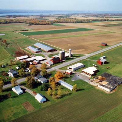
54 WHAT HUMAN FEATURES AND PHYSICAL FEATURES DO YOU NOTICE IN THESE PHOTOS?

55 The Human Light Feature House

56 The Human Road Feature

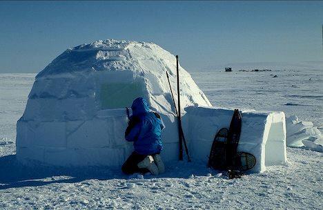
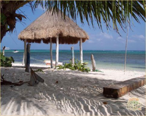
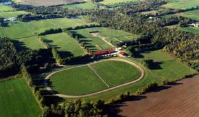
57 The Physical tree Feature

58 Human The bridge Feature

59 Human Feature The Building

60 Physical The Feature hill

61 The Physical cliff Feature

62 The tree Hmmm, Tricky. Human Feature
63 IN THE LAST EXAMPLE, THE TREE, IS A DIFFICULT ONE. WHERE DID THE TREE COME FROM? WHO PUT IT THERE?
64 A PHYSICAL ENVIRONMENT THEN, IS AN ENVIRONMENT, OR PLACE, THAT HAS NOT BEEN ALTERED OR CHANGED BY HUMANS. IT HAS MANY PHYSICAL FEATURES, AND NOT MANY HUMAN FEATURES
65 A HUMAN ENVIRONMENT, IS AN ENVIRONMENT THAT HAS BEEN CHANGED OR ALTERED, OR EVEN CREATED BY HUMANS. A HUMAN ENVIRONMENT HAS MANY HUMAN FEATURES.
66 ARE THESE ENVIRONMENTS HUMAN ENVIRONMENTS OR PHYSICAL ENVIRONMENTS? LOOK AT THE WHOLE ENVIRONMENT TO DECIDE.

67
68
69
70
71
72
73
74 A-B-C S OF THE WESTERN HEMISPHERE FUNTIVITY religions, foods, clothing styles, leisure activities, economic systems, form of government, traditions.
75 LEARNING LOG Where are people likely to settle when they move to new areas? What sorts of areas do people want to move to? What did the early settlers look for along the Eastern seaboard? The would search and look for resources like gold. The waterways were the easiest ways for the settlers to travel inland What other physical features besides water drew settlers to a specific area? Collect ABCs
76 BIG IDEAS Thematic maps and graphs provide population information Settlement patterns can be studied through a variety of maps Settlement patterns are linked to physical features of the Earth as well as human features Megacities are an important part of population studies.

77 Where do you think few people would choose to live and why? Where will there be the highest population density? What other factors influence where people live?
78 WHERE ARE MOST OF THESE CITIES? SIMILARITIES? DIFFERENCES? 1500: Beijing (China) Vijayanagar (India) Cairo (Egypt) Hangzhou (China) Tabriz (Iran) Constantinople (Turkey) Gaur (India) Paris (France) Canton (China) Nanjing (China) 1600: Beijing (China) Constantinople (Turkey) Agra (India) Osaka (Japan) Kyoto (Japan) Hangzhou (China) Paris (France) Naples (Italy) Cairo (Egypt) Bijapur (India).
79 LAND FACTS SHEET: US AND MEXICO
80 LEARNING LOG Try to forget everything you know about large cities in the US and Mexico. Based on your land facts sheet, where do you think the most dense population is located in the US and Mexico and WHY?

81 EARTH AT NIGHT

82 DO YOU RECOGNIZE THIS?

83 FROM THESE MAPS, CAN YOU TELL WHERE PEOPLE LIVE?
84 WHERE DO PEOPLE LIVE? What does it mean that over half the world s population is urban? What is a megacity? A city with a population over 10 million people Can you name any megacities?
85 The 10 largest megacities in the world as of the year 2000 are: Tokyo, Japan 26.4 million Mexico City, Mexico 18.4 million Bombay, India 18.1 million Sao Paulo, Brazil 17.8 million Shanghai, China 17.0 million New York City, USA 16.6 million Lagos, Nigeria 13.4 million Los Angeles, USA 13.1 million Calcutta, India 12.9 million Buenos Aires, Argentina 12.6 million
86 WHAT CITIES DO YOU THINK WILL BE MEGACITIES IN 2015? WHY? Final Question: Why do people live where they do?
87 Name as many natural hazards as you LEARNING LOGS can Write these 8 on your Natural Hazards sheet They can be: Atmospheric Hydrologic Geologic And have a negative effect on human life. Earthquakes Floods Hurricanes Landslides Tornadoes Tsunamis Volcanoes Wildfires
88 NATURAL HAZARDS SHEET Fill in the what I already know or have learned column on your own Has anyone ever experienced any of these? Where? Did you know there s a 100% chance of an earthquake today?

89 RING OF FIRE
90 THE EARTH S PLATES
91 JAPAN TSUNAMI Clip 1 Clip 2 Clip 3
92 VOLCANO HURRICANE AND TORNADO FE1D-48E9-AF54-5EC2BA9CBB2C
93 WILDFIRES FA5E-4E72-91F0-C0786E948B03 LANDSLIDES
94 FLOODS D021-4D25-B784-6A13BFD9AFE7
95 ECOSYSTEMS Learning logs: Explain what an ecosystem is. Then, list as many ecosystems as you can think of.
96 BIG IDEAS An ecosystem is a natural unit consisting of the non-living portion of an environment interacting with the living plants and animals that are adapted to it. There are hundreds of ecosystems on the planet. The Western Hemisphere is made up of a number of different ecosystems. Two primary ecosystems are deserts and rainforests, both of which appear in the western hemisphere
97 ECOSYSTEMS OF THE WESTERN HEMISPHERE LEARNING LOG: Create 2 columns in your learning log: Write down everything you know about each ecosystem Deserts Rainforests
98 TODAY S TASKS 1. Vocabulary Sheet 2. Find facts about each of the ecosystems 3. Locate each of these rainforests and deserts and color them on the map
99 HOW? In groups of three you will have one person in charge of each of the three responsibilities. It is important that everyone contributes for each of the three tasks
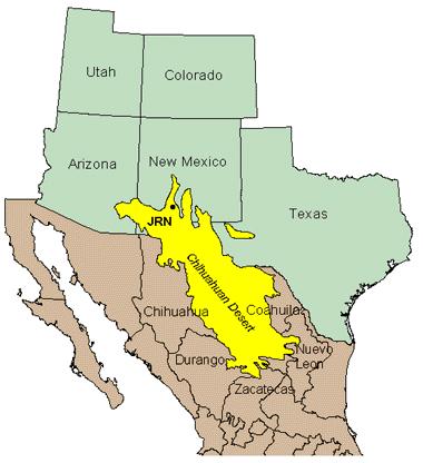
100 VOCABULARY Find vocabulary in your learning log. Highlight Mental map Special purpose map Region Landforms Weather Climate Climograph Human characteristics Population density Atmospheric Hydrologic Geologic Natural hazards Ecosystems Human Environment Interaction
101 LOCATE DESERTS AND RAINFORESTS Use your atlas (blue book) to find the location and details of deserts and rainforests in the western hemisphere. Color in the area where each desert or rainforest is located. Use the reading and the atlas in the textbook to locate and identify each rainforest or desert.
102 FIND FACTS ABOUT DESERTS AND RAINFOREST Use the readings to find facts about each of the rainforests and deserts listed on your sheets.
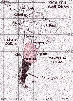
103 TODAY S TASKS 1. Vocabulary Sheet 2. Find facts about each of the ecosystems 3. Locate each of these rainforests and deserts and color them on the map
104 Mental map: a map that you have memorized in your mind Special purpose map: any of a variety of maps to show a particular topic, such as population or land use. Region: An area that is grouped together based on one or more common characteristics Landforms: natural physical features on the Earth s surface like rivers, mountains, lakes, Oceans, deserts, and plains. Weather: What the temperature and precipitation is like on a given day Climate: what the temperature and precipitation is like on average over a long period of time Climograph: A graph that show the average temperature and precipitation from a specific location. Human characteristics: the languages, religions, foods, clothing styles, leisure activities, economic systems, form of government, and traditions.
105 Population density: Measure how many people are in a square mile. The population can be dense or sparse depending on the area. Atmospheric: A natural disaster that happens in the atmosphere. Ex Hurricane Hydrologic: A natural disaster than happens in the water. Ex: tsunami Geologic: A natural disaster than happens in the earth. Ex. Earthquake Natural hazards: An atmospheric, geologic or hydrologic event that has a negative impact on human life. Ecosystems: a natural unit consisting of the non-living portion of an environment interacting with the living plants and animals that are adapted to it. Human Environment Interaction: The way that people adapt, modify, and use the earth.
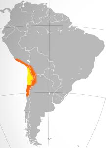
106 ATACAMA
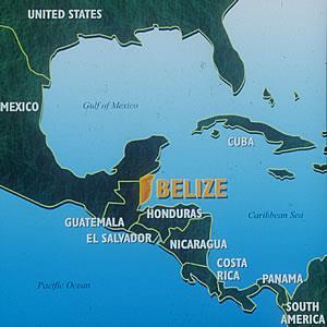
107 CHIHUAHUAN DESERT

108 GREAT BASIN

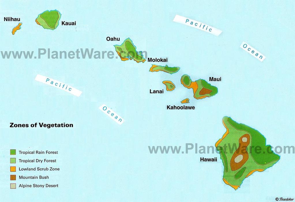
109 MOJAVE DESERT
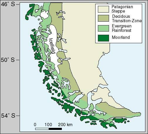
110 PATAGONIAN DESERT

111 SONORAN DESERT
112

113 PATAGONIAN RAINFOREST
114 BELIZE RAINFOREST

115 COSTA RICA RAINFOREST
116 HAWAIIAN RAINFOREST
117 MAGELANIC RAINFOREST

118 PACIFIC TEMPERATE Rainforest
119
120 FUNTIVITY Write a paragraph about 1 desert and 1 rainforest. Describe why it s easier to live in Grand Rapids verses living in the desert you chose and then the rainforest you chose.
121 HUMAN ENVIRONMENT INTERACTION Human/environment interaction shows us the ways in which people use and interact with the earth People can adapt to the environment by changing their behavior because of certain natural conditions. People can modify the environment by changing physical features of nature to accommodate their own lives Human/environment interaction can be either positive or negative
122 HEI AROUND THE WORLD Read: This is the Way We Go to School Fill in the chart: Interaction site, adaptation, modification, and explanation
123
Latin America. Physical Geography
 Latin America Physical Geography Regions Latin America can be divided into separate regions based on physical geography or cultural geography. Regions If we look at physical geography Latin America has
Geographic Qualities of South America
 Geographic Qualities of South America 1. South America is the fourth largest continent in area. It is located in the Western Hemisphere, lying southwest of North America. Most of South America lies in
Chapter 19 Test on South America
 Name Part 1 - Labeling (27 pts.) Chapter 19 Test on South America Score A. Locate the countries and territory contained in the word box below on the map of South America on the next page. Write the name
Latin America. Introduction
 Latin America Introduction What are the 5 Themes of Geography? Draw lines to connect the theme to the definition: Location How humans and the environment impact each other Physical and human characteristics
Mrs. Reifsnyder World Geography. Unit 8: Latin America Study Guide SOLs Addressed: WG. 1c, 2b, 3c, 4, 10b/c
 Mrs. Reifsnyder World Geography Unit 8: Latin America Study Guide SOLs Addressed: WG. 1c, 2b, 3c, 4, 10b/c Essential Questions: - In what ways do physical, economic, and cultural characteristics influence
2018 Spring Semester Final : STUDY GUIDE
 Name: Hr: 2018 Spring Semester Final : STUDY GUIDE My final is on:, May My final will have questions and will be COLONIZATION OF NORTH & SOUTH AMERICA - Match the regions with the European countries that
Comprehension Questions:
 Unit 3: Central & South america Comprehension Questions: 1. What is the driest desert on earth? Atacama Desert 2. What two water routes were discovered in the 1500s to get around the tip of South America?
WORLD GEOGRAPHY. Hector Rodriguez
 Mr. Chavira 9th Period WORLD GEOGRAPHY Hector Rodriguez P a g e 1 Table of Contents Latin America Page 2 o Maps Economic Map Page 3 Political Map Page 4 Population Map Page 5 Physical Page 6 o Notes Physical
CHAPTER Latin America. Regional Atlas Study Guide. 2 Chapter A. As You Read. B. Reviewing Vocabulary
 CHAPTER 28 9 Many Th ew inventions new Regional Atlas Study Guide Latin America Directions: As you work through the Regional Atlas, complete the chart below by writing two details about each Latin American
The Lesser Antilles. Dominican Republic), and Puerto Rico
, and Puerto Rico") The Caribbean Islands are archipelagoes or groups of islands. The major archipelagoes are: The Greater Antilles - Cuba, Jamaica, Hispaniola (Composed of Haiti and the Dominican Republic), and Puerto Rico
The Caribbean Islands are archipelagoes or groups of islands. The major archipelagoes are: The Greater Antilles - Cuba, Jamaica, Hispaniola (Composed of Haiti and the Dominican Republic), and Puerto Rico
STUDY GUIDE. The Land. Physical Features of Latin America. Chapter 8, Section 1. Terms to Know DRAWING FROM EXPERIENCE ORGANIZING YOUR THOUGHTS
 For use with textbook pages 193 198. The Land Terms to Know cordillera A mountain range that runs parallel to another mountain range (page 194) altiplano A high plain (page 194) escarpment A steep cliff
Latin America. Chapter 9 Physical Geography
 Latin America Chapter 9 Physical Geography Latin American Regions Middle America includes Mexico and the Central American countries The Caribbean Islands South America Mexico Landforms Sierra Madre Oriental
Why is the US industry and agriculture prosperous? The US industry and agriculture is so prosperous because it has many different natural resources.
 Ch. 1-7 Study Guide Why is the US industry and agriculture prosperous? The US industry and agriculture is so prosperous because it has many different natural resources. What likely drew immigrants to the
A funny sounding lake. South American Landforms, Climate, and Vegetation
 A funny sounding lake South American Landforms, Climate, and Vegetation 3 4 Essential Question: How have physical features and climate affected the population distribution of Latin America? 5 I. Landforms
Friday, November 10, 2017
 Friday, November 10, 2017 Andes and Midlatitude Countries Objective: Summarize the main physical features and regions of the Southern Cone. Identify and locate the urban centers and understand the pattern
1st Period Mr. Chavira WORLD GEOGRAPHY. Hector Rodriguez
 1st Period Mr. Chavira WORLD GEOGRAPHY Hector Rodriguez P a g e 1 Table of Contents Latin America Page 2 o Maps Economic Map Page 3 Political Map Page 4 Population Map Page 5 Physical Page 6 o Notes Physical
Objective. Students will familiarize themselves with the physical features and climates of Latin America.
 Journal Write KWL What do you KNOW about Latin America? What do you WANT TO KNOW about Latin America? What did you LEARN today that you didn t know before? Latin America Objective Students will familiarize
6th Grade Western Hemisphere Geography
 6th Grade Western Hemisphere Geography Multiple Choice Identify the choice that best completes the statement or answers the question. 1 Latin America is located in the A Northern Hemisphere. C Western
The Geography of Climate
 The Geography of Climate Objective for Today: Today we will examine ways that latitude and landforms influence climate The focus of our study will be the South American Continent in the Formal Region known
Mrs. Davis s Adventures
 Mrs. Davis s Adventures Latin America Countries & Political Map NAME: DATE: PERIOD: DIRECTIONS: Use your mapping skills and textbook pages: 127, 97, and 3 to complete Mrs. Davis s Story. Transfer the countries
The Land Photo Source: The Atlas of Canada, The Red River, Manatoba, Canada land/physio_red_ri
 The Land The United States and Canada An Overview of the Region The United States and Canada are the two largest countries in North America. The Rio Grande is part of the southwest border of the United
UNIT 3 Extra Review for Chapters 9-11
 UNIT 3 Extra Review for Chapters 9-11 Mexico Central America Caribbean Islands Middle America is Central America, Mexico, and the Islands of the Caribbean Central America is a region within Middle America.
6th Grade Western Hemisphere Geography
 6th Grade Western Hemisphere Geography Multiple Choice Identify the choice that best completes the statement or answers the question. 1 Latin America is located in the A Northern Hemisphere. C Western
Social Studies: The World
 Social Studies: The World What is the name of the continent that is labeled #1 on the map? North America What is the name of the continent that is labeled #2 on the map? South America What is the name
The Geological Pacific Northwest. Wednesday February 6, 2012 Pacific Northwest History Mr. Rice
 The Geological Pacific Northwest Wednesday February 6, 2012 Pacific Northwest History Mr. Rice 1 Free Response #2 Please do not simply list the items for this response. Full sentences!!! Minimum of 3-5
3 rd Term Worksheet [ ] Subject Geography Class VI Name : Sec. :
![3 rd Term Worksheet [ ] Subject Geography Class VI Name : Sec. :](/thumbs/84/89736232.jpg "3 rd Term Worksheet [ ] Subject Geography Class VI Name : Sec. :") 1 geo (vi) 3 rd Term Worksheet [2018 19] Subject Geography Class VI Name : Sec. : Case Study 1 : The Lumberjacks of Canada Exercise: [80-81] [A] Choose the correct answers: [80] 1. What are the men who
1 geo (vi) 3 rd Term Worksheet [2018 19] Subject Geography Class VI Name : Sec. : Case Study 1 : The Lumberjacks of Canada Exercise: [80-81] [A] Choose the correct answers: [80] 1. What are the men who
Latin America. Physical Geography
 + Latin America Physical Geography + I. Landforms A. Caribbean & Central America 1. Mexico is dominated by two mountain chains, collectively called the Sierra Madre. A high plateau is situated in between.
4th Grade Third 9 Weeks Test
 4th Grade Third 9 Weeks Test Multiple Choice Identify the choice that best completes the statement or answers the question. 1 A waterway for ships that is dug across land is called a. A port C river B
Regional Atlas: Introduction to Latin America
 Chapter 9, Section World Geography Chapter 9 Regional Atlas: Introduction to Latin America Copyright 2003 by Pearson Education, Inc., publishing as Prentice Hall, Upper Saddle River, NJ. All rights reserved.
Essential Questions. 1. How have historical figures and events affected South America today?
 South America Essential Questions 1. How have historical figures and events affected South America today? 2. How has location affected the development of countries in South America? 3. How has the role
Rivers. Highlights of some of the World s Most Famous Rivers!
 Rivers Highlights of some of the World s Most Famous Rivers! Directions This Power Point presentation contains information about some of the most famous rivers in the world! Students should use this presentation
Curriculum Pacing Guide Grade/Course 5 Th Grade Geography Grading Period 1 st Nine Weeks
 2013-2014 Curriculum Pacing Guide Grade/Course 5 Th Grade Grading Period 1 st Nine Weeks Time Frame Unit/ photographs, pictures, and tables to Locate and identify: Continents and Oceans -North America
LATIN AMERICA. Mexico Central America Caribbean Islands South America
 LATIN AMERICA Mexico Central America Caribbean Islands South America HISTORY First Settlers Hunters/gatherers from Asia crossed land bridge connecting Asia and Alaska Learned to farm over time Maize (corn)
Latin America s Physical Geography. EQ: What are characteristics of Latin America s physical features?
 Latin America s Physical Geography EQ: What are characteristics of Latin America s physical features? Your Task: We are going to participate in a Museum Walk! You will travel around the room with a partner
early human history and Central & South America Jeopardy
 early human history and Central & South America Jeopardy Every team will be chosen by Joe with the intention of mixing girls and boys and grade levels. Teams can choose a name if desired. teams can answer
Unit 1: Physical Geography Notes
 - How has the physical world impacted settlement patterns? o Major factors in the decision-making process of o Before the boom controlling the physical environment was not possible on a large scale - Physical
Portuguese Language - Fostering National Unity
 Geography Brazil Brazil Portuguese Language - Fostering National Unity 11 dialects of Portuguese Influenced by Amerindian and African languages, creating differences between Portuguese spoken in Brazil
World Geography Ch. 7.2 Climate Regions of Latin America
 World Geography Ch. 7.2 Climate Regions of Latin America BR: D10 When you think of Latin America, what types of climates do you think are down there? Write down which of the following you believe are there:
CONTINENTS. Australia is the name of a continent and a country. It is the smallest continent on Earth.
 1 Name: _ CONTINENTS A continent is a big area of land. There are seven continents on Earth: Africa, Asia, Europe, North America, South America, Australia and Antarctica. In North America there are countries
Seven Continents. Grade Level: 1 3
 Seven Continents Grade Level: 1 3 Teacher Guidelines pages 1 2 Instructional Pages pages 3 6 Activity Pages pages 8 14 Practice Page page 15 Homework Page page 16 Answer Key pages 17 18 Classroom Procedure:
Location, Climate, & Natural Resources. Where People Live & How They Trade
 Location, Climate, & Natural Resources Where People Live & How They Trade Standards SS6G13 The student will explain the impact of location, climate, distribution of natural resources, and population distribution
Exploring South America Learning Lapbook with Study Guide
 A J T L Grades 1-4 Exploring South America Learning Lapbook with Study Guide A Journey Through Learning www.ajourneythroughlearning.com Copyright 2013 A Journey Through Learning 1 Authors-Paula Winget
Five Themes Reference Sheet. Where is it? An exact position on earth. A general sense of position on earth, in relation to another position.
 Where is it? An exact position on earth. A general sense of position on earth, in relation to another position. Location Absolute Location Latitude & Longitude 35 N, 135 E is the global address for the
Introduction. We hope you find these materials useful and would welcome any feedback.
 Introduction This planning pack was produced with teachers from County Durham following a visit to São Paulo. The materials support the teaching of geography at key stage one and two within the context
Oceania. Australia, New Zealand, and the Pacific Islands. Physical Geography. Where is Australia located?
 Oceania Australia, New Zealand, and the Pacific Islands Physical Geography Australia New Zealand Oceania Where is Australia located? Australia & Oceania are a group of islands located between Asia, Antarctica,
6th Grade Third Nine Weeks Benchmark Assessment
 6th Grade Third Nine Weeks Benchmark Assessment Multiple Choice Identify the choice that best completes the statement or answers the question. Key Concepts 1 Latin America is located in the A Northern
Many ecotourists visit the various natural habitats in Central America. Why do you think ecotourism has become so popular?
 Chapter 9 Middle America and Spanish Speaking South America pg. 252 287 9 1 Central America pg. 255 259 Connecting to Your World What is one country in Central America that promotes ecotourism? Many ecotourists
Latin America and The Caribbean. A Closer Look.
 Latin America and The Caribbean A Closer Look. Mexico Capital: Mexico City The Location of Mexico Mexico is the second-largest country by size and population in Latin America.but the Largest Spanish -
Brazil Today The Amazon River and Basin
 Non-fiction: Brazil Today The Amazon River and Basin Brazil Today The Amazon River and Basin Deep within the Andes Mountains of northern Peru, two rivers flow together. Their junction forms one of the
South American Countries. Capital Location Population Terrain Climate
 South American Countries Capital Location Population Terrain Climate Andes Mountains Four large areas that make up the Central Plains: Llanos, the Selva, the Gran Chaco, and the Pampas Brazilian Highlands
South America. pg. 520 (5 th) pg. 523 (6 th )
 pg. 523 (6 th )") South America pg. 520 (5 th) pg. 523 (6 th ) Venezuela Rich in Oil Lake Maracaibo Called Little Venice pg. 572 (5 th) pg. 574 (6 th ) Caracas 8 miles Inland 3000 pg. 572 (5 th) pg. 574 (6 th ) Caracas
South America pg. 520 (5 th) pg. 523 (6 th ) Venezuela Rich in Oil Lake Maracaibo Called Little Venice pg. 572 (5 th) pg. 574 (6 th ) Caracas 8 miles Inland 3000 pg. 572 (5 th) pg. 574 (6 th ) Caracas
Amazon. Alaska. Antarctica VERY INTERESTING GEOGRAPHY FACTS. More than half of the coastline of the entire United States is in Alaska.
 Alaska Amazon More than half of the coastline of the entire United States is in Alaska. Antarctica Antarctica is the only land on our planet that is not owned by any country. 90% of the world's ice covers
Latin America 11/4/2013. Latin America Today. 580 million people 9% of the world s population Diverse backgrounds:
 Latin America Chapter 10 Human Geography Latin America Today 580 million people 9% of the world s population Diverse backgrounds: Native Americans Europeans Africans Asians 1 Population 393 million live
LAST TIME (Happy 300 th Birthday Ben Franklin!)
") LAST TIME (Happy 300 th Birthday Ben Franklin!) Latin American Diversity: Introduction Physical Geography of Mexico, Caribbean, and Central America: 1. Mexican drylands 2. Mesoamerican Highlands 3. Coastal
LAST TIME (Happy 300 th Birthday Ben Franklin!) Latin American Diversity: Introduction Physical Geography of Mexico, Caribbean, and Central America: 1. Mexican drylands 2. Mesoamerican Highlands 3. Coastal
PHYSICAL GEOGRAPHY. Unit 1
 PHYSICAL GEOGRAPHY Unit 1 HOW HAS THE PHYSICAL WORLD IMPACTED SETTLEMENT PATTERNS? Major factor in the decision-making process of settlers Before the technological boom controlling the physical environment
second term revision Social studies grade- 8
 المملكة العربية السعودية وزارة التعليم اإلدارة العامة للتعليم بمحافظة جدة مكتب التعليم بوسط جدة مدرسة دار التربية الحديثة Kingdom of Saudi Arabia Ministry of Education Dar Al- Tarbia Al-Haditha School
GEOGRAPHY AND HISTORY
 GEOGRAPHY AND HISTORY YEAR 1, PART 1 www.vicensvives.es Contents 01 Our planet Earth 02 The representation of the Earth: maps 03 The Earth s relief 04 Rivers and seas 05 Weather and climate 06 Climates
Year 7 Geography Snow Work
 Year 7 Geography Snow Work As part of your ISEB Geography Syllabus, you are required to know the names and locations of major countries, capitals, mountain ranges and rivers in the UK, Europe and throughout
Academic Vocabulary Social Studies, 5-8 (adapted from Building Academic Vocabulary by Robert Marzano.)
") Academic Vocabulary Social Studies, 5-8 (adapted from Building Academic Vocabulary by Robert Marzano.) Provide a student-friendly description, explanation, or example of the term. 7 Continents of the World
Academic Vocabulary Social Studies, 5-8 (adapted from Building Academic Vocabulary by Robert Marzano.) Provide a student-friendly description, explanation, or example of the term. 7 Continents of the World
Unit 5/Chapter 8 ticket Central America and the Caribbean
 Unit 5/Chapter 8 ticket Central America and the Caribbean Important Vocabulary Latifundia inifundia ISTHMUS : a strip of land two large strips of land ARCHIPELAGO : a or of islands BIODIVERSITY : an as
Ancient Egypt. Life Along the Nile River
 Ancient Egypt Life Along the Nile River 2018 Geography How Does Geography affect the way that people live? Geography- Where in the World? You are Here Streetsboro, Ohio United States of America Geography-
Chapter 7 Geography and the Early Settlement of Egypt, Kush, and Canaan
 Chapter 7 Geography and the Early Settlement of Egypt, Kush, and Canaan How did geography affect early settlement in Egypt, Kush, and Canaan? Section 7.1 - Introduction RF/NASA//Corbis This satellite photograph
Africa s. Presentation, Graphic Organizers, & Activities
 Africa s Presentation, Graphic Organizers, & Activities STANDARDS: SS7G1 Locate selected features of Africa. a. Locate on a world and regional political-physical map: Sahara, Sahel, savanna, tropical rain
*Latin America spans 7,000 miles, from Mexico to Tierra Del Fuego. *3 Regions: Central America, South America, and the Caribbean.
 Physical Geography Latin America spans 7,000 miles, from Mexico to Tierra Del Fuego *3 Regions: Central America, South America, and the Caribbean. *Intro clip: http://www.youtube.com/watch?v=cffp6rza3
South America Projects
 South America Projects Study the geography of South America by choosing one of the activities below. South American Travel Brochure Explorer s Journal World Cup Geography Create a Playable Board Game Create
South America. Land of Color and Contrast
 South America Land of Color and Contrast Home to: *The world s largest river system *The longest mountain chain, and second tallest mountains *Earth s driest desert *One of the world s great grassland
Name: Hour: Day: The Land and Its Regions (pg ) Define, in your own words, escarpment. Define, in your own words, sertão
 Define, in your own words, escarpment. Define, in your own words, sertão") Name: Hour: Day: World Geography Guided Reading Notes Chap 12 & 13 --- ANSWER IN COMPLETE SENTENCES!!!! READ EACH QUESTION CAREFULLY & ANSWER COMPLETELY!!!! Objectives: Upon completion of reading you should
Name: Hour: Day: World Geography Guided Reading Notes Chap 12 & 13 --- ANSWER IN COMPLETE SENTENCES!!!! READ EACH QUESTION CAREFULLY & ANSWER COMPLETELY!!!! Objectives: Upon completion of reading you should
Paper Reference. Paper Reference(s) 1312/4H Edexcel GCSE Geography A Higher Tier. Wednesday 15 June 2005 Afternoon Time: 1 hour 15 minutes
 1312/4H Edexcel GCSE Geography A Higher Tier. Wednesday 15 June 2005 Afternoon Time: 1 hour 15 minutes") Centre No. Candidate No. Paper Reference 1 3 1 2 4 H Surname Paper Reference(s) 1312/4H Edexcel GCSE Geography A Higher Tier Paper 4H Wednesday 15 June 2005 Afternoon Time: 1 hour 15 minutes Signature
Centre No. Candidate No. Paper Reference 1 3 1 2 4 H Surname Paper Reference(s) 1312/4H Edexcel GCSE Geography A Higher Tier Paper 4H Wednesday 15 June 2005 Afternoon Time: 1 hour 15 minutes Signature
Chapter 17. North Africa, Southwest Asia and Central Asia
 Chapter 17 North Africa, Southwest Asia and Central Asia Chapter Objectives Describe the major landforms and natural resources of North Africa, Southwest Asia, and Central Asia. Discuss the climate and
Match the names below with their locations on the map by writing the correct letter in the blank.
 P r e v i e w Match the names below with their locations on the map by writing the correct letter in the blank. Physical Features of Canada 60ºN 70ºN 80ºN A R C T I C O C E A N 130ºW 120ºW 110ºW 90ºW 70ºW
Countries Of The World: Mexico
 Countries Of The World: Mexico By National Geographic Kids, adapted by Newsela staff on 06.07.18 Word Count 659 Level MAX Image 1: The pyramids of Guachimontones in Jalisco, Mexico. Mexico is a country
Chapter 20. The Physical Geography of Africa South of the Sahara
 Chapter 20 The Physical Geography of Africa South of the Sahara Chapter Objectives Identify the major landforms, water systems, and natural resources of Africa south of the Sahara. Describe the relationship
LOCATION, LOCATION, LOCATION! Mexico, Venezuela, Cuba, and Brazil
 LOCATION, LOCATION, LOCATION! Mexico, Venezuela, Cuba, and Brazil GPS and E.Q. GPS: SS6G3 The student will explain the impact of location, climate, distribution of natural resources, and population distribution
2. The most important crop in Mexico. 3. The Priest who spoke against Spain. 5. Ancient Aztec city, now Mexico City
 Name: Date: Did you hear about what happened at the laundromat last night? Three clothespins held up two shirts! Clues are listed below. Print the word that matches the clue on the blank line by the clue.
Introduction to Africa
 Introduction to Africa Did you know? Africa has more countries than any other continent. The Sahara is a desert that is the size of the U.S. It s the world's largest desert. Most of the world s gold and
Paper Reference. Edexcel GCSE. Geography A Higher Tier. Thursday 12 June 2008 Afternoon Time: 1 hour 15 minutes
 Surname Centre No. Initial(s) Paper Reference 1 3 1 2 Candidate No. 4 H Signature Paper Reference(s) 1312/4H Examiner s use only Edexcel GCSE Team Leader s use only Geography A Higher Tier Question Number
ì<(sk$m)=beicea< +^-Ä-U-Ä-U
=beicea< +^-Ä-U-Ä-U") Fascinating Facts The Nile River in Egypt is the world s longest river, but the Amazon River in Brazil moves the most water. The world s largest freshwater lake is Lake Baikal in Russia. The highest temperature
Fascinating Facts The Nile River in Egypt is the world s longest river, but the Amazon River in Brazil moves the most water. The world s largest freshwater lake is Lake Baikal in Russia. The highest temperature
CHAPTER 12. South America. Section 1: Natural Environments Section 2: History and Culture Section 3: South America Today. HOLT World Geography
 CHAPTER 12 South America Section 1: Natural Environments Section 2: History and Culture Section 3: South America 1 Section 1 Natural Environments Objectives: What are the major landforms and rivers of
Countries of the World
 As of September 2017 Countries of the World Website: Countries of the World. com https://www.countries-ofthe-world.com/countries-of-north-america.html Website: CIA.gov https://www.cia.gov/index.html Tales
Tourism is a rapidly growing industry and has an enormous economic and environmental impact across the world.
 3º ESO UNIT 3 HOLIDAY TIME 1. Tourism Tourism is a rapidly growing industry and has an enormous economic and environmental impact across the world. The growth of tourism In 2010, 940 million people were
Geography: Unit 2. Map. Rivers. Major Physical Features. Slide 1. Slide 2. Slide 3. Slide 4. North America United States and Canada.
 Mississippi River Slide 1 Slide 2 Slide 3 Slide 4 Geography: Unit 2 North America United States Map Major Physical Features Mountain Ranges Brooks Range Mackenzie Mountains Coast Mountains Cascades Sierra
Label your Map with Russia. Map Activity
 Bell Activity How many time zones does the U.S. have? How do these time zones affect life in the U.S.? Russia is so large it has 11 time zones. What difficulties might this create? Objectives Know landforms,
Ancient Greece. Teachers Curriculum Institute Geography and the Settlement of Greece 1
 G e o g r a p h y C h a l l e n g e Ancient Greece G R E E C E N W E S 0 250 500 miles 0 250 500 kilometers Lambert Azimuthal Equal-Area Projection Teachers Curriculum Institute Geography and the Settlement
This Is the. W e s t
 This Is the W e s t This Is the W e s t Copyright by Harcourt, Inc. All rights reserved. No part of this publication may be reproduced or transmitted in any form or by any means, electronic or mechanical,
Chapter 7: Vocabulary (Use the Glossary in the back of your textbook) Chapter 7: Places (Use the Gazetteer in the back of your textbook)
 Chapter 7: Places (Use the Gazetteer in the back of your textbook)") Name Period Chapter 7 Study Guide Chapter 7: Vocabulary (Use the Glossary in the back of your textbook) Review 10-15 min. EVERY Night p. 188 archipelago: p. 188 biome: p. 199 quipu: p. 188 scrub land:
Name Period Chapter 7 Study Guide Chapter 7: Vocabulary (Use the Glossary in the back of your textbook) Review 10-15 min. EVERY Night p. 188 archipelago: p. 188 biome: p. 199 quipu: p. 188 scrub land:
STANDARDS: Brain Wrinkles
 STANDARDS: SS6G3 The student will explain the impact of location, climate, distribution of natural resources, and population distribution on Latin America and the Caribbean. a. Compare how the location,
Ancient Greece GREECE UNIT 5 GEOGRAPHY CHALLENGE. 1 Unit 5 Geography Challenge miles. Lambert Azimuthal Equal-Area Projection
 W N S E UNIT 5 GEOGRAPHY CHALLENGE Ancient Greece 0 250 500 miles 0 250 500 kilometers Lambert Azimuthal Equal-Area Projection GREECE 1 Unit 5 Geography Challenge UNIT 5 GEOGRAPHY CHALLENGE Geography Skills
e 2 design season three New Orleans: The Water Line Episode Summary
 e 2 design season three New Orleans: The Water Line Episode Summary After the devastation of Hurricane Katrina, which hit the southern coast of the United States on August 28, 2005, the residents of the
Brazil. Population & Culture
 Brazil Population & Culture Population of Brazil Largest country in South America 200 million people (2012 est) Growing population - approximately 1% per year Life expectancy - approx 72 years Population
COUNTRY DATA: Costa Rica : Information from the CIA World Factbook! INTRODUCTION GEOGRAPHY
 ! COUNTRY DATA: Costa Rica : Information from the CIA World Factbook! INTRODUCTION GEOGRAPHY Location Area Central America, bordering both the Caribbean Sea and the North Pacific Ocean, between Nicaragua
MEXICO: OUR NEIGHBOR TO THE SOUTH A
 MEXICO: OUR NEIGHBOR TO THE SOUTH A Unit of Study BLACKLINE MASTERS Specific instructions for the use of these blackline masters are given in the Teacher's Guide under Suggested Instructional Procedures.
Chapter 7: The Geography and Settlement of Egypt, Kush, and Canaan
 Chapter 7: The Geography and Settlement of Egypt, Kush, and Canaan Learning Target: I can explain how geography affected early settlement in Egypt, Kush, and Canaan. Ancient Egypt and the Middle East Can
Brain Wrinkles. Africa: The impact of location, climate, & physical characteristics on where people live, the type of work they do, & how they travel
 Africa: The impact of location, climate, & physical characteristics on where people live, the type of work they do, & how they travel STANDARDS: SS7G3 The student will explain the impact of location, climate,
Mediterranean Europe
 Chapter 17, Section World Geography Chapter 17 Mediterranean Europe Copyright 2003 by Pearson Education, Inc., publishing as Prentice Hall, Upper Saddle River, NJ. All rights reserved. Chapter 17, Section
Countries Of The World: Mexico
 Countries Of The World: Mexico By National Geographic Kids, adapted by Newsela staff on 06.07.18 Word Count 638 Level 800L Image 1: The pyramids of Guachimontones in Jalisco, Mexico. Mexico is a country
THE USA. The capital of USA is Washington D.C., in the District of Columbia.
 THE USA The United States of America is the richest and one of the biggest countries in the world. It has a population of about 295 million people. It is divided into 50 states; two of them, Alaska and
4th Grade Social Studies 2nd Nine Weeks Test
 4th Grade Social Studies 2nd Nine Weeks Test Multiple Choice Identify the choice that best completes the statement or answers the question. 1 Which is the largest city in the United States? A Philadelphia,
Do Not Write On This Sheet. World Rally. City, country, continient: to city, country, continent:
 World Rally At each checkpoint you must list the city, country, and continent. The teacher must check all answers before you can go on to the next checkpoint. Checkpoint 1: Start at: 29 N 98 W and go to:
DOWNLOAD OR READ : MAPPING SOUTH AMERICA PDF EBOOK EPUB MOBI
 DOWNLOAD OR READ : MAPPING SOUTH AMERICA PDF EBOOK EPUB MOBI Page 1 Page 2 mapping south america mapping south america pdf mapping south america South America PDF maps Free South America maps for students,
EXPLORING BIOMES IN GORONGOSA NATIONAL PARK
 EXPLORING BIOMES IN GORONGOSA NATIONAL PARK ABOUT THIS WORKSHEET This worksheet complements the Click and Learn Gorongosa National Park Interactive Map (http://www.hhmi.org/biointeractive/gorongosa-national-park-interactive-map),