St. George Jeepers Torrey, Utah, Fall Foliage Outing September 26, 2016
|
|
|
- Georgia Copeland
- 5 years ago
- Views:
Transcription
1 St. George Jeepers Torrey, Utah, Fall Foliage Outing September 26, 2016 On a beautiful, sunny fall day fourteen vehicles departed the Maverick station in Cedar City for a ride to Torrey, Utah. We were led by Joan Hayes. Unfortunately, Phil Hayes was home convalescing and couldn't make this Torrey trip. Our trip to Torrey included the drive up I-15 to US Rt. 20 and then easterly on Rt. 20 to Rt. 89. We then drove north up 89 and did a brief stop in Circleville, Utah. Circleville was originally settled in The town was named for the shape of the valley in which it is located, Circle Valley. The valley is completely circled by mountains except where the north flowing Sevier River goes in and out of the valley on the north and south. On Jun 28th, 1866, the town was abandoned by the original settlers. A few settlers began to trickle back into the area in 1873 and the town was re-established in 1874 when Charles Wakeman Dalton crossed the mountain from Beaver with two of his wives and family. Utah's most notorious native son, the elusive international cowboy outlaw, Robert Leroy Parker, better known as Butch Cassidy, grew up in Circle Valley just a mile from Circleville (but he was born further to the west, across the Tushar Mountains, in the town of Beaver, Utah). His family's small cabin, on the outskirts of town, is still standing on the land they homesteaded. It can be seen on the west side of the road almost exactly one mile to the south of Circleville on US Highway 89.
 family")
2 Parker (Butch Cassidy) family cabin

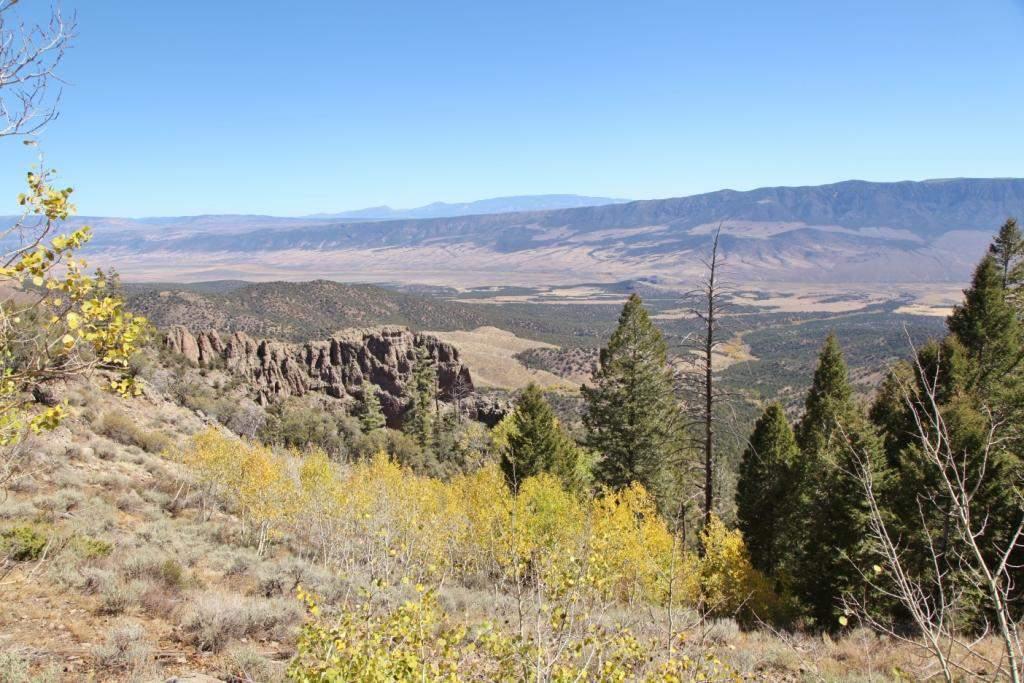
3 After departing Circleville we traveled up 89 to Rt. 62, passed through the village of Kingston and entered the scenic Kingston Canyon Road. Below, air down at a rest center on Rt. 62, shortly before we left the highway and turned north onto Monroe Mountain Road.

4 Fish Lake Cut-off of the Old Spanish Trail
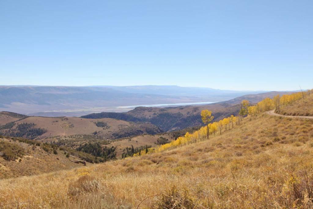
5 An Historic Trade Route Passed This Way In the early 1800s, thousands of men, mules, and horses plodded along a well-travelled trail that paralleled Fish Lake. Why Did Traders Come This Way? The cutoff was a 72-mile shortcut that skirted the western shores of Wahsatch Lake (Fish Lake). Reaching elevations near 9,000 feet, the trail crossed mountain valleys that provided abundant quantities of fish, grass, water, and cool summer temperatures for travelers using this alternate route. This "southern branch" rejoined the main Old Spanish Trail near here at Kingston, Utah. The Old Spanish Trail This pack trail, known as the Old Spanish Trail, stretched 1,200 miles and linked Santa Fe, New Mexico, and the Pueblo de Los Angeles (L.A.) in the Mexican Territory of California. Between 1829 and 1848, traders used the trail to carry New Mexican woolen goods; rugs, blankets and serapes, that were traded for California mules and horses. On day two, September 27, of this fall foliage trip, we will visit another crossing of the Fish Lake Cut-off near Johnson Reservoir. A more detailed story of the trail will be included.

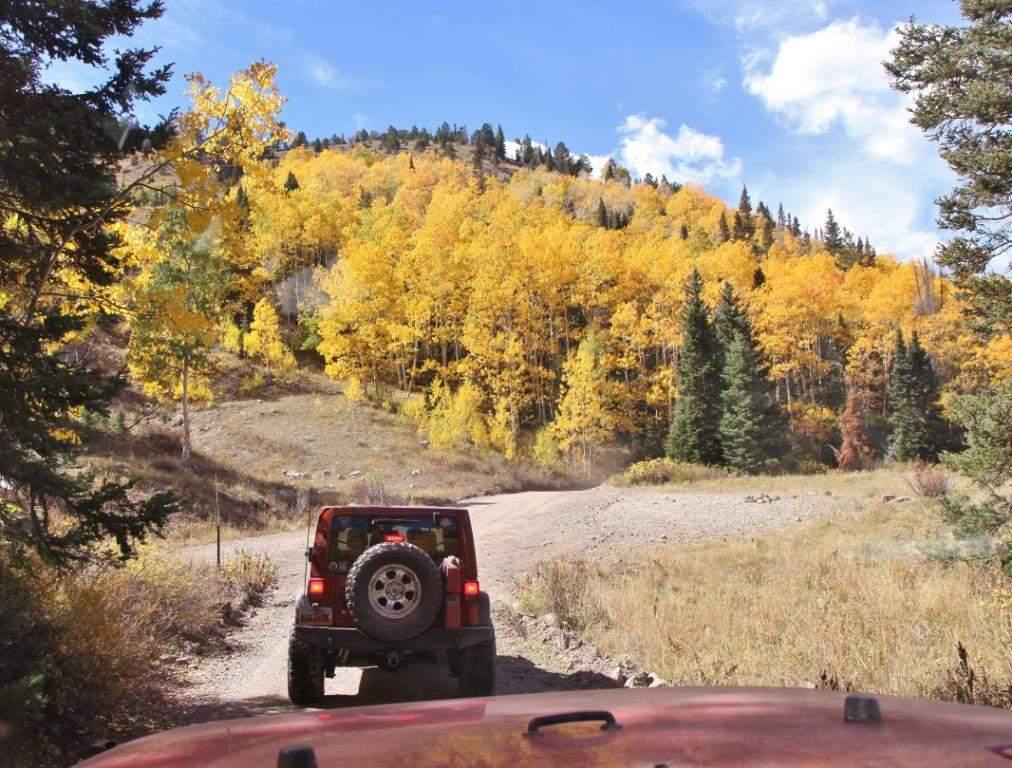
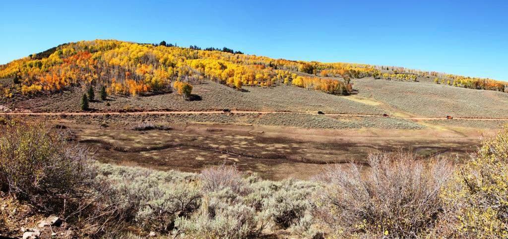
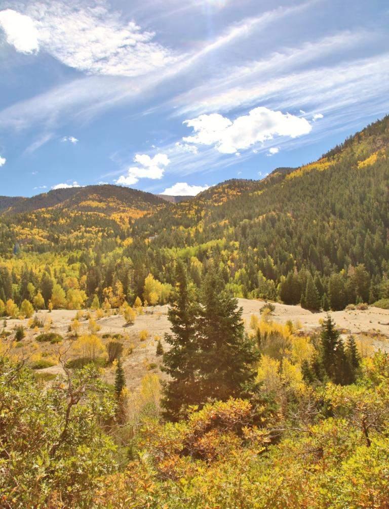
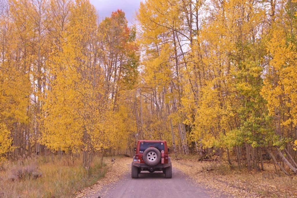
6 Snow was evident from a recent storm on the high reaches of the Tushar Mountains. Throughout this fall trip this snowstorm with the accompanying high winds had a big impact on the amount of foliage remaining as will be apparent in some of the following photographs.
")
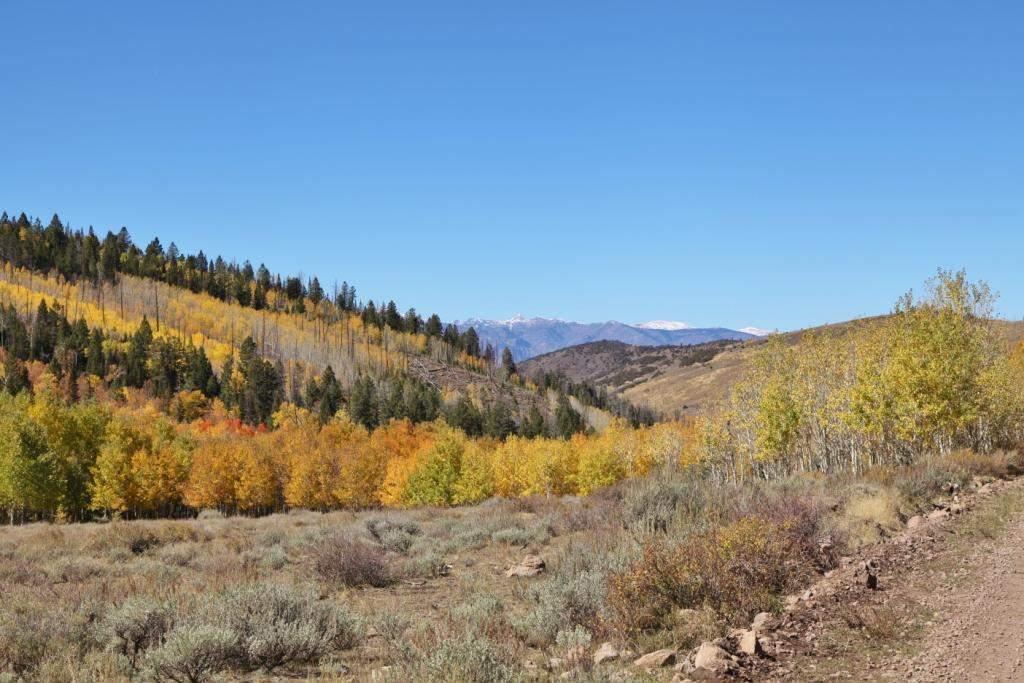
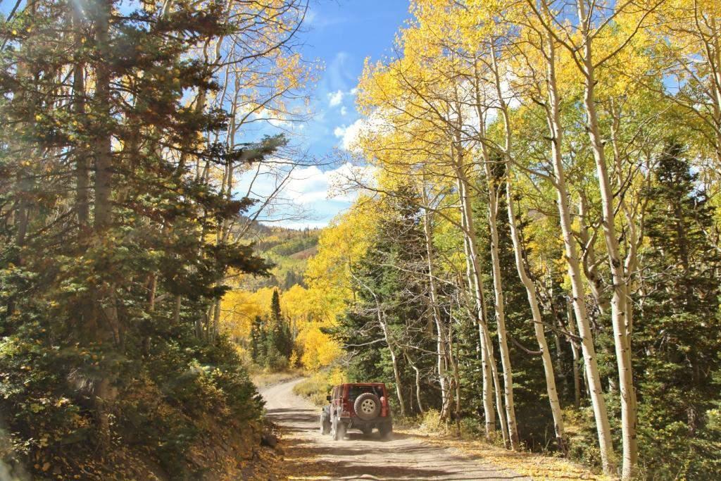
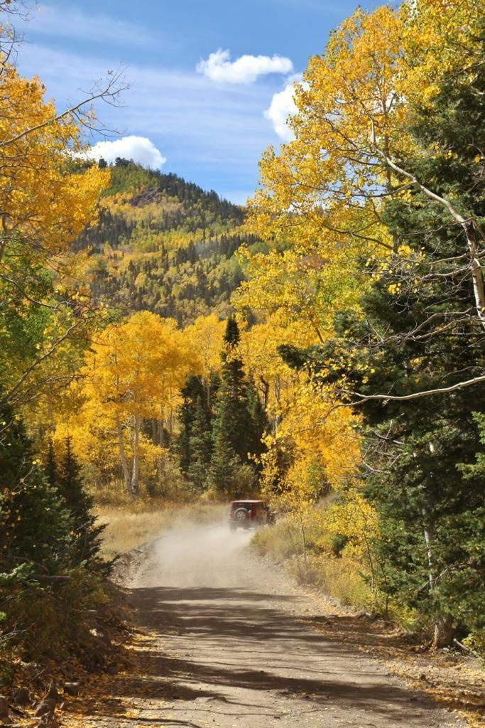
7 Monroe Canyon Road (FR 078)
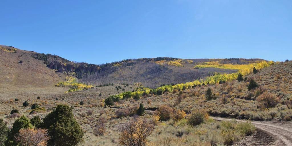
8

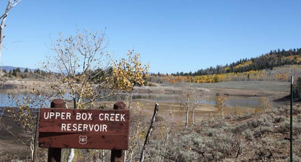
9 A small, yet valuable livestock and wildlife watering pond.

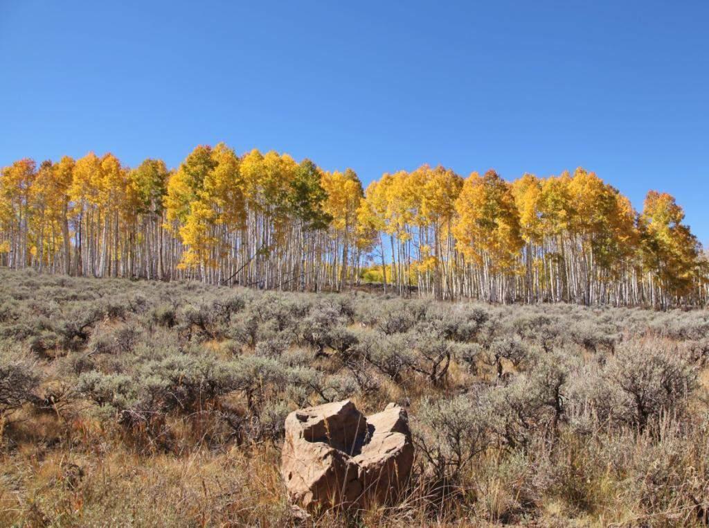
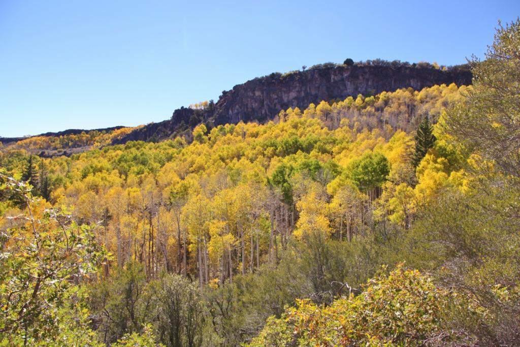
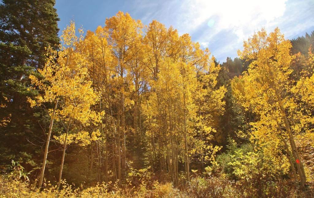
10 Getting into some nice color.
11
12
13

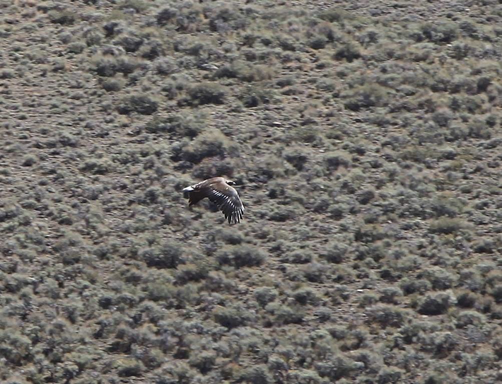
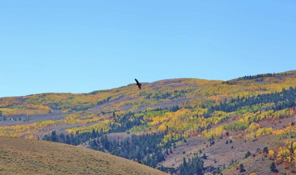
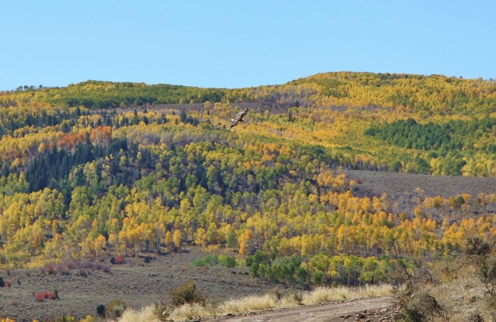
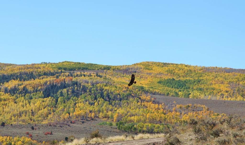
14 We were fortunate to see several golden eagles hunting in this high mountain valley.
15
16
17
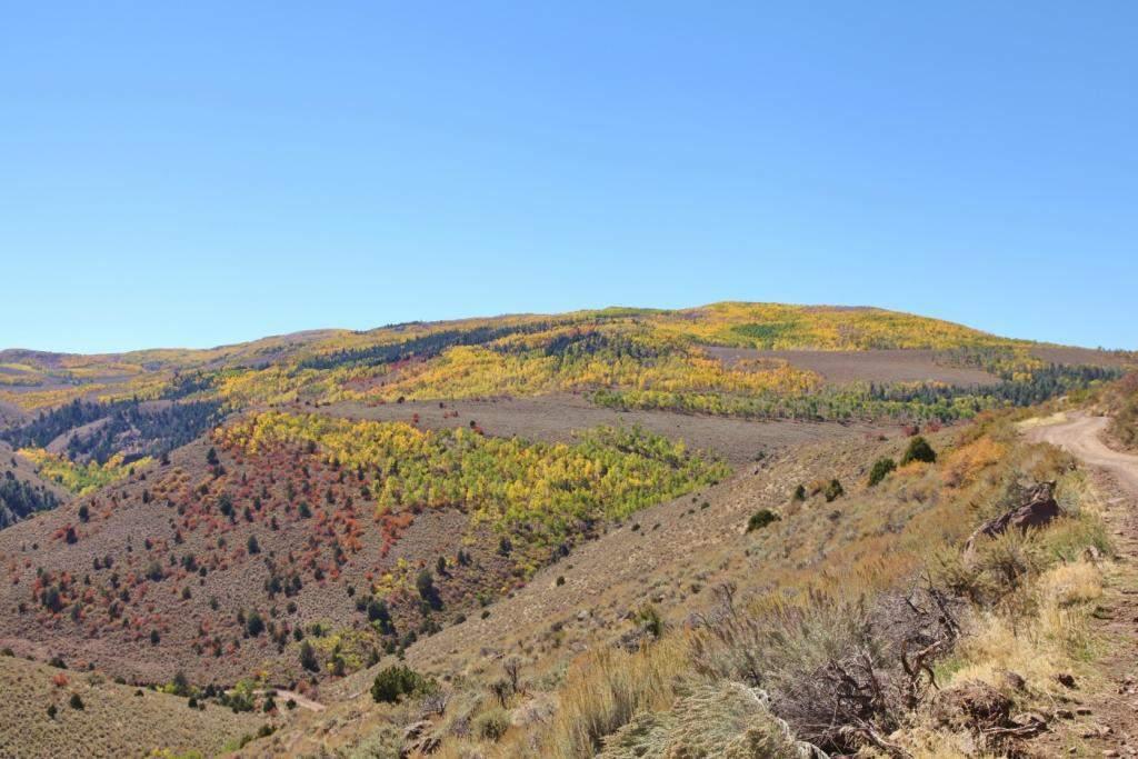
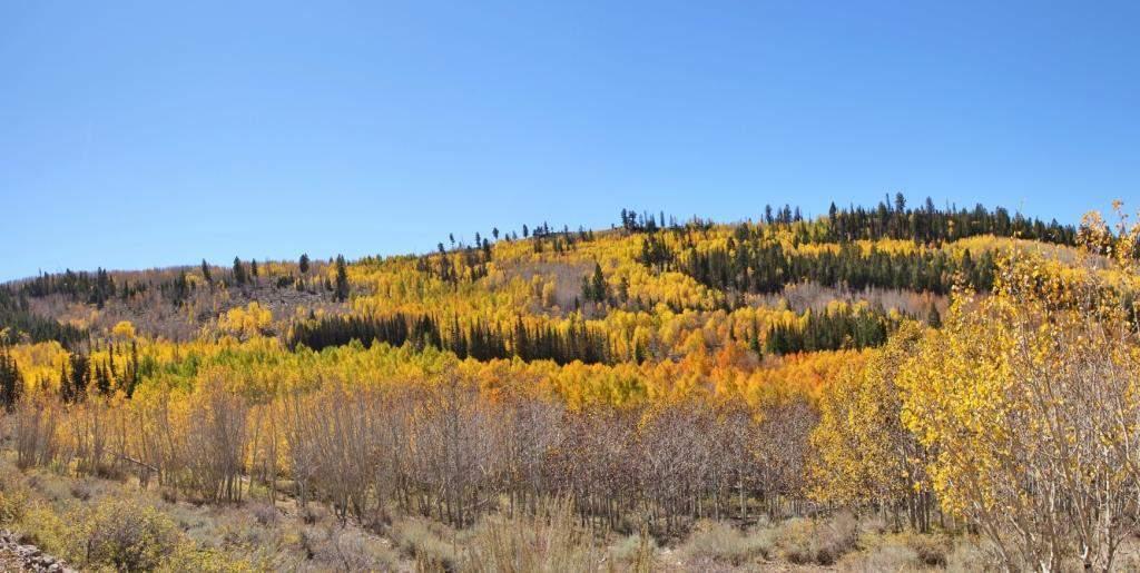
18
19
20
21
22
23
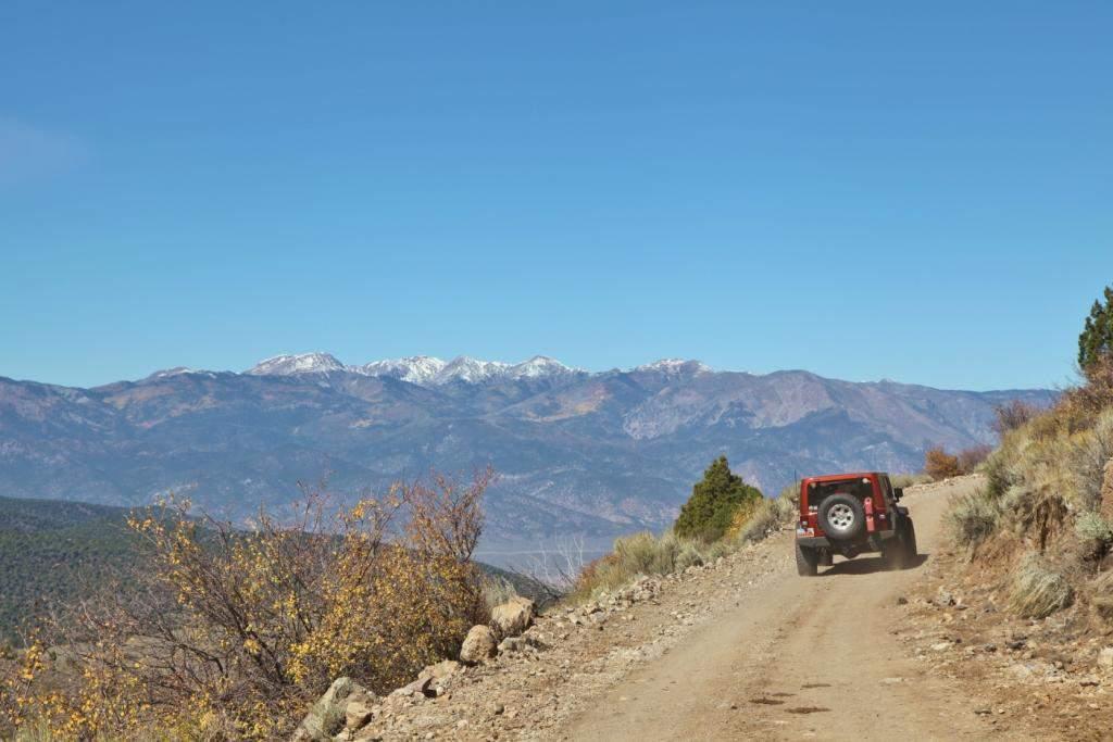
24

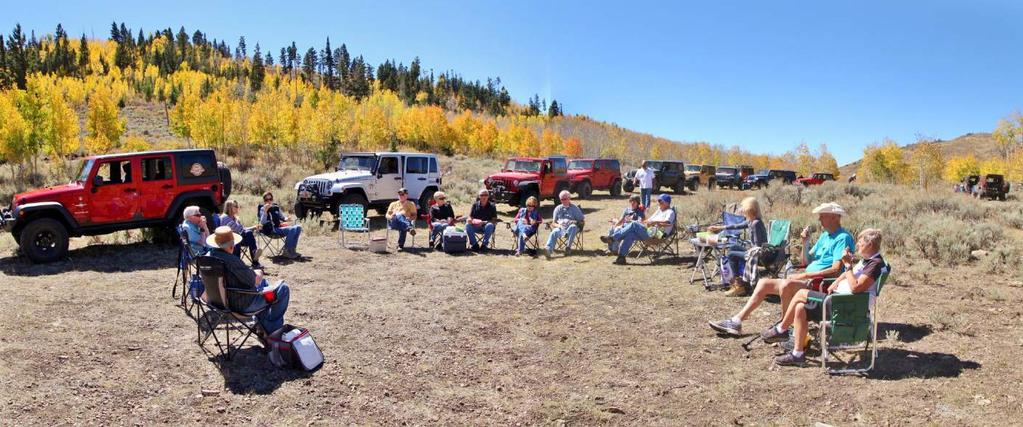
25 A time everybody looks forward to; lunchtime on the trail.

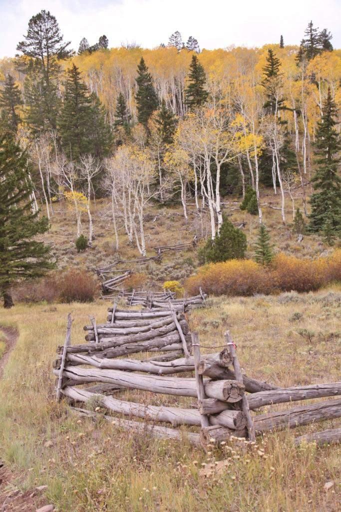
26 An old wooden rail fence protects a small riparian spring area.

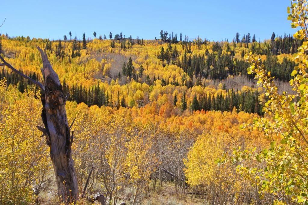
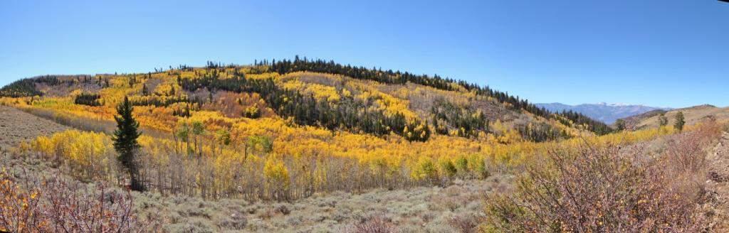
27 The contrast between the evergreen spruce and fir and the aspens adds to the visual appeal of the fall foliage experience.
28

29 Aspens regenerate by spreading underground. In this photo, all these stems are part of the same plant. Scientists calculate that aspens have the most biomass of any individual organism on earth.
30
31
32

33 Below, Joan Hayes and Debbie Andrews take a photography break.

34 Traveling on toward Koosharem.
35
36
37
38
39

40 The old Virginia rail style fence adds to the aesthetic appeal of the adventure.

41 Worm's eye view of the aspen canopy.
42
43

44 Grass Valley Mercantile, the famous Koosharem store. After arriving in Koosharem we aired up our tires and took Rt. 24 to Torrey for check-in at the Broken Spur Motel and Restaurant and an excellent supper provided by the Broken Spur. Submitted by Bud Sanders
26 Utah s Patchwork Parkway SCENIC BYWAY CORRIDOR MANAGEMENT PLAN (SR 143)
") Natural Natural Quality applies to those features in the visual environment that are in a relatively undisturbed state. These features predate the arrival of human populations and may include geological
Natural Natural Quality applies to those features in the visual environment that are in a relatively undisturbed state. These features predate the arrival of human populations and may include geological
DOWNLOAD OR READ : USA CALIFORNIA NEVADA NATIONAL GEOGRAPHIC ADVENTURE TRAVEL MAP PDF EBOOK EPUB MOBI
 DOWNLOAD OR READ : USA CALIFORNIA NEVADA NATIONAL GEOGRAPHIC ADVENTURE TRAVEL MAP PDF EBOOK EPUB MOBI Page 1 Page 2 usa california nevada national geographic adventure travel map usa california nevada
SAN MIGUEL CREEK RANCH. q Trinidad, Las Animas County, Colorado q
 SAN MIGUEL CREEK RANCH q Trinidad, Las Animas County, Colorado q 2 s San Miguel Creek Ranch is a scenic well-balanced cattle and trophy hunting ranch that showcases the very best of Southern Colorado.
Spanish Colonies on the Borderlands
 Spanish Colonies on the Borderlands Pages 90 93 Nov 1 8:14 PM 1 Today's Objectives *Describe Spain s colony in Florida. *Explain how Spain established settlements throughout much of North America. *Describe
Hartsel Springs Ranch 4,637 Acres Park County, Colorado $4,780,000
 Hartsel Springs Ranch 4,637 Acres Park County, Colorado $4,780,000 Presented By: Farm, Ranch & Recreational Real Estate Hartsel Springs Ranch 4,637 Acres Park County, Colorado $4,780,000 Property Description
Cornucopia Ranch. the
 Cornucopia Ranch the Majestic mountains... Rolling hills... Vast meadows... are all part of the beautiful landscape of the Cornucopia Ranch. Located just 40 miles from Cloudcroft, New Mexico, the Cornucopia
BUTCHER CREEK RANCH. Butcher Creek Ranch. Roscoe, Montana. Reduced to $1,650,000.
 BUTCHER CREEK RANCH Butcher Creek Ranch Roscoe, Montana Reduced to $1,650,000. Offered Exclusively By: Sonny Todd Real Estate 301 West First Avenue, PO Box 788 Big Timber, Montana 59011 Office: (406) 932-1031
the Cornucopia Canyon Ranch
 the Cornucopia Canyon Ranch Majestic mountains... Rolling hills... Vast meadows... are all part of the beautiful landscape of the Cornucopia Canyon Ranch. Located just 40 miles from Cloudcroft, New Mexico,
Subject to Sale, Withdrawal or Error
 We are proud to offer an exclusive listing on a ranch in a very highly desired part of Northeast New Mexico. This ranch truly expresses the long understood real estate requirements of location, location,
TAYLOR CANYON RANCH COLORADO - ROUTT COUNTY - STEAMBOAT SPRINGS
 TAYLOR CANYON RANCH COLORADO - ROUTT COUNTY - STEAMBOAT SPRINGS Tucked up against the steep valley shaped by Mt. Pau and rising to the Routt National Forest, Taylor Canyon Ranch is an easily accessible,
Countries Of The World: Mexico
 Countries Of The World: Mexico By National Geographic Kids, adapted by Newsela staff on 06.07.18 Word Count 659 Level MAX Image 1: The pyramids of Guachimontones in Jalisco, Mexico. Mexico is a country
Maple Leaf School TRU Trip to Wells Gray Provincial Park. October 28+29, 2017
 Maple Leaf School TRU Trip to Wells Gray Provincial Park October 28+29, 2017 Twelve students, our principal, our principal s son, and I left Kamloops at 7:00 am on October 28 in two 8-seat rental transit
the Webb Ranch Resort
 the Webb Ranch Resort Recreation... Privacy... Comfort... The Webb Ranch Resort is located approximately 6 miles northwest of Pinon, New Mexico. Featuring a beautifully designed, custom log home, the 212
State Symbols. State Facts. California. California
 became a state in 1850. became a territory of the U.S. in 1848, right before gold was discovered at Sutter s Mill. is called the Golden State. This name started because long ago many people moved to to
PAUL S PLACE ELK, DEER AND VIEWS FISHTAIL, MONTANA
 McCaslin Land 2010 PAUL S PLACE ELK, DEER AND VIEWS FISHTAIL, MONTANA LOCATION Paul s Place is ideally located in the foothills of the Beartooth Mountains, approximately 5 to 5-1/2 miles west of Fishtail,
Ponderosa Pines Ranch
 PONDEROSA PINES RANCH Ponderosa Pines Ranch Shepherd, Montana $3,285,000. Offered Exclusively By: Sonny Todd Real Estate 301 W First, PO Box 788 Big Timber, MT 59011 Office: (406) 932-6668 (406) 932-LAND
Utah Studies DOMINGUEZ AND ESCALANTE
 Utah Studies THE WORLD IN THE 1400 S In the 1400 s merchants in Europe wanted to buy and sell goods with people in faraway places. Some of the reasons for this desire to trade with the world were: the
HIGH COUNTRY L-BAR RANCH
 HIGH COUNTRY L-BAR RANCH Sandoval and mckinley counties N e w m e x i c o Jim Haworth, Ranch Team Lead Broker ~ 505-235-5236 3613 NMSR 528 NW, Ste. H, Albuquerque, NM 87114 505-792-3713 www.wwrealty.com
BRYCE CANYON COUNTRY Boulder Mountain Scenic backways itinerary
 BRYCE CANYON COUNTRY Boulder Mountain Scenic backways itinerary Boulder Mountain Area The high plateaus of the Aquarius Plateau (Boulder Mountain), are heavily forested and covered in countless winding
G R E E N R I V E R - W Y O M I N G - S W E E T W A T E R C O U N T Y
 G R E E N R I V E R - W Y O M I N G - S W E E T W A T E R C O U N T Y Minor Ranch All information contained herein is taken from sources considered reliable, but is not guaranteed by either seller nor
Lane Residence. Silverthorne, Colorado. Offered for $3,999,999. Contact Bill George. (970)
") Lane Residence Silverthorne, Colorado Offered for $3,999,999 Contact Bill George (970) 485 1052 bill@ranchland.com Ownership of this 6,450 square foot custom log home at Shadow Creek Ranch gets you access
Lane Residence Silverthorne, Colorado Offered for $3,999,999 Contact Bill George (970) 485 1052 bill@ranchland.com Ownership of this 6,450 square foot custom log home at Shadow Creek Ranch gets you access
Brinker Creek Ranch. Colorado - Routt County - Yampa
 Located at the base of the Flattops Range in the Steamboat/Vail corridor, Brinker Creek Ranch consists of 1,451 acres ideally suited for high country grazing and native grass hay production. Traditionally
Lesson 1: Land and Climate of the West Land and Water of the West 1. There are 13 states in the West, divided into 3 regions a. Southwest: Nevada,
 Lesson 1: Land and Climate of the West Land and Water of the West 1. There are 13 states in the West, divided into 3 regions a. Southwest: Nevada, Utah, Arizona, New Mexico b. Mountain States: Wyoming,
Bat Cave Canyon Ranch 2,920 acres Jeff Davis County, Texas
 Bat Cave Canyon Ranch 2,920 acres Jeff Davis County, Texas James King, Agent Office 432.426.2024 Cell 432.386.2821 James@KingLandWater.com Bat Cave Canyon Ranch 2,920 acres Jeff Davis County, Texas James
Telluride-to-Moab Alternative Singletrack Options
 Telluride-to-Moab Alternative Singletrack Options Day 1 Day 1 Alternate 1: Galloping Goose to Deep Creek. 18.4 miles, ascent 3,530ft, descent 1,388ft. This is fun, flowey, moderate to intermediate singletrack
BROCHURE. APPLE HILL WOODS 118 +/- Acres Camino, California. Presented by Jim Copeland
 BROCHURE APPLE HILL WOODS 118 +/- Acres Camino, California Presented by Jim Copeland 1 The Property This 118 acre is a rare gem in the Sierra Nevada foothills. Covered with lush forestland and scattered
B HALL RANCH FISHTAIL, MONTANA
 Brochure Courtesy of: B HALL RANCH FISHTAIL, MONTANA w w w. m c c a s l i n l a n d. c o m Page 1 LOCATION The Hall Ranch is ideally located in the foothills of the Beartooth Mountains, approximately 5
815 E Highway ± AC $995,000. Duck Creek Village, UT Duck Creek Village Inn. For more information: Property Features FOR SALE
 FOR SALE 1.18± AC Duck Creek Village Inn 815 E Highway 14 Duck Creek Village, UT 84762 Property Features Located on one of Southern Utah s Scenic byways. Minutes from Zion LOT SIZE - ACRES 1.18± AC National
Daisy Dean Creek Ranch
 Daisy Dean Creek Ranch MARTINSDALE, MONTANA Hunting Ranching Fly Fishing Conservation Daisy Dean Creek Ranch MARTINSDALE, MONTANA Introduction: Daisy Dean Creek Ranch is comprised of 1,652 acres with a
4th Grade Third 9 Weeks Test
 4th Grade Third 9 Weeks Test Multiple Choice Identify the choice that best completes the statement or answers the question. 1 A waterway for ships that is dug across land is called a. A port C river B
Trail Beginning Elevation: 7553 ft The Poison Creek Trailhead is located at the end of National Forest Road 646E (NF-646E).
.") West Mountain Trails Poison Creek Trail #134 Length: 2.9 miles (4.7 km) Difficulty Horseback: A good trail for the first time west mountain rider, some steep sections Hiking: Most Difficult USGS Maps:
West Mountain Trails Poison Creek Trail #134 Length: 2.9 miles (4.7 km) Difficulty Horseback: A good trail for the first time west mountain rider, some steep sections Hiking: Most Difficult USGS Maps:
2.0 PARK VISION AND ROLES
 2.0 PARK VISION AND ROLES 2.1 Significance in the Protected Area System Marble Range and Edge Hills provincial parks protect 6.8% of the Pavillion Ranges Ecosection, which is located in the Southern Interior
Maya s Creek Crossing Hwy 17 N acres $185,000 Fort Davis, Texas
 Maya s Creek Crossing Hwy 17 N 14.98 acres $185,000 Fort Davis, Texas James King, Agent Office 432-426-2024 Cell 432-386-2821 James@KingLandWater.com King Land & Water LLC P.O. Box 109, 600 State Street,
Final Recreation Report. Sunflower Allotment Grazing Analysis. July 2015
 Final Recreation Report Sunflower Allotment Grazing Analysis July 2015 Table of Contents Introduction... 3 Affected Environment... 3 Four Peaks Wilderness Area... 3 Dispersed Recreation... 3 Environmental
A Long Weekend in Zion. 4 Days
 A Long Weekend in Zion 4 Days A Long Weekend in Zion Spend a long weekend completely immersed in Zion National Park, exploring its massive red walls, enormous sandstone monoliths soaring into brilliant
THE OLD SPANISH TRAIL
 THE OLD SPANISH TRAIL By Suzanne Colville Off The Old Spanish Trail was used from 1829 to 1848, as an official trade route between Santa Fe, New Mexico, and Los Angeles, California. Woolen textiles, woven
Weston County, Wyoming
 The Sweet 200-Acre Property Weston County, Wyoming A unique opportunity to own a little piece of the old West, where one can experience unparalleled scenery, adventure and history walk in the footsteps
ARCTIC AURORA TOUR 5-Day Itinerary
 ARCTIC AURORA TOUR 5-Day Itinerary If you are serious about the northern lights, then you ll want to dedicate more than day to it. This trip carries you away from Fairbanks to the historic village of Wiseman
Countries Of The World: Mexico
 Countries Of The World: Mexico By National Geographic Kids, adapted by Newsela staff on 06.07.18 Word Count 638 Level 800L Image 1: The pyramids of Guachimontones in Jalisco, Mexico. Mexico is a country
NATIONAL ATV / UTV JAMBOREE RIDES
 NATIONAL ATV / UTV JAMBOREE RIDES Note: Rides range from Beginner to Advanced and will last from 2 to 3 hours or an entire day of riding. 1. DESERT RIDE (CLEAR LAKE BIRD REFUGE & LACE CURTAINS/LAVA TUBES)
Ortiz River Ranch Pagosa Springs, Colorado
 Ortiz River Ranch Pagosa Springs, Colorado This ranch provides an exceptional opportunity to own a property with frontage on the San Juan and Navajo Rivers, lush irrigated pastures, and beautiful rolling
Double Bar Z Ranch 8,690 ± California. Mariposa County Exclusive Agents Allen Alsobrook Jim Watson. Sierra Foothills. La Grange
 Double Bar Z Ranch 8,690 ± California. Mariposa County Exclusive Agents Allen Alsobrook Jim Watson Sierra Foothills. La Grange The Double Bar Z Ranch is a spectacular working cattle ranch. It has been
THE GHOST ROSE RANCH. Randy J. Wood Qualifying Broker Cell:
 Wild West Properties, LLC 7020 Santa Marisa, NE Albuquerque, NM 87113 505-836-4558 http://www.wildwestproperties.com/ Randy J. Wood Qualifying Broker Cell: 505-980-8019 E-mail: rjwood5@comcast.net THE
2nd Edition Consignment Store 348 Main Street, Delta, Colorado For Sale or Lease
 2nd Edition Consignment Store 348 Main Street, Delta, Colorado For Sale or Lease Longtime Established Consignment Clothing and Accessories Store Located in the Heart of the City of Delta Known for it s
Washakie Wilderness Ranch
 Washakie Wilderness Ranch Dubois, Wyoming Fly Fishing Hunting Ranching Conservation Washakie Wilderness Ranch Dubois, Wyoming Introduction: A stunning 160-acre parcel located at the base of the Ramshorn
Driving Time: 3 hours (allow extra time for stops)
") Scenic Byways loop This journey takes visitors through the eastern edge of Mt. Rainier National Park and along two of Washington s most beloved scenic byways, the Chinook Byway and the White Pass Scenic
Scenic Byways loop This journey takes visitors through the eastern edge of Mt. Rainier National Park and along two of Washington s most beloved scenic byways, the Chinook Byway and the White Pass Scenic
Colorado Life Zone Scavenger Hunt
 Colorado Life Zone Scavenger Hunt Below are worksheets created for all the habitats or life zones. They were designed with the intention of breaking the class up into small groups, and having students
COLORADO TRAIN ADVENTURE
 COLORADO TRAIN ADVENTURE by Melody Hagerman at Travel the Horizon Summary Traveling by rail in Colorado is the most spectacular way to take in its unique scenery. From high above the tracks, you'll enjoy
The Olathe Quiet Zone
 The Olathe Quiet Zone LEARNING TO LIVE WITH THE RAILROAD AS YOUR NEIGHBOR APWA August 18, 2008 1 2 BNSF At-Grade Crossings BNSF System Track Map Emporia - 88 TPD Ft Scott - 40 TPD Southgate 8 TPD 3 BNSF
543 MAIN STREET DELTA, COLORADO HISTORIC DOWNTOWN BUILDING
 543 MAI STREET DELTA, COLORADO HISTORIC DOWTOW BUILDIG PROPERTY FEATURES Spanish style building with great store front Private office, large office/work area/ restroom and breakroom Large shop area with
1 Permanent Full Time Forester GS /07/09 Kaibab National Forest Duty Station: Williams or Tusayan, AZ
 1 Permanent Full Time Forester GS-460-05/07/09 Kaibab National Forest Duty Station: Williams or Tusayan, AZ Merit Vacancy Announcement: Open Monday January 11 th to Friday January 20 th 2016 and working
Plaza del Rio. Rio Grande Sanctuary. Exclusive Home Sites in the San Luis Valley, Colorado
 Plaza del Rio Rio Grande Sanctuary Photography by Gary Tyson River Valley Group, LLC and Team Murphy Realty, LLC offer for sale: Exclusive Home Sites in the San Luis Valley, Colorado Plaza del Rio Exclusive
Hiking Trail Descriptions
 Hiking Trail Descriptions For ye shall go out with joy. And be led forth with peace. The mountains and the hills shall break forth before you in singing. And all the trees of the fields shall clap their
Ranch. Creek. Cow. Mountain
 Cow Creek Mountain Ranch Situated along the southwestern hills of the Laramie Mountains and the Medicine Bow-Routt National Forest in northeastern Albany County, Wyoming. 58 E. Benteen Street Buffalo,
Frizzell Creek Ranch Summerville, OR $1,400, ± Acres
 Frizzell Creek Ranch Summerville, OR $1,400,000 165± Acres 1 Introduction The Frizzell Creek Ranch is a beautiful 165± acre ranch located in northeast Oregon at the base of the Wallowa Whitman National
Delaware Wildlife Area
 Delaware Wildlife Area 8 miles away from Delaware 4,670 acre Wildlife Area 1) Take Rt. 36/East Williams Street eastward 2) Take left onto Rt. 42/Lake Street 3) Slight left onto Horseshoe Rd./CR. 220 4)
NATIONAL ATV JAMBOREE RIDES
 NATIONAL ATV JAMBOREE RIDES Note: Rides range from Beginner to Advanced and will last from 2 to 3 hours to an entire day of riding. 1. WHITE SAGE: 50 or Less, This trail is recommended for ADVANCED RIDERS.
Mazatzal Wilderness Trail Maintenance and Exploration
 Mazatzal Wilderness Trail Maintenance and Exploration March 15-19 (Wednesday - Sunday) Difficulty: Beginner Camping: Car Camping Mileage: Wednesday ~4 miles Thursday ~4-6 miles Friday ~4-6 miles Saturday
The Remains of the Ontario and Western Railway Fifty Years after Abandonment
 The Remains of the Ontario and Western Railway Fifty Years after Abandonment Oswego to Cadosia Drew James New York Ontario and Western Railway Oswego to Cadosia Oswego Fulton Pennellville Central Square
Get Your Kicks on Route 66
 Get Your Kicks on Route 66 This week, we go for a ride through the colorful history of Route 66, a road that has been called "The Main Street of America. The idea for Route 66 started in Oklahoma. Citizens
Great pizza and wings are found at Fox. e s. Motorcycle travelers enjoy a stop at the Route 6 Diner Trav
 Food King serves es serves es tasty Chinese food Great pizza and wings are found at Fox oxe e s Motorcycle travelers enjoy a stop at the Route 6 Diner Trav ravelers on U.S. Route 6 delight at stopping
Photography Guide U.P. of Michigan
 Photography Guide U.P. of Michigan Porcupine Mountains Pictured Rocks National Seashore & Tahquamenon Falls By Bill Welch The U.P. of Michigan Michigan s Upper Peninsula (the U.P.) is a forest covered
NATIONAL ATV / UTV JAMBOREE RIDES
 NATIONAL ATV / UTV JAMBOREE RIDES Note: Rides range from Beginner to Advanced and will last from 2 to 3 hours or an entire day of riding. 1. DESERT RIDE (CLEAR LAKE BIRD REFUGE & LACE CURTAINS/LAVA TUBES)
Ronda and Grazalema. Monday, May 9, 2011
 Monday, May 9, 2011 Ronda and Grazalema With us dropping Seville and Granada from our schedule due to traffic considerations, Jan and I have only one goal left. That is to visit Ronda... and maybe Grazalema.
National Parks Called America s Best Idea
 National Parks Called America s Best Idea Welcome to This Is America in VOA Learning English. I'm Jim Tedder. And I'm Kelly Jean Kelly. This week on our program, we talk about national parks in the United
Buena Vista Ranch 12,075 +/- acres, Terrell County, Texas
 Buena Vista Ranch 12,075 +/- acres, Terrell County, Texas Buena Vista Ranch 12,075 +/- acres Terrell County, Texas James King, Agent Office 432.426.2024 James@KingLandWater.com Location Buena Vista Ranch
Wyoming Public Lands Initiative in Carbon County
 Wyoming Public Lands Initiative in Carbon County THE CARBON COUNTY WPLI ADVISORY COMMIT TEE WANTS YOUR INPUT Wilderness Study Area: A special designation that applies to lands managed to protect wilderness
FEES: Date of hike: Saturday, September 12th, 7:15 am (DST) aka Rez Time. Local Native American tribal members are free
 aka Rez Time. Local Native American tribal members are free") Date of hike: Saturday, September 12th, 2015 @ 7:15 am (DST) aka Rez Time Transportation: Transportation will not be provided by the Diabetes Prevention Program. Participants must drive in their own vehicles.
Date of hike: Saturday, September 12th, 2015 @ 7:15 am (DST) aka Rez Time Transportation: Transportation will not be provided by the Diabetes Prevention Program. Participants must drive in their own vehicles.
Children's Discovery Trail Guide - Lost Creek
 Children's Discovery Trail Guide - Lost Creek Thank you for spending time learning and observing some of the secrets of Red Rock Canyon Conservation Area has to offer. Feel free to talk to a ranger if
Places in Brent. Stonebridge. Grange Museum of Community History and Brent Archive
 Places in Brent Stonebridge Grange Museum of Community History and Brent Archive Stonebridge is situated in southern Brent, on the Harrow Road between Harlesden and Wembley. The 17 th and 18 th centuries
Spanish Land Grant History of Santa Teresa and Sunland Park Abridged by Dr. Paul Maxwell Taken from the NM Office of the State Historian
 Spanish Land Grant History of Santa Teresa and Sunland Park Abridged by Dr. Paul Maxwell Taken from the NM Office of the State Historian Introduction: Ownership of what now encompasses the Sunland Park
EXPERIENCE DARWIN S ENCHANTED ISLANDS, THE GALÁPAGOS
 2015 SEMESTER ADVENTURE Voyage Galápagos EXPERIENCE DARWIN S ENCHANTED ISLANDS, THE GALÁPAGOS ARCHIPELAGO, REPUBLIC OF ECUADOR. CONSISTING OF THIRTEEN LARGE ISLANDS AND MORE THAN 100 SMALLER ISLANDS, THIS
CK Ranch Sublette County, Wyoming
 CK Ranch Sublette County, Wyoming 1 Since originally homesteaded in the late me of the finest recreational hunting and e ribbon trout fishing, bordering 5 miles of on request. 2 The CK Ranch is located
Transportation. By: Matthew Kikkert
 Transportation By: Matthew Kikkert Early Transportation Dirt roads began to connect major cities in the early 1700s, but conditions were very poor and dangerous. Taverns sprung up on these roads and were
NM or AZ Cell Fax at:
 For Sale Exclusively Offered By Azure Enterprises, Inc. P.O. Box 880 Las Vegas, New Mexico 87701 505.454.6000 NM or 480-535-4800 AZ Cell 505-429-0039 Fax 480-295-7997 Email at: lwbrow@gmail.com Forward
Sunrise Ranch 6890 acres, Jeff Davis County, Texas On the Fort Davis Scenic Loop
 Sunrise Ranch 6890 acres, Jeff Davis County, Texas On the Fort Davis Scenic Loop 432-386-2821 Cell 432-426-2024 Office james@kinglandwater.com King Land & Water LLC P.O. Box 109, 600 State Street, Fort
Stagecoach Ridge Ranch 1266 Acres, Alpine, Brewster County James King, Agent Office Cell
 Stagecoach Ridge Ranch 1266 Acres, Alpine, Brewster County James King, Agent Office 432-426-2024 Cell 432-386-2821 James@KingLandWater.com King Land & Water LLC P.O. Box 109, 600 State Street, Fort Davis,
Chapter 12 Manifest Destiny ( ) Section 3 War With Mexico
 Section 3 War With Mexico") Assess your agreement with the following statement: The United States government acted morally in its acquisition of the land of the present-day continental United States. A. Strongly agree B. Somewhat
Assess your agreement with the following statement: The United States government acted morally in its acquisition of the land of the present-day continental United States. A. Strongly agree B. Somewhat
Swan Valley Farms. 523 acres for sale in Bonneville County, ID JIMMY ROUMANIS. JOHN STARR
 Swan Valley Farms JOHN STARR 208 472 2838 john.starr@colliers.com 523 acres for sale in Bonneville County, ID JIMMY ROUMANIS 208 472 2840 jimmy.roumanis@colliers.com Swan Valley Farms- 523 acres for sale
Central Overland Trail Utah & Nevada Driving Guide, First Edition, 2016
 Central Overland Trail Utah & Nevada Driving Guide, First Edition, 2016 Page 51 In the third paragraph, second sentence, change 0.4 miles to 0.1 miles. In the fourth paragraph, second sentence, change
Idaho Native Plant Society 2018 Annual Meeting
 Idaho Native Plant Society 2018 Annual Meeting Hosted by: Calypso Chapter, Idaho Native Plant Society, Coeur d Alene, Idaho Dates: Friday thru Monday, June 29 thru July 2, 2018 Meeting Location: US Forest
Sands Motel 112 McArthur St, Grants, New Mexico 87020
 Sands Motel 112 McArthur St, Grants, New Mexico 87020 6565 Americas Pkwy NE Suite 200, Albuquerque, NM 87110 verify the subject offering as suitable for the intended use. Neither exp Realty LLC, it s agents
Yankee Hill Dispatch
 Yankee Hill Dispatch Vol 2 No 3 Dec 2008 Published by the Yankee Hill Historical Society www.yankeehillhistory.com P.O.Box 4031, Yankee Hill, Ca 95965 Wishing You Happy Holidays And A Prosperous 2009 Our
BUCK POINT RANCH. Aspen Associates Realty
 BUCK POINT RANCH Aspen Associates Realty www.aspenassociatesrealty.com 970.544.5800 WELCOME TO Buck Point Ranch is a 960± acre property located in one of the last pristine valleys in close proximity to
The Old Spanish National Historic Trail Recreation and Development Strategy, Grand County Utah
 The Old Spanish National Historic Trail Recreation and Development Strategy, Grand County Utah United States Department of the Interior Bureau of Land Management-National Park Service March 2018 Old Spanish
Subject to sale, withdrawal, or error.
 The Crawford L Bar Ranch is located approximately 40 air miles west of Albuquerque, New Mexico. This ranch truly epitomizes the description of New Mexico being the Land of Enchantment. The topography and
This Great Nation Will Endure : Photographs of the Great Depression Thumbnails: FSA Photographs
 Franklin D. Roosevelt Presidential Library and Museum This Great Nation Will Endure : Photographs of the Great Depression Thumbnails: FSA Photographs, September 1939. Franklin D. Roosevelt Presidential
Morgan Estates. Lassen County, CA. Proudly Offered By
 Morgan Estates Lassen County, CA Proudly Offered By 707 Merchant Street, Suite 100, Vacaville, Ca 95688 (707) 455-4444 Office (707) 455-0455 Fax info@caoutdoorproperties.com Introduction Looking North
HUNTING PROPERTIES Bearpaw Trail Hand constructed with reclaimed timbers from a historic Stagestop.
 $4,500,000 #139289 428.0 AC $2,500,000 #138964 113.5 AC $24,9500,000 #137591 9,000.0 AC 8855 Bearpaw Trail Includes a 3 acre lake and borders Routt National Forest. 8925 Bearpaw Trail Hand constructed
Best of the Southwest - National Geographic Sweepstakes
 SAMPLE ITINERARY Friday June 15th, 2018 - Friday June 22nd, 2018 Best of the Southwest - National Geographic Sweepstakes Program Meals Friday June 15th Saturday June 16th Sunday June 17th Day 1: Arrive
The following criteria were used to identify Benchmark Areas:
 7.0 BENCHMARK AREAS The Churn Creek Protected Area offers a significant opportunity to learn more about how grassland ecosystems function. One of the key tools that will be used to monitor larger grassland
LAS VARAS RANCH CA COASTAL TRAIL PROPOSED ALIGNMENT
 LAS VARAS RANCH CA COASTAL TRAIL PROPOSED ALIGNMENT Santa Barbara Trails Council * Prepared by Ray Ford February 1,2012 The following notes accompany the Santa Barbara Trails Council map for the Las Varas
Bryce Canyon Country.
 Bryce Canyon Country Backways Itinerary - Grand Staircase, Capitol Reef Region Grand Staircase/Capitol Reef/Henry Mountains Adventure off the beaten path and revel in the beauty of Utah s scenic backways.
Trails and Towers El Camino Real and the Verde Power Line in Santa Fe County
 Devin Bent, p 1 of 6, December 16, 2016. Introduction Trails and Towers El Camino Real and the Verde Power Line in Santa Fe County El Camino Real begins in Mexico City and travels 1600 miles north entering
Voyage Galapagos. Experience Darwin s enchanted Semester Adventure
 2015 Semester Adventure Voyage Galapagos Experience Darwin s enchanted islands, the Galápagos archipelago, Republic of Ecuador. Consisting of thirteen large islands and more than 100 smaller islands, this
The Sea Ranch 3 +/- acres, Sea Ranch, CA Sonoma County
 The Sea Ranch 3 +/- acres, Sea Ranch, CA Sonoma County 707 Merchant Street Suite 100 Vacaville, CA 95688 707-455-4444 Office 707-455-0455 Fax californiaoutdoorproperties.com CalBRE# 01838294 Introduction
November 8, Members: Ms. Eileen Mackin-Getzoff Chair Dr. Yarrow Nelson Vice Chair Mr. Robert Carr Mr. Ryan Andrews Mr.
 - Jim Suty, President 15131 Garcal Drive San Jose, CA 95127 805-994-9309 E-mail: jim@oceanodunes.org www.oceanodunes.org November 8, 2017 San Luis Obispo County Air Pollution Control District Hearing Board
The gorges of Mohican Park in Ohio create a hiker's paradise Sunday, May 22, 2011 By Bob Downing, Akron Beacon Journal
 Pittsburgh Post-Gazette The gorges of Mohican Park in Ohio create a hiker's paradise Sunday, May 22, 2011 By Bob Downing, Akron Beacon Journal Bob Downing Big Lyons Falls drops 80 feet into a shady U-shaped
= Stops. = Restrooms
 = Stops = Restrooms Restrooms are located near the Lake Elkhorn pavilion Safety Tips 1.Be courteous. 2.Travel at a safe speed. 3.Use your bell or announce: passing on your left. 4.Remember there are people
San Luis Obispo. Bishop Peak Felsman Loop Eagle Rock Maino Open Space Poly Canyon Poly P Other Areas
 San Luis Obispo Bishop Peak Felsman Loop Eagle Rock Maino Open Space Poly Canyon Poly P Other Areas 1 JCT. ELEV. 72 400 00 0 FELSMAN LOOP GATE LOOP RIDGE 600 FENCE JCT. ELEV. 860 1000 1200 BISHOP PEAK