APPENDIX A Data Sheets and Sample Site Photographs
|
|
|
- Verity Davis
- 5 years ago
- Views:
Transcription
1 APPENDIX A Data Sheets and Sample Site Photographs Appendix C - Page 41
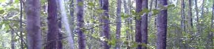
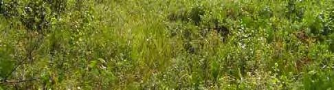
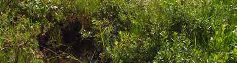
2 Seward Highway MP Anchorage August 8, 2006 DOT&PF 1 RAC/EMC none none Southcentral Alaska N N N N N N Hydrology - the winter storage this year is half of the average, so wetland areas may be drier compared to last year. The site is adjacent to a bike path and the highway. There is a creek approximately 20 feet away. Creek is deep cut. Populus balsamifera (t) 65 FACU Gymnocarpium dryopteris (h) 30 FACU Heracleum maximum 35 FACU Equisetum arvense (h) 15 FACU Calamagrostis canadensis (h) 10 FAC Aconitum delphinifolium (h) <1 FAC Viburnum edule (s) 45 FACU Rosa acicularis (s) 10 FACU Actaea rubra (s) 30 NI foot circle Ground is covered in leaf litter. Appendix C - Page 42
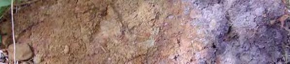
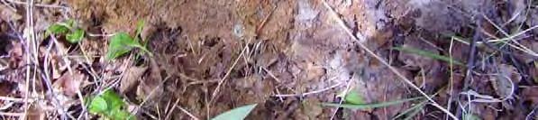
3 YR 2/1 100 N/A Sandy loam Root wad with decomposed wood. Hard packed pebbles and cobbles. Very loamy, fully soil. Can't hold water. Dry Appendix C - Page 43

4 Appendix C - Page 44
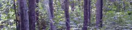
5 Seward Highway MP Anchorage August 8, 2006 DOT&PF 2 RAC/EMC hillside none 30 Southcentral Alaska N N N N N N hydrology - the winter storage this year is half of the average, so wetland areas may be drier compared to last year. Approximately 20 feet from site the hill starts to get very steep. Tall cottonwoods are along the edge of the beach. Waypoint 37 Closed Tall Shrub. 80% cover. Sambucus racemosa (s) 65 FACU Sorbus scopulina (s) 25 NI Alnus crispa (s) 40 FAC Calamagrostis canadensis (h) 25 FAC Ribes triste (s) 30 FAC Gymnocarpium dryopteris 10 FACU Oplopanax horridus 10 FACU Chamerion angustifolium (h) 10 FACU Rosa acicularis (s) 10 FACU 3.53 Galium boreale (h) <1 FACU foot circle Appendix C - Page 45
6 Y4/3 100 N/A Sandy loam Root wad with decomposed wood. spongy. some cobbles, some gravel. Really red soil. Appendix C - Page 46


7 Appendix C - Page 47
8 Seward Highway MP Anchorage August 8, 2006 DOT&PF 3 RAC/EMC hummocks none Southcentral Alaska WGS hydrology - the winter storage this year is half of the average, so wetland areas may be drier compared to last year. Site is adjacent to the highway. Waypoint 39 Shrub low open Alnus crispa (s) 30 FAC Betula nana (s) 35 FAC Potentilla fruticosa 30 FAC Andromeda polifolia 20 OBL Empetrum nigrum 15 FAC 0 0 Equisetum hyemale 35 FACW 0 0 Chamaedaphne calyculata 25 FACW Myrica gale 20 OBL Menyanthes trifoliata 5 OBL 2.07 Parnassia palustris 10 FACW Picea Mariana (s) 5 FACW Carex aquatilis 30 OBL Vaccinium cespitosum 15 FACW Vaccinium vitis-idaea 10 FAC Equisetum fluviatile 15 OBL Ledum decumbens 10 FACW Salix monticola 20 FAC Carex canescens 15 OBL Eriophorum angustifolium 10 OBL foot circle Alders are growing on hummocks. Appendix C - Page 48
9 Hydric soils assumed due to hydrophytic vegetation and hydrology Appendix C - Page 49


10 Appendix C - Page 50
11 Seward Highway MP Anchorage August 8, 2006 DOT&PF 4 RAC/EMC none none 0 Southcentral Alaska N N N N N N Hydrology - the winter storage this year is half of the average, so wetland areas may be drier compared to last year. Site is adjacent to the highway. Open low shrub. 35% cover. Waypoint 41 Myrica gale (s) 35 OBL Equisetum pratense (h) 15 FACW Potentilla fruticosa (s) 30 FAC Andromeda polifolia (s) 20 OBL Oxycoccus microcarpus (s) 10 NI Parnassia palustris (h) 10 FACW Carex aquatilis (h) 20 OBL Viola palustris (h) 5 NI Ledum groenlandicum (s) 10 FAC 1.87 Rubus chamaemorus (h) 15 FACW Rubus arctica (h) 5 NI Betula papyrifera (saplings) (s) 15 FAC Calamagrostis canadensis (h) 5 FAC Equisetum fluviatile (h) 10 OBL Sanguisorba stipulata (h) 10 NI Salix commutata (s) 15 FAC Carex canescens (h) 20 OBL Picea mariana (sapling) 15 FACW foot circle Tussocks. No bare ground - plants occupying every space available. Appendix C - Page 51
12 Hydric soils are assumed due to the hydrophytic vegetation and hydrology Tributary has very clear water. Area adjacent to creek is very saturated and spongy. Water between tussocks. Appendix C - Page 52

13 Appendix C - Page 53
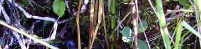
14 Seward Highway MP Anchorage August 8, 2006 DOT&PF 5 RAC/EMC none slightly concave 3 Southcentral Alaska N N N N N N Hydrology - the winter storage this year is half of the average, so wetland areas may be drier compared to last year. Site is adjacent to a trail. Forest broadleaf closed % cover. Weak shrub layer. Waypoint 42 Betula papyrifera (t) 65 FACU Calamagrostis canadensis (h) 40 FAC Chamerion angustifolium (h) 25 FACU Rosa acicularis (s) 30 FACU Athyrium filix-femina 10 FAC Cornus canadensis (h) 35 FAC Alnus crispa 15 FAC Sambucus racemosa 15 FACU foot circle Appendix C - Page 54
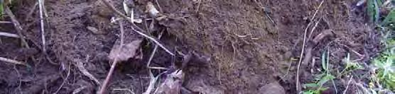
15 YR 3/2 100 silty loam YR3/4 100 sandy loam YR3/4 100 sandy loam O layer - root wad ash layer tightly packed cobbles with interstitial red soil some gravel Dry Dry Appendix C - Page 55

16 Appendix C - Page 56
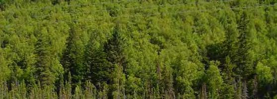
17 Seward Highway MP Anchorage August 8, 2006 DOT&PF 6 RAC/EMC none none 0 Southcentral Alaska N N N N N N Hydrology - the winter storage this year is half of the average, so wetland areas may be drier compared to last year. This point seems to provide seasonal drainage, as evidenced by a culvert nearby under the trail. Water stained leaves and other hydrologic indicators suggest a wetland, but no hydric soils have developed and with the exception of the sedge, the plants are upland indicators. BPJ is that the trail (<10 years old) impounds water and is directing flow into a drainage channel. across Waypoint 44 Closed Mixed Forest Sitka sitchensis (t) 20 FACU Equisetum sylvaticum (h) 10 FACU Cornus canadensis (h) 15 FAC 0 0 Calamagrostis canadensis (h) 40 FAC Betula papyrifera (t) 45 FACU Athyrium distentifolium 10 FAC Equisetum arvense (h) 10 FACU Carex canescens (h) 40 OBL foot swath Water stained leaves covered the bare ground. The larch are on the peripheral and on hummocks. The birch are going in the middle of the site on hummocks. Appendix C - Page 57
18 YR 2/1 100 N/A silty loam Root wad organic soil 0 Appendix C - Page 58
19 Appendix C - Page 59
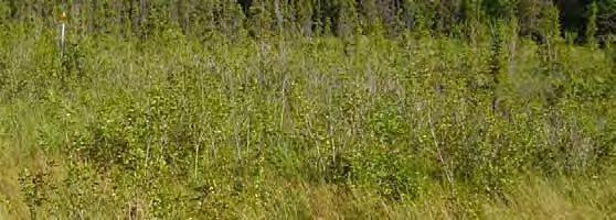
20 Seward Highway MP Anchorage August 8, 2006 DOT&PF 7 RAC/EMC none none 0 Southcentral Alaska N N N N N N Hydrology - the winter storage this year is half of the average, so wetland areas may be drier compared to last year. The site is a swath of Bepa and Caca that connects to site 6. Waypoint 46 This site does not have hydrophytic vegetation, however due to the strong hydric soils and hydrology it is professional opinion that this site is located within a wetland. Betula papyrifera (t) 55 FACU Calamagrostis canadensis (h) 75 FAC Viola adunca 20 FAC Equisetum sylvaticum (h) 25 FACU Athyrium distentifolium 35 FAC Equisetum arvense (h) 15 FACU foot diameter circle Water stained leaves covered the ground. The viola is patchy. Appendix C - Page 60
21 YR 2/1 100 N/A silty loam root matter. accordian. organic soil 2 Appendix C - Page 61
22 Appendix C - Page 62
23 Seward Highway MP Anchorage August 8, 2006 DOT&PF 8 RAC/EMC none none 0 Southcentral Alaska N N N N N N Hydrology - the winter storage this year is half of the average, so wetland areas may be drier compared to last year. Waypoint 47 The area perhaps serves as a temorary storage area in times of high precipitation, and the summer of 2006 had high rainfall amounts. Menyanthes trifoliata 80 OBL Calamagrostis canadensis (h) 25 FAC Carex lyngbyei 65 OBL foot swath Grounds was cover in water stained leaves. Appendix C - Page 63
24 YR 2/1 100 N/A silty loam Root wad with organics organic soil 0 Appendix C - Page 64

25 Appendix C - Page 65
26 Seward Highway MP Anchorage August 8, 2006 DOT&PF 9 RAC/EMC none none 0 Southcentral Alaska N N N N N N Hydrology - the winter storage this year is half of the average, so wetland areas may be drier compared to last year. Shrub tall closed Alnus crispa (s) 90 FAC Heracleum lanatum (h) 50 FACU Galium triflorum (h) 30 FACU Galeopsis tetrahit (h) 30 NI sphagnum foot circle Appendix C - Page 66
27 YR2/2 100 N/A sandy 6+ mixed organics fractured bedrock Dry Appendix C - Page 67
28 Appendix C - Page 68
29 Seward Highway MP Anchorage August 8, 2006 DOT&PF 10 CAD/SPT none none 0 Southcentral Alaska N N N N N N Hydrology - the winter storage this year is half of the average, so wetland areas may be drier compared to last year. Forest broadleaf open Betula papyrifera (t) 80 FACU Alnus crispa (s) 40 FAC Achillea millefolium (h) 40 FACU 5 10 Calamagrostis canadensis (h) 70 FAC Trientalis arctica 20 FAC Viburnum edule (s) 10 FACU Cornus canadensis (h) 10 FAC Picea mariana 5 FACW 3.45 Sphagnum sp. (h) foot diameter circle Appendix C - Page 69
30 YR4/6 100 N/A sandy loam YR4/6 100 N/A sandy loam Root wad. fine sand mixed with ash same, with mixed cobbles Dry Appendix C - Page 70

31 Appendix C - Page 71
32 Seward Highway MP Anchorage August 8, 2006 DOT&PF 11 CAD/SPT none none 0 Southcentral Alaska N N N N N N Hydrology - the winter storage this year is half of the average, so wetland areas may be drier compared to last year. Immediately at base of shoulder and a few feet before the community changes into a herbaceous wet graminoid with stream. This is a transition zone where it appears road side weeds have dominated the vegetation. Since the site has very strong hydric soils and hydrology this site is considered to be located within a wetland. Calamagrostis canadensis (h) 90 FAC Achillea millefolium (h) 10 FACU Equisetum arvense (h) 25 FACU Salix sp. (s) 10 FAC Trifolium pratense (h) 30 FAC Chamerion angustifolium (h) 20 FACU Rhinanthus arcticus (h) 5 FAC Heracleum maximum (h) 5 FACU foot swath Appendix C - Page 72
33 Saturated organics. Mucky peat Gley 1 2.5/10GY 100 N/A 19 3 Approximately 6 feet from standing water. Appendix C - Page 73

34 Appendix C - Page 74
35 Seward Highway MP Anchorage August 8, 2006 DOT&PF 12 CAD/SPT none none 0 Southcentral Alaska N N N N N N Hydrology - the winter storage this year is half of the average, so wetland areas may be drier compared to last year. Picea mariana (t) 20 FACW Betula papyrifera (t) 40 FACU Equisetum arvense (h) 60 FACU Calamagrostis canadensis (h) 20 FAC Picea sitchensis (t) 10 FACU Alnus crispa (s) 50 FAC 0 0 Ledum decumbens (h) 50 FACW Myrica gale (s) 60 OBL Betula nana (s) 60 FAC 2.8 Potentilla fruticosa (s) 30 FAC Sphagnum sp. (h) foot diameter circle Appendix C - Page 75
36 0-20 N/A Peat - saturated organics Appendix C - Page 76


37 Appendix C - Page 77
38 Seward Highway MP Anchorage August 8, 2006 DOT&PF 13 CAD/SPT hillside concave on macro scale 2 Southcentral Alaska N N N N N N Hydrology - the winter storage this year is half of the average, so wetland areas may be drier compared to last year. The site is located on a hill that slopes down towards the inlet. Betula papyrifera (t) 50 FACU Alnus crispa (s) 30 FAC Chamerion angustifolium (h) 70 FACU Sambucus racemosa (s) 30 FACU Pteridium aquilinum (h) 40 FACU Ribes triste (s) 10 FAC Picea glauca (t) 5 FACU Trientalis arctica (h) 10 FAC Galium triflorum (h) 10 FACU foot diameter circle Appendix C - Page 78
39 N/A Root mat dry organics ash fractured bedrock Appendix C - Page 79
Map of Forested Habitats in Anchorage s Parks and Greenbelts
 Map of Forested Habitats in Anchorage s Parks and Greenbelts Susan C. Klein Alaska Natural Heritage Program Environment and Natural Resources Institute University of Alaska Anchorage June 1999 Funding
Environmental Statement South Kyle Wind Farm August 2013
 Appendix 12.5: Quadrat Data from the National Vegetation Classification Survey 1.1 Introduction 1 This Appendix presents a list of the National Vegetation Classification (NVC) communities identified within
SOLITARY LAKE CONSERVATION RESERVE (C2362) STATEMENT OF CONSERVATION INTEREST
 STATEMENT OF CONSERVATION INTEREST") SOLITARY LAKE CONSERVATION RESERVE (C2362) STATEMENT OF CONSERVATION INTEREST OMNR, Kenora District August, 2001 Prepared by: Catherine Reaburn Prepared for: Ontario Ministry of Natural Resources, Kenora
SOLITARY LAKE CONSERVATION RESERVE (C2362) STATEMENT OF CONSERVATION INTEREST OMNR, Kenora District August, 2001 Prepared by: Catherine Reaburn Prepared for: Ontario Ministry of Natural Resources, Kenora
ALAGNAK WILD RIVER & KATMAI NATIONAL PARK VASCULAR PLANT INVENTORY ANNUAL TECHNICAL REPORT
 ALAGNAK WILD RIVER & KATMAI NATIONAL PARK VASCULAR PLANT INVENTORY ANNUAL TECHNICAL REPORT Matthew L. Carlson & Robert Lipkin Alaska Natural Heritage Program Environment and Natural Resources Institute
Kluane National Park and Reserve parkscanada.gc.ca. Bringing you Canada s natural and historic treasures. Photo : S. McDougall
 Kluane National Park and Reserve parkscanada.gc.ca Alsek River Camping & Travel Bringing you Canada s natural and historic treasures Photo : S. McDougall Table of Contents Introduction Background Campsite
Kluane National Park and Reserve parkscanada.gc.ca. Bringing you Canada s natural and historic treasures. Photo : S. McDougall
 Kluane National Park and Reserve parkscanada.gc.ca Alsek River Camping & Travel Bringing you Canada s natural and historic treasures Photo : S. McDougall Table of Contents Introduction 3 Background Campsite
Ep156 Miller's Grove (2.3 ha) TL
 TL") Ep156 Miller's Grove (2.3 ha) TL 520040 Miller's Grove is located just within the extreme eastern boundary of Ongar Great Park, a medieval deer park dating from the 11 th century. This broadleaved woodland
Ep156 Miller's Grove (2.3 ha) TL 520040 Miller's Grove is located just within the extreme eastern boundary of Ongar Great Park, a medieval deer park dating from the 11 th century. This broadleaved woodland
Species Status 2014 Update in Northwestern Alberta for the DMI FMAs FINAL
 Species Status 2014 Update in Northwestern Alberta for the DMI FMAs FINAL Prepared for: Daishowa-Marubeni International Ltd. 211013 HWY 986 Postal Bag 6500, Pulp Mill Site Peace River, AB T8S 1V5 LETTER
Figure 1 shows the evaluation area around Tailings Basin Cells 2E/1E. Two areas were evaluated for potential wetland impacts including:
 Barr Engineering Company 4700 West 77th Street Minneapolis, MN 55435-4803 Phone: 952-832-2600 Fax: 952-832-2601 www.barr.com An EEO Employer Minneapolis, MN Hibbing, MN Duluth, MN Ann Arbor, MI Jefferson
Agenda. City of Ocean Shores City Council Study Session. Monday August 8, :00 PM
 Agenda City of Ocean Shores City Council Study Session Monday August 8, 2011 1:00 PM Ocean Shores Convention Center 120 Chance A La Mer Ocean Shores, Washington Call to Order Discussion 1. Weatherwax Wetland
Forest: Manti-La Sal Allotment: Brumley Ridge District: Moab-Monticello Pasture: Mill Creek
 Forest: Manti-La Sal Allotment: Brumley Ridge District: Moab-Monticello Pasture: Mill Creek Oowah Bench Exclosure constructed June 6, 2012 Transects read August 31, 2012 August 13, 2016 Exclosure NE corner:
Open Alpine Community
 Open Alpine Community Alpine meadow on Mount Skylight System Subsystem Terrestrial Open Uplands Did you know? Many of the plants characteristic of the open alpine community have a circumboreal distribution,
April 20, RG = Restoration Grade LQ = Low Quantity
 April 20, 2017 RG = Restoration Grade LQ = Low Quantity Latin Name Common Name Format Zone Size Price Note Evergreen Trees Abies fraseri Fraser Fir 1 Gallon 30cm $ 8.00 Juniperus virginiana Red Cedar 1
Ep166 Dewley Wood (6.4 ha) TL
 TL") Ep166 Dewley Wood (6.4 ha) TL 528045 This large ancient wood contains a canopy of predominantly Pedunculate Oak (Quercus robur) standards, occasional Ash (Fraxinus excelsior) coppice with Hornbeam (Carpinus
Ep166 Dewley Wood (6.4 ha) TL 528045 This large ancient wood contains a canopy of predominantly Pedunculate Oak (Quercus robur) standards, occasional Ash (Fraxinus excelsior) coppice with Hornbeam (Carpinus
Ditch flows slowly to the north
 Ditch flows slowly to the north Photo 1. Wetland DE: Looking west across Wetland DE from upslope. Ponded water, mucky mineral soils, and patches of emergent vegetation observed. Wetland DE appears to be
DIXIE HIGHWAY Region of Peel NAI Area # 1304, 1320, 2449, 2625, 3961
 DIXIE HIGHWAY 407 1 Region of Peel NAI Area # 1304, 1320, 2449, 2625, 3961 Toronto and Region Conservation Authority City of Brampton Size: 36 hectares Watershed: Etobicoke Creek Con 4 E, Lots 13, 14 Ownership:
Viola selkirkii (Selkirk s violet) Survey Report for the Pike and San Isabel National Forests Performed in June, 2010
 Survey Report for the Pike and San Isabel National Forests Performed in June, 2010") Viola selkirkii (Selkirk s violet) Survey Report for the Pike and San Isabel National Forests Performed in June, 2010 Closeup of Selkirk s violet in bloom. The diagnostic glassy hairs on the leaves are
Viola selkirkii (Selkirk s violet) Survey Report for the Pike and San Isabel National Forests Performed in June, 2010 Closeup of Selkirk s violet in bloom. The diagnostic glassy hairs on the leaves are
Pacific Forested Glacial Ablation Plain Biophysical Setting Southern Alaska
 Pacific Forested Glacial Ablation Plain Biophysical Setting Southern Alaska Conservation Status Rank: S4 (apparently secure) Introduction Forested glacial ablation plains are represented by mature trees
Wicklow Mountains Path Survey
 Wicklow Mountains Path Survey Glenmacnass Tonelagee Start to Finish: O 114 030 to O 085 016 Altitude (lowest highest): 370m 817m Weather: Sunny day, hot Access: Military Road, Glenmacnass Surveyed by:
Attachment D: PHOTO LOG CITY OF ARCATA RAIL-WITH-TRAIL CONNECTIVITY PROJECT
 01051-09004 Attachment D: PHOTO LOG CITY OF ARCATA RAIL-WITH-TRAIL CONNECTIVITY PROJECT DRAFT: June 30, 2010 Applicant: City of Arcata 736 F Street Arcata, CA 95521 Phone (707) 825-2154 Prepared by: Winzler
KP Lasnaya 1 River
 KP 370.2 Lasnaya 1 River The Lasnaya 1 River crossing is protected by Reno mattings and a gabion wall on the north bank (Photo 1). The south bank consists of natural river gravel deposits on top of Reno
FOURMILE CANYON CREEK PARK Management Plan
 ~J ~l I),.:t '" FOURMILE CANYON CREEK PARK Management Plan LOCATION AND ACCESS Fourmile Canyon Creek Park is located west of Bow Mountain Subdivision. Access to the area is via Pinto Drive in the Bow Mountain
ANIAKCHAK NATIONAL MONUMENT AND PRESERVE VASCULAR PLANT INVENTORY FINAL TECHNICAL REPORT
 ANIAKCHAK NATIONAL MONUMENT AND PRESERVE VASCULAR PLANT INVENTORY FINAL TECHNICAL REPORT Robert Lipkin Alaska Natural Heritage Program Environment and Natural Resources Institute University of Alaska Anchorage
Specification for Grip blocking using Peat Dams
 Technical Guidance Note 1 Specification for Grip blocking using Peat Dams 1. Introduction Moorland drains (grips) have been dug across much of the Yorkshire upland peatlands. Many of these grips have become
BOS, Gregory Neil RANGE TYPES AND THEIR UTILIZATION BY MUSKOX ON NUNIVAK ISLAND, ALASKA: A RECONNAISSANCE STUDY.
 I MASER'S HESIS M-1373 BOS, Gregory Neil RANGE YPES AND HEIR UILIZAION BY MUSKOX ON NUNIVAK ISLAND, ALASKA: A RECONNAISSANCE SUDY. University of Alaska, M.S., 1967 Agriculture, forestry and wildlife University
Community Development
 Community Development City & Borough of Juneau Community Development 155 S. Seward Street Juneau, AK 99801 (907) 586 0715 Phone (907) 586 4529 Fax DATE: February 11, 2016 TO: FROM: Planning Commission
Fire in the Tundra at Rankin Inlet N.W.T.
 Proceedings: 9th Tall Timbers Fire Ecology Conference 1969 Fire in the Tundra at Rankin Inlet N.W.T. G. ROSS COCHRANE AND J. S. ROWE University of Auckland, University of Saskatchewan T HE ENVIRONMENT
Boreal Forested Glacial Ablation Plain Biophysical Setting Interior Alaska
 Boreal Forested Glacial Ablation Plain Biophysical Setting Interior Alaska Conservation Status Rank: S4 (apparently secure) Introduction Forested glacial ablation plains are represented by mature trees
SITE SYNOPSIS. Site Name: River Moy SAC. Site Code:
 SITE SYNOPSIS Site Name: River Moy SAC Site Code: 002298 This site comprises almost the entire freshwater element of the River Moy and its tributaries including both Loughs Conn and Cullin. The system
Alyeska Mountain Resort
 Alyeska Mountain Resort Girdwood, Alaska October 2007 Submitted by: Alyeska Resort Management Co. DESIGN TEAM Planners: 131 Church Street Burlington, Vermont 05401 802.862.0098 Architects: 501 Folsom Street,
Mark West Creek Flow Study Report
 Mark West Creek Flow Study Report Biology and Geology of Mark West Creek The headwaters of Mark West Creek are located in the Mayacamas Mountain range, which border Napa and Sonoma County, where it then
TYPE REGION P-j: SWII~TOKRZYSKIE MTS. (HOLY CROSS MTS.)
") ACTA PALAEOBOTANICA 2g (2) : 51-55, 1g39 KAZIMIERZ SZCZEPANEK TYPE REGION P-j: SWIITOKRZYSKIE MTS. (HOLY CROSS MTS.) Location: longitude c. 2 17'21 17'E, latitude c. 5 4'-51 34'N. Area: approx. 35 sq.
ACTA PALAEOBOTANICA 2g (2) : 51-55, 1g39 KAZIMIERZ SZCZEPANEK TYPE REGION P-j: SWIITOKRZYSKIE MTS. (HOLY CROSS MTS.) Location: longitude c. 2 17'21 17'E, latitude c. 5 4'-51 34'N. Area: approx. 35 sq.
Site 19 Firemen s Park General Description
 Table 19- Firemen s Park 19 Firemen s Park General Description Polygon 1 Firemen s Park contains a large man-made pond and a dog park among other attractions on site. Woodlands, thickets, plantations,
2.0 Physical Characteristics
 _ 2.0 Physical Characteristics 2.1 Existing Land Use for the Project The site is comprised of approximately 114 acres bounded by Highway 101 to the north, the existing town of Los Alamos to the east, State
Appendix A Appendix A (Project Specifications) Auk Auk / Black Diamond (Trail 44) Reroute
 Auk Auk / Black Diamond (Trail 44) Reroute") Appendix A (Project Specifications) Auk Auk / Black Diamond (Trail 44) Reroute I. Proposed Action: This project proposes to reroute approximately 1,800 feet of a 50 inch wide trail, off of private property
Appendix A (Project Specifications) Auk Auk / Black Diamond (Trail 44) Reroute I. Proposed Action: This project proposes to reroute approximately 1,800 feet of a 50 inch wide trail, off of private property
WINTER CITY DESIGN GUIDELINES
 WINTER CITY DESIGN GUIDELINES February 2000 Table of Contents 1 Introduction: Winter and the Liveable City... 1 2 Winter Safety and Comfort... 1 3 Fort St-John s Climate... 2 4 Liveable Cities... 3 5 Key
Terrestrial Protected Area Nomination: Central Mangrove Wetland South-West, Grand Cayman
 Terrestrial Protected Area Nomination: Central Mangrove Wetland South-West, Grand Cayman The attached nomination, proposing that a parcel of land in the Central Mangrove Wetland be made a Protected Area
MASTER PLAN EXECUTIVE SUMMARY
 Biscuit Run State Park Scottsville Road (State Route 20) Charlottesville, VA 22902 Biscuit Run State Park MASTER PLAN EXECUTIVE SUMMARY Department of Conservation and Recreation Division of Planning and
3.0 EXISTING PARK & RECREATION SPACE
 3.0 EXISTING PARK & RECREATION SPACE TOWN PARK & RECREATION SPACE An inventory of current parks and recreation area in the Town of Cedarburg is shown in Table 3. These areas total roughly 381.89 acres.
Native Trees, Shrubs, and Vines Suitable for Urban Environments - Tolerance to Abnormal Salt Levels Shrubs
 Native Trees, Shrubs, and Vines Suitable for Urban Environments - Tolerance to Abnormal Salt Levels Shrubs Aesculus parviflora Bottlebrush Buckeye Aesculus pavia Red Buckeye Alnus serrulata Yes / / Yes
Region 1 Piney Woods
 Region 1 Piney Woods Piney Woods 1. This ecoregion is found in East Texas. 2. Climate: average annual rainfall of 36 to 50 inches is fairly uniformly distributed throughout the year, and humidity and temperatures
Expedition to Kamchatka August 31 to September 14, 2000 with seedlist
 Expedition to Kamchatka August 31 to September 14, 2000 with seedlist Elisabeth Öberg, Bo Nilsson Arboretum Norr Box 4097 SE-904 03 UMEÅ SWEDEN Collection of plant material from Kamchatka Seed list The
Each copy of any part of a JSTOR transmission must contain the same copyright notice that appears on the screen or printed page of such transmission.
 Black Bear Seasonal Food Habits and Disibution by Elevation in Banff National Park, Alberta Author(s): R. Michael Raine and John L. Kansas Source: Bears: Their Biology and Management, Vol. 8, A Selection
APPENDIX D: SUSTAINABLE TRAIL DESIGN. APPENDICES Town of Chili Parks and Recreation Master Plan Update
 APPENDIX D: SUSTAINABLE TRAIL DESIGN APPENDICES Town of Chili Parks and Recreation Master Plan Update Sustainable Trail Construction Sustainable trails are defined by the US Forest Service as trails having
APPENDIX E LIST OF FEDERALLY ENDANGERED, THREATENED, AND CANDIDATE PLANT SPECIES HABITATS AND RANGES
 APPENDIX E LIST OF FEDERALLY ENDANGERED, THREATENED, AND CANDIDATE PLANT SPECIES HABITATS AND RANGES List of Federally Endangered, Threatened, and Candidate Plant Species Habitats and Ranges* Plants listed
SITE SYNOPSIS. Site Name: River Boyne and River Blackwater SAC. Site Code:
 SITE SYNOPSIS Site Name: River Boyne and River Blackwater SAC Site Code: 002299 This site comprises the freshwater element of the River Boyne as far as the Boyne Aqueduct, the Blackwater as far as Lough
Section 2 North Slope Ecoregions and Climate Scenarios
 Section 2 North Slope Ecoregions and Climate Scenarios North Slope Ecoregions The geographic/ecological scope of the workshop will be freshwater and terrestrial systems of the North Slope of Alaska, with
ALPINE PLANT COMMUNITIES OF BRITISH COLUMBIA AND THEIR OCCURRENCE IN EXISTING OR PROPOSED ECOLOGICAL RESERVES
 ALPINE PLANT COMMUNITIES OF BRITISH COLUMBIA AND THEIR OCCURRENCE IN EXISTING OR PROPOSED ECOLOGICAL RESERVES by George W. Douglas Douglas Ecological Consultants Ltd. 2049 Crescent Road Victoria, B.C.
Alpine Krummholz. Summary. Protection Not listed in New York State, not listed federally. Rarity G3G4, S2
 Alpine Krummholz Alpine krummholz on Mount Dix System Subsystem Terrestrial Barrens And Woodlands Did you know? The word krummholz is derived from German word krumm, meaning crooked, bent, or twisted;
Killarney National Park, Macgillycuddy s Reeks and Caragh River Catchment SAC (site code )
") Killarney National Park, Macgillycuddy s Reeks and Caragh River Catchment SAC (site code 000365) Conservation objectives supporting document - blanket bogs and associated habitats NPWS Version 1 September
Killarney National Park, Macgillycuddy s Reeks and Caragh River Catchment SAC (site code 000365) Conservation objectives supporting document - blanket bogs and associated habitats NPWS Version 1 September
DRAFT TRAIL IMPROVEMENTS PLAN OCTOBER 2009
 DRAFT TRAIL IMPROVEMENTS PLAN OCTOBER 2009 FINAL DRAFT FAR NORTH BICENTENNIAL PARK TRAIL IMPROVEMENTS PLAN Prepared for: Municipality of Anchorage Parks and Recreation 632 West 6th Avenue 99501 Prepared
Appendix C. Tenderfoot Mountain Trail System. Road and Trail Rehabilitation Plan
 Appendix C Tenderfoot Mountain Trail System Road and Trail Rehabilitation Plan All rehabilitation work would be under the direction of the District Fisheries Biologist, the Forest Hydrologist, and/or the
Siberian Institute for Ecological Initiatives Institute for the Environment UNC-Chapel Hill
 Siberia Siberian Institute for Ecological Initiatives Institute for the Environment UNC-Chapel Hill Dr. Pavel Barsukov Institute for Soil Science and Agrochemistry Siberian Institute for Ecological Initiatives
MORGAN CREEK GREENWAY Final Report APPENDICES
 APPENDICES MORGAN CREEK GREENWAY Appendix A Photos of Existing Conditions in Trail Corridor Photos of existing conditions Main trail corridor - February 2009 Photos of existing conditions south bank Morgan
HIGH QUALITY FARMLAND PORTFOLIO MONROE COUNTY, ILLINOIS 670 ACRES M/L
 HIGH QUALITY FARMLAND PORTFOLIO MONROE COUNTY, ILLINOIS 670 ACRES M/L HIGH QUALITY FARMLAND PORTFOLIO Monroe County, Illinois 670 Acres M/L Mississippi River St. LOUIS, MISSOURI Monroe CouNTy, Illinois
PLAN VIEW ACCESS ROAD ENGINEERING MAP
 9mm (36in.) dia. 16 9 4 13 13 9mm (36in.) dia. 6mm (24in.) dia. 36 9mm (36in.) dia. ort To M- 7 12 S21N5W S2N5W 6mm (24in.) dia. 76mm (3in.) dia. 6mm (24in.) dia. 9mm (36in.) dia. 76mm (3in.) dia. 35 12
O.C , 25 March 2009
 990 GAZETTE OFFICIELLE DU QUÉBEC, April 8, 2009, Vol. 141, No. 14 Part 2 Gouvernement du Québec O.C. 297-2009, 25 March 2009 Natural Heritage Conservation Act (R.S.Q., c. C-61.01) Authorization to assign
STUDY REPORT TR-08 CALIFORNIA TIGER SALAMANDER ATTACHMENT A CTS SITE ASSESSMENT
 STUDY REPORT TR-08 CALIFORNIA TIGER SALAMANDER ATTACHMENT A CTS SITE ASSESSMENT Table of Contents Section. Description Page. 1.0 DON PEDRO RESERVOIR STUDY AREA... 1-1 1.1 Sites Potentially Suitable for
Triangle Land Conservancy Conservation Area Monitoring Report Carolina North
 Triangle Land Conservancy Conservation Area Monitoring Report Carolina North Property Name: Bolin Creek East Conservation Area Date of visit: March 16, 2017 County: Orange Property Type: Restrictive Covenants
Comparison Pictures of Receding Glaciers
 Comparison Pictures of Receding Glaciers In the photo above, the west shoreline of Muir Inlet in Alaska's Glacier Bay National Park & Preserve is shown as it appeared in 1895. Notice the lack of vegetation
Chapter 8: Colorado Plateau State Highway 141, Dove Creek to Naturita
 State Highway 141 Dove Creek to (61 miles) Summary: Highway 141 heads north from US Highway 491 about two miles northwest of the town of Dove Creek. Initially, the highway runs through gently rolling farming
NICOLUM RIVER PARK MASTER PLAN. July, 1983
 Ministry of Lands, Parks and Housing Parks and Outdoor Recreation Division Lower Mainland Region NICOLUM RIVER PARK MASTER PLAN July, 1983 TABLE OF CONTENTS PART 1: SUMMARY AND BACKGROUND A. Plan Summary...1
Boatswain bay biodiversity reserve
 Boatswain bay biodiversity reserve March 2003 1 1. Plan and description 1.1. Geographic location, boundaries and dimensions The plan of the proposed Boatswain bay biodiversity reserve and its location
Triangle Land Conservancy Conservation Area Monitoring Report Carolina North
 Triangle Land Conservancy Conservation Area Monitoring Report Carolina North Property Name: Crow Branch Conservation Area Date of visit: 4/8/2015 County: Orange Property Type: Restrictive Covenants Local
David Magney Environmental Consulting
 David Magney Environmental Consulting DELINEATION OF JURISDICTIONAL WATERS AND RIPARIAN HABITATS FOR LYONS CANYON RANCH, NEWHALL, CALIFORNIA Prepared for: UNITED STATES ARMY CORPS OF ENGINEERS and CALIFORNIA
Vegetation and natural habitats of Kamchatka
 Ber. d. Reinh.-Tüxen-Ges. 20, 195-218. Hannover 2008 Vegetation and natural habitats of Kamchatka - Pavel V. Krestov & Alexander M. Omelko,Vladivostok & Yukito Nakamura, Tokyo - Abstract Since 2002 we
Understanding user expectations And planning for long term sustainability 1
 Understanding user expectations And planning for long term sustainability 1 What is a natural surface trail? It can be as simple has a mineral soil, mulched or graveled pathway, or as developed as elevated
PORTAGE CREEK VILLAGE COUNCIL PORTAGE CREEK, ALASKA
 PORTAGE CREEK VILLAGE COUNCIL PORTAGE CREEK, ALASKA INDIAN RESERVATION ROADS PROGRAM FINAL LONG-RANGE TRANSPORTATION PLAN PHASE II JUNE 2002 Submitted by: 2000 W. International Airport Road, #C-1 Anchorage,
KNIGHTS LANDING RIVER RANCH WOODLAND, CA - YOLO COUNTY
 PROPERTY HIGHLIGHTS ±77.2 Gross Acres Contains Excellent Sandy and Silty Clay Loam Soils Established Surface Water Rights in Sacramento River Developed River Diversion and Distribution System Three Phase
Significant Natural Area Assessment. Property Name: Hillend Station
 Private Bag 50072, Queenstown 9348, New Zealand QUEENSTOWN, 10 Gorge Road, Phone +64 3 441 0499, Fax +64 3 450 2223 WANAKA, 47 Ardmore Street, Phone +64 3 443 0024, Fax +64 3 450 2223 Significant Natural
Sakhalin-2 Phase 2 Lenders Monitoring Visit Report Annex D: Individual RoW Descriptions
 Annex D: Individual RoW Descriptions Annex D: Individual RoW Descriptions List of RoW Locations Visited KP River / Location Team Date Visited 12-14 Fault Crossing 1 and adjacent RoW Northern 31 August
EXPLORING BIOMES IN GORONGOSA NATIONAL PARK
 EXPLORING BIOMES IN GORONGOSA NATIONAL PARK ABOUT THIS WORKSHEET This worksheet complements the Click and Learn Gorongosa National Park Interactive Map (http://www.hhmi.org/biointeractive/gorongosa-national-park-interactive-map),
Chapter 17: Spruce Willow Birch Zone
 Chapter 17: Spruce Willow Birch Zone by J. Pojar and A.C. Stewart LOCATION AND DISTRIBUTION... 252 ECOLOGICAL CONDITIONS... 252 SUBZONES... 255 SOME REPRESENTATIVE SITE ASSOCIATIONS... 256 White spruce
RE: Complaint Investigation at the Tankersley Food Warehouse
 July 24, 2009 Mr. Thomas Moon, Vice President of Operations Tankersley Food Service 3203 Industrial Park Road Van Buren, AR 72956 RE: Complaint Investigation at the Tankersley Food Warehouse Dear Mr. Moon:
Contract Grow and Pre-orders Welcome! Wholesale Plant Availability May 29, 2018 WOODY PLANTS. Available Now. Scientific Name Common Name Size
 Oxbow Farm and Conservation Center 10819 Carnation-Duvall Rd NE Carnation, WA 98014 contact: bridget@oxbow.org 425.788.1134 ext 4 Bridget McNassar, nursery manager Contract Grow and Pre-orders Welcome!
APPENDIX 3 NPWS Site Synopses
 Roughan & O Donovan - AECOM Alliance Consulting Engineers Roscommon County Council N5 Ballaghaderreen to Scramoge Road Project APPENDIX 3 NPWS Site Synopses Ref: (14.155) Appendix 3 SITE SYNOPSIS SITE
PacifiCorp North Umpqua Hydroelectric Project FERC Project No VOLUME 1 EXHIBITS
 PacifiCorp North Umpqua Hydroelectric Project FERC Project No. 1927 A VOLUME 1 EXHIBITS TMP and SA Implementation Summary B Settlement Agreement (Section 15) C D E F G H I J K L M N O P Q R S T U Rolling
ENVIRONMENT Environmental Service PRKLND REION, Red Deer F1 F F1 L1 F1 L1 M1 F4 F1 F2 F1 F2 L3 L1 F2 L1 L1 Map 2 Dillberry Lake Provincial Park Projec
 ENVIRONMENT Environmental Service PRKLND REION, Red Deer 67 66 68 69 65 64a,b 63 82 70 77 71 78 72 73 74 76 75 40a 40b 41 42 46 60 61 59 58 83 90 89 39 43 38 44 37 45 47 79 80 81 49 50 51 52 48 53 54 55
NON TIMBER FOREST PRODUCTS IN KOSOVO
 UNMIK MINISTRY OF AGRICULTURE, FORESTRY AND RURAL DEVELOPMENT PISG NON TIMBER FOREST PRODUCTS IN KOSOVO November 2007, Dresden Kosovo in brief The total surface area is 1.1 million ha. Kosovo is circled
Habitat Assessment, Mt San Jacinto CCD/MSJC Southwest Campus
 I - 15 CORRIDOR CAMPUS MASTER PLAN DRAFT EIR MT. SAN JACINTO COMMUNITY COLLEGE DISTRICT Appendices Appendix D7 Habitat Assessment, Mt San Jacinto CCD/MSJC Southwest Campus August 2017 I - 15 CORRIDOR CAMPUS
DRAFT. Dorabelle Campground Rehabilitation
 DRAFT Dorabelle Campground Rehabilitation September 2012 1.1 REGIONAL SETTING AND PROJECT LOCATION The Dorabelle Campground is located on the western shore of Shaver Lake in Fresno County, California (Section
Sabourin lake biodiversity reserve
 PLAN OF THE PROPOSED SABOURIN LAKE BIODIVERSITY RESERVE AND CONSERVATION PLAN FOR THE RESERVE (provisional name) Sabourin lake biodiversity reserve February 2003 March 2003 1 1. Plan and description 1.1.
Nestucca Bay National Wildlife Refuge BCS number: 47-22
 Nestucca Bay National Wildlife Refuge BCS number: 47-22 Site description author(s) Shawn W. Stephensen, Wildlife Biologist Primary contact for this site Shawn W. Stephensen, Wildlife Biologist, U.S. Fish
USING GRIZZLY BEAR HABITAT EVALUATIONS TO LOCATE TRAILS AND CAMPSITES IN KANANASKIS PROVINCIAL PARK
 USING GRIZZLY BEAR HABITAT EVALUATIONS TO LOCATE TRAILS AND CAMPSITES IN KANANASKIS PROVINCIAL PARK STEPHEN HERRERO, Faculty of Environmental Design and Department of Biology, University of Calgary, Calgary,
HYDROLOGY OF GLACIAL LAKES, FORT SISSETON AREA
 PROC. S.D. ACAD. SCI., VOL. 77 (1998) 59 HYDROLOGY OF GLACIAL LAKES, FORT SISSETON AREA Perry H. Rahn Department of Geology & Geological Engineering South Dakota School of Mines and Technology Rapid City,
Shrubs and alpine meadows represent the only vegetation cover.
 Saldur river General description The study area is the upper Saldur basin (Eastern Italian Alps), whose elevations range from 2150 m a.s.l. (location of the main monitoring site, LSG) and 3738 m a.s.l.
ECOLOGICAL REPORT. Prepared for Walton and Wellesbourne Way Neighbourhood Plan
 ECOLOGICAL REPORT Prepared for Walton and Wellesbourne Way Neighbourhood Plan by Habitat Biodiversity Audit Partnership Warwickshire Wildlife Trust Ecological Services, Warwickshire County Council Habitat
RAILS WITH TRAILS ALBANY TO CORVALLIS PEDESTRIAN AND BICYCLE PATH FEASIBILITY STUDY
 RAILS WITH TRAILS ALBANY TO CORVALLIS PEDESTRIAN AND BICYCLE PATH FEASIBILITY STUDY September 2004 Benton County Public Works Chuck Knoll, P.E., Senior Engineer Andrew Monaco, GIS Analyst and Maps Mark
Triangle Land Conservancy Conservation Area Monitoring Report Carolina North
 Triangle Land Conservancy Conservation Area Monitoring Report Carolina North Property Name: Crow Branch Conservation Area Date of visit: March 16, 2016 County: Orange Property Type: Restrictive Covenants
Wintergreen Woods. Phyliss Benn Trail. Owned and managed by the La Porte County Conservation Trust Inc.
 Wintergreen Woods Phyliss Benn Trail Owned and managed by the La Porte County Conservation Trust Inc. Welcome to Wintergreen Woods State Nature Preserve and the Phyliss Benn Trail As you enter the woods,
VOLUME II APPENDIX F DETAILED PHYSICAL DESCRIPTION OF PROJECT RESERVOIRS AND LANDS
 VOLUME II APPENDIX F DETAILED PHYSICAL DESCRIPTION OF PROJECT RESERVOIRS AND LANDS THE CENTRAL NEBRASKA PUBLIC POWER AND IRRIGATION DISTRICT FERC PROJECT NO. 1417 PHYSICAL DESCRIPTION OF PROJECT LANDS
Segment 2: La Crescent to Miller s Corner
 goal of the USFWS refuges is to conserve, protect and enhance fish, wildlife and plants and their habitats for the continuing benefit of the American people. Refuge lands are used largely for fishing,
RIO VISTA MUNICIPAL AIRPORT
 DRAINAGE TECHNICAL MEMORANDUM RIO VISTA MUNICIPAL AIRPORT RIO VISTA, CALIFORNIA Prepared for: City of Rio Vista 1 Main Street Rio Vista, CA 94571 (707) 374-5337 Prepared by: August 2012 Copyright 2012
Ep36 Longcroft Grove/Claverhambury Road (3.7 ha) TL
 TL") Ep36 Longcroft Grove/Claverhambury Road (3.7 ha) TL 416032 This site consists of a small area of ancient woodland and an adjacent green lane. Longcroft Grove is a streamside ancient wood dominated by Hornbeam
Ep36 Longcroft Grove/Claverhambury Road (3.7 ha) TL 416032 This site consists of a small area of ancient woodland and an adjacent green lane. Longcroft Grove is a streamside ancient wood dominated by Hornbeam
Non-Native Plant Inventory: Kenai Trails
 Non-Native Plant Inventory: Kenai Trails M.E. Shephard photo 1 R.L. DeVelice, Vegetation Ecologist USDA Forest Service, Chugach National Forest 3301 C Street, Suite 300 Anchorage, Alaska 99503-3998 1 Close-up
Triangle Land Conservancy Conservation Area Monitoring Report Carolina North
 Triangle Land Conservancy Conservation Area Monitoring Report Carolina North Property Name: Bolin Creek West Conservation Area Date of visit: March 16, 2017 County: Orange Property Type: Restrictive Covenants
Triangle Land Conservancy Conservation Area Monitoring Report Carolina North
 Triangle Land Conservancy Conservation Area Monitoring Report Carolina North Property Name: Bolin Creek East Conservation Area Date of visit: 4/8/2015 County: Orange Property Type: Restrictive Covenants
PORTISHEAD BRANCH LINE PRELIMINARY ENVIRONMENTAL INFORMATION REPORT VOLUME 4 APPENDIX Water Receptors
 PORTISHEAD BRANCH LINE PRELIMINARY ENVIRONMENTAL INFORMATION REPORT APPENDIX 17. 3 Water Receptors Contents Section Page 1 Water Receptors... 1-1 1.1 Surface Water Features/Receptors in the Study Area
The Roots of Carrying Capacity
 1 Applying Carrying Capacity Concepts in Wilderness 1872 1964...shall be preserved for the use & enjoyment of the American people...in such manner as will leave them unimpaired for future generations...
v, EBB, D. A., 1953, An Irish FlOra, ed. 2. WEDGWOOD, M. L., 19"0, A cata,logue at the Plants in the TVe!y'Wood IIerbarium.
 VERONICA PEREGRINA L. IN THE BRITISH ISLES 313 Mum, A. G., 1872, On l',ecent additions to tile FIOl"a of Il'daml, Proc. nay. [rt~h A eall., s,el'. 2, 1, 256-29:3- liiurison, R. 1680, Planla1"urn Illstol'iae