Conservation Lands. Conservation Lands Advisory Committee October 19, 2005
|
|
|
- Albert Porter
- 5 years ago
- Views:
Transcription
1 Conservation Lands Advisory Committee October 19, 2005 Roland DeBlois Chief of Environmental Planning & Code Enforcement Community Development Department Beth Powell Conservation Lands Manager Parks Division Public Works Department
 Oslo Riverfront Conservation Area (ORCA). 1992: $26 million bond referendum approved. 2000: full-time Conservation Lands Manager hired.")
2 Background 1990: Environmental Lands Program established; LAAC created. Primary Purpose of program: conservation of environmentally significant lands. 1991: 1 st conservation purchase (pre-bond) Oslo Riverfront Conservation Area (ORCA). 1992: $26 million bond referendum approved. 2000: full-time Conservation Lands Manager hired. 2004: $50 million bond referendum approved, program expanded to include historic/ cultural sites and agricultural lands. To Date: Approximately 7500 acres acquired in cost-share with other agencies

3 Purpose of the Environmental Lands Program Preserve quality of life Protect, preserve & sustain endangered ecosystems, rare & endangered species Protect ground water quality and quantity Provide flood protection Protect historic and cultural resources Provide compatible recreation
4 Conservation Lands Advisory Committee Consider and study how to best manage, conserve, maintain, utilize, protect and promote the County s Conservation Lands Advise the Board of County Commissioners at their request or upon its own initiative regarding existing Conservation Lands Consider all matters submitted to it by the Board of County Commissioners and submit proposed legislation, ordinances, and rules to the BCC Make recommendations to the BCC concerning land management, grant applications or other types of assistance from private and public groups to further the goals of the Committee Collaborate, coordinate and cooperate with County staff in order to further the goals and duties of the Committee

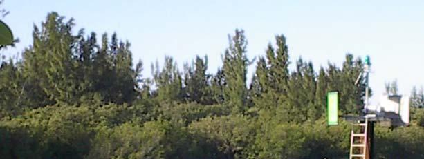
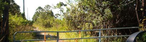
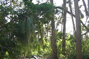
5 Types of Habitat Preserved Oceanfront

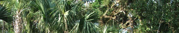
6 Types of Habitat Preserved Maritime Hammock


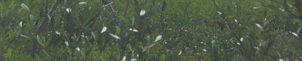
7 Types of Habitat Preserved Estuarine Wetlands

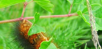
8 Types of Habitat Preserved Xeric Scrub

9 Types of Habitat Preserved Pine Flatwoods

10 Types of Habitat Preserved Freshwater Wetlands

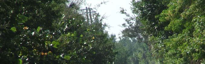
11 Types of Habitat Preserved Hardwood Hammocks

12 Types of Habitat Preserved Natural Islands

13 Management Objectives Restore/Enhance Native Habitats Protect Endangered & Threatened Species Enhance Groundwater/Wetland Quality Remove/Treat Exotics Protect Historic and Archeological Resources Provide for Passive Recreation
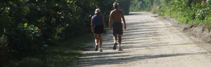

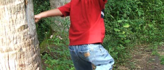

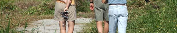
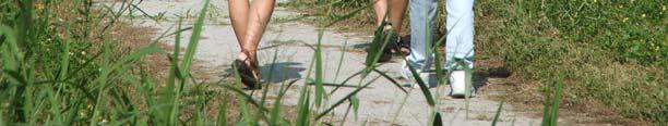
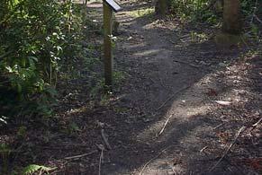
14 Passive Recreational Opportunities Hiking/Walking
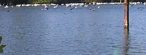


15 Passive Recreational Birdwatching Opportunities

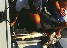
16 Fishing Passive Recreational Opportunities
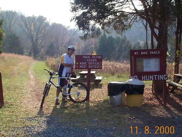
17 Passive Recreational Bicycling Opportunities

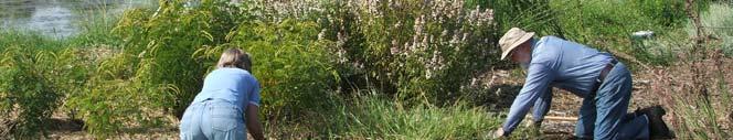
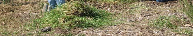
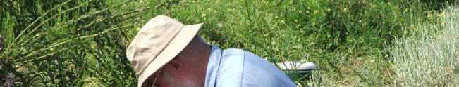
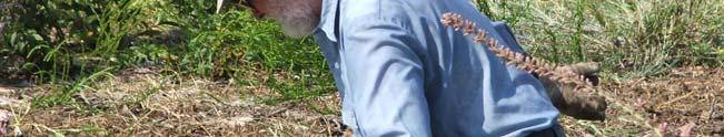
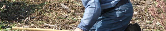
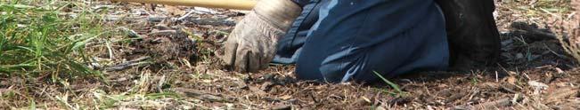
18 Passive Recreational Volunteering Opportunities
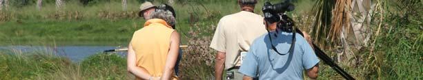


19 Passive Recreational Opportunities Nature photography
20 Passive Recreational Opportunities Nature appreciation
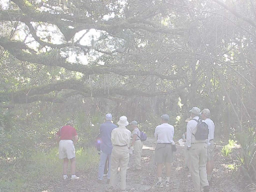


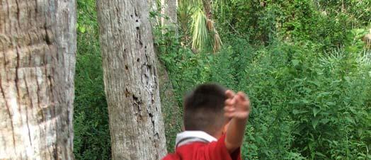
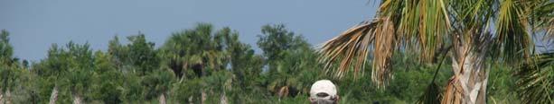
21 Passive Recreational Opportunities Environmental Education


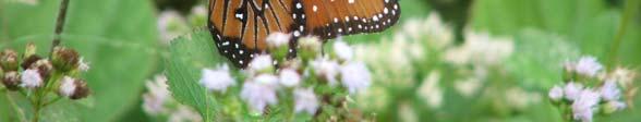
22 Passive Recreational Opportunities Wildlife viewing
23 Conservation Areas Managed by IRC North Sebastian Conservation Area 407 acres Wabasso Scrub Conservation Area 111 acres Captain Forster Hammock Preserve 111 acres Kroegel Homestead ~3 acres Sebastian Scrub 10 acres Prange Islands 27 acres Lost Tree Islands 576 acres Oslo Riverfront Conservation Area 298 acres South Oslo Riverfront Conservation Area 66 acres + SORCA Link 6 acres Hallstrom Farmstead 93 acres Round Island South 59 acres Harmony Oaks 90 acres

24 Conservation Areas Managed by IRC The Conservation Lands Manager currently manages and maintains 15 Conservation Areas with assistance from the Parks Division. Approximately 2050 acres 7 Conservation Areas are opened to the public with Capital Improvements
25 Parks Division Assistance The Conservation Lands Manager works within the Parks Division in the Public Works Department. This allows for the use of Parks Division Staff and equipment to assist with the management of the Conservation Lands. During the winter and early spring, special projects can be accomplished using Parks Division Staff under the direction and supervision of the Conservation Lands Manager. Parks Division staff mow and maintain 5 Conservation Area parking areas weekly. Parks Division staff open and close 3 Conservation Area gates daily. Parks Division staff clean the restrooms at Pelican Island NWR and Captain Forster Hammock Preserve daily. Parks Division staff removes garbage from 5 conservation areas daily. Parks Division staff maintains Joe Earman Island Camp site weekly.

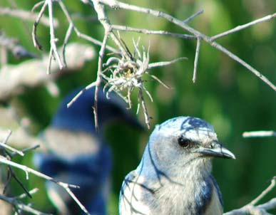
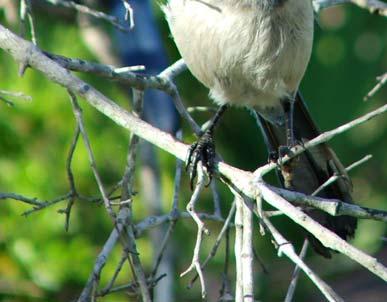
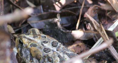
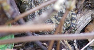
26 North Sebastian Conservation Area 407 Acres Xeric scrub, Pine flatwoods, Freshwater wetlands, Seasonal Wet Prairies Part of the Sebastian Area-Wide Scrub Jay Habitat Conservation Plan Important Species on Site: Florida Scrub Jay Gopher Tortoise Gopher Frog Scrub Lizard Osprey Wood Stork Listed Plant Species Giant Orchid Many Tillandsia spp. Curtiss Milkweed


27 Pelican Island National Wildlife Refuge 168 Acres - USFWS manages 2 Parking Areas and 1 Restroom Parks Division maintains daily


28 Sebastian Canoe Launch 95 acres Managed by Sebastian River Buffer Preserve Park Staff Parking, picnic facilities and canoe launch are managed by Parks Division Staff


29 111 acres River to Oceanfront Property Maritime Hammock, Forested wetlands, coastal dune 1.5 miles of trails 1 restroom and parking facility, maintained daily; parking area maintained weekly Captain Forster Hammock Preserve


30 Wabasso Scrub Conservation Area 111 acres of Xeric Scrub, Pine Flatwoods, Freshwater Wetlands Animal Species Florida Scrub Jay Gopher Tortoise Scrub Lizard Gopher Frog Plant Species Large Flowering False Rosemary

31 Lost Tree Islands Conservation Area 509 acres spoil and natural islands


32 Prange Islands Conservation Area 27 acres Boat dock Natural Island, Maritime Hammock


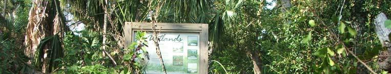
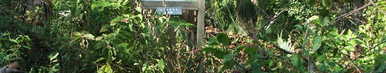
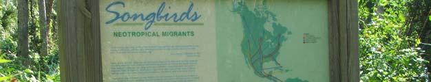
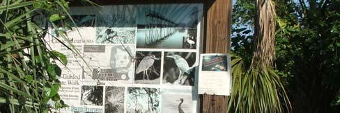
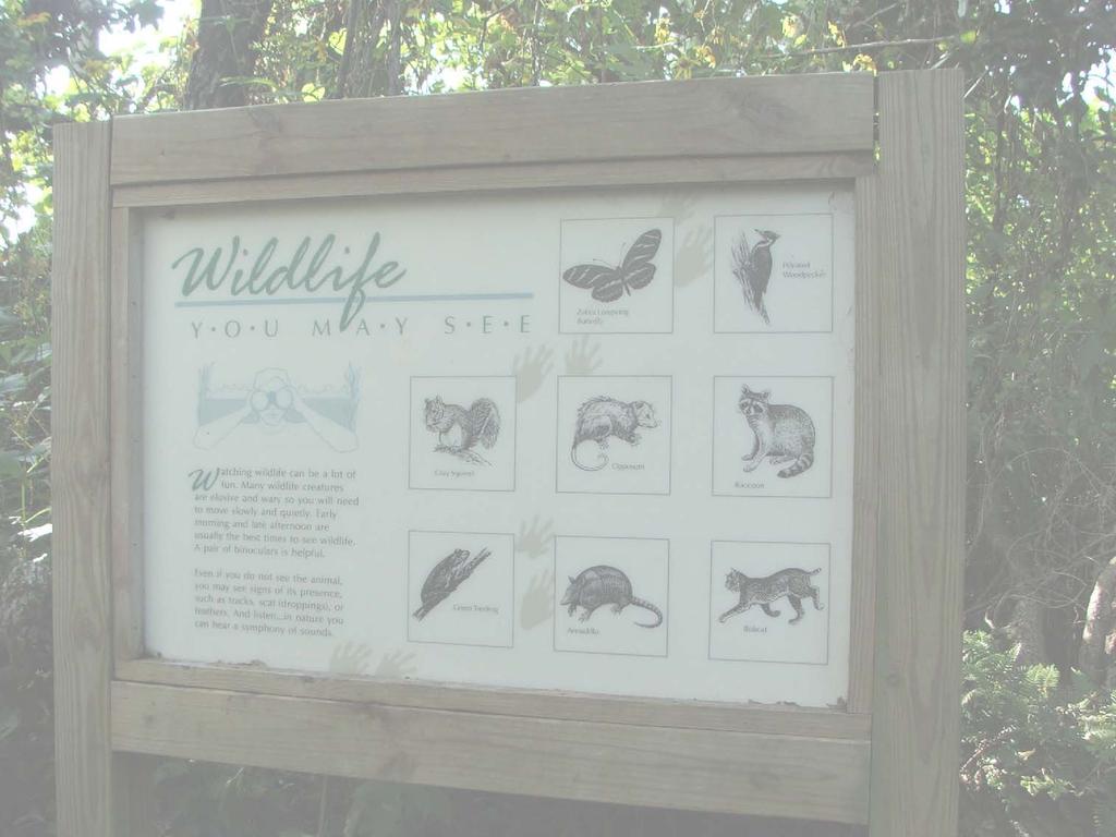
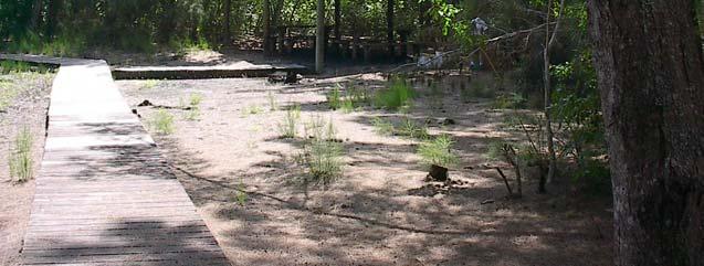
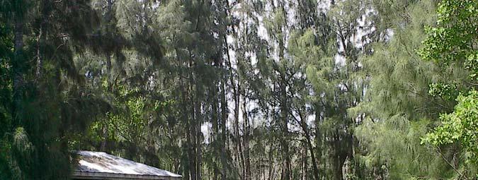
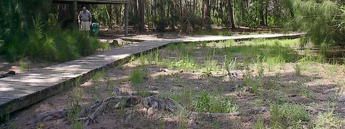
33 Olso Riverfront Conservation Area 298 acres Maritime Hammock, Scrubby Flatwoods, Estuarine Wetlands, Freshwater Wetlands 1.5 mile trail system Boardwalks and Observation Tower Educational Signage
34 South Oslo Riverfront Conservation Area 66 Acres.5 mile trail Listed Animal Species Bald Eagle Osprey Gopher Tortoise Listed Plant Species Curtiss Milkweed Large Flowering False Rosemary


35 Harmony Oaks Conservation Area 96 Acres Maritime Hammock, Forested Wetlands, Estuarine Wetlands


36 155 Acres Oyster Bar Salt Marsh Conservation Area Estuarine Wetlands, Maritime Hammock, Impounded Wetlands


37 Round Island South Conservation Area 65 acres Maritime Hammock, Estuarine Wetlands, Impounded Wetlands Listed species Simpson s Stopper


38 Flinn Tract 36 Acres Maritime Hammock, Estuarine Wetlands, Impounded Wetland


39 Hallstrom Farmstead 93 Acres Conceptual Site Plan includes a working historic farm, tours of the Hallstrom home and nature trails. Lakela s Mint Federally Endangered Northern most known population on protected land
40 Conservation Lands Currently Opened to the Public with Capital Development Oslo Riverfront Conservation Area South Oslo Riverfront Conservation Area Captain Forster Hammock Preserve Pelican Island National Wildlife Refuge North and South Prange Island Conservation Area Sebastian Canoe Launch Lost Tree Islands Conservation Area - Joe Earman Island (temporarily closed due to hurricane damage)

41 Slated for Capital Improvements North Sebastian Conservation Area Wabasso Scrub Conservation Area Harmony Oaks Conservation Area Round Island South Conservation Area
42 North Sebastian Conservation Area Public Access Improvements Received a Land & Water Conservation Fund grant through the Florida Department of Environmental Protection for $103,000 to provide passive recreation opportunities on the NSCA with County match.

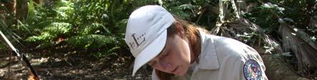
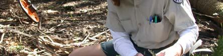
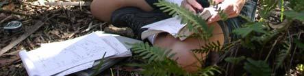
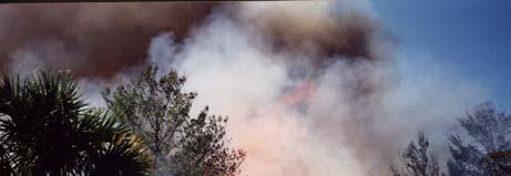

43 What does a Conservation Lands Manager Do? Manage Conservation Areas 45% Time Scrub Jay Monitoring Exotic Treatment Trail Maintenance Patrolling Species Inventories Prescribed Burning Structure Repair & Maintenance
44 What does a Conservation Lands Manager Do? Education 25% Time Public Speaking Pelican Island Elementary School Written media Brochures, Website, Press Journal
45 What does a Conservation Lands Manager Do? Management Plans & Grants 25% Florida Communities Trust Annual Stewardship Reports Grant Writing & Compliance Annual Reports for St. Johns Water Management District (County mitigation projects) General Administrative 5% Attend training, conferences and other meetings
46 Management Accomplishments to Date Sebastian Area-Wide Florida Scrub Jay Habitat Conservation Plan approved in March Scrub Jay monitoring and habitat monitoring for all conservation areas included in the HCP. Timbered North Sebastian Conservation Area, Wabasso Scrub Conservation Area and Pelican Island Elementary School. Conducted prescribed burns at the Conservation Areas listed above. Firebreaks installed at Wabasso Scrub CA, North Sebastian CA, Pelican Island Elementary School Scrub Habitat and Hallstrom Farmstead. Over 20 off-site wetland mitigation projects underway on various conservation areas by private developers, eradicating and improving County owned and managed wetlands. Prange Islands dock built by a grant through the Florida Inland Navigation District.
47 Management Accomplishments to Date continued Public access improvements completed at Pelican Island Viewing Area, Pelican Island Welcome Center and Captain Forster Hammock Preserve. Improvements include 2 restroom facilities, 3 parking areas, trails and educational material. Fencing installed at North Sebastian Conservation Area, Hallstrom Farmstead and the Flinn Tract. Ongoing treatment and eradication of exotics on all Conservation Areas. Boardwalks constructed at Oslo Riverfront Conservation area. Discovered Lakela s Mint, Curtiss Milkweed and Giant Orchid Conservation Lands. Received $103,000 grant for public access improvements to North Sebastian Conservation Area
Brooker Creek Preserve Management Plan 2008 Update
 Brooker Creek Preserve Management Plan 2008 Update Plan approved by the Board of County Commissioners Pinellas County, Florida 19 August 2008 Pinellas County Department of Environmental Management Environmental
Pinellas County Environmental Lands
 Pinellas County Environmental Lands In addition to traditional parks and recreation facilities, Pinellas County owns and manages a system of environmental lands that provides specialized resource-based
Florida Department of Environmental Protection Division of Recreation and Parks
 Florida Department of Environmental Protection Division of Recreation and Parks Land Honeymoon Island State Park Introduction Honeymoon Island State Park is a 2,810.16-acre public outdoor recreation and
BA Collaborators. Driftless Area Initiative The Prairie Enthusiasts Trout Unlimited TNC TCF Natural Resources Foundation of Wisconsin
 BA Collaborators Driftless Area Initiative The Prairie Enthusiasts Trout Unlimited TNC TCF Natural Resources Foundation of Wisconsin The mission of the of the Blufflands Alliance is to actively conserve
SECTION 4. PUBLIC RECREATION
 SECTION 4. PUBLIC RECREATION Brooker Creek Preserve is the largest remaining tract of wild land in Pinellas County and contains many species not found anywhere else in the County. As such, these wild lands
Chapter 2: Summary of Existing Open Space System
 Chapter 2: Summary of Existing Open Space System In 1976, the Wake County Board of Commissioners established the Wake County Parks and Recreation Department in order to provide park facilities and programs
Florida Department of Environmental Protection Division of Recreation and Parks
 Florida Department of Environmental Protection Division of Recreation and Parks Land Edward Ball Wakulla Springs State Park Introduction Edward Ball Wakulla Springs State Park is a 6,055.2-acre public
THOMAS A. SWIFT METROPARK Introductions History Present Conditions Future Development Plans Implementation Strategies Statistics
 THOMAS A. SWIFT METROPARK Introductions History Present Conditions Future Development Plans Implementation Strategies Statistics Introduction As an open meadow park positioned along the Mahoning River,
proof Northwest District
 1 Northwest District The Northwest Florida Water Management District is the most rural of all five water management districts. From just east of Tallahassee west to the Florida/Alabama line, and from the
Conservation Area Management Statement
 Conservation Area Management Statement Miller Creek Wildlife Area Resolution #: Approval: Issue Date: Date of Last Revision: Table of Contents 1. Purpose....... 1 2. Property Description...... 1 2.1. Legal
Niagara Natural Heritage Park
 A Future Proposal For the Niagara-on-the-Lake DND Lands....... Parks Canada Lakeshore Road Property 1 May, 2016 The Harmony Residents Group We are proposing a Natural Heritage Park be established on the
MAIN LAKE PROVINCIAL PARK
 MAIN LAKE PROVINCIAL PARK PURPOSE STATEMENT AND ZONING PLAN March 2003 MAIN LAKE PROVINCIAL PARK Purpose Statement and Zoning Plan Primary Role The primary role of Main Lake Park is to protect a biologically
The Sand Ridge - Tulare Lake Conservation Report proposes the following recommendations:
 Introduction Creighton Ranch. Pixley National Wildlife Refuge. Allensworth State Historic Park. Sand Ridge. Deer Creek. Located in the Tulare Lake Basin, the Sand-Ridge - Tulare Lake Planning Area features
2. Goals and Policies. The following are the adopted Parks and Trails Goals for Stillwater Township:
 D. PARKS AND TRAILS 1. Introduction Stillwater Township s population is relatively low, with most residents living on rural residences on large lots. The need for active park space has been minimal in
$866,000. $1,400,000 Health Benefits $13,156,000 TOTAL ANNUAL DIRECT BENEFITS. $10,890,000 Economic Benefits
 SINGING RIVER TRAIL Trails Create Value + Generate Economic Activity Trails generate economic returns through improved health, safety, and environmental conditions, raise property values, and attract visitors.
Prepared by Cathy Quinlan & Brad Hertner Upper Thames River Conservation Authority. For the City of Woodstock
 Prepared by Cathy Quinlan & Brad Hertner Upper Thames River Conservation Authority For the City of Woodstock Burgess Park and Standard Tube Parks in the west end of Woodstock Pittock Reservoir Along the
FLORIDA DEPARTMENT OF ENVIRONMENTAL PROTECTION DIVISION OF RECREATION AND PARKS RECREATIONAL CARRYING CAPACITY GUIDELINES
 FLORIDA DEPARTMENT OF ENVIRONMENTAL PROTECTION DIVISION OF RECREATION AND PARKS RECREATIONAL CARRYING CAPACITY GUIDELINES THE SELECTION AND CAPACITY DETERMINATION OF USE SITES Introduction The Division
Nags Head Woods Preserve ANNUAL REPORT
 Nags Head Woods Preserve 2017-2018 ANNUAL REPORT TOWN OF KILL DEVIL H I L L S Aaron McCall, Northeast Regional Steward September 2018 Staff Pictured from left: Jennifer Gilbreath, Conservation Coordinator,
Colorado Parks and Wildlife Commission July 10, Raquel Wertsbaugh, CNAP Coordinator
 Colorado Natural Areas Program Logan Wash Mine Designation Colorado Parks and Wildlife Commission July 10, 2014 Raquel Wertsbaugh, CNAP Coordinator raquel.wertsbaugh@state.co.us Colorado Natural Areas
2009 RIVER TOWN OF THE YEAR AWARD APPLICATION Supplemental Material Images
 2009 RIVER TOWN OF THE YEAR AWARD APPLICATION Supplemental Material Images Our History The earliest record of settlement along the river is in 1854; one of the earliest in Carroll County. About this time
STORNETTA BROTHERS COASTAL RANCH
 STORNETTA BROTHERS COASTAL RANCH Location: Surrounding Point Arena Lighthouse and immediately south of Manchester State Park Mendocino Co., CA Acres: 1,860 Resources: Over two miles of Pacific Ocean coastline
Access: The rocky shoreline is only accessible via private property.
 10. Whale Cove Site description: Whale Cove is a small cove fringed by private homes and condominiums with diverse and relatively undisturbed rocky intertidal and subtidal habitat located approximately
MARINE PROTECTED AREAS LESSON PLAN Water Parks
 Marine Protected Areas U. S. Marine Protected Areas Lesson Plan MARINE PROTECTED AREAS LESSON PLAN Water Parks Theme U.S. Marine Protected Areas Links to Overview Essays and Resources Needed for Student
Kim DeLaney, Ph.D. Strategic Development Coordinator. Overview & Project Approach. Waterways Forum 5 - Rec - Ed - Cultural Resources (5/12/2014) 1
 1") Waterways Forum #5: Recreational, Cultural & Educational Facilities in & along the Waterways Kim DeLaney, Ph.D. Strategic Development Coordinator Treasure Coast Regional Planning Council March 12, 2014
Waterways Forum #5: Recreational, Cultural & Educational Facilities in & along the Waterways Kim DeLaney, Ph.D. Strategic Development Coordinator Treasure Coast Regional Planning Council March 12, 2014
Maine Coast Heritage Trust is embarking on the largest coastal conservation campaign in the state s history. The Campaign addresses threats to the
 Maine Coast Heritage Trust is embarking on the largest coastal conservation campaign in the state s history. The Campaign addresses threats to the Maine coast by protecting vulnerable coastal land, caring
MARBLE RIVER PROVINCIAL PARK
 MARBLE RIVER PROVINCIAL PARK PURPOSE STATEMENT AND ZONING PLAN March 2003 MARBLE RIVER PROVINCIAL PARK Purpose Statement and Zoning Plan Primary Role The primary role of Marble River Park is to protect
STREAKED HORNED LARK. Conservation of a threatened species in an industrial landscape. Cat Brown US Fish and Wildlife Service
 STREAKED HORNED LARK Conservation of a threatened species in an industrial landscape Cat Brown US Fish and Wildlife Service HISTORICAL & CURRENT RANGE Streaked Horned Lark Distribution Historical Range:
LOCAL PLAN FOR THE MANAGEMENT OF THE APPALACHIAN TRAIL IN MAINE. (GRAFTON NOTCH TO KATAHDIN) 1 January 2013 (Revised 5 February 2014)
 1 January 2013 (Revised 5 February 2014)") LOCAL PLAN FOR THE MANAGEMENT OF THE APPALACHIAN TRAIL IN MAINE (GRAFTON NOTCH TO KATAHDIN) 1 January 2013 (Revised 5 February 2014) The Appalachian Trail is a way, continuous from Katahdin in Maine to
LOCAL PLAN FOR THE MANAGEMENT OF THE APPALACHIAN TRAIL IN MAINE (GRAFTON NOTCH TO KATAHDIN) 1 January 2013 (Revised 5 February 2014) The Appalachian Trail is a way, continuous from Katahdin in Maine to
ISLAND PARK MANAGEMENT PLAN AND GUIDELINES
 ISLAND PARK MANAGEMENT PLAN AND GUIDELINES - 2015 Introduction Island Park was a sand dune on the edge of Lake Huron 12,000 years ago. As the lake receded, it left a river channel, the Thunder Bay River.
Greening Project Status Report: Grand Canyon National Park
 Greening Project Status Report: Grand Canyon National Park Prepared for the Federal Energy Management Program U.S. Department of Energy February 2001 iii Contents Page 1. Introduction... 1 2. Context of
National Forests and Grasslands in Texas
 United States Department of Agriculture Forest Service National Forests and Grasslands in Texas Sam Houston NF 394 FM 1375 West New Waverly, Texas 77358 Phone 936-344-6205 Dear Friends, File Code: 1950
WEST SECTION TRAIL SITES as of Mon October
 WEST SECTION TRAIL SITES as of Mon October 9 2017 Partial Site is open but some hiking trails/facilities may be closed Closed Site is closed until further notice Open Site is open Unknown We have no information
Biodiversity is life Biodiversity is our life
 Biodiversity is life Biodiversity is our life Chapter 10 Section 2 Biodiversity at Risk Objectives Define and give examples of endangered and threatened species. Describe several ways that species are
Lewis and Clark National Historic Trail
 National Trails System Land and Water Conservation Fund FY2014 Lewis and Clark National Historic Trail Total LWCF Request: $ 3,130,000 Project Name Agency District # Tracts Acres Total Cost Columbia River
Galveston Bay Estuary Program. Carla G. Guthrie, Ph.D. Galveston Bay Council Member Texas Water Development Board
 Galveston Bay Estuary Program Carla G. Guthrie, Ph.D. Galveston Bay Council Member Texas Water Development Board The statements contained in this presentation are my current views and opinions and are
Watchorn Provincial Park. Management Plan
 Watchorn Provincial Park Management Plan 2 Watchorn Provincial Park Table of Contents 1. Introduction... 3 2. Park History... 3 3. Park Attributes... 3 3.1 Natural... 4 3.2 Recreational... 4 3.3 Additional
Cat Island Chain Background & Access Guide
 Cat Chain Background & Access Guide Brown County Port & Resource Recovery Department 2561 S. Broadway, Green Bay, WI 54304 (920) 492-4950 www.portofgreenbay.com January 2018 1 Restoration of the Cat Chain
Wetlands Reservoirs of Biodiversity. Billy McCord, SCDNR
 Wetlands Reservoirs of Biodiversity Billy McCord, SCDNR Estuaries Tidal Deepwater Intertidal Salt Marsh Tidal Riverine Fresh & Brackish Deepwater Tidal Emergent Marsh Freshwater Riverine Seasonally Flooded
BUCKEYE LAKE PROTECTION PLAN THE TOWN OF BEECH MOUNTAIN REGULATIONS GOVERNING IN-LAKE ACTIVITIES AND USES OF BUCKEYE LAKE
 I. PURPOSE BUCKEYE LAKE PROTECTION PLAN THE TOWN OF BEECH MOUNTAIN REGULATIONS GOVERNING IN-LAKE ACTIVITIES AND USES OF BUCKEYE LAKE The purpose of this regulation is to set forth for the Town of Beech
Dungeness Recreation Area County Park Master Plan
 Dungeness Recreation Area County Park Public Outreach Meeting October 10, 2007 Project Overview USFWS Site Dungeness Recreation Area County Park Meeting Objectives: Re-Introduce project; provide status
Portage Spillway Provincial Park. Draft Management Plan
 Portage Spillway Provincial Park Draft Management Plan 2 Portage Spillway Provincial Park Table of Contents 1. Introduction... 3 2. Park History... 3 3. Park Attributes... 4 3.1 Natural... 4 3.2 Recreational...
The Sonoran Desert Conservation Plan. Our Land, Our Home, Our Way of Life
 The Sonoran Desert Conservation Plan Our Land, Our Home, Our Way of Life Coalition for Sonoran Desert Protection The Sonoran Desert Conservation Plan The Sonoran Desert Conservation Plan is a comprehensive
Acquisition in fee simple of approximately one-half acre of property on the shore of Spring Lake to expand the Lakeside Beach Park.
 Lakeside Beach TF00-136 $122,550.00 in fee simple of approximately one-half acre of property on the shore of Spring Lake to exp the Lakeside Beach. 2000 River Ravines TF00-150 $910,000.00 in fee simple
SOUTH WALTON TRAILWAYS
 SOUTH WALTON TRAILWAYS 13 14 15 10 1 2 11 12 3 5 6 4 3 7 9 8 Nestled throughout Walton County are 200 miles of hiking and biking trails winding through state forests, state parks and public-private greenways.
Flow Stand Up Paddle Board Parkway Plan Analysis
 Regional Parks Department Jeffrey R. Leatherman, Director County of Sacramento Divisions Administration Golf Leisure Services Maintenance Rangers Therapeutic Recreation Services Flow Stand Up Paddle Board
MARINE PROTECTED AREA IN MALAYSIA
 MARINE PROTECTED AREA IN MALAYSIA AB RAHIM GOR YAMAN Director, Division of Planning and Management Department of Marine Park Ministry of Natural Resources and Environment abrahim@nre.gov.my History of
NEW MEADOWS PARK PROPOSED MASTER PLAN
 NEW MEADOWS PARK PROPOSED MASTER PLAN A vision for your neighborhood park, the draft master plan is ready for your review. Tuesday September 12 th, 2017 5:30-7:00 PM Hellgate School District #4 middle
U.S. Army Corps of Engineers Fiscal Year 2013 Handshake Program Application
 U.S. Army Corps of Engineers Fiscal Year 2013 Handshake Program Application Please review instructions before completing application! Corps Lake/Project Name:Rathbun Lake/ North Shore Trail Handshake Proposal
An NPS Wetland of International Significance!
 An NPS Wetland of International Significance! A World Class Tourism Destination Linda Friar Chief of Public Affairs 305-242-7714 Linda_Friar@nps.gov The Everglades - International Recognition as a special
MONTAGUE HARBOUR MARINE PROVINCIAL PARK
 MONTAGUE HARBOUR MARINE PROVINCIAL PARK PURPOSE STATEMENT AND ZONING PLAN March 2003 1 MONTAGUE HARBOUR MARINE PROVINCIAL PARK Purpose Statement and Zoning Plan Primary Role The primary role of Montague
Case Study: 1. The Clarence River Catchment
 Case Study: 1. The Clarence River Catchment The NSW coastline is a great natural asset, making an enormous contribution to the economy. The resources of coastal catchments such as the Clarence River Catchment,
Bon Portage Island Conservation Campaign
 Bon Portage Island Conservation Campaign Protecting a Coastal Treasure Final Report to Nova Scotia Habitat Conservation Fund September 2012 Protection of Bon Portage Island Over the course of this two-year
OPEN SPACE. The Open Space Element describes the County s goals and policies with respect to open space areas and addresses the following topics:
 PURPOSE This element addresses open spaces for: the managed production of resources, outdoor recreation, public health and safety, and the preservation of natural resources. Amador County s open space
March Hello everyone,
 Hello everyone, March 2015 Our first trip of 2015 found us at the Santee National Wildlife Refuge. It was sunny most of the day with highs in the low 50s and a steady breeze that made it feel much cooler.
Conservation Results In An Urban Environment Through Public-Private Partnerships
 Conservation Results In An Urban Environment Through Public-Private Partnerships James Boase, U.S. Fish and Wildlife Service Supporting Contributors John Hartig, USFWS Allison Krueger, USFWS Ed Roseman,
Wilds. Headwaters. Lakes. Oxbows. Falls
 56 5 4 3 Wilds Headwaters Lakes Oxbows Falls 57 Zones It could be said the on-the-ground essence of this master plan appears within the next 6 pages of this report. As we learned in the preceding Cultural
Southern Nevada Interagency Volunteer Program
 Get Outdoors Nevada Public Lands Institute 2005 Southern Nevada Interagency Volunteer Program Public Lands Institute Follow this and additional works at: https://digitalscholarship.unlv.edu/pli_outdoors_nevada
COASTAL CONSERVANCY. Staff Recommendation September 22, 2011 BAY AREA RIDGE TRAIL: HOOD MOUNTAIN TO HIGHWAY 12
 COASTAL CONSERVANCY Staff Recommendation September 22, 2011 BAY AREA RIDGE TRAIL: HOOD MOUNTAIN TO HIGHWAY 12 File No. 11-039-001 Project Manager: Betsy Wilson RECOMMENDED ACTION: Authorization to disburse
By the Numbers. Medina County Park District. Annual Report
 2016... By the Numbers Medina County Park District Annual Report From the Director Walking in nature provides many benefits to each of us who take the time to have that experience. Lowered blood pressure,
Savannah NWR Outreach Program & Pinckney Island NWR Tours
 Moss Creek Nature Club Savannah NWR Outreach Program & Pinckney Island NWR Tours November 8, 2017 Nancy V. Fernandez Urban Outreach Coordinator U.S. Fish and Wildlife Service Savannah Coastal Refuges Complex
IOWA ORNITHOLOGISTS' UNION - Birding Sites in Dallas County
 IOWA ORNITHOLOGISTS' UNION - Birding Sites in Dallas County Printed on 7/19/2018 Beaver Bottoms Wetland (restricted) (Important Bird Area) GPS Coordinates:, Ownership: Private (see directions for access)
Business Item No
 Metropolitan Parks and Open Space Commission Meeting date: February 6, 2018 For the Community Development Committee meeting of February 20, 2018 For the Metropolitan Council meeting of February 28, 2018
KETTLE CREEK CONSERVATION AUTHORITY TRAIL GUIDE.
 KETTLE CREEK CONSERVATION AUTHORITY TRAIL GUIDE www.kettlecreekconservation.on.ca EXPLORE OUR TRAILS HIKE OUR TRAILS Kettle Creek Conservation Authority (KCCA) proudly supports and promotes an active lifestyle
LAKE MERCED November 6, 2013
 LAKE MERCED November 6, 2013 Agenda Welcome and Introductions Harding Road Boathouse Updates Lake Merced Water Level Management Pacific Rod and Gun Club Site Cleanup Community Planning Process for Lake
VERP Assignment for Ft. Fisher State Recreation Area
 Case Background VERP Assignment for Ft. Fisher State Recreation Area Fort Fisher State Recreation Area is a jewel of the southeastern coast of North Carolina. Comprised of a wide variety of maritime ecosystems,
BRACEVILLE NATURE PRESERVE Introductions History Present Conditions Future Development Plans Implementation Strategies Statistics
 BRACEVILLE NATURE PRESERVE Introductions History Present Conditions Future Development Plans Implementation Strategies Statistics Introduction Braceville Nature Preserve is one of MetroParks largest preserves.
MINIMUM REQUIREMENTS DECISION GUIDE WORKSHEETS
 ARTHUR CARHART NATIONAL WILDERNESS TRAINING CENTER MINIMUM REQUIREMENTS DECISION GUIDE WORKSHEETS Fuel Maintenance Around Red-cockaded Woodpecker Trees on Islands within the Okefenokee Wilderness Area....
The Islands Trust Fund s Plan for Conservation. working together to protect canada s islands in the salish sea
 The Islands Trust Fund s Plan for Conservation working together to protect canada s islands in the salish sea The Islands Trust Fund s Plan for Conservation 3 2 The Islands Trust Fund s Plan for Conservation
Hazardous Wildlife Management
 Hazardous Wildlife Management ACI-NA Joint Session Technical & Operations Committee Public Safety & Security Committee Emily Underhill, P.E. Division Director - Development March 16, 2009 Who We Are The
MANAGEMENT STATUS REPORT FOR CONSERVATION 20/20 PRESERVES FY QUARTER 1 REPORT (October-December 2018) January 10, 2018
 January 10, 2018") CAPE CORAL, PINE ISLAND, SANIBEL and MATLACHA PASS AREAS Charlotte Harbor Buffer Preserve 448.61 acres adjacent to Charlotte Harbor Preserve State Park Nominations 58, 91, 95, 96, 99, 137, 262, 280, 372,
CAPE CORAL, PINE ISLAND, SANIBEL and MATLACHA PASS AREAS Charlotte Harbor Buffer Preserve 448.61 acres adjacent to Charlotte Harbor Preserve State Park Nominations 58, 91, 95, 96, 99, 137, 262, 280, 372,
The Vision for the San Juan Islands Scenic Byway
 The Vision for the San Juan Islands Scenic Byway 2 Judd Cove, Orcas Island, Courtesy of Kurt Thorson (kurtthorson.com) and San Juan County Land Bank Vision for the San Juan Islands Scenic Byway The San
Understanding the caring capacity of the visitor experience Provide facilities to support a high level user experience Address visual quality through
 Understanding the caring capacity of the visitor experience Provide facilities to support a high level user experience Address visual quality through recreation ecological restoration opportunities Collaboration
Segment 2: La Crescent to Miller s Corner
 goal of the USFWS refuges is to conserve, protect and enhance fish, wildlife and plants and their habitats for the continuing benefit of the American people. Refuge lands are used largely for fishing,
National Wilderness Steering Committee
 National Wilderness Steering Committee Guidance White Paper Number 1 Issue: Cultural Resources and Wilderness Date: November 30, 2002 Introduction to the Issue Two of the purposes of the National Wilderness
Monterey Coast-Sierra de Salinas Linkage Study. Conducted by The Big Sur Land Trust & Pathways for Wildlife
 Monterey Coast-Sierra de Salinas Linkage Study Conducted by The Big Sur Land Trust & Pathways for Wildlife Objectives & Goals 1) To increase our understanding of wildlife movement throughout the Central
Whitemouth Falls Provincial Park. Draft Management Plan
 Whitemouth Falls Provincial Park Draft Management Plan Whitemouth Falls Provincial Park Draft Management Plan Table of Contents 1. Introduction... 3 2. Park History... 3 3. Park Attributes... 4 3.1 Natural...
A Vision for South Skunk River and Chichaqua Bottoms Greenbelt
 A Vision for South Skunk River and Chichaqua Bottoms Greenbelt Photo: Jim Pease Chichaqua Bottoms Booklet 7 of 8 Greater Des Moines Water Trails and Greenways 1 2016 Table of Contents Booklet 1: Water
Mosquito Coast Regional Working Group
 Mosquito Coast Regional Working Group Merritt Island Invasive Exotic Plant Control Projects PCL: Merritt Island National Wildlife Refuge Project Manager: U.S. Fish and Wildlife Service Ron Hight, Refuge
Status of Mangroves in Belize
 Status of Mangroves in Belize State of the Coastal zone Summit June 7 th 2012 Nadia Bood*, Emil Cherrington and Tim Smith Outline Introduction to mangroves Importance of mangrove to Belize National status
3.0 EXISTING PARK & RECREATION SPACE
 3.0 EXISTING PARK & RECREATION SPACE TOWN PARK & RECREATION SPACE An inventory of current parks and recreation area in the Town of Cedarburg is shown in Table 3. These areas total roughly 381.89 acres.
B10. Agate Beach State Recreation Site
 B10. Agate Beach State Recreation Site Location Within the City of Newport, just south of the Yaquina Head Outstanding Natural Area. The park is located along the west side of Highway 101 at the mouth
Procedure for the Use of Power-Driven Mobility Devices on Mass Audubon Sanctuaries 1 September 17, 2012
 Procedure for the Use of Power-Driven Mobility Devices on Mass Audubon Sanctuaries 1 September 17, 2012 Background As part of Mass Audubon s mission to preserve the nature of Massachusetts for people and
MANAGEMENT STATUS REPORT FOR CONSERVATION 20/20 PRESERVES QUARTER 1 REPORT (October - December 2017) February 8, 2018
 February 8, 2018") CAPE CORAL, PINE ISLAND, SANIBEL and MATLACHA PASS AREAS Charlotte Harbor Buffer Preserve 446 acres adjacent to Charlotte Harbor Preserve State Park Nominations 58, 91, 95, 96, 99, 137, 262, 280, 372,
CAPE CORAL, PINE ISLAND, SANIBEL and MATLACHA PASS AREAS Charlotte Harbor Buffer Preserve 446 acres adjacent to Charlotte Harbor Preserve State Park Nominations 58, 91, 95, 96, 99, 137, 262, 280, 372,
Quintessential Rare Plant Site Protected, Forever Celebrating the New Wilsons Lake Conservation Lands
 Quintessential Rare Plant Site Protected, Forever Celebrating the New Wilsons Lake Conservation Lands A hotspot for Canadian endangered species conservation has been protected, forever, in Nova Scotia.
4988 +/- ACRES JEFFERSON AND LEON COUNTY, FLORIDA
 4988 +/- ACRES JEFFERSON AND LEON COUNTY, FLORIDA Located in the famed Red Hills of north Florida, El Destino Plantation consists of 4988+/- acres and represents an incredible opportunity to own one of
City of Durango 5.8 FUNDING TRAILS DEVELOPMENT
 5.8 FUNDING TRAILS DEVELOPMENT The City has been successful in establishing dedicated local funding sources as well as applying for grants to develop the City s trail system, having received nearly $2.4
Checklist for a Successful Visit. Park Specific Items
 Checklist for a Successful Visit GENERAL ITEMS: Reserve your scheduled visit Send in your deposit and pay the balance on the date of the field trip Arrange transportation; coordinate your arrival and departure
Activating our Waterways and Waterfront- Making our Natural Asset our Greatest Asset. August 3, 2017
 Activating our Waterways and Waterfront- Making our Natural Asset our Greatest Asset August 3, 2017 Remember where we started- Water Shapes our Identity and is at the Heart of Who Jacksonville Is We Identified
CHAPTER 4 EXISTING PARKS AND RECREATION FACILITIES INVENTORY
 CHAPTER 4 EXISTING PARKS AND RECREATION FACILITIES INVENTORY Existing park and recreation sites and facilities provide the basis upon which to build a park and recreation plan for the city. This inventory
Ragged Mountain Natural Area. Public Planning Meeting #1 February 29 th, 2016
 Ragged Mountain Natural Area Public Planning Meeting #1 February 29 th, 2016 Planning During dam construction P&R approached by various groups asking if the rules would be changed once the dam was complete
Staff Report on Brevard County Area Projects (See pages 32-60) Staff will present a report on District Projects in the Brevard County area.
 Staff will present a report on District Projects in the Brevard County area.") Call to Order - Chair Netts will call the meeting to order. Pledge of Allegiance - Commissioner Sansom will lead the Pledge of Allegiance. Roll Call - Secretary Gernert will call the roll. Additions or
Call to Order - Chair Netts will call the meeting to order. Pledge of Allegiance - Commissioner Sansom will lead the Pledge of Allegiance. Roll Call - Secretary Gernert will call the roll. Additions or
Frond Forum Florida Native Plant Society Cuplet Fern Chapter :: Seminole County
 Florida Native Plant Society Cuplet Fern Chapter :: Seminole County 2013 14 Board President: Beth Jackson Vice President: Sherry Williams Secretary: Christine Brown Treasurer: Susan Blount-Angermeier Chapter
TOWARDS SUSTAINABLE MANAGEMENT OF MARINE AND COASTAL HABITATS ASIA- PACIFIC DAY FOR THE OCEAN
 TOWARDS SUSTAINABLE MANAGEMENT OF MARINE AND COASTAL HABITATS WANNAKIAT THUBTHIMSANG PHUKET MARINE BIOLOGICAL CENTER, DMCR, THAILAND ASIA- PACIFIC DAY FOR THE OCEAN 20 NOVEMBER 2018, CONFERENCE ROOM 4,
 AGREEMENT Between Director of the Białowieża National Park, based in Białowieża (Poland) and Director of the National Park Bialowieża Forest, based in Kamieniuki (Belarus) and Head Forester of the Białowieża
Terrestrial Protected Area Nomination: Central Mangrove Wetland South-West, Grand Cayman
 Terrestrial Protected Area Nomination: Central Mangrove Wetland South-West, Grand Cayman The attached nomination, proposing that a parcel of land in the Central Mangrove Wetland be made a Protected Area
MANAGEMENT STATUS REPORT FOR CONSERVATION 20/20 PRESERVES QUARTER 3 REPORT (April - June 2018) July 12, 2018
 July 12, 2018") CAPE CORAL, PINE ISLAND, SANIBEL and MATLACHA PASS AREAS Charlotte Harbor Buffer Preserve 446 acres adjacent to Charlotte Harbor Preserve State Park Nominations 58, 91, 95, 96, 99, 137, 262, 280, 372,
CAPE CORAL, PINE ISLAND, SANIBEL and MATLACHA PASS AREAS Charlotte Harbor Buffer Preserve 446 acres adjacent to Charlotte Harbor Preserve State Park Nominations 58, 91, 95, 96, 99, 137, 262, 280, 372,
MSUE Epsilon Sigma Phi Professional Development Trip Las Tres Perus: a Journey May 10-25, 2019
 MSUE Epsilon Sigma Phi Professional Development Trip Las Tres Perus: a Journey May 10-25, 2019 Come join this year s team on our life changing experiences in community engagement and visiting several historical
Comanche National Grassland, Timpas Unit
 Comanche National Grassland, Timpas Unit Heritage Resources More than 540 sites are eligible for listing on the National Register of Historic Places (NRHP) by Forest Service staff and/or the Colorado State
Welcome and thank you for being here! Kick-Off Public Workshop November 19, 2014
 Welcome and thank you for being here! Kick-Off Public Workshop November 19, 2014 OPEN SPACE MATTERS: Boise s First Reserve Master Plan Julia Grant Foothills and Open Space Manager City of Boise Ellen Campfield
Decision Memo Ice Age Trail Improvement (CRAC 37)
") Decision Memo Ice Age Trail Improvement (CRAC 37) U.S. Forest Service Chequamegon-Nicolet National Forest, Medford-Park Falls Ranger District Taylor County, Wisconsin T32N, R2W, Town of Grover, Section
Decision Memo Ice Age Trail Improvement (CRAC 37) U.S. Forest Service Chequamegon-Nicolet National Forest, Medford-Park Falls Ranger District Taylor County, Wisconsin T32N, R2W, Town of Grover, Section