National Park Service - Coho Salmon & Steelhead Trout Restoration Project
|
|
|
- Horatio Nichols
- 5 years ago
- Views:
Transcription
1 National Park Service Point Reyes National Seashore Salmonid Trends in Lagunitas and Redwood Creek Mt. Tamalpais Watersheds National Park Service - Coho Salmon & Steelhead Trout Restoration Project Brannon Ketcham Hydrologist Point Reyes National Seashore Point Reyes Station, CA 94956

2 National Park National Service Park Service Point Reyes Point National Reyes Seashore National Seashore Presentation Objectives Background on aquatic resources in Lagunitas Creek and Redwood Creek Monitoring Efforts in these coastal Marin watersheds Coho salmon cohort comparisons Lagunitas Creek Redwood Creek severe declines Interpreting the news Take Home Message Generally estimates are that salmonid populations are % of historic numbers Greater Lagunitas coho population represents 0-0% of the CCCESU. Lagunitas Creek system is exceptional Represents southernmost stable coho populations


3 National National Park Service Park Point Reyes National Point Reyes National Seashore Lagunitas Salmonids Coho Chum Chinook Steelhead
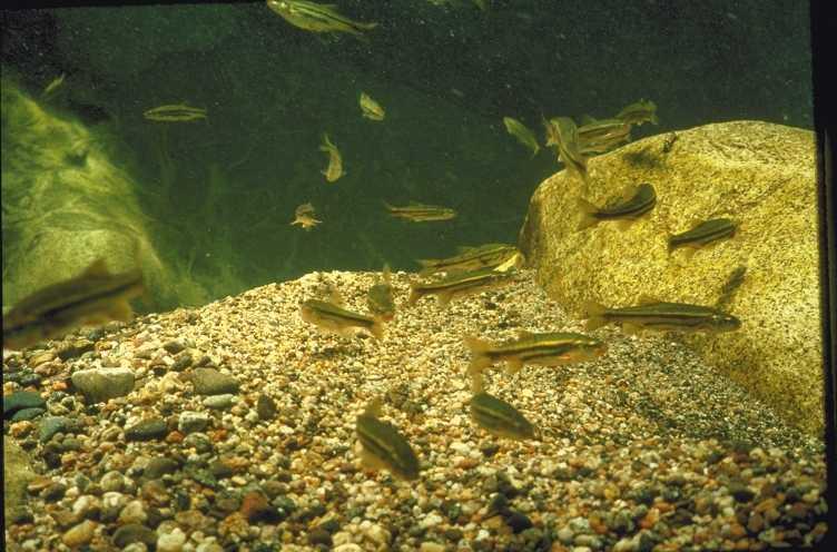
4 Roach
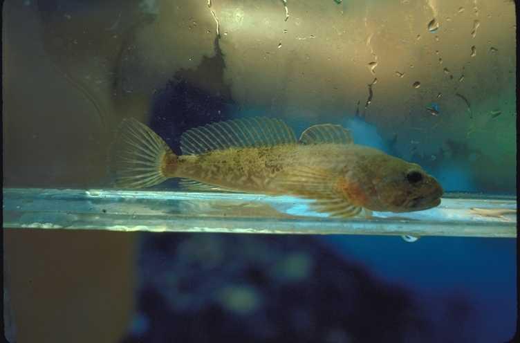
5 Sculpin
6 Stickleback
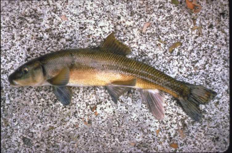
7 Sucker

8 California freshwater shrimp

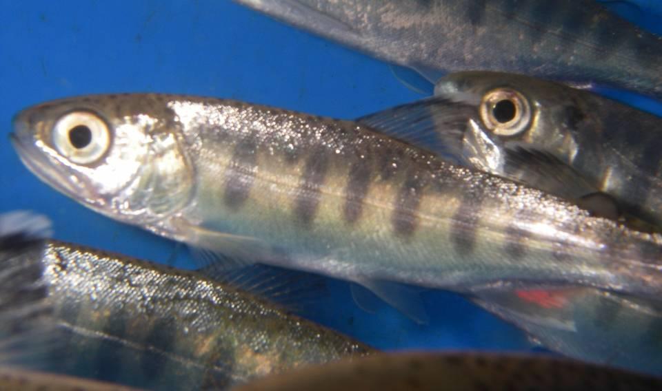
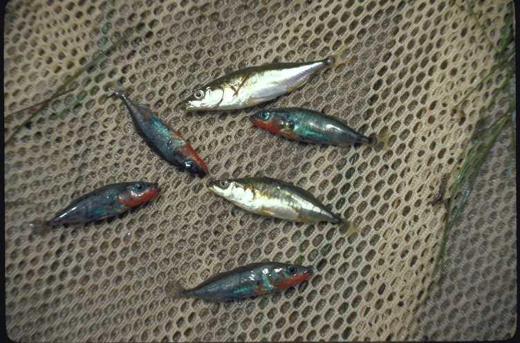
9 Coho salmon

10 National National Park Service Park Point Reyes National Point Reyes National Seashore Coho Salmon CCCESU Status: ENDANGERED
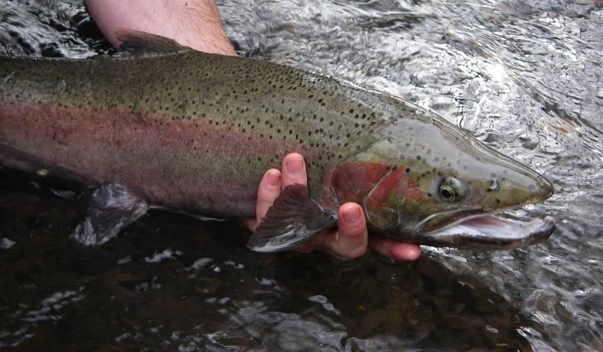
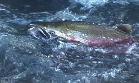
11 Steelhead

12 National National Park Service Park Point Reyes National Point Reyes National Seashore Steelhead CCCESU Status: THEATENED
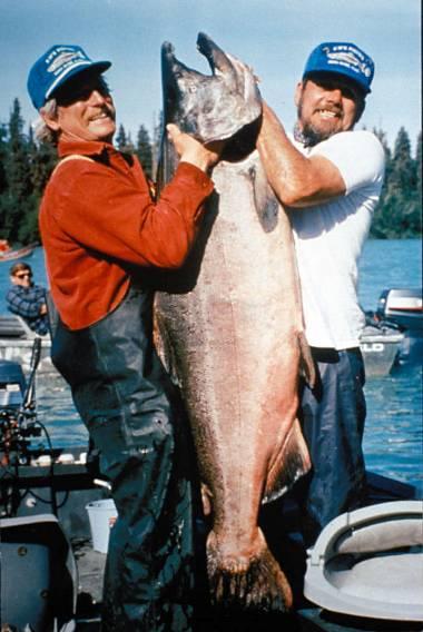
13 Chinook


14 National National Park Service Park Point Reyes National Point Reyes National Seashore Chinook Salmon Central Coast ESU Status: THEATENED

15 National Park National Service Park Service Point Reyes Point National Reyes Seashore National Seashore Monitoring Efforts in Coastal Marin Marin Municipal Water District Lagunitas, San Geronimo, Devils Gulch Spawner surveys Winter Summer index reach surveys 993 Smolt Trapping 006, 008 SPAWN - San Geronimo Tributaries Spawner surveys Smolt Trapping 006 National Park Service Olema, Redwood, Pine Gulch Spawner surveys 996 Summer Index Reach Surveys 998 Basinwide Estimates Smolt Trapping 00 Pine Gulch, 003 Olema, 004 Redwood

16 National Park Service Point Reyes National Seashore
17 National Park Service Point Reyes National Seashore Coho salmon response to Ocean Condition Dramatic decline in fishery in mid-970s Correlation to the shift in ocean productivity from California coast towards Alaska. Pacific Decadal Oscillation year cycle - shifted back to the south in last few years Coho Salmon Ocean phase Coho salmon feed in shallower waters, close to shore on nectonic species juvenile fish, euphausiids, decapod larvae, & hyperiid amphipods coho population collapse synchronous along CA coast directly related to the reduced California Current
18 National Park National Service Park Service Point Reyes Point National Reyes Seashore National Seashore Coastal Marin Coho Salmon Lagunitas Creek watershed Southernmost stable population in CCC ESU 5-0% coho in this ESU Two strong year classes (YC & ), one weak one (YC 3) Redwood Creek Distinct from Lagunitas Creek population Related to Pine Gulch Creek occurrence Annual returns, no adults observed in YC stable, YC recent hard hit, YC3 weakest Outlook All year classes are represented and resilient Address limiting factors within watershed Understand ocean survival and impact on populations
19 National Park National Service Park Service Point Reyes Point National Reyes Seashore National Seashore Coastal Marin Coho Salmon Three Year Classes YC Strong in Lagunitas Creek watershed Stable but low in Redwood Creek watershed YC Strong in Lagunitas Creek watershed Strongest and increasing in Redwood Creek watershed Significant decline in in all watersheds YC3 Weak in Lagunitas Creek watershed Weakest in Redwood Creek watershed
20 National Park National Service Park Service Point Reyes Point National Reyes Seashore National Seashore Coho in Coastal Marin Watersheds Coho Salmon Redds in the Lagunitas Creek Watershed 600 Other Tribs (Nicasio, Cheda, etc) Devil's Gulch 500 Olema Creek San Geronimo +tribs Lagunitas Creek Number of Redds Spawner Year Lagunitas Creek, San Geronimo Creek, Devil s Gulch, and Olema Creek Coho Salmon redd results by year class winter thorough winter Year classes are designated by color (Year Class shown in yellow, Year Class shown in blue, Year Class 3 shown in red). Data provided by NPS, MMWD, and SPAWN.
21 National Park National Service Park Service Point Reyes Point National Reyes Seashore National Seashore Coho in Coastal Marin Watersheds Coho Salmon Redds in the Redwood Creek Watershed Kent Canyon Fern Creek Redwood Creek 40 Number of Redds Spawner Year Year classes are designated by color (Year Class shown in yellow, Year Class shown in blue, Year Class 3 shown in red). Data provided by NPS,.
22 National Park National Service Park Service Point Reyes Point National Reyes Seashore National Seashore Coastal Marin Coho Salmon Life-cycle monitoring for coho salmon cohort (year class) Adult Escapement/Redd Counts Estimate egg numbers Juvenile density/population estimate Egg to juvenile survival Redd success Spring refugia for newly emerged salmon Smolt trap outmigration estimate Juvenile to smolt survival Overwintering habitat Egg to smolt survival Aggregate watershed production Cohort Adult Escapement Smolt to adult Ocean survival
23 National Park National Service Park Service Point Reyes Point National Reyes Seashore National Seashore Coho in Coastal Marin Watersheds A Comparison of Multiple life stage observations of coho salmon within Coastal Marin watersheds for the Year Class. Spawner Year Redwood Creek Olema Creek Pine Gulch Creek PLD Index Redds c Average Female Fork Length a Estimated number of Eggs 0,38 b 30,0 b,99 b Basinwide Juvenile Estimate 6,45 ±,367 5,857 ±, Estimated Survival Rate Egg to Juvenile 6.7%.3% 4.9% Watershed Smolt Production Estimate 3,48 ± 66,96 ± 74 d 0 Estimated Survival Rate Juvenile to Smolt 38.67% 5.0% 9.6% Estimated Survival Rate Egg to Smolt.4% 0.56% 4.55% Redwood Creek watershed Spawner Year Olema Creek mainstem (watershed) Pine Gulch Creek PLD Index 8 80 (08) 0 Redds 66 (95) 0 Estimated Survival Rate Smolt to Adult.3% 8.33% 0.00% a Average female length based on female carcass lengths on Redwood Creek for spawner years thru b Estimated number of eggs using Shapovalov and Taft (954) formula based on average female fork length c Based on presence of juvenile coho observations during the summer basinwide surveys, it is assumed that at least one coho pair successfully constructed a viable redd. d Trapping operations were suspended on May 8 th, 005 due to high flows and red-legged frog captures. This resulted in an artificially low smolt production estimate.
24 National Park Service Point Reyes National Seashore Coho in Coastal Marin Watersheds A Comparison of Multiple life stage observations of coho salmon within Coastal Marin watersheds for the Year Class. Redwood Creek Watershed Spawner Year Olema Creek mainstem (watershed) Pine Gulch Creek PLD Index 7 84 (70) 3 Redds (37) 3 Average Female Fork Length a Estimated number of Eggs,35 b 49,599 b 6,597 b Basinwide Juvenile Estimate 8,594 ±,65 9,887 ± 9,970 3,50 ± 554 Estimated Survival Rate Egg to Juvenile 4.0%.0% 7.4% Watershed Smolt Production Estimate 4 3,53 ± 54 0,544 ± 8, ± 76 Estimated Survival Rate Juvenile to Smolt 37.9% 35.3% 3.0% Estimated Survival Rate Egg to Smolt.5% 4.% 5.6% Redwood Creek watershed Spawner Year Olema Creek mainstem (watershed) Pine Gulch Creek PLD Index 5 0* (33) Redds (5) Estimated Survival Rate Smolt to Adult % 0.7% a Average female length based on female carcass lengths on Redwood Creek for spawner years thru b Estimated number of eggs using Shapovalov and Taft (954) formula based on average female fork length
25 National Park Service Point Reyes National Seashore Coho in Coastal Marin Watersheds A Comparison of multiple life stage observations of coho salmon within Coastal Marin watersheds for the Year Class Redw ood Creek Olema Creek Pine Gulch Creek # of coho salmon SY Adults Egg estimate Juvenile Estimate Smolt Production Returning Adults
26 National Park Service Point Reyes National Seashore Coho in Coastal Marin Watersheds A Comparison of multiple life stage observations of coho salmon in Redwood Creek for the Year Class Spring Emergence and Rearing # of coho salmon Winter Rearing Upstream Migration and Spawning Ocean and Estuary Rearing 0 Expected return based on regional return rates SY Adults Egg estimate Juvenile Estimate Smolt Production Returning Adults
27 National Park Service Point Reyes National Seashore Winter Decline of returning coho salmon to streams in California and Oregon 007/08 relative to returns in 004/05. Streams listed from north to south. % Decline of Returning Coho Salmon 0% 0% 40% 60% 80% 00% Oregon Coast ESU ( streams) Mill Creek (Smith River Trib) Bogus Creek Shasta River Trinity River Freshwater Creek Elk River Eel River Pudding Creek Lagunitas Creek Olema Creek Pine Gulch Creek Redwood Creek Scott Creek (from MacFarlane R.B., S. Hayes, B. Wells Coho and Chinook salmon decline in California during the spawning seasons of 007/08. Unpublished document from the National Oceanic and Atmospheric Administration Southwest Fisheries Science Center, Santa Cruz, Ca.)
28 National Park Service Point Reyes National Seashore (from MacFarlane R.B., S. Hayes, B. Wells Coho and Chinook salmon decline in California during the spawning seasons of 007/08. Unpublished document from the National Oceanic and Atmospheric Administration Southwest Fisheries Science Center, Santa Cruz, Ca.) WOPI and NOI Lagunitas Creek Redds Index Value Year Number of Redds Spawner Year The Wells Ocean Productivity Index (WOPI, black line) and the Northern Oscillation Index (NOI, grey line) between 975 and 006. Values derived for March-August. Note the close fit between the larger-scale NOI, which represents the strength of the North Pacific high pressure cell, and local-scale WOPI, except for recent years ( ), suggesting a change in local conditions. Low values indicate conditions for lower biological productivity.
29 National Park Service Point Reyes National Seashore (from MacFarlane R.B., S. Hayes, B. Wells Coho and Chinook salmon decline in California during the spawning seasons of 007/08. Unpublished document from the National Oceanic and Atmospheric Administration Southwest Fisheries Science Center, Santa Cruz, Ca.) WOPI and NOI Olema PLD Escapement Index Index Value PLD Minimum Escapement Estimate Year Spawner Year The Wells Ocean Productivity Index (WOPI, black line) and the Northern Oscillation Index (NOI, grey line) between 975 and 006. Values derived for March-August. Note the close fit between the larger-scale NOI, which represents the strength of the North Pacific high pressure cell, and local-scale WOPI, except for recent years ( ), suggesting a change in local conditions. Low values indicate conditions for lower biological productivity.
30 National Park Service Point Reyes National Seashore (from MacFarlane R.B., S. Hayes, B. Wells Coho and Chinook salmon decline in California during the spawning seasons of 007/08. Unpublished document from the National Oceanic and Atmospheric Administration Southwest Fisheries Science Center, Santa Cruz, Ca.) WOPI and NOI Redwood PLD Escapement Index Index Value PLD Minimum Escapement Estimate Year Spawner Year The Wells Ocean Productivity Index (WOPI, black line) and the Northern Oscillation Index (NOI, grey line) between 975 and 006. Values derived for March-August. Note the close fit between the larger-scale NOI, which represents the strength of the North Pacific high pressure cell, and local-scale WOPI, except for recent years ( ), suggesting a change in local conditions. Low values indicate conditions for lower biological productivity.
31 National Park National Service Park Service Point Reyes Point National Reyes Seashore National Seashore Outlook for Salmonids in Coastal Marin Watersheds Southernmost stable coho populations Lagunitas Creek system is exceptional Ensure resiliency in system watershed constraints, limitations Ocean survival, susceptibility to regional shifts in circulation and temperature regimes Coho (3 year life-cycle) compared to Chinook (3-5 year lifecycle) Impact already has hit coho populations (SY 06-07, SY07-08) However next cohort is traditionally the weakest Ramifications for Chinook another - years

32 National Park Service Point Reyes National Seashore Coordinated efforts and watershed collaboration In coastal Marin, our fisheries resource is unusual. It is important that we both appreciate what we have, and strive to improve it.
33 National Park National Service Park Service Point Reyes Point National Reyes Seashore National Seashore Restoration relationship to life-stage Riparian Protection Rearing habitat, temperature control, structure in channel Woody Debris Structures Rearing habitat, temperature control, structure in channel Streambank Stabilization sediment, rearing habitat, spawning habitat, structure in channel Fish Passage adult passage, juvenile passage for access to overwintering and rearing habitat Floodplain recovery limited rearing, overwintering for coho, California Red-legged frog habitat Estuarine Habitat Restoration outmigration feeding, adult spawner refugia


34 National Park Service Point Reyes National Seashore Riparian Protection Riparian Protection Rearing habitat, temperature control, structure in channel Gale Ranch, Walker Creek Watershed Photos courtesy of Marin RCD


35 National Park Service Point Reyes National Seashore Woody Debris Structures Woody Debris Structures Rearing habitat, temperature control, structure in channel Habitat Complexity increased with additional woody debris. Susceptible to high flows. Structure moved on high flows subsequent to photos. Lagunitas Creek Watershed Photos courtesy of MMWD


36 National Park Service Point Reyes National Seashore Streambank Stabilization Streambank Stabilization sediment, rearing habitat, spawning habitat, structure in channel Randall Slide, Olema Creek


37 National Park Service Point Reyes National Seashore Fish Passage Fish Passage adult passage, juvenile passage for access to overwintering and rearing habitat, natural channel process Bates Canyon San Geronimo Cr. Courtesy of Marin County - DPW

38 National Park Service Point Reyes National Seashore Floodplain Process Floodplain recovery / Restoration limited rearing, overwintering for coho, California Red-legged frog habitat Olema Flat, Olema Creek

39 National Park Service Point Reyes National Seashore Estuarine Restoration and Function Estuarine Habitat Restoration outmigration feeding, adult spawner refugia Giacomini Wetland Restoration Area, Tomales Bay
40 National Park National Service Park Service Point Reyes Point National Reyes Seashore National Seashore Restoration Activities in the Watershed Marin Municipal Water District Sediment Management Projects (30+ sites) Riparian Enhancement and Woody Debris Structures 43 Woody Debris sites 9 Riparian sites SPAWN Outreach and Education Riparian protection and streambank stabilization National Park Service Olema, Redwood, Pine Gulch Fish Passage Riparian Protection (fencing, planting), Streambank Stabilization Estuarine Restoration, Floodplain protection Marin County Fish Passage Enhancement Marin Resource Conservation District Best Management Practices on Rangeland Riparian Protection, streambank stabilization
Juvenile coho salmon use of constructed off-channel habitats in two Lower Klamath River tributaries: McGarvey Creek & Terwer Creek
 Juvenile coho salmon use of constructed off-channel habitats in two Lower Klamath River tributaries: McGarvey Creek & Terwer Creek Prepared by: Yurok Tribal Fisheries Program PO Box 1027, Klamath, CA Spring
Hatchery Scientific Review Group Review and Recommendations
 Hatchery Scientific Review Group Review and Recommendations Willamette - Clackamas Spring Chinook Salmon Population and Related Hatchery Programs January 31, 2009 Columbia River Hatchery Reform Project
STORNETTA BROTHERS COASTAL RANCH
 STORNETTA BROTHERS COASTAL RANCH Location: Surrounding Point Arena Lighthouse and immediately south of Manchester State Park Mendocino Co., CA Acres: 1,860 Resources: Over two miles of Pacific Ocean coastline
Mark West Creek Flow Study Report
 Mark West Creek Flow Study Report Biology and Geology of Mark West Creek The headwaters of Mark West Creek are located in the Mayacamas Mountain range, which border Napa and Sonoma County, where it then
This area encompasses the coastal shores and
 COASTAL REDWOOD NATIONAL AND STATE PARKS This area encompasses the coastal shores and forests of Redwood National and State Parks (RNSP) from Crescent Beach south to Mussel Point, near the town of Orick
Enhancement of Salmonid Rearing Habitat in McGarvey Creek - Lower Klamath River
 Enhancement of Salmonid Rearing Habitat in McGarvey Creek - Lower Klamath River Prepared by: Sarah Beesley Yurok Tribal Fisheries Program PO Box 1027 Klamath, California 95548 and Rocco Fiori, Fiori GeoSciences
HATCHERY AND GENETIC MANAGEMENT PLAN (HGMP)
") DRAFT HATCHERY AND GENETIC MANAGEMENT PLAN (HGMP) Hatchery Program: Clackamas River Spring Chinook Species or Hatchery Stock: Clackamas River Spring Chinook (Stock 19) Agency/Operator: Oregon Department
DRAFT HATCHERY AND GENETIC MANAGEMENT PLAN (HGMP) Hatchery Program: Clackamas River Spring Chinook Species or Hatchery Stock: Clackamas River Spring Chinook (Stock 19) Agency/Operator: Oregon Department
M.J. Milne & Associates Ltd.
 M.J. Milne & Associates Ltd. March, 29 Tolko Industries Ltd. 6 Yellowhead Highway RR#, Site, C Kamloops, BC V2C K Attention: Mr. Michael Bragg, R.P.F. Dear Sir: Re: Risk Rating Evaluation Non-status Roads
Penticton Creek Restoration Committee Meeting to be held at City of Penticton, Corporate Boardroom 171 Main Street, Penticton, B.C.
 Agenda 1. Call Regular Committee Meeting to Order 2. Adoption of Agenda 3. Adoption of Minutes Penticton Creek Restoration Committee Meeting to be held at City of Penticton, Corporate Boardroom 171 Main
14.0 NORTHERN CALIFORNIA COAST NORTHERN FOCUS AREA Description of Area The Land
 14.1 Description of Area 14.1.1 The Land The Northern California Coast - Northern Focus Area is composed of coastal Del Norte and Humboldt counties. The boundary extends eastward from the Pacific coast
MARBLE RIVER PROVINCIAL PARK
 MARBLE RIVER PROVINCIAL PARK PURPOSE STATEMENT AND ZONING PLAN March 2003 MARBLE RIVER PROVINCIAL PARK Purpose Statement and Zoning Plan Primary Role The primary role of Marble River Park is to protect
Title/Name of the area: Chwaka Bay, Zanzibar
 Title/Name of the area: Chwaka Bay, Zanzibar Presented by: Dr. Charles Lugomela, Ag. Head, Department of Aquatic Sciences and Fisheries, University of Dar es Salaam, P.O. Box 35064 Dar es Salaam, Tanzania
MARIN CONSERVATION LEAGUE. Parks and Open Space Committee January 14, 2016 MINUTES
 MARIN CONSERVATION LEAGUE Parks and Open Space Committee January 14, 2016 MINUTES ATTENDEES: Nona Dennis, Chair; Greg Zitney, Tom Boss, Linda Novy, Susan Stompe, Eva Buxton, Al Baumann, Robert Eichstaedt,
Northern Pacific Sea Star
 Northern Pacific Sea Star The Northern Pacific Seastar http://www.marine.csiro.au/leafletsfolder/01npseastar.html Reproduced with permission of Craig Macaulay, CSIRO http://www.marine.csiro.au/leafletsfolder/01npseastar.html
Satoquo SEINO (Graduate School of Engineering, Kyushu University, Japan)
") A reconsideration of horseshoe crab conservation methodology in Japan over the last 100 years and prospects for a marine protected area network in Asian seas Satoquo SEINO (Graduate School of Engineering,
A reconsideration of horseshoe crab conservation methodology in Japan over the last 100 years and prospects for a marine protected area network in Asian seas Satoquo SEINO (Graduate School of Engineering,
MARINE PROTECTED AREAS LESSON PLAN Water Parks
 Marine Protected Areas U. S. Marine Protected Areas Lesson Plan MARINE PROTECTED AREAS LESSON PLAN Water Parks Theme U.S. Marine Protected Areas Links to Overview Essays and Resources Needed for Student
Lagunitas Creek Watershed Sediment Reduction and Enhancement Project Final Report
 Lagunitas Creek Watershed Sediment Reduction and Enhancement Project Final Report Presented: April 4, 2007 To: Marin Municipal Water District 220 Nellen Avenue Corte Madera, CA 94925 By: Patrick Kelleher
Alaskan/Fjordland Pacific (Ecoregion 22)
") Alaskan/Fjordland Pacific (Ecoregion 22) Background The Alaskan/Fjordland Pacific Ecoregion is an area of abundant marine resources. The ecoregion begins at Vancouver Island and moves up the Gulf of Alaska
Alaskan/Fjordland Pacific (Ecoregion 22) Background The Alaskan/Fjordland Pacific Ecoregion is an area of abundant marine resources. The ecoregion begins at Vancouver Island and moves up the Gulf of Alaska
MAIN LAKE PROVINCIAL PARK
 MAIN LAKE PROVINCIAL PARK PURPOSE STATEMENT AND ZONING PLAN March 2003 MAIN LAKE PROVINCIAL PARK Purpose Statement and Zoning Plan Primary Role The primary role of Main Lake Park is to protect a biologically
Phoenix Habitat Restoration Projects
 Phoenix Habitat Restoration Projects Spur Cross Ranch Cave Creek (Estergard) Regional Tree and Shade Summit March 9, 2010 Desert Riparian Ecosystems Healthy riparian areas like this once existed along
SENSITIVE AREAS: PART FIVE - AREAS OF LOCAL CONCERN
 S: PART FIVE - AREAS OF LOCAL CONCERN Some areas within the Cook Inlet Subarea warrant special attention due to the presence of highly productive wildlife habitat, the ability to sustain a large part of
Elkhorn Slough Tidal Wetland Project
 Elkhorn Slough Tidal Wetland Project Joint Meeting Strategic Planning Team and Science Panel September 23, 2009 Funding National Oceanic and Atmospheric Admin. David and Lucille Packard Foundation Resources
Finn Creek Park. Management Direction Statement Amendment
 Finn Creek Park Management Direction Statement Amendment November 2013 Management Direction Statement Amendment Approved by: Jeff Leahy Regional Director, Thompson Cariboo BC Parks November 12, 2013 Date
Virginian Atlantic (Ecoregion 8)
") Virginian Atlantic (Ecoregion 8) Background The Virginian Atlantic Ecoregion extends from the south side of Cape Cod to Cape Hatteras in North Carolina. The waters of the ecoregion are a mix of cold and
Virginian Atlantic (Ecoregion 8) Background The Virginian Atlantic Ecoregion extends from the south side of Cape Cod to Cape Hatteras in North Carolina. The waters of the ecoregion are a mix of cold and
Evaluation of Outstanding Remarkable Values for Collawash River March 2011
 Evaluation of Outstanding Remarkable Values for Collawash River March 0 Segment From headwaters of East Fork Collawash River to Buckeye Creek Mileage: miles Free flowing: Yes Scenic:, Substantial River
Galveston Bay Estuary Program. Carla G. Guthrie, Ph.D. Galveston Bay Council Member Texas Water Development Board
 Galveston Bay Estuary Program Carla G. Guthrie, Ph.D. Galveston Bay Council Member Texas Water Development Board The statements contained in this presentation are my current views and opinions and are
ROAD AND TRAIL PROJECT APPROVAL
 ROAD AND TRAIL PROJECT APPROVAL www.marincountyparks.org Marin County Parks, 3501 Civic Center Dr, Suite 260, San Rafael, CA 94903 DATE: July 12, 2017 PRESERVE: Gary Giacomini Open Space Preserve PROJECT:
Yard Creek Provincial Park. Management Plan
 Yard Creek Provincial Park Management Plan Draft January 2010 Yard Creek Provincial Park Management Plan Approved by: telàlsemkin/siyam/chief Scott Benton Bill Williams Squamish Executive Director ation
X. WHATCOM CREEK SMA. X.1 Watershed Analysis. X.1.1 Landscape Setting
 X. WHATCOM CREEK SMA Summary: The entire length of Whatcom Creek is located within the City of Bellingham. SMA jurisdiction associated with this creek is approximately 300 acres. Land use is dominated
Status of Mangroves in Belize
 Status of Mangroves in Belize State of the Coastal zone Summit June 7 th 2012 Nadia Bood*, Emil Cherrington and Tim Smith Outline Introduction to mangroves Importance of mangrove to Belize National status
Description of the Proposed Action for the Big Creek / Yellow Pine Travel Plan (Snow-free Season) and Big Creek Ford Project
 and Big Creek Ford Project") Description of the Proposed Action for the Big Creek / Yellow Pine Travel Plan (Snow-free Season) and Big Creek Ford Project Payette National Forest Krassel Ranger District Valley and Idaho Counties, Idaho
Description of the Proposed Action for the Big Creek / Yellow Pine Travel Plan (Snow-free Season) and Big Creek Ford Project Payette National Forest Krassel Ranger District Valley and Idaho Counties, Idaho
Sibley LUPA. Board Executive Committee Meeting December 7, 2017
 Sibley LUPA Board Executive Committee Meeting December 7, 2017 Project Location & Project Area 1,318-acre Robert Sibley Volcanic Regional Preserve Project Area Purpose Project Purpose & Goals Append the
Sizing up Australia s eastern Grey Nurse Shark population
 Image: David Harasti A new estimate of adult population size for Australia s eastern Grey Nurse Shark drew on widespread genetic sampling and forensic exploration of family trees. Grey Nurse Sharks are
Progress Report March 2002 Project FIS Summary of Whitefish movement, Whitefish Lake Weir, Yukon Delta National Wildlife Refuge, Alaska, 2001
 Progress Report March Project FIS 1-5 Summary of Whitefish movement, Whitefish Lake Weir, Yukon Delta National Wildlife Refuge, Alaska, 1 Frank G. Harris and Ken C. Harper U.S. Fish and Wildlife Service
MAA 5 Year Approved Projects List FY through FY
 MAA 5 Year Approved Projects List FY 2018 19 through FY 2022 23 AA01 Miramontes Ridge: Gateway to the Coast Public Access, Stream Restoration and Agriculture Enhancement AA01 Miramontes Ridge: Gateway
Prepared by: the Marin Municipal Water District (MMWD), July 2005 Sky Oaks Watershed Headquarters 49 Sky Oaks Rd., Fairfax California mail to:
, July 2005 Sky Oaks Watershed Headquarters 49 Sky Oaks Rd., Fairfax California mail to:") Preface The Marin Municipal Water District (District) has been caring for the Mount Tamalpais Watershed for nearly 100 years. At the heart of the District s mission is the continued preservation of the
Preface The Marin Municipal Water District (District) has been caring for the Mount Tamalpais Watershed for nearly 100 years. At the heart of the District s mission is the continued preservation of the
SHASTA WEST PLANNING AREA
 2016 SHASTA COUNTY COMMUNITY WILDFIRE PROTECTION PLAN SHASTA WEST PLANNING AREA Covering the communities of: Centerville Redding (west & downtown) Shasta I. PROPOSED PROJECTS A. THE PLANNING AREA SHASTA
Michipicoten Island Regional Plan
 Michipicoten Island Regional Plan This is one of twenty Regional Plans that support implementation of the Lake Superior Biodiversity Conservation Strategy (Strategy). The Strategy, prepared and overseen
DIDYMO SURVEY, LOWER FRYINGPAN RIVER, BASALT, COLORADO 2015
 DIDYMO SURVEY, LOWER FRYINGPAN RIVER, BASALT, COLORADO 2015 Second Annual Report PREPARED FOR: ROARING FORK CONSERVANCY PREPARED BY: COLORADO MOUNTAIN COLLEGE NATURAL RESOURCE MANAGEMENT PROGRAM TIMBERLINE
Annual - TOTAL ADA ALL SETTINGS
 2015-16 Annual - TOTAL ADA ALL SETTINGS Basic Aid DISTRICT K-3 4-6 7-8 9-12 Choice ADA Bolinas 36.98 27.03 30.76 - - 94.77 Dixie 887.20 605.33 479.83 - - 1,972.36 Kentfield 491.44 426.88 266.81 - - 1,185.13
DATE: January 19, WCA Governing Board. Johnathan Perisho, Project Manager. Mark Stanley, Executive Officer
 Item 14 DATE: January 19, 2017 TO: FROM: THROUGH: SUBJECT: WCA Governing Board Johnathan Perisho, Project Manager Mark Stanley, Executive Officer Item 14: Consideration of a resolution to accept an acquisition
Case Study: 1. The Clarence River Catchment
 Case Study: 1. The Clarence River Catchment The NSW coastline is a great natural asset, making an enormous contribution to the economy. The resources of coastal catchments such as the Clarence River Catchment,
$850,000 Awarded to 20 Organizations
 $850,000 Awarded to 20 Organizations The Conservation Alliance is pleased to fund the following organizations to support their efforts to protect wild lands and waterways for their habitat and recreation
What is an Marine Protected Area?
 Policies, Issues, and Implications of Marine Protected Areas Kara Anlauf University of Idaho Before the House Subcommittee on Fisheries Conservation, Wildlife and Oceans April 29, 2003 What is an Marine
NECHAKO CANYON PROTECTED AREA
 NECHAKO CANYON PROTECTED AREA PURPOSE STATEMENT AND ZONING PLAN March 2003 1 Nechako Canyon Protected Area Purpose Statement and Zoning Plan The Nechako Canyon Protected Area (1,246 hectares) is located
Northern Oregon Coast
 Joint Venture Implementation Plans Northern Oregon Coast 1994 Prepared for: Pacific Coast Joint Venture Oregon Wetlands Joint Venture 1880 Willamette Falls Drive, Suite 200 West Linn OR 97068 503-597-3889
Damn those dams their effects on stream ecosystems
 Damn those dams their effects on stream ecosystems Jeremy Tiemann Illinois Natural History Survey Prairie Research Institute at the University of Illinois History of dams History of dams First evidence
VARGAS ISLAND PROVINCIAL PARK
 VARGAS ISLAND PROVINCIAL PARK PURPOSE STATEMENT AND ZONING PLAN February 2003 VARGAS ISLAND PROVINCIAL PARK Purpose Statement and Zoning Plan Primary Role The primary role of Vargas Island Park is to protect
Coral reefs facing to global and regional environmental changes
 Coral reefs facing to global and regional environmental changes Hiroya Yamano (National Institute for Environmental Studies) Importance of coral reefs Photo: H. Kan Photo: H. Kayanne Biodiversity Fisheries
MODEL Task Team. NEMURO NEMURO.FISH Dynamic link Coupled with population dynamics model PEST Regional comparison 3D-NEMURO
 MODEL Task Team NEMURO NEMURO.FISH Dynamic link Coupled with population dynamics model PEST Regional comparison E-NEMURO 3D-NEMURO ECOPATH/ECOSIM+NEMURO Ecological Modelling special volume Future perspectives
FEASIBILITY CRITERIA
 This chapter describes the methodology and criteria used to evaluate the feasibility of developing trails throughout the study areas. Land availability, habitat sensitivity, roadway crossings and on-street
Partners: Michigan California Timber Company Shasta-Trinity National Forest Pacific Crest Trail Association The Trust for Public Land
 Partners: Michigan California Timber Company Shasta-Trinity National Forest Pacific Crest Trail Association The Trust for Public Land Describe the project location, size, opportunities, and timing. Provide
Fifty-Year Record of Glacier Change Reveals Shifting Climate in the Pacific Northwest and Alaska, USA
 Fact Sheet 2009 3046 >> Pubs Warehouse > FS 2009 3046 USGS Home Contact USGS Search USGS Fifty-Year Record of Glacier Change Reveals Shifting Climate in the Pacific Northwest and Alaska, USA Fifty years
2.1 Physical and Biological Description Matabitchuan River Watershed
 2.1 Physical and Biological Description Watershed 2.1.1 Physical Description The system watershed has a total area of about 933 km 2 and is a tributary system to Lake Temiskaming and the Ottawa River Drainage
The Chippewas of Georgina Island First Nation At A Glimpse
 Located in Lake Simcoe approximately100 km north of the Greater Toronto Area (GTA) in Ontario Canada. Consisting of 3 separate Islands, Georgina, Snake and Fox with 2 mainland access points.. Georgina
When Oregon s first state park
 The Coastal Edge Conserving the Coastal Edge When Oregon s first state park superintendent created Oswald West and Nehalem Bay parks beginning in the 1930s, he believed they were just the start of an outstanding
Instream Restoration of Lower West Fork McGarvey Creek
 Instream Restoration of Lower West Fork McGarvey Creek Prepared by: Daniel B. Gale 4BYurok Tribal Fisheries Program P.O. Box 339 Klamath, CA 95548 Funded by: California Department of Fish and Game FY 2005
Bear River ECC Final Meeting Notes April 20, 2016 Pocatello, ID
 Bear River ECC Final Meeting Notes April 20, 2016 Pocatello, ID ECC Members Present Lynn Van Every, Idaho Department of Environmental Quality Jim DeRito, Trout Unlimited Corey Lyman, U.S. Forest Service
An Introduction. The Saginaw River/Bay Area of Concern
 Saginaw River & Bay Area of Concern: Looking Forward Continued Partnerships in the Restoration of Saginaw Bay Michelle Selzer Lake Huron Coordinator & Interim AOC Coordinator Saginaw Bay Watershed Conference
Wetlands Reservoirs of Biodiversity. Billy McCord, SCDNR
 Wetlands Reservoirs of Biodiversity Billy McCord, SCDNR Estuaries Tidal Deepwater Intertidal Salt Marsh Tidal Riverine Fresh & Brackish Deepwater Tidal Emergent Marsh Freshwater Riverine Seasonally Flooded
ENVIRONMENTAL SYSTEMS LESSONS High School level DRAFT
 ENVIRONMENTAL SYSTEMS LESSONS High School level DRAFT Project: Data Sets and Inquiry in Geoscience Environmental Restoration Studies (NSF GEO- 0808076) Authors: Daniel Zalles, Center for Technology in
OPPORTUNITIES FOR WILD & SCENIC RIVER DESIGNATION
 OPPORTUNITIES FOR WILD & SCENIC RIVER DESIGNATION IN SOUTHWEST WASHINGTON S VOLCANO COUNTRY Washington's legendary volcanoes - Mount St. Helens, Mount Rainier and Mount Adams - are the source of wild,
Stuart River Provincial Park Purpose Statement and Zoning Plan
 Stuart River Provincial Park Purpose Statement and Zoning Plan Stuart River Provincial Park protects three-quarters of the 110 kilometer long Stuart River corridor between Stuart Lake and the Nechako River.
PALO CORONA REGIONAL PARK MPRPD BOARD MEETING AUGUST 8, 2018
 PALO CORONA REGIONAL PARK MPRPD BOARD MEETING AUGUST 8, 2018 ACKNOWLEDGEMENTS AGENCIES AND ORGANIZATIONS The Trust for Public Land Big Sur Land Trust Santa Lucia Conservancy California State Parks Point
Palau National Marine Sanctuary Building Palau s future and honoring its past
 A fact sheet from Sept 2015 Palau National Marine Sanctuary Building Palau s future and honoring its past Caring for the environment has long been an important part of Palau s culture. For centuries, traditional
Underwater Acoustic Monitoring in US National Parks
 Underwater Acoustic Monitoring in US National Parks Megan F McKenna 1, Christopher Garsha 2, Erik Stabenau 1, Christine Gabriele 1, Timothy Clark 1, Clayton Pollock 1, Brinnen Carter 1, Samantha Bietsch
Weekly Report #19-01
 Visit our Website at www.fpc.org Fish Passage Center Weekly Report #19-1 847 NE 19th Ave., Suite 25 Portland, OR 97232 (53) 833-39 March 8, 219 This Week s Highlights Water Supply Precipitation throughout
Paul Sturm Roberto Viqueira Ríos
 Paul Sturm Roberto Viqueira Ríos In this talk Brief Background on Land Based Sources Historical Perspective Guánica watershed characteristics/ issues High priority restoration projects Other key issues
North Shore Streamkeepers Meeting May 16, :00 pm Laura Lynn Strata Lodge
 North Shore Streamkeepers Meeting May 16, 2018 7:00 pm Laura Lynn Strata Lodge Chair: Barbara Frisken Secretary: Janet Dysart Regrets: Zo Ann Morten, Jan Landers, Brian Comey Attendance: 18 AGM and Election
Land Protection Accomplishments
 2017 Land Protection Accomplishments Conserving Open Space and Recreational Access On the Pacific Crest National Scenic Trail View from the Pacific Crest Trail of Donomore Meadows near the California/Oregon
Cat Island Chain Background & Access Guide
 Cat Chain Background & Access Guide Brown County Port & Resource Recovery Department 2561 S. Broadway, Green Bay, WI 54304 (920) 492-4950 www.portofgreenbay.com January 2018 1 Restoration of the Cat Chain
Marine Reserves LEGEND. State Boundary Sanctuary Boundary. State Marine Protected Areas State Marine Reserve State Marine Conservation Area
 Marine Reserves LEGEND State Boundary Sanctuary Boundary State Marine Protected Areas State Marine Reserve State Marine Conservation Area 0 10 20 30 Kilometers What is a marine reserve? Places in the ocean
TOWARDS SUSTAINABLE MANAGEMENT OF MARINE AND COASTAL HABITATS ASIA- PACIFIC DAY FOR THE OCEAN
 TOWARDS SUSTAINABLE MANAGEMENT OF MARINE AND COASTAL HABITATS WANNAKIAT THUBTHIMSANG PHUKET MARINE BIOLOGICAL CENTER, DMCR, THAILAND ASIA- PACIFIC DAY FOR THE OCEAN 20 NOVEMBER 2018, CONFERENCE ROOM 4,
FINGER-TATUK PROVINCIAL PARK
 FINGER-TATUK PROVINCIAL PARK PURPOSE STATEMENT AND ZONING PLAN March 2003 FINGER-TATUK PROVINCIAL PARK Purpose Statement and Zoning Plan Finger-Tatuk Provincial Park is 17,151 ha in size. It includes the
BOULDER CREEK CATTLE FENCING FOR KOKANEE HABITAT ENHANCEMENT 2010
 BOULDER CREEK CATTLE FENCING FOR KOKANEE HABITAT ENHANCEMENT 2010 Prepared for the: FISH & WILDLIFE COMPENSATION PROGRAM, NELSON, B.C. Prepared by: Marc André Beaucher CRESTON VALLEY WILDLIFE MANAGEMENT
Creation of a Community-managed Biodiversity Park in the Saloum Delta of Senegal. Voré Gana Seck Director GREEN Senegal for People, Land, Ocean
 Creation of a Community-managed Biodiversity Park in the Saloum Delta of Senegal Voré Gana Seck Director GREEN Senegal for People, Land, Ocean Rationale for the Creation of the Biodiversity Park F In line
An experimental habitat enhancement effort for a sandy river: San Rafael River restoration project
 An experimental habitat enhancement effort for a sandy river: San Rafael River restoration project Samuel Lyster Department of Watershed Sciences, Utah State University Brian G. Laub Department of Watershed
Flood History. Floodplain Descriptions
 Flood History The worst flooding in the area took place in 1966, 1969, 1971, 1995 and 1998. The storms in 1966 and 1969 caused considerable damage throughout the area due to flooding, erosion and debris
MCARTHUR SWAMP PLANNING UNIT Pit-McCloud River Watershed
 Existing Conditions & Uses Overview Spring-fed lake and rivers; valuable grazing lands and important waterfowl area Planning unit provides the only public access to Ahjumawi Lava Springs State Park 7,596
State of Nature 2016
 State Nature 2016 State Nature 2016 Results look up tables This document presents tables the results referred to in the report in an easy to access format. All data presented here feature in the report
Santa Cruz North Interior
 Santa Cruz North Interior The Santa Cruz North Interior planning area includes the area commonly referred to as the San Lorenzo Valley. The greatest amount of development occurs in the communities of Boulder
Water Quality Report for Auburn Ravine Water Year
 Water Quality Report for Auburn Ravine Water Year 216-217 Compiled by the SARSAS Citizen Science Program INDEX 1. Overview of Auburn Ravine 2. Comments on Study 3. Sites of study on Auburn Ravine a. Auburn
Bear Creek Habitat Improvement Project
 06/10/10 Bear Creek Habitat Improvement Project El Paso County, Colorado Pike National Forest and Colorado Springs Utilities Owned Land Report prepared by: Eric Billmeyer Executive Director Rocky Mountain
CHAPTER 2: DESCRIPTION OF ALTERNATIVES
 CHAPTER 2: DESCRIPTION OF ALTERNATIVES This chapter includes a description of the no-action alternative and two action alternatives for trail designation for the Dry Bay area of Glacier Bay National Preserve.
Climate Change and Chance
 Climate Change and Chance Will recovering fish stocks help puffins adapt to warming waters? A recent paper (1) published by NOAA researchers found that 24 of 36 fish stocks on the Northeast Continental
Lake Trout Population Assessment Wellesley Lake 1997, 2002, 2007
 Lake Trout Population Assessment Wellesley Lake Prepared by: Lars Jessup Fish and Wildlife Branch November 2009 Lake Trout Population Assessment Wellesley Lake Yukon Fish and Wildlife Branch TR-09-01 Acknowledgements
ROUGE RIVER REPORT CARD
 ROUGE RIVER REPORT CARD Noel Mullett, Wayne County Rouge River Report Card The Rouge River communities, residents and partners continue to address watershed issues Water quality and ecosystem health continues
Proposed National Marine Conservation Area Reserve Southern Strait of Georgia PROJECT UPDATE Spring 2012
 Proposed National Marine Conservation Area Reserve Southern Strait of Georgia PROJECT UPDATE Spring 2012 National marine conservation areas (NMCAs) are established to protect, conserve and present examples
Nature Conservation Agency (NCA) Salacgrīva 05/07/2018
 Salacgrīva 05/07/2018") Nature Conservation Agency (NCA) Salacgrīva 05/07/2018 Nature Conservation Agency ensures implementation of unified nature protection policy in Latvia Specially protected nature areas in Latvia Specially
Nature Conservation Agency (NCA) Salacgrīva 05/07/2018 Nature Conservation Agency ensures implementation of unified nature protection policy in Latvia Specially protected nature areas in Latvia Specially
Santa Cruz North Interior
 Santa Cruz North Interior The Santa Cruz North Interior planning area includes the area commonly referred to as the San Lorenzo Valley. The greatest amount of development occurs in the communities of Boulder
TURTLE SURVIVAL ALLIANCE EXECUTIVE DIRECTOR
 Transforming passion for turtles into effective conservation action through a global network of living collections and recovery programs. TURTLE SURVIVAL ALLIANCE BACKGROUND TURTLE SURVIVAL ALLIANCE EXECUTIVE
Case 3:16-cv Document 1 Filed 02/10/16 Page 1 of 37
 Case :-cv-00 Document Filed 0// Page of KEKER & VAN NEST LLP JEFFREY R. CHANIN - # jchanin@kvn.com JESSE BASBAUM - # jbasbaum@kvn.com Battery Street San Francisco, CA -0 Telephone: 00 Facsimile: ADVOCATES
OUTREACH ANNOUNCEMENT Reply by February 21, 2014
 OUTREACH ANNOUNCEMENT Reply by February 21, 2014 Lead Fire Prevention Technician GS-0462-5/6/7 Announcement Number: OCR14-462-PREV-5/6/7DP OCR14-462-PREV-5/6/7G One Position to be filled on the Siskiyou
White Mountain National Forest
 White Mountain National Forest United States Department of Agriculture Forest Service Eastern Region Boles Brook Snowmobile Bridge Decision Memo Boles Brook Snowmobile Bridge Project Town of Woodstock
Memorandum. Conclusions
 Memorandum To: Jeff Oliver, City of Golden Valley From: Greg Wilson, Barr Engineering Co. Subject: Follow-up on Phase 1 of Twin Lake Alum Treatment and Recommendations for Phase 2 Date: June 13, 2018 Project:
The Regional Coral Reef Task Force and Action plan. 27 th ICRI. Cairns Australia July 2012
 The Regional Coral Reef Task Force and Action plan 27 th ICRI Cairns Australia July 2012 Western Indian Ocean Region East Africa mainland states Indian Ocean Islands states Biogeographic division of the
Watershed Description
 Bear River Basin: Bear Lake Watershed 1 Watershed Description The Bear Lake Watershed in the Bear River Basin has an area of 3,280 km 2 and includes all lands draining to the Bear River between Stewart
The Lower Prut Floodplain Natural Park (Romania)
") The Lower Prut Floodplain Natural Park (Romania) Gabriela Costea Natural Sciences Museum Complex Galati (Romania) & member of the Scientific Council of the Lower Prut Floodplain Natural Park The Prut The
The Lower Prut Floodplain Natural Park (Romania) Gabriela Costea Natural Sciences Museum Complex Galati (Romania) & member of the Scientific Council of the Lower Prut Floodplain Natural Park The Prut The
Are there successful fish passes? Lessons from South America. Paulo Santos Pompeu Federal University of Lavras
 Are there successful fish passes? Lessons from South America Paulo Santos Pompeu Federal University of Lavras Is it possible to build a successful fish pass? When it is not possible? Could we know when
Internship Announcement. Mount Rainier National Park. NPS Academy Internships 6 Positions. Please Respond By April 15, 2019
 NPS Academy Mount Rainier National Park Internship Announcement Mount Rainier National Park NPS Academy Internships 6 Positions Please Respond By April 15, 2019 The Northwest Youth Corps (NYC), in partnership