ROUGE RIVER REPORT CARD
|
|
|
- Brendan Stokes
- 6 years ago
- Views:
Transcription
1 ROUGE RIVER REPORT CARD Noel Mullett, Wayne County Rouge River Report Card The Rouge River communities, residents and partners continue to address watershed issues Water quality and ecosystem health continues to improve Community projects are beginning to establishing a healthier balance between green and gray infrastructure. 1
2 Alliance of Rouge Communities The ARC is comprised of 35 communities, three counties, including Wayne County, 2 education institutions and partners, such as Friends of the Rouge. The ARC supports activities such as water quality monitoring, public education activities and special projects including green infrastructure, such as native plant grow zones, tree plantings, rain barrel sales, habitat (green infrastructure) restoration. Water Quality and Ecosystem Health Dissolved Oxygen concentrations are improving across the watershed. % of DO > 5 mg/l Percent of DO Values Greater than 5 mg/l 4 Continuously Monitored Locations


3 Water Quality and Ecosystem Health The Lower Rouge Branch has improved the most since 1994 with an average improvement of 0.22mg/L/year. DO (mg/l) 16 Improvement in DO of 0.22 mg/l per year 14 P < improvement/yr ALL L05 Daily Averages DO Wet and Dry May - October State Minimum Standard L05 Dry L05 Wet All Linear (All) DO data were not collected in 2007 Jan-94 Apr-94 Jun-94 Sep-94 Dec-94 Mar-95 Jun-95 Sep-95 Dec-95 Mar-96 Jun-96 Sep-96 Dec-96 Mar-97 Jun-97 Sep-97 Dec-97 Mar-98 Jun-98 Sep-98 Dec-98 Mar-99 Jun-99 Sep-99 Dec-99 Feb-00 May-00 Aug-00 Nov-00 Feb-01 May-01 Aug-01 Nov-01 Feb-02 May-02 Aug-02 Nov-02 Feb-03 May-03 Aug-03 Nov-03 Feb-04 May-04 Aug-04 Nov-04 Feb-05 May-05 Aug-05 Oct-05 Jan-06 Apr-06 Jul-06 Oct-06 Jan-07 Apr-07 Jul-07 Oct-07 Jan-08 Apr-08 Jul-08 Oct-08 Jan-09 Apr-09 Date Water Quality and Ecosystem Health Flow is stabilizing and/or improving across the watershed. 3

4 Water Quality and Ecosystem Health Rouge Macroinvertebrate data is showing signs of improvement Community Projects (Local Funding) Through funding from Wayne County, ARC members are implementing a variety of projects to improve the Lower Branch of the Rouge River. Along the Lower Rouge River, these projects include: Inkster: CSO Outfall L49 Sewer Separation and Relief Sewer Separation and Relief Sewer to Andover Pump Station Construction of CSO Retention treatment basin at Middlebelt Road Canton: Lower Rouge River Recreational Trail and Bridges Wayne County Parks: Lower Rouge Parkway: Five (5) acres of native plantings in Inkster and Westland 4
5 Community Projects (Local Funding) Thanks to funding from a variety of federal sources, Wayne County and ARC members are implementing projects to restore beneficial uses to the river, such as improved habitat. They are: Danvers Dam Removal in Farmington Hills; Creation of 25 acres of natural areas in Wayne County Parks and Detroit and restoration of a wetland in Southfield; The installation of 2,350 trees in 12 communities and Wayne County to replace trees lost to the Emerald Ash Borer, and Removal of the Wayne Road Dam. Wayne Road Dam The MDNR 1998 Fisheries Assessment identified the Wayne Road Dam as a major impediment to restoring fish and wildlife habitat in the Rouge River. The river hosts a variety of fish in the vicinity of the dam, including trout in upstream areas and warm water species, such as smallmouth bass, northern pike and walleye downstream of the dam. Removing the dam would reconnect approximately 17 miles of the Rouge River to the Detroit River and the Lake Erie ecosystem. 5


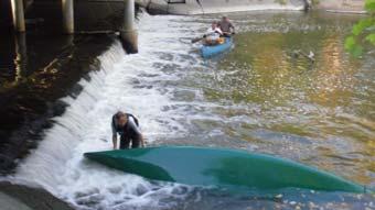
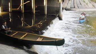
6 Wayne Road Dam NOAA Grant In 2011, the ARC received a $1 Million grant from NOAA to remove the Wayne Road Dam. Project Partners ARC, Wayne County, City of Wayne and Friends of the Rouge. Project Components monitoring before and after, public outreach, dam removal and stream restoration Construction to begin this June. Comparison of Potential Target Species vs. Actual Species Present in the Lower Rouge River Number of Species Total Potential Fishes Actual Species Present 0 LO1 LO6 LUS1 LO5 LO2 Fellows Creek 6


7 Ecological Targets: Northern Pike Novi Northern Pike Northville Livonia Southfield Detroit Canton Dearborn Ecological Targets: Rock Bass Novi Northern Rock Bass Northville Livonia Southfield Detroit Canton Dearborn 7


8 Ecological Targets: Smallmouth Bass Novi Northern Smallmouth Bass Northville Livonia Southfield Detroit Canton Dearborn Ecological Targets: Channel Catfish & Walleye Novi Channel Catfish Northville Livonia Southfield Detroit Walleye Canton Dearborn 8


9 Friends of the Rouge 2011 Lower Canoe Expedition October 7-9, 2011 Canton to Dearborn: Beck Road to Fairlane Estate Sally Petrella, Friends of the Rouge This is funded in part by a GLRI/NOAA grant to the Alliance of Rouge Communities (Wayne Road Dam Removal and Habitat Restoration Project, NA11NMF ). Canoe Expedition Purpose To examine anddocumentdocument the potential for a recreational canoe route on the Lower Rouge as it flows through Canton, Wayne, Westland, Dearborn Heights and Dearborn 9


10 The Route The Expeditioners Kurt Kuban Bill Craig Jeff Vallender Matt Mullholland Sally Petrella Sue Thompson 10


11 Day One: Beck Road to Lilley Rd Day One: Friday October 7, 2011 Expeditioners: Kurt Kuban, Bill Craig, Jeff Vallender, Sue Thompson, Sally Petrella, Matthew Mulholland plus Bob Belair, Joe Mantey and Joe the walker 10:19 am Launch 11


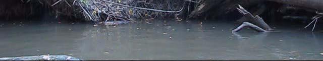
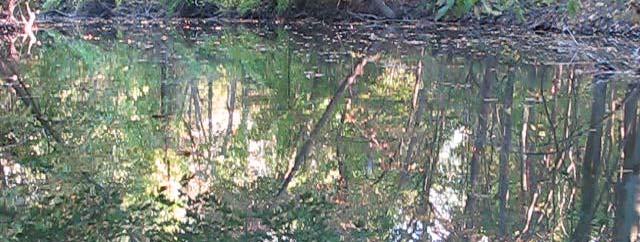
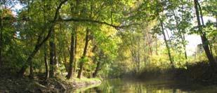
12 Day One: Friday October 7, :37 am: First logjam & Joe the walker 11:39 am Limbo time Day One: Friday October 7, :16 am - Gorgeous scenery 1:17 pm Lunch stop at Lilley Road 12


13 Day One: Friday October 7, :08 pm - Dryad s saddle mushroom 2:09 pm Back to the logjams Day One: Friday October 7,


14 Day One: Friday October 7, :05 pm - Canton s Lower Rouge Trails 3:06 pm Kurt and Matt determined it is easier to walk the trails Day One: Friday October 7, :33 pm 4:49 pm Almost to Lilley Rd and our pull out for the night 14


15 Day One: Beck Rd to Lilley Rd Day One Accomplishments: 2.4 miles/ 6:45 hours of canoeing = 0.36 mph 60 large logjams Beck Rd to Canton Center 1 mile/3 hours = 0.33 mph Canton Center to Lilley Rd 1.5 mile/4 hours = mph Day Two: Lilley Rd to Wayne Rd Lilley Rd to Commerce Court 15


16 Day Two: Saturday Oct. 8, 2011 Expeditioners: Kurt Kuban, Bill Craig, Jeff Vallender, Sue Thompson, Sally Petrella, Matthew Mulholland plus Dan Wright 10:00 am Lilley Rd launch 10:34 am An old sunken boat rumored to once have been used to open logjams Day Two: Saturday Oct. 8, :39 am Walkers in Canton 10:41 am Awesome scenery near Haggerty 16


17 Day Two: Saturday Oct. 8, :56 am I :00 am I-275 walking trail bridge Day Two: Saturday Oct. 8, :39 am 11:54 am Kurt, Matt and Dan catch up 17


18 Day Two: Saturday Oct. 8, :30 pm Fellows Creek confluence 12:41 pm American toad Day Two: Saturday Oct. 8, :48 pm Lunch back of Wayne County office 3:34 pm Large logjam 18


19 Day Two: Lilley Rd to Wayne Rd Commerce Court to Wayne Road Day Two: Saturday Oct. 8,


20 Day Two: Saturday Oct. 8, 2011 Day Two: Saturday Oct. 8,


21 Day Two: Saturday Oct. 8, 2011 Day Two: Saturday Oct. 8, :49 pm 5:49 pm 21


22 Day Two: Saturday Oct. 8, 2011 Day Two: Lilley Rd to Wayne Rd Day Two Accomplishments: 2 miles/ 5:25 hours of canoeing = 0.38 mph 33 large logjams/33 small = 66 total Wildlife Seen: 1 American toad 1 Cooper s hawk many wood ducks 1 mink 22


23 Day Three: Wayne Rd to Fairlane Estate Part 1: Wayne Rd to Inkster Rd Day Three: Sunday Oct. 9, 2011 Expeditioners: Kurt Kuban, Bill Craig, Jeff Vallender, Sue Thompson, Sally Petrella, Matthew Mulholland 10:04 am high school student Chelsea 10:22 am Wayne Road Dam 23


24 Day Three: Sunday Oct. 9, :34 am Female wood duck 10:52 am Sleeping raccoon Day Three: Sunday Oct. 9, :16 am Mushrooms after giant logjam 11:19 am Virginia creeper 24


25 Day Three: Sunday Oct. 9, :24 am Hillside 11:31 am Outfall Day Three: Sunday Oct. 9, :55 am Bridge in Eloise property 11:57 am Golf course bridge 25


26 Day Three: Sunday Oct. 9, :26 pm Inkster Wetlands 4:01 pm Giant snapping turtle Day Three: Wayne Rd to Fairlane Estate Part 2: Inkster to Fairlane Estate 26


27 Day Three: Sunday Oct. 9, :10 pm Dearborn Hills Golf Course 5:51 pm Just past Outer drive bridge Day Three: Sunday Oct. 9, :02 pm Military St bridge 7:09 pm The confluence with the Main Rouge and the end of the trip 27


28 Day Three: Wayne Rd to Fairlane Estate Day Three Accomplishments: 8 miles/ 7:45 hours of canoeing = 1.03 mph 25 large logjams/20 small = 45 Wildlife Seen: Many Wood ducks 2 Raccoon 1 Snapping turtle 4 White-tailed deer Old beaver sign Total Trip: miles of river/19:45 hours/ 8 people 171 logjams Public Canoe Trip: Oct. 29, 2011 Opening the route prior 28


 Route is accessible to a large")

29 Public Canoe Trip: Oct. 29, 2011 Alan Heavner, owner of Heavner Canoe Rental, announces his intent to work out an agreement with Wayne County to provide canoe rentals and programming in the Rouge River watershed. Conclusion & Challenges Conclusion: The Lower Rouge has excellent potential for recreational canoeing Water levels are high enough for canoeing year round due to YCUA discharge Most of the route is public land (parkland and forested) Route is accessible to a large metropolitan area Challenges Fallen trees prevent passage for much of the route Water quality, though improving, can be a concern Rouge River carries stigma due to years of pollution 29


30 Next Steps FOTR to hold a hands-on logjam opening class for municipal workers and volunteers on May 9 Dam removal this year will provide passage for fish and canoes Heavner Canoe Rental is planning trips for the Lower Rouge WAYNE ROAD DAM PROJECT John O Meara, P.E. Alliance of Rouge Communities 30

31 Wayne Road Dam - Project Background Dam installed in late 1800 s (anecdotal evidence) Project identified by Rouge River AOC PAC as a priority project for restoring fish & wildlife habitat to the Rouge River watershed Design completed by ARC through partial funds from a Rouge Grant in Construction funding secured from NOAA 2011 Great Lakes Restoration Initiative Grant The Project Will: Reconnect 17 miles of the Lower Rouge River (125 miles of its tributaries) back to the Great Lakes and restore fish passage by removing the Wayne Road dam Insure that the streambed remains stable and protect integrity of the bridge and utilities Stabilizethe the streambank immediately upstream of the dam (north bank) and downstream of the dam (north bank) 31
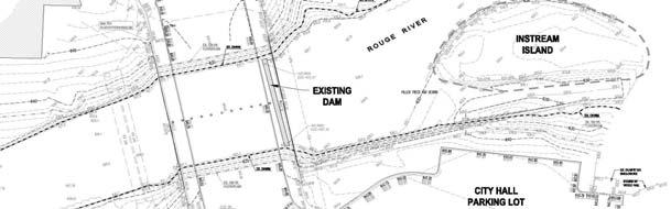

32 Existing Conditions Existing Conditions 32
33 Project Improvements Removal and disposal of upstream impounded sediment Dam removal Engineered riffle/boulder cascade construction Realignment of downstream channel Removal of instream island Construction of bankfull benches on both sides of channel to protect banks from erosive forces Bank erosionrepair repair upstream of dam Woody debris removal Proposed Conditions 33


34 Riffle and Bankfull Bench Examples Project Timeline Site Investigation & Design COMPLETED MDEQ Permitting COMPLETED Construction Documents COMPLETED Pre construction Monitoring COMPLETED Bidding On going Construction July October 2012 Post Construction Monitoring Spring


35 Pre-Construction Monitoring Fish monitoring conducted at three transects, 2 upstream of the dam, 1 downstream Fish collection was conducted by electro shocking and netting Specimens were identified, counted and released Pre-Construction Monitoring Results 19 total fish species, 234 specimens captured Dominant species were Creek Chub, White Sucker, and Emerald Shiner Found 1 Great Lakes Steelhead downstream of the dam % of Total Catch Catch Results Species White Sucker Creek Chub Emerald Shiner 35


36 Electro-shocking crew Steelhead captured downstream of the dam Construction Impacts Intermittent Lane Closures Construction Access Areas Public Access to City Hall City Hall Parking Park Access Limited 36
January 2018 Air Traffic Activity Summary
 January 2018 Air Traffic Activity Summary Jan-2018 Jan-2017 CY-2018 CY-2017 Passengers 528,947 505,421 4.7% 528,947 505,421 4.7% Passengers 537,332 515,787 4.2% 537,332 515,787 4.2% Passengers 1,066,279
An Introduction. The Saginaw River/Bay Area of Concern
 Saginaw River & Bay Area of Concern: Looking Forward Continued Partnerships in the Restoration of Saginaw Bay Michelle Selzer Lake Huron Coordinator & Interim AOC Coordinator Saginaw Bay Watershed Conference
SAN ANTONIO RIVER IMPROVEMENTS PROJECT. April 27, 2009
 SAN ANTONIO RIVER IMPROVEMENTS PROJECT April 27, 2009 1 Project Limits 2 Project Partners City of San Antonio Provides project funding for project amenities (i.e.. Sidewalks, Landscaping, Lighting, etc.)
Figure 1. Overview map of Burrard Inlet, showing location of False Creek inlet.
 Figure 1. Overview map of Burrard Inlet, showing location of False Creek inlet. 65 Figure 2. Location map of False Creek and shoreline and mid-channel monitoring sites. 66 Figure 3. Location of CSO's,
Poudre River District 3. Irrigation Ditch Construction in Fort Collins - Late 19 th Century
 Poudre River District 3 Irrigation Ditch Construction in Fort Collins - Late 19 th Century Where Does the Water in the Poudre Come From? Three main sources Native River Water C-BT System Water Other Transbasin
DTTAS Quarterly Aviation Statistics Snapshot Quarter Report
 Contents DTTAS Quarterly Aviation Statistics Snapshot Quarter 3 2018 Report 1.1 Dublin Airport Key Statistics... 1 1.2 Cork Airport Key Statistics... 3 1.3 Shannon Airport Key Statistics... 5 1.4 Total
DTTAS Quarterly Aviation Statistics Snapshot Quarter Report
 Contents DTTAS Quarterly Aviation Statistics Snapshot Quarter 4 2015 Report 1.1 Dublin Airport Key Statistics... 1 1.2 Cork Airport Key Statistics... 3 1.3 Shannon Airport Key Statistics... 5 1.4 Total
DTTAS Quarterly Aviation Statistics Snapshot Quarter Report
 Contents DTTAS Quarterly Aviation Statistics Snapshot Quarter 1 2018 Report 1.1 Dublin Airport Key Statistics... 1 1.2 Cork Airport Key Statistics... 3 1.3 Shannon Airport Key Statistics... 5 1.4 Total
Finn Creek Park. Management Direction Statement Amendment
 Finn Creek Park Management Direction Statement Amendment November 2013 Management Direction Statement Amendment Approved by: Jeff Leahy Regional Director, Thompson Cariboo BC Parks November 12, 2013 Date
Hydrology Input for West Souris River IWMP
 Hydrology Input for West Souris River IWMP Prepared by: Mark Lee Manitoba Water Stewardship 1 1 1 Overall view of: drainage area watershed characteristics gauging stations meteorological stations Runoff
Emily to Blind Lake Trail PROPOSED TRAIL DEVELOPMENT APPLICATION SUMMARY
 Emily to Blind Lake Trail PROPOSED TRAIL DEVELOPMENT APPLICATION SUMMARY Township 137 Range 26 (Fairfield Township) sections 2 & 3 Township 138 Range 26 (City of Emily) sections 27, 34, 35, & 36 Township
SUMMARY OF UNAPPROVED COMMON PROPERTY AND FOREST COMMITTEE MINUTES. August 4, 2014
 SUMMARY OF UNAPPROVED COMMON PROPERTY AND FOREST COMMITTEE MINUTES August 4, 2014 Board Liaison Comments Mike Medica New Business: 6-2 Barcelona Request to check beetle and dying trees Joe Burleigh completed
The Lower Prut Floodplain Natural Park (Romania)
") The Lower Prut Floodplain Natural Park (Romania) Gabriela Costea Natural Sciences Museum Complex Galati (Romania) & member of the Scientific Council of the Lower Prut Floodplain Natural Park The Prut The
The Lower Prut Floodplain Natural Park (Romania) Gabriela Costea Natural Sciences Museum Complex Galati (Romania) & member of the Scientific Council of the Lower Prut Floodplain Natural Park The Prut The
Sibley LUPA. Board Executive Committee Meeting December 7, 2017
 Sibley LUPA Board Executive Committee Meeting December 7, 2017 Project Location & Project Area 1,318-acre Robert Sibley Volcanic Regional Preserve Project Area Purpose Project Purpose & Goals Append the
SAN ANTONIO RIVER IMPROVEMENTS PROJECT. August 6, 2008
 SAN ANTONIO RIVER IMPROVEMENTS PROJECT August 6, 2008 1 History of the SA River Improvements 1921 Flood Olmos Dam Complete in 1929 Downtown Flood Relief Projects in 1950 s Dams on the River Channel and
2.1 Physical and Biological Description Matabitchuan River Watershed
 2.1 Physical and Biological Description Watershed 2.1.1 Physical Description The system watershed has a total area of about 933 km 2 and is a tributary system to Lake Temiskaming and the Ottawa River Drainage
December 2012 Passenger and Cargo Traffic Statistics Reno-Tahoe International Airport
 December 2012 Passenger and Cargo Traffic Statistics Reno-Tahoe International Airport January 29, 2013 U.S. DOMESTIC INDUSTRY OVERVIEW FOR DECEMBER 2012 All RNO Carriers Systemwide year over year comparison
Public Information Exchange
 Public Information Exchange Belton/Stillhouse Hollow Lakes Ronnie Bruggman US Army Corps of Engineers U. S. Army Corps of Engineers Missions Belton/Stillhouse Flood Risk Management Natural Resources Water
Paul Sturm Roberto Viqueira Ríos
 Paul Sturm Roberto Viqueira Ríos In this talk Brief Background on Land Based Sources Historical Perspective Guánica watershed characteristics/ issues High priority restoration projects Other key issues
Minnesota Department of Natural Resources
 Lake Name: Orono Minnesota Department of Natural Resources Fisheries Management DRAFT VERSION - PRELIMINARY DATA Survey Type: Re-Survey DOW Number: 7-- Survey Date: 8/4/8 Lake Identification Alternate
Pinellas County Environmental Lands
 Pinellas County Environmental Lands In addition to traditional parks and recreation facilities, Pinellas County owns and manages a system of environmental lands that provides specialized resource-based
Recreation in the Battle River Basin: Overview. John Thompson, Watrecon Consulting
 Recreation in the Battle River Basin: Overview John Thompson, Watrecon Consulting Recreation Rates for Alberta & Battle Basin Households 1996 2004 Battle Basin Alberta Battle Basin Alberta Bird Watching
Hossana Solomon PhD; Henry H. Smith PhD University of the Virgin Islands (UVI)
") Effectiveness of Mandatory Law of Cistern Construction for Rainwater Harvesting on Supply and Demand of Public Water in U.S. Virgin Islands Hossana Solomon PhD; Henry H. Smith PhD University of the Virgin
Effectiveness of Mandatory Law of Cistern Construction for Rainwater Harvesting on Supply and Demand of Public Water in U.S. Virgin Islands Hossana Solomon PhD; Henry H. Smith PhD University of the Virgin
HYDRAULIC DESIGN OF THE TOURISTIC BERTHING IN ASWAN CITY
 HYDRAULIC DESIGN OF THE TOURISTIC BERTHING IN ASWAN CITY Dr. Hossam El-Sersawy Researcher, Nile Research Institute (NRI), National Water Research Center (NWRC), Egypt E-mail: h_sersawy@hotmail.com Dr.
National Park Service - Coho Salmon & Steelhead Trout Restoration Project
 National Park Service Point Reyes National Seashore Salmonid Trends in Lagunitas and Redwood Creek Mt. Tamalpais Watersheds National Park Service - Coho Salmon & Steelhead Trout Restoration Project Brannon
Lake Chelan Operations
 Lake Chelan Operations IPMA Executive Seminar September 17, 2013 Presented by: Janet Jaspers Chelan County PUD Lake Chelan Hydroelectric Project Today s Discussion Chelan PUD Overview Interesting Facts
Flow Stand Up Paddle Board Parkway Plan Analysis
 Regional Parks Department Jeffrey R. Leatherman, Director County of Sacramento Divisions Administration Golf Leisure Services Maintenance Rangers Therapeutic Recreation Services Flow Stand Up Paddle Board
The packet is available on-line by going to choosing the Monthly Calendar, and clicking on Monday, March 16, 2015.
 AGENDA Ingham County Parks & Recreation Commission 121 E. Maple Street, P.O. Box 178, Mason, MI 48854 Telephone: 517.676.2233; Fax: 517.244.7190 The packet is available on-line by going to www.ingham.org,
Juvenile coho salmon use of constructed off-channel habitats in two Lower Klamath River tributaries: McGarvey Creek & Terwer Creek
 Juvenile coho salmon use of constructed off-channel habitats in two Lower Klamath River tributaries: McGarvey Creek & Terwer Creek Prepared by: Yurok Tribal Fisheries Program PO Box 1027, Klamath, CA Spring
Cat Island Chain Background & Access Guide
 Cat Chain Background & Access Guide Brown County Port & Resource Recovery Department 2561 S. Broadway, Green Bay, WI 54304 (920) 492-4950 www.portofgreenbay.com January 2018 1 Restoration of the Cat Chain
Norfolk District North Atlantic Division
 Norfolk District North Atlantic Division Eastern Chapter of WEDA Fall Conference October 26, 2016 Stephen J. Powell, P.E. (757) 201-7788 US Army Corps of Engineers Norfolk District FY-17 Dredging Program
Bear Creek Habitat Improvement Project
 06/10/10 Bear Creek Habitat Improvement Project El Paso County, Colorado Pike National Forest and Colorado Springs Utilities Owned Land Report prepared by: Eric Billmeyer Executive Director Rocky Mountain
ATTACHMENT A TABLE 1: List of sites with location, area estimate, and site coordinates
 ATTACHMENT A TABLE : List of sites with location, area estimate, and site coordinates TABLE : List of Sites with site location, treatment area estimate, and general site coordinates Project ID Location
I T N E T R E N R A N T A I T ON O AL A L A R A R R I R VA V L A S L S A N A D N D D E D PA
 INTERNATIONAL ARRIVALS AND DEPARTURES July 2015 Government of Tonga SD18M-36 Statistical Bulletin Month of Change from Change from July 2015 Number previous month previous year All Arrivals 8,252-28.0
With the completion of this project, we would like to follow-up on the projections as well as highlight a few other items:
 TO: FROM: Mayor and Council Interim City Manager Rebecca Underhill, Director of Finance DATE: February 28, 2014 SUBJECT: Water Meter Project Analysis On March 28, 2012, Acting City Manager Mike Loftin
2014 STATEWIDE COMPREHENSIVE OUTDOOR RECREATION PLAN
 2014 STATEWIDE COMPREHENSIVE OUTDOOR RECREATION PLAN SUSTAINING COLORADO S OUTDOOR RECREATION FUTURE SECTION 1: INTRODUCTORY INFORMATION WHAT IS THE SCORP? The SCORP update is required every five years
2009 RIVER TOWN OF THE YEAR AWARD APPLICATION Supplemental Material Images
 2009 RIVER TOWN OF THE YEAR AWARD APPLICATION Supplemental Material Images Our History The earliest record of settlement along the river is in 1854; one of the earliest in Carroll County. About this time
SECTION 3 GENERAL DESCRIPTION OF THE RIVER BASIN
 SECTION 3 GENERAL DESCRIPTION OF THE RIVER BASIN SECTION 3 GENERAL DESCRIPTION OF THE RIVER BASIN River basin description. A general description of the river basin or subbasin, as appropriate, in which
Chattanooga & Hamilton Co. Tourism Trends & Economic Outlook
 Chattanooga & Hamilton Co. Tourism Trends & Economic Outlook How Tourism Works for Chattanooga, TN January 21, 2010 Presentation by: Steve Morse, Ph.D. Director & Economist, Tourism Institute University
Hard Labor Creek State Park Business Plan. Table of Contents
 Hard Labor Creek State Park Business Plan Table of Contents Georgia State Parks and Historic Sites Executive Summary Site Name Site Manager Region Manager Hard Labor Creek State Park Daniel Schay Eric
Long Term Ecological Research in the Upper Paraná River Floodplain, Brazil: main patterns and variations:
 Long Term Ecological Research in the Upper Paraná River Floodplain, Brazil: main patterns and variations: Session on Role of Flow and Hydrologic Connectivity in Floodplain and Wetlands Ecosystems 9th INTECOL
Norfolk District North Atlantic Division
 Norfolk District North Atlantic Division Eastern Chapter of WEDA Fall Conference October 9, 2012 Stephen J. Powell, P.E. (757) 201-7788 US Army Corps of Engineers 5-Year Dredging Schedule (By dredge type)
LOVE FIELD ENVIRONMENTAL ADVISORY COMMITTEE QUARTERLY REPORT. October December 2016
 LOVE FIELD ENVIRONMENTAL ADVISORY COMMITTEE QUARTERLY REPORT October December 2016 VOLUNTARY NOISE CONTROL PROGRAM COMPLIANCE DURING PREFERENTIAL HOURS 2100 0600 (JAN SEP 2016) 2 PERCENTAGE OF COMPLIANCE
May 2011 Passenger and Cargo Traffic Statistics Reno-Tahoe International Airport
 May 2011 Passenger and Cargo Traffic Statistics Reno-Tahoe International Airport July 5, 2011 U.S. DOMESTIC INDUSTRY OVERVIEW FOR MAY 2011 All RNO Carriers Systemwide year over year comparison Average
Appalachian Power Company Smith Mountain Hydroelectric Project FERC No Debris Management Plan
 Appalachian Power Company Smith Mountain Hydroelectric Project FERC No. 2210 Debris Management Plan Final July2008 TABLE OF CONTENTS Description Page SUMMARY 1 1.0 Introduction.. 2 1.1 Project Lands and
EDGEWILD TRAIL Non Motorized Trail PROPOSED DEVELOPMENT PROJECT
 EDGEWILD TRAIL Non Motorized Trail PROPOSED DEVELOPMENT PROJECT SESW, SWSE Section 15, NWNE, NENW, SWNE, SENE Section 22, Township 138, Range 27 (City of Fifty Lakes) Crow Wing County Land Services Department
U.S. DOMESTIC INDUSTRY OVERVIEW FOR OCTOBER 2010 All RNO Carriers Systemwide year over year comparison
 Inter-Office Memo Reno-Tahoe Airport Authority Date: November 22, 2010 To: Chairman and Board of Trustees From: Krys T. Bart, A.A.E., President/CEO Subject: RENO-TAHOE INTERNATIONAL AIRPORT OCTOBER 2010
Damon Hylton Vice President
 ACI-NA Commissioners Conference Air Service Development in a Tough Market Damon Hylton Vice President May 19, 2008 Today s Agenda Background Now What? Questions and Answers 2 Background 3 Current Industry
U.S. Army Corps of Engineers Wilmington District
 U.S. Army Corps of Engineers Wilmington District 2012 East Coast - WEDA October 9-11, 2012 Ongoing & Upcoming Contracts US Army Corps of Engineers Wilmington District Ongoing Contracts Project Quantity
Mark West Creek Flow Study Report
 Mark West Creek Flow Study Report Biology and Geology of Mark West Creek The headwaters of Mark West Creek are located in the Mayacamas Mountain range, which border Napa and Sonoma County, where it then
Map 1.1 Wenatchee Watershed Land Ownership
 Map 1.1 Wenatchee Watershed Land Ownership Map 1.1 Wenatchee Watershed Land Ownership The Wenatchee watershed lies in the heart of Washington state in Chelan County. Just larger than the state of Rhode
Kit Carson-Challenger Ridge Trail Project
 Kit Carson-Challenger Ridge Trail Project Project Accomplishments Report-USFS December 15, 2015 Photo courtesy of Justin Peterson 815 South 25 th Street, Suite 101 Colorado Springs, CO 80904 Dedicated
Dates for Student-Run Credit Unions 18-19
 Dates for s 18-19 Northville Schools Northern Schools Novi & Livonia Schools Plymouth-Canton Elementary Schools: Bentley Bird Dodson Eriksson October 9, 23 November 13, 27 December 11 January 8, 22 February
Keflavik International Airport Passenger forecast 2018
 Keflavik International Airport Passenger forecast 2018 2 Keflavik International Airport Passenger forecast Keflavik International Airport 2018 3 Passenger Forecast 2018 Forecast 2018 6,409,312 3,971,969
LAKE COVE HOTEL RESORT / REND LAKE
 LAKE COVE HOTEL RESORT / REND LAKE 14711 FREEWAY LANE WHITTINGTON, IL 62897 Kurt Lord Managing Director 314.862.5566 x14 kurt.lord@svn.com Cheri Simon Advisor 314.862.5566 cheri.simon@svn.com SVN Lord
Sheboygan River Area of Concern: Moving Towards Recovery
 Sheboygan River Area of Concern: Moving Towards Recovery 2018 Wisconsin Lakes Partnership & Water Action Volunteers Symposium Amy Kretlow WI Department of Natural Resources What s Ahead What is an AOC
Establishing a National Urban Park in the Rouge Valley
 STAFF REPORT ACTION REQUIRED Establishing a National Urban Park in the Rouge Valley Date: March 29, 2012 To: From: Wards: Reference Number: Executive Committee Deputy City Manager, Cluster B All p:\2012\cluster
Community Forum 17 August Resort Management Update
 Community Forum 17 August 2013 Resort Management Update Topics Board Appointments Snowmaking and Water Supply Update Strategy Planning & Operational Direction 5 Year Strategic Management Plan Update 2013/14
Damn those dams their effects on stream ecosystems
 Damn those dams their effects on stream ecosystems Jeremy Tiemann Illinois Natural History Survey Prairie Research Institute at the University of Illinois History of dams History of dams First evidence
Passenger and Cargo Statistics Report
 Passenger and Cargo Statistics Report RenoTahoe International Airport December 2016 U.S. DOMESTIC INDUSTRY OVERVIEW FOR DECEMBER 2016 All RNO Carriers Domestic Systemwide year over year comparison Average
TENTATIVE SCHEDULE
 TENTATIVE SCHEDULE 20-2015 Facility Dredge Depth (- ft MLLW) 20 Spring Early Summer 20/2012 2012/2013 HWRP/ HWRP/ HWRP/ SFDODS SF- MWP Upland SFDODS SF- MWP upland SFDODS SF- MWP upland SFDODS SF- 2013/2014
Monthly SunPass Transponder Sales Inception to June 2012
 Monthly SunPass Transponder Sales Inception to June 2012 This graph shows the monthly SunPass transponder sales since inception. The significant increase in transponder sales during March 2004 is attributed
LESOTHO HIGHLANDS DEVELOPMENT AUTHORITY
 LESOTHO HIGHLANDS DEVELOPMENT AUTHORITY ANNUAL FLOW RELEASES INSTREAM FLOW REQUIREMENT (IFR) IMPLEMENTATION AND MONITORING (October 2004 to September 2005) TOWER ON MALIBAMATŠO RIVER @ KAO REPORT N0.6
LOVE FIELD ENVIRONMENTAL ADVISORY COMMITTEE QUARTERLY REPORT
 LOVE FIELD ENVIRONMENTAL ADVISORY COMMITTEE QUARTERLY REPORT October 19, 2017 Dallas Love Field 7555 Lemmon Ave Conference Room 103 AGENDA Introductions Wildlife Hazard Working Group Bachman Lake USTW
Whitemouth Falls Provincial Park. Draft Management Plan
 Whitemouth Falls Provincial Park Draft Management Plan Whitemouth Falls Provincial Park Draft Management Plan Table of Contents 1. Introduction... 3 2. Park History... 3 3. Park Attributes... 4 3.1 Natural...
U.S. DOMESTIC INDUSTRY OVERVIEW FOR MARCH
 Inter-Office Memo Reno-Tahoe Airport Authority Date: April 30, 2009 To: Statistics Recipients From: Krys T. Bart, A.A.E., President/CEO Subject: RENO-TAHOE INTERNATIONAL AIRPORT PASSENGER STATISTICS U.S.
September 2013 Passenger and Cargo Traffic Statistics Reno-Tahoe International Airport
 September 2013 Passenger and Cargo Traffic Statistics Reno-Tahoe International Airport October 31, 2013 U.S. DOMESTIC INDUSTRY OVERVIEW FOR SEPTEMBER 2013 All RNO Carriers Systemwide year over year comparison
Appendix C. Tenderfoot Mountain Trail System. Road and Trail Rehabilitation Plan
 Appendix C Tenderfoot Mountain Trail System Road and Trail Rehabilitation Plan All rehabilitation work would be under the direction of the District Fisheries Biologist, the Forest Hydrologist, and/or the
Public Service Department MONTHLY REPORT November 2017
 - Public Service Department MONTHLY REPORT Professionalism Integrity Be inspired. Reliability Quality Pride Inside This Issue: Department Highlights 2 Project Planning Updates 3 City Construction Projects
December 2011 Passenger and Cargo Traffic Statistics Reno-Tahoe International Airport
 December 2011 Passenger and Cargo Traffic Statistics Reno-Tahoe International Airport January 27, 2012 U.S. DOMESTIC INDUSTRY OVERVIEW FOR DECEMBER 2011 All RNO Carriers Systemwide year over year comparison
Rouge National Park. Opportunities and Challenges
 Rouge National Park Opportunities and Challenges January 2013 Rouge Park Finch Meander Rouge Beach at Lake Ontario Toronto GLWQA Area of Concern Rouge National Park Nationally Significant First Nation
Minnesota Department of Natural Resources
 Minnesota Department of Natural Resources Fisheries Management LAKE SURVEY REPORT DRAFT VERSION - PRELIMINARY DATA (AS OF /4/2) Lake Name: Talcot Survey Type: Standard Survey DOW Number: -- Survey ID Date:
Platted Single-Family Lots in the Town of Windsor as of 02/28/14
 Platted Single-Family Lots in the Town of Windsor as of /8/14 Lots Permits Issued Permit Needing Final SUBDIVISIONS Zoning 1 Total Total This Lots Ready Further School Utility Approval Lots Issued Month
Impact of Offshore Directed Forcing on Sediment Transport and Structural Integrity at Packery Channel, Corpus Christi Texas
 Google Earth 29 Aug 2017 Impact of Offshore Directed Forcing on Sediment Transport and Structural Integrity at Packery Channel, Corpus Christi Texas Deidre D. Williams Coastal Research Scientist Conrad
The Chippewas of Georgina Island First Nation At A Glimpse
 Located in Lake Simcoe approximately100 km north of the Greater Toronto Area (GTA) in Ontario Canada. Consisting of 3 separate Islands, Georgina, Snake and Fox with 2 mainland access points.. Georgina
KASKASKIA RIVER NAVIGATION POOL Compartment 12 UNIT 1 Kaskaskia Lock and Dam Lands These lands are now being managed by the Carlyle Lake project
 KASKASKIA RIVER NAVIGATION POOL Compartment 12 UNIT 1 Kaskaskia Lock and Dam Lands These lands are now being managed by the Carlyle Lake project office. Sections 1-4 in this plan present Kaskaskia River
An experimental habitat enhancement effort for a sandy river: San Rafael River restoration project
 An experimental habitat enhancement effort for a sandy river: San Rafael River restoration project Samuel Lyster Department of Watershed Sciences, Utah State University Brian G. Laub Department of Watershed
Presented to: City of Petaluma City Council
 Agenda Item #1.A REVISED Presented to: City of Petaluma City Council Presented By: Dan St. John, F.ASCE, Director Jason Beatty, P.E., Senior Engineer James 'Jody' Boyette, USACE Project Manager November
Cau River. Map of River. Table of Basic Data. Vietnam 5
 Cau River Map of River Table of Basic Data Name: Cau River Location: Thai Nguyen, Province, Viet Nam Area: 6,030 km 2 Origin: Mt. Phia Deng 1,527 m Outlet: Pha Lai Note: * Indicates missing data in some
LESOTHO HIGHLANDS DEVELOPMENT AUTHORITY
 LESOTHO HIGHLANDS DEVELOPMENT AUTHORITY ANNUAL FLOW RELEASES INSTREAM FLOW REQUIREMENT (IFR) IMPLEMENTATION AND MONITORING (October 2005 to September 2006) REPORT N0.7 OCTOBER 2007 STRATEGIC AND CORPORATE
T H E VILLAGE OF P h i l m o n t, N Y
 T H E VILLAGE OF P h i l m o n t, N Y Summit Reservoir Area Plan November 17, 2014 Executive Steering Committee Meeting 2 Agenda 1:00 1. Welcome 2. Housekeeping & updates i. Committee contact list review
Insights in the water-energy-food nexus in the Nile Basin with the new Eastern Nile Water Simulation Model
 Insights in the water-energy-food nexus in the Nile Basin with the new Eastern Nile Water Simulation Model Wil N.M. van der Krogt, Henk J.M. Ogink For International Conference Sustainability in the WaterEnergy-Food
DOW Number: Survey ID Date: 08/21/2018. Windom Southern
 Fisheries Management DRAFT VERSION PRELIMINARY DATA (AS OF /4/) Lake Name: Hall Survey Type: Standard Survey DOW Number: 4-- Survey ID Date: // Lake Identification Alternate Lake Name: Primary Lake Class
M.J. Milne & Associates Ltd.
 M.J. Milne & Associates Ltd. March, 29 Tolko Industries Ltd. 6 Yellowhead Highway RR#, Site, C Kamloops, BC V2C K Attention: Mr. Michael Bragg, R.P.F. Dear Sir: Re: Risk Rating Evaluation Non-status Roads
Passenger and Cargo Statistics Report
 Passenger and Cargo Statistics Report RenoTahoe International Airport December 2015 U.S. DOMESTIC INDUSTRY OVERVIEW FOR DECEMBER 2015 All RNO Carriers Domestic Systemwide year over year comparison Average
Passenger and Cargo Statistics Report
 Passenger and Cargo Statistics Report RenoTahoe International Airport September 2016 U.S. DOMESTIC INDUSTRY OVERVIEW FOR SEPTEMBER 2016 All RNO Carriers Domestic Systemwide year over year comparison Average
Reno-Tahoe Airport Authority U.S. DOMESTIC INDUSTRY OVERVIEW FOR FEBRUARY
 Inter-Office Memo Reno-Tahoe Airport Authority Date: March 30, 2009 To: Statistics Recipients From: Krys T. Bart, A.A.E., President/CEO Subject: RENO-TAHOE INTERNATIONAL AIRPORT PASSENGER STATISTICS U.S.
Prepared by Cathy Quinlan & Brad Hertner Upper Thames River Conservation Authority. For the City of Woodstock
 Prepared by Cathy Quinlan & Brad Hertner Upper Thames River Conservation Authority For the City of Woodstock Burgess Park and Standard Tube Parks in the west end of Woodstock Pittock Reservoir Along the
Parks & Recreation Areas Program
 PARKS & RECREATION Parks & Recreation Areas Program As part of its mission to conserve and protect natural resources, the Upper Big Blue Natural Resources District (NRD) has been involved in several large-scale
EAST DON TRAIL ENVIRONMENTAL ASSESSMENT. Community Liaison Committee Meeting #3 July 15, :30 to 8:30 pm Flemingdon Park Library
 EAST DON TRAIL ENVIRONMENTAL ASSESSMENT Community Liaison Committee Meeting #3 July 15, 2013 6:30 to 8:30 pm Flemingdon Park Library Agenda 1. Welcome 2. Housekeeping and Updates a) Housekeeping b) CLC
Gatwick Stream Riverside Garden Park, Horley
 Gatwick Stream Riverside Garden Park, Horley An Advisory Visit by the Wild Trout Trust January 2014 1 1. Introduction This report is the output of a Wild Trout Trust visit to the Gatwick Stream in Horley,
Park Updates 1. Cavalero 2. Lundeen 3. Frontier Heights Citizen Advisory Committee
 Page 1 of 10 PARK BOARD AGENDA Community Center 1808 Main Street, Lake Stevens Monday, April 11, 2016 CALL TO ORDER: 6:00 pm ROLL CALL: GUEST BUSINESS: ACTION ITEMS: A. B. C. Approval of February 8, 2016
SYSTEM BRIEF DAILY SUMMARY
 SYSTEM BRIEF SUMMARY * ANNUAL (PEAK HOURS 7:00 AM TO 10:00 PM MON-SAT) MaxTemp NEL (MWH) Hr Ending Hr Ending LOAD ENERGY (MWH) INCREMENTAL COST DAY DATE Civic TOTAL MAXIMUM @Max MINIMUM @Min FACTOR ON
March 2014 Passenger and Cargo Traffic Statistics Reno-Tahoe International Airport
 March 2014 Passenger and Cargo Traffic Statistics Reno-Tahoe International Airport April 25, 2014 U.S. DOMESTIC INDUSTRY OVERVIEW FOR MARCH 2014 All RNO Carriers Domestic Systemwide year over year comparison
PM Measurements at the Port of Patras
 POSEIDON Pollution monitoring of ship emissions: an integrated approach for harbours of the Adriatic basin Priority 2: Environmental Protection Topic 1: Sources of land-based and sea-based pollution Deliverable
Conservation of Critical Environmental Resources in Chatham Park
 Conservation of Critical Environmental Resources in Chatham Park Elaine Chiosso, Haw Riverkeeper Haw River Assembly Haw River As Seen From Chatham Park "Spreading southwestward from the banks of the Haw
July 2012 Passenger and Cargo Traffic Statistics Reno-Tahoe International Airport
 July 2012 Passenger and Cargo Traffic Statistics Reno-Tahoe International Airport August 31, 2012 U.S. DOMESTIC INDUSTRY OVERVIEW FOR JULY 2012 All RNO Carriers Systemwide year over year comparison Average
A Vision for South Skunk River and Chichaqua Bottoms Greenbelt
 A Vision for South Skunk River and Chichaqua Bottoms Greenbelt Photo: Jim Pease Chichaqua Bottoms Booklet 7 of 8 Greater Des Moines Water Trails and Greenways 1 2016 Table of Contents Booklet 1: Water
Welcome KROSNO CREEK DIVERSION PROJECT CLASS ENVIRONMENTAL ASSESSMENT
 Welcome KROSNO CREEK DIVERSION PROJECT PUBLIC INFORMATION CENTRE # 1 Tonight s Presentation Study Overview Background Existing Conditions Alternative Solutions Preliminary Preferred Solution Next Steps
Annual Report for the Alliance of Rouge Communities
 2016 Annual Report for the Alliance of Rouge Communities Friends of the Rouge January 1, 2016 through December 31, 2016 FRIENDS OF THE ROUGE ANNUAL REPORT 2016 (January 1 through December 31, 2016) For