HORSHAM RIVERSIDE WALK
|
|
|
- Fay Dawson
- 6 years ago
- Views:
Transcription

1 HORSHAM RIVERSIDE WALK
2 A B C D E F The six sections of the Horsham Riverside Walk. INTERPRETATION BOARDS can be found here on each section, giving guidance, illustrations of wildlife and nearby locations of historical interest Warnham Bridge (Warnham Road B2237) to Farthing Bridge (Guildford Road A281) Farthing Bridge (Guildford Road A281) to Tan Bridge (Worthing Road B2237) Tan Bridge (Worthing Road B2237) to Doomsday Bridge (Hammerpond Road) Doomsday Bridge (Hammerpond Road) to New House Farm (Crawley Road A264) New House Farm (Crawley Road A264) to Chennells Brook Bridge Chennells Brook Bridge to Warnham Bridge (Warnham Road B2237). NAVIGATION and SAFETY A North directional compass bearing is indicated with a path guide on each board FOLLOW THE WAYMARKERS which guide you along the Walk. Always carry a compass River Arun PLEASE KEEP DOGS UNDER CLOSE CONTROL AT ALL TIMES BE AWARE, the path may be very muddy and slippery in places. Boldings Brook B A24 River Arun Boldings Brook Warnham Local Nature Reserve Mill Pond P A Guildford Road A281 Worthing Road C A264 Chennells Brook Warnham Road HORSHAM TOWN CENTRE P North Heath Lane Chesworth Farm Horsham Railway Station Kerves Lane F River Arun D P Leechpool and Owlbeech Woods For more information online see horsham.gov.uk/leisure E
3 CIRCULAR PATH SUMMARY The Horsham Riverside Walk follows meandering Wealden streams and the upper river Arun, forming a circular route of about 13 miles in extent. The walk is divided into six sections, the complete walk starting and finishing near Warnham Local Nature Reserve, although each section can form a short linear walk. The path takes us downstream along Boldings Brook or the Red River, both streams flowing south from Warnham Mill Pond, then joining. Following the flow of Boldings Brook, a tributary of the river Arun, we cross the Guildford Road where the river flows under Farthing Bridge. The path rejoins and follows Boldings Brook to the western limit of the walk where we turn and follow the course of the river Arun upstream, past the old part of Horsham Town near the historic Church of St Mary, and across to join the footpath through Chesworth Farm. Leaving the Arun near Amiesmill Bridge and now following a tributary, the Horn Brook, upstream, we reach Doomsday Bridge and continue past Highland Copse along the stream where it flows now from the north, across Hampers Lane and through Leechpool and Owlbeech Woods. We cross Forest Road and follow the footpath over fields and through woods north east, then turing west we join Chennells Brook and follow it downstream towards Warnham Mill Pond. Follow the Waymarkers along the path in either direction, anticlockwise or clockwise.

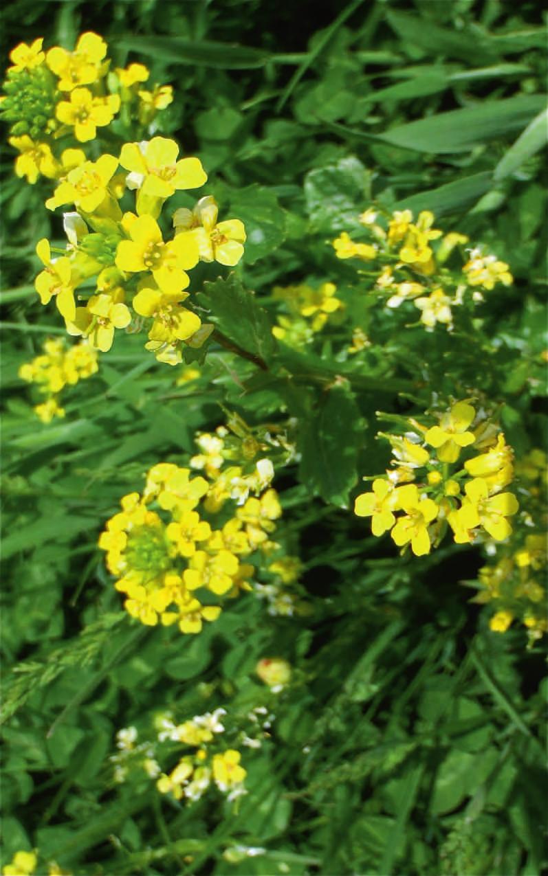
4 THE RIVERS, A HAVEN FOR WILDLIFE The rivers along the Riverside Walk pass through a diversity of wildlife habitat - damp and ancient woodland, heathland and farmland. The healthy rivers create places where creatures can live undisturbed, with plentiful food plants growing on the river banks, from huge oaks to the smallest wild flowers and seeds. Everything has its place, in shade, in sun, in shelter or on high ground. You will find Interpretation Boards along the route with illustrations of some of the wildlife which may be seen. The Riverside Walk can be followed at any time of the year, changing with the seasons. Be aware that some parts of the route can be very muddy or flooded after rain as the rivers follow their natural course into the Arun and down to the sea along the ancient river beds. Beautiful Demoiselle Damselfly (male)
 but entry to its Visitor Centre and Cafe is free. There is a car park at the entrance off Warnham Rd.")
5 HORSHAM RIVERSIDE WALK: The rivers and their riverine ecology form important wildlife corridors linking the nature reserves of Warnham LNR, Chesworth Farm and Leechpool and Owlbeech Woods. Warnham Local Nature Reserve can be visited for a small admission fee (no dogs) but entry to its Visitor Centre and Cafe is free. There is a car park at the entrance off Warnham Rd. The Riverside Walk along the Arun near St Marys Church and Horsham Cricket Fields The Walk passes through the old part of Horsham Town where the Arun flows near St Mary s Church at the end of the historic Causeway. Upstream the Arun flows through Chesworth Farm which can be explored along several trails. Further north, following the Horn Brook, a tributary of the Arun, the Walk takes us to Leechpool and Owlbeech Woods where there are diverse wildlife habitats to be found. Enquiries: HDC Parks and Countryside Tel Respect Protect Enjoy

6 HORSHAM S RIVERSIDE HISTORY: Warnham Millpond was created during the 17c by excavations for iron ore during the days of the Iron Industry. Next to the sluice gates is Warnham Mill which replaced the original mill used to drive hammers crushing the stone containing iron ore. The great English poet Percy Bysshe-Shelley who lived at Field Place in Warnham probably learnt to sail on the Millpond. Walking south we come to the Hills Farm area which was once part of the historic Hills Estate with extensive gardens designed by Capability Brown. Shelley used to visit Hills Place on the Guildford Road as a young man. Crossing Worthing Road, we pass by Prewitts Mill then Provender Mill and a WW2 Pill Box on the river Arun, with the Remembrance Gardens and the Church of St Mary nearby. Continuing east across Denne Road we walk past the Chesworth Estate through Chesworth Farm. Further east we reach Hammerpond Road with its history of the Wealden hammerponds, part of the ancient St Leonards Forest, then walk through fields near the ancient Motte and Bailey to return to Warnham Mill.
Woodland Walk If you enjoyed this walk there are two others available in the same area.
 The Woodland Walk 11-12 kilometres (7-8 miles) 4-5 hours Terrain: some easy hills Can be slippery when wet 5 stiles Unsuitable for a pushchair/wheelchair Uses OS map 197 Parking: Pulborough Station and
West Wirral (Dee Estuary)
") View of Hilbre Island from West Kirby with walkers at low tide. West Wirral (Dee Estuary) West Kirby is the start of the 12 mile long Wirral Way, the backbone of Wirral Country Park, the old Hooton to
View of Hilbre Island from West Kirby with walkers at low tide. West Wirral (Dee Estuary) West Kirby is the start of the 12 mile long Wirral Way, the backbone of Wirral Country Park, the old Hooton to
3.1 Bowness-on-Solway to Carlisle
 3.1 Bowness-on-Solway to Carlisle Map panel 1 Distance 15 miles (24 km) Terrain minor roads, tracks, field paths and riverside footpath, muddy in places Grade easy, with gentle gradients on undulating
Discovery Trail. outstanding natural beauty.
 Discovery Trail Discover the Tamar Valley Area of Outstanding Natural Beauty along this 30-mile walking route. Waymarkers guide you through scenic woodland, historic river quays and rural villages. outstanding
landcapes and romance Artists and poets have been inspired by the idyllic scenes of picturesque Kent villages sheltered by rolling, chalk hills.
 landcapes and romance Artists and poets have been inspired by the idyllic scenes of picturesque Kent villages sheltered by rolling, chalk hills. WALK 4 41 41 WALK 4 42 Pond Location: Distance: 5 miles
The. History Walk. WWII Armaments factory
 The History Walk WWII Armaments factory 4.8-6.5 kilometres (3-4 miles) 2.5-3.5 hours Terrain: easy Can be slippery when wet No stiles Unsuitable for a pushchair/wheelchair Uses OS map 197 Parking: Pulborough
Silver-washed Fritillaries in the Straits Inclosure in July
 ALICE HOLT FOREST Hampshire from www.discoverbutterflies.com the website for the book Discover Butterflies in Britain D E Newland Silver-washed Fritillaries in the Straits Inclosure in July Alice Holt
Walk 1. Cotswold Water Park. Gateway Centre to Cerney Wick, railway track to Lake 6, Gateway Centre.
 Cotswold Water ark Walk way A Swindon/ Cirencester Thomas and Severn Canal way to Cerney Wick, railway track to Lake, way. Spine Road East Hotel Time: hours (short walk km) Distance: km A level walk along
Councillor Briefing on Elvetham Chase
 Councillor Briefing on Elvetham Chase In partnership with the Calthorpe Estate, Wates Developments vision for Elvetham Chase is to provide an outstanding new community for Hart District that will become
Delamere Loop. The. Useful Businesses Equestrian Escapes Tailor-made horse riding holidays in Cheshire. Tel:
 The Loop Accommodation Providers Akesmere Bed & Breakfast OS Grid Ref. SJ589/669 B&B for horse and rider. Chester Road, Little, Tarporley, Cheshire CW6 9ER Tel: 01829 760348 www.akesmerefarm.co.uk Useful
Ambleside & Windermere Outdoor Properties Access Statement.
 Ambleside & Windermere Outdoor Properties Access Statement. Windermere, Cumbria. T: 015394 46402 E: ambleside@nationaltrust.org.uk please state that your email relates to access in Ambleside or Windermere.
DAVA WAY. Notes on multi-use access
 DAVA WAY Notes on multi-use access The Dava Way is a 24 mile (38km) waymarked long distance route based largely on the dismantled Highland Railway Line between Forres, near the Moray Coast in north-east
This page helps you find out more about Bute Park. (Including Coopers Field and Blackweir)
") This page helps you find out more about Bute Park. (Including Coopers Field and Blackweir) Bute Park Useful information is set out under the following headings: Summary Features of interest Facilities
This page helps you find out more about Bute Park. (Including Coopers Field and Blackweir) Bute Park Useful information is set out under the following headings: Summary Features of interest Facilities
BISHOPSTONE CIRCULAR WALK
 BISHOPSTONE CIRCULAR WALK 4½ miles (7¼ km) - allow 2 hours (see maps on final pages) Introduction This walk is within the North Wessex Downs Area of Outstanding Natural Beauty and starts from the small,
Gatwick Stream Riverside Garden Park, Horley
 Gatwick Stream Riverside Garden Park, Horley An Advisory Visit by the Wild Trout Trust January 2014 1 1. Introduction This report is the output of a Wild Trout Trust visit to the Gatwick Stream in Horley,
Chichester Harbour Education Service. Chichester Harbour
 Chichester Harbour Chichester Harbour is a unique blend of land and sea, combining large open waters with narrow creeks and inlets. It is a beautiful and fascinating environment, with a wealth of learning
Aeron & Arth walks 4 walks for all the family to enjoy
 Aeron & Arth walks walks for all the family to enjoy Please take note that the maps illustrating these walks are intended as a rough guide only. You should use the most recent version of the relevant Ordnance
Beautiful Walks from the Blue Ball Inn
 Walk No. 5 RIVER VALLEYS AND MOOR Countisbury, Watersmeet, Hillsford Bridge, Cheriton, Shilstone Hill, Rockford and Chiselcombe. 8.5 MILES APPROX. Walking time four and a half hours approx. OS 1;25,000
Barra Wood, Perthshire - Just over 11 acres, 69,000
 Barra Wood, Perthshire - Just over 11 acres, 69,000 Barra Wood is a truly spectacular woodland that would make a perfect retreat from the stresses of modern day life. Close to the entance of the wood and
Newlands Corner Leaflet 08:Newlands Corner Leaflet 5/10/09 11:58 Page 1
 Newlands Corner Leaflet 08:Newlands Corner Leaflet 5/10/09 11:58 age 1 St Martha s is the start of the Downs Link, a 33-mile long distance trail linking the North Downs Way with the South Downs Way at
Birthday Party Enquiry Pack
 Birthday Party Enquiry Pack Thank you for your enquiry into a birthday party with us at Sayers Croft! This pack contains everything you need to know about having a party with us. Afterwards please fill
Penn Common and Bramshaw Wood
 Trail Activity Type Terrain Author Distance Ascent Location : HAMPTR0025 : Walk : Pub : Towpaths and Cycle Tracks : Anne-Marie Edwards : 5.3 miles / 8.5 kms : 381 feet / 116 metres : SU253173 / SP5 2BZ
Hay Wood, Rowington and Baddesley Clinton - Warwickshire
 Hay Wood, Rowington and Baddesley Clinton - Warwickshire Starts at Lay-by alongside Hay Wood 2 hours 30 minutes 5.5miles 8.8km Leisurely ID: 0.683 Developed by: John Clift Checked by: Andy Page www.ramblersroutes.org
Cemetery Price List Effective January 15, 2018
 Cemetery Price List Effective January 15, 2018 NATURAL BURIAL OPTIONS Lower Meadow The Restoration of Fernwood s Coastal Prairie. Habitat Interpretation: High density of wild flowers provides a seed bank
North Meadow National Nature Reserve
 Leaflet produced with the support of Cricklade Town Council. North Meadow National Nature Reserve For further information about North Meadow contact: The Senior Reserve Manager The Ebworth Centre, The
Woodbridge and the Deben Estuary
 Station Walks Woodbridge Woodbridge and the Deben Estuary visiteastofengland.com Directions... Route 1 & 2: As you arrive at Woodbridge station, from either the north or south, you cannot fail to notice
ASRA 2018 Hike Schedule
 ASRA 2018 Hike Schedule Date/Day Destination Hike Info Meeting Info Leader Feb 10, Saturday Stagecoach and 9:00 at the Confluence kiosk. Manzanita trails Parking fee required. We ll hike along the trail
Six Stage Route Guide
 NORTH DOWNS WAY Six Stage Route Guide A25 Stage 1 Stage 2 Six stage route The Downs Link follows the route of a disused railway line and is enjoyed by walkers, cyclists and horse riders. West Sussex County
PORTISHEAD BRANCH LINE PRELIMINARY ENVIRONMENTAL INFORMATION REPORT VOLUME 4 APPENDIX Water Receptors
 PORTISHEAD BRANCH LINE PRELIMINARY ENVIRONMENTAL INFORMATION REPORT APPENDIX 17. 3 Water Receptors Contents Section Page 1 Water Receptors... 1-1 1.1 Surface Water Features/Receptors in the Study Area
Delamere Loop. The. Accommodation Providers. Useful Businesses
 The Loop Accommodation roviders Akesmere Bed & Breakfast OS Grid Ref. SJ589/669 B&B for horse and rider. Chester Road, Little, Tarporley, Cheshire CW6 9ER Tel: 01829 760348 www.akesmerefarm.co.uk Useful
Gomshall station - Abinger Hammer - Abinger Common - Friday Street - Leith Hill - Coldharbour - Holmwood station
 1 To Leith Hill Gomshall station - Abinger Hammer - Abinger Common - Friday Street - Leith Hill - Coldharbour - Holmwood station Important note: this walk cannot currently be done wholly by train on a
Section 6 WHALE CHINE TO FRESHWATER BAY
 Section 6 WHALE CHINE TO FRESHWATER BAY Introduction The route begins at Whale Chine and follows the Public ROW of the existing coastal footpath to the Lifeboat House at Freshwater Bay. The area is characterised
Designated Sites. Headlines
 Designated Sites Headlines Over 36% of the Sheffield district is covered by sites with European, national or local designation. These offer valuable habitats to wildlife, with some level of protection,
CWMGIEDD FROM ABERCRAVE
 Abercrave to Cwmgiedd Walk Page 1 Starting from The Abercrave Inn. Grid Ref: SN 824128 From the Abercrave Inn, an 11.3km (7 miles) walk to the foothills of the Cribarth Mountain, then through forest to
Blair Castle Activities
 Atholl Estates Blair Castle Activities Explore Atholl Estates Off Road Safaris Experience the beauty and tranquillity of rural Scotland in just a few hours on an off road safari. Your expert guide will
Langton Lake Park Implementation Planning Session One 6 June Attendees signed in
 27 Attendees signed in Meeting summary Following an overview of the Parks and Recreation Renewal Program and the key directions of the Parks and Recreation System Master Plan, meeting participants were
CAMP ROCK RANCH JACK KAVANAUGH RMABROKERS.COM
 CAMP ROCK RANCH JACK KAVANAUGH 303.909.1706 JACK@RMABROKERS.COM RMABROKERS.COM CAMP ROCK RANCH COLORADO - CLEAR CREEK COUNTY - UPPER BEAR CREEK ROAD, EVERGREEN The 162±-acre Camp Rock Ranch is surprisingly
This Passport: Revised October 20, 2017, EAM # Discovering the Trails of Penfield, NY
 This Passport: Revised October 20, 2017, EAM #161922 Discovering the Trails of Penfield, NY The Town of Penfield is fortunate to have a wide variety of natural resources which make for many unique and
Limestone terraces (in the distance) and woodland on hills in the Upper Wharfedale valley
 and woodland on hills in the Upper Wharfedale valley") GRASSINGTON North Yorkshire from www.discoverbutterflies.com the website for the book Discover Butterflies in Britain D E Newland 2009 Limestone terraces (in the distance) and woodland on hills in the
GRASSINGTON North Yorkshire from www.discoverbutterflies.com the website for the book Discover Butterflies in Britain D E Newland 2009 Limestone terraces (in the distance) and woodland on hills in the
THE CATERAN TRAIL Cairngorms National Park, Scotland
 THE CATERAN TRAIL Cairngorms National Park, Scotland Explore the Scottish Highlands in this 4-day trek along the Cateran Trail, as you follow ancient paths through the hills and glens of Perthshire. A
PET/459/18 Minutes The Minutes of the Committee Meeting held on 24 th May 2018 were agreed and signed by the Chairman as a true record.
 MINUTES OF A MEETING OF NORTH HORSHAM PARISH COUNCIL PLANNING, ENVIRONMENT AND TRANSPORT COMMITTEE HELD ON THURSDAY 21 ST JUNE 2018 AT 7.30pm AT ROFFEY MILLENNIUM HALL, CRAWLEY ROAD, HORSHAM Present: Committee
COAST TO COAST RAINFOREST TREK
 COSTA RICA TREK TOUGH ABOUT THE CHALLENGE Our adventurous coast to coast rainforest trek involves crossing from Costa Rica's Pacific Coast to the Caribbean. Enroute we take in the country s highest active
Mersey Valley Timberland Trail
 Route Pack Page 1 Route Summary A long distance linear walk on roads and country paths linking town and countryside to parks, woodlands and other open spaces. Grade Distance Accessibility Allow Start Map
Amlets Lane Cranleigh Surrey
 Amlets Lane Cranleigh Surrey A Unique Development Opportunity in the heart of Surrey Cranleigh Cranleigh has become a highly desirable place to live, in the heart of the Surrey countryside, yet only a
Wimpole Estate Multi-use Trail 2017 Frequently asked questions
 Wimpole Estate Multi-use Trail 2017 Frequently asked questions Why does the National Trust want to create new trails? We want to play our part in helping to reconnect the nation with the outdoors. At the
As pretty as a picture
 43 As pretty as a picture Discover this enchanting stroll through classic Kentish countryside and peaceful Plaxtol. Shipbourne Village Green 44 44 Shipbourne Crown copyright 0009238. St Giles Church Location:
Mills Pecos River Ranch 7800 Acres Val Verde County, Texas Situated along both sides of the Pecos River
 Mills Pecos River Ranch 7800 Acres Val Verde County, Texas Situated along both sides of the Pecos River James King, Agent Office 432-426-2024 Cell 432-386-2821 James@KingLandWater.com King Land & Water
Trail Guide. The Nunckatessett Greenway. Wildlands Trust. AmeriCorps MassLIFT. Bridgewater, MA & West Bridgewater, MA
 This trail guide was compiled by Allison Gillum, Regional Conservationist, and Sarah Kugel, Community Outreach Coordinator, serving at Wildlands Trust through the AmeriCorps MassLIFT program. Wildlands
Much of the information which follows is included by kind permission of the Tynedale Council (now defunct) and is based on its brochure.
 and is based on its brochure.") The Tyne Green Trail This easy going circular walk is on level ground throughout. It follows the course of the River Tyne between Hexham Bridge and the turning point just past Watersmeet. The return is
The Tyne Green Trail This easy going circular walk is on level ground throughout. It follows the course of the River Tyne between Hexham Bridge and the turning point just past Watersmeet. The return is
Access Statement for Belfast Lough Nature Reserve
 This access statement does not contain personal opinions as to our suitability for those with access needs, but aims to accurately describe the facilities and services that we offer all our guests/visitors.
Park Farm Wormshill Sittingbourne. rural land and property
 Park Farm Wormshill Sittingbourne rural land and property Equestrian Property homes for horses and riders www.hobbsparker.co.uk Park Farm Park Lane, Wormshill, Sittingbourne, Kent ME9 0UA A former arable
Horden. A walk of nature...sea and history
 Horden A walk of nature......sea and history 182 283 A181 Wingate B1287 Peterlee Seaham Easington B1281 Newcastle Horden Blackhall A179 Newcastle International Airport Crimdon A1086 Location... Horden
Camping (Primitive) Camping (RV) Electrical Potable Water Grill Established Fire Pit Picnic Table
 Camping (RV) Electrical Potable Water Grill Established Fire Pit Picnic Table") Alden - 9th Road River Mile 777 Map: 38.20833, -98.32031 Managing Agency: Kansas Department of Wildlife, Parks & Tourism Nearest Community: Alden, Rice County Kansas Developed Amenities Provided Parking
Alden - 9th Road River Mile 777 Map: 38.20833, -98.32031 Managing Agency: Kansas Department of Wildlife, Parks & Tourism Nearest Community: Alden, Rice County Kansas Developed Amenities Provided Parking
ROUTE AROUND THE GREEN BELT of Vitoria-Gasteiz
 The Route around the Green Belt of Vitoria-Gasteiz is a circular and linking all the parks that form the Green Belt. The Route can be easily accessed from any point within the city, and from the Route,
Celebrating Heritage Creating Opportunities
 Celebrating Heritage Creating Opportunities Heritage Skills Conservation Access Volunteer www.landofoakandiron.org.uk LandofOakandIron 1 Introduction Setting the Scene Programme Development Vision The
9. When in Kielder Forest please observe all signage and comply with instructions from members of staff at all times
 Kielder Backpacking Sites 2014 Terms and conditions of use 1. To avoid clashes users should inform the Forestry Commission that they intend to use a site at least 3 days in advance (phone 01434 220242
Britain s oldest surviving water-balanced cliff lift
 44 3.6 Saltburn by the Sea to Sandsend Map panels 3 and 4 Distance 17 miles (27½ km) Terrain mostly grass and field paths which can be muddy; some pavement, beach and shore Grade undulating route, with
Approximate distance: 4.5 miles For this walk we ve included OS grid references should you wish to use them. Start. End
 Approximate distance: 4.5 miles For this walk we ve included OS grid references should you wish to use them. 2 1 Start End 4 3 N W E S Reproduced by permission of Ordnance Survey on behalf of HMSO. Crown
NORTH HORSHAM PARISH COUNCIL
 NORTH HORSHAM PARISH COUNCIL ANNUAL REPORT 2017/18 Roffey Millennium Hall, Crawley Road, Horsham, West Sussex, RH12 4DT Tel: 01403 750786 Email: parish.clerk@northhorsham-pc.gov.uk Website:www.northhorsham-pc.gov.uk
Coast Path Survey Stretch 09 Shalfleet Mill to Thorness Bay
 Coast Path Survey Stretch 09 Shalfleet Mill to Thorness Bay Overview Map of stretch Introduction This stretch of Island coast covers several salt marsh creeks backed by grazing land and woodland on the
Skipton Castle Woods Accessibility Statement November 2016
 Skipton Castle Woods Accessibility Statement November 2016 Purpose: This accessibility statement outlines the available facilities and access information for Skipton Castle Woods. Welcome We, the Woodland
Gomshall station - Abinger Hammer - Abinger Common - Friday Street - Leith Hill - Coldharbour - Holmwood station
 1 To Leith Hill Gomshall station - Abinger Hammer - Abinger Common - Friday Street - Leith Hill - Coldharbour - Holmwood station Important note: this walk cannot currently be done on a Sunday due to the
Access Statement for Radipole Lake
 This access statement does not contain personal opinions as to our suitability for those with access needs, but aims to accurately describe the facilities and services that we offer all our guests/visitors.
SLAUGHAM MANOR. An exquisitely renovated Manor House, in a glorious Mid Sussex countryside setting, converted into 9 exclusive, spacious apartments
 SLAUGHAM MANOR An exquisitely renovated Manor House, in a glorious Mid Sussex countryside setting, converted into 9 exclusive, spacious apartments the Development Photograph taken prior to renovation.
Tacklers Trail. Walk No miles. (A walk with a couple of short steep slopes and some rough moorland paths)
") Tacklers Trail Walk No.3 9.5 miles (A walk with a couple of short steep slopes and some rough moorland paths) WALK 3 TACKLERS TRAIL 9.5 miles (moderate wi 1. Sunnyhurst Visitor Centre The Warpers Trail
Tacklers Trail Walk No.3 9.5 miles (A walk with a couple of short steep slopes and some rough moorland paths) WALK 3 TACKLERS TRAIL 9.5 miles (moderate wi 1. Sunnyhurst Visitor Centre The Warpers Trail
Today we are showing you the early designs to improve the A27 at Arundel and we would like to hear your views on our options.
 Welcome Welcome to the Highways England A27 Arundel Bypass public consultation. Thank you for coming. Today we are showing you the early designs to improve the A27 at Arundel and we would like to hear
Eakin Community Park. Getting There
 Eakin Community Park Quiet woods along the Accotink Creek are the hallmark of Eakin Community Park. Actually a string of smaller parks, Eakin is made-up of Mantua Park, Kern Drive Park, Eakin Park, Woodburn
This path goes past an old tree nursery and sawmill. After 800m it crosses over a lane. Follow the bridleway fingerpost into the woods.
 FRENSHAM PONDS 11K CIRCULAR TRAIL 2½ HRS GU10 2DA This magnificent heathland trail starts in woodland and then brings you out onto the open heather of Frensham Common, with no roadwork! The route runs
Access Statement for RSPB Lochwinnoch
 Introduction This access statement does not contain personal opinions as to our suitability for those with access needs, but aims to accurately describe the facilities and services that we offer all our
STORY MILL COMMUNITY PARK
 OWNER: City of Bozeman Department or Parks and Recreation P.O. Box 1230, 415 N. Bozeman Street Bozeman, MT 59715 Tel: (406)-582-2908 APPLICANT: The Trust for Public Land 1007 E. Main Street, Suite 300
A Circular Walk from Chapel Carn Brea
 A Circular Walk from Chapel Carn Brea 4.3 Miles A Walk Visiting Five Historic Ancient Sites This circular walk offers the possibility of several alternatives, depending on the walker s available time and
Countryside Trails Dunkeld
 R A N G E R S E RV I C E Countryside Trails Dunkeld WELCOME Welcome to this southern end of Atholl Estates. The countryside here is a wonderful blend of lochs, woodland and heather moor. There is a large
Choose Your Adventure!
 Choose Your Adventure! The Schuylkill Center s Summer Adventure Treks challenge pre-teens and teens to improve their outdoor knowledge and skills in a comfortable and supportive setting. Participants learn
Essential Botswana. Sample Itinerary
 Sample Itinerary Essential Botswana 2019 Website: www.essentialafrica.co.za e-mail: melissa@essentialafrica.co.za, eva@essentialafrica.co.za Tel: +27 76 216 6022 (Melissa) or +27 74 903 0577 (Eva) Introduction
Broomhill Park - 10 Year Vision Document
 Broomhill Park will provide a vibrant community focal point functioning as a green oasis within Strood, emphasizing the views of the surrounding countryside and giving consideration to biodiversity within
SHEEPLEAS. Visitor Guide and Self-guided Trails
 SHEEPLEAS Visitor Guide and Self-guided Trails Sheepleas The Sheepleas is an interesting mix of woodland, scrub and open grassland, situated on the chalk of the North Downs. This diversity of habitats
Flatford (including Bridge Cottage) Access Statement A small thatched cottage set in the countryside of the Dedham Vale.
 Access Statement A small thatched cottage set in the countryside of the Dedham Vale.") Flatford (including Bridge Cottage) Access Statement A small thatched cottage set in the countryside of the Dedham Vale. Contact details Bridge Cottage, Flatford, East Bergholt, Suffolk, CO7 6UL T: 01206
Flatford (including Bridge Cottage) Access Statement A small thatched cottage set in the countryside of the Dedham Vale. Contact details Bridge Cottage, Flatford, East Bergholt, Suffolk, CO7 6UL T: 01206
Mapledurham, Gallowstree and Shepherd s Green
 Mapledurham, Gallowstree and Shepherd s Green Pangbourne station Mapledurham Gallowstree Common Satwell Shepherd s Green Grey s Court Henley-on-Thames Length: 15 ½ miles (24.8km) Underfoot: Minor roads
Essential Botswana. Sample Itinerary
 Sample Itinerary Essential Botswana 2017 Website: www.essentialafrica.co.za e-mail: leew@essentialafrica.co.za, eva@essentialafrica.co.za Tel: +27 73 510 3180 (Lee) or +27 74 903 0577 (Eva) Introduction
Ardingly Lake, Ouse Valley, Borde Hill
 point your feet on a new path Ardingly Lake, Ouse Valley, Borde Hill Distance: 14 km=9 miles or 12½ km=8 miles Region: West Sussex Author: Hautboy Refreshments: Borde Hill Map: Explorer 135 (Ashdown Forest)
Lock by Jamie McKendrick
 A423 M1 Lock by Jamie McKendrick A46 Warwick Stratfordupon-Avon A3400 14 A42 LEAMINGTON SPA M1 NORTHAMPTON 16 A5 A At the crank of the windlass in the racks the paddle boards square blocks of elm are lifted
Draft Length 10 Thorness Bay to Cowes Chain Ferry
 Draft Length 10 Thorness Bay to Cowes Chain Ferry Introduction The southern section of this length of coast is largely (mud and sand) beach edged with landslip. Landward of this is agricultural land with
Sutton and Hollesley Heaths Walk Guide
 Outstanding Landscapes Sutton and Hollesley Heaths Walk Guide Explore the unique and rare landscape of the Sandlings heath and its diversity of wildlife and history. The Suffolk Coast & Heaths Area of
3.0 EXISTING PARK & RECREATION SPACE
 3.0 EXISTING PARK & RECREATION SPACE TOWN PARK & RECREATION SPACE An inventory of current parks and recreation area in the Town of Cedarburg is shown in Table 3. These areas total roughly 381.89 acres.
Road Cycling. View Trip Dates Book Now. Casks and Castles. Trip Grade: Green 2
 Road Cycling Casks and Castles View Trip Dates Book Now Trip Grade: Green 2 Casks and Castles On this relaxed cycling trip to the Cairngorms National Park you will enjoy beautiful cycling on quiet Highland
Middle Barn Farm PULBOROUGH, WEST SUSSEX
 Middle Barn Farm PULBOROUGH, WEST SUSSEX Middle Barn Farm PULBOROUGH, WEST SUSSEX A large Grade II Listed barn conversion with secondary accommodation on the fringes of Pulborough enjoying a fantastic
Choose your own Adventure
 Choose your own Adventure Mountain Discovery STREAM ECOLOGY- We will introduce you to the life of an aquatic eco-system of a mountain freestone stream. We will put on a pair of waders, set out into Hesse
Pontfadog. Walk A. Walk A
 Walk A A Bird s eye view of the village 2km. (1 1 /2 miles); height gain 45m. (150ft) about 45 minutes. Six minutes walk along the main road towards Glyn Ceiriog reach a signpost to Llwynmawr. Take the
Fetcham Downs and Bocketts Farm A magical teashop walk
 point your feet on a new path Fetcham Downs and Bocketts Farm A magical teashop walk Distance: 3 km=2 miles or 4 km=2½ miles Region: Surrey Author: Fusszweig Refreshments: Bocketts Farm easy walking Date
The Lower Prut Floodplain Natural Park (Romania)
") The Lower Prut Floodplain Natural Park (Romania) Gabriela Costea Natural Sciences Museum Complex Galati (Romania) & member of the Scientific Council of the Lower Prut Floodplain Natural Park The Prut The
The Lower Prut Floodplain Natural Park (Romania) Gabriela Costea Natural Sciences Museum Complex Galati (Romania) & member of the Scientific Council of the Lower Prut Floodplain Natural Park The Prut The
61 million live in under a tenth of England, Wales, and Scotland. Less than 10% of England is urban, suburban, or exurban
 61 million live in under a tenth of England, Wales, and Scotland Less than 10% of England is urban, suburban, or exurban More than 90% has a landscape or heritage designation People are not free to build
To advise members of the recent activity of the NET s, Land & Countryside Services teams for the period 1 st April to 31 st July 2016
 DATA LABEL: PUBLIC LINLITHGOW LOCAL AREA COMMITTEE SERVICE UPDATE NETS, LAND & COUNTRYSIDE REPORT BY HEAD OF OPERATIONAL SERVICES A. PURPOSE OF REPORT To advise members of the recent activity of the NET
The Clyde Walkway. Crossford to Falls of Clyde, New Lanark. Thanks to
 Thanks to The Clyde Walkway is a partnership venture based on co-operation and agreement. North Lanarkshire, South Lanarkshire and Glasgow City Councils would like to acknowledge the help and support of
Groundwater Recharge/Discharge Y 1, 2, 3, 4, 5, 16 X Wetland appears to be a contiguous hydraulic system, draining towards Goff Mill Brook.
 Wetland Function-Value Evaluation Form Total area of wetland: Human made? No Is wetland part of a wildlife corridor? Yes or a habitat island? Adjacent land use Rt. 1, Commercial, undeveloped forest Distance
Phoenix Habitat Restoration Projects
 Phoenix Habitat Restoration Projects Spur Cross Ranch Cave Creek (Estergard) Regional Tree and Shade Summit March 9, 2010 Desert Riparian Ecosystems Healthy riparian areas like this once existed along
Medway Valley Orchards
 1 Medway Valley Orchards East Farleigh station - Kettle Corner - Farleigh Green - Buston Manor - Yalding - Yalding station Length: 6 ¾ miles (10.9km) Underfoot: Generally, this is a walk on good paths,
Pangbourne, Mapledurham and The Thames
 Trail Activity Area Type(s) Author Distance Ascent Location : BRKSTR0003 : Walk : The River and Reading : Country Escape : D Scott : 5.7 miles / 9.1 kms : 66 feet / 20 metres : SU634765 / RG8 7AN Whitchurch
Difficult Run Stream Valley Park
 Difficult Run Stream Valley Park The more intense mountain bikers have known about for Difficult Run for some time. Equestrians have known it longer. Eight miles of unpaved trail, the Rails to River Trail
Androscoggin River Trail Access Sites. North Woods. 168 miles from its source at Lake Umbagog to Merrymeeting Bay
 Androscoggin River Trail Access Sites North Woods 168 miles from its source at Lake Umbagog to Merrymeeting Bay Trail Under Construction More than 40 Public Access Sites Available Androscoggin River Watershed
Land & Woodland at Medham Cowes Guide Price 250,000
 Land & Woodland at Medham Cowes Guide Price 250,000 Several parcels of established mature woodland, land and shoreline on and near to the west bank of the River Medina south of Cowes on the Isle of Wight.