NATIONAL PARKS IN HAWAII. WADE W. McCALL Soil Management Specialist. Cooperative Extension Service University of Hawaii Circular 443
|
|
|
- Felicity Bradford
- 6 years ago
- Views:
Transcription


1 NATIONAL PARKS IN HAWAII WADE W. McCALL Soil Management Specialist Cooperative Extension Service University of Hawaii Circular 443
2 ~---- CONTENTS National Parks in Hawaii 1 Hawaii Volcanoes National Park Kilauea Volcano 3 Mauna Loa 6 Trails 8 Cabins and Camping 9 Birds and Animals 10 Plants ; Haleakala National Park 12 Haleakala Crater 13 Trails Cabins and Camping 14 Birds and Animals 14 Plants 15 City of Refuge National Historical Park 16 Place of Refuge The Great Wall 17 Temples 17 Royal Palace Grounds 17 Plants 17 National Memorial Cemetery of the Pacific 18 Cover image courtesy J. McLeod 1971, Photo-Pacific.
3 HAMOA KAUPO ~-" ~ VALLE_6-- KIPAHULU " -', _-~AUPO..._-..._---- MAUl NATIONAL PARKS IN HAWAII SOUTH POINT HAWAII o 5 10 MILES ~ (AFTER STEARNS, 1966)


4 NATIONAL PARKS IN HAWAII Wade W. McCall Soil Management Specialist It is important that we know what private and public recreational facilities are available for our use. Private facilities are controlled by nonpublic organizations, groups or agencies and have limited access for use. Public recreational facilities are established, constructed, administered and maintained by government agencies. The federal government provides national parks, monuments, and historical parks. State governments provide state parks, recreational areas, and beach parks. County and city governments provide beach parks, playgrounds, and similar areas. Many of these areas are highly developed and provide a wide variety of recreational opportunities; others have had little or no development and are primitive in nature. These areas provide different types of recreational opportunities for the needs of all. This publication describes the national parks in Hawaii. We chose national parks because they are of interest to all people of the nation and are established to preserve these areas in their natural state. These parks are administered by the Department of Interior for use by the public. They are developed to provide maximum use by a large number of people. These areas are controlled to prevent destruction due to carelessness, accidents or maliciousness and are designed to provide people with an opportunity to commune with nature with minimum interference by civilization. Hawaii has two areas set aside as national parks: the area of active volcanoes on the Island of Hawaii, and Haleakala Crater-Seven Sacred Pools area on the Island of Maui. Two other areas of national interest are the City of Refuge National Historical Park on the Island of Hawaii, and the National Memorial Cemetery of the Pacific on Oahu. Thousands of visitors come to these areas each year. Royal Fish Pond in Place of Refuge National Historical Park. 1


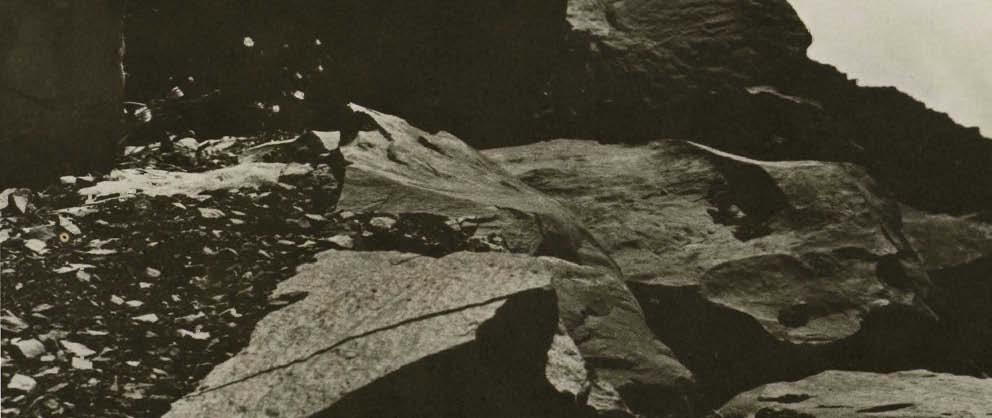
5 HAWAII VOLCANOES NATIONAL PARK This park is the largest in Hawaii. It was established in 1916 as the Hawaii National Park and included the dormant volcano of Haleakala, located 80 miles away on the Island of Maui. In 1961, Hawaii National Park was separated into Hawaii Volcanoes National Park on the Island of Hawaii, and Haleakala National Park on Maui. Hawaii Volcanoes National Park includes two active volcanoes. Mauna Loa, the largest volcano in the world, stands more than 30,000 feet from its base and 13,680 feet above sea level. Kilauea is the most active, most studied and best understood volcano in the world. Both are relatively young volcanoes, as their growth keeps well ahead of the destructive forces of erosion. Geologists have calculated that, with its present rate of growth, Mauna Loa could have grown to its present size in the last million years. The park includes a wide range of climatic, soil, vegetative, and scenic differences. Rainfall varies from virtually none to more than 100 inches per year. Vegetation varies from bare lava to dense jungles of fern and ohia. Temperature varies from a balmy 80 F at sea level to below 0 F at the summit of Mauna Loa, which is often snow covered for several months of the year. Soils vary from zero, when the lava is erupted, to deep, highly productive soils capable of producing high crop yields when properly managed. The park is located 30 miles from the city of Hilo. There is a safe, well-paved highway (Route 11) from Hilo to the park. Well-paved highways within the park provide easy accessibility to all parts of the area. These roads are built and maintained by the National Park Service; however, recent Kilauea eruptions have destroyed several miles of highway within the park. At each entrance there is a visitor information center and museum that provide information booklets, slides, pictures, postcards, etc., of the park area. Daily Hawaii Volcanoes National Park has a wide range of scenery, ranging from tropical fern-ohia jungles (above) to deserts (below). (National Park Service Photo)


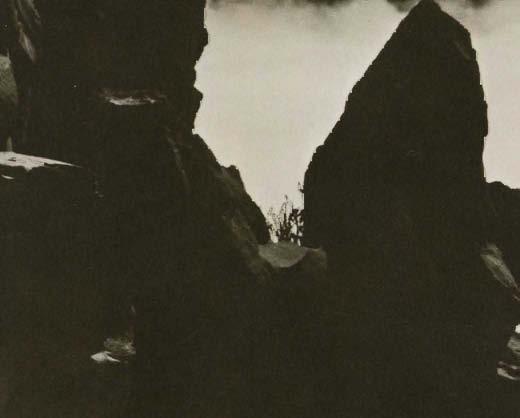
6 talks are given in auditoriums, and moving pictures of recent eruptions are shown. A park concessionaire operates the Volcano House Hotel on the edge of Kilauea Crater to provide meals and lodging. The U.S. military has a rest camp near the Volcano House for members of the armed forces. Trails give access to areas of the park where automobiles cannot go. The park has more than 900,000 visitors annually. Kilauea Volcano This is the most active volcano in the world. Kilauea Caldera is 212 miles long and 2 miles wide at the apex of the mountain. It was formed by the collapse of a cylindrical block that left walls up to 400 feet high. The floor of the caldera is covered by lava flows of 1919 on the north end, 1921 on the south end, and 1954 in the center. The southern portion also has many blocks of lava and ash thrown out during an explosive eruption in Halemaumau fire pit, located near the southwestern edge of the caldera, is about 3,500 feet wide and varies in depth according to the stage and degree of volcanic activity. It is the focus of eruptive activity for Kilauea Volcano and the traditional home of Pele, the Hawaiian Fire Goddess. Many types of volcanic phenomena are found in the area of Kilauea Caldera. Fumaroles, or steam vents, are quite common due to high rainfall percolating into the hot rock and being converted to steam. The steam Volcanoes National Park has many features associated with volcanism: Steam vents, or fumaroles (top left), sulfur banks, or sulfateras (center), devasted areas (bottom left). Lookout to Halemaumau Fire Pit (bottom right). 3


7 bank near Volcano House is an outstanding example of this, although fumaroles are found throughout the wetter portions of the park area. Another type of fumarole, known as a sulfatera, is represented by the sulfur banks that are also near Volcano House. Cinder cones may be found throughout the park. The interior structure of a cinder cone can be seen along the Chain of Craters Road which cuts through a cone. A large cinder cone also covers the Chain of Craters Road in the vicinity of Aloi Crater as a result of the series of eruptions which began February 22, New cinder cones may be formed any time an eruption occurs in the area. Tree molds are found in many areas. These are formed as hot lava solidifies when it comes in contact with the cool tree trunks. If the lava flows on, it leaves a lava "tree" standing in its path. If it merely buries the tree, a hole is left where the tree was. Both types of tree molds are found throughout the park area. Earth cracks are also common due to the movement and splitting of the earth's crust during volcanic activity. Many of these cracks are plastered with lava that flows into them. The Chain of Craters marks the east rift zone of Kilauea Volcano. These craters were formed, as was the Kilauea Caldera, by the collapse of blocks of lava after the molten lava beneath had drained away. The Chain of Craters Road provides easy access to these craters, up to Aloi Crater, where it has been blocked by the most recent eruptions. Aloi Crater on the Chain of Craters Road: Before the 1969 eruptions began (top), and after eight phases of the eruption (center). Note the lava ring formed as the liquid lava drained from the partially filled crater. First of the series of eruptions in the Aloi Crater area (bottom). Note the lava being thrown in the air and the cracks with smoke and fire coming forth. (National Park Service Photo)


8 Lava tubes are formed 'by pahoehoe l lava flows cooling on the surface and sides but remaining liquid in the center. The liquid core flows out leaving a hollow tube. Thurston lava tube is an excellent example and easily accessible for safe inspection. A hole that resulted from collapse of part of the roof, provides a convenient exit from the tube. Kilauea generally has relatively mild eruptions marked by fire fountains, caused by gases forcing the liquid lava to heights of 1,900 feet. Most parts of the volcano are readily accessible by highway, so people drive up to look when an eruption occurs. Airlines also fly excursions to view them-this is Hawaii's drive-in volcano! In rare instances, water flows into the interior channels of the volcano causing explosive type eruptions due to steam pressure. Two of this type of eruption have occurred in recent times. One in 1790 is noted in Hawaiian history because the hot blast of gases, rocks and dust killed part of a native army marching near the crater. In 1924, dust and steam rose to a height of nearly 5 miles, boulders weighing up to 14 tons were thrown out of the crater, and the fire pit was enlarged from 1,400 feet in diameter to almost twice that width. The Volcano Observatory, located on the rim of Kilauea Caldera, was established to study the volcanic activity in this area. An overlook next to the observatory provides an excellent view of both the caldera and the fire pit. Some of the seismographs used by the observatory in volcano research can be seen near the overlook. Important discoveries regarding volcanism have been made here, and eruptions have been predicted. I Pahoehoe lava has a thin glassy crust. The Thurston Lava Tube (top), is an old lava flow that solidified on the top and sides. The liquid core ran out leaving a tube or cave. Footprints of a Hawaiian Army are preserved in the ash from 1790 eruption of Kilauea Volcano (bottom). The destruction of this army is credited with assisting King Kamehameha I in his effort to unify the Hawaiian Islands. (National Park Service photo) 5


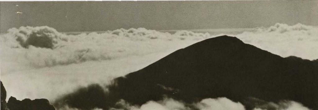
9 Mauna Loa This is a typical shield volcano formed by its fluid lavas. All volcanoes in Hawaii are of this type and are built up by successive layers of lava. This volcano has erupted enough lava during the past 100 years to increase its height by 17 feet. Mauna Loa is about 60 miles long by 30 miles wide and contains 10,000 cubic miles of lava-one of the largest single mountains in the world. A prolific lava producer, it has erupted up to 600,000,000 cubic yards of lava in 23 days, and some of its lava flows extend 31 miles from their source. Noone has lost his life as a result of its eruptions, but towns have been covered and other buildings and highways destroyed. Mokuaweoweo Caldera is at the summit of Mauna Loa. It is 3 miles long, 1.5 miles wide and 600 feet deep. Most eruptions begin in this caldera and later break out lower down the volcano in "flank" eruptions. The lava is full of gas, like that in Kilauea, and fountains occur in the early stages of an eruption. The lava is very fluid and flows rapidly down the flanks, often reaching the ocean and building submarine lava flows. The last eruption from Mauna Loa was in 1950 and lasted 23 days. The longest lava flow began in 1855 and continued for 13 months. Night picture of eruption on Mauna Loa (top), with Mokuaweoweo crater in background. Note lava flowing down mountainside and snow on top of mountain. (U.S. Geological Survey photo) Mauna Loa, a typical shield-shaped volcano, is the largest in the world and erupts on an average of every 4 years. (Hawaii Visitors Bureau photo) 6


10 Fresh lava flows extending down the slope appear black; however, pahoehoe flows may also appear silvery gray when the light is reflected from them. Older lava flows are dark gray, and still older flows are reddish brown due to the oxidation of iron in them. Lava flows often divide, leaving islands of older material not covered by the newer flow. The Hawaiians called these islands kipukas. At higher elevations the kipukas consist of gray or brown lava; at lower elevations the kipukas have groves of large trees such as Kipuka Puaulu, described later. Mauna Loa also has many of the volcanic features found in the Kilauea area; however, some, such as fumaroles, are not as common because rainfall is lower on Mauna Loa. Many of its features are more easily seen, as there is less vegetation; at higher elevations, there is no vegetation. The rough volcanic terrain resembles the surface of the moon. United States astronauts are sent here for training before going to the moon. A good, narrow, paved road, Mauna Loa strip, goes 13.5 miles up to the 6,700-foot level. A trail leads from the end of the road to the summit of the volcano, 18.5 miles away. The road passes by tree molds, Kipuka Puaulu, through the forest and into mountain meadows. The trail leaves the mountain meadows, passes through straggling, struggling manonis and railliardias (a relative of the sunflower). At 10,000 feet, it enters the vast expanse of lava fields extending all the way to the summit. When snowfalls extend to the 7,000-foot level, people drive out to enjoy a snowball fight and allow their children, many who have never seen snow, to play in the cold stuff. Park Service cabins are located at Red Hill (10,000 feet) and Pendulum Peak (13,300 feet) near the summit. These may be used by hikers, but permission is required. 2 2For further information write to Ranger in Charge-Hawaii Volcanoes National Park, Hawaii An aa lava flow. The cooling clinkery lava "floats" on the surface of the liquid lava. The weight and force of the lava pushes over large trees. (U.S. Geological Survey photo) 7


11 Trails The park contains more than 120 miles of wellmarked trails. The trail to the summit of Mauna Loa, described above, requires about 3 days for the round trip-2 days up and 1 day back. Another interesting trail leads from the end of the road at Hilina Pali to Halape on the coast and back. A short hike may be taken on the Devastation Trail that goes through the area covered by ash during the 1959 eruption of Kilauea Iki. The Crater Rim Trail begins at Park Headquarters and provides an opportunity to view all the outstanding features of the Kilauea Caldera area. Halemaumau Trail has been named the "world's weirdest walk," as it leads across the floor of Kilauea Caldera and provides an outstanding opportunity to experience volcanic phenomena. The Bird Park Trail is a self-guided tour of Kipuka Puaulu. It provides an opportunity to see rare native Hawaiian trees and birds, unrivaled elsewhere in the islands. Many other trails, such as the Steaming Bluff Trail, Sandalwood Trail and Spatter Ridge Trail, provide the opportunity to see specific areas of interest. These trails all intersect with the Crater Rim Trail, making it possible to hike selected portions of the trail. Permits should be obtained from Park Headquarters before hiking on back-eountry trails. Otherwise, permits are required only for use of park-operated camping facilities. It is recommended that warm clothing and sturdy shoes be worn for hiking, as it is usually cool at this elevation and tennis shoes and thongs do not hold up on the rough lava surface. The weather in the area is very unpredictable, so that light rain gear should be carried. Drinking water and food are not available along the trails, so carry enough to meet your needs. Picnic only in designated areas, and leave the area clean and attractive for others. When hiking on Mauna Loa, it is suggested that at least two people go together, as a single hiker who injures himself would be in serious trouble. Register at Park Headquarters before going on the mountain, so that park rangers will know who is on the mountain at all times. Elevation sickness is common at or near the summit, due to the relatively rapid climb to the summit which does not allow the body time to adjust to the lower oxygen level. This sickness is characterized by splitting headaches, nausea, pounding heart and lack of energy. Hiking is popular in Hawaii Volcanoes National Park. Trails are plainly marked (top and center). Kipuka Puaulu, or Bird Park, an area missed by recent lava flows, is a refuge for native birds (bottom). (National Park Service photos) 8

 before use.")


12 Cabins The National Park Service provides two cabins on Mauna Loa for the use of hikers; one at Red Hill at an elevation of 1,000 feet, the other at 13,300 feet near the summit. Each cabin provides eight bunks with mattresses, blankets, coleman stove and lantern (bring your own white gasoline and matches), and cooking and eating utensils. There is water at each cabin, but it requires water purification tablets (Halizone) before use. You must bring your own food and personal articles, including pillows and sheets, if desired. The park concessionaire 3 rents camper cabins at Namakani Paio Campground. Each cabin is constructed of wood and has one double bed and two doubledecker bunks, an outdoor grill, table and benches. Other furnishings may be obtained for use during your stay. Overnight accommodations and meals may be obtained also in the Volcano House on the rim of Kilauea Volcano. Camping Camping is allowed only in designated areas: Namakani Paio, Kipuka Nene and Kamoamoa Campgrounds. These provide drive-in camping, including accommodations for mobile units. All camps are to be established only at fixed fireplace sites within each campground. You may collect dead wood on the ground for fuel; however, it is best to bring your own to insure an adequate supply for your needs. Permits are required for camping in park areas, which is limited to 7 days at each campground, with a maximum of 21 days for the park. Each park provides water, openair fireplaces, and eating shelters. There are also three picnic grounds in the park restricted to family use only. Back-country camping also may be allowed. 3For further information, write Kilauea Volcano House, Ltd., Hawaii Volcanoes National Park, Hawaii Typical cabin available at Namakani Paio Campground (top). Picnic area near the Kipuka Puaulu (center). Naulu picnic area (bottom) is accessible only from the Kalapana entrance due to 1969 eruptions. Note the Halei PaIi, a typical fault block, in the background. (National Park Service photos) 9


13 Birds and Animals The most common native birds are the apapane, iiwi, amakihi and the elepaio. The apapane is found extensively in the park, as it feeds upon the nectar from the flowers of the ohia tree. It is a small red bird with black wings and tail, crimson breast and whitish abdomen. Its black, slightly curved bill helps distinguish it from the iiwi which is very similar in appearance. The iiwi has a sickle-shaped, salmon-colored bill which is longer and more curved than the apapane's. Its songs are not as musical as those of the apapane. It also depends upon the nectar of the ohia flower (lehua) for food. The amakihi is found in all areas where ohia forests abound. The male is green above and yellow below with a dark-green tail and a black eye line. The female is much duller in color and lacks the yellow breast. The elepaio is an insect eater and often catches them on the wing. Its upper parts are brown and it has a white rump and dark tail, white wing bars and whitish underparts. All of these birds are found throughout the park but are especially abundant in the Bird Park area. Other Hawaiian birds found in the park are: Vau, or dark-rumped petrel, which nests on the volcanic slopes in the National Park; kooe ke'a, or white-tailed tropic bird, which can be seen nesting and flying in Kilauea Caldera; nene, or Hawaiian goose, which was nearly extinct at one time but is now staging a comeback in the National Park; io, or Hawaiian hawk, which is common in the park; kolea, or golden plover, found in grassy mountain slopes during late August to April; pueo, or Hawaiian owl, is common in the park and feeds both during day and night; omao is common in the park; akiopolaau is a rare bird resembling the amakihi; palila depends upon the young mamane tree for food and is rarely seen in the park; ou is also rare, the last reported sighting in the park being in 1955; creeper is a shy silent bird found in the dense rain forests of the park. Some of the introduced birds that may be found in the park are: California quail, found in the dry portions of the park; ring-necked pheasant, found mostly in open country but also in native forest areas; chukar frequents the arid rocky areas above the tree line, Wildlife abounds in the National Park area. The Nene, or Hawaiian Goose, once almost extinct, is making a comback here. (National Park Service photo) 10


14 although may be found in some other areas as well; skylark is found mostly at higher elevations; red-billed leiothrix is found in most parts of the park; white eye, or mejiro, is found throughout the park at all elevations. All of the mammals found in the park are introduced species that have gone wild in Hawaii. Feral goat is common and very destructive to native vegetation in the park. It is easily recognized by its long flowing hair and beard. If captured when young, it will stay close to its human friends and may be partially controlled by this means. Wild pig, introduced by the early Hawaiians, is found throughout the wetter areas of the park. They have been seen feeding along the Chain of Craters Road in the area destroyed by the series of 1969 eruptions in the Aloi Crater area. These animals are wild should not be approached closely, and may be quit~ dangerous if cornered. Feral cats cause great damage to ground-nesting birds such as the nene and uau. These are not common in the park. The mongoose was introduced to help control rats; however, it is a daytime animal and rats are nocturnal so they have not been very effective in rat control. The mongoose spreads rapidly and is very destructive to the eggs and young of ground-nesting birds and an endless variety of other native species of fauna. Other wild animals that may be seen are dogs, cattle and sheep. These are no longer common but a few may still be seen in the more remote sections of the park. Plants The National Park has a wide range of environments which permits the growth of a great variety of plants, including several adaptations of the same plant due to the different ecological systems in which they are found. There are more than 70 species of fern 4 found in the park. The most famous are the giant tree ferns that grow in the tropical rain forest along Crater Rim Road. There are four different species of tree ferns; some grow to a height of 35 feet, including the fronds. These ferns grow as an understory of large ohia trees, which take root very readily in the fern and rapidly outgrow them. The trunk of the tree fern contains much starch and was used as food by the Hawaiians in time of famine. Other ferns were used for a red dye, for lining and thatching houses and for food. Some ferns are highly resistant to heat and drought and are among the first plants, along with the ohia tree, to take root on new lava flows. The Feral Goat is very destructive to vegetation. The ohia tree grows throughout the park, on new lava flows, in the high rainfall fern forests and in climatic areas in between. This tree has a beautiful red flower, called the lehua by the Hawaiians, that serves as the source of food for some of Hawaii's native birds. 5 Kipukas such as Kipuka Puaulu and Kipuka Ki are excellent areas to observe native trees in their natural habitat. Many of these plants are found in no other location and provide excellent examples of the interaction (ecology) of geological and biological forces on plant growth and development. The National Park provides protection for these native birds and plants by maintaining their area in its original condition-a little bit of America unspoiled. Please help keep it that way so that all who come may enjoy this beautiful and interesting area. 4Hubbard, D.H., 1952 "Ferns of Hawaii National Park" Hawaii Natural History Association, Honolulu, describes these in detail and shows pictures and/ or sketches of the more abundant species. 5Hubbard, D.H. and V.R. Burder, Jr., 1960 "Trailside Plants of Hawaii National Park" Hawaii Natural History Association and the selfguiding natural trail for Kipuka Puaulu published by the National Park Service both provide excellent descriptions and some drawings and pictures of plants found in the park area. 11


.")
15 HALEAKALA NATIONAL PARK Haleakala, the second largest national park in Hawaii, was established in 1916 as part of the Hawaii National Park. It was made a separate park in 1961 and was enlarged in 1970 by the addition of the Kipahulu area, including the Seven Sacred Pools. The park now consists of more than 20,000 acres, most of which is within the main feature of the park-haleakala Crater. The park is located on Haleakala Mountain, one of the world's large dormant volcanoes. It extends from sea level to 10,025 feet, the summit of the mountain. Climatic conditions vary from the heavy rainfall area of the eastern side of the mountain, with up to 300 inches of rain per year, to the dry, low rainfall areas of the western side of the mountain with less than 15 inches per year. Vegetation and soils also vary widely with rainfall. Seven Sacred Pools at Kupahulu in the Hana area of Maui (top). (Hawaii Visitors Bureau photo) The largest cinder cone in this view of Haleakala Crater (bottom) is taller than the Empire State Building. (National Park Service photo) 12


16 Haleakala Park Headquarters is located 27 miles from Kahului Airport on Maui. It is reached by a well~ paved narrow road that winds up the mountain. It is narrow but there is room to pass when meeting another car. The weather generally is clear in the morning, but during the afternoon clouds accumulate from the 3,000-foot to 7,000- or 8,000-foot level, so you will be driving through fog (clouds). Above this level, however, the sun will often be shining. It is worth the trip to see the sunset behind these same clouds, or to watch the sunrise from the crater rim. It is best to be there by 4:30 or 5:00 a.m., as the sun rises very early at this altitude. 6 The mornings and evenings are cool at all times of the year. During winter, snow is common and warm clothing is needed. The park had almost 150,000 visitors in 1969; about 4,000 remained overnight or longer. Haleakala Crater is 7~ miles long and 2~ miles wide. The circumference is 21 miles. As one looks across the deep depression from the visitors observatory, he is impressed with its unusual "Z" form which is unlike any true caldera or crater. To the left is Koolau Gap through which lavas flowed and partially filled Keanae Valley and through which clouds drift into the crater during the afternoon. To the right is Kaupo Gap through which lavas flowed into Kaupo Valley and through which clouds also enter the crater. At the far end of the depression is Kipahulu Valley rising above the lavas of the crater floor. To the left is White Hill from which the Sliding Sands trail begins its descent into the crater, and on the right is Magnetic Peak which affects a compass so that it is useless in the area. On a clear day, Mauna Kea and Mauna Loa, 80 miles away, can be seen from the observatory. Haleakala Crater The major natural feature of the park is Haleakala Crater. This is not a true crater. It is a huge depression formed during a long erosional epoch after the original volcanic activity had ceased. Huge amphitheater valleys were formed as Kaupo and Keanae streams eroded; these were cut back to the summit and then coalesced to form a large deep depression. A later period of volcanic activity partially filled the depression and valleys with lava. Evidence of this activity is shown by cinder cones, vents, and lava flows within the crater. The great size of many of the cinder cones is dwarfed by the large depression in which they occur. Many unusual and interesting features are a result of this volcanic activity. A partially buried spatter cone named Ka Puaa 0 Pele (Pele's pigpen) and a deep vent know as the bottomless pit are examples of such features. The large lava flows partially masked the interstream divides between adjacent valleys; the interstream divide between Kaupo and Kipahulu Valleys, which projects above the sea of lava, is an example of this phenomenon. Aerial view of Haleakala Crater and road to crater (top). Note effects of erosion on the walls of the crater. (Photo courtesy Dr. Agatin Abbott) A popular method of entering the crater is by horseback (bottom). 6Phone Park Headquarters (ph: ) for latest information on visibility in the crater. 13
17 Trails Three major trails lead into Haleakala, and a network of trails across the crater floor lead to the cabins and various points of interest. The best known of these is the Sliding Sands trail which begins near White Hill; others are Halemauu and Kaupo trails. It is generally recommended that you enter by the Sliding Sands trail and exit through the trails at lower elevation, as this trail is very steep and arduous for the return trip. The Halemauu trail enters the crater from the 8,000-foot level. It descends down the face of 1,500-foot Leleiwi Pali (cliff) on its way to the crater floor. It is the easiest of all the trails for entrance and exit into the crater and is recommended for exit by those who enter on the Sliding Sands trail. The Kaupo trail exits from the summit depression through Kaupo Gap and down Kaupo Valley. It descends very rapidly to the Kaupo ranch below the park boundary. It is 8 miles from Paliku cabin to ranch headquarters and another 1Y2 miles to Kaupo Village. It is an interesting trail but is recommended for exit only, as it is steep and an arduous climb on an exposed south slope. If this trail is to be used, arrange for someone to pick you up at Kaupo, as the village is 50 miles from central Maui by the shortest road, and transportation from the village is difficult to obtain. Part of the trail is over private property; no previous permission is required, but take care to close gates and protect property so the next hiker may be allowed to use the trail. All hikers should register with the Park Headquarters before entering the crater and check out before leaving. Office hours are 7:30 a.m. to 4:00 p.m. This is for your protection, as it is easy to become lost on the floor of the crater. Hikers should wear comfortable clothing and take sufficient water and food to meet their requirements. A jacket and/ or raincoat should be taken, as it may be cool and rainy at any time in some parts of the crater. Temperatures during sunny periods are comfortable, but night temperatures may drop to below freezing any time of the year. Cabins Three overnight cabins are provided for visitors to the crater floor: Holua at the foot of Leleiwi Pali, Kapalaoa, and Paliku which is in a different climatic zone due to clouds bringing abundant moisture to the area. These are maintained by the National Park Service. Each is equipped with drinking water, woodburning cookstove, firewood, kerosene lamps, cooking and eating utensils, and triple-tiered bunks equipped with mattresses, mattress covers and blankets, but no sheets or pillows. Rates are very reasonable. Reser- vations should be made up to 6 months in advance.7 If reservations will not be used, notify the park rangers so someone else may use the cabins. Although each cabin will accommodate 12 persons, it is reserved for your exclusive use except for passing hikers to obtain drinking water and to rest or eat lunch. Visitors may occupy cabins for three consecutive nights but can occupy anyone cabin for two nights. Leaders of youth groups must be 21 years old; with other groups or parties, one member must be at least 18 yeats of age. Visitors are required to obtain permits for trips to the floor of the crater. The permit plus cabin keys and information may be obtained at Park Headquarters. Check again when leaving to return keys and let them know you are safely out of the crater. Food, gasoline, film, etc., cannot be purchased in the park but must be obtained elsewhere. When using cabins, bring your own food, water for the trail, matches, dish towels, pillows and sheets and other personal articles desired. Dress should be the same as for hikers. Camping Hosmer Grove, near Park Headquarters, provides facilities for camping and picnicking. This is a beautiful mixed stand of trees that offers restful camping, protection from the wind, and an opportunity to see and hear some of the birds of the area. The area provides water, fuel, rest rooms, picnic tables and barbecue grills. The camping areas are available on a first-come, first-served basis. Camping is permitted in the crater, but no specific facilities are provided for the purpose. The same rules as for hikers apply to campers in the crater. They must provide their own cooking stoves, as open fires are not permitted in the crater. Birds and Animals The apapane and iiwi may be seen up to the 8,000 foot level, as they are associated with ohia which provides them with food. The amakihi is fond of the mamane blossoms and, though not numerous, is found throughout the park. The nene, or Hawaiian goose, is very rare, but some may be seen in the area near Paliku cabin. The pueo, Hawaiian owl, may be found flying over grasslands near the park entrance or near Paliku cabin. Koae, or tropic bird, and uau, or dark-rumped petrel, may be found near the palis in the crater. The golden plover is common except during the period of May to August when it is in Alaska. 7For further information write to Superintendent, Haleakala National Park, Box 456, Kahului, Hawaii


18 Introduced birds, such as the ring-necked pheasant, chukar, partridge, California quail and skylarks are common. 8 The feral goat is the greatest problem in the Haleakala area, as it destroys the silversword, mamane and other desirable vegetation. Wild pigs are found in the wet forested areas below Koolau Gap and in Kipahulu Valley. The mongoose, also an introduced animal, is quite common in the park area. Plants The most famous plant is the silversword, a relative of the sunflower. This plant will grow for 4 to 30 years before it blooms. It then produces a flower stalk 1 to 9 feet tall with one to several hundred purplish sunflowerlike blooms. After the seeds mature, the plant dies. This plant almost became extinct due to the ravages of the feral goat and of visitors who used to take plants to show friends they had been to the crater. Plants can be found in all stages of growth in a fenced enclosure near Kalahaku Overlook and along the trails in the central portion of the crater. Other plants found are the ohia, ferns, bracken, lichens, mamane and many others. Many of these develop characteristics found only on Haleakala because of the distinctive environment. The unstable permeable ash retains little water and provides insecure anchorage for plants. It has no soil and very little available mineral nutrients. Plants are isolated, subjected to wide variations in temperature in relatively short periods of time and exposed to winds. These factors combine to develop plants unique to the area-presenting a fascinating study in ecology. 8For more detailed information on.birds, mammals and plants, see "A Guide To Haleakala National Park" by George Ruhle, published by Hawaii Natural History Association. Camping in Hosmer Grove near the entrance to Haleakala Park (top left). (National Park Service photo) Silversword (right top and bottom) is found only in Hawaii. It often grows to a height of 9 feet. 15


, reconstructed ancient Hawaiian heiau. Place of Refuge The main feature of the park is the Place of Refuge.")


19 CITY OF REFUGE NATIONAL HISTORICAL PARK This. park is located 111 miles from Hilo and 20 miles from Kailua-Kona. It is reached by a side road, Route 16, 3 miles down the mountain from Highway 11. The park was established in 1961 to preserve the rich archaeological and historical sites of the area. It consists of 180 acres encompassing the traditional seat of the Kingdom of Kona, the Pu'uhonua-o-Honaunau-better known as the City of Refuge-many burial and shelter caves, and other important sites. The park is open all year. Points of interest are visited on foot and identified by a self-guide booklet obtained at the beginning of the visit. A modern visitors center is provided to explain the historical and geological origins of the Park. Picture wall tells the story of the Hawaiian people who lived near the Place of Refuge (top). Hale-o-Keawa (center), reconstructed ancient Hawaiian heiau. Place of Refuge The main feature of the park is the Place of Refuge. This area was established to provide sanctuary for noncombatants and defeated warriors during time of war and for kapu breakers. Any person who entered was protected from death and all punishment by the power of the gods of the area. The gods of this place of refuge were the traditional ones (Kane, etc.) and the spirits of deified dead chiefs-spirits who could lead the souls of men to safety or destruction. All who sought refuge were admitted from any part of the island or from another island. No trial was required to determine their guilt or innocence. War refugees stayed until the war was over; kapu breakers usually stayed a few hours or overnight until they were purified by the priests. The protection of the sacred place went with them, and they were then free to return to their homes. There was usually a place of refuge in every major district of all the inhabited Islands of Hawaii. The one in the National Historical Park is historically the most important and the only one which has survived almost intact. The Place of Refuge, enclosed within a great wall, is located upon a small peninsula built into the sea by an ancient pahoehoe lava flow. Springs in the nearby cove provided the refugees with brackish water. There is no record or legend that indicates when the Place of Refuge was established, but it is believed to have been in operation before Columbus discovered America. It remained in use until 1819 when the old system of kapus and religion was destroyed. Ki'i, now known as Tiki's (bottom), are carved from native Hawaiian ohia wood and represent deities worshipped by ancient Hawaiians. 16


20 The Great Wall Religious sanctions were the primary force in maintaining a pu'uhonua and enforcing its protection of refugees. However, some degree of physical protection was also required. This was provided by the Great Wall, built about 1550, which forms the inland boundaries of the Place of Refuge. The Alealea heiau, whose large stone platform still stands within the wall, was also built at this time. The Great Wall is 1,000 feet long and averages 10 feet in height and 17 feet in width. One length of the wall begins at Honaunau Bay and extends more than 600 feet to the corner. Another length begins at the comer and runs almost 400 feet toward the open sea. At one time this portion of the wall extended to the sea, but it has been partially destroyed by tidal waves. The Hawaiian masons laid their stones without mortar, similar to the method used by the Incas of Peru. In the Great Wall, the best or flat face of each stone was set outward. The largest stone in the face of the wall is 6Y2 feet high, more than 5 feet wide and 2 feet thick. It weighs between 4 and 6 tons. The wall was opened and a ramp was built for horses to enter during the late 1800's. This ramp is now used as a visitors entrance into the area. Temples The Place of Refuge was established by a ruling king. It was operated in conjunction with a heiau (temple) whose gods (ki'i or tikis) protected the Place of Refuge and whose priests operated it. There were three temples in the City of Refuge at Honaunau. The ruins of the first heiau stand near the sea. Many of the stones from its platform were used in building Alealea heiau, the second temple, in 1550; the large stone platform within the Great Wall is all that remains of this heiau. The third heiau, Hale-o-Keawe, was built in 1650 and was in use until This heiau was not destroyed in 1819 with the other temples, as it served as a royal mausoleum. However, the bones of the deified chiefs and kings were removed in 1829 and the temple razed. It has been reconstructed by the National Park Service and stands at the edge of Honaunau Bay at the end of the Great Wall. Many ki'i's, carved from ohia wood by Hawaiian people, stand in the enclosure of Hale-o-Keawe as they did before the temple was destroyed. Royal Palace Grounds The kings of Kona and their courts occupied the most choice dwelling sites in the Honaunau area. The palace grounds were on the inland side of the Great The Great Wall of the Place of Refuge was built of volcanic stone put together without mortar. The ramp was for horse traffic. Wall. The small sloping cove next to Hale-o-Keawe was the landing and launching site for the kings' canoes. The members of the court lived near the king along the shore to the south of Honaunau Bay. The common people were on the opposite shore of Honaunau Bay and inland of the chiefs' homes. Many important archaeological sites in the park show the type and size of the buildings used in the area, burial and shelter caves, trails, etc., that were used by these ancient Hawaiians. All houses, both for kings and commoners, were one-room structures of wooden frames. The kings' houses were covered with ti leaves while those of the commoners were covered with pili grass thatch. Commoners usually had one small hut that was used for storage and shelter from the infrequent storms of the area. A chiefs home usually consisted of three or more houses, each for a specific purpose, and the king would have ten or more houses. Plants The Honaunau area, like much of Hawaii, was barren lava or soil before the first foreign visitors arrived. There were groves of coconut used for food, pandanus (hala) and koa along the coast. Pili grass, used for thatching homes, and many medicinal plants grew, and still grow, in the park area. Much of the area is covered with thorny vegetation, nonnative grasses and other plants brought by these visitors. These plants rapidly established themselves, at the expense of the native plants, due to a lack of competition and pests in Hawaii. The National Park Service is now clearing away these undesirable plants and restoring the native vegetation in the park area. 17


21 NATIONAL MEMORIAL CEMETERY OF THE PACIFIC The National Cemetery was constructed in the typical broad and shallow crater of a tuff cone, known as "puowaina" by the Hawaiian people. This name means "reverence to the highest degree, to hallow." Puowaina was venerated as a resting place for the weary by the old Hawaiians. The cone is known better as Punchbowl, so-named by early sailors who visited Honolulu and noted that the cone with its broad, shallow crater resembled a giant punchbowl. Punchbowl was formed late in the geological history of Oahu, some 75,000 to 100,000 years ago during the Honolulu period of secondary volcanic activity. Its formation was due to magma or hot lava rising through cracks in the old coral reef that extended to the foot of the Koolau Range at that time. As the hot lava rose in these cracks, it contacted rocks saturated with water. The water became superheated, much as in an ordinary pressure cooker, and resulted in steam explosions that deposited a brown ash layer around the active vent. The trade winds blowing during the period of activity piled the ash on the leeward side of the cone, causing the west side of the crater to be higher than the east side. The sides have been gullied by water erosion in what appear to be giant scratches. The Cemetery was built in a young, loose black ash deposited 5,000 to 10,000 years ago by eruptions from nearby Mt. Tantulus and Round Top. The tuff of the cone is brown and hard as shown in an exposure along the road leading up to the Cemetery. Other famous tuff cones of the same period of activity and formed in the same manner are Diamond Head, Salt Lake and Koko Head Crater. The Cemetery was begun in August 1948 under the supervision of the Honolulu District Corps of Army Engineers, and dedicated September 2, 1949 on the fourth anniversary of V-J Day, which marked the end of World War II. It contains 112 acres and is the largest of three national cemeteries superyised by the U.S. Army outside of the continental United States. It is the first national cemetery established in the Pacific area. The Cemetery contains 19,500 interred remains from World War II and the Korean police action; twenty of these are Medal of Honor winners. The National Memorial Cemetery of the Pacific (top). Eight Courts of the Missing (center) list the names of 26,280 missing heroes whose bodies were never found. A 30-foot female figure, holding a laurel branch, overlooks the court (bottom). 18


22 graves of many famous persons are found here also, such as war correspondent Ernie Pyle who was killed during the invasion of Okinawa in A memorial stairs, flanked by eight "courts of the missing," lists the names of 26,280 American servicemen whose bodies were never recovered; 18,093 of these from World War II, and 8,187 from the Korean action. At the top level is the Court of Honor, chapel, pool, and map galleries, depicting the campaigns in the Pacific during World War II and in Korea. Overlooking the Court is a 30-foot high female figure holding a laurel branch. This memorial was open to the public in January An observation point in the Cemetery provides a magnificent view of Honolulu, from the International Airport to Diamond Head. The Cemetery is beautifully landscaped and meticulously maintained. It is divided into lettered sections, and graves are numbered in sequence, beginning with the corner nearest the flagpole and continuing to the far corner of the plot. A visitors' center provides rest rooms and cold drinking water near the entrance to the Cemetery. Rest rooms are also located at the memorial. The Cemetery is open from 8 a.m. to 5 p.m. daily and 8 a.m. to 7 p.m. on Memorial Day. In 1969, there were more than 800,000 visitors from all parts of the world. Several tiilusual trees are found in the area of the Cemetery: The fish fuddle tree (Piscidia piscipula L. Sarg.), the needle flower tree (Posoqueria latifolia), the pencil tree(euphorbia tirucalli L.) and the Honduras or West Indies mahogany (Swietenia mahogoni Jacq.), as well as many trees common in Hawaii. The only wildlife found in the area is the golden plover, which migrates each year from Alaska to the same area of the Cemetery, apparently undisturbed by the large number of visitors to the park. Indeed they seem to "stake out" an area which they consider their own and which no other bird will enter. BIBLIOGRAPHY Bannick, N Hawaii: A Guide to All the Islands, Sunset Travel Books. Lane Books, Menlo Park, California. Butcher, D Our National Parks in Color. e.n. Potter, Inc., New York, 2nd Ed. Frome, M Rand McNally National Park Guide. Rand McNally & Co., Chicago, New York, San Fran ClSCO. Hawaii Audubon Soc., Hawaii Birds. Hawaii Audubon Soc., Honolulu. Hubbard, D.H Ferns of Hawaii National Park. Hawaii Nature Notes Vol. V, No.1 Hawaii Natural History Association Ltd., Hawaii Volcanoes National Park, Hawaii Hubbard, D.H. and V.R. Bender, Jr Trailside Plants of Hawaii National Park. Hawaii Nature Notes Vol. IV No.1. Hawaii Natural History Association, Ltd. Macdonald, G.A. and A.G. Abbott Volcanoes in the Sea: the Geology of Hawaii. Univ. of Hawaii Press, Honolulu. Macdonald, G.A. and W. Kepelka Anatomy of an Island. Bishop Museum Press, Honolulu. Macdonald, G.A. and D.H. Hubbard, Volcanoes of the National Parks in Hawaii. Hawaii Natural His tory Association, Ltd., Hawaii Volcanoes National Park, Hawaii Neal, M.e In Gardens of Hawaii. Bishop Mu seum Press, Honolulu. Ruhle, G A Guide to Haleakala National Park, Island of Maui, Hawaii. Stearns, H.T Geology of the State of Hawaii. Pacific Books, Palo Alto, California. Stearns, H.T A Geological Field Trip of the State of Hawaii. Pacific Books, Palo Alto, California. The map galleries of the Memorial depict the campaigns of the Pacific and Korea. 19
23 ,r ~r:,~ ~ --x-~~r:,~+o~ - _''; HILL RED " ,"', '0'0&.1 10~3~... TO KALAPANA AND HILa r o MILES I _ KAPAOO POINT I:i. CAMPGROUND A TRAIL SHELTER --ROAD ---- TRAIL HAWAII VOLCANOES NATIONAL PARK (AFTER NATIONAL PARK SERVICE, 1968)
24 HOSMER GROVE CAMPGROUND AND NATURE TRAIL TO KAHULUI ~O -to ~~"" 0(..(, '9~,,~ ~~~ SCIENCE TO Irl/)Jf",u. "'- HANA,... 'I..CJ "Jf((~)f '\~ \\ ~ ' SEVEN... SACRED POOLS RESERVE " "... AREA " KIPAHULU' " FOREST " RESERVE \ \ HALEAKALA NATIONAL PARK 3847' TO KAUPO VILLAGE VI MILES a:::::::::j (AFTER RUHLE, 1959 AND NATIONAL PARK SERVICE, 1968)
25 , 1I TO KAILUA-KONA '> VISITOR CENTER () ROYAL FISHPOND C> TO PAHALA CITY OF REFUGE I FEET NATIONAL HISTORICAL PARK Scale applies only to area of City of Refuge (AFTER NATIONAL PARK SERVICE, 1968)
26 II8UeCl in furthm:ance of Cooperative Extension work, acts of May 8 and June 30, 1914, in cooperation with the U. S. Department of Apiculture. C. Peaks WDlOn, Direcu.r, Cooperative Extension Service, College of Tropical Agriculture, Univm:sity of Hawaii, Honolulu, Hawaii arcular 443-FEBRUARY M
Aloha to Parents and Participants
 Aloha to Parents and Participants August 10-15, 2018 ISLE Project Expedition Overview WHEN: August 10-15, 2018 WHERE: Big Island, Hawai I Volcanoes National Park Kilauea Camp - A family based camp facility
Big Island Hawaii Explorer
 # 1933 Hawaii s Big Island is not only big in size, but also in diversity. There are snowy mountaintops, lush jungles, windswept grasslands, picturesque beaches, and lava fields - you can see all these
What You ll Find Inside
 What You ll Find Inside Table of Contents 1 Guest Room Information 2 Property Information 3 Volcano Village Information 4 Volcano Village Map 5 Hawaii Volcanoes National Park 6-11 Kilauea Caldera Map 12
Typical avalanche problems
 Typical avalanche problems The European Avalanche Warning Services (EAWS) describes five typical avalanche problems or situations as they occur in avalanche terrain. The Utah Avalanche Center (UAC) has
Death Valley Is a Beautiful but Dangerous Place
 Death Valley Is a Beautiful but Dangerous Place Welcome to This Is America with VOA Learning English. Today we visit one of America s great national parks. It is a place of strange and silent beauty. As
Other Agencies and Organizations
 Daniel Boone National Forest 1700 Bypass Road WInchester, KY 40391 859-745-3100 Location Northern terminus is near Morehead, Kentucky. Southern terminus is located in the Big South Fork NRRA in Tennessee.
Chapter 7 Geography and the Early Settlement of Egypt, Kush, and Canaan
 Chapter 7 Geography and the Early Settlement of Egypt, Kush, and Canaan How did geography affect early settlement in Egypt, Kush, and Canaan? Section 7.1 - Introduction RF/NASA//Corbis This satellite photograph
ONE ISLAND, FIVE NATIONAL PARKS
 FOR IMMEDIATE RELEASE Big Island Visitors Bureau Media Contact: Jessica Ferracane, (808) 895-5740, jessica@irondogpr.com ONE ISLAND, FIVE NATIONAL PARKS Hawai i Island (July 12, 2011) Hawai i, the Big
Driving Time: 3 hours (allow extra time for stops)
") Scenic Byways loop This journey takes visitors through the eastern edge of Mt. Rainier National Park and along two of Washington s most beloved scenic byways, the Chinook Byway and the White Pass Scenic
Scenic Byways loop This journey takes visitors through the eastern edge of Mt. Rainier National Park and along two of Washington s most beloved scenic byways, the Chinook Byway and the White Pass Scenic
TROOP FIVE BOY SCOUTS OF AMERICA (
 TROOP FIVE BOY SCOUTS OF AMERICA (http://www.troop5.net) HISTORIC MOUNT WASHINGTON HIKE LOCATION: White Mountain National Forest, New Hampshire DATE: Friday - Monday, June 25-28 th, 2010. TIME: Be at the
Bureau of Land Management Public Lands Guide Northwest District
 Bureau of Land Management Public Lands Guide Northwest District NORTHWEST Fee Site Restrooms Picnic Sites Developed Campgrounds Farmington Field Office (505) 564-7600 Alien Run Mountain Bike Trail Angel
Region 1 Piney Woods
 Region 1 Piney Woods Piney Woods 1. This ecoregion is found in East Texas. 2. Climate: average annual rainfall of 36 to 50 inches is fairly uniformly distributed throughout the year, and humidity and temperatures
Children's Discovery Trail Guide - Lost Creek
 Children's Discovery Trail Guide - Lost Creek Thank you for spending time learning and observing some of the secrets of Red Rock Canyon Conservation Area has to offer. Feel free to talk to a ranger if
GLACIER STUDIES OF THE McCALL GLACIER, ALASKA
 GLACIER STUDIES OF THE McCALL GLACIER, ALASKA T John E. Sater* HE McCall Glacier is a long thin body of ice shaped roughly like a crescent. Its overall length is approximately 8 km. and its average width
Mount Meru Hiking / Climb
 Mount Meru Hiking / Climb Mount Meru is the second highest mountain in Tanzania and the fifth highest in Africa. Mount Meru is an active volcano located 70 kilometres (44 miles) west of Mount Kilimanjaro.
Ancient Egypt and the Near East
 *O*»f ' i ft Ancient Egypt and the Near East Chapter 7 Chapter 8 Chapter 9 Geography and the Early Settlement of Egypt, Kush, and Canaan The Ancient Egyptian P h a r a o h s Daily Life in Ancient Egypt
The Geological Pacific Northwest. Wednesday February 6, 2012 Pacific Northwest History Mr. Rice
 The Geological Pacific Northwest Wednesday February 6, 2012 Pacific Northwest History Mr. Rice 1 Free Response #2 Please do not simply list the items for this response. Full sentences!!! Minimum of 3-5
TOPIC = CAMP SITE SELECTION
 TOPIC = CAMP SITE SELECTION I. RESOURCES a. Guide to safe scouting. who can participate and what can they do. trail safety. safety from lightning. b. BSA field book. c. Camping merit badge booklet. d.
Meet the world s newest glacier at Mount St. Helens
 Meet the world s newest glacier at Mount St. Helens By Seattle Times, adapted by Newsela staff on 08.10.15 Word Count 733 Hikers walk past this chunk of the volcano that existed before May 18, 1980. The
Objective. Students will familiarize themselves with the physical features and climates of Latin America.
 Journal Write KWL What do you KNOW about Latin America? What do you WANT TO KNOW about Latin America? What did you LEARN today that you didn t know before? Latin America Objective Students will familiarize
50miler.com Outing Resource Center on Facebook
 Snow Camping Shelters and Camps http://50miler.com Camp Lay Out Upon reaching a camp site the kitchen, latrine, cleanup sump, and snow caves are located. Paths are established between the different areas
GOLDEN EARS PROVINCIAL PARK
 GOLDEN EARS PROVINCIAL PARK Trail Information as of October 10 th 2015 Do not underestimate the mountainous wilderness of Golden Ears Provincial Park. The combination of rugged terrain and rapidly changing
6 DAYS MACHAME ROUTES ON KILIMANJARO
 6 DAYS MACHAME ROUTES ON KILIMANJARO Day 1: Moshi Machame camp In the morning, we depart from our base hotel at approximately 8:00 AM for the Machame village where you begin the trek. From the park entrance
Volcano Above the Clouds
 Volcano Above the Clouds PROGRAM OVERVIEW NOVA joins climbers scaling Mount Kilimanjaro as they travel through ecosystems ranging from a cloud forest to a glaciated mountaintop. The program: chronicles
Chapter 20. The Physical Geography of Africa South of the Sahara
 Chapter 20 The Physical Geography of Africa South of the Sahara Chapter Objectives Identify the major landforms, water systems, and natural resources of Africa south of the Sahara. Describe the relationship
WORLD EERITAGE NOMINATION EAWAII VOLCANOES NATIONAL BARE (USA)
") WORLD EERITAGE NOMINATION -- IUCN SUMMARY 4098 EAWAII VOLCANOES NATIONAL BARE (USA) summary prepared by IUCN (April 1987) based on the original nomination submitted by USA. This original and all documents
WORLD EERITAGE NOMINATION -- IUCN SUMMARY 4098 EAWAII VOLCANOES NATIONAL BARE (USA) summary prepared by IUCN (April 1987) based on the original nomination submitted by USA. This original and all documents
50miler.com Outing Resource Center on Facebook
 Snow Camping Shelters and Camps http://50miler.com Camp Lay Out Upon reaching a reasonable camp site, leaders should find spots for the kitchen, latrine, cleanup sump, and snow caves. Paths are then established
Isle Royale Info Section 5: Campgrounds
 Isle Royale Info Section 5: Campgrounds Overview: All of the campgrounds are very well marked and the sites have shelters and or tent pads. Shelters are typically available at campgrounds on Lake Superior,
Chapter 7. Geography and the Early Settlement of Egypt, Kush, and Canaan
 Chapter 7 Geography and the Early Settlement of Egypt, Kush, and Canaan Chapter 7 Geography and the Early Settlement of Egypt, Kush, and Canaan How did geography affect early in Egypt Kush, and Canaan?
16 USC 391. NB: This unofficial compilation of the U.S. Code is current as of Jan. 4, 2012 (see
 TITLE 16 - CONSERVATION CHAPTER 1 - NATIONAL PARKS, MILITARY PARKS, MONUMENTS, AND SEASHORES SUBCHAPTER XLI - HAWAII NATIONAL PARK 391. Establishment; boundaries The tracts of land on the island of Hawaii
Roduner Ranch FOR SALE. 5,878± Acres Potential Development Land. Merced County, California. Offices Serving The Central Valley
 FOR SALE 5,878± Acres Potential Development Land Merced County, California Offices Serving The Central Valley F R E S N O V I S A L I A B A K E R S F I E L D 7480 N. Palm Ave, Ste 101 3447 S. Demaree Street
Subject to sale, withdrawal, or error.
 The Crawford L Bar Ranch is located approximately 40 air miles west of Albuquerque, New Mexico. This ranch truly epitomizes the description of New Mexico being the Land of Enchantment. The topography and
B HALL RANCH FISHTAIL, MONTANA
 Brochure Courtesy of: B HALL RANCH FISHTAIL, MONTANA w w w. m c c a s l i n l a n d. c o m Page 1 LOCATION The Hall Ranch is ideally located in the foothills of the Beartooth Mountains, approximately 5
Friday, November 10, 2017
 Friday, November 10, 2017 Andes and Midlatitude Countries Objective: Summarize the main physical features and regions of the Southern Cone. Identify and locate the urban centers and understand the pattern
APPENDIX D: SUSTAINABLE TRAIL DESIGN. APPENDICES Town of Chili Parks and Recreation Master Plan Update
 APPENDIX D: SUSTAINABLE TRAIL DESIGN APPENDICES Town of Chili Parks and Recreation Master Plan Update Sustainable Trail Construction Sustainable trails are defined by the US Forest Service as trails having
Potomac Gorge. Resource Booklet. A Natural Monument in the Shadow of National Monuments. Bridging the Watershed. Potomac Gorge 75
 Potomac Gorge Potomac Gorge A Natural Monument in the Shadow of National Monuments Resource Booklet Bridging the Watershed An outreach program of the Alice Ferguson Foundation in partnership with the National
Three Sisters Wilderness Oct. 2009
 Three Sisters Wilderness Oct. 2009 I was in Bend, OR and had the whole day to travel back to Boise so I decided to take a hike to the popular Green Lakes and summit the South Sister in Three Sisters Wilderness.
Yellowstone NATIONAL PARK. with photos by: MICHAEL MELFORD TOM MURPHY ROBBIE GEORGE SERGIO LANZA CASADO TERRY DONNELLY MICHAEL S. LEWIS RAYMOND GEHMAN
 Yellowstone NATIONAL PARK with photos by: MICHAEL MELFORD TOM MURPHY ROBBIE GEORGE SERGIO LANZA CASADO TERRY DONNELLY MICHAEL S. LEWIS RAYMOND GEHMAN GRAND PRISMATIC SPRING PHOTO BY SERGIO LANZA CASADO
ANGEL PEAK SCENIC AREA
 Activities: Facilities: ANGEL PEAK SCENIC AREA Hiking, photography, watchable wildlife, camping, picnicking. Note: While formal hiking trails in the area are limited, dispersed hiking opportunities abound
Classic Tanzania. Brief Itinerary
 Classic Tanzania Brief Itinerary Day 1 Day 2 Day 5 Day 6 Day 10 Day 11 Day 15 Fly Kilimanjaro, Tanzania Manyara Ranch, 3 nights, full-board Ngorongoro Serena, 1 night, full-board Kirurumu Serengeti, 4
CAMPSITE 411. Girl Scouts of Greater Atlanta, Inc.
 CAMPSITE 411 Girl Scouts of Greater Atlanta, Inc. What is provided for us at each campsite/cabin? Although each living unit (tents or cabins) is unique, you can expect to find certain unit equipment in
26 Utah s Patchwork Parkway SCENIC BYWAY CORRIDOR MANAGEMENT PLAN (SR 143)
") Natural Natural Quality applies to those features in the visual environment that are in a relatively undisturbed state. These features predate the arrival of human populations and may include geological
Natural Natural Quality applies to those features in the visual environment that are in a relatively undisturbed state. These features predate the arrival of human populations and may include geological
King George Area: May 5-18, 2019
 King George Area: May 5-18, 2019 Section 1: Faraway Bay airstrip to Twin Falls: May 5-12 We fly to the Faraway Bay airstrip where we leave the food for the second section, don our packs and head toward
ì<(sk$m)=beicea< +^-Ä-U-Ä-U
=beicea< +^-Ä-U-Ä-U") Fascinating Facts The Nile River in Egypt is the world s longest river, but the Amazon River in Brazil moves the most water. The world s largest freshwater lake is Lake Baikal in Russia. The highest temperature
Fascinating Facts The Nile River in Egypt is the world s longest river, but the Amazon River in Brazil moves the most water. The world s largest freshwater lake is Lake Baikal in Russia. The highest temperature
Twin Lakes Avalanche Incident 1/31/2016
 Twin Lakes Avalanche Incident 1/31/2016 Location: Place State Published by: Dave Bingaman (PAC), George Halcom (PAC), and Kent May (PAC) Twin Lakes, Salmon River Mountains Idaho Date 01/31/2016 Time Summary
Rogue Gorge (Mt. Stella) Roadless Area-- T30S R3E (primarily in portions of Sections 23, 26, 33, 34 & 35)
 Roadless Area-- T30S R3E (primarily in portions of Sections 23, 26, 33, 34 & 35)") Rogue Gorge (Mt. Stella) Roadless Area-- T30S R3E (primarily in portions of Sections 23, 26, 33, 34 & 35) Rogue River-Siskiyou National Forest--High Cascades Ranger District Upper, higher elevation trail
Rogue Gorge (Mt. Stella) Roadless Area-- T30S R3E (primarily in portions of Sections 23, 26, 33, 34 & 35) Rogue River-Siskiyou National Forest--High Cascades Ranger District Upper, higher elevation trail
Mills Pecos River Ranch 7800 Acres Val Verde County, Texas Situated along both sides of the Pecos River
 Mills Pecos River Ranch 7800 Acres Val Verde County, Texas Situated along both sides of the Pecos River James King, Agent Office 432-426-2024 Cell 432-386-2821 James@KingLandWater.com King Land & Water
Glacier National Park
 Glacier National Park West Glacier, MO Page 1 Page 3-6 Report Rough Draft Glacier National Park Glacier National Park is located in the northwest corner of Montana and extends into Canada. It is located
TAHITI TO HAWAII. DAY 1: Depart U.S. Depart the U.S. on an overnight flight to Tahiti Departure Dates: Advance Payment:
 TAHITI TO HAWAII 16 Days Nat Geo Orion 102 Guests Expeditions in: May/Sep $10,800 to $20,790 DAY 1: Depart U.S. Depart the U.S. on an overnight flight to Tahiti. 2019 Departure Dates: DAY 2: Papeete, French
Little Grand Canyon near Pomona, Illinois
 Little Grand Canyon near Pomona, Illinois Below: View of the trail and the terrain created using the Map My Hike app Below: Summary of the hike created using the Map My Hike app Presented by: Jennifer
AMERICAN S PARTICIPATION IN OUTDOOR RECREATION: Results From NSRE 2000 (With weighted data) (Round 1)
 (Round 1)") AMERICAN S PARTICIPATION IN OUTDOOR RECREATION: Results From NSRE 2000 (With weighted data) (Round 1) The emphasis of this report is on participation patterns across activities and segments of our society.
AMERICAN S PARTICIPATION IN OUTDOOR RECREATION: Results From NSRE 2000 (With weighted data) (Round 1) The emphasis of this report is on participation patterns across activities and segments of our society.
Mobile Safari Laikipia to Western Kenya 10 Nights
 Mobile Safari Laikipia to Western Kenya 10 Nights This is a private guided safari led by Steve Carey or another highly experienced guide. The safari is by road in a custom-made Toyota Landcruiser focusing
Bear Butte State Park Trail System NORTH
 Trail System 4426 4250 4000 3750 3500 3250 NORTH SCALE IN FEET 0 1000 2000 Summit Trail Type of trail: Hiking Length of trail: 1.85 miles Trail surface: Dirt and rock Rated: Moderate, somewhat hilly, even
TAYLOR CANYON RANCH COLORADO - ROUTT COUNTY - STEAMBOAT SPRINGS
 TAYLOR CANYON RANCH COLORADO - ROUTT COUNTY - STEAMBOAT SPRINGS Tucked up against the steep valley shaped by Mt. Pau and rising to the Routt National Forest, Taylor Canyon Ranch is an easily accessible,
What Is An Ecoregion?
 Ecoregions of Texas What Is An Ecoregion? Ecoregion a major ecosystem with distinctive geography, characteristic plants and animals, and ecosystems that receives uniform solar radiation and moisture Sometimes
ì<(sk$m)=beicdd< +^-Ä-U-Ä-U
=beicdd< +^-Ä-U-Ä-U") Fascinating Facts The Nile River in Egypt is the world s longest river, but the Amazon River in Brazil moves the most water. The world s largest freshwater lake is Lake Baikal in Russia. The highest temperature
Fascinating Facts The Nile River in Egypt is the world s longest river, but the Amazon River in Brazil moves the most water. The world s largest freshwater lake is Lake Baikal in Russia. The highest temperature
EXPLORING BIOMES IN GORONGOSA NATIONAL PARK
 EXPLORING BIOMES IN GORONGOSA NATIONAL PARK ABOUT THIS WORKSHEET This worksheet complements the Click and Learn Gorongosa National Park Interactive Map (http://www.hhmi.org/biointeractive/gorongosa-national-park-interactive-map),
SAMt. INCA tour Chile - Peru. Total Kilometers days 10 nights
 An ADVENTURE of an incredible mixture of mystical archaeology sites and historical monuments, amazing nature combined with one of the oldest and most diverse cultures in South America. LIFE IS NOT - WITHOUT
Brinker Creek Ranch. Colorado - Routt County - Yampa
 Located at the base of the Flattops Range in the Steamboat/Vail corridor, Brinker Creek Ranch consists of 1,451 acres ideally suited for high country grazing and native grass hay production. Traditionally
CRAZY HORSE TRAIL GUIDE
 CRAZY HORSE TRAIL GUIDE Abridged Version: July 2016 This is a short form of our interpretive trail guide for the Crazy Horse Trail. The full version of the guide has a more detailed description of the
Camping. Council Approval: Not required
 Camping Council Approval: Not required Activity Permitted For: D B J C S A About Camping Camping, a great Girl Scout tradition, is one of the very first activities that Girl Scouts founder Juliette Gordon
What are you getting into?
 Overnight Camping What are you getting into? You will be hiking with your gear to a campground about ½ mile away and spending 1 night camping You will help to prepare a meal over an open flame You will
Chapter 7: The Geography and Settlement of Egypt, Kush, and Canaan
 Chapter 7: The Geography and Settlement of Egypt, Kush, and Canaan Learning Target: I can explain how geography affected early settlement in Egypt, Kush, and Canaan. Ancient Egypt and the Middle East Can
Wicklow Mountains Path Survey
 Wicklow Mountains Path Survey Glenmacnass Tonelagee Start to Finish: O 114 030 to O 085 016 Altitude (lowest highest): 370m 817m Weather: Sunny day, hot Access: Military Road, Glenmacnass Surveyed by:
Stephens State Park Trails
 TRAILS OF ALLAMUCHY MOUNTAIN & STEPHENS STATE PARKS Allamuchy Mountain and Stephens State Parks contain 28 marked trails providing access to diverse landscapes for walking, hiking, biking, bird-watching,
Silver Lake Park An Environmental Jewel for the Citizens of Prince William County
 Silver Lake Park An Environmental Jewel for the Citizens of Prince William County The Prince William Park Authority Mission Statement states: The Prince William County Park Authority will create quality
Colorado Life Zone Scavenger Hunt
 Colorado Life Zone Scavenger Hunt Below are worksheets created for all the habitats or life zones. They were designed with the intention of breaking the class up into small groups, and having students
the Webb Ranch Resort
 the Webb Ranch Resort Recreation... Privacy... Comfort... The Webb Ranch Resort is located approximately 6 miles northwest of Pinon, New Mexico. Featuring a beautifully designed, custom log home, the 212
Wednesday, April 4, 2018
 Wednesday, April 4, 2018 Physical Geography of Japan Objective: Outline the countries and territories that are included in East Asia. Describe the main physical features and climate types of each country.
Latin America. Chapter 9 Physical Geography
 Latin America Chapter 9 Physical Geography Latin American Regions Middle America includes Mexico and the Central American countries The Caribbean Islands South America Mexico Landforms Sierra Madre Oriental
Did It. naturalists. Young. Moving and melting ice shaped many of Minnesota s land features. 30 Minnesota Conservation Volunteer
 Young naturalists by Mary Hoff Photography by Gary Alan Nelson T he Glacier Did It Moving and melting ice shaped many of Minnesota s land features. Shut your eyes. Imagine that it s a sunny summer day
HILO, HAWAII. Arrive: 0800 Friday, 17 January Onboard Time: 2100 Friday, 17 January
 HILO, HAWAII Arrive: 0800 Friday, 17 January Onboard : 2100 Friday, 17 January Brief Overview: Ever since Hawaii became the fiftieth and most tropical U.S. state in 1959, Hawaii has been a hotspot for
Egypt and the Nile River Valley System. SC Standards 6-1.3, 1.4, 1.5
 Egypt and the Nile River Valley System SC Standards 6-1.3, 1.4, 1.5 Where is Egypt? Egypt is on the continent of Africa. The River Nile runs through Egypt The capital of Egypt is Cairo Where is Egypt?
MIDDLE SCHOOL CURRICULUM TR AILING ICE AGE M YST ERI E S ICE AGE TREKKING
 MIDDLE SCHOOL CURRICULUM TR AILING ICE AGE M YST ERI E S ICE AGE TREKKING CONTENTS I. Enduring Knowledge... 3 II. Teacher Background... 3 III. Before Viewing this Video... 5 IV. Viewing Guide... 5 V. Discussion
Cataloochee. Fishing Species Rainbow Trout and Brook Trout. Recreation
 Cataloochee River Information The Cataloochee River is located in the historic Cataloochee Valley--a relatively remote part of Smoky Mountain National Park. The campground is a secluded setting and offers
Request for Proposal National Tropical Botanical Garden Lower Limahuli Preserve Emergency Stream Debris Removal
 Request for Proposal National Tropical Botanical Garden Lower Limahuli Preserve Emergency Stream Debris Removal I. Summary of Work Bids are solicited for the emergency removal of debris deposited in the
VOLCANO DISCOVERY 5 days
 5 days Countries visited Philippines Tour Highlights Trek to Mount Pinatubo Take a boat to Lake Taal's inner volcano Witness smoking Mount Mayon - the perfect conical volcano Places visited Legazpi Tagaytay
Maple Leaf School TRU Trip to Wells Gray Provincial Park. October 28+29, 2017
 Maple Leaf School TRU Trip to Wells Gray Provincial Park October 28+29, 2017 Twelve students, our principal, our principal s son, and I left Kamloops at 7:00 am on October 28 in two 8-seat rental transit
MOUNT RINJANI VOLCANO TREKS
 3D 2N Crater Rim, Lake and Summit from Sembalun village This trek is suitable for beginner to experienced trekkers with good fitness. SCHEDULE Arrival day: Guests are picked up at their preferred location
VIETNAM S NEWEST TOURIST ATTRACTION
 Welcome to the November 2012 issue of the Vietnam Resort Report. Last month we finished the fourpart series Why, Where, When, and How to invest in Vietnam s Coastal Tourism. This month s report has less
International Snow Science Workshop
 A PRACTICAL USE OF HISTORIC DATA TO MITIGATE WORKER EXPOSURE TO AVALANCHE HAZARD Jake Elkins Jackson Hole Mountain Resort, Teton Village, Wyoming Bob Comey* Jackson Hole Mountain Resort, Teton Village,
Oceania. Australia, New Zealand, and the Pacific Islands. Physical Geography. Where is Australia located?
 Oceania Australia, New Zealand, and the Pacific Islands Physical Geography Australia New Zealand Oceania Where is Australia located? Australia & Oceania are a group of islands located between Asia, Antarctica,
We have compared the way a historian works to the way a detective
 2.8 Primary and Secondary Sources We have compared the way a historian works to the way a detective works. The main difference between detectives and historians is the evidence they work with. Detectives
M.C. ATHALA II - 7 NIGHT ITINERARY WITH GENOVESA ISLAND
 M.C. ATHALA II - 7 NIGHT ITINERARY WITH GENOVESA ISLAND SATURDAY- ARRIVAL IN GALAPAGOS Arrival at the airport in Baltra Transfer to the dock Check-in to your cabin Introductory briefing & safety drill
Exam Review. Part 3- Deserts, Glaciers, and maps
 Exam Review Part 3- Deserts, Glaciers, and maps What causes a desert? Lots of sand Vegetation holds the arms Star Dunes- Star dunes form only in places where wind blows from varied directions over the
INTERPRETING TOPOGRAPHIC MAPS (MODIFIED FOR ADEED)
") INTERPRETING TOPOGRAPHIC MAPS (MODIFIED FOR ADEED) Science Concept: Topographic maps give information about the forces that shape the features of Earth. Objectives: The student will: identify land features
INTERPRETING TOPOGRAPHIC MAPS (MODIFIED FOR ADEED) Science Concept: Topographic maps give information about the forces that shape the features of Earth. Objectives: The student will: identify land features
For more information about trips, itineraries, costs and dates please
 SURVIVING & SUSTAINABILITY - SUMATRA A Science, Humanities & Service Adventure in Central Sumatra For Round Square Conference Delegates (Oct. 9-13, 2015) For more information about trips, itineraries,
6DAYS/5NIGHTS (A) ITINERARY
 ITINERARY") 6DAYS/5NIGHTS (A) ITINERARY 2012/2013 6-Day Cruise A : Saturday to Thursday Isabela & Fernandina Islands 6 DAYS / 5 NIGHTS A OCEAN SPRAY 2012 /2013 OUTLINE ITINERARY SATURDAY AM: Baltra arrival and transfer
6DAYS/5NIGHTS (A) ITINERARY 2012/2013 6-Day Cruise A : Saturday to Thursday Isabela & Fernandina Islands 6 DAYS / 5 NIGHTS A OCEAN SPRAY 2012 /2013 OUTLINE ITINERARY SATURDAY AM: Baltra arrival and transfer
Information for Your Stay in Antler s Cabin
 Information for Your Stay in Antler s Cabin Driving Directions Address: 2072 CR 512, Divide, CO 80814 From I-25 in Colorado Springs, take Exit 141 Cimarron St (Hwy 24) and turn left at the at the end of
HIKING IN THE CANADIAN ROCKIES
 HIKING IN THE CANADIAN ROCKIES Distance Time Elevation y MORAINE LAKE TRAILS THE ROCKPILE 0.8 km (0.5 mi) 20 min 30 m (98 ft) Located adjacent to the Lodge, the short interpretive trail up the Rock Pile
(apr l(x)irrnr. brttctx5~~ (H+H J )TVH~HTH. national Seaside. sjludu rora.
irrnr. brttctx5~~ (H+H J )TVH~HTH. national Seaside. sjludu rora.") r sjludu rora. national Seaside IU Inc/uatitq (H+H J )TVH~HTH brttctx5~~ (apr l(x)irrnr BRAnOfOFPLflnninG-nflTIOIlAL. PARK SERVICE D E PflRT m E n T OF TH E I n T E RIOK. NATIONAL SEASHORE PJSCriiATIOIIAL
r sjludu rora. national Seaside IU Inc/uatitq (H+H J )TVH~HTH brttctx5~~ (apr l(x)irrnr BRAnOfOFPLflnninG-nflTIOIlAL. PARK SERVICE D E PflRT m E n T OF TH E I n T E RIOK. NATIONAL SEASHORE PJSCriiATIOIIAL
The Taiga Boreal Forest. By: Charlie Lichauer, Harrison Simons, and Hunter Williams
 z The Taiga Boreal Forest By: Charlie Lichauer, Harrison Simons, and Hunter Williams Purpose We chose to do the Taiga Boreal biome because we believe it is the optimal host to excite the viewers. The taiga
Chapter The All-new, World-class Denver International Airport Identify Describe Know Describe Describe
 Chapter 10 The aerospace subject is very large and diverse. As seen in previous chapters, there are many subject areas. So far you have learned about history, weather, space and aerodynamics. Now you will
Darwin s gigantic blunder
 Trail Darwin s gigantic blunder Explore how ice shaped the landscape and why Charles Darwin made a nice mess of Glen Roy Time: 1hr 10 mins Distance: 2 miles Landscape: rural At Glen Roy a curious feature
MP : The Big Chief Overlook and the Glen
 MP 253 254: The Big Chief Overlook and the Glen The mile between MP 253 and 254 has lots of history in it. It includes the only recorded remains of the Victory Highway on the Clear Creek County side of
47I THE LAS ANIMAS GLACIER.
 THE LAS ANIMAS GLACIER. ONE of the largest of the extinct glaciers of the Rocky Mountains was that which occupied the valley of the Las Animas river. This stream originates in the San Juan mountains in
BROCHURE. APPLE HILL WOODS 118 +/- Acres Camino, California. Presented by Jim Copeland
 BROCHURE APPLE HILL WOODS 118 +/- Acres Camino, California Presented by Jim Copeland 1 The Property This 118 acre is a rare gem in the Sierra Nevada foothills. Covered with lush forestland and scattered
Alpine Glacial Features along the Chimney Pond Trail, Baxter State Park, Maine
 Maine Geologic Facts and Localities September, 2009 Alpine Glacial Features along the Chimney Pond Trail, Baxter State Park, Maine 45 54 57.98 N, 68 54 41.48 W Text by Robert A. Johnston, Department of
Welcome to Badgerland Council s property photos and information.
 Welcome to Badgerland Council s property photos and information. 1 In addition to the four Service Centers located in Beloit, La Crosse, Platteville, and Madison, Badgerland Council owns and maintains
ITINERARY DAYS/5NIGHTS Tuesday to Sunday (every 15 days)
") ITINERARY 2015 6 DAYS/5NIGHTS Tuesday to Sunday (every 15 days) Day 1 Tuesday Cerro Colorado, San Cristóbal Upon arrival at San Cristobal Airport, travelers pass through an airport inspection point to
ITINERARY 2015 6 DAYS/5NIGHTS Tuesday to Sunday (every 15 days) Day 1 Tuesday Cerro Colorado, San Cristóbal Upon arrival at San Cristobal Airport, travelers pass through an airport inspection point to