RUSSIA, AS THE BIGGEST COUNTRY IN THE WORLD, HAS AN INTERNATIONAL RESPONSIBILITY FOR PRESERVING BIOLOGICAL DIVERSITY
|
|
|
- Charles Potter
- 5 years ago
- Views:
Transcription
1
2 Writers: Alexander Shestakov, Vladimir Krever Maps: Irina Onufrenya Translated by: Gregory H. Ferguson-Cradler, Lisa Woodson Art and design: Elena Sokolova Printed by: Circulation: August 2003, WWF Russia, Moscow, Russia. Any reproduction in full or in part of this publication must mention WWF. Use of photographs from this publication is prohibited without written permission of WWF Russia. text 2003 WWF. All rights reserved. DISCLAIMER The designations of geographical entities and the presented information in this report do not express any opinion whatsoever on behalf of WWF or its supporting organizations concerning the legal status of any country, territory, or area, or of its authorities, or concerning the delineation of its frontiers or borders.

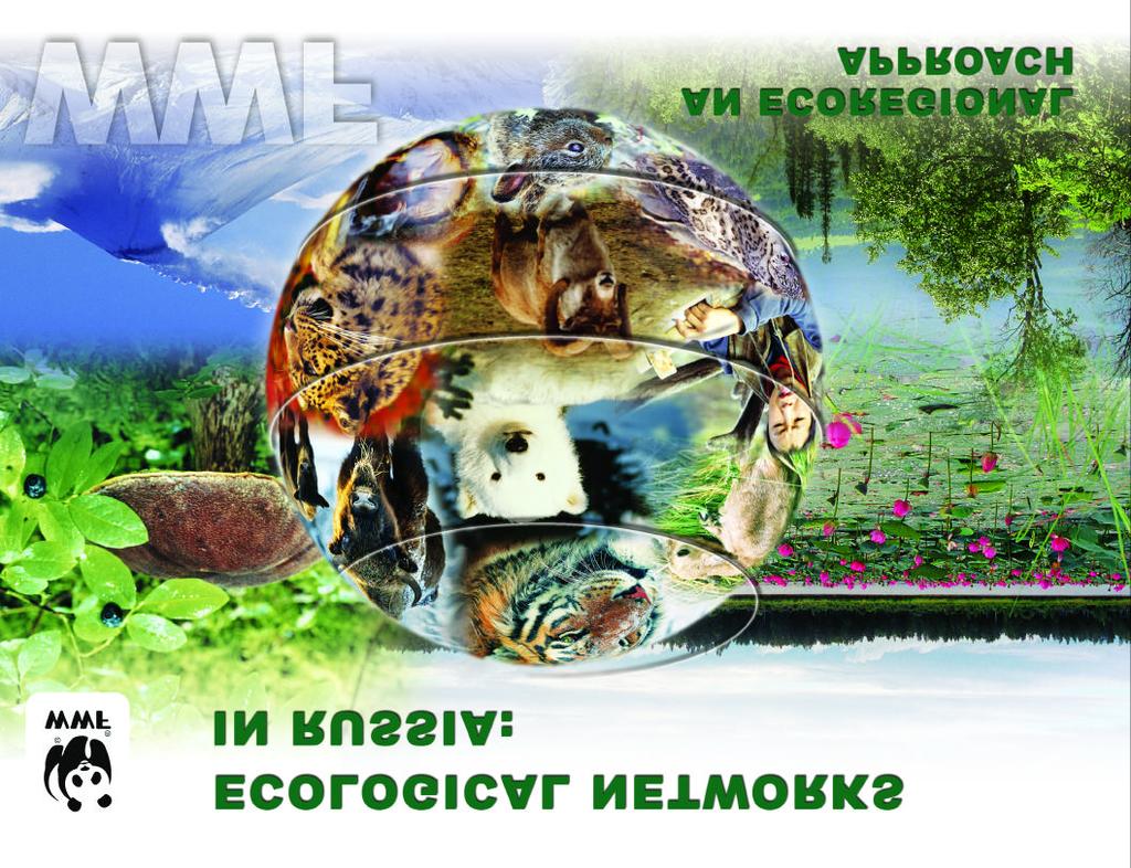
3 RUSSIA, AS THE BIGGEST COUNTRY IN THE WORLD, HAS AN INTERNATIONAL RESPONSIBILITY FOR PRESERVING BIOLOGICAL DIVERSITY Russia occupies 17,075,000 square kilometers (11,4% of the planet s land surface) Biodiversity in Russia includes: 120,000 rivers? about 2,000,000 lakes 8 biomes (polar deserts, arctic and sub-arctic tundra, forest-tundra, taiga, deciduous forests, steppe, partial deserts and deserts) 11,000 species of vascular plants 320 species of mammals 730 bird species 75 reptile species 30 amphibian species 269 species of fresh water fish and 400 species of marine fish 16 terrestrial and 4 marine Global 200 Ecoregion
4 Efforts to form a system of specially protected nature areas in Russia have been ongoing for more than 100 years. Russia s first modern nature reserve was founded in At present more than 15,000 specially protected nature areas of various sorts exist in Russia, occupying a total approximately 10% of the country s area. These protected areas helped to save many unique species from extinction. Many protected areas provide environmental observation and monitoring for over sixty years. Over 60 protected areas in Russia have some sort of international status. The changing tide of socio-economic conditions at the close of the 20th century brought numerous challenges to Russia s system of protected areas. Nonetheless, it is with confidence that we can state that the system has not only been preserved, but has developed. A new legal foundation has been established, new methods for protecting natural complexes have been developed, and greater attention has been given to integrating protected areas into regional socio-economic context. In a number of Russian ecoregions, the process of forming ecological networks has already begun. These systems are based on scientifically established plans which include protected nature areas connected by ecological corridors to protect those areas and species that are of the greatest importance to preserving biodiversity. Such systems allow for in-situ biodiversity conservation and facilitate the maintenance of ecological balance in large areas. The development of ecological networks can be considered an ecological service that not only protects the environment, but also creates conditions for long term sustainable use of biodiversity resources. Creating econets will enable regional socio-economic development, increase ecological safety, and support the welfare of the local population. Russia s networks of protected nature areas are a significant advancement in the effort to preserve the biological diversity of our planet. Individual elements of this system acts as links and support the unity of the Pan-European Ecological Network, the world s first continental ecological network. A. Amirkhanov Director Department of Specially Protected Nature Areas and Objects, and Biodiversity Conservation Ministry of Natural Resources of the Russian Federation Protected Areas in Russia The total area of specially protected nature areas (SPNAs) in Russia is about 140 million hectares (7.6% of the country s total area). Thirty protected areas also have the status of biosphere reserves, 28 are on the Ramsar list and 19 are listed as World Heritage Sites. Protected area category Area according to Russian IUCN Number total, ha % of legislation country area zapovedniks (state strict nature reserve) Ia ,56 national parks II ,41 federal nature reserves IV ,73 regional nature parks II ,77 regional nature reserves IV ,97 nature monuments III ,14 The largest protected area, Great Arctic Zapovednik, measures 4,200,000 hectares, while the smallest covers only a few hundred hectares. Legislative Groundwork and Protected Areas Administration in Russia The 1995 federal law «On Specially Protected Nature Areas,» along with regional laws and regulations, govern the operation of protected areas in Russia. Federal legislation distinguishes seven categories of SPNAs, designating regulations for their establishment, protection and use; the Russian Federation s 89 administrative regions (similar to Canadian provinces or American states) have the right to introduce their own categories of SPNAs. Although other protected areas may operate under land, water, forest and wildlife legislation and have 1
5 special regimes designating resource use, they are not regarded as SPNAs. Russia s SPNAs fall under the authority of the following ministries: The Ministry of Natural Resources of the Russian Federation (zapovedniks, national parks, some federal nature reserves and natural monuments) and its regional substructures; The Ministry of Agriculture of the Russian Federation (some federal nature reserves) and its regional substructures (regional nature reserves). Some federal SPNA are under the authority of the Russian Academy of Sciences. Regional protected areas are managed by regional executive bodies, and local protected areas by local (municipal) administrations. Developing Protected Areas in Russia: WWF s Contribution Protected areas have been a key focus of WWF s program for conserving biological diversity ever since the organization began. The major areas of its work include: developing a legislative, economic, theoretical and methodological foundation for creating and managing systems of SPNAs; establishing new SPNAs and supporting those already in existence; offering professional training for the employees of SPNAs; seeking ways to balance the objectives of environmental protectionand sustainable regional development while respecting the interests of the local population; advocating in-situ biodiversity conservation. Between 1994 and 2003 WWF-Russia aided in a number of important conservation initiatives: creating more than 30 million hectares of new SPNAs, which increased the total area of SPNAs in Russia by 20% and doubled the area protected in the Arctic; conducting assessments of management in all of the federal SPNAs and a portion of the regional SPNAs; setting aside more than $2 million to support existing SPNAs; founding the National Environmental Education Center «Zapovedniks»; training the head administrators of protected areas and specialists in regional environmental conservation bodies in the development and management of SPNAs; and developing and publishing literature on these themes; developing federal and regional laws and regulations to improve the establishment and management of regional SPNAs; writing the Concept of Ecological Networks in the Russian Federation and developing a methodology for planning econets. From Islands to Networks Building Econets in Russia The idea of ecological networks in Russia is not new. The basic tenets of an approach to territory-based nature conservation were proposed and developed in the USSR back in the 1970s and 1980s. More recently, as people have expounded the idea of creating ecological networks of nature areas of differing status and land use regimes (including SPNAs and other areas with specific restrictions on the use of nature), interest in econets has been renewed. This approach has particular significance in Russia because of the country s great natural, economic and cultural diversity. Russia is a large, federated state where environmental protection mechanisms (including SPNAs) are based on division of authority between the federal center and the administrative regions. Russia currently has a number of favorable conditions for the development of econets: a significant portion of natural areas (over 50% of the nation s total area) have retained the ability for natural self-regulation or can be easily restored to this state; in the majority of Russia s regions, landscape fragmentation has not reached critical levels; large intact areas exist which can preserve dominant types of ecosystems; 2

6 environmental protection has a long history in Russia, with great stores of knowledge and long-standing traditions in the theory and practice of nature conservation; a network of specially protected nature areas already exists and there are a number of other areas with land use regulations; a legal framework exists to govern environmental protection and use of natural resources (including in protected areas) which allows protected areas of different categories. At the same time, the new political, economic and social conditions that have arisen in Russia since 1991 demand new approaches to the long-term development of systems of protected areas. First and foremost, these areas should fulfill the following two functions: conserving biological diversity in-situ and maintaining ecological balance in Russia and Northern Eurasia as a whole; investing in the sustainable use of biodiversity resources in neighboring areas and integration into regional socio-economic spheres. WWF Russia / Sergey Trepet In order to fulfill these functions, new methods for territorial nature conservation must be developed: the most effective may be promoting econets. In cases where it is not economically profitable for society to restore and artificially sustain natural processes, a more effective strategy is to allow nature itself to do this work itself. Enabling existing natural systems to become self-regulating is a goal of ecological networks. In Russia, a fundamental change in property rights to natural resources and a focus on raw materials economy pose significant threats to sustaining a high level of biodiversity. New methods are required to protect this biodiversity. Russia must move towards a system of interlocking natural areas with varied regulations for protection and use of natural resources. The Russian Federation is an active participant in international developments in the field of biodiversity conservation, which includes participation in the Pan-European Biological and Landscape Diversity Strategy (signed by ministers of the environment of 54 European countries in 1995). The most vital component of the Strategy is creating a Pan-European ecological network. The system of protected areas in Russia should be considered a component part of this ecological network and developed accordingly. Russia is also coordinating transborder econet development between itself and neighboring countries. Russia is prepared to maintain the ecological value and integrity of its own ecosystems, thereby providing an ecological service whose benefits will be felt around the world. Russia also counts on continued assistance from other countries in pursuit of this goal, and joins in international cooperation in territorial nature protection. These aims are based in the conviction that investing in protecting Russia s environment will benefit the ecology of the planet as a whole. Thus besides simply taking account government reforms in the areas of conservation and natural resource use, a single document is needed to formalize the process of establishing and managing a system of ecological networks in Russia. This document is the Concept of Ecological Networks in the Russian Federation. 3
7 4 The Concept of Ecological Networks in the Russian Federation WWF Russia began preparing its Concept of Ecological Networks in the Russian Federation (hereon, Concept)in The Concept is based on current legislation in Russia, current scientific knowledge, and international documents on the development of ecological networks (econets), biosphere reserves, and biological diversity conservation. Between 1999 and 2000 drafts of the Concept and related materials were discussed at numerous workshops included the following groups: government nature conservation authorities (federal and regional), SPNA administrative bodies, scientific institutions, environmental non-governmental organizations. In 1999, in the course of working on the Concept, a sociological survey and subsequent study entitled Problems and Perspectives for Developing a System of Protected Natural Territories were conducted. The survey questionnaire included 17 questions on various aspects of the maintenance, protection, and management of protected areas. Four hundred questionnaires were sent out together with copies of the Concept draft. The 200 responses that were received led to significant additions to the text. The final draft of the Concept was sent to the Ministry of Natural Resources of the Russian Federation in 2002, and is currently under consideration to become a national strategy for developing ecological networks. The Concept introduces terminology in econet development that is new to Russia. This terminology mixes internationally accepted practices with the contemporary legal base and traditions of Russian nature conservation science. The Concept also introduces an idea that is new to Russia: planning econets based not on administrative but natural boundaries and on the scale of large natural regions called ecoregions. This Concept focuses on in-situ biodiversity conservation for large areas while simultaneously maintaining ecological balance and setting up the prerequisites for sustainable use of natural resources in neighboring areas. Because ecoregions serve as elements of the biosphere s natural structure, they provide the optimal scale for planning and developing econets. The Ecoregion-Based Approach in Econet Planning Ecoregion-based conservation (EBRC) provides a framework for identifying landscapes that are representative of a region s natural biodiversity. The fundamental unit in this framework is the ecoregion. An ecoregion is defined as «a relatively large parcel of land or water that harbors a characteristic set of species, communities, dynamics, and environmental conditions» (Dinerstein et al. 2000). Ecoregions are used as the basis for planning and designing larger conservation landscapes and protected area systems with a regional perspective. Ecoregions transcend administrative boundaries to represent units with meaningful biological boundaries. The goal of ERBC is to ensure long-term conservation of representative biodiversity. The advantages of targeting the ecoregion-level for conservation include the following: the fate of natural ecosystems, endangered species, and people can be addressed across political boundaries; more meaningful goals for biodiversity conservation and socio-economic welfare for people in the entire region can be set; conservation results that are ecologically viable become more attainable (e.g. by setting aside networks of key protected areas, creating migration corridors for particular species, and preserving ecological processes at scales large enough to maintain natural biodiversity).
8 The Concept Objectives The Concept of Ecological Networks in the Russian Federation: is a set of approaches to forming and developing territorial biodiversity conservation in Russia through sustainable, functioning econets; defines basic precepts, principles, and strategic objectives and mechanisms for establishing econets, thereby creating a foundation for planning and making administrative decisions about the establishment of ecological networks; is aimed at the unification and further development of both new and time-tested principles for territorial biodiversity conservation of with the goal of integrating these principles into economic practices and civil society. The Main Objectives of the Concept include: defining the principles and mechanisms for creating ecological networks; identifying principles for econet management; establishing a strategy and action plan as a foundation for creating and managing econets in the country s current stage of development. Regional strategies based on action plans for developing econets and their component parts should be developed in accordance with this Concept. The provisions of the Concept should be taken into consideration during: the drafting of legal and other documents dealing with environmental protection management; territorial planning for general and specific aspects of regional socio-economic development; territorial planning and decision-making relating to environmental protection and use of natural resources. Objectives and Purposes of Ecological Networks Econets are created to maintain the environmental potential of natural territories in order to meet the following goals: maintaining ecological balance and protecting ecological processes at a regional level; protecting biological and landscape diversity and our natural heritage; restoring renewable natural resources and providing for their sustainable use; preserving unique and valuable areas; offering ecological education; monitoring the environment and producing information that enables long-term, sustainable use of the environment; creating recreational areas for human comfort; providing a balance between protecting biodiversity and providing for economic development of regions. Principles of Planning, Developing and Managing Ecological Networks Planning, creating and managing econets are guided by the following principles: Representativeness. An econet should adequately represent the natural biological and landscape diversity of a given territory. Self-sufficiency (ecological sustainability). An econet s structure (location, size and component parts) should enable it to function normally in the long term, and with consideration of potential economical development. Hierarchy. Large econets will be sustainable on the ecoregional level if small econets are first independently effective in nature conservation on the local level. Diversity among econet elements. In order to serve its multiple purposes, econets should be made up of areas with differing conservation regimes and varying land use. 5
9 6 Social effectiveness. An econet should provide the ecological conditions necessary for the region s sustainable socio-economic development. Legal foundation. Legislation is being designed with the specific purpose of facilitating the planning and management of econets. Established regulations must govern the designation of areas to be included into econets and subsequent changes to these plans. Coordinated planning of econets and specific designation of responsibilities for their creation and management.decisions relating to the planning and establishing of econets, especially given the interconnectedness of their many component parts (which fall into different spheres of administrative responsibility), should be made in a coordinated fashion. Multiple sources of funding. The first priority in financing econets should be to minimize their start-up and maintenance costs. Additional means of funding should be sought from outside sources, including the private sector, in a number of ways: providing services related to functioning of econets, collecting rent and other payments for use of natural resources in econets. Structure of Ecological Networks There are two types of areas to be included into econets: specially protected natural areas (SPNA) of federal, regional and local status. These areas are created and managed in accordance with federal and regional legal provisions relating to specially protected natural areas; other protected areas with specific land use and conservation regimes are governed in accordance with forest, land, water and wildlife legislation. Elements of Ecological Networks For an econet to be successful, its component parts and functions should include the following elements: core areas are large SPNAs, capable of supporting ecological balance and preserving a natural level of biological and landscape diversity. Core areas include animal habitats and landscapes of high importance to nature conservation, specifically: representative natural and semi-natural (modified by human activity) ecosystems; self-sustaining populations of species, including rare species and other species that are of particular concern; areas that provide environmental support services; representative landscapes that are particularly valuable, typical or unique. Core area management aims at the long-term conservation of natural landscapes and processes within an area s given borders. transit areas (ecological corridors) are areas that link core areas and have specific regulations for nature management. Transit areas ensure: sustainable links between species populations and between habitats of sufficient size; access to breeding and wintering grounds for migratory species; possibility for genetic exchange among populations; geochemical cycles and processes that sustain the balance of the landscape. Transit areas (ecological corridors) can be made up of connected or fragmented areas that together comprise a connected ecological space. As long as geographical conditions are taken into consideration, territories of many different types can be used as transit areas. buffer zones are areas that protect both core areas and transit areas from outside interference. Buffer zones: protect core areas and transit areas from negative outside interference; enlarge the total acreage of core areas and transit areas, making them the optimal size for carrying out their objectives. Specific land use regulations are established for every buffer zone, taking into consideration the specific natural and social-economic factors of the given area.
10 Planning an Ecological Network One econet that provides for the long-term maintenance of ecological balance by conserving key natural elements should be established in every ecoregion. Planning econets should occur within contexts that already existing, and should take into consideration both the current state of the environment and future socio-economic development. An ecoregional econet s plan (demarcation and development) should be approved by the appropriate federal environmental agency. Parts of the econet that fall under the jurisdiction of particular administrative regions of the Russian Federation should be approved by the appropriate regional government bodies. Plans for econets must take into consideration of the natural landscapes of the ecoregion (or parts of the ecoregion) and should include the following minimum standards: in regions with intact landscapes and little threat of damage to the ecosystem: 1) SPNAs should be organized protect all core areas; 2) land for transit areas should be reserved to avoid the negative side effects of potential economic development; in regions with intact landscapes and a gradual rise in human impact (including increases in human population and economic development): all essential elements of the econet should be identified and placed under protection (regulations on land use should be established); in regions where the natural landscapes have been significantly damaged: 1) any remaining elements of the natural structure should be identified and placed under protection; 2) plans should be undertaken to restore damaged elements. When identifying natural areas in need of special nature management and protective regulations, as well as assessing the condition of natural landscapes, due consideration should be given to the natural zoning of the ecoregion: natural biological and landscape diversity, including the spatial distribution of the most important elements; major areas of current and perspective economic development in the region; features of current nature management and potential for these features to change; the local history of nature conservation, including existing protected areas. When planning econets within the borders of an ecoregion, the following issues should be considered: the necessity of national or international reserves that provide ecological links between ecoregions (e.g. transcontinental flyways stopovers, transecoregional basins) and thereby guaranteeing econet integrity at the national and international levels; activities in neighboring administrative regions that compromise de facto uncoordinated development of econets. Designing Ecological Networks Designing a particular econet should include the following steps: identifying and mapping the natural landscape structure of the territory; identifying and mapping rare and especially valuable natural objects and ecosystems; taking an inventory of the existing protected areas in the ecoregion; identifying and mapping areas that meet ecological criteria for core areas, transit areas and buffer zones but are as of yet unprotected; compiling and receiving necessary approval for econet plans which inter alia include information on suggested elements of the econet, volume, costs and descriptions of the work necessary to create them; receiving necessary approval to reserve tracts of land and water to found protected areas in the future; conducting survey work needed to create protected areas; receiving approval for the creation of new protected areas from the appropriate government bodies and local administrations; 7
11 8 introducing special land use regulations; integrating the necessary nature conservation restrictions into socio-economic development, land use management, forest management and game management planning as well as to urban planning documents; collecting and publishing the necessary maps and other information on the location, structure, and specific details of econets and their elements. In federated countries like Russia, where protected areas can have federal, regional or local status, exact legislative delineation of authority to plan, create and manage econets is especially important. Management of Ecological Networks An econet s long term functioning should aim to maintain natural processes and parameters that meet criteria for sustainability. Removing elements of an econet or loosening conservation regulations is allowable only in the extraordinary circumstances defined in legal acts, and only under the condition that the body responsible for the change gives adequate compensation. This compensation must allow the general parameters of the econet to remain the same. In all cases this change can be carried out only in accordance with existing legislation and positive environmental impact assessment reports. An econet should function using finances coming from various sources: state and local budgets of various levels (first of all to maintain SPNAs as core areas); funds received for services rendered relating to the econet (particularly through ecological education, recreation, ecological monitoring, conducting scientific studies, ecotourism, etc.), as well as for ecological services which need to be identified and valued in monetary terms; funds from non-governmental and other environmental organizations and program-specific projects for developing and maintaining elements of econets; funds from those who use, for recreation or other purposes, parts of econets. In order to make sure econets can play out their intended role, their operation should be regularly monitored and assessed. In order to carry out the ideas of this Concept, the general population must have an understanding of the importance of econets for preserving biodiversity and maintaining necessary conditions for using this biodiversity. To achieve this goal, the following measures are needed: society must be informed of the role and purpose of econets; a mechanism must be created to allow the public to participate in the planning and management of econets (including a system of public control); public initiatives and public participation in developing econets must be encouraged. Making the Concept a Reality To create an econet based on already existing network of different categories of protected areas, a number of overlapping mechanisms are necessary, including: Legal, including inter alia: introducing the concept of an «ecological network» into the legal vocabulary; establishing land use regulations for all econet elements; developing mechanisms for managing econets (bearing in mind that different elements of the econet may fall under the jurisdiction of different administrative and sectoral authorities); formalizing administrative and criminal responsibility for harming econets or their component parts; developing a mechanism for listing the status of areas/bodies of water that are part of econets with related nature management regimes in land cadastre and through sectoral regulations;

12 recognizing the necessity of conducting environmental impact assessments in the case of suggested reductions in area, changing of borders and/or demotion of the status of econet elements; defining a list of conditions and cases for removal of lands from econets and changing protection regulations of econet elements. Scientific, including inter alia: developing methods of planning econets, including making maps for possible econets and mapping out component parts of econets; developing methods for monitoring the condition of econets and their component parts; developing methods for assessment of the capability of ecological systems to be self-regulating; implementing methods for assessing econets functioning efficacy. Organizational, including inter alia: producing maps of possible locations for econets within entire ecoregions and within individual administrative borders; facilitating agreements between administrative regions that share one ecoregion on joint action to create and manage econets based on a uniform set of requirements; propagating the practice of developing management plans for econets at the ecoregional level; conducting observations of existing protected areas with the goal of assessing their condition, enforcing regulations, and making sure they are still carrying out their functions within the econet; designating new econet component parts at the ground level; strengthening governmental and public control over the state of natural ecosystems and enforcement of the land use regimes of the econet s elements. Economic, including inter alia: developing standards for economic assessment of econets, their component parts and services which they porvide; developing a mechanism to compensate those whose interests are encroached upon during creation of econets, as well as compensating econets when their structure or earlier established protection regulations and nature management rules are changed; exempting from land fees those land owners or users whose lands are included in econet and who follow all requirements of established regulations for protection and land use; integrating econets into regional development plans as integral component parts of the economy. Social, including inter alia: drawing interested parties into the decision making process at the econet formation stage; creating institutions for training managers to work in econet administration and development; developing and propagating a mechanism for involving the public in econet management; developing and propagating a means of encouraging local communities and land users to take part in maintaining econets and their component parts. WWF Russia / Victor Lukarevsky 9
13 Methodology for Planning Ecoregional Econet Development Methodological approaches towards the planning of ecological networks at the ecoregional level must be developed to implement of the designed Concept. The approaches, typical for Western Europe and based on the inventory and protection of landscapes (the latter retaining their natural structure), are not believed to be fully applicable in Russia, where extensive areas still remain untouched or slightly affected by human impact. The use of remote data (satellite images) and relevant maps allows one to approach the entire study area at the same time, which in turn enables the identification of protected natural areas as a single integral system. The major analytical approaches are based on generally accepted statements about biological diversity dependent upon variety of habitats, possibility of intrapopulational breeding, etc. Conservation the natural diversity of species, communities, habitats, as well as maintaining their relationships, requires the creation of a hierarchically organized network of areas. In turn, accomplishing this task implies the subordination and specific spatial conjugation of its discrete elements, ensuring representation of every level of biological and landscape diversity. The proposed method of creating ecological networks will guarantee the solution of the majority of the aforementioned problems. The Initial Materials The initial materials for projecting elements of the ecological networks are digitized elevation maps scaled from 1:200,000 to 1:1,000,000 m (See Fig. I-1) to be converted into 3D raster images for further analysis (Fig. I-2), and satellite images with a pixel resolution of m (Fig. II-1). The map scale and satellite image resolution are determined separately for each region depending upon its size and the complexity of its relief. To this end, maps are used that show the distribution of especially valuable species and natural complexes, existing protected areas, plans for the socio-economic development of the regions, etc. The Main Stages of the Ecological Networks Outline Creation In general, the process of the ecological network outline creation can be divided into three constituents: relief analysis (Block I), satellite image analysis (Block II) and synthesis of the results of processing satellite images, relief, maps of socio-economic development and distribution of biological diversity throughout the region (Block III). The analysis of the first and second components (relief and satellite image) can be categorized into the three main stages as follows: 1 - determining the major hierarchical levels of the area organization; 2 - uncovering hotspots of diversity, homogeneity and crucial types of habitats; 3 - uncovering independent spatial structures: ecological corridors and cores. Blocks I-II. Elevation and Satellite Image Analysis Stage 1: Identification of the Major Hierarchical Levels of the Area Organization Hierarchy means inclusion of one minor system as a part into a larger one, uniting numerous smaller parts into the conventional entity. It always implies the existence structure in space and time called the «order.» The term «order» implies that the properties of nature at neighboring points of space, to some extent, interrelate and define each other or correlate. The presence of such spatial links allows the possibility of establishing relatively homogeneous structural levels in nature. Each of them is associated with the spatial relationships of species populations adapted to existence within a given area, variety of habitats, and protected areas with appropriate linear sizes. The revelation of such hierarchical levels using satellite images and digital elevation models follows the same method. Diversity and homogeneity, revealing of significance, subordination, and the area of elements of an ecological network are assessed according to strict 10
14 dependence upon results of the established hierarchical levels. The number of relevant hierarchical levels for the regions analyzed by us varies from 2 to 5. There are three such hierarchical levels on the diagram offered (Fig. I-3-5, I-6-8, II-2-4). They correspond to elements of an ecological network with linear sizes: the first level - 5 km, the second level - 9 km, and the third level - 20 km. Stage 2: Determination of Hotspots of Diversity, Homogeneity and Crucial Types of Habitats Diversity of habitats is the most important criterion for selection of protected areas. Of particular relevance are areas with very high diversity or, on the contrary, with exclusively homogeneous compositions of their habitats. As noted above, diversity of habitats is assessed for the earlier established hierarchical levels of space organization (in our case their number totaling three), thus reflecting needs of various species and communities. In the given analysis several «landscape indexes» - applied in landscape ecology worldwide - are used: 1) generalized index of diversity integrating values of relative diversity, number of elementary contours, entropy, and dominance; 2) index of diversity of relationships; 3) index of fragmentation; 4) index of fractal dimensions - complexity grade; and 5) index of uniqueness. Using the entire spectrum of the indexes allows the possibility of identifying areas with different functional and structural traits at every hierarchical level (Fig. I-3-5, II-2-4). The map of habitat types is constructed based on an integrated analysis of all spectral channels of a satellite image. For this purpose the hierarchical procedure of a subsequent division of sets of habitats into paired classes, which allows the content of the identified classes to be strictly checked, and ultimately all classes appear mutually arranged according to their similarity with each other (Fig. II - 5-6). The final number of classes of habitats depends on the structural organization of an area. Thus, the resulting map of types of ground cover quite fully reflects their diversity at the regional level, provides an idea about their current distribution within space, and allows the most valuable ones among them to be identified (Fig. II - 5-6). Stage 3: Revealing of Independent Spatial Structures: Ecological Corridors and Cores. The diversity of spatially linked habitats of various hierarchical levels is stipulated by the effect of numerous factors, mainly related to the structure of relief. Elevation affects heat supply, transfer of moisture, and elements of mineral nutrition along with soil-forming rocks. In turn these factors create environmental diversity, determining specific combinations of species of plants, communities and ecosystems. It entails the formation of the hierarchical network of natural structures, including the linear ones, which perform the role of natural ecological corridors, well reflected through the relief and set of habitats. In order to identify corridors, points with minimum and maximum heights are found. If such points form the linear order at the surface, then they form the linear structure known as a corridor. The search procedure of such points within an image is performed for each hierarchical level (Fig. I-6-8). The first level allows one to identify the largest corridors playing a significant role at the regional level, while the second and third ones appear subordinated and are designed to allow the movement of minor animals and joining of ecosystems. The bases for assessing the ecological status of a corridor are its linear structure and its hierarchical level. Ecological core areas, the major element of ecological networks, are formed by overlaying the established corridors of various levels and trends onto one another (Fig. I-10). The ecological status of a core area is determined by the quantity and hierarchical status of the component corridors. Obviously, a core area formed by the intersection of several corridors of higher hierarchical levels indicates a more complicated area with greater connectedness with its neighbors, and therefore ought to have a higher conservation status. Block III. Integral Analysis of Results of Processing of Satellite Images, Relief, Maps of Socio-Economical Development and Distribution of Biological Diversity in the Region. For each core found at the intersection of corridors, the mean value of diversity according to the relief given in scores (Fig. I-9), the mean value of heterogeneity with the help of a satellite image, and the mean 11

15 12 value of homogeneity (Fig. II-7) are estimated. The quality of a node as a protected area is estimated as a sum of scores (Fig. III-1). As a result, each core is given comprehensive estimation of quality; and at the same time potentially valuable areas with very high values of integral quality based on landscape indexes, although not included into the system of the cores, are identified.

16 of the areas it includes can still be occupied by settlements or mining industries or have large reserves of proven deposits. Indirect criteria cannot exhaust all of the factors stipulating the conservation value of the area. Complimentary conservation elements can be selected according to direct criteria, like the previous ones being known areas of threatened species, migration pathways, unique natural objects, etc. Therefore, during the final stage, maps of the identified core areas and corridors (Fig. III-1) are added together with data on anthropogenic pressure of the region: (Fig. III-2) settlements, railways and roads, pipelines, etc., which allow discrete objects of an ecological network to be excluded and adjusted. Further, data on biological diversity collected indirectly within the region are added (Fig. III-3), which ensures inclusion of all valuable items not displayed in satellite images and elevation maps, such as rare species, valuable and unique natural landscapes, etc. As a result, the identification of every element of an ecological network is maintained with the use of all types of criteria, and the integral quality of each is assessed. In this way, the foundation for selecting elements of ecological networks is laid, proceeding from parameters of the entire region (See Fig. III-4). The obtained system should by no means be overestimated. Constructed on the base of indirect traits, it registers only areas more likely to be optimal for conservation purposes. For example, a portion 13

17 14 Ecoregional Econets: Selected Case Studies

18 WWF focused its work on econet development in several ecorigions in Russia and Central Asia. All these ecoregions are recognized as the centers of biodiversity concentration. The choice for particular ecoregion was based not only on the level of biological diversity but also to cover areas with different types of ecosystems, and different levels of natural landscape structure modification resulted in various degree of economic activities and history of socio-economic development. Most of selected ecoregions are characterized by high level of cultural diversity with a substantial share of traditional land use practiced by local indigenous communities. In most cases creating the econet was based on unified methodological approach following methodology described above. The key factor to enable successful development of the econet concepts and particular econet planning in every ecoregion is political support of regional, and local administrations and local population. To achieve this goal the following tools were used depending on peculiarities of each ecoregion: declarations of governors to develop the system of protected areas and to allocate additional land and resources for this purpose; framework ecoregional declarations (e.g. Altay-Sayan Millennium Initiative) and agreements on cooperation on biodiversity conservation and econet development; governor s decrees to establish system of protected areas and specific SPNAs; development of federal and regional legislation (e.g. special econet law in Orel oblast) in support to the development and sustainable management of protected areas and econets; establishment of interregional biodiversity councils and boards; advocating conservation and socio-economic role of econets for regional economy and local communities; public awareness campaigns and environmental education programs. 15

19 16 Russian Far East Ecoregion The Russian Far East Ecoregion (RFE) covers a total area of 1.35 million km 2, or one percent of the Earth s land surface. The largely unaltered forest and freshwater ecosystems in the southern part of Russia s Far East play an important role in conserving the Earth s biodiversity. The region still contains large areas of intact habitats where environmental processes, such as predator-prey relations, seasonal migrations, and large-scale natural flooding regimes, fluctuate within natural regime. Ecoregion Biodiversity Overview High levels of landscape diversity in the RFE are largely the result of altitudinal variation and zonal variability, which create numerous biogeographic regions. Having a unique geographical location - on the brim of the vast Eurasian continent abutting the Pacific Ocean - the RFE is subject to the combined effects of monsoon climate, oceanic currents, and mountains that change air circulation patterns. Numerous mountain chains separated by lush valleys permit a variety of different microclimate, soil, and vegetative conditions. In turn, these conditions have created a broad range of landscapes and unusually high levels of species diversity for the Temperate Zone. There are 2,800 species of vascular plants in the RFE, of which nearly a third are endemics. Nearly 15% of the total number are endangered, and onethird are relics. «Living fossils» such as Komarov Lotus, Water Shield, and Gorgon Plant grow in the Amur River Valley at the northern tip of their ranges. Four percent of the world s 1,300 lilies are found in the RFE. More than 100 species of fish inhabit the freshwaters of the RFE, including a number of native species such as the Kaluga Stugeon, which can weigh up to 1,000 kg. Twenty-three amphibians and reptiles are found here, such as the endangered and endemic Amur River Turtle. Of the 400 birds in the RFE, 250 nest here and 27 are rare and endangered. The Amur Valley is the last remaining nesting habitat for 95% of the world population of oriental white storks, 65% of redcrowned cranes, and 50% of white-naped cranes. Ninety species of mammals are found in the RFE, including 95% of the total world population of the notable and highly endangered Amur tiger and Amur leopard.
20 The Current Status of the Protected Areas The current protected areas system in the RFE consists of a variety of areas with various forms of conservation regimes (altogether they cover 7.68% of the ecoregion s area), which are not managed with a unified approach. Several protected areas in the RFE have international status: two are world natural heritage sites; five are Ramsar sites; one is biosphere reserve. Protected Areas in the RFE: 16 zapovedniks (IUCN I) cover 2.9 million ha (2.1% of the RFE); 72 federal (IUCN III) and regional (IUCN IV) game and landscape refuges cover 7.31 million ha (5.4% of the RFE); several hundred natural monuments (IUCN IV) protect local natural objects; the first ecological corridor was created in Khabarovsky region (34,300 ha); three national parks (IUCN I) were approved on the provincial level and are under consideration in Russian Government (together 616,700 ha). WWF has supported the creation of two new zapovedniks, two national parks, two federal wildlife refuges, and 18 local wildlife refuges with a total area of 3.4 million ha. Development of the Far East Ecoregional Econet To ensure a positive political climate in the RFE, WWF-Russia has been using the Gifts to the Earth campaign as a tool to speed up the process of creating ecological network in the region: the Governor of the Khabarovsky region declared his intention to establish 7.9 million ha of new protected areas in 1997; the Governor of the Amurskaya region promised to enlarge the system of protected areas to 10% of the region s total area and in 2002 signed decrees on establishing 7 reserves totaling more than 1 million ha. Political Support of Econet Development in the RFE WWF prepared a special programs to develop protected areas in the administrative regions of the RFE: in the Amurskaya region to create 40 new nature reserves (total 2.04 million ha) in five years approved by the regional parliament in 2002 with allocation of funds from the regional budget; in Khabarovsky region to establish 75 new nature reserves (total over 1.76 million ha) approved by the Interagency Commission on Biodiversity Conservation; in Primorsky region documents for developing a protected areas system (including the Tiger Econet) have been approved. In Jewish Autonomous region, WWF has been funding a study to evaluate the existing system of protected areas and prepare recommendations for future development programs. Econet development programs were considered at an RFE Ecoregional Council that includes all stakeholders. Creating econets became a priority of the Ecoregional Conservation Action Plan, which was approved by eight leading NGOs of the RFE. The proposed econet will cover more than 6 million hectares. The next step in territorial protection of biodiversity will be planning and implementing local econets as a means of ecological zoning for entire river basins. A number of efforts have invested in the development of international pieces of the ecoregional econet: to create a Russian-Chinese transboundary Leopard Econet (to link existing protected areas in the habitats of the Amur leopard); to establish a Russian-Chinese transboundary ecological corridor for the Amur tiger; to provide ecological corridors in the Amur River floodplains in Russia, China and Mongolia (the Amur Green Belt program as a part of the Integrated River Basin Management Initiative). 17
 is located here as well.")
21 Altay-Sayan Mountains mountainous part of this ecoregion is the origin of two of the ten biggest rivers in the world, the Ob and Yenisei, whose basins are over 5.5 million km 2. The highest peak of Siberia, Mt. Belukha (4506 meters) is located here as well. Ecoregion Biodiversity Overview 18 The Altai-Sayan Ecoregion is located in the center of Eurasia and covers an area of 1,065,000 km 2. The ecoregion lies in four countries: 62% of it falls within Russian borders, 29% is in Mongolia, 5% belongs to Kazakhstan and 4% is Chinese territory. It is characterized by combinations of mountain ecosystems and intermountain depressions that include tundra, forest, steppe, and desert biomes. The Forests occupy roughly half of all the territory (the world s largest undamaged stands of the famous Siberian pine (Pinus sibirica) and black taiga made up of Siberian fir (Abies sibirica)); steppes, located mostly in depressions and on southern mountain slopes, make up 24%; mountain tundra covers 16% of the total area; 6% is alpine and sub-alpine meadows; deserts ecosystems are only 4% of the ecoregion. The Russian and Kazakh tracts are comprised predominantly of forest and alpine ecosystems, while in Mongolia and China the landscape is mostly desert. The Altai-Sayan ecoregion is one of the world s centers of plant diversity. Local flora includes over 600 species of moss, 1,200 lichens, and 3,726 species of vascular plants, of which 700 are rare or endangered and 317 endemic (for example, the steppe peony (Paeonia hybrida) and yellow mallow (Alcea froloviana)). The ecoregion is located at the confluence of the Central Asian and Siberian fauna zones. Fauna is represented in 691 vertebrate species, of which 39 species are endemic to the region (including Tetraogallus altaicus, Anthus spinoletta blakistoni, Crocidura sibirica, Castor fiber tuvinicus and others). The snow leopard and argali sheep are frequently viewed as being indicators of the health of the entire ecosystem. A significant number of species are in the Red Book of the Russian Federation and IUCN Red Book.

22 The global significance of the region s biodiversity was recognized in 1998 when five nature areas of the ecoregion (in the Republic of Altai, Russia) were added to the list of World Natural Heritage Sites. The region is also remarkable for its cultural diversity (around 20 nationalities live here, including small native ethnic groups that still practice traditional land use) and religious diversity (Buddhism, Christianity, Islam, and traditional religions such as shamanism). The Current Status of Protected Areas Specially protected nature areas in the Altai-Sayan Ecoregion cover 116,000 km 2, which is 10.2% of the region s total area. They include 15 zapovedniks, 9 national parks, 4 natural parks, 62 nature reserves and more than 200 natural monuments. Econet Planning In 1998 WWF began planning for an econet for the entire Altai-Sayan ecoregion with the following stages: econet planning based on satellite images, and deciphering and developing background cartographic materials; field verification of these results to define locations and borders of territories suggested as elements for the econet; bringing suggested protected areas and other areas with regulated land use regimes together under a common system. The general plan for the econet was prepared with core areas and ecological corridors ranked according to their sizes and the features of the landscape. Perspective protected areas were set at points of intersection of corridors in areas with high levels of diversity. While planning the econet, ecological corridors were chosen in such a way as to enable free migration between core areas. These corridors frequently form a system of adjacent fragments of landscapes that are favorable for migration, which combine to provide links between core areas. The resulting design for the econet requires the establishment of 123 protected areas or areas with a special regime of land use whose total area covers 12.7 million hectares. With this addition, the total acreage of protected areas will reach 23% of the ecoregion s area. This will provide in-situ conservation of up to 95% of the ecoregion biodiversity. To implement the developed econet plan WWF has facilitated the creation of 19,900 km 2 of protected areas in the ecoregion, including 5,300 km 2 in Russia, 8,200 km 2 in Mongolia, and 6,400 km 2 in Kazakhstan. Currently another two nature parks (3,900 km 2 ) and four protected areas of other status (4,000 km 2 ) are being planned. A feasibility study is being conducting with the active participation of local communities to investigate possibility of creating two natural parks, Ukok and Lake Telets, in areas already designated as World Heritage Sites (to upgrade the status of existing regional protected areas). WWF founded theassociation of Zapovedniks and National Parks of the Altai-Sayan Ecoregion. This Association of more than twenty members brings together not only SPNA of different status but also some local environmental organizations. The principle goal of the association is to coordinate efforts of all stakeholders to preserve biodiversity of the ecoregion through development and maintenance of a system of protected areas. In the ecoregion as a whole (all four countries) there is no common government body that can approve the suggested ecoregional plan. For this reason, the plan has been approved by individual regional administrations in Russia and Kazakhstan after consultations with experts and stakeholders. In Mongolia the proposed plan corresponds to adopted plans for creating a system of protected areas. WWF/Klein & Hubert 19

23 Ural Mountains Ecoregion Biodiversity Overview The Southern Urals are made up of a medium and low-altitude mountain ranges of north-south orientation divided by deep river valleys. There is a high level of climatic, soil and fauna variation due to altitude differences as well as latitudinal difference. On the highest peaks of the Southern Urals (Ymantau mount 1640 m and Iremel mount 1586 m) above 1050 meters above sea level tundra and mountain meadows are common, and below that level fir taiga dominates. The forests of the Urals cuts deep into the steppe zone and coniferous forests. The flora of the Southern Urals includes more than 1,700 vascular plants. The Southern Urals has been free of Pleistocene ice cover and, therefore, relict plant species have been preserved here (56 species). Of the flora of the Southern Urals, 363 species of rare plants, making up 22.7% of total plant species, have been found. 20 The Ural Ecoregion covers an area of roughly 217,000 km 2 on the border between Europe and Asia. A number of geographical zones are represented in the region, from arctic tundra to steppe. The placement of the Ural mountains running from north to south and separating European and Asian flora and fauna creates a high level of biological diversity. Southern Ural is especially important for preservation of biodiversity in the Urals. In this area steppe, forest steppe, deciduous and fir forests and mountain tundra are found in an area of 93,000 km 2. Fauna are represented by 557 species of vertebrate animals, including 56 species of mammals, 250 species of birds, 10 reptiles, 8 amphibians and 28 fish species. This region provides outflow of animals to neighboring territories, which helps to maintain a high level of biological diversity in adjacent regions. The Current Status of the Protected Areas There are four strict nature reserves, three national parks and 180 other SPNAs of different categories on the territory of the Southern Ural Ecoregion with the total area of 550,000 hectares.

24 Econet Planning The president of Bashkortostan Republic M.Rakhimov announced within the framework of WWF s Gift to the Earth campaign plans to increase the area of protected areas by 1.9 million hectares, which would bring it to 16% of the republic s total territory. Therefore, one of the goals of WWF is to develop a scientifically proven plan for an econet in the ecoregion and create necessary conditions for its long term sustainable existence. Sustainable Use as a Contribution to Biodiversity Conservation The mountain-forest zone of the Southern Urals is a rural area with high levels of unemployment and poverty. Thus the logic behind the econet development project postulates that the basic principles of econet in the Republic of Bashkortostan will help improve the well-being of the local communities while preserve value of the region s biodiversity. Major emphasis is placed on socio-economic development of local communities by creating natural parks, which will open the door for activities such as ecological tourism, sustainable use of non-timber products, traditional beekeeping and production and selling of souvenirs. Concept a project to organize four nature parks in the Republic of Bashkortostan and three in neighboring Chelyabinsk region with a total area of 340,000 hectares was developed. Ecological Education To assist creation of econet in the Southern Urals special awareness and educational program was launched. This program includes training of government officials, SPNAs employees and propagation of ideas of nature preservation among local population living near SPNAs as well as to young people. Since 2000 training seminars, nature conservation knowledge exchange trips and children s ecological camps have been organized in Bashkortostan and Chelyanbinsk oblast. In the Southern Urals five children s Friends of WWF clubs formed a movement for environmental protection to propagate to the public the major ideas behind biodiversity preservation. All these activities resulted in growth of the econet support from society at large in the Southern Urals and increased degree of environmental responsibility shown by regional and local authorities. As a way to preserve unique natural complexes and to ensure implementation of SPNAs development plan the government of Bashkortostan ordered 191,000 hectares be reserved for further creation of SPNAs. Methodology for econet planning is based on data from satellite images and collating relevant cartographic data. Field verification was conducted to define the location and borders of areas with valuable biodiversity to be included into econet. During this process WWF actively cooperates with legislative and executive structures of the Republic of Bashkortostan, the scientific community and non-governmental organizations to improve regional environmental legislation (draft regulations on developing a system of protected nature areas and Concept for the System of Protected Areas of the Republic of Bashkortostan were developed). Based on this WWF Russia / Gennady Shalikov 21

25 Forest-Steppe Ecosystems of Central European Russia This ecoregion (90,000 km 2 ) falls within the borders of three administrative regions of Central European Russia, all of which have high population density and high level of development. The region represents two natural zones - forest and forest steppe - and is located on hilly and ravines area at the confluence of the Volga, Dnepr and Don river basins. Ecoregion Biodiversity Overview Broadleaf forest dominates while some southern taiga is also present. Remaining true steppe areas make up less than one percent of the area and are located near ravines and gullies. A continuous forest belt with stands of protected native forests stretches through the borders of Bryansk, Kaluga and Orel oblasts and partially spills over onto Ukraine. The total area of this unique and valuable natural area is over 420,000 hectares. The ecoregion s flora includes about 200 species of mosses and over 1,500 vascular species. The greatest species diversity (up to species per km 2 ) is observed on the steppe, although many species are rare because of high levels of human damage to the area. A significant number of species here have been listed to the Red Book of the Russian Federation and the IUCN Red Book, including the desman, bustard, black stork, white-tailed eagle, short-toed eagle, golden eagle, and osprey. A wild herd of European bison numbering around 90 animals is of particular interest. Work on acclimatization of bison has been conducted since 1994 at Orel Woodlands National Park. 22 In contrast to other ecoregions selected for econet development, this area s landscapes have undergone extensive anthropogenic modification.


26 Arable lands dominate in the land use structure of the region: arable lands spread from 30% in the northest to 70% in the south-east and rise to 80% in some districts of the Orel Region. Forests cover varies from only 7% in the southeast to more than 60% in the north west. The Current Status of the Protected Areas Currently protected areas in the ecoregion occupy around 420,000 hectares and include two zapovedniks, two national parks with large buffer zones and a network of federal and regional nature reserves. In 1993, at the initiative of the governor of Orel oblast, an Interregional Directorate was established with the responsibility of coordinating regional efforts to consolidate protected areas into a common interregional network that would provide habitats for the bison. Econet Planning Planning ecological networks in the ecoregion began in 1998 as part of a WWF project. Planning included the following stages: inventory of the natural potential of the territory and creating a GIS with information on the natural, social, demographic, and economic situation; field verification of results to determine exact locations and borders of areas recommended as econet elements; developing a plan for an ecological network based on existing natural areas; creating model areas for ecological networks; developing legal groundwork for ecological networks. In order to strengthen legal mechanisms in the area of landscape planning, the regional law On a System of Protected Nature Areaswas drafted. The law was adopted in June The law established processes for planning, founding, managing, protecting and using ecological networks, and also provides for the creation of a body responsible for developing ecological networks. Moreover, a plan for an ecological network in the Orel Region is being developed, which would serve as the foundation for landscape restoration. The ecological networks include core areas (areas with the greatest habitat and landscape diversity, and those located at junctions in animal migration routes) and ecological corridors (linear natural objects such as major forest beltways, river valleys, areas of ravine networks, etc.), ranked according to their size and landscape features. Planning ecological networks in densely populated areas requires a differentiated approach for designation of the sites to be included in econet, especially those with high economic potential. The conservation regime of these areas should fit with existing natural and socio-economic features of the area. Creation of central European ecological networks is currently a part of regional policy that is based on well-established methodological and legal foundations. The importance of such networks for both nature conservation and economic development is understood by the general population and government, which creates the needed conditions and interest to further develop econets. The current plan for ecological networks is the foundation for further development of a system of SPNAs. Within this framework, more than 15,000 hectares of land has been reserved in the Orel Region in for SPNAs. The econet development plan calls for creating 24 regional protected areas with a total area of over 100,000 hectares. In neighboring Ukraine, efforts have been largely focused on creating a system of transboundary protected areas in the Desna river basin. WWF Russia / Vladimir Filonov WWF Russia / Sergey Kischenko 23

27 24 Wetlands of Northern Kazakhstan With an area of more than 2.7 million hectares, Kazakhstan is one of the largest countries of the world. Its high level of plant and animal diversity is due to its wide range of landscapes - from forest steppes of the north to southern deserts; coastal areas on the Caspian Sea in the west to forests of the Altai mountains in the east, and its unique Tyan- Shan mountain ecosystem. The steppe zone, which globally can be considered an endangered biome, covers 44% of Kazakhstan s area. Ecoregion Biodiversity Overview The ecoregion includes natural and unaltered biotopes of steppe, relict pine forests and wetlands (river valleys and lakes) in northwestern Kazakhstan, which include the Turgai Steppe and Kazakh Rolling Hills. Lakes and other wetlands of the region are situated in the center of the most important intercontinental (Europe-Asia-Africa) flyway of waterfowl, and provide necessary living space for Asia s largest waterfowl population. This population includes such endangered species as the Siberian crane, red-breasted goose, and lesser white-fronted goose. The vegetation cover includes almost 600 species, representing more than half of all steppe flora, including rare steppe species. Of special interest are: 1) different types of steppe typical to Eurasia and only found in Kazakhstan, 2) pine forests extending deep into steppe zone and 3) riparian «Tugai» forests with the Russian olive and oriental clematis. This area is very important for the conservation of populations of rare birds of prey (the world s largest population of imperial eagles - more than 30 nesting pairs; stable populations of the Saker falcon, whitetailed eagle and golden eagle). The total number of nesting waterfowl in one season can reach 500,000 birds, including rare species like the roseate pelican, Dalmatian pelican, whooper swan, spoonbill, whiteheaded duck and black-headed gull. The Current Status of Protected Areas Before WWF started its project on wetlands econet development, protected areas in the region included Naurzumsky zapovednik (88,000 hectares) and Sarikopinsky preserve (51,000 hectares).
 in Central Asia.")
28 Five wetlands of the region have been included in the Ramsar list. The unique biodiversity of this region led the territory to be nominated as the first world natural heritage site (UNESCO is currently considering the nomination) in Central Asia. Development of the Wetlands Econet in the Northern Kazakhstan In 1999, WWF began work on planning an econet to include, first, zapovedniks as core areas, as well as protected areas of varying status. It was also to contain areas to be set aside for sustainable use. For this purpose detailed on-site study was carried out on more than 40 lakes. Unstable ecological conditions in the steppe ecosystem and periodic movement of wetland and swamp birds in relation to water levels creates significant difficulties in laying out prospective protected areas and including them in the econet. These unstable conditions require an econet based on a system of areas which should be multi-leveled and flexible enough to allow for the changing ecological conditions that result from different water levels. The strategy was to create a system of regulations for economic activities instead of creating of new protected areas with strict regimes. Regulations may include the following elements: prohibitions on plowing inclines in lake basins within 1000 meters of the water line; prohibitions on mowing grass or putting livestock out to pasture within 500 meters of the outer edge of reed plants during nesting season; prohibitions outboard motors and fish nets outside of specially reserved areas; a complete prohibition on human presence near important landing lakes (rest areas) during periods of massive flybys; prohibitions on constructing livestock farms on the banks of lakes and the rivers that feed them; maintaining a high level of stability in biodiversity of the most important wetland and swamp areas by allowing flood water to drain. Field research allowed the following developments took place: wetlands and areas in need of protection regulations have been identified; the area of Naurzumsky zapovednik (the core area of the econet) was increased by 100,000 hectares; the area of Sarikopinsky reserve was increased and its status upgraded; a number of lakes with one-kilometer wide buffer zones received the status of «quiet areas»; the hunting ban was extended to meter buffers for several important lakes; a program for ecotourism development (in particular bird watching) has been started in order to develop alternative sources of income for the local populations. There is already no possibility for creating of new high category protected areas. However, there is no need for such measures anyway, since the primary users of these areas, hunters and fishermen, recognize that in order to maintain these wetland and swamp areas and retain high populations of waterfowl, wise management is needed. This management should address creation of quiet areas as well as issues of irrigation and drainage. To provide for the effective operation of the wetlands econet, information must be constantly updated to maintain a flexible system for protecting key areas that adjust to changing ecological circumstances. This practice should allow conservation regimes to be adjusted in a way that makes it possible to combine the various interests of biodiversity conservation and sustainable use of biological resources in a manner that meets the needs of local communities. WWF Russia / Evgeniy Bragin 25
.")
29 Marine and Coastal Ecological Network in Russia Existing and proposed marine protected areas - existing strictly protected reserves and federal reserves with offshore parts; - zones of marine mammal protection; - proposed marine specially protected natural areas (MSPNL). 26
30 The Marine Ecoregions of Russia Russia has coastline along 12 seas as well as the landlocked Caspian Sea. The total area of territorial seas and exclusive economic zones is about 7 million km 2. Russia s continental shelf is around 5 million km 2. Russia s seas make up four ecoregions listed in the Global 200 list of ecoregions vital for maintaining biological diversity, namely: 1) the Northeastern Atlantic Shelf Ecoregion (Baltic Sea); 2) the Barents Ecoregion (the Barents, White and part of the Kara Seas); 3) the Bering-Chuckchi Marine Ecoregion (the Chukchi, Bering Seas and the Pacific Ocean to the east of the Kamchatka Peninsula); and 4) Sea of Okhotsk Ecoregion (the Okhotsk Sea and the Pacific Ocean to the east of the Kuril Islands). Ecoregions Biodiversity Overview The total number of species of plants and animals inhabiting Russia s seas is still unknown. In only the last 30 years, the number of known species in Russian seas has increased by 150%. The richest areas in this regard are the seas of the Far East, which have over 5,000 species of invertebrates. The largest amount of invertebrates live in the Sea of Japan; the smallest amount of diversity is found in the Sea of Azov. The fauna there is characterized by fewer species than the Black Sea, plus a small amount of fresh water species. The Caspian Sea is also not hugely rich in diversity, although around half of the species found there are endemic. A significant number of the species found in the seas of Russia are on the IUCN Red List (all the sturgeon species, the bowhead and gray whales, and others). Existing Marine Protected Areas The total area of marine areas with the status of specially protected nature areas is 91,000 km 2, which makes up about 1.8% of the Russian shelf. According to federal legislation, territorial seas and shelf are under exclusive federal jurisdiction. In other words, only federal protected areas may be established on those waters. The current network of marine and coastal protected areas consists of zapovedniks with marine parts or marine buffer zones(only the Commander Islands and the Far Eastern Marine Zapovedniks consist largely of marine areas), federal natural reserves, regional natural reserves, nature parks and natural monuments, marine mammal protection zones, and coastal Ramsar sites. Marine and coastal protected areas in marine ecoregions in Russia IUCN Bering Sea Okhotsk Sea Barents Sea category Ecoregion Ecoregion Ecoregion Federal strict nature reserves, including: Ia buffer zones III 3 Federal coastal nature reserves VI Marine mammals protection zones IV-V 9 12 Regional coastal nature reserves, including: IV with lagoons Nature Parks II 3 1 Natural Monuments, including: III 12 2 with lagoons 2 1 In Russia s possessions in the Baltic, Azov, and Black Seas, there are currently no marine protected areas. The overall size of existing marine protected areas in the Caspian Sea is 300 km 2. Planning Marine Ecological Networks There is currently no plan at the federal level for creating a marine ecological networks in Russia. The government s ten-year plan for developing zapovedniks and national parks, however, envisions creating a number of marine zones. 27


31 WWF Russia / Alexander Ratnikov WWF Russia / Alexander Ratnikov WWF-Russia developed the following set of criteria for setting aside marine protected areas and marine econets: representativeness, uniqueness of natural features, species diversity and rarity of biotas, biological productivity of marine ecosystems and support for natural ecosystem processes, role played in economic activity and early warning of technological catastrophes, social and cultural significance. An appraisal of these criteria led to WWF s formulation of the following suggestions for priority actions to create ecological networks in marine ecoregions (suggestions relating to the Baltic Sea, Azov- Black Sea basin and Caspian Sea were not considered, as these areas require international cooperation): WWF Russia / Alexander Ratnikov Barents Sea Ecoregion: increasing marine protected areas in shallow water ecosystems, wetland and swamps of the Onezhsk Gulf of the White Sea; protecting the Russian Arctic, with its ecosystems of fjords and bird colonies on Novaya Zemlya; zoning and granting protected status to waters of the Solovetsk Archipelago (in the White Sea), with its breeding grounds for beluga whales and tern colonies; regulating tourism and restricting human presence in areas of reproduction for marine seabirds and marine mammals in the While Sea and on Novaya Zemlya; protecting several fjords and coastal inlets along the Murmansk and Tersk shorelines on the Kola Peninsula, with its eelgrass at the edge of its range and areas that eiders use for hibernation; introducing prohibitions on the use of sea bottom catch equipment in the Murmansk and Gusin shoals to set sea bottom protected zones; giving protected status to the Czech Inlet (in the Sea of Pechorsk), with its sea bottom biocenosis of temperate water type, which is unusual in Arctic conditions. 28

32 Chukchi-Bering Sea Ecoregion: establishing the international Beringia National Park, which will protect a hibernation spot for large marine mammals of the western Arctic; creating a protected area in the southern part of the Anadyr Gulf to provide ecological control over the exploitation of hydrocarbon and trawling activities; promoting the marine areas that surround Kraginsk Island to a higher protection status; creating a set of small, coastal-marine protected areas among nesting sites for marine waterfowl and in wetland and swamp areas; integration of regions with fishing restrictions into the marine ecological network; creating salmon reserves in the estuaries and basins of important rivers. Okhotsk Sea Ecoregion: analyzing the current state and needed conservation regimes of existing marine mammals protection areas, regional coastal SPNA, wetlands included in the shadow Ramsar list, and areas of shallow water with hydrothermal activity in the Kuril Islands as potential components for a marine ecological network; creating protected areas in the summering sites of a unique population of polar whales (the Shantarsky Islands) and feeding grounds for the endangered western Pacific population of gray whales (the northeast of Sakhalin), which are threatened by large scale shelf oil and gas extraction; introducing conservation regimes in the breeding grounds of commercially significant species and sea bottom habitats (e.g. fattening grounds to the Kamchatka crab), including a ban on the use of certain trawling equipment. 29
 is located on the borders of Russia, Mongolia and China.")
33 30 Ecoregional Econets Under Planning At the current time ecological networks are being planned by WWF for a number of regions in Russia and in Central Asia that are important for conservation of biodiversity of the planet. Dauria This ecoregion (260,000 km 2 ) is located on the borders of Russia, Mongolia and China. It represents one of the few remaining untouched steppe ecosystems and wetlands. Biodiversity Overview The mosaic of landscapes includes steppes, lakes, islands, rivers, deltas and gorges. These different habitats provide homes to 50 species of mammals, 314 species of birds, 40 species of fish, 9 species of amphibians and reptiles, more than 520 species of insects, and 350 species of vascular plants. Swamp and steppe also form important habitat for the survival of many rare and endangered species of birds, mammals and other species of flora and fauna of the region. Rare and endangered species of birds include: relict gull, Siberian, common, white-naped, red-crowned and demoiselle cranes, bustard and others. Rare species of mammals include the manul, Dauria hedgehog, Siberian marmot and dzeren antelope. The latter four species of mammals, as well as 35 bird species are currently in the IUCN Red List of Threatened Species and in Red Book of the Russian Federation. Lake Torei, the largest lake in the region east of Lake Baikal, serves as an important nesting and feeding ground for millions of migrating waterfowl. Swamp areas are part of a valuable tract of the largest continental bird migration route in Asia, and were recognized as Ramsar site in The WWF has named the Dauria steppes one of 200 ecoregions of global importance for preserving biodiversity. It is also part of the Asia-Pacific Action Plan for preserving the migrating crane. The region s high level of biodiversity, as well as its regional and global importance, led to several initiatives over the last decade aimed at preserving this diversity. In 1994, in recognition of the need for appropriate management of the region s natural resources at a regional level through cooperation between different countries, the Dauria International Reserve was established (includes Daursky Zapovednik of 100,000 hectares in Russia; Mongol-Dagur Specially Protected Natural Area of 103,000 hectares in Mongolia; and Dallai-Nor Specially Protected Area in China). The main goal of the WWF project (proposed for financing to the GEF/UNDP) is to provide for the ecological continuity of protected areas in a united ecological network. It also seeks to propose and propagate contemporary methods for achieving sustainable use of natural resources to local communities. These methods would allow the goals of socio-economic development and biodiversity conservation to be addressed simultaneously. WWF Russia / Vadim Kirilyuk The Caucasus The Caucasus Ecoregion covers an area of 440,000 km 2 and includes areas of Armenia, Azerbaijan, Georgia, the Russian Federation, and Turkey. This area is known as a diverse combination of nearly intact natural ecosystems that currently face man-made threats.

34 Biodiversity Overview The landscape is made up of a wide variety of glacier areas, alpine and subalpine meadows, rocky ecosystems, boreal and broadleaf forests, mountain and plain steppes. There are also Mediterranean types of woodlands, wetlands, riverside thickets, and even semi-deserts. Such diverse landscapes account for the very high biodiversity of the area. More than 150 mammal species, 350 bird species, 70 amphibian and reptile species live here, in addition to thousands of invertebrate species, as well as about 5000 vascular plant species (one of the worlds richest temperate plant ecosystems). About one fourth of the species registered in the Caucasus are endemic. This is region of plant and animal domestication (goat and sheep were domesticated here). Their wild relatives can still be found in the region and are considered now to be a valuable source of genetic resources. The Caspian coastal wetlands make up an important continental migratory flyway route for birds. biodiversity conservation, providing opportunities for local people to prosper by using biodiversity and natural resources in a sustainable fashion. The Northern Green Corridor will stretch nearly 800 kilometers and incorporate 25 existing and more then 100 planned protected areas along the Greater Caucasus Range. Protection of the Greater Caucasus Range is important for maintaining the integrity of the watershed for the surrounding lowlands. More than 70% of the corridors would be protected in some form of reserve, park or sanctuary. In addition, healthy mountain ecosystems, including pasturelands, forests, and rivers are the basis for creating economic development opportunities for local people, such as fishing, ecotourism, grazing, etc. By involving local communities in the creation of the Northern Green Corridor, threats to mountain ecosystems will diminish and the public will benefit from and support nature conservation. The WWF has named the Caucasus one of 200 ecoregions of priority for global conservation, and the Caucasus Biosphere Reserve, along with adjacent territories, has been recognized as a World Natural Heritage site. The number of existing protected areas is not enough to provide the necessary level of nature conservation and protection of rare species. These protected areas are usually isolated from each other and do not form a real network. In addition, due to the current economic crisis, natural ecosystems everywhere in the region are being heavily damaged. The most dangerous factors are logging, over-harvesting, poaching and poor (worse than before) management of existing nature reserves. The long-term goal of the project is to improve biodiversity conservation in the Caucasus ecoregion by establishing protected areas and connecting them with ecological corridors leading to the creation of a «Caucasus Econet.» The three countries along the Greater Caucasus Range could create the Northern Green Corridor as a model of international cooperation in WWF Russia / Victor Lukarevsky Central Asia Central Asia is made up of 5 countries - Kazakhstan, Kyrgyzstan, Tajikistan, Turkmenistan, Uzbekistan - and covers an area of about 4 million km 2. The mountains of Central Asia and deserts with river valley riparian forests are recognized to be unique and are included on the list of WWF 200 global priority ecoregions. 31

35 32 Biodiversity Overview It is a vast territory of great contrasts in landscape and biological diversity - from true deserts and steppes to mountain forests and tundra. About 7,000 species of angiosperm flora, 900 species of vertebrate and 20,000 species of invertebrates are found here. In some areas, up to 18-20% of species are local endemics. Many species are listed in the IUCN Red Data Book (such as the Asian cheetah, leopard, snow leopard, kulan, markhour deer, Bukhara deer, various rare eagles and falcons, Houbara bustard, cobra, grey monitor, beautiful tulips, butterflies, and many others). Zones of contact of Asian and Mediterranean flora are situated here, as are some unique natural centres of speciation, including centres of origin of plants with cultural significance: fruit trees, walnuts, pistachios, almonds, grapes, pomegranates and flowers. People have cultivated most of the Central Asian region, especially its submontane zone, for thousands of years. In the second half of the 20th century the natural environment of the region was subjected to rapid changes due to the increase of anthropogenic activities such as large scale irrigation, plowing steppe, logging etc. Sharp decreases in population (Bukhara deer, cheetah) or total extinction (Turanian tiger) of several species, the desiccation of the Aral Sea, the almost total disappearance of Tugai forests, and the appearance of a large number of man-made reservoirs are but a brief list of recent dramatic changes in the region. As a result of such largescale changes in many parts of the region, its environment has become increasingly harmful to quality of life and livelihoods of the population. Almost the entire region faces a lack of fresh water. Pastures closest to settlements are degrading seriously; increasing proportions of arable lands are becoming seriously salinized and suffer from desertification. Systems of protected areas of varying status are the basis for efforts to conserve biodiversity in these ecosystems. The existing protected areas of Central Asia historically were created one by one, according to various urgent necessities and realities without prior scientific and management plans. The network lacks some areas of special importance. At the present time, the countries need for economic development does not allow for an increase in the area of strictly protected areas that would guarantee self-sustainable biodiversity conservation, including the preservation of the majority of rare species. However, an approach has been suggested for the region that includes creating ecological corridors between the existing strict protected areas, as well as recommending on specific, environmentally friendly economic development of some intermediate key areas. To identify these areas, a complex analysis must be carried out, combining data for the whole region that has already been collected and analyzed, including: landscape analysis; data on biodiversity (flora and fauna - both potential and existing variability); economic development of the region (traditional, recent, planned, and prospective); information on the existing system of protected areas; plans for developing the system of protected areas (including regional priorities, which should be agreed upon by the five states). The overall goals of the project are to create a joint scheme for econet development in Central Asia, integrate this into regional and national plans for sustainable development, and develop and implement viable mechanisms for long-term, inter-state coordination and collaboration to conserve and exploit biodiversity in a sustainable manner. WWF Russia / Olga Pereladova
TOWARDS SUSTAINABLE MANAGEMENT OF MARINE AND COASTAL HABITATS ASIA- PACIFIC DAY FOR THE OCEAN
 TOWARDS SUSTAINABLE MANAGEMENT OF MARINE AND COASTAL HABITATS WANNAKIAT THUBTHIMSANG PHUKET MARINE BIOLOGICAL CENTER, DMCR, THAILAND ASIA- PACIFIC DAY FOR THE OCEAN 20 NOVEMBER 2018, CONFERENCE ROOM 4,
Dr. Lkhagvasuren Badamjav Leading Scientist, Institute of Biology Mongolian Academy of Sciences
 Transboundary landscape cooperation in the Altay-Sayan region: experiences and lessons learnt Dr. Lkhagvasuren Badamjav Leading Scientist, Institute of Biology Mongolian Academy of Sciences Stakeholder
The Design of Nature Reserves
 The Design of Nature Reserves Goals Maintenance of MVP s for targeted species Maintenance of intact communities Minimization of disease Considerations of reserve design 1. Disturbance regime Fire Insect
ALBERTA S GRASSLANDS IN CONTEXT
 ALBERTA S GRASSLANDS IN CONTEXT GLOBAL GRASSLANDS 1 Temperate grasslands, located north of the Tropic of Cancer and south of the Tropic of Capricorn, are one of the world s great terrestrial biomes 2.
Biosphere Reserves of India : Complete Study Notes
 Biosphere Reserves of India : Complete Study Notes Author : Oliveboard Date : April 7, 2017 Biosphere reserves of India form an important topic for the UPSC CSE preparation. This blog post covers all important
A GUIDE TO MANITOBA PROTECTED AREAS & LANDS PROTECTION
 A GUIDE TO MANITOBA PROTECTED AREAS & LANDS PROTECTION Manitoba Wildands December 2008 Discussions about the establishment of protected lands need to be clear about the definition of protection. We will
Draft LAW. ON SOME AMENDAMENTS IN THE LAW No.9587, DATED ON THE PROTECTION OF BIODIVERSITY AS AMENDED. Draft 2. Version 1.
 Technical Assistance for Strengthening the Capacity of the Ministry of Environment, Forests and Water Administration in Albania for Law Drafting and Enforcement of National Environmental Legislation A
Tourism and Wetlands
 CONVENTION ON WETLANDS (Ramsar, Iran, 1971) 43 rd Meeting of the Standing Committee Gland, Switzerland, 31 October 4 November 2011 DOC. SC43-27 Tourism and Wetlands Action requested. The Standing Committee
4) Data sources and reporting ) References at the international level... 5
 Data sources and reporting ) References at the international level... 5") D- 1: Protected areas (PA) 1) General description... 2 1.1) Brief definition... 2 1.2) Units of measurement... 2 1.3) Context...2 2) Relevance for environmental policy... 2 2.1) Purpose... 2 2.2) Issue...
D- 1: Protected areas (PA) 1) General description... 2 1.1) Brief definition... 2 1.2) Units of measurement... 2 1.3) Context...2 2) Relevance for environmental policy... 2 2.1) Purpose... 2 2.2) Issue...
Ohrid Lake and Prespa Lake, Sub basin s on Crn Drim river basin International Workshop, Sarajevo, Bosna and Hercegovina May 2009
 Ohrid Lake and Prespa Lake, Sub basin s on Crn Drim river basin International Workshop, Sarajevo, Bosna and Hercegovina 18-20 May 2009 Ms. Darinka Jantinska Ministry of Environment and Physical Planning
 AGREEMENT Between Director of the Białowieża National Park, based in Białowieża (Poland) and Director of the National Park Bialowieża Forest, based in Kamieniuki (Belarus) and Head Forester of the Białowieża
Group of specialists European diploma on protected areas CoE, Strasbourg, 8 March 2017
 RENEWAL OF THE EUROPEAN DIPLOMA TO THE KHOSTOMUKSHA STRICT NATURE RESERVE RUSSIAN FEDERATION Group of specialists European diploma on protected areas CoE, Strasbourg, 8 March 2017 Hervé LETHIER, Switzerland
Order of the Minister of Environment #39, August 22, 2011 Tbilisi
 Registration Code 360050000.22.023.016080 Order of the Minister of Environment #39, August 22, 2011 Tbilisi On preparatory stages and procedure of the methodology for Elaborating structure, content and
Protection of Ulcinj Saline
 Strasbourg, 25 March 2015 T-PVS/Files (2015) 21 [files21e_2015.docx] CONVENTION ON THE CONSERVATION OF EUROPEAN WILDLIFE AND NATURAL HABITATS Standing Committee 35 th meeting Strasbourg, 1-4 December 2015
Dr. Dimitris P. Drakoulis THE REGIONAL ORGANIZATION OF THE EASTERN ROMAN EMPIRE IN THE EARLY BYZANTINE PERIOD (4TH-6TH CENTURY A.D.
 Dr. Dimitris P. Drakoulis THE REGIONAL ORGANIZATION OF THE EASTERN ROMAN EMPIRE IN THE EARLY BYZANTINE PERIOD (4TH-6TH CENTURY A.D.) ENGLISH SUMMARY The purpose of this doctoral dissertation is to contribute
Ecological Corridors: Legal Framework for the Baekdu Daegan Mountain System (South Korea) Katie Miller* Kim Hyun**
 Katie Miller* Kim Hyun**") Ecological Corridors: Legal Framework for the Baekdu Daegan Mountain System (South Korea) Katie Miller* Kim Hyun** Information concerning the legal instruments discussed in this case study is current as
Ecological Corridors: Legal Framework for the Baekdu Daegan Mountain System (South Korea) Katie Miller* Kim Hyun** Information concerning the legal instruments discussed in this case study is current as
Monitoring the Environmental Status of the Heart of Borneo
 Monitoring the Environmental Status of the Heart of Borneo By: Stephan Wulffraat The Heart of Borneo conservation initiative has been going on now for several years and has gained increasing support from
PROUDLY BRINGING YOU CANADA AT ITS BEST. Management Planning Program NEWSLETTER #1 OCTOBER, 2000
 PROUDLY BRINGING YOU CANADA AT ITS BEST VUNTUT NATIONAL PARK Management Planning Program NEWSLETTER #1 OCTOBER, 2000 INTRODUCTION This newsletter launches the development of the first management plan for
ECORREGIONAL ASSESSMENT: EASTERN CORDILLERA REAL ORIENTAL PARAMOS AND MONTANE FORESTS
 ECORREGIONAL ASSESSMENT: EASTERN CORDILLERA REAL ORIENTAL PARAMOS AND MONTANE FORESTS The Nature Conservancy, EcoCiencia y Fundación AGUA. 2005. Evaluación Ecorregional de los Páramos y Bosques Montanos
LATIN AMERICA / CARIBBEAN COIBA NATIONAL PARK PANAMA
 LATIN AMERICA / CARIBBEAN COIBA NATIONAL PARK PANAMA WORLD HERITAGE NOMINATION IUCN TECHNICAL EVALUATION COIBA NATIONAL PARK (PANAMA) ID Nº 1138 Bis Background note: Coiba National Park was nominated for
MEETING CONCLUSIONS. Andean South America Regional Meeting Lima, Peru 5-7 March ECOTOURISM PLANNING
 MEETING CONCLUSIONS Andean South America Regional Meeting Lima, Peru 5-7 March 2002 1.0 ECOTOURISM PLANNING 1.1 Protected Areas Ecotourism in Protected Areas is part of an integrated vision of tourism
Project Concept Note
 North-East Asian Subregional Programme for Environmental Cooperation (NEASPEC) 1. Overview 1. Project Title 2. Goals Project Concept Note Study on Transborder Movement of Amur Tigers and Leopards using
L 342/20 Official Journal of the European Union
 L 342/20 Official Journal of the European Union 24.12.2005 COMMISSION REGULATION (EC) No 2150/2005 of 23 December 2005 laying down common rules for the flexible use of airspace (Text with EEA relevance)
Forms of Natural Protection in Greece
 Forms of Natural Protection in Greece 105 th Primary School of Thessaloniki NATIONAL PARKS AND PROTECTED AREAS The irregular and constantly increasing human intervention in nature and the relentless exploitation
Protected Areas & Ecotourism
 Protected Areas & Ecotourism IUCN Best Practice Guidelines, tools & protected area/ecotourism highlights from around the world Kathy Zischka, Director Annual General Meeting Australian 2 November Committee
Resolution XI.7. Tourism, recreation and wetlands
 11 th Meeting of the Conference of the Parties to the Convention on Wetlands (Ramsar, Iran, 1971) Wetlands: home and destination Bucharest, Romania, 6-13 July 2012 Resolution XI.7 Tourism, recreation and
BABIA GÓRA DECLARATION ON SUSTAINABLE TOURISM DEVELOPMENT IN MOUNTAIN AREAS
 BABIA GÓRA DECLARATION ON SUSTAINABLE TOURISM DEVELOPMENT IN MOUNTAIN AREAS The participants of the International Workshop for CEE Countries Tourism in Mountain Areas and the Convention on Biological Diversity",
TRANSBOUDARY COOPERATION OF RUSSIAN PROTECTED AREAS
 MINISTRY OF NATURAL RESOURCES AND ENVIRONMENT OF THE RUSSIAN FEDERATION TRANSBOUDARY COOPERATION OF RUSSIAN PROTECTED AREAS Dauria International Protected Area Daursky Biosphere Reserve OLGA KIRILYUK kiriliuko@bk.ru
Spatial Assessment for the revised Mpumalanga Biodiversity Expansion Strategy. Mervyn Lotter Scientific Services 8 June 2016
 Spatial Assessment for the revised Mpumalanga Biodiversity Expansion Strategy Mervyn Lotter Scientific Services 8 June 2016 Mpumalanga Protected Area Expansion Strategy (MPAES) Developed our first MPAES
Policy PL Date Issued February 10, 2014
 Subject RENEWABLE ENERGY ON CROWN LAND Compiled by Renewable Energy Program, Biodiversity Branch Replaces Policy Directives Waterpower Site Release Crown Land Onshore Windpower Development - Crown Land
STRATEGY OF DEVELOPMENT 2020 OF THE CCI SYSTEM IN UKRAINE
 STRATEGY OF DEVELOPMENT 2020 OF THE CCI SYSTEM IN UKRAINE CONTENTS 1. Preconditions of formation of the Strategy of development of the CCI system...4 2. Conceptual grounds of the Strategy...5 3. Mission,
The results of the National Tourism Development Strategy Assessments
 The results of the National Tourism Development Strategy Assessments - 2012 (I) The assessment tool In 2012 the Sustainable Tourism Working Group of the CEEweb for Biodiversity prepared a guidance for
Continental Divide National Scenic Trail Legislative History and Planning Guidance
 Continental Divide National Scenic Trail Legislative History and Planning Guidance Legislation, Policy, and Direction Regarding National Scenic Trails The National Trails System Act, P.L. 90-543, was passed
Land Use. Grasslands and Rangelands National Parks and Reserves. Thursday, October 9, 14
 Land Use Grasslands and Rangelands National Parks and Reserves MANAGING AND SUSTAINING GRASSLANDS Almost half of the world s livestock graze on natural grasslands (rangelands) and managed grasslands (pastures).
What is Pimachiowin Aki? What is The Land that Gives Life?
 What is Pimachiowin Aki? What is The Land that Gives Life? Pimachiowin Aki is Canada s newest and first mixed (cultural and natural) World Heritage Site. In Anishaabemowin, the Ojibwe language, Pimachiowin
We, Ministers, assembled in Berlin for the International Conference on Biodiversity and Tourism from 6 to 8 March 1997
 March 8th, 1997 Berlin Declaration BIOLOGICAL DIVERSITY AND SUSTAINABLE TOURISM We, Ministers, assembled in Berlin for the International Conference on Biodiversity and Tourism from 6 to 8 March 1997 -
Water quality management in the Lake Baikal region of Russia
 Lomonosov Moscow State University Faculty of Geography Department of Environmental Management Water quality management in the Lake Baikal region of Russia Dr., Prof. Sergey Kirillov Dr., Prof. Mikhail
Amur Green Belt. Anna Barma
 Amur Green Belt Anna Barma abarma@wwf.ru 891-472-82737 http://amur-heilong.net/vicarr/ Russia, China, Mongolia Size: 246121793 ha and 2461217,93 sq/km Page 1 of 4 Participants in coordinating the ongoing
ARTWEI ARTWEI ARTWEI
 Protection / Management Plans for Natura 2000 areas and Maritime Spatial Plan for internal sea waters - including the Szczecin Lagoon Szczecin, 7th May 2011 Andrzej Zych Inspectorate of Coast Protection
COMMISSION IMPLEMENTING REGULATION (EU)
") 18.10.2011 Official Journal of the European Union L 271/15 COMMISSION IMPLEMENTING REGULATION (EU) No 1034/2011 of 17 October 2011 on safety oversight in air traffic management and air navigation services
18.10.2011 Official Journal of the European Union L 271/15 COMMISSION IMPLEMENTING REGULATION (EU) No 1034/2011 of 17 October 2011 on safety oversight in air traffic management and air navigation services
Global Sustainable Tourism Destinations Criteria
 Global Sustainable Tourism Destinations Criteria Draft destination level Global Sustainable Tourism Criteria as proposed after Destinations and International Standards joint working group meeting and follow-up
The Conservation Contributions of Ecotourism Cassandra Wardle
 The Conservation Contributions of Ecotourism Cassandra Wardle PhD Candidate, Gold Coast, Australia Supervisors: Ralf Buckley, Aishath Shakeela and Guy Castley State of the Environment State of the Environment
ECOREGIONAL ASSESSMENT EQUATORIAL PACIFIC EXECUTIVE SUMMARY
 ECOREGIONAL ASSESSMENT EQUATORIAL PACIFIC The Nature Conservancy, Fundación Agua, EcoCiencia, Fundación Jatun Sacha, CDC Ecuador, CDC UNALM 2004. Portafolio de Sitios Prioritarios para la Conservación
Draft Resolution on wetlands in polar and subpolar regions
 RAMSAR CONVENTION ON WETLANDS 54th Meeting of the Standing Committee Gland, Switzerland, 23 27 April 2018 Submitted by Sweden Draft Resolution on wetlands in polar and subpolar regions SC54-Com.15 (21.14)
Case Study: Conserving Ecological Processes in the Eastern Himalayas
 Standard 7: Select terrestrial, freshwater and marine conservation biodiversity elements (a.k.a conservation targets) across multiple biological scales to comprehensively represent the biodiversity of
STATEMENT OF PROBLEMS OF THE PROJECT
 Strategic planning and the development of Vladivostok city local economic policy Andrey Velichko (Far Eastern State University, Vladivostok city, Russia) the presenter Alexandr Abramov, Yuriy Avdeev, Denis
Biodiversity and Protected Areas-- Ukraine
 Biodiversity and Protected Areas-- Ukraine EarthTrends Country Profiles Ukraine Europe World Total Land Area (000 ha) 60,370 2,301,873 13,328,979 Protected Areas Extent of Protected Areas by IUCN Category
National Park Service Wilderness Action Plan
 National Park Service U.S. Department of the Interior National Park Service Wilderness Action Plan National Wilderness Steering Committee National Park Service "The mountains can be reached in all seasons.
Twelve Apostles Marine National Park Australia
 EVALUATION REPORT Twelve Apostles Marine National Park Australia Location: Victoria, Australia coastal waters Global Ocean Refuge Status: Nominated (2017), Evaluated (2017) MPAtlas.org ID: 7703885 Manager(s):
How should the proposed protected area be administered and managed?
 SPERRGEBIET CONSERVATION PLANNING Questionnaire In big words the main objectives of this questionnaire are to contribute to: 1. finding approaches and mechanism for implementing a multi-use protected area
COMMISSION OF THE EUROPEAN COMMUNITIES. Draft. COMMISSION REGULATION (EU) No /2010
 No /2010") COMMISSION OF THE EUROPEAN COMMUNITIES Brussels, XXX Draft COMMISSION REGULATION (EU) No /2010 of [ ] on safety oversight in air traffic management and air navigation services (Text with EEA relevance)
COMMISSION OF THE EUROPEAN COMMUNITIES Brussels, XXX Draft COMMISSION REGULATION (EU) No /2010 of [ ] on safety oversight in air traffic management and air navigation services (Text with EEA relevance)
Community-based tourism at Gunung Halimun National Park
 Asia-Pacific Environmental Innovation Strategies (APEIS) Research on Innovative and Strategic Policy Options (RISPO) Good Practices Inventory Community-based tourism at Gunung Halimun National Park Summary
Baku, Azerbaijan November th, 2011
 Baku, Azerbaijan November 22-25 th, 2011 Overview of the presentation: Structure of the IRTS 2008 Main concepts IRTS 2008: brief presentation of contents of chapters 1-9 Summarizing 2 1 Chapter 1 and Chapter
WORLDWIDE AIR TRANSPORT CONFERENCE: CHALLENGES AND OPPORTUNITIES OF LIBERALIZATION. Montreal, 24 to 29 March 2003
 26/2/03 English only WORLDWIDE AIR TRANSPORT CONFERENCE: CHALLENGES AND OPPORTUNITIES OF LIBERALIZATION Montreal, 24 to 29 March 2003 Agenda Item 1: Preview 1.1: Background to and experience of liberalization
Korean Protected Areas in WDPA. Sung-gon Kim Programme Specialist Korea National Park Service & Korea Protected Areas Forum
 Korean Protected Areas in WDPA Sung-gon Kim Programme Specialist Korea National Park Service & Korea Protected Areas Forum Nov. 15 th 2013 Table of Contents Ⅰ. The definitions of Protected Areas Ⅱ. General
Community-based tourism at Gunung Gede Pangrango National Park, Indonesia
 Asia-Pacific Environmental Innovation Strategies (APEIS) Research on Innovative and Strategic Policy Options (RISPO) Good Practices Inventory Community-based tourism at Gunung Gede Pangrango National Park,
Lake Ohrid. our shared responsibilities and benefits. Protecting
 Towards strengthened governance of the shared transboundary natural and cultural heritage of the Lake Ohrid region Protecting Lake Ohrid region our shared responsibilities and benefits This publication
Land Claims as a Mechanism for Wilderness Protection in the Canadian Arctic
 Land Claims as a Mechanism for Wilderness Protection in the Canadian Arctic Vicki Sahanatien Abstract Northern land claims agreements support establishing national parks and wilderness protection but are
REDD+ IN YUCATAN PENINSULA
 REDD+ IN YUCATAN PENINSULA JOINING FORCES TO PRODUCE AND PRESERVE 2 3 Campeche, Yucatan, and Quintana Roo combat deforestation together in the Yucatan Peninsula and build a new path for growth A peninsular
Marchand Provincial Park. Management Plan
 Marchand Provincial Park Management Plan 2 Marchand Provincial Park Table of Contents 1. Introduction... 3 2. Park History... 3 3. Park Attributes... 4 3.1 Natural... 4 3.2 Recreational... 4 3.3 Additional
Biosphere reserves: a tool for the management of coastal zones and islands in the Latin American Pacific
 Biosphere reserves: a tool for the management of coastal zones and islands in the Latin American Pacific MIGUEL CLÜSENER-GODT Director (a.i.), Division of Ecological and Earth Sciences Secretary (a.i.),
Draft Resolution on wetlands in polar and subpolar regions
 RAMSAR CONVENTION ON WETLANDS 54th Meeting of the Standing Committee Gland, Switzerland, 23 27 April 2018 Submitted by Sweden Draft Resolution on wetlands in polar and subpolar regions Doc. SC54-21.14
Welcome. Sustainable Eco-Tourism in the face of Climate Change. Presented by Jatan Marma
 Welcome Sustainable Eco-Tourism in the face of Climate Change Presented by Jatan Marma Definition Sustainable Development: is a process to meet the needs of the present without compromising the ability
Conservation Partners for the National Reserve System Program: a Western NSW focus
 Conservation Partners for the National Reserve System Program: a Western NSW focus Cooper, N. 1, Webber, L. 2, Nicolson, K. 3 1 Department of Environment, Climate Change and Water NSW, PO Box 788 Broken
PRESPA BIOSPHERE RESERVE MANAGEMENT MACEDONIAN PERSPECTIVE
 PRESPA BIOSPHERE RESERVE MANAGEMENT MACEDONIAN PERSPECTIVE Secretariat by Ohrid, 10.03.2016 Prespa Ohid TBB reserve Biodiversity richness trans-boundary level Total Species richness Registered over 1500
Code of conduct on international travel and invasive alien species
 Code of conduct on international travel and invasive alien species Riccardo Scalera Programme officer, IUCN/SSC Invasive Species Specialist Group 37th meeting of the Standing Committee of the Bern Convention
2.0 PARK VISION AND ROLES
 2.0 PARK VISION AND ROLES 2.1 Significance in the Protected Area System Marble Range and Edge Hills provincial parks protect 6.8% of the Pavillion Ranges Ecosection, which is located in the Southern Interior
Hydropower development in Valbona VALLEY National Park IN Albania
 POSITION PAPER MARCH 2017 Hydropower development in Valbona VALLEY National Park IN Albania Hydropower development in Valbona Valley National Park, currently totaling 14 plants, is among the most egregious
Establishing a National Urban Park in the Rouge Valley
 STAFF REPORT ACTION REQUIRED Establishing a National Urban Park in the Rouge Valley Date: March 29, 2012 To: From: Wards: Reference Number: Executive Committee Deputy City Manager, Cluster B All p:\2012\cluster
Draft Executive Summary
 Draft Executive Summary The Juneau Tourism Plan development process was undertaken by Egret Communications and ARA Consulting in April 2001, under contract with the City and Borough of Juneau, Alaska.
Catchment and Lake Research
 LARS 2007 Catchment and Lake Research Multilateral versus bilateral agreements for the establishment of river based organizations: comparison of legal, economic and social benefits in the Zambian experience.
1. Thailand has four biosphere reserves which located in different parts of the country. They are as follows;
 Country Report on MAB programme : Kingdom of Thailand The MAB National Committee of Thailand In occasion of 26th Session of the International Co-ordinating Council of the Man and the Biosphere Programme
Barents Euro-Arctic Council Tenth Meeting of the Ministers of the Environment 9 November 2011 Umeå. Declaration
 Barents Euro-Arctic Council Tenth Meeting of the Ministers of the Environment 9 November 2011 Umeå Declaration Environment Ministers and senior representatives of Finland, Norway, the Russian Federation,
628: BELOVEZHSKAYA PUSHCHA STATE NATIONAL PARK (BELARUS)
") WORLD HERITAGE NOMINATION - IUCN SUMMARY 628: BELOVEZHSKAYA PUSHCHA STATE NATIONAL PARK (BELARUS) Summary prepared by WCMC/IUCN (April 1992) based on the original nomination submitted by the Government
WORLD HERITAGE NOMINATION - IUCN SUMMARY 628: BELOVEZHSKAYA PUSHCHA STATE NATIONAL PARK (BELARUS) Summary prepared by WCMC/IUCN (April 1992) based on the original nomination submitted by the Government
Workshop on Guiana Shield Biodiversity Corridor to streamline support for the achievement of the Aichi Biodiversity Targets
 Workshop on Guiana Shield Biodiversity Corridor to streamline support for the achievement of the Aichi Biodiversity Targets ACTION PLAN Preamble: We, the participants of the workshop called, Guiana Shield
The Challenges for the European Tourism Sustainable
 The Challenges for the European Tourism Sustainable Denada Olli Lecturer at Fan S. Noli University, Faculty of Economy, Department of Marketing, Branch Korça, Albania. Doi:10.5901/mjss.2013.v4n9p464 Abstract
What is an Marine Protected Area?
 Policies, Issues, and Implications of Marine Protected Areas Kara Anlauf University of Idaho Before the House Subcommittee on Fisheries Conservation, Wildlife and Oceans April 29, 2003 What is an Marine
Hudson Bay Lowlands Proposed Protected Areas
 Hudson Bay Lowlands Proposed Protected Areas Hudson Bay Lowlands Proposed Protected Areas The Protected Areas Initiative has identified portions of the Hudson Bay Lowlands region that have significant
Protecting the Best Places
 United Nations Environment Programme World Conservation Monitoring Centre Protecting the Best Places an international policy perspective Charles Besançon UNEP World Conservation Monitoring Centre Mission
Management of nature and protected areas in Greenland - Efforts in conservation, research and development
 Management of nature and protected areas in Greenland - Efforts in conservation, research and development Martin Schiøtz, The Ministry of Housing, Nature and Environment, Greenland Legal and institutional
COUNTRY CASE STUDIES: OVERVIEW
 APPENDIX C: COUNTRY CASE STUDIES: OVERVIEW The countries selected as cases for this evaluation include some of the Bank Group s oldest (Brazil and India) and largest clients in terms of both territory
TURTLE SURVIVAL ALLIANCE EXECUTIVE DIRECTOR
 Transforming passion for turtles into effective conservation action through a global network of living collections and recovery programs. TURTLE SURVIVAL ALLIANCE BACKGROUND TURTLE SURVIVAL ALLIANCE EXECUTIVE
HELLENIC REPUBLIC Voluntary National Review on the Implementation of the 2030 Agenda for Sustainable Development. 16 July 2018
 HELLENIC REPUBLIC Voluntary National Review on the Implementation of the 2030 Agenda for Sustainable Development 16 July 2018 1 HELLENIC REPUBLIC Voluntary National Review on the Implementation of the
As outlined in the Tatshenshini-Alsek Park Management Agreement, park management will:
 Management Strategy General Strategy The priority management focus for the park is to ensure that its internationally significant natural, cultural heritage and recreational values are protected and that
Quarterly Newsletter for WWF Caucasus and CEPF jointly supporting biodiversity conservation in the Caucasus
 Newsletter Hot in this issue: Black Sea Sturgeon October-December 2008 Quarterly Newsletter for WWF Caucasus and CEPF jointly supporting biodiversity conservation in the Caucasus Highlighted in issue:
ACTION PLAN FOR THE PERIOD concerning the STRATEGY ON IMPLEMENTATION OF THE FRAMEWORK AGREEMENT ON THE SAVA RIVER BASIN
 Doc. 1S-26-O-11-5/1-2 ACTION PLAN FOR THE PERIOD 2011-2015 concerning the STRATEGY ON IMPLEMENTATION OF THE FRAMEWORK AGREEMENT ON THE SAVA RIVER BASIN April 2011 Table of Contents INTRODUCTION... 5 1.
CRITICAL FACTORS FOR THE DEVELOPMENT OF AIRPORT CITIES. Mauro Peneda, Prof. Rosário Macário AIRDEV Seminar IST, 20 October 2011
 CRITICAL FACTORS FOR THE DEVELOPMENT OF AIRPORT CITIES Mauro Peneda, Prof. Rosário Macário AIRDEV Seminar IST, 20 October 2011 Introduction Airports are becoming new dynamic centres of economic activity.
COUNTRY REPORT-2016/2017 THE INDONESIAN MAB PROGRAMME NATIONAL COMMITTEE: Management and Development of Biosphere Reserves in Indonesia
 COUNTRY REPORT-2016/2017 THE INDONESIAN MAB PROGRAMME NATIONAL COMMITTEE: Management and Development of Biosphere Reserves in Indonesia Indonesia is recognized as a country of mega-diversity with ecosystems
Analysing data on protected areas
 Analysing data on protected areas International goals The OECD is developing an improved method to generate more detailed indicators on protected areas, both terrestrial and marine, for countries across
AIR NAVIGATION SERVICE PROVIDERS
 AIR LAW, REGULATION AND COMPLIANCE MANAGEMENT COURSE DESIGNED FOR ISTANBUL TECHNICAL UNIVERSITY AND TURKISH AVIATION ACADEMY BY McGILL UNIVERSITY INSTITUTE OF AIR AND SPACE LAW AIR NAVIGATION SERVICE PROVIDERS
Sustainable development: 'Lanzarote and the Biosphere strategy'. LIFE97 ENV/E/000286
 Sustainable development: 'Lanzarote and the Biosphere strategy'. LIFE97 ENV/E/000286 Project description Environmental issues Beneficiaries Administrative data Read more Contact details: Project Manager:
Assessing and Protecting the World s Heritage. Assessing and Protecting the World s Heritage
 Assessing and Protecting the World s Heritage NEFA BACKGROUND PAPER Assessing and Protecting the World s Heritage Prepared by: Dailan Pugh, 2014 With the NSW opposition parties threatening to open up the
East Pacific hub. An area larger than continental Europe with over 120 islands and 20% of the world s atolls on the front line of climate change
 2 entities (FR / EN ) An area larger than continental Europe with over 120 islands and 20% of the world s atolls on the front line of climate change Results from ecosystem profiling in French Polynesia
Online Application Form
 EUROPARC Federation - Membership Application Form *Required Please note this is only a reference document. The application form must be submitted online: Online Application Form Thank you for joining the
Bayview Escarpment. Interim Management Statement
 Bayview Escarpment Interim Management Statement Bayview Escarpment Provincial Nature Reserve Interim Management Statement January 15, 1995 REGIONAL DIRECTOR'S APPROVAL STATEMENT This Interim Management
52. Richtersveld Cultural and Botanical Landscape (South Africa) (C 1265)
 (C 1265)") 52. Richtersveld Cultural and Botanical Landscape (South Africa) (C 1265) Decision: 32 COM 7B.52 The World Heritage Committee, 2. Having examined Document WHC-08/32.COM/7B.Add, 3. Recalling Decision 31
52. Richtersveld Cultural and Botanical Landscape (South Africa) (C 1265) Decision: 32 COM 7B.52 The World Heritage Committee, 2. Having examined Document WHC-08/32.COM/7B.Add, 3. Recalling Decision 31
A Proposed Framework for the Development of Joint Cooperation On Nature Conservation and Sustainable Tourism At World Heritage Natural sites.
 Introduction: A Proposed Framework for the Development of Joint Cooperation On Nature Conservation and Sustainable Tourism At World Heritage Natural sites Between The tourism industry and the UNESCO, World
8 CROSS-BOUNDARY AGREEMENT WITH BRAMPTON TRANSIT
 8 CROSS-BOUNDARY AGREEMENT WITH BRAMPTON TRANSIT The Transportation Services Committee recommends the adoption of the recommendations contained in the following report dated May 27, 2010, from the Commissioner
Phoenix Fund. Amur/ Siberian Tiger Conservation in Verkhnebikinsky Wildlife Refuge. Final report September 2005 February 2006
 Phoenix Fund Amur/ Siberian Tiger Conservation in Verkhnebikinsky Wildlife Refuge Final report September 2005 February 2006 Vladivostok 2006 Grantor: Project Name: INTERIM REPORT September 2005 February
CASE STUDIES FROM ASIA
 AGRI-TOURISM Sustainable Tourism in GIAHS Landscapes CASE STUDIES FROM ASIA GIAHS Scientific and Steering Committee FAO Rome April 2014 Kazem Vafadari kazem@apu.ac.jp GIAHS-TOURISM Agritourism / Agrotourism