Balam Jungle Estates P R O P E R T Y O V E R V I E W
|
|
|
- Derek Lang
- 6 years ago
- Views:
Transcription
1 Balam Jungle Estates 2013 P R O P E R T Y O V E R V I E W
2 Table of Contents PROPERTY DESCRIPTION...3 LEGAL DESCRIPTION...4 LOCATION...5 ACCESS...8 TOPOGRAPHY...10 TEMPERATURE...11 WIND PATTERNS...12 TECTRONICS...13 GEOLOGY...14 SOIL DESCRIPTIONS...18 BIODIVERSITY...20 ECOSYSTEMS...21 FORESTED LAND...22 COASTLINE CHARACTERISTICS...23 ASSESSEMENTS & DEVELOPMENT...27 DEVELOPMENT RECOMMENDATIONS...31 INVESTMENT CLIMATE IN BELIZE


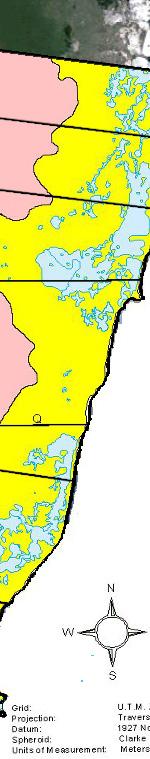
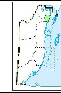
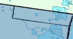
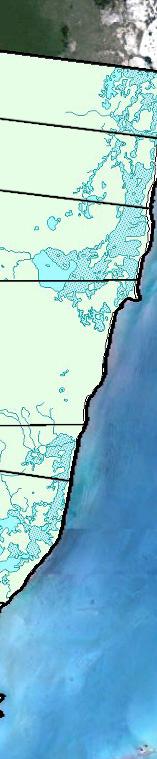
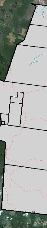
3 PROPERTY DESCRIPTION Mexico Belize Guatemala Central America Caribbean Sea The Balam Jungle Estates ( BJE ) is situated in the southeast corner of the Corozal District, just south of where the Yucatan Peninsula greets the Caribbean Sea. Both the Northern and Southern Bulkhead areas are located on the property and the coastal waters offshore are often referred to as part of the Belizean Riviera. Belize Mexico Originally, BJE was one of the largest privately owned blocks of land Corozal Sarteneja Chetumal in Belize, consisting of five (5) contiguous freehold title parcels, totalling 95, acres. Orange Walk Little Belize Santa Martha Balam Jungle Estates Bomba Ambergris Caye San Pedro Given recent parcel sales and reconfiguration, BJE now offers five (5) new parcels totalling 53, acres; from Caribbean Belize beachfront to tropical broadleaf forests. Diagram 1.0 3

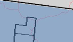
4 LEGAL DESCRIPTION The property can be verified in the Government of Belize s Land Registery, located in the nation s capital, Belmopan. The Registration Section is: Shipstern / Bulhead. The registered Proprietor is Julian Castillo of 5859 Seashore Drive, Buttonwood Bay Area, Belize City, Belize. Diagram 2.0 Remaining Parcels for Sale (in Green, ordered north to south): Parcel 22 (10, acres) - Land Register Parcel ID: Parcel 6 (17, acres) - Land Register Parcel ID: Parcel 14 (9, acres) - Land Register Parcel ID: Parcel 39 (5, acres) - Land Register Parcel ID: Parcel 41 (10, acres) - Land Register Parcel ID: Total Acreage: 53, acres 4
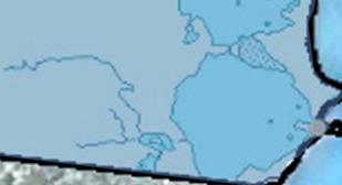
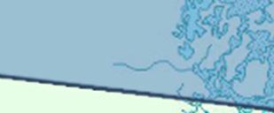
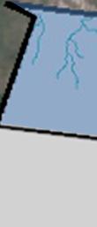
5 LOCATION & LANDMARKS - BJE is situated near a number of communities and other identifiable areas in this region: Shipstern Lagoon & Shipstern Nature Reserve: Found just a few kilometers north of BJE s northern boundary. Shipstern is connected to BJE through the Corozalito waterways, which are a labyrinth of scenic natural canals. The 22,000 +-acre Shipstern Nature Reserve boasts three different northern hardwood forests, along with savannah and mangrove habitats similar to those found on BJE. Fireburn: The small community of Fireburn is located approximately 6km (3.7 miles) north of the property s northern boundary. The community will be expanding with the recent nearby discovery of one of the largest Mayan Ruin sites in Northern Belize. Little Belize & Neuland Reinlaender Mennoniten Community: These two Mennonite communities border the property along its western boundary. The communities have converted their areas into highly productive farmland. Bomba Village: This small village is located approx. 10km (6.2 miles) south of the southern boundary of the property. The village is connected to the sea by way of the Northern River, which many fisherman and tourism boats use to access the sea/mainland on tours of various attractions in the area (i.e. Altun Ha and Lamanai Mayan ruin sites). 5
6 Maskall Village: This a quaint yet well-established village located approx. 15km (9.3 miles) to the southwest of the BJE. Maruba Resort one of the more exclusive jungle resorts in Belize - is located nearby and offers a range of services and amenities.. Santa Marta Village: This is a very quaint farming village located at Mile 29 of the Old Northern Highway, beyond Maskall Village and Maruba Resort. San Pedro on Ambergris Caye: From anywhere along BJE s beachfront it is approximately 18.5km (11.5 miles) or roughly a 15 minute boat ride to Ambergris Caye. The main town, San Pedro, is a Caribbean tourism mecca and one of the most developed areas in Belize. The Belize Barrier Reef parallels the entire length of Ambergris Caye. Orange Walk Town: This is the second largest town in the nation with a population of about 13,400. It is the capital of the Orange Walk District, located on the left bank of the New River, 28.2km (17.5 miles) west of BJE and 85.3km (53 miles) north of Belize City and the International Airport. 6

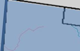
7 Landmarks Map Diagram 3.0 Santa Marta 7
 Bomba Village (23 km /14.3 miles), or Belize City (64 km /39.8 miles). 2.")
8 ACCESS 1. Boat Access - Any part of the BJE s coastline and the coastal lagoons can be easily accessed by boat, either from Sarteneja (32 km/19.9 miles) from BJE s northern border), San Pedro (18.5 km /11.5 miles ) Bomba Village (23 km /14.3 miles), or Belize City (64 km /39.8 miles). 2. Road Access - BJE can be accessed by all-weather marl roadway, either from the southwest via the Maskall/Bomba route off the Old Northern Highway or from the northwest via Little Belize. The property can also be accessed using a bush road via Santa Marta Village. All of the major road systems on the property are wide enough for 2 way traffic and provide all-weather access for almost any vehicle. Primary Access Points are: Bomba: This road, running northwards from Bomba, off the Old Northern Highway, provides access to BJE in approximately (1) hour from Philip Goldson International Airport (BZE) in Ladyville, just outside Belize City. It enters the property on the southwest side of the southern boundary, providing a direct link to the coastal road and all other roadways that exist. Diagram 4.0 8


. 4.")


9 Little Belize: The road accesses BJE to the Northwest and serves as a main artery to all existing roadway. This entry is located approximately 43.6 km (27.1 miles) from Orange Walk Town. 3. Inland Access to the Coast All of the main roadways on the property connect to the has been planned in order to access the northern area of BJE s coastline (via Parcel 14). 4. Diagram 4.1 present coastal roadway. A new coastal road Neuland Reinlaender Mennoniten Community Santa Marta 9
 above sea level, then slopes gently towards the mangrove savannas to the north and east.")
10 TOPOGRAPHY Inland The north east of Belize is part of the low-lying Yucatan Platform and, characteristic of the entire Yucatan Peninsula; the entire area is extremely flat with slight variation in height. On the western boundary, the forested land lies at an altitude of approximately 5m (16.4ft) above sea level, then slopes gently towards the mangrove savannas to the north and east. Photograph 1: Cleared land in Little Belize, adjacent to BJE Estates, showing undulating characteristics of landscape The forested area can be characterized as an undulating plain, as can be seen very clearly in the north west corner of the property, and in the nearby cleared farmland of the adjacent communities of Neuland Reinlaener Mennoniten Church and Little Belize. Within the BJE, this undulation follows the top surface of the limestone bedrock. It varies from shallow, widely spaced undulations to low, but steep, limestone ridges 3 to 4m (10-13ft) in height where the limestone top is exposed and lacks soil cover. Other characteristic features of limestone are also present within the area such as cenotes. Coastal - There is a very definite divide between the higher forested region to the west, and the lower savanna coastal areas, indicative of different past eras of inundation and deposition. The coastal savanna, stretching from the forest edge to the sea, has very little altitude, rarely exceeding 0.7m (2.3ft) above sea level and certain areas are frequently inundated 10
11 during wet season. Small, forested, limestone islands or hummocks low limestone protrusions that occur scattered throughout the coastal area maintain dryer regions throughout the savannah. The southern portion of the coastal zone has a thick deposit of fine carbonate sediment left by the most recent geological inundation period. Towards the more northern part of BJE s coastal area, the limestone bedrock is much closer to the surface, with sharp, unweathered rocks often projecting above. TEMPERATURE Being a large property, there is some local climate variation between the inland and coastal areas, as well as between the north and south of the area, though overall the influence is primarily coastal, with the ameliorating effect of the sea breezes. Temperature varies throughout the year from 15 C to 36 C (59 F to 97 F), corresponding to the change in dominant wind direction, with northers bringing colder temperatures during January/April, and hottest temperatures occurring during the short dry season in August. This can be seen in the figures from Tower Hill, 25km (15.5 miles) to the west of BJE. Water temperatures of approximately 30 C (86 F) were recorded in the shelf lagoon and bay with daily warming of 2 C (25.6 F). 11
 interrupt the regular wind patterns, bringing strong northerly winds of up to 30 knots and, at")


12 WIND PATTERNS The prevailing winds, the trade winds, come from the east and northeast throughout much of the year, rarely exceeding 15 knots. During November through to March, periodic northers (strong, cold, north fronts) interrupt the regular wind patterns, bringing strong northerly winds of up to 30 knots and, at times, heavy Temperature in C Monthly Average Temperatures at Maximum Average Minimum rain. These north winds affect the water table by 2 J F M A M J J A S O N D Data from the National Meteorological creating currents that take water from the semienclosed Chetumal Bay and push it southwards, reducing both the level of Chetumal Bay and wells further inland. These northers are countered by stable south-easterly winds produced by strong anticyclones during this dry season period. Hurricane Season begins in June, and extends until November, bringing both tropical storms and the potentially damaging hurricanes. Even though Belize has escaped the majority of hurricanes spawned within the Caribbean, hurricanes have had an impact in the past. 12


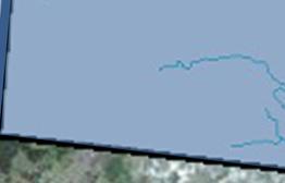
13 BJE s coastline is quite well protected from the danger of storm surges by the presence of the Belize s Great Barrier Reef, Ambergris Caye and the expanse of shallow water over Bulkhead Shoal; 3 solid lines of defense. Note: Low speed turbines used on BJE s coastline could generate a high enough capaity factor to make wind an efficient alternative energy a viable option. TECTRONICS The northeast corner of Belizee lies on a stable fault block or horst, formed as a result of the eastward sliding of the Caribbean and North American plates during the Tertiary-Recent period. To the north of the BJE area lies the major Shipstern Lagoon system, one of several major waterways in the north (other examples being Progresso Lagoon and the Neww River) believed to be aligned along these SW-NE trending faults down-faulted to the east.. Map 5: Fault lines of Northern Belize (After James and No evidence of tectonic activity has been seen in BJE s area, thoughh it should be borne in Ginsburg, 1979 mind that this coastal area of Belize remains a tectonically active area. 13
14 GEOLOGY Overview The BJE, lying in northeastern Belize, is part of a region belonging to the Yucatan carbonate platform, a Cretaceous to Tertiary age sedimentary basin that once covered the Yucatan peninsula, Belize and much of the Peten in Guatemala. Most of the surface geology of the BJE is composed of late Tertiary limestones of the Orange Walk Group, while the southernmost part is older and referred to the early Tertiary, flint bearing, Doubloon Bank Formation. 1. INLAND One of the most striking bedrock features in BJE is the widespread occurrence of a hard, well cemented, limestone bed, up to 2m (6.6ft) thick. The hard limestone layer forms a modestly undulating topography with gentle ridges separated by small basins. Distance from ridges to ridge, as seen along BJE s roadway, is often less than 100m (328.1ft) and the height of the ridge above the basin floors are estimated to be only a few meters. In the basin-like areas, a thin bed of soft limestone, locally termed marl, is preserved and readily available. It s the preferred aggregate in Belize for land filling and unpaved road surfacing. 14


 of")


 in thickness, clay")


,")


15 Diagram In the southern part of the property, flint nodules occur in this marl. In addition, the marl and the hard limestone bed appear to be conglomeratic; i.e., there are clastss (fragments) of limestone ranging in size from pebble up to an occasional boulder. Neuland Reinlaender Mennoniten Community Private Thin, often less thann 1m (3.3ft) in thickness, clay layers occur on top of the marl beds. The clay is rarely silty and based on descriptionss of clays in other areas of northern Belize some of these clays could be bentonitic. 2. COAS STAL - The north east of Belize is part of the low- lying Yucatan Peninsula (BJE s coastal area), typically being extremely flat with very little variation in height, maximum elevation being no more than 1m (3.3ft) above sea level. Unlike the more northern part of the Sarteneja peninsula, where the limestonee bedrock is close to the surface with rocky outcrops oftenn projecting above the soil surface, the southern limestone bedrock of the much of the coastal area has a fairly deep band of sediment deposited above it. 15


16 However, the sediment is easy to excavate and the limestone bedrock beneath provides a reliable base for solidly constructed foundations that can transmit demanding loads from heavy structures to the ground. Hard Limestone Layer Soil Layer Soft Marl Bare Limestone 3m Karst Conduit Conglomeratic Marl Hard Limestone Diagram 1: BJE Estates: Schematic Geological Cross Section of Bedrock of the Western Portion Soft Marl Karst Conduit Conglomeratic Marl After B. Holland 1m 16
17 3. ECONOMIC GEOLOGY Hydrocarbon (oil & gas): Although seismic surveys for hydrocarbon exploration have not been conducted on BJE, the petrochemical mapping system for Central America shows that the property lies in the Corozal Basin, part of the Yucatan Platform. This is thought to be the eastern continuation of the Northern Peten Basin and the western continuation of the Yucatan Basin, both of which have proven to be high oil producing areas in neighboring Guatemala and Mexico (CEP 2000, unpublished). For this reason, this area has attracted much of the country's oil exploration activities in the past and test wells drilled in area adjacent to BJE have recorded live oil shows. Limestone (aggregate): The widespread hard limestone layer can and is presently quarried and utilized as rock aggregate and sand for development projects on the property. This onsite material is a great benefit to any future development. Bentonite (clay): The clays are quite plastic and, depending on firing/testing results, could be drilled and used for impervious liners for waste dumps, handicrafts, scale pottery, bricks, or ceramic production. Other Economic Minerals & Rocks: Besides the numerous reports of hydrocarbon occurrences in exploration wells, geological studies on the property have shown strong potential for economic rocks and minerals in the subsurface and surface of BJE. The following potential resources now warrant further investigation as to the extent of their presence on BJE: Gypsum wallboard, cement retardant and soil amendment in agriculture Hydrothermal mineralization associated with crystalline quartz. 17
18 SOIL DESCRIPTIONS 1. INLAND BJE lies on the northern coastal plain, with a bedrock composed of the youngest limestones to be found in Belize, being formed in the Pleistocene period. These limestones provide the parent material for the different soil types found on the property. 2. COASTAL The coastal area has limited agricultural value due to high salinity and seasonal or permanent inundation. The soils are poorly drained and due to their high salinity, can only naturally support halophytic plants such as mangroves, which are the predominant associated vegetation type. These soils are very young and composed of fairly structureless silts and clays, with a moderately alkaline ph. With little traditional agricultural potential, present use is primarily as fishing grounds for local communities. There is a major potential for aquaculture, residential or tourism development with consideration given to the clearance of coastal red mangrove, which maintains a buffer vegetation to protect this area from erosion due to full force storm waves and destructive hurricanes. 18
, where it meets higher land with less saline, slightly better-drained soils, representing an older shoreline from a")


19 Neuland Reinlaender Mennoniten Community This coastal plain stretches westward for 4.5km to 5km (2.8miles to 3.1miles), where it meets higher land with less saline, slightly better-drained soils, representing an older shoreline from a previous inundation period. Here, soils are shallow and calcareous, over old coral reef limestone bedrock. They have low agricultural potential due to their shallow nature (averaging less than 30cm / 11.8 inch deep) and the impenetrable hardness of the underlying bedrock, causing extreme drought during dry season. Private Diagram 6.0 Solid bedrock found throughout the area at varying depths provides a dependable base for foundations used in future development and infrastructure projects along this coastal strip. 19

20 BIODIVERSITY BJE occupies an important biogeographic position both within Belize, and within Mesoamerica, being the confluence of several major ecological regions North American, South American and Antillean evidenced in the different elements that make up the land. The position of the property, along with the heterogeneity of the habitats and protection from major human impacts, leads to this area being one of the most species-diverse in the region. The rich resources found on BJE make the property an internationally recognized biodiversity hotspot that includes all three ecosystems prioritized by IUCN in the Mesoamerican region: Freshwater, Coastal and Marine, and Broadleaf Forest. BJE is host to some of the tallest and densest broadleaf hardwood forests in Belize; a shelter for the highest biodiversity levels in Mesoamerica. With a projected 260 bird species present within the Estates, the property has one of the highest concentrations of bird species anywhere in the world. The lagoons and savannah with intermittent littoral and mangrove forests that compose over 15 miles of coastal waterways are recognized as an assemblage of habitats crucial in maintaining the health and integrity of Belize s Great Barrier Reef, and is home to a vast array of marine population. This includes the endangered manatees that use our coastal waters as a 20


21 primary part of their migratory route. It is an understandable fact that our coastal land is designated a priority coastal area under the regional Mesoamerican Biological Reef Programme. ECOSYSTEMS The vegetation of BJE is both rich and diverse, with numerous habitat types forming a mosaic of structurally and floristically differing systems, ranging from some of the tallest broadleaf forest in northern Belize, to the maze of freshwater pools and channels, to the extensive coastal saline savannah and major lagoon systems. 21

22 The timbered land gives way to thousands of acres of a variety of coastal ecosystems ranging from extensive mangrove and littoral forests to coastal lagoons and estuaries. The coastline is made up of mangroves and saltwater marshes interspersed with sugar-white beaches and palm trees. The clear jade colored coastal waterways serve as the nurseries that support the vibrant offshore fishing industry and also serve as transmigration routes for a variety of marine life, most notably the endangered manatee. FORESTED LAND Although selectively logged in its history, BJE s forests are a remarkably resilient ecotype, surviving and flourishing through these exploits. Today, with the ongoing protection and preservation efforts over the past 15 years, recent assessments evidence the forests and other vegetation patterns have never been severely damaged. The area is, with regards to its extraordinary richness of flora and fauna, one of the last important coastal forest refuges of the Yucatan Peninsula. 22
, was contracted to complete a full forest inventory of BJE s forests.")
23 In order to gain a true understanding of the forest s natural treasures, how they ve been impacted and how they can best be preserved, a Guatemalan organization, Fundación Naturaleza para la Vida (NPV), was contracted to complete a full forest inventory of BJE s forests. NPV, who was recommended through Smartwood, the world s leading nonprofit forestry certifier, established BJE s Forest Management Plan. COASTLINE CHARACTERISTICS 1. WATER QUALITY a.) Water Depth - Within BJE, water depth over the entire coastline is 150m (492ft) fairly shallow; seldom more than 1.5m (4.9ft) in depth at a distance of 150m from shore. Within the survey area; however, there are some notable exceptions found on the coastline areas near the outlet point of Bennett s Lagoon, where water attains a depth of 23

24 1.3m (4.3ft) within 50m (164ft) of the shoreline. This may well be because of movement of sediment away from the area by water flowing out from Bennett s Lagoon. b.) Water Clarity Water clarity is dependent on sediment load in the water, which is itself largely dependent on sediment particle size, water currents and wind. Nearly the entire length of BJE s coastline maintains excellent water clarity as far as 50m (164ft) from shore. In general, during dry season, water clarity increases south of High Bluff. This was observed during extensive surveys of the coastal area and confirmed through the satellite photography taken of the property. 2. COASTAL SEDIMENT DEPTHS - Sediment depth appears to be much deeper in the southernmost areas of the coastline; test areas showed over 2.4m (7.9ft). The sediment may be as much as 6m (19.7ft) deep in offshore areas. 24


25 The coastline east of the southern point of Bulkhead Lagoon is the first coastal area to show a bedrock base within 2.4m of the sediment surface [measured at 20m from shore and 50m from shore]. The more northerly coastline has a much shallower sediment layer, bedrock being reached at an average of 1.5m (4.9ft). Sediment shows variation between 100% mud content and 100% sand. There appears to be a general decrease in sand content with distance from shore. Mollusk fragment content varies extensively. 25


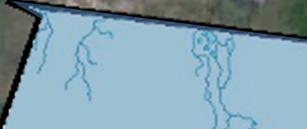
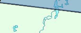
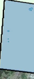

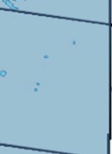


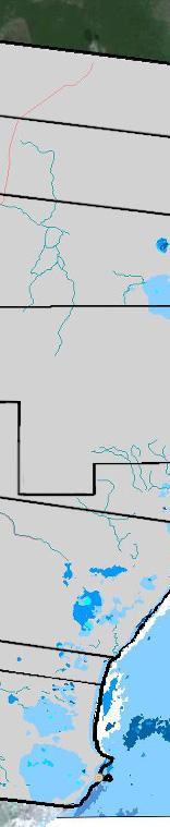
26 v Hydrology Map Diagram 7..0 Marine Habitat Map Diagram 7.1 Neuland Reinlaender Mennoniten Community Neuland Reinlaender Mennoniten Community Private Private 26

27 ASSESSMENTS & DEVELOPMENT 1. ASSESSMENTS: In order to coordinate development and management initiatives in harmony with BJE s vital natural resources, we have conducted the following assessments, studies, and inventories while considering the most productive land uses: Geological Assessment Sustainable Forest Management Plan. Natural Resource Inventory Coastal Survey Biodiversity Assessment Environmental Impact Assessment (EIA) in preparation coastal road construction. 27
 Roadwork Road construction is limited, for the most part, to the dry-season months and depending on the impact to the environment, the Department of Environment (DEO) may require an Environmental")
28 2. BASIC COSTS OF DEVELOPMENT IN BELIZE: a.) Roadwork Road construction is limited, for the most part, to the dry-season months and depending on the impact to the environment, the Department of Environment (DEO) may require an Environmental Impact Assessment ( EIA ) be undertaken prior to construction. The DOE should be notified as soon as the planning phase begins. For reference, the EIA that was required prior to the building of the Coastal Road on BJE cost approx. US$8000 for 6.9 km (3 miles) of unpaved roadway across a sensitive savannah and beachfront region. Project costs are negotiable and it s strongly advised that local expertise is employed in order to expedite clearance processes. b.) Landfill & Dredging - Any coastal development will require significant volumes of landfill material. One acre of this coastal land will require approximately 5,000 cubic yards of fill. Two potential options are available: quarried landfill from the western portions of the property or dredged material from the seabed. Quarried landfill is the cheapest option (starting at approx. US$6,500 per acre), the most solid substrate, and the easiest upon which development can be undertaken. The drawbacks of this system include the destruction of habitat 28
29 at the quarry site (generally around one acre for every four acres filled), and the conversion of these quarried sites into unproductive lands for further development although biodiversity can be reintroduced into quarried areas. Dredging for fill material is theoretically an attractive option: the very shallow in-shore waters could be deepened and the material put to good use as landfill. Dredged material usually has a high compaction rate one yard of dredged material may settle to less than a foot in depth. Controlling surface run-off has to be established through the construction of dykes and banks. It is expensive if equipment and services have to be contracted - a cubic yard of pumped dredge material may cost US $10-12 as compared with US $2.50 for quarried material and compaction of dredged material can be less than half the depth of quarried material. In balance therefore, it would seem that quarried landfill is the a more cost efficient option unless the investment was made to purchase a dredger thereby cutting the operating expenses significantly and thus making dredging an extremely useful strategy. It is important to recognize impact to the environment and the DOE would need to be consulted prior to commencing dredging operations. c.) Power Options - i. Belize Electricity Limited ( BEL ) is the chief power provider in Belize. Unless one is looking to set up their own alternative energy system, the only option for immediate power is with BEL. Power can be sourced by tapping into the high tension lines that provide power to Ambergris Caye, which draw their feed from a power grid in Mexico, part of a Power Purchase Agreement between Mexico and Belize. The high tension lines carry a voltage of 115KV. These high tension lines pass approx. 6.4km (4 miles) south of our southern border. In order to reduce the voltage to a usable current level to feed power to a project on BJE - maintaining the ability to expand 29
30 in the future - a substation would be required. An estimate for a smaller model substation would be around US $100, ,000. Larger substations can cost upwards close to US$500,000 or more. However, depending on the project size and the amount of current that would be needed, BEL may have a substation available or be willing to help finance the setup if there were enough load on the line. The cost to set the poles, install the transformers (if needed), and run the lines is going to be approx. US$25-$30,000/mile. As a general rule of thumb, underground lines are going to more than double the cost for installation and materials. BEL would also have to assess the feasibility of underground installation in coastal regions of the BJE because of its slight elevation above sea level. ii. Renewable Energy Options - a. Solar Paneling Today, projects can utilize a range of photovoltaic technologies and applications such as Concentror Collectors, Building-Integrated Photovoltaic (BIPV) and Stand-Alone Photovoltaic Systems. b. Wind Generation One of today s fastest growing forms of electricity generation, wind generation has not yet gained much popularity in Belize due to the results of Belize Electricity Limited s (BEL) preliminary wind studies, which were conducted by ReTech International Limited. The data collected from site testing near BJE demonstrated that continual production of the required 25 mile-per-hour winds, a standard that has been used to decide if a wind operation is worthwhile, was not achieved. However, new technology advances in wind generation efficiency have reintroduced the potential for wind in Belize as a valuable means of energy production. The wind generation industry in the states is being fueled by 30
31 the Department of Energy and there has been a huge emphasis put on the development of cost effective, low speed, wind speed technology, specifically targeting more typical class 4 wind sites (5.8 10m height or 33 feet). The anticipated new technology in this field would make wind generation an ideal electricity generating alternative for BJE s coastal region and even specific inland areas as well. New breeds of wind turbines will provide good power in low wind speeds with enhanced designs to survive high wind events, while still producing maximum power. DEVELOPMENT RECOMMENDATIONS 1. COASTAL DEVELOPMENT RECOMMENDATIONS The coastal lands have been highlighted as best suited for development due to the relatively close proximity to Ambergris Caye and the Belize Barrier Reef. The coastal lands have a strong and immediate coastal tourism potential. It is recommended, on both environmental and financial grounds, that the number of roads crossing the coastal savannas (from the forest to the coast) be kept to a minimum. Access to coastal lands within one zone (such as the southern two blocks) should preferably be via the existing Coastal road, which leads to a single north-south coast road at least 100m (328ft) inland from the shoreline, and a minimum of 25m (82ft) from the eastern edges of the 31
32 fragile coastal lagoons. Minimizing the number of roads crossing the saline savannas will be important in minimizing impact on a delicate habitat. Of the coastal habitats identified within this southern portion of BJE, tropical littoral forest is by far the most restricted in extent. They represent fragments of a habitat that has traditionally come under significant conversion pressure. It would be desirable, from a conservation standpoint, to identify a few of the more intact fragments and for these to remain largely untouched, for conservation and aesthetics. The other habitats exist in far more extensive areas along this coastal plain and cannot be considered either rare or threatened in this context. Specific development goals can usually be justified through a proper Environmental Impact Assessment (EIA) application/clearance process with the DOE. However, in order to achieve balance between development and conservation priorities, zoning should reflect areas with better water clarity and depth, less muddy seabed substrate, and higher drier ground within the proposed development area. Significant stands of coastal fringe mangrove should be left untouched between one development zone and the next and proper permitting sought for any habitat alteration within the 20m (66ft) coastal reserve. A 20m (66ft) non-development belt should be left, whenever possible, around the sensitive lagoon systems. By doing so, the development zone would include the highest value beach-frontage and reduce the depth of landfill needed while leaving the better tracts of coastal fringe mangrove and deeper sediment trapped there. Whenever possible, development should also avoid the seasonally mostinundated mudflats and shallow lagoons as they help filter surface run-off, provide habitat to nesting birds, and serve as nurseries for fish. 32
33 INVESTMENT CLIMATE IN BELIZE Highlights: Stability: Long-standing, democratic tradition; independent judiciary, exchange rate fixed to the US Dollar ($2.00BZE = $1.00US) for 25 years, English is the official language. Profitability: Flexible fiscal incentives and concessions, Commercial Free Zones, Export Processing Zones, Repatriation of profits and dividends Livability: Subtropical climate, virgin rainforest, unspoiled beaches and spectacular barrier reef in coexistence with the friendly local people. With a stable political and economic climate under democratic rule, Belize is an opportunity for the international investor. Belize is a lively offshore center with some of the most beautiful natural landscapes in the world. Property prices in desirable parts of Belize have been steadily increasing in value for the past 25 years. And, unlike any other place in Central to South America, English is the official language. Foreign buyers have the same rights as Belizeans to own property; no special permissions or permits required. Further, Belize s Government has established incentives and less restrictive development criterion to promote and support foreign investment and trade. There is no capital gains tax and no inheritance tax in Belize. 33
FOR SALE Belize s World Heritage
 FOR SALE Belize s World Heritage The Pelican Cayes A Hotspot of Biodiversity and Destruction In the Belize Barrier Reef Reserve World Heritage Site March 2003 In the Pelican Cays, mangrove cays exhibit
Region 1 Piney Woods
 Region 1 Piney Woods Piney Woods 1. This ecoregion is found in East Texas. 2. Climate: average annual rainfall of 36 to 50 inches is fairly uniformly distributed throughout the year, and humidity and temperatures
Terrestrial Protected Area Nomination: Central Mangrove Wetland South-West, Grand Cayman
 Terrestrial Protected Area Nomination: Central Mangrove Wetland South-West, Grand Cayman The attached nomination, proposing that a parcel of land in the Central Mangrove Wetland be made a Protected Area
Title/Name of the area: Chwaka Bay, Zanzibar
 Title/Name of the area: Chwaka Bay, Zanzibar Presented by: Dr. Charles Lugomela, Ag. Head, Department of Aquatic Sciences and Fisheries, University of Dar es Salaam, P.O. Box 35064 Dar es Salaam, Tanzania
COSTA MAYA HIGH POTENTIAL INVESTMENT OPPORTUNITY & PROPOSAL
 COSTA MAYA HIGH POTENTIAL INVESTMENT OPPORTUNITY & PROPOSAL Introduction This investment analysis and proposal was developed to provide investors with an accurate representation of the investment potential
The 4 ARRRRR s. Presented by Phil Hahn
 The 4 ARRRRR s B E L I Z E Presented by Phil Hahn The 4R s of Belize Rivers Reefs Ruins Rainforests The 4R s of Belize RIVERS Rare flora and fauna live in healthy populations within the abundant riverine
Chapter 20. The Physical Geography of Africa South of the Sahara
 Chapter 20 The Physical Geography of Africa South of the Sahara Chapter Objectives Identify the major landforms, water systems, and natural resources of Africa south of the Sahara. Describe the relationship
Status of Mangroves in Belize
 Status of Mangroves in Belize State of the Coastal zone Summit June 7 th 2012 Nadia Bood*, Emil Cherrington and Tim Smith Outline Introduction to mangroves Importance of mangrove to Belize National status
What Is An Ecoregion?
 Ecoregions of Texas What Is An Ecoregion? Ecoregion a major ecosystem with distinctive geography, characteristic plants and animals, and ecosystems that receives uniform solar radiation and moisture Sometimes
2.0 Physical Characteristics
 _ 2.0 Physical Characteristics 2.1 Existing Land Use for the Project The site is comprised of approximately 114 acres bounded by Highway 101 to the north, the existing town of Los Alamos to the east, State
Alternative Highest & Best Use Analysis Boutique Hotel
 Alternative Highest & Best Use Analysis In response to numerous comments received from the public, as well as issues raised by the CCC in the Appeal Staff Report Substantial Issue Determination, the following
How South Africa is making progress towards the Aichi 2020 Target 11
 How South Africa is making progress towards the Aichi 2020 Target 11 Montreal, Canada 2 May 2016 Oceans and Coasts Content Protected area considerations and progress 1994-2010 Terrestrial Protected Area
CONSEJO SHORES HOTEL SITE WITH WATERFRONT ACCESS AND 15 RESIDENTIAL LOTS FOR SALE
 CONSEJO SHORES HOTEL SITE WITH WATERFRONT ACCESS AND 15 RESIDENTIAL LOTS FOR SALE 1 st Choice Belize Corner 1 st Avenue & 2 nd Street North Corozal Town, Corozal District Belize Tel: 602-2126 Email: lincolneiley@outlook.com
Current conditions. Guatemala's Maya Biosphere Reserve. No clear idea of speed of deforestation. Deforestion by pollen analysis
 Current conditions Most obvious human transformation is cutting of forests Guatemala's Maya Biosphere Reserve An Eco-Friendly Adventure Along the Maya Trails Key ecological roles: repository for biodiversity
Typical avalanche problems
 Typical avalanche problems The European Avalanche Warning Services (EAWS) describes five typical avalanche problems or situations as they occur in avalanche terrain. The Utah Avalanche Center (UAC) has
The Maltese Islands: Geography
 The Maltese Islands: Geography The Maltese Archipelago comprises a group of small low islands aligned in a NW-SE direction. At their extreme points the Maltese Islands fall within the following points:
Unit 1 Lesson 1: Introduction to the Dry Tortugas and Sustainable Seas Expedition
 Unit 1 Lesson 1: Introduction to the Dry Tortugas and Sustainable Seas Expedition Lesson Objectives: Introduce students to the historical, geographic, and ecological importance of the Dry Tortugas. Introduce
Monitoring the Environmental Status of the Heart of Borneo
 Monitoring the Environmental Status of the Heart of Borneo By: Stephan Wulffraat The Heart of Borneo conservation initiative has been going on now for several years and has gained increasing support from
Belize Emerging INSIGHTS INTO THE EMERGING REAL ESTATE MARKET OF BELIZE 2016
 Belize Emerging INSIGHTS INTO THE EMERGING REAL ESTATE MARKET OF BELIZE 2016 BELIZE MAP AND DISTRICTS KEY FINDINGS The following is a summary of the key findings gleaned from Belize Emerging 2016, our
FINCA SOLANA HOUSE & LOT
 FINCA SOLANA HOUSE & LOT 1 st CHOICE BELIZE Agent Placenicia Penninsula Stann Creek District Heading Location Property Type Price Property Description Area Description House and Lot Finca Solana Area,
Just how big is Africa?
 The United States China India The United Kingdom Portugal Spain France Belgium Germany The Netherlands Switzerland Italy Eastern Europe Japan 11.7 million sq. miles Just how big is Africa? Chapter 18 Section
2.0 PARK VISION AND ROLES
 2.0 PARK VISION AND ROLES 2.1 Significance in the Protected Area System Marble Range and Edge Hills provincial parks protect 6.8% of the Pavillion Ranges Ecosection, which is located in the Southern Interior
3.0 OVERVIEW OF HUECO BOLSON
 3.0 OVERVIEW OF HUECO BOLSON The Hueco Bolson covers about 2,500 square miles, or 1.6 million acres in New Mexico, Texas, and Chihuahua (Figure 3-1). In Texas, the Hueco overlies portions of El Paso and
Hudson Bay Lowlands Proposed Protected Areas
 Hudson Bay Lowlands Proposed Protected Areas Hudson Bay Lowlands Proposed Protected Areas The Protected Areas Initiative has identified portions of the Hudson Bay Lowlands region that have significant
Belize Trip Accommodations [1] Island Expeditions: Belize Trip Accommodations. Belize Trip Accommodations
![Belize Trip Accommodations [1] Island Expeditions: Belize Trip Accommodations. Belize Trip Accommodations](/thumbs/72/66508780.jpg "Belize Trip Accommodations [1] Island Expeditions: Belize Trip Accommodations. Belize Trip Accommodations") [1] Share: var switchto5x = true;stlight.options({"publisher":"dr-61cbf29c-70b8-a347-48ed-c13d26df1b16"}); Island Expeditions: Belize Marine Basecamp - Southwest Caye, Glover's Reef On the water's edge,
[1] Share: var switchto5x = true;stlight.options({"publisher":"dr-61cbf29c-70b8-a347-48ed-c13d26df1b16"}); Island Expeditions: Belize Marine Basecamp - Southwest Caye, Glover's Reef On the water's edge,
AGENDA ITEM 5 D WAKULLA ENVIRONMENTAL INSTITUTE (WEI) TRAIL FEASIBILITY STUDY
 TRAIL FEASIBILITY STUDY") March 19, 2018 AGENDA ITEM 5 D WAKULLA ENVIRONMENTAL INSTITUTE (WEI) TRAIL FEASIBILITY STUDY TYPE OF ITEM: Action STATEMENT OF ISSUE The Wakulla Environmental Institute (WEI) Trail is one of several trails
March 19, 2018 AGENDA ITEM 5 D WAKULLA ENVIRONMENTAL INSTITUTE (WEI) TRAIL FEASIBILITY STUDY TYPE OF ITEM: Action STATEMENT OF ISSUE The Wakulla Environmental Institute (WEI) Trail is one of several trails
ISLAND. FOR SALE Spanish Lookout Caye -186 Acre Island
 FOR SALE Spanish Lookout Caye -186 Acre Island ISLAND 186 Acre Private Island - Spanish Lookout Caye - just off Cruise Ship Mooring 8.5 Miles Southeast of Belize City, Spanish Lookout Caye Belize Spanish
Virginian Atlantic (Ecoregion 8)
") Virginian Atlantic (Ecoregion 8) Background The Virginian Atlantic Ecoregion extends from the south side of Cape Cod to Cape Hatteras in North Carolina. The waters of the ecoregion are a mix of cold and
Virginian Atlantic (Ecoregion 8) Background The Virginian Atlantic Ecoregion extends from the south side of Cape Cod to Cape Hatteras in North Carolina. The waters of the ecoregion are a mix of cold and
THE STORY OF MALDIVES. DR MARIYAM SHAKEELA Minister Of Environment and Energy Republic Of Maldives
 THE STORY OF MALDIVES DR MARIYAM SHAKEELA Minister Of Environment and Energy Republic Of Maldives Significance of ecotourism & coral reefs on regional economy Coral reefs are among the most diverse and
National Protected Area Systems Analysis Case Study: Gra Gra Lagoon National Park
 ational Protected Area ystems Analysis Case tudy: Gra Gra Lagoon ational Park Problem statement: How does Gra Gra Lagoon ational Park fit in the ational Protected Areas ystem and how does it relate to
Section 61 Recreational Vehicle Park / Campground (Bylaw No. 2012/10)
") Part 7 General Regulations Section 61 Recreational Vehicle Park / Campground (Bylaw No. 2012/10) 61.1 A comprehensive site plan shall be provided to the satisfaction of the Development Authority that shows
Part 7 General Regulations Section 61 Recreational Vehicle Park / Campground (Bylaw No. 2012/10) 61.1 A comprehensive site plan shall be provided to the satisfaction of the Development Authority that shows
Town of Oakfield Agricultural and Farmland Protection Plan
 SECTION III COMMUNITY OVERVIEW A. Regional Setting / Location The Town of Oakfield is located in the northwestern portion of Genesee County. Located west of New York's Finger Lakes, the Town is uniquely
The Galveston Seawall
 Coastal and Ocean Engineering ENGI.8751 Undergraduate Student Forum Faculty of Engineering and Applied Science, Memorial University, St. John s, NL, Canada. March, 2013 The Galveston Seawall Mark Harvey
Alternative 3 Prohibit Road Construction, Reconstruction, and Timber Harvest Except for Stewardship Purposes B Within Inventoried Roadless Areas
 Roadless Area Conservation FEIS Summary Table S-1. Comparison of Key Characteristics and Effects by Prohibition Alternative. The effects summarized in this table A would occur in inventoried roadless areas
LAUNCH OF THE COASTAL ZONE MANAGEMENT TRUST
 A 60km stretch of coastline on the Yucatan Peninsula of Mexico is the testing ground for an idea that could protect fragile environments around the world: insuring coral reefs. The Economist World Ocean
MAYA BREEZE SERENITY ROAD
 MAYA BREEZE SERENITY ROAD 1 st Choice Belize Corner 1 st Avenue & 2 nd Street North Corozal Town, Corozal District Belize Tel: 602-2126 Email: lincolneiley@outlook.com Website: www.1stchoicebelize.com
Lidar Imagery Reveals Maine's Land Surface in Unprecedented Detail
 Maine Geologic Facts and Localities December, 2011 Lidar Imagery Reveals Maine's Land Surface in Unprecedented Detail Text by Woodrow Thompson, Department of Agriculture, Conservation & Forestry 1 Introduction
ALBERTA S GRASSLANDS IN CONTEXT
 ALBERTA S GRASSLANDS IN CONTEXT GLOBAL GRASSLANDS 1 Temperate grasslands, located north of the Tropic of Cancer and south of the Tropic of Capricorn, are one of the world s great terrestrial biomes 2.
Loop Walks Key Criteria
 Loop Walks Key Criteria 1/31/2012 CONTENTS Mission... 3 Background... 3 Phase 1... 3 Guidelines... 3 Occasional Walker... 5 Level of Difficulty... 5 Loop Furniture... 6 1. Mapboard... 6 2. Waymarkers...
Pinellas County Environmental Lands
 Pinellas County Environmental Lands In addition to traditional parks and recreation facilities, Pinellas County owns and manages a system of environmental lands that provides specialized resource-based
Case Study: 1. The Clarence River Catchment
 Case Study: 1. The Clarence River Catchment The NSW coastline is a great natural asset, making an enormous contribution to the economy. The resources of coastal catchments such as the Clarence River Catchment,
Terrestrial Protected Area Nomination: Hemmington Forest, Cayman Brac Central
 Terrestrial Protected Area Nomination: Hemmington Forest, Cayman Brac Central Initial discussions with major landowners in the Hemmington Forest area have indicated that a nomination to protect some or
Twelve Apostles Marine National Park Australia
 EVALUATION REPORT Twelve Apostles Marine National Park Australia Location: Victoria, Australia coastal waters Global Ocean Refuge Status: Nominated (2017), Evaluated (2017) MPAtlas.org ID: 7703885 Manager(s):
MESOAMERICAN REEF (MAR) ECOREGION, CENTRAL AMERICA
 ECOREGION, CENTRAL AMERICA") MESOAMERICAN REEF (MAR) ECOREGION, CENTRAL AMERICA Community Level Climate Change Vulnerability A CASE STUDY Assessment NADIA D. BOOD 2008 3 OVERVIEW World Wildlife Fund (WWF) embarked on a mission to
MESOAMERICAN REEF (MAR) ECOREGION, CENTRAL AMERICA Community Level Climate Change Vulnerability A CASE STUDY Assessment NADIA D. BOOD 2008 3 OVERVIEW World Wildlife Fund (WWF) embarked on a mission to
Xaman-Ha city, an answer to the poor growth and spread population
 Xaman-Ha city, an answer to the poor growth and spread population Global aspect In The Mexican Republic we can found three zones with an important tourist movement; the metropolitan area of Mexico City,
UNIT 5 AFRICA PHYSICAL GEOGRAPHY SG 1 - PART II
 UNIT 5 AFRICA PHYSICAL GEOGRAPHY SG 1 - PART II III. CLIMATE & VEGETATION A. The four main climate zones are tropical wet, tropical wet/dry (split into monsoon & savanna), semiarid, and arid. Other climate
Chapter 7 Geography and the Early Settlement of Egypt, Kush, and Canaan
 Chapter 7 Geography and the Early Settlement of Egypt, Kush, and Canaan How did geography affect early settlement in Egypt, Kush, and Canaan? Section 7.1 - Introduction RF/NASA//Corbis This satellite photograph
155 acres on Tyaughton Lake 900 feet of Pristine Waterfront Private & Secluded Property
 155 acres on Tyaughton Lake 900 feet of Pristine Waterfront Private & Secluded Property 946 Tyaughton Lake Road Gold Bridge BC V0K1P0 900 ft of waterfront with 155 acres of south facing easy access. This
Rule Governing the Designation and Establishment of All-Terrain Vehicle Use Trails on State Land
 Rule Governing the Designation and Establishment of All-Terrain Vehicle Use Trails on State Land 1.0 Authority 1.1 This rule is promulgated pursuant to 23 V.S.A. 3506. Section 3506 (b)(4) states that an
Skyland Ranch. At a Glance: Property Features
 Property Features Ideally positioned in an ox box of the mighty Apalachicola River, Skyland Ranch s 2 ½ miles of river frontage form the foundation of this distinctive property. Coveted by recreational
City of Fort Lauderdale. Frequently Asked Questions. Proposed Sea Wall Ordinance
 City of Fort Lauderdale Frequently Asked Questions Proposed Sea Wall Ordinance The City of Fort Lauderdale is considering amending the Unified Land Development Regulations of the City of Fort Lauderdale
Status of Antillean Manatees in Belize
 Status of Antillean Manatees in Belize Belize regional stronghold of the Antillean Manatee (Trichechus manatus manatus) Belize population is estimated to be in the region of 800 to 1000 animals Highest
ICRI Monaco January 2010
 Economic Valuation of Coral Reefs in the Caribbean ICRI Monaco January 2010 Lauretta Burke World Resources Institute (WRI) Beautiful Valuable Valuable Valuable Valuable Valuable Photos: Krishna Desai Valuable
Arrowhead Ranch. Located in the Big Range Country of Central Wyoming.
 Arrowhead Ranch Located in the Big Range Country of Central Wyoming. 58 E. Benteen Street Buffalo, WY 82834 Ph 307-684-9556 Toll Free 888-684-9557 Fax 307-684-8565 Location The ranch is approximately:
SUMMER VILLAGE OF SILVER SANDS. Municipal Development Plan
 SUMMER VILLAGE OF SILVER SANDS Municipal Development Plan Bylaw 253-2014 Adopted August 22, 2014 Summer Village of Silver Sands Municipal Development Plan Bylaw No. 253-2014 Page 2 1 INTRODUCTION 1.1 SETTING
STORNETTA BROTHERS COASTAL RANCH
 STORNETTA BROTHERS COASTAL RANCH Location: Surrounding Point Arena Lighthouse and immediately south of Manchester State Park Mendocino Co., CA Acres: 1,860 Resources: Over two miles of Pacific Ocean coastline
SELF-ASSESSMENT CHECKLIST
 Tourism and Mountains A Practical Guide to Managing the Environmental and Social Impacts of Mountain Tours Using this Self-Assessment Checklist This checklist has been developed to help mountain-based
Module 1 Educator s Guide: Representative Discussion Points Investigation 3
 Module 1 Educator s Guide: Representative Discussion Points Investigation 3 Ethiopia and Eritrea Our combined population is 59,578,171 people. We have just emerged from a long period of civil war and famine.
The View at Bankhead Lake 12 miles off new Interstate Corridor X
 The View at Bankhead Lake 12 miles off new Interstate Corridor X offers the opportunity to the first to view 6 beautiful waterfront lots on Bankhead Lake to be released Saturday August 25th. Appointment
MAP KEY. BLACK CIRCLES: Our 3 trip destinations of Tulum, Progreso, and Hacienda Temozon in Merida.
 SPRING 2017 GLOBAL OUTREACH is the newest product to come from The SA Way s educational brand. It is part study abroad, part ecoadventure, focusing on Spanish language, ethical service learning, environmental
Dungeness Recreation Area County Park Master Plan
 Dungeness Recreation Area County Park Public Outreach Meeting October 10, 2007 Project Overview USFWS Site Dungeness Recreation Area County Park Meeting Objectives: Re-Introduce project; provide status
Background Information Document & Invitation to Comment
 Background Information Document & Invitation to Comment Basic Assessment for the Proposed Cultural Tourism Lodge Development at Lake Bhangazi (South), isimangaliso Wetland Park, KwaZulu-Natal Overview
Map 1.1 Wenatchee Watershed Land Ownership
 Map 1.1 Wenatchee Watershed Land Ownership Map 1.1 Wenatchee Watershed Land Ownership The Wenatchee watershed lies in the heart of Washington state in Chelan County. Just larger than the state of Rhode
Exclusive Expedition Dates July 2015
 CROCODILE EXPEDITION- Yucatan Mexico Join Dr. Andrea Marshall & Janneman Conradie in Mexico on an exclusive expedition to the Chinchorro Banks Biosphere Reserve to encounter American crocodiles and other
Tropical Belize. A 7 Night Photography Expedition & Workshop
 Tropical Belize Vladimir Kostka Photography www.vladimirkostka.com A 7 Night Photography Expedition & Workshop Starts: Mar 7, 2019 Guides: 1-3 leaders, Ends Mar 14, 2017 1 Photography Instructor Duration:
proof Ancient Maya Life on the Fringes of Chetumal Bay
 1 Ancient Maya Life on the Fringes of Chetumal Bay An Introduction DEBRA S. WALKER Considering how much effort the ancient Maya put into building roads (sacbeob) to link communities and facilitate trade
Order of the Minister of Environment #39, August 22, 2011 Tbilisi
 Registration Code 360050000.22.023.016080 Order of the Minister of Environment #39, August 22, 2011 Tbilisi On preparatory stages and procedure of the methodology for Elaborating structure, content and
CRAZY HORSE TRAIL GUIDE
 CRAZY HORSE TRAIL GUIDE Abridged Version: July 2016 This is a short form of our interpretive trail guide for the Crazy Horse Trail. The full version of the guide has a more detailed description of the
Ragular Half-Day Tour Options
 Company: Womens Veterinary Summit Group: Los Sueños, Costa Rica 2018 Ragular Half-Day Tour Options ATV Tour Welcome to the best Jungle & river ATV adventure in Costa Rica, at the adventure center you will
The Entrance to Phillips Arm Cardero Channel
 The Entrance to Phillips Arm Cardero Channel Jason Zroback jason@landquest.com 1 (604) 414-5577 Jamie Zroback jamie@landquest.com 1 (604) 483-1605 The Source for Oceanfront, Lakefront, Islands, Ranches,
Boatswain bay biodiversity reserve
 Boatswain bay biodiversity reserve March 2003 1 1. Plan and description 1.1. Geographic location, boundaries and dimensions The plan of the proposed Boatswain bay biodiversity reserve and its location
HOUSE FOR SALE SANTA RITA HEIGHTS
 HOUSE FOR SALE SANTA RITA HEIGHTS BELIZE PROPERTY CENTER Lincoln Eiley Associate Agent Corner 1 st Avenue & 2 nd Street North Corozal Town, Corozal District Belize Heading Location Property Type Price
RAIN FORESTS TO REEFS
 RAIN FORESTS TO REEFS A Legacy Circle Journey through Belize with Nadia Bood, WWF-Belize Reef Scientist and Climate Change Officer April 4 12, 2019 legacy circle ANTONIO BUSIELLO / WWF-US As a WWF Legacy
Mark West Creek Flow Study Report
 Mark West Creek Flow Study Report Biology and Geology of Mark West Creek The headwaters of Mark West Creek are located in the Mayacamas Mountain range, which border Napa and Sonoma County, where it then
Member s report on activities related to ICRI
 Member s Report INTERNATIONAL CORAL REEF INITIATIVE (ICRI) 32 nd General Meeting 7-9 December 2017 Nairobi, Kenya Member s report on activities related to ICRI MALAYSIA Reporting period November November
Chapter 7. Geography and the Early Settlement of Egypt, Kush, and Canaan
 Chapter 7 Geography and the Early Settlement of Egypt, Kush, and Canaan Chapter 7 Geography and the Early Settlement of Egypt, Kush, and Canaan How did geography affect early in Egypt Kush, and Canaan?
Chapter Objectives. Describe the dominant landforms and natural resources of Southeast Asia. Discuss Southeast Asia s climate and vegetation.
 Chapter Objectives Describe the dominant landforms and natural resources of Southeast Asia. Discuss Southeast Asia s climate and vegetation. The Land Section 1 Objectives Describe how tectonic plates and
FAQ HOW DO I MAKE A RESERVATION?
 HOW DO I MAKE A RESERVATION? All our reservations are done through our website here at www.cabanaslaluna.com. Click on the Reservations tab and enter your desired dates. If you receive an error message,
Information on Ecological and Biological Significant Marine Areas in Albania
 Information on Ecological and Biological Significant Marine Areas in Albania The report is assembled from the draft strategic plan for marine and coastal protected areas in Albania, supported by the GEF-UNDP
Falkland Oil and Gas Limited ( FOGL or the Company ) Preliminary Results for the year ended 31 December 2007
 Preliminary Results for the year ended 31 December 2007") Wednesday 12 March 2008 Falkland Oil and Gas Limited ( FOGL or the Company ) Preliminary Results for the year ended 31 December 2007 FOGL, the oil and gas exploration company focused on its extensive licence
Wednesday 12 March 2008 Falkland Oil and Gas Limited ( FOGL or the Company ) Preliminary Results for the year ended 31 December 2007 FOGL, the oil and gas exploration company focused on its extensive licence
Bankhead Lake TWO PARCELS AND 1 LOT FOR SALE
 OVERVIEW NORTH PARCEL ACRES: 46 WATERFRONT: 1,227 Front Feet PRICE: $350,000 PER ACRE: $7574 PER FRONT FT. $285 SOUTH PARCEL ACRES: 22 WATERFRONT: 1,381 Front Feet PRICE: $295,000 PER ACRE: $13,170 PER
Roduner Ranch FOR SALE. 5,878± Acres Potential Development Land. Merced County, California. Offices Serving The Central Valley
 FOR SALE 5,878± Acres Potential Development Land Merced County, California Offices Serving The Central Valley F R E S N O V I S A L I A B A K E R S F I E L D 7480 N. Palm Ave, Ste 101 3447 S. Demaree Street
Proposed Action. Payette National Forest Over-Snow Grooming in Valley, Adams and Idaho Counties. United States Department of Agriculture
 United States Department of Agriculture Forest Service January 2012 Proposed Action Payette National Forest Over-Snow Grooming in Valley, Adams and Idaho Counties Payette National Forest Valley, Adams
STUDY GUIDE. The Land. Chapter 29, Section 1. Both. Terms to Know DRAWING FROM EXPERIENCE ORGANIZING YOUR THOUGHTS
 Chapter 29, Section 1 For use with textbook pages 719 724. The Land Terms to Know cordilleras Parallel mountain ranges and plateaus (page 719) archipelago A group of islands (page 720) insular Relating
If there is magic on this planet, it is contained in water.
 If there is magic on this planet, it is contained in water. Loren Eiseley ~ American philosopher and nature writer ~ b.1907 d.1977 Above: A swimmer rests in the X Keken Cenote underground pool in the town
566± acres total - WILL DIVIDE Volusia County, FL
 L IC E N S E D HUNTING P RESERVE ts Q u a i l ahi ul anb l e are av r info! fo CALL TODAY LAKEFRONT PROPERTY PERFECTION This ranch lies on a natural sand ridge in North Volusia County, Florida and has
BENEFICIAL USE OF DREDGED MATERIAL DISPOSAL HISTORY HOUMA NAVIGATION CANAL, LA
 BENEFICIAL USE OF DREDGED MATERIAL DISPOSAL HISTORY HOUMA NAVIGATION CANAL, LA 1991-2012 The Houma Navigation Canal (HNC) provides a navigation channel between Houma, Louisiana, and the Gulf of Mexico
National Forests and Grasslands in Texas
 United States Department of Agriculture Forest Service National Forests and Grasslands in Texas Sam Houston NF 394 FM 1375 West New Waverly, Texas 77358 Phone 936-344-6205 Dear Friends, File Code: 1950
Coverage of Mangrove Ecosystem along Three Coastal Zones of Puerto Rico using IKONOS Sensor
 Coverage of Mangrove Ecosystem along Three Coastal Zones of Puerto Rico using IKONOS Sensor Jennifer Toledo Rivera Geology Department, University of Puerto Rico, Mayagüez Campus P.O. Box 9017 Mayagüez,
Theme: Predominately natural/natural appearing; rustic improvements to protect resources. Size*: 2,500 + acres Infrastructure**:
 Recreation Opportunity Spectrum (ROS) Classes The Recreation Opportunity Spectrum (ROS) provides a way to describe the variations in the degree of isolation from the sounds and influences of people, and
1. Belize Barrier Reef System (Belize) (N 764) Year of inscription on the World Heritage List Criteria (vii) (ix) (x)
 (N 764) Year of inscription on the World Heritage List Criteria (vii) (ix) (x)") 1. Belize Barrier Reef System (Belize) (N 764) 1996 (vii) (ix) (x) Total amount provided to the property: USD 80,000 Current conservation issues There is a great demand for land on which to carry out tourism
1. Belize Barrier Reef System (Belize) (N 764) 1996 (vii) (ix) (x) Total amount provided to the property: USD 80,000 Current conservation issues There is a great demand for land on which to carry out tourism
Chapter 16 Glaciers and Glaciations
 Chapter 16 Glaciers and Glaciations Name: Page 419-454 (2nd Ed.) ; Page 406-439 (1st Ed.) Part A: Anticipation Guide: Please read through these statements before reading and mark them as true or false.
BRACEVILLE NATURE PRESERVE Introductions History Present Conditions Future Development Plans Implementation Strategies Statistics
 BRACEVILLE NATURE PRESERVE Introductions History Present Conditions Future Development Plans Implementation Strategies Statistics Introduction Braceville Nature Preserve is one of MetroParks largest preserves.
2012. Proceedings of the 11 European Geoparks Conference. AGA Associação Geoparque Arouca, Arouca, 5-6.
 References to this volume It is suggested that either the following alternatives should be used for future bibliographic references to the whole or part this volume: th Sá, A.A., Rocha, D., Paz, A. & Correia,
Geoscape Toronto The Oak Ridges Moraine Activity 2 - Page 1 of 10 Information Bulletin
 About 13,000 years ago as the Laurentide Ice Sheet melted, glacial meltwater accumulated between the ice sheet and the Niagara Escarpment. This formed a lake basin into which gravel and sand were deposited.
Seager Wheeler Lake. Representative Area. -- Concept Management Plan --
 Seager Wheeler Lake Representative Area -- Concept Management Plan -- Saskatchewan Environment and Resource Management January, 1999 Saskatchewan s Representative Areas Network Program The Government of
FLORIDA DEPARTMENT OF ENVIRONMENTAL PROTECTION DIVISION OF RECREATION AND PARKS RECREATIONAL CARRYING CAPACITY GUIDELINES
 FLORIDA DEPARTMENT OF ENVIRONMENTAL PROTECTION DIVISION OF RECREATION AND PARKS RECREATIONAL CARRYING CAPACITY GUIDELINES THE SELECTION AND CAPACITY DETERMINATION OF USE SITES Introduction The Division
LATIN AMERICA / CARIBBEAN COIBA NATIONAL PARK PANAMA
 LATIN AMERICA / CARIBBEAN COIBA NATIONAL PARK PANAMA WORLD HERITAGE NOMINATION IUCN TECHNICAL EVALUATION COIBA NATIONAL PARK (PANAMA) ID Nº 1138 Bis Background note: Coiba National Park was nominated for
VOLUME II APPENDIX F DETAILED PHYSICAL DESCRIPTION OF PROJECT RESERVOIRS AND LANDS
 VOLUME II APPENDIX F DETAILED PHYSICAL DESCRIPTION OF PROJECT RESERVOIRS AND LANDS THE CENTRAL NEBRASKA PUBLIC POWER AND IRRIGATION DISTRICT FERC PROJECT NO. 1417 PHYSICAL DESCRIPTION OF PROJECT LANDS
MASTER PLAN EXECUTIVE SUMMARY
 Biscuit Run State Park Scottsville Road (State Route 20) Charlottesville, VA 22902 Biscuit Run State Park MASTER PLAN EXECUTIVE SUMMARY Department of Conservation and Recreation Division of Planning and