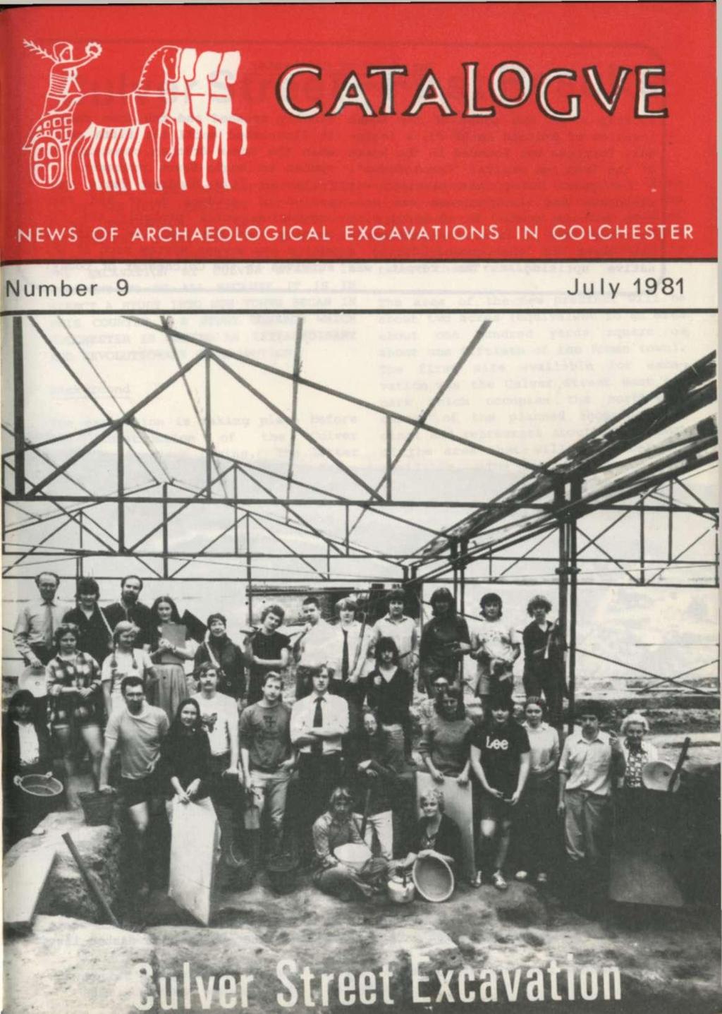
Culver Street-First Results
|
|
|
- Scot Hall
- 5 years ago
- Views:
Transcription
1


2 The story of Colchester Shortly after the start of the Roman invasion of Britain in AD 43, a legionary fortress was founded in the heart of the Iron Age capital 'Camulodunum'. A few years later, the garrison was withdrawn and the fortress was made into a Roman town. In AD 60/61 with enormous loss of life, the settlement was burnt to the ground during a native uprising. The revolt was finally crushed and the town rebuilt. It flourished until the fifth century when the Roman-British community succumbed to Anglo-Saxon pressure. The following five hundred years was a period of gradual decay and sparse occupation until probably the tenth century when the town was revitalised with a new street system much of which survives in the Colchester of today. Culver Street-First Results THE CULVER STREET EXCAVATION PROMISES TO BE THE MOST EXCITING AND INFORM- ATIVE EXCAVATION TO TAKE PLACE IN COLCHESTER. TODAY MOST OF US LIVE IN TOWNS AND TAKE TOWN-LIFE FOR GRANTED. THE EXCAVATION AT CULVER STREET IS RELEVANT TO US ALL BECAUSE IT IS IN EFFECT A STUDY INTO HOW TOWNS BEGAN IN THIS COUNTRY - A STUDY TOWARDS WHICH COLCHESTER IS MAKING AN EXTRAORDINARY AND REVOLUTIONARY CONTRIBUTION. Background The excavation is taking place before the construction of the Culver Shopping Precinct begins. The latter will involve the digging of a large basement up to twenty-feet deep over most of the site so that the new shops and offices can be serviced from an underground lorry and car park. Since the archaeological remains occupy the uppermost ten feet or so, they will of necessity have to be destroyed. It is thus the purpose of the excavation to record these remains. The area of the new precinct will be about two acres (equivalent to an area about one hundred yards square or about one fiftieth of the Roman town). The first site available for excavation was the Culver Street West car park which occupies the north-west corner of the planned shopping precinct and represents about one seventh of the area that will ultimately be available. The following pages outline the discoveries made and the current interpretation of them. An imaginative view of Roman Colchester in cad 200 seen from the south-west. The area of the Culver Street excavation is indicated by a white dashed line. Artist's impression of what the new Culver Street shopping precinct will look like. (Courtesy Duncan Clark & Beckett.) 3
 of eighty soldiers commanded by a centurion.")

3 The Roman fortress The first buildings to have been erected on the site are identifiable as barrack blocks of the legionary fortress. Each block would have been about 250 feet long and accommodated a company (or century) of eighty soldiers commanded by a centurion. The latter lived in comparatively spacious quarters at one end of his century's block. Usually the barracks were grouped into units of six corresponding to a cohort, ten of which made up a legion. The arrangement of the six barrack blocks was standard: Blocks 1 and 2, 3 and 4, 5 and 6 faced one another across narrow streets with Blocks 2 and 3 and Blocks 4 and 5 being back-to-back. At Culver Street, it appears that the centurions' quarters of three barrack blocks have been found (see plan) with a further three to the south yet to be discovered. Soldiers at Colchester: Longinus a Thracian officer on the left talking to Facilis a centurion of the Twentieth Legion on the right. (Drawn from their tombstones found in Colchester in the 19th century and now in Colchester Museum.)

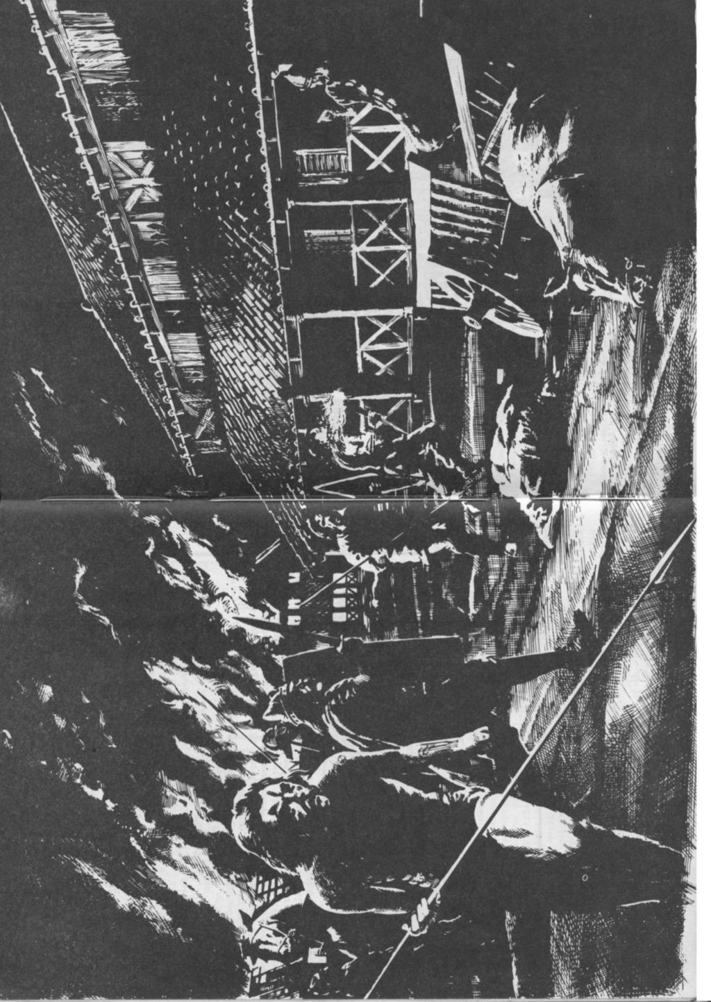
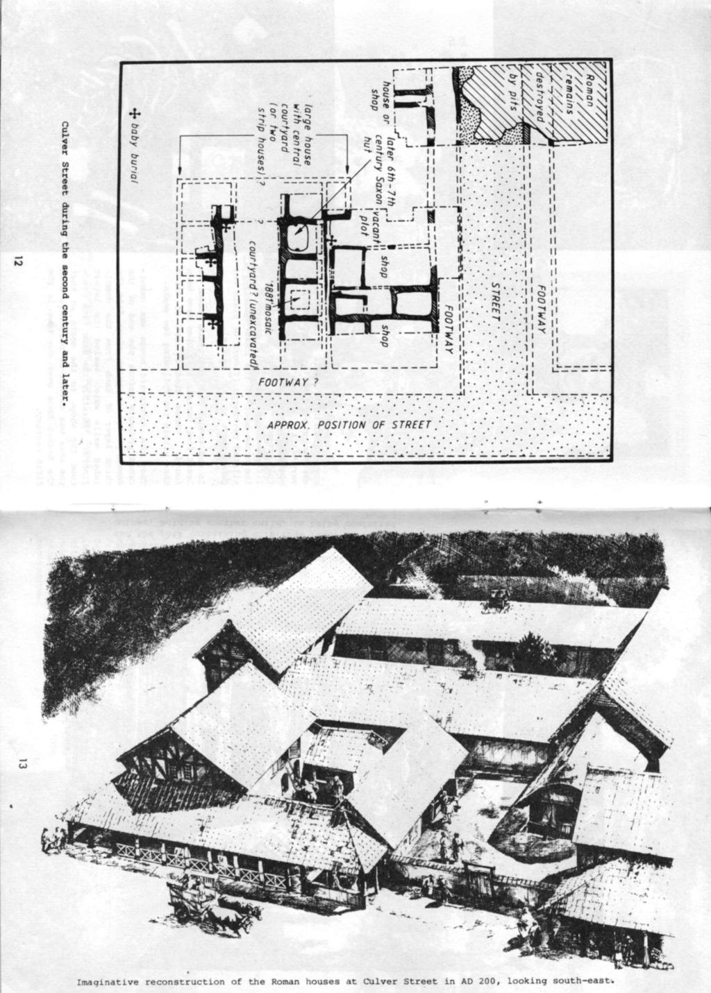
4 The New Town When the legion was transferred to the frontier in Wales, the fortress was no longer required by the Roman Army and rather than demolish it, the base was converted into a town. As recent excavations have shown much of the old fortress was retained but there were also many changes. The military defences were levelled, many new buildings were erected including the magnificent Temple of Claudius, and many new streets were laid out where the military ones did not exist or had been too narrow for civilian use. At Culver Street and no doubt many places elsewhere, the barrack blocks, especially the centurions' quarters, proved very suitable for conversion to private houses. The major change which took place at Culver Street was not demolition of buildings but the widening of the most northerly of the east-west military streets to form a broad thoroughfare flanked by two footways. The idea that some towns were founded by reusing redundant fortresses is recent and novel; Colchester is one of the best examples of this phenomenon. The Boudican Revolt In AD 60 or 61, disaster struck when during the native revolt led by Boudica, Queen of the Iceni, the new town was burnt to the ground. From excavations around the town it is clear that this destruction was nearly total - almost without exception every building seems to have been destroyed by fire. Despite their tiled roofs, their stone plinths, their daubed and plastered walls, these early buildings contained much timber and could easily be set on fire. And so it has proved to have been at Culver Street where the destroyed remains were exceptionally well preserved and plain to see. Floors were -scorched all over bright red and black in the intense heat. And in many places, bases of daub walls survived in place as bright red stumps sealing strips of charcoal that were all that survived of their timber frames. The whole area was covered by a layer up to a foot or more thick of lumps of daub burnt red and black and mixed with fragments of burnt wall plaster and charcoal. To the inhabitants at the time, the full horror of the event would have defied description; to the modern archaeologist, the holocaust presents a marvellous opportunity to examine the remains of buildings not only preserved to an extraordinary degree but also perfectly dated. The Rebuilding After the fire, new buildings were erected on the same plots as before and the narrow streets which had been retained from the fortress were cleared of debris and resurfaced. The new buildings were built in much the same manner as the earlier ones (see plan); they had walls which were framed in timber, and then daubed, plastered and painted. During the second century, the area saw gradual and piecemeal change. The northern building was subdivided and rebuilt as several small shops, presumably taking advantage of the considerable traffic along the east-west street which it fronted. To the south the two buildings were rebuilt so that the narrow street which had originally separated Barrack Blocks 1 and 2 disappeared. The form of this alteration is not yet clear. Possibly the two properties were amalgamated to form a simple substantial house incorporating a central courtyard and fronting onto the northsouth street or possibly both were rebuilt as two long east-west strip houses. (Further excavation should clarify this matter.) In one of the rooms of the?courtyard house, there had been a small mosaic. This was almost certainly the one dis- The buildings erected after the Boudican revolt at Culver Street. Over page: Boudican destruction of Colchester in AD 60/61. 7
5

. In and around the?")

6 The mosaic found during the excavation of The hole in the paved floor caused by the attempt to lift the mosaic in Remains of one of the baby burials. covered during a small archaeological excavation of Unfortunately very little of the pavement survived suggesting that in 1881 an unsuccessful attempt must have been made to lift and preserve it. Elsewhere in the house most of the rooms had tessellated pavements (floors of plain red cubes about an inch square). In and around the?courtyard house, at least four burials of babies have been found. These died if not at birth then within the following few weeks. Imaginative reconstruction of the 1881 excavation when a mosaic was found. That the?courtyard house was demolished probably before the end of the Roman period is quite clear from the thick layer of daub from the demolished walls which sealed its latest floors. Possibly the same fate overtook the shops to the north so that the area was devoid of buildings when the Saxons took over the town in the fifth century. 10
7


8 The Anglo-Saxons Evidence for Saxon occupation of Colchester comes in the form of various Anglo-Saxon objects found in and around the town over the last century or so and - most important - two Anglo-Saxon huts discovered during the Lion Walk excavations of the early 1970s. At Culver Street, yet another hut was found bringing Colchester's total to three. This example was well preserved and contained large quantities of pottery dating it to the 6th or 7th centuries. Huts of this kind were usually very small and were built around a hollow in the ground which frequently was used as the floor. The Culver Street hut was only 13 feet long and had a sunken floor peppered with stakeholes. Very often buildings such as these seem to have been used primarily for weaving rather than habitation. Imaginative reconstruction of the Anglo-Saxon hut. The Anglo-Saxon hut showing its sunken floor and stakeholes. 14

9 The COLCHESTER ARCHAEOLOGICAL TRUST is composed of representatives of local and national bodies as well as a few co-opted individuals and employs a permanent staff of archaeologists to deal with the rescue sites in Colchester. Thanks to all our helpers The dig at Culver Street is being carried out with the help of many people, principally by digging, pottery washing and giving guided tours. Much of this work is voluntary and all of it essential and highly valued. If you think you could help in some way, either visit the site and ask for Debbie Lloyd or telephone Colchester The FRIENDS OF THE COLCHESTER ARCHAEOLOGICAL TRUST has been formed to provide a means of keeping interested members of the public informed about the archaeological work going on in and around the historic town of Colchester. The Friends provide the funds to publish CATALOGUE - the Newsletter of the Colchester Archaeological Trust. Mike Corbishley organises the Friends and edits the Newsletter. Friends receive two newsletters a year, attend an annual programme of lectures on the previous year's progress, are given conducted tours of current sites and can take part in a regular programme of archaeological visits to sites and monuments in the area. The Colchester Archaeological Trust is greatly indebted to Colchester Borough Council, the Department of the Environment and the developers the Carroll Group and Balfour Beatty whose help and co-operation have made the Culver Street excavation possible. The annual subscription rates are as follows: Adults 1.50, Children and Students 75p, Family Membership 2.00 and Institutions or newsletters-only You will find a membership form inside this newsletter. Subscriptions should be sent to Brenda May, Treasurer, Friends of the Colchester Archaeological Trust, 5 William Close, Wivenhoe, Colchester. The Friends of the Colchester Archaeological Trust wish to thank Philips Business Systems for their generous gift towards Catalogue 9, and for the Philips P7000 word processing facilities to prepare the text for printing. This newsletter was prepared by Nick Smith and Philip Crummy. Drawings are by Peter Froste and photography by Alison Colchester.
FOREWORD. S. S. Frere. The Culver Street site in relation to the fortress (top) and the Roman city (below).
 and the Roman city (below).") THE BIG DIG BEGINS FOREWORD Colchester has always been seen as an important Roman site owing to its known status as a Roman colonia - the first of only four in the country - and owing to the presence there
THE BIG DIG BEGINS FOREWORD Colchester has always been seen as an important Roman site owing to its known status as a Roman colonia - the first of only four in the country - and owing to the presence there
An archaeological evaluation at 14 Vineyard Street, Colchester, Essex March 2006
 An archaeological evaluation at 14 Vineyard Street, Colchester, Essex March 2006 report prepared by Ben Holloway commissioned by Colchester Borough Council CAT project code: 06/4b Colchester Museums accession
IN SEARCH OF COLCHESTER'S PAST. by Philip Crummy. Prologue 2. The early antiquarians 3. From 1900 to 1970, a period of rapid progress 12
 IN SEARCH OF COLCHESTER'S PAST PLACES MENTIONED IN THE TEXT by Philip Crummy Front Cover: Imaginative reconstruction of the theatre (centre right) and the Temple of Claudius (background left) in c AD 200.
CARLUNGIE EARTH HOUSE
 Property in Care (PIC) ID: PIC015 Designations: Scheduled Monument (SM90059) Taken into State care: 1953 (Guardianship) Last reviewed: 2004 HISTORIC ENVIRONMENT SCOTLAND STATEMENT OF SIGNIFICANCE CARLUNGIE
An archaeological watching brief at the Sixth Form College, North Hill, Colchester, Essex
 An archaeological watching brief at the Sixth Form College, North Hill, Colchester, Essex July 2001 on behalf of Colchester Borough Council CAT project ref.: 01/7B Colchester Museum accession code: 2001.126
archeological site LOS MILLARES
 archeological site LOS MILLARES Aerial view of the plain of Los Millares between the Rambla de Huéchar and the River Andarax The archaeological site of Los Millares is located in the township of Santa
Following the initial soil strip archaeology is sprayed up prior to planning and excavation
 Barton Quarry & Archaeology Over the past half century quarries have been increasingly highlighted as important sources of information for geologists, palaeontologists and archaeologists, both through
Just under a mile from Cawfields car park where the walk begins is Great Chesters Roman Fort. It is behind the tree, looking from the west.
 Tynedale U3A Hadrian s Wall Group Cawfields to Birdoswald Just under a mile from Cawfields car park where the walk begins is Great Chesters Roman Fort. It is behind the tree, looking from the west. Great
The Italian Archaeological Mission in Sudan Ca Foscari University of Venice
 The Italian Archaeological Mission in Sudan Ca Foscari University of Venice Karima (Sudan) November-December 2012 The 2012 season of the Italian Archaeological Mission at Jebel Barkal was carried out between
I I I I LINDEN TO WOOD FORD SURVEY ITEMS OF HISTORICAL SIGNIFICANCE I I I I I I I I I I I I I
 LNDEN TO WOOD FORD SURVEY TEMS OF HSTORCAL SGNFCANCE ------------------------------------------------------------------------------ --- - CONTENTS OF THE REPORT 1.0 ntroduction to the Report 1.1 Parameters
A leisurely one mile stroll through the history of Aldershot s Manor park, considered by many as the most attractive and pleasant parts of our town.
 Figure 1 Entrance to Park from the Aldershot Green/Churchill road end A leisurely one mile stroll through the history of Aldershot s Manor park, considered by many as the most attractive and pleasant parts
Two recently-discovered Roman buildings in Colchester
 Essex Archaeology and History 23 (1992), 25-38 Two recently-discovered Roman buildings in Colchester by Stephen Benfield and Simon Garrod East Stockwell Street Early Roman occupation was observed in section
4. Bronze Age Ballybrowney, County Cork Eamonn Cotter
 4. Bronze Age Ballybrowney, County Cork Eamonn Cotter Illus. 1 Location map of the excavated features at Ballybrowney Lower (Archaeological Consultancy Services Ltd, based on the Ordnance Survey Ireland
Excavations in a Medieval Market Town: Mountsorrel, Leicestershire,
 Excavations in a Medieval Market Town: Mountsorrel, Leicestershire, by John Lucas Mountsorrel is situated 12 kms north of Leicester and forms a linear settlement straddling the A6, Leicester to Derby road.
Cyprus and Greece. We spent time enjoying the views over the sea and slowly strolled back to the hotel to complete our introductory day.
 Cyprus and Greece We are traveling again, this time spending two weeks in the Eastern Mediterranean, first in Cyprus and then in Greece. We have visited both countries before but it has been about 20 years
MAGAZINE-June & July 2015
 Editor: Edwin Lilly Issue 8 Email: edwin_lilly@yahoo.co.uk MAGAZINE-June & July 2015 Welcome to the June & July 2015 edition of our Magazine. This issue runs from 1st June to 31st July. Reports include:
Archaeological Investigations Project South East Region SOUTHAMPTON 2/842 (C.80.C004) SU
 SU") SOUTHAMPTON City of Southampton 2/842 (C.80.C004) SU 4382 1336 125 BITTERNE ROAD WEST, SOUTHAMPTON Report on the Archaeological Evaluation Excavation at 125 Bitterne Road West, Southampton Russel, A. D
SOUTHAMPTON City of Southampton 2/842 (C.80.C004) SU 4382 1336 125 BITTERNE ROAD WEST, SOUTHAMPTON Report on the Archaeological Evaluation Excavation at 125 Bitterne Road West, Southampton Russel, A. D
TOWERBUTTE. Lewis and Clark s. >> By Jerry Penry, LS
 4.95 Lewis and Clark s TOWERBUTTE >> By Jerry Penry, LS Have you ever felt like you are standing on hallowed ground, knowing that some very important surveyors had previously occupied that same location?
Romans on the Don Classroom Exercise 2. Having a Roman Bath at Hampole
 Having a Roman Bath at Hampole At least seventeen surveys or excavations were carried out at Hazel Lane between 1993 and 2003. These found evidence of field ditches, pits, and a droveway. In the centre
Gorse Stacks, Bus Interchange Excavations Interim Note-01
 Gorse Stacks, Bus Interchange Excavations 2015 Prepared for: Cheshire West & Chester Council Interim Note-01 1 Introduction & Summary Background Since c. 2000 investigations associated with redevelopment
New Studies in the City of David The Excavations
 The 2013-2014 Excavations Israel Antiquities Authority The intensive archaeological work on the city of David hill during the period covered in this article has continued in previously excavated areas
The Coach House, Mill Lane, Cookham, Berkshire
 The Coach House, Mill Lane, Cookham, Berkshire An Archaeological Watching Brief For Ms Sophia Butler by Stephen Hammond Thames Valley Archaeological Services Ltd Site Code CMC 03/104 October 2003 Summary
A21 TONBRIDGE TO PEMBURY DUALLING. Statement of Case
 A21 TONBRIDGE TO PEMBURY DUALLING Statement of Case In Respect of Applications for the Demolition of Listed Buildings Under the Provisions of the Planning (Listed Buildings and Conservation Areas) Act
An archaeological excavation at 193 High Street, Kelvedon, Essex September 2009
 An archaeological excavation at 193 High Street, Kelvedon, Essex September 2009 report prepared by Ben Holloway and Howard Brooks on behalf of Marden Homes CAT project ref.: 09/4g NGR: TL 8631 1913 (c)
The Archaeology of Cheltenham
 The Archaeology of Cheltenham The archaeology collection of The Wilson contains a rich quantity of material relating to the prehistoric and Roman occupation of the North Cotswolds and parts of the Severn
CASTLE OF OLD WICK HISTORIC ENVIRONMENT SCOTLAND STATEMENT OF SIGNIFICANCE. Property in Care(PIC) ID: PIC282 Designations:
 ID: PIC282 Designations:") Property in Care(PIC) ID: PIC282 Designations: Scheduled Monument (SM90065) Taken into State care: 1957 (Guardianship) Last reviewed: 2004 HISTORIC ENVIRONMENT SCOTLAND STATEMENT OF SIGNIFICANCE CASTLE
Property in Care(PIC) ID: PIC282 Designations: Scheduled Monument (SM90065) Taken into State care: 1957 (Guardianship) Last reviewed: 2004 HISTORIC ENVIRONMENT SCOTLAND STATEMENT OF SIGNIFICANCE CASTLE
HANBURY PARISH COUNCIL
 HANBURY PARISH COUNCIL STAFFORDSHIRE Clerk: 44 HOLLOW LANE AMANDA ANDREW DRAYCOTT IN THE CLAY 01283 820420 ASHBOURNE DERBYSHIRE hanburyparishcouncil@live.co.uk DE6 5HQ Present MINUTES OF THE PARISH MEETING
3.4 Hulme Barracks, Hulme
 3.4 Hulme Barracks, Hulme Historical Background Hulme Barracks represent an often overlooked aspect of life in 19 th -century Manchester. As the local journal The Sphinx observed in 1868, Manchester was
The City-Wall of Nineveh
 The City of Nineveh Nineveh has a very long history, with finds dating already back at fifth millennium. As part of the Assyrian empire, the city served as a regional center during the Middle and Early
An archaeological watching brief on a new cable trench at the Abbey Field sports pitches, Circular Road North, Colchester, Essex October 2006
 An archaeological watching brief on a new cable trench at the Abbey Field sports pitches, Circular Road North, Colchester, Essex report prepared by Ben Holloway on behalf of Atkins Defence CAT project
The Greek-Swedish-Danish Excavations at Kastelli, Khania 2010 a short report
 The Greek-Swedish-Danish Excavations at Kastelli, Khania 2010 a short report During six weeks from 19 July to 27 August the Greek-Swedish-Danish Excavations continued work in the Ag. Aikaterini Square
The Farleighs, Boughton Monchelsea, The Loose Valley and the Roman Occupation. By Simon Elliott BSc MA (Arch) MA (War Studies)
 MA (War Studies)") The Farleighs, Boughton Monchelsea, The Loose Valley and the Roman Occupation. By Simon Elliott BSc MA (Arch) MA (War Studies) During the period when Britain was occupied by the Romans (AD43 through to
The Farleighs, Boughton Monchelsea, The Loose Valley and the Roman Occupation. By Simon Elliott BSc MA (Arch) MA (War Studies) During the period when Britain was occupied by the Romans (AD43 through to
Deddington Castle, Oxfordshire: A Summary of Excavations *
 Deddington Castle, Oxfordshire: A Summary of Excavations 1977 1979* R.J. Ivens for Queen s University, Belfast, and DoE Between 1947 and 1951 Prof. E.M. Jope carried out a series of rescue excavations
Ground Penetrating Radar Survey Report:
 Ground Penetrating Radar Survey Report: German Hospice in Jerusalem, Israel Data Acquired June 19, 2003 Report compiled August 26, 2003 Survey and Report Published by Mnemotrix Systems, Inc. Copyright
MEDIA RELEASE Embargoed until 4.15pm 12 July Recommended location announced for Waikato Regional Theatre
 MEDIA RELEASE Embargoed until 4.15pm 12 July 2017 Recommended location announced for Waikato Regional Theatre The recommended location for the new Waikato Regional Theatre has been announced as the Hamilton
An archaeological excavation and watching brief at the Musket Club, Homefield Road, Colchester, Essex December 2004-February 2005
 An archaeological excavation and watching brief at the Musket Club, Homefield Road, Colchester, Essex December 2004-February 2005 report prepared by Howard Brooks on behalf of RMPA and the MoD CAT project
218 R. S. BORAAS AND S. H. HORN
 were able to show a sequence of ceramic corpora much more fully representative than those available from the occupation surfaces and structures higher on the mound. This ceramic series obtained from D.
An archaeological fieldwalking evaluation at Tile House Farm, Great Horkesley, Essex July-September 2005
 An archaeological fieldwalking evaluation at Tile House Farm, Great Horkesley, Essex commissioned by ADP Chartered Architects on behalf of The Ingleton Properties Ltd and Mersea Homes CAT project code:
aiton.new 1/4/04 3:48 AM Page 2
 aiton.new 1/4/04 3:48 AM Page 2 Below: An aerial view of area A of the excavations. A massive square building that appears to be a fortress was discovered in this area at the top of the tell. aiton.new
Labraunda Preliminary report
 Labraunda 2012. Preliminary report The excavations at Labraunda this year were very successful and lasted for eight weeks. Our main new discovery is obviously the gold coin from Philip II discovered in
UNIVERSITY OF LANCASTER ARCHAEOLOGY FORUM. 5 March 2011
 UNIVERSITY OF LANCASTER CENTRE FOR NORTH-WEST REGIONAL STUDIES ARCHAEOLOGY FORUM 5 March 2011 Feeding the military masses: How did northern Britain cope with the Roman army? Sue Stallibrass Whilst we shall
The Battle of Quebec: 1759
 The Battle of Quebec: 1759 In the spring of 1759, the inhabitants of Quebec watched the river with worried eyes. They waited anxiously to see whether the ships of the French, or those of the British fleet,
Connect With Us National Geographic Daily News
 Page 1 of 5 Connect With Us National Geographic Daily News Page 2 of 5 Huge Gladiator School Found Buried in Austria "Important" find boasts amphitheater, was nearly as big as two Walmarts. Digital reconstruction
GPR prospection at Borgholm castle, Öland, Sweden
 ArcheoSciences Revue d'archéométrie 33 (suppl.) 2009 Mémoire du sol, espace des hommes GPR prospection at Borgholm castle, Öland, Sweden Immo Trinks, Pär Karlsson, Magnus Stibéus, Clas Ternström and Alois
w w w. d r a k e s - i s l a n d. c o m
 w w w. d r a k e s - i s l a n d. c o m 1 A Piece of History Named after Plymouth s most famous patron and situated in the heart of Plymouth Sound, Drake s Island has a rich history having been a religious
ROUKEN GLEN: BANDSTAND 2015 DATA STRUCTURE REPORT
 ROUKEN GLEN: BANDSTAND 2015 DATA STRUCTURE REPORT Author (s) Ian Hill Editors Report Date June 2015 Working Partners Funders Phil Richardson East Renfrewshire Council East Renfrewshire Council, Heritage
EDINBURGH CASTLE QUEEN ANNE BUILDING
 Property in Care (PIC) no:pic222 Designations: Listed Building (LB48220) Taken into State care: 1906 (Ownership) Last reviewed: 2012 HISTORIC ENVIRONMENT SCOTLAND STATEMENT OF SIGNIFICANCE EDINBURGH CASTLE
BRONZE-AGE FOOD VESSEL (b) USED AS A BURIAL URN BROWN CANDOVER, [To face page 249]
![BRONZE-AGE FOOD VESSEL (b) USED AS A BURIAL URN BROWN CANDOVER, [To face page 249]](/thumbs/93/118018967.jpg "BRONZE-AGE FOOD VESSEL (b) USED AS A BURIAL URN BROWN CANDOVER, [To face page 249]") BRONZE-AGE FOOD VESSEL (b) USED AS A BURIAL URN BROWN CANDOVER, HANTS [To face page 249] 249 TWO BRONZE AGE DISCOVERIES IN HANTS. BY S. E. WlNBOLT, M.A. (i.) Brown Candover. East of the road at Brown Candover,
BRONZE-AGE FOOD VESSEL (b) USED AS A BURIAL URN BROWN CANDOVER, HANTS [To face page 249] 249 TWO BRONZE AGE DISCOVERIES IN HANTS. BY S. E. WlNBOLT, M.A. (i.) Brown Candover. East of the road at Brown Candover,
Fort Ticonderoga Carillon Battlefield Walking Trail Guide
 Fort Ticonderoga Carillon Battlefield Walking Trail Guide Copyright Fort Ticonderoga. Photo Credit Carl Heilman II Length: Approximately 1¾ mile Welcome to Fort Ticonderoga s Walking Trail Blue markers
GEOGRAPHY OF UK. (O Driscoll, James. 2003)
") GEOGRAPHY OF UK (O Driscoll, James. 2003) A group of about 5,000 islands off the northcoast of mainland Europe Between the latitude 50 N and 61 N UK consists of four countries; * England, * Wales, * Scotland,
GEOGRAPHY OF UK (O Driscoll, James. 2003) A group of about 5,000 islands off the northcoast of mainland Europe Between the latitude 50 N and 61 N UK consists of four countries; * England, * Wales, * Scotland,
In September, 1966, an
 ANNE S. ROBERTSON, D LITT THE ROMAN CAMP(S) ON HILLSIDE FARM, DUNBLANE, PERTHSHIRE This paper is published with the aid of a grantfrom H.M.Treasury In September, 1966, an emergency excavation was begun,
EXCAVATING THE ROMAN EMPIRE IN BRITAIN: EXCAVATION AND RESEARCH AT SOUTH SHIELDS ROMAN FORT, UK
 Earthwatch 2016 Annual Field Report EXCAVATING THE ROMAN EMPIRE IN BRITAIN: EXCAVATION AND RESEARCH AT SOUTH SHIELDS ROMAN FORT, UK Nick Hodgson MA, PhD, FSA (Tyne & Wear Archives & Museums) PERIOD COVERED
Town Planning in Ancient Egypt
 Town Planning in Ancient Egypt Location The reasons for the foundation of a new settlement could be varied: security, often combined with economics, as in the case of the southern fortress towns (Buhen);
An archaeological watching brief on land adjacent to 50 Rosebery Avenue, Colchester, Essex May/June 2003
 An archaeological watching brief on land adjacent to 50 Rosebery Avenue, Colchester, Essex May/June 2003 report prepared by C Crossan on behalf of Highfield Homes Ltd NGR: TM 0035 2500 CAT project ref.:
ARCHAEOLOGY IN TUCSON
 ARCHAEOLOGY IN TUCSON Vol.1, No.4 Newsletter of the Institute for American Research Summer 1987 TRULY THE ORIGINAL TUCSON! In our last AIT newsletter, we presented some of the background about the San
FOUNDATIONS OF ARCHAEOLOGY A WALK IN VERNDITCH CHASE
 FOUNDATIONS OF ARCHAEOLOGY A WALK IN VERNDITCH CHASE 1. A Tale of two Long Barrows Long barrows were constructed as earthen or drystone mounds with flanking ditches and acted as funerary monuments during
Cave and Basin & Castle Internment Camp Site Visit Report Sarah Beaulieu December 7, 2015
 Cave and Basin & Castle Internment Camp Site Visit Report Sarah Beaulieu December 7, 2015 Figure 1.1 Cave and Basin National Historic Site Internment Exhibit Banff National Park was the site of two internment
EOMAN EEMAINS POUND AT BAMSGATE.
 Archaeologia Cantiana Vol. 12 1878 EOMAN EEMAINS POUND AT BAMSGATE. BY ROBERT HICKS, M.B.C.S. WHEN Thanet was completely isolated, the sea flowed in at Eeculver, covering the marshes between that place
Documentation of Mosaic Tangible Heritage in Jordan Jarash Governorate
 Documentation of Mosaic Tangible Heritage in Jordan Jarash Governorate Catreena Hamarneh, Abdel Majeed Mjalli, Mohamed al-balawneh Introduction In the year 2005 a project was launched to build up a data
Afon Adda Refurbishment Bangor
 Afon Adda Refurbishment Bangor Archaeological Assessment Revised Report GAT Project No. 1876 Report No. 628 April 2006 Ymddiriedolaeth Archaeolegol Gwynedd Gwynedd Archaeological Trust Craig Beuno, Ffordd
Historical value The building was erected on a new site to serve a new meeting and in itself is of low historical value.
 Quaker Meeting House, Welwyn Garden City 109 Handside Lane, Welwyn Garden City, Hertfordshire, AL8 6SP National Grid Reference: TL 23149 12617 Statement of Significance As first built in 1926 to the designs
Dunyvaig Castle Dun Naomhaig. Isle of Islay
 Dunyvaig Castle Dun Naomhaig Isle of Islay Dunyvaig Castle Dunyvaig Castle, Dun Naomhaig, located on Islay s southern coast, is an unrealised asset, not just for Islay but for the whole of Scotland. Islay
Remote Sensing into the Study of Ancient Beiting City in North-Western China
 Dingwall, L., S. Exon, V. Gaffney, S. Laflin and M. van Leusen (eds.) 1999. Archaeology in the Age of the Internet. CAA97. Computer Applications and Quantitative Methods in Archaeology. Proceedings of
Trench 91 revealed that the cobbled court extends further to the north.
 Report on the 2013 Gournia Excavations The 2013 excavations at Gournia were conducted June 17 July 26 under the aegis of the American School of Classical Studies at Athens and the supervision of the KD
North East CBD/ Little Lon and Bourke Hill.
 North East CBD/ Little Lon and Bourke Hill. The North East CBD in an area of contrasts. From the former slum district laneways around Little Lonsdale St., to the leafy area around Bourke Hill and stately
archaeological site GADES Columbaria Roman Theatre Salting Factory
 archaeological site GADES Columbaria Roman Theatre Salting Factory In the final days of the Roman Republic and the early years of Augustus rule, the city of Gades experienced a period of economic and political
REPORT NUMBER 001 ARCHAEOLOGICAL DOWSING SURVEY BISHOPS SUTTON NEAR ALRESFORD HAMPSHIRE. D P BRYAN BA (Hons) MARCH 2012
 MARCH 2012") REPORT NUMBER 001 ARCHAEOLOGICAL DOWSING SURVEY AT BISHOPS SUTTON NEAR ALRESFORD HAMPSHIRE D P BRYAN BA (Hons) MARCH 2012 1 Table of Contents 1. Introduction 1.1 Project Background Page 2 1.2 Site Location
REPORT NUMBER 001 ARCHAEOLOGICAL DOWSING SURVEY AT BISHOPS SUTTON NEAR ALRESFORD HAMPSHIRE D P BRYAN BA (Hons) MARCH 2012 1 Table of Contents 1. Introduction 1.1 Project Background Page 2 1.2 Site Location
Please see our website for up to date contact information, and further advice.
 Saxon Shore Forts On 1st April 2015 the Historic Buildings and Monuments Commission for England changed its common name from English Heritage to Historic England. We are now re-branding all our documents.
Jneneh in the Upper Wadi az-zarqa, in North Central Jordan, First Season 2011.
 Jneneh in the Upper Wadi az-zarqa, in North Central Jordan, First Season 2011. Khaled Douglas Jneneh is located in the north-western periphery of the city of Zarqa (grid ref. 250.88E 165.25N), in North
Bootham Bar, York City Walls. (John Oxley FSA, City Archaeologist)
") W a l l e d C i t i e s & O p e n S o c i e t i e s : M a n a g i n g H i s t o r i c W a l l s i n U r b a n W o r l d H e r i t a g e P r o p e r t i e s Siena, Italy. 26-27 January 2017 Bootham Bar,
W a l l e d C i t i e s & O p e n S o c i e t i e s : M a n a g i n g H i s t o r i c W a l l s i n U r b a n W o r l d H e r i t a g e P r o p e r t i e s Siena, Italy. 26-27 January 2017 Bootham Bar,
APPLICATION FOR AMENDMENT TO THE LIST
 APPLICATION FOR AMENDMENT TO THE LIST Before completing this form please ensure you have read the accompanying guidance notes. All sections marked * are essential; please complete all other sections as
The Yingtianmen Gate-site of the Sui and Tang Eastern Capital in Luoyang City
 Nandajie The Yingtianmen Gate-site of the Sui and Tang Eastern Capital in Luoyang City Tang Luoyang City-site Archaeological Team, Institute of Archaeology, Chinese Academy of Social Sciences Key words:
Concept Document towards the Dead Sea Basin Biosphere Reserve and World Heritage Listing. This report has been presented to the public and to
 Concept Document towards the Dead Sea Basin Biosphere Reserve and World Heritage Listing. This report has been presented to the public and to political decision makers both regionally and internationally
Access Statement for Tullie House Museum and Art Gallery
 This access statement does not contain personal opinions as to our suitability for those with access needs, but aims to accurately describe the facilities and services that we offer all our guests/visitors.
Friends of Ayton Castle Meeting Minutes 8th October2018 Present Catherine Cussons (Farmer), Paul Buck (Scarborough Borough Council), Peter Durkin
, Paul Buck (Scarborough Borough Council), Peter Durkin") Friends of Ayton Castle Meeting Minutes 8th October2018 Present Catherine Cussons (Farmer), Paul Buck (Scarborough Borough Council), Peter Durkin (local resident), John Edwards (local resident), Jean Glover
Friends of Ayton Castle Meeting Minutes 8th October2018 Present Catherine Cussons (Farmer), Paul Buck (Scarborough Borough Council), Peter Durkin (local resident), John Edwards (local resident), Jean Glover
LOCHRANZA CASTLE HISTORIC ENVIRONMENT SCOTLAND STATEMENT OF SIGNIFICANCE. Property in Care (PIC) ID: PIC090
 ID: PIC090") Property in Care (PIC) ID: PIC090 Designations: Scheduled Monument (SM90206) Taken into State care: 1956 (Guardianship) Last reviewed: 2004 HISTORIC ENVIRONMENT SCOTLAND STATEMENT OF SIGNIFICANCE LOCHRANZA
Property in Care (PIC) ID: PIC090 Designations: Scheduled Monument (SM90206) Taken into State care: 1956 (Guardianship) Last reviewed: 2004 HISTORIC ENVIRONMENT SCOTLAND STATEMENT OF SIGNIFICANCE LOCHRANZA
Gelligaer. Roman Fort. Caer Rufeinig. Meet the Edwardian Explorers who uncovered Gelligaer s Roman Past
 Gelligaer Caer Rufeinig Roman Fort Meet the Edwardian Explorers who uncovered Gelligaer s Roman Past Guided Walk and Children s Clue Trail around Gelligaer Roman Fort Time Team is nothing new! What lies
The Rosetta Stone. Writing in Ancient Egyptian
 Writing in Ancient Egyptian The Rosetta Stone The hieroglyphic writing system used more than 600 symbols, mostly pictures of objects. Each symbol represented one or more sounds in the Egyptian language.
ARDESTIE EARTH HOUSE HISTORIC ENVIRONMENT SCOTLAND STATEMENT OF SIGNIFICANCE. Property in Care no: 24
 Property in Care no: 24 Designations: Scheduled Monument (SM90021) Taken into State care: 1953 (Guardianship) Last reviewed: 2004 HISTORIC ENVIRONMENT SCOTLAND STATEMENT OF SIGNIFICANCE ARDESTIE EARTH
IKLAINA ARCHAEOLOGICAL PROJECT 2016 FIELD REPORT Michael B. Cosmopoulos
 IKLAINA ARCHAEOLOGICAL PROJECT 2016 FIELD REPORT Michael B. Cosmopoulos Introduction The overarching objective of the Iklaina project is to test existing hierarchical models of state formation in Greece
Draft Report. 7. Excavations in the temenos gateway, Area (TG5) Author - D. A. Welsby Period 1-2. Period 1. Period 2. Derek A.
 Author - D. A. Welsby Period 1-2. Period 1. Period 2. Derek A.") 7. Excavations in the temenos gateway, Area (TG5) Derek A. Welsby When Griffith excavated the temples at Kawa in 1929-31, work followed by that of Macadam and Kirwan in the winter of 1935-6, the temenos
7. Excavations in the temenos gateway, Area (TG5) Derek A. Welsby When Griffith excavated the temples at Kawa in 1929-31, work followed by that of Macadam and Kirwan in the winter of 1935-6, the temenos
-abstract- Carmen Olguţa Rogobete. Key words: domestic architecture, Greek colonies, above-ground houses, dugouts, semidugouts,
 The Domestic Architecture in the Greek Colonies on the Western and Northern Shore of the Black Sea (end of the 7 th Century-end of the 1 st Century BC) -abstract- Carmen Olguţa Rogobete Key words: domestic
Fishbourne Roman Palace
 Fishbourne Roman Palace Property Information for volunteers Contents Fishbourne Roman Palace background information Collections Discovery Centre] Roman Gardens Fishbourne Today Contact details Volunteer
NASCIO 2015 State IT Recognition Awards
 NASCIO 2015 State IT Recognition Awards Title: Camp Lawton Augmented Reality Category: Digital Government Government to Citizen Contact: Mr. John Martin Chief Information Officer Department of Natural
CLASSICAL TURKEY 10 days
 10 days Countries visited Turkey Tour Highlights Admire the stunning Blue Mosque Learn about life in Ottoman times in Topkapi Palace Appreciate the genius in the design of Hagha Sophia Experience the Grand
Roman And Anglian York Ordnance Survey Historical Map And Guide
 Roman And Anglian York Ordnance Survey Historical Map And Guide We have made it easy for you to find a PDF Ebooks without any digging. And by having access to our ebooks online or by storing it on your
Friends Meeting House, Hitchin. 1 Paynes Park, Hitchin, Hertfordshire, SG5 1EH. National Grid Reference: TL Statement of Significance
 Friends Meeting House, Hitchin 1 Paynes Park, Hitchin, Hertfordshire, SG5 1EH National Grid Reference: TL 18282 29279 Statement of Significance A meeting house of 1957 designed by Paul V. Mauger and erected
Fort Carillon/Ticonderoga
 Fort Carillon/Ticonderoga A P H O T O G R A P H I C H I S T O R Y B E H I N D T H E S T R A T E G I C K E Y T O B O T H B R I T I S H A N D A M E R I C A N V I C T O R I E S I N T H E N O R T H. S E V
The Castor Roman Walk
 The Castor Roman Walk Welcome to the Route Plan and teachers notes for the Castor Roman Walk. The walk is approximately 3km, with an optional extension of 0.7km. We suggest that you bring with you OS Explorer
The Area Known as the Highfields
 The Area Known as the Highfields In the early nineteenth century, our area to the east of Leicester city centre was known as High fields. The area was rich in water sources and windmills, the springs being
Archaeology Internship in the Great Smoky Mountains National Park Summer 2010, Leila Donn
 Archaeology Internship in the Great Smoky Mountains National Park Summer 2010, Leila Donn This past summer I spent three months working as an archaeology intern in the Great Smoky Mountains National Park
Friends Meeting House, Leicester. 16 Queens Road, Leicester, LE2 1WP. National Grid Reference: SK Statement of Significance
 Friends Meeting House, Leicester 16 Queens Road, Leicester, LE2 1WP National Grid Reference: SK 59852 02815 Statement of Significance A meeting house purpose-built on a new site in 1955 and slightly enlarged
HIGHLIGHTS: TOUR INCLUDES:
 1-877-725-6674 The Hashemite Kingdom of Jordan lies at the heart of a region whose development and culture has played a pivotal part in the history of the world for the past two thousand years. This short
Archaeologists for Hire: An In-Class Activity
 Archaeologists for Hire: An In-Class Activity Beyond Grades: Capturing Authentic Learning Conference Welcome to the Marveloso Valley, a fictional valley on the central coast of Peru. Over the decades,
Independent Technical Reference Group Wild Horse Damage around Currango Homestead Made by: Friends of Currango Inc. (FoC) Date: 13 April 2015
 Date: 13 April 2015") Submission to: Dr Mark Lonsdale Independent Chair Independent Technical Reference Group Re: Wild Horse Damage around Currango Homestead Made by: Friends of Currango Inc. (FoC) Date: 13 April 2015 Background
Submission to: Dr Mark Lonsdale Independent Chair Independent Technical Reference Group Re: Wild Horse Damage around Currango Homestead Made by: Friends of Currango Inc. (FoC) Date: 13 April 2015 Background
Medulin Bay in Late Antiquity Antique and Late Antique Site of Vižula near Medulin, Croatia
 Medulin Bay in Late Antiquity Antique and Late Antique Site of Vižula near Medulin, Croatia Kristina Džin, International Research Centre for Archaeology Brijuni Medulin Ivo Pilar Institute, Zagreb p.p.
Martinengo Palace. Historic Buildings on the Roman Forum Square. Soprintendenza Archeologica della Lombardia
 Martinengo Palace Historic Buildings on the Roman Forum Square Soprintendenza Archeologica della Lombardia 2 3 Martinengo Palace Historic Buildings on the Roman Forum Square I am pleased to introduce you
Department of Tourism, Culture and Recreation Provincial Archaeology Office 2012 Archaeology Review February 2013 Volume 11
 Department of Tourism, Culture and Recreation Provincial Archaeology Office 2012 Archaeology Review February 2013 Volume 11 Area 14 of FjCa-14 in Sheshatshiu, portion of feature in southeast corner of
St. Patrick s Street Development Brief
 St. Patrick s Street Development Brief Bardas Chorcai Cork Corporation August 2001 Contents Introduction and background The Development Brief Area Protected and valuable buildings Urban context Objectives
How the Nile River Led to Civilization in Ancient Egypt
 How the Nile River Led to Civilization in Ancient Egypt By USHistory.org, adapted by Newsela staff on 03.07.17 Word Count 786 Level 950L TOP: This photo, taken around 1915, shows the flooding of the Nile