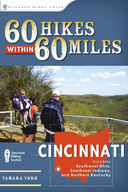
cincinnati including southwest ohio, Southeast Indiana, and Northern Kentucky f i r s t e d i t i o n tamara york
|
|
|
- Johnathan Byrd
- 5 years ago
- Views:
Transcription
1
2 60 Hikes within 60 MILES cincinnati including southwest ohio, Southeast Indiana, and Northern Kentucky f i r s t e d i t i o n tamara york
3 table of contents Overview Map inside front cover Acknowledgments IX Foreword X About the Author XI Preface XII Hiking Recommendations XV Introduction Ohio 1 Adams Lake State Park and State Nature Preserve... 2 Beaver Creek Wildlife Area: Siebenthaler Fen... 3 Buzzardroost Rock... 4 Caesar Creek Gorge State Nature Preserve: Gorge Loop Trail 5 Caesar Creek State Park... 6 Chaparral Prairie State Nature Preserve... 7 Chilo Lock 34 Park and Crooked Run Nature Preserve. 8 Clifton Gorge State Nature Preserve... 9 Cox Arboretum East Fork State Park: South Trail Fort Ancient State Historical Site Germantown MetroPark Governor Bebb Preserve and Pioneer Village Hueston Woods John Bryan State Park Miami of Ohio: Natural Areas Spring Valley Wildlife Area Stonelick State Park Sugarcreek MetroPark Wilderness Preserve... Cincinnati: Hikes near the 275 Loop 21 Ault Park Caldwell Park California Woods Nature Preserve Cincinnati Nature Center s Rowe Woods Eden Park Gilmore Ponds Interpretive Preserve Miami Whitewater Forest: Outer Loop Mount Airy Forest: West Fork Road, Diehl Ridge, and Elm Ravine Mount Airy Forest: Furnas, Twin Bridge, Beechwood, Red Oak, and Ponderosa Sharon Woods Shawnee Lookout Spring Grove Cemetery Winton Woods Withrow Nature Preserve... Indiana 35 Clifty Falls State Park and Clifty Canyon Nature Preserve 36 Hardy Lake State Recreation Area Hayes Arboretum Mary Gray Bird Sanctuary Mounds State Recreation Area Muscatatuck Park Muscatatuck National Wildlife Refuge: Chestnut Ridge Trail Muscatatuck National Wildlife Refuge: East River Trail 43 Muscatatuck National Wildlife Refuge: Richart Trail. 44 Pennywort Cliffs Nature Preserve Selmier State Forest Shrader-Weaver Nature Preserve Versailles State Park Whitewater Gorge: Cardinal Greenway Rail Trail Whitewater Memorial State Park... Kentucky 50 Big Bone Lick State Park Blue Licks Battlefield State Resort Park Boone County Cliffs State Nature Preserve Curtis Gates Lloyd Wildlife Management Area Dinsmore Homestead and State Nature Preserve Fort Thomas Landmark Tree Trail General Butler State Resort Park John A. Kleber Wildlife Management Area Kincaid State Park Mullins Wildlife Management Unit Quiet Trails State Nature Preserve... Appendixes and index Appendix A Outdoor Shops Appendix B Places to Buy Maps Appendix C Hiking Clubs Appendix D Hiking with children and outdoor programs Index Map Legend inside back cover
4 32 60 hikes within 60 miles: cincinnati 04 Caesar Creek Gorge State Nature Preserve: Gorge Loop Trail 04 Caesar Creek Gorge State Nature Preserve: Gorge Loop Trail feet i KEY AT-A-GLANCE INFORMATION Length: 1.53 miles Configuration: Figure 8 Difficulty: Easy moderate Scenery: Tailwaters, forest, and cliffs Exposure: Mostly shaded Traffic: Moderate heavy Trail surface: Old road, mowed path, gravel, and soil Hiking time: 1 hour Driving distance: 1 hour north of Cincinnati Season: Year-round Access: Sunrise sunset Maps: USGS Oregonia; Caesar Creek Lake Map and Guide to Trails, Plants, Wildlife, and Fossils Wheelchair accessible: A portion of the area near the tailwaters Facilities: Restrooms and drinking water at the front of the parking area For more information: Caesar Creek Gorge State Nature Preserve, (614) Special comments: Although this trail does not rate as a hard trail, the section that leads downhill has plenty of steps and is a little difficult to navigate in places. GPS Trailhead Coordinates UTM Zone (WGS84) 16 S Easting Northing Latitude N 39 28' 59.53" Longitude W 84 03' 54.22" In Brief The Gorge Loop Trail at Caesar Creek Gorge State Nature Preserve offers a pleasant hike through the woods and a nice start or end to your hiking day. It s relatively easy except for portions that lead down a steep hillside. Description Caesar Creek Gorge State Nature Preserve is 483 acres of Ordovician bedrock, woods, and Caesar Creek. The meltwater of a glacier carved a path through the area, forming the gorge. The nature preserve is located beyond the dam of Caesar Creek Lake. This area is rich in fossils, but you are only allowed to collect them in the nearby emergency spillway. Before doing so, you should obtain a fossil-collecting permit from the U.S. Army Corps of Engineers. You ll most likely find brachiopods, horn coral, and crinoids. Resist the urge to climb up and inspect the rocks of the cut-through because it damages the habitat. After you ve parked your vehicle, walk toward the restroom area. Across the road from the restrooms is a steel bridge spanning the tailwaters of Caesar Creek Lake. The bridge is an excellent place to view Caesar Creek. Continue across the bridge to an intersection with three trails. Follow the Gorge Directions From the northeast corner of Cincinnati, take Interstate 71 north (from Interstate 275) 28 miles and turn left onto OH 73. Travel west on OH 73 for 7.6 miles. Turn left, heading south on Clarksville Road for 2.5 miles. Turn right onto the entrance road to Caesar Creek Gorge State Nature Preserve. FEET O Neall Rd. Ceasar Creek arched bridge steel bridge MILES steps footbridge tailwaters steps Clarksville Rd. CAESAR CREEK GORGE STATE NATURE PRESERVE 1.53

5 34 60 hikes within 60 miles: cincinnati ohio 04 :: Caesar Creek Gorge State Nature Preserve 35 Loop Trail to the left and uphill. This trail, which is made of gravel and old asphalt, follows a retired roadbed. It enters a mature forest of American beech, sugar maples, and elms. A fair amount of aging and erosion has pitted this portion of the trail. Be careful of your footing. Butterflies are common here as they take advantage of the small pools of water and salts. Near 0.13 miles, parts of this trail are marked with blue blazes, as this is also a portion of the Ohio Buckeye Trail. At 0.15 miles a beautiful ravine area begins, with flat stones to the right at 0.28 miles. The trail then transitions from the forest to an open area. Take a right onto the wide, mulched trail. At the next intersection, take the trail to the right. It enters a field with no overstory. The field is going through succession, as you can tell from the red cedars, which are usually the first trees to pioneer an old field habitat. This area has plenty of red cedars as well as elms and poison ivy. The trail enters into a mixed hardwood forest with a canopy at about 40 feet. Near 0.3 miles, the forest is composed of chinquapin oak trees and beech and sugar maple saplings. The trail is shaded as it weaves through the sugar maple saplings and pawpaw trees. At 0.38 miles, cross a footbridge over a small intermittent stream, then another footbridge shortly thereafter. The trail begins to head uphill over several large steps. Beautiful red and white oaks and several shagbark hickory trees fill the forest. The trail winds uphill and passes an enormous red oak tree at 0.47 miles. Red oaks can be easily identified because of the distinguished dark and light gray bark that, near the top of the tree, looks like ski tracks. Unlike some gorge trails, this one typically has a good breeze flowing through that makes for a nice, cool hike on a hot summer day. And even though the Gorge Loop Trail is popular, it remains a quiet place to hike. Near 0.5 miles, trillium covers the hillsides. Pass by the black cherry tree with grapevine growing into its canopy. Dogwoods, basswoods, and elms border the trail along this portion. Pass by the small retention wall and enjoy a break on the bridge at 0.59 miles. Outfitted with benches, this is a wonderful spot to enjoy the view of the gorge. After you cross the bridge, the trail leads uphill for a little bit. It banks and passes by several large trees within 10 feet of each other. The first on the right is a sugar maple, the second one on the right is a red oak, and the next one to the left is a shagbark hickory. The canopy of the mature woods is now about 60 feet tall. At 0.69 miles, when the trail splits, take the trail to the right. It leads downhill and, at 0.71 miles, splits again. The trail to the left leads to the spillway; follow the Gorge Loop Trail to the right and downhill via the steps. Take 21 steps down to the platform and look to the left at the gorge area. After 12 more steps, the trail becomes a mulched path. At 0.74 miles, you ll encounter another series of steep steps and a boardwalk. The gorge and stream are to the left. View of Caesar Creek from the small spur trail Decorated by several large, flat stones, the trail winds along a shelf on the hillside. Watch out for the poison ivy on both sides of the trail, especially near 0.86 miles where it overgrows the edges. Pass through another area with a retaining wall and descend the steps. The steps end at 0.91 miles. The creek bed is just a few feet to the left. Pass over more steps and the mulched path leads to a gravel-covered path. To the left is another bridge. Take a few moments to enjoy this area and the rock formations. Follow the gravel road to the right. The creek is to the left. Several spur trails lead to the edge of Caesar Creek. Follow this path to the first intersection and take the concrete path straight ahead. Cross over the small footbridge and continue along the edge of Caesar Creek. Take the steps up and over the tailwater outlet. At 1.4 miles, cross the bridge with the steep incline. Caesar Creek is to the left and a small stream is to the right. Follow the concrete path back to the parking lot and your vehicle. Nearby Activities Caesar Creek Lake State Park, Spring Valley Wildlife Area, and Fort Ancient offer additional hiking opportunities and are included in this book. Waynesville has several great hometown restaurants as well as plenty of antique stores.
Cincinnati Nature Center s
 120 60 hikes within 60 miles: cincinnati 24 Cincinnati Nature Center s Rowe Woods i KEY AT-A-GLANCE INFORMATION Length: 8.9 miles Configuration: Loop Difficulty: Difficult Scenery: Forest, ponds, prairie,
2 7 5 L O O P 2 5 : : E
 275 loop 25 :: Eden Park 125 Eden Park 25 In Brief Eden Park offers an array of activities, including a playhouse, amphitheater, conservatory, art museum, outdoor sculptures, and gardens. Plan to spend
Matthiessen State Park Dells Area Hike
 90 Easy Hikes Close to Home At the south end of the hike, you ll climb on top of a mound left over from a former coal-mining operation in the park. Not far from Goose Lake Prairie, the town of Morris hosts
Tiger Mountain State Forest:
 98 60 hikes within 60 miles: SEATTLE 20 Tiger Mountain State Forest: West Tiger Mountain Three Loop i KEY AT-A-GLANCE INFORMATION Length: 5.1 miles round-trip Configuration: Loop Difficulty: Moderate difficult
CRAZY HORSE TRAIL GUIDE
 CRAZY HORSE TRAIL GUIDE Abridged Version: July 2016 This is a short form of our interpretive trail guide for the Crazy Horse Trail. The full version of the guide has a more detailed description of the
A Publication of Friends of Sleeping Bear Dunes
 A Publication of Friends of Sleeping Bear Dunes 2014, Friends of Sleeping Bear Dunes, P.O. Box 545, Empire, MI 49630 www.friendsofsleepingbear.org info@friendsofsleepingbear.org Learn more about the Friends
Caesar Creek State Park Perimeter Loop Trail
 2009 Digital Cartographics Revised June 2012 Caesar Creek State Park Perimeter Loop Trail PLEASE NOTE: This document is no longer being revised. The information contained within is still useful, but expect
PASSPORT. Discovering the Trails of Webster, NY
 PASSPORT to family wellness Discovering the Trails of Webster, NY Join the Friends of Webster Trails, Webster Health and Education Network, The Town of Webster and Wegmans to get moving more and enjoy
This Passport: Revised October 20, 2017, EAM # Discovering the Trails of Webster, NY
 This Passport: Revised October 20, 2017, EAM #161923 Discovering the Trails of Webster, NY The Town of Webster invites you to explore and experience our diverse outdoor adventures! Here s your opportunity
Marilla Reservoir to Chestnut Ridge via Marilla Trails and Bullis Hollow Trail east to west
 USGS topographic maps useful to this hike are the Bradford and Stickney 7.5 minute sectionals. These notes are designed to assist in identifying distance and location using geophysical and man-made characteristics
Driving Time: 3 hours (allow extra time for stops)
") Scenic Byways loop This journey takes visitors through the eastern edge of Mt. Rainier National Park and along two of Washington s most beloved scenic byways, the Chinook Byway and the White Pass Scenic
Scenic Byways loop This journey takes visitors through the eastern edge of Mt. Rainier National Park and along two of Washington s most beloved scenic byways, the Chinook Byway and the White Pass Scenic
Calvert Regional Park - Tari Moore Recreational Trail. Calvert Regional Park - Woodland Trail. miles from Rising Sun
 Calvert Regional Park - Tari Moore Recreational Trail 304 Brick Meeting House Road, North East, MD 21901 5.2 about 1.1 mile Paved parking lot, plentiful Easy, paved path with slight incline. Easy, paved
CAMELBACK MOUNTAIN: CHOLLA TRAIL
 CITY OF PHOENIX :: Camelback Mountain: Cholla T rail 21 CAMELBACK MOUNTAIN: CHOLLA TRAIL IN BRIEF Camelback Mountain is the tallest point in the city of Phoenix. From the 2,704-foot summit of Camelback,
Hiking Las Vegas.com
 Hike: Mt. Wilson via First Creek Canyon route Trailhead: First Creek marked Distance: 10 miles up and back Elevation gain: 3,400 feet Elevation of Peak: 7,070 feet Time: 7 to 9 hours (up and back) Difficulty:
Little Grand Canyon near Pomona, Illinois
 Little Grand Canyon near Pomona, Illinois Below: View of the trail and the terrain created using the Map My Hike app Below: Summary of the hike created using the Map My Hike app Presented by: Jennifer
Rogue Gorge (Mt. Stella) Roadless Area-- T30S R3E (primarily in portions of Sections 23, 26, 33, 34 & 35)
 Roadless Area-- T30S R3E (primarily in portions of Sections 23, 26, 33, 34 & 35)") Rogue Gorge (Mt. Stella) Roadless Area-- T30S R3E (primarily in portions of Sections 23, 26, 33, 34 & 35) Rogue River-Siskiyou National Forest--High Cascades Ranger District Upper, higher elevation trail
Rogue Gorge (Mt. Stella) Roadless Area-- T30S R3E (primarily in portions of Sections 23, 26, 33, 34 & 35) Rogue River-Siskiyou National Forest--High Cascades Ranger District Upper, higher elevation trail
Stephens State Park Trails
 TRAILS OF ALLAMUCHY MOUNTAIN & STEPHENS STATE PARKS Allamuchy Mountain and Stephens State Parks contain 28 marked trails providing access to diverse landscapes for walking, hiking, biking, bird-watching,
Trail Beginning Elevation: 7553 ft The Poison Creek Trailhead is located at the end of National Forest Road 646E (NF-646E).
.") West Mountain Trails Poison Creek Trail #134 Length: 2.9 miles (4.7 km) Difficulty Horseback: A good trail for the first time west mountain rider, some steep sections Hiking: Most Difficult USGS Maps:
West Mountain Trails Poison Creek Trail #134 Length: 2.9 miles (4.7 km) Difficulty Horseback: A good trail for the first time west mountain rider, some steep sections Hiking: Most Difficult USGS Maps:
Route #1) Mt. of the Holy Cross - North Ridge
 Mt. of the Holy Cross - North Ridge") Climbing 14ers can be very dangerous, please read the Mountaineering Safety Page and make sure you have a map+compass and can use them effectively, without the help of electronic devices. Route #1) Mt.
Climbing 14ers can be very dangerous, please read the Mountaineering Safety Page and make sure you have a map+compass and can use them effectively, without the help of electronic devices. Route #1) Mt.
Hiking Trail Descriptions
 Hiking Trail Descriptions For ye shall go out with joy. And be led forth with peace. The mountains and the hills shall break forth before you in singing. And all the trees of the fields shall clap their
Beaver Creek State Park
 GENERAL INFORMATION Name of Park/Forest/Facility: Beaver Creek State Park County: Columbiana (St. Clair Township) Address: 12816 Sprucevale Road (ie County Rd 428) (street #, city) East Liverpool, Ohio
Hiking 101. March 20, Andy Captain Blue Niekamp
 Hiking 101 March 20, 2018 Andy Captain Blue Niekamp Outdoor Adventure Connection Backpacking 101 Classes Overnight Backpacking Workshops Guided Backpacking Trips Programs & Presentations www.outdooradventureconnection.com
Trail Accessibility Guide
 Trail Accessibility Guide Programs and Events The s will make every effort, with two weeks advance notice, to provide reasonable accommodations so that people with disabilities may participate in special
Understanding user expectations And planning for long term sustainability 1
 Understanding user expectations And planning for long term sustainability 1 What is a natural surface trail? It can be as simple has a mineral soil, mulched or graveled pathway, or as developed as elevated
S H A W A N G U N K R I D G E T R A I L
 214 Shawangunk Ridge Trail The Shawangunk Ridge Trail was originally conceived as a relocation of the Long Path from Harriman State Park to Minnewaska State Park. Now part of the Long Path system, the
(/ 12 (/ 18 (/ 18 (/ 12 (/ 51 (/ 14 Æ%106 Æ% 106 Æ% 213 Æ% 104 Æ% 89 Æ% 26 Æ% 73 Æ% 59 Æ% 138 Æ% 92 Æ% 26 Æ% 67 Æ% 11 Æ% 11 Æ% 11. Æÿ H Æÿ Z.
 WAUKESHA Existing Ice Age Trail, subject to change as it evolves toward completion Glacial Drumlin Rail-Trail 94 Ice Age Trail Rock, Walworth and Jefferson Counties Other Trail Unofficial Connecting Route
Non-motorized Trail Plan & Proposal. August 8, 2014
 Town of Star Valley Ranch, Wyoming and the Star Valley Ranch Association in partnership with the USDA Forest Service, Bridger-Teton National Forest, Greys River Ranger District Non-motorized Trail Plan
beach. Make the ford and follow the trail out to the junction with Red Creek Tr in an open grassy area.
 Description: This is a moderate to slightly strenuous 22.8 mile backpack (add 2.6 miles if you do the packless out and back to the Lion s Head) that will have you exploring nearly every thing that is The
Section 7: Pick Up Where You Left Off! S-Tree Road over the Todd Road
 2018 TRACE NOTES Helpful information for your adventure on Section 7 of the Hiker Challenge. Start Point S-Tree Rd. End Point Intersection Todd Rd. / Hale Ridge Rd. WEATHER DECISION Weather Alert!!!! Potential
Field Trips
 2017 2018 Field Trips www.yourmetroparks.net 513.867.5835 The mission of the MetroParks of Butler County is to provide a superior park system that maximizes the community s quality of life through conservation,
Hiking Las Vegas.com
 Hike: Juniper Peak up and back Trailhead: Oak Creek Canyon marked Distance: 5.5 miles round trip Elevation gain: 2,200 feet Elevation peak: 6,109 feet Time: 4 to 5 hours - Up and back Difficulty: 3 Danger
GIFFORD PINCHOT NATIONAL FOREST
 GIFFORD PINCHOT NATIONAL FOREST 9341 Wright Meadow 93 Spencer Meadow Spencer Butte 4247' 30 30A 19 24 80 31C Lewis River Lower Falls 5 Quartz Creek 90 Taidnapam Falls Upper Falls 31 Spencer Peak 3861'
GOLDEN EARS PROVINCIAL PARK
 GOLDEN EARS PROVINCIAL PARK Trail Information as of October 10 th 2015 Do not underestimate the mountainous wilderness of Golden Ears Provincial Park. The combination of rugged terrain and rapidly changing
43 STONE MOUNTAIN LOOP
 204 60 hikes within 60 miles: atlanta 43 STONE MOUNTAIN LOO i KEY AT-A-GLANCE INFORMATION LENGTH: 5.5 miles CONFIGURATION: Loop DIFFICULTY: Easy SCENERY: Views of Stone Mountain and Confederate Memorial;
HIGH POINT STATE PARK
 State of New Jersey, Department of Environmental Protection Division of Parks and Forestry State Park Service njparksandforests.org HIGH POINT STATE PARK TRAILS OF HIGH POINT STATE PARK There are thirteen
(west) onto Charleston Boulevard. Drive 16 miles on Charleston and turn right into Red Rock
 onto Charleston Boulevard. Drive 16 miles on Charleston and turn right into Red Rock") Hike: North Peak and Ice Box Overlook up and back Trailhead: 2.5 miles up the Rocky Gap Road not mark Distance: 5 miles round trip Elevation gain: 2,694 feet Elevation Peak: 7,094 feet Time: 3 to 5 hours
Hike: North Peak and Ice Box Overlook up and back Trailhead: 2.5 miles up the Rocky Gap Road not mark Distance: 5 miles round trip Elevation gain: 2,694 feet Elevation Peak: 7,094 feet Time: 3 to 5 hours
The gorges of Mohican Park in Ohio create a hiker's paradise Sunday, May 22, 2011 By Bob Downing, Akron Beacon Journal
 Pittsburgh Post-Gazette The gorges of Mohican Park in Ohio create a hiker's paradise Sunday, May 22, 2011 By Bob Downing, Akron Beacon Journal Bob Downing Big Lyons Falls drops 80 feet into a shady U-shaped
Telluride-to-Moab Alternative Singletrack Options
 Telluride-to-Moab Alternative Singletrack Options Day 1 Day 1 Alternate 1: Galloping Goose to Deep Creek. 18.4 miles, ascent 3,530ft, descent 1,388ft. This is fun, flowey, moderate to intermediate singletrack
West Trails Trek Guide. Chief Pontiac Trail Credential Hikes
 West Trails Trek Guide Kensington Start Edition Chief Pontiac Trail Credential Hikes RDS.WTW.110609 WP# Dist. Accum. Dist. Accum. Feet Miles Meters Meters 1 0 0.0 0 0 2 410 0.1 125 125 3 164 0.1 150 275
MONTGOMERY TOWNSHIP OPEN SPACE & PATHWAYS COMMITTEE
 MONTGOMERY TOWNSHIP OPEN SPACE & PATHWAYS COMMITTEE Meetings: 2 nd Wednesday of each month @ 6:30 PM in the Municipal Building Questions? Call the Open Space Coordinator, Lauren Wasilauski, at (908) 359-8211
Camping (Primitive) Camping (RV) Electrical Potable Water Grill Established Fire Pit Picnic Table
 Camping (RV) Electrical Potable Water Grill Established Fire Pit Picnic Table") Alden - 9th Road River Mile 777 Map: 38.20833, -98.32031 Managing Agency: Kansas Department of Wildlife, Parks & Tourism Nearest Community: Alden, Rice County Kansas Developed Amenities Provided Parking
Alden - 9th Road River Mile 777 Map: 38.20833, -98.32031 Managing Agency: Kansas Department of Wildlife, Parks & Tourism Nearest Community: Alden, Rice County Kansas Developed Amenities Provided Parking
SIMON CANYON AREA OF CRITICAL ENVIRONMENTAL CONCERN (ACEC)
") SIMON CANYON AREA OF CRITICAL ENVIRONMENTAL CONCERN (ACEC) Activities: Facilities: Season / Hours: Description: Hiking, backpacking, fishing, picnicking, watchable wildlife. A graveled parking area, picnic
SIMON CANYON AREA OF CRITICAL ENVIRONMENTAL CONCERN (ACEC) Activities: Facilities: Season / Hours: Description: Hiking, backpacking, fishing, picnicking, watchable wildlife. A graveled parking area, picnic
To Wellness. To Wellness PASSPORT PASSPORT. Partners. Partners. Ashland County Health & Human Services 630 Sanborn Avenue, Ashland, WI
 Partners Ashland County Health & Human Services 630 Sanborn Avenue, Ashland, WI Ashland Bretting Center 320 4th Avenue W., Ashland, WI PASSPORT Bayfield County Health Department 117 E. 6th Street, Washburn,
Trail Phasing Plan. Note: Trails in the Clear Creek Canyon area (Segments will be finalized in the future to minimize wildlife impacts
 Note: Trails in the Clear Creek Canyon area (Segments 2 5 and a future JCOS connection) will be finalized in the future to minimize wildlife impacts Trail Phasing Plan P Parking 3 Easy Trail Intermediate
Baltimore County Nature Quest NEW TRAILS 2014
 Baltimore County Nature Quest NEW TRAILS 2014 Nature Quest Park Locations Robert E. Lee Park Cromwell Valley Park Agricultural Ctr. & Farm Park Honeygo Regional Park Marshy Point Park and Nature Center
MOrtOn arboretum east HiKe
 92 60 hikes within 60 miles: chicago 18 MOrtOn arboretum east HiKe key at-a-glance i information LenGtH: 5 miles ConFiGuRation: 2 connected loops DiFFiCuLty: easy SCeneRy: Rolling hills, dense woods, oak
Black Hill Regional Park, Little Seneca Lake
 Black Hill Regional Park, ittle Seneca ake ittle Seneca ake, in Black Hill Regional Park, is a reservoir created after a previous drought struck the Washington area. The park is under Maryland-National
Royal Gorge Far Out Trail to Le Point
 Royal Gorge Far Out Trail to Le Point Direction to trailhead: From East Ridge Campground: Drive west from Canon City on US 50 to County Road 3A, the entrance road to the Royal Gorge Park. Turn left onto
Cuyahoga Valley National Park Ohio
 Cuyahoga Valley National Park Ohio Brandywine Falls The Ledges The Beaver Marsh Temperate Deciduous Forest How To Get There... Located between Cleveland & Akron, Ohio Cuyahoga Valley National Park can
CELEBRATE WEST GREENWICH GEOCACHING THROUGHOUT WEST GREENWICH
 CELEBRATE WEST GREENWICH GEOCACHING THROUGHOUT WEST GREENWICH The West Greenwich Land Trust (WGLT) is sponsoring Celebrate West Greenwich, an event designed to celebrate the beauty and history of scenic
BEGINNER. mayorsmtbchallenge.org
 mayorsmtbchallenge.org Redding s second local Mountain Bike Challenge uniting current and new bicyclists in a friendly self-competition highlighting our diverse trail system. BEGINNER N Churn Creek Greenway
Figure 1 Understanding Map Contours
 Figure 1 Understanding Map Contours The light brown lines overprinted on topographic maps are called contour lines. They indicate the elevation above sea level of land features and thus permit you to view
OMH Trail Data / History
 Lake Sylvia Loop Ouachita National Forest (AR) This is a five-mile loop with several variations for Saturday hikes. The basic loop starts at Lake Sylvia campground and goes south to meet the Ouachita Trail
Arches of the. Sandflats Area. By Virginia Allen
 Arches of the Sandflats Area By Virginia Allen TABLE OF CONTENTS Introduction Dedication Road Log Arches 1. Perforated View Arch 2. Fee Booth Arch 3. Windsong Arch 4. Weird Arch 5. Resting Arch 6. Bike
proof Northwest District
 1 Northwest District The Northwest Florida Water Management District is the most rural of all five water management districts. From just east of Tallahassee west to the Florida/Alabama line, and from the
Dogwood Lane Trail Guide
 Dogwood Lane Trail Guide Activity Book & www.arkansasstateparks.com Lake Frierson State Park Trail Station Answers 1. urushiol oil 2. gray and fox squirrels 3. black dye 4. chewing gum, tobacco, root bear,
UTAH S NATIONAL PARK TOUR
 UTAH S NATIONAL PARK TOUR DAY 1 Each client needs to check in any time at the fabulous Aria Hotel located in the heart of Las Vegas. We will meet at 6pm for a one hour orientation explaining the schedule
Visitor s Center 110 E. Meeting Street Morganton, NC
 5 unique trails worth checking out! Cross-Country skiing! No snakes! Don t sweat it! www.discoverburkecounty.com Visitor s Center 110 E. Meeting Street Morganton, NC Photo of Table Rock by Justin Costner
Delaware Wildlife Area
 Delaware Wildlife Area 8 miles away from Delaware 4,670 acre Wildlife Area 1) Take Rt. 36/East Williams Street eastward 2) Take left onto Rt. 42/Lake Street 3) Slight left onto Horseshoe Rd./CR. 220 4)
playwinterpark.com Off The Beaten Path Hikes Hiking Recommendations for the Adventurous Hiker
 playwinterpark.com Off The Beaten Path Hikes Hiking Recommendations for the Adventurous Hiker Hike: Devil s Thumb (difficult) Length: 3.93 miles one-way Elevation: Trailhead 9609 Destination 12,236 Trailhead
ASRA 2018 Hike Schedule
 ASRA 2018 Hike Schedule Date/Day Destination Hike Info Meeting Info Leader Feb 10, Saturday Stagecoach and 9:00 at the Confluence kiosk. Manzanita trails Parking fee required. We ll hike along the trail
Milwaukee River (Washington County) Segment. Kewaskum. Æÿ B. Æÿ D Southern. Kewaskum. Segment.
 Segment. Kewaskum. Æÿ B. Æÿ D Southern. Kewaskum. Segment.") Ice Age Trail Washington County Washington County FOND DU LAC WASHINGTON Æ% 28 Æÿ H Milwaukee River (Washington County) Æÿ B Æÿ S State Forest Northern Kettle Moraine Æÿ H Æ% 28 Ice Age Trail Alliance
Ice Age Trail Washington County Washington County FOND DU LAC WASHINGTON Æ% 28 Æÿ H Milwaukee River (Washington County) Æÿ B Æÿ S State Forest Northern Kettle Moraine Æÿ H Æ% 28 Ice Age Trail Alliance
Segment 2: La Crescent to Miller s Corner
 goal of the USFWS refuges is to conserve, protect and enhance fish, wildlife and plants and their habitats for the continuing benefit of the American people. Refuge lands are used largely for fishing,
F.O.K.O.S. Friends of Kingston Open Space A GUIDE TO KINGSTON OPEN SPACE
 F.O.K.O.S. Friends of Kingston Open Space A GUIDE TO KINGSTON OPEN SPACE Friends of Kingston Open Space (FOKOS) was formed when a handful of concerned citizens joined together to learn what could be done
Murphys Point Provincial Park
 Murphys Point Provincial Park FRONTENAC ARCH BIOSPHERE HIKING TRAIL GUIDE About The Trail A turn of the century mine, sawmill ruins, pioneer homesteads, sky-blue waters, and sylvan splendour are all to
San Luis Obispo. Bishop Peak Felsman Loop Eagle Rock Maino Open Space Poly Canyon Poly P Other Areas
 San Luis Obispo Bishop Peak Felsman Loop Eagle Rock Maino Open Space Poly Canyon Poly P Other Areas 1 JCT. ELEV. 72 400 00 0 FELSMAN LOOP GATE LOOP RIDGE 600 FENCE JCT. ELEV. 860 1000 1200 BISHOP PEAK
Leura Cascades to Gordon Falls Reserve
 Leura Cascades to Gordon Falls Reserve 1 hr 15 mins 1.8 km One way Moderate track 200m From Leura Park to Gordon Falls Park, this diverse walk offers fantastic views of the Jamison Valley, as well as two
Cincinnati Wild Flower Preservation Society
 Cincinnati Wild Flower Preservation Society 1 Founded 1917 Southwestern Ohio Chapter of the Ohio Native Plant Society www.cincywildflower.org Newsletter for January May 2014 We received a very nice thank
Route #2) Mt. Massive - Southwest Slopes
 Mt. Massive - Southwest Slopes") Route #2) Mt. Massive - Southwest Slopes Difficulty: Class 2 Ski: Advanced, D6 / R2 / III Exposure: Summit Elevation: Trailhead Elevation: Elevation Gain: Round-trip Length: Trailhead: County Sheriff:
Route #2) Mt. Massive - Southwest Slopes Difficulty: Class 2 Ski: Advanced, D6 / R2 / III Exposure: Summit Elevation: Trailhead Elevation: Elevation Gain: Round-trip Length: Trailhead: County Sheriff:
National Recreation Trail Update Form
 National Recreation Trail Update Form Introduction Thank you for taking the time to complete this form. Your assistance will help ensure that the National Recreation Trail (NRT) database is complete and
throu Booth Hill Green Belt
 s k r a p s l l u b m u r T Explore gh Geocaching throu Booth Hill Green Belt This was originally a concept to try and preserve some of the land in our town, without hurting the developers that are creating
EVENT SALE - March 27th to April 2nd
 EVENT SALE - March 27th to April 2nd 888-777-5758 JasperHighlands.com LOCATION With all the conveniences of a large city just 25 minutes away in Chattanooga and the friendliness of a small southern town
Walking Tips. Locations. Good luck on your journey to better health! Earleigh Heights Ranger Station
 Walking Tips Dress in Layers The weather and even your own body temperature can fluctuate as you walk or hike. Layering allows you to comfortably add or remove clothing as needed during your activity.
A Publication of Friends of Sleeping Bear Dunes
 2019, Friends of Sleeping Bear Dunes, P.O. Box 545, Empire, MI 49630 www.friendsofsleepingbear.org info@friendsofsleepingbear.org Learn more about the Friends of Sleeping Bear Dunes, our mission, projects,
This Passport: Revised October 20, 2017, EAM # Discovering the Trails of Penfield, NY
 This Passport: Revised October 20, 2017, EAM #161922 Discovering the Trails of Penfield, NY The Town of Penfield is fortunate to have a wide variety of natural resources which make for many unique and
Tecumseh Trail Guide
 Tecumseh Trail Guide FROM THE HOOSIER HIKERS COUNCIL CONTENTS Contents... 1 Overview... 1 Maps... 1 Planning Your Trip... 2 Camping and Lodging along the Trail... 3 Water... 5 Directions to Access and
Nature is for everyone to enjoy, so let your followers experience the beauty.
 POCKET GUIDE WHILE YOU RE HIKING For your safety, please watch for loose rocks, tree roots, and other obstacles along the trails. Please park in designated parking areas only. Stay on the marked trail;
APPENDIX F: Trail Maps Available on the Internet
 APPENDIX F: Trail Maps Available on the Internet There are over 25 trail maps highlighting more than 150 trails within the NCHA region featured on the internet. A list of these websites are provided below:
BRACEVILLE NATURE PRESERVE Introductions History Present Conditions Future Development Plans Implementation Strategies Statistics
 BRACEVILLE NATURE PRESERVE Introductions History Present Conditions Future Development Plans Implementation Strategies Statistics Introduction Braceville Nature Preserve is one of MetroParks largest preserves.
IOWA ORNITHOLOGISTS' UNION - Birding Sites in Dallas County
 IOWA ORNITHOLOGISTS' UNION - Birding Sites in Dallas County Printed on 7/19/2018 Beaver Bottoms Wetland (restricted) (Important Bird Area) GPS Coordinates:, Ownership: Private (see directions for access)
Guide to. Suffolk. Walking. Trails. Lake Meade Park
 Walking Lake Meade Park Guide to Suffolk Trails Lake Meade Park Lonestar Lake Regional Park Walking Safety Tips Avoid walking alone on trails. Walking with friends is recommended. Tell someone where you
Æÿ U Æ% Sauk Point @ Segment Merrimac. Æÿ DL. Devil's Lake. State Park. Gibraltar.
 MARQUETTE Æ% 23 French Creek Wildlife Area Dells Æ% 127 Æÿ H Æÿ F (/ 51 Lake Delton Æÿ Æ% 16 90 Mirror Lake State ark Western Bifurcation Æ% 23 ortage ortage Canal 94 ine Island Wildlife Area Eastern Bifurcation
The TransAm Eastern Express - Westbound Map Set #12B Waynesville, OH to Connersville, IN 69.0 Miles / Cumulative Climbing: 2,685
 The TransAm Eastern Express - Westbound Map Set #12B Waynesville, OH to Connersville, IN 69.0 Miles / Cumulative Climbing: 2,685 PART #1 WAYNESVILLE TO FRANKLIN, OH FRANKLIN EAST 4TH STREET I - 75 The
BRYCE CANYON COUNTRY. A twisted tree endures rugged life on the rim of the Paunsaugunt Plateau.
 BRYCE CANYON COUNTRY Grand Staircase - Paunsaugunt Plateau Scenic backways itinerary A twisted tree endures rugged life on the rim of the Paunsaugunt Plateau. Travel to Bryce Canyon Country. Lodging check-in,
AOTA ArtTrek Locations
 AOTA ArtTrek Locations ArtTrek is a summer-long Grand County, CO art adventure. Highlighted by snow-covered mountain vistas and rolling meadows threaded with sparkling streams and rivers, numerous sites
Best Hikes on Orcas Island
 Published on San Juan Islands Washington Visitors Bureau Orcas Island Lopez Island Friday Harbor San Juan Island (https://www.visitsanjuans.com) Best Hikes on Orcas Island The Emerald Isle offers big trees,
Other Agencies and Organizations
 Daniel Boone National Forest 1700 Bypass Road WInchester, KY 40391 859-745-3100 Location Northern terminus is near Morehead, Kentucky. Southern terminus is located in the Big South Fork NRRA in Tennessee.
Anderson Mt. Proposed Wilderness Additions to the Rogue-Umpqua Divide Wilderness-- T30S R3E (mostly) Sections 4 & 9, and T29S R3E Section 33
 Sections 4 & 9, and T29S R3E Section 33") Anderson Mt. Proposed Wilderness Additions to the Rogue-Umpqua Divide Wilderness-- T30S R3E (mostly) Sections 4 & 9, and T29S R3E Section 33 When the 35,701 acre Rogue-Umpqua Divide Wilderness was designated
Anderson Mt. Proposed Wilderness Additions to the Rogue-Umpqua Divide Wilderness-- T30S R3E (mostly) Sections 4 & 9, and T29S R3E Section 33 When the 35,701 acre Rogue-Umpqua Divide Wilderness was designated
The Sierra Club Hiker s Guide to the Tri-State Region 2 nd Edition
 The Sierra Club Hiker s Guide to the Tri-State Region 2 nd Edition - 2014 Trails in Northern Kentucky, Southwest Ohio, and Southeast Indiana Recommended by Sierra Club s Northern Kentucky Group 2 Introduction
CIEC 9 PEAKS AWARD SUPPLEMENT POSSIBLE ROUTES FOR THE 9 PEAKS AWARD TRIP
 CIEC 9 PEAKS AWARD SUPPLEMENT POSSIBLE ROUTES FOR THE 9 PEAKS AWARD TRIP As you plan your trip, be aware of 3 regulations in this wilderness: 1. Camp only in designated campsites. 2. No campfires allowed.
MONTANA ROCKHOUNDING MONTANA: 4 DAYS. Calgary Rock and Lapidary Club - You Drive Field Trip. A Rockhounder s Dream
 Calgary Rock and Lapidary Club - You Drive Field Trip MONTANA A Rockhounder s Dream ROCKHOUNDING MONTANA: 4 DAYS Crystal Park, Calvert Mine, Argo Mine Just a few hours south of Calgary is Montana, the
The Croatan MST Segment 16B
 1 Mountains-to-Sea Trail Last Updated 1/1/2017 A sandy road through longleaf pine savanna in the Croatan National Forest Photo by PJ Wetzel, www.pjwetzel.com The Croatan MST Segment 16B STELLA TO THE NEUSIOK
This Passport: Revised March 20, 2017, EAM # Discover the Trails of Perinton, NY
 This Passport: Revised March 20, 2017, EAM #161921 Discover the Trails of Perinton, NY The Town of Perinton invites you to explore and experience our diverse outdoor adventures! Here s your opportunity
Cataloochee. Fishing Species Rainbow Trout and Brook Trout. Recreation
 Cataloochee River Information The Cataloochee River is located in the historic Cataloochee Valley--a relatively remote part of Smoky Mountain National Park. The campground is a secluded setting and offers
YOSEMITE ON HORSEBACK: THREE RIDES ALONG TIOGA ROAD Cindy Casey White Wolf Area, May Lake Loop, Ragged Peak Loop
 YOSEMITE ON HORSEBACK: THREE RIDES ALONG TIOGA ROAD Cindy Casey White Wolf Area, May Lake Loop, Ragged Peak Loop The high country along Tioga Road presents us with some of the most dramatic scenery in
Drive and Stop Routes
 Drive and Stop Routes Limantour Road 1 - easy and likely productive. From Bear Valley Visitor Center drive back out and turn left onto Bear Valley Rd. Turn left at Limantour Road (the first road). Drive
3.0 EXISTING PARK & RECREATION SPACE
 3.0 EXISTING PARK & RECREATION SPACE TOWN PARK & RECREATION SPACE An inventory of current parks and recreation area in the Town of Cedarburg is shown in Table 3. These areas total roughly 381.89 acres.
Whiteside Mountain Land Owned by: Location: Trails:
 Whiteside Mountain Latitude: 35 05.123 N Longitude: 083 07.933 W Elevation: 1,503m Land Owned by: US Forest Service Nantahala Ranger District 828-524-6441 Location: Jackson County, NC Turn off of US Highway
Staples Lookout to Mt Wondabyne loop
 Staples Lookout to Mt Wondabyne loop 4 hrs 3 mins 1.8 km Circuit Hard track 337m This walk starts and finishes at Staples Lookout, on Woy Woy Rd. The walk follows sections of the Great North Walk around
H U D S O N P A L I S A D E S
 14 H U D S O N P A L I S A D E S Hudson Palisades The southernmost sections of the Long Path follow the Hudson River and the Hudson Palisades north, staying close to the river and to civilization. Although