Elkhorn Slough Tidal Wetland Project
|
|
|
- Eric Howard Parker
- 5 years ago
- Views:
Transcription
1 Elkhorn Slough Tidal Wetland Project Joint Meeting Strategic Planning Team and Science Panel September 23, 2009 Funding National Oceanic and Atmospheric Admin. David and Lucille Packard Foundation Resources Legacy Fund Foundation Environmental Protection Agency California Coastal Conservancy Bryan Largay Elkhorn Slough National Estuarine Research Reserve
2 Purpose of this meeting Provide project update Discuss management priorities and tradeoffs Receive guidance on project design and adaptive management Objectives Discuss predicted impacts of the project Identify the species and habitats that are most important to manage for in the Parsons Slough complex To improve the structure design To guide Adaptive Management Discuss tradeoffs between those species and habitats Prioritize species and habitats to resolve tradeoffs
3 Unresolved issues for the Tidal Wetland Project important but less urgent Decision making on the mouth Sediment supply projects Restoration of water quality Restoration of tidally restricted sites Some of these require low but consistent levels of effort. Good partnership opportunity.
4 Tidal Wetland Project status Joint meeting of the Strategic Planning Team and Science Panel recommended the Parsons Slough Sill Design, permitting and adaptive management planning are underway Project Next Step How do we best design and manage the structure to avoid or minimize undesirable effects? Which effects are most undesirable? Overarching goal Maximize ecologic health
5 Recovery Act Grant award from the NOAA Restoration Center (June 30) Build Parsons Slough Sill Implement Adaptive Management Process Integrate the community and stakeholders into the process Construction timeline: 15 months 24 month intensive monitoring period
6 Parsons Slough Project Decision Process Role of the group today Improve the project with advice and guidance Learn about how to help by participating further Authority rests with DFG The site is DFG property, management is ultimately a DFG decision. Straw man management priorities To be presented later The recommendation of ESNERR staff Something to build on and react to
7 Parsons Slough Project Tasks Outreach Design Regulatory Compliance Adaptive Managemnt Project Managemnt Staff Lead Working Groups Contractors
8 Parsons Slough Project Working Groups Outreach Design Regulatory Compliance Adaptive Management Plan Development and Process Design Water quality Tidal scour Salt marsh die back Benthic invertebrates and other indicators Sharks and other fish Marine mammals Others? Project Management Membership ESNERR staff lead Managers Key agency staff Scientists Other stakeholders Reports by contractors
9 The Adaptive Management budget was cut Track progress on Goals Minimize impacts Requested $800,000 Awarded $200,000 Focus: Water Quality, Adaptive Management Plan development Options Proceed with reduced scope of work Proceed with less monitoring Pursue funding Take advantage of funding if available Delay restricting the sill until funding is secured?


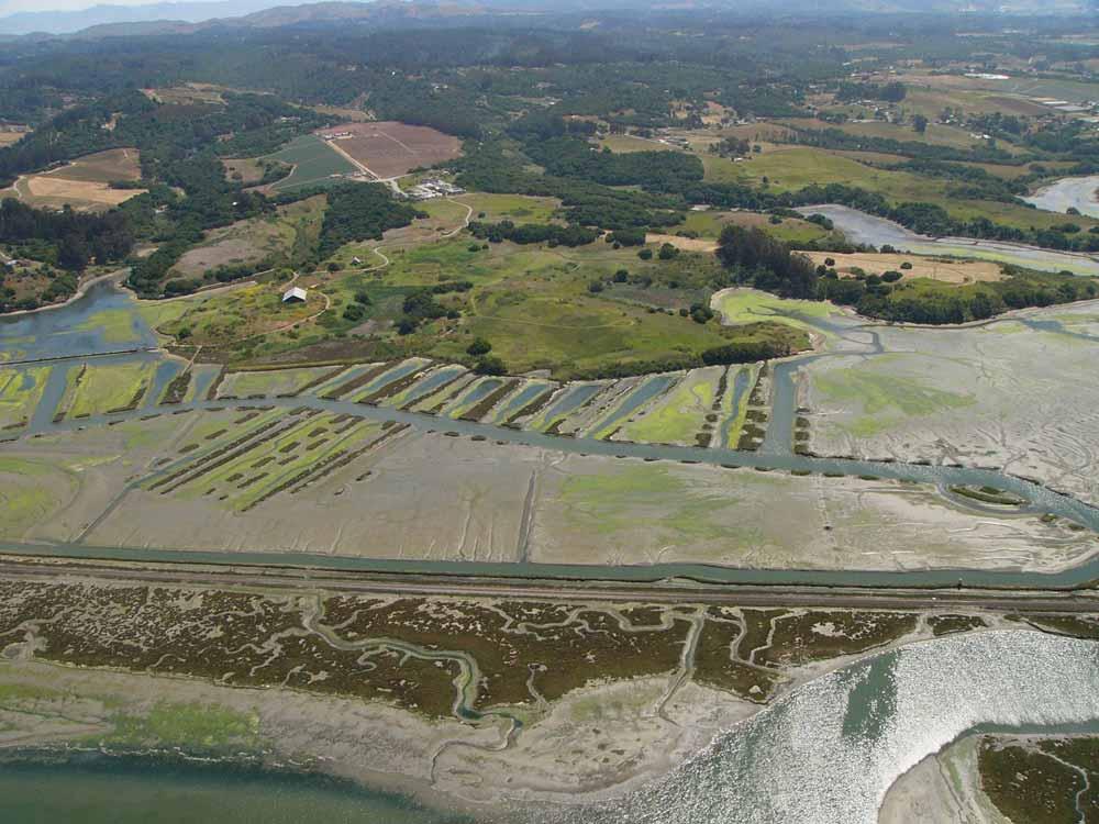
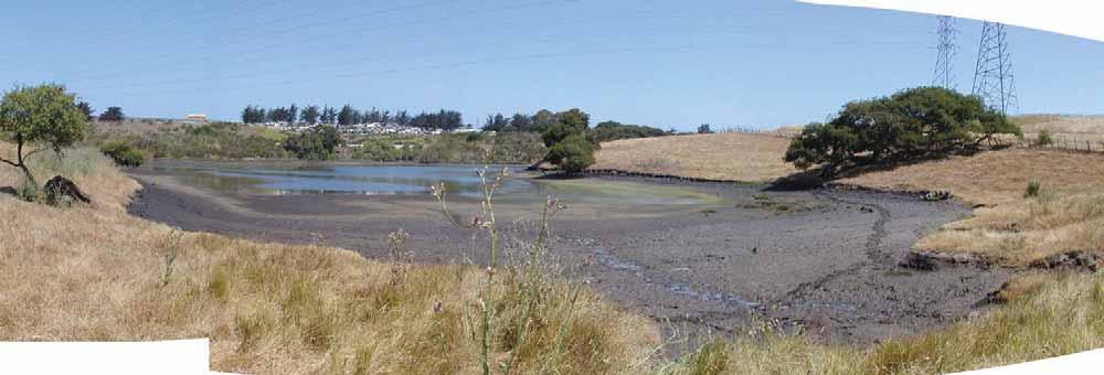
10 Elkhorn Slough: The lay of the land Salinas Castroville Parsons Slough Elkhorn Slough Moss Landing Monterey Bay


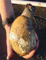
11 Elkhorn Slough An exceptional resource 750+ species of animals 50,000+ visitors each year world class scientific research


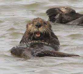
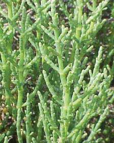
12 Salt Marsh & Tidal Creeks 800 acres Mudflat 1,600 acres Tidal Channels 300 acres


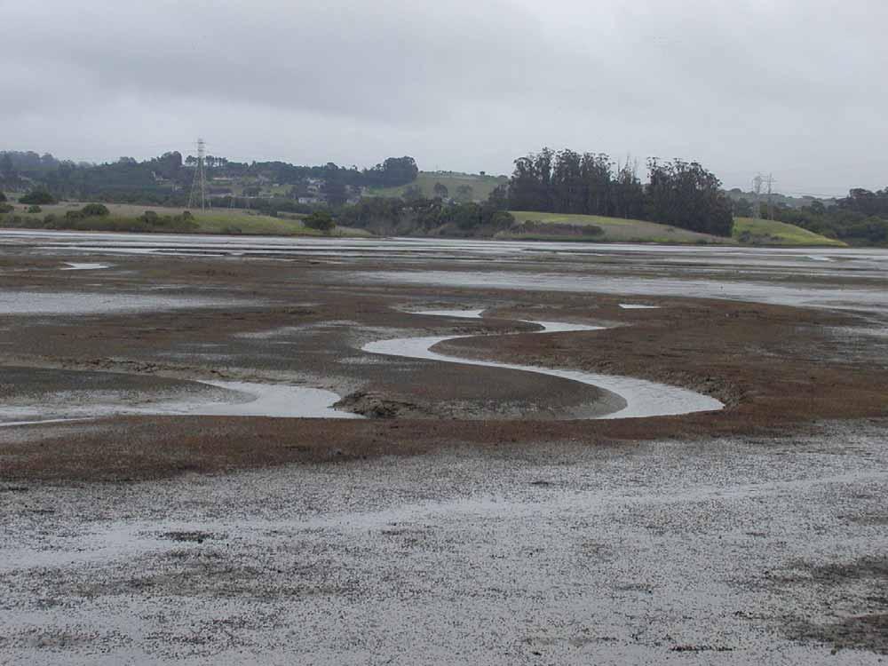
13 Elkhorn Slough is changing Soft mud is scoured away Marsh is dying back, Banks are eroding China Camp SF Bay


14 Marsh Loss 200 acres of marsh have died back prediction: 550 acres more within 50 years
15 Soft Mud Habitats Scoured away deepening of main channel Elkhorn Slough Thalweg Depth (meters from MLLW) Distance from harbor mouth (meters)
* STATE CA Coastal Commission CA Coastal Conservancy CA Department of Fish and Game")
16 Problem Solving: Strategic Planning Team Role: Primary decision-making body FEDERAL Monterey Bay National Marine Sanctuary National Marine Protected Areas U.S. Army Corps of Engineers U.S. Environmental Protection Agency U.S. Fish and Wildlife Service FEDERAL & STATE Elkhorn Slough National Estuarine Research Reserve NOAA/CA DFG (lead)* STATE CA Coastal Commission CA Coastal Conservancy CA Department of Fish and Game LOCAL Monterey County Moss Landing Harbor District NONPROFIT, ACADEMIC, CORPORTATE Moss Landing Marine Laboratories CA State University Monterey Bay Elkhorn Slough Foundation San Francisco Estuary Institute The Nature Conservancy The Ocean Conservancy University of San Francisco Union Pacific Railroad
17 Technical Guidance: Science Panel Role Who Provide and review scientific information Biologists, hydrologists, geologists, marine chemists Over 80 members U.S. Geological Survey Stanford University Moss Landing Marine Laboratories U.S. Environmental Protection Agency U.S. Army Corps of Engineers University of California Santa Cruz University of California Davis Monterey Bay Aquarium Research Institute California State University Monterey Bay Monterey Bay National Marine Sanctuary Point Reyes Bird Observatory ES National Estuarine Research Reserve San Francisco State University California Department of Fish and Game


18 Root causes of change: Moss Landing Harbor
19 Conceptual model of change Before Moss Landing Harbor: the sand bar at the mouth dissipated the energy of Monterey Bay tides Monterey Bay tides Elkhorn Slough tides salt marsh thrives sand bar soft mud accumulates Monterey Bay sinuous channel Elkhorn Slough
20 Present conditions After Moss Landing Harbor: The deep channel transmits the ocean s s energy into the slough Monterey Bay tides Elkhorn Slough tides salt marsh drowns soft mud is scoured away Monterey Bay Highway 1 bridge Elkhorn Slough


21 Root causes of change: Parsons Slough - diking, draining and breaching After subsidence the land has dropped 3 to 5 feet It covers just 15% of the land of Elkhorn Slough But contributes over 35% of the daily tidal exchange
22 Historical reference condition <1870 (estimated) Before Moss Landing Harbor Before Parsons was drained Monterey Bay tides Elkhorn Slough tides salt marsh thrives sand bar soft mud accumulates Monterey Bay sinuous channel Elkhorn Slough
23 Historical condition ~1931 Before Moss Landing Harbor After Parsons was drained Tidal Barrier Monterey Bay tides Elkhorn Slough tides Land subsides sand bar soft mud accumulates Monterey Bay sinuous channel Elkhorn Slough
24 After the harbor was opened ~1955 Moss Landing Harbor is opened Tidal scour begins Tidal Barrier Monterey Bay tides Elkhorn Slough Land subsides further soft mud begins to scour Monterey Bay straight channel Elkhorn Slough
25 Parsons Slough opened to the tides ~1985 Parsons Slough is opened Tidal scour accelerates Monterey Bay tides Parsons Slough tides soft mud is scoured away Monterey Bay Elkhorn Slough
26 Root causes of change: Salinas River diversion Salinas Salinas River Castroville Parsons Slough Elkhorn Slough Moss Landing Monterey Bay

27 Salinas River in Flood, 1995 Watershed area: 2.5 million acres
28 Sediment supports salt marsh With a greater sediment supply Salt marshes can keep pace with rising waters Monterey Bay tides Elkhorn Slough tides salt marsh rises soft mud is scoured away Monterey Bay Highway 1 bridge Elkhorn Slough
29 Tidal Wetland Project Planning Process 30+ Meetings on History, Ecology, Hydrology Brainstorming, Expert guidance Goal 1. Conserve Estuarine Habitats More natural rate of change Goal 2. Restore estuarine habitats Emphasize habitats with highest rates of loss Goal 3. Restore processes that sustain the system Water and sediment Objectives prioritize: salt marsh soft subtidal habitats tidal creeks tidal brackish marshes decrease tidal prism increase sediment supply
30 Planning Principles (17) Guidelines and constraints Examples: Consider the broadest range of approaches Accommodate economic activities Minimize ongoing maintenance Prioritize projects that improve water quality
31 The plan did not define all the acceptable tradeoffs Examples of agreement: Minimize impact to economic activity Avoid salt marsh farms Examples of unresolved issues: Should sea otters be excluded to restore marsh? What loss of mudflat is acceptable for shorebirds? Where do you draw the line?
32 Management alternative: New Ocean Inlet Restores a sinuous shoaling inlet Effectiveness: High Cost: $100 million Impacts: Many Risk: High Reversible: No Image: Google Earth

33 Management alternative: Sill at Highway 1 Dissipates the energy of the tides Effectiveness: Medium Cost: $30 million Impacts: Some-Many Risk: High? Reversible: Maybe Image: Google Earth
34 Management alternative: Sill at Highway 1 A submerged tidal barrier near the mouth of the slough dissipates tidal energy Monterey Bay tides Elkhorn Slough tides salt marsh survives Sill soft mud deposits Moss Landing Harbor Elkhorn Slough


35 Water quality risk Less tidal exchange often leads to poor water quality Elkhorn Slough is already at risk
 Risk: Low (relatively) Reversible: Yes - Maybe Approach An adjustable structure With detailed monitoring That triggers management")
36 Recommended alternative: A tidal barrier at Parsons Slough Moderate reduction of the tides in Parsons Slough Slow currents throughout Elkhorn Slough Elkhorn Slough Effectiveness: Low-Medium Cost: $2 million Parsons Slough sill location Impacts: Few (relatively) Risk: Low (relatively) Reversible: Yes - Maybe Approach An adjustable structure With detailed monitoring That triggers management actions To manage risk to water quality, fish and wildlife movement
37 Parsons Slough Sill: Restricted Less tidal exchange Soft mud accumulates? Salt marsh recovers? Monterey Bay tides Parsons Slough tidal scour slows (stops?) Monterey Bay Elkhorn Slough
38 Parsons Slough Sill: Open Full tidal exchange Maintains water quality Restores present habitat extent Monterey Bay tides Parsons Slough tidal scour resumes Monterey Bay Elkhorn Slough
39 Effect on current velocity in Elkhorn Slough Current velocity in Elkhorn Slough downstream of Parsons under the Narrow and Deep configuration of a submerged sill at Parsons Slough existing condtions Narrow, Deep configuration current velocity (feet/sec) /14/05 12/15/05 12/16/05 12/17/05 12/18/05 12/19/05 Analysis: Moffatt and Nichol simulation date
40
41

42
43
44 Progress on TWP Goals Tidal Wetland Project Objective In Parsons Slough In the Rest of Elkhorn Slough Reduce the rate of salt marsh loss Reduce the rate of subtidal channel erosion likely increase Reduce the rate of soft sediment loss Reduce the rate of tidal creek conversion likely no change Restore salt marsh Restore brackish marsh Restore freshwater/salt water transitions Restore soft sediment habitats Reduce tidal prism Restore tidal exchange to restricted areas possible increase Restore sediment to subsided areas Use pilot projects for learning opportunities
45 How the proposed structure affects the ecosystem Construction Noise, machinery Physical effects Physical barrier partially adjustable Velocity barrier partially adjustable Others? Habitat changes Hard substrate not adjustable Shift mudflat to open water adjustable Shift mudflat to salt marsh adjustable Water quality Increased residence time adjustable Shallower, less oxygen available partially adjustable
46 Example of Trade Offs we hope to discuss today Structure is more restrictive In Elkhorn Slough Tidal prism reduction Sediment retention In Parsons Slough Salt marsh restoration Structure is less restrictive In Elkhorn Slough Fewer benefits In Parsons Slough Better water quality More shorebirds
47 Advancing goals while minimizing impacts Management Target, defined Something we measure to guide management Design of the structure Adjustment of the structure Linked to species or habitat by conceptual model Links monitoring to a species or habitat and to a management action
48 Monitoring: Potential management targets Species and Habitats What people care about Physical, chemical and biological drivers of ecologic health Management strategies operate here. Monitoring parameters as surrogates for ecologic health Things we can measure easily, reliable indicators
49 Monitoring and Management Conceptual models Ecologic Health conceptual model Monitoring parameters
50 Conceptual model to identify monitoring approach Example: More restrictive sill setting > Reduced tidal range > Longer residence time > Greater abundance of algae > Lower dissolved oxygen > Reduced abundance of fish
51 Adaptive management cycle Management and monitoring cycle Decision process defined Process revision built in
52 Adaptive Management and Monitoring Inner Loop Are our Management Targets being met? Action > monitoring > decide: action/no action Easy to measure parameters Outer Loop Are we monitoring the right things Process refinement: make sure the conceptual models are right Species or habitats with slower response management decision Process revision monitoring

53 Elkhorn Slough Tidal Wetland Project working to preserve all the habitats of Elkhorn Slough despite the changes, it remains a magical place Bryan Largay Elkhorn Slough National Estuarine Research Reserve bryan@elkhornslough.org
Appendix C. Past and Current Management of Selected Tidal Wetland Sites
 Appendix C. Past and Current Management of Selected Tidal Wetland Sites Maps and photographs of wetland sites can be found at http://www.elkhornslough.org/tidalwetlandproject. Site 1. Parsons Slough/South
Cat Island Chain Background & Access Guide
 Cat Chain Background & Access Guide Brown County Port & Resource Recovery Department 2561 S. Broadway, Green Bay, WI 54304 (920) 492-4950 www.portofgreenbay.com January 2018 1 Restoration of the Cat Chain
MARINE PROTECTED AREAS LESSON PLAN Water Parks
 Marine Protected Areas U. S. Marine Protected Areas Lesson Plan MARINE PROTECTED AREAS LESSON PLAN Water Parks Theme U.S. Marine Protected Areas Links to Overview Essays and Resources Needed for Student
Virginian Atlantic (Ecoregion 8)
") Virginian Atlantic (Ecoregion 8) Background The Virginian Atlantic Ecoregion extends from the south side of Cape Cod to Cape Hatteras in North Carolina. The waters of the ecoregion are a mix of cold and
Virginian Atlantic (Ecoregion 8) Background The Virginian Atlantic Ecoregion extends from the south side of Cape Cod to Cape Hatteras in North Carolina. The waters of the ecoregion are a mix of cold and
UNESCO s World Heritage Program California Current Conservation Complex
 Office of National Marine Sanctuaries National Oceanic and Atmospheric Administration UNESCO s World Heritage Program California Current Conservation Complex William Douros Regional Director NOAA's Office
TOWARDS SUSTAINABLE MANAGEMENT OF MARINE AND COASTAL HABITATS ASIA- PACIFIC DAY FOR THE OCEAN
 TOWARDS SUSTAINABLE MANAGEMENT OF MARINE AND COASTAL HABITATS WANNAKIAT THUBTHIMSANG PHUKET MARINE BIOLOGICAL CENTER, DMCR, THAILAND ASIA- PACIFIC DAY FOR THE OCEAN 20 NOVEMBER 2018, CONFERENCE ROOM 4,
Water Resources Update after NCGA Long Session
 Water Resources Update after NCGA Long Session North Carolina Beach Inlet & Waterway Association Annual Conference November 16, 2015 Division of Water Resources Overview New Name / Reorganization Jordan
Title/Name of the area: Chwaka Bay, Zanzibar
 Title/Name of the area: Chwaka Bay, Zanzibar Presented by: Dr. Charles Lugomela, Ag. Head, Department of Aquatic Sciences and Fisheries, University of Dar es Salaam, P.O. Box 35064 Dar es Salaam, Tanzania
Twelve Apostles Marine National Park Australia
 EVALUATION REPORT Twelve Apostles Marine National Park Australia Location: Victoria, Australia coastal waters Global Ocean Refuge Status: Nominated (2017), Evaluated (2017) MPAtlas.org ID: 7703885 Manager(s):
Bon Portage Island Conservation Campaign
 Bon Portage Island Conservation Campaign Protecting a Coastal Treasure Final Report to Nova Scotia Habitat Conservation Fund September 2012 Protection of Bon Portage Island Over the course of this two-year
Adapting to climate change by promoting sustainable livelihoods, human and food security, and resilient ecosystems
 Adapting to climate change by promoting sustainable livelihoods, human and food security, and resilient ecosystems ICRI Indian Ocean Day December 13, 2011 Regional Challenges Atlantic Caribbean Challenge
An Introduction. The Saginaw River/Bay Area of Concern
 Saginaw River & Bay Area of Concern: Looking Forward Continued Partnerships in the Restoration of Saginaw Bay Michelle Selzer Lake Huron Coordinator & Interim AOC Coordinator Saginaw Bay Watershed Conference
Pinellas County Environmental Lands
 Pinellas County Environmental Lands In addition to traditional parks and recreation facilities, Pinellas County owns and manages a system of environmental lands that provides specialized resource-based
Terrestrial Protected Area Nomination: Central Mangrove Wetland South-West, Grand Cayman
 Terrestrial Protected Area Nomination: Central Mangrove Wetland South-West, Grand Cayman The attached nomination, proposing that a parcel of land in the Central Mangrove Wetland be made a Protected Area
LAUNCH OF THE COASTAL ZONE MANAGEMENT TRUST
 A 60km stretch of coastline on the Yucatan Peninsula of Mexico is the testing ground for an idea that could protect fragile environments around the world: insuring coral reefs. The Economist World Ocean
Riverine Sand Mining/Scofield Island Restoration (BA-40)
") Riverine Sand Mining/Scofield Island Restoration (BA-40) Conference on Ecological and Ecosystem Restoration Kenneth Bahlinger, CPRA Project Manager July 31, 2014 committed to our coast committed to our
Riverine Sand Mining/Scofield Island Restoration (BA-40) Conference on Ecological and Ecosystem Restoration Kenneth Bahlinger, CPRA Project Manager July 31, 2014 committed to our coast committed to our
Department of Environment and Natural Resources
 Department of Environment and Natural Resources Brad Ives Assistant Secretary for Natural Resources brad.ives@ncdenr.gov 919-707-8620 Mitch Gillespie Assistant Secretary for Environment mitch.gillespie@ncdenr.gov
Alaskan/Fjordland Pacific (Ecoregion 22)
") Alaskan/Fjordland Pacific (Ecoregion 22) Background The Alaskan/Fjordland Pacific Ecoregion is an area of abundant marine resources. The ecoregion begins at Vancouver Island and moves up the Gulf of Alaska
Alaskan/Fjordland Pacific (Ecoregion 22) Background The Alaskan/Fjordland Pacific Ecoregion is an area of abundant marine resources. The ecoregion begins at Vancouver Island and moves up the Gulf of Alaska
Committee. Presentation Outline
 CW-33-15 11/9/2015 Community and Corporate Services Committee November 10, 2015 1 Presentation Outline Background Vision and Objectives Study Process and Timeline Public and Stakeholder Engagement Organization
What is an Marine Protected Area?
 Policies, Issues, and Implications of Marine Protected Areas Kara Anlauf University of Idaho Before the House Subcommittee on Fisheries Conservation, Wildlife and Oceans April 29, 2003 What is an Marine
Galveston Bay Estuary Program. Carla G. Guthrie, Ph.D. Galveston Bay Council Member Texas Water Development Board
 Galveston Bay Estuary Program Carla G. Guthrie, Ph.D. Galveston Bay Council Member Texas Water Development Board The statements contained in this presentation are my current views and opinions and are
Unit 1 Lesson 1: Introduction to the Dry Tortugas and Sustainable Seas Expedition
 Unit 1 Lesson 1: Introduction to the Dry Tortugas and Sustainable Seas Expedition Lesson Objectives: Introduce students to the historical, geographic, and ecological importance of the Dry Tortugas. Introduce
MANAGING COASTAL HAZARDS THROUGH BENEFICIAL REUSE OF DREDGED SAND AND AN ADAPTIVE WORKS STRATEGY
 MANAGING COASTAL HAZARDS THROUGH BENEFICIAL REUSE OF DREDGED SAND AND AN ADAPTIVE WORKS STRATEGY Isabelle Ghetti 1, B.Morgan 2, R.Massie 1, Gary Blumberg 2 1 Shoalhaven City Council, Nowra, NSW 2 Royal
Nature Conservation Agency (NCA) Salacgrīva 05/07/2018
 Salacgrīva 05/07/2018") Nature Conservation Agency (NCA) Salacgrīva 05/07/2018 Nature Conservation Agency ensures implementation of unified nature protection policy in Latvia Specially protected nature areas in Latvia Specially
Nature Conservation Agency (NCA) Salacgrīva 05/07/2018 Nature Conservation Agency ensures implementation of unified nature protection policy in Latvia Specially protected nature areas in Latvia Specially
Engineering With Nature Geographic Project Mapping Tool (EWN ProMap)
") Engineering With Nature Geographic Project Mapping Tool (EWN ProMap) Cynthia Banks Program Manager Burton Suedel, PhD Research Biologist Michelle Bourne Research Biologist U.S. Army ERDC 23 June 2015 Dredging
Engineering With Nature Geographic Project Mapping Tool (EWN ProMap) Cynthia Banks Program Manager Burton Suedel, PhD Research Biologist Michelle Bourne Research Biologist U.S. Army ERDC 23 June 2015 Dredging
U.S. Activities in Puerto Rico, U.S. Virgin Islands and the Wider Caribbean. NOAA and the US Coral Reef Task Force
 U.S. Activities in Puerto Rico, U.S. Virgin Islands and the Wider Caribbean NOAA and the US Coral Reef Task Force U.S. Coral Reef Task Force Co-Chairs: National Oceanic and Atmospheric Administration (NOAA)
Juvenile coho salmon use of constructed off-channel habitats in two Lower Klamath River tributaries: McGarvey Creek & Terwer Creek
 Juvenile coho salmon use of constructed off-channel habitats in two Lower Klamath River tributaries: McGarvey Creek & Terwer Creek Prepared by: Yurok Tribal Fisheries Program PO Box 1027, Klamath, CA Spring
Access: The rocky shoreline is only accessible via private property.
 10. Whale Cove Site description: Whale Cove is a small cove fringed by private homes and condominiums with diverse and relatively undisturbed rocky intertidal and subtidal habitat located approximately
THAT the Board approve the final proposed concept plan for the Jericho Marginal Wharf site as shown in Figure C-4 of Appendix C.
 Date: January 17, 2012 TO: Board Members Vancouver Park Board FROM: General Manager Parks and Recreation SUBJECT: Jericho Marginal Wharf Phase 2 Concept Plan RECOMMENDATION THAT the Board approve the final
Project Data Sheet BASIC PROJECT DATA
 BASIC PROJECT DATA Full project title: Short project title: (acronym) Improvement of navigation in the joint Bulgarian-Romanian section of the Danube river from km 530 to km 520 Batin and from km 576 and
Monifieth (Potentially Vulnerable Area 07/10) Local Plan District Local authority Main catchment Tay Estuary and Montrose Angus Council, Dundee coasta
 Local Plan District Local authority Main catchment Tay Estuary and Montrose Angus Council, Dundee coasta") Monifieth (Potentially Vulnerable Area 07/10) Local Plan District Tay Estuary and Montrose Basin Local authority Angus Council, Dundee City Council Main catchment Dundee coastal Summary of flooding impacts
Monifieth (Potentially Vulnerable Area 07/10) Local Plan District Tay Estuary and Montrose Basin Local authority Angus Council, Dundee City Council Main catchment Dundee coastal Summary of flooding impacts
IMPACTS OF THE RECENT TSUNAMI ON THE BUNDALA NATIONAL PARK THE FIRST RAMSAR WETLAND IN SRI LANKA
 IMPACTS OF THE RECENT TSUNAMI ON THE BUNDALA NATIONAL PARK THE FIRST RAMSAR WETLAND IN SRI LANKA by C.N.B. Bambaradeniya, IUCN The World Conservation Union, Sri Lanka Country Office (Email: cnb@iucnsl.org)
National Park Service - Coho Salmon & Steelhead Trout Restoration Project
 National Park Service Point Reyes National Seashore Salmonid Trends in Lagunitas and Redwood Creek Mt. Tamalpais Watersheds National Park Service - Coho Salmon & Steelhead Trout Restoration Project Brannon
STORNETTA BROTHERS COASTAL RANCH
 STORNETTA BROTHERS COASTAL RANCH Location: Surrounding Point Arena Lighthouse and immediately south of Manchester State Park Mendocino Co., CA Acres: 1,860 Resources: Over two miles of Pacific Ocean coastline
Clam Harbour Provincial Park
 Clam Harbour Provincial Park Public Engagement Session Thursday, September 14 th, 2017 5:30pm 7:30pm Webbers Store 11470 Nova Scotia Trunk 7 Lake Charlotte, NS Agenda Overview of the Provincial Parks System
The Use of Low Cost Breakwaters for Mangrove Restoration in Muddy Foreshores
 The Use of Low Cost Breakwaters for Mangrove Restoration in Muddy Foreshores Douglas A. Gaffney, P.E. Ranata Robertson October 23, 2012 The Use of Low Cost Breakwaters for Mangrove Restoration in Muddy
Satoquo SEINO (Graduate School of Engineering, Kyushu University, Japan)
") A reconsideration of horseshoe crab conservation methodology in Japan over the last 100 years and prospects for a marine protected area network in Asian seas Satoquo SEINO (Graduate School of Engineering,
A reconsideration of horseshoe crab conservation methodology in Japan over the last 100 years and prospects for a marine protected area network in Asian seas Satoquo SEINO (Graduate School of Engineering,
30 Years of conservation. 30 years. Elkhorn Slough Foundation. in Elkhorn SLough
 30 years Advancing advancing 30 Years of conservation Conservation in Elkhorn SLough Elkhorn Slough Foundation Elkhorn Slough: Protecting A Watershed Holistic grazing practices on Elkhorn Slough Foundation
PURPOSE AND NEED. Introduction
 Public Scoping: Allocation of Recreation Capacity for Commercial Outfitter Guide Services on North Kruzof Island Trails (Kruzof Island Outfitter Guide) PURPOSE AND NEED Introduction The U.S. Department
St. Christopher Camp and Conference Center s Outdoor education program for elementary and middle school students
 St. Christopher Camp and Conference Center s Outdoor education program for elementary and middle school students Since 1980, The Barrier Island Environmental Education Program has provided thousands of
WALKER SWAMP INFORMATION DAY Saturday 23 rd June 2018
 WALKER SWAMP INFORMATION DAY Saturday 23 rd June 2018 Introduction to the Upper Wannon River Floodplain wetlands and the new Walker Swamp Restoration Reserve Mark Bachmann and Greg Kerr, Nature Glenelg
COASTAL CONSERVANCY. Staff Recommendation June 5, 2008 GUALALA BLUFF TRAIL OPERATIONS AND MAINTENANCE
 COASTAL CONSERVANCY Staff Recommendation June 5, 2008 GUALALA BLUFF TRAIL OPERATIONS AND MAINTENANCE File No. 08-047-01 Project Manager: Deborah Hirst RECOMMENDED ACTION: Consideration and possible Conservancy
TRANSATLANTIC PLATFORM FOR ACTION ON THE GLOBAL ENVIRONMENT (T-PAGE) 1. Background Paper on US Marine Protected Areas (MPAs)
 1. Background Paper on US Marine Protected Areas (MPAs)") TRANSATLANTIC PLATFORM FOR ACTION ON THE GLOBAL ENVIRONMENT (T-PAGE) 1 Background Paper on US Marine Protected Areas (MPAs) June 2007 Authors: Melanie Nakagawa, Attorney, International Program Kate Wing,
TRANSATLANTIC PLATFORM FOR ACTION ON THE GLOBAL ENVIRONMENT (T-PAGE) 1 Background Paper on US Marine Protected Areas (MPAs) June 2007 Authors: Melanie Nakagawa, Attorney, International Program Kate Wing,
VARGAS ISLAND PROVINCIAL PARK
 VARGAS ISLAND PROVINCIAL PARK PURPOSE STATEMENT AND ZONING PLAN February 2003 VARGAS ISLAND PROVINCIAL PARK Purpose Statement and Zoning Plan Primary Role The primary role of Vargas Island Park is to protect
4.0 Context for the Crossing Project
 4.0 Context for the Crossing Project This section provides background information about key features of the North Douglas Crossing project area, and opportunities and constraints. This information is important
Ship traffic and the Roberts Bank Terminal 2 Project
 Roberts Bank Terminal Project Ship traffic information sheet The Vancouver Fraser Port Authority is responsible for ensuring that Canada s largest port is ready for growing trade and the ships that trade
Korean Protected Areas in WDPA. Sung-gon Kim Programme Specialist Korea National Park Service & Korea Protected Areas Forum
 Korean Protected Areas in WDPA Sung-gon Kim Programme Specialist Korea National Park Service & Korea Protected Areas Forum Nov. 15 th 2013 Table of Contents Ⅰ. The definitions of Protected Areas Ⅱ. General
Wetlands Reservoirs of Biodiversity. Billy McCord, SCDNR
 Wetlands Reservoirs of Biodiversity Billy McCord, SCDNR Estuaries Tidal Deepwater Intertidal Salt Marsh Tidal Riverine Fresh & Brackish Deepwater Tidal Emergent Marsh Freshwater Riverine Seasonally Flooded
Toward a National Marine Conservation Area in the Southern Strait of Georgia
 Toward a National Marine Conservation Area in the Southern Strait of Georgia Bill Henwood Parks Canada Abstract Parks Canada is committed to creating a system of National Marine Conservation Areas (NMCA)
Workshop on Guiana Shield Biodiversity Corridor to streamline support for the achievement of the Aichi Biodiversity Targets
 Workshop on Guiana Shield Biodiversity Corridor to streamline support for the achievement of the Aichi Biodiversity Targets ACTION PLAN Preamble: We, the participants of the workshop called, Guiana Shield
AGENCY: Office of National Marine Sanctuaries (ONMS), National Ocean Service (NOS),
, National Ocean Service (NOS),") This document is scheduled to be published in the Federal Register on 01/24/2018 and available online at https://federalregister.gov/d/2018-01271, and on FDsys.gov 3510-NK DEPARTMENT OF COMMERCE National
This document is scheduled to be published in the Federal Register on 01/24/2018 and available online at https://federalregister.gov/d/2018-01271, and on FDsys.gov 3510-NK DEPARTMENT OF COMMERCE National
Land, Water and Community: Preparing for a Successful 2015 Review
 Land, Water and Community: Preparing for a Successful 2015 Review Outline ORM Partnership for 2015 Preparing for 2015: Three Plans versus Four Plans Our Areas of Focus Governance & the 2015 Process Our
HIGHWAY 17 WILDLIFE and REGIONAL TRAIL CROSSINGS
 HIGHWAY 17 WILDLIFE and REGIONAL TRAIL CROSSINGS Agenda and Meeting Format 7:00-7:15 Welcome 7:15-8:00 Presentation 8:00-8:30 Open House 8:30 Recap 9:00 Conclusion 2 Meeting Goals: Introduce the project
Michipicoten Island Regional Plan
 Michipicoten Island Regional Plan This is one of twenty Regional Plans that support implementation of the Lake Superior Biodiversity Conservation Strategy (Strategy). The Strategy, prepared and overseen
Maximising Beneficial Reuse through the use of a Novel Dredging Contract
 Maximising Beneficial Reuse through the use of a Novel Dredging Contract Nicola Clay & Katherine Harris Port of London Authority Nick Bray Dredging Research Paul Hesk Van Oord UK CEDA Dredging Days 2007
FEASIBILITY CRITERIA
 This chapter describes the methodology and criteria used to evaluate the feasibility of developing trails throughout the study areas. Land availability, habitat sensitivity, roadway crossings and on-street
Marine Reserves LEGEND. State Boundary Sanctuary Boundary. State Marine Protected Areas State Marine Reserve State Marine Conservation Area
 Marine Reserves LEGEND State Boundary Sanctuary Boundary State Marine Protected Areas State Marine Reserve State Marine Conservation Area 0 10 20 30 Kilometers What is a marine reserve? Places in the ocean
April 10, Mark Stiles San Juan Public Lands Center Manager 15 Burnett Court Durango, CO Dear Mark,
 Mark Stiles San Juan Public Lands Center Manager 15 Burnett Court Durango, CO 81301 Dear Mark, We are pleased to offer the following comments on the draft San Juan Public Lands Center management plans
June 29 th 2015 SOS LEMURS SPECIAL INITIATIVE
 June 29 th 2015 SOS LEMURS SPECIAL INITIATIVE 1 SUMMARY FOREWORD...3 SOS LEMURS HELP US SAVE MADAGASCAR S ICONS...3 EMERGENCY ACTION PLAN...4 WHY PROTECT LEMURS?... 4 THE IUCN ACTION PLAN!... 5 GENERAL
Coral Reefs: Integrative Teaching Tool (and Guide to NOAA Resources) National Science Teachers Association April 6, 2006 Anaheim, California
 National Science Teachers Association April 6, 2006 Anaheim, California") Coral Reefs: Integrative Teaching Tool (and Guide to NOAA Resources) National Science Teachers Association April 6, 2006 Anaheim, California NOAA Coral Reef Conservation Program: Created by NOAA in 2000
Coral Reefs: Integrative Teaching Tool (and Guide to NOAA Resources) National Science Teachers Association April 6, 2006 Anaheim, California NOAA Coral Reef Conservation Program: Created by NOAA in 2000
Tourism and Wetlands
 CONVENTION ON WETLANDS (Ramsar, Iran, 1971) 43 rd Meeting of the Standing Committee Gland, Switzerland, 31 October 4 November 2011 DOC. SC43-27 Tourism and Wetlands Action requested. The Standing Committee
X. WHATCOM CREEK SMA. X.1 Watershed Analysis. X.1.1 Landscape Setting
 X. WHATCOM CREEK SMA Summary: The entire length of Whatcom Creek is located within the City of Bellingham. SMA jurisdiction associated with this creek is approximately 300 acres. Land use is dominated
Presented to: City of Petaluma City Council
 Agenda Item #1.A REVISED Presented to: City of Petaluma City Council Presented By: Dan St. John, F.ASCE, Director Jason Beatty, P.E., Senior Engineer James 'Jody' Boyette, USACE Project Manager November
2012 Texas Water Conservation Association Meeting
 2012 Texas Water Conservation Association Meeting BG Thomas Kula Southwestern Division Commander 15 June 2012 US Army Corps of Engineers AGENDA UNCLASSIFIED Overview of Southwestern Division Missions Texas
Agenda Report. Spruce Street Outlet Drainage Improvements Tower Road Relief Sewer
 Agenda Report Subject: Prepared By: Spruce Street Outlet Drainage Improvements Tower Road Relief Sewer Steven M. Saunders, Director of Public Works/Village Engineer Date: August 12, 2012 On March 8, 2012
Mark West Creek Flow Study Report
 Mark West Creek Flow Study Report Biology and Geology of Mark West Creek The headwaters of Mark West Creek are located in the Mayacamas Mountain range, which border Napa and Sonoma County, where it then
Project : Marine Ecology Research Center (MERC) Sabah, Malaysia
 Sabah, Malaysia") Project : Marine Ecology Research Center (MERC) Sabah, Malaysia Table of contents 1) Introduction of Malaysia 2) Malaysia Map & Location of MERC 3) Introduction of MERC 4) Activities of MERC 4.1) Active
Project : Marine Ecology Research Center (MERC) Sabah, Malaysia Table of contents 1) Introduction of Malaysia 2) Malaysia Map & Location of MERC 3) Introduction of MERC 4) Activities of MERC 4.1) Active
Appendix A Appendix A (Project Specifications) Auk Auk / Black Diamond (Trail 44) Reroute
 Auk Auk / Black Diamond (Trail 44) Reroute") Appendix A (Project Specifications) Auk Auk / Black Diamond (Trail 44) Reroute I. Proposed Action: This project proposes to reroute approximately 1,800 feet of a 50 inch wide trail, off of private property
Appendix A (Project Specifications) Auk Auk / Black Diamond (Trail 44) Reroute I. Proposed Action: This project proposes to reroute approximately 1,800 feet of a 50 inch wide trail, off of private property
March 2, The Honorable Mayor Williams D. Sessoms, Jr. Members of City Council. Subject: Coastal CIP Presentation to City Council - March 6, 2018
 OFFICE OF THE CITY MANAGER (757) 385-4242 (757) 427-5626 FAX MUNICIPAL CENTER BUILDING 1, ROOM 234 2401 COURTHOUSE DRIVE VIRGINIA BEACH, VA 23456-9001 March 2, 2018 The Honorable Mayor Williams D. Sessoms,
ARTWEI ARTWEI ARTWEI
 Protection / Management Plans for Natura 2000 areas and Maritime Spatial Plan for internal sea waters - including the Szczecin Lagoon Szczecin, 7th May 2011 Andrzej Zych Inspectorate of Coast Protection
The MPA Name. The past and future of the. Montego Bay Marine Park Trust
 The MPA Name The past and future of the Montego Bay Marine Park Trust Park Boundaries and Sanctuary Area 100m/330ft/50 Fathom Depth Contour to The Average Highest High Tide Mark 50 Fathom/100M Depth Great
1 INFORMATION REQUIREMENTS
 1 INFORMATION REQUIREMENTS 1.1 BACKGROUND 2 1.2 WHAT IS THE DISTRICT PLAN 3 1.3 DISTRICT PLAN STRUCTURE 4 1.4 HOW TO USE THE DISTRICT PLAN 5 1.5 STRATEGIC FRAMEWORK 6 Whanganui District Plan (15 January
Port Everglades Master/Vision Plan Update
 Port Everglades Master/Vision Plan Update Environmental Stakeholder Meeting June 15, 2009 Discussion to Focus On: Updating the 2006 Port Everglades Master Plan Issues dealing with the Turning Notch Potential
SENSITIVE AREAS: PART FIVE - AREAS OF LOCAL CONCERN
 S: PART FIVE - AREAS OF LOCAL CONCERN Some areas within the Cook Inlet Subarea warrant special attention due to the presence of highly productive wildlife habitat, the ability to sustain a large part of
Our Mission: Our Goals:
 Our Mission: Reef Relief is a nonprofit membership organization dedicated to improving and protecting our coral reef ecosystem. Our programs instill an attitude of stewardship in boaters, divers, fishermen
BRAND-OGRAPHY. Katarina Baumann
 BIRD ISLAND PELICAN POINT POWER STATION OUTER HARBOR NORTH HAVEN BIODIVERSITY PARK MUTTON COVE ADELAIDE LEFEVRE PENINSULA Scale 1:25000 NORTH HAVEN MARINA TAPEROO FORMER PENRICE FACTORY SITE TORRENS ISLAND
Creation of a Community-managed Biodiversity Park in the Saloum Delta of Senegal. Voré Gana Seck Director GREEN Senegal for People, Land, Ocean
 Creation of a Community-managed Biodiversity Park in the Saloum Delta of Senegal Voré Gana Seck Director GREEN Senegal for People, Land, Ocean Rationale for the Creation of the Biodiversity Park F In line
ENVIRONMENT ACTION PLAN
 ENVIRONMENT ACTION PLAN 2015 16 Airservices Australia 2015 This work is copyright. Apart from any use as permitted under the Copyright Act 1968, no part may be reproduced by any process without prior written
ROAD AND TRAIL PROJECT APPROVAL
 ROAD AND TRAIL PROJECT APPROVAL www.marincountyparks.org Marin County Parks, 3501 Civic Center Dr, Suite 260, San Rafael, CA 94903 DATE: July 12, 2017 PRESERVE: Gary Giacomini Open Space Preserve PROJECT:
SELF-ASSESSMENT CHECKLIST
 Tourism and Mountains A Practical Guide to Managing the Environmental and Social Impacts of Mountain Tours Using this Self-Assessment Checklist This checklist has been developed to help mountain-based
[Type text] [Type text] [Type text]
![[Type text] [Type text] [Type text]](/thumbs/83/88153521.jpg "[Type text] [Type text] [Type text]") Camp Nautilus Camp Nautilus is located in the region of Kenting National Park(http://www.ktnp.gov.tw/), is partnership between Scouts of China and National Museum of Marine Biology & Aquarium (http://www.nmmba.gov.tw/english/index.aspx)
Camp Nautilus Camp Nautilus is located in the region of Kenting National Park(http://www.ktnp.gov.tw/), is partnership between Scouts of China and National Museum of Marine Biology & Aquarium (http://www.nmmba.gov.tw/english/index.aspx)
Flood History. Floodplain Descriptions
 Flood History The worst flooding in the area took place in 1966, 1969, 1971, 1995 and 1998. The storms in 1966 and 1969 caused considerable damage throughout the area due to flooding, erosion and debris
TRINITY RIVER CORRIDOR
 TRINITY RIVER CORRIDOR MODIFIED DALLAS FLOODWAY PROJECT UPDATE May 12, 2015 Jon Loxley Project Manager Dallas Floodway Project Fort Worth District U.S. Army Corps of Engineers US Army Corps of Engineers
The Lower Prut Floodplain Natural Park (Romania)
") The Lower Prut Floodplain Natural Park (Romania) Gabriela Costea Natural Sciences Museum Complex Galati (Romania) & member of the Scientific Council of the Lower Prut Floodplain Natural Park The Prut The
The Lower Prut Floodplain Natural Park (Romania) Gabriela Costea Natural Sciences Museum Complex Galati (Romania) & member of the Scientific Council of the Lower Prut Floodplain Natural Park The Prut The
3 Pilbara ports provide gateways
 COMMUNITY AND STAKEHOLDERS Community Consultation Committees 8 meetings each year across our 3 port locations Dampier, Port Hedland and Ashburton Community Support Initiative >$295,000 a year in financial
STREAKED HORNED LARK. Conservation of a threatened species in an industrial landscape. Cat Brown US Fish and Wildlife Service
 STREAKED HORNED LARK Conservation of a threatened species in an industrial landscape Cat Brown US Fish and Wildlife Service HISTORICAL & CURRENT RANGE Streaked Horned Lark Distribution Historical Range:
 AGREEMENT Between Director of the Białowieża National Park, based in Białowieża (Poland) and Director of the National Park Bialowieża Forest, based in Kamieniuki (Belarus) and Head Forester of the Białowieża
SF1363 / HF 1061: Legacy Funding; Conference Agreement
 - Conference 1 Art 1 - Outdoor Heritage Fund 2 3 Prairies 4 WMA, SNA, & Prairie Bank Easement Acq. Phase III 5 Accelerated Prairie Restoration - Phase III 6 MN Buffers for Wildlife & Water 7 Northern Tallgrass
Finn Creek Park. Management Direction Statement Amendment
 Finn Creek Park Management Direction Statement Amendment November 2013 Management Direction Statement Amendment Approved by: Jeff Leahy Regional Director, Thompson Cariboo BC Parks November 12, 2013 Date
Thirteenth International Water Technology Conference, IWTC , Hurghada, Egypt 1249
 Thirteenth International Water Technology Conference, IWTC 13 2009, Hurghada, Egypt 1249 EVALUATION OF LOCAL SCOUR AROUND BRIDGE PIERS (RIVER NILE BRIDGES AS CASE STUDY) Sherine Ismail Assoc. Prof., Survey
Wildlife Management from a Regulatory Perspective
 Wildlife Management from a Regulatory Perspective Description Operators of aircraft have a reasonable expectation that any wildlife hazard which may exist at an airport they use will be managed to a level
Award of Contract for Highway 17 Wildlife Passage Structures and Bay Area Ridge Trail Crossing: Conceptual Design and Feasibility Study
 R-16-18 Meeting 16-04 February 10, 2016 AGENDA ITEM AGENDA ITEM 6 Award of Contract for Highway 17 Wildlife Passage Structures and Bay Area Ridge Trail Crossing: Conceptual Design and Feasibility Study
Forms of Natural Protection in Greece
 Forms of Natural Protection in Greece 105 th Primary School of Thessaloniki NATIONAL PARKS AND PROTECTED AREAS The irregular and constantly increasing human intervention in nature and the relentless exploitation
DIDYMO SURVEY, LOWER FRYINGPAN RIVER, BASALT, COLORADO 2015
 DIDYMO SURVEY, LOWER FRYINGPAN RIVER, BASALT, COLORADO 2015 Second Annual Report PREPARED FOR: ROARING FORK CONSERVANCY PREPARED BY: COLORADO MOUNTAIN COLLEGE NATURAL RESOURCE MANAGEMENT PROGRAM TIMBERLINE
Rising seas threaten to drown important mangrove forests, unless we intervene
 University of Wollongong Research Online Faculty of Science, Medicine and Health - Papers Faculty of Science, Medicine and Health 2015 Rising seas threaten to drown important mangrove forests, unless we
Impact of Offshore Directed Forcing on Sediment Transport and Structural Integrity at Packery Channel, Corpus Christi Texas
 Google Earth 29 Aug 2017 Impact of Offshore Directed Forcing on Sediment Transport and Structural Integrity at Packery Channel, Corpus Christi Texas Deidre D. Williams Coastal Research Scientist Conrad
Virginia Beach. InOneofAmerica s. GreatestAquariums! The City of Virginia Beach Has An Exciting Opportunity
 Virginia Beach The City of Virginia Beach Has An Exciting Opportunity InOneofAmerica s GreatestAquariums! The City of Virginia Beach Seeks a Director to Lead our Aquarium & Museums Things to love about
Underwater Acoustic Monitoring in US National Parks
 Underwater Acoustic Monitoring in US National Parks Megan F McKenna 1, Christopher Garsha 2, Erik Stabenau 1, Christine Gabriele 1, Timothy Clark 1, Clayton Pollock 1, Brinnen Carter 1, Samantha Bietsch
LAS VARAS RANCH CA COASTAL TRAIL PROPOSED ALIGNMENT
 LAS VARAS RANCH CA COASTAL TRAIL PROPOSED ALIGNMENT Santa Barbara Trails Council * Prepared by Ray Ford February 1,2012 The following notes accompany the Santa Barbara Trails Council map for the Las Varas
Project Concept Note
 North-East Asian Subregional Programme for Environmental Cooperation (NEASPEC) 1. Overview 1. Project Title 2. Goals Project Concept Note Study on Transborder Movement of Amur Tigers and Leopards using