LINCOLN HIGHWAY ASSOCIATION CALIFORNIA CHAPTER Editor; Gary Kinst
|
|
|
- Lynn Flynn
- 5 years ago
- Views:
Transcription


1 THE TRAVELER LINCOLN HIGHWAY ASSOCIATION CALIFORNIA CHAPTER Editor; Gary Kinst NEWSLETTER PUBLISHED QUARTERLY ON THE FIRST OF JANUARY, APRIL, JULY, OCTOBER VOL. 18 NO. 4 FALL OCTOBER,

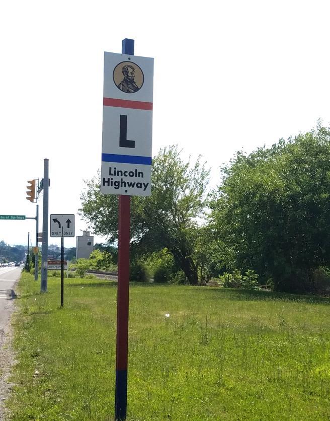
2 COVER Lincoln Highway Marker on display in the Smithsonian Museum of American History, Washington DC. This marker was placed alongside the Lincoln Highway in Wyoming on September 1, 1928 CURRENT MAKER PROJECT Copied from the Facebook Group, The Historic Lincoln Highway in San Joaquin County, submitted by member Kevin Shawver on June 24, 2017 On June 15, I met with Lodi City Council Member JoAnne Mounce, City Manager Steve Schwabauer, and Department of Public Works Director Charlie Swimley. The purpose of the meeting was to request that Historic Lincoln Highway Signage be installed along the Lincoln Highway route through the City of Lodi. The City was very receptive and has agreed to donate labor to install the needed signage. The entire route is marked throughout San Joaquin County except for the City of Lodi. We are closing the gap in signage. The Lincoln Highway Association will donate ten signs for this project; however, the Association would like to recoup part or all the cost of the signs through public donations. The Association is a non-profit 501C group. Kevin responded to the numerous comments on his hard work and dedication to the San Joaquin County sign projects by giving credit to member Mike Kaelin, his sign mentor and coordinator for the entire state, without whose guidance and advice, nothing would have been done. 2
 to attend the summer Chapter meeting.")

3 JULY CHAPTER MEETING The California Chapter held its Summer Chapter Meeting on July 8 th in Historic Downtown Auburn at the Auburn Alehouse & Restaurant. Thirty-two hardy folks tackled the brutal California heat ( degrees) to attend the summer Chapter meeting. The meeting was held outside on the patio of the restaurant and thankfully, many umbrellas and the building itself provided shade. Ceiling fans and overhead fans provided enough air circulation to allow the heat to be somewhat bearable. Our server received a hearty round of applause for maintaining a steady flow of ice water and cold beverages throughout the meeting We were fortunate to have several guest speakers brave the heat to speak to us on several interesting topics. Mr. Mike Holmes, Auburn Chamber of Commerce, gave a presentation on the history and development of the roads/highways in Auburn and along the I-80 corridor. He recounted numerous stories from locals and the area newspapers regarding events on the roads dating back to the Gold Rush days. We would like to thank Mike for reserving 25 parking spaces in a lot behind the restaurant specifically for our group. Thanks Mike. Cindy Ainsworth, President of the Nevada LHA Chapter, talked about the current events being undertaken by her chapter, including the upcoming tour to Austin and Eureka. The Nevada Chapter was awarded a Friend of the Highway Award at the 2017 Conference for their efforts in renovating and restoring the LH bridge railings at Mogul, NV. Cindy handed out copies of the Chapters new brochure and travel guide Discover Historic Nevada. Beautiful brochure with map and accompanying photos. Cindy was accompanied by her husband Tom, who introduced himself as Cindy s driver. Kendra Stoll, Senior History Librarian Caltrans Transportation Library, spoke to the vast historical research information and photos available at the Caltrans library. She also handed out brochures. There will be a special Department of Transportation exhibit showcasing the development of California highways, which will be displayed inside the State Capital Building beginning in March of More to come on that.. Updates were given by the individual committee heads, which included the following; President Joel Windmiller; Orangevale Bridge dedication ceremony and new marker State Director Bob Dieterich; Upcoming 8K LH run in Clarksville VP Neil Rodriques; Stone arch bridge on US50 Web Master Jimmy Lin; Report on web site activity Mike Kaelin; Current signage projects including Lodi Kevin Shawver; Signage in San Joaquin County Newsletter Editor Gary Kinst; Recent speaking engagement and questions to editor A complete recap of meeting minutes will be posted on the Chapters web site in late August. 3


4 Bob Dieterich, Greg and Grant Gassman Guest Cindy Ainsworth, Nevada Chapter President and husband Tom Greg Gassman, Secretary, Myrna Johnson Treasurer Grant Gassman 4


5 Mike Holmes, Auburn Chamber of Commerce, speaking to group about the roads and highways in and around Auburn. President Joel Windmiller presented Mike with a copy of Greg Franzwa s California book for their historical museum Dome of Court House Old Fire House Gold Panning Monument 5


6 LINCOLN HIGHWAY JOHNNY John Fitzsimmons AKA Lincoln Highway Johnny and The Vagabond Artist originally hailed from Boone, IA. Currently living in Placerville, CA John travels back-and- forth across the country attending as many LHA conferences as possible. A 1992 founding member of the current LHA, John and a friend are responsible for painting LH Logos on over 186 telephone poles in and around Boone County Iowa. John s grandfather Pat helped build the 1913 Lincoln in Iowa. California Chapter member, Greg Beemer shared an original copy of the sketch shown here, at our July meeting, which he obtained from John while attending the 2017 Conference. To see more of John s work, go to his web site; 6


7 IN SEARCH OF THE LINCOLN In late July, my Daughter and Family were on their summer vacation, which included trips to New York, NY, Gettysburg, Pa and Washington, DC. I had asked them to keep a close eye for Lincoln Highway signage and was surprised with what they were able to discover. The first 5 days of the vacation were spent sightseeing in NYC and then on to Cooperstown where my Grandson s baseball team played in a U12 tournament at Cooperstown Dream Fields, this being the main purpose of the trip east. First stop was Broadway and West 42 nd Street near Times Square. After the grueling week in Cooperstown, the trip to Washington, DC took them through Hershey, PA and Gettysburg. Here are a few of the photos encountered in Pennsylvania. Gettysburg Mural appears to need some touch-up 7

8 Several of the signs discovered along US30 in Gettysburg 8


9 Upon arriving in DC, one of the first attractions visited was the Smithsonian Museum of American History. While viewing the exhibits they came upon the Lincoln Highway display. One of the photos taken is of a 1913 Contributor plaque. The display states that these plaques were attached to the member s autos radiators My understanding is that these plaques were attached to the vehicles dash or in some cases, as with Henry Joy s Packard, the floorboard. Example of an early Lincoln Highway Radiator badge with the thru radiator pin. An article appeared in the August 13, 1913 edition of Horseless Age Magazine stating, Automobilists in general are now given an opportunity of donating their mite toward the construction of the Lincoln Highway, which is to stretch from the Atlantic to the Pacific oceans, for automobile radiator plates boosting the proposed coast-to-coast road have been placed on sale in Indianapolis. The plates are numbered consecutively, and plate No. 1 has been reserved and will be sent to President Wilson. With the exception of the lower numbers, the plates will sell for $5. The promoters hope to get higher prices for the low numbers, and plate No.2 already has been sold to a woman in Maine for $1,000 9


10 TWO TRIPS ON THE LINCOLN On June 3, 1915, a gentleman by the name of Gustave Gus Petzel, a resident of Stockton, began a trip across the US to gain attention. Simply walking from San Francisco to New York was too utterly common. No one would remember that feat. So, Gus decided to roll a steel ball while walking across the continent. The ball which measured four feet six inches in diameter and weighed 180 pounds with a thickness of 1/16 of an inch would be certain to attract attention. The result of this trip on the Lincoln Highway is lost in history. Gus paid for his trip by working along the way. The goal was to reach New York in six months to claim the one thousand dollars sponsored by parties in San Francisco. By 1925, Gus had apparently relocated to the small island of Alameda next to Oakland and across the Bay from San Francisco. Records show Gus to be a member of a foundry workers organization in the San Francisco Bay Area, which lends credence to his artisan abilities. For his second trip to New York on the Lincoln Highway, Gus choose to drive instead of walking. The car he chose closely resembles cars built in 1915 and known as Art Smith Baby Cars. This car was designed and built by Gus and described as being The smallest automobile in the world. Gus s car was an upgraded and modernized version of a baby car utilizing an in-line 4-cylinder Henderson Motorcycle engine. The car incorporated a three-speed transmission, electric lights and starter, 60-inch wheelbase, 21 x 4 airplane wheels and weighed 560 pounds. It made 52 miles per gallon and had a speed of 65 miles per hour on the road and 80 miles on the track. It cost $2,000 to fabricate. The trip, which followed the Lincoln Highway for the greater part, also included a side trip into Yosemite National Park; The picture shown above is from a postcard, which Gus peddled along the way to finance the trip. Sometime after 1926, Gus sold the car to Edmond Hoot Owl Gibson renowned rodeo champion and Hollywood cowboy movie actor. 10


11 1925 Map of Strategic Routes between Salt Lake City, Utah and California prepared for the Secretary of Agriculture by the Lincoln Highway Association Discovered this booklet on Amazon Kindle. Edited by UC Davis graduate, Kevin Warwick, it is a short 16page booklet of 2500 words and several photos published in June, It begins with a short history of the Lincoln Highway and continues with a discussion of the routing in California. Cities and towns are listed for both the pioneer and later alignment with places to eat, visit and shop. Photos of locations along the routes include the Banta Inn and the Summit Garage. Also included is a photo of our latest Historic sign. Available from Amazon Digital Services LLC for $
12 12


13 Ebay LISTINGS Several Lincoln Highway items shown below were posted on ebay in the month of July. A 1916 LH Road Guide, located in Rock Springs, WYM. was also listed for $180. These items were brought to our attention by member Russell Rein. Antique Original Porcelain Sign Curved Lincoln Highway 30 Road Sign 21 x 9-1/2 Starting Price $ 2, Located in Browns Valley, CA 12 miles N/E of Marysville Marking on back states; Burdick, Consumers Bldg, CHI. Brudick Enamel Sign Company of Chicago, , produced porcelain signs and license plates. This sign first appeared on the LH in YOLO CAUSEWAY By Pass Lincoln Highway SACRAMENTO rare souvenir button badge Starting Price $ Located in Santa Maria, CA Marking on back states that it was manufactured by the Walter N. Brunt Co. San Francisco, CA Correspondence in my archives confirm the fact that this button is part of the collection of recently departed member David Cole of Santa Maria, CA 13

14 NEW CALIFORNIA HISTORICAL DIRECTIONAL SIGN The concept of adding a directional arrow to our exiting Historic signs, to aid motorists travelling the LH in California, has been an ongoing discussion. Member Kevin Shawver came up with this solution of placing a vinyl arrow onto existing signs, thus allowing the arrow to point either left or right and eliminating a great expense in having to produce additional signage or using independent arrows as used by the Historic US40 folks. 14
15 GHOSTS OF THE TRUCKEE RIVER CANYON by Tom Macaulay This article was first published in the Sierra Sun on December 19, 2001, by Tom Macaulay. The article has since been republished in the Tahoe Donner Historical Society Newsletter. TDHS also published a similar series of Macaulay articles in its Echoes From the Past Newsletter publications in prior issues. Part I, pp. 4-5, and Part II, p. 5, are available on the TDHS website at these links. Part I link, Park II link, Part III is available at this link, March 2014, pp. 3-7 Once bustling towns gone but not forgotten; The Truckee River canyon between Truckee, California, and Verdi, Nevada, is an important link in America's transcontinental highway. Before 1844 it was unknown to America, but that year the Stevens-Murphy-Townsend party struggled through. They were the only ones to do so. The steep walls and twisting course of the canyon were a nightmare for the exhausted party. Their guide, Old Caleb Greenwood, searched out a better route which became known as the Dog Valley route, still in use today. It was used by all immigrant parties on the Donner Trail until 1868 when the Central Pacific Railroad, part of the Transcontinental Railway, made regular traffic through the Truckee River canyon commonplace. For many years the Truckee canyon was a thriving, vibrant commercial center with small towns and communities. The CPRR defined and dominated the canyon. It carried supplies and passengers in and carried lumber, ice, and paper out. Gradually wagon roads and then motor roads, starting at Truckee and Verdi, worked their way into the canyon. In 1925 the last stretch of the Victory Highway, later Highway 40, between Floriston and Stateline, was paved and the entire canyon was open to private vehicles. In 1964 the last phase of freeway work on Interstate 80 was completed, and the canyon assumed its present character. Truckee and Verdi still flourish at the upper and lower ends of the canyon. All of the other towns, except Floriston, have disappeared, leaving only scattered ruins to mark their sites. Most of the names have disappeared from modern maps, and local residents who remember the names have forgotten the locations. GLENSHIRE DRIVE, Modern: It follows Old Highway 40 from Truckee to the new subdivision of Glenshire, three highway miles from the Glenshire Drive turn off from Highway 267 near Truckee. It follows the CPRR and Truckee river and crosses the Glenshire Bridge. A short distance beyond the bridge, Old Highway 40 turns to the left, to the Flycaster's Club. Down the canyon, below this point, Highway 40 has been abandoned. Even farther down the canyon it has been overlaid by Interstate
16 The road continues past Glenshire to meet another short section of Old Highway 40, called Hirschdale Road, between Boca and Hirschdale. The total length is about seven and one-half miles. Part of Glenshire Drive follows old mill and logging roads. HALF DAM, local name: It sits on the river about two miles below Truckee on Glenshire Drive. Dam work began for Gem Ice Works in 1894 but was never completed. The site is hard to find unless you know just where to look. POLARIS. On the river three and one-half miles below Truckee; site of Tahoe Ice Company after It was first called Proctor's and Winsted by the CPRR, then the name was changed to Polaris by the National Ice Company in It is known by locals as "The Pink Palace" because the old headquarters building, later demolished, had been sheathed in pink asbestos shingles. The old ice pond, the best preserved on the river, is across the river from the highway and is easily visible from the east end of Olympic Heights. The sanitary district sewer plant is just downstream. OLD BUG STATION, Modern: It sits on the left side of Interstate 80, about one mile below Polaris. It was abandoned when the new station was built west of Truckee at the Donner interchange. GLENSHIRE BRIDGE: This is the modern name for the concrete bridge across the Truckee River on old Highway 40. It was named after the modern subdivision. MARTIS CREEK. The creek is five miles below Truckee. It enters the Truckee River near Glenshire Bridge. At one time, it was the terminus of the Sisson-Wallace flume which served Samuel McFarland's mill and Richardson Brothers upper mill and flume extension. It was also the site of the Truckee Ice Company after The old ice dam is still visible above the mouth of the creek, as are old stone building foundations. Several bridges crossed the Truckee River here to provide access to CPRR side tracks and the Richardson Brothers mill. A modern campground and reservoir are two miles upstream and are accessible from Highway 267 FLYCASTER'S CLUB: This was below Martis Creek, six miles below Truckee. Located on private property, it was accessible by private road from Old Highway 40. The buildings were purchased in 1906 from Dr. Zimmer, who had a sanitarium there. It is visible from Interstate 80 near the California Highway Patrol weigh station, in the canyon to the right. UNION MILLS. The mill was located six miles below Truckee and was a stop on the CPRR. It sat across the Truckee River from the Flycaster's Club. The Union Mills lumber mill was located in Union Valley, now the location of the Glenshire subdivision. GLENSHIRE. This is the well-known subdivision in Union Valley. It was the site of Union Mills, McKay Spring, and Buck Spring. Stewart McKay of Truckee developed springs, an old log pond, and three additional reservoirs as ponds for ice harvests and fish raising. Fish were caught for commercial sale, as well as for sport fishing. Some of Glenshire's homes are visible from Interstate 80, just below the CHP scales. It is estimated that today more than 300 residents commute to Reno from the subdivision. 16
17 PROSSER CREEK. The creek enters the Truckee canyon on the left side, seven miles below Truckee. Terminus of lumber flumes for mills on Sage Hen and Alder Creeks, (Banner Mill, Parkhurst Flume, Nevada and California Lumber Co., Lonkey and Smith Flume), and Martin and Sweeney shingle mill. Summit Ice Company, later part of Sierra Lakes Ice Company and Union Ice Company, harvested ice one half mile above mouth and was connected to the CPRR by a rail siding. Broken concrete dam still exists. Store, lumber yard and telegraph office were at mouth of the canyon. New Bureau of Reclamation dam is three miles farther up canyon, accessible from Highway 89. CAMP 16. One mile below Prosser Creek and eight miles below Truckee, on CPRR right of way. Named by CPRR construction crews. Site of Pacific Lumber Co., Nevada and Mountain Lakes Ice Company, Pacific Shingle Co. and terminus for some lumber flumes descending Prosser Cr. Nothing remains today. BOCA INTERCHANGE. On Interstate 80 provides access to modern United Trails Campground, Glenshire road, Hirschdale, Boca reservoir, and Stampede reservoir. BOCA. Nine miles below Truckee, across river on left. Most famous town in the canyon. Named Camp 17 by CPRR construction crews, it was first a mill site for Friend and Terry Lumber Co. of Sacramento, then the Boca Mill Company Natural ice harvests started in 1868 and lasted until 1927, the last plant on the river. Interstate 80 crosses the site of the Boca Brewery which operated from 1876 to Numerous broken foundations are still visible at Boca. Existing earth fill dam built in 1940 by U.S. Bureau of Reclamation. Residence of water tender employed by U.S. Federal Watermaster to control river flow is below the dam. Pot office from roads beyond Boca lead to Stampede Reservoir, Prosser Reservoir, Truckee, Henness Pass Road, Highway - 89, and Loyalton. UNITED TRAILS CAMPGROUND. Modern, at the Boca interchange. The only commercial establishment in the canyon it provides a store, gas station, and trailer space rentals. RODDYVILLE or ROWDYVILLE. Located across the Truckee River from Boca, possibly near modern United Trails Campground. Does not show on maps and is only known from a few letters and oral references. HINTON. Maps show Hinton eight miles below Truckee, and CPRR time tables list stop twelve miles below Truckee. Twelve miles would place Hinton at Camp 19 and the CPRR may have used this designation before building the side track and passing track between Boca and Hirschdale. Foundations for the old Hinton bridge are visible at Hirschdale. Hinton was not a community. HIRSCHDALE. Modern bedroom community downstream three highway miles from United Trails Campground on a short stretch of original Highway 40. Hirschdale was developed as a road stop in 1926 by Jonas Hirsch. Glenshire Drive intersects Highway 40 about one mile from United Trails. BURKHALTER and CLINTON. Burkhalter is ten miles below Truckee, and Clinton is 11 miles. A concrete highway bridge on old Highway 40 below Hirschdale crosses the river and a second bridge crosses the CPRR tracks. The first bridge gives access to a small flat on the right, between the highway and the river, now private property. 17
18 This is the site of Burkhalter's Mill, used by Bragg and Folsom's Pacific Wood and Lumber Co. The Clinton Narrow Gauge Railroad extended up Juniper Creek almost to Lake Tahoe. The town of Clinton was on the CPRR to the left of the highway after crossing the railroad bridge. The names are often used interchangeably. Post office from The concrete bridges were built in 1926, part of Highway 40 through the canyon. CAMP 19. One mile below Clinton and twelve miles below Truckee, Camp 19 was the site of the Marysville Mill in The actual site has not been located. CPRR timetables list Hinton as being 12 miles below Truckee. Interstate 80 below Boca gives a view of the Truckee canyon. Across the river can be seen a county road which gives access from Hirschdale to Iceland. ICELAND. Thirteen miles below Truckee, Camp 20, also known as Cuba, where Gray Creek enters the Truckee River. An old log crib dam can still be seen across the mouth of Gray Creek, first called Joe Gray Creek. Joe Gray, who helped found Truckee, built a lumber mill here and gave his name to the creek. In 1876, he leased his property to People's Ice Company of which he was part owner. Also operating here were Mountain Ice Company, Union Ice Company, and Floriston Ice Company Old ice pond walls are between the CPRR and the river. Post office from FIRST CPRR CROSSING OF THE TRUCKEE RIVER. In Truckee, the CPRR is on the highway side of the canyon and remains so until Iceland is reached. At this point it crosses the river to run for six miles on the opposite or mountain side of the river. TUNNEL 14. This tunnel between Iceland and Bronco was part of the original CPRR construction. It was abandoned when the railroad was double-tracked in the early 1900's. In the 1970's the railroad dynamited the tunnel to discourage hippies from using it. BRONCO, or WICKES. One mile below Iceland and fourteen miles below Truckee is Bronco Creek, first called Alder Cr. and then Wick's or Wicke's Cr. before acquiring the modern name of Bronco Creek. Alexander M. and Lucius D. Wicks, brothers, operated a wood yard here, complete with store, telegraph station and residence. Also used by Walter Hobart and, in 1892 by Kidder Brothers. Post office from FLORISTON. Fifteen miles below Truckee. Second most famous town on the river. First a CPRR section house, then site of the Rocky Run Ice Company. Floriston Ice Company was up river, between Floriston and Bronco. The Truckee River General Electric Company's Farad diversion dam was built in The dam is visible on the left side of the highway, as is the upper portion of the Farad flume. In 1900 the Floriston Pulp and Paper Company completed a paper mill on the right side of the river. Modern Interstate 80 goes through the site of the mill but company houses can be seen on the hillside above the CPRR. The paper mill went through several changes in ownership. (Floriston Pulp and Paper Co., Crown Columbia Paper Co., Willamette Paper Co., Crown Zellerbach Corp.) and was finally closed in Lawsuits over pollution in the Truckee River were a constant problem for the paper mill and downstream water users. Crown Willamette Paper Co. moved its operations to Camas, Washington in Very few personnel transfers were made but some families from Floriston moved to Camas and found employment in the new mill, which still operates. 18
19 The Floriston site was vacant except for a watchman until 1947 when Preston L. Wright of San Francisco purchased the property. On March 20, 1949, the Floriston hotel was destroyed by fire but the rest of the town survived. Houses were sold to private citizens and the town now has 42 homes and about 150 residents. Post office from 1891 until present. ROCKY RUN Ice Company Located on the river at Floriston where the Interstate 80 bridge crosses the Truckee River. The old ice pond wall can be seen between Interstate 80 and the river, between the Farad diversion dam and the Interstate 80 bridge. DUFFY CAMP. Wood camp for Floriston paper mill, on a branch of Bronco Creek, about two miles from Floriston. Wood delivered to Floriston by flume or by mule train. FARAD. Seventeen miles below Truckee, on the right side of the highway. This is the location of the Farad generating station. The flume between the Floriston bridge and Farad is close beside the highway and is not visible. The roof of the forebay house is visible from the highway, just above the interchange. The Farad site was originally Mystic Hot Springs, a spa. During cold weather, steam from the hot springs can be seen along the road above the plant. When the Farad plant was built the CPRR built a siding across the river and this provided the only access to the outside world until Highway 40 was built in Farad is an electrical engineering term. Hydroelectric generating plants were built at three places in the canyon by the Truckee River General Electric Company and are now owned by Sierra Pacific Power Co. of Reno. MYSTIC. Eighteen miles below Truckee, one mile below Farad on the CPRR was Mystic, a section house. Charles L. Wiley had a dairy on the river to supply milk to families in Floriston. He later moved his dairy to Iceland. On Highway 40, before Interstate 80 was built, the Forest Service maintained Mystic Campground. OLD STATE LINE. Nineteen miles below Truckee. This is the original California-Nevada State line, surveyed by Houghton-Ives in It was moved approximately three miles to the east, to its present location, by the Von Schmidt survey in SECOND CPRR CROSSING OF THE TRUCKEE RIVER. Nineteen miles below Truckee. Camp 24. Below Mystic, and visible from Interstate 80, is the second crossing. This is sometimes incorrectly referred to as the site of Hamlin's State Line Mill and was also called Linham station. Railroad is now on highway side of river. TUNNEL 15. Nineteen miles below Truckee, this was another tunnel on the original CPRR construction route. It was removed when the line was double tracked. FLEISH diversion. About 20 miles below Truckee, built in 1905 by Truckee River General Electric Company. A wide spot alongside Interstate 80 provides a view of the Fleish flume. The dam is out of site on the river. The flume continues for two miles along the canyon wall, with one short section of ditch, and is one of the most prominent features of the canyon. Below the dam, across the river from Interstate 80, is a high, rock cliff. It is known to local climbers as "River Rock" and was a popular climbing site. It is on private property and is not available. 19
20 BELL CR. Bell Creek enters the river twenty miles below Truckee and just below Fleish diversion dam. It was served by a suspension foot bridge from the railroad and was a watering point for the CPRR. Some records indicate that this was the site of Hamlin's State Line Mill and old stone foundations near the railroad give credence to the claim. CALVADA. Twenty-one miles below Truckee at the State Line surveyed by Von Schmidt in It was a CPRR side track and passing track. STATE LINE. Twenty-one miles below Truckee on Interstate 80 is the present-day boundary between California and Nevada. A prominent monument was removed when Interstate 80 was built and the site is now indicated by a highway sign. FLEISH power house. Twenty-two miles below Truckee, the Fleish forebay, penstock and power house are visible across the canyon. Two spill-ways are often seen. One is for Fleish, the other is for the Steamboat Ditch which takes water from the river a short distance upstream. Fleish was named for the Fleishacker brothers who financed the Truckee River General Electric Company. Post office from THIRD CPRR CROSSING OF THE TRUCKEE RIVER. The bridge, just below the Fleish plant, is easily seen from Interstate 80. It was originally called Manassas Bridge and the narrow canyon just below was called Manassas Gap. Railroad is now on mountain side of river. MARMOL. Twenty-three miles below Truckee on the CPRR, Marmol was the site of the Inyo Marble Company works. Marble was quarried near Keeler, Inyo County, California, shipped to Moundhouse via the Carson and Colorado Railroad, then to Reno via the V and T, and then to Marmol on the CPRR. The Marmol plant was run by water power which was cheaper than the 100 HP steam plant formerly used at Keeler. Inyo marble was used in the D.O. Mills building in San Francisco and in Golden Gate Park. Water was diverted from the Truckee river by a dam at Manassas Gap. A private residence is now near the site. Post office from FOULKS MILL. Across the CPRR from Marmol was the site of Foulk's saw mill, later Essex mill and Hamlin's mill. VERDI DIVERSION DAM. Easily visible from Interstate 80 is the Verdi diversion dam, twenty-three and one-half miles below Truckee, built by Truckee River General Electric Company in Several different diversion dams were built in this area but all have now been replaced by this one dam. Water was supplied to Coldren/Katz/Merrill Ditches, Essex Ice Company, Verdi Lumber Co., and the California Sugar and White Pine Agency. The generating plant is below Verdi and is not visible from Interstate 80. FOULKS' TRUCKEE RIVER COUNTRY CLUB. On the highway side of the river at river level, between Interstate 80 and the river, near the end of the Verdi diversion dam. This resort, owned by the Foulks family, was on part of the old family homestead and opened in 1901.Access was from a passenger stop on the CPRR which provided a sheltered waiting area. Abutments for the old pedestrian and carriage bridge to cross the river can still be seen. The site is now a private residence. 20

21 ESSEX. Twenty-three miles below Truckee on the CPRR was Essex, a coal and fuel stop for the CPRR. The settlement of Essex was in the curve of hills at the lower end of the existing fields. ESSEX, MUTUAL, AND CRYSTAL Ice Company's. These three companies operated in the Essex-Verdi area. The Essex Ice Company was in the flat pasture to the right of the Verdi diversion dam. Mutual Ice Company was nearby. Crystal Ice Company was on the edge of existing Verdi and the only remains are known as Marsh's pond. ROADSIDE BUSINESS. There are several modern tourist stops in this area but they are usually considered to be a part of Verdi. DOG VALLEY. Dog Valley and Dog Creek are to the left of Interstate 80. This is the route discovered in 1844 by Caleb Greenwood and it still provides an alternate to travel through the Truckee canyon. It leads to Boca reservoir, Stampede reservoir, Truckee, Henness Pass Road and Highway 89. CRYSTAL PEAK. Just across the California - Nevada State Line, west of Verdi on the Dog Valley road, are the remains of Crystal Peak. It was a thriving community which served the local area and the trade over the Dog Valley grade until the advent of the CPRR. When the CPRR was built across the valley from Crystal Peak, it withered and disappeared. A few foundations can still be found in the sagebrush. Post office from 1864 to VERDI. Twenty-five miles from Truckee, this town came into being with the construction of the CPRR in It supplanted Crystal Peak and Essex as the local trading center. Location of Verdi Mill Co. and California Sugar and White Pine Agency. Post office from 1869 to present. It is now a thriving community which is influenced by the growth of nearby Reno. LHA DISBANDED?? 21


22 NOTE: This run has been rescheduled to; Saturday October 14, 2017 due to a conflict with other races scheduled on same date. 22


23 MARK YOUR 2017 CALENDAR Saturday OCTOBER 7, 2017 State Chapter Meeting 12:00 Noon Lunch Pete s Restaurant and Brewhouse 1:00-4:00 Chapter Meeting 6608 Auburn-Folsom Rd. Folsom Saturday OCTOBER 14, K Lincoln Highway Fun Run El Dorado Hills Saturday OCTOBER 30, 2017 Sports Leisure Vacation Bus Tour Sacramento to San Francisco via 1928 alignment Yolo Causeway, Vacaville, Carquinez Bridge $127.00/person NOTE: Announcement of Chapter Meeting locations are mailed via postcard to all current members approximately 2 weeks prior to the actual date. They are also posted on the California Chapter web site. Contact Joel Windmiller regarding mailing of postcards. NOTE: Chapter Meeting Locations marked ** are tentative NOTE: For information on Car Cruise and Sports Leisure Bus Tours, contact Paul Gilger. paulgilger@att.net or Joel Windmiller, joelwindmiller@att.net NOTE: For additional information on the 2017 LHA Conference go to 23
24 MARK YOUR 2018 CALENDAR Saturday JANUARY 6, 2018 State Chapter Meeting 12:00 Noon (Location TBA) Saturday APRIL 7, 2018 State Chapter Meeting 12:00 Noon (Location TBA) JUNE LHA CONFERENCE NEW JERSEY Saturday JULY 7, 2018 State Chapter Meeting 12:00 Noon (Location TBA) Saturday OCTOBER 6, 2018 State Chapter Meeting 12:00 Noon (Location TBA) 24
25 P.O. Box 447 Carmichael, CA Joel Windmiller * Chapter President Bob Dieterich * Marker and Membership Chairman CA State Director joelwindmiller@att.net BobD@iname.com Neil Rodriques * Grant Gassman * Chapter Vice President Treasurer Promotional Chairman grant.gassman@att.net neil_rodriques@yahoo.com Myrna Johnston * Michael Kaelin Secretary Field Rep/Signage myrnagi@icloud.com mkaelinpl8s@yahoo.com Gary Kinst James Lin Newsletter Editor National & State Chapter Historian Webmaster lincolnhwy@jameslin.name gary_kinst@yahoo.com * Indicates Board Members California Chapter LHA Web Site Maintained by James Lin Log in at; 25
ECHOES FROM THE PA ST
 Founded July 24, 1968 and designated a 501(c)(3) in July 1971 Truckee Donner Historical Society P.O. Box 893 Truckee, CA 96160 530-582-0893 truckeehistory.org ECHOES FROM THE PA ST Dear Members, President's
LINCOLN HIGHWAY ASSOCIATION - CALIFORNIA CHAPTER EDITOR Gary Kinst
 THE TRAVELER LINCOLN HIGHWAY ASSOCIATION - CALIFORNIA CHAPTER www.lincolnhighwayassoc.org/ca/traveler EDITOR Gary Kinst PUBLISHED QUARTERLY ON THE FIRST OF JANUARY, APRIL, JULY, OCTOBER VOL. 17 NO. 4 FALL
LINCOLN HIGHWAY ASSOCIATION CALIFORNIA CHAPTER Editor; Gary Kinst
 THE TRAVELER LINCOLN HIGHWAY ASSOCIATION CALIFORNIA CHAPTER www.lincolnhighwayassoc.org/ca/traveler Editor; Gary Kinst NEWSLETTER PUBLISHED QUARTERLY ON THE FIRST OF JANUARY, APRIL, JULY, OCTOBER VOL.
The Traveler LINCOLN HIGHWAY ASSOCIATION CALIFORNIA CHAPTER VOLUME 5 NUMBER 2 APRIL New Tours Highlight Lincoln Highway Across California
 LINCOLN L HIGHWAY The Traveler LINCOLN HIGHWAY ASSOCIATION CALIFORNIA CHAPTER www.lincolnhwy.org/ca/traveler VOLUME 5 NUMBER 2 APRIL 2004 PUBLISHED QUARTERLY New Tours Highlight Lincoln Highway Across
N E WSL E T T E R T H E T R A V E L E R
 LINCOLN HIGHWAY ASSOCIATION CALIFORNIA CHAPTER N E WSL E T T E R T H E T R A V E L E R E DI T O R; Gary K inst PUBLISHED QUARTERLY ON THE FIRST OF JANUARY, APRIL, JULY, OCTOBER V O L. 8 N O. 2 SPRIN G
E DI T O R Gary K inst PUBLISHED QUARTERLY ON THE FIRST OF JANUARY, APRIL, JULY, OCTOBER
 LINCOLN HIGHWAY ASSOCIATION CALIFORNIA CHAPTER N E WSL E T T E R T H E T R A V E L E R E DI T O R Gary K inst PUBLISHED QUARTERLY ON THE FIRST OF JANUARY, APRIL, JULY, OCTOBER V O L. 12 N O. 1 & 2 W IN
LINCOLN HIGHWAY ASSOCIATION CALIFORNIA CHAPTER N E WSL E T T E R T H E T R A V E L E R. E DI T O R Gary K inst
 LINCOLN HIGHWAY ASSOCIATION CALIFORNIA CHAPTER N E WSL E T T E R T H E T R A V E L E R E DI T O R Gary K inst PUBLISHED QUARTERLY ON THE FIRST OF JANUARY, APRIL, JULY, OCTOBER V O L. 11 N O.s 3 & 4 SU
LINCOLN HIGHWAY ASSOCIATION - CALIFORNIA CHAPTER EDITOR Gary Kinst
 THE TRAVELER LINCOLN HIGHWAY ASSOCIATION - CALIFORNIA CHAPTER www.lincolnhighwayassoc.org/ca/traveler EDITOR Gary Kinst PUBLISHED QUARTERLY ON THE FIRST OF JANUARY, APRIL, JULY, OCTOBER VOL. 18 NO. 1 WINTER
LINCOLN HIGHWAY ASSOCIATION NEVADA CHAPTER MEETING RENO, NEVADA, July 16, 2016
 OFFICERS IN ATTENDANCE Cindy Ainsworth, President/State Director Vacant, Vice President Tom Davis, Treasurer Connie Davis, Secretary OTHERS IN ATTENDANCE LINCOLN HIGHWAY ASSOCIATION NEVADA CHAPTER MEETING
LINCOLN HIGHWAY ASSOCIATION CALIFORNIA CHAPTER. N E WSL E T T E R T H E T R A V E L E R E DI T O R Gary K inst
 LINCOLN HIGHWAY ASSOCIATION CALIFORNIA CHAPTER N E WSL E T T E R T H E T R A V E L E R E DI T O R Gary K inst PUBLISHED QUARTERLY ON THE FIRST OF JANUARY, APRIL, JULY, OCTOBER V O L. 10 NO. 2 SPRIN G APRI
T H E T R A V E L E R E DI T O R Gary K inst
 LINCOLN HIGHWAY ASSOCIATION CALIFORNIA CHAPTER N E WSL E T T E R T H E T R A V E L E R E DI T O R Gary K inst PUBLISHED QUARTERLY ON THE FIRST OF JANUARY, APRIL, JULY, OCTOBER Happy Holidays V O L. 10
LINCOLN HIGHWAY ASSOCIATION CALIFORNIA CHAPTER Editor; Gary Kinst
 THE TRAVELER LINCOLN HIGHWAY ASSOCIATION CALIFORNIA CHAPTER www.lincolnhighwayassoc.org/ca/traveler Editor; Gary Kinst NEWSLETTER PUBLISHED QUARTERLY ON THE FIRST OF JANUARY, APRIL, JULY, OCTOBER Posted
Trail Boss: Rich Bugarin Home # Cell#
 Henness Pass Road Hi-Landers October 2013 Club Run Trail Boss: Rich Bugarin Home # 916-771-3359 Cell# 916-300-3192 E-Mail: rbugarin@hi-landers.com Meet at the Grass Valley Lumber Jack Restraint at 9:00am
Overland Stagecoach Service through Tucson If it weren t for stagecoaches, Tucson wouldn t have developed to be the town we see today!
 Ring s Reflections by Bob Ring Overland Stagecoach Service through Tucson 1857-1880 If it weren t for stagecoaches, Tucson wouldn t have developed to be the town we see today! Let s set the stage (sorry).
Central Overland Trail Utah & Nevada Driving Guide, First Edition, 2016
 Central Overland Trail Utah & Nevada Driving Guide, First Edition, 2016 Page 51 In the third paragraph, second sentence, change 0.4 miles to 0.1 miles. In the fourth paragraph, second sentence, change
BROCHURE. APPLE HILL WOODS 118 +/- Acres Camino, California. Presented by Jim Copeland
 BROCHURE APPLE HILL WOODS 118 +/- Acres Camino, California Presented by Jim Copeland 1 The Property This 118 acre is a rare gem in the Sierra Nevada foothills. Covered with lush forestland and scattered
FOR LEASE: $1.30 PSF, MODIFIED GROSS* * Tenant pays separately metered utilities and janitorial service.
 The Green Valley Technical Plaza is one of Fairfield s most recognizable locations and offers high-quality and aggressively priced professional office space with excellent visibility and accessibility
T H E T R A V E L E R
 LINCOLN HIGHWAY ASSOCIATION CALIFORNIA CHAPTER N E WSL E T T E R T H E T R A V E L E R E DI T O R Gary K inst PUBLISHED QUARTERLY ON THE FIRST OF JANUARY, APRIL, JULY, OCTOBER V O L. 9 N O. 2 SPRIN G APRI
LINCOLN HIGHWAY ASSOCIATION - CALIFORNIA CHAPTER. EDITOR Gary Kinst
 THE TRAVELER LINCOLN HIGHWAY ASSOCIATION - CALIFORNIA CHAPTER www.lincolnhighwayassoc.org/ca/traveler EDITOR Gary Kinst PUBLISHED QUARTERLY ON THE FIRST OF JANUARY, APRIL, JULY, OCTOBER VOL. 16 NO. 4 FALL
ARCHIVES MONTH in Washington!
 ARCHIVES MONTH in Washington! We received an invitation in September from The State Archives to participate in Archives Month : 2014 is the 125th anniversary of Washington reaching statehood. It is a momentous
MP : The Big Chief Overlook and the Glen
 MP 253 254: The Big Chief Overlook and the Glen The mile between MP 253 and 254 has lots of history in it. It includes the only recorded remains of the Victory Highway on the Clear Creek County side of
LINCOLN HIGHWAY ASSOCIATION - CALIFORNIA CHAPTER. EDITOR Gary Kinst
 THE TRAVELER LINCOLN HIGHWAY ASSOCIATION - CALIFORNIA CHAPTER www.lincolnhighwayassoc.org/ca/traveler EDITOR Gary Kinst PUBLISHED QUARTERLY ON THE FIRST OF JANUARY, APRIL, JULY, OCTOBER VOL. 16 NO. 3 SUMMER
Lathrop Industrial Complex
 A Project by: AVAILABLE FOR SALE OR LEASE three overhead cranes heavy power yard/trailer parking rail served EXCLUSIVE BROKERS - INDUSTRIAL SERVICES TEAM: MIKE GOLDSTEIN, SIOR Executive Managing Director
Preparing for Writing Performance Tasks: Readying Students for Success in Writing and State Tests
 Preparing for Writing Performance Tasks: Readying Students for Success in Writing and State Tests "If students are to make knowledge their own, they must struggle with the details, wrestle with the facts,
CONNECT WITH SUCCESS!
 CONNECT WITH SUCCESS! SCADA CONVENTION State of California Auto Dismantlers Association No other industry event offers this opportunity to discuss California business issues and solve problems with the
Published Quarterly by the South Bay Historical Railroad Society, Inc.
 Volume 23 Number 1 January, 2015 Microsoft Published Quarterly by the South Bay Historical Railroad Society, Inc. CALTRAIN CHRISTMAS TRAIN ARRIVES Saturday, December 6, 2014 On Saturday evening, the Caltrain
At the time, the portion of the line through Eagle County remains wholly under the ownership of Union Pacific Railroad (UP).
.") Chapter 5 The Railroad Corridor as a Trail Corridor The intent of this chapter is to identify how the rail corridor, if available for lease or purchase in all or part, could be incorporated into the core
Chapter 5 The Railroad Corridor as a Trail Corridor The intent of this chapter is to identify how the rail corridor, if available for lease or purchase in all or part, could be incorporated into the core
RECREATION AND RESORT PROJECTS
 RECREATION AND RESORT PROJECTS Coyote Moon Golf Clubhouse, Truckee, CA Dollar Point Pool and Tennis Club, Tahoe City, CA Donner Lake Boat Ramp, Truckee, CA Tahoe Swiss Village Beach and Shore Frontage,
C E N T R A L C A T S K I L L S
 120 C E N T R A L C A T S K I L L S Central Catskills Once out of the southern parts of the Catskills, the Long Path enters the more well traveled and civilized regions. The trail joins the Devil s Path,
Mankato s Transportation Heritage
 Mankato s Transportation Heritage City of Mankato Mankato Heritage Preservation Commission May 11, 2017 1. Union Depot, 112 S. Riverfront Drive, c. 1896. The railroads were Mankato s dominant transportation
July, Wednesday, September 13, :30 pm Amherst Railway Society headquarters more on meetings
 Eight & Sand July, 2017 Amherst Railway Society 1130 South Main Street Palmer, MA 01069 amherstrail.org a regular publication of the Amherst Railway Society Amherst at Springfield Union Station The mission
LINCOLN HIGHWAY ASSOCIATION - CALIFORNIA CHAPTER. EDITOR Gary Kinst
 THE TRAVELER LINCOLN HIGHWAY ASSOCIATION - CALIFORNIA CHAPTER www.lincolnhwy.org/ca/traveler EDITOR Gary Kinst PUBLISHED QUARTERLY ON THE FIRST OF JANUARY, APRIL, JULY. OCTOBER VOL. 15 NO. 1 WINTER JANUARY,
Lines West Buckeye Region Newsletter
 Page 1 of 5 Lines West Buckeye Region Newsletter Volume No. 4 Issue No. 2 June 2007 In this Issue: Upcoming Chapter Meeting Bradford, A Railroad Town A Weekend at Lewistown Pennsylvania Locomotives in
LINCOLN HIGHWAY ASSOCIATION CALIFORNIA CHAPTER Editor; Gary Kinst
 THE TRAVELER LINCOLN HIGHWAY ASSOCIATION CALIFORNIA CHAPTER www.lincolnhighwayassoc.org/ca/traveler Editor; Gary Kinst NEWSLETTER PUBLISHED QUARTERLY ON THE FIRST OF JANUARY, APRIL, JULY, OCTOBER Posted
MP : The Empire Toll Gate and Glen Arbor
 MP 255 256: The Empire Toll Gate and Glen Arbor This section includes the location of the Empire Toll Gate, Glen Arbor and a reservoir. Route Mile Marker X Y Longitude Latitude 1 U. S. Highway 40 255 439593.25
The Black Diamond. Official Newsletter of the Lehigh Valley Railroad Historical Society May/June, 2007
 The Black Diamond Official Newsletter of the Lehigh Valley Railroad Historical Society May/June, 2007 Message From The Editor Welcome to the May/Jun, 2007 edition of the Black Diamond. Please send any
BROCHURE. Brandy Hill Ranch 300 Acres Placerville, California
 BROCHURE Brandy Hill Ranch 300 Acres Placerville, California Presented by Jim Copeland Shown by appointment 1 The Property This 300-acre ranch is a rare gem in the Sierra Nevada foothills and is located
NEWSLETTER THE TRAVELER
 LINCOLN HIGHWAY ASSOCIATION CALIFORNIA CHAPTER NEWSLETTER THE TRAVELER EDITOR; Gary Kinst PUBLISHED QUARTERLY ON THE FIRST OF JANUARY, APRIL, JULY, OCTOBER VOL. 6 NO. 4 FALL OCTOBER 2005 Western Terminus
Pony Express. https://www.youtube.com/watch?v=y1r- GeEd95c
 Pony Express https://www.youtube.com/watch?v=y1r- GeEd95c RIDERS Most riders were around 20 years of age Youngest rider was 11 Oldest rider was mid-40s Many riders were orphans Riders usually weighed around
THE TRACK CAR The Official Newsletter of West Coast Railroaders Group Copyright 2019 West Coast Railroaders Group All rights reserved.
 THE TRACK CAR The Official Newsletter of West Coast Railroaders Group Upcoming WCRG Events Vintage Track Car Rides: Roaring Camp Railroad Felton, California. Track Car Rides fundraiser benefiting Make-A-Wish
Indian Creek. Plumas County, California. Proudly Offered By
 Indian Creek Plumas County, California Proudly Offered By 707 Merchant Street, Suite 100, Vacaville, Ca 95688 (707) 455-4444 Office (707) 455-0455 Fax info@caoutdoorproperties.com Introduction House looking
Tour 12 - Historic Plumas County
 SPECIALTY tour 12 page 1 Tour 12 - Historic Plumas County This tour highlights many of Plumas County s historic attractions and small museums. Local experts may be available for tours or presentations
Mid-America Packards, Inc. August
 Volume 32, No. 8 Mid-America Packards, Inc. August 2014 The Data Plate is the Official Publication of Mid-America Packards A Region of Packard Automobile Classics Our feature for the month of August is
Stairway to Heaven by Tom Layton
 Smith-Layton Archive Stairway to Heaven by Tom Layton Charlene Duval, Executive Secretary cduval@sourisseauacademy.org Leilani Marshall, Archivist lmarshall@sourisseauacademy.org Phone: 408 808-2064 Sponsored
Ford. tri-motor. Media Kit
 Ford tri-motor Media Kit TRI-MOTOR TOUR MEDIA KIT TABLE OF CONTENTS About EAA History and Information 2 EAA Publications 2 Annual Dues 3 Special Activities 3 Ford Tri-Motor Tour History 4 5 Tour Schedule
Columbia River Highway Celebrating 100 Years
 June 2016 Columbia River Highway Celebrating 100 Years Webfooters Post Card Club PO Box 17240 Portland OR 97217-0240 www.thewebfooters.com Columbia River Highway Celebrating 100 Years see page 4. (paid
Communication in the West and the Transcontinental Railroad!!!
 Communication in the West and the Transcontinental Railroad!!! What was communication like during Westward Expansion? If people wanted to get letters from the West back to the East, the fastest way was
Jul/Aug/Sep 2013 Notes From the Editor
 Jul/Aug/Sep 2013 Notes From the Editor Hello summer! Hope everyone is enjoying their summer and are taking care in this hot weather. This is our first all digital edition, which we hope you enjoy. We are
ASRA 2018 Hike Schedule
 ASRA 2018 Hike Schedule Date/Day Destination Hike Info Meeting Info Leader Feb 10, Saturday Stagecoach and 9:00 at the Confluence kiosk. Manzanita trails Parking fee required. We ll hike along the trail
SD45T-2 for Train Simulator 2017 Owner s Manual
 SD45T-2 for Train Simulator 2017 Owner s Manual Page 1 Index A Little Bit of History...3 Cab Controls...4 Included Career Scenarios...5 How to Use This in Your Own Scnario...8 Included Rolling Stock...10
To the Public: President The Atchison, Topeka & Santa Fe Railway Co. V I
 V I To the Public: On October 25, 1960, the Santa Fe Railway Co. filed an application with the Interstate Commerce Commission for permission to acquire control of the Western Pacific Railroad. Because
Guide to the Virginia "Teddy" Fenton Photograph Collection on the Hoover Dam and Boulder City, Nevada
 Guide to the Virginia "Teddy" Fenton Photograph Collection on the Hoover Dam and Boulder City, Nevada This finding aid was created by Lindsay Oden on April 27, 2018. Persistent URL for this finding aid:
EDITOR; Gary Kinst PUBLISHED QUARTERLY ON THE FIRST OF JANUARY, APRIL, JULY, OCTOBER VOL.6 NO. 3 SUMMER JULY 2005 THE TRAILBLAZER
 LINCOLN HIGHWAY ASSOCIATION CALIFORNIA CHAPTER NEWSLETTER THE TRAVELER EDITOR; Gary Kinst PUBLISHED QUARTERLY ON THE FIRST OF JANUARY, APRIL, JULY, OCTOBER VOL.6 NO. 3 SUMMER JULY 2005 THE TRAILBLAZER
Great Basin Drive, Yosemite to Las Vegas (C18A-3)
") Great Basin Drive, Yosemite to Las Vegas (C18A-3) After finishing up with the California parks, I left Yosemite and entered the Great Basin, which spans a large area east of the Sierra Nevada mountains
Great Basin Drive, Yosemite to Las Vegas (C18A-3) After finishing up with the California parks, I left Yosemite and entered the Great Basin, which spans a large area east of the Sierra Nevada mountains
Mother Lode Tour July 7 & 8, 2015
 Mother Lode Tour July 7 & 8, 2015 Tour leaves Orchard Creek at 8:30 AM July 7, 2015. Our exact route will be posted in late June so we don t have problems with road work. We will select roads that tend
Yankee Hill Dispatch
 Yankee Hill Dispatch Vol 2 No 3 Dec 2008 Published by the Yankee Hill Historical Society www.yankeehillhistory.com P.O.Box 4031, Yankee Hill, Ca 95965 Wishing You Happy Holidays And A Prosperous 2009 Our
History along McDade Trail I Hialeah Picnic Area to Turn Farm Trailhead
 US Dept of the Interior National Park Service History along McDade Trail I Hialeah Picnic Area to Turn Farm Trailhead McDade Trail from Hialeah Picnic Area to Turn Farm Trailhead Spanning the Gap The newsletter
Guide to the L. F. Manis Photographs
 This finding aid was created by Lindsay Oden on February 27, 2018. Persistent URL for this finding aid: http://n2t.net/ark:/62930/f1vk60 2018 The Regents of the University of Nevada. All rights reserved.
UNITED STATES DEPARTMENT OF THE INTERIOR BUREAU OF RECLAMATION REGION 4 SALT LAKE CITY, UTAH. May 29, 1958
 UNITED STATES DEPARTMENT OF THE INTERIOR BUREAU OF RECLAMATION REGION 4 SALT LAKE CITY, UTAH May 29, 1958 FACT SHEET ON PRIME CONTRACT FOR CONSTRUCTION OF FLAMING GORGE DAM GENERAL INFORMATION Bids will
COMMENT PERIOD. August 2, 2017 to September 1, 2017 INTRODUCTION
 DATE: July 31, 2017 TO: FROM: RE: Interested Persons Scott Johnson, Associate Planner Community Development Department NOTICE OF PREPARATION OF AN ENVIRONMENTAL IMPACT REPORT FOR THE SACRAMENTO CONVENTION
FOR SALE. TOWN & COUNTRY BUILDING B TRUCKEE AIRPORT ROAD #2 Truckee, CA Listing Price: $685,750.00
 FOR SALE TOWN & COUNTRY BUILDING B 40169 TRUCKEE AIRPORT ROAD #2 Truckee, CA 96161 Listing Price: $685,750.00 Amazing Martis Valley View - Off Highway 267 South Breath-taking views of Northstar-at-Tahoe
The Newsletter of the Red River Valley Railroad Historical Society, Inc.
 The Newsletter of the Red River Valley Railroad Historical Society, Inc. October, 2009 Shreveport, LA Our 28 th Year Gone But Not Forgotten: Standard Wood Preservers of Shreveport Standard Wood Preservers
Trail Beginning Elevation: 7553 ft The Poison Creek Trailhead is located at the end of National Forest Road 646E (NF-646E).
.") West Mountain Trails Poison Creek Trail #134 Length: 2.9 miles (4.7 km) Difficulty Horseback: A good trail for the first time west mountain rider, some steep sections Hiking: Most Difficult USGS Maps:
West Mountain Trails Poison Creek Trail #134 Length: 2.9 miles (4.7 km) Difficulty Horseback: A good trail for the first time west mountain rider, some steep sections Hiking: Most Difficult USGS Maps:
Oregon 2013 Regional Visitor Report The Southern Region
 Oregon 01 Regional Visitor Report The Southern Region Introduction Longwoods International began tracking American travelers in 1985, and has conducted large-scale syndicated visitor research quarterly
Chapter 2: El Dorado County Characteristics and Demographics
 Chapter 2: El Dorado County Characteristics and Demographics 2.1 Geographic Area and Demographics El Dorado County comprises 1,805 square miles with over half of the area in the Eldorado National Forest
The Remains of the Ontario and Western Railway Fifty Years after Abandonment
 The Remains of the Ontario and Western Railway Fifty Years after Abandonment Oswego to Cadosia Drew James New York Ontario and Western Railway Oswego to Cadosia Oswego Fulton Pennellville Central Square
The Valley Flyer. Photo Dave McPherson. Lonesome George Photo Kate Fickell. Photo by Deb Hudson. Photo Deb Hudson
 The Valley Flyer NOV/DEC. 2016 THE OFFICIAL PUBLICATION OF THE HOCKING VALLEY SCENIC RAILWAY VOL. 14 ISSUE 5 Photo by Deb Hudson Photo Dave McPherson Lonesome George Photo Kate Fickell Photo Deb Hudson
Guide to the L. F. Manis Photographs
 This finding aid was produced using ArchivesSpace on February 29, 2016. English 2016 The Regents of the University of Nevada. All rights reserved. University of Nevada, Las Vegas. University Libraries.
CARVER S FALLS. Cumberland County s Natural Beauty. What s Included In This Information Packette
 Cumberland County s Natural Beauty What s Included In This Information Packette History of the Falls Boy Scouts have acquired Right of Use Guidelines for Usage Application Check-out Report HISTORY AND
Black Rock Creek Ranch
 Black Rock Creek Ranch El Dorado County, California Proudly Offered By 707 Merchant Street, Suite 100, Vacaville, Ca 95688 (707) 455-4444 Office (707) 455-0455 Fax info@caoutdoorproperties.com www.californiaoutdoorproperties.com
BROCHURE Sierra Foothills Ranch 55 Acres Pilot Hill, California. Presented by Jim Copeland
 BROCHURE Sierra Foothills Ranch 55 Acres Pilot Hill, California Presented by Jim Copeland 1 The Property This 55 acres is located midway between the historic California gold rush towns of Placerville and
Redesigning The Waterfront
 San Francisco Maritime National Park Service U.S. Department of the Interior National Historical Park California Redesigning The Waterfront A Self-Guided Walking Tour Then & Black Point Cove, ca. 1910.
MOUNTAIN BIKING THE CASCADE LOOP
 MOUNTAIN BIKING THE CASCADE LOOP By Henry Freimuth All photographs by Henry Freimuth The Cascades are on the Spanish Creek, which is a tributary of the Feather River. The Feather River was named by Spanish
Yucca Mountain Nuclear Fuel Locations and Associated Rail Facilities. Diablo Canyon Power Plant, California
 Yucca Mountain Nuclear Fuel Locations and Associated Rail Facilities Diablo Canyon Power Plant, California Yucca Mountain: Nuclear Fuel Locations and Associated Rail Facilities October 1, 2010 Final Report
N E WSL E T T E R T H E T R A V E L E R
 LINCOLN HIGHWAY ASSOCIATION CALIFORNIA CHAPTER N E WSL E T T E R T H E T R A V E L E R E DI T O R Gary K inst PUBLISHED QUARTERLY ON THE FIRST OF JANUARY, APRIL, JULY, OCTOBER V O L. 9 N O. 3 SU M M E
Mission Trail Mustangs Car Club - Pony Express Newsletter. July 2017
 Mission Trail Mustangs Car Club - Pony Express Newsletter July 2017 Mission Trail Mustangs is a car club formed in 1999 by Mustang and Ford enthusiasts who share a common interest in Mustangs of all Vintages
LAS VARAS RANCH CA COASTAL TRAIL PROPOSED ALIGNMENT
 LAS VARAS RANCH CA COASTAL TRAIL PROPOSED ALIGNMENT Santa Barbara Trails Council * Prepared by Ray Ford February 1,2012 The following notes accompany the Santa Barbara Trails Council map for the Las Varas
THE MANIFEST January 2015
 THE MANIFEST January 2015 The new year has begun and work continues on the track-laying project at the Park. It is hard to believe we only have two more months before we open again! I for one am looking
CHAPTER 4 -- THE LAND USE PLAN: DESCRIPTIONS AND POLICIES FOR THIRTEEN PLANNING AREAS
 CHAPTER 4 -- THE LAND USE PLAN: DESCRIPTIONS AND POLICIES FOR THIRTEEN PLANNING AREAS SOUTH COAST CAC PLANNING AREA 4.10 NAVARRO RIVER TO MALLO PASS CREEK PLANNING AREA (Includes Greenwood/Elk) This planning
No online items
 http://oac.cdlib.org/findaid/ark:/13030/tf009n97t4 No online items Processed by Lauren Lassleben, Project Archivist The Bancroft Library. University of California, Berkeley Berkeley, California, 94720-6000
The Stage Stop Gazette
 Elk Grove Historical Society The Stage Stop Gazette July 2018 August Volume 39 Issue 7-8 A publication of the Elk Grove Historical Society. Representing the communities of Elk Grove, Wilton, Sheldon, Franklin,
MAIN LINE GRAND CANYON MODEL RAILROADERS. JULY, 2013 Volume 22 Number 7. PRESIDENT S MESSAGE By John Draftz CALENDAR
 GRAND CANYON MODEL RAILROADERS MAIN LINE JULY, 2013 Volume 22 Number 7 PRESIDENT S MESSAGE By John Draftz The theme for our July meeting is Skill at kit bashing, scratch building and repainting - AKA what
The Railroad at Lake Sarah By Alton Chermak, and Brad Spencer
 The Railroad at Lake Sarah By Alton Chermak, and Brad Spencer Much of the advertising ephemera from Lake Sarah s resort heydays in the early 1900 s makes note of the convenience of travel to the area s
Bridging Belmont. By ROGER AMSDEN, LACONIA DAILY SUN
 Bridging Belmont This covered bridge was bought for $1 in 2013 from Dover, and broken into three sections. One section was installed two years ago, and the second and third sections were combined for a
SLOW GROWTH OF SOUTHERN NEVADA ECONOMY
 NEVADA S ECONOMY A monthly report produced for Commerce Real Estate Solutions by Stephen P. A. Brown, PhD, Center for Business & Economic Research, University of Nevada, Las Vegas To receive an electronic
The Railroad in Alcolu, South Carolina
 Railway & Locomotive Historical Society, Inc. Southeast Chapter Newsletter No. 123 February 2011 Southeast Limited The Railroad in Alcolu, South Carolina On a trip to North Carolina and back to Florida
Missing Link Snowmobile Club. Stonecliffe Trail September 15 th, 2017
 Missing Link Snowmobile Club Stonecliffe Trail September 15 th, 2017 Recap: 2017 Trail Changes In the fall of 2016, an opportunity presented itself for the snowmobile club to utilize a portion of the abandoned
Algona, IA Kossuth County
 Algona, IA Kossuth County Location: Algona is located in Kossuth County in rthwest Iowa. Highways 18 & 169 service and intersect in Algona. Algona offers Midwestern living at its best with affordable housing,
THE 10 TON TRUCKS HAVE ARRIVED!
 Volume 21 Number 5 Specializing in Narrow Gauge May 2003 THE 10 TON TRUCKS HAVE ARRIVED! BCH delivered the 10 ton trucks on April 19th, 2001. These are the first 10 ton Carter swing motion trucks built
Columbia Seaplane Pilots Association
 Columbia Seaplane Pilots Association 13200 Fielding Road President ARON FAEGRE 503-222-2546 Lake Oswego, Oregon 97034 Vice President BILL WAINRIGHT 503-293-7627 website: www.c-spa.org Treasurer CLIFF GERBER
MP : Snowy Range Road and the Hoop Creek Bridge
 MP 246 247: Snowy Range Road and the Hoop Creek Bridge This section of U. S. Highway 40 contains a Colorado treasure, a great photo op, and a historical landmark all at one stop. It s the Hoop Creek Stone
SierraRescue.com ~ ~
 + SierraRescue.com ~ info@sierrarescue.com ~ 530-902-6122 HELLO FROM SIERRA RESCUE! Thanks for signing up for the WFR Review! The WFR Re-Certification is designed to recertify a wilderness first responder
Transportation. By: Matthew Kikkert
 Transportation By: Matthew Kikkert Early Transportation Dirt roads began to connect major cities in the early 1700s, but conditions were very poor and dangerous. Taverns sprung up on these roads and were
The Benefits of a Whittier Blvd. Alignment for the Metro Eastside Extension
 The Benefits of a Whittier Blvd. Alignment for the Metro Eastside Extension by Bart Reed The Transit Coalition P.O. Box 567 San Fernando, CA 91341-0567 (818) 367-1661 1 Introduction Metro has released
TRAFFIC FREE. HANDS FREE. STRESS FREE. Marketing Partnerships Overview
 TRAFFIC FREE. HANDS FREE. STRESS FREE. Marketing Partnerships Overview The Capitol Corridor operates intercity rail transit between Sacramento, Oakland and San Jose for more than 1.7 million passengers
Neighborhood Meetings
 Neighborhood Meetings MEETING 1: Tahoe City, North Lake Tahoe and West Shore Expand open space programs Provide benefits to Placer County residents Limit Tahoe City helipad to emergency use only Increase
Yucca Mountain Nuclear Fuel Locations and Associated Rail Facilities. Rancho Seco Nuclear Generating Station, California
 Yucca Mountain Nuclear Fuel Locations and Associated Rail Facilities Rancho Seco Nuclear Generating Station, California Yucca Mountain: Nuclear Fuel Locations and Associated Rail Facilities October 1,
Town of Hamburg Planning Board Meeting July 26, 2017
 Town of Hamburg Planning Board Meeting July 26, 2017 Minutes The Town of Hamburg Planning Board met for a Work Session at 6:30 P.M., followed by a Regular Meeting at 7:00 P.M. on Wednesday, July 26, 2017
LANDER COUNTY RAIL ASSESSMENT NOVEMBER 2006
 of hydrologic features. A substantial proportion of the land between and north of the railroad tracks contain wetlands, as identified by the US Fish and Wildlife Service National Wetlands Inventory (NWI).
 STAFF SPEAKS Microsoft BOARD NEWS Newsletter Date Rumble Sheet August 2012 2012 Street Project has begun! More photos available on website! MONDAY NIGHT MOVIES START TIME 6:00 PM BALLROOM POPCORN PROVIDED