Peace River Regional District REPORT
|
|
|
- Charles Lyons
- 6 years ago
- Views:
Transcription


1 Peace River Regional District REPORT To: Chair & Directors Date: September 18, 2014 From: Subject: Trish Morgan, Manager of Community Services On behalf of the Regional Parks Committee Recommendations for the Blackfoot Park Boat Launch RECOMMENDATION 1: That the Regional Board forward information from the August 25, 2014 public meeting at Blackfoot to BC Hydro identifying an alternative location on BC Hydro property, at Clayhurst, for the construction of a public boat launch and that a meeting be scheduled between the Regional Parks Committee and BC Hydro to discuss the option. RECOMMENDATION 2: That the Regional Board send a letter to the BC Comptroller of Water Rights and the Regional Water Manager with the Ministry of Forests, Lands and Natural Resource Operations recommending that BC Hydro be held accountable to fulfill their obligations under the 2007 Water Use Plan to provide safe and reliable access to the Peace River at ClayhurstlBlackfoot Regional Park. BACKGROUNDIRATIONALE: The following resolutions were passed at the September 9, 2014 Regional Parks Committee meeting: That the Regional Parks Committee recommend to the Board of Directors that information from the August 25, 2014 public meeting at Blackfoot Park be sent to BC Hydro identifying an alternative location on BC Hydro property, at CIayhurst, for the construction of a public boat launch and that a meeting be scheduled between the Regional Parks Committee and BC Hydro to discuss the option. That the Regional Parks Committee recommend to the Board of Directors that a letter be sent to the BC Comptroller of Water Rights and the Regional Water Manager with the Ministry of Forests, Lands and Natural Resource Operations recommending that BC Hydro be held accountable to fulfill their obligations under the 2007 Water Use Plan to provide safe and reliable access to the Peace River at Clayhurst/Blackfoot Regional Park. On June 12, 2014 Bob Gammer, Manager of Community Relations, met with Director Goodings, Director Hiebert and Director Jarvis along with Chris Cvik, GAO and Trish Morgan, Manager of Community Services. Mr. Gammer explained that the Comptroller of Water Rights had released BC Hydro from their obligation under their Water Use Plan to construct a boat launch at Blackfoot Park but that they are open to considering other options for a boat launch Staff Initials: Dept. Head: CAO: Page 1 of 3

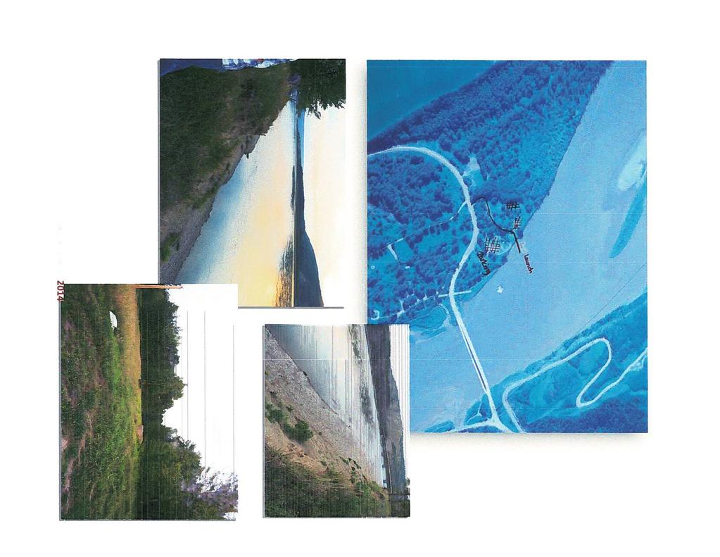
2 Report Chair and Directors September 18, 2014 Page 2 of 3 in the vicinity of Blackfoot Park, but recommendations need to be made by the end of the summer. From the meeting at Blackfoot Park on August 25, 2014 it was recommended that a launch be constructed on the property adjacent to Blackfoot park, also known as the old Greene property, where the Clayhurst ferry crossing used to be located. This property is Crown land and is regularly used for camping when Blackfoot Park is full. There was consensus amongst the group in attendance that this was the only suitable location on either side of the river. A number of community members also offered to assist with the construction should it go forward. STRATEGIC PLAN RELEVANCE: none FINANCIAL CONSIDERATION(S): none COMMUNICATIONS CONSIDERATION(S): none OTHER CONSIDERATION(S): Please see the attached meeting notes from the August 25, 2014 meeting. Excerpts from the Peace Project Water Use Plan (August 21, 2007) ca/050/documents/p E. pdf 1.0 Introduction The conditions proposed in this Water Use Plan, for the operation of BC Hydro s Peace River hydroelectric facilities, reflect the December 2003 consensus recommendations of the Peace Project Water Use Plan Committee... The proposed conditions will change current operations at the Peace Canyon and Williston Reservoir and are expected to positively affect fisheries and wildlife habitat, shoreline conditions, flood control, and recreation interests. The proposed conditions are expected to decrease power generation revenues (page 1). 5.4 Recommended Non-Operating Alternatives for the Peace The Peace Management Plan is limited to the portion of the Peace within British Columbia between Peace Canyon Dam and the BC/Alberta border. The work would be primarily conducted from Peace Canyon Dam to the Pine River confluence. Following are the components of the Management Plan Peace Access To provide safe and reliable access to and from the Peace for the full operating range at Peace Canyon Generating Station. Four sites below Peace Canyon Dam were identified for the construction and maintenance of river access. They are: Lynx Creek, Halfway River, Peace Island Park and ClayhurstlBlackfoot Regional Park (page 12). 7.6 Recreation

3 Report Chair and Directors September18, 2014 Page 3 of 3 The proposed operating conditions in this Water Use Plan are expected to have a minimal affect on the access or recreation activities on Williston Reservoir. The proposed physical works (e.g., improving or constructing reliable and safe reservoir access, debris removal, etc.) are expected to improve the recreation opportunity and public safety on Williston Reservoir... The Peace operating regime is not changing. The proposed physical works are expected to provide safe and reliable access on the river at four locations. These are Peace Island Park, Lynx Creek, Halfway River and ClayhurstlBlackfoot Regional Park (page 14).
 Community Members: Dave & Paula Friesen; Dave & Judy Russell, Tim & Charlie Hartnell, Steve HartneII, George Streeper, Marvin Meeres,")
4 Peace River Regional District Regional Parks Committee Meeting Date: Monday, August 25, 2014 Location: Blackfoot Regional Park Present: Director Jarvis (Chair); Trish Morgan-Manager of Community Services, Jill Rickert Community Services Coordinator (Recorder) Community Members: Dave & Paula Friesen; Dave & Judy Russell, Tim & Charlie Hartnell, Steve HartneII, George Streeper, Marvin Meeres, Tim Thomsen, Dwayne Shawchek, Tim Bennett (FLNRO), John Haukings (FLNRO), Dennis Nelson, Chad & Tia Esau, Donovan & Alex Giesbrecht, Perry Piper, Roni Nelson Refreshments and a fire for roasting hotdogs prior to the meeting was supplied for everyone by the PRRD. 1. Introductions and opening remarks were stated and the meeting was called to order at 7:00 p.m. 2. Trish Morgan presented information and discussion to provide a background to the history of the boat launch located at Blackfoot Park. - Part of the Water Use Plan for the Peace Canyon and WAC Bennett Dam that identified Blackfoot Park as an area needing a boat launch as an obligation to communities impacted by the dams - Hydro approached the PRRD regarding a boat launch at Blackfoot Park in In 2011 a meeting regarding plans for a boat launch was held at Doe River Community Hall to discuss options - July 2014 Comptroller of Water Rights released BC Hydro of all obligations to land bordering river, therefore no longer obligated to PRRD to maintain/build boat launch. Q: How much money do we have to work with? A: TM we don t know; FJ need to work together on a p an that s reasonable and then approach them. Q: What about the issues that Taylor has faced? A: FJ some issued occurred due to lack of knowledge regarding the nature of the vers in the north; rivers run hard and aren t deep; unfortunately cost BC Hydro more money in the long run, important to help BC Hydro understand what needs to be done here with a good solid plan Q: Are we restricted to the current location of the old launch? A: TM no not necessarily. Comment: Ideal place would be above the bridge and upriver, out of the flood plain area to avoid the launch flooding and ruining it. Comment: There is a lot of expeence and knowledge just among the people present tonight that could help and tell you where the launch should go. Group walked to current site of broken boat launch at near river...

5 Q: Will the new dam (Site C) stabilize the water level of the river at all? A: FJ yes in all likelihood, it could. Sfte C involves 3 major rivers located behind the dam, fewer running into it, means can control levels more with new dam Comment: It s important that if and when a new boat launch is built the old one in the current location is cleaned up. A lot of mess there, concrete and rebar, should be cleaned up before new project is started. Q: Any way there could be a bigger parking lot built if moved location of launch upriver? A: TM possibility if enough room. Group walked to Bill Greene s land across from Blackfoot park and upriver from current location of launch... Q: If boat launch built up river on Greene property, would PRRD/Hydro own it? A: TM Hydro land then hydro own it but likely PRRD would lease and run it, most likely Q: Last time some of us met with BC Hydro to discuss launch, we told them where it should go, showed them and took pictures. What happened to all that information? A: TM not sure what Hydro did with all that info, but we are going to take this information we get tonight to the next Parks Committee mtg come up with some type of plan/report to take to the Board. Q: How often would boat launch be used? A: Daily when water levels are good, very busy on weekends. At current location, vehicles get stuck all the time and need a 4 wheel drive to get out, constantly helping people get out of launch area. Q: TM Is the water at the Greene site for new launch deep enough? High river bank (20-30 ft) and erosion, wonder about the stability and recession. A: Lots of room and river plenty deep enough, could build ramp sideways (45 angle) and follow bank, fill in low spots not a lot of waste material most be utilised, very little maintenance in this area, easy area to expand with washrooms and picnic tables, keep access to public open. Comment: The location of the old ferry crossing on the Greene property is the ideal location. The river naturally slows at this location and although there is a steep bank, a ramp could be built back onto the property. (Group was in consensus that this was the only location) Comment: BC Hydro met with some of us in 2013 and we walked this property and showed them this same location. They took pictures and notes. What did BC Hydro do with all of this information? Q: TM - Cost? A: $200,000 to $300,000 to complete, lot of experience and knowledge here in community, people willing to help and donate time and equipment as long as there is money to finish it. Group walked back to Blackfoot Park and examined a map and marked the location of a potential new boat launch. 6. Meeting Adjourned at 8:30 p.m.


6
Pillar Park. Management Plan
 Pillar Park Management Plan January 2014 Pillar Park Management Plan Approved by: Jeff Leahy Regional Director Thompson Cariboo Region BC Parks January 9, 2014 Date Brian Bawtinheimer Executive Director
APPENDIX C LIST OF OTHER PARK SYSTEMS WITHIN THE PRRD
 APPENDIX C LIST OF OTHER PARK SYSTEMS WITHIN THE PRRD The PRRD is well served with parks of various kinds and levels within its boundaries. Although there are no national parks within the PRRD, there is
METROPOLITAN COUNCIL 390 North Robert Street, St. Paul, MN Phone (651) TDD (651)
 TDD (651)") DATE: March 27, 2012 METROPOLITAN COUNCIL 390 North Robert Street, St. Paul, MN 55101 Phone (651) 602-1000 TDD (651) 291-0904 TO: Metropolitan Parks and Open Space Commission FROM: Arne Stefferud, Planning
DATE: March 27, 2012 METROPOLITAN COUNCIL 390 North Robert Street, St. Paul, MN 55101 Phone (651) 602-1000 TDD (651) 291-0904 TO: Metropolitan Parks and Open Space Commission FROM: Arne Stefferud, Planning
PROPOSED ACTION South 3000 East Salt Lake City, UT United States Department of Agriculture
 United States Department of Agriculture Forest Service Uinta-Wasatch-Cache National Forest Salt Lake Ranger District 6944 South 3000 East Salt Lake City, UT 84121 801-733-2660 File Code: 1950/2300 Date:
Beaver Creek Provincial Park. Management Plan
 Beaver Creek Provincial Park Management Plan 2 Beaver Creek Provincial Park Table of Contents 1. Introduction... 3 2. Park History... 3 3. Park Attributes... 4 3.1 Natural... 4 3.2 Recreational... 4 4.
VOLUME II APPENDIX F DETAILED PHYSICAL DESCRIPTION OF PROJECT RESERVOIRS AND LANDS
 VOLUME II APPENDIX F DETAILED PHYSICAL DESCRIPTION OF PROJECT RESERVOIRS AND LANDS THE CENTRAL NEBRASKA PUBLIC POWER AND IRRIGATION DISTRICT FERC PROJECT NO. 1417 PHYSICAL DESCRIPTION OF PROJECT LANDS
Piedra River Protection Workgroup Meeting #5 Feb. 21, 2012 Ross Aragon Community Center, Pagosa Springs
 Piedra River Protection Workgroup Meeting #5 Feb. 21, 2012 Ross Aragon Community Center, Pagosa Springs What happened at this meeting? - Identified conservation easements - Discussed In-stream Flows -
Evaluation of Outstanding Remarkable Values for Collawash River March 2011
 Evaluation of Outstanding Remarkable Values for Collawash River March 0 Segment From headwaters of East Fork Collawash River to Buckeye Creek Mileage: miles Free flowing: Yes Scenic:, Substantial River
BOULDER CREEK CATTLE FENCING FOR KOKANEE HABITAT ENHANCEMENT 2010
 BOULDER CREEK CATTLE FENCING FOR KOKANEE HABITAT ENHANCEMENT 2010 Prepared for the: FISH & WILDLIFE COMPENSATION PROGRAM, NELSON, B.C. Prepared by: Marc André Beaucher CRESTON VALLEY WILDLIFE MANAGEMENT
Watchorn Provincial Park. Management Plan
 Watchorn Provincial Park Management Plan 2 Watchorn Provincial Park Table of Contents 1. Introduction... 3 2. Park History... 3 3. Park Attributes... 3 3.1 Natural... 4 3.2 Recreational... 4 3.3 Additional
Whitemouth Falls Provincial Park. Draft Management Plan
 Whitemouth Falls Provincial Park Draft Management Plan Whitemouth Falls Provincial Park Draft Management Plan Table of Contents 1. Introduction... 3 2. Park History... 3 3. Park Attributes... 4 3.1 Natural...
EAST DON TRAIL ENVIRONMENTAL ASSESSMENT. Community Liaison Committee Meeting #3 July 15, :30 to 8:30 pm Flemingdon Park Library
 EAST DON TRAIL ENVIRONMENTAL ASSESSMENT Community Liaison Committee Meeting #3 July 15, 2013 6:30 to 8:30 pm Flemingdon Park Library Agenda 1. Welcome 2. Housekeeping and Updates a) Housekeeping b) CLC
Boardman River Dams Implementation Team. DRAFT Meeting Minutes
 Location: Traverse City Governmental Center, Commission Chambers 400 Boardman Avenue Traverse City, MI 49684 Boardman River Dams Implementation Team Grand Traverse County Traverse City Light and Power
RIVER ACCESS STRATEGY
 RIVER ACCESS STRATEGY The River Access Strategy is a 10-year plan the City of Edmonton is developing to inform future programming, operations and infrastructure improvements that support access to the
The board welcomed Sioux City Economic Development Director, Marty Dougherty.
 Downtown Partners Sioux City Board of Directors Operational Meeting Minutes Downtown Partners 418 Pierce Street 11:00 a.m. March 24, 2017 Present: Jennifer Rose Bass, Darin Daby, Terry Glade, Chris Jackson,
Yard Creek Provincial Park. Management Plan
 Yard Creek Provincial Park Management Plan Draft January 2010 Yard Creek Provincial Park Management Plan Approved by: telàlsemkin/siyam/chief Scott Benton Bill Williams Squamish Executive Director ation
Rating: 5.0 (scale of 1-10)
") 95 Community Trail System Groundcover: 2-metre paved path, 1- metre grass buffer on either side. Location: Fort St. John Ownership: City of Fort St. John Rating: 5.0 (scale of 1-10) Strategic value: Linear
95 Community Trail System Groundcover: 2-metre paved path, 1- metre grass buffer on either side. Location: Fort St. John Ownership: City of Fort St. John Rating: 5.0 (scale of 1-10) Strategic value: Linear
CONTRACTUAL OBLIGATIONS supplementary detail information
 CONTRACTUAL OBLIGATIONS supplementary detail information Health Ministry of Health Maximus service delivery agreement 1... 38 36 36 110 Oracle (formerly Sun Microsystems) service delivery agreements...
APPENDIX. Alberta Land Stewardship Act AMENDMENTS TO THE SOUTH SASKATCHEWAN REGIONAL PLAN
 APPENDIX Alberta Land Stewardship Act AMENDMENTS TO THE SOUTH SASKATCHEWAN REGIONAL PLAN 1 All references to Alberta Environment and Sustainable Resource Development, Environment and Sustainable Resource
Land Management Summary
 photo credit: ANGAIR Anglesea Heath Land Management Summary The Anglesea Heath (6,501 ha) was incorporated into the Great Otway National Park in January 2018. This provides an opportunity to consider the
Board Member Comments (items not on the Agenda)
") PO Box 285 Dallesport Washington 98617-0285 Airport Management 509-767-2272 airporttd@gorge.net Agenda for the MEETING OF THE REGIONAL AIRPORT BOARD OF THE COLUMBIA GORGE REGIONAL AIRPORT (Established
PO Box 285 Dallesport Washington 98617-0285 Airport Management 509-767-2272 airporttd@gorge.net Agenda for the MEETING OF THE REGIONAL AIRPORT BOARD OF THE COLUMBIA GORGE REGIONAL AIRPORT (Established
Submission on the Tukituki Catchment Proposal: EPA reference numbers; NSP 13/ , NSP 13/ , NSP 13/ , NSP 13/02.
 Hutt Valley Tramping Club PO Box 30 883 LOWER HUTT 5045 Tukituki Catchment Proposal Environmental Protection Agency Private Bag 63 002 WELLINGTON 6140 29 July 2013 Submission on the Tukituki Catchment
Finn Creek Park. Management Direction Statement Amendment
 Finn Creek Park Management Direction Statement Amendment November 2013 Management Direction Statement Amendment Approved by: Jeff Leahy Regional Director, Thompson Cariboo BC Parks November 12, 2013 Date
SECTION 3 GENERAL DESCRIPTION OF THE RIVER BASIN
 SECTION 3 GENERAL DESCRIPTION OF THE RIVER BASIN SECTION 3 GENERAL DESCRIPTION OF THE RIVER BASIN River basin description. A general description of the river basin or subbasin, as appropriate, in which
Danvers River Committee Thursday April 20, 2017 Meeting Minutes
 Danvers River Committee Thursday April 20, 2017 Meeting Minutes The Danvers River Committee held a public meeting on Thursday April 20, 2017 in the Town Manager s Conference Room, Danvers Town Hall, at
PERFORMANCE MEASURE INFORMATION SHEET #16
 PERFORMANCE MEASURE INFORMATION SHEET #16 ARROW LAKES RESERVOIR: RECREATION Objective / Location Recreation/Arrow Lakes Reservoir Performance Measure Access Days Units Description MSIC 1) # Access Days
SIMON CANYON AREA OF CRITICAL ENVIRONMENTAL CONCERN (ACEC)
") SIMON CANYON AREA OF CRITICAL ENVIRONMENTAL CONCERN (ACEC) Activities: Facilities: Season / Hours: Description: Hiking, backpacking, fishing, picnicking, watchable wildlife. A graveled parking area, picnic
SIMON CANYON AREA OF CRITICAL ENVIRONMENTAL CONCERN (ACEC) Activities: Facilities: Season / Hours: Description: Hiking, backpacking, fishing, picnicking, watchable wildlife. A graveled parking area, picnic
NAVAJO COMMUNITY PLAN
 NAVAJO COMMUNITY PLAN Prepared by the NAVAJO COMMUNITY PLANNERS and THE CITY OF SAN DIEGO City of San Diego Planning Department 202 C Street, MS 4A San Diego, CA 92101 Printed on recycled paper. This information,
Androscoggin River Trail Access Sites. North Woods. 168 miles from its source at Lake Umbagog to Merrymeeting Bay
 Androscoggin River Trail Access Sites North Woods 168 miles from its source at Lake Umbagog to Merrymeeting Bay Trail Under Construction More than 40 Public Access Sites Available Androscoggin River Watershed
Port Bruce. Interim Management Statement
 Port Bruce Interim Management Statement Port Bruce Interim Management Statement August 3, 1999 This Port Bruce Provincial Park Interim Management Statement provides direction for the custodial management
Park Board Chair and Commissioners
 TO: FROM: Park Board Chair and Commissioners April 21, 2017 General Manager Vancouver Board of Parks and Recreation SUBJECT: Water Bike Rental Service at Vanier Park Pilot Program Contract Award RECOMMENDATION
OMINEACA PROVINCIAL PARK
 OMINEACA PROVINCIAL PARK AND PROTECTED AREA PURPOSE STATEMENT AND ZONING PLAN March 2003 OMINECA PROVINCIAL PARK AND PROTECTED AREA Purpose Statement and Zoning Plan Omineca Park and Omineca Protected
Calgary River Access Strategy Priority Sites and Proposed Funding
 Calgary River Access Strategy Priority Sites and Proposed Funding CPS2017-0103 ATTACHMENT 2 A total of $7,660,000 (Class 5 estimate) is required to implement all sites within the Calgary River Access Strategy;
MINUTES COMMUNITY DEVELOPMENT BOARD MARCH 18, 2015 AT 6:00 P.M. CITY HALL, 116 FIRST STREET NEPTUNE BEACH, FLORIDA
 MINUTES COMMUNITY DEVELOPMENT BOARD MARCH 18, 2015 AT 6:00 P.M. CITY HALL, 116 FIRST STREET NEPTUNE BEACH, FLORIDA Pursuant to proper notice a public hearing of the Community Development Board for the
Prepared by Cathy Quinlan & Brad Hertner Upper Thames River Conservation Authority. For the City of Woodstock
 Prepared by Cathy Quinlan & Brad Hertner Upper Thames River Conservation Authority For the City of Woodstock Burgess Park and Standard Tube Parks in the west end of Woodstock Pittock Reservoir Along the
Whitefish Range Partnership Tentatively Approved by WRP 11/18/2013!Rec. Wilderness Page 1
 Whitefish Range Partnership Tentatively Approved by WRP 11/18/2013!Rec. Wilderness Page 1 Recommended Wilderness Background The Whitefish Range has a long management and legislative history associated
Wyoming Public Lands Initiative in Carbon County
 Wyoming Public Lands Initiative in Carbon County THE CARBON COUNTY WPLI ADVISORY COMMIT TEE WANTS YOUR INPUT Wilderness Study Area: A special designation that applies to lands managed to protect wilderness
Lake Tahoe Shoreline Plan 03 Policy Topic: Access Issues
 Lake Tahoe Shoreline Plan 03 Policy Topic: Access Issues V9 Last Updated 03.10.2017 1 Brief Description Physical access to the waters of Lake Tahoe is one of the key issues surrounding the Shoreline Plan
MONTEREY REGIONAL AIRPORT MASTER PLAN TOPICAL QUESTIONS FROM THE PLANNING ADVISORY COMMITTEE AND TOPICAL RESPONSES
 MONTEREY REGIONAL AIRPORT MASTER PLAN TOPICAL QUESTIONS FROM THE PLANNING ADVISORY COMMITTEE AND TOPICAL RESPONSES Recurring topics emerged in some of the comments and questions raised by members of the
SPECTACLE LAKE PROVINCIAL PARK PURPOSE STATEMENT AND ZONING PLAN
 SPECTACLE LAKE PROVINCIAL PARK PURPOSE STATEMENT AND ZONING PLAN August 2003 1 SPECTACLE LAKE PROVINCIAL PARK Purpose Statement and Zoning Plan Primary Role The primary role of Spectacle Lake Park is to
KOOTENAY LAKE PROVINCIAL PARK (MIDGE CREEK SITE)
") KOOTENAY LAKE PROVINCIAL PARK (MIDGE CREEK SITE) PURPOSE STATEMENT AND ZONING PLAN February 2003 Approved by: KOOTENAY LAKE PROVINCIAL PARK (Midge Creek Site) Purpose Statement and Zoning Plan Primary
KOOTENAY LAKE PROVINCIAL PARK (MIDGE CREEK SITE) PURPOSE STATEMENT AND ZONING PLAN February 2003 Approved by: KOOTENAY LAKE PROVINCIAL PARK (Midge Creek Site) Purpose Statement and Zoning Plan Primary
Lake Chelan Operations
 Lake Chelan Operations IPMA Executive Seminar September 17, 2013 Presented by: Janet Jaspers Chelan County PUD Lake Chelan Hydroelectric Project Today s Discussion Chelan PUD Overview Interesting Facts
NECHAKO CANYON PROTECTED AREA
 NECHAKO CANYON PROTECTED AREA PURPOSE STATEMENT AND ZONING PLAN March 2003 1 Nechako Canyon Protected Area Purpose Statement and Zoning Plan The Nechako Canyon Protected Area (1,246 hectares) is located
Welcome KROSNO CREEK DIVERSION PROJECT CLASS ENVIRONMENTAL ASSESSMENT
 Welcome KROSNO CREEK DIVERSION PROJECT PUBLIC INFORMATION CENTRE # 1 Tonight s Presentation Study Overview Background Existing Conditions Alternative Solutions Preliminary Preferred Solution Next Steps
Richmond Centre for Disability
 Richmond Centre for Disability Duke of Edinburgh Challenge Gold Medal Level Expedition Information & Planning May 21 24, 2010 Overall Schedule Time Location Activity May 21, 2010, Friday 9 a.m. RCD To
CORNWALL WATERFRONT PLAN 2007
 CANAL LANDS CANAL LANDS Page 58 Introduction This chapter details areas of possible development or redevelopment, and lands to be protected from any form of development in the Canal Lands area. As outlined
Chessie Trail Public Forum Minutes. December 7, :00 7:30 pm Turman Room, Preston Library, VMI
 1. Welcome Chessie Trail Public Forum Minutes December 7, 2017 6:00 7:30 pm Turman Room, Preston Library, VMI a. Col Jay Williams welcomed everyone to the meeting and thanked them for their interest and
The Chu property is a 6.57 acre parcel located in the Town of Superior on the west side of McCaslin Boulevard. In 2014, the Town of Superior acquired
 1 The Chu property is a 6.57 acre parcel located in the Town of Superior on the west side of McCaslin Boulevard. In 2014, the Town of Superior acquired the Chu property for open space with a contribution
BURGES JAMES GADSDEN PROVINCIAL PARK PURPOSE STATEMENT AND ZONING PLAN
 BURGES JAMES GADSDEN PROVINCIAL PARK PURPOSE STATEMENT AND ZONING PLAN February 2003 BURGES JAMES GADSDEN PROVINCIAL PARK Purpose Statement and Zoning Plan Primary Role The primary role of Burges James
Wallace Lake Provincial Park. Management Plan
 Wallace Lake Provincial Park Management Plan 2 Wallace Lake Provincial Park Table of Contents 1. Introduction... 3 2. Park History... 3 3. Park Attributes... 4 3.1 Natural... 4 3.2 Recreational... 4 4.
Appendix C Oregon Resident Component of Recreation Visitor Survey Results
 Appendix C Oregon Resident Component of Recreation Visitor Survey Results Oregon Resident Component of Recreation Visitor Survey Results Lewis River Hydroelectric Projects FERC Nos. 2111, 2213, 2071, and
Waterfront Concept Plan: Community Survey Summary
 Waterfront Concept Plan: Community Survey Summary Published April 20, 2016 #1100085 Introduction The survey was one component of the public consultation process endorsed by Council in October, 2015. This
Triangle Land Conservancy Conservation Area Monitoring Report Carolina North
 Triangle Land Conservancy Conservation Area Monitoring Report Carolina North Property Name: Bolin Creek East Conservation Area Date of visit: March 16, 2017 County: Orange Property Type: Restrictive Covenants
90 I-90 Snoqualmie Pass East September Annual Mega-Project Report. Project Benefits
 90 I-90 Snoqualmie Pass East September 2015 Annual Mega-Project Report Purpose of this Report The financial and schedule information in this document will assist the Office of Financial Management in meeting
TOWN OF OSOYOOS REGULAR OPEN MEETING OF COUNCIL APRIL 18, 2016
 PRESENT: Mayor McKortoff Councillors Rhodes, Youngberg, Campol and King Water Councillors Moreira and Rai Staff: Barry Romanko, CAO Janette Van Vianen, Director of Corporate Services Jim Zakall, Director
GOLDEN BACKCOUNTRY RECREATION ADVISORY COMMITTEE (GBRAC)
") GOLDEN BACKCOUNTRY RECREATION ADVISORY COMMITTEE (GBRAC) MINUTES from November 1, 2006 Meeting Attending: Sector / Stakeholder GBRAC Commercial Aerial Motorized Sector GBRAC Habitat Protection; Sport Fishing
GOLDEN BACKCOUNTRY RECREATION ADVISORY COMMITTEE (GBRAC) MINUTES from November 1, 2006 Meeting Attending: Sector / Stakeholder GBRAC Commercial Aerial Motorized Sector GBRAC Habitat Protection; Sport Fishing
2.1 Physical and Biological Description Matabitchuan River Watershed
 2.1 Physical and Biological Description Watershed 2.1.1 Physical Description The system watershed has a total area of about 933 km 2 and is a tributary system to Lake Temiskaming and the Ottawa River Drainage
Others in Attendance: Airport Manager, Billie Jo Grafton, Airport Clerk, Claudia Chavarria.
 International Airport Commission Meeting Minutes Airport Terminal Building City of Del Rio, Texas 1104 West 10 th St. Del Rio, Texas 78840 Wednesday August 24, 2011 6:00 P.M. ************************************************************************
A moment of silence was taken for Trish Avery in appreciation for her service to the community.
 Minutes of the Special Meeting of the Lava Planning and Zoning Commission held Tuesday, March 20, 2012, 6:30p.m. at the Lava City Hall, 115 West Elm Street, Lava Hot Springs, Idaho. Present: Cory Unsworth
Steps in the Management Planning Process
 Steps in the Management Planning Process Developing a management plan for Kalamalka Lake Park will follow a multi-stage process. The planning process for this park is currently in the Draft Management
Planning Future Directions. For BC Parks: BC Residents' Views
 Planning Future Directions For BC Parks: BC Residents' Views Summary Report Ministry of Water, Land and Air Protection Province of British Columbia April, 2002 National Library of Canada Cataloguing in
Approve Agenda Motion by Mike Roiger and second by Troy Larson to approve agenda as presented. Motion carried.
 Price-Taylor Rail Trail Corridor Commission Westboro VFW Hall October 21, 2014 Call Meeting to Order Meeting of the Price-Taylor Rail Trail Commission was called to order by President Marvin Kuenne on
TOWN COUNCIL MEETING MINUTES July 13, 2017
 TOWN COUNCIL MEETING MINUTES July 13, 2017 1. Call to Order and Pledge of Allegiance Mayor Pro Temp Dean Heavrin called to order the meeting of the Town Council of the Town of Hideout at 6:05 p.m. on July
ROBERTS CREEK PROVINCIAL PARK MASTER PLAN. November, 1981
 Ministry of Lands, Parks and Housing Parks and Outdoor Recreation Division Park Operations Branch North Vancouver, B. C. ROBERTS CREEK PROVINCIAL PARK MASTER PLAN November, 1981 Mr. G. Trachuk Director
THE CORPORATION OF DELTA COMMUNITY PLANNING ADVISORY COMMITTEE
 THE CORPORATION OF DELTA COMMUNITY PLANNING ADVISORY COMMITTEE Minutes of the Regular Meeting of the Community Planning Advisory Committee held Thursday, February 4, 2016 at 7:00 p.m. in the Annacis Room
INCORPORATED VILLAGE OF HILTON BEACH MINUTES
 INCORPORATED VILLAGE OF HILTON BEACH MINUTES Council Meeting October 11, 2017 5:00 p.m. Council Chambers, Hilton Beach Municipal Office 3100 Bowker Street, Hilton Beach, Ontario The meeting was called
THE CORPORATION OF THE CITY OF NELSON Special Regular Council meeting including items closed to the Public AGENDA
 THE CORPORATION OF THE CITY OF NELSON Special Regular Council meeting including items closed to the Public AGENDA Monday, January 23, 2017 at 11:00 AM in Council Chambers, 2nd Floor, 310 Ward Street, Nelson,
FORECASTING FUTURE ACTIVITY
 EXECUTIVE SUMMARY The Eagle County Regional Airport (EGE) is known as a gateway into the heart of the Colorado Rocky Mountains, providing access to some of the nation s top ski resort towns (Vail, Beaver
Optimize the City s operations while maintaining or improving the quality of life.
 Staff Report Report To: City Council Report From: Chris Hughes, Manager of Contract Services Meeting Date: September 20, 2016 Report Code: OP-16-049 Subject: Airport Service Review Options Recommendations:
2016 Trails Maintenance and Operating Costs
 2016 Trails Maintenance and Operating Costs Motorized Trails Maintenance for motorized trails comes from vehicle registration fees and a portion of the federal Recreation Trails Program (RTP) funds. The
Adventure Tourism Management Plan. Adventure Tourism Intensive Use Sites MANAGEMENT PLAN
 Adventure Tourism Intensive Use Sites MANAGEMENT PLAN ACCEPTED BY: FILES #: 1413906 1413905 LICENSES #: 112857 112905 DATE: April 25, 2018 SIGNED on behalf of HER MAJESTRY THE QUEEN IN THE RIGHT OF THE
Lake Acreage Mcleese Lake, BC
 Lake Acreage Mcleese Lake, BC Jason Zroback jason@landquest.com 1 (604) 414-5577 Jamie Zroback jamie@landquest.com 1 (604) 483-1605 The Source for Oceanfront, Lakefront, Islands, Ranches, Resorts & Land
Greenways Commission Meeting Agenda Monday, March 20, 2017; 4:00 pm 7:00 pm Town Hall, Parking Lot
 Greenways Commission Meeting Agenda Monday, March 20, 2017; 4:00 pm 7:00 pm Town Hall, Parking Lot I. 4:00 4:05 pm Leave Town Hall Parking Lot for Briar Chapel II. III. IV. 4:30 pm Site Visit - Briar Chapel
Comments on Grand Canyon National Park Environmental Assessment April, 2010
 Comments on Grand Canyon National Park Environmental Assessment April, 2010 The purpose of this EA is to examine environmental impacts associated with the proposal to make changes to stock use and mule
Santa Clara South Hills Recreation Park Project Development and Management Plan
 Santa Clara South Hills Recreation Park Project Application for Land for Recreation or Public Purposes, City of Santa Clara, Utah Prepared for: Bureau of Land Management, St. George Field Office 345 East
Longlac North Conservation Reserve (C2207) Statement of Conservation Interest
 Statement of Conservation Interest") Longlac North Conservation Reserve (C2207) Statement of Conservation Interest April 2003 Prepared for the Ontario Ministry of Natural Resources, Northwest Region by Rebecca Zeran and Natalie Kolody OLL
Longlac North Conservation Reserve (C2207) Statement of Conservation Interest April 2003 Prepared for the Ontario Ministry of Natural Resources, Northwest Region by Rebecca Zeran and Natalie Kolody OLL
You can also park on the side of the highway for a shorter approach; if you don t mind having your car towed. I was ticketed once and towed once.
 ARBUTUS GROVE Good problems, good views and closer than Squamish make this an attractive climbing spot for a few hours of fun. The freeway makes it a little noisy. Low vegetation (due to power line clearing)
Public Comment. Comment To consider extending State Park lands above River Mile 7.0
 Public To consider extending Park lands above River Mile 7.0 on the Little Spokane River for the conservation and limited recreation qualities they contain is this request. Could this be included in your
Thank you for the opportunity to comment on the proposed action to add trails and trailheads to the Red Rock District trail system.
 July 14, 2010 Jennifer Burns Red Rock Ranger District PO Box 20429 Sedona, AZ 86341 Flagstaff Biking Organization PO Box 23851 Flagstaff, AZ 86002 Dear Jennifer- Thank you for the opportunity to comment
Indian Creek. Plumas County, California. Proudly Offered By
 Indian Creek Plumas County, California Proudly Offered By 707 Merchant Street, Suite 100, Vacaville, Ca 95688 (707) 455-4444 Office (707) 455-0455 Fax info@caoutdoorproperties.com Introduction House looking
Minutes Huron-Clinton Metropolitan Authority Board of Commissioners Thursday, June 9, 2016
 Minutes Huron-Clinton Metropolitan Authority Board of s Thursday, June 9, 2016 A regular meeting of the Huron-Clinton Metropolitan Authority s Board of s was held at 10:30 a.m. on Thursday, June 9, 2016
Stephanie Sinnott, Executive Director, Finance, Office of the City Manager
 Public Report To: From: Finance Committee Stephanie Sinnott, Executive Director, Finance, Office of the City Manager Paul D. Ralph, BES, RPP, MCIP, Commissioner, Development Services Department Report
April 2011 Newsletter
 Ridge Riders Snowmobile Club, Inc. PO Box 1004 Whitney Point, NY 13862 Web: WWW.RidgeRidersWP.org April 2011 Newsletter 2011-2012 Officers and Board of Directors Board of Directors Trail Captains Judi
Northowram & Shelf Ward Forum
 Northowram & Shelf Ward Forum Notes of meeting held on 18 March 2014 at Northowram Community Sport and Activity Club, Westercroft Lane, Northowram HX3 7EN Present: Cllr. S Baines (Chair); Cllr. R Taylor;
Marchand Provincial Park. Management Plan
 Marchand Provincial Park Management Plan 2 Marchand Provincial Park Table of Contents 1. Introduction... 3 2. Park History... 3 3. Park Attributes... 4 3.1 Natural... 4 3.2 Recreational... 4 3.3 Additional
TRUMPINGTON MEADOWS COMMUNITY MEETING (MEETING 1) held at Trumpington Meadows Primary School Meeting Room 2 on 27th November 2017, 19:30 21:00 MINUTES
 held at Trumpington Meadows Primary School Meeting Room 2 on 27th November 2017, 19:30 21:00 MINUTES") TRUMPINGTON MEADOWS COMMUNITY MEETING (MEETING 1) held at Trumpington Meadows Primary School Meeting Room 2 on 27th November 2017, 19:30 21:00 MINUTES Guests Tim Watkins Project Manager, Western Orbital,
TRUMPINGTON MEADOWS COMMUNITY MEETING (MEETING 1) held at Trumpington Meadows Primary School Meeting Room 2 on 27th November 2017, 19:30 21:00 MINUTES Guests Tim Watkins Project Manager, Western Orbital,
Recreation Management Plan Lake Baroon and Ewen Maddock Dam
 Lake Baroon and Ewen Maddock Dam December 2013 Contents Overview... 3 The Value of Our Natural Areas... 4 Management Approach... 6 Funding... 7 Recreation Management... 8 Conditions of Access and Use...
The Covered Bridge of Pepperell
 The Covered Bridge of Pepperell 1742 - An uncovered wooden bridge historically referred to as the cart bridge at Joseph Blood s Fordway, links Groton West Parish and Groton. Cost Unknown 1753 - As Pepperell
Action Recommendation: Budget Impact:
 City of Fayetteville Staff Review Form Matt Mihalevich 1/16/2019 DEVELOPMENT SERVICES (620) Submitted By 2019 0050 Legistar File ID February 5th, 2019 City Council Meeting Date Agenda Item Only N/A for
Northern Rockies Regional Municipality Fort Nelson First Nation.
 July 23, 2018 Northern Rockies Regional Municipality Fort Nelson First Nation By E-mail: dtofte@northernrockies.ca Re: Letter of Support for the Fort Nelson Community Forest Partnership To Whom It May
ENA General Membership Meeting
 ENA General Membership Meeting 1-31-13 1. Welcome 2. Introduce Board Current Board Members: President: Wendy Jones Vice President: Brooks Beaupain Treasurer: Suzanne Dove Secretary: Amy Sirr Sabrina Barton
District of Summerland COMMITTEE OF THE WHOLE MEETING AGENDA
 District of Summerland COMMITTEE OF THE WHOLE MEETING AGENDA Monday, July 8th, 2013-8:30 a.m. Council Chambers Municipal Hall, 13211 Henry Ave. Summerland, BC Page 1. Call to Order 3-5 2. Adoption of Minutes
Performance Term 4 An Opportunity to Reset Ferry Fares. Background:
 Performance Term 4 An Opportunity to Reset Ferry Fares Background: The British Columbia Ferry Corporation was established in 1958 through the Toll Highways and Bridges Authority. It was a government Crown
INDIAN LANDS REGISTRY SYSTEM
 Reserve: 07661 - STIKINE RIVER 7 MINUTES OF DECISION 1916/06/30 112954 1987/07/20 12:00:00AM Area: 80.000 Acres Land Affected: LEFT BANK OF STIKINE RIV 1/2 MI BELOW TELEGRAPH CREEK Grantor(s): ROYAL COMMISSION
GORDON LAKE RANCH. 973 acres palo pinto county Texas
 GORDON LAKE RANCH 973 acres palo pinto county Texas As the Dallas Ft Worth Metroplex expands, fewer large tracts of land are available for those wanting to enjoy life outside that ever increasing circle
Valemount Visitor Centre Annual Report 2014
 Valemount Visitor Centre Annual Report 2014 1 Table of Contents Introduction... 3 Visitor Statistics... 3 Revenues... 5 Accommodation Revenues... 5 Activity Revenues... 6 Retail Sales Revenues... 7 Summary...
Please Tell Us What You Think: Candidate Sites for Recreation Business Activities
 Please Tell Us What You Think: Candidate Sites for Recreation Business Activities Background In January 2015, the Washington State Parks and Recreation Commission (Commission) approved some forms of privately
Meeting Minutes. Meeting Details: FAC:
 e Meeting Minutes Meeting Details: FAC: Denman/Hornby Islands and Comox Valley Ferry Advisory Committee Date: October 25, 2005 Location: Denman Seniors & Museum Society, Denman Island Time: 9:30 a.m. 12:15
Plans and Design Calculations for the Alder Creek Diversion Fish Screen
 TECHNICAL MEMORANDUM Plans and Design Calculations for the Alder Creek Diversion Fish Screen El Dorado Irrigation District 2890 Mosquito Road Placerville, CA 95667 Alder Creek Diversion Fish Screen Plans
Table of Contents. page 3 Long term Goals Project Scope Project History. 4 User Groups Defined Trail Representative Committee. 5 Trail Users Breakdown
 Launched April 27th, 2010 1 Table of Contents page 3 Long term Goals Project Scope Project History 4 User Groups Defined Trail Representative Committee 5 Trail Users Breakdown 13 Trail Users Desires 16