Table of figures. Table of contents. Executive summary... i Introduction... 1 Purpose... 1
|
|
|
- Joleen Higgins
- 5 years ago
- Views:
Transcription
1
2 Table of contents Executive summary... i Introduction... 1 Purpose... 1 The corridor at a glance... 2 Corridor overview... 2 The regional economy... 2 Understanding our customers... 3 Key customers... 3 How we deliver services along the corridor... 5 Transport partners... 5 Network Outcomes Contracts approach... 6 Drivers for change... 7 Understanding customer levels of service on the corridor... 8 Current levels of service performance... 8 Improving the customer experience Access Resilience Reliability and efficiency Safety People, places and environment Understanding the infrastructure assets Asset condition and performance Asset condition and performance pressures Asset condition and performance future considerations Investing in the Corridor Summary investment Investing in access and resilience Investing in reliability and efficiency Investing in safety Investing in people, places and environment Investment pressures Investment future considerations Appendix A Information Sources Table of figures Figure 1 - Performance of the corridor against ONRC outcomes... i Figure 2 - Corridor management plan framework... 1 Figure 3 Corridor overview... 2 Figure 4 - Key customers, journeys, and destinations... 3 Figure 5 - Map of associated local authorities... 5 Figure 6 - NOC process... 6 Figure 7 - Current ONRC levels of service performance... 8 Figure 8 Significant corridor planned improvements Figure 9 - Corridor characteristics Figure 10 Horizontal Alignment Figure 11 - Corridor capacity Figure 12 Resilience Figure 13 - Reliability and efficiency Figure 14 Safety Figure 15 People, places and environment Figure 16 Corridor asset base Figure 17 Summary asset condition and performance Figure 18 Asset condition Figure 19 - Asset condition Figure 20 Asset condition Figure 21 Asset condition Figure 22 Asset condition Figure 23 Corridor Investment Figure 24 Access and resilience investment Figure 25 Reliability and efficiency investment Figure 26 Safety investment Figure 27 People, places and environment investment... 38

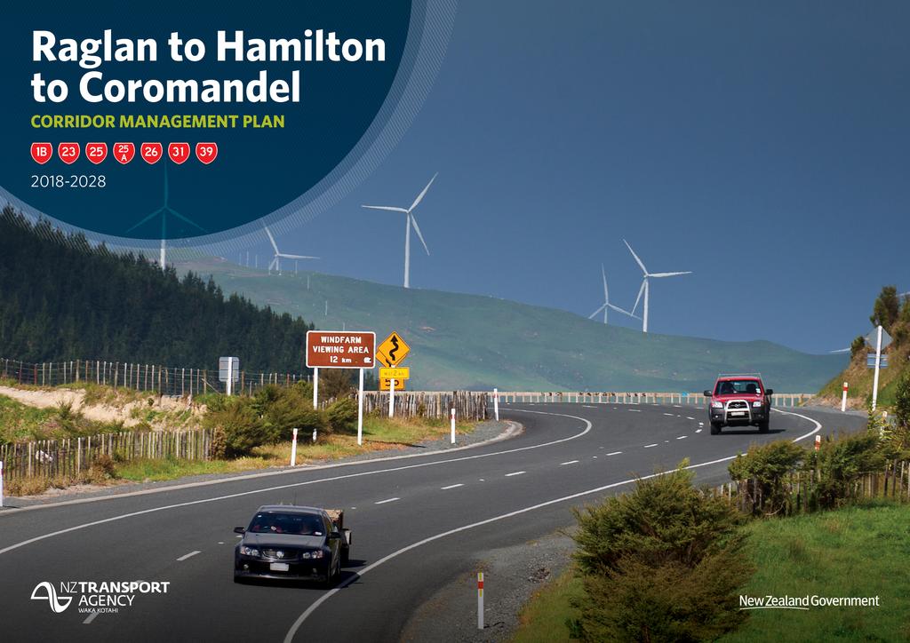
3 Executive summary The Raglan to Hamilton to Coromandel corridor comprises numerous segments of the secondary state highway network in the Waikato Region. West of Hamilton, the corridor comprises SH23, between Raglan and Frankton, SH31 from Kawhia to Tihiroa and SH39 which travels from Te Rapa through to Otorohanga. To the east of Hamilton, this corridor includes SH1B, linking Taupiri to Hautapu (SH1B is also known as the Gordonton Road and is due to be revoked in 2020); SH26, from Hillcrest to Thames via Morrinsville and Paeroa; and the State Highway network around the Coromandel comprising SH25 from Mangatarata to Waihi via Whitianga, and SH25A between Kopu and Hikuai. The East Coast main trunk rail line operates a freight service between Hamilton and Tauranga, and runs adjacent to SH26 near Morrinsville. A spur rail line links Hamilton to Cambridge. This corridor provides for key journeys to the east and west of Hamilton that link into the primary state highway network (SH1, SH2 and SH3). However, they do not form a strong connection from end to end. Figure 1 - Performance of the corridor against ONRC outcomes The corridor is approximately 548 km long (4.8% of the state highway network). The total value of assets along the corridor is $735M (3.2% of the total national asset value). The state highways along this corridor are either Primary Collector or Arterial routes. As such, investment and maintenance along this corridor will be fit for purpose and may not offer the same level of service as higher order roads. Customers using the corridor include domestic and international tourists accessing east and west coast beaches; freight servicing agriculture and industry; and commuters in the outer suburbs of Hamilton. Tourism and dairy are New Zealand s highest earning exports, and this corridor provides access for both types of journeys, as well as links to and from the Golden Triangle, the higher classification state highways that link Auckland, Hamilton and Tauranga. This corridor provides access to high value natural and coastal landscapes, and the beaches of the Coromandel Peninsula and Raglan attract international and local visitors. The Waikato region is one of the most productive agricultural regions in New Zealand. Dairy plays a prominent role, with 25% of New Zealand s milk supply originating in the region. The main issues and constraints on this corridor relate to Resilience, Reliability, Safety and Amenity. Some sections of the corridor are lifeline routes, with few alternative options if roads are closed and are regularly closed as a result of erosion, flooding and slips. The east coast of the Coromandel Peninsula has high travel time variability due to the influx of tourists over the Summer period. This results in significant traffic congestion through these townships, and in the vicinity of two single lane bridges during these peak periods. The remoteness of some parts of this corridor can also exacerbate the severity of injuries, given the long emergency response times. Many sections of the corridor offer access to high value natural and coastal landscapes. However, journeys through the hilly and winding sections of the corridor are uncomfortable in parts, with tight bends, steep drops without barriers and constrained cross sections. i Future investment on this corridor needs to ensure access and resilience is maintained in support of the many rural communities along the corridor particularly those in the more remote sections. Future investment also needs to support continual improvement in the safety performance of the corridor, including consideration of visiting driver enhancements Raglan to Hamilton to Coromandel Corridor Management Plan

4 Introduction Purpose What is the corridor management plan? This Corridor Management Plan describes the customer service delivery story for the Raglan to Hamilton to Coromandel corridor, as measured against the One Road Network Classification performance framework. It is intended to describe the investment story, i.e. why invest in this corridor, in a context everyone can understand whether the activities are delivered through investment in the State Highways maintenance, operations, renewals and improvements programmes. The corridor management plan considers a combination of: The pressures on the system that are resulting in increased demand or a reduction in levels of service How will we use it? The Corridor Management Plan will provide the customer story and case for investment in maintenance, renewal and improvement on the corridor, based on targeting maintenance to achieve the appropriate customer levels of service within the context of providing value for money. The information presented in the corridor management plan helps to inform the business case for investment in State Highways for the subsequent triennial period. In conjunction with the long-term view, the corridor management plan will provide for engagement with key stakeholders and partners to shape the future of the corridor. It responds to the needs of the users of the corridor to shape the future service levels. Figure 2 - Corridor management plan framework The current state of the system and how it is performing The response the Agency is investing in to deliver the customer levels of service along the corridor. It is important to note that this is a first-generation Corridor Management Plan, therefore, we expect it to be improved as we learn from this approach. It sets a firm foundation to improve from in the next 2-3 years, utilising a common framework and consistent data sets across the 30 corridors. Why is it needed? The corridor plan provides a link between the long-term planning outlook, the 10-year medium term investment programme and the 3-year land transport programmes for the next funding round. Traditionally, the approach to investing in maintenance and renewals is to consider each asset activity in isolation, i.e. pavement, structures, drainage, and in isolation of capital expenditure. The Corridor Management Plan approach considers all assets within the corridor and takes a holistic view of the customer levels of service they provide throughout the corridor. Planning is currently undertaken at the regional level, but typically significant journeys traverse more than one region. By considering the significant customer journeys and destinations, the corridor management plan is a vehicle to engage in regional and inter-regional conversations by focusing on the issues that are important and may extend beyond the state highways network Raglan to Hamilton to Coromandel Corridor Management Plan
.")
5 The corridor at a glance Figure 3 Corridor overview Corridor overview This corridor management plan covers numerous segments of the secondary state highway network in the Waikato Region. This corridor provides for key journeys to the east and west of Hamilton that link into the primary state highway network (SH1, SH2 and SH3). However, they do not form a strong connection from end to end. West of Hamilton, the corridor comprises SH23, between Raglan and Frankton, SH31 from Kawhia to Tihiroa and SH39 which travels between Te Rapa through to Otorohanga. To the east of Hamilton, this corridor includes SH1B, linking Taupiri to Hautapu (SH1B is also known as the Gordonton Road and is due to be revoked in 2020); SH26, from Hillcrest to Thames via Morrinsville and Paeroa; and the State Highway network through the Coromandel comprising SH25 from Mangatarata to Waihi via Whitianga, and SH25A between Kopu and Hikuai. The East Coast main trunk rail line operates a freight service between Hamilton and Tauranga, and runs adjacent to SH26 near Morrinsville. A spur rail line links Hamilton to Cambridge. The regional economy The Waikato Region has nearly 450,000 residents (9.6% of New Zealand s population), 9.3% of national employment and generates 9.0% of New Zealand s Gross Domestic Product (GDP). Hamilton City is the hub of the region, and is the fourth largest city in New Zealand, with a population of 156,800. Tourism and dairy are New Zealand s highest earning exports, and this corridor provides access for both types of journeys, as well as links to and from the Golden Triangle. This corridor provides access to high value natural and coastal landscapes, and the beaches of the Coromandel Peninsula and Raglan attract international and local visitors. The Waikato region is one of the most productive agricultural regions in New Zealand. Dairy plays a prominent role, with 25% of New Zealand s milk supply originating in the region. Dairy contributes 5.1% of Waikato s total employment (compared to the national average of 1.7%), however in some districts the dairy industry provides up to 15% of employment. Forestry, aggregates and minerals play an important role for the regional economy, and 75% of New Zealand s geothermal energy comes from the Waikato region Raglan to Hamilton to Coromandel Corridor Management Plan

6 Understanding our customers Figure 4 - Key customers, journeys, and destinations Key customers The key customers using the corridor are diverse, and use a range of transport modes. Different customers have different needs, expectations, and personal circumstances for using the transport system. Therefore, what customers value from the transport network needs to be understood in the context of who they are. Daily commuter Commuters living in the outer suburbs and townships of Hamilton may use parts of this corridor to access key services, employment and education in Hamilton City. Hamilton has a comprehensive bus network, however public transport use for journeys to work is low. Hamilton has the lowest rate of travel by active modes (walking and cycling) compared to the six largest cities in New Zealand. Whitianga, Morrinsville and Thames function as regional service towns and provide services and facilities to the surrounding rural areas. Insights into daily commuter users: Road use: The suburbs of Hamilton included within this corridor (Frankton, Te Rapa and Hillcrest) are located on the urban fringe. As noted above, public transport use is low and use of private motor vehicles is high. Road knowledge: Commuters are familiar with their route, and viable alternatives to avoid congestion. Journey times are relatively predictable and consistent. Pain points: Traffic volumes on the urban section of SH23 at Frankton and through Thames are relatively high. Delays at the Dinsdale roundabout and at the intersection of SH23 and SH1 at Frankton are common during peak times. Daily commuters expect: Predictable journeys at peak times, accurate and up to date information about traffic (peak and off peak), weather, and road conditions and hazards Raglan to Hamilton to Coromandel Corridor Management Plan
7 Tourist and recreational users Tourism contributed $1.88 billion to the Waikato economy in 2014 which was 8.4% of New Zealand s total tourism spend. Key attractions include the beaches and forests of the Coromandel Peninsula, Raglan Beach, the Hauraki Rail Trail and the historic gold town at Waihi. SH25 and SH39 are used by tourists travelling on promoted routes including the Pacific Coast and Thermal Explorer Highways. Numerous events including Whangamata Beach Hop, Battle of the Streets, and food and heritage festivals attract high numbers of local visitors. Insights into tourist and recreational users are as follows: Road use: The population of Coromandel Peninsula townships and Raglan swell over the summer, as well as shoulder periods and weekends. This results in substantial congestion in towns including Tairua, Whitianga and Whangamata, which generally experience few or no delays in off-peak periods. International visitors may have tight holiday schedules and underestimate journey times between key destinations. These factors can increase risk taking and exposure to fatigue. Motorcyclists are drawn to the Coromandel Peninsula and Raglan, as the routes are challenging and offer scenic views and rest stops. Road knowledge: Many international tourists have not experienced New Zealand roads or conditions. Some tourists are driving unfamiliar vehicles such as campervans and motorhomes, and may be inexperienced driving on the left. Travel times are often underestimated, particularly on the Coromandel where roads are narrow and winding. There are only a handful of passing lanes on the corridor. Lack of safe overtaking opportunities can lead to risk taking. Domestic tourists are generally more familiar with the road environment, however may be impatient or time constrained during peak travel times. Pain points: High traffic volumes on the Coromandel Peninsula in peak times can add significant delays to journeys. This is exacerbated by two onelane bridges located on SH25, where traffic management is used on Pepe Bridge and Graham s Bridge at Tairua to manage traffic flows at peak times. Tourist and recreational users expect: Ease of travelling around the country, straightforward connections between modes, well signposted directions to key attractions and landmarks, easy access to information, and places to stop for breaks and take photos when undertaking regional journeys. Mobile phone reception aids tourists to access information and advise others of delays or changes to their schedule. The population of Coromandel townships swells in summer, putting strain on the road network Freight operator The Waikato region is strategically important for freight, with much of the area contained within the Golden Triangle. The region provides key links between Hamilton, Tauranga and Auckland. A total of 25% of New Zealand s land freight movement starts, ends or travels through the Waikato region. The corridor provides key feeder routes for the transportation of key commodities and resources to the primary state highway network (SH1, SH2 and SH3). There is a high concentration of dairy farms and two dairy processing factories on SH26. Established forestry areas are located on the Coromandel Peninsula and around Kawhia resulting in logging trucks on SH25 and SH31 connecting to the Port of Tauranga. Only small sections of the corridor near Hamilton are rated for HPMV vehicles. Insights into freight operators are as follows: Road use: Freight journeys generally begin or end on the corridor, providing links between dairy, aggregates and forestry production, and to manufacturing and export destinations. Journeys therefore tend to be shorter on these routes than freight travelling on long haul national routes. SH39 is a liquid petroleum gas (LPG) route that bypasses central Hamilton. Road knowledge: Knowledge of road conditions is high, verging on technical. Operators have confidence in managing difficult conditions, and may be willing to take calculated risks to meet deadlines. Pain points: The alignment of SH25, particularly north of Thames is very narrow, reducing to 4.8 metres in some locations. The Criterion Bridge at Paeroa is also narrow and two heavy vehicles are unable to pass on the bridge. Heavy vehicles are required to use the state highway detour at Whangamata, however the bypass deviation offers a lower level of service than the adjacent through corridor. It features tight bends and a single lane timber bridge, and is out of context to other parts of the corridor. Resilience of SH23, SH25, SH25A and SH39 is poor, with few if any viable alternatives in the event of a road closure. Growth of heavy vehicles on SH39 has been substantial and they now comprise 20% of all vehicles on this part of the corridor. Freight operators expect: Infrastructure that supports commercial activity alternative routes that reliably and safely cater for heavy vehicles, with consistent width and visibility; convenient places for trucks to stop and drivers to rest; and passing lanes for overtaking. Operators also expect information about road conditions that provides as much planning time as possible, and enables considered decision-making and confidence that the advice is enabling business to operate efficiently. Freight vehicles are required to bypass the town of Whangamata, but the detour route has a low level of service Raglan to Hamilton to Coromandel Corridor Management Plan

8 How we deliver services along the corridor Transport partners Figure 5 - Map of associated local authorities The land transport system comprises more than State Highways. To provide customers with a reliable and safe journey usually requires the use of two or more transport infrastructure provider s networks. As such the Transport Agency work with other network providers to provide a one network approach. The NZ Transport Agency works closely with the TLAs and regional councils along the corridor shown in Figure 5 Collaboration along the corridor The NZ Transport Agency are collaborating with the Motorcycle Safety Advisory Council, ACC, Thames-Coromandel and Hauraki district councils, Waikato Regional Council, NZ Police and motorcycling user groups to deliver the Coromandel Motorcycle Demonstration Project. The Transport Agency has also established a Safe Roads Alliance to deliver road safety improvements on SH1B and SH23. These programmes of work on SH1B and SH23 form part of the government s Safer Roads and Roadsides programme Raglan to Hamilton to Coromandel Corridor Management Plan
 have been integrated into the NOC contract model which delivers services through a primary supplier incorporating")
9 Network Outcomes Contracts approach Network Outcome Contracts (NOC) are aimed at improving the effectiveness of service delivery for maintenance and operations of the state highway network. Elements of previous procurement methodologies (PSMC, Hybrid and Traditional models) have been integrated into the NOC contract model which delivers services through a primary supplier incorporating both professional services and physical works for all key maintenance activities. To support this a central Governance and Management Group represents the interests of the Maintenance and Operations teams in the delivery of the NOCs. This group resolves issues, looks at opportunities for improvement, recommends changes to the national contact documentation, and ensures a consistent application, understanding and implementation of the NOC delivery model. The core scope of work typically includes, but is not limited to maintenance, operations and renewals. The core scope of work typically excludes transport planning, ITS maintenance and management, capital works, emergency works reinstatement, Traffic Operation Centre activities, bridge and other structures management and repairs. The contract process for the VOC is shown below: Figure 6 - NOC process Collaborative delivery of services The Raglan to Coromandel corridor crosses over three NOC contract areas, as discussed below. The professional services contract for regional bridges and structures across the Waikato and Bay of Plenty regions was awarded to Beca in October 2015 for a three-year period, with the option to extend for a further two years based on performance. Beca also delivers professional services for traffic monitoring across the two regions. This contract was awarded on 1 November 2016, with a contract term of five years ( ). West Waikato North Network Outcomes Contract The West Waikato North Network Outcomes Contract is delivered by Fulton Hogan. The area (in relation to this corridor) encompasses SH23, SH39 north of Whatawhata, SH1B and SH26 to Motumaoho. The contract commenced 1 July 2015 for a five-year period. This contract is supported by the following specialist maintenance contracts: Traffic signal maintenance region: There is one pedestrian operated signal in the West Waikato North NOC that overlaps with this corridor; a pedestrian operated signal at Frankton on SH23. The operation and maintenance of this signal is managed by Hamilton City Council. Regional bridge and structures: Bridge structures are inspected by Beca every two years. Routine maintenance of bridges, including drain clearing and deck pavement is undertaken as part of the NOC contract. West Waikato South Network Outcomes Contract The West Waikato South Network Outcomes Contract is delivered by Broadspectrum. The area (in relation to this corridor) encompasses SH29 south of Whatawhata and SH31. The contract commenced in December 2014 for a six-year term. This contract is supported by the following specialist maintenance contracts: Traffic signal maintenance region: There are no traffic signals in this NOC area. Regional bridge and structures: Bridge structures are inspected by Beca every two years. Routine maintenance of bridges, including drain clearing and deck pavement is undertaken as part of the NOC contract Raglan to Hamilton to Coromandel Corridor Management Plan
 encompasses SH26 east of Motumaoho, SH25 and SH25A.")
10 East Waikato Network Outcomes Contract The West Waikato South Network Outcomes Contract is delivered by Broadspectrum. The area (in relation to this corridor) encompasses SH26 east of Motumaoho, SH25 and SH25A. The contract commenced in May 2015 for a term of seven years, with the option to extend for a further two years based on performance. This contract is supported by the following specialist maintenance contracts: Traffic signal maintenance region: There are no traffic signals in this NOC area. Regional bridge and structures: Bridge structures are inspected by Beca every two years. Routine maintenance of bridges, including drain clearing and deck pavement is undertaken as part of the NOC contract. Drivers for change The Raglan to Hamilton to Coromandel corridor caters for variable levels and types of customers and this demand is expected to grow into the future. The drivers for change associated with the corridor are briefly described below. Hamilton urban growth and development Initially an agricultural service centre, Hamilton is now the third fastest growing urban areas in New Zealand. Over the next 30 years, the City s population is projected to grow by almost 40%. As the urban footprint of the City grows, there will be increasing pressure on these secondary state highways near Hamilton to provide for increasing numbers of commuter journeys. Hamilton is fast becoming a freight hub and inland port destination, given its location between Auckland and Tauranga. The completion of the Waikato Expressway in 2020 will augment Hamilton s role in New Zealand s freight task. The development of an inland port and logistics centre is proposed for Ruakura, located on the outskirts of Hamilton City. The 365-hectare commercial zone will provide a purpose-built distribution centre that is central to the ports of Auckland and Tauranga. Direct rail and road connections are planned, including a dedicated interchange onto the Waikato Expressway. The inland port is expected to offer cost advantages compared with Auckland and Tauranga, and result in increased economic activity and higher freight movements in and around Hamilton. Increasing freight rail journeys between Hamilton and Tauranga may put pressure on the safety and level of service of the rail level crossing at Morrinsville on SH26. Development of adjoining corridors Hamilton forms part of the Golden Triangle, providing strategic links to Auckland and Tauranga. The corridor covered within this Corridor Management Plan interacts with the Auckland to Wellington journey, as described below. The corridor also bisects the Auckland to Tauranga journey at Paeroa. Growth and investment on these state highways will result in changes to the function and/or operation of the state highways that makes up the Raglan to Coromandel corridor. Auckland to Wellington SH1 forms the key transport spine on the North Island. It provides the most direct road link between Auckland, New Zealand s largest city, and Wellington, the nation s capital. The highway currently travels through residential and commercial areas within Hamilton City. Once complete, the Waikato Expressway will form part of SH1, and will completely bypass Hamilton City. Many of the journeys that begin and end on the sections of highway contained within this Corridor Management Plan use SH 1 to access other parts of the network Raglan to Hamilton to Coromandel Corridor Management Plan
11 Understanding customer levels of service on the corridor Figure 7 - Current ONRC levels of service performance Current levels of service performance The One Network Road Classification (ONRC) is a framework that categorises roads throughout the country depending on what purpose they serve. Importantly it will also help New Zealand to plan, invest in, maintain, and operate the road network in a more strategic, consistent and affordable way throughout the country. Over time all roads in a category should offer an increasingly consistent and fit for purpose customer level of service (CLoS) for road users. With the knowledge of current CLoS experienced by customers, we can better target investment to meet future intended service levels. Overall, customers will be provided with the right level of road transport infrastructure where it is needed, determined by a robust, impartial, nationally consistent tool the ONRC. Road classification SH23 and SH31 are classified as primary collector routes, and function as lifeline corridors to Raglan and Kawhia Harbour respectively. West of Hamilton, SH39 is an arterial highway that links Otorohanga to Te Rapa, providing a parallel route to SH3 and SH1, bypassing Hamilton. SH1B is a primary collector route that bypasses Hamilton to the east, linking Taupiri and Hautapu. This highway will be revoked following the completion of the Waikato Expressway. From Hamilton, SH26 provides an arterial link to Kopu and serves key industries in central Waikato. From Mangatarata to Thames, SH25 functions as an arterial road. From Thames, SH25 loops around the Coromandel Peninsula through to Waihi, and is classified as a primary collector. It connects local population centres and provides a recreational route for tourists and motorcyclists. Sections of SH25 are performing poorly in terms of safety, amenity and optimal speeds. Overleaf provides additional context to explain the current levels of service along the corridor based on the road classification Raglan to Hamilton to Coromandel Corridor Management Plan
12 Summary of current performance Figure 6 shows how the Raglan to Hamilton to Coromandel corridor is currently performing against the ONRC Levels of Service expected for the relevant classification of each section. Levels of service performance has been determined by workshop participants in the development of this corridor plan and is therefore not solely based upon consolidated evidence from the ONRC technical measures. A simple four-point assessment has been utilised as follows: Exceeds The level of service provided by the section of corridor for the activity under consideration exceeds what is required for a highway of that classification Good The section of corridor generally meets the LOS requirements for the activity and ONRC Average The section of corridor meets some but not all of the LOS requirements for the activity and ONRC classification Poor The section of corridor generally fails the LOS requirements for the activity and ONRC classification, or there is a significant gap in the LOS for some aspects of the activity. Travel time reliability Travel time reliability on the corridor is generally good, with little variability in travel times. Journeys in the steep and winding sections on SH31, SH25 and SH25A are slow, but these are consistent, and have negligible effect on travel time variability. Highways in the outer suburbs of Hamilton have average variability, affected by congestion during peak times. Travel times on the east coast of the Coromandel Peninsula have average travel time reliability, primarily influenced by the peak holiday congestion and delays through townships and single lane bridges. However, these delays only occur over a very short period. Resilience The coastal segments of the corridor have an average resilience risk. Highways to Raglan, Kawhia and the Coromandel are susceptible to erosion, slips and flooding, and alternative routes are limited should critical assets fail. Some of the primary collector routes are lifeline corridors, however lower levels of resilience are acceptable and some closures are to be expected. Low lying areas along SH39 and SH26 are susceptible to flooding in major weather events. While these highways have viable alternatives, these corridors provide important freight links for agriculture and other industries. Amenity While the corridor is classified as either Primary Collector or Arterial, parts of the corridor offer a lower level of service than its ONRC classification. Journeys through the hilly and winding sections of the corridor are uncomfortable and challenging to drive, with tight bends, steep drops without barriers, constrained cross sections and debris from erosion and vegetation often littered on the carriageway. Views along some sections of the Coromandel Peninsula are exceptional, with landscapes of high natural and coastal value. However, there are few stopping areas for photo opportunities and breaks, meaning customers are unable to enjoy the scenic landscapes and views, or may pull over in unsafe locations. Accessibility The corridor generally travels through the main street of each town, and features frequent direct access from adjacent properties, with areas of concern those located on tight bends north of Whitianga and on SH31 to Kawhia. Access for other road users is poor, with many towns having insufficient pedestrian crossing facilities. Heavy vehicles can generally navigate the corridor, however the freight bypass at Whangamata is challenging and offers a lower level of service in comparison to the parallel route through the township. The road environment for cyclists is hazardous, with inconsistent shoulders along much of the corridor, and the high posted speed limit making the corridor threatening for vulnerable road users. Touring cyclists are drawn to the Coromandel Loop and SH23and the Hauraki Rail Trail, which crosses SH26 in several locations. These users may need to ride on SH26 to access the services and facilities available in adjacent townships. Safety Large parts of the corridor fail to meet the target 3-star KiwiRAP rating for Primary Collector and Arterial State Highways. The majority of the corridor is rated 2-star, denoting major deficiencies in some road features. Parts of the corridor have constrained road geometry, inadequate sightlines, and poor provision of facilities for pedestrians and cyclists between urban areas. SH31 has a high personal safety risk, due to low volumes and challenging topography. The remoteness of the highway can also exacerbate the severity of injuries, given the long emergency response times. SH23 has a medium-high collective risk and work is being undertaken through Safe Roads to improve safety on this corridor. Planned capital works improvements and ongoing maintenance will help address areas of deficiency, however corridor-wide improvements will be required to lift the corridor to a 3-star rating The high-risk intersections along the corridor are in rural areas. There are small sections along the corridor with high personal and collective risk. Between Hillcrest and Tatuanui, there is a high potential to reduce fatal and serious injuries through targeted medium-high cost improvements Raglan to Hamilton to Coromandel Corridor Management Plan

13 Improving the customer experience In responding to Customer Levels of Service it is important to acknowledge the significant improvements on, or adjacent to the corridor. The Waikato Expressway project is under construction, and when complete will provide a four-lane highway from the Bombay Hills to south of Cambridge. The project is being delivered as part of the Roads of National Significance (RoNS) Programme and will improve safety and reliability, and reduce travel times and congestion on SH1. While the expressway is not directly located on the corridor, it will result in changes to this corridor, such as the revocation of SH1B. Figure 8 Significant corridor planned improvements Other significant improvements include the replacement of the Kirikiri Bridge at Kopu with a higher, single span bridge that will help protect the area from severe flooding. When completed, the improvements will provide a bridge that can cater to flows from a 100-year flood. The nearby intersection of SH26 and SH25A will be upgraded at the same time, replacing the existing priority intersection with a roundabout. The NZ Transport Agency s Safe Roads Alliance is delivering safety improvements on SH23, as the highway is considered a high risk rural road. Works include shoulder widening, side barriers, rumble strips, a wide centreline, minor intersection improvements and motorcycle specific safety interventions. The Alliance is also undertaking safety improvements on SH1B to address the road s high crash history, and make it fit for purpose prior to its revocation in Improvements include installation of side barriers, widened centrelines, intersection improvements and improved signage and road markings. The Coromandel Motorcycle Demonstration Project is a motorcycle safety project delivering initiatives including improved edgeline delineation, trial of new perceptual road markings, improved surfacing, hazard reduction, installation of helicopter landing pads and enhanced mobile phone coverage to improve emergency response times. Work has been completed on the Southern Coromandel Loop, with some initiatives expected to be replicated on the Northern Loop Raglan to Hamilton to Coromandel Corridor Management Plan

14 Access Figure 9 - Corridor characteristics Carriageway configuration The configuration of the carriageway along the corridor is mostly consistent, comprising two opposing lanes. This is generally appropriate for the role and function of each section of the corridor. However, there are few passing lanes resulting in few safe overtaking opportunities. Near the urban outer suburbs of Hamilton, the carriageway configurations vary and include divided carriageways and four lane sections. Speed limits The generally has a 100km/h posted speed limited, except for where reductions in speed limits are required where the highway passes through urban areas and small communities. Assessment under the Speed Management Framework has identified that the 100km/h posted speed limit is not a safe nor appropriate for many sections of the corridor, particularly on lengths of SH23, SH25 and SH25A where the road is predominantly steep and/or winding. Topography/geography Both ends of the corridor feature significant hills that are characterised with steep and twisting alignments. Parts of SH25 (particularly between Thames and Coromandel Town) feature sections of curving coastal roads that are often constrained by steep cliffs Raglan to Hamilton to Coromandel Corridor Management Plan
15 Horizontal alignment Figure 10 Horizontal alignment The infographic shows the location and extent of the out of context curves along the corridor. The height of the bar is an! indication of the severity of the curve calculated as, "#$%&' ( meaning the taller the bar, the smaller the radius of the curve. Note: Unlike other infographics, the horizontal alignment infographics are drawn in proportion to the length along the corridor. As such they are not shown in context with the intermediate points which have been excluded. Parts of SH25 around the Coromandel Peninsula contain a number of tight curves with a radius under 25m, including two severe bends with a radius below 12.5m Raglan to Hamilton to Coromandel Corridor Management Plan

16 Volumes Figure 11 - Corridor capacity Traffic through the outer urban areas of Hamilton and through Thames have the highest traffic volumes on this corridor. However, the data does not reflect the peak traffic volumes at key holiday destinations. Coastal town populations on the Coromandel can increase five-fold, and many experience substantial traffic congestion and delays. HPMV routes Few sections of the corridor are suitable for HPMV traffic, however it is not intended many sections become HPMV accessible and are therefore considered fit for purpose in this regard. HPMV rated sections of the corridor are SH1B between Taupiri and Hautapu, SH23 between Frankton and Whatawhata, SH39 between Te Rapa and Te Kowhai, and SH26 between Riverlea and Motumaoho. However, all of these sections of the corridor require bridge strengthening to achieve full HPMV rating. Some local roads provide alternative HPMV rated routes. Critical customers and assets There are several critical customers adjacent or close to the corridor that rely on the corridor to be open 24/7 and are vulnerable to having short term interruptions that impact productivity. These include milk collections from dairy farms and timely access for patients to get to hospital. There are also critical assets along the corridor that need an enhanced maintenance focus to ensure they do not fail or significantly interrupt services along the network. Bridges are important assets as they provide network connectivity. They also carry critical utility infrastructure that communities along the corridor depend on. The Kopu Bridge is critical, given the length of detour should it be closed (even though it is a new asset). The Waitakaruru twin bridges near Mangatarata are also critical assets as they feature an out of context alignment, are height constrained and are vulnerable to strikes. Seawalls on SH25 north of Thames are also critical assets with failure of vulnerable sections of this highway requiring long term road closures to reinstate the road Raglan to Hamilton to Coromandel Corridor Management Plan
17 Pressures The pressures on the corridor that are resulting in increased demand or a reduction in levels of service for Access are the following: Topography and landform: Roads at both ends of this corridor are constrained by the mountainous and coastal landforms, and few alternative routes are available. Few passing opportunities: The carriageway for this corridor is predominantly two lanes, with only a handful of passing opportunities along the whole length. Some of these passing lanes are too short and customers delayed by slower vehicles may perform risky merges. Passing bays are provided on some of the winding sections of the corridor where they can be accommodated, however these are generally short, making it difficult for slow moving traffic to safely re-enter the traffic stream. Utility access: High voltage cables are in the road corridor parallel to SH23. Maintaining this section of the road requires enhanced risk and safety precautions. Access may also be required by the utility company, impacting on the function of the road corridor. Future considerations The future considerations relating to corridor pressures, intervention triggers and appropriate levels of investment related to Access are as follows: Status of SH39: SH39 is a temporary state highway functioning as a Hamilton bypass used as a through route for inter-regional traffic between Auckland and Taranaki, and Auckland and National Park. It features a high proportion of heavy vehicles (up to 20%) and serves multiple purposes, however is of rural local road quality. A decision on the status of this road has not been made. Given its temporary status, accesses are managed through district plans, rather than the NZ Transport Agency as it may revert to a local road. Forestry growth: Plantations on and around SH31 are expected to mature in the next decade, resulting in increasing heavy vehicle traffic, and wear and tear on the road. Ongoing forecasts of growth in forestry on the Coromandel Peninsula have not eventuated. Maintenance disruption: The absence of alternate routes along portions of the corridor mean that minor maintenance activities (planned and unplanned) cannot be performed without some disruption to the operation of the corridor. ONRC rating for SH25: SH25 is currently classified as a Primary Collector between Thames and Waihi. An Arterial classification for this highway may be more appropriate for this part of the corridor, given the critical connectivity role it plays for the Coromandel Peninsula. Furthermore, the peak traffic volumes over holiday periods more closely aligns with an arterial function and classification. This corridor has similar features to SH25A, which is classified as Arterial Raglan to Hamilton to Coromandel Corridor Management Plan

18 Resilience Figure 12 Resilience The corridor provides access to some of New Zealand s bestknown sections of coastline, including Raglan surf breaks and the beaches of the Coromandel Peninsula. However, these roads are particularly vulnerable in significant weather events, and are subject to flooding, slips and rock falls. The highways to Kawhia and Raglan, and the Coromandel Loop (SH25 and SH25A) provide lifeline routes to these areas. Vulnerabilities Many low-lying areas are susceptible to flooding, including Whitianga, Tairua, Kawhia, Te Aroha and Whatawhata. Much of the narrow coastal corridor north of Thames is constrained by seawalls and sheer rock faces, and the road is particularly vulnerable to erosion and slips. The Coromandel Peninsula often experiences intense rain events. Sections of SH31 to Kawhia are unstable and subject to erosion and slumping. Alternative routes and diversion lengths The corridors providing links to key recreation attractions including Raglan Beach and the northern tip of the Coromandel Peninsula have few alternative routes available. Where detours are available, these routes are often unsealed, narrow and winding, meaning they are generally unsuitable for heavy vehicles. These alternative routes are unlikely to be accessible if the corridor is closed following a weather event. The last five kilometres of SH31 to Kawhia has no alternative access routes. Closures and duration The corridor is subject to both full and partial unplanned closures along its length. Over the last five years there were 14 closures with a duration greater than 10 hours and 44 closures of three to ten hours. The key cause of closures on the western sections of this corridor are predominantly crashes, while widespread flooding and slips are the dominant cause of closures on the eastern highways. Major closures and their duration are shown in Figure Raglan to Hamilton to Coromandel Corridor Management Plan

19 Pressures The pressures on the corridor that are resulting in increased demand or a reduction in levels of service for Resilience are as follows: Slope stability: Slope instability on SH31 and the western side of SH25 is common, with frequent rockfalls, slips and slumping affecting the corridor. Tight terrain and narrow alignments: SH25 and SH31 travel through mountainous terrain and feature sections with large drops and no shoulder. Between Thames and Coromandel township, many sections of the corridor are constrained by seawalls and steep rock faces, making it impossible to retreat the road. Coastal protection is being undertaken, however the risk of failure will remain. Limited alternative routes to Raglan, Kawhia and the Coromandel Peninsula: These sections of the corridor are susceptible to disruption following crashes and severe weather events. Communities may become isolated (or must undertake substantial detours) following major slips or flooding. Future considerations The future considerations relating to corridor pressures, intervention triggers and appropriate levels of investment related to Resilience are as follows: Response times: Investment and planning for resilience readiness to improve response times and reduce delays. Preparing and maintaining an inventory of available resources, equipment and materials to fast track post-incident recovery works and reinstate network access (e.g. stockpiled aggregate at key sites on SH25, SH25A and SH31 to restore slips and slumping). Use of technology: The use of permanent VMS signs at key gateways along the corridor (e.g. SH25A at Kopu, SH25 at Thames, SH23 at Whatawhata and SH31 at Tihiroa) will enable delays and incidents to be communicated quicker allowing customers to make decisions about journeys. Tsunami risk: The east coast of the Coromandel Peninsula is recognised as being vulnerable to tsunami. With limited road access to these communities, evacuation of these townships, and emergency response access will be challenging. Mobile phone reception: In isolated sections of the corridor mobile phone reception is patchy in parts. It is difficult to communicate timely with road users about network conditions in the event of a disruption. In the event of an incident, response times can be long in remote areas such as SH31 and parts of SH25. Weather events: The Coromandel Peninsula is subject to intense rainfall, and can be exposed to the tail end of tropical cyclones. Low lying coastal margins, particularly near Whitianga, Tairua and Kawhia can be inundated by rainfall and king tides, blocking road access. Stop banks along parts of the corridor reduce flooding impacts on roads and property, while asphalt bunds divert water discharges from road assets. Bridge washouts and scouring: Access across bridges are crucial for the lifeline function of many of these highways. Tairua River Bridge on SH25A requires ongoing maintenance due to scouring. Lifeline routes: Weather events that close the parts of the corridor generally also impact on local road alternatives and detours (e.g. storms on the Coromandel Peninsula or flooding on SH26). 2.5 metres of rain fell on the hills of the Coromandel Peninsula causing slips on SH Raglan to Hamilton to Coromandel Corridor Management Plan

20 Reliability and efficiency Figure 13 - Reliability and efficiency Efficiency The corridor performs as expected, with mostly free flowing traffic operations. Lower levels of service are experienced in the AM and PM peaks in the urban areas around Hamilton. Lower levels of service depicted in Figure 11 are reflective of the need to reduce speed while travelling through the challenging mountainous topography of SH23, SH25, SH25A and SH31. They do not indicate congestion and high traffic flows through these areas. Variability No variability data is available for the corridor. However, from knowledge of the corridor, there are significant seasonal variations in reliability and efficiency. The populations of towns on the Coromandel Peninsula (and to a lesser extent Raglan) experience five-fold growth in the summer peak, resulting in congestion and substantial travel time variability between peak and off-peak periods. Commercial vehicle average speed No commercial average speed data is available for this corridor. However commercial speeds are likely to be low at both ends of the corridor, given the topography and geography of the network at these locations. Current constraints The key constraints that impact on the reliability and efficiency of the corridor are shown in Figure 11. The constraints include numerous single lane bridges, narrow roads, railway level crossings and a pedestrian operated traffic signal Raglan to Hamilton to Coromandel Corridor Management Plan
21 Pressures The pressures on the corridor that are resulting in increased demand or a reduction in levels of service for Reliability and Efficiency are as following: Lack of data: No data on variability or commercial speeds is available for this corridor. The sections of corridor with low levels of service reflects the topography and geography of the corridor rather than the flow of traffic. It is therefore difficult to identify where there are genuine areas of network capacity constraints. Similarly, traffic volume data is recorded during the off-peak period and does not reflect the five-fold increase in population and associated traffic in towns on the Coromandel Peninsula over the peak summer period. Seasonal peaks: Increased summer demands on the Coromandel Peninsula (and SH23 to Raglan to a lesser extent) create congestion through and between towns, particularly on the east coast of the Peninsula. This results in substantial travel time variability between peak and off-peak periods. Single lane bridges: SH25 features eleven single lane bridges. During the summer peak, two of these bridges result in significant delays. Traffic control is used at Pepe Bridge and Grahams Bridge at Tairua during peak holiday periods to provide opportunities for non-priority traffic flows. However, congestion only occurs for a very small period over the whole year and the problem is not seen as significant enough to warrant investment to date. Width of the Criterion Bridge, Paeroa. Width constraints on the Criterion Bridge mean it s not possible for two heavy vehicles to pass on the bridge. The proximity of this bridge to the SH2/SH26 intersection mean delays at the bridge can result in short stacking through the intersection. A shared path is provided, but pedestrians and cyclists are required to share a very narrow corridor. Urban growth: Urban development in the outer suburbs of Hamilton is increasing travel demand on the western end of SH23, increasing travel time delays at peak times. Reduced travel speeds through townships: Lower speed limits are used through townships to align with the function of the adjacent land use and road users. However, during peak times and holiday periods, parking movements and congestion through these urban areas can result in travel time delays. Ribbon development on SH26 through Morrinsville and a detour of the town centre through an industrial and residential area increases travel times. Residential ribbon development is also a feature of the northern end of Te Aroha where the design speed of the road at Te Aroha doesn t align with the road environment meaning many vehicles travel faster than the posted speed limit. Future considerations The future considerations relating to corridor pressures, intervention triggers and appropriate levels of investment related to Reliability and Efficiency are as follows: Use of technology: The ability to effectively communicate with road users in real-time following an incident will enable road users to take detours where available, reducing travel time delays (e.g. use of VMS at key gateways). Single lane bridge replacements: Consideration to develop an investment programme for the single lane bridges may be required as community expectations increase. However, based on age, many of these bridges are due to be replaced in 10 years. Access between Hamilton and the Coromandel Peninsula: There are several non-state highway alternative routes that provide faster journey times and are widely used by customers. This puts pressure on the local authority to maintain an asset with a dominant through function. In future, the local Council may seek to upgrade the ONRC classification of this highway to reflect the higher volume and through movement function. Intersection efficiency: The intersection of SH23 and SH39 at Whatawhata can be difficult to navigate during the morning peak. The intersection of SH2 and SH26 at Paeroa can also be difficult navigate at peak times. This can be exacerbated by short stacking issues as heavy vehicles are unable to simultaneously cross the Criterion Bridge, located just west of the SH2/SH26 intersection. Agricultural vehicles using parts of the corridor: This reduces the level of service for motorists and can lead to drivers taking risks, especially as there are few safe passing opportunities. Pedestrian crossing: A signalised pedestrian crossing and traffic signals at SH1 and SH23 can impact on the efficiency of SH23 at Frankton Raglan to Hamilton to Coromandel Corridor Management Plan

22 Safety Figure 14 Safety Collective risk Collective risk along the corridor is varied. There are some sections of high risk along SH26, SH25 and SH1B. From Kawhia to Pirongia and isolated sections between Te Aroha and Waihi there are areas of low risk. Medium risk is particularly seen in the areas between Te Rapa and Pirongia, Kopu to Mangatarata and Tairua to Hikuai. There are some small sections along the corridor that are unrated for collective risk. Personal risk A section of SH31 from Kawhia has high personal risk as does Whangamata to Hikuai on SH25, a small section on SH26 and a few areas north of Thames on SH25 and immediately outside of Coromandel Town. SH39 from Tihiroa to Otorohanga is rated medium-high personal risk along with the segment between Hikuai and Tairua, and the SH25 from Kopu. Star rating The corridor is predominately rated as a 2-star road. This rating indicates there are many major deficiencies in some road features along the corridor. For the most part, the corridor fails to meet the 3-star target for Primary Collector and Arterial state highways. Intersection risk indicators There are four high risk intersections along the corridor on SH23 between Whatawhata and Frankton and 1B between Hautapu and Taupiri and SH26 outside Tatuanui. Three of these high-risk intersections are in rural areas, and one is located in Hautapu on SH1B. Paeroa features six medium risk intersections. There are large sections of the corridor that do not have any high-risk intersections but feature a 2-star KiwiRAP rating Raglan to Hamilton to Coromandel Corridor Management Plan
23 Pressures The pressures on the corridor that are resulting in increased demand or a reduction in levels of service for Safety are as follows: Shoulders: Some parts of this corridor have inconsistent shoulder widths. In constrained corridors, particularly on the Coromandel Peninsula there are areas with no shoulder provision, adjacent to steep drops and sheer rock faces. Barriers cannot be used in critical sections as there is insufficient space to anchor rails. Single vehicle crashes are common and many are not reported. Deep culverts: Many of the highways have deep ditches and culverts to enable drainage of the corridor, particularly SH26. Most culverts are protected by barriers; however, some barriers are failing and require maintenance. Location of accesses: Some accesses on this corridor are poorly located on bends, with inadequate sightlines such as on SH31 near Kawhia, and SH25 north of Whitianga. Driver fatigue: The Coromandel Loop roads are scenic, recreational routes favoured by motorcyclists. The challenging terrain and length of these highways can strain driver and motorcyclist concentration and result in fatigue related crashes. Intersection risks: The intersection of SH23 and SH39 at Whatawhata is offset making it difficult for larger vehicles to navigate travelling on SH39. The SH2/SH26 intersection at Paeroa is also offset, and can be challenging for turning vehicles in peak periods with few safe gaps. Both intersections are also challenging environments for pedestrians and cyclists. Manoeuvring issues: Angle parking is provided on SH25 at the Colenso Café in Tairua and vehicles must reverse onto the highway in a high-speed environment. Similarly, vehicles towing boats and trailers may undertake risky manoeuvring at boat ramps that are accessed from SH25 (e.g. Waikawau) due to congestion in the summer peak. Future considerations The future considerations relating to corridor pressures, intervention triggers and appropriate levels of investment related to Safety are as follows: Expansion of motorcycle demonstration project: Initiatives implemented as part of the Southern Coromandel Loop motorcycle demonstration project will be expanded to the Northern Loop. Ongoing evaluation of the effectiveness of these safety initiatives should be undertaken to identify whether they should be replicated in other areas. Improvements to road quality: Many roads on this corridor are rural local road quality (e.g. SH31 and SH25), and most form part of the state highway network due to their critical connectivity role. However, as traffic volumes on the corridor continue to grow, there will be a greater exposure to safety risks on these secondary highways and a need to consider improvements to the quality. Pedestrian facilities: As urban areas grow, there will be increased need for pedestrian facilities across and adjacent to the highway. Alternatively, town centre vehicle bypasses could be considered, as has been undertaken in Whangamata and Morrinsville. Tourist safety: Given the tourist value of many locations along this corridor, interventions to specifically improve visitor driver safety and experience should be considered, including directional arrows, and advance warning of road conditions and delays. Speed management: Speed environments on SH31 and SH25 and SH25A are not conducive to the posted speed limit of 100km/h. Many bends are posted with curve warning signs, with some as low as 35km/h. A review of speed limits along parts of the corridor, including SH31, SH23, SH25 and SH25A, particularly through towns, should be considered. Long response times: Isolated sections of the corridor mean that response times can be long. In the event of a crash, this can impact on the severity of injuries. Frost and ice: SH25A is susceptible to frost and ice in winter. CMA is used at times, however it is ad hoc and not well managed. Vulnerable road users: Poor provision of facilities for pedestrians and cyclists through and between towns increases the safety risk and reduces the attractiveness of these modes on this corridor. In addition, as the Hauraki Rail Trails are expanded and connected, it is anticipated that there will be a growth in cyclists. The trails involve numerous crossings of the corridor, exposing more vulnerable road users to safety risks at these intersections. In addition, cyclists require access to the services and facilities along the corridor, and use to state highways to access key townships Raglan to Hamilton to Coromandel Corridor Management Plan

24 People, places and environment Figure 15 People, places and environment Natural environment The Coromandel Peninsula is a renowned natural environment, characterised by native forest fragments including threatened Kauri Forests, and scenic coastal views interspersed with Pohutukawa trees. The sections of the corridor to Raglan and Kawhia straddle the Pirongia Forest Park, and are characterised by topography, catchments and scenic harbours. The scenic and tourism value of sections of the corridor are recognised with their inclusion in Tourism NZ s Pacific Coast Highway and Thermal Explorer road trips. The Waikato, Waipa and Waihou Rivers are significant waterways that interface with the corridor. They are ecologically sensitive environments and those in low lying areas contribute to flooding along the corridor. Noise, vibration and air quality Dense residential development adjoins the corridor in the Hamilton City urban area. As the City expands, more residents will be exposed to noise, vibration and air quality issues. Engine breaking is banned through Raglan, Kawhia and Frankton. Cultural landmarks, heritage and built environment Buildings and sites of both Maori and European significance are accessed via the corridor including maraes, churches and war memorials. The new Kopu Bridge incorporates images of waka and taniwha, and native landscaping. The old Kopu bridge features a heritage listed single span swing bridge. Long term plans for this bridge are still unclear. Otorohanga has branded itself as the home of Kiwiana, while Paeroa is home to a giant L&P bottle. Waihi and Coromandel township both feature gold mining era buildings, while the operational gold mine at Waihi can be viewed from the town. Commemorative landmarks to Captain Cook are located on the corridor at Kopu, Paeroa and Mercury Bay (Coromandel Peninsula), and a windfarm is visible from Te Uku Raglan to Hamilton to Coromandel Corridor Management Plan
25 Pressures The pressures on the corridor that are resulting in increased demand or a reduction in levels of service for People, Places and Environment are as follows: Increasing severe weather events: Impacts from more frequent and intense weather events are expected increase the vulnerability of key parts of the corridor, in particular the west coast of the Coromandel Peninsula and parts of SH31. This will lead to significant impacts, as these sections of corridor have few viable alternatives. Dumped rubbish: Dumped rubbish is commonly seen along the corridor, and adds to operational maintenance costs. While occurrences on this corridor are no different to other highways, the natural environment along parts of this corridor (such as the Coromandel Peninsula and Raglan) are highly valued, meaning the communities may be more sensitive and reactive to rubbish and litter removal. Viewshaft and vegetation management: Scenic areas, especially on the Coromandel Peninsula have not been maintained for their view. Many are on private land, or are managed for other values. Stopping Places: The cultural and scenic amenity of the Coromandel Peninsula is recognised and highly valued. However, there are few stopping places and public amenities available enroute to enhance the journey experience, and provide rest breaks and photo opportunities for customers. Future considerations The future considerations relating to corridor pressures, intervention triggers and appropriate levels of investment related to People, Places and Environment are as follows: Integrated land use planning: With increasing urban development, along and in close proximity to sections of the corridor, the NZ Transport Agency will need to work closely with the relevant local authorities to ensure District Plans consider reverse sensitivity issues and require appropriate management of potential noise and vibration through urban design. Kauri Dieback Management: The inclusion of managing Kauri Dieback should be considered within NOC contracts to ensure contractors working in affected areas are not spreading the disease. Pest Control Management: Increased investment to eradicate and manage pest species such as wilding pines, gauze and broom will be required to maintain the natural environments that the area is valued for, particularly along the Coromandel Peninsula. Stopping place strategy: Appropriately located stopping points along SH25 on the Coromandel Peninsula incorporating educational information (and amenities where appropriate) will ensure visitors are provided with safe places to stop, take photos and learn more about the area Raglan to Hamilton to Coromandel Corridor Management Plan


26 Understanding the infrastructure assets The following sections contain information about the condition and performance of the state highway assets within the corridor. This information is necessarily complex and therefore challenging to communicate simply. Every effort has been made to explain the base data inputs and what the information is describing in as simple terms as possible, however full comprehension does require some technical knowledge of the terms used. Figure 16 Corridor asset base Corridor asset base The state highway system is a significant national asset, made up of 11,412 km of roads and associated assets. This corridor contributes approximately 548 km of road network which reflects 4.8% nationally. The total value of the assets along the corridor is $735M (excluding ITS, and, heritage and green assets). The corridor assets have been divided into eight groups as shown in Figure 16 which directly support the access, reliability and efficiency, safety, resilience and people, places and environment outcomes on the network. Figure 17 Summary asset condition and performance Asset condition and performance summary The infographic shows the summary score the entire corridor achieves for each of the eight measures used in this document to assess the condition and performance of the assets. These measures are assessed in more detail along the corridor in the following sections of the document Raglan to Hamilton to Coromandel Corridor Management Plan

27 Asset condition and performance Figure 18 Asset condition Surface skid resistance The infographic shows the proportion of the Route Section, as a percentage, that falls within the two levels of either threshold limit or investigation level. The change in Surface Skid Resistance infographic shows the change in the levels from the 2014 survey to the 2016 survey, as either an improvement or degradation. The information is derived from inspection data that records a value every 10m in each direction. Each 10m length is rated as to whether it is within one of the bands: below threshold limit; within investigation limits; or above Investigation limits. The proportion is then the number of 10m lengths in that section as a percentage of all 10m lengths in that section. Sections SH25/42, SH25/58 and SH25/72 between Te Puru and Coromandel Town show high levels of surface skid resistance both below the threshold limit and within the investigation limits. The remainder of SH25 around the Coromandel Peninsula to Waihi, and SH25A between Kopu and Hikuai shows significant levels of surface skid resistance within the Investigation limits. The remainder of the corridor shows moderate levels of surface skid resistance and has demonstrated significant improvement in surface skid resistance levels over the three-year period Raglan to Hamilton to Coromandel Corridor Management Plan

28 Priority for surface safety treatment The infographics show the proportion of the Route Section that has a Priority for Surface Safety Treatment (Skid Assessment Length) that would qualify for funding, i.e. a score >140. The second infographic shows the change in these levels from the 2014 survey to the 2016 survey, as either an improvement or degradation. Figure 19 - Asset condition 2 Taken from inspection data that is normally recorded every 100m in each direction. Each 100m assessment length is rated and if it achieves a score over 140 it qualifies for funding. The proportion is then the length of route section that qualifies for funding as a percentage of the total length of that section. A relatively high percentage (3.0 %) of the corridor achieved a Priority for Surface Safety Treatment that qualifies for funding. This equates to 32.8 lane-km of the 1089 total lanekm of the corridor. The sections with the highest priority for surface safety treatment are, SH25/42, SH25/58 and SH25/72 between Te Puru and Coromandel Town, SH25/127 south of Whitianga, and SH25/206 around Whangamata. Overall the priority for surface safety treatment scores on the corridor maintained 2014 levels or showed some improvement over the three-year period Raglan to Hamilton to Coromandel Corridor Management Plan

29 Figure 20 Asset condition 3 Surface defects The infographics show the proportion of the Route Section that has a Surface Defects (100m Priority) score that would signal the need for further investigation, i.e. a score >20. The second infographic shows the change in these levels from the 2014 survey to the 2016 survey, as either an improvement or degradation, as well as the three-year trend. The Surface Defects score is made up of a number of measures which all contribute to the overall score including: roughness, rutting, shoving, flushing, and design life. Any 100m section achieving a score over a total of 20 rates as flagged for inspection. The proportion is then the length of corridor that is flagged for inspection as a percentage of the total length of that section. Overall, 27.1% of the corridor achieved a score above which inspection is required. Sections with significant lengths of surface requiring inspection include: SH25/42, SH25/58 and SH25/72 between Te Puru and Coromandel Town, and to a lesser extent, the remainder of SH25 around the Coromandel Peninsula. These sections also show a significant level of degradation in score over the last three years Raglan to Hamilton to Coromandel Corridor Management Plan

30 Surface age Figure 21 Asset condition 4 The infographic shows the weighted average age of road surface, and the proportions of surface age that fall within the three age bands. The base data is all the seal lengths and their age from RAMM. Then a weighted average is then calculated. Overall, all sections add up to 100%. The proportion is the length of corridor in a particular age band as a percentage of the total length of that section. The sections of corridor with the oldest age profile are SH25/42n between Te Puru and Waikawau, SH25/84 East of Coromandel Town, SH25A/21 East of the Tairua River, and, SH26/95 at Kopu. Service life of prior surface The infographic shows the weighted average age achieved for the sections of road surface that were resurfaced in the last financial year ( ). The infographic only shows sections where re-surfacing work was undertaken in the 2015/16 season. The value is derived from the weighted average age of the sections of seal that were overlaid by a new first coat seal. This is a standard ONRC measure. Overall the re-surfaced sections achieved a prior service life of 9.5 years, with sections SH25/12 between Pipiroa and Kopu bridge, SH25/113 between Kuaotunu and Whitianga, SH39/11between Te Kowhai and Whatawhata, and, SH31/31 between east of Oparau achieving a service life in excess of 12 years Raglan to Hamilton to Coromandel Corridor Management Plan

31 Resurfacing Figure 22 Asset condition 5 The infographics show the proportion of Route Sections planned for resurfacing in the 2016/17 and 2017/18 approved annual plans, confirmed through the RAPT tour, as an indication of the response to the surface condition described previously, and current surface condition. Based on the Annual Plans WC214 for 2016/17 and 2017/18, the proportion is the length of section planned for re-seal as a percentage of the total length of that section. Only first coat seals are included in the calculation, i.e. second coat seals are excluded. The major resurfacing works are planned for sections SH25/58. SH25/72 and SH25/84 between Kerata and Te Rerenga, SH25/127 south of Whitianga, and, SH26/35 Tatuanui and Te Aroha. Proportion of travel on smooth roads The infographic shows whether the route section passes the ONRC standard for Proportion of Travel on Smooth Roads (Smooth Travel Exposure). 97% is the ONRC target for proportion of travel on smooth roads. The infographic simply shows whether the route section achieves this level or not. Pavement strength Recommended deflection constraints for thin asphaltic surfaces is used as a measure of pavement strength. The infographic shows the proportion of the Route Section that fails to achieve the recommended deflection constraint for the classification of road, based on lane-km. The sections of corridor with the highest proportion of pavement failing to meet the deflection constraints occur SH23/3 between Hamilton and Whatawhata, SH25/12 through Pipiroa, SH25/226 between Waihi and Whiritoa, SH26/26 and SH26/35 between Morrinsville and Te Aroha, and, SH26/95 at Kopu Raglan to Hamilton to Coromandel Corridor Management Plan
32 Asset condition and performance pressures The pressures on the corridor that are resulting in increased demand or a reduction in levels of service for Asset Condition and Performance are as follows: Substandard Lane Widths: On coastal parts of SH25 and SH31 lane widths are already substandard, with natural barriers to driving on shoulders (coast on one side and mountain on other) meaning safe working distances are hard to maintain during maintenance works and in some circumstances requiring full closure on routes with little or no alternative route. Large distance from materials: Options for surface treatments is limited in much of the corridor due to the distance from asphalt plants. Resilience: Resilience is an issue on the more remote sections of the corridor, especially SH25 around Coromandel Peninsula, and SH31 to Kawhia, with no viable alternative routes. On the Coromandel Peninsula, severe weather events tend to cause widespread issues whereby all alternative routes are affected simultaneously. One Lane Bridges: While there are a number of old one lane bridges, they are in relatively good condition. Any maintenance work done on these bridges does however require full closure of the road. Asset condition and performance future considerations The future considerations relating to corridor pressures, intervention triggers and appropriate levels of investment related to Asset Condition and Performance are as follows: Coastal effects: A significant storm event or the ongoing coastal effects along the Thames coast SH25/42 to SH25/72 between Thames and Coromandel may eventually cause complete eradication of the pavement, requiring a significant engineering intervention. Safety improvements: Planned improvements for safety will have a consequential effect on maintenance of SH23 as more barriers are erected. This will eventually make overlay a doubtful option as this would require raising of barrier heights to maintain standard. Change in travel patterns: Volumes on SH39 have significantly increased, especially heavy vehicles, due to the changes in the Waikato Expressway network. SH39 has become the preferred route for heavy vehicles wanting to avoid the Hamilton Urban area on their journey. This may be further influenced once the Huntly section of the Waikato expressway opens. This increase in heavy vehicles is having a detrimental effect on the pavement, that was not expected. Stakeholder expectations: Visitors to the western harbours and Coromandel Peninsula who are familiar with the levels of service on roads in major urban areas have a high level of service expectation above that for which the roads are classified. Local Authorities/Transport partners expectations also exceed the customer level of service for the classification of road Raglan to Hamilton to Coromandel Corridor Management Plan
33 Investing in the corridor The Customer Levels of Service shapes our response to our investment in maintenance, renewals and improvements. The NZ Transport Agency must consider the impact we have on our customers, the environment, communities, iwi, and the NZ economy in everything we do. Decisions must be evidence based, informed and transparent with investment targeted to the right treatment, in the right place, at the right time while considering a range of competing priorities for investment. This requires significant analysis of various alternatives and options and expertise in applying appropriate judgement in collaboration with our service delivery partners. Right treatment, right place, right time A range of factors have been considered to determine the best point at which to intervene with maintenance and/or renewal treatments and improvements along the corridor. Intervention works will be programmed to ensure: The right treatment, At the right place, and, At the right time. Interventions will: Be based on minimising whole of life, whole of system costs and be underpinned by facts derived from enhanced asset information and modelling Define the most appropriate approach to asset maintenance, inspection and renewal, supported by reliability, availability, maintainability and safety specifications Use a risk-based approach to determine intervention requirements to specified levels of reliability Summary investment The proposed investment in the corridor is as follows: Table 1- Summary corridor investment ($000) Outcome Expenditure Category Access and Resilience Reliability and Efficiency Maintenance and Operations $9,086 $10,484 $15,746 Renewals $22,455 $27,778 $40,006 Improvements $24,330 $6,300 $12,300 Maintenance and Operations $4,887 $5,257 $7,914 Renewals $243 $351 $508 Improvements $0 $0 $0 Safety Maintenance and Operations $8,824 $10,065 $15,154 People, places and Environment Figure 23 Corridor investment Renewals $6,264 $6,770 $10,226 Improvements $19,187 $26,530 $114,500 Maintenance and Operations $2,580 $2,848 $4,278 Renewals $127 $133 $203 Improvements $0 $0 $0 Total $97,983 $96,516 $220,835 People, Places and Environment 2% Access Improvements Maintenance and 49% and Operations Resilience 23% 41% Use resilience requirements to a specified range of weather conditions, considering climate change Define how sustainable development requirements are to be addressed Safety 52% Reliability and Efficiency 5% Renewals 28% Raglan to Hamilton to Coromandel Corridor Management Plan
34 Table 2 - Summary investment by work category ($000) Outcome Work Category Outcome Work Category Access and Resilience 111 Sealed Pavement Maintenance $1,562 $2,072 $3, Unsealed Roads $0 $0 $0 Safety 111 Sealed Pavement Maintenance $1,829 $2,311 $3, Unsealed Roads $0 $0 $0 113 Drainage Maintenance $944 $1,074 $1, Drainage Maintenance $149 $177 $ Structures Maintenance $1,621 $1,802 $2, Structures Maintenance $368 $443 $ Environmental Maintenance $1,201 $1,367 $2, Environmental Maintenance $157 $210 $ Traffic Services Maintenance $19 $66 $ Traffic Services Maintenance $3,851 $4,162 $6, Cycle Path Maintenance $10 $12 $ Cycle Path Maintenance $0 $0 $0 Reliability and Efficiency 151 Network & Asset Management $2,993 $3,285 $4, Property $736 $807 $1, Unsealed Road Metalling $10 $12 $ Sealed Road Resurfacing (excl. surface skid resistance) $13,755 $14,714 $23, Drainage Renewals $656 $815 $1, Pavement Rehabilitation $5,645 $9,742 $11, Structures Component Replacements $2,315 $2,389 $3, Traffic Services Renewals $74 $106 $ Improvements $24,330 $6,300 $12, Environmental Maintenance $831 $901 $1, Operational Traffic Management $2,651 $2,904 $4, Network & Asset Management $1,270 $1,306 $1, Property $135 $146 $ Traffic Services Renewals $243 $351 $ Improvements $0 $0 $0 People, places and Environment 151 Network & Asset Management $2,155 $2,409 $3, Property $315 $353 $ Surface Skid Resistance $5,031 $5,405 $8, Pavement Rehabilitation $24 $51 $ Structures Component Replacements $350 $403 $ Traffic Services Renewals $859 $911 $1, Improvements $19,187 $26,530 $114, Sealed Pavement Maintenance $438 $471 $ Environmental Maintenance $1,744 $1,943 $2, Network & Asset Management $320 $349 $ Property $79 $86 $ Environmental Renewals $127 $133 $ To be confirmed through the RLTP Improvements $0 $0 $0 Total $97,983 $96,516 $220, Raglan to Hamilton to Coromandel Corridor Management Plan

35 Investing in access and resilience Figure 24 Access and resilience investment Operations and maintenance The main areas of investment to provide and preserve access and resilience are drainage maintenance, sealed road surfacing and structural component replacements and vegetation control. A key focus is to realign the base preservation quantities toward increased preventative maintenance and to slow pavement deterioration specially through improved drainage. Maintenance hot spots The following maintenance hotspots require additional monitoring or cause an increased maintenance burden along the corridor: Slips and rockfalls: During storm events on SH25 sections on the coast between Thames and Coromandel work is undertaken in preparing for storms and in the response during and after a storm. Proactive clearing of drainage outfalls occurs along this section to minimise the impact of storm events when they occur. Rockfall and under-slips are an issue on section SH31/31 of the Kawhia Road. Subsidence: A resilience issue on SH23/3 between Hamilton and Whatawhata is subsidence that requires increased monitoring. Subsidence is also an issue on SH26/48 and SH26/60 between Paeroa and Te Aroha to which the response has been levelling Winter Maintenance: Ice is an issue at the summit of SH25A at certain times of year, requiring winter maintenance. Bridge Scour: On SH25A/8 bridge scour occurs that requires increased monitoring Raglan to Hamilton to Coromandel Corridor Management Plan

36 Renewals Resurfacing The infographic shows the proportion of route section by carriageway length planned for resurfacing within the period 2018/19 to 2020/21, the three-year span of the SHIP. This is also broken down into the individual years to indicate the timing of expenditure over the three-year period. Significant investment in resurfacing is planned for sections: SH25/0 east of Mangatarata, SH25/42 between Te Puru and Waikawau, and, SH31/0 between Tihiroa and Otorohanga Structure renewal The renewal investment infographic shows the planned bridge replacements along the corridor. No bridges are planned for replacement due to asset condition. Improvements Planned The following projects are planned and underway. Details of the project progress can be found on the Transport Agency website at: SH26 Kirikiri Bridge Replacement Description: The construction of the new bridge will help protect the area from severe flooding. The new bridge will be constructed slightly upstream of the existing bridge and will be built to handle the flow of a 100-year flood. An increase in the height of the stopbanks has resulted in the need to build the new bridge higher than the existing bridge. The upgrading of the nearby intersection of SH26 and SH25A will be done at the same time. A roundabout will replace the existing intersection. Draft regional programme considered for SHIP The following table shows the list of projects being considered through the Draft Regional Programme for SHIP, and cover the next 10 years. Table 3- Draft regional programme considered for SHIP Project SH25 Coromandel Long Term Integrated Improvements - Resilience, Safety & amenity SH31 - SH39 to Kawhia, Safety & Resilience Improvements SH31 - Rollercoaster under-slip Resilience SH31 - Raglan Road West Slumping Resilience Funding Status New New New New Description Improvements to SH25 and SH25a to respond to resilience, speeds, safety, amenity and travel time reliability problems Safety and resilience improvements on SH31 between Kawhia and SH39 Design and construction of tied back retaining wall Further Investigation needed The construction of the new bridge will help protect the area from severe flooding - Kirikiri Stream Bridge in Kopu on State Highway Raglan to Hamilton to Coromandel Corridor Management Plan

37 Investing in reliability and efficiency Figure 25 Reliability and efficiency investment Operations and maintenance The main areas of investment to provide and preserve reliability and efficiency are environmental maintenance through keeping potential obstructions clear of the highway, wayfinding signage, and operational traffic management. Maintenance hot spots The following maintenance hotspots require additional monitoring or cause an increased maintenance burden along the corridor: Seasonal increases in traffic over the summer months impact on the available maintenance window for sections of the corridor that link major urban areas and the coastal communities popular as summer holiday destinations. Holiday period traffic management: Seasonal increases in traffic during peak holiday season also require an additional response in terms of traffic control including: Criterion Bridge SH26/SH2 junction Tairua Bridge VMS: Variable message signs are in place at SH25/12 westbound, and, SH25/24:2.8 southbound Night works are undertaken where the corridor is within the urban area of Hamilton, on SH23 and SH26 LED street lighting upgrades have been approved for the corridor and a priority list will be developed for direct retrofit of LED lanterns Raglan to Hamilton to Coromandel Corridor Management Plan

38 Renewals Improvements There are no reliability and efficiency related renewals planned for the corridor. Planned There are no reliability and efficiency related improvements planned for the corridor. Draft Regional Programme considered for SHIP The following table shows the list of projects being considered through the Draft Regional Programme for SHIP, and cover the next 10 years. Table 4- Draft regional programme considered for SHIP Project Funding Status SH26 Onetai Stream Bridge Replacement 35 Description Bridge replacement identified in as priority in the National SH Bridge Programme & Structures Asset Management Plan Raglan to Hamilton to Coromandel Corridor Management Plan
, signage, edge markers, safety barriers, speed")
39 Investing in safety Figure 26 Safety investment Operations and maintenance Safer Journeys Goal 2016 to 2020 is to reduce the likelihood of crashes occurring and to minimise the consequences. The main areas of investment into ensuring safer journeys include: specialist pavement treatments, road marking including audio-tactile markings (ATP), signage, edge markers, safety barriers, speed limits, roadside vegetation control, and, street lighting. Maintenance hot spots The following maintenance hotspots require additional monitoring or cause an increased maintenance burden along the corridor: Northern Motorcycle loop: An increase safety based assets due to the Northern Motorcycle loop safety scheme, SH25/42 to the end of SH25/172 at Hikuai that includes wider lines, higher edge marking, helicopter pads, and improved signage, as well as vegetation control will place an increased maintenance burden on this part of the corridor. Crossing stock leaving effluent on the road surface on sections SH25/113 and SH25/127 requires regular cleaning Gap programme indicators The potential for reducing fatal and serious injuries across the State Highway network has been assessed under the Gap programme. The Gap programme looks at the collective risk rating, likely level of intervention and the potential reduction in death and serious injury that may be achieved to determine a possible treatment approach. For instance, a road segment rated Very High could potentially achieve a 50-70% reduction in fatal and serious injuries with the application of high cost improvements. Alternatively, if the risk level is Elevated a 10-20% reduction may be realised through targeted low cost, high coverage treatment improvements. There is a high potential for reducing fatal and serious injuries between Hillcrest and Tatuanui where comprehensive targeted medium-high cost improvements will be beneficial. From Tihiroa to Te Rapa and Tatuanui to Waihi there is significant potential for reducing fatal and serious injuries through targeted lowmedium cost improvements Raglan to Hamilton to Coromandel Corridor Management Plan

40 Renewals There are no safety related renewals planned for the corridor. Improvements Planned The following projects are planned and underway. Details of the project progress can be found on the Transport Agency website at: SH23 Hamilton to Raglan (Hamilton to Whatawhata Whatawhata to Waitenua Waitenua to Raglan) Description: improve the safety features on the road and roadside on SH23 between Hamilton and Raglan. This project includes shoulder widening, side barriers, rumble strips, wide centreline and minor intersection improvements to improve safety. SH1B Taupiri to Gordonton Description: The project will see side barriers installed in locations where there is a high risk of run-off-road crashes, widened centrelines installed to reduce the risk of head-on crashes and signage and road markings improved. The visibility of the roundabout on the northbound exit off the expressway on SH1 between Orini Road, Taupiri and the Gordonton interchange will also be improved. Draft regional programme considered for SHIP The following table shows the list of projects being considered through the Draft Regional Programme for SHIP, and cover the next 10 years. Table 5- Draft regional programme considered for SHIP Project SH39 Hamilton to SH31 Safety Improvements SH25 Coromandel Motorcycle Demonstration Project - stage 2 SH25 Coromandel Short term Safety Improvements SH26 Hamilton to Morrinsville Safety Improvements SH26 Morrinsville to Kopu Safety Improvements Funding Status Description Safety improvements on SH39 from Hamilton to SH31 as identified through the NSRRP Review Low cost safe system route treatments on SH25/25A Coromandel northern loop, focussed on motor cycle safety. Implementation of revised speed limits with supporting engineering measures on SH25 and surrounding network following Coromandel Integration Improvements Safety improvements on SH26 from Hamilton through to Morrinsville as identified in the NSRRP Review and the Raglan-Hamilton-Coromandel CMP Safety improvements on SH26 from Morrinsville through to Kopu as identified in the NSRRP Review and the Raglan-Hamilton-Coromandel CMP SH39 & SH31 Hamilton to Otorohonga Safety Improvements Safety improvements on SH39 and SH31 from north Hamilton through to Otorohonga to SH39 as identified through the NSRRP Review Taupiri safety improvements Raglan to Hamilton to Coromandel Corridor Management Plan
41 Investing in people, places and environment Figure 27 People, places and environment investment Operations and maintenance The main areas of investment into people, places and environment are: pavement rehabilitation to ensure a high proportion of travel on smooth roads, control of litter, provision of rest areas and stopping points, landscaped areas maintenance, and, environmental compliance. Maintenance hot spots The following maintenance hotspots require additional monitoring or cause an increased maintenance burden along the corridor: Falling trees: including Wilding Pines falling onto road including due to root subsidence along SH25A is an issue. Planting maintenance: At Kopu on SH25 there is an increased maintenance pressure due to the upkeep of additional plantings around the new Kopu bridge project. Renewals There are no people, places and environment related renewals planned for the corridor. Improvements There are no people, places and environment related improvements planned for the corridor Raglan to Hamilton to Coromandel Corridor Management Plan
42 Investment pressures Access and resilience The following concerns excerpt pressure on the investment in Access and resilience on the corridor. Maintenance timing and access: Constrained by intense rainfall over winter and spring, and the peak holiday period over high summer, access to the corridor on the Coromandel Peninsula for planned maintenance is confined to a small window in late summer and early autumn. Maintenance access for some other sections of the corridor can also be challenging given the isolation of some areas. Getting resources to these areas puts pressure on contractors to complete work quickly and may require temporary asset maintenance until permanent repairs can be scheduled. Maintenance of SH31: The highway is the only road to Kawhia and is particularly challenging to maintain due to the underlying geology. The road is subject to frequent erosion and slumping and corrugated sections are common on slopes. Slip seal repairs, retaining wall construction and ongoing maintenance costs are high in relation to its volume and function. Bridge washouts and scouring: Access across bridges are crucial for the lifeline function of many of these highways. Tairua River Bridge on SH25A requires ongoing maintenance because of scouring. Large distance from materials: Options for surface treatments is limited in much of the corridor due to the distance from asphalt plants. Reliability and efficiency The following concerns excerpt pressure on the investment in Reliability and efficiency on the corridor. Seasonal peaks: Increased summer demands on the Coromandel Peninsula (and SH23 to Raglan to a lesser extent) create congestion through and between towns, particularly on the east coast of the Peninsula. This creates an extraordinary operational burden to implement traffic management during these periods. Urban growth: Urban development in the outer suburbs of Hamilton is increasing travel demand on the western end of SH23, increasing travel time delays at peak times. One Lane Bridges: While there are a number of old one lane bridges, they are in relatively good condition. Any maintenance work done on these bridges does however require full closure of the road. Safety The following concerns excerpt pressure on the investment in Safety on the corridor: Shoulders: Some parts of this corridor have inconsistent shoulder widths. In constrained corridors, particularly on the Coromandel Peninsula there are areas with no shoulder provision, adjacent to steep drops and sheer rock faces. Deep culverts: Many of the highways have deep ditches and culverts to enable drainage of the corridor, particularly SH26. Most culverts are protected by barriers; however, some barriers are failing and require maintenance. Road surface: Bitumen flushing occurs on parts of the corridor and reduces surface skid resistance. This is of particular concern on the Coromandel Peninsula, which is favoured by motorcyclists. Vulnerable road users: Poor provision of facilities for pedestrians and cyclists through and between towns increases the safety risk and reduces the attractiveness of these modes on this corridor. In addition, as the Hauraki Rail Trails are expanded and connected, it is anticipated that there will be a growth in cyclists. People, places and environment The following concerns excerpt pressure on the investment in People, places and environment on the corridor. Increasing severe weather events: Impacts from more frequent and intense weather events are expected increase the vulnerability of key parts of the corridor, in particular the west coast of the Coromandel Peninsula and parts of SH31. Reduced vegetation envelope: There is a reduced vegetation envelope on SH25/42 and SH25/72 between Thames and Coromandel for to allow for Pohutukawa preservation. Annual inspections are required to agree a trimming programme with the Pohutukawa Preservation Society and Road Transport operators. Vegetation management: Requirements for biosecurity compliance to minimise the spread of Kauri Dieback disease are likely to increase on the Coromandel Peninsula. Continued urban growth puts pressure on natural environments. Overhanging trees and wilding pines are an ongoing maintenance item. Pohutukawas along the Coromandel coastline are highly valued by local communities; management of these species can be sensitive Raglan to Hamilton to Coromandel Corridor Management Plan

43 Investment future considerations Consideration of investment in the corridor in future should take account of the following: Maintenance management: Increased investment on preventative maintenance measures to mitigate resilience risks such as enhanced drainage maintenance, construction of retaining walls, and benching or battering rock faces should be programmed for known areas of weakness. Investment in enduring treatments and infrastructure: For the more isolated and vulnerable sections of the corridor such as SH31 and parts of SH25 and SH25A, investment in quality repairs and renewals should be considered given the fragility and remoteness of parts of this corridor. Cycle facilities: Initiatives to improve cycle safety at busy crossing points and opportunities to increase shoulder widths on sections of the corridor should be considered, particularly those near the Hauraki Rail Trail. Improvements to road quality: As traffic volumes on the corridor continue to grow along the corridor, there will be a greater exposure to safety risks that will need to be mitigated on these secondary highways, and the need to consider improvements to the quality of the assets to deliver safety outcomes. Management of at-risk assets: The constraints and at-risk assets along the corridor are well known. However, given competing demands and priorities, assets such as Coromandel s single lane bridges and constrained road corridor north of Thames are maintained and repaired as required. Preventative works, or replacement of these assets will need to be prioritised before failure of sections of the corridor results in substantial disruptions and inconvenience to communities enroute. Ruamahunga slip SH25 Managing customer expectations: The adoption of the ONRC classification will impact on how roads are being maintained, and the philosophy may not be understood by customers. Higher risks and lower tolerances are generally accepted on lower order roads such as Primary Collectors through the ONRC. However, the effects of less investment and acceptance of a lower level of service may be cumulative and will result in faster deterioration of the road. A change in context between journeys on higher order state highways (e.g. SH1 and SH2), to the more rural state highways that make up this CMP may appear inconsistent to some users. This can increase the risk for drivers who are unfamiliar with network. Conversely, the construction of high quality local roads in new subdivisions (e.g. Whitianga and Pauanui) are raising expectations of the quality and performance of the state highway network Raglan to Hamilton to Coromandel Corridor Management Plan
44 Appendix A Information sources Section Infographic Information Source Date Section Infographic Information Source Date Introduction Corridor Overview Map Understanding our Customers Key Customers The Road Efficiency Group Key journeys Network Manager and Regional Staff 2016 Daily commuters Network Manager and Regional Staff 2016 Freight Network Manager and Regional Staff 2016 Tourism and recreation Demographics and population centres Network Manager and Regional Staff 2016 MBIE Regional Economic Activity Report Web Tool Understanding Customer Levels of Service on the Corridor 2015 Access ONRC classification Carriageway configuration Posted speed limit The Road Efficiency Group Network Manager and Regional Staff Corridor drive-over Highway information Sheets NZTA MapHub Speed Limits on NZ Road Network Topography Elevations derived from Google Earth 2016 Geography Traffic volumes heavy vehicles Network Manager and Regional Staff Corridor drive-over RAMM Carriageway Table December Traffic Estimates Customer Levels of Service Current Levels of Service Performance Corridor classifications Current ONRC Levels of Service Performance The Road Efficiency Group ONRC -right-road-right-value-right-timecombined-poster.pdf Network Manager and Regional Staff 2016 Traffic volumes all vehicles HPMV routes Critical Customers RAMM Carriageway Table December Traffic Estimates NZTA MapHub High Productivity Freight Network Network Manager and Regional Staff 2016 Improving the Customer Experience Significant planned improvements Network Manager and Regional Staff NZTA Projects web page: NZTA Safe Roads web page: Critical Assets Network Manager and Regional Staff 2016 Resilience Vulnerabilities NZTA MapHub Hazard Incidents and Area Warnings Major Alternate Routes Network Manager and Regional Staff Desktop analysis Corridor drive-over Submitted Regional SHIP programmes Diversion Lengths NZTA StateHighways.pptx Diversion Routes Unknown Raglan to Hamilton to Coromandel Corridor Management Plan
45 Section Infographic Information Source Date Section Infographic Information Source Date Reliability and efficiency Closures Efficiency NZTA _Treis_incidents_by_region.xlsx NZTA MapHub EfficiencyNet Noise and Vibration Drainage Catchments NZTA - Environment and Urban Design Team NZTA - Environment and Urban Design Team Variability NZTA / Beca Dwg No. GIS Network Performance - Attachments.pdf March 2012 eruc Commercial Vehicle Data State Highway Austroads Variability Assessment 2012 Understanding the Infrastructure Assets Overview Corridor Asset Base NZTA_ 2017 Values by Corridor.xlsx complied by Opus International Consultants from RAMM and other asset information sources Safety Commercial Vehicle Average Speed Current Constraints KiwiRAP Collective Risk KiwiRAP Personal Risk NZTA / Beca Dwg No. GIS Network Performance - Attachments.pdf March 2012 eruc Commercial Vehicle Data State Highway Average Speeds Network Manager and Regional Staff Corridor drive-over SafetyNET SafetyNET Asset condition and performance Asset Condition and Performance Surface Skid Resistance Surface Safety Treatment Surface Defects Surface Age Service life of Prior Surface Summarised from the data sets described below SCRIM data derived from RAMM by NZTA Data Quality and Access team SAL data derived from RAMM by NZTA Data Quality and Access team 100m Priority data derived from RAMM by NZTA Data Quality and Access team Surface Age data derived from RAMM by NZTA Data Quality and Access team Surface Age data derived from RAMM by NZTA Data Quality and Access team KiwiRAP Star Rating Intersection Risk Indicator From 2010 KiwiRAP star rating report. SafetyNET Resurfacing Proportion of Travel on Smooth Roads Resurface data derived from forward works programme STE data derived from RAMM by NZTA Data Quality and Access team Gap Programme Rating SafetyNET 2015 Pavement Strength Investing in the Corridor Deflection data derived from RAMM by NZTA Data Quality and Access team 2016 Environment Culture and Heritage Natural Environment People and Place: Journeys People and Place: Landmarks and Heritage Places NZTA - Environment and Urban Design Team NZTA - Environment and Urban Design Team NZTA - Environment and Urban Design Team Summary Investment Summary Corridor Investment Summary investment by work category Investing in access and resilience Maintenance Hot Spots SHIP programme funding requests 2017/18 Annual Plans SHIP programme funding requests 2017/18 Annual Plans Network Manager and Regional Staff Raglan to Hamilton to Coromandel Corridor Management Plan
46 Section Infographic Information Source Date Section Infographic Information Source Date Investing in access and resilience Resurfacing Renewal Investment Resurface data derived from forward works programme National Bridge Replacement Programme National bridge replacement programme 2017 LCMP data.xlsx Improvements Network Manager and Regional Staff NZTA Projects web page: Improvements Network Manager and Regional Staff Submitted Regional SHIP programmes NZTA Projects web page: Submitted Regional SHIP programmes Investing in reliability and efficiency Maintenance Hot Spots Renewal Investment Network Manager and Regional Staff 2017 Improvements Network Manager and Regional Staff NZTA Projects web page: Submitted Regional SHIP programmes Investing in safety Maintenance Hot Spots Network Manager and Regional Staff 2017 Renewal Investment Improvements Network Manager and Regional Staff NZTA Projects web page: NZTA Safe Roads web page: Submitted Regional SHIP programmes Investing in people places and environment Maintenance Hot Spots Renewal Investment Network Manager and Regional Staff Raglan to Hamilton to Coromandel Corridor Management Plan
47
48
$244 $45 OVERVIEW National Land Transport Programme Bay of Plenty BAY OF PLENTY REGIONAL SUMMARY
 2015 18 National Land Transport Programme Bay of Plenty BAY OF PLENTY REGIONAL SUMMARY OVERVIEW Transport investment in the Bay of Plenty is targeted to support significant residential growth, new industrial
Wellington $312 $49 $456 OVERVIEW WELLINGTON REGIONAL SUMMARY
 National Land Transport Programme 2015 18 Wellington WELLINGTON REGIONAL SUMMARY OVERVIEW The Wellington region is made up of a number of cities, urban areas and supporting rural hinterland. The city is
WELLINGTON $422 MILLION $614 MILLION $83 MILLION 22% SPEND $1.9 BILLION
 WELLINGTON WELLINGTON $1.9 BILLION FORECAST TOTAL WELLINGTON INVESTMENT The Wellington region s transport challenges are dominated by the region s concentration of population in the metropolitan cities,
Table of figures. Table of contents. Executive summary... i Introduction... 1 Purpose... 1
 Table of contents Executive summary... i Introduction... 1 Purpose... 1 The corridor at a glance... 2 Corridor overview... 2 The regional economy... 2 Understanding our customers... 3 Key customers...
Table of figures. Table of contents. Executive summary... i Introduction... 1 Purpose... 1
 Table of contents Executive summary... i Introduction... 1 Purpose... 1 The corridor at a glance... 2 Corridor overview... 2 The regional economy... 2 Understanding our customers... 3 Key customers...
Transit s forecasts of expenditure in Waikato for the next 10 years are set out in Table WK1.
 WAIKATO STATE HIGHWAY PLAN EXECUTIVE SUMMARY Transit s forecasts of expenditure in Waikato for the next 10 years are set out in Table WK1. These forecasts of expenditure are based on a 10-year plan of
$960 $1,175 $91 OVERVIEW National Land Transport Programme Auckland AUCKLAND REGIONAL SUMMARY
 2015 18 National Land Transport Programme Auckland AUCKLAND REGIONAL SUMMARY OVERVIEW Achieving an effective and efficient transport system is central to supporting Auckland s future. Auckland is home
$745 $10 $41 OVERVIEW
 2015 1 National Land Transport Programme Southern SOUTHERN REGIONAL SUMMARY The NZ Transport Agency s Southern region comprises the local government regions of Canterbury, Otago, Southland and the West
Regional summary - Wellington
 Regional summary Wellington Regional summary - Wellington This is a summary of data relevant to transportation in this region, viewed from a Land Transport NZ perspective. It s purpose is to inform the
ROTORUA INTEGRATED NETWORK STRATEGY
 ROTORUA INTEGRATED NETWORK STRATEGY 2012-2042 May 2013 This photo provided by RDC Cover photos provided by RDC and BOPRC Contents Context Issues for the Strategy to Address Outcomes and Interventions Implementation
AUCKLAND $1.2 BILLION $1.9 BILLION $149 MILLION 15% SPEND $5.7 BILLION
 AUCKLAND AUCKLAND $5.7 BILLION FORECAST TOTAL AUCKLAND INVESTMENT The next 10 years are expected to underline Auckland s performance as the fastest growing major city in Australasia. The city is expected
6 Road infrastructure
 6 Road infrastructure 51 ƨƨsummary New Zealand does not score highly for its road infrastructure when compared to other developed nations. This may partly be due to geography and population size, which
PERTH-ADELAIDE CORRIDOR STRATEGY
 INTRODUCTION The Royal Automobile Association of SA Inc (RAA), the State s principal advocate for motorists on a broad range of motoring-related issues, represents the views of more than 560,000 South
East Lancashire Highways and Transport Masterplan East Lancashire Rail Connectivity Study Conditional Output Statement (Appendix 'A' refers)
") Report to the Cabinet Member for Highways and Transport Report submitted by: Director of Corporate Commissioning Date: 1 June 2015 Part I Electoral Divisions affected: All East Lancashire Highways and
Report to the Cabinet Member for Highways and Transport Report submitted by: Director of Corporate Commissioning Date: 1 June 2015 Part I Electoral Divisions affected: All East Lancashire Highways and
Appendix 3 Local Area Blueprint Transport Strategy
 DRAFT COROMANDEL PENINSULA LOCAL AREA BLUEPRINTS Appendix 3 Local Area Blueprint Transport Strategy PREPARED FOR THE BLUEPRINT PROJECT March 2011 BY Urbanismplus Ltd WITH Pocock Design:Environment Ltd
CONGESTION MONITORING THE NEW ZEALAND EXPERIENCE. By Mike Curran, Manager Strategic Policy, Transit New Zealand
 CONGESTION MONITORING THE NEW ZEALAND EXPERIENCE 26 th Australasian Transport Research Forum Wellington New Zealand 1-3 October 2003 By, Manager Strategic Policy, Transit New Zealand Abstract New Zealand
CHRISTCHURCH MOTORWAYS. Project Summary Statement February 2010
 CHRISTCHURCH MOTORWAYS Project Summary Statement February 2010 Table of Contents 1. Purpose of Document 2. Strategic Context 3. Benefits 4. Project Scope and Economics 5. Implementation Plan 1 ROADS OF
THRESHOLD GUIDELINES FOR AVALANCHE SAFETY MEASURES
 BRITISH COLUMBIA MINISTRY OF TRANSPORTATION & INFRASTRUCTURE AVALANCHE & WEATHER PROGRAMS THRESHOLD GUIDELINES FOR AVALANCHE SAFETY MEASURES British Columbia Ministry of Transportation & Infrastructure
Draft Marine and Harbour Facilities Strategy
 Draft Marine and Harbour Facilities Strategy Vision The Coromandel peninsula is a destination of choice for safe, sustainable and accessible marine and harbour facilities that are fit for purpose to meet
HOW SAFE ARE OUR ROADS? Tracking the safety performance of New Zealand s state highway network
 WAIKATO AND BAY OF PLENTY Regional results 0 What is KiwiRAP? KiwiRAP analyses the road safety ratings of New Zealand s (0+km/h) rural state highway network. KiwiRAP is part of an international family
Kilometres. Blacktown. Penrith. Parramatta. Liverpool Bankstown. Campbelltown
 0 5 10 15 20 Kilometres Penrith Blacktown Parramatta Liverpool Bankstown Campbelltown accessibility outcomes Legend Outcomes targeted in Western Sydney are: public transport that is accessible throughout
South East Traffic Solution
 South East Traffic Solution A MAJORITY LIBERAL GOVERNMENT WILL: Complete the Hobart Airport Interchange project Fix the Tasman Highway near Tasmania Golf Club Replace the Midway Point Roundabout with additional
Hamilton City Council Transport Strategy
 Hamilton City Council Transport Strategy Where Does Access Hamilton Fit? Strategic Vision Deliver an affordable, integrated, safe, responsive and sustainable transport system. Support economic, social,
GISBORNE DISTRICT COUNCIL BUSINESS CASE PROPOSAL. Eastland Port Access. Pedestrian Safety Rakaiatane Rd. Page 1 of 4
 GISBORNE DISTRICT COUNCIL BUSINESS CASE PROPOSAL Eastland Port Access Pedestrian Safety Rakaiatane Rd Page 1 of 4 Introduction This proposal has been developed by Gisborne District Council (GDC) to provide
SH73 Route Security Strategic Study Project Summary
 November 2009 SH73 Route Security Strategic Study Project Summary Managing Route Security from Springfield to Aickens STATE HIGHWAY 73 SPRINGFIELD TO AICKENS ROUTE SECURITY STRATEGY CONSULTATION 1. Introduction
N4 Carrick-on-Shannon to Dromod Road Project. 2.1 Introduction
 Chapter 2 Need for the Scheme 2.1 Introduction The National Primary Route N4, Dublin to Sligo is a strategic corridor from Dublin to the northwest and border counties (See RCSR 101 in Volume 2). The National
North Waikato Integrated Growth Management
 North Waikato Integrated Growth Management Programme Business Case Draft Revision C November 2017 Contents 1. Introduction... 10 1.1 Partners and key stakeholders... 11 2. Programme context... 12 2.1 Geographic
Report to: Greater Cambridge Partnership Joint Assembly 18 January A10 Foxton level crossing bypass and travel hub
 Report to: Greater Cambridge Partnership Joint Assembly 18 January 2018 Lead officer: Chris Tunstall GCP Director of Transport A10 Foxton level crossing bypass and travel hub 1. Purpose 1.1 The list of
Launceston and Tamar Valley Traffic Vision
 Launceston and Tamar Valley Traffic Vision A MAJORITY LIBERAL GOVERNMENT WILL: Address growing congestion issues in the Launceston and Tamar Valley road network Provide high productivity freight movement
Auckland Port and the Unitary Plan Dr Douglas Fairgray
 Auckland Port and the Unitary Plan Dr Douglas Fairgray Source: Auckland 1886 - Sir George Grey Special Collections, Auckland Libraries, NZ Map 374 Scope The interface between the Unitary Plan and the Port
Draft City Centre Transport Proposals
 Draft City Centre Transport Proposals Introduction This draft position paper provides an overview of the current City Centre transport issues, including concepts of the possible future City Centre transport
BUSINESS CASE EXECUTIVE SUMMARY CHANNEL CAPACITY UPGRADE
 www.channelcapacityupgrade.com.au 2 $10 BILLION in trade value Introduction The Port of Townsville is the largest container and automotive port in Northern Australia and last financial year handled around
EAST WEST RAIL EASTERN SECTION. prospectus for growth
 EAST WEST RAIL EASTERN SECTION prospectus for growth September 2018 executive summary The East West Rail Consortium, a partnership of local authorities, rail operators and Network Rail, continues to promote
5 Rail demand in Western Sydney
 5 Rail demand in Western Sydney About this chapter To better understand where new or enhanced rail services are needed, this chapter presents an overview of the existing and future demand on the rail network
Gold Coast. Rapid Transit. Chapter twelve Social impact. Chapter content
 Gold Coast Rapid Transit Chapter twelve Social impact Chapter content Social impact assessment process...235 Existing community profile...237 Consultation...238 Social impacts and mitigation strategies...239
Other Principle Arterials Minor Arterial Major Collector Minor Collector Local
 CHAPTER 10 TRANSPORTATION Introduction The system of public roads in East Pikeland Township is decidedly rural in character. Since the 1984, the road network has remained much the same, with the addition
South of England north-south connectivity
 South of England north-south connectivity An outline economic case for the inclusion of north-south connectivity improvements to form part of the government s road investment strategy (RIS2) Weston-super-Mare
Agenda Item 5: Rail East Midlands Rail Franchise Consultation
 Strategic Transport Forum 15 th September 2017 Agenda Item 5: Rail East Midlands Rail Franchise Consultation Recommendation: It is recommended that the Forum agree (subject to any amendments agreed by
Waikato Plan. A SUMMARY Building champion communities, together. August 2017
 Waikato Plan A SUMMARY Building champion communities, together August 2017 The mighty Waikato region is a place of powerful possibilities. Forged by a proud history and shared excitement about the future,
Submission to. Southland District Council on. Draft Stewart Island/Rakiura Visitor Levy Policy and Bylaw
 Submission to Southland District Council on Draft Stewart Island/Rakiura Visitor Levy Policy and Bylaw Date: 9 November 2018 Tourism Industry Aotearoa (TIA) welcomes the opportunity to comment on Southland
NATIONAL LAND TRANSPORT PROGRAMME
 NATIONAL LAND TRANSPORT PROGRAMME 2018 21 NATIONAL LAND TRANSPORT PROGRAMME 2018 21 NZ TRANSPORT AGENCY 1 2018 21 NLTP REVENUE AND INVESTMENT FLOWS FUNDING WILL COME FROM National Land Transport Fund Local
DRAFT 2018 Update to the Waikato Regional Land Transport Plan
 DRAFT 2018 Update to the Waikato Regional Land Transport Plan 2015-2045 Chairman's foreword Waikato Regional 2018 update to the Waikato Regional Land Transport Plan 2015-2045 I am particularly pleased,
PURPOSE AND NEED (CONCURRENCE POINT 1) NEW CANADA ROAD PROJECT FROM STATE ROUTE 1 (U.S. HIGHWAY 70) TO U.S. INTERSTATE 40
 NEW CANADA ROAD PROJECT FROM STATE ROUTE 1 (U.S. HIGHWAY 70) TO U.S. INTERSTATE 40") PURPOSE AND NEED (CONCURRENCE POINT 1) NEW CANADA ROAD PROJECT FROM STATE ROUTE 1 (U.S. HIGHWAY 70) TO U.S. INTERSTATE 40 Project Description The primary purpose of this project is to improve the major
PURPOSE AND NEED (CONCURRENCE POINT 1) NEW CANADA ROAD PROJECT FROM STATE ROUTE 1 (U.S. HIGHWAY 70) TO U.S. INTERSTATE 40 Project Description The primary purpose of this project is to improve the major
The implementation of this Master Plan will be undertaken in logical stages to meet passenger and workforce demands.
 The implementation of this Master Plan will be undertaken in logical stages to meet passenger and workforce demands. Connecting People Building Opportunities 198 Brisbane Airport Corporation CHAPTER 10
Agenda: SASP SAC Meeting 3
 Agenda: SASP SAC Meeting 3 Date: 04/12/18 Public Involvement Plan Update Defining the System Recommended Classifications Discussion Break Review current system Outreach what we heard Proposed changes Classification
Inter-Regional Planning Uniting both Urban and Provincial Centres
 Inter-Regional Planning Uniting both Urban and Provincial Centres Looking at how to solve pressures and problems in Urban and Provincial Centres while linking to Sustainability and Planning Ben Ross. 2017
National Land Transport Programme Waikato
 National Land Transport Programme 2009 2012 Waikato Table of contents Introduction from the Regional Director 1 Regional maps 3 Regional summary 5 Regional tables 10 Glossary 24 Key to map abbreviations
Gold Coast. Rapid Transit. Chapter content. Chapter four Route selection and staging
 Chapter four Route selection and staging Gold Coast Rapid Transit Chapter four Route selection and staging Chapter content Route selection...73 Section one: Helensvale to Griffith University...74 Section
Submission on the Tukituki Catchment Proposal: EPA reference numbers; NSP 13/ , NSP 13/ , NSP 13/ , NSP 13/02.
 Hutt Valley Tramping Club PO Box 30 883 LOWER HUTT 5045 Tukituki Catchment Proposal Environmental Protection Agency Private Bag 63 002 WELLINGTON 6140 29 July 2013 Submission on the Tukituki Catchment
The Government s Aviation Strategy Transport for the North (TfN) response
 response") The Government s Aviation Strategy Transport for the North (TfN) response Transport for the North Background Good transport links are a crucial part of a strong economy supporting labour markets and delivering
The Government s Aviation Strategy Transport for the North (TfN) response Transport for the North Background Good transport links are a crucial part of a strong economy supporting labour markets and delivering
Policy Transport. Policy highlights. Our plan
 Policy 2017 Our plan Policy highlights National is committed to building the world-class infrastructure to ensure New Zealand continues to grow. Record investment in transport Delivering the Roads of National
The Coalition s Policy to Build the Swan Valley Bypass and Perth Gateway
 1 Our Plan Real Solutions for all Australians The direction, values and policy priorities of the next Coalition Government. The Coalition s Policy to Build the Swan Valley Bypass and Perth Gateway August
PSP 75 Lancefield Road. Northern Jacksons Creek Crossing Supplementary Information
 PSP 75 Lancefield Road Northern Jacksons Creek Crossing Supplementary Information September 2017 The northern crossing of Jacksons Creek proposed within the Lancefield Road PSP is a key part of the ultimate
Update on the Thameslink programme
 A picture of the National Audit Office logo Report by the Comptroller and Auditor General Department for Transport Update on the Thameslink programme HC 413 SESSION 2017 2019 23 NOVEMBER 2017 4 Key facts
NSW PRE-BUDGET STATEMENT FUTURE ECONOMY FUTURE JOBS
 2017-18 NSW PRE-BUDGET STATEMENT FUTURE ECONOMY FUTURE JOBS Executive Summary The 2017-18 NSW State Budget presents an opportunity for the NSW Government to future-proof the tourism and transport sectors.
Monitoring and data acquisition for the safety related traffic information services
 Monitoring and data acquisition for the safety related traffic information services Best Practices on Monitoring Deployment Workshop 12 th September 2013 - Helsinki Contents 1. Transport Scotland and Traffic
Auckland Transport Quarterly Indicators Report 2018/19
 Attachment 1 Auckland Transport ly Indicators Report 218/19 September 218 Table of Contents Page 2. 1. Executive summary 2. External indicators 3. Performance by Key Priority 3.1 Deliver an efficient and
VISITOR ECONOMY STRATEGY
 ECONOMY STRATEGY WESTERN 6 6% GDP 3.5M NIGHTS 3.5m The Western Bay of Plenty subregion incorporates the Western Bay of Plenty District and Tauranga City. The Western Bay of Plenty District covers 212,000
Lansdowne Wetton BRT Public Transport Corridor Trunk Route: Planning Analysis
 Lansdowne Wetton BRT Public Transport Corridor Trunk Route: Planning Analysis 1. Introduction The purpose of this report is to detail the planning evaluation for the trunk route alignment alternatives
1 INFORMATION REQUIREMENTS
 1 INFORMATION REQUIREMENTS 1.1 BACKGROUND 2 1.2 WHAT IS THE DISTRICT PLAN 3 1.3 DISTRICT PLAN STRUCTURE 4 1.4 HOW TO USE THE DISTRICT PLAN 5 1.5 STRATEGIC FRAMEWORK 6 Whanganui District Plan (15 January
LYNDHURST NEW URBAN DEVELOPMENT AREA STRUCTURE PLAN. Lyndhurst New Urban Development Area Structure Plan OUTCOMES AND PERFORMANCE STANDARDS
 APPENDIX 15.1-3 LYNDHURST NEW URBAN DEVELOPMENT AREA STRUCTURE PLAN Purpose of the Structure Plan Lyndhurst New Urban Development Area Structure Plan OUTCOMES AND PERFORMANCE STANDARDS LSP-P1 The District
CHAPTER 4 -- THE LAND USE PLAN: DESCRIPTIONS AND POLICIES FOR THIRTEEN PLANNING AREAS
 CHAPTER 4 -- THE LAND USE PLAN: DESCRIPTIONS AND POLICIES FOR THIRTEEN PLANNING AREAS NORTH CENTRAL CAC AREA LITTLE VALLEY ROAD TO JUG HANDLE CREEK PLANNING AREA This planning area includes Cleone, Noyo,
Policy Communications. Policy highlights. Our plan. National is committed to connecting New Zealanders to each other and to the world.
 Our plan National believes in connecting New Zealanders to each other and to the world. A more digitally connected New Zealand supports a growing economy and jobs, safer and healthier communities, our
Regional summary - Auckland
 Regional summary Auckland Regional summary - Auckland This is a summary of data relevant to transportation in the Auckland region, viewed from a New Zealand Transport Agency perspective. The purpose of
REAUTHORISATION OF THE ALLIANCE BETWEEN AIR NEW ZEALAND AND CATHAY PACIFIC
 Chair Cabinet Economic Growth and Infrastructure Committee Office of the Minister of Transport REAUTHORISATION OF THE ALLIANCE BETWEEN AIR NEW ZEALAND AND CATHAY PACIFIC Proposal 1. I propose that the
SUBMISSION BY THE BOARD OF AIRLINE REPRESENTATIVES OF NEW ZEALAND ON THE DRAFT QUEENSTOWN LAKES DISTRICT COUNCIL DRAFT PLAN
 SUBMISSION BY THE BOARD OF AIRLINE REPRESENTATIVES OF NEW ZEALAND ON THE DRAFT QUEENSTOWN LAKES DISTRICT COUNCIL DRAFT PLAN Background to BARNZ BARNZ is an incorporated society comprising 19 member airlines
Major Scheme Business Case Summary Report for Programme Entry
 Paper A Heart of South West Local Transport Board Major Scheme Business Case Summary Report for Programme Entry M5 Junction 25, Taunton July 2016 1 SCHEME SUMMARY Scheme Name M5 Junction 25, Taunton Date
TERMINAL DEVELOPMENT PLAN
 5.0 TERMINAL DEVELOPMENT PLAN 5.0 TERMINAL DEVELOPMENT PLAN Key points The development plan in the Master Plan includes the expansion of terminal infrastructure, creating integrated terminals for international,
Whangarei Airport. Prepared by Carine Andries 10/20173
 Whangarei Airport Prepared by Carine Andries 10/20173 March 2010 TABLE OF CONTENTS 1 2 3 INTRODUCTION... 3 AIRPORT ROLE AND FUNCTION... 3 AIRPORT FEATURES AND CAPACITY... 3 3.1 3.2 3.3 3.4 3.5 3.5.1 3.5.2
A140 study and Major Road Network
 A140 study and Major Road Network Executive Summary The Government s new Transport Investment Strategy sets out a new long-term approach for government infrastructure spending. Funding will be targeted
TOWN PLANNING SUBMISSION TO THE GREATER SYDNEY COMMISSION LANDS AT ARTARMON
 TOWN PLANNING SUBMISSION TO THE GREATER SYDNEY COMMISSION LANDS AT ARTARMON March 2017 TABLE OF CONTENTS 1.0 INTRODUCTION 3 2.0 THE SUBJECT SITE 4 3.0 STRATEGIC PLANNING CONTEXT 6 4.0 SUMMARY AND CONCLUSIONS
A303. Sparkford to Ilchester Dualling Scheme. Public consultation. Welcome. Highways England -- creative MCR18_0016
 Sparkford to Ilchester Dualling Scheme Public consultation Welcome Background The /A358 corridor provides vital east-west connectivity between the south west and London and the south east for people, communities
ARRIVAL CHARACTERISTICS OF PASSENGERS INTENDING TO USE PUBLIC TRANSPORT
 ARRIVAL CHARACTERISTICS OF PASSENGERS INTENDING TO USE PUBLIC TRANSPORT Tiffany Lester, Darren Walton Opus International Consultants, Central Laboratories, Lower Hutt, New Zealand ABSTRACT A public transport
Your Transport Levy Your Transport Future. Sunshine Coast Council Transport Levy Annual Report
 Your Transport Levy Your Transport Future Sunshine Coast Council Transport Levy Annual Report 2016-2017 www.sunshinecoast.qld.gov.au T 07 5475 7272 F 07 5475 7277 Locked Bag 72 Sunshine Coast Mail Centre
LOCAL GOVERNMENT ROADS AND TRANSPORT STRATEGY
 LOCAL GOVERNMENT ROADS AND TRANSPORT STRATEGY 2006 2016 AUSTRALIAN LOCAL GOVERNMENT ASSOCIATION LOCAL GOVERNMENT ROADS AND TRANSPORT STRATEGY 2006 2016 For more information: www.alga.asn.au/policy/transport/congress/2006/strategy.php
The Committee for Gippsland Inc
 The www.committeeforgippsland.com.au ABN: 68225605779 P: 03 5623 3219 PO Box 380 E: info@gipps.com.au F: 03 5623 2905 Level 1, 62 Smith St Warragul VIC 3820 Mr Michel Masson Chief Executive Officer Infrastructure
Blackburn Road Blackburn Level Crossing Removal. Frequently Asked Questions August 2014 GENERAL
 Frequently Asked Questions August 2014 Blackburn Road Blackburn Level Crossing Removal GENERAL What is the project? The Victorian Government has committed to eliminating a number of the busiest level crossings
Transport Indicators Report June 2018
 Transport Indicators Report June 2018 Board Meeting 21 August 2018 Recommendation That the Board: i. Receives this report. Executive summary 1. The attached Monthly and Quarterly Indicator Reports provide
Guide for Permits Development adjacent to Provincial Highways
 Guide for Permits Development adjacent to Provincial Highways Engineering & Operations Division Highway Planning and Design Branch January 2019 TABLE OF CONTENTS 1 Introduction... 1 1.1 The Traffic and
The Sunshine Coast is part of the global community and generates wealth through export, high-value industries and new investment.
 3.2 Strategic intent 3.2.1 Shaping growth an overview In 2031, the Sunshine Coast is renowned for its vibrant economy, ecological values, unique character and strong sense of community. It is Australia
At the time, the portion of the line through Eagle County remains wholly under the ownership of Union Pacific Railroad (UP).
.") Chapter 5 The Railroad Corridor as a Trail Corridor The intent of this chapter is to identify how the rail corridor, if available for lease or purchase in all or part, could be incorporated into the core
Chapter 5 The Railroad Corridor as a Trail Corridor The intent of this chapter is to identify how the rail corridor, if available for lease or purchase in all or part, could be incorporated into the core
Risk Maps. Risk Maps how the sections were identified
 2007-2011 Risk Maps Risk Maps how the sections were identified For the purpose of comparing the level of risk of crashes between different parts of the network, the state highway network was broken up
SPOTLIGHT ON STUDENT ACCOMMODATION FABBY ERNESTA
 SPOTLIGHT ON STUDENT ACCOMMODATION FABBY ERNESTA 22 SEPTEMBER 2015 MARKET CONTEXT SUPPLY V DEMAND Supply Side: 1. Significant shortage of affordable supply Current student beds supplied account for less
TfL Planning. 1. Question 1
 TfL Planning TfL response to questions from Zac Goldsmith MP, Chair of the All Party Parliamentary Group on Heathrow and the Wider Economy Heathrow airport expansion proposal - surface access February
HARBOUR EDGE STITCH. Uniting the Waterfront with the City Centre
 78 AC_BEU_CCMP_2_TM1_4 _FD.indd 78 20/07/12 12:04 PM 01 HARBOUR EDGE STITCH Uniting the Waterfront with the City Centre 01 VISION OUR 2032 VISION IS: Quay Street as a high-quality Harbour Edge space that
Freight Movements in the Upper North Island
 Freight Movements in the Upper North Island Presentation 4 September 2009 Freight Key driver supporting economic growth Planning and management of freight Good information Role of NFDS Current patterns
Research Briefing Flood and Coastal Erosion Risk Management in Wales
 Research Briefing Flood and Coastal Erosion Risk Management in Wales Author: Wendy Dodds Date: September 2017 National Assembly for Wales Research Service The National Assembly for Wales is the democratically
Proposals for the Harrogate Road / New Line Junction Improvement Scheme. August / September Supported by:
 Proposals for the Harrogate / New Line Junction Improvement Scheme August / September 2016 Supported by: Introduction Key Benefits Proposals are currently being developed for changes to the junction of
NORTH FRASER PERIMETER ROAD WEST CORRIDOR DEFINITION STUDY
 NORTH FRASER PERIMETER ROAD WEST CORRIDOR DEFINITION STUDY MAY 2011 SW1132SWD NORTH FRASER PERIMETER ROAD WEST CORRIDOR DEFINITION STUDY TABLE OF CONTENTS 1.0 INTRODUCTION... 1 2.0 CURRENT TRAVEL PATTERNS
THE PROPOSED NETWORK RAIL (ESSEX AND OTHERS LEVEL CROSSING REDUCTION) ORDER DEPARTMENT FOR TRANSPORT REFERENCE: TWA/17/APP/05
 ORDER DEPARTMENT FOR TRANSPORT REFERENCE: TWA/17/APP/05") OBJ/148/ W 031 E20 SNIVELLERS THE PROPOSED NETWORK RAIL (ESSEX AND OTHERS LEVEL CROSSING REDUCTION) ORDER PUBLIC INQUIRY, 18 OCTOBER 2017 DEPARTMENT FOR TRANSPORT REFERENCE: TWA/17/APP/05 OBJECTION BY
OBJ/148/ W 031 E20 SNIVELLERS THE PROPOSED NETWORK RAIL (ESSEX AND OTHERS LEVEL CROSSING REDUCTION) ORDER PUBLIC INQUIRY, 18 OCTOBER 2017 DEPARTMENT FOR TRANSPORT REFERENCE: TWA/17/APP/05 OBJECTION BY
2008 DEKALB COUNTY TRANSPORTATION PLAN (UPDATE)
") 2008 DEKALB COUNTY TRANSPORTATION PLAN (UPDATE) TABLE OF CONTENTS Introduction 1 Transportation Planning Activities 2 Identification of Problem Areas and Recommended Solutions 7 DeKalb County Projects
2008 DEKALB COUNTY TRANSPORTATION PLAN (UPDATE) TABLE OF CONTENTS Introduction 1 Transportation Planning Activities 2 Identification of Problem Areas and Recommended Solutions 7 DeKalb County Projects
Roundhouse Way Transport Interchange (Part of NATS City Centre Package)
") Roundhouse Way Transport Interchange (Part of NATS City Centre Package) 15/16 16/17 17/18 18/19 19/20 Total TOTAL COST Roundhouse Way Transport Interchange 0.5m 0.5m FUNDING CIL 0.05m 0.05m Growth Deal
Roundhouse Way Transport Interchange (Part of NATS City Centre Package) 15/16 16/17 17/18 18/19 19/20 Total TOTAL COST Roundhouse Way Transport Interchange 0.5m 0.5m FUNDING CIL 0.05m 0.05m Growth Deal
Response to the London Heathrow Airport Expansion Public Consultation
 Response to the London Heathrow Airport Expansion Public Consultation Summary This report sets out the response to the Heathrow Airport s consultation on airport expansion and airspace change. The consultation
Open Report on behalf of Richard Wills, Executive Director for Environment and Economy
 Agenda Item 7 Executive Open Report on behalf of Richard Wills, Executive Director for Environment and Economy Report to: Executive Date: 02 September 2014 Subject: Lincoln East West Link Road Phase 1
London Borough of Barnet Traffic & Development Design Team
 London Borough of Barnet Traffic & Development Design Team AERODROME ROAD PEDESTRIAN FACILITY AND BUS STOP INTRODUCTION FEASIBILITY REPORT Job Number: 60668 Doc Ref: S106/12-13/60668 Author: Manoj Kalair
Gold Coast: Modelled Future PIA Queensland Awards for Planning Excellence 2014 Nomination under Cutting Edge Research category
 Gold Coast: Modelled Future PIA Queensland Awards for Planning Excellence 2014 Nomination under Cutting Edge Research category Jointly nominated by SGS Economics and Planning and City of Gold Coast August
Wales. Andy Thomas. Route Managing Director Wales. Ken Skates, Cabinet Secretary for Economy and Infrastructure, Welsh Government
 Wales The railway in Wales and Borders plays a critical role in connecting people, businesses and communities to support both regional and national economic growth. We run the safest railway in Europe,
A Master Plan is one of the most important documents that can be prepared by an Airport.
 The Master Plan A Master Plan is one of the most important documents that can be prepared by an Airport. A Master Plan is a visionary and a strategic document detailing planning initiatives for the Airport
IAT Annual Conference 'Driving Forward
 Zero to Hero Transformation of Ireland s National Road Network IAT Annual Conference 'Driving Forward Sean O Neill Topics Overview How It All came together. TII & National Road Network & History A Little
Research Report Agreement T4118, Task 24 HOV Action Plan HOV ACTION PLAN
 Research Report Agreement T4118, Task 24 HOV Action Plan HOV ACTION PLAN by John M. Ishimaru Senior Research Engineer Duane Wright Systems Analyst Programmer Mark E. Hallenbeck Director Jaime Kang Research