3.0 Greenways Mapping. Waitematā Greenways
|
|
|
- Clara Daniel
- 6 years ago
- Views:
Transcription
1 3.0 Greenways Mapping Waitematā Greenways 19
2
3
4
5
6
7
8
9
10
11
12
13
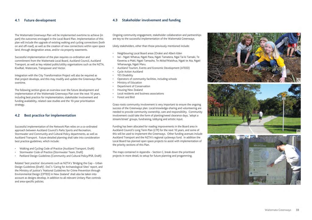
14 4.0 Future Development Waitematā Greenways 32
15
16 References Waitematā Greenways 34
17 Image reference Cover page 1. Auckland Council Stock Photo (2012). Aerial photo looking towards the North Shore over the CBD from Grafton, Auckland. Page 7 2. Photographer - Krantz, Adele (2013). Cox s Bay Reserve, Auckland. ID Page 9 3. Auckland Council Design Team (2012). Twin Streams Walk / Cycleway, West Auckland. 4. Auckland Council Design Team (2012). Twin Streams Walk / Cycleway, West Auckland. 5. Auckland Council Design Team (2012). Twin Streams Walk / Cycleway, West Auckland. 6. Auckland Council Design Team (2012). Twin Streams Walk / Cycleway, West Auckland. 7. Auckland Council Stock Photo (2009). Western Springs, Auckland - ID Auckland Council Design Team (2012). Road and walk / cycleway junction at the Twin Streams, West Auckland. 9. Auckland Council Design Team (2012). Cyclelanes, Sydney, Australia. 10. Auckland Council Design Team (2012). On road cycling on a minor road, Sydney, Australia. 11. Photographer - Shimmin, Graeme (2013). Cyclelanes in the city of Vancouver, Canada. 12. Auckland Council Design Team (2012). Raingarden alongside road network, Totara Avenue, New Lynn, West Auckland. 13. Auckland Council Design Team (2012). Textured surface at intersections to slow cyclists, Twin Streams, West Auckland. 14. Auckland Council Design Team (2012). Permeable paving on Twin Streams Walk / Cycleway, Twin Streams, West Auckland. 15. Photographer - Scot, Bathgate (2012). On-road cycling, local street, Vancouver, Canada. 16. Auckland Council Design Team (2012). Swales alongside road network, Totara Avenue, New Lynn, West Auckland. 17. Auckland Council Design Team (2012). Wetland Swale information board, Botanical Gardens, Manurewa. 18. Auckland Council City Centre Masterplan (2012). Nelson Street redundant off-ramp proposed visualisation. Page Auckland Council Stock Photo (2012). Aerial photo looking towards the North Shore over the CBD from Grafton, Auckland. Page Auckland Council Stock Photo (2012). Aerial photo looking over Westhaven Marina towards Auckland CBD. Page Photographer - Farnworth, Jay (2013). Waitemata Greenways public engagement event, Richmond Rovers Rugby League Club, Auckland. ID Page Photographer - Farnworth, Jay (2013). Waitemata Greenways public engagement event, Richmond Rovers Rugby League Club, Auckland. ID Photographer - Farnworth, Jay (2013). Waitemata Greenways public engagement event, Richmond Rovers Rugby League Club, Auckland. ID Page Auckland Council Stock Photo (2012). Aerial photo looking over Point Resolution and Judges Bay towards Parnell. Page Auckland Council Stock Photo (2008). Children Planting Kauri Tree in Waitakere Ranges - ID Auckland Council Design Team (2013). Twin Streams Walk / Cycleway, West Auckland. 27. Auckland Council Design Team (2013). Twin Streams Walk / Cycleway network signage, West Auckland.\ Page Auckland Council Stock Photo (2012). Aerial photo looking over Judges bay towards Point Resolution Pedestrian Bridge. Page Portland Development Commission, Lloyd Crossing Project (2050 Habitat Conditions)\ 30. Portland Development Commission, Lloyd Crossing Project (Pre-Development Water Conditions) 31. Portland Development Commission, Lloyd Crossing Project (2004 Existing Water Conditions) 32. Portland Development Commission, Lloyd Crossing Project (2050 Per Plan Water Use Conditions) Page City Of Portland, Bureau of Environmental Services (Portland Greenways and Green Streets) 34. City Of Portland, Bureau of Environmental Services (Portland Greenways and Green Streets) 35. City Of Portland, Bureau of Environmental Services (Portland Greenways and Green Streets) 36. Environmental Services. City of Portland. Green Streets in Portland. Retrieved deom URL: Page Photographer - Jeff Brass (Jellicoe St) 38. Waterfront Auckland. Auckland Council (Artists Impression, Jellicoe Street) 39. Waterfront Auckland. Auckland Council (Artists Impression, Jellicoe Street) 40. Waterfront Auckland. Auckland Council (Artists Impression, Jellicoe Street) 41. Photographer - Jeff Brass (Jellicoe St) 42. Eye on Auckland (2012) Jellicoe Street, Wynyard Quarter. Retrieved from Page Greenpark Reading. Green Park. Retrieved from URL Text reference Auckland Council. (2012). The Auckland Plan. Waterfront Auckland. (2012). The Waterfront Plan. Auckland Council. (2012). City Centre Master Plan. Auckland Regional Policy Statement (Appendix b, 100) Auckland City with assistance from Ngati Paoa and Ngati Whatua, text by Dr Nerida Campbell and the introduction by Lisa Truttman. Auckland City Heritage Walks - Aucklands Original Shoreline pamphlet. Retrieved from: home.aspx Bruce W.Hayward, Graeme Murdoch and Gordon Maitland. (2011). Volcanos of Auckland - The Essential Guide. Auckland Council. (1999). Auckland City District Plan, Operative Auckland City - Isthmus Section. Retrieved from: DistrictRegionalPlans/aucklandcitydistrictplanisthmus/ Auckland Council. (1995). Cultural Heritage Inventory. Geospatial Data, Auckland Council Auckland Transport. (2011). Central Cycle Map, Auckland Transport. (2012). Regional Cycle Network. Waitemata Local Board. (2011). Waitemata Local Board Plan, Te Araroa. (2011). Te Araroa, The Long Pathway. Retrieved from: Waitemata Greenways 35
18
Where. meets. headspace. workspace INTRODUCTION PAGE
 01 Where headspace meets workspace 02 VXV Precinct is defined by connection. Where energy meets action, where workspace meets headspace. An intersection of things more than the sum of their parts, that
Designing & Building for People on Bikes within evolving constraints Auckland Central City
 Designing & Building for People on Bikes within evolving constraints Auckland Central City Asia Pacific Cycle Congress 19 October 2017 Graeme Bean MEngSc (Transport), BE (Civil), PGDipBus (Mktg), MEngNZ,
Draft City Centre Transport Proposals
 Draft City Centre Transport Proposals Introduction This draft position paper provides an overview of the current City Centre transport issues, including concepts of the possible future City Centre transport
Task Force Meeting #2
 Task Force Meeting #2 July 9, 2013 Project Precedents Granville Island, Vancouver B.C. South Waterfront, Portland OR Jack London Square, Oakland CA Brooklyn Basin, Oakland CA Chula Vista Bayfront, Chula
HARBOUR EDGE STITCH. Uniting the Waterfront with the City Centre
 78 AC_BEU_CCMP_2_TM1_4 _FD.indd 78 20/07/12 12:04 PM 01 HARBOUR EDGE STITCH Uniting the Waterfront with the City Centre 01 VISION OUR 2032 VISION IS: Quay Street as a high-quality Harbour Edge space that
Wynyard Precinct: Urban Design Framework February 2014
 Wynyard Precinct: Urban Design Framework February 2014 Contents 0 Introduction Realising Auckland s Waterfront Potential 1 Introduction 2 Background 3 Purpose 4 Relationship to the Operative District
Your new bayside address
 Your new bayside address Create the home of your dreams at Promenade Rothwell, Stockland s exciting new residential community in the thriving Moreton Bay region. Conveniently located adjacent to the bay,
Urban Cycleways Programme Announcement Questions and Answers
 Urban s Programme Announcement Questions and Answers 1. What is the Urban s Programme? The Urban s Programme is an investment of $100 million over the next four years, dedicated to urban cycling infrastructure.
Curriculum Vitae Brian Joseph Waddell
 Curriculum Vitae Brian Joseph Waddell 18 Shelly Beach Road, Waiheke Island, Auckland 1081 Home 64 9 372 5442. Cell phone 64 21 791107 Email brian@urbanista.co.nz Professional Qualifications Bachelor of
Photographic Log Client: Project Number: Site Location: Site Name: Photograph ID: Date: Location: Direction: Comments: Photograph ID:
 Photograph ID: 1 west View of one of the monitoring well and the large parking lot on the south side of Center Street. Photograph ID: 2 Monitoring well located in the middle of the parking lot located
Urban Cycleways Programme Announcement Questions and Answers
 Urban Cycleways Programme Announcement Questions and Answers 1. What is the Urban Cycleways Programme? The Urban Cycleways Programme is a leveraged investment programe made up of $100 million Government
EAST-WEST STITCH. Connecting the Western Edge of the City to the Centre
 98 AC_BEU_CCMP_2_TM1_4 _FD.indd 98 20/07/12 12:06 PM 02 EAST-WEST STITCH Connecting the Western Edge of the City to the Centre 01 02 Northern Motorway Daldy Street Fanshawe Street Nelson Street Hobson
Next Generation Cycleway Design. Improving connectivity and cycling behaviours through design
 Next Generation Cycleway Design Improving connectivity and cycling behaviours through design Safe segregation between Place Users to offer improved safety and a defined space for each user group Elevated
AUCKLAND WATERFRONT VISION 2040
 AUCKLAND WATERFRONT VISION 2040 HARBOUR BRIDGE WESTHAVEN MARINA WYNYARD POINT WESTERN RECLAMATION VIADUCT HARBOUR FANSHAWE STREET VICTORIA PARK PRINCES WHARF QUEENS WHARF PORT CAPTAIN COOK WHARF QUAY STREET
Puketapapa Local Board
 ATTACHMENT A July September 2017 Puketapapa Local Board This report provides a picture of Auckland Transport activities over the July September 2017 Quarter. The report is in two sections: (a) Information
GO MEDIA UPPER NORTH IS. CLASSIC SITECARDS (DEC-JAN)
") GO MEDIA UPPER NORTH IS. CLASSIC SITECARDS (DEC-JAN) NORTHLAND A - WHAN1-62, WHAN1-61 Whāngārei This site is located in the heart of Whāngārei targeting a large pedestrian and vehicle audience, close to
GO MEDIA UPPER NORTH IS. CLASSIC SITECARDS (DEC-JAN) NORTHLAND A - WHAN1-62, WHAN1-61 Whāngārei This site is located in the heart of Whāngārei targeting a large pedestrian and vehicle audience, close to
WESTERN RECLAMATION & VIADUCT HARBOUR WATERFRONT VISION 2040
 WESTERN RECLAMATION & VIADUCT HARBOUR 20 18 WATERFRONT VISION 2040 The Western Reclamation and Viaduct Harbour will be a key component in any future redevelopment of the Auckland waterfront due to their
$960 $1,175 $91 OVERVIEW National Land Transport Programme Auckland AUCKLAND REGIONAL SUMMARY
 2015 18 National Land Transport Programme Auckland AUCKLAND REGIONAL SUMMARY OVERVIEW Achieving an effective and efficient transport system is central to supporting Auckland s future. Auckland is home
Cycling as part of the NZ transport system
 Cycling as part of the NZ transport system New Zealand s journey so far and where we re headed next Asia Pacific Cycle Congress, 19 October 2017, Christchurch Claire Pascoe, Lead Advisor Multi-modal, NZ
Auckland Harbour Bridge Walking and Cycling Access Prepared by the AHB Pathway Working Group
 Auckland Harbour Bridge Walking and Cycling Access Prepared by the AHB Pathway Working Group Auckland Harbour Bridge Pathway: 12 August 2011 Page: 1 of 45 Table of Contents EXECUTIVE SUMMARY...3 THE PATHWAY...4
Whether travelling on two wheels or two feet, we help communities stay active and sustainable.
 Creating pathways Whether travelling on two wheels or two feet, we help communities stay active and sustainable. Stantec is a local leader in providing cycleway expertise to clients throughout New Zealand.
Working document. Updates underway to executive summary, costs and economics. February 2017
 Working document. Updates underway to executive summary, costs and economics February 2017 East-West Midtown PT Link Project no: IZ047400 Document title: Indicative Business Case Document no: IZ061800-0000-CT-RPT-002
Auckland City Centre: Transport Capacity and Access Trends
 Auckland City Centre: Transport Capacity and Access Trends Final Report Prepared for: Auckland Council Date: 8 August 2018 Version: Final QUALITY ASSURANCE REGISTER Issue Description Prepared by Reviewed
Welcome. Welcome to our public exhibition which explains our proposed changes to the Brentford Community Stadium development, at Lionel Road South.
 Welcome Recent aerial view of the site with Griffin Park, the existing stadium, in the background. Welcome to our public exhibition which explains our proposed changes to the Brentford Community Stadium
TALLAWONG STATION PRECINCT SOUTH CONCEPT PROPOSAL STATE SIGNIFICANT DEVELOPMENT APPLICATION
 TALLAWONG STATION PRECINCT SOUTH CONCEPT PROPOSAL STATE SIGNIFICANT DEVELOPMENT APPLICATION ENVIRONMENTAL IMPACT STATEMENT OVERVIEW Through great partnerships, great things can happen. That s why we re
THE HEART OF A VIBRANT COMMUNITY
 THE HEART OF A VIBRANT COMMUNITY Newton Apartments redefine contemporary living in Melbourne s west, where everything you need is right at your doorstep. Generous 1 and 2 bedroom apartments will occupy
ASHTON GATE SPORTS & CONVENTION CENTRE. A New Home For Bristol Flyers
 ASHTON GATE SPORTS & CONVENTION CENTRE A New Home For Bristol Flyers THE VISION I n 2016 Ashton Gate/ Bristol Sport delivered the 45m redevelopment of the home of Bristol City FC and Bristol Bears Rugby.
CITY RAIL LINK. New Public Transport Stations and Development Opportunities at Karangahape Road, Newton and Aotea Quarter
 134 AC_BEU_CCMP_3_TM5_8_FD.indd 134 20/07/12 12:30 PM 05 CITY RAIL LINK New Public Transport Stations and Development Opportunities at Karangahape Road, Newton and Aotea Quarter 5 MO VE 0 1 2 8 KEY 1 Britomart
Concord Road Interchange. Standard hours of work
 Artist impression of the Concord Road interchange, Concord - concept only WestConnex s M4 East will extend the M4 Motorway with two new 5.5 kilometre tunnels from Homebush to Haberfield, providing a bypass
Aotea Quarter Action Plan
 Aotea Quarter Action Plan 2010 2015 Auckland s Civic Core and Cultural Heart Find out more: phone 09 379 2020 or visit www.aucklandcity.govt.nz Aotea Quarter Auckland s civic core and cultural heart The
UNDER the Resource Mangement Act 1991 PANUKU DEVELOPMENT AUCKLAND. Applicant AUCKLAND COUNCIL. Regulatory Authority
 2002 BEFORE THE ENVIRONMENT COURT AT AUCKLAND ENV-2018-AKL-000078 UNDER the Resource Mangement Act 1991 IN THE MATTER BETWEEN of the direct referral of applications for resource consent for the necessary
Otorohanga Stopbank Pathway - Project Overview
 Otorohanga Stopbank Pathway - Project Overview Introduction Otorohanga District Council with the support of the Otorohanga Community Board are constructing a 3.5 km long gravel pathway for shared use on
Unlocking the Recreation and Tourism Potential of the Manukau Harbour. 27 March 2014
 Unlocking the Recreation and Tourism Potential of the Manukau Harbour 27 March 2014 Phase 1: Local Tourism Audit Inventory and Mapping: to identify recreation and tourism opportunities and attractions
T H E W AT E R F R O N T L A N D
 THE WATERFRONT LAND A place you ll truly love to call home With its vibrant future town centre and world class marina, The Waterfront, Shell Cove offers you an unrivalled lifestyle opportunity. Set amidst
Green Fields Leppington
 Green Fields Leppington CONNTENTS 1.0 URBAN GROWTH - SYDNEY 2.0 MACRO CONTEXT 3.0 LOCAL ENVIRONMENTAL PLAN - LEPPINGTON 4.0 CONCEPT 5.0 GREEN ROOFS 6.0 APARTMENT REALISATION SCHEDULE 7.0 INFRASTRUCTURE
Te Awa is a shared cycle/walkway travelling 70 kms along the banks of New Zealand s largest & longest river the Mighty Waikato.
 Te Awa is a shared cycle/walkway travelling 70 kms along the banks of New Zealand s largest & longest river the Mighty Waikato. Project completion date 2013 Ngaruwahia - Hamilton Completion Early 2012
Auckland Unitary Plan Operative in part
 Auckland Unitary Plan Operative in part PROPOSED PLAN CHANGE 7 (PC7) Additions to Schedule 14 Historic Heritage Schedule, Statements and Maps in the Auckland Unitary Plan (Operative in part) Public notification:
Appendix 6 Fulbourn Greenway Review
 Appendix 6 Fulbourn Greenway Review Nigel Brigham & Associates A report for 1 Introduction This report is based on fieldwork carried out in 2016 to review the Greenway network around Cambridge as shown
Everett Riverwalk Life style explore
 Life style explore Project Overview The 217-acre Everett Riverfront redevelopment is visible from I-5 with traffic counts charted at 170,000+ vehicles per day with direct freeway access from 4-way interchange.
Explore the Bay the Green Way
 Explore the Bay the Green Way Botany Bay Trail Pre-Feasibility Study Report Nick Benson Sutherland Shire Environment Centre August 2002 1 Botany Bay Trail Explore the Bay the Green Way Opportunities for
AUCKLAND CITY HERITAGE WALKS > AUCKLAND S ORIGINAL SHORELINE
 AUCKLAND CITY HERITAGE WALKS > AUCKLAND S ORIGINAL SHORELINE 1 AUCKLAND CITY HERITAGE WALKS AUCKLAND S ORIGINAL SHORELINE Map showing the progressive changes to the Auckland shoreline. SPECIAL COLLECTIONS,
Parking Amendments - Bay Street, between Harbour Street and Queens Quay West (York Street, Bay Street, and Yonge Street Ramp Removal)
") REPORT FOR ACTION between Harbour Street and Queens Quay West (York Street, Bay Street, and Yonge Street Ramp Removal) Date: October 26, 2017 To: Toronto and East York Community Council From: Acting Director,
REPORT FOR ACTION between Harbour Street and Queens Quay West (York Street, Bay Street, and Yonge Street Ramp Removal) Date: October 26, 2017 To: Toronto and East York Community Council From: Acting Director,
Townsville. One Million. design
 Townsville One Million design Table Of Contents N 1 3 6 7 2 4 8 5 Development Proposal Development Opportunity Satellite image taken from Google Earth Introduction Major Investment 1. Inner City Stadium
Sarawia Street Laxon Terrace Rail Level Crossing Removal
 Sarawia Street Laxon Terrace Rail Level Crossing Removal Recommendations It is recommended that the Board: Receives the report. Executive summary The removal of the Sarawia Street to Laxon Terrace rail
FINCH HYDRO CORRIDOR TRAIL PROJECT
 FINCH HYDRO CORRIDOR TRAIL PROJECT Pharmacy Avenue to Birchmount Road January 29 th, 2018 L Amoreaux Community Centre (2000 McNicoll Avenue) 1 Purpose of Drop In Event The purpose of today s drop-in event
Centurion Way Chichester
 Centurion Way Chichester Work book of plans to show details of the Centurion Way, its links, and potential developments and enhancements from linking to the South Downs National Park all the way to the
Appendix 8 Sawston Greenway Review
 Appendix 8 Sawston Greenway Review Nigel Brigham & Associates A report for 1 Introduction This report is based on fieldwork carried out in 2016 to review the Greenway network around Cambridge as shown
Windsor Kingsville Essex Tour:
 An Ontario's Southwest Cycling Itinerary Windsor Kingsville Essex Tour: Pedal into the Heart of Southern Ontario s Wine Country CYCLE LOTS TO SEE AND LOTS TO DO IN ONTARIO S SOUTHWEST Total Distance: 130
Western Bay of Plenty District Council
 Western Bay of Plenty District Council Minutes of Meeting No. TP13 of the Te Puke Community Board held on 14 June 2018 at the Te Puke Library and Service Centre commencing at 7.00pm Present Members P Miller
Standing Committee on Planning, Transportation and Environment
 ADMINISTRATIVE REPORT Report Date: June 16, 2014 Contact: Jerry Dobrovolny Contact No.: 604.873.7331 RTS No.: 10637 VanRIMS No.: 08-2000-20 Meeting Date: June 25, 2014 TO: FROM: SUBJECT: Standing Committee
Hawke s Bay Regional Parks Network. Pekapeka Regional Park Individual Park Plan
 Hawke s Bay Regional Parks Network Pekapeka Regional Park Individual Park Plan 2015-2024 Hawke s Bay Regional Council 159 Dalton Street Private Bag 6006 Napier 4110 Hawke s Bay New Zealand Telephone: 0800
THE NORTHERN CORRIDOR IMPROVEMENTS PROJECT
 THE NORTHERN CORRIDOR IMPROVEMENTS PROJECT The Northern Corridor Improvements Project is the last link in the Western Ring Route, connecting the north with the west long SH1 and SH18. Major benefits of
State Road Upgrades Southern Region
 State Road Upgrades Southern Region A MAJORITY LIBERAL GOVERNMENT WILL: Undertake an historic reset of roads and traffic management in Southern Tasmania taking roads to the next level. Underpin the extraordinary
Site, Situation and Settlement
 1793 Names: 1. Refer to Photo 6. Name the streets marking the boundaries: N: S: E: W: Town of York 2. You are the expert for this date. Read the TEXT (Overview - Signs of Growth - Reasons for Growth),
NEWBORO AND PORTLAND HARBOUR REDVELOPMENT PLANS
 INTRODUCTION The Municipal docks in both Newboro and Portland were transferred to the Township of Rideau Lakes by Parks Canada in 2002. Little has been done to improve the docks physical condition or role
Plaquing Nomination for Thornleigh Quarry & Zig Zag Railway Page 2 LOCALITY PLAN 3 SITE MAP 4 PLAQUE NOMINATION FORM 6
 Plaquing Nomination for Thornleigh Quarry & Zig Zag Railway Page 2 Contents INTRODUCTION 3 LOCALITY PLAN 3 SITE MAP 4 PLAQUE NOMINATION FORM 6 PLAQUING NOMINATION ASSESSMENT FORM 7 1 BASIC DATA 7 2 ASSESSMENT
THE WATERFRONT PLAN AKL
 THE WATERFRONT PLAN AKL 2012 Tamaki kainga nga ika me nga wheua katoa! Auckland where the fish are so succulent you can eat them bones and all! This proverb alludes to the once abundant and sought after
Sunshine Coast and Caloundra Airports Aircraft Noise Information Report
 Sunshine Coast and Caloundra Airports Aircraft Noise Information Report Quarter 1 2014 (January to March) 1 Version Control Version Number Detail Prepared by Date 1 - Environment June 2014 2 Updated text
transformational an overview PoPulation Growth auckland s PoPulation will increase by up to million PeoPle over the next 30 years.
 auckland s PoPulation will increase by up to million PeoPle over the next 30 years. an overview Auckland s time has come. We now have a shared vision to be the world s most liveable city and, for the first
DAY 3: Huntleys Point Wharf to Balmain East Wharf
 DAY 3: Huntleys Point Wharf to Balmain East Wharf Total Distance: 14.5km Time: Approximately 5 hours Walk Notes in Five Sections Section Name Length Time 3:1 Huntleys Point Wharf to Iron Cove Bridge 4km
Have your say on Let s Get Wellington Moving PUBLIC FEEDBACK IS OPEN UNTIL FRIDAY 15 DECEMBER 2017
 Have your say on Let s Get Wellington Moving PUBLIC FEEDBACK IS OPEN UNTIL FRIDAY 15 DECEMBER 2017 Getting Wellington moving Let s Get Wellington Moving is a joint initiative between Wellington City Council,
EVIDENCE OF GORDON DESMOND MOLLER ONZM ON BEHALF OF PANUKU DEVELOPMENT AUCKLAND (ARCHITECT) 7 AUGUST 2018
 7 AUGUST 2018") 0117 BEFORE THE ENVIRONMENT COURT I MUA I TE KOOTI TAIAO O AOTEAROA ENV-2018-AKL-000078 IN THE MATTER of the Resource Management Act 1991 (RMA) AND IN THE MATTER BETWEEN of the direct referral of applications
0117 BEFORE THE ENVIRONMENT COURT I MUA I TE KOOTI TAIAO O AOTEAROA ENV-2018-AKL-000078 IN THE MATTER of the Resource Management Act 1991 (RMA) AND IN THE MATTER BETWEEN of the direct referral of applications
Site Analysis. Context Plan ANALYSIS
 Site Analysis Context Plan The site located in Crosstown, occupies an entire city block bridging between the Downtown, Gastown, False Creek North, and Yaletown neighborhoods. It is bounded by W Georgia
3. COLTA / HUGA CONNECTIONS - PRELIMINARY
 9 3. COLTA / HUGA CONNECTIONS - PRELIMINARY 3.1 COLTA The Chain of Lakes Trail Association (COLTA) trail, formerly identified as the Chester Spur Line, was completed and opened for use in June 2011. The
Community Development
 Community Development City & Borough of Juneau Community Development 155 S. Seward Street Juneau, AK 99801 (907) 586 0715 Phone (907) 586 4529 Fax DATE: February 11, 2016 TO: FROM: Planning Commission
I. INTRODUCTION EAST COAST GREENWAY STUDY PURPOSE
 I. INTRODUCTION STUDY PURPOSE The purpose of this study is to determine the engineering feasibility of developing the Eastern Trail. It was initiated at the request of the and funded by the Maine Department
David acts an Independent Hearing Commissioner and has considered plan changes, resource consents and notices of requirements.
 Director David is a Director with Hill Young Cooper Ltd, a resource management, environmental policy and planning consultancy with offices in Auckland and Wellington. David has over 25 years experience
The Narrows Waterfront Park A Crown Jewel for Southern Brooklyn
 The Narrows Waterfront Park A Crown Jewel for Southern Brooklyn In New York, the unquestioned popularity of urban spaces such as Riverside Park, the High Line, Brooklyn Bridge Park and others has demonstrated
City of Durango 5.8 FUNDING TRAILS DEVELOPMENT
 5.8 FUNDING TRAILS DEVELOPMENT The City has been successful in establishing dedicated local funding sources as well as applying for grants to develop the City s trail system, having received nearly $2.4
SPACE OPPORTUNITY CONNECT CORPORATE CENTRE O RIORDAN STREET, MASCOT
 SPACE + OPPORTUNITY CONNECT CORPORATE CENTRE 185 189 O RIORDAN STREET, MASCOT OVERVIEW 2 Opportunity Connect Corporate Centre is an new mixed use precinct located in Mascot. Three contemporary commercial
North Shore. There s more to life.
 There s more to life. is not just any old place. It s a special place. For over 60 years, we ve been creating places that meet the needs of our customers and communities. And for 60 years those customers
STITCH TRANSFORMATIVE IDEA 3. SHORELINE STITCH. Re-connect the city to the waterfront and link the east and west Core Circle landscapes
 SHORE STITCH TRANSFORMATIVE IDEA 3. SHORELINE STITCH Re-connect the city to the waterfront and link the east and west Core Circle landscapes 126 LINE PUBLIC WORK 127 TRANSFORMATIVE IDEA 3. SHORELINE STITCH
For personal use only
 ASX Announcement Lend Lease Investor Site Tour Day presentations 3 April 2014 Attached are the presentations to be given today by Lend Lease senior executives at its Investor Site Tour Day. ENDS For further
WAIKARAKA CYCLEWAY: LESSONS LEARNT. Daniel Newcombe & Ina Stenzel Auckland City Council
 WAIKARAKA CYCLEWAY: LESSONS LEARNT Daniel Newcombe & Ina Stenzel Auckland City Council Introduction Waikaraka cycleway is key link in Auckland regional cycle network Lessons learnt from two sections: Pikes
Part 005 Implementation Strategy _
 Part 0 Implementation Strategy www. landlab.co.nz Queenstown Town Centre Masterplan Version 7 14 June 28 Section 0 Page 4 5.1 Implementation Plan The projects and initiatives contained within the Queenstown
Sunshine Coast and Caloundra Airports Aircraft Noise Information Report
 Sunshine Coast and Caloundra Airports Aircraft Noise Information Report Quarter 1 2015 (January to March) 1 Version Control Version Number Detail Prepared by Date 1 - Environment June 2015 Airservices
Southwind Marina Sinton Drive Pensacola, Florida Unique Opportunity to Acquire a 90 Slip Marina With Excellent Investment Potential
 Urban Realty Southeast is pleased to present Southwind Marina 10121 Sinton Drive Pensacola, Florida 32507 Unique Opportunity to Acquire a 90 Slip Marina With Excellent Investment Potential Closest marina
Report: 2 derelict barges in Flushing Bay & large source of styrofoam pollution. Importance: High. All,
 Report: 2 derelict barges in Flushing Bay & large source of styrofoam pollution Importance: High All, This report and request is being submitted by Riverkeeper in partnership with two citizen groups: the
City of Markham Staff Presentation. York Region Lake to Lake Trail. Implementation DEVELOPMENT SERVICES COMMITTEE. September 6, 2016 PRESENTATION TO
 York Region Lake to Lake Trail Implementation City of Markham Staff Presentation PRESENTATION TO DEVELOPMENT SERVICES COMMITTEE September 6, 2016 1 Lake to Lake Route 2 Lake to Lake Route In 2008, the
GOLDEN BACKCOUNTRY RECREATION ADVISORY COMMITTEE (GBRAC)
") GOLDEN BACKCOUNTRY RECREATION ADVISORY COMMITTEE (GBRAC) MINUTES from November 1, 2006 Meeting Attending: Sector / Stakeholder GBRAC Commercial Aerial Motorized Sector GBRAC Habitat Protection; Sport Fishing
GOLDEN BACKCOUNTRY RECREATION ADVISORY COMMITTEE (GBRAC) MINUTES from November 1, 2006 Meeting Attending: Sector / Stakeholder GBRAC Commercial Aerial Motorized Sector GBRAC Habitat Protection; Sport Fishing
Tourism & Urban Development: Building Local Economies & Sense of Place - Mt Eden Village -
 Tourism & Urban Development: Building Local Economies & Sense of Place - Mt Eden Village - Simon Milne, Ulrich Speidel, Carolyn Deuchar, Suzanne Histen, Romy Fischer, Fleur Bonekamp Key themes We need
The North West Growth Precinct
 Where is Greater Sydney s next investment hotspot? Sydney has experienced very strong price growth over the past 6 years. When such strong growth has already occurred, it is important not to get caught
places Mooloolaba s heart five
 five places the mooloolaba heart 1 Flexible community event use of school oval 2 Enhanced streetscape District cycle route Future cross-block pedestrian link 5 Existing school buildings New signalised
Train Whistling at Public Grade Crossings
 Train Whistling at Public Grade Crossings Train Whistling at Public Grade Crossings Train whistling is an important way to keep drivers, cyclists and pedestrians safe The Canadian Rail Operating Rules
ONE the square, CB1. A unique opportunity to base your business in the new city quarter of Cambridge, that is CB1.
 ONE The Square ONE the square, CB1. SEE THE FUTURE, BE PART OF IT. A unique opportunity to base your business in the new city quarter of Cambridge, that is CB1. With its unique blend of history, culture
Arts, Creative & Cultural Innovations Committee Meeting to be held at City of Penticton, Committee Room A 171 Main Street, Penticton, BC
 Agenda Arts, Creative & Cultural Innovations Committee Meeting to be held at City of Penticton, Committee Room A 171 Main Street, Penticton, BC 1. Call Regular Committee Meeting to Order 2. Adoption of
Pedestrian Safety Review Spadina Avenue
 STAFF REPORT ACTION REQUIRED Pedestrian Safety Review Spadina Avenue Date: October 13, 2015 To: Toronto and East York Community Council From: Director, Transportation Services, Toronto and East York District
Live a life like no other at The Waterfront
 Live a life like no other at The Waterfront Where the sea meets the shore, you ll find The Waterfront. Here, you ll discover a community where no two days ever have to be the same. With its picturesque
Road Signs, Markings and Their Meaning
 Road Signs, Markings and Their Meaning FUNCTIONS OF ROAD SIGNS AND MARKINGS 1. Guides 2. Directs 3. Warns 4. Informs 5. Prohibits 6. Regulates CLASSIFICATION OF ROAD SIGNS 1. Warning 2. Regulatory 3. Informatory
River First Initiative and Waterworks Park
 River First Initiative and Waterworks Park The RiverFIRST proposal is critical to the creation of a larger regional parks and trails network, as well as ecological and infrastructure system. When realized,
Wilds. Headwaters. Lakes. Oxbows. Falls
 56 5 4 3 Wilds Headwaters Lakes Oxbows Falls 57 Zones It could be said the on-the-ground essence of this master plan appears within the next 6 pages of this report. As we learned in the preceding Cultural
Have your say... on the Ian McKinnon Drive Cycleway Project
 Have your say... on the Ian McKinnon Drive Cycleway Project The missing cycleway link connecting the Northwestern Cycleway and Dominion Road cycle lanes to the Grafton Gully Cycleway, Te Ara I Whiti Lightpath
Economic Development and Tourism
 SECTION 4 SECTION 4 Economic Development and Tourism 4. Economic Development and Tourism Tourism plays a very important role in Niagara s economy, providing employment and generating business for support
COASTAL CONSERVANCY. Staff Recommendation November 6, 2008 SAN FRANCISCO BAY TRAIL: CANAL BOULEVARD CONSTRUCTION
 COASTAL CONSERVANCY Staff Recommendation November 6, 2008 SAN FRANCISCO BAY TRAIL: CANAL BOULEVARD CONSTRUCTION File No. 07-037-02 Project Manager: Michelle Jesperson RECOMMENDED ACTION: Authorization
File: Title: Date(s): Note:
: Note:") page 1 Call Number: 1975-013/001 (1) Agendas for meetings (2) Notes of meetings 1969- (3) Miscellaneous business correspondence 1969-1 of 2 (4) Miscellaneous business correspondence 1969-2 of 2 (5) Correspondence
page 1 Call Number: 1975-013/001 (1) Agendas for meetings (2) Notes of meetings 1969- (3) Miscellaneous business correspondence 1969-1 of 2 (4) Miscellaneous business correspondence 1969-2 of 2 (5) Correspondence
Construction Staging Area 19 Western Battery Road
 REPORT FOR ACTION Construction Staging Area 19 Western Battery Road Date: December 6, 2017 To: Toronto and East York Community Council From: Acting Director, Transportation Services, Toronto and East York
New York City, New York, USA (2006)
") Hide Menu Show Menu This site is a private and free non-commercial Blues guitar tutorial. It is not Clapton's home page. New York City, New York, USA (2006) Preface This is a short review about my second
Hide Menu Show Menu This site is a private and free non-commercial Blues guitar tutorial. It is not Clapton's home page. New York City, New York, USA (2006) Preface This is a short review about my second
Ossington Station Easier Access Project - Construction & Public Art Concept Update
 Ossington Station Easier Access Project Construction & Public Art Concept Update Open House College/Shaw Library 1 Easier Access Program Wide Committed to making all stations accessible by 2025 34 stations
Unitary Plan Parking Provision Rules. Auckland City Centre Fringe
 Auckland City Centre Fringe June 2012 Project: Title: Document Reference: Prepared by: Project Manager Reviewed by: Unitary Plan Parking Provision Rules Auckland City Centre Fringe S:\ACUP\004 UP PArking
Precinct Properties New Zealand Annual General Meeting 7 November 2014
 Precinct Properties New Zealand Annual General Meeting 7 November 2014 Craig Stobo, Chairman BOARD AND EXECUTIVE Management Scott Pritchard Chief Executive Officer George Crawford Chief Financial Officer