PROTECTING THE YARRA RIVER (BIRRARUNG)
|
|
|
- Stephen Bond
- 6 years ago
- Views:
Transcription
1 PROTECTING THE YARRA RIVER (BIRRARUNG) Discussion Paper Prepared by: Yarra River Protection Ministerial Advisory Committee 1
2 The Yarra River traverses 9 L cal C uncils Provides around The Yarra River is 242 km 70% in length The river s catchment covers 4076 km2 of Melbourne s drinking water spanning from the pristine forests of the Yarra Ranges to the mouth at Port Phillip Bay (including 24 tributaries) 10km 4 th Over 1/3 190 sea water travels upstream to Dights Falls highest yield of water per hectare of catchment in Victoria of Victoria s animal species are found in the Yarra catchment species of birds inhabit the Yarra River corridor 2
3 The Yarra is brown in colour in the lower reaches due to suspended silt carried downstream Melbourne Water has spent approx $290m on river health improvements over the past 5 years Aboriginal people called the river Birrarung shadows of the mists and Yarra Yarra means ever flowing in the Wurundjeri language Over 30,000 bats live at Yarra Bend park in summer There are 38 mammal species including platypus, gliders and bandicoots There are 16 reptile species known to inhabit the Yarra River including skinks, turtles, snakes and lizards Over 1,000 cyclists travel along the Main Yarra Trail between 7am and 9am on weekdays 3

4 Chapter 6: Options for governance reform Acknowledgement The Yarra River Protection Ministerial Advisory Committee proudly acknowledges Victoria s Aboriginal 1 communities and their rich culture and pays respect to their Elders past and present. 1 This discussion paper uses the term Aboriginal rather than Indigenous to refer to the First Nation Peoples of mainland Australia as the discussion paper relates specifically to the Yarra River and its catchment. The Yarra MAC recognises that the term Aboriginal refers to several specific individuals and communities in Victoria. The term Indigenous is retained in the names of and references to programs, initiatives and publication titles: unless otherwise noted, it is inclusive of both Aboriginal and Torres Strait Islander people. We acknowledge Aboriginal people as Australia s first peoples and as the Traditional Owners and custodians of the land and water on which we rely. We recognise the intrinsic connection of Traditional Owners to Country and value their contribution to managing the land, water and natural landscape. We acknowledge the ongoing contribution this makes to the Yarra River catchment. We support the need for genuine and lasting partnerships with Aboriginal people and communities to understand their culture and connections to Country in the way we plan for and manage the Yarra River corridor and its environs. We embrace the spirit of reconciliation, working towards equality of outcomes and ensuring an equal voice. i

5 Purpose of this discussion paper This discussion paper was developed by the Yarra River Protection Ministerial Advisory Committee (Yarra MAC) to promote community discussion about opportunities to improve the oversight and management of the Yarra River. It was developed through consultation with a reference group and key stakeholders about the most important issues and opportunities that need to be addressed. ii
6
7 ACKNOWLEDGEMENT PURPOSE OF THIS DISCUSSION PAPER CHAIR S MESSAGE 1. INTRODUCTION The Yarra River Protection Ministerial Advisory Committee Changing policy settings Have your say 5 2. STEWARDSHIP OVER TIME Aboriginal peoples relationship with the Yarra European settlement Investment and regulation so far THE YARRA RIVER TODAY Significance River health Water quality Estuary habitat Impact on Port Phillip Bay Urban parklands and open spaces Amenity Values Characteristics of each reach Key issues and opportunities 28 i ii v 5. A NEW MANAGEMENT MODEL A community vision for the entire length of the Yarra A Yarra strategic plan A Yarra (Birrarung) Protection Act Improved institutional arrangements 49 APPENDICES 53 GLOSSARY 54 THE MINISTERIAL ADVISORY COMMITTEE 55 THE YARRA RIVER PROTECTION REFERENCE GROUP 56 YARRA REFERENCE GROUP ISSUES AND OPPORTUNITIES WORKSHOPS 57 YARRA RIVER ECOLOGICAL, CULTURAL, SOCIAL, AMENITY AND ECONOMIC VALUES 58 MAPS 62 Inner city Yarra reach 63 Suburban Yarra reach 64 Rural Yarra reach 66 Upper Yarra reach 68 Contents 4. THE CASE FOR CHANGE Current legislative, regulatory and management frameworks Roles and responsibilities Environmental advocacy Current governance challenges Future challenges 40 iv

8 Chair s message The Yarra River is a valuable natural asset that needs to be protected for the benefit and enjoyment of future generations. To ensure that we have in place an effective management model to develop and implement a vision and plan for the Yarra River, the Minister for Planning and then Minister for Environment, Climate Change and Water established the Yarra River Protection Ministerial Advisory Committee (Yarra MAC) to consult with stakeholders and provide independent advice about the key issues and opportunities. Throughout Melbourne s history, attitudes to the uses of the Yarra River (including the riverbanks, parklands, trails and adjacent land) have evolved in a complex relationship with the inhabitants of the region. Similarly, perceptions of the value of this asset have also changed. At different stages, there have been great plans and major investments to implement them. There have also been periods of neglect and periods of great debate and contention. Since Melbourne rediscovered the Yarra in the 1980s and the city reoriented itself by developing Southbank, Docklands and Birrarung Marr, there has been increased interest in and concern about the health of the river and debate about the impacts of development along its corridor. This period has coincided with major changes in the institutions responsible for urban planning, catchment and river management, open space planning and management, and environmental protection. There is concern that current institutional and regulatory arrangements leave the river vulnerable to the increasing pressures of urban development and cannot deliver on the community s expectations for a healthy river that can sustain the demands of a population that seeks greater use and enjoyment of the river environment. Because of their geography, rivers are always subject to complex management arrangements. The Yarra traverses more than 200 km of urban and rural landscapes. The river and its floodplains extend across many thousands of hectares of private land as well as public land managed by numerous local and state government authorities. The river and its catchment are the major source of Melbourne s water and include some of Victoria s richest farmland. Many of our famous vineyards rely on the river s water for irrigation and it is surrounded by some of Melbourne s most sought-after and expensive real estate. Its parklands and open space are the most heavily utilised in the state and its waters are the setting for rowers, kayakers and Melbourne s commercial ferryboats. Its port is the busiest in Australia. For Aboriginal communities it is a place of great spiritual and cultural significance; for all Melburnians the river helps us define where we live. Given such complexity, the planning and management of the river will always be challenging. However, we cannot afford for such a precious natural asset to be degraded. I encourage you to contribute to the Yarra MAC s work to protect the Yarra River (Birrarung) as we seek to ensure that future generations have the opportunity to enjoy the river s many values by strengthening management arrangements and ensuring a strong community voice in governance and oversight of the river. Chris Chesterfield Chair, Yarra River Protection Ministerial Advisory Committee v
 1.")
9 Protecting the Yarra River (Birrarung) 1. Introduction 1
10 Introduction The Victorian Government has committed to protecting the Yarra River s amenity and significance by introducing legislation, stronger planning controls and a trust or similar entity. Before preparing new legislation to protect the Yarra River the government established the Yarra River Protection Ministerial Advisory Committee (Yarra MAC) to assess the effectiveness of current governance arrangements. The Yarra River Protection Reference Group (Yarra Reference Group) has also been established to help the Yarra MAC and government better understand the key issues, opportunities and reform options for protecting the river. It comprises representatives of the organisations with direct oversight and management responsibilities for the Yarra River and its riverscape (11 councils, Melbourne Water, Parks Victoria and Environment Protection Authority [EPA] Victoria) and of environmental advocacy groups for the Yarra (Yarra Riverkeeper Association and Environmental Justice Victoria). 1.1 The Yarra River Protection Ministerial Advisory Committee The Minister for Planning and the then Minister for Environment, Climate Change and Water established the Yarra MAC in December 2015 to provide independent advice to government about improving governance arrangements for protecting the Yarra River. Its advice covers the entire length of the Yarra River from its source in the headwaters above the Upper Yarra Reservoir to Port Phillip Bay. Its advice does not cover the waters of the Port of Melbourne and the regulation of on-water activities, commercial boats and berthing. The Yarra MAC is to provide its advice to government by the end of 2016 and are examining arrangements for three key aspects of the Yarra River: 1. waterway health (stream, riverbanks and vegetation) 2. community use, access and amenity of the river and its network of parklands and open spaces 3. the interface of the river with adjacent land uses and its catchment. The Yarra MAC has adopted an approach that includes: regularly engaging with the partners that have responsibilities for decisionmaking and management of the Yarra River and with key environmental advocates investigating governance issues to provide an evidence base for evaluating options developing a discussion paper for public release as the basis for discussion and debate about improvements to the oversight and management of the Yarra River providing a range of opportunities for people to voice their views engaging with community, user and industry representative groups. The full terms of reference and membership of the Yarra MAC are on the department s website, at 2

11 Protecting the Yarra River (Birrarung) Extract from the Yarra MAC s terms of reference Purpose The Government is establishing this Committee to provide assistance in engaging with the community and other stakeholders and to provide advice and a recommended action plan for the improved management, promotion and protection of the Yarra River. Scope The Committee is required to address the following matters. Defining the issues What are the current and emerging issues for the Yarra River that are impacting on its environmental cultural, social and economic values? Institutional and regulatory arrangements In relation to the statutory bodies with powers and functions affecting or relevant to the Yarra River a. What are the existing powers and functions of these statutory bodies? b. What opportunities are there to improve these powers and functions to address the issues for the Yarra River? What are the options and net benefits for establishing an entity, including a statutory trustee, to contribute to the management, promotion and protection of the Yarra River? What would be the role, power and functions of any entity and/or trust for the Yarra River? Land use planning and development In relation to the referral of planning applications a. Are the relevant criteria and powers of referral authorities sufficient to address land developments that affect the Yarra River? b. Are there other matters of concern or other statutory bodies that should be included in the referral process? What other changes to land development controls would further improve the health of the Yarra River and its tributaries and improve the net benefits that the Yarra River can provide to the community? General Which of all these issues and opportunities are of greatest priority and, if addressed, would achieve the greatest net economic, social and environmental benefits for the community today and for future generations? What other strategies and measures are needed to ensure all the benefits and opportunities for the Yarra River can be realised or achieved in a costeffective manner? Does the Committee have any advice or findings that would benefit the Maribyrnong River and the community? 3
12 Chapter 1: Introduction 2 For more information about planning controls being developed for the Yarra River, visit www. delwp.vic.gov.au/yarrariver-controls. 1.2 Changing policy settings The Yarra MAC is aware that there are Victorian Government initiatives underway that will contribute to the policy context for their advice. These initiatives will enhance the focus on environmental protection and the importance of liveable cities and towns to community health and wellbeing. Table 1 shows the key initiatives. The Department of Environment, Land, Water and Planning (DELWP) is also working with Banyule, Boroondara, Manningham, Nillumbik, Stonnington and Yarra councils and with Melbourne Water to prepare and implement stronger planning controls. These aim to protect the landscape values of the Yarra River between Richmond and Warrandyte, an area under increasing development pressure. This work 2 has recently: strengthened the State Planning Policy Framework, implementing for the first time a Yarra River protection planning policy that identifies the river s metropolitan significance and provides guidance to councils about decisionmaking strengthened overshadowing controls in the Melbourne central business district (CBD) to ensure that tall buildings do not overshadow the Yarra River and its banks implemented interim planning controls into the Yarra Planning Scheme (City of Yarra) to protect this part of the Yarra River corridor that is under the most pressure. Table 1: Relevant Victorian Government initiatives Theme Initiative Biodiversity Protecting Victoria s Environment Biodiversity 2036 Native Vegetation Regulations review Flora and Fauna Guarantee Act review Climate change Coasts & marine Environment Land use planning Water (and waterways) New Victorian climate change framework New coasts and marine legislation Port Phillip Bay Environmental Management Plan State of the Bay reporting EPA Victoria Inquiry Review of the State Environment Protection Policies Improved state of the environment reporting Plan Melbourne refresh Independent review of management arrangements for Kananook Creek Yarra River protection stronger planning controls Water for Victoria Regional riparian action plan Renewed floodplain strategy New integrated catchment management strategy Improved catchment reporting Our catchments, our communities 4
13 Protecting the Yarra River (Birrarung) 1.3 Have your say The Yarra MAC developed this discussion paper after discussions with the Yarra Reference Group and stakeholders about key issues and opportunities for the Yarra River corridor and its catchment. The Yarra MAC would like to hear what you think about the ideas in this discussion paper and any other ideas you may have about protecting the Yarra River. In particular, it seeks feedback on the following questions. 1. What aspect of the Yarra River and its environs would you most like to see protected? 2. What aspect of the Yarra River and its environs would you most like to see improved? 3. Is there any information or issues we have missed? 4. What would you like to see included in a vision for the Yarra River? 5. What elements would you like to see covered in the Yarra strategic plan? 6. What would you like to see included in legislation to protect the Yarra River? 7. What do you think are the key criteria for the evaluation of options for management arrangements of the Yarra River and its riverscape (refer section 5.4)? 8. What are your thoughts on the options for a new management model for the Yarra River and its environs? 9. What are your thoughts about establishing a new organisation to oversee development and monitor delivery of the Yarra strategic plan? 10. Are there any other management models /options we should consider? The Yarra MAC will consider all feedback and prepare a summary report. A number of investigations have also been commissioned to inform the Yarra MAC s deliberations. The Yarra MAC will provide their advice on governance reforms to protect the Yarra River to the Victorian Government by the end of Figure 1: Yarra MAC timelines Critical issues and opportunities (Jan Mar 2016) Investigations (Mar Jun 2016) Discussion paper (Jul 2016) Public and targeted consultation (Jul 2016) Deliberations (Aug 2016) Advice to the government (Late 2016) 5

14 There are many ways to have your say: online, in person and by making a written submission. Online At you can view and download this discussion paper, background studies and other information and also provide feedback through an online ideas-sharing tool. You can also make a written submission by completing the submission form on the website. In person You can attend one of the community workshops being held along the Yarra to join the discussion and complete a workshop feedback form. Or you can drop in to one of the listening posts being held along the Yarra River corridor. Details and timings of events will available at protecting-the-yarra-river. Written submission You can make a written submission on the discussion paper by: completing an online submission form at au/protecting-the-yarra-river ing a written submission to yarra.river@delwp.vic.gov.au posting a written submission to: Yarra River Protection Program Manager, Planning Policy Implementation Department of Environment, Land, Water and Planning Level 8, 8 Nicholson St, Melbourne Vic 3000 Submissions will be made public unless you ask for yours to be confidential. Please make your submission by Friday 5 August
 2.")
15 Protecting the Yarra River (Birrarung) 2. Stewardship over time 7


16 Stewardship over time To the Wurundjeri people, the Birrarung (Yarra River) was the life source and an important meeting place. Its landscapes and biodiversity features in their Dreamtime and creation stories. After European settlement, the river became the lifeblood of the rapidly developing city of Melbourne. It provided water supply, supported food production and industries, transported people and goods and was a place for recreational activities; it facilitated urban development. It has continued to shape Melbourne ever since. Today s Yarra River, with its naturalistic riverscape settings and vast network of parklands, is largely the legacy of two major waves of regulatory interventions and investments that followed the two most significant population growth eras of Melbourne: the initial gold rush and town-founding era of the late 1800s and the post war immigration and baby boom decades from the 1950s that drove significant environment protection and urban renewal especially in the 1970s. 2.1 Aboriginal peoples relationship with the Yarra The land surrounding where the Birrarung (the Yarra River) flows into Port Phillip Bay, including the Yarra Valley, was home to the Woiwurrung, Boonwurrung, Taungurong, Dja Dja Wurrung and the Wathaurung groups who form the Kulin Nation. There were many wetlands, which were great sources of food and water, where Melbourne and its suburbs now stand. The wetland areas included the lower Yarra west and south of the current CBD, Elwood and Carrum Carrum Swamp (which stretched from Mordialloc in the north to Frankston in the south). Albert Park Lake is all that remains of the once-extensive wetlands areas of the lower Yarra. For the Wurundjeri people, who have a spiritual connection to the Yarra s lands and waterway, the river is a life source that has been etched into the landscape by the ancestral creator spirit Bunjil, the wedge-tailed eagle. They call the river Birrarung (meaning shadows of the mists) and they once moved around the area according to the weather and availability of food. In winter, the Wurundjeri-willam regularly camped in the higher areas as the land near the river flooded. In spring and summer they travelled more frequently, hunting and gathering food and visiting sacred sites. Their spiritual connection to places such as the confluence of the Yarra River and Merri Creek extends back thousands of years through periods of extraordinary environmental upheaval that saw dramatic changes in the river. Some 16,000 years ago before Earth emerged from the Ice Age, the land mass of Victoria was still connected to Tasmania. Port Phillip Bay was a vast plain, the Yarra flowed through a vast gorge at the heads then south to join the Tamar River then west into the Southern Ocean. The Bunyip River in Western Port was also tributary of the Yarra. 8

17 Protecting the Yarra River (Birrarung) Volcanic eruptions have since altered the course of the Yarra River. As recently as about 1000 years ago it meandered across the grassland and saltbush floor of Port Phillip Bay, the bay entrance having become blocked with sand and silt, cutting it off from Bass Strait. With no ocean water to replenish it, the bay shrank and was occupied by the Yarra and Werribee rivers. When the ocean finally penetrated the clogged entrance to Port Phillip Bay, it would have filled rapidly. These dramatic environmental events are consistent with several Aboriginal oral histories that include the flooding waters of a drier bay. 2.2 European settlement The story of dramatic changes to the Yarra River continued with the arrival of Europeans. The river and its provision of freshwater was essential for the founding and development of Melbourne. It wasn t long however before the Yarra s clear water became muddy, polluted and unsafe to drink. Over only a few decades, the river was straightened, widened and deepened in sections to manage its flooding and improve navigation. In the upper catchment, large areas were cleared for agriculture, causing the easily erodible soils to wash into the river. Pollution, degrading water quality and the spread of disease drove the city to secure its water supply from the upper Yarra catchment and eventually to construct an underground sewerage system to transfer wastes from properties to a treatment farm at Werribee. To carry out these works the Victorian Government and local councils created the Melbourne and Metropolitan Board of Works (MMBW) in This was a key initiative in what was a momentous period of planning and investment for Melbourne s future. The sewering of Melbourne transformed the quality of life of many Melburnians and dramatically reduced pollution in its waterways, including in the Yarra. The setting-aside of 100,000 ha in the upper Yarra catchment in 1890 to harvest water to supply Melbourne has preserved the pristine headwaters of the Yarra River until today. The deep soils in these forests act like sponges to hold rainwater then filter and slowly release it into springs, streams, creeks and rivers from where it is harvested and stored by a network of diversion weirs, aqueducts and reservoirs, the largest being the Upper Yarra Reservoir. Because the source water from the protected catchment is highquality it requires very little treatment: the fantastic legacy of our city s early planners. Recognition of the contribution that the Yarra River corridor and its links into the catchment make to the amenity of the city also began relatively early in Melbourne s development. The Melbourne Botanic Gardens were established in 1846 and were enlarged in 1875 to include land from the Domain on the banks of the river. Other smaller areas of public open space were progressively reserved along both banks of the lower Yarra and in 1877 Yarra Bend Park was reserved. This park, with some later additions, is now a rare example of natural bushland and it offers a unique sense of the pre-european city and river landscape. Yarra Bend Park was the forerunner of the later and larger reservations of areas along the middle Yarra for public parkland. These green spaces are now a key part of Melbourne s open space network and integral to the character of the city. Source State Library of Victoria 9

18 Chapter 6: Options for governance reform Source imagesofyesteryear 2.3 Investment and regulation so far With Melbourne s continually growing population came the increasing urbanisation of the Yarra River catchment and further pressure on the health of the waterway. From the First World War through the Great Depression and the Second World War there was little investment in new sewerage or water supply infrastructure to service the growing city. The rapid population growth and expanding suburbs of the 1960s and 1970s were mostly unsewered. This resulted in risks to public health and significant pollution of the Yarra, its tributaries and Port Phillip Bay. To secure Melbourne s water supply for a growing population, a major period of dam building began in the 1950s. Major investments included the construction of the Upper Yarra Reservoir (completed in 1957) which further reduced flows in the Yarra River. Planning for the growth of Melbourne s suburbs began with the Melbourne Metropolitan Planning Scheme developed in 1954 by the MMBW. The scheme shows the beginnings of the urban development corridors we know today and highlighted the potential for a network of parklands and open spaces along rivers and creeks. It was not until the early 1970s and the release by the MMBW of Planning Policies for the Melbourne Metropolitan Region (which included the growth corridor and green wedge concepts) that investment began creating the open space corridor and metropolitan park system along the Yarra River as well as other Melbourne waterways. The early 1970s also saw the creation of EPA Victoria and the implementation of a major backlog sewering program to tackle the increasing pollution from the nearly 300,000 unsewered properties in Melbourne. These initiatives greatly improved water quality in the Yarra River and sparked renewed interest in the use and enjoyment of the Yarra River and its environs. Government investment 10

19 Protecting the Yarra River (Birrarung) continued into the 1980s with further strategic open space acquisition to create a continuous open space corridor along the river and to develop the shared trail network that now attracts hundreds of thousands of users each year. In recent decades there has been considerable investment in revegetation, improved management of stormwater pollution, provision of environmental flows and research and monitoring to get a better understanding of the river s ecology and its condition. The improving condition of the Yarra River has encouraged a rediscovery of the river with the redevelopment of Southbank, Federation Square, Birrurung Marr and Docklands. The reimagining of the Yarra River continues today as commercial and industrial sites are redeveloped, and competition for limited residential land with river frontage intensifies. The increasing development pressures have raised community concerns. The concept plans developed by the MMBW and Melbourne Parks and Waterways in the 1980s and 1990s have proven to be inadequate to protect the Yarra River corridor from intrusive development and the Victorian Government has recently moved to strengthen planning controls in a process with local government. Figure 2 shows a timeline of the major capital investment and regulatory and management interventions for the Yarra River corridor. It shows the two main waves of investment and regulatory change that followed times of major population growth: the town-founding period of the late-1800s to early-1900s and the period of the 1970s and 1980s. 11
20 Chapter 2: Stewardship over time Figure 2: Stewardship over time 1890s 100,000 ha reserved in the upper Yarra catchment to protect water supplies which has protected the headwaters of the Yarra in nearpristine condition Construction started on an underground sewerage system to send wastes to the Werribee treatment farm MMBW established to build and operate sewerage and water supply systems 1896 Yarra Improvement Act 1896 drives improvements in flood management 1929 Traditional Owners use the river for water supply, food and cultural activities 1835 Early European settlement developed along the Yarra River s European settlers modified the water course and used the river for ad hoc water supply and waste disposal which degraded and polluted the waterway Abattoirs, smelters, tanneries and mortuaries also disposed of waste into river causing it to run red s Royal Botanic Gardens laid out and planted 1877 Yarra Bend Park reserved Yarra Bend Park joined with Studley Park to create current 260 ha reserve Low-intensity land management River used for water supply and waste disposal Town-founding investment in parks and public health (water supply quality and waste disposal systems) 12
21 Protecting the Yarra River (Birrarung) 1970 Environment Protection Act 1970 led to the creation of EPA Victoria and large-scale (backlog) sewering of outer suburbs and prohibition of industrial waste discharges Statement of Planning Policy Number 4: Yarra River required the corridor to be planned primarily as an open space system for nature conservation and recreation 1970s ,000 ML environmental water entitlement made available for the Yarra River to protect environmental values Planning controls for residential stormwater management introduced (Clause 56.07) 1950s Construction of the Upper Yarra Reservoir that further reduced flows in the river s Rapid population growth and expansion of Melbourne s (mostly unsewered) suburbs resulted in risks to public health and pollution of the Yarra MMBW Planning Policies for Melbourne Metropolitan region included green wedges and policies to manage flooding, reduce sewage pollution and reserve land for recreational use; it was followed by significant investments to create the open space corridor and park system along the Yarra and strategic open space acquisition and construction of the Main Yarra Trail along the river s Transformation of Southbank and development of the promenades along the CBD section 2002 Melbourne 2030 reinforced the green wedges policy and set urban growth boundaries for Melbourne, protecting the upper Yarra Valley from significant urban development 2015 Yarra River protection clause introduced into the State Planning Policy Framework, the strongest policy to date for managing the river corridor s environmental and landscape values Rapid expansion of suburbs that are largely unsewered Significant investments in environment protection and urban renewal Incremental improvements 13
22 14
 3.")
23 Protecting the Yarra River (Birrarung) 3. The Yarra River today 15
24 The Yarra River today The Yarra River and the landscape through which it passes have metropolitan significance as an environmental, aesthetic, cultural, recreation and tourism asset. The river corridor links parklands and reserves into a near-continuous vegetated landscape experience that provides a highly valued refuge from the urban environment for local and metropolitan communities. Its highly naturalistic landscape corridor forms a backdrop to surrounding suburbs, helping to define their identity Significance The Yarra River is one of Victoria s most iconic waterways. It flows 242 kms from its near-pristine forested headwaters, through the tranquil rural Yarra Valley and Melbourne s suburbs to the heart of Melbourne s CBD before discharging into Port Phillip Bay. The river is integral to Melbourne s identity and vital for the city s liveability. There are 2,450 ha of urban parklands and green open spaces along the river where people relax, meet, exercise and celebrate. It is a wildlife and biodiversity corridor supporting diverse life forms and it is important to the culture, values and practices of Aboriginal people. The Yarra River catchment is more than 4,000 km 2 in area and is home to more than two million people: over one-third of Victoria s population. The upper Yarra reach is the source of much of Melbourne s drinking water and its estuary is home to the Port of Melbourne, Australia s largest maritime hub for cargo. The significance of the Yarra River to Melbourne has recently been recognised in the State Planning Policy Framework with a dedicated Yarra River protection planning policy identifying its metropolitan significance. 3 Middle Yarra Corridor Study (July 2014), Department of Transport, Planning and Local Infrastructure. 16
25 Protecting the Yarra River (Birrarung) Figure 3: The Yarra River and its catchment - Context Map DRAFT Yarra River Yarra River tributaries Yarra River catchment boundary Water bodies Open space Urban extent Freeways and highways Rail lines Localities N The State of Victoria, Department of Environment, Land, Water and Planning The State of Victoria does not warrant the accuracy or completeness of information in this publication and any person using or relying upon such information does so on the basis that the State of Victoria shall bear no responsibility or liability whatsoever for any errors, faults, defects or omissions in the information. 17
26 Chapter 3: The Yarra River today Figure 4: Extract from the State Planning Policy Framework - clause /12/2015 VC121 Yarra River protection Objective Maintain and enhance the natural landscape character of the Yarra River corridor in which the topography, waterway, banks and tree canopy are dominant features providing a highly valued, secluded, natural environment for the enjoyment of the public. Strategies Strengthen the river s natural environment, heritage and overall health by: Protecting the river s riparian vegetation, natural riverbank topography and flood management capacity. Ensuring development does not increase the rate or quantity of stormwater, sediment or other pollutants entering the river. Protecting and enhancing both terrestrial and aquatic habitats and their linkages along the river corridor. Maintain a sense of place and landscape identity by: Retaining a dominant and consistent tree canopy along the river corridor and within its broader landscape setting. Ensuring that the appearance of development is subordinate to the local landscape setting, with any views of development being filtered through vegetation. Retain and enhance people s enjoyment of the river and its environment by: Planning for the river and its environs as a recreation and tourism resource. Ensuring linkages and public access to the river and its parklands are maintained, enhanced and new links created where appropriate. Avoiding overshadowing of the river, its banks and adjacent public open space to ensure that the amenity of the public realm is maintained year-round. Ensure that development is designed and sited to maintain and enhance the river s secluded and natural environment by: Minimising the visual intrusion of development when viewed from major roads, bridge crossings, public open space, recreation trails and the river itself. Ensuring that the siting and design of buildings avoid contrast with the local natural landscape and environmental character. Ensuring building height is below the natural tree canopy and all development is set back a minimum of 30 metres, or greater, from the banks of the river. Policy guidelines Planning must consider as relevant: Review of Policies and Controls for the Yarra River Corridor Punt Road to Burke Road 2005, Department of Sustainability and Environment Middle Yarra River Corridor Study 2015, Department of Environment, Land, Water and Planning. 18

27 Protecting the Yarra River (Birrarung) 3.2 River health 4 Despite significant catchment changes and urbanisation, the ecological habitat of the Yarra River is still relatively high-standard and supports a diverse community of fish and birdlife. Onethird of Victoria s animal species and over 190 species of birds are found in the Yarra catchment. The Yarra River supports many important environmental values including platypus and nationally significant fish species (such as the Australian grayling and the Macquarie perch). A recent study of the health of the Yarra River by the Centre for Aquatic Pollution Identification and Management (CAPIM) 5 at The University of Melbourne observed that Overall, the waterway health of the Yarra River is moderate when examining biota. Several key indicators change from high/ very high in headwaters to low/very low condition in lower reaches - this applies to freshwater macroinvertebrates, birds and vegetation and reflects the impacts of land clearing, pollution and flow modification. The study also observed that a number of indicators do not change significantly along the rivers length: fish remain in moderate numbers (flow and migration being key determinants) platypus remain in very low numbers (but most surveys have been of tributaries while the Yarra itself is known to support sustainable breeding populations down to Odyssey House in Templestowe) frog numbers are very high in the lower reaches with a higher occurrence of preferred habitat in wetlands and in moderate condition in headwaters. 4 River health is measured by examining a range of scientific data to understand the biological diversity and ecological functioning required to support the different key values of an urbanised river (such as fish, waterbugs, birds, vegetation and habitat). 5 The study the Yarra River Waterway Health Overview (2016) is available on request. 19

28 Chapter 3: The Yarra River today 6 Yarra River Waterway Health Overview (2016), Centre for Aquatic Pollution Identification and Management (CAPIM). 7 The E. coli count is an indication of faecal contamination that can make swimmers sick if they ingest the water. Faecal pollution can be from sewage, agricultural run off or urban runoff (for example, from dogs or ducks). 3.3 Water quality The water quality of the Yarra River varies along its length. It is excellent in the headwaters where the river flows through protected forests and a near-pristine environment, but it progressively declines downstream towards Port Phillip Bay into the increasingly urbanised Greater Melbourne area. In Australia and across the world, relatively few rivers remain in pristine condition. Most rivers are affected by human activities in their catchments which often result in changes to their form, flows and water quality and to vegetation, soils, flora and fauna. There has been much improvement in the water quality of the Yarra River over the last 40 years. A recent study by CAPIM 6 of the Yarra River s water quality compared to that of other major urban rivers (refer figure 5) found the Yarra River had: relatively low levels of Escherichia coli (E. coli) 7 and nutrients (cities with much higher faecal pollution included London, San Diego, Hong Kong, Brussels, Lanzhou, Guangzhou, Beijing and Shanghai; cites with much higher nutrient levels included Brussels, Madrid, London, Phoenix, Los Angeles and Hong Kong) a higher standard of sewer system management (in particular of wet weather spills) than many countries relatively low levels of heavy metals (such as mercury and chromium), due to there being few point sources for discharges from industries associated with these metals. However, the Yarra was also found to have high levels of zinc and lead. Zinc is likely to be from urban stormwater run-off from roofs and roads and from industrial discharges. Lead is primarily a legacy of urban stormwater run-off from roads before leaded petrol was phased out. The river s water quality is much better today than it was in the 1970s and has remained fairly stable in the past decade despite increased pressure from continued urbanisation, population growth and agriculture. 20
29 Protecting the Yarra River (Birrarung) Figure 5: Faecal contamination levels of major urban rivers Faecal indicators Notes indicator relative to SEPP guideline Primary guideline Secondary guideline Xi'an City Portland Austin Sydney Boston Hamilton Vienna Melbourne Songhuajiang Wellington Brisbane Los Angeles Phoenix Christchurch Adelaide Cape Town Oita City Perth Ashburton London Rio De Janeriro San Diego Australia International Melbourne (primary) Melbourne (secondary) Paris Hong Kong Brussels Lanzhou Guangzhou Beijing Shanghai 1. Faecal contamination is as E. coli, Enterococci or faecal coliforms. 2. Primary uses include swimming and secondary uses include boating and fishing. Data is represented as a relative value (ratio) to the primary guideline. A value of 1.0 on the graph means that the faecal contamination value was the same as the relevant primary guideline value. A value of 5.0 is equal to the secondary guideline, as recommended in the State Environment Protection Policy (Waters of Victoria Schedule F7 Waters of the Yarra Catchment) (State of Victoria 1999). 3. Primary sites for Melbourne are Kew and Warrandyte. Secondary site for Melbourne is Melbourne CBD. Source: Yarra River Waterway Health Overview (2016), Centre for Aquatic Pollution Identification and Management (CAPIM). 21
30 Chapter 3: The Yarra River today 8 The Yarra River estuary extends from Dights Falls to Newport. It is a saltwedge estuary where the mixing of saltwater and freshwater is influenced by freshwater inflows over Dights Falls. 3.4 Estuary habitat The aquatic habitat in the Yarra River estuary 8 is also very important. Many species of native fish move from rivers to the sea (and vice versa) to complete their life cycles. Species such as the Australian grayling, tupong, eels and galaxiids move between the upper reaches of the Yarra River catchment and the saltwater of Port Phillip Bay as adults or juveniles to complete their life cycle. A weir on the Yarra constructed in 1845 as part of the Dights Falls flour mill (Collingwood) was a significant barrier to upstream fish movement for more than 100 years prior to the construction of a fishway by Melbourne Water. The estuarine region of the Yarra River runs through the Port of Melbourne and Melbourne s CBD and retains little natural habitat. This may be an impediment to the survival of estuarine fish species and the movement of migrating fish, especially in their highly susceptible juvenile stage. There has been very little study of the ecology of the river estuary or investment in restoring and maintaining aquatic habitat in this reach. 3.5 Impact on Port Phillip Bay The Yarra River is the largest contributor of sediments (toxicants, pathogens and litter) to Port Phillip Bay and contributes around one third of the nitrogen from the bay s catchment. The total contribution of nitrogen by the Yarra to the bay is second only to that of the Western Treatment Plant (WTP). The bay naturally processes most nutrients, limiting the risk of damaging algal blooms. A science review and modelling undertaken to inform the new Port Phillip Bay Environmental Management Plan indicates that nitrogen loads should be managed to avoid exceeding current levels, which are at around 6000 t/year. Should nitrogen levels exceed 15,000 t/year, algal blooms are likely to occur along the northern beaches of the bay for most of the year and it may be difficult for the bay to recover. Urban development from Melbourne s increasing population will, if unmanaged, result in greater catchment-based pollution (including sediments, nutrients, toxicants and pathogens) to Port Phillip Bay. Given that inputs from the WTP are already tightly controlled, it is essential to improve management of stormwater to the bay via tributaries such as the Yarra River to maintain the amenity and health of Port Phillip Bay for its animals, plants and people. Figure 6: Sources of nitrogen in Port Phillip Bay Yarra 32% Werribee 6% Dandenong 4% WTP 54% Maribyrnong 3% Figure 6 Data sourced from Port Phillip Catchments to Bay Model Scenarios Report (2015). 22
31 Protecting the Yarra River (Birrarung) 3.6 Urban parklands and open spaces Public parkland and green open space are vital contributors to the health and wellbeing of the community and the character of the local and regional landscape. Of all Melbourne s public and private open spaces, those associated with the Yarra River represent perhaps the largest and most important. This is particularly true in more built-up areas, where the density of development is such that access to open space is limited. The open space corridor associated with the Yarra varies in width from broad, substantial parklands to narrow linear reserves at the river s edge. There is 2,450 ha of urban parklands and public open spaces along the Yarra. In addition, there is a considerable area of private open spaces with more than 10 golf courses along the river s length. The Williamstown to Southbank stretch of the inner-city Yarra reach has a series of public open spaces, often narrow pathways and promenades that allow for complex patterns of movement by pedestrians, cyclists, vehicles and river traffic. This transitions into a less highly developed but still highly utilised corridor somewhat dominated by major roads such as the Monash Freeway before emerging into a substantial chain of urban parklands and naturalistic river environs from Herring Island to Dights Falls. The Maribyrnong River and Moonee Ponds, Gardiners and Merri creeks are important tributaries and open space linkages in this reach. Upstream of Dights Falls, the suburban Yarra reach comprises an almost continuous vegetated corridor linking substantial areas of parkland particularly from Bulleen to Warrandyte. At the western end (downstream of Bulleen) the linear open space is dominated by sports fields, golf courses and smaller parkland areas while further upstream towards Warrandyte the open space becomes more about conservation. Gardiners, Merri, Darebin and Mullum Mullum Creeks and the Plenty River are important tributaries and open space linkages in this reach. Public access to the open space corridor of the rural Yarra reach after Warrandyte becomes more limited due to the presence of private property, golf courses and public institutions. As a result, some sections of the corridor are accessible only via canoes or kayaks which can contribute to a sense of isolation and seclusion in places. Most people would only directly experience the Yarra through public open spaces associated with townships as well as conservationfocused reserves. A central objective of previous strategic planning of the river corridor has been to develop a continuous linear trail network for non-motorised movement within the area, which will link with areas of open space upstream and downstream and facilitate cross-valley movement 9. The largely successful development of the Main Yarra Trail and its associated links demonstrates achievement of this objective. The linear trail network currently terminates at Tikalara Park in Templestowe. The Shire of Yarra Ranges has a strategy for a new Yarra Valley Trail that will link at points with the Yarra River. Along the entire river corridor, the cultural and environmental significance of many spaces is recognised by heritage or environmental controls over buildings and structures, the river banks, significant trees and the parklands themselves. 9 Lower Yarra River Development Plan (1985) and repeated in later plans including Linking People and Spaces (2002). 23
32 Chapter 3: The Yarra River today Figure 7 displays survey data about why people visit the Yarra River corridor. It shows that the main reason people visit the river are to exercise, for general relaxation, picnics and social events and to appreciate nature. It also shows that commuting and dog walking are popular reasons to visit. Figure 7: Reasons people visit the Yarra River EXERCISING 29% 61% Source: Melbourne Water s 2014 Community Perception survey. GENERAL RELAXATION 20% 55% MAIN DOG WALKING 5% 18% ALL PICNICS / SOCIAL EVENTS 20% 57% APPRECIATING NATURE 14% 44% COMMUTING 8% 23% FISHING 2% 9% SWIMMING 1% 8% CANOEING OTHER 1% 1% 1% 6% 24

33 Protecting the Yarra River (Birrarung) 3.7 Amenity The Yarra River and its riverscape (or landscape corridor) has been identified as an important amenity value to the city and its community. Amenity is a term with varied meanings across the community and land use and environmental planning disciplines. In the context of this discussion it is the attributes of the Yarra River corridor that contribute to feelings of comfort, pleasantness, social connection and visual attractiveness for the community. Research and strategies along the river corridor to date have identified numerous attributes that contribute to its amenity. These include a tree-dominant landscape, open spaces, recreation trails, views of and access to the water, scenic views to and from roads and bridges to a naturalistic landscape, connections to cultural places and the lack of dominant and continuous built form immediately adjacent to the waterway. Amenity and liveability are interrelated and can share many common attributes. 3.8 Values The Yarra River, its immediate corridor and its catchment offer a wide range of opportunities for the benefit, enjoyment and health of locals and visitors. The Yarra MAC has identified that the Yarra River corridor provides the following ecological, cultural, social, amenity and economic values. The corridor: is an inseparable part of Melbourne s identity has vital significance for Aboriginal cultural heritage and practices has shaped non-aboriginal cultural heritage and urban settlement in Melbourne is a diverse water-dependent ecosystem is the main source of Melbourne s drinking water supports primary sector production (of agricultural and fishery commodities) is a commuter transport corridor provides many passive and active recreation opportunities has pre-eminent public spaces where people can go to appreciate nature and encounter others has aesthetic and landscape value is a natural setting for events and attractions for tourism is home to Australia s largest container port and the Docklands precinct provides marinas and facilities for commercial and recreational boating has a significant influence on the environmental health of Port Phillip Bay. 25

34 Chapter 3: The Yarra River today 3.9 Characteristics of each reach Along the length of the Yarra River the characteristics and values of the river are quite distinct and the benefits and experiences it provides vary considerably. These variations can be grouped into four distinct waterway typologies (reaches) that highlight the different pressures on the health and amenity of the Yarra River and the challenges of developing an integrated management approach along its full length. The four reaches are: 1. the inner-city Yarra reach: it is a highly urbanised setting; the watercourse has been heavily modified to reduce flood risk and enable navigation and recreational uses (such as rowing). Significant areas of former industrial land and buildings are being converted for residential and commercial use through Abbotsford, Richmond, Cremorne, Southbank and Docklands in an ongoing transformation of the inner city. 2. the suburban Yarra reach: it flows through Melbourne s residential areas and provides recreational and transport opportunities. 3. the rural Yarra reach: it flows through agricultural land past lifestyle properties and rural towns and is characterised by broad floodplain elements with the river mostly hidden away on private land. 4. the upper Yarra reach: it is mostly national park with nearpristine areas of public land set aside for harvesting water; many pristine streams are found in this area which is mostly national park comprised of Mountain Ash forests and cool temperate rainforests. Figure 8 explains the environmental, social, cultural and economic characteristics of each reach and illustrates the degree of modification of each. 26

 into the bay via the Yarra. The riverscape is urbanised.")


35 Figure 8: The four reaches of the Yarra River Characteristic Inner-city Yarra reach Port Phillip Bay to Dights Falls Suburban Yarra reach Dights Falls to Warrandyte Rural Yarra reach Warrandyte to Upper Yarra Reservoir Upper Yarra reach Headwaters above the Upper Yarra Reservoir Environmental The watercourse and estuary are highly modified. Dolphins and seals are sighted on occasions. There are areas of naturalistic riverscape. The aquatic estuarine habitat is vital for movement between the upper reaches and the sea of some native fish species. Stormwater run-off carries nutrients and sediments (toxicants, pathogens and litter) into the bay via the Yarra. The riverscape is urbanised. River health and water quality is affected by stormwater run-off from roads, roofs and pavements with pollutants such as nutrients, heavy metals and litter. The fishway at Dights Falls allows the passage of native migratory fish, boosting fish numbers and species diversity. This reach has cleared rural riverscapes with fragmented vegetation. The natural flow of the Yarra is altered by the Upper Yarra Reservoir. Water quality declines as run-off contains nutrients, sediments and pesticides. There are good numbers of fish although many are non-native species. Yering Backswamp near Yarra Glen is significant. The Yarra s source in the southern slopes of the Great Dividing range is near-pristine forested mountains. River health and water quality are excellent. Birds and macroinvertebrates are plentiful and platypus sightings are common. Social There are many active and passive recreation opportunities along trails, in parklands, on the water and in open spaces (including community gatherings and events). There are many active and passive recreation opportunities along trails, in parklands, on the water and in open spaces (including community gatherings and events). It is an important transport corridor for cyclists. There is limited public access to the corridor except at access points and in rural towns. On-water activities at access points including fishing. The catchment is closed. Cultural There are many cultural events and sporting facilities. There are important Aboriginal and other heritage values. There are important Aboriginal and other heritage values, and cultural events and venues. There are important Aboriginal and other heritage values. There are important Aboriginal and other heritage values. It is recognised as a heritage river. Economic This reach includes the Port of Melbourne and offers commercial, tourism, event and sporting activities on and along the river. Trails are also a cycling corridor for commuters. There are competing uses in some locations. The adjoining metropolitan parklands, bushland reserves and wetlands contribute to the character and amenity of the corridor. There are dispersed tourism, sporting and commercial activities. There are competing uses in some locations. This is a prime agricultural region for wine making, gourmet food production and cattle and sheep grazing. It has fruit orchards, flower gardens, market gardens and berry farms. It also has national and state parks and supports nature and gourmet tourism. The protected water supply area generates much high-quality drinking water for Melbourne. It has national and state parks and supports nature tourism. Degree of modification HIGH DEGREE OF MODIFICATION LOW 27
36 Chapter 3: The Yarra River today 3.10 Key issues and opportunities The Yarra MAC has held discussions and workshops with a range of stakeholders to identify the issues and opportunities that should be considered in governance reforms. Due to the diversity of the conditions along the Yarra River, opportunities and issues were separately identified for each of the four reaches. Recurring themes across the reaches were the need to: improve the recognition and celebration of Aboriginal heritage and culture develop a strategic vision and/or plan for the whole Yarra River corridor secure continuous parkland and trail along the corridor protect the river s water quality and ensure sufficient water flows enhance biodiversity control the effects of urbanisation and development (such as increased stormwater run-off and visual impacts). Inner-city Yarra reach (Port Phillip Bay to Dights Falls) There have been (and continue to be) significant opportunities to redevelop and renew sites along the inner-city Yarra reach to provide for increased community access, enjoyment and use of the Yarra. Table 2 shows the key issues identified for this reach and the opportunities to address them, largely through land use planning processes for urban (re) developments. Table 2: Key issues and opportunities for the Inner-city Yarra reach Issues Opportunities Land use/development planning Responsibilities for land use planning along the corridor are fragmented Intrusive development affecting views to and from the river Pollution and litter from stormwater flows into the river and then into Port Phillip Bay Yarra corridor strategy / plan Establish a whole-of-river approach that sets the context for localised projects and management (through development of a corridor plan and/ or vision) Identify and celebrate Aboriginal heritage and culture Parklands and open space strategy Establish continuous public access along the length of the river Waterway strategy / management plan Engage in revegetation and ecological restoration 28

37 Protecting the Yarra River (Birrarung) Figure 9: Stormwater run-off drainage into waterways Source: Melbourne Water
38 Chapter 3: The Yarra River today Suburban Yarra reach (Dights Falls to Warrandyte) A key issue in the suburban Yarra reach is urban stormwater run-off from roads, roofs and pavements that picks up pollutants (such as nutrients, heavy metals and litter). In the Yarra catchment, urban run-off enters the Yarra River via the 10,041 km of council drains (the orange drains in Figure 10) that discharge directly into the Yarra River, into a tributary that then flows into the Yarra River or into the 422 km of Melbourne Water drains (the light blue drains in Figure 10) that then drain directly (or via a tributary) into the Yarra River. The rush of polluted water into waterways causes damage every time it rains. The volume and frequency of polluted stormwater means that sensitive organisms can rarely survive in the river. Table 3 shows the issues identified for the suburban Yarra reach and the opportunities to address them. Table 3: Key issues and opportunities for the Suburban Yarra reach Issues Opportunities Land use/development planning Management of private properties affects the environment and landscape of the waterway Development is encroaching on the views to and from the river Competing uses and interests should be balanced Aboriginal culture and heritage should be protected Waterway strategy / management plan Climate change is affecting river flows Stormwater run-off is increasing pollution and river flows and causing erosion The reach has pest plants and animals Land use / development planning Develop a clear vision for a future riverscape along the river s full length Implement stronger and consistent planning controls to protect the reach s character Develop hubs or popular visitor attractions to make the river a destination, not just a trail Parklands and open space strategy Improve the network of trails including for all-abilities use and improve access (such as by smart design to balance competing uses and meet peak demands) and make the trails continuous along the length of river. Increase recreation, community and sporting events Funding sources Funding sources are not secure 30
39 Protecting the Yarra River (Birrarung) Rural Yarra reach (Warrandyte to the Upper Yarra Reservoir) Table 4: Key issues and opportunities for the Rural Yarra reach Issues Opportunities The natural flow of the Yarra was altered greatly by the harvesting of water to supply Melbourne, other towns in the region and agriculture. The combination of passing flows and the Yarra s 17,000ML annual environmental water entitlement are now used to improve the environmental values and health of the river. Table 4 shows the key issues identified for the rural Yarra reach and the opportunities to address them. Enhanced use of environmental water entitlements Flow is reduced by water extractions Volume and timing of river flows Waterway strategy / management plan Cleared land and run-off contain nutrients and sediments that enter the river Changing land uses result in increased urbanisation Agricultural run-off and livestock access affect the river Develop a parklands and open space strategy Protect Aboriginal culture and heritage Create continuous parkland and trails Create continuous parkland and trails Encourage tourism Upper Yarra reach Table 5: Key issues and opportunities for the Upper Yarra reach The main pressures on the health of the upper Yarra and its water quality are from the impacts of a changing climate that is warmer and drier, with an increased likelihood of severe events (such as droughts and bushfires). Table 5 shows the key issues and opportunities identified and issues identified for the upper Yarra reach and the opportunities to address them. Priorities and issues Protection of water supply The need to control public access and keep sites well maintained Extreme weather resulting in increased likelihood of bushfires and flooding, landslips and erosion Biodiversity management The need to balance managing fire risk with protecting biodiversity and other values Opportunities Recognise and protect natural values Engage Traditional Owners in fire management Educate the public about the river s values Increase ecotourism 31

40 Questions for discussion What aspect of the Yarra River and its environs would you most like to see protected? What aspect of the Yarra River and its environs would you most like to see improved? Is there any information or issue we have missed? 32
 4.")
41 Protecting the Yarra River (Birrarung) 4. The case for change 33

42 The case for change Despite the conscientious work of more than 10 organisations responsible for planning and oversight of the Yarra River, the management of the river and its riverscape is fragmented. In particular, there is no overarching mechanism for a joined-up approach that aligns objectives and integrates decision-making across organisations and along the full length of the river. 4.1 Current legislative, regulatory and management frameworks The current institutional, regulatory and management arrangements for managing the Yarra River and its environs have been shaped by past challenges and policy priorities. The Yarra MAC is investigating the effectiveness of these arrangements and their ability to enable government, government agencies and councils to address the key issues and to protect the Yarra River from future pressures. Table 6 shows the key legislative and regulatory frameworks governing the management of the Yarra River and the situation with respect to them. Generally, the Yarra MAC considers that the legislative and regulatory frameworks are relatively effective for managing the Yarra given the single-purpose approach by each entity. There is not, however, an overarching mechanism for a joinedup approach that aligns the objectives and decisions of organisations across regulatory and spatial boundaries. Currently waterway health is managed with a combination of: planning controls to limit the urbanisation of land in the nominated green wedge areas an environmental water entitlement to improve the environmental values and health of the river one waterway manager (Melbourne Water) for the entire length of the river and its catchment and an associated funding stream (from the Waterways and Drainage Charge) enabling it to build on consecutive healthy waterway strategies to achieve longer-term goals. DELWP is currently working with all the relevant councils to establish planning controls that protect the Yarra River s landscape setting from Richmond to Warrandyte. This work is taking a consistent (group) approach along the river that will greatly strengthen the protection of the Yarra in that stretch. The 2,450 ha of urban parklands and green open spaces along the Yarra are managed under a multitude of crown land management arrangements and committees of management. There is no shared vision or strategy to guide investment decisions or planning to maximise the value of this public asset for the benefit of the community. 34
43 Table 6: The Yarra s legislative and regulatory framework Protecting the Yarra River (Birrarung) Element Key legislation and regulatory instruments Situation Land use planning Under Victoria s planning system local councils and the Victorian Government develop planning schemes to control land use and development and to ensure the protection and conservation of land in Victoria in the present and long-term interests of all Victorians. These schemes are developed in line with planning policy and strategy and contain planning policies, zones, overlays and other provisions that affect how land can be used and developed. Waterway management There are a range of measures to protect waterways from the adverse impacts of human use. Crown land As well as DELWP and Parks Victoria s Crown land management efforts, there are volunteer committees of management, which are appointed by the minister. The Planning and Environment Act 1987 sets out the framework for planning the use, development and protection of land in Victoria. The State Planning Policy Framework in the Victoria Planning Provisions provides the overarching policy to guide land use, subdivision and development in Victoria and includes a dedicated Yarra River protection planning policy. The Local Planning Policy Framework provides local policy context for precinct structure planning and land subdivision permits. Some planning scheme provisions and overlays (e.g. flooding overlay) trigger the referral of permit applications to Melbourne Water to ensure any waterway, water quality and drainage issues affecting or affected by the subdivision are satisfactorily addressed. The Water Act 1989 sets out the water entitlement framework and mechanisms for managing Victoria s water resources. It provides caps on consumptive uses, sets sustainable diversion limits, allocated entitlements and requires licences for works on waterways. It also sets out the framework for managing rivers, floodplains and drainage. The Catchment and Land Protection Act 1994 sets out the integrated catchment management system the institutions, processes and responsibilities for assessing and managing catchments There are regulations about when it is permitted to clear native vegetation, to ensure biodiversity impacts are factored into decisions about land use changes and development. Diffuse- and point-source pollution (including wastewater management) is controlled with a combination of works approvals and licences, issuing of notices, formal enforcement and collaborative management frameworks to achieve the requirements of the State Environmental Protection Policy (Waters of Victoria) under the Environmental Protection Act The Crown Land (Reserves) Act 1978 enables reservation of land for a range of public purposes, stipulates how reserved land must be dealt with and prescribes some governance arrangements for committees of management appointed to manage reserved land. There are 9 councils along the Yarra River and an additional 10 in the broader Yarra catchment, each with their planning scheme influenced by both State policy and by local factors. There is currently no overarching (integrated) linear / corridor strategy for the length of the Yarra River to guide the development and application of consistent, joined-up conditions for land use and development along the Yarra River. 100,000 ha of land in the upper Yarra catchment is a designated water supply catchment and excludes other uses. Management of stormwater run-off from properties is only required in a very limited set of circumstances in the Yarra catchment and the standards (Best Practice Environmental Guidelines for Urban Stormwater) need updating. The Yarra River has passing flow requirements at several locations and a 17 GL environmental water entitlement and the catchment is capped. Most of the suburban and inner-city Yarra reaches are highly modified riverscape in a naturalistic setting. Protecting vegetation that is non-native is also important for public appreciation and enjoyment of the river. Most identifiable point-source pollutants have now been addressed. The biggest source of pollution in the suburban and inner-city Yarra reaches is from urban stormwater run-off. Melbourne Water as the designated waterway manager prepares a regional waterway strategy and delivers the implementation plan. As these are catchment-based they cover the full length of the Yarra River. There are 833 crown land parcels adjacent to the Yarra River totalling of more than 139,000 ha. There are a multitude of different land management arrangements and committees of management. There is no requirement for an integrated approach to managing the linear network of parklands or to improving the community benefits provided. 35
44 Chapter 4: The case for change 4.2 Roles and responsibilities Several organisations government, private sector and community currently have some level of effect or interest in the planning, monitoring, management and condition of the Yarra River corridor and its catchment. Organisations with decision-making and service delivery responsibilities that affect the Yarra River and its riverscape include: DELWP EPA Victoria Melbourne Water Metropolitan Planning Authority Parks Victoria Places Victoria (Docklands) Port Phillip and Westernport Catchment Management Authority (CMA) VicRoads 11 councils along the Yarra River: Banyule, Baw Baw, Boroondara, Hobsons Bay, Melbourne, Manningham, Maribyrnong, Nillumbik, Stonnington, Yarra and Yarra Ranges 10 additional councils in the water catchment area for the Yarra River: Cardinia, Darebin, Hume, Maroondah, Mitchell, Monash, Moonee Valley, Moreland, Whitehorse and Whittlesea. Table 7 shows the roles and responsibilities of these organisations. 4.3 Environmental advocacy For many years, the Yarra Riverkeeper Association and Environmental Justice Australia have advocated for better care of the Yarra River. These two organisations are currently facilitating community forums as part of their advocacy of an integrated legislative framework to protect the Yarra River. Other community groups (such as Friends of Merri Creek) have also actively worked over many years to restore and protect the river, its riverscape and tributaries. 4.4 Current governance challenges A strong message from the Yarra MAC s initial canvassing of the views of stakeholders is that a unifying vision is required for the Yarra River and its corridor, together with an overarching strategy to better integrate the sometimes-disjointed planning for the economic, amenity, environmental and cultural values of the Yarra. More than 10 organisations have management responsibilities for the Yarra River corridor across four broad areas of governance: controls over land use and development including the first steps to protect the amenity of the river corridor provision of environmental health protection services provision of amenity services (such as recreation, leisure, tourism, water transport, land transport and potentially amenity) stewardship of the cultural significance of the river for Aboriginal people and the wider Victorian community. Despite the conscientious work of these organisations, management of the river corridor is fragmented. The provision of amenity services in particular lacks a lead agency and suffers from a lack of clear goals, fragmented service provision and a lack of investment. In addition to government entities, there are also multiple community and private sector organisations that play a direct or indirect role in the management of the Yarra River corridor, or whose activities impact on the Yarra River, its environs and its catchment. Achieving harmonisation and integration of efforts across these agencies and areas of governance is perhaps the principal challenge. In addition to the broader governance challenge of working across sectors and between organisations, the Yarra MAC s work to date has identified seven issues arising from the current institutional and regulatory arrangements. They are: the nature of the partnership with Aboriginal communities for managing the river is not clearly defined there is no shared, overarching vision or strategy for the Yarra River corridor 36
45 Table 7: Roles and responsibilities for the Yarra River Who Victorian Government Role(s) and responsibilities DELWP is responsible for developing and implementing statewide policy for waterway health, flood management and regional drainage. It manages Crown water frontages and other Crown land reserves, flora and fauna and oversees the water allocation framework. It also administers the Parks and Reserves Trust Account. Other state government agencies involved in regulating and managing the river system are the Department of Health, Department of Treasury and Finance, Essential Services Commission, Victorian Environmental Water Holder and Parks Victoria. Melbourne Water Corporation Melbourne Water is the waterway manager for the Yarra River acting as caretaker of the river s ecological health. Melbourne Water leads the development and delivery of the waterway management program for the Yarra River, which includes integrated planning and coordination of water and biodiversity management and an extensive scientific program. It is also responsible for: providing bulk stormwater drainage systems and improving the water quality of stormwater in drainage systems for areas larger than 60 ha regulating and issuing consents for persons building structures or carrying out work on flood-prone land and for works that would interfere with the hydrological functioning of the river protection and maintenance of the water supply catchment area in the upper Yarra catchment emergency response and clean-up for pollution events. Under clause 56 of the Victoria Planning Provisions, Melbourne Water is a determining referral authority for planning permit applications to develop land that is subject to flooding and for drainage of land that is to be subdivided. Parks Victoria Parks Victoria provides management services over waterways land for the purposes of recreation, leisure, tourism and water transport. It also undertakes on-the-ground land management tasks for most of the Crown land reserved as parks along the Yarra corridor. This includes the national and state parks, Crown reserves and places of historical significance. Parks Victoria supports the activities of many community groups that care for the Yarra and parklands along the corridor (see below). Parks Victoria is the water transport safety manager for the Yarra, making it responsible for managing and controlling on-water boating activities, dredging and maintaining navigation aids and signs. As a ministerial delegate, it also issues licences for jetties on the river. Councils along the Yarra River in the Yarra catchment Councils are the responsible authorities for developing a local planning policy framework to govern planning approvals for the use or development of private land and for issuing planning permits. They can take enforcement action in response to a landowner building or conducting unauthorised work on land that requires a planning permit or doing so in breach of permit conditions. Councils also provide stormwater drainage systems servicing areas of less than 60 ha. The stormwater in their drains discharges either directly into the Yarra River and its tributaries or into Melbourne Water s stormwater drains. Councils manage Crown land as committees of management and land they own along the corridor, most of which is open space. They also issue licences for a landowner to use a septic tank system and planning permits for jetties on rivers such as the Yarra. EPA Victoria VicRoads Port Phillip and Westernport CMA The EPA helps protect the health of the Yarra with powers under the Environment Protection Act 1970 to prevent pollution and protect the environment. The EPA licenses discharges to the environment, monitors water quality and enforces state environment protection policies for the protection of surface water and groundwater. VicRoads delivers and manages main road crossings of waterways and floodplains, manages urban stormwater run-off from major roads, and manages and implements emergency response plans for containing spills associated with major roads. The CMA develops and monitors a catchment management strategy to protect and improve the Port Phillip and Westernport area s land and water resources, focusing mainly on protecting the land resources. 37
46 Chapter 4: The case for change 10 Water for Victoria Discussion Paper (DELWP), 2016, p.87. there is no responsibility for developing and maintaining the amenity values of the river a community driven vision for the Yarra River corridor is not embedded in statutory planning there is no community forum with status there are funding constraints inconsistent application of standards and regulations. Partnership with Aboriginal custodians of the river The Victorian Government has expressed a renewed commitment to recognising and managing for Aboriginal values. Its commitment is enshrined in a range of policy instruments (such as the National Water Initiative, Aboriginal Partnerships Action Plan, the Victorian Aboriginal Affairs Framework and Munganin Gadhaba Achieve Together : DELWP Aboriginal Inclusion Plan Additionally, the Commonwealth Native Title Act 1993 and Victorian Traditional Owner Settlement Act 2010 that formally recognise the rights and interests that Victoria s Traditional Owners continue to hold in land and water. The Water for Victoria Discussion Paper states that, Victorian water planning and management frameworks will recognise the cultural value that water has for Aboriginal people. Our existing water planning and management processes will have regard to the rights and interests of Victoria s Traditional Owners. This will be achieved through Aboriginal participation in water management. 10 The Wurundjeri Tribe Compensation and Cultural Heritage Council has a long history of managing and protecting cultural heritage in the Yarra River corridor on behalf of Woiwurrung people. Their Our Country, or Narrap Team, focuses on the protection, management and enhancement of environmentally and culturally significant places, including the health of the Yarra River. However, it remains unclear how an overarching Wurundjeri perspective can be hardwired into ongoing governance of the river and its environments. The particulars of a partnership model for the Yarra River need to be developed to enable a productive, long-term partnership with Aboriginal custodians. Lack of overarching vision or strategy There isn t a shared overarching vision or strategy for the Yarra River and its environs that considers the strategic importance of the whole river corridor and addresses all areas of governance. None of the organisations whose functions intersect the river corridor or catchment are required to produce such a document. A shared vision would facilitate the coordination and alignment of localised efforts in working towards longer-term goals for the corridor. This is particularly important for addressing catchment-wide issues (such as urban stormwater run-off) and connectivity issues (such as a continuous trail along the river passing through several local government areas). Responsibility for amenity values Consideration of the Yarra River s amenity values is often absent or ill-defined in the responsibilities of organisations involved in managing the Yarra River corridor and its links into the catchment. Amenity includes the character of the landscape and the vistas and views from and to the river, as well as the many benefits that parklands and open spaces provide along it. The cultural values attached to the river and recreational uses and facilities are also related to the amenity function. Where amenity is considered, there is often an ad hoc and fragmented response from relevant agencies as their responsibilities are either limited in scope or in geographic reach. For example, local governments who play a lead role in the provision of amenity services in their municipality are only responsible for the part of the river corridor that is within their jurisdiction and have only to respond to localised demands and issues. 38
47 Protecting the Yarra River (Birrarung) A community vision is not embedded in statutory planning With no whole-of-corridor strategy there has been a weak link between the functions and management of the river and the statutory planning process. Approvals for change in land uses and development may only link to local policies and strategies where they exist. This has led to the situation of constantly defending the river from inappropriate development and considerable community frustration and disappointment. The absence of a clear vision and consistent planning controls has led to the same battle being fought repeatedly as new development proposals are presented. No community forum with status There are limited opportunities (both in timing and in scope) for the wider community to have a say in an overall vision or strategy for the Yarra River corridor, including where different values should be prioritised and how they interact. While the community is consulted about policies and plans, they tend to be either narrow in scope or in geography. A recognised community forum does not exist that would help develop objectives and goals for the entire length of the river and raise issues between strategic planning cycles. Such a forum would enable broader debate about the challenges and opportunities facing the Yarra River corridor. It would also support the collective shaping of parklands and open spaces by their local communities, in the context of realising the shared vision for the corridor. Funding Except for Melbourne Water, few organisations have an ongoing funding stream specifically for programs or works associated with the Yarra River corridor. Most funding is project-based with only short-term commitments. Parks Victoria draws funding from the Parks Charge for its operations and investments which may include works along the Yarra River corridor. There is no funding committed to deliver whole of river corridor strategic priorities. There can also be a mismatch between responsibilities and funding. This is particularly the case with local governments, which currently provide amenity services but have limited access to funds for projects that may be of strategic importance beyond their local area. Much of the open space acquisition and development that occurred in the 1970s and 80s, including the trails network, was delivered by the MMBW and funded by the Parks Charge (previously the Metropolitan Improvement Fund) which was collected by the MMBW at the time. The Parks Charge has a similar history to the Waterways and Drainage Charge. It was under the MMBW and Melbourne Water until 1998 when Parks Victoria was created and the Parks Charge revenues were paid into a Trust administered by the Secretary of the Department of Sustainability and Environment (now DELWP). In contrast, Melbourne Water still collects the Waters and Drainage Charge and has made considerable efforts to reform the delivery of waterways and drainage services in its region and to establish clear service levels linked to the value of the charge. This has enabled Melbourne Water to implement a program of works to protect and enhance the health of the Yarra River and other waterways in the Port Phillip and Westernport region. Inconsistent standards Another issue to be considered is the inconsistent standards in the planning, permit applications, construction and ongoing management of the Yarra and its environs. There is variance in the standards that are set along the river and in their application. The cumulative impact of vegetation removal, landscaping, rock work to the river bank and significant mass and visual intrusion of large dwellings have already significantly and permanently altered the landscape character of sections of the river. 39
48 Chapter 4: The case for change 4.5 Future challenges Population growth and changing demographics Population growth in the Melbourne region will continue to put pressure on the health and amenity of the Yarra River and its corridor. Current population forecasts project Melbourne will grow from 4.5 million residents today to 7.8 million by The Yarra catchment is a highly populated area with over two million people (over one-third of Victoria s population) residing there. While the water quality of the Yarra and Port Phillip Bay compares well with rivers in other cities internationally, increased urban development in the catchment will result in increased pollutants in stormwater run-off that will affect ecological health if not properly managed. Additionally, the built environment has less surface permeability than natural land, leading to increased stormwater flows into waterways that exacerbate the effects of flooding, increase river scouring and affect river habitat. Improved management of stormwater via tributaries such as the Yarra River is also essential to maintain the amenity and health of Port Phillip Bay. A growing population will increase usage of the river, its parklands and public open spaces. There are two urban forms that predominantly accommodate growth in Melbourne: low-density greenfield development and higher-density innercity development. Population growth generally occurs across the catchment in both types of urban development and will put additional pressure on the city s green wedges, parks and open spaces as well as on the environment in peri-urban greenfield areas. Protection and conservation of the naturalistic landscape along the Yarra is required as well as consideration of a wider range of uses, all-abilities access and changing recreation requirements. This will require balancing areas for protection with the identification and design of hubs or attractions as destinations to attract more-intensive uses. Impacts of a changing climate The changing climate also poses a threat to sustainable management of the Yarra River. Declining rainfall, higher temperatures and longer droughts are predicted as well as more frequent storms. There has been much progress with environmental flow arrangements in the last decade. However these have aimed to protect current environmental values under the historic climate patterns. As we experience the impacts of climate change, current arrangements may not be sufficient to sustain a healthy river and many of its plant and animal species in their current forms. The urban Yarra has an important role in hot weather. Its tree canopy cover, vegetated surfaces and soil moisture can reduce urban heat through both shading and evapotranspiration. As such, the Yarra River corridor will become more and more important for the health and wellbeing of locals during hot periods. Its cooling benefits can be felt in the immediate vicinity and downwind of green areas. Temperature decreases of even 1 2 C can measurably reduce heatrelated morbidity and mortality. Conclusion Metropolitan Melbourne is undergoing a growth phase comparable in scale and consequence to those triggered by the gold rush in the mid-19th century and the long post-world War II population boom. Both these periods brought major challenges but a combination of visionary planning, highly effective public institutions (such as the MMBW) and significant investment also left the city with great legacies. These include: a large footprint of urban parklands and a (mostly) connected open space and trail network protection of the forested upper Yarra water supply catchment area for highquality drinking water construction of Melbourne s sewerage system regulation of pollution by the EPA (the world s second-oldest EPA) a series of metropolitan plans and policies that created green wedges and development corridors that valued and preserved the naturalistic Yarra River corridor. 40

49 Protecting the Yarra River (Birrarung) Source Melbourne Water A similar level of vision is required now as we undergo the third major growth wave in Melbourne: it is important that we protect this legacy and ensure that the Yarra River and its corridor continue to enhance Melbourne s and the region s liveability and economic success. The current challenge in managing the Yarra River corridor is, however, very different from that of the past. In the past, big-picture decisions were required to reserve and acquire land for open space, control development and make major investments in public sewerage infrastructure. These were far reaching initiatives, and a commitment to deliver them over decades of sustained effort has provided us with the basic footprint of the Yarra corridor and catchment land use patterns that we see today. Except for in the City of Melbourne there has only been incremental investment in developing or enhancing the open space corridor over the last 30 years. While setting aside significant areas of land has been largely successful, there has been no overall vision and strategy for the long term development and use of the corridor in order to resolve competing uses, provide for a wider range of community benefits and develop nodes for more intensive uses. The corridor s potential for more use and enjoyment by the community to provide more opportunities for recreation and appreciation of nature, and to attract tourists is largely unexplored. The challenge today is to manage the demands that Melburnians put on the Yarra River. As the population grows, there will be pressure for more-intensive development in the catchment and greater recreational use of the river and its environs. As the city grows, there will be both greater appreciation of the need to protect the Yarra and a greater number of potentially damaging processes to protect it from. 41

50 Question for discussion Is there any information or issue we have missed? 42
 5.")
51 Protecting the Yarra River (Birrarung) 5. A new management model 43
52 A new management model After examining the current planning and management arrangements for the Yarra, the Yarra MAC concluded that a new management model is needed to protect the river and that this requires work in six key areas. The Yarra MAC proposes a strategic framework comprising: a community vision that clearly outlines community requirements and expectations for the entire length of river over the long term an integrated, overarching strategic plan for the river that would give effect to the community vision improved management arrangements to ensure the Yarra Strategic Plan will be implemented efficiently and effectively with clear accountabilities for all aspects of management legislation to provide statutory backing and longevity to the new arrangements and give real confidence that the river will be protected over the long term a statutory reporting and audit function to provide regular reporting to government and the community about progress delivering the plan clear funding and infrastructure delivery arrangements. 5.1 A community vision for the entire length of the Yarra The whole Yarra River corridor faces challenges that are set to escalate as Melbourne continues to adapt to rapid population growth and climate change. At the same time, Melbourne s growth and the implied investment in infrastructure offer the opportunity to build greater resilience into the natural and cultural systems sustained by the Yarra River, its corridor and its catchment. A strong message from the Yarra MAC s canvassing of the views of experts and officials is that a unifying vision is required for the Yarra River corridor, together with an overarching strategy to integrate the sometimes disjointed planning for the development, amenity, environmental and cultural values of the river. Expressed correctly and properly established through effective governance arrangements, such a vision will help guide the decisions of the various planning and service delivery agencies involved in shaping the future of the Yarra River corridor and its catchment. The scope of the community vision would need to encompass eight key elements of the river and its environs: the river and its riparian environment its role in providing recreational enjoyment and liveability for the city its cultural and heritage significance its role in providing opportunities for celebration and coming together its place as a transport corridor its landscape, amenity and open space characteristics its role in sustainable agriculture and development its connection to Port Phillip Bay. The community vision given effect by the Yarra strategic plan will drive decisions, actions and investment for the 44

53 Protecting the Yarra River (Birrarung) Yarra River, its corridor and catchment. The Yarra MAC therefore considers it important that the vision be developed through a detailed community co-design process with opportunities for deep community participation and debate. Table 8 shows five goals the Yarra MAC has developed and tested with the Yarra Reference Group to provide direction to the governance reforms: a healthy river, a liveable city, a culturally diverse riverscape, sustainable development and modern governance arrangements. Table 8: Goals for the Yarra River, its corridor and catchment Goal Through which we would aim to... A healthy river care for the river, its riverscape and catchment promote the health of the river and its riparian ecology A liveable city ensure community access to, and travel alongside, the river ensure enjoyment of the river for people of all ages and abilities A culturally diverse riverscape Sustainable development increase cultural and heritage values increase opportunities for celebration and coming together protect iconic and naturalistic river landscapes from inappropriate development connect communities and places along the river with trails and cycling corridors Modern governance arrangements provide visionary leadership and a long-term commitment to delivering the vision and its goals involve the Traditional Owners and the general community in the management and stewardship of the river Source Melbourne Water 45
54 Chapter 5: A new management model 5.2 A Yarra strategic plan Under current management arrangements, decisions about statutory planning, public land management and waterway management tend to be portfolio-based and are undertaken somewhat independently of each other. As well, there has been a lack of planning to protect and enhance the amenity of the Yarra River corridor. A vision for the Yarra River corridor will help to harmonise planning efforts. However, the Yarra MAC also considers it necessary to draw up an overarching strategy for the length of the Yarra River to make sure all relevant planning and management activities are coordinated, contribute to a shared longterm view and address the current gaps in planning for amenity. More detailed plans for each reach would then translate the priorities and outcomes to specific on-the-ground parameters for land use, development, infrastructure provision and environmental health. The Yarra strategic plan could develop a spatial and management vision for each river reach. The scope of this would include the waterway and its riverscape, parklands and open spaces, interfaces with adjacent land uses and connectivity with the lower reaches of tributaries and their associated open spaces. More specifically, a Yarra strategic plan would: 1. outline the community vision for the full length of the river (from its source to the bay) and each of the four reaches 2. identify issues and challenges for the corridor 3. identify demand for services along the corridor now and in the future 4. prioritise river values along the corridor 5. enable community participation and stakeholder engagement at a scale commensurate with the river s significance 6. develop standards and statements of outcomes for the corridor and for each reach 7. establish broad strategic directions and detailed parameters for future planning and management that ensure the protection and enhancement of the Yarra River and its riverscape. A Yarra strategic plan would not take the place of other policies and plans made under relevant statutes such as the Planning and Environment Act, the Environment Protection Act and the Water Act. Rather, it could be an overarching strategy to integrate and harmonise the many plans, regulations and investment programs of the various agencies and organisations that help manage the corridor. Currently, these plans, regulations and programs whether they are concerned with development, amenity, environment or culture are no doubt logically framed and clearly directed at specified objectives. What is needed is an overarching blueprint that: coordinates and aligns the cumulative developments and investments that will occur across regulatory boundaries and over many years, even decades focuses delivery on multiple community benefits and policy objectives, beyond the remit of any one organisation provides a mechanism for balancing competing uses and policy objectives sets out priorities and principles for balancing competing needs. To give the Yarra strategic plan status, the Yarra MAC considers that it would be mandated by legislation and would need the approval of the parliament. Once agreed and approved, the Yarra strategic plan and reach plans would be incorporated into the statutory planning framework and provide guidance for local planning provisions, infrastructure and investment decisions and work management plans of waterway manager(s), Parks Victoria and local councils. It would need to be reviewed at least once every years. Figure 10 shows schematically the possible scope of a Yarra strategic plan. 46
 Plan of management (broad strategies and targets) Framework plan (specific implementation measures for each reach) Monitoring and evaluation plan Upper")
55 Protecting the Yarra River (Birrarung) Figure 10: Schematic scope of Yarra strategic plan Yarra strategic plan Introduction (purpose and context) Vision and values Objectives and principles Regulatory framework (e.g. planning, catchment) Plan of management (broad strategies and targets) Framework plan (specific implementation measures for each reach) Monitoring and evaluation plan Upper Yarra reach plan Descriptions of key unique characteristics Rural Yarra reach plan Descriptions of key unique characteristics Suburban Yarra reach plan Descriptions of key unique characteristics Inner-city Yarra reach plan Descriptions of key unique characteristics Key issues and opportunities Key outcomes (clear and measurable) Principles for management (e.g. vegetation management, public access, infrastructure, land use) Create the structure for future investment and development Implementation plan Monitoring and evaluation plan 47
56 Chapter 5: A new management model 5.3 A Yarra (Birrarung) Protection Act Legislation is the means by which the rights and obligations of individuals and organisations are established. In the context of managing and protecting the Yarra River, it is proposed that legislation would impose duties and obligations on individuals, agencies and councils and ensure their actions and accountabilities were aligned with a Yarra strategic plan. Chapter 4 sets out current management arrangements for the Yarra River. As noted, responsibility for managing and protecting the Yarra River rests with a large number of entities including DELWP, Parks Victoria, Melbourne Water, Port Phillip and Westernport CMA, the EPA and up to 19 councils. If the roles and responsibilities of these entities are to change, legislation will be necessary. Legislation is also necessary to develop and implement the proposed Yarra strategic plan and to ensure that entities whose powers and functions are affected by the plan act in a coordinated way in accordance with it. Legislation is further necessary to provide for any auditing and reporting arrangements proposed for the plan. And, of course, if responsibility for any of these things is to be given to a new entity, or a new entity is to be given a service delivery function or an existing entity is to be given a new function, legislation is also necessary to establish the entity and confer the function. The proposed Yarra (Birrarung) Protection Act will therefore be essential to implement any new management model for the Yarra River. The Yarra MAC anticipates that the Yarra (Birrarung) Protection Act will provide the framework for the Yarra strategic plan and establish any new entity required for the new management model. It will also amend as required the legislation under which current entities operate to amend their powers and functions to conform with the new model. Importantly, the Act should contain a vision statement for the new model and set out objectives and decision-making principles with which all entities with responsibilities under the Act must comply. It is clear that the current governance arrangements do not sufficiently align and coordinate the efforts of the various entities and suffer from duplication, fragmentation and inadequate Aboriginal stewardship and recognition of the community s passion for the Yarra River. The Act could recognise the importance of (and establish) coordinated waterway, open space and land use / development planning. It could do this by establishing a new coordinating entity or giving a coordinating role to an existing entity. Whichever option is chosen, the Act could ensure that entities with functions that affect the management or protection of the Yarra act in a coordinated way and in accordance with the Yarra strategic plan. This will ensure that long-term planning and governance arrangements have bipartisan commitment and longevity. The Yarra MAC considers that the new legislation could: create the requirement to develop the Yarra strategic plan and community vision, for tabling in Parliament establish a new entity or nominate an existing agency to develop the plan with Traditional Owners and community participation outline the contents of the plan and its development process, including how Traditional Owners and the community will be involved identify the relevant agencies and require them to participate in the plan s development and align their actions to it require all decisions affecting the river and its environs to be consistent with the plan and its objectives set out decision-making principles and processes provide referral powers as required extend any regulatory protections and service delivery functions as required outline the process for independent audit and reporting to Parliament. Further, where there is a gap in the services and regulatory protections provided by a statutory body, an Act could address this deficiency. 48
57 Protecting the Yarra River (Birrarung) 5.4 Improved institutional arrangements A Yarra strategic plan and community vision will go some way to solving coordination issues but on their own are insufficient. They need to be accompanied by changes in management arrangements to provide clear accountability for: developing and reporting on delivery of the community vision and Yarra strategic plan infrastructure and service delivery for all aspects of the Yarra strategic plan independent auditing of implementation and effectiveness. Given the range of stakeholders involved and the complexity of management activities that need to be coordinated to shape the river s future, an agency needs to be identified or created to develop the Yarra strategic plan and community vision. The lead agency must be able to exercise influence across the relevant portfolios. It would sponsor any new budget bids and would (by developing the Yarra strategic plan) be responsible for refining the management partnership with Traditional Owners and establishing community relationships. Existing agencies could continue to be responsible for service delivery. However, any gaps in service delivery functions that emerge through the planning process will need to be filled, with clear accountabilities for these new roles. Regular independent auditing will be required to assure the government and the community that the Yarra strategic plan is being implemented and the community vision is being achieved, and that all agencies are discharging their responsibilities in a proactive and integrated way. Through initial consultation with stakeholders, the Yarra MAC has identified options for how institutional arrangements could be improved with respect to developing and delivering the plan and vision, service delivery and independent audit. The options are shown in Table 10. Regardless of the options recommended, the Yarra MAC will also make sure its recommendations address the key gaps that have been identified in the oversight and management arrangements. The planning process and links to related initiatives and projects will also be examined by the Yarra MAC to see if there are improvements that could be made that would improve the effectiveness of the recommended governance reforms. An example of integrative legislation: Transport Integration Act 2010 The Transport Integration Act 2010 created a framework for the provision of an integrated and sustainable transport system in Victoria. The Act is principles-based and establishes a framework a vision, six objectives and eight decisionmaking principles for integrated and sustainable transport policy and operations. The Act requires decisions affecting transport systems to support the objectives and to be made within the Act s integrated decision-making framework. The vision statement in the Act is that, The Parliament recognises the aspirations of Victorians for an integrated and sustainable transport system that contributes to an inclusive, prosperous and environmentally responsible state. It defines integrated decision-making as, The principle of integrated decisionmaking means seeking to achieve government policy objectives through coordination between all levels of government and government agencies and with the private sector. The Transport Integration Act is an example of legislation to clarify roles and improve consistency across the many agencies and portfolios whose work affects transport services. 49
58 Chapter 5: A new management model The Yarra MAC considers the issues and principles in Table 9 should be considered when assessing the advantages and disadvantages of each option. Table 9: Issues and principles for evaluating options Function General principles Issues and principles Complement or build on existing successful governance arrangements, practices and mechanisms Enable best use of existing funding for the Yarra River Reduce duplication and complexity Able to be implemented for other rivers in Melbourne and across the state if required Ensure consistency with existing statewide policies and approaches for waterway management Clarify don t blur accountabilities The overall model should as far as possible be cost-neutral to government Aim for the model to be best practice in urban water management and to be a case example Development of the Yarra strategic plan and community vision and reporting on delivery The lead entity should have an ongoing relationship with the community and partnership with the Traditional Owners, not just when developing the plan The lead entity should have ongoing relationships with relevant councils and other service delivery agencies The Yarra strategic plan should be developed and implemented in the context of its tributary requirements, whole-of-catchment management and its effects on Port Phillip Bay Service delivery Complement and do not disrupt existing service delivery programs Where an agency is funded under legislation to provide a service, the agency must provide that service: that is, there must be no cross-subsidisation New boundary issues should not be created Independent audit Audit requirements should be aligned with other relevant monitoring and reporting functions 50

59 Protecting the Yarra River (Birrarung) Table 10: Improved institutional arrangements options Function 1. Develop a Yarra vision and a Yarra strategic plan Options 1.1 A new coordinating committee 1.2 An existing body 1.3 A new body 1.4 A new body established within an existing agency 2. Service delivery 2.1 An existing service delivery agency 2.2 A new service delivery agency 2.3 The body that produced the Yarra vision and Yarra strategic plan 2.4 A new coordinating body 3. Independent audit 3.1 An existing independent monitoring and audit agency 3.2 A new independent monitoring and audit agency 3.3 The body that produced the Yarra Vision and Yarra strategic plan 5.5 Funding arrangements A Yarra strategic plan is likely to identify gaps in service delivery (such as in the provision of infrastructure and facilities to support the corridor s amenity values). The plan might also identify opportunities for synergistic investments and services that span portfolio areas. While funding and delivery arrangements may be in place for the core services within each portfolio area, effective responses to gaps and potential synergies will need to be appropriately resourced through the government s established business case process. This requires a suitable sponsor agency as well as a process and vehicle to deliver services. 51

60 Questions for discussion What would you like to see included in a vision for the Yarra River? What elements would you like to see covered in the Yarra strategic plan? What would you like to see included in legislation to protect the Yarra River? What do you think are the key criteria for the evaluation of options for management arrangements of the Yarra River and its riverscape (refer section 5.4)? What are your thoughts on the options for a new management model for the Yarra River and its environs? What are your thoughts about establishing a new organisation to oversee development and monitor delivery of the Yarra strategic plan? Are there any other management models /options we should consider?
")
61 Protecting the Yarra River (Birrarung) Appendices 53
62 Appendices Glossary Biodiversity: The numbers and variety of plants, animals and other living beings, including micro-organisms, across our land, rivers and oceans. It includes the diversity of their genetic information, the habitats and ecosystems in which they live and their connections with other life forms. Catchment: An area of land where runoff from rainfall goes into one river system. Catchment management authorities: Government authorities established to manage river health, regional and catchment planning, and waterway, floodplain, salinity and water quality management. Community: Includes individuals, public and private landholders, community groups and business owners. Country: Traditional Aboriginal culture revolves around relationships to the land and water. For Traditional Owners, Country is a part of who they are, just as they are a part of it. Ecosystem: A dynamic complex of plant, animal, fungal and microorganism communities and the associated nonliving environment interacting as an ecological unit. Environmental Water Entitlement: A legally recognised, secure share of the water resources to be taken from a water system to maintain the environmental values of a water system available Environs: The surrounding area or district. Fishway: Fishways (or fish ladders) are simple structures that allow fish to move past physical barriers in rivers and creek. Fishways are commonly used in Victoria to provide fish passage past manmade structures such as weirs, dams, floodgates and roads. Floodplain: Land subject to overflow during floods and that is often valuable for its ecological assets. Gigalitre (GL): One billion (1,000,000,000) litres. Point source: Any single identifiable source of pollution from which pollutants are discharged such as a pipe, ditch, or site. Riparian: Land or vegetation that adjoins a river, creek, estuary, wetland or lake. River Corridor: The river and the strips of land adjacent to it. Sewage: Wastewater produced from household and industry. Sewerage: The pipes and plant that collect, remove, treat and dispose of liquid urban waste Stormwater: Runoff from urban areas. The net increase in runoff and decrease in groundwater recharge resulting from the introduction of impervious surfaces such as roofs and roads within urban development Traditional Owners: People who, through membership of a descent group or clan, are responsible for caring for particular Country. A Traditional Owner is authorised to speak for Country and its heritage as a senior Traditional Owner, an Elder or, in more recent times, a registered native title claimant. Wastewater: Water that has had its quality affected by human influence, deriving from industrial, domestic, agricultural or commercial activities. Waterway condition/ Waterway health: Waterway condition (or waterway health) is an umbrella term for the overall state of key features and processes that underpin functioning waterway ecosystems (such as species and communities, habitat, connectivity, water quality, riparian vegetation, physical form, and ecosystem processes such as nutrient cycling and carbon storage). Waterways: Rivers and streams, their associated estuaries and floodplains (including floodplain wetlands) and nonriverine wetlands. 54
63 Protecting the Yarra River (Birrarung) The Ministerial Advisory Committee Chris Chesterfield (Chair) is nationally recognised for his leadership in waterway and urban water management. He is currently a Commissioner of the Victorian Environmental Water Holder and Director Strategic Engagement at the Cooperative Research Centre for Water Sensitive Cities (Monash University). Chris has 30 years experience in technical and senior executive management roles in waterway management and water resource management and has played a leading role in establishing Melbourne as a world leader in water sensitive urban design. Eamonn Moran PSM QC is a barrister in private practice at the Victorian Bar and a member of the Victorian Law Reform Commission. He was formerly Chief Parliamentary Counsel (Victoria) and Law Draftsman (Hong Kong). He chaired an expert panel that reviewed the Water Act 2007 (Commonwealth) and was a member of a State Water Law Review Advisory Panel in Eamonn has extensive experience in the drafting and interpreting of water and other regulatory legislation. Professor Jane Doolan is a Professorial Fellow in Natural Resource Governance at the University of Canberra, Chair of the Murray-Darling Freshwater Research Centre, Director of Western Water and a former National Water Commissioner. She has extensive experience at senior leadership levels in sustainable waterresource management, providing policy advice to the Victorian Government on urban and rural water supply and security, national water reform, water allocation, river and catchment management and water sector governance. Kirsten Bauer is a landscape architect and director of ASPECT Studios globally and leads the practice based in Melbourne. She is a current member of the Victorian Design Review Panel and other municipal design review panels in Victoria and an Adjunct Professor of RMIT University. Kirsten has held the positions of the Victorian state president, state executive member and national board member for the Australian Institute of Landscape Architects and has led award winning and significant public realm projects across Australia. 55

64 Appendices The Yarra River Protection Reference Group A Yarra River Protection Reference Group has been established to help the Yarra MAC and government better understand the key issues, opportunities and reform options for protecting the river. It comprises representatives of the organisations with direct oversight and management responsibilities for the Yarra River and its environs and environmental advocacy groups: councils along the Yarra River: Banyule, Baw Baw, Boroondara, Hobsons Bay, Melbourne, Manningham, Maribyrnong, Nillumbik, Stonnington, Yarra and Yarra Ranges Environmental Justice Australia EPA Victoria Melbourne Water Parks Victoria Port Phillip and Westernport CMA Yarra Riverkeeper Association. 56
65 Protecting the Yarra River (Birrarung) Yarra Reference Group issues and opportunities workshops The Yarra MAC held two workshops in late February-March seeking input about the most significant issues facing the Yarra River corridor. Workshop participants were invited from the Reference Group organisations. Due to the diversity of the conditions along the Yarra River, opportunities and issues were separately identified for each of the four reaches along its length. Recurring themes across all the reaches were the need to: improve recognition and celebration of Aboriginal heritage and culture develop a strategic vision and/or plan for the whole of the Yarra River corridor secure continuous parkland and trail along the corridor protect water quality and ensure sufficient water flows enhance biodiversity along the river control the effects of urbanisation and development (e.g. increased stormwater run off and visual impacts). Table 11: Synthesis of priorities identified by Reference Group participants Priority Protecting water quality (including managing pollution, stormwater and agricultural run off) Enhancing biodiversity including managing pest plants and animals, re-vegetation, landscape restoration, habitat connection Inner city Yarra Suburban Yarra Rural Yarra Upper Yarra Strategic vision/integrated approach Controlling the effects of urbanisation, development and transport corridors (other than stormwater) Building awareness of and protecting culture and heritage Enabling recreation and public access Ensuring sufficient water flow Consistent planning controls protecting character Protecting and enhancing views Facilitating tourism Building community education and appreciation of the river s values Securing funding Managing disturbance and climate change impacts including fire 57
66 Appendices Yarra River ecological, cultural, social, amenity and economic values Indicated provides significant benefits under this theme Environmental Social Cultural Economic This appendix overviews the key values that the Yarra MAC found the Yarra River, its corridor and catchment offer. Aboriginal cultural heritage and practices The Birrarung (Yarra River) is a site of significance for Aboriginal people. While traditional Aboriginal life was permanently altered with European settlement in 1835 and despite disconnection from large parts of the Yarra River and its surrounds, there has continued to be strong Aboriginal association with the Yarra River corridor. The history of the Yarra River s role in traditional Aboriginal life, the many places of cultural heritage significance along its length and its importance today for Aboriginal practices of living that are important values to be recognised. The Victorian Aboriginal Heritage Council has recognised the Wurundjeri Tribe Land and Compensation Cultural Heritage Council (Wurundjeri Council) as having a long history of managing and protecting the cultural heritage of most of the Yarra River corridor on behalf of Woiwurrung people, for which it is now the Registered Aboriginal Party. The Wurundjeri Council is a conduit for ongoing Aboriginal connection and practices including cultural activities and knowledge transfer between generations. The Wurundjeri Narrap Team focuses on the protection, management and enhancement of environmentally and culturally significant places on Wurundjeri Country including the Yarra River. Cultural heritage and urban settlement The site for Melbourne was chosen because of the Yarra s water supply. The river also provided the earliest transport links to the developing city. The Yarra River was the axis of, and main passage for the transport of goods to, the original colonial city of Melbourne. It facilitated the city s growth and prosperity and provided an area for the city s residents to develop ways of living and customs (such as using ferries for transport, recreational boating and festivals). The river continues to shape urban development patterns. Due to its high amenity, the corridor attracts residential and commercial development that in recent years has raised community concerns about the loss of amenity and potential impact of increased stormwater discharges on waterway health. Nevertheless, ways of living in Melbourne and the city s urban form continue to be profoundly shaped by the Yarra River and there are many significant sites along the Yarra corridor including its bridges and buildings such as the Abbotsford Convent and Dights Falls. A diverse water-dependent ecosystem The Yarra River catchment covers over 4,000 km 2 and is a diverse ecosystem and biodiversity corridor connecting the Yarra Valley with the inner city. It is home to a range of bird, frog, fish, macroinvertebrate and platypus populations. Its banks and wider catchment area have unique native vegetation (such as manna gums, river red gums and riparian scrub). This provides habitat for other native animals (such as echidnas and koalas). Together, over one-third of Victoria s 58
67 Protecting the Yarra River (Birrarung) native plant and animal species occur in the Yarra River catchment. Many species rely on the Yarra River for feeding and reproduction and it also provides refuge during droughts for populations that normally reside in its drying tributaries. The important environmental functions provided by the Yarra River (such as regulating water flow and recycling nutrients) provide additional ecosystem values. In addition to the great intrinsic value of the natural environment offered by the Yarra River, it also supports the health and wellbeing of locals and visitors by enabling active lifestyles, providing cool places in hot weather and a range of nature experiences. This in turn builds the resilience of the area s capacity to respond to pressures like climate extremes. Melbourne s drinking water Primary sector production of agricultural and fishery commodities The Yarra River supports primary sector production of agricultural and fishery commodities. In particular, the rural Yarra reach supports a large variety of agriculture including nurseries, cut flowers, cropping, orchards, berry farms, market gardening, viticulture, grazing and dairy farming. The good health of the Yarra River also ensures that marine aquaculture industries are viable in Port Phillip Bay. Transport corridor the Yarra River from the Charles Grimes Bridge to the Eastern Freeway and stretches 27 km. The Main Yarra Trail extends from Southbank to Westerfolds Park. These trails are important for commuters and for recreational cyclists. Figure 7 illustrates the river s importance as a cycling corridor: the bike trails along the Yarra River are the most heavily used in Melbourne. The Main Yarra Trail / Yarra Boulevard at CityLink is the busiest cycling site in the City of Yarra according to the Super Tuesday Bike Count 2015 with 1,760 bicycle riders in a two-hour period. This was a 9% increase from 2014 and ranked Melbourne first among 33 participating cities globally. The trails along the Yarra River corridor are also heavily used by joggers and walkers. Recreation corridor Indicated provides significant benefits under this theme Environmental Social Cultural Economic The Yarra River s upper reaches have traditionally provided most of Melbourne s drinking water. Throughout all stages of human settlement from Aboriginal camps and early European settlement to contemporary Melbourne the region s population has relied on the Yarra as a source for water. The Yarra River has historically been important for transporting people and goods. The inner-city Yarra reach today is a busy transport corridor, forming part of the Port of Melbourne waters and providing access to Victoria Harbour and the Maribyrnong River. In addition to river-based transport in its estuarine waters, the bicycle and pedestrian routes along the Yarra River and its tributaries (such as Merri and Gardiners creeks) are principal cycling corridors with high volumes of traffic. For example, the Capital City Trail borders The Yarra River riverscape offers naturalistic vistas and diverse recreational activities (including boating, fishing, rowing, canoeing, kayaking, swimming in some places and naturebased activities) that provide health, wellbeing and social benefits to the community. The borders of the river are used for recreational cycling, walking and other activities. The upper Yarra reach flows through national parks that have hiking and walking trails and areas for camping and picnics. 59
68 Appendices Indicated provides significant benefits under this theme Environmental Social Cultural Economic 11. Waterways Perceptions Survey 2014, Melbourne Water. The Yarra River corridor is an important green wedge with a river spine of parkland that encompasses its confluence with tributaries (such as Merri and Darebin creeks). The Yarra Valley parklands are one of the mostvisited areas of open space in Melbourne, attracting over 1 million visitors a year. In a recent survey by Melbourne Water, community satisfaction for the Yarra River was 85%. 11 A place where communities come together The Yarra River and its surrounds provide publicly accessible places for residents and visitors to meet. It s important for cities to have public places where people can have planned and unplanned encounters, including with people of different cultures, ages and incomes. The Yarra River offers such public places for people to enjoy shared experiences. Public and accessible river and riverside locations are important for exposure to social diversity and social cohesion. Landscape and amenity value The landscape and amenity value of the Yarra River corridor is the basis for a range of other values (such as its attraction as a meeting place or recreation corridor and a driver for residential development demand). Its scenic vistas and unique landscapes provide diverse settings for a wide range of uses and activities. La Trobe University s Centre for Water Policy and Management is currently investigating the value of amenity in relation to rivers. A natural venue for events and attraction for tourism The Yarra River corridor sees many events including rowing regattas, New Year s Eve fireworks, Moomba and the Dragon Boat Festival. It offers many experiences like outings to the Royal Botanical Gardens or strolls to events at Rod Laver Arena and the MCG. It also provides for nationally recognised tourism opportunities (such as visits to national parks and the vineyards around the upper reaches). Influence on the environmental health of Port Phillip Bay The Yarra River (with its extensive catchment area) is the largest flow input to Port Phillip Bay. Water quality in the bay is much-affected by activities in the Yarra catchment and by the amount of rainfall in it. After heavy rain, the urban stormwater run-off washes pollutants into the Yarra that then flow into the bay. Key indicators of bay health include sediments, nitrogen and phosphorus. The Yarra is the largest contributor of sediments (including toxicants, pathogens and litter) into the bay and contributes about half its total phosphorus. If the health of the bay is to be maintained, the level of pollutants in the Yarra nitrogen and pathogens in particular must be managed. 60
 Maps")
69 Protecting the Yarra River (Birrarung) Maps 61
70 Maps LEGEND Yarra River Tributary Water Body Yarra River Reach Boundary Key Open Space - Crown Land Key Open Space - Municipal Other Publicly Accessible Open Space Urban Extent School Main Yarra Trail Freeway / Highway Major Road Local Road Rail Station Rail Line Point of Interest (approximate location)

71 Inner city Yarra reach

72 Suburban Yarra reach
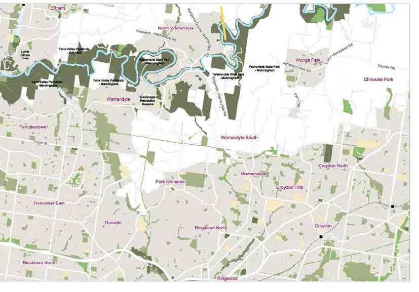
73

74 Rural Yarra reach
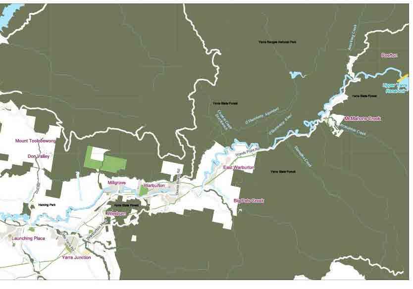
75

76 Upper Yarra reach
Is a different governance mindset needed for our coasts, waterways and open space? Chris Chesterfield
 Is a different governance mindset needed for our coasts, waterways and open space? Chris Chesterfield Is a different governance mindset needed for our coasts, waterways and open space? Yarra MAC objectives:
The Sunshine Coast is part of the global community and generates wealth through export, high-value industries and new investment.
 3.2 Strategic intent 3.2.1 Shaping growth an overview In 2031, the Sunshine Coast is renowned for its vibrant economy, ecological values, unique character and strong sense of community. It is Australia
Queensland State Election Priorities 2017
 Queensland State Election Priorities 2017 Protecting, conserving and celebrating Queensland s environmental, built and cultural heritage. QUEENSLAND S HERITAGE MAKES A DIFFERENCE Environmental, built and
PLANNING THE SUNBURY GROWTH CORRIDOR
 SUNBURY GROWTH CORRIDOR NOVEMBER 2016 PLANNING THE SUNBURY GROWTH CORRIDOR Sunbury Planning Background The Victorian Planning Authority, in consultation with Hume City Council, is undertaking a number
Part four. In this part you will find: The next steps to deliver the master plan
 Part four NEXT STEPS In this part you will find: The next steps to deliver the master plan 6. How COULD the Master Plan be delivered? There are a number of steps required to take the proposals in the master
GLENTHORNE NATIONAL PARK OUR NEW BACKYARD
 2036 WILL MARK OUR STATE S BICENTENARY By the time our State turns 200 years old, I want South Australia to be a place of prosperity. Planning and delivering on my vision for a better future starts now.
ENVIRONMENT ACTION PLAN
 ENVIRONMENT ACTION PLAN 2015 16 Airservices Australia 2015 This work is copyright. Apart from any use as permitted under the Copyright Act 1968, no part may be reproduced by any process without prior written
PROUDLY BRINGING YOU CANADA AT ITS BEST. Management Planning Program NEWSLETTER #1 OCTOBER, 2000
 PROUDLY BRINGING YOU CANADA AT ITS BEST VUNTUT NATIONAL PARK Management Planning Program NEWSLETTER #1 OCTOBER, 2000 INTRODUCTION This newsletter launches the development of the first management plan for
Land Management Summary
 photo credit: ANGAIR Anglesea Heath Land Management Summary The Anglesea Heath (6,501 ha) was incorporated into the Great Otway National Park in January 2018. This provides an opportunity to consider the
Kilometres. Blacktown. Penrith. Parramatta. Liverpool Bankstown. Campbelltown
 0 5 10 15 20 Kilometres Penrith Blacktown Parramatta Liverpool Bankstown Campbelltown accessibility outcomes Legend Outcomes targeted in Western Sydney are: public transport that is accessible throughout
That Council endorses the attached submission on the Reef 2050 Long-term Sustainability Plan.
 4 ORDINARY MEETING 22 OCTOBER 2014 1 REEF 2050 LONG-TERM SUSTAINABILITY PLAN D Walton 8/24/18-01 #4506842v2 RECOMMENDATION: That Council endorses the attached submission on the Reef 2050 Long-term Sustainability
Case Study: 1. The Clarence River Catchment
 Case Study: 1. The Clarence River Catchment The NSW coastline is a great natural asset, making an enormous contribution to the economy. The resources of coastal catchments such as the Clarence River Catchment,
PSP 75 Lancefield Road. Northern Jacksons Creek Crossing Supplementary Information
 PSP 75 Lancefield Road Northern Jacksons Creek Crossing Supplementary Information September 2017 The northern crossing of Jacksons Creek proposed within the Lancefield Road PSP is a key part of the ultimate
A Master Plan is one of the most important documents that can be prepared by an Airport.
 The Master Plan A Master Plan is one of the most important documents that can be prepared by an Airport. A Master Plan is a visionary and a strategic document detailing planning initiatives for the Airport
LA TROBE UNIVERSITY MELBOURNE CAMPUS MASTER PLAN 2014 AUGUST 2014 MASTER PLAN PREPARED BY MGS ARCHITECTS
 LA TROBE UNIVERSITY MELBOURNE CAMPUS 2014 AUGUST 2014 PREPARED BY MGS ARCHITECTS ACKNOWLEDGEMENTS La Trobe University proudly acknowledges the Wurundjeri, the traditional custodians of the land upon which
LA TROBE UNIVERSITY MELBOURNE CAMPUS MASTER PLAN 2014 AUGUST 2014 EXECUTIVE SUMMARY PREPARED BY MGS ARCHITECTS
 LA TROBE UNIVERSITY MELBOURNE CAMPUS MASTER PLAN 2014 AUGUST 2014 EXECUTIVE SUMMARY PREPARED BY MGS ARCHITECTS ACKNOWLEDGEMENTS La Trobe University proudly acknowledges the Wurundjeri, the traditional
Park-specific management and policies Wainuiomata Recreation Area
 Park-specific management and policies Wainuiomata Recreation Area 6.8 Wainuiomata Recreation Area 6.8.1 Legal status Title held: Legislative status: Wellington Regional Council Administered under Local
BABIA GÓRA DECLARATION ON SUSTAINABLE TOURISM DEVELOPMENT IN MOUNTAIN AREAS
 BABIA GÓRA DECLARATION ON SUSTAINABLE TOURISM DEVELOPMENT IN MOUNTAIN AREAS The participants of the International Workshop for CEE Countries Tourism in Mountain Areas and the Convention on Biological Diversity",
North District Plan OVERVIEW
 OUR GREATER SYDNEY 2056 Revised Draft North District Plan OVERVIEW Hornsby Hunter's Hill Ku-ring-gai Lane Cove Mosman Northern Beaches North Sydney Ryde Willoughby Snapshot of the North District today
Recreation Management Plan Lake Baroon and Ewen Maddock Dam
 Lake Baroon and Ewen Maddock Dam December 2013 Contents Overview... 3 The Value of Our Natural Areas... 4 Management Approach... 6 Funding... 7 Recreation Management... 8 Conditions of Access and Use...
Draft Planning Controls Planning Scheme Amendment GC81
 Draft Planning Controls Planning Scheme Amendment GC81 Peita Tapper Senior Planner, Planning Services What the planning controls do? The draft planning controls translate the objectives and strategies
TOWN PLANNING SUBMISSION TO THE GREATER SYDNEY COMMISSION LANDS AT ARTARMON
 TOWN PLANNING SUBMISSION TO THE GREATER SYDNEY COMMISSION LANDS AT ARTARMON March 2017 TABLE OF CONTENTS 1.0 INTRODUCTION 3 2.0 THE SUBJECT SITE 4 3.0 STRATEGIC PLANNING CONTEXT 6 4.0 SUMMARY AND CONCLUSIONS
City vision. Introduction. Our vision is for the City of Melbourne to be a thriving and sustainable city.
 City vision Introduction City Plan 2010 is Melbourne City Council s primary planning strategy. It sets out what we believe must happen over the next 10 years to achieve our vision for the City of Melbourne
MELBOURNE METRO RAIL PROJECT EXPANDING MELBOURNE S UNDERGROUND RAIL NETWORK UPDATE FOR RESIDENTS OF THE DOMAIN PRECINCT APRIL 2016
 MELBOURNE METRO RAIL PROJECT EXPANDING MELBOURNE S UNDERGROUND RAIL NETWORK UPDATE FOR RESIDENTS OF THE DOMAIN PRECINCT APRIL 2016 MEETING THE CHALLENGE OF POPULATION GROWTH 24 14.4 12.6 MELBOURNE METRO
APPENDIX I: PROCESS FOR FIRST NATIONS REGIONAL DIALOGUES
 Process and significance The bipartisan support of the Government and the Opposition for the Council to host a series of Aboriginal and Torres Strait Islander designed and led dialogues provided a historic
The implementation of this Master Plan will be undertaken in logical stages to meet passenger and workforce demands.
 The implementation of this Master Plan will be undertaken in logical stages to meet passenger and workforce demands. Connecting People Building Opportunities 198 Brisbane Airport Corporation CHAPTER 10
CITY OF MELBOURNE RECONCILIATION ACTION PLAN
 CITY OF MELBOURNE RECONCILIATION ACTION PLAN 2015-2018 A CITY FOR PEOPLE We support our community members whatever their age, sex, physical ability, socio-economic status, sexuality or cultural background
WESTERN SYDNEY PARKLANDS PLAN 2020 CORPORATE
 WESTERN SYDNEY PARKLANDS 2020 CORPORATE PLAN March 2015 Table of Contents Message from the Chairman and Director 1 What is the Western Sydney Parklands? 4 The Western Sydney Parklands Trust 4 The Corporate
Tourism Development Framework for Scotland. Executive Summary- Development Framework to 2020 for the Visitor Economy (Refresh 2016)
") Tourism Development Framework for Scotland Executive Summary- Development Framework to 2020 for the Visitor Economy (Refresh 2016) Introduction The Tourism Development Framework for Scotland refresh 2016:
Tourism Development Framework for Scotland Executive Summary- Development Framework to 2020 for the Visitor Economy (Refresh 2016) Introduction The Tourism Development Framework for Scotland refresh 2016:
Submission to the Joint Standing Committee on Northern Australia
 Submission to the Joint Standing Committee on Northern Australia Inquiry into Opportunities and Methods for Stimulating the Tourism Industry in Northern Australia February 2017 About the RAC RAC represents
CITY OF MELBOURNE 10 Year Financial Plan People s Panel Report. 8 November 2014
 CITY OF MELBOURNE 10 Year Financial Plan People s Panel Report 8 November 2014 The Panel s Decision Making Principles 1. SMART (Specific, Measurable, Achievable, Realistic, Timely) 2. Sustainable 3. Forward
Map 1.1 Wenatchee Watershed Land Ownership
 Map 1.1 Wenatchee Watershed Land Ownership Map 1.1 Wenatchee Watershed Land Ownership The Wenatchee watershed lies in the heart of Washington state in Chelan County. Just larger than the state of Rhode
PROTECTED AREAS ZONE - POLICY
 PROTECTED AREAS ZONE - POLICY.1 Introduction The Protected Areas Zone applies to the land depicted on the Ruapehu District Plan Maps as: Amenity Policy Area. Protected Areas - Conservation. (c) Protected
DEVELOPING A PLAN FOR SOUTH EAST S WATERWAYS
 LOOKING FORWARD TO THE NEXT 10 YEARS DEVELOPING A PLAN FOR SOUTH EAST S WATERWAYS Oxford Canal Corridor John Best, Chair South East Waterway Partnership Welcome Banbury / Oxford Canal Programme Partnership
SYDNEY OPERA HOUSE. Artwork: Dreaming Sisters 2011 by Mary Smith. Copyright Mary Smith & Weave Arts Centre
 SYDNEY OPERA HOUSE reconciliation action plan Artwork: Dreaming Sisters 2011 by Mary Smith. Copyright Mary Smith & Weave Arts Centre SYDNEY OPERA HOUSE reconciliation action plan CONTENTS introduction
MINNESOTA S PARKS & TRAILS LEGACY PROGRAM: ACCOMPLISHMENTS & PROSPECTS
 MINNESOTA S PARKS & TRAILS LEGACY PROGRAM: ACCOMPLISHMENTS & PROSPECTS PAU L P U R M A N M I N N E S OTA D E PA R T M E N T O F N AT U R A L R E S O U R C E S, PA R K S & T R A I L S L EG 5/15/2016 1 A
Steps in the Management Planning Process
 Steps in the Management Planning Process Developing a management plan for Kalamalka Lake Park will follow a multi-stage process. The planning process for this park is currently in the Draft Management
Great Barrier Reef Ports Strategy Have your say
 Great Barrier Reef Ports Strategy Have your say Written submission form The Great Barrier Reef Ports Strategy presents the vision and principles guiding the Queensland Government s approach to future port
Public Submissions in response to the Bill closed on 2 July 2015 and Council lodged a copy of the submission provided as Attachment 1.
 54 PLANNING AND ECONOMIC COMMITTEE 8 JULY 2015 3 SUSTAINABLE PORTS DEVELOPMENT BILL Neil Quinn 1/58/14 #4771706 RECOMMENDATION: That Council endorses the Submission made to the Infrastructure, Planning
Schedule of Planning Applications Committee Date: 23 May Reference: 06/18/0064/F Great Yarmouth Officer: Mr J Beck Expiry Date:
 Schedule of Planning Applications Committee Date: 23 May 2018 Reference: 06/18/0064/F Great Yarmouth Officer: Mr J Beck Expiry Date: 24-04-2018 Applicant: Proposal: Site: Mr Mavroudis Clear weather hoardings
A REVIEW OF 40 YEARS OF REPORTS AND PLANS FOR THE YARRA RIVER CORRIDOR
 Charting the Yarra A REVIEW OF 40 YEARS OF REPORTS AND PLANS FOR THE YARRA RIVER CORRIDOR ABOUT THE YARRA RIVERKEEPER ASSOCIATION The Yarra Riverkeeper Association is the voice of the river. Over the past
Twelve Apostles Marine National Park Australia
 EVALUATION REPORT Twelve Apostles Marine National Park Australia Location: Victoria, Australia coastal waters Global Ocean Refuge Status: Nominated (2017), Evaluated (2017) MPAtlas.org ID: 7703885 Manager(s):
This is a submission to Council s Delivery Plan and Operational Plan
 Goulburn Mulwaree Council Locked Bag 22 Goulburn NSW 2580 Emailed: strategy@goulburn.nsw.gov.au and council@goulburn.nsw.gov.au Marulan/Tallong Community Network C/O 843 Marulan South Road Marulan NSW,
Sunshine Coast Council Locked Bag 72 Sunshine Coast Mail Centre QLD Submitted via online portal. 2 June 2017.
 Sunshine Coast Council Locked Bag 72 Sunshine Coast Mail Centre QLD 4560 Submitted via online portal 2 June 2017 Dear Sir /Madam, RE: DRAFT ENVIRONMENTAL AND LIVEABILITY STRATEGY The Green Building Council
Parkland County Municipal Development Plan Amendment Acheson Industrial Area Structure Plan
 Parkland County Municipal Development Plan Amendment Acheson Industrial Area Structure Plan New Plan Acheson Industrial Area Structure Plan Amendment Parkland County Municipal Development Plan Board Reference
F6. Coastal Ferry Terminal Zone
 F6. Coastal Ferry Terminal Zone F6.1. Zone description The purpose of the Coastal Ferry Terminal Zone is to provide for the integrated and efficient operation and development of ferry terminal facilities.
Proposal to Redevelop Lower Kananaskis River-Barrier Lake. Bow Valley Provincial Park
 Frequently Asked Questions Proposal to Redevelop Lower Kananaskis River-Barrier Lake Bow Valley Provincial Park Frequently Asked Questions What has been decided? What are the details of the plan? What
Protected Areas & Ecotourism
 Protected Areas & Ecotourism IUCN Best Practice Guidelines, tools & protected area/ecotourism highlights from around the world Kathy Zischka, Director Annual General Meeting Australian 2 November Committee
Attachment 2 Agenda Item 6.1 Future Melbourne Committee 6 May 2014 Melbourne Music Strategy
 Attachment 2 Agenda Item 6.1 Future Melbourne Committee 6 May 2014 Melbourne Music Strategy A strategy for supporting and growing the city s music industry 2014 17 Contents Welcome... 3 1. Introduction...
WALKER SWAMP INFORMATION DAY Saturday 23 rd June 2018
 WALKER SWAMP INFORMATION DAY Saturday 23 rd June 2018 Introduction to the Upper Wannon River Floodplain wetlands and the new Walker Swamp Restoration Reserve Mark Bachmann and Greg Kerr, Nature Glenelg
Proposal to Redevelop Lower Kananaskis River-Barrier Lake. Bow Valley Provincial Park. Frequently Asked Questions
 Proposal to Redevelop Lower Kananaskis River-Barrier Lake Bow Valley Provincial Park Frequently Asked Questions What is being proposed? What are the details of the proposal? Where is the project area located?
Department of Environment, Climate Change & Water NSW. Stakeholder feedback
 Department of Environment, Climate Change & Water NSW Stakeholder feedback 1 Stakeholders group Blue Gum High Forest Group Guardians of Lane Cove NP Sydney Metropolitan Wildlife Service Ku-ring-gai Historical
WELLINGTON $422 MILLION $614 MILLION $83 MILLION 22% SPEND $1.9 BILLION
 WELLINGTON WELLINGTON $1.9 BILLION FORECAST TOTAL WELLINGTON INVESTMENT The Wellington region s transport challenges are dominated by the region s concentration of population in the metropolitan cities,
Marchand Provincial Park. Management Plan
 Marchand Provincial Park Management Plan 2 Marchand Provincial Park Table of Contents 1. Introduction... 3 2. Park History... 3 3. Park Attributes... 4 3.1 Natural... 4 3.2 Recreational... 4 3.3 Additional
Committee. Presentation Outline
 CW-33-15 11/9/2015 Community and Corporate Services Committee November 10, 2015 1 Presentation Outline Background Vision and Objectives Study Process and Timeline Public and Stakeholder Engagement Organization
2 THE MASTER PLAN 23
 2 THE MASTER PLAN 23 THE MASTER PLAN 2.1 Purpose of the Master Plan A Master Plan provides the airport operator, the Commonwealth, State and Local Governments, the local community, aviation industries
Destination Orkney. The Orkney Tourism Strategy Summary
 Destination Orkney The Orkney Tourism Strategy Summary Introduction Adopted by Destination Orkney (formerly Orkney s Area Tourism Partnership), the strategy rocket is a one-page summary of the strategy
SUPPORT TO WATER RESOURCES MANAGEMENT IN THE DRINA RIVER BASIN DRAFT ROOF REPORT INTRODUCTION AND GENERAL APPROACH
 SUPPORT TO WATER RESOURCES MANAGEMENT IN THE DRINA RIVER BASIN DRAFT ROOF REPORT INTRODUCTION AND GENERAL APPROACH Nadja Zeleznik, REC Public Concultation Beograd, Serbia, 4 July 2017 1 1. Introduction
NARRABEEN LAGOON SUMMIT am Wednesday, 13 April 2005 Warringah Council Chambers, 725 Pittwater Road, Dee Why.
 NARRABEEN LAGOON SUMMIT 9.15 9.30am Wednesday, 13 April 2005 Warringah Council Chambers, 725 Pittwater Road, Dee Why. NSW Minister for the Environment, the Hon. Bob Debus I am very pleased to be here to
A summary of Draft Makara Peak Mountain Bike Park Master Plan
 A summary of Draft Makara Peak Mountain Bike Park Master Plan OVEMBER 216 Image: Peter Marshall 2 3 Introduction Since it was established in 1998, the Makara Peak Mountain Bike Park (Makara Peak) has grown
Stakeholder Briefing The Bays Precint Urban Transformation Program
 Stakeholder Briefing The Bays Precint Urban Transformation Program November 2014 Our Lifecycle Approach 3 Our Ambition & Narrative Our Ambition Statement for UrbanGrowth NSW is - Transforming City Living
A THRIVING ENVIRONMENTAL AND RECREATIONAL PRECINCT IN OUR SOUTHERN SUBURBS
 A THRIVING ENVIRONMENTAL AND RECREATIONAL PRECINCT IN OUR SOUTHERN SUBURBS A STRONG PLAN FOR REAL CHANGE 1 We re ready. Over the last four years, we ve been working hard developing our vision for the future
1 INFORMATION REQUIREMENTS
 1 INFORMATION REQUIREMENTS 1.1 BACKGROUND 2 1.2 WHAT IS THE DISTRICT PLAN 3 1.3 DISTRICT PLAN STRUCTURE 4 1.4 HOW TO USE THE DISTRICT PLAN 5 1.5 STRATEGIC FRAMEWORK 6 Whanganui District Plan (15 January
SUSTAINING OUR ENVIRONMENT, PLANNING FOR OUR FUTURE
 SUSTAINING OUR ENVIRONMENT, PLANNING FOR OUR FUTURE Key Recommendations to Inform the 2015 Provincial Review of the Oak Ridges Moraine Conservation Plan APRIL 2015 KEY RECOMMENDATIONS TO INFORM THE 2015
Committee for Melbourne 2018 Election Priorities
 Committee for Melbourne 2018 Election Priorities Vote for the future The Committee for Melbourne calls on the next Victorian Government to commit to bold, visionary policies to help sustain Melbourne s
GUNGAHLIN TOWN CENTRE
 GUNGAHLIN TOWN CENTRE PLANNING REFRESH SNAPSHOT NOVEMBER 2018 CONTENTS INTRODUCTION....1 Australian Capital Territory, Canberra 2018 This work is copyright. Apart from any use as permitted under the Copyright
Tourism 201 CHAPTER 10
 Tourism 201 CHAPTER 10 202 Doncaster Unitary Development Plan Tourism 203 Tourism INTRODUCTION 10.1 The increasing importance of tourism is recognised in the UDP by having its own chapter. The benefits
REAUTHORISATION OF THE ALLIANCE BETWEEN AIR NEW ZEALAND AND CATHAY PACIFIC
 Chair Cabinet Economic Growth and Infrastructure Committee Office of the Minister of Transport REAUTHORISATION OF THE ALLIANCE BETWEEN AIR NEW ZEALAND AND CATHAY PACIFIC Proposal 1. I propose that the
TOWPATH MOWING GUIDELINES
 TOWPATH MOWING GUIDELINES 24 September 2007 CONTENTS Introduction Scope and Status of Guidelines Influences on the Guidelines Health and Safety Biodiversity INTRODUCTION Towpath management is a key issue
The Challenges for the European Tourism Sustainable
 The Challenges for the European Tourism Sustainable Denada Olli Lecturer at Fan S. Noli University, Faculty of Economy, Department of Marketing, Branch Korça, Albania. Doi:10.5901/mjss.2013.v4n9p464 Abstract
Public Transport for Perth in 2031
 South West Group Submission Public Transport for Perth in 2031 October 2011 South West Group Vision and Mission Local Governments in South Metropolitan Perth, through cooperation with industry, community
21.07 ECONOMIC DEVELOPMENT AND EMPLOYMENT 19/03/2015 C323 Proposed C Key issues and influences. Economic Role and Function
 21.07 ECONOMIC DEVELOPMENT AND EMPLOYMENT 19/03/2015 C323 Proposed C347 21.07-1 Key issues and influences 14/10/2010 C168 Economic Role and Function Geelong is the largest regional city in Victoria and
The South Gippsland Koala. For over 60 years, the plantation industry has shared a unique relationship with the Strzelecki Koala. protection.
 The South Gippsland Koala For over 60 years, the plantation industry has shared a unique relationship with the Strzelecki Koala. protection harmony THE CO-EXISTENCE OF THE KOALA WITH THE PLANTATIONS co-existence
A Response to: Belfast On The Move Transport Masterplan for Belfast City Centre, Sustainable Transport Enabling Measures
 West Belfast Partnership 218-226 Falls Road Belfast BT12 6AH T: 02890809202 A Response to: Belfast On The Move Transport Masterplan for Belfast City Centre, Sustainable Transport Enabling Measures Issued
PERTH ZOO S RECONCILIATION
 PERTH ZOO S RECONCILIATION ACTION PLAN 2011 2013 PERTH ZOO RECONCILATION ACTION PLAN 2011 2013 introduction At Perth Zoo we recognise, appreciate and respect the contribution of Aboriginal and Torres Strait
Guidance material for land use at or near aerodromes
 Guidance material for land use at or near aerodromes Table of Contents Overview... 1 Glossary... 1 Types of Aerodromes... 1 Obstacle Limitation Surfaces... 2 Wildlife Hazard Management... 2 Notice of Intention
SUBMISSION BY THE BOARD OF AIRLINE REPRESENTATIVES OF NEW ZEALAND ON THE DRAFT QUEENSTOWN LAKES DISTRICT COUNCIL DRAFT PLAN
 SUBMISSION BY THE BOARD OF AIRLINE REPRESENTATIVES OF NEW ZEALAND ON THE DRAFT QUEENSTOWN LAKES DISTRICT COUNCIL DRAFT PLAN Background to BARNZ BARNZ is an incorporated society comprising 19 member airlines
Global Sustainable Tourism Destinations Criteria
 Global Sustainable Tourism Destinations Criteria Draft destination level Global Sustainable Tourism Criteria as proposed after Destinations and International Standards joint working group meeting and follow-up
PERTH AND KINROSS COUNCIL. Enterprise and Infrastructure Committee 4 November 2009
 PERTH AND KINROSS COUNCIL 4 09/494 Enterprise and Infrastructure Committee 4 November 2009 STRATEGIC PRIORITIES FOR TOURISM AND AREA TOURISM PARTNERSHIP ARRANGEMENTS Report by Depute Director (Environment)
Lake Baroon RECREATION GUIDE
 Lake Baroon RECREATION GUIDE seqwater.com.au About Lake Baroon OUR VISION To manage access to recreation opportunities while protecting natural resources and water quality. Lake Baroon, located between
VICTORIA IN FUTURE Population 5.5 million Population 10 million. Deaths 2 million. Births 3.8 million. Natural increase 1.
 VICTORIA IN FUTURE Births 3.8 million Deaths 2 million 2011 Population 5.5 million Natural increase 1.8 million Net migration 2.7 million 2051 Population 10 million Net overseas migration 2.7 million Net
Draft LAW. ON SOME AMENDAMENTS IN THE LAW No.9587, DATED ON THE PROTECTION OF BIODIVERSITY AS AMENDED. Draft 2. Version 1.
 Technical Assistance for Strengthening the Capacity of the Ministry of Environment, Forests and Water Administration in Albania for Law Drafting and Enforcement of National Environmental Legislation A
NSW PRE-BUDGET STATEMENT FUTURE ECONOMY FUTURE JOBS
 2017-18 NSW PRE-BUDGET STATEMENT FUTURE ECONOMY FUTURE JOBS Executive Summary The 2017-18 NSW State Budget presents an opportunity for the NSW Government to future-proof the tourism and transport sectors.
Queensland s Commitment to the World Heritage Convention
 WORLD HERITAGE LEADERSHIP Queensland s Commitment to the World Heritage Convention The Hon Andrew Powell MP Minister for Environment and Heritage Protection The theme for this symposium Australia s World
A GUIDE TO MANITOBA PROTECTED AREAS & LANDS PROTECTION
 A GUIDE TO MANITOBA PROTECTED AREAS & LANDS PROTECTION Manitoba Wildands December 2008 Discussions about the establishment of protected lands need to be clear about the definition of protection. We will
Draft Western District Plan
 Powered by TCPDF (www.tcpdf.org) Draft Western District Plan Submission_id: 31732 Date of Lodgment: 15 Dec 2017 Origin of Submission: Online Organisation name: APP Corporation Pty Ltd Organisation type:
AN INTRODUCTION TO THE GC2018 RECONCILIATION ACTION PLAN
 AN INTRODUCTION TO THE GC2018 RECONCILIATION ACTION PLAN 1 THE ARTWORK STORY WITH SHARED VISION, TOGETHER IN UNITY, WE MOVE FORWARD WITH ENERGY, AND LEAVE OUR LEGACY. The journey begins with a vision,
Submission to Infrastructure Victoria s Draft 30-Year Infrastructure Strategy
 Submission to Infrastructure Victoria s Draft 30-Year Infrastructure Strategy 1. Introduction This submission is a response to Infrastructure Victoria s assessment of the need to construct a heavy rail
fact sheet fact sheet Minnippi Masterplan. Squirrel Glider Habitat Public Open Space Medium Density Proposed Public Golf Course Medium Density
 P ROJ E C T OV E RV I E W Minnippi comprises a Brisbane City Council owned public golf course, conservation areas and new housing to be developed on a total of 125 hectares between Creek Road, Fursden
Conservation Partners for the National Reserve System Program: a Western NSW focus
 Conservation Partners for the National Reserve System Program: a Western NSW focus Cooper, N. 1, Webber, L. 2, Nicolson, K. 3 1 Department of Environment, Climate Change and Water NSW, PO Box 788 Broken
Draft Greater Sydney Region Plan
 Draft Greater Sydney Region Plan Submission_id: 31392 Date of Lodgment: 14 Dec 2017 Origin of Submission: Online Organisation name: Greenfields Development Company No. 2 Pty Limited Organisation type:
uburbs Inner Eastern LLEN Region 27,298 FTE students in Government schools*** 177,361 * 397,525 Total population* 61,631 businesses 202,078 Boroondara
 uburbs Inner Eastern LLEN Region There are 55,952 young people aged 5-19 years old in the IELLEN region That's 15% of the total population 120 Primary and Secondary schools (Government, Catholic, Independent)
Establishing a National Urban Park in the Rouge Valley
 STAFF REPORT ACTION REQUIRED Establishing a National Urban Park in the Rouge Valley Date: March 29, 2012 To: From: Wards: Reference Number: Executive Committee Deputy City Manager, Cluster B All p:\2012\cluster
FEDERAL BUDGET PRIORITIES FOR THE SOUTH WEST METROPOLITAN REGION 2018 TO 2022
 A Co-operative venture of the municipalities of: Cockburn, East Fremantle, Fremantle, Kwinana, Melville & Rockingham Tuesday, 5 December 2017 Enquiries: Mick McCarthy 9364 0631 Our Ref: Federal Budget
Michipicoten Island Regional Plan
 Michipicoten Island Regional Plan This is one of twenty Regional Plans that support implementation of the Lake Superior Biodiversity Conservation Strategy (Strategy). The Strategy, prepared and overseen
Submission to NSW Koala Strategy Consultation Process. March 2017
 Submission to NSW Koala Strategy Consultation Process March 2017 Table of contents Opening 3 Response 3 Whole-of-government NSW koala strategy 3 State Environment Planning Policy (SEPP) 44 3 The draft
5 Rail demand in Western Sydney
 5 Rail demand in Western Sydney About this chapter To better understand where new or enhanced rail services are needed, this chapter presents an overview of the existing and future demand on the rail network
Cooloolabin Dam Recreation Management Discussion Paper. November 2013
 Cooloolabin Dam Recreation Management Discussion Paper November 2013 Contents November 2013... 1 Background... 3 Overview of Cooloolabin Dam... 6 Weed Management... 7 Cultural Heritage... 7 Commercial
Monifieth (Potentially Vulnerable Area 07/10) Local Plan District Local authority Main catchment Tay Estuary and Montrose Angus Council, Dundee coasta
 Local Plan District Local authority Main catchment Tay Estuary and Montrose Angus Council, Dundee coasta") Monifieth (Potentially Vulnerable Area 07/10) Local Plan District Tay Estuary and Montrose Basin Local authority Angus Council, Dundee City Council Main catchment Dundee coastal Summary of flooding impacts
Monifieth (Potentially Vulnerable Area 07/10) Local Plan District Tay Estuary and Montrose Basin Local authority Angus Council, Dundee City Council Main catchment Dundee coastal Summary of flooding impacts
Investor Briefings First-Half FY2016 Financial Results
 Cedar Woods Properties Limited Investor Briefings First-Half FY2016 Financial Results 26 February 2016 Cedar Woods Presentation 2 Snapshot of Achievements in FY2016 Extensive portfolio of residential estates