C h a r t e r Township of Milford Recreation Master Plan
|
|
|
- Hilary Small
- 5 years ago
- Views:
Transcription
 E. Mazzara Dale R. Wiltse Brien R.")
1 C h a r t e r Township of Milford Recreation Master Plan Donald D. Green, Supervisor Cynthia Dagenhardt, Treasurer Holly Brandt, CMC, Clerk Township Trustees Randal K. Busick William (Bill) E. Mazzara Dale R. Wiltse Brien R. Worrell Public Hearings: February 12, 2018 January 14, 2019 Recommended by Parks and Recreation Commission: Adopted by Township Board: Printed: Parks and Recreation Commission Steve Wolfe, Chairman Zach S. Przybyla, Vice Chairman Charles Hornacek, Recording Secretary William (Bill) E. Mazzara, Board Liaison Rebecca Franchock Kevin Lawrence Stacie Morrison Rob Scott Heather Worthington Assistance provided by: 500 Griswold, Suite 2500 Detroit, MI MTP D


2 Table of Contents Community Description... 5 Planning & Public Input Process... 9 Administrative Structure Recreation Inventory Basis For Action Action Plan Appendix A Public Input Recreation Master Plan 2 3

 5-Year Estimates, contained 9,960 people, or 306 people per square mile.")

3 Community Description Milford Township is located in the southwest portion of Oakland County and is bordered by four Oakland County Communities, Lyon Township, the City of Wixom, Commerce Township and Highland Township and one Livingston County community to the west, Brighton Township. Within the Township borders is the Village of Milford. The Village of Milford is an established, urban village approximately 2.5 square miles in area. Milford Township is approximately 32.5 square miles in area and, according to the American Community Survey (ACS) 5-Year Estimates, contained 9,960 people, or 306 people per square mile. The Parks and Recreation Master Plan has been prepared by the Township Parks and Recreation Commission and adopted by the Milford Township Board to serve as a guide and decision making document for future recreation facilities and programs. The Plan presents an inventory of existing recreation facilities, recreation programs, and environmentally significant open spaces within the Township as well as an evaluation of opportunities and needs. The Plan considers the existing facilities in and around the Township, as well as the anticipated demand for additional or improved facilities and programs. The Plan also includes goals, guidelines and a 5-Year Action Plan. The jurisdiction of this Master Plan includes only Milford Township. The Plan is also intended to enable the Township to continue to apply for funding assistance from various agencies and work toward implementing the documented recommendations. This Plan provides for five years of grant eligibility with the Michigan Department of Natural Resources. A predominantly residential community, Milford Township relies on the Village of Milford for its urban amenities such as local shopping and entertainment. The Township is home to the largest recreation area owned and managed by the Huron-Clinton Metropolitan Authority, Kensington Metropark, as well as Camp Dearborn and sections of the Proud Lake and Highland State Recreation Areas. The Township also contains a large portion of the General Motors Proving Grounds. Milford Township provides a desirable setting and some of the most notable topography in the region. The Township is made easily accessible to the region by its close proximity to Interstate 96 along its southern border, M-59 to its north, and is serviced by both County and local roads. Milford Township is situated in a growth area at the western edge of the Detroit Metropolitan Area and is located approximately 40 miles from downtown Detroit, 25 miles from Ann Arbor, 30 miles from Flint, and 30 to 35 miles from Detroit Wayne County Metropolitan Airport and the Flint Bishop International Airport. Recreation Master Plan 4 5

4 Recreation Master Plan 6 7


5 Planning & Public Input Process The Parks and Recreation Commission prepared the Recreation Master Plan to serve as a guide and decision making document for future recreation facilities and programs. The Plan presents an inventory of existing facilities and programs within the Township and an evaluation of opportunities and needs. The Plan considers the existing facilities in and around the Township, the anticipated demand for additional or improved facilities and the means for providing those facilities over the upcoming five year period. Milford Township adopted their first Recreation Master Plan in Since the adoption of the plan, there have been several accomplishments in relation to parks and recreation including: Development and adoption of Parks and Recreation By-Laws Passed millage for construction of Milford to Kensington Trail Completed funding and planning for the Milford to Kensington Trail Started and organized bi-annual community picnics Established and supported Friends of Milford Skate Park Created Parks and Recreation web page on Township website Created contact list of related organizations Participation in support of other entities/activities such as 30K Race and Village Trail project Members participated on Milford Open Space Team (MOST) for preservation of open space Adopted the Recreation Master Plan Completion and oversight of Milford to Kensington Trail Purchased an outdoor movie screen with 5 other communities Established the Movies in the Park series and Drive-in Adopted and hosted the Summer Concert Series in Central Park Established and organized the annual Milford Snow Day Continued organization of the bi-annual Community Picnics Continue annual Adopt-A-Road cleanups Maintained Parks & Recreation webpage on Milford Township website Promoted and supported recreation opportunities with other community entities Adopted the addendum to the Recreation Master Plan Plan Development Process The Parks and Recreation Commission reviewed the previous Recreation Master Plan and Addendum during a series of Commission meetings in 2018 discussing updates and noting desired modifications. A consulting firm was hired in the fall of 2018 to assist Milford Township and the Commission in updating and developing the 5-year plan for Recreation Master Plan 8 9

6 Background Studies The necessary data to begin the formulation of the background studies for the plan was collected from various sources including: Milford Township, Oakland County, SEMCOG, US Census Bureau, the Huron Valley School District, Huron-Clinton Metropolitan Authority, Department of Natural Resources, YMCA, Dearborn, Trailway Management Council, field observations and various other sources. The Community Description section includes a brief introduction to Milford Township, the jurisdiction of the Master Plan and the focus of the Plan. The Administrative Structure chapter of the Plan describes how recreation is governed and operated within the Township. In addition to the Parks and Recreation Commission, the Township has a small staff with the Township Supervisor responsible for parks and recreation related issues. The function and responsibilities of the Parks and Recreation Commission is included as well as a fiscal analysis of the overall Township revenues and expenditures. The Township itself currently only owns and operates the Milford-Kensington Trail that was completed in The location of the recreation facilities operated by a variety of other entities was mapped utilizing Oakland County GIS data. Significant information was collected via the Internet, phone interviews and field observations to complete the inventory. The Recreation Inventory portion of the plan also discusses the various programs, activities, and events offered in the Milford area. The Community Description (social and physical characteristics), Recreation Inventory, and Administrative Structure were presented to the Parks and Recreation Commission at their December 3, 2018 meeting for review and revisions. Basis For Action The Basis For Action portion of the document analyzes factors inside and outside of the Township that may have an affect on the direction of recreation over the next five years. This portion of the plan provides the rationale for the goals, guidelines and recommended capital improvements. Several factors are analyzed including current recreation trends (on both national and state levels), comparison of facilities within the Township to acreage and facility standards, service area gaps, existing plans and reports, and results of the public workshop, hearing and staff and Commission input. The draft Basis For Action was presented to the Parks Commission for their review and discussion at their December 3, 2018 meeting. At this meeting, the Parks and Recreation Commission also brainstormed language for the goals and guidelines and capital improvements schedule. Action Program At their December 3, 2018 meeting, the Parks and Recreation Commission focused on reviewing the results of the public input session and worked on the goals, guidelines, and capital improvements schedule. At the December 3, 2018Parks and Recreation Commission meeting, the capital improvements were revisited and a final review of the draft document was conducted prior to the draft plan being made available for public review. Public Input Public input into the development of a Parks and Recreation Plan is an important component of the recreation planning process, and the Michigan Department of Natural Resources (M-DNR) recreation plan approval process mandates a minimum of public input. By hosting two public hearings and collection of information at several open meetings, this 2019 revision to the Township s Recreation Master Plan significantly exceeds the M-DNR s minimum standards. Public input provides guidance into the development of the goals and objectives that the community desires for itself, and this input assists the Parks and Recreation Commission and the Board of Trustees in developing the implementation portion. The input ensures that the plan is reflective of the interests of the community. In preparation for the Recreation Master Plan update, the Township mailed a form to its residents in late 2017 requesting that they provide input and comments relative parks and recreational activities within the Township. Twenty written responses were received. On February 12, 2018, the Parks and Recreation Commission hosted a public hearing to gain additional input relative recreational activities within the Township. Several residents provided comments to the Parks and Recreation Commission at this meeting. The Commission members also discussed their goals and ideas. The questionnaire and public hearing results ranked the development of bike trails as the most discussed with ten people mentioning it in some form. Creation of a dog park and development of a youth/community center were each mentioned three times while kayak parking in Central Park and adding pickleball courts both received two votes. A summary of these efforts is included in Appendix A. On Monday November 19, 2018, the Milford Township Parks and Recreation Commission hosted a public forum. In addition to the Commission members themselves, approximately twenty individuals attended the public forum. Three different exercises were conducted during the course of the evening. The first exercise was a survey to test the results that were obtained from the public workshop that was held at the Milford Senior Center on September 10, 2007, during the creation of the Township s plan. At that workshop, the attendees were asked to identify ideas, issues, concerns, or desires for recreation within the Township. Nine different goals/ideas/concepts had received four or more votes from the attendees. The 2018 activity asked how important is the goal/idea/concept is to the attendee today Very Important, Important, Somewhat Important, Not Important, or No Opinion. Develop Trails ranked the highest with Make Milford Township More Bicycle Friendly as the second highest priority. Other high ranking priorities included Connecting Existing State Recreation Areas to Downtown Milford and Acquire Active Park Land. One priority, Installing A Hand-Activated Crossing Button at Milford Road and Huron River Parkway, has been completed since A summary of the first exercise is included in Appendix A. The second exercise was designed to engage the attendees in an effort to learn about the diversity of recreational options that may be provided by a community. The attendees were divided into four groups. Each person was first tasked with developing a fictional $100 budget where $100 would be spent in one of six recreational categories. Each individual developed their own budget in $5 increments, and then the table was tasked with developing a $100 budget for each group. Significant discussion ensued within the groups discussing what recreational activities are important to them. The results are shown in the table Public Input Budget Exercise. Public Input Budget Exercise The third exercise was a group mapping exercise to ascertain sites, nodes, and places of interest that should be connected by intra Milford Township non-motorized pathways. Regional trailway planning began in earnest in Southeastern Michigan in the late 1990s. Oakland County adopted its Oakland County Trails Master Plan in 2008 which developed out of regional efforts in the early 2000s including the Southeast Michigan Greenways Vision (2006). Since 2008, A Plan for SEMCOG and MDOTs Southeast Michigan Regions was produced in October These plans illustrate a proposed regional trail network that connects communities and major regional destinations together. These regional efforts do not include local connections that are needed between trip generators like schools, shopping districts, parks, and other local destinations within the individual communities. The attendees stayed in their groups and were asked to identify destinations and nodes that should be connected together by various non-motorized connections. They were then asked to identify how to connect the nodes with six standard non-motorized connections. The identified options included: 1) sidewalks; 2) multi-use paths; 3) bike lanes; 4) widened shoulders; 5) equestrian trails, and 6) hiking/cross-country skiing/mountain biking trails. Attendees identified important destinations to be connected included GM Proving Grounds, Camp Dearborn, Milford High School, Country Oaks Elementary School, and Oak Valley Middle School. Additional connections included routes along Buno Road, Burns Road, Childs Lake Road, Garner Road, Milford Road, Old Plank Road, and South Hill Road. The results will be combined with the Trail and Recreation Network Plan from the Township s Master Plan that will develop an updated non-motorized vision plan for Milford Township. A Public Notice ran in The Spinal Column newspaper on and announcing that the draft plan was available during a public 30 day comment period. The following comments were received during this comment period. The same notice also announced that a formal Public Hearing was held by the Parks and Recreation Commission on Monday January 14, 2018 at 7 PM. number of people spoke during the public hearing. After the Public Hearing, the Parks and Recreation Commission discussed the draft Milford Township Recreation Master Plan. They identified the following changes to be made to the plan. The consultant agreed to make these changes prior to adoption by the Township Board of Trustees. Adoption The final draft plan with the requested amendments from the Parks and Recreation Commission was presented to the Charter Township Milford Board of Trustees for consideration at its Wednesday January 16, 2019 meeting. After discussion, the Charter Township Board of Trustees adopted the Recreation Master Plan by resolution. A copy of this final plan was submitted to the Michigan Department of Natural Resources prior to February 1, 2019 plan deadline for plans. Recreation Master Plan 10 11


7 Administrative Structure This section of the Parks and Recreation Master Plan describes the administrative hierarchy within the Township as it relates to parks and recreation decision-making and governance. Additionally, Township expenditures and revenues are described as well as relationships the Township has with other agencies such as the Village, schools, Huron Clinton Metropolitan Authority, or Oakland County. Public Act 156 of 1917, Local Government, Operate System of Public Recreation, empowers Michigan cities, villages, counties, school districts and townships to create and operate local recreation facilities and recreation systems. The Act states that a city, village, county or township may operate a system of public recreation and playgrounds, acquire, equip and maintain land, buildings or other recreation facilities, employ a superintendent of recreation and assistants and vote and expend funds for the operation of the systems. The is a traditional Township organizational structure with a Township Supervisor, Treasurer, Clerk and a Township Board consisting of four trustees. Township staff is relatively small with seven full-time employees. Police service is contracted to the Township from the Village of Milford. The Milford Fire Department is also a jointly-operated service, contracted to the Village from the Township, and includes a paid-on-call fire department with a full time chief. Parks and Recreation Commission On September 19, 2001, the Milford Township Board of Trustees appointed a five member Parks and Recreation Commission for the first time to serve in an advisory role to the Township Board and Supervisor in regards to recreation within the Township. Since that time, the Commission has developed and adopted bylaws to provide procedural guidelines for the Parks and Recreation Commission. The bylaws dictate that the Commission shall not exceed 9 voting members. A Commission members terms is for three years and they serve at the pleasure of the Township Board. A Chairperson, Vice-Chairperson and Secretary are elected at the first meeting of each year. The Parks and Recreation Commission holds regular meetings on the 3rd Monday of each month at 7:00 pm at the Township Hall. In September 2006, the Parks and Recreation Commission adopted a Mission Statement to guide their progress and direction as follows: The mission of the Milford Township Parks and Recreation Commission is to work with public and private partners to provide recreational facilities and activities to its residents and visitors. Recreation Master Plan 12 13

8 Village of Milford The Village and Township work closely together on many governmental and civic issues. Major cooperative efforts include the shared administrative offices, as well as police and fire services. In terms of the provision of recreation, the Village and Township interact on a project-by-project basis to provide support, share resources, plan events, etc. In the past, the Township has provided financial assistance for summer entertainment programs, the playscape, tennis courts, basketball courts, various improvements at Central Park and the restoration efforts at the Ford Powerhouse. Milford Township Fiscal Analysis The annual budget is prepared by the Township Supervisor and adopted by the Township Board with subsequent amendments approved by the Township Board. The majority of the Township s expenditures consist of police, fire, and general governance with the largest revenues coming from the police and fire millages as well as property taxes. The Milford Township Parks & Recreation expenses are divided between two accounts (Dept. 751 and Dept. 752). Account 751 is expenses associated with operations of the Parks & Recreation Commission and event expenses related to hosting special events like the summer concert series. Account 752 is related to bond payments assocated with the Kensington-Milford Trail. Milford Township Budget and Expenditures, Recreation Master Plan 14 15


9 Recreation Inventory An inventory of recreation facilities, programs and events is an essential component of a Recreation Master Plan. The inventory provides a base of information to use in developing the goals, guidelines and capital priorities as well as assists in the future decision-making process. This section of the plan includes several components, including a recreation inventory map and table, which provides a general overview of all facilities found within the Township including those operated by the schools, Village, County, State, HCMA, and various regional entities. Another component of this chapter is a description of the recreation programs and events available to Township residents, offered by a variety of entities. To aid in identifying potential open space areas for preservation, an inventory of existing open spaces and potential natural areas (as identified by Oakland County) within the Township is also provided. Milford Township is home to an exceptional network of state and regional parks and recreation facilities. In and around Milford Township there are thousands of acres of developed and undeveloped recreation space under the administration of Oakland County, the Huron-Clinton Metropolitan Authority, the Village of Milford, two school districts, the City of Dearborn and the State of Michigan. In Milford (Township and Village), there are approximately 4,420 acres of land that are parks under various ownership (excluding water). Parkland comprises nearly 20% of the total area of the community (Township and Village). Currently, Milford Township itself only owns the Milford-Kensington Trail Connector that opened in The primary recreation facilities in Milford Township serve to not only provide recreation opportunities, but also to conserve and protect one of the most integral natural features of the Township, the Huron River. The Huron flows east to west through Milford Township, meets and crosses the Village of Milford, and then turns southwest as it flows into Green Oak in Livingston County. With the exception of a few hundred feet of river frontage, the entire length of the Huron River within the Township resides in public land. This rare amenity sets Milford Township ahead of the curve with regard to recreation facilities. In addition to those amenities associated with the Huron River, the Township benefits from a series of other significant local and regional facilities. These, in combination with the Huron River and its amenities, provide an established base upon which the Township will be able to focus future recreation facility development. The following section describes the existing facilities serving the residents of and visitors to Milford Township. Recreation Master Plan 16 17


10 State Parks and Recreation Areas Milford Township contains portions of three significant State Recreation Areas within its boundaries: Proud Lake and Highland Recreation Areas and the Lakelands Trail State Park. In addition, Island Lake State Recreation Area is located just south of the Township. These facilities are owned, operated and maintained by the Michigan Department of Natural Resources. A Michigan State Park motor vehicle permit is required at all State Parks. Proud Lake State Recreation Area The Proud Lake State Recreation Area, located in Milford and Commerce Townships, provides over 1,100 acres of outdoor recreation area within Milford Township, and more than 4,700 acres overall. This State Recreation Area benefits from a full compliment of passive and active recreation opportunities and has a comprehensive list of amenities for its visitors. Perched along the banks of the Huron River at its confluence with Norton Creek and Proud Lake, this park s programming and attractions are primarily structured around its natural features. The park also contains the ancient Chief Pontiac Trail as well as many other rustic trails and approximately 20 miles of shared trails, used primarily by the mountain bikers, opening day. Organizational camping on two rustic campgrounds, public camping on 130 modern family campsites, canoeing and beach activities also make the Recreation Area a popular place for overnight stays as well as day visits. Interpretive walks and other guided nature activities and outdoor education events are scheduled throughout the season here. The park also includes an area dedicated to horse staging as well as an extensive network of equestrian and hiking trails that lead directly to Kensington Metropark. Seasonal hunting is also allowed in specified areas. Finally, this park contains the Michigan Civilian Conservation Corps Proud Lake administrative office and a residential camp. 1 Highland Recreation Area The Highland Recreation Area is an approximately 5,900 acre State Park which lies almost entirely within Highland and White Lake Townships, with the exception of a small portion of the park containing the southern half of Moore Lake, which lies in Milford Township. The Highland Recreation Area is a primarily unimproved natural area in which seasonal hunting, fishing, boating, mountain biking, cross country skiing, swimming, boating, snowmobiling, rustic camping, equestrian activities, and field dog trial areas are supported. The Recreation Area is most notable for its 17 miles of trails for hiking and cross-country skiing, 16 miles of trails dedicated to mountain biking and 12 miles of bridle trails for horse riding. In addition, a horse stable is available with a staging area and horse camping is permitted at the rustic campsites. The predominant character of this park is undisturbed open space, wetlands, marshes and wooded areas, compromised only by minor gravel roads and trails. 2 Huron Valley Trail In 2011, the Michigan Trails and Greenways Alliance identified five Great Lake to Lake Trail (GLTLT) routes that will eventually traverse the State of Michigan. The GLTLT #1 traverses from Port Huron to South Haven. It utilizes several segments that had already been completed including the Huron Valley Trail that connects Lyon Oaks County Park with South Lyon. This route traverses the former Michigan Air Line Railroad route and the Huron Valley Trail was formally dedicated in The current trail begins at Lyon Oaks County Park following widened sidewalks along Pontiac Trail and Old Plank Road. From the Old Plank Road intersection with the former railbed, the trail follows the railbed alignment southwesterly into South Lyon where the trail currently ends. The trail segment to the east of Milford Township is currently under development by the Commerce, Walled Lake and Wixom Trailway Management Council. The council has received funding to purchase the trail in 2017 and a non-motorized bridge was constructed over M-5 Expressway in Efforts are underway to complete the trail eastward by 2020 to Haggerty Road where it will connect into the existing West Bloomfield Trail. Besides a missing link near Downtown Pontiac, this work will complete the GLTLT #1 trail all the way into Richmond in northeastern Macomb County. Island Lake Recreation Area Located at the southwest corner of Milford Township is the Island Lake State Recreation Area. Abutting Kensington Metropark, this State Recreation Area contains over 4,000 acres of space, primarily in Livingston County. The park serves to continue the substantial natural area surrounding the Huron River begun upstream by Proud Lake State Recreation Area and Kensington Metropark. This area completes a chain of parks that essentially provide public access and conservation and recreation area on the banks of the Huron River for the entirety of its flow through Milford Township. Touted by the Michigan Department of Natural Resources as providing an up north experience in Southeast Michigan, Island Lake does not have any modern camping sites or significant manmade facilities. A small playground, restrooms and some athletic fields supported by a concession stand comprise most of the limited improvements. However, the beaches, hiking (18 miles), biking (4 miles paved), mountain biking (14 miles), hunting and fishing opportunities (including a universally accessible fishing pier) make hikers, and the equestrian community. Camping, hunting, boating, horse back riding, swimming, hiking, mountain biking, snowmobiling, cross country skiing, and fishing are the most popular draws of the park. Its strategic location in Milford and Commerce Townships allows it to cater to the residents of Wayne, Washtenaw, Oakland and Livingston Counties, all within a short drive. Due to the efforts of the Michigan Department of Natural Resources, the Proud Lake State Recreation Area boasts a significant trout fishery in Southeast Michigan, has stocked rainbow and brown trout, and has a variety of warm water sport fishing species. The park is notable amongst Southeast Michigan anglers for its special early trout season, which allows the opportunity to fish, observing catch-and-release regulations, for trout a month prior to the state-wide trout season 1 Michigan Department of Natural Resources website. Source: The Great Lake-To-Lake Trails 2 Ibid., Recreation Master Plan 18 19

11 this a valuable resource. The park also includes an archery range, cross country skiing and snowmobiling on unpaved portions of the trails. Island Lake is the only balloon port in the state park system. Balloons usually take off in early morning or late evening, depending on weather. The most significant facility built in the park is the Island Lake Shooting Range, considered one of the most safe and modern in the United States. This shooting range was developed with sound abatement technologies that keep outside disturbance at a minimum. In addition, the quiet, natural feel of the Recreation Area is further enhanced by a year-round ban on off-road vehicles. 3 Huron-Clinton Metropolitan Authority The Huron Clinton Metropolitan Authority (HCMA) is an organization serving the counties of Wayne, Oakland, Macomb, Washtenaw and Livingston. Created in 1940 and funded by taxpayers and access fees, the HCMA has developed 13 Metroparks in Southeast Michigan that combine to cover over 24,000 acres and serve approximately 7.3 million people annually. The HCMA is named after the Huron and Clinton Rivers, around which their facilities are structured. The network of Metroparks around Southeast Michigan provides a unique set of public, natural conservation areas that stretch almost continuously across the region. Significant efforts have been made by the Metroparks and the communities in which they are located to develop an interconnected non-motorized trail network connecting the Metroparks to one another and to State, County and city, village or township parks. 4 Kensington Metropark Consisting of 4,486 acres, Kensington Metropark serves as the HCMA Headquarters and is second in size only to Stony Creek Metropark of all 13 of the system s parks. Due to the large area, extensive programming and long list of amenities, Kensington Metropark, located almost entirely within Milford Township, is a major recreation destination for the entire southeast Michigan region and serves over 2.5 million visitors a year. Kensington Metropark surrounds Kent Lake and takes full advantage of this amenity by providing two beaches with swimming, and two launching ramps and a boat concession, offering paddleboats, rowboats, canoes, and kayaks for visitors. The Island Queen II is a 37 passenger pontoon boat offering excursions during the summer months. Picnic shelters for large events, group camping facilities, an 18-hole golf course, a 27-hole disc golf course, a wide variety of pier and boat fishing opportunities, horse and hiking trails and cross country skiing and tobogganing in winter months are all located within the park. There are 11.9 miles of paved trails, a 20 station fitness trail, 19 miles of marked equestrian trails and 7 miles of unpaved hiking trails near the Nature Center (mountain biking is prohibited). The Nature Program includes wildlife exhibits, ranger-lead educational trips, and self-guided nature walks on exclusive nature trails. A staff Park Naturalist at the Nature Center Building is a valuable asset and will provide guidance and information for day trips for families, individuals or group events. 5 The park also includes the Farm Learning Center, offering interpretive displays, a petting farm, and group hay/sleigh rides. Ice skating with a heated building, fireplace, and food bar is offered during the winter months along with ice fishing and cross-country skiing. Splash n Blast is the most recent addition to Kensington with two, 250-foot twisted waterslides and a water spray area with cannons, palm trees and serpents that spray water. The HCMA-owned property between Milford Road and the Proud Lake Recreation Area (also referred to as the Sidney Waldon Parkway) is also part of Kensington Metropark and includes the Chief Pontiac Trail for hiking (although others utilize the trail as well including equestrians). The Chief Pontiac Trail connects Proud Lake State Recreation Area and Kensington Metropark. Oakland County Parks By virtue of Milford Township s location within Oakland County, the residents of the Township have access to the Oakland County Parks System. Oakland County Parks encompass over 6,000 acres of recreation area, and its 13 sites include parks and golf courses providing a wide range of services and programs. Attention to special needs residents, seniors and children alike have positioned the Oakland County Parks as essential community amenities. 6 Lyon Oaks Lyon Oaks County Park, the closest county park to Milford in the Oakland system, is owned and operated by the Oakland County Parks Department and is located along Pontiac Trail, adjacent to Milford Township on its southern border immediately east of Old Plank Road. Located within Lyon Township, Lyon Oaks Park is 1,041 acres in area, and contains a 800-acre wetland preserve and an 18-hole Arthur Hills-designed golf course. Dog owners may take advantage of a 13 acre fenced in Dog Park in which they may run dogs without a leash. Sports fields, including a cricket pitch that shares the soccer fields, are available along with restrooms, picnic areas, hiking trails and a nature interpretation center. The Lyon Oaks Golf Course offers banquet and meeting facilities as well as a clubhouse and driving range. The course has been designed to be friendly to beginners, with 5 tee sets of yardage tees, but long and complex enough to challenge experienced golfers, which make it a unique and ideal course for groups varying in ability or experience. Camp Dearborn and Mystic Creek Golf Club Camp Dearborn is a 626 acre park located immediately west of the Village of Milford between Commerce Road and General Motors Road. Camp Dearborn was originally founded in the 1940 s as a rustic vacation space for the residents of Dearborn, Michigan, located approximately 30 miles southeast of Milford Township. While the Township has seen a great deal of development since that time, Camp Dearborn has remained relatively intact and continues to be owned and operated by the City of Dearborn. The City also leases approximately 260 acres of the property to the Mystic Creek Golf Club. The course has 27 championship holes, driving range, putting green, adventure golf, and clubhouse/banquet center. Camp Dearborn is open to the general public, although rates are reduced for use of the park, camping facilities and golf for residents of Dearborn, Milford Township, and the Village of Milford. A variety of sports fields and courts, fishing ponds and picnic facilities are popular in the camp. RV camp sites are available along with restroom/shower facilities and a selection of sites are pet-friendly. In recent years Resort Cabins have been constructed and are available to rent. 7 Atchison Memorial Park The James F. Atchison Memorial Park (formerly Lyon Township Community Park) is a 120-acre park located in Lyon Township along Grand River Avenue, just south of Milford and I-96. The park includes several soccer fields, tennis courts, baseball fields, playground, basketball court, open space, and a paved trail. Non-Motorized Systems A widespread effort has been emerging in the State of Michigan to identify opportunities and develop non-motorized trails and trail networks throughout and between communities and various destinations. Partnerships between individual cities, village and townships, county governments, regional entities, and non-profit regional trail development organizations have produced comprehensive trail networks in many areas throughout Michigan including the Milford community. Oakland County has led the way for this growing movement by providing planning services, funding and County resources toward the construction of a trail network within its boundaries, taking advantage of the lakes and rivers of the county and connecting to those networks present or under consideration in adjacent counties. Western Oakland Trailway Management Council Milford Township is a participant with the Western Oakland County Trailway Management Council (formerly the Southwest Oakland County Trailway Management Council). The Council, formed in 1997, is an organization consisting of representatives from the City of South Lyon, Lyon Township, Milford Township and the Huron Clinton Metropolitan Authority. Several members of the Council were the founding members of a larger entity which was called the Southwest Oakland County Trailway Management Council and began in the early 1990 s. The SW Oakland County Trailway Management Council was the driving force behind the planning for the Huron Valley Trail. Once implementation on the Huron Valley Trail moved forward, a new group called the Western Oakland Trailway Management Council formed and consisted of only those communities prepared and able to move forward. The Western Oakland Trailway Management Council is dedicated to developing and maintaining trail networks within its member communities to connect their neighborhoods and town centers as well as link to the regional trail networks. In 2001, Milford Township dedicated $100,000 to the organization. 8 The Western Oakland County Trailway Management Council works closely with the 3 Ibid., 4 Huron-Clinton Metropolitan Authority Website 5 Huron-Clinton Metropolitan Authority Web Site 6 Oakland County Parks and Recreation Commission, website, www. oakgov.com/parks/pages/default.aspx 7 Camp Dearborn Website 8 Milford Township Financial Report, December 31, Recreation Master Plan 20 21

12 O AKLAND COUNTY PATHWAY CONCEPT MUNDY FENTON TYRONE HARTLAND BRIGHTON Kensington Metropark Island Lake State Recreation Area GREEN OAK NORTHFIELD Seven Lakes State Park Rose Oaks County Park Highland Oaks County Park HIGHLAND Huron Valley Trail GRAND BLANC MILFORD ROSE Headwaters Trails Highland State Recreation Area SALEM HOLLY Trail County Trail Concept* Complete Design/Development Under Consideration Under Review Lyon Oaks County Park LYON Groveland Oaks County Park 75 Springfield Oaks County Park Maybury State Park Holly State Recreation Area SPRINGFIELD Indian Springs Metropark Pontiac Lake State Recreation Area «59 White Lake Oaks County Park COMMERCE Proud Lake StateLakes Community Recreation Area Trail WIXOM 96 ATLAS WHITE LAKE NOVI GROVELAND NORTHVILLE Municipal Boundary County Parks HCMA Recreation Land State Recreation Land Bike Path HADLEY Ortonville State Recreation Area «15 *The county pathways system is comprised of a vision to link pathways and greenways throughout Oakland County and Southeastern Michigan. The county concept envisions a hierarchy of pathways consisting of primary and secondary pathways. «5 Independence Oaks County Park WATERFORD Waterford Oaks County Park B West BRANDON INDEPENDENCE «5 24 loomfield Trail WEST BLOOMFIELD Glen Oaks «10 County Park LIVONIA FARMINGTON HILLS ORION OXFORD Orion Oaks County Park Bald Mountain State Recreation Area PONTIAC BLOOMFIELD SOUTHFIELD REDFORD o June METAMORA « Miles «24 AUBURN HILLS «10 Sources Roads: Oakland County GIS, 2008 Trail Network: Oakland County GIS, 2008 Recreation Lands: Oakland County GIS, 2008 «1 «39 Polly Ann Trail Paint Creek Trail Clinton Riv er ROCHESTER HILLS Woodward Corridor BERKLEY Catalpa Oaks County Park DRYDEN DETROIT \\Tydata\Projects\Oak2002\02t\Gis-Data\Projects\Polly Ann Paint Creek Gap Alts.mxd O AKLAND Addison Oaks County Park OAKLAND 75 Trail ADDISON «59 ROYAL OAK « FERNDALE Stony Creek Metropark TROY ALMONT BRUCE WASHINGTON SHELBY WARREN Red Oaks County Park MADISON HEIGHTS HIGHLAND PARK COUNTY TRAILS MASTER PLAN Michigan Department of Natural Resources, Michigan Department of Transportation and the Road Commission for Oakland County to maintain the Huron Valley Trail and other trail efforts within the communities. Oakland County Trails Initiative Oakland County Parks and Recreation and the Oakland Trails Advisory Council (OTAC) worked together to expand and coordinate a network of trails. The initiative has evolved from local visions and applied countywide. OTAC envisioned an interconnected trail system throughout the region. As of 2007, 90 miles of trails in Oakland County have been completed, 13 miles are in detailed planning/ design/development stage, 146 miles are under consideration and plans are underway for over 117 additional miles. To assist in the planning efforts of creating a connected system, Oakland County and OTAC have developed a map that is continuously updated to illustrate the vision and to depict completed and planned segments. In 2008, Oakland County adopted its Oakland County Trails Master Plan. A number of corridor opportunities have been identified in and around the Milford community. To the east of Milford Township, the trail system is planned to traverse Wixom, Commerce Township, Wolverine Lake and into Orchard Lake, West Bloomfield Township, and Keego Harbor leading into Pontiac and then the Clinton River Trail and Paint Creek Trail. Once fully completed, this comprehensive trail network will be a model of trail development and planning within the State of Michigan and for urban counties nationwide. Awaiting additional information from Oakland County Planning and Economic Development Department. Milford-Kensington Non-Motorized Connector Milford Township adopted its first Recreation Plan in 2002, identifing the design and construction of a non-motorized trail from the Milford dam to Kensington Metropark as a top priority. Following the adoption of the Recreation Master Plan, the Township secured over $2.6 million in funding and passed a millage to fund a significant portion of the construction costs of the project. The Township was successful in obtaining funding assistance from the Community Foundation for Southeastern Michigan, MDOT, and MDNR. The trail was completed in The 10-foot wide trail traverses HCMA property and connects Kensington Metropark to the Milford Dam. To minimize wetland impact, the trail features five timber boardwalks over three separate wetland areas. Milford-Kensington Connector and Village of Milford Trail Connection to Kensington Metropark Village of Milford Trail The Milford Trail was finished in 2009 with the completion of the Milford-Kensington Connector to downtown Milford. The Village section of the trail connects the Milford Dam north around Hubbell Pond Park through a densely wooded area to the YMCA, Commerce Road, and the Milford Library. Recreation Master Plan 22 23


13 YMCA The Carls Family YMCA was constructed in 2002 as part of the YMCA of Metropolitan Detroit. Located in the Village of Milford the Y attracts a high membership base and provides exercise, pool, instructional and other health facilities for the residents of the community. The building contains a series of pools including a shallow, warm water children s pool, a lap and diving pool, a two-story waterslide, and another general activity area. A large gymnasium, with dividers and striping for volleyball, basketball and other indoor sports as well as an activity room with wood floors and wall-to-wall mirrors for dance and aerobic instruction. The YMCA also brings to the Township an array of summer, recreational and educational programs for member families. Day camps, sports leagues, classes on many different activities and exercise and sports clinics are available for members. 9 Huron Valley School District 10 The Huron Valley School District encompasses eight elementary schools, three middle schools, two high schools and one alternative high school and services Highland, Milford, White Lake and Commerce. The majority of Milford Township lies within the Huron Valley School District boundaries. There are 3 schools within Milford with Milford High School located just north of the Township on Milford Road. Huron Valley Recreation and Community Education The Recreation and Community Education department strives to offer life long learning opportunities to meet the needs of Huron Valley Schools residents and neighbors. Program staff include teachers, professionals and instructors who are specialists in their chosen field. Annually, 125 part time instructors lead over 500 youth and 1200 adults in various classes / workshops. Each season, a variety of classes for youth through adult including computers, fitness, arts and crafts, enrichment and more, are offered. Milford High School Located on S. Milford Road in Highland Township, school enrollment is approximately 1,393 students ( 17-18). Milford High School has 9 acres of outdoor active recreation area which contain sports fields for baseball, softball, tennis, football, track and soccer. In addition, the high school has a full gymnasium and associated parking. These facilities are used by high school league play for students and for general community use. Milford High School also contains a state-of-the-art theater. The theater, known as the Milford High School Center for the Performing Arts, holds approximately 650 people. The school also includes a competitive pool, community/family pool with water slide and spray area as well as a fitness center and indoor track. The pool and fitness facilities were constructed with bond funds approved in It is operated by the School District. Various memberships are available with reduced fees for Huron Valley School District residents. Muir Middle School Muir Middle School is located on George Street in the Village of Milford and includes approximately 759 students ( 17-18). Muir Middle School (16.3 acres) includes a general play area is supported by two ball fields, a soccer field and gymnasium. Johnson Elementary School Johnson Elementary School is located on General Motors Road and has an enrollment of approximately 386 students ( 17-18). The school (14.7 acres) includes a baseball field, basketball and soccer fields or courts, as well as general outdoor play area and various play equipment. This school also has a gymnasium for indoor activities. Kurtz Elementary School Kurtz Elementary School is located on Kurtz Drive and has a student enrollment of approximately 412 students ( 17-18). Kurtz School (12.6 acres) includes area for baseball, basketball and soccer. Like the other Milford area schools, Kurtz also has a gymnasium and a general outdoor play area with playground equipment. In addition to the schools located in Milford, Milford students also attend Lakeland High School, Oak Valley Middle School and Country Oaks Elementary, depending on where they live in the community. Oak Valley Middle School and Country Oaks Elementary School are located just east of Milford Township in Commerce Township on a shared complex. These facilities should be connected via non-motorized trails west into the Village of Milford. South Lyon School District Located in the extreme southwest corner of Oakland County, and partially in Livingston and Washtenaw Counties, the South Lyon School District covers about 83 square miles. The District serves South Lyon, New Hudson, the hamlet of Salem, and parts of the Townships of Lyon, Salem, Northfield, Green Oak, Wixom and Novi. Additionally, the district serves a very small section of land at the extreme southeast corner of Milford Township. The South Lyon School District has two high schools, two middle schools, eight elementary schools, and an early childhood center. Located in the City of South Lyon, the administrative offices for the School District share a facility with the City of South Lyon Municipal Offices, the first such partnership in the State of Michigan. South Lyon Schools also offer a comprehensive adult program named the Center for Active Adults. The Center serves as a community center for ages 50 and older and offers classes in exercise, art, financial management, crafts and many other topics. The program also offers health screenings, sponsors volunteer events and support groups. 11 Village of Milford The Village of Milford operates and maintains six parks within the municipal boundaries including: 12 Hubbell Pond Park (150 acres) (leased for 99 years from the HCMA and overlaps to the west into Milford Township). The Hubbell Pond Park site, located on the north side of the Mill Pond in the western portion of the Village, is largely undeveloped, but does feature walking trails, mountain bike trails, 4 ballfields, and a picnic shelter. The site is also home to the Milford Public Library and Carls Family YMCA. The Milford Trail connector was completed in 2009 and connects the Milford Dam and Kensington Metropark to Hubbell Pond Park, the YMCA, Library and downtown Milford. Central Park (12 acres) Central Park is located on the north side of the Mill Pond/Huron River in the center of the Village, within walking distance of the downtown district. The park includes a community built playscape, a tennis court, two basketball courts, canoe launch area, sand volleyball court, and special event pavilion, picnic areas and restrooms. The LaFontaine Family Amphitheater is used for the Village s summer concert series and a Veterans Memorial is also located in the park. In 2015 the Village Council adopted the Central Park Plan which aims to guide development over the next years. Southside Park (5 acres) This park is located between Huron Street and Washington Street, east of Main Street, south of the downtown area. The park features play equipment, horse shoe pits, remote control race car track, picnic tables, and an authentic log cabin. Fairgrounds Park (3 acres) Fairgrounds Park is located adjacent to the Milford Senior Center and municipal complex, south of Atlantic Street. The park is mainly an undeveloped natural area but does feature shuffleboard courts and a picnic area. In 2017 the eastern portion of the park was approved as the future loction of the Milford Skatepark. A groundbreaking is targeted for spring 2019 with 9,150 square feet of hardscaped features and 1,350 square feet of landscaping. 9 YMCA promotional materials 10 Huron Valley School District Website. 11 South Lyon School District Website 12 Master Plan for Parks and Recreation. Village of Milford Recreation Master Plan 24 25

14 SOUTH HILL RD BURNS RD OLD PLANK RD WIXOM RD CHARMS RD BRIGHTON TOWNSHIP DUCK LAKE RD COMMERCE RD Sloan Lake HICKORY RIDGE TRL HONEYWELL LAKE RD Sears Lake STONERIDGE RD GARNER RD Honey well Lake ROWE RD Camp Dearborn Indian Lake GENERAL MOTORS RD Kensington Metropark Mystic Creek Golf Course Huron R iver MARTINDALE RD HIGHLAND TOWNSHIP Phillip Lake Lake Ashley Lake James Mill Pond MILFORD RD Hubbell Pond Park Central Park VILLAGE OF MILFORD Highland Recreation Area Moore Lake Southside Park Johnson Elementary WEAVER RD RI VER Muir Jr. High Center Street Park Riverview Park ATLANTIC SUMMIT ST Fairgrounds Park COOLEY LAKE RD CRYSTAL AVE Hur o n Rive r Kurtz Elementary COMMERCE ST Milford Montessori Schools WIX OM TRAIL Proud Lake Recreation Area GARDEN RD COMMERCE TOWNSHIP STOBART RD DAWSON RD Chief Pontiac Trail OLD PLANK RD CHILDS Norton Creek PEARSON RD LAKE RD BUNO RD BUNO RD Kensington Metropark LABADIE RD HIGH RIDGE DR MAPLE BEACH DR Kent Lake HURON RIVER PKWY MOORE RD MAPLE RD Childs Lake CHILDS LAKE RD CITY OF WIXOM MILFORD RD Huron Valley Trail Kensington Metropark LYON TOWNSHIP PONTIAC TR Legend Milford Township Recreation Inventory Map Non-Motorized System Bike / Ped (Paved) Trail Equestrian Trail Mountain Bike Trail Equestrian/Mountain Bike Trail Park Path Bike Lane Parks Facilities Educational Facilities GM Proving Grounds Parcel Lines Municipal Boundaries Water Bodies Water Features Roads Railroads Z Miles Hiking Trail Widened Shoulder Water Trail Source: Wade Trim 2018 Recreation Master Plan 26 27
15 Arthur s Park (0.15 acre) This small park is located along Main Street, on the north side of the Huron River, across from Central Park. Although no active recreational facilities are present, the park features a butterfly garden and offers a walkway, benches and picnic table for visitors to enjoy the views of the river. Center Street (0.1 acre) This small urban park is located on the east side of Main Street in the downtown area. The park has a courtyard feel and features benches, a gazebo, and water fountain. Programs and Clubs There are a variety of programs and clubs available to Milford area residents including: The Huron Valley Soccer Club offers organized soccer for girls, boys, and adults. The club utilizes fields at the Highland Township Community Park and also practices at Kensington Metropark. The Huron Valley Youth Baseball & Softball League is active within the community and offers instructional/recreational baseball and softball to Milford area youth. It is a volunteer-run organization and utilizes Janowski and Jay Cee Park Bal fields in the Village of Milford. The Milford Athletic Club is a swim club in Milford that runs programming for adults from Huron Vally Pools and Milford High School. The Huron Valley Schools Community Education Department organizes and offers a number of recreation-related programs throughout the year such as Counselor In Training, Outdoor Adventure Camp, Safety Camps, Tennis, Horseback Riding, gymnastics, cheerleading, flag football, swim classes, water aerobics, yoga, pilates, gardening, etc. Additional opportunities include: Huron Valley Community Chorus Huron Valley Council for the Arts Friends of the Milford Library Huron Valley Moms Club Village Fine Arts Association Girl/Boy Scouts Milford Garden Club Milford Historical Society Proud Lake Trails Riders Association (Equestrian) Highland Trail Riders Association (Equestrian) Kensington Trail Riders Association (Equestrian) Huron Valley Equestrian Committee Beautification Committee Milford Amateur Radio Club Milford Masonic Lodge Rotary Club of Milford Zonta Club of Milford Huron Valley Running Club Huron Valley Mountain Bike Club Huron River Watershed Council Wolverine Sports Club Friends of Proud Lake Heavner Canoe & Kayak Rental Village Canoe Rental Milford Senior Center The Milford Township Senior Center is located on the Civic Center grounds, adjacent to the Village/Township offices. Its location makes it easy and accessible for area Senior Citizens. The Center has a Director and Activity Director who plan many outings and activities for older (50+) adults. Lunch is served daily, and a schedule of events can be mailed or picked up at the Center. The Highland/ Milford Transportation Program owns two vehicles to take area Seniors to doctors appointments as well as shopping trips. Programs and Events There are several programs and events sponsored and organized by various agencies and held in the community throughout the year. Milford Winterfest The Milford Township Parks and Recreation Commission hosts Winterfest every year at Downtown Milford s Central Park. The winter festival features a variety of events for all ages, including winter crafts, ice skating, winter games, and available snacks and hot cocoa. Milford Memories Summer Festival The Milford Memories Summer Festival is a three day event held in August in downtown Milford. It includes an art fair with over 300 artists from around the country. The festival also includes music, events for all ages, a 5K & 10K Race, Pancake breakfast, food and beverages. Milford Summer Concerts in the Park A summer concert series is held Thursday evenings in Central Park s LaFontaine Family Amphitheater in downtown Milford. From June through August, community members can enjoy a variety of musical genres: from blues and swing music to bluegrass, big band, jazz, and rock and roll. Milford Community Picnic The Milford Township Parks and Recreation Commission jointly holds a Community Picnic with the DDA and the Village of Milford in the Spring of each year at Central Park. Food is available as well as various games, crafts, face painting, moon bounce and a movie in the park. Labor Day 30K The Labor Day 30K takes place every Labor Day Weekend, starting from Bakers of Milford Restaurant. Run by a Nonprofit Organization, the race offers a 30K Bike, 30K Run, 10K Run, 6K Run/Walk and a 1/2 Mile Kids Run. Past Grants When preparing a Recreation Plan, the Michigan Department of Natural Resources requires that information be provided concerning grants that have been received in the past for acquisition or development of recreation facilities. In the past, Milford Township has received 1 grant for recreation facility development. In 2006 Milford Township was granted $400,000 from the MDNR for project number TF06-074, the Milford to Kensington Metropark Trail. The project developed an approximately 2.9-mile non-motorized trail through Kensington Metropark to Milford Dam. In addition to the trail, the grant also supported construction of elevated boardwalks over wetlands and supported site restoration. The trail is in good condition and well-maintained. The trail is heavily used and is an asset to the community. Recreation Master Plan 28 29


16 Basis For Action There are several factors that affect and impact the provision of parks and recreation facilities. The Basis For Action section analyzes and reviews the primary factors that have the potential to impact recreation planning within the Township over the next 5 years. The goals, objectives, and priority improvements are the result of the analysis presented here. A number of important factors contribute to the development of the Basis For Action section, including current trends, future planned improvements to facilities in the community, a comparison of existing facilities to acreage and facility standards, gaps in service areas, participation data in community recreation programs and the results of staff and community input. The Basis For Action contains several pieces of information and analysis, and when put together as a whole, begins to establish the need for various facilities within the Township over the next 5 years. National Recreation Trends Recreation trends occurring nationally provide insight into activities that can be expected to draw a large number of participants and how different age groups vary in the way they use recreation areas. The Physical Activity Council (PAC) released a 2018 Participation Report that tracked annual recreation participation data in the United States. The report found that fitness sports and outdoor recreation have garnered the greatest amount of interest in recent years. The top aspirational activity for all age segments occurrs outdoors, ranging from camping, to biking, to birdwatching. Interest levels do vary by age groups. Kids, ages 6-17, have a high interest in team sports and outdoor activities, while the Boomer generation participates heavily in low impact fitness activities, like aquatic exercise, cycling, and walking. The figure Aspirational Sports Participation displays aspirational sports participation for ages 6 and older. Camping, fishing, and biking are found near the top of nearly every age segment, and although the level of interest does vary, swimming for fitness is an interest across all age groups. The PAC 2018 Participation Report also found that there is a trend towards less frequent activity among the U.S. population million people, or 72% of the population over age 6 was active in The rate of inactivty has remained steady over the past five years, but the number of inactive individuals as risen due to population increase. Two million more people were inactive in 2017 than the number inactive in Non-participants provided various responses to what would help them to get involved with recreational activity (See figure Ways to get Non-Participants Involved). Recreation Master Plan 30 31


17 Aspirational Sports Participation (U.S. Population Ages 6+) National Planning Standards In the process of determining and prioritizing needs, it is not only important to understand the national and local trends in terms of participation levels and popularity, but it is also imperative to compare the provision of local recreation facilities to published standards. This comparison of existing facilities to standard acreage and facility recommendations is another tool to determine needs within Milford Township. However, it should be noted that the latest available national standards were developed in the 1980 s and 1990 s and may not fully reflect today s needs and trends. Acreage Standards The National Recreation and Park Association provides a recommended park classification system which recognizes that open space has various functions. The system categorizes open space into various park classifications (see the table Recreation Classificatiom System). The desirable characteristics relative to size, function, amenities and acreage provisions per 1,000 people (where available) are identified in the table. Recreation Classification System (National Recreation and Park Association) General Location Size Acres/1,000 Description Criteria Criteria Population Mini-Park Used to address limited, isolated Less than a 1/4 mile Between to 0.5A or unique recreational needs. distance in residential sq. ft. and one setting. acre in size. Source: The Physical Activity Council, 2018 Participation Report Ways to get Non-Participants Involved (U.S. Population Ages 6+) Neighborhood Remains the basic unit of the park 1/4 to 1/2 mile distance 5 acres is 1.0 to 2.0A Park system and serves as the recreational and uninterrupted by considered min. and social focus of the neighborhood. non-residential roads size. 5 to 10 ac. Focus is on informal active and passive & physical barriers is optimal. recreation. Community Serves broader purpose than neighbor- Determined by the As needed to 5.0 to 8.0A Park hood park. Focus is on meeting quality and suitability accommodate community-based recreation needs, as of the site. Usually serves desired uses. well as preserving unique landscapes and two or more neighbor- Between 30 open spaces. hoods and 1/2 to 3 mile and 50 acres. distance. Large Urban Serves broader purpose than community Determined by quality and As needed to 5.0 to 10.0A Park/ Regional parks. Focus is on meeting community- suitability of site. Serves accommodate Metropolitan based recreational needs, as well as entire community. desired uses. Park/ Natural preserving unique landscapes and open Minimum of 50 Resource Area spaces. acres. 75 or more acres optimal for Urban Parks, over for Regional/ Metro Parks Source: The Physical Activity Council, 2018 Participation Report Recreation Master Plan 32 33

, and State Recreation Areas.")
18 The Table Classification of Milford Area Recreation Facilities displays which parks fall into each classification system, along with its acreage. These classifcations are helpful in determining service areas for members of the community. As the table illustrates, there is a significant amount of acreage within the Township and immediate surroundings that can be considered Large Urban Park/Regional/Metropolitan Park/Natural Resource Area land. This includes Camp Dearborn, the HCMA properties, Lyon Oaks (just outside of Township), and State Recreation Areas. There is a significant amount of passive recreation areas, camping, fishing, hiking, wildlife viewing, etc. available within the majority of these large regional parks. For each park classification, the Table Existing Recreation vs Public Standards compares the area s existing park acreage against the recommended standard.the Township and Village rely heavily on one another for the provision of recreation and open space, thus the table includes an analysis of acreage needed based on a combined 2016 population of 16,394. Utilizing all of the acreage within the Township and Village, regardless of owner, it appears the Township contains sufficient recreation acreage. It should be noted however, that with the exception of maintaining the Milford-Kensington Metropark Trail, the Township owns and controls no recreation properties. The Township relies primarily on the Village and School District to provide residents with active recreation areas. This becomes problematic when dealing with access, maintenance, scheduling, etc. Park Service Areas As has been referenced, each type of recreation facility (community, neighborhood, and mini) has varying service areas due to their size and amenities offered. According to the NRPA, community parks serve an area within a 1/2 to three mile radius, neighborhood parks serve an area between 1/4 mile to 1/2 mile radius and mini parks serve a population within 1/4 mile. To illustrate the proximity of recreation areas to residents, a service area map has been created. If considering Hubbell Pond Park, Central Park and Milford High School as community parks, nearly every resident of the Township is within 3 miles from one of these facilities, with the Classification of Milford Area Recreation Facilities Large Urban Parks Acres Regional/ Metro Park/ Natural Resources Area Camp Dearborn 626 Lyon Oaks County Park 1,043 Kensington Metropark 4,481 Proud Lake State Recreation Area 4,700 Highland State Recreation Area 5,900 Island Lake Recreation Area 4,000 Community Parks Hubbell Pond Park 150 Central Park 16.5 Milford High School 56.1 Neighborhood Parks Muir Middle School 16.3 Johnson Elementary 14.7 Kurtz Elementary 12.6 Mini Parks Southside 1.6 Fairgrounds 4.3 Riverview 0.2 Center Street 0.1 exception of those in the southern portion of the Township. Those facilities considered neighborhood or mini parks are all located within the Village boundaries. As the map illustrates, very few Township residents have one of these facilities within a 1/2-mile or 1/4-mile of their home. For Large Urban Parks, Regional/Metropolitan Parks/Natural Resource Areas they either server the entire community (Large Urban Parks) or service beyond the municipalities boundaries. Existing Recreation vs. Published Standards Recreation Master Plan 34 35

19 In evaluating the results from classifying Milford Area Recreational Facilities by park type (found on page 34), Milford Township has sufficient park land of the various types of parks to meet the standards for amount of parks by acreage; however, the Milford Township Service Area Map on page 35, illustrates that significant portions of the Township are not served by Mini-Parks or Neighborhood Parks. To address this issue, Milford Township should consider identifying prospective park land in the northwestern and southeastern quadrants of the Township for Neighborhood or Community Parks that would address this deficiency. A well-positioned park in the southeastern quadrant of the Township could also serve as a hub to the intra-township non-motorized trail network in this part of the Township. Facility Standards The NRPA also publishes typical recreation facility standards that specify service area, the number of facilities needed to service the population, and the land area needed for such facilities. Standards for facilities typically located within neighborhood and community parks are provided in the table below. These standards, used in conjunction with the needed acreage, facilitate further understanding of Milford Township s recreation needs. Data in the facility deficiencies table compares the existing community recreation facilities within Milford, to the NRPA published standards. Recreation Facility Deficiency Recreation Facility Standards Activity/ MinimumSpace Units Per Service Radius Location Notes Facility Requirements Population Basketball Court 1 per 5,000 ¼ - ½ mile Outdoor courts in neighborhood and community parks, plus active Youth sq.ft. recreation areas in other park High School sq.ft. settings. Ice Hockey 22,000 sq.ft. 1 per 100,000 ½ hour to 1 hour Climate important consideration including travel time affecting number of units. support area Tennis Court 7200 sq.ft./court 1 per 2,000 ¼ - ½ mile Best in batteries of acres/complex Located in neighborhood/community park or adjacent to school site. Volleyball Court 4000 sq.ft. 1 per 5,000 ½ - 1 mile Same as basketball court Ballfields 1 per 5,000 ¼ - ½ mile Part of neighborhood complex. Baseball acres 1 per 30,000 Lighted fields part of community Little League 1.2 acre (lighted) complex. Softball fields may also Softball acres be used for youth baseball. Football Field 1.5 acre 1 per 20, min. Usually part of baseball, football, travel time soccer complex in community park or adjacent to high school. When compared to the published standards, Milford Township is deficient in the provision of a lighted ballfield. Again, as the Township currently only owns two trails, the facilities provided by the Village, local schools, Oakland County, HCMA and the State of Michigan help to offset some of the facility deficiencies. It should be noted, however, that the Township does not have direct control over operation, maintenance, availability, etc. of any of these facilities. For example, while the standards indicate that the community is not short in soccer fields, all soccer fields are located on school or HCMA properties. The facility standards should also be considered in light of the national recreation activity trends previously noted as well as the input received from staff, the Commission and from the public forum. Of the facilities listed in the standards, national participation over the past 10 years has only increased in ice hockey, football and soccer. Soccer Field acres 1 per 10, miles Number of units depends on popularity. Youth soccer on smaller fields adjacent to schools or neighborhood parks. Swimming Pool ½ to 2-acre site 1 per 20, min. Located in community park or travel time school site. Data from Roger A Lancaster, Ed., Recreation Park and Open Space Standards and Guidelines, Alexandria, Virginia: National Recreation and Park Association, 1983, pages Recreation Master Plan 36 37

20 Community Demographics The socioeconomic characteristics of a community play a role in the demand for certain types of recreation facilities. By examining socioeconomic characteristics such as population, density, age, and household size, municipalities can identify trends and opportunities that may influence future land use and recreation decisions and/ or policy choices. This section provides a brief summary of the socioeconomic characteristics of Milford Township that may influence parks and recreation planning decisions. The US Census Bureau and American Community Survey (ACS) serve as the primary source of data for this demographics section. Census statistics are presented for Milford Township as a whole, but are also illustrated for the 7 block groups that comprise the Township. Additionally, census statistics for the 4 block groups in the Village are presented. A series of maps are included that illustrate the relevant Census data by block group within the Milford community. Population Trends and Forecast Between 1970 and 2016, Milford Township has experienced significant population growth. The total growth rate over the apprximately 45 year span was 331.5%. Since the year 2000, the Township population has grown 10.6%, and the population is forecasted to continue to increase by another 10.7% over the next 30 years.the Township is expected to reach an estimated population of 11,034 by the year This continuing growth is a clear indication that the Township will need to consider the provision of additional park Milford Population Trends and Forecast Village of Year Milford Twp Milford Combined ,557 4,699 7, ,146 5,041 10, ,610 5,511 12, ,999 6,272 15, ,561 6,175 15, ,960 6,434 16, Estimate 11,034 7,004 18,038 Source: U.S. Census Bureau and American Community Survey 5-Year Estimates 2045 Estimate - SEMCOG 2045 Regional Development Forecast facilities and services to accommodate the growing population. Population By Block Group Where people are living within the community can have an influence on recreation planning. There will likely be a greater need for park facilities where the greatest number of people are residing. Conversely, it may not be as practical or economical to locate park facilities within sparsely populated areas. The Population by Block Group Map shows where the largest numbers of people are residing within the Milford community. The least amount of people (822) are in the Block Group in the southwest corner of the Township. This area includes the main portion of Kensington Metropark. The northwest section of the Township contains the largest number of people at 2,095. In the Village of Milford, the greatest number of people reside in the northeast and southwest sections of town. Median Age Knowledge of a community s age distribution plays a crucial role in the planning of recreation facilities and programs. Whether an area is comprised of older or younger citizens will greatly influence such things as the facilities that are most desired within parks. The Median Age by Block Group Map shows the median age for the block groups within Milford Township and the Village of Milford. The block group in the Township with the highest median age is located in the southern-central portion of the Township with a median age of 51.3 years. The block group in the Township with the lowest median age is located directly north of the block group with the highest median age years is the lowest median age in the Township. The remaining block groups in the Township range in median age from 45.5 to 49.4 years. The median age within the Village is generally lower than that of the Township residents. The lowest median age within the Village is in the southeast (31.2) section of the community with a median age of 36.5 years. According to SEMCOG s Regional Development Forecast for Milford Township, the percentage of citizens older than 65 years is expected to increase from 17.8 percent of the total population (as of 2015) to 29.3 percent of the total population by When making future recreation facility decisions, the Township must be aware of the needs of this growing age group. Household Size A household, as defined by the US Census, is all persons who occupy the same housing unit. A housing unit can be described as a house, apartment, mobile home, a group of rooms, or a single room used as a separate living quarters. A trend occurring nationwide and characteristic of today s population is the declining size of households. There are several factors that demographers have linked to the declining size. People are marrying later, postponing having children, and having fewer children. Nationwide, married couple families still comprise the largest and economically most powerful household. However, the number of single parent households is increasing, thus contributing to the decline in average household size. Recreation Master Plan 38 39


21 Recreation Master Plan 40 1 Huron Valley Public Schools Proposed Bond Issue,

22 Household size is an important factor when making recreation facility and program decisions. A high person per household figure can be an indication that an area is comprised of families with children and thus could justify family or youth oriented recreation facilities. Conversely, an area with a low person per household figure may require recreation facilities more favorable to singles, adults or the elderly. The geographic distribution of household size in Milford is portrayed on the Average Household Size by Block Group Map. Block groups with a high persons per household average are found in the central-eastern portion of the Township, with 3.18 and 3.29 people per household. The lowest average household size is in the southeast section of the Township with 1.94 people per household. Within the Village of Milford, the average household size tends to be smaller. The block groups with the lowest average household size are located in the southeast and northwest sections of the Village, with 2.12 and 2.15 people per household. In the Village, the larest average households are located in the northeast block group with 2.38 people per household. Related Planning Efforts Understanding planning efforts that have occurred or are occurring in the area is essential when planning for recreation improvements within the Township. This is especially true in Milford where multiple entities are in control of recreation land and facilities. A brief description of these efforts, studies, and plans is provided. Michigan Department of Natural Resources Currently, there are significant budget constraints within the State Park systems that have had considerable impacts upon the State s capital improvements within its State Park system.the MDNR has been able to add restroom facilities to Proud Lake State Recreation Area. No significant improvements are planned for the Highland State Recreation Area. Camp Dearborn Camp Dearborn is a family-orientated recreational facility, owned and operated by the City of Dearborn Recreation & Parks Department. The Camp is located in picturesque Milford, approximately 35 miles northwest of Dearborn City Hall and conveniently located near many of southeastern Michigan s main attractions. New resort cabins featuring complete bathrooms and kitchenettes with garbage disposals have been added to facility. These cabins overlook Paddleboat Lake. A zip line has also been added as a possible activity for visitors. Village of Milford The current Recreation Master Plan for the Village of Milford includes a description of several desired improvements to the Village park properties. For Central Park a plan was prepared in November Since the plan was adopted, a new restroom structure has been built. The plan includes a connection at Liberty Street under the existing railroad bridge to form a non-motorized, continuous path from Downtown Milford to Central Park. A canoe launch and landing are a potential addition to the park as well as improved drainage, landscaping, boardwalk along the river, pavilion, water spray park, improved parking, bandshell, and picnic areas. At Hubbell Pond Park, the Village has completed a non-motorized trail from the Milford Dam, north to Commerce Road. The Village has long-term plans to continue the trail system throughout the Village to forge a continuous path into the downtown and into Milford Township to the north and south. Ultimately, the path would connect north into Highland Township. Additionally, an access road and handicap parking at the picnic area, scenic overlook, restored beach, fishing pier, and canoe launch. At the smaller Village park properties improvements include landscaping, signage, historic renovations, and improved picnic areas. Shiawassee and Huron Headwaters Resource Preservation Project Spearheaded by Oakland County, the S&H Project involved six communities and approximately 180 square miles: Highland, Milford, Rose, Springfield, White Lake and the Village of Milford. The project provides a model that communities can use in order to balance development with resource preservation. The plan serves as a guide for communities, property owners, developers and conservancies on how to cooperatively work together in order to identify, rank, and preserve natural resources. Huron Clinton Metropolitan Authority The Huron Clinton Metroparks staff a team of planning professionals that facilitate public input, data collection and anlysis, and park master planning. The Kensington Metropark Master Plan was completed in February 2017 and outlines a short-term action plan for and a long-term action plan for Key projects include updates to Maple Beach, the Farm Center, the Nature Center, Martindale Beach, the Park Office & HCMA Administrative Office, and the Mitten Bay boat docking facility. Overall, the Master Plan focuses on addressing aging infrastructure and outdated signage; drawing visitors to the park and better public outreach; and diversifying revenue sources for sustainability. Many of the master plan initiatives focus on maintaining and improving existing infrastructure over developing new facilities or trails. Milford Open Space Team Milford is recognized for its beautiful parks, wetlands, wildlife, and a multitude of recreational activities. In continuance of Milford s natural legacy, the Milford Open Space Team (MOST) was created to help preserve Milford s rural charm and country-like atmosphere. The team s primary purpose was to establish guidelines for the identification, location, and acquisition of unique pieces of property that will help Milford maintain its community character. The Milford Open Space Team (MOST) was formed to explore the viability of a program to acquire and preserve open space within the Milford community boundaries. The MOST consisted of 7 residents that met on a monthly basis for nearly two years (December 2004 November 2006) to develop a report and recommendations. The MOST recommended that property acquisitions should be predominantly open lands and in an undeveloped condition that is suitable for or as any of the following: natural areas; wildlife and native plant habitat; important wetlands or watershed lands; stream, creek and river corridors; passive, low-impact activities; little or no land disturbance; and/or trails for non-motorized activities. The MOST outlined a recommended process and procedures to evaluate potential properties for purchase and preservation. A point system was developed to establish an objective way to identify the best projects for acquisition/protection and to gain the greatest benefit with Township funds. Criteria include: Parcel Size Proximity to Other Protected Land or Surface Water Bodies Scenic Quality Ecosystem Value Public Access Heritage/Cultural Value Strategic Purchases Consistent with Objectives of Master Plan The MOST group is no longer active, bt its goals to preserve open space remain. The current Milford Township Future Land Use Map illustrates a Conservation Overlay district that was selected based upon the existing interconnected green infrastructure system. The overlay district utilizes design controls to limit the negative impacts upon valuable natural assets. Milford Community Joint Master Plan The Village of Milford and are unique yet interdependent and, over the years, have developed a strong and mutually beneficial relationship. In many respects, particularly in the provision of public services and facilities, each community relies on the other for mutual assistance and support. It is through this cooperation and collaboration that the citizens of the community as a whole are able to experience a higher quality of life that could not be achieved by the efforts of either of the communities alone. In much the same manner, the Village and Township have begun working on a cooperative master planning process that will result in a more relevant and efficient Master Plan document that maximizes the benefits to each community. Originally adopted in 2009, an addendum to the plan was adopted by the Milford Township Planning Commission in 2017 to address changes pertinent to land use planning policies within Milford Township. The addendum embraced smart growth planning principles, which includes working towards walkable communities and preserving open space and and natural areas. The addendum introcued a new future land use map for the Township, and the map included three distinct recreation land use categories: Recreation/Conservation, Regional Recreational, and Specialized Recreational. Recreation Master Plan 42 43

23 Oakland County Natural Area Program The mission of Oakland County s Environmental Stewardship Program is to develop a network of linked natural areas throughout the County. The first step to help achieve this goal was the development of the Oakland County Potential Conservation/Natural Areas Report. The report identifies the location of possible conservation areas and then ranks them by level of importance. The report states the following: Potential Conservation Areas are defined as places on the landscape dominated by native vegetation that have various levels of potential for harboring high quality natural areas and unique natural features. In addition, these areas may provide critical ecological services such as maintaining water quality and quantity, soil development and stabilization, pollination of cropland, wildlife travel corridors, stopover sites for migratory birds, sources of genetic diversity, and floodwater retention. However, the actual ecological value of these areas can only be truly ascertained through on the ground surveys. The County utilized GIS to develop a map illustrating potential conservation sites. Emphasis was specifically placed on the intactness of the potential conservation area, wetlands and wetland complexes, riparian corridors, and forested tracts. The potential areas were then classified as Priority One, Two, or Three (by using natural break classification) based on the number of points they were given during the analysis. The Potential Conservation/Natural Areas Map identifies these priority conservation areas within the Milford Community. Parks and Recreation Commission/Staff Input The Parks and Recreation Commission met several times during the planning process. These meetings not only included review of draft materials and information but, more importantly included discussions and brainstorming sessions that ultimately led to the development of the goals, guidelines and capital improvements schedule. The majority of discussions focused on a few primary topics including: completion and connection of trails within the community and connecting to adjacent communities desire to be an equestrian- and bicycle-friendly community acquisition of property for active recreation purposes establishment of a Youth Center Recreation Master Plan 44 45


24 Action Program The Action Program is intended to detail the direction that the Township wishes to take over the next five years in order to improve recreation opportunities within the community. This includes the establishment of goals and guidelines to direct recreation operation and policies as well as capital improvements to implement the Master Plan. As is detailed in the Basis For Action section, Milford is basing recreation improvement and service decisions on recreational trends, national standards, existing facilities, community opinion, needs identified and observed by staff, the Commission, and Board, as well as demographic trends, the capability of the land and its surroundings, and funding sources and availability. As was previously noted, the Parks and Recreation Commission adopted a Mission Statement to guide their overall progress and direction as follows: The mission of the Milford Township Parks and Recreation Commission is to work with public and private partners to provide recreational facilities and activities to its residents and visitors. Goals and Guidelines Goals are statements that describe how the Township views its own future. They are the long-term ideal or end product that is desired. Goals should meet the following guidelines: Provide guidance, but not be too detailed; Be realistic and achievable; and, Inspire people to action. Statements of specific goals and more detailed guidelines are intended to guide the formulation and implementation of the Recreation Master Plan. The following goals and guidelines have been established to assist in implementing the Master Plan. The goals and guidelines are intended to be as significant as the capital improvements schedule and serve to provide further guidance and direction to the Township over the next five years. It is envisioned that these guidelines will be reviewed on a regular basis and be utilized during the regular decision making process. The guidelines have been placed into one of seven categories relating to communication and awareness, land acquisition, habitat protection, partnerships, connectivity, facility development and operations, and programming. Recreation Master Plan 46 47
25 Communication and Awareness Goal: Continue to raise the level of awareness of the availability, importance, and benefits of parks and recreation within the community. Guidelines: Incorporate recreation goals, guidelines, plans, maps, etc. onto the Township website. Prepare informational brochures, flyers, announcements, etc. regarding existing and proposed recreation opportunities for distribution to the general public. Actively seek public input on proposed projects and project details. Maintain a high level of communication and awareness with Village and Township staff, boards and commissions. Continue to build distribution list of parks and recreation stakeholders and utilize to increase communication, awareness, and participation. Land Acquisition Goal: Pursue the acquisition of property(ies) that will provide for active recreation opportunities and/or the preservation of open space in the community. As has been detailed in the previous sections of this plan, the Township has an abundance of recreation lands within its boundaries. However, none of these properties are under the direct control of the Township in terms of ownership, operation, maintenance and scheduling. In addition, the vast majority of recreation acreage within the Township boundaries is large-scale, regional facilities with a generally passive, resource-based nature. While resource-based, passive areas are outstanding facilities located in close proximity to Township residents, the Township is severely deficient in accessible, active recreation opportunities. Guidelines: Acquire property for the provision of active recreation facilities such as athletic fields, splash park, picnicking, etc. Acquire property that will assist in providing connections between existing and planned recreation areas. Acquire property(ies) that may become available from other recreation providers within the community. Habitat Protection and Restoration Goal: Seek to preserve and protect natural resources, environmentally sensitive lands, and wildlife corridors. Guidelines: Work closely with the Planning Commission in the implementation of the Township Zoning Ordinance regarding the preservation of environmental quality and open space preservation. Assist in and encourage the maintenance of habitat along stream corridors. Support and when possible design, fund and implement streambank restoration and erosion control measures utilizing soft shoreline techniques. Coordinate with Planning Commission to protect Natural Beaty Roads and Scenic Vistas as identified in the Milford Community Master Plan. Assist the Planning Commission in protecting Quality Natural Areas and habitat linkages as identifed in the Milford Community Master Plan. Partnerships Goal: Coordinate and communicate with other agencies and entities in order to provide comprehensive, high quality parks and recreation opportunities for the Milford community. Guidelines: Continue to work closely with various public and private entities to ensure effective, efficient and diverse recreation opportunities are available in the Milford area. These include, but are not limited to: Village of Milford and DDA Oakland County School Districts HCMA MDNR City of Dearborn Neighboring communities Road Commission for Oakland County YMCA Milford Library General Motors Athletic Organizations/Associations Huron Valley Lacrosse Huron Valley Soccer Club Milford Youth Baseball Association Police Athletic League (PAL) Huron Valley Running & Athletic Club Friends of Milford Skate Park Milford Trail Committee Kensington Trail Riders Association Proud Lake Trail Riders Association Highland Trail Riders Association Highland Equestrian Conservancy Oakland Equestrian Coalition The Equestrian Land Conservation Coalition Rose Center Trail Riders Association Pontiac Lake Trail Riders Association Mayberry Trail Riders Association Walled Lake Equestrian Teams Milford-Highland 4H Trailblazers Huron Valley Equestrian Teams (Highland, Milford & Juniors) Michigan Mountain Bike Association Milford Historic Society Michigan Trails and Greenways Alliance League of Michigan Bicyclists Hiking Michigan Other groups/organizations Engage the youth of the community in the development of recreation facilities and programs. Collaborate and coordinate efforts with the various departments, staff, boards and commissions within the Township to ensure awareness of recreation issues and effective and efficient solutions to Township needs. Encourage the involvement of private agencies and corporations in the provision of recreation within the community. Connectivity Goal: Continue to support and encourage the development and maintenance of the local and regional non-motorized systems. Guidelines: Continue to focus on the implementation and maintenance of non-motorized trail systems that will contribute to the developing Oakland County and regional trail system (hike, bike, equestrian, pedestrian). Work with Huron Clinton Metropolitan Authority (HCMA) and the MDNR and support the development of multi-use hike, bike, pedestrian, and equestrian trails between Kensington Metropark and Proud Lake and Highland State Recreation Areas. Encourage the school district to begin Safe Routes to Schools programs in order to ensure the ability to safely walk, ride, or skateboard to school. Support community efforts to establish Milford as an equestrian-friendly and bicycle-friendly community. Continue to encourage the Road Commission, Huron Clinton Metropolitan Authority, and the Village of Milford to provide safe crossings that are pedestrian-, bicycle-, and equestrian-friendly where trails cross roads within the community. Where possible, and to ensure safety, provide separate trails for equestrians, mountain bikes, and pedestrians and include signage that raises awareness of different trail users needs. Advocate with Oakland County Roads Commission to implement the Township s non-motorized vision plan and compliance with the Township s Complete Streets resolution. Facility Development and Operations Goal: Provide the community with high quality, diverse recreation opportunities by expanding parks and recreation offerings. Guidelines: When the Township is able to acquire property and/or easements for the development of recreation facilities they will be: well-designed and of a high quality designed with maintenance costs at the forefront built to comply with existing barrier-free standards (minimum) built to be universally accessible Seek opportunities to construct multi-use fields (i.e. soccer and baseball). Support the Friends of Milford Skate Park in the design, funding, and construction of a skate park within the Milford community. Aggressively seek and pursue alternative funding opportunities to assist in the implementation of the Recreation Master Plan. Evaluate the need to increase Township staffing for maintenance, operations, etc. Continue to seek inter-agency opportunities to share financial, personnel, and equipment needs with various public and private entities. Continue the planning process through periodic review of the Recreation Master Plan and necessary updates. Engage various community groups such as garden clubs, scouts, etc. to assist in maintenance and beautification projects. Programming Goal: In conjunction with other parks and recreation providers, make available high quality, comprehensive, and diverse recreation programs that meet the needs of the community. Guidelines: Work closely with other providers (see Partnerships) to offer a variety of recreation programs. Continue to offer, sponsor, support, and/or coordinate community events such as the Community Picnic, Concerts-in-the- Park, Milford Memories, etc. Seek opportunities and gauge interest in additional events/activities such as charity bike rides, runs, pool party, equestrian days, adventure races, etc. Recreation Master Plan 48 49

26 Capital Improvement Priorities Just as essential as the goals and guidelines are to the development of parks and recreation opportunities within the Township, so is the establishment of capital improvement priorities for the next five years. The programming of capital improvements for this Recreation Plan have been established to: provide a framework for decision makers during the annual budgeting process. serve as a guide for the Parks and Recreation Commission enable the Township to apply for grant funding for proposed projects. The capital improvement schedule is not a fixed element and is neither all inclusive or exclusive. The schedule merely reflects the results of the Parks and Recreation Commission s research, brainstorming and data gathering in conjunction with input from staff and the general public. While priorities have been identified, it s likely that over the next five years, priorities may shift due to unanticipated circumstances such as private donations, changing recreation trends, community opinion and/or available funding. The Parks and Recreation Commission anticipates reviewing the plan on an annual basis to ensure its appropriateness and relevancy to the current Township views, finances, strategies, etc. As much as is possible, it is the Township s intent to develop and implement the guidelines and capital improvements identified in this plan with existing Township funds and grant resources. Recreation Master Plan 50 51
27 Possible Funding Sources The following pages describe possible funding sources that may be available for various recreation-related projects. Funding sources change on a continual basis and therefore consistent time and resources are necessary to ensure complete awareness of opportunities. Transportation Enhancement Funds (MDOT) Transportation Enhancements (TE) activities are federally funded, community-based projects that expand travel choices and enhance the transportation experience by improving the cultural, historic, aesthetic and environmental aspects of the transportation infrastructure. To be eligible, a project must fall into one of the 12 TE activities and relate to surface transportation. Activities that relate to the implementation of this Master Plan include: Provision of facilities for pedestrians and bicycles. Includes new or reconstructed sidewalks, walkways, curb ramps, bike lane striping, wide paved shoulders, bike parking, bus racks, off-road trails, bike and pedestrian bridges and underpasses. Paved shoulders four or more feet wide Curb lane width greater than 12 feet Bike lanes Pedestrian crosswalks, sidewalks Shared use paths 10 feet wide or greater Path/trail user amenities Grade separations Bicycle parking facilities Bicycle accommodations on public transportation Provision of safety and educational activities for pedestrians and bicyclists. Programs designed to encourage walking and bicycling by providing potential users with education and safety instruction through classes, pamphlets and signage. Preservation of abandoned railway corridors (including the conversion and use thereof for pedestrian and bicycle trails). Acquiring railroad rights-of-way; planning, designing and constructing multi-use trails; developing rail-with-trail projects; purchasing unused railroad property for reuse. A minimum 20% local match is required for proposed projects and applications are accepted on an on-going basis. Michigan Natural Resources Trust Fund The MNRTF provides funding for both the purchase of land (or interests in land) for recreation or protection of land because of its environmental importance or scenic beauty and the appropriate development of land for public outdoor recreation use. Goals of the program are to: 1) protect Michigan s natural resources and provide for their access, public use and enjoyment; 2) provide public access to Michigan s water bodies, particularly the Great Lakes, and facilitate their recreation use; 3) meet regional, county and community needs for outdoor recreation opportunities; 4) improve the opportunities for outdoor recreation in Michigan s urban areas; and, 5) stimulate Michigan s economy through recreation-related tourism and community revitalization. Any individual, group, organization, or unit of government may submit a land acquisition proposal. However, only state and local units of government can submit development proposals. All proposals for grants must include a local match of at least 25% of the total project cost. There is no minimum or maximum for acquisition projects. For development projects, the minimum funding request is $15,000 and the maximum is $500,000. Applications are due in April and August for acquisition projects and April (only) for development projects. Land and Water Conservation Fund The Land and Water Conservation Fund (LWCF) is a federal appropriation to the National Park Service who distributes funds to the Michigan Department of Natural Resources for development of outdoor recreation facilities. The focus of the 2007 program was on trailway systems and other community recreation needs such as playgrounds, picnic areas, skate parks, ballfields, soccer fields and walking paths. Minimum grant requests were $30,000 and maximum grant requests were $75,000. The match percentage must be 50% of the total project cost. Applications are typically due in June or July. Bikes Belong The Bikes Belong Coalition is sponsored by members of the American Bicycle Industry. Their mission is to put more people on bikes more often. The program funds projects in three categories: Facility Education Capacity Building Requests for funding can be up to $10,000 for projects such as bike paths, trails, lanes, parking, and transit, and safe routes to school. Applications are reviewed on a quarterly basis. More information can be found at Access to Recreation Access to Recreation projects will provide universal access for people of all abilities to a wide variety of recreation opportunities, such as nature viewing and photography areas, hiking trails, scenic outlooks, waterfalls and water activities of all kinds, beaches, fishing and boating, playgrounds, picnic areas, campgrounds, and much more. There are two primary grant programs under this project: Recreation Access Matching Grant Provides up to 75% matching funds (up to $20,000) for the purchase of universally accessible recreation equipment and materials (such as all terrain hiking wheelchairs, pool lifts, accessible playground surface, transfer systems, beach access mats, trail surface enhancements, accessible picnic tables, etc.) that enhance recreation participation by people with disabilities. Accessible by Design Awards Designed to stimulate the development of creative universally designed recreation experiences that invite, welcome and support the inclusion of all people of all abilities. Winning designs will demonstrate how going above and beyond the minimum requirements of the ADA can create greater access and usability for all people of all abilities in the community. Wining designs will be awarded cash prizes to build the projects. Awards up to $250,000 and 25% minimum match. Safe Routes To School Program The Safe Routes To School Program is a national movement to make it safe, convenient and fun for children to bicycle and walk to school. When routes are safe, walking or biking to and from school is an easy way to get the regular physical activity children need to succeed. In Michigan, the program is sponsored by the Michigan Governor s Council on Physical Fitness and has gained momentum over the past few years. With the passage of the federal transportation legislation in 2005, Michigan s SR2S program will make schools eligible for transportation enhancement funds, providing for infrastructure improvements and education campaigns. The purpose of the program as defined in the federal legislation is: (1) to enable and encourage children, including those with disabilities, to walk and bicycle to school; (2) to make bicycling and walking to school a safer and more appealing transportation alternative, thereby encouraging a healthy and active lifestyle from an early age; and (3) to facilitate the planning, development, and implementation of projects and activities that will improve safety and reduce traffic, fuel consumption, and air pollution in the vicinity of schools. The program authorizes $612 million over the 5 fiscal years beginning with The Michigan Department of Transportation estimates that Michigan s total apportionment over the 5 years will be roughly $19 million. Schools must be registered, attend a day long training session, and develop a Walking Audit in order to be eligible to apply. SR2S funding is 100 percent federal; no match is required. 70% of the funding must be used for infrastructure projects, 10% for non-infrastructure projects, and 20% for either. www. saferoutesmichigan.org Recreational Trails Program / Recreation Improvement Fund The Recreational Trails Program/Recreation Improvement Fund is administered by the MDNR for trails on DNR land or linked to a trail on DNR land. The DNR division must always be the applicant, but can be developed as a joint application with a local unit of government. Applications are typically due in June of each year. Additional information can be found on the MDNR-Grants website. Recreation Master Plan 52 53

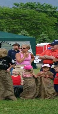
28 Appendix A Public Input Recreation Master Plan 54 55

29 Name (Optional): Address (Optional): Phone Number (Optional): Input or comments: Results from Milford Township Public Hearing, Forum, and Mailer This questionnaire was sent to all of the township residents via the Winter Tax bill mailing in late Twenty written responses were received. The Milford Township Parks and Recreation Commission held a public hearing on February 12, The following paraphrased responses were received from the mailer and the public hearing: Biking path extended to GM Tech/safer lots of traffic today Permanent kayak racks should be built near downtown racks could be rented for annual fee Milford bike trail clear some openings near the lake for a breeze gets too still along the path and remove dead tree near the dam Likes the walk/bike path is salted and plowed in winter and looking for more paths, would like to see trees planted along Huron Valley Trail and in Kensington near I-96 Wants Milford Trail kept open year round plowing and deicing Love the Kensington and Proud Lake horse trails Bike-only lanes for Milford Road and Kensington Park Bike path along W. Commerce Road Skate park Don t allow kay and boat parking in Central Park it will ruin the site, more picnic tables near the baseball diamond, only allow short-term dockage for kayaks so that they can visit downtown businesses
30 Like concerts add concert Labor Day weekend New playground for smaller kids ages 1-4 years old, Central Park s equipment is for older children Bike trial along Milford and GM Roads Preserve natural habitat for animals, retain open space and limit development Dog park [3] Youth center (shoot pool, ping-pong, rock climbing, etc.) keep price affordable, YMCA is too expensive [2] Trail north to Highland Twp. And porta-john at library parking lot (for trailhead) Mountain bike trails Pickleball courts striped onto existing tennis courts [2] Don t rezone for more commercial or multi-family residential Add more bike trails and purchase land for parks Add restrooms along the trail to Kensington Park Construct a community center Acquire land for new Township park Repair the bridges along the trails where they meet the bridges Provide a Township park suitable for everyone Improve area near the dam for fishing The most requested results were Bike trails in some manner [10] Dog park [3] Youth/community center [3] Kayaks [2] Pickleball courts [2]
31 Wade Trim Associates, Inc. 500 Griswold Street, Suite 2500 Detroit, MI Milford Township Recreation Master Plan Public Workshop Exercise #1 Evaluation of Recreation Master Plan Public Forum Results During the public input process for the Milford Township Recreation Master Plan, approximately 50 attendees participated in the public forum, held at the Milford Senior Center. During the engagement exercise, they identified 50 different ideas, issues, concerns, or desires that related to parks and recreation in the community. At the end of the public forum, each individual was given three stickers to vote on the ideas that they felt were the most important to them. Below is a listing of the top nine items from that evening. Several similar concepts have been grouped together. With the following nine general topics/issues/areas of concern that received the highest ranking in September 2007, please rate how important they are to you today Highest Ranking Priorities Very Important Important Somewhat Important Not Important No Opinion Complete development of a skate park Build a youth center Acquire active park land Develop trails Make Milford Township equestrian friendly and develop horseback riding trails Make Milford Township more bicycle friendly Connect existing State Recreation Areas to Downtown Milford Install a hand-activated crossing button at Milford Road and Huron River Parkway for pedestrians and horseback riders Improve directional signage and wayfinding to and along pathways
32 Received 23 responses to the exercise Some attendees did not respond to question 8 as it had been accomplished since the 2007 Workshop occurred Are there any important recreation priorities today, which were not included in the list from the previous page? Please add them here. Accessibility Dog park 45K towards Village Sidewalks along major rds Old Plank, Milford, S. Hill, etc. Please use this space for open-ended comments. I don t believe horses should be important Why have horses downtown?
33 Wade Trim Associates, Inc. 500 Griswold Street, Suite 2500 Detroit, MI Milford Township Recreation Master Plan Public Workshop Exercise #2 How to Spend $100? Parks and recreation plans address a variety of issues relative recreational planning and development within a community. There are six general areas of activities that municipal recreational programs commonly offer today. They are: 1) Active sports programming football leagues, swim teams, basketball leagues, etc; 2) Non-sports recreational activities - includes: a) community education classes (computer and technology, arts and crafts, fitness); b) youth camps; c) theatre and music classes; d) events (concerts, movies, ice sculpture and car shows); and d) senior trips and senior activities; 3) Facilities operations - includes the regular maintenance of facilities (cutting grass, trimming shrubs, plowing snow, personnel) and periodic maintenance (repaving parking lots, replacing roofs on recreation buildings); 4) Acquisition of new parkland purchasing new properties for parks or trails; 5) Parks facilities development examples include the construction of new pickleball courts, recreation center, skate park, etc.; and 6) Trail development - includes the development of non-motorized pathways between destinations throughout the community. These recreational activities are beneficial to a community and significantly enhances the quality of life for all its residents; however, all of these recreational activities come with direct and indirect costs. To assist in the development of Milford Township s new five year Recreation Master Plan, we would like to have attendees develop generalized recreation budgets based upon how to spend a fictional $100 in Milford Township on recreational programming and development. Group Activity Divide into groups of four to six individuals. Spend about five to ten minutes considering what your individual budget would be for each type of recreational activity budget categories should be in five dollar increments. Once everyone has completed their own budgets, discuss as a group how important each of the generalized recreational planning areas are to them individually. Once everyone has described their goals and their own budgets for recreation in the community, work together to develop an agreed-upon group budget. Of a budget of $100, how much should be spent on each category (in $5 increments): RECREATIONAL ACTIVITY Table 1 Table 2 Table 3 Table 4 1) Active sports programming _$10 $ 0 $ 9 $ 0 2) Non-sports recreational activities _$15 $10 $18 $15_ 3) Facilities operations _$10 $10 $15 $ 0 4) Parkland purchase _$20 $30 $10 $ 5 5) Parks facilities development _$15 $40 $18 $10_ 6) Trail and pathway development _$30 $10 $30 $70 TOTAL $100


34 Appendix B Resolutions Transmittals Certification Checklist Recreation Master Plan 56 57
Chapter 6. Action Program. Heart of the Lakes Area Recreation Plan
 Heart of the Lakes Area Recreation Plan 1. Design and construct the following trails (please see the following map): a. the Speedway Trail 1) primary pathway the main trail 2) secondary pathway the proposed
2. Goals and Policies. The following are the adopted Parks and Trails Goals for Stillwater Township:
 D. PARKS AND TRAILS 1. Introduction Stillwater Township s population is relatively low, with most residents living on rural residences on large lots. The need for active park space has been minimal in
Chapter eight. Parks and Recreation. Introduction. Crystal Lake Park District
 Chapter eight Parks and Recreation Introduction One of the indicators of quality of life in a city is the parks and recreation system. The City of Crystal Lake is fortunate to have an excellent parks and
J. Recreation Plan of Conservation and Development. The Town of Hebron. Section 2. Preservation of Unique Assets. 1 P a g e
 The Town of Hebron Section 2 2014 Plan of Conservation and Development Preservation of Unique Assets J. Recreation Open spaces, parks, sports fields, and recreational programs are considered essential
presentation to Director
 2010-1111 Macomb Community Needs Assessment The Demographic and Economic Landscape presentation to Macomb Community Action Advisory Board Meeting Kurt Metzger Director Data Driven Detroit (D3) June 14,
Public Park System. Township of Derry. Providing natural open space for the recreational use of our residents and guests.
 Township of Derry Public Park System Providing natural open space for the recreational use of our residents and guests. Directory of Recreational Amenities Hershey s Commitment to Recreation Famous candy
MASTER PLAN EXECUTIVE SUMMARY
 Biscuit Run State Park Scottsville Road (State Route 20) Charlottesville, VA 22902 Biscuit Run State Park MASTER PLAN EXECUTIVE SUMMARY Department of Conservation and Recreation Division of Planning and
Schoolcraft Township is located in northeast Houghton County. A portion of the township borders Keweenaw County and Lake Superior.
 COMMUNITY DESCRIPTION Schoolcraft Township is located in northeast Houghton County. A portion of the township borders Keweenaw County and Lake Superior. The township is largely rural but has one main population
Township Superintendent
 EMPLOYMENT OPPORTUNITY Township Superintendent Buena Vista Charter Township Township Superintendent BUENA VISTA CHARTER TOWNSHIP Buena Vista Charter Township, located in Saginaw County, Michigan, strives
Northeast Quadrant Distinctive Features
 NORTHEAST QUADRANT Northeast Quadrant Distinctive Features LAND USE The Northeast Quadrant includes all the area within the planning area that is east of Interstate 5 and to the north of State Route 44.
Flow Stand Up Paddle Board Parkway Plan Analysis
 Regional Parks Department Jeffrey R. Leatherman, Director County of Sacramento Divisions Administration Golf Leisure Services Maintenance Rangers Therapeutic Recreation Services Flow Stand Up Paddle Board
Stony Creek Master Plan Public Meeting #2. May 21, 2016
 Stony Creek Master Plan Public Meeting #2 May 21, 2016 Today s Agenda 10:00 10:20 am Presentation 10:20 10:45 am Q & A 10:45 11:30 am Browse, discuss, and comment Metroparks Master Plan Process 4 months
Non-Motorized Transportation
 Non-Motorized Transportation Non-motorized facilities are important components to the transportation system. They provide an environmentally-friendly, low-cost mode of travel. Some of the facilities can
ADVENTURE PLAN EXPLORE PARK
 ADVENTURE PLAN ROANOKE COUNTY S EXPLORE PARK ROANOKE COUNTY PARKS, RECREATION AND TOURISM 1206 KESSLER MILL RD SALEM, VA 24153 (540) 387-6078 WHAT S INCLUDED? Explore Park Adventure Plan - Guided by extensive
City of Keller Parks and Facilities Inventory
 City of Keller Parks and Facilities Inventory April 2013 1. BEAR CREEK PARK 44 ACRES 1 Basketball Court with 2 goals 4 Drinking Fountains 1 Large Pavilion with 4 picnic tables, electricity and fireplace
The Recreational Trail along Cushing Park road has been a successful addition to the city
 The Recreational Trail along Cushing Park road has been a successful addition to the city Trails TRAILS, PATHS, ROUTES AND CONNECTORS Citizen input pointed to trails, paths, bike routes, and other non-motorized
10/25/2013. What is the SCORP?! 2013 Local Government Survey 2013 Statewide Public Survey Advisory Group Priority Areas Your Suggestions!
 COLORADO OUTDOOR RECREATION TRENDS RESULTS FROM THE SCORP AND STATEWIDE Colorado Outdoor Recreation Resource Partnership September 2013 PRESENTATION What is the SCORP?! 2013 Local Government Survey 2013
WASHINGTON TOWNSHIP REGIONAL ANALYSIS
 WASHINGTON TOWNSHIP REGIONAL ANALYSIS SECTION 1.0 INTRODUCTION The growth and development of a community and its resultant land use pattern depends, in large part, on its position within the region in
Stambaugh Township 5-Year Recreation Plan - DRAFT
 Stambaugh Township 5-Year Recreation Plan - DRAFT Stambaugh Township GEI Project No. 1702677 January 5, 2018 Table of Contents 1. Community Description 1 2. Administrative Structure 2 3. Recreation Inventory
4.19 Parks, Recreation, and Conservation Lands
 interchange would have on the Reed Paige Clark Homestead located on the north side of Stonehenge Road. Alternative D would also affect Palmer Homestead, E.F. Adams House, and Knapp Brothers Shoe Manufacturing
COASTAL CONSERVANCY. Staff Recommendation December 2, 2004 COYOTE HELLYER COUNTY PARK BAY AREA RIDGE TRAIL
 COASTAL CONSERVANCY Staff Recommendation December 2, 2004 COYOTE HELLYER COUNTY PARK BAY AREA RIDGE TRAIL File No. 04-057 Project Manager: Amy Hutzel RECOMMENDED ACTION: Authorization to disburse up to
OAKLAND TOWNSHIP PARKS AND RECREATION MILLAGE RENEWAL AUGUST 2, 2016 BALLOT PROPOSAL QUESTIONS & ANSWERS PULL-OUT SECTION (APRIL 21, 2016)
") OAKLAND TOWNSHIP PARKS AND RECREATION MILLAGE RENEWAL AUGUST 2, 2016 BALLOT PROPOSAL QUESTIONS & ANSWERS PULL-OUT SECTION (APRIL 21, 2016) 2007 2016 Millage Accomplishments Timeline in Pull-out The Mission
OAKLAND TOWNSHIP PARKS AND RECREATION MILLAGE RENEWAL AUGUST 2, 2016 BALLOT PROPOSAL QUESTIONS & ANSWERS PULL-OUT SECTION (APRIL 21, 2016) 2007 2016 Millage Accomplishments Timeline in Pull-out The Mission
University Region Non-Motorized Plan 2015
 Non-Motorized Transportation Non-motorized facilities are important components to the transportation system. They provide an environmentally-friendly, low-cost mode of travel. Some of the facilities can
City of Haslett. City of East Lansing. City of East Lansing
 Central Park North (Nancy L. Moore Park) Lake Park North Expansion White Park Expansion #2 White Park Expansion #1 County East East Haslett East East TF87-212 Acquisition $90,000.00 Park. TF08-138 Acquisition
APPENDIX E: SUMMARY OF PUBLIC MEETING QUESTIONNAIRE RESULTS
 Appendices Gwinnett County 2004 Comprehensive Parks and Recreation Master Plan APPENDIX E: SUMMARY OF PUBLIC MEETING QUESTIONNAIRE RESULTS March 2004 Monteith Brown Planning Consultants & The Jaeger Company
Chapter 9 Recreation
 Chapter 9 Chapter 9 1.0 INTRODUCTION The Town of Littleton is within one of New England s most important recreation areas. More than three million people live within 100 miles of the area. Local residents
Silver Lake Park An Environmental Jewel for the Citizens of Prince William County
 Silver Lake Park An Environmental Jewel for the Citizens of Prince William County The Prince William Park Authority Mission Statement states: The Prince William County Park Authority will create quality
Hampton Township. Community Description
 Hampton Township Community Description Hampton Township is located in southern Bay County, east of Bay City and Essexville. It contains approximately 9 miles of Saginaw Bay shoreline and 1.5 miles of Saginaw
Blueways: Rivers, lakes, or streams with public access for recreation that includes fishing, nature observation, and opportunities for boating.
 Parks, Open Space and Trails PRINCE WILLIAM COUNTY 2008 COMPREHENSIVE PLAN TRAILS PLAN CONTENTS The components of the trails plan are: Intent Definitions Goals, Policies, and Action Strategies Trails Map
Please Tell Us What You Think: Candidate Sites for Recreation Business Activities
 Please Tell Us What You Think: Candidate Sites for Recreation Business Activities Background In January 2015, the Washington State Parks and Recreation Commission (Commission) approved some forms of privately
Village of Taos Ski Valley 2015 Master Plan. Recreation Element
 Village of Taos Ski Valley 2015 Master Plan Taos Ski Valley is known across the world for skiing and winter sports, but the Village has more to offer than advanced skiing terrain and short lift lines.
Trail Etiquette. Hours of Operation. Trail Accessibility
 Trail Guide The Elmhurst Park District, with 28 parks and over 460 acres of land, offers nearly six miles of paved or asphalt park trails and maintains an additional 3.6 miles of trails within Elmhurst.
Beth Lucas, Senior Planner Stephanie Brewer, Planner Broome County Planning May 12 th, 2016
 Beth Lucas, Senior Planner Stephanie Brewer, Planner Broome County Planning May 12 th, 2016 Background Data Collection Trail Mapping Promotional Strategy December 2014 County s natural beauty identified
CHAPTER 5. Chapter 5 Recreation Element
 CHAPTER 5 Recreation Element Chapter 5 Recreation Element The Recreation Element of the Meyers Area Plan is a supplement to the Recreation Element of the TRPA Regional Plan and the El Dorado County General
Picture your next event in Novi!
 Picture your next event in Novi! Facility Reservation Guide Why Novi? Thank you for considering Novi as the location for your next event. We look forward to welcoming you at one of our unique venues which
L. BROOKS PATTERSON OAKLAND COUNTY EXECUTIVE
 L. BROOKS PATTERSON OAKLAND COUNTY EXECUTIVE L. BROOKS PATTERSON OAKLAND COUNTY EXECUTIVE 2016 APPORTIONMENT REPORT OAKLAND COUNTY, MICHIGAN Prepared By DEPARTMENT OF MANAGEMENT AND BUDGET LAURIE VAN PELT,
Wilds. Headwaters. Lakes. Oxbows. Falls
 56 5 4 3 Wilds Headwaters Lakes Oxbows Falls 57 Zones It could be said the on-the-ground essence of this master plan appears within the next 6 pages of this report. As we learned in the preceding Cultural
2017 M I C H I G A N
 M I C H I G A N 2017 L. BROOKS PATTERSON OAKLAND COUNTY EXECUTIVE 2017 APPORTIONMENT REPORT OAKLAND COUNTY, MICHIGAN Prepared By DEPARTMENT OF MANAGEMENT AND BUDGET LAURIE VAN PELT, Director EQUALIZATION
O REGON TRAILS SUMMIT. Oregon Trails Summit. Rogue River National Forest
 O REGON TRAILS SUMMIT Oregon Trails Summit 2014 Rogue River National Forest OREGON TRAILS 2015: A VISION FOR THE FUTURE The 2015-2024 Oregon Statewide Trails Plan Why do a trails plan? 2005-2014 Oregon
Cascade River State Park Management Plan Amendment
 This document is made available electronically by the Minnesota Legislative Reference Library as part of an ongoing digital archiving project. http://www.leg.state.mn.us/lrl/lrl.asp Cascade River State
EMPLOYMENT OPPORTUNITY. Police Chief. Buena Vista Charter Township
 EMPLOYMENT OPPORTUNITY Police Chief Buena Vista Charter Township Police Chief BUENA VISTA CHARTER TOWNSHIP Buena Vista Charter Township is located in Saginaw County, Michigan. The township strives to be
Continental Divide National Scenic Trail Legislative History and Planning Guidance
 Continental Divide National Scenic Trail Legislative History and Planning Guidance Legislation, Policy, and Direction Regarding National Scenic Trails The National Trails System Act, P.L. 90-543, was passed
JOSLIN FIELD, MAGIC VALLEY REGIONAL AIRPORT DECEMBER 2012
 1. Introduction The Federal Aviation Administration (FAA) recommends that airport master plans be updated every 5 years or as necessary to keep them current. The Master Plan for Joslin Field, Magic Valley
Lake Myra County Park. Wake County, North Carolina Community Forum #2 June 12, 2008
 Lake Myra County Park Wake County, North Carolina Community Forum #2 June 12, 2008 Welcome and Introduction Meeting Agenda Welcome Introductions of Project Team Master Plan Process Community Forum #1 Updates
IL 390 Station. Wood Dale Open House Summary 5/18/17
 Wood Dale Open House Summary 5/18/17 The first public open house for the Wood Dale Comprehensive Plan took place on May 18 th, 2017. The program was conducted as a fun community event and there were 216
Winnebago County Community Park
 Directions to Community Park From Interstate Hwy. 41 to Oshkosh exit 124, which is Hwy. 76/Jackson Street. East on Hwy 76/ Jackson Street to left on County Road Y, 1/4 mile. Winnebago County Park is on
Classifications, Inventory and Level of Service
 Classifications, Inventory and Level of Service Section 3 Kenmore Park, Recreation and Open Space Plan 1 P a g e Classifications and Inventory Park Classifications Kenmore classifies its parks based upon
Section II. Planning & Public Process Planning for the Baker/Carver Regional Trail began in 2010 as a City of Minnetrista initiative.
 Section II Planning & Public Process Planning for the began in 2010 as a City of initiative. city staff began discussions with the Park District on the possibility of a north/south regional trail connection
The Master Plan, Walkability, and Trails in the City of Solon. April 23, 2018
 The Master Plan, Walkability, and Trails in the City of Solon April 23, 2018 Tonight s topics 1. Existing trail options in the City of Solon 2. Potential trail options 3. How trails and walkability converge
Central Land Acquisition (formerly Farmington Hills Acquisition) City of Farmington Hills. City of Farmington Hills
 City of Farmington Hills. City of Farmington Hills") Central Land (formerly ) TF89-100 $661,200.00 To acquire approximately 44 acres of land ajacent to I-96. 1989 Karner Farm Expansion Project TF00-056 $352,594.00 in fee simple of 14.6 acres for habitat
Central Land (formerly ) TF89-100 $661,200.00 To acquire approximately 44 acres of land ajacent to I-96. 1989 Karner Farm Expansion Project TF00-056 $352,594.00 in fee simple of 14.6 acres for habitat
Southwest Quadrant Distinctive Features
 SOUTHWEST QUADRANT Southwest Quadrant Distinctive Features LAND USE The 31.17 square mile Southwest Quadrant includes all the area within the planning area west of I-5 and south of the Sacramento River.
Chapter 1: Introduction
 Chapter 1: Purpose of the Comprehensive Plan The purpose of the Comprehensive Plan of the City of Rockaway Beach is to provide a policy guide for the growth and future development of the City. Section
Appendix B - Undeveloped Parks and Existing Parks with Remaining Development Programming
 Appendix B - Undeveloped Parks and Existing Parks with Remaining Development Programming Table of Contents Appendix B - Undeveloped Parks and Existing Parks with Remaining Development Programming Table
Tracy Ridge Shared Use Trails and Plan Amendment Project
 Tracy Ridge Shared Use Trails and Plan Amendment Project Scoping Document Forest Service Allegheny National Forest Bradford Ranger District McKean, County, Pennsylvania In accordance with Federal civil
Columbus Township Board
 Columbus Township Recreation Plan 2018-2022 Prepared by: Adopted by: Assisted by: Adopted: Columbus Township Planning Commission Columbus Township Board Giffels Webster Columbus Township Michigan Recreation
4.0 FACILITIES INVENTORY
 4.0 FACILITIES INVENTORY 4.1 PARK LEVEL OF SERVICE STANDARDS (LOS) Based on current City of Longview Parks and Recreation Level of Service (LOS) Standards (Figure G), the City currently has a deficiency
Park Design and Location Criteria
 Park Design and Location Criteria This section is presented in the interest of assisting park and recreation agencies in the development of a system of parks and recreation areas. A recreation system is
INGHAM COUNTY TRAILS AND PARKS TASK FORCE MEETING 2
 INGHAM COUNTY TRAILS AND PARKS TASK FORCE MEETING 2 October 22, 2015 Mannik and Smith Group Michigan Trails & Greenways Alliance AGENDA FOR TONIGHT 1. Project Approach, Process and Timeframe 2. Public
Chapter 2: Summary of Existing Open Space System
 Chapter 2: Summary of Existing Open Space System In 1976, the Wake County Board of Commissioners established the Wake County Parks and Recreation Department in order to provide park facilities and programs
MINUTES FILED WITH TOWN CLERK
 Page 1 of 7 Town of Farmington Parks Master Plan Advisory Committee FILED WITH TOWN CLERK January 28, 2015 TOWN OF FARMINGTON PARKS MASTER PLAN ADVISORY COMMITTEE MINUTES OF THE MEETING OF JANUARY 28,
New Haven-Adams Twp Parks & Recreation Dept Citizen Survey
 New Haven-Adams Twp Parks & Recreation Dept Citizen Survey Monday, October 02, 2017 281 Total Responses Date Created: Thursday, July 13, 2017 Complete Responses: 243 Q1: Do you live in New Haven-Adams
NORTHWEST SECTION CONTENTS: CLEVELAND PARK FOLWELL PARK RYAN LAKE PARK VICTORY PRAIRIE DOG PARK VICTORY PARK
 NORTHWEST SECTION CONTENTS: CLEVELAND PARK FOLWELL PARK RYAN LAKE PARK VICTORY PRAIRIE DOG PARK VICTORY PARK LUCY LANEY COMMUNITY SCHOOL N 33RD AVE N 33RD AVE SINGLE-FAMILY RESIDENTIAL MULTI-USE DIAMOND
SOAR ATHLETIC COMMITTEE
 PASCAGOULA RECREATION COMMISSION MEETING MAY 15, 2017 Mike McElhaney opened the meeting at 6:00 pm. Mike welcomed Bo Cole as a guest. A special meeting was called to review the recommendation being made
Parks, Recreation, Trails and Open Space Master Plan Survey Results. October 2018
 Parks, Recreation, Trails and Open Space Master Plan Survey Results October 2018 Conducted by Qualtrics subconsultant 300 completed responses Random attempt to get a balanced response from all four Council
City of Chelan Shoreline Public Access Plan
 City of Shoreline Public Access Plan This City of Shoreline Public Access Plan documents how the City has planned for parks and recreation in the community, particularly along Lake and the River. This
NOTE: YOU MAY COMPLETE THIS SURVEY ONLINE (USING THIS DOCUMENT TO VIEW MAPS AND GRAPHICS) AT:
 AT:") for completing the Town of Beech Mountain Comprehensive Planning Survey. The information you provide in reply to the following questions will be used to help the Town develop a plan that will guide our
for completing the Town of Beech Mountain Comprehensive Planning Survey. The information you provide in reply to the following questions will be used to help the Town develop a plan that will guide our
CLEVELAND PARK LOCATION AND HISTORY EXISTING CONDITIONS AND CHARACTER LOCATION
 CLEVELAND PARK LOCATION LOCATION AND HISTORY Attempts to create a neighborhood park and playground in the Cleveland neighborhood began in 1926, when the park board designated for acquisition the block
CHAPTER 6 NOISE EXPOSURE
 CHAPTER 6 NOISE EXPOSURE FAA requires that the NEM submitted for review represent the aircraft noise exposure for the year of submittal (in this case 2008) and for a future year (2013 for OSUA). However,
13.1 REGIONAL TOURISM ISSUES AND SUMMARY OF FINDINGS
 13 REGIONAL TOURISM T he County of Mariposa s recreation needs and facilities fall within two categories: regional tourism and local recreation. This Element focuses on regional tourism issues related
Tabor Mountain Recreation Society Who We Are What We Do Regional Park The Ask. Photo by Ken Hodges
 Tabor Mountain Recreation Society Who We Are What We Do Regional Park The Ask Photo by Ken Hodges 1 TMRS History 1961 logging and the Grove Fire activities resulted in many of the existing trails 1961
April 10, Mark Stiles San Juan Public Lands Center Manager 15 Burnett Court Durango, CO Dear Mark,
 Mark Stiles San Juan Public Lands Center Manager 15 Burnett Court Durango, CO 81301 Dear Mark, We are pleased to offer the following comments on the draft San Juan Public Lands Center management plans
PARKS & AMENITIES. Presented by Brad Swanson, Public Works Director Duane Rader, Parks Superintendent
 PARKS & AMENITIES Presented by Brad Swanson, Public Works Director Duane Rader, Parks Superintendent City of North Mankato Incorporated in 1898 Past Tanley Baseball Field 1930s Tanley Baseball Field was
Aviation, Rail, & Trucking 6-1
 6-1 This chapter describes the services, facilities, and condition of air, rail, and trucking as components of the transportation system. These three intermodal areas have an impact on the factors to be
CITY OF ARDEN HILLS PARKS, TRAILS AND RECREATION COMMITTEE MEETING TUESDAY, OCTOBER 20, 2015 ARDEN HILLS CITY HALL
 CITY OF ARDEN HILLS PARKS, TRAILS AND RECREATION COMMITTEE MEETING TUESDAY, OCTOBER 20, 2015 ARDEN HILLS CITY HALL CALL MEETING TO ORDER Acting Chair Straumann called the October 20, 2015, meeting of the
State of the City. Mayor Bill Houston City Manager Chris Dick. 1 State of the City Midlothian Chamber of Commerce
 State of the City Mayor Bill Houston City Manager Chris Dick 1 State of the City Midlothian Chamber of Commerce 14 November 2018 Growth & Development Managing Our Finances Quality of Life Public Health
F. Forest Recreation Management
 F. Forest Recreation Management F.1) Park and Recreation Management F.1.A. Program Overview. The park and recreation program has been in existence since 1980. With ever increasing outdoor recreation demands
Northern Rockies District Value of Tourism Research Project December 2007
 Northern Rockies District Value of Tourism Research Project December 2007 Project Partners: Northern Rockies Regional District, Tourism British Columbia, Northern Rockies Alaska Highway Tourism Association,
YOU CAN MAKE A DIFFERENCE! VISIONING SESSION FOR THREAD LAKE OCTOBER 8, 2013
 YOU CAN MAKE A DIFFERENCE! VISIONING SESSION FOR THREAD LAKE OCTOBER 8, 2013 PEOPLE IN NEIGHBORHOODS & INSTITUTIONS ARE BUILDING A BETTER FLINT RIGHT NOW! DIPLOMAT PHARMACY GENESSEE COUNTY LAND BANK FLINT
APPENDIX OFFICIAL MAP ORDINANCE OF HAMILTONBAN TOWNSHIP OFFICIAL MAP NARRATIVE
 APPENDIX A OFFICIAL MAP ORDINANCE OF HAMILTONBAN TOWNSHIP OFFICIAL MAP NARRATIVE INTRODUCTION: The Official Map of Hamiltonban Township has been prepared to identify those lands and features that Hamiltonban
DRAFT Appendix A Appendix B. Planning Process & Public Participation
 1 2 3 4 5 Appendix A Appendix B Planning Process & Public Participation This chapter provides an overview of the planning process. Summaries of public input for the comprehensive planning process are provided.
Spadina Avenue Built Form Study Preliminary Report
 STAFF REPORT ACTION REQUIRED Spadina Avenue Built Form Study Preliminary Report Date: July 9, 2014 To: From: Wards: Reference Number: Toronto and East York Community Council Director, Community Planning,
Yuba Creek Natural Area Acquisition. Acme Township. Acme Township. TF Acquisition $1,576, Grand Traverse
 Yuba Creek Natural Area TF00-162 $1,576,021.00 in fee simple of 403 acres of critical wetls upl habitat with over 5,000 feet of frontage on Yuba Creek, a tributary to the east arm of Bay. 2000 Petobago
FEASIBILITY CRITERIA
 This chapter describes the methodology and criteria used to evaluate the feasibility of developing trails throughout the study areas. Land availability, habitat sensitivity, roadway crossings and on-street
AGENDA ITEM 5 D WAKULLA ENVIRONMENTAL INSTITUTE (WEI) TRAIL FEASIBILITY STUDY
 TRAIL FEASIBILITY STUDY") March 19, 2018 AGENDA ITEM 5 D WAKULLA ENVIRONMENTAL INSTITUTE (WEI) TRAIL FEASIBILITY STUDY TYPE OF ITEM: Action STATEMENT OF ISSUE The Wakulla Environmental Institute (WEI) Trail is one of several trails
March 19, 2018 AGENDA ITEM 5 D WAKULLA ENVIRONMENTAL INSTITUTE (WEI) TRAIL FEASIBILITY STUDY TYPE OF ITEM: Action STATEMENT OF ISSUE The Wakulla Environmental Institute (WEI) Trail is one of several trails
Dungeness Recreation Area County Park Master Plan
 Dungeness Recreation Area County Park Public Outreach Meeting October 10, 2007 Project Overview USFWS Site Dungeness Recreation Area County Park Meeting Objectives: Re-Introduce project; provide status
A CASE FOR COMPLETING THE JORDAN RIVER PARKWAY: A
 A CASE FOR COMPLETING THE JORDAN RIVER PARKWAY: A safe crossing at 9000 South and 850 West Proposed 9000 South Underpass Parkway Timeline Parkway, Trail, and Tourism Facts Blueprint Jordan River 1971 1973
Welcome to the Cross County Trail Public Input Session!
 Welcome to the Cross County Trail Public Input Session! Please sign in on the table below! What are we doing here? Camden County has proposed a bicycle and pedestrian trail spanning across the entire county.
METROPOLITAN COUNCIL 390 North Robert Street, St. Paul, MN Phone (651) TDD (651)
 TDD (651)") DATE: March 27, 2012 METROPOLITAN COUNCIL 390 North Robert Street, St. Paul, MN 55101 Phone (651) 602-1000 TDD (651) 291-0904 TO: Metropolitan Parks and Open Space Commission FROM: Arne Stefferud, Planning
DATE: March 27, 2012 METROPOLITAN COUNCIL 390 North Robert Street, St. Paul, MN 55101 Phone (651) 602-1000 TDD (651) 291-0904 TO: Metropolitan Parks and Open Space Commission FROM: Arne Stefferud, Planning
1. Overview of Atlantic Highlands and Its Waterfront
 Atlantic Highlands 1. Overview of Atlantic Highlands and Its Waterfront Atlantic Highlands: Satellite Photo by USGS 1.1. Geographical Overview The Borough of Atlantic Highlands is on Sandy Hook Bay. It
Trails. Lois Jensen Nature Preserve is a 30 acre parcel on the north end of the city. It provides unspoiled wooded paths.
 Trails Lois Jensen Nature Preserve is a 30 acre parcel on the north end of the city. It provides unspoiled wooded paths. TRAIL S, PATHS, ROUTES AND CONNECTORS Citizen input pointed to trails, paths, bike
Novi, Michigan... Your Sports. Destination
 Novi, Michigan... Your Sports Destination Novi, Michigan At a glance Location: Less than 30 minutes from major international airport At the convergence of three major freeways Average seasonal high temperature
NORTH HEMPSTEAD BEACH PARK MASTER PLAN
 NORTH HEMPSTEAD BEACH PARK MASTER PLAN COMMUNITY DESIGN CHARRETTE Supervisor Judi Bosworth Viviana L. Russell Peter J. Zuckerman Angelo P. Ferrara Anna M. Kaplan Lee R. Seeman Dina M. De Giorgio VISIONING
Acquisition in fee simple of approximately one-half acre of property on the shore of Spring Lake to expand the Lakeside Beach Park.
 Lakeside Beach TF00-136 $122,550.00 in fee simple of approximately one-half acre of property on the shore of Spring Lake to exp the Lakeside Beach. 2000 River Ravines TF00-150 $910,000.00 in fee simple
CITY OF MANVEL Parks & Recreation Master Plan Community Meeting Summary
 CITY OF MANVEL Parks & Recreation Master Plan Community Meeting Summary The City of Manvel hosted a Community Meeting on June 23, 2016 at the Church of the Harvest. Over 25 community members attended and
Georgetown-Lewes Rail/Trail Study. Rail/Trail Study: Cool Spring to Cape Henlopen State Park New Road Extension (House Resolution No.
 Georgetown-Lewes Rail/Trail Study Rail/Trail Study: Cool Spring to Cape Henlopen State Park New Road Extension (House Resolution No. 47) August 22, 2011 Presentation Outline Background Benefits Statewide
MONTEREY REGIONAL AIRPORT MASTER PLAN TOPICAL QUESTIONS FROM THE PLANNING ADVISORY COMMITTEE AND TOPICAL RESPONSES
 MONTEREY REGIONAL AIRPORT MASTER PLAN TOPICAL QUESTIONS FROM THE PLANNING ADVISORY COMMITTEE AND TOPICAL RESPONSES Recurring topics emerged in some of the comments and questions raised by members of the
The City of Durango Community Interest and Opinion Survey Executive Summary
 The City of Durango Community Interest and Opinion Survey Executive Summary Overview ETC Institute administered a community interest and opinion survey for the City of Durango between January and March
50 Largest U.S. Metropolitan Areas
 America s Racially : Opportunities and Challenges 50 Largest U.S. Metropolitan Areas Community types in the 50 largest metropolitan areas White 39,333,003 26% 14,533,326 16,983,337 9% 10% White 47,406,687
Montrose Charter Township Parks & Recreation Master Plan
 Montrose Charter Township Parks & Recreation Master Plan 2014-2018 Adopted February 25, 2014 Montrose Charter Township Parks & Recreation Master Plan 2014-2018 Montrose Charter Township 139 S. Saginaw
WEST JORDAN PARKS, RECREATION AND TRAILS MASTER PLAN Advisory Committee Meeting #2
 WEST JORDAN PARKS, RECREATION AND TRAILS MASTER PLAN Advisory Committee Meeting #2 MONDAY, NOVEMBER 5, 2018, 6:00 P.M.; PARKS DEPT. CONFERENCE ROOM ATTENDEES: Lisa Dean Larry Gardner Duane Harding David