DRAFT Environmental Assessment for Ann Arbor Municipal Airport Ann Arbor, Michigan
|
|
|
- Madison Stokes
- 6 years ago
- Views:
Transcription
1
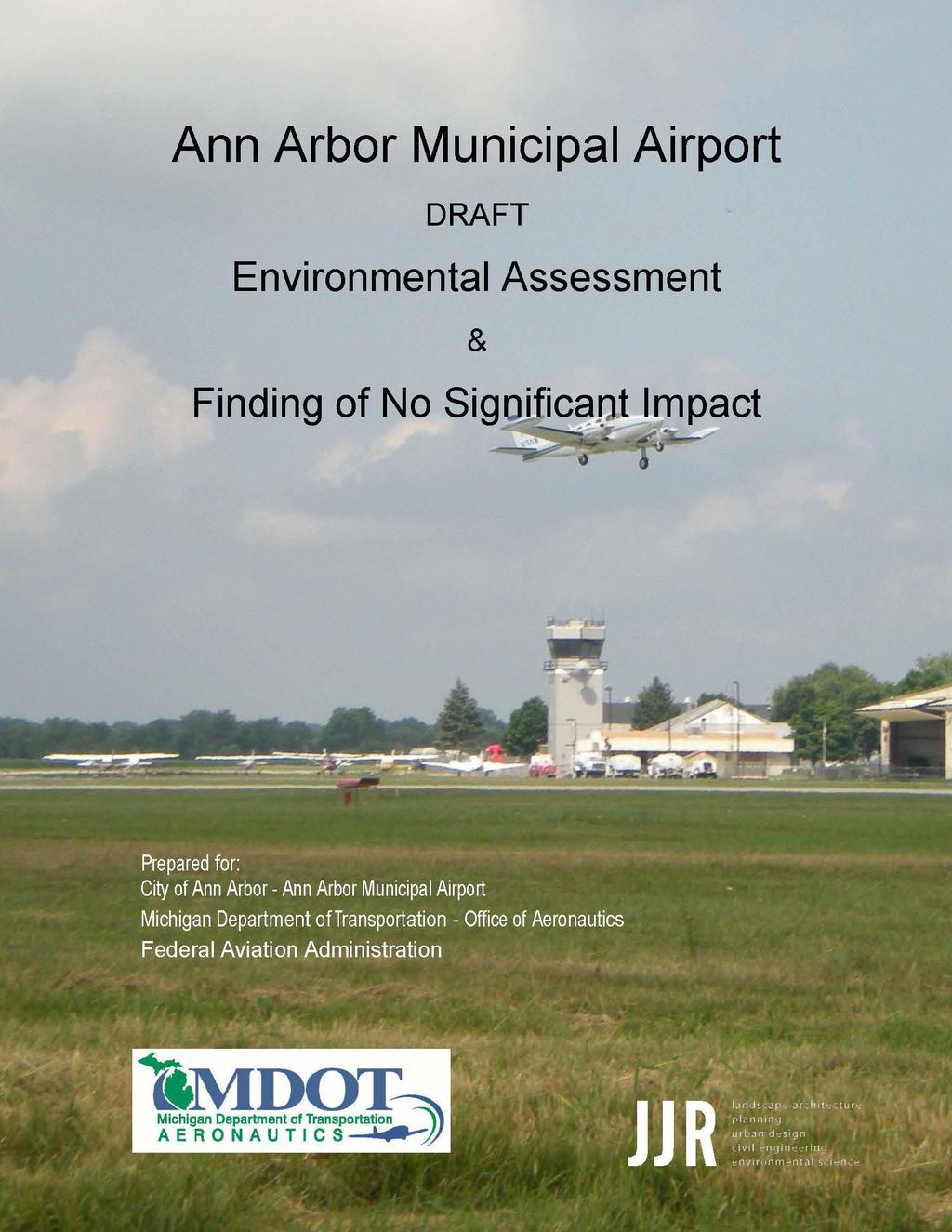
2 DRAFT Environmental Assessment for Ann Arbor Municipal Airport Ann Arbor, Michigan Prepared for: City of Ann Arbor Michigan Department of Transportation - Office of Aeronautics and Federal Aviation Administration Prepared by: SmithGroupJJR and Michigan Department of Transportation Office of Aeronautics This Environmental Assessment becomes both a State and Federal document when evaluated, signed and dated by the responsible State (AERO) and Federal (FAA) officials. Responsible AERO Official (State Actions) Date of Approval Responsible FAA Official (Federal Actions) Date of Approval This Environmental Assessment describes the social, economic, and environmental impacts associated, or lack thereof, with the Preferred Alternative for implementing proposed improvements at the Ann Arbor Municipal Airport. The alternatives considered were: no development, use of other airports, construction of a new airport, and five different Runway 6/24 alternatives. Comments on this Environmental Assessment should be received within 30 days of the date of publication and should be sent to Mr. Steve Houtteman, Environmental Specialist, Project Support Unit, MDOT-Office of Aeronautics, 2700 Port Lansing Road, Lansing, Michigan OCTOBER
3 Ann Arbor Municipal Airport Environmental Assessment TABLE OF CONTENTS Section Topic...Page Number Title Page...1 Table of Contents...2 List of Appendices...4 List of Figures...4 List of Tables...5 Section 1. Section 2. Purpose and Need Introduction Setting Background Purpose and Need Aircraft, Activity, Operations, & Forecasts Critical Aircraft Determination Aircraft Activity Aircraft Characteristics and Runway Recommendations Airport Operations and Forecasts Sponsor s Proposed Action Requested Federal, State, & Local Actions Federal Actions State Actions Local Actions Other Considerations Line of Sight Concern Approach Slope Concern Runway Overrun Concern Enhancement of Commerce Summary...26 Description of Alternatives Alternatives Considered and Dismissed Use Other Airports Construct New Airport Extend Runway to the East foot Runway Shift Only Alternatives Carried Forward No Build Alternative Build Alternatives..29 OCTOBER
4 2.3 Alternatives Evaluation No Build Alternative Build Alternative Build Alternative Build Alternative Preferred Alternative...36 Section 3. Affected Environment and Environmental Consequences Noise Analysis Methodology Aircraft Noise Exposure Reevaluation of Noise Exposure Analysis Land Use Impacts Induced Socioeconomic Impacts Community Displacement Environmental Justice Community Cohesion and Community Facilities Demographics Economics Air Quality Water Quality Surface Hydrology Geology, Groundwater, and Soils Section 4(f) Resources Cultural Resources Archaeological, Architectural, & Historic Biotic Communities Threatened & Endangered Species Wetlands Floodplains Farmland Energy Supply & Natural Resources Light Emissions Construction Impacts Solid Waste Impacts Existing & Future Traffic Conditions Hazardous Waste Sites Section 4. Environmental Mitigation Summary Mitigation Measures Threatened and Endangered Species Permits OCTOBER
5 Section 5. Agency Coordination and Public Participation Agency Coordination Public Participation Citizen s Advisory Committee Public Hearing Section 6. List of Preparers Section 7. References and Sources Section 8. Glossary...80 Appendices Appendix A. User Survey Reports/Airport Operations Records/Forecasts of Operations Appendix B. Noise Analysis Report Appendix C. Air Quality Analysis Report Appendix D. Early Agency Coordination Appendix E. Field Observation Report Appendix F. Audubon Society Bird Species Observed List Appendix G. Citizens Advisory Committee Coordination Appendix H. Additional Agency Correspondence Appendix I. Public Notices Appendix J. Agency Distribution & Comment Appendix K. Response to Comments List of Figures Figure 2.1 Figure 2.2 Figure 3.1 Figure 3.2 Figure 3.3 Figure 3.4 Figure 4.1 Figure 4.2 Figure 4.3 Figure 4.4 Figure 4.5 Figure 4.6 Figure 4.7 Figure 4.8 Location Map...8 Airport Layout Plan...11 Existing Conditions...31 Build Alternative 1 Extend & Realign...32 Build Alternative 2 Extend West...33 Build Alternative 3 Preferred Alternative...34 Noise Contour Map Existing Conditions...43 Noise Contour Map No Build Alternative...44 Noise Contour Map Preferred Alternative...45 Pittsfield Charter Township Existing Land Use...48 Pittsfield Charter Township Zoning Map...49 City of Ann Arbor Zoning Map...50 Pittsfield Charter Township Future Land Use...51 Existing Water Resources and Land Cover...62 OCTOBER
6 List of Tables Table 1-1 Table 2-1 Table 3-1 Table 3-2 Actual and Forecasted Total Operations at Ann Arbor Municipal Airport...20 Summary of Alternatives Carried Forward...35 Ann Arbor Area Population and Projections...54 Summary of Demographic Data...55 OCTOBER
7 Section 1. Purpose and Need 1.1 INTRODUCTION Note: The following information contains a large number of aviation related acronyms. A glossary with definitions is included in Section 8 of this document. Ann Arbor Municipal Airport (ARB) is a public-use, general aviation airport owned and operated by the City of Ann Arbor, Michigan. The airport is located in Pittsfield Charter Township, Washtenaw County, Michigan and consists of approximately 733 acres. ARB s operating budget is through a City enterprise fund comprised solely of revenue generated by airport operations. The primary runway, Runway 6/24, is 3,505 feet long by 75 feet wide and is oriented in a northeast/southwest direction. ARB also has a secondary turf runway, Runway 12/30, which is 2,750 feet long by 110 feet wide and is oriented in a northwest/southeast direction. The City proposes to improve the existing safety and operational environment at the airport to accommodate existing and projected aeronautical demand. This Environmental Assessment (EA) is being prepared in accordance with Federal Aviation Administration (FAA) Orders E; Environmental Impact: Policies and Procedures, and B, National Environmental Policy Act Implementing Instructions for Airport Actions. These orders implement the National Environmental Policy Act of 1969 (NEPA), specifically Sections and , as set forth by the Council on Environmental Quality (CEQ). This EA includes the following reviews and determinations: Identification of the need for the project and reasonable alternatives including the proposed improvements Review of all applicable resources to determine whether or not the proposed airport improvements create environmental impacts Provides the basis for Michigan Department of Transportation Office of Aeronautics (AERO) and FAA s Finding of No Significant Impact (FONSI) Identification of any permits, licenses, or other entitlements required for the proposed improvements Coordination with all applicable agencies reviewing the proposed improvements Provides notification to the general public and discloses all known environmental impacts OCTOBER
8 This EA has been prepared to define the purpose of and the need for the proposed airfield improvements; evaluate reasonable alternatives; identify potential environmental consequences associated with the proposed development; and propose methods to mitigate for potential environmental impacts. 1.2 SETTING ARB is generally bound by Ellsworth Road to the north, State Road to the east, Avis Farms Technology Park to the South and Lohr Road to the west (Figure 2.1). Residential, business, industrial, recreational, agricultural, and forested areas are located adjacent to the airport. Residential properties are located along Lohr Road and business properties are located along State and Ellsworth Roads. ARB has 22 permanent aviation service buildings, including the administration building, the Fixed Base Operators (FBO), maintenance facilities, conventional box hangars, privately owned hangars, and the FAA Airport Traffic Control Tower (ATCT). The airport also provides 150 T- hangar spaces in an additional 13 T-hangar structures which helps serve the airport s 183 based aircraft. ARB is in close proximity to state highways including US-23, M-14, US-12, and I-94. Direct access to the airport is from Ellsworth and State Roads. The closest public-use airport is Willow Run Airport in Ypsilanti, which is approximately 12 miles to the east (approximately a 20 minute drive by automobile). OCTOBER

9 OCTOBER
10 1.3 BACKGROUND On May 19, 1928, when Lieutenant Leonard Flo landed the first airplane at ARB, a long history of aviation in the Ann Arbor area was born. The airport s formal dedication on October 9, 1928, was presided over by the Honorable Fred W. Green, Governor of the State of Michigan. For decades ARB has served the local community through aviation by providing mail service, passenger service, entertainment, pilot training, recreation and commerce. The first terminal building was constructed in 1933 and continues to provide service to flyers and the community as the Experimental Aircraft Association (EAA) Chapter #333 Welcome Center. The airport s first T-hangars, built in 1948, still house aircraft today. The airport grew substantially over the years to serve the needs of the community and aviation. The airport s current primary runway, 6/24, was constructed in the late 1950 s and was followed shortly with the construction of the new taxiway and what is currently known as the terminal ramp. Today, modern aircraft are still using Runway 6/24 which has not been lengthened since it was first paved in ARB serves the local community by supporting economic development and public services. The following businesses and organizations are located at and operate from the airport and employ staff that supports the operations of the airport: Two fixed-wing FBOs A helicopter FBO Three national rental car agencies Two flying clubs Four flight schools and pilot training centers FAA ATCT Air taxi, aircraft sales, aviation insurance and aviation fueling businesses ARB serves the Ann Arbor medical and biomedical industries with professional air ambulance services, transporting patients, radio isotopes, and other biomedical products and services. Community pilots and aircraft owners are members of nonprofit organizations providing no charge charitable gifts of flight time to citizens in need. Some of these organizations include Wings of Mercy, Angel Flight, and Dreams and Wings. Wings of Mercy has documented 542 flights into or out of ARB since 1992, including 51 flights in 2014 and 35 flights through November The southeastern region of Michigan has a high level of commerce, and high levels of commercial, corporate, and general aviation air traffic. OCTOBER
11 The state of Michigan was selected by the FAA to manage federal airport funds for nonprimary airports in the Federal State Block Grant Program. The state serves the role of FAA in many aspects and a Memorandum of Understanding agreement is signed periodically to establish responsibilities between the two agencies. The state of Michigan is responsible for the overall environmental clearance to meet the NEPA requirements for the proposed actions listed in section 1.7. The FAA is responsible for the environmental clearance of the federally owned navigational aids. ARB is included in the FAA s National Plan of Integrated Airport Systems (NPIAS) as a general aviation regional airport asset. Not all public-use airports are included in this nationwide airport system plan. Inclusion in the NPIAS signifies that the FAA considers this airport an important part of the nation s air transportation system, and it makes ARB eligible to receive federal grants as part of the FAA s Airport Improvement Program. ARB is also included in AERO s Michigan Airport System Plan (MASP) (MDOT 2008). The MASP presents the results of an airport system planning process that has been aligned with the goals and objectives of MDOT s State Long Range Plan. The MASP supports programming decisions and is useful in evaluating programming actions related to airport system and airport facility deficiencies. ARB initiated preparation of the first draft of this EA (DEA1) in 2009 to evaluate the potential impacts of implementing portions of proposed developments shown on the conditionally approved Airport Layout Plan (ALP) - April 2008 (Figure 2.2). Under the FAA State Block Grant Program (SBGP), AERO has approval responsibility for ALPs. With a conditional approval, the actual development of all proposed items shown on the future ALP sheet is subject to environmental clearances, justification for specific projects, etc. The ALP was reviewed by many branches of the FAA through the customary FAA Airspace Review process, and all FAA comments or concerns were addressed prior to AERO signing the conditional approval letter. OCTOBER

12 OCTOBER
13 The DEA1 was published in February 2010 and available for public review (Appendix I) for at least 35 days prior to a public hearing. The public hearing was held in March 2010 and attendees were able to provide oral comments or written comments. Federal, state and local agencies, including the FAA Detroit Airports District Office (ADO), were also provided a copy of the DEA1 and asked to provide comments (Appendix J). All agency and public comments associated with the DEA1, including those from the ADO which were addressed directly in writing (Appendix J), were compiled, reviewed and carefully considered. Formal written responses to all comments are summarized and documented in Appendix K. This EA has been revised as necessary to incorporate any significant questions, comments and/or details received during the agency and public review/comment process. Where necessary, due to age and/or relevance, reevaluated data has also been included. 1.4 PURPOSE AND NEED The existing airport is considered safe according to current FAA and MDOT standards. In order to enhance safety and more effectively accommodate the critical aircraft that currently use the airport, the City of Ann Arbor is proposing to extend and shift the existing primary runway. The runway extension and shift would allow critical aircraft to operate safely at their optimum capabilities without weight restrictions due to lack of suitable runway length. The proposed actions focus on extending and improving the primary runway, as it does not currently meet the FAA design objectives of the existing critical aircraft that use the airport. The Purpose of the proposed actions is to provide facilities at ARB that fully accommodate the operational requirements of critical aircraft currently using the airport, while at the same time enhancing safety. The Need of the proposed actions is to allow the critical aircraft to safely operate at their optimum capabilities without weight restrictions (i.e. reductions in passengers, cargo, and fuel associated with aircraft range) due to lack of suitable runway length. The proposed actions will further improve operational safety by increasing line of sight for ATCT personnel. 1.5 AIRCRAFT, ACTIVITY, OPERATIONS, & FORECASTS Critical Aircraft Determination The critical aircraft is defined by the FAA as the most demanding aircraft-type that performs a minimum of 500 annual operations at a particular airport. An operation can be either a takeoff or a landing (i.e., an aircraft arriving at an airport and later departing equals two operations even though it was only one visit). In cases where the critical aircraft weigh less than 60,000 pounds, a classification of aircraft is used rather than a specific individual aircraft model. OCTOBER
14 During the course of this EA, a total of four separate Airport User Surveys were performed in order to determine (and later revalidate) the critical aircraft classification at ARB (copies of all four reports can be found in Appendix A). Airport User Survey Report No. 1 and Supplemental Report No. 2 were issued in July 2009 and December 2009 respectively, and aircraft operational data from entire calendar year 2007 was used in the analysis of both surveys. Airport User Survey Report No. 3 was issued in September 2010, and operational data from entire calendar year 2009 was used in the analysis. The most recent Airport User Survey Report No. 4 was issued in February 2015, and operational data from entire calendar year 2014 was used in the analysis. This was the most current full calendar year of information available at the time of updating this EA. The results of the original Airport User Survey No. 1 (July 2009) revealed that the critical aircraft classification for ARB at that time was B-II Small Aircraft. Each subsequent Airport User Survey, including the most recent Airport User Survey No. 4 (February 2015), has validated this initial determination of critical aircraft classification. Therefore, the current critical aircraft classification has remained unchanged since the original survey, and it remains B-II Small Aircraft. Aircraft in this category have runway approach speeds between 91 and 120 knots, wingspans between 49 and 79 feet, tail heights less than 30 feet, and maximum certificated takeoff weights of 12,500 pounds or less. A representative aircraft of this classification is the Beechcraft King Air 200, a twin-engine turboprop aircraft that typically seats people, including the flight crew. A critical aircraft weight category analysis was conducted solely for the purpose of referencing FAA Advisory Circular 150/5325-4B, Runway Length Requirements for Airport Design. AERO planning guidance regarding runway length recommendations does not distinguish between weight categories. The critical aircraft category listed on the current conditionally approved ALP is B-II. No reference is made to Small or Large weight category. As stated in FAA Advisory Circular 150/5325-4B, The design objective for the main primary runway is to provide a runway length for all airplanes that will regularly use it without causing operational weight restrictions. Airplanes that are classified as being within an airport s critical aircraft classification are considered by the FAA to be the regular use aircraft of the primary runway. Development of the primary runway at ARB to the recommended length of 4,300 feet would allow the majority of B-II Small classification aircraft to operate at their optimum capabilities (without weight restrictions). Interstate commerce into and out of a community can be negatively impacted if business aircraft are forced to operate with load restrictions (i.e. reductions in passengers, cargo, and fuel associated with aircraft range) due to lack of suitable runway length. The local impact of this is described by an ARB based corporate B-II aircraft pilot as follows: With the 3,500 foot runway at ARB, we are forced to reduce our departure weight with any temperature above 40 degrees Fahrenheit through a reduction in fuel, which in many cases causes us to add an additional fueling stop which could be avoided with a longer runway. On return flights to ARB, with the presence of higher winds or runway contamination, we are forced OCTOBER
15 to divert to Willow Run which causes logistic issues for our passengers and business operations. In addition, many small corporate charter aircraft cannot operate from ARB based upon which Federal Aviation Regulation (FAR) they operate their aircraft under. Part 135 operators must reduce the useable length of the runway by anywhere from 20-35% based on runway conditions Aircraft Activity An Origin-Destination Analysis was conducted using records obtained from the FlightAware Instrument Flight Rules (IFR) flight plan database associated with ARB as part of the user survey process (see User Survey Supplemental Report No. 2 dated December 2009 in Appendix A-2 for full details). Although the data analyzed did not include records of all operations conducted at ARB, it did confirm that there are a significant number of operations between ARB and distant locations throughout the country. Flight operations were verified between ARB and at least 31 other states (approximately 63 percent of the continental U.S.). Also, approximately 67 percent of the IFR flight plan records examined were between ARB and out-of-state locations. These factors are strong indicators of corporate flight activity, as opposed to local pleasure flying by general aviation pilots. The large number of states that were linked to ARB is also a strong indicator of use of the airport by many corporations, as opposed to a single or few corporate users. Some of the larger corporations that were confirmed by the user survey as being users of ARB are Synergy International, Wells Fargo, Polaris Industries, Bombardier Aerospace, Avis Industrial Corporation, Thumb Energy, NetJets, and AvFuel. NetJets provides on-demand air charter service and corporate aircraft fractional ownership opportunities to a large number of businesses located throughout the country. AvFuel Corporation, a nationwide supplier of aviation fuels and aviation support services, is headquartered in Ann Arbor and bases their Cessna 560 Excel Jet at ARB Aircraft Characteristics and Runway Length Recommendations The Airport Reference Code (ARC) is a coding system developed by the FAA to correlate airport design criteria with the operational and physical characteristics of the airplane types that regularly use a particular airport. The critical aircraft, or grouping of aircraft, are generally the largest, most demanding types that conduct at least 500 operations per year at the airport. The ARC for each particular airport is determined based on two characteristics of the critical aircraft: the Aircraft Approach Category and the Airplane Design Group (ADG). OCTOBER
16 The first component, designated by letter A through E, is the critical aircraft s Approach Category, as determined by its approach speed to the runway: Category A: Approach Speed less than 91 knots Category B: Approach Speed 91 knots or more, but less than 121 knots Category C: Approach Speed 121 knots or more, but less than 141 knots Category D: Approach Speed 141 knots or more, but less than 166 knots Category E: Approach Speed 166 knots or more The second component, designated by Roman numeral I through VI, is the critical aircraft s ADG. This is determined by the wingspan and tail height of the aircraft: Group I: Wingspan less than 49 feet Tail Height less than 20 feet Group II: Wingspan 49 feet or more, but less than 79 feet Tail Height 20 feet to less than 30 feet Group III: Wingspan 79 feet or more, but less than 118 feet Tail Height 30 feet to less than 45 feet Group IV: Wingspan 118 feet or more, but less than 171 feet Tail Height 45 feet to less than 60 feet Group V: Wingspan 171 feet or more, but less than 214 feet Tail Height 60 feet to less than 66 feet Group VI: Wingspan 214 feet or more, but less than 261 feet Tail Height 66 feet to less than 80 feet The FAA has also established categories for aircraft based on their certificated Maximum Takeoff Weights (MTOW), which are determined by each specific aircraft s manufacturer. Small Aircraft are those with MTOWs of 12,500 lbs. or less. Large Aircraft are those with MTOWs greater than 12,500 lbs. OCTOBER
17 As previously mentioned, the airport user surveys confirmed that the current critical aircraft category and ARC for ARB is B-II Small Aircraft. Based on the findings of the user survey analysis, the primary runway length recommendations by AERO and FAA are as follows: AERO Source: Michigan Airport System Plan (MASP 2008) Table 40 (statewide standard for all ARC B-II airports) 4,300 feet As part of the MASP development, each of Michigan s public-use airports were assigned to one of three tiers based on their contribution to the state system goals. Tier 1 airports respond to essential/critical airport system goals. These airports should be developed to their full and appropriate level. Tier 2 airports complement the essential/critical airport system and/or respond to local community needs. Focus at these airports should be on maintaining infrastructure with a lesser emphasis on facility expansion. Tier 3 airports duplicate services provided by other airports and/or respond to specific needs of individuals and small business. The MASP identifies ARB as a Tier 1 airport, with a current MASP classification of B-II. Basic standard developmental items for B-II category airports, as outlined in Table 40 of the MASP, are a paved primary runway of 4,300 feet in length by 75 feet wide, a paved parallel taxiway, appropriate runway lighting and visual aids, a runway approach protection plan, basic pilot and aircraft services, all-weather access, year-round access, and landside access. Although it is not a requirement, AERO encourages all of Michigan s Tier 1 airport sponsors to consider development of their airports to comply with the basic development standards outlined in the MASP. ARB currently meets all MASP basic development standards for category B-II airports, with the exception of runway length. The current primary runway is only 3,505 feet in length by 75 feet wide. An extension of the primary runway to 4,300 feet in length would result in the airport meeting all state-recommended standards for B-II category airports. FAA Source: FAA Advisory Circular 150/5325-4B, Runway Length Requirements for Airport Design Figure 2-2(airport-specific standard for ARB) 4,200 feet* * Note: The FAA runway length recommendation was obtained from Figure 2-2 in Advisory Circular 150/5325-4B. The following specifics for ARB were used in the determination: Airport Elevation: 839 feet above mean sea level Temperature: 83 degrees F mean daily maximum temp, hottest month of year (July) The FAA recommended runway length of 4,200 feet at ARB was obtained by calculation from FAA Advisory Circular 150/5325-4B, Runway Length Requirements for Airport Design, a publication that is used nationally by the agency. As defined in paragraph 206 of the AC, the Runway Length Curves included in the document were developed by the FAA based on their analysis of the performance manuals of many individual aircraft types that were selectively grouped. The length curves are considered very accurate, as they are specific to critical aircraft OCTOBER
18 categories, and they also take into consideration the specific airport elevation and mean daily maximum temperature of the hottest month of the year at each particular airport to which they are applied. As identified in the MASP 2008, the AERO recommended runway length of 4,300 feet is a statewide standard for all airports in the state with category B-II critical aircraft classifications. In the determination of this length, analysis of the data and recommendations outlined by the FAA in AC 150/5325-4B were considered. Elevations of our public-use airports in Michigan range from 578 to 1,622 feet MSL and there is little variation in mean daily maximum temperatures of the hottest month (typically in the mid-80 s). If these factors are applied to Figure 2-2 of the AC, the resulting recommended runway lengths range from approximately 4,200 feet for the lower elevation airports to 4,400 feet for the higher elevation airports. Since there is not a significant difference between these two numbers, and the range between low and high airport elevations in Michigan is relatively small as compared to other states, the statewide AERO recommendation of 4,300 feet is based on an average of the lengths obtained from the FAA AC. Since all four of the user surveys confirmed that the current critical aircraft at ARB were of the B-II Small aircraft category, Figure 2-2 of Chapter 2 of the FAA AC was referenced in the determination of the recommended runway length. Had the critical aircraft been determined to be of the Large aircraft category, the Runway Length Curves in Chapter 3 of the FAA AC would have been referenced, and the resulting recommended runway length would have been a minimum of 4,700 feet or longer. The existing ARC shown on the current ALP for the airport is category B-II. This classification has been confirmed correct by each of the four separate airport user surveys. Even if the proposed extension to 4,300 feet is constructed, the ALP shows that the future ARC for the airport will remain category B-II Airport Operations and Forecasts Year 2007 was the onset year of planning activities associated with the potential extension of Runway 6/24, and the year in which the airport manager and FBOs were requested to collect based and itinerant aircraft operational data for the purpose of determining the current critical aircraft category and project justification. In order to maintain consistency, FlightAware operational records from year 2007 were also examined during the original user survey analytical process. The results of the analysis of the operational data obtained from entire calendar year 2007 are included in the original Airport User Survey Report dated July 2009, and also in the second User Survey Report (Supplemental Report) dated December 2009 (See Appendices A-1 and A-2). In 2010, a third user survey process was conducted, again using actual flight operational records obtained from the FlightAware database. For this update, operational data from entire calendar year 2009 was collected and analyzed. Results of the third survey analysis are included in the Airport User Survey Update Report dated September 2010 (See Appendix A-3). OCTOBER
19 In 2015, a fourth user survey process was also conducted. For this study, actual flight operational records from the FAA Traffic Flow Management System Counts (TFMSC) Report were analyzed. Records from calendar year 2014 were used in this analysis, as this data was the most current available for an entire calendar year. Results of the fourth survey analysis and a copy of the TFMSC Report are included in Airport User Survey Report No. 4 dated February 2015 (See Appendix A-4). Operational data obtained from both the FlightAware and the TFMSC sources is considered the most accurate available, as it is based on actual documented operations obtained from Flight Plans filed by pilots, over an entire calendar year of time. None of the data is based on estimates of annual operations generated by pilots, or proration of partial year survey data, as is common in conducting many other operational surveys. It is important to note that the operational numbers obtained from both the FlightAware and TFMSC sources do not include any operations that were conducted without the filing of IFR Flight Plans by pilots (such as VFR operations). FlightAware records also do not include numbers of operations by pilots who have requested to have their aircraft model and ownership information blocked at their request. Therefore, the true total number of annual operations conducted by B-II category aircraft at ARB is very likely higher than the documented numbers reported in each of the User Survey Reports. For the entire calendar year 2014 there were 57,370 actual (i.e., documented) Total Operations at ARB. This number was taken directly from the FAA Air Traffic Activity Data System (ATADS) Standard Report, dated July 31, From the initial user survey operational data year 2007 through the most recent operational data year 2014, total annual operations at ARB have decreased by approximately 21 percent (from 72,853 actual in 2007 to 57,370 actual in 2014). Since these operational totals were obtained from actual ATCT records, rather than from estimates, they are considered to be very accurate. The FAA s most current (January 2015) Terminal Area Forecast (TAF) shows actual and forecasted Total Operations at ARB ranging from the year 1990 to year The TAF shows year 2014 to be a low point in the number of Total Operations. The TAF projects Total Annual Operations at ARB to continually increase every single year from 2014 (estimated 57,857 Total Operations) through year 2040 (estimated 66,943 Total Operations). The most recent Airport User Survey No. 4 (February 2015) determined an actual number of 538 annual operations by B-II category aircraft for entire calendar year Since the TAF shows that Total Annual Operations at ARB are forecasted to increase every year beyond year 2014, it is logical to conclude that operations by B-II category aircraft will also increase beyond the 538 that were documented in Even if B-II category operations do not increase in the future, but remain the same as in year 2014 (very unlikely if total operations are increasing), justification for the proposed runway extension would still be confirmed presently, as well as substantiated through the year OCTOBER
20 Table 1-1 of the draft EA shows a combination of actual and forecasted Total Operations at ARB, from year 2000 through year For years 2000 through 2014, the Total Annual Operations listed are actual numbers that were obtained from the current FAA ATADS Report (See Appendix A-5). For years 2015 through 2040, the Total Annual Operations listed are forecasted numbers that were obtained from the current FAA TAF Report (See Appendix A-6). In the right column of Table 1-1, the estimated number of Category B-II operations for each year is also listed. These numbers have been calculated based on the percentage of actual B-II operations to actual Total Operations in calendar year For years 2007, 2009, and 2014, actual numbers of B-II operations as determined by Airport User Survey are listed. Forecasts from the MASP 2008 also project increasing Total Operations at ARB from years 2010 through 2030 (See Appendix A-7). The AERO forecasts, which are independent of the FAA forecasts, further substantiate the mid-term and long-term FAA projections of a continuous increase in annual operations at ARB. The consensus of the FAA TAF forecast and MASP forecast support the fact that the operational data analyzed during the user survey process was, and still is, a very pertinent representation of current and forecasted operational levels at ARB. Current and long-term justification for the proposed runway extension project continues to be substantiated. OCTOBER
21 Year Table 1-1 Actual and Forecasted Total Operations at ARB Total Operations Estimated Category B-II Operations ,342 * ,321 * ,414 * ,051 * ,516 * ,940 * ,785 * ,853 * 750 *** ,910 * ,109 * 538 *** ,999 * ,228 * ,555 * ,746 * ,370 * 538 *** ,065 ** ,395 ** ,727 ** ,062 ** ,398 ** ,737 ** ,078 ** ,421 ** ,765 ** ,111 ** ,459 ** ,809 ** ,160 ** ,516 ** ,874 ** ,234 ** ,943 ** 628 * = Actual Total Annual Operations from FAA ATADS Report July 31, 2015 (See Appendix A-5) ** = Forecasted Total Annual Operations from FAA TAF July 1, 2015 (See Appendix A-6) *** = Actual B-II Operations as Determined by Airport User Surveys (See Appendices A-1, A-2, A-3, A-4) OCTOBER
22 1.6 SPONSOR S PROPOSED ACTION The City of Ann Arbor proposes to extend the existing 3,505 foot primary runway to 4,300 feet in total length and shift it 150 feet to the southwest in order to enhance safety and effectively accommodate the critical aircraft that currently use the airport. The runway extension and shift would allow critical aircraft to operate safely at their optimum capabilities without weight restrictions due to lack of suitable runway length. The proposed improvements would also enhance operational safety at ARB. The proposed developments focus on extending, shifting and improving Runway 6/24, the primary runway, as it does not currently meet the FAA design objectives of the existing critical aircraft (B-II) that use the airport. Extending, shifting and improving Runway 6/24 would allow the majority of B-II aircraft to operate at their optimum capabilities (without weight restrictions). Alternatives were developed to provide options for extending the existing 3,505 foot runway to 4,300 feet, while extending the existing parallel taxiway to the same length. Alternatives considered in this study included no build, using other airports, constructing a new airport and the Runway 6/24 alternatives. The existing runway approach light system pilots use to identify the approach end of Runway 24 at ARB is an Omni-Directional Approach Lighting System (ODALS). The sequentially-flashing strobe lights assist pilots in identifying the runway threshold location and runway centerline alignment in low-visibility conditions but are considered older technology and are no longer installed by the FAA. Due to difficulty in maintaining the system, the ODALS are currently out of service. Due to the fact that the Runway 24 end is proposed to be relocated, the FAA is proposing to permanently decommission and remove the ODALS according to an FAA airspace letter signed on May 13, 2015, Airspace Case Number 15-AGL-14NR (Appendix H). A new runway approach lighting system will not be constructed as part of the proposed action. The alternatives were evaluated based on their ability to meet the purpose and need of the project, the impact the alternative would have on the community and environment, and other limiting factors, such as cost. Based on this evaluation, a build alternative that involves extending and shifting the existing runway was selected as the Preferred Alternative. Implementation of the Preferred Alternative would meet the Purpose and Need and adequately addresses the needs of the existing critical aircraft using the airport, as well as enhance the safety of airport operations and may, as a secondary benefit, have a positive impact on interstate commerce to the immediate Ann Arbor area. OCTOBER
23 The proposed actions include: Construct a 945 extension to the existing Runway 6/24 to the southwest. The 945 of new runway will consist of a 795 extension and an additional 150 extension that will be offset by the removal of 150 of runway at the northeast end of Runway 6/24. The changes result in a runway that would be 4,300 feet long by 75 feet wide. Construct a 945 extension and shift to the parallel taxiway Alpha to coincide with the extended and shifted Runway 6/24 Construct a new taxiway connector to the extended Runway 6 end from taxiway Alpha Construct a new taxiway connector to the shifted Runway 24 end from taxiway Alpha Construct a new taxiway connector to the shifted Runway 24 end from taxiway Delta Install runway and taxiway lighting and guidance signage to accommodate the proposed changes to the runway and taxiways Relocate airport-owned Precision Approach Path Indicator (PAPI) and Visual Approach Slope Indicator (VASI) glide slope indicators Install new pavement markings on the runway and taxiways Remove the inactive taxiway connector pavements to the shifted Runway 24 end from taxiways Alpha and Delta Relocate/reconstruct FAA owned Runway 6 End Identifier Lights (REILS) Remove FAA owned and decommissioned ODALS 1.7 REQUESTED FEDERAL, STATE, & LOCAL ACTIONS Several actions of Federal, State, and Local government bodies are required to obtain environmental approval and/or coordination of the proposed project. Outlined below is a list of agencies and actions necessary. OCTOBER
24 1.7.1 Federal Actions FAA final acceptance and approval for relocation, removal and construction of Federal navigational aids FAA acceptance of the forecast analyses, contained in this document FAA environmental approval to allow use of Airport Improvement Program (AIP) funds for AIP eligible projects FAA final environmental approval of this EA and subsequent FONSI State Actions Administration and oversight of State and Federal assistance for development, design and construction, of the proposed improvements/actions Compliance assurance for all State and Federal specifications, environmental regulations and any required permits AERO final environmental approval of this EA and subsequent FONSI Local Actions Coordination with Local planning and zoning administrators Coordination with Local municipalities, townships and counties Coordination with the Washtenaw Audubon Society 1.8 OTHER CONSIDERATIONS Line of Sight Concern The proposed 150 foot shift of the Runway 24 threshold to the southwest would enhance the safety of ground operations by taxiing aircraft. Two separate buildings currently block the view of the taxiway hold area at Runway 24 from the ATCT. The most significant is the very large maintenance hangar of Ann Arbor Aviation Center, one of the airport s FBOs. The other is a multi-unit T-hangar structure. The resulting area of restricted visibility has been designated as a hot spot by the FAA. While this situation is not considered an immediate hazard, the lack of visual oversight by controllers can lead to a confusing condition which may be compounded by OCTOBER
25 miscommunication between a pilot and a controller. The proposed shift would enhance operational safety, and reduce the chances of a runway incursion, by expanding the view of the hold area and parallel taxiway to ATCT personnel. Other alternatives to address the ATCT line-of-sight issue were initially considered, but were dismissed after evaluation as not being reasonable for the inclusion in the EA. The alternatives included the removal and relocation of the obstructions to the ATCT line-of-sight, and raising or relocating the ATCT. Removing and reconstructing the two structures in another location on the airport would be significantly more expensive, and there would be more negative impacts, than with the runway threshold shift alternative. The financial impacts would not only include the demolition and construction costs of two replacement structures, but also the associated site development and site restoration costs. In addition to the financial impacts, the operational impacts of taking an FBO hangar and multi-unit T-hangar out of service for relocation for any period of time are significant and disruptive to the business and the users of the airport. Environmental impacts related to the demolition and construction for any relocation would also increase solid waste impacts and temporary construction impacts (noise, air quality, water quality, etc.) in a more densely occupied area of the airport than that of the runway shift alternative. Raising the height of the existing ATCT was evaluated and an airspace analysis was conducted. It was determined that in order for air traffic controllers to see aircraft on the taxiway at the hold location at the existing Runway 24 threshold, the tower would have to be raised beyond the point where it penetrates the 7:1 transitional surfaces to both primary Runway 6/24 and crosswind Runway 12/30. By penetrating the transitional surfaces, the tower itself would become a hazard to air navigation and a detriment to airport operational safety. Removing and reconstructing the ATCT in a different location on the airport would also be much more expensive than the threshold shift alternative. In addition to the high construction costs, there would also be many associated negative impacts. These impacts would include the need to relocate ATCT equipment, temporary disruption of ATCT operations, and impacts associated with the development of the new tower, roads, parking areas, drainage systems, utilities, etc Approach Slope Concern The proposed shift of the Runway 24 threshold would provide for a clear 34:1 approach slope to the east end of the runway. The existing approach slope is a steeper 20:1 ratio. An approach slope is an imaginary surface radiating upwards and outwards from the end of the runway, in the existing case, at a slope of 20 foot horizontal for every 1 foot vertical. By keeping obstructions below the flatter 34:1 approach slope (34 foot horizontal for every 1 foot vertical), an additional margin of safety is provided between approaching aircraft and any ground-based obstacles. While not a stated project need, this is particularly beneficial when aircraft are operating in lowvisibility conditions over the busy State Road corridor. OCTOBER
26 1.8.3 Runway Overrun Concern Aircraft performance information and runway length requirements for each airplane are contained in the individual airplane flight operating manual. As quoted from FAA Advisory Circular 150/5325-4B, Paragraph 206, This information is provided to assist the airplane operator in determining the runway length necessary to operate safely. Performance information from those manuals was selectively grouped and used to develop the runway length curves in Figures 2-1 and 2-2. The major parameters utilized for the development of these curves were the takeoff and landing distances for Figure 2-1 and the takeoff, landing, and accelerate-stop distances for Figure 2-2. As stated earlier in this section, Figure 2-2 of the Advisory Circular was used to determine the FAA recommended runway length for ARB. The accelerate-stop distance concept referred to above is an important operating consideration. In this concept, the pilot not only considers the amount of runway needed for takeoff, but also the amount of runway needed to abort the takeoff while on the takeoff roll and bring the aircraft to a stop. In situations where pilots detect a problem with the aircraft while on the takeoff roll, they are forced to continue the takeoff and contend with the problem in the air if there is not enough runway remaining to bring the aircraft to a stop. By having enough remaining runway to safely abort a takeoff and stop the aircraft while still on the ground, a pilot would be able to avoid a potentially hazardous situation of taking to the air with a mechanically-deficient aircraft. A local objective is to reduce the occurrence of runway overrun incidents. While overrun incidents are not officially recognized by the FAA or AERO as justification for extending or shifting runways, there is merit to this local objective. The 11 overrun incident reports that were analyzed showed that most runway overruns at ARB involved small single-engine category A-I aircraft. These types of incidents often involve student pilots or low-time, relatively inexperienced pilots. There is no evidence in the incident reports that any of the aircraft which overran the end of the existing 3,505 foot runway exceeded the limits of the 300 foot long turf Runway Safety Area (RSA). Therefore, in each of these cases, the proposed 4,300 foot long runway would have provided sufficient length for the small category A-I aircraft to safely come to a stop while still on the runway pavement, without running off the runway end. The considerations mentioned above do not imply that the existing 3,505 foot runway is unsafe in any regard. Accelerate-stop distance requirements can be accommodated on the existing runway if pilots of critical category aircraft operate at reduced load capacities. In the cases of the previous runway overrun incidents, the turf RSAs to the existing runway performed as designed and provided a clear area for the overrunning aircraft to come to a stop. There were no reports of personal injuries, although there were reports of aircraft damage in several of the incidents Enhancement of Commerce In addition to the operational improvements resulting from implementation of these actions, they would benefit ARB by enhancing interstate commerce through the removal of operational weight restrictions on critical category aircraft. OCTOBER
27 1.9 Summary The proposed extension and shift of primary Runway 6/24 at ARB would provide a runway configuration that would enhance safety and effectively accommodate the critical aircraft that presently use the facility. The proposed project would satisfy the FAA design objective of providing sufficient runway length to allow airplanes that regularly use it to operate without weight restrictions. The proposed project would also result in ARB achieving full compliance with all AERO basic developmental standards outlined in the MASP 2008 for category B-II airports. In particular, the proposed project would provide the following benefits: Provide sufficient runway length to allow the majority of category B-II Small critical aircraft that currently use ARB to operate without load restrictions (i.e. reduction in passengers, cargo, and fuel associated with aircraft range) Enhance the safety of ground operations, and lessen the chances of a runway incursion, by expanding the view of the parallel taxiway and aircraft hold area to ATCT personnel Improve the all-weather capability of ARB and enhance operational safety in lowvisibility conditions by providing a clear 34:1 approach slope to Runway 24 Address the local objective of decreasing the number of runway overruns by small category A-I aircraft by providing approximately 795 feet of additional runway pavement OCTOBER
28 Section 2. Description of Alternatives Eight alternatives have been considered to meet the purpose and need of the project, enhance safety and efficiency, and serve current users. The existing airport facilities include the primary runway, Runway 6/24, which is 3,505 feet long and 75 feet wide, a taxiway system, FAA ATCT, and the terminal and hangar buildings. The terminal and the majority of hangar buildings are located north of the runway. The taxiway is a full parallel taxiway and there is a turf crosswind runway. See Figure 3.1 for an illustration of existing airport conditions. The alternatives considered include: no build (e.g., No Action), use other airports, construct new airport, and five build alternatives for Runway 6/24. The impacts of each alternative were considered along with the ability to meet the purpose and need. An analysis and illustrations of the alternatives follow, along with a summary of their associated impacts. 2.1 ALTERNATIVES CONSIDERED AND DISMISSED During the evaluation of ARB and its future needs, several alternatives were evaluated. The following alternatives were not considered feasible and were dismissed from further study Use Other Airports The closest public-use airport to ARB is Willow Run Airport, approximately 12 miles east, near the City of Ypsilanti. Runway lengths at Willow Run range from 5,996 feet to 7,543 feet. Surface travel time to this airport is approximately 20 minutes. Willow Run Airport is one of the largest cargo airports in the country, transferring approximately 400 million pounds of freight through the airport annually. Other airports within 25 miles of ARB include New Hudson-Oakland Southwest Airport (approximately 21 miles north, 3,128 foot runway), Canton-Plymouth-Mettetal Airport (approximately 22 miles northeast, 2,303 foot runway), and Tecumseh-Myers-Divers Airport (approximately 23 miles southwest, 2,660 foot runway). All three of these airports have primary runways that are shorter than the existing 3,505 foot runway at ARB. From an operational standpoint, Willow Run Airport is capable of accommodating any of the aircraft that currently fly into ARB. Although Willow Run offers longer runway lengths, and a precision Instrument Landing System (ILS) approach procedure, many corporate users still elect to fly into ARB instead of Willow Run. This demonstrates that a large number of operators of business aircraft value the close proximity of ARB to their corporate offices and business contacts over the larger facility at Willow Run. Use of ARB over Willow Run also provides increased economic benefits to the Ann Arbor-based FBOs, as well as nearby hotels, restaurants, and other businesses. OCTOBER
29 Neither AERO, nor the FAA, dictate to pilots which airports they can and cannot use. The decision on whether or not to use a particular airport is entirely up to the discretion of the pilot. Even with the availability of Willow Run, the recent airport user survey confirmed substantial use of ARB by B-II category aircraft that are operated by many of the corporations listed in Sections 1.3 and of this document. The FAA design standards that are used nationally, as well as the AERO basic development standards outlined in the MASP 2008, are based on accommodating the existing critical aircraft that operate at each particular airport. It was determined that using other airports is neither suitable based on runway lengths nor desirable based on proximity to corporate offices or business needs. Consequently, this alternative was removed from further consideration Construct New Airport The existing airport is located in proximity to I-94, US-23, and M-14. ARB has been located at its current location since the 1920s. Many businesses have chosen their location to be in close proximity to ARB. Relocating the operations of ARB to a new site would initially require acquisition of property comparable to, or larger than, the existing facility. While there may be sites that would physically accommodate the needs of a new airport, the costs associated with the relocation and the environmental consequences of a new airport would be greater than those expected with the proposed expansion of ARB in its current location. It is anticipated that any site for relocation of the airport may require road closures, loss of farmlands, habitat disruption and displacement, residential relocations, and significant infrastructure improvements to provide a facility comparable to the existing airport. It was determined that constructing a new airport would be a disruption to local businesses, considerably more expensive, and more environmentally damaging than the proposed project at the existing site. Consequently, this alternative was removed from further consideration Extend Runway to the East This build alternative would involve extending Runway 6/24 to the east, holding the west end in its current location. The new runway would be 4,300 feet long and 75 feet wide. The parallel taxiway would also be extended to the east. Extension of the runway pavement to the east would require the relocation of a considerable portion of State Road. Due to the FAA requirement of providing a clear RSA, Object Free Area, and Runway Protection Zone in the approach area to the extended runway, there would also be a need to relocate a portion of Ellsworth Road, as well as the entire intersection of State and Ellsworth Roads. State and Ellsworth Roads are highly traveled corridors. Any relocation would result in an impact to vehicular circulation, businesses, and residents in the area. A considerable amount of right-of-way would also have to be acquired in order to accommodate the relocated roadways, OCTOBER
30 which would result in high costs and further impacts to the nearby businesses. In addition to these impacts, the relocation of State Road would also severely impact the large wetland complex that is located on its east side. This alternative was dismissed because it is not compatible with local plans and due to the extent of safety, transportation and wetland impacts resulting from relocating State Road foot Runway Shift Only This build alternative would involve shifting the runway to the west and provide no increase in the runway length. The east end of the runway would be shortened 150 feet to the west and the west end of the runway would be extended 150 feet to the west. The new runway would remain 3,505 feet long and 75 feet wide. The parallel taxiway would also be shifted to the west. Shifting the runway would improve the ATCT line of sight issue and allow a 34:1 approach slope to Runway 24. The shift only alternative was dismissed because it does not meet the purpose of providing an overall safe, efficient and usable facility at ARB, it does not meet the need to allow the majority of critical aircraft to safely operate at their design capabilities, it does not satisfy the FAA design objectives for the critical aircraft at the airport, and it does not achieve full compliance with the basic development standards outlined in the MASP 2008 for category B-II airports. 2.2 ALTERNATIVES CARRIED FORWARD The following alternatives were considered feasible and were carried forward for further evaluation No Build Alternative The No Build Alternative assumes that no development would occur at ARB other than to maintain the existing facilities. The runway and taxiway would not be altered and no improvements to hangars or hangar access would occur beyond regularly scheduled maintenance Build Alternatives When it was determined that extension of the primary runway was justified based on a determination of the airport s critical aircraft, several build alternatives were developed. Build Alternative 1 Extend and Realign the Existing Runway The existing runway, Runway 6/24, would be realigned and extended to the southwest, holding the east end in its current location (Figure 3.2). The west end would be rotated 5 degrees counterclockwise. This alignment would maintain wind coverage needs, while moving the west approach away from some residential areas. The runway would be extended 795 feet to the OCTOBER
31 southwest, resulting in a primary runway length of 4,300 feet with a width of 75 feet. The taxiway to the north would be extended to 4,300 feet, creating a full parallel taxiway. The taxiway and runway would have a 240 foot separation. Build Alternative 2 Extend the Existing Runway to the West The existing runway, Runway 6/24, would be extended 795 feet to the west (Figure 3.3), holding the east end in its current location. The primary runway would be lengthened to 4,300 feet, maintaining the existing 75 foot width. As with Build Alternative 1, the existing taxiway would be extended, creating a full parallel taxiway. The taxiway and runway would have a 250 foot separation. Build Alternative 3 Shift and Extend the Existing Runway to the West The east end of the runway would be shortened 150 feet to the west and the west end extended 945 feet to the west. The new runway would be extended a total of 795 feet, resulting in an overall runway length of 4,300 feet long and 75 feet wide (Figure 3.4). The parallel taxiway would be extended the same as the runway, with a 250 foot separation. Changes to the alignment of the primary runway are limited due to the layout of existing surface features and also by wind coverage. Desired wind coverage by FAA is 95 percent. Currently, Runways 6/24 and 12/30 provide 96.9 percent coverage with a maximum 10.5 knot cross wind component. Any change in runway alignment would need to be analyzed to determine the wind coverage. OCTOBER

32 OCTOBER
33 OCTOBER

34 OCTOBER

35 OCTOBER
36 2.3 ALTERNATIVES EVALUATION The alternatives were evaluated for their ability to meet the purpose and need and extent of impacts to resources (Table 2-1). An alternative was rejected if it did not meet purpose and need, or had a high degree of impacts. The alternatives rejected and reasons for not being further considered follow. Table 2-1 Summary of Alternatives Carried Forward Evaluation Factors Alternatives No Build Runway Length 3,505 ft. 4,300 ft. 4,300 ft. 4,300 ft. Full Safety Areas Yes Yes Yes Yes Stream Impact length in feet None 660 None None Direct Wetland Impacts 0 acres 1.3 acres 0 acres 0 acres Tree Clearing 0 acres 15 acres 0 acres 0 acres Residential Displacements Land Acquisition 0 8 acres 0 0 Airport Buildings Removed None 3 None None Meets Purpose and Need No Yes No Yes No Build Alternative The No Build Alternative would be the least expensive alternative in the near future; however, this alternative was dismissed because it does not meet the purpose of enhancing an overall safe, efficient and usable facility at ARB, it does not meet the need to allow the majority of critical aircraft to safely operate at their design capabilities, it does not satisfy the FAA design objectives for the critical aircraft at the airport, and it does not achieve full compliance with the basic development standards outlined in the MASP 2008 for category B-II airports. OCTOBER
37 2.3.2 Build Alternative 1 Extend and Realign the Existing Runway Implementation of Build Alternative 1 would impact 1.3 acres of wetlands and extend the existing culvert of the stream by additional 660 feet. Fifteen acres of trees would need to be cleared at the west end of the new realigned runway. Three buildings at the east end of the runway would need to be removed. The property line would be 1,000 feet from the start of this approach. This would provide 50 feet of clearance at the 20:1 approach slope on this approach. Approximately 8 acres of land southwest of the runway would require an easement to clear the 20:1 approach slope in this area. This alternative was dismissed due to the impacts to the natural resources and required land acquisition. Construction costs would also be much higher than the other alternatives, since an entirely new runway and parallel taxiway system would have to be developed, versus extending the existing runway and taxiway Build Alternative 2 Extend the Existing Runway to the West Build Alternative 2 would not result in impacts to wetlands or the stream. No buildings at ARB would be removed. This alternative was dismissed because it would not meet the overall purpose and need of the project. Keeping the east runway end in its current location would not address the ATCT line of sight issue or provide the added benefit of a 34:1 approach slope on the east end Build Alternative 3 Shift and Extend the Existing Runway to the West Build Alternative 3 would avoid impacts to wetlands, the stream, and the buildings at ARB. This alternative would fully meet the project purpose and need. By both shifting and extending the runway, this would accommodate the existing users, improve the ATCT line of sight issue, and gain the added benefit of a 34:1 approach slope to Runway PREFERRED ALTERNATIVE Build Alternative 3 was selected as the Preferred Alternative. This alternative involves shifting and extending Runway 6/24 and the parallel taxiway (Figure 3.4). This alternative would have no significant impacts while meeting the objectives of the project s purpose and need. Implementation of the Preferred Alternative would not require the acquisition of land, and no homes or businesses would be displaced. The Preferred Alternative would not individually or cumulatively have a significant impact on the environment. The Preferred Alternative will result in the relocation and reestablishment of the associated runway lighting systems, except for the ODALS. These lighting systems include Runway End Identifier Lights (REIL) that are owned by FAA. FAA acceptance and approval for the relocation of the REILS will be required as part of the proposed action. On May 13, 2015, the FAA issued Airspace Case Number 15-AGL-14NR which was a request to decommission the ODALS at the airport without replacement. If the decommissioning proposal is finalized, the approach lighting system will be removed and no relocation will occur. Other existing runway OCTOBER
38 lighting systems include Medium Intensity Runway Lights (MIRL), Visual Approach Slope Indicator lights (VASI), Precision Approach Path Indicator lights (PAPI) and Medium Intensity Taxiway Lights (MITL) on the parallel taxiway. These systems are owned and operated by the sponsor and their relocation is considered inherent with the runway project. OCTOBER
39 Section 3. Affected Environment and Environmental Consequences This section describes existing conditions within ARB and the immediate surrounding areas. Potential environmental impacts associated with the Preferred Alternative are presented and described with regard to the following categories: Noise; Land Use Impacts; Induced Socioeconomic Impacts; Air Quality; Water Quality; Recreational Lands 4(f); Archaeological, Architectural, Historic and Cultural Resources; Biotic Communities; Threatened & Endangered Species; Wetlands & Waters of the State; Floodplains; Energy Supply & Natural Resource Development; Light Emissions; Construction Impacts; Solid Waste; Hazardous Waste; and the physical and ecological environment in general. Potential environmental impacts associated with the Preferred Alternative are not presented and described with regard to the following categories as there will be no impacts: Social Impacts, Environmental Justice, and Cumulative Impacts. There will be unavoidable short-term impacts associated with the Preferred Alternative however, they are heavily outweighed by the positive impact the project will have on the operation and safety of ARB and its role in the community. The project will comply with all federal, state, and local laws and regulations. 3.1 NOISE An assessment of the project aircraft noise exposure in the areas surrounding the ARB is provided in this section (see Noise Analysis Report in Appendix B for full details). Section provides an overview of the methods used to develop noise exposure maps, Section presents the noise exposure maps which identify the areas affected by aircraft noise and Section provides a reevaluation of 2009 noise exposure analysis Methodology The evaluation of the ARB noise environment, and land use compatibility associated with airport noise, was conducted using the methodologies developed by the FAA and published in FAA Order B, FAA Order F, and Title 14 Code of Federal Regulations (CFR) part 150. For aviation noise analysis, the FAA has determined that the cumulative noise energy exposure of individuals to noise resulting from aviation activities must be established in terms of yearly Day-Night Sound Level (DNL). DNL is a 24-hour time-weighted-average noise metric expressed in A-weighted decibels (dba) that accounts for the noise levels of all individual aircraft events, the number of times those events occur, and the time of day which they occur. In order to OCTOBER
40 represent the added intrusiveness of sounds occurring during nighttime hours (10:00 p.m. to 7:00 a.m.), DNL penalizes, or weights, events occurring during the nighttime periods by 10 dba. This is due to the increased sensitivity to noise during normal sleeping hours and because ambient (without aircraft) sound levels during nighttime are typically about 10 db lower than during daytime hours. The FAA s Integrated Noise Model (INM) Version 7.0a was used to develop noise exposure contours in order to assess the noise impacts associated with the proposed extension of Runway 6/24 (URS Corporation, 2009). The INM has been FAA's standard tool since 1978 for determining the predicted noise impact in the vicinity of airports. The INM incorporates the number of annual average daily daytime and nighttime flight and run-up operations, flight paths, run-up locations, and flight profiles of the aircraft along with its extensive internal database of aircraft noise and performance information, to calculate the DNL at many points on the ground around an airport. The noise exposure contours represent computer-generated lines connecting these points of equal noise levels resulting from aircraft operations. The input data required in the INM to develop noise exposure contours includes: Aircraft operations Aircraft fleet Runway end utilization Ratio of daytime and nighttime aircraft operations Flight tracks Aircraft operation data was collected from multiple sources, including: Flight Explorer, computer software which obtains N-number (registration number), aircraft type, arrival and departure airport, and time of day from ATCT radar data USDOT, FAA Airport Master Record, Form 5010 July 2009 FAA TAF December 2008 FAA ATADS Report May 2009 MDOT-AERO Airport User s Survey Report 2009 INM-modeled annual operations for the 2009 existing condition, consisting of operations from April 2008 through March 2009, totaled 61,969 operations, which is approximately 169 daily operations. Jet operations accounted for approximately 2 percent of the total operations. Nighttime operations accounted for 4.2 percent of the total operations. OCTOBER
41 Since the noise study was conducted in 2009, forecasts of future condition aircraft operations were obtained from the 2008 FAA TAF for ARB. Forecasted annual operations for the year 2014 future condition totaled 69,717 operations, or approximately 191 daily operations. The percent of night and jet operations would remain constant between the existing condition and the future years. In addition, fleet mix between the 2009 Existing Condition and the 2014 Future Alternatives would remain static. The existing and future fleet mix with annual operations is shown in Appendix B as Table B-2. Runway end utilization was based on discussions with the ATCT staff. Runway utilization is approximately 30 percent on Runway 6 (west end) and 70 percent on Runway 24 (east end). Discussions with ATCT staff also indicate that approximately 5 percent of single engine piston aircraft operations occur on Runway 12/30 with a 50/50 split (north end versus south end). Helicopters operate to and from the east edge of the terminal apron. Table B-3 in Appendix B provides runway utilization by aircraft category. The year 2014 No Build and Proposed Project Alternatives would maintain the same runway utilization. Flight tracks are the aircraft s actual path through the air projected vertically onto the ground. Due to the level of operations occurring at ARB, a single arrival and departure track for each runway end was appropriate for the noise modeling. Straight out departures tracks were modeled for all runways. Straight in arrivals to Runway 12/30 were modeled and arrivals to Runway 6/24 followed the published instrument approach (Very High Frequency Omni Range (VOR)) procedures. Unique helicopter and touch-and-go flight tracks were also modeled based on ATCT interviews. Eighty percent of the helicopter operations arrive from or depart to the north, with the remaining twenty percent distributed evenly between arrivals from and departures to the east, south, and west Aircraft Noise Exposure The INM was used to develop 65, 70, and 75 DNL noise contours for the following scenarios: Existing conditions (Year 2009) 6/24 Runway length 3,505 feet No Build future conditions (Year 2014) 6/24 Runway length 3,505 feet Preferred Alternative future conditions (Year 2014) 6/24 Runway length 4,300 feet DNL contours are a graphical representation of how the noise from the airport s average annual daily aircraft operations is distributed over the surrounding area. The INM can calculate sound levels at any specified point so that noise exposure at representative locations around an airport can be obtained. The noise exposure maps developed by the INM program for the three scenarios are presented in Figure 4.1 through Figure 4.3. The noise contours (65, 70, and 75) for each scenario are superimposed over an aerial. For the purposes of assessing the impacts related to aircraft noise, the OCTOBER
42 contour maps were evaluated with respect to the number of dwelling units and number of people located within the 65 DNL contours. As stated in the FAA Order F, Environmental Impacts: Policies and Procedures, A significant noise impact would occur if analysis shows that the proposed action will cause noise sensitive areas to experience an increase in noise of DNL 1.5 db or more at or above DNL 65 db noise exposure when compared to the no action alternative for the same timeframe. Existing Conditions No homes or noise sensitive land uses are located within the 65 DNL contour for the existing conditions (Figure 4.1). The existing condition 65 DNL contour does not extend beyond airport property. No Action Alternative The No Action Alternative assumes that there will be no construction of any facilities to address the established purpose and need. No impacts to noise contours are expected under this alternative (Figure 4.2). Consequences of the Preferred Alternative No homes or noise sensitive land uses are located within the 65 DNL contour for the Preferred Alternative future conditions (Figure 4.3). This 65 DNL noise contour does not extend beyond airport property. Therefore, no people are living within areas exposed to noise levels above the 65 DNL. The Preferred Alternative is not expected to have any significant aircraft noise impacts as defined in FAA Order B. Therefore, mitigation measures are not necessary or planned in association with the proposed runway extension and shift Reevaluation of 2009 Noise Exposure Analysis (2015) Since the formal noise study was conducted by URS Corporation in 2009, it was reevaluated in 2015 for accuracy. The noise contours shown in Figure 4.3, Noise Contour Map - Preferred Alternative (2014), were generated in year 2009 as part of the INM modeling process. The Preferred Alternative considered for this exhibit is the proposed shift and extension of existing Runway 6/24 to an overall length of 4,300 feet. The noise contours shown on this exhibit were based on forecasts of aviation activity and fleet mix for the year 2014, which at the time of the original noise analysis, was considered five years into the future. As forecasted in the 2008 FAA Terminal Area Forecast (TAF) which was used in the 2009 analysis, total annual operations for the year 2014 future condition were forecasted to be 69,717. Based on this forecast, noise contours for 65 DNL, 70 DNL, and 75 DNL were generated by the INM and they are shown superimposed over a map of the airport in Figure 4.3. As can be seen in this exhibit, even the largest of the three contours - the critical 65 DNL contour - remains entirely within the boundaries of existing airport property, and no part of it extends off airport. Actual aircraft operations for calendar year 2014 turned out to be significantly less than those forecasted in the 2008 TAF and used in the INM analysis. The FAA Air Traffic Activity Data System (ATADS) report, dated July 31, 2015, revealed that actual total operations for year 2014 were only 57,370. OCTOBER
43 A more recent version of the TAF, dated July 1, 2015, shows forecasts of annual operations for all years leading up to future year 2040 as also being less than those used in the 2009 noise analysis. The year 2040 is as far into the future as the current TAF estimates total annual operations. The highpoint of future forecasted annual operations is 66,943 and it is forecasted to occur in year Since the actual operations for year 2014 (57,370) and the current highpoint of forecasted operations for year 2040 (66,943) are both less than the number of annual operations used in the formal INM noise analysis that was conducted in 2009 (69,717), it is logical to conclude that the footprint of the current and future noise contours will actually be slightly smaller than those shown in Figure 4.3. The smaller contours would obviously still remain entirely within the confines of existing airport property and not extend off-airport into any populated areas for the foreseeable future. With the proposed length of primary runway 6/24 remaining considerably below 5,000 feet overall, the percentage of night and jet operations, as well as the fleet mix, are not expected to significantly change. With these factors remaining relatively constant, and the current and forecasted total annual operations expected to remain below the level used in the noise analysis, the findings of the formal noise study that was conducted in 2009 are still considered accurate and relevant. OCTOBER
44 OCTOBER

45 OCTOBER
Citizens Advisory Council Meeting #3
 Citizens Advisory Council Meeting #3 Ann Arbor Municipal Airport Environmental Assessment February 22, 2010 3:00 pm 4:30 pm 1. Introductions 3:00-3:10 2. Environmental Studies Update 3:10-3:20 a. Wetland
MEETING MINUTES Page 1 of 5
 Page 1 of 5 50178.000 May 26, 2009 PROJECT PROJECT NO. MEETING DATE ISSUE DATE Citizens Advisory Committee Meeting MEETING LOCATION MEETING PURPOSE Amy Eckland ISSUED BY SIGNATURE PARTICIPANT See attached
DRAFT FINAL REPORT AIRPORT MASTER PLAN. Rifle Garfield County Airport Revised May 15, 2014
 DRAFT FINAL REPORT AIRPORT MASTER PLAN Rifle Garfield County Airport Revised May 15, 2014 As required by Paragraph 425.B(4) of FAA Order 5100.38C, Airport Improvement Program (AIP) Handbook: The preparation
APPENDIX X: RUNWAY LENGTH ANALYSIS
 APPENDIX X: RUNWAY LENGTH ANALYSIS Purpose For this Airport Master Plan study, the FAA has requested a runway length analysis to be completed to current FAA AC 150/5325-4B, Runway Length Requirements for
CHAPTER 1 BACKGROUND AND PROPOSED ACTION
 CHAPTER 1 BACKGROUND AND PROPOSED ACTION 1.0 INTRODUCTION An Environmental Assessment (EA) evaluates the effects of a proposed Federal action on the surrounding environment and is prepared in compliance
According to FAA Advisory Circular 150/5060-5, Airport Capacity and Delay, the elements that affect airfield capacity include:
 4.1 INTRODUCTION The previous chapters have described the existing facilities and provided planning guidelines as well as a forecast of demand for aviation activity at North Perry Airport. The demand/capacity
Runway Length Analysis Prescott Municipal Airport
 APPENDIX 2 Runway Length Analysis Prescott Municipal Airport May 11, 2009 Version 2 (draft) Table of Contents Introduction... 1-1 Section 1 Purpose & Need... 1-2 Section 2 Design Standards...1-3 Section
Merritt Island Airport
 TABLE OF CONTENTS CHAPTER 1 INTRODUCTION... 1-1 INTRODUCTION AND PROJECT OVERVIEW... 1-1 General Guidelines... 1-1 Prior Planning Documentation... 1-2 Key Issues... 1-2 Goals and Objectives... 1-2 Regulatory
1.1.3 Taxiways. Figure 1-15: Taxiway Data. DRAFT Inventory TYPICAL PAVEMENT CROSS-SECTION LIGHTING TYPE LENGTH (FEET) WIDTH (FEET) LIGHTING CONDITION
 WIDTH (FEET) LIGHTING CONDITION") 1.1.3 Taxiways EWN has an extensive network of taxiways and taxilanes connecting the terminal, air cargo, and general aviation areas with the runways as listed in Figure 1-15. A 50-foot wide parallel taxiway
1.1.3 Taxiways EWN has an extensive network of taxiways and taxilanes connecting the terminal, air cargo, and general aviation areas with the runways as listed in Figure 1-15. A 50-foot wide parallel taxiway
DRAFT MASTER PLAN UPDATE
 DRAFT MASTER PLAN UPDATE CHAPTER VI: AIRPORT LAYOUT PLAN NARRATIVE DRAFT REPORT APRIL 2017 PREPARED BY: Table of Contents WESTCHESTER COUNTY AIRPORT 6 AIRPORT LAYOUT PLAN NARRATIVE REPORT... 6-1 6.1 AGIS
CHAPTER 3 ALTERNATIVES CONSIDERED
 CHAPTER 3 ALTERNATIVES CONSIDERED 3.0 ALTERNATIVES The 2010 Stevensville Airport Master Plan contained five (5) airside development options designed to meet projected demands. Each of the options from
Airport Master Plan for. Brown Field Municipal Airport PAC Meeting #3
 Airport Master Plan for Brown Field Municipal Airport PAC Meeting #3 Public Meeting #1 > 8/24/17 from 5:30 to 8:00 pm > 41 attendees signed-in > Comments: > EAA area > Environmental constraints > Focus
AIRPORT MASTER PLAN. Newport State Airport. Draft. (Colonel Robert F. Wood Airpark) THE Louis Berger Group, INC. Prepared for: Prepared by:
 THE Louis Berger Group, INC. Prepared for: Prepared by:") Draft AIRPORT MASTER PLAN Newport State Airport () Prepared for: 2000 Post Road Warwick, Rhode Island 02886-1533 THE Louis Berger Group, INC. 20 Corporate Woods Boulevard Albany, New York 12211-2370 Prepared
Draft AIRPORT MASTER PLAN Newport State Airport () Prepared for: 2000 Post Road Warwick, Rhode Island 02886-1533 THE Louis Berger Group, INC. 20 Corporate Woods Boulevard Albany, New York 12211-2370 Prepared
FACILITY REQUIREMENTS SUMMARY OF KEY ISSUES OVERVIEW
 FACILITY REQUIREMENTS SUMMARY OF KEY ISSUES OVERVIEW This summary is intended to provide a brief overview of the key issues associated with conformance to FAA standards at Methow Valley State Airport.
The purpose of this Demand/Capacity. The airfield configuration for SPG. Methods for determining airport AIRPORT DEMAND CAPACITY. Runway Configuration
 Chapter 4 Page 65 AIRPORT DEMAND CAPACITY The purpose of this Demand/Capacity Analysis is to examine the capability of the Albert Whitted Airport (SPG) to meet the needs of its users. In doing so, this
Appendix C AIRPORT LAYOUT PLANS
 Appendix C AIRPORT LAYOUT PLANS Appendix C AIRPORT LAYOUT PLANS Airport Master Plan Santa Barbara Airport As part of this Airport Master Plan, the Federal Aviation Administration (FAA) requires the development
Airport Master Plan for Montgomery-Gibbs Executive Airport PAC Meeting #3
 Airport Master Plan for Montgomery-Gibbs Executive Airport PAC Meeting #3 Agenda > Introductions > Public Meetings Overview > Working Paper 3 - Facility Requirements > Working Paper 4 - Environmental Baseline
CHAPTER 1: INTRODUCTION
 CHAPTER 1: INTRODUCTION Purpose and Scope The information presented in this report represents the study findings for the 2016 Ronan Airport Master Plan prepared for the City of Ronan and Lake County, the
Prepared By: Mead & Hunt, Inc Port Lansing Road Lansing, MI 48906
 Master Plan The preparation of this document was financed in part through a planning grant from the Federal Aviation Administration (FAA) as provided under Section 505 of the Airport and Airway Improvement
CHAPTER 1 INTRODUCTION AND BACKGROUND
 CHAPTER 1 INTRODUCTION AND BACKGROUND An Environmental Assessment (EA) evaluates the effects of a proposed Federal action on the surrounding environment and is prepared in compliance with the National
Ann Arbor Municipal Airport (ARB), Ann Arbor Michigan - Draft Environmental Assessment FAA Combined Comment Matrix --May thru October
, Ann Arbor Michigan - Draft Environmental Assessment FAA Combined Comment Matrix --May thru October") Comment Number Ann Arbor Municipal Airport (ARB), Ann Arbor Michigan - Draft Environmental Assessment FAA Combined Comment Matrix --May thru October 2016-- Page Number 1 1 title page n/a Section Number
Comment Number Ann Arbor Municipal Airport (ARB), Ann Arbor Michigan - Draft Environmental Assessment FAA Combined Comment Matrix --May thru October 2016-- Page Number 1 1 title page n/a Section Number
1.0 Project Background Mission Statement and Goals Objectives of this Sustainable Master Plan
 TABLE OF CONTENTS CHAPTER 1 INTRODUCTION 10 Project Background 1-1 11 Mission Statement and Goals 1-1 12 Objectives of this Sustainable Master Plan 1-2 CHAPTER 2 INVENTORY 20 Airport Background 2-1 201
FORT LAUDERDALE-HOLLYWOOD INTERNATIONAL AIRPORT ENVIRONMENTAL IMPACT STATEMENT DRAFT
 D.3 RUNWAY LENGTH ANALYSIS Appendix D Purpose and Need THIS PAGE INTENTIONALLY LEFT BLANK Appendix D Purpose and Need APPENDIX D.3 AIRFIELD GEOMETRIC REQUIREMENTS This information provided in this appendix
Agenda: SASP SAC Meeting 3
 Agenda: SASP SAC Meeting 3 Date: 04/12/18 Public Involvement Plan Update Defining the System Recommended Classifications Discussion Break Review current system Outreach what we heard Proposed changes Classification
Source: Chippewa Valley Regional Airport ASOS, Period of Record
 Chapter 1 Inventory Runway wind coverage is the percentage of time a runway can be used without exceeding allowable crosswind velocities. Allowable crosswind velocities vary depending on aircraft size
CHAPTER 1 EXECUTIVE SUMMARY
 CHAPTER 1 EXECUTIVE SUMMARY 1 1 EXECUTIVE SUMMARY INTRODUCTION William R. Fairchild International Airport (CLM) is located approximately three miles west of the city of Port Angeles, Washington. The airport
Hartford-Brainard Airport Potential Runway Closure White Paper
 Hartford-Brainard Airport Potential Runway 11-29 Closure White Paper June 2012 In recent years there has been discussion regarding the necessity of Runway 11-29 to the Hartford- Brainard Airport (HFD)
Table of Contents. Overview Objectives Key Issues Process...1-3
 Table of Contents Chapter One Introduction Overview...1-1 Objectives...1-1 Key Issues...1-2 Process...1-3 Chapter Two Inventory of Existing Conditions Airport Setting...2-1 Locale...2-1 Airport Surroundings...2-5
Safety, Infrastructure, and Tenant Improvement Project. Public Hearing Informational Brochure February 26, 2013
 New York State Department of Transportation Safety, Infrastructure, and Tenant Improvement Project Public Hearing Informational Brochure February 26, 2013 This DEIS/Draft EA evaluates the potential impacts
Lake Tahoe Airport Master Plan Public Meeting March 16, 2015
 Lake Tahoe Airport Master Plan Public Meeting March 16, 2015 What is an Airport Master Plan? a comprehensive study of an airport [that] usually describes the short, medium, and long term development plans
MEETING SUMMARY Page 1 of 4
 MEETING SUMMARY www.jjr-us.com Page 1 of 4 Ann Arbor Municipal Airport 50178.000 July 20, 2009 September 8, 2009 PROJECT PROJECT NO. MEETING DATE ISSUE DATE Ann Arbor Municipal Airport Citizens Advisory
CHAPTER FOUR AIRPORT ALTERNATIVES
 4.0 INTRODUCTION CHAPTER FOUR The goal of the master planning process is to provide the City of New Smyrna Beach with an assessment of the adequacy and capabilities of the Airport as well as to identify
Tallahassee International Airport Master Plan. Technical Advisory Committee Meeting #2 October 19, 2016
 Tallahassee International Airport Master Plan Technical Advisory Committee Meeting #2 October 19, 2016 Agenda Welcome / Introductions Master Plan Process and Project Status Forecast of Aviation Demand
Runway Safety Margin Enhancement Project. Matt Kulhanek Director Facilities Management
 Runway Safety Margin Enhancement Project Ann Arbor Municipal Airport Matt Kulhanek Director Facilities Management 1 Agenda Background Environmental Assessment Study Airport Improvement Process Airport
Lake Tahoe Airport Master Plan
 Lake Tahoe Airport Master Plan City Council Briefing October 20, 2015 What is an Airport Master Plan? a comprehensive study of an airport [that] usually describes the short, medium, and long term development
Airport Master Plan Update June 15, 2017
 Airport Master Plan Update June 15, 2017 www.harveyfield.com The Master Plan is a 20-year plan to understand the needs of current and future users of the Airport. This is important to ensure that safe
Draft Concept Alternatives Analysis for the Inaugural Airport Program September 2005
 Section 10 Preferred Inaugural Airport Concept 10.0 Introduction The Preferred Inaugural Airport Concept for SSA was developed by adding the preferred support/ancillary facilities selected in Section 9
Appendix 6.1: Hazard Worksheet
 Appendix 6.1: Appendix 6.1: Ref. Condition, real or potential; that can cause injury, illness, etc. This is a prerequisite for an Airfield Hazards 1. Taxiway Geometry Direct access to runway from ramp
Preliminary Findings of Proposed Alternative
 Preliminary Findings of Proposed Alternative The attached drawing provides a schematic layout of the proposed alternative that will be discussed on July 27, 2010. A full report will follow and should be
MONTEREY REGIONAL AIRPORT MASTER PLAN TOPICAL QUESTIONS FROM THE PLANNING ADVISORY COMMITTEE AND TOPICAL RESPONSES
 MONTEREY REGIONAL AIRPORT MASTER PLAN TOPICAL QUESTIONS FROM THE PLANNING ADVISORY COMMITTEE AND TOPICAL RESPONSES Recurring topics emerged in some of the comments and questions raised by members of the
Executive Summary. MASTER PLAN UPDATE Fort Collins-Loveland Municipal Airport
 Executive Summary MASTER PLAN UPDATE Fort Collins-Loveland Municipal Airport As a general aviation and commercial service airport, Fort Collins- Loveland Municipal Airport serves as an important niche
Draft Concept Alternatives Analysis for the Inaugural Airport Program September 2005
 Draft Concept Alternatives Analysis for the Inaugural Airport Program September 2005 Section 3 - Refinement of the Ultimate Airfield Concept Using the Base Concept identified in Section 2, IDOT re-examined
Chapter 1 Introduction and Project Overview
 Chapter 1 Introduction and Project Overview Kittitas County in cooperation with the Federal Aviation Administration (FAA) is updating the Airport Master Plan for Bowers Field Airport (FAA airport identifier
CATCODE ] CATCODE
![CATCODE ] CATCODE](/thumbs/82/85644630.jpg "CATCODE ] CATCODE") Runways. FAC: 1111 CATCODE: 111111 OPR: AFCEC/COS OCR: AF/A3O-A 1.1. Description. The runway is the paved surface provided for normal aircraft landings and take offs. Runways are classified as either Class
Runways. FAC: 1111 CATCODE: 111111 OPR: AFCEC/COS OCR: AF/A3O-A 1.1. Description. The runway is the paved surface provided for normal aircraft landings and take offs. Runways are classified as either Class
Airport Master Plan Update
 Duttchessss Countty Airrporrtt Masstterr Plan Updatte Airport Master Plan Update Final Report Dutchess County Airport Town of Wappingers, New York C&S Engineers, Inc. 499 Col. Eileen Collins Blvd. Syracuse,
Addendum - Airport Development Alternatives (Chapter 6)
") Bowers Field Addendum - Airport Development Alternatives (Chapter 6) This addendum to the Airport Development Alternatives chapter includes the preferred airside development alternative and the preliminary
Bowers Field Addendum - Airport Development Alternatives (Chapter 6) This addendum to the Airport Development Alternatives chapter includes the preferred airside development alternative and the preliminary
B GEORGIA INFRASTRUCTURE REPORT CARD AVIATION RECOMMENDATIONS DEFINITION OF THE ISSUE. Plan and Fund for the Future:
 2014 GEORGIA INFRASTRUCTURE REPORT CARD B + RECOMMENDATIONS Plan and Fund for the Future: While the system continues to enjoy excess capacity and increased accessibility it still needs continued focus
ERIE INTERNATIONAL AIRPORT MASTER PLAN TABLE OF CONTENTS
 EXECUTIVE SUMMARY ERIE INTERNATIONAL AIRPORT MASTER PLAN TABLE OF CONTENTS PAGE NO. CHAPTER 1-INTRODUCTION... 1-1 1.01 General...1-1 1.02 Purpose and Scope of Study...1-1 1.03 The Planning Process...1-2
FACILITY REQUIREMENTS 5.1 Introduction
 Chapter 5 FACILITY REQUIREMENTS 5.1 Introduction The facility requirements section of this study defines the physical facilities needed to safely and efficiently accommodate the current and future aviation
Airport Master Plan Update June 15, 2017
 Airport Master Plan Update June 15, 2017 www.harveyfield.com The Master Plan is a 20-year plan to understand the needs of current and future users of the Airport. This is important to ensure that safe
MASTER PLAN CONCEPT 1 DRAFT
 The Airport Master Plan Update for Dallas Executive Airport has included the development of aviation demand forecasts, an assessment of future facility needs, and the evaluation of airport development
Chapter 8.0 Implementation Plan
 Chapter 8.0 Implementation Plan 8.1 Introduction This chapter is the culmination of the analytical work accomplished in the previous chapters. The result is a prioritized list of the essential projects.
AIRSIDE CAPACITY AND FACILITY REQUIREMENTS
 AIRSIDE CAPACITY AND FACILITY REQUIREMENTS This Section investigates the capacity of the airport, its ability to meet current demand, and the facilities required to meet forecasted needs as established
JOSLIN FIELD, MAGIC VALLEY REGIONAL AIRPORT DECEMBER 2012
 1. Introduction The Federal Aviation Administration (FAA) recommends that airport master plans be updated every 5 years or as necessary to keep them current. The Master Plan for Joslin Field, Magic Valley
Update on the Aspen/Pitkin County Airport Improvements
 Update on the Aspen/Pitkin County Airport Improvements and EA Process Public Information Meeting September 10, 2015 Meeting Objectives Explain what has changed since we had our last meeting and how it
AERONAUTICAL SURVEYS & INSTRUMENT FLIGHT PROCEDURES
 AERONAUTICAL SURVEYS & INSTRUMENT FLIGHT PROCEDURES Current as of November 2012 ALASKA AVIATION SYSTEM PLAN UPDATE Prepared for: State of Alaska Department of Transportation & Public Facilities Division
Facility Requirements
 C H A P T E R T H R E E Facility Requirements 3.0 OVERVIEW Airport planning for facility requirements is based upon addressing any existing issues and accommodating the probable demand that may occur over
Chapter 2 FINDINGS & CONCLUSIONS
 Chapter 2 FINDINGS & CONCLUSIONS 2.01 GENERAL Dutchess County acquired the airport facility in 1947 by deed from the War Assets Administration. Following the acquisition, several individuals who pursued
Chapter 1 Introduction and Project Overview
 EPHRATA MUNICIPAL AIRPORT Chapter 1 Introduction and Project Overview The Port of Ephrata in cooperation with the Federal Aviation Administration (FAA) is updating the Airport Master Plan for Ephrata Municipal
STUDY OVERVIEW MASTER PLAN GOALS AND OBJECTIVES
 INTRODUCTION An Airport Master Plan provides an evalua on of the airport s avia on demand and an overview of the systema c airport development that will best meet those demands. The Master Plan establishes
TABLE OF CONTENTS. General Study Objectives Public Involvement Issues to Be Resolved
 TABLE OF CONTENTS Description Page Number LIST OF ACRONYMS... a CHAPTER ONE INTRODUCTION General... 1-1 Study Objectives... 1-1 Public Involvement... 1-2 Issues to Be Resolved... 1-2 CHAPTER TWO EXISTING
The following criteria shall be applied within the boundaries of the AO District:
 Sec. 419 (a) Purpose AIRPORT OVERLAY DISTRICT (AO) The purpose of the Airport Overlay District is to regulate and restrict the height of structures, objects, or natural growth, regulate the locations of
II. Purpose and Need. 2.1 Background
 II. 2.1 Background The Metropolitan Washington Airports Authority is preparing an Environmental Assessment of potential environmental impacts associated with proposed enhancements to the Runway 4-22 and
Document prepared by MnDOT Office of Aeronautics and HNTB Corporation. MINNESOTA GO STATE AVIATION SYSTEM PLAN
 LAST UPDATE JULY 2013 Acknowledgements The preparation of this document was financed in part by a grant from the Federal Aviation Administration (Project No: 3-27-0000-07-10), with the financial support
Kittitas County Airport Bowers Field Airport Master Plan Planning Advisory Committee Meeting #1 April 6, 2016
 Kittitas County Airport Bowers Field Airport Master Plan Planning Advisory Committee Meeting #1 April 6, 2016 Project Team Kittitas County, WA Airport Owner (Sponsor) and Operator, Land Use Century West
Technical Memorandum. Synopsis. Steve Carrillo, PE. Bryan Oscarson/Carmen Au Lindgren, PE. April 3, 2018 (Revised)
") Appendix D Orange County/John Wayne Airport (JWA) General Aviation Improvement Program (GAIP) Based Aircraft Parking Capacity Analysis and General Aviation Constrained Forecasts Technical Memorandum To:
Appendix D Orange County/John Wayne Airport (JWA) General Aviation Improvement Program (GAIP) Based Aircraft Parking Capacity Analysis and General Aviation Constrained Forecasts Technical Memorandum To:
1 DRAFT. General Aviation Terminal Services Aircraft Hangars Aircraft Parking Aprons Airport Support Facilities
 To properly plan for improvements at Dallas Executive Airport, it is necessary to translate forecast aviation demand into the specific types and quantities of facilities that can adequately serve the demand.
Chapter Six ALP Drawings. Tacoma Narrows Airport. Master Plan Update
 Chapter Six ALP Drawings Master Plan Update The master planning process for the (Airport) has evolved through efforts in the previous chapters to analyze future aviation demand, establish airside and landside
TABLE OF CONTENTS. Washington Aviation System Plan Update July 2017 i
 TABLE OF CONTENTS Chapter 1 Overview... 1-1 1.1 Background... 1-1 1.2 Overview of 2015 WASP... 1-1 1.2.1 Aviation System Performance... 1-2 1.3 Prior WSDOT Aviation Planning Studies... 1-3 1.3.1 2009 Long-Term
1. Background and Proposed Action
 1. Background and Proposed Action This chapter describes Hillsboro Airport and the planning background for the proposed project. The Port of Portland (the Port) is the sponsor for the Hillsboro Airport
TECHNICAL REPORT #7 Palm Beach International Airport Airport Layout Plan
 TECHNICAL REPORT #7 Palm Beach International Airport Airport Layout Plan Technical Report #7 Palm Beach International Airport Layout Plan Palm Beach International Airport Prepared for Palm Beach County
STUDY WORK GROUP MEETING No. 3. November 29, 2016
 STUDY WORK GROUP MEETING No. 3 November 29, 2016 Agenda Welcome and introductions Update project schedule Brief overview of previous SWG meeting Update on aviation forecasts Introduction to airfield demand/capacity
Airport Master Plan. Rapid City Regional Airport. October 2015 FAA Submittal
 Airport Master Plan Rapid City Regional Airport October 2015 FAA Submittal Rapid City Regional Airport Master Plan Update Table of Contents Executive Summary... i Scope & Timeline... i Forecasts... i Preferred
Appendix D Project Newsletters. Tacoma Narrows Airport. Master Plan Update
 Appendix D Project Newsletters Tacoma Narrows Airport Master Plan Update This appendix contains the newsletters distributed throughout the project. These newsletters provided updates and information on
Study Committee Meeting. September 2015
 W ki P T / Working Paper Two/ Study Committee Meeting September 2015 Agenda Introductions and Opening Comments Project Overview, Process, and Schedule Review Materials from Working Paper Two Comments,
FAA Requirements for Engine-out Procedures and Obstacle Clearance
 FAA Requirements for Engine-out Procedures and Obstacle Clearance Presentation to: CAAC Engine-out Procedures Seminar Name: Chuck Friesenhahn Date: 11/29/2005 Flight Standards Senior Advisor, Advanced
PLU Airport Master Plan. Master Plan Advisory Committee (MPAC) Meeting #4 March 19, 2018
 Meeting #4 March 19, 2018") PLU Airport Master Plan Master Plan Advisory Committee (MPAC) Meeting #4 March 19, 2018 Meeting Agenda 1. Master Plan Status [5 Minutes] 2. Preferred Forecasts [15 Minutes] 3. Runway Length Options [45
PLU Airport Master Plan Master Plan Advisory Committee (MPAC) Meeting #4 March 19, 2018 Meeting Agenda 1. Master Plan Status [5 Minutes] 2. Preferred Forecasts [15 Minutes] 3. Runway Length Options [45
Chapter 9 - AIRPORT SYSTEM DESIGN
 Chapter 9 - AIRPORT SYSTEM DESIGN 9.01 GENERAL This chapter discusses the development program for Dutchess County Airport to the year 2020. This airport system design is based upon the airport's existing
The offers operators increased capacity while taking advantage of existing airport infrastructure. aero quarterly qtr_03 10
 The 747 8 offers operators increased capacity while taking advantage of existing airport infrastructure. 14 aero quarterly qtr_03 10 Operating the 747 8 at Existing Airports Today s major airports are
Flying Cloud Airport (FCM) Zoning Process: Informing a Mn/DOT Path Forward
 Zoning Process: Informing a Mn/DOT Path Forward") : Informing a Mn/DOT Path Forward A Review of the Flying Cloud Airport (FCM) Joint Airport Zoning Board (JAZB) Process and the Draft Airport Zoning Ordinance B A RPZ RPZ A B C Zone Chad E. Leqve Director
: Informing a Mn/DOT Path Forward A Review of the Flying Cloud Airport (FCM) Joint Airport Zoning Board (JAZB) Process and the Draft Airport Zoning Ordinance B A RPZ RPZ A B C Zone Chad E. Leqve Director
BELFAST MUNICIPAL AIRPORT OVERVIEW
 BELFAST MUNICIPAL AIRPORT OVERVIEW LOCATION AND HISTORY Belfast Municipal Airport (Federal Aviation Administration (FAA) airport code BST, International Civil Aviation Organization airport code KBST, FAA
Airport Obstruction Standards
 Airport Obstruction Standards Dr. Antonio Trani Department of Civil and Environmental Engineering Virginia Tech Outline of this Presentation Obstructions to navigation around airports Discussion of Federal
Table of Contents. Master Plan March 2014 TOC i Spokane International Airport
 Table of Contents Page Chapter 1 Inventory 1. Introduction... 1 1 1.1 Community Profile... 1 2 1.1.1 Location and Setting... 1 1 1.1.2 Climate... 1 2 1.1.3 Socioeconomic Conditions... 1 5 1.1.4 Area Land
CHAPTER 1. INTRODUCTION
 CHAPTER 1. INTRODUCTION An Airport Master Plan Update serves as an opportunity for airport sponsors, airport users, and other stakeholders to discuss the existing challenges and uncertain futures surrounding
APPENDIX H 2022 BASELINE NOISE EXPOSURE CONTOUR
 APPENDIX H 2022 BASELINE NOISE EXPOSURE CONTOUR This appendix sets forth the detailed input data that was used to prepare noise exposure contours for 2022 Baseline conditions. H.1 DATA SOURCES AND ASSUMPTIONS
Public Information Meeting. September 2015
 W ki P O & T / Working Papers One & Two/ Public Information Meeting September 2015 Agenda Introductions and Opening Comments Project Overview, Process, and Schedule Review Materials from Working Papers
6.1 INTRODUCTION 6.2 AIRSIDE ALTERNATIVES NORTH PERRY AIRPORT MASTER PLAN UPDATE RUNWAY LENGTH REQUIREMENTS SECTION 6: ALTERNATIVES ANALYSIS
 6.1 INTRODUCTION In the previous chapter, facility needs for the 20-year planning horizon were identified. The next step in the planning process is to identify and evaluate the various ways certain facilities
Harvey Field Airport. Planning Advisory Committee & Public Open House. April 1, Comment Responses
 Harvey Field Airport Planning Advisory Committee & Public Open House April 1, 2015 Comment Responses In an effort to respond to comments received at both the Planning Advisory Committee (PAC) meeting and
Punta Gorda Airport Master Plan Update
 Punta Gorda Airport Master Plan Update Draft Executive Summary Prepared for: The Charlotte County Airport Authority January 2018 Charlotte County Airport Authority James Herston, Chair Robert D. Hancik,
Airport Master Plan 1
 1 Aviation Demand AIRPORT PLANNING PROCESS FAA Design Standards Financial Resources Community Goals Environmental Requirements Serve Business Community This Advisory Circular (AC) provides guidance for
APPENDIX D FEDERAL AVIATION REGULATIONS, PART 77
 APPENDIX D FEDERAL AVIATION REGULATIONS, PART 77 Subparts A through C PART 77 - OBJECTS AFFECTING NAVIGABLE AIRSPACE Subpart A General 77.1 Scope. 77.2 Definition of terms. 77.3 Standards. 77.5 Kinds of
2015 PURDUE ROAD SCHOOL March 11, 2015
 2015 PURDUE ROAD SCHOOL March 11, 2015 Runway Protection Zone (RPZ) Definition It is a trapezoidal shape formed off the end of a runway and its geometry it a function of the airport s aircraft approach
Alternatives. Introduction. Range of Alternatives
 Alternatives Introduction Federal environmental regulations concerning the environmental review process require that all reasonable alternatives, which might accomplish the objectives of a proposed project,
Chapter Seven COST ESTIMATES AND FUNDING A. GENERAL
 Chapter Seven COST ESTIMATES AND FUNDING A. GENERAL This chapter delineates the recommended 2005 2024 Sussex County Airport Capital Improvement Program (CIP). It further identifies probable construction
AIRPORT PLANNING, DEVELOPMENT AND LAND ACQUISITION
 30 th Annual AAAE Basics of Airport Law Workshop and 2014 Legal Update October 19-21, 2014 AIRPORT PLANNING, DEVELOPMENT AND LAND ACQUISITION Desk Reference Chapters 4, 13, 14 & 25 Catherine M. van Heuven,
3.1 Facility Requirements Overview Airfield Facility Requirements... 1
 Table of Contents 3.1 Overview... 1 3.2 Airfield... 1 Airspace Capacity...1 Airside Capacity... 2 Aircraft Mix Index... 3 Arrivals Percentage... 4 Touch-and-Go Percentage... 4 Taxiway Access Factors...
New Opportunities PUBLIC WORKSHOP. Venice Municipal. Bringing g the pieces together
 Bringing g the PUBLIC WORKSHOP Venice Municipal Airport New Opportunities Presented for Venice City Council & Citizens of Venice September 25, 2009 Slide 1 Bringing g the Welcome & Introductions May 12th
Draft Concept Alternatives Analysis for the Inaugural Airport Program September 2005
 Draft Concept Alternatives Analysis for the Inaugural Airport Program September 2005 Section 1 - Introduction This report describes the development and analysis of concept alternatives that would accommodate
Milton. PeterPrinceAirportislocatedinSantaRosaCounty, approximatelythreemileseastofmilton.
 Milton GeneralAviationAirport PeterPrinceAirportislocatedinSantaRosaCounty, approximatelythreemileseastofmilton. Existing Facilities Peter Prince Airport is served by one runway, Runway 18/36, 3,700 feet
Airports and UAS: Integrating UAS into Airport Infrastructure and Planning
 ACRP Problem Statement 17-03-09 Recommended Allocation: $500,000 Airports and UAS: Integrating UAS into Airport Infrastructure and Planning ACRP Staff Comments This is one of four UAS-themed problem statements