Edinburgh Airport Airspace Change Proposal. What we have proposed and why
|
|
|
- Mercy Briggs
- 6 years ago
- Views:
Transcription


1 Edinburgh Airport Airspace Change Proposal What we have proposed and why
2
3 Contents Page 01 Executive Summary Welcome Why do we need to change? Current airspace Proposed flight paths 18 Flight path A 22 Flight path B 24 Flight path C 26 Flight path D 28 Flight path E 30 Flight path F 32 Flight path G 34 Flight path H 36 Arrivals What did you tell us? Impacts of our Airspace Change Consultation process issues Population data Next steps Appendix A: Current Standard Instrument (SID) Departure flight paths 60 Page 1
4 01 Executive summary Introduction We have been discussing our Airspace Change Programme with communities, organisations and political stakeholders for over 18 months, via two distinct consultation exercises, our initial consultation which ran June September 2016 and our second consultation which ran January May We have created this report to provide you with an overview of our final decision-making process and to inform you of the final flight paths that we have proposed and why. In doing so, we outline our objectives, answer some of the issues raised during the consultation process and address some of the criticisms received during our consultation. Why do we need to change? Edinburgh Airport is growing. In 2016, we helped 12.3 million passengers through our airport a growth of 11% on Growth for Edinburgh Airport is not new; our passenger numbers have consistently grown over recent years. It is set to continue, and we are confident that we ll break the 13 million passenger barrier in The Airspace Change Programme is about the way in which we intend to grow, ensuring that we continue to be able to support Scotland s aspirations in a safe and effective way. We believe that there are two main reasons why we needed to run an Airspace Change Programme: growth and modernisation. The UK Government s Future of Airspace Strategy requires all airports within the UK to use an area navigation system. This concentrates flight paths in a narrower and more precise track (1 nautical mile either side of the centre track) compared to the current flight paths which are typically dispersed (up to 5 miles Page 2 wide). Although due to the coding used on some of our proposed routes, there is some dispersion around the first turn. Faster aircraft will fly towards the outside of this swathe while slower aircraft will fly closer to the inside of the turn. This is happening in airports across the UK and would be happening at Edinburgh Airport even if we did not want to build in extra capacity. In 2019 the technology behind the current flight paths will be removed; we will have no option but to modernise. Modernising our airspace will allow us to ensure our airport can meet existing and future demand by increasing the capacity of our runway allowing us to avoid delays and manage arrivals more efficiently. The objectives of our Airspace Change Programme are to: maintain or improve the level of safety for departures and arrivals reduce the population overflown below 4,000ft and minimise the impact of aircraft noise on the local population reduce the minimum departure interval between flights on diverging routes introduce RNAV Standard Instrument Departure (SIDs) and Standard Terminal Arrival Route (STARs) in accordance with CAA Future Airspace Strategy (FAS) recommendations reduce delays not to increase the overall volume of controlled airspace accord with the Department for Transport environmental objectives relating to noise impact and CO 2 emissions minimise the impact on military operations.
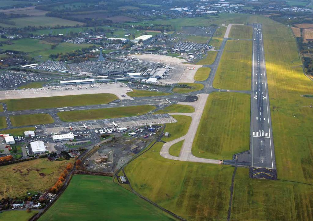
5 We have submitted an Airspace Change Proposal to the CAA. The decision that the CAA will make is not only on where the flight paths are positioned in the sky, but also how frequently they are used, at what times of day and by which type of aircraft. Current airspace Edinburgh Airport has one primary runway (Runway 06/24), which operates in two directions. When runway 06 (R06) is in operation, aircraft arrive from the west and depart to the east. When runway 24 (R24) is in operation, aircraft arrive from the east and depart to the west. The direction of operation is entirely dependent on weather conditions as, where possible, aircraft will take off and depart into wind. Due to local weather conditions (south-westerly is the prevalent wind direction at Edinburgh Airport), R24 is in operation approximately 70% of the time, and R06 is in operation approximately 30% of the time. Standard Instrument Departure (SID) flight paths are a set of instructions which a pilot will refer to when departing from the airport. These ensure that all departures are safe and efficient. In the 1970s, when our runway was designed and built, SID construction was not as rigorous or sophisticated as it is today. There was limited technology, so instructions were fairly simple, involving directions to be taken once an aircraft had reached a certain height or travelled a certain distance. The SIDs currently used at Edinburgh Airport are: GRICE used by approximately 5% of departures comprising mainly Scandinavian and Highland and Islands services and occasionally Middle East aircraft; GOSAM used by over half of all departures primarily used by aircraft heading south; and TALLA primarily used by non-jet aircraft to all destinations except the north. Proposed flight paths Our proposal reduces the number of people affected by our operations. It limits the number of new communities overflown and, it restricts the times they re overflown. It recognises the difference between our peak, our night time flights and day time requirements. Ultimately, it is driven by the community response to our consultation, it is safe, modern and it allows the airport to grow. We have proposed to use a phased approach and break the day into three distinct time periods. Phase 1 would not be introduced before Spring 2018 and phase 2 would not be introduced before Spring This ensures that we only use the flight paths when required and helps to give more of an understanding to those living below the flight paths of how and when they would be used. We have also placed additional usage restriction on certain flight paths, with some only being flown by certain aircraft at certain times. During our second consultation, we asked respondents closed questions to rate our preferred and other viable options for each flight path and open questions providing an opportunity to make further comments on their opinions of the flight paths. Our preferred option for flight path A was A6. We consulted on all viable flight paths (A1-A6). During the second consultation, 19% of respondents strongly disagreed with flight path A6, 3% disagreed, 10% partly agreed and 23% strongly agreed. Of the flight path options consulted on, the one most favoured by respondents during the consultation was A1. However this was not proposed as the longer track would result in a greater population overflown and increased CO 2 emissions. Based on feedback received during the consultations we have proposed two flight paths for flight path A, A3 and A6. Page 3
6 01 Executive Summary Runway 24 departures (aircraft departing to the west) Table 1: Provides an overview of our proposed flight paths Flight path Description Usage A3 A6 B2 B5 C5 D0 RNAV replication of the current TALLA6C SID New RNAV flight path New RNAV flight path, offload of B5 RNAV replication of the current GOSAM1C SID New RNAV flight path, replacement for GRICE3C New RNAV flight path Jet and non-jet aircraft No time restrictions Turbo-prop aircraft only Only used during peak time 06:00-09:59 Jet aircraft only Only used during day time 06:00-22:59 Jet aircraft only No time restrictions Jet and non-jet aircraft No time restrictions Jet aircraft only Only used during peak time 06:00-09:59 Introduction (Phase 1 or 2) Approximate number of aircraft per day Phase Phase 2 n/a Phase Phase Phase Phase 2 n/a 9 11 Total runway 24 departures Runway 06 departures (aircraft departing to the east) E7 F2a G5 H2 New RNAV flight path, replacement for GOSAM1D New RNAV flight path, replacement for GRICE4D New RNAV flight path New RNAV flight path, replacement for TALLA6D Jet aircraft only Only used during day time 06:00-22:59 Jet and non-jet aircraft No time restrictions Jet aircraft only No time restrictions Non-jet aircraft only during day time 06:00-22:59 All aircraft during night time 23:00-05:59 Phase Phase Phase Phase Total runway 06 departures Arrivals from the north RNAV transition from STIRA hold to runway 24/06 Jet and non-jet aircraft No time restrictions Phase Arrivals from the south RNAV transition from EDIBO hold to runway 24/06 Jet and non-jet aircraft No time restrictions Phase The number of flights has been provided by NATS to one decimal point. Flight numbers provided in these tables have been rounded to the nearest full number. The future projections for flights have been based on 4.7% growth until 2018 and 2019 and 20% growth to The year 2024 has been given to represent future projections based on CAA guidance that states projections for five years after the change has been implemented should be used. Page 4
7 Flight path A3, which is an RNAV replication of our current TALLA flight path would be introduced during phase 1 and used by both jet and non-jet aircraft. There would be no time restrictions on A3 during phase 1. It is expected that there would be approximately 83 flights using this flight path per day in 2018 when R24 is in use and 72 flights using this flight path per day in This is an increase to what we presented during the second consultation where we did not plan to use the A3 flight path. Flight path A6 would be introduced during phase 2 and would be for turbo props only. This flight path would only be used during peak time (06:00-09:59) and would be closed when there is gliding activity at RAF Kirknewton. It is expected that there would be approximately 11 flights using this flight path per day in 2019 and 13 flights using this flight path per day in 2024 R24 is in use. As this is a new flight path, these 13 flights would be overflying an area that has not been overflown before. Our preferred options for flight path B were B2 and B5. We are submitting both of these flight paths in our proposal to the CAA. We consulted on all viable flight paths (B1, B2 and B5). During the second consultation, 15% of respondents strongly disagreed with flight path B2, 4% disagreed, 12% partly agreed and 21% strongly agreed. 12% of respondents strongly disagreed with flight path B5, 5% disagreed, 12% partly agreed and 22% strongly agreed. Flight path B1 was not the preferred option based on consultation feedback with 18% of respondents strongly disagreeing. Flight path B2 is an offload of flight path B5, removing some flights from overflying Livingston, and would be introduced during phase 1 by jet aircraft only. B2 would only be used during the day time (06:00-22:59). It is expected that there would be approximately six flights using this flight path per day in 2018 when R24 is in use and seven flights using this flight path per day in This is a reduction in the 36 flights proposed to use this flight path during the second consultation. Flight path B5 which is an RNAV replication of our current GOSAM flight path would be introduced during phase 1. There would be no time restrictions on B5. It is expected that there would be approximately 93 flights using this flight path per day in 2018 and 107 flights using this flight path per day in This is an increase on the 55 flights proposed to use this flight path during the second consultation. Our preferred option for flight path C was C5. We are submitting this flight path in our proposal to the CAA. We consulted on all viable flight paths (C1-C6). During the second consultation, 26% of respondents strongly disagreed with flight path C5, 4% disagreed, 9% partly agreed and 22% strongly agreed. Of the flight path options consulted on, the one most favoured by respondents during the consultation was C1. However this was not selected as the longer track would result in a greater population overflown and increased CO 2 emissions. Flight path C5 would be introduced during phase 1 and would be used by both jet and non-jet aircraft. There would be no time restrictions on C5. It is expected that there would be approximately 13 flights using this flight path per day in 2018 when R24 is in use and 15 flights using this flight path per day in This is a reduction in the 15 flights proposed to use this flight path during the second consultation. Our preferred option for flight path D was D0. We are submitting this flight path in our proposal to the CAA. We consulted on all viable flight paths (D0, D1, D3, D4 and D5). During the second consultation, 41% of respondents strongly disagreed with flight path D0, 4% disagreed, 8% partly agreed and 20% strongly agreed. There was little community support for any of the D flight paths. Of the flight path options consulted on, the one most favoured by respondents during the consultation was D5. However this was not selected as a greater population would be overflown. Page 5
8 01 Executive Summary Flight path D0 would be introduced during phase 2 and would be for jet aircraft only. This flight path would only be used during peak time (06:00-09:59). It is expected that there would be approximately nine flights using this flight path per day in 2019 when R24 is in use and 11 flights using this flight path per day in As this is a new flight path, these nine flights would be overflying an area that has not been overflown before. However, this is a reduction in the 40 flights proposed to use this flight path during the second consultation. Our preferred option for flight path E was E6. Based on feedback received during the consultations we have decided to submit flight path E7. We consulted on all viable flight paths (E2-E7). During the second consultation, 30% of respondents strongly disagreed with our preferred flight path E6, 4% disagreed, 10% partly agreed and 25% strongly agreed. 35% of respondents strongly disagreed with E7, 8% disagreed, 11% partly agreed, 9% strongly agreed. Of the flight path options consulted on, the one most favoured by respondents during the consultation was E5. However, this was not selected as the longer track miles would have resulted in increased CO 2 emissions, and it did not meet growth plans as it does not meet our need for reduced departure separation times. Flight path E7 would be introduced during phase 1 and would be for jet aircraft only. This flight path would only be used during day time (06:00-22:59). It is expected that there would be approximately 96 flights using this flight path per day in 2018 and 111 flights using this flight path per day in 2024 when R06 is in use which, which is approximately 30% of the time. Based on feedback received during the initial consultation we reviewed the proposed usage of this flight path and introduced time restrictions to this flight path to provide respite from noise during the night time period 23: This is a significant increase on the 41 flights proposed to use this flight path during the second consultation. Our preferred option for flight path F was F2a. We are submitting this flight path in our proposal to the CAA. We consulted on all viable flight paths (F2-F3). During the second consultation, 30% of respondents strongly disagreed with flight path F2a, 4% disagreed, 11% partly agreed and 19% strongly agreed. Of the flight path options consulted on, the one most favoured by respondents during the consultation was F3. However, this was not selected as the longer track miles would have resulted in increased CO 2 emissions, and it did not meet growth plans as it does not meet our need for reduced departure separation times. Flight path F2a would be introduced during phase 1 and used by both jet and non-jet aircraft. This flight path has no time-bound restrictions. It is expected that there would be approximately 13 flights using this flight path per day in 2018 and 15 flights using this flight path per day in 2024 when R06 is in use which, which is approximately 30% of the time. This is a reduction in the 14 flights proposed to use this flight path during the second consultation. Our preferred option for flight path G was G5. We are submitting this flight path in our proposal to the CAA. We consulted on all viable flight paths (G4-G5). During the second consultation, 15% of respondents strongly disagreed with flight path G5, 3% disagreed, 11% partly agreed and 27% strongly agreed. Flight path G5 was the option most favoured by respondents during the consultation. Flight path G5 would be introduced during phase 1 for use by jet aircraft only. This flight path has no time-bound restrictions. It is expected that there would be approximately 34 flights using this flight path per day in 2018 and 39 flights using this flight path per day in 2024 when R06 is in use which, which is approximately 30% of the time. This is a reduction in the 40 flights proposed to use this flight path during the second consultation. Page 6
9 Our preferred option for flight path H was H2. We are submitting this flight path in our proposal to the CAA. We consulted on all viable flight paths (H1-H2). During the second consultation, 17% of respondents strongly disagreed with flight path H2, 3% disagreed, 11% partly agreed and 22% strongly agreed. Flight path H2, was the preferred option based on consultation feedback. Flight path H2 would be introduced during phase 1 and used by non-jet aircraft only during day time (06:00-22:59) and by jet and non-jet aircraft when flight path E7 is closed during the night (23:00-05:59). It is expected that there would be approximately 51 flights using this flight path per day in 2018 and 59 flights using this flight path per day in 2024 when R06 is in use, which is approximately 30% of the time. This is a reduction in the 90 flights proposed to use this flight path during the second consultation. During the second consultation 17% of respondents strongly disagreed with the arrivals flight path onto runway 24, 2% disagreed, 14% partly agreed, 24% strongly agreed. 10% strongly disagreed with the arrivals flight path onto runway 06, 3% disagreed, 16% partly agreed and 22% strongly agreed. We are proposing to introduce a published flight path for aircraft arriving from the south. This flight path would be used for aircraft flight planning purposes as aircraft arriving from the south would enter this flight path into their pre-flight planning system, however Air Traffic Control (ATC) would have the flexibility to vector aircraft to ensure a safe and orderly flow of arriving aircraft. Despite introducing this flight path for arriving aircraft, the general pattern of traffic is expected to be very similar to current operations. There may be some concentration of flight tracks along the arrival flight path, however, the requirement by ATC to vector aircraft to achieve safe and orderly arrival sequence would still remain. By introducing a published flight path, aircraft would have a better understanding of the planned flight path which would enable aircraft to perform continuous descent approaches. These smoother approaches at reduced power settings require less fuel and reduce CO 2 emissions. Impacts of our Airspace Change Proposal If our application for airspace change is approved as proposed, there may be a number of impacts as a result. There would be a concentration of traffic due to the introduction of RNAV, this would result in a reduction in the overall area regularly overflown (but a corresponding increase in the concentration of flights in some areas). There would be a reduction in the time aircraft are held on the ground before departure due to reduced separation times. Our proposal does not impact on military airspace users or other general aviation users. Ensuring the safety of proposed changes is a priority. Safety representatives from the CAA Safety and Airspace Regulation Group (SARG) have had oversight of the safety assurance process. We have commissioned an Environmental Assessment to assess the environmental impact of our proposal. This covered biodiversity, noise, local air quality, health, tranquillity and visual intrusion, equalities and the cumulative effects of our proposal. We also commissioned a Habitat Regulation Appraisal Screening Report. Should our Airspace Change Proposal be approved by the CAA we will prepare a mitigation package and share details of this as and when available. Consultation process issues All of the comments that we received during the consultation process were subject to a full analysis of patterns and common themes and Page 7
10 frequency of comment. Comments were categorised into nine themes and then subjected to further analysis on 46 subthemes. In addition to specific local factors that were flight path specific, there were a number of key themes that emerged consistently throughout the consultations and were relevant to all communities and flight paths. These key themes were noise, local community and environment, health and wellbeing, property, time of flights and flight path and operational issues. We have published this document to let interested parties know what we have applied for and why. We believe it is important to continue our conversation with our communities and stakeholders about our Airspace Change Programme. We acknowledge that some mistakes have been made during our Airspace Change Programme. Where these have been pointed out to us, we have been grateful for the opportunity to quickly put them right. We apologise to everyone affected by them, and have taken steps to fix them and ensure that those with an interest were able to engage with us and respond to our consultations. Next steps Our Airspace Change Proposal was submitted to the CAA on 7 August. After reviewing the proposal CAA has temporarily halted its review of our airspace change proposal which will cause a pause in the process we are following. The CAA has sought clarification relating to technicalities in our proposed design and the co-ordination of air traffic control on a local and national level. This is a hugely important decision for the CAA and we welcome its challenge. It is incumbent on all agencies involved to make sure the right decision is made for Scotland and we believe that if it takes longer than first anticipated, then it is worth it. We are working hard with the regulator and NATS to answer the further questions asked, provide further clarity and ensure that the analysis and assessment of our proposals restarts as soon as possible. Page 8
11 Glossary of terms This glossary lists key acronyms within the document and their meaning as well as defining some industry terms and Edinburgh Airport Limited services, and what they mean in this context. ATC ATM CAA CAP CAS EAL Design envelope FAS Highly Annoyed ICAO L eq L max Air traffic control Air traffic movement Civil Aviation Authority Civil Aviation Publication Controlled airspace Edinburgh Airport Limited The area within which each flight path may be positioned Future Airspace Strategy The percentage of those highly annoyed (HA) has been estimated using the findings of the Aircraft Noise Index Study (ANIS) using equations applied to populations exposed to noise levels International Civil Aviation Organisation Equivalent continuous sound level: is the average noise level over a specified time period Level maximum: is the maximum value of the time weighted sound pressure level, which occurs during the measurement period L night NATS NM No 2 RNAV SARG SEL Vector L eq (8 hours) based on the night time period of 23:00-07:00 Air traffic management company providing en-route air traffic control throughout the UK Nautical mile Nitrogen dioxide This is a sub-set of performance based navigation which uses many navigational references, including satellites rather than the conventional ground-based radio beacons and is far more accurate Safety and Airspace Regulation Group Sound Exposure Level: is the constant sound level which has the same energy in one second as the original sound event This means that aircraft do not follow the flight path until the very end of the path, but may be directed onto a different heading by air traffic control once a certain altitude has been reached after departure. Vectoring occurs for many reasons including weather conditions and flight safety Page 9

12 02 Welcome Welcome to this report on Edinburgh Airport s Airspace Change Programme s proposal to the Civil Aviation Authority (CAA). We have been discussing airspace change with communities, organisations, airspace users and politicians for over 18 months now. Our initial consultation in 2016 helped us understand our surrounding areas better, so that our airspace change design process was as best informed as it could be, on the issues and concerns raised by you. Our second consultation conducted in early 2017, sought opinions on the options which that process created for different flight paths in the future, as we prepare for technological, regulatory and growth changes. hours, substantially reducing any potential impacts on communities while delivering the capacity required. This report details the final flight paths that we have proposed to the CAA, and provides the rationale behind our decision making. Thank you for your ongoing interest in our Airspace Change Programme. It was important to us to have a rich and informed conversation on this necessary change. It is an important change. It is significant, of course, for the communities that we currently overfly and may overfly in the future. We have now had the extensive, deep and broad discussion for which we aimed. I thank all those who contributed to enrich our understanding of your concerns and opinions about the options we set out, as clearly as we could. We have used the information we ve gained through our consultation dialogue to inform our design process. As a result of this information we have developed a phased approach based on the premise we only use any new flight paths when they are required. We ve also restricted some of these to peak Regards Gordon Dewar Chief Executive Page 10
13 It was important to us to have a rich and informed conversation on this necessary change. Gordon Dewar Chief Executive Page 11
14 03 Why do we need to change? What is the Airspace Change Programme about? Airlines and airports require the support of efficient airspace, the invisible infrastructure in the skies above them. The airspace structure was established over 40 years ago when there were fewer aircraft in the skies, and they used basic navigation technology. We need to enable growth and we must update the technology we use to navigate. We now have the opportunity to modernise the old airspace structures currently flown to improve efficiency and reduce the impact on those living in our local communities. Growth In order to maintain the growth of services to and from Scotland, we need to ensure that we have the capacity to deal with it especially at peak times. One of the main criticisms we ve faced on capacity is that people have asked us what problem we re solving. We believed by stating the case for growth we were answering the growth question why we need it and why it s important. We ve been asked to go further. It s perhaps better to explain what would happen if we didn t attempt to build in more capacity to our airspace. Our runway is constrained at peak times. Our airport has two main peaks in the day, but in particular our morning peak, where our Edinburgh-based aircraft all leave for the day, sees a high number of departures. At peak times, we see congestion on our airfield as aircraft queue to leave. This queueing would only get more acute and if left alone would ultimately mean us turning airlines away. In the meantime, the congestion causes delays, affecting on-time performance and passenger experience. By making our airspace more efficient, our runway becomes more efficient and the congestion lessens and disappears. The proposed airspace changes allow us to reduce the time between aircraft at peak times to one minute, faster than the current two minute separation. The best measure of assessing the capacity is looking at the movements (ATMs) on the runway per hour. Our studies have shown the impact that not increasing airspace capacity would have on our operations as we grow our year peak ATM/hour impact: ground delays, queue management required ground delays, queue management cannot eradicate, departure delays impact on on time performance (OTP). Delays to arriving aircraft getting to stand ground delays, increased frequency of ground delays due to build up of queues on taxiways. Delays to arriving aircraft getting to stand ground delays, we re forced to turn away business at peak times. Bottleneck most days during the summer peak ground delays, major limitations to growth and Edinburgh Airport. Page 12
15 Some comments in the consultation suggested that we could delay airspace change with ground improvements. We are clear that whilst there would be some interventions we could do on the ground to mitigate our airspace bottleneck; none of them would delay the requirement for airspace change meaningfully because our peak increases so quickly. If we are to grow and attract the routes and connections that Scots want, we need to build capacity. Modernisation The existing flight paths used by aircraft (termed conventional flight paths) rely on the 1950s technology of ground-based radio beacons. A well-established and much more accurate form of navigation is area navigation (RNAV) which uses a combination of satellite and ground-based navigation technology to permit aircraft to follow a precisely defined path over the ground with far greater accuracy than is possible with conventional flight paths. This, in turn, enables pilots to fly pre-determined, predictable arrival and departure flight paths. Although there is currently no RNAV SIDs in operation, departing aircraft can use RNAV overlays on certain routes. Processes are underway at an international level which requires modernisation of the route system to internationally agreed standards. If the UK is to keep pace with the changes in the surrounding countries we need to upgrade our flight paths to RNAV standards. It is important that as we seek to modernise our airspace to accommodate growth that we update all of our flight paths to RNAV standards. This is happening, in airports across the UK and would be happening at Edinburgh Airport even if we did not want to build in extra capacity. In the coming years the technology behind the current flight paths will be removed; we will have no option but to modernise. The Edinburgh Airport Airspace Change Programme has taken 18 months and included two periods of public consultation. Our initial consultation asked What local factors should be taken into account when determining the position of the flight path within the design envelope and why? Feedback from this consultation was used to help refine the flight path options we presented in the second consultation. In the second consultation we presented the flight path options that we had investigated and asked for views on these flight path options. Consultation books and the Findings Reports from both consultations are available on our website letsgofurther.com. Before we can make any changes, we must formally present an Airspace Change Proposal (ACP) to the Civil Aviation Authority (CAA). We submitted our ACP on the 7 August Our ACP is subject to review and approval by the Group Director of the Safety and Airspace Regulation Group (SARG), the body that regulates the use of airspace across the UK. Programme mandate We commissioned a quality assurance of our consultation by the Consultation Institute. As part of our commitment to you, we have published our programme mandate. Our mandate was, we, Edinburgh Airport, need to understand the views of stakeholders concerning the presentation of an Airspace Change Proposal to the CAA that complies with the relevant regulatory requirements so that Edinburgh Airport can operate flight paths that maximise operational benefits and minimise community impact by 2018 so as to improve Edinburgh Airport s national transportation infrastructure to enable the economic, social and cultural growth of Scotland. Page 13
16 03 Why do we need to change? Justification and objectives* Modernising our airspace would allow us to: minimise the impact to people on the ground. In particular, by minimising the number of people impacted by aircraft noise from flights below 4,000ft as per guidance in CAP725 ensure our airport can meet existing and future demand by increasing the capacity of our runway make improvements to departure routes utilising RNAV capabilities to allow flights to depart with fewer delays make efficiency improvements to the arrival routes based on RNAV arrival transitions and a newly-positioned RNAV holding pattern. Our aim is to meet these requirements, maximising benefits to Edinburgh and Scotland whilst minimising any negative impacts. Where we seek to change a flight path, we need to minimise the population impacted under the flight path and work with those affected to mitigate any negative impacts. Improved track keeping means that there will be less dispersal of aircraft either side of the flight path nominal centrelines. This would mean a reduction in the overall area regularly overflown, but a corresponding increase in the concentration of flights in some areas. In line with this justification, our objectives of the Airspace Change Programme are to: maintain or improve the level of safety for departures and arrivals reduce the population overflown below 4,000ft and minimise the impact of aircraft noise on the local population reduce the minimum departure interval between flights on diverging routes introduce RNAV Standard Instrument Departure (SIDs) and Standard Terminal Arrival Route (STARs) in accordance with CAA Future Airspace Strategy (FAS) recommendations reduce delays not to increase the overall volume of controlled airspace accord with the Department for Transport environmental objectives relating to noise impact and CO 2 emissions minimise the impact on military operations. *The justification and objectives have been taken from our Airspace Change Proposal submitted to the CAA. Page 14

17 Page 15
18 04 Current airspace Edinburgh Airport has one primary runway (runway 06/24), which operates in two directions. When runway 06 is in operation, aircraft arrive from the west and depart to the east. When runway 24 is in operation, aircraft arrive from the east and depart to the west. The direction of operation is entirely dependent on weather conditions as, where possible, aircraft will take off and depart into wind. Due to local weather conditions (south-westerly is the prevalent wind direction at Edinburgh Airport), R24 is in operation approximately 70% of the time and R06 is in operation approximately 30% of the time. Figure 1 shows traffic patterns over a two-week period including periods when both runway 24 and 06 are in use. Figure 1 shows the density and spread of current flight paths. The spread is a result of many factors including; the different speeds and performance of the various aircraft types, variation due to wind and runway operation and vectoring by Air Traffic Control (ATC). Once above 4,000ft aircraft are often tactically vectored by ATC. This means that they are instructed by ATC to leave the Standard Instrument Departure (SID) flight path. Hence above 4,000ft the departure flight paths may be more dispersed. Likewise, from around 3,000 4,000ft arrivals converge on the final approach path. Prior to this they are generally coming from the same direction however they are in a broader swathe. ATC position them this way to keep them separated from one another and to ensure that they have the right spacing when joining final approach and for landing. same flight path. Currently, due to the design of the departure flight paths, the standard departure interval between successive departures is two minutes. This two-minute standard departure interval results in delays at busy times, especially during the first rotation wave of departures in the morning. The initial portion of the departure flight paths is bottle-neck which limits the runway capacity and causes delays. The current declared runway capacity is 42 movements per hour. The target runway capacity if the proposed changes are implemented is 50 movements per hour. More information on our current SID flight paths can be seen in Appendix A: Current Standard Instrument Departure (SID) flight paths. The frequency at which aircraft are able to depart in succession is determined by wake turbulence. Wake turbulence is disturbance in the atmosphere that forms behind aircraft. The time these last is determined by the size of the aircraft and for safety reasons means that there must be a certain time split between departures on the Page 16

19 Figure 1: Current arrival and departure flight paths Crown copyright and database rights 2016, Ordnance Survey These are derived from a two week traffic sample of radar data taken from June Page 17
20 05 Proposed flight paths During the initial consultation we asked what local factors should be considered when designing our flight paths. During the second consultation we presented the options we had investigated, as well as our preferred flight paths for each route. For each flight path we asked a closed question asking respondees to rate their preference on our flight path and an open question seeking to understand the explanation for their preferences. Consultation feedback was used to help refine our flight path options and determine the final flight paths we submitted to the CAA. All of the comments that we received were subject to a full analysis of patterns and common themes and frequency of comment. Comments were categorised into nine themes and then subjected to further analysis on 46 subthemes. Throughout the process, we have worked hard on our proposal to find a solution that best meets our regulatory, community and operational requirements. This balance is key to us. Our growth must be sustainable and managed. It must be safe and compliant with our regulator and it must have as minimal an impact as possible on surrounding communities. This balance was at the heart of our consultations, our design process and our ultimate decision making. We believe that we have achieved this balance. Our proposal would reduce the number of people affected by our operations. It limits the number of new communities overflown and where they are, it restricts the times they re overflown. It recognises the difference between our peak, our night time flights and day time requirements. Ultimately, it is driven by the community response to our consultation, it is safe, modern and it allows the airport to grow. We have proposed to use a phased approach and break the day into three distinct time periods. This ensures that we would only use the flight paths when required and helps to give more of an understanding to those living below the flight paths of how and when they would be used. We have also placed additional usage restriction on certain flight paths, with some only being flown by certain aircraft at certain times. Moving to RNAV would concentrate our flight paths, although due to the coding used on some of our proposed routes, there is some dispersion around the first turn. Faster aircraft would fly towards the outside of this swathe while slower aircraft would fly closer to the inside of the turn. Some of our proposed flight paths have limitations on which aircraft can use them e.g. jet or turbo props. The aircraft that an airline chooses to use will be based on a number of factors including the destination flown to. Noise from aircraft differs between makes and models of aircraft, the load which they carry, wind direction, the age of the aircraft and whether an aircraft is a turbo prop or a jet engine aircraft. Aircraft noise is caused by the motion of turbulent air passing over and around the surfaces of the aircraft, including both in and out of the engines, it is also created by the movement of the mechanical moving parts of the aircraft. Turbo props are nosier than jet aircraft due to aerodynamic noise of the air passing over the blades of the engines. Individual aircraft noise footprints of both turbo prop and jet engine aircraft on the relevant preferred flight path options are contained within the technical document ERCD, available on our website letsgofurther.com. The difference in engine types and the other causes of aircraft noise are taken into account in the calculations shown in the technical data supplied during consultation. Page 18
21 With any airspace change there will inevitably be people who notice a difference and people who will notice no difference. When comparing against those currently overflown the population overflown within the L eq 51dBA noise contour will be reduced by 5.7%. The L eq population counting methodology is a well-established measure used by the CAA to determine the noise impact of flights. Figure 2: Runway 06 departures In the following section we have tried to explain the impact of the flight paths compared to the information we provided in our Second Consultation Book, to show if the flight paths would be used more or less frequently. In Section 04 Current airspace we have included information showing current usage. Figures 2-4 shows an overview of our proposed SIDS. Figure 3: Runway 24 departures, phase 1 Figure 4: Runway 24 departures, phase 2 Page 19

22 05 Proposed flight paths Figure 5 shows the proposed arrivals flight paths. These are proposed to be introduced in phase 2 and would provide a transition from the hold to the final approach paths for R06 and R24. Figure 5: Proposed arrival flight paths We are proposing to introduce a published flight path for aircraft arriving from the south. This flight path would be used for aircraft flight planning purposes as aircraft arriving from the south would enter this flight path into their pre-flight planning system. However, ATC would have the flexibility to vector aircraft to ensure a safe and orderly flow of arriving aircraft. Despite introducing this flight path for arriving aircraft the general pattern of traffic is expected to be very similar to current operations. There may be some concentration of flight tracks along the arrivals flight path, however, the requirement by ATC to vector aircraft to achieve safe and orderly arrival sequence would still remain. By introducing a published flight path, aircraft would have a better understanding of the planned flight path which would enable aircraft to perform continuous descent approaches, these smoother approaches at reduced power settings require less fuel and reduce CO 2 emissions. Since holding occurs relatively infrequently, and flights in the hold are at or above 7,000ft the impact on stakeholders on the ground of holding aircraft would be minimal. Page 20
23 Table 2: Making comparisons between current and future usage Approximate number of aircraft per day Flight path (Phase 1) (4.7% growth) 2019 (Phase 2) (4.7% growth) 2024 (Phase 2+5) (20% growth) R24 R06 R24 R06 R24 R06 GOSAM TALLA GRICE HAVEN Total Table 3: Provides an overview of our proposed flight paths Runway 24 departures Runway 06 departures (aircraft departing to the west) (aircraft departing to the east) Flight path Description Usage A3 A6 B2 B5 C5 D0 RNAV replication of the current TALLA6C SID New RNAV flight path New RNAV flight path, offload of B5 RNAV replication of the current GOSAM1C SID New RNAV flight path, replacement for GRICE3C New RNAV flight path Jet and non-jet aircraft No time restrictions Turbo-prop aircraft only Only used during peak time 06:00-09:59 Jet aircraft only Only used during day time 06:00-22:59 Jet aircraft only No time restrictions Jet and non-jet aircraft No time restrictions Jet aircraft only Only used during peak time 06:00-09:59 Introduction (Phase 1 or 2) Approximate number of aircraft per day Phase Phase 2 n/a Phase Phase Phase Phase 2 n/a 9 11 Total runway 24 departures E7 F2a G5 H2 New RNAV flight path, replacement for GOSAM1D New RNAV flight path, replacement for GRICE4D New RNAV flight path New RNAV flight path, replacement for TALLA6D Jet aircraft only Only used during day time 06:00-22:59 Jet and non-jet aircraft No time restrictions Jet aircraft only No time restrictions Non-jet aircraft only during day time 06:00-22:59 All aircraft during night time 23:00-05:59 Phase Phase Phase Phase Total runway 06 departures Arrivals from the north Arrivals from the south RNAV transition from STIRA hold to runway 24/06 RNAV transition from EDIBO hold to runway 24/06 Jet and non-jet aircraft No time restrictions Jet and non-jet aircraft No time restrictions Phase Phase The number of flights has been provided by NATS to one decimal point. Flight numbers provided in these tables have been rounded to the nearest full number. The future projections for flights have been based on 4.7% growth until 2018 and 2019 and 20% growth to The year 2024 has been given to represent future projections based on CAA guidance that states projections for five years after the change has been implemented should be used. Page 21
24 05 Proposed flight paths Flight path A Our preferred option for flight path A was A6. A7 was considered unviable as it didn t meet safety requirements and ICAO design criteria. We consulted on all viable flight paths (A1-A6). During the second consultation, 19% of respondents strongly disagreed with flight path A6, 3% disagreed, 10% partly agreed and 23% strongly agreed. Of the flight path options consulted on, the one most favoured by respondents during the consultation was A1, however this was not selected as the longer track would result in increased CO 2 emissions and a greater population would be overflown. There were 3,820 respondents who rated the flight path options for flight path A, of these 1,783 respondents provided comments. Specific consultation feedback on flight path A included: concerns around restrictions the use of A6 may place on gliding activity at RAF Kirknewton new housing developments at Calderwood being overflown rural and tranquil areas that currently experience few flights being overflown flights over the Pentland Hills would cause disturbance on a currently tranquil area impact on St John s Hospital. When deciding on our preferred flight path we focused on avoiding populated areas to minimise the population overflown, however feedback during the consultation showed that we should follow existing flight paths where possible to avoid overflying new areas. Based on feedback received during the consultations we have decided to submit two flight paths for flight path A. This is a significant increase compared to what we presented in our second consultation, where we planned to use only flight path A6. Flight path A3, which is an RNAV replication of our current TALLA flight path would be introduced during phase 1 and used by both jet and non-jet route. There would be no time restrictions on A3 during phase 1. It is expected that there would be approximately 83 flights using this flight path per day in 2018 when R24 is in use and 72 flights using this flight path per day in Flight path A6 would be introduced during phase 2 and would be for turbo props only. This flight path would only be used during peak time (06:00-09:59) and would be closed when there is gliding activity at RAF Kirknewton. It is expected that there would be approximately 11 flights using this flight path per day in 2019 and 13 flights using this flight path per day in As this is a new flight path, these 13 flights would be overflying an area that has not been overflown before. Although A6 is required for operational efficiency improvements, we have minimised its usage and restricted it to only being used during peak time. Minimising the use of our preferred flight path A6 would reduce the impact on rural and tranquil areas that currently experience few overflights and minimise overflights of new developments in East Calder and Calderwood. When planning the flight paths we had to balance overflying populated areas against overflying tranquil areas. We commissioned a tranquillity study to investigate the impact of our proposed flight paths. The study concluded that there would be no new impacts on tranquillity and visual intrusion as a result of flight path A3. Aircraft on flight path A6 would be some 6-9km further east than aircraft on the existing flight path. Because they would be closer to the airport, aircraft would be at a lower altitude when they overfly the Pentland Hills. These hills are among the most tranquil parts of the tranquillity study area, and represent a popular recreational resource for Edinburgh and the surrounding area. The flight path passes directly over Harperrig Reservoir, a popular location and access point into the hills, and also over West Cairn Hill (562m) and Byrehope Mount (536m). Page 22

 when gliding does not take place, so would primarily be used when fewer people are likely to be using the hills.")
25 The flight path is close to enclosed upland valleys that are currently infrequently overflown, including Baddinsgill and West Water. The use of flight path A6 is likely to have an impact on the tranquillity of the Pentland Hills, though only as a result of slower climbing aircraft, and would be experienced by people accessing the central and southern hills, and using the Thieves Road and nearby paths. However, this route would only be used at peak times (06:00-09:59) when gliding does not take place, so would primarily be used when fewer people are likely to be using the hills. As per consultation feedback we had tried to minimise hospital and care facilities overflown, the use of A3 would mean that St John s Hospital would be overflown, as it is today. Figure 6: Considered options for flight path A Figure 7: Proposed option for flight path A with typical climb profiles Climb Profiles The altitudes shown are for typical aircraft with average climb performance. The majority of aircraft will follow this profile. The extremes of the climb profiles are depicted by the 6000ft points, as follows: 2000ft Point at which 6000ft reached at 7.4% climb gradient (slow climber) Point at which 6000ft reached at 15.0% climb gradient (good climber) 5000ft 6000ft 7000ft 8000ft 4000ft 3000ft 4000ft 5000ft 6000ft Flights per More than ft 7000ft A6 8000ft 10,000ft A3 9000ft 10,000ft This map shows the current flight tracks, overlaid with our considered flight paths A1-A7. This map shows our proposed flight path and proposed guidance on minimum altitudes along the flight path. Page 23
26 05 Proposed flight paths Flight path B Our preferred options for flight paths B were B2 and B5. We are submitting both of these flight paths in our proposal to the CAA. B3, B4 and B6 were considered unviable as they didn t meet safety requirements and ICAO design criteria. We consulted on all viable flight paths (B1, B2 and B5). During the second consultation, 15% of respondents strongly disagreed with flight path B2, 4% disagreed, 12% partly agreed and 21% strongly agreed. 12% of respondents strongly disagreed with flight path B5, 5% disagreed, 12% partly agreed and 22% strongly agreed. Flight path B1 was not the preferred option based on consultation feedback with 18% of respondents strongly disagreeing. There were 3,873 respondents who rated the flight path options for flight path B, of these 1,372 respondents provided comments. Consultation feedback on flight path B included: rural and tranquil areas that currently experience few flights being overflown overflights of the Scottish National Equestrian Centre and Oatridge Agricultural College impact on St John s Hospital overflights of Beecraigs Park. Flight path B2 is an offload of flight path B5, removing some flights from overflying Livingston, and would be introduced during phase 1 by jet aircraft only. B2 would only be used during the day time (06:00-22:59). It is expected that there would be approximately six flights using this flight path per day in 2018 when R24 is in use and seven flights using this flight path per day in This is a reduction in the number of flights proposed to use this flight path during the second consultation. Flight path B5 which is an RNAV replication of our current GOSAM flight path would be introduced during phase 1 and would be used by jet aircraft only. There would be no time restrictions on B5. It is expected that there would be approximately 93 flights using this flight path per day in 2018 and 107 flights using this flight path per day in This is a significant increase on the 55 flights proposed to use this flight path during the second consultation. When planning the flight path we had to balance overflying populated areas against overflying tranquil areas. We commissioned a tranquillity study to investigate the impact of our proposed flight path. The study concluded that there would be no new impacts on tranquillity and visual intrusion as a result of flight path B5. Flight path B2 is a new flight path, and although the eastern part of this flight path is already overflown by some aircraft that are turning northwards, few aircraft currently overfly the western part. The flight path passes over the low Bathgate Hills, and crosses part of Beecraigs Country Park. Cockleroy Hill (278m) is a prominent viewpoint at the edge of the country park, and is less than 1 km from the centre line of the flight path. The flight path continues over the valley of the River Avon, close to Muiravonside Country Park. These areas are all shown as being relatively tranquil, particularly enclosed valleys such as the River Avon. Flight path B2 would be in use during daytime hours (06:00-22:59), including weekends. The use of this flight path is likely to have additional effects on tranquillity and levels of intrusion experienced by people using Beecraigs Country Park and visiting Cockleroy Hill. To a lesser extent, aircraft may affect the tranquillity experienced by people within the Avon Valley and Muiravonside Country Park, though these are further west so aircraft would be higher, and are more enclosed by woodland and topography. Both B2 and B5 avoid areas mentioned in feedback including Oatridge Agricultural College and the Scottish National Equestrian Centre. St John s Hospital is located in Livingston under the existing B5 flight path, however the use of the offload flight path B2 would reduce the number of flights over St John s Hospital. Page 24

27 Figure 8: Considered options for flight path B Figure 9: Proposed option for flight path B with typical climb profiles Flights per day More than Climb Profiles The altitudes shown are for typical aircraft with average climb performance. The majority of aircraft will follow this profile. The extremes of the climb profiles are depicted by the 6,000ft points, as follows: Point at which 6,000ft reached at 8.0% climb gradient (slow climber) Point at which 6,000ft reached at 15.0% climb gradient (good climber) This map shows the current flight tracks, overlaid with our considered flight paths B1-B6. This map shows our proposed flight path and provides guidance on minimum altitudes along the flight path. Page 25
28 05 Proposed flight paths Flight path C Our preferred option for flight path C was C5. We are submitting this flight path in our proposal to the CAA. We consulted on all viable flight paths (C1-C6). During the second consultation, 26% of respondents strongly disagreed with flight path C5, 4% disagreed, 9% partly agreed and 22% strongly agreed. Of the flight path options consulted on, the one most favoured by respondents during the consultation was C1, however this was not selected as the longer track would result in increased CO 2 emissions and a greater population would be overflown. There were 3,820 respondents who rated the flight path options for flight path C, of these 1,528 respondents provided comments. Consultation feedback on flight path C included: recent and ongoing housing developments in Winchburgh some areas lying outside the design envelope shown in the initial consultation turning earlier to avoid overflying Broxburn, Uphall and Dechmont rural and tranquil areas that currently experience few flights being overflown. Flight path C5 would be introduced during phase 1 and would be used by both jet and non-jet aircraft. There would be no time restrictions on C5. It is expected that there would be approximately 13 flights using this flight path per day in 2018 when R24 is in use and 15 flights using this flight path per day in This is a reduction in the 15 flights proposed to use this flight path during the second consultation. the areas overflown by flight path C5 are of moderate or lower tranquillity. There are pockets of tranquillity around the Union Canal and Winchburgh. The estate woodland west of Hopetoun House has relatively higher tranquillity: the John Muir Way follows the shore of the Firth of Forth in this location. The new flight path may have additional impacts on these local pockets, particularly around Winchburgh which is close to the airport. The John Muir Way is within woodland at this location. On the north side of the Firth of Forth there are areas of tranquillity along the shore, though the flight path crosses DM Crombie, a naval installation not accessible to the public. Around Comrie and further north there are more pockets of higher tranquillity, though most aircraft would be at higher altitude here. Overall, the use of flight path C5 would lead to reduction in tranquillity in some small pockets of relatively tranquil landscape, including short sections of the Union Canal. There would also be a small increase in tranquillity for some areas to the west of the new flight path, including the fringes of the Bathgate Hills, as a result of fewer aircraft flying over the area west of Ecclesmachan. Based on feedback received during the initial consultation we reviewed the design coding method used to allow us to introduce a tighter turn on departure. This did result in the flight path lying slightly outside our original design envelope, see Section 08 Consultation process issues. This flight path avoids low-level overflights of Broxburn and Uphall, with aircraft turning over the more industrial end of Broxburn. Winchburgh, a town currently growing with continued development planned would be overflown, however only 10 flights per day are expected to use this flight path, helping to mitigate the impact to those living in Winchburgh. When planning the flight paths we had to balance overflying populated areas against overflying tranquil areas. We commissioned a tranquillity study to investigate the impact of our proposed flight paths. The study concluded that on the south side of the Firth of Forth, Page 26


 The Possible Vectoring areas show where aircraft could be vectored off the route once above 4,000ft This map")

29 Figure 10: Considered options for flight path C Figure 11: Proposed option for flight path C with typical climb profiles Flights per day More than Main flow of: Departures Climb Profiles The altitudes shown are for typical aircraft with average climb performance. The majority of aircraft will follow this profile. The extremes of the climb profiles are depicted by the 6,000ft points, as follows: Point at which 6,000ft reached at 7.4% climb gradient (slow climber) Point at which 6,000ft reached at 15.0% climb gradient (good climber) The Possible Vectoring areas show where aircraft could be vectored off the route once above 4,000ft This map shows the current flight tracks, overlaid with our considered flight paths C1-C5. This map shows our proposed flight path and provides guidance on minimum altitudes along the flight path. The proposed flight path takes advantage of RNAV coding to enable aircraft to turn as early as possible. This results in some dispersion of flight paths in the first turn. Faster aircraft will fly towards the outside of this swathe while slower aircraft will fly closer to the inside of the turn. Page 27
30 05 Proposed flight paths Flight path D Our preferred option for flight path D was D0. We are submitting this flight path in our proposal to the CAA. D2 was considered unviable as it didn t meet safety requirements and ICAO design criteria. We consulted on all viable flight paths (D0, D1, D3, D4 and D5). During the second consultation, 41% of respondents strongly disagreed with flight path D0, 4% disagreed, 8% partly agreed and 20% strongly agreed. There was little community support for any of the D flight paths. Of the flight path options consulted on, the one most favoured by respondents during the consultation was D5. However, this was not selected as a greater population would be overflown. There were 3,820 respondents who rated the flight path options for flight path D, of these 1,883 respondents provided comments. Consultation feedback on flight path D included: concerns around the previous TUTUR trial and the impact of these flights on the community recent and ongoing housing developments in Winchburgh some areas lying outside the design envelope shown in the initial consultation turning earlier to avoid overflying Broxburn, Uphall and Dechmont. Flight path D0 would be introduced during phase 2 and would be for jet aircraft only. This flight path would only be used during peak time (06:00-09:59). It is expected that there would be approximately nine flights using this flight path per day in 2019 when R24 is in use and 11 flights using this flight path per day in As this is a new flight path, these 11 flights would be overflying an area that has not been overflown before however, this is a reduction in the 40 flights proposed to use this flight path during the second consultation. Many respondents raised concerns relating to the TUTUR trial. On initial review of the flight path options D3 was considered the preferred flight path option. However based on community feedback raised during consultation 1, D0 was designed to introduce an early turn over the east end of Broxburn, a more industrial area, moving the traffic away from the residential areas of Broxburn and Uphall. This did result in the flight path lying slightly outside our original design envelope, see Section 08 Consultation process issues. As a result of this early turn this flight path would overfly Winchburgh and South Queensferry, however, based on consultation feedback we have restricted the usage on this flight path to peak time (06:00-09:59) to reduce the impact on these newly overflown communities. When planning the flight paths we had to balance overflying populated areas against overflying tranquil areas. We commissioned a tranquillity study to investigate the impact of our proposed flight paths. The study concluded that flight path D0 is a new flight path, and beyond the initial turn it passes over areas that are not currently overflown. Aircraft would pass over areas that are largely low in tranquillity, to the east of Broxburn and Winchburgh. North of the M9, there are pockets of higher tranquillity, particularly associated with the designed landscapes of Dundas House (private) and Hopetoun House (open to the public). The flight path does not pass over the core of either designated designed landscape, though it passes over the approach to Hopetoun on the Firth of Fourth shore, which is also the flight path of the John Muir Way. The Firth of Forth in the region of the Forth Bridges is not particularly tranquil, though there are smaller areas such as Port Laing to the east of North Queensferry, where the Fife Coastal Path follows a secluded bay. Most aircraft would have reached 7,000ft by this point, though there may be some that have not. More distant views of these aircraft would be seen from the tranquil coast east of Dalmeny House, though any associated impact on tranquillity is likely to be limited. Page 28


 Point at which 6,000ft reached at 15.")


31 Figure 12: Considered options for flight path D Figure 13: Proposed option for flight path D with typical climb profiles Flights per day More than Main flow of: Departures Climb Profiles The altitudes shown are for typical aircraft with average climb performance. The majority of aircraft will follow this profile. The extremes of the climb profiles are depicted by the 6,000ft points, as follows: Point at which 6,000ft reached at 8.9% climb gradient (slow climber) Point at which 6,000ft reached at 15.0% climb gradient (good climber) This map shows the current flight tracks, overlaid with our considered flight paths D0-D5. This map shows our proposed flight path and provides guidance on minimum altitudes along the flight path. The proposed flight path takes advantage of RNAV coding to enable aircraft to turn as early as possible. This results in some dispersion of flight paths in the first turn. Faster aircraft will fly towards the outside of this swathe while slower aircraft will fly closer to the inside of the turn. Page 29
32 05 Proposed flight paths Flight path E Our preferred option for flight path E was E6. Based on feedback received during the consultations we have decided to submit flight path E7. E1a and E1b were considered unviable as they didn t meet safety requirements and ICAO design criteria. We consulted on all viable flight paths (E2-E7). During the second consultation, 30% of respondents strongly disagreed with our preferred flight path E6, 4% disagreed, 10% partly agreed and 25% strongly agreed. 35% of respondents strongly disagreed with E7, 8% disagreed, 11% partly agreed, 9% strongly agreed. Of the flight path options consulted on, the one most favoured by respondents during the consultation was E5. However, this was not selected as the longer track miles would have resulted in increased CO 2 emissions, and it did not meet growth plans as it does not meet our need for reduced departure separation times. There were 3,820 respondents who rated the flight path options for flight path E, of these 1,742 respondents provided comments. Consultation feedback on flight path E included: flight paths should be kept over water as much as possible to avoid overflight of populated areas on the Fife coast the flight path should be offset to avoid Cramond there should be night time restrictions to offer respite to local communities. Our preferred flight path presented during consultation (E6) aimed to facilitate the earliest turn possible in order to keep flights over the water and minimise overflight of Dalgety Bay and Inverkeithing, whilst maintaining the offset departure turn to avoid Cramond. During flyability flight validation testing, it was shown that proposed changes to the initial runway 06 departure track (Cramond offset) resulted in some aircraft types not being able to fly this flight path. However, flight path E7 is expected to be flyable. Modified versions of E6 were tested to try to design a flight path which was both flyable but still over the water, as far away from the Fife coastline as possible. This proved not to be possible therefore E7 represents the best option which keeps the flight paths as far to the south and over the Firth of Forth as possible while still being flyable. Flight path E7 would be introduced during phase 1 and would be for jet aircraft only. This flight path would only be used during day time (06:00-22:59). It is expected that there would be approximately 96 flights using this flight path per day in 2018 and 111 flights using this flight path per day in 2024 when runway 06 is in use which, which is approximately 30% of the time. Based on feedback received during the initial consultation we reviewed the proposed usage of this flight path and introduced time restrictions to this flight path to provide respite from noise during the night time period 23:00-05:59. This is a significant increase on the 41 flights proposed to use this flight path during the second consultation. When planning the flight paths we had to balance overflying populated areas against overflying tranquil areas. We commissioned a tranquillity study to investigate the impact of our proposed flight paths. The study concluded that flight path E7 may slightly reduce the experience of tranquillity along the south coast of the Firth of Forth, between Hound Point and Cramond, and along the Fife Coastal Trail near North Queensferry. All departing flights would pass over the Firth of Forth near Cramond, with combined effects on this popular and relatively tranquil area. However, aircraft are already a feature in this area, particularly around Cramond. There may be increased effects on tranquillity due to the new flight paths, which are more dispersed across the Firth of Forth than the current flight paths. Page 30


 The Possible Vectoring areas show where aircraft could be vectored off the route once above 4000ft E2 E1b E1a E7 E6")

33 Figure 14: Considered options for flight path E Figure 15: Proposed option for flight path E with typical climb profiles Flights per day More than Route E Climb Profiles The altitudes shown are for typical aircraft with average climb performance. The majority of aircraft will follow this profile. The extremes of the climb profiles are depicted by the 6000ft points, as follows: E5 E3 E4 Point at which 6000ft reached at 8.9% climb gradient (slow climber) Point at which 6000ft reached at 15.0% climb gradient (good climber) The Possible Vectoring areas show where aircraft could be vectored off the route once above 4000ft E2 E1b E1a E7 E6 NATS - PRIVATE 6 This map shows the current flight tracks, overlaid with our considered flight paths E1a-E7. This map shows our proposed flight path and provides guidance on minimum altitudes along the flight path. The proposed flight path takes advantage of RNAV coding to enable aircraft to turn as early as possible. This results in some dispersion of flight paths in the first turn. Faster aircraft will fly towards the outside of this swathe while slower aircraft will fly closer to the inside of the turn. Page 31
34 05 Proposed flight paths Flight path F Our preferred option for flight path F was F2a. We are submitting this flight path in our proposal to the CAA. F1, F4, F5 and F6 were considered unviable as they didn t meet safety requirements and ICAO design criteria. We consulted on all viable flight paths (F2-F3). During the second consultation, 30% of respondents strongly disagreed with flight path F2a, 4% disagreed, 11% partly agreed and 19% strongly agreed. Of the flight path options consulted on, the one most favoured by respondents during the consultation was F3. However, this was not selected as the longer track miles would have resulted in increased CO 2 emissions, and it did not meet growth plans as it does not meet our need for reduced departure separation times. There were 3,820 respondents who rated the flight path options for flight path F, of these 1,605 respondents provided comments. Consultation feedback on flight path F included: the flight path should be offset to avoid Cramond flight path should be kept over water as much as possible to avoid overflight of populated areas on the Fife coast flights would adversely impact on the natural environment. The proposed flight path F2a is as per the preferred option presented during consultation. The flight path positioning facilitates the earliest turn possible in order to keep flights over the water and minimise flying over Dalgety Bay, Inverkeithing, North Queensferry and Dunfermline. When planning the flight paths we had to balance overflying populated areas against overflying tranquil areas. We commissioned a tranquillity study to investigate the impact of our proposed flight paths. The existing situation sees aircraft flying over a broad area between Dalgety Bay and Aberdour. The new flight path would see these flights being more concentrated along the proposed line, although the actual number of aircraft would remain modest for this flight path. Flight path F2a passes over relatively tranquil areas at Cramond, although this area is affected by existing arriving and departing aircraft, and no new effects on tranquillity are predicted. The flight path also passes over Inchcolm, a popular tourist destination served by a ferry flight path. Within Fife, there are tranquil areas along the coastline, and inland at Couston Castle and the farmland south of Crossgates. These inland locations are likely to be used for local recreation, though the Fife Coastal Path crosses the coastal locations. Because the flight path is broadly similar to the existing flight paths, new effects on tranquillity are anticipated to be limited. All departing flights would pass over the Firth of Forth near Cramond, with combined effects on this popular and relatively tranquil area. However, aircraft are already a feature in this area, particularly around Cramond. There may be increased effects on tranquillity due to the new flight paths, which are more dispersed across the Firth of Forth than the current flight paths. Page 32 Flight path F2a would be introduced during phase 1 and used by both jet and non-jet aircraft. This flight path has no time-bound restrictions. It is expected that there would be approximately 13 flights using this flight path per day in 2018 and 15 flights using this flight path per day in 2024 when runway 06 is in use which, which is approximately 30% of the time. This is a reduction in the 14 flights proposed to use this flight path during the second consultation.

 The Possible Vectoring areas show where aircraft could be vectored off the route once above 4,000ft This map shows the current flight tracks, overlaid with our")
35 Figure 16: Considered options for flight path F Figure 17: Proposed option for flight path F with typical climb profiles Flights per day More than Climb Profiles The altitudes shown are for typical aircraft with average climb performance. The majority of aircraft will follow this profile. The extremes of the climb profiles are depicted by the 6,000ft points, as follows: Point at which 6,000ft reached at 7.4% climb gradient (slow climber) Point at which 6,000ft reached at 15.0% climb gradient (good climber) The Possible Vectoring areas show where aircraft could be vectored off the route once above 4,000ft This map shows the current flight tracks, overlaid with our considered flight paths F1-F6. This map shows our proposed flight path and provides guidance on minimum altitudes along the flight path. The proposed flight path takes advantage of RNAV coding to enable aircraft to turn as early as possible. This results in some dispersion of flight paths in the first turn. Faster aircraft will fly towards the outside of this swathe while slower aircraft will fly closer to the inside of the turn Page 33
36 05 Proposed flight paths Flight path G Our preferred option for flight path G was G5. We are submitting this flight path in our proposal to the CAA. G1, G2, G3 and G6 were considered unviable as they didn t meet safety requirements and ICAO design criteria. We consulted on all viable flight paths (G4-G5). During the second consultation, 15% of respondents strongly disagreed with flight path G5, 3% disagreed, 11% partly agreed and 27% strongly agreed. Flight path G5 was the preferred option based on consultation feedback. There were 3,820 respondents who rated the flight path options for flight path G, of these 1,283 respondents provided comments. Consultation feedback on flight path G included: the flight path should be offset to avoid Cramond concerns of the impact on nature reserves and bird roosts at Aberlady. The flight path positioning endeavours to position flights over the Firth of Forth until they are above 10,000ft thus minimising noise impact on populations under this flight path. The limits of controlled airspace prevents the flight path from being positioned further east and positioning further west impacts on flight path H. Flight path G5 would be introduced during phase 1 for use by jet aircraft only. This flight path has no time-bound restrictions. It is expected that there would be approximately 34 flights using this flight path per day in 2018 and 39 flights using this flight path per day in 2024 when runway 06 is in use which, which is approximately 30% of the time. This flight path brings aircraft over the coastline at a greater altitude than the current 06 departure flight path. This is a reduction in the 40 flights proposed to use this flight path during the second consultation. When planning the flight paths we had to balance overflying populated areas against overflying tranquil areas. We commissioned a tranquillity study to investigate the impact of our proposed flight paths. At present, the same flight path is used for both the G and H flight paths. This continues in a more north-easterly direction, with aircraft turning closer to the Fife Coast near Kinghorn, and returning to the Lothian coast closer to Edinburgh. The proposed flight path passes over Cramond Island where it turns towards the north-east, heading along the centre of the Firth of Forth. It passes over Inchkeith, and turns southward over the water, to meet the East Lothian coast near Longniddry. Typical aircraft would reach 7,000ft just after passing Inchkeith, and slower climbing aircraft are likely to reach 7,000ft before they pass over the East Lothian coast. By routeing the new G5 flight path over water, the potential for effects on tranquillity is reduced. However, the flight path is closer to the relatively tranquil coastline of north Edinburgh, between Cramond and Granton, then the existing flight paths. Although aircraft are a familiar part of the scene in this popular recreational area, particularly at Cramond, there may be some reduction in tranquillity further east. Further out, Inchkeith and the adjacent waters are indicated as relatively tranquil, but there are few users aside from recreational sailors. Flight path G5 may also slightly increase tranquillity on a short section of the Fife coast, due to aircraft being further from this shore. We commissioned a Habitat Appraisal Assessment to investigate the potential impact on wildlife habitat this concluded that there would be no change compared to current flight paths. Page 34
37 Figure 18: Considered options for flight path G Figure 19: Proposed option for flight path G with typical climb profiles Flights per day More than Climb Profiles The altitudes shown are for typical aircraft with average climb performance. The majority of aircraft will follow this profile. The extremes of the climb profiles are depicted by the 6,000ft points, as follows: Point at which 6,000ft reached at 8.9% climb gradient (slow climber) Point at which 6,000ft reached at 15.0% climb gradient (good climber) The Possible Vectoring areas show where aircraft could be vectored off the route once above 4,000ft This map shows the current flight tracks, overlaid with our considered flight paths G1-G6. This map shows our proposed flight path and provides guidance on minimum altitudes along the flight path. Page 35
38 05 Proposed flight paths Flight path H Our preferred option for flight path H was H2. We are submitting this flight path in our proposal to the CAA. H3 and H4 were considered unviable as they didn t meet safety requirements and ICAO design criteria. We consulted on all viable flight paths (H1-H2). During the second consultation, 17% of respondents strongly disagreed with flight path H2, 3% disagreed, 11% partly agreed and 22% strongly agreed. Flight path H2, was the preferred option based on consultation feedback. There were 3,820 respondents who rated the flight path options for flight path H, of these 1,193 respondents provided comments. Consultation feedback on flight path H included: The proposed flight path passes over Cramond Island where it turns eastward along the Firth of Forth. It turns south-east to follow the coast, which it crosses at Musselburgh. The flight path turns south-west to skirt the built-up area of Edinburgh. Typical aircraft would reach 7,000ft off the coast of Seafield. Slow climbers would reach 6,000ft before flying over Musselburgh and would reach 7,000ft shortly after this point. As described above, the same existing flight path is used for G and H, with aircraft passing close to the Fife coast to turn. The proposed flight path remains over the open water, and effects are likely to be very similar to those noted for flight path G5 above, including some potential decrease in tranquillity along the popular north Edinburgh coast. the flight path should be offset to avoid Cramond. The flight path keeps departures over the Firth of Forth until above 6,000ft before crossing the coastline at Musselburgh. Flight path H2 would be introduced during phase 1 and used by non-jet aircraft only during day time (06:00-22:59) and by jet and non-jet aircraft when flight path E is closed during the night (23:00-05:59). It is expected that there would be approximately 51 flights using this flight path per day in 2018 and 59 flights using this flight path per day in 2024 when runway 06 is in use which, which is approximately 30% of the time. This is a significant reduction in the 91 flights proposed to use this flight path during the second consultation. When planning the flight paths we had to balance overflying populated areas against overflying tranquil areas. We commissioned a tranquillity study to investigate the impact of our proposed flight paths. At present, the same flight path is used for both the G and H flight paths. This continues in a more north-easterly direction, with aircraft turning closer to the Fife Coast near Kinghorn, and returning to the Lothian coast closer to Edinburgh. Page 36


 The Possible Vectoring areas show where aircraft could be vectored off the route once above 4,000ft This")
39 Figure 20: Considered options for flight path H Figure 21: Proposed option for flight path H with typical climb profiles Flights per day More than Climb Profiles The altitudes shown are for typical aircraft with average climb performance. The majority of aircraft will follow this profile. The extremes of the climb profiles are depicted by the 6,000ft points, as follows: Point at which 6,000ft reached at 8.0% climb gradient (slow climber) Point at which 6,000ft reached at 15.0% climb gradient (good climber) The Possible Vectoring areas show where aircraft could be vectored off the route once above 4,000ft This map shows the current flight tracks, overlaid with our considered flight paths H1-H4. This map shows our proposed flight path and provides guidance on minimum altitudes along the flight path. Page 37
40 05 Proposed flight paths Arrivals During the second consultation 17% of respondents strongly disagreed with the proposed arrivals path onto runway 24, 2% disagreed, 14% partly agreed, 24% strongly agreed. 10% strongly disagreed with the arrivals path onto runway 06, 3% disagreed, 16% partly agreed and 22% strongly agreed. We are proposing to introduce a published flight path for aircraft arriving from the south. This flight path would be used for aircraft flight planning purposes as aircraft arriving from the south would enter this flight path into their pre-flight planning system. However, as described above ATC would have the flexibility to vector aircraft to ensure a safe and orderly flow of arriving aircraft. Despite introducing this flight path for arriving aircraft the general pattern of traffic is expected to be very similar to current operations. There may be some concentration of flight tracks along the transition route however the requirement by ATC to vector aircraft to achieve safe and orderly arrival sequence would still remain. By introducing a published flight path, aircraft would have a better understanding of the planned flight path which would enable aircraft to perform continuous descent approaches, these smoother approaches at reduced power settings require less fuel and reduce CO 2 emissions. The use of RNAV technology enables aircraft to fly flight paths more accurately and does mean that over time, as an increasing number of aircraft use the RNAV flight paths there would be an increased concentration of aircraft over certain areas. This concentration would be focused in the airspace between 4,000ft and 7,000ft and should be offset by the increased use of continuous descent approaches which would bring improvements in noise and emissions. Above 7,000ft the impact of noise due to over-flying aircraft is less significant to those on the ground. Concentration of traffic reduces the extent of areas overflown, and has the potential to reduce the number of people exposed to noise from aircraft flying below 7,000ft. The flight paths selected for the arrival flight paths replicate the procedural flight-planned flight path. Different options for the arrivals flight paths were not consulted on as the normal practice would remain as today, with the majority of flights being radar vectored by ATC and not following the exact published flight path. On occasion aircraft may be asked to hold in the holding pattern until they can be given approval to land. Aircraft in the hold would be at altitudes over 7,000ft. The proposed arrival flight paths require the current TWEED hold to be realigned. A new RNAV hold called EDIBO has been proposed. The EDIBO hold is positioned 1.5NM to the east of the current TWEED hold. The location of the hold can be seen in Figure 23. Non-RNAV capable aircraft would be instructed to hold at EDIBO. The arrivals transitions proposed are unchanged from those presented in the consultation. Technical note The option of maintaining the existing TWEED hold was considered, however for the following reasons it was discounted: current procedures direct aircraft to TARTN then south back to TWEED to take up the hold. This configuration would be difficult to integrate into the arrival transition design as an RNAV hold can only have one holding waypoint the hold would have to be reconfigured using TARTN as the holding point the current direction of the hold would not integrate efficiently with the RNAV arrival transitions the protected area would need to be re-assessed the TWEED protected area balloons to the north such that both routes A and H would pass within the hold protected area. Lateral separation would therefore not be possible and the routes would have to be kept down at 6,000ft for vertical separation. This would incur fuel burn and increased CO 2 emissions. Page 38

 Flights per day More than 10 7-10 5-7 3-5 1-3")
41 Figure 22: Current runway 24 arrivals from the south and proposed flight path Figure 23: Current runway 06 arrivals from the south and proposed flight path Flights per day More than Contains OS data Crown copyright and database right (2017) Contains OS data Crown copyright and database right (2017) Flights per day More than Page 39
42 06 What did you tell us? During the project we ran two 14-week consultations 1. We wanted to ensure that those living in communities close to the airport, and with an interest in our operations, were aware of our consultation, had access to our communication materials, were able to participate in the consultations and engage with us throughout the process. All of the comments that we received were subject to a full analysis of patterns and common themes and frequency of comment. All comments were categorised into nine themes and then subjected to further analysis on 46 subthemes. Once our final flight paths were selected we completed an Environmental Assessment in order to fully understand the impact of our proposals. You can view the full Environmental Assessment on our website letsgofurther.com In addition to specific local factors that were flight path specific, there were a number of key themes that emerged consistently throughout the consultations that were relevant to all communities and flight paths. These key themes were noise, local community and environment, health and wellbeing, property, time of flights and flight path and operational issues. These key themes and the resulting impact on our final flight path design are described below. Noise Noise was the primary concern for those taking part in our consultations. During the second consultation we received 4,048 mentions of noise from individuals (16% of total mentions) and 111 mentions of noise from organisations and elected members. The key subthemes identified under noise were: night noise, noise during unsociable hours, noise when turning, noise of departing aircraft and noise of arriving aircraft. General noise concerns included comments around the cumulative impact of noise, concerns around increases in noise and the disruptive effects of noise. We engaged with a noise specialist who advised that the fairest way to reduce the noise impact was to use population density mapping to overfly the fewest number of people. Where possible flight paths have been positioned to overfly the fewest people. We have tried to reduce the impact on all, however, in accordance with CAP725, priority has been given to those overflown below 4,000ft. It is not possible to completely eliminate the effect of aircraft noise, however, we are committed to helping people understand the potential noise impact and commissioned additional noise modelling work to help local communities understand the noise impact. Noise contours have been calculated using the ANCON noise model (v2.3) to meet the requirements of CAP 725. Additional modelling, which goes above and beyond the requirement of CAP725 was completed as part of our Environmental Assessment. 1 For full information, please refer to our initial and second Consultation Reports available on our website letsgofurther.com Page 40
43 These additional models can be viewed in our Environmental Assessment, which can be found at letsgofurther.com. Analysis of noise modelling form part of both the Noise Assessment and Tranquillity and Visual Intrusion Assessment sections of the report. The analysis carried out indicates that it can be concluded that the introduction of our proposed flight paths would not result in any significant additional noise intrusion within the areas affected by the noise contours. Night noise and noise during unsociable hours Night noise and noise at unsociable hours also featured highly during both consultations. We have split the day into three time periods; Day 06:00-22:59, Night 23:00-05:59 and Peak 06:00-09:59 and have put time operating restrictions on some of our flight paths (A3, B2, D0 and E7) that affect communities not previously overflown. This would provide respite and allow those living under the flight paths to have a greater degree of certainty about when they would be used as well as ensuring that flight paths are only used when needed operationally. Anderson Acoustics were appointed, through Ricardo AEA, to undertake a noise assessment as part of our Environmental Assessment. They investigated the annual 8hr L night in order to fully investigate the noise effects of the proposed changes. The modelling results indicate: that the change of airspace in 2018 and 2019 makes little difference to the area of the db LAeq,16hr daytime contours the population and households inside these contours reduces relative to the baseline year (2016) the number of schools inside the contours reduces relative to the baseline year (2016) the number of hospitals inside the contours remains consistent in each considered year, the population, households and schools exposed to noise levels >54 db LAeq,16hr is less with our airspace change than without our airspace change. Summary annual night time L night LAeq, 8hr results The modelling results indicate: the change of airspace in 2018 and 2019 increases the area of the L night contours in 2018 and 2019 the population and households exposed to greater than 45 db L night is less with our airspace change, than without our airspace change relative to the baseline year (2016) the population is higher in all future years both with or without our airspace change the number of hospitals remains consistent inside the 45 db L night contour in 2023 and 2024 the population and households exposed to greater than 45 db L night is greater with our airspace change than without our airspace change. These increases however are largely due to increases in air traffic movements rather than the airspace change as the areas that experience increases in 2018 and 2019 are limited. In addition to the above analysis we commissioned Anderson Acoustics to look at High Annoyance and High Sleep Disturbance to further determine the effect of noise on the communities in close proximity to Edinburgh Airport. The percentage Highly Annoyed (HA) has been estimated using the findings of the Aircraft Noise Index Study (ANIS). LAeq is measured in decibels (db), and is equivalent continuous sound level over a period of time and is used to predict or measure the average noise level and the disturbance caused; it is commonly used in environmental noise measurements. Page 41
44 06 What did you tell us? The percentage Highly Sleep Disturbed (HSD) has been estimated using the findings by Miedema and Vos as recommended in the WHO Europe Burden of Disease report. The results indicate that: with the proposed airspace change the number of people HA reduces relative to without airspace change, and, is lower with airspace change in 2018 and 2019 than the baseline year. Increases in 2023 and 2024 are considered due to air traffic movement increases. the population of HSD stays largely the same as a result of airspace change, in 2024 there is an increase largely due to increased traffic volumes rather than the airspace change itself. Turning aircraft As a result of feedback received during and regarding the TUTUR trial, we appreciate that there is a community noise impact from turning aircraft. Whilst we have to include turns on the flight paths to ensure safe separation and operational efficiency we have reviewed the coding methods used when designing our flight paths to avoid population centres. On flight path C and D we have introduced an earlier turn over the more industrial east end of Broxburn, to minimise the population overflown at lower altitudes. For R06 departures (E, F, G, H) we have used the Firth of Forth to avoid populated areas, and maintained the offset turn away from Cramond. Departing and arriving aircraft noise Whilst we have more flexibility, as described above, with departing aircraft we are more limited on the changes that we can make to arriving aircraft. Arriving aircraft follow the Instrument Landing System, a precision approach that means there is very little variation in the position of arriving aircraft from approximately 10 miles from the runway. Local community and environment During the second consultation we received 1,659 mentions of local community impacts from individuals (7% of total mentions) and 55 mentions from organisations and elected members. Flight path specific local impacts have been covered in the previous section. We received 2,038 mentions of environment from individuals (8% of total mentions) and 76 mentions from organisations and elected members. The key issues addressed under the category of environment included: air quality and local pollution, climate change and wildlife and nature. We commissioned Ricardo AEA to carry out an Environmental Assessment to address and investigate noise, fuel burn and CO 2, local air quality, economic valuation, tranquillity and visual intrusion, health, equalities and cumulative impacts. Air quality Concern was raised over air pollution and the impact that this would have on communities. As stated in CAP725, air quality should be investigated at altitudes below 1,000ft. Our air quality study concluded: the reduction in NO 2 concentrations at the airport boundary and within the Glasgow Rd Air Quality Management Area (AQMA) from the proposed programme is estimated to be less than 0.5% of the air quality assessment level for annual mean NO 2. This comprises a negligible beneficial impact, in accordance with EPUK/ IAQM (2017) guidance. Similarly, changes to PM10 concentrations at the airport boundary and within the Glasgow Rd AQMA are estimated to be to be negligible and significantly below legal limits. Climate change Climate change and carbon emissions were also mentioned as areas of concern during the consultation. As part of our airspace change we completed an emissions study which concluded that implementation of the proposed airspace changes would have a negligible beneficial effect on fuel burn and CO 2 emissions in the short term, due to reduced flight mileage and improvements to vertical trajectories through Continual Climb Departures and Continuous Descent Page 42
45 Approaches. However, implementation of phase 2 of the proposed programme would have a negligible adverse effect on fuel use and CO 2 emissions, due to prioritisation of community concerns regarding noise impacts when the final flight paths were selected. Some of the flight paths that we have proposed are not the shortest flight paths, although this would have reduced track miles and CO 2 emissions it would have increased the noise impact on local communities. We are a member of Sustainable Aviation; an organisation made up of airlines, airports and industry organisations committed to reducing the environmental impacts of aviation, and would continue to work to reduce our carbon footprint. Wildlife and nature There were a number of comments regarding farming and the impact on those who have livestock or spend a lot of time working outside. Using population density to overfly the fewest number of people would mean that there may be more rural areas that would be impacted as a result of our operations. However, if our proposal is approved we would look at mitigation on a case-by-case basis. We also conducted a Habitat Appraisal Assessment to investigate the potential impact on wildlife habitat this concluded that there would be no change compared to current flight paths. Health and wellbeing During the second consultation we received 1,501 mentions of health and wellbeing from individuals (6% of total mentions) and 82 mentions from organisations and elected members. We commissioned a Health Assessment which investigated the effects of noise on the cardiovascular system, annoyance, sleep disturbance and children s learning. The assessment concluded that the airspace change programme would have both positive and negative impacts, but these are likely to be no more than minor with fewer people predicted to be highly annoyed after phase 1 and 2 of the programme. With future expansion a small increase in the numbers highly annoyed is predicted. A small decrease in the number of people highly sleep-disturbed is predicted with the airspace change programme in However, the number of highly disturbed people may increase due to growth in aircraft movements by We plotted hospitals and healthcare facilities to avoid where possible. For those that may be impacted should our Airspace Change Proposal be approved, mitigation would be looked at on a case-by-case basis. We studied tranquillity, and tried to balance avoiding overflights of populated areas against flying over rural areas people identified as vital to health and wellbeing. Our tranquillity study concluded that the proposed flight paths likely to have the greatest effects on tranquillity are B2 and A6. Flight path B2 overflies the Bathgate Hills including Beecraigs Country Park, introducing flights into an area that is not currently intensively overflown. Flight path A6 would overfly sections of the Pentland Hills that are of high tranquillity and which are not currently overflown, albeit that this flight path would only be in use during peak hours (06:00 to 09:59) and not on gliding days at RAF Kirknewton. Flight paths C5, D0, E7, G5 and H2 are likely to have a modest effect on tranquillity and the remaining proposed flight paths are not expected to increase effects on rural tranquillity, relative to the existing flight paths. The existing aircraft noise contours affect only two pockets of higher baseline tranquillity, within the Almond Valley and along the Forth coast around Cramond and Dalmeny House. These areas are already affected by noise intrusion which reduces the level of tranquillity experienced and this situation would not change materially as a result of the proposed programme. We received 233 mentions of schooling from individuals (1% of total mentions) and 21 mentions from organisations and elected members. We mapped schools when designing our flight paths and have tried to avoid overflying schools where possible. Our Health Assessment found that some schools would experience increased noise exposure Page 43
46 06 What did you tell us? and some decreased noise exposure, but the changes are small and any effect on reading age is likely to be small compared to the effect of other factors influencing reading age. We would ensure that any schools affected by our proposal would be adequately insulated to ensure that our operations do not exceed stipulated noise levels. Property During the second consultation we received 962 mentions of local community impacts from individuals (4% of total mentions) and 35 mentions from organisations and elected members. Feedback in this category related to the impact on property values, property and window insulation and compensation in place. We will be reviewing our Five-Year Noise Action Plan based on any changes to our airspace, this will be submitted to the Scottish Government by 30 April 2018 in line with current legislation. As part of our Five-Year Noise Action Plan our current Noise Insulation Scheme will be reviewed to reflect any changes and ensure that an appropriate mitigation scheme is in place. Time of flights During the second consultation we received 607 mentions of time impacts from individuals (2% of total mentions) and 17 mentions from organisations and elected members. These comments related to night restrictions and time restrictions on flight paths. Whilst we are unable to ban night flights due to operational need we have introduced time restrictions on certain flight paths and broken the day into three distinct operational periods; Day 06:00-22:59, Night 23:00-05:59 and Peak 06:00-09:59. By defining these time periods and providing additional detail in the proposed flight paths section around usage, people would have a greater degree of certainty on when the flight paths would be used and the number of aircraft using the flight paths, and would provide respite to areas already overflown and those who would be newly overflown. Flight path and operational issues During the second consultation we received 1,122 mentions of flight path and operational issues from individuals (5% of total mentions) and 37 mentions from organisations and elected members. There were safety concerns raised over flying over military or industrial complexes such as the Grangemouth Oil Refinery. Flight path E7 does fly over Grangemouth Oil Refinery. However, there are no flying restrictions in place over the refinery and at this point on the flight path aircraft would be at altitudes in excess of 10,000ft. Feedback received on operational issues included flight planning and continuous descent and climb operations and the associated environmental impacts. When flying RNAV arrival flight paths, pilots have more certainty regarding the distance left to run before reaching key points in the approach. This enables them to plan their descent such that they are able to stay higher longer and to execute smooth continuous descents. This can save fuel, reduce CO 2 emissions, and reduce noise impacts. Maximising the use of the Firth of Forth was also suggested, to avoid overflights of populated areas. For R06 departures to the east, we have positioned the flight paths over water to turn and gain altitude, reducing the noise impact on local communities. There were also comments about the unpredictable flight paths aircraft may take and the wide swathe that can currently be flown. By introducing RNAV technology aircraft would be able to follow a clearly-defined centre line, reducing the number of people overflown and increasing the accuracy of the track flown. Page 44

47 Page 45
48 07 Impacts of our Airspace Change If our Airspace Change Proposal is approved as proposed, there may be a number of impacts as a result. Concentration of traffic When following RNAV routes, aircraft follow the flight paths more consistently than when using conventional radio navigation aids. This is due to the improved track-keeping ability of RNAV. Improved track-keeping means that there would be less dispersal of aircraft either side of the flight path nominal centrelines. This would result in a reduction in the overall area regularly overflown (but a corresponding increase in the concentration of over-flights in some areas). In designing the flight paths we have positioned them to, where possible, over-fly the lowest number of people. This is in accordance with Department for Transport s guidelines which recommend concentration versus dispersal. Ground holding time* One objective of our Airspace Change Programme is to reduce the minimum departure interval between flights on diverging flight paths. The average ground holding times with current operations are: Taxi time to Runway 24 6 mins, average holding time 4.6 mins. Taxi time to Runway 06 8 mins, average holding time 3.9 mins. After introduction of the proposed flight paths it is expected that the average ground holding time would be reduced by approximately 30 seconds for each flight. Note that during the peak periods when the delays are worst the ground holding time would be reduced by more than 1 minute per flight. If there are three aircraft in a queue for departure and due to reduced departure intervals each is able to be given a 1-minute split, then the benefit accumulates for those at the back of the queue. For example (compared to 2-minute splits) for three aircraft awaiting departure, for the first aircraft the delay is reduced by 1-minute, for the second it would be 2-minutes and for the third it would be 3-minutes (a total of 6-minutes reduced delay). Military airspace users The RAF Kirknewton 661 Volunteer Gliding Squadron is based at Kirknewton (Lothian) Airfield. This is in close proximity to Edinburgh Airport and flight path A6 cannot be flown when gliding activity is taking place. Therefore we have proposed that flight path A6 would not be used when gliding is in progress. General Aviation airspace users Notwithstanding the gliding at RAF Kirknewton, the proposed airspace change would have no impact on General Aviation (GA) airspace users. There are no changes proposed to controlled airspace and GA users of Edinburgh Airport would not be adversely affected. Impact on aviation safety Ensuring the safety of proposed changes is a priority. Safety representatives from SARG have had oversight of the safety assurance process. Page 46 This can be found on our website letsgofurther.com *Ground holding time is the time that aircraft are waiting on the ground before departure.
49 Economic impact Edinburgh Airport is a key piece of transport infrastructure which makes an important contribution to the economy of the UK. Edinburgh Airport is one of the fastest growing in the UK and the busiest in Scotland. The contribution to the UK economy of the activity generated by the airport is worth almost 1 billion every year and provides 23,000 jobs. Edinburgh Airport s sharp growth since 2013 means that it now handles 12.3 million passengers per year (2016). The benefits of improving the airport s route network to the UK s position in world markets and therefore to national economy are substantial. It is forecast that the growth in passengers and air traffic would continue. Enhancing the capacity of our runway and the departure and arrival flight paths which serve it, would help the airport to operate efficiently as the traffic levels grow. No analysis has been undertaken to quantify the monetary benefit of the proposed changes to the local economy, however this would be constrained with limited growth. Impact on Cramond Cramond is affected by aircraft departing from runway 06. Aircraft departing from runway 06 are currently required to make a 17 left turn to avoid overflying Cramond when reaching a distance of 0.5NM from the end of the runway or an altitude of 635ft, whichever comes earlier. During the design process we spent a lot of time investigating the possibilities of varying the offset for departures from runway 06, to attempt to minimise the noise impact on Cramond. The current 17 turn was designed in the 1970s and is not compliant with ICAO rules, it is therefore not possible to replicate it in the current design. We have proposed a 15 from turn from the end of the runway for aircraft departing from runway 06. Aircraft can make the left turn as soon as they reach 500ft above airport elevation, which would allow fast climbers to turn before reaching the end of the runway if they are above 500ft. We believe that this is the best option available within the design considerations that we have to follow. The 15 turn, combined with RNAV technology would result in a more concentrated track past Cramond. Aircraft would be slightly further away from the south-west side of Cramond where aircraft are lowest, but would be slightly closer to the north-west of Cramond. We had initially looked at using a track adjustment type procedure in order to have aircraft turn away from Cramond as soon after take-off as possible. This type of procedure involves the aircraft adjusting onto a track very close to the runway centreline as soon as it is airborne. The maximum turn angle allowed by ICAO for a track adjustment is 15 (ref ICAO Doc 8168 PANS-OPS Vol II Construction of Procedures) so we based our designs on this angle. While working on these designs it became apparent that the UK requirement for all aircraft to climb straight ahead until reaching 500ft above the aerodrome meant that these departures would actually become turn at altitude type procedures. This type of procedure involves the aircraft climbing straight ahead until it reaches a prescribed altitude before turning onto a specified track with no limit to the turn angle. We, therefore, looked at other alternatives to a 15 turn and designed a 17.5 option to more closely replicate the current conventional procedure and a 20 option to see if the track could improve on the current turn. The other constraint placed on the designers was that the initial departure procedure had to allow the various departure flight paths to diverge within 3NM (5.556km) of the end of the runway. This allows Air Traffic Control to leave less time between aircraft departing on different flight paths and increase airport capacity. When preparing our Airspace Change Proposal it was important that we took a fair and holistic view of the airspace in order to minimise Page 47
50 07 Impacts of our Airspace Change the impact from our operations. A requirement of CAP725, the procedure we must follow when making our proposal, is to minimise the population overflown. We must, therefore, consider the other population areas that would be affected by R06 departures, in particular those on the Fife coast. The angle of the Cramond offset has a knock-on-effect on the subsequent flight path. If the offset angle from the original runway centre-line is increased, the subsequent initial turn gets pushed further towards Fife coast. In order to publish a procedure in the UK it has to be flyable by all the expected aircraft types in any likely weather conditions. While most aircraft reach 500ft before they get to the end of the runway, the procedure has to accommodate heavy aircraft in adverse conditions that might not reach 500ft until after the end of the runway. When these slow climbing aircraft reach 500ft they must then turn left to intercept the procedure track. The larger the turn angle between the runway centreline and the subsequent departure track, the more distance these aircraft require to get back on track. As we cannot place the next turn any earlier than the point at which we expect the worst case aircraft to have intercepted the procedure track, the turn angle affects how close to the end of the runway we can place the next turn. We, therefore, put all three options (15, 17.5, and 20 ) into our flight validation plan to test how four different aircraft types performed. The flight validation activities showed that for two of the four aircraft types the 17.5 and 20 options were not flyable using only the Flight Management System on board the aircraft. We, therefore, selected the 15 option as the only viable procedure for this project. Although on paper increased angles are feasible and can be designed, if the Flight Management System on board the aircraft cannot cope without the pilot intervening the route would not be approved. Biodiversity We commissioned a Habitats Regulations Appraisal (HRA) screening to ensure that our Airspace Change does not adversely affect any designated sites protected by either Council Directive 92/43/EEC on the conservation of natural habitats and of wild fauna and flora ( the Habitats Directive ) or Council Directive 2009/147/EC on the conservation of wild birds (codified version) ( the Birds Directive ). This study concluded that the proposed Edinburgh Airport Airspace Change Programme would have no likely significant effect to any Natura 2,000 sites. We have commissioned an Environmental Assessment, which was completed by Ricardo AEA. This included assessments on: effects on noise change in fuel burn/co 2 effect on local air quality economic valuation health assessment tranquillity and visual intrusion assessment equalities assessment cumulative effects with other planned developments. Noise The population size and number of households and schools exposed to noise levels >54dB LAeq,16hr is less with implementation of the proposed programme than without the proposed programme. There is a net benefit to the local area from the proposed programme, although noise impacts would increase in some communities and reduce in others. Page 48
51 There are areas that would experience an increase in night-time noise levels. The modelled scenarios without implementation of the proposed programme show increases in night-time noise levels in all years compared to the baseline, due to aircraft traffic growth. The proposed programme would increase this incrementally in 2023 and 2024, however, the majority of the increase is due to aircraft traffic growth. Fuel burn and CO 2 Implementation of the proposed airspace changes would have a negligible beneficial effect on fuel burn and CO 2 emissions in the short term, due to reduced flight mileage and improvements to vertical trajectories. However, implementation of phase 2 of the proposed programme would have a negligible adverse effect on fuel use and CO 2 emissions, due to prioritisation of community concerns regarding noise impacts when the final flight paths were selected. Some of the flight paths that we have proposed are not the shortest flight paths, although this would have reduced track miles and CO 2 emissions it would have increased the noise impact on local communities. In accordance with the Department for Transport s recommended altitude based priorities the primary environmental objective of the proposed changes is to reduce the impact of aircraft noise due to aircraft below 4,000ft. In line with this and in order to achieve the significant improvement in runway capacity the increase in fuel burn/co 2 (3.6kg per flight) is considered acceptable to achieve these goals. Local air quality The reduction in NO 2 concentrations at the airport boundary and within the Glasgow Rd AQMA from the proposed programme is estimated to be less than 0.5% of the air quality assessment level for annual mean NO 2. This comprises a negligible beneficial impact, in accordance with EPUK/IAQM (2017) guidance. Similarly, changes to PM10 concentrations at the airport boundary and within the Glasgow Rd AQMA are estimated to be to be negligible. Health assessment Implementation of the proposed programme would have both positive and negative impacts on the health of communities surrounding Edinburgh Airport, but these are likely to be no more than minor. Overall, the most significant health impact is likely to be the reduction in the number of highly annoyed people (an 11% reduction with the airspace change in 2018 and 2019 compared with the baseline year), so on balance, the proposed programme may have a minor beneficial impact on human health. Tranquillity and visual intrusion The new flight paths likely to have the greatest effects on tranquillity are A6 and B2. Other flight paths likely to have more modest effects on tranquillity are C5, D0, E7, G5 and H2. Other flight paths are not expected to increase effects on rural tranquillity, relative to the existing flight paths. Equalities assessment We made considerable efforts to engage with those who would be affected by proposed changes to the airspace including engaging with people whose voices are seldom heard. Overall there are likely to be equalities impact for communities overflown, specifically concerning young people and children, the elderly, people with specific disabilities causing a hypersensitivity to noise such as autism, post-traumatic stress disorder (PTSD) and people who may be housebound due to their disability would have increased exposure to any increased noise. You can read the full Equalities Assessment report in our Environmental Assessment, available on our website letsgofurther.com Page 49
52 07 Impacts of our Airspace Change Cumulative effects Given the largely negligible (beneficial and adverse) impacts associated with implementation of the proposed programme with respect to noise, fuel burn and CO 2 emissions, local air quality, tranquillity and health in isolation, it is considered there would be no significant adverse cumulative impacts due to combined impacts from the proposed programme together with other proposed developments in the area. Adverse and beneficial impacts identified for individual topics are largely negligible and no greater than minor, so significant adverse cumulative effects between topics are unlikely. The Environmental Assessment can be viewed on our website letsgofurther.com Mitigation Should our Airspace Change Proposal be approved by the CAA we would prepare a mitigation package and share details of this when available. Page 50
53 Page 51
54 08 Consultation process issues We made some mistakes during our consultation process and we apologise for these. Whilst we admit and recognise that they were regrettable, we are confident there has been no impact on our final Airspace Change Proposal. Page 52 Three main issues dominated our conversations aside from the substantive options themselves: the population data we used in assessing the options the presentation of options outside our original design envelopes (having made adjustments after the initial consultation) the integrity of the consultation itself given people s perceptions on the first two issues. We spoke with over 1,000 people at 23 public drop-in sessions and public meetings over the course of the second consultation and these were indeed the issues that came through very clearly. Our response was clear too. The consultation process is designed to understand better the impact of our airport business, and then to fashion a solution that lessens the numbers negatively impacted. We have tried to be active in our listening it is not enough to register a strongly held opinion or view. We ve been probing instant reactions for more detail and commissioning further work, such as focus groups, to better understand what we re hearing. We ve been asking the why question and exploring viable alternatives. The richness of the dialogue we ve had means that we have a substantive of data on which to make our decisions. A secondary and unanticipated benefit has been to enrich our relationships with many of those previously anonymous stakeholders who are affected daily by our operations, in a positive or negative manner. We believe that our consultation was robust and did the job that we wanted it to do assist us in our decision making. This is important as one of the things that we have learned in bringing this incredibly complex and contentious consultation project to life is that errors will be and have been made. How we dealt with these is the important part. Throughout the project we have worked closely with our Legal team and the Consultation Institute to resolve and mitigate any impact. When mistakes were identified we immediately sought to correct them. We would also like to thank those who identified and made us aware of mistakes, giving us the opportunity to correct them. The Consultation Institute was founded in 2003 as a not-for-profit, best practice body dedicated to improving public and stakeholder consultation. Part of its work is to undertake a formal Quality Assurance (QA) of high-profile exercises where the integrity of the process is considered to be important. In 2016, we commissioned the Consultation Institute to provide a Quality Assurance of the initial consultation on our Airspace Change Programme. In January 2017, a second consultation was launched providing the public with an opportunity to express their views on specific flight path options, and once again the Consultation Institute was invited to provide an independent quality assurance.
55 They were able to build upon the knowledge and insights obtained in the 2016 exercise, and were assisted by an independent Stakeholder Reference Group (SRG) that had been established for the initial consultation. The SRG ensured that our conduct of the consultation was subject not only to the Consultation Institute s QA process but to the opinions and views of a forum of well-informed local stakeholders, including some who were sceptical of our proposed changes. The SRG is chaired by Dame Sue Bruce and has met on several occasions to be kept fully briefed on the course of the consultation and to offer its informed advice to both ourselves and the Consultation Institute. The quality assurance process requires the Consultation Institute to sign off each of six separate interventions, each of which places onerous requirements upon the consultor. The Consultation Institute are aware of the mistakes that happened during the consultation periods. Nevertheless, they have recognised we have made a commendable effort to share an unprecedented level of detailed information with relevant communities and are fully satisfied that they have been afforded a fair opportunity to be heard. They do not believe that the errors complained of will have prevented arguments from being properly presented and will therefore be endorsing the exercise as having fulfilled its main objective. In the mid-term review assessment of the second consultation, the Consultation Institute found we have demonstrated much that is best practice in the industry. The Consultation Institute will make a final assessment on the whole Consultation process, after it has reviewed all the documentation, received the views of the SRG, and sought appropriate clarifications from Edinburgh Airport. Our external advisors are happy with the robust steps we have taken and we are confident that all issues were identified and rectified. Late book delivery In order to have the best and most detailed product possible, we corrected small errors that were identified in the Second Consultation Book. We also took the opportunity to add in some additional information based on feedback we received during the first week of the consultation. All those who had requested printed copies of the books had them delivered to them and books were available at all community events. Routes outside design envelopes A crucial part of any consultation is listening to the feedback received and taking that into the final proposal. In our initial consultation, the design envelopes were based upon flight path design criteria which used a certain RNAV coding method. As a result of feedback received, and in order to minimise noise exposure at low altitude, we then explored other coding possibilities which could facilitate a tighter first turn. Based on feedback received and engagement, two of our preferred routes in the second consultation were slightly outside the design envelopes identified in the first. We sent additional letters to residents in Winchburgh and South Queensferry, two communities that lay outside the original design envelopes, to ensure they were aware of the second consultation and able to take part during the 14 week period. Freepost address During the second consultation there was an error in the freepost address given on the FAQ page on our website which was not identified until after consultation period closed. The correct address was given on all other correspondence material and advertising. Page 53
56 08 Consultation Process Issues Page 54 We investigated the issue with Royal Mail who advised on company protocol on such issues: incorrectly addressed letters with no return address would be opened under secure conditions to look for the sender details if no sender details were located then contents would be disposed of if a sender address was located the item would be returned to that address. When our Second Consultation Findings Report was published we were careful to highlight this issue and give respondents who may have been affected the opportunity to resubmit their feedback. We provided a deadline of 31 July 2017 to submit their feedback to ensure all feedback received was logged and submitted to the CAA as part of our Airspace Change Proposal. issue As part of the Airspace Change Programme initial and second consultations we gave visitors to the letsgofurther.com website the ability to opt-in to be kept updated about the Airspace Change Programme. When we published our Second Consultation Report we ed people who had left their addresses, to let them know that the report was available on the website. Unfortunately, a small proportion of those addresses were included in the To field of the rather than the BCC field. This was a result of human error when sending the and we contacted those affected to assure them that no personal information was incorrectly shared. We also contacted the Information Commissioner s Office to report this error and were advised that no further action would be taken. We treat the handling of personal information seriously and we have taken appropriate steps to prevent any reoccurrence. Inconsistent wording between online and paper response forms Nearing the close of the survey it was noticed that the paper version of the survey did not exactly match the online survey in that a slightly different scale was used to assess alternative flight paths. The paper version used a scale ranging from strongly oppose to strongly support. The online version used a scale of strongly disagree to strongly agree. The similarity in the two versions was thought to be close enough to allow aggregating the data from both types. Despite respondents from the paper version being less likely to express strong support than other respondents across most of the flight paths tested, the number of those who reported on paper (1.3% of the sample, 52 questionnaires in total) did not make a difference to the overall findings. The non-viable option of flight path B6 was included in the online version of the questionnaire. The responses to the non-viable option B6 have been discounted and this has not affected views on the other, viable options. The airport recognises and apologises for this error. Equalities questions The second consultation was launched without the ability to capture equalities data. Once this was available we gathered equalities information to report on the respondents. From 3 April through to the closing date of the survey, questions were included that asked respondents about their personal details to reported on protected characteristics and to determine if they had classifiable views. The report on this information gathered is on page 20 of our Second Consultation Findings Report. Non-viable B6 In the options for flight path B in our Second Consultation Book, the options compared to our preferred criteria listed B6 as a non-viable option (page 53). However, B6 was incorrectly represented as a viable option on the maps shown on pages 52 and 57 by showing a solid instead of being represented as non-viable by a dotted line.

57 Page 55
58 09 Population data Population figures have been a key factor in our decision making and the methodology behind the key indicators we have used within the consultation and as part of our final proposals have all been rigorously tested. These include flight path option placements, population density mapping and noise mapping. Supplementary population data was used in the matrix tables in the Second Consultation Report to primarily provide an indication of local towns and act as a guide to the size of each of the settlements. Upon completion of our second consultation we were informed that unverified sources had been used to obtain some of these figures. The population data had absolutely no impact on the key indicators. While we acknowledge the use of unverified population data in our matrix tables it was not used in any analysis. We are confident that the calculations and analysis we have provided are robust and sound. The process used for evaluating flight path designs and making flight path choices with respect to population was as follows: Flight path options were drawn using CAD tools, and ensuring compliance with ICAO procedure design criteria (ICAO Doc 8168 PANS-OPS Vol I and II). These options were then overlaid over maps of population density. The population density maps use underlying population data provided by CACI Ltd (2016 update of the 2011 Census). CACI takes the base census data and updates the populations annually using a variety of sources. For Scotland these are: Local Authority Mid-Year Estimates, LSOA (lower-level data-zones) Population Mid-Year Estimates, Local Authority Population Projections and Principal National Population Projections The population density maps were used to provide a visualisation of population centres and relative size of populations such that flight paths can be positioned to minimise the population overflown. The options for each flight path were evaluated and discussed at design workshops attended by the airport and the NATS design team. In some cases alternative options were created to explore routings which avoided areas of high population concentration e.g. E5 and F5 to avoid Dunfermline. The cumulative noise impact of the proposed flight paths was modelled by aviation noise experts ERCD. The ERCD noise analysis gives an accurate indication of the overall community noise impact. The analysis produces L eq noise contours which measure areas of equal noise exposure. The populations within these contours are counted, and by comparing current and proposed flight paths, this can be used as an indication of whether the proposed changes will result in greater or lesser community noise impact. Population density maps were used to show how preferred flight paths were positioned with respect to centres of population. During consultation, information was requested from stakeholders regarding future population growth. In particular, information was requested to identify areas allocated for future housing development. Page 56
59 As a result of community concerns we engaged with councils and developers to ascertain current housebuilding levels and future growth plans. The following development areas were identified within the design envelopes: Winchburgh: Large new housing development (relevant to flight paths C and D). With the benefit of the information yielded from consultation, these developments were able to be taken into account when considering the route proposals submitted to the CAA. The L eq noise analysis was re-run with the final route proposals and times of use to ascertain the impact of the final designs as presented to the CAA in the Airspace Change Proposal. East Calder/Calderwood: Large new housing development (relevant to flight path A6). Dunfermline & Halbeath (relevant to flight paths C, E and F). Smaller housing developments identified in South Queensferry, Broxburn, Dechmont/Bangour, Livingston, Rosyth, Dalgety Bay and Hillend, Inverkeithing, Aberdour, Burntisland, Kinghorn and Cowdenbeath. Page 57
60 10 Next steps Our Airspace Change Proposal was submitted to the CAA on 7 August After reviewing the proposal, the Civil Aviation Authority (CAA) has temporarily halted its review of our airspace change proposal which will cause a pause in the process we are following. The CAA has sought clarification relating to technicalities in our proposed design and the co-ordination of air traffic control on a local and national level. This is a hugely important decision for the CAA and we welcome its challenge. It is incumbent on all agencies involved to make sure the right decision is made for Scotland and we believe that if it takes longer than first anticipated, then it is worth it. We are working hard with the regulator and NATS to answer the further questions asked, provide further clarity and ensure that the analysis and assessment of our proposals restarts as soon as possible. We have published this document to let interested parties know what we have applied for and why. We believe it is important to continue our conversation with our communities and stakeholders about our Airspace Change Programme. Timeline INITIAL CONSULTATION DATA ANALYSIS AND ROUTE OPTIONS DEVELOPMENT SECOND CONSULTATION DATA ANALYSIS AND ROUTE REFINEMENT AIRSPACE CHANGE PROPOSAL SUBMISSION TO CAA Page 58

61 Page 59
Framework Brief. Edinburgh SIDs
 Framework Brief 11-Nov-2015 CAA House Edinburgh SIDs 2 Security Statement Unclassified This presentation has been approved for public distribution and publication on the CAA website. Copyright 2015 NATS/
FUTURE AIRSPACE CHANGE
 HEATHROW EXPANSION FUTURE AIRSPACE CHANGE UPDATE SEPTEMBER 2018 On 25 June 2018, Parliament formally backed Heathrow expansion, with MPs voting in support of the Government s Airports National Policy Statement
Arriving and departing aircraft at Edinburgh Airport
 Arriving and departing aircraft at Edinburgh Airport Contents Introduction... 3 Arriving aircraft... 3 The Instrument Landing System (ILS)... 6 Visual Approach... 6 Non Directional Beacon Approach... 6
Proposed Changes to Inverness Airport s Airspace The Introduction of Controlled Airspace and Optimisation of Instrument Flight Procedures
 Proposed Changes to Inverness Airport s Airspace The Introduction of Controlled Airspace and Optimisation of Instrument Flight Procedures What is an Airspace Change Proposal? It is a formal UK Civil Aviation
Safety and Airspace Regulation Group
 Safety and Airspace Regulation Group All NATMAC Representatives 18 August 2014 CAA DECISION LETTER 1. INTRODUCTION BRISTOL INTERNATIONAL AIRPORT (BIA) RNAV STARS 1.1 During January 2014, the Civil Aviation
POST-IMPLEMENTATION COMMUNITY IMPACT REVIEW
 POST-IMPLEMENTATION COMMUNITY IMPACT REVIEW RNAV STAR updates and RNP AR approaches at Edmonton International Airport NAV CANADA 77 Metcalfe Street Ottawa, Ontario K1P 5L6 January 2018 The information
POST-IMPLEMENTATION COMMUNITY IMPACT REVIEW
 POST-IMPLEMENTATION COMMUNITY IMPACT REVIEW RNAV STAR updates and RNP AR approaches at Winnipeg James Armstrong Richardson International Airport NAV CANADA 77 Metcalfe Street Ottawa, Ontario K1P 5L6 November
CAA MINDED TO REJECT EDINBURGH AIRSPACE CHANGE PROPOSAL
 Safety & Airspace Regulation Group Airspace, Air Traffic Management and Aerodrome Division Edinburgh Airport Limited Scotland EH12 9DN 29 October 2018 CAA MINDED TO REJECT EDINBURGH AIRSPACE CHANGE PROPOSAL
Edinburgh Airport TUTUR1C Trial Findings Report
 Edinburgh Airport TUTUR1C Trial Findings Report Trial period: 25 June 28 October 2015 Report published: 26 January 2016 Produced by Edinburgh Airport 2016 1 Contents Executive summary... 3 Summary of trial
POST-IMPLEMENTATION COMMUNITY IMPACT REVIEW
 POST-IMPLEMENTATION COMMUNITY IMPACT REVIEW RNAV STAR updates and RNP AR approaches at Halifax Stanfield International Airport NAV CANADA 77 Metcalfe Street Ottawa, Ontario K1P 5L6 November 2017 The information
ARRIVALS REVIEW GATWICK
 ARRIVALS REVIEW GATWICK BO REDEBORN GRAHAM LAKE bo@redeborn.com gc_lake@yahoo.co.uk 16-12-2015 2 THE TASK Has everything been done that is reasonably possible to alleviate the noise problems from arriving
Safety and Airspace Regulation Group
 Page 1 of 11 Airspace Change Proposal - Environmental Assessment Version: 1.0/ 2016 Title of Airspace Change Proposal Change Sponsor Isle of Man/Antrim Systemisation (Revised ATS route structure over the
NATMAC INFORMATIVE INTRODUCTION OF STANSTED TRANSPONDER MANDATORY ZONE (TMZ)
") Directorate of Airspace Policy NATMAC Representatives DAP/STNTMZ 23 July 2009 NATMAC INFORMATIVE Dear Colleagues INTRODUCTION OF STANSTED TRANSPONDER MANDATORY ZONE (TMZ) INTRODUCTION 1.1 NATS issued a
Directorate of Airspace Policy NATMAC Representatives DAP/STNTMZ 23 July 2009 NATMAC INFORMATIVE Dear Colleagues INTRODUCTION OF STANSTED TRANSPONDER MANDATORY ZONE (TMZ) INTRODUCTION 1.1 NATS issued a
AIRSPACE PRINCIPLES CONSULTATION DOCUMENT JANUARY 2018
 AIRSPACE PRINCIPLES CONSULTATION DOCUMENT JANUARY 2018 Page 2 Contents Contents 1. Introduction 2. Airspace change process 3. Redesigning our airspace 4. Airspace design principles 5. Have your say Page
Part B. Part C. Part C. Part D. Part D. Figure B1 Consultation Areas Overview
 Airspace Consultation Part B: Proposed changes below 4,000ft in the vicinity of Farnborough Airport (Affecting Parts of Hampshire, Surrey, West Sussex and Berkshire) Part B: Farnborough aircraft below
CAA DECISION LETTER. LUTON RUNWAY 26 BROOKMANS PARK RNAV1 SIDs AIRSPACE CHANGE PROPOSAL
 Safety and Airspace Regulation Group All NATMAC Representatives 13 August 2015 CAA DECISION LETTER LUTON RUNWAY 26 BROOKMANS PARK RNAV1 SIDs AIRSPACE CHANGE PROPOSAL 1. INTRODUCTION 1.1 For over 10 years
Performance Based Navigation Literature Review
 Performance Based Navigation Literature Review HCNF March 2018 Glen Smith Overview Introduction and Objective of the study Overview of documents that formed the study Summary of key themes and areas derived
Doncaster Sheffield Airport Airspace Change Proposal for the Introduction of RNAV (GNSS) Departure and Approach Procedures ANNEX B TO PART B
 Departure and Approach Procedures ANNEX B TO PART B") Doncaster Sheffield Airport Airspace Change Proposal for the Introduction of RNAV (GNSS) Departure and Approach Procedures ANNEX B TO PART B ANNEX B TO PART B: Runway 20 Westerly Departure UPTON 2B 2 Contents
Doncaster Sheffield Airport Airspace Change Proposal for the Introduction of RNAV (GNSS) Departure and Approach Procedures ANNEX B TO PART B ANNEX B TO PART B: Runway 20 Westerly Departure UPTON 2B 2 Contents
Noise Action Plan Summary
 2013-2018 Noise Action Plan Summary Introduction The EU Noise Directive 2002/49/EU and Environmental Noise (Scotland) Regulations 2006 requires airports with over 50,000 movements a year to produce a noise
REVIEW OF PERTH AIRPORT Noise Abatement Procedures
 REVIEW OF PERTH AIRPORT Noise Abatement Procedures Contents SUMMARY... 3 Summary of Review Findings... 3 BACKGROUND... 4 Noise Abatement Procedures... 4 Perth Airport Noise Abatement Procedures... 4 Noise
Community Impact: Focus on Barston
 Community Impact: Focus on Barston With flights to more than 140 destinations worldwide and a workforce of more than 6,000 people, Birmingham is the UK s 7th largest airport and an economic powerhouse,
Flight Path Option Design
 Flight Path Option Design This paper provides descriptions of the flight path options considered for each route and the rationale for selection or rejection of the various options. For each route a representative
UPDATE ON THE 6 IDEAS (1-4) NAV CANADA
 NAV CANADA") UPDATE ON THE 6 IDEAS (1-4) THE 6 INITIATIVES 1. New approaches for night-time operations - Implemented 2. New departure procedures for night-time operations - Implemented 3. Increased downwind arrival
UPDATE ON THE 6 IDEAS (1-4) THE 6 INITIATIVES 1. New approaches for night-time operations - Implemented 2. New departure procedures for night-time operations - Implemented 3. Increased downwind arrival
London Southend Airport Airspace Change Proposal. Annex E to Part B of the Consultation Document Runway 05 Departures via CLN
 London Southend Airport Airspace Change Proposal Introduction of Standard Instrument Departure Procedures to Routes in the London Terminal Control Area Sponsor Consultation - 2016 Annex E to Part B of
FASI(N) IoM/Antrim Systemisation Airspace Change Decision
 IoM/Antrim Systemisation Airspace Change Decision") Safety and Airspace Regulation Group FASI(N) IoM/Antrim Systemisation Airspace Change Decision CAP 1584 Contents Published by the Civil Aviation Authority, August 2017 Civil Aviation Authority, Aviation
Safety and Airspace Regulation Group FASI(N) IoM/Antrim Systemisation Airspace Change Decision CAP 1584 Contents Published by the Civil Aviation Authority, August 2017 Civil Aviation Authority, Aviation
Review of brisbane Airport Noise Abatement Procedures
 Review of brisbane Airport Noise Abatement Procedures 1. Summary This document presents an overview of the findings of the review of the Noise Abatement Procedures in place for Brisbane Airport. The technical
Updates to Procedures at St. John s International Airport
 October 10, 2017 Updates to Procedures at St. John s International Airport This document provides notice of upcoming changes to instrument procedures being implemented by NAV CANADA at the St. John s International
IRISH AVIATION AUTHORITY DUBLIN POINT MERGE. Presented by James O Sullivan PANS-OPS & AIRSPACE INSPECTOR Irish Aviation Authority
 IRISH AVIATION AUTHORITY DUBLIN POINT MERGE Presented by James O Sullivan PANS-OPS & AIRSPACE INSPECTOR Irish Aviation Authority 2012 Holding Holding Before Point Merge No Pilot anticipation of distance
GATWICK RNAV-1 SIDS CAA PIR ROUTE ANALYSIS REPORT
 GATWICK RNAV-1 SIDS GATWICK RNAV-1 SIDS CAA PIR ROUTE ANALYSIS REPORT ROUTE ANALYSIS REPORT FOR GATWICK This section explains the track distribution of conventional SIDs and the RNAV SID replications using
Glasgow Prestwick Airport RNAV1 Routes
 Glasgow Prestwick Airport RNAV1 Routes Airspace Change Proposal NATS Airspace Change Assurance Team Issue 2.0 Redacted Submission October 2017 Table of contents Table of contents 2 References 4 1 Introduction
Community Impact: Focus on Knowle
 Community Impact: Focus on Knowle With flights to more than 140 destinations worldwide and a workforce of more than 6,000 people, Birmingham is the UK s 7 th largest airport and an economic powerhouse,
London Southend Airport Airspace Change Proposal. Annex B to Part B of the Consultation Document Runway 23 Departures via CLN
 London Southend Airport Airspace Change Proposal Introduction of Standard Instrument Departure Procedures to Routes in the London Terminal Control Area Sponsor Consultation - 2016 Annex B to Part B of
Opportunities to improve noise management and communications at Heathrow
 Opportunities to improve noise management and communications at Heathrow Summary of a dialogue between Aviation Environment Federation, British Airways, HACAN, Heathrow Airport and NATS 1. Introduction
Birmingham Airport Airspace Change Proposal
 Birmingham Airport Airspace Change Proposal Deciding between Option 5 and Option 6 Ratified Version 1. Introduction Birmingham Airport Limited (BAL) launched the Runway 15 departures Airspace Change Consultation
CAA DECISION LETTER MANSTON KENT INTERNATIONAL AIRPORT (KIA) RNAV (GNSS) HOLD AIRSPACE CHANGE PROPOSAL
 RNAV (GNSS) HOLD AIRSPACE CHANGE PROPOSAL") Directorate of Airspace Policy NATMAC Representatives 13 July 2012 CAA DECISION LETTER MANSTON KENT INTERNATIONAL AIRPORT (KIA) RNAV (GNSS) HOLD AIRSPACE CHANGE PROPOSAL 1. INTRODUCTION 1.1 During late
Directorate of Airspace Policy NATMAC Representatives 13 July 2012 CAA DECISION LETTER MANSTON KENT INTERNATIONAL AIRPORT (KIA) RNAV (GNSS) HOLD AIRSPACE CHANGE PROPOSAL 1. INTRODUCTION 1.1 During late
AIRSPACE CHANGE COMMUNITY ENGAGEMENT REPORT
 AIRSPACE CHANGE COMMUNITY ENGAGEMENT REPORT Proposed RNP AR approaches and STAR updates at Halifax Stanfield International Airport NAV CANADA 77 Metcalfe Street Ottawa, Ontario K1P 5L6 October 2016 The
What is an airspace change?
 What is an airspace change? Our airspace is regulated by the Civil Aviation Authority (CAA) who keep it safe, efficient and cost-effective. Airspace is broken down into two categories: Uncontrolled where
LAMP 2 - FASI(S) Network
 Network") Future Airspace Strategy Implementation South: ATS Route Network managed by NERL under London Airspace Management Programme 2 LAMP 2 - FASI(S) Network Stage 1 Assessment Meeting Friday 23 rd February 2018
Future Airspace Strategy Implementation South: ATS Route Network managed by NERL under London Airspace Management Programme 2 LAMP 2 - FASI(S) Network Stage 1 Assessment Meeting Friday 23 rd February 2018
Appendix B Ultimate Airport Capacity and Delay Simulation Modeling Analysis
 Appendix B ULTIMATE AIRPORT CAPACITY & DELAY SIMULATION MODELING ANALYSIS B TABLE OF CONTENTS EXHIBITS TABLES B.1 Introduction... 1 B.2 Simulation Modeling Assumption and Methodology... 4 B.2.1 Runway
TWELFTH WORKING PAPER. AN-Conf/12-WP/137. International ICAO. developing RNAV 1.1. efficiency. and terminal In line.
 International Civil Aviation Organization WORKING PAPER 31/10/12 English only TWELFTH AIR NAVIGATION CONFERENCE Montréal, 19 to 30 November 2012 Agenda Item 5: Efficient flight paths through trajectory-based
ENVIRONMENT ACTION PLAN
 ENVIRONMENT ACTION PLAN 2015 16 Airservices Australia 2015 This work is copyright. Apart from any use as permitted under the Copyright Act 1968, no part may be reproduced by any process without prior written
Birmingham Airport Airspace Change Proposal. Proposed changes to flightpaths for aircraft departing Runway 33
 Birmingham Airport Airspace Change Proposal Proposed changes to flightpaths for aircraft departing Runway 33 Contents Foreword... 5 Introduction... 6 What is an Airspace Change Proposal?... 6 Background
Perth Noise Abatement Procedures - Change to Preferred Runways
 Environmental Analysis Summary Preferred Runways Perth Perth Airport Perth Noise Abatement Procedures - Change to Preferred Runways Environmental Analysis Summary April 2016 1 of 10 Environment Analysis
Airports Commission s Senior Delivery Group - Technical Report Number 01
 Airports Commission s Senior Delivery Group - Technical Report Number 01 Implementation of Performance-Based Navigation in the UK Summary The UK Future Airspace Strategy (FAS) is a programme designed to
Gold Coast Airport Aircraft Noise Information Report
 Gold Coast Airport Aircraft Noise Information Report Quarter 2 2014 (April to June) 1 Version Control Version Number Detail Prepared by Date 1 - Environment September 2014 Airservices Australia. All rights
Airspace Consultation Feedback Report Part B The Proposed Airspace Design
 Airspace Consultation Feedback Report Part B The Proposed Airspace Design Contents Executive Summary...3 1. Introduction to...7 2. The South Coast, LAMP, and NATS... 10 3. Justifications and Objectives
GATWICK RNAV-1 SIDS CAA PIR ROUTE ANALYSIS REPORT
 GATWICK RNAV-1 SIDS GATWICK RNAV-1 SIDS CAA PIR ROUTE ANALYSIS REPORT ROUTE ANALYSIS REPORT FOR GATWICK This section explains the track distribution of conventional SIDs and the RNAV SID replications using
European Joint Industry CDA Action Plan
 Foreword In September 2008, CANSO, IATA and EUROCONTROL signed up to a Flight Efficiency Plan that includes a specific target to increase European CDA performance and achievement. This was followed in
QUIETER OPERATIONS A GUIDE FOR PILOTS AND CONTROLLERS
 QUIETER OPERATIONS A GUIDE FOR PILOTS AND CONTROLLERS FOREWORD It takes a cross-industry effort to ensure that every flight happens safely and efficiently airlines, air navigation services, airport authorities,
COMMUNITY NOISE MITIGATION SUGGESTIONS
 COMMUNITY NOISE MITIGATION SUGGESTIONS Toronto Pearson is one of North America's fastest growing global hub airports, handling nearly 40 million passengers today, and well on its way to reaching greater
Mr. Chairman, Members of the Committee, I am Chet Fuller, President GE Aviation
 Mr. Chairman, Members of the Committee, I am Chet Fuller, President GE Aviation Systems, Civil. Thank you for the opportunity to testify before the Subcommittee today on the issue of Area Navigation (RNAV)
AIRSPACE. Aviation Consultancy at its best. Specialist aviation support to help solve problems for airports and airport developers
 AIRSPACE Enabling Excellence in Aviation Aviation Consultancy at its best. Specialist aviation support to help solve problems for airports and airport developers www.cyrrus.co.uk AIRSPACE Airspace is a
Guidance for Complexity and Density Considerations - in the New Zealand Flight Information Region (NZZC FIR)
") Guidance for Complexity and Density Considerations - in the New Zealand Flight Information Region (NZZC FIR) Version 1.0 Director NSS 14 February 2018 Guidance for Complexity and Density Considerations
Guidance for Complexity and Density Considerations - in the New Zealand Flight Information Region (NZZC FIR) Version 1.0 Director NSS 14 February 2018 Guidance for Complexity and Density Considerations
Regulating Air Transport: Department for Transport consultation on proposals to update the regulatory framework for aviation
 Regulating Air Transport: Department for Transport consultation on proposals to update the regulatory framework for aviation Response from the Aviation Environment Federation 18.3.10 The Aviation Environment
AIRSPACE CHANGE COMMUNITY ENGAGEMENT REPORT
 AIRSPACE CHANGE COMMUNITY ENGAGEMENT REPORT Proposed RNP AR approaches and STAR updates at Ottawa Macdonald Cartier International Airport NAV CANADA 77 Metcalfe Street Ottawa, Ontario K1P 5L6 August 2016
Christchurch PBN Flight Paths Trial. Interim Report
 Christchurch PBN Flight Paths Trial Interim Report Christchurch PBN Flight Paths Trial Interim Report PBN trial partners have prepared the following summary outlining progress of the PBN flight paths trial.
Heathrow Consultation January March 2018
 A briefing from HACAN Heathrow Consultation January March 2018 Heathrow launched its biggest ever consultation on 17 th January. It closes on 28 th March. In reality, it is two consultations running in
London Airspace Consultation Part E Proposed Changes to London City and Biggin Hill Routes between 4,000ft and 7,000ft over parts of Essex and Kent
 London Airspace Consultation Part E Proposed Changes to London City and Biggin Hill Routes between 4,000ft and 7,000ft over parts of Essex and Kent Contents 1 Introduction... 2 2 Today s Airspace Usage...
Classification: Public AIRSPACE AND FUTURE OPERATIONS CONSULTATION (JANUARY-MARCH 2019)
") AIRSPACE AND FUTURE OPERATIONS CONSULTATION (JANUARY-MARCH 2019) LOCAL AUTHORITY BRIEFING 8 FEBRUARY 2019 Westerly operations Easterly operations PRESENTATION OVERVIEW Intro Airspace and Future Operations
AIRSPACE AND FUTURE OPERATIONS CONSULTATION (JANUARY-MARCH 2019) LOCAL AUTHORITY BRIEFING 8 FEBRUARY 2019 Westerly operations Easterly operations PRESENTATION OVERVIEW Intro Airspace and Future Operations
Follow up to the implementation of safety and air navigation regional priorities XMAN: A CONCEPT TAKING ADVANTAGE OF ATFCM CROSS-BORDER EXCHANGES
 RAAC/15-WP/28 International Civil Aviation Organization 04/12/17 ICAO South American Regional Office Fifteenth Meeting of the Civil Aviation Authorities of the SAM Region (RAAC/15) (Asuncion, Paraguay,
Environmental Assessment. Runway 14 Smart Tracking Approach Gold Coast Airport
 Environmental Assessment Runway 14 Smart Tracking Approach Gold Coast Airport Table of Contents Introduction ` 3 Runway 14 Smart Tracking approach 3 Assessment 3 Assumptions 3 Nominated aircraft 3 How
London Southend Airport Airspace Change Proposal
 London Southend Airport Airspace Change Proposal Introduction of Standard Instrument Departure Procedures to Routes in the London Terminal Control Area Sponsor Consultation - 2016 Annex A to Part B of
TRAFFIC MANAGEMENT PLAN FINAL STAGE. Implementation of Standard Instrument Departure and Standard Instrument Arrival Flight Paths.
 TOWNSVILLE AIRPORT TRAFFIC MANAGEMENT PLAN FINAL STAGE Implementation of Standard Instrument Departure and Standard Instrument Arrival Flight Paths. Airservices and the Department of Defence are implementing
UK Implementation of PBN
 UK Implementation of PBN Geoff Burtenshaw Directorate of Airspace Policy UK Civil Aviation Authority 1 UK airspace context Presentation Overview Future Airspace Strategy (FAS) (FAS) Industry Implementation
Air Navigation Bureau ICAO Headquarters, Montreal
 Performance Based Navigation Introduction to PBN Air Navigation Bureau ICAO Headquarters, Montreal 1 Performance Based Navigation Aviation Challenges Navigation in Context Transition to PBN Implementation
CONTROLLED AIRSPACE CONTAINMENT POLICY
 Safety and Airspace Regulation Group (SARG) 17 January 2014 Policy Statement 1 Overview CONTROLLED AIRSPACE CONTAINMENT POLICY 1.1 UK airspace design policy for ATS Routes, SIDs and STARs is based upon
PBN Performance. Based Navigation. Days 1, 2 & 3. ICAO PBN Seminar Seminar Case Studies Days 1,2,3. Seminar Case Studies
 PBN Performance Based Navigation Seminar Case Studies Days 1, 2 & 3 1 Overview 2 Case Study - Day 1 Case Study - Day 2 Case Study - Day 3 3 Case Study - Day 1 Learning Objectives Identify navigation performance
Airspace Design Guidance: Noise mitigation considerations when designing PBN departure and arrival procedures
 Safety & Airspace Regulation Performance-based Navigation Airspace Design Guidance: Noise mitigation considerations when designing PBN departure and arrival procedures CAP 1378 Contents Published by the
4.1 This document outlines when a proposal for a SID Truncation may be submitted and details the submission requirements.
 Safety and Airspace Regulation Group 13 May 2014 Policy Statement STANDARD INSTRUMENT DEPARTURE TRUNCATION POLICY 1 Introduction 1.1 This Policy Statement (PS) is intended to provide guidance to ANSPs
Wokingham Borough Council Response to the Consultation on the Draft Airports National Policy Statement
 Wokingham Borough Council Response to the Consultation on the Draft Airports National Policy Statement The consultation Draft Airports National Policy Statement (Draft NPS) sets out Government s policy
PBN AIRSPACE CONCEPT WORKSHOP. SIDs/STARs/HOLDS. Continuous Descent Operations (CDO) ICAO Doc 9931
 ICAO Doc 9931") International Civil Aviation Organization PBN AIRSPACE CONCEPT WORKSHOP SIDs/STARs/HOLDS Continuous Descent Operations (CDO) ICAO Doc 9931 Design in context Methodology STEPS TFC Where does the traffic
International Civil Aviation Organization PBN AIRSPACE CONCEPT WORKSHOP SIDs/STARs/HOLDS Continuous Descent Operations (CDO) ICAO Doc 9931 Design in context Methodology STEPS TFC Where does the traffic
Table of Contents. Page 2 of 59
 Table of Contents Foreword by the Managing Director... 4 1. Introduction... 5 2. Why are we proposing this airspace change?... 5 3. Change Options... 8 4. Trials... 12 5. Future Use of Required Navigation
Canberra Airport Aircraft Noise Information Report
 Canberra Airport Aircraft Noise Information Report Quarter 1 2016 (January to March) 1 Version Control Version Number Detail Prepared by Date 1 - Environment June 2016 Airservices Australia. All rights
Birmingham Airport Airspace Change Proposal. Proposed changes to the Runway 15 Standard Instrument Departure procedures
 Birmingham Airport Airspace Change Proposal Proposed changes to the Runway 15 Standard Instrument Departure procedures Contents Foreword by Chief Executive Officer... 5 Introduction... 6 Artist impression
REVIEW OF GOLD COAST AIRPORT Noise Abatement Procedures
 REVIEW OF GOLD COAST AIRPORT Noise Abatement Procedures Introduction The purpose of this document is to present an overview of the findings of the review of the Noise Abatement Procedures (NAPs) in place
Safety and Airspace Regulation Group. 31 May Policy Statement STANDARD INSTRUMENT DEPARTURE TRUNCATION POLICY.
 Safety and Airspace Regulation Group 31 May 2018 Policy Statement STANDARD INSTRUMENT DEPARTURE TRUNCATION POLICY 1 Introduction 1.1 This Policy Statement (PS) presents CAA policy and guidance to Air Navigation
RESPONSE TO AIRPORT EXPANSION CONSULTATION 27 MARCH 2018 Submitted online by Helen Monger, Director
 RESPONSE TO AIRPORT EXPANSION CONSULTATION 27 MARCH 2018 Submitted online by Helen Monger, Director 1. Expanding Heathrow The expansion of Heathrow will be one of the largest infrastructure projects in
Atlantic Interoperability Initiative to Reduce Emissions AIRE
 ICAO Colloquium on Aviation and Climate Change ICAO ICAO Colloquium Colloquium on Aviation Aviation and and Climate Climate Change Change Atlantic Interoperability Initiative to Reduce Emissions AIRE Célia
TWELFTH AIR NAVIGATION CONFERENCE
 International Civil Aviation Organization AN-Conf/12-WP/6 7/5/12 WORKING PAPER TWELFTH AIR NAVIGATION CONFERENCE Agenda Item 2: Aerodrome operations improving airport performance 2.2: Performance-based
TANZANIA CIVIL AVIATION AUTHORITY AIR NAVIGATION SERVICES INSPECTORATE. Title: CONSTRUCTION OF VISUAL AND INSTRUMENT FLIGHT PROCEDURES
 Page 1 of 8 1. PURPOSE 1.1. This Advisory Circular provides guidance to personnel involved in construction of instrument and visual flight procedures for publication in the Aeronautical Information Publication.
Welcome to AVI AFRIQUE 2017
 Welcome to AVI AFRIQUE 2017 Single African sky and Functional Airspace Blocks: Improving Air Traffic Management The global ATM operational concept is fundamental framework drive ATM operational requirements,
> Aircraft Noise. Bankstown Airport Master Plan 2004/05 > 96
 Bankstown Airport Master Plan 2004/05 > 96 24.1 Why Is Aircraft Noise Modelled? Modelling of the noise impact of aircraft operations has been undertaken as part of this MP. Such modelling is undertaken
UK Performance-based Navigation (PBN) Implementation Status
 Implementation Status") UK Performance-based Navigation (PBN) Implementation Status Geoff Burtenshaw Technical Advisor, Navigation Systems Directorate of Airspace Policy 1 Current Implementation of PBN in UK Airspace 2 Current
UK Performance-based Navigation (PBN) Implementation Status Geoff Burtenshaw Technical Advisor, Navigation Systems Directorate of Airspace Policy 1 Current Implementation of PBN in UK Airspace 2 Current
Draft airspace design guidance consultation
 Draft airspace design guidance consultation Annex 2: CAP 1522 Published by the Civil Aviation Authority, 2017 Civil Aviation Authority Aviation House Gatwick Airport South West Sussex RH6 0YR You can copy
NextGen: New Technology for Improved Noise Mitigation Efforts: DFW RNAV Departure Procedures
 NextGen: New Technology for Improved Noise Mitigation Efforts: DFW RNAV Departure Procedures DFW International Airport Sandy Lancaster, Manager Noise Compatibility October 13, 2008 OUTLINE About DFW Airport
Heathrow Airport Ltd Summary Note of Initial Stakeholder Workshop Compton 09R/L CPT Standard Instrument Departures Route
 Summary Note of Initial Stakeholder Workshop Compton 09R/L CPT Standard Instrument Departures Route 23 September 2016 This report takes into account the particular instructions and requirements of our
How to Manage Traffic Without A Regulation, and What To Do When You Need One?
 How to Manage Traffic Without A Regulation, and What To Do When You Need One? Identification of the Issue The overall aim of NATS Network management position is to actively manage traffic so that sector
HOBART AIRSPACE DESIGN
 HOBART AIRSPACE DESIGN CARLTON COMMUNITY Airservices has undertaken a review of the Hobart Airport Standard Instrument Departures (SIDs) and Standard Instrument Arrivals (STARs) for Runway 12 and Runway
LONDON AIRSPACE CHANGE GATWICK LOCAL AREA CONSULTATION. Issue 1, May 2014
 LONDON AIRSPACE CHANGE GATWICK LOCAL AREA CONSULTATION Issue 1, May 2014 Table of Contents 1 Introduction... 1 2 Consultation Overview... 3 3 Context and Background to the Proposal... 5 4 Airspace Change
TAG Guidance Notes on responding to the Civil Aviation Authority s consultation on its Five Year Strategy
 TAG Guidance Notes on responding to the Civil Aviation Authority s consultation on its Five Year Strategy 1. Introduction (Deadline for consultation responses is 19 February 2016) The CAA is currently
Review of the designation of Class C controlled airspace in the Mount Cook area - Consultation November 2013
 Review of the designation of Class C controlled airspace in the Mount Cook area - Consultation November 2013 Civil Aviation Authority Table of Contents Background... 1 Final decision... 1 The introduction
TECHNICAL NOTE: Edinburgh Airport new SIDs ACP reworking of noise contours for revised Runway 06 SIDs
 TECHNICAL NOTE: Edinburgh Airport new SIDs ACP reworking of noise contours for revised Runway 06 SIDs Introduction ERCD was commissioned by NATS to rework the Edinburgh Airport ACP summer day Leq contours
FLIGHT OPERATIONS PANEL (FLTOPSP)
") International Civil Aviation Organization FLTOPSP/1-WP/3 7/10/14 WORKING PAPER FLIGHT OPERATIONS PANEL (FLTOPSP) FIRST MEETING Montréal, 27 to 31 October 2014 Agenda Item 4: Active work programme items
International Civil Aviation Organization FLTOPSP/1-WP/3 7/10/14 WORKING PAPER FLIGHT OPERATIONS PANEL (FLTOPSP) FIRST MEETING Montréal, 27 to 31 October 2014 Agenda Item 4: Active work programme items
PART D: Potential environmental impact of proposals affecting Southport, Formby, Ormskirk, Skelmersdale and surrounding areas
 IRISH SEA AIRSPACE CHANGE PROPOSAL PART D: Potential environmental impact of proposals affecting Southport, Formby, Ormskirk, Skelmersdale and surrounding areas Page D1 of D12 Introduction 1. This part
GOLD COAST AIRPORT - Runway 14 southern departures trial
 Post Implementation Review GOLD COAST AIRPORT - Runway 14 southern departures trial Version 1 Effective January 2016 Airservices Australia 2016 1 of 13 Introduction At the request of the community, Airservices
TWENTY-SECOND MEETING OF THE ASIA/PACIFIC AIR NAVIGATION PLANNING AND IMPLEMENTATION REGIONAL GROUP (APANPIRG/22)
") INTERNATIONAL CIVIL AVIATION ORGANIZATION TWENTY-SECOND MEETING OF THE ASIA/PACIFIC AIR NAVIGATION PLANNING AND IMPLEMENTATION REGIONAL GROUP (APANPIRG/22) Bangkok, Thailand, 5-9 September 2011 Agenda
INTERNATIONAL CIVIL AVIATION ORGANIZATION TWENTY-SECOND MEETING OF THE ASIA/PACIFIC AIR NAVIGATION PLANNING AND IMPLEMENTATION REGIONAL GROUP (APANPIRG/22) Bangkok, Thailand, 5-9 September 2011 Agenda
Pacific Project. CPWG/8 - WP/6 Appendix A
 Pacific Project CPWG/8 - WP/6 Pacific Project Objective This project aims to substantially improve operational efficiency and environmental outcomes on the major air traffic flow between North America
Figure 1 AIRSPACE CHANGE PROPOSAL STANSTED TMZ. STAKEHOLDER CONSULTATION FEEDBACK Issue 1. EGSS TMZ Stakeholder Consultation Feedback
 A B C D Figure 1 AIRSPACE CHANGE PROPOSAL STANSTED TMZ STAKEHOLDER CONSULTATION FEEDBACK Issue 1 EGSS TMZ Stakeholder Consultation Feedback Executive Summary This document provides feedback to all stakeholders
Title: Airway Q41: Reclassify to Class G below Flight level 55. Subject Release of Controlled and Segregated Airspace
 Title: Airway Q41: Reclassify to Class G below Flight level 55 Subject Release of Controlled and Segregated Airspace Version: V3.0 Status: Final Reference FASVIG 20161026 V3.0 Author: Publication Date:
CAA stakeholder engagement Draft airspace modernisation strategy
 CAA stakeholder engagement Draft airspace modernisation strategy 19 July to 10 September 2018 Civil Aviation Authority airspace.policy@caa.co.uk CAP 1690 1 1 We are asking for responses to this stakeholder