Understanding Aerial Surveys Through Accessible UAV s. David Snyder
|
|
|
- Ezra Hutchinson
- 6 years ago
- Views:
Transcription
1 Understanding Aerial Surveys Through Accessible UAV s David Snyder

2

3 Presenter David Snyder: Solutions Specialist Bachelors of Science Degree Louisiana State University years production experience in photogrammetry, photo interpretation and GIS mapping projects at management and ownership level. Experience in all types of photogrammetry projects including forestry, coastal environments, industrial sites, litigation/expert testimony, utilities, etc. 2005, began work with InphoUSA a subsiderary of Inpho. Eight years in various roles with Trimble including regional operations manager, sales representative, support representative, technical sales support representative role with Trimble change to also include Unmanned Aerial Systems including Trimble UX5 and terrestrial photogrammetric products expansion into Trimble s full Geospatial producst with the title of Applied Geospatial Expert.
4 Outline 1. Aerial Photogrammetric History and base for UAV surveys: 10 min 2. Components of UAV/UAS: 30 min UAV Cameras Pitfalls 3. FAA Requirements: 20 Last but most important.
5 What is Photogrammetry? The science of making reliable measurements from photographs (aerial and satellite based) The Problem? Aerial images are not maps in raw form. Aerial images must be corrected for location, orientation, distortions and terrain displacement. Many images must be made to look like one image.

6 19 th Century Aerial Imaging Begins Aerial photography was first practiced by the French photographer and balloonist Gaspard-Félix Tournachon, known as Nadar in 1858 over Paris.


7 Aerial Imaging Begins WW1, the basics of aerial imaging established


8 Measurements Single Image Measurements Shadow Measurements Object Height = Shadow Length x tan ( Hc ) Overlapping Image Measurements Paralax Measurements Paralax Bar and Float the Dot
9 Scale Image Scale F = DE H AB Focal Length = 6 Altitude = 2,000 RF = 1:4,000 Scale 1 =


10 Scale vs Resolution Highest Resolution? Largest Scale?
11 Resolution Image Resolution Ground Sample Distance (GSD) = smallest light sensing cell ground distance or cell size x image scale P = PG GSD = P(Scale) P P = 12 microns 1 = GSD GSD = 0.17 PG
12 Problems to overcome Inconsistent Scale Off Nadir images have different scale On Photo On Ground
13 Solution Inconsistent Scale Reproduce Orientation Orthorectificaion DTM IMU Aerial Triangulation

14 Multi Photo Use How do we measure across multiple photos? Stereo Pair Mapping Ground Control Needed Ground Control is Expensive GCP s

15 Multi Photo Use Aerial Triangulation Tie photos together to reduce GCP s Pug Marking

16 Multi Photo Use Aerial Triangulation Autocorrelation Block Adjustment RMS


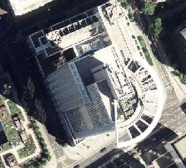
17 Multi Photo Use Aerial Triangulation Tie Points and GCP

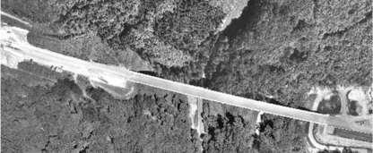
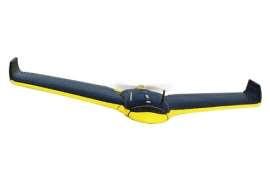
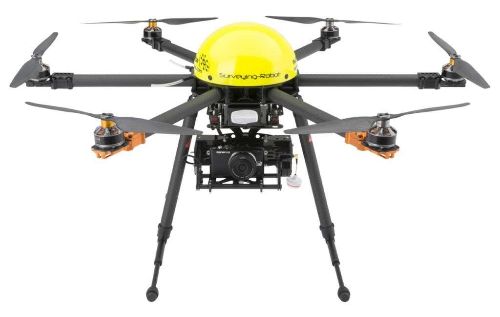
18 Looking down Nadir image approach Quadcopter


19 Digital Solution Allows True Orthorectification = Orthorectification of Structures Camera Distortion

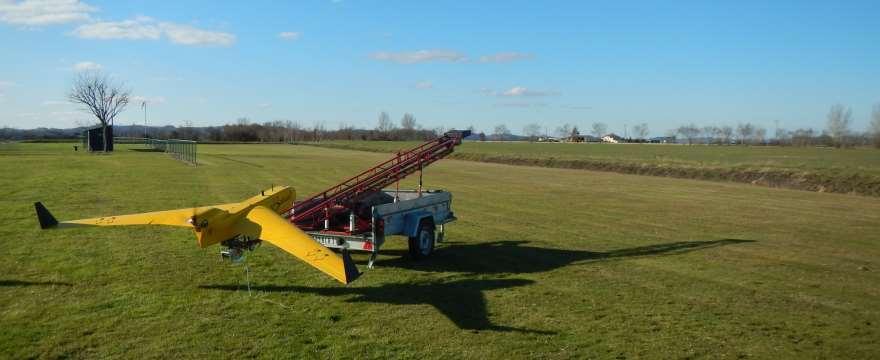
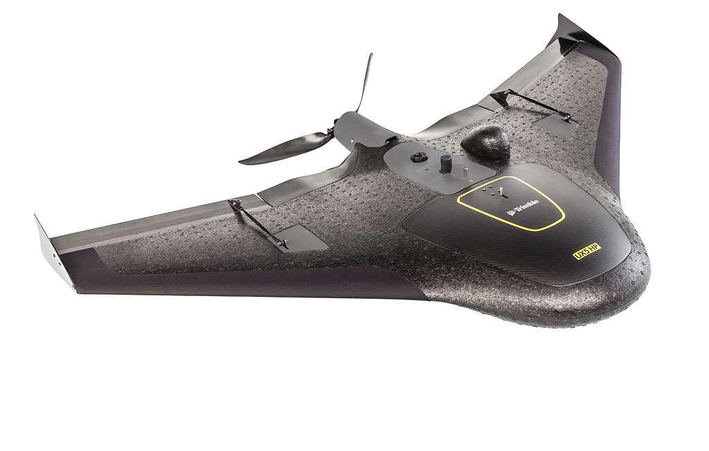
20 Create Digital Surface Models

21 Create Point Clouds

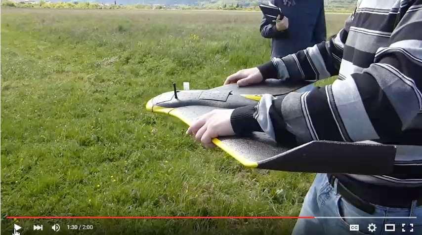
22 Create Surface

23 Create Contours
24 Create Orthomosaics
25 UAV or UAS? An unmanned aerial vehicle (UAV), commonly known as a drone, is an aircraft without a human pilot on board. Its flight is controlled either autonomously by computers in the vehicle, or under the remote control of a pilot on the ground or in another vehicle. The term unmanned aircraft system (UAS) emphasizes the importance of other elements beyond an aircraft itself. A typical UAS consists of the: unmanned aircraft (UAV) control system, such as Ground Control Station (GCS) control link, a specialized datalink other related support equipment. Credit: Wikipedia.org

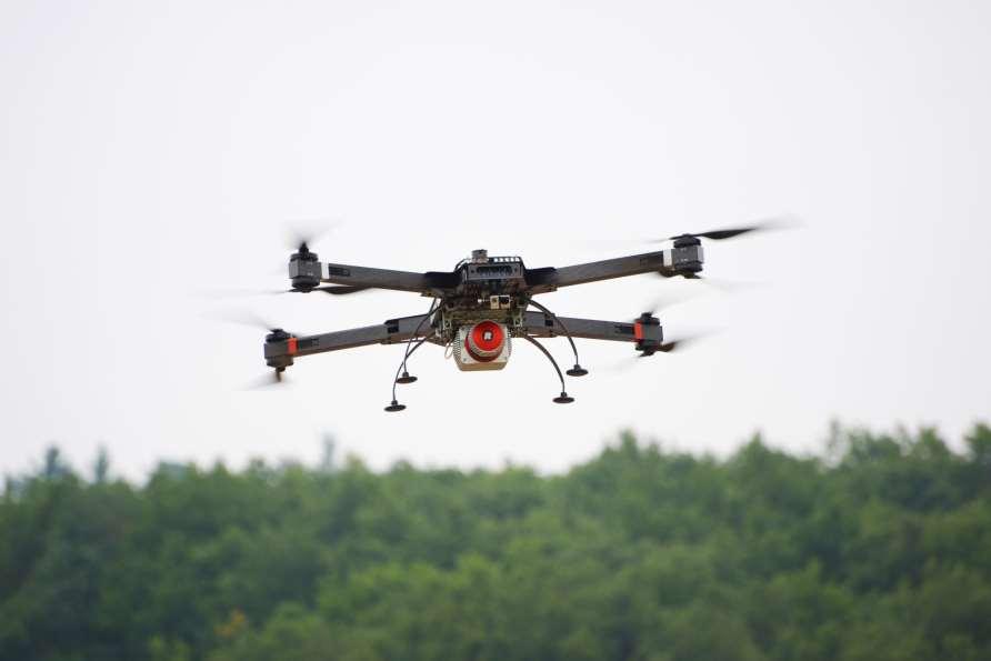
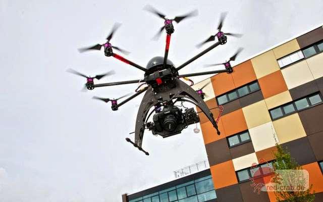
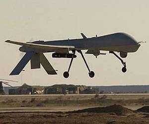
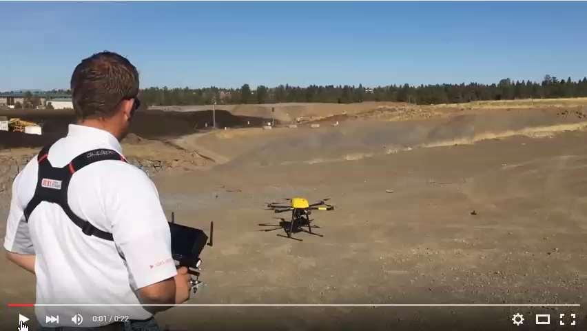
26 UAV s come in all sizes


27 Aerial Imaging Rover Airframe Internal carbon frame Expanded polypropylene foam body Engine & propeller Servo-controlled elevons Payload Bay Battery Camera Tracking beacon ebox GPS & orientation sensors 2.4 GHz radio Autopilot


28 Airframe Internal carbon frame Expanded polypropylene foam Impact resistant plastics Motor assembly ebox Servos Composite fiber parts Elevons Vertical winglets Belly plate
29 UX5 Payload Bay Tracking Beacon Clamp Battery Camera

30 UX5 ebox GPS Antenna Power Button & Status LEDs Pitot Tube Radio antenna Download Port

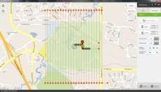
31 Defining the Flight
32 Planned photos
33 Timed Photos


34 Ground Station Rugged Tablet Flight Planning & Control Software Communications Link Download Connector

 Instruct UA to decrease altitude by 10 m Available once a flight maneuver is")
35 Safety Maneuvers Land Instruct aircraft to follow land circuit before flight path is finished Fly To Fly to a user-specified location on map and circle Hold Circle at current position Here Fly to location of pilot/gcs and circle Right Fly 300 m to the right of current heading and circle FTS (Flight Termination System) Abort flight immediately and spiral downward Up (not shown) Instruct UA to increase altitude by 10 m Available once a flight maneuver is enacted Down (not shown) Instruct UA to decrease altitude by 10 m Available once a flight maneuver is enacted
36 Flight Conditions and Effects Result from photo flight Ideal Crab Drift Norm
37 Flight Conditions and Effects Perfect Photos WIND
38 Flight Conditions and Effects CRAB COG YAW
39 Flight Conditions and Effects DRIFT
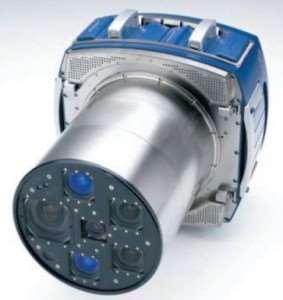
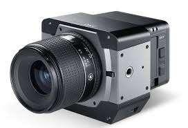
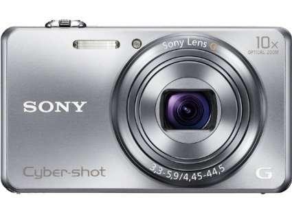
40 Flight Conditions and Effects Common WIND

41 Unstable Flight = dancing in the air overlap reduction and data gaps Number of images that see the surface Number of images that see the surface areas with reduced geospatial accuracy


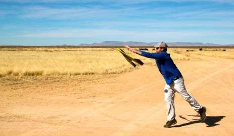
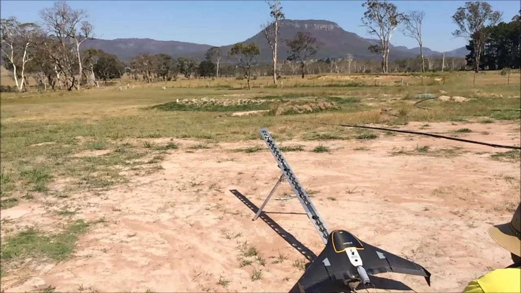
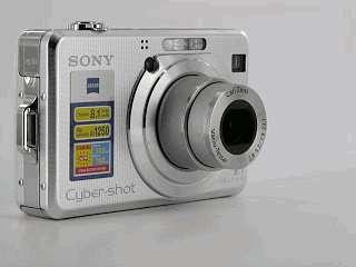
42 Launch Methods:
43
44
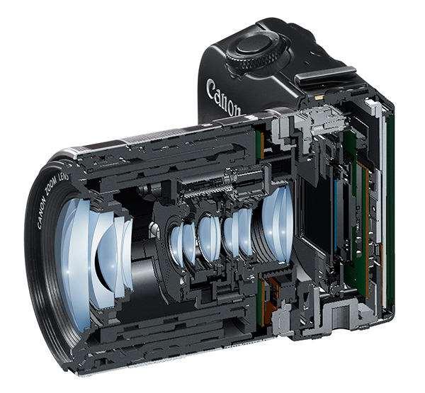
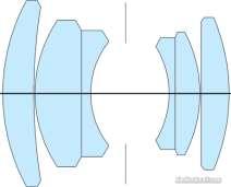
45

46
47 Flight Movie Launch Movie Andes Launch Slow Motion Launch Hand Thrown Launch Copter Landing Movie MacchuPichu Landing ebee Landing High Winds Landing Antiqua

48 2. Cameras


49 Light Receptors (sensor) Film Grain Speed
 Sensors")


50 Light Receptors (sensor) Sensors Charged Couple Device CCD Complimentary Metal Oxide Semiconducter CMOS RGBG CMYG R+G+B = Pixel Color


51 Chip Sensors 2592 Pixel Size Nicon 1J 13.2 x 8.8 [mm] μm Ricoh GR 7.44 x 5.58 [mm] μm 4918 Sony A7R 35.9 x 24.0 [mm] μm

52 Chip Sensors


53 Camera Distortion Calibration Calibration require Camera Stability Lens Distortion Platten Distorion PPA PPS
54 Lens Instability


55 Camera not optimized = zoom lens, no immobilized lens and autofocus no stable interior geometry Higher Flight Lower Flight Tree branches and terrain in focus Tree branches in focus, terrain slightly out of focus Autofocus blurs part of the scene and reduces quality Lack of stable geometry reduces overall project accuracy
56 Questions?

57 6. Fly Legal


58 Airspace Aviators do not see a map the same way we do Terrain is a hazard unless it is a runway Controlled Flight Into Terrain (CFIT) Map detail is a distraction unless it s a landmark usable for navigation
59 Airspace Aviation maps show areas of air traffic Represent cylinders/cones of controlled access Areas near airports are more restrictive The larger the airport, the more traffic and restrictions Controlled airspace is where instrument procedures may take place and are priority UAS operations would require additional equipment Operating illegally here is asking for serious trouble Class G is the only uncontrolled airspace Easiest airspace to obtain UAS flight approval Populated areas are highlighted in yellow and may have an impact on flight approvals

60 Airspace Map (VFR Sectional)

61 Airspace Classifications Airspace Handbook
62 Aircraft Manned aviation aircraft have type certificates and type ratings UAS aircraft classifications are not developed like manned aircraft FAA defines small unmanned aircraft (SUA) as those less than 55 pounds Not all aviation authorities agree on this definition e.g. France = 2kg
63 Operators 7 Different Pilot Licenses (Defined in Code of Federal Regulation, Title 14, Part 61) Student Pilot learner s permit Recreational & Sport Pilot aircraft, passenger, airspace and environmental restrictions Private Pilot (PPL) personal aircraft operation Instrument rating requires at least PPL Commercial Pilot (CPL) for-hire aircraft operation Airline Transport Pilot (ATP) Delta, United, FedEx Flight Instructors (CFI & CFII) certified trainers
64 Key Differences of Pilot Licenses PPL cannot operate for compensation or hire Some exceptions, but primarily a recreational pilot Only requires 3 rd Class Medical CPL can operate for compensation or hire Instrument rating not required Requires 2 nd Class Medical ATP requires 1500 hours of flight time Airliner pilots Requires 1 st Class Medical
65 What is Needed for Legal Flight Operations 333 Exemption Registration Certificate of Authorization Flight Actions

66 What is a 333 Exemption? A waiver predicated on the Airworthiness of the proposed system. The request should include wording that describes: How will the flights be conducted to ensure safe operation Design of the platform Provide manuals Procedures Radio Frequencies System Training
67 The 333 Exemption Process FAA Account is created Receive an FAA### for exemption Process can take several weeks Exemption Approved Receive documentation of exemption Receive a Blanket COA

68 333 Exemption Online Info Petition Links with Guides
69 333 Exemption Online Info Has someone filed for 333 Exemption
70 333 Exemption Online Info Petition Links with Guides Has someone filed for 333 Exemption Example Petition and Information
71 Registration of UAV Is a recent FAA requirement Dec. 21, 2015, Why do I need to register? Must be traceable in the event of an incident Registration is $5 Deadline to registers February 19, 2016 for systems prior implementation
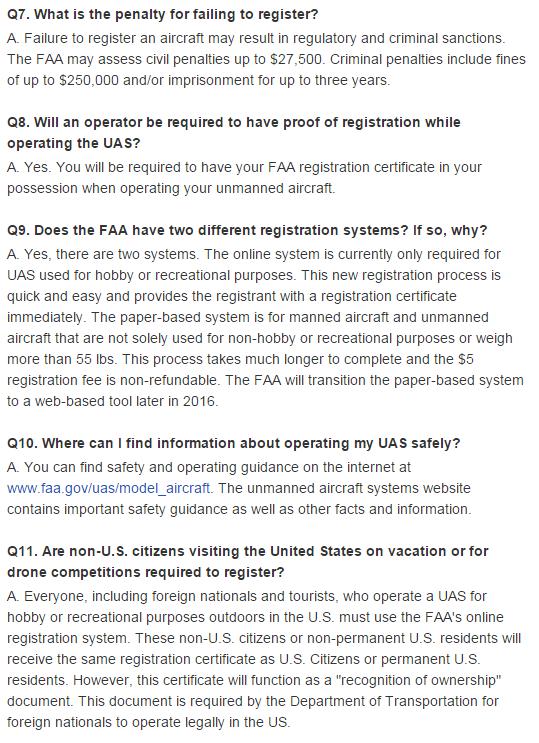
72 Registration of UAV What is a Pink Slip? Is a 90 day temporary waiver while registration is being reviewed. What if I don t register? The FAA may assess civil penalties up to $27,500. Criminal penalties include fines of up to $250,000 and/or imprisonment for up to three years
73 Registration of UAV
74 Certificate of Waiver or Authorization Airspace Controlled or uncontrolled airspace, but not class B Determined by agreement among Flight Standards and Air Traffic Control Aircraft Must be owned by the proponent and registered with FAA (N number) Airworthiness of aircraft is self-certified by proponent Operator PPL Ground school passing grade for Class G airspace PPL for controlled airspace (other than G) Observer and Pilot must each have a current 2 nd Class Medical
75 Certificate of Waiver or Authorization COA Example

76 Certificate of Waiver or Authorization COA Example

77 Certificate of Waiver or Authorization COA Example
78 What is Needed When you are Ready to Fly? Registration: The FAA Registration number or N number must be clearly written on the UAV You should keep a copy with you Certificate of Authorization Make Sure to have a copy with you. It provides Instructions require for flight in the waiver area.
79 Misconceptions Commonly Heard: Stay under 400 feet and you don t have to worry about all this. FAA clearly states that you must follow rules or potentially face FINES Send the plane off, and don t worry about seeing it. It will come back and land when finished. Not an instrument rated aircraft. VFR apply, and you must see the aircraft at all times

80 Violations and Penalties: Failure to register: Criminal penalties include fines of up to $250,000 and/or imprisonment for up to three years. Operation without a COA: Fines at FAA discretion: LINK

81 Violations and Penalties: How will they know? FAA follows up on ALL reports of aircraft being operated in an unsafe manner and registration is a material matter which will be examined when identified. Enforcement Link
82 Overview of Proposed Rules Unmanned aircraft must weigh less than 55 lbs. (25 kg). Visual line-of-sight (VLOS) only; the unmanned aircraft must remain within VLOS of the operator or visual observer. At all times the small unmanned aircraft must remain close enough to the operator for the operator to be capable of seeing the aircraft with vision unaided by any device other than corrective lenses. Small unmanned aircraft may not operate over any persons not directly involved in the operation. Daylight-only operations (official sunrise to official sunset, local time). Must yield right-of-way to other aircraft, manned or unmanned. May use visual observer (VO) but not required. First-person view camera cannot satisfy see-and-avoid requirement but can be used as long as requirement is satisfied in other ways. Maximum airspeed of 100 mph (87 knots). Maximum altitude of 500 feet above ground level. Minimum weather visibility of 3 miles from control station. Operations in Class B, C, D and E airspace are allowed with the required ATC permission. Operations in Class G airspace are allowed without ATC permission No person may act as an operator or VO for more than one unmanned aircraft operation at one time. No careless or reckless operations. Requires preflight inspection by the operator. A person may not operate a small unmanned aircraft if he or she knows or has reason to know of any physical or mental condition that would interfere with the safe operation of a small UAS. Proposes a microuas option that would allow operations in Class G airspace, over people not involved in the operation, provided the operator certifies he or she has the requisite aeronautical knowledge to perform the operation.
83 Overview of Proposed Rules cont. IMPORTANTLY, Pilot License requirement is proposed to be eliminated: Pilots of a small UAS would be considered operators. Operators would be required to: Pass an initial aeronautical knowledge test at an FAA-approved knowledge testing center. Be vetted by the Transportation Security Administration. Obtain an unmanned aircraft operator certificate with a small UAS rating (like existing pilot airman certificates, never expires). Pass a recurrent aeronautical knowledge test every 24 months.

84 A Good Starting Point Navigation Electronics Inc UAS Startup Kit Have been highly successful getting their customer legally flying Corporate Office 200 Toledo Drive Lafayette, LA Phone: Fax:
85 Questions? END
FAA Unmanned Aircraft Systems (UAS)
") FAA Unmanned Aircraft Systems (UAS) Overview: Proposed Small UAS Rule Presented To: Small Business Aviation Safety Roundtable Presented By: Mark Bury, Assistant Chief Counsel, Regulations Division of the
FAA Unmanned Aircraft Systems (UAS) Overview: Proposed Small UAS Rule Presented To: Small Business Aviation Safety Roundtable Presented By: Mark Bury, Assistant Chief Counsel, Regulations Division of the
NEW JERSEY COUNTIES EXCESS JOINT INSURANCE FUND 9 Campus Drive, Suite 216 Parsippany, NJ Telephone (201) BULLETIN NJCE 19-04
 BULLETIN NJCE 19-04") Date: January 1, 2019 NEW JERSEY COUNTIES EXCESS JOINT INSURANCE FUND 9 Campus Drive, Suite 216 Parsippany, NJ 07054 Telephone (201) 881-7632 BULLETIN NJCE 19-04 To: From: Re: Fund Commissioners of NJCE
Date: January 1, 2019 NEW JERSEY COUNTIES EXCESS JOINT INSURANCE FUND 9 Campus Drive, Suite 216 Parsippany, NJ 07054 Telephone (201) 881-7632 BULLETIN NJCE 19-04 To: From: Re: Fund Commissioners of NJCE
Part 107 Regulations in Plain English
 Part 107 Regulations in Plain English www.onlinegroundschool.com This applies to anyone flying an Unmanned Aircraft System (UAS) for any kind of compensation. This does not have to be monetary, it could
Unmanned Aircraft Systems (UAS) 101
 101") Unmanned Aircraft Systems (UAS) 101 Presented to: AUVSI Cascade Chapter Future Robotics Forum Presented by: Michael Dement-Myers, (FAA), NextGen Branch Date: October 20, 2016 Overview Unmanned Aircraft
Unmanned Aircraft Systems (UAS) 101 Presented to: AUVSI Cascade Chapter Future Robotics Forum Presented by: Michael Dement-Myers, (FAA), NextGen Branch Date: October 20, 2016 Overview Unmanned Aircraft
Drone Technology: What Works for Industry & Landowners. Michael J. Buschermohle Interim Assistant Dean UT Extension
 Drone Technology: What Works for Industry & Landowners Michael J. Buschermohle Interim Assistant Dean UT Extension So You Want to Fly FAA Regulations UAS Platforms Cameras Applications in Forestry Current
DEFINITIONS DEFINITIONS 2/11/2017 REQUIREMENTS AND LIMITATIONS OF DRONE USE IN FORENSIC ACCIDENT RECONSTRUCTION
 REQUIREMENTS AND LIMITATIONS OF DRONE USE IN FORENSIC ACCIDENT RECONSTRUCTION ROGER BURGMEIER BURGMEIER CONSULTING INC. DEFINITIONS Aircraft: device that is used, or intended to be used, for flight. Drone:
Community College Risk Management Consortium July 21 22, 2016 Understanding the Evolving Landscape of Drone Regulations and Risk Management
 Community College Risk Management Consortium July 21 22, 2016 Understanding the Evolving Landscape of Drone Regulations and Risk Management The ABCs of UAVs July 2016 UAV Talking Points Drones are changing
Municipal Drone Operations Ben Roper City of College Station
 Municipal Drone Operations Ben Roper City of College Station Unmanned Aerial System (UAS) aka Drone You are establishing an aviation unit for your entity What could possible go wrong? https://youtu.be/aolm1aqkews
Adventures in UAS: Experiences of a UAS Operator. Paul Beckwith, PE, CCM, LEED AP bd+c Navigator CS, LLC, President. Presented by:
 Adventures in UAS: Experiences of a UAS Operator Presented by: Paul Beckwith, PE, CCM, LEED AP bd+c Navigator CS, LLC, President Paul Beckwith, PE, CCM, LEED AP bd+c BA in Architectural Engineering from
LAUNCHING YOUR UNMANNED AIRCRAFT PROGRAM
 LAUNCHING YOUR UNMANNED AIRCRAFT PROGRAM THE DARTDRONES TEAM UNMANNED AIRCRAFT APPLICATIONS AERIAL INSPECTIONS AERIAL INSPECTIONS Safer and faster alternative to visual inspection by an individual Damage
Using Geospatial Data in the Oil & Gas Industry. Dr. Stacey D. Lyle, RPLS
 Using Geospatial Data in the Oil & Gas Industry Dr. Stacey D. Lyle, RPLS Outcomes A Geospatial Data Science Center is an advanced database of information organized and accessible using multiple software
2017 PLSO Fall Seminar. UAV s Flying to Finished Product
 2017 PLSO Fall Seminar UAV s Flying to Finished Product Scott D. Kraner, P.E. Subject Matter Expert Civil Infrastructure Session Outline UAV Overview and Applications How to obtain a remote pilot certificate?
Drone Pilot Course. Lesson 1 Study Guide- Regulations. Questions take from ASA Remote Pilot Test Prep Guide
 Lesson 1 Study Guide- Regulations 1. You are operating a 1280g (2.8lb) quadcopter for your own enjoyment. What FAA regulation is this suas operation subject to? a. 14 CFR 107 b. 14 CFR 101 2. You have
UNMANNED AERIAL SYSTEM USE
 UNMANNED AERIAL SYSTEM USE Unmanned aircraft systems (UASs) come in a variety of shapes and sizes and serve diverse purposes. Also known as drones, unmanned vehicle systems (UVSs) and unmanned aerial vehicles
Unmanned Aircraft Systems (UAS) 101
 101") Unmanned Aircraft Systems (UAS) 101 Presented to: ACC Airports Technical Workshop Presented by: David Russell, Program Analyst, UAS Integration Office, Date: August 10, 2016 Overview Unmanned Aircraft
Unmanned Aircraft Systems (UAS) 101 Presented to: ACC Airports Technical Workshop Presented by: David Russell, Program Analyst, UAS Integration Office, Date: August 10, 2016 Overview Unmanned Aircraft
5 Day Operator Course. 1.0 AIRSPACE CLASSROOM ONLINE EXECUTIVE VO Terms X X Classification
 5 Day Operator Course 2 Day Executive Training 2 Day VO Training 0.1 INTRODUCTION CLASSROOM ONLINE EECUTIVE VO About Avion Solutions Purpose of the course Learning objectives Course outline and schedule
Unmanned Aircraft Systems (UAS) 101
 101") Unmanned Aircraft Systems (UAS) 101 Presented to: The American Association of State Highway and Transportation Officials Presented by: Dave May, FAA UAS Integration Office Date: What is a UAS? A UAS is
Unmanned Aircraft Systems (UAS) 101 Presented to: The American Association of State Highway and Transportation Officials Presented by: Dave May, FAA UAS Integration Office Date: What is a UAS? A UAS is
TABLE OF CONTENTS 1.0 INTRODUCTION...
 Advisory Circular Subject: General Safety Practices Model Aircraft and Unmanned Air Vehicle Systems Issuing Office: Civil Aviation, Standards Document No.: AC 600-02 File Classification No.: Z 5000-31
2018 ENGINEERING EXPO Jon Thies NUAIR Director of Consulting
 2018 ENGINEERING EXPO Jon Thies NUAIR Director of Consulting Agenda Operating Under Current FAA Regulations suas Program Development Considerations suas Use Case Examples Quiz Regulations Small Unmanned
small Unmanned Aerial Systems (suas)
") 2018 WSC Annual Safety Conference small Unmanned Aerial Systems (suas) Presenter Introduction Chris Seider, CSP, PHR, CHST, ARM Senior Safety and Risk Management Specialist Foth & Van Dyke, LLC Chris.Seider@Foth.com
2018 WSC Annual Safety Conference small Unmanned Aerial Systems (suas) Presenter Introduction Chris Seider, CSP, PHR, CHST, ARM Senior Safety and Risk Management Specialist Foth & Van Dyke, LLC Chris.Seider@Foth.com
Airworthiness Certification. The UAS proposed by the petitioner are the.
 2 Airworthiness Certification The UAS proposed by the petitioner are the. The petitioner requested relief from 14 CFR part 21, Certification procedures for products and parts, Subpart H Airworthiness Certificates.
small Unmanned Aircraft Systems Arlington Police Department June 28, 2011
 suas small Unmanned Aircraft Systems Arlington Police Department June 28, 2011 1. Overview of APD suas program to date 2. Discuss the C.O.A. (FAA certificate of authorization to fly) and restrictions
Using UAS Technology for Invasive Plant Management
 Using UAS Technology for Invasive Plant Management Adam Benjamin, P.S.M. UF/IFAS Fort Lauderdale R.E.C. May 8, 2018 2018 Aquatic Weed Control Short Course Coral Springs, FL Using UAS Technology for Invasive
Program. - Flight Operations (VRI) Motivation. The Aircraft / Sensors. Unmanned Aircraft Systems 8/1/17
 Motivation. The Aircraft / Sensors. Unmanned Aircraft Systems 8/1/17") Program Unmanned Aircraft in Agriculture: Flight Operations and FAA Certification Process * 1) Background. Wayne Woldt, Ph.D., P.E. Department of Biological Systems Engineering School of Natural Resources
Program Unmanned Aircraft in Agriculture: Flight Operations and FAA Certification Process * 1) Background. Wayne Woldt, Ph.D., P.E. Department of Biological Systems Engineering School of Natural Resources
Unmanned Aircraft Systems (UAS) 101
 101") Unmanned Aircraft Systems (UAS) 101 Presented to: National Tribal Transportation Conference Presented by: Robert Winn, Aviation Safety Inspector, Unmanned Aircraft Systems Office Date: Overview Unmanned
Unmanned Aircraft Systems (UAS) 101 Presented to: National Tribal Transportation Conference Presented by: Robert Winn, Aviation Safety Inspector, Unmanned Aircraft Systems Office Date: Overview Unmanned
UNMANNED AERIAL SYSTEM (UAS) POLICY
 POLICY") UNMANNED AERIAL SYSTEM (UAS) POLICY Colby College 5500 Mayflower Hill, Waterville, ME 04901 REVISION HISTORY The UAS Policy will be reviewed and revised annually by the EHS Director. Additional revisions
UNMANNED AERIAL SYSTEM (UAS) POLICY Colby College 5500 Mayflower Hill, Waterville, ME 04901 REVISION HISTORY The UAS Policy will be reviewed and revised annually by the EHS Director. Additional revisions
Flying Small Drones in the Truckee Meadows
 Flying Small Drones in the Truckee Meadows A Drone for our discussion is a small unmanned aircraft weighing less than 55 pounds and flying slower than 100 MPH. Often Drone UAS, suas, UAV and are interchangeable.
OFWIM and DRONES How to stay out of trouble
 OFWIM and DRONES How to stay out of trouble AMA, FAA, and FARs FAA 2012 Reform and Modernization Act 2014 Interpretive Rule AMA 550 AMA 560 AC91-57 FAR 91.119 d1 NPRM Section 333 United States v. Causby328
Fly for Fun under the Special Rule for Model Aircraft
 US Fly for Fun under the Special Rule for Model Aircraft You don't need permission from the FAA to fly your UAS under the Special Rule for Model Aircraft, but you must always fly safely. You may elect
fll,' The University of Georgia O tfo:c o f rh.: Vu:.: Pre,id.:nt for Research
 November 30, 2015 fll,' - - - ----- I M.$------- The University of Georgia ------------------9 O tfo:c o f rh.: Vu:.: Pre,id.:nt for Research U.S. Department of Transportation Docket Management System
UAV/Drone Uses and Laws
 UAV/Drone Uses and Laws Robert Moorhead Director of Geosystems Research and Northern Gulf Institutes Professor of Electrical & Computer Engineering Unmanned Aerial Systems (UASs) 3 components to the system:
Kenyon College. Policy Statement
 Kenyon College Unmanned Aircraft System Policy Scope This policy applies to: Any Kenyon College employees operating unmanned aircraft systems in any location as part of their College employment or as part
Municipal Drone Operations Ben Roper City of College Station
 Municipal Drone Operations Ben Roper City of College Station Unmanned Aerial System (UAS) aka Drone You are establishing an aviation unit for your entity What could possible go wrong? What is Needed Register
PART 107 SMALL UNMANNED AIRCRAFT SYSTEMS 597 Sec. Subpart A General Applicability Definitions Falsification, reproduction or
 PART 107 SMALL UNMANNED AIRCRAFT SYSTEMS 597 Sec. Subpart A General 107.1 Applicability. 107.3 Definitions. 107.5 Falsification, reproduction or alteration. 107.7 Inspection, testing, and demonstration
UAS/Drone Recreational Regulatory Guidance for Municipalities and Law Enforcement Academy of Model Aeronautics
 UAS/Drone Recreational Regulatory Guidance for Municipalities and Law Enforcement Academy of Model Aeronautics www.modelaircraft.org As drone proliferation and use rapidly increases, local city governments
UAV Program. What does it take to have a UAV Program Current Requirements Lemhi County UAV program
 UAV Program UAV Program What does it take to have a UAV Program Current Requirements Lemhi County UAV program What does it take to have a UAV program? Some Very Important Questions to Ask Before What type
DRONES + AIRPORTS: BUZZ AROUND HARTSFIELD-JACKSON
 DRONES + AIRPORTS: BUZZ AROUND HARTSFIELD-JACKSON ACI-NA Legal Affairs Spring Conference Elizabeth Wharton, Senior Asst. City Attorney elizabeth.wharton@atl.com ATL Activities UAS Part 107 Operations contractors,
Commit to Safety: Professional Pilots Always Use a Checklist INITIAL EQUIPMENT SETUP
 Commit to Safety: Professional Pilots Always Use a Checklist INITIAL EQUIPMENT SETUP READ THE MANUAL Familiarize yourself with all aspects of your suas before you even consider going out for your first
Unmanned Aerial Vehicles for Environmental Applications
 Unmanned Aerial Vehicles for Environmental Applications John Rankin, President, J.R. Canadian Mapping Ltd. 10 th Annual Professional Biology Conference April 23 rd, 2015 UAVs Our System Suitable Sites
Sam Houston State University UAS Use Checklist
 Sam Houston State University UAS Use Checklist The FAA Part 107 of the Code of Federal Regulations and the Sam Houston State University President s Office Policy PRE-27 determine the minimum requirements
MANUAL OF POLICY. V-50 PAGE 1 of 6. Unmanned Aircraft Systems (Unmanned Aircraft and Model Aircraft) Operation
 Operation") V-50 PAGE 1 of 6 A. STATEMENT OF POLICY To provide an official College policy pertaining to the operation and use of unmanned aircraft systems, including drones and model aircrafts (collectively UAS )
V-50 PAGE 1 of 6 A. STATEMENT OF POLICY To provide an official College policy pertaining to the operation and use of unmanned aircraft systems, including drones and model aircrafts (collectively UAS )
August 26, Exemption No Regulatory Docket No. FAA Mr. Peter Sachs 3 Weir Street Branford, CT Dear Mr.
 August 26, 2015 Exemption No. 12602 Regulatory Docket No. FAA 2015 1810 Mr. Peter Sachs 3 Weir Street Branford, CT 06405 Dear Mr. Sachs: This letter is to inform you that we have granted your request for
Hidalgo County Drone Program. Standard Operating Procedure (SOP) Template. February 23, 2017
 Template. February 23, 2017") Hidalgo County Drone Program Standard Operating Procedure (SOP) Template The following is a detailed (but intended as a comprehensive) framework of topics to be covered in a Standard Operating Procedure
Hidalgo County Drone Program Standard Operating Procedure (SOP) Template The following is a detailed (but intended as a comprehensive) framework of topics to be covered in a Standard Operating Procedure
Remote Controlled Aircraft Permit Instructions
 The use of remote controlled aircraft is regulated within State Parks by WAC 352-32-130 (5) which allows for the flying of remote controlled aircraft with written permission of the Director, or designee.
Public Aircraft Operations (Governmental Entities)
") Public Aircraft Operations (Governmental Entities) Scott Gardner Acting Manager, Emerging Technologies Integration Directorate, Mission Support Services, FAA Air Traffic Organization Workshop 9: Public
Public Aircraft Operations (Governmental Entities) Scott Gardner Acting Manager, Emerging Technologies Integration Directorate, Mission Support Services, FAA Air Traffic Organization Workshop 9: Public
What is a UAS (Drone)
") UAS KCSI Aerial Patrol KCSI is Based in Bakersfield CA Established in 1993 Operates in 15 States KCSI has over 20 fulltime pilots Currently fly: Over 40,000 miles of pipeline a month 700 hours of production
UAS KCSI Aerial Patrol KCSI is Based in Bakersfield CA Established in 1993 Operates in 15 States KCSI has over 20 fulltime pilots Currently fly: Over 40,000 miles of pipeline a month 700 hours of production
Aerial Photography and Flight Planning
 Aerial Photography and Flight Planning What is VFR? Flight is to take place using visual references Must avoid clouds Normally have a distinguishable horizon Should have sight of the ground below, or in
Introduction. Who are we & what do we do.
 Drones and the Law Introduction FAA s Regulations vs. Congress Legislation Recreational Use vs. Academic Use Private Property vs. Public Airspace Flying in Class B Airspace Working with MassPort Helpful
Advanced Rating Study Guide
 Advanced Rating Study Guide FAR Part 103--Ultralight Vehicles FAR Part 91 VFR/IFR Cruise Altitude Windsports Soaring Center 12623 Gridley Street Sylmar, CA 91342-3334 Tel: (818) 367-2430 Fax: (818) 367-5363
THAT REGULATES THE USE AND OPERATION OF THE SYSTEMS OF PILOTED AIRCRAFT AT DISTANCE (RPA) or DRONES IN THE NATIONAL TERRITORY.
 or DRONES IN THE NATIONAL TERRITORY.") THAT REGULATES THE USE AND OPERATION OF THE SYSTEMS OF PILOTED AIRCRAFT AT DISTANCE (RPA) or DRONES IN THE NATIONAL TERRITORY. RNC: National Registry of Taxpayers. VLO: Visual line of sight. VMC: Visual
THAT REGULATES THE USE AND OPERATION OF THE SYSTEMS OF PILOTED AIRCRAFT AT DISTANCE (RPA) or DRONES IN THE NATIONAL TERRITORY. RNC: National Registry of Taxpayers. VLO: Visual line of sight. VMC: Visual
Air Law. Iain Darby NAPC/PH-NSIL IAEA. International Atomic Energy Agency
 Air Law Iain Darby NAPC/PH-NSIL International Atomic Energy Agency Aviation Regulations International Civil Aviation Organisation (ICAO) Convention on International Civil Aviation also known as the Chicago
2019 NYSAPLS Conference Becoming a Licensed UAS Pilot. George Southard GSKS Associates LLC
 2019 NYSAPLS Conference Becoming a Licensed UAS Pilot George Southard GSKS Associates LLC Introduction George Southard: Master s Degree in Photogrammetry and Cartography 40+ years working in the mapping/surveying
Lone Star UAS Center. of Excellence and Innovation
 Lone Star UAS Center LSUASC Introduction of Excellence and Innovation Bringing UAS to America s Skies NASAO 85 th Annual Convention and Tradeshow UAS Emerging Technologies & Utilizations September 13,
Getting Your Drone Off the Ground: An Insider's Look at the New FAA Regs
 Getting Your Drone Off the Ground: An Insider's Look at the New FAA Regs Asking Questions Anti-Trust Policy Before we begin our meeting, please keep in mind that numerous state and Federal laws absolutely
UNMANNED AIRCRAFT PROVISIONS IN FAA REAUTHORIZATION BILL
 UNMANNED AIRCRAFT PROVISIONS IN FAA REAUTHORIZATION BILL Section 341 Comprehensive Plan -Codifies in title 49 the requirement in the 2012 FAA reauthorization Act that a comprehensive plan to safely accelerate
How to Use Drones in Stormwater Management January 17, :30 a.m. 11:30 a.m. (Eastern)
") Webinar Training Series How to Use Drones in Stormwater Management January 17, 2019 10:30 a.m. 11:30 a.m. (Eastern) www.seswa.org Today s Presenters Robert Gecy Application Programmer Beaufort County,
Webinar Training Series How to Use Drones in Stormwater Management January 17, 2019 10:30 a.m. 11:30 a.m. (Eastern) www.seswa.org Today s Presenters Robert Gecy Application Programmer Beaufort County,
Unmanned. FAA Guidelines and Regulations for the Model Aircraft Pilot. Federal Aviation Administration Aircraft Systems (UAS) Date:
 Date:") Unmanned Aircraft Systems (UAS) FAA Guidelines and Regulations for the Model Aircraft Pilot Presented by: FAA Safety Team AFS-850 Date: Important Information Exits Restrooms Emergency Evacuation Breaks
Unmanned Aircraft Systems (UAS) FAA Guidelines and Regulations for the Model Aircraft Pilot Presented by: FAA Safety Team AFS-850 Date: Important Information Exits Restrooms Emergency Evacuation Breaks
Use of UAS in Research and Education
 Use of UAS in Research and Education Kelly A. Rusch, Ph.D., P.E. Vice President for Research and Creative Activity-NDSU James L. Grimsley Associate Vice President for Research OU Norman Campus 11/14/16
 Presented by: Lt. Michael J. Magda Team Leader, Firefighter, EMT -P, Hazardous Material Specialist, Private Pilot, Airframe & Power plant Mechanic Western Wayne County HMRT, Livonia Fire & Rescue And
Development and Testing of an Unmanned Aircraft Safety Beacon for Aerial Application Safety
 Development and Testing of an Unmanned Aircraft Safety Beacon for Aerial Application Safety Wayne Woldt, Ph.D., P.E., and Jacob Smith Biological Systems Engineering and School of Natural Resources University
The UAS proposed by the petitioner are the DJI Phantom 2, DJI Phantom 3, DJI Inspire 1, Lockheed Martin Indago, and Sentera Phoenix.
 October 23, 2015 Exemption No. 13313 Regulatory Docket No. FAA 2015 1830 Mr. Reid Plumbo Director of Product Management Sentera, LLC 6636 Cedar Avenue South Minneapolis, MN 55423 Dear Mr. Plumbo: This
Systems (UAS) Unmanned Aircraft. Presented to: GWBAA Safety Stand Down Day. Presented by: John Meehan. Date: 17 May AUS-430 Safety & Operations
 Unmanned Aircraft. Presented to: GWBAA Safety Stand Down Day. Presented by: John Meehan. Date: 17 May AUS-430 Safety & Operations") Unmanned Aircraft Systems (UAS) Presented to: GWBAA Safety Stand Down Day Presented by: John Meehan AUS-430 Safety & Operations UAS Integration Office Date: What is a UAS? Unmanned aircraft system (UAS)
Unmanned Aircraft Systems (UAS) Presented to: GWBAA Safety Stand Down Day Presented by: John Meehan AUS-430 Safety & Operations UAS Integration Office Date: What is a UAS? Unmanned aircraft system (UAS)
GCAA GUYANA CIVIL AVIATION AUTHORITY
 GCAA GUYANA CIVIL AVIATION AUTHORITY DIRECTIVE No: GCAA/ASR/DIR/2017-01 Issued: 26 th February, 2017 AUTHORITY DIRECTIVE TO OWNERS AND OPERATORS OF UNMANNED AERIAL VEHICLES (UAVs) The Guyana Civil Aviation
Colorado Association of Realtors
 Colorado Association of Realtors Drones in the Real Estate Industry What You Need to Know Tom Dougherty Lewis Roca Rothgerber LLP Overview 1. Introduction to Unmanned Aircraft Systems (UAS) 2. Federal
Commercial Pilot Practical Test Briefing
 Commercial Pilot Practical Test Briefing 1. What certificates and documents must you have on board the aircraft prior to flight? 2. Locate the following inspections, as appropriate, in the airframe and
Waiver Safety Explanation Guidelines
 Waiver Safety Explanation Guidelines When filling out the Waiver Safety Explanation field in the operational waiver application, applicants must: 1. Describe their proposed operation(s) 2. Describe the
LOW DOWN ON THE HIGH UP: USING DRONES FOR LAND CONSERVATION
 LOW DOWN ON THE HIGH UP: USING DRONES FOR LAND CONSERVATION TEXAS LAND CONSERVATION CONFERENCE MARCH 3, 2017 STEPHEN RAMIREZ STEWARDSHIP DIRECTOR TEXAS LAND CONSERVANCY RAY RENNER, RPLS, PMP MANAGER OF
UAS in Canada Stewart Baillie Chairman Unmanned Systems Canada Sept 2015
 UAS in Canada - 2015 Stewart Baillie Chairman Unmanned Systems Canada Sept 2015 My Focus Today.. Report on the growth of the UAS sector in Canada as a whole Provide background on UAS regulation in Canada
P310 VTOL UAV Operation Manual
 P310 VTOL UAV Operation Manual February, 2017 1 Shanghai Huace Navigation Technology Ltd. Contents 1.1 SYMBOLS DEFINITIONS... 4 1.2 TECHNICAL SUPPORT... 5 2.1 WARNING... 5 2.2 NOTICE... 5 4.1 GENERAL SPECIFICATIONS...
GUIDANCE FOR THE SAFE OPERATION OF MODEL AIRCRAFT, SMALL-UNMANNED AIRCRAFT AND SMALL UNMANNED SURVEILLANCE AIRCRAFT IN GUERNSEY AND ALDERNEY
 GUIDANCE FOR THE SAFE OPERATION OF MODEL AIRCRAFT, SMALL-UNMANNED AIRCRAFT AND SMALL UNMANNED SURVEILLANCE AIRCRAFT IN GUERNSEY AND ALDERNEY 1 Introduction 1.1 This document has been produced by Guernsey
COMMERCIAL OPERATIONS
 Cornell University UAV Guidelines Office of Risk Management and Insurance Purpose: The Office of Risk Management and Insurance has published guidelines as a resource for members of the University community
Unmanned Aircraft Systems
 Unmanned Aircraft Systems Current State, Task Force, and Upcoming Regulations Presented to: APWA Minnesota Chapter By: Kevin Morris, Date: November, 19, 2015 What is a UAS? are aircraft.* *NTSB Order No.
Questions to Answer: The Rules. Unmanned Aerial Systems (UAS): What You Need to Know. 1. Should we be leveraging UAS?
: What You Need to Know. 1. Should we be leveraging UAS?") Unmanned Aerial Systems (UAS): What You Need to Know Colorado SWANA Annual Conference September 13, 2017 Questions to Answer: 1. Should we be leveraging UAS? 2. Should we self-perform UAS work? 3. If we
Unmanned Aerial Systems (UAS): What You Need to Know Colorado SWANA Annual Conference September 13, 2017 Questions to Answer: 1. Should we be leveraging UAS? 2. Should we self-perform UAS work? 3. If we
TAPS 49 th Annual Conference & Exhibition FAA Regulations for UAS Operations
 TAPS 49 th Annual Conference & Exhibition FAA Regulations for UAS Operations 10 March 2017, Murfreesboro, TN George Southard Introduction George Southard: Master s Degree in Photogrammetry and Cartography
DRONING FOR INFORMATION
 DRONING FOR INFORMATION Opportunity of Drones for Surveying and Mapping Practices By: Adam Smith, CP Matt Aguirre, PLS Overview Introduction Background Problem and Opportunity Issues and Mitigations Implementation
MODEL AERONAUTICAL ASSOCIATION OF AUSTRALIA
 MODEL AERONAUTICAL ASSOCIATION OF AUSTRALIA GENERAL RULES AND GUIDELINES FOR THE OPERATION OF MODEL AIRCRAFT MOP014 APPROVED: MAAA PRESIDENT Date: 31/10/2017 Paragraph 2.0 Definitions Brief description
Advisory Circular. General Safety Practices Model Aircraft and Unmanned Air Vehicle Systems
 Advisory Circular Subject: General Safety Practices Model Aircraft and Unmanned Air Vehicle Systems Issuing Office: Civil Aviation, Standards Document No.: AC 600-002 File Classification No.: Z 5000-34
Getting off the Ground: Implementing a Drone Program
 Getting off the Ground: Implementing a Drone Program November 2017 Steve Goldman, GISP GIS Manager / UAS Coordinator California Department of Fish and Wildlife http://www.wildlife.ca.gov Drones (UAS) What
National Regulatory Profile
 National Regulatory Profile Finland NOTE : In this form the following terms are used Drone = Remotely Piloted Aircraft (RPA) = Unmanned Aircraft (UA) = See definition below Drone Pilot = Remote Pilot (RP)
Airworthiness considerations for UAVs
 A general overview about the approach to a UAV System under current regulations for operation, airspace and certification Presentation by : STN ATLAS ELEKTRONIK Klaus Wohlers, LMP Airborne Systems Type
SBA Communications Corporation suas Policy
 SBA Communications Corporation suas Policy 1 Change and Issue Record Date of Issue Issue Changes 9/30/2016 01 Initial Release 11/3/2016 02 Updated Insurance Requirements 11/15/16 03 Updated Avetta Status
USE OF REMOTELY PILOTED AIRCRAFT AND MODEL AIRCRAFT IN AVIATION
 luo Regulation 1 (10) OPS M1-32 Issued: 4 December 2018 Enters into force: 7 December 2018 Validity: indefinitely Legal basis: Aviation Act (864/2014), Sections 5, 9 and 57 Act on Transport Services (320/2017),
OWEA Woolpert UAS Operations
 OWEA 2016 Woolpert UAS Operations UAS Rules and Regulations How Woolpert is Handling This The Exemption In December 2014 Woolpert received approval from the FAA regarding an exemption seeking relief from
Subtitle B Unmanned Aircraft Systems
 H. R. 658 62 (e) USE OF DESIGNEES. The Administrator may use designees to carry out subsection (a) to the extent practicable in order to minimize the burdens on pilots. (f) REPORT TO CONGRESS. (1) IN GENERAL.
Drone Guidelines. Risks and Guidelines Related to Unmanned Aerial Systems (UAS)/Drones
/Drones") Drone Guidelines Risks and Guidelines Related to Unmanned Aerial Systems (UAS)/Drones Disclaimer: The technical information contained herein is provided to ASCIP members and nonmembers. While ASCIP makes
Drone Guidelines Risks and Guidelines Related to Unmanned Aerial Systems (UAS)/Drones Disclaimer: The technical information contained herein is provided to ASCIP members and nonmembers. While ASCIP makes
Small Unmanned Aircraft Systems (Drone) Policy
 Policy") SUNY Cortland - Environmental Health and Safety Office Unmanned Aircraft Systems (Drone) Policy Date of Inception: January 29, 2018 Latest Revision/Review Date: November 15, 2018 Previous Revision/Review
SUNY Cortland - Environmental Health and Safety Office Unmanned Aircraft Systems (Drone) Policy Date of Inception: January 29, 2018 Latest Revision/Review Date: November 15, 2018 Previous Revision/Review
Unmanned Aircraft Systems (UAS)
") Unmanned Aircraft Systems (UAS) Update Presented to: Airports Council International Presented by: Danielle J. Rinsler, AICP Date: Who is Operating UAS in the National Airspace System (NAS)?* Public (Governmental)
Unmanned Aircraft Systems (UAS) Update Presented to: Airports Council International Presented by: Danielle J. Rinsler, AICP Date: Who is Operating UAS in the National Airspace System (NAS)?* Public (Governmental)
Pre-Solo Written Exam
 Pre-Solo Written Exam Introduction 14 CFR Part 61.87(b) requires student pilots to demonstrate aeronautical knowledge by completing a knowledge test prior to soloing an aircraft. The test must address
Democratic Socialist Republic of Sri Lanka. Implementing Standards (Issued under Sec. 120, Civil Aviation Act No. 14 of 2010)
") Democratic Socialist Republic of Sri Lanka Civil Aviation Authority of Sri Lanka Implementing Standards (Issued under Sec. 120, Civil Aviation Act No. 14 of 2010) Title: Requirements for Operation of Pilotless
Democratic Socialist Republic of Sri Lanka Civil Aviation Authority of Sri Lanka Implementing Standards (Issued under Sec. 120, Civil Aviation Act No. 14 of 2010) Title: Requirements for Operation of Pilotless
11/20/15 AC 61-98C Appendix 2 APPENDIX 2. SAMPLE AIRPLANE PILOT S PROFICIENCY PRACTICE PLAN. Flight Rules (VFR) Flight Profile Every 4-6 Weeks:
 Flight Profile Every 4-6 Weeks:") Appendix 2 APPENDIX 2. SAMPLE AIRPLANE PILOT S PROFICIENCY PRACTICE PLAN Pilot s Name: Date: Flight Rules (VFR) Flight Profile Every 4-6 Weeks: Preflight (include 3-P Risk Management Process (RMP) (Perceive
Appendix 2 APPENDIX 2. SAMPLE AIRPLANE PILOT S PROFICIENCY PRACTICE PLAN Pilot s Name: Date: Flight Rules (VFR) Flight Profile Every 4-6 Weeks: Preflight (include 3-P Risk Management Process (RMP) (Perceive
Western Service Area Unmanned Aircraft Systems (UAS) Update. Federal Aviation Administration. Defense Symposium
 Update. Federal Aviation Administration. Defense Symposium") Western Service Area Unmanned Aircraft Systems (UAS) Update Presented to: Presented by: Northwest Aerospace & Defense Symposium Matt Gammon, Tactical Operations Team, FAA Western Service Center Date: May
Western Service Area Unmanned Aircraft Systems (UAS) Update Presented to: Presented by: Northwest Aerospace & Defense Symposium Matt Gammon, Tactical Operations Team, FAA Western Service Center Date: May
Using UAVs for Aerial Mapping, Surveying and Photography
 Using UAVs for Aerial Mapping, Surveying and Photography Prepared for: Central Florida GIS Workshop 18 September 2013 Kevin Shortelle System Dynamics International, Inc kevinshortelle@bellsouth.net Presentation
Outline Why CCSU PinnaclX and Eversource
 CBIA 2018 Safety & Health Conference Wednesday, May 23, 2018 The Red Lion Hotel Cromwell 100 Berlin Road, Cromwell, CT Drones & Safety: A Brave New World Alfred A. Gates, Ph.D. CFI Helicopter, UAS Remote
MODEL AERONAUTICAL ASSOCIATION OF AUSTRALIA
 MODEL AERONAUTICAL ASSOCIATION OF AUSTRALIA GENERAL RULES AND GUIDELINES FOR THE OPERATION OF MODEL AIRCRAFT MOP014 APPROVED M.A.A.A. PRESIDENT Date: 16/02/2007 Table of Contents 1. PURPOSE...1 2. DEFINITIONS...1
The Legal Environment for Commercial Unmanned Aircraft
 The Legal Environment for Commercial Unmanned Aircraft Overview The Legal Environment Who can fly them? A history of FAA policy to the present Asking for permission 2 Today s Legal Framework 3 Today s
FAA FORM UAS COA Attachment FAA
 Page 1 of 6 DEPARTMENT OF TRANSPORTATION FEDERAL AVIATION ADMINISTRATION CERTIFICATE OF WAIVER OR AUTHORIZATION ISSUED TO Xcam Aerials, Inc. 10197 SE 144th Place Summerfield, FL 34491 This certificate
SECURE RESEARCH POLICY Use of Small Unmanned Aircraft Systems (Small UAS or Drones in University Activities or on University Property) November 2016
 November 2016") 1.0 INTRODUCTION The use of Unmanned Aircraft Systems, referred to customarily as UAS or drones, in the United States, for commercial, recreational and other permitted activities, has greatly increased
1.0 INTRODUCTION The use of Unmanned Aircraft Systems, referred to customarily as UAS or drones, in the United States, for commercial, recreational and other permitted activities, has greatly increased
ONE PLATFORM, MULTIPLE APPLICATIONS: SURVEYING CONSTRUCTION FORESTRY AGRICULTURE ENVIRONMENT POWER ENGINEERING BIRDIE YOUR TAILOR-MADE UAV
 UAV BIRDIE BIRDIE YOUR TAILOR-MADE UAV ONE PLATFORM, MULTIPLE APPLICATIONS: SURVEYING CONSTRUCTION FORESTRY AGRICULTURE ENVIRONMENT POWER ENGINEERING BIRDIE UAV is the complete mapping solution, made for
UNITED STATES OF AMERICA DEPARTMENT OF TRANSPORTATION FEDERAL AVIATION ADMINISTRATION WASHINGTON, DC
 UNITED STATES OF AMERICA DEPARTMENT OF TRANSPORTATION FEDERAL AVIATION ADMINISTRATION WASHINGTON, DC Regulatory Docket No. FAA-2007-3330-0001 IN THE MATTER OF THE PETITION FOR EXEMPTION OF: STEVEN MCDONALD
Part 101 Unmanned aircraft and rockets
 Part 101 Unmanned aircraft and rockets Part 101 Unmanned aircraft and rockets Table of contents Subpart 101.A Preliminary 101.005 Applicability of this Part 101.010 Application to rocket-powered unmanned