and Supplements Introduction Requirements Procedures Aerodromes Heliports
|
|
|
- Amice Lynch
- 6 years ago
- Views:
Transcription
1 AIP BAHRAIN FIR GEN NAME OF PUBLISHING AUTHORITY PART 1 - GENERAL (GEN) GEN 0. GEN 0.1 PREFACE The AIP BAHRAIN FIR is published by the authority of Civil Aviation Affairs of the Kingdom of Bahrain and the Civil Aviation Authority of the State of Qatar APPLICABLE ICAO DOCUMENTS The AIP is prepared in accordance with the Standards and Recommended Practices (SARPS) of Annex 15 to Chicago Convention and the Aeronautical Information Services Manual (ICAO Doc AN 872). Charts contained in the AIP are produced in accordance with Annex 4 to the Chicago Convention and the Aeronautical Chart Manual (ICAO Doc AN 889). Differences from ICAO Standards, Recommended Practices and Procedures are given in section GEN PUBLICATION MEDIA See GEN THE AIP STRUCTURE AND ESTABLISHED REGULAR AMENDMENT INTERVAL The AIP structure The AIP forms part of the Integrated Aeronautical Information Package of which details are given in Section GEN 3.1. The principal structure is shown in graphic form at the end of this GEN 0.1subsection. The AIP is the basic aeronautical information document for the BAHRAIN FIR / BAHRAIN UIR, and contains lasting information essential to air navigation. For other details reference should be made to the AIP of the State concerned. The AIP is divided into three Parts, General (GEN), En-route (ENR) and Aerodromes (AD), each divided into sections and subsections containing various types of information subjects. Note: the electronic AIP BAHRAIN FIR (see GEN ) may not include certain subsections listed hereafter which are not relevant for an electronic AIP. These subsections are marked as underlined Part 1 General (GEN) Part 1 consists of the five sections containing information as briefly described hereafter. GEN 0 Preface; Record of AIP Amendments; Record of AIP Supplements; Checklist of AIP pages; List of hand amendments to the AIP; and the Table of Contents to Part 1. GEN 1. National regulations and requirements Designated authorities; Entry, transit and departure of aircraft; Entry, transit and departure of passengers and crew; Entry, transit and departure of cargo; Aircraft instruments, equipment and flight documents; summary of national regulations and international agreements / conventions; and Differences from ICAO Standards, Recommended Practices and Procedures for the Kingdom of Bahrain and the State of Qatar. GEN 2. Tables and codes Measuring system, aircraft markings, holidays; Abbreviations used in AIS publications; Chart symbols; Location indicators; List of radio navigation aids; Conversion tables; and Sunrise / Sunset tables. GEN 3. Services Aeronautical information services; Aeronautical charts; Air traffic services; Communication services; Meteorological services; and rescue. GEN 4. Charges for aerodromes / heliports and air navigation services Aerodrome / heliport charges; and Air navigation services charges Part 2 En - route (ENR) Part 2 consists of seven sections containing information as briefly described hereafter. ENR 0.
2 GEN AIP BAHRAIN FIR Preface; Record of Amendments; Record of AIP Supplements; Check list of AIP pages; List of hand amendments to the AIP; and the Table of Content to Part 2. ENR 1. General rules and procedures General rules; Visual flight rules; Instrument flight rules; ATS airspace classification; Holding, approach and departure procedures; Radar services and procedures; Altimeter setting procedures; Regional supplementary procedures; Air traffic flow management; Flight planning; Addressing of flight plan messages; Interception of civil aircraft; Unlawful interference; and Air traffic incidents. ENR 2. Air traffic services airspace Detailed description of: Flight information regions (FIR), Upper flight information regions (UIR), Terminal control areas (TMA); and other regulated airspace. ENR 3. ATS routes Detailed description of: Lower ATS routes; Upper ATS routes; Area navigation routes; Helicopter routes; other routes; and En-route holding. Note: Other types of routes which are specified in connection with procedures for traffic to and from aerodromes / heliports are described in the relevant section of the Part 3 Aerodromes. ENR 4. Radio navigation aids / systems Radio navigation aids en-route; Special navigation systems; Global navigation satellite system, Name-code designators for significant points; and Aeronautical ground lights en -route. ENR 5. Navigation Warnings Prohibit, restricted and danger areas; Military exercise and training areas; Other activities of dangerous nature; Air navigation obstacles enroute; Aerial sporting and recreational activities; and Bird migration and areas with sensitive fauna. ENR 6. En - route charts En-route Chart ICAO and index charts Part 3 Aerodromes (AD) Part 3 consists of four sections containing information as briefly described hereafter. AD 0. Preface; Record of AIP Amendments; Record of AIP Supplements; Check list of AIP pages; List of hand amendments to the AIP; and the Table of Contents to Part 3. AD 1. Aerodromes / Heliports Introduction Aerodrome / heliport availability; Rescue and Fire fighting services and snow plan; Index to aerodromes and heliports, Grouping of aerodromes / heliports, Status of certification of aerodromes. AD 2. Aerodromes Detailed information about aerodromes, including helicopter landing areas, if located at the aerodromes. AD 3. Heliports Detailed Information about heliports (not located at aerodromes) Regular amendment Interval The AIP BAHRAIN FIR will be updated on regular basis according the AIRAC dates as published in GEN Whenever an AIRAC AMDT is published a trigger NOTAM will be issued by at least three days prior to effective date. This NOTAM will give a brief description of the AIRACs content and shall come into effect on the same date of the AIRAC COPYRIGHT POLICY To be developed
3 AIP BAHRAIN FIR GEN SERVICES TO CONTACT IN CASE OF DETECTED AIP ERRORS OR OMISSIONS The AIP BAHRAIN FIR and associated NOTAM are compiled from a variety of sources. Except for Kingdom of Bahrain, all information is acquired from indepent states and from commercial sources. The greatest care is exercised in the assembly and compilation of information for the AIP BAHRAIN FIR and associated NOTAM and they are considered to be as reliable as possible at the time of issue. Civil Aviation Affairs will not be held responsible, however, for the accuracy of the content of the AIP or NOTAM or for any omissions therefrom, neither will Civil Aviation Affairs be responsible for the adequacy or receipt of NOTAM or AIP amendments. Any errors and omissions which may nevertheless be detected, as well as any correspondence concerning the Integrated Aeronautical Information Package, should be referred to: Aeronautical Information Service Static Data Coordinator (SDC) Kingdom of Bahrain Civil Aviation Affairs P.O. Box 586 TEL: Telefax: sdc@caa.gov.bh Bahrain International NOTAM Office Kingdom of Bahrain Civil Aviation Affairs P.O. Box 586 TEL: / 1 / 2 Telefax: AFS: OBBBYNYX
4 GEN AIP BAHRAIN FIR THE INTEGRATED AERONAUTICAL INFORMATION PACKAGE NOTAM and PIB AIP including Amendments and Supplements AIC Checklists and List of valid NOTAM PART 1 GENERAL (GEN) PART 2 EN-ROUTE (ENR) PART 3 AERODROMES (AD) GEN 0 ENR 0 AD 0 GEN 1 National Regulations and Requirements ENR 1 General Rules and Procedures AD 1 Aerodromes/Heliports - Introduction GEN 2 Tables and Codes ENR 2 ATS Airspace AD 2 Aerodromes GEN 3 Services ENR 3 ATS Routes AD 3 Heliports GEN 4 Charges for Aerodromes/Heliports and Air Navigation Services ENR 4 Radio Navigation Aids/Systems ENR 5 Navigation Warnings ENR 6 En-route Charts
5 AIP BAHRAIN FIR GEN GEN 0.2 RECORD OF AIP AMENDMENTS AIP AMENDMENT AIRAC AIP AMENDMENT NR/ Year Publication date Date inserted Inserted by NR/ Year Publication date Effective date Inserted by
6 INTENTIONALLY BLANK
7 AIP BAHRAIN FIR GEN GEN 0.3 RECORD OF AIP SUPPLEMENTS Not applicable.
8 INTENTIONALLY BLANK
9 AIP BAHRAIN FIR GEN GEN 0.4 CHECKLIST OF AIP PAGES Page Date PART 1 - GENERAL (GEN) GEN GEN GEN GEN Page Date GEN PART 2 - EN-ROUTE (ENR) ENR ENR Page Date ENR ENR
10 GEN AIP BAHRAIN FIR Page Date ENR ENR ENR PART 3 - AERODROMES (AD) AD Page Date AD AD 2. BAHRAIN INTERNATIONAL 2-OBBI-1 2-OBBI-2 2-OBBI-3 2-OBBI-4 2-OBBI-5 2-OBBI-6 2-OBBI-7 2-OBBI-8 2-OBBI-9 2-OBBI-10 2-OBBI-11 2-OBBI-12 2-OBBI-13 2-OBBI-14 2-OBBI-15 2-OBBI-16 2-OBBI-17 2-OBBI-18 2-OBBI-19 2-OBBI-20 2-OBBI-21 2-OBBI-22 2-OBBI-23 2-OBBI-24 2-OBBI-25 2-OBBI-26 2-OBBI-27 2-OBBI-28 2-OBBI-29 2-OBBI-30 2-OBBI-31 2-OBBI-32 2-OBBI-33 2-OBBI-34 2-OBBI-35 2-OBBI-36 2-OBBI-37 2-OBBI-38 2-OBBI-39 2-OBBI-40 2-OBBI-41 2-OBBI-42 2-OBBI-43 2-OBBI-44 2-OBBI-45 2-OBBI-46 2-OBBI-47 2-OBBI-48 2-OBBI-49 2-OBBI-50 2-OBBI-51 2-OBBI-52 2-OBBI-53 2-OBBI-54 2-OBBI-55 2-OBBI-56 2-OBBI-57 2-OBBI-58 Page Date 2-OBBI-59 2-OBBI-60 2-OBBI-61 2-OBBI-62 2-OBBI-63 2-OBBI-64 2-OBBI-65 2-OBBI-66 2-OBBI-67 2-OBBI-68 2-OBBI-69 2-OBBI-70 2-OBBI-71 2-OBBI-72 2-OBBI-73 2-OBBI-74 2-OBBI-75 2-OBBI-76 2-OBBI-77 2-OBBI-78 2-OBBI-79 2-OBBI-80 2-OBBI-81 2-OBBI-82 2-OBBI-83 2-OBBI-84 BAHRAIN / ISA AIRBASE 2-OBBS-1 2-OBBS-2 2-OBBS-3 2-OBBS-4 2-OBBS-5 2-OBBS-6 2-OBBS-7 2-OBBS-8 2-OBBS-9 2-OBBS-10 2-OBBS-11 2-OBBS-12 2-OBBS-13 2-OBBS-14 BAHRAIN / SAKHIR AIRBASE 2-OBKH-1 2-OBKH-2 2-OBKH-3 2-OBKH-4 2-OBKH-5 2-OBKH-6 2-OBKH-7 2-OBKH-8 2-OBKH-9 2-OBKH-10 2-OBKH-11 2-OBKH-12 2-OBKH-13 2-OBKH-14 2-OBKH-15 2-OBKH-16 2-OBKH-17 2-OBKH-18 2-OBKH-19 2-OBKH-20 2-OBKH-21 2-OBKH-22 2-OBKH-23 2-OBKH-24 AD
11 AIP BAHRAIN FIR GEN GEN 0.5 LIST OF HAND AMENDMENTS TO THE AIP AIP page(s) affected Amendment text Introduced by AIP Amendment NR
12 INTENTIONALLY BLANK
13 AIP BAHRAIN FIR GEN GEN 0.6 TABLE OF CONTENTS TO PART 1 Page GEN 0. GEN 0.1 PREFACE GEN GEN 0.2 RECORD OF AIP AMENDMENTS GEN GEN 0.3 RECORD OF AIP SUPPLEMENTS GEN GEN 0.4 CHECKLIST OF AIP PAGES GEN GEN 0.5 LIST OF HAND AMENDMENTS TO THE AIP GEN GEN 0.6 TABLE OF CONTENTS TO PART 1 GEN GEN 1. NATIONAL REGULATIONS AND REQUIREMENTS GEN 1.1 DESIGNATED AUTHORITIES GEN GEN 1.2 ENTRY, TRANSIT AND DEPARTURE OF AIRCRAFT GEN GEN 1.3 ENTRY, TRANSIT AND DEPARTURE OF PASSENGERS AND CREW GEN GEN 1.4 ENTRY, TRANSIT AND DEPARTURE OF CARGO GEN GEN 1.5 AIRCRAFT INSTRUMENTS, EQUIPMENT AND FLIGHT DOCUMENTS GEN GEN 1.6 SUMMARY OF NATIONAL REGULATIONS AND INTERNATIONAL AGREEMENTS / CONVENTIONS GEN GEN 1.7 DIFFERENCES FROM ICAO STANDARDS, RECOMMENDED PRACTICES AND PROCEDURES GEN GEN 2. TABLES AND CODES GEN 2.1 MEASURING SYSTEM, AIRCRAFT MARKINGS, HOLIDAYS GEN GEN 2.2 ABBREVIATIONS USED IN AIS PUBLICATIONS GEN GEN 2.3 CHART SYMBOLS GEN GEN 2.4 LOCATION INDICATORS GEN GEN 2.5 LIST OF RADIO NAVIGATION AIDS GEN GEN 2.6 CONVERSIONS OF UNIT OF MEASUREMENTS GEN GEN 2.7 SUNRISE / SUNSET GEN GEN 3. SERVICES GEN 3.1 AERONAUTICAL INFORMATION MANAGEMENT GEN GEN 3.2 AERONAUTICAL CHARTS GEN GEN 3.3 AIR TRAFFIC SERVICES GEN GEN 3.4 COMMUNICATION SERVICES GEN GEN 3.5 METEOROLOGICAL SERVICES GEN GEN 3.6 SEARCH AND RESCUE GEN GEN 4. CHARGES FOR AERODROMES / HELIPORTS AND AIR NAVIGATION SERVICES GEN 4.1 AERODROME / HELIPORT CHARGES GEN GEN 4.2 AIR NAVIGATION SERVICES CHARGES GEN 4.2-1
14 INTENTIONALLY BLANK
15 AIP BAHRAIN FIR GEN REQUIREMENTS AND PROCEDURES GEN 1. NATIONAL REGULATIONS AND REQUIREMENTS GEN 1.1 DESIGNATED AUTHORITIES The requirements for entry and departure of aircraft engaged in international flights, and the standard procedures for clearance of these aircraft is given for the Kingdom of Bahrain. (for state of Qatar, refer to Qatar AIP) Note: It is solely the aircraft operators responsibility to obtain any required landing and overflight permission from the appropriate state authorities Permission to and / or overfly issued by Civil Aviation Affairs Bahrain related only to BAHRAIN INTERNATIONAL Airport and the territorial airspace of the Kingdom of Bahrain Clearances issued by the BAHRAIN ACC or Flight Information Centre are based on ATC considerations and do not absolve operators from compliance with the states facilitation regulations DESIGNATED AUTHORITIES The addresses of designated authorities concerned with the facilitation of international air navigation (e.g. civil aviation, meteorology, customs, immigration, health, en - route and aerodrome / heliport charges, agricultural quarantine and aircraft accident investigation) containing, for each authority DIFFERENCES FROM ICAO STANDARDS AND RECOMMENDED PRACTICES Where available, information concerning any difference from ICAO Annex 9 is published seperately for each individual State. Additional information is published when received. KINGDOM OF BAHRAIN INTRODUCTION The requirements for entry and departure of aircraft engaged in international flights, and the standard procedure for clearance of these aircraft at international airports, are given for the information and guidance of operators conducting international flights DESIGNATED AUTHORITIES The postal and telegraphic addresses of the designated authorities concerned with the entry, transit and departure of international air navigation and for the collection of fees therefrom, are as follows: Undersecretary for Civil Aviation P.O. Box 586 Kingdom of Bahrain TEL: Telefax: AFS: OBBIYAYX Undersecretary for Civil Aviation P.O. Box 586 Kingdom of Bahrain TEL: Telefax: AFS: OBBIYAYX (AIR NAVIGATION DIRECTORATE) Director Air Navigation P.O. Box 586 Kingdom of Bahrain TEL: Telefax: AFS: OBBIYAYX (AIRPORT DIRECTORATE) Vice President Airport Operations P.O. Box Kingdom of Bahrain
16 GEN AIP BAHRAIN FIR TEL: Telefax: (AIRPORT CHARGES) Director of Administration & Finance P.O. Box 586 Kingdom of Bahrain TEL: Telefax: (DIRECTORATE OF AIR TRANSPORT) Director of Air Transport P.O. Box 586 Kingdom of Bahrain TEL: Telefax: AFS: OBBIYAYX SITA: BAHAPYF CUSTOMS Director General of Customs P.O. Box 15 Kingdom of Bahrain TEL: Telefax: Telex: 8642 MINA BN BAHRAIN AIRPORT CUSTOMS INSPECTION SECTION TEL: Telefax: IMMIGRATION General Director of Immigration and Passports P.O. Box 331 Kingdom of Bahrain TEL: Telefax: AIRPORT IMMIGRATION SECTION TEL: Telefax: HEALTH Ministry of Health P.O. Box 12 Kingdom of Bahrain TEL: Telefax: Airport Health Office TEL: AGRICULTURAL & VETERINARY QUARANTINE Ministry of Municipalities & Agriculture Affairs Farmers Services Directorate P.O. Box 251 Kingdom of Bahrain Telex: 7200 ZERAA BN AGRICULTURAL AFFAIRS TEL: Telefax: MINISTRY OF MUNICIPALITIES TEL: Telefax:
17 AIP BAHRAIN FIR GEN MINISTRY OF INTERIOR (DIRECTOR OF AIRPORT SECURITY AREA) Ministry of Interior P.O. Box 13 Kingdom of Bahrain TEL: Telefax: Telex: 9572 PSMKT BN MINISTRY OF FOREIGN AFFAIRS Ministry of Foreign Affairs P.O. Box 547 Kingdom of Bahrain Telefax: Telex: 8228 KARJIA BN TRACKING OFFICE TEL: , Telefax: APPROVED AIRCRAFT HANDLING AGENCIES Bahrain Airport Services (BAS) P.O. Box Kingdom of Bahrain TEL: Telefax: Telex: 8971 BASBA BN AFS: OBBIXHAX SITA: BAHKBXH APPROVED AVIATION FUELLING Bahrain Aviation Fuelling Company - BAFCO P.O. Box Kingdom of Bahrain TEL: (Office) / (Operations - H24) Telefax:
18 INTENTIONALLY BLANK
19 AIP BAHRAIN FIR GEN KINGDOM OF BAHRAIN GEN 1.2 ENTRY, TRANSIT AND DEPARTURE OF AIRCRAFT REGULATIONS AND REQUIREMENTS FOR ADVANCE NOTIFICATION AND APPLICATIONS FOR PERMISSION CONCERNING ENTRY, TRANSIT AND DEPARTURE OF AIRCRAFT ON INTERNATIONAL FLIGHTS GENERAL All flights landing in, departing from or overflying the territory of Bahrain shall comply with Bahrain Civil Aviation Law and Regulations and must include a valid mailing address of the company for which payment invoice must be issued to, failure to comply will result in rejecting the relevant approval request INFORMATION REQUIRED FROM AIRCRAFT OPERATORS The following information is required from all aircraft operators for any type of operations: 1. Aircraft Operator (Air Operators Certificate (AOC) - holder) and Address 2. Aircraft Charterer (if any) 3. Call Sign / Flight Number or Registration mark(s) 4. Aircraft Type & Nature of flight 5. Full Sector or Flight (from / to) & ETA / ETD 6. If Dangerous Goods are carried, refer also to GEN Proposed date(s) of flight(s) 8. Aircraft configuration (passenger and cargo capacity) 9. Postal address of the company for collection of bills and payments. 10. Postal address of the agent and its client, if any. 11. Finance section contact details, telephone, fax and APPLICATIONS FOR APPROVAL All applications should be addresses to the attention of: Director of Air Transport P.O. Box 586 Kingdom of Bahrain TEL: / / / Telefax: / schedule@caa.gov.bh AFS: OBBIYAYX SITA: BAHAPYF Aircraft landing in or departing from the territory of Bahrain must first land at or finally depart from the international Airport SCHEDULED OPERATIONS TRAFFIC STOPS IN THE TERRITORY OF BAHRAIN For regular international scheduled flights into Bahrain, the airline must be designated pursuant to a bilateral or multilateral agreement to which the government of Bahrain and that of the State in which the airline is registered are parties, or have been granted a Temporary Operating Permit (T.O.P.) by Bahrain CAA. Applications should be made 30 days prior to the proposed date of commencement of operation to the address shown in GEN The following information and documents are required from aircraft operators in addition to the information shown under GEN above: a) Information 1. Period of Operation 2. Aircraft Configuration (Passengers & Cargo Capacity) 3. Frequency (days of the week) Note: see recommended Airlines Schedule Application Format b) Pre-requisite valid documents: 1. Air Operators Certificate, reflecting the aircraft registration mark(s) 2. Certificate of Registration 3. Certificate of Airworthiness 4. Insurance Certificate with full liability coverage (refer to GEN ) 5. Noise Certificate 6. Aircraft Radio Station License 7. ACAS II / TCAS Certificate (mandatory within Bahrain airspace) 8. Basic Area Navigation (B - RNAV) Certificate, if equipped 9. RVSM Certificate, when operating above feet
20 GEN AIP BAHRAIN FIR 10. In case of a leased aircraft: a) A copy of the lease agreement, approved by the State of Registry and the state operator; and b) Conformity statement from the State of Registry, stating that it will remain responsible for the safety oversight. (c) In case of transfer of functions of the State of Registry to the State of Operator, evidence is required showing the state responsible for safety oversight OVERFLYING AND TECHNICAL STOPS Subject to the observance of the applicable rules and regulations, aircraft registered in ICAO States and operated by an airline of any contracting State may overfly or make non-traffic stops in the territory of Bahrain provided the State concerned being signatory to the International Air Transit Agreement. There is no requirement to request for overflying permission for such aircraft. Applications for non-traffic stops should be made to the address shown in GEN a minimum notice period of one week is required for administrative and operational reasons. The following information is required from aircraft operators in addition to the information shown under GEN above: 1. Period of Operation 2. Aircraft Configuration (Passengers & Cargo Capacity) 3. Frequency (days of the week) Operators of aircraft registered in States that are not signatory to the ICAO convention must be obtain prior approval to overfly or land in the territory of Bahrain. A minimum notice period of one week is required for administrative and operational reasons. Note: see recommended Airlines Schedules Application Format DOCUMENTARY REQUIREMENTS FOR THE CLEARANCE OF AIRCRAFT It is necessary that the aircraft documents shown in the table in GEN be submitted by aircraft operators for the clearance on entry and departure of their aircraft to and from Bahrain One copy of the General Declaration must be signed by the pilot - in - command or an authorized agent All documents listed below must follow the ICAO standard format, set forth in the relevant appendices to Annex 9, must be furnished in English and be completed legibly No visas are required in connection with such documents AIRCRAFT DOCUMENTS REQUIRED (ARRIVAL / DEPARTURES) REQUIRED BY GENERAL DECLARATION PASSENGER MANIFEST CARGO MANIFEST IMMIGRATION NIL NIL NIL HEALTH 1 1 NIL CUSTOMS NIL / 1 NIL 1 / 1 TOTAL Note: If no passengers are embarking or disembarking and no articles are loaded or unloaded, no documents except copies of the General Declaration need to be submitted PUBLIC HEALTH MEASURES APPLIED TO AIRCRAFT If more than four weeks have elapsed since the date of issue of the certificate of Residual Disinfection, and the aircraft has originated in or arrived from a malarious area or a yellow fever endemic area, aerosol disinfection of the aircraft should be carried out before taking off, or on arrival NON SCHEDULED OPERATIONS TRAFFIC STOPS IN THE TERRITORY OF BAHRAIN If an operator intends to make an non - scheduled stop in the territory of Bahrain for the purpose of taking on or discharging passengers, cargo or mail, the Air Operators Certificate (AOC) - holder should apply to the address shown in GEN , a minimum notice period of one week is required. The following valid documents are required from AOC - holder in addition to the information shown under GEN above: 1. Air Operators Certificate, reflecting the aircraft registration mark(s)
21 AIP BAHRAIN FIR GEN Certificate of Registration 3. Certificate of Airworthiness 4. Insurance Certificate with full liability coverage (refer to GEN ) 5. Noise Certificate 6. Aircraft Radio Station License 7. ACAS II / TCAS Certificate (mandatory within Bahrain airspace) 8. Basic Area Navigation (B - RNAV) Certificate, if requipped 9. RVSM Certificate, when operating above FT 10. In case of a leased aircraft: (a) A copy of the lease agreement, approved by the State of Registry and the State of Operator; and (b) Conformity statement from the State of Registry, stating that it will remain responsible for the safety oversight. (c) In case of transfer of functions of the State of Registry to the State of Operator, evidence is required showing the state responsible for safety oversight OVERFLYING AND TECHNICAL STOPS Subject to the observance of the applicable rules and regulations, aircraft registered in ICAO States and operated by an airline of any contracting State may over fly or make non - traffic stops in the territory of Bahrain provided the State concerned being signatory to the Chicago Convention on International Civil Aviation. There is no requirement to request for over flying permission for such aircraft except when the flight is involved in Diplomatic or Military operations e.g. State VIP, transportation of ammunitions etc. in which case an application for approval should be made in accordance with GEN below. Applications for non - traffic stops should be made to the address shown in GEN A minimum notice period of 48 hours is required for administrative and operational reasons. The following information is required from aircraft operators in addition to the information shown under GEN above: 1. Date of Flight(s) 2. Type of Cargo (if any) Operators of aircraft registered in States that are not signatory to the ICAO convention must obtain prior approval to overfly or land in the territory of Bahrain. A minimum notice period of one week is required for the administrative and operational reasons DOCUMENTARY REQUIREMENTS FOR THE CLEARANCE OF AIRCRAFT The same as for scheduled flights (see GEN ) AIRCRAFT DOCUMENTS REQUIRED (ARRIVAL / DEPARTURE) REQUIRED BY GENERAL DECLARATION PASSENGER MANIFEST CARGO MANIFEST IMMIGRATION 1 1 NIL HEALTH 1 1 NIL CUSTOMS 1 / 1 NIL 1 TOTAL PUBLIC HEALTH MEASURES APPLIED TO AIRCRAFT The same as for scheduled flights PRIVATE / GENERAL AVIATION OPERATIONS TRAFFIC STOPS IN THE TERRITORY OF BAHRAIN If an operator wishes to land in the territory of Bahrain for the purpose of taking on or discharging of passengers, cargo or mail, he should apply for approval to the address shown in GEN , a minimum notice period of 48 hours is required for administrative and operational reasons. The following information is required from aircraft operators in addition to the information shown under GEN above: 1. Purpose of Flight 2. Passenger & Company Name 3. Name of VIP (if any) 4. Type of Cargo (if any) 5. Hosting Company and / or Contact in Bahrain Note: see recommended Request Processing Information List
22 GEN AIP BAHRAIN FIR OVERFLYING AND TECHNICAL STOPS Subject to the observance of the applicable rules and regulations, there is no requirement to request permission for overflying or refuelling / crew rest stops for such aircraft except when the flight is involved in Diplomatic or Military Operations e.g. State VIP, Transportation of ammunitions etc. in which case an application for approval should be made in accordance with GEN below Operators of aircraft registered in states that are not signatory to the ICAO convention must obtain prior approval to overfly or land in the territory of Bahrain. A minimum notice period of 48 hours is required for administrative and operational reason. Note: see recommended Request Processing Information List DOCUMENTARY REQUIREMENTS FOR THE CLEARANCE OF AIRCRAFT The same as for scheduled flights (see GEN ) AIRCRAFT DOCUMENTS REQUIRED (ARRIVAL / DEPARTURE) REQUIRED BY GENERAL DECLARATION PASSENGER MANIFEST CARGO MANIFEST IMMIGRATION 1 1 NIL HEALTH 1 1 NIL CUSTOMS 1 / 1 NIL 1 TOTAL PUBLIC HEALTH MEASURES APPLIED TO AIRCRAFT The same as for non - scheduled flights APPLY FOR APPROVAL Any State or Military aircraft (including chartered flights) wishing to overfly, land in or depart from the territory of Bahrain shall apply for approval. A minimum notice period of one week before the intended date of overflight, arrival or departure is required. Applications should be made to: Address Ministry of Foreign Affairs P.O. Box 547 Kingdom of Bahrain Telefax: Telex: 8228 KARJIA BN With a copy to: Director of Air Transport P.O. Box 586 Kingdom of Bahrain Telefax: AFS: OBBIYAYX SITA: BAHAPYF Information required from aircraft operators The following information is required from aircraft operators in addition to the information shown under GEN above: 1. Purpose of Flight 2. Name of VIP (if any) 3. Type of Cargo (if any) VVIP / VIP FLIGHT OPERATIONS Any operator carrying out a VVIP / VIP flight for the purpose of landing in, departing from or overflying the territory of Bahrain shall apply for approval to the Ministry of Foreign Affairs as detailed in GEN above.
23 AIP BAHRAIN FIR GEN INSURANCE COVER IN RESPECT OF LIABILITY FOR PASSENGERS, BAGGAGE, CARGO AND THIRD PARTIES REQUIREMENT FOR MINIMUM INSURANCE COVER Air carriers and aircraft operators are required to provide a minimum insurance cover in respect of passengers, baggage and cargo in accordance with the rules of Montreal Convention (signed on 28 May 1999); and in respect of third parties in accordance with GEN below The insurance shall cover aviation - specific liability in respect of passengers, baggage, cargo and third parties. Regarding passengers, baggage and cargo insurance shall include cover for death and personal injury caused by accidents and for loss or destruction of or damage to baggage and cargo. Regarding third parties, insurance shall include cover for death, personal injury and damage to property caused by accidents DEFINITIONS a) "air carrier" means an air transport undertaking with a valid operating license or Air Operators Certificate; b) "aircraft operator" means the person or entity, not being an air carrier, who has continual effective disposal of the use or operation of the aircraft; the natural or legal person in whose name the aircraft is registered shall be presumed to be the operator, unless that person can prove that another person is the operator; c) " flight means"; with regard to passengers and unchecked baggage, the period of transport of the passengers by aircraft including their boarding and disembarkation, with regard to cargo and checked baggage, the period of transport of baggage and cargo from the moment the baggage or cargo is handed to the air carrier until the moment of delivery to the entitled recipient, with regard to third parties, the use of an aircraft from the moment when power is applied to its engines for the purpose of taxiing or actual take - off until the moment when it is on the surface and its engines have come to a complete stop; additionally, it shall mean the moving of an aircraft by towing and push - back vehicles or by powers which are typical for the drive and lift of aircraft, particularly air streams; d) "SDR" means a Special Drawing Right as defined by the International Monetary Fund; e) "MTOM" means the Maximum Take - off Mass, which corresponds to a certified amount of specific to all aircraft types, as stated in the certificate of airworthiness of the aircraft; f) "Passenger" means any person who is on the flight with the consent of the air carrier or the aircraft operator, excluding on - duty members of both the flight crew and the cabin crew; g) "third party" means any legal or natural person, excluding passengers and on - duty members of both the flight crew and the cabin crew; h) "commercial operation" means an operation for remuneration and / or hire PRINCIPLES OF INSURANCE The insured risks shall include acts of war, terrorism, hijacking, acts of sabotage, unlawful seizure of aircraft and civil commotion Air carriers and aircraft operators shall ensure that insurance cover exists for each and every flight, regardless of whether the aircraft operated is at their disposal through ownership or form of lease agreement, or through joint or franchise operations, code - sharing or any other agreement of the same nature INSURANCE IN RESPECT OF LIABILITY FOR THIRD PARTIES In respect of liability for third parties, the minimum insurance cover per accident, for each and every aircraft, shall be: CATEGORY MOTOM (kg) MINIMUM insurance (million SDRs) 1 < < < < < < < < < = / >
24 GEN AIP BAHRAIN FIR AMENDMENT TO THE INSURANCE VALUES The insurance values may be amended, as appropriate, when amendments in the relevant international treaties indicate the necessity thereof EVIDENCE OF ADEQUATE INSURANCE COVER Air carriers and air operators are required to provide evidence of adequate insurance cover stated as above. In an event such evidence is not provided, operating permission shall be denied.
25 AIP BAHRAIN FIR GEN RECOMMENDED PRESENTATION FORMAT FOR AIRLINES SCHEDULE APPROVAL APPLICATIONS
26 GEN RECOMMENDED REQUEST PROCESSING INFORMATION LIST FOR PRIVATE / GENERAL AVIATION FLIGHTS AIP BAHRAIN FIR Note: This form may be reproduced to suit individual operators need e.g. SITA / AFTN.
27 AIP BAHRAIN FIR GEN KINGDOM OF BAHRAIN GEN 1.3 ENTRY, TRANSIT AND DEPARTURE OF PASSENGERS AND CREW REGULATIONS (INCLUDING CUSTOMS, IMMIGRATION AND QUARANTINE, AND REQUIREMENTS FOR ADVANCE NOTIFICATION AND APPLICATIONS FOR PERMISSION) CONCERNING ENTRY, TRANSIT AND DEPARTURE OF PASSENGERS AND CREW IMMIGRATION REQUIREMENTS ARRIVING PASSENGERS A person entering Bahrain for the purpose of immigration must hold a valid passport. A 72 - hour visa can be obtained for non - immigration purposes such as business. Disembarkation cards must be completed TRANSIT PASSENGERS No documents or visa are required for passengers arriving and departing on the same flight, or transferring to another flight at the same airport DEPARTING PASSENGERS From departing passengers, inspection of identity documents and completion of an embarkation card are required CREW A crew member license is acceptable CUSTOMS REQUIREMENTS ARRIVAL Baggage belonging to disembarking passengers and crew is immediately inspected and released if it does not contain any prohibited, restricted or dutiable goods. Dutiable items are released immediately on payment of duty TRANSIT Not specified DEPARTURE For embarking passengers, the inspection of baggage is not normally required PUBLIC HEALTH REQUIREMENTS ARRIVAL A Yellow Fever vaccination certificate is required from travellers over one year of age coming from infected areas TRANSIT Not specified DEPARTURE On departure, no health formalities are required.
28 INTENTIONALLY BLANK
29 AIP BAHRAIN FIR GEN KINGDOM OF BAHRAIN GEN 1.4 ENTRY, TRANSIT AND DEPARTURE OF CARGO REGULATIONS (INCLUDING CUSTOMS, AND REQUIREMENTS FOR ADVANCE NOTIFICATION AND APPLICATIONS FOR PERMISSION) CONCERNING ENTRY, TRANSIT AND DEPARTURE OF CARGO Note: Provisions for facilitating entry and departure for search, rescue, salvage, investigation, repair or salvage in connection with lost or damaged aircraft are detailed in section GEN 3.6, Search and Rescue CUSTOMS REQUIREMENTS CONCERNING CARGO AND OTHER ARTICLES IMPORTS All air cargo shipments for Bahrain or in transit Bahrain are subject to customs clearance before release. For clearance, the appropriate Customs Declaration supported by required documents, notably genuine commercial suppliers invoice and Certificate of Origin must be presented TRANS - SHIPMENTS Trans - shipment from one flight to another is permitted under customs supervision and must be recorded in the Export Manifest of departing flights EXPORTS Air cargo shipments from Bahrain may be required to be cleared through customs on the appropriate customs declaration before shipment, especially when draw back of duty or deposit is claimed AGRICULTURAL QUARANTINE REQUIREMENTS ARRIVAL Advance permits are required for the importation of plants, plant parts, seeds and organic fertilizers. Advance permits are also required for the importation of live animals to Kingdom of Bahrain. Details are available on application to the Ministry of Municipalities and Agriculture Affairs, Farmers Services Directorate at the address shown on GEN TRANSIT See GEN DEPARTURE See GEN SAFE TRANSPORT OF DANGEROUS GOODS BY AIR General The Kingdom of Bahrain legislation requires that the transportation of all classes of dangerous goods is done in accordance with instructions contained in the Technical instructions for the safe Transport of Dangerous Goods by Air, ICAO Doc AN / 905 and CAA Publication CAP The Kingdom of Bahrain legislation expressly forbids the transport of the following items by aircraft, except with the prior permission from Civil Aviation Affairs and in accordance with the conditions mentioned in this permission: a) Weapons and munitions b) Explosives, unless required on board the aircraft for its operation, or for signaling c) Poisonous Gases d) Germs e) Radioactive material, radioisotopes and similar substances f) Any other prohibited item as determined by the competent authority An Operator who intends to transport dangerous goods by air, is required to apply and be approved in accordance with CAA publication CAP In the event of an accident / incident involving dangerous goods, the operator is required to adhere to the reporting procedures
30 GEN AIP BAHRAIN FIR in accordance with CAA publication CAP Overflying BAHRAIN FIR / BAHRAIN UIR An Operator desirous to carry dangerous goods and applying for permission to overfly the BAHRAIN FIR / BAHRAIN UIR, must ensure that all dangerous goods have been packed, marked, labelled and handled in accordance with ICAO Annex 18 - Safe Transport of Dangerous Goods by Air, and the requirements of ICAO Technical Instructions Doc, AN / 905, and must make an undertaking to CAA to this effect. This undertaking must be made at the time of providing notification of over flight / applying for the required permission (GEN 1.2 refers) Transportation of Arms, Ammunition and all Classes of Explosives Furthermore, the transportation of arms, ammunition and all classes of explosives from / to / through Bahrain requires prior permission to be obtained from the Ministry of the Interior (MOI) and Civil Aviation Affairs (CAA) of the Kingdom of Bahrain Applications are required to be made at least seven working days in advance of the proposed date of transportation to an appropriate office of the Ministry of Interior (MOI): (a) Transportation To / From Bahrain (Form: AT / ARL / F002 a) Ministry of Interior Public Security Headquarters Kingdom of Bahrain TEL: Telefax: Telex: 9572 BN (b) Transit / Transshipment at Bahrain (Form: AT / ARL / F 002 b) Ministry of Interior Airport Directorate Bahrain International Airport Kingdom of Bahrain TEL: / Telefax: On receipt of "no objection" from MOI, the application is required to be forwarded to CAA, at least three working days prior to the proposed date of transportation for final approval: Head of Aircraft Registration and Licensing Air Transport Directorate Civil Aviation Affairs P.O. Box 586 Kingdom of Bahrain TEL: Telefax: Telex: 9186 AIRCIV BN
31 AIP BAHRAIN FIR GEN GENERAL GEN 1.5 AIRCRAFT INSTRUMENTS, EQUIPMENT AND FLIGHT DOCUMENTS CARRIAGE OF RADIO AND RADAR EQUIPMENT To assist in the expeditious of air traffic throughout the BAHRAIN FIR / BAHRAIN UIR by the fullest use of the Navigation Aids provided for this purpose, the appropriate authorities of state providing Approach and / or Area Control Services have agreed to the requirements shown in GEN and GEN below for the carriage of Radio and Radar equipment Carriage of equipment listed under Paragraphs GEN , GEN and GEN is mandatory CARRIAGE COMMUNICATIONS, NAVIGATION AND APPROACH AID EQUIPMENT The requirements applicable to all aircraft flying in the BAHRAIN FIR / BAHRAIN UIR and those particular to aircraft flying for the purpose of public transport are tabulated below. No general exemption from these requirements will be granted, but in very special circumstances relaxation of the requirements for a single flight may be approved by the Bahrain Air Traffic Control Centre or by the appropriate Approach Control Unit COMMUNICATION, NAVIGATION AND APPROACH EQUIPMENT REQUIRED Flight under IFR in Controlled Airspace up to FL 150 COMMUNICATIONS EQUIPMENT VHF RTF with appropriate frequencies available NAVIGATION EQUIPMENT a) in Control Areas and Control Zones VOR Receiver and automatic D / F and receiver for 75 MHZ Beacons b) in BAHRAIN CTA and Terminal Manoeuvring Areas, in addition to (a) above, DME APPROACH AID EQUIPMENT For landing at certain aerodromes within Control Zones an Approach Aid, e.g. ILS Exception Gliders, helicopters and light aircraft of 2500 KG MAUW or less, and special VFR flights, are exempt from the Navigation Equipment requirements Flight in Controlled Airspace above FL 150 In addition to GEN , DME Public Transport Aircraft flying under IFR Equipment as in GEN and GEN Public Transport Aircraft flying under VFR Sufficient equipment to maintain two - way communication with appropriate ATS units and also to navigate to the Flight Plan and ATC instructions. Note: See also GEN 3.4 with reference to the continuous guarding of emergency frequencies CARRIAGE OF SSR TRANSPONDERS The requirements for the carriage of radar equipment in the BAHRAIN FIR / BAHRAIN UIR are as follows: All TFC WI OBBB FIR / UIR: Mode A Codes and Mode C Exception for carrying Mode C Gliders Helicopters below 1000 FT
32 GEN AIP BAHRAIN FIR Exemptions The grant of exemptions from meeting the above requirements for the carriage of SSR transponder will only be considered in exceptional circumstances, and for limited periods. Applicants for exemption should submit full details of their inability to meet the requirements to: Undersecretary for Civil Aviation P.O. Box 586 Kingdom of Bahrain Telefax: AFS: OBBIYAYX CARRIAGE OF AIRBORNE COLLISION AVOIDANCE SYSTEM - ACAS II All fixed - wing turbine - engined aircraft having maximum take - off mass in excess of 5700 KG or approved passenger seating configuration of more than 19, will be required to be equipped with ACAS II Aircraft that failed to install ACAS II shall not be permitted to operate within BAHRAIN FIR / BAHRAIN UIR AUTHORIZATION FOR FLIGHT IN RVSM AIRSPACE Aircraft intending flight in airspace where RVSM rules are applied are required to carry specific approval for RVSM operations from their State of Registry State aircraft are exempt from the requirement to carry RVSM documentation. Note: In these cases 2000 FT vertical separation shall be applied. However, priority for allocation of levels will be in accordance with the criteria of making the best use of available airspace NAVIGATION EQUIPMENT FAILURE PROCEDURES If part of an aircrafts radio navigation equipment fails, but two-way communication can still be maintained with ATC, the pilot must inform ATC of the failure and report his altitude and approximate position. ATC may at its discretion authorize the pilot to continue his flight in or into controlled airspace. When radar is available it may, subject to workload, be used to provide navigational assistance to the pilot If no authorization to proceed is given by ATC the pilot should leave or avoid controlled airspace and areas of dense traffic, and either: a) Go to an area in which he can continue his flight in VMC, or b) Select a suitable area in which to descend through cloud, fly visually to a suitable aerodrome and land as soon as practicable. Note: Before doing so, however, he should consult ATC who may be able to give him instructions or advice. He should also take into consideration the latest meteorological information and terrain clearance.
33 AIP BAHRAIN FIR GEN GEN 1.6 SUMMARY OF NATIONAL REGULATIONS AND INTERNATIONAL AGREEMENTS / CONVENTIONS The following is a list of Civil Aviation Legislation, Air Navigation Regulation etc. in force in certain areas of the BAHRAIN FIR / BAHRAIN UIR. They are available from: Head of Aviation Safety Civil Aviation Affairs P.O. Box 586 Kingdom of Bahrain Reference NO. (a) Civil Aviation Law (Amiri Decree No. 6/1995) CAA Law (b) Air Navigation Technical Regulations ANTR (c) Safe Transport of Dangerous Goods by Air (PO1/01) (d) Procedures for Aircraft Accident & Incident Investigation (PO1/02) (e) Procedures for ATC Incident Reporting (PO1/03) (f) The Mandatory Occurrence Reporting Scheme for Bahrain Registered Aircraft (PO1/05) (g) Air Operators Certificate (PO1/06) (h) The Completion of Application Forms for the Grant, Renewal or Variation of an Air Operators Certificate (PO1/07) (i) Maintenance Engineer Licensing (PO1/08) (j) Flight Crew Licensing (PO1/09) (k) Designated Examiner : Flight Crew (PO1/10) (l) Procedures for Air Ambulance Operations and Emergency Medical Services (PO1/12) Summary of the procedure for issuance / Validation of Licenses (Refer P01/79) in GEN above: The licenses issued by ICAO contracting state may be recognized by the Kingdom of Bahrain provided that the following are adhered to: a) A license is issued by a contracting state to the convention on International Civil Aviation, in accordance with Annex 1 to the convention, and is valid at the time of application; b) The training organization and syllabus meet Bahrain CAA requirements; c) The applicant is employed by a Bahrain registered operator; and d) The applicant successfully passes an examination on Bahrain aviation law and regulations, conducted by Bahrain CAA International agreements / conventions: Kingdom of Bahrain Convention on International Civil Aviation (The Chicago Convention) Convention for the Unification of Certain Rules Relating to International Carriage by Air (The Warsaw Convention) International Air Services Transit Agreement Convention on offences and certain Other Acts Committed on Board Aircraft (The Tokyo Convention) Convention for the Suppression of Unlawful Seizure of Aircraft (The Hague Convention) Convention for the Suppression of Unlawful Acts against the Safety of Civil Aviation (The Montreal Convention) Convention on the Privileges and Immunities of specialized Agencies (United Nations) Convention on the Marking of plastic Explosives for the Purpose of Detection Convention on Damage Caused by Foreign Aircraft to Third Parties on surface (Rome, 7 October 1952) and protocol to emend the same (Montreal, 23 September 1978) Convention for the Unification of Certain Rules for International Carriage by Air (Montreal, 28 May 1999)
34 INTENTIONALLY BLANK
35 AIP BAHRAIN FIR GEN GENERAL GEN 1.7 DIFFERENCES FROM ICAO STANDARDS, RECOMMENDED PRACTICES AND PROCEDURES The rules of the air and air traffic procedures applicable to air traffic within the BAHRAIN FIR / BAHRAIN UIR conform with Annexes 2 and 11 to the Convention on International Civil Aviation, the Procedures for Air Navigation Services and the Regional Supplementary Procedures applicable to the MID / SIA Region, except in the cases indicated hereunder. Any differences which are attributable to the Bahrain ATC are registered with the International Civil Aviation Organization (ICAO). With reference to Annex 2 Chapter 4 para. 4.3, VFR flights are permitted between the hours of sunset and sunrise in CLASS C, D and CLASS G airspace. Aircraft operating off airways are required to send position reports as soon as practicable after the first half - hour of flight and at hourly intervals thereafter. As the BAHRAIN FIR and BAHRAIN UIR are considered to be areas over which Search and Rescue operations may be difficult, aircraft must transmit at least one signal in the interval between position reports. ANNEX 1 PERSONNEL LICENSING (9 th Edition to 10 th Edition): Note: On request, the Kingdom of Bahrain will accept international air services / commercial operations by pilots of Contracting States beyond their 60th birthday up to the age stipulated by their respective states of Registry, which has filed a difference with ICAO, to a maximum of 65 years on the condition that the other pilot is below the age of 60 years. ANNEX 2 - RULES OF THE AIR (9 th Edition to 10 th Edition): Appendix 3 A modified table of cruising levels applies; see ENR 1.7 PROCEDURES FOR NAVIGATION SERVICES: AIR TRAFFIC MANAGEMENT SERVICES. (DOC ATM / 501) Part II 8.4 REPETITIVE FLIGHT PLANS / FLIGHT SCHEDULE DATA LISTS Pending full implemantation of the RPL concept, RPLs are transmitted on the AFTN as if they were filed Flight Plans. (I) Operators are required to submit advance details of their Season Scheduled Services (or any changes thereto) operating within the BAHRAIN FIR / BAHRAIN UIR, so as to the address shown below at least 14 days in advance of the effective date (s) in the format shown in the Repetitive Plan Listing Form : THE FLIGHT DATA PROCESSING UNIT (FDPU) P.O. Box 586 (AIS), KINGDOM OF BAHRAIN FAX: TEL: / Note: The submission of such details to Air Traffic Services does not constitute a request for approval of flight schedules. (II) This Date is required to be presented, on a separate sheet for each 12 hours UTC of each day, in the format shown in Repetititve Plan Listing Form. Note: There is a requirement to indicate in Column Q for all flights the Entry point Designator for BAHRAIN FIR / BAHRAIN UIR with EST (UTC). (III) FLIGHT PLANS (III - 1) Scheduled flights operating wholly within BAHRAIN FIR / BAHRAIN UIR. (III - 2) It is not necessary to file INTRA - FIR Flight plans provided the seasonal schedules have been received and processed by the FDPU. (IV) SCHEDULED FLIGHTS DEPARTING AIRFIELDS IN THE FIR AND ENTERING OTHER FIR / UIR (IV -1) Standard Flight Plans for flights leaving the FIR / UIR must be filed with the ATC Unit at the aerodrome of departure, or (IV - 2) Alternatively, by direct arrangement between the operator and the local ATC Unit involved, a standard ICAO Flight plan may be stored at the aerodrome of departure and activated by that unit at 0001 UTC on the day of operation. (v) CHANGES TO FLIGHT DETAILS (V - 1) Permanent Changes
36 GEN AIP BAHRAIN FIR (V - 2) Changes of a permanent nature to any of the details previously supplied (under or ) require that complete details must be advised, both to the FDPU at Bahrain and to any other aerodrome concerned within the FIR, either by a completely new replacement plan, or by clear "insert / delete" editing instructions. (VI) TEMPORARY CHANGES (VI 1) Extra flights require submission of both: a) a standard Flight Plan, and b) Flight date details to Bahrain FDPU (VI - 2) Replacement flights, (i.e. Flights with temporary changes to details which have been submitted under or ) require: (a) A Standard Flight plan clearly annotated in ITEM 12, Replacement of Scheduled Flight (c / s)... of... (date); Note: Flight Schedule Date Lists are required by ATSUs to prepare Air Traffic Control Date Systems in advance, thus reducing the possibility of traffic delay resulting from work - load in peak periods. Timely provision of Scheduled Flight Data, preferably more than the prescribed 14 days in advance, is therefore in the best interests of operators of scheduled air transport. (VII) AFTN ADDRESSES (VII - 1) All Flight Plans and Departure messages for flights operating through or within the BAHRAIN FIR / BAHRAIN UIR must include address OBBBZQZX. (VII - 2) All aircraft operators intending to use BAHRAIN INTERNATIONAL airport as a departure aerodrome must include the address OBBIZPZX in their flight plan. (VII - 3) New AFTN addresses have been installed at BAHRAIN / SAKHIR AIRBASE for the purpose of flight planning and other aviation related issues in the following form: OBKHZTZX for Control Tower, OBKHZPZX for AIS / COMMS and OBKHYFYX for Service Address. (VII - 4) A new eight - letter sequence AFTN address OBBINEMX is established for the purpose of Nuclear Emergency Message (NEM). (VIII) FLIGHT PLAN FORM (VIII - 1) The Flight Plan Form must be completed according to the instructions contained in DOC ATM / 501, Appendix 2. (VIII - 2) The following options are REQUIRED by the ATS authority for all flights operating within the BAHRAIN FIR / BAHRAIN UIR: (VIII - 3) Flight plan ITEM 8 The second field letter denoting the TYPE OF FLIGHT. (VIII 4) Flight Plan ITEM 18 The indicator EET / followed by FIR / UIR boundary designators and accumulated elapsed times as follows: a) Flights entering the BAHRAIN FIR / BAHRAIN UIR: The location indicator for the BAHRAIN FIR / BAHRAIN UIR together with the accumulated estimated elapsed time since departure (e.g. EET / OBBB0345) b) Flights departing from within the BAHRAIN FIR: All boundary designators, together with the corresponding estimated elapsed times to those points. (e.g. for a flight from OBBI to EGLL, EET / OEJD0005 OJAC0125 OSTT0145 LCCC02010 LGGG0245 LTBB0300 LGGG0305 LYBA0345 LYZB0420 LOVV0540 EDDU0510 EBUR0545 EHAA0600 EGTT0615) c) All ACFT using BAHRAIN FIR / BAHRAIN UIR are reminded to strictly adhere to the requirements of including their relevant ACFT registration markings in item 18 of the flight plan, failure to do so will result in an anticipated delay. (VIII - 5) Flight Plan ITEM 18 The indicator SEL/ followed by the SELCAL code. (VIII - 6) Flight plan ITEM 19 To be completed in full. PROCEDURES FOR NAVIGATION SERVICES: AIR TRAFFIC MANAGEMENT (DOC ATM / 501) Reference: Chapter 5 GENERAL PROVISIONS FOR THE SEPARATION OF CONTROLLED TRAFFIC Difference: 1.1 No VMC climbs or descents will be permitted to aircraft operating within controlled airspace of the BAHRAIN FIR / BAHRAIN UIR while such aircraft are operating under Instrument Flight Rules. Regional Supplementary Procedures (Doc 7030 / 4)
37 AIP BAHRAIN FIR GEN The Supplementary Procedures in force, directly applicable to aircraft is given in their entirety. Differences are printed in heavy face italic type. Doc 7030 part Visual Flight Rules (VFR) (Annex 2-4.6) VFR flights to be operated within a control zone established at an aerodrome serving International Flights and in specified portions of the associated terminal control area shall: 1. have two - way radio communications; 2. obtain clearance from the appropriate air traffic control unit; and 3. report positions as required. Note: The phrase "specified portions of the associated terminal control area" is intended to signify at least those portions of the TMA used by International IFR Flights in association with approach, holding, departure and noise abatement procedures Instrument Flight Rules (IFR) (Annex and chapter 5) Flights shall be conducted in accordance with the Instrument Flight Rules (even when not operating in instrument meteorological conditions) when operated: 1. more than 100 NM seaward from the shoreline within controlled airspace; or 2. at or above FL A / G communications and in - flight Reports (PANS ATM / 501 Chapter 4, 4-11) All aircraft on VFR flights, and aircraft on IFR flights outside controlled airspace, shall maintain a watch on a radio station furnishing communications for the unit providing a flight information service in the flight information region and file reports with that station including information as to their position unless otherwise authorized by the state overflown The aircraft call sign / identification shall be transmitted immediately before or after the word "position" The position of the aircraft shall be transmitted in reference to a reporting point name, name - code designator or, if not named: 1. For flights operating in a predominantly east - west direction: a) latitude in degrees and minutes, and b) longitude in degrees only 2. For flights operating in a predominantly north - south direction: a) latitude in degrees only; and b) longitude in degrees and minutes The time at which the aircraft is over the reporting point shall be transmitted in four digits, giving both the hour and the minutes The altitude / flight level of the aircraft shall be included in the position report Next position and time shall normally be expressed as the reporting point name, name - code designator or latitude and longitude as indicated in Estimated time over the next position shall be expressed in four digits Ensuing position information shall include the name, name - code designator or coordinates of the next succeeding reporting point, whether compulsory or not. 4.0 Special Procedures for in - flight contingencies General Procedures The following general procedures apply to both subsonic and supersonic aircraft If an aircraft is unable to continue flight in accordance with its Air Traffic Control Clearance, a revised Clearance shall be obtained at the earliest possible time and, in the meantime, the aircraft shall broadcast position (including ATS route designator or the track code, as appropriate) and intentions, on frequency MHZ at suitable intervals until Air Traffic Control Clearance is received.
38 GEN AIP BAHRAIN FIR Alerting and Search and Rescue Services - Routes and equipment of Private Aircraft (Annex 6 - Part II and 6.4): General Aviation aircraft operating over designated areas, land or sea, where search and rescue operations would be difficult, should: 1. carry appropriate survival equipment 2. follow the routes or specified procedures if not equipped with two - way radio except that under special circumstances, the appropriate authority may grant specific exemptions from this requirement Alerting Services (PANS ATM / 501 Chapter 9 & Chapter 10, 10-2) The procedures for "Alerting Service" detailed in the PANS RAC, Part VI, 2, are applicable to all flights except those conducted wholly in the vicinity of an aerodrome when exempted by an appropriate air traffic control unit. Doc 7030 / 4, Part Aircraft Observations and Reports ( Annex 3 - Chapter 5) Aircraft within the BAHRAIN FIR / BAHRAIN UIR shall make and record routine observations at the ATS / MET reporting points indicated in the Regional Plan. Regional Supplementary Procedures Doc 7030 / 4 to Doc 7030 / 5 The Supplementary procedures in force are given in their entirety; differences are shown in bold. ANNEX 3 - METEOROLOLOGICAL SERVICE FOR INTERNATIONAL AIR NAVIGATION (14 th Edition to 16 th Edition): NIL ANNEX 4 - AERONAUTICAL CHARTS (10 th Edition to 11 th Edition): NIL ANNEX 5 - UNITS MEASUREMENT TO BE USED IN AIR AND GROUND OPERATIONS (4 th Edition): NIL ANNEX 6 - OPERATION OF AIRCRAFT Part I (9 th Edition), Part II (6 th Edition), Part III (5 th Edition): PART I 4.7 Additional requirements for operations by aeroplanes with turbine engines beyond 60 minutes to an en-route alternate aerodrome including extended diversion time operations (EDTO). Note 1: Current Kingdom of Bahrain Air Navigation Technical Regulations (ANTR-OPS 1) which details the corresponding provisions for ETOPS, is considered as an acceptable means of compliance to the requirements of Annex 6 Part I. Note 2: Currently ETOPS is considered to be equivalent to EDTO for twin-turbine engine aeroplanes. ANNEX 7 - NATIONALITY AND REGISTRATION MARKS (5 th Edition): NIL ANNEX 8- AIRWORTHINESS OF AIRCRAFT (8 th Edition to 10 th Edition): NIL ANNEX 9 - FACILITATION (11 th Edition to 12 th Edition): NIL ANNEX 10 - AERONAUTICAL TELECOMMUNICATIONS Volume I (5 th Edition to 6 th Edition), Volume II (6 th Edition), Volume III (1 st Edition to 2 nd Edition), Volume IV (3 rd Edition to 4 th Edition), Volume V (2 nd Edition): NIL
39 AIP BAHRAIN FIR GEN ANNEX 11 - AIR TRAFFIC SERVICES (13 th Edition): NIL ANNEX 12 - SEARCH AND RESCUE (7 th Edition to 8 th Edition): NIL ANNEX 13 - AIRCRAFT ACCIDENT AND INCIDENT INVESTIGATION (9 th Edition): NIL ANNEX 14 - AERODROMES Volume I (3 rd Edition to 5 th Edition), Volume II (2 nd Edition to 3 rd Edition): NIL ANNEX 15 - AERONAUTICAL INFORMATION SERVICES (13 th Edition) AD 2.10 AERODROME OBSTACLES AD 2.10 Obstacle data not fully compliant. Reason for incompliance: Obstacle Area 2 to 4 assessment not yet completed. Work in progress. ENR 5.4 AIR NAVIGATION OBSTACLES EN-ROUTE ENR 5.4 Obstacle data not fully compliant. Obstacle Area 1 assessment not yet completed. Work in progress. Chapter 8 Pre - flight Information Bulletin Plain Language pre - flight information bulletins are currently available for the BAHRAIN FIR / BAHRAIN UIR only. Note: Automated Pre - Flight BulletinS are presently provided on a test basis upon request. ANNEX 16 - ENVIRONMENTAL PROTECTION VOLUME I (3 rd Edition to 5 th Edition), VOLUME II (2 nd Edition to 3 rd Edition): NIL ANNEX 17 - SECURITY - SAFEGUARDING INTL. CIVIL AVIATION AGAINST ACTS OF UNLAWFUL INTERFERENCE (7 th Edition to 8 th Edition): NIL ANNEX 18 - THE SAFE TRANSPORT OF DANGEROUS GOODS BY AIR (3 rd Edition): NIL
40 GEN AIP BAHRAIN FIR INTENTIONALLY BLANK
41 AIP BAHRAIN FIR GEN UNITS OF MEASUREMENT GEN 2. TABLES AND CODES GEN 2.1 MEASURING SYSTEM, AIRCRAFT MARKINGS, HOLIDAYS The following table of units of measurement will be used by aeronautical stations within BAHRAIN FIR / BAHRAIN UIR for air and ground operations. FOR MEASUREMENT OF UNITS USED Distance used in navigation, position reporting, etc. Generally in excess of 2 nautical miles Relatively short distances such as those relating to Aerodromes (e.g. runway lengths) Altitudes, elevations and heights Horizontal speed including wind speed Vertical speed Wind direction for landing and taking off Wind Direction except for landing and taking off Visibility including runway visual range Altimeter setting Temperature Weight Time Nautical Miles and tenth Metres Feet Knots or ratio MACH number Feet per minute Degrees Magnetic Degrees True Kilometres or metres Hecto Pascals (HPA) Degrees Celsius Metric tons or Kilograms Hours and Minutes, the day of 24 hours beginning at midnight UTC TIME SYSTEM General Coordinated Universal Time (UTC) is used by air navigation services and in publication issued by the Aeronautical Information Service. Reporting of time to the nearest minute, e.g. 12:40:35 is reported When a " Date - Time Group " is required, two figures are used for each of the following, in this order; YEAR - MONTH - DAY - HOUR - MINUTE for example, twenty seven minutes past midnight on the third of December 1995 is down as " " Local time in the Kingdom of Bahrain is UTC plus 3 hours HORIZONTAL REFERENCE SYSTEM Name / designation of the reference system All public geographical coordinates indicating latitude and longitude are expressed in terms of the World Geodetic system (WGS - 84) geodetic reference datum except where indicated that the International 1909 spheroid is still extant Identification and parameters of the projection To be developed Identification of the ellipsoid used To be developed Identification of the datum used To be developed.
42 GEN AIP BAHRAIN FIR Area of application Area of application for the published geographical coordinates coincides with the area of responsibility of the Aeronautical Information Service, as well as the airspace over the high seas encompassed by the BAHRAIN FIR / BAHRAIN UIR in accordance with the regional air navigation agreement Use of asterisk to identify published geographical co - ordinates An asterisk (*) will be used to identify those published geographical co - ordinates which have been transformed into WGS - 84 coordinates but whose accuracy of original field work does not meet the requirements in Annex 11, Chapter 2 and Annex 14, Volumes I and II, Chapter 2. Specifications for determination and reporting of WGS - 84 coordinates are given in Annex 11, Chapter 2 and Annex 14, Volume I and II, Chapter AIRCRAFT NATIONALITY AND REGISTRATION MARKS The nationality mark for aircraft registered in the Kingdom of Bahrain is A 9 C (Alfa Nine Charlie) PUBLIC HOLIDAYS The following Public Holidays are fixed and applicable as indicated. Airport and ATC Facilities are unaffected. Additional Public Holidays that fall in accordance with the Islamic Calendar are published as an AIC. HOLIDAY DATE DURATION OF HOLIDAY DAYS GREGORIAN NEW YEAR 1 JAN 1 BAHRAIN LABOUR DAY 1 MAY 1 BAHRAIN NATIONAL DAY 16 DEC 2
43 AIP BAHRAIN FIR GEN GEN 2.2 ABBREVIATIONS USED IN AIS PUBLICATIONS Abbreviations listed in DOC 8400, "ICAO Abbreviations and Codes", are used in the AIP Bahrain FIR, and in NOTAM. Additionally, the following abbreviations may be used: A ACAS ACRV A.D. AD AED AGNIS A.H. AL APT Ar ARAMCO AVTUR Airborne Collision Avoidance System Aerodrome Crash Rescue Vehicle Anno Domini (Gregorian Year) Aerodrome UAE Dirhams Aircraft Guidance Nose - in System Anno Hejir, (Muslim Year) Ammendment List Airport Arabic Arabian American Oil Company Aviation Jet Fuel B BD Bahrain Dinars C CAA CWY Civil Aviation Affairs Clearway D DA DH DOC DVORTAC DX Decision Altitude Decision Height Document Doppler VOR and TACAN combination Duplex E e.g. En Exempli Gratia (= for example) English F FDRO Flight Data Receiving Office G GMC GRAND Ground Movement Control Gradient H h HAA HAT HI HPOX Pavement Detail Height Above Aerodrome Height Above Threshold High Intensity High Pressure Oxygen I ICAO International Civil Aviation Organisation J JP 4 Jet Fuel
44 GEN AIP BAHRAIN FIR L LCN Load Classification Number M MAUW MB MDA Maximum All - Up Weight Millibars Minimum Descent Altitude O OCA OCH OCT ORCAM Obstacle Clearance Altitude or Height Obstacle Clearance Height Octane Originating Region Code Allocation Method P PO PP PPO Post Office Prior Permission Prior Permission Only R R RAIM RCAG RDH RDL REC RIV * RNAV RNP RSR RTIL * RVR RVSM RWY Red Receiver autonomous integrity monitoring Remote Controlled Air / Ground (Transmitter / Receiver) Reference datum height Radial Receive Rapid Intervention Vehicle Area Navigation Required Navigational Perfomance En - route surveillance radar Runway threshold indicator lights Runway Visual Range Reduced Vertical Separation Minima Runway S SITA STR Societe Internationale de Telecommunications Aeronautique Strength T TBN TOR TOP TL TRANS TWY To Be Notified Take - Off Run Temporary Operating Permit Transition level Transmit Taxiway U UAE United Arab Emirates Additional abbreviations used: O / R On request W / V Wind Velocity When other abbreviations are used specific to a particular subject, a separate list is provided in the appropriate section of the AIP.
45 AIP BAHRAIN FIR GEN GEN 2.3 CHART SYMBOLS
46 INTENTIONALLY BLANK
47 AIP BAHRAIN FIR GEN GEN 2.4 LOCATION INDICATORS 1. ENCODE 2. DECODE Location Indicator Indicator Location BAHRAIN / ISA AIRBASE OBBS OBBB BAHRAIN UIR BAHRAIN / SAKHIR AIRBASE OBKH OBBB BAHRAIN FIR BAHRAIN FIR OBBB OBBI BAHRAIN INTERNATIONAL BAHRAIN INTERNATIONAL OBBI OBBS BAHRAIN / ISA AIRBASE BAHRAIN UIR OBBB OBKH BAHRAIN / SAKHIR AIRBASE
48 INTENTIONALLY BLANK
49 AIP BAHRAIN FIR GEN GEN 2.5 LIST OF RADIO NAVIGATION AIDS ID Station name Aid Purpose A=Aerodrome E=Enroute AE=Both Station name ID Aid Purpose A=Aerodrome E=Enroute AE=Both BAH BAHRAIN DVOR/DME AE BAHRAIN BAH DVOR/DME AE DOH DOHA/HAMAD INTL DVOR/DME AE BAHRAIN LB L A IBIA BAHRAIN INTERNATIONAL ILS A BAHRAIN / ISA AIR- BASE ISIB ILS A IBIB BAHRAIN INTERNATIONAL ILS A BAHRAIN / SAKHIR AIRBASE IKH ILS A IKH BAHRAIN / SAKHIR AIRBASE ILS A BAHRAIN INTER- NATIONAL IBIA ILS A ISIB BAHRAIN / ISA AIRBASE ILS A BAHRAIN INTER- NATIONAL IBIB ILS A LB BAHRAIN L A DOHA/HAMAD INTL DOH DVOR/DME AE SI ISA L A ISA SI L A SIA ISA VOR A ISA SIA VOR A
50 INTENTIONALLY BLANK
51 AIP BAHRAIN FIR GEN GEN 2.6 CONVERSIONS OF UNIT OF MEASUREMENTS Tables for conversions or alternately conversion formulae between: Nautical miles to kilometres Conversion tables for Nautical miles to Kilometres are based upon the following conversion factors: 1 NM = KM 1 KM = NM Nautical Miles to Kilometres Kilometres to Nautical Miles NM KM KM NM
52 GEN AIP BAHRAIN FIR Nautical Miles to Kilometres Kilometres to Nautical Miles Feet to Metres Conversion tables for Feet to Metres are based upon the following conversion factors: 1 FT = M 1 M = FT Feet to Metres Metres to Feet Feet Metres Metres Feet , , , , , , , ,
53 AIP BAHRAIN FIR GEN Feet to Metres Metres to Feet 5, , From decimal minutes of an arc to seconds of an arc MIN SEC MIN SEC MIN SEC MIN SEC From seconds of an arc to decimal minutes of an arc SEC MIN SEC MIN SEC MIN SEC MIN
54 GEN AIP BAHRAIN FIR SEC MIN SEC MIN SEC MIN SEC MIN Kilograms (KG) to Pounds (LB) Kilograms (KG) to Pounds (LB) KG LB KG LB KG LB
55 AIP BAHRAIN FIR GEN Kilograms (KG) to Pounds (LB) KG LB KG LB KG LB Liquid LITRES (L) to IMPERIAL GALLONS (IMP) LITRES (L) to U.S GALLONS (U.S) L IMP L IMP L IMP L U.S L U.S L U.S , , , ,
56 GEN AIP BAHRAIN FIR LITRES (L) to IMPERIAL GALLONS (IMP) LITRES (L) to U.S GALLONS (U.S) L IMP L IMP L IMP L U.S L U.S L U.S , , , , , , ,000 1, , ,000 1, , ,000 1, , ,000 1, , ,000 2, ,
57 AIP BAHRAIN FIR GEN Barometric HECTOPASCALS (hpa) to INCHES (INS) hpa INS hpa INS
58 GEN AIP BAHRAIN FIR HECTOPASCALS (hpa) to INCHES (INS) hpa INS hpa INS Temperature CELCIUS (C) to FAHRENHEIT (F) C F C F C F
59 AIP BAHRAIN FIR GEN CELCIUS (C) to FAHRENHEIT (F) C F C F C F
60 INTENTIONALLY BLANK
61 AIP BAHRAIN FIR GEN GEN 2.7 SUNRISE / SUNSET Sunrise / Tables BAHRAIN INTERNATIONAL OBBI N E Month Day BMCT SR SS EECT Month Day BMCT SR SS EECT JAN JUL FEB AUG MAR SEP APR OCT MAY NOV
62 GEN AIP BAHRAIN FIR Sunrise / Tables BAHRAIN INTERNATIONAL OBBI N E Month Day BMCT SR SS EECT Month Day BMCT SR SS EECT JUN DEC Note: All times are UTC BMCT = Begining Morning Civil Twilight EECT = Ending Evening Civil Twilight SR = Sunrise SS = Sunset
63 AIP BAHRAIN FIR GEN RESPONSIBLE SERVICE GEN 3. SERVICES GEN 3.1 AERONAUTICAL INFORMATION MANAGEMENT The Aeronautical Information Management which forms part of the Civil Aviation Affairs of the Kingdom of Bahrain, ensures the flow of information necessary for the safety, regularity and efficiency of international air navigation within the area of its responsibility indicated under GEN below. It consists of AIM Headquarters, International NOTAM Office (NOF) and AIM units established at aerodromes as listed under GEN below AIM Headquarters AERONAUTICAL INFORMATION MANAGEMENT P.O. Box 586 Kingdom of Bahrain TEL: / 1 / 2 Telefax: AFS: OBBBYNYX sdc@caa.gov.bh Http: NOTAM: OBZZNAXX SNOWTAM: OBZZSNXX AREA OF RESPONSIBILITY OF AIM The Aeronautical Information Service is responsible for the collection and dissemination of information for the BAHRAIN FIR / BAHRAIN UIR AERONAUTICAL PUBLICATIONS The aeronautical information is provided in the form of the Integrated Aeronautical Information Package consisting of the following elements: An electronic Aeronautical Information Publication (electronic AIP); An electronic Amendment Service to the electronic AIP (AIP AMDT); An electronic Supplement Service to the electronic AIP (AIP SUP); NOTAM, and Pre - Flight Information Bulletins (PIB); An electronic Aeronautical Information Circulars (AIC) Service; and Check lists and summaries NOTAM and the related monthly checklists are issued via the Aeronautical Fixed Service (AFS) while PIB are made available at aerodrome AIS units. All other elements of the package are published on the internet Electronic Aeronautical Information Publication (electronic AIP) The electronic AIP is the basic aviation document intended primarily to satisfy international requirements for the exchange of permanent aeronautical information and long duration temporary changes essential for air navigation. The electronic AIP BAHRAIN FIR is available in HTML format. The HTML version and and a PDF version derived therefrom is published on the internet, and can be found at The HTML version is the primary method of publication of the electronic AIP BAHRAIN FIR. Electronic AIP Bahrain FIR This electronic AIP, issued in English only, is the basic aeronautical information document for the BAHRAIN FIR / BAHRAIN UIR, for use in international and domestic operations whether the flight is a commercial or a private one and contains lasting information essential to air navigation Amendment service to the electronic AIP (AIP AMDT) Amendments to the electronic AIP (AIP AMDT) are published on the internet. Two types of electronic AIP AMDT are produced: 1. Electronic Regular AIP Amendments (AIP AMDT) are issued in accordance with the established regular interval (ref. GEN 0.1), and incorporate permanent changes into the electronic AIP at the indicated publication date; 2. Electronic AIRAC AIP Amendments (AIRAC AIP AMDT) are issued in accordance with the AIRAC system, identified by the acronym AIRAC, and incorporate operationally significant permanent changes into the electronic AIP at the indicated AIRAC effective date. A brief description of the subjects affected by the amendment is given on the electronic AIP Amendment cover sheet. Each electronic AIP amendment cover sheet includes references to the serial number of those elements, if any, of the Integrated Aeronautical Information Package which have been incorporated in the electronic AIP by the amendment and are consequently cancelled.
64 GEN AIP BAHRAIN FIR Each AIP AMDT and each AIRAC AIP AMDT will be allocated separate two digit serial numbers which are consecutive in line with the AIRAC cycle. This will be followed by a two digit number to denote the year of issue or validity, e.g. AIP AMDT 01 / 11; AIRAC AIP AMDT 01 / 11. This new system will supersede the old system (which used a continuous sequence of numbers). For further details refer to the electronic AIP BAHRAIN FIR version on the internet and its Help section Electronic Supplement Service to the electronic AIP (AIP SUP) Temporary changes of long duration (three months and longer) and information of short duration which consists of extensive text and / or graphics, supplementing the permanent information contained in the electronic AIP are published as electronic AIP Supplements (AIP SUP). Operationally significant temporary changes to the electronic AIP are published in accordance with the AIRAC system and its established effective dates and are identified clearly by the acronym AIRAC. Electronic AIP Supplements are separated by information subject (General - GEN, En-route - ENR and Aerodromes - AD). In a similar manner to AIP AMDT, each Supplement (regular or AIRAC) is allocated a serial number which is consecutive and based on the calendar year, i. e. AIRAC AIP SUP 01 / 11. Electronic AIP Supplements are kept in the AIP as long as all or some of their contents remain valid. The period of validity of information contained in the electronic AIP Supplement will normally be given in the supplement itself. Alternatively, NOTAM may be used to indicate changes to the period of validity or cancellation of the supplement. The checklist of electronic AIP Supplements currently in force is issued additionally by the medium of the monthly printed plain language summary of NOTAM in force. Electronic AIP Supplements are placed on the desktop of the electronic AIP as a separate subject item under the electronic AIP Tabulator "SUP". For further details refer to the electronic AIP BAHRAIN FIR version on the internet and its Help section NOTAM and Pre - flight Information Bulletins (PIB) NOTAM contain the information concerning the establishment, condition or change in any aeronautical facility, service, procedure or hazard, the timely knowledge of which is essential for personnel concerned with flight operations. The text of each NOTAM contains the information in the order shown in the ICAO NOTAM Format and is composed of the significations / uniform abbreviated phraseology assigned to the ICAO NOTAM Code complemented by ICAO abbreviations, indicators, designators, call signs, frequencies, figures and plain language. NOTAM are originated and issued for BAHRAIN FIR / BAHRAIN UIR and are distributed in one series which is identified by the letter A. Series A All NOTAM information for domestic and international use pertinent to flight within the BAHRAIN FIR / BAHRAIN UIR. NOTAM S (SNOWTAM) contains information concerning snow, slush, ice or standing water associated with snow, slush and ice in the movement areas. The local climate precludes the issue of NOTAM S in the BAHRAIN FIR / BAHRAIN UIR. Pre - flight Information Bulletins (PIB), which contain a recapitulation of current NOTAM and other information of urgent character to the operator / flight crews, are available at the Aerodrome AIS Units. The extent of the information contained in the PIB is indicated in subsection Electronic Aeronautical Information Circulars (AIC) The electronic Aeronautical Information Circulars (AIC) contain information of long - term forecast of any major change in legislation, regulations procedures or facilities; purely explanatory or advisory nature liable to affect flight safety; and information or notification of an explanatory or advisory nature concerning technical, legislative or purely administrative matters. AICs are divided in accordance with subjects and their affects and are issued in one series (A). Each electronic AIC is numbered consecutively on a calendar year basis. The year, indicated by two digits, is a part of serial number of the AIC, e.g. AIC 1 / 11. A checklist of AIC currently in force is issued as an AIC once a year. Electronic AIC are placed on the desktop of the electronic AIP accordingly as a separate item under the eaip Tabulator "AIC". For further details refer to the electronic AIP BAHRAIN FIR version on the internet and its Help section Checklist of NOTAMS A checklist of NOTAM is issued monthly via AFS. This checklist contains all valid NOTAMS, latest AIP AMDT, latest AIP SUP and AIC Summary of NOTAM Summary of NOTAM is published on the official website. It contains a plain language (in English) presentation of the valid NOTAM and information about the latest AIRAC AIP AMDT, AIC issued and checklist of AIP SUP Publication Sale All publications can be obtained from the following official website in both HTML and PDF versions and is free of charge to all users.
65 AIP BAHRAIN FIR GEN THE AIRAC SYSTEM In order to control and regulate the flow of operationally significant changes requiring amendments to charts, route - manuals etc., such changes, whenever possible, will be issued on predetermined dates according to the AIRAC SYSTEM. Whenever possible this type of information will be published as an AIRAC AIP AMDT / SUP. If an AIRAC AMDT / SUP cannot be produced due to lack of time on a predetermined date, a NIL AIRAC notification NOTAM will be issued one cycle before the effective date of the AIRAC concern The table overleaf indicates AIRAC effective dates for the coming years. AIRAC information will be issued so that the information will be received by user not later than 28 days, and major changes not later than 56 days, before the effective date. At AIRAC effective dates, a Trigger NOTAM will be issued giving a brief description of the contents, effective date and cross reference number of the AIRAC AIP AMDT or AIRAC AIP SUP that will become effective on that particular date. Schedule of AIRAC effective dates Jan 08-Jan 07-Jan 05-Jan 04-Jan 03-Jan 2 06-Feb 05-Feb 04-Feb 02-Feb 01-Feb 31-Jan 3 06-Mar 05-Mar 04-Mar 02-Mar 01-Mar 28-Feb 4 03-Apr 02-Apr 31-Mar 30-Mar 29-Mar 28-Mar 5 01-May 30-Apr 28-Apr 27-Apr 26-Apr 25-Apr 6 29-May 28-May 26-May 25-May 24-May 23-May 7 26-Jun 25-Jun 23-Jun 22-Jun 21-Jun 20-Jun 8 24-Jul 23-Jul 21-Jul 20-Jul 19-Jul 18-Jul 9 21-Aug 20-Aug 18-Aug 17-Aug 16-Aug 15-Aug Sep 17-Sep 15-Sep 14-Sep 13-Sep 12-Sep Oct 15-Oct 13-Oct 12-Oct 11-Oct 11-Oct Nov 12-Nov 10-Nov 09-Nov 08-Nov 07-Nov Dec 10-Dec 08-Dec 07-Dec 06-Dec 05-Dec If no information was submitted for publication at the AIRAC date, a NIL notification will be issued by NOTAM not later than one AIRAC cycle before the AIRAC effective date concerned PRE - FLIGHT INFORMATION SERVICE AT AERODROMES / HELIPORTS NOTAM ARE ADDRESSED TO AND RECEIVED FROM THE FOLLOWING NOTAM OFFICES: Addis Ababa Brussels Greenland Laos Paris Tokyo Algier Bucharest Harare Lilongwe Prague Toronto Amman Budapest Helsinki Lisbon Riga Tripoli Amsterdam Cairo Ho Chi Minh London Rome Tunis Ankara Casablanca Hong Kong Luqa Sanaa U.A.E. Athens Colombo Iceland Lusaka Seeb Vienna Auckland Copenhagen Jakarta Macau Seoul Vilnius Baghdad Damascus Jeddah Madras Seychelles Warsaw Bangkok Dar - es - Salaam Johannesburg Madrid Shannon Windhoek Beijing Dhaka Kabul Male Singapore Yangon Beirut Dublin Karachi Manila Slovakia Zurich
66 GEN AIP BAHRAIN FIR Belgrade Entebbe Kathmandu Maputo Slovenia Bombay Frankfurt Khartoum Melbourne Sofia Brisbane Gaborone Kuala Lumpur Moskow Stockholm Brunei Kuwait Nairobi Sydney Nicosia Taipei Tehran NOTAM are additionally received from: Kolkata New Delhi Tallinn NOTAM are additionally addressed to: Dallas Fort Worth Kota Kinabalu Luxembourg Moscow Ottawa Shanghai Washington Vientiane NOTAM are received from the following offices in the USA ARTCC Boston Corpus Christie New York JFK ARTCC Houston Dallas Fort Worth Newark ARTCC Miami Dayton Newburgh ARTCC New York Detroit Norfolk ARTCC Washington Greensboro Philadelphia Atlanta Houston Intercontinental Pittsburgh Baltimore Indianapolis Raleigh / Durham Bangor Knoxville San Antonio Birmingham Memphis St Louis Lambert Boston Minneapolis Tampa Chicago OHare Nashville Washington Cincinnati New Orleans Cleveland A self - briefing pre - flight information service is available at BAHRAIN INTERNATIONAL airport with the coverage indicated below: BAHRAIN: Complete coverage as for BAHRAIN INTERNATIONAL NOTAM OFFICE. See GEN to GEN Pre - flight Information Bulletins (PFIBs) In addition to the self - briefing pre - flight information service, a comprehensive tailored pre - flight briefing is available to scheduled operators from BAHRAIN INTERNATIONAL airport. Application for service should be made to the Airport AIM / MET Briefing Office: AIS / MET Briefing P.O. Box 586 Kingdom of Bahrain TEL: / and Telefax:
67 AIP BAHRAIN FIR GEN Bahrain Integrated Aeronautical Information Package is available on: Accuracy of Information The AIP BAHRAIN FIR and associated NOTAM are compiled from the variety of sources. Except for Bahrain, all information is acquired from independent states and from commercial sources. The greatest care is exercised in the assembly and compilation of information for the AIP BAHRAIN FIR and associated NOTAM and they are considered to be as reliable as possible at the time of issue. Civil Affairs will not be held responsible, however, for the accuracy of the contents of the AIP BAHRAIN FIR or NOTAM or for any omissions therefrom, neither will Civil Aviation Affairs be responsible for the adequacy or receipt of NOTAM or AIP amendments Any errors or ommissions discovered should be notified without delay to the AIS Department or to Civil Aviation Affairs To further enhance the quality of the services provided by AIS, Bahrain has implemented ISO 9001 : 2008 to AIS, should any comments or suggestions arise, please do not hesitate to mail or us at the following address: AERONAUTICAL INFORMATION MANAGEMENT P.O. Box 586 Kingdom of Bahrain sdc@caa.gov.bh Http: ELECTRONIC TERRAIN AND OBSTACLE DATA (ETOD) Air Navigation Obstacles and Electronic Terrain Data Sets of Bahrain may be obtained from: AERONAUTICAL INFORMATION MANAGEMENT - Air Navigation Bahrain Civil Aviation Affairs P.O. Box 586 Kingdom of Bahrain TEL: / Telefax: / etod@caa.gov.bh sdc@caa.gov.bh
68 INTENTIONALLY BLANK
69 AIP BAHRAIN FIR GEN RESPONSIBLE SERVICE GEN 3.2 AERONAUTICAL CHARTS Civil Aviation Affairs of Bahrain provides a wide range of aeronautical charts for use by all types of Bahrain Civil Aviation Affairs. The Aeronautical Information Service produces the charts which are part of the AIP. For addresses see GEN below. The charts are produced in accordance with the provisions contained in the following ICAO documents: Annex 4 - Aeronautical Charts. Differences to these provisions are detailed in section GEN MAINTENANCE OF CHARTS The aeronautical charts included in the AIP are kept up - to - date by amendments by AIP. Corrections to aeronautical charts not contained in the AIP are promulgated by AIP Amendments and are listed under GEN of this section. Information concerning the planning for or issuance of new maps and charts are notified by Aeronautical Information Circular Incorrect information detected on published charts are corrected by NOTAM if they are of operational significance PURCHASE ARRANGEMENTS The charts contained in the AIP BAHRAIN FIR may be obtained from the: Aeronautical Information Service P.O. Box 586 Kingdom of Bahrain TEL: / / Telefax: AFS: OBBBYNYX The charts listed under GEN of this section may be obtained through the following accredited chart agents: a) Edward Stanford Ltd Long Acre, London, WC 2 E 9 L P., UK b) British Airways (Aerad) (S 464), P.O. Box 10, Aerad House, Heathrow Airport Hounslow, Middlesex TW 6 2 JA, UK c) Airtour International Ltd., Elstree Aerodrome, Elstree, Herts, WD 6 3 AW, UK d) British Light Aviation Centre, Artillery Manisions, Victoria Street, London SW 1, UK Civil Aviation Affairs, the Aeronautical Information Service and the sales agents have copies of the ICAO Catalogue (ICAO Doc MAP / 565) wherein are listed all aeronautical charts or chart series produced by this and other countries, and known to be generally available to Civil Aviation AERONAUTICAL CHART SERIES AVAILABLE The following series of aeronautical charts are acknowledged: a) World Aeronautical Chart - ICAO 1 : b) Plotting Chart - ICAO c) Aerodrome / Heliport Chart - ICAO d) Aerodrome Ground Movement Chart - ICAO
70 GEN AIP BAHRAIN FIR e) Aircraft Parking / Docking Chart - ICAO f) Aerodrome Obstacle Chart - ICAO - Type A g) Aerodrome Obstacle Chart - ICAO - Type C h) Precision Approach Terrain Chart - ICAO i) En-route Chart - ICAO j) Area Chart - ICAO (departure, arrival and transit routes) k) Instrument Approach Chart - ICAO (for each runway and procedure type) l) Visual Approach Chart - ICAO The charts currently available are listed under AD 2.24 of each aerodrome General description of each Series a) World Aeronautical Chart ICAO 1 : The World Aeronautical Chart ICAO 1 : series is constructed on Lambert Conical Orthomorphic Projection up to 80 N and Polar Stereographic Projection between 80 N and 90 N with the scales matching at 80 N. The aeronautical data shown has been kept to a minimum, consistent with the use of the chart for visual air navigation. It includes a selection of aerodromes, significant obstacles, elements of the ATS system, prohibited, restricted and danger areas and radio navigation aids. The chart provides information to satisfy visual air navigation and is also used as a pre - flight planning chart. b) Plotting Chart - ICAO This series, covering the North Atlantic, Western Europe and North Africa is designed for in - flight long range navigation and is constructed on Mercators projection with simple outline of land areas at a scale of 1 : Aeronautical data consist of major international aerodromes, selected radio navigation aids, lattices of long range electronic aids to navigation, FIR, CTA, CTR, reporting points, etc. The chart is designed to provide a means of maintaining a continuous flight record of the aircraft position. c) Aerodrome / Heliport Chart - ICAO The Aerodrome / Heliport Chart - ICAO contains detailed Aerodrome / Heliport data to provide flight crew with information which will facilitate the ground movement of aircraft: a) from aircraft stand to the runway; and b) from the runway to the aircraft stand; and helicopter movement: a) from the helicopter stand to the touchdown and lift - off area and to the final approach and take - off area; b) from the final approach and take - off area to the touchdown and lift - off area and to the helicopter stand; c) along helicopter ground and air taxiways; and d) along air transit routes; It also provides essential operational information at the aerodrome / heliport. d) Aerodrome Ground Movement Chart - ICAO The Aerodrome Ground Movement Chart - ICAO is produced for those aerodromes where, due to congestion of information, details necessary for the ground movement of aircraft along the taxiways to and from the aircraft stands and the parking / docking of aircraft, cannot be shown with sufficient clarity on the Aerodrome / Heliport Chart - ICAO. e) Aircraft Parking / Docking Chart - ICAO This chart is produced for those aerodromes where, due to the complexity of the terminal facilities the information to facilitate the ground movement of aircraft between the taxiways and the aircraft stands and the parking / docking of aircraft cannot be shown with sufficient clarity on the Aerodrome / Heliport Chart - ICAO or on Aerodrome Ground Movement Chart - ICAO. f) Aerodrome Obstacle Chart - ICAO, Type A (Operating Limitations) This chart contains detailed information of obstacles in the take - off flight path areas of aerodromes. It is shown in plan and profile view. This obstacle information, in combination with an Obstacle Chart - ICAO, Type C provides the data necessary to enable an operator to comply with the operating limitations of Annex 6, Parts I and II, Chapter 5. g) Aerodrome Obstacle Chart - ICAO, Type C This chart contains obstacles data necessary to enable an operator to develop procedures to comply with operating limitations of Annex 6, Parts I and II, Chapter 5 with particular reference to information on obstacles that limit the maximum permissible take - off mass. This chart must provide certain obstacle data and topographical information covering a distance of 45 KM (24 NM) from the aerodrome reference point. Appropriate topographical charts which are available for the area around the airports, if supplemented with "overprint" obstacle data and other significant aeronautical information, should be suitable for use as the topographic base for the AOC - ICAO, Type C. The chart is not produced if:
71 AIP BAHRAIN FIR GEN a) The required obstacle data is published in the AIP; or b) No significant obstacles exist, and this fact is published in the AIP. h) Precision Approach Terrain Chart - ICAO Precision Approach Terrain Charts - ICAO provide detailed terrain profile information within a defined portion of the final approach so as to enable aircraft operating agencies to assess the effect of the terrain on decision height determination by the use of radio altimeters. This chart is produced for all precision approach runways Categories II and III. i) En-route Chart - ICAO This chart is produced for the entire BAHRAIN FIR / BAHRAIN UIR. The aeronautical data include all aerodromes, prohibited, restricted and danger areas and the air traffic services system in detail. The chart provides flight crews with information to facilitate navigation along ATS routes in compliance with air traffic services procedures. j) Area Chart - ICAO The Area Chart - ICAO is produced where the air traffic services routes or position reporting requirements are complex and cannot be shown on an En-route Chart - ICAO. It contains in more detail aerodromes, which affect terminal routings, prohibited, restricted and danger areas and the air traffic services system. This chart provides the flight crew with information to facilitate the following phases of instrument flight: a) the transition between the en-route phase and approach to an aerodrome; b) the transition between take - off / missed approach and en-route phase of flight; and c) flights through areas of complex ATS routes or airspace structure. k) Instrument Approach Chart - ICAO Instrument Approach Charts - ICAO are produced for all aerodromes used by civil aviation where instrument approach procedures have been established. A separate Instrument Approach Chart - ICAO has been provided for each approach procedure. The aeronautical data shown include information on aerodromes, prohibited restricted and danger areas, radio communication facilities and navigation aids, minimum sector altitude, procedure track portrayed in plan and profile view, aerodrome operating minima etc. This chart provides flight crew with information which will enable them to perform an approved instrument approach procedure to the runway of intended landing including the missed approach procedure and where applicable, associated holding patterns. l) Visual Approach Chart - ICAO The Visual Approach Chart - ICAO is produced for aerodromes used by civil aviation where: 1. only limited navigation facilities are available; 2. radio communication facilities are not available; or 3. no adequate aeronautical charts of the aerodrome and its surroundings at 1 : or greater scale are available; or 4. visual approach procedures have been established. The aeronautical data shown, include information on aerodromes, obstacles, designated airspace, visual approach information, radio navigation aids and communication facilities as appropriate INDEX TO OPERATIONAL NAVIGATIONAL CHARTS ONC 1 : and TACTICAL PILOTAGE CHARTS TPC 1 : LIST OF CHART SERIES TITLE AND SCALE SERIES CODE CHART NUMBER Topographical Operational Navigation Chart - 1 : ONC H - 6 ONC H - 7 ONC J - 7
72 GEN AIP BAHRAIN FIR LIST OF CHART SERIES TITLE AND SCALE SERIES CODE CHART NUMBER Topographical Tactical Pilotage Chart - 1 : TPC H - 6 A TPC TPC TPC TPC TPC TPC TPC H - 6 B H - 6 C H - 6 D H - 7 D J - 7 A J - 7 B J - 7 D TOPOGRAPHICAL CHARTS To supplement the aeronautical charts, a range of topographical charts is available from: The Ministry of Housing Survey Directorate P.O. Box 5802 Kingdom of Bahrain TEL: Telefax: CORRECTIONS TO CHARTS NOT CONTAINED IN THE AIP NIL
73 AIP BAHRAIN FIR GEN RESPONSIBLE SERVICE GEN 3.3 AIR TRAFFIC SERVICES The Air Traffic Services Department of the Bahrain Civil Aviation Affairs is the responsible authority for the provision of Air Traffic Services within the area indicated under GEN below. Undersecretary for Civil Aviation P.O. Box 586 Kingdom of Bahrain TEL: Telefax: AFS: OBBBZGZX SITA: BAHAPYF The services are provided in accordance with the provision contained in the following ICAO documents: Annex 2 Rules of the Air Annex 11 Air Traffic Services Doc 4444 Air Traffic Management (PANS - ATM) Doc 8168 Procedures for Air Navigation Services / Aircraft Operation (PANS - OPS) Doc 7030 Regional Supplementary Procedures Differences from these provisions are detailed in sub - section GEN AREA OF RESPONSIBILITY Air Traffic Services are provided for the entire territories, including territorial waters, and in the airspace over the high seas encompassed by the BAHRAIN FIR / BAHRAIN UIR TYPE OF SERVICES The following types of services are provided: Flight Information Service (FIS) and Alerting Service (ALRS) Area Control (ACC); and Radar With the exception of services provided at military air bases, the following types of services are provided at aerodromes: Aerodrome Control (TWR); Approach / Approach Radar; Aerodrome Flight Information Service (AFIS); and Automatic Terminal Information Service (ATIS), at certain aerodromes For military ATS within the Kingdom of Bahrain see OBBS AD 2.17 and OBKH AD Air Traffic Services are provided in accordance with the standards specified in Annex 11 to the Convention on International Civil Aviation. Airspace is classified in accordance with Appendix 4 to Annex 11, and a description of the system with an indication of the utilization in the BAHRAIN FIR / BAHRAIN UIR is set out in ENR 1.4. Air Traffic Control is exercised: a) In Class A Airspace which in the BAHRAIN UIR encompasses all Controlled Airspace at and above FL 150 and; b) In Class C Airspace which in the BAHRAIN FIR encompasses all Controlled Airspace below FL 150. Note: Controlled Airspace is a generic term which covers ATS Airspace Classes A, B, C, D & E as defined in Appendix 4 to Annex Flight Information Service and Alerting Service within the Area of Responsibility outside the Control Zones, and Air Traffic Control service in airways within the Area of Responsibility are provided by one Centre (ACC Bahrain). Within Control Zones the Services are provided by the Approach Control Unit concerned. The Taxis of each airway is constituted by a line connecting significant points identified as a rule by radio navigational facilities Air Traffic Control, Flight Information and Alerting Services are provided by: a) ACC Bahrain in the Bahrain CTA and along the airways, including those parts of the airways traversing Control Zones. b) The relevant Approach Control Unit and Aerodrome Control Unit, in co - ordination with Bahrain as necessary, for arriving and departing aircraft The description of the airspace designated for Air Traffic Services purposes is contained in several tables, all forming part of
74 GEN AIP BAHRAIN FIR ENR In general, the air traffic rules and procedures in force and the organization of Air Traffic Services are in conformity with ICAO Standards, Recommended Practices and Procedures. Differences between the National and International Rules and Procedures are given in GEN 1.7. The Regional Supplementary Procedures are given in full with an indication where there is a difference Prohibited, Restricted and Danger areas are established within BAHRAIN FIR / BAHRAIN UIR. These areas are shown in ENR 5. Activation of areas subject to Intermittent activity is notified in advance by NOTAM, given reference to the area only by its designation COORDINATION BETWEEN THE OPERATORS AND ATS Co - ordination between the operator and Air Traffic Services is affected in accordance with Annex 11 and Doc 4444 (PANS - ATM) MINIMUM FLIGHT ALTITUDES The minimum flight altitudes on the ATS routes as listed in ENR 3 have been determined to ensure at least 300 M (1000 FT) vertical clearance above the highest obstacle within 5 NM from the edge of airways. However, where the angular divergence of the navigational air signal in combination with the distance between the navigational aids could result in an aircraft being more than 5 NM (9 KM) on either side of the centre line, the 5 NM (9 KM) protection limit on each side of the centre line of the ATS route is increased by the extent to which the divergence is more than 5 NM (9 KM) from the centre line. Note: The navigation performance accuracy necessary for operation on air routes within BAHRAIN UIR is expressed as RNAV type. RNAV type is containment value expressed as a distance in NM from the intended position within which flights would be for at least 95 per cent of the total flying time. For operation on the air routes in the BAHRAIN UIR, the required radio navigation specification (RNAV) is RNAV 5. RNAV 5 represents a navigation accuracy of plus or minus 9.26 KM (5 NM) on a per cent containment basis. RNAV 5 application in BAHRAIN UIR is detailed in ENR
75 AIP BAHRAIN FIR GEN ATS UNITS ADDRESS LIST BAHRAIN ACC Chief ATM P.O. Box 586 Kingdom of Bahrain TEL: / / Telefax: / AFS: OBBBZQZX bahatc@caa.gov.bh BAHRAIN / ISA AIRBASE Senior ATCO Air Operations Centre P.O. Box 245 Kingdom of Bahrain TEL: / Telefax: Telex: 8429BN AFS: OBBSZTZX
76 INTENTIONALLY BLANK
77 AIP BAHRAIN FIR GEN KINGDOM OF BAHRAIN RESPONSIBLE SERVICE GEN 3.4 COMMUNICATION SERVICES The telecommunications services in the BAHRAIN FIR / BAHRAIN UIR are not administered by a single authority but by different administrations or operating authorities, each responsible for the telecommunications stations under their control. Arrangements concerning these services, or any enquiries, suggestions or complaints regarding telecommunications services at individual stations, should be referred to the relevant administration or operating authority for the telecommunications stations concerned The authority responsible for the administration of telecommunications services at Bahrain is Civil Aviation Affairs. Undersecretary for Civil Aviation P.O. Box 586 Kingdom of Bahrain TEL: Telefax: AFS: OBBIYAYX The service is provided in accordance with the provisions contained in the following ICAO documents: Annex 10 Aeronautical Telecommunications Doc 8400 Procedures for Air Navigation Services - ICAO Abbreviations and Codes (PANS - ABC) Doc 8585 Designator for Aircraft Operating Agencies, Aeronautical Authorities and Services Doc 7030 Regional Supplementary Procedures Doc 7910 Location Indicators AREA OF RESPONSIBILITY Communication services are provided for the entire BAHRAIN FIR / BAHRAIN UIR. Arrangements for such Services on a continuing basis should be made with the Head of Communications Civil Aviation Affairs, who is also responsible for the application of the regulations concerning the design, type and installations of aircraft radio stations. Responsibility for the day - to - day operation of these services is vested in Station Communication Officers located at each international aerodrome. Enquiries, suggestions or complaints regarding any telecommunication service should be referred to the relevant Station Communication Officer or to the Head of Communications, Civil Aviation Affairs, as appropriate. The various authorities are in States within the BAHRAIN FIR / BAHRAIN UIR TYPES OF SERVICE Radio Navigation Service The following types of radio aids to navigation are available: Instrument Landing System (ILS) VHF Omnidirectional Radio Range (VOR) Distance Measuring Equipment (DME) Mobile Service / Fixed Service Mobile Service The aeronautical stations within the BAHRAIN FIR / BAHRAIN UIR maintain a continuous watch on their stated frequencies during the published hours of service unless otherwise notified An aircraft should normally communicate with the air - ground control station which exercises control in the area in which it is flying. Aircraft should maintain continuous watch on the appropriate frequency and should not cease watch, except for reasons of safety, without the authority of the control radio station, During flight within the BAHRAIN FIR / BAHRAIN UIR, pilots must additionally guard one or both of the emergency fequencies MHZ and MHZ At stations within the BAHRAIN FIR / BAHRAIN UIR the language used in air - ground communications is English Fixed Service At stations within the BAHRAIN FIR / BAHRAIN UIR messages to be transmitted over the Aeronautical Fixed Service are accepted only if: a) they satisfy the requirements of Annex 10, Volume 2, Chapter 3.3 b) they are prepared in the form specified in Annex 10, and c) the text of an individual message does not exceed 1800 characters
78 GEN AIP BAHRAIN FIR General Aircraft Operating Agency messages are only accepted for transmission to countries which have agreed to accept Class "B" traffic Broadcast Service Sub - Area Meteorological Broadcasts (VOLMET Radio - telephony Broadcasts) are available for the use of aircraft in flight. Full details are given in Section GEN Language used: English Where detailed information can be obtained Details of the various facilities available for the En - route traffic are to be found in the En - route Part. (ENR 4). Detailes of the facilities available at the individual aerodrome are to be found in the relevant aerodrome (AD) section. In cases where a facility is serving both the En - route traffic and the Aerodromes, details are given in both the En - route Part and the Aerodrome section concerned. The co - ordinates listed refer to the transmitting antennae REQUIREMENTS AND CONDITIONS The requirements of the Directorate of Communication Services and the general conditions under which the communication services are available for international use, as well as the requirements for the carriage of radio equipment, are contained in the Air Navigation (Radio) Regulations of Bahrain. The list of the main provisions is briefly summarized below: Article (12) Radio Equipment and its use in the Aircraft Aircraft operating in the territory of the Kingdom of Bahrain shall not carry any radio equipment unless a license has been issued to the effect by the competent Authorities in the State of Registry. Such equipment shall be used only for air navigation purposes by the flight crew of the aircraft in accordance with the established rules Table Aeronautical Fixed Services - International Circuits Station Name and Location Indicator Correspondent AFTN Addressees Type of Channel Type of Traffic Hours of Operation Remarks BAHRAIN OBBI KUWAIT OKBK ABU DHABI OMAE OBBIYFYX Serial AFS H24 NIL OKBKYFYX Serial AFS H24 NIL OMAEYFYX LAN AMHS H24 NIL
79 AIP BAHRAIN FIR GEN KINGDOM OF BAHRAIN Responsible Service GEN 3.5 METEOROLOGICAL SERVICES The Meteorological Services for civil aviation at Bahrain are provided by the Bahrain Meteorological Service. Bahrain Meteorological Service Civil Aviation Affairs Bahrain International Airport P.O. Box 586 Kingdom of Bahrain TEL: (MET Briefing), (Forecaster) Telefax: AFS: OBBIYMYX The service is provided with the provisions contained in the following ICAO documents: Annex 3: Meteorological Service for International Air Navigation Annex 15: Aeronautical Information Service Doc 8126: Aeronautical Information Services Manual Doc 7030: Regional Supplementary Procedures Doc 8700: Air Navigation Plan, MID / ASIA Doc 9377: Co - ordination between ATS and the Meteorological Services Differences from these provisions are detailed in Section GEN Area of Responsibility Meteorological Watch Office for the BAHRAIN FIR / BAHRAIN UIR. Air routes from Bahrain to: North America Europe South Africa The Far East Observing Systems and Operation Procedures Surface wind is measured by ultrasonic wind sensor located approximately 350 M WSW of THR RWY 30L and at RWY 12R. Wind indicators are located in the meteorological units of Briefing, Observing and Operations and in the appropriate Air Traffic Services Units. Cloud height is estimated. However Vaisala Ceilometer cloud measurements are also available near the RWY 30L. Temperature and huminidity readings are taken from instruments located at a site some 250 M from the RWY, near to the THR RWY 30L. Vertical / horizontal wind - shear warnings are issued. Slant visual range observations are not made. Visibility is estimated except for IRVR as follows IRVR REPORTING PROCEDURES IRVR reporting is initiated when: a) The regular meteorological report shows visibility to be 2000 M or less; b) The IRVR value is observed to be 2000 M or less; c) Whenever shallow fog is reported, and during periods for which it is forecast. Note: In METAR, only the touchdown and stop end values are given IRVR values will be passed to all aircraft at the beginning of each approach for landing and thereafter, any significant change to the IRVR is passed until the aircraft has landed. A significant change is defined as a change in value of one increment or more. IRVR information will also be provided to aircraft prior to take off The IRVR is measured by forward scattering visibility sensor and the system consists of three transmission meters indicating Touch - down, Mid point and Stop - end values for the RWY in use. Where all three readings are reported to the pilot, they are passed as three
80 GEN AIP BAHRAIN FIR sets of figures representing Touch - down, Mid point and Stop - end respectively. e.g.: RVR If only two values are passed they will be identified, for example, as follows: RVR Touch - down Stop - end If only one unit is serviceable it will be identified, for example, as follows: RVR Mid - point 650 except that if the only serviceable unit is the Stop - end, the value will not be reported and the whole system will be placed unserviceable for that RWY Meteorological Observations and Reports Table GEN Meteorological Observations and Reports Name of Station Location Indicator Type and frequency of observations / autom. equipment Types of MET reports and Suppl. Information included Observation System and sites Hours Climatological Information Available BAHRAIN MET BAHRAIN INTERNATIONAL OBBI Half hour plus special observations METAR, SPECI, TREND & WS SFC wind sensors RVR EQPT Ceilometer Thermometer See AD Chart H24 Climatological tables AVBL NOTIFICATION REQUIRED FROM OPERATORS Pursuant to ICAO Annex 3, chapter 2, paragraph 2.3, notification in respect of all flight documentation and briefing is normally required. Such notification should normally be received at least six hours before expected departure time for flight of more than 1500 NM and at least 2 hours before expected departure time for flights of 1500 NM or less Types of Service A 24-hour personal briefing and consultation service for flight crews is provided. Flights documentation provided comprises prognostic charts of upper air (for 250 MB) and significant weather (above FL 250) for long - haul flights. Charts for 500, 300 and 200 MB are available by prior arrangement. Rout sector winds for 700 MB and significant weather charts (above FT) are provided for regional flights. Take-off data and climb and descent winds are also provided, together with the latest available aerodrome forecasts for designation and alternates. Satellite imagery and local weather radar displays are available for inspection at the MWO and satellite imagery can be provided on request Aircraft Reports required from Pilots In Flight In accordance with Annex 3, chapter 5, paragraph 5.3.1, the marking and transmission of aircraft reports (AIREP) is required of the following ATS reporting points: BAHRAIN (DAVRI, TORBO, SODAK or SOGAT) Reports also requested at: TOMSO, DEGSO, RESAR, ORSIS, TUMAK, ALPOB, ORMID, RULEX, RABAP After landing To establish a data-base for validating enhanced forecast information for take-off procedures, pilots of aircraft equipped with Flight Management Systems are requested to record winds and temperatures at and below 3000 FT at 500 FT intervals on a pro forma provided, and submit it to ground services after landing whenever operational requirements permit. Pro forma are available from BAHRAIN AIRPORT SERVICES (BAS) and the MET / AIS Briefing Office.
81 AIP BAHRAIN FIR GEN VOLMET Service Name of Station Call Sign ID (EM) Freq. BCST period Hours of services ADs included Continents & Format of REP and FCST & Remarks BAHRAIN BAHRAIN VOLMET (A3E) MHZ H24 CNS OBBI, OEDF, OEJN, OERK, OKBK, OMAA, OMDB, OMRK, OMSJ, OMMS, and OTBD METAR, TREND, QNH SIGMET Service / Validity Name of MWO / Location Indicator Hours FIR Served Type of SIGMET / Validity Specific Procedures ATS Unit served Additional Information BAHRAIN H24 BAHRAIN FIR / BAHRAIN UIR SIGMET / 4 HR SIGMET SST / 4 HR NIL BAHRAIN ACC SHAIKH ISA APC DOHA APC NIL General For safety of air traffic the Bahrain Meteorological Service maintains an area meteorological watch and warning service. This service consists partly in a continuous weather watch within the FIR / UIR and the issuance of appropriate information (SIGMET) by the Meteorological Watch Office, partly in the issue of warnings for BAHRAIN INTERNATIONAL airport and, subject to agreement, for other aerodromes by all aeronautical MET office Area Meteorological Watch Service The area meteorological watch service is performed by the Bahrain Meteorological Watch Office. The MWO issues information in the form of SIGMET messages about occurrence or expected occurrence of one of several of the following significant meteorological phenomena. Thunderstorms* (Obscured, Embedded, Frequent, Obscured with Hail, Embedded with Hail, Frequent with Hail). Severe turbulence Severe icing Severe mountain waves Heavy sands / dust - storm Volcanic ash cloud Tropical cyclone * Area of widespread Cumulonimbus clouds or Cumulonimbus along a line (squall line) with little or no space between individual clouds, or Cumulonimbus embedded in cloud layers or obscured by haze. SIGMET SST messages are issued as required and relate to the following phenomena: Cumulonimbus Turbulence (mod / severe/) Hail Volcanic ash cloud The SIGMETS are issued in abbreviated plain language using ICAO abbreviations and are numbered consecutively for each day commencing at Their period of validity is generally limited to 4 hours or less from the time of transmission. The MWO transmits SIGMETS issued by itself as well as SIGMETS of adjacent. MWOs. SIGMET Information is disseminated. a) by the Area Control Centre Bahrain for the BAHRAIN FIR / BAHRAIN UIR; b) by ATS units for their own area of responsibility. The information is broadcast from Aeronautical Communication Centre and repeated every half and full hour during the period of validity of the SIGMET Information Warning Service Warnings are issued for the safety of aircraft taking off and landing for the protection of parked and moored aircraft or equipment at the airport. Warnings are issued in plain language.
82 GEN AIP BAHRAIN FIR Aerodrome Warnings are issued when one or more of the following phenomena are expected to affect the airport: Thunderstorm Squall 1 Sandstorm / dust storm Rising sand / dust Strong surface wind 2 Temperature inversion 3 Hail Low level turbulence Note 1: squall relates to a sudden increase of wind speed of at least 16 KT, the speed being 22 KT or more. Note 2: strong wind refers to mean wind speed of 22 KT or more and / or gusts of 28 KT or more. Note 3: Temperature inversion warnings are issued for a lapse of 07 C or more, at or below 1500 FT. Wind Shear Warnings are issued within a radius of 8 KM from the airport and up to 1600 FT. For vertical Shear the following criteria are used: Mod 5-8 KT / 100 FT Str 9-12 KT / 100 FT Svr 12 or more KT / 100 FT Horizontal shear refers to a vector change of more than 20 KT. All warnings are valid for 1 to 4 hours unless cancelled. Each type of warnings is numbered consecutively on a monthly basis. The warnings are issued in English and are distributed in accordance with a distribution list which has been agreed upon locally. In order to guarantee a rapid dissemination of the warnings, the distribution list used contains only one recipient for an interested group; this recipient will be responsible for the further dissemination for the warnings within the group Other Automated Meteorological Services NIL Meteorological Briefing at Aerodromes Details of meteorological briefing at aerodromes are given in the individual aerodrome subsections i.e. AD 2.
83 AIP BAHRAIN FIR GEN Responsible Service GEN 3.6 SEARCH AND RESCUE The Search and Rescue Services in the BAHRAIN FIR / BAHRAIN UIR are organized in accordance with the International Standards and Recommended Practices of ICAO, and overall responsibility for coordinating the necessary facilities rests with the Undersecretary for Civil Aviation, Bahrain Civil Aviation Affairs, Kingdom of Bahrain: Bahrain Rescue Coordination Center (RCC) P.O. Box 586 Kingdom of Bahrain TEL: / Telefax: AFS: OBBISARX Note 1: New AFTN address OBBINEMX is established for the purpose of Nuclear Emergency Message (NEM). Note 2: There is a direct speech circuits between the RCC and all related ATC Units. Note 3: Out of the normal working hours from 0400 to 1100 to call and FAX Applicable ICAO Documents: Annex 12 Search and Rescue Annex 13 Aircraft Accident Investigation Doc 7030 Regional Supplementary Procedures Differences: NIL Area of Responsibility The Search and Rescue Region encompasses the BAHRAIN FIR / BAHRAIN UIR, excluding the Qatar land and territorial waters Types of Service Coastguard Search and Rescue Unit Facilities Available: Marine Craft Ministry of Interior CGD P.O. Box 13 Kingdom of Bahrain TEL: Telefax: Telex: 7707 CGD BN Craft Available Activation Time Availability 2 RB (20 M) Immediate H 24 4 RB (20 M) Immediate H 24 4 Open oat (31 FT) Immediate H Police Flying Wing Facilities Available: Light Helicopters Ministry of Interior Police Flying Wing P.O. Box 13 Kingdom of Bahrain TEL: / Telefax: BDF Helicopter Wing
84 GEN AIP BAHRAIN FIR Aircraft Available Activation Time Availability 2 HEL - L 30 Mins. BTN 0500 & 1215 SR - SS 1 HR BTN 1215 & HR during weekend and public holidays BDF Helicopter Wing Facilities Available: Light Helicopter BDF Helicopter Wing P.O. Box 245 Kingdom of Bahrain TEL: Telefax: Aircraft Available Activation Time Availability 2 SAR HEL - L 30 MIN BTN 0400 and 1100 SR - SS 1 Rescue (EMPRA) 1 HR 30 MIN after 1100 and during weekend and public holidays COSPAS / SARSAT Area Control Centre ACC is located at the Civil Aviation Affairs / Air Navigation Directorate to detect and locate the position of distress signals pemitted on MHZ and MHZ and received by the COSPAS / SARSAT satellite system. Distress signals received at the ACC will be notified to the appropriate Rescue Coordination Centre (RCC) in order to initiate immediate search and rescue coordination SAR agreements To be developed Conditions of availability Assistance will be provided to aircraft in distress and to survivors of aircraft accidents. In addition to the facilities outlined in GEN various elements of Police organizations, the Merchant Marine and the Armed Forces are available to the Search and Rescue Organization. Requests for entry of aircraft, equipment and personnel from other States to engage in the search for aircraft in distress or to rescue survivors of aircraft accidents should be transmitted to: Undersecretary for Civil Aviation P.O. Box 586 Kingdom of Bahrain TEL: / Telefax: AFS: OBBISARX Unwarrant Operations Civil Aviation Affairs, as the authority responsible for the coordination of rescue services for the Bahrain SRR, reserves the right to take steps to recover expenditure, incurrent either by aerodrome services or other participants involved in search and rescue operations, whenever circumstances show that the operation was unwarranted Procedures and signals used Owing to the nature terrain, aircraft are advised to maintain a good look - out at all times whilst operating within the BAHRAIN FIR / BAHRAIN UIR and are requested to inform the Bahrain FIC immediately they see anything which might be relate to an aircraft in distress. Procedures for pilots - in - command observing an accident or intercepting a distress call are in accordance with Annex 12. Communications Transmission and reception of distress messages within the Bahrain Search and Rescue Region are handled in accordance with ICAO Annex 10, Volume II, Chapter 5, paragraph 5.3.
85 AIP BAHRAIN FIR GEN For communications during search and rescue operations, the codes and abbreviations published in ICAO Abbreviations and Codes (Doc 8400) are used. The frequency MHZ is guarded continuously during the hours of service at an area control centers and flight information centers. It is also monitored at BAHRAIN INTERNATIONAL Approach Control Office. Search and rescue signals The search and rescue signals to be used are those prescribed in Annex 12, Chapter 5, paragraph Ground / air visual signal codes for use by survivors NO. Message Code symbol 1 Require assistance V 2 Require medical assistance X 3 No or negative N 4 Yes or affirmative Y 5 Proceeding in this direction -> Instructions for use: 1. Make signals not less than 8 FT (2.5 M). 2. Take care to lay out signals exactly as shown. 3. Provide as much color contrast as possible between signals and background. 4. Make every effort to attract attention by other means such as radio, flares, smoke, reflected light.
86 INTENTIONALLY BLANK
87 AIP BAHRAIN FIR GEN KINGDOM OF BAHRAIN GENERAL GEN 4. CHARGES FOR AERODROMES / HELIPORTS AND AIR NAVIGATION SERVICES GEN 4.1 AERODROME / HELIPORT CHARGES Unless an alternative arrangement has been made, all charges for the use of BAHRAIN INTERNATIONAL airport are payable by the pilot of the aircraft on demand, or before the aircraft departs from the aerodrome NON - SCHEDULED OVER FLIGHT Operators of non - scheduled flights within the BAHRAIN FIR / BAHRAIN UIR which do not land at BAHRAIN INTERNATIONAL airport must ensure that the full name and address of the Aircraft Operator, or of the Agent authorized to pay charges on behalf of the Aircraft Operator, is include in Field 18 of the Flight Plan. In addition to the following: 1- Operator name. 2- Operator postal address. 3- Postal address of the company for collecting our bills and settling our payments. 4- Call sign and registration separately if they were different. 5- Aircraft type and the maximum takeoff weight. 6- The postal address of the agent and its client if any. 7- Telephone and fax numbers. 8- address LANDING CHARGES BASIS The maximum take - off mass of the aircraft, authorized by the State of Registration in its certificate of airworthiness. ICAO VORTEX CLASSIFICATION MTOM CHARGE Light Up to 7000 KG BD flat rate Medium 7001 up to KG BD per 1000 KG or part of thereof Heavy Over KG BD per 1000 KG or part thereof RULES The payment of the Landing Charge shall entitle the aircraft to: a) The use of the aerodrome for alighting and departure. b) The use of the radio and night lighting installations at the aerodrome. c) The supply of all available information as to routes, and weather information. d) The services of the aerodrome personnel, if available, for manual assistance in guiding, housing, or parking the aircraft The landing charge, the payment of which entitles the aircraft to the use of the radio, does not include operational charges or charges for radio services in connection with movement, which may be levied by an approved agency of the Government PAYMENT OF CHARGES Charges must be paid to the Duty Aerodrome Reporting Office Official prior to the departure of the aircraft, unless previous arrangements have been made for credit facilities A money - changing facility exists in the passenger concourse of the Terminal Building REDUCTIONS General Reductions in the standard charges may be granted by Civil Aviation Affairs by the issuance of specific directives. Details upon application.
88 GEN AIP BAHRAIN FIR The following reductions in landing fees may be granted, by prior arrangement with the airport authority, in respect of flights undertaken soley for the purpose of the training or testing of flying personnel, or in respect of flights performed by an aircraft constructor and undertaken soley for the purpose of experimenting with or testing the constructors aircraft AIRCRAFT WEIGHING / RATES PER LANDING AIRCRAFT WEIGHING RATES PER LANDING Up to KG 50 % of the standard charge Exceeding KG, but not exceeding KG BD 30 Exceeding KG 25 % of the standard charge up to a maximum of BD A reduction in the standard fee may be granted, by prior arrangement with Civil Aviation Affairs, in respect of a series of flights through Bahrain, when landing are made for non - traffic purposes, e.g. fuelling, crew - rest, change of crew EXEMPTIONS GENERAL Exemptions from payment of landing charges for aircraft other than those listed below may be granted by Civil Aviation Affairs by the issuance of special directives. Details upon application The following aircrafts shall be exempted by law from landing and parking fees: a) State aircraft and aircraft of Kings. Heads of State and Emirs and persons of similar status;. b) Aircraft of the United Nations and its specialised agencies; c) Aircraft of the League of Arab States and its specialised agencies, and aircraft of regional organisations of which the Sate is a member.. d) Aircraft used free of charge in ambulance operations, search and rescue operations, as well as aircraft of the Red Crescent and Red Cross; and e) Any other aircraft or any government or diplomatic agency that the Minister may exempt from fees either totally or partially, if this is in the public interest, following consultation with the Minster of Finance and approval of the Prime Minster PASSENGER SERVICE CHARGES Unless specifically exempted by the appropriate authority an Airport Charge of BD (Five) is levied from all persons leaving the Kingdom of Bahrain by air. The charge is incorporated in the passengers ticket upon issuance. In addition, common user platform service of 30 cent of a USD per passengers check - in shall be so charged Exemptions General Exemptions from payment of landing charges for aircraft other than those listed below may be granted by Civil Aviation Affairs by the issuance of special deirecves. Detail upon application. The following aircrafts should be exempted by law from landing and parking fees: The following categories shall be exempt from departure service charge: a) Bahraini and foreign official and deplomatic delegations. b) Chiefs and members of the diplomatic missions approved by the State. c) Members of the aircraft crew, provided they are dressed formally; d) Transit passengers. e) Children who are less than two years of age The Minster may exempt any other categories, after obtaining the opinon of the Minster of Finance and approval of the Prime Minster PARKING Maximum take - off weight of the aircraft authorized by the State of Registration in its certificate of airworthiness PARKING RATES Aircraft up to KG MTOW Flat rate BD 5.000
89 AIP BAHRAIN FIR GEN Aircraft of KG MTOW & over BD per 1000 KG or part thereof See GEN for applicability RULES No parking fee will be charged for the first two hours after landing. After the first two hours and for each period of 24 hours or part thereof the above parking rates will be charged An authorized official from Civil Aviation Affairs may at any time order an aircraft operator either to move a parked aircraft to another position, or to remove it from the airport. Failure to comply with the order within the period specified in it will render the operator liable to a special charge, equivalent to five times the standard parking charge set out above, for every day or part of a day during which the aircraft remains in position after the expiry of the period specified in the order PAYMENT OF CHARGES See payment of landing charges REDUCTIONS Monthly rates, payable in advance, are 22 times the daily rates Reductions in the standard charges may be granted by Civil Aviation Affairs by the issuance of special directives. Details upon application EXEMPTIONS The same as for exemption for landing charges.
90 INTENTIONALLY BLANK
91 AIP BAHRAIN FIR GEN EN - ROUTE CHARGES GENERAL GEN 4.2 AIR NAVIGATION SERVICES CHARGES An en - route charge will be payable by the owner or operator of the aircraft concerned in respect of each flight carried out, whether in whole or in part within the BAHRAIN FIR / BAHRAIN UIR, which entails the use of facilities provided by the Bahrain Air Traffic Control Centre in accordance with authorised procedures A flight is defined as the complete process of take - off, journey en - route and subsequent landing The assessment for the en - route charge is based on a sliding scale relating to the maximum permitted take - off weight of the aircraft SCALE OF CHARGES STANDARD CHARGES The standard charge will be assessed in accordance with the following schedule: Charges impose on each landing and take-off to / from Bahrain International Airport Weight Charges Up to 40,000 Kg BD ,001 Kg - 80,000 Kg BD ,001 Kg - 120,000 Kg BD ,001 Kg - 200,000 Kg BD ,001 Kg - 300,000 Kg BD ,001 Kg or more BD EN-ROUTE CHARGES Air Navigation charges for aircraft that does not landing in Bahrain International Airport Weight Charges Up to 40,000 Kg BD ,001 Kg - 80,000 Kg BD ,001 Kg - 120,000 Kg BD ,001 Kg - 200,000 Kg BD ,001 Kg - 300,000 Kg BD ,001 Kg or more BD REBATES Rebates in the standard charges may be granted by Civil Aviation Affairs upon issuance of specific directives. Details upon application. A special rate of 50% of the standard en - route charge may be applied in the case of a flight carried out for the sole purpose of the training ot testing of fliying personnel that entails the aircraft being flown outside the aerodrome Control Zone. Prior written application for the grant of such special rates should be made to the Under Secrectary of Civil Aviation, Bahrain EXEMPTIONS GENERAL Exemptions from the payment of en - route charges other than those listed below may be granted by Civil Aviation Affairs by the issuance of special directives. Details upon application.
92 GEN AIP BAHRAIN FIR The following classes of aircraft are exempt by law from Air Navigation Services charges: a) State aircraft and aircraft of Kings, Heads of State and Emirs and persons of similar status; b) Aircraft of the United Nations and its specialised agencies; c) Aircraft of the Leauge of Arab States and its specialised agencies, and aircraft of regionl organisations of which the State is a member; d) Aircraft used free of charge in ambulance operations, search and rescue operations, as well as aircraft of the Red Crescent and Red Cross; and e) Any other aircraft or any government of diplomatic agency that the Minister may exempt from fees either totally or partially, if this is in the public interest, following consultation with the Minster of Finance and approval of the Prime Minister.
93 AIP BAHRAIN FIR ENR PART 2 - EN-ROUTE (ENR) ENR 0. ENR 0.1 PREFACE Not applicable. ENR 0.2 RECORD OF AIP AMENDMENTS Not applicable. ENR 0.3 RECORD OF AIP SUPPLEMENTS Not applicable. ENR 0.4 CHECKLIST OF AIP PAGES Not applicable. ENR 0.5 LIST OF HAND AMENDMENTS TO THE AIP Not applicable. ENR 0.6 TABLE OF CONTENTS Page ENR 0. ENR 0.1 PREFACE ENR ENR 0.2 RECORD OF AIP AMENDMENTS ENR ENR 0.3 RECORD OF AIP SUPPLEMENTS ENR ENR 0.4 CHECKLIST OF AIP PAGES ENR ENR 0.5 LIST OF HAND AMENDMENTS TO THE AIP ENR ENR 0.6 TABLE OF CONTENTS ENR ENR 1. GENERAL RULES AND PROCEDURES ENR 1.1 GENERAL RULES ENR ENR 1.2 VISUAL FLIGHT RULES ENR ENR 1.3 INSTRUMENT FLIGHT RULES ENR ENR 1.4 ATS AIRSPACE CLASSIFICATION AND DESCRIPTION ENR ENR 1.5 HOLDING, APPROACH AND DEPARTURE PROCEDURES ENR ENR 1.6 RADAR SERVICES AND PROCEDURES ENR ENR 1.7 ALTIMETER SETTING PROCEDURES ENR ENR 1.8 REGIONAL SUPPLEMENTARY PROCEDURES (DOC 7030 / 5) ENR ENR 1.9 AIR TRAFFIC FLOW MANAGEMENT (ATFM) AND AIRSPACE MANAGEMENT ENR ENR 1.10 FLIGHT PLANNING ENR ENR 1.11 ADDRESSING OF FLIGHT PLAN MESSAGES ENR ENR 1.12 INTERCEPTION OF CIVIL AIRCRAFT ENR ENR 1.13 UNLAWFUL INTERFERENCE ENR ENR 1.14 AIR TRAFFIC INCIDENTS ENR ENR 2. AIR TRAFFIC SERVICES AIRSPACE ENR 2.1 FIR, UIR, TMA AND CTA ENR ENR 2.2 OTHER REGULATED AIRSPACE ENR ENR 3. ATS ROUTES ENR 3.1 LOWER ATS ROUTES ENR ENR 3.2 UPPER ATS ROUTES ENR ENR 3.3 AREA NAVIGATION (RNAV) ROUTES ENR ENR 3.4 HELICOPTER ROUTES ENR ENR 3.5 OTHER ROUTES ENR ENR 3.6 EN-ROUTE HOLDING ENR ENR 4. RADIO NAVIGATION AIDS/SYSTEMS ENR 4.1 RADIO NAVIGATION AIDS - EN-ROUTE ENR ENR 4.2 SPECIAL NAVIGATION SYSTEMS ENR 4.2-1
94 ENR AIP BAHRAIN FIR Page ENR 4.3 GLOBAL NAVIGATION SATELLITE SYSTEM (GNSS) ENR ENR 4.4 NAME-CODE DESIGNATORS FOR SIGNIFICANT POINTS ENR ENR 4.5 AERONAUTICAL GROUND LIGHTS - EN-ROUTE ENR ENR 5. NAVIGATION WARNINGS ENR 5.1 PROHIBITED, RESTRICTED AND DANGER AREAS ENR ENR 5.2 MILITARY EXERCISE AND TRAINING AREAS AND AIR DEFENCE IDENTIFICATION ZONE (ADIZ) ENR ENR 5.3 OTHER ACTIVITIES OF A DANGEROUS NATURE AND OTHER POTENTIAL HAZARDS ENR ENR 5.4 AIR NAVIGATION OBSTACLES - EN-ROUTE ENR ENR 5.5 AERIAL SPORTING AND RECREATIONAL ACTIVITIES ENR ENR 5.6 BIRD MIGRATION AND AREAS WITH SENSITIVE FAUNA ENR ENR 6. EN-ROUTE CHARTS BAHRAIN FIR ENR ENROUTE CHART LOWER GND-FL 245 ENR 6-5 BAHRAIN FIR ENR ENROUTE CHART UPPER FL UNL ENR 6-7
95 AIP BAHRAIN FIR ENR ENR 1. GENERAL RULES AND PROCEDURES ENR 1.1 GENERAL RULES The air traffic rules and procedures applicable to air traffic in the BAHRAIN FIR / BAHRAIN UIR conform with Annexes 2 and 11 to the Convention on International Civil Aviation and to those portions, applicable to aircraft, for the Procedures for Air Navigation Services - Rules of the Air and Air Traffic Services, and the Regional Supplementary Procedures applicable to the MID / ASIA Region, except for the differences listed in GEN 1.7.
96 INTENTIONALLY BLANK
97 AIP BAHRAIN FIR ENR ENR 1.2 VISUAL FLIGHT RULES Except when operating as a special VFR flight, VFR flights shall be conducted so that the aircraft is flown in conditions of visibility and distance from clouds equal to or greater than those specified in Table Except when a clearance is obtained from an air traffic control unit, VFR flights shall not take off or land at an aerodrome within a control zone, or enter the aerodrome traffic zone or traffic pattern: a) When the ceiling is less than 1500 FT (450 M); or b) When the ground visibility is less than 5 KM VFR flights between sunset and sunrise, or such other period between sunset and sunrise as may be prescribed by the appropriate ATS authority, shall operated in accordance with the conditions prescribed by such authority Unless authorized by the appropriate ATS authority, VFR flights shall not be operated: a) at or above FL 150, b) at transonic and supersonic speeds. Airspace class A *** BCD E F G ABOVE 3000 FT (900 M) AMSL or above 1000 FT (300 M) above terrain, whichever is the higher At and below 3000 FT (900 M) AMSL or 1000 FT (300 M) above terrain, whichever is the higher Distance from cloud Flight visibility 1500 M horizontally 1000 FT (300 M) vertically 8 KM at and above FT (3050 M) AMSL 5 KM below 10000FT (3050 M) AMSL Clear of cloud and in sight of the surface 5 KM ** Table * * When the height of the transition altitude is lower than FT (3050 M) AMSL, FL 100 should be used in lieu of FT. ** When so prescribed by the appropriate ATS authority: a) lower flight visibilities to 1500 M may be permitted for flights operating: 1. at speeds that, in the prevailing visibility, will give adequate opportunity to observe other traffic or any obstacles in the time to avoid collision; or 2. in circumstances in which the probability of encounters with other traffic would normally be low, e.g. in areas of low volume traffic and for aerial work at low levels. b) HELICOPTERS may be permitted to operate in less that 1500 M flight visibility, if maneuvered at a speed that will give adequate opportunity to observe other traffic or any obstacles in time to avoid collision. *** The VMC minima in Class A airspace are included for guidance to pilots and do not imply acceptance of VFR flights Class A airspace Except when necessary for take - off or landing, or except by permission from the appropriate authority, a VFR flight shall not be flown: a) over the congested area of cities, towns or settlements or over an open - air assembly of persons at a height less than 1000 FT (300 M) above the highest obstacle within a radius of 600 M from the aircraft; b) elsewhere than as specified in 5 (a), at a height less than 500 FT (150 M) above the ground or water Except where otherwise indicated in air traffic control clearances or specified by the appropriate ATS authority, VFR flights in level cruising flight when operated above 3000 FT (900 M) from the ground or water, or a higher datum as specified by the appropriate ATS authority, shall be conducted at a flight level appropriates to the track as specified in the table of cruising levels VFR flights shall comply with the provisions of Chapter 3 para 3.6 of Annex 2: a) when operated within Class B, C and D airspace; b) when forming part of aerodrome traffic at controlled aerodromes; or c) when operated as special VFR flights An aircraft operated in accordance with the visual flight rules which wishes to change to Compliance with the instrument flight rules shall: a) If a flight plan was submitted, communicate the necessary changes to be effected to its current flight plan, or
98 ENR AIP BAHRAIN FIR b) When so required by Chapter 3 para 3.3 of Annex 2, submit a flight plan to the appropriate air traffic services unit and obtain a clearance prior to proceeding IFR when in controlled airspace.
99 AIP BAHRAIN FIR ENR RULES APPLICABLE TO ALL IFR FLIGHTS Aircraft equipment ENR 1.3 INSTRUMENT FLIGHT RULES Aircraft shall be equipped with suitable instruments and with navigation equipment appropriate to the route to be flown Minimum levels Except when necessary for take - off or landing except when specifically authorized by the appropriate authority, an IFR flight shall be flown at a level which is not below the minimum flight altitude established by the State whose territory is overflown or, where no such minimum flight altitude has been established: a) over high terrain or in mountainous areas, at a level which is at least 2000 FT (600 M) above the highest obstacle located within 8 KM of the estimated position of the aircraft; b) elsewhere than as specified in a), at a level which is at least 1000 FT (300 M) above the highest obstacles located within 8 KM of the estimated position of the aircraft. Note: The estimated position of the aircraft will take account of the navigational accuracy which can be achieved on the relevant route segment, having regard to the navigational facilities available on the ground and in the aircraft Change from IFR flight to VFR flight An aircraft electing to change the conduct of its flight from compliance with the instrument flight rules to compliance with the visual flight rules shall, if a flight plan was submitted, notify the appropriate air traffic services unit specifically that the IFR flight is cancelled and communicate thereto the changes to be made to its current flight plan When an aircraft operating under the instrument flight rules is flown in or encounters visual meteorological conditions it shall not cancel its IFR flight unless it is anticipated, and intended, that the flight will be continued for a reasonable period of time in uninterrupted visual meteorological conditions RULES APPLICABLE TO IFR FLIGHTS WITHIN CONTROLLED AIRSPACE IFR flights shall comply with the provisions of 3.6 of Annex 2 to the Convention on International Civil Aviation when operated in controlled airspace An IFR flight operating in cruising flight in controlled airspace shall be flown at a cruising level or, if authorized to employ cruise climb techniques, between two levels or above a level, selected from: a) the tables of cruising levels in Appendix 3 of Annex 2 or, b) a modified table of cruising levels, when so prescribed in accordance with Appendix 3 of Annex 2 for flights above FL 410. Except that the correlation of levels to track prescribed therein shall not apply whenever otherwise indicated in air traffic control clearance or specified by the appropriate ATS authority in the Aeronautical Information Publication. For cruising levels within the BAHRAIN FIR / BAHRAIN UIR see ENR Five minutes longitudinal separation In accordance with ICAO DOC 4444 PARA C. Within the AMMAN FIR, BAHRAIN FIR / BAHRAIN UIR, DAMASCUS FIR, JEDDAH FIR and NICOSIA FIR / NICOSIA UIR, a minimum of five minutes longitudinal separation will be applied when the leading aircraft is maintaining a TAS of 20 KTs or more faster than the following aircraft. The application of this separation minimum may require ATC to impose speed restrictions on aircraft. When subject to speed restrictions, pilots must notify ATC immediately if at any time they are unable to comply with the restrictions. Pilots should note that speed restrictions applied in one FIR will continue to apply in succeeding FIRs unless specifically cancelled by ATC RULES APPLICABLE TO IFR FLIGHTS OUTSIDE CONTROLLED AIRSPACE Cruising levels An IFR flight operating in level cruising flight outside if controlled airspace shall be flown at a cruising level appropriate to its track as specified in: a) the tables of cruising levels in Appendix 3 of Annex 2, except when otherwise specified by the appropriate ATS authority for flight at or below 3000 FT (900 M) above mean sea level; or b) a modified table of cruising levels, when so prescribed in accordance with Appendix 3 of Annex 2 for flight above FL 410. (Not used at the present in the BAHRAIN UIR) Note: This provision does not preclude the use of cruise climb techniques by aircraft in supersonic flight.
100 ENR AIP BAHRAIN FIR Communications An IFR flight operating outside controlled airspace but within or into areas, or along routes, designated by the appropriate ATS authority in accordance with c) or d) of Annex 2 shall maintain a listening watch on the appropriate radio frequency and established two - way communication, as necessary, with the air traffic services unit providing flight information services Position reports An IFR flight operating outside controlled airspace and required by the appropriate ATS authority to: submit a flight plan, maintain a listening watch on the appropriate radio frequency and establish two - way communication, as necessary, with the air traffic services unit providing flight information service, shall report position as specified in of Annex 2 for controlled flights. Note: Aircraft electing to use the air traffic advisory service whilst operating IFR within specified advisory airspace are expected to comply with the provisions of 3.6 of Annex 2, except that the flight plan and changes thereto are not subjected to clearance and that two - way communication will be maintained with the unit providing the air traffic advisory service. There is no Advisory Airspace currently designated within the BAHRAIN FIR / BAHRAIN UIR OPERATIONS ON ATS ROUTES IN THE BAHRAIN FIR / BAHRAIN UIR WHERE AN RNAV TYPE IS SPECIFIED APPLICATION OF RNAV 1 AND RNAV 5 TO ATS ROUTES IN THE BAHRAIN UIR Requirements for RNAV capability and aircraft navigation accuracy meeting RNAV 1 and RNAV 5 will be progressively introduced in BAHRAIN UIR RNAV 1 and RNAV 5 requirements may be specified on a route by route basis or by designation of airspace Within BAHRAIN UIR only RNAV equipped aircraft having a navigation accuracy meeting RNAV 1 and RNAV 5 may plan for operations under IFR on those ATS routes, and within those levels bands, which have been specified as requiring RNAV 1 and RNAV 5 in ENR Aircraft operating under IFR on designated RNAV 1 and RNAV 5 routes shall be equipped with, as a minimum, RNAV equipment meeting the following requirements: a) A system use accuracy equal to, or better than, (2.5 NM) for one standard deviation, with a 95 % containment value of plus or minus 5 NM, thereby meeting the accuracy requirements for RNAV 5; and b) A system use accuracy equal to, or better than, (0.5 NM) for one standard deviation, with a 95 % containment value of plus or minus 1 NM, thereby meeting the accuracy requirements for RNAV 1; and c) An average continuity of service of % of flight time AREA OF APPLICABILITY Area Navigation "RNAV" will be implemented within BAHRAIN FIR / BAHRAIN UIR within designated airspace on area basis as follows: All Lower Routes of Bahrain within TMAs are RNAV 1 with requirements. RNAV 5 will be implemented from TMA levels to FL 145. At Upper Routes RNAV 1 will be implemented from FL 150 to FL 460 within TMAs MEANS OF COMPLIANCE Conformance to the navigation requirement shall be verified by the State of Registry or the State of Operator as appropriate. Note: Guidance material concerning navigation accuracy requirements is contained in the Manual on Required Navigation performance (RNP) Doc 9613, Chapter FLIGHTS PLANNING Operators of aircraft fitted with RNAV having a navigation accuracy meeting RNAV 5 shall insert the designator "R" in item 10 of the flight plan PROCEDURES FOR OPERATION IN RNAV 5 ROUTES Correct operation of the aircraft RNAV system shall be verified before joining and during operation on an RNAV 5 route. This shall include confirmation that: a) The routing is in accordance with the clearance; and b) The aircraft navigation accuracy meets RNAV If, as a result of failure of the RNAV system or its degradation to below RNAV 5, an aircraft is unable to enter an ATS route designated as RNAV 5 or to continue operations in accordance with current air traffic control clearance, a revised clearance shall, wherever possible, be obtained by the pilot Subsequent air traffic control action in respect of that aircraft will be dependent upon the nature of the reported failure and the overall traffic situation. Continued operation in accordance with the current ATC clearance may be possible in many situations. When this
101 AIP BAHRAIN FIR ENR cannot be achieved, a revised clearance may be required to revert to VOR / DME ATC PROCEDURES FOR AIRCRAFT EXPERIENCING FAILURE OR DEGRADATION OF THE RNAV SYSTEM If, as a result of failure or degradation of the RNAV system, detected either before or after departure, the aircraft cannot meet the requirements of ENR , the following ATC procedures are applicable Coordination messages (PANS ATM / 501 Chapter 11, ) a) Computer - assisted coordination of estimate messages. In the case of automated messages not containing the information provided in item 18 of the flight plan, the sending air traffic control unit shall inform the receiving air traffic control unit by supplementing the ATC message verbally with the phrase "RNAV OUT OF SERVICE" after the call sign of the aircraft concerned. b) Verbal coordination of estimate messages. When a verbal coordination process is being used, the sending air traffic control unit shall include the phrase "RNAV OUT OF SERVICE" at the end of the message Pilot phraseology (PANS ATM / 501 Chapter 12) The phrase "UNABLE RNAV DUE EQUIPMENT" shall be included by the pilot immediately following the aircraft call sign whenever initial contact on an air traffic control frequency is established ATC PROCEDURES FOR STATE AIRCRAFT NOT EQUIPPED WITH RNAV EQUIPMENT MEETING RNAV 5 REQUIREMENTS Instructions for the completion of the flight plan (PANS ATM / 501 Appendix 2, A 2-3) Operators of state aircraft not equipped with RNAV equipment meeting RNAV 5 shall not insert "S" or "R" in item 10 of the flight plan Since such flight require special handling by air traffic control, "STS / NORNAV" shall be inserted in item 18 of the flight plan Air traffic control clearances (PANS ATM / 501 Chapter 4, 4.5.7) Within TMAs, state aircraft not equipped with RNAV approved for RNAV 5 should be routed via non - RNAV SIDs and STARs Such aircraft operating en - route should be routed via VOR / DME - defined ATS routes When the above procedures cannot be applied, the air traffic control unit shall provide the aircraft with radar vectors until the aircraft is capable of resuming its own navigation Coordination messages (PANS ATM / 501 Chapter 11, ) a) Computer - assisted coordination of estimate messages. In case of automated messages not containing the information provided in item 18 of the flight plan, the sending air traffic control unit shall inform the receiving air traffic control unit by supplementing the ATC message verbally with the phrase "NEGATIVE RNAV" after the call sign of the aircraft concerned. b) Verbal coordination of estimate messages. When a verbal coordination process is being used, the sending air traffic control unit shall include the phrase "NEGATIVE RNAV" at the end of the message Pilot phraseology (PANS ATM / 501 Chapter 12) The phrase "NEGATIVE RNAV" shall be included by the pilot immediately following the aircraft call sign whenever initial contact on an air traffic control frequencies established EQUIPMENT, REQUIREMENT AND CERTIFICATION RNAV 5 defines RNAV operations which satisfy a required track keeping accuracy of plus or minus 5 NM for at least 95 % of the flight time in accordance with the requirements set out in ICAO Document Regional Supplementary Procedures for the Middle East region, as amended, and ICAO Document Manual on RNP. RNAV equipped aircraft operating on designated RNAV 5 routes in designated RNAV 5 routes airspace must be certified for RNAV 5 operations by the State of Operator or the State of Registry of the aircraft. Conformance to the navigation requirement shall be verified by the State of Registry or the State of Operator, as appropriate. Foreign air carriers operating within BAHRAIN UIR shall ensure their operations specifications are updated to reflect RNAV 5 approvals. The adress for information regarding RNAV 5 certification is: Aviation Safety Section Air Transport Directorate Civil Aviation Affairs P.O. Box 586 Kingdom of Bahrain TEL: Telefax:
102 ENR AIP BAHRAIN FIR SITA: BAHAPYF
103 AIP BAHRAIN FIR ENR ATS airspaces classification ENR 1.4 ATS AIRSPACE CLASSIFICATION AND DESCRIPTION ATS airspaces are classified and designated in accordance with the following: Class A. IFR flights only are permitted, all flights are subject to air traffic control services and are separated from each other. Class B. IFR and VFR flights are permitted, all flights are subject to air traffic control service and are separated from each other. Class C. IFR and VFR flights are permitted, all flights are subject to air traffic control service and IFR flights are separated from other IFR flights and from VFR flights. VFR flights are separated from IFR flights and receive traffic information in respect of other VFR flights. Class D. IFR and VFR flights are permitted and all flights are subject to air traffic control service, IFR flights are separated from other IFR flights and receive traffic information in respect of VFR flights, VFR flights receive traffic information in respect of all other flights. Class E. IFR and VFR flights are permitted, IFR flights are subject to air traffic control service and are separated from other IFR flights. All flights receive traffic information as far as is practical. Class F. IFR and VFR flights are permitted, all participating IFR flights receive an air traffic advisory service and all flights receive flight information service if requested. Class G. IFR and VFR flights are permitted and receive flight information service if requested. The requirements for the flights within each class of airspace are as shown in the following tables ATS airspace description Within the BAHRAIN FIR / BAHRAIN UIR the Airspace is further divided into four classifications. A, B, C and G. Three ICAO Classifications, D, E and F which have been adopted by the Kingdom of Bahrain are available for use but at present no portions of BAHRAIN FIR / BAHRAIN UIR Airspace have been classified. Airspace classified as A, B and C is Controlled Airspace. The Airspace Classifications are described in subsequent paragraphs, and notifications, descriptions and procedures of individual Airspaces within each classification are contained in ENR 2, ENR 3 and AD Airspace Classification Class A - Controlled Airspace The provisions of Class A Airspace are shown below: IFR VFR Separation Provided All Aircraft Service Provided Air Traffic Control Service VFR FLIGHT VMC Minima Not applicable NOT Speed Limitation Not applicable PERMITTED Radio Communication ATC Clearance Continuous two - way Required BAHRAIN FIR / BAHRAIN UIR class A airspace, over international waters, is subject to high concentration of military activity acting in due regard in accordance with article 3 of the convention of International Civil Aviation. Class A Airspace comprises All controlled Areas (Airways) FL 150 and above. BAHRAIN CTA FL 150 and above.
104 ENR AIP BAHRAIN FIR Class B - Controlled Airspace The provisions of Class B Airspace are shown below: IFR VFR Separation Provided All Aircraft All Aircraft Service Provided Air Traffic Control Service Air Traffic Control Service VMC Minima Not applicable At and above FT AMSL: 8 KM visibility Clear of Cloud Below FT AMSL: 5 KM visibility Clear of Cloud Speed Limitation Not applicable Not applicable Radio Communication Continuous two - way Continuous two - way ATC Clearance Required Required Class B Airspace comprises ISA AIRBASE CTR Class C - Controlled Airspace The Provisions of Class C Airspace are shown below: IFR VFR Separation Provided IFR from IFR IFR from VFR Service Provided Air Traffic Control Service Air Traffic Control Service for separation from IFR VFR / VFR Traffic Information (and traffic avoidance advice on request) VMC Minima Not applicable At and above FT AMSL: 8 KM visibility 1500 M horizontal and 1000 FT vertical distance from Cloud Below FT AMSL: 5 KM visibility 1500 m horizontal and 1000 FT vertical distance from Cloud Speed Limitation Not applicable 250 KT IAS below FT AMSL Radio Communication Continuous two - way Continuous two - way ATC Clearance Required Required Class C airspace comprises: All Controlled Areas (Airways) at and above 4500 FT and below FL 150 BAHRAIN CTA below FL 150
105 AIP BAHRAIN FIR ENR Class D - Controlled Airspace The provisions of Class D Airspace are shown below: IFR VFR Separation Provided IFR from IFR Not provided Service Provided Air Traffic Control Service including Traffic information about VFR flights (and traffic avoidance advice on request) Traffic information between VFR and IFR Flights (and traffic avoidance advice on request) VMC Minima Not applicable At and above FT AMSL: 8 KM visibility 1500 M horizontal and 1000 FT vertical distance from Cloud Below FT AMSL: 5 KM visibility 1500 horizontal and 1000 FT vertical distance from Cloud Speed Limitation Not applicable 250 KT IAS below FT AMSL Radio Communication Continuous two - way Continuous two-way ATC Clearance Required Required Class D Airspace comprises: BAHRAIN CTR and TMA at and above 1000 FT and below 4500 FT Class E - Controlled Airspace The provisions of Class E Airspace are shown below IFR VFR Separation Provided IFR from IFR Not provided Service Provided Air Traffic Control Service including Traffic information about VFR flights as far as practicable Traffic information as far as practicable VMC Minima Not applicable At and above FT AMSL: 8 KM visibility 1500 M horizontal and 1000 FT vertical distance from Cloud Below FT AMSL: 5 KM visibility 1500 M horizontal and 1000 FT vertical distance from Cloud Speed Limitation 250 KT IAS below FT AMSL 250 KT IAS below FT AMSL Radio Communication Continuous two - way Not required ATC Clearance Required Not required No BAHRAIN FIR / BAHRAIN UIR Airspace is currently designated Class E.
106 ENR AIP BAHRAIN FIR Class F The provisions of Class F Airspace are shown below: IFR VFR Separation Provided IFR from IFR as far as practical Not provided Service Provided Air Traffic Advisory Service Flight Information Service Flight Information Service VMC Minima Not applicable At and above FT AMSL: 8 KM visibility 1500 M horizontal and 1000 FT vertical distance from Cloud Below FT AMSL: 5 KM visibility 1500 m horizontal and 1000 FT vertical distance from Cloud At and below 3000 FT AMSL or 1000 FT above terrain whichever is higher: 5 KM visibility and in sight of ground or water Speed Limitation 250 KT IAS below FT AMSL 250 KT IAS below FT AMSL Radio Communication Continuous two - way Not required ATC Clearance Required Not required Class G The Provisions of Class G Airspace are shown below: IFR VFR Separation Provided Not provided Not provided Service Provided Flight Information service Flight Information Service VMC Minima Not applicable At and above FT AMSL: 8 KM visibility 1500 M horizontal and 1000 FT vertical distance from Cloud Below FT AMSL: 5 KM visibility 1500 M horizontal and 1000 FT vertical distance from Cloud At and below 3000 FT AMSL or 1000 FT above terrain whichever is higher and speed greater than 140 KT 5 KM visibility Clear of cloud and in sight of ground or water or; At and below 3000 FT AMSL or 1000 FT above terrain whichever is higher and speed less than 140 KT 1500 M visibility clear of cloud and in sight of ground or water Speed Limitation 250 KT below FT AMSL 250 KT IAS below FT AMSL Radio Communication Continuous two - way Not required ATC Clearance Not required Not required
107 AIP BAHRAIN FIR ENR Class G Airspace comprises: All BAHRAIN FIR / BAHRAIN UIR Airspace not covered by classes A, B, C and D.
108 INTENTIONALLY BLANK
109 AIP BAHRAIN FIR ENR GENERAL ENR 1.5 HOLDING, APPROACH AND DEPARTURE PROCEDURES The holding, approach and departure procedures in use are based on those contained in the latest edition of ICAO DOC OPS - procedures for Air Navigation Services - Aircraft Operation (PANS - OPS) The holding and approach procedures in use have been based on the values and factors contained in Part II of the PANS - OPS. The holding patterns shall be entered and flown as indicated below: Flight level (FL) CAT A and B aircraft Jet Aircraft Normal conditions Turbulence conditions Up to FT (4250 M) inclusive 170 KT 230 KT (425 KM / H) Above FT (4250 M) to FL 200 (6100 M) inclusive 240 KT (445 KM / H) 280 KT (520 KM / H) or (Mach 0.8) which ever is less Above FL 200 (6100 M) to FL 340 (10350 M) inclusive 265 KT (490 KM / H) Above FL 340 (10350 M) 0.83 Mach 0.84 Mach ARRIVING FLIGHTS IFR flights entering and landing within, a Terminal Control Area will be cleared to a specified holding point and instructed to contact Approach Control at a specified time, level or position. The terms of this clearance shall be adhered to until further instructions are received from Approach Control. If the clearance limit is reached before further instructions have been received, holding procedure shall be carried out at the level last authorized Due to the limited airspace available, it is of importance that the approaches to the patterns and the holding procedures are carried out as exactly as possible. Pilots are strongly requested to inform ATC if for any reason the approach and / or holding cannot be performed as required No landing will be allowed to BAHRAIN INTERNATIONAL airport RWY 12R / 30L if the reported met visibility is less than 4000 M For CAT I ILS approaches the localiser is not to be used below 200 FT AGL Pilots carrying out practice CAT II or III approaches are cautioned that ILS critical and sensitive areas are not protected to CAT II / III standards Instrument approach charts publish applicable Obstacle Clearance Altitude (OCA) for the procedure. This should not be confused with the Decision Altitude (DA) established by the operator in accordance with the provisions of ICAO Annex 6. However, in accordance with ICAO standards, the Decision Height for ILS approaches established by operators shall in no case be lower than ILS CAT I FT above THR ELEV All ACFT arriving BAHRAIN INTERNATIONAL airport are requested to advise BAHRAIN GMC of ACFT registration after landing All ACFT arriving BAHRAIN INTERNATIONAL airport are required to adjust IAS as per the following speeds unless otherwise instructed by ATC: Unless otherwise authorized by the ATC, no aircraft below FT MSL may operate at an indicated airspeed of more than 250 KT The longitudinal separation between aircraft established on final approach runway 30R/12L is reduced to 3NM DEPARTING FLIGHTS IFR flights departing from controlled aerodromes will receive initial ATC clearance from the local Aerodrome Control Tower. The clearance limit will normally be at the aerodrome of destination. IFR flights departing from non-controlled aerodromes will not take - off without prior arrangements with BAHRAIN ACC Detailed instructions will be issued with regard to routes, turns, etc. after take - off Pilots are required to call BAHRAIN GROUND on freq MHZ ten minutes prior to start - up for the purpose of ATC
110 ENR AIP BAHRAIN FIR clearance delivery BAHRAIN AND DOHA TMAs, BAHRAIN CONTROL ZONE REPORTING POINTS The reporting points for aircraft taking off, operating, or landing within the Control Area are as instructed by ATC The reporting points for aircraft overflying the Control Area or Control Zone are as follows: BAH DVOR / DME Compulsory REP Or such other positions as may, from time to time, be indicated in an ATC clearance HOLDING POINTS En - route holding points are as instructed by ATC High level holding will be carried out at FL 150 and above ROUTING Aircraft are not permitted to route off the centre - lines of the published routes unless specifically instructed by ATC.
111 AIP BAHRAIN FIR ENR PRIMARY RADAR Radar Units ENR 1.6 RADAR SERVICES AND PROCEDURES Radar units in the BAHRAIN FIR / BAHRAIN UIR operate as integral parts of the parent ATS unit and provide radar service, to the maximum extend practicable, to meet the operational requirement. Factors, such as radar coverage, controller workload, and equipment capabilities, may affect these services, and the radar controller shall determine whether he is able to provide, or continue to provide, radar services in any specific case Radar Service A pilot will know when radar services are being provided because the radar controller will use the ATS callsign depending on the position of the aircraft in BAHRAIN FIR / BAHRAIN UIR and under what ATS unit the aircraft is operating, followed by "Radar" for example: a) Aircraft under Area Control - "BAHRAIN RADAR"; b) Aircraft under Approach Control - "BAHRAIN APPROACH" RADAR COVERAGE The following radar units operate within the BAHRAIN FIR / BAHRAIN UIR: a) BAHRAIN MSSR: Position: N E Range: 240 NM b) BAHRAIN TAR with co - located MSSR: Position: N E Range: Primary 80 NM, Secondary 256 NM (Note well that Bahrain may delegate the resonsibility for providing ATS, FIS and Alerting Service to other radars when aircraft are within their cover in the BAHRAIN FIR / BAHRAIN UIR.) THE APPLICATION OF RADAR CONTROL SERVICE RADAR IDENTIFICATION is achieved according to the provisions specified by ICAO RADAR SERVICES Radar control service is provided in controlled airspace to aircraft operating within BAHRAIN CTA and on airways within Bahrain radar coverage. These services may include: a) radar separation of arriving, departing and en -route traffic; b) radar monitoring of arriving, departing and en -route traffic to provide information on any significant deviation from normal flight path; c) radar vectoring when required; d) assistance to aircraft in emergency; e) assistance to aircraft crossing controlled airspace; f) warnings and position information on other aircraft considered to constitute a hazard; g) information to assist in the navigation of aircraft; h) information on observed weather. Radar Advisory Service and Flight Information Service are provided to identified aircraft operating within the BAHRAIN FIR / BAHRAIN UIR to the extent possible within radar cover MINIMUM HORIZONTAL RADAR SEPARATION BAHRAIN PSR (TAR Range 80): 20 NM when one aircraft is supersonic, otherwise 5 NM. BAHRAIN MSSR: 20 NM when one aircraft is supersonic, otherwise 10 NM reducing to 5 NM within 150 NM of radar head. TERRAIN CLEARANCE Flight Levels assigned by a radar controller to pilots will provide a minimum terrain clearance according to the phase of flight.
112 ENR AIP BAHRAIN FIR RADAR AND RADIO FAILURE PROCEDURES Radar failure In the event of radar failure or loss of radar identification, instructions will be issued to restore non - radar standard separation and the pilot will be instructed to communicate with the parent ATS unit Radio failure The radar controller will establish whether the aircraft radio receiver is working by instructing the pilot to operate the SSR transponder (see also GEN 1.5) or, if the aircraft is not SSR equipped, to carry out a turn. If appropriate actions are observed the radar controller will continue to provide radar services to the aircraft Aircraft unable to receive radio transmissions shall comply with the ICAO radio communication failure procedures as detailed in Annex 2 para If radar identification was established prior to radio failure the radar controller will vector other identified aircraft clear of the radio failure aircraft until such time as the aircraft leaves radar coverage or has landed Flights departing from BAHRAIN INTERNATIONAL airport on a radar clearance and experiencing a total radio communication failure shall carry out the following procedures: IN VMC: Continue to fly in VMC and land at the nearest suitable aerodrome. In IMC: Maintain last assigned heading and flight level or altitude for a period of three minutes after departure or to a distance of 12 DME BAH whichever occurs earlier. Thereafter continue according to current flight plan by routing direct to the first en - route reporting point and climbing to the last acknowledged en -route flight level cleared by ATC AIRBORNE COLLISION AVOIDANCE SYSTEM (ACAS) REF. ICAO DOC OPS / 611 VOL. I PART VIII CHAPTER The information provided by ACAS is intended to assist pilots in the safe operation of aircraft. The traffic alert and collision avoidance system - TCAS II is accepted as a suitable system provided the installation is certified for use by the State of Registry of the aircraft concerned and its operation is in accordance with instructions for use of the equipment laid down in the company operations manual issued by the aircraft operator Nothing in the following procedures shall prevent pilots - in - command from exercising their best judgement and full authority in the choice of the best course of action to resolve a traffic conflict USE OF ACAS INDICATIONS ACAS indications are intended to assist pilots in the active search for, and visual acquisition of, the conflicting traffic and the avoidance of potential collisions. The following safety considerations apply: a) Pilots shall not maneuver their aircraft in response to traffic advisories only; Note: Traffic advisories are intended to assist in visual acquisition of conflicting traffic and to alert the pilot to the possibility of a resolution advisory. The restriction in the use of traffic advisories is due to the limited bearing accuracy and to the difficulty in interpreting altitude rate from displayed traffic information. b) In the event of a resolution advisory, ATC will expect the pilot to respond. If avoiding action is necessary, alteration of flight path should be limited to the minimum extent necessary to comply with the resolution advisories; c) Pilots who deviate from an air traffic control clearance in response to a resolution advisory shall promptly return to the terms of the previous air traffic control instruction or clearance when the conflict is resolved and shall notify the appropriate ATC unit as soon as possible.
113 AIP BAHRAIN FIR ENR INTENTIONALLY BLANK


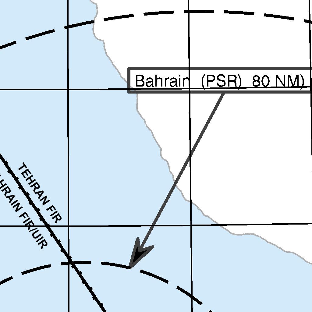
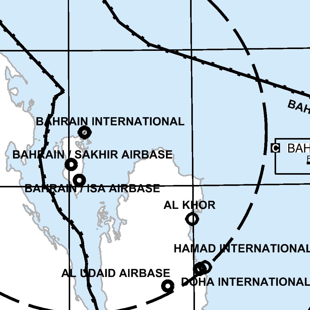
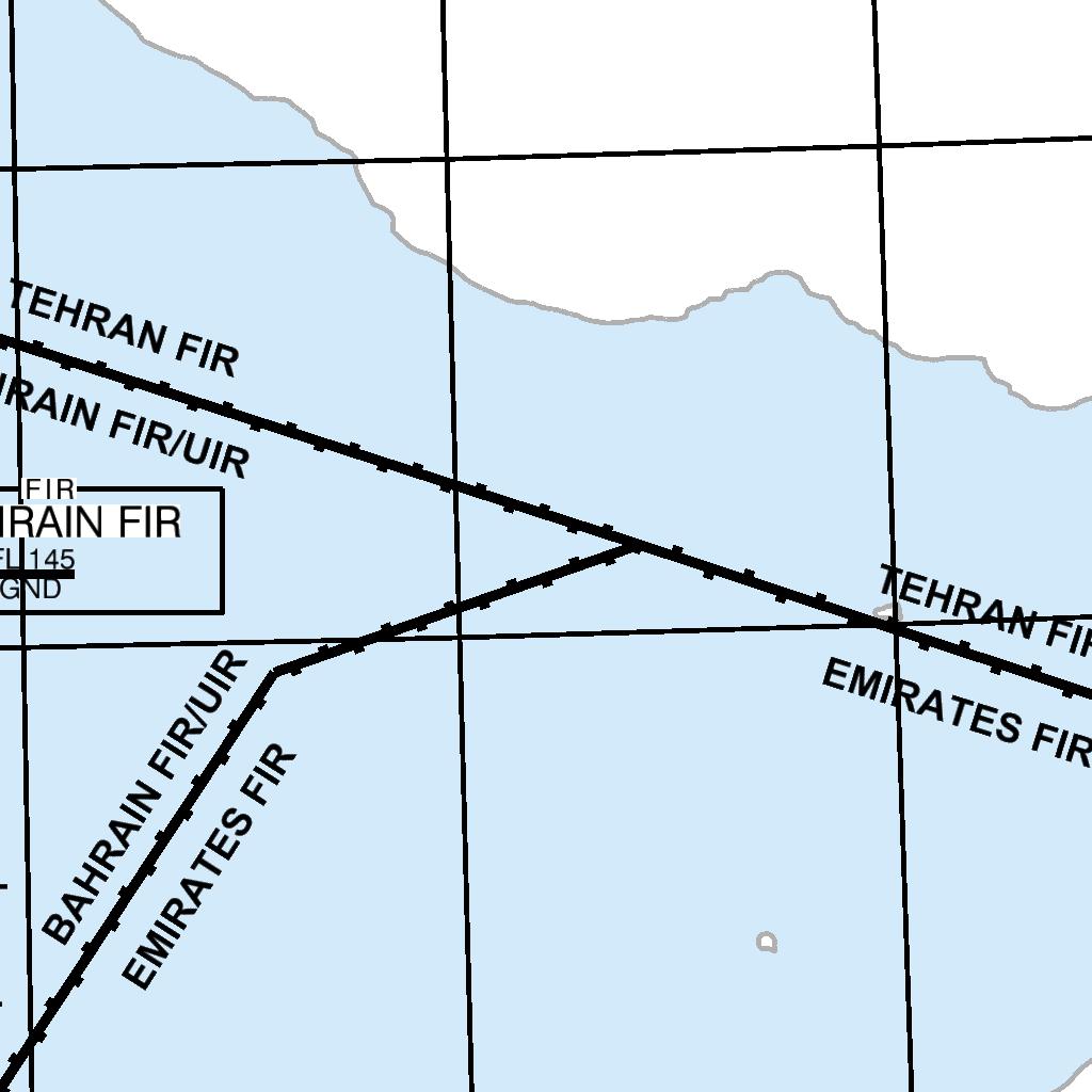
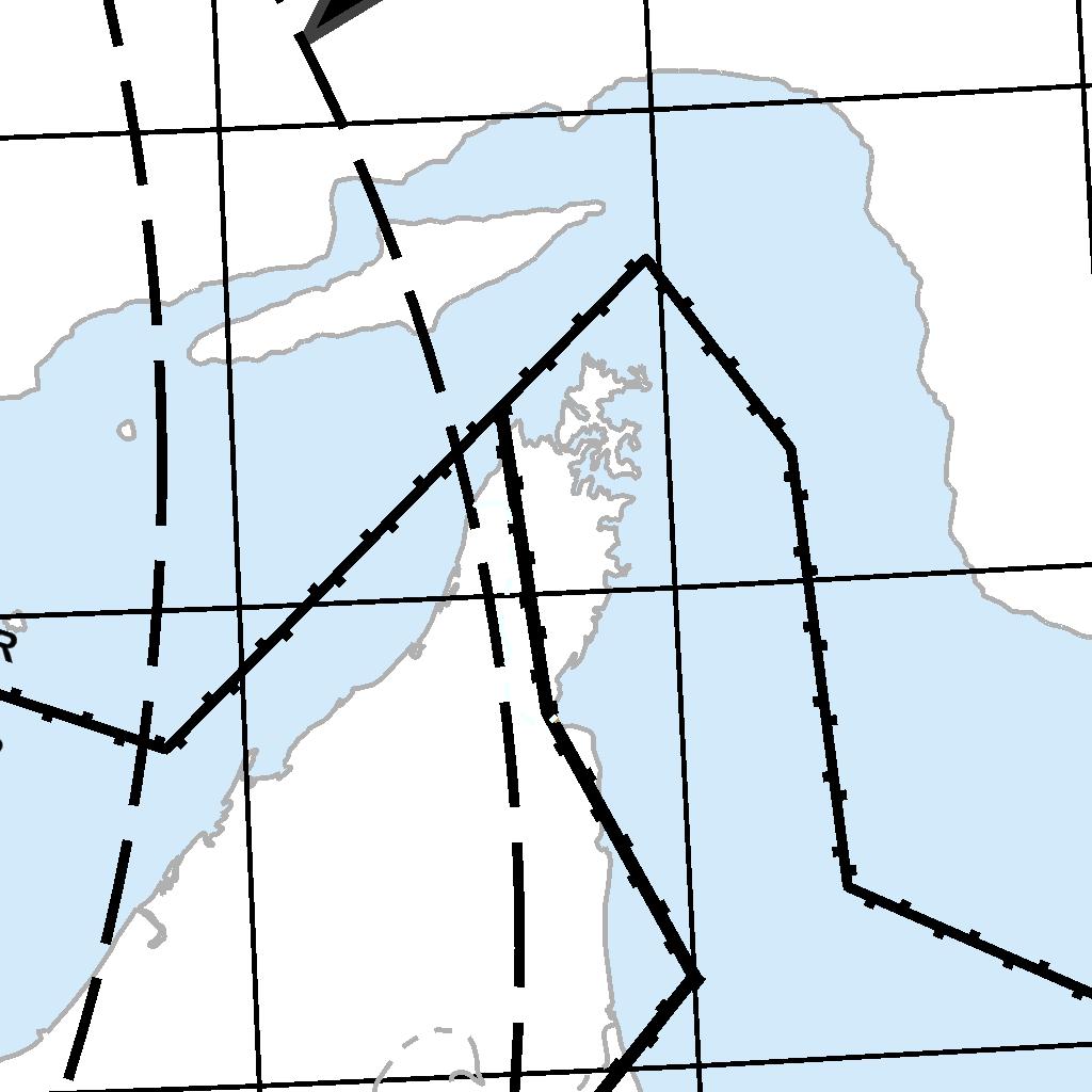
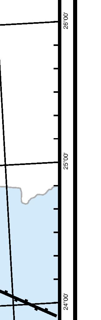
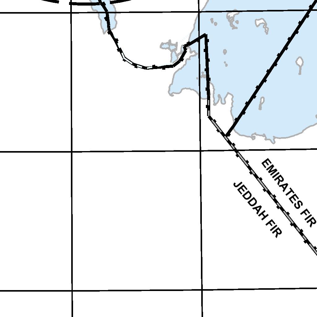
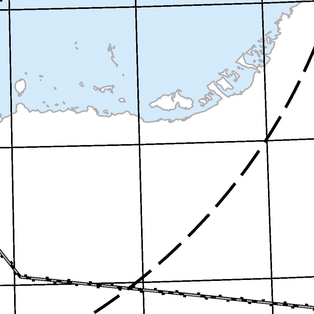

114 ENR AIP BAHRAIN FIR
115 AIP BAHRAIN FIR ENR INTENTIONALLY BLANK
116 ENR AIP BAHRAIN FIR SECONDARY SURVEILLANCE RADAR (SSR) Emergency Procedures Except as provided for paragraph ENR below, pilot shall operate transponders and select modes and codes in accordance with ATC instructions. In particular, when entering BAHRAIN FIR / BAHRAIN UIR pilots who have already received specific instructions from ATC concerning the setting of the transponder shall maintain that setting until otherwise instructed Pilots of aircraft about to enter the BAHRAIN FIR / BAHRAIN UIR who have not received specific instructions from ATC concerning the setting of the transponder shall operate the transponder on Mode A / 3 Code 2000 before entry and maintain that setting until otherwise instructed. Mode C, if fitted, is to be selected at all times If the pilot of an aircraft encountering a state of emergency has previously been instructed by ATC to operate the transponder on a specific code, this code setting shall be maintained until otherwise advised. In all other circumstances, the transponder shall be set to Mode A / 3 Code Notwithstanding the procedures set out above, a pilot may select Mode A / 3 Code 7700 wheneever the nature of the emergency is such that this appears to him to be the most suitable course of action. Note: Continuous monitoring of responses on Mode A / 3 Code 7700 is provided Radio communication failure and unlawful interference procedures Radio Communication failure procedures In the event of an aircraft radio receiver failure, a pilot shall select Mode A / 3 Code 7600 and follow established procedures, and subsequent control of aircraft will be based on these procedures Unlawful Interferernce procedure Pilots of aircraft in flight subjected to unlawful interference shall endeavour to set the transponder to Mode A Code 7500 to give indication of the situation, unless circumstances warrant the use of A / 3 Code Note: Continuous monitoring in responses on Mode A / 3 Code 7500 is provided System of SSR Code assignment Codes are assigned according to the ICAO "ORIGINATING REGION CODE ALLOCATION METHOD2 - ORCAM - for the MID / ASIA Region Mode S operation within OBBB FIR INTRODUCTION The provision of air traffic services (ATS) using SSR Mode S in Bahrain FIR airspace will rely on a unique ICAO 24-bit aircraft address for selective interrogation of individual aircraft. The 24-bit aircraft address is also an essential element of the airborne collision avoidance system (ACAS II). In addition, Mode S surveillance requires the reporting of aircraft identification as stated below. Pilots of aircraft equipped with mode S transponder having an aircraft identification feature shall set the aircraft identification in the transponder while operating within OBBB FIR. This setting shall correspond to the aircraft identification specified in item 7 of the standard ICAO FPL, or if no FPL has been filed, the aircraft registration. ATC equipment requires strict compliance with mode S settings to ensure proper radar tracking. Inability to comply with these requirements may result in aircraft being denied entry into OBBB class A airspace. The aircraft address shall be one of twenty-four-bit aircraft addresses allocated by ICAO to the State of Registery or common mark registering authority and assigned as prescribed in the ICAO Annex 10. All Mode S equipped aircraft engaged in international civil aviation are required to have an aircraft identification feature as prescribed in ICAO Annex 10. This guidance is provided to ensure consistency regarding 24-bit aircraft addresses and the reporting of aircraft identification relevant to the operational introduction of Mode S Elementary and Enhanced Surveillance. In particular: 1. Adherence to the world-wide scheme for assignment of ICAO 24-bit Aircraft Addresses. 2. Correct setting of Aircraft Identification by flight crew THE ICAO 24-BIT AIRCRAFT ADDRESS Instances occur of incorrect 24-bit aircraft addresses being installed/hard-wired on individual aircraft. This has happened not only on first installation of Mode S transponder but also when a major modification has been made to the Mode S equipment, and following a change of State of Registration. Incorrect installation, such as setting the address to all zeros, or, inadvertent duplication of an address can pose a severe risk to flight safety. In particular, the airborne collision avoidance system (ACAS II), performs on the assumption that only a single, unique 24- bit aircraft address per airframe exists. The performance of ACAS II can be seriously degraded and in some instances disabled if an incorrect
117 AIP BAHRAIN FIR ENR or duplicate address is installed on an aircraft. Incorrect or duplicated 24-bit aircraft addresses will also undermine the effectiveness of surveillance services based on SSR Mode S. It is essential that aircraft operators comply with the aircraft address assignment procedures of the state regulatory authority to which blocks of addresses have been allocated by ICAO. Note: Telephony designators for aircraft operating agencies are contained in ICAO Doc The world-wide addressing scheme has been designed so that, at any one time, no address is assigned to more than one aircraft. Only one address can be assigned to an aircraft and it can not be changed except under exceptional circumstances authorised by the State Regulatory Authority concerned. When an aircraft changes its State of Regulatory of Registry, the previously assigned address is to be relinguished and a new address assigned by the new registering authority. It is essential that the aircraft address is periodically verified using ramp tests. Such checks must also be conducted when a major maintenance check has taken place and when the aircraft has changed registration, to ensure that a newly assigned address has been properly set CORRECT SETTING OF AIRCRAFT IDENTIFICATION To comply with airborne equipment requirements, Mode S transponder equipped aircraft must incorporate an Aircraft Identification Feature. Correct setting of aircraft identification is essential for the correlation of radar tracks with flight plan data in the ATM and Airport Operator ground systems. Initial operational trials using SSR Mode S have shown that many aircraft are transmitting incorrect aircraft identification, e.g. J9165 instead of JZR165. Such erroneous settings of aircraft identification prohibit automatic flight plan correlation and, if perpetuated, will severely limit the effectiveness of Mode S to relieve the shortage of SSR codes. In accordance with ICAO Doc 8168 [PANS-OPS] Vol. I, Part III, flight crew of aircraft equipped with Mode S having an aircraft identification feature shall set the aircraft identification in the transponder. The setting shall correspond to the aircraft identification specified in item 7 of the ICAO flight plan, or, if no flight plan has been filed, the aircraft registration. Note: All Mode S equipped aircraft engaged in international civil aviation are required to have an aircraft identification feature. Note: No zeroes, dashes or spaces are to be added when the aircraft identification consists of less than 7 characters FURTHER INFORMATION Or guidance may be obtained from: Bahrain Senior Air Traffic Control Officer satco@caa.gov.bh


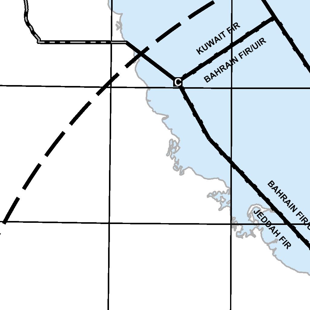
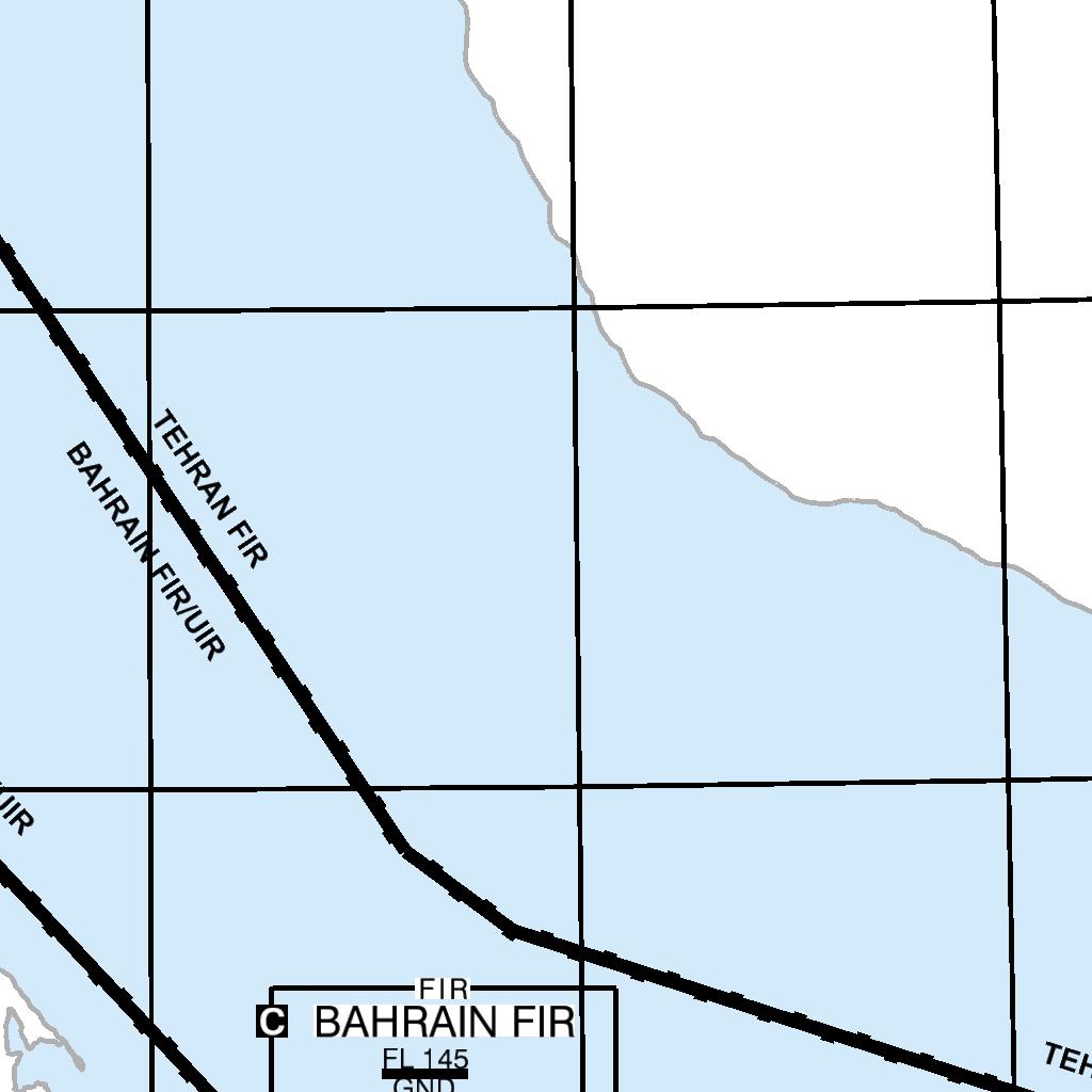
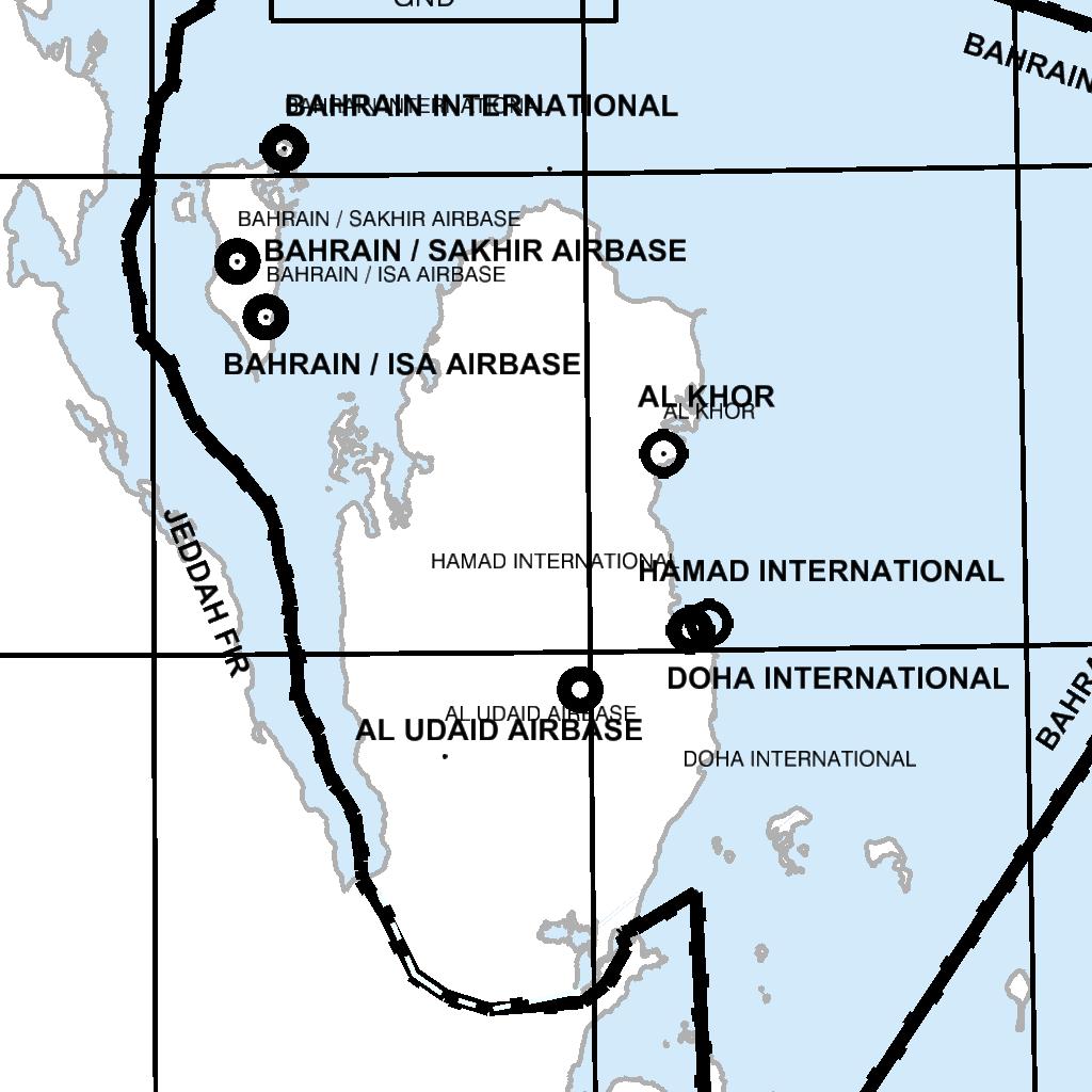
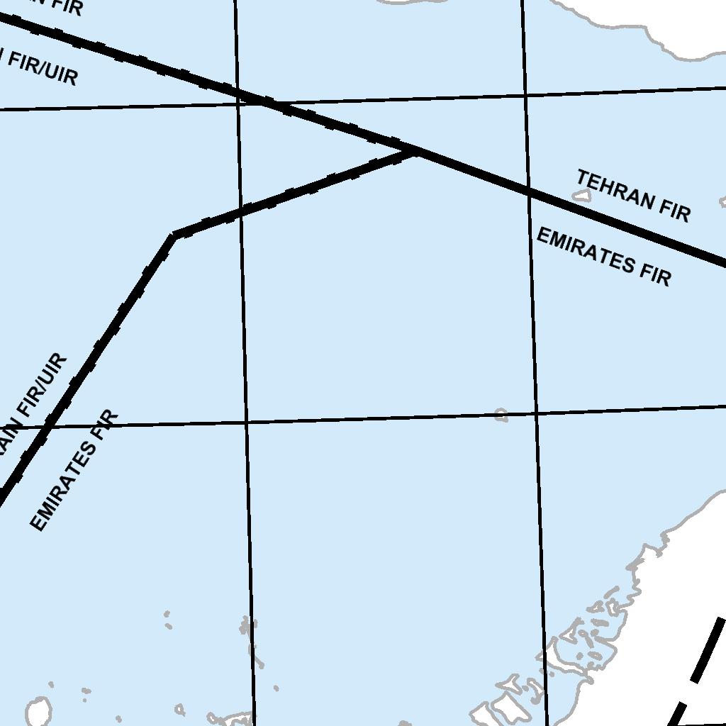
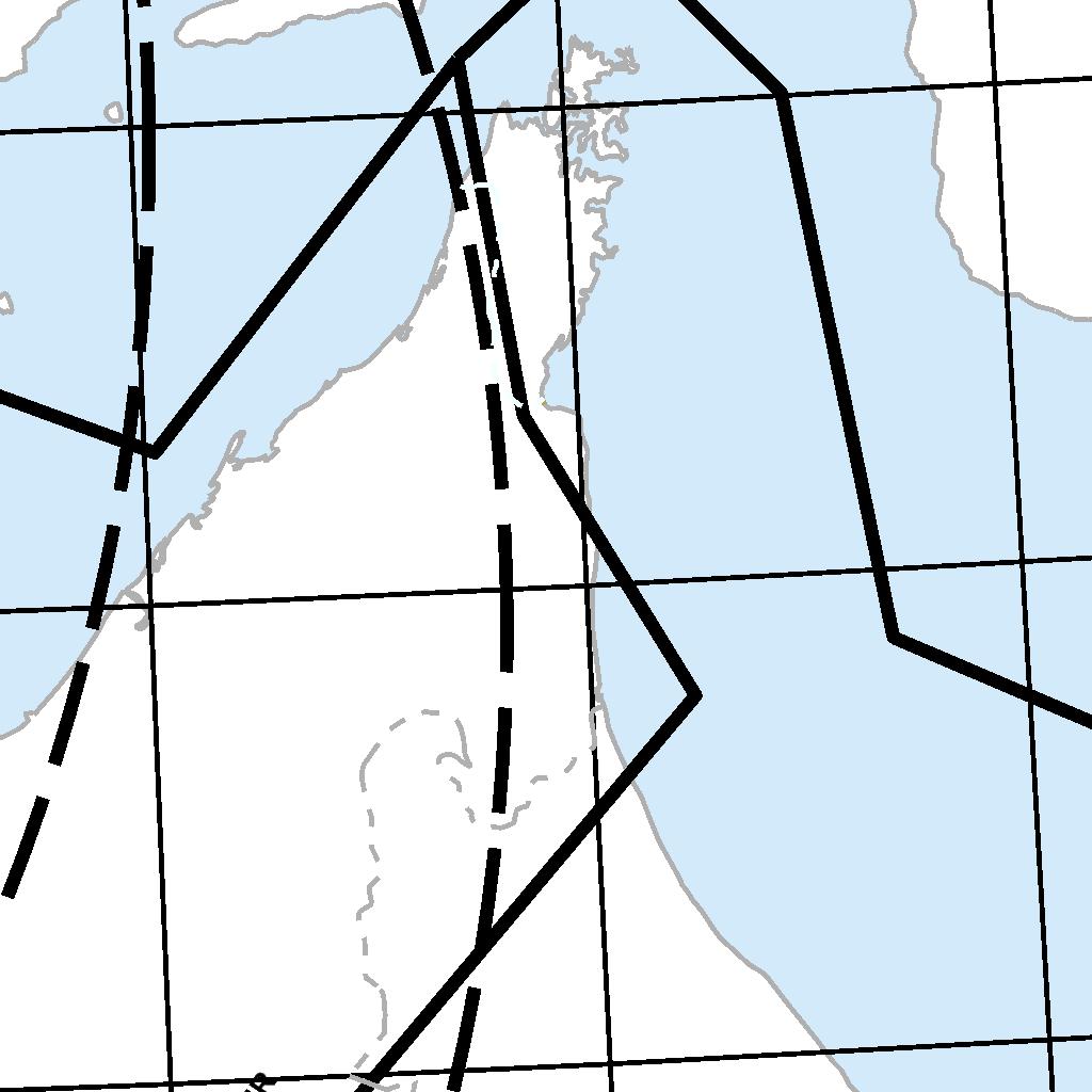


118 ENR AIP BAHRAIN FIR
119 AIP BAHRAIN FIR ENR INTENTIONALLY BLANK
120 INTENTIONALLY BLANK
121 AIP BAHRAIN FIR ENR INTRODUCTION ENR 1.7 ALTIMETER SETTING PROCEDURES The Altimeter setting procedures in use generally conform to those contained in ICAO Doc OPS, / 611 Volume 1 and DOC 7030, and are given in full below. QNH reports and temperature information for use in determining adequate terrain clearance are provided in MET broadcasts, and are available on request from Air Traffic Services Units. QNH values are given in whole hectopascals BASIC ALTIMETER SETTING PROCEDURES General The Transition Altitude is fixed at FT AMSL for the entire BAHRAIN FIR. The Transition level is fixed at FL 150 for the entire BAHRAIN FIR / BAHRAIN UIR Vertical displacement of aircraft at or below the Transition Altitude is expressed in terms of altitude. Vertical displacement of aircraft at or above the Transition Level is expressed in terms of Flight Levels. While an aircraft is passing through the Transition Layer, vertical displacement is expressed as altitude when descending, and as Flight Levels when climbing Flight Level Zero is located at the atmospheric pressure level of HPA (29.92"). Consecutive Flights are separated by a pressure interval corresponding to 500 FT in the Standard Atmosphere below FL 290, and by a pressure interval corresponding to 1000 FT above FL 290. Simultaneous flight at both the Transitional Altitude and the Transition Level is permissible as a minimum of 1000 FT separation exists between the two layers, however, level flight within the Transition Layer is not permitted Take - off and climb A QNH altimeter setting is made available to aircraft in the routine take - off and climb instructions Vertical displacement of aircraft during the climb is controlled by reference to altitudes until reaching the Transition Altitude, above which vertical displacement is controlled by reference to Flight Levels. In this context, the word "controlled" is used in a composite sense in that a pilot will wish to fly his aircraft at predetermined Flight Levels or altitudes, and Air Traffic Services will wish to advise the pilot of the availability of Flight Levels and altitudes. Both are concerned with the vertical position of aircraft En - route at and below the transition altitude - altimeter pressure setting BAHRAIN INTERNATIONAL airport QNH Vertical separation - En-route Aircraft shall be flown En-route at Flight Levels at all times when above FT AMSL When complying with the semi-circular system of cruising levels of Annex 2, an aircraft shall be flown at Flight Levels or Flight Altitudes corresponding to the magnetic track as shown in the following table: Magnetic Track Flight Rules IFR VFR IFR VFR Flight Altitudes Up to Up to Up to Up to Flight Levels Up to 290 Up to
122 ENR AIP BAHRAIN FIR Magnetic Track Flight Rules IFR VFR IFR VFR etc etc Approach and landing A QNH altimeter setting is made available in the routine approach and landing instructions Vertical displacement of aircraft during approach is controlled by reference to Flight Levels until reaching the Transition Level, below which vertical displacement is controlled by reference to altitudes. Note: This does not preclude a pilot from using a QFE setting to terrain clearance purposes during the final approach of the runway Missed approach The relevant portions of ENR , ENR and ENR shall be applied to the case of a missed approach DESCRIPTION OF ALTIMETER SETTING REGION There is a single altimeter pressure setting region which covers the entire BAHRAIN FIR / BAHRAIN UIR, however see ENR PROCEDURES APPLICABLE TO OPERATORS, INCLUDING PILOTS The levels at which flight is to be conducted shall be specified in a Flight Plan; a) in terms of Flight Levels, if the flight is to be conducted at or above the Transition Level, and b) in terms of altitudes of the flight is to be conducted in the vicinity of an aerodrome, and at or below the Transition Altitude. Note: Short flights in the vicinity of an aerodrome may often be conducted only at altitudes below the Transition Altitude. Note: Flight Levels are specified in a plan by number; and not in terms of feet as is the case with altitudes TABLE OF CRUISING LEVELS TRACK From 000 to 179 From 180 to 359 IFR Flights VFR Flights IFR Flights VFR Flights FL Altitude FL Altitude FL Altitude FL Altitude Metres Feet Metres Feet Metres Feet Metres Feet Class A airspace 160 Class A airspace
123 AIP BAHRAIN FIR ENR Class A airspace RVSM applied 360 Class A airspace RVSM applied (See ENR 1.10) (See ENR 1.10) TRACK From 000 to 179 From 180 to 359 IFR Flights VFR Flights IFR Flights VFR Flights FL Altitude FL Altitude FL Altitude FL Altitude Metres Feet Metres Feet Metres Feet Metres Feet 450 Class A airspace 430 Class A airspace etc. etc.
124 INTENTIONALLY BLANK
125 AIP BAHRAIN FIR ENR ENR 1.8 REGIONAL SUPPLEMENTARY PROCEDURES (DOC 7030 / 5) The Supplementary Procedures in force, directly applicable to aircraft are given in their entirety. Differences are printed in heavy face italic type. DOC 7030 part 1 Reference Procedure 1.1 Visual Flight Rules (VFR) (Annex 2-4.6) VFR flights to be operated within a control zone established at an aerodrome serving International Flights and in specific portions of the associated terminal control area shall: 1. have two - way radio communications; 2. obtain clearance from the appropriate air traffic control unit; and 3. report position as required Note: The phrase "specified portions of the associated terminal control area" is intended to signify at least those portions of the TMA used by International IFR Flights in association with approach, holding, departure and noise abatement procedures Instrument Flight Rules (IFR) (Annex and Chapter 5) Flights shall be conducted in accordance with the Instrument Flight Rules (even when not operating in instrument meteorological conditions) when operated: 1. more than 100 NM seaward from the shoreline within controlled airspace; or 2. at or above Flight Level A / G communications and in - flight reporting (ANNEX , 3.6.5, and and PANS ATM / 501 Chapter 4, 4-11) All aircraft on VFR flights, and aircraft on IFR flights outside controlled airspace, shall maintain a watch on a radio station furnishing communications for the unit providing flight information service in the flight information region and file with that station information as their position unless otherwise authorized by the State overflown. Reference Procedure The aircraft call sign / identification shall be transmitted immediately before or after the word "position" The position of the aircraft shall be transmitted in reference to a reporting point name, name code designator or, if not named: 1. for flights operating in a predominantly east - west direction: a) latitude in degrees and minutes; and b) longitude in degrees only; 2. for flights operating in a predominantly north - south direction: a) latitude in degrees only; and b) longitude in degrees and minutes The time at which the aircraft is over the reporting point shall be transmitted in four digits, giving both the hour and the minutes The altitude / flight level of the aircraft shall be included in the position report Next position and time shall normally be expressed as the reporting point name, name - code designator or latitude and longitude as indicated in Estimated time over the next position shall be expressed in four digits Ensuing position information shall include the name, name - code designator or coordinates of the next succeeding reporting point, whether compulsary or not. 4.0 Special Procedures for in - flight contingencies General Procedures The following general procedures apply to both subsonic and supersonic aircraft
126 ENR AIP BAHRAIN FIR If an aircraft is unable to continue flight in accordance with its Air Traffic Control Clearance, a revised Clearance shall be obtained at the earliest possible time and, in the meantime, the aircraft shall broadcast position (including ATS route designator or the track code, as appropriate) and intentions, on frequency MHZ at suitable intervals until Air Traffic Control Clearance is received Alerting and Search and Rescue Services - Routes and equipment of Private Aircraft Annex 6 - part II and 6.4): General Aviation aircraft operating over designated areas, land or sea, where search and rescue operations would be difficult, should: 1. carry appropriate survival equipment; 2. follow the routes or specified procedures if not equipped with two - way radio except that under special circumstances, the appropriate authority may grant specific exemptions from this requirement. Reference Procedure 12.2 Alerting Services (PANS ATM / 501 Chapter 9 & Chapter 10, 10-2) The procedures for "Alerting Service" detailed in PANS RAC, Part V1.2 are applicable to all flights except those conducted wholly in the vicinity of an aerodrome when exempted by the appropriate air traffic control unit. DOC 7030 / 4, Part 2 Referrence Procedure 1.0 AERONAUTICAL MOBILE SERVICE 1.1 Languages to be used in radiotelephony (A10, Vol. 11, , Note 2) English is used in radiotelephony 2.0 AERONAUTICAL FIXED SERVICE 2.1 Priority of MOTNE messages on AFTN NIL 3.0 RADIO FREQUENCIES 3.1 Air - to - air channel (A10, Vol. 1, Part ) The frequency MHZ has been approved for use as the air - to - air channel to enable aircraft engaged in flights over remote and oceanic areas out of range of VHF ground stations to exchange necessary operational information and to facilitate the resolution of operational problems. DOC 7030 / 4, Part Aircraft observations and Reports (Annex 3 - Chapter 5) Aircraft within the BAHRAIN FIR / BAHRAIN UIR shall make and record routing observations at the ATS / MET reporting points indicated in the Regional Plan. Regional Supplementary Procedures DOC 7030 / 4 The Supplementary Procedures in force, directly applicable to ATSUs and indirectly applicable to aircraft, are not given in their entirety. The relevant differences are given but only differences from ICAO have been published in full. Reference Differences NIL
127 AIP BAHRAIN FIR ENR ENR 1.9 AIR TRAFFIC FLOW MANAGEMENT (ATFM) AND AIRSPACE MANAGEMENT Air traffic flow management structure, service area, service provided location of unit and hours of operation Service provided Within the BAHRAIN FIR / BAHRAIN UIR there is no requirement for Strategic Flow Management at present, or in the forseeable future, and the establishment of a Regional Flow Management Unit is perceived as not being necessary. Tactical Flow Management is implemented from time to time, as required.
128 INTENTIONALLY BLANK
129 AIP BAHRAIN FIR ENR (Restriction, Limitation or advisory Information) ENR 1.10 FLIGHT PLANNING PROCEDURES FOR THE SUBMISSION OF A FLIGHT PLAN A flight plan shall be submitted in accordance with Annex 2, para prior to operating: a) any IFR flight, b) any VFR flight. i. departing from or destined for an aerodrome within a CTR; ii. crossing any CTR within BAHRAIN FIR; iii. across any International State Boundary or the FIR / UIR boundary. Time of submission Except for repetitive flight plans, a flight plan shall be submitted at least 60 minutes prior to departure, taking into account requirements for timely information of ATS units in airspace along the route to be flown, including requirements for early submission for ATS Air Traffic Flow Management (ATFM) purposes. Place of submission a) Flight plans shall be submitted at the Air Traffic Services Reporting Office (ARO) at the departure aerodrome. b) In absence of such office at the departure aerodrome, a flight plan shall be submitted by telephone, telefax or teletype to the nearest ARO as listed below, (except as indicated under c.). An acknowledgement of receipt must be obtained prior to departure when using telefax or teletype. BAHRAIN ARO TEL: / Telefax: c) For domestic flights from an uncontrolled to a controlled aerodrome a flight plan shall be submitted by telephone to the ARO at destination. VFR flight plan for alerting service only Alerting service in principle provided to flights for which a flight plan has been submitted. Contents and form of flight plan a) ICAO flight plan forms are available at AROs and airport offices at uncontrolled aerodromes. The instructions for completing those forms shall be complied with. b) Flight plans concerning IFR flights and international VFR flights shall include FIR / UIR boundary estimates. c) When a flight plan is submitted by telephone, teletype or telefax, the sequence of items of the flight plan - form shall be strictly adhered to. Adherence to ATS route structure No flight plans shall be filed for routes deviating from the published ATS route structure, unless prior permission has been obtained from BAHRAIN ACC. Authorization for special flights Flights of a specific character such as survey flights, scientific research flights etc. may be exempted from the restriction specified above. Request for exemption shall be mailed so as to be received at least one week before the intended day of operation to: Undersecretary for Civil Aviation Bahrain Civil Aviation Affairs P.O. Box 586 Kingdom of Bahrain REPETITIVE FLIGHT PLAN SYSTEM General The procedures concerning the use of Repetitive Flight Plans (RPL) conform to ICAO Document 7030 and PANS RAC 12th edition. Except where indicated hereunder. REPETITIVE FLIGHT PLANS / FLIGHT SCHEDULE DATA LISTS Pending full implementation of the RPL concept, RPLs are transmitted on the AFTN as if they were Filed Flight Plans Operators are required to provide advance details of Season Scheduled Services operating within the BAHRAIN FIR / BAHRAIN
130 ENR AIP BAHRAIN FIR UIR at least 14 days in advance of implementation or change, to the Flight Data Processing Unit (FDPU). The Flight Data Processing Unit Aeronautical Information Services Office P.O. Box 586 Kingdom of Bahrain Note: The submission of such details to Air Traffic Control does not constitute a request for approval of flight schedules This Data is required to be presented, on separate sheet for each 12 hours UTC of each day, in the format shown in the "REPETITIVE FLIGHT PLAN LISTING". Note: There is a requirement to indicate in Column Q for all flights the Entry point Designator for BAHRAIN FIR / BAHRAIN UIR with EST (UTC) Incidental changes and cancellations of RPL Incidental changes to and cancellations of RPL relating to departures from BAHRAIN INTERNATIONAL airport shall be notified as early as possible and not later than 30 minutes before departure to: BAHRAIN ARO TEL: / for departures from BAHRAIN INTERNATIONAL airport. RPL Lists shall be replaced in their entirety by new lists prior to the instruction of the summer and winter schedules Delay When a specific flight is likely to encounter a delay of one hour or more in excess of the departure time stated in the RPL, the ATS unit serving the departure aerodrome shall be notified immediately. Note: Failure to comply with this procedure may result in the automatic cancellation of the RPL for that specific at one or more of the ATS unit concerned ATS messages For a flight operated on a RPL, a flight plan message (FPL) will be transmitted pending full implementation of the RPL concept in the region. Departure messages (DEP) or Delay messages (DLA) relating to such flights will also be transmitted to appropriate ATS units FLIGHT PLANS Scheduled Flights departing from airfields in the FIR Standard Flight Plans for flights must be filed with the Aerodrome / Heliport AIS Unit at the aerodrome of departure, or Alternatively, by direct arrangement between the operator and the local ATC Unit involved, a Standard ICAO Flight Plan may be stored at the aerodrome of departure and activated by that unit at 0001 UTC on the day of operation CHANGES TO FLIGHT DETAILS Permanent Changes Changes of permanent nature to any of the details previously supplied (under ENR and ENR above) require that complete details must be advised, both to the FDPU at Bahrain and to any other aerodrome concerned within the FIR, either by a completely new replacement plan, or by clear "insert / delete" editing instructions Temporary Changes Extra flights require submission of both a) a standard Flight Plan, and b) Flight Data details to BAHRAIN FDPU Replacement flights, (i.e. Flights with temporary changes to details which have been submitted under ENR and ENR above) require a Standard Flight Plan clearly annotated in item 12 "Replacement of Scheduled Flight (c / s) of... (date)"; Note: Flight Schedule Data Lists are required by ATSUs to prepare Air Traffic Control Data Systems in advance, thus reducing the possibility of traffic delay resulting from work - load in peak periods. Timely provision of Scheduled Flight Data, preferably more than the prescribed 14 days in advance, is therefore in the best interests of operators of scheduled air transport.
131 AIP BAHRAIN FIR ENR FLIGHT PLAN FORM The Flight Plan Form must be completed according to the instructions contained in Doc ATM 501, Appendix The following options are REQUIRED by the ATS authority for all flight operating within the BAHRAIN FIR / BAHRAIN UIR: Flight Plan ITEM 8 - The second field letter denoting the TYPE OF FLIGHT Flight Plan ITEM 18 - The indicator "EET / " followed by FIR / UIR boundary designators and accumulated elapsed times as follows: a) Flight entering the BAHRAIN FIR: The location indicator for the BAHRAIN FIR together with the accumulated estimated time since departure (e.g. EET / OBBB 0345). b) Flights departing from the BAHRAIN FIR: All boundary designators together with the corresponding estimated elapsed times to those points (e.g. for a flight from OBBI to EGLL, EET / OEJD 0005, OJAC 0125, OSTT 0145, LCCC 0210, LGGG 0245, LTBB 0300, LYBA 0420, LOVV 0450, EDDU 0510, EBUR 0545, EHAA 0600, EGTT 0615) Flight Plan ITEM 18 - The indicator "SEL / " followed by the SELCAL code Flight Plan ITEM 19 - To be completed in full CHANGE TO THE SUBMITTED FLIGHT PLAN All changes to a flight plan submitted for an IFR flight or a controlled VFR flight and significant changes to a flight plan submitted for an uncontrolled VFR flight shall be reported as soon as possible to the appropriate ATS unit In the event of a delay in departure of 30 minutes or more for a flight for which a flight plan has been submitted, the flight plan shall be amended or a new flight plan shall be submitted after the old plan has been cancelled. Note 1: If a delay in departure of a controlled flight is not properly reported, the relevant flight plan date may no longer be readily available to the appropriate ATS unit when a clearance is ultimately requested, which will consequently result in extra delay for the flight. Note 2: If a delay in departure (or cancellation) of an uncontrolled VFR flight is not properly reported, alerting or search and rescue action may be unnecessarily initiated, when the flight fails to arrive at the destination aerodrome within 30 minutes after current ETA Whenever a flight, for which a flight plan has been submitted, is cancelled, the appropriate ATS unit shall be informed immediately. Changes to a current flight plan for a controlled flight during flight shall be reported or requested subject to the provisions in Annex (Adherence to flight plan). Significant changes to a flight plan for an uncontrolled VFR flight include changes in endurance, or total number of persons on board and changes in time estimates of 30 minutes or more Arrival report (Closing a flight plan) A report of arrival shall be made at the earliest possible moment after landing to the airport office of the arrival aerodrome by any flight for which a flight plan has been submitted except when the arrival has been acknowledged by the local ATS unit. After landing at an aerodrome which is not the destination aerodrome (diversionary landing) the local ATS unit shall be specifically informed accordingly. In the absence of a local ATS unit at the aerodrome of diversionary landing the pilot is responsible for passing the arrival report to the destination aerodrome. aircraft identification departure aerodrome destination aerodrome time of arrival In the case of diversion, insert between "destination aerodrome" an "time of arrival": the "arrival aerodrome"
132 ENR AIP BAHRAIN FIR INTENTIONALLY BLANK
133 AIP BAHRAIN FIR ENR
134 ENR AIP BAHRAIN FIR INTENTIONALLY BLANK
135 AIP BAHRAIN FIR ENR ADDITIONAL REQUIREMENTS RELATED TO RVSM AIRSPACE Note: Flights will not be given access to BAHRAIN RVSM airspace when: a) No flight plan has been received, or b) A flight plan has been received but the required RVSM data has not been included in the flight plan Except as indicated in ENR flight between FL 290 to FL 410 is for exclusive use of RVSM approved aircraft. Non - RVSM certified aircraft shall flight plan accordingly Operators of RVSM certified aircraft shall insert the letter "W" in item 10 of the flight plan regardless of the requested level Acceptance of non - RVSM certified State aircraft for flight at RVSM levels is subject to prevailling traffic conditions. RVSM certified aircraft will be offered priority in order to make maximum use of airspace capacity. Note: Consequently, operators of State aircraft intending to navigate within BAHRAIN FIR / BAHRAIN UIR are advised to dispatch RVSM certified aircraft or flight plan at non - RVSM levels Operators of non - RVSM certified State aircraft requesting a flight level within RVSM airspace shall insert the phrase "STS / NONRVSM" in item 18 of the flight plan In addition to the requirements of ENR operators of non - RVSM certified State aircraft requesting to operate in RVSM airspace shall include the letter "M" in item 8 of the flight plan The flight plan for an aircraft intending to operate across or within the lateral limits of RVSM airspace shall include: a) The entry point and requested flight level for that portion of the route commencing immediately after the entry point. b) The exit point and requested flight level for that portion of the route commencing immediately after the exit point.
136 INTENTIONALLY BLANK
137 AIP BAHRAIN FIR ENR ENR 1.11 ADDRESSING OF FLIGHT PLAN MESSAGES Flight movement messages relating to traffic into or via BAHRAIN FIR / BAHRAIN UIR shall be addressed as stated below in order to warrant correct relay and delivery. Note: Flight movement messages in this context comprise flight plan messages, amendment messages relating thereto and flight plan cancellation messages. ICAO ATM - DOC 4444, chapter 11 para refers AFTN ADDRESSES Category of flight (IFR, VFR or both) All Flight Plans and Departures messages for flights operating through or within the BAHRAIN FIR / BAHRAIN UIR must include addressees OBBBZQZX All aircraft operators intending to use BAHRAIN INTERNATIONAL airport as a departure aerodrome must include the addressees OBBIZPZX in their flight plan BAHRAIN / SAKHIR AIRBASE installed new AFTN addresses necessary for flight planning puropses and other relevant issues as follows: OBKHZTZX for Control Tower, OBKHZPZX for AIS / COMMS and OBKHYFYX for Service Address.
138 INTENTIONALLY BLANK
139 AIP BAHRAIN FIR ENR Interception procedures ENR 1.12 INTERCEPTION OF CIVIL AIRCRAFT All unknown aircraft within the airspace over territories and territorial waters of states within the BAHRAIN FIR / BAHRAIN UIR may be intercepted by air defense fighters by day and by night Applicability The procedures and signals set out in this section apply in the event of an interception over the territory and territorial waters of the Kingdom of Bahrain An aircraft which is intercepted by another aircraft is required immediately to: a) follow the instructions given by the intercepting aircraft, interpreting and responding to the signals given under ENR ; b) notify, if possible, the Air Traffic Services Unit responsible for the airspace in which the aircraft is flying; c) make a general call on the emergency frequency MHZ to attempt to establish radio communication with the intercepting aircraft or with the intercept control unit, giving the identity and position of the aircraft and the nature of the flight. This call should be repeated on MHZ if necessary and practicable; d) if equipped with SSR transponder, select Mode A Code 7700, unless otherwise instructed by the appropriate Air Traffic Services Unit If any instructions received by radio from any sources conflict with those given by the intercepting aircraft by visual signals, the intercepted aircraft is required to request immediate clarification while continuing to comply with the visual instructions given by the intercepting aircraft If any instructions received by radio from any sources conflict with those given by the intercepting aircraft by radio, the intercepted aircraft is required to request immediate clarification while continuing to comply with the radio instructions given by the intercepting aircraft All aircraft shall, at all times, remain well clear from areas being published as prohibited areas, however, if an aircraft was so be compelled to enter a prohibited area due to weather avoidance or otherwise track deviation from the intended route, which would finally take the aircraft into prohibited areas, was observed and such initiative was made by the pilot without obtaining a specific approval from ATC to carry out the maneouvre, then this particular flight may expect an interception by military jets by the ROYAL BAHRAIN AIR FORCE during which full compliance to the instructions issued by the interceptors must be immediately adhered to If radio contact is established during interception but communication in a common language is not possible, attempts shall be made to convey instructions, acknowledgement of instructions and essential information by using the phrases and pronunciations in the following table and transmitting each phrase twice: Phrases for use by INTERCEPTING aircraft Phrase Pronunciation 1 Meaning CALL SIGN KOL SA - IN What is your call sign? FOLLOW FOL - LO Follow me DESCEND DEE - SEND Descend for landing YOU LAND YOU LAAND Land at this aerodrome PROCEED PRO - SEED You may proceed 1 Syllables to be emphasized are printed in bold letters. Phrases for use by INTERCEPTED aircraft Phrase Pronunciation 1 Meaning CALL SIGN 2 KOL SA - IN My call sign is (call sign) WILCO VILL - KO Understood. Will comply. CAN NOT KANN - NOTT Unable to comply REPEAT REE - PEET Repeat your instruction AM LOST AM - LOSST Position unknown MAYDAY MAYDAY I am in distress HIJACK 3 HI - JACK I have been hijacked LAND (place name) LAAND (place name) I request to land at (place name)
140 ENR AIP BAHRAIN FIR DESCEND DEE - SEND I required descent 1 Syllables to be emphasized are printed in bold letters. 2 The call sign required to be given is that used in radio telephony communications with air traffic services units and corresponding to the aircrafts identification in the flight plan. 3 Circumstances may not always permit, nor make desirable, the use of the phrase "HIJACK" TABLES OF VISUAL SIGNALS FOR USE IN THE EVENT OF INTERCEPTION Signals initiated by INTERCEPTING aircraft and responses by INTERCEPTED aircraft Series INTERCEPTING Aircraft Signals Meaning INTERCEPTED Aircraft Responds Meaning 1 DAY or NIGHT - Rocking aircraft and flashing navigational lights at irregular intervals (and landing lights in the case of a helicopter) from a position slightly above and ahead of, and normally to the left of, the intercepted aircraft (or to the right if the intercepted aircraft is a helicopter) and, after acknowledgement, a slow level turn, normally to the left, (or to the right in case of a helicopter) on the desired heading. Note 1: - Meteorological conditions or terrain may require the intercepting aircraft to reverse the positions and direction of turn given above in Series 1. Note 2: - If the intercepted aircraft is not able to keep pace with the intercepting aircraft, the latter is expected to fly a series of racetrack patterns and to rock the aircraft each time it passes the intercepted aircraft. You have been intercepted. Follow me. DAY or NIGHT - Rocking aircraft, flashing navigational lights at irregular intervals and following. Note: - Additional action required to be taken by intercepted aircraft is prescribed on ENR Understood, will comply. 2 DAY or NIGHT - An abrupt breakaway manoeuvre from the intercepted aircraft consisting of a climbing turn of 90 degrees or more without crossing the line of the flight of the intercepted aircraft. You may proceed. DAY or NIGHT - Rocking the aircraft. Understood, will comply. 3 DAY or NIGHT - Lowering landing gear (if fitted), showing steady landing lights and overflying the runway in use or, if the intercepted aircraft is a helicopter, overflying the helicopter landing area. In the case of helicopters, the intercepted helicopter makes a landing approach, coming to hover near to the landing area. Land at this aerodrome. DAY or NIGHT - Lowering landing gear, (if fitted), showing steady landing lights and following the intercepting aircraft and, if, after overflying the runway in use or helicopter landing area, landing is considered safe, proceeding to land. Understood will comply.
141 AIP BAHRAIN FIR ENR Signals initiated by INTERCEPTED aircraft and responses by INTERCEPTING aircraft Series INTERCEPTED Aircraft Signals Meaning INTERCEPTING Aircraft Responds Meaning 1 DAY or NIGHT - Raising landing gear (if fitted) and flashing landing lights while passing over runway in use or helicopter landing area at a height exceeding 300 M (1000 FT) but not exceeding 600 M (2000 FT) in the case of a helicopter, at a height exceeding 100 M (350 FT) above the aerodrome level, and continuing to circle the runway in use or helicopter landing area. If unable to flash landing lights, flash any other lights available. Aerodrome you have designated is inadequate. DAY or NIGHT - If it is desired that the intercepted aircraft follow the intercepting aircraft to an alternate aerodrome, the intercepting aircraft raises its landing gear (if fitted) and uses the Series 1 signals prescribed for intercepting aircraft. If it is decided to release the intercepted aircraft, the intercepting aircraft uses the Series 2 signals prescribed for intercepting aircraft. Understood, follow me. Understood, you may proceed. 2 DAY or NIGHT - Regular switching on and off of all available lights but in such a manner as to be distinct from flashing lights. Cannot comply. DAY or NIGHT - Use Series 2 signals prescribed for intercepting aircraft. Understood. 3 DAY or NIGHT - Irregular flashing of all available lights. In distress. DAY or NIGHT - Use Series 2 signals prescribed for intercepting aircraft. Understood.
142 INTENTIONALLY BLANK
143 AIP BAHRAIN FIR ENR General ENR 1.13 UNLAWFUL INTERFERENCE The following procedures are intended for use by aircraft when unlawful interference occurs and the aircraft is unable to notify an ATS unit of this fact Procedures Unless considerations aboard the aircraft dictate otherwise, the pilot - in - command should attempt to continue flying on the assigned track and the assigned cruising level at least until able to notify an ATS unit or within radar coverage When an aircraft subjected to an act of unlawful interference must depart from its assigned track or its assigned cruising level without being able to make radiotelephony contact with ATS, the pilot - in - command should, whenever possible: a) attempt to broadcast warnings on the VHF emergency frequency and other appropriate frequencies, unless considerations aboard the aircraft dictate otherwise. Other equipment such as on - board transponders, data links, etc. should also be used when it is advantageous to do so and circumstances permit; and b) Proceed in accordance with applicable special procedures for in - flight contingencies, where such procedures have been established and promulgated in Doc Regional Supplementary Procedures; or c) If no applicable regional procedures have been established, proceed at a level which differs from the cruising levels normally used for IFR flight: M (500 FT) in an area where a vertical separation minimum of 300 M (1000 FT) is applied; or M (1000 FT) in an area where a vertical separation minimum of 600 M (2000 FT) is applied.
144 INTENTIONALLY BLANK
145 AIP BAHRAIN FIR ENR Definition of air traffic incidents ENR 1.14 AIR TRAFFIC INCIDENTS "Air traffic incident" is used to mean a serious occurrence related to the provision of air traffic services, such as: a) aircraft proximity (AIRPROX); b) serious difficulty resulting in a hazard to aircraft caused, for example, by: 1. faulty procedures 2. non-compliance with procedures, or 3. failure of ground facilities Definitions for aircraft proximity and AIRPROX. Aircraft proximity. A situation in which, in the opinion of the pilot or the air traffic services personnel, the distance between aircraft, as well as their relative positions and speed, have been such that the safety of the aircraft involved may have been compromised. An aircraft proximity is classified as follows: Risk of collision. The risk classification of aircraft proximity in which serious risk of collision has existed. Safety not assured. The risk classification of aircraft proximity in which the safety of the aircraft may have been compromised. No risk of collision. The risk classification of aircraft proximity in which no risk of collision has existed. Risk not determined. The risk classification of aircraft proximity in which insufficient information was available to determine the risk involved, or inconclusive or conflicting evidence precluded such determination. AIRPROX. The code word used in an air traffic incident report to designate aircraft proximity Air traffic incidents are designated and identified in reports as follows: Type Air traffic incident as a) above as b) 1) and 2) above as b) 3) above Designation Incident AIRPROX (Aircraft proximity) Procedure Facility Use of the Air Traffic Incident Report Form (See model below) The Air Traffic Incident Report Form is intended for use: a) by a pilot for filing a report on an air traffic incident after arrival or to confirm a report made initially by radio during flight. Note: The form, if available on board, may also be of use in providing a pattern for making the initial report in flight. b) by an ATS unit for recording an air traffic incident report received by radio telephone or teleprinter. Note: The form may be used as the format for the text of a message to be transmitted over the AFS network Reporting procedures (including in-flight procedures) The following are the procedures to be followed by a pilot who is or has been involved in an incident: a) during flight, use the appropriate air / ground frequency for reporting an incident of major significance, particularly if it involves other aircraft, so as to permit the facts to be ascertained immediately; b) as promptly as possible after landing, submit a completed Air Traffic Incident Report Form; 1. for confirming a report of an incident made initially as in a) above, or for making the initial report on such an incident if it had not been possible to report it by radio; 2. for reporting an incident which did not require immediate notification at the time of occurrence An initial report made by radio should contain the following information: a) aircraft identification; b) type of incident, e.g. aircraft proximity; c) the incident; 1. a) and b); 2. a), b), c), d), n); 3. a), b), c), i); 4. a), b); d) miscellaneous: 1. e) The confirmatory report on an incident of major significance initially reported by radio or the initial report on any other incident should be submitted to The Aviation Safety Board, P.O. Box 586, Kingdom of Bahrain or to the ATS Reporting Office of the aerodrome of first
146 ENR AIP BAHRAIN FIR landing for submission to The Aviation Safety Board. The pilot should complete the Air Traffic Incident Report Form, supplementing the details of the initial reports as necessary. Note: Where there is no ATS Reporting Office, the report may be submitted to another ATS unit The pilot should complete the Air Traffic Incident Report Form (see ENR ICAO model Air Traffic Incident Report Form, supplementing the details of the initial reports as necessary Purpose of reporting and handling of the form The purpose of the reporting of aircraft proximity incidents and their investigation is to promote the safety of aircraft. The degree of risk involved in an aircraft proximity incident should be determined in the incident investigation and classified as "risk of collision", "safety not assured", "no risk of collision" or "risk not determined".
147 AIP BAHRAIN FIR ENR The purpose of the form is to provide investigatory authorities with as complete information on an air traffic incident as possible and to enable them to report back, with the least possible delay to the pilot or operator concerned, the result of the investigation of the incident and, if appropriate, the remedial action taken. AIR TRAFFIC INCIDENT REPORT FORM For use when submitting and receiving reports on air traffic incidents. In an initial report by radio, shaded items should be included. A AIRCRAFT IDENTIFICATION B TYPE OF INCIDENT AIRPROX / PROCEDURE / FACILITY* C THE INCIDENT 1. General a) Date / time of incident UTC b) Position 2. Own aircraft a) Heading and route b) True airspeed measured in ( ) kt ( ) km/h c) Level and altimeter setting d) Aircraft climbing or descending ( ) Level flight ( ) Climbing ( ) Descending e) Aircraft bank angle ( ) Wings level ( ) Slight bank ( ) Moderate bank ( ) Steep bank ( ) Inverted ( ) Unknown f) Aircraft direction of bank ( ) Left ( ) Right ( ) Unknown g) Restrictions to visibility (select as many as required) ( ) Sunglare ( ) Windscreen pillar ( ) Dirty windscreen ( ) Other cockpit structure ( ) None h) Use of aircraft lighting (select as many as required) ( ) Navigation lights ( ) Strobe lights ( ) Cabin lights ( ) Red anti-collision lights ( ) Landing / taxi lights ( ) Logo (tail fin) lights ( ) Other ( ) None i) Traffic avoidance advice issued by ATS ( ) Yes, based on radar ( ) Yes, based on visual sighting ( ) Yes, based on other information ( ) No j) Traffic information issued ( ) Yes, based on radar ( ) Yes, based on visual sighting ( ) Yes, based on other information ( ) No k) Airborne collision avoidance system ACAS ( ) Not carried ( ) Type ( ) Traffic advisory issued ( ) Resolution advisory issued ( ) Traffic advisory or resolution advisory not issued l) Radar identification ( ) No radar available ( ) Radar identification ( ) No radar identification m) Other aircraft sighted ( ) Yes ( ) No ( ) Wrong aircraft sighted *Delete as appropriate
148 ENR AIP BAHRAIN FIR n) Avoiding action taken ( ) Yes ( ) No o) Type of flight plan IFR / VFR / none* 3. Other aircraft a) Type and call sign / registration (if known) b) If a) above not known, describe below ( ) High wing ( ) Mid wing ( ) Low wing ( ) Rotorcraft ( ) 1 engine ( ) 2 engines ( ) 3 engines ( ) 4 engines ( ) More than 4 engines Marking, colour or other available details c) Aircraft climbing or descending ( ) Level flight ( ) Climbing ( ) Descending ( ) Unknown d) Aircraft bank angle ( ) Wings level ( ) Slight bank ( ) Moderate bank ( ) Steep bank ( ) Inverted ( ) Unknown e) Aircraft direction of bank ( ) Left ( ) Right ( ) Unknown f) Lights displayed ( ) Navigation lights ( ) Strobe lights ( ) Cabin lights ( ) Red anti-collision lights ( ) Landing / taxi lights ( ) Logo (tail fin) lights ( ) Other ( ) None ( ) Unknown g) Traffic avoidance advice issued by ATS ( ) Yes, based on radar ( ) Yes, based on visual sighting ( ) Yes, based on other information ( ) No ( ) Unknown h) Traffic information issued ( ) Yes, based on radar ( ) Yes, based on visual sighting ( ) Yes, based on other information ( ) No ( ) Unknown i) Avoiding action taken ( ) Yes ( ) No ( ) Unknown *Delete as appropriate
149 AIP BAHRAIN FIR ENR Distance a) Closest horizontal distance b) Closest vertical distance 5. Flight weather conditions a) IMC / VMC* b) Above / below* clouds / fog / haze or between layers* c) Distance vertically from cloud m / ft* below m / ft* above d) In cloud / rain / snow / sleet / fog / haze* e) Flying into / out of* sun f) Flight visibility m / km* 6. Any other information considered important by the pilot-in-command D MISCELLANEOUS 1. Information regarding reporting aircraft a) Aircraft registration b) Aircraft type c) Operator d) Aerodrome of departure e) Aerodrome of first landing destination f) Reported by radio or other means to (name of ATS unit) at time UTC g) Date / time / place of completion of form 2. Function, address and signature of person submitting report a) Function b) Address c) Signature d) Telephone number 3. Function and signature of person receiving report a) Function b) Signature *Delete as appropriate
150 ENR AIP BAHRAIN FIR E SUPPLEMENTARY INFORMATION BY ATS UNIT CONCERNED 1. Receipt of report a) Report received via AFTN / radio / telephone / other (specify)* b) Report received by (name of ATS unit) 2. Details of ATS action Clearance, incident seen (radar/visually, warning given, result of local enquiry, etc.) DIAGRAMS OF AIRPROX Mark passage of other aircraft relative to you, in plan on the left and in elevation on the right, assuming YOU are at the centre of each diagram. Include first sighting and passing distance Hundreds of metres Hundreds of metres VIEW FROM ABOVE Hundreds of FEET VIEW FROM ASTERN METRES *Delete as appropriate
151 AIP BAHRAIN FIR ENR Item A B C1 C2 C2 c) C3 C4 C6 D1 f) D1 g) E2 Instructions for completion of the Air Traffic Incident Report Form Aircraft identification of the aircraft filing the report. An AIRPROX report should be filed immediately by radio. Date / time UTC and position in bearing and distance from a navigation aid or in LAT / LONG. Information regarding aircraft filing the report, tick as necessary. E.g. FL 350 / 1013 HPA or 2500 FT / QNH HPA or 1200 FT / QFE 998 HPA. Information regarding the other aircraft involved. Passing distance - state units used. Attach additional papers as required. The diagrams may be used to show aircrafts positions. State name of ATS unit and date / time in UTC. Date and time in UTC. Include details of ATS unit such as service provided, radiotelephony frequency, SSR Codes assigned and altimeter setting. Use diagram to show the aircrafts position and attach additional papers as required.
152 INTENTIONALLY BLANK
153 AIP BAHRAIN FIR ENR ENR 2. AIR TRAFFIC SERVICES AIRSPACE ENR 2.1 FIR, UIR, TMA AND CTA Name Lateral limits Vertical limits Class of airspace Unit providing service Call sign Languages Area and conditions of use Hours of service Frequency/ Purpose Remarks BAHRAIN FIR BAHRAIN ACC N E N E N E N E N E N E N E N E N E N E N E N E N E N E N E N E N E N E N E N E N E N E N E N E N E N E N E N E N E N E N E N E N E N E N E N E N E N E N E N E N E N E N E N E N E N E N E N E N E N E N E N E N E N E N E N E Below FL 150 / SFC except CTR / TMA Class of Airspace C at and above 4500 FT and below FL150 Class of Airspace G below 4500 FT
154 ENR AIP BAHRAIN FIR Name Lateral limits Vertical limits Class of airspace Unit providing service Call sign Languages Area and conditions of use Hours of service Frequency/ Purpose Remarks NORTH SECTOR N E N E N E N E N E N E N E BAHRAIN ACC BAHRAIN NORTH HIGH English H MHZ BAHRAIN NORTH LOW English MHZ H24 CENTRAL SECTOR N E N E N E N E N E N E N E N E N E N E N E N E N E N E N E N E N E N E N E N E N E N E N E N E N E BAHRAIN ACC BAHRAIN CENTRAL HIGH English H MHZ BAHRAIN CENTRAL LOW English MHZ H24 BAHRAIN CENTRAL English MHZ H24
155 AIP BAHRAIN FIR ENR Name Lateral limits Vertical limits Class of airspace Unit providing service Call sign Languages Area and conditions of use Hours of service Frequency/ Purpose Remarks EAST HIGH SECTOR N E N E N E N E N E N E N E N E N E N E BAHRAIN ACC BAHRAIN EAST HIGH English H MHZ EAST LOW SECTOR N E N E N E N E N E N E N E N E N E N E N E N E N E N E N E N E N E N E N E N E N E N E N E N E N E N E N E N E N E N E N E N E N E N E N E N E N E N E N E N E BAHRAIN ACC BAHRAIN EAST LOW English H MHZ
156 ENR AIP BAHRAIN FIR Name Lateral limits Vertical limits Class of airspace Unit providing service Call sign Languages Area and conditions of use Hours of service Frequency/ Purpose Remarks BAHRAIN UIR N E N E N E N E N E N E N E N E N E N E N E N E N E N E N E N E N E N E N E N E N E N E N E N E N E N E N E N E N E N E N E N E N E N E N E N E N E N E N E N E N E N E N E N E N E N E N E N E N E N E N E N E N E N E N E N E UNL FL150 Class of Airspace A, FL 150 / FL 460 Class of Airspace; G, above FL 460 BAHRAIN ACC RVSM rules apply between FL FL 410 inclusive
157 AIP BAHRAIN FIR ENR Name Lateral limits Vertical limits Class of airspace Unit providing service Call sign Languages Area and conditions of use Hours of service Frequency/ Purpose Remarks NORTH SECTOR N E N E N E N E N E N E N E BAHRAIN ACC BAHRAIN NORTH HIGH English H MHZ BAHRAIN NORTH LOW English MHZ H24 CENTRAL SECTOR N E N E N E N E N E N E N E N E N E N E N E N E N E N E N E N E N E N E N E N E N E N E N E N E N E BAHRAIN ACC BAHRAIN CENTRAL HIGH English H MHZ BAHRAIN CENTRAL LOW English MHZ H24 BAHRAIN CENTRAL English MHZ H24
158 ENR AIP BAHRAIN FIR Name Lateral limits Vertical limits Class of airspace Unit providing service Call sign Languages Area and conditions of use Hours of service Frequency/ Purpose Remarks EAST HIGH SECTOR N E N E N E N E N E N E N E N E N E N E BAHRAIN ACC BAHRAIN EAST HIGH English H MHZ EAST LOW SECTOR N E N E N E N E N E N E N E N E N E N E N E N E N E N E N E N E N E N E N E N E N E N E N E N E N E N E N E N E N E N E N E N E N E N E N E N E N E N E N E N E BAHRAIN ACC BAHRAIN EAST LOW English H MHZ
159 AIP BAHRAIN FIR ENR Name Lateral limits Vertical limits Class of airspace Unit providing service Call sign Languages Area and conditions of use Hours of service Frequency/ Purpose Remarks BAHRAIN TMA N E N E Clockwise arc radius 40 NM centered at N E (BAH DVOR) N E N E N E N E N E N E N E N E N E N E N E N E N E N E N E N E N E N E N E N E N E N E N E BAHRAIN APP BAHRAIN APPROACH English H MHZ MHZ MHZ Alternate frequency FL FT GND Class A FL 150 and above Class C at and above 4500 FT and below FL 150 Class D above 1000 FT and below 4500 FT DOHA TMA N E N E N E N E N E N E N E N E N E N E N E N E DOHA APP DOHA RADAR (English) H MHZ TMA FL FT Class of Airspace: Class A - FL150 and above, Class C - below FL150.
160 ENR AIP BAHRAIN FIR Name Lateral limits Vertical limits Class of airspace Unit providing service Call sign Languages Area and conditions of use Hours of service Frequency/ Purpose Remarks BAHRAIN CTA N E N E N E N E N E N E N E N E N E N E N E N E N E N E N E N E N E N E N E N E N E N E N E N E N E N E N E N E N E FL 460 FL 150 Class of airspace: A BAHRAIN ACC For Call sign and frequency see Sector description.
161 AIP BAHRAIN FIR ENR ENR 2.2 OTHER REGULATED AIRSPACE KINGDOM OF BAHRAIN See AD 2.24 chart list. Also see AD 1.1 for civil use and AD 2.17 for ATS airspace.
162 INTENTIONALLY BLANK
163 AIP BAHRAIN FIR ENR ENR 3. ATS ROUTES ENR 3.1 LOWER ATS ROUTES A453 (RNAV 1) Route designator (RNAV type) Name of significant points Coordinates MIDSI (FIR BDRY) Track MAG (GEO) VOR RDL DIST (NM) (COP) Upper limit Lower limit Airspace classification Minimum flight altitude Lateral limits (NM) Direction of cruising levels Odd Even Remarks Controlling unit channel Logon address N E NM BOTOB N E 225 SOLOB 17.0 NM N E 260 TOBLI 8.0 NM N E 260 SOGAT 8.0 NM N E 260 ASTAD 16.0 NM N E 260 BAHRAIN DVORDME (BAH) 16.0 NM N E 339 ELOSO NM N E 339 EGMOR NM N E 315 LOTOR NM N E 315 RAMSI NM N E 308 ORNAK 40.0 NM N E NM SOLEM N E 328 KUMBO (FIR BDRY) 28.0 NM N E FL FT MSL Class C FL 145 Class C FL FT MSL Class C OIIX / OBBB FIR BDRY; TFC entering OBBB FIR to call on second box BAHRAIN EAST at 50 NM prior to MIDSI; Only avbl for TFC landing OBBI / OBBS / OBKH / OEDF / OEDR and for TFC routing SOGAT - BAH - KFA 1 TFC ENTERING OBBB FIR VIA POSITION MID- SI SHALL ESTABLISH TWO WAY COMMU- NICATIONS WITH BAHRAIN ACC FIVE MINUTES PRIOR TO ESTIMATING POSI- TION MIDSI. TFC AT FL270 AND BELOW TO CONTACT BAHRAIN ACC ON FRQ MHZ AND TFC ABOVE FL270 TO CONTACT BAHRAIN ACC ON FRQ MHZ. BAHRAIN ACC EAST HIGH TMA BDRY BAHRAIN ACC CENTRAL Transfer of Control OBBB / OKAC ACC; BAH- RAIN ACC NORTH OBBB / OKAC FIR BDRY RNAV = area navigation specification. RNAV type = A containment value expressed as a distance in nautical miles from the intended position within which flights would be situated for at least 95 per cent of the total flying time. RNAV 5 represents a navigation accuracy of ± 9,5 km (5 NM) on a 95 per cent containment basis.
164 ENR AIP BAHRAIN FIR B415 (RNAV 1) Route designator (RNAV type) Name of significant points Coordinates Track MAG (GEO) VOR RDL DIST (NM) (COP) Upper limit Lower limit Airspace classification Minimum flight altitude Lateral limits (NM) Direction of cruising levels Odd Even Remarks Controlling unit channel Logon address DOHA/HAMAD INTL DVORDME (DOH) N E 105 KUPSA NM N E 103 BUNDU (FIR BDRY) N E NM FL FT MSL Class C 1 Ref to QATAR AIP. DOHA APP. OBBB / OMAE FIR BDRY RNAV = area navigation specification. RNAV type = A containment value expressed as a distance in nautical miles from the intended position within which flights would be situated for at least 95 per cent of the total flying time. RNAV 5 represents a navigation accuracy of ± 9,5 km (5 NM) on a 95 per cent containment basis.
165 AIP BAHRAIN FIR ENR B416 (RNAV 1) Route designator (RNAV type) Name of significant points Coordinates AMBIK (FIR BDRY) Track MAG (GEO) VOR RDL DIST (NM) (COP) Upper limit Lower limit Airspace classification Minimum flight altitude Lateral limits (NM) Direction of cruising levels Odd Even Remarks Controlling unit channel Logon address N E 118 TESSO NM N E 118 GEVAL NM N E 118 GOGMA NM N E 118 KUVER (FIR BDRY) N E NM FL FT MSL Class C OKAC / OBBB FIR BDRY TFC ENTERING OBBB FIR VIA POSI- TION AMBIK SHALL ESTABLISH TWO WAY COMMUNICATIONS WITH BAH- RAIN ACC ON FREQ MHZ FIVE MINUTES PRIOR TO ESTIMATING THIS POSITION. 1 BAHRAIN ACC NORTH TFC ENTERING OBBB FIR VIA POSI- TION KUVER SHALL ESTABLISH TWO WAY COMMUNICATIONS WITH BAHRAIN ACC ON FREQ MHZ FIVE MINUTES PRIOR TO ESTI- MATING POSITION KUVER. OBBB / OIII FIR BDRY RNAV = area navigation specification. RNAV type = A containment value expressed as a distance in nautical miles from the intended position within which flights would be situated for at least 95 per cent of the total flying time. RNAV 5 represents a navigation accuracy of ± 9,5 km (5 NM) on a 95 per cent containment basis.
166 ENR AIP BAHRAIN FIR B419 (RNAV 1) RAMSI Route designator (RNAV type) Name of significant points Coordinates Track MAG (GEO) VOR RDL DIST (NM) (COP) Upper limit Lower limit Airspace classification Minimum flight altitude Lateral limits (NM) Direction of cruising levels Odd Even Remarks Controlling unit channel Logon address N E NM METLA (FIR BDRY) N E FL FT MSL Class C 1 BAHRAIN ACC CENTRAL OBBB / OEJD FIR BDRY RNAV = area navigation specification. RNAV type = A containment value expressed as a distance in nautical miles from the intended position within which flights would be situated for at least 95 per cent of the total flying time. RNAV 5 represents a navigation accuracy of ± 9,5 km (5 NM) on a 95 per cent containment basis.
167 AIP BAHRAIN FIR ENR B457 (RNAV 1) EMISA Route designator (RNAV type) Name of significant points Coordinates Track MAG (GEO) VOR RDL DIST (NM) (COP) Upper limit Lower limit Airspace classification Minimum flight altitude Lateral limits (NM) Direction of cruising levels Odd Even Remarks Controlling unit channel Logon address N E 296 PATOM NM N E 296 DENVO NM N E 113 BAHRAIN DVORDME (BAH) NM N E 095 NARMI (FIR BDRY) N E NM FL FT GND Class C FL 145 Class C 1 BAHRAIN ACC CENTRAL Ref to QATAR AIP. DOHA APP. Ref to AIP BAHRAIN FIR. OBBB / OEJD FIR BDRY; Transfer Of Control OBBB / OEJD / OERK ACC RNAV = area navigation specification. RNAV type = A containment value expressed as a distance in nautical miles from the intended position within which flights would be situated for at least 95 per cent of the total flying time. RNAV 5 represents a navigation accuracy of ± 9,5 km (5 NM) on a 95 per cent containment basis.
168 ENR AIP BAHRAIN FIR G663 (RNAV 1) Route designator (RNAV type) Name of significant points Coordinates ALSER (FIR BDRY) Track MAG (GEO) VOR RDL DIST (NM) (COP) Upper limit Lower limit Airspace classification Minimum flight altitude Lateral limits (NM) Direction of cruising levels Odd Even Remarks Controlling unit channel Logon address N E 225 VEDOR 3.0 NM N E 226 GETAL 7.0 NM N E 226 ITIXA 4.0 NM N E 226 KOBOK 5.0 NM N E 226 TOLMO 5.0 NM N E 224 RAKAK 4.0 NM N E 226 LOTOR 5.0 NM N E 234 ULADA (FIR BDRY) N E 6.0 NM FL FT MSL Class C FL 145 Class C OIIX / OBBB FIR BDRY TFC entering OBBB FIR to call on second box BAHRAIN CENTRAL at 50 NM prior to ALSER 1 TFC ENTERING OBBB FIR VIA POSI- TION ALSER SHALL ESTABLISH TWO WAY COMMUNICATIONS WITH BAH- RAIN ACC FIVE MINUTES PRIOR TO ESTIMATING POSITION ALSER. TFC AT FL330 AND BELOW TO CONTACT BAHRAIN ACC ON FRQ MHZ AND TFC ABOVE FL330 TO CONTACT BAHRAIN ACC ON FRQ MHZ. BAHRAIN ACC CENTRAL Transfer of Control OBBB / OERK / OEJD ACC; TMA BDRY OBBB / OEJD FIR BDRY RNAV = area navigation specification. RNAV type = A containment value expressed as a distance in nautical miles from the intended position within which flights would be situated for at least 95 per cent of the total flying time. RNAV 5 represents a navigation accuracy of ± 9,5 km (5 NM) on a 95 per cent containment basis.
169 AIP BAHRAIN FIR ENR L305 (RNAV 1) Route designator (RNAV type) Name of significant points Coordinates Track MAG (GEO) VOR RDL DIST (NM) (COP) Upper limit Lower limit Airspace classification Minimum flight altitude Lateral limits (NM) Direction of cruising levels Odd Even Remarks Controlling unit channel Logon address DOHA/HAMAD INTL DVORDME (DOH) N E NM ORMAL N E 076 ENANO 3.7 NM N E 076 ALSEM 16.1 NM N E 076 ASTOG (FIR BDRY) 6.5 NM N E FL FT MSL Class C 1 Ref to QATAR AIP. DOHA APP. Transfer of Control OBBB / OMAE ACC TMA BDRY BAHRAIN ACC EAST LOW OBBB / OMAE FIR BDRY RNAV = area navigation specification. RNAV type = A containment value expressed as a distance in nautical miles from the intended position within which flights would be situated for at least 95 per cent of the total flying time. RNAV 5 represents a navigation accuracy of ± 9,5 km (5 NM) on a 95 per cent containment basis.
170 ENR AIP BAHRAIN FIR L319 (RNAV 1) Route designator (RNAV type) Name of significant points Coordinates BAHRAIN DVORDME (BAH) Track MAG (GEO) VOR RDL DIST (NM) (COP) Upper limit Lower limit Airspace classification Minimum flight altitude Lateral limits (NM) Direction of cruising levels Odd Even Remarks Controlling unit channel Logon address N E 024 DAVRI 38.0 NM N E 025 OBTAR (FIR BDRY) 11.0 NM N E FL 145 Class C 1 BAHRAIN ACC CENTRAL TMA OBBB / OIIX FIR BDRY RNAV = area navigation specification. RNAV type = A containment value expressed as a distance in nautical miles from the intended position within which flights would be situated for at least 95 per cent of the total flying time. RNAV 5 represents a navigation accuracy of ± 9,5 km (5 NM) on a 95 per cent containment basis.
171 AIP BAHRAIN FIR ENR L438 (RNAV 1) Route designator (RNAV type) Name of significant points Coordinates LONOS (FIR BDRY) Track MAG (GEO) VOR RDL DIST (NM) (COP) Upper limit Lower limit Airspace classification Minimum flight altitude Lateral limits (NM) Direction of cruising levels Odd Even Remarks Controlling unit channel Logon address N E NM LOPOL N E 137 ATBAG 13.0 NM N E 144 GODRI 7.0 NM N E 143 RAKSO 12.0 NM N E 143 GOGRA 5.0 NM N E 143 OBNAX 27.0 NM N E 142 DEKTA 13.0 NM N E 142 VELOG 17.0 NM N E 142 KOBOK 4.0 NM N E 154 MOGAS 12.0 NM N E 154 TOSTA 22.0 NM N E 143 ASTAD 12.0 NM N E FL FT MSL Class C FL 145 Class C OKAC / OBBB FIR BDRY For TFC landing within OBBB 1 TFC ENTERING OBBB FIR VIA POSI- TION LONOS SHALL ESTABLISH TWO WAY COMMUNICATIONS WITH BAH- RAIN ACC ON FREQ MHZ FIVE MINUTES PRIOR TO ESTIMATING THIS POSITION. BAHRAIN ACC NORTH BAHRAIN ACC CENTRAL TMA BDRY RNAV = area navigation specification. RNAV type = A containment value expressed as a distance in nautical miles from the intended position within which flights would be situated for at least 95 per cent of the total flying time. RNAV 5 represents a navigation accuracy of ± 9,5 km (5 NM) on a 95 per cent containment basis.
172 ENR AIP BAHRAIN FIR L443 (RNAV 1) Route designator (RNAV type) Name of significant points Coordinates RABAP (FIR BDRY) Track MAG (GEO) VOR RDL DIST (NM) (COP) Upper limit Lower limit Airspace classification Minimum flight altitude Lateral limits (NM) Direction of cruising levels Odd Even Remarks Controlling unit channel Logon address N E 178 TESSO 8.0 NM N E 171 LOPOL 10.0 NM N E 171 ENAVI 23.0 NM N E 173 GIRSI 15.0 NM N E 140 ORDAN NM N E 142 RAMSI NM N E 087 GASSI 13.0 NM N E FL FT MSL Class C 1 OKAC / OBBB FIR BDRY Under ATC Restricion TFC ENTERING OBBB FIR VIA POSI- TION RABAP SHALL ESTABLISH TWO WAY COMMUNICATIONS WITH BAHRAIN ACC ON FREQ MHZ FIVE MINUTES PRIOR TO ESTI- MATING THIS POSITION. BAHRAIN ACC NORTH BAHRAIN ACC CENTRAL RNAV = area navigation specification. RNAV type = A containment value expressed as a distance in nautical miles from the intended position within which flights would be situated for at least 95 per cent of the total flying time. RNAV 5 represents a navigation accuracy of ± 9,5 km (5 NM) on a 95 per cent containment basis.
173 AIP BAHRAIN FIR ENR L564 (RNAV 1) Route designator (RNAV type) Name of significant points Coordinates Track MAG (GEO) VOR RDL DIST (NM) (COP) Upper limit Lower limit Airspace classification Minimum flight altitude Lateral limits (NM) Direction of cruising levels Odd Even Remarks Controlling unit channel Logon address DOHA/HAMAD INTL DVORDME (DOH) N E 176 LADEM NM N E 190 DATRI (FIR BDRY) NM FL FT MSL Class C 1 Ref to QATAR AIP Avbl dly btn and H24 during FRI & SAT TMA BDRY N E OBBB / OEJD FIR BDRY RNAV = area navigation specification. RNAV type = A containment value expressed as a distance in nautical miles from the intended position within which flights would be situated for at least 95 per cent of the total flying time. RNAV 5 represents a navigation accuracy of ± 9,5 km (5 NM) on a 95 per cent containment basis.
174 ENR AIP BAHRAIN FIR L602 (RNAV 1) Route designator (RNAV type) Name of significant points Coordinates TUMAK (FIR BDRY) Track MAG (GEO) VOR RDL DIST (NM) (COP) Upper limit Lower limit Airspace classification Minimum flight altitude Lateral limits (NM) Direction of cruising levels Odd Even Remarks Controlling unit channel Logon address N E NM VEDOM N E 295 VELAK 27.0 NM N E 294 LABOP 13.0 NM N E 294 ALTOM 8.0 NM N E 289 DASOS 6.0 NM N E 288 ALMOK 12.0 NM N E 288 VEDOS 36.0 NM N E 287 NABOS 9.0 NM N E 287 MEMKO 7.0 NM N E 289 MOGAS 5.0 NM N E 307 TOLMO 11.0 NM N E 311 EGLIT 11.0 NM N E 311 TOKMA NM N E 322 ORSOL NM N E ITNAS 32.0 NM N E 140 ENAVI NM N E 139 DAMUR NM N E 319 DAVUS (FIR BDRY) 28.0 NM N E FL FT MSL Class C FL 145 Class C FL FT MSL Class C OMAE / OBBB FIR BDRY 1 BAHRAIN ACC EAST HIGH TFC are required to be levelled by ALTOM or before; Avbl only for TFC exiting OBBB FIR via DAVUS; For ORBB FIR via OKAC FIR TMA BDRY BAHRAIN ACC CENTRAL BAHRAIN ACC NORTH Transfer of Control OBBB / OKAC ACC OBBB / OKAC FIR BDRY RNAV = area navigation specification. RNAV type = A containment value expressed as a distance in nautical miles from the intended position within which flights would be situated for at least 95 per cent of the total flying time. RNAV 5 represents a navigation accuracy of ± 9,5 km (5 NM) on a 95 per cent containment basis.
175 AIP BAHRAIN FIR ENR L604 (RNAV 1) Route designator (RNAV type) Name of significant points Coordinates NARMI (FIR BDRY) Track MAG (GEO) VOR RDL DIST (NM) (COP) Upper limit Lower limit Airspace classification Minimum flight altitude Lateral limits (NM) Direction of cruising levels Odd Even Remarks Controlling unit channel Logon address N E 095 BAHRAIN DVORDME (BAH) NM N E 113 DENVO NM N E 116 PATOM NM N E 116 EMISA NM N E 117 KAPAX 10.0 NM N E 120 ORSIS 27.0 NM N E 114 ENANO 9.0 NM N E 117 TOSNA (FIR BDRY) 16.0 NM N E FL 145 Class C FL FT GND Class C OEJD / OBBB FIR BDRY 1 BAHRAIN ACC CENTRAL TMA BDRY BAHRAIN ACC EAST LOW Transfer of Control OBBB / DOHA / OMAE ACC: OBBB / OMAE FIR BDRY RNAV = area navigation specification. RNAV type = A containment value expressed as a distance in nautical miles from the intended position within which flights would be situated for at least 95 per cent of the total flying time. RNAV 5 represents a navigation accuracy of ± 9,5 km (5 NM) on a 95 per cent containment basis.
176 ENR AIP BAHRAIN FIR L768 (RNAV 1) Route designator (RNAV type) Name of significant points Coordinates ALPOB (FIR BDRY) Track MAG (GEO) VOR RDL DIST (NM) (COP) Upper limit Lower limit Airspace classification Minimum flight altitude Lateral limits (NM) Direction of cruising levels Odd Even Remarks Controlling unit channel Logon address N E NM ROTAG N E NM FL FT MSL Class C OMAE / OBBB FIR BDRY 1 Avbl only for TFC exiting OEJD FIR via ULADA TFC are required to be levelled by RAMKI or before SOLEG BAHRAIN ACC EAST HIGH N E 294 MODOG 18.0 NM N E 294 RAMKI 3.0 NM N E NM RABLA N E 294 SOLOB 17.0 NM N E 288 MEDMA 35.0 NM N E NM TOTLA N E 286 EGMOR 13.0 NM N E 284 ULADA (FIR BDRY) 12.0 NM N E FL 145 Class C TFC are required to be levelled by RAMKI or before TMA BDRY BAHRAIN ACC CENTRAL Transfer of Control OBBB / OEJD / OERK ACC OBBB / OEJD FIR BDRY RNAV = area navigation specification. RNAV type = A containment value expressed as a distance in nautical miles from the intended position within which flights would be situated for at least 95 per cent of the total flying time. RNAV 5 represents a navigation accuracy of ± 9,5 km (5 NM) on a 95 per cent containment basis.
177 AIP BAHRAIN FIR ENR M430 (RNAV 1) Route designator (RNAV type) Name of significant points Coordinates TOSNA (FIR BDRY) Track MAG (GEO) VOR RDL DIST (NM) (COP) Upper limit Lower limit Airspace classification Minimum flight altitude Lateral limits (NM) Direction of cruising levels Odd Even Remarks Controlling unit channel Logon address N E NM BOVIP N E 267 DOHA/HAMAD INTL DVORDME 49.9 NM (DOH) N E LAGNO 19.3 NM N E 267 GINTO NM N E 267 ULIKA (FIR BDRY) N E NM FL FT MSL Class C 1 OMAE / OBBB FIR BDRY Ref to QATAR AIP. DOHA APP DOH - ULIKA avbl dly and FRI & SAT H24 DOHA APP CHANNEL MHZ Transfer of Control OBBB / OEJD / OERK ACC OBBB / OEJD FIR BDRY RNAV = area navigation specification. RNAV type = A containment value expressed as a distance in nautical miles from the intended position within which flights would be situated for at least 95 per cent of the total flying time. RNAV 5 represents a navigation accuracy of ± 9,5 km (5 NM) on a 95 per cent containment basis.
178 ENR AIP BAHRAIN FIR M444 (RNAV 1) Route designator (RNAV type) Name of significant points Coordinates Track MAG (GEO) VOR RDL DIST (NM) (COP) Upper limit Lower limit Airspace classification Minimum flight altitude Lateral limits (NM) Direction of cruising levels Odd Even Remarks Controlling unit channel Logon address DOHA/HAMAD INTL DVORDME (DOH) N E 007 EMISA NM N E 296 PATOM NM N E 296 DENVO NM N E 113 BAHRAIN DVORDME (BAH) NM N E 159 ELOSO NM N E 160 EGMOR NM N E LOTOR 9.0 NM N E 135 RAMSI NM N E 142 ORDAN NM N E 140 GIRSI NM N E 321 ENASO 20.0 NM N E 335 DAVUS (FIR BDRY) 29.0 NM N E FL FT MSL Class C FL 145 Class C FL FT MSL Class C 1 TMA BDRY BAHRAIN ACC CENTRAL BAHRAIN ACC NORTH Transfer of Control OBBB / OKAC ACC OBBB / OKAC FIR BDRY RNAV = area navigation specification. RNAV type = A containment value expressed as a distance in nautical miles from the intended position within which flights would be situated for at least 95 per cent of the total flying time. RNAV 5 represents a navigation accuracy of ± 9,5 km (5 NM) on a 95 per cent containment basis.
179 AIP BAHRAIN FIR ENR M600 (RNAV 1) Route designator (RNAV type) Name of significant points Coordinates TUMAK (FIR BDRY) Track MAG (GEO) VOR RDL DIST (NM) (COP) Upper limit Lower limit Airspace classification Minimum flight altitude Lateral limits (NM) Direction of cruising levels Odd Even Remarks Controlling unit channel Logon address N E NM VEDOM N E 295 VELAK 27.0 NM N E 294 LABOP 13.0 NM N E 294 ALTOM 8.0 NM N E 289 DASOS 6.0 NM N E 288 ALMOK 12.0 NM N E 288 VEDOS 36.0 NM N E 287 NABOS 9.0 NM N E 287 MEMKO 7.0 NM N E 289 MOGAS 5.0 NM N E 289 RAKAK 12.0 NM N E 300 RAMSI 20.0 NM N E 308 ORNAK 40.0 NM N E 319 SOLEM 30.0 NM N E 328 KUMBO (FIR BDRY) 28.0 NM N E FL FT MSL Class C FL 145 Class C FL FT MSL Class C OMAE / OBBB FIR BDRY BAHRAIN ACC EAST HIGH 1 TFC are required to be levelled by ALTOM or before; Avbl only for TFC exiting OBBB FIR via KUMBO and TFC landing within OKAC FIR. TMA BDRY BAHRAIN ACC CENTRAL BAHRAIN ACC NORTH OBBB / OKAC FIR BDRY RNAV = area navigation specification. RNAV type = A containment value expressed as a distance in nautical miles from the intended position within which flights would be situated for at least 95 per cent of the total flying time. RNAV 5 represents a navigation accuracy of ± 9,5 km (5 NM) on a 95 per cent containment basis.
180 ENR AIP BAHRAIN FIR M677 (RNAV 1) Route designator (RNAV type) Name of significant points Coordinates RABAP (FIR BDRY) Track MAG (GEO) VOR RDL DIST (NM) (COP) Upper limit Lower limit Airspace classification Minimum flight altitude Lateral limits (NM) Direction of cruising levels Odd Even Remarks Controlling unit channel Logon address N E NM PASAK N E 146 GOGMA 12.0 NM N E 143 IVIVI 45.0 NM N E 143 VEDOR 34.0 NM N E 133 TOSDA 13.0 NM N E 120 TORBO 15.0 NM N E 106 SOGAN 41.0 NM N E 108 DEGSO 82.0 NM N E 112 OBNET (FIR BDRY) 25.0 NM N E FL FT MSL Class C OKAC / OBBB FIR BDRYNot avbl for TFC landing within OBBB FIR; Avbl for TFC landing / overflying northern OMAE FIR 1 TFC ENTERING OBBB FIR VIA POSI- TION RABAP SHALL ESTABLISH TWO WAY COMMUNICATIONS WITH BAHRAIN ACC ON FREQ MHZ FIVE MINUTES PRIOR TO ESTI- MATING THIS POSITION. BAHRAIN ACC NORTH BAHRAIN ACC CENTRAL BAHRAIN ACC EAST HIGH OBBB / OMAE FIR BDRY RNAV = area navigation specification. RNAV type = A containment value expressed as a distance in nautical miles from the intended position within which flights would be situated for at least 95 per cent of the total flying time. RNAV 5 represents a navigation accuracy of ± 9,5 km (5 NM) on a 95 per cent containment basis.
181 AIP BAHRAIN FIR ENR N300 (RNAV 1) Route designator (RNAV type) Name of significant points Coordinates Track MAG (GEO) VOR RDL DIST (NM) (COP) Upper limit Lower limit Airspace classification Minimum flight altitude Lateral limits (NM) Direction of cruising levels Odd Even Remarks Controlling unit channel Logon address DOHA/HAMAD INTL DVORDME (DOH) N E 098 ELOBI 37.7 NM N E 097 NAMLA (FIR BDRY) 14.7 NM N E FL FT MSL Class C 1 Ref to QATAR AIP. DOHA APP. OBBB / OMAE FIR BDRY RNAV = area navigation specification. RNAV type = A containment value expressed as a distance in nautical miles from the intended position within which flights would be situated for at least 95 per cent of the total flying time. RNAV 5 represents a navigation accuracy of ± 9,5 km (5 NM) on a 95 per cent containment basis.
182 ENR AIP BAHRAIN FIR N318 (RNAV 1) Route designator (RNAV type) Name of significant points Coordinates LADNA (FIR BDRY) Track MAG (GEO) VOR RDL DIST (NM) (COP) Upper limit Lower limit Airspace classification Minimum flight altitude Lateral limits (NM) Direction of cruising levels Odd Even Remarks Controlling unit channel Logon address N E NM ELOSO N E 105 DAVOV 4.0 NM N E 105 GOLKO 4.0 NM N E 106 ASTAD 12.0 NM N E 117 TOTIS 14.0 NM N E 117 RASDI 14.0 NM N E 117 VELAM 20.0 NM N E 116 VUTAN 9.0 NM N E 113 RESAR 31.0 NM N E 117 ALSEM 21.0 NM N E 119 OVONA (FIR BDRY) 5.0 NM N E FL 145 Class C FL FT GND Class C OEJD / OBBB FIR BDRY 1 Avbl only for TFC landing within OBBB FIR and landing / overflying southern OMAE FIR BAHRAIN ACC CENTRAL Ref to QATAR AIP. DOHA APP. BAHRAIN ACC EAST LOW Ref to AIP BAHRAIN FIR Transfer of Control OBBB / OMAE ACC OBBB / OMAE FIR BDRY RNAV = area navigation specification. RNAV type = A containment value expressed as a distance in nautical miles from the intended position within which flights would be situated for at least 95 per cent of the total flying time. RNAV 5 represents a navigation accuracy of ± 9,5 km (5 NM) on a 95 per cent containment basis.
183 AIP BAHRAIN FIR ENR N685 (RNAV 1) Route designator (RNAV type) Name of significant points Coordinates NARMI (FIR BDRY) Track MAG (GEO) VOR RDL DIST (NM) (COP) Upper limit Lower limit Airspace classification Minimum flight altitude Lateral limits (NM) Direction of cruising levels Odd Even Remarks Controlling unit channel Logon address N E 095 BAHRAIN DVORDME (BAH) NM N E 113 DENVO NM N E PATOM 14.0 NM N E 116 EMISA NM N E 117 KAPAX 10.0 NM N E 120 ORSIS 27.0 NM N E NM ENANO N E 117 TOSNA (FIR BDRY) 16.0 NM N E FL 145 Class C FL FT GND Class C OEJD/OBBB FIR BDRY 1 BAHRAIN ACC CENTRAL Avbl for TFC landing within OBBB FIR and not avbl for landing OTBD / OTBH / OTHH and overflying southern OMAE FIR TMA BDRY BAHRAIN ACC EAST LOW Transfer of Control OBBB / DOHA / OMAE ACC OBBB / OMAE FIR BDRY RNAV = area navigation specification. RNAV type = A containment value expressed as a distance in nautical miles from the intended position within which flights would be situated for at least 95 per cent of the total flying time. RNAV 5 represents a navigation accuracy of ± 9,5 km (5 NM) on a 95 per cent containment basis.
184 ENR AIP BAHRAIN FIR N687 (RNAV 1) Route designator (RNAV type) Name of significant points Coordinates ROTEL (FIR BDRY) Track MAG (GEO) VOR RDL DIST (NM) (COP) Upper limit Lower limit Airspace classification Minimum flight altitude Lateral limits (NM) Direction of cruising levels Odd Even Remarks Controlling unit channel Logon address N E 072 EGMOR 7.0 NM N E 072 MEMKO 14.0 NM N E 072 DAVRI 12.0 NM N E NM TORBO N E FL 145 Class C FL FT MSL Class C OEJD / OBBB FIR BDRY 1 BAHRAIN ACC CENTRAL TMA BDRY BAHRAIN ACC EAST HIGH RNAV = area navigation specification. RNAV type = A containment value expressed as a distance in nautical miles from the intended position within which flights would be situated for at least 95 per cent of the total flying time. RNAV 5 represents a navigation accuracy of ± 9,5 km (5 NM) on a 95 per cent containment basis.
185 AIP BAHRAIN FIR ENR N697 (RNAV 1) Route designator (RNAV type) Name of significant points Coordinates NARMI (FIR BDRY) Track MAG (GEO) VOR RDL DIST (NM) (COP) Upper limit Lower limit Airspace classification Minimum flight altitude Lateral limits (NM) Direction of cruising levels Odd Even Remarks Controlling unit channel Logon address N E 095 BAHRAIN DVORDME (BAH) NM N E 036 GOLKO 8.0 NM N E 036 TOSTA 8.0 NM N E 036 MEDMA 8.0 NM N E 036 VEDOS 9.0 NM N E 036 SODAK 7.0 NM N E NM TORBO N E FL 145 Class C FL FT MSL Class C 1 OEJD / OBBB FIR BDRY BAHRAIN ACC CENTRAL TMA BDRY BAHRAIN ACC EAST HIGH RNAV = area navigation specification. RNAV type = A containment value expressed as a distance in nautical miles from the intended position within which flights would be situated for at least 95 per cent of the total flying time. RNAV 5 represents a navigation accuracy of ± 9,5 km (5 NM) on a 95 per cent containment basis.
186 ENR AIP BAHRAIN FIR P425 (RNAV 1) Route designator (RNAV type) Name of significant points Coordinates BAHRAIN DVORDME (BAH) Track MAG (GEO) VOR RDL DIST (NM) (COP) Upper limit Lower limit Airspace classification Minimum flight altitude Lateral limits (NM) Direction of cruising levels Odd Even Remarks Controlling unit channel Logon address N E 007 DAVOV NM N E 007 DATGO NM N E 007 TOTLA NM N E 007 MEMKO NM N E 007 BOXOG NM N E 007 ALSER (FIR BDRY) N E NM FL 145 Class C FL FT MSL Class C 1 TMA BDRY TFC entering OBBB FIR to call on second box BAHRAIN CENTRAL at 50 NM prior to ALSER OBBB / OIIX FIR BDRY TFC ENTERING OBBB FIR VIA POSITION ALSER SHALL ESTABLISH TWO WAY COMMUNICATIONS WITH BAHRAIN ACC FIVE MINUTES PRIOR TO ESTIMATING POSITION ALSER. TFC AT FL330 AND BELOW TO CONTACT BAHRAIN ACC ON FRQ MHZ AND TFC ABOVE FL330 TO CONTACT BAHRAIN ACC ON FRQ MHZ. RNAV = area navigation specification. RNAV type = A containment value expressed as a distance in nautical miles from the intended position within which flights would be situated for at least 95 per cent of the total flying time. RNAV 5 represents a navigation accuracy of ± 9,5 km (5 NM) on a 95 per cent containment basis.
187 AIP BAHRAIN FIR ENR P430 (RNAV 1) Route designator (RNAV type) Name of significant points Coordinates Track MAG (GEO) VOR RDL DIST (NM) (COP) Upper limit Lower limit Airspace classification Minimum flight altitude Lateral limits (NM) Direction of cruising levels Odd Even Remarks Controlling unit channel Logon address DOHA/HAMAD INTL DVORDME (DOH) N E 035 BAYAN NM N E 008 KAPAX 13.0 NM N E 004 VUTAN 8.0 NM N E 010 ALVEN 4.1 NM N E 010 BONAN 7.9 NM N E 005 RAMKI 10.0 NM N E 359 ALTOM 11.0 NM N E FL FT MSL Class C 1 DOHA APP Ref to QATAR AIP. DOHA APP. BAHRAIN ACC EAST LOW Ref to AIP BAHRAIN FIR. BAHRAIN ACC EAST HIGH RNAV = area navigation specification. RNAV type = A containment value expressed as a distance in nautical miles from the intended position within which flights would be situated for at least 95 per cent of the total flying time. RNAV 5 represents a navigation accuracy of ± 9,5 km (5 NM) on a 95 per cent containment basis.
188 ENR AIP BAHRAIN FIR P559 (RNAV 1) Route designator (RNAV type) Name of significant points Coordinates DAROR (FIR BDRY) Track MAG (GEO) VOR RDL DIST (NM) (COP) Upper limit Lower limit Airspace classification Minimum flight altitude Lateral limits (NM) Direction of cruising levels Odd Even Remarks Controlling unit channel Logon address N E NM RAMSI N E 087 GASSI 13.0 NM N E 111 KOBOK 11.0 NM N E 111 BOXOG 12.0 NM N E 111 DAVRI 11.0 NM N E 111 SODAK 8.0 NM N E 108 DANOB 20.0 NM N E 108 BOTOB 18.0 NM N E 108 ROSAN 7.0 NM N E 108 KUMLA 15.0 NM N E 108 ASPAK 14.0 NM N E 111 TOMSO 38.0 NM N E 110 NALPO (FIR BDRY) 27.0 NM N E FL FT MSL Class C FL 145 Class C FL FT MSL Class C OEJD / OBBB FIR BDRY 1 Not avbl for TFC landing within OBBB FIR; Avbl for TFC landing / overflying northern OMAE FIR TMA BDRY BAHRAIN ACC EAST HIGH Transfer of Control OBBB / OMAE ACC OBBB / OMAE FIR BDRY RNAV = area navigation specification. RNAV type = A containment value expressed as a distance in nautical miles from the intended position within which flights would be situated for at least 95 per cent of the total flying time. RNAV 5 represents a navigation accuracy of ± 9,5 km (5 NM) on a 95 per cent containment basis.
189 AIP BAHRAIN FIR ENR P699 (RNAV 1) Route designator (RNAV type) Name of significant points Coordinates ORMID (FIR BDRY) Track MAG (GEO) VOR RDL DIST (NM) (COP) Upper limit Lower limit Airspace classification Minimum flight altitude Lateral limits (NM) Direction of cruising levels Odd Even Remarks Controlling unit channel Logon address N E 296 DASLO 25.0 NM N E NM NAGOG N E 295 BONAN 21.0 NM N E 295 VEDED 9.0 NM N E 295 KUNDO 23.0 NM N E 295 SOGAT 9.0 NM N E 260 ASTAD 16.0 NM N E 260 BAHRAIN DVORDME (BAH) 16.0 NM N E 275 NARMI (FIR BDRY) N E NM FL FT MSL Class C FL 145 Class C OMAE / OBBB FIR BDRY BAHRAIN ACC EAST HIGH 1 Avbl for TFC landing within OBBB TFC landing within OBBB FIR are required to be at FL 260 or below by NA- GOG and subject to ATC clearance. TMA BDRY BAHRAIN ACC CENTRAL OBBB / OEJD FIR BDRY RNAV = area navigation specification. RNAV type = A containment value expressed as a distance in nautical miles from the intended position within which flights would be situated for at least 95 per cent of the total flying time. RNAV 5 represents a navigation accuracy of ± 9,5 km (5 NM) on a 95 per cent containment basis.
190 ENR AIP BAHRAIN FIR P899 (RNAV 1) KUPSA Route designator (RNAV type) Name of significant points Coordinates Track MAG (GEO) VOR RDL DIST (NM) (COP) Upper limit Lower limit Airspace classification Minimum flight altitude Lateral limits (NM) Direction of cruising levels Odd Even Remarks Controlling unit channel Logon address N E NM MEKMA (FIR BDRY) N E FL FT MSL Class C Ref to QATAR AIP DOHA APP. TMA BDRY 1 BAHRAIN ACC EAST LOW OBBB / OMAE FIR BDRY RNAV = area navigation specification. RNAV type = A containment value expressed as a distance in nautical miles from the intended position within which flights would be situated for at least 95 per cent of the total flying time. RNAV 5 represents a navigation accuracy of ± 9,5 km (5 NM) on a 95 per cent containment basis.
191 AIP BAHRAIN FIR ENR P975 (RNAV 1) Route designator (RNAV type) Name of significant points Coordinates LONOS (FIR BDRY) Track MAG (GEO) VOR RDL DIST (NM) (COP) Upper limit Lower limit Airspace classification Minimum flight altitude Lateral limits (NM) Direction of cruising levels Odd Even Remarks Controlling unit channel Logon address N E NM ORGEL N E 143 DATEN 51.0 NM N E 144 REVAX 13.0 NM N E 141 GETAL 20.0 NM N E 153 LOSIS 3.0 NM N E 153 BOXOG 8.0 NM N E 151 NABOS 11.0 NM N E 151 TOTIS 37.0 NM N E FL FT MSL Class C FL 145 Class C OKAC / OBBB FIR BDRY Avbl for TFC and landing / overflying southern OMAE FIR. 1 TFC ENTERING OBBB FIR VIA POSI- TION LONOS SHALL ESTABLISH TWO WAY COMMUNICATIONS WITH BAH- RAIN ACC ON FREQ MHZ FIVE MINUTES PRIOR TO ESTIMATING THIS POSITION. BAHRAIN ACC NORTH TMA BDRY BAHRAIN ACC CENTRAL RNAV = area navigation specification. RNAV type = A containment value expressed as a distance in nautical miles from the intended position within which flights would be situated for at least 95 per cent of the total flying time. RNAV 5 represents a navigation accuracy of ± 9,5 km (5 NM) on a 95 per cent containment basis.
192 ENR AIP BAHRAIN FIR R659 (RNAV 1) Route designator (RNAV type) Name of significant points Coordinates Track MAG (GEO) VOR RDL DIST (NM) (COP) Upper limit Lower limit Airspace classification Minimum flight altitude Lateral limits (NM) Direction of cruising levels Odd Even Remarks Controlling unit channel Logon address DOHA/HAMAD INTL DVORDME (DOH) N E 007 EMISA NM N E 189 VELAM 7.6 NM N E 190 VEDED 11.8 NM N E 190 RABLA 9.0 NM N E 190 DASOS 10.0 NM N E 190 ROSAN 7.0 NM N E 190 SOGAN 8.0 NM N E 190 MIDSI (FIR BDRY) N E 2.0 NM FL FT MSL Class C Ref to QATAR AIP. DOHA APP. 1 BAHRAIN ACC EAST LOW TMA BDRY Ref to AIP BAHRAIN FIR. BAHRAIN ACC EAST HIGH TFC entering OBBB FIR to call on second box BAHRAIN EAST at 50 NM prior to MIDSI; OBBB / OIIX FIR BDRY; TFC ENTERING OBBB FIR VIA POSITION MIDSI SHALL ESTABLISH TWO WAY COMMUNICATIONS WITH BAHRAIN ACC FIVE MINUTES PRIOR TO ESTIMATING POSITION MIDSI. TFC AT FL270 AND BELOW TO CONTACT BAHRAIN ACC ON FRQ MHZ AND TFC ABOVE FL270 TO CONTACT BAHRAIN ACC ON FRQ MHZ. RNAV = area navigation specification. RNAV type = A containment value expressed as a distance in nautical miles from the intended position within which flights would be situated for at least 95 per cent of the total flying time. RNAV 5 represents a navigation accuracy of ± 9,5 km (5 NM) on a 95 per cent containment basis.
193 AIP BAHRAIN FIR ENR T308 (RNAV 1) Route designator (RNAV type) Name of significant points Coordinates DAROR (FIR BDRY) Track MAG (GEO) VOR RDL DIST (NM) (COP) Upper limit Lower limit Airspace classification Minimum flight altitude Lateral limits (NM) Direction of cruising levels Odd Even Remarks Controlling unit channel Logon address N E NM RAMSI N E 087 GASSI 13.0 NM N E 093 VELOG 8.0 NM N E 093 ITIXA 6.0 NM N E 093 LOSIS 4.0 NM N E 093 TOSDA 13.0 NM N E 120 TORBO 15.0 NM N E 106 SOGAN 41.0 NM N E 100 RAGAS (FIR BDRY) 18.0 NM N E FL FT MSL Class C OEJD / OBBB FIR BDRY 1 AVBL for TFC from OEJD FIR TO OIIX FIR. BAHRAIN ACC CENTRAL BAHRAIN ACC EAST HIGH OBBB / OIIX FIR BDRY RNAV = area navigation specification. RNAV type = A containment value expressed as a distance in nautical miles from the intended position within which flights would be situated for at least 95 per cent of the total flying time. RNAV 5 represents a navigation accuracy of ± 9,5 km (5 NM) on a 95 per cent containment basis.
194 ENR AIP BAHRAIN FIR T319 (RNAV 1) Route designator (RNAV type) Name of significant points Coordinates DAROR (FIR BDRY) Track MAG (GEO) VOR RDL DIST (NM) (COP) Upper limit Lower limit Airspace classification Minimum flight altitude Lateral limits (NM) Direction of cruising levels Odd Even Remarks Controlling unit channel Logon address N E 087 RAMSI 8.0 NM N E 087 GASSI 13.0 NM N E 093 VELOG 8.0 NM N E 093 ITIXA 6.0 NM N E 093 LOSIS 4.0 NM N E 093 TOSDA 13.0 NM N E 093 OBTAR (FIR BDRY) 6.0 NM N E FL FT MSL Class C 1 OEJD / OBBB FIR BDRY BAHRAIN ACC CENTRAL OBBB / OIIX FIR BDRY RNAV = area navigation specification. RNAV type = A containment value expressed as a distance in nautical miles from the intended position within which flights would be situated for at least 95 per cent of the total flying time. RNAV 5 represents a navigation accuracy of ± 9,5 km (5 NM) on a 95 per cent containment basis.
195 AIP BAHRAIN FIR ENR T430 (RNAV 1) ALVEN Route designator (RNAV type) Name of significant points Coordinates Track MAG (GEO) VOR RDL DIST (NM) (COP) Upper limit Lower limit Airspace classification Minimum flight altitude Lateral limits (NM) Direction of cruising levels Odd Even Remarks Controlling unit channel Logon address N E 010 BONAN 7.9 NM N E 024 MODOG 9.0 NM N E 024 LABOP 10.0 NM N E 025 KUMLA 8.0 NM N E 024 RAGAS (FIR BDRY) 11.0 NM N E FL FT MSL Class C 1 BAHRAIN ACC EAST HIGH OBBB / OIIX FIR RNAV = area navigation specification. RNAV type = A containment value expressed as a distance in nautical miles from the intended position within which flights would be situated for at least 95 per cent of the total flying time. RNAV 5 represents a navigation accuracy of ± 9,5 km (5 NM) on a 95 per cent containment basis.
196 ENR AIP BAHRAIN FIR T444 (RNAV 1) DENVO Route designator (RNAV type) Name of significant points Coordinates Track MAG (GEO) VOR RDL DIST (NM) (COP) Upper limit Lower limit Airspace classification Minimum flight altitude Lateral limits (NM) Direction of cruising levels Odd Even Remarks Controlling unit channel Logon address N E NM BAHRAIN DVORDME (BAH) N E 159 ELOSO 9.0 NM N E 160 EGMOR 19.0 NM N E 135 LOTOR 9.0 NM N E 135 RAMSI 19.0 NM N E 142 ORDAN 18.0 NM N E 140 GIRSI 31.0 NM N E 341 DAMUR 21.0 NM N E 027 GEPUT 13.0 NM N E 027 ROTOX (FIR BDRY) 23.0 NM N E FL 145 Class C FL FT MSL Class C 1 Tfc departing via OIIX FIR for LTAA and UBBB FIRs; FL300 and above only on UT444 BAHRAIN ACC CENTRAL TMA BAHRAIN ACC NORTH OBBB / OIIX FIR BDRY RNAV = area navigation specification. RNAV type = A containment value expressed as a distance in nautical miles from the intended position within which flights would be situated for at least 95 per cent of the total flying time. RNAV 5 represents a navigation accuracy of ± 9,5 km (5 NM) on a 95 per cent containment basis.
197 AIP BAHRAIN FIR ENR T659 (RNAV 1) Route designator (RNAV type) Name of significant points Coordinates Track MAG (GEO) VOR RDL DIST (NM) (COP) Upper limit Lower limit Airspace classification Minimum flight altitude Lateral limits (NM) Direction of cruising levels Odd Even Remarks Controlling unit channel Logon address OKAC / OBBB FIR BDRY LONOS (FIR BDRY) TFC ENTERING OBBB FIR VIA POSITION LONOS SHALL ESTABLISH TWO WAY COMMUNICATIONS WITH BAHRAIN ACC ON FREQ MHZ FIVE MINUTES PRIOR TO ESTIMATING THIS POSITION.
198 ENR AIP BAHRAIN FIR N E 137 LOPOL 15.0 NM N E 137 ATBAG 13.0 NM N E 144 GODRI 7.0 NM N E 143 RAKSO 12.0 NM N E 143 GOGRA 5.0 NM N E 143 OBNAX 27.0 NM N E 142 DEKTA 13.0 NM N E 142 VELOG 17.0 NM N E 142 KOBOK 4.0 NM N E 111 BOXOG 12.0 NM N E 111 DAVRI 11.0 NM N E 111 SODAK 8.0 NM N E 108 DANOB 20.0 NM N E 108 BOTOB 18.0 NM N E 108 ROSAN 7.0 NM N E 010 DASOS NM N E 010 RABLA NM N E VEDED Route designator (RNAV type) Name of significant points Coordinates 9.0 NM N E 190 VELAM 11.8 NM N E 189 EMISA 7.8 NM N E 187 DOHA/HAMAD INTL DVORDME (DOH) N E Track MAG (GEO) VOR RDL DIST (NM) (COP) NM Upper limit Lower limit Airspace classification Minimum flight altitude FL FT MSL Class C FL 145 Class C FL FT MSL Class C 1 BAHRAIN ACC NORTH BAHRAIN ACC CENTRAL TMA BDRY Refer to AIP BAHRAIN FIR. Ref to QATAR AIP. DOHA APP. RNAV = area navigation specification. RNAV type = A containment value expressed as a distance in nautical miles from the intended position within which flights would be situated for at least 95 per cent of the total flying time. RNAV 5 represents a navigation accuracy of ± 9,5 km (5 NM) on a 95 per cent containment basis. Lateral limits (NM) Direction of cruising levels Odd Even Remarks Controlling unit channel Logon address
199 AIP BAHRAIN FIR ENR T872 (RNAV 1) Route designator (RNAV type) Name of significant points Coordinates ROTEL (FIR BDRY) Track MAG (GEO) VOR RDL DIST (NM) (COP) Upper limit Lower limit Airspace classification Minimum flight altitude Lateral limits (NM) Direction of cruising levels Odd Even Remarks Controlling unit channel Logon address N E 072 EGMOR 7.0 NM N E 072 MEMKO 14.0 NM N E 072 DAVRI 12.0 NM N E 074 TORBO 12.0 NM N E 106 SOGAN 41.0 NM N E 100 RAGAS (FIR BDRY) 18.0 NM N E FL 145 Class C FL FT MSL Class C 1 OEJD / OBBB FIR BDRY BAHRAIN ACC CENTRAL TMA BDRY BAHRAIN ACC EAST HIGH OBBB / OIIX FIR BDRY RNAV = area navigation specification. RNAV type = A containment value expressed as a distance in nautical miles from the intended position within which flights would be situated for at least 95 per cent of the total flying time. RNAV 5 represents a navigation accuracy of ± 9,5 km (5 NM) on a 95 per cent containment basis.
200 INTENTIONALLY BLANK
201 AIP BAHRAIN FIR ENR ENR 3.2 UPPER ATS ROUTES NIL
202 INTENTIONALLY BLANK
203 AIP BAHRAIN FIR ENR ENR 3.3 AREA NAVIGATION (RNAV) ROUTES UA453 (RNAV 1) Route designator Name of significant points Coordinates MIDSI (FIR BDRY) N E BOTOB N E SOLOB N E TOBLI N E SOGAT N E ASTAD N E Way-point VOR/DME IDENT BRG & DIST ELEV DME Antenna Great circle DIST (NM) Upper limit Lower limit Airspace classification Minimum Altitude Direction of cruising levels Odd Even Remarks Controlling unit channel Logon address BAHRAIN DVORDME (BAH) N E ELOSO N E EGMOR N E LOTOR N E RAMSI N E ORNAK N E SOLEM N E KUMBO (FIR BDRY) N E FL 460 FL 150 Class A OIIX / OBBB UIR BDRY TFC entering OBBB UIR to call on second box BAHRAIN EAST at 50 NM prior to MIDSI TFC ENTERING OBBB FIR VIA POSITION MIDSI SHALL ESTABLISH TWO WAY COMMUNICATIONS WITH BAHRAIN ACC FIVE MINUTES PRIOR TO ESTIMATING POSITION MIDSI. TFC AT FL270 AND BELOW TO CONTACT BAHRAIN ACC ON FRQ MHZ AND TFC ABOVE FL270 TO CONTACT BAHRAIN ACC ON FRQ MHZ. BAHRAIN ACC EAST HIGH Only avbl for TFC landing OBBI / OBBS / OBKH / OEDF / OEDR and for TFC routing SOGAT - BAH - KFA at or below FL 240 BAHRAIN ACC CENTRAL Transfer of Control OBBB / OKAC ACC OBBB / OKAC UIR BDRY RNAV = area navigation specification. RNAV type = A containment value expressed as a distance in nautical miles from the intended position within which flights would be situated for at least 95 per cent of the total flying time. RNAV 5 represents a navigation accuracy of ± 9,5 km (5 NM) on a 95 per cent containment basis.
204 ENR AIP BAHRAIN FIR UB415 (RNAV 1) Route designator Name of significant points Coordinates Way-point VOR/DME IDENT BRG & DIST ELEV DME Antenna Great circle DIST (NM) Upper limit Lower limit Airspace classification Minimum Altitude Direction of cruising levels Odd Even Remarks Controlling unit channel Logon address DOHA/HAMAD INTL DVORDME (DOH) N E KUPSA N E BUNDU (FIR BDRY) N E FL 460 FL 150 Class A Ref to QATAR AIP. Below FL245-DOHA APP. OBBB / OMAE UIR BDRY RNAV = area navigation specification. RNAV type = A containment value expressed as a distance in nautical miles from the intended position within which flights would be situated for at least 95 per cent of the total flying time. RNAV 5 represents a navigation accuracy of ± 9,5 km (5 NM) on a 95 per cent containment basis.
205 AIP BAHRAIN FIR ENR UB416 (RNAV 5) Route designator Name of significant points Coordinates AMBIK (FIR BDRY) N E TESSO N E GEVAL N E GOGMA N E KUVER (FIR BDRY) N E Way-point VOR/DME IDENT BRG & DIST ELEV DME Antenna Great circle DIST (NM) Upper limit Lower limit Airspace classification Minimum Altitude Direction of cruising levels Odd Even Remarks Controlling unit channel Logon address FL 460 FL 150 Class A OKAC / OBBB UIR BDRY TFC ENTERING OBBB FIR VIA POSITION AMBIK SHALL ES- TABLISH TWO WAY COMMUNI- CATIONS WITH BAHRAIN ACC ON FREQ MHZ FIVE MINUTES PRIOR TO ESTIMAT- ING THIS POSITION. BAHRAIN ACC NORTH TFC ENTERING OBBB FIR VIA POSITION KUVER SHALL ES- TABLISH TWO WAY COMMUNI- CATIONS WITH BAHRAIN ACC ON FREQ MHZ FIVE MINUTES PRIOR TO ESTIMAT- ING POSITION KUVER. OBBB / OIIX UIR BDRY RNAV = area navigation specification. RNAV type = A containment value expressed as a distance in nautical miles from the intended position within which flights would be situated for at least 95 per cent of the total flying time. RNAV 5 represents a navigation accuracy of ± 9,5 km (5 NM) on a 95 per cent containment basis.
206 ENR AIP BAHRAIN FIR UB419 (RNAV 1) RAMSI Route designator Name of significant points Coordinates N E METLA (FIR BDRY) N E Way-point VOR/DME IDENT BRG & DIST ELEV DME Antenna Great circle DIST (NM) Upper limit Lower limit Airspace classification Minimum Altitude Direction of cruising levels Odd Even Remarks Controlling unit channel Logon address FL 460 FL 150 Class A BAHRAIN ACC CENTRAL OBBB / OEJD UIR BDRY RNAV = area navigation specification. RNAV type = A containment value expressed as a distance in nautical miles from the intended position within which flights would be situated for at least 95 per cent of the total flying time. RNAV 5 represents a navigation accuracy of ± 9,5 km (5 NM) on a 95 per cent containment basis.
207 AIP BAHRAIN FIR ENR Route designator Name of significant points Coordinates UB457 (RNAV 1) EMISA N E PATOM N E DENVO N E BAHRAIN (BAH) N E NARMI (FIR BDRY) Way-point VOR/DME IDENT BRG & DIST ELEV DME Antenna Great circle DIST (NM) Upper limit Lower limit Airspace classification Minimum Altitude Direction of cruising levels Odd Even Remarks Controlling unit channel Logon address DVORDME FL 460 FL 150 Class A Ref to QATAR AIP. BAHRAIN ACC CENTRAL Below FL245-DOHA APP. Refer to AIP BAHRAIN FIR N E Transfer of Control OBBB / OEJD / OERK ACC; OBBB / OEJD UIR BDRY TFC ENTERING OBBB FIR VIA POSITION NARMI SHALL ESTABLISH TWO WAY COMMUNICATIONS WITH BAHRAIN ACC FIVE MINUTES PRIOR TO ESTIMATING POSITION NARMI. TFC FLY BTN FL250 AND FL330 TO CONTACT BAHRAIN ACC ON FRQ MHZ AND TFC ABOVE FL330 TO CONTACT BAHRAIN ACC ON FRQ MHZ. RNAV = area navigation specification. RNAV type = A containment value expressed as a distance in nautical miles from the intended position within which flights would be situated for at least 95 per cent of the total flying time. RNAV 5 represents a navigation accuracy of ± 9,5 km (5 NM) on a 95 per cent containment basis.
208 ENR AIP BAHRAIN FIR Route designator Name of significant points Coordinates UG663 (RNAV 1) ALSER (FIR BDRY) N E VEDOR N E GETAL N E ITIXA N E KOBOK N E TOLMO N E RAKAK N E LOTOR N E ULADA (FIR BDRY) N E Way-point VOR/DME IDENT BRG & DIST ELEV DME Antenna Great circle DIST (NM) Upper limit Lower limit Airspace classification Minimum Altitude Direction of cruising levels Odd Even Remarks Controlling unit channel Logon address FL 460 FL 150 Class A OIIX / OBBB UIR BDRY Tfc entering OBBB UIR to call on second box BAHRAIN CENTRAL at 50 NM prior to ALSER TFC ENTERING OBBB FIR VIA POSITION ALSER SHALL ESTABLISH TWO WAY COMMUNICATIONS WITH BAHRAIN ACC FIVE MINUTES PRIOR TO ESTIMATING POSITION ALSER. TFC AT FL330 AND BELOW TO CONTACT BAHRAIN ACC ON FRQ MHZ AND TFC ABOVE FL330 TO CONTACT BAHRAIN ACC ON FRQ MHZ. BAHRAIN ACC EAST HIGH BAHRAIN ACC CENTRAL Transfer of Control OBBB / OERK / OEJD ACC OBBB / OEJD UIR BDRY RNAV = area navigation specification. RNAV type = A containment value expressed as a distance in nautical miles from the intended position within which flights would be situated for at least 95 per cent of the total flying time. RNAV 5 represents a navigation accuracy of ± 9,5 km (5 NM) on a 95 per cent containment basis.
209 AIP BAHRAIN FIR ENR UL305 (RNAV 1) Route designator Name of significant points Coordinates Way-point VOR/DME IDENT BRG & DIST ELEV DME Antenna Great circle DIST (NM) Upper limit Lower limit Airspace classification Minimum Altitude Direction of cruising levels Odd Even Remarks Controlling unit channel Logon address DOHA/HAMAD INTL DVORDME (DOH) N E ORMAL N E ENANO N E ALSEM N E ASTOG (FIR BDRY) N E FL 460 FL 150 Class A Ref QATAR AIP Ref QATAR AIP Below FL245-DOHA APP OBBB / OMAE UIR BDRY RNAV = area navigation specification. RNAV type = A containment value expressed as a distance in nautical miles from the intended position within which flights would be situated for at least 95 per cent of the total flying time. RNAV 5 represents a navigation accuracy of ± 9,5 km (5 NM) on a 95 per cent containment basis.
210 ENR AIP BAHRAIN FIR UL319 (RNAV 1) Route designator Name of significant points Coordinates BAHRAIN DVORDME (BAH) N E DAVRI N E OBTAR (FIR BDRY) N E Way-point VOR/DME IDENT BRG & DIST ELEV DME Antenna Great circle DIST (NM) Upper limit Lower limit Airspace classification Minimum Altitude Direction of cruising levels Odd Even Remarks Controlling unit channel Logon address FL 460 FL 150 Class A OBBB / OIIX UIR BDRY RNAV = area navigation specification. RNAV type = A containment value expressed as a distance in nautical miles from the intended position within which flights would be situated for at least 95 per cent of the total flying time. RNAV 5 represents a navigation accuracy of ± 9,5 km (5 NM) on a 95 per cent containment basis.
211 AIP BAHRAIN FIR ENR Route designator Name of significant points Coordinates UL438 (RNAV 1) LONOS (FIR BDRY) N E LOPOL N E ATBAG N E GODRI N E RAKSO N E GOGRA N E OBNAX N E DEKTA N E VELOG N E KOBOK N E MOGAS N E TOSTA N E ASTAD N E Way-point VOR/DME IDENT BRG & DIST ELEV DME Antenna Great circle DIST (NM) Upper limit Lower limit Airspace classification Minimum Altitude Direction of cruising levels Odd Even Remarks Controlling unit channel Logon address FL 460 FL 150 Class A OKAC / OBBB UIR BDRY For tfc landing within OBBB TFC ENTERING OBBB FIR VIA POSI- TION LONOS SHALL ESTABLISH TWO WAY COMMUNICATIONS WITH BAHRAIN ACC ON FREQ MHZ FIVE MINUTES PRIOR TO ESTI- MATING THIS POSITION. BAHRAIN ACC NORTH BAHRAIN ACC CENTRAL RNAV = area navigation specification. RNAV type = A containment value expressed as a distance in nautical miles from the intended position within which flights would be situated for at least 95 per cent of the total flying time. RNAV 5 represents a navigation accuracy of ± 9,5 km (5 NM) on a 95 per cent containment basis.
212 ENR AIP BAHRAIN FIR UL443 (RNAV 1) Route designator Name of significant points Coordinates RABAP (FIR BDRY) N E TESSO N E LOPOL N E ENAVI N E GIRSI N E ORDAN N E RAMSI N E GASSI N E Way-point VOR/DME IDENT BRG & DIST ELEV DME Antenna Great circle DIST (NM) Upper limit Lower limit Airspace classification Minimum Altitude Direction of cruising levels Odd Even Remarks Controlling unit channel Logon address FL 460 FL 150 Class A OKBK / OBBB UIR BDRY TFC ENTERING OBBB FIR VIA POSITION RABAP SHALL ESTABLISH TWO WAY COMMUNICATIONS WITH BAHRAIN ACC ON FREQ MHZ FIVE MINUTES PRIOR TO ESTIMATING THIS POSITION. Under ATC Restriction BAHRAIN ACC NORTH BAHRAIN ACC CENTRAL RNAV = area navigation specification. RNAV type = A containment value expressed as a distance in nautical miles from the intended position within which flights would be situated for at least 95 per cent of the total flying time. RNAV 5 represents a navigation accuracy of ± 9,5 km (5 NM) on a 95 per cent containment basis.
213 AIP BAHRAIN FIR ENR UL564 (RNAV 1) Route designator Name of significant points Coordinates Way-point VOR/DME IDENT BRG & DIST ELEV DME Antenna Great circle DIST (NM) Upper limit Lower limit Airspace classification Minimum Altitude Direction of cruising levels Odd Even Remarks Controlling unit channel Logon address DOHA/HAMAD INTL DVORDME (DOH) N E LADEM N E DATRI (FIR BDRY) N E FL 460 FL 150 Class A Ref to QATAR AIP; Avbl dly btn and H24 during FRI & SAT OBBB / OEJD FIR BDRY; Transfer of Control DOHA / OBBB ACC RNAV = area navigation specification. RNAV type = A containment value expressed as a distance in nautical miles from the intended position within which flights would be situated for at least 95 per cent of the total flying time. RNAV 5 represents a navigation accuracy of ± 9,5 km (5 NM) on a 95 per cent containment basis.
214 ENR AIP BAHRAIN FIR UL602 (RNAV 1) Route designator Name of significant points Coordinates TUMAK (FIR BDRY) N E VEDOM N E VELAK N E LABOP N E ALTOM N E DASOS N E ALMOK N E VEDOS N E NABOS N E MEMKO N E MOGAS N E TOLMO N E EGLIT N E TOKMA N E ORSOL N E ITNAS N E ENAVI N E DAMUR N E DAVUS (FIR BDRY) N E Way-point VOR/DME IDENT BRG & DIST ELEV DME Antenna Great circle DIST (NM) Upper limit Lower limit Airspace classification Minimum Altitude Direction of cruising levels Odd Even Remarks Controlling unit channel Logon address FL 460 FL 150 Class A OMAE / OBBB UIR BDRY TFC are required to be levelled by ALTOM or before; Avbl only for tfc exiting OBBB UIR via DAVUS; For ORBB UIR via OKAC UIR BAHRAIN ACC EAST HIGH BAHRAIN ACC CENTRAL BAHRAIN ACC NORTH Transfer of Control OBBB / OKAC ACC OBBB / OKAC UIR BDRY RNAV = area navigation specification. RNAV type = A containment value expressed as a distance in nautical miles from the intended position within which flights would be situated for at least 95 per cent of the total flying time. RNAV 5 represents a navigation accuracy of ± 9,5 km (5 NM) on a 95 per cent containment basis.
215 AIP BAHRAIN FIR ENR UL604 (RNAV 1) Route designator Name of significant points Coordinates NARMI (FIR BDRY) N E Way-point VOR/DME IDENT BRG & DIST ELEV DME Antenna Great circle DIST (NM) Upper limit Lower limit Airspace classification Minimum Altitude Direction of cruising levels Odd Even Remarks Controlling unit channel Logon address BAHRAIN DVORDME (BAH) N E DENVO N E PATOM N E EMISA N E KAPAX N E ORSIS N E ENANO N E TOSNA (FIR BDRY) FL 460 FL 150 Class A OEJD / OBBB UIR BDRY TFC ENTERING OBBB FIR VIA PO- SITION NARMI SHALL ESTAB- LISH TWO WAY COMMUNICATIONS WITH BAH- RAIN ACC FIVE MINUTES PRIOR TO ESTIMATING POSITION NAR- MI. TFC FLY BTN FL250 AND FL330 TO CONTACT BAHRAIN ACC ON FRQ MHZ AND TFC ABOVE FL330 TO CONTACT BAHRAIN ACC ON FRQ MHZ. BAHRAIN ACC CENTRAL BAHRAIN ACC EAST LOW N E Transfer of Control OBBB / DOHA / OMAE ACC; OBBB / OMAE UIR BDRY RNAV = area navigation specification. RNAV type = A containment value expressed as a distance in nautical miles from the intended position within which flights would be situated for at least 95 per cent of the total flying time. RNAV 5 represents a navigation accuracy of ± 9,5 km (5 NM) on a 95 per cent containment basis.
216 ENR AIP BAHRAIN FIR UL768 (RNAV 1) Route designator Name of significant points Coordinates ALPOB (FIR BDRY) N E ROTAG N E SOLEG N E MODOG N E RAMKI N E RABLA N E SOLOB N E MEDMA N E TOTLA N E EGMOR N E ULADA (FIR BDRY) Way-point VOR/DME IDENT BRG & DIST ELEV DME Antenna Great circle DIST (NM) Upper limit Lower limit Airspace classification Minimum Altitude Direction of cruising levels Odd Even Remarks Controlling unit channel Logon address FL 460 FL 150 Class A OMAE / OBBB UIR BDRY Avbl only for TFC exiting OEJD UIR via ULADA BAHRAIN ACC EAST HIGH TFC are required to be levelled by RAMKI or before BAHRAIN ACC CENTRAL N E Transfer of Control OBBB / OEJD / OERK ACC; OBBB / OEJD UIR BDRY RNAV = area navigation specification. RNAV type = A containment value expressed as a distance in nautical miles from the intended position within which flights would be situated for at least 95 per cent of the total flying time. RNAV 5 represents a navigation accuracy of ± 9,5 km (5 NM) on a 95 per cent containment basis.
217 AIP BAHRAIN FIR ENR UM430 (RNAV 1) Route designator Name of significant points Coordinates TOSNA (FIR BDRY) N E BOVIP N E Way-point VOR/DME IDENT BRG & DIST ELEV DME Antenna Great circle DIST (NM) Upper limit Lower limit Airspace classification Minimum Altitude Direction of cruising levels Odd Even Remarks Controlling unit channel Logon address DOHA/HAMAD INTL DVORDME (DOH) N E LAGNO N E GINTO N E ULIKA (FIR BDRY) FL 460 FL 150 Class A OMAE / OBBB UIR BDRY Ref to QATAR AIP DOH - ULIKA avbl dly and FRI & SAT H N E OBBB / OEJD UIR BDRY RNAV = area navigation specification. RNAV type = A containment value expressed as a distance in nautical miles from the intended position within which flights would be situated for at least 95 per cent of the total flying time. RNAV 5 represents a navigation accuracy of ± 9,5 km (5 NM) on a 95 per cent containment basis.
218 ENR AIP BAHRAIN FIR UM444 (RNAV 1) Route designator Name of significant points Coordinates Way-point VOR/DME IDENT BRG & DIST ELEV DME Antenna Great circle DIST (NM) Upper limit Lower limit Airspace classification Minimum Altitude Direction of cruising levels Odd Even Remarks Controlling unit channel Logon address DOHA/HAMAD INTL DVORDME (DOH) N E EMISA N E PATOM N E DENVO N E BAHRAIN DVORDME (BAH) N E ELOSO N E EGMOR N E LOTOR N E RAMSI N E ORDAN N E GIRSI N E ENASO N E DAVUS (FIR BDRY) N E FL 460 FL 150 Class A BAHRAIN ACC NORTH OBBB / OKAC UIR BDRY; RNAV = area navigation specification. RNAV type = A containment value expressed as a distance in nautical miles from the intended position within which flights would be situated for at least 95 per cent of the total flying time. RNAV 5 represents a navigation accuracy of ± 9,5 km (5 NM) on a 95 per cent containment basis.
219 AIP BAHRAIN FIR ENR UM600 (RNAV 1) Route designator Name of significant points Coordinates TUMAK (FIR BDRY) N E VEDOM N E VELAK N E LABOP N E ALTOM N E DASOS N E ALMOK N E VEDOS N E NABOS N E MEMKO N E MOGAS N E RAKAK N E RAMSI N E ORNAK N E SOLEM N E KUMBO (FIR BDRY) N E Way-point VOR/DME IDENT BRG & DIST ELEV DME Antenna Great circle DIST (NM) Upper limit Lower limit Airspace classification Minimum Altitude Direction of cruising levels Odd Even Remarks Controlling unit channel Logon address FL 460 FL 150 Class A OMAE / OBBB UIR BDRY Avbl only for TFC exiting OBBB UIR via KUMBO and for landing within OKAC FIR TFC are required to be levelled by ALTOM or before BAHRAIN ACC EAST HIGH BAHRAIN ACC CENTRAL BAHRAIN ACC NORTH OBBB / OKAC UIR BDRY RNAV = area navigation specification. RNAV type = A containment value expressed as a distance in nautical miles from the intended position within which flights would be situated for at least 95 per cent of the total flying time. RNAV 5 represents a navigation accuracy of ± 9,5 km (5 NM) on a 95 per cent containment basis.
220 ENR AIP BAHRAIN FIR UM677 (RNAV 1) Route designator Name of significant points Coordinates RABAP (FIR BDRY) N E PASAK N E GOGMA N E IVIVI N E VEDOR N E TOSDA N E TORBO N E SOGAN N E DEGSO N E OBNET (FIR BDRY) N E Way-point VOR/DME IDENT BRG & DIST ELEV DME Antenna Great circle DIST (NM) Upper limit Lower limit Airspace classification Minimum Altitude Direction of cruising levels Odd Even Remarks Controlling unit channel Logon address FL 460 FL 150 Class A OKAC / OBBB UIR BDRYNot avbl for tfc landing in OBBB FIR; Avbl for TFC landing / overflying northern OMAE FIR / UIR TFC ENTERING OBBB FIR VIA POSITION RABAP SHALL ESTABLISH TWO WAY COMMUNICATIONS WITH BAHRAIN ACC ON FREQ MHZ FIVE MINUTES PRIOR TO ESTIMATING THIS POSITION. BAHRAIN ACC NORTH BAHRAIN ACC CENTRAL BAHRAIN ACC EAST HIGH Transfer of Control OBBB / OMAE ACC OBBB / OMAE UIR BDRY RNAV = area navigation specification. RNAV type = A containment value expressed as a distance in nautical miles from the intended position within which flights would be situated for at least 95 per cent of the total flying time. RNAV 5 represents a navigation accuracy of ± 9,5 km (5 NM) on a 95 per cent containment basis.
221 AIP BAHRAIN FIR ENR UN300 (RNAV 1) Route designator Name of significant points Coordinates Way-point VOR/DME IDENT BRG & DIST ELEV DME Antenna Great circle DIST (NM) Upper limit Lower limit Airspace classification Minimum Altitude Direction of cruising levels Odd Even Remarks Controlling unit channel Logon address DOHA/HAMAD INTL DVORDME (DOH) N E ELOBI N E NAMLA (FIR BDRY) N E FL 460 FL 150 Class A Ref to QATAR AIP Below FL245-DOHA APP OBBB / OMAE UIR BDRY RNAV = area navigation specification. RNAV type = A containment value expressed as a distance in nautical miles from the intended position within which flights would be situated for at least 95 per cent of the total flying time. RNAV 5 represents a navigation accuracy of ± 9,5 km (5 NM) on a 95 per cent containment basis.
222 ENR AIP BAHRAIN FIR UN318 (RNAV 1) Route designator Name of significant points Coordinates LADNA (FIR BDRY) N E ELOSO N E DAVOV N E GOLKO N E ASTAD N E TOTIS N E RASDI N E VELAM N E VUTAN N E RESAR N E ALSEM N E OVONA (FIR BDRY) N E Way-point VOR/DME IDENT BRG & DIST ELEV DME Antenna Great circle DIST (NM) Upper limit Lower limit Airspace classification Minimum Altitude Direction of cruising levels Odd Even Remarks Controlling unit channel Logon address FL 460 FL 150 Class A Transfer of Control OEJD / OBBB ACC; OEJD / OBBB UIR BDRY TFC ENTERING OBBB FIR VIA POSITION LADNA SHALL ES- TABLISH TWO WAY COMMU- NICATIONS WITH BAHRAIN ACC FIVE MINUTES PRIOR TO ESTIMATING POSITION LAD- NA. TFC FLY BTN FL250 AND FL330 TO CONTACT BAHRAIN ACC ON FRQ MHZ AND TFC ABOVE FL330 TO CONTACT BAHRAIN ACC ON FRQ MHZ. For TFC landing within OBBB FIR and landing / overflying southern OMAE FIR / UIR at FL 290 or below BAHRAIN ACC CENTRAL Ref to QATAR AIP. Below FL245-DOHA APP. Ref to QATAR AIP. Below FL245-DOHA APP. Ref to QATAR AIP. Below FL245-DOHA APP. BAHRAIN ACC EAST LOW Refer to AIP BAHRAIN FIR. Refer to AIP BAHRAIN FIR. Transfer of Control OBBB / OMAE ACC Refer to AIP BAHRAIN FIR. OBBB / OMAE UIR BDRY RNAV = area navigation specification. RNAV type = A containment value expressed as a distance in nautical miles from the intended position within which flights would be situated for at least 95 per cent of the total flying time. RNAV 5 represents a navigation accuracy of ± 9,5 km (5 NM) on a 95 per cent containment basis.
223 AIP BAHRAIN FIR ENR UN685 (RNAV 1) Route designator Name of significant points Coordinates NARMI (FIR BDRY) N E Way-point VOR/DME IDENT BRG & DIST ELEV DME Antenna Great circle DIST (NM) Upper limit Lower limit Airspace classification Minimum Altitude Direction of cruising levels Odd Even Remarks Controlling unit channel Logon address BAHRAIN DVORDME (BAH) N E DENVO N E PATOM N E EMISA N E KAPAX N E ORSIS N E ENANO N E TOSNA (FIR BDRY) N E FL 460 FL 150 Class A OEJD / OBBB UIR BDRY TFC ENTERING OBBB FIR VIA POSITION NARMI SHALL ESTABLISH TWO WAY COMMUNICATIONS WITH BAHRAIN ACC FIVE MIN- UTES PRIOR TO ESTIMAT- ING POSITION NARMI. TFC FLY BTN FL250 AND FL330 TO CONTACT BAHRAIN ACC ON FRQ MHZ AND TFC ABOVE FL330 TO CONTACT BAHRAIN ACC ON FRQ MHZ. BAHRAIN ACC CENTRAL Transfer of Control OBBB / DOHA / OMAE ACC; BAH- RAIN ACC EAST LOW OBBB / OMAE UIR BDRY RNAV = area navigation specification. RNAV type = A containment value expressed as a distance in nautical miles from the intended position within which flights would be situated for at least 95 per cent of the total flying time. RNAV 5 represents a navigation accuracy of ± 9,5 km (5 NM) on a 95 per cent containment basis.
224 ENR AIP BAHRAIN FIR UN687 (RNAV 1) Route designator Name of significant points Coordinates ROTEL (FIR BDRY) N E EGMOR N E MEMKO N E DAVRI N E TORBO N E Way-point VOR/DME IDENT BRG & DIST ELEV DME Antenna Great circle DIST (NM) Upper limit Lower limit Airspace classification Minimum Altitude Direction of cruising levels Odd Even Remarks Controlling unit channel Logon address FL 460 FL 150 Class A OEJD / OBBB UIR BDRY BAHRAIN ACC CENTRAL BAHRAIN ACC EAST HIGH RNAV = area navigation specification. RNAV type = A containment value expressed as a distance in nautical miles from the intended position within which flights would be situated for at least 95 per cent of the total flying time. RNAV 5 represents a navigation accuracy of ± 9,5 km (5 NM) on a 95 per cent containment basis.
225 AIP BAHRAIN FIR ENR UN697 (RNAV 1) Route designator Name of significant points Coordinates NARMI (FIR BDRY) N E Way-point VOR/DME IDENT BRG & DIST ELEV DME Antenna Great circle DIST (NM) Upper limit Lower limit Airspace classification Minimum Altitude Direction of cruising levels Odd Even Remarks Controlling unit channel Logon address BAHRAIN DVORDME (BAH) N E GOLKO N E TOSTA N E MEDMA N E VEDOS N E SODAK N E TORBO N E FL 460 FL 150 Class A Transfer of Control OEJD / OBBB ACC; OEJD / OBBB UIR BDRY TFC ENTERING OBBB FIR VIA POSITION NARMI SHALL ESTABLISH TWO WAY COMMUNICATIONS WITH BAHRAIN ACC FIVE MIN- UTES PRIOR TO ESTIMAT- ING POSITION NARMI. TFC FLY BTN FL250 AND FL330 TO CONTACT BAHRAIN ACC ON FRQ MHZ AND TFC ABOVE FL330 TO CONTACT BAHRAIN ACC ON FRQ MHZ. BAHRAIN ACC CENTRAL BAHRAIN ACC EAST HIGH RNAV = area navigation specification. RNAV type = A containment value expressed as a distance in nautical miles from the intended position within which flights would be situated for at least 95 per cent of the total flying time. RNAV 5 represents a navigation accuracy of ± 9,5 km (5 NM) on a 95 per cent containment basis.
226 ENR AIP BAHRAIN FIR UP425 (RNAV 1) Route designator Name of significant points Coordinates Way-point VOR/DME IDENT BRG & DIST ELEV DME Antenna Great circle DIST (NM) Upper limit Lower limit Airspace classification Minimum Altitude Direction of cruising levels Odd Even Remarks Controlling unit channel Logon address BAHRAIN DVORDME (BAH) N E DAVOV N E DATGO N E TOTLA N E MEMKO N E BOXOG N E ALSER (FIR BDRY) N E FL 460 FL 150 Class A TFC entering OBBB UIR to call on second box BAHRAIN CEN- TRAL at 50 NM prior to ALSER OBBB / OIIX UIR BDRY TFC ENTERING OBBB FIR VIA POSITION ALSER SHALL ESTABLISH TWO WAY COMMUNICATIONS WITH BAHRAIN ACC FIVE MINUTES PRIOR TO ESTIMATING POSITION ALSER. TFC AT FL330 AND BELOW TO CONTACT BAHRAIN ACC ON FRQ MHZ AND TFC ABOVE FL330 TO CONTACT BAHRAIN ACC ON FRQ MHZ. RNAV = area navigation specification. RNAV type = A containment value expressed as a distance in nautical miles from the intended position within which flights would be situated for at least 95 per cent of the total flying time. RNAV 5 represents a navigation accuracy of ± 9,5 km (5 NM) on a 95 per cent containment basis.
227 AIP BAHRAIN FIR ENR UP430 (RNAV 1) Route designator Name of significant points Coordinates Way-point VOR/DME IDENT BRG & DIST ELEV DME Antenna Great circle DIST (NM) Upper limit Lower limit Airspace classification Minimum Altitude Direction of cruising levels Odd Even Remarks Controlling unit channel Logon address DOHA/HAMAD INTL DVORDME (DOH) N E BAYAN N E KAPAX N E VUTAN N E ALVEN N E BONAN N E RAMKI N E ALTOM N E FL 460 FL 150 Class A Ref to QATAR AIP. Below FL245-DOHA APP. BAHRAIN ACC EAST LOW Refer to AIP BAHRAIN FIR. BAHRAIN ACC EAST HIGH RNAV = area navigation specification. RNAV type = A containment value expressed as a distance in nautical miles from the intended position within which flights would be situated for at least 95 per cent of the total flying time. RNAV 5 represents a navigation accuracy of ± 9,5 km (5 NM) on a 95 per cent containment basis.
228 ENR AIP BAHRAIN FIR UP559 (RNAV 1) Route designator Name of significant points Coordinates DAROR (FIR BDRY) N E RAMSI N E GASSI N E KOBOK N E BOXOG N E DAVRI N E SODAK N E DANOB N E BOTOB N E ROSAN N E KUMLA N E ASPAK N E TOMSO N E NALPO (FIR BDRY) N E Way-point VOR/DME IDENT BRG & DIST ELEV DME Antenna Great circle DIST (NM) Upper limit Lower limit Airspace classification Minimum Altitude Direction of cruising levels Odd Even Remarks Controlling unit channel Logon address FL 460 FL 150 Class A OEJD / OBBB UIR BDRY Not avbl for tfc landing in OBBB FIR; Avbl for TFC landing / overflying northern OMAE FIR / UIR TFC ENTERING OBBB FIR VIA POSITION DAROR SHALL ES- TABLISH TWO WAY COMMUNI- CATIONS WITH BAHRAIN ACC FIVE MINUTES PRIOR TO ESTI- MATING POSITION DAROR. TFC FLY BTN FL250 AND FL330 TO CONTACT BAHRAIN ACC ON FRQ MHZ AND TFC ABOVE FL330 TO CONTACT BAHRAIN ACC ON FRQ MHZ. BAHRAIN ACC CENTRAL BAHRAIN ACC EAST HIGH Transfer of Control OBBB / OMAE ACC OBBB / OMAE UIR BDRY RNAV = area navigation specification. RNAV type = A containment value expressed as a distance in nautical miles from the intended position within which flights would be situated for at least 95 per cent of the total flying time. RNAV 5 represents a navigation accuracy of ± 9,5 km (5 NM) on a 95 per cent containment basis.
229 AIP BAHRAIN FIR ENR UP693 (RNAV 5) Route designator Name of significant points Coordinates DEMTA (FIR BDRY) N E BUNDU (FIR BDRY) N E Way-point VOR/DME IDENT BRG & DIST ELEV DME Antenna Great circle DIST (NM) Upper limit Lower limit Airspace classification Minimum Altitude Direction of cruising levels Odd Even Remarks Controlling unit channel Logon address FL 460 FL 195 Class A OEJD / OBBB / OMAE FIR BDRY Acft not to expect climb or descend in BAHRAIN UIR; Route activated by NOTAM OBBB / OMAE UIR BDRY RNAV = area navigation specification. RNAV type = A containment value expressed as a distance in nautical miles from the intended position within which flights would be situated for at least 95 per cent of the total flying time. RNAV 5 represents a navigation accuracy of ± 9,5 km (5 NM) on a 95 per cent containment basis.
230 ENR AIP BAHRAIN FIR UP699 (RNAV 1) Route designator Name of significant points Coordinates ORMID (FIR BDRY) N E DASLO N E NAGOG N E BONAN N E VEDED N E KUNDO N E SOGAT N E ASTAD N E BAHRAIN DVORDME (BAH) N E NARMI (FIR BDRY) N E Way-point VOR/DME IDENT BRG & DIST ELEV DME Antenna Great circle DIST (NM) Upper limit Lower limit Airspace classification Minimum Altitude Direction of cruising levels Odd Even Remarks Controlling unit channel Logon address FL 460 FL 150 Class A OMAE / OBBB UIR BDRY; Transfer of Control OMAE / OBBB ACC Tfc landing within OBBB FIR / UIR are required to be at FL 260 or below by NA- GOG and subject to ATC clearance BAHRAIN ACC EAST HIGH BAHRAIN ACC CENTRAL OBBB / OEJD UIR BDRY TFC ENTERING OBBB FIR VIA POSITION NARMI SHALL ESTABLISH TWO WAY COMMUNICATIONS WITH BAHRAIN ACC FIVE MINUTES PRIOR TO ESTI- MATING POSITION NARMI. TFC FLY BTN FL250 AND FL330 TO CONTACT BAH- RAIN ACC ON FRQ MHZ AND TFC ABOVE FL330 TO CONTACT BAH- RAIN ACC ON FRQ MHZ. RNAV = area navigation specification. RNAV type = A containment value expressed as a distance in nautical miles from the intended position within which flights would be situated for at least 95 per cent of the total flying time. RNAV 5 represents a navigation accuracy of ± 9,5 km (5 NM) on a 95 per cent containment basis.
231 AIP BAHRAIN FIR ENR UP899 (RNAV 1) KUPSA Route designator Name of significant points Coordinates N E MEKMA (FIR BDRY) N E Way-point VOR/DME IDENT BRG & DIST ELEV DME Antenna Great circle DIST (NM) Upper limit Lower limit Airspace classification Minimum Altitude Direction of cruising levels Odd Even Remarks Controlling unit channel Logon address FL 460 FL 150 Class A Ref to QATAR AIP. Below FL245-DOHA APP BAHRAIN ACC EAST LOW OBBB / OMAE UIR BDRY RNAV = area navigation specification. RNAV type = A containment value expressed as a distance in nautical miles from the intended position within which flights would be situated for at least 95 per cent of the total flying time. RNAV 5 represents a navigation accuracy of ± 9,5 km (5 NM) on a 95 per cent containment basis.
232 ENR AIP BAHRAIN FIR UP975 (RNAV 1) Route designator Name of significant points Coordinates LONOS (FIR BDRY) N E ORGEL N E DATEN N E REVAX N E GETAL N E LOSIS N E BOXOG N E NABOS N E TOTIS N E Way-point VOR/DME IDENT BRG & DIST ELEV DME Antenna Great circle DIST (NM) Upper limit Lower limit Airspace classification Minimum Altitude Direction of cruising levels Odd Even Remarks Controlling unit channel Logon address FL 460 FL 150 Class A OKAC / OBBB UIR BDRY TFC ENTERING OBBB FIR VIA POSITION LONOS SHALL ES- TABLISH TWO WAY COMMU- NICATIONS WITH BAHRAIN ACC ON FREQ MHZ FIVE MINUTES PRIOR TO ES- TIMATING THIS POSITION. Transfer of Control OKAC / OBBB ACC BAHRAIN ACC NORTH BAHRAIN ACC CENTRAL RNAV = area navigation specification. RNAV type = A containment value expressed as a distance in nautical miles from the intended position within which flights would be situated for at least 95 per cent of the total flying time. RNAV 5 represents a navigation accuracy of ± 9,5 km (5 NM) on a 95 per cent containment basis.
233 AIP BAHRAIN FIR ENR UR659 (RNAV 1) Route designator Name of significant points Coordinates Way-point VOR/DME IDENT BRG & DIST ELEV DME Antenna Great circle DIST (NM) Upper limit Lower limit Airspace classification Minimum Altitude Direction of cruising levels Odd Even Remarks Controlling unit channel Logon address DOHA/HAMAD INTL DVORDME (DOH) N E EMISA N E VELAM N E VEDED N E RABLA N E DASOS N E ROSAN N E SOGAN N E MIDSI (FIR BDRY) N E FL 460 FL 150 Class A Ref to QATAR AIP. Below FL245-DOHA APP. BAHRAIN ACC EAST LOW Refer to AIP BAHRAIN FIR. BAHRAIN ACC EAST HIGH TFC entering OBBB UIR to call on second box BAH- RAIN EAST SECTOR at 50 NM prior to MIDSI OBBB / OIIX UIR BDRY TFC ENTERING OBBB FIR VIA POSITION MIDSI SHALL ESTABLISH TWO WAY COMMUNICATIONS WITH BAHRAIN ACC FIVE MINUTES PRIOR TO ESTIMATING POSITION MIDSI. TFC AT FL270 AND BELOW TO CONTACT BAHRAIN ACC ON FRQ MHZ AND TFC ABOVE FL270 TO CONTACT BAHRAIN ACC ON FRQ MHZ. RNAV = area navigation specification. RNAV type = A containment value expressed as a distance in nautical miles from the intended position within which flights would be situated for at least 95 per cent of the total flying time. RNAV 5 represents a navigation accuracy of ± 9,5 km (5 NM) on a 95 per cent containment basis.
234 ENR AIP BAHRAIN FIR UT308 (RNAV 1) Route designator (RNP type) Name of significant points Coordinates DAROR (FIR BDRY) Track MAG (GEO) VOR RDL DIST (COP) Upper limit Lower limit Airspace classification Lateral limits (NM) Direction of cruising levels Odd Even Remarks Controlling unit Frequency N E 8.0 NM FL 460 RAMSI N E GASSI N E VELOG N E ITIXA N E LOSIS N E TOSDA N E TORBO N E SOGAN N E RAGAS (FIR BDRY) N E 13.0 NM 8.0 NM 6.0 NM 4.0 NM 13.0 NM 15.0 NM 41.0 NM 18.0 NM FL 150 Class A OEJD / OBBB UIR BDRY; AVBL for TFC from OEJD FIR TO OIIX FIR. TFC ENTERING OBBB FIR VIA POSI- TION DAROR SHALL ESTABLISH TWO WAY COMMUNICATIONS WITH BAHRAIN ACC FIVE MINUTES PRIOR TO ESTIMATING POSITION DAROR. TFC FLY BTN FL250 AND FL330 TO CONTACT BAHRAIN ACC ON FRQ MHZ AND TFC ABOVE FL330 TO CONTACT BAHRAIN ACC ON FRQ MHZ. BAHRAIN ACC EAST HIGH OBBB / OIIX FIR BDRY. RNP = required navigation performance. RNP type = A containment value expressed as a distance in nautical miles from the intended position within which flights would be situated for at least 95 per cent of the total flying time. RNP 5 represents a navigation accuracy of ± 9,5 km (5 NM) on a 95 per cent containment basis.
235 AIP BAHRAIN FIR ENR UT319 (RNAV 1) Route designator (RNP type) Name of significant points Coordinates DAROR (FIR BDRY) Track MAG (GEO) VOR RDL DIST (COP) Upper limit Lower limit Airspace classification Lateral limits (NM) Direction of cruising levels Odd Even Remarks Controlling unit Frequency N E 8.0 NM FL 460 RAMSI N E GASSI N E VELOG N E ITIXA N E LOSIS N E TOSDA N E OBTAR (FIR BDRY) N E 13.0 NM 8.0 NM 6.0 NM 4.0 NM 13.0 NM 6.0 NM FL 150 Class A OEJD / OBBB UIR BDRY TFC ENTERING OBBB FIR VIA POSI- TION DAROR SHALL ESTABLISH TWO WAY COMMUNICATIONS WITH BAH- RAIN ACC FIVE MINUTES PRIOR TO ESTIMATING POSITION DAROR. TFC FLY BTN FL250 AND FL330 TO CON- TACT BAHRAIN ACC ON FRQ MHZ AND TFC ABOVE FL330 TO CON- TACT BAHRAIN ACC ON FRQ MHZ.BAHRAIN CENTRAL HIGH OBBB / OIIX UIR BDRY RNP = required navigation performance. RNP type = A containment value expressed as a distance in nautical miles from the intended position within which flights would be situated for at least 95 per cent of the total flying time. RNP 5 represents a navigation accuracy of ± 9,5 km (5 NM) on a 95 per cent containment basis.
236 ENR AIP BAHRAIN FIR UT430 (RNAV 1) ALVEN Route designator (RNP type) Name of significant points Coordinates Track MAG (GEO) VOR RDL DIST (COP) Upper limit Lower limit Airspace classification Lateral limits (NM) Direction of cruising levels Odd Even Remarks Controlling unit Frequency N E 7.9 NM FL 460 BONAN N E MODOG 9.0 NM FL 150 Class A N E 10.0 NM BAHRAIN ACC EAST HIGH LABOP N E KUMLA 8.0 NM N E 11.0 NM OBBB / OIIX UIR RAGAS (FIR BDRY) N E RNP = required navigation performance. RNP type = A containment value expressed as a distance in nautical miles from the intended position within which flights would be situated for at least 95 per cent of the total flying time. RNP 5 represents a navigation accuracy of ± 9,5 km (5 NM) on a 95 per cent containment basis.
237 AIP BAHRAIN FIR ENR UT438 (RNAV 1) Route designator (RNP type) Name of significant points Coordinates KUVER (FIR BDRY) Track MAG (GEO) VOR RDL DIST (COP) Upper limit Lower limit Airspace classification Lateral limits (NM) Direction of cruising levels Odd Even Remarks Controlling unit Frequency N E 14.0 NM FL 460 GOGRA FL 150 Class A RTE avbl only for TFC landing WI OBBB FIR TFC ENTERING OBBB FIR VIA POSITION KUVER SHALL ESTABLISH TWO WAY COMMUNICATIONS WITH BAHRAIN ACC ON FREQ MHZ FIVE MINUTES PRIOR TO ESTIMATING POSITION KUVER N E 27.0 NM BAHRAIN ACC NORTH OBNAX N E DEKTA N E VELOG N E KOBOK N E MOGAS N E TOSTA N E ASTAD N E TOTIS N E 13.0 NM 17.0 NM 4.0 NM 12.0 NM 22.0 NM 12.0 NM 14.0 NM BAHRAIN ACC CENTRAL OIIX / OBBB UIR BDRY RNP = required navigation performance. RNP type = A containment value expressed as a distance in nautical miles from the intended position within which flights would be situated for at least 95 per cent of the total flying time. RNP 5 represents a navigation accuracy of ± 9,5 km (5 NM) on a 95 per cent containment basis.
238 ENR AIP BAHRAIN FIR UT444 (RNAV 1) DENVO Route designator (RNP type) Name of significant points Coordinates Track MAG (GEO) VOR RDL DIST (COP) Upper limit Lower limit Airspace classification Lateral limits (NM) Direction of cruising levels Odd Even Remarks Controlling unit Frequency N E 26.0 NM FL 460 BAHRAIN DVORDME (BAH) N E ELOSO N E EGMOR N E LOTOR N E RAMSI N E ORDAN N E GIRSI 9.0 NM 19.0 NM 9.0 NM 19.0 NM 18.0 NM 31.0 NM FL 150 Class A Levels avbl within OBBB UIR FL300 And above. TFC required to be levelled by GIRSI or before. BAHRAIN ACC CENTRAL N E 21.0 NM BAHRAIN ACC NORTH DAMUR N E GEPUT 13.0 NM N E 23.0 NM OBBB / OIIX UIR BDRY ROTOX (FIR BDRY) N E RNP = required navigation performance. RNP type = A containment value expressed as a distance in nautical miles from the intended position within which flights would be situated for at least 95 per cent of the total flying time. RNP 5 represents a navigation accuracy of ± 9,5 km (5 NM) on a 95 per cent containment basis.
239 AIP BAHRAIN FIR ENR UT557 (RNAV 1) Route designator (RNP type) Name of significant points Coordinates TUMAK (FIR BDRY) Track MAG (GEO) VOR RDL DIST (COP) Upper limit Lower limit Airspace classification Lateral limits (NM) Direction of cruising levels Odd Even Remarks Controlling unit Frequency N E 26.0 NM FL 460 VEDOM N E VELAK N E RAGAS (FIR BDRY) N E 27.0 NM 23.0 NM FL 255 Class A OMAE / OBBB UIR BDRY Avbl only for TFC exiting OBBB UIR via RAGAS; FL320 AND FL380 not avbl within OBBB UIR. BAHRAIN ACC EAST HIGH TFC required to be levelled before REP VELAK or before; BAHRAIN ACC EAST HIGH Transfer of Control OBBB / OIIX ACC; OBBB / OIIX UIR BDRY RNP = required navigation performance. RNP type = A containment value expressed as a distance in nautical miles from the intended position within which flights would be situated for at least 95 per cent of the total flying time. RNP 5 represents a navigation accuracy of ± 9,5 km (5 NM) on a 95 per cent containment basis.
240 ENR AIP BAHRAIN FIR UT602 (RNAV 1) Route designator (RNP type) Name of significant points Coordinates TUMAK (FIR BDRY) Track MAG (GEO) VOR RDL DIST (COP) Upper limit Lower limit Airspace classification Lateral limits (NM) Direction of cruising levels Odd Even Remarks Controlling unit Frequency N E 26.0 NM FL 460 VEDOM N E VELAK N E LABOP N E ALTOM 27.0 NM 13.0 NM 8.0 NM FL 255 Class A OMAE / OBBB UIR BDRY Levels avbl within OBBB UIR FL300 And above. TFC are required to be levelled by LABOP or before N E 6.0 NM BAHRAIN ACC EAST HIGH DASOS N E ALMOK N E VEDOS N E NABOS N E MEMKO N E MOGAS N E TOLMO N E EGLIT N E TOKMA N E ORSOL 12.0 NM 36.0 NM 9.0 NM 7.0 NM 5.0 NM 11.0 NM 11.0 NM 10.0 NM 15.0 NM BAHRAIN ACC CENTRAL N E 32.0 NM BAHRAIN ACC NORTH ITNAS N E GODRI 16.0 NM N E 31.0 NM OBBB / OIIX UIR BDRY ROTOX (FIR BDRY) N E RNP = required navigation performance. RNP type = A containment value expressed as a distance in nautical miles from the intended position within which flights would be situated for at least 95 per cent of the total flying time. RNP 5 represents a navigation accuracy of ± 9,5 km (5 NM) on a 95 per cent containment basis.
241 AIP BAHRAIN FIR ENR UT659 (RNAV 1) Route designator (RNP type) Name of significant points Coordinates LONOS (FIR BDRY) Track MAG (GEO) VOR RDL DIST (COP) Upper limit Lower limit Airspace classification Lateral limits (NM) Direction of cruising levels Odd Even Remarks Controlling unit Frequency N E 15.0 NM FL 460 LOPOL N E ATBAG N E GODRI N E RAKSO N E GOGRA N E OBNAX N E DEKTA N E VELOG 13.0 NM 7.0 NM 12.0 NM 5.0 NM 27.0 NM 13.0 NM 17.0 NM FL 150 Class A OKAC / OBBB FIR BDRY TFC ENTERING OBBB FIR VIA POSITION LONOS SHALL ESTABLISH TWO WAY COM- MUNICATIONS WITH BAHRAIN ACC ON FREQ MHZ FIVE MINUTES PRIOR TO ESTIMATING THIS POSITION. To be assigned by ATC only for traffic destination WI state of QATAR. BAHRAIN ACC NORTH N E 4.0 NM BAHRAIN ACC CENTRAL KOBOK N E BOXOG N E DAVRI N E SODAK N E DANOB N E BOTOB N E ROSAN N E DASOS N E RABLA N E VEDED 12.0 NM 11.0 NM 8.0 NM 20.0 NM 18.0 NM 7.0 NM 7.0 NM 10.0 NM 9.0 NM N E 11.8 NM Refer to AIP BAHRAIN FIR. VELAM N E EMISA 7.6 NM N E 32.3 NM Ref to QATAR AIP. DOHA/HAMAD DVORDME (DOH) N E INTL Below FL245-DOHA APP.
242 ENR AIP BAHRAIN FIR Route designator (RNP type) Name of significant points Coordinates Track MAG (GEO) VOR RDL DIST (COP) Upper limit Lower limit Airspace classification RNP = required navigation performance. RNP type = A containment value expressed as a distance in nautical miles from the intended position within which flights would be situated for at least 95 per cent of the total flying time. RNP 5 represents a navigation accuracy of ± 9,5 km (5 NM) on a 95 per cent containment basis. Lateral limits (NM) Direction of cruising levels Odd Even Remarks Controlling unit Frequency
243 AIP BAHRAIN FIR ENR UT677 (RNAV 1) Route designator (RNP type) Name of significant points Coordinates KUVER (FIR BDRY) Track MAG (GEO) VOR RDL DIST (COP) Upper limit Lower limit Airspace classification Lateral limits (NM) Direction of cruising levels Odd Even Remarks Controlling unit Frequency N E 36.0 NM FL 460 IVIVI FL 255 Class A OIIX / OBBB UIR; Not avbl for tfc landing in OBBB FIR; Avbl for TFC landing / overflying northern OMAE UIR TFC ENTERING OBBB FIR VIA POSITION KUVER SHALL ESTABLISH TWO WAY COMMUNICATIONS WITH BAHRAIN ACC ON FREQ MHZ FIVE MINUTES PRIOR TO ESTIMATING POSITION KUVER N E 34.0 NM BAHRAIN ACC NORTH VEDOR N E TOSDA N E TORBO N E SOGAN 13.0 NM 15.0 NM 41.0 NM BAHRAIN ACC CENTRAL N E 82.0 NM BAHRAIN EAST HIGH DEGSO N E OBNET (FIR BDRY) N E 25.0 NM OBBB / OMAE UIR RNP = required navigation performance. RNP type = A containment value expressed as a distance in nautical miles from the intended position within which flights would be situated for at least 95 per cent of the total flying time. RNP 5 represents a navigation accuracy of ± 9,5 km (5 NM) on a 95 per cent containment basis.
244 ENR AIP BAHRAIN FIR UT872 (RNAV 1) Route designator (RNP type) Name of significant points Coordinates ROTEL (FIR BDRY) Track MAG (GEO) VOR RDL DIST (COP) Upper limit Lower limit Airspace classification Lateral limits (NM) Direction of cruising levels Odd Even Remarks Controlling unit Frequency N E 7.0 NM FL 460 EGMOR N E MEMKO N E DAVRI N E TORBO N E SOGAN N E RAGAS (FIR BDRY) N E 14.0 NM 12.0 NM 12.0 NM 41.0 NM 18.0 NM FL 150 Class A OEJD / OBBB UIR BDRY BAHRAIN ACC CENTRAL BAHRAIN ACC EAST HIGH OBBB / OIIX UIR BDRY RNP = required navigation performance. RNP type = A containment value expressed as a distance in nautical miles from the intended position within which flights would be situated for at least 95 per cent of the total flying time. RNP 5 represents a navigation accuracy of ± 9,5 km (5 NM) on a 95 per cent containment basis.
245 AIP BAHRAIN FIR ENR UT975 (RNAV 1) Route designator (RNP type) Name of significant points Coordinates KUVER (FIR BDRY) Track MAG (GEO) VOR RDL DIST (COP) Upper limit Lower limit Airspace classification Lateral limits (NM) Direction of cruising levels Odd Even Remarks Controlling unit Frequency N E 40.0 NM FL 460 FL 255 DATEN Class A OIIX / OBBB UIR BDRY Not Avbl for TFC landing WI OBBB FIR only for overflying / landing southern OMAE. TFC ENTERING OBBB FIR VIA POSITION KUVER SHALL ESTABLISH TWO WAY COMMUNICATIONS WITH BAHRAIN ACC ON FREQ MHZ FIVE MINUTES PRIOR TO ESTIMATING POSITION KUVER N E 13.0 NM BAHRAIN ACC NORTH REVAX N E GETAL N E LOSIS N E BOXOG N E NABOS 20.0 NM 3.0 NM 8.0 NM 11.0 NM N E 37.0 NM BAHRAIN ACC CENTRAL TOTIS N E RASDI N E VELAM N E VUTAN 14.0 NM 20.0 NM 9.0 NM N E 31.0 NM BAHRAIN ACC EAST LOW RESAR N E ALSEM N E OVONA (FIR BDRY) N E 21.0 NM 5.0 NM Transfer of Control OBBB / OMAE ACC OBBB / OMAE UIR. RNP = required navigation performance. RNP type = A containment value expressed as a distance in nautical miles from the intended position within which flights would be situated for at least 95 per cent of the total flying time. RNP 5 represents a navigation accuracy of ± 9,5 km (5 NM) on a 95 per cent containment basis.
246 INTENTIONALLY BLANK
247 AIP BAHRAIN FIR ENR ENR 3.4 HELICOPTER ROUTES NIL
248 INTENTIONALLY BLANK
249 AIP BAHRAIN FIR ENR ENR 3.5 OTHER ROUTES NIL
250 INTENTIONALLY BLANK
251 AIP BAHRAIN FIR ENR ENR 3.6 EN-ROUTE HOLDING HLDG ID / FIX / WPT coordinates INBD TR ( MAG) Direction of PTN MAX IAS (KT) MNM - MAX HLDG LVL FL / FT (MSL) TIME (MIN) Controlling unit and Frequency AFNAN N E MARWA N E OBSAS N E RAZAN N E SOGAT N E SOLOB N E TOTEL N E VELOG N E 268 Right 230 FL 250 FL Left FT FL Right FT FL Right FT FL Right FT FL Right FT FL Right FT FL Left FT FL BAHRAIN EAST HIGH MHZ 1.5 BAHRAIN APPROACH MHZ 1.5 BAHRAIN APPROACH MHZ 1.5 BAHRAIN APPROACH MHZ 1.5 BAHRAIN APPROACH MHZ 1.5 BAHRAIN APPROACH MHZ 1.5 BAHRAIN APPROACH MHZ 1.5 BAHRAIN APPROACH MHZ
252 INTENTIONALLY BLANK
253 AIP BAHRAIN FIR ENR Name of station (VAR) VOR: Declination) BAHRAIN DVOR/DME (2 E) ID FREQ (CH) ENR 4. RADIO NAVIGATION AIDS/SYSTEMS ENR 4.1 RADIO NAVIGATION AIDS - EN-ROUTE Hours of operation Coordinates ELEV DME Antenna DOHA/HAMAD INTL DVOR/DME (2.30 E) BAH DOH MHZ (CH 100X) MHZ (CH 91X) H N E FT NIL Remarks H N E FT Refer to QATAR AIP.
254 INTENTIONALLY BLANK
255 AIP BAHRAIN FIR ENR ENR 4.2 SPECIAL NAVIGATION SYSTEMS NIL
256 INTENTIONALLY BLANK
257 AIP BAHRAIN FIR ENR ENR 4.3 GLOBAL NAVIGATION SATELLITE SYSTEM (GNSS) NIL
258 INTENTIONALLY BLANK
259 AIP BAHRAIN FIR ENR ENR 4.4 NAME-CODE DESIGNATORS FOR SIGNIFICANT POINTS Name-code designator Coordinates ATS route or other route Remarks ADARY N E Note 2 AFNAN N E Note 4 ALMOK N E L602, M600, UL602, UM600, UT602 ALPOB N E L768, UL768 ALRAS N E Note 1 ALSEM N E L305, N318, UL305, UN318, UT975 ALSER N E G663, P425, UG663, UP425 ALTOM N E L602, M600, P430, UL602, UM600, UP430, UT602 ALVEN N E P430, T430, UP430, UT430 AMBIK N E B416, UB416 ASPAK N E P559, UP559 ASTAD N E A453, L438, N318, P699, UA453, UL438, UN318, UP699, UT438 ASTOG N E L305, UL305 ATBAG N E L438, T659, UL438, UT659 AWALI N E Note 1 BAYAN N E P430, UP430 BONAN N E P430, P699, T430, UP430, UP699, UT430 BOTOB N E A453, P559, T659, UA453, UP559, UT659 BOVIP N E M430, UM430 BOXOG N E P425, P559, P975, T659, UP425, UP559, UP975, UT659, UT975 BUNDU N E B415, UB415, UP693 DAMUR N E L602, T444, UL602, UT444 DANOB N E P559, T659, UP559, UT659 DAROR N E P559, T308, T319, UP559, UT308, UT319 DASLO N E P699, UP699 DASOS N E L602, M600, R659, T659, UL602, UM600, UR659, UT602, UT659 DATEN N E P975, UP975, UT975 DATGO N E P425, UP425 DATRI N E L564, UL564 DAVOV N E N318, P425, UN318, UP425 DAVRI N E L319, N687, P559, T659, T872, UL319, UN687, UP559, UT659, UT872 DAVUS N E L602, M444, UL602, UM444 DEGSO N E M677, UM677, UT677 DEKTA N E L438, T659, UL438, UT438, UT659 DEMTA N E UP693 DENVO N E B457, L604, M444, N685, T444, UB457, UL604, UM444, UN685, UT444 EGLIT N E L602, UL602, UT602 EGMOR N E A453, L768, M444, N687, T444, T872, UA453, UL768, UM444, UN687, UT444, UT872 EGTAB N E Note 3 ELELO N E Note 1
260 ENR AIP BAHRAIN FIR Name-code designator Coordinates ATS route or other route Remarks ELOBI N E N300, UN300 ELOSO N E A453, M444, N318, T444, UA453, UM444, UN318, UT444 EMISA N E B457, L604, M444, N685, R659, T659, UB457, UL604, UM444, UN685, UR659, UT659 ENAKO N E Note 3 ENANO N E L305, L604, N685, UL305, UL604, UN685 ENASO N E M444, UM444 ENAVI N E L443, L602, UL443, UL602 GASSI N E L443, P559, T308, T319, UL443, UP559, UT308, UT319 GEPUT N E T444, UT444 GETAL N E G663, P975, UG663, UP975, UT975 GETEK N E Note 3 GEVAL N E B416, UB416 GINTO N E M430, UM430 GIRSI N E L443, M444, T444, UL443, UM444, UT444 GODRI N E L438, T659, UL438, UT602, UT659 GOGMA N E B416, M677, UB416, UM677 GOGRA N E L438, T659, UL438, UT438, UT659 GOLKO N E N318, N697, UN318, UN697 ITIXA N E G663, T308, T319, UG663, UT308, UT319 ITNAS N E L602, UL602, UT602 IVIVI N E M677, UM677, UT677 JALYD N E Note 1 KAPAX N E L604, N685, P430, UL604, UN685, UP430 KOBOK N E G663, L438, P559, T659, UG663, UL438, UP559, UT438, UT659 KUMBO N E A453, M600, UA453, UM600 KUMLA N E P559, T430, UP559, UT430 KUNDO N E P699, UP699 KUPSA N E B415, P899, UB415, UP899 KUVER N E B416, UB416, UT438, UT677, UT975 LABOP N E L602, M600, T430, UL602, UM600, UT430, UT602 LADEM N E L564, UL564 LADNA N E N318, UN318 LAGNO N E M430, UM430 LONOS N E L438, P975, T659, UL438, UP975, UT659 LOPOL N E L438, L443, T659, UL438, UL443, UT659 LOSIS N E P975, T308, T319, UP975, UT308, UT319, UT975 LOTOR N E A453, G663, M444, T444, UA453, UG663, UM444, UT444 LOVAK N E Note 1 MARWA N E Note 1 & 2
261 AIP BAHRAIN FIR ENR Name-code designator Coordinates ATS route or other route Remarks MEDMA N E L768, N697, UL768, UN697 MEKMA N E P899, UP899 MEMKO N E L602, M600, N687, P425, T872, UL602, UM600, UN687, UP425, UT602, UT872 METLA N E B419, UB419 MIDSI N E A453, R659, UA453, UR659 MODOG N E L768, T430, UL768, UT430 MOGAS N E L438, L602, M600, UL438, UL602, UM600, UT438, UT602 NABOS N E L602, M600, P975, UL602, UM600, UP975, UT602, UT975 NAGAT N E Note 1 NAGOG N E P699, UP699 NALPO N E P559, UP559 NAMLA N E N300, UN300 NARMI N E B457, L604, N685, N697, P699, UB457, UL604, UN685, UN697, UP699 OBNAX N E L438, T659, UL438, UT438, UT659 OBNET N E M677, UM677, UT677 OBSAS N E Note 1 & 2 OBTAR N E L319, T319, UL319, UT319 ORDAN N E L443, M444, T444, UL443, UM444, UT444 ORGEL N E P975, UP975 ORMAL N E L305, UL305 ORMID N E P699, UP699 ORNAK N E A453, M600, UA453, UM600 ORSIS N E L604, N685, UL604, UN685 ORSOL N E L602, UL602, UT602 OVONA N E N318, UN318, UT975 PASAK N E M677, UM677 PATOM N E B457, L604, M444, N685, UB457, UL604, UM444, UN685 RABAP N E L443, M677, UL443, UM677 RABLA N E L768, R659, T659, UL768, UR659, UT659 RAGAS N E T308, T430, T872, UT308, UT430, UT557, UT872 RAKAK N E G663, M600, UG663, UM600 RAKSO N E L438, T659, UL438, UT659 RAMKI N E L768, P430, UL768, UP430 RAMSI N E A453, B419, L443, M444, M600, P559, T308, T319, T444, UA453, UB419, UL443, UM444, UM600, UP559, UT308, UT319, UT444 RASDI N E N318, UN318, UT975 RAZAN N E Note 1 & 2 RESAR N E N318, UN318, UT975 REVAX N E P975, UP975, UT975 RIGAG N E Note 1 & 2 ROSAN N E P559, R659, T659, UP559, UR659, UT659 ROTAG N E L768, UL768
262 ENR AIP BAHRAIN FIR Name-code designator Coordinates ATS route or other route Remarks Note 1: Part of SID or STAR ROTEL N E N687, T872, UN687, UT872 ROTOX N E T444, UT444, UT602 SOBUS N E Note 3 SODAK N E N697, P559, T659, UN697, UP559, UT659 SOGAN N E M677, R659, T308, T872, UM677, UR659, UT308, UT677, UT872 SOGAT N E A453, P699, UA453, UP699 SOLEG N E L768, UL768 SOLEM N E A453, M600, UA453, UM600 SOLOB N E A453, L768, UA453, UL768 TESSO N E B416, L443, UB416, UL443 TOBLI N E A453, UA453 TOKMA N E L602, UL602, UT602 TOLMO N E G663, L602, UG663, UL602, UT602 TOMSO N E P559, UP559 TORBO N E M677, N687, N697, T308, T872, UM677, UN687, UN697, UT308, UT677, UT872 TOSDA N E M677, T308, T319, UM677, UT308, UT319, UT677 TOSNA N E L604, M430, N685, UL604, UM430, UN685 TOSTA N E L438, N697, UL438, UN697, UT438 TOTIS N E N318, P975, UN318, UP975, UT438, UT975 TOTLA N E L768, P425, UL768, UP425 TUMAK N E L602, M600, UL602, UM600, UT557, UT602 ULADA N E G663, L768, UG663, UL768 ULAMU N E Note 3 ULIKA N E M430, UM430 VEDED N E P699, R659, T659, UP699, UR659, UT659 VEDOM N E L602, M600, UL602, UM600, UT557, UT602 VEDOR N E G663, M677, UG663, UM677, UT677 VEDOS N E L602, M600, N697, UL602, UM600, UN697, UT602 VELAK N E L602, M600, UL602, UM600, UT557, UT602 VELAM N E N318, R659, T659, UN318, UR659, UT659, UT975 VELOG N E L438, T308, T319, T659, UL438, UT308, UT319, UT438, UT659 VNAV N E VUTAN N E N318, P430, UN318, UP430, UT975 Note 2: Traffic sequence waypoints. Note 3: Only for record, states requirement to record / locate position not connected with airways but used for LOA (Letter of Agreement) between ATS units and considered important to disseminate them. Note 4: Only for enroute holding purposes.
263 AIP BAHRAIN FIR ENR ENR 4.5 AERONAUTICAL GROUND LIGHTS - EN-ROUTE NIL
264 INTENTIONALLY BLANK
265 AIP BAHRAIN FIR ENR CLASSIFICATION ENR 5. NAVIGATION WARNINGS ENR 5.1 PROHIBITED, RESTRICTED AND DANGER AREAS All airspace in which a potential hazard to aircraft operations may exist and all areas over which the operation of civil aircraft may, for one reason or another, be restricted either temporarily or permanently, are classified according to the following three types of area as defined by ICAO PROHIBITED AREA An airspace of defined dimensions, above the land areas or territorial waters of a State, within which the flight of aircraft is prohibited. This term is used only when the flight of civil aircraft within the designated airspace is not permitted at any time under any circumstances RESTRICTED AREA An airspace of defined dimensions, above the land areas or territorial waters of a State, within which the flight of aircraft is restricted in accordance with certain specified conditions. This term is used whenever the flight of civil aircraft within the designated airspace is not absolutely prohibited but may be made only if specified conditions are complied with. Thus, prohibition of flight except at certain specified times leads to the designation of the airspace as a "Restricted Area", as would prohibition except in certain meteorological conditions. Similarly, prohibition of flight unless special permission has been obtained leads to the designation of a "Restriction Area". However, conditions of flight imposed as a result of application of the Rules of the Air or air traffic services practices or procedures, (For example, compliance with minimum safe heights or with rules stemming from the establishment of controlled airspace) do not constitute conditions calling for designation of a "Restricted Area" DANGER AREA An airspace of defined dimensions within which activities dangerous to the flight of aircraft may exist at specified times. This term is used only when the potential danger to aircraft has not led to the designation of the airspace as "Restricted" or "Prohibited". The effect of the creation of the Danger Area is to caution operators or pilots of aircraft that it is necessary for them to assess the dangers in relation to their responsibility for the safety of their aircraft GENERAL The TYPE of area is indicated by the letters: "D" for Danger - followed by number 1 to 39 "P" for Prohibited - followed by number 40 to 49 "R" for Restricted - followed by number 50 and above Each Area is described in a tabulation which indicates: Its lateral and vertical limits The type of restriction or hazard involved The time at which the area is active, and Any other pertinent information The positions of these Areas are also shown on the Airspace Charts, see ENR Altitudes are given in feet.
266 ENR AIP BAHRAIN FIR Prohibited, Restricted and Danger areas: Identification, name and lateral limits Upper limit Lower limit Remarks (time of activity, type of restriction, nature of hazard, risk of interception) PROHIBITED AREAS OBP42 BAHRAIN N N N N N OTP43 QATAR 2556N 2556N 2540N 2540N E E E E E 05100E 05120E 05120E 05100E OTP44 QATAR / WUSAYL A circle of radius 1 NM centred on N E OTP45 QATAR A circle of radius 1 NM centred on N E OTP46 QATAR / RAYYAN A circle of radius 1 NM centred on 2517N 05128E OTP47 QATAR A circle of radius 1.5 NM centred on N E RESTRICTED AREAS OTR51 QATAR / AL GHARIYEH A circle of radius 5 NM centred on N E OTR52 QATAR Area encloses Qatar territorial land and water boundaries. OTR53 QATAR 2608N 2620N 2608N 2555N 05112E 05121E 05141E 05135E UNL SFC UNL SFC 1500 FT SFC 1500 FT SFC 1500 FT SFC 5000 FT SFC 3000 FT SFC UNL SFC 3000 FT SFC H24 H24 H24 H24 H24 Exemptions granted only by Commander - in - Chief, Public Security. H24 HJ Light Aircraft FlyingPPR from GHQ Qatar H24 Controlling Authority State of Qatar Military flying activities. H24 Controlling Authority State of Qatar Military exercise area OTR54 QATAR N N N N E E E E 1500 FT SFC H24 Remotely controlled pilotless vehicles (RPV)
267 AIP BAHRAIN FIR ENR Identification, name and lateral limits Upper limit Lower limit Remarks (time of activity, type of restriction, nature of hazard, risk of interception) OTR55 RAS LAFFAN A circle of radius 3 NM centred on N E OTR56 QATAR A circle of radius 5 NM centred on N E OBR57 Area encloses entire Bahrain Island plus the additional sea / island area contained within 2558N 05031E 2558N 05038E 2550N 05038E 2550N 05031E OTR58 QATAR A circle 1.5 NM centred on N E OTR59 UMM SAID FERTILIZER PLANT A circle of 3NM radius centred on N E OTR60 QATAR A circle of radius 500 M centered on N E OBR66 BAHRAIN N N N N N N E E E E E E DANGER AREAS OTD1 QATAR / ALQALAEL 2436N 05055E 2454N 05055E 2454N 05104E 2436N 05104E 3000 FT SFC 5000 FT SFC UNL SFC 3000 FT SFC 3000FT SFC 1000 FT SFC UNL SFC FT SFC H24 Aircraft intending to fly below ALT 3000 FT to obtain prior permission from RAS LAFFAN RLC Head of Security: TEL FAX Industrial area H24 H24. Except on instructions from Bahrain ATC H24 H24 H24 Remote Control Aircraft Military Exercise Area. Controlled and activated by Bahrain Defense Force H24 Artillery, Heavy Machine Gun, Air Defense Weapons, Ground to Air OTD2 QATAR N N N N E E E E FT SFC H24 Air Defense Weapons, Ground to Air. OBD8 BAHRAIN N N N N N N E E E E E E FL FT SUN - THU 04:00-21:00 Military jet training.traffic on ATS route P425, UP425, P559, UP559, L768, UL768, M872, UM872, G663, UG663, N929, UN929, P975 and UP975 to follow ATC instruction and to expect re-routing.
268 ENR AIP BAHRAIN FIR Identification, name and lateral limits Upper limit Lower limit Remarks (time of activity, type of restriction, nature of hazard, risk of interception) OTD17 QATAR N N N N N N E E E E E E FT SFC Military jet training; Active daily between UTC except FRI AND SAT OTD26 QATAR / BIR ZIRKIT A circle 5 NM centred on 2530N 05052E OTD28 ALASHAT N E N E N E N E N E N E N E N E 3500 FT SFC FT SFC H24 Gun Firing. Activity as notified by NOTAM Air to Air / Surface to Air Firing OTD29 QATAR N N N N E E E E 500 FT SFC H24 Ground to Ground Gun Firing EMIRATES RESTRICTED AREAS OMR54 SHAHEEN N E N E N E N E N E N E N E N E N E N E N E N E N E N E N E UNL SFC H24 Controlled by UAE Air Force. Military Jet Training Area.
269 AIP BAHRAIN FIR ENR ENR 5.2 MILITARY EXERCISE AND TRAINING AREAS AND AIR DEFENCE IDENTIFICATION ZONE (ADIZ) NIL
270 INTENTIONALLY BLANK
271 AIP BAHRAIN FIR ENR ENR 5.3 OTHER ACTIVITIES OF A DANGEROUS NATURE AND OTHER POTENTIAL HAZARDS NIL
272 INTENTIONALLY BLANK
273 AIP BAHRAIN FIR ENR ENR 5.4 AIR NAVIGATION OBSTACLES - EN-ROUTE (Height 330 FT (100 M) or higher) Designation OBST type OBST position ELEV/HGT (FT) OBST LGT Type/ Colour Remarks NIL Mast N E NIL / 330 OBST / R NIL NIL Mast N E 454 / 405 OBST / R NIL Note: "For state of Qatar obstacle refer to Qatar AIP"
274 INTENTIONALLY BLANK
275 AIP BAHRAIN FIR ENR ENR 5.5 AERIAL SPORTING AND RECREATIONAL ACTIVITIES NIL
276 INTENTIONALLY BLANK
277 AIP BAHRAIN FIR ENR ENR 5.6 BIRD MIGRATION AND AREAS WITH SENSITIVE FAUNA Due to sea proximity to runway ends flock of birds usually fly unaccountably during the day, therefore, pilots must immediately report to Bahrain ATC any bird strike that occurs during the phases of takeoff or landing whether the strike is deemed serious of benign.
278 INTENTIONALLY BLANK
279 AIP BAHRAIN FIR ENR 6-1
280 ENR 6-2 AIP BAHRAIN FIR INTENTIONALLY BLANK
281 AIP BAHRAIN FIR ENR 6-3
282 ENR 6-4 AIP BAHRAIN FIR INTENTIONALLY BLANK
283 AIP BAHRAIN FIR ENR 6-5
284 ENR 6-6 AIP BAHRAIN FIR INTENTIONALLY BLANK
285 AIP BAHRAIN FIR ENR 6-7
286 ENR 6-8 AIP BAHRAIN FIR INTENTIONALLY BLANK

287 AIP BAHRAIN FIR ENR 6-9
288 ENR 6-10 AIP BAHRAIN FIR INTENTIONALLY BLANK
289 AIP BAHRAIN FIR AD PART 3 - AERODROMES (AD) AD 0. AD 0.1 PREFACE Not applicable. AD 0.2 RECORD OF AIP AMENDMENTS Not applicable. AD 0.3 RECORD OF AIP SUPPLEMENTS Not applicable. AD 0.4 CHECKLIST OF AIP PAGES Not applicable. AD 0.5 LIST OF HAND AMENDMENTS TO THE AIP Not applicable. AD 0.6 TABLE OF CONTENTS Page AD 0. AD 0.1 PREFACE AD AD 0.2 RECORD OF AIP AMENDMENTS AD AD 0.3 RECORD OF AIP SUPPLEMENTS AD AD 0.4 CHECKLIST OF AIP PAGES AD AD 0.5 LIST OF HAND AMENDMENTS TO THE AIP AD AD 0.6 TABLE OF CONTENTS AD AD 1. AERODROMES / HELIPORTS - INTRODUCTION AD 1.1 AERODROME / HELIPORT AVAILABILITY AND CONDITIONS OF USE AD AD 1.2 RESCUE AND FIRE FIGHTING SERVICES AND SNOW PLAN AD AD 1.3 INDEX TO AERODROMES AND HELIPORTS AD AD 1.4 GROUPING OF AERODROMES / HELIPORTS AD AD 1.5 STATUS OF CERTIFICATION OF AERODROMES AD AD 2. AERODROMES BAHRAIN INTERNATIONAL OBBI AD 2.1 AERODROME LOCATION INDICATOR AND NAME AD 2-OBBI-1 OBBI AD 2.2 AERODROME GEOGRAPHICAL AND ADMINISTRATIVE DATA AD 2-OBBI-1 OBBI AD 2.3 OPERATIONAL HOURS AD 2-OBBI-1 OBBI AD 2.4 HANDLING SERVICES AND FACILITIES AD 2-OBBI-1 OBBI AD 2.5 PASSENGER FACILITIES AD 2-OBBI-2 OBBI AD 2.6 RESCUE AND FIRE FIGHTING SERVICES AD 2-OBBI-2 OBBI AD 2.7 SEASONAL AVAILABILITY - CLEARING AD 2-OBBI-2 OBBI AD 2.8 APRONS, TAXIWAYS AND CHECK LOCATIONS/POSITIONS DATA AD 2-OBBI-2 OBBI AD 2.9 SURFACE MOVEMENT GUIDANCE AND CONTROL SYSTEM AND MARKINGS AD 2-OBBI-3 OBBI AD 2.10 AERODROME OBSTACLES AD 2-OBBI-3 OBBI AD 2.11 METEOROLOGICAL INFORMATION PROVIDED AD 2-OBBI-5 OBBI AD 2.12 RUNWAY PHYSICAL CHARACTERISTICS AD 2-OBBI-6 OBBI AD 2.13 DECLARED DISTANCES AD 2-OBBI-6 OBBI AD 2.14 APPROACH AND RUNWAY LIGHTING AD 2-OBBI-7 OBBI AD 2.15 OTHER LIGHTING, SECONDARY POWER SUPPLY AD 2-OBBI-7 OBBI AD 2.16 HELICOPTER LANDING AREA AD 2-OBBI-7 OBBI AD 2.17 ATS AIRSPACE AD 2-OBBI-8 OBBI AD 2.18 ATS COMMUNICATION FACILITIES AD 2-OBBI-8 OBBI AD 2.19 RADIO NAVIGATION AND LANDING AIDS AD 2-OBBI-8 OBBI AD 2.20 LOCAL AERODROME REGULATIONS AD 2-OBBI-10 OBBI AD 2.21 NOISE ABATEMENT PROCEDURES AD 2-OBBI-11 OBBI AD 2.22 FLIGHT PROCEDURES AD 2-OBBI-12 OBBI AD 2.23 ADDITIONAL INFORMATION AD 2-OBBI-13
290 AD AIP BAHRAIN FIR Page OBBI AD 2.24 CHARTS RELATED TO AN AERODROME AD 2-OBBI-15 BAHRAIN / ISA AIRBASE OBBS AD 2.1 AERODROME LOCATION INDICATOR AND NAME AD 2-OBBS-1 OBBS AD 2.2 AERODROME GEOGRAPHICAL AND ADMINISTRATIVE DATA AD 2-OBBS-1 OBBS AD 2.3 OPERATIONAL HOURS AD 2-OBBS-1 OBBS AD 2.4 HANDLING SERVICES AND FACILITIES AD 2-OBBS-1 OBBS AD 2.5 PASSENGER FACILITIES AD 2-OBBS-2 OBBS AD 2.6 RESCUE AND FIRE FIGHTING SERVICES AD 2-OBBS-2 OBBS AD 2.7 SEASONAL AVAILABILITY - CLEARING AD 2-OBBS-2 OBBS AD 2.8 APRONS, TAXIWAYS AND CHECK LOCATIONS/POSITIONS DATA AD 2-OBBS-2 OBBS AD 2.9 SURFACE MOVEMENT GUIDANCE AND CONTROL SYSTEM AND MARKINGS AD 2-OBBS-2 OBBS AD 2.10 AERODROME OBSTACLES AD 2-OBBS-3 OBBS AD 2.11 METEOROLOGICAL INFORMATION PROVIDED AD 2-OBBS-3 OBBS AD 2.12 RUNWAY PHYSICAL CHARACTERISTICS AD 2-OBBS-3 OBBS AD 2.13 DECLARED DISTANCES AD 2-OBBS-4 OBBS AD 2.14 APPROACH AND RUNWAY LIGHTING AD 2-OBBS-4 OBBS AD 2.15 OTHER LIGHTING, SECONDARY POWER SUPPLY AD 2-OBBS-4 OBBS AD 2.16 HELICOPTER LANDING AREA AD 2-OBBS-5 OBBS AD 2.17 ATS AIRSPACE AD 2-OBBS-5 OBBS AD 2.18 ATS COMMUNICATION FACILITIES AD 2-OBBS-5 OBBS AD 2.19 RADIO NAVIGATION AND LANDING AIDS AD 2-OBBS-6 OBBS AD 2.20 LOCAL AERODROME REGULATIONS AD 2-OBBS-7 OBBS AD 2.21 NOISE ABATEMENT PROCEDURES AD 2-OBBS-8 OBBS AD 2.22 FLIGHT PROCEDURES AD 2-OBBS-9 OBBS AD 2.23 ADDITIONAL INFORMATION AD 2-OBBS-10 OBBS AD 2.24 CHARTS RELATED TO AN AERODROME AD 2-OBBS-11 BAHRAIN / SAKHIR AIRBASE OBKH AD 2.1 AERODROME LOCATION INDICATOR AND NAME AD 2-OBKH-1 OBKH AD 2.2 AERODROME GEOGRAPHICAL AND ADMINISTRATIVE DATA AD 2-OBKH-1 OBKH AD 2.3 OPERATIONAL HOURS AD 2-OBKH-1 OBKH AD 2.4 HANDLING SERVICES AND FACILITIES AD 2-OBKH-1 OBKH AD 2.5 PASSENGER FACILITIES AD 2-OBKH-2 OBKH AD 2.6 RESCUE AND FIRE FIGHTING SERVICES AD 2-OBKH-2 OBKH AD 2.7 SEASONAL AVAILABILITY - CLEARING AD 2-OBKH-2 OBKH AD 2.8 APRONS, TAXIWAYS AND CHECK LOCATIONS/POSITIONS DATA AD 2-OBKH-2 OBKH AD 2.9 SURFACE MOVEMENT GUIDANCE AND CONTROL SYSTEM AND MARKINGS AD 2-OBKH-2 OBKH AD 2.10 AERODROME OBSTACLES AD 2-OBKH-3 OBKH AD 2.11 METEOROLOGICAL INFORMATION PROVIDED AD 2-OBKH-3 OBKH AD 2.12 RUNWAY PHYSICAL CHARACTERISTICS AD 2-OBKH-4 OBKH AD 2.13 DECLARED DISTANCES AD 2-OBKH-4 OBKH AD 2.14 APPROACH AND RUNWAY LIGHTING AD 2-OBKH-4 OBKH AD 2.15 OTHER LIGHTING, SECONDARY POWER SUPPLY AD 2-OBKH-5 OBKH AD 2.16 HELICOPTER LANDING AREA AD 2-OBKH-5 OBKH AD 2.17 ATS AIRSPACE AD 2-OBKH-5 OBKH AD 2.18 ATS COMMUNICATION FACILITIES AD 2-OBKH-6 OBKH AD 2.19 RADIO NAVIGATION AND LANDING AIDS AD 2-OBKH-6 OBKH AD 2.20 LOCAL AERODROME REGULATIONS AD 2-OBKH-7 OBKH AD 2.21 NOISE ABATEMENT PROCEDURES AD 2-OBKH-8 OBKH AD 2.22 FLIGHT PROCEDURES AD 2-OBKH-9 OBKH AD 2.23 ADDITIONAL INFORMATION AD 2-OBKH-10 OBKH AD 2.24 CHARTS RELATED TO AN AERODROME AD 2-OBKH-11 AD 3. HELIPORTS
291 AIP BAHRAIN FIR AD General conditions AD 1. AERODROMES / HELIPORTS - INTRODUCTION AD 1.1 AERODROME / HELIPORT AVAILABILITY AND CONDITIONS OF USE The conditions under which aircraft may land, be parked, housed or otherwise be dealt with at the aerodromes under the control of the administrations of the Kingdom of Bahrain. a) The fees and charges for landing, parking or housing of aircraft, as notified, from time to time by the various administrations concerned shall be published in the AIP BAHRAIN FIR, or by NOTAM. Unless otherwise agreed in advance the administration concerned shall levy reasonable fees and charges, as determined from time to time, for services and / or supplies furnished by, or on behalf of the administration to aircraft any aerodrome under its control. Such fees and charges as referred to above shall accrue from day to day and be payable to the administration on demand. b) The administration shall have a lien on the aircraft, its parts and accessories, for such fees and charges as aforesaid. c) If payment of such fees and charges is not made to the administration within fourteen days after a letter demanding payment thereof has been sent by post to the registered owner of the aircraft, the administration shall be entitled to sell, remove destroy or otherwise dispose of the aircraft, and any of its parts and accessories, and to apply the proceeds from so doing to the payment of such fees and charges. d) Neither the particular administration nor any servant of agent of the government shall be liable for the loss of, or damage to, the aircraft, its parts of accessories or any property contained in the aircraft, however such loss or damage may arise, occurring whilst the aircraft is on any of the aerodromes under the control of a particular administration, or is in the course of landing or taking - off at any such aerodrome, or of being removed or dealt with elsewhere, for the purposes of AD of these conditions Landings made other than at an international aerodrome / heliport or designated alternate aerodrome / heliport If a landing is made elsewhere than at an international airport or a designated alternate airport the pilot - in - command shall report the landing as soon as possible to the health, customs and immigration authorities of the state in whose territory the aircraft has landed. This notification may be made through the air radio channels if this method of communication is available. The pilot - in - command is responsible for ensuring that: a) If permission has not been granted to the aircraft at the previous landing, contact between other persons on the one hand and the passengers and crew on the other is avoided. b) That cargo, baggage and mail are not removed from the aircraft except as provided below. c) Any foodstuff of overseas origin, or any plant material, is not removed from the aircraft except where local food is unobtainable. All food refuse, including peelings, cores and stones of fruit, etc., must be collected and returned to the galley refuse container, the contents of which should not be removed from the aircraft except for hygiene reasons, in which case they must be destroyed by burning or deep burial Traffic of persons and vehicles on aerodrome Demarcation of zones The grounds of each aerodrome are divided into two zones: a) A Public zone comprising the part of the aerodrome open to the public; b) A restricted zone comprising the rest of the aerodrome Movement of persons Access to the restricted zone is authorized only under conditions prescribed by the special rules governing the aerodrome The customs, police and health inspection offices and premises assigned to transit traffic are normally accessible only to passengers, to staff of public authorities and to airlines, and to authorized persons in the pursuit of their duty The movement of persons having access to the restricted zone of the aerodrome is subject to the conditions prescribed by the air regulations and the special rules laid down by the person responsible for the management of the airport Movement of vehicles The movement of vehicles in the restricted zone is strictly limited to vehicles driven, or used by, persons carrying a traffic permit or an official card of admittance Drivers of vehicles, of whatever type, driving within the confines of the aerodrome must respect the direction of the traffic, the traffic signs and the posted speed limits, and generally comply with the provisions of the highway code and with the instructions given by the competent authorities Policing Care and protection of aircraft, vehicles, equipment and goods for which the aerodrome facilities are used are not the responsibility of the state or any concessionaire, who cannot be responsible for loss or damage which is not incurred through action by them or their agents.
292 AD AIP BAHRAIN FIR KINGDOM OF BAHRAIN SPECIAL REGULATIONS FOR AIRPORT USE Conditions applicable to the landing, parking, or storage of aircraft on aerodromes under the control of Civil Aviation Affairs An authorized official from Civil Aviation Affairs may at any time order an aircraft operator either to move a parked aircraft to another position or to remove it from the airport. Failure to comply with the order, within the period specified in it, will render the operator liable to a special charge, equivalent to five times the standard parking charge, for every day or part of a day during which aircraft remains in position after the period specified in the order has expired It is mandatory for all aircraft arriving / departing from the Kingdom of Bahrain to employ the services of the Handling Agent BAHRAIN INTERNATIONAL airport is a civilian airport and for reasons of safety, diversions to the airport by military aircraft shall only be permitted under the following circumstances: 1. Diversion to the airport by military combat aircraft which are fully loaded (i.e. armed) shall not be permitted under any circumstances. 2. Military combat aircraft not loaded (i.e. unarmed) shall be permitted to divert to the airport in cases of a declared emergency and as a matter of last resort. 3. Procedures for diversions by non combat military aircraft remain as at present. In all cases the preferred division airport for BAHRAIN INTERNATIONAL airport should be BAHRAIN / ISA AIRBASE No training flights are permitted at BAHRAIN INTERNATIONAL airport daily between the following timings: and All military fixed wing tactical aircraft will not permitted to arrive to BAHRAIN INTERNATIONAL airport daily between the following timings: Enquiries should be made to: Bahrain Airport Services (BAS) TEL: / Telefax: Telex: 8971 BASBA BN AFS: OBBIXHAX SITA: BAHKBXH VHF AIR / GRD: MHZ Call sign: BAS OPERATIONS Carriage of explosives, arms and ammunition The carriage of explosives, arms and ammunition in aircraft arriving at, departing from, or in transit through BAHRAIN INTERNATIONAL airport is prohibited without prior permission from the Ministry of the Interior (see GEN 1.1) The prohibition stated in AD does not apply to arms and ammunition which the State of Registry of the aircraft allows to be carried for the protection of persons on board the aircraft Dangerous goods The carriage of dangerous goods in aircraft arriving at, departing from, or in transit through BAHRAIN INTERNATIONAL airport and Bahrain sovereign Airspace shall comply fully with, or be to no less a standard than that specified in, the latest edition of: Government Legislation, Decree or Instruction. ICAO Annex 18 to the Convention on International Aviation ICAO Doc AN / 905, Technical Instructions for the Safe Transport of Goods by Air. Instructions and Notices issued by the Under Secretary for Civil Aviation Use of military air bases Kingdom of Bahrain General
293 AIP BAHRAIN FIR AD Use of military air bases in the Kingdom of Bahrain with other than State registered aircraft may be made solely when prior permission has been obtained. The use of military air bases as alternate aerodromes may likewise be made solely when prior permission thereto has been obtained. BAHRAIN / ISA AIRBASE is designated as an emergency diversion aerodrome for BAHRAIN INTERNATIONAL airport. A permission may at any time be withdrawn with immediate effect, should circumstances so require. Submission of application Application to use a military air base shall be submitted in writing well in advance of the intended flight to the Bahrain Defence Force General Headquarters. The address is: Bahrain Defence Force War Operation Room P.O. Box 245 Kingdom of Bahrain Rules and conditions Operations on the air base must be carried out in accordance with the rules and conditions stated below with due regard to such other conditions as may have been stipulated for each individual permission. A flight plan shall be submitted for each flight. During operations in military airspace or at a military air base, the pilot - in - command shall closely adhere to any instruction given. The Commander of the air base establishes the rules which are to be observed by flight crew members and passengers concerning security measures, traffic and stays at the air base. Photographing from the air or on the ground is totally prohibited at all military bases. Flight crew members, and ground personnel shall immediately report any violations. Bahrain Defence Force shall not be liable for the theft, fire-, water or other damage to aircraft, their equipment, flight crew members, passengers, cargo, etc. caused by civil aircraft, flight crew members or passengers to Defence Force material, buildings and personnel within the area of an air base Low visibility procedures (LVP) To be developed Aerodrome operating minima Promulgation of an aerodrome as available for Category II or Category III operations means that it is suitably equipped and that procedures appropriate to such operations have been determined and are applied when relevant. Promulgation implies that at least the following facilities are available: ILS - certificated to relevant performance category. Lighting - suitable for Category promulgated. RVR System - may be automatic or manned system for Category II; will be automatic system for Category III. Special Procedures and safeguards will be applied during Category II and III operations. In general, these are intended to provide protection for aircraft operating in low visibilities and to avoid disturbance to the ILS signals. Protection of ILS signals during Category II or III operations may dictate that pre- take-off holding positions are more distant from the runway than the holding positions used in good weather. Such holding positions will be appropriately marked and will display signs conforming to the specifications in Annex 14, Volume I on one or both sides of the taxiway; there may also be a stop bar of red lights. For aircraft taxing off the runway during Catagory III operations exit taxiway center line lights are colour coded to facilitate notification of runway vacation and the colour coding ends at the boundary of the ILS critical / Sensitive Area. Pilots are required to make a "Runway Vacated" call on R / T when the aircraft has colour code of part of exit taxiway center line lights, due allowance being made for aircraft size to ensure that the entire aircraft is clear of the ILS critical / Sensitive Area. In actual Category II or III weather conditions pilots will be informed by ATC of any unserviceabilites in the promulgated facilities so that they can amend their minima, if necessary, according to their operations manual. Pilots who wish to carry out a practice Category II or Category III approach are to request practice Category II (or Category III) approach on initial contact with Approach Control. For practice approaches there is no guarantee that the full safeguarding procedures will be applied and pilots should anticipate the possibility of resultant ILS signal disturbance.
294 AD AIP BAHRAIN FIR Runway friction measuring BAHRAIN INTERNATIONAL airport Friction Measuring surveys are conducted at BAHRAIN INTERNATIONAL airport four times per year. The Friction Classification Survey Table is displayed here: Friction Classification Survey Table - BAHRAIN INTERNATIONAL airport Equipment Design objectice for New Runway Surfaces Maintanance Planning Level Minimum Friction Level Test Water Depth mm (tolerance) Test Speed kph (tolerance) Tyre Pressure Psi (tolerance) Tyre Grip Tester Above mm (+ / - 5 %) 65 ( + / - 5) 20 ( + / - 1) Type A 10 x Friction measuring devices are not used at BAHRAIN INTERNATIONAL airport on a daily operational basis. Whenever water is present on the runway, a description of the runway surface conditions on the centre half of the width of the runway, including the possible assessment of water depth, where applicable, should be made available using the following terms: DAMP - the surface shows a change of colour due to moisture WET - the surface is soaked but there is no standing water WATER PATCHES - significant patches of standing water are visible FLOODED - extensive standing water is visible Other information NIL
295 AIP BAHRAIN FIR AD Rescue and fire fighting services AD 1.2 RESCUE AND FIRE FIGHTING SERVICES AND SNOW PLAN At aerodromes approved for scheduled and / or non - scheduled traffic with aeroplanes carrying passengers, Rescue and Fire Fighting Services, and in some cases also Sea Rescue Services, are established in accordance with regulations for civil aviation. Note: For heliports special rules will apply. Information about whether there is a service or not and also the extent of the service is given on the relevant page for each aerodrome. Scheduled or non - scheduled traffic with aeroplanes carrying passengers are not allowed to use aerodromes without Rescue and Fire Fighting Services. Each individual service is categorised to the table shown below. Temporary changes will be published by NOTAM. Rescue and fire fighting services Aerodrome Category Amount of water in litres for Production of performance level B Foam Snow Plan The local climate precludes the requirement for a snow plan.
296 INTENTIONALLY BLANK
297 AIP BAHRAIN FIR AD AD 1.3 INDEX TO AERODROMES AND HELIPORTS Aerodrome/heliport name and ICAO location indicator Type of traffic permitted to use the aerodrome/heliport International- National (INTL-NTL) IFR-VFR S = Scheduled NS = Non-Scheduled P = General Aviation, Military and other Reference to AD Section and remarks Aerodromes BAHRAIN INTERNATIONAL OBBI BAHRAIN / ISA AIRBASE OBBS BAHRAIN / SAKHIR AIRBASE OBKH INTL, NTL IFR, VFR S, NS, P AD 2-OBBI NIL IFR, VFR NIL AD 2-OBBS NTL IFR, VFR S, NS AD 2-OBKH
298 INTENTIONALLY BLANK
299 AIP BAHRAIN FIR AD AD 1.4 GROUPING OF AERODROMES / HELIPORTS The criteria applied in grouping aerodromes / heliports for the provision of information in this AIP is as follows: Primary / major international aerodrome / heliport Aerodrome / heliport of entry and departure for international air traffic, where all formalities concerning customs, immigration, health, animal and plant quarantine and similar procedures are carried out and where air traffic services are available on a regular basis. Secondary / other international aerodrome / heliport Other aerodrome / heliport available for entry or departure of international air traffic, at which the formalities of customs, immigration, health and similar procedures and air traffic services are made available on a restricted basis to flights, with prior approval only. National aerodrome / heliport Aerodrome / heliport available only for domestic air traffic, including those military aerodromes / heliports where civil air traffic is allowed under certain conditions.
300 INTENTIONALLY BLANK
301 AIP BAHRAIN FIR AD AD 1.5 STATUS OF CERTIFICATION OF AERODROMES Aerodrome Name Date of Certification Validity of Certification Remarks Location Indicator BAHRAIN INTERNATIONAL OBBI 15 JULY years 15 JULY years Certified by BCAA
302 INTENTIONALLY BLANK
303 AIP BAHRAIN FIR AD 2-OBBI-1 AD 2. AERODROMES OBBI AD 2.1 AERODROME LOCATION INDICATOR AND NAME OBBI - BAHRAIN INTERNATIONAL OBBI AD 2.2 AERODROME GEOGRAPHICAL AND ADMINISTRATIVE DATA 1 ARP coordinates and site at AD N E Mid - point of RWY on CL 2 Direction and distance from (city) 3.3 NM NE of Manama 3 Elevation/Reference temperature 6 FT / 38 C 4 Geoid undulation at AD ELEV PSN FT 5 MAG VAR/Annual change 2.4 E (2013) / NIL 6 AD operator, address, telephone, telefax, address, AFS and website address Undersecretary for Civil Aviation P.O. Box 586 Kingdom of Bahrain TEL: Telefax: AFS: OBBIYAYX 7 Types of traffic permitted (IFR/VFR) IFR/VFR 8 Remarks OBBI AD 2.3 OPERATIONAL HOURS 1 AD Operator SUN - THU 04:00-11:15 2 Customs and immigration H24 3 Health and sanitation H24 4 AIS Briefing Office H24 5 ATS Reporting Office (ARO) H24 6 MET Briefing Office H24 7 ATS H24 8 Fuelling H24 9 Handling H24 10 Security H24 11 De-icing NIL 12 Remarks NIL OBBI AD 2.4 HANDLING SERVICES AND FACILITIES 1 Cargo-handling facilities BAHRAIN AIRPORT SERVICES 2 Fuel/oil types Fuel: AVGAS 100 LL by prior arrangement with BAFCO (Bahrain Aviation Fuelling Company) TEL: FAX: Jet A1available to contract customers or on cash basis only Oil: Mobil oil Jet 2 3 Fuelling facilities/capacity Jet A1 Bays 3-7, E1 - E4 and 11-22; hydrant Bays 41-46, 51-58, and 71-75; Bowser AVGAS - Bowser only 4 De-icing facilities NIL 5 Hangar space for visiting aircraft NIL 6 Repair facilities for visiting aircraft Gulf Air
304 AD 2-OBBI-2 AIP BAHRAIN FIR 7 Remarks 1. Handling Services available H24 from Bahrain Airport Services (BAS) 2. Private / Business Aircraft shall carry a tow bar compliant to its type of aircraft OBBI AD 2.5 PASSENGER FACILITIES 1 Hotels In Manama and at Airport 2 Restaurants At Airport 3 Transportation Taxis and courtesy coaches to Hotels 4 Medical facilities First aid; Ambulance; Hospitals in Manama 5 Bank and Post Office At airport; At airport 6 Tourist Office At airport 7 Remarks NIL OBBI AD 2.6 RESCUE AND FIRE FIGHTING SERVICES 1 AD category for fire fighting CAT 10 2 Rescue equipment 1 rescue boat available from airport and 4 from coastguard 3 Capability for removal of disabled aircraft Limited 4 Remarks Trained personal: 18 per shift; Fire vehicles: 3 vehicles, 2 with L of capacity each, 1 with L of capacity OBBI AD 2.7 SEASONAL AVAILABILITY - CLEARING 1 Types of clearing equipment NIL 2 Clearance priorities NIL 3 Remarks NIL OBBI AD 2.8 APRONS, TAXIWAYS AND CHECK LOCATIONS/POSITIONS DATA 1 Apron designation, surface and strength MAIN: Concrete, PCN 69 / R / B / W / T MIDDLE: Concrete, PCN 79 / R / C / W / T EASTERN: Concrete, PCN 89 / R / B / W / T EASTERN: Asphalt, PCN 22 / F/ B / X / T (extension) WESTERN A: Concrete, PCN 83 / R / C / W / T WESTERN B: Concrete, PCN 83 / R / C / W / T EXECUTIVE: Concrete, PCN 69 / R / B / W / T CARGO: Concrete, PCN 69 / R / B / W / T NORTHERN: Asphalt, PCN 61 / F / A / W / T MENA : Concrete, PCN 24 / R / B / X / T 2 Taxiway designation, width, surface and strength All TWYs: 23 M, Concrete, PCN 109 / R / D / W / T except TWY A: 28.5 M, Asphalt, PCN 81 / F / C / X / T TWY H: 28.5 M, Asphalt, PCN 81 / F / C / X / T TWY J : 23 M, Asphalt, PCN 22 / F / B / X / T Code D 37 / F / B / X / T Code E TWY L: 26 M, Asphalt, PCN 81 / F / C / X / T TWY S: 44 M, Asphalt, PCN 81 / F / B / W / T TWY T: 42 M, Asphalt, PCN 82 / F / B / W / T TWY U: 42 M, Asphalt, PCN 82 / F / B / W / T TWY V: 42 M, Asphalt, PCN 82 / F / B / W / T TWY Y, 30 M, Asphalt, PCN 61 / F / A / W / T 3 Altimeter checkpoint location and elevation Bays 11-19: 8 FT Bays 42-46: 6 FT
305 AIP BAHRAIN FIR AD 2-OBBI-3 4 VOR checkpoints VOR: Holding point TWY A - 296R BAH 2.0 NM, Main TWY abeam TWY M - 291R BAH 1.1 NM 5 INS checkpoints See ACFT Parking / Docking charts 6 Remarks NIL OBBI AD 2.9 SURFACE MOVEMENT GUIDANCE AND CONTROL SYSTEM AND MARKINGS 1 Use of aircraft stand ID signs, TWY guide lines and visual docking/parking guidance system of aircraft stands Taxiing guidance signs at all intersections with TWY and RWY at all holding positions. Taxi guide lines at all aprons. Visual Docking Guidance System (VDGS) installed on stands: MAIN APRON 11-22, MIDDLE APRON 41-44, CARGO APRON 3-7, EXECUTIVE APRON E1 - E4, EASTERN APRON A28-36 and RWY and TWY markings RWY 12L / 30R: designation, THR, Displaced THR, TDZ, CL, Edges marked and lighted RWY 12R / 30L: designation, THR, Displaced THR, TDZ, CL, Edges marked and Displaced THR & Edges lighted TWY: CL, holding positions at all TWY/RWY intersections, marked and lighted (except TWY Y ). 3 Stop bars Where approproiate, manually controlled by TWR. 4 Remarks See also Aerodrome Ground Movement Chart for taxiing guidance. Road Holding positions to RWY: Reflective signs are available. OBBI AD 2.10 AERODROME OBSTACLES In approach/tkof areas In circling area and at AD 1 2 Obstacle identification or designation RWY NR/ Area affected Obstacle type Elevation Markings/LGT Coordinates Obstacle identification or designation Obstacle type Elevation Markings/LGT Coordinates a b c d a b c OB L APCH Lamppost M, FT NIL / NIL N E OB-1127 Comms Mast M, FT NIL / NIL N E OB L APCH 12R TKOF Building M, FT NIL / NIL N E OB-1146 ATC Dipole M, FT NIL / NIL N E OB L TKOF ILS FFM 7.86 M, FT NIL / NIL N E OB-1209 Comms Mast M, FT NIL / NIL N E OB L TKOF Lamppost M, FT NIL / NIL N E OB-1213 Comms Mast M, FT NIL / NIL N E OB L Lamppost M, FT NIL / NIL N E OB-1295 Comms Mast M, FT NIL / NIL N E OB L Lamppost M, FT NIL / NIL N E OB-1321 Power Stn Chimney M, FT NIL / NIL N E OB L Lamppost M, FT NIL / NIL N E OB-2011 Water Tower M FT NIL / NIL N E OB L Lamppost M, 40.42FT NIL / NIL N E OB-2024 Comms Mast M, FT NIL / NIL N E
306 AD 2-OBBI-4 AIP BAHRAIN FIR In approach/tkof areas In circling area and at AD 1 2 Obstacle identification or designation RWY NR/ Area affected Obstacle type Elevation Markings/LGT Coordinates Obstacle identification or designation Obstacle type Elevation Markings/LGT Coordinates a b c d a b c OB L Lamppost M, 40.03FT NIL / NIL N E OB-2072 Building M, FT NIL / NIL N E OB L Tree 7.50 m, FT NIL / NIL N E OB-2078 Crane (T) M, FT NIL / NIL N E OB L Building M, FT NIL / NIL N E OB-2165 Crane (T) M, FT NIL / NIL N E OB L Building M, FT NIL / NIL N E OB-2166 Crane (T) M, FT NIL / NIL N E OB L Building M, FT NIL / NIL N E OB-2233 Building M, FT NIL / NIL N E OB L Mobile Obstacle 6.47 M, FT NIL / NIL N E OB-2235 Crane (T) M, FT NIL / NIL N E OB L Mobile Obstacle 6.38 M, FT NIL / NIL N E OB-2240 Financial Harbour Building M, FT NIL / NIL N E OB R TKOF Lamppost M, FT NIL / NIL N E OB-2241 Financial Harbour Building M, FT NIL / NIL N E OB R TKOF Lamppost M, FT NIL / NIL N E OB-2242 WTC Building M, FT NIL / NIL N E OB R DVOR Monitor 8.90 M, 29.2 FT NIL / NIL N E OB-2243 WTC Building M, FT NIL / NIL N E OB R TKOF Tree M, FT NIL / NIL N E OB-2249 Building Antenna M, FT NIL / NIL N E OB R TKOF Tree 9.62 M, FT NIL / NIL N E OB-2250 Building Antenna M, FT NIL / NIL N E OB R TKOF Lamppost 8.19 M, FT NIL / NIL N E OB-2261 Building Antenna M, FT NIL / NIL N E OB R TKOF Lamppost M, FT NIL / NIL N E OB-2299 Flag Pole M, FT NIL / NIL N E OB R TKOF Lamppost M, 54.4 FT NIL / NIL N E OB-2309 Building M, 170.9FT NIL / NIL N E OB R TKOF Lamppost M, FT NIL / NIL N E
307 AIP BAHRAIN FIR AD 2-OBBI-5 In approach/tkof areas In circling area and at AD 1 2 Obstacle identification or designation RWY NR/ Area affected Obstacle type Elevation Markings/LGT Coordinates Obstacle identification or designation Obstacle type Elevation Markings/LGT Coordinates a b c d a b c OB R TKOF Lamppost M, 38.91FT NIL / NIL OB R TKOF Mobile Obstacle 6.45 M, FT NIL / NIL OB R TKOF Mobile Obstacle 6.27 M, FT NIL / NIL OB L TKOF Apron Light M, FT NIL / NIL OB L Apron Light M, FT NIL / NIL OB L TKOF Apron Light M, FT NIL / NIL OB L Comms Mast M, FT NIL / NIL OB L Mobile Obstacle 6.21 M, FT NIL / NIL N E N E N E N E N E N E N E N E OBBI AD 2.11 METEOROLOGICAL INFORMATION PROVIDED 1 Associated MET Office BAHRAIN MET. See also GEN Hours of service MET Office outside hours 3 Office responsible for TAF preparation Periods of validity 4 Trend forecast Interval of issuance H24. See also GEN NIL BAHRAIN MET HR 30 Trend 1/2 HR 5 Briefing/consultation provided Personal consultation, partial self briefing, telephone to Forecaster. See also GEN Flight documentation Language(s) used 7 Charts and other information available for briefing or consultation 8 Supplementary equipment available for providing information Charts, abbreviated plain language text English S, U25, P25 (other levels on request), T, SWH (East & West), SWM (MID), TB (Gulf sector winds). See also GEN Telefax, Self briefing terminal. See also GEN ATS units provided with information BAHRAIN TWR, APC, ACC, RCC 10 Additional information (limitation of service, etc.) See GEN 3.5.1
308 AD 2-OBBI-6 AIP BAHRAIN FIR OBBI AD 2.12 RUNWAY PHYSICAL CHARACTERISTICS Designations RWY NR TRUE & MAG BRG Dimensions of RWY(M) Strength (PCN) and surface of RWY and SWY THR coordinates RWY end coordinates THR geoid undulation THR elevation and highest elevation of TDZ of precision APP RWY L 123 / x / F / B / X / U Asphalt between landing THRs 79 / R / C / W / U Concrete first 307 M 30R 303 / x / F / B / X / U Asphalt between landing THRs 79 / R / C / W / U Concrete first 307 M Landing THR: N E THR end: N E FT Landing THR: N E THR end: N E FT 7.6 FT 7.42 FT 12R 123 / x / F / B / W / T Asphalt 30L 303 / x / F / B / W / T Asphalt Landing THR: N E THR end: N E FT Landing THR: N E THR end: N E FT 8.13 FT 6.84 FT Note: RWY 12R / 30L is approved as a backup RWY. Approaches to land or take off shall not be planned. RWY 12R / 30Lwill be assigned by ATC in exeptional circumstances. Slope of RWY-SWY SWY dimensions (M) CWY dimensions (M) Strip dimensions (M) OFZ Remarks L 0.0% NIL NIL NIL 4084 x 300 Yes Non load bearing shoulders 8 M; RWY is liable to be slippery when wet 30R 0.0% NIL NIL NIL 4084 x 300 Yes Non load bearing shoulders 8 M; RWY is liable to be slippery when wet 12R 0.0% NIL NIL 60 x x 150 No Non load bearing shoulders 7.5 M 30L 0.0% NIL NIL 600 x x 150 No Non load bearing shoulders 7.5 M Note: Standard RESA 240 M available for RWY 12L and 30R OBBI AD 2.13 DECLARED DISTANCES RWY Designator TORA (M) TODA (M) ASDA (M) LDA (M) Remarks L NIL 30R NIL 12R NIL 30L NIL
309 AIP BAHRAIN FIR AD 2-OBBI-7 OBBI AD 2.14 APPROACH AND RUNWAY LIGHTING RWY Designator APCH LGT type LEN INTST THR LGT colour WBAR VASIS (MEHT) PAPI TDZ, LGT LEN RWY Centre Line LGT Length, spacing, colour, INTST RWY edge LGT LEN, spacing, colour INTST RWY End LGT colour WBAR SWY LGT LEN (M) colour Remarks L ICAO CAT II precision approach lighting system 900 M LIH Green PAPI LEFT FT 900 M White LIH 3964 M; 30 M white; 3000 M M red / white; from 3600 M red LIH White LIH 3964 M; 60 M; last 600 M yellow Red NIL NIL 30R ICAO CAT II precision approach lighting system 900 M LIH Green PAPI LEFT FT 900 M White LIH 3964 M; 30 M white; 3000 M M red / white; from 3600 M red LIH White LIH 3964 M; 60 M; last 600 M yellow Red NIL NIL 12R Simple approach lighting system (for non-instrument RWY) 420 M Green PAPI LEFT FT NIL NIL White LIH 2530 M; 60 M; last 600 M yellow Red NIL NIL 30L Simple approach lighting system (for non-instrument RWY) 420 M Green PAPI LEFT FT NIL NIL WHITE LIH 2530 M; 60 M; last 600 M yellow Red NIL NIL Note: RWY incursion lights (wig wag) installed at all TWY / RWY intersections 2.6 M from TWY edge. Height 65 CM.. OBBI AD 2.15 OTHER LIGHTING, SECONDARY POWER SUPPLY 1 ABN/IBN location, characteristics and operational hours 2 LDI location and LGT Anemometer location and LGT NIL NIL 350 M WSW of THR 30R; lighted 3 TWY lighting Green CL, Runway intersections 4 Secondary power supply/switch-over time Secondary power supply to all AD Lighting; 5 seconds 5 Remarks Apron: Blue Apron edge OBBI AD 2.16 HELICOPTER LANDING AREA 1 Coordinates TLOF or THR of FATO Geoid undulation NIL 2 TLOF and/or FATO elevation M/FT NIL 3 TLOF and FATO area dimensions, surface, strength, marking NIL 4 True BRG of FATO NIL 5 Declared distance available NIL 6 APP and FATO lighting NIL
310 AD 2-OBBI-8 AIP BAHRAIN FIR 7 Remarks As directed by ATC OBBI AD 2.17 ATS AIRSPACE 1 Designation and lateral limits BAHRAIN CTR: A Circle, radius 10 NM centered at BAH VOR ( N E). 2 Vertical limits SFC FT 3 Airspace classification D 4 ATS unit call sign Language(s) BAHRAIN TOWER English 5 Transition altitude 13000FT 6 Hours of applicability H24 7 Remarks New ATC Control Tower at N E top elevation 53 M (174 FT) AMSL located aprox DIST / MAG BRG at 210 / 500 M (0.3 NM) from ARP, penetrates Obstacle Limitation Surfaces OBBI AD 2.18 ATS COMMUNICATION FACILITIES Service designation Call sign Channel Hours of operation Remarks APP / TAR BAHRAIN APPROACH MHZ H MHZ H24 Alternate Frequency TWR BAHRAIN TOWER MHZ H MHZ H24 Alternate Frequency SMC BAHRAIN GROUND MHZ H24 A/G BAHRAIN RADIO 2992 KHZ H KHZ H KHZ H KHZ H KHZ H KHZ H24 D - ATIS BAHRAIN INFORMATION MHZ H24 VOLMET BAHRAIN VOLMET 128.8MHZ H24 OBBI AD 2.19 RADIO NAVIGATION AND LANDING AIDS Type of aid, MAG VAR, CAT of ILS/MLS (For VOR/ILS/MLS, give declination) ID Frequency Hours of operation Position of transmitting antenna coordinates Elevation of DME transmitting antenna Remarks DVOR (2 E / 1996) BAH MHZ H N E 200 M from CL abeam landing THR RWY 30R
311 AIP BAHRAIN FIR AD 2-OBBI-9 Type of aid, MAG VAR, CAT of ILS/MLS (For VOR/ILS/MLS, give declination) ID Frequency Hours of operation Position of transmitting antenna coordinates Elevation of DME transmitting antenna Remarks DME BAH CH 100 X H N E FT 200 M from CL abeam landing THR RWY 30R L ( 2 E / 2009) ILS LOC RWY 12L CAT I (2 E / 1996) LB 395 KHZ H N E 121 MAG 0.47 NM from THR RWY 30R IBIB MHZ H N E NIL GP RWY 12L MHZ H N E Angle 3, RDH 55 FT ILS DME RWY 12L IBIB CH 52 X H N E 42 FT Co - located with GP ILS LOC RWY 30R CAT I (2 E / 1996) IBIA MHZ H N E 301 MAG 2.18 NM from THR RWY 30R GP RWY 30R 335 MHZ H N E Angle 3, RDH 55 FT ILS DME RWY 30R IBIA CH 40 X H N E 42 FT Co - located with GP ILS MM RWY 30R.- 75 MHZ H N E 121 MAG 0.48 NM from THR RWY 30R
312 AD 2-OBBI-10 AIP BAHRAIN FIR OBBI AD 2.20 LOCAL AERODROME REGULATIONS (i) Operations on the Eastern Apron (1) Stands Following are the source of ground power available and shall be provided accordingly: 1. FEGP when serviceable 2. GPU - when FEGP is not serviceable 3. No APU is to be left running unless either a qualified person is in attendance or the APU has both an auto-shut
313 AIP BAHRAIN FIR AD 2-OBBI-11 NOISE ABATEMENT PROCEDURES - BAHRAIN 1. Circuit directions at BAHRAIN INTERNATIONAL airport are: RWY 30L/ 30R: right hand; RWY 12L / 12R: left hand. OBBI AD 2.21 NOISE ABATEMENT PROCEDURES 2. Departing and arriving flights are not permitted to operate within the eighty - degree arc subtended by the 180 and 260 Radials of the BAH DVOR, and containing the main Bahrain Islands. Exceptionally, flights which the Controlling Authority has deemed operationally essential may be permitted to operate within this arc, provided they can remain either visually clear of the land, or be vectored clear by BAHRAIN APPROACH. 3. Usage of reverse thrust: Usage of reverse thrust more than idle is not permitted during landing between the hours of 2100 and 0300, unless an aircraft is in an emergency and has been cleared to use the reverse thrust by the ATC. 4. Engine Run Ups at BAHRAIN INTERNATIONAL airport Between the hours of 2100 and 0300, testing of aircraft engines is permissible at ground idle power only. Settings above this, however brief, are not allowed.
314 AD 2-OBBI-12 AIP BAHRAIN FIR OBBI AD 2.22 FLIGHT PROCEDURES RNAV GNSS APPROACH GNSS approach is part of the GPS service and is established at Bahrain, therefore, acquisition of such service could only be done by means of flying towards a number of waypoints which are prevailed along the approach phases within BAHRAIN TMA after which it will guide an aircraft to the final approach of the landing RWY, such procedure may only be flown using significant position co - ordinates that are stored in the aircrafts navigational data base. a) RNAV GNSS APPROACH WAYPOINTS RWY 12L Point Co - ordinates LOVAL N E PAXEM N E BI N E BI N E RW12L N E b) RNAV GNSS APPROACH WAYPOINTS RWY 30R Point Co - ordinates GOLBI N E DAXEL N E BI N E BI N E RW30R N E RVR RESTRICTIONS No landing and take off will be allowed at BAHRAIN INTERNATIONAL airport if the reported RVR reading is 350 M or less.
315 AIP BAHRAIN FIR AD 2-OBBI-13 OBBI AD 2.23 ADDITIONAL INFORMATION NIL
316 AD 2-OBBI-14 AIP BAHRAIN FIR INTENTIONALLY BLANK
317 AIP BAHRAIN FIR AD 2-OBBI-15 OBBI AD 2.24 CHARTS RELATED TO AN AERODROME Chart name Page AERODROME/HELIPORT CHART AERODROME GROUND MOVEMENT CHART AIRCRAFT PARKING DOCKING CHART MAIN APRON A AIRCRAFT PARKING DOCKING CHART MAIN APRON B AIRCRAFT PARKING DOCKING CHART MIDDLE AND CARGO APRONS AIRCRAFT PARKING DOCKING CHART EXECUTIVE AND CARGO APRON AIRCRAFT PARKING DOCKING CHART WESTERN APRONS A & B CARGO & EXECUTIVE APRONS AIRCRAFT PARKING DOCKING CHART NORTHERN APRON AIRCRAFT PARKING DOCKING CHART EASTERN APRON AIRCRAFT PARKING DOCKING CHART EASTERN APRON EXTENSION AERODROME OBSTACLE CHART RWY 12L / 30R AERODROME OBSTACLE CHART RWY 12R / 30L PRECISION APPROACH TERRAIN CHART - ICAO RWY 30R AREA CHART BAHRAIN BAHRAIN FIR DEPARTURE CHART RADAR CIRCLING AUTHORIZATION AREA IAC - ICAO RWY 12L ILS DME CAT A, B, C & D IAC - ICAO RWY 12L VOR DME CAT A, B, C & D IAC - ICAO RWY 12L VOR CAT A, B, C & D IAC - ICAO RWY 12L RNAV GNSS IAC - ICAO RWY 12R VOR DME VISUAL CAT A, B, C & D IAC - ICAO RWY 30L VOR DME VISUAL CAT A, B, C & D IAC - ICAO RWY 30R ILS DME CAT A, B, C & D IAC - ICAO RWY 30R VOR DME CAT A, B, C & D IAC - ICAO RWY 30R VOR CAT A, B, C & D IAC - ICAO RWY 30R RNAV GNSS VISUAL APP CHART - ICAO BIRD CONCENTRATIONS RADAR MINIMUM ALTITUDE CHART STAR CHART - ICAO RWY 12L/30R RNAV1 - RADIO COMMUNICATION FAILURE STAR STAR CHART - ICAO RWY 12L/30R RNAV1 - DENVO 1 ARRIVAL STAR CHART - ICAO RWY 12L/30R RNAV1 - KOBOK 1 ARRIVAL STAR CHART - ICAO RWY 12L/30R RNAV1 - LADNA 1 ARRIVAL STAR CHART - ICAO RWY 12L/30R RNAV1 - SOGAT 1 ARRIVAL AD 2-OBBI-17 AD 2-OBBI-19 AD 2-OBBI-21 AD 2-OBBI-23 AD 2-OBBI-25 AD 2-OBBI-27 AD 2-OBBI-29 AD 2-OBBI-31 AD 2-OBBI-33 AD 2-OBBI-35 AD 2-OBBI-37 AD 2-OBBI-39 AD 2-OBBI-41 AD 2-OBBI-43 AD 2-OBBI-45 AD 2-OBBI-47 AD 2-OBBI-49 AD 2-OBBI-51 AD 2-OBBI-53 AD 2-OBBI-55 AD 2-OBBI-57 AD 2-OBBI-59 AD 2-OBBI-61 AD 2-OBBI-63 AD 2-OBBI-65 AD 2-OBBI-67 AD 2-OBBI-69 AD 2-OBBI-71 AD 2-OBBI-73 AD 2-OBBI-75 AD 2-OBBI-77 AD 2-OBBI-79 AD 2-OBBI-81 AD 2-OBBI-83
318 AD 2-OBBI-16 AIP BAHRAIN FIR INTENTIONALLY BLANK
319 AIP BAHRAIN FIR AD 2-OBBI-17
320 AD 2-OBBI-18 AIP BAHRAIN FIR INTENTIONALLY BLANK
321 AIP BAHRAIN FIR AD 2-OBBI-19
322 AD 2-OBBI-20 AIP BAHRAIN FIR INTENTIONALLY BLANK
323 AIP BAHRAIN FIR AD 2-OBBI-21 AIP BAHRAIN FIR MAIN APRON (A) AD 2-15 AIRCRAFT PARKING / DOCKING CHART - ICAO APRON ELEV 6 FT TWR GMC BAHRAIN / Bahrain Intl. Amendment: Taxiway Links re-designated; Establishment of new Emergency Runway. TWY C NEW EMERGENCY RWY END LIGHTS MAIN TWY A SHOULDER MAIN TWY H SHOULDER MAIN TWY A CENTRELINE MAIN TWY H CENTRELINE TWY P TWY Q TWY R LEGEND INS COORDINATES FOR AIRCRAFT STANDS N E N E N E N E N E N E N E N E N E 02 SEP 04 (AIRAC 16)
324 AD 2-OBBI-22 AIP BAHRAIN FIR INTENTIONALLY BLANK
325 AIP BAHRAIN FIR AD 2-OBBI-23 AIP BAHRAIN FIR MAIN APRON (B) AD AIRCRAFT PARKING/ DOCKING CHART - ICAO APRON ELEV TWR FT GMC BAHRAIN / Bahrain Intl. 12 R TWY R TWY S 02 SEP 04 AIP (AIRAC 6th Edition 16) 10/15
326 AD 2-OBBI-24 AIP BAHRAIN FIR INTENTIONALLY BLANK
327 AIP BAHRAIN FIR AD 2-OBBI-25 AIP BAHRAIN FIR MIDDLE APRON AD 2-17 AIRCRAFT PARKING/ DOCKING CHART - ICAO APRON ELEV TWR FT GMC BAHRAIN / Bahrain Intl. TWY P BEXAIR TERMINAL ALPHA 2 HOLD 02 SEP 04 (AIRAC 16) FROM TWY N
328 AD 2-OBBI-26 AIP BAHRAIN FIR INTENTIONALLY BLANK
329 AIP BAHRAIN FIR AD 2-OBBI-27
330 AD 2-OBBI-28 AIP BAHRAIN FIR INTENTIONALLY BLANK
331 AIP BAHRAIN FIR AD 2-OBBI-29
332 AD 2-OBBI-30 AIP BAHRAIN FIR INTENTIONALLY BLANK
333 AIP BAHRAIN FIR AD 2-OBBI-31 AIP BAHRAIN FIR NORTHERN APRON AD 2-21 AIRCRAFT PARKING/ DOCKING CHART - ICAO APRON ELEV TWR FT GMC BAHRAIN / Bahrain Intl. 02 SEP 04 (AIRAC 16)
334 AD 2-OBBI-32 AIP BAHRAIN FIR INTENTIONALLY BLANK
335 AIP BAHRAIN FIR AD 2-OBBI-33
336 AD 2-OBBI-34 AIP BAHRAIN FIR INTENTIONALLY BLANK
337 AIP BAHRAIN FIR AD 2-OBBI-35
338 AD 2-OBBI-36 AIP BAHRAIN FIR INTENTIONALLY BLANK
339 AIP BAHRAIN FIR AD 2-OBBI-37
340 AD 2-OBBI-38 AIP BAHRAIN FIR INTENTIONALLY BLANK
341 AIP BAHRAIN FIR AD 2-OBBI-39
342 AD 2-OBBI-40 AIP BAHRAIN FIR INTENTIONALLY BLANK
343 AIP BAHRAIN FIR AD 2-OBBI-41 DIMENTIONS AND ELEVATIONS IN METRES PRECISION APPROACH TERRAIN CHART - ICAO BAHRAIN INTL. RWY 30R
344 AD 2-OBBI-42 AIP BAHRAIN FIR INTENTIONALLY BLANK
345 AIP BAHRAIN FIR AD 2-OBBI-43
346 AD 2-OBBI-44 AIP BAHRAIN FIR INTENTIONALLY BLANK
347 AIP BAHRAIN FIR AD 2-OBBI-45
348 AD 2-OBBI-46 AIP BAHRAIN FIR INTENTIONALLY BLANK


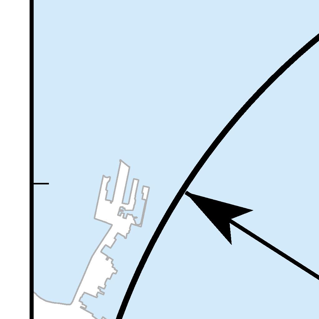
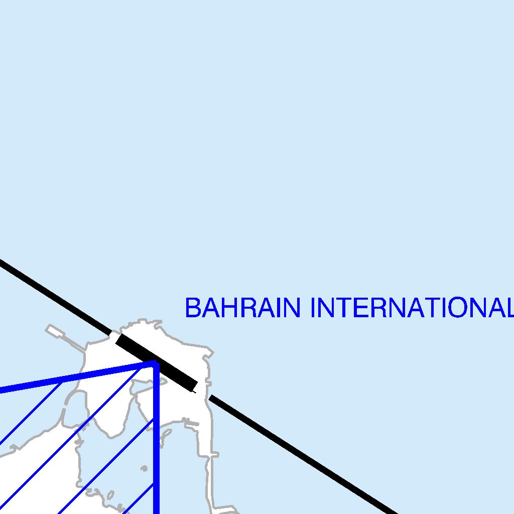
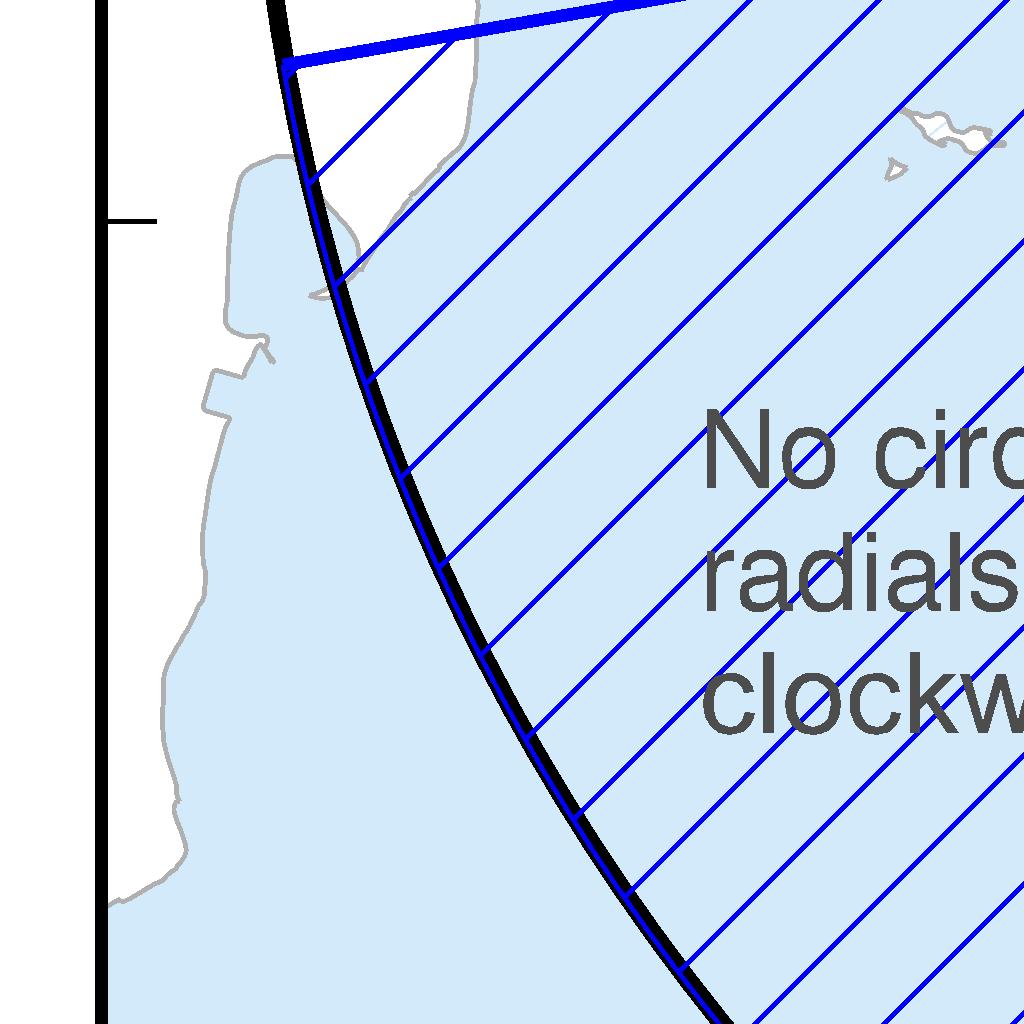
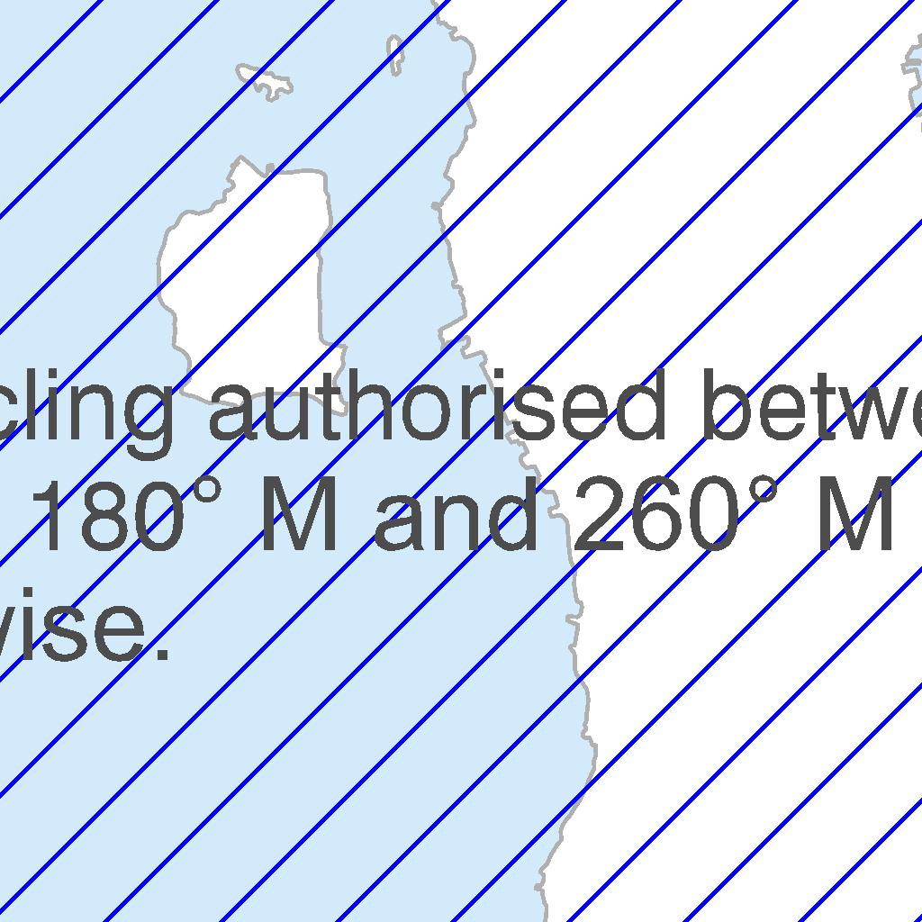
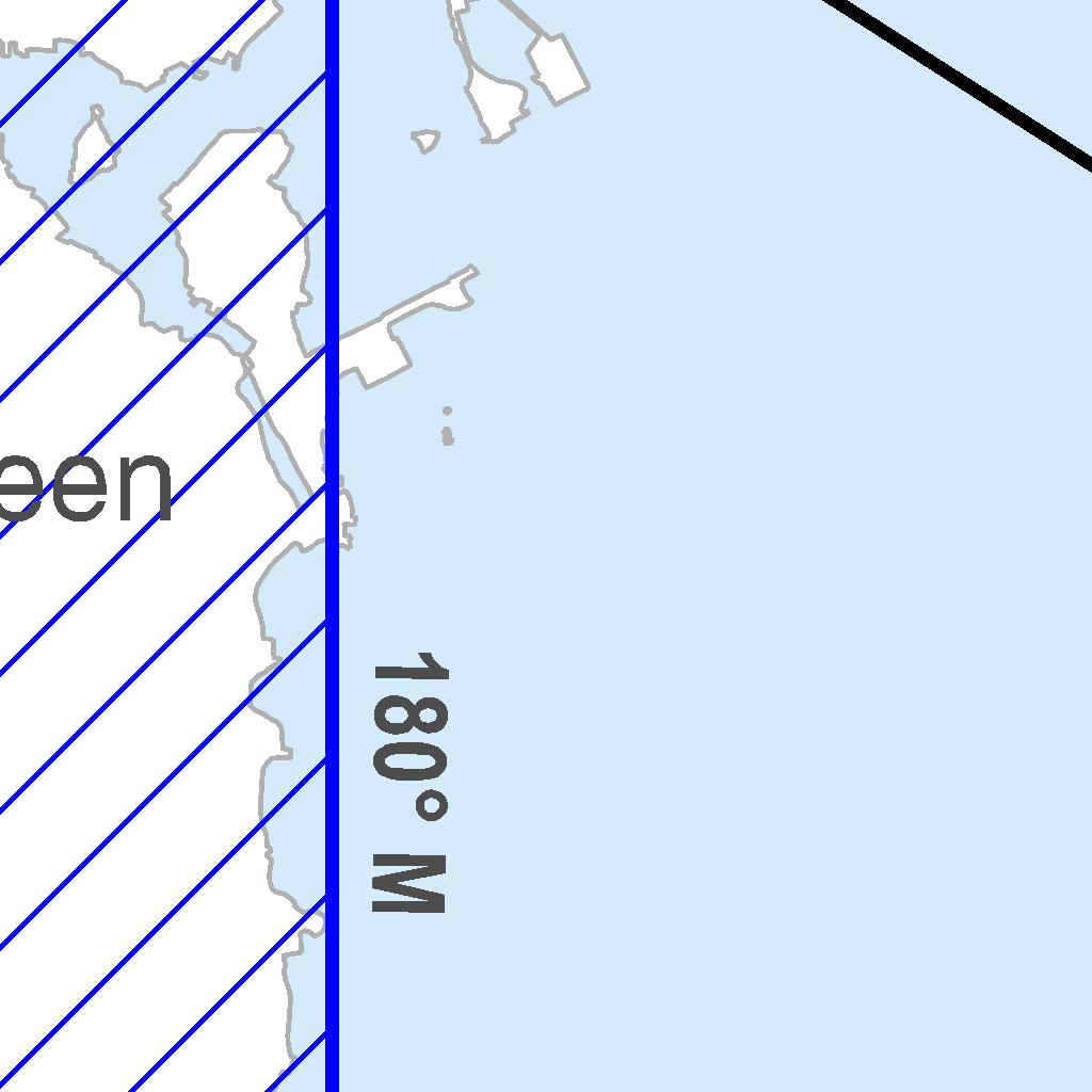

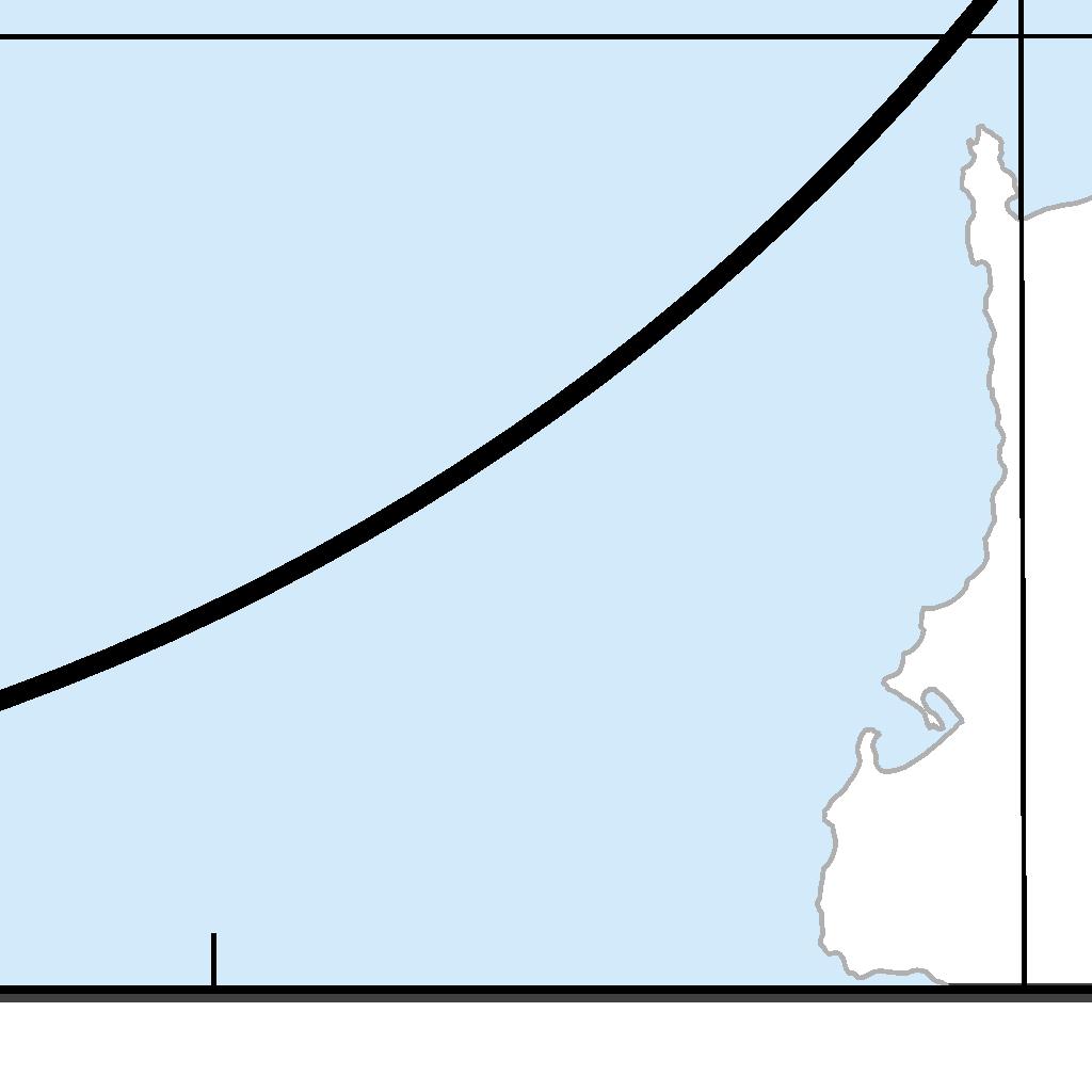
349 AIP BAHRAIN FIR AD 2-OBBI-47
350 AD 2-OBBI-48 AIP BAHRAIN FIR INTENTIONALLY BLANK
351 AIP BAHRAIN FIR AD 2-OBBI-49
352 AD 2-OBBI-50 AIP BAHRAIN FIR INTENTIONALLY BLANK
353 AIP BAHRAIN FIR AD 2-OBBI-51
354 AD 2-OBBI-52 AIP BAHRAIN FIR INTENTIONALLY BLANK


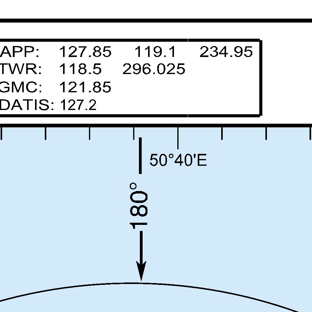
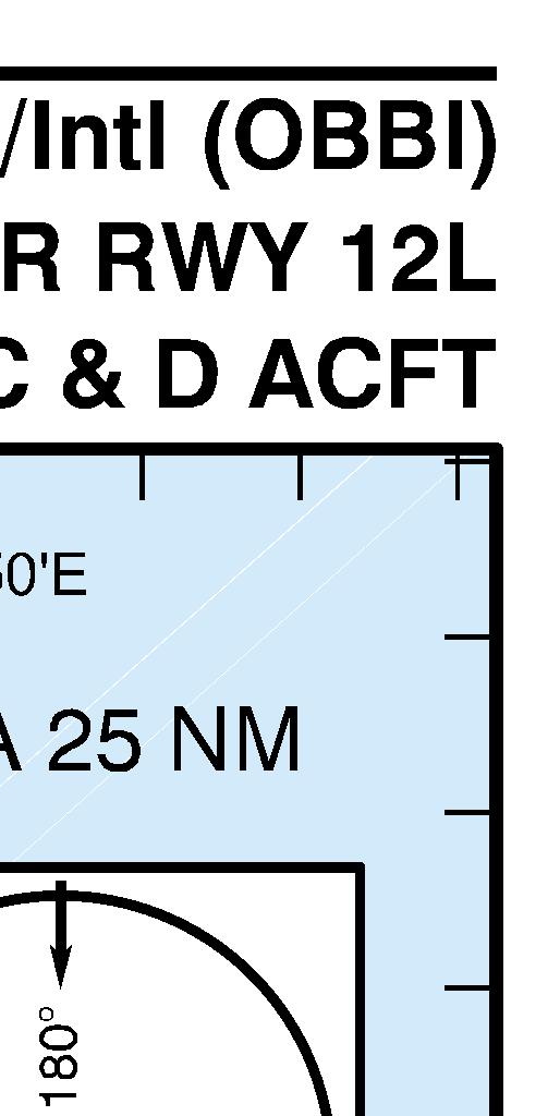
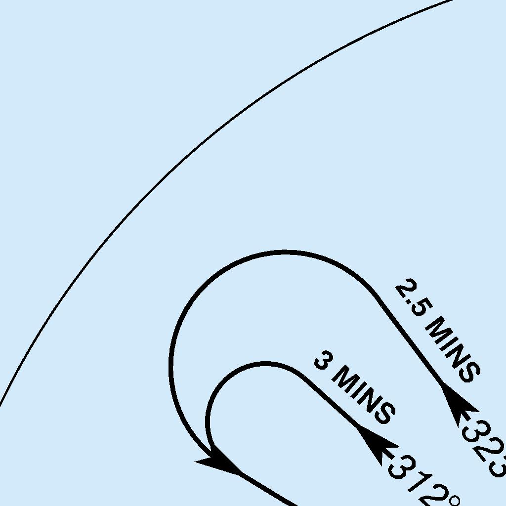
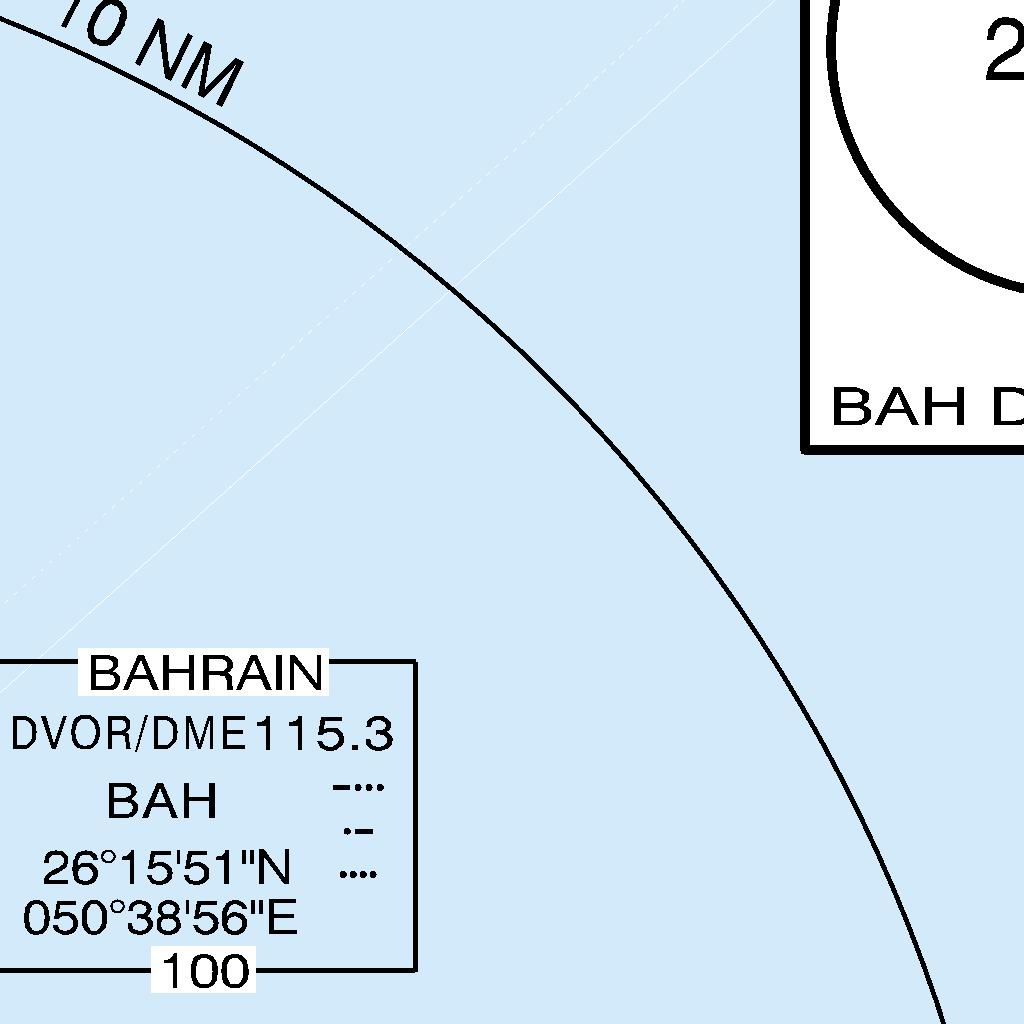
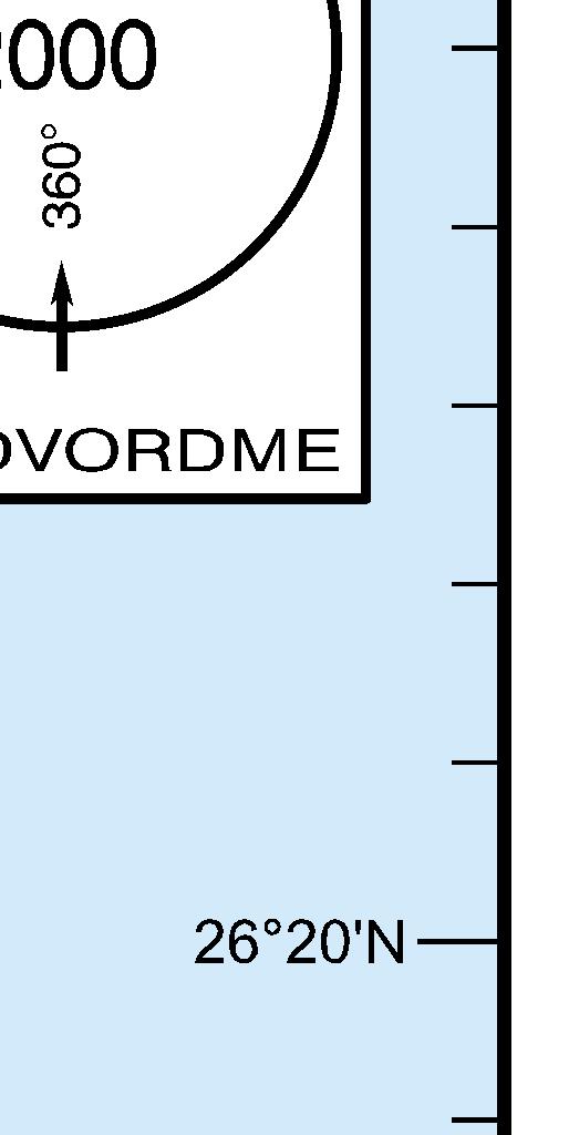
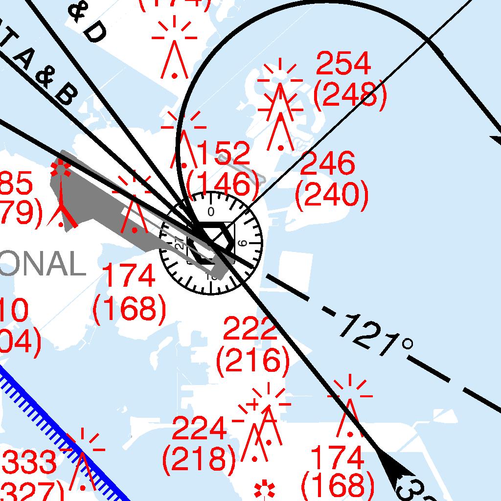
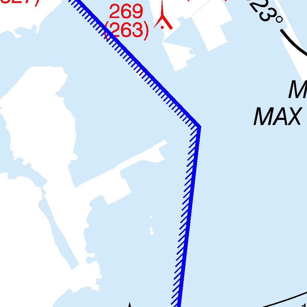
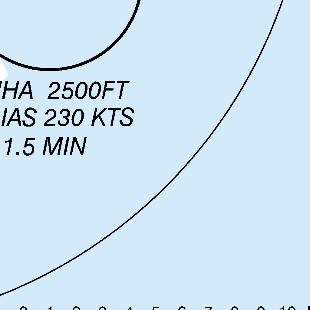
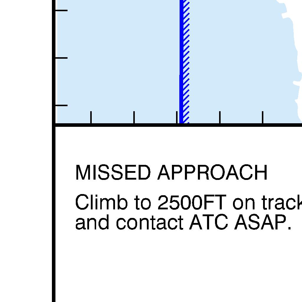
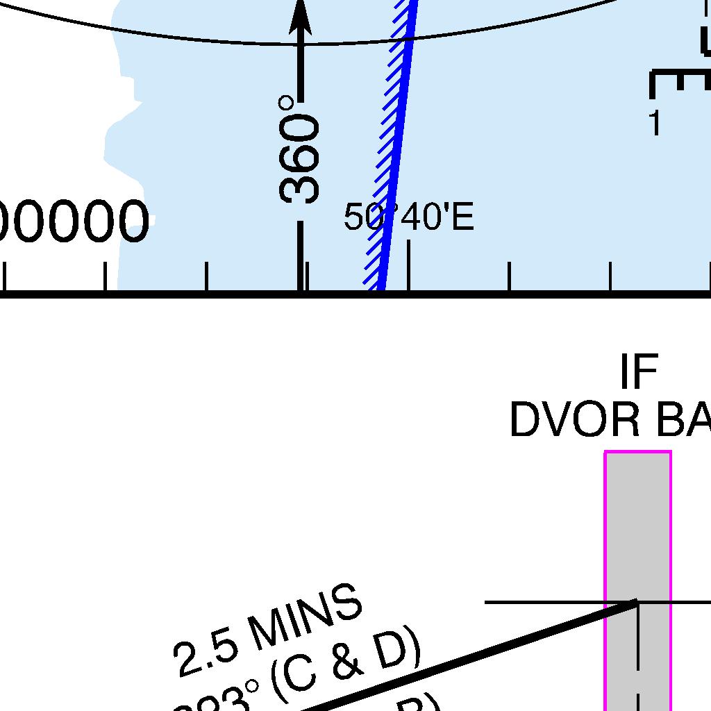
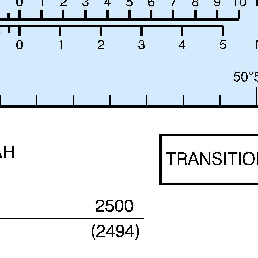
355 AIP BAHRAIN FIR AD 2-OBBI-53
356 AD 2-OBBI-54 AIP BAHRAIN FIR INTENTIONALLY BLANK
357 AIP BAHRAIN FIR AD 2-OBBI-55
358 AD 2-OBBI-56 AIP BAHRAIN FIR INTENTIONALLY BLANK
359 AIP BAHRAIN FIR AD 2-OBBI-57
360 AD 2-OBBI-58 AIP BAHRAIN FIR INTENTIONALLY BLANK
361 AIP BAHRAIN FIR AD 2-OBBI-59
362 AD 2-OBBI-60 AIP BAHRAIN FIR INTENTIONALLY BLANK
363 AIP BAHRAIN FIR AD 2-OBBI-61
364 AD 2-OBBI-62 AIP BAHRAIN FIR INTENTIONALLY BLANK


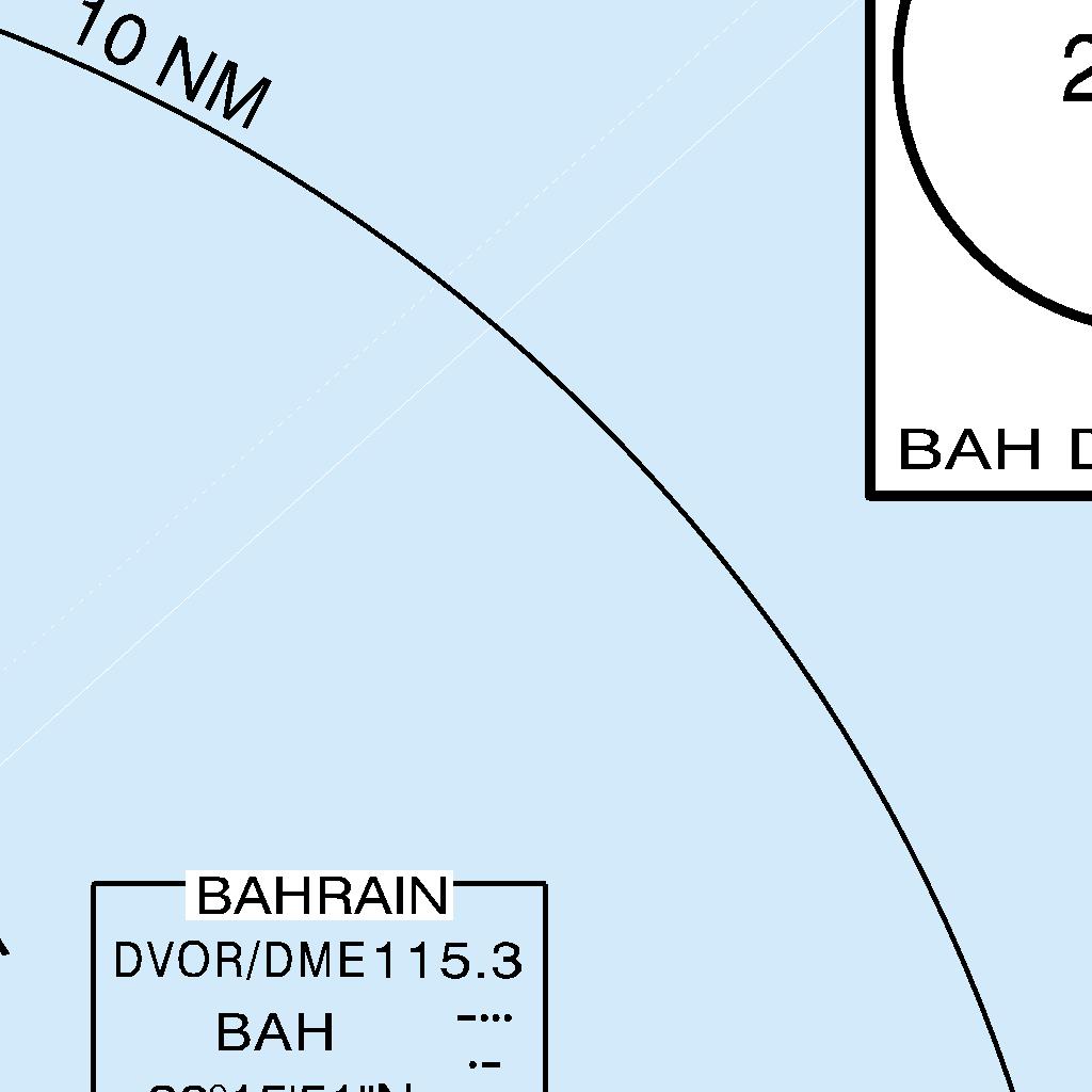
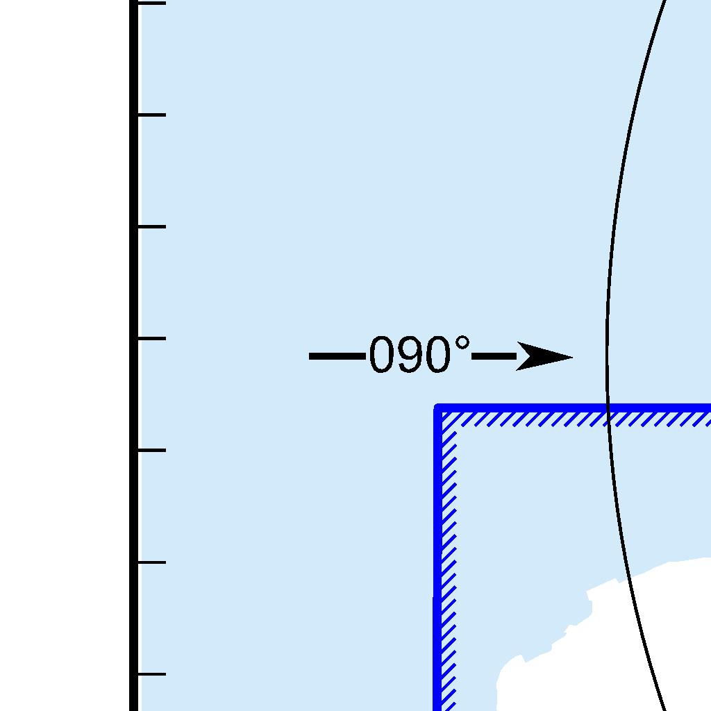
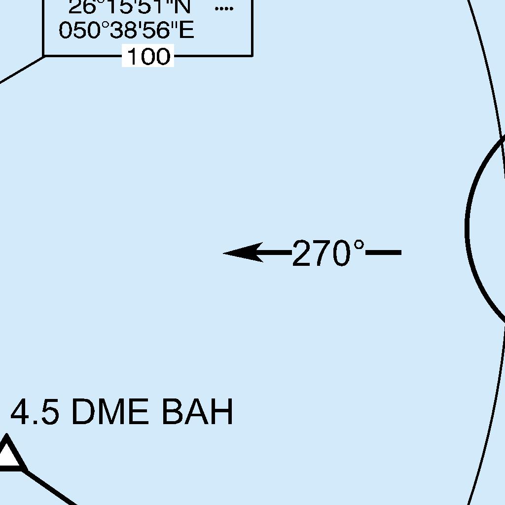
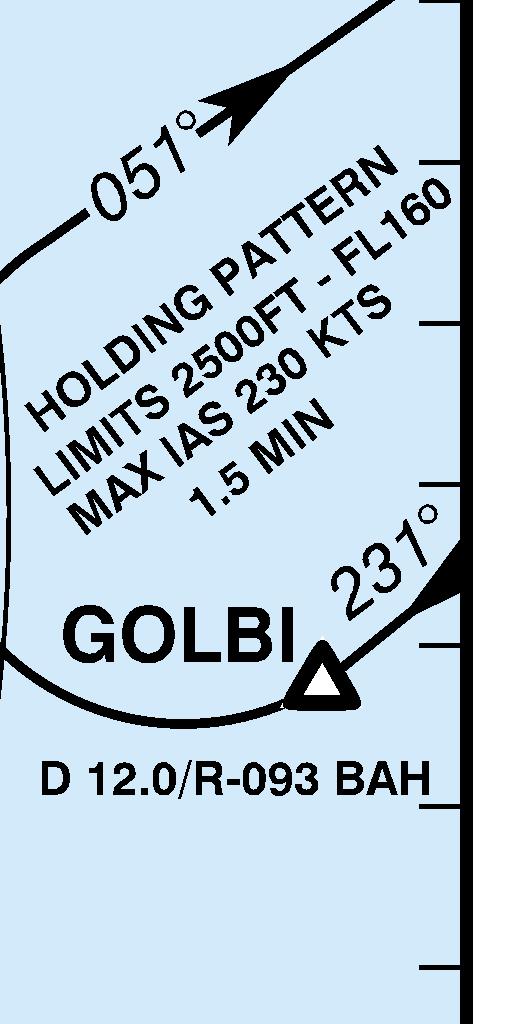
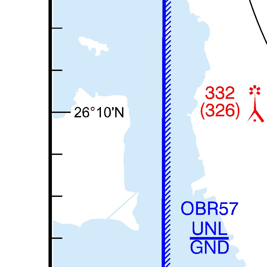
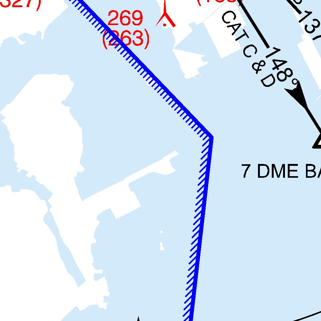
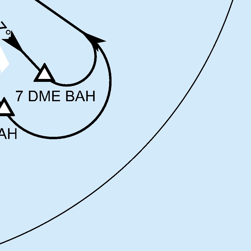
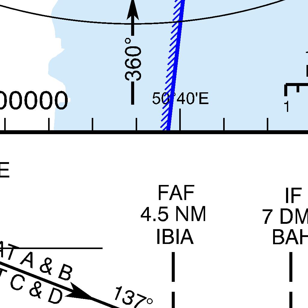
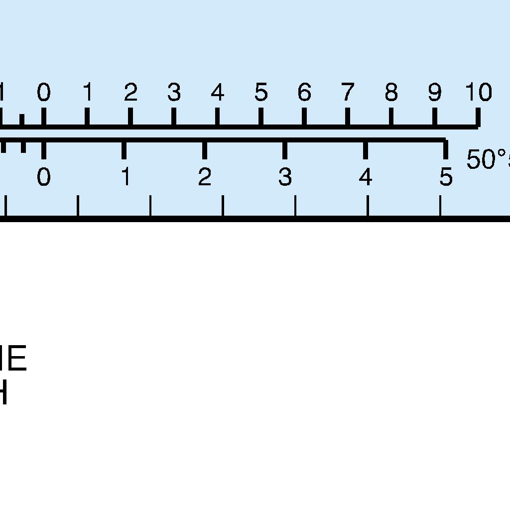

365 AIP BAHRAIN FIR AD 2-OBBI-63
366 AD 2-OBBI-64 AIP BAHRAIN FIR INTENTIONALLY BLANK


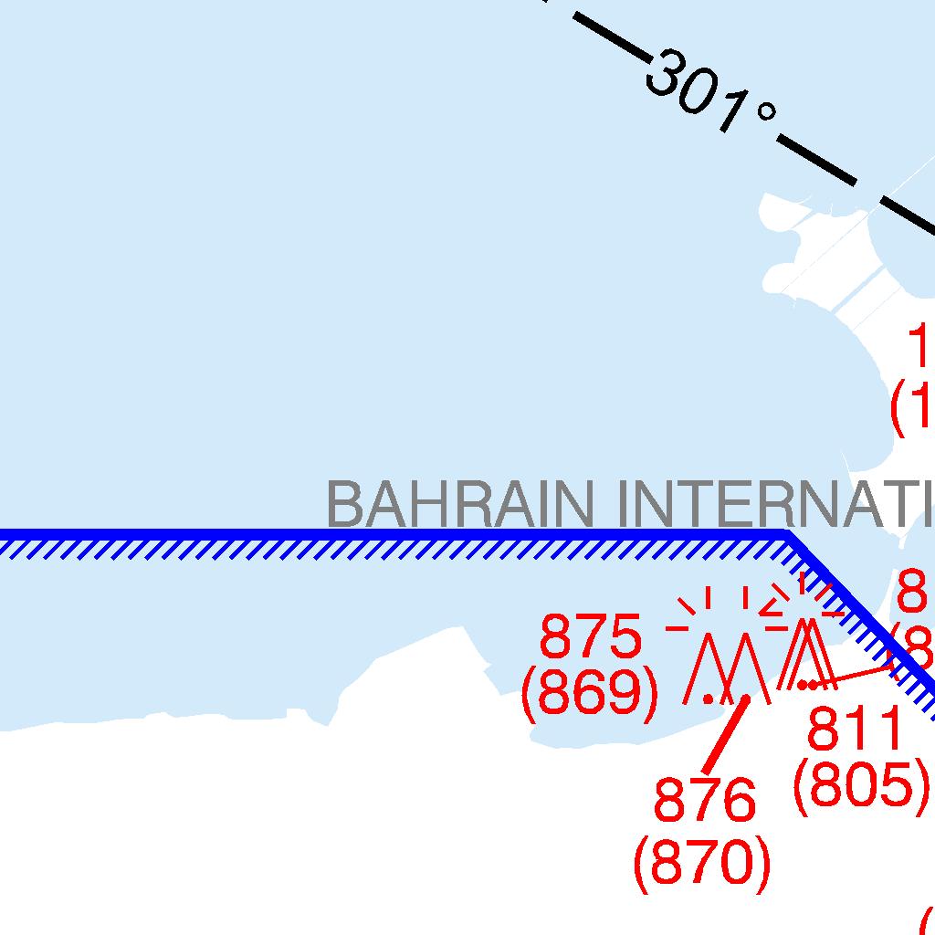
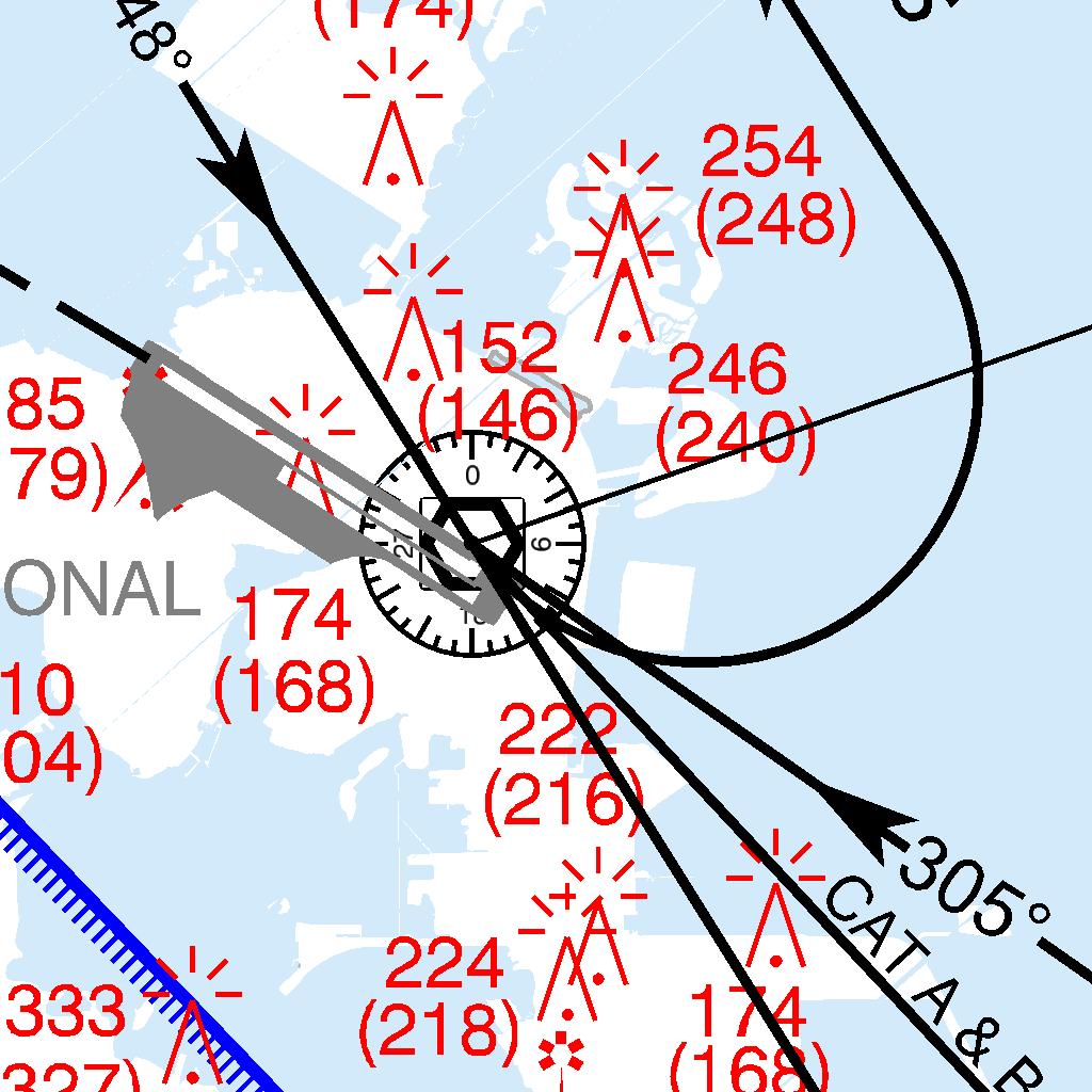
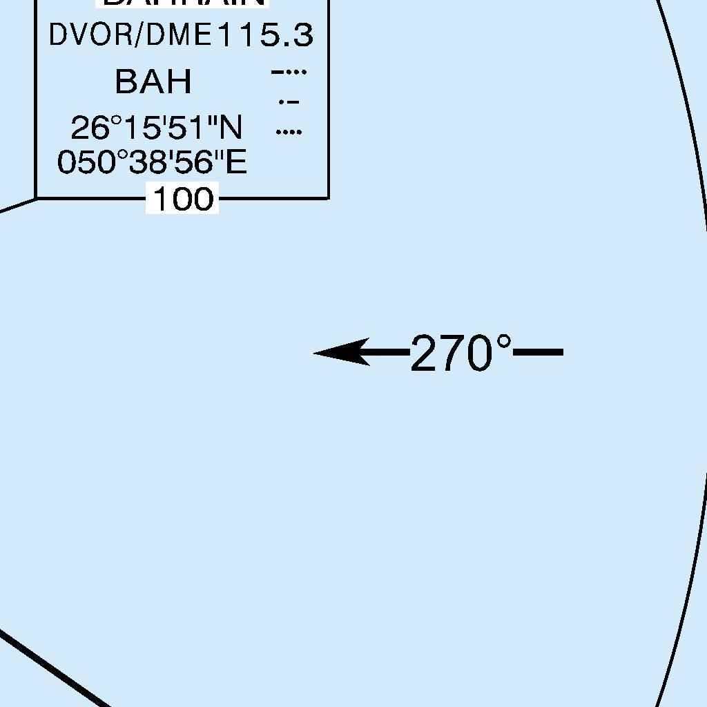
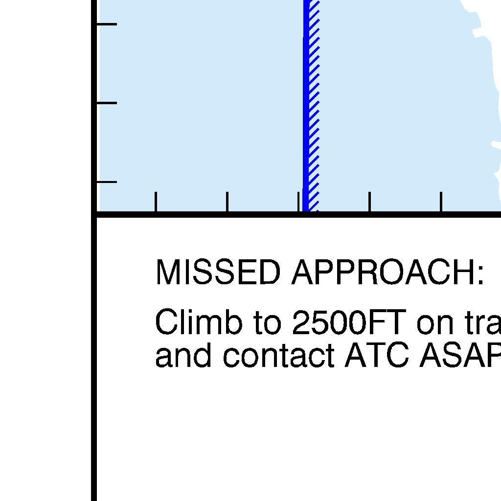

367 AIP BAHRAIN FIR AD 2-OBBI-65
AIP KUWAIT FIR AMENDMENT 28 IMPLEMENTATION AIRAC DATE 25 NOVEMBER 2004
 Phone: +965 476 25 31 FAX: +965 476 55 12 AFTN: OKNOYNYX Email :ais1@kuwait-airport.com.kw www.kuwait-airport.com.kw STATE OF DIRECTORATE GENERAL OF CIVIL AVIATION AERONAUTICAL INFORMATION SERVICE (AIS)
CIVIL AVIATION REGULATIONS PART 10 COMMERCIAL AIR TRANSPORT BY FOREIGN AIR OPERATORS WITHIN FEDERATED STATES OF MICRONESIA
 CIVIL AVIATION REGULATIONS PART 10 COMMERCIAL AIR TRANSPORT BY FOREIGN AIR OPERATORS WITHIN FEDERATED STATES OF MICRONESIA FEDERATED STATES OF MICRONESIA 2001 [THIS PAGE INTENTIONALLY LEFT BLANK] 10-ii
AIR LAW AND ATC PROCEDURES
 1 The International Civil Aviation Organisation (ICAO) establishes: A standards and recommended international practices for contracting member states. B aeronautical standards adopted by all states. C
REGULATIONS (10) FOREIGN AIR OPERATORS
 FOREIGN AIR OPERATORS") Republic of Iraq Ministry of Transport Iraq Civil Aviation Authority REGULATIONS (10) FOREIGN AIR OPERATORS Legal Notice No. REPUBLIC OF IRAQ THE CIVIL AVIATION ACT, NO.148 REGULATIONS THE CIVIL AVIATION
Republic of Iraq Ministry of Transport Iraq Civil Aviation Authority REGULATIONS (10) FOREIGN AIR OPERATORS Legal Notice No. REPUBLIC OF IRAQ THE CIVIL AVIATION ACT, NO.148 REGULATIONS THE CIVIL AVIATION
AIP GEN SRI LANKA REGULATIONS AND REQUIREMENTS 25 MAY 17 GEN 1.2 ENTRY, TRANSIT AND DEPARTURE OF AIRCRAFT
 AIP GEN.2- SRI LANKA REGULATIONS AND REQUIREMENTS 25 MAY 7 GEN.2 ENTRY, TRANSIT AND DEPARTURE OF AIRCRAFT. GENERAL. All flights into / from or over the territory of Sri Lanka and landing in such territory
GUYANA CIVIL AVIATION REGULATION PART X- FOREIGN OPERATORS.
 Civil Aviation 1 GUYANA CIVIL AVIATION REGULATION PART X- FOREIGN OPERATORS. REGULATIONS ARRANGEMENT OF REGULATIONS 1. Citation. 2. Interpretation. 3. Applicability of Regulations. PART A GENERAL REQUIREMENTS
Sao Tome and Principe Civil Aviation Regulations
 INAC Instituto Nacional de Aviação Civil Sao Tome and Principe Civil Aviation Regulations STPCAR - PART 10 COMMERCIAL AIR TRANSPORT BY FOREIGN AIR OPERATORS WITHIN SAO TOME AND PRINCIPE LIST OF EFFECTIVE
Air Law and ATC Procedures Subject: AIR LAW AND ATC PROCEDURES
 Air Law and ATC Procedures Subject: Classroom Instruction: YES (Workshop) Appr. # of Instruction Hrs: 3 Internal Examination: YES ITSS (online) / Offline International Law: Conventions, Agreements and
ENTRY, DEPARTURE AND TRANSIT OF AIRCRAFT 1. GENERAL 2. INTERNATIONAL SCHEDULED FLIGHTS GEN SEP 2012 AIP HUNGARY
 GEN 1.2-1 GEN 1.2 ENTRY, DEPARTURE AND TRANSIT OF AIRCRAFT 1. GENERAL 1.1 All flights into, from or over Hungary and landing within it's territory shall be carried out in accordance with the provisions
AIP PORTUGAL ENR NOV-2007
 AIP PORTUGAL ENR 1.6-1 ENR 1.6 RADAR SERVICES AND PROCEDURES PROVISION OF RADAR SERVICES WITHIN LISBOA AND SANTA MARIA FIR / UIR Introduction Air Traffic Control Services within Lisboa and Santa Maria
OVERSEAS TERRITORIES AVIATION REQUIREMENTS (OTARs)
") OVERSEAS TERRITORIES AVIATION REQUIREMENTS (OTARs) Part 171 AERONAUTICAL TELECOMMUNICATION SERVICES Published by Air Safety Support International Ltd Air Safety Support International Limited 2005 First
OVERSEAS TERRITORIES AVIATION REQUIREMENTS (OTARs) Part 171 AERONAUTICAL TELECOMMUNICATION SERVICES Published by Air Safety Support International Ltd Air Safety Support International Limited 2005 First
SUMMARY REPORT ON THE SAFETY OVERSIGHT AUDIT FOLLOW-UP OF THE DIRECTORATE GENERAL OF CIVIL AVIATION OF KUWAIT
 ICAO Universal Safety Oversight Audit Programme SUMMARY REPORT ON THE SAFETY OVERSIGHT AUDIT FOLLOW-UP OF THE DIRECTORATE GENERAL OF CIVIL AVIATION OF KUWAIT (Kuwait, 17 to 20 September 2003) International
COMMISSION REGULATION (EU) No 255/2010 of 25 March 2010 laying down common rules on air traffic flow management
 No 255/2010 of 25 March 2010 laying down common rules on air traffic flow management") L 80/10 Official Journal of the European Union 26.3.2010 COMMISSION REGULATION (EU) No 255/2010 of 25 March 2010 laying down common rules on air traffic flow management (Text with EEA relevance) THE EUROPEAN
L 80/10 Official Journal of the European Union 26.3.2010 COMMISSION REGULATION (EU) No 255/2010 of 25 March 2010 laying down common rules on air traffic flow management (Text with EEA relevance) THE EUROPEAN
Contents. Subpart A General 91.1 Purpose... 7
 Contents Rule objective... 3 Extent of consultation... 3 Summary of comments... 4 Examination of comments... 6 Insertion of Amendments... 6 Effective date of rule... 6 Availability of rules... 6 Part 91
Supplement No. 17 published with Gazette No. 22 dated 25 October, THE AIR NAVIGATION (OVERSEAS TERRITORIES) ORDER 2007, S.I No.
 ORDER 2007, S.I No.") CAYMAN ISLANDS Supplement No. 17 published with Gazette No. 22 dated 25 October, 2010. THE AIR NAVIGATION (OVERSEAS TERRITORIES) ORDER 2007, S.I. 2007 No. 3468 THE AIR NAVIGATION (FEES) REGULATIONS, 2010
CAYMAN ISLANDS Supplement No. 17 published with Gazette No. 22 dated 25 October, 2010. THE AIR NAVIGATION (OVERSEAS TERRITORIES) ORDER 2007, S.I. 2007 No. 3468 THE AIR NAVIGATION (FEES) REGULATIONS, 2010
Appendix A REQUEST FOR AUTHORIZATION FORM
 Appendix A REQUEST FOR AUTHORIZATION FORM Note. For details on completing this form, and for definitions of acronyms and abbreviations, see section on Information Required for the Assessment of Authorization
GHANA CIVIL AVIATION (FLIGHT STANDARDS) PART 10 COMMERCIAL AIR TRANSPORT BY FOREIGN AIR OPERATORS WITHIN GHANA
 PART 10 COMMERCIAL AIR TRANSPORT BY FOREIGN AIR OPERATORS WITHIN GHANA") Part 10 Commercial Air Transport By Foreign Air Operators PART 10 COMMERCIAL AIR TRANSPORT BY FOREIGN AIR OPERATORS WITHIN GHANA 10-1 Part 10 Commercial Air Transport By Foreign Air Operators INTRODUCTION
Part 10 Commercial Air Transport By Foreign Air Operators PART 10 COMMERCIAL AIR TRANSPORT BY FOREIGN AIR OPERATORS WITHIN GHANA 10-1 Part 10 Commercial Air Transport By Foreign Air Operators INTRODUCTION
CAR Section II Series I Part VIII is proposed to be amended. The proposed amendments are shown in subsequent affect paragraphs.
 CAR Section II Series I Part VIII is proposed to be amended. The proposed amendments are shown in subsequent affect paragraphs. The text of the amendment is arranged to show deleted text, new or amended
REPUBLIC OF SEYCHELLES CIVIL AVIATION AUTHORITY AERONAUTICAL INFORMATION SERVICE P.O.BOX 181, VICTORIA SEYCHELLES
 Phone: 248-384000 AFS: FSIAYNYX FAX: 248-384030 Email: sezais@scaa.sc REPUBLIC OF SEYCHELLES CIVIL AVIATION AUTHORITY AERONAUTICAL INFORMATION SERVICE P.O.BOX 181, VICTORIA SEYCHELLES AIP SUPPLEMENT S02/09
CCAR-129 XXXXX AIRLINES XXXX
 CCAR-129 ISSUED TO XXXXX AIRLINES XXXX General Administration of Civil Aviation of China Print December 25, 2006 No.: DEHF567P CCAR-129 Operations Specifications HQ Revision A001 Issuance and Applicability
STATUS OF MONTENEGRO WITH REGARD TO INTERNATIONAL AIR LAW INSTRUMENTS
 1. Convention Chicago, 7/12/44-12/2/07 14/3/07 2. International Air Services Transit Agreement Chicago, 7/12/44-5/10/07 5/10/07 3. International Air Transport Agreement Chicago, 7/12/44 - - - 4. Protocol
ENR-5 FLIGHT PLANNING
 04 JAN 18 (2) Flight planning VFR-ENR-5-1 ENR-5 FLIGHT PLANNING 5.1 Flight plan submission 5.1.1 VFR flight plans shall be submitted exclusively by means of Central Air Traffic Services Reporting Office
HIGHLANDS AND ISLANDS AIRPORTS LIMITED
 HIGHLANDS AND ISLANDS AIRPORTS LIMITED ARRANGEMENTS FOR FLIGHTS OUTSIDE OFFICIAL OPENING HOURS The term Company or HIAL Group applies to Highlands and Islands Airport Limited (HIAL) and any subsidiary
(Japanese Note) Excellency,
 Excellency,") (Japanese Note) Excellency, I have the honour to refer to the recent discussions held between the representatives of the Government of Japan and of the Government of the Republic of Djibouti concerning
(Japanese Note) Excellency, I have the honour to refer to the recent discussions held between the representatives of the Government of Japan and of the Government of the Republic of Djibouti concerning
Legal regulations in transport policy
 Air Legal regulations in transport policy Lecture 2 Anna Kwasiborska, PhD Air Flying is becoming easier and cheaper, with new airlines, more routes and hundreds of services connecting large numbers of
Sample Regulations for Water Aerodromes
 Sample Regulations for Water Aerodromes First Edition (unedited version) March 2015 Notice to users: This document is an unedited version which is made available to the public for convenience. Its content
1- Wher can you find the difference between ICAO standards and Iran regulation and procedure? a) GEN 2.5 b) ENR 3 c) GEN 1.
 GEN 2.5 b) ENR 3 c) GEN 1.") 1- Wher can you find the difference between ICAO standards and Iran regulation and procedure? a) GEN 2.5 b) ENR 3 c) GEN 1.7 d) ENR l 2- Which part of AIP contain conversion table? a) GEN 1 b) GEN 2 c)
1- Wher can you find the difference between ICAO standards and Iran regulation and procedure? a) GEN 2.5 b) ENR 3 c) GEN 1.7 d) ENR l 2- Which part of AIP contain conversion table? a) GEN 1 b) GEN 2 c)
FAX MESSAGE PLEASE NOTE THE ABOVE APPROVAL IS BASED ON THE FOLLOWING REQUIREMENTS BEING FULLY MET.
 SEYCHELLES CIVIL AVIATION AUTHORITY P O Box 181 International Airport, Mahe, Republic of Telephone: (+248) 4384000 Facsimile: (+248) 4384128 / 4384009 E-mail: secretariat@scaa.sc Please address all correspondence
ENR 1.1 GEN. RULES (Insert para 13 in ENR 1.1 of AIP India as follows)
") TEL: +91-11-24632950 Extn: 2219/2233 AFS: VIDDYXAX FAX: +91-11-24615508 Email: gmais@aai.aero INDIA AERONAUTICAL INFORMATION SERVICE AIRPORTS AUTHORITY OF INDIA RAJIV GANDHI BHAVAN SAFDARJUNG AIRPORT NEW
TEL: +91-11-24632950 Extn: 2219/2233 AFS: VIDDYXAX FAX: +91-11-24615508 Email: gmais@aai.aero INDIA AERONAUTICAL INFORMATION SERVICE AIRPORTS AUTHORITY OF INDIA RAJIV GANDHI BHAVAN SAFDARJUNG AIRPORT NEW
GEN 3. SERVICES GEN AERONAUTICAL INFORMATION SERVICES
 GEN 3.1-1 1. RESPONSIBLE SERVICE GEN 3. SERVICES GEN 3.1 - AERONAUTICAL INFORMATION SERVICES 1.1 The object of the aeronautical information service (AIS) is to ensure the flow of aeronautical data and
OVERSEAS TERRITORIES AVIATION REQUIREMENTS (OTARs)
") OVERSEAS TERRITORIES AVIATION REQUIREMENTS (OTARs) Part 174 METEOROLOGICAL SERVICES FOR AVIATION Published by Air Safety Support International Ltd Air Safety Support International Limited 2017 First Issue
OVERSEAS TERRITORIES AVIATION REQUIREMENTS (OTARs) Part 174 METEOROLOGICAL SERVICES FOR AVIATION Published by Air Safety Support International Ltd Air Safety Support International Limited 2017 First Issue
Reporting Instructions FILING REQUIREMENTS
 FORM N AVIATION PERSONNEL LICENSING AND TRAINING Reporting Instructions General FILING REQUIREMENTS This form is to be used by ICAO Member States to report aviation personnel qualifications and aviation
STATUS OF GERMANY WITH REGARD TO INTERNATIONAL AIR LAW INSTRUMENTS
 1. Convention Chicago, 7/12/44-9/5/56 8/6/56 2. International Air Services Transit Agreement Chicago, 7/12/44-9/5/56 8/6/56 3. International Air Transport Agreement Chicago, 7/12/44 - - - 4. Protocol on
Guidelines for Workflow of AIP AMDT, AIP SUP & AIRAC at Iraq CAA AIS HQ
 Guidelines for Workflow of AIP AMDT, AIP SUP & AIRAC at Iraq CAA AIS HQ July 23rd, 2011 INDEX 1- INTRODUCTION... 2 2- COMPILING AND EDITING OF AN AIP... 3 2.1- Language... 3 2.2- Page Numbering... 3 3-
ATM REGIONAL CONTINGENCY PLAN FOR.. CTA/UTA/FIR
 ATM REGIONAL CONTINGENCY PLAN FOR.. CTA/UTA/FIR OBJECTIVE: This ATS Contingency plan s objective is to ensure the continued safety and supplies of air navigation services in the event of partially or total
Official Journal of the European Union L 186/27
 7.7.2006 Official Journal of the European Union L 186/27 COMMISSION REGULATION (EC) No 1032/2006 of 6 July 2006 laying down requirements for automatic systems for the exchange of flight data for the purpose
RED SKY VENTURES. Study guide. COPYRIGHT RED SKY VENTURES AVIATION CC First edition published JULY 2003 This edition: January 2005.
 RED SKY VENTURES PPL Air Law Study guide COPYRIGHT RED SKY VENTURES AVIATION CC First edition published JULY 2003 This edition: January 2005 1 PPL Air Law CONTENTS NOTE TO TEXT... 6 Current Namibian Law...
OVERSEAS TERRITORIES AVIATION REQUIREMENTS (OTARs)
") OVERSEAS TERRITORIES AVIATION REQUIREMENTS (OTARs) Part 13 OCCURRENCE REPORTING Published by Air Safety Support International Ltd Air Safety Support International Limited 2005 First Issue published for
OVERSEAS TERRITORIES AVIATION REQUIREMENTS (OTARs) Part 13 OCCURRENCE REPORTING Published by Air Safety Support International Ltd Air Safety Support International Limited 2005 First Issue published for
EU-OPS Operations Manual Checklist/Compliance Schedule
 EU-OPS Operations Manual Checklist/Compliance Schedule This checklist is for you to complete and return with your submitted company Operations Manual, indicating where it addresses s. EU-OPS requirements
CHAPTER 7 AEROPLANE COMMUNICATION AND NAVIGATION EQUIPMENT
 CHAP 7-1 CHAPTER 7 COMMUNICATION AND NAVIGATION EQUIPMENT 7.1 COMMUNICATION EQUIPMENT 7.1.1 An aeroplane shall be provided with radio communication equipment capable of: a) conducting two-way communication
EASA NPA on SERA Part ENAV Response sheet. GENERAL COMMENTS ON NPA PACKAGE Note: Specific comments are provided after the General Comments
 EASA NPA on SERA Part ENAV Response sheet GENERAL COMMENTS ON NPA PACKAGE te: Specific comments are provided after the General Comments 1 SERA Parts C and D ENAV still misses clarity on the whole scope
CIVIL AVIATION REQUIREMENT SECTION 3 AIR TRANSPORT SERIES C PART I ISSUE IV, 24 th March 2017 EFFECTIVE: FORTHWITH
 GOVERNMENT OF INDIA OFFICE OF THE DIRECTOR GENERAL OF CIVIL AVIATION TECHNICAL CENTRE, OPPOSITE SAFDARJUNG AIRPORT, NEW DELHI CIVIL AVIATION REQUIREMENT SERIES C PART I ISSUE IV, 24 th March 2017 EFFECTIVE:
AGREEMENT BETWEEN JAPAN AND THE KINGDOM OF SAUDI ARABIA FOR AIR SERVICES
 AGREEMENT BETWEEN JAPAN AND THE KINGDOM OF SAUDI ARABIA FOR AIR SERVICES The Government of Japan and the Government of the Kingdom of Saudi Arabia, Desiring to conclude an agreement for the purpose of
Israel. Contacts. Flight Information. Country Specific Travel Information. Aeronautical Information Publication (AIP) ISO Country Code - IL
 ISO Country Code - IL") Israel ISO Country Code - IL Verification Date: 27-January-2014 Contacts Designated Authorities Aeronautical Information Service (AIS) Israel Embassy to the United States United States Embassy to Israel
Israel ISO Country Code - IL Verification Date: 27-January-2014 Contacts Designated Authorities Aeronautical Information Service (AIS) Israel Embassy to the United States United States Embassy to Israel
National Air Transport Facilitation Program Kingdom of Bahrain
 National Air Transport Facilitation Program Kingdom of Bahrain Introduction: Speed is the comparative advantage of air transport on all other modes of transportation. The success of state depends on the
REPUBLIC OF KAZAKHSTAN
 POST: Bldg 15, E522 str., 010014 Astana, Republic of Kazakhstan REPUBLIC OF KAZAKHSTAN The Republican State Enterprise Kazaeronavigatsia AIRAC AIP SUP: 001 TEL: +7 (7172) 704268 Effective Date: 30 Mar
NOTICE 1063 OF 2012 AIRPORTS COMPANY SOUTH AFRICA LIMITED. AIRPORTS COMPANY ACT, 1993 (ACT No. 44 OF 1993), AS AMENDED PUBLICATION OF AIRPORT CHARGES
, AS AMENDED PUBLICATION OF AIRPORT CHARGES") STAATSKOEANT, 21 DESEMBE 2012 No. 36030 3 GENEAL NOTICE NOTICE 1063 OF 2012 AIPOTS COMPANY SOUTH AFICA LIMITED AIPOTS COMPANY ACT, 1993 (ACT No. 44 OF 1993), AS AMENDED PUBLICATION OF AIPOT CHAGES In terms
STAATSKOEANT, 21 DESEMBE 2012 No. 36030 3 GENEAL NOTICE NOTICE 1063 OF 2012 AIPOTS COMPANY SOUTH AFICA LIMITED AIPOTS COMPANY ACT, 1993 (ACT No. 44 OF 1993), AS AMENDED PUBLICATION OF AIPOT CHAGES In terms
AIRAC AIP SUPPLEMENT A 16/17 08 June 2017
 Phone: 66 02 568 8831 Fax: 66 02 576 1903 AFTN: VTBAYOYX E-mail: aisthai@caat.or.th ais@caat.or.th THE CIVIL AVIATION AUTHORITY OF THAILAND Aeronautical Information Service Department 333/105 Lak Si Plaza,
GOVERNMENT OF INDIA OFFICE OF DIRECTOR GENERAL OF CIVIL AVIATION
 GOVERNMENT OF INDIA OFFICE OF DIRECTOR GENERAL OF CIVIL AVIATION ANSS AC NO. 1 of 2017 31.07. 2017 Air Space and Air Navigation Services Standard ADVISORY CIRCULAR Subject: Procedures to follow in case
Advisory Circular AC61-3 Revision 12 SUPERSEDED Describe the duties of the pilot-in-command, as laid down in CA Act 1990 S13 and 13A.
 Subject No 4 Air Law Each subject has been given a subject number and each topic within that subject a topic number. These reference numbers will be used on knowledge deficiency reports and will provide
Subject. Insurance Requirements. Appendixes Appendix
 Contents Section No. Subject 203.1 Applicability. 203.3 Definitions. 203.5 General provisions 203.7 Applications 203.9 Time schedule for Application Process. 203.11 Fees & Charges. 203.13 Insurance Requirements.
CIVIL AVIATION REGULATIONS SURINAME PART 17 - AERONAUTICAL TELECOMMUNICATIONS VERSION 5.0
 CIVIL AVIATION REGULATIONS SURINAME PART 17 - AERONAUTICAL TELECOMMUNICATIONS VERSION 5.0 January 2018 AMENDMENTS Location Date Amended by Description CONTENTS 17.1 GENERAL... 4 17.1.1 Applicability...
Content. Part 91 General Operating and Flight Rules 5
 Content Rule objective... 3 Extent of consultation... 3 New Zealand Transport Strategy... 3 Summary of submissions... 3 Examination of submissions... 3 Insertion of Amendments... 4 Effective date of rule...
Provisional Agreement between the Government of the Republic of Korea and the Government of the People's Republic of China for Civil Air Transport
 Signed at Seoul October 31, 1994 Entered into force October 31, 1994 Provisional Agreement between the Government of the Republic of Korea and the Government of the People's Republic of China for Civil
Part 171. Aeronautical Telecommunication Services - Operation and Certification. CAA Consolidation. 10 March 2017
 Part 171 CAA Consolidation 10 March 2017 Aeronautical Telecommunication Services - Operation and Certification Published by the Civil Aviation Authority of New Zealand DESCRIPTION Part 171 provides the
luxaviation S.A. GENERAL TERMS AND CONDITIONS OF BUSINESS
 luxaviation S.A. GENERAL TERMS AND CONDITIONS OF BUSINESS 1. DEFINITIONS 1.1 Carrier is luxaviation S.A. 1.2 Charter is the contract between the Carrier and the Charterer. 1.3 Charterer is any person,
OFFICE OF DIRECTOR GENERAL OF CIVIL AVIATION TECHNICAL CENTRE, OPP SAFDARJANG AIRPORT, NEW DELHI
 GOVERNMENT OF INDIA OFFICE OF DIRECTOR GENERAL OF CIVIL AVIATION TECHNICAL CENTRE, OPP SAFDARJANG AIRPORT, NEW DELHI CIVIL AVIATION REQUIREMENTS SECTION 2 - AIRWORTHINESS SERIES 'R', PART IV DATED 8 TH
Chapter 16. Airports Authority of India Manual of Air Traffic Services Part RESPONSIBILITY IN REGARD TO MILITARY TRAFFIC
 Chapter 16 16.1 RESPONSIBILITY IN REGARD TO MILITARY TRAFFIC 16.1.1 It is recognized that some military aeronautical operations necessitate non-compliance with certain air traffic procedures. In order
INTERNATIONAL CIVIL AVIATION ORGANIZATION FIRST MEETING OF DIRECTORS OF CIVIL AVIATION OF THE CARIBBEAN REGION (CAR/DCA/1)
") CAR DCA/1 20/09/02 INTERNATIONAL CIVIL AVIATION ORGANIZATION FIRST MEETING OF DIRECTORS OF CIVIL AVIATION OF THE CARIBBEAN REGION (CAR/DCA/1) (Grand Cayman, Cayman Islands, 8-11 October 2002) Agenda Item
CAR DCA/1 20/09/02 INTERNATIONAL CIVIL AVIATION ORGANIZATION FIRST MEETING OF DIRECTORS OF CIVIL AVIATION OF THE CARIBBEAN REGION (CAR/DCA/1) (Grand Cayman, Cayman Islands, 8-11 October 2002) Agenda Item
GOVERNMENT OF INDIA AERONAUTICAL INFORMATION SERVICES DIRECTOR GENERAL OF CIVIL AVIATION OPPOSITE SAFDARJUNG AIRPORT NEW DELHI
 Telephone No. : 24622495 Telegraphic Address: Commercial : AIRCIVIL NEW DELHI Aeronautical : VIDDYAYX E Mail: dri @ dgca.delhnic.in Fax : 91 11 2469 2374 GOVERNMENT OF INDIA AERONAUTICAL INFORMATION SERVICES
ICAO Aerodrome s Manual. AERODROME S INSPECTOR WORKSHOP St. Maarten, MAHO June 2012
 ICAO Aerodrome s Manual AERODROME S INSPECTOR WORKSHOP St. Maarten, MAHO 11-15 June 2012 Objectives - Identify the requirements listed in Annex 14 regarding the development and maintenance of an aerodrome
AIRSPACE STRUCTURE. In aeronautics, airspaces are the portion of the atmosphere controlled by a country above its territory.
 AIRSPACE STRUCTURE 1. Introduction In aeronautics, s are the portion of the atmosphere controlled by a country above its territory. There are two kinds of : Controlled is of defined dimensions within which
COMMISSION OF THE EUROPEAN COMMUNITIES. Draft. COMMISSION REGULATION (EU) No /
 No /") EN EN EN COMMISSION OF THE EUROPEAN COMMUNITIES Draft Brussels, C COMMISSION REGULATION (EU) No / of [ ] laying down requirements and administrative procedures related to Air Operations pursuant to Regulation
EN EN EN COMMISSION OF THE EUROPEAN COMMUNITIES Draft Brussels, C COMMISSION REGULATION (EU) No / of [ ] laying down requirements and administrative procedures related to Air Operations pursuant to Regulation
AIR TRANSPORT AGREEMENT BETWEEN THE GOVERNMENT OF THE REPUBLIC OF MOLDOVA AND THE GOVERNMENT OF THE STATE OF ISRAEL
 AIR TRANSPORT AGREEMENT BETWEEN THE GOVERNMENT OF THE REPUBLIC OF MOLDOVA AND THE GOVERNMENT OF THE STATE OF ISRAEL The Government of the State of Israel, and the Government of the Republic of Moldova,
AVIATION. Carriage by Air Act 17 of 1946, as amended in South Africa to March AVIATION-1
 AVIATION Carriage by Air Act 17 of 1946, as amended in South Africa to March 1978. Summary: This Act (SA GG 3649) gives effect to the Warsaw Convention that governs international air travel. It was brought
The Legal Framework for RPAS/UAS Suitability of the Chicago Convention and its Annexes
 The Legal Framework for RPAS/UAS Suitability of the Chicago Convention and its Annexes 27 May 2013 Page 1 Non-Lawyers 27 May 2013 Page 2 Lawyers 27 May 2013 Page 3 Is the Chicago Convention Suitable? م
Cooperative Development of Operational Safety Continuing Airworthiness Programme. COSCAP-Gulf States. Training of Airworthiness Inspectors
 COSCAP- Training of Airworthiness Inspectors Part V _ STATE SAFETY OVERSIGHT SYSTEM (ICAO Doc 9734, Part I) By Nadia Konzali COSCAP-GS Project Coordinator FLIGHT PLAN 1. Civil aviation regulations; 2.
CIVIL AVIATION AUTHORITY, PAKISTAN OPERATIONAL CONTROL SYSTEMS CONTENTS
 CIVIL AVIATION AUTHORITY, PAKISTAN Air Navigation Order No. : 91-0004 Date : 7 th April, 2010 Issue : Two OPERATIONAL CONTROL SYSTEMS CONTENTS SECTIONS 1. Authority 2. Purpose 3. Scope 4. Operational Control
IFR SEPARATION WITHOUT RADAR
 1. Introduction IFR SEPARATION WITHOUT RADAR When flying IFR inside controlled airspace, air traffic controllers either providing a service to an aircraft under their control or to another controller s
Guidelines for NOTAM Workflow and Allocation of Responsibilities
 Guidelines for NOTAM Workflow and Allocation of Responsibilities May 19 2011 INDEX 1- MAIN OBJECTIVES 1 2- ORIGINATION OF NOTAM 1 3- VALUE OF A NOTAM 3 4- DURATION OF NOTAM 4 5- THE AERONAUTICAL DATA CHAIN
ENR 1.14 AIR TRAFFIC INCIDENTS
 AIP ENR.- Republic of Mauritius 0 AUG 00 ENR. AIR TRAFFIC INCIDENTS. Definition of air traffic incidents. "Air traffic incident" is used to mean a serious occurrence related to the provision of air traffic
SAFETYSENSE LEAFLET AIR TRAFFIC SERVICES OUTSIDE CONTROLLED AIRSPACE
 SAFETYSENSE LEAFLET 8e AIR TRAFFIC SERVICES OUTSIDE CONTROLLED AIRSPACE 1 INTRODUCTION 2 NON-RADAR SERVICES 3 RADAR SERVICES 4 HOW TO OBTAIN A SERVICE 5 RADAR SERVICE LIMITATIONS 1 INTRODUCTION a) In this
Airmen s Academic Examination
 Airmen s Academic Examination E4 Qualification Airline Transport Pilot (Airplane) (Rotorcraft) (Airship) No. of questions; time allowed 20 questions; 40 minutes Subject Civil Aeronautics Law (subject code:
Airmen s Academic Examination
 ualification Subject Airmen s Academic Examination Airline Transport Pilot (Airplane, rotorcraft and airship) Multi-crew Pilot (Airplane) Civil Aeronautics Law (subject code: 04) No. of questions; time
ICAO Annex 9 : Facilitation Structure and Amendment 26
 ICAO Annex 9 : Facilitation Structure and Amendment 26 Ademola Oladele Regional Officer, Aviation Security /FAL ICAO WACAF Regional Office Dakar, Senegal Structure Annex 9: Structure & Amendment 26 Annex
STATUS OF SLOVAKIA WITH REGARD TO INTERNATIONAL AIR LAW INSTRUMENTS
 1. Convention Chicago, 7/12/44-15/3/93 14/4/93 2. International Air Services Transit Agreement Chicago, 7/12/44-6/3/95 (s) 1 14/4/93 3. International Air Transport Agreement Chicago, 7/12/44 - - - 4. Protocol
ICAO SUMMARY REPORT OF THE DEPARTMENT OF CIVIL AVIATION BOTSWANA
 Universal Safety Oversight Audit Programme SUMMARY REPORT OF THE DEPARTMENT OF CIVIL AVIATION OF BOTSWANA (Gaborone and Maun, 17 to 23 November 1999) INTERNATIONAL CIVIL AVIATION ORGANIZATION UNIVERSAL
ENR 1.7 ALTIMETER SETTING PROCEDURES
 AIP LEBANON ENR 1.7-1 11 APR 2008 ENR 1.7 ALTIMETER SETTING PROCEDURES 1. Introduction: 1.1 The procedures herein describe the method used in providing adequate vertical separation between aircraft and
SERA AND CAP694 (THE UK FLIGHT PLANNING GUIDE) - GUIDANCE. Correct to 1 May This document is for guidance only and is subject to change.
 - GUIDANCE. Correct to 1 May This document is for guidance only and is subject to change.") SERA AND CAP694 (THE UK FLIGHT PLANNING GUIDE) - GUIDANCE Correct to 1 May 2015. This document is for guidance only and is subject to change. Implementing Regulation (EU) 923/2012, supporting Acceptable
SERA AND CAP694 (THE UK FLIGHT PLANNING GUIDE) - GUIDANCE Correct to 1 May 2015. This document is for guidance only and is subject to change. Implementing Regulation (EU) 923/2012, supporting Acceptable
Airmen s Academic Examination
 Airmen s Academic Examination E4 ualification Airline Transport Pilot (Airplane, rotorcraft and airship) No. of questions; time allowed 20 questions; 40 minutes Subject Civil Aeronautics Law (subject code:
REGULATION No. 990/2017 on the operation of remotely piloted aircraft CHAPTER I. General provisions Article 1 Objective
 REGULATION No. 990/2017 on the operation of remotely piloted aircraft CHAPTER I General provisions Article 1 Objective This Regulation sets out rules on the operation of remotely piloted aircraft with
Introduction to Annex 9: ICAO SARPs on Traveller Identification and Border Controls
 Introduction to Annex 9: ICAO SARPs on Traveller Identification and Border Controls Erik Slavenas, Programme Officer, ICAO Regional Seminar on MRTDs and Traveller Identification Management Tashkent, Uzbekistan,
REGULATIONS OF THE CIVIL AVIATION BOARD NUMBER 75 ON PRIVILEGES OF HOLDERS OF PILOT, AIR TRAFFIC CONTROLLER
 1 REGULATIONS OF THE CIVIL AVIATION BOARD NUMBER 75 ON PRIVILEGES OF HOLDERS OF PILOT, AIR TRAFFIC CONTROLLER AND FLIGHT DISPATCHER LICENCES By virtue of Section 15 (2) of the Air Navigation Act B.E 2497,
ICAO Annex 14 Standards and Aerodrome Certification
 ICAO Annex 14 Standards and Aerodrome Certification Punya Raj Shakya Regional Officer Aerodromes and Ground Aids, ICAO Asia/Pacific Regional Office (Bangkok) ICAO Workshop for Pacific Island States, 12-15
Seychelles Civil Aviation Authority SAFETY DIRECTIVE. This Safety Directive contains information that is intended for mandatory compliance.
 Safety Directive Seychelles Civil Aviation Authority SAFETY DIRECTIVE Number: Issued: 18 April 2018 Aircraft Leasing This Safety Directive contains information that is intended for mandatory compliance.
Part 175. Aeronautical Information Service Organisations Certification. CAA Consolidation. 10 March 2017
 Part 175 CAA Consolidation 10 March 2017 Aeronautical Information Service Organisations Certification Published by the Civil Aviation Authority of New Zealand DESCRIPTION Part 175 prescribes rules governing
Civil Instrument Flight Rules at Military Aerodromes or in Military Controlled Airspace
 Federal Departement of the Environment, Transport, Energy and Communications DETEC Federal Office of Civil Aviation FOCA Safety Division - Flight Operations FOCA GM/INFO Guidance Material / Information
AIP ENR JORDAN 12 DEC 2013 RADAR SERVICES AND PROCEDURES
 AIP ENR 1.6-1 JORDAN 12 DEC 2013 ENR 1.6 RADAR SERVICES AND PROCEDURES 1. GENERAL 1.1 SERVICES a) Radar units in the Amman FIR operate as integral parts of the ATS system and provide Radar Control Service
To whom it may concern,
 To whom it may concern, Thank you for your interest in operating into the Cayman Islands. Please note that all air transport operations into the Cayman Islands are subject to regulation under the UK s
Index to Paragraph Numbers - OTAR Parts 91, 125, 135, 121 Issue 10-0
 Index to Paragraph umbers - TAR Parts 91, 125, 135, 121 Issue 10-0 Part 91 Part 125 Part 135 Part 121 Subpart A General 1 91.1 Applicability 125.1 Applicability 135.1 Applicability 121.1 Applicability
STATUTORY INSTRUMENTS. S.I. No. 855 of 2004 IRISH AVIATION AUTHORITY (AIR TRAFFIC SERVICE SYSTEMS) ORDER, 2004
 ORDER, 2004") STATUTORY INSTRUMENTS S.I. No. 855 of 2004 IRISH AVIATION AUTHORITY (AIR TRAFFIC SERVICE SYSTEMS) ORDER, 2004 PUBLISHED BY THE STATIONERY OFFICE DUBLIN To be purchased directly from the GOVERNMENT PUBLICATIONS
STATUTORY INSTRUMENTS S.I. No. 855 of 2004 IRISH AVIATION AUTHORITY (AIR TRAFFIC SERVICE SYSTEMS) ORDER, 2004 PUBLISHED BY THE STATIONERY OFFICE DUBLIN To be purchased directly from the GOVERNMENT PUBLICATIONS
GOVERNMENT GAZETTE REPUBLIC OF NAMIBIA
 GOVERNMENT GAZETTE OF THE REPUBLIC OF NAMIBIA r N$383u WINDHOEK- 15 August 1997 No 1637 CONTENTS Page GENERAL NOTICE No 211 Proposed Civil Aviation Regulations: Part 141 -Organisations: Aviation Training
FIJI AERONAUTICAL INFORMATION CIRCULAR
 FIJI AERONAUTICAL INFORMATION CIRCULAR Civil Aviation Authority of Fiji Private Bag (NAP0354), Nadi Airport Fiji Tel: (679) 6721 555; Fax (679) 6721 500 Website: www.caafi.org.fj AIC 05/05 Effective 14
TITLE 20 AERONAUTICS
 TITLE 20 AERONAUTICS CHAPTERS 1 General Provisions ( 101) 2 General Powers of the Secretary; National Preemption ( 201-202) 3 Organization of Civil Aviation Authority and Powers and Duties of the Secretary
NZQA registered unit standard version 2 Page 1 of 9. Demonstrate flying skills for an airline transport pilot licence (aeroplane)
") Page 1 of 9 Title Demonstrate flying skills for an airline transport pilot licence (aeroplane) Level 6 Credits 35 Purpose People credited with this unit standard are able, for an airline transport pilot
Page 1 of 9 Title Demonstrate flying skills for an airline transport pilot licence (aeroplane) Level 6 Credits 35 Purpose People credited with this unit standard are able, for an airline transport pilot
AERONAUTICAL INFORMATION DIGITAL DATBASES INTERGATION AND QUALITY MANAGED MIGRATION
 AIM SG/5 (Egypt, Cairo, 22 24 January 2019) AERONAUTICAL INFORMATION DIGITAL DATBASES INTERGATION AND QUALITY MANAGED MIGRATION Presentation contents : 1. NG Aviation company overview 2. New documentation
Aeroplane Noise Regulations (as amended and as applied to the Isle of Man)
") Aeroplane Noise Regulations 1999 (as amended and as applied to the Isle of Man) Contents Table of Contents Contents Foreword... i... iii 1. Citation and commencement... 1 3. Interpretation... 1 4. Noise
Aeroplane Noise Regulations 1999 (as amended and as applied to the Isle of Man) Contents Table of Contents Contents Foreword... i... iii 1. Citation and commencement... 1 3. Interpretation... 1 4. Noise
IRELAND SAFETY REGULATION DIVISION
 NOTICE TO AIR NAVIGATION SERVICE PROVIDERS IRELAND SAFETY REGULATION DIVISION NR S.016 ISSUE 1 DATE 03.03.10 IRISH AVIATION AUTHORITY AVIATION HOUSE HAWKINS STREET DUBLIN 2 Tel +353 1 6718655 Fax +353
CHAPTER 5 SEPARATION METHODS AND MINIMA
 CHAPTER 5 SEPARATION METHODS AND MINIMA 5.1 Provision for the separation of controlled traffic 5.1.1 Vertical or horizontal separation shall be provided: a) between IFR flights in Class D and E airspaces