AIRCRAFT NOISE CONTOUR MAP UPDATE
|
|
|
- Milo Booker
- 5 years ago
- Views:
Transcription
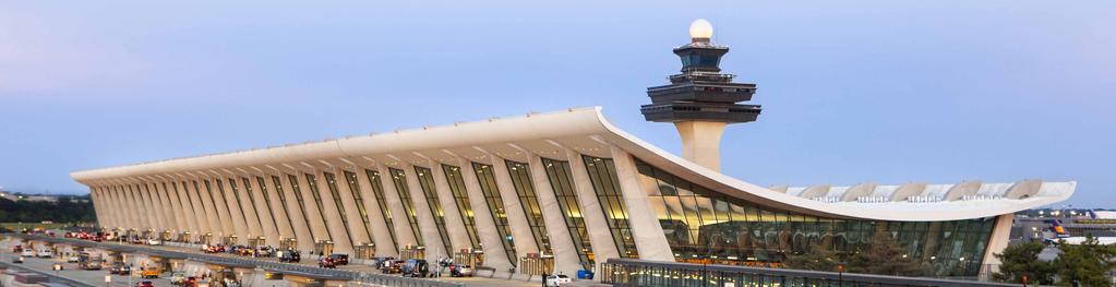
1 WELCOME PUBLIC WORKSHOP FOR WASHINGTON DULLES INTERNATIONAL AIRPORT AIRCRAFT NOISE CONTOUR MAP UPDATE February 2019
2 Why Update Now? Aug. 9, 2017 FAA Announces Triple Simultaneous Approaches at Washington Dulles (*) (*) With the implementation of FAA s NextGen across the national airspace, Washington Dulles flight procedures will soon allow for triple simultaneous runway operations in North Flow and/or in South Flow during low visibility conditions.
; U.S. Census Bureau, Geography Division, TIGER/Line Shapefiles, 2017 (place, county boundaries); Ricondo & Associates, Inc., February 2019 (approach, runways).")
3 Triple Simultaneous Approaches North Flow Triple Approach South Flow Triple Approach SOURCES: Esri, HERE, DeLorme, MapmyIndia, OpenStreetMap Contributors, and the GIS User Community, January 2019 (basemap); U.S. Census Bureau, Geography Division, TIGER/Line Shapefiles, 2017 (place, county boundaries); Ricondo & Associates, Inc., February 2019 (approach, runways).

4 Changes To Be Addressed Update the Dulles Airport noise contour map with stakeholder collaboration to reflect future changes in the aviation environment including: Long-term FAA NextGen implementation Flight paths Runway use Airfield capacity Airline operations Fleet mix Airfield development Terminal Cargo FAA air traffic control procedures Triple simultaneous operations Restricted airspace


5 Objective 2 Provide accurate information to local jurisdictions to guide effective land use decisions for today and in the future Loudoun County Su b ur b a n P ol i c y A r e a Pl a c e T y p es 2040 General Plan SYCOLIN RD SE Leesburg RD BE LM O N T RI E DG CLA IBO LN SY C OL AL Provide local jurisdictions with a land use compatibility planning tool to inform: Loudoun County: Envision Loudoun Fairfax County: Dulles Suburban Area Plan G O N KI AN PKWY IN R D Beaverdam Reservoir D NR SO AT W A N VILL GE PKWY NE VD BL UR HB AS GA NT R 7 WA X PO IR R D R ESE RV O OL R D ST ER L IN G BL VD 28 N WY S R S TE LIN D LV GB D O UN NO RT RYAN RD CO U HS TA R BL VD 267 Y PK NT U LO OLD OX RD FLEETWOO D RD EVERF IELD D R EV E R GR E EN MI LL 50 S RD Washington Dulles International Airport G UM S P RIN GR D Policy Areas Parks & Recreation Airport Extended Runway Centerline Airport Runways Place Types Suburban Neighborhood Suburban Compact Neighborhood Suburban Mixed Use Suburban Employment Suburban Industrial/Mineral Extraction AUBURN FA R M R D BR AD DO CK RD Loudoun County IS NOT LIABLE for any use of or reliance upon this map or any information contained herein. While reasonable efforts have been made to obtain accurate data, the County makes no warranty, expressed or implied, as to its accuracy, completeness, or fitness for use of any purpose Ma p N um b e r Miles DR A F T CHAPTER 2-38 SOURCES: Loudoun County, Envision Loudoun, DRAFT Loudoun 2040 General Plan. October 23, SOURCES: Johnson, Clara. Fairfax County, Department of Planning and Zoning. DSC-J-1 Commonweath Centre, November 7, Retrieved at sites/planning-zoning/files/assets/documents/compplanamend/ dullessuburbancenter/presentations/advisorygroup/november%20 7,%202016/dsc-j-1_staff_presentation.pdf on February 11, 2019.
6 Noise Map Update Process INVENTORY Evaluate current and future plans (MWAA and FAA) Assess existing operation conditions KEY Completed In Process Determine airfield operating configurations FORECAST Determine maximum potential operations Determine potential aircraft runway use and flight paths Build baseline noise model NOISE MODELING Calculate potential aircraft noise levels for airfield operating configurations Determine appropriate composite of airfield operating configurations, if appropriate Complete noise contour map CONCLUSIONS Recommend potential aircraft noise contours for land use planning Finalize documentation Share recommended airport noise contours with local land use jurisdictions and remain a resource as Counties deliberate adoption
7 Ultimate Conditions Five-Runway Airfield Growth in Passenger and Cargo Operations Evolution of Aircraft Long-Term FAA NextGen Improvements FAA s Triple Simultaneous Parallel Approaches
8 Stakeholder & Public Input APRIL 4, 2018 Working Group Kick-off Meeting APRIL 20, 2018 Working Group Airfield Configurations, Annual Service Volume Methodology Discussion JUNE 6, 2018 Working Group Inventory and Existing Condition Operations Discussion JUNE 27 & 28, 2018 Public Information Workshops #1 and #2 (Frequently Asked Questions) AUGUST 13, 2018 Working Group Preliminary Annual Service Volume and Ultimate Conditions Runway Use/Flight Path Patterns Discussion SEPTEMBER 25, 2018 Working Group Preliminary Ultimate Condition Operation Levels Discussion JANUARY 7, 2019 Working Group Draft Composite Noise Contour Review FEBRUARY 28, 2019 Final Public Information Workshop #3 Sharing Ultimate Conditions Noise Contours and Recommended Noise Overlay
9 Why Protect Dulles International? Global and National Importance Population Growth Economic Impact Growth in Air Service Demand
10 garegions Dulles Global and National Importance FAA forecast trends: Northern California Domestic and international cargo to increase international at a higher rate Front Range Northeast Great Lakes Southern California Domestic and international passenger demand to increase international at a higher rate The Emerging Megaregions Cascadia Operations at hub airports such as Dulles to grow substantially faster than the overall national trend Northeast Arizona Sun Corridor Texas Triangle Gulf Coast Piedmont Atlantic Metro Area Population 150,000 to 1 million Florida 1 to 3 million 6 million + 3 to 6 million 2008 by Regional Plan Association Metro Area Population SOURCE: Both maps taken from Our Maps, America 2050-Regional Plan Association, (Accessed March 29, 2018). 150,000 to 1 million Dulles is ideally positioned to accommodate domestic and international passenger and cargo demand

11 Enplanement Growth Supported by Population Forecasts The population growth averaged 1.3% annually between 2010 and PROJECTED POPULATION GROWTH WITHIN AIRPORTS SERVICE REGION , consistently exceeding the national average of 0.7% The inner suburbs, including Fairfax 37.7% 19.1% 42.7% County, are forecast to have the greatest total population by % IAD DCA The outer suburbs, including Loudoun County, are forecast to experience the fastest rates of growth through % KEY Central Jurisdictions Inner Suburbs Outer Suburbs * Fredericksburg-Area Jurisdictions Outer Ring - VA* Other Jurisdictions Not Modeled SOURCES: Report of the Airport Consultant (2018) Growth - Metropolitan Washington Council of Governments


12 Significance of IAD on Local/ Commonwealth of Virginia Economy LOUDOUN 37% 77% forecasted population growth 1/ growth in jobs /1 Dulles contributed 51,149 jobs and $2.9 billion in associated labor income in the Commonwealth of Virginia in /2 IAD Dulles jobs and visitor spending generated FAIRFAX $315 million in local/ / +1.5 million people 25% forecasted population growth 1/ state tax revenues in / million jobs +766,000 households 37% growth in jobs /1 SOURCES: 1/ Metropolitan Washington Council of Governments. Cooperative Forecasting in Metropolitan Washington-Growth Trends to 2045, November 9, / Commonwealth of Virginia. Virginia Department of Aviation. Virginia Airport System Economic Impact Technical Report. May 2018.

; MWAA, July 2018 (international non-stop destination")
13 Air Service Continues To Grow POTENTIAL INTERNATIONAL PASSENGER SERVICE Airline hub expansion International service expansion Growth in local demand and domestic connecting POTENTIAL CARGO SERVICE Medium-size hub for one integrated cargo carrier Expansion of international cargo carriers Addition of an ecommerce cargo carrier flights for international passengers MAP? Existing International Destinations and Regional Forecast Passenger Growth to/from U.S between 2018 and 2038 SOURCES: Esri, HERE, DeLorme, MapmyIndia, OpenStreetMap contributors, and the GIS user community, May 2018 (basemap); MWAA, July 2018 (international non-stop destination data); OpenFlights.org, June 2018 (flight arcs); National Science Foundation, National Institutes of Health, 2016 (countries); FAA Aerospace Forecast Fiscal Years , Federal Aviation Administration, May 2018 (forecast growth in passengers between 2018 and 2038). SOURCE: MWAA Air Service Development Industry and Community Briefing. November 2014
14 Dulles Noise Contours History Current Airport Noise Impact Overlay Districts Full-Build Aircraft Noise Contours Timeline

15 Existing Airport Noise Impact Overlay Districts for Loudoun and Fairfax SOURCES: Google Earth Pro, Image Landsat/Copernicus, Data SIO, NOAA, U.S. Navy, NGA, GEBCO, 2010 (aerial photography); Loudoun County Open Geospatial Data, March 2018 (noise overlay contours); Fairfax County Open Geospatial Data, March 2018 (noise overlay contours).


; Federal Aviation Administration.")
16 Dulles Noise Contour Map Timeline Chronological Noise Contour Changes 1985 FAR Part 150 Potential Noise Contours Projection: Five-Runway, Full Build SOURCE: Peat Marwick. Noise Compatibility Program Washington Dulles International Airport. Exhibit 15 January FAR Part 150 Addendum Potential Noise Contours Adopted County Impact Overlays Projection: Five-Runway, Full Build 2005 Environmental Impact Statement Potential Noise Contours Projection: Five-Runway, Year 2025 SOURCES: Esri, HERE, Garmin, OpenStreetMap Contributors, and the GIS User Community, January 2019 (basemap); Loudoun County Open Geospatial Data, March 2018 (noise overlay contours); Fairfax County Open Geospatial Data, March 2018 (noise overlay contours). SOURCES: Esri, HERE, Garmin, OpenStreetMap Contributors, and the GIS User Community, January 2019 (basemap); Federal Aviation Administration. Final Environmental Impact Statement for New Runways, Terminal Facilities and Related Facilities at Washington Dulles International Airport. August 2005 (contours).
; Metropolitan Washington")

17 Dulles International Airfield Configurations Four-Runway (Existing) Five-Runway (Future) SOURCES: USGS, USDA-FSA-APFO Aerial Photography Field Office Virginia 1m NAIP Imagery, 2015 (imagery); Metropolitan Washington Airports Authority, April 2018 (Airport Layout Plan). SOURCES: USGS, USDA-FSA-APFO Aerial Photography Field Office Virginia 1m NAIP Imagery, 2015 (imagery); Metropolitan Washington Airports Authority, April 2018 (Airport Layout Plan).

18 FAA s Airport Environmental Decision Tool (AEDT) FAA-developed and adopted software tool for computation of noise contours Accurately computes noise contours based on many operational characteristics INPUT OUTPUT PHYSICAL For example: Runway layouts Airfield elevation Atmospheric conditions Flight tracks OPERATIONAL For example: Aircraft types Aircraft operation numbers Airport use by runway Flight track Aviation Environmental Design Tool (AEDT) Version 2c User Guide September 2016 Noise exposure contours Location-specific detailed reports Emissions and fuel consumption
 Accounts for number of noise events SOUND EXPOSURE LEVEL Provides an additional weighting factor for nighttime")
19 Day/Night Average Sound Level DNL SINGLE EVENT: PEAK SOUND LEVEL CUMULATIVE: DAY/NIGHT AVERAGE SOUND LEVEL A way to describe the cumulative noise dose for a 24-hour period Can also be described as an average of the sound level over the full day Accounts for noise event noisiness (SEL) Accounts for number of noise events SOUND EXPOSURE LEVEL Provides an additional weighting factor for nighttime operations AIRCRAFT NOISE EVENTS FOR 24 HOURS Shaded areas represented passby sound energy
20 Noise Modeling Process INVENTORY FORECAST 2017 ANOMS RADAR TRACK DATA 2017 ANOMS FLIGHT PLAN DATA FUTURE TRENDS IN AIRCRAFT USE FUTURE AIRPORT LAYOUT PLAN AND LAND USE 2017 FAA TOWER COUNTS AND AVIATION SYSTEM PERFORMANCE DATA SUSTAINABLE RUNWAY THROUGHPUT AIRFIELD OPERATING CONFIGURATION 1 RUNWAY USE AIRFIELD OPERATING CONFIGURATION 1 AEDT AEDT BASELINE MODEL 4-RUNWAY FULL-BUILD OPERATIONS AIRFIELD OPERATING CONFIGURATION 2 RUNWAY USE AIRFIELD OPERATING CONFIGURATION 2 AEDT COMPOSITE FULL-BUILD NOISE CONTOUR 5-RUNWAY FULL-BUILD OPERATIONS AIRFIELD OPERATING CONFIGURATION 3 RUNWAY USE AIRFIELD OPERATING CONFIGURATION 3 AEDT

; Federal Aviation Administration, February 2018 (OPSNET tower operation counts); Harris Miller Miller and Hanson, April 2018 (2017 average annual day")
21 Ultimate Conditions Operations Five Runway User Category 5 Runway AS General Aviation AAD: 135 Share of Total: 5% Military AAD: 2 Share of Total: <1% General Aviation AAD: 106 Share of Total: 13% Average Annual Operations Military AAD: 1 Share of Total: <1% Air Taxi AAD: 316 Share of Total: 11% Air Taxi AAD: 205 Share of Total: 26% 806 Total AAD Operations Air Carrier AAD: 494 Share of Total: 61% 2,751 Total AAD Operations Air Carrier AAD: 2,298 Share of Total: 84% SOURCES: Metropolitan Washington Airports Authority, Airport Noise and Operations Monitoring System, February 2018 (2017 fight and radar track operations data); Federal Aviation Administration, February 2018 (OPSNET tower operation counts); Harris Miller Miller and Hanson, April 2018 (2017 average annual day operations by user category); Ricondo & Associates, Inc., December 2018 (ultimate levels of average annual day operations by user category).
 = Nighttime hours (10:00 p.m.. to 6:59 a.")
22 Ultimate Conditions Operations Five Runway Time of Day Time of Day 5 Runway AS Night Annual: 42,653 AAD: 117 Percent of Total: 15% Average Annual Operations Annual: 120,450 AAD: 330 Percent of Total: 12% Day Annual: 251,413 AAD: 689 Percent of Total: 85% Annual: 883,665 AAD: 2,421 Percent of Total: 88% e-decisional = Daytime hours (7:00 a.m. to 9:59 p.m.) = Nighttime hours (10:00 p.m.. to 6:59 a.m.) SOURCES: Metropolitan Washington Airports Authority, Airport Noise and Operations Monitoring System, February 2018 (2017 fight and radar track operations data); Harris Miller Miller and Hanson, April 2018 (2017 average annual day operations by day/night); Ricondo & Associates, Inc., December 2018 (ultimate levels of average annual day operations by time of day).
; U.S.")

23 Five-Runway Airfield Noise Model Tracks Arrival Flight Paths Departure Flight Paths SOURCES: Esri, HERE, DeLorme, MapmyIndia, OpenStreetMap Contributors, and the GIS User Community, January 2019 (basemap); U.S. Census Bureau, Geography Division, TIGER/Line Shapefiles, 2017 (place, county boundaries); Harris Miller Miller and Hanson, December 2018 (five-runway noise model tracks). SOURCES: Esri, HERE, DeLorme, MapmyIndia, OpenStreetMap Contributors, and the GIS User Community, January 2019 (basemap); U.S. Census Bureau, Geography Division, TIGER/Line Shapefiles, 2017 (place, county boundaries); Harris Miller Miller and Hanson, December 2018 (five-runway noise model tracks).
; U.S.")
24 Ultimate Conditions Noise Contours DNL 60 and DNL 65 Arrival Flight Paths Departure Flight Paths SOURCES: Esri, HERE, DeLorme, MapmyIndia, OpenStreetMap Contributors, and the GIS User Community, January 2019 (basemap); U.S. Census Bureau, Geography Division, TIGER/Line Shapefiles, 2017 (place, county boundaries); Harris MIller Miller and Hanson, December 2018 (five-runway noise model tracks); Harris Miller Miller and Hanson, February 2019 (Ultimate Conditions DNL 60 and DNL 65 contours). SOURCES: Esri, HERE, DeLorme, MapmyIndia, OpenStreetMap Contributors, and the GIS User Community, January 2019 (basemap); U.S. Census Bureau, Geography Division, TIGER/Line Shapefiles, 2017 (place, county boundaries); Harris MIller Miller and Hanson, December 2018 (five-runway noise model tracks); Harris Miller Miller and Hanson, February 2019 (Ultimate Conditions DNL 60 and DNL 65 contours). SOURCES: Google Earth Pro, Image Landsat/Copernicus, Data SIO, NOAA, U.S. Navy, NGA, GEBCO, 2010 (aerial photography); Harris Miller Miller and Hanson, February 2019 (Ultimate Conditions contours).
; U.S.")
25 Ultimate Conditions Noise Contours & Existing Land Use Arrival Flight Paths Departure Flight Paths SOURCES: Esri, HERE, DeLorme, MapmyIndia, OpenStreetMap Contributors, and the GIS User Community, January 2019 (basemap); U.S. Census Bureau, Geography Division, TIGER/Line Shapefiles, 2017 (place, county boundaries); Harris MIller Miller and Hanson, December 2018 (five-runway noise model tracks); Harris Miller Miller and Hanson, February 2019 (Ultimate Conditions DNL 60 and DNL 65 contours). SOURCES: Esri, HERE, DeLorme, MapmyIndia, OpenStreetMap Contributors, and the GIS User Community, January 2019 (basemap); U.S. Census Bureau, Geography Division, TIGER/Line Shapefiles, 2017 (place, county boundaries); Harris MIller Miller and Hanson, December 2018 (five-runway noise model tracks); Harris Miller Miller and Hanson, February 2019 (Ultimate Conditions DNL 60 and DNL 65 contours). SOURCES: Esri, HERE, DeLorme, MapmyIndia, OpenStreetMap Contributors, and the GIS User Community, January 2019 (basemap); U.S. Census Bureau, Geography Division, TIGER/Line Shapefiles, 2017 (place, county boundaries); Fairfax County, 2017, (accessed 12, 2018) (land use); Loudoun County, 2018, (accessed 12, 2018) (land use); Harris Miller Miller and Hanson, February 2019 (Ultimate Conditions contours).
26 Long-Term Land Use Compatibility Considerations Consider today s airport use and protect for tomorrow s growth Maintain current protections Existing overlays have served the Counties well Protect for transition over time from current to Ultimate conditions Plan for Ultimate Conditions Five-Runway Airfield NextGen implementation Triple Simultaneous Parallel Approach Aviation operations growth (passenger and cargo)
27 Recommendation for Local Land Use Compatibility (Consider Today s Airport Use and Tomorrow s Growth) Loudoun County and Fairfax County maintain their existing Airport Noise Impact Overlay Districts (DNL 60 and DNL 65) and also protect for the Ultimate Conditions Noise Contours (DNL 60 and DNL 65)

28 Ultimate Conditions Noise Contours with Existing Airport Noise Impact Overlay Districts Arrival Flight Paths Departure Flight Paths SOURCES: Esri, HERE, DeLorme, MapmyIndia, OpenStreetMap Contributors, and the GIS User Community, January 2019 (basemap); U.S. Census Bureau, Geography Division, TIGER/ Line Shapefiles, 2017 (place, county boundaries); Harris MIller Miller and Hanson, December 2018 (five-runway noise model tracks); Harris Miller Miller and Hanson, February 2019 (Ultimate Conditions DNL 60 and DNL 65 contours). SOURCES: Esri, HERE, DeLorme, MapmyIndia, OpenStreetMap Contributors, and the GIS User Community, January 2019 (basemap); U.S. Census Bureau, Geography Division, TIGER/ Line Shapefiles, 2017 (place, county boundaries); Harris MIller Miller and Hanson, December 2018 (five-runway noise model tracks); Harris Miller Miller and Hanson, February 2019 (Ultimate Conditions DNL 60 and DNL 65 contours). SOURCES: Google Earth Pro, Image Landsat/Copernicus, Data SIO, NOAA, U.S. Navy, NGA, GEBCO, 2010 (aerial photography); Harris Miller Miller and Hanson, February 2019 (Ultimate Conditions contours); Loudoun County Open Geospatial Data, March 2018 (noise overlay contours); Fairfax County Open Geospatial Data, March 2018 (noise overlay contours); MWAA, January 2019.

29 Combine Existing Airport Noise Impact Overlay Districts and Ultimate Conditions Noise Contours Arrival Flight Paths Departure Flight Paths SOURCES: Esri, HERE, DeLorme, MapmyIndia, OpenStreetMap Contributors, and the GIS User Community, January 2019 (basemap); U.S. Census Bureau, Geography Division, TIGER/Line Shapefiles, 2017 (place, county boundaries); Harris MIller Miller and Hanson, December 2018 (five-runway noise model tracks); Harris Miller Miller and Hanson, February 2019 (Ultimate Conditions DNL 60 and DNL 65 contours). SOURCES: Esri, HERE, DeLorme, MapmyIndia, OpenStreetMap Contributors, and the GIS User Community, January 2019 (basemap); U.S. Census Bureau, Geography Division, TIGER/Line Shapefiles, 2017 (place, county boundaries); Harris MIller Miller and Hanson, December 2018 (five-runway noise model tracks); Harris Miller Miller and Hanson, February 2019 (Ultimate Conditions DNL 60 and DNL 65 contours). SOURCES: Google Earth Pro, Image Landsat/Copernicus, Data SIO, NOAA, U.S. Navy, NGA, GEBCO, 2010 (aerial photography); Ricondo & Associates, Inc., February 2019, based on Loudoun County Open Geospatial Data, March 2018 (noise overlay contours), Fairfax County Open Geospatial Data, March 2018 (noise overlay contours), Harris Miller Miller and Hanson, February 2019 (Ultimate Conditions contours).
30 Next Steps REVIEW Comments received at Public Workshop FINALIZE Ultimate Conditions Noise Contours documentation SHARE Recommended airport noise contours with Loudoun County and Fairfax County
31 How to Stay Informed
Washington Dulles International Airport (IAD) Aircraft Noise Contour Map Update. 6th Working Group Briefing 1/7/19
 Aircraft Noise Contour Map Update. 6th Working Group Briefing 1/7/19") Washington Dulles International Airport (IAD) Aircraft Noise Contour Map Update 6th Working Group Briefing 1/7/19 Study Purpose Agenda Background Summary of last stakeholder meetings Refresher on DNL,
Washington Dulles International Airport (IAD) Aircraft Noise Contour Map Update 6th Working Group Briefing 1/7/19 Study Purpose Agenda Background Summary of last stakeholder meetings Refresher on DNL,
Washington Dulles International Airport (IAD) Aircraft Noise Contour Map Update
 Aircraft Noise Contour Map Update") Washington Dulles International Airport (IAD) Aircraft Noise Contour Map Update Ultimate ASV, Runway Use and Flight Tracks 4th Working Group Briefing 8/13/18 Meeting Purpose Discuss Public Workshop input
Washington Dulles International Airport (IAD) Aircraft Noise Contour Map Update Ultimate ASV, Runway Use and Flight Tracks 4th Working Group Briefing 8/13/18 Meeting Purpose Discuss Public Workshop input
Washington Dulles International Airport (IAD) Aircraft Noise Contour Map Update. Ultimate Operations 5th Working Group Briefing 9/25/18
 Aircraft Noise Contour Map Update. Ultimate Operations 5th Working Group Briefing 9/25/18") Washington Dulles International Airport (IAD) Aircraft Noise Contour Map Update Ultimate Operations 5th Working Group Briefing 9/25/18 Meeting Purpose Discuss methodology of Ultimate build scenario operations
Washington Dulles International Airport (IAD) Aircraft Noise Contour Map Update Ultimate Operations 5th Working Group Briefing 9/25/18 Meeting Purpose Discuss methodology of Ultimate build scenario operations
Washington Dulles International Airport (IAD) Noise Contour Map Update. For Publication on MWAA Website April 4, 2018
 Noise Contour Map Update. For Publication on MWAA Website April 4, 2018") Washington Dulles International Airport (IAD) Noise Contour Map Update For Publication on MWAA Website April 4, 2018 Introduction Background Existing Conditions Noise Contours Land Use Compatibility Planning
Washington Dulles International Airport (IAD) Noise Contour Map Update For Publication on MWAA Website April 4, 2018 Introduction Background Existing Conditions Noise Contours Land Use Compatibility Planning
14 CFR PART 150 NOISE AND LAND USE COMPATIBILITY STUDY. Technical Committee Meeting #2 August 23, 2017
 14 CFR PART 150 NOISE AND LAND USE COMPATIBILITY STUDY Technical Committee Meeting #2 August 23, 2017 1 Agenda Introductions Review of the Role of the TC Meeting Facilitator Review of TC Meeting No.1 Data
Welcome to the Boise Airport Master Plan Update Open House
 Welcome to the Boise Airport Master Plan Update Open House Get the facts and sign up for the Master Plan Update newsletter at http://www.iflyboise.com/about-boi/master-plan/ What does the Master Plan Update
Austin-Bergstrom International Airport Master Plan Update
 FINAL REPORT Prepared for: City of Austin Department of Aviation 3600 Presidential Boulevard Austin, Texas 78719 Prepared by: P&D Aviation A Division of P&D Consultants, Inc. 999 Town & County Road, 4
Table of Contents. Master Plan March 2014 TOC i Spokane International Airport
 Table of Contents Page Chapter 1 Inventory 1. Introduction... 1 1 1.1 Community Profile... 1 2 1.1.1 Location and Setting... 1 1 1.1.2 Climate... 1 2 1.1.3 Socioeconomic Conditions... 1 5 1.1.4 Area Land
WELCOME! FORT LAUDERDALE-HOLLYWOOD INTERNATIONAL AIRPORT 14 CFR PART 150 NOISE AND LAND USE COMPATIBILITY STUDY
 WELCOME! FORT LAUDERDALE-HOLLYWOOD INTERNATIONAL AIRPORT 14 CFR PART 150 NOISE AND LAND USE COMPATIBILITY STUDY Public Information Workshop November 2017 1 14 CFR Part 150 Overview Establishes the methodology
Committee for Dulles. June 9, Jack Potter, MWAA President & CEO
 Committee for Dulles June 9, 2016 Jack Potter, MWAA President & CEO Dulles International is the Premier International Gateway to the Capital Region Dom Intl Total Mainline Airlines 10 29 37* Destinations
APPENDIX H 2022 BASELINE NOISE EXPOSURE CONTOUR
 APPENDIX H 2022 BASELINE NOISE EXPOSURE CONTOUR This appendix sets forth the detailed input data that was used to prepare noise exposure contours for 2022 Baseline conditions. H.1 DATA SOURCES AND ASSUMPTIONS
DENVER INTERNATIONAL AIRPORT 2016 IGA NOISE RELEASE STUDY. June 22, 2016
 DENVER INTERNATIONAL AIRPORT 2016 IGA NOISE RELEASE STUDY June 22, 2016 INTRODUCTION This Noise Release Study was prepared pursuant to Section 4.5.3 Noise Studies of the Intergovernmental Agreement dated
Forecast of Aviation Activity
 DETROIT METROPOLITAN WAYNE COUNTY AIRPORT FAR PART 150 NOISE COMPATIBILITY STUDY UPDATE CHAPTER B FORECAST OF AVIATION ACTIVITY Forecast of Aviation Activity Introduction This chapter summarizes past aviation
Planning, Development and Environment Committee
 Page 1 of 7 MEMORANDUM TO: Planning, Development and Environment Committee FROM: Neil Ralston, Airport Planner Airport Development (726-8129) SUBJECT: 2035 MSP LONG TERM COMPREHENSIVE PLAN FORECAST, FACILITY
Economic Impact of Aviation in Arizona
 Economic Impact of Aviation in Arizona Presented by: Arizona Department of Transportation Aeronautics Division May 5, 2004 Aviation Contributes $38.5 Billion to the Arizona Economy PRIMARY IMPACT Economic
TABLE OF CONTENTS. General Study Objectives Public Involvement Issues to Be Resolved
 TABLE OF CONTENTS Description Page Number LIST OF ACRONYMS... a CHAPTER ONE INTRODUCTION General... 1-1 Study Objectives... 1-1 Public Involvement... 1-2 Issues to Be Resolved... 1-2 CHAPTER TWO EXISTING
Appendix B Ultimate Airport Capacity and Delay Simulation Modeling Analysis
 Appendix B ULTIMATE AIRPORT CAPACITY & DELAY SIMULATION MODELING ANALYSIS B TABLE OF CONTENTS EXHIBITS TABLES B.1 Introduction... 1 B.2 Simulation Modeling Assumption and Methodology... 4 B.2.1 Runway
Norfolk International Airport
 Norfolk International Airport Master Plan Update Technical Advisory Committee Meeting #1 Community Advisory Committee Meeting #1 January 24, 2018 Agenda Project Background Introductions Overview of Airport
TABLE OF CONTENTS. Washington Aviation System Plan Update July 2017 i
 TABLE OF CONTENTS Chapter 1 Overview... 1-1 1.1 Background... 1-1 1.2 Overview of 2015 WASP... 1-1 1.2.1 Aviation System Performance... 1-2 1.3 Prior WSDOT Aviation Planning Studies... 1-3 1.3.1 2009 Long-Term
Noise Abatement 101. July 13, Regular Board Meeting / August 7, 2014 Hillsborough County Aviation Authority
 Noise Abatement 101 July 13, 2017 1 Objectives Provide context and a better understanding for how and why flights may operate at Tampa International Airport the way they do. Provide an overview of laws,
Prepared By: Mead & Hunt, Inc Port Lansing Road Lansing, MI 48906
 Master Plan The preparation of this document was financed in part through a planning grant from the Federal Aviation Administration (FAA) as provided under Section 505 of the Airport and Airway Improvement
WELCOME! FORT LAUDERDALE-HOLLYWOOD INTERNATIONAL AIRPORT 14 CFR PART 150 NOISE AND LAND USE COMPATIBILITY STUDY
 WELCOME! FORT LAUDERDALE-HOLLYWOOD INTERNATIONAL AIRPORT 14 CFR PART 150 NOISE AND LAND USE COMPATIBILITY STUDY Public Information Workshop #2 January 2019 Station 1: Par t 150 Over view 14 CFR Part 150
NextGen: New Technology for Improved Noise Mitigation Efforts: DFW RNAV Departure Procedures
 NextGen: New Technology for Improved Noise Mitigation Efforts: DFW RNAV Departure Procedures DFW International Airport Sandy Lancaster, Manager Noise Compatibility October 13, 2008 OUTLINE About DFW Airport
APPENDIX C NOISE ANALYSIS
 APPENDIX C NOISE ANALYSIS KBE Final - 10/11/16 Existing Noise The extent of existing noise resulting from aircraft operations at Central Colorado Regional Airport (AEJ) was determined using the FAA-approved
14 CFR PART 150 NOISE AND LAND USE COMPATIBILITY STUDY
 14 CFR PART 150 NOISE AND LAND USE COMPATIBILITY STUDY Technical Committee Meeting #3 March 7, 2018 1 Agenda Introductions Review of the Role of the TC Meeting Facilitator Review of Prior TC Meetings Public
Appendix D Project Newsletters. Tacoma Narrows Airport. Master Plan Update
 Appendix D Project Newsletters Tacoma Narrows Airport Master Plan Update This appendix contains the newsletters distributed throughout the project. These newsletters provided updates and information on
ENVISIONING AUSTIN s Airport of the Future
 ENVISIONING AUSTIN s Airport of the Future ABIA 2040 Master Plan Public Workshop #1 October 12, 2017 WHAT IS THE PURPOSE OF TODAY S WORKSHOP? Educate & Inform Solicit Input Answer Questions 2 WHAT IS A
Partnership for Quieter Skies Report
 Ft. Lauderdale-Hollywood International Airport Prepared by: Broward County Aviation Department August 2007 Partnership for Quieter Skies Report The Partnership for Quieter Skies Report provides an overview
Regional Jets ,360 A319/ , , , ,780
 Excel Tab Name: Seats (18 MAP) PASSENGER AIRLINE FLIGHT SCHEDULE CALCULATION RECORD Summary 17.2 MAP flight schedule* (with Southwest Airlines B737-800s changed to B737-700s) Number of Total Seats Avg.
Chapter 1 Introduction and Project Overview
 Chapter 1 Introduction and Project Overview Kittitas County in cooperation with the Federal Aviation Administration (FAA) is updating the Airport Master Plan for Bowers Field Airport (FAA airport identifier
AIRPORT MASTER PLAN FOR. charles B. WHEELER DOWNTOWN AIRPORT KANSAS CITY, MISSOURI
 AIRPORT MASTER PLAN FOR charles B. WHEELER DOWNTOWN AIRPORT KANSAS CITY, MISSOURI Prepared For The City of Kansas City, Missouri By Coffman Associates, Inc. January 2004 "The contents of these documents
Martin County Airport / Witham Field Noise Abatement Departure Profile (NADP) Demonstration Technical Report March 2010
 Demonstration Technical Report March 2010") Martin County Airport / Witham Field Noise Abatement Departure Profile (NADP) Demonstration Technical Report March 2010 Prepared for: Federal Aviation Administration (FAA) Orlando Airport District Office
Martin County Airport / Witham Field Noise Abatement Departure Profile (NADP) Demonstration Technical Report March 2010 Prepared for: Federal Aviation Administration (FAA) Orlando Airport District Office
APPENDIX D-12. Modeled Aircraft Operations and Integrated Noise Model Inputs for Noise Assessment of Year 2025 Build Alternatives 3 and 4
 APPENDIX D-12 Modeled Aircraft Operations and Integrated Noise Model Inputs for Noise Assessment of Year 2025 Build Alternatives 3 and 4 In order to compare to current planning policies of Loudoun and
CHAPTER 1 EXECUTIVE SUMMARY
 CHAPTER 1 EXECUTIVE SUMMARY 1 1 EXECUTIVE SUMMARY INTRODUCTION William R. Fairchild International Airport (CLM) is located approximately three miles west of the city of Port Angeles, Washington. The airport
STAFF REPORT. Airport Land Use Plan Consistency Review: Santa Barbara Airport Master Plan. MEETING DATE: November 19, 2015 AGENDA ITEM: 7D
 STAFF REPORT SUBJECT: Airport Land Use Plan Consistency Review: Santa Barbara Airport Master Plan MEETING DATE: AGENDA ITEM: 7D STAFF CONTACT: Peter Imhof, Andrew Orfila RECOMMENDATION: Adopt findings
Developing an Aircraft Weight Database for AEDT
 17-02-01 Recommended Allocation: $250,000 ACRP Staff Comments This problem statement was also submitted last year. TRB AV030 supported the research; however, it was not recommended by the review panel,
Noise Programs & NextGen Briefing. Stan Shepherd, Manager Airport Noise Programs
 Noise Programs & NextGen Briefing Stan Shepherd, Manager Airport Noise Programs 1 Presentation Overview Noise Information Hotline Increased Operations Economic Impacts Noise Contours Noise Mitigation Programs
ERIE INTERNATIONAL AIRPORT MASTER PLAN TABLE OF CONTENTS
 EXECUTIVE SUMMARY ERIE INTERNATIONAL AIRPORT MASTER PLAN TABLE OF CONTENTS PAGE NO. CHAPTER 1-INTRODUCTION... 1-1 1.01 General...1-1 1.02 Purpose and Scope of Study...1-1 1.03 The Planning Process...1-2
Minneapolis-St. Paul International Airport (MSP)
") 2 nd Quarter 2016 Minneapolis-St. Paul International Airport (MSP) Public Input Meeting Metropolitan Airports Commission Noise Program Office April 27, 2016 PUBLIC INPUT MEETING Meeting Goals To hear the
2 nd Quarter 2016 Minneapolis-St. Paul International Airport (MSP) Public Input Meeting Metropolitan Airports Commission Noise Program Office April 27, 2016 PUBLIC INPUT MEETING Meeting Goals To hear the
Master Plan Update Community Advisory Committee Kick-off Meeting
 Nashville International Airport Master Plan Update Community Advisory Committee Kick-off Meeting September 13, 2018 Agenda Welcome and Introductions Master Plan Objectives Master Plan Process BNA Vision
Federal Aviation Administration DCA. By: Terry Biggio, Vice President Air Traffic Services Date: June 18, Federal Aviation Administration
 DCA Presented to: Arlington County By: Terry Biggio, Vice President Air Traffic Services Date: June 18, 2015 Air Traffic Roles and Responsibilities As aviation technology advances, the FAA is putting in
What is the ABIA 2040 Master Plan?
 AUSTIN-BERGSTROM INTERNATIONAL AIRPORT What is the ABIA 2040 Master Plan? The ABIA 2040 Master Plan outlines the vision for how our airport will serve the expected 26+ million passengers by the year 2040.
DCA Airport Noise. MWAA WG Dec 15, 2016
 DCA Airport Noise MWAA WG Dec 15, 2016 BACKGROUND FAA Next Gen noise Analyzed on macro level Data below 3K Ft under estimated community level impacts Primary focus has been on departure procedures 1 part
 Existing Conditions AIRPORT PROFILE Passenger Terminal Complex 57 air carrier gates 11,500 structured parking stalls Airfield Operations Area 9,000 North Runway 9L-27R 6,905 Crosswind Runway 13-31 5,276
STUDY OVERVIEW MASTER PLAN GOALS AND OBJECTIVES
 INTRODUCTION An Airport Master Plan provides an evalua on of the airport s avia on demand and an overview of the systema c airport development that will best meet those demands. The Master Plan establishes
Connecting People Building Opportunities BRISBANE AIRPORT 2014 MASTER PLAN
 Connecting People Building Opportunities BRISBANE AIRPORT 2014 MASTER PLAN MASTER PLAN 2014 PROPOSED AIRPORT DEVELOPMENT STRATEGY 2034 Important Notice This Master Plan has been prepared by Brisbane Airport
APA NOISE REPORT. January 2018
 January 2018 [Grab your reader s attention with a great quote from the document or use this space to emphasize a key point. To place this text box anywhere on the page, just drag it.] APA NOISE REPORT
PRELIMINARY WEB DOCUMENT
 APA NOISE REPORT May 2018 [Grab your reader s attention with a great quote from the document or use this space to emphasize a key point. To place this text box anywhere on the page, just drag it.] 1 TABLE
Nantucket Memorial Airport Commission. Master Plan Workshop. October 26, 2012
 Nantucket Memorial Airport Commission Master Plan Workshop October 26, 2012 Agenda Introductions Master Plan 101 Airport Planning Issues Noise Abatement Activities Environmental Monitoring Public Outreach
APA NOISE REPORT. August 2017
 August 2017 [Grab your reader s attention with a great quote from the document or use this space to emphasize a key point. To place this text box anywhere on the page, just drag it.] APA NOISE REPORT 1
Study Design Outline. Background. Overview. Desired Study Outcomes. Study Approach. Goals (preliminary) Recession History
 Recession History") MIA BASELINE ACTIVITY FORECASTS, DERIVATIVE DATA AND FLEET MIX PROJECTIONS RESULTS SUMMARY ACCEPTANCE BRIEFING FOR THE AIRPORT AND SEAPORT COMMITTEE (ASC) JULY 15, 2010 Study Design Outline Background
MIA BASELINE ACTIVITY FORECASTS, DERIVATIVE DATA AND FLEET MIX PROJECTIONS RESULTS SUMMARY ACCEPTANCE BRIEFING FOR THE AIRPORT AND SEAPORT COMMITTEE (ASC) JULY 15, 2010 Study Design Outline Background
Portland International Jetport Part 150 Noise Committee Meeting 5 October 9, :00PM Portland Jetport Conference Room. Agenda
 Portland International Jetport Part 150 Noise Committee Meeting 5 October 9, 2002 6:00PM Portland Jetport Conference Room Agenda Time: Location: 6 p.m. Portland International Jetport Conference Room I.
Memorandum. Federal Aviation Administration. Date: June 19, Richard Doucette, Environmental Protection Specialist. From: To:
 Federal Aviation Administration Memorandum Date: June 19, 2008 From: To: Subject: Richard Doucette, Environmental Protection Specialist LaVerne Reid, Airports Division Manager John Donnelly, Regional Counsel
APA NOISE REPORT. August 2018
 August 2018 [Grab your reader s attention with a great quote from the document or use this space to emphasize a key point. To place this text box anywhere on the page, just drag it.] APA NOISE REPORT 1
Airport Master Plan. Brookings Regional Airport. Runway Runway 17-35
 Runway 17-35 Airport Master Plan Runway 12-30 Brookings Regional Airport Table of Contents Table of Contents Chapter 1: Master Plan Goals... 1-1 1.1. Introduction... 1 1.2. Objective 1 Identify improvements
MONTEREY REGIONAL AIRPORT MASTER PLAN TOPICAL QUESTIONS FROM THE PLANNING ADVISORY COMMITTEE AND TOPICAL RESPONSES
 MONTEREY REGIONAL AIRPORT MASTER PLAN TOPICAL QUESTIONS FROM THE PLANNING ADVISORY COMMITTEE AND TOPICAL RESPONSES Recurring topics emerged in some of the comments and questions raised by members of the
Airport Master Plan Update
 Duttchessss Countty Airrporrtt Masstterr Plan Updatte Airport Master Plan Update Final Report Dutchess County Airport Town of Wappingers, New York C&S Engineers, Inc. 499 Col. Eileen Collins Blvd. Syracuse,
Nantucket Memorial Airport Master Plan Update
 Nantucket Memorial Airport Master Plan Update CHAPTER 1 - INTRODUCTION & PUBLIC OUTREACH PROGRAM REVIEW DRAFT SUBJECT TO CHANGE Prepared for: Nantucket Memorial Airport Commission 14 Airport Road Nantucket,
City of Monett, Missouri. Pride and Progress. Airport Master Plan Update. for the Monett Municipal Airport
 City of Monett, Missouri Airport Master Plan Update for the Monett Municipal Airport Pride and Progress Airport Inventory Monett Municipal Airport (HFJ) Master Plan Update MoDOT Project Number: 08-098B-1
General Aviation Master Plan Update
 Peter O. Knight Airport Public Meeting #2 Peter O. Knight Airport Agenda Welcome and Introductions HCAA System of Airports Purpose of Public Meetings Master Plan Status Update Next Steps Q & A 2 Our System
Airport Background Data and Assumptions Report New Cuyama Airport. Santa Barbara County Airport Land Use Compatibility Plan Update
 Airport Background Data and Assumptions Report Santa Barbara County Airport Land Use Compatibility Plan Update June 25, 212 Updated August 17, 217 Airport Background Data and Assumptions Report 1. Introduction
1.0 Project Background Mission Statement and Goals Objectives of this Sustainable Master Plan
 TABLE OF CONTENTS CHAPTER 1 INTRODUCTION 10 Project Background 1-1 11 Mission Statement and Goals 1-1 12 Objectives of this Sustainable Master Plan 1-2 CHAPTER 2 INVENTORY 20 Airport Background 2-1 201
Chapter 1 EXECUTIVE SUMMARY
 Chapter 1 EXECUTIVE SUMMARY Contents Page Aviation Growth Scenarios................................................ 3 Airport Capacity Alternatives.............................................. 4 Air Traffic
DTW Class B Airspace Redesign Proposal
 DTW Class B Airspace Redesign Proposal Presented for Informal Public Meetings, July 20-22, 2010 Presented to: Informal Public Meetings By: John Hoelscher, Lockheed Martin Date: July 20-22, 2010 The current
APPENDIX E AVIATION ACTIVITY FORECASTS
 APPENDIX E AVIATION ACTIVITY FORECASTS E.1 PURPOSE AND CONTEXT This appendix presents the St. George Airport (SGU) aviation activity forecasts for the period of 2003 through 2020. Among the components
Draft Concept Alternatives Analysis for the Inaugural Airport Program September 2005
 Draft Concept Alternatives Analysis for the Inaugural Airport Program September 2005 Section 3 - Refinement of the Ultimate Airfield Concept Using the Base Concept identified in Section 2, IDOT re-examined
Airport Land Use Compatibility Plan (ALUCP) Update. Public Information Meeting #2 December 1, 2015
 Update. Public Information Meeting #2 December 1, 2015") Airport Land Use Compatibility Plan (ALUCP) Update Public Information Meeting #2 December 1, 2015 Agenda 1. Welcome and Introductions 2. Status of Study 3. Long-term Planning Activity Level Annual Service
Airport Land Use Compatibility Plan (ALUCP) Update Public Information Meeting #2 December 1, 2015 Agenda 1. Welcome and Introductions 2. Status of Study 3. Long-term Planning Activity Level Annual Service
Westover Metropolitan Airport Master Plan Update
 Westover Metropolitan Airport Master Plan Update June 2008 INTRODUCTION Westover Metropolitan Airport (CEF) comprises the civilian portion of a joint-use facility located in Chicopee, Massachusetts. The
Appendix C AIRPORT LAYOUT PLANS
 Appendix C AIRPORT LAYOUT PLANS Appendix C AIRPORT LAYOUT PLANS Airport Master Plan Santa Barbara Airport As part of this Airport Master Plan, the Federal Aviation Administration (FAA) requires the development
TransAction Overview. Introduction. Vision. NVTA Jurisdictions
 Introduction Vision NVTA Jurisdictions In the 21 st century, Northern Virginia will develop and sustain a multimodal transportation system that enhances quality of life and supports economic growth. Investments
The following criteria shall be applied within the boundaries of the AO District:
 Sec. 419 (a) Purpose AIRPORT OVERLAY DISTRICT (AO) The purpose of the Airport Overlay District is to regulate and restrict the height of structures, objects, or natural growth, regulate the locations of
HILLSBORO AIRPORT MASTER PLAN UPDATE Planning Advisory Committee Meeting 1
 HILLSBORO AIRPORT MASTER PLAN UPDATE Planning Advisory Committee Meeting 1 Feb. 27, 2017 HILLSBORO AIRPORT MASTER PLAN UPDATE Planning Advisory Committee Welcome Curtis Robinhold, Port of Portland 1 HILLSBORO
FIRST PUBLIC WORKSHOP
 Lambert-St. Louis International Airport Master Plan & 14 CFR Part 150 Noise Compatibility Plan Update FIRST PUBLIC WORKSHOP February 12 th 2009 Why prepare a Master Plan Update Now? Last full Master Plan
FAA Update. Dakota-Minnesota (DMA) Airports District Office. Federal Aviation Administration. Presented to: By: Date: South Dakota Airports Conference
 Airports District Office. Federal Aviation Administration. Presented to: By: Date: South Dakota Airports Conference") FAA Update Dakota-Minnesota (DMA) Airports District Office Presented to: By: Date: South Dakota Airports Conference Chris Hugunin & Dave Anderson March 18, 2015 FY 2014 DMA ADO Total AIP Funding $107.2
FAA Update Dakota-Minnesota (DMA) Airports District Office Presented to: By: Date: South Dakota Airports Conference Chris Hugunin & Dave Anderson March 18, 2015 FY 2014 DMA ADO Total AIP Funding $107.2
Noise Oversight Committee
 Noise Oversight Committee July 22, 2015 Audio recordings are made of this meeting 1 Noise Oversight Committee July 22, 2015 Item 1 Review and Approve Draft Meeting Minutes Minutes from May 20, 2015 Noise
JOSLIN FIELD, MAGIC VALLEY REGIONAL AIRPORT DECEMBER 2012
 1. Introduction The Federal Aviation Administration (FAA) recommends that airport master plans be updated every 5 years or as necessary to keep them current. The Master Plan for Joslin Field, Magic Valley
Geospatial Data Collection for the FAA Airports GIS Program
 Geospatial Data Collection for the FAA Airports GIS Program A Change in Direction Dr. Michael T. McNerney, P.E. FAA Office of Airports Office of Airport Safety and Standards Assistant Manager, Airport
State of the Airport Robert S. Bowen, Executive Director October 18, 2018
 Robert S. Bowen, Executive Director October 18, 2018 A Year of Change The last year will be remembered as a period when the airlines, bolstered by a growing national economy, moderate fuel prices and changing
Airport Master Plan Update June 15, 2017
 Airport Master Plan Update June 15, 2017 www.harveyfield.com The Master Plan is a 20-year plan to understand the needs of current and future users of the Airport. This is important to ensure that safe
PUBLIC MEETING 2. Airport Master Plan Update. March 2019
 PUBLIC MEETING 2 Airport Master Plan Update March 2019 Airport Overview MASTER PLAN MISSION: How do we modernize the airport to enhance the student experience, aerospace research & the central Ohio region?
AIRPORT MASTER PLAN ADVISORY COMMITTEE MEETING #2 AGENDA
 AIRPORT MASTER PLAN ADVISORY COMMITTEE MEETING #2 AGENDA MEETING DATE: Wednesday, June 1, 2011 TIME: 2:30 PM (1½ Hours) LOCATION: Duluth Airport Terminal Building, Skyline Room (2 nd Floor) This meeting
Portland International Jetport FAR Part 150 Update
 Portland International Jetport FAR Part 150 Update Part 150 Noise Advisory Committee Meeting 4 December 2002 Harris Miller Miller & Hanson Inc. In association with: Vanasse Hangen Brustlin, Inc. Simat,
Airport Master Plan. Rapid City Regional Airport. October 2015 FAA Submittal
 Airport Master Plan Rapid City Regional Airport October 2015 FAA Submittal Rapid City Regional Airport Master Plan Update Table of Contents Executive Summary... i Scope & Timeline... i Forecasts... i Preferred
agis a brief overview
 agis a brief overview Steve Welebny Photogrammetrist Keystone Aerial Surveys Villanova University 1 Villanova University 2 Nav Aid Cost VOR Install = $250,000 20 year life cycle cost = $1,100,000 ILS Install
FAA Update Society of American Military Engineers
 FAA Update Society of American Military Engineers May 8, 2013 Presented by Joseph Miniace Regional Administrator FAA Central Region Current FAA FAA Mission is to provide the safest, most efficient aerospace
Airport Planning at the. Local and National Levels. Presented to: ICAO Airport Planning Workshop for the SAM Region
 Airport Planning at the Federal Aviation Administration Local and National Levels. Presented to: ICAO Airport Planning Workshop for the SAM Region Presented to: By: By: Will Reinhardt, FAA Office of Airports
National Society of Professional Engineers. Charles S. Carnaggio, PE Project Director July 2, 2014
 National Society of Professional Engineers Charles S. Carnaggio, PE Project Director July 2, 2014 Phase 1 Opening Date: July 26, 2014 Dulles Corridor Metrorail Project At-a-Glance Seamless integration
MINNEAPOLIS-ST. PAUL PUBLIC INPUT MEETING 3 RD QUARTER 2016 INTERNATIONAL AIRPORT (MSP)
") 3 RD QUARTER 2016 MINNEAPOLIS-ST. PAUL INTERNATIONAL AIRPORT (MSP) PUBLIC INPUT MEETING Metropolitan Airports Commission Noise Program Office July 27, 2016 PUBLIC INPUT MEETING Meeting Goals To hear the
3 RD QUARTER 2016 MINNEAPOLIS-ST. PAUL INTERNATIONAL AIRPORT (MSP) PUBLIC INPUT MEETING Metropolitan Airports Commission Noise Program Office July 27, 2016 PUBLIC INPUT MEETING Meeting Goals To hear the
DRAFT MASTER PLAN UPDATE
 DRAFT MASTER PLAN UPDATE CHAPTER VI: AIRPORT LAYOUT PLAN NARRATIVE DRAFT REPORT APRIL 2017 PREPARED BY: Table of Contents WESTCHESTER COUNTY AIRPORT 6 AIRPORT LAYOUT PLAN NARRATIVE REPORT... 6-1 6.1 AGIS
DRAFT. Master Plan RESPONSIBLY GROWING to support our region. Summary
 Master Plan GROWING 2017-2037 RESPONSIBLY to support our region Summary DRAFT 2 1 Introduction Over the next three decades, Southern Ontario is set to experience significant growth its population will
According to FAA Advisory Circular 150/5060-5, Airport Capacity and Delay, the elements that affect airfield capacity include:
 4.1 INTRODUCTION The previous chapters have described the existing facilities and provided planning guidelines as well as a forecast of demand for aviation activity at North Perry Airport. The demand/capacity
Chapter 1 Introduction and Project Overview
 EPHRATA MUNICIPAL AIRPORT Chapter 1 Introduction and Project Overview The Port of Ephrata in cooperation with the Federal Aviation Administration (FAA) is updating the Airport Master Plan for Ephrata Municipal
PUBLIC SCOPING MEETING APRIL 2018
 Photo credit: Patrick Schneider PUBLIC SCOPING MEETING APRIL 2018 Welcome to the meeting! The Federal Aviation Administration (FAA) is preparing an Environmental Impact Statement (EIS) to evaluate the
AIRPORT MASTER PLAN. Newport State Airport. Draft. (Colonel Robert F. Wood Airpark) THE Louis Berger Group, INC. Prepared for: Prepared by:
 THE Louis Berger Group, INC. Prepared for: Prepared by:") Draft AIRPORT MASTER PLAN Newport State Airport () Prepared for: 2000 Post Road Warwick, Rhode Island 02886-1533 THE Louis Berger Group, INC. 20 Corporate Woods Boulevard Albany, New York 12211-2370 Prepared
Draft AIRPORT MASTER PLAN Newport State Airport () Prepared for: 2000 Post Road Warwick, Rhode Island 02886-1533 THE Louis Berger Group, INC. 20 Corporate Woods Boulevard Albany, New York 12211-2370 Prepared
Table of Contents. Overview Objectives Key Issues Process...1-3
 Table of Contents Chapter One Introduction Overview...1-1 Objectives...1-1 Key Issues...1-2 Process...1-3 Chapter Two Inventory of Existing Conditions Airport Setting...2-1 Locale...2-1 Airport Surroundings...2-5
NOISE MITIGATION EVALUATION
 NOISE MITIGATION EVALUATION Opa Locka Airport Prepared For: MIAMI DADE MIAMI-DADE AVIATION DEPARTMENT Prepared By: Harris Miller Miller & Hanson, Inc. In Association With: CWI Civil Works, Inc. September,
> Aircraft Noise. Bankstown Airport Master Plan 2004/05 > 96
 Bankstown Airport Master Plan 2004/05 > 96 24.1 Why Is Aircraft Noise Modelled? Modelling of the noise impact of aircraft operations has been undertaken as part of this MP. Such modelling is undertaken
Preferred Alternative Summary
 Tacoma Narrows Airport Master Plan Update Preferred Alternative Summary The Preferred Alternative represents Pierce County s vision for the long-term development of the Tacoma Narrows Airport. This Alternative
What is an Airport Master Plan?
 What is an Airport Master Plan? The goal of a master plan is to provide the framework needed to guide future airport development that will cost-effectively satisfy aviation demand, while considering potential
Introduction DRAFT March 9, 2017
 Chapter Overview The City of Redmond (City) initiated an update to the Airport Master Plan ( Plan ) to assess the facility and service needs of the Redmond Municipal Airport ( the Airport ) throughout