The National ICM Strategy and Prospects for Poverty Reduction. Tanzania Coastal Management Partnership
|
|
|
- Priscilla Anderson
- 5 years ago
- Views:
Transcription

1 TANZANIA STATE OF THE COAST REPORT 2003 The National ICM Strategy and Prospects for Poverty Reduction Tanzania Coastal Management Partnership A joint iniatiative between the National Environment Management Council, the University of Rhode Island Coastal Resources Center, and the United States Agency for International Development
2
3 NATIONAL ENVIRONMENT MANAGEMENT COUNCIL Tanzania State of the Coast Report 2003: The National ICM Strategy and Prospects for Poverty Reduction Produced by Tanzania Coastal Management Partnership Produced and designed by: A. Whitney, T. Bayer, J.Daffa, C. Mahika and J. Tobey Dar es Salaam August 2003 Coastal Management Report # 2002 TCMP ISBN: MAZINGIRA Tanzania Coastal Management Partnership Haile Selassie Road, Plot 87 P.O. Box 71686, Dar es Salaam, Tanzania, East Africa. This publication is also available electronically on the Coastal Resources Center website at A joint iniatiative between the National Environment Management Council, the University of Rhode Island Coastal Resources Center, and the United States Agency for International Development
4 ACKNOWLEDGEMENTS TCMP and its partners would like to thank the following organisations and individuals for their help in producing this document: Dr. Magnus K. Ngoile for his leadership and vision for the coast. IUCN-TCZCDP for providing vital information on coastal monitoring. Catharine Muir of the Community-based Marine Turtle and Dugong Research & Habitat Protection Programme for providing information on sea turtles in Tanzania. John Kimaro of Antiquities for providing information about the Kilwa World Heritage Site. The Geographic Information for Sustainable Development (GISD) project for their help in providing maps and images for this document. Dr. Amani Ngusaru and the team at WWF-EAME for assisting in the production of this edition of State of the Coast. Allison Whitney for her inputs in editing and designing this document. As always, we thank USAID for their support of this publication and the USAID Water Team for their support and encouragement. The views expressed herein do not necessarily reflect the position of the Government of Tanzania or USAID. Any questions or comments regarding this Report should be addressed directly to TCMP.
5 TABLE OF CONTENTS Foreword Introduction ii iii COASTAL ECOSYSTEMS & ENVIRONMENT 1 Coral Reefs 2 Greg M. Wagner Mangrove Forests 5 Greg M. Wagner, Vedast Makota and Rose Sallema Marine Fisheries 11 Narriman Jiddawi Water Quality 16 Salim Mohammed Shoreline Change 18 Alfonce Dubi Shoreline Change Case Study of Kunduchi Shores 21 Vedast Makota and Rose Sallema Coastal Ecosystems and Environment in the ICM Strategy 25 MARINE PROTECTED AREAS AND CONSERVATION EFFORTS 27 MARINE LIFE AS A RESOURCE 29 Marine Mammals 30 Narriman Jiddawi Sea turtles 32 Narriman Jiddawi and Anita Julius Plankton 36 Anita Julius Seagrass 39 Charles Gaspar Mahika Marine Life in the ICM Strategy 41 COASTAL PEOPLE 43 Coastal Population Growth 44 Abuu Mvungi Access to Social Services 45 Simeon Mesaki Gender Equity and Coastal Management 47 Rose Mwaipopo & Zainab Ngazy Coastal People in the ICM Strategy 48 EMERGING ECONOMIC OPPORTUNITIES 49 Seaweed Farming 50 Charles Gaspar Mahika Coastal Tourism 51 Ildefons Masekesa Economic Opportunities in the ICM Strategy 57 The Way Forward 59 References 61 5
6 FOREWORD I am delighted to introduce the second report on the state of our coastal environment and its resident citizenry. State of the Coast is a biannual publication that provides a panoramic reflection on coastal Tanzania and its people as well as the condition, trends and threats of coastal and marine resources. The series further recommend management measures necessary for sustainable utilisation of the resources. This year s report coincides with the recently adopted and launched National Integrated Coastal Environment Management (ICM) Strategy. Consequently, the report has drawn inferences from the ICM Strategy to make recommendations on conservation and sustainable utilisation of resources as a means by which the coastal society in Tanzania can fight against poverty. Tanzania is endowed with 1424 km of coast that houses nearly three-quarters of Tanzania s industries and is home to over a quarter of the country s population. Coastal people s occupations include artisanal and commercial fishing, seaweed farming, terrestrial crop farming, industrial production, livestock farming and gleaning for wild seaweed, sea cucumbers, cowries, cockles and other molluscs. Furthermore, the ocean supports marine parks such as Mafia and Mnazi Bay, and several Marine Reserves, which attract a burgeoning number of tourists. Additionally the sea provides resources for ports, maritime commerce and offshore gas extraction. Unsurprisingly, the coast contributes about one-third of the country s national gross domestic product (GDP). The coastal area is important in many additional ways. Ecologically, it supports a number of natural systems, including coral reefs, mangrove forests, estuaries, beaches, seagrass beds, seaweed and terrestrial forests. Of special note is Saadani National Park that borders the ocean north of Bagamoyo town. These diverse ecosystems harbour the potential to increase food supply and create means of livelihood and income, therefore contributing to the fight against poverty especially to the poorest of the poor - coastal communities. There are several not easily quantifiable ecological services that the coast offers to its human population which include aesthetic and cultural amenities, fish nurseries and storm surge protection, to name a few. In view of its importance, the coast deserves special attention. It remains indisputable that our coastal resources are under mounting pressures from those who depend on them for their livelihoods. It is therefore of utmost importance that we accumulate and apply the best scientific information and skills to make sound recommendations for management and sustainable utilisation of resources. This report, which contains contributions from experts in marine sciences and coastal zone management, provides information in a way that is concise and easy to read. As such, this report provides essential information for integrating science with society while implementing the national ICM strategy. Finally I wish to thank all who made this document possible, including the United States Agency for International Development, the Coastal Resources Center of the University of Rhode Island, the World Wide Fund for Nature (WWF) and the staff and experts of the Tanzania Coastal Management Partnership. I thank the field-based coastal management initiatives such as Tanga Coastal Zone Conservation and Development Program (TCZDP), Rufji Environment Management Project (REMP), Mafia Island Marine Park (MIMP), Kinondoni Integrated Coastal Management Project (KICAMP), the PEW Foundation and all those who contributed input to this report. I congratulate the National Environmental Management Council for its leadership in supporting this effort. Hon. Arcado D. Ntagazwa (MP) Minister of State (ENVIRONMENT) VICE PRESIDENT S OFFICE
7 INTRODUCTION This report highlights the status, issues, and threats to the coastal and marine environment and the direct and indirect links to human welfare essential for policy decisions to manage natural resources in a sustainable and effective manner. State of the Coast Report 2003 is an update, but it is not just a new edition of the same material. There will be familiar sections to those of you who have read the previous edition, but there are also new areas of interest and new issues that have come to the forefront. These changes reflect the evolving environment in which coastal management takes place. Perhaps the greatest of such changes is the National Integrated Coastal Environment Management Strategy that was adopted by the Government in 2002 and its focus on using coastal resources in a sustainable manner to alleviate poverty. The strategy aims toward improving decision-making, promoting and strengthening sectoral management, promoting local coastal management programs, and meeting regional and international commitments such as the Nairobi Convention, the Convention on Biological Diversity and the UN Framework Convention on Climate Change. The ICM Strategy links the coastal and marine environment and poverty reduction in Tanzania with the goal of identifying long-term management options for poverty alleviation, food security, and marine conservation. Furthermore, the ICM Strategy places great importance on the involvement of local stakeholders in the management of coastal resources. These issues are the focus of this edition of the State of the Coast with chapters offering an overview of how the ICM Strategy relates to these specific resources. Another change is the new section about Emerging Economic Opportunities, which we hope to expand during coming years. This part of the report gives information about the up and coming industries in coastal areas which have definite room for expansion and further development. The two industries highlighted in this edition are seaweed farming and coastal tourism. The section devoted to Marine Life as a Resource has been expanded to identify more marine resources and to further explain their importance to coastal ecosystems. Many areas have been identified for development as possible activities for generating income for coastal peoples. This is also true of the resources and issues presented in Coastal Ecosystems & Environment, though this section focuses more on the management measures which are required for the sustainable use of the coastal resources. Similarly, Coastal People emphasises the human impact on the coastal environment and identifies specific activities and issues which need management. Preparations for writing this report involved many people, but mostly members of the TCMP Science and Technical Working Group. In order to obtain recent information that reflects the evolving nature of the coast, writers of themes and sections of the report undertook in-depth literature searches to complement physical surveys. In cases involving shoreline change detection or establishment of recent status of mangroves and their utilisation, it was necessary to conduct ground truthing exercises and hold discussions with the custodians and users of the resources. As always, there were some difficulties in obtaining information regarding the current status of trends of coastal resourses in the country. Information from arrays of sources is now presented in this document in harmonised format. An overview of the theme or section is given first and is followed by distribution and area, importance of the resource, previous conditions and threats, recent resource use patterns, projected trends and implications with the National Integrated Environment Management Strategy. Finally prospects for poverty alleviation and information gaps are explored. 7
8

9 COASTAL ECOSYSTEMS & ENVIRONMENT This section provides an overview of the diversity and abundance of natural resources and globally important ecosystems along Tanzania s coastline including coral reefs, mangrove forests and marine fisheries. Additionally, the effects of water quality and shoreline change are examined in depth. The human pressures that threaten the long-term integrity of these natural endowments and management actions to address them are highlighted. These include overfishing and over-harvesting of resources, pollution from industry and cities, clear-cutting of forests, destructive fishing techniques and coral bleaching. With proper management, it is likely that the coastal environment can recover to full health. However, with neither management nor the introduction of sustainable practices these resources will never recover. Coral reefs, a prominent coastal tourist attraction, have been extensively damaged by destructive fishing methods and by the global coral bleaching event of There are indications that some reefs are recovering from the bleaching event, but regrowth of corals damaged by fishermen has not been recorded. Conservation efforts in Tanga, Mafia and Zanzibar have succeeded in that coral cover in protected areas has increased. However, because of increasing fishing pressure, the use of destructive fishing techniques and further coral beaching incidents, it is projected that reefs in Tanzania will decline in area of coverage and overall health. Mangrove forests, which support coral reefs, have also been damaged from over-harvesting and clear-cutting practices. Studies in Bagamoyo and Kilwa showed that the forests were in adequate condition, though the one in Bagamoyo consisted primarily of very young trees, and both areas are under high cutting pressure. The Rufiji mangrove forest is in the best health with the highest species diversity and greatest coverage by trees. The mangrove forests in Dar es Salaam, on the other hand, were very degraded due to extensive over-harvesting. Without immediate measures to protect these forests they will likely be lost. Marine fisheries provide income and food to coastal peoples. However, overfishing and destructive fishing is a problem everywhere. Inshore fishing effort has roughly doubled in less than 20 years. We know with considerable certainty that the inshore fishery of mainland Tanzania and Zanzibar is overexploited and that shallow reefs are degraded. Fish abundance in most locations has declined significantly in the last decade, while fishing effort has increased. With essentially no deep-sea fishery, the pressure exerted on fragile inshore coral reef ecosystems is severe and persistent. Water quality, key for all activities from swimming to fishing, is deteriorating. This is due largely to industrial and municipal waste, as well as runoff of chemicals from farming activities. In most places, levels of harmful chemicals are below FAO/WHO limits, though they are continuing to increase. The greatest immediate threat has been identified as the rapid urban population growth rate since waste from large cities is one of the largest sources of water pollution. Shoreline change in Tanzania has been varied throughout the coastal regions. While there is no update about the overall condition of the shoreline, a case study of the Kunduchi Beach area is available as an example of what changes have been occurring. Both erosion (loss of land area) and accretion (gain of land area) have been reported in this area. Several efforts to control erosion by hotels along the northern shoreline were unsuccessful and many buildings have been damaged or destroyed. Monitoring and management of shoreline change is an important process as it can help identify and reduce the impact on areas of high risk. 1

10 CORAL REEFS Coral reefs are tropical, shallow-water ecosystems that have very high productivity and biodiversity. Hard corals, which produce calcium carbonate as they grow, are the main building blocks of these ecosystems. A few other organisms, such as coralline algae also CORAL REEFS Fig. 1: Healthy coral reefs are made up of corals and many other living organisms. numerous small islands along the coast of mainland Tanzania and Zanzibar as well as along many sections of the coastline. Numerous patch reefs are scattered along the continental shelf. The greatest concentrations of well-developed coral reefs are along the coast of Tanga, Pemba, Unguja, Mafia, Kilwa (Songo Songo Archipelago) and Mtwara. These are critical habitats due to their ecological and socio-economic importance. Besides having high productivity and biodiversity, coral reefs provide shelter as well as feeding, breeding and nursery grounds for a great variety of invertebrates and fish. Thus, coral reefs play a role as keystone ecosystems in the ocean by providing ecological services that extend far beyond their area of coverage. The health or degradation of coral reefs greatly affects the well being of surrounding seagrass beds, intertidal zones, and mangrove forests as well as the plankton and nekton (fish, large crustaceans, sharks, sea turtles and marine mammals) communities in the open ocean. In addition, coral reefs protect the coast from strong wave action and thus help to prevent shoreline erosion. 2 contribute to reef building. The variable topography of the reef structure creates numerous microhabitats which, in turn, support a high diversity of algae, seagrass, sponges, sea anemones, soft corals, crustaceans, gastropods, bivalves, echinoderms, fish and marine turtles. LHC-Live Hard Coral which indicates the health of the reef; the higher LHC coverage of the seafloor, the better the reef s health. Rubble-Dead pieces of broken up coral that litter the sea floor. Excellent condition % LHC coverage. Good condition-51-75% LHC coverage. Fair condition-26-50% LHC coverage. Poor condition-0-25% LHC coverage. Coral reefs are located along about two thirds (600 km) of Tanzania s continental shelf, but they are restricted to a narrow strip along the coast. There are fringing r e e f s surrounding COASTAL ECOSYSTEMS & ENVIRONMENT Due to their ecological importance, coral reefs also have great economic importance, supporting 70% of the artisanal fish production in Tanzania. In addition, coral reefs are one of the most important tourist attractions in Tanzania, bringing foreign currency into the country. At the same time, due to the uniqueness, complexity and high biodiversity of coral reefs they have significant educational and scientific value. Previous Condition and Threats (as of 2001) As of 2001, though there were relatively pristine reefs in some parts of the country, many had been degraded, particularly in the shallower depths of 1-10 m. Reefs near urban centres such as Dar es Salaam, Tanga, Zanzibar and Mtwara were the most degraded. Though dynamite fishing was greatly reduced in the late 1990s, it appears that this destructive practice is now on the rise in many parts of the country, such as Dar es Salaam. The dragging of seine nets over coral reefs continues unchecked. Fortunately, coral mining, which has devastated many reefs in Mtwara has been,


11 CORAL REEFS to a large extent, controlled in that district, though it still goes on in a few other parts of the country such as Mafia. Fig. 2: Materials used in dynamite fishing. Other destructive fishing methods include seine net dragging, smashing coral with poles to frighten fish into nets and prawn trawling. Tanga The Tanga Coastal Zone Conservation and Development Programme (TCZCDP) has been implementing interventions in six management areas, with one of the interventions being the closure of selected reefs to fisheries for a certain period of time. Since these management areas began, they have been conducting reef LHC cover rose by 19% in Boza-Sange, an old management area. It decreased by 9% in Deepsea-Boma, a recently established management area. monitoring every six months. In general, LHC cover remained stable in closed reefs of management areas that had started recently (2000/2001), and actually increased in some of the older management areas (started in 1998). However, in open reefs coral cover decreased considerably in the more recently established management areas. (TCZCDP unpublished). overall health of the reef ecosystems. Zanzibar A recent study on reefs around Unguja showed that live coral cover ranged from 2% at Kichwani on the Northeast coast to 78% at Pange on the West coast (Bergman and Ohman 2001). LHC cover was generally highest on the reefs near Zanzibar town on the western side, except for Chapwani (see below). The reefs on the southwestern side of Unguja near Menai Bay had lower LHC cover (12-29%), which can be attributed to the rampant use of destructive fishing methods. Fig. 3: Bleached coral. Coral Bleaching The coral bleaching event of 1998 caused widespread death of corals all along the coast of Tanzania and elsewhere in the world. Coral bleaching refers to the phenomenon whereby hard corals turn white due to the death and loss of the pigmented microscopic algae (plants) that live symbiotically in the tissues of the coral polyps (animals). The bleaching is mainly caused by a rise in seawater temperature and, to a lesser extent, by the drop in salinity and increase in turbidity, all of which are often associated with El Nino. Results of coral reef monitoring (Mohammed et. al., 2002) were different at Chapwani and Changuu near Zanzibar town, where LHC cover fell only slightly between 1994 and 1999 and then rose to around 50% in Dead coral cover, though low, rose somewhat in 2002 to approximately 10% at both reefs. This data indicates that the health of the reefs is worsening, albeit at a slow rate. At Chumbe, a marine protected area somewhat further from Zanzibar town, LHC cover dropped between 1994 and 1999 but then rose in 2002 to almost match the level of 1994, covering nearly 50%. The coral bleaching event of 1998 caused significant reduction in coral cover and led to a great increase in sea urchins. Triggerfish, one of the main predators of sea urchins, reappeared soon after the interventions, resulting in a reduction in sea urchins in some of the management areas. This indicates a recovery in the Bagamoyo Community-based monitoring was recently conducted on the landward side of Mwambakuni, which is the only large patch reef in Bagamoyo and is the main fishing ground for most of the villages in Bagamoyo. The study indicated that there is fair LHC cover (30%) COASTAL ECOSYSTEMS & ENVIRONMENT 3
12 CORAL REEFS and a diversity of other organisms. However, there is also a substantial amount of dead coral (24%), which may be attributed primarily to the coral bleaching event of There is also a significant amount of recently bleached coral that was still alive at the time the observations were made. Dar es Salaam Most of the fringing reef in the Dar es Salaam Marine Reserve System (DMRS) consists of coral rubble, largely covered with algae, dead coral, seagrass and sand, except for patches of good LHC growth on the Northeast and Southwest sides of Pangavini Island. The degradation was attributed to a combination of dynamite fishing, seine net dragging and the coral bleaching event of A study along the landward side of Fungu Yasin (also in DMRS), revealed several patches of LHC, intermittent with rubble and sand, at a site on the Northwest side of the reef. On the Southwest side, there was a large area that consisted almost Transplanted fragments of the hard coral Galaxea, translocated from Mbudya to Fungu Yasin, increased in diameter and height by an average of 2.7 and 0.4 cm per month, respectively (Peter 2003). entirely of coral rubble with some rock and sand. In between these two sites, the seafloor cover consisted of rubble, seagrass and sand. This reef is severely degraded. The rubble at Fungu Yasin was probably a result of a combination of coral bleaching, dynamite fishing and seine net dragging. A recent study at Kendwa Island reef, 4 km south of the Dar es Salaam harbour, showed that there was good diversity and abundance of live hard corals (51% cover) and soft corals (39% cover) on the exposed seaward reef slope. This area is naturally protected from the impacts of destructive fishing practices. On the other hand, on the shallow, sheltered back reef, where daily dragging of seine nets still takes place, coral cover was only 2%, while rubble was 66%! (Mchome 2002) slightly at Utumbi. During the same period LHC cover rose at Tutia from approximately 15% to 20%. At all three sites, dead coral and soft coral cover decreased (Mohammed et. al., 2002). Kilwa There was high abundance and diversity of fish at many of the Kilwa reefs, particularly Mwamba wa Songo, Msangamla, Mwanamkaya and Amana. The high percentage of rubble and dead coral on many of these reefs can be attributed both to coral bleaching and past years of dynamite fishing and dragging seine nets. In Msangamla Bay on the Southeast side of Kilwa Kisiwani, the dominant seafloor category was rubble with some LHC, dead coral, rock, seagrass and soft coral also present. Sanji ya Kati, a patch reef located about 3 km south of Kilwa Kisiwani, had only a low percentage of LHC cover, due to the fact that it is not a continuous reef, but has areas of seagrass and algae between patches of LHC. There was also a high percentage of dead coral and rubble. Mwamba wa Songo, located on the Northeast side of the Island of Songo Mnara, was the most interesting reef surveyed, with a high percentage of LHC, though there was also a significant coverage of dead coral. The reef is very attractive because of the great diversity of live hard corals and associated reef organisms such as soft corals, gorgonians, sea anemones, giant clams and fish. The Southern and Eastern sides of Mwanamkaya, which is located in the Songo Songo Archipelago had substantial percentages of LHC and dead coral, as well as significant percentages of algae, soft coral and rubble. Projected Trends Due to the on-going threats of increased fishing pressure, combined with the destructive fishing practices used, there is likely to be further deterioration of the coral reefs of Tanzania, unless drastic and decisive measures are taken to curtail these practices. 4 Mafia Coral reef monitoring indicated that, from 1999 to 2001, LHC cover decreased at Msumbiji, from approximately 30% to 25% while decreasing only COASTAL ECOSYSTEMS & ENVIRONMENT Coral bleaching is likely to become an even more serious threat. Due to global warming, the frequency and severity of coral bleaching events is likely to increase. The extent of the degradation that might be

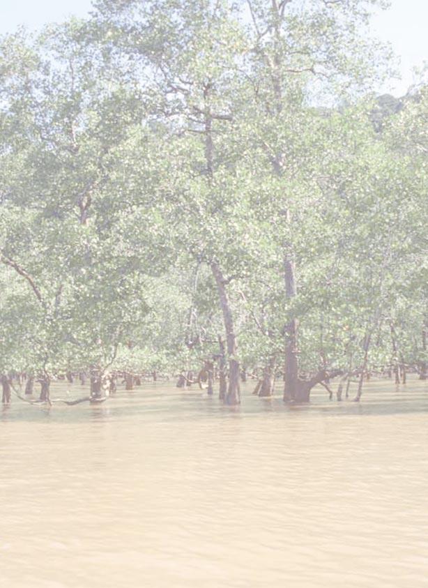
13 MANGROVE FORESTS caused by future coral bleaching events is quite unpredictable, but the impacts could be profound on the future health of coral reefs and the abundance of the resources. Management Options There are several management options that could be taken in relation to coral reefs. First of all, the complete elimination of all destructive fishing practices would be a very big step in coral reef conservation. This would require the concerted effort and collaboration of all stakeholders. At the same time, fishermen should be encouraged to undertake environmentally friendly practices on a regulated and sustainable basis. The temporary (e.g., 1 year) closure of reefs on a rotating basis, such as has been practised in Tanga, seems to be a good management option that could be adopted in other parts of the country. The decision to close certain reefs should be done by the fishermen themselves, with environmental managers only creating awareness and facilitating discussion. Otherwise, the fishermen are unlikely to adhere to the closure. Ecotourism should be further developed as an alternative or supplementary income-generating activity and as a means of motivating communities to protect and restore their environment. In many reefs where degradation is severe, active intervention is necessary to return the ecosystem to its original state in a reasonable length of time so that resource users can gain benefits as soon as possible. Otherwise, such reefs may take decades to recover or may never recover at all. At the same time restoration helps to maintain coral diversity. Involvement of community members in monitoring their own environment is another important aspect. Though the data gathered by the community may not always be of the highest quality, their involvement can result in gathering large quantities of reasonably reliable data and, perhaps more importantly, it enhances a feeling of ownership amongst the community members and motivates them to implement conservation measures. Prospects for Poverty Alleviation If coral reefs in Tanzania could be restored to their pristine condition, this could have a great positive impact on the economy of coastal communities, due to both improved fisheries and greater benefits from tourism. The involvement of coastal people in ecotourism, with increased numbers of tourists, could greatly improve their economic well being. MANGROVE FORESTS Mangroves are salt tolerant trees or shrubs that form the major component of the complex tropical and subtropical mangrove ecosystems. These ecosystems occupy the intertidal zone, primarily in muddy, sheltered areas of the coast such as bays, inlets, estuaries, channels and the leeward sides of islands. They sometimes cover vast areas in large river deltas. The other components of mangrove ecosystems include algae; marine fauna living in the mud, on the bases of the trees and in the tidal water; and terrestrial animals living in the tree canopy. Mangrove forests are found in all coastal districts of Tanzania. There are eight species of mangroves in mainland Tanzania and a ninth species from Zanzibar. The largest continuous mangrove forests Fig. 1: Mangroves in Mikindani. are in the districts of Rufiji, Kilwa, Tanga-Muheza, and Mtwara. Remote sensing, as used to create Fig. 2, has been identified as an effective tool to study otherwise difficult-to-reach and difficult-to-penetrate mangrove forests along coastal areas. Comparison of data from 1990 and 2000 shows that there has not been a dramatic change in mangrove area. However, a small decrease in the overall area of mangrove coverage did occur. COASTAL ECOSYSTEMS & ENVIRONMENT 5

14 MANGROVE FORESTS mangroves filter river water and facilitate the settlement of sediments, which would otherwise be detrimental to surrounding seagrass beds and coral reefs. Mangroves also play an important role in stabilising the coastline, thus preventing shoreline erosion. Economically, mangroves are a source of firewood, charcoal, building poles, materials for boat construction, tannin and traditional medicines. Moreover, mangrove forests serve as great tourist attractions and have important scientific value. Previous Condition and Threats (as of 2001) Fig. 2: Mangrove forests in Tanzania with enlargements of key regions. Enlargements are as they appear in Landsat images. The presence of mangroves is denoted by the maroon color. During past decades, degradation of mangroves occurred in many parts of the country. Besides a decrease in the area coverage of mangroves, there was also considerable decrease in the density, height and canopy cover of the mangroves within the forests. The areas hardest hit were those near urban centres, such as Maruhubi in Zanzibar, Kunduchi, Mbweni and Mtoni in Dar es Salaam and forests around Tanga town. Less accessible areas such as Rufiji remained largely pristine. 6 While mangrove coverage declined in the districts of Rufiji, Kilwa and Mkuranga it increased slightly in other districts. The area covered by mangroves in mainland Tanzania was approximately 109,593 ha from and about 108,138 ha in 2000 (Wang et. al., 2002). Similar to coral reefs, mangrove forests are also considered critical habitats with great ecological and socio-economic value. They are also keystone ecosystems in that they have high productivity, producing large quantities of organic matter that serve as food for many organisms. This includes those living within the forest and also outside it, since much of the organic matter produced is exported to other areas of the marine environment. Mangroves also serve as feeding, breeding and nursery grounds for a great variety of invertebrates and fish, many of which move out into the ocean during their adult stages. In addition, Coastal Districts Fig. 3: Comparison of Mangrove Areas (in Hectares), 1990 and Salt crust areas were sections of the mangrove forests cleared for salt harvesting. They are not included in the mangrove vegetation area. COASTAL ECOSYSTEMS & ENVIRONMENT 1990 Mangroves 2000 Mangroves Mangrove Vegetation Salt Crust Areas Mangrove Vegetation Salt Crust Areas Tanga and Muheza 9, , Pangani 3, ,879 0 Bagamoyo 5, ,051 0 Dar es Salaam (Ilala, Kinondoni & Temeke) 2, ,516 0 Kisarawe 4, , Rufiji 49,799 1,169 48,030 2,361 Kilwa 21, , Lindi 4, , Mtwara 9, , Total 109,593 2, ,138 3,679

15 Density-the number of trees per metre square Seedlings-mangrove plant less than 1 m tall with seed coat still visible and no proper bark. Saplings-mangrove plant between 1 and 2 m, typically between 1 and 2 years old, and is not able to fruit. Mature trees-mangrove plant usually greater than 5 m with the ability to reproduce. Stump basal area-the amount of ground (at ground level) covered by stumps, measured in cm 2 per m 2. Stand basal area-the amount of ground (at ground level) which is covered by stands of trees, measured in cm 2 per m 2. Increased awareness and conservation efforts have resulted in some recovery of mangrove forests, especially in Tanga (with collaboration from Tanga Coastal Zone Conservation and Development Programme), Lindi and Mtwara. The major immediate causes of mangrove forest degradation were the over-harvesting of mangroves (46%) for firewood, charcoal-making, building poles and boat-making and the clear-cutting of mangrove areas (30%) for aquaculture, agriculture, solar salt works, road construction, urbanisation and hotel construction. The underlying cause of mangrove degradation was the lack of alternative resources such as other cheap firewood or land. Near urban centres, various types of pollution, including municipal sewage, garbage and oil pollution also posed a threat. Condition and Threats (2003 Update) The information presented in the following sections comes from studies of the mangrove ecosystems conducted in three MANGROVE FORESTS Mangrove Species Avicennia marina Bruguiera gymnorrhiza Ceriops tagal Heritiera littoralis Lumnitzera racemosa Rhizophora mucronata Sonneratia alba Xylocarpus granatum sites in each forest. By measuring the characteristics of the forest in multiple sites, it is believed that a more accurate picture of the ecosystem s health can be attained. The surveys found the mangrove forests in Bagamoyo and Kilwa to be in good condition, though the forests in Bagamoyo primarily consisted of very young trees, and both areas are under high cutting pressure. The Rufiji mangrove forest is in the best health with the highest species diversity and greatest coverage by trees. The forests in Dar es Salaam, on the other hand, were very degraded due to extensive over-harvesting. Without immediate measures to protect these forests, they will likely be lost. In general, the present threats to mangrove forests are basically the same as they were in the past. However, some recent information is available on threats in specific areas. Fig. 4: Satellite image of mangrove coverage in Bagamoyo. Bagamoyo At Chengeni kwa Bwanakozi, there was a very high density of natural seedlings, with a good density of trees and a fewer number of saplings. At Ruvu kwa Mtailend, there was a large number of seedlings, but quite a low density of trees and almost no saplings. Ruvu kwa Chenipembe had the fewest number of seedlings of the three sites, but had intermediate density of trees and saplings. Preferred Habitat Exposed area facing the sea Middle of the mangrove forest extending into the landward area Inner part of mangrove forest on well drained soil River banks, tidal estuaries and mangrove swamps Saline and dry areas Fig. 5: Mainland mangrove species. Tidal stream, river banks and estuaries Mudflats in sheltered locations and estuaries with slow moving water Upper portion of river banks and dry areas COASTAL ECOSYSTEMS & ENVIRONMENT 7


16 MANGROVE FORESTS There is significant on-going cutting pressure, with 5-10 stumps per 25-m 2 plot being observed in the three sites. It appears that Ruvu kwa Mtailend has been subjected to the highest cutting pressure in past years and thus many of the stumps observed came from large trees. Fig. 6: Satellite image of mangrove coverage in Mtoni Kijichi. Dar es Salaam The mangrove forest at Mtoni Kijichi shows considerable degradation. Due to mangrove harvesting, over a period of just a few months the density of mature trees dropped from 0.06 to 0.04 individuals per m 2, stand basal area decreased from 24 to 7 cm 2 per m 2 and stump basal area rose proportionally. Moreover, saplings and seedlings were completely absent from the Sonneratia zone due to fishermen dragging seine nets under the tree canopy. Thus, this forest is in danger of being lost unless remedial measures are taken (Akwilapo 2001). Community-based monitoring has been undertaken at Mbweni and Kunduchi. Baseline data reveals that natural seedlings are abundant, but very few mature trees or saplings are present. At Mbweni, the community transplanted a significant number of R. mucronata seedlings (some of which are now saplings), while the Kunduchi community had transplanted C. tagal seedlings. the very low basal area. However, these forests are regenerating reasonably well as indicated by the high number of natural and transplanted seedlings. Nevertheless, there is no regeneration of some species and greater efforts are needed to fully restore these forests in terms of mangrove abundance and species diversity. Mangrove Regrowth in Cleared Areas A comparison between cleared and forested areas of mangroves at Mbweni indicated that sediment organic matter (needed as nutrients for the trees) was significantly higher and seafloor, or land, animals, particularly crabs, were more abundant in the forested areas than the cleared areas. Transplanted seedlings showed better survival/ health status in the forested areas than the cleared areas. The poor survival in cleared areas was attributed mainly to the extreme temperatures, salinity levels and desiccation that occur there, as well as low organic matter content. These findings demonstrate that the practice of clear cutting has significant impacts on the environmental characteristics of the forest and makes replanting difficult. 8 Though the number of mangrove species was greater in Kunduchi (six) than in Mbweni (four), the evenness component of species diversity was much higher in Mbweni than Kunduchi, making an overall greater species diversity in Mbweni than in Kunduchi. Higher species diversity indicates a healthier ecosystem. The mangroves of Mbweni and Kunduchi have been more severely degraded than forests in other parts of the country described in this update, as indicated by the sparseness of mature trees and saplings as well as COASTAL ECOSYSTEMS & ENVIRONMENT In Dar es Salaam, interviews with the villagers at Mbweni and Kunduchi indicated that the main reasons for cutting mangroves in Mbweni and Kunduchi are over-harvesting for use as firewood (mentioned by 25% of the interviewees), construction poles (16%) and charcoal-making (12%) as well as clear-cutting for building sites and commercial projects (19%) (Wagner et. al., 2001). In Mbweni, a large area was clear-cut for the construction of a hotel and another area for solar salt pans, both of which never materialised. These destructive activities have been somewhat reduced

17 MANGROVE FORESTS since 2002, but there are still occasional incidences of people clear cutting certain patches of the mangrove forests for construction purposes. There is also some harvesting for firewood and building poles, though at a low level. Fig. 7: Satellite image of mangrove coverage in Kilwa. Kilwa A communitybased rapid assessment of mangrove forests in Kilwa (Ngoile et. al., unpublished) was conducted in April The mangrove forests observed all showed an adequate average density of mangroves and a good community age/size structure, i.e., there was a good balance between mature trees and regenerating seedlings and saplings at all sites assessed. In general, the Kilwa mangroves have higher density than forests in Bagamoyo and Dar es Salaam, particularly with respect to mature trees and saplings. The number of mangrove species represented at the various sites ranged from four to six. The best representation of mangrove species occurred at Kilwa Kivinje and Mtoni, i.e., the evenness component of species diversity was highest at these sites. The other three sites were dominated by Ceriops tagal, with reasonably good representation of Rhizophora mucronata at Matapatapa and Somonga. 2 D plot 20 0 i Kisiwani Kivinje Mtoni Matapatapa Somanga Fig. 8: The density of seedlings, saplings and trees (mean + standard error) of all mangrove species in study sites in Kilwa. Seedlings Saplings Trees The highest cutting pressure was observed at Matapatapa (6 stumps per 25-m 2 plot), which is a significant proportion of the number of trees per plot (an average of 20). At other sites, there were less than 3 stumps per plot. Despite the reasonably adequate density of mangroves in most areas, there were certain small patches within these forests where there had been recent high cutting pressure and substantial degradation plo Kisiwani Kivinje Mtoni Matapatapa Somanga Figure 9: Total density of stumps (mean + standard error) of all mangrove species found in the study sites. In Kilwa district, present threats include harvesting for domestic firewood, building poles, fence-making and firewood for salt making, and activities at landing sites and clear-cutting for solar saltpans. Digging under mangrove trees to collect fish bait, which usually results in the death of the tree, is another current threat. Mangrove resource utilisation at sites in Kilwa appears to be sustainable. However, Kilwa Kisiwani, Kilwa Kivinje and Mataptapa the utilisation is not sustainable because the above-mentioned impacts are very severe. Rufiji The Rufiji mangrove forest is the largest in East Africa. As such, it is the most highly developed mangrove ecosystem in Tanzania. As in Kilwa, a one-time assessment was conducted at selected sites in Rufiji, with community participation. At Kifuma, all eight mangrove species found in mainland Tanzania were present. Mangrove density was relatively low since the trees were large in size. There was a high number of Avicennia marina seedlings, but modest number of seedlings of other species. COASTAL ECOSYSTEMS & ENVIRONMENT 9

18 MANGROVE FORESTS There was a similar situation at Atakae, but only six species were present and Ceriops tagal seedlings had the highest density partly due to the fact that villagers had planted large numbers of C. tagal seedlings in areas that had formerly been cut for rice cultivation. At Matosa, the Fig. 10: Satellite image of mangrove stress-tolerant coverage in Rufiji. Avicennia marina dominated (3.9 and 4.5 trees and seedlings per 25-m 2 plot, respectively), with only 0.06 Ceriops tagal trees per 25-m 2 plot and no other species present. This is due to the fact that water only reaches this area for a few weeks per year during the principal rainy season when the river is flooded. Total stand basal area at Kifuma, Atakae and Matosa were 1261, 738 and 282 cm 2 per 25-m 2 plot, respectively. Kifuma showed higher basal area than any other sites reported herein. This is to be expected since Rufiji is the most highly developed mangrove forest in Tanzania and in eastern Africa. Projected Trends Due to increased awareness about the importance of mangroves and mangrove replanting efforts, which have been promoted by the Mangrove Management Project (MMP) as well as various local ICM programmes and NGOs, it is likely that the condition of the mangrove forests of Tanzania will improve considerably over the next few years. The positive impacts of replanting can be observed within only a few years. management efforts that are being implemented, greater community management should be encouraged through various ICM programmes, marine parks and the MMP. For example, through participatory decisionmaking, communities can completely close certain mangrove areas that require recovery and allow harvesting on a sustainable basis in other areas that are already well-developed forests. Another possibility is that communities can decide to divide certain degraded areas into plots and allocate them to specific groups or individuals for replanting. If their replanting efforts are satisfactory, they could be allowed to harvest their plots on a sustainable basis once the mangroves have grown sufficiently. These approaches would help to motivate coastal people to restore and protect the mangrove forests. While some efforts have been made to restore mangrove forests in degraded areas, much still needs to be done. With the involvement of villagers in replanting, the workforce is greatly increased and a feeling of ownership is created amongst the communities. Relatively minor efforts in restoration can have great positive impacts on mangrove forests. Ecotourism, where the local communities are fully involved, can be an effective way of motivating communities to protect and even restore their mangrove forests. In fact, planting mangroves can be an integral part of the ecotours as is done in Mbweni, with both tourists and villagers participating. Since one of the greatest demands on mangroves is for energy in the form of firewood and charcoal, rural electrification, fuel-efficient stoves and the use of biogas could help to relieve the pressure on mangroves. Proper Environmental Impact Assessments (EIAs) must be conducted before the establishment of all salt works, aquaculture projects and construction of any kind, to be sure that proper areas are selected and environmentally friendly procedures are followed. Often the natural salt flats on the upper edges of mangrove forests can be used for these purposes with minimal negative impacts. Management Options and Their Implementation Prospects for Poverty Alleviation 10 In addition to the awareness campaigns and other COASTAL ECOSYSTEMS & ENVIRONMENT Mangrove forests are a rich source of fuel, building


19 poles, and materials for boat making, all of which are important to the livelihood of coastal people. The easy availability of these items precludes the necessity of spending money on procuring them elsewhere and thus alleviates poverty. If there is a high enough level of conservation and on-going replanting of mangroves, these resources could be harvested on a sustainable basis for the economic benefit of the local communities. Sustainable harvesting of mangroves for sale is a legal way to generate income. In addition, mangroves provide nectar for large populations of bees and therefore bee-keeping is an economic activity that can be more fully developed in mangrove forests. Ecotourism, besides being a way of conserving mangrove forests, can also provide significant income to the local communities that are involved. Moreover, well-preserved mangrove forests help to maintain fisheries production, not only in the rivers within the forests, but also in the surrounding coastal waters. Thus there are many ways in which the mangrove forests can contribute to the alleviation of poverty. MARINE FISHERIES The demand for fish in Tanzania is progressively increasing, particularly with the greater the number of people living along the coast and with the expansion of tourism activities. This increased demand for fish Fig. 1: Artisanal fishing boats in Bagamoyo. MARINE FISHERIES products has raised the prices substantially, which has enlarged the incomes of some people in the fisheries trade. However the fishing industry is still 95% artisanal as the majority of the local fishermen still use traditional fishing methods. Most of the fishermen are poor and thus despite profit opportunities, they have not been able to adjust to the increased demand. Most of the fisherfolk use simple gear and vessels with l i m i t e d operational range. These vessels include dugout canoes, outrigger canoes, dhows and small boats. Fig. 2: A fisherman displays a ray at the Mtwara fish market. They are normally driven by sails but can be fitted with outboard engines. The operational range of a vessel is determined by its size and whether it is sail or motor-driven. Vessels driven by sails rarely travel further than four km from shore. Their fishing gear includes traps, hook-and-line, nets and spears. The fishermen have good ecological knowledge about the marine ecosystems, which they use in their day-to-day activities, especially since their fishing pattern is affected by tides and guided by the monsoons. Fishing is practised throughout the year but the peak season is during the Northeast monsoon (November to April) when the ocean is calmer and clearer. Fish resources caught by these fishermen which are of special significance includes the pelagic, or surfaceliving, species such as the sardine, jack, swordfish, mackerel, kingfish and tuna. The groups that dominate the marine demersal, or deeper, catches are bream, grouper, parrotfish, snapper, rabbitfish, and emperor. These are caught using hand lines, traps and nets. The small pelagic species consist primarily of sardine, small tuna and mackerel. These are mainly caught by purse seines or ring nets. Other species include octopus and lobster that are usually collected by hand from reef flats at low tide or by divers. Prawn and shrimp are caught in seines in estuarine waters, particularly at the mouths of large rivers. Sea cucumber and cockle are gathered at low tide in the intertidal flats. Squid are COASTAL ECOSYSTEMS & ENVIRONMENT 11
20 MARINE FISHERIES mainly caught using hand lines, seine nets or fixed nets. Other species that are caught include sharks and rays. The crab catches in Tanzania are Stakeholders in the marine fisheries include: Tourism and sport fishing personnel including boat captains and crew and guides Fishermen and their suppliers including fuel and ice suppliers, credit suppliers, gear manufacturers and boat builders Bulk buyers, fish exporters and retailers Consumers sand crab. dominated by two species, both of which are of commercial importance. They are Scylla s e r r a t a, commonly known as the mud or mangrove crab, and Portunus pelagicus, commonly known as blue swimming or economic alternatives. The importance and impact of the fishing extends much beyond these full-time fishers, and includes all those involved in boat construction and repair, and marketing and sale of fish products. Therefore when a fishery collapses it does not only affect the fishermen but a whole group of people who are dependent on it. Fish is also an important source of animal protein to a large part of the coastal population. The high seas, or the Exclusive Economic Zone that extends 364 km (200 miles) out to sea, is so far unexploited by local fishermen because of the lack of suitable vessels to venture into these distant waters. However there are many unofficial reports that a few big foreign licence vessels fish in these waters. Prawn fisheries represent the only industrial-scale marine fishery in the country, and has been operating since the mid 1980 s. The industrial fishery for prawns is based mostly in the inshore shallow areas around the mangrove fringed Bagamoyo/Saadani and the 12 Most coastal people are involved in fishing activities. Nearly all fishing takes place on the continental shelf which is quite narrow. It reaches about 4 km offshore, with the exception of the Zanzibar and Mafia channels where the shelf extends for some 60 km. The area of the shelf to the 200 m depth contour for both mainland and Zanzibar combined is 30,000 km 2. This is the area commonly used by the artisanal fishermen. Hand, stick and spear fishing occurs in the intertidal areas at depths of m. Most other types of artisanal fishing, including hand lines and seine nets, occurs in shallow waters rarely exceeding depths of 60 metres. SCUBA divers collecting sea cucumber and other molluscs can reach a depth of up to 35 metres. Trawling for prawns is usually conducted at depths between 4-10 m though some few vessels do occasionally trawl in deeper waters. The inshore marine fishery is extremely important to coastal communities in Tanzania. The number of fishermen is increasing. Currently it is estimated that there are over 60,000 fishermen operating along the whole coast of Tanzania including the islands. Most of the fishing is conducted by poor, artisanal fishers, often on shores with marginal soil productivity and with few COASTAL ECOSYSTEMS & ENVIRONMENT Years Fig. 3: Total annual fish catch for Zanzibar, 1980 to Rufiji Delta with a fleet of approximately 25 prawn trawlers. Offshore fisheries are a potential resource with high value migratory fish species such as tuna, sailfish, marlin and swordfish. Foreign industrial vessels are also known to fish these waters. Few vessels are licensed. The total annual catch of Tanzania s marine fisheries is around 70,000 t. Zanzibar alone currently lands about 22,000 t. The total annual catch for mainland Tanzania still ranges between 48,000 t to 56,000 t.
21 MARINE FISHERIES Previous Condition and Threats (as of 2001) Natural calamities such as storms and strong waves are known to damage coral reefs and indirectly could affect fish populations. Other impacts could be caused by river runoffs, which could create siltation effects especially around river mouths. A recent event was the coral bleaching caused by the increase in water temperatures in This is believed to have impacted coral reefs in several parts of Tanzania with one of the effects being a change in fish species composition. Much of the pressure on fisheries and degradation of reef ecosystems has been caused by destructive fishing methods. By far the most destructive type of fishing is the use of dynamite. Dynamite fishing was once widespread, but its use has been reduced drastically throughout the country. It has been practiced in Tanzania for over 40 years. Each blast of dynamite instantly kills all fish and most other living organisms within a m radius and completely destroys the reef habitat itself with a radius of several meters. With numerous blasts occurring daily on reefs all over the country, over a period of many years, the cumulative effect has been devastating. Before 1995, Mafia Bay was reported to be like a war zone with blasts going off every hour. The use of small mesh seine nets to capture fish on the bottom and around reefs is almost as destructive as the use of dynamite. The nets are weighted and dragged through the reef flat or are pulled around coral reefs. Dragging them over the reef flat unavoidably damages coral and other marine life. Some techniques involve beating and smashing coral colonies with poles to frighten fish into the net. The small-mesh size of seine nets results in the capture of many juveniles. Capture of juvenile fish, when conducted intensively in nursery areas, results in depletion of fish stocks, alteration of species composition, loss of species diversity, and disruption of food webs. Traders also claimed that the sizes of some sea products such as the sea cucumbers had decreased, but they still continued to buy them due to demand and competition. In the long line fisheries the catch rate in numbers and weight in most parts of the West Indian Ocean region including Tanzania, declined drastically. Shark fin trade also declined and some species are rarely seen now in Tanzania waters. Other resources that showed a decline were the octopus and squid populations, which contribute about 6% of the total catch. In addition to consumption by local markets, pressure was also being exerted on octopus fishery bay the tourist industry, since octopus meat is very popular in tourist hotels and restaurants. A lot of octopus is also exported to neighbouring Kenya, where there is a ready market. Condition and Threats (2003 Update) Almost all people in coastal communities are involved in fishing activities in one form or another. The average individual consumption of seafood in the country is 13 kg/year in Tanzania mainland and 22 kg/year for Zanzibar. Tanzania s exports of marine products include shrimp, sea cucumber, shells, lobsters, crabs, squid, octopus and sardines. However, the majority of export revenue comes from the harvest of shrimp or prawns (kamba). One of the indicators of the status of a fishery is the change in species composition and/or change in size of the fishes. These are important components in evaluating trends in fisheries. In the southern part of Zanzibar where the villagers used to practice local conservation systems (which in recent years has collapsed), it has been observed that although the fishermen s catch is large, the fish are of a much smaller size than before. The fish landings and catch per unit effort seemed to be declining slightly. However, overall fishery resources appear to have reached the upper level of exploitation. Some resources were affected more than others. For example in the small pelagic fisheries of Zanzibar, the catch drastically declined from 600 t in 1986 to 91 t in 1997 (Jiddawi 2000). In the case of prawns, it is believed that the resource has reached the upper level of exploitation. In early 1988, 13 trawlers were landing about 2000 t of prawns and 25 trawlers are currently landing half of this (Nhwani et. al., 1993 and Bwathondi et. al., 2002). Coral reef fish form the majority of the catch in Tanzanian waters. Most of these reefs are located close COASTAL ECOSYSTEMS & ENVIRONMENT 13
22 MARINE FISHERIES to the villages where the fishermen live. However fishermen migrate to other areas during monsoon seasons. There is currently ongoing Regional monitoring, control and surveillance programme which started in The programme is designed to assist development of Tanzanian ideas for the improvement of Monitoring, Control and Surveillance (MCS) in our marine waters in order to improve management of marine fisheries resources. There are also plans now to increase national sea fishery inspectorate capacity, national onboard observer capacity, as well as data and information management. This is an advance in Tanzania s marine fisheries, especially in relation towards the management of deep-sea fisheries. Shrimp trawl fisheries, particularly for tropical species, generate more by-catch and discards than any other fishery type, accounting for over one third of the global total. In Tanzania, the annual prawn landings are associated with about 80% by-catch in weight, which includes juveniles of commercial fish species and other marine organisms that include endangered species like the sea turtles. Also, prawn trawling destroys seafloor ecosystems and it is likely that prawn trawlers have been compromising nursery grounds. In the Rufiji delta, conflicts exist between the trawler operators, the artisanal fishermen and other stakeholders. Sources of conflicts between artisanal and trawl fishermen arise from destroyed nets, apportioning of fishing grounds and dumping of trash fish by the trawlers offshore which is often swept on the beach, fouling the artisanal fishery landing sites. Trawlers also damage artisanal fishing equipment thus heightening conflicts between them. nursery and breeding grounds for many ecologically and economically valuable fish and prawn species. Indications are that the fish supply will not be able to keep up with the projected increased demand. The supply gap is challenged by external factors such as human population growth, domestic and industrial pollution, competing demands for the same resources and the overriding but unknown consequences of global climate change. While difficult to predict specific outcomes, the impact of these changes will further reduce the potential growth in fisheries. Projected Trends There are possibilities for Tanzania to expand its fish production by focusing on the pelagic stocks, especially sardines and tunas, in the Exclusive Economic Zone (EEZ). Since 1997, industrial long liners have caught 193 metric tons per year of tuna and other fish in Tanzania s EEZ. Due to the on-going threats of increased fishing pressure, combined with the destructive fishing practices used there is likely to be further deterioration of the coral reefs of Tanzania unless drastic and decisive measures are taken. As mentioned in the section on coral reefs, the frequency and severity of coral bleaching events is likely to increase due to global warming. Such events are expected to have serious consequences with respect to the future health of coral reefs and the abundance of their resources, though the extent of the degradation that might be caused is unpredictable. 14 The use of destructive fishing methods has decreased, but is still practised in some areas. Using these techniques leads to indiscriminate destruction of fish breeding and nursery grounds and has seriously affected populations by destroying fish larvae and juveniles. Most of the destructive fishing methods are illegal, but continue to be used due to lack of enforcement and competition for marine harvests. Mangrove cutting and loss of mangrove habitat has a similar impact on fisheries. The forests are an irreplaceable part of the fish life cycle, providing COASTAL ECOSYSTEMS & ENVIRONMENT Management Options and Their Implementation A comprehensive research and monitoring programme on marine resources is required to determine the status, distribution, abundance and value of the resources so as to obtain baseline information for comparison in future studies. Also, such in depth monitoring of the landings will generate better relationships with the fishing community. Monitoring the size frequency of prawns caught in the Rufiji delta is a way to make recommendations on mesh

23 MARINE FISHERIES size of net regulations. Also, detailed studies of the industrial fishery will help to understand the overall contribution of immature prawns to the catches from the Rufiji delta. Public education and awareness campaigns must be conducted to raise and improve the general public s knowledge of fishery laws and their justification. There must also be promotion of good practices, such as avoiding the capture or collection of juveniles thereby allowing them to grow to maturity. Community-based marine reserves and protected areas should be established in order to conserve and restore marine diversity and fish populations. These programs cangenerate income from responsible tourism and build awareness of the need for conservation. poor as a result of various problems they face in relation to capture and marketing of their products. One of the biggest problems is reaching the markets due to poor roads especially during the rainy season. Improvement of roads could assist in increasing the income of fishermen. Improving and encouraging the use of appropriate technologies in the post harvest handling and processing of fish could improve the shelf life of fish and fish products for local consumption and export. In addition, modernising fish landing sites could assist in alleviating this problem and increase the income of There is a long history of traditional conservation or management in some coastal villages in Tanzania. This has included seasonal octopus closures in the southern Unguja Villages and restrictions on moving fishers (dago) fishing in Menai Bay. They have also included the reservation of village-front fishing grounds for elders and the creation of special fishing areas that can only be fished to generate money for collective communal activities like special celebrations. These latter two forms have been in practice at Bweleo, Uzi, and Fumba. Encouragement of such traditional management could assist in reducing overexploitation of fishery resources. In view of the nature of the fisheries in many parts of the country and the capacity at government level in Tanzania it is recommended that the co-management route for coastal fisheries be done. Those will involve the sharing of responsibilities between the government and local resource users to manage the resources. Prospects for Poverty Alleviation The national fisheries policy recognises the role of small-scale fishermen who catch most of the fish consumed locally as well as for export market. Therefore it aims at promoting, developing and exploiting the fish sustainably in order to provide food employment and income to fishermen. Most of the fishermen along the Tanzanian coast are Fig. 4: Unprocessed fish catch in Bagamoyo. fishermen. There is also poor distribution of credit facilities to enable the fishermen to improve fishing vessels and equipment. Encouraging export of fish and fishery products so as to meet the requirements of the international markets is one method of advancing the fight against poverty. Furthermore, to ensure the resources are preserved, fishing under-utilised areas such as deep sea or expanding aquaculture practices could be practiced. Also, proper management of all human activities that affect fisheries could help to reverse past trends in fisheries decline and improve the livelihood of the coastal communities. Additionally, fishermen know the location of most of Tanzania s fishing grounds. However, to what extent these reefs are utilised in terms of fishing effort and the seasons during which they are visited still needs investigation in order to be able to make policy decisions. COASTAL ECOSYSTEMS & ENVIRONMENT 15

24 WATER QUALITY 16 WATER QUALITY Good water quality is an important prerequisite for virtually all social and economic activities that occur in or around the aquatic environment including both marine and freshwater ecosystems. For example, economic activities like fishing and aquaculture are only viable in an environment that is free from contagion that may arise from pollution or other contaminants. Similarly, tourism and other leisure activities are especially sensitive to an aquatic environment that is deemed to be of poor quality. Of major local concern is the health impact of poor water quality. Pollution of water bodies resulting from improper discharge of waste such as sewage, solid waste and industrial and agrochemicals has serious consequences on the health of communities living in the vicinity of or using food resources from such areas. Water quality can also be reduced by the introduction of sediments and other material resulting from natural events such as storms and floods but also through poor use of the land. Tanzania loses an estimated 10 to 100 metric tons of soil and silt per hectare annually. Fig. 1: This beach in Bagamoyo has become polluted due to fishing activities taking place there. Poor land-use practices both inland and in coastal areas negatively affect water quality. This includes largescale clearing of forests and grasslands, agricultural practices of overgrazing and mining. Such practices result in more rapid runoff, leading to soil erosion and increased sedimentation in coastal areas causing the reduction in quality of coastal waters. This has a direct impact on the natural environment. Excessive sediment loads in the water column reduce light penetration such that light dependent plants are unable to survive. Moreover, high sediment loads smother corals and other organisms resulting in their deaths. Similarly, drainage of irrigated farms and subsequent discharge of such water into coastal waters may COASTAL ECOSYSTEMS & ENVIRONMENT contaminate these waters with excessive nutrients and pesticide residues. Coastal habitats, such as mangroves and coral reefs, are easily degraded by excess loading of agricultural discharges as well as sewage borne nutrients and organic matter. Eutrophication, also resulting from excess nutrients, causes degradation of water quality through oxygen depletion and general organic over-loading. Previous Condition and Threats (as of 2001) Previous studies on water quality in Tanzania have shown that the quality of coastal waters in most parts of the country is relatively good. The exceptions were the water bodies fronting major cities and towns such as Tanga and Dar es Salaam, on the mainland, and Zanzibar Town in Zanzibar. In Dar es Salaam, waste from domestic and industrial sources had created pollution hot spots in the harbour area and other locations around the city s waterfront. Untreated sewage from Zanzibar Municipality was discharged directly into coastal waters and this had been reported to cause local pollution. Excess discharge of nutrient-laden waters from a fertiliser factory as well as from municipal sources and discharge of effluents from sisal processing factories were the principal cause of water quality degradation in the coastal waters of Tanga. As a result, proliferation of macroalgae caused by such pollution was a common feature of the municipality. In Zanzibar Town coastal waters were reported to have alarming levels of both feacal and total coliform bacteria far beyond the internationally accepted levels for safe bathing. Nutrient levels were also higher than normal. Discharge of untreated wastewater into the coastal environment was principally responsible for the observed water quality degradation in the waters fronting the town. Dar es Salaam, being the most populous city in Tanzania, generated the most waste in the country. Domestic sewage was the principal source of pollution in the city s coastal waters, especially the harbour area. The pollution originating from the discharge of untreated waste from the sewer system, pit latrines, soak pits, small landfill sites and garbage dumps may have found their way into the coastal waters. As a result

25 WATER QUALITY Another potential threat to water quality in Tanzania was that posed by petroleum exploration activities in some coastal regions. These include the Selous Basin, Rufiji River plain, Ruvu basin and Mandawa basin. Leakage of petroleum resulting from such activities could cause severe water quality degradation. Fig. 2: The Zanzibar Town coastline is fronted by hotels and other buildings. The city is the cause of the decreased water quality. of this pollution, high levels of nutrients and faecal and total coliform have been recorded in coastal waters. Furthermore, heavy blooms of macroalgae are a regular feature of near shore waters especially in the vicinity of the northern end of Ocean Road beach. Manufacturing industries were another source of pollution in Dar es Salaam. Various industrial wastes from Keko, Chang ombe, Kurasini, Mtoni and Temeke have been discharged untreated into the shores via the Msimbazi Creek. These pollutants included chemicals from textile industries such as dyes, paint wastes and strong alkalis. Other pollutants included pesticides, heavy metals, cyanides and detergents. Oil pollution from the refinery at Kigamboni also contributed to the waste load. The principal threat to water quality in Tanzania coastal waters stemmed from untreated municipal wastes. This was especially true in the main coastal towns and cities. The water quality outside these densely populated mainly urban areas, though largely free from the impact of domestic wastes, was under threat from agricultural run-off, pesticides and fertilizers. Water quality in these areas was threatened by chemical wastes and sediment carried to the coast by rivers, especially during heavy rains. The threat is worsened by poor agricultural activities carried out upstream, deforestation and soil erosion. A direct consequence of this is the smothering of corals and other organisms, as well the reduction of aesthetic value of the water, making it less attractive for activities such as tourism and general recreation. Poor water quality was therefore a significant threat to emerging economic activities especially to coastal tourism, which has a great potential in national development. Condition and Threats (2003 Update) Industrial and municipal waste, as well as runoff of chemicals from upstream farming activities, are the greatest sources of coastal water contamination. In most places, chemical levels are not in violation of international water quality standards, but the trend is toward increasing deterioration. The greatest immediate risk has been identified as rapid urban population growth rate since untreated sewerage from large cities is one of the largest sources of water pollution. Since the publication of the last State of the Coast in 2001, only a few studies on water quality have been conducted in Tanzania. However, these give an indication, albeit in a small way, of the present quality of the coastal waters in some parts of Tanzania. For example, the use of pesticides is prevalent in Tanzania including in the Dar es Salaam District. In the city proper, pesticides are mainly used in horticulture. Small amounts of DDT and its derivatives have been detected in the biota and water column in various sites in Dar es Salaam that include the harbour area, R. Kizinga and estuary, R. Msimbazi and estuary, Salender and Ferry among others. However, the amount of the pesticides found ( ug/kg f.w.) was significantly below the FAO/WHO maximum acceptable limits in fish and seafood, which is 200 ug/kg f.w. Studies have indicated that some economic uses of coastal waters are themselves sources of water quality degradation. Notable among these that have been reported recently in the literature are fish culture and tourism. Diminishing oxygen concentrations in earthen mariculture ponds has been reported in Makoba Bay, Zanzibar. This has been attributed to eutrophication, which results from remineralisation of accumulated organic matter on the bottom of the ponds. Since there is a periodic but direct exchange of water between the ponds and the sea one can assume that there is at least a localised impact of mariculture activities in this area. COASTAL ECOSYSTEMS & ENVIRONMENT 17

26 SHORELINE CHANGE This may also be true in other areas in Tanzania where collected and disposed of properly. Characteristically, neighbourhood solid waste dumps are a common feature in almost all major towns. During the wet season rainwater drain through these dumps and as a consequence a high amount of nutrients, organic and turbidity loadings end up in coastal water, further reducing the water quality. Projected Trends 18 Fig. 3: Mariculture ponds are a potential source of water quality degradation, but they also provide a source of income to coastal people. aquaculture is being practised. Several activities, both economic and recreational, take place in the coastal and marine waters. Economic activities include tourism development, fisheries, aquaculture, shipping and hydrocarbon exploration. At the community level important economic activities that are key to the sustenance of the daily lives of local coastal inhabitants include, but are not limited to artisanal fishing, seaweed farming, gleaning and collection of various species of shellfish from the intertidal zone and lime and salt production. All of the present uses of coastal waters either benefit from or are a threat to good water quality. However, of greatest concern is the rapid increase in urban population and of squatter developments making urban centres the major source of land-based water quality degradation activities including the use of coastal waters for the purpose of discharging untreated municipal wastes. Of particular concern are the waters fronting such cities and towns as Dar es Salaam, Tanga, Mtwara, Zanzibar and Chake Chake. Not surprising then that these waters have the poorest water quality standards in the country. The rapid increase in population and industrialisation of coastal towns and cities has also led to the generation of more solid waste. Poor or inadequate management of this waste means that only a small fraction is COASTAL ECOSYSTEMS & ENVIRONMENT Few measures, if any, have been taken to remove sources responsible for the degradation of water quality. Municipal and industrial wastewater is still discharged untreated into coastal waters and since no treatment facilities are planned, this situation will almost certainly prevail in the foreseeable future. Similarly, no attempts have been taken to curb the current accelerated rate of urbanisation of the coastal areas. Given this situation it is very difficult to see any improvement in the current state of water quality in Tanzania especially in major urban areas. Prospects for Poverty Alleviation As mentioned above, good water quality is an important prerequisite for nearly all economic uses of coastal waters. Given this fact, the maintenance of pollution free coastal waters for tourism and for fisheries and aquaculture activities should ensure the successful development of these activities. The government has placed major emphasis on the development of coastal resources - coastal tourism, mariculture and natural gas - in recognition of their increasing importance in shaping the on-going fight for economic salvation and the reduction of poverty. SHORELINE CHANGE About two thirds of the coastline of Tanzania has fringing reefs, often close to the shoreline, broken by

27 SHORELINE CHANGE river outlets such as the Rufiji Delta, Pangani, Ruvuma, be mapped and monitored if it is to be managed sustainably. However, maps as part of baseline data are sometimes outdated or not available at appropriate scale for some uses. In order to safeguard the future of these coastal resources, it is imperative to study the extent of shoreline change in order to provide useful information to decision-makers, researchers and other stakeholders of coastal areas. Fig.1: Beach erosion at Jambiani. Wami and Ruvu. Coastal erosion is a natural shore process in which the boundary between land and water shifts in position overtime i.e. the shift towards the land in which the sea wears away a shoreline. In contrast to this, accretion is a process in which sediments or sand are deposited. The rate at which both erosion and accretion occur is dependent upon the wind, waves, currents, tides, vegetation, sand composition and geology specific to a particular coastline. The causative factors are mostly natural, but can also be intensified by human activities. For example, more than 8 million people in Tanzania depend on the resources and ecosystems surrounding the water. Activities such as dynamite fishing, coral and sand mining, tree (mangrove) cutting, seaweed farming, waste disposal and tourism have a marked effect on the erosion of the coasts. Such activities occur often in developing countries like Tanzania where greater demands for food, land for settlements and building materials are needed to sustain peoples lives. In Tanzania, mangrove forests and coastal trees are under pressure from peoples need for firewood and construction. The mining of both coral and sand weakens the coast s natural protection against erosion. Moreover, many tourists come to see the beautiful coral reefs, oceans and beaches, an activity that boosts the country economically yet is detrimental to coastal land if unsustainably practised. This is of primary concern to coastal development and management. With the loss of land comes the degradation of habitats and biodiversity. With an increasing population, Tanzania coastal area is experiencing a serious decline in its natural resources. The coastal environment needs to Factors Contributing to Shoreline Change in Tanzania The Tanzanian coast is dominated by sandy shorelines and lagoon systems associated with large beach ridge plains, especially in front of the Rufiji, Ruvu and Pangani rivers. Reefs are currently found along the coasts of Zanzibar, Pemba and in discontinuous location all along the coast of Tanzania in the southern sector. The coast of Tanzania is influenced by the northerly and southerly trade, or monsoon, winds. From May to October, the Southeast trade winds blow with great strength and constancy of direction. The Northeast winds are weaker and blow from November to April. The Southerly monsoons are said to strengthen the northward moving East African Coastal Current, which can possess a velocity of up to 2 m/s. This current is only retarded, and never reversed, by the Northerly monsoons. These winds have governed seasonal trading between East Africa and Asia for more than 1,000 years. Furthermore, the seasonal change in direction can cause accretion and erosion to occur at different times each year. Suspended sediment load data indicates a maximum daily transport of approximately 1,000,000 tons. Heaviest loads of sediment are related to flash floods. The sources of this sediment and the characteristics of the tributary basins are dependent on relief, geology and seasonal rainfall regimes. The entire coastline of Tanzania is characterised by fringing reefs except in the vicinity of river mouths, where there is a seasonal increase in suspended sediment and falls in salinity, radiant energy and light intensity. Inshore reefs are absent where the coastline is formed of sand barriers such as those found at Kunduchi. Most reef flats are not coral at all, but COASTAL ECOSYSTEMS & ENVIRONMENT 19
. While the ebb and flood tidal movements tend to be self-balancing on the open coast, individual features will influence the extent of fluctuations.")
28 SHORELINE CHANGE calcite-cemented coralline sands or beach rock. The coast of Tanzania experiences a semi-diurnal tide with two almost equal high tides and two low tides during a lunar day (24.8 solar hours). While the ebb and flood tidal movements tend to be self-balancing on the open coast, individual features will influence the extent of fluctuations. Tidal currents in estuaries and areas with islands and sand spits such as at Kunduchi are localised and important in their effect on coastal and offshore shelf topography. Interruption of sediment supply to the coastal zone appears in many forms. The construction of protective works disrupts sediment supply, such as the construction of a dam on rivers, whose consequence is to reduce the sediment supply to the coast through trapping. In Tanzania, dams for the production of electricity, irrigation and fisheries exist in most of the rivers entering the Indian Ocean, e.g. the Pangani, Wami and Great Ruaha Rivers. many places where developers decide to cut the mangrove vegetation in search of a clearer and more scenic view of the sea. Trends in Shoreline Change Both accretion and erosion have occurred throughout the coastline of Tanzania. However, from the few studies that have been done, it has been seen that increased human activity along the shoreline has increased the rate of erosion. For example, the destruction of the coral reefs around Maziwi Island (off the coast of Tanga) led to such severe erosion that the island disappeared in Zanzibar has experienced both erosion and accretion. In the Kigomasha Tondooni area the shoreline has receded by 50 m since On the other hand, the southern part of Nungwi showed accretion of m since In Dar es Salaam during the March-May rainy season, accretion of up to 30 cm has been noted. However, in August, beaches have been found to erode up to 2 m. Thus the overall impact of these seasonal events is still erosion. This does vary between specific areas on the coast due to specific local factors. For example, some areas (such as the site of the old Africana Hotel) experience accretion during the August high tides. This information does indicate, however, that changes in the shape of the coastline are taking place. 20 Fig. 2: Most of the erosion around Dar is caused by the extraction of sand for construction and the removal of vegetation in order to develop the shoreline. The extraction of sand from feed rivers and streams deprives the beaches of much needed sand and silt required for maintaining equilibrium. Since the beginning of the 1980s, there has been a boom in construction all over Tanzania, especially in Dar es Salaam. The boom in construction is obviously associated with a great demand for construction material such as sand, cement, coarse aggregate and stone. The consequence of cutting vegetation can be seen in COASTAL ECOSYSTEMS & ENVIRONMENT Management Options and their Implementation Sustainable coastal zone management is an interdisciplinary field of study combining mainly public/social administration, business administration/ the owner and civil (coastal) engineering. As such there is a need for an integrated approach to the problems of shoreline change. Strategy 1: The need for legislative and administrative framework. A survey conducted along the entire coastline of Tanzania shows that various structures have been erected close to or on beaches and dunes. Due to shoreline retreat, these structures are threatened by the advancing sea. Although the primary responsibility for
29 dealing with coastal erosion at a given location rests with the landowner, a statutory law which will vest powers in specific local authorities and bodies should be passed. This law, which could be known as The Coast Protection and Management Act, will have the function to define, protect and regulate the use of the shore areas. In particular, it should ensure and safeguard the public nature of the beaches, preserve its natural features and balance the need of development with conservation. After the enactment, a department of the Government should administer the legislation such as the ICM Unit (ICMU) or a Coastal Marine Management Authority. This department must spearhead co-ordinated planning, finance and administration. It should be the duty of this body to define the rights, obligations and responsibilities of all parties concerned in coastal development. One of the priority tasks of this body, immediately after its formation, should be a survey to identify Erosion Prone Areas (EPAs) and compile a coastal vulnerability database containing information on several variables relating to inundation and erosion risks of the different areas along the entire coastline. Local authorities should obtain the views of the Coast Directorate with respect to town planning matters affecting land in the EPAs. Property holders should require a permit to erect or alter buildings in the EPAs. Once EPAs have been identified, buffer zones of the appropriate width are determined to define areas where controls are required. Strategy 2: The need for establishing a Coastal Observation Programme The next step following the identification of EPAs is the establishment of a Coastal Observation/Monitoring Programme. This programme will contribute to technical aspects of the Coast Directorate s operations and management. Its functions should be to: Establish an extensive data collection programme. Collect and archive historical, geological, geomorphologic, botanical and meteorological aspects of the entire coast as well as normal engineering aspects. Install storm tide recorders at all major coastal population centres as the basis of a warning and response for impeding disasters from tropical-cycloneinduced storm surges. SHORELINE CHANGE CASE STUDY It is also important to collect data on the socioeconomic characteristics of the study area and to develop scenarios of their future development. Once the data is collected, it can be added to the up and running GIS database. SHORELINE CHANGE CASE STUDY OF KUNDUCHI SHORES: Change Detection Using Remote Sensing and GIS Methods Shoreline erosion is an issue of concern in coastal management. This study addresses the problem of shoreline erosion using the science and technology of Remote Sensing and GIS. Mapping the coastline and conducting various spatial analyses for change detection becomes crucial for providing information to decision-makers, researchers and other stakeholders. Remote sensing and GIS techniques have therefore been used in this study to compare aerial photographs of different years in order to determine extent of shoreline changes in Kunduchi shores. The Kunduchi coastal area, just north of Dar es Salaam is an example of shoreline change partly resulting from human activities. Kunduchi beach is located approximately 18 km north of Dar es Salaam harbour. The shoreline dynamics of Kunduchi beach are largely natural processes, but human activities have likely contributed to the increase in coastal erosion. Many resort hotels and residential buildings are located at Kunduchi beach (including White Sands Hotel, Bahari Beach Hotel, Water World, and Beachcomber Hotel). Serious shoreline erosion has caused damage to property and vegetation, particularly hotels and coconut trees that used to dot the shoreline. The economic cost of erosion and accretion has not been estimated, but this is an area of very high land and real estate value. The past and potential future costs of property loss from unexpected shoreline changes are immense. The beach in Kunduchi area is gently sloping and there are shoals offshore. The shoreline is continually COASTAL ECOSYSTEMS & ENVIRONMENT 21

30 SHORELINE CHANGE CASE STUDY changing. Processes of erosion, sediment transport and accretion are very evident and common to the area. Coastal erosion has threatened a lot of public and private property along the shore, forcing some beach hotel owners to reclaim big areas of land by pushing further into the ocean. While shoreline dynamics are largely natural processes, human activities within the area have likely contributed to the increase in coastal erosion. This includes: mangrove cutting and destruction of offshore reefs by dynamite fishing, both of which act as natural barriers to wave action. Practises of beach seining (which destroys seagrass beds that normally help to stabilise the substratum), construction on the coast, beach activities (including driving cars on the beach) and sand mining in streams that lead into the ocean also contribute to the erosion. In addition, a factor external to local human activities is the sea level rise brought about by global warming. Results The results of this study are presented in form of photomaps and a table. They are presented based on the analysis from aerial photographs and the GPS measurements. Shoreline changes in the Northern Kunduchi- Manyema Creek between Between these periods the results of the shoreline changes show that about 6.4 acres of land has been eroded from the shore in the northern part of the creek (Fig. 1). From this map one can clearly see the Kunduchi Beach Hotel buildings, just off the current shoreline represented by a red line. Fig. 1: Shoreline changes between 1981 and 2002 (Northern part of Kunduchi-Manyema Creek). In 1981, the groynes were not yet constructed since there was not much shoreline erosion. The actual aerial photograph of 2002 that has been used for the analysis is on the lower right corner of map 3 below. Shoreline change results in the Southern Kunduchi- Manyema Creek between Figure 2 shows the significant changes that took place during this period. Red and blue lines represent the shoreline in 1981 and 2002 respectively. There was shoreline erosion of about 1.51 acres in areas denoted by letter B on the map. There was, however, accretion of about 5.45 acres at the same time in areas denoted by letter A. Further accretion occurred between 1992 and 2002, forming a piece of land of about 6.90 acres which protrudes northwards. In this particular area we observed regeneration of vegetation such as bushes and exotic trees which were more than 10 metres tall. Between 1981 and 2002 shoreline erosion destroyed about 1 acre of mangroves from the area denoted by letter C. 22 COASTAL ECOSYSTEMS & ENVIRONMENT

31 SHORELINE CHANGE CASE STUDY Shoreline changes in other parts of Kunduchi Figure 3 (on the next page) shows the shoreline changes between 1981 and 2002 from the former site of the Africana Hotel to the Water World Hotel. There have been considerable shoreline changes in this particular area. The blue and red lines represent the shoreline in 1981 and 2002 respectively. Letters A, B, C and D represent areas where measurements for shoreline changes were made. At point A, near Beachcomber Hotel, the shoreline erosion that took place caused the shoreline to shift by about 52 m. At point B, we decided to measure the distance from the shoreline to a road going to the former Africana hotel. It was found that in 1981 the shoreline was about 78 m from this point at the road. However, in 2002 shoreline erosion has reduced this distance to 36 m. So the shoreline has shifted by 42 m from this particular point at the road. At point C the distance of shoreline changes is 29 m and 40 m at point D. Discussion The shoreline erosion has been very alarming in the northern part of Kunduchi-Manyema Creek. Between 1981 and 1992, about 5.03 acres of land was eroded from the shore. This number increased to more than 6.4 acres by the year Some of the buildings have collapsed near Kunduchi Beach Hotel, especially in areas closer to the fish market, causing damage and loss of property and investments. Previous efforts of controlling shoreline erosion through construction of groynes seem to have failed. Some of the groynes have been washed away and others are left a distance from the current shoreline, showing that erosion is still taking place. As a result of shoreline erosion at Kunduchi Beach Hotel, stone structures have been constructed along the shore to control erosion. In the southern parts of the creek there have also has been serious shoreline erosion between the study periods. In addition to the collapsed properties, shoreline erosion removed the mangroves on the southwest side especially between 1981 and About 1 acre of mangrove was washed away along the riverside near the river mouth. The people interviewed also mentioned that mangrove removal occurred in this area. Fig. 2: Shoreline changes between 1981 and 2002 (Southern part of Kunduchi-Manyema Creek). The other phenomenon along with shoreline erosion is the accretion that is taking place in the southern part of the creek. As a result of accretion, the southern part protrudes northwards, forming a piece of land of about 6.95 acres. According to measurements from GPS, vegetation such as COASTAL ECOSYSTEMS & ENVIRONMENT 23

32 trees and bushes covering an area of about 5.53 acres have generated in this piece of land. In fact, there is more vegetation than there used to be in It appears that the soil characteristics have changed and this piece of land has stabilised. However, monitoring and further studies are recommended. SHORELINE CHANGE CASE STUDY Fig. 3: Overview of Kunduchi shoreline changes between 1981 and Year Erosion in Northern Part of Creek (Area in Acres) The use of remote sensing data and GIS has enabled us to determine the shoreline changes in the study area. This has proved that remote sensing is an effective technique in shoreline monitoring applications and therefore it should be given more attention by researchers and other scientists; and applied in other environmental and natural resources monitoring studies. Management of coastal environment and resources in Tanzania take advantage of remote sensing and GIS techniques. Continued shoreline change monitoring is important for providing more information and understanding of the changes taking place at Kunduchi-Manyema creek and the Kunduchi shores in general. Erosion in Southern part of Creek (Area in Acres) Conclusion * 24 It has been observed that shoreline changes in the study area result from both erosion and accretion. There has been more shoreline erosion in the northern part of the creek than the southern part. The study has shown that, apart from the creek area, other shoreline areas in Kunduchi have also been affected by shoreline erosion for the whole study period of about 20 years. Fig. 4: Quantification of shoreline change in the Kunduchi-Manyema Creek during the period * Includes an area of mangrove loss which equals 1.05 acres. COASTAL ECOSYSTEMS & ENVIRONMENT We conclude from this example that shoreline surveys, monitoring and coastal land use planning are invaluable to reduce or avoid the risk of economic losses resulting from a lack of firm knowledge about shoreline processes and change.
33 COASTAL ECOSYSTEMS & ENVIRONMENT IN THE ICM STRATEGY COASTAL ECOSYSTEMS & ENVIRONMENT IN THE ICM STRATEGY The National ICM Strategy provides a framework and process for linking different sectors and harmonising their decisions about the management of coastal resources and the environment. It supports decentralisation and existing initiatives working to conserve, protect and develop coastal resources. The Strategy provides a basis and mechanisms for decisionmaking across sectors concerning the conservation and sustainable use of coastal and marine resources. In the absence of an improved management system, the cumulative impact of development will eventually lead to reduced water quality and supply, reefs stripped clean of fish, lost mangrove habitat, coastal erosion, and restricted public access to resources and livelihood opportunities. Seven specific strategies to address six priority issues provide the strategic framework for action in the National ICM Strategy. All strategies relate back to coastal ecosystems and the environment directly or indirectly. They all attempt to balance enhanced conservation with continued use of coastal resources as well as new pathways of environmentally sound development that will reduce poverty, vulnerability, and increase the well being of rural coastal communities. Some of the means to achieve this balance include local level integrated planning and management (Strategy 1) and stakeholder involvement in the coastal development process and the implementation of coastal management policies (Strategy 6). Strategy 2 calls for innovative ways to be devised to create and promote the sustainable development of economic uses of coastal resources. There is ample potential for the development of such economically beneficial uses of coral reefs, particularly in terms of ecotourism and improved fisheries. Strategy 3 aims to conserve ecosystems while still benefiting from sustainable resource use. This is very relevant to critical habitats such as coral reefs, mangroves and estuaries. There is significant degradation of reefs and reef fisheries in Tanzania, therefore definite steps need to be taken to conserve and restore these precious habitats so that coastal people will continue to benefit from the resource. Moreover, according to Strategy 4, Special Area Management Plans (SAMPs) can be established in critical areas of economic interest which are vulnerable. This may encompass unique and high value marine ecosystems (e.g. coral and mangrove ecosystems), or areas subject to special threats of shoreline change and natural hazard resulting from coastal development. Fundamental to the conservation and sustainable use of coastal ecosystems and the environment is scientific and technical information to inform ICM decisions (Strategy 5). This strategy recognises that sustainable development requires access to data and understanding about the environment and natural resources, human patterns of land use, and resource use trends. The National ICM Strategy Strategy 1: Support environmental planning and integrated management of coastal resources and activities at the local level and provide mechanisms to harmonise national interests with local needs. Strategy 2: Promote integrated, sustainable and environmentally friendly approaches to the development of major economic uses of the coastal resources to optimise benefits. Strategy 3: Conserve and restore critical habitats and areas of high biodiversity while ensuring that coastal people continue to benefit from the sustainable use of resources. Strategy 4: Establish an integrated planning and management mechanism for coastal areas of high economic interest and/or with substantial environmental vulnerability to natural hazards. Strategy 5: Develop and use an effective coastal ecosystem research, monitoring and assessment system that will allow available scientific and technical information to inform ICM decisions. Strategy 6: Provide meaningful opportunities for stakeholder involvement in the coastal development process and the implementation of coastal management policies. Strategy 7: Build both human and institutional capacity for inter-disciplinary and intersectoral management of coastal resources. COASTAL ECOSYSTEMS & ENVIRONMENT 25

34 26 COASTAL ECOSYSTEMS & ENVIRONMENT
35 MARINE PROTECTED AREAS AND CONSERVATION EFFORTS Coastal conservation initiatives and marine protected area (MPA) management provide a means for managing coastal and marine resources and achieving the dual objectives of sustainable development and conservation of marine biodiversity. Establishment of an efficient network of national or transboundary MPAs and restoration of fisheries to sustainable levels are recommendations of the World Summit on Sustainable Development and the New Partnership for Africa s Development (NEPAD). The National ICM Strategy offers an opportunity for the coordination of marine parks and place-based conservation initiatives with a broader policy framework focused on the conservation of natural resources, on ensuring food security, and on supporting poverty alleviation and economic growth. Coastal and marine protection takes a variety of forms in Tanzania. A group of marine reserves, known as the Dar es Salaam Marine Reserves System which encompasses four small islands, were designated in The Marine Parks and Reserves Act of 1994 provided the first guide on the establishment and the institutional mechanisms for the management of parks and reserves. Chole Bay and Tutia Reef (Mafia Island) were incorporated in the Mafia Island Marine Park, which was legally established in The Mnazi Bay Marine Park was gazetted in These MPAs consist of relatively large, multiple use MPAs that are very much like small-scale models of integrated coastal management. The need to balance the protection of the natural resource base while maintaining the local communities right to resources has necessitated the adoption of this management approach. Protected areas are declared under separate legislation in Zanzibar and Pemba. The Menai Bay Conservation Area off the south coast of Zanzibar was established in 1997 and is one of a number of new marine protected areas being operated at the local level, with local government and As an Administrator, the greatest challenge is balancing the very high dependency of villages in the Park on natural resources with the goal of lessening the impact on resources through conservation and alternative livelihoods, George Msumi, Warden, MIMP community involvement in park utilization and management. Misali Island Marine Conservation Area is located 10 km off the west coast of Pemba. The Misali Island Marine Conservation Project involves 36 villages on Pemba in conservation activities. The Jozani-Chwaka Bay Conservation Area is located 35 kilometers southeast of Zanzibar town. A proposal to upgrade the status of the Jozani Forest Reserve to a National Park would expand the area from 2,500 to 5,000 hectares and extend to the Chwaka Bay mangrove system. Community-based marine protection as in Tanga, Muheza, and Pangani Districts under the direction of the Tanga Coastal Zone Conservation and Development Program (TCZCDP). Other community-based coastal and marine management initiatives include the Kinondoni Integrated Coastal Area Management Programme, the Rural Integrated Project Support, and Rufiji Environment Management Project. Community-based management is based on the idea of empowering communities to care for their own resources. A second form of marine protection is found in Zanzibar where there are small protected areas managed by private companies with the agreement of government. They include Chumbe Island Coral Sanctuary, a private nature reserve managed by Chumbe Island Coral Park, Ltd., and Mnemba Island Marine Reserve, managed by Conservation Corporation Africa. MARINE PROTECTED AREAS AND CONSERVATION EFFORTS 27
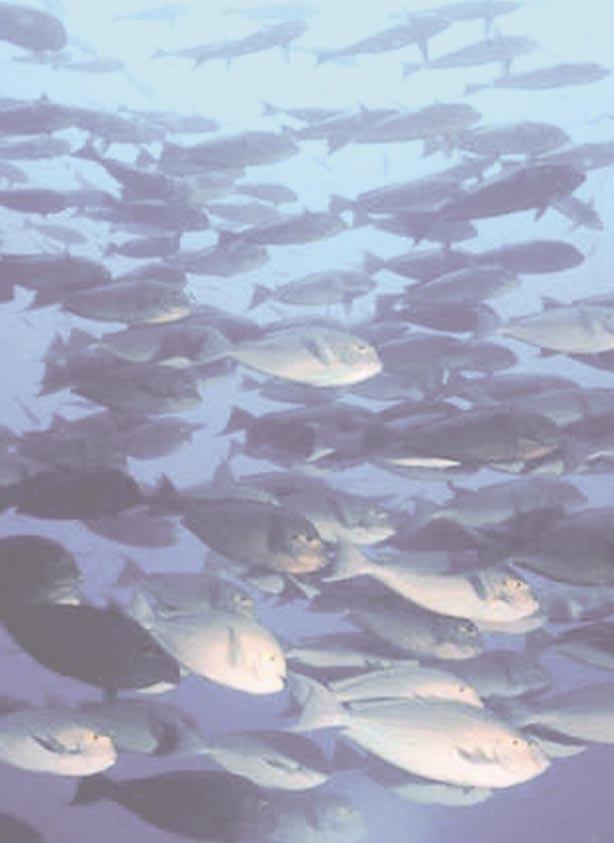
36


37 MARINE LIFE AS A RESOURCE These living resources are critical to the ecosystems in which they live, as well as to the coastal communities which can use them for economic gain. Plankton and seagrass, for example, form the basis of marine ecosystems by being primary producers and providing nursery and breeding areas for other organisms. Plankton diversity and productivity have been found to be fairly high in Tanzania. While this is positive for the marine ecosystems indicating their good health, it can also be potentially dangerous when blooms of harmful plankton occur. By trapping sediment and providing nursery grounds for fish, seagrass beds play a vital role in the health of the marine environment. They are, however, under threat from human activities. On the other hand, marine mammals and sea turtles are an important draw for tourists, while sea cucumbers are a potential export product. All species of sea turtle found in Tanzania are endangered because they are threatened by many human activities. Many management options are available and the key for their success lies in the involvement of local communities. Marine mammals are endangered by increasing boat traffic. Any tourism activities must be managed to ensure that their habitats are not compromised. The role of sea cucumbers in the coral reef ecosystem is largely unknown. In order to ensure their continued well being, harvesting must be managed sustainably. 29

 and dugongs (nguva), which are also known as sea cows or manatees.")
, bottlenose dolphin (Tursiops truncatus), Indo-Pacific humpback dolphin (Sousa chinensis), spinner")


, the pygmy sperm whale (Kogia breviceps) and another species of")
38 MARINE MAMMALS MARINE MAMMALS Marine mammals are warm-blooded animals that spend the majority of their lives in or near the sea. The key characteristics of mammals are being warm-blooded, having at least a few hairs, nourishing young with milk, and giving live birth to young. An outstanding diversity of marine mammals exists in Tanzania. The most commonly seen is the dolphin (pomboo). However, there are other marine mammals such as whales (nyangumi) and dugongs (nguva), which are also known as sea cows or manatees. Out of the ten species of dolphins found in the Western Indian Ocean eight species have been reported in Tanzania waters. They are: Indo-Pacific bottlenose dolphin (Tursiops aduncus), bottlenose dolphin (Tursiops truncatus), Indo-Pacific humpback dolphin (Sousa chinensis), spinner dolphin (Stenella longirostris), pan-tropical spotted dolphin (Stenella attenuata), Risso s dolphin (Grampus griseus), roughtoothed dolphin (Steno brendanensis), and Sousa plumbea which is a sub-species of the Indo-Pacific humpback dolphin. They are typically found in Zanzibar, Mtwara, Bagamoyo and Tanga. In Tanzanian waters there is very little information on the occurrence, distribution and abundance of whales, although humpback whales (Megaptera novaeangliae) are often sighted off the coast particularly on the East Coast of Zanzibar and Tanga between Fig. 1: Humpback whales are known to frequent the Zanzibar coast. October and December. Several humpback and sperm whales ( Physeter macrocephalus) have also been sighted by fishermen or travelers in ships near Tanzania. Other species of whales which have been observed in Zanzibar waters are the killer whale (Orca), the pygmy sperm whale (Kogia breviceps) and another species of sperm whale (Physeter macrocephalus). T. aduncus T. truncatus S. chinensis S. longirostris S. attenuata G. Griseus S. brendanensis Fig. 2: Dolphin species found in Tanzanian waters. 30 MARINE LIFE AS A RESOURCE

39 Fig. 3: Dugong populations in Tanzania are at the brink of extinction. MARINE MAMMALS The dugong (Dugong dugon) is believed to be almost extinct in Tanzania. H o w e v e r, anecdotal reports suggest that these animals are still in existence in the southern part of Tanzania near Kilwa and Mafia as well as in the northern part of Pemba. For example, there were 10 reported dugong sightings by Mafia fishermen in (Muir and Abdallah 2002). Condition and Threats (2003 Update) Marine mammals in Tanzania suffer direct and indirect attacks as well as habitat degradation due to anthropogenic activities. Though hunting for dolphins has reduced somewhat, they are still sought for local consumption and bait. The incidental catch of cetaceans (dolphins and whales) in gillnets is a major cause of mortality, as these nets are used to catch large species of fish such as tuna, billfish and marlin. The increased use of these nets in Tanzania is likely to maintain or increase the threat to these large animals. About 93 dolphins were caught in gillnets in the year 1999 a majority of them from Nungwi where the gillnets are common fishing equipment (Amir et. al., 2002). This number is high enough to have a negative impact on local populations. Cetacean species distribution is poorly understood. There is very little information on the occurrence, distribution and abundance of whales in the coastal waters of Tanzania. On going research activities in Menai Bay using photo techniques suggest the existence of approximately 150 bottlenose and 75 humpback dolphins in Menai Bay, Zanzibar (Stensland and Berggren in prep.). A pilot aerial survey to investigate the occurrence of marine mammals around Zanzibar was conducted in March 2000 with some very interesting results. The survey recorded a total of eight species in 17 hours of flying; Cuvier s beaked whale, bottlenose whale, sperm whale, Indo-Pacific bottlenose- and humpback dolphin, spinner dolphin, Risso s dolphin and rough toothed dolphin (Berggren 2000). The results from the pilot aerial survey are extremely encouraging regarding the diversity of species and in revealing some rarely sighted or studied species such as the beaked whales. This indicates that coastal waters of Tanzania provide unique opportunities to conduct research, not possible in other areas of the world. It also presents the possibility for dolphin and whale tourism on new species and in new areas of the region. Projected Trends Due to the increased fishing pressure it is possible that fisheries could pose another danger, for they may compete with marine mammals for the same fish and in the process reduce the fish populations that marine mammals depend on for food. This aspect is yet to be investigated in Tanzania. Marine mammals cannot survive without a plentiful food supply, so overfishing presents a real danger to the health of the marine ecosystem, especially when marine environments are also beset by pollution and other forms of habitat degradation. Pollution poses a threat to marine mammals in many forms. Plastic debris, can become entangled around the snouts and necks of dolphins preventing proper breathing and feeding. Razor-thin nylon fishing lines slice off flukes and fins of whales and dolphins that have become entangled in them. Oil spills, may kill and injure hundreds or even thousands of marine mammals and birds. Direct damage includes the oiling of their skin which destroys their insulating properties; injury to internal organs through ingesting oil, especially as a result of cleaning it off their body; and pneumonia from inhaling it. Bottlenose dolphins and other marine mammals are threatened by industrial pollution (from sources such as heavy metals, PCBs and other organic pollutants) and the destruction of coastal habitats by agricultural runoff and other forms of environmental degradation. Marine mammals are also threatened by increasing vessel traffic. A prime example is dugongs. Vessels often strike these slow-moving, surface-dwelling herbivores, scarring them for life or killing them. MARINE LIFE AS A RESOURCE 31

40 SEA TURTLES 32 Most marine mammals are highly sound-oriented creatures. Whales and dolphins in particular rely on a form of sonar, echolocation, to sense their surroundings. Human activities such as dynamite fishing and the increasing level of engine noise from everyday boat tourism activities and ship traffic may have long-term debilitating effects on marine mammal hearing, as well as disruptive effects on their social lives and foraging habits. Fig. 4: Swimming with dolphins can threaten dolphin populations. Dolphin watching though regarded as a sustainable nonconsumptive alternative to the direct exploitation of cetaceans has in recent years been uncontrolled which can potentially threaten dolphin populations if allowed to continue. Sexually mature females are more susceptible than males to human disturbance during the calving season when nursing their calves. Management Options and Their Implementation In order to conserve the marine mammals, there is a need to introduce regulations that will assist in better management of these resources. Also more studies need to be conducted to understand these animals better. There are several management options that could be implemented for marine mammal protection. Watching the dolphins and dugongs in their natural habitats can be exciting but care needs to be taken to avoid disturbing the animals as this could interfere with their normal behaviour. Therefore producing guidelines for dolphin tourism has been an advance towards protection of these animals. According to the guidelines carefully managed dolphin and dugong tourism has the potential to provide a regular and sustainable income to local communities while helping to protect the dolphins and to support education and conservation. Some safety rules include: Drive boats slowly with a steady speed Do not swim after or chase the dolphins or MARINE LIFE AS A RESOURCE dugongs Do not feed the dolphins or dugongs Do not throw plastic bags in the vicinity of dolphins or dugongs Community participation in protection of these animals will help motivate communities to protect dolphins, dugongs and other marine life. For example, the community-based Marine Turtle and Dugong Research and Habitat Protection Programme on Mafia Island has involved members of the community in collecting information about dugongs. Prospects for Poverty Alleviation Proper management of dolphins could help to reverse past trends in the decrease in numbers or disappearance of certain species. However, constant effort is required. The Marine mammal project could assist in these efforts. Dolphin tourism has become one of the most important attractions for tourists when considering travel to Zanzibar and East Africa. It is conceivable that an expansion of dolphin tourism (new sites and the development of whale tourism) will make this one of the most important industries in the region. However, the industry will only become sustainable if it is closely and responsibly managed. Furthermore the involvement of women in the dolphin tourism industry could help equalise the gender imbalances found in coastal communities. If dolphin tourism is managed well it could have a great positive impact on the economy of coastal communities. Other types of tourism could then follow using a similar model. The involvement of coastal people in management efforts would greatly improve their economic well being. SEA TURTLES Turtles locally known as kasa are a group of vertebrate animals belonging to the order Testudines.
. Turtles are the oldest living group of reptiles, first appearing about 200 million years ago.")

.")
, which prohibits international trade in the species on the list.")

 can still be offered a menu of turtle meat when you visit the local homes despite all efforts to conserve them.")
41 SEA TURTLES Green turtle Hawksbill turtle Loggerhead turtle Olive Ridley turtle Leatherback turtle Fig. 1: Sea turtle species found in Tanzania. Like snakes, lizards and crocodiles, they are reptiles (Class Reptilia). Turtles are the oldest living group of reptiles, first appearing about 200 million years ago. Like the other orders of reptiles, turtles are cold-blooded, have scaly skin and lay eggs with a yolk and tough outer covering. consumed by humans and are considered aphrodisiacs in some communities. The eggs of many endangered sea turtles are still collected by poachers. All five species of sea turtle found in the West Indian Ocean have been sighted in Tanzanian waters. These are the Green turtle, Hawksbill turtle, Olive Ridley turtle, Loggerhead turtle and Leatherback turtle. Two of the five species, Green and Hawksbill, are known to nest on the Tanzanian beaches. Sea turtles are under threat the world over and Tanzania is no exception. Their populations are estimated to have declined by 50% to 80% in the last fifty years (Slade 2000). The Leatherback and Hawksbill are classified (by the IUCN) as Critically Endangered because of a population decline of over 80% in the past 50 years while the others are categorised as Endangered. All are listed on Appendix I of the Convention on International Trade in Endangered Species of Wild Fauna and Flora (CITES), which prohibits international trade in the species on the list. Marine turtles occur in tropical and temperate seas throughout the world. They vary in size and habitat preference. Today, many species of turtles are threatened with extinction. Human activities, such as habitat destruction and overharvesting, are the main causes of diminishing populations. For a long time marine turtles have been used as food. Even today, in some villages such as Fig. 2: Discarded turtle shells in Mtwara. Matemwe in Unguja Island you Condition and Threats (2003 Update) can still be offered a menu of turtle meat when you visit the local homes despite all efforts to conserve them. The eggs and meat from sea turtles are also There is long history of exploitation of sea turtles in the Indian Ocean. People in Tanzania have traditionally used turtles for food and medicinal purposes. Zanzibar had a reputation as one of the world s major clearinghouses for tortoise shells (from the Hawksbill turtle). Records show an average export of 2600 kg per year in This trade is no longer in existence MARINE LIFE AS A RESOURCE 33
, slaughter of nesting females, egg harvesting and disturbance of nesting beaches through")
42 SEA TURTLES 34 but still the populations of sea turtles in Zanzibar have declined to a fraction of what they once were due to various human impacts (Khatib and Jiddawi 2002, Slade 2000). The main threats to turtles apart from natural predators are accidental capture in gill nets (or jarife), slaughter of nesting females, egg harvesting and disturbance of nesting beaches through construction. Turtles are still secretly hunted by the local population for food or for traditional medicine, which is believed to increase life and induce fertility and strength. About 85 dead turtles were recorded in Mafia in incidental capture in gill nets and occasionally surrounding (or seine) nets and long lines. Meat is sold in Kilindoni for between Tsh 4000 and Tsh 9000 (US $4 to $9) per turtle according to size. The turtle flippers are sold for Tsh 1000 (US $1) each (Muir 2002). For the whole of the Mafia area, it is estimated that between 1000 and 2000 turtles are caught a year (Muir 2002). A total of 6,918 young turtles successfully hatched in Mafia in 2001 (Muir 2001). Recently turtle nests were recorded around Mbudya island marine reserve near Dar es Salaam as an effort of conservation activities around these areas. Additional research on Mafia Island has recorded 231 nests since 2001, the majority of which were Green turtles, with only 9 nests belonging to Hawksbills. Loggerhead turtles have also been sighted, though they do not breed on Mafia. The estimated number of breeding females based on the number of nests is slated at Greens and 3-5 Hawksbills. Between 2001 and 2002 the percentage of nests successfully hatching increased by 40% with an overall success rate of 59% for the two-year period. Part of the increasing success rate may be due to the large decline in egg poaching which decreased from 49% of nests in 2001 to 5% in 2002 (Muir and Abdallah 2002). Early 2003 reported 50 Green turtle nests in Mafia of which 41 have hatched, 2 were poached, 2 were eroded by the sea and 3 were predated on. Interestingly, it was found that the turtles tended to nest away from the main areas of activity by the fishers on the island. During the northeast monsoon turtles nested in the west coast of Mafia when fishers move their camps elsewhere on the island because of rough MARINE LIFE AS A RESOURCE conditions. During the northwest monsoon the turtles nested mainly on the east coast when the fishers return to the west coast of the island. Tourism and hotel development along the coastline in Zanzibar has contributed to destruction of nesting beaches. Many hotels have been built on former nesting beaches in Unguja and Pemba. As a result there is a marked decline of turtle nesting in those areas. For instance, Kiwengwa beach on the northeast coast of Unguja, an important turtle-nesting beach, has been rendered almost totally unusable for turtles as a result of hotel development. Kiwengwa now has 6 operating hotels. All hotels have sun beds on the beach and some have beach Fig. 3: Sea turtles often nest on beaches like this one in Mafia. The development of hotels along these beaches keeps turtles from nesting there. umbrellas. A fishermen survey in the early 90s established that about 20 nesting occurred per year in this area, but b e t w e e n November 1992 and May 1993 only 9 nests were observed. From 1999 to 2002 no nests have been recorded along these beaches. Projected Trends Each year thousands of hatchling turtles emerge from their nests along the Tanzanian coast and enter the Indian Ocean. Usually only an estimated one in a thousand will survive to adulthood. The natural obstacles faced by young and adult sea turtles are staggering, but it is the increasing threats caused by humans that are driving them to extinction. In many villages in Tanzania, people still harvest sea turtle eggs for consumption though it is done in hiding. It is illegal to take eggs, but enforcement is lacking, poaching is rampant, and the eggs are often still collected. Each year, hundreds of turtles become entangled in fishing nets and drown. Shrimp trawling probably accounts for the incidental death of more juvenile and

43 SEA TURTLES adult sea turtles than any other source. In some countries shrimpers are required to put Turtle Excluder Devices (TEDs) in their trawl nets. Unfortunately, not all fishermen comply with the law, and sea turtles continue to drown in shrimp nets. The use of TEDs is not yet a law in Tanzania. Thousands of sea Fig. 4: Sea turtles caught in trash like turtles die from this one are usually unable to survive. eating or becoming entangled in non-degradable debris each year, including packing bands, balloons, pellets, bottles, vinyl films, and tar balls. Trash, particularly plastic bags thrown overboard from boats or dumped near beaches, are deadly meals for turtles. Nesting turtles once had no trouble finding a quiet, dark beach on which to nest, but now they must compete with tourists, businesses and coastal residents for use of the beach. Tanzanian beaches are increasingly being lined with seaside hotels and houses. Lights from these developments Fig. 5: Sea turtle hatchling. discourage females from nesting and cause hatchlings to become disoriented and wander inland, where they often die of dehydration or predation. Pollution can have serious impacts on both sea turtles and the food they eat. New research suggests that fibropapillomas, a disease now killing many sea turtles, may be linked to pollution in the oceans and in nearshore waters although this disease has so far not yet been recorded in Zanzibar. When pollution kills aquatic plant and animal life, it also takes away the food sea turtles eat. Oil spills, urban runoff of chemicals, fertilisers and petroleum all contribute to water pollution. In January 2001, the Mafia Island Turtle (& Dugong) Conservation Programme (MITDCP) was initiated on Mafia and its associated islands to promote the longterm survival of sea turtles through proactive community protection. One of the most important achievements in efforts to conserve turtles in Zanzibar was the establishment of the Zanzibar Sea Turtle Conservation Committee (ZSTCC) in February 2002 as a recommendation of the Sea turtle recovery plan for Zanzibar. Since 1990, Zanzibar has made efforts to conserve sea turtles. A successful campaign on local trade in turtle products culminated in the symbolic burning by the government of many turtle shells which took place in Prior to that these products were sold openly in Zanzibar. Tag returns provide important information on the migration routes of breeding turtles. Fifteen tags have been recovered in Zanzibar between 2001 and The tags were from nesting females tagged in the Seychelles (7), Comoros (92) and South Africa (5). In Mafia 9 tags were returned to the Mafia programme from turtles caught in gill nets, 4 from South Africa, 2 from Comoros and 3 from the Seychelles. The threats to turtles, from accidental capture in gill nets, egg poaching, hunting of nesting females and habitat disturbance, are currently being addressed through regular beach patrols, a nest protection scheme and awareness campaigns. The current management of sea turtles is through the establishment of a network of locally elected turtle contact persons, the provision of financial incentives as an alternative to hunting for meat and eggs, and the implementation of district-wide environmental education activities. To provide individual members of the local community with an incentive to consider sea turtle nests as a valuable resource by paying a cash reward for every nest that is reported and protected. Since sea turtles can lay several times in one nesting season, this may also provide a financial incentive to protect nesting females too. MARINE LIFE AS A RESOURCE 35
44 PLANKTON Ecotourism Ecotourism is small-scale, environmentally- and culturally-friendly tourism. The sustainability of the activities is key as this will ensure the protection of the environment and local cultures as well as a continued source of income to the communities. As such, it has also been called cultural or sustainable tourism. The income generated from such endeavours can also provide funds to maintain conservation areas, thus creating a sustainable system of funding for the activities. The main benefits of ecotourism include: Providing a source of income to villagers Providing alternate income to that resulting from destructive activities Promoting conservation activities in local communities. Furthermore, since ecotourism is by nature low impact, it requires low investment and thus is feasible for many of the poorer coastal communities. Activities can include: Wildlife watching Wildlife photography Spending a day with villagers Scientific tourism. While ecotourism can be very successful in Tanzania, it is important to remember that it is essentially small scale. These same activities which are low impact for 10 tourists would be high impact for 50. Raising the awareness of tourists about sea turtles, and in this way harness tourists interest in sea turtles to provide funds to run this scheme, could help set up a self-sustaining project which also reduces tourist demand for sea turtle shell curios. Prospects for Poverty Alleviation A turtle sighting is a major attraction of a dive and divers often request to be taken to sites where they can see turtles. Income obtained on Unguja in 1996 from diving alone amounted to $518,000 and ecotourism stands to gain considerably by actively pursuing turtle conservation programmes. More effort is required to raise awareness of tourists about sea turtles, and in this way harness tourists interest in sea turtles having them pay money to watch them. This will provide funds to run turtle conservation schemes in villages. In this way villagers could set up self-sustaining projects and reduce tourist demand for sea turtle shell curios. In Nungwi village there is a natural pool where, in 1996, the villagers organised to keep turtles and fish. They have tourists pay to see this natural aquarium. The turtles are kept for some time only and then released again after being tagged to get a chance to lead a normal life again. These turtles are obtained from incidental catches in gill nets. 36 Management Options and their Implementation To protect sea turtles in Tanzania all people need to co-operate and share responsibility. National laws and agreements, research, and the work of dedicated organisations and individuals each must play a part. Long-term protection of sea turtles also means developing solutions that reduce reliance on management methods requiring direct human involvement such as moving nests or raising hatchlings in captivity. If sea turtles cannot survive and reproduce on their own, without help from humans, then they are doomed. Feeding and nesting grounds must be protected, and a public wildlife conservation ethic must be fostered that can withstand gaps in government regulations and pressure from private interests. MARINE LIFE AS A RESOURCE A nest protection scheme in Mafia Island gives villagers a financial reward of Tsh 3,000 for finding nests and an additional Tsh 40 for each egg which hatches and 20/- for each rotten egg. Since December 2001 when the program was started, 115 nests were reported and protected by the local communities on Mafia Island, with an average reward of Tsh 7,000 per nest (Muir and Abdallah 2002). PLANKTON Plankton is made up of organisms with the ability to float in aquatic habitats such as oceans, rivers and lakes.

45 PLANKTON animals. It is estimated that the total annual rate of biomass production of continental shelf regions ranges from 100 to 750 gcm -2 per year. Dar es Salaam waters were found to have productivity on the low side of global averages. However, the waters off Zanzibar had high productivity, equalling up to 1400 gcm -2 per year. Plankton Sizes Nanoplankton is made up of small phytoplankton between ìm. Microplankton is made up of larger phytoplankton and zooplankton between ìm. The analysis of phytoplankton size indicated higher *note: 1 ìm = mm nanoplankton biomass (65% 95%) than microplankton. This is significant because nanoplankton is responsible for most of the primary production by phytoplankton in coastal waters. Fig. 1: Many different species of microscopic animals and plants make up plankton. They are neutrally buoyant having filaments which prevent them from sinking to the sea floor even though they are feeble swimmers. Several types of plants form the microscopic phytoplankton that is predominantly autotrophic and hence forms the primary producing level of the food chain in the marine environment. It is comprised of millions of single-celled light dependent organisms which are very small (about mm). Many animal groups comprise the zooplankton that makes up the nutritionally dependent animal component of plankton. These organisms can range in size from less than 0.01 mm to several centimetres, but the majority are less than 5 mm. Species composition of phytoplankton varies with location, season and time of day. Species diversity in Tanzanian waters was found to be higher than normal. About 265 taxa were reported to occupy the coastal waters around Dar es Salaam, with a total of 192 species found in Zanzibar waters (Bryceson 1977). About 29 species of microalgae were identified in the mangrove sediments near Dar es Salaam city (Lugomela et. al., 1999). Studies conducted in salt marshes and coastal waters of Bagamoyo identified 41 species of microalgae. The high species composition found in Tanzanian coastal waters was due to greater fluctuations of environmental factors and the diverse ecosystems found here. Environmental conditions such as physical, chemical and biological factors control the spatial distribution and composition of phytoplankton species in aquatic systems. Phytoplankton Phytoplankton consists of primary producers of organic matter that stand on the baseline of food webs in aquatic environments. About 95% of the total marine primary production comes from phytoplankton which is the vital source of energy in the ecosystem. The plants produce their own food using energy from sunlight and are then the direct source of food to many aquatic Some phytoplanktonic genera especially those belonging to cyanobacteria such as those in the genera Trichodesmium, Richelia and Nostoc are able to fix nitrogen, thus contributing to the rise of nitrogenous nutrients in the marine environment. This in turn leads to a bloom in biomass production, as lack of nitrogen can be a limiting factor in plant growth. Trichodesmium are able to fix up to g of nitrogen annually. MARINE LIFE AS A RESOURCE 37

46 PLANKTON In the near shore waters off the Tanzania coast nitrogen fixation was found to be highest during northern monsoons when the water column is stable. During this period of time phytoplankton biomass, fish catch and production are also highest. About 50 species of cyanobacteria were recently found along the coastal areas of Tanzania. Blooms of cyanobacteria, which occur during the northern monsoon months, contribute new nitrogen production in the coastal areas of Tanzania, sometimes leading to a bloom in phytoplankton growth. Potentially Harmful Phytoplankton in Tanzania Phytoplankton growth is normally limited by the availability of nutrients in the water. However, blooms occur in tropical coastal waters as a result of pollutions which contain or release nutrients such as nitrogen. This can lead to increase in productivity. Overproduction by some species can cause toxic blooms to occur. Two such organisms include dinoflagellates, a type of algae found in plankton, and Trichodesmium, a genus of nitrogen fixing cyanobacteria. These harmful microalgae are normally found in low numbers but under certain conditions may form extensive blooms resulting in the contamination of shellfish. When eaten, the poisoned shellfish can lead to death of sea and terrestrial animals including man. This is because biotoxins produced by such phytoplankton species accumulate in herbivorous and carnivorous fish. For example, ciguatoxin is derived from a bottom dwelling single-celled dinoflagellate algal species that is usually found in abundance in damaged reefs. The poisonous dinoflagellate is consumed by herbivorous reef fish, which are in turn eaten by larger predatory species in which the ciguatoxin accumulates. Other toxic phytoplankton include dinoflagellates in the genus Pseudonitzchia and Gambierdiscus toxicus reported to occur in Zanzibar waters. They have been found responsible for most cases of ciguatera poisoning. More than 20 species of potentially harmful microalgae have been identified in the waters around Zanzibar and Dar es Salaam (Kyewalyanga and Lugomela 1999). Large blooms and scums of cyanobacteria could be stimulated by land disturbances such as construction and filling of reservoirs which increase eutrophication in water catchment areas. Species of the Trichodesmium genus are toxic to shrimp and can be identified by an unpleasant smell and pinkish colour. Zooplankton The other component of plankton is the animal zooplankton. This community includes tiny herbivores that feed on the smaller phytoplankton. Zooplankton may be holoplanktonic or meroplanktonic. The former refers to animals which remain in plankton throughout their life while the latter are those found in plankton for only a portion of their life cycles. Larvae of worms and molluscs, and egg and larval stages of most fish are examples of meroplankton. Holoplanktonic animals represent a very large number of zooplankton including animals that live on, or in the bottom of the sea by day but ascend in the surface by night, such as ostracods (a type of crustacean), some prawn larvae and species of Leptochela. 38 Fig. 2: Algal blooms somestimes turn the ocean red due to the saturation of the algae. Because of this, it is often called a Red Tide. MARINE LIFE AS A RESOURCE Zooplankton are primary consumers. Like phytoplankton they play a major role in the transfer of energy from one trophic level to another in the marine food web. Herbivorous zooplankton feed on phytoplankton, which are the primary producers. They feed carnivorous zooplankton, which in turn are eaten by other larger animals. Thus, zooplankton biomass distribution is an index of the fertility of the sea and it provides information on the fishery potential. Zooplankton is the basic food of many fish larvae and adult fishes as well as many marine animals like


47 cetaceans. In coastal waters fish catches and zooplankton abundance are directly correlated. Zooplankton are also of economic importance as they can reduce the market value of fish by being parasitic to fish at some stages of their life cycle. SEAGRASS Light, temperature and water movement were found to affect the zooplankton composition and distribution. Higher abundance of zooplankton occurred during rainy seasons when there was a lot of runoff from streams. Coastal waters around Dar Fig. 1: Seagrass beds are nurseries to many fish es Salaam contain species. Calanoida species of zooplankton at higher abundance during the northern monsoon than southern monsoon seasons. However, very little has been studied concerning zooplankton in the coastal waters of Tanzania. SEAGRASS Fig. 3: Sea urchins (top) and dugongs (bottom) commonly graze on seagrass. bottoms. Usually, several seagrass species occur together in mixed vegetation that forms extensive meadows. In some cases, a single species of seagrass may form a lush growth of an aquatic grass community. Worldwide there are only about fifty species of seagrasses, which is a small number in comparison to their ecological importance. Twelve species of seagrasses have been reported in Tanzania. Seagrasses are marine flowering plants (angiosperms) that are adapted to live submerged in shallow sea Fig. 2: Distribution of seagrass species on the Tanzanian coast. In Tanzania, seagrass beds are widely distributed in intertidal and sub-tidal mud and sand flats, coastal lagoons, and in sandy Name of species Tanga Dar/Coast Lindi Tanga Pangani Coast Dar Mafia Lindi Mtwara Cymodocea rotundata x x x C. serrulata x x x x Enhalus acoroides x x x Halodule wrightii x x x x x H. uninervis x x x x Halophila minor x H. ovalis x x H. stipulacea x x x H. minor x H. wrightii x x x x x Syringodium isoetifolium x x x x x Thalassia ciliatum x x x x x T. hemprichii x x x x x x areas around the bases of shallow, patchy and fringing reefs. They are also found in mangrove creeks exposed to low tide or always submerged, in fine sand mixed with mud and on sand flats and sand bars. They are found in abundance in sheltered areas of the coast around Moa in Tanga, and tidal zones fronting the deltas of the Ruvu, Wami and MARINE LIFE AS A RESOURCE 39

48 SEAGRASS 40 Fig. 4: Seagrass beds can help reduce erosion along the coastline. Rufiji rivers and around Kilwa. The actual area covered by seagrass beds and the relative species densities have not been established in Tanzania. Seagrasses play important ecological roles. They have strong, intertwining rhizomes and roots that penetrate the substratum to stabilize bottom sediments and support the plant against water motion. When seagrasses bind sediments securely, less debris suspends in the water column. Invariably this results in reduced coastal erosion, increased light penetration and enhanced primary production. When fully grown, sometimes with blades reaching the water surface, seagrasses act to dampen strong wave action appreciably and slow water currents. Because seagrasses are plants with extensive nutrient cycling and fast regeneration, they have a very high productivity rate. They may form dense carpets of as many as 4000 blades m -2 over extensive areas of the sea and they may have a standing biomass of up to 2kg m -2 (Nybakken 1983). By servicing complex food webs through dead and living biomass, seagrass beds act to enhance primary productivity and maintain coastal and marine biodiversity. For example, they act as feeding, breeding, nursery grounds and shelter for a large number of marine organisms including fish species. Indeed a number of adult fish and shrimp species live in seagrass ecosystems for all or part of their life cycles. Other organisms, for instance the sea-urchin Tripneustes gratela and dugongs live on seagrasses by grazing on them directly. Therefore, seagrass beds are critical habitats in maintaining marine biodiversity, supporting both artisanal and industrial fisheries and protecting beaches from erosion by attenuating strong sea waves. Threats MARINE LIFE AS A RESOURCE Natural threats Seagrass beds are threatened by natural and human activities that include illegal fishing methods, tourist activities and shoreline dynamics. Grazing by populations of sea urchins has been reported to appreciably reduce seagrass cover. In controlled experiments, removal of sea urchins resulted in increased seagrass cover and associated fauna. Dugongs are also known to devour seagrasses and can reduce their cover quite fast. Natural grazers are, however, difficult to control under normal circumstances. However, this natural grazing is part of the equilibrium of the seagrass ecosystem. It is damage from humans that disrupts the equilibrium cause the ecosystems to suffer. Human threats Illegal operation of dragnets such as beach seining and shallow water trawling are examples of fishing methods that are detrimental to seagrass communities. These methods are indiscriminate as they employ equipment that clean-sweeps sea bottoms to remove everything from the fishing ground. For example, the decline in seagrass beds off Kunduchi shores is attributable mainly to regular beach seining activities and shoreline dynamics. This is because seagrass, seaweed, juvenile fish and a variety of invertebrates often form a large part of a beach seine by-catch. Decades of shoreline dynamics have resulted in formation of sand dunes and varying magnitudes of sand deposition and removal. These processes have invariably been associated with loss of seagrass cover. Although the Government of Tanzania has officially banned the beach seine, the illegal operation is still on going in many beaches on the coast. On the other hand, shallow water prawn trawling is a legal form of fishing that continues to threaten the existence of seagrass beds in Bagamoyo, Jaja and Pangani shrimp fishing grounds. During tidal ebbing, coastal people are often involved in gleaning the sea bottom for wild seaweed for sale and bait and cockles as food. Regular anchoring of fishing and tourist boats is likely to increase as demands for fish increase and coastal tourism expands. These activities aim to ensure food security to an expanding coastal human population and increase Government revenue from tourism. Unfortunately, the same activities are often associated with frequent tramping
49 MARINE LIFE IN THE ICM STRATEGY on and destruction of sea-grass beds and other fauna. Management options and recommendations Coastal districts ICM Action Planning process should prioritise conservation and protection of seagrass communities, coral reef and mangroves. The coastal people, who are the users and custodians of coastal resources, should be involved in formulation and implementation of legislation and by-laws prohibiting damaging seagrass beds and other coastal resources. Local authorities should promote community awareness campaigns on the need to conserve seagrass beds and other critical habitats. The scientific and coastal communities should jointly initiate and promote restoration activities for seagrass beds, coral reefs and mangroves as a way of increasing fish production and productivity of coastal waters, and enhancing the overall productive benefits of coastal ecosystems. MARINE LIFE IN THE ICM STRATEGY Strategy 3 spells out the need to conserve and restore critical habitats, such as seagrass beds, and areas of high biodiversity while ensuring that coastal people continue to benefit from the sustainable use of the resources. Seagrass communities are integral components of coastal and marine ecosystems. In association with coral reefs and mangroves, seagrass beds prevent coastal erosion, improve water quality, and are a habitat for commercially important finfish and crustacean fisheries, as well as endangered marine mammals. Adoption of Strategy 3 by the Government of Tanzania highlights the importance placed on the management and protection of geographical areas of concern, such as those with unique ecological importance and economic value. For example, areas frequently visited by dolphins, dugongs and sea turtles. Inadequacy of data and information on resources for decision making is addressed in Strategy 5, which aims at developing an effective coastal ecosystem research, monitoring and assessment system that will allow available scientific and technical information to inform ICM decisions. This strategy also gives the policy mandate to improve understanding of living marine resources critical to a healthy and diverse marine environment. Monitoring of marine mammal movement and finding their breeding and feeding grounds will fall under this strategy, as will assessment and research on microalgae and seagrass communities in Tanzania. The National ICM Strategy provides a policy framework and specific strategies to improve coastal and marine stewardship and environmentally sound development planning. This will enhance the long-term health of coastal and marine ecosystems, from the phytoplankton that all marine organisms depend on, to seagrass communities, to large marine mammals such as dolphins and endangered sea turtles. Strategy 1 supports environmental planning and integrated management of coastal resources and activities at the local level and provides mechanisms to harmonise national interests with local needs. This can include, for example, community participation in turtle conservation linked to urgently needed national turtle conservation programs and outreach. MARINE LIFE AS A RESOURCE 41
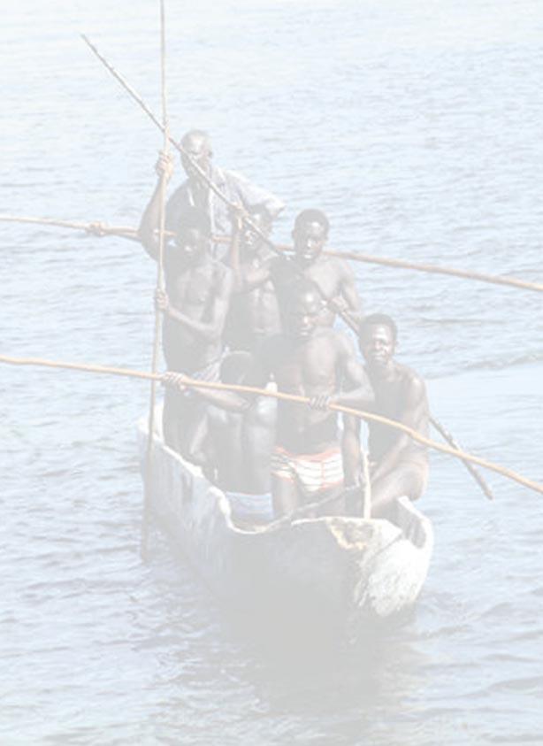
50

 for")

51 COASTAL PEOPLE Most rural coastal communities are very poor. They are directly dependent on coastal and marine resources the sea, intertidal marine systems, and forests for survival and income. As a consequence they are also vulnerable to environmental change. Their economy is mainly subsistence comprising of smallholder farming, subsistence forestry, artisanal fishing, lime and salt production, seaweed farming, livestock husbandry and handcrafts. Poverty Facts in the Coastal Zone The rural poor in coastal areas depend heavily on communally held natural resources and linked ecosystems (fish, seagrass, mangroves and other aquatic products) for survival and income. Fish caught by local small-scale fishers provides up to 90 percent of the animal protein in coastal communities. Sustainable yields from small-scale fisheries are critical to food security and reduced vulnerability. Small-scale fisheries employ about 42,500 of the nation s 43,000 marine fishers. If the fishery disappears from people that have little or no access to other resources, they will become poor in all aspects. When natural resources are lost or irreversibly degraded, the future of the poor is severely put at risk. Poor performance of agriculture and fishing is of major concern for food security and is considered a major factor that fuels rural-urban migration. Adding to vulnerability, is the fact that most coastal villages in Tanzania are situated on land that is made up of coral rag where soil and hydrology are poor. In many rural villages, fish caught by small-scale fishers provides over three-quarters of the animal protein. The cumulative and persistent impact of human activities and resource use can damage the very natural systems that people depend on. Sustainability of resource use and harvesting must be achieved in order to preserve coastal and marine ecosystems for future generations. Addressing the issues associated with poverty, the environment and the use of natural resources is critical in Tanzania. Despite significant economic growth in recent years, most rural coastal communities are very poor. 43

52 COASTAL POPULATION GROWTH COASTAL POPULATION GROWTH The rate of population growth on the mainland coast and Zanzibar differs from Region to Region as can be seen in Table 1. On the mainland, the average rates of growth for the period 1988 to 2002 range from 4.3 percent recorded in Dar es Salaam Region to 1.4 percent in Lindi Region. In Zanzibar the average rates of growth for the period 1988 to 2002 ranges from 4.5 percent recorded in Urban West to 2.1 percent recorded in South Unguja. The Regions that show highest rates of growth are dominated by large urban areas (e.g., Dar es Salaam and Zanzibar Town). 44 Fig. 1: Population density by region (persons people per sq. km), (Source: Tanzania National Website) The Tanzanian coastal region comprises 13 Districts in five Regions on the mainland and five Administrative Regions in Zanzibar. The coastal population is relatively large, mostly concentrated in Zanzibar and the urban areas of Tanga, Dar es Salaam and Mtwara. The 2002 Population and Housing Census shows that 23% of the Tanzanian population (8 million) resides along the coast. COASTAL PEOPLE Apart from Dar es Salaam and Coast Regions, whose rates of population growth are 4.3 percent and 2.4 percent respectively, the growth rates in the other coastal Regions are well below the mainland average of 2.9 percent. The average growth rate on Zanzibar is 3.0 percent. South Unguja and Urban West are the only two Administrative Regions that exceed the average (3.1 and 3.8 percent, respectively). The population density in Tanzania varies greatly from Region to Region. People are particularly concentrated in Dar es Salaam Region (1793 persons per square kilometre) and Urban West (1700 persons per square kilometre). The other four Regions of Zanzibar are also relatively densely populated. By contrast, population density is only 12 persons per square kilometre in Lindi Region. Coastal Region/District Population (Number) Growth Rate ( ) Population Density Tanga 1,642, Coast 889, Dar es Salaam 2,497, Lindi 791, Mtwara 1,128, Total Mainland Coast 6,948, North Unguja 136, South Unguja 94, Urban West 391, North Pemba 186, South Pemba 176, Total Zanzibar 984, Total Tanzania 34,569, Fig. 2: Population Data in Tanzania. (Source: 2002 Population and Housing Census, National Bureau of Statistics, Government of Tanzania) In the urban a r e a s, extremely rapid population g r o w t h combined with p o o r management has lead to the rapid and extreme degradation of coral reefs, shoreline change and deforestation.
53 ACCESS TO SOCIAL SERVICES In the vicinity of high population areas, shallow reefs are almost completely destroyed. The large urban demand for resources from the coast also exerts pressure on the natural environment along the entire coast. For example, the urban demand for timber, poles for construction and charcoal for fuel, ornamental shells, lobster, crabs, octopus and all types of fish products is a driving force of growing resource exploitation in rural areas. ACCESS TO SOCIAL SERVICES Poverty has both income and non-monetary dimensions. This highlights the idea that development must be people-centred to be sustainable and include the human dimensions of development such as participation in decision making, human-health, education, vulnerability, food security, co-operation, trust and equity. State of the Coast 2001 assessed the condition of the human environment in coastal Tanzania and found that a large proportion of the population lived at very low levels of welfare. The level of per capita income, health, nutrition, accesses to safe water, education, and basic infrastructure was very low, especially in rural areas. Average per capita income in most rural coastal villages does not exceed $US100. This situation has not significantly changed. The National Bureau of Statistics conducted a major household budget survey (HBS) in The survey results confirm that income poverty is high and social indicators show high levels of non-income poverty. Nation wide, only 12% of households have electricity (only 2% in rural areas), 6% have a bank account, 25% have modern walls and for 45% of households, drinking water is more than 1 km away. A quarter of Tanzanian adults have no education and 29% can neither read nor write. Women are about twice as likely as men to have no education. One of the rural regions that is consistently most disadvantaged is Lindi. Tanga Coast (Pwani) DSM Lindi Mtwara K jaro Kagera Tanzania mainland EDUCATION Adult men without education (%) Adult women without education (%) Primary school net enrolment ratio Mean distance to primary school (km) Mean distance to secondary school (km) HEALTH % who were ill 4 weeks prior to survey % households within 6 km of health facility Mean distance to hospital (km) WATER % households with piped/protected drinking water % households within 1 km of drinking water (dry season) Fig. 1: Social Indicators for Mainland Coastal Regions compared to Kagera and Kilimanjaro Regions and Tanzania Mainland. (Source: Household Budget Survey 2000/01, National Bureau of Statistics, Government of Tanzania) COASTAL PEOPLE 45
54 ACCESS TO SOCIAL SERVICES 46 One of the causes of continued poverty in rural areas is the state of poor infrastructure and social services roads, water supply, electricity, telecommunications, schools and health centres. Tanzania s development depends on improved basic infrastructure and a welleducated and healthy population. The table below highlights selected social indicators for the mainland coastal Regions compared to the relatively more endowed Kagera and Kilimanjaro Regions and the overall situation for Tanzania mainland. Water and sanitation services in the Dar es Salaam urban area are growing social and environmental problems. The 2000/2001 Household Budget Survey reports that 85% of the city s population has some kind of access to piped water supply. However the service is erratic; most households have service for less than six hours per day. Over 45% of households in the Dar es Salaam urban area buy water from neighbours, tanker trucks or from street vendors. This has led to the development of a thriving water industry. Only 10% of the city s population has sewerage service. The sewerage network in place is old and worn, dating to The bulk of the population (about 90%) is dependent on on-site sanitation systems comprising mainly of traditional pit latrines and to a smaller extent septic tanks and soak-pits. The existing pit emptying services are inadequate to cope with demand, especially in areas with a high groundwater table and/or poor soil conditions. Overall, the HBS finds that many measures of welfare show modest improvements over the past decade. The economy has diversified and How the Poverty Line is Drawn The food poverty line is the minimum spending per person needed to provide 2,200 calories a day for one month, based on the foods consumed by the poorest 50% of the population. A higher, basic needs poverty line allows for other essentials such as cloths. In 2000/01, the food poverty line was 5,295 Tshs. The basic needs poverty line was 7,253 Tshs. household consumption has increased. The percent of adults whose primary activity is agriculture decreased from 73 to 63 percent. The proportion of the population that is poor has fallen slightly, COASTAL PEOPLE although absolute numbers have risen due to population growth. Many improvements have been concentrated in urban areas, particularly Dar es Salaam, while they have been more limited in rural areas. Poverty remains overwhelmingly rural 87% of the poor live in rural areas. The percentage of rural population in food poverty and basic needs poverty dropped over the last decade, but remains high (20% below the food poverty line; 39% below the basic needs poverty line). This data reconfirms the compelling need to focus on reducing poverty in rural areas. Rural areas are especially deficient in basic infrastructure and services such as electricity, communications, adequate health care and education, potable water and other social services. The Household Budget Survey found that women have lower incomes than men. The proportion of households headed by women has increased during the 1990s, although they are no poorer than households headed by men. In terms of health, there are some important gender differences. Table 2 illustrates the greater prevalence of HIV/AIDS in women compared to men. Health differences such as these affect women s productive capacities, freedom of association and action and their general well being. Region Coast DSM Lindi Mtwara Tanga National Sex Year Male Female Male Female Male Female Male Female Male Female Male Female Fig. 2: Prevalence (%) of HIV infection among blood donors (Source: Health Statistics Abstract Ministry of Health, Government of Tanzania)

55 GENDER EQUITY AND COASTAL MANAGEMENT Interest in gender equity in coastal resource management has increased dramatically with growing concern about the need to eliminate poverty and to ensure sustainable development that is both fair and equitable. A gender perspective in conservation and poverty alleviation helps to reveal the roles and contributions of women and shows the need for their full involvement, as well as the obstacles to their participation that must be addressed if equity is to be achieved. Inequities in rights and entitlements influence the degree to which women or men are exposed to the risk of impoverishment and their abilities to respond or cope with respect to resource use and management. The persistence of gender-related institutions and processes of subordination and domination indicate that forms of discrimination and unequal benefit from coastal management efforts still exist. Key genderrelated processes that shape an individual s opportunities to benefit from coastal management efforts include: division of labour, resource ownership, rights and entitlements. These aspects also influence the degree to which women or men are exposed to the risk of impoverishment and their abilities to respond or cope with respect to resource use and management. a)division of labour: Most activities related to coastal livelihoods do not have strict gender based boundaries, except for fishing and activities such as carpentry that men predominantly do and activities for daily household upkeep and collecting small shrimp and sea shells that are predominantly done by women. In fishing activities, women r e m a i n predominantly Fig. 1: Somanga women processing the fish catch. GENDER EQUITY AND COASTAL MANAGEMENT employed in post-harvest activities (small- scale fish processing and marketing), which is one of the key sources of cash income and daily household maintenance, as some men take up some of the traditionally female activities such as fetching and selling fuel wood. In terms of the ratio of working hours between women and men, women do have a heavier time burden than men, and the opportunities for recreation or resting are more limited for women (wives) than they are for men. b)property and resource ownership: Inheritance is an important source of property acquisition, but gender based discrimination influences control and ownership of productive assets and resources between women and men. This aspect has to-date influenced participation in certain activities according to gender attributes. Poverty however, has limited the opportunities people may have since many families nowadays do not have anything of value to give sons, and even less to daughters. c)rights and entitlements: Inequality in decisionmaking power over household and community processes is increasingly being challenged by empowerment strategies and economic opportunities targeted for women. The development of education remains skewed reflecting the gender differentiation in education qualifications throughout the country. Professional training and higher education more women in teaching and related professions than in technical and engineering related courses. These aspects continue to influence gender equity in resource utilisation and management, security of livelihoods. Women s time burden, limited access to resources and productive assets, credit and other discriminatory processes has limited their ability to access or to take advantage of economic opportunities. They have limited sources of capital and access to credit mostly because of low education and awareness. Coastal communities are increasingly accepting women s presence and active participation in resource management and decision making processes. Women s representation in local management processes and structures has improved in some places. The proportion of women in resource management bodies is about 40 percent in the coastal villages that are part of the Tanga Coastal Zone Conservation and Development Programme. In Bagamoyo, the proportion is 30 percent. COASTAL PEOPLE 47
56 COASTAL PEOPLE IN THE ICM STRATEGY Government policy in Tanzania now routinely applies a gender lens. Gender dimensions in the ICM Strategy are implicit. The Strategy provides the policy framework to mainstream gender equity by encouraging full participation of all stakeholders, democratic processes, and equitable The excitement that women in Songo Songo village (Kilwa District) showed with respect to seaweed farming is notable. Apparently, seaweed has uplifted their economic power and they are catching up fast with men, Dr. Adolf Mkenda, UDSM, Department of Economics distribution of the benefits of r e s o u r c e management. Most coastal conservation and marine protected area initiatives incorporate specific gender equity strategies. These include profiling, monitoring, and assessing gender equity, introducing participatory approaches towards mainstreaming gender into local leadership processes, creation of role models, awareness-raising and training, and more equitable representation in resource management activities at all levels. Examples include: Raising awareness of women s rights through civic education, as in the Zanzibar government s women development programmes Training in income generating activities, basic accounting and resource management, as in the Tanga Coastal Zone Conservation and Development Programme. Establishment of credit programmes for women, as in the Rural Integrated Project Support initiative in Lindi District Enhancing women s empowerment, security, and coping strategies by strengthening livelihood skills and opportunities, as in development of seaweed farming and handicraft industries support economic growth. One of the principles of the Strategy is that coastal development decisions shall be consistent with the government s priority of poverty alleviation and food security. The Strategy is based on the idea that achieving a healthy marine and coastal environment needs to go hand in hand with improvement of livelihood standards of c o a s t a l communities. A balance of development and environmental stewardship is highlighted in Strategy 2, which seeks to promote integrated, sustainable and environmentally f r i e n d l y approaches to the development of major economic uses of the coastal resources to o p t i m i s e benefits. Well At the 2002 World Summit on Sustainable Development, governments around the globe declared that eradicating poverty is the greatest global challenge facing the world today, and an indispensable requirement for sustainable development. The following Government of Tanzania documents outline plans to reduce poverty: The Tanzanian Development Vision: 2025 The National Poverty Eradication Strategy of June 1998 The Poverty Reduction Strategy Paper of October 2000 The Zanzibar Poverty Reduction Plan adopted by the Government of Zanzibar. These documents recognise that the poor in Tanzania are heavily dependent on the environment and natural resources for their livelihood and income generation and therefore, emphasise mainstreaming environmental sustainability into poverty reduction efforts. planned and managed, the economic opportunities available in the coastal area offer the means to improve the livelihood and well being of communities. 48 COASTAL PEOPLE IN THE ICM STRATEGY The National ICM Strategy stresses the need to preserve, protect and develop the resources of Tanzania s coast for use by the people of today and for succeeding generations to ensure food security and to COASTAL PEOPLE Another central idea of the National ICM Strategy is importance of empowering coastal people to use and manage resources sustainably. Strategy 6 seeks to provide meaningful opportunities for stakeholder involvement in the coastal development process and the implementation of coastal management policies. Strategy 7 seeks to build both human and institutional capacity for inter-disciplinary and intersectoral management of the coastal environment.


57 EMERGING ECONOMIC OPPORTUNITIES A diversified portfolio of income and employment opportunities is required in remote coastal areas to reduce poverty, food insecurity, and vulnerability to environmental shocks. This means strengthening existing and fostering new pathways for rural income generation that benefit local communities without degrading the natural environment. There are many new industries being created which involve, in some way, the use of coastal resources. These new businesses provide opportunities for the alleviation of poverty in coastal districts. However, resource use must be monitored to ensure that sustainable practices are being used. In this 2003 issue of the State of the Coast we highlight two promising coastal enterprises that have a significant and expanding impact on income generation, poverty reduction, and conservation in Tanzania seaweed farming and tourism. Sea Cucumbers There are about 1200 species of sea cucumber that have been described worldwide, with about 300 species in shallow water within the Indo-Pacific region. Out of these, 17 species are harvested for the production of bechede-mer. Fig 1: Two different types of sea cucumber. Sea cucumbers are found in large numbers in sheltered shallow water sediments in the tropics. They are commonly seen on tidal flats, in sea grass beds and on coral reefs. Most sea cucumbers are nocturnal, hiding in crevices in the reef during the day, presumably protecting themselves from predators. In Tanzania sea cucumbers are distributed in many parts of the coastline. This fishery is well developed in the coastal areas of Bagamoyo, Dar es Salaam, Mtwara and Zanzibar. Sea cucumbers are a source of food in some parts of the world particularly the Far East. In Tanzania, sea cucumbers are not part of the diet of the local people and instead the resource is collected as a cash crop. The trade is very lucrative and Holothuria atra is the most prized and expensive. Collectors recognise that correct processing of the product is vital to a successful fishery, since the price they get depends on how careful the processing has been. The processed product is called beche-de-mer. 49

58 SEAWEED FARMING SEAWEED FARMING Farming of Eucheuma seaweeds began in 1989 along the east coast of Zanzibar and it has since expanded to many other areas. The socio-economic impacts of seaweed farming have been overwhelmingly positive, providing income to women from poor remote villages. It also represents a source of foreign exchange for the national economy. There are abundant natural habitat areas with good water quality where the industry can expand. It is estimated that this industry employs more than 30,000 people. Women are the primary cultivators of seaweed and the additional income has benefited their families and communities. The increasing importance of seaweed farming is reflected in its dramatic growth, starting from barely 500 tonnes of dry seaweed per year in 1989 to a staggering 7,000 tonnes per year by Between 1993 and 1994 seaweed contributed 15-27% of the Zanzibar export income. Some red seaweeds have a high content of carrageenan, which can be commercially extracted from dried seaweed and used in foods, cosmetics and pharmaceutical products as a gelling, thickening and emulsifying agent. Eucheuma seaweed is one of these and five species of Eucheuma occur naturally along the coast of Tanzania. Until the early 1990s, all exported seaweed from Tanzania was harvested from naturally growing species. Fig. 1: Products made with carrageenan. Marine scientists from Tanzania systematically investigated the carrageenan content of Eucheuma in Tanzania and then pioneered the introduction of Eucheuma farming techniques, especially among women in villages in eastern Zanzibar. Foreign commercial interests also played an important role in developing production and markets. However, with changing demand and market prices there has been a significant shift from production of spinosum to cottonii in recent years. In coastal mainland Tanzania, cottonii is now almost exclusively farmed, being grown in coastal villages in all coastal Regions. The price paid to seaweed farmers is about US$400 and US$1000 for a metric tonne of dried spinosum and cottonii, respectively. Seaweed culture has the advantage that the technology is simple and has been demonstrated as easily adoptable by villagers. This form of aquaculture does not pollute the environment with feeds, wastes or other chemicals. There are some negative interactions causing inhibition of surrounding biota, but they appear to be relatively mild. Two methods are commonly used in seaweed farming. There is the pole and line method whereby fronds of Eucheuma are tied to strings stretched between wooden pegs. This is applicable in shallow waters, such shallow intertidal lagoons inside the fringing reefs. The other method involves floating lines and rafts that are used in open waters. The fixed, offbottom method is presently the most common technique used. Eucheuma seaweeds normally grow at an impressive rate of 4-12% per day. Depending on growth rate, the crop may be harvested after 1-2 months. Fig. 2: Seaweed farm with pole and line in an intertidal zone. Challenges and Opportunities for Growth 50 Two species of Eucheuma are under cultivation in Tanzania, Eucheuma cottonii and Eucheuma spinosum. Initially, spinosum dominated farms in Unguja and Pemba and some parts of coastal mainland Tanzania. EMERGING ECONOMIC OPPORTUNITIES Despite the rapid spread of the technology, there is room for improvement. Quality of existing harvests of both spinosum and cottonii can be improved if technical assistance is given to the farmer. Spinosum is easy to
 but is more difficult to grow. It is more sensitive to temperature and heavy rains.")
59 Fig. 3: Seaweed is laid out to dry outside under the sun. grow and can be cultivated year round, but prices are low (about 70 Tsh per kilogram). Cottonii has a higher price (about 280 Tsh per kilogram) but is more difficult to grow. It is more sensitive to temperature and heavy rains. Currently, most technical and marketing assistance, as well as the materials for start-up, are provided by the seaweed marketing companies (such as C-weed, Zanea and Zascol). Lack of knowledge on care of seed stock and lack of equipment, such as lines, are problems in many locations. Prices for dried seaweed are also highly variable and outside of the control of small producers who have no market power. A few multinational corporations control the market for carrageenan. The major importers of Eucheuma are corporations based in Denmark, UK and USA. Despite increasing demand and market price for carrageenan, the prices paid to primary producers of the seaweeds containing carrageenan have continued to fall. The seaweed industry in Tanzania only involves primary production and not processing where the bulk of the value-added product is generated. At present, the level of production is too low to make it economically feasible to invest in processing plants. To illustrate the importance of secondary processing, consider that the retail value of a kilogram of lower grade carrageenan products ranges from about $50 to $30, in stark contract the price paid to seaweed farmers COASTAL TOURISM Reducing environmental dependency and enhancing livelihoods. A diversified portfolio of income and employment opportunities for resource dependent people is required to reduce poverty and vulnerability to environmental shocks and food insecurity. This means strengthening existing and fostering new pathways for rural income generation that benefit local communities without degrading the natural environment. in Tanzania for a kilogram of dried seaweed is about $0.09. Persistently fluctuating and falling prices of dried seaweed have compelled many farmers to abandon farming altogether. Reliable marketing channels are sometimes also a problem. In Lindi and Mtwara Regions seaweed farmers had to wait for up to three years before an intermediary buyer appeared. Beset with the same frustrations, farmers at Mjimwema and Ununio villages in Dar es Salaam region and Mlingotini in Bagamoyo suspended seaweed farming efforts until marketing problems were solved. Promotion of alternative income-generating options to reduce pressure on overexploited inshore fisheries is often part of marine conservation and integrated coastal management strategies. The strategy is summarised by a quote from a specialist working with the national ICM program in the Philippines: Seaweed farming helps protect our remaining coastal resources by building up other marine life and providing alternative livelihood for coastal fishermen, who might have otherwise resorted to cyanide and dynamite fishing. -Sun Star Manila, February 25, 2000 The importance of income generation and poverty reduction in rural coastal communities makes alternative livelihood strategies, such as seaweed farming, an important component of marine protected areas and integrated coastal management. Promoting income-generating businesses as part of communitybased coastal management also improves community interest and participation in conservation projects, and therefore the likelihood of success. COASTAL TOURISM Tanzania is internationally renowned for its terrestrial parks and wildlife safari tourism. The wildlife resources of Tanzania rank among the finest in the world and EMERGING ECONOMIC OPPORTUNITIES 51

60 COASTAL TOURISM include the Serengeti Plain, Ngorongoro Crater, Lake Manyara and Mt. Kilimanjaro. The tourism industry is already a major source of foreign exchange, accounting for about 16% of national GDP, and nearly 25% of total export earnings. The total number of tourists grew from 153 thousand in 1990 to over 500 thousand in At the same time, the value of foreign currency earnings grew from US$65 million to $US725 million. With a conservative annual growth rate of 7%, it is projected that the country will reach one million tourists entering the country per year by The size and income from coastal tourism is smaller, but with tourist numbers increasing to near-capacity levels in terrestrial parks, leaders in the industry see a future shift to tourism expansion and diversification along the coast. The draft National Integrated Tourism Master plan points to coastal areas as having strong potential for tourism growth. The natural, cultural, and historical heritage of Tanzania is what makes coastal and marine sites attractive to international tourists it is therefore what must be managed in a sustainable way. The goal of the National Integrated Tourism Master plan is to provide a policy framework for integrated planning and a means to ensure environmentally, economically, and culturally sound development. Kilwa Kilwa District sees tourism as the engine of growth, revenue generation, and poverty alleviation in its future. If this occurs, it will be a stark change from its present status; it is estimated that only about 400 international tourists currently visit Kilwa each year. One of the few hotels catering to international tourists is the Kilwa Ruins Beach Resort. Like most rural tourism resorts in Tanzania, it is small and can accommodate fewer than two dozen guests. There are many reasons for the high expectations for tourism and economic development in Kilwa. Archeological and historical richness are one reason. Kilwas was designated by UNESCO as a World Heritage Site in The coastal ruins include mosques, forts and palaces of early traders. Kilwa was a famous and prosperous city in East Africa from the 14 th Century all the way through the mid-19 th Century. It was occupied as early as the 10 th Century and by the time the Portuguese arrived in 1498, it was a large town that derived its wealth from gold trade with the African interior. The city was a main portal to the Middle and Far East during medieval and pre-colonial times. Many of the ruins can be visited today. A UNESCO and French government project has recently begun to renovate and preserve the Great Mosque, palace and other historical structures on the island of Songo Mnara. A Steering Committee on the management of the World Heritage Sites meets every month. Fig. 1: The Kilwa Gereza, oneof the ruins which makes up the world heritage site. The nearby Selous National Wildlife Reserve, Mozambique wildlife corridor, the longest cave system in Tanzania, hippo pools, beaches, sport fishing, and coral reef diving are other reasons to stay in Kilwa. Like Mafia Island, the marine and coastal ecosystem of the area is characterized by abundant and diverse coral reefs, seagrass beds, extensive mangroves, inter-tidal flats and highly productive marine fisheries. The Kilwa District Council and Tanzania Coastal Management Partnership have been working together to develop a tourism management plan. There are plans to train local people at the Kilwa Community Development College to be nature guides, and to construct a tourist information center. There is also a community-based ICM program under the Pew Fellowship Award of Magnus Ngoile, Director General of the National Environment Management Council. The District Council is also quite actively pursuing the legal designation of a Marine Protected Area in Kilwa coastal waters. It is hoped that increased electrical service following increased energy supply from the Songo Songo natural gas fields will provide a boost to the local economy in terms of tourism growth and other small enterprises. In addition, the road to Kilwa from Dar es Salaam is currently being worked on with completion planned by 2004, and recently a small commercial airline company in Dar es Salaam has introduced air service to Kilwa on a regular basis. 52 EMERGING ECONOMIC OPPORTUNITIES

61 COASTAL TOURISM A large proportion of total hotel beds and tourist resorts along the coast are currently located in the Dar es Salaam region, Bagamoyo district, and Unguja Island, Zanzibar. Located close to major urban areas, hotels in these locations serve domestic, international, business, and holiday tourism. Limited hotel facilities with a mainly domestic demand are also found in other urban areas such as Mtwara urban area, Tanga, and Kilwa. Clusters of hotels and lodges that provide nature-based tourism with a market that relies primarily on international travellers are found in Pangani, Zanzibar Islands, Mafia Island, and Kilwa. These hotels and lodges offer tranquillity, beautiful beaches and natural environment, sport fishing, diving and snorkelling, culture and history, and archeological sites. economic and social fabric of the islands of Zanzibar, especially on Unguja Island, the main port of entry and location of Stone City. The history, culture, architecture, beautiful natural environments, and other facets combine to make Zanzibar a popular international destination. In 1986 the Zanzibar government identified tourism as a major target for investment and engine for economic growth. From 1986 to 1996 the total number of arrivals increased from about 23,000 to 69,000. Today, tourism infrastructure is well developed. Several small airlines provide direct service from Dar es Salaam and Kilimanjaro, which are the main points of entry A cluster of three small and one medium sized resorts within the boundaries of the Mafia Island Marine Park draw travelers to the natural environment and unchanged rural, traditional culture. Mafia Island and its chain of small islets lie approximately 20 km offshore from the Rufiji river delta. The Mafia Island geographical region is one of the finest complexes of estuarine, mangrove, coral reef and marine ecosystems in the world. It has been recognized internationally as a critical site for biodiversity. The waters around Mafia include a tremendous diversity of representative tropical marine habitats including coral reefs, seagrass beds, mangroves, inter-tidal flats and contain nesting grounds for globally endangered sea turtles (90 sea turtle nests were counted this year). It is one of the few remaining reef complexes within Tanzania s coastal waters in relatively intact condition. The productivity of the Mafia Island ecosystem is due partly to the supply of nutritional substances at the base of a complex food chain flowing from the Rufiji delta, one of the largest delta systems in Africa. The scope for large-scale tourism growth is limited in many places by remoteness poor, and sometimes impassable roads and limited service by air. Investments in infrastructure combined with international marketing and supportive public policies would need to come together if international tourist travel to coastal areas is to expand as it has it other important tourist destinations around the world. The most popular coastal destination in Tanzania for tourism is currently Zanzibar. In the last decade, the tourism industry has grown to be a central part of the Fig. 2: Beach front hotels in Zanzibar. into Tanzania for tourists. There is also a reliable and frequent service of high-speed ferryboats that leave from the port of Dar es Salaam and take just over an hour to reach Zanzibar town. Tourism brings income to the local economy not only through hotels and resorts, but also though island tours, boat expeditions, diving and snorkelling, gift shops, restaurants, bars and night clubs, and more. It boasts varied attractions including tours of spice plantations, Arab buildings from pre-colonial times, artefacts from the slave trade, the vibrant Swahili culture and art of Stone Town, snorkelling and white sand beaches and the Jozani Forest Reserve. These attractions are well publicised by the multitude of hotels which cater mainly to international tourists. There are large luxury resorts as well as smaller guesthouses, providing lots of choice to visitors. Additionally, there are many restaurants and shops EMERGING ECONOMIC OPPORTUNITIES 53

62 COASTAL TOURISM Chumbe Island Coral Sanctuary Chumbe Island is a privately managed nature reserve located 8 miles southwest of Zanzibar town. The island and fringing reef on the West side are a rare example of a still pristine coral island ecosystem in an otherwise heavily over fished and over exploited area. Chumbe has at least 90 percent of all coral species that have ever been recorded from Eastern Africa. Nearly 380 species of fish, belonging to 50 families have been recorded, including Giant Groupers (up to 1 m length), a rare occurrence in shallow reefs. The rich fish life has attracted seabirds, such as the rare Roseate Terns. The rare Robber or Coconut Crab is common on Chumbe, while it is threatened elsewhere in the Indian Ocean. Fig. 3: Chumbe Island helps conserve the critical coral reef habitats. The island was not inhabited and fishermen did not heavily use the surrounding waters. One of the reasons is the distance from Unguja. Another reason is that the western end of the island had for decades been more or less offlimits because of its close proximity to the shipping channel of larger vessels traveling between Zanzibar and Dar es Salaam. The island has one of the few lighthouses on the coast and had a military base, which used the area around Chumbe for shooting range exercises. In 1994 the Zanzibar Government gazetted the reef as the Chumbe Reef Sanctuary, and licensed the island and reef to be managed by a private company, Chumbe Island Coral Park, Ltd. (CHICOP). At the same time, the island s coral-rag forest was declared a closed forest by the government of Zanzibar. The island itself covers a small area approximately 20 hectares. The protected area zone reaches 300 m off the West side of the island where no fishing or scuba diving is allowed. CHICOP was established by a former development worker from Germany, who was impressed with the island s biodiversity and wanted to try a new model of conservation that wasn t completely reliant on outside donor funding. The company holds a 33-year lease of 2.5 ha of cleared land and a 10-year management plan for the Chumbe Reef Sanctuary signed between CHICOP and the Ministry of Agriculture, Livestock and Natural Resources. When the contract expires, the Zanzibar government has the option of canceling the lease. An advisory committee representing the relevant ministries, the Institute of Marine Science, and local village chiefs was established and is still a focal point for discussions on park management. The goal of the company is conservation of the reef and island and related to this is the desire to further an understanding of the ecological importance of the reefs. Since it is privately financed it must, of course, be financially viable in the long run. An ecotourism resort is the sole revenue-generating component of the project. There are 7 bungalows on the island allowing a maximum of about 14 overnight guests (and a number of staff, who have their own housing on the island). The bandas are constructed specifically to be environmentally sensitive, with solar electricity, solar water heating, rainwater catchment systems, gray-water recycling through filtration irrigation, and composting toilets. Both day and overnight stays are allowed on the island, although the total number of guests is limited to fourteen people. The fee for a day trip to the island is about US$70 per person. To market itself, CHICOP has used a strategy that includes recognition by the international conservation community, international environmental awards and targeted marketing over the Internet. Besides limiting fishing in the exclusion zone near the island, CHICOP also manages the protected forest on the island and an Aders duiker re-introduction and sanctuary program. Nature trails have been developed and an environmental education visitors center was built on the island. During the off season, local school children are brought to the island to participate in marine education programs. CHICOP has helped to develop information brochures, marine environmental education material for local schools, and has created floating information panels on reef organisms. The CHICOP leaders hope to get the program incorporated into the regular school-curriculum. The company also welcomes researchers who want to carry out conservation studies. Chumbe has been the site of fieldwork on sea urchin densities, macro algae abundance, factors influencing fish movement, and coral transplantation. Reef monitoring has shown that protection has been effective. Both the quantity and diversity of fish stocks have 54 EMERGING ECONOMIC OPPORTUNITIES

63 COASTAL TOURISM increased. Six former fishermen from adjacent villages have been trained as park rangers and posted on the island. They enforce the boundaries through explaining the area to trespassing fishermen, or in extreme cases, reporting them to local officials. They have played an important role in raising awareness among fishermen from neighboring villages. The company actively encourages the employment of women, giving equal opportunities to both genders as they hire cooks, waiters, or environmental educators. The company purchases food and other materials (e.g. building materials for the bandas) from local villages. The relationship with adjacent villages seems to be stable and the CHICOP staff perceives the villagers benefit from the program. The funds generated through tourism pay for all costs of operation, including sanctuary enforcement, conservation program, and environmental educational activities. Funding still remains a concern. Increasing publicity has helped the hotel to get more visitors, but it still runs at about 40 percent capacity and has not yet paid off the initial investor. About two thirds of the project s investment costs (about US$1 million) were funded privately. Several donors have supported some of the project s activities. Additionally, over 30 volunteers from various countries have taken part in the project since it started. through which income is obtained, but which also provide a welcoming atmosphere. Perhaps most important are the tour operators who have pre-planned trips to offer tourists, such as tours of the entire island, day trips to ruins such as Fig. 4: Giant tortoise on Prison Island in Zanzibar. Kizimkazi which was the site of a mosque built in 900 and Prison island which offers white sand beaches, ruins of a slave house and giant tortoises. Travel to and from Zanzibar is also well developed with many small airlines providing direct service from Dar es Salaam and Kilimanjaro, which are the main points of entry into Tanzania for tourists. There are also a number of boats which leave Dar es Salaam several times a day and take about an hour to reach Unguja. In short, the infrastructure for tourism is well developed for Zanzibar, providing visitors with many activities Fig. 5: Many large passenger boats travel between Dar es Salaam and Zanzibar each day. and places to see, well-organised means of transport, a multitude of places to stay and eat, many opportunities for shopping, and easy transportation to and from the island. However, there are a few factors which, if not controlled, could lead to Zanzibar becoming a less popular place to visit. For example, because the industry is one of the main focuses on the island, there are a lot of individuals for whom tourism is their sole income. This can lead to excessive pushiness by vendors and drivers can detract from the experience. Furthermore, political stability is key to the continued interest in Zanzibar. Pemba Island is significantly less developed than Unguja. However, it also has many historical monuments, such as a 14th century mosque, and the Ngezi Equatorial Forest which contains many rare tree species. The infrastructure is much less developed and the island receives far fewer tourists than Unguja each year. On both islands, tourism is a boon to the coastal communities, offering another source of income that may in some cases be greater than traditional fishing EMERGING ECONOMIC OPPORTUNITIES 55
64 COASTAL TOURISM Mnemba Island Marine Reserve Mnemba island, located off the northeast coast of Zanzibar, has an area of approximately 150 hectares and houses Mnemba Island Lodge, a high-end luxury resort. The island is managed by Conservation Corporation Africa (CCA), a South African Company founded in 1990 whose goal is to make conservation pay for itself with high income, low impact tourism. Mnemba is surrounded by an extensive coral reef and it is an important nesting ground for sea turtles. There is a nofishing protected area zone that extends 200 meters offshore surrounding the island. Mnemba Island Lodge and protected area was established in CCA currently has a 33-year renewable lease for managing the island and is responsible for managing the protected area. In November 2002, the company s area of management was expanded to include the marine protected area covering the coral reefs surrounding the island. Before then, the island had a small patch (about 1 km 2 ) of protected area. Fig. 6: The Mnemba Island Marine Reserve protects sea turtles like this Green turtle. Only guests of the hotel are allowed on the island itself, and hotel guards monitor the waters surrounding the island to make sure there is no intrusion into the exclusion zone. When incidences of illegal fishing are recorded, the hotel cannot enforce regulations itself, but guards take pictures and bring them back to local village leaders to try to obtain compliance. Chumbe Island Lodge is hoping to help establish a community NGO that will assist in patrolling the reef for illegal fishing and will obtain revenues based on a small tourist fee. The hotel bandas are environmentally sensitive. The company s goal is to leave as small a foot print as possible. Hotel guests receive an environment guide and information about the community work that CCA is involved in. CCA supports research on coral reefs and endangered species. There is for example an effort to tag and monitor turtles that lay eggs on the island. In 3 years over 250 nests have been identified and about 30 turtles have been tagged. Another research project is testing a fish aggregation device to promote fishing effort off the reef and in deeper water. CCA hires most of its personnel (rangers, gardeners, cooks, cleaners, etc.) from local communities and has sent some people to training at their more established lodges whereas others have been mentored on site. Beginning in November 2002, CCA has been charging a $1 fee for divers visiting the reef. During high season (June March) the reefs can be visited by as many as 300 persons per day. Proceeds are deposited into a community fund; so far all the money has gone into funding patrolling efforts. However, as the fund grows CCA managers are planning to distribute it to four adjacent villages through a program in which the communities will be able to decide themselves how to use the funds. Mnemba Island Lodge also works with nearby coastal villages in small development projects including schools, a health clinic, and a windmill water pump for irrigating a small vegetable garden. Money for community projects does not come from CCA itself, but from the Africa Foundation, which is a separate donor foundation affiliated with CCA projects. Part of the profits made through the Mnemba lodge (and all lodges run by CCA) is given to the Foundation. The Mnemba hotel management meets with villages to help them write proposals to receive funds for small projects. Up to June 2003, villages had received $36,000 for development projects from the Africa Foundation. 56 or farming. However, more controls need to be set up to ensure the safety of visitors and the continued protection of the marine environment. The local communities can and should be involved in these processes, ensuring their continued participation in the tourism industry and also in the protection of the environment. This is also true of tourism on the mainland; sustainable development and environmental protection is necessary for visitors continued interest in Tanzania. EMERGING ECONOMIC OPPORTUNITIES Linkages to Conservation Coastal tourism can have negative as well as positive impacts to local culture, quality of life, and the environment. For example, tourist and economic growth can bring many new pressures and outside influences on people and resources. Loss of access to beaches and fish landing areas is a frequent impact felt by villages that rely on the sea for livelihood. Loss of
65 ECONOMIC OPPORTUNITIES IN THE ICM STRATEGY beach access was an impact of hotel development in Bagamoyo. In Zanzibar, greater demand for fish is said to raise prices, leading to greater fishing effort including the use of destructive fishing practices. At the same time, the availability of fish in the diet to local people falls because of the high price and reduced abundance of fish from over harvesting. Similarly, population and economic growth in Zanzibar town are driving forces behind high extraction rates of wood from island forests. It is estimated that the annual extraction of wood on Unguja is four times the allowable amount of 8,000 cubic meters. Demand of wood fuel in Zanzibar town is the driving force: 85% of the households in the Zanzibar urban area use fuel wood and charcoal for cooking and heating. Wise tourism development can reduce its unintended side effects. It can also directly work for local community development and marine conservation. Every tourist that enters the Mafia Island Marine Park to stay at one of the four resorts pays US$10 per day. These revenues go toward funding marine park conservation efforts. MIMP has collected about $60,000 in entry fees over the last 3 years. The Menai Bay Conservation Area on Zanzibar is a popular tourist destination for dolphin viewing and boating excursions. Local officials are empowered to collect a $2 per person visitor fee from tour operators to support conservation. ECONOMIC OPPORTUNITIES IN THE ICM STRATEGY The National ICM Strategy is based on the idea that by applying the principles and practices of ICM, the benefits of sustainable coastal development can be realised. Sustainable development and economic opportunities within the coastal area are urgently needed to improve the well being and livelihoods of the resident coastal population. The Strategy articulates principles and strategies related to simultaneously building livelihood opportunities and protecting the environment. Two key principles of the National ICM Strategy relate directly to the development of emerging economic opportunities. One states that Integrated approaches to the development of major new economic uses of the coast shall be promoted to optimise benefits and minimise negative impacts. The other states that Development and conservation interests shall be balanced by promoting areas of high biodiversity and cultural/historic importance and identifying and steering large-scale economic developments to suitable areas. These principles are very relevant to the future management and growth of coastal industries such as tourism and seaweed farming. International tourists visiting natural areas tend to have relatively high conservation values and are often willing to contribute to local conservation if there are innovative schemes in place to do so. Volunteer monitoring of coral reefs and illegal fish practices is one example. In both the KICAMP program in Kilondoni District and on Mafia Island, tourists have been engaged in monitoring. On Mafia Island, two tourist lodges have agreements with MIMP to monitor illegal seine net fishing through their guests when they go on the water. Private sector ecotourism can even be a means to support protected area management and alternative to protection by the government. This alternative has experienced a good deal of attention and support for terrestrial wildlife conservation on the mainland. Two examples from Zanzibar provide insights to how it can work in coastal and marine areas they are the Chumbe Island Coral Santuary and Mnemba Island Marine Reserve (see text boxes on previous pages). The economic opportunities available in the coastal area, both large and small scale, can improve the livelihood and well being of the communities if planned and managed sustainably. Strategy 2 in the National ICM Strategy provides for integrated, sustainable and environmentally friendly approaches to the development of major economic uses of coastal resources to optimise benefits. Tourism, mariculture, mining, fisheries and other industries are expected to expand along parts of the coast. The National ICM Strategy gives the mandate to national government bodies to work with relevant sectors to develop integrated and sustainable approaches to coastal economic development. This includes permitting and development guidelines, such as have been developed for mariculture and coastal tourism. EMERGING ECONOMIC OPPORTUNITIES 57

66
67 THE WAY FORWARD In this edition of State of the Coast we have presented information from new studies conducted or published in the last two years. However, scientific research in Tanzania has not caught up to the need for information. In order to develop resources sustainably, information must be available about the state of the resources, the severity of impacts from different activities and how long an ecosystem takes to recover from depletion. In order to gather this information, baseline data about ecosystems and other resources must be gathered. However, long-term monitoring is also required to ensure that the environment remains in good health. Involving villagers in this process will help to ensure both that the monitoring takes place and also promote a sense of ownership, giving further incentive to conserve the resources. Furthermore, the data must be collected from all parts of the coast, compiled in a database and be made available to the public. This data will provide a basis for making important decisions about creating sustainable systems of resource use and also deciding when ecosystems should be conserved to ensure their continued existence. Furthermore, studies should be conducted on degraded ecosystems with the hope of finding ways to restore their health. For example, transplanting techniques may be useful for restoring coral reefs or seagrass beds. On the other hand, perhaps breeding animals in captivity, as is done in other inland ecosystems, would help increase sea turtle or dolphin populations. Again, this information is necessary to be able to ensure the continued existence of valuable resources. Without this vital information, we continue to deplete resources and degrade ecosystems. This means a loss in income, such as was seen during the 1990s in the Zanzibar fishery. Not only will these primary industries be lost, but income from tourism will also disappear since the natural attractions will be gone. However, at this time the much-needed monitoring and assessments have not been taking place. We recommend, therefore, that further monitoring and assessment studies be undertaken in order to allow the continuing publication of a biannual State of the Coast which can provide up-to-date information for decision-makers. 59
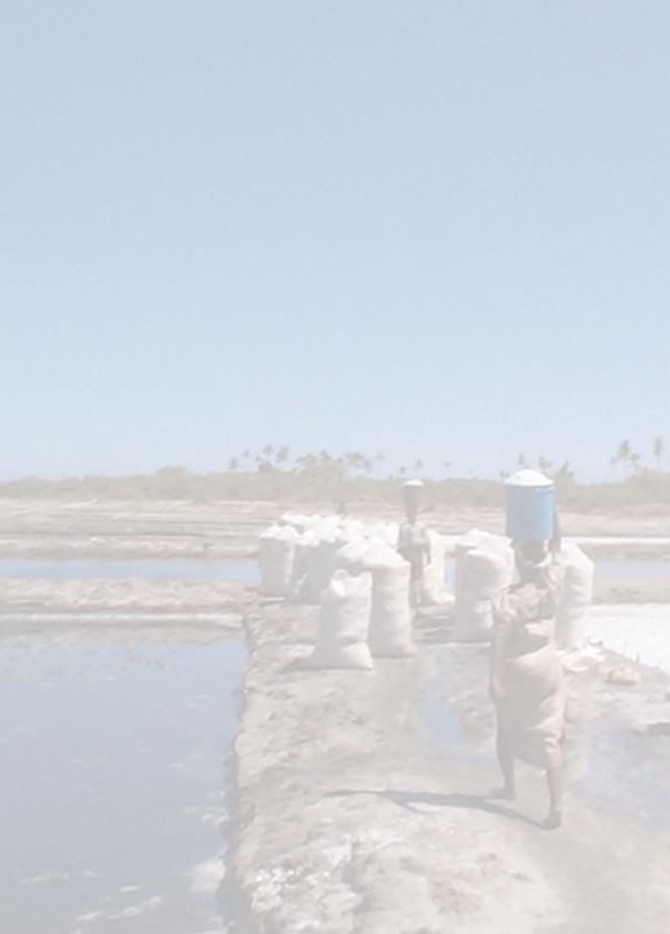
68
Title/Name of the area: Chwaka Bay, Zanzibar
 Title/Name of the area: Chwaka Bay, Zanzibar Presented by: Dr. Charles Lugomela, Ag. Head, Department of Aquatic Sciences and Fisheries, University of Dar es Salaam, P.O. Box 35064 Dar es Salaam, Tanzania
GCRMN Number of sites regularly monitored
 GCRMN Number of sites regularly monitored What is being Monitored Monitoring Partnerships Engagement in international efforts Outputs/reports Recent key findings Notable successes and challenges Presented
The Regional Coral Reef Task Force and Action plan. 27 th ICRI. Cairns Australia July 2012
 The Regional Coral Reef Task Force and Action plan 27 th ICRI Cairns Australia July 2012 Western Indian Ocean Region East Africa mainland states Indian Ocean Islands states Biogeographic division of the
Palau National Marine Sanctuary Building Palau s future and honoring its past
 A fact sheet from Sept 2015 Palau National Marine Sanctuary Building Palau s future and honoring its past Caring for the environment has long been an important part of Palau s culture. For centuries, traditional
Overview of Marine Protected Areas. Tanzania Experience.
 Overview of Marine Protected Areas. Tanzania Experience. Razack Lokina Department of Economics University of Dar es Salaam Fisheries Forum 24 th -25 th 2006. Case study Mnazi Bay MBREMP is located to the
IMPORTANCE OF MANGROVES
 IMPORTANCE OF MANGROVES WHAT ARE MANGROVE TREES? They are shrubs or small trees that grow in coastal saline or brackish water (salt water). A Mangrove is a tropical marine tree or a shrub. It has special
What is an Marine Protected Area?
 Policies, Issues, and Implications of Marine Protected Areas Kara Anlauf University of Idaho Before the House Subcommittee on Fisheries Conservation, Wildlife and Oceans April 29, 2003 What is an Marine
Title/Name of the area: Tanga Coelocanth Marine Park (TACMP)
") Title/Name of the area: Tanga Coelocanth Marine Park (TACMP) Presented by: Dr. Charles Lugomela, Ag. Head, Department of Aquatic Sciences and Fisheries, University of Dar es Salaam, P.O. Box 35064 Dar
Title/Name of the area: Tanga Coelocanth Marine Park (TACMP) Presented by: Dr. Charles Lugomela, Ag. Head, Department of Aquatic Sciences and Fisheries, University of Dar es Salaam, P.O. Box 35064 Dar
ReefFix. May, For the Organization of American States (OAS) and the Inter-American Biodiversity Information Network (IABIN)
 and the Inter-American Biodiversity Information Network (IABIN)") Fondation pour la Protection de la Biodiversité Marine FoProBiM B.P. 642 www.foprobim.org (mail) 6011 Henning St. Port-au-Prince, Haiti Bethesda, MD 20817 ReefFix Rapid Assessment of the Economic Value
Fondation pour la Protection de la Biodiversité Marine FoProBiM B.P. 642 www.foprobim.org (mail) 6011 Henning St. Port-au-Prince, Haiti Bethesda, MD 20817 ReefFix Rapid Assessment of the Economic Value
Bazaruto Archipelago National Park-Mozambique. Mozambique. Workshop on MPAs- Is MPAs a useful tool In Fisheries management?
 Bazaruto Archipelago National Park-Mozambique Workshop on MPAs- Is MPAs a useful tool In Fisheries management? Norway ; 24-25 25 October 2006 By Paula Santana Afonso Institute for Fisheries Research Mozambique
VANUATU. By: Trinison Tari 1 and William Naviti 2
 VANUATU Introduction By: Trinison Tari 1 and William Naviti 2 Mangrove ecosystems of Vanuatu cover an estimated 2,500-3,500 ha, 0.2%-0.3% of the total land area (12,190 square kilometres). Sizable stands
The Regional Coral Reef Task Force and Action plan. Indian Ocean Day. Reunion December 2011
 The Regional Coral Reef Task Force and Action plan Indian Ocean Day Reunion December 2011 Western Indian Ocean Region East Africa mainland states Indian Ocean Islands states Biogeographic division of the
The Ecology and Economy of Coral Reefs: Considerations in Marketing Sustainability
 The Ecology and Economy of Coral Reefs: Considerations in Marketing Sustainability Rick MacPherson Director, Conservation Programs Coral Reef Alliance Coral Reefs in Peril: Worldwide Status 2004: 70% of
State of Oceans and Coasts: Philippines
 State of Oceans and Coasts: Philippines Nilda Baling Department of Environment and Natural Resources (DENR) Romeo Recide Philippine Statistics Authority Ocean economy GROSS VALUE ADDED OF OCEAN-BASED ACTIVITIES
Case Study: 1. The Clarence River Catchment
 Case Study: 1. The Clarence River Catchment The NSW coastline is a great natural asset, making an enormous contribution to the economy. The resources of coastal catchments such as the Clarence River Catchment,
Contribution of Marine Protected Areas to the Blue Economy and Sustainable Fisheries
 2015/HLPD-FSBE/012 Session: 1 Contribution of Marine Protected Areas to the Blue Economy and Sustainable Fisheries Purpose: Information Submitted by: Philippines High Level Policy Dialogue on Food Security
Developing Lampi Marine National Park as an Ecotourism Role Model
 Developing Lampi Marine National Park as an Ecotourism Role Model Ms Tania Miorin, Country Director, Istituto Oikos & Dr Paul Rogers, Ecotourism Consultant PART I: BACKGROUND Ms Tania miorin OIKOS in Myanmar
How South Africa is making progress towards the Aichi 2020 Target 11
 How South Africa is making progress towards the Aichi 2020 Target 11 Montreal, Canada 2 May 2016 Oceans and Coasts Content Protected area considerations and progress 1994-2010 Terrestrial Protected Area
Coverage of Mangrove Ecosystem along Three Coastal Zones of Puerto Rico using IKONOS Sensor
 Coverage of Mangrove Ecosystem along Three Coastal Zones of Puerto Rico using IKONOS Sensor Jennifer Toledo Rivera Geology Department, University of Puerto Rico, Mayagüez Campus P.O. Box 9017 Mayagüez,
Sustainable Tourism in Marine National Parks The Seychelles Experience
 Sustainable Tourism in Marine National Parks The Seychelles Experience First Pan-African Conference on Sustainable Tourism Management in African National Parks and Protected Areas: Challenges and Opportunities
Environmental Impacts of Increasing Vessel Traffic in the Straits of Malacca and Singapore
 Environmental Impacts of Increasing Vessel Traffic in the Straits of Malacca and Singapore Cheryl Rita Kaur Centre for Coastal and Marine Environment 8 th Co-operation Forum (CF): Singapore, 5-6 October
Virginian Atlantic (Ecoregion 8)
") Virginian Atlantic (Ecoregion 8) Background The Virginian Atlantic Ecoregion extends from the south side of Cape Cod to Cape Hatteras in North Carolina. The waters of the ecoregion are a mix of cold and
Virginian Atlantic (Ecoregion 8) Background The Virginian Atlantic Ecoregion extends from the south side of Cape Cod to Cape Hatteras in North Carolina. The waters of the ecoregion are a mix of cold and
QUÉBEC DECLARATION ON ECOTOURISM World Ecotourism Summit Québec City, Canada, 2002
 QUÉBEC DECLARATION ON ECOTOURISM World Ecotourism Summit Québec City, Canada, 2002 The participants at the Summit acknowledge the World Summit on Sustainable Development (WSSD) in Johannesburg, August/September
How MPAs, and Best Fishing Practices Can Enhance Sustainable Coastal Tourism 10 July 2014 Mark J. Spalding, President The Ocean Foundation
 How MPAs, and Best Fishing Practices Can Enhance Sustainable Coastal Tourism 10 July 2014 Mark J. Spalding, President The Ocean Foundation TOF Expertise Established a unique model of resort partnerships
Terrestrial Protected Area Nomination: Central Mangrove Wetland South-West, Grand Cayman
 Terrestrial Protected Area Nomination: Central Mangrove Wetland South-West, Grand Cayman The attached nomination, proposing that a parcel of land in the Central Mangrove Wetland be made a Protected Area
MPA s and Poverty Alleviation. An Empirical Study of 24 Coastal Villages on Mainland Tanzania and Zanzibar. February 2004
 MPA s and Poverty Alleviation An Empirical Study of 24 Coastal Villages on Mainland Tanzania and Zanzibar February 2004 Report prepared for the World Bank ACRONYMS CHICOP JCBA MIMP MPA MPRU MBCA MICA MICP
Arts + Culture Business + Economy Education Environment + Energy Health + Medicine Politics + Society Science + Technology
 Edition: Australia Job Board Donate Get newsletter Dashboard Thomas Wernberg 22 Search analysis, research, academics Academic rigour, journalistic flair Arts + Culture Business + Economy Education Environment
IMPACTS OF THE RECENT TSUNAMI ON THE BUNDALA NATIONAL PARK THE FIRST RAMSAR WETLAND IN SRI LANKA
 IMPACTS OF THE RECENT TSUNAMI ON THE BUNDALA NATIONAL PARK THE FIRST RAMSAR WETLAND IN SRI LANKA by C.N.B. Bambaradeniya, IUCN The World Conservation Union, Sri Lanka Country Office (Email: cnb@iucnsl.org)
Theme A ECOTOURISM DEVELOPMENT IN TANZANIA : THE SUSTAINABILITY CHALLENGE
 Theme A STATEMENT BY MR. PHILEMON L. LUHANJO, PERMANENT SECRETARY, MINISTRY OF NATURAL RESOURCES AND TOURISM-TANZANIA, AT THE SUMMIT OF CELEBRATION OF THE INTERNATIONAL YEAR OF ECOTOURISM, QUEBEC CANADA,
Coastal and marine ecosystems provide vitally
 Coastal Capital: Belize The Economic Contribution of Belize s Coral Reefs and Mangroves Coastal and marine ecosystems provide vitally important goods and services to countries in the Caribbean. This study
GLOBAL LEADERS IN BUILDING EFFECTIVE MARINE PROTECTED AREAS
 GLOBAL LEADERS IN BUILDING EFFECTIVE MARINE PROTECTED AREAS Marine protected areas (MPAs) like national parks on land set aside dedicated areas for conservation to help the ocean thrive, provide jobs,
ICRI Monaco January 2010
 Economic Valuation of Coral Reefs in the Caribbean ICRI Monaco January 2010 Lauretta Burke World Resources Institute (WRI) Beautiful Valuable Valuable Valuable Valuable Valuable Photos: Krishna Desai Valuable
LAUNCH OF THE COASTAL ZONE MANAGEMENT TRUST
 A 60km stretch of coastline on the Yucatan Peninsula of Mexico is the testing ground for an idea that could protect fragile environments around the world: insuring coral reefs. The Economist World Ocean
Diversity of Coastal Ecosystems of Maharashtra - Ecologically Sensitive Coastal Areas of Ratnagiri and Sindhudurga
 Diversity of Coastal Ecosystems of Maharashtra - Ecologically Sensitive Coastal Areas of Ratnagiri and Sindhudurga Abstract: Approximately 20% of the world s coral reefs were lost and an additional 20%
BABIA GÓRA DECLARATION ON SUSTAINABLE TOURISM DEVELOPMENT IN MOUNTAIN AREAS
 BABIA GÓRA DECLARATION ON SUSTAINABLE TOURISM DEVELOPMENT IN MOUNTAIN AREAS The participants of the International Workshop for CEE Countries Tourism in Mountain Areas and the Convention on Biological Diversity",
SUSTAINABLE AND ENVIRONMENTALLY FRIENDLY TOURISM IN THE COASTAL ZONES OF THE BALTIC SEA AREA
 CONVENTION ON THE PROTECTION OF THE MARINE ENVIRONMENT OF THE BALTIC SEA AREA HELSINKI COMMISSION - Baltic Marine HELCOM 21/2000 Environment Protection Commission Minutes of the Meeting 21st Meeting Helsinki,
DOWNLOAD OR READ : CORAL REEFS OF THE WORLD VOLUME 2 INDIAN OCEAN RED SEA AND GULF PDF EBOOK EPUB MOBI
 DOWNLOAD OR READ : CORAL REEFS OF THE WORLD VOLUME 2 INDIAN OCEAN RED SEA AND GULF PDF EBOOK EPUB MOBI Page 1 Page 2 coral reefs of the world volume 2 indian ocean red sea and gulf coral reefs of the pdf
Coral Restoration and Conservation in Serangan Island, Denpasar City, Bali, Indonesia: Turning Coral Miners into Conservation Advocates
 Coral Restoration and Conservation in Serangan Island, Denpasar City, Bali, Indonesia: Turning Coral Miners into Conservation Advocates Case Study 24 Coral Restoration and Conservation in Serangan Island,
Hauraki Maori Trust Board STRATEGIC PLAN
 Hauraki Maori Trust Board STRATEGIC PLAN FOR THE CUSTOMARY FISHERIES OF HAURAKI 2002-2052 1 This strategic planning document was developed for and approved by the Hauraki Maori Trust Board on 12 February
TOWARDS SUSTAINABLE MANAGEMENT OF MARINE AND COASTAL HABITATS ASIA- PACIFIC DAY FOR THE OCEAN
 TOWARDS SUSTAINABLE MANAGEMENT OF MARINE AND COASTAL HABITATS WANNAKIAT THUBTHIMSANG PHUKET MARINE BIOLOGICAL CENTER, DMCR, THAILAND ASIA- PACIFIC DAY FOR THE OCEAN 20 NOVEMBER 2018, CONFERENCE ROOM 4,
33. Coiba National Park and its Special Zone of Marine Protection (Panama) N 1138 rev)
 N 1138 rev)") World Heritage status of the area and the Outstanding Universal Value of the Monarch butterfly migration phenomenon, c) Explore options for the development of non-butterfly related tourism activities;
World Heritage status of the area and the Outstanding Universal Value of the Monarch butterfly migration phenomenon, c) Explore options for the development of non-butterfly related tourism activities;
CLIMATE CHANGE AND SUSTAINABLE COASTAL TOURISM DEVELOPMENT: A CASE STUDY OF KUDAT
 CLIMATE CHANGE AND SUSTAINABLE COASTAL TOURISM DEVELOPMENT: A CASE STUDY OF KUDAT Dr. ER AH CHOY Associate Professor Faculty of Social Sciences and Humanities Universiti Kebangsaan Malaysia Introduction
Status of Mangroves in Belize
 Status of Mangroves in Belize State of the Coastal zone Summit June 7 th 2012 Nadia Bood*, Emil Cherrington and Tim Smith Outline Introduction to mangroves Importance of mangrove to Belize National status
Saadani National Park, Tanzania: Fostering Long Term Sustainability of Community Based Conservation and Development
 Saadani National Park, Tanzania: Fostering Long Term Sustainability of Community Based Conservation and Development Bruce Downie Kesho Trust, Tanzania; bdownie@thekeshotrust.org Key Messages Activities
ECOREGIONAL ASSESSMENT EQUATORIAL PACIFIC EXECUTIVE SUMMARY
 ECOREGIONAL ASSESSMENT EQUATORIAL PACIFIC The Nature Conservancy, Fundación Agua, EcoCiencia, Fundación Jatun Sacha, CDC Ecuador, CDC UNALM 2004. Portafolio de Sitios Prioritarios para la Conservación
The MPA Name. The past and future of the. Montego Bay Marine Park Trust
 The MPA Name The past and future of the Montego Bay Marine Park Trust Park Boundaries and Sanctuary Area 100m/330ft/50 Fathom Depth Contour to The Average Highest High Tide Mark 50 Fathom/100M Depth Great
THE STORY OF MALDIVES. DR MARIYAM SHAKEELA Minister Of Environment and Energy Republic Of Maldives
 THE STORY OF MALDIVES DR MARIYAM SHAKEELA Minister Of Environment and Energy Republic Of Maldives Significance of ecotourism & coral reefs on regional economy Coral reefs are among the most diverse and
Rising seas threaten to drown important mangrove forests, unless we intervene
 University of Wollongong Research Online Faculty of Science, Medicine and Health - Papers Faculty of Science, Medicine and Health 2015 Rising seas threaten to drown important mangrove forests, unless we
Member s report on activities related to ICRI
 Member s Report INTERNATIONAL CORAL REEF INITIATIVE (ICRI) 32 nd General Meeting 7-9 December 2017 Nairobi, Kenya Member s report on activities related to ICRI MALAYSIA Reporting period November November
Alaskan/Fjordland Pacific (Ecoregion 22)
") Alaskan/Fjordland Pacific (Ecoregion 22) Background The Alaskan/Fjordland Pacific Ecoregion is an area of abundant marine resources. The ecoregion begins at Vancouver Island and moves up the Gulf of Alaska
Alaskan/Fjordland Pacific (Ecoregion 22) Background The Alaskan/Fjordland Pacific Ecoregion is an area of abundant marine resources. The ecoregion begins at Vancouver Island and moves up the Gulf of Alaska
Project : Marine Ecology Research Center (MERC) Sabah, Malaysia
 Sabah, Malaysia") Project : Marine Ecology Research Center (MERC) Sabah, Malaysia Table of contents 1) Introduction of Malaysia 2) Malaysia Map & Location of MERC 3) Introduction of MERC 4) Activities of MERC 4.1) Active
Project : Marine Ecology Research Center (MERC) Sabah, Malaysia Table of contents 1) Introduction of Malaysia 2) Malaysia Map & Location of MERC 3) Introduction of MERC 4) Activities of MERC 4.1) Active
LATIN AMERICA / CARIBBEAN COIBA NATIONAL PARK PANAMA
 LATIN AMERICA / CARIBBEAN COIBA NATIONAL PARK PANAMA WORLD HERITAGE NOMINATION IUCN TECHNICAL EVALUATION COIBA NATIONAL PARK (PANAMA) ID Nº 1138 Bis Background note: Coiba National Park was nominated for
Status of mangroves per province
 Status of mangroves per province State of the Mangroves in ORIENTAL MINDORO Marilyn M. Alcanices, Supervising Agriculturist Fishery and Coastal Resources Management Division Chief Provincial Agriculture
Welcome. Sustainable Eco-Tourism in the face of Climate Change. Presented by Jatan Marma
 Welcome Sustainable Eco-Tourism in the face of Climate Change Presented by Jatan Marma Definition Sustainable Development: is a process to meet the needs of the present without compromising the ability
Adapting to climate change by promoting sustainable livelihoods, human and food security, and resilient ecosystems
 Adapting to climate change by promoting sustainable livelihoods, human and food security, and resilient ecosystems ICRI Indian Ocean Day December 13, 2011 Regional Challenges Atlantic Caribbean Challenge
A Proposed Framework for the Development of Joint Cooperation On Nature Conservation and Sustainable Tourism At World Heritage Natural sites.
 Introduction: A Proposed Framework for the Development of Joint Cooperation On Nature Conservation and Sustainable Tourism At World Heritage Natural sites Between The tourism industry and the UNESCO, World
Sustainable development: 'Lanzarote and the Biosphere strategy'. LIFE97 ENV/E/000286
 Sustainable development: 'Lanzarote and the Biosphere strategy'. LIFE97 ENV/E/000286 Project description Environmental issues Beneficiaries Administrative data Read more Contact details: Project Manager:
Satoquo SEINO (Graduate School of Engineering, Kyushu University, Japan)
") A reconsideration of horseshoe crab conservation methodology in Japan over the last 100 years and prospects for a marine protected area network in Asian seas Satoquo SEINO (Graduate School of Engineering,
A reconsideration of horseshoe crab conservation methodology in Japan over the last 100 years and prospects for a marine protected area network in Asian seas Satoquo SEINO (Graduate School of Engineering,
Sustainable Rural Tourism
 Sustainable Rural Tourism Tourism: its nature and potential Tourism = multifaceted economic activity + strong social element Definition of tourism by the World Tourism Organisation (WTO): tourism comprises
We, Ministers, assembled in Berlin for the International Conference on Biodiversity and Tourism from 6 to 8 March 1997
 March 8th, 1997 Berlin Declaration BIOLOGICAL DIVERSITY AND SUSTAINABLE TOURISM We, Ministers, assembled in Berlin for the International Conference on Biodiversity and Tourism from 6 to 8 March 1997 -
Creation of a Community-managed Biodiversity Park in the Saloum Delta of Senegal. Voré Gana Seck Director GREEN Senegal for People, Land, Ocean
 Creation of a Community-managed Biodiversity Park in the Saloum Delta of Senegal Voré Gana Seck Director GREEN Senegal for People, Land, Ocean Rationale for the Creation of the Biodiversity Park F In line
Overview CARIBBEAN MARINE BIODIVERSITY PROGRAM
 CARIBBEAN MARINE BIODIVERSITY PROGRAM Overview The Caribbean Marine Biodiversity Program is a five-year project (2014-2019), funded by the U.S. Agency for International Development and The Nature Conservancy,
Adventure tourism in South Africa: Challenges and prospects
 Adventure tourism in South Africa: Challenges and prospects Abstract There is great potential for the development of adventure tourism in Southern Africa for a number of reasons. One is the variety of
SCALING AND AMPLIFYING MPAS FOR THE EFFECTIVE CONSERVATION OF THE CENTER OF CENTER OF MARINE BIODIVERSITY,
 SCALING AND AMPLIFYING MPAS FOR THE EFFECTIVE CONSERVATION OF THE CENTER OF CENTER OF MARINE BIODIVERSITY, THE VERDE ISLAND PASSAGE A. Rex F. Montebon, Ph.D. 2015 EAS Congress Furama Resort, Danang, Vietnam
Mangroves and Community Aquaculture
 Mangroves and Community Aquaculture AQUACULTURE DEPARTMENT Southeast Asian Fisheries Development Center February 2000 M An aquasilviculture pond/ pen tests the integration of mangrove conservation with
A Brief Introduction to the Wetlands Phang Nga Marine National Park. Yuppayao Saichan Department of Marine and Coastal Resources Thailand
 A Brief Introduction to the Wetlands Phang Nga Marine National Park Yuppayao Saichan Department of Marine and Coastal Resources Thailand Wetlands Phang Nga Marine National Park Location: Muang and Ta kau
SELF-ASSESSMENT CHECKLIST
 Tourism and Mountains A Practical Guide to Managing the Environmental and Social Impacts of Mountain Tours Using this Self-Assessment Checklist This checklist has been developed to help mountain-based
Seychelles National Parks Authority Aspects of Research
 Seychelles National Parks Authority Aspects of Research First Pan-African Conference on Sustainable Tourism Management in African National Parks and Protected Areas: Challenges and Opportunities 15-18
Sizing up Australia s eastern Grey Nurse Shark population
 Image: David Harasti A new estimate of adult population size for Australia s eastern Grey Nurse Shark drew on widespread genetic sampling and forensic exploration of family trees. Grey Nurse Sharks are
Typical avalanche problems
 Typical avalanche problems The European Avalanche Warning Services (EAWS) describes five typical avalanche problems or situations as they occur in avalanche terrain. The Utah Avalanche Center (UAC) has
Putting Museums on the Tourist Itinerary: Museums and Tour Operators in Partnership making the most out of Tourism
 1 of 5 ICME papers 2002 Putting Museums on the Tourist Itinerary: Museums and Tour Operators in Partnership making the most out of Tourism By Clare Mateke Livingstone Museum, P O Box 60498, Livingstone,
Monitoring the Environmental Status of the Heart of Borneo
 Monitoring the Environmental Status of the Heart of Borneo By: Stephan Wulffraat The Heart of Borneo conservation initiative has been going on now for several years and has gained increasing support from
Anderson, J.D. & Gates, P.D South Pacific Commission Fish Aggregating Device (FAD) Manual. Vol. 1. Planning FAD Programmes.
 Manual. Vol. 1. Planning FAD Programmes.") 6. APPENDIX 6.1 Bibliography Anderson, J.D. 1994. The interaction between artisanal and fish aggregation devices (FADs). Unpub. Final Report. FMSP Programme, ODA. MRAG Ltd., London. Anderson, J.D. & Gates,
6. APPENDIX 6.1 Bibliography Anderson, J.D. 1994. The interaction between artisanal and fish aggregation devices (FADs). Unpub. Final Report. FMSP Programme, ODA. MRAG Ltd., London. Anderson, J.D. & Gates,
The Economics of Ecosystems and Biodiversity on Bonaire. Tourism value of ecosystems in Bonaire
 The Economics of Ecosystems and Biodiversity on Bonaire Tourism value of ecosystems in Bonaire 2 The Economics of Ecosystems and Biodiversity on Bonaire Tourism value of ecosystems in Bonaire This study
FOR SALE INDIAN OCEAN BEACHFRONT- HEADLAND PLOT
 June 2017 FOR SALE INDIAN OCEAN BEACHFRONT- HEADLAND PLOT Rasini, Kimbiji, Kizito Huonjwa, Temeke, Dar es Salaam, Tanzania A UNIQUE opportunity to acquire 9 hectares/22 acres of natural cliff and beachfront
Unit 1 Lesson 1: Introduction to the Dry Tortugas and Sustainable Seas Expedition
 Unit 1 Lesson 1: Introduction to the Dry Tortugas and Sustainable Seas Expedition Lesson Objectives: Introduce students to the historical, geographic, and ecological importance of the Dry Tortugas. Introduce
Buck Island Reef National Monument News Release Date: Immediate Contact: Joel Tutein, Superintendent, x 222
 National Park Service U.S. Department of the Interior www.nps.gov 2100 Church Street, # 100 Christiansted, VI 00820 News Release Date: Immediate Contact: Joel Tutein, Superintendent, Joel.Tutein@nps.gov
Communicating the Economic and Social Importance of Coral Reefs for South East Asian countries
 Communicating the Economic and Social Importance of Coral Reefs for South East Asian countries This fact sheet will provide you with information extracted from economic studies BASICS Coral reefs are among
Kagoshima Prefecture consists of about 600
 Kawai, K., Terada, R. and Kuwahara, S. (eds): The Islands of Kagoshima Kagoshima University Research Center for the Pacific Islands, 15 March 213 Chapter 16 Sugarcane Cultivation in the Islands of Kagoshima
Queensland State Election Priorities 2017
 Queensland State Election Priorities 2017 Protecting, conserving and celebrating Queensland s environmental, built and cultural heritage. QUEENSLAND S HERITAGE MAKES A DIFFERENCE Environmental, built and
Draft Strategic Plans for Coillte s eight Business Area Units ( )
") Draft Strategic Plans for Coillte s eight Business Area Units (2011-2015) Response to Public Consultation from Mountaineering Ireland April 2013 1 Introduction Mountaineering Ireland welcomes this opportunity
Draft Strategic Plans for Coillte s eight Business Area Units (2011-2015) Response to Public Consultation from Mountaineering Ireland April 2013 1 Introduction Mountaineering Ireland welcomes this opportunity
Biosphere Reserves of India : Complete Study Notes
 Biosphere Reserves of India : Complete Study Notes Author : Oliveboard Date : April 7, 2017 Biosphere reserves of India form an important topic for the UPSC CSE preparation. This blog post covers all important
Extension of community based mangrove restoration model focusing on fallow shrimp-farming ponds in Cam Ranh, Khanh Hoa
 Extension of community based mangrove restoration model focusing on fallow shrimp-farming ponds in Cam Ranh, Khanh Hoa ABSTRACT The project was supported by Rufford Small Grant (British), carried out based
3rd International Forum on sustainable Tourism 20th to 22nd October 2008 Bamako - Mali
 TANZANIA S POLICY ON TOURISM DEVELOPMENT 3rd International Forum on sustainable Tourism 20th to 22nd October 2008 Bamako - Mali Ministry of Natural Resources and Tourism - Tanzania 1 Tanzania basic facts
photos Department of Environment and Conservation Biodiversity Conservation
 photos Department of Environment and Conservation Biodiversity Conservation EcoEducation - making the connections to biodiversity conservation Do you consider experiential learning of biodiversity in the
Disaster Risk Management in Tourism Destinations
 Disaster Risk Management in Tourism Destinations Dr. Stefanos Fotiou United Nations Environment Programme Division of Technology, Industry and Economics This presentation is about Tourism and Risk Tourism
Tourism and Wetlands
 CONVENTION ON WETLANDS (Ramsar, Iran, 1971) 43 rd Meeting of the Standing Committee Gland, Switzerland, 31 October 4 November 2011 DOC. SC43-27 Tourism and Wetlands Action requested. The Standing Committee
Global Sustainable Tourism Destinations Criteria
 Global Sustainable Tourism Destinations Criteria Draft destination level Global Sustainable Tourism Criteria as proposed after Destinations and International Standards joint working group meeting and follow-up
Community-based tourism at Gunung Halimun National Park
 Asia-Pacific Environmental Innovation Strategies (APEIS) Research on Innovative and Strategic Policy Options (RISPO) Good Practices Inventory Community-based tourism at Gunung Halimun National Park Summary
REDD+ IN YUCATAN PENINSULA
 REDD+ IN YUCATAN PENINSULA JOINING FORCES TO PRODUCE AND PRESERVE 2 3 Campeche, Yucatan, and Quintana Roo combat deforestation together in the Yucatan Peninsula and build a new path for growth A peninsular
The Island invites you to enjoy simple, exquisite pleasures
 Welcome The Island invites you to enjoy simple, exquisite pleasures Ten years ago it started with a dream, a fanciful ambition to find a small, remote, uninhabited Tropical Island off the coast of East
Twelve Apostles Marine National Park Australia
 EVALUATION REPORT Twelve Apostles Marine National Park Australia Location: Victoria, Australia coastal waters Global Ocean Refuge Status: Nominated (2017), Evaluated (2017) MPAtlas.org ID: 7703885 Manager(s):
Recreational Carrying Capacity
 9 th Annual Caribbean Sustainable Tourism Conference Recreational Carrying Capacity Graham C Barrow What is Recreational Carrying Capacity? It s not about fixing absolute numbers of visitors/tourists that
Getting Rural Youth Ready for Work in Burma. (Myanmar) Project No:
 Project No:") Final Technical Report Getting Rural Youth Ready for Work in Burma Supported by (Myanmar) Project No: 108265-001 Implemented by Tag International Development Yangon, Myanmar 31 st January 2017 Implemented
Final Technical Report Getting Rural Youth Ready for Work in Burma Supported by (Myanmar) Project No: 108265-001 Implemented by Tag International Development Yangon, Myanmar 31 st January 2017 Implemented
The Underwater Dodo Project: Creating Underwater Coral Sculpture Gardens in Mauritius and Bringing the Dodo Back to Life
 The Underwater Dodo Project: Creating Underwater Coral Sculpture Gardens in Mauritius and Bringing the Dodo Back to Life Bringing dodos back to life: a creative conservation project combining art, science,
Indicators of Sustainable Development for Tourism Destinations
 Indicators of Sustainable Development for Tourism Destinations Dr. Ted Manning Lead Expert WTO Indicators Program President, Tourisk Inc. Ottawa Canada Washington DC 2004 Dolomites Italy Tourism is at
A vision for a healthier, more prosperous and secure future for all coastal communities. Can Gio Biosphere Reserve 2010 IUCN Vietnam MERD
 A vision for a healthier, more prosperous and secure future for all coastal communities Can Gio Biosphere Reserve 2010 IUCN Vietnam MERD Local woman caring for mangroves in Hau Loc, Thanh Hoa CARE International
FOR SALE Belize s World Heritage
 FOR SALE Belize s World Heritage The Pelican Cayes A Hotspot of Biodiversity and Destruction In the Belize Barrier Reef Reserve World Heritage Site March 2003 In the Pelican Cays, mangrove cays exhibit
Benefits and costs of tourism for remote communities
 Benefits and costs of tourism for remote communities Case study for the Carpentaria Shire in north-west Queensland Chapter 2 1 THE CARPENTARIA SHIRE COMMUNITY AND TOURISM... 2 Plate 5: Matilda Highway
OUR Promise. OUR Caribbean.
 OUR Promise. OUR Caribbean. Expanding upon the philanthropic work that SRI has undertaken over the past 30 years; to create a positive and sustainable impact on both people s lives and the environment