GET Hiking Great Eastern Trail Newsletter
|
|
|
- Myron Hines
- 5 years ago
- Views:
Transcription


1 GET Hiking Great Eastern Trail Newsletter Volume 1, Number 3, September 2011 By Timothy A. Hupp Please feel free to print out or copy and distribute this newsletter New name for GET Newsletter It was unanimous! GET Hiking or variants was the only name offered for the new name of the GET Newsletter. How Many GET miles have you hiked? I m trying to give credit for those who have hiked significant miles of the GET. If you have hiked at least 50 miles of the GET, please report it to me at the address given at the end of the newsletter. You may include miles of exploring for GET routes, and if it has two branches, you may count the miles hiked on both. Count only the trail miles if you ve done a section twice, you don t double the miles. Also, do not count side trails, but if you hike a close parallel trail, you may count that if you go that way instead of the main trail. Here is the first listing. As time goes on, I hope more people will report, and these numbers will be increasing. Sue Turner 720 Tom Johnson 362 Lloyd McAskill 321 Tim Hupp 291 Jim Sims 224 David Frye 193 Marty Dominy 130 Michael Seth 91 Shad Baker 90 Malcolm & Lynn Cameron 89 Nancy Ruggles 77 GETA Board Meeting The Great Eastern Trail Association Board met May 13-15, 2011 at the Brayton Lodge, owned by the Woolrich company, high above the town of Woolrich, Pennsylvania. The company, one of only two wool mills left in the United States, generously paid all of our expenses. The Great Eastern Trail follows the Mid State Trail through the town of Woolrich, whose main street is lined with tall Norway Spruces. In the town s park is the J. Woods Rich Shelter. Board members attending were (from North to South) Pat Monahan (CHT), Pete Fleszar (MST), Tom GET Board (those present): (l to r, back: Warren Devine, Shad Baker, Pete Fleszar, Tom Johnson, Tim Hupp; front: Marty Dominy, Pat Monahan. 1
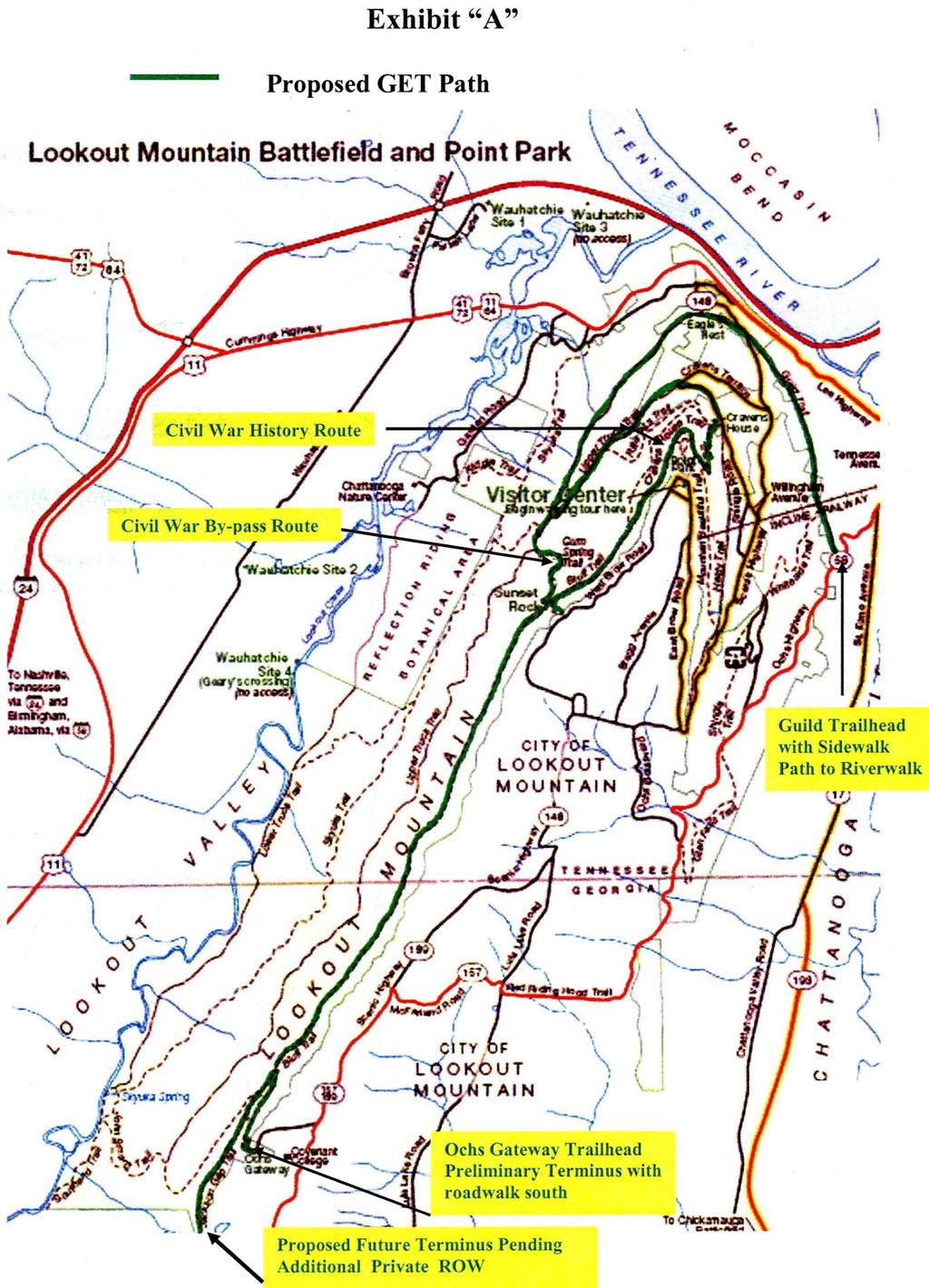
2 Johnson (PATC), Tim Hupp (WVSTA), Shad Baker (PMTC), Warren Devine (CTC), and Marty Dominy (PTC). We went over the business of the GET, with progress and problems encountered over the length of the Trail. Included in the business was the accepting of the Cumberland Pinhoti Connecter, which passes through Chattanooga, Tennessee. Also, Headwaters Section was officially accepted as the name of the Tuscarora Allegheny Link. We also decided to increase use of Facebook to promote the GET. Saturday evening we went into Woolrich and visited the outlet store, and walked into the park, visiting the shelter, and followed a bit of the MST. After breakfast on Sunday, we headed out and did a hike on the MST/GET, which is described in the Hike Report of this issue. Pinhoti Cumberland connector The longest remaining gap in the Great Eastern Trail route has been filled with a plan for a trail route connecting the Cumberland Trail in Tennessee to the Georgia Pinhoti Trail. It was worked out by Jim Schroeder and Marty Dominy, and has been reviewed by the major land owners. This includes the Chickamauga & Chattanooga National Military Park, Cloudland Canyon State Park (GA), and McLemore Cove Area. Route approval by the Chickamauga & Chattanooga National Military Park is complete. Route approval by Cloudland Canyon State Park in Georgia is pending. There has been communication with the managers of three wildlife management areas in Georgia that include the McLemore Cove area and with a manager at Little River Canyon. However, anything formal in these areas is still a From the Chattanoogan.com: Great Eastern Trail - Alternative To Appalachian Trail - Will Come Through Chattanooga posted June 9, 2011 The National Park Service and the Great Eastern Trail Association on Thursday announced the designation of 8.1 miles of Chickamauga and Chattanooga National Military Park trails on Lookout Mountain as a segment of the Great Eastern Trail. Officials said this segment is part of a route from the Georgia Pinhoti Trail to the Cumberland Trail near Soddy Daisy. The formal signing of a Memorandum of Understanding creating this designation took place at the Craven House on Lookout Mountain on Monday, June 27. Park officials said, "This is a landmark event for the routing of the Great Eastern Trail through the Chattanooga Metropolitan Area." ways off. Even if we get trail through these areas, over half the route will be on roads of one type or another. Contact with most private landowners won't even take place until we have a firm foothold on these public lands. Two maps are shown here for the route, and they show only from Chattanooga south. Within and north of Chattanooga, the route follows streets and roads to the Cumberland Trail at Montlake Road in the North Chickamauga Creek Gorge State Natural Area. This is an alternate route until such time at the Chattanooga Greenway System is complete. Jim Schroeder has prepared a guide for that section. 2

3 Map of the Georgia portion: the Georgia Pinhoti Trail is not shown here. 3
4 4 Green
5 GET Calendars for 2012 There will be a 2012 calendar with pictures taken on the Great Eastern Trail. For the past several years, I (Tim Hupp) have been preparing calendars using pictures I took while hiking on the Appalachian Trail. I plan to continue that practice, but I will also prepare a calendar using GET pictures. This year I hiked on the AT in Tennessee and Pennsylvania, plus some repeated parts of the Shenandoah National Park. My GET hiking has been in Virginia and West Virginia, ranging from Bluestone River to Siler, Virginia near Shockeys Knob, plus the GETA Board hike in Pennsylvania. Pictures of these areas will be used, appropriate to the season, for each month of the year. The calendars will be available for $20. They may be ordered by Hupp_Tim@msn.com Blazes on Pine Mountain Trail The Great Eastern Trail as a rule uses whatever color blazes as the local trails use, rather than a set color. The member trails had their color chosen before the GETA was organized. But what about the case of where new trail is built that is not part of a former local trail? This occurred in the building of the TuGuNu section in West Virginia, and they decided to use a bright green. This is a rarely used color for blazing trails, and people tend to think it would not be visible among the foliage of a forest. But in fact, artificial greens are different colors from natural greens, and a bright green looks quite distinctive as blazes. Pine Mountain Trail is the first GET section to make the change to bright green. They used Nelson green glo to blaze the Highland and Little Shepherd Trail sections. GET Brochures GET Brochures are out! They were designed and produced by Debra Spinnenweber with input from the GETA board members. 20,000 brochures promoting the Great Eastern Trails have been printed. They have been distributed to member clubs as follows: Club # held by Alabama Trails Association 1000 Bob Williams/Hayesville, NC Alabama Hiking Trail Society 1500 Rick Guhse/Keene, NH Cumberland Trail Conference 1500 Warren Devine/Oak Ridge, TN Finger Lakes Trail Conference 1000 Pat Monahan/Corning, N.Y Friends of Green Ridge State Forest 1000 Francis Zumbrun/Flintstone, MD Georgia Pinhoti Trails Association 1000 Marty Domini/Toomsboro, GA Mid State Trail Association 2000 Pete Fleszar /Hummelstown, PA Pine Mountain Trail Conference 1000 Shad Baker/Whitesburg, KY Potomac Appalachian Trail Club 7500* Tom Johnson/Front Royal, VA Standing Stone Trail Club 1000 Mel Cooper/Huntingdon PA West Virginia Scenic Trails Association 1000 Doug Wood/Forest Hill, WV Steve Clark/Mullens, WV * are being held in reserve for clubs that run out. Tom Johnson will be storing them. You may request brochures from the individual listed here, if you know them; if not, contact Tom Johnson see contacts at the end of this newsletter. 5
6 GET Guidebook A guidebook for the Great Eastern Trail has been prepared for the part between Hancock, Maryland (I-70) and White Sulphur Springs, West Virginia (I-64), which has been under development since It is currently posted at: ent&task=view&id=122 (this site is linked to the GET website, and is also included at the final page of this newsletter). This site is being updated as additional information comes in. It is divided into sections and subsections, and each subsection has its guide and trail condition report. PATC Publishing hopes to publish this as a book. There was some question about its authorization, so Tom Johnson decided we should include guides to trails on Shenandoah Mountain with it, to increase its acceptance and sales. After a PATC-Southern Shenandoah Valley Chapter hike and meeting, it was decided that I (Tim Hupp) would be getting assistance from members on guides for these trails. However, this will delay publication by about a year. Once published, the guide will no longer be posted on the website. Remaining will be an overview, the trail condition reports, and any updates, such as relocations. Carr Mountain Trail It was hoped that the August 13, 2011 work trip on the Carr Mountain Trail in Rockingham County, VA would make the trail sufficiently open to hike. Sixteen workers, including nine PATC members (four of whom had hiked the entire trail route before), four North River Back Country Horse Club members, and three International Mountain Bikers Association Members started the hike that day with such hopes. We had cleared and graded as far as 2 miles from the east end the last two years before, and about that far from the west end from the previous fall and spring. In between were the high points of Carr Mountain (elev ) and Beech Lick Knob (elev ). It was a slow drive from our meeting place near Bergton up German River to the west trailhead. The group was well equipped, and a huge tree fallen across the trail was cleared in ten minutes. After lunch, we divided into groups with 6 different tasks. The front group (Tom Johnson, Lloyd McAskill, Nancy Hall, and me) marked the trail route with ribbons and cleared some light growth. Another group (the bikers) had a chainsaw and cleared the blowdowns. Another group had a measuring wheel and took notes of the route. We did not come to grade the trail it was summer, too hot for that task, and most of the trail we were working on was on ridge crests, and did not need it, or so we thought. We were aware of a sidehill of Carr Mountain which we passed, as the ridge walk was fine for getting through. By 2:30, the front group was on top of Beech Lick Knob, lost in the sense that it was not obvious which way to go. We had followed the yellow blazes to the pond of Beech Lick Knob, a dry depression on the south side of the top, which the map showed as the highest point of the trail on the mountain, before easing downhill to the right of the top. Tom had described the trail as going over the top. And the blazes went off to the left, going down gradually for a while. It went about ¼ mile, never going up, and Tom had enough, and announced that he was going up on top of the ridge. Just after that, the blazes were no more, so we all joined Tom on the ridge top, which was descending. A look at the map showed this ridge was leading west, completely away from the trail route in either direction (it approaches Beech Lick Knob from the south, and leaves to the east). So we turned around, found our way to the top and a little over. There we found remains of tape that we knew Lloyd had used for marking the original trail route years ago. But which way did we need to go? We looked at the map and got out two compasses. The compass direction seemed to be 90 off the way the old trail should be heading. We couldn t agree which way to get back to the pond, but we did agree to go one way, because we planned to go opposite ways at this point I planned to hike through to the east end and down FS 302, while the others were going back to the west end. Soon Lloyd decided this couldn t be the way back, so they turned around and I continued down the hill. And it started to rain, and I had 9 miles to go. We had dinner at the Schlabachs, our hosts house. They had ridden in on horses, and they were planning on riding through and down forest roads to
7 their home. But they couldn t find their way over Beech Lick Knob, so they headed down a different way, coming out several miles south of their home. They got home first, and started preparing supper for us. The bikers were next. They worked through the whole trail and down the road, and passed me about 5:45. I got to my car at 6:30 and at the Schlabachs at 7:00. Not five minutes later the others started arriving, having gone back to the west end of the trail. Much of our discussion over dinner was who was where when, and what we did. With the different groups and a lack of marking of the trail where it needed it most, everybody was lost at some point. Some had to be searched for, trying not to lose others in the process. So at this point, the Carr Mountain Trail still has an uncertain route over Beech Lick Knob, but most of the rest is clear. Tower Hill scouting On July 9 Tom Johnson went with Bryan Bruns to scout out a possible off-road route for the GET in Bath County, VA. Currently, the GET follows paved roads for 8 miles between the south end of Shenandoah Mountain and near Bath Alum. Although this must be the original GET route, we are seeking ways to get the GET off roads wherever we can. They hiked over Tower Hill Mountain, going up on Forest Service Road 281 and up on the ridge and south on the ridge. There is some private land for 1-½ miles over Mays Mountain, then the Tower Hill Mountain Trail, which passes Chimney Rock. The hike was about ten miles. It went well along the road, ridge, and trail, but the part around the private property was on some sidehill, and was rather steep. To be used for the GET, trail needs to be built in that area, but this would be a great improvement over the current road walk. Great Eastern Trail in Wyoming County, WV Meeting On August 2, 2011 there was a GET strategy meeting for Wyoming County, WV held at the Cow Shed Restaurant in Pineville. Attending were Steve Clark, Tim McGraw, Val Page, Peggy Pings, and Megan Smith. This is part of the TuGuNu section. In order to have permissions for the GET route, several steps were needed toward official establishment. Property owners need to be identified, contacted, given options, and courted for an agreement allowing passage of the GET through an appropriate corridor. Education and presentations will be needed. Agreements take time, and GET people are advised to work on other things while waiting for them to be completed. In Wyoming County, the GET is divided into 3 sections: 1. R.D. Bailey WMA to Twin Falls State Park (via Horse Creek WMA, Baileysville, and Pineville, about 25 miles), 2. within Twin Falls SP (about 4 miles), and 3. Twin Falls SP to Mullens (about 5 miles). The route of the GET across southern West Virginia has been adjusted considerably since a plan was first made in June 2009, mostly south of the route of the first plan. 7 Due to this change, the GET route needs to be remapped. Tim McGraw, from August to November, is GPS-ing the trail route. There are still different possible trail routes, as not all planned pathways will be available. Other possibilities need to be noted. So, if no other route is possible, public roads are OK for initial route. It is better to use off-road route, and best are off-road routes for hiking only. The idea is to have the whole gap from Pine Mountain Trail at Elkhorn City, Kentucky to Camp Creek State Park, WV sections all identified, so we have a connected system. The route can be relocated later, to improve or optimize the hiking experience. The Hatfield-McCoy Trail is opening between Mullens and Twin Falls SP, and it may be available for hiking. It is not a hiking trail, but it is off road, and could be suitable for an initial route. The plan is to move forward on trail segments that would not be dead ends or trails to nowhere. Destinations are needed. Getting the trail on-the-ground would be: 1. Get agreements in place to route the trail over the property, 2. Blaze the trail and put up signs, 3. Encourage trail use. It is not advised to build trail.
8 A trail guide would be needed, after model of the GET Guidebook for the Hancock White Sulphur Springs segment. The main tool for accomplishing this will be the local trail club. Several issues arise: Should it be under the umbrella of GETA or WVSTA? What activities should be held (hikes, maintenance, fun)? How to recruit members? Specifics of these were discussed and planned. Then there are issues of other outdoor groups to involve with the GET project, such as Mountain Bike and Horse clubs. There was some discussion about who should be points of contact with landowners. VISTA has been the organization to initiate the GET in this area, but it is new, and thus not well known to local people. Good people for such contacts were identified. Plans for training people to make contacts with landowners were made. VISTA s role is to facilitate club formation and to educate local people about the GET. After the meeting, s were distributed and further comments were made by Tom Johnson and Peggy Pings. Tom s thoughts were 1. That sustainable club formation was the most important task of VISTA; 2. Including bike and horse riders is a good idea since there is no hiking culture in the area; 3. Use ATV trails only when the only other option is on a road (ATVs are less dangerous to hikers than coal trucks are); 4. We need to work around uncooperative landowners. At first there may be segments that are not linked, but try to find another landowner or wait until the situation changes with the first owner. If we wait until we get 100% owner agreement, volunteers will lose interest; 5. Concern that this club may be limited to one county, when there are other counties carrying the GET in that part of the state; 6. A club needs to be established as a 501(c)(3) tax-exempt organization or an affiliate of a larger one (both GETA and WVSTA qualify), as financial grantors always ask about this; 7. [Tom] would try to visit the area to meet people; 8. Some members of the Mid State Trail and Finger Lakes Trail Conference have lots of experience in approaching landowners, and some of them could come and talk about it here. Peggy s thoughts were: 1. That there is a hiking culture, just not very visible; 2. She has met people who hike at R.D. Bailey WMA and Twin Falls SP and they are also avid hunters and fishermen. They are likely supporters of the GET, but find out their interests first; 3. VISTA can talk to trail users on public lands, perhaps giving surveys to help the land managers. Also Hatfield- McCoy Trail users and permit holders may also like to walk trails; 4. A stronger partnership with Hatfield-McCoy Trail is needed, as they have a lot of experience working with landowners; 5. The different trail projects are good for the region and should not be viewed as competing. People in Tourism or Economic Development should be approached for their support; 6. A group of 5-10 dedicated GET supporters is needed to start up the club, who can bring in new people to join, not be needed to form the group; and 7. The nearby Kanawha Trail Club is organized and could provide some support. Peggy also discussed several people who could be key in hiking, club formation, and landowner contacting. The GET goes through or by Pineville, Kentucky and Pineville, West Virginia. So far, the only part of the GET completed between them is 44 miles of the Pine Mountain Trail, from Elkhorn City, KY to US 119, plus 38 miles of the Little Shepherd Trail (road), which runs from US 119 to Kingdom Come State Park, which is part of the Pine Mountain Trail. Pineville, KY is 45 miles down Pine Mountain from Kingdom Come SP, and the trail still needs to be built. North of Elkhorn City, it is about 37 miles to the West Virginia border, crossing over Tug Fork into Matewan. From there it is about 55 miles to Pineville, WV. So altogether it is about 220 miles from Pineville to Pineville, with 138 miles needing to be built or open. Maybe that can be a rallying cry: From Pineville to Pineville! 8

9 Featured Section: Crystal Hills Trail This section is the Great Eastern Trail in New York (GET in NY) at the very northern end of the GET. It connects the Mid State Trail at the New York/Pennsylvania state line to the northern terminus of the GET at the junction of the main Finger Lakes Trail, which is also the North Country Trail as well. The Crystal Hills Trail (CH Trail) is approximately 45 miles long. It is part of the Finger Lakes Trail (FLT) system across New York State which is 950+ miles of continuous footpath across the state connecting the North Country Trail, and other trail systems for approximately 10,000 miles of hiking trails. The orange-blazed CH Trail heads south through the South Bradford State Forest (SF), Meads Creek SF, West Hill SF, Erwin Hollow SF, Erwin Wildlife Management Area, Pinnacle State Park and McCarthy Hill SF with many private landowners like the Watson Homestead and Conference Center (original homestead of Thomas Watson, founder of IBM) and others that help us to connect the public lands. The CHT crosses the following primary highways: NY 17 and I-86 in the Painted Post/Corning area and NY 417 in the Addison area. Painted Post and Addison have restaurants, convenience stores, post offices, lodging (Painted Post only), laundry mats, and gas stations. The total length of the CHT is about 45 miles and about 35 miles have been built. There is a completion target of There are a few miles of scattered road walks, a few miles through the village of Addison, and about 6 miles of road walk from the NY/PA border heading north that will eventually be moved off road in the future. There is a lean to shelter at the northern terminus/junction to the main Finger Lakes Trail (FLT), a planned lean to in McCarthy Hill SF (2012 or 2014) and a private campgrounds south of Addison. Camping is permitted in all of the state forests at least 150 feet from the trail and water sources. There are reliable water sources (streams, ponds) in all of the state forests as well as fresh water at Watson Homestead and Pinnacle State Park. Trail heads are signed and GET signs are up across the length of the trail. Maps with guidebook/databook on back is available from (3 map set for entire length). Great Eastern Trail Sections: Crystal Hills Branch (Finger Lakes Trail) Mid State Trail Potomac Heritage National Scenic Trail Standing Stone Trail Tuscarora Trail Headwaters Section Allegheny Trail/AT/Mary Draper Ingles Trail TuGuNu Section Pine Mountain Trail Cumberland Trail Georgia Pinhoti Trail Alabama Pinhoti Trail Alabama Trail Next issue: Standing Stone Trail 9
10 Parallels As the Great Eastern Trail is a second long trail in the Appalachians, there are automatically parallels between it and the Appalachian Trail. This is a series of articles discussing similarities and differences between the GET and the AT. Nature of the Appalachian Trail and the Great Eastern Trail Both trails have a governing organization (Appalachian Trail Conservancy and Great Eastern Trail Association) which have local trail clubs that oversee certain sections of the respective trail. The Appalachian Trail (with a few exceptions in Vermont and New Hampshire) is one continuous named trail, marked with the familiar 2x6 white blazes. While much of it was built on pre-existing trails, they did not have names before being used by the AT. The AT was intended to be a wilderness footpath. There was a big controversy between Benton MacKaye and Myron Avery (the major mover of the building of the AT) on what was acceptable for building the AT. MacKaye wanted the AT to be only in the wilderness, and if there was no wilderness to use, there should be no trail. Avery insisted there needed to be something, even if it is road walk or a path across fields or in towns to have a continuous trail. They became especially contentious about the National Park System rebuilding the AT in the Shenandoah National Park. In time, things worked out in that more and more of the AT was moved off roads (as it had been necessary to get a continuous route) and onto forest path. Today only 1% of the AT is on roads, mostly in Trail Towns. Hike Report GETA Board hiking on the Mid State Trail at Little Pine State Park After the Board Meeting (described above), we set out to hike a local section the GET, which is the Mid State Trail in that part of Pennsylvania. Pete Fleszar had planned and scouted this hike, and so was our leader. He apologized that considering the hiking experience of the group, he was rather out of condition, and expected we might be waiting On the Great Eastern Trail, the local trail names are dominant, and they are part of the GET system. Each local trail has its own blazing scheme, so the blazes may be orange, yellow, blue, white, or even green. Many places where road walks are needed, there may be no blazes or other markings (at this time, you need to know ahead of your hike which way you need to go). There is the GET diamond marker, which marks trailheads, but in general, they are not yet applied to road walks, and major areas do not have them. Like the early AT, the GET requires several road walks in places. There just is no place yet to put a hiking trail due to land ownership and permission. (It may be there are many nearby owners who would be happy to have the GET run across their property, and we just don t know them yet.) If we have to have a walk on a road, it is preferred to use a dirt or gravel road, and least preferred to use a primary, heavy traffic road, especially if there is little shoulder room. As far as the foot trails the GET uses, some have been around almost as long as the AT, others have been built in the decades since, some are under construction, and some are planned. A large portion are on the ground for the GET to use. It is the goal to get the GET off road onto trails, but compromise will be necessary as we move toward that goal. It may be an improvement to move it from a paved road to a gravel road. One other difference between the AT and the GET is that the AT is hiker only except for a few places in the Smokies and on the C&O Towpath, while the GET has some sections that are multi-use, that is, also open to horses and mountain bikes. for him. With that said, he headed up the steep approach trail, and had to wait for the rest of us for much of the hike. It was a rainy day, and more rain fell the farther we went. The hike started up from the main recreation area parking, and ascending the Panther Run Trail, which unlike its name suggests, climbs up a steep ridge to the MST/GET. There were some interesting rocks along this trail, which are stacked layers, and some places have windows through 10


11 them. At the intersection with the MST/GET, there was supposed to be a view, but it was fogged in. From that point, we headed south on the MST/GET/Love Run Road, going down the side of the ridge, then down a hollow, where we saw many wildflowers. The trail reached a low point at a cabin there in the woods, where it practically went across the cabin s porch. We stopped there, some of us stood under the roof to be out of the rain. I noticed the door was open, and even took a picture looking inside. Then we found out why the door was open. Two elderly gentlemen stepped out of the cabin and greeted us. In the ensuing conversation we found out that one of them knew David Brickely the one whom Tom had explained to us was planning a 9-11 Trail. Small world. At this point, Shad continued down the lane and cut the hike short due to his long drive home. From the cabin, the trail led up a hollow with more wildflowers, primarily violets and maroon Trillium. After a fairly steep climb, the trail came on top of a ridge, and from there it went gradually down. There were some interesting rocks in places along this ridge. The map showed another viewpoint, but we couldn t find it not only was it still fogged in, but there was no open place. Eventually the trail reached the bottom, on the paved road that goes through Little Pine State Park. There was a signpost with a GET diamond on it. This ended our 3.9 miles (6.3 km the MST is measured in kilometers rather than mile; Shad Baker says this is some French plot!) of the MST/GET and we had to walk back along the road to the cars. We found a path away from the road for most of the way. There, after a hike of 6.4 miles, we had some lunch the staff at Brayton Lodge had generously prepared for us. From there, we all headed home or to the next stop on a journey. 11


:")

12 Photo Gallery House Rock, ½ mile off the GET on Warm Springs Mountain in the Headwaters Section David Frye at Pinnacles, on the Tuscarora Trail Sid (my dog) on Hanging Rock by the Allegheny Trail Bluestone River in West Virginia Web addresses & s: GET website: GET Guidebook (Hancock, MD to White Sulphur Springs, WV): GET Newsletter: GETA President Tom Johnson about Great Eastern Trail: 12
Great Eastern Trail Newsletter
 Great Eastern Trail Newsletter Volume 1, Number 1, January 2011 By Timothy A. Hupp Please feel free to print out or copy and distribute this newsletter Note this is the first newsletter of the Great Eastern
GUIDE TO THE GREAT EASTERN TRAIL IN TENNESSEE
 GUIDE TO THE GREAT EASTERN TRAIL IN TENNESSEE FIRST EDITION, SEPTEMBER 2011 Covers Section TN1 Base of Lookout Mountain to Soddy Daisy, TN THIS GUIDE IS NOT FOR SALE OR RESALE Guide To The Great Eastern
C E N T R A L C A T S K I L L S
 120 C E N T R A L C A T S K I L L S Central Catskills Once out of the southern parts of the Catskills, the Long Path enters the more well traveled and civilized regions. The trail joins the Devil s Path,
Hiking Las Vegas.com
 Hike: Mt. Wilson via First Creek Canyon route Trailhead: First Creek marked Distance: 10 miles up and back Elevation gain: 3,400 feet Elevation of Peak: 7,070 feet Time: 7 to 9 hours (up and back) Difficulty:
Cherokee Hiking Club Trail Blurb
 Cherokee National Forest Trail #164 Distance: 6.2 miles Elevation Change: 2280 feet High Point: 3692 feet (Waucheesi Mountain) Low Point: 1412 feet (Wildcat Creek) Trail Rating: Moderately Strenuous (NW
SOL VS.2a, 2b, 2c, 10b
 What are the characteristics of the Coastal Plain? 1. Also known as Tidewater 2. Located near the Atlantic Ocean and the Chesapeake Bay 3. Includes the Eastern Shore, a peninsula between the Atlantic Ocean
Non-motorized Trail Plan & Proposal. August 8, 2014
 Town of Star Valley Ranch, Wyoming and the Star Valley Ranch Association in partnership with the USDA Forest Service, Bridger-Teton National Forest, Greys River Ranger District Non-motorized Trail Plan
beach. Make the ford and follow the trail out to the junction with Red Creek Tr in an open grassy area.
 Description: This is a moderate to slightly strenuous 22.8 mile backpack (add 2.6 miles if you do the packless out and back to the Lion s Head) that will have you exploring nearly every thing that is The
CRAZY HORSE TRAIL GUIDE
 CRAZY HORSE TRAIL GUIDE Abridged Version: July 2016 This is a short form of our interpretive trail guide for the Crazy Horse Trail. The full version of the guide has a more detailed description of the
Massanutten Mountain Cluster
 Massanutten Mountain Cluster Signal Knob Catback Mountain Southern Massanutten Mountain Five areas of almost 49,000 acres on the Lee Ranger District compose the Massanutten Mountain Cluster of Mountain
Other Agencies and Organizations
 Daniel Boone National Forest 1700 Bypass Road WInchester, KY 40391 859-745-3100 Location Northern terminus is near Morehead, Kentucky. Southern terminus is located in the Big South Fork NRRA in Tennessee.
SECTION 1: MARYLAND TO PA nd CROSSING MASON DIXON LINE TO RAINSBURG GAP BUCHANAN STATE FOREST, PRIVATE LAND, SGL 97
 SECTION 1: MARYLAND TO PA 326 2 nd CROSSING MASON DIXON LINE TO RAINSBURG GAP BUCHANAN STATE FOREST, PRIVATE LAND, SGL 97 Web Update, August 2010 http://www.hike mst.org Section 1 follows Tussey Mountain
ADOPT-A-TRAIL MANUAL C. Bailey-May
 ADOPT-A-TRAIL MANUAL C. Bailey-May 2011 1 ADOPT-A-TRAIL VOLUNTEER DUTIES Welcome to the White Mountain National Forest s Adopt-A-Trail (AAT) program and thank you for volunteering with us! This volunteer
KETTLEBOWL - Distance: Approximately 13 miles Highway 52 to Polar at Highway 64.
 LANGLADE COUNTY ICE AGE NATIONAL SCENIC TRAIL CONDITIONS (As of September 7, 2017) Due to situations beyond the control of the Langlade County Chapter of the Ice Age Trail Alliance, conditions are constantly
Trail Phasing Plan. Note: Trails in the Clear Creek Canyon area (Segments will be finalized in the future to minimize wildlife impacts
 Note: Trails in the Clear Creek Canyon area (Segments 2 5 and a future JCOS connection) will be finalized in the future to minimize wildlife impacts Trail Phasing Plan P Parking 3 Easy Trail Intermediate
Trail Beginning Elevation: 7553 ft The Poison Creek Trailhead is located at the end of National Forest Road 646E (NF-646E).
.") West Mountain Trails Poison Creek Trail #134 Length: 2.9 miles (4.7 km) Difficulty Horseback: A good trail for the first time west mountain rider, some steep sections Hiking: Most Difficult USGS Maps:
West Mountain Trails Poison Creek Trail #134 Length: 2.9 miles (4.7 km) Difficulty Horseback: A good trail for the first time west mountain rider, some steep sections Hiking: Most Difficult USGS Maps:
Route #1) Mt. of the Holy Cross - North Ridge
 Mt. of the Holy Cross - North Ridge") Climbing 14ers can be very dangerous, please read the Mountaineering Safety Page and make sure you have a map+compass and can use them effectively, without the help of electronic devices. Route #1) Mt.
Climbing 14ers can be very dangerous, please read the Mountaineering Safety Page and make sure you have a map+compass and can use them effectively, without the help of electronic devices. Route #1) Mt.
POTOMAC APPALACHIAN TRAIL CLUB
 PATC MAPS PA100 Map 1 (ed. 12, 2015) AT Cumberland Valley, PA (Susquehanna River to Route 94) $8.00 $6.40 PA110 Map 2-3 (ed.12, 2013) AT Michaux State Forest, PA (Route 94 to Route 30) $8.00 $6.40 PA120
APPENDIX F: Trail Maps Available on the Internet
 APPENDIX F: Trail Maps Available on the Internet There are over 25 trail maps highlighting more than 150 trails within the NCHA region featured on the internet. A list of these websites are provided below:
Stephens State Park Trails
 TRAILS OF ALLAMUCHY MOUNTAIN & STEPHENS STATE PARKS Allamuchy Mountain and Stephens State Parks contain 28 marked trails providing access to diverse landscapes for walking, hiking, biking, bird-watching,
LIFETIME SERVICE AWARD NOMINEE SAM H. POWELL
 LIFETIME SERVICE AWARD NOMINEE SAM H. POWELL Sam H. Powell and his wife Emilie started hiking 1955 to 1958 in the Smoky Mountains while students at the University of Tennessee in nearby Knoxville. They
LANGLADE COUNTY ICE AGE NATIONAL SCENIC TRAIL CONDITIONS (As of May 18, 2017)
") LANGLADE COUNTY ICE AGE NATIONAL SCENIC TRAIL CONDITIONS (As of May 18, 2017) Due to situations beyond the control of the Langlade County Chapter of the Ice Age Trail Alliance, conditions are constantly
LANGLADE COUNTY ICE AGE NATIONAL SCENIC TRAIL CONDITIONS (As of May 18, 2017) Due to situations beyond the control of the Langlade County Chapter of the Ice Age Trail Alliance, conditions are constantly
Volunteer Trail Builders on NC s Mountains-to-Sea Trail. Kate Dixon Executive Director Friends of the Mountains-to-Sea Trail
 Volunteer Trail Builders on NC s Mountains-to-Sea Trail Kate Dixon Executive Director Friends of the Mountains-to-Sea Trail What I plan to cover today Overview of the Mountains-to-Sea Trail How we assist
The gorges of Mohican Park in Ohio create a hiker's paradise Sunday, May 22, 2011 By Bob Downing, Akron Beacon Journal
 Pittsburgh Post-Gazette The gorges of Mohican Park in Ohio create a hiker's paradise Sunday, May 22, 2011 By Bob Downing, Akron Beacon Journal Bob Downing Big Lyons Falls drops 80 feet into a shady U-shaped
BRYCE CANYON COUNTRY Boulder Mountain Scenic backways itinerary
 BRYCE CANYON COUNTRY Boulder Mountain Scenic backways itinerary Boulder Mountain Area The high plateaus of the Aquarius Plateau (Boulder Mountain), are heavily forested and covered in countless winding
Family Hiking Day on the Appalachian Trail
 Family Hiking Day on the Appalachian Trail September 30, 2017 Guided Hikes and Trail Celebrations In celebration of National Public Lands Day, September 30th is Family Hiking Day on the Appalachian Trail!
CHAPTER VII: ASSETS, AMENITIES AND UNIQUE OFFERINGS
 CHAPTER VII Other Assets, Amenities, and Unique Offerings in the Tri- City Area The Tri- City area of Cumberland, Benham, and Lynch has numerous unique offerings that, in themselves, are major draws to
San Luis Obispo. Bishop Peak Felsman Loop Eagle Rock Maino Open Space Poly Canyon Poly P Other Areas
 San Luis Obispo Bishop Peak Felsman Loop Eagle Rock Maino Open Space Poly Canyon Poly P Other Areas 1 JCT. ELEV. 72 400 00 0 FELSMAN LOOP GATE LOOP RIDGE 600 FENCE JCT. ELEV. 860 1000 1200 BISHOP PEAK
Black Hill Regional Park, Little Seneca Lake
 Black Hill Regional Park, ittle Seneca ake ittle Seneca ake, in Black Hill Regional Park, is a reservoir created after a previous drought struck the Washington area. The park is under Maryland-National
Oregon Equestrian Trails Mt. Hood Chapter
 Oregon Equestrian Trails Mt. Hood Chapter November 17, 2010 To: Michelle Lombardo, Mt. Hood National Forest From: Barb Adams, Oregon Equestrian Trail, Mt. Hood Chapter Re: Barlow and Hood River Ranger
Rogue Gorge (Mt. Stella) Roadless Area-- T30S R3E (primarily in portions of Sections 23, 26, 33, 34 & 35)
 Roadless Area-- T30S R3E (primarily in portions of Sections 23, 26, 33, 34 & 35)") Rogue Gorge (Mt. Stella) Roadless Area-- T30S R3E (primarily in portions of Sections 23, 26, 33, 34 & 35) Rogue River-Siskiyou National Forest--High Cascades Ranger District Upper, higher elevation trail
Rogue Gorge (Mt. Stella) Roadless Area-- T30S R3E (primarily in portions of Sections 23, 26, 33, 34 & 35) Rogue River-Siskiyou National Forest--High Cascades Ranger District Upper, higher elevation trail
Crystal Lake Area Trails
 Lake Area Trails Welcome to the Lake area of the Big Snowy Mountains! This island mountain range in central Montana features peaks reaching to 8,600 feet and long, high ridges from which vistas of the
Tracy Ridge Shared Use Trails and Plan Amendment Project
 Tracy Ridge Shared Use Trails and Plan Amendment Project Scoping Document Forest Service Allegheny National Forest Bradford Ranger District McKean, County, Pennsylvania In accordance with Federal civil
OMH Trail Data / History
 Lake Sylvia Loop Ouachita National Forest (AR) This is a five-mile loop with several variations for Saturday hikes. The basic loop starts at Lake Sylvia campground and goes south to meet the Ouachita Trail
Staunton River Trail to Hoover Camp and Fork Mtn. Relay Tower (Based on September 18, 2013 hike by Ron Singleton, Fredericksburg, Va.
 Staunton River Trail to Hoover Camp and Fork Mtn. Relay Tower (Based on September 18, 2013 hike by Ron Singleton, Fredericksburg, Va.) The President's Cabin (The "Brown" House) at Camp Hoover. Sign on
CASS SCENIC RAILROAD. Cass, West Virginia. Written by Dan Whetzel Photography by Lance C. Bell
 CASS SCENIC RAILROAD Cass, West Virginia Written by Dan Whetzel Photography by Lance C. Bell m o u n t a i n d i s c o v e r i e s 49 Facing page: Cass Scenic Railroad s Heisler #6 departs from the depot
Greenbush Town Hall / Fire Station
 Page 1 of 18 Course Description Greenbush Town Hall / Fire Station Both races start in front of the Greenbush Town Hall / Fire Station, just south of Highway 23 on Sugarbush Road. Parking will be in the
The temperature is nice at this time of year, but water is already starting to be scarce.
 In March of 2003, Scott Morrison and I went backpacking in the Grand Canyon. The temperature is nice at this time of year, but water is already starting to be scarce. Another issue with this time of year
Section 7: Pick Up Where You Left Off! S-Tree Road over the Todd Road
 2018 TRACE NOTES Helpful information for your adventure on Section 7 of the Hiker Challenge. Start Point S-Tree Rd. End Point Intersection Todd Rd. / Hale Ridge Rd. WEATHER DECISION Weather Alert!!!! Potential
DRAFT - APRIL 13, 2007 ROUTING STUDY FOR TRAIL CONNECTIONS BETWEEN CALAIS AND AYERS JUNCTION
 DRAFT - APRIL 13, 2007 ROUTING STUDY FOR TRAIL CONNECTIONS BETWEEN CALAIS AND AYERS JUNCTION Abstract The vision for the East Coast Greenway is an off-road urban trail system running from Calais, Maine
Paiute Trail Hatfield-McCoy Highwood Mountains
 Paiute Trail Hatfield-McCoy Highwood Mountains Located in Central Utah Main trail is 238 miles 550 miles of designated side trails Links 16 communities in 4 counties Ranges from 5,200 to 11,500 feet Great
GOLDEN EARS PROVINCIAL PARK
 GOLDEN EARS PROVINCIAL PARK Trail Information as of October 10 th 2015 Do not underestimate the mountainous wilderness of Golden Ears Provincial Park. The combination of rugged terrain and rapidly changing
ABOUT THE PARKS NANTAHALA NATIONAL FOREST MOUNTAINS NATIONAL PARK CHEROKEE NATIONAL FOREST PISGAH NATIONAL FOREST GREAT SMOKY HIKING TRAILS
 ABOUT THE PARKS GREAT SMOKY MOUNTAINS NATIONAL PARK NANTAHALA NATIONAL FOREST CHEROKEE NATIONAL FOREST PISGAH NATIONAL FOREST GREAT SMOKY MOUNTAINS NATIONAL PARK Straddling the border between North Carolina
Ribbon Cliff - Ribbon Mesa text and photos by Charlie Hickenbottom
 Ribbon Cliff - Ribbon Mesa text and photos by Charlie Hickenbottom Looking for something a little different than Sage Hills or Saddlerock? Perhaps something a little wilder, a little less traveled? Look
Blue Ridge Hiking Club Hike List July- September 2016
 Blue Ridge Hiking Club Hike List July- September 2016 Saturday, July 2, Elk Knob: 3.8 mile round trip with 900 ft. gain in elevation. Spectacular views at the summit. The trails are mostly moderate, but
Cataloochee. Fishing Species Rainbow Trout and Brook Trout. Recreation
 Cataloochee River Information The Cataloochee River is located in the historic Cataloochee Valley--a relatively remote part of Smoky Mountain National Park. The campground is a secluded setting and offers
To: Cam Hooley From: Trails 2000 Date: September 30, 2016 Re: Hermosa Comments. Dear Cam:
 ! To: Cam Hooley From: Trails 2000 Date: September 30, 2016 Re: Hermosa Comments Dear Cam: Trails 2000 is commenting on the Forest Service Management Plan for the Hermosa Creek Watershed Management Plan
TENNESSEE MOUNTAIN LIVING
 NOVEMBER 2016 Featuring Jasper Highlands TNLand.com END of the YEAR December 26th to Land Sale December 31st See back cover for more info... TENNESSEE MOUNTAIN LIVING JASPER HIGHLANDS - TENNESSEE'S MOST
2. Goals and Policies. The following are the adopted Parks and Trails Goals for Stillwater Township:
 D. PARKS AND TRAILS 1. Introduction Stillwater Township s population is relatively low, with most residents living on rural residences on large lots. The need for active park space has been minimal in
BRR Leg 1 (4.0 miles, Easy)
") BRR Leg 1 (4.0 miles, Easy) Min 3881 Max 4948 Ascent +36 Descent -1027 0.0 Start (Grayson Highlands State Park Visitor Center) 4.0 Grayson Highlands State Park Office & Gate, on L (EZ 1) Leg Notes: Minimal
BRR Leg 1 (4.0 miles, Easy) Min 3881 Max 4948 Ascent +36 Descent -1027 0.0 Start (Grayson Highlands State Park Visitor Center) 4.0 Grayson Highlands State Park Office & Gate, on L (EZ 1) Leg Notes: Minimal
Appalachian Trail Guide To North Carolina-Georgia By Don O'Neal READ ONLINE
 Appalachian Trail Guide To North Carolina-Georgia By Don O'Neal READ ONLINE If searching for the ebook by Don O'Neal Appalachian Trail Guide to North Carolina-Georgia in pdf form, then you have come on
FHWA Actions on Past Interstate Requests that were approved by the USRN were presented and conditions were lifted. FHWA Approval Date
 SPECIAL COMMITTEE ON US ROUTE NUMBERING MEETING MINUTES FOR OCTOBER 17, 2013 AND REPORT TO SCOH OCTOBER 18, 2013 SHERATON DOWNTOWN DENVER, DENVER, COLORADO ADDENDUM OCTOBER 28, 2013 The meeting of the
Trail Town Program Creating Opportunities along the Nation s Trails. David Kahley President & CEO The Progress Fund
 Trail Town Program Creating Opportunities along the Nation s Trails David Kahley President & CEO The Progress Fund The Progress Fund Non-Profit Established 1997 CDFI with Rural Focus Provides Capital &
APPALACHIAN NATIONAL SCENIC TRAIL PENNSYLVANIA SECTION: A MUNICIPAL GUIDE
 APPALACHIAN NATIONAL SCENIC TRAIL PENNSYLVANIA SECTION: A MUNICIPAL GUIDE SECTION I THE APPALACHIAN NATIONAL SCENIC TRAIL The Appalachian National Scenic Trail (A.T.) is the world s longest hiking-only
Southern Shenandoah Valley Chapter
 Southern Shenandoah Valley Chapter June 7, 2018 Members of the State Water Control Board c/o Office of Regulatory Affairs, Department of Environmental Quality P.O. Box 1105 Richmond, Virginia 23218 citizenboards@deq.virginia.gov
Market Profile 2013 Appalachian Trail Conservancy
 Market Profile 2013 Appalachian Trail Conservancy About the Appalachian Trail The Appalachian Trail (A.T.) is one of the longest continuously marked hiking footpaths in the world, measuring roughly 2,180
Featuring North America s Leading Travel Destinations. Great American Roads
 Featuring North America s Leading Travel Destinations Great American Roads The Alaska Highway, U.S. 395 in California, Colorado s Million Dollar Highway, The Natchez Trace, Parkersburg-Staunton Turnpike,
S H A W A N G U N K R I D G E T R A I L
 214 Shawangunk Ridge Trail The Shawangunk Ridge Trail was originally conceived as a relocation of the Long Path from Harriman State Park to Minnewaska State Park. Now part of the Long Path system, the
Peak to Peak MST Segment 1A
 1 Mountains-to-Sea Trail Last Updated 1/1/2017 Peak to Peak MST Segment 1A View from the Mountains-to-Sea Trail at Clingmans Dome Photo by Danny Bernstein CLINGMANS DOME TO WATERROCK KNOB ALTERNATE ROUTE
Appalachian Trail Community
 Harpers Ferry, West Virginia Appalachian Trail Community A Designation Program of the Appalachian Trail Conservancy The Appalachian Trail Conservancy (ATC) mission is to preserve and manage the Appalachian
Little Grand Canyon near Pomona, Illinois
 Little Grand Canyon near Pomona, Illinois Below: View of the trail and the terrain created using the Map My Hike app Below: Summary of the hike created using the Map My Hike app Presented by: Jennifer
Anderson Mt. Proposed Wilderness Additions to the Rogue-Umpqua Divide Wilderness-- T30S R3E (mostly) Sections 4 & 9, and T29S R3E Section 33
 Sections 4 & 9, and T29S R3E Section 33") Anderson Mt. Proposed Wilderness Additions to the Rogue-Umpqua Divide Wilderness-- T30S R3E (mostly) Sections 4 & 9, and T29S R3E Section 33 When the 35,701 acre Rogue-Umpqua Divide Wilderness was designated
Anderson Mt. Proposed Wilderness Additions to the Rogue-Umpqua Divide Wilderness-- T30S R3E (mostly) Sections 4 & 9, and T29S R3E Section 33 When the 35,701 acre Rogue-Umpqua Divide Wilderness was designated
APPENDIX A: Survey Instruments
 Three different surveys were conducted during the research phase of the NCHA Trails Study. One questionnaire was designed for elected officials and user groups (general public). The other two questionnaires
APPALACHIAN TRAIL THROUGH GEORGIA. Long Distance YRE 2018/Y2289, rated 4D. Table of Contents. HOW TO HIKE THE AT IN GEORGIA THE BASICS Page 2
 Table of Contents HOW TO HIKE THE AT IN GEORGIA THE BASICS Page 2 THE SUGGESTED 8 DAY HIKES PLUS APPROACH Page 3 OPTIONAL A AWARD Page 4 HIKING GUIDELINES Page 4 AFTER YOU HAVE COMPLETED THE HIKE Page
MASTER PLAN EXECUTIVE SUMMARY
 Biscuit Run State Park Scottsville Road (State Route 20) Charlottesville, VA 22902 Biscuit Run State Park MASTER PLAN EXECUTIVE SUMMARY Department of Conservation and Recreation Division of Planning and
Asheville & WNC Hikes
 Asheville & WNC Hikes Amazingly, we have 3,000+ miles of free public hiking trails near Asheville, including 1,600 miles in the Pisgah and Nantahala National Forests, 850 miles in Great Smokey Mountains
Orienteering. The fundamental outdoors skill!
 The fundamental outdoors skill! Orienteering Nothing will make you feel more confident in the out of doors like knowing how to find your way in the woods. Orienteering Prepared by: Jeffrey Lybarger Assistant
Table of Contents. page 3 Long term Goals Project Scope Project History. 4 User Groups Defined Trail Representative Committee. 5 Trail Users Breakdown
 Launched April 27th, 2010 1 Table of Contents page 3 Long term Goals Project Scope Project History 4 User Groups Defined Trail Representative Committee 5 Trail Users Breakdown 13 Trail Users Desires 16
CIEC 9 PEAKS AWARD SUPPLEMENT POSSIBLE ROUTES FOR THE 9 PEAKS AWARD TRIP
 CIEC 9 PEAKS AWARD SUPPLEMENT POSSIBLE ROUTES FOR THE 9 PEAKS AWARD TRIP As you plan your trip, be aware of 3 regulations in this wilderness: 1. Camp only in designated campsites. 2. No campfires allowed.
Sacramento Placerville Transportation Corridor Alternatives Analysis
 Sacramento Placerville Transportation Corridor Alternatives Analysis EL DORADO COUNTY TRANSPORTATION COMMISSION 1 Sacramento Placerville Transportation Corridor 2 Goal of the Project To give public officials
Blue Ridge Hiking Club - First Quarter 2018 Hikes
 Blue Ridge Hiking Club - First Quarter 2018 Hikes Monday, Jan 1: Trout Lake to Manor House & Figure 8 Trail: Meet at Trout Lake parking lot, at 9:30. (1st exit left off Parkway just south of Cone Manor
Virginia Antebellum: Part C. Transportation Infrastructure 1
 Virginia Antebellum: Part C. Transportation Infrastructure 1 Student Name: Date: For each of the following slides/questions, fill-in-the-blanks: Question Statement(s) Part 1. Building Roads 2 1. In the
Adopt a Trail Blue Ridge Parkway
 Adopt a Trail Blue Ridge Parkway THANK YOU Thank You for volunteering to maintain a trail with the Adopt-A-Trail program! You are helping to keep these trails open for public use and enjoyment. We couldn
Willow Creek Horse Camp Reconstruction
 Performance Period: 04/15/2017-12/31/2017 The following is a summary of hours and work completed on the Black Hills National Forest and other public lands during the reporting period for 2017 by the Black
Preferred Recreation Recommendations Stemilt-Squilchuck Recreation Plan March 2018
 Preferred Recreation Recommendations Stemilt-Squilchuck Recreation Plan March 2018 Below are the recommended recreation ideas and strategies that package together the various recreation concepts compiled
Coast to Crest Trail Corridor Hike
 Coast to Crest Trail Corridor Hike Jim Cunningham, Poway City Council member and Board Chair of the San Dieguito River Park in 2013 has embarked on a project to hike the entire 70-mile San Dieguito River
HIKING/BIKING IN MERRITT AREA
 HIKING/BIKING IN MERRITT AREA Coquihalla Lakes: Just inside the southern boundary of BC Park's Coquihalla Summit Park, a nice little twin lakes paddle with a private campground & lodge is the Coquihalla
Hiking Las Vegas.com
 Hike: Juniper Peak up and back Trailhead: Oak Creek Canyon marked Distance: 5.5 miles round trip Elevation gain: 2,200 feet Elevation peak: 6,109 feet Time: 4 to 5 hours - Up and back Difficulty: 3 Danger
Camp Geronimo Rainbow Trails
 Camp Geronimo Rainbow Trails With over 5,000 acres of surrounding national forest, the possibilities of getting out and seeing the wilderness are almost limitless. Camp Geronimo offers some of the greatest
LOCAL PLAN FOR THE MANAGEMENT OF THE APPALACHIAN TRAIL IN MAINE. (GRAFTON NOTCH TO KATAHDIN) 1 January 2013 (Revised 5 February 2014)
 1 January 2013 (Revised 5 February 2014)") LOCAL PLAN FOR THE MANAGEMENT OF THE APPALACHIAN TRAIL IN MAINE (GRAFTON NOTCH TO KATAHDIN) 1 January 2013 (Revised 5 February 2014) The Appalachian Trail is a way, continuous from Katahdin in Maine to
LOCAL PLAN FOR THE MANAGEMENT OF THE APPALACHIAN TRAIL IN MAINE (GRAFTON NOTCH TO KATAHDIN) 1 January 2013 (Revised 5 February 2014) The Appalachian Trail is a way, continuous from Katahdin in Maine to
GUIDE TO THE PINHOTI TRAIL IN GEORGIA
 GUIDE TO THE PINHOTI TRAIL IN GEORGIA TENTH EDITION, MAY 2016 Covers Sections 14 through 31 Alabama State Line to Benton MacKaye Trail Conasauga Ranger District of the Chattahoochee National Forest Simms
GIFFORD PINCHOT NATIONAL FOREST
 GIFFORD PINCHOT NATIONAL FOREST 9341 Wright Meadow 93 Spencer Meadow Spencer Butte 4247' 30 30A 19 24 80 31C Lewis River Lower Falls 5 Quartz Creek 90 Taidnapam Falls Upper Falls 31 Spencer Peak 3861'
CHAPTER FOUR: Overview & Benefits of Trails
 An inventory of all the trails within the NCHA study area reveals that there are 294 trails totaling 2,231.70 miles of trails. A complete list of trails thus far identified in alphabetical order are provided
(west) onto Charleston Boulevard. Drive 16 miles on Charleston and turn right into Red Rock
 onto Charleston Boulevard. Drive 16 miles on Charleston and turn right into Red Rock") Hike: North Peak and Ice Box Overlook up and back Trailhead: 2.5 miles up the Rocky Gap Road not mark Distance: 5 miles round trip Elevation gain: 2,694 feet Elevation Peak: 7,094 feet Time: 3 to 5 hours
Hike: North Peak and Ice Box Overlook up and back Trailhead: 2.5 miles up the Rocky Gap Road not mark Distance: 5 miles round trip Elevation gain: 2,694 feet Elevation Peak: 7,094 feet Time: 3 to 5 hours
ROAD SCHOLAR SPRING HIKING ADVENTURE Tentative Schedule April 8-13, 2018
 Sunday, April 8 ROAD SCHOLAR SPRING HIKING ADVENTURE Tentative Schedule April 8-13, 2018 PM 3:00-5:00 Arrival, registration and move in to the dorm. 6:00 Supper EVE 7:00 Welcome & Orientation, Sign Ups
LANGLADE COUNTY ICE AGE NATIONAL SCENIC TRAIL CONDITIONS
 LANGLADE COUNTY ICE AGE NATIONAL SCENIC TRAIL CONDITIONS (As of September 1, 2014) Due to situations beyond the control of the Langlade County Chapter of the Ice Age Trail Alliance, conditions are constantly
Road and Trail Report 04/02/2015
 U.S.D.A. FOREST SERVICE KETCHUM RANGER DISTRICT 206 SUN VALLEY ROAD P.O. BOX 2356 KETCHUM, ID 83340 (208) 622-5371 Road and Trail Report 04/02/2015 o Dry weather and a dwindling snowpack continue to bring
FEASIBILITY CRITERIA
 This chapter describes the methodology and criteria used to evaluate the feasibility of developing trails throughout the study areas. Land availability, habitat sensitivity, roadway crossings and on-street
Steps in the Management Planning Process
 Steps in the Management Planning Process Developing a management plan for Kalamalka Lake Park will follow a multi-stage process. The planning process for this park is currently in the Draft Management
Sign Library. Florida Trail Association
 310: FTA SIGN LIBRARY December 2015 Sign Library Florida Trail Association Trail signs are used to inform the motoring public and/or trail users that they are approaching, or are on, the Trail. When blazes
Arches of the. Sandflats Area. By Virginia Allen
 Arches of the Sandflats Area By Virginia Allen TABLE OF CONTENTS Introduction Dedication Road Log Arches 1. Perforated View Arch 2. Fee Booth Arch 3. Windsong Arch 4. Weird Arch 5. Resting Arch 6. Bike
FAQ: HR 799 & S. 403: North Country National Scenic Trail Route Adjustment Act
 FAQ: HR 799 & S. 403: North Country National Scenic Trail Route Adjustment Act Exactly what does HR 799/S. 403 call for? These bills simply amend the National Trails System Act (16 U.S.C. 1244(a)(8)) by:
9 December 2016 Maxwell Wolckenhauer NYS DEC State Highway 10, Suite 1 Stamford, NY Conservation.
 Conservation Education Recreation Since 1922 9 December 2016 Maxwell Wolckenhauer NYS DEC 65561 State Highway 10, Suite 1 Stamford, NY 12167 r4.ump@dec.ny.gov RE: Windham-Blackhead Range Wilderness UMP
HALO S HANDOUT Virginia Good Sam Club June 2018
 HALO S HANDOUT Virginia Good Sam Club June CAMPGROUND OF THE MONTH YOGI BEAR JELLYSTONE PARK AT NATURAL BRIDGE Located only 5 miles from Natural Bridge, this Virginia campground features cabin rentals,
Subj: POLICY FOR MAINSIDE TRAIL USE AT MARINE CORPS BASE QUANTICO
 UNITED STATES MARINE CORPS MARINE CORPS BASE QUANTICO, VIRGINIA 22134-5001 MCBO 5090.4 B 04 MARINE CORPS BASE ORDER 5090.4 From: Commander To: Distribution List Subj: POLICY FOR MAINSIDE TRAIL USE AT MARINE
A Bike Adventure by Rebecca Regeth
 A Bike Adventure by Rebecca Regeth In the spring of 2017 I went for a walk on the Montour trail. I walk this trail frequently and often glance at this sign. This time I spent a few minutes really looking
Marilla Reservoir to Chestnut Ridge via Marilla Trails and Bullis Hollow Trail east to west
 USGS topographic maps useful to this hike are the Bradford and Stickney 7.5 minute sectionals. These notes are designed to assist in identifying distance and location using geophysical and man-made characteristics
TELEMARK NORDIC 5 YEAR PLAN OCTOBER, 2014
 Page 1 of 6 TELEMARK NORDIC 5 YEAR PLAN OCTOBER, 2014 VISION At Telemark all individuals will be able to follow their passion of cross country skiing, biathlon and snowshoeing in a first class, stimulating
Colorado s forests are slated to lose thousands of miles of roads through the new OHV Route Designation process. DON T LET IT HAPPEN!
 Colorado s forests are slated to lose thousands of miles of roads through the new OHV Route Designation process. DON T LET IT HAPPEN! This packet identifies many roads that you may lose if you don t act.
Dixon Trail Construction - From the Top of the Mountain 2016 Interim Report Friends of Cheyenne Mountain State Park September 2 nd, 2016
 - Dixon Trail Construction - From the Top of the Mountain 2016 Interim Report Friends of Cheyenne Mountain State Park September 2 nd, 2016 Prepared by: Andy Riter, Program Coordinator, and Joe Lavorini,