COASTAL CONSERVANCY. Staff Recommendation May 27, 2010 SANTA CRUZ COUNTY MASTER COASTAL TRAIL PLAN. File No Project Manager: Laura Engeman
|
|
|
- Gervase Cooper
- 5 years ago
- Views:
Transcription
1 COASTAL CONSERVANCY Staff Recommendation May 27, 2010 SANTA CRUZ COUNTY MASTER COASTAL TRAIL PLAN File No Project Manager: Laura Engeman RECOMMENDED ACTION: Authorization to disburse up to $250,000 to Santa Cruz County Regional Transportation Commission to prepare a Master Coastal Trail Plan and environmental analysis for the Santa Cruz County segment of the California Coastal Trail. LOCATION: Santa Cruz County PROGRAM CATEGORY: Public Access RESOLUTION AND FINDINGS: EXHIBITS Exhibit 1: Project Location Maps Exhibit 2: Photographs of Santa Cruz County Exhibit 3: Project Letters Staff recommends that the State Coastal Conservancy adopt the following resolution pursuant to Sections et seq. of the Public Resources Code: The State Coastal Conservancy hereby authorizes the disbursement of up to $250,000 (two hundred fifty thousand dollars) to the Santa Cruz County Regional Transportation Commission (SCCRTC) for the preparation of a Master Coastal Trail Plan (the Plan) and environmental analysis for the Santa Cruz County segment of the California Coastal Trail/Monterey Bay Sanctuary Scenic Trail Network, subject to the following conditions: 1. Prior to the commencement of work and the disbursement of funds, SCCRTC shall submit for the review and written approval of the Executive Officer of the Conservancy a detailed work program, schedule and budget, and the names and qualifications of any contractors to be employed in carrying out the project. 2. To the extent appropriate, SCCRTC shall ensure that the Plan designs are consistent with the Conservancy s Standards and Recommendations for Accessway Location and Development and all applicable federal and state statutes, regulations and guidelines for disabled access. Page 1 of 9
2 SANTA CRUZ COUNTY MASTER COASTAL TRAIL PLAN Staff further recommends that the Conservancy adopt the following findings: Based on the accompanying staff report and attached exhibits, the State Coastal Conservancy hereby finds that: 1. The proposed project is consistent with the Project Selection Criteria and Guidelines, last updated by the Conservancy on September 20, The proposed authorization is consistent with the purposes and objectives of Chapter 9 of Division 21 of the Public Resources Code, regarding public access. 3. The project will serve greater than local needs. PROJECT SUMMARY: The Santa Cruz County Regional Transportation Commission (SCCRTC) is requesting $250,000 from the Conservancy to prepare a master coastal trail plan and programmatic environmental impact report for the entire Santa Cruz County segment of the California Coastal Trail, also known as the northern Monterey Bay Sanctuary Scenic Trail (MBSST) Network. The Santa Cruz County Master Coastal Trail Plan (the Plan) would guide the development of approximately 38 miles of continuous bicycle and pedestrian pathways extending from the San Mateo-Santa Cruz County line down to the southern Santa Cruz-Monterey County boundary, with additional spur trails leading to and from Santa Cruz coastal points of interest, transit hubs or other community access points. Development of the Plan will include the following tasks: An evaluation of potential bicycle-pedestrian pathways along the Santa Cruz County coastal corridor designed to maximize coastal access, and minimize impacts to landowners, agricultural operators and natural resources; A list of proposed segment alignments, including a description of the conditions, property owner information, environmental constraints, and coastal access; Several public workshops to discuss the proposed trail alignments with relevant agencies, interest groups and the public; An analysis of the preferred trail segments through a programmatic environmental impact report; and A list of preferred and alternative trail segments identified through the workshops and a list of prioritized trail implementation tasks. A major component of the Plan would be an evaluation of potential trail alignments along the railway right-of-way that the SCCRTC expects to purchase from Union Pacific Railroad in the late summer of The railroad right-of-way extends 31.8 miles from Davenport to the Pajaro River, just short of the entire length of the county. Since much of the right-of-way runs right along the coast and is wide enough to accommodate trains and a bicycle-pedestrian pathway, it would provide tremendous opportunity for developing a continuous trail through Santa Cruz County by providing access though private properties and agricultural lands. Page 2 of 9
3 SANTA CRUZ COUNTY MASTER COASTAL TRAIL PLAN The Plan would also coordinate the various coastal trail plans that have been proposed, funded, and/or constructed across the county. These include the Wilder Ranch Bicycle and Pedestrian Path, the Watsonville Slough Trails, the Rail Trail, the Coastal Trail Network and the Monterey Bay Sanctuary Scenic Trail. Although all of these projects share the goal of developing new accessible bicycle and pedestrian trail facilities on or near the coast, they were not always coordinated. In 2007, the SCCRTC under the Monterey Bay Sanctuary Scenic Trail (MBSST) Network consolidated the various trail projects to improve agency coordination, trail connectivity, and funding capacity. The Santa Cruz County segment of the California Coastal Trail will serve as the northern segment of the MBSST Network. The trail would invite pedestrians and bicyclists to experience the Monterey Bay National Marine Sanctuary from vantage points on land and interpretive features would foster stewardship of this natural treasure and its shoreline communities. The Transportation Agency of Monterey County recently completed a master plan for the Monterey County portion of the trail and is in the beginning stages of constructing new trail segments. The Santa Cruz County Master Trail Plan will identify trail alignments linking Santa Cruz County up to the Monterey County trail. Site Description: The trail planning area for the Santa Cruz County segment of the California Coastal Trail/MBSST Network would extend from the San Mateo County line to the Thurwachter Bridge over the Pajaro River where it connects with the northern border of Monterey County. The area includes approximately 38 miles of shoreline with additional trail spurs to coastal access and viewpoints throughout Santa Cruz County. Santa Cruz County has long been a favorite coastal destination in California. Valued for its surf culture, pristine beaches, abundant marine life, and historic pier and boardwalk facilities, Santa Cruz County is considered one of central California s most popular places to live and visit. The County boasts 29 miles of beaches and shoreline that are largely protected through state and county parks. These include two state parks (Big Basin Redwoods/Rancho Del Oso and Wilder Ranch) and six state beaches (Natural Bridges, Twins Lakes, New Brighton, Seacliff, Manresa, and Sunset). Extensive trails and the coast s scenic wonders also support a culture of active coastal recreation, including sailing, fishing, surfing, bike riding, diving, and hiking. Skyline to Sea Trails, such as the one developed through Big Basin Redwoods Park, allow hikers and bikers to enjoy state park trails that begin in the redwoods of the Santa Cruz Mountains and end at the beach. Santa Cruz County also serves as one of the gateways to the Monterey Bay National Marine Sanctuary, home to a diversity of marine habitats and a wealth of ocean life. Marine-associated activities, such as diving, whale watching, kayaking, and tide pool exploration often attract visitors looking to experience the wonders of the marine world. Project History: In 2000, the legislature called for the establishment of the California Coastal Trail. In 2001, the California State Legislature, by way of SB 908, directed the State Coastal Conservancy to determine what was needed to complete the Coastal Trail. The ensuing report titled Completing the California Coastal Trail was prepared by Conservancy staff with the Page 3 of 9
4 SANTA CRUZ COUNTY MASTER COASTAL TRAIL PLAN participation of the Coastal Commission and State Parks, plus staff and volunteers from Coastwalk in The Completing the Coastal Trail report identified several specific objectives along the Santa Cruz County coast including: 1) work with the SCCRTC to acquire the former railroad right-ofway and develop the multi-use trail from Davenport to Watsonville, 2) complete the environmental analysis and design of a principal trail alignment through the former Coast Dairies property in cooperation with the Trust for Public Land and others, and construct the trail, 3) work with State Parks to complete the coastal trail segment across the Gray Whale Ranch property and open the property to the public, 4) Work with Santa Cruz County to identify a trail alignment through Live Oak and work with the County, State Parks, and private landowners to identify a trail alignment from Capitola to the southern county line, and 5) encourage and assist in the completion of the Monterey Bay Sanctuary Scenic Trail. The proposed authorization will permit the SCCRTC to evaluate preferred trail alignments, including the areas described above, and to develop a set of prioritized tasks for implementing the entire Santa Cruz County segment of the California Coastal Trail/MBSST Network. The proposed authorization will also integrate several trail development projects that the Conservancy has supported in an effort to establish the Santa Cruz segment of the California Coastal Trail. In 2005 the Conservancy authorized up to $10,000,000 as a reimbursable grant to SCCRTC to purchase 31.8 miles of railway right-of-way from Union Pacific. The railroad rightof-way would provide a significant opportunity for developing the Santa Cruz coastal trail since it hugs the coast for much of its span through Santa Cruz County and it is wide enough in many sections to develop a coastal trail adjacent to the tracks. This acquisition is expected to occur in the late summer of 2010 and some portion of the Conservancy reimbursable grant may be needed to complete the acquisition. In addition, in 2008, the Conservancy authorized a $250,000 grant to the Santa Cruz Port Commission to improve coastal access along the West Jetty and designate the Harbor s coastal pathways as a segment of the California Coastal Trail. The engineering designs for the West Jetty project are now complete, and the Harbor anticipates completing the trail renovation within the next two years. The proposed master trail plan will identify potential coastal trail alignment along the railway right-of-way, incorporate developed trail such as the Harbor paths, and identify trail connections to establish continuous access from the San Mateo County line south to the Monterey County line. PROJECT FINANCING: California Department of Transportation (federal appropriations)* $250,000 Coastal Conservancy $250,000 TOTAL: $500,000 The expected source for the Conservancy funds for this authorization is an appropriation to the Conservancy from the Safe Drinking Water, Water Quality and Supply, Flood Control, River and Coastal Protection Bond Act of 2006 (Proposition 84). Proposition 84 authorizes the Page 4 of 9
5 SANTA CRUZ COUNTY MASTER COASTAL TRAIL PLAN Conservancy s use of these funds for the purposes of promoting access to and enjoyment of the coastal resources of the state. Section 75060(b) of the Public Resources Code specifically allocates funding to the Conservancy for expenditure pursuant to the Conservancy s enabling legislation, Division 21 of the Public Resources Code. The proposed project serves to assist in the development of land-based public access and, as discussed in the section found immediately below, the project is consistent with Chapter 9 of Division 21. *The federal appropriations were allocated specifically for the development of the Santa Cruz and Monterey Bay coastal trails by the California Department of Transportation through the 2004 and 2005 Federal Appropriations Acts and the SAFETEA-LU program. The California Department of Transportation and the Federal Highway Administration, who administer the funds, authorized the SCCRTC to proceed with spending $250,000 on planning for the Santa Cruz segment of the coastal trail project. CONSISTENCY WITH CONSERVANCY S ENABLING LEGISLATION: This project would be undertaken pursuant to Chapter 9 of Division 21, of the Public Resources Code (Sections ), relating to the provision of public accessways to and along the coast. Section provides that the Conservancy shall have a principal role in the implementation of a system of public accessways to and along the state s coastline and Section 31408(a) directs the Conservancy to coordinate the development of the California Coastal Trail. Consistent with these sections, the Conservancy would provide funds to SCCRTC to develop plans for implementation of the California Coastal Trail throughout Santa Cruz County. Section allows the Conservancy to provide grants to public entities to develop, operate and manage lands for access to and along the coast, if the accessway is determined to serve more than local public needs. Consistent with this section, the proposed project will provide grant funds to the SCCRTC to develop a master trail plan for enhanced coastal access in Santa Cruz County to be used by both local residents and visitors from throughout the state and beyond. Pursuant to Section , the Conservancy may provide up to the total cost of the initial development of a public accessway and the amount of the Conservancy contribution shall be determined only after an assessment of funding generally available and other factors. The proposed contribution by the Conservancy was determined based on the consideration of the factors specified in the Conservancy s Project Selection Criteria and Guidelines (see below), and taking into account the federal matching funds for the project that are available to the SCCRTC. Finally, the proposed project is also consistent with Section , under which the Conservancy is authorized to provide funds required to aid public agencies and nonprofit organizations in establishing a system of public coastal accessways, and related functions necessary to meet the objectives of this division. These funds will be used for the planning and environmental analysis of the proposed Santa Cruz County trail segment. CONSISTENCY WITH CONSERVANCY S 2007 STRATEGIC PLAN GOAL(S) & OBJECTIVE(S): Consistent with Goal 1, Objective C, the proposed project would develop a master trail plan for Page 5 of 9
6 SANTA CRUZ COUNTY MASTER COASTAL TRAIL PLAN developing the Santa Cruz County segment of the Monterey Bay Sanctuary Scenic Trail Network, to serve as the California Coastal Trail. When completed, this trail system would offer approximately 38 miles of continuous bike-pedestrian paths through public and private lands in the County, with additional trail spurs to coastal points of interest. CONSISTENCY WITH CONSERVANCY S PROJECT SELECTION CRITERIA & GUIDELINES: The proposed project is consistent with the Conservancy s Project Selection Criteria and Guidelines, last updated on June 4, 2009, in the following respects: Required Criteria 1. Promotion of the Conservancy s statutory programs and purposes: See the Consistency with Conservancy s Enabling Legislation section above. 2. Consistency with purposes of the funding source: See the Project Financing section above. 3. Support of the public: The project is championed by Congressman Sam Farr and supported by Senator Joe Simitian, UCSC Chancellor George Blumenthal, City of Santa Cruz Mayor Cynthia Matthews, City of Watsonville Mayor Antonio Rivas, the Transportation Agency for Monterey County, the County of Santa Cruz Health Services Agency, the Pajaro Valley Chamber of Commerce, the Pajaro Valley Transportation Management Association, the Santa Cruz County Conference and Visitors Council, the SCCRTC s Bicycle Committee, and community organizations such as Mission: Pedestrian, Ecology Action, People Power, Bike Smart, Campaign for Sensible Transportation, and the Santa Cruz Cycling Club among others (Exhibit 3: Project Letters). 4. Location: The project is located within the coastal zone in Santa Cruz County. 5. Need: The SCCRTC has secured $250,000 in federal appropriations for development of a master plan to be provided through the California Department of Transportation, but needs an additional $250,000 to develop a master trail plan that would span the entire county coastline. The Conservancy has been identified as the only possible funding source. 6. Greater-than-local interest: Santa Cruz County is a significant tourist destination along the central coast, receiving over two million visitors a year. The County s coastal points of interest are enjoyed by visitors from other regions of the state and from across the nation who come to enjoy the scenic and recreational amenities this area of the coast has to offer. 7. Sea level rise vulnerability: Consistent with Executive Order S-13-08, the Santa Cruz Master Trail Plan shall consider a range of sea level rise scenarios for the years 2050 and 2100 in order to assess project vulnerability and, to the extent feasible, reduce expected risks and increase resiliency to sea level rise. Additional Criteria 8. Urgency: A master trail plan is needed to coordinate trail developments and evaluate all trail options including rail and other rights of way. If a master plan is not developed, trail Page 6 of 9
7 SANTA CRUZ COUNTY MASTER COASTAL TRAIL PLAN connection opportunities will be lost as agencies and organizations pursue implementation individually. In addition, federal appropriations secured for planning and construction need to be expended before they are lost. 10. Leverage: See the Project Financing section above. 11. Conflict resolution: Bicycle and pedestrian coastal access is often limited to the shoulder of Highway 1 or requires dangerous crossing of the Highway. This project will consider establishing non-motorized coastal access pathways to eliminate these hazards. 13. Readiness: The SCCRTC is poised to move forward with the master trail plan and environmental review for the Santa Cruz County segment of the MBSST network. 14. Realization of prior Conservancy goals: The Conservancy has participated in numerous projects to improve coastal access in Santa Cruz County and enhance coastal resources and waterfront facilities. The development of a master trail plan will include many of these projects and significantly expand public enjoyment of these areas. 16. Cooperation: This project is a cooperative effort of the SCCRTC and numerous committees and organizations, comprised of community leaders, public agencies and non-profit organizations from the Monterey Bay area. 18. Minimization of Greenhouse Gas Emissions: The master trail plan will greatly enhance non-motorized transportation options for residents and visitors accessing Santa Cruz coastal areas or the county s coastal communities. The trail plan will, therefore, contribute to the community s efforts to encourage emission free commuting and transportation through the county s public bicycle and pedestrian trail systems. CONSISTENCY WITH THE CONSERVANCY S STANDARDS AND RECOMMENDATIONS FOR ACCESSWAY LOCATION AND DEVELOPMENT: As a condition of approval, the project will be designed to be consistent with the Coastal Conservancy s Standards and Recommendations for Accessway Location and Development. In particular: Standard No. 1. Protect the Public and Coastal Resources: The proposed project will prepare trail plans designed to minimize alteration of natural landforms, to be subordinate to the setting s character, to prevent unwarranted hazards to the land and public safety, and to protect environmentally sensitive habitats. Standard No. 2. Correct Hazards: The proposed project will prepare trail plans designed to correct unsafe conditions such as bicycle and pedestrian use of Highway 1 along the Santa Cruz County shoreline. The trail plan will also identify potential hazards throughout the trail planning area and evaluate options for avoiding these through alternative routes or trail design. Standard No. 3. Accessway Easements: The proposed project will prepare trail plans for the railway right-of-way as well as other easements acquired for coastal access purposes in Santa Cruz County. Evaluation of trail alignments within the easements will consider appropriate trail width and wheelchair accessibility. Standards No. 4. Privacy: The proposed master trail plan will consider landowner privacy concerns through the trail planning process. Page 7 of 9
8 SANTA CRUZ COUNTY MASTER COASTAL TRAIL PLAN Standard No. 5. Environmentally Sensitive Areas: The proposed project will prepare trail plans designed to ensure that adverse effects on natural resources are avoided to the extent feasible. Standard No. 6 & 7. Lateral and Vertical Accessways: The master trail planning process will plan lateral and vertical accessways along the Santa Cruz County shoreline. These plans will consider siting issues, such as limiting the construction of facilities, and establishing buffers between coastal trails and agricultural crops. Standard No. 8. Trails: The proposed project will prepare trail plans designed to provide continuous public access either along a coastal bluff or linking inland recreational and transportation facilities to the shoreline. Standard No. 9. Scenic Overlooks: The entire length of the trail will be planned to take advantage of scenic views as feasible, a primary goal of the Monterey Bay Sanctuary Scenic Trail Network. Standard No. 10. Coastal Bikeways. The proposed project will identify trail segments appropriate for bicycle use. The trail plans will be designed to maximize the development of shared multi-use pathways for the exclusive use of bicycles and pedestrians. Standard No. 12. Support Facilities: The proposed master trail plan will consider the placement of support facilities such as interpretive panels, overlooks, benches and trash receptacles and restrooms, as appropriate. Standard No. 13. Barrier-Free Access: The proposed master trail plan will incorporate plans for wheelchair accessible facilities and will also incorporate other features required by applicable federal and state statues, regulations and guidelines regarding disabled access. CONSISTENCY WITH LOCAL COASTAL PROGRAM POLICIES: The Santa Cruz County General Plan/Local Coastal Plan (LCP) contains several general policies that support the proposed project. Objective 7.6 directs the County to establish a countywide system of hiking, bicycling and equestrian trails which provides access to and connects the various parks, recreation areas, beaches and urban areas. Objective 7.6 also directs the County to link the County trail system with the proposed state trail system between the state parks, adjoining counties, and cities within the County. The proposed master trail plan will identify potential trail alignments for a countywide network of bicycling and pedestrian pathways that maximize access to coastal recreational areas. The master plan will identify routes that link existing county trails to the California Coastal Trail/MBSST Network and provide a continuous pathway through the coastal cities within the County. Objective 7.6.9a. directs the County to establish a program to develop and implement a public countywide Trails Master Plan. The SCCRTC will use Conservancy funds to develop the plan. Objective 7.7a directs the County to maximize public use and enjoyment of coastal recreation resources for all people, including those with disabilities, while protecting those resources from Page 8 of 9
9 SANTA CRUZ COUNTY MASTER COASTAL TRAIL PLAN the adverse impacts of overuse. Objective 7.7b directs the County to provide a system of shoreline access to the coast with adequate improvements to serve the general public and the coastal neighborhoods. The proposed project will develop a trail network with the goal of maximizing shoreline access, enhancing the public's enjoyment of the Monterey Bay's coastal resources, and connecting multi-use recreational paths to the coastal communities within Santa Cruz County. Objective directs the County to provide for safe bicycle travel along the coastal corridor by developing a coordinated, continuous bicycle route parallel to the shoreline. The trail master plan would identify potential bicycle path alignments for creating a continuous pathway through the Santa Cruz County coastal corridor. Objective directs the County to establish a system of hiking and bicycle trails and bridges which provides access to and connects the various parks, recreation areas, beaches, and urban areas. The trail master plan would identify a system of potential bicycle and pedestrian paths which provide access to various coastal recreational areas and connect the cities, state parks, and other private recreational areas along the Santa Cruz County shoreline. COMPLIANCE WITH CEQA: The project is statutorily exempt from the provisions of the California Environmental Quality Act (CEQA) pursuant to 14 Cal. Code of Regulations Section 15262, because it involves only feasibility or planning studies for possible future actions, which the Conservancy has not yet approved, adopted, or agreed to fund. As required by Section 15262, planning for this Santa Cruz County segment of the Scenic Trail will include consideration of environmental factors. This will also be further outlined in the proposed programmatic environmental impact report. The proposed project is also categorically exempt under Section 15306, in that it consists of data collection, research and resource evaluation, which will not result in serious or major disturbance to an environmental resource. This project does not include the funding of any construction activities. Upon Conservancy approval of the project, staff will file a Notice of Exemption. Page 9 of 9

10 Exhibit 1: Project Location Maps Exhibit 1a Project Location Map Project Location

11 Exhibit 1: Project Location Maps Exhibit 1b Map of Santa Cruz County Railroad Line


12 Exhibit 1: Project Location Maps Exhibit 1c Santa Cruz County Potential Coastal Trail Alignment Maps


13 Exhibit 2: Photographs of Santa Cruz County Exhibit 2 Photographs of Santa Cruz County Coast COASTAL RAIL AND TRAIL NORTH SANTA CRUZ COUNTY NATURAL BRIDGES STATE PARK

14 Exhibit 2: Photographs of Santa Cruz County Exhibit 2 Photographs of Santa Cruz County Coast LIGHTHOUSE STATE BEACH EXISTING COASTAL TRAIL USE IN SANTA CRUZ


15 Exhibit 2: Photographs of Santa Cruz County Exhibit 2 Photographs of Santa Cruz County Coast SANTA CRUZ BOARDWALK MANRESA UPLANDS STATE PARK CAMPGROUND
16
17
18
19
20
21
22
23
24
25
 Network Master Plan and Environmental Review Project Dear Chairman Bosco: The Santa Cruz County Regional Transportation")

26 March 11, 2009 Douglas Bosco, Chairman California State Coastal Conservancy 1330 Broadway, 13 th Floor Oakland, CA Fax: Re: Santa Cruz County Conference and Visitors Council s support for funding of the SCCRTC s Monterey Bay Sanctuary Scenic Trail (MBSST) Network Master Plan and Environmental Review Project Dear Chairman Bosco: The Santa Cruz County Regional Transportation Commission (SCCRTC) is in the beginning stages of developing a master plan for the Monterey Bay Sanctuary Scenic Trail (MBSST) Network. The MBSST Network will be a multi-use bicycle and pedestrian pathway network spanning the coast of the Monterey Bay National Marine Sanctuary in Santa Cruz County from the Monterey County line to the San Mateo County line. The Santa Cruz County Conference and Visitors Council (CVC) encourages your approval of SCCRTC s request for Coastal Conservancy funds to complete the funding necessary for the master plan and the corresponding environmental review of the MBSST Network. Coastal Conservancy funds will help secure the planning and environmental phase for a bicycle and pedestrian path network along the full span of the County s coastline. The CVC is responsible for promoting Santa Cruz County as a visitor, conference and film destination. We work diligently with our tourism partners to stimulate the economy by promoting eco-friendly, overnight travel in the off-peak periods of the year. Consistent with these efforts, the CVC is pleased to offer our support for the implementation of this project, which will provide visitors with accessible access to Santa Cruz County s scenic shoreline. Sincerely, Maggie Ivy CEO/Executive Vice President Santa Cruz County Conference and Visitors Council cc: SCCRTC
27
28

29 Mission: Pedestrian Exhibit 3: Project Letters An organization of neighbors and business people seeking to improve the pedestrian environment in Santa Cruz 1603 King Street, Santa Cruz, CA March 25, 2009 RE: Support for funding SCCRTC s Monterey Bay Scenic Sanctuary Scenic Trail Network and Master Plan and Environmental Review Project Dear Chairman Bosco: Mission: Pedestrian urges your approval of the SCCRTC request for Coastal Conservancy funds to complete funding for the master plan and environmental review of the Sanctuary Scenic Trail. We are excitedly looking forwarding to having a pedestrian and bicycle path along the scenic Santa Cruz County Coast. Such a path will link to the Monterey County Recreation path which many of our members enjoy using. We want to see the same type of facility here in our own county. A non-road scenic path along the Monterey Bay will also provide pleasurable transportation options to people who wish to reduce their carbon footprint. Such a path will increase accessibility to the wonders of the Monterey Bay to more people. Please provide funding for the planning and environmental work for this worthwhile project. Mission: Pedestrian supports safe, comprehensive, convenient, accessible, and attractive pedestrian ways. Mission: Pedestrian is affiliated with California Walks and America Walks, pedestrian advocacy groups dedicated to promoting walkable communities. for Mission: Pedestrian, Debbie Bulger, Steering Committee Member
30
31
 Network Master Plan and Environmental Review Project Dear Chairman Bosco: The Santa Cruz County Regional Transportation")
32 March 12, 2009 Douglas Bosco, Chairman California State Coastal Conservancy 1330 Broadway, 13 th Floor Oakland, CA Fax: A program of Ecology Action Re: Bike Smart! support for funding of the SCCRTC s Monterey Bay Sanctuary Scenic Trail (MBSST) Network Master Plan and Environmental Review Project Dear Chairman Bosco: The Santa Cruz County Regional Transportation Commission (SCCRTC) is in the beginning stages of developing a master plan for the Monterey Bay Sanctuary Scenic Trail (MBSST) Network. The MBSST Network will be a multi-use bicycle and pedestrian pathway network spanning the coast of the Monterey Bay National Marine Sanctuary in Santa Cruz County from the Monterey County line to the San Mateo County line. On behalf of Bike Smart! Youth Bicycle Safety Program, I strongly urge your approval of SCCRTC s request for Coastal Conservancy funds to complete the necessary master plan and the corresponding environmental review of the MBSST Network. Coastal Conservancy funds will help secure the planning and environmental phase for a bicycle and pedestrian path network along the full span of the County s coastline. Bike Smart! conducts bicycle safety trainings for youth in Santa Cruz County. Our programs are carried out at schools, community centers and events. We offer classroom presentations, hands-on bicycle safety obstacle courses (a.k.a. rodeos ), community rides (on-street training), as well as bicycle safety information booths at community events. The MBSST Network will greatly support Bike Smart s goals to: Advocate and empower youth to become lifelong bicycle riders for transportation Promote exercise and healthy life-styles through bicycling Reduce the crash and injury rates of young bicyclists Youth are encouraged to ride bicycles more often when they have a safer and more enjoyable route available to them, such as the proposed MBSST Network. In addition, parents are more likely to allow their son or daughter to go places on bike when they feel they will be able to do so safely. The MBSST Network provides a concrete solution to some of our society s most pressing problems, including: environmental degradation, traffic congestion and the obesity epidemic. Specifically, this network will encourage greater use of active transportation by people of all ages. Thank you for your consideration. Sincerely, Saskia Lucas Program Specialist cc: SCCRTC PO Box Ph x129 Santa Cruz, California Fax
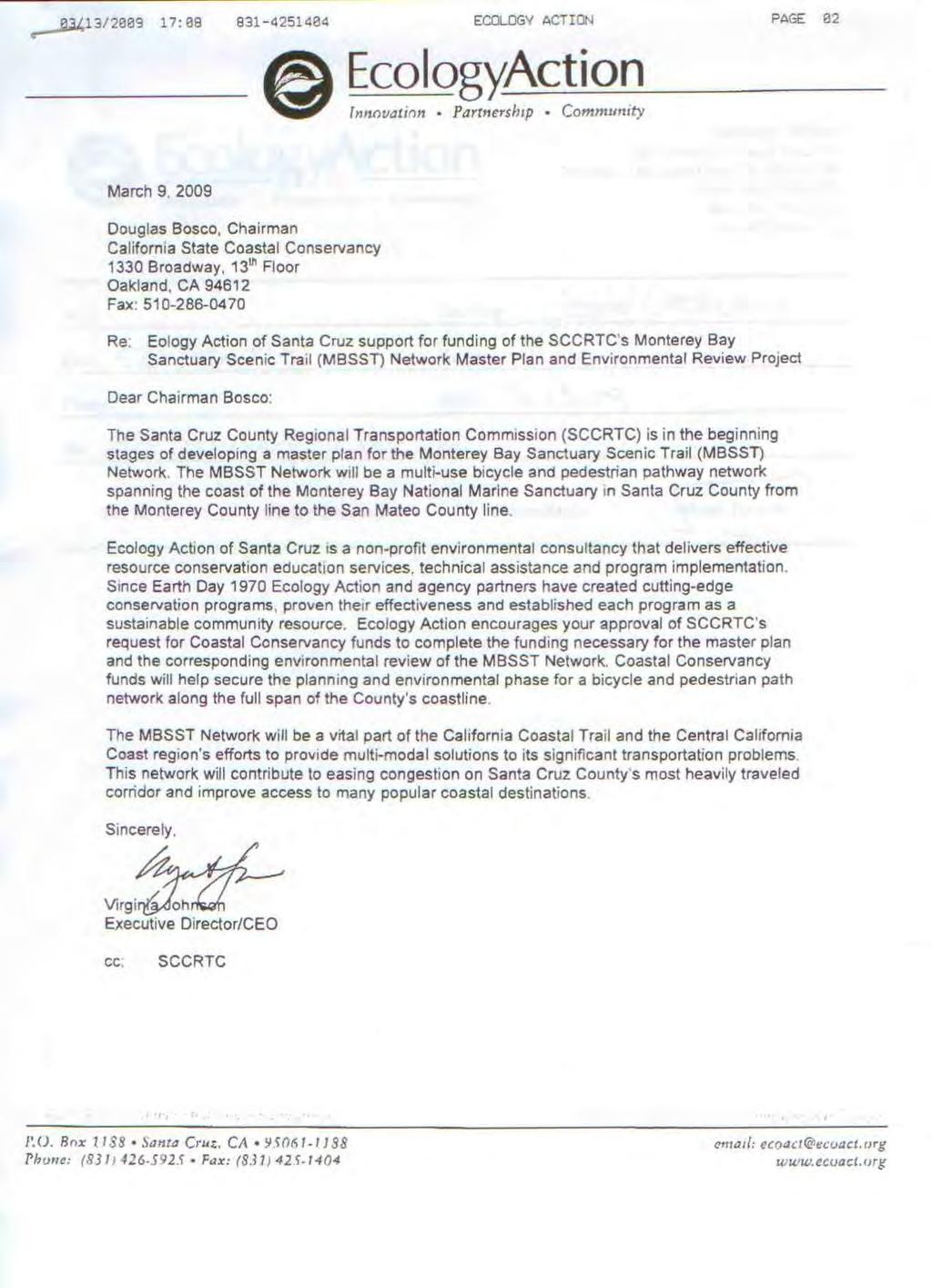
33 The Campaign for Sensible Transportation P.O. Box 604, Santa Cruz, CA Douglas Bosco, Chairman California State Coastal Conservancy 1330 Broadway, 13th Floor Oakland, CA March 13, 2009 Re: Urging support for funding the Monterey Bay Sanctuary Scenic Trail Project Dear Chairman Bosco: We are writing to express our enthusiastic support for the Monterey Bay Sanctuary Scenic Trail (MBSST) Project, and to urge the Coastal Conservancy to provide funds to complete the master plan and the corresponding environmental review for this project. The MBSST will be a multi-use bicycle and pedestrian pathway that will span the entire coast of the Monterey Bay National Marine Sanctuary, which includes the full span of the coastline of Santa Cruz County. This project has the strong support of the Santa Cruz County Regional Transportation Commission. The Campaign for Sensible Transportation is a group of individuals and organizations focused on Santa Cruz County policies and issues, an active group formed in Our mission is to promote an effective transportation system that makes it easier to get around and decreases the stress and frustration of driving, without causing increased air and noise pollution and without degrading the aesthetic quality of our surroundings. (More details are available from our website at The MBSST Network clearly fits our mission: It will be a vital part of the California Coastal Trail and the efforts in our region to provide multi-modal solutions to its significant transportation problems. The Network will also contribute to easing congestion on Santa Cruz County s most heavily traveled corridor, and improve access to the many popular destinations along our coast. Sincerely, cc: SCCRTC Paul Elerick, Chair The Campaign for Sensible Transportation Participating Organizations: Fishhook Neighbors Santa Cruz Friends Meeting Sierra Club Aptos Neighbors Board of Directors Mission Pedestrian People Power Watsonville Brown Berets

34 c/o The Hub, 703 Pacific Ave., Santa Cruz, CA April 10, 2009 Douglas Bosco, Chairman California State Coastal Conservancy 1330 Broadway, 13 th Floor Oakland, CA Fax: Re: Friends Of the Rail/Trail s (FORT) support for funding of the SCCRTC s Monterey Bay Sanctuary Scenic Trail (MBSST) Network Master Plan and Environmental Review Project Dear Chairman Bosco: The Santa Cruz County Regional Transportation Commission (SCCRTC) is in the beginning stages of developing a master plan for the Monterey Bay Sanctuary Scenic Trail (MBSST) Network. The MBSST Network will be a multi-use bicycle and pedestrian pathway network spanning the coast of the Monterey Bay National Marine Sanctuary in Santa Cruz County from the Monterey County line to the San Mateo County line. FORT encourages your approval of SCCRTC s request for Coastal Conservancy funds to complete the funding necessary for the master plan and the corresponding environmental review of the MBSST Network. Coastal Conservancy funds will help secure the planning and environmental phase for a bicycle and pedestrian path network along the full span of the County s coastline. FORT believes that the UP rail corridor through Santa Cruz County is an ideal location for significant sections of the MBSST network as it is both scenic and accessible to a large portion of the population, offering a safe and direct route near or on the coast and separate from automobile traffic. Half of the population of Santa Cruz County lives within one mile of the tracks and almost one-third lives within a half-mile. As you no doubt know, this purchase of this corridor from Union Pacific is currently under negotiation by the SCCRTC and sufficient monies from California State Proposition 116 and other sources have been allocated for this purpose. The MBSST Network will be a vital part of the California Coastal Trail and the Central California Coast region s efforts to provide multi-modal solutions to its significant transportation problems. This network will contribute to easing congestion on Santa Cruz County s most heavily traveled corridor and improve access to many popular coastal destinations. Sincerely, Bruce Sawhill Mike Dalbey Co-chairs, FORT cc: SCCRTC
35
36
37 MARGUERITE MEYER[Design & Production 431 Logan Street Santa Cruz, CA (831) March 6, 2009 Douglas Bosco, Chairman California State Coastal Conservancy 1330 Broadway, 13th Floor Oakland, CA Fax: Re: My support for funding of the SCCRTC s Monterey Bay Sanctuary Scenic Trail (MBSST) Network Master Plan and Environmental Review Project Dear Chairman Bosco: The Santa Cruz County Regional Transportation Commission (SCCRTC) is in the beginning stages of developing a master plan for the Monterey Bay Sanctuary Scenic Trail (MBSST) Network. The MBSST Network will be a multi-use bicycle and pedestrian pathway network spanning the coast of the Monterey Bay National Marine Sanctuary in Santa Cruz County from the Monterey County line to the San Mateo County line. I encourage your approval of SCCRTC s request for Coastal Conservancy funds to complete the funding necessary for the master plan and the corresponding environmental review of the MBSST Network. Coastal Conservancy funds will help secure the planning and environmental phase for a bicycle and pedestrian path network along the full span of the County s coastline. I have lived and worked in the communities of the Monterey Bay for 40 of my 50 living years. With daily regularity I ride my bicycle to commute along the Bay between the communities, sometimes all the way from Carmel to Santa Cruz. It is often not so easy to navigate in the higher car traffic areas. The plan for the Scenic Trail is very important to commuters and recreationalists like me and more importantly to attract people to this form of transportation who would travel by bicycle if it were more safe to do so. The MBSST Network will be a vital part of the California Coastal Trail and the Central California Coast region s efforts to provide multi-modal solutions to its significant transportation problems. This network will contribute to easing congestion on Santa Cruz County s most heavily traveled corridor and improve access to many popular coastal destinations. Sincerely, Marguerite Meyer cc: SCCRTC
38
39 March 6, 2009 Douglas Bosco, Chairman California State Coastal Conservancy 1330 Broadway, 13 th Floor Oakland, CA Fax: Re: Timely Data Resources support for funding of the SCCRTC s Monterey Bay Sanctuary Scenic Trail (MBSST) Network Master Plan and Environmental Review Project Dear Chairman Bosco: The Santa Cruz County Regional Transportation Commission (SCCRTC) is in the beginning stages of developing a master plan for the Monterey Bay Sanctuary Scenic Trail (MBSST) Network. The MBSST Network will be a multi-use bicycle and pedestrian pathway network spanning the coast of the Monterey Bay National Marine Sanctuary in Santa Cruz County from the Monterey County line to the San Mateo County line. TImley Data Resources encourages your approval of SCCRTC s request for Coastal Conservancy funds to complete the funding necessary for the master plan and the corresponding environmental review of the MBSST Network. Coastal Conservancy funds will help secure the planning and environmental phase for a bicycle and pedestrian path network along the full span of the County s coastline. We are a small business in Santa Cruz and our employees would benefit from this trail. The MBSST Network will be a vital part of the California Coastal Trail and the Central California Coast region s efforts to provide multi-modal solutions to its significant transportation problems. This network will contribute to easing congestion on Santa Cruz County s most heavily traveled corridor and improve access to many popular coastal destinations. Sincerely, Timely Data Resources, Inc. 107 Washburn Avenue, Capitola, CA Phone: (831) Fax: (831) support@tdrdata.com
COASTAL CONSERVANCY. Staff Recommendation June 5, 2008 GUALALA BLUFF TRAIL OPERATIONS AND MAINTENANCE
 COASTAL CONSERVANCY Staff Recommendation June 5, 2008 GUALALA BLUFF TRAIL OPERATIONS AND MAINTENANCE File No. 08-047-01 Project Manager: Deborah Hirst RECOMMENDED ACTION: Consideration and possible Conservancy
COASTAL CONSERVANCY. Staff Recommendation September 22, 2011 BAY AREA RIDGE TRAIL: HOOD MOUNTAIN TO HIGHWAY 12
 COASTAL CONSERVANCY Staff Recommendation September 22, 2011 BAY AREA RIDGE TRAIL: HOOD MOUNTAIN TO HIGHWAY 12 File No. 11-039-001 Project Manager: Betsy Wilson RECOMMENDED ACTION: Authorization to disburse
COASTAL CONSERVANCY. Staff Recommendation December 2, 2004 COYOTE HELLYER COUNTY PARK BAY AREA RIDGE TRAIL
 COASTAL CONSERVANCY Staff Recommendation December 2, 2004 COYOTE HELLYER COUNTY PARK BAY AREA RIDGE TRAIL File No. 04-057 Project Manager: Amy Hutzel RECOMMENDED ACTION: Authorization to disburse up to
COASTAL CONSERVANCY. Staff Recommendation March 25, 2004 SONOMA COUNTY COASTAL TRAIL, PHASE I. File No Project Manager: Richard Retecki
 COASTAL CONSERVANCY Staff Recommendation March 25, 2004 SONOMA COUNTY COASTAL TRAIL, PHASE I File No. 03-142 Project Manager: Richard Retecki RECOMMENDED ACTION: Authorization to disburse up to $455,000
COASTAL CONSERVANCY. Staff Recommendation October 21, 2010 PETALUMA TRESTLE REHABILITATION DESIGN
 COASTAL CONSERVANCY Staff Recommendation October 21, 2010 PETALUMA TRESTLE REHABILITATION DESIGN Project No.: 10-017-01 Project Manager: Deborah Hirst RECOMMENDED ACTION: Authorization to disburse up to
COASTAL CONSERVANCY. Staff Recommendation November 6, 2008 SAN FRANCISCO BAY TRAIL: CANAL BOULEVARD CONSTRUCTION
 COASTAL CONSERVANCY Staff Recommendation November 6, 2008 SAN FRANCISCO BAY TRAIL: CANAL BOULEVARD CONSTRUCTION File No. 07-037-02 Project Manager: Michelle Jesperson RECOMMENDED ACTION: Authorization
COASTAL CONSERVANCY. Staff Recommendation March 17, 2011 EAST-SLOPE SONOMA MOUNTAIN RIDGE TRAIL PLANNING
 COASTAL CONSERVANCY Staff Recommendation March 17, 2011 EAST-SLOPE SONOMA MOUNTAIN RIDGE TRAIL PLANNING File No. 11-008-01 Project Manager: Sam Jenniches RECOMMENDED ACTION: Authorization to disburse up
Blueways: Rivers, lakes, or streams with public access for recreation that includes fishing, nature observation, and opportunities for boating.
 Parks, Open Space and Trails PRINCE WILLIAM COUNTY 2008 COMPREHENSIVE PLAN TRAILS PLAN CONTENTS The components of the trails plan are: Intent Definitions Goals, Policies, and Action Strategies Trails Map
COASTAL CONSERVANCY. Staff Recommendation December 13, 2007 SANTA ANA RIVER PARKWAY. File No Project Manager: Mary Small
 COASTAL CONSERVANCY Staff Recommendation December 13, 2007 SANTA ANA RIVER PARKWAY File No. 07-097 Project Manager: Mary Small RECOMMENDED ACTION: Authorize disbursement of up to two million seven hundred
COASTAL CONSERVANCY. Staff Recommendation May 27, 2010 SAN DIEGUITO RIVER PARK TRAILS PHASE II TRAIL DESIGN AND CONSTRUCTION
 COASTAL CONSERVANCY Staff Recommendation May 27, 2010 SAN DIEGUITO RIVER PARK TRAILS PHASE II TRAIL DESIGN AND CONSTRUCTION File No. 05-031-02 Project Manager: Christopher Kroll RECOMMENDED ACTION: Authorization
FEASIBILITY CRITERIA
 This chapter describes the methodology and criteria used to evaluate the feasibility of developing trails throughout the study areas. Land availability, habitat sensitivity, roadway crossings and on-street
COASTAL CONSERVANCY. Staff Recommendation October 18, 2012 USAL-SHADY DELL CREEK CALIFORNIA COASTAL TRAIL PLANNING
 COASTAL CONSERVANCY Staff Recommendation October 18, 2012 USAL-SHADY DELL CREEK CALIFORNIA COASTAL TRAIL PLANNING Project No. 10-030-02 Project Manager: Karyn Gear RECOMMENDED ACTION: Consideration and
CHAPTER 4 -- THE LAND USE PLAN: DESCRIPTIONS AND POLICIES FOR THIRTEEN PLANNING AREAS
 CHAPTER 4 -- THE LAND USE PLAN: DESCRIPTIONS AND POLICIES FOR THIRTEEN PLANNING AREAS NORTH CENTRAL CAC AREA LITTLE VALLEY ROAD TO JUG HANDLE CREEK PLANNING AREA This planning area includes Cleone, Noyo,
AGENDA ITEM 5 D WAKULLA ENVIRONMENTAL INSTITUTE (WEI) TRAIL FEASIBILITY STUDY
 TRAIL FEASIBILITY STUDY") March 19, 2018 AGENDA ITEM 5 D WAKULLA ENVIRONMENTAL INSTITUTE (WEI) TRAIL FEASIBILITY STUDY TYPE OF ITEM: Action STATEMENT OF ISSUE The Wakulla Environmental Institute (WEI) Trail is one of several trails
March 19, 2018 AGENDA ITEM 5 D WAKULLA ENVIRONMENTAL INSTITUTE (WEI) TRAIL FEASIBILITY STUDY TYPE OF ITEM: Action STATEMENT OF ISSUE The Wakulla Environmental Institute (WEI) Trail is one of several trails
Continental Divide National Scenic Trail Legislative History and Planning Guidance
 Continental Divide National Scenic Trail Legislative History and Planning Guidance Legislation, Policy, and Direction Regarding National Scenic Trails The National Trails System Act, P.L. 90-543, was passed
2. Goals and Policies. The following are the adopted Parks and Trails Goals for Stillwater Township:
 D. PARKS AND TRAILS 1. Introduction Stillwater Township s population is relatively low, with most residents living on rural residences on large lots. The need for active park space has been minimal in
Georgetown-Lewes Rail/Trail Study. Rail/Trail Study: Cool Spring to Cape Henlopen State Park New Road Extension (House Resolution No.
 Georgetown-Lewes Rail/Trail Study Rail/Trail Study: Cool Spring to Cape Henlopen State Park New Road Extension (House Resolution No. 47) August 22, 2011 Presentation Outline Background Benefits Statewide
Citrus Heights Creek Corridor Trail Project Trail Advisory Group Field Trip #2 September 11, :00 11:00 am Trellis Hall, Citrus Heights
 September 11, 2013 9:00 11:00 am Trellis Hall, Citrus Heights Project Overview The City of Citrus Heights is studying the feasibility of establishing a multi use trail system within the City s 26 miles
Waukee Trailhead Public Art and Amenities Project
 Waukee - Trailhead Public Art and Amenities Project Sponsor Waukee Project Title Waukee Trailhead Public Art and Amenities Project Termini Description ( i.e. Park Avenue to 19th Street) NE Intersection
COASTAL CONSERVANCY. Staff Recommendation December 4, 2008 TIMBER COVE COASTAL TRAIL FEASIBILITY STUDY
 COASTAL CONSERVANCY Staff Recommendation December 4, 2008 TIMBER COVE COASTAL TRAIL FEASIBILITY STUDY File No. 08-138-01 Project Manager: Matthew Gerhart RECOMMENDED ACTION: Authorization to disburse up
ROAD AND TRAIL PROJECT APPROVAL
 ROAD AND TRAIL PROJECT APPROVAL www.marincountyparks.org Marin County Parks, 3501 Civic Center Dr, Suite 260, San Rafael, CA 94903 DATE: July 12, 2017 PRESERVE: Gary Giacomini Open Space Preserve PROJECT:
The Vision for the San Juan Islands Scenic Byway
 The Vision for the San Juan Islands Scenic Byway 2 Judd Cove, Orcas Island, Courtesy of Kurt Thorson (kurtthorson.com) and San Juan County Land Bank Vision for the San Juan Islands Scenic Byway The San
Chapter 6: POLICY AND PROCEDURE RECOMMENDATIONS
 Chapter 6 POLICY AND PROCEDURE RECOMMENDATIONS FOR SRRA Below are seven policy elements that should be considered for adoption by the Southwest Regional Recreation Authority of Virginia: 1. Develop strategies
Flow Stand Up Paddle Board Parkway Plan Analysis
 Regional Parks Department Jeffrey R. Leatherman, Director County of Sacramento Divisions Administration Golf Leisure Services Maintenance Rangers Therapeutic Recreation Services Flow Stand Up Paddle Board
Logo Department Name Agency Organization Organization Address Information 5700 North Sabino Canyon Road
 Logo Department Name Agency Organization Organization Address Information United States Forest Coronado National Forest 5700 North Sabino Canyon Road Department of Service Santa Catalina Ranger District
Parkland County Municipal Development Plan Amendment Acheson Industrial Area Structure Plan
 Parkland County Municipal Development Plan Amendment Acheson Industrial Area Structure Plan New Plan Acheson Industrial Area Structure Plan Amendment Parkland County Municipal Development Plan Board Reference
Longmont to Boulder Regional Trail Jay Road Connection DRAFT FINAL REPORT
 Longmont to Boulder Regional Trail Jay Road Connection DRAFT FINAL REPORT December 2018 Project Summary Boulder County, Colorado, in partnership with the City of Boulder, is evaluating options for multi-use
MEETING MINUTES District 1 Trail Planning Meeting 1
 MEETING MINUTES District 1 Trail Planning Meeting 1 June 1, 2017 2:00 PM 3:30 PM City of Two Harbors 2:00 Introductions Attendees: Lisa Austin, MnDOT Bryan Anderson, MnDOT Jasna Hadzic-Stanek, MnDOT Justin
PROPOSED PROCESS FOR WRITING THE MASTER PLAN FOR THE BIG SUR PORTION OF THE CALIFORNIA COASTAL TRAIL
 PROPOSED PROCESS FOR WRITING THE MASTER PLAN FOR THE BIG SUR PORTION OF THE CALIFORNIA COASTAL TRAIL PURPOSE The purpose of this process is to agree on the Master Plan for the portion of the California
At the time, the portion of the line through Eagle County remains wholly under the ownership of Union Pacific Railroad (UP).
.") Chapter 5 The Railroad Corridor as a Trail Corridor The intent of this chapter is to identify how the rail corridor, if available for lease or purchase in all or part, could be incorporated into the core
Chapter 5 The Railroad Corridor as a Trail Corridor The intent of this chapter is to identify how the rail corridor, if available for lease or purchase in all or part, could be incorporated into the core
COMMENT PERIOD INTRODUCTION
 To: Interested Persons From: Tom Buford File: Del Rio Trail Project Date: June 8, 2018 Community Development Department Reference: NOTICE OF PREPARATION OF AN ENVIRONMENTAL IMPACT REPORT FOR THE DEL RIO
Procedure for the Use of Power-Driven Mobility Devices on Mass Audubon Sanctuaries 1 September 17, 2012
 Procedure for the Use of Power-Driven Mobility Devices on Mass Audubon Sanctuaries 1 September 17, 2012 Background As part of Mass Audubon s mission to preserve the nature of Massachusetts for people and
A CASE FOR COMPLETING THE JORDAN RIVER PARKWAY: A
 A CASE FOR COMPLETING THE JORDAN RIVER PARKWAY: A safe crossing at 9000 South and 850 West Proposed 9000 South Underpass Parkway Timeline Parkway, Trail, and Tourism Facts Blueprint Jordan River 1971 1973
UNITED STATES DEPARTMENT OF THE INTERIOR BUREAU OF LAND MANAGEMENT MANUAL TRANSMITTAL SHEET
 Form 1221-2 (June 1969) UNITED STATES DEPARTMENT OF THE INTERIOR BUREAU OF LAND MANAGEMENT MANUAL TRANSMITTAL SHEET Release 8-83 Date Subject 8353 Trail Management Areas Secretarially Designated (Public)
Little River Trail Feasibility Study
 Final April, 2014 Prepared for the State Coastal Conservancy By the Natural Resources Services Division of Redwood Community Action Agency Table of Contents Executive Summary... 1 1. Project Purpose and
Airport Planning Area
 PLANNING AREA POLICIES l AIRPORT Airport Planning Area LOCATION AND CONTEXT The Airport Planning Area ( Airport area ) is a key part of Boise s economy and transportation network; it features a multi-purpose
Rule Governing the Designation and Establishment of All-Terrain Vehicle Use Trails on State Land
 Rule Governing the Designation and Establishment of All-Terrain Vehicle Use Trails on State Land 1.0 Authority 1.1 This rule is promulgated pursuant to 23 V.S.A. 3506. Section 3506 (b)(4) states that an
City of Durango 5.8 FUNDING TRAILS DEVELOPMENT
 5.8 FUNDING TRAILS DEVELOPMENT The City has been successful in establishing dedicated local funding sources as well as applying for grants to develop the City s trail system, having received nearly $2.4
2016 Regional Transportation Alternatives Program (TAP) Grant Application
 Grant Application") 2016 Regional Transportation Alternatives Program (TAP) Grant Application PROJECT TITLE: Yelm-Tenino Trail Extension Feasibility Study TRPC use only GENERAL PROJECT INFORMATION Agency or Organization City
2016 Regional Transportation Alternatives Program (TAP) Grant Application PROJECT TITLE: Yelm-Tenino Trail Extension Feasibility Study TRPC use only GENERAL PROJECT INFORMATION Agency or Organization City
SCENIC TRAIL NETWORK MASTER PLAN. Prepared for the: SANTA CRUZ COUNTY REGIONAL TRANSPORTATION COMMISSION
 m o n t e r e y b a y s a nc tu a ry SCENIC TRAIL NETWORK MASTER PLAN Prepared for the: SANTA CRUZ COUNTY REGIONAL TRANSPORTATION COMMISSION ADOPTED 11-07-2013 REVISED 2-06-2014 ACKNOWLEDGMENTS Congressman
Jefferson County Non-Motorized Transportation and Recreational Trails Plan 2010
 Chapter 8: Goals and objectives Plan Update: The following update presents general principles, goals, and objectives related to non-motorized transportation facilities as a component of the overall transportation
4.0 Context for the Crossing Project
 4.0 Context for the Crossing Project This section provides background information about key features of the North Douglas Crossing project area, and opportunities and constraints. This information is important
Draft for approval by TCC on 2/3, TAQC on 2/9 and ARC Board on 2/22. Regional Trail Plan. Mike Alexander, Director, Center for Livable Communities
 DATE: February 3, 2017 ISSUE SUMMARY: Regional Trail Plan FROM: Mike Alexander, Director, Center for Livable Communities IMPORTANCE: In May 2016, ARC adopted the active transportation component of the
Blue River Trail Master Plan JSA to Town Hall June 2004
 Blue River Trail Master Plan JSA to Town Hall June 2004 Prepared for: Silverthorne Town Council Silverthorne SPORT Committee Department of Recreation and Culture Silverthorne Public Works Silverthorne
Rivanna Trails Foundation
 a project of the Rivanna Trails Foundation Source www.rivanna.avenue.org Who we are The mission of the Rivanna Trails Foundation (RTF) is to create, promote the creation of, and protect footpaths, trails
January 14, Orange County Transportation Authority Attn: M2 NCCP/HCP 550 South Main Street P.O. Box Orange, CA
 Equestrian Trails, Inc. Corral 357 P.O. Box 1026 Trabuco Canyon, CA 92678 http://saddlebackcanyonriders.com/ President: James Iacono... 714-612-1789 January 14, 2016 Orange County Transportation Authority
Economic Development and Tourism
 SECTION 4 SECTION 4 Economic Development and Tourism 4. Economic Development and Tourism Tourism plays a very important role in Niagara s economy, providing employment and generating business for support
Port Gamble Shoreline Area Conceptual Trail Proposal
 The North Kitsap Trails Association is pleased to be a partner to the Kitsap Forest and Bay Project and assist Kitsap County, Forterra, Olympic Property Group, Great Peninsula Conservancy and the Port
APPENDIX OFFICIAL MAP ORDINANCE OF HAMILTONBAN TOWNSHIP OFFICIAL MAP NARRATIVE
 APPENDIX A OFFICIAL MAP ORDINANCE OF HAMILTONBAN TOWNSHIP OFFICIAL MAP NARRATIVE INTRODUCTION: The Official Map of Hamiltonban Township has been prepared to identify those lands and features that Hamiltonban
Nassau County Bridge Authority (N.Y. Public Authorities Law 651) 2007 Annual Report
 2007 Annual Report") Nassau County Bridge Authority (N.Y. Public Authorities Law 651) 2007 Annual Report The Nassau County Bridge Authority is a public benefit corporation created by the New York State Legislature in 1945
Nassau County Bridge Authority (N.Y. Public Authorities Law 651) 2007 Annual Report The Nassau County Bridge Authority is a public benefit corporation created by the New York State Legislature in 1945
Proposal to Redevelop Lower Kananaskis River-Barrier Lake. Bow Valley Provincial Park. Frequently Asked Questions
 Proposal to Redevelop Lower Kananaskis River-Barrier Lake Bow Valley Provincial Park Frequently Asked Questions What is being proposed? What are the details of the proposal? Where is the project area located?
Environment and Natural Resources Trust Fund 2019 Request for Proposals (RFP)
") Environment and Natural Resources Trust Fund 2019 Request for Proposals (RFP) Project Title: Glacial Edge Trail and Downtown Pedestrian Bridge Category: G. Land Acquisition for Habitat and Recreation ENRTF
Environment and Natural Resources Trust Fund 2019 Request for Proposals (RFP) Project Title: Glacial Edge Trail and Downtown Pedestrian Bridge Category: G. Land Acquisition for Habitat and Recreation ENRTF
CHAPTER 4 -- THE LAND USE PLAN: DESCRIPTIONS AND POLICIES FOR THIRTEEN PLANNING AREAS
 CHAPTER 4 -- THE LAND USE PLAN: DESCRIPTIONS AND POLICIES FOR THIRTEEN PLANNING AREAS NORTH CENTRAL CAC PLANNING AREA 4.4 FORT BRAGG CITY LIMIT TO HARE CREEK PLANNING AREA (Includes Noyo) The Noyo community
CHAPTER 9. PARKS, RECREATION, TRAILS AND NATURAL AREA RESOURCES
 CHAPTER 9. PARKS, RECREATION, TRAILS AND NATURAL AREA RESOURCES The forms of recreation chosen by residents and visitors in the CBJ are as diverse as the population. Many people choose to recreate in developed
Welcome to the Cross County Trail Public Input Session!
 Welcome to the Cross County Trail Public Input Session! Please sign in on the table below! What are we doing here? Camden County has proposed a bicycle and pedestrian trail spanning across the entire county.
MASTER PLAN EXECUTIVE SUMMARY
 Biscuit Run State Park Scottsville Road (State Route 20) Charlottesville, VA 22902 Biscuit Run State Park MASTER PLAN EXECUTIVE SUMMARY Department of Conservation and Recreation Division of Planning and
Nassau County Bridge Authority (N.Y. Public Authorities Law 651) 2011 Annual Report
 2011 Annual Report") Nassau County Bridge Authority (N.Y. Public Authorities Law 651) 2011 Annual Report The Nassau County Bridge Authority is a public benefit corporation created by the New York State Legislature in 1945
Nassau County Bridge Authority (N.Y. Public Authorities Law 651) 2011 Annual Report The Nassau County Bridge Authority is a public benefit corporation created by the New York State Legislature in 1945
CHAPTER III: TRAIL DESIGN STANDARDS, SPECIFICATIONS & PERMITS
 CHAPTER III Trail Design Standards, Specifications & Permits This chapter discusses trail standards, preferred surface types for different activities, permits, and other requirements one must consider
Chatsworth Branch Library Devonshire Street, Chatsworth, CA Thursday, November 16, :00-8:00 pm
 Chatsworth Branch Library 21052 Devonshire Street, Chatsworth, CA 91311 Thursday, November 16, 2017 6:00-8:00 pm Project Team County of Los Angeles Department of Parks and Recreation Kathline King Chief
4.19 Parks, Recreation, and Conservation Lands
 interchange would have on the Reed Paige Clark Homestead located on the north side of Stonehenge Road. Alternative D would also affect Palmer Homestead, E.F. Adams House, and Knapp Brothers Shoe Manufacturing
CHAPTER 5. Chapter 5 Recreation Element
 CHAPTER 5 Recreation Element Chapter 5 Recreation Element The Recreation Element of the Meyers Area Plan is a supplement to the Recreation Element of the TRPA Regional Plan and the El Dorado County General
The Chu property is a 6.57 acre parcel located in the Town of Superior on the west side of McCaslin Boulevard. In 2014, the Town of Superior acquired
 1 The Chu property is a 6.57 acre parcel located in the Town of Superior on the west side of McCaslin Boulevard. In 2014, the Town of Superior acquired the Chu property for open space with a contribution
Silver Lake Park An Environmental Jewel for the Citizens of Prince William County
 Silver Lake Park An Environmental Jewel for the Citizens of Prince William County The Prince William Park Authority Mission Statement states: The Prince William County Park Authority will create quality
White Mountain National Forest Saco Ranger District
 United States Department of Agriculture Forest Service White Mountain National Forest Saco Ranger District 33 Kancamagus Highway Conway, NH 03818 Comm: (603) 447-5448 TTY: (603) 447-3121 File Code: 1950
Stevenson Ranch Library The Old Road, Stevenson Ranch, CA Thursday, November 9, :00-8:00 pm
 Stevenson Ranch Library 25950 The Old Road, Stevenson Ranch, CA 91381 Thursday, November 9, 2017 6:00-8:00 pm Project Team County of Los Angeles Department of Parks and Recreation Kathline King Chief of
BACKCOUNTRY TRAIL FLOOD REHABILITATION PROGRAM
 BACKCOUNTRY TRAIL FLOOD REHABILITATION PROGRAM Backcountry Trail Flood Rehabilitation A June 2013 Flood Recovery Program Summary In June 2013, parts of Southern Alberta were devastated from significant
Greater Minnesota Regional Parks and Trails Commission Designation Application
 Greater Minnesota Regional Parks and Trails Commission Designation Application General Section Designation Application #: 15-050D Date Submitted: 06/30/2015 Park or Trail Name: Perham to Pelican Rapids
NATIONAL PARK SERVICE CERTIFICATION OF COMPLETED SEGMENTS OF THE NORTH COUNTRY NATIONAL SCENIC TRAIL
 NATIONAL PARK SERVICE CERTIFICATION OF COMPLETED SEGMENTS OF THE NORTH COUNTRY NATIONAL SCENIC TRAIL Completed trail segments that (1) follow the route identified in the 1982 National Park Service (NPS)
County of Sonoma Agenda Item Summary Report
 Revision No. 20170501-1 of Sonoma Agenda Item Summary Report Agenda Item Number: 37 (This Section for use by Clerk of the Board Only.) Clerk of the Board 575 Administration Drive Santa Rosa, CA 95403 To:
CHAPTER 4 -- THE LAND USE PLAN: DESCRIPTIONS AND POLICIES FOR THIRTEEN PLANNING AREAS
 CHAPTER 4 -- THE LAND USE PLAN: DESCRIPTIONS AND POLICIES FOR THIRTEEN PLANNING AREAS SOUTH COAST CAC PLANNING AREA 4.10 NAVARRO RIVER TO MALLO PASS CREEK PLANNING AREA (Includes Greenwood/Elk) This planning
SANTA CRUZ PROPERTY FOR SALE
 SANTA CRUZ PROPERTY FOR SALE 1911-1919 Soquel Avenue and 108 Eastgate Avenue Santa Cruz, CA 95062 Price: $5,387,000 Building Size: 15,447sf Land Size: 50,962sf 100% Leased to Longtime Tenants The information
Chapter 2: Summary of Existing Open Space System
 Chapter 2: Summary of Existing Open Space System In 1976, the Wake County Board of Commissioners established the Wake County Parks and Recreation Department in order to provide park facilities and programs
Auburn Trail / Ontario Pathways Trail Connector Feasibility Study Public Information Meeting Wednesday, August 22, 2012
 Auburn Trail / Ontario Pathways Trail Connector Feasibility Study Public Information Meeting Wednesday, August 22, 2012 Purpose of Feasibility Study Purpose Evaluate the feasibility of constructing a multiuse
13.1 REGIONAL TOURISM ISSUES AND SUMMARY OF FINDINGS
 13 REGIONAL TOURISM T he County of Mariposa s recreation needs and facilities fall within two categories: regional tourism and local recreation. This Element focuses on regional tourism issues related
Stage 2 ION: Light Rail Transit (LRT) from Kitchener to Cambridge
 from Kitchener to Cambridge") Stage 2 ION: Light Rail Transit (LRT) from Kitchener to Cambridge Public Consultation Centre (PCC) No. 3 Please Sign-in Cambridge City Hall November 21, 2017 2:00 to 8:00pm Preston Memorial Auditorium
Stage 2 ION: Light Rail Transit (LRT) from Kitchener to Cambridge Public Consultation Centre (PCC) No. 3 Please Sign-in Cambridge City Hall November 21, 2017 2:00 to 8:00pm Preston Memorial Auditorium
Appendix L Technical Memorandum Aesthetics
 Technical Memorandum Aesthetics 1.0 AESTHETICS This section provides a discussion of the aesthetic resources in the vicinity of ARTIC. Aesthetics pertain to the elements that make a certain view pleasing
Executive Summary Downtown Park Fund Allocation HEARING DATE: MAY 5, 2016
 Executive Summary Downtown Park Fund Allocation HEARING DATE: MAY 5, 2016 Date: April 28, 2016 Case No.: 2016 004634CWP Project Name: Allocation of $4,000,000 from the Downtown Park Fund for the Renovation
Lafourche Parish Government REQUEST FOR QUALIFICATIONS. Landscape Architectural Services
 Lafourche Parish Government REQUEST FOR QUALIFICATIONS Landscape Architectural Services Bayou Lafourche Parish Multi-Use Path Feasibility Study Phase 1 And Bayou Lafourche Parish Multi-Use Path Feasibility
DRAFT FINAL ACCESSIBILITY GUIDELINES FOR OUTDOOR DEVELOPED AREAS
 Date: October 19, 2009 DRAFT FINAL ACCESSIBILITY GUIDELINES FOR OUTDOOR DEVELOPED AREAS Introduction Background Whom Guidelines Apply To How to Submit Comments Contact for Further Information General Issues:
Land Management Summary
 photo credit: ANGAIR Anglesea Heath Land Management Summary The Anglesea Heath (6,501 ha) was incorporated into the Great Otway National Park in January 2018. This provides an opportunity to consider the
FINAL TESTIMONY 1 COMMITTEE ON RESOURCES UNITED STATES HOUSE OF REPRESENTATIVES. July 13, 2005 CONCERNING. Motorized Recreational Use of Federal Lands
 FINAL TESTIMONY 1 STATEMENT OF DALE BOSWORTH CHIEF Of the FOREST SERVICE UNITED STATES DEPARTMENT OF AGRICULTURE Before the SUBCOMMITTEE ON FORESTS AND FOREST HEALTH And the SUBCOMMITTEE ON NATIONAL PARKS,
RE: Access Fund Comments on Yosemite National Park Wilderness Stewardship Plan, Preliminary Ideas and Concepts
 September 30, 2016 Superintendent Yosemite National Park Attn: Wilderness Stewardship Plan P.O. Box 577 Yosemite, CA 95389 RE: Access Fund Comments on Yosemite National Park Wilderness Stewardship Plan,
Briefing Pack for the role of Executive Manager, Roads and Drainage Whitsunday Regional Council
 Briefing Pack for the role of Executive Manager, Roads and Drainage Whitsunday Regional Council Whitehaven Beach Closing date for Applications is Monday 15 th May 2017 BRIEFING PACK CONTENTS THE POSITION,
ANCLOTE COASTAL TRAIL ALTERNATIVES ANALYSIS STUDY
 ANCLOTE COASTAL TRAIL ALTERNATIVES ANALYSIS STUDY PASCO COUNTY MPO JULY 2015 PROJECT OVERVIEW... INTRODUCTION EXECUTIVE SUMMARY CONTEXT... TAMPA BAY AREA, PINELLAS, & PASCO COUNTY S MULTI-USE TRAIL PLANS
Wilderness Areas Designated by the White Pine County bill
 Wilderness Areas Designated by the White Pine County bill SEC. 321. SHORT TITLE. This subtitle may be cited as the `Pam White Wilderness Act of 2006'. SEC. 322. FINDINGS. Congress finds that-- The White
Chapter 6. Trail Design. Trail Design
 Chapter 6 Trail Design Trail Design The trail winds through a region rich in scenic beauty, cultural, and natural history. Volunteer landscape architects working with the Core and Planning Teams, have
DATE: 23 March, 2011 TO: Communities FROM: BlazeSports America. RE: Accessible Trails Checklist 1
 M E M O R A N D U M DATE: 23 March, 2011 TO: Communities FROM: BlazeSports America RE: Accessible Trails Checklist 1 The purpose of the Accessible Trails Checklist (below) is to help the community review
Minimum Requirements References in National Park Service Policy
 Minimum Requirements References in National Park Service Policy 2006 NPS Management Policies Chapter 6: Wilderness Preservation and Management 6.3 Wilderness Resource Management 6.3.1 General Policy (in
Appendix 3. Greenway Design Standards. The Whitemarsh Township Greenway Plan
 Appendix 3 Greenway Design Standards This chapter discusses two design standards for the greenway types discussed above. First, trail design standards are presented together with trailhead facilities and
Decision Memo Broken Wheel Ranch Equestrian Outfitter Special-Use Permit Proposed Action
 Decision Memo Broken Wheel Ranch Equestrian Outfitter Special-Use Permit USDA Forest Service Mississippi Bluffs Ranger District, Shawnee National Forest Jackson and Union Counties, Illinois Proposed Action
Chapter 4: Parks, Recreation and Trails
 Chapter 4: Parks, Recreation and Trails Physical Setting a. Parks & Recreation The Gaviota Coast is well known as a coastal recreation destination of local and statewide importance due in part to the unspoiled
MONTEREY REGIONAL AIRPORT MASTER PLAN TOPICAL QUESTIONS FROM THE PLANNING ADVISORY COMMITTEE AND TOPICAL RESPONSES
 MONTEREY REGIONAL AIRPORT MASTER PLAN TOPICAL QUESTIONS FROM THE PLANNING ADVISORY COMMITTEE AND TOPICAL RESPONSES Recurring topics emerged in some of the comments and questions raised by members of the
CHAPTER 4 -- THE LAND USE PLAN: DESCRIPTIONS AND POLICIES FOR THIRTEEN PLANNING AREAS
 CHAPTER 4 -- THE LAND USE PLAN: DESCRIPTIONS AND POLICIES FOR THIRTEEN PLANNING AREAS SOUTH COAST CAC PLANNING AREA 4.11 MALLO PASS CREEK TO IVERSEN ROAD PLANNING AREA (Irish Beach/Manchester/Point Arena)
Please find the attached letter and resolution from the MPO Chair, Commissioner Richard Blattner. The original letter has been mailed to you.
 From: Singer Kathy [mailto:singerk@browardmpo.org] Sent: Thursday, March 17, 2016 5:15 PM To: Kiar, Martin Cc: Barrocas, Scott ; Henry, Bertha ;
To: Cam Hooley From: Trails 2000 Date: September 30, 2016 Re: Hermosa Comments. Dear Cam:
 ! To: Cam Hooley From: Trails 2000 Date: September 30, 2016 Re: Hermosa Comments Dear Cam: Trails 2000 is commenting on the Forest Service Management Plan for the Hermosa Creek Watershed Management Plan
PALO CORONA REGIONAL PARK MPRPD BOARD MEETING AUGUST 8, 2018
 PALO CORONA REGIONAL PARK MPRPD BOARD MEETING AUGUST 8, 2018 ACKNOWLEDGEMENTS AGENCIES AND ORGANIZATIONS The Trust for Public Land Big Sur Land Trust Santa Lucia Conservancy California State Parks Point
DATE: January 19, WCA Governing Board. Johnathan Perisho, Project Manager. Mark Stanley, Executive Officer
 Item 14 DATE: January 19, 2017 TO: FROM: THROUGH: SUBJECT: WCA Governing Board Johnathan Perisho, Project Manager Mark Stanley, Executive Officer Item 14: Consideration of a resolution to accept an acquisition
H. R IN THE HOUSE OF REPRESENTATIVES
 I 113TH CONGRESS 1ST SESSION H. R. 1776 To establish the Clear Creek National Recreation Area in San Benito and Fresno Counties, to designate the Joaquin Rocks Wilderness in such counties, to designate
Segment 2: La Crescent to Miller s Corner
 goal of the USFWS refuges is to conserve, protect and enhance fish, wildlife and plants and their habitats for the continuing benefit of the American people. Refuge lands are used largely for fishing,
2016 PARKS UPDATE YOUR PARKS!
 2016 PARKS UPDATE YOUR PARKS! #ThatsMy PARK DEAR PARK SUPPORTER, Our state parks and beaches are healing places of beauty, solace and renewal. They provide opportunites for exercise, recreation and learning.