Granite Mountain Avalanche Fatality, December 31st, 2015 Report prepared by NWAC
|
|
|
- Chad Wright
- 6 years ago
- Views:
Transcription
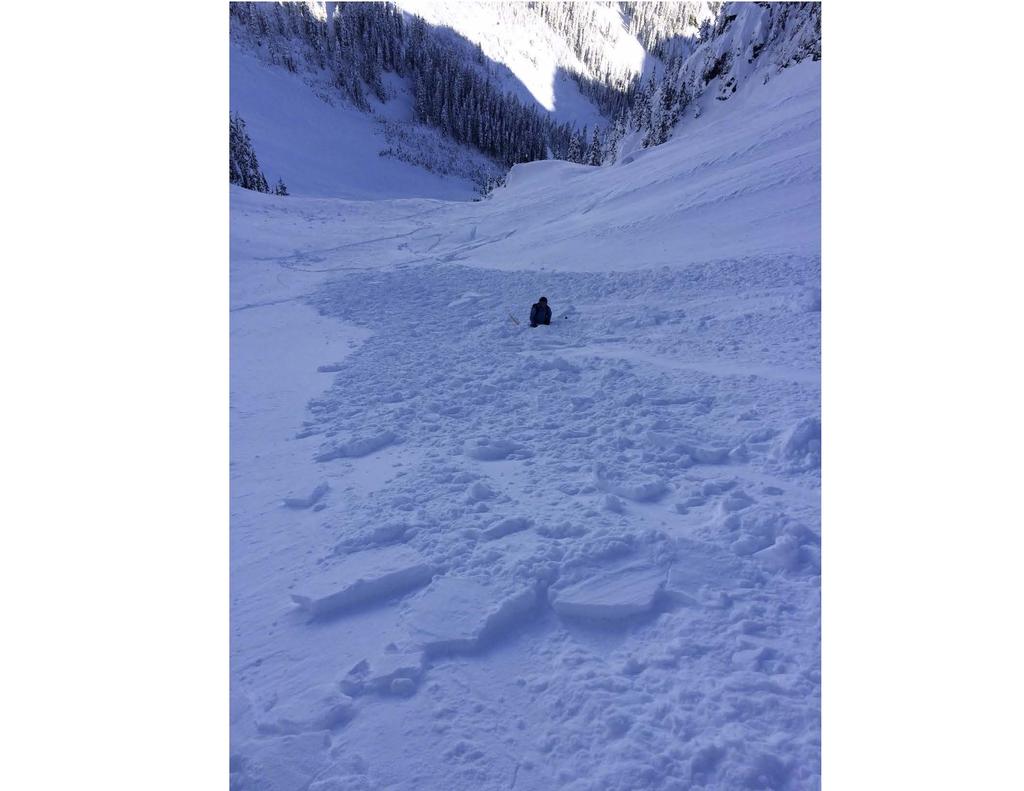
1 Granite Mountain Avalanche Fatality, December 31st, 2015 Report prepared by NWAC Incident snapshot (All avalanche fields estimated from interview with Seattle Mountain Rescue) Time and Date: Mid-day or afternoon, December 31 st, 2015 Location: Granite Mountain, King County, Mt Baker-Snoqualmie Forest, Washington State Number in Party: 3 Snowshoers Number caught: 1 Number partially buried, non-critical (non-critical means head was exposed): 1 Number killed: 1 (Trauma) Avalanche type: Hard Slab Trigger: est Snowshoer, Unintentional Size Destructive Force: est D1 or D2 Size Relative to Path: Unknown Start Zone Aspect: SSW Start Zone Elevation: Unknown Sliding surface: est In new snow Height of Crown Face: Unknown Width of Fracture: Unknown Vertical Fall: Unknown, but presumed to be several hundred feet Slab Hardness: est Pencil Slab Grain Type: est Wind broken precipitation particles or Wind Packed (Rounded Grains) Terrain Trap: Yes, Trees in Runout Party crossed start zone before avalanche: Unknown Location of subject relative to Start Zone: Unknown Avalanche occurred during: Unknown Signs of Instability Noted by Group: Unknown Avalanche safety gear carried by party: None Avalanche Training and Experience: Victim was a very experienced climber/snowshoer with at least some formal avalanche training and familiar with the NWAC avalanche forecast. The other two snowshoers reportedly had little experience. NWAC Forecast Zone: Snoqualmie Pass NWAC Avalanche Danger Rating in effect for start zone (near treeline): Moderate Narrative and Rescue: After departing from the trailhead around 10:30 or 11:00 AM, the other two snowshoers in the group turned back near treeline (3900 ft) due to the strong winds and blowing snow. They were behind the victim and lost visual contact as he ascended above treeline and out of sight. The initial 911 call was placed by the other members of the group in the afternoon after the victim failed to return. Seattle Mountain Rescue (SMR), one of several SAR units involved in the rescue effort, was contacted by King County Sheriff s Office at 5:15 PM on 12/31/15. A SMR team climbed through high winds during the evening and night of 12/31/15 to check the route and summit for the missing snowshoer. SMR bivyed in a snow cave near the summit until first light and then descended to continue searching.
2 Olympic, Tacoma, and Everett Mountain Rescue teams were called in as well to help with the search on New Year's Day. As the SMR team descended, they found avalanche debris and requested the additional teams help search the area. Shortly after, an Olympic Mountain Rescue Team spotted the victim as they entered the debris field from below. All teams then worked to evacuate the victim back to the trailhead. Supplemental Rescue Notes: Strong winds continued overnight and through the morning of the 1st, SMR estimated 70 mph, lean into wind, Beaufort scale interpretation for that description equals knots (40-45 mph) with higher gusts likely. No large cornice formation: Traditional east facing cornices obliterated by east winds, only one east-facing cornice noted. Ridgelines scoured by winds, crampons used above treeline. Comments from NWAC Forecasters (Dennis D'Amico) After the snowiest week in Snoqualmie Pass s recorded history (Dec 18th-24th) and the snowiest December overall (records courtesy WSDOT), December ended on a dry note with three consecutive dry days. Snoqualmie Pass weather station winds were consistently moderate out of the east hours prior to this incident, with much stronger winds experienced west of the Snoqualmie Pass Summit, including at Granite Mountain (see photos/videos). Temperatures stayed cold due to the easterly flow despite free-air freezing levels significantly warming for areas further to the west such as the Olympics and Mt. Baker area. Despite the lack of specifics regarding this incident, we can say that it was probable that the victim triggered a shallow wind slab that developed because of the strong east winds through the Snoqualmie Pass area. Several generally small skier triggered wind slabs were reported in the Snoqualmie Pass and Mt. Rainier area from December 30 th through January 1 st. Both areas are subject to east wind events loading non-traditional westerly aspects. Relevant public observations submitted to NWAC of shallow human triggered wind slab avalanches on December 31st are attached near the end of this report. The notable difference between the public observations and the fatal avalanche is that the fatal avalanche ended in a deadly treed terrain trap. NWAC did not interview the other two members of the group whom had stopped near treeline while the victim continued his ascent. Since there were no witnesses with this incident, we do not know if the separate wind slab avalanche to the west (identified in photos) of the fatal avalanche was natural or human triggered.


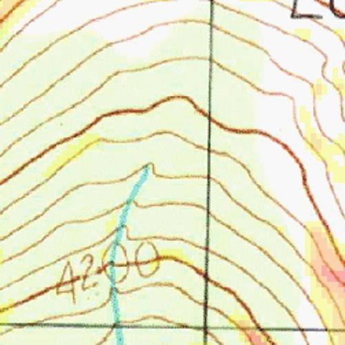
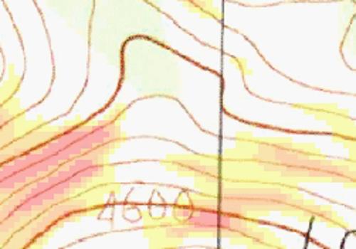
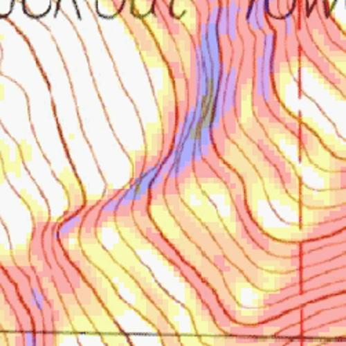
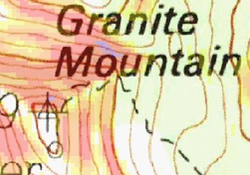
3 Debris found in avalanche path #1 (discovered first by rescue team) Location victim was found in path #2 (incident avalanche)
 Location victim was found in path #2 (incident")
4 Debris found in avalanche path #1 (discovered first by rescue team) Location victim was found in path #2 (incident avalanche)
 where the victim was found.")
5 Photos 1-4 by Russell Anschell of Seattle Mountain Rescue during recovery on January 1st, 2016 Photo 1: Looking uphill at avalanche path #2 (incident avalanche) where the victim was found. Victim was found about 30 feet to the left of the photo location.

6 Photo 2: Location where the victim was found in path #2.


7 Photo 3 and 4: Looking uphill and downhill respectively of avalanche path #1. Debris found in path #1 was discovered first. The victim was later located to the east in path #2.
8 Additional photos and videos from a solo climber on Granite Mountain that morning prior to the incident can be found at:
9 Northwest Avalanche Center Observation forecasts observations blog education accidents events about support nwac Recreational Observation Skinning up to the "mainline chute" of the Kendall Chutes (approached via skiing Commonwealth Basin and Sterling Direct) Dec. 31, 2015, noon PST Weather: Clear, cold and windy. Snowpack: Mostly dry, unconsolidated power, which some subtle crusts in some places, and some new shallow wind-affected/windslab in others (lee slopes near ridgelines). Area Description: North facing slopes of the ridge above Kendall Lakes (Kendall Chutes) Avalanches: While skinning up to the "Mainline Chute" I set off a very small winddeposited slab which propagated above me into a small, shallow dry/slab windslab avalanche that carried me about feet with no burial or injury. Latitude: Longitude: Did you see any avalanches? Yes Did you trigger any avalanches? Yes Was anyone caught in an Avalanche? Yes
10
11 Northwest Avalanche Center Observation forecasts observations blog education accidents events about support nwac Recreational Observation Snoqualmie Pass Dec. 31, 2015, 10 a.m. PST Elevation: Near treeline Aspect: W Did you see any avalanches? No Did you trigger any avalanches? No Was anyone caught in an Avalanche? No Comments: On the west / leeward side of Tinkham, snow below the rideline was wind loaded for feet below the crest (at 4.8K), and readily cracked, with limited propagation. This included the upper reaches of the Twin Lakes Couloir / Zipper Chute, which we declined to ski. Descending in the trees on the same aspact further south, the top 6 inches of snow were highly faceted and rotten feeling, but on a stable / solid base.

12 Northwest Avalanche Center Observation forecasts observations blog education accidents events about support nwac Recreational Observation Our party of two were coming out from an overnight in the Tatoosh area - following the road route from Refection Lake. When we arrived at the avalanche zone above Narada Falls, we observed many wind-blown features on the road and the route was completely covered. Further progress on the south end of the zone demonsrated some cracking (18" to 24") in the front of the snowshoes. Snowpack analysis reveled a wind-slab had been formed from the previous nights wind. Additionally, some surface hoar was observed on the night prior in the Refection Lake area. We deemed the route too dangerous and retreated to the Mazama Ridge route for safe crossing. Dec. 31, 2015, 8:15 a.m. PST Weather: Clear sky with variable winds at with gusts to 30. Snowpack: Storm layer well formed and consolidated. Observed 8" to 10" wind slab layer on NW Facing slope above Narada Falls. Area Description: Above Narada Falls / Inspiration Point - MRNP Avalanches: No natural or human-triggered avalanches were observed. Observation by Tim Kirk Latitude: Longitude: Did you see any avalanches? No Did you trigger any avalanches? No Was anyone caught in an Avalanche? No
13 Northwest Avalanche Center Washington Department of Transportation Snoqualmie Pass, Washington 3770' temp above Lake Keechelus MM/DD Hour PST Temp F 3760' Temp F 3770' Temp F 3010' RH % 3010' Wind Avg 3760' Wind Max 3760' Wind Dir 3760' Hour Prec. 3010' Total Prec. 3010' 24 Hr Snow 3010' Total Snow 3010' Press mb 3010' 1/ / / / / / / / / / / / / / / / / / / / / / / / / / / / / /
14 Forecast Northwest Avalanche Center Avalanche Region Snoqualmie Pass Issued: 6:00 PM PST Wednesday, December 30, 2015 by Garth Ferber NWAC avalanche forecasts apply to backcountry avalanche terrain in the Olympics, Washington Cascades and Mt Hood area. These forecasts do not apply to developed ski areas, avalanche terrain affecting highways and higher terrain on the volcanic peaks above the Cascade crest level. The Bottom Line: A MODERATE danger means human triggered avalanches are possible. Watch mainly for possible wind slab on a variety of aspects and for possible loose wet avalanches on steep solar slopes. Watch out for dangerous tree bombs and stay in sight of your partner.
15 Northwest Avalanche Center Avalanche Region Forecast Issued: 6:00 PM PST Wednesday, December 30, 2015 by Garth Ferber Elevation Thursday Outlook for Friday Above Treeline Moderate Heightened avalanche conditions on specific terrain features. Evaluate snow and terrain carefully; identify problem features. Moderate Near Treeline Moderate Heightened avalanche conditions on specific terrain features. Evaluate snow and terrain carefully; identify problem features. Moderate Below Treeline Low Generally safe, watch for unstable snow on isolated terrain features. Low Danger Scale No Rating Low Moderate Considerable High Extreme


16 Northwest Avalanche Center Avalanche Region Forecast Issued: 6:00 PM PST Wednesday, December 30, 2015 by Garth Ferber Avalanche Problems for Thursday Wind Slab Wind slabs can take up to a week to stabilize. They are confined to lee and cross-loaded terrain features and can be avoided by sticking to sheltered or wind scoured areas. Avalanche Problem Aspect/Elevation Likelihood Size Loose Wet Loose wet avalanches occur where water is running through the snowpack, and release at or below the trigger point. Avoid terrain traps such as cliffs, gullies, or tree wells. Exit avalanche terrain when you see pinwheels, roller balls, a slushy surface, or during rain-on-snow events. Avalanche Problem Aspect/Elevation Likelihood Size
17 Snowpack Analysis: Northwest Avalanche Center Avalanche Region Forecast A cool very snowy storm cycle brought 5-9 feet of snowfall along the west slopes the week ending December 24th. Light additional accumulations in the past week have allowed the snowpack to slowly settle with good skiing. A weak weather system Sunday and Monday helped create some new mostly small and mostly shallow wind slab in many areas. There have been numerous triggered wind slabs the past week but with each passing day the ease of trigger seems to be diminishing. Storm slabs have all but settled and are no longer a problem of note. Storm snow has been gradually settling but remains mostly right side up and continues to offer some excellent conditions. Here are summaries for a couple of the latest reports for the west slopes. A report via the NWAC Observations for Moonlight Bowl on Skyline Ridge at Stevens Pass on Tuesday indicated generally unreactive wind slab and right side up snow on steep north slopes and no signs of instability. NWAC pro observer Lee Lazzara was in the Bagley Lake area near Mt Baker on Tuesday and found a generally right side up snow pack with some wind slab but also lacking a weak layer or interface. Lots of skiers around Bagley Lakes triggered only small loose dry avalanches. A small loose wet was also seen on the south side of Table Mountain. NWAC pro observers Dallas Glass and Ian Nicholson were on Chair Peak at Snoqualmie today and reported that wind slab was a bit more prevalent there than the past couple days. Dallas triggered a small wind slab on a degree north slope at about 5500 feet.they saw another skier triggered wind slab on a southwest slope about 600 feet below a ridge. They felt wind slab should be possible there on a variety of slopes and to 1000 feet below ridges. Detailed Forecast for Thursday: Sunny weather should be seen on Thursday. Warmer temperatures should be seen at higher elevations in the north Cascades by Thursday afternoon. Cool temperatures with possible low clouds should be seen in the Cascade passes especially Snoqualmie. This weather should allow older wind slab to continue to slowly settle and stabilize. Wind slab will most likely be found on north to southeast aspects near and above tree line. New wind slab may also be found on west to northwest aspects mainly in the Cascade Passes. Any wind slab avalanches should be confined to surface layers. Watch and test for inverted strong over weak storm snow. The sunny weather and warmer temperatures at higher elevations mainly in the north Cascades should bring the possibility of loose wet avalanches Thursday afternoon on steep solar slopes. Watch for surface wet snow deeper than a few inches, initial roller balls and natural loose wet avalanches on steep solar slopes where snow may shed from rocks or cliffs. A lot of snow has been seen in trees lately along the west slopes. Stay away from trees if you see trees starting to shed snow due to sunny weather on Thursday afternoon. A tree bomb can be just as fatal as an avalanche! There have been snow immersion fatalities in tree wells already this season at Snoqualmie and in Canada. Tree wells may still be lurking so stick near your partner in the trees and maintain visual contact.

18 American Avalanche Association Forest Service National Avalanche Center Avalanche Incident Report: Short Form Occurrence Date (YYYYMMDD): and Time (HHMM): Comments: All avalanche charactistics and incident details are estimated from interviews with Seattle Mountain Rescue whom extracted the victim the next morning. No fracture line profile was visible the next day due to continued wind loading. NWAC was unable to Reporting Party Name and Address: Dennis D'Amico Northwest Avalanche Center 7600 Sandpoint Way, Bld 1 Seattle, WA Avalanche Characteristics: Type: HS Aspect: SSW Trigger: AI Slope Angle: Size: R \ D -12 Elevation: m / ft Sliding surface (check one): In new New/old In old Ground interview the other two members of the victim's party. See full NWAC report for details and pictures. Location: State: WA County: King Forest: Mt Baker - Snoqualmie Peak, Mtn Pass, or Drainage: Granite Mountain Site Name: Lat/Lon or UTM: Group Number of People Caught 1 Partially Buried Not critical Time recovered 1 9:45 AM next day Duration of burial est hrs Depth to Face m / ft Partially Buried-- Critical Completely Buried Number of people injured: Number of people killed: 1 1 Dimensions m / ft Height of Crown Face Width of Fracture Vertical Fall Average est several hundred feet Maximum Snow Hardness Grain Type Grain Size (mm) Slab P Wind broken precipitation particles or Wind Packed Weak Layer Bed Surface Thickness of weak layer: mm / cm / in Burial involved a terrain trap? no yes type: Trees in Runout Number of people that crossed start zone before the avalanche: Unknown Location of group in relation to start zone during avalanche: high middle low below all unknown Avalanche occurred during ascent descent Subject Name Age Gender Address Phone Activity 1 Doug Walker 65 M Seattle Snowshoeing 2 Unknown Snowshoeing 3 Unknown Snowshoeing 4 5 Equipment Carried Transceiver Shovel Probe Experience at Activity Unknown Novice Intermediate Advanced Expert Avalanche Training Unknown None Some Advanced Expert
19 Signs of Instability Noted by Group Unknown None Recent avalanches Shooting cracks Collapse or whumphing Low test scores Injuries Sustained None First Aid Doctor s care Hospital Stay Fatal Damage Number of Vehicles Caught: Number Structures Destroyed: Estimated Loss: $ Extent of Injuries or Cause of Death Asphyxiation Head Trauma Spinal Injury Chest Trauma Skeletal Fractures Other: Trauma Accident Summary Include: events leading to accident, group s familiarity with location, objectives, route, hazard evaluation, etc. See attached report Rescue Summary Include: description of initial search, report of accident, organized rescue, etc. After departing from the trailhead around 10:30 or 11:00 AM, the other two snowshoers in the group turned back near treeline (3900 ft) due to the strong winds and blowing snow. They were behind the victim and lost visual contact as he ascended above treeline and out of sight. The initial 911 call was placed by the other members of the group in the afternoon after the victim failed to return. Seattle Mountain Rescue (SMR), one of several SAR units involved in the rescue effort, was contacted by King County Sheriff s Office at 5:15 PM on 12/31/15. A SMR team climbed through high winds during the evening and night of 12/31/15 to check the route and summit for the missing snowshoer. SMR bivyed in a snow cave near the summit until first light and then descended to continue searching. Olympic, Tacoma, and Everett Mountain Rescue teams were called in as well to help with the search on New Year's Day. As the SMR team descended, they found avalanche debris and requested the additional teams help search the area. Shortly after, an Olympic Mountain Rescue Team spotted the victim as they entered the debris field from below. All teams then worked to evacuate the victim back to the trailhead. Rescue Method Self rescue Transceiver Spot probe Probe line Rescue dog Voice Object Digging Other: Supplemental Rescue Notes: Strong winds continued overnight and through the morning, SMR estimated 70 mph, lean into wind, Beaufort scale interpretation for that description equals knots (40-45 mph) with higher gusts likely. No large cornice formation: Traditional east facing cornices obliterated by east winds, only one east-facing cornice noted Ridgelines scoured by winds, crampons used above treeline Attach additional pages as needed. Include weather history, snow profiles, reports from other agencies, diagram of site, photographs, and any other supporting information Additional information including narrative, topographic maps, NWAC avalanche forecast in effect, relevant weather history, public observations and incident photos are available in NWAC full report. Please send to: CAIC; 325 Broadway WS1; Boulder CO 80305; caic@state.co.us and to the nearest Avalanche Center. 2
American Avalanche Association Forest Service National Avalanche Center Avalanche Incident Report: Long Form
 American Avalanche Association Forest Service National Avalanche Center Avalanche Incident Report: Long Form Please send to: CAIC; 325 Broadway WS1; Boulder CO 80305; caic@qwest.net; Fax (303) 499-9618
Corona Bowl Avalanche Incident, December 6th, 2015
 Corona Bowl Avalanche Incident, December 6th, 2015 Report prepared by NWAC and Stevens Pass Pro Patrol Incident snapshot Time and Date: 11:48 AM, December 6 th, 2015 Location: Corona Bowl, Chief Mountain,
Morning Star Peak Avalanche Accident
 Morning Star Peak Avalanche Accident Saturday, December 4, 2010 Date: 2010-12-13 Submitted by: Oyvind Henningsen Everett Mountain Rescue and Mark Moore NWAC Place: Morning Star Peak, north-central WA Cascades
Avalanche Mountain Incident March 4 th, 2017
 Avalanche Mountain Incident March 4 th, 2017 Report by Dennis D Amico, Robert Hahn and Jeremy Allyn Incident snapshot Occurrence Time and Date: Approximately 3 pm on March 4th, 2017 Time First Reported
American Avalanche Association Forest Service National Avalanche Center Avalanche Incident Report: Short Form
 American Avalanche Association Forest Service National Avalanche Center Avalanche Incident Report: Short Form Occurrence Date (YYYYMMDD): 20170205 and Time (HHMM): 1100 Comments: Most avalanche characterists
Park Butte Avalanche Fatality March 10 th, 2018
 Park Butte Avalanche Fatality March 10 th, 2018 Report by Lee Lazzara and Dennis D Amico, Northwest Avalanche Center Recovery details provided by Whatcom County Sheriff s Office Incident snapshot Occurrence
Slot Couloir Accident, Snoqualmie Mt
 Body Page 1 Slot Couloir Accident, Snoqualmie Mt 4-27-14 Date and Time: estimated 12 pm, Sunday 4/27/14 Location: Slot Couloir, Snoqualmie Mt Number in Party: 2 backcountry skiers Number hurt: 1 backcountry
Excelsior Pass Avalanche Accident January 1, 2008
 Excelsior Pass Avalanche Accident January 1, 2008 Accident Summary Time: 1 January 2008, approximately 13:00 hrs Location: Near Excelsior Pass to east of Church Mt, Northern Washington Cascades WA Activity:
Avalanche danger high in parts of NCW
 3/23/2017 Avalanche danger high in parts of NCW THURSDAY, MARCH 23, 2017 Avalanche danger high in parts of NCW by Christine Pratt Public Safety Feb. 9, 2017, 4:52 p.m. Photo provided An avalanche hit the
Cottonwood Lake Avalanche Fatality February, 25th 2018
 Cottonwood Lake Avalanche Fatality February, 25th 2018 Report by Josh Hirshberg and Dennis D Amico, Northwest Avalanche Center Incident snapshot Occurrence Time and Date: Approximately 12:00pm Feb 25,
Lane Peak, Fly Couloir Avalanche 2/25/2017
 Lane Peak, Fly Couloir Avalanche 2/25/2017 NWAC Report by Jeremy Allyn and Dennis D Amico Incident snapshot: Occurrence Time and Date: 1234 pm, February 25, 2017 Lat/Lon: 46.7581, -121.7531 (estimated,
Snow Lake Divide Avalanche Fatality February 25th, 2018
 Snow Lake Divide Avalanche Fatality February 25th, 2018 Report by Jeremy Allyn and Dennis D Amico, Northwest Avalanche Center Incident snapshot: Occurrence Time and Date: February 25, 2018 (estimated time:
SYNOPSIS WEATHER AND SNOWPACK
 Peak 6996 Avalanche Fatality Incident Report Glacier National Park, MT Date of Avalanche: 31 March 2010 Date of Investigation: 2 April 2010 Investigation Team: Erich Peitzsch (USGS), Ted Steiner (Chugach
Avalanche Awareness and Leading a Companion Rescue
 Avalanche Awareness and Leading a Companion Rescue Introduction: Traveling in the backcountry is a great way to enjoy the outdoors and friends. It s important that when we travel in the backcountry we
Henderson Mountain Avalanche Accident Two riders caught, one partially buried, one fully buried
 Henderson Mountain Avalanche Accident Two riders caught, one partially buried, one fully buried Custer-Gallatin National Forest 28 November 2014 Synopsis A group of 6 or 7 snowmobilers (part of a larger
Typical avalanche problems
 Typical avalanche problems The European Avalanche Warning Services (EAWS) describes five typical avalanche problems or situations as they occur in avalanche terrain. The Utah Avalanche Center (UAC) has
Twin Lakes Avalanche Incident 1/31/2016
 Twin Lakes Avalanche Incident 1/31/2016 Location: Place State Published by: Dave Bingaman (PAC), George Halcom (PAC), and Kent May (PAC) Twin Lakes, Salmon River Mountains Idaho Date 01/31/2016 Time Summary
NWAC Blog. Cornices - don't walk the line! Written by Robert Hahn on March 14, Last update on May 15, 2017.
 NWAC Blog Cornices - don't walk the line! Written by Robert Hahn on March 14, 2017. Last update on May 15, 2017. Human-triggered cornice fall avalanche from March 10th, 2017. The crown release exposed
Number Caught: 2 Partially Buried, Non-Critical: 1 Partially Buried, Critical: 0 Fully Buried: 1 Injured: 1 Killed: 1
 South Waldron Creek Avalanche Fatality 2 snowmobilers caught, 1 carried and injured, 1 fully buried and killed. Teton River, MT Helena-Lewis and Clark National Forest January 5 th, 2019 Avalanche Details
Part 1: Introduction to Decision Making
 Part 1: Introduction to Decision Making 1.1 - Anatomy of a Decision ABOUT AIARE Learning Outcomes Identify that backcountry decision making involves five key components: Plan, Observe, Teamwork, Choose
Swede Creek Avalanche Incident Report Swede Creek, Whitefish Range, MT Date of Avalanche: 23 January 2016 Date of Site Visit: 24 January 2016
 Swede Creek Avalanche Incident Report Swede Creek, Whitefish Range, MT Date of Avalanche: 23 January 2016 Date of Site Visit: 24 January 2016 INCIDENT SYNOPSIS On Saturday, January 23, 2016, three snowmobilers
Crystal Mountain Snow Safety Union Creek Avalanche Accident Report December 2, 2007
 Crystal Mountain Snow Safety Union Creek Avalanche Accident Report December 2, 2007 Prepared by Paul Baugher, Chris Morin, Crystal Mt Ski Patrol/ Snow Safety and Mark Moore, NWAC Accident Summary Time:
Twin Peaks Near Miss Report Turnagain Pass, Kenai Mountains, Alaska
 Twin Peaks Near Miss Report Turnagain Pass, Kenai Mountains, Alaska Location: East Face, Twin Peaks Lat/Lon: 60.71343N, -149.38205E Date: February 3, 2018, Time: 3:50 pm Report by: Chugach National Forest
Avalanche Accident Report
 Hatcher Pass Avalanche Center POB 1223 Chickaloon, AK 99674 907-746-4566 info@hatcherpassavalanchecenter.org Avalanche Accident Report January 2, 2016 Avalanche Accident in Grubstake Gulch, Talkeetna Mountains,
Twin Wildcat Lakes Avalanche Wednesday, February 1, 2012 Incident Report
 Twin Wildcat Lakes Avalanche Wednesday, February 1, 2012 Incident Report February 17, 2012 Location: (See Appendix A-1 Maps) Hungry Horse Ranger District Flathead National Forest -Region One Flathead County
Proceedings, International Snow Science Workshop, Breckenridge, Colorado, 2016
 AVALANCHE FORECASTING AND MESSAGING FOR UNUSUAL AVALANCHE CONDITIONS IN A MARITIME SNOW CLIMATE-BURIED SURFACE HOAR INTERNATIONAL SNOW SCIENCE WORKSHOP 2016 IN BRECKENRIDGE, CO Steve A. Reynaud Sierra
The Kendall Trap. Charlie Hagedorn
 This photo-essay is neither a route-description nor a guide; it is intended to raise, among skiers already familiar with the area, awareness of hazards, to suggest not doing something. Take accredited
Avalanche Safety Guidelines
 Introduction Avalanche Safety Guidelines Worldwide, avalanches kill more than 150 people annually and thousands more are partly buried or injured. Although highway motorists and others can be involved
Avalanche Safety Guidelines This guideline is intended as a general introduction to this topic.
 Introduction Worldwide, avalanches kill more than 150 people annually and thousands more are partly buried or injured. Although highway motorists and others can be involved in an avalanche, climbers, backcountry
Proceedings, International Snow Science Workshop, Breckenridge, Colorado, 2016 ANALYSIS OF UTAH AVALANCHE FATALITIES IN THE MODERN ERA
 ANALYSIS OF UTAH AVALANCHE FATALITIES IN THE MODERN ERA Drew Hardesty 1 * 1 Utah Avalanche Center ABSTRACT: The Utah Avalanche Center (UAC) has records of Utah avalanche fatalities for the modern era,
2/16/2014 Idaho Frenchman Creek Published by Scott Savage, SAC
 Location: Place Frenchman Creek drainage, Smoky Mountains State Idaho Date 2/16/2014 Time 2:00pm Summary 4 snowmobilers buried, 1 killed, 1 injured Number: Caught 4 Fully Buried 4 Injured 1 Killed 1 Avalanche
Avalanche accident case study: Persistent buried weak layer in the Central Idaho Mountains
 Avalanche accident case study: Persistent buried weak layer in the Central Idaho Mountains Doug Abromeit* Forest Service National Avalanche Center Bozo Cardozo Sun Valley Helicopter Ski Guides Ketchum,
Washington Explorer Search and Rescue Pierce County Unit February 2013
 Washington Explorer Search and Rescue Pierce County Unit February 2013 Part I Winter Training Logistics Gear for Winter Training Building Snow Caves & Other Snow Shelters Winter Training Logistics - 2013
Elevation Bands Description of terrain characteristics to which the avalanche danger ratings apply.
 1 Definition of Terms used in Daily Trip Forms This document is part of Decision Making in Avalanche Terrain: a fieldbook for winter backcountry users by Pascal Haegeli, Roger Atkins and Karl Klassen and
MP : the top of the bottom switchback
 MP 237 238: the top of the bottom switchback For reference this section of U S Highway 40 has been called the top of the bottom switchback on the Grand County side of the Pass. It is here that the proposed
International Snow Science Workshop
 A PRACTICAL USE OF HISTORIC DATA TO MITIGATE WORKER EXPOSURE TO AVALANCHE HAZARD Jake Elkins Jackson Hole Mountain Resort, Teton Village, Wyoming Bob Comey* Jackson Hole Mountain Resort, Teton Village,
NivoTest : a personal assistant for avalanche risk assessment
 NivoTest : a personal assistant for avalanche risk assessment R.Bolognesi METEISK, CP 993, CH-1951 SION. www.meteorisk.com Introduction About avalanche risk Every mountaineer knows that avalanche hazard
2010 International Snow Science Workshop
 200 International Snow Science Workshop TEN YEARS OF AVALANCHE DEATHS IN THE UNITED STATES, 999/00 TO 2008/09 Dale Atkins* RECCO AB ABSTRACT: After reaching a twenty-year low in the late 980s avalanche
In southern Upper Valais a very high avalanche danger will be encountered in some regions Edition: , 08:00 / Next update: 9.1.
 Page 1/6 In southern Upper Valais a very high avalanche danger will be encountered in some regions Edition: 9.1.2018, 08:00 / Next update: 9.1.2018, 17:00 Avalanche danger updated on 9.1.2018, 08:00 region
ENVIRONMENTAL HAZARDS OF AVALANCHES: PRELIMINARY RESEARCH IN GLACIER NATIONAL PARK
 ENVIRONMENTAL HAZARDS OF AVALANCHES: PRELIMINARY RESEARCH IN GLACIER NATIONAL PARK Site Focus: Balu Pass, Glacier National Park, B.C. Avalanche path near Balu Pass. (Photo Courtesy of: www.leelau.net/2007/rogerspass/day1/1)
Avalanche Observations
 Avalanche Observations Avalanche Observations 3.1 Introduction Observations of past and present avalanche activity are of the utmost importance for any avalanche forecasting operation. These data should
AVALANCHE TERRAIN. Bill Glude Alaska Avalanche Specialists All photos and graphics Bill Glude unless otherwise noted.
 Bill Glude Alaska Avalanche Specialists 20111202 All photos and graphics Bill Glude unless otherwise noted. AVALANCHE TERRAIN The Key Questions 1.) Could the terrain produce an avalanche?! a.) Where you
Avalanches and the Mount Whitney Basin
 Avalanches and the Mount Whitney Basin 10 April 2006 by Bob Rockwell Prelude Avalanches are a fact of life in high mountains in winter, and we take courses to find out about them. We learn how to assess
Example of the layout of a Fieldwork Atlas
 Example of the layout of a Fieldwork Atlas Example of a Worksite with multiple facilities and work goals in one area: Map Center 49 3 46 N 117 3 11 W Noname Area with typical travel route marked. Avalanche
Ski / Sled tracks as an expression of avalanche risk Jordy Hendrikx 1 & Jerry Johnson 2,1 1.
 Ski / Sled tracks as an expression of avalanche risk Jordy Hendrikx 1 & Jerry Johnson 2,1 1 Snow and Avalanche Laboratory, Montana State University, Bozeman, Montana, USA 2 Political Science, Montana State
Mt. Thielsen Trip Report: April 29, 2012
 Mt. Thielsen Trip Report: April 29, 2012 Outing Organizer: Geoff Hance, with Brent McGregor Elevation Gain: 3,800 feet, over warming snow, with an exposed summit block Distance: About 9 miles round trip
Going-to-the-Sun Road, Glacier National Park, MT, USA Avalanche Path Atlas
 Going-to-the-Sun Road, Glacier National Park, MT, USA Avalanche Path Atlas Erich H. Peitzsch Daniel B. Fagre USGS Northern Rocky Mountain Science Center West Glacier, MT, USA Introduction... 2 Overview
International Snow Science Workshop
 Chinook Pass: 25 Years On John Stimberis*, Washington State Department of Transportation, Snoqualmie Pass, Washington, USA ABSTRACT: Washington State Route 410 over Chinook Pass (1656 m) is generally closed
Skyland Avalanche Saturday, February 25, 2012 Incident Report
 Skyland Avalanche Saturday, February 25, 2012 Incident Report April 12, 2012 Location: (See Appendix A-1 Maps) Hungry Horse Ranger District Flathead National Forest - Region One Flathead County, Montana
Proceedings, 2012 International Snow Science Workshop, Anchorage, Alaska
 I-90 SNOQUALMIE PASS: OPERATING A HIGHWAY AVALANCHE PROGRAM DURING A MAJOR CONSTRUCTION PROJECT John Stimberis, Washington State Department of Transportation ABSTRACT: Snoqualmie Pass, WA (921m) receives
TUPPER DESIGNATED ACCESS ROUTE
 TUPPER DESIGNATED ACCESS ROUTE 1 FOR ACCESS/EGRESS TO CONNAUGHT, LOOKOUT, STONE ARCH, PORTAL PATHS AND TUPPER TRAVERSE EGRESS Length: 2.6km Vertical Gain: +162m / -83m (Values are for access. For egress,
Snow camping: Once you try building an ice shelter, you just may dig it
 Snow camping: Once you try building an ice shelter, you just may dig it By KAREN SYKES SPECIAL TO THE POST-INTELLIGENCER From http://seattlepi.nwsource.com/getaways/121897/snow18.html If you've never spent
Chasing Skylines in Kyrgyzstan BMC Reference: 15/ 02
 Chasing Skylines in Kyrgyzstan 2015 BMC Reference: 15/ 02 21/02/2015 to 15/03/2015 Contact: Sophie Nunn Email: Sophienunn@gmail.com, Phone: 07540454054 Address: 7 Richmond Lodge, 6 Victoria Avenue, Swanage,
Route #1) Mt. of the Holy Cross - North Ridge
 Mt. of the Holy Cross - North Ridge") Climbing 14ers can be very dangerous, please read the Mountaineering Safety Page and make sure you have a map+compass and can use them effectively, without the help of electronic devices. Route #1) Mt.
Climbing 14ers can be very dangerous, please read the Mountaineering Safety Page and make sure you have a map+compass and can use them effectively, without the help of electronic devices. Route #1) Mt.
New Motorized Level I Avalanche Class!
 New Motorized Level I Avalanche Class! New guidelines by American Avalanche Association. Fast paced 24 hour class with minimum of 60% of hours on snow. This is a snowmobile/snow bike specific class and
LEVEL 1 - AVALANCHE OVERVIEW HANDOUT
 Bill Glude Alaska Avalanche Specialists 20111202 All photos and graphics Bill Glude unless otherwise noted. LEVEL 1 - AVALANCHE OVERVIEW HANDOUT Summary of Key Points Statistics 1 2 3 Urban Avalanches
Alaska Avalanche Information Center (AAIC) Season Summary Statewide AAIC Outreach Stats: ANCHORAGE (AAC)
 Season Summary Statewide AAIC Outreach Stats: ANCHORAGE (AAC)") Alaska Avalanche Information Center (AAIC) 2015-16 Season Summary Alaska experienced another unseasonably warm winter with heightened avalanche activity across many parts of the state in late November
Alaska Avalanche Information Center (AAIC) 2015-16 Season Summary Alaska experienced another unseasonably warm winter with heightened avalanche activity across many parts of the state in late November
International Snow Science Workshop
 IMPROVING K-9 AVALANCHE TEAM PERFORMANCE AND COMMUNICATION IN BACKCOUNTRY AVALANCHE MISSIONS: A COLLABORATIVE APPROACH BETWEEN SKI PATROL AND K-9 SEARCH AND RESCUE (SAR) TEAMS Susan Purvis *1 Patti Burnett
Self-Guided Group Organization - Recommendations
 Self-Guided Group Organization - Recommendations Introduction The purpose of this document is to offer a template to self-guided groups with respect to pre-trip and on-trip planning. The ultimate goal
23 rd National Avalanche School Snowbird Ski and Summer Resort, UT October 27-31,2013. Student Prework
 23 rd National Avalanche School Snowbird Ski and Summer Resort, UT October 27-31,2013 Student Prework MOUNTAIN SNOWPACK PRE-WORK (Ethan Greene) NOTE: For an introduction to the material to be covered read
Scenario #1 - GROUND SEARCH
 Scenario #1 - GROUND SEARCH An elderly male dementia patient has walked away from a residence in a rural area. He has done this before. It is now 1900hrs. He has been missing for four hours and needs medication.
Guide Training Ski TAP APPLICATION PACKAGE. Hello and thank you for your interest in applying to the ACMG Training and Assessment Program (TAP).
.") Hello and thank you for your interest in applying to the ACMG Training and Assessment Program (TAP). As of April 30, 2018, the ACMG will be running the program for an undetermined period. For any courses
Hello and thank you for your interest in applying to the ACMG Training and Assessment Program (TAP). As of April 30, 2018, the ACMG will be running the program for an undetermined period. For any courses
Proceedings, 2012 International Snow Science Workshop, Anchorage, Alaska
 HISTORICAL ANALYSIS OF AVALANCHE FATALITIES IN DENALI NATIONAL PARK Kevin Wright 1,2 and Tucker Chenoweth 1,3 1 Denali National Park Mountaineering Program, Talkeetna, AK, USA 2 Chugach National Forest
Avalanche Safety Basics By Sandy K. Ott
 Avalanche Safety Basics By Sandy K. Ott For Mountain Riders, or Those Going Into the Mountains to Ride There is one common theme when the avalanche experts go investigate avy incidents. The responses they
Proceedings, International Snow Science Workshop, Breckenridge, Colorado, 2016
 THE WHITE PASS AND YUKON ROUTE AVALANCHE PROGRAM, FORECASTING AND RISK MAN- AGEMENT FOR A HISTORICAL RAILROAD Bill Glude Alaska Avalanche Specialists, Juneau, AK The White Pass and Yukon Route (WPYR) is
THE SME AVALANCHE TRAGEDY OF JANUARY 20, 2003: A SUMMARY OF THE DATA. Dick Penniman* Snowbridge Associates Frank Baumann Baumann Engineering
 THE SME AVALANCHE TRAGEDY OF JANUARY 20, 2003: A SUMMARY OF THE DATA Dick Penniman* Snowbridge Associates Frank Baumann Baumann Engineering ABSTRACT: On January 20, 2003 guided skiers and snowboarders
Avalanche Incident on Twin Peaks Flint Creek Range December 24, 2013
 Avalanche Incident on Twin Peaks Flint Creek Range December 24, 2013 On December 24, 2013, a group of snowmobilers were riding in familiar terrain in the Flint Creek Range 8 miles southeast of Phillipsburg,
MP : Blue Hill and the Disney Avalanche Path
 MP 252-253: Blue Hill and the Disney Avalanche Path This section of the Auto Tour includes a portion of the wagon road, one of Colorado s most famous avalanches and the remains of an old dam. Route Mile
AN AVALANCHE CHARACTERIZATION CHECKLIST FOR BACKCOUNTRY TRAVEL DECISIONS. Roger Atkins* Canadian Mountain Holidays
 AN AVALANCHE CHARACTERIZATION CHECKLIST FOR BACKCOUNTRY TRAVEL DECISIONS Roger Atkins* Canadian Mountain Holidays ABSTRACT: This paper presents a checklist to assess the character of likely avalanche activity
AVIATION INVESTIGATION REPORT A05P0032 SETTLING WITH POWER ROLL-OVER
 Transportation Safety Board of Canada Bureau de la sécurité des transports du Canada AVIATION INVESTIGATION REPORT A05P0032 SETTLING WITH POWER ROLL-OVER TASMAN HELICOPTERS LTD. BELL 212 (HELICOPTER) C-GEEC
Jill Hawk Chief Ranger, Mount Rainier National Park Tahoma Woods, Star Route Ashford, WA 98304
 January 21, 2003 Jill Hawk Chief Ranger, Mount Rainier National Park Tahoma Woods, Star Route Ashford, WA 98304 Re: Analysis of the Mount Rainier Climbing Program; Proposal to Increase Special Fee Dear
Scottish Mountain Rescue Avalanche Burial Organised Rescue Response SCOTTISH MOUNTAIN RESCUE AVALANCHE BURIAL - ORGANISED RESCUE RESPONSE
 Scottish Mountain Rescue Avalanche Burial Organised Rescue Response SCOTTISH MOUNTAIN RESCUE AVALANCHE BURIAL - ORGANISED RESCUE RESPONSE The International Commission for Alpine Rescue (ICAR) recommends
10 YEARS OF AVALANCHE DEATHS IN THE UNITED STATES. 2003/04 to 2012/13. Part I. Dale Atkins RECCO AB Avon, Colorado USA
 LEARNING OBJECTIVES 2003/04 to 2012/13 Part I Dale Atkins RECCO AB Avon, Colorado USA Lecture At the conclusion of this lecture students will be able to: I. Describe recent trends in US avalanche accidents
AVALANCHE INSTRUCTOR S MANUAL TAB: TEST BANK CHAPTER 9. UPDATED VERSION AVALANCHE TEST BANK (without answers) January 1999
 January 1999") AVALANCHE INSTRUCTOR S MANUAL TAB: TEST BANK CHAPTER 9 UPDATED VERSION AVALANCHE TEST BANK (without answers) January 1999 This document replaces the October 1995 version in Chapter 9 of your Avalanche
AVALANCHE INSTRUCTOR S MANUAL TAB: TEST BANK CHAPTER 9 UPDATED VERSION AVALANCHE TEST BANK (without answers) January 1999 This document replaces the October 1995 version in Chapter 9 of your Avalanche
Risk Management Plan
 Risk Management Plan Revised June 14, 2011 by Bela G. Vadasz Technical Director Alpine Skills International 11400 Donner Pass Rd. Truckee, CA 96161 (530) 582-9170 w w w. a l p i n e s k i l l s. c o m
Mount Daly a Most Prominent Peak via South Ridge
 Mount Daly a Most Prominent Peak via South Ridge Difficulty: Class 3 Exposure: Exposed in places along the ridge Summit Elevation: 13,305 Elevation Gain: 4100 from trailhead; 1800 from Capitol Lake camp
GOLDEN EARS PROVINCIAL PARK
 GOLDEN EARS PROVINCIAL PARK Trail Information as of October 10 th 2015 Do not underestimate the mountainous wilderness of Golden Ears Provincial Park. The combination of rugged terrain and rapidly changing
Risk Assessment in Winter Backcountry Travel
 Wilderness and Environmental Medicine, 20, 269 274 (2009) ORIGINAL RESEARCH Risk Assessment in Winter Backcountry Travel Natalie A. Silverton, MD; Scott E. McIntosh, MD; Han S. Kim, PhD, MSPH From the
AVALANCHE FLOTATION DEVICES
 AVALANCHE FLOTATION DEVICES 1. ISSUE In the Coroner s Report into the deaths of Ms. Kimberly Anne Manchip and Mr. Daisuke Matsui, both of whom were caught in an avalanche and died from asphyxiation, the
Draft II - Trip Report by Kurt Wibbenmeyer
 Draft II - Trip Report by Kurt Wibbenmeyer COLORADO MOUNTAIN CLUB FAIRWEATHER MOUNTAIN EXPEDITION 2010 TEAM Rich McAdams Leader Mike Butyn Wayne Herrick Gerry Roach Bill Blazek Dave Covill Jim Rickard
Avalanche Bulletin Interpretation Guide
 WSL-Institut für Schnee- und Lawinenforschung SLF WSL Institut pour l'étude de la neige et des avalanches SLF WSL Institute for Snow and Avalanche Research SLF WSL Istituto per lo studio della neve e delle
AVALANCHE SKILLS TRAINING 1 MOUNT CAIN
 Thank you for choosing Island Alpine Guides for your Avalanche Skills Training. This package contains some background information to help you prepare, including meeting times and places, and a complete
THRESHOLD GUIDELINES FOR AVALANCHE SAFETY MEASURES
 BRITISH COLUMBIA MINISTRY OF TRANSPORTATION & INFRASTRUCTURE AVALANCHE & WEATHER PROGRAMS THRESHOLD GUIDELINES FOR AVALANCHE SAFETY MEASURES British Columbia Ministry of Transportation & Infrastructure
A study of 4 avalanche accidents in Japan during '99-'00 season. Shinji Ikeda, Toru Maehara, Ryuzo Nitta*, David Enright**
 A study of 4 accidents in Japan during '99-'00 season Shinji Ikeda, Toru Maehara, Ryuzo Nitta*, David Enright** ABSTRACT: During the '99-00 season, 4 fatal accidents occurred in Japan. 7 people were killed
Trail Phasing Plan. Note: Trails in the Clear Creek Canyon area (Segments will be finalized in the future to minimize wildlife impacts
 Note: Trails in the Clear Creek Canyon area (Segments 2 5 and a future JCOS connection) will be finalized in the future to minimize wildlife impacts Trail Phasing Plan P Parking 3 Easy Trail Intermediate
AIRCRAFT ACCIDENT REPORT AND EXECUTIVE SUMMARY
 Section/division Accident and Incident Investigations Division Form Number: CA 12-12a AIRCRAFT ACCIDENT REPORT AND EXECUTIVE SUMMARY Aircraft Registration Type of Aircraft Reference: CA18/2/3/9350 ZU-UBB
Vatnajökull Glacier Expedition (IMG51)
") 2018 Vatnajökull Glacier Expedition (IMG51) Nine-Day Cross Country Ski-Tour with Pulkas / Sledges across the mighty Vatnajökull Glacier in Iceland - Expedition manual - Content overview Expedition overview
2018 Vatnajökull Glacier Expedition (IMG51) Nine-Day Cross Country Ski-Tour with Pulkas / Sledges across the mighty Vatnajökull Glacier in Iceland - Expedition manual - Content overview Expedition overview
FRANCE : HOW TO IMPROVE THE AVALANCHE KNOWLEDGE OF MOUNTAIN GUIDES? THE ANSWER OF THE FRENCH MOUNTAIN GUIDES ASSOCIATION. Alain Duclos 1 TRANSMONTAGNE
 FRANCE : HOW TO IMPROVE THE AVALANCHE KNOWLEDGE OF MOUNTAIN GUIDES? THE ANSWER OF THE FRENCH MOUNTAIN GUIDES ASSOCIATION ABSTRACT : Alain Duclos 1 TRANSMONTAGNE Claude Rey 2 SNGM The French Mountain Guides
Proceedings, International Snow Science Workshop, Banff, 2014
 TRAVEL ADVICE FOR THE AVALANCHE PROBLEMS: A PUBLIC FORECASTING TOOL Wendy Wagner 1 * and Drew Hardesty 2 1 Chugach National Forest Avalanche Center, Girdwood, Alaska 2 Utah Avalanche Center, Salt Lake
Introduction to Safety on Glaciers in Svalbard
 Introduction to Safety on Glaciers in Svalbard Content Basic info on Svalbard glaciers Risk aspects when travelling on glaciers Safe travel on glaciers UNIS safety & rescue equipment Companion rescue in
Hiking Las Vegas.com
 Hike: Mt. Wilson via First Creek Canyon route Trailhead: First Creek marked Distance: 10 miles up and back Elevation gain: 3,400 feet Elevation of Peak: 7,070 feet Time: 7 to 9 hours (up and back) Difficulty:
Tiger Mountain State Forest:
 98 60 hikes within 60 miles: SEATTLE 20 Tiger Mountain State Forest: West Tiger Mountain Three Loop i KEY AT-A-GLANCE INFORMATION Length: 5.1 miles round-trip Configuration: Loop Difficulty: Moderate difficult
Alaska Heli Skiing. Leadership & Guide Training Course Information 12 days. Course Location
 Alaska Heli Skiing Leadership & Guide Training Course Information 12 days Course Location The town of Skagway, Alaska at the northern end of Alaska s inside passage is surrounded by an extremely jagged,
Oregon Region Report from the Oregon Mountain Rescue Council
 Oregon Region Report from the Oregon Mountain Rescue Council More current information can be found on each team s web site or at the Oregon Mountain Rescue Council s web site at http://corvallismountainrescue.org/omrc/
GRAPHIC AVALANCHE INFORMATION FOR THE NEW MEDIA. Bruce Tremper and Jim Conway * Utah Avalanche Center
 GRAPHIC AVALANCHE INFORMATION FOR THE NEW MEDIA Bruce Tremper and Jim Conway * Utah Avalanche Center ABSTRACT: As recently as ten years ago, the only way to deliver avalanche information to the public
21 Aug. 2004, 9:45am, at the Paradise trailhead. The day before the climb, we all took part in a one-day climbing school to refresh our skills in
 21 Aug. 2004, 9:45am, at the Paradise trailhead. The day before the climb, we all took part in a one-day climbing school to refresh our skills in walking with crampons on snow and ice, and in arresting
Guthega to Mt Twynam. 2183m. 1583m. 6 hrs 45 mins 14.8 km Return. Experienced only. 913m
 Guthega to Mt Twynam 6 hrs 45 mins 14.8 km Return Experienced only 5 913m This walk starts from Guthega and makes its way along the Snowy River to the Illawong Lodge, via the Blue Cow Creek flying fox.
Course Information. Required Text: AIARE Student Manual. (Instructor will provide on Day 1 of the course)
") Red Rocks Community College Spring 2017 Outdoor Studies OUT 168 Avalanche Awareness I Course Information Instructor: John MacKinnon, Outdoor Education- Adjunct Faculty Cell # 970 236 6130 Email: john.mackinnon@rrcc.edu
Red Rocks Community College Spring 2017 Outdoor Studies OUT 168 Avalanche Awareness I Course Information Instructor: John MacKinnon, Outdoor Education- Adjunct Faculty Cell # 970 236 6130 Email: john.mackinnon@rrcc.edu
THE DANGERATOR: A METHOD FOR ESTIMATING AVALANCHE DANGER IN AREAS WITH NO PUBLIC AVALANCHE FORECAST
 THE DANGERATOR: A METHOD FOR ESTIMATING AVALANCHE DANGER IN AREAS WITH NO PUBLIC AVALANCHE FORECAST James A. Floyer 1,2 *, Mark A. Bender 1 1 Avalanche Canada, Revelstoke, BC, Canada 2 Simon Fraser University,
TriPyramids via Slide Trails
 AMC August 12, 2010 TriPyramids via Slide Trails 0 2999 ft 2007, Appalachian Mountain Club. All rights reserved. Notes Created by AMC White Mountain Guide Online wmgonline.org 1 Distance Time Elev Change