September Summit County Multi-Hazard Mitigation Plan
|
|
|
- Dale Griffin
- 6 years ago
- Views:
Transcription


1 Summit County
2 This page intentionally left blank.
3 Summit County Developed by Summit County with professional planning assistance from AMEC Earth and Environmental Hazard Mitigation and Emergency Management Program Denver, Colorado Summit County, Colorado i
4 SPECIAL THANKS AND ACKNOWLEDGEMENTS Summit County Hazard Mitigation Planning Committee Joel Cochran John Minor Derek Woodman Steve Hill Rich Ferris Ric Pocius Robert Jacobs Lindsay Hirsh Tim Faia Dan Hendershott Kevin McCormick Gary Drescher Susan Fairweather Scott O Brien Eric Holgerson Joe Wray Greg Morrison Kim Green Mark Hanschmidt Mark Heminghous Tom Hill Lindsay Backas Keats Scott Jack Taylor Gary Green Jay Nelson Dave Parmley Gary Severson Ross Wilmore Marilyn Gally Summit County Emergency Management Summit County Sheriff s Office Summit County Sheriff s Office Summit County Summit County Information Systems Summit County Engineering Department Summit County Engineering Department Summit County Planning Department Summit County Planning Department Summit County Environmental Health Snake River Wastewater Treatment Plant Buffalo Mountain Metropolitan District Town of Dillon Town of Dillon Town of Dillon Public Works Dillon Police Department Breckenridge Police Department Breckenridge Police Department Silverthorne Police Department Frisco Police Department Blue River Trustee Blue River Mayor Lower Blue Fire Protection District Lower Blue Fire Protection District Red, White, and Blue Fire Protection District Red, White, and Blue Fire Protection District Lake Dillon Fire Protection District Northwest Colorado Council of Governments U.S. Forest Service Colorado Division of Emergency Management AMEC Earth and Environmental Julie Baxter, Shelby Hudson, Will Meyer, Greg Wobbe, and Christa Rabenold Summit County, Colorado ii
5 TABLE OF CONTENTS Executive Summary... v Prerequisites... xi Chapters 1 Introduction and Planning Area Profile Purpose Background and Scope Jurisdictional Annexes Plan Organization Planning Area Profile Planning Process Multi-Jurisdictional Participation The 10-Step Planning Process Risk Assessment Hazard Identification Disaster Declaration History Hazard Profiles Avalanche Dam Failure Drought Earthquake Erosion/Deposition Flood Hazardous Materials Release (Transportation) Landslide, Mudflow/Debris Flow, Rock Fall Lightning Mountain Pine Beetle Infestation Severe Winter Weather Wildfire Windstorm Hazard Profiles Summary Vulnerability Assessment Methodology Community Asset Inventory Vulnerability by Hazard Development and Land Use Trends Risk Assessment Summary Summit County, Colorado iii
6 4 Mitigation Strategy Goals and Objectives Identification and Analysis of Mitigation Actions Implementation of Mitigation Actions Plan Implementation and Maintenance Implementation Monitoring, Evaluating, and Updating the Plan Incorporation into Existing Planning Mechanisms Continued Public Involvement Annexes Annex A: Unincorporated Summit County Annex B: Town of Blue River Annex C: Town of Breckenridge Annex D: Town of Dillon Annex E: Town of Frisco Annex F: Town Silverthorne Annex G: Buffalo Mountain Metropolitan District Annex H: Fire Protection Districts Appendices Appendix A: References Appendix B: Planning Process Documentation Appendix C: Mitigation Alternatives and Prioritization Summit County, Colorado iv
7 EXECUTIVE SUMMARY The purpose of natural hazards mitigation is to reduce or eliminate long-term risk to people and property from natural hazards. Summit County and participating jurisdictions developed this multi-hazard mitigation plan to reduce future losses to the County and its communities resulting from natural hazards. The plan was prepared pursuant to the requirements of the Disaster Mitigation Act of 2000 and to achieve eligibility for the Federal Emergency Management Agency (FEMA) Flood Mitigation Assistance, Pre-Disaster Mitigation, Hazard Mitigation Grant Programs. The Summit County is a multi-jurisdictional plan that covers the following local governments that participated in the planning process: Summit County Town of Blue River Town of Breckenridge Town of Dillon Town of Frisco Town of Silverthorne Buffalo Mountain Metropolitan District Lake Dillon Fire Protection District Red, White, and Blue Fire Protection District The County s planning process followed a methodology prescribed by FEMA, which began with the formation of a Hazard Mitigation Planning Committee (HMPC) comprised of key stakeholders from Summit County, participating jurisdictions, and state and federal agencies. The HMPC conducted a risk assessment that identified and profiled hazards that pose a risk to Summit County, assessed the County s vulnerability to these hazards, and examined the capabilities in place to mitigate them. The County is vulnerable to several hazards that are identified, profiled, and analyzed in this plan. Floods, wildfires, severe winter weather, and avalanche are among the hazards that can have a significant impact on the County. Based upon the risk assessment, the HMPC identified goals and objectives for reducing risk to hazards. The goals and objectives of this multi-hazard mitigation plan are to: Goal 1: Reduce risk to the people, property, and environment of Summit County from the impacts of natural hazards Minimize the vulnerability of existing and new development to hazards Increase education and awareness of hazards and risk reduction measures Improve comprehensive wildfire planning, funding, and mitigation Summit County, Colorado v
8 Strengthen floodplain management programs Goal 2: Protect critical facilities and infrastructure Enhance assessment of multi-hazard risk to critical facilities and infrastructure Prioritize mitigation projects based on the enhanced assessment and identify funding sources Reduce hazard related closures of transportation routes Goal 3: Minimize economic losses Strengthen disaster resistance and resiliency of businesses and employers Promote and conduct continuity of operations and continuity of governance planning Reduce financial exposure of county and municipal governments Goal 4: Implement the mitigation actions identified in the plan Improve communication and coordination between communities and state and federal agencies Engage collaborative partners, including community organizations, businesses, and others Integrate mitigation activities into existing and new community plans and policies Monitor, evaluate, and update the mitigation plan To meet identified goals and objectives, the plan recommends the mitigation actions summarized in the table on the following page. The HMPC also developed an implementation plan for each action, which identifies priority level, background information, ideas for implementation, responsible agency, timeline, cost estimate, potential funding sources, and more. The multi-hazard mitigation plan has been formally adopted by the Summit County Board of County Commissioners and the governing bodies of each participating jurisdiction and will be updated within a five-year timeframe. Summit County, Colorado vi
9 Mitigation Action Matrix Jurisdiction- Number Action Priority Multi-Jurisdictional 1 Coordinate biannual reviews of the Summit County Multi-Hazard Mitigation Plan to monitor, evaluate, and update the plan. Goals Addressed Hazards Addressed High Goal 4 Multi-Hazard Multi-Jurisdictional 2 Continue public involvement in mitigation activities High Goals 1,4 Multi-Hazard Multi-Jurisdictional 3 Improve coordination of local emergency sheltering plans High Goal 1,4 Multi-Hazard, Severe Winter Weather Multi-Jurisdictional 4 Complete a comprehensive inventory and vulnerability analysis of critical High Goal 2,3 Multi-Hazard infrastructure and coordinate multi-jurisdictional continuity of operations/continuity of governance (COOP/COOG) planning Multi-Jurisdictional 5 Consolidate fragmented meetings into one public safety meeting and/or High Goal 4 Multi-Hazard stimulate interest in local emergency planning committee (LEPC) Multi-Jurisdictional 6 Coordinate wildland-urban interface policies and programs for improved High Goal 1,4 Wildfire consistency between the towns and the County Multi-Jurisdictional 7 Coordinate County emergency planning with Regulated Entities Medium Goal 2 Multi-Hazard Emergency Planning and hazard vulnerability assessments (HVA) Summit County 1 Coordinate vulnerable populations plans High Goal 1 Multi-Hazard Summit County 2 Support and participate in the Summit County Wildfire Council High Goal 1,4 Wildfire Summit County 3 Integrate wildfire mitigation strategies identified in the Summit County High Goal 1,4 Wildfire Community Wildfire Protection Plan (CWPP) into the multi-hazard mitigation plan Summit County 4 Work with the Summit County Forest Health Group (formerly referred to High Goal 1,4 Wildfire as Mountain Pine Beetle Task Force) to strengthen public and stakeholder educational efforts Summit County 5 Continue to enhance mapping of hazard and vulnerability analysis for High Goal 1 Wildfire wildland-urban interface areas of Summit County Summit County 6 Identify and prioritize fuel reduction projects around critical facilities and High Goal 2,3 Wildfire infrastructure in wildfire hazard areas Summit County 7 Review and strengthen floodplain regulations when adopting new digital High Goal 1 Flood Summit County 8 flood insurance rate maps (DFIRMs) Identify and map geologic hazard zones and incorporate into master planning Medium Goal 1,2 Avalanche, Landslide, Mudflow/Debris Flow, Rock Fall Summit County, Colorado vii
10 Jurisdiction- Number Action Priority Summit County 9 Incorporate information from the multi-hazard mitigation plan into community master plans Summit County 10 Summit County 11 Summit County 12 Summit County 13 Develop protection plan for roadside ditches to reduce erosion and flooding Enhance flood protection of the Snake River s collection system to prevent potential sanitary sewer overflows or inundation of critical facilities. Remove the North Fork River Estates lift station and replace it with a gravity sewer line system. Improve education and information on the National Flood Insurance Program (NFIP) and flood hazard areas in Summit County. Goals Addressed Hazards Addressed Medium Goal 4 Multi-Hazard Medium Goal 2 Erosion/ Deposition, Flood Low Goal 2 Flood Low Goal 2 Flood Low Goal 1 Flood Summit County 14 Consider joining the Community Rating System (CRS) Low Goal 1,3 Flood Blue River 1 Replace collapsing culverts and rebuild bridge over the Blue River on High Flood Blue River Road. Blue River- 2 Continue homeowner defensible space program begun in 2007 Medium Goal 1 Wildfire Blue River 3 Regrade Spruce Creek Road to allow safe automobile passage to homes and national forest trails Low Goal 1,2 Erosion/ Deposition, Flood Breckenridge 1 Inspect metal culverts to determine risk of failure High Goal 1,2 Flood Breckenridge 2 Install erosion traps High Goal 1,2 Erosion/ Deposition, Flood Breckenridge 3 Promote defensible space and removal of beetle-infested trees High Goal 1,2 Wildfire Breckenridge 4 Educate public about winter preparedness kits High Goal 1 Severe Winter Weather Breckenridge 5 Update and enhance evacuation plan Low Goal 1 Multi-Hazard Breckenridge 6 Inventory and map locations of hazardous materials Low Goal 1 Hazardous Materials Release Breckenridge 7 Locate portable wayfinding signage around Town during emergency events Low Goal 1 Multi-Hazard Summit County, Colorado viii
11 Jurisdiction- Number Action Priority Dillon 1 Develop a Hazard Mitigation Planning Committee to guide policy and implementation Goals Addressed Hazards Addressed Low Goal 4 Multi-Hazard Dillon 2 Improve education on risk and preparedness and mitigation measures Low Goal 1 Multi-Hazard Frisco 1 Continue to implement mountain pine beetle plan to mitigate wildfire High Goal 1,3 Mountain Pine hazard Beetle, Wildfire Frisco 2 Improve information on website about natural hazard risk and mitigation Low Goal 1 Multi-Hazard Silverthorne 1 Pursue implementation of special improvement districts as a mechanism to fund the undergrounding of existing overhead utility lines High Goal 1,2,3 Multi-Hazard Silverthorne 2 Continue to implement mountain pine beetle program and enforce ordinance High Goal 1,3 Mountain Pine Beetle, Wildfire Silverthorne 3 Revise language of Silverthorne flood damage prevention ordinance to Medium Goal 1 Flood improve clarity and ease of use Silverthorne 4 Insure emergency power for wastewater treatment plant during extended power Medium Goal 2 Multi-Hazard outage Silverthorne 5 Insure continued water distribution during extended power outage Medium Goal 2 Multi-Hazard Silverthorne 6 Develop action plan for responding to an explosive gas event at the head works of the Silverthorne/Dillon Joint Sewer Authority Low Goal 2 Not profiled Buffalo Mountain Metropolitan District 1 Buffalo Mountain Metropolitan District 2 Buffalo Mountain Metropolitan District 3 Lake Dillon Fire Protection District 1 Lake Dillon Fire Protection District 2 Red, White, and Blue Fire Protection District 1 Red, White, and Blue Fire Protection District 2 Reduce the risk of wildfire in the Wildernest subdivision by assisting property owners with the creation of defensible spaces around residential buildings High Goal 1 Wildfire Enhance the ability to ensure continuity of water and sewer service during Medium Goal 2 Multi-Hazard emergencies by converting paper as-built infrastructure drawings to digital format Obtain backup power for water pumping stations Low Goal 2 Multi-Hazard Maintain and enhance wildfire mitigation program High Goal 1,3 Wildfire Install emergency generators in three fire stations Medium Goal 1,2,3 Multi-Hazard Create public education program encouraging wildfire defensible space High Goal 1 Wildfire Promote household winter preparedness kits High Goal 1 Severe Winter Weather Summit County, Colorado ix
12 Jurisdiction- Number Action Priority Red, White, and Blue Fire Protection District 3 Red, White, and Blue Fire Protection District 4 Red, White, and Blue Fire Protection District 5 Goals Addressed Hazards Addressed Provide backup power to fire stations to protect continuity of services Medium Goal 2 Multi-Hazard Conduct periodic community evacuation drills Medium Goal 1 Multi-Hazard Inventory and map locations of hazardous materials Low Goal 1 Hazardous Materials Release Summit County, Colorado x
13 PREREQUISITES 44 CFR requirement 201.6(c)(5): The local hazard mitigation plan shall include documentation that the plan has been formally adopted by the governing body of the jurisdiction requesting approval of the plan. For multi-jurisdictional plans, each jurisdiction requesting approval of the plan must document that it has been formally adopted. Note to Reviewers: When this plan has been reviewed and approved pending adoption by FEMA Region VIII, the adoption resolutions will be signed by the participating jurisdictions and added to the Prerequisites section. A model resolution is provided below. The following jurisdictions participated in the development of this plan and have adopted the multi-jurisdictional plan and their jurisdiction s annex. Resolutions of Adoptions are included on the following pages. Summit County, lead agency Town of Blue River Town of Breckenridge Town of Dillon Town of Frisco Town of Silverthorne Buffalo Mountain Metropolitan District Lake Dillon Fire Protection District Red, White, and Blue Fire Protection District Summit County, Colorado xi
14 Model Resolution Resolution # Adopting the Summit County Whereas, the (Name of Government/District/Organization seeking FEMA approval of hazard mitigation plan) recognizes the threat that natural hazards pose to people and property within our community; and Whereas, undertaking hazard mitigation actions will reduce the potential for harm to people and property from future hazard occurrences; and Whereas, the U.S. Congress passed the Disaster Mitigation Act of 2000 ( Disaster Mitigation Act ) emphasizing the need for pre-disaster mitigation of potential hazards; Whereas, the Disaster Mitigation Act made available hazard mitigation grants to state and local governments; Whereas, an adopted is required as a condition of future funding for mitigation projects under multiple FEMA pre- and post-disaster mitigation grant programs; and Whereas, the (Name of Government/District/Organization) fully participated in the FEMAprescribed mitigation planning process to prepare this ; and Whereas, the Colorado Department of Emergency Management and the Federal Emergency Management Agency Region VIII officials have reviewed the Summit County Multi-Hazard Mitigation Plan, and approved it contingent upon this official adoption of the participating governing body; Whereas, the (Name of Government/District/Organization) desires to comply with the requirements of the Disaster Mitigation Act and to augment its emergency planning efforts by formally adopting the Summit County. Whereas, adoption by the governing body for the (Name of Government/District/Organization), demonstrates the jurisdictions commitment to fulfilling the mitigation goals and objectives outlined in this. Whereas, adoption of this legitimacies the plan and authorizes responsible agencies to carry out their responsibilities under the plan. Now, therefore, be it resolved, that the (Name of Government/District/Organization) adopts the Summit County as an official plan; and Be it further resolved, the (Name of Government/District/Organization) will submit this Adoption Resolution to the Colorado Department of Emergency Management and Federal Emergency Management Agency Region VIII officials to enable the plan s final approval. Passed: Certifying Official Summit County, Colorado xii
15 1 INTRODUCTION AND PLANNING AREA PROFILE 1.1 Purpose Summit County and eight participating jurisdictions prepared this local hazard mitigation plan to guide hazard mitigation planning to better protect the people and property of the County from the effects of hazard events. This plan demonstrates the communities commitment to reducing risks from hazards and serves as a tool to help decision makers direct mitigation activities and resources. The four goals of the Summit County are the following: Goal 1: Reduce risk to the people, property, and environment of Summit County from the impacts of natural hazards Goal 2: Protect critical facilities and infrastructure Goal 3: Minimize economic losses Goal 4: Implement the mitigation actions identified in the plan This plan was also developed to make Summit County and participating jurisdictions eligible for certain federal disaster assistance, specifically, the Federal Emergency Management Agency s (FEMA) Hazard Mitigation Grant Program, Pre-Disaster Mitigation program, and Flood Mitigation Assistance program. 1.2 Background and Scope Each year in the United States, natural disasters take the lives of hundreds of people and injure thousands more. Nationwide, taxpayers pay billions of dollars annually to help communities, organizations, businesses, and individuals recover from disasters. These monies only partially reflect the true cost of disasters, because additional expenses to insurance companies and nongovernmental organizations are not reimbursed by tax dollars. Many natural disasters are predictable, and much of the damage caused by these events can be alleviated or even eliminated. Hazard mitigation is defined by FEMA as any sustained action taken to reduce or eliminate long-term risk to human life and property from a hazard event. The results of a three-year, congressionally mandated independent study to assess future savings from mitigation activities provides evidence that mitigation activities are highly cost-effective. On average, each dollar spent on mitigation saves society an average of $4 in avoided future losses in addition to saving lives and preventing injuries (National Institute of Building Science Multi-Hazard Mitigation Council 2005). Summit County, Colorado 1.1
16 Hazard mitigation planning is the process through which hazards that threaten communities are identified, likely impacts of those hazards are determined, mitigation goals are set, and appropriate strategies to lessen impacts are determined, prioritized, and implemented. This plan documents Summit County s hazard mitigation planning process and identifies relevant hazards and vulnerabilities and strategies the County and participating jurisdictions will use to decrease vulnerability and increase resiliency and sustainability in Summit County. The Summit County is a multi-jurisdictional plan that geographically covers everything within Summit County s jurisdictional boundaries (hereinafter referred to as the planning area). Unincorporated Summit County and the following communities and special districts participated in the planning process: Summit County Town of Blue River Town of Breckenridge Town of Dillon Town of Frisco Town of Silverthorne Buffalo Mountain Metropolitan District Lake Dillon Fire Protection District Red, White, and Blue Fire Protection District This plan was prepared pursuant to the requirements of the Disaster Mitigation Act of 2000 (Public Law ) and the implementing regulations set forth by the Interim Final Rule published in the Federal Register on February 26, 2002, (44 CFR 201.6) and finalized on October 31, The 2007 amendments also incorporate mitigation planning requirements of the Flood Mitigation Assistance (FMA) program authorized by the National Flood Insurance Act of While the Disaster Mitigation Act emphasized the need for mitigation plans and more coordinated mitigation planning and implementation efforts, the regulations established the requirements that local hazard mitigation plans must meet in order for a local jurisdiction to be eligible for certain federal disaster assistance and hazard mitigation funding under the Robert T. Stafford Disaster Relief and Emergency Act (Public Law ). Information in this plan will be used to help guide and coordinate mitigation activities and decisions for local land use policy in the future. Proactive mitigation planning will help reduce the cost of disaster response and recovery to communities and their residents by protecting critical community facilities, reducing liability exposure, and minimizing overall community impacts and disruptions. The Summit County planning area has been affected by hazards in the past and is thus committed to reducing future impacts from hazard events and becoming eligible for mitigation-related federal funding. This plan addresses natural hazards and one manmade hazard hazardous materials release. Although the members of the Summit County Hazard Mitigation Planning Committee (HMPC) Summit County, Colorado 1.2
17 recognize that FEMA encourages communities to integrate manmade hazards into the mitigation planning process, the scope of this effort did not address other manmade hazards for two reasons. First, many of the planning activities for the mitigation of these hazards are either underway or complete and are addressed in the emergency operations plan for Summit County. Second, the Disaster Mitigation Act of 2000 requires extensive public information and input, and this is in direct conflict with the confidentiality necessary in planning for chemical, biological, and radiological terrorism. Summit County is currently working on security measures related to terrorism and the Dillon Dam with Denver Water, the dam s owner and operator. The HMPC determined it was not in the planning area s best interests to publicly share specific information about its vulnerability to manmade hazards. 1.3 Jurisdictional Annexes Each jurisdiction participating in this plan developed its own annex, which provides a more detailed assessment of the jurisdiction s unique risks as well as their mitigation strategy to reduce long-term losses. Each jurisdictional annex contains the following: Community profile summarizing geography and climate, history, economy, and population Hazard information on location, previous occurrences, probability of future occurrences, and magnitude/severity for geographically specific hazards Hazard map(s) at an appropriate scale for the jurisdiction, if available Number and value of buildings, critical facilities, and other community assets located in hazard areas, if available Vulnerability information in terms of future growth and development in hazard areas A capability assessment describing existing regulatory, administrative, technical, and fiscal resources and tools as well as outreach efforts and partnerships and past mitigation projects Mitigation actions specific to the jurisdiction 1.4 Plan Organization The Summit County is organized as follows: Executive Summary Prerequisites Chapter 1: Introduction and Planning Area Profile Chapter 2: Planning Process Chapter 3: Risk Assessment Chapter 4: Mitigation Strategy Chapter 5: Plan Implementation and Maintenance Jurisdictional Annexes Appendices Summit County, Colorado 1.3


18 1.5 Planning Area Profile Figure 1.1 shows a map of the Summit County planning area. Figure 1.1. Summit County Summit County, Colorado 1.4
19 1.5.1 Geography and Climate Summit County is located high in the Colorado Rockies along the west side of the Continental Divide. It encompasses approximately 619 square miles and is located slightly northwest of the geographic center of Colorado. Interstate 70, the state s main east-west transportation corridor, bisects the County. The County is bounded by Grand (north), Clear (east), Park (southeast), Lake (southwest), and Eagle counties (west). The eastern section of White River National Forest and Eagles Nest Wilderness are located in Summit County. The County s topography includes broad mountain valleys flanked by high peaks. Several mountain ranges converge in the County, including portions of the Gore Range, the Ten Mile Range, and the Front Range. Elevations range from 7,500 feet at the northern end of the County where the Blue River enters Grand County to 14,270 feet at the summit of Grays Peak. Vegetation is based primarily on elevation. The lowest elevation areas in the Lower Blue Basin are composed primarily of sage meadows. At around 9,000 feet and above, coniferous forest predominates. Timberline is located at approximately 11,500 feet, with areas above that elevation comprised of snow, rock, and alpine tundra. The County has one drainage basin, that of the Blue River. The river flows northerly throughout the County. Two large reservoirs, Dillon and Green Mountain, are located in the central and northern portions of the County, respectively. These reservoirs impound the Blue River, which intersects with the Colorado River about 15 miles north of the County border. Two large tributaries, the Snake River and Ten Mile Creek, also enter Dillon Reservoir. At the lowest elevations, around Green Mountain Reservoir, summer high temperatures reach into the low 80s. At the County s higher elevations, high temperatures can be significantly cooler, with evening temperatures that can dip into the 30s. Winter lows occasionally drop below -35 F, though daytime temperatures are often in the 20s and 30s. The relative humidity is quite low throughout the year. Much of the annual precipitation comes in the form of winter snow, but afternoon summer thunderstorms are common. Snow is possible at any time of year in the highest elevations Population Summit County has the 20th largest population of the 64 counties in Colorado. Summit County has grown by 18.7 percent since the 2000 U.S. Census. The estimated County population in 2006 was 27,964. The majority of the County s population is in unincorporated areas. Population estimates for the year 2006 for each of the incorporated towns and the unincorporated County are provided in Table 1.1. Summit County, Colorado 1.5
20 Table 1.1. Summit County Population Jurisdiction April 2000 July 2006* Town of Blue River Town of Breckenridge 2,408 3,439 Town of Dillon Town of Frisco 2,443 2,742 Town of Montezuma Town of Silverthorne 3,196 3,956 Unincorporated Summit County 13,972 16,208 Total Summit County 23,548 27,964 Source: Colorado Department of Local Affairs, *Estimate Select 2000 U.S. Census demographic and social characteristics for Summit County are shown in Table 1.2. Characteristics for Summit County are for the entire County. Table 1.2. Summit County Demographic and Social Characteristics Town of Dillon Characteristic Summit County Town of Blue River Town of Breckenridge Town of Frisco Town of Montezuma Gender/Age Male (%) Female (%) Under 5 Years (%) Years and Over (%) Race/Ethnicity (one race) White (%) Hispanic/Latino (Any Race) (%) Other Average Household Size High School Grad or Higher (%) Source: U.S. Census Bureau, 2000, Town of Silverthorne With the reputation as a national and international center for winter sports and outdoor recreation, peak seasonal population in Summit County may swell to nearly 150,000 people. According to the County s general plan, monthly average population fluctuation indexes indicate that March has the highest seasonal population, with percent of average occupation; May has the lowest with 54.1 percent of average History Summit County s history has included several waves of settlement and activity. Native Americans, who hunted in the area in the summer months, represented the first wave of settlers. In 1859, the second wave marked the official settlement of the area when gold was discovered in the Blue River just north of present-day Breckenridge. The Town of Breckenridge was founded, Summit County, Colorado 1.6
21 and it became the first permanent town on Colorado s Western Slope. Soon, other areas of the County were prospected and dozens of town settlements were established, including Frisco and Dillon. While mining was the dominant employment activity in most of the County during the late 1800s and early 1900s, another source of income came from ranching. Ranching occurred throughout the valley areas of the County, but was most prevalent in the Lower Blue River valley. Because of the high elevation, ranching in the County has been mostly limited to raising cattle and growing hay. Some of the ranches in the County have been handed down through the family for generations and continue to be actively ranched. By the 1960s, mining was mainly a memory of the past (with the exception of the Climax Molybdenum Mine at Fremont Pass), and the Arapahoe Basin and Breckenridge ski areas started to draw a new wealth to the County in the form of tourism. As skiing increased in popularity, the Keystone and Copper Mountain ski areas were created in the early 1970s, and the County experienced its third wave of settlement and growth. Today s economy is based primarily on the County s recreational amenities Economy Tourism and recreation dominate the County s economy. The local economy has transitioned from a dependence on mining in the late 1800s to dependence on some of the country s bestknown and premier recreation and winter resorts. What started decades ago as a traditional seasonal ski economy is developing into a diverse year-round tourism-based economy. Four major ski areas are located in Summit County: Arapahoe Basin, Breckenridge, Copper Mountain, and Keystone. In the summer months, Dillon and Green Mountain reservoirs are popular recreation destinations. Approximately 80 percent of the land area in Summit County is publicly owned and is managed by the U.S. Forest Service. These lands offer a full spectrum of backcountry and wilderness recreation opportunities. According to the 2000 U.S. Census, the industries that employed the highest percentages of Summit County s labor force were arts, entertainment, recreation, accommodation, and food services (30.2%); construction (13.8%); retail trade (12.3%); and finance, insurance, real estate, and rental and leasing (10.3%). Select economic characteristics for Summit County from the 2000 Census and the Bureau of Labor Statistics are shown in Table 1.3. Characteristics for Summit County are for the entire County. Summit County, Colorado 1.7
22 Table 1.3. Summit County Economic Characteristics Characteristic Summit County Town of Blue River Town of Breckenridge Town of Dillon Town of Frisco Town of Montezuma Town of Silverthorne Families below Poverty Level* Individuals below 2, Poverty Level* Median Home Value ($) 317, , , , , , ,300 Median Household 56,587 61,964 43,938 49,821 62,267 38,750 58,839 Income ($)* Per Capita Income ($) 28,676 28,411 29,675 32,727 31,232 31,924 24,271 Population in Labor 17, , , ,161 Force Unemployment** 2.9% n/a n/a n/a n/a n/a n/a Source: U.S. Census Bureau (2000), Bureau of Labor Statistics, *1999; **March 2008 Summit County, Colorado 1.8
23 2 PLANNING PROCESS 44 CFR Requirement 201.6(c)(1): [The plan shall document] the planning process used to develop the plan, including how it was prepared, who was involved in the process, and how the public was involved. The Summit County Office of Emergency Management recognized the need and importance of this plan and was responsible for its initiation and for securing funding. The County contracted with AMEC Earth and Environmental (AMEC) in January 2008 to facilitate and develop a multijurisdictional, multi-hazard mitigation plan. AMEC s role was to: Assist in establishing a Hazard Mitigation Planning Committee (HMPC) for the County that incorporates key stakeholders and representatives from each participating jurisdiction Meet all of the planning requirements of the Disaster Mitigation Act (DMA) and the Flood Mitigation Assistance program as established by federal regulations and following FEMA s planning guidance Facilitate the planning process Identify the data requirements that the HMPC can provide and conduct the research and documentation necessary to augment that data Develop and facilitate the public input process Produce the draft and final plan documents Coordinate the Colorado Division of Emergency Management, Colorado Water Conservation Board, and FEMA Region VIII reviews of the plan and its formal adoption by the Summit County Board of County Commissioners and the governing bodies of each of the participating jurisdictions The remainder of this chapter provides a narrative description of the steps taken to prepare the hazard mitigation plan. 2.1 Multi-Jurisdictional Participation 44 CFR Requirement 201.6(a)(3): Multi-jurisdictional plans may be accepted, as appropriate, as long as each jurisdiction has participated in the process and has officially adopted the plan. Summit County invited every incorporated city and special district in the County to participate in the multi-jurisdictional Summit County. The Disaster Mitigation Act requires that each jurisdiction participate in the planning process and officially adopt the multi-jurisdictional hazard mitigation plan. Each jurisdiction that chose to participate in the planning process and development of the plan was required to meet strict plan participation requirements defined at the beginning of the process, which included the following: Summit County, Colorado 2.1
24 Designate a representative to serve on the HMPC Participate in HMPC meetings Complete and return the AMEC Data Collection Guide Identify mitigation actions for the plan Review and comment on plan drafts Inform the public, local officials, and other interested parties about the planning process and provide opportunity for them to comment on the plan Formally adopt the mitigation plan All of the jurisdictions with annexes to this plan met all of these participation requirements. In most cases, the representative for each jurisdiction brought together a planning team to help collect data, identify mitigation actions and implementation strategies, and review annex drafts. Table 2.1 shows the attendance of representatives at each HMPC meeting; sign-in sheets are included in Appendix B: Planning Process Documentation. Table 2.1. Jurisdictional Participation in HMPC Meetings Jurisdiction Kickoff Meeting Meeting #2 Meeting #3 Open House Summit County Town of Blue River Town of Breckenridge Town of Dillon Town of Frisco Town of Silverthorne Buffalo Mountain Metropolitan District Lake Dillon Fire Protection District Red, White, and Blue Fire Protection District 2.2 The 10-Step Planning Process AMEC and the Summit County Office of Emergency Management worked together to establish the framework and process for this planning effort using FEMA s Local Multi-Hazard Mitigation Planning Guidance (2008) and the State and Local Mitigation Planning How-To Guides (2001), which include Multi-Jurisdictional Mitigation Planning (2006). The plan is structured around a four-phase process: 1) Organize resources 2) Assess risks 3) Develop the mitigation plan 4) Implement the plan and monitor progress Summit County, Colorado 2.2
25 Into this process, AMEC integrated a more detailed 10-step planning process used for FEMA s Community Rating System (CRS) and Flood Mitigation Assistance programs. Thus, the modified 10-step process used for this plan meets the funding eligibility requirements of the Hazard Mitigation Grant Program, Pre-Disaster Mitigation program, Community Rating System, and Flood Mitigation Assistance program. Table 2.2 shows how the modified 10-step process fits into FEMA s four-phase process. Table 2.2. Mitigation Planning Process Used to Develop the Plan DMA Process 1) Organize Resources 201.6(c)(1) 201.6(b)(1) 201.6(b)(2) and (3) 2) Assess Risks 201.6(c)(2)(i) 201.6(c)(2)(ii) 3) Develop the Mitigation Plan 201.6(c)(3)(i) 201.6(c)(3)(ii) 201.6(c)(3)(iii) 4) Implement the Plan and Monitor Progress 201.6(c)(5) 201.6(c)(4) Modified CRS Process 1) Organize the Planning Effort 2) Involve the Public 3) Coordinate with Other Departments and Agencies 4) Identify the Hazards 5) Assess the Risks 6) Set Goals 7) Review Possible Activities 8) Draft an Action Plan 9) Adopt the Plan 10) Implement, Evaluate, and Revise the Plan Phase I Organize Resources Step 1: Organize the Planning Effort The planning process officially began with a kickoff meeting in Frisco, Colorado, on February 15, The Summit County Office of Emergency Management mailed letters of invitation to the kickoff meeting to county, municipal, district, state, and other stakeholder representatives. This list is included in Appendix B. The Disaster Mitigation Act requires that each jurisdiction participate in the planning process and officially adopt the multi-jurisdictional hazard mitigation plan. A planning committee was created that includes representatives from each participating jurisdiction, departments of the County, and other local, state, and federal organizations responsible for making decisions in the plan and agreeing upon the final contents. Kickoff meeting attendees discussed potential participants and made decisions about additional stakeholders to invite to participate on the HMPC. Summit County, Colorado 2.3
 Summit County Planning Summit County Sheriff s Office Snake River Wastewater Treatment Plant Town of Blue River Town of Breckenridge Town of Dillon Town of Frisco Town of Silverthorne")
26 The following agencies or organizations participated on the HMPC: Summit County Office of Emergency Management Summit County Engineering Summit County Environmental Health Summit County Information Systems (GIS) Summit County Planning Summit County Sheriff s Office Snake River Wastewater Treatment Plant Town of Blue River Town of Breckenridge Town of Dillon Town of Frisco Town of Silverthorne Buffalo Mountain Metropolitan District Lake Dillon Fire Protection District Lower Blue Fire Protection District Red, White, and Blue Fire Protection District Northwest Colorado Council of Governments Colorado Division of Emergency Management U.S. Forest Service Summit County Multi-Hazard Mitigation Plan Kickoff Meeting The HMPC contributed to this planning process by: providing facilities for meetings, attending meetings, collecting data, managing administrative details, making decisions on plan process and content, submitting mitigation action implementation worksheets, reviewing drafts, and coordinating and assisting with public involvement and plan adoptions. The HMPC communicated during the planning process with a combination of face-to-face meetings, phone interviews, correspondence, and an FTP (file transfer protocol) site. The meeting schedule and topics are listed in Table 2.3. The sign-in sheets and agendas for each of the meetings are included in Appendix B. Summit County, Colorado 2.4
27 Table 2.3. Schedule of HMPC Meetings Meeting Topic Date Kickoff Introduction to DMA and the planning process; February 15, 2008 Meeting Identification of hazards impacting Summit County HMPC #2 Review of risk assessment; May 9, 2008 Identification of goals and objectives HMPC #3 Identification and prioritization of mitigation actions; Discussion of process to monitor, evaluate, and update plan July 24, 2008 During the kickoff meeting, AMEC presented information on the scope and purpose of the plan, participation requirements of HMPC members, and the proposed project work plan and schedule. Plans for public involvement (Step 2) and coordination with other agencies and departments (Step 3) were discussed. AMEC also introduced hazard identification requirements and data. The HMPC discussed past events and impacts and future probability for each of the hazards required by FEMA for consideration in a local hazard mitigation plan. The HMPC refined the list of hazards to make it relevant to Summit County. Participants were given the AMEC Data Collection Guide to facilitate the collection of information needed to support the plan, such as data on historic hazard events, values at risk, and current capabilities. Each participating jurisdiction completed and returned the worksheets in the data collection guide to AMEC. Step 2: Involve the Public 44 CFR Requirement 201.6(b): An open public involvement process is essential to the development of an effective plan. In order to develop a more comprehensive approach to reducing the effects of natural disasters, the planning process shall include: (1) An opportunity for the public to comment on the plan during the drafting stage and prior to plan approval. At the kickoff meeting, the HMPC discussed options for soliciting public input on the mitigation plan and developed an outreach strategy by consensus. During the plan s drafting stage, the HMPC held a Natural Hazards Planning Open House at the Community and Senior Center in Frisco on July 24, The public was informed of the meeting through flyers placed at community locations and announcements on the Krystal 93 FM radio station on July 24, The HMPC provided information to the local newspaper, but it was accidentally overlooked and not printed. A copy of the sign-in sheet is provided in Appendix B. At the open house, AMEC presented information on the purpose of the plan and its planning process, the results of the risk assessment, and the mitigation strategy developed by the HMPC. Members of the HMPC then presented the mitigation actions identified at their morning meeting. The mitigation actions were listed on posters placed around the room. Each attendee at the public meeting was given five sticky dots and asked to vote on their top five mitigation actions by placing one dot next to each one. They used the same prioritization criteria as the HMPC. This Summit County, Colorado 2.5
28 input was used in the final prioritization of the mitigation actions. See Section 4.3 Implementation of Mitigation Actions for more detailed information on the prioritization. The public was also given an opportunity to provide input on a draft of the complete plan prior to its submittal to the State and FEMA. Summit County provided the plan draft for review and comment on the Office of Emergency Management website at and in hard copy at the following locations: Summit County Sheriff s Office (Breckenridge) Summit County Library Main Branch - Frisco Summit County Library North Branch - Silverthorne The plan was available at these locations from September 8 to 21, The jurisdictions announced the availability of the draft plan and the public comment period in the Summit Daily News on September 7, A copy of this notice is provided in Appendix B. The Summit County Office of Emergency Management also ed all County staff involved in the planning process, including the County Managers Office and the Summit County Board of County Commissioners on September 11, 2008, asking for final review and comment on the plan prior to submittal to the State and FEMA. One member of the public submitted comments on the plan and identified concerns related to the Town of Silverthorne s role in the planning process, employment and economic assets, and risk of dam failure to Silverthorne and Heeney. Most of these comments were addressed in Chapters 2 and 3. The comment is on file with the Summit County Office of Emergency Management. Step 3: Coordinate with Other Departments and Agencies 44 CFR Requirement 201.6(b): An open public involvement process is essential to the development of an effective plan. In order to develop a more comprehensive approach to reducing the effects of natural disasters, the planning process shall include: (2) An opportunity for neighboring communities, local and regional agencies involved in hazard mitigation activities, and agencies that have the authority to regulate development, as well as businesses, academia and other private and non-profit interests to be involved in the planning process. (3) Review and incorporation, if appropriate, of existing plans, studies, reports, and technical information. There are numerous organizations whose goals and interests interface with hazard mitigation in Summit County. Coordination with these organizations and other community planning efforts is vital to the success of this plan. The Summit County Office of Emergency Management invited other local, state, and federal departments and agencies to the kickoff meeting to learn about the hazard mitigation planning initiative. Many of the agencies participated throughout the planning process on the HMPC and were listed previously in Step 1: Organize the Planning Effort. Summit County, Colorado 2.6


29 In addition, the HMPC developed a list of neighboring communities and local and regional agencies involved in hazard mitigation activities, as well as other interested parties, to invite by letter to the open house on July 24, The list of stakeholders invited and the invitation letter are included in Appendix B. The invitation letter was also distributed on lists to two community groups: Our Future Summit and Friends of the Lower Blue. As part of the coordination with other agencies, the HMPC collected and reviewed existing technical data, reports, and plans. State and federal agency data sources, including National Weather Service web pages and FEMA Flood Insurance Studies, were used to collect information. Summit County and its communities use a variety of comprehensive planning mechanisms, such as land use and general plans, emergency operations plans, and municipal ordinances and building codes, to manage community growth and development. This information was used in the development of the hazard identification, vulnerability assessment, and capability assessment and in the formation of goals, objectives, and mitigation actions. These sources are documented throughout the plan and specifically in the capability assessment sections of each jurisdictional annex. Phase 2 Assess Risk Step 4: Identify the Hazards AMEC assisted the HMPC in a process to identify the natural hazards that have impacted or could impact communities in Summit County. At the kickoff meeting, the HMPC discussed past events and impacts and future probability for each of the hazards required by FEMA for consideration in a local hazard mitigation plan. The HMPC refined the list of hazards to make it relevant to Summit County. A profile of each of these hazards was then developed. Web resources, existing reports and plans, and existing GIS layers were used to compile information about past hazard events and determine the location, previous occurrences, probability of future occurrences, and magnitude/severity of each hazard. The Summit County Data Collection Guide distributed at the kickoff meeting helped identify hazards and vulnerabilities. Information on the methodology and resources used to identify and profile hazards is provided in Sections Step 5: Assess the Risks After profiling the hazards that could affect Summit County, the HMPC collected information to describe the likely impacts of future hazard events on the participating jurisdictions. This step included two parts: a vulnerability assessment and a capability assessment. HMPC Members Discuss Risk Assessment Findings Summit County, Colorado 2.7
30 Vulnerability Assessment Participating jurisdictions inventoried their assets at risk to natural hazards overall and in identified hazard areas. These assets included total number and value of structures; critical facilities and infrastructure; natural, historic, and cultural assets; and economic assets. The HMPC also analyzed development trends in hazard areas. FEMA s loss estimation computer software, HAZUS-MH, was used to estimate potential losses due to a 100-year flood for major streams in the County (those with a minimum drainage area of 10 square miles). Capability Assessment This assessment consisted of identifying the existing mitigation capabilities of participating jurisdictions. This involved collecting information about existing government programs, policies, regulations, ordinances, and plans that mitigate or could be used to mitigate risk to disasters. Participating jurisdictions collected information on their regulatory, personnel, fiscal, and technical capabilities, as well as ongoing initiatives related to interagency coordination and public outreach. This information is included in the jurisdictional annexes. AMEC provided the draft risk assessment to the HMPC in May 2008 for review and comment. Results of the risk assessment were presented and comments discussed at the second meeting of the HMPC. Phase 3 Develop the Mitigation Plan Step 6: Set Goals AMEC facilitated a brainstorming and discussion session with the HMPC during their second meeting to identify goals and objectives for the overall multi-jurisdictional mitigation plan. The HMPC discussed definitions and examples of goals, objectives, and actions and considered the goals of the state hazard mitigation plan and other relevant local plans when forming their own goals and objectives. Then, each attendee identified and presented three ideas for plan goals and relevant objectives for each one. The group discussed the ideas and came to consensus on the final goals and objectives for the multi-jurisdictional plan, which are further discussed in Chapter 4. Step 7: Review Possible Activities The HMPC identified and prioritized mitigation actions at their third meeting. The group was presented with six different categories of mitigation actions and examples of each. The HMPC then participated in a brainstorming process, in which each committee member identified at least one mitigation action to address each of the plan s four goals. The HMPC then reviewed potential mitigation alternatives and identified new actions by hazard to ensure that all of the plan s profiled hazards were addressed. The HMPC discussed criteria for narrowing down and prioritizing the identified actions. The group approved the STAPLEE criteria, which assesses the social, technical, administrative, political, legal, economic, and environmental implications of each action. Each member used this criteria to vote for their four highest priority projects. Projects were then sorted into high, Summit County, Colorado 2.8
31 medium, or low priority based upon the number of votes they received. This process is described in more detail in Chapter 4 Mitigation Strategy. The HMPC also identified the responsible agency for implementing each action. The identified agencies then completed a mitigation action implementation worksheet for each action. The purpose of these worksheets is to document background information, ideas for implementation, alternatives, responsible agency, partners, potential funding, cost estimates, benefits, and timeline for each identified action. Each jurisdiction was responsible for completing mitigation action implementation worksheets for each action identified by the HMPC that they would need to implement on the jurisdictional level. The jurisdictions were also responsible for working with their local staff to submit additional mitigation actions unique to their jurisdiction. Step 8: Draft the Plan Drafts of the jurisdictional annexes to the plan were developed and submitted to the HMPC for internal review in August. Once the committee s comments were incorporated, a complete draft of the plan was made available online and in hard copy for review and comment by the public and other agencies and interested stakeholders. This review period was from September 8-21, Methods for inviting interested parties and the public to review and comment on the plan were discussed in Steps 2 and 3, and materials are provided in Appendix B. Comments were integrated into a final draft for submittal to the Colorado Division of Emergency Management, Colorado Water Conservation Board, and FEMA Region VIII. Phase 4 Implement the Plan and Monitor Progress Step 9: Adopt the Plan To secure buy-in and officially implement the plan, the governing bodies of each participating jurisdiction adopted the plan and their jurisdictional annex. Scanned copies of resolutions of adoption are included in the Prerequisites section at the beginning of this plan. Step 10: Implement, Evaluate, and Revise the Plan The HMPC developed and agreed upon an overall strategy for plan implementation and for monitoring and maintaining the plan over time during Meeting #3. This strategy is described in Chapter 5. Summit County, Colorado 2.9
32 This page intentionally left blank.
33 3 RISK ASSESSMENT Requirement 201.6(c)(2): [The plan shall include] A risk assessment that provides the factual basis for activities proposed in the strategy to reduce losses from identified hazards. Local risk assessments must provide sufficient information to enable the jurisdiction to identify and prioritize appropriate mitigation actions to reduce losses from identified hazards. Risk to natural hazards is a combination of hazard, vulnerability, and capability. This chapter will examine hazards and vulnerability. Jurisdictional annexes to the plan discuss the capabilities for each of the participating jurisdictions as well as the hazards and vulnerability particular to their area. The risk assessment process identifies and profiles relevant hazards and assesses the exposure of lives, property, and infrastructure to these hazards. The goal of the risk assessment is to estimate the potential loss in Summit County, including loss of life, personal injury, property damage, and economic loss, from a hazard event. The risk assessment process allows communities in Summit County to better understand their potential risk to natural hazards and provides a framework for developing and prioritizing mitigation actions to reduce risk from future hazard events. The risk assessment for Summit County and its jurisdictions followed the methodology described in the FEMA publication 386-2, Understanding Your Risks: Identifying Hazards and Estimating Losses (2002), which includes a four-step process: 1) Identify Hazards 2) Profile Hazard Events 3) Inventory Assets 4) Estimate Losses This chapter is divided into three parts: hazard identification, hazard profiles, and vulnerability assessment: Section 3.1 Hazard Identification identifies the hazards that threaten the planning area and describes why some hazards have been omitted from further consideration. Section 3.2 Hazard Profiles discusses the geographic location, past events, future probability, magnitude/severity, and overall vulnerability of the planning area to each hazard. Section 3.3 Vulnerability Assessment assesses the County s total exposure to natural hazards and considers assets at risk, including critical facilities and infrastructure; natural, historic, and cultural resources; and economic assets. This section also describes vulnerability and estimates potential losses to structures in identified hazard areas and addresses development and land use trends. Summit County, Colorado 3.1
34 3.1 Hazard Identification Requirement 201.6(c)(2)(i): [The risk assessment shall include a] description of the type of all natural hazards that can affect the jurisdiction. The Summit County Hazard Mitigation Planning Committee (HMPC) reviewed data and discussed the impacts of each of the hazards required by FEMA for consideration, which are listed alphabetically below, to determine the hazards that threaten the planning area: Avalanche Coastal Erosion Coastal Storm Dam/Levee Failure Drought Earthquake Expansive Soils Extreme Heat Flood Hailstorm Hurricane Land Subsidence Landslide Severe Winter Storm Tornado Tsunami Volcano Wildfire Windstorm Data on the past impacts and future probability of these hazards was collected from the following sources: State of Colorado Natural Hazards Mitigation Plan (2007) Information on past hazard events from the Spatial Hazard Event and Loss Database (SHELDUS), a component of the University of South Carolina Hazards Research Lab, that compiles county-level hazard data for 18 different natural hazard event types Information on past extreme weather and climate events from the National Oceanic and Atmospheric Administration s (NOAA) National Climatic Data Center Disaster declaration history from FEMA, the Public Entity Risk Institute, and the U.S. Department of Agriculture (USDA) Farm Service Agency The HMPC eliminated some hazards from further profiling because they do not occur in the planning area or their impacts were not considered significant in relation to other hazards. Table 3.1 lists these hazards and provides a brief explanation for their elimination. Summit County, Colorado 3.2
35 Table 3.1. Hazards Not Profiled in the Plan Hazard Explanation for Omission Coastal Storm Planning area is not near coastal areas. Expansive Soils Expansive soils are not a common soil type in the planning area and the HMPC was unaware of past impacts. Extreme Heat* The hazard has not created problems in the past. Due to the high altitude and alpine environment of Summit County temperatures are rarely hot enough to affect human health. Hailstorm* Hailstorms occur, but large-sized damaging hail similar to that occurring on the Front Range of Colorado is very rare. Past damage has been negligible. Hurricane Planning area is not near coastal areas. Land Subsidence Hazard is primarily related to coal mining in Colorado. There are no coal mines in Summit County. The HMPC are unaware of any areas of concern or past impacts. Tornado Past events have been rare and weak in strength (F0). Damages are addressed in the profile for windstorm. Tsunami Planning area is not near coastal areas. Volcano Dotsero, near Glenwood Canyon, is the only volcano of concern in Colorado. It has not erupted in 4,000 years. Source: Summit County Hazard Mitigation Planning Committee, 2008 *Although Summit County has received USDA disaster declarations for these hazards, it was as a contiguous county, and no information has been found to suggest that the County was seriously impacted. The HMPC identified 13 natural hazards that significantly affect the planning area and organized these hazards to be consistent with the State of Colorado Natural Hazards Mitigation Plan (2007). These hazards are profiled in further detail in the next section and are listed in Table 3.2 along with a checkmark indicating the jurisdictions impacted by the hazard. Although not required by the Disaster Mitigation Act, the HMPC decided to address one manmade hazard hazardous materials release. The risk from this hazard is related primarily to the transportation of hazardous materials through the County, and the HMPC believed this was an important issue to incorporate into this hazard planning process. The HMPC also decided to profile mountain pine beetle infestation. This hazard affects the lodgepole pine tree population in the County and exacerbates wildfire risk. Summit County, Colorado 3.3
36 Table 3.2. Hazards Identified for Each Participating Jurisdiction Buffalo Summit Blue Mountain Breckenridge Dillon Frisco Silverthorne County River Metropolitan Hazard District Avalanche Dam Failure Lake Dillon FPD* Drought Earthquake Erosion and Deposition Flood Hazardous Materials Release (Transportation) Landslide, Mudflow/Debris Flow, Rock Fall Lightning Mountain Pine Beetle Infestation Severe Winter Weather Wildfire Windstorm Source: Summit County Hazard Mitigation Planning Committee, 2007 *FPD=Fire Protection District Disaster Declaration History One method used by the HMPC to identify hazards was to examine events that triggered federal and/or state disaster declarations. Federal and/or state declarations may be granted when the severity and magnitude of an event surpasses the ability of the local government to respond and recover. Disaster assistance is supplemental and sequential. When the local government s capacity has been surpassed, a state disaster declaration may be issued, allowing for the provision of state assistance. Should the disaster be so severe that both the local and state governments capacities are exceeded; a federal emergency or disaster declaration may be issued allowing for the provision of federal assistance. The federal government may issue a disaster declaration through FEMA, the USDA, and/or the Small Business Administration (SBA). FEMA also issues emergency declarations, which are more limited in scope and without the long-term federal recovery programs of major disaster declarations. The quantity and types of damage are the determining factors. A USDA disaster declaration certifies that the affected county has suffered at least a 30 percent loss in one or more crop or livestock areas and provides affected producers with access to lowinterest loans and other programs to help mitigate the impact of the disaster. In accordance with the Consolidated Farm and Rural Development Act, all counties neighboring those receiving Summit County, Colorado 3.4 Red, White, and Blue FPD*
37 disaster declarations are named as contiguous disaster counties and, as such, are eligible for the same assistance. Table 3.3 lists state and federal disaster declarations received by Summit County. Many of the disaster events were regional or statewide; therefore, reported costs are not accurate reflections of losses to Summit County. Table 3.3. Disaster Declaration History in Summit County, 1953-Present Date Declared Disaster Name Declaration Type 8/8/2006 Heat, high winds, and ongoing USDA (contiguous) drought 7/11/2006 Heat, high winds, insect pests, late USDA (contiguous) freeze, and ongoing drought Disaster Number Cost ($) S2351 S2329 7/10/2006 Drought, fire, high winds, and heat USDA (contiguous) S2327 1/4/2006 Drought USDA (contiguous) S2188a 1/4/2006 Wind, heavy rain, and hail USDA (contiguous) S2188b 4/9/2003 Snow Presidential Emergency ,198,775 1 Declaration 6/19/2002 Wildfires Presidential Major ,131,538 1 Disaster Declaration 2002 Drought USDA 1995 Flooding State 1/29/1977 Drought Presidential Emergency Declaration ,624,607 1 Source: State of Colorado Natural Hazards Mitigation Plan; Public Entity Risk Institute Presidential Disaster Declaration Site, USDA Farm Service Agency, 1 Costs are in 2006 dollars and are statewide More than half of the declarations were for, or included, drought. These declarations, which were USDA declarations with the exception of one, were in 1977, 2002, and 2006 (four declarations). Summit County was included in the Presidential Major Disaster Declaration for wildfire in 2002; however; major fires or losses were not sustained in the County itself. The County provided aid to affected areas but no reimbursement was involved. It is important to be aware that hazard events that happen outside of the County boundaries also can have direct and indirect impacts to Summit County. For instance, transportation routes or power supply could be interrupted by severe winter storms or wildfire hazards outside of the County. Summit County, Colorado 3.5
38 3.2 Hazard Profiles Requirement 201.6(c)(2)(i): [The risk assessment shall include a] description of the location and extent of all natural hazards that can affect the jurisdiction. The plan shall include information on previous occurrences of hazard events and on the probability of future hazard events. Requirement 201.6(c)(2)(ii): [The risk assessment shall include a] description of the jurisdiction s vulnerability to the hazards described in paragraph (c)(2)(i) of this section. This description shall include an overall summary of each hazard and its impact on the community. The hazards identified in Section 3.1 Hazard Identification are profiled individually in this section. The section will conclude by summarizing the probability of future occurrence and potential magnitude of each hazard for each jurisdiction, as well as assigning an overall vulnerability, or planning significance, rating of high, moderate, or low for each hazard. The sources used to collect information for these profiles include the following: Disaster declaration history from FEMA, the Public Entity Risk Institute, and the USDA Farm Service Agency State of Colorado Natural Hazards Mitigation Plan (2007) Summit County Community Wildfire Protection Plan (2006) Summit County Countywide Comprehensive Plan (2003) Internet resources on past hazard events, such as the SHELDUS database created by the University of South Carolina Hazards Research Lab and the National Climatic Data Center Storm Events Database Geographic information systems (GIS) data from the Summit County GIS Department Statewide GIS datasets compiled by state and federal agencies Other existing plans and reports Personal interviews with HMPC members and other stakeholders Summit County Data Collection Guide completed by each participating jurisdiction Detailed profiles for each of the identified hazards include information on the following characteristics of the hazard: Hazard Description This section consists of a general description of the hazard and the general impacts it may have on a community. Geographic Location This section describes the geographic extent or location of the hazard in the planning area and assesses the affected areas as isolated, small, medium, or large. Summit County, Colorado 3.6
39 Large More than 50 percent of the planning area affected Medium percent of the planning area affected Small percent of the planning area affected Isolated Less than 10 percent of the planning area affected Previous Occurrences This section includes information on historic incidents, including impacts and costs, if known. A historic incident worksheet was used to capture information from participating jurisdictions on past occurrences. Information from the HMPC was combined with other data sources, including those previously mentioned. Probability of Future Occurrence The frequency of past events is used to gauge the likelihood of future occurrences. Based on historical data, the Probability of Future Occurrence is categorized as follows: Highly Likely Near 100 percent chance of occurrence next year or happens every year Likely percent chance of occurrence in next year or has a recurrence interval of 10 years or less Occasional 1-10 percent chance of occurrence in the next year or has a recurrence interval of 11 to 100 years Unlikely Less than 1 percent chance of occurrence in next 100 years or has a recurrence interval of greater than every 100 years The probability, or chance of occurrence, was calculated where possible based on existing data. Probability was determined by dividing the number of events observed by the number of years and multiplying by 100. This gives the percent chance of the event happening in any given year. An example would be three droughts occurring over a 30-year period, which suggests a 10 percent chance of a drought occurring in any given year. Magnitude/Severity This section summarizes the magnitude/severity or extent of a hazard event in terms of deaths, injuries, property damage, and interruption of essential facilities and services. Magnitude and severity is classified in the following manner: Catastrophic Multiple deaths; property destroyed and severely damaged; and/or interruption of essential facilities and service for more than 72 hours Critical Isolated deaths and/or multiple injuries and illnesses; major or long-term property damage that threatens structural stability; and/or interruption of essential facilities and services for hours Summit County, Colorado 3.7
40 Limited Minor injuries and illnesses; minimal property damage that does not threaten structural stability; and/or interruption of essential facilities and services for less than 24 hours Negligible No or few injuries or illnesses; minor quality of life loss; little or no property damage; and/or brief interruption of essential facilities and services Avalanche Hazard Description Avalanche hazards occur predominantly in the mountainous regions of Colorado above 8,000 feet. The vast majority of avalanches occur during and shortly after winter storms. Avalanches occur when loading of new snow increases stress at a rate faster than strength develops, and the slope fails. Critical stresses develop more quickly on steeper slopes and where deposition of wind-transported snow is common. While most avalanches are caused simply by the weight of accumulated snow, other triggers can be a human (e.g., skier, snowshoer, snowmobiler), animal, or a sonic boom. The combination of steep slopes, abundant snow, weather, snowpack, and an impetus to cause movement create an avalanching episode. According to the Colorado Avalanche Information Center (CAIC), about 90 percent of all avalanches start on slopes of degrees; about 98 percent of all avalanches occur on slopes of degrees. Avalanches release most often on slopes above timberline that face away from prevailing winds (leeward slopes collect snow blowing from the windward sides of ridges). Avalanches can run, however, on small slopes well below timberline, such as gullies, road cuts, and small openings in the trees. Very dense trees can anchor the snow to steep slopes and prevent avalanches from starting; however, avalanches can release and travel through a moderately dense forest. An average-sized avalanche travels around 80 miles mph; the typical range of impact pressure from an avalanche is from 0.5 to 5.0 tons per foot. Historically in Colorado, avalanches have occurred during the winter and spring months between November and April. The avalanche danger increases with major snowstorms and periods of thaw. About 2,300 avalanches are reported to the CAIC in an average winter. More than 80 percent of these fall during or just after large snowstorms. The most avalanche-prone months are, in order, February, March, and January. Avalanches caused by thaw occur most often in April. Geographic Location The geographic extent of this hazard in Summit County is isolated less than 10 percent of the planning area affected The prevailing winds in the region are westerlies, and most slides start on the lee (downwind) or eastern side of ridges where snow accumulates, such as on the east side of the Ten Mile Range in the southern part of the County. Avalanches and fatalities have occurred on Quandary Peak in Summit County, Colorado 3.8
41 the Ten Mile Range and in the Arapahoe Basin ski area and surrounding backcountry terrain in the eastern part of the County near Loveland Pass (see Previous Occurrences). The most severe avalanche terrain in Summit County is on federally owned lands. Unincorporated Summit County is the jurisdiction with the most avalanche risk. However, highway closures due to an event can affect all participating jurisdictions. Previous Occurrences According to information from a History of Colorado Avalanche Accidents, , there were 58 avalanche-related deaths in Summit County between 1859 and The National Climatic Data Center Storm Events Database and the CAIC have information on 12 notable avalanches (e.g., avalanches that involved people) that occurred in Summit County between 1997 and 2006, details of these and others are summarized below. May 20, 2005 A 53-year-old skier from Boulder was buried and killed in a medium-sized wet slab avalanche at Arapahoe Basin. The avalanche occurred in an area known as the First Alley, immediately below the roll on the west side of the Pallavicini Run. (See Figure 3.1.) May 18, 2005 A backcountry snowboarder triggered a small slab avalanche on the north side of Buffalo Mountain. He received leg and facial injuries. March 24, 2005 Two climbers were caught in an avalanche on the south side of Quandary Peak, about 6.5 miles south southwest of Breckenridge. One man survived with only minor injuries; the other was buried and killed. March 10, 2004 A snowmobiler was killed in an avalanche on Mt. Guyot. March 20, 2003 Two out-of-area skiers were caught in an avalanche on Porcupine Peak west of Loveland Pass. One was injured, the other killed. November 11, 2002 Two climbers were caught and one was seriously injured when swept down the south side of Quandary Peak. February 2, 2002 A snowmobiler triggered an avalanche on Mt. Guyot that left him buried up to his neck in snow. He was rescued by friends. April 3, 2001 A snowmobiler was buried and killed in an avalanche east of the Copper Mountain ski area. December 2, 2000 Two men were glissading (sitting) when the snow fractured and swept them down for a short and bumpy ride. The pair were lucky the snow did not sweep them into the large rocks near the toe of the debris. Both men remained on the surface and were able to walk away. April 21, 2000 Two out-of-area skiers were caught in an avalanche at Arapahoe Basin. One died from his injuries a few days later. January 25, 2000 An out-of-area snowboarder was buried and killed at Arapahoe Basin. December 21, 1999 A lone backcountry skier was buried and killed on the south side of Quandary Peak. Summit County, Colorado 3.9

42 March 15, 1987 Two brothers died in an avalanche while snowmobiling in the Shrine Pass area. February 18, 1987 The Peak 7 avalanche near the Breckenridge Ski Area ripped across the entire face of the peak and left debris piled up to 20 feet deep across 23 acres. Despite the warnings, eight backcountry skiers were caught in the slide, which resulted in one of the largest search and rescue missions ever in Colorado. Four of the skiers were killed. Figure 3.1. Arapahoe Basin Avalanche, May 20, 2005 Source: Colorado Avalanche Information Center, ( Dan Moroz, 2005) There were several other notable events discussed by the HMPC that did not involve deaths or injuries. An avalanche slid onto the parking lot at Arapahoe Basin ski area (year unknown). In 2003, an avalanche near Silver Plume (Clear Creek County) took out a power transmission line and cellular phone tower causing the Loveland Ski Area to close for the day. An avalanche on Buffalo Mountain just above the Wildernest Subdivision in February 1987, cleared swaths of forest, which are still visible as scars today. Probability of Future Occurrence Highly Likely Near 100 percent chance of occurrence next year or happens every year Between 1997 and 2006, there were 12 notable avalanches in Summit County (e.g., avalanches that involved people). This suggests that at least one notable avalanche occurs each year in Summit County. Summit County, Colorado 3.10
43 Magnitude/Severity Critical Isolated deaths and/or multiple injuries and illnesses; major or long-term property damage that threatens structural stability; and/or interruption of essential facilities and services for hours Avalanches in Summit County can injure and kill multiple people, damage property and infrastructure, and cause road closures Dam Failure Hazard Description Dams are manmade structures built for a variety of uses, including flood protection, power, agriculture, water supply, and recreation. Dams typically are constructed of earth, rock, concrete, or mine tailings. Two factors that influence the potential severity of a full or partial dam failure are the amount of water impounded and the density, type, and value of development and infrastructure located downstream. Dam failures can result from any one or a combination of the following causes: Prolonged periods of rainfall and flooding, which result in overtopping (overtopping is the primary cause of earthen dam failure) Earthquake Inadequate spillway capacity resulting in excess overtopping flows Internal erosion caused by embankment or foundation leakage or piping or rodent activity Improper design Improper maintenance Negligent operation Failure of upstream dams on the same waterway Geographic Location The geographic extent of this hazard in Summit County is small percent of the planning area affected. HAZUS-MH contains a database of dams based on the National Inventory of Dams. This database lists nine dams in the County and classifies dams based on the potential hazard to the downstream area resulting from failure or misoperation of the dam or facilities: High Hazard Potential Probable loss of life (one or more) Significant Hazard Potential No probable loss of human life but can cause economic loss, environment damage, disruption of lifeline facilities, or impact other concerns; often located Summit County, Colorado 3.11
44 in predominantly rural or agricultural areas but could be located in areas with population and significant infrastructure Low Hazard Potential No probable loss of human life and low economic and/or environmental losses; losses are principally limited to the owner s property Based on these classifications, there are five high hazard dams, two significant hazard dams, and two low hazard dams in Summit County. These dams are listed in Table 3.4 and illustrated in Figure 3.2 The high and significant hazard dams all have emergency action plans in place. Table 3.4. Summit County Dams Name River Near City Maximum Storage (cubic feet) Hazard Class Black Creek Black Creek Kremmling 276 Low Clinton Gulch Ten Mile Creek Frisco 5,915 High Dillon Blue River Frisco 305,000 High Goose Pasture Tarn Blue River Breckenridge 2,075 High Green Mountain Blue River Kremmling 161,850 High Hoagland #1 Elliott Creek Kremmling 476 Low Reynolds Soda Creek Dillon 221 Significant Sawmill Sawmill Gulch Breckenridge 29 Significant Upper Blue Lake Monte Cristo Creek Breckenridge 2,635 High Source: HAZUS-MH MR3 National Inventory of Dams Risk to dam failure is greatest to the Town of Silverthorne immediately downstream of the Dillon Dam. Breckenridge could be impacted by a failure of the Goose Pasture Tarn Dam. Unincorporated areas downstream of all high hazard dams are at risk if a failure occurred. There is little risk to Blue River, Montezuma, or the Town of Dillon. Summit County, Colorado 3.12


45 Figure 3.2. Summit County Dams Summit County, Colorado 3.13
46 Previous Occurrences There was no information available indicating that dam failures had occurred in Summit County in the past. Probability of Future Occurrence Unlikely Less than 1 percent chance of occurrence in next 100 years or has a recurrence interval of greater than every 100 years Using the methodology adopted for natural hazards in this plan, no past events represent an unlikely probability of future occurrence. However, because dam failure is a manmade hazard, the methodology for calculating probability based on past occurrences does not necessarily reflect the actual risk of future occurrence. Further information on this risk is unknown. Magnitude/Severity Catastrophic Multiple deaths; property destroyed and severely damaged; and/or interruption of essential facilities and service for more than 72 hours Water released by a failed dam generates tremendous energy and can cause a flood that is catastrophic to life and property located in the inundation area. Of particular concern is the Green Mountain Dam, where exposure conditions at the dam site are very harsh, with many cycles of freezing and thawing and large temperature swings, particularly on south-facing slopes. In 1998, the Bureau of Reclamation, the agency that manages the dam, conducted a condition assessment of the spillway. It determined that overall the spillway was in good condition. However, there were a number of areas that needed repair. Some of the previous repairs had failed and needed to be replaced. A failure of the Dillon Dam would be catastrophic to the Town of Silverthorne and unincorporated areas of the County from the dam downstream to the Grand County border Drought Hazard Description Drought is a condition of climatic dryness that is severe enough to reduce soil moisture and water below the minimum necessary for sustaining plant, animal, and human life systems. Lack of annual precipitation and poor water conservation practices can result in drought conditions. Drought is a gradual phenomenon. Although droughts are sometimes characterized as emergencies, they differ from typical emergency events. Most natural disasters, such as floods or forest fires, occur relatively rapidly and afford little time for preparing for disaster response. Droughts occur slowly, over a multi-year period, and it is often not obvious or easy to quantify when a drought begins and ends. Summit County, Colorado 3.14
47 Due to Colorado s semiarid conditions, drought is a natural but unpredictable occurrence in the state. Single season droughts over some portion of the state are quite common. The onset of drought in western Colorado mountain counties is usually signaled by a lack of significant winter snowfall. Hot and dry conditions that persist from spring into summer and fall can aggravate drought conditions, making the effects of drought more pronounced as water demands increase during the growing season and summer months. Drought is a complex issue involving many factors it occurs when a normal amount of moisture is not available to satisfy an area s usual water-consuming activities. Drought can often be defined regionally based on its effects: Meteorological drought is usually defined by a period of below average water supply. Agricultural drought occurs when there is an inadequate water supply to meet the needs of crops and other agricultural operations such as livestock. Hydrological drought is defined as deficiencies in surface and subsurface water supplies. It is generally measured as streamflow, snowpack, and as lake, reservoir, and groundwater levels. Socioeconomic drought occurs when a drought impacts health, well-being, and quality of life or when a drought starts to have an adverse economic impact on a region. Drought affects the water supply of communities and water districts in the County, as well as the ski and recreation industries that drive the County s economy. Geographic Location The geographic extent of this hazard in Summit County is large more than 50 percent of the planning area affected. The Western Regional Climate Center reports precipitation data from weather stations in and around Summit County. The data reported here are from three of the stations: Breckenridge, Dillon, and Green Mountain Dam. Precipitation is greatest in Breckenridge, where the month with the most average precipitation is July. Precipitation is least at the Green Mountain reservoir, where May is the month with the most average precipitation. Table 3.5 contains precipitation summaries for the three stations, and Figures show monthly average total precipitation. Table 3.5. Summit County Precipitation Summaries 1 Month with Most Precipitation/Average Precipitation Highest Monthly Precipitation Highest Annual Precipitation Average Annual Station Precipitation Breckenridge July/ /Aug /1995 Dillon July/ /Feb /1936 Green Mountain Dam May/ /Sept /1984 Source: Western Regional Climate Center, 1 All totals are reported in inches; 2 Period of Record: 8/1/1948-6/30/2007; 3 Period of Record: 5/2/1909-6/30/2007; 4 Period of Record: 8/1/1948-6/28/2007 Summit County, Colorado 3.15


48 Figure 3.3. Breckenridge Station Monthly Average Total Precipitation Source: Western Regional Climate Center, Figure 3.4. Dillon Station Monthly Average Total Precipitation Source: Western Regional Climate Center, Summit County, Colorado 3.16
49 Figure 3.5. Green Mountain Station Monthly Average Total Precipitation Source: Western Regional Climate Center, Previous Occurrences According to the 2004 Drought and Water Supply Assessment, Colorado has experienced multiple severe droughts. The most significant of the instrumented period (which began in the late 1800s), are listed in Table 3.6. Summit County may or may not have been affected by these droughts. Table 3.6. Significant Colorado Drought Periods of the Modern Instrumented Era Years Worst Years Major State Impact Areas and 1894 Severe drought east of mountains Very severe drought over southwestern Colorado , 1939 Widespread, severe, and long lasting drought in Colorado , Statewide, worse than the 1930s in the Front Range Statewide, driest winter in recorded history for Colorado s high country and Western Slope Winter Mountains and Western Slope; stimulated writing of the Colorado Drought Response Plan and the formation of the Water Availability Task Force Significant multi-year statewide drought, with many areas experiencing most severe conditions in Colorado in instrumented history. Estimated losses of $1.1 billion to Colorado s agricultural, tourism, and recreation industries. Source: Drought and Water Supply Assessment, 2004, The following droughts were significant to Summit County: Summit County, Colorado 3.17
50 2006 The U.S. Agriculture Secretary designated Summit among 59 counties in Colorado as disaster area due to the ongoing drought, high winds, insect pests, and a late freeze (Summit received its designation as a contiguous county) This year was the driest year on record for the Denver region and much of the state. For the first time in state history, the Colorado governor asked the federal government to declare all of Colorado a drought disaster area. With an average temperature of 52 degrees, 2001 was the warmest year since The drought started in late 1999 and was compounded by scarce snowfall in Total precipitation for 2002 was 7.48 inches; the average is inches (National Weather Service, Denver Office). In Summit County, the drought depleted reservoirs and the resulting exposed soils along the shorelines caused problems with dust and air pollution Strong La Niña conditions created below average precipitation and above average temperatures for most months in Statewide, snowpack started out well below average but recovered to near average in March. However, an early snowmelt resulted in low stream flows, and by June, drought conditions began to affect most of the state. By fall, weather patterns returned to near normal with average precipitation and below average temperatures In March 1989, the State Drought Water Availability Task Force met to access drought conditions within Colorado. Warm dry conditions during April of 1989 reduced snowpack to 50 percent of average This drought, beginning in the fall of 1980 and lasting until the summer of 1981, had costly impacts to the ski industry This drought was characterized as a winter event, limited in duration. It was the driest winter in recorded history for much of Colorado s high country and western slope, severely impacting the ski industry. Colorado agriculture producers and municipalities received over $110 million in federal drought disaster aid. The National Drought Mitigation Center developed the Drought Impact Reporter in response to the need for a national drought impact database for the United States. Information comes from a variety of sources: online drought-related news stories and scientific publications, members of the public who visit the website and submit a drought-related impact for their region, members of the media, and members of relevant government agencies. The database is being populated beginning with the most recent impacts and working backward in time. The Drought Impact Reporter contains information on 99 drought impacts from droughts that affected Summit County between 1990 and The list is not comprehensive. Most of the impacts, 27, were classified as agricultural. Other impacts include social (14), fire (13), environment (8), water/energy (3), and other (34). These categories are described as follows: Agriculture Impacts associated with agriculture, farming, and ranching. Examples include damage to crop quality, income loss for farmers due to reduced crop yields, reduced productivity of cropland, insect infestation, plant disease, increased irrigation costs, cost of new or supplemental water resource development, reduced productivity of rangeland, forced Summit County, Colorado 3.18
51 reduction of foundation stock, closure/limitation of public lands to grazing, high cost/unavailability of water for livestock, and range fires. Water/Energy Impacts associated with surface or subsurface water supplies (i.e., reservoirs or aquifers), stream levels or streamflow, hydropower generation, or navigation. Examples include lower water levels in reservoirs, lakes, and ponds; reduced flow from springs; reduced streamflow; loss of wetlands; estuarine impacts; increased groundwater depletion, land subsidence, reduced recharge; water quality effects; revenue shortfalls and/or windfall profits; cost of water transport or transfer; cost of new or supplemental water resource development; and loss from impaired navigability of streams, rivers, and canals. Environment Impacts associated with wildlife, fisheries, forests, and other fauna. Examples include loss of biodiversity of plants or wildlife; loss of trees from urban landscapes, shelterbelts, wooded conservation areas; reduction and degradation of fish and wildlife habitat; lack of feed and drinking water; greater mortality due to increased contact with agricultural producers, as animals seek food from farms and producers are less tolerant of the intrusion; disease; increased vulnerability to predation; migration and concentration; and increased stress to endangered species. Fire Impacts associated with forest and range fires that occur during drought events. The relationship between fires and droughts is very complex. Not all fires are caused by droughts and serious fires can result when droughts are not taking place. Social Impacts associated with the public, or the recreation/tourism sector. Examples include health-related low-flow problems (e.g., cross-connection contamination, diminished sewage flows, increased pollutant concentrations, reduced fire fighting capability, etc.), loss of human life (e.g., from heat stress, suicides), public safety from forest and range fires, increased respiratory ailments; increased disease caused by wildlife concentrations, population migrations, loss of aesthetic values; reduction or modification of recreational activities, losses to manufacturers and sellers of recreational equipment, and losses related to curtailed activities. Other Drought impacts that do not easily fit into any of the above categories. Figure 3.6 compares the severity of the drought in Colorado in July of 2002 with the severity of the drought in late April The maps illustrate significantly improved conditions in Colorado as a whole and no drought conditions in Summit County in April Additionally, the seasonal forecast, through July 2008, did not forecast drought conditions for Summit County. Summit County, Colorado 3.19
 State drought conditions (percent area) Week None D0-D4 D1-D4 D2-D4 D3-D4 D4 02/19/08 59.37 40.64 3.79 0.00 0.00 0.00 06/11/02 0.00 100.00 100.00 100.00 68.")


52 Figure 3.6. U.S. Drought Monitor for Colorado, July 23, 2002 (left) vs. April 29, 2008 (right) State drought conditions (percent area) Week None D0-D4 D1-D4 D2-D4 D3-D4 D4 02/19/ /11/ Source: National Drought Mitigation Center, Probability of Future Occurrence Likely percent chance of occurrence in next year or has a recurrence interval of 10 years or less According to information from the Colorado Drought Mitigation and Response Plan, Colorado was in drought for 48 of the past 115 years ( ). Thus, there is a 42 percent chance that a drought will happen in Colorado in any given year, and a drought can be expected somewhere in the state every 2.4 years. Summit County has had significant impacts in five drought in the last 30 years. Magnitude/Severity Limited Minor injuries and illnesses; minimal property damage that does not threaten structural stability; and/or interruption of essential facilities and services for less than 24 hours Summit County, Colorado 3.20
53 Drought impacts in Summit County can be wide-reaching: economic, environmental, and societal. The most significant impacts associated with drought are those related to water intensive activities such as wildfire protection, commerce, tourism, recreation, municipal usage, and wildlife preservation. Drought during the winter season impacts the ski industry and economy of Summit County. Drought in the summer increases problems with dust and erosion and can cause deterioration in water quality. Drought conditions can also cause soil to compact and not absorb water well, potentially making an area more susceptible to flooding. It also increases the wildfire hazard. Drought impacts increase with the length of a drought, as carryover supplies in reservoirs are depleted and water levels in groundwater basins decline Earthquake Hazard Description An earthquake is caused by a sudden slip on a fault. Stresses in the earth s outer layer push the sides of the fault together. Stress builds up and the rocks slip suddenly, releasing energy in waves that travel through the earth s crust and cause the shaking that is felt during an earthquake. Earthquakes can cause structural damage, injury, and loss of life, as well as damage to infrastructure networks, such as water, power, communication, and transportation lines. Other damage-causing effects of earthquakes include surface rupture, fissuring, settlement, and permanent horizontal and vertical shifting of the ground. Secondary impacts can include landslides, seiches, liquefaction, fires, and dam failure. The amount of energy released during an earthquake is usually expressed as a Richter magnitude and is measured directly from the earthquake as recorded on seismographs. Another measure of earthquake severity is intensity. Intensity is an expression of the amount of shaking, typically the greatest cause of losses to structures during earthquakes, at any given location on the surface as felt by humans and defined in the Modified Mercalli Intensity Scale. Table 3.7 features abbreviated descriptions of the 12 levels of intensity. Summit County, Colorado 3.21
54 Table 3.7. Modified Mercalli Intensity (MMI) Scale MMI Felt Intensity I Not felt except by a very few people under special conditions. Detected mostly by instruments. II Felt by a few people, especially those on upper floors of buildings. Suspended objects may swing. III Felt noticeably indoors. Standing automobiles may rock slightly. IV Felt by many people indoors, by a few outdoors. At night, some people are awakened. Dishes, windows, and doors rattle. V Felt by nearly everyone. Many people are awakened. Some dishes and windows are broken. Unstable objects are overturned. VI Felt by everyone. Many people become frightened and run outdoors. Some heavy furniture is moved. Some plaster falls. VII Most people are alarmed and run outside. Damage is negligible in buildings of good construction, considerable in buildings of poor construction. VIII Damage is slight in specially designed structures, considerable in ordinary buildings, great in poorly built structures. Heavy furniture is overturned. IX Damage is considerable in specially designed buildings. Buildings shift from their foundations and partly collapse. Underground pipes are broken. X Some well-built wooden structures are destroyed. Most masonry structures are destroyed. The ground is badly cracked. Considerable landslides occur on steep slopes. XI Few, if any, masonry structures remain standing. Rails are bent. Broad fissures appear in the ground. XII Virtually total destruction. Waves are seen on the ground surface. Objects are thrown in the air. Source: Multi-Hazard Identification and Risk Assessment, FEMA 1997 According to the Colorado Geological Survey, Colorado is comprised of areas with low to moderate potential for damaging earthquakes. There are about 90 potentially active faults that have been identified in Colorado, with documented movement within the last 1.6 million years. However, there are several thousand other faults that have been mapped in Colorado that are believed to have little or no potential for producing future earthquakes. Geographic Location The geographic extent of this hazard in Summit County is large more than 50 percent of the planning area affected. All of Summit County is at risk to a potential earthquake. Known faults in Summit County include the Blue River Graben Faults (LC), Blue River Fault West (LC), Frontal (LQ), Gore (LC), Green Mountain Reservoir Faults (LC), Mosquito (LQ), Mount Powell Faults (LC), and Sheephorn Mountain Faults (LC). Of these faults, only the Frontal and Mosquito faults are of concern to the state. Other faults that could affect Summit County (e.g., other faults that were analyzed by the state for their potential impact on the County) are Chase Gulch (LQ), Golden (Q), N Sangre de Cristo (H), N Sawatch (LQ), S Sawatch (H), Ute Pass (MLQ), and Williams Fork (H) (which is in Grand County but very close to the Summit County border). (See Section for the results of the state s analysis.) Some of these faults are illustrated in Figure 3.7. Time of most recent fault activity (in order of activity occurrence, most recent is listed first): H Holocene LQ Late Quaternary MLQ Middle to Late Quaternary Summit County, Colorado 3.22

55 LC Late Cenozoic Figure 3.7. Colorado Earthquakes and Quaternary Faults Source: State of Colorado Natural Hazards Mitigation Plan, 2007 Seismic hazard zone maps and earthquake fault zone maps are used to identify where such hazards are most likely to occur based on analyses of faults, soils, topography, groundwater, and the potential for earthquake shaking that can trigger landslide and liquefaction. Figure 3.8 is a probabilistic seismic hazard map of Colorado from the U.S. Geological Survey that depicts the probability that ground motion will reach a certain level during an earthquake. It shows the shaking level that has a 10 percent chance of being exceeded over a period of 50 years (as well as earthquakes in Colorado between 1568 and 2004). Western Summit County lies in the range of 5 percent peak acceleration (the fastest measured change in speed for a particle at ground level that is moving horizontally because of an earthquake), and eastern Summit County lies in the range of 4 percent peak acceleration. Thus, western Summit County has a greater earthquake risk. Significant earthquake damage typically does not occur until peak accelerations are greater than 30 percent. Summit County, Colorado 3.23

56 Figure 3.8. Colorado Seismic Hazard Map 10% Probability of Exceedance in 50 Years Source: USGS, Summit County, Colorado 3.24
57 Previous Occurrences Colorado Earthquake Information from the Colorado Geological Survey features the following two earthquake events in the planning area. September 12, 1990 A magnitude 3.0 earthquake with an epicenter in Vail caused intensity V shaking in Vail, Frisco, and Minturn and intensity III shaking in Silverthorne. August 4, 1964 A magnitude 4.0 earthquake had an epicenter in Dillon. Note: The third earthquake in Figure 3.7 that appears to be in or near Summit County was actually the result of a blast from mining operations in Climax. Probability of Future Occurrence Occasional 1-10 percent chance of occurrence in the next year or has a recurrence interval of 11 to 100 years Two small events in the County in the last 130 years, equals one event every 65 years, or a 1.5 percent chance in any given year. Although neither were damaging events, the occurrence of earthquakes is relatively infrequent in Colorado and the historical earthquake record is relatively short (roughly 130 years). The earthquake hazard in Colorado is not well understood and the potential for unknown active faults exists. Magnitude/Severity Limited Minor injuries and illnesses; minimal property damage that does not threaten structural stability; and/or interruption of essential facilities and services for less than 24 hours As shown in Figure 3.8, the shaking level that has a 10 percent chance of being exceeded over a period of 50 years is in the range of 4 to 5 percent peak acceleration in Summit County. Significant earthquake damage typically does not occur until peak accelerations are greater than 30 percent Erosion/Deposition Hazard Description The Colorado Geological Survey defines erosion as the removal and simultaneous transportation of earth materials from one location to another by water, wind, waves, or moving ice and sedimentation (deposition) as the placing of the eroded material in a new location. All material that is eroded is later deposited in another location. While these are natural processes, human activities greatly influence the rate and extent of erosion and sedimentation. Examples of these activities include removal of vegetation, alteration Summit County, Colorado 3.25
58 of natural drainages, and actions that rearrange the earth, such as subdivision development, highway construction, and modification of drainage channels. Geographic Location The geographic extent of this hazard in Summit County is small percent of the planning area affected. Soil erosion and the associated deposition have proven to be problems in Summit County due to steep slopes and frequent slide activity. Sanding on Interstate 70 to improve winter driving conditions also causes major deposition problems. Since the Town of Dillon gets 75 percent of its water supply from Straight Creek, which runs down from the Continental Divide at the Eisenhower Tunnel, along Interstate 70 and into the Blue River in Silverthorne, the water quality of the creek requires monitoring. Along Highway 6 between Loveland Pass and Keystone, there are numerous places where traction sand has covered U.S. Forest Service land, ultimately ending up in the North Fork of the Snake River. Previous Occurrences Erosion was a problem during the 2002 drought, when the exposed soils along shorelines of depleted reservoirs created large amounts of dust and air pollution. Data on other specific past events was not available. Probability of Future Occurrence Likely percent chance of occurrence in next year or has a recurrence interval of 10 years or less Magnitude/Severity Limited Minor injuries and illnesses; minimal property damage that does not threaten structural stability; and/or interruption of essential facilities and services for less than 24 hours In severe conditions, erosion can lead to exacerbated stream bank deterioration; channel instability; loss of agricultural, residential, industrial or private property; loss of infrastructure; and increased sediment loads to downstream reaches. Similarly, sedimentation in an uncontrolled or unmanaged system can lead to loss of channel and reservoir capacity, habitat, and fisheries; decreased channel stability; increased floodplain widths; more variable channel meander patterns; plugging of stormwater outlets; loss of agricultural, residential, industrial, or private property; and increased probabilities of flooding. Undercutting caused by erosion can lead to landslides and rock falls. Summit County, Colorado 3.26
59 Over time, the processes of erosion and sedimentation can have negative impacts on communities and the environment in Summit County. Resultant economic losses may include damage to property and infrastructure, and lost recreational or development opportunities Flood Hazard Description Riverine flooding is defined as when a watercourse exceeds its bank-full capacity and is usually the most common type of flood event. Riverine flooding generally occurs as a result of prolonged rainfall, or rainfall that is combined with soils already saturated from previous rain events. It also occurs as a result from snowmelt, in which case the extent of flooding depends on the depth of winter snowpack and spring weather patterns. The area adjacent to a river channel is its floodplain. In its common usage, floodplain most often refers to that area that is inundated by the 100-year flood, the flood that has a 1 percent chance in any given year of being equaled or exceeded. Other types of floods include general rain floods, thunderstorm generated flash floods, alluvial fan floods, dam failure floods (see Section 3.2.1), and local drainage floods. The 100-year flood is the national standard to which communities regulate their floodplains through the National Flood Insurance Program. The potential for flooding can change and increase through various land use changes and changes to land surface. A change in environment can create localized flooding problems inside and outside of natural floodplains by altering or confining watersheds or natural drainage channels. These changes are commonly created by human activities. These changes can also be created by other events such as wildfires. Wildfires create hydrophobic soils, a hardening or glazing of the earth s surface that prevents rainfall from being absorbed into the ground, thereby increasing runoff, erosion, and downstream sedimentation of channels. According to the Summit County Flood Insurance Study dated August 9, 2001, major stream flooding on Summit County streams is caused by snowmelt, which increases as temperatures rise. Snowmelt runoff generally reaches its peak in June and recedes to a normal flow by mid- July or August. Spring rains do not appreciably increase streamflows, but rainfall does tend to increase runoffs following the early summer peak runoffs. It is these rains, in July and August, that have the greatest potential for causing major flooding in the County. These events typically include localized flooding and debris-flow activity. Ice jam flooding also occurs in Summit County. This flooding generally occurs when warm weather and rain break up frozen rivers or any time there is a rapid cycle of freezing and thawing. The broken ice floats down rivers until it is blocked by an obstruction such as a bridge or a shallow area. An ice dam forms, blocking the channel and causing flooding upstream (FEMA, 2005). Summit County, Colorado 3.27
60 Geographic Location The geographic extent of this hazard in Summit County is small percent of the planning area affected. The Blue River Basin covers all of Summit County. It generally drains in a north to northwest direction. The basin width ranges from 21 miles at Dillon Reservoir to 9 miles at Green Mountain Reservoir. The topography is mountainous with larger rivers in deep broad valleys and smaller creeks in steep gullies. The average elevation in the basin is approximately 10,000 feet. The Upper and Lower Blue River are classified as high flood risks. The Upper Blue River threatens Breckenridge, and the Lower Blue River threatens Silverthorne. Ten Mile Creek, also classified as a high flood risk, threatens Frisco and Copper Mountain (from the State of Colorado Natural Hazards Mitigation Plan). Other notable streams in the County include Straight Creek and Soda Creek (around Summit Cove). In Breckenridge, flooding along the Blue River, Sawmill Gulch, Illinois Gulch, and Lehman Gulch occurs primarily in mid-june and is largely due to snowmelt. County Road 3 is subject to flooding, which threatens access to Peak 7 in Breckenridge. Past flooding in Breckenridge has been mitigated through culvert replacement and changes to the Blue River channel. The channel improvements were made to contain a 100-year flood. In Frisco, flooding along the Ten Mile and Meadow creeks normally occurs from May through September and results from snowmelt and or/intense storms. In Silverthorne, flooding along the Blue River, Straight Creek, and Willow Creek normally occurs from April to July. Again, the most common cause is snowmelt. Floodwaters can breach a private road to the south of Willow Creek and cause ponding along State Highway 9. Since the Dillon Reservoir began operating in 1963, there have been no serious flood problems in Silverthorne. With the exception of Dillon, every town in Summit County is at risk to riverine flooding. Localized stormwater flooding is fairly minor problems in the communities of Breckenridge, Dillon, and Silverthorne, and is more significant along Main Street in Frisco. More specific information on flooding is provided in the jurisdictional annexes. The effective flood insurance rate map (FIRM) for the County was revised in 2001 and a complete digital version of this map is not available. The County began the process to update FIRMs through FEMA s map modernization program in The best available data for flooding in Summit County was generated by HAZUS-MH MR3, FEMA s software program for estimating potential losses from disasters. HAZUS was used to generate a 1 percent annual flood, or base flood, event for major rivers and creeks in the County. The software produces a flood polygon and flood-depth grid that represents the base flood. While not as accurate as official flood maps, such as digital FIRMs, these floodplain boundaries are for use in GIS-based loss estimation. Figure 3.9 is a map of Summit County s HAZUS-generated 100-year floodplain. Summit County, Colorado 3.28


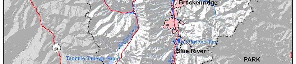

61 Figure 3.9. Summit County HAZUS 100-Year Floodplain Summit County, Colorado 3.29
62 Flood Protection Measures The major flood protection measures in Summit County are Dillon Dam and Reservoir, which are just upstream from Silverthorne on the Blue River. The reservoir receives flows from three of the major streams in the County: Blue River, Snake River, and Ten Mile Creek. The reservoir storage significantly reduces the peak discharges of frequent floods and is also used to control discharges of the Blue River through Silverthorne to the Green Mountain Reservoir. The primary function of the Dillon Reservoir is collection and storage of snowmelt runoff for domestic use on the eastern slope. The Goose Pasture Tarn, a small reservoir immediately upstream of Breckenridge, also serves as a flood protection measure for the Blue River. The reservoir is important in reducing the peak discharge of Blue River due to rainfall, but is only marginally effective for runoff due to snowmelt. Previous Occurrences According to the flood insurance studies, there is little evidence of significant flooding in Summit County in recent years. Noted exceptions from the studies and the HMPC include the following: February 2007 A frozen culvert caused water backup from a Reynolds Reservoir overflow, causing minimal water damage to a home in Summit Cove and the closure of Summit Drive for part of a day. Sandbagging kept damage to a minimum. Spring 1996 Flooding occurred on the Blue River in Breckenridge and on Straight Creek in Dillon Valley. Straight Creek Drive was washed out and has since been repaired with a culvert. July 23, 1965 Rainfall runoff from a high-intensity storm centered over a small tributary above Breckenridge caused flooding along the Blue River. Damage was not very extensive. Other rivers in the County were also at their peaks during this storm. July 17, 1965 The largest recorded discharge on the Blue River, 1,250 cubic feet per second, resulted from snowmelt and a high-intensity storm centered over a tributary above Breckenridge. It had a return period of 50 years. Flooding in Breckenridge was caused by backwater from blocked culverts and bridges (many of the culverts have since been replaced). Probability of Future Occurrence Likely percent chance of occurrence in next year or has a recurrence interval of 10 years or less Despite the lack of information about past flood events, the HMPC agreed that some level of flooding is almost an annual occurrence in Summit County. Summit County, Colorado 3.30
63 Magnitude/Severity Critical Isolated deaths and/or multiple injuries and illnesses; major or long-term property damage that threatens structural stability; and/or interruption of essential facilities and services for hours In Summit County, floods can cause injuries and deaths. Flood water, as well as debris from steep tributary channels, can damage property and infrastructure and close roads. However, past flood damages have been limited Hazardous Materials Release (Transportation) Hazard Description Summit County is susceptible to accidents involving the transport of hazardous materials on County roads and highways. A hazardous material is any item or agent (biological, chemical, physical, radiological) that has the potential to cause harm to humans, animals, or the environment, either by itself or through interaction with other factors. An accident could occur at any time or as a result of a natural disaster. The release of hazardous materials can threaten people and natural resources in the immediate vicinity of the accident, including residences, resorts, and businesses along transportation routes. Geographic Location The geographic extent of this hazard in Summit County is isolated less than 10 percent of the planning area affected (based on historical experience), but depending on the type and quantity of spill and the medium affected, the geographic extent could become large. Summit County is particularly concerned about the transport of hazardous materials on Interstate 70 (I-70) and U.S. 6. I-70 serves as a major east-west corridor for the state, as well as for the United States. Closure of the road due to a hazardous materials incident would significantly disrupt traffic flow between the Denver metropolitan area and the western slope of the Rocky Mountains and could cause severe economic impacts to the Summit County area. Similarly, the economies of Dillon and the Keystone and Arapahoe Basin ski areas are all dependent on U.S. 6 and would be severely impacted if an incident were to occur on the route, especially one that caused soil or water contamination. At present, hazardous materials trucks, such as gas tankers, are not allowed passage through the Eishenhower/Johnson Memorial Tunnels on I-70 and are routed to U.S. 6 and over Loveland Pass, which is a mountain pass with tight switchbacks and steep grades. Loveland Pass is also the boundary between Clear Creek County and Summit County. Summit County, Colorado 3.31
64 Previous Occurrences Hazardous materials incidents in Summit County have been relatively insignificant. Statistics from the National Response Center, which serves as the sole national point of contact for reporting all oil, chemical, radiological, biological, and etiological discharges into the environment anywhere in the United States and its territories, indicate that between 1990 and the end of 2007, 40 transportation-related hazardous materials incidents were reported in Summit County. The majority of the incidents were related to gasoline and diesel fuel spills resulting from an accident (i.e., not from cargo). Seven of the events involved hazardous materials carriers (as identified in the reports). Spills from these events were largely gasoline. The most notable spill that involved hazardous cargo occurred on April 28, 2006, when a double box trailer truck combination overturned on U.S. 6 on the west side of Loveland Pass, closing the highway. The two trailers were reportedly carrying eight different types of hazardous products. Some of the products spilled and appeared to have reached a stream. There was concern that the products would contaminate water sources that could affect Denver Water, the Snake River Water District, and Dillon Reservoir. In 2003, a tanker rolled into the oncoming lane on I-70 near the Copper Mountain Fire Station and closed the interstate for 18 hours. The tanker spilled between 950-1,000 gallons of gasoline, which ran down the interstate under the snow into a storm drain. Probability of Future Occurrence Likely percent chance of occurrence in next year or has a recurrence interval of 10 years or less Transportation- related hazardous materials incidents occur in Summit County every year. These are most often fuel spills that are not related to the cargo being transported. Based on previous experience, the probability of a spill of a nonfuel hazardous material or a spill with significant impact to people, the environment, or the economy is much less likely. Magnitude/Severity Catastrophic Multiple deaths; property destroyed and severely damaged; and/or interruption of essential facilities and service for more than 72 hours Impacts in the past have been limited but depending on the type and quantity of spill and the medium affected, an event s magnitude and severity could become catastrophic. A hazardous materials release could cause personal injury or death to humans or damage to property or the environment. Humans are affected through inhalation, ingestion, or direct contact with skin. Air releases can prompt large-scale population evacuations and spills into water or onto the ground can adversely affect public water and sewer systems. Summit County, Colorado 3.32
65 According to a recent study for the Colorado Department of Transportation, Risk Analysis Study of Hazardous Materials Trucks through Eisenhower/Johnson Memorial Tunnels, a hazardous materials incident on U.S. 6 would result in roadway damage with a replacement cost of approximately $5.5 million per mile. It is also possible that adjacent buildings and other infrastructure in Keystone, the Arapahoe Basin ski area, and Dillon could be damaged in an explosion or spreading fire caused by a hazardous materials incident. The Snake River and Dillon Reservoir are also at risk. The Colorado Department of Transportation estimates that 150 hazardous materials trucks travel along Loveland Pass each day. Population centers along I-70 and the hazardous materials bypass route on U.S. 6 are vulnerable to accidents involving hazardous materials. Damage to the environment and road closures due to accidents would negatively impact the tourism and recreation based economy Landslide, Mudflow/Debris Flow, Rock Fall Hazard Description A landslide is a general term for a variety of mass-movement processes that generate a downslope movement of soil, rock, and vegetation under gravitational influence. For the purposes of this plan, the term landslide includes mudslides, debris flows, and rock falls. Some of the natural causes of ground instability are stream and lakeshore erosion, heavy rainfall, and poor quality natural materials. In addition, many human activities tend to make the earth materials less stable and, thus, increase the chance of ground failure. Human activities contribute to soil instability through grading of steep slopes or overloading them with artificial fill, by extensive irrigation, construction of impermeable surfaces, excessive groundwater withdrawal, and removal of stabilizing vegetation. A mudslide is a mass of water and fine-grained earth materials that flows down a stream, ravine, canyon, arroyo, or gulch. If more than half of the solids in the mass are larger than sand grains (e.g., rocks, stones, boulders), the event is called a debris flow. Many of Colorado s older mountain communities built in major mountain valleys are located on or near debris fans. A debris fan is a conical landform produced by successive mud and debris flow deposits, and the likely spot for a future event. The mud and debris flow problem can be exacerbated by wildfires that remove vegetation that serves to stabilize soil from erosion. Heavy rains on the denuded landscape can lead to rapid development of destructive mudflows. A rock fall is the falling of a detached mass of rock from a cliff or down a very steep slope. Weathering and decomposition of geological materials produce conditions favorable to rock falls. Rock falls are caused by the loss of support from underneath through erosion or triggered by ice wedging, root growth, or ground shaking. Changes to an area or slope such as cutting and filling activities can also increase the risk of a rock fall. Rocks in a rock fall can be of any dimension, from the size of baseballs to houses. Rock fall occurs most frequently in mountains Summit County, Colorado 3.33
66 or other steep areas during the early spring when there is abundant moisture and repeated freezing and thawing. Landslides, mudslides, and rock falls occur commonly throughout Colorado, and the annual damage is estimated to exceed $3 million to buildings alone. California, Washington, and Colorado were the first three states to use federal disaster funds to acquire property in landslide hazard areas. Geographic Location The geographic extent of this hazard in Summit County is isolated less than 10 percent of the planning area affected. According to the 2002 update to the 1988 Colorado Landslide Mitigation Plan, a landslide complex on the south side of Green Mountain Reservoir in the Town of Heeney is a tier two landslide/rock fall area. Geologic hazards mapping by the Colorado Geological Survey showed a large old landslide that includes all of Heeney and adjacent developed shore area for about 1.5 miles. Although there were no signs of large scale active sliding on the old landslide, it was considered to have the potential to become a large and serious landslide that could threaten the Town and the reservoir. This hazard area encompasses approximately 710 acres. According to the Heeney/Green Mountain Reservoir Subbasin Plan, low water levels in the reservoir in 2002 created heightened concerns about the landslide potential in the area. Homes began to noticeably slip, and the last time that happened was in 1963, when a rapid drawdown of the water resulted in the loss of several homes. In 2002, the dramatic drop in water levels did not give the shoreline time to dry and solidify. It is anticipated that low reservoir levels in the future, as a result of possible drought conditions and high demand from water users downstream, will pose development challenges. The Bureau of Reclamation is studying the problem. According to the HMPC, other problem areas in the County include Keystone Mountain (condos), a slump on I-70 west of the Eisenhower/Johnson Memorial tunnels at mile marker 212 (approximately 23 acres), Quandary Village (approximately 4 acres), and Mesa Cortina in Silverthorne (approximately 14 acres). Figure 3.10 illustrates significant landslide hazard areas in Summit County. Summit County, Colorado 3.34


67 Figure Summit County Landslide Hazard Areas Summit County, Colorado 3.35
68 Previous Occurrences Previous occurrences of landslide hazards are not well known. According to the Colorado Natural Hazards Mitigation Plan (2007), an area being planned as a subdivision in Summit County was engulfed by a mudslide caused by saturated soils below the Town of Breckenridge water reservoir and a beaver pond. No structures were involved. Geologic investigation showed several similar slides had occurred previously. The property lost its prime value and extensive regrading and mitigation work was required. It is unknown when this occurred. In 1963, a rapid drawdown of the water in Green Mountain Reservoir caused a landslide that resulted in the loss of several homes in the Town of Heeney. Probability of Future Occurrence Occasional 1-10 percent chance of occurrence in the next year or has a recurrence interval of 11 to 100 years Based on the two known past events and the identified areas currently being monitored, probability of damaging landslide events in the future is occasional. Magnitude/Severity Critical Isolated deaths and/or multiple injuries and illnesses; major or long-term property damage that threatens structural stability; and/or interruption of essential facilities and services for hours Landslide is a serious geological hazard that can threaten human life, impact transportation corridors and communication systems, and result in other infrastructure (e.g., reservoirs) and property damage. Actual losses can range from mere inconvenience or high maintenance costs where very slow or small-scale destructive slides are involved. Rapidly moving large slides have the capacity to completely destroy buildings, roads, bridges, and other costly manmade structures. Such slides also have the potential for inflicting loss of life when they occur in developed areas Lightning Hazard Description Lightning is an electrical discharge between positive and negative regions of a thunderstorm. Intracloud lightning is the most common type of discharge. This occurs between oppositely charged centers within the same cloud. Usually it takes place inside the cloud and looks from the outside of the cloud like a diffuse brightening that flickers. However, the flash may exit the boundary of the cloud, and a bright channel can be visible for many miles. Summit County, Colorado 3.36
69 Although not as common, cloud-to-ground lightning is the most damaging and dangerous form of lightning. Most flashes originate near the lower-negative charge center and deliver negative charge to earth. However, a large minority of flashes carry positive charge to earth. These positive flashes often occur during the dissipating stage of a thunderstorm s life. Positive flashes are also more common as a percentage of total ground strikes during the winter months. This type of lightning is particularly dangerous for several reasons. It frequently strikes away from the rain core, either ahead or behind the thunderstorm. It can strike as far as 5 or 10 miles from the storm in areas that most people do not consider to be a threat. Positive lightning also has a longer duration, so fires are more easily ignited. And, when positive lightning strikes, it usually carries a high peak electrical current, potentially resulting in greater damage. According to the National Lightning Safety Institute, lightning causes more than 26,000 fires in the United States each year. The institute estimates property damage, increased operating costs, production delays, and lost revenue from lightning and secondary effects to be in excess of $6 billion per year. Impacts can be direct or indirect. People or objects can be directly struck, or damage can occur indirectly when the current passes through or near it. Geographic Location The geographic extent of this hazard in Summit County is large. Lightning can occur anywhere in the County. Previous Occurrences Data from the National Lightning Detection Network ranks Colorado 31st in the nation (excluding Alaska and Hawaii) with respect to the number of cloud-to-ground lightning flashes with an average number of 517,217 flashes per year (based on data collected between 1996 and 2005). Summit County has an average of 1,700 cloud-to-ground lightning flashes per year. Figure 3.11 shows state-by-state lightning deaths between 1997 and Colorado ranks second for the number of deaths at 30. Only Florida, with 71 deaths, had more. Texas followed Colorado with 25 deaths. In 2006, there were 5 lightning deaths and 15 reported lightning injuries in Colorado. None of these were in Summit County. In an average year in Colorado, 3 people are killed and 13 are injured. Summit County, Colorado 3.37

70 Figure Lightning Fatalities in the United States, Source: National Weather Service, While lightning is a regular occurrence in Summit County, damaging lightning is not. According to the National Climatic Data Center Storm Event Database, there were three notable lightning events in Summit County between 1993 and August 2007: August 1, 2004 Lightning killed a woman as she was hiking in French Gulch near Breckenridge. Four other people hiking with the woman were knocked down but suffered only minor injuries. July 9, 2001 Lightning struck a home in Keystone, damaging the roof. June 8, 1997 Two search and rescue volunteers were injured while rescuing a skier atop Peak 10 at Breckenridge Ski Area. Lightning struck the first man as he was towing the injured skier by snowmobile and toboggan. The bolt struck the snowmobile, then the rescuer, causing the rescuer permanent disability in eyesight. The other rescuer was injured 1/4 mile away. Apparently the ground current created by the lightning travelled up his ski pole. He suffered temporary dizziness as a result of the strike. It should be noted that this database captures only small portion of damaging lightning events; most go unreported. Probability of Future Occurrence Likely percent chance of occurrence in next year or has a recurrence interval of 10 years or less Summit County, Colorado 3.38
71 It is highly likely that lightning will occur every year in Summit County, but not all will be damaging. In the last 15 years, the County experienced three damaging lightning events. This averages to a damaging lightning event every five years, or a 20 percent chance of an event in any given year. Magnitude/Severity Critical Isolated deaths and/or multiple injuries and illnesses; major or long-term property damage that threatens structural stability; and/or interruption of essential facilities and services for hours Lightning can cause deaths, injuries, and property damage, including damage to buildings, communications systems, power lines, and electrical systems. It also causes forest and brush fires Mountain Pine Beetle Infestation Hazard Description Mountain pine beetle is native to western North America. The insect develops in and affects primarily pines, such as ponderosa, lodgepole, Scotch, and limber pines, and less commonly bristlecone and piñon pines. Beetle epidemics are a natural part of forest ecosystems, but certain factors, such as age of forests, drought, crowding, poor growing conditions, and warm temperatures, can fuel epidemics. While the stressed trees are targeted first, as beetle populations increase, they attack most of the large trees in an outbreak area. During an epidemic, enough beetles can emerge from an infested tree to kill at least two, and possibly more, trees the following year. The direction and spread rate of an infestation is impossible to predict. However, attacked trees usually are adjacent to or near previously killed trees. Once the beetle infests a tree, nothing practical can be done to save it, so prevention is critical. Prevention includes forest management (e.g., creating diversity in age and structure) and treating infested trees to kill developing beetles before they emerge as adults. Discolored foliage is generally the first sign of beetle-caused mortality. Needles on infested trees begin changing color several months to one year after attack, going from green to yellowish green, then sorrel and red to rusty brown. Geographic Location The geographic extent of this hazard in Summit County is large more than 50 percent of the planning area affected. The entire County, (wilderness areas, mountain subdivisions, and backyards) is susceptible to mountain pine beetle infestation. Figure 3.12 shows mountain pine beetle activity in and around Summit County. Summit County, Colorado 3.39

72 Figure 3.12 Mountain Pine Beetle Activity in Central Colorado Source: U.S. Forest Service Summit County, Colorado 3.40
73 Previous Occurrences Summit County is in the midst of a statewide mountain pine beetle infestation. Tree mortality from this infestation is unprecedented in Colorado s recorded history. Colorado lost 500,000 acres of lodgepole pines in 2007 alone and approximately 1.5 million acres since the infestation began in At current rates of spread and intensification, it is likely that the beetle will kill the majority of Colorado s mature lodgepole pine forests by However, younger lodgepole pines will survive and seedlings will regenerate naturally. Probability of Future Occurrence Highly Likely Near 100 percent chance of occurrence in next year or has a recurrence interval of 10 years or less Magnitude/Severity Limited Minor injuries and illnesses; minimal property damage that does not threaten structural stability; and/or interruption of essential facilities and services for less than 24 hours The definitions for Magnitude/Severity are not well-suited to this hazard. Although the Mountain Pine Beetle is unlikely to cause deaths or injuries or significant damage to property and infrastructures, it is killing millions of trees each year. Widespread tree mortality can alter the forest ecosystem in numerous ways, including: Converting forested areas to grass and shrubs, Changing wildlife species composition, Increasing water yield, which may contribute to flooding and landslides, and Creating a source of fuel for wildfire. Overall vulnerability to mountain pine beetle is moderate. The hazard is widespread and the infestation is likely to continue to grow. Although it is unlikely to cause deaths or injuries or damage to structures, it has the potential to have significant impacts on the forest ecosystems and the recreation and tourism-based economy of Summit County, as well as increase wildfire risk Severe Winter Weather Hazard Description Winter weather includes snow, ice, blizzard conditions, and extreme cold. Heavy snow can immobilize a region, stranding commuters, stopping the flow of supplies, and disrupting emergency and medical services. Accumulations of snow can collapse roofs and knock down trees and power lines. The cost of snow removal, damage repair, and business losses can have a tremendous impact on cities and towns. Summit County, Colorado 3.41
74 Heavy accumulations of ice can bring down trees, electrical wires, telephone poles and lines, and communication towers. Communications and power can be disrupted for days until damage can be repaired. Even small accumulations of ice may cause extreme hazards to motorists and pedestrians. Some winter storms are accompanied by strong winds, creating blizzard conditions with blinding wind-driven snow, severe drifting, and dangerous wind chills. Strong winds with these intense storms and cold fronts can knock down trees, utility poles, and power lines. Blowing snow can reduce visibilities to only a few feet in areas where there are no trees or buildings. Serious vehicle accidents can result with injuries and deaths. Extreme cold often accompanies a winter storm or is left in its wake. Prolonged exposure to the cold can cause frostbite or hypothermia and can become life-threatening. Infants and the elderly are most susceptible. Pipes may freeze and burst in homes or buildings that are poorly insulated or without heat. Extreme cold is most likely to occur in the winter months of December, January, and February. In 2001, the National Weather Service implemented an updated Wind Chill Temperature index. This index was developed to describe the relative discomfort/danger resulting from the combination of wind and temperature. Wind chill is based on the rate of heat loss from exposed skin caused by wind and cold. As the wind increases, it draws heat from the body, driving down skin temperature and eventually the internal body temperature. The National Weather Service will issue a Wind Chill Warning for Summit County when wind and temperature combine to produce wind chill values of -35 F. The coldest months on average in Summit County are January and February and record minimum temperatures have fallen below -46F. The average minimum temperatures are approximately 1F in Dillon and 8F in Breckenridge. Geographic Location The geographic extent of this hazard in Summit County is large more than 50 percent of the planning area affected. Winter weather can occur throughout Summit County. The Western Regional Climate Center reports data from weather stations in and around Summit County. The data reported here are from three of the stations: Breckenridge, Dillon, and Green Mountain Dam. Table 3.8 contains winter weather summaries for the three stations and illustrates differences within the County. Figures 3.13 through 3.18 show daily snowfall and temperature averages and extremes. Summit County, Colorado 3.42

75 Table 3.8. Summit County Winter Weather Summaries 1 Average Annual Snowfall Snowiest Month/ Average Snowfall Highest Daily Snowfall Station Breckenridge Mar./ /24/198 3 Dillon Mar./ /9/1944 4/15/1921 Green Mountain Dam Jan./ /8/1985 Highest Monthly Snowfall Dec Feb Jan Source: Western Regional Climate Center, 1 All snowfall and snow depths are reported in inches Highest Seasonal Snowfall Average Snow Depth Winter 2 Average Minimum Temp. Minimum Temp F -26F 1/2/ F -46F 12/24/ F -46F 2/7/1989 # Days <32F/ Year n/a Winter: December, January, February 3 Period of Record: 8/1/1948-6/30/ Period of Record: 5/2/1909-6/30/ Period of Record: 8/1/1948-6/28/2007 Figure Breckenridge Station Snowfall Averages and Extremes Source: Western Regional Climate Center, Summit County, Colorado 3.43
76 Figure Dillon Station Snowfall Averages and Extremes Source: Western Regional Climate Center, Figure Green Mountain Dam Station Snowfall Averages and Extremes Source: Western Regional Climate Center, Summit County, Colorado 3.44
77 Figure Breckenridge Station Temperature Averages and Extremes Source: Western Regional Climate Center, Figure Dillon Station Temperature Averages and Extremes Source: Western Regional Climate Center, Summit County, Colorado 3.45
78 Figure Green Mountain Dam Station Temperature Averages and Extremes Source: Western Regional Climate Center, Previous Occurrences Historical data from SHELDUS and the National Climatic Data Center Storm Events Database was combined to determine that there were roughly 148 recorded winter weather events in Summit County between 1960 and August Of the 148 recorded events for Summit County or its National Weather Service forecast zones (Zones 32 and 34) in the period of record, 6 were specifically for freeze or cold. Data limitations: Some events may have been missed due to limitations in the manner in which events that occurred over multiple forecast zones are reported. Dollar figures reported for winter weather events in both SHELDUS and the National Climatic Data Center Storm Events database are total damages for all counties associated with an event. Specific Summit County losses are not available. Descriptions of notable events from the HMPC are included below: December 30, 2007 More than 2,100 travelers required sheltering when high winds and blowing snow forced the closure of I-70 in both directions. Driving conditions were treacherous and the danger of avalanches was high. Needs exceeded capacity, so the County coordinated with churches to accommodate the overflow. It was the County s largest shelter mobilization to date. The fact that the storm hit on a Sunday over a holiday weekend, and came with little warning contributed to the problems. Cellular phones jammed communication networks, which affected emergency communications capabilities. Stormrelated traffic accidents included a multi-car pileup on I-70 near Silverthorne. Summit County, Colorado 3.46
79 Probability of Future Occurrence Highly Likely Near 100 percent chance of occurrence in next year or has a recurrence interval of 10 years or less There were 148 recorded winter weather events in Summit County between 1960 and August On average, there are 3.1 severe winter weather events in the County each year, which equals over 100 percent chance of occurrence in each year. Magnitude/Severity Critical Multiple injuries and illnesses; major or long-term property damage that threatens structural stability; and/or interruption of essential facilities and services for hours Winter weather in Summit County, including strong winds and blizzard conditions, can result in property damage, localized power and phone outages, and closures of streets, highways, schools, businesses, and nonessential government operations. People can also become isolated from essential services in their homes and vehicles. A winter storm can escalate, creating life threatening situations when emergency response is limited by severe winter conditions. Other issues associated with severe winter weather include hypothermia and the threat of physical overexertion that may lead to heart attacks or strokes. Snow removal costs can impact budgets significantly. Heavy snowfall during winter can also lead to flooding or landslides during the spring if the area snowpack melts too quickly. High snow loads also cause damage to buildings and roofs. Summit County can be isolated on all sides by highway closures or blocked vehicles stopped on the interstate for miles. The County usually has about three days worth of commodities (food and gasoline). This supply is based upon the needs of a community of 27,000 and is quickly depleted during peak tourism periods when the average daily population is over 100,000. During the December 2007 winter storm event, stores already were in short supply from the weekend and were quickly emptied in one day with 2,500 stranded motorists Wildfire Hazard Description Fire conditions arise from a combination of hot weather, an accumulation of vegetation, and low moisture content in air and fuel. These conditions, especially when combined with high winds and years of drought, increase the potential for wildfire to occur. The wildfire risk is predominantly associated with wildland-urban interface areas, areas where development is interspersed or adjacent to landscapes that are prone to wildfire. Wildfire in the wildland-urban interface can result in major losses of property and structures. Summit County, Colorado 3.47
80 Generally, there are three major factors that sustain wildfires and predict a given area s potential to burn. These factors are fuel, topography, and weather. Fuel Fuel is the material that feeds a fire and is a key factor in wildfire behavior. Fuel is generally classified by type and by volume. Fuel sources are diverse and include everything from dead tree needles and leaves, twigs, and branches to dead standing trees, live trees, brush, and cured grasses. Also to be considered as a fuel source are manmade structures, such as homes and associated combustibles. The type of prevalent fuel directly influences the behavior of wildfire. Light fuels such as grasses burn quickly and serve as a catalyst for fire spread. In addition, ladder fuels can spread a ground fire up through brush and into trees, leading to a devastating crown fire that burns in the upper canopy and cannot be controlled. The volume of available fuel is described in terms of fuel loading. Topography An area s terrain and land slopes affect its susceptibility to wildfire spread. Both fire intensity and rate of spread increase as slope increases due to the tendency of heat from a fire to rise via convection. The arrangement of vegetation throughout a hillside can also contribute to increased fire activity on slopes. Weather Weather components such as temperature, relative humidity, wind, and lightning also affect the potential for wildfire. High temperatures and low relative humidity dry out the fuels that feed the wildfire creating a situation where fuel will more readily ignite and burn more intensely. Wind is the most treacherous weather factor. The greater the wind, the faster a fire will spread and the more intense it will be. In addition to wind speed, wind shifts can occur suddenly due to temperature changes or the interaction of wind with topographical features such as slopes or steep hillsides. Lightning also ignites wildfires, which often occur in terrain that is difficult for firefighters to reach. Drought conditions contribute to concerns about wildfire vulnerability. During periods of drought, the threat of wildfire increases. Wildfires are of significant concern throughout Colorado. According to the Colorado State Forest Service, vegetation fires occur on an annual basis; most are controlled and contained early with limited damage. For those ignitions that are not readily contained and become wildfires, damage can be extensive. There are many causes of wildfire, from naturally caused lightning fires to human-caused fires linked to activities such as smoking, campfires, equipment use, and arson. According to the State of Colorado Natural Hazards Mitigation Plan, a century of aggressive fire suppression combined with cycles of drought and changing land management practices has left many of Colorado s forests unnaturally dense and ready to burn. Further, the threat of wildfire and potential losses are constantly increasing as human development and population increases and the wildland-urban interface expands. Summit County, Colorado 3.48
81 Geographic Location The geographic extent of this hazard in Summit County is medium percent of the planning area affected. Figure 3.19 shows the wildfire threat in Summit County classified as low, medium, high, and extreme. This threat ranking was developed for the Summit County Community Wildfire Protection Plan by the County, fire protection districts, and U.S. Forest Service. It is based on fuel hazards, risk of wildfire occurrence, essential infrastructure at risk, community values at risk, and local preparedness and firefighting capability. The wildfire threat GIS layer was used to determine the number of acres in each wildfire threat zone by town and fire protection district. The results are shown in Table 3.9. The fire protection districts cumulative acreage represents the total acreage for the County; however, these boundaries are not completely accurate. There are remote areas of the County that are not part of a fire protection district. Summit County, Colorado 3.49

82 Figure Summit County Wildfire Threat Summit County, Colorado 3.50
83 Table 3.9. Acreage in Wildfire Threat Zones by Jurisdiction Jurisdiction No Data Low Medium High Extreme Acres % Total Acres % Total Acres % Total Acres % Total Acres % Total Total Acres Blue River n/a n/a ,445 Breckenridge n/a n/a 1, , ,705 Dillon n/a n/a 1, ,483 Frisco n/a n/a ,127 Montezuma n/a n/a Silverthorne n/a n/a 1, ,475 Unincorporated 7, , , , ,538 Areas Copper 2, , , ,966 Mountain FPD Lake Dillon , , , ,701 FPD Lower Blue 2, , , , ,146 FPD Red, White, 1, , , , ,009 and Blue FPD Total County 7, , , , ,822 Source: Summit County Notes: FPD=fire protection district Based on the information presented in Table 3.9, unincorporated Summit County has the most acreage at risk to wildfire, with 162,393 acres (42.1 percent of the County s unincorporated acreage) in medium to extreme wildfire threat zones. Among the incorporated municipalities, Breckenridge has the most acreage at risk to wildfire; it is the only town with acreage in the extreme fire threat zone (.5 acres) and has 124 acres in the high threat zone and 1,775 acres in the medium threat zone, which, in both instances, is significantly more than the other towns. But, in regard to percent of total acreage in medium to extreme wildfire threat zones, Frisco (76.5 percent) and Montezuma (58.7 percent) are more at risk than Breckenridge (51.3 percent). Among the fire protection districts, the Lake Dillon Protection District has the most acreage at risk (80,351 acres in medium to extreme wildfire threat zones). In regard to percent of total acreage in medium to extreme wildfire threat zones, the Red White and Blue Fire Protection District has the most to lose, with 51.9 percent of its acreage in a medium to extreme wildfire threat zone. Overall, the County has 167,162 acres (42.2 percent of its acreage) in medium to extreme wildfire threat zones. Figure 3.20 illustrates Summit County s wildland-urban interface and Figure 3.21 shows the level of community protection needed as extreme, high, medium, and low as determined in the Summit County Community Wildfire Protection Plan. Summit County, Colorado 3.51


84 Figure Summit County Wildland-Urban Interface Summit County, Colorado 3.52


85 Figure Community Protection Assessment Summit County, Colorado 3.53
86 Previous Occurrences According to the Federal Wildland Fire Occurrence Data website (which reports official fire occurrence data collected from five federal agencies), there were 199 wildland fires in Summit County between 1980 and Of these fires, all but one (the Ophir Mountain fire) burned on four acres or less was Summit County s worst wildfire season in 30 years. It saw 10 wildfires in 10 days. Eighty percent of the fires were human-caused. Notable fires in Summit County (that burned at least one acre) include the following: June 2006 The Brinker Fire, near the Williams Fork Reservoir, on the Summit and Grand County line, burned about 30 acres. September 19-20, 2005 The Ophir Mountain Fire (Red, White, and Blue Fire Protection District) burned approximately 16 acres. Summit High School and about 50 homes were evacuated. Up to five homes were in immediate danger of being destroyed. Likely humancaused, the fire spread quickly through beetle-killed lodgepole pine trees, mostly in the White River National Forest near Farmer s Korner. The fire burned on land designated in the County s Community Wildfire Protection Plan as high priority because of heavy fuel loads, ground litter, and its proximity to development. The plan was still under development at the time of the fire. Southbound U.S. Highway 9 was closed at the Nordic Center in Frisco. July 17, 2005 The Meadow Creek fire burned 2 acres near the Meadow Creek trailhead in Frisco. It was human-caused and took four days to extinguish. August 1, 2003 The Spruce Creek fire burned 1 acre. August 16, 2002 The Old Dillon Reservoir fire burned 2.5 acres. June 24, 2002 The Otter Creek fire burned 1 acre between Black and Surprise lakes in the Eagles Nest Wilderness. July 24, 2000 The Black Lake fire burned 4 acres. November 14, 1999 Keystone fire burned 1-acre fire and was human-caused. May 20, 1999 The Lowery fire burned 4 acres and was human-caused. July 8, 1994 A fire burned 1.5 acres. June 8, 1994 A fire burned 2 acres. July 4, 1992 A fire burned 1 acre. June 17, 1990 A fire burned 1.5 acres. Probability of Future Occurrence Highly Likely Near 100 percent chance of occurrence next year or happens every year According to the Federal Wildland Fire Occurrence website, there were 199 wildland fires in Summit County between 1980 and Thus, there is a 100 percent chance that at least one wildfire will occur each year in Summit County. It is worth noting that the majority (94 percent) of these fires burned less than one acre. Nevertheless, given the conditions described above and the mountain pine beetle infestation, a small fire could easily become a big one. Summit County, Colorado 3.54
87 Magnitude/Severity Catastrophic Multiple deaths; property destroyed and severely damaged; interruption of essential facilities and service for more than 72 hours Potential losses from wildfire include human life; structures and other improvements; natural and cultural resources; the quality and quantity of the water supply; assets such as timber and range; and recreational opportunities; and economic losses. Smoke and air pollution from wildfires can be a severe health hazard. In addition, wildfire can lead to secondary impacts due to vegetation loss such as future flooding and landslides and erosion during heavy rains Windstorm Hazard Description High winds occur year round in Summit County. In the spring and summer, high winds often accompany severe thunderstorms. These winds are typically straight-line winds, which are generally any thunderstorm wind that is not associated with rotation (i.e., is not a tornado). It is these winds, which can exceed 100 miles per hour (mph) that represent the most common type of severe weather and are responsible for most wind damage related to thunderstorms. In the mountains of Colorado, strong winds are also common throughout the winter months and can exceed 50 to 100 mph in exposed locations. Specifically, these winter winds can force the closure of highways (blowing snow) and induce avalanches (see Section Avalanche and Section Severe Winter Weather). Geographic Location The geographic extent of this hazard in Summit County is large more than 50 percent of the planning area affected. High winds can occur throughout Summit County and may be most severe at high elevations. Frequent high winds at Dillon Reservoir make it a popular challenging technical sailing destination. There are sailing races here each weekend throughout the summer, and high winds often create hazardous conditions. Previous Occurrences Historical data from SHELDUS and the National Climatic Data Center Storm Events Database was combined to determine that there were roughly 43 recorded wind events in Summit County or its National Weather Service forecast zones (Zones 32 and 34) between 1955 and April (Note: These wind events were reported as wind only or thunderstorm wind events. The summary does not include winds that were part of severe winter weather (see Section Severe Winter Weather.) Summit County, Colorado 3.55
88 Data limitations: Some events may have been missed due to limitations in the manner in which events that occurred over multiple forecast zones are reported. Dollar figures reported for wind events in both SHELDUS and the National Climatic Data Center Storm Events database are total damages for all counties associated with an event. Specific Summit County losses are not available. Notable events mentioned by the HMPC include the following: June 2007 A severe microburst in the area of Dillon Reservoir capsized a sailboat with four people onboard. A sheriff s deputy rescued the boaters; none were wearing floatation devices (2003) There was a big wind storm on Dillon Reservoir (2000) A microburst at Green Mountain Reservoir capsized a number of boats. September 1986 High winds at Dillon Reservoir broke up the marina, sinking six boats and damaging numerous others. Wind gusts of more than 70 mph were reported. The HMPC also reported that a microburst occurred in the Eagle s Nest Wilderness Area within Summit County in the last few years. Probability of Future Occurrence Likely percent chance of occurrence in next year or has a recurrence interval of 10 years or less. There were 43 significant recorded high wind events in the past 53 years in Summit County, which equals one wind event every 1.2 years on average, or an 81 percent chance of occurrence in any given year. Magnitude/Severity Limited Minor injuries and illnesses; minimal property damage that does not threaten structural stability; interruption of essential facilities and services for less than 24 hours Wind storms in Summit County are rarely life threatening, but do threaten public safety, disrupt daily activities, cause damage to buildings and structures, increase the potential for other hazards (e.g., wildfire), and have adverse economic impacts from business closures and power loss. Although windstorms are likely to occur in the future, data indicates that past losses have not been significant, and the overall magnitude of this hazard is limited. Summit County, Colorado 3.56
89 Hazard Profiles Summary This section summarizes the results of the hazard profiles and assigns a level of overall planning significance to each hazard of low, moderate, or high. Significance was determined based on the hazard profile, focusing on key criteria such as frequency and resulting damage, including deaths/injuries and property, crop, and economic damage. This assessment was used by the HMPC to prioritize those hazards of greatest significance to the planning area; thus enabling the County to focus resources where they are most needed. Those hazards that occur infrequently or have little or no impact on the planning area were determined to be of low significance. Those hazards determined to be of high and moderate significance were characterized as priority hazards that required further evaluation in Section 3.3 Vulnerability Assessment. Table Summary of Hazard Profiles Hazard Type Geographic Location* Probability* Magnitude* Overall Vulnerability Avalanche Isolated Highly Likely Critical High Flood Small Likely Critical High Severe Winter Weather Large Highly Likely Critical High Wildfire Medium Highly Likely Catastrophic High Drought Large Likely Limited Moderate Dam Failure Small Unlikely Catastrophic Moderate Hazardous Materials Release (Transportation) Isolated Likely Catastrophic Moderate Landslide, Mudflow/Debris Flow, Rock Fall Isolated Occasional Critical Moderate Lightning Large Likely Critical Moderate Mountain Pine Beetle Large Highly Likely Limited Moderate Infestation Earthquake Large Occasional Limited Low Erosion/Deposition Small Likely Limited Low Windstorm Large Likely Limited Low Source: Summit County Hazard Mitigation Planning Committee, 2008 *See section 3.2 for definitions of these factors The following tables summarize the results of the hazard profiles for incorporated communities that are participating jurisdictions in the hazard mitigation plan. Summit County, Colorado 3.57
90 Table Probability of Future Occurrence of Identified Hazards by Jurisdiction Summit Hazard Type County Blue River Breckenridge Dillon Frisco Silverthorne Avalanche High Likely Unlikely Unlikely Unlikely Unlikely Unlikely Dam Failure Unlikely Unlikely Unlikely Unlikely Unlikely Unlikely Drought Likely Occasional Occasional Likely Likely Likely Earthquake Occasional Unlikely Unlikely Unlikely Unlikely Unlikely Erosion/Deposition Likely Likely Likely Likely Likely Likely Flood Likely Occasional Likely Unlikely Likely Likely Hazardous Materials Release Likely Unlikely Unlikely Occasional Occasional Occasional (Transportation) Landslide, Mudflow/Debris Occasional Occasional Occasional Unlikely Unlikely Likely Flow, and Rock Fall Lightning Likely Likely Likely Likely Likely Likely Mountain Pine Highly Likely Highly Likely Highly Likely High Likely Highly Likely Likely Beetle Infestation Severe Winter Highly Likely Highly Likely Highly Likely Highly Likely Highly Likely Highly Likely Weather Wildfire Highly Likely Likely Likely Occasional Occasional Likely Windstorm Likely Likely Likely Likely Likely Likely *See Section 3.2 for definitions of these factors Table Magnitude/Severity of Identified Hazards by Jurisdiction Hazard Type Summit County Blue River Breckenridge Dillon Frisco Silverthorne Avalanche Critical Limited Limited Negligible Negligible Negligible Dam Failure Catastrophic Critical Critical Limited Limited Catastrophic Drought Limited Limited Limited Limited Limited Limited Earthquake Limited Limited Limited Limited Limited Limited Erosion/Deposition Limited Critical Limited Limited Limited Limited Flood Critical Limited Critical Limited Limited Critical Hazardous Materials Release Catastrophic Limited Critical Critical Critical Critical (Transportation) Landslide, Mudflow/Debris Critical Limited Limited Limited Limited Limited Flow, and Rock Fall Lightning Critical Limited Critical Critical Critical Critical Mountain Pine Limited Limited Limited Limited Limited Limited Beetle Infestation Severe Winter Critical Critical Critical Critical Critical Critical Weather Wildfire Catastrophic Critical Catastrophic Critical Critical Critical Windstorm Limited Limited Limited Limited Limited Limited *See Section 3.2 for definitions of these factors Summit County, Colorado 3.58
91 Table Planning Significance of Identified Hazards by Jurisdiction Summit Hazard Type County Blue River Breckenridge Dillon Frisco Silverthorne Avalanche High Low Low Low Low Low Dam Failure Moderate Moderate Moderate Low Low High Drought Moderate Low Moderate Low Moderate Moderate Earthquake Low Low Low Low Low Low Erosion/Deposition Low Moderate Low Moderate Moderate Low Flood High Moderate High Low Moderate High Hazardous Materials Release Moderate Low Low High High High (Transportation) Landslide, Mudflow/Debris Moderate Low Low Low Low Low Flow, and Rock Fall Lightning Moderate Low Moderate Moderate Moderate Moderate Mountain Pine Moderate Moderate Moderate Moderate High Moderate Beetle Infestation Severe Winter High High High High High High Weather Wildfire High High High Moderate High High Windstorm Low Low Low Low Low Low Summit County, Colorado 3.59
92 3.3 Vulnerability Assessment Requirement 201.6(c)(2)(ii)(A): The plan should describe vulnerability in terms of the types and numbers of existing and future buildings, infrastructure, and critical facilities located in the identified hazard areas. Requirement 201.6(c)(2)(ii)(B): [The plan should describe vulnerability in terms of an] estimate of the potential dollar losses to vulnerable structures identified in paragraph (c)(2)(i)(a) of this section and a description of the methodology used to prepare the estimate. Requirement 201.6(c)(2)(ii)(C): [The plan should describe vulnerability in terms of] providing a general description of land uses and development trends within the community so that mitigation options can be considered in future land use decisions Methodology The vulnerability assessment further defines and quantifies populations, buildings, critical facilities and infrastructure, and other community assets at risk to natural hazards. The vulnerability assessment for this plan followed the methodology described in the FEMA publication Understanding Your Risks Identifying Hazards and Estimating Losses (2002). The vulnerability assessment was conducted based on the best available data and the overall planning significance of the hazard. Data to support the vulnerability assessment was collected from the same sources identified in Section 3.1 Hazard Identification and Section 3.2 Hazard Profiles and from FEMA s HAZUS-MH MR3 loss estimation software. The vulnerability assessment includes three sections: Community Asset Inventory This section inventories assets exposed to hazards in Summit County, including the total exposure of people and property; critical facilities and infrastructure; natural, cultural, and historic resources; and economic assets. Vulnerability by Hazard This section describes the County s overall vulnerability to each hazard; identifies existing and future structures, critical facilities, and infrastructure in identified hazard areas; and estimates potential losses to vulnerable structures, where data is available. Only hazards of moderate or high planning significance, or that have identified hazard areas are addressed in the vulnerability assessment. Development and Land Use Trends The final section analyzes trends in population growth, housing demand, and land use patterns. In addition, a capability assessment was conducted for each jurisdiction as part of the risk assessment process. A capability assessment identifies the existing programs, policies, and plans that mitigate or could be used to mitigate risk to disasters. This information can be found in the annex for each jurisdiction. Summit County, Colorado 3.60
93 3.3.2 Community Asset Inventory This section assesses the population, structures, critical facilities and infrastructure, and other important assets in Summit County at risk to natural hazards. Total Exposure to Hazards Table 3.14 shows the total population, number of structures, and assessed value of improvements to parcels by jurisdiction. Building counts and values (includes building contents) were taken from HAZUS-MH census block-level data, then aggregated by town. The census blocks nest into the city boundaries for the most part, but sometimes census block boundaries cross city boundaries. In these cases, the counts and values were attributed to that city (or unincorporated county) where the majority of the census block is located. Land values have been purposely excluded because land remains following disasters, and subsequent market devaluations are frequently short term and difficult to quantify. Additionally, state and federal disaster assistance programs generally do not address loss of land or its associated value. Table Maximum Population and Building Exposure by Jurisdiction Community Population 2006 Number of Structures Total Structure Value ($)* Blue River ,378,000 Breckenridge 3,439 2,262 1,020,891,000 Dillon ,779,000 Frisco 2,742 2, ,857,000 Montezuma ,229,000 Silverthorne 3,956 1, ,704,000 Unincorporated Areas 16,208 7,659 2,911,915,000 Total 27,964 14,948 5,519,753,000 Source: HAZUS-MH (MR 3) (structures), Colorado Division of Local Government State Demography Office, *Value represents improved structure value and includes contents The Summit County Office of Emergency Management coordinates evacuation planning for jurisdictions in the County. Figure 3.22 shows evacuation routes and identified areas of concern. Summit County, Colorado 3.61

94 Figure Summit County Evacuation Routes and Areas of Concern Summit County, Colorado 3.62
95 Critical Facilities and Infrastructure A critical facility may be defined as one that is essential in providing utility or direction either during the response to an emergency or during the recovery operation. Table 3.15 displays the inventory of critical facilities (based on available data) in Summit County as provided by the HMPC and Summit County GIS data. The locations of these facilities are shown with a floodplain map in Figure 3.24 in the flood section of Vulnerability by Hazard. Specific information on facilities and their locations can be found in the jurisdictional annexes. Table Critical Facilities in Summit County Facility Type Unincorporated Areas Blue River Breckenridge Dillon Frisco Silverthorne Ambulance Bridge Dam Emergency 1 Operations EMS Transmitter Fire Lookout Fire Station Government Building Helicopter Pad/Staging Incident Command Post Medical Facility School Water/Wastewater County Totals Source: Summit County GIS Department Other facilities in the County, such as locations that hold concerts, sporting events, and other events that attract large numbers of people, may also be at higher risk due to concentrations of people. Natural, Historic, and Cultural Assets Assessing the vulnerability of Summit County to disaster also involves inventorying the natural, historic, and cultural assets of the area. This step is important for the following reasons: The community may decide that these types of resources warrant a greater degree of protection due to their unique and irreplaceable nature and contribution to the overall economy. Summit County, Colorado 3.63
96 If these resources are impacted by a disaster, knowing so ahead of time allows for more prudent care in the immediate aftermath, when the potential for additional impacts are higher. The rules for reconstruction, restoration, rehabilitation, and/or replacement are often different for these types of designated resources. Natural resources can have beneficial functions that reduce the impacts of natural hazards, such as wetlands and riparian habitat, which help absorb and attenuate floodwaters. One particular asset that falls into all three categories is the Top of the Rockies National Scenic Byway. Administered by the Federal Highway Administration, national scenic byways are so designated to preserve and protect the nation s scenic but often less-traveled roads and promote tourism and economic development. Any disaster-related damage done to the Top of the Rockies (or damage that affects access) could have negative implications on tourism, and thus the economy, in Summit County. Natural Resources Natural resources are important to include in benefit-cost analyses for future projects and may be used to leverage additional funding for projects that also contribute to community goals for protecting sensitive natural resources. Awareness of natural assets can lead to opportunities for meeting multiple objectives. For instance, protecting wetlands areas protects sensitive habitat as well as attenuates and stores floodwaters. A number of natural resources exist in Summit County, including wetlands, endangered species, and imperiled plant communities. Wetlands Wetlands are a valuable natural resource for communities, due to their benefits to water quality, wildlife protection, recreation, and education, and play an important role in hazard mitigation. Wetlands reduce flood peaks and slowly release floodwaters to downstream areas. When surface runoff is dampened, the erosive powers of the water are greatly diminished. Furthermore, the reduction in the velocity of inflowing water as it passes through a wetland helps remove sediment being transported by the water. They also provide drought relief in water-scarce areas where the relationship between water storage and streamflow regulation are vital. According to the Wetlands FAQ on the Summit County website, between the 1780s and 1980s, over half of the wetlands in Colorado were lost due to human activities (e.g., filling and other degrading activities). In Summit County, wetland has loss resulted from historic gold mining and large construction projects such as Interstate 70 and Dillon and Green Mountain reservoirs. In more recent years, construction of single-family residences, as well as other types of development, has resulted in a cumulative and permanent wetland loss in the County. Summit County, Colorado 3.64
97 Endangered Species To further understand natural resources that may be particularly vulnerable to a hazard event, as well as those that need consideration when implementing mitigation activities, it is important to identify at-risk species (i.e., endangered species) in the planning area. An endangered species is any species of fish, plant life, or wildlife that is in danger of extinction throughout all or most of its range. A threatened species is a species that is likely to become an endangered species within the foreseeable future throughout all or a significant portion of its range. Both endangered and threatened species are protected by law and any future hazard mitigation projects are subject to these laws. Candidate species are plants and animals that have been proposed as endangered or threatened but are not currently listed. According to the U.S. Fish and Wildlife Service, as of February 2008, there were nine federal endangered, threatened, or candidate species in Summit County. These species are listed in Table 3.16 along with state listed species. State special concern is not a statutory category, but suggests a species may be in danger. Table Select List of Rare Species Found in Summit County Common Name Scientific Name Type of Species Status Bald eagle Haliaeetus Leucocephalus Bird State Threatened Bonytail* Gila elegans Fish Federal Endangered Boreal toad Bufo boreas Amphibian State Endangered Canada lynx Lynx canadensis Mammal Federal Threatened Colorado pikeminnow* Ptychocheilus lucius Fish Federal Endangered Greater sandhill crane Grus Canadensis tabida Bird State Special Concern Humpback chub* Gila cypha Fish Federal Endangered Mexican spotted owl Strix occidentalis lucida Bird Federal Threatened Northern leopard frog Rana pipiens Amphibian State Special Concern Northern pocket gopher Thomomys talpoides Mammal State Special Concern Northern river otter Lutra Canadensis Mammal State Threatened Penland alpine fen mustard Eutrema penlandii Plant Federal Threatened Plains sharp-tailed grouse Tympanuchus phasianellus Bird State Endangered jamesii Razorback sucker* Xyrauchen texanus Fish Federal Endangered Sage grouse Centrocercus urophasianus Bird State Special Concern Southwestern willow flycatcher Empidonax traillii extimus Bird State Endangered Uncompahgre fritillary butterfly Boloria acrocnema Insect Federal Endangered Yellow-billed cuckoo Coccyzus americanus Bird Federal Candidate Source: Endangered, Threatened, Proposed and Candidate Species Colorado Counties (February 2008), U.S. Fish and Wildlife Service Mountain-Prairie Region, Natural Diversity Information Source of the Colorado Division of Wildlife, * Water depletions in the Upper Colorado River and San Juan River Basins, may affect the species and/or critical habitat in downstream reaches in other states. Note: State status information is from the NDIS, which does not track county occurrence of fish or insects at this time. Summit County, Colorado 3.65
98 Imperiled Natural Plant Communities According to the Colorado Natural Heritage Program, there are a number of natural plant communities in Summit County that have been identified as critically imperiled, imperiled, or imperiled/rare or uncommon. These communities are listed below. Lower montane forests (critically imperiled) Montane floating/submergent wetland (critically imperiled) Western slope sagebrush shrublands (Artemisia tridentata ssp. vaseyana) (critically imperiled/imperiled) Clustered sedge wetland (imperiled) Lower montane woodlands (imperiled) Subalpine riparian willow carr (imperiled/rare or uncommon) Western slope sagebrush shrublands (Artemisia cana ssp. viscidula) (imperiled/rare or uncommon) Ecologically Sensitive Areas Figure 3.23 is a map of ecologically sensitive areas that displays the areas in Summit County where threatened and endangered species and imperiled natural plant communities are most likely to be found. The map shows statewide potential conservation areas identified by the Colorado Natural Heritage Program. These are best estimates of the primary areas required to support the long-term survival of targeted species or natural communities. Each conservation area is given a biodiversity rank of B1 (most significant) through B5 (general interest) based on observed occurrences in the area. Part of Frisco has a biodiversity rank of B2 (very high), and parts of Blue River, Breckenridge, and Dillon have biodiversity ranks of B3 (high). The map also shows statewide network of conservation areas (NCA) identified by the Colorado Natural Heritage Program that are located in Summit County. An NCA may represent a landscape area that encompasses potential conservation areas that share similar species or natural communities and ecological processes. It may also represent a mostly intact, lightly fragmented landscape that supports wide-ranging species and large scale disturbances and include unoccupied or unsurveyed areas that demonstrate the connectivity of the landscape. The only currently designated NCA in Summit County is the Upper Eagle River Megasite, which includes part of Copper Mountain and the area to the west in Eagle and Lake Counties. Summit County, Colorado 3.66


99 Figure Summit County Ecologically Sensitive Areas Summit County, Colorado 3.67
100 Historical and Cultural Resources Several national and state historic inventories were reviewed to identify historic and cultural assets in Summit County: The National Register of Historic Places is the Nation s official list of cultural resources worthy of preservation. The National Register is part of a national program to coordinate and support public and private efforts to identify, evaluate, and protect historic and archeological resources. Properties listed include districts, sites, buildings, structures, and objects that are significant in American history, architecture, archeology, engineering, and culture. The National Register is administered by the National Park Service, which is part of the U.S. Department of the Interior. The Colorado State Register of Historic Properties is a listing of the state s significant cultural resources worthy of preservation for the future education and enjoyment of Colorado s residents and visitors. Properties listed in the Colorado State Register include individual buildings, structures, objects, districts, and historic and archaeological sites. The Colorado State Register program is administered by the Office of Archaeology and Historic Preservation within the Colorado Historical Society. Properties listed in the National Register of Historic Places are automatically placed in the Colorado State Register. Table 3.17 lists the properties and districts in Summit County that are on the Colorado State Register of Historic Properties. Those properties that are also on the National Register of Historic Places are indicated with an asterisk. In addition to these properties, several other structures have been designated by the County for their historic significance (e.g., the Rice Barns, Slate Creek Hall, and Old County Courthouse). Table Summit County Historic Properties/Districts in State and National Registers Property Name City Location Date Listed Boreas Railroad Station Site* Breckenridge Boreas Pass Road, 10/28/1993 northwest of Como, Pike National Forest Breckenridge Historic District* Breckenridge Roughly bounded by 4/9/1980 Jefferson Avenue, Wellington Road, High, and Main Street Frisco Schoolhouse* Frisco 120 Main Street 9/15/1983 Montezuma Schoolhouse* Montezuma 5375 Webster Street 1/9/2007 Porcupine Peak Site* (prehistoric site) Dillon Address Restricted 8/1/1980 Slate Creek Bridge* Slate Creek County Road 1450, over 6/24/1985 Blue River Staley-Rouse House Frisco 518 Main Street 5/31/2007 Wildhack's Grocery Store-Post Office* Frisco 510 Main Street 5/16/1985 Sources: Directory of Colorado State Register Properties, National Register Information System, *On both the Colorado State Register of Historic Properties and the National Register of Historic Places Summit County, Colorado 3.68
101 It should be noted that as defined by the National Environmental Policy Act (NEPA), any property over 50 years of age is considered a historic resource and is potentially eligible for the National Register. Thus, in the event that the property is to be altered, or has been altered, as the result of a major federal action, the property must be evaluated under the guidelines set forth by NEPA. Structural mitigation projects are considered alterations for the purpose of this regulation. Economic Assets Economic assets at risk may include major employers or primary economic sectors, such as, agriculture, whose losses or inoperability would have severe impacts on the community and its ability to recover from disaster. After a disaster, economic vitality is the engine that drives recovery. Every community has a specific set of economic drivers, which are important to understand when planning ahead to reduce disaster impacts to the economy. When major employers are unable to return to normal operations, impacts ripple throughout the community. Table 3.18 lists the top employers in Summit County by number of employees. Table Top Employers in Summit County Name Address City 1,000+ Employees Breckenridge Ski Resort Summit County Road 3 # C Breckenridge Copper Mountain Resort Ten Mile Circle Frisco Keystone Lodge U.S. Highway 6 Keystone Keystone Resort U.S. Highway 6 Keystone Employees Everist Materials Llc Highway 9 Silverthorne Keystone Resort County Road 8 Keystone Employees Arapahoe Basin Ski Area U.S. Highway 6 Dillon Beaver Run Resort & Conference Village Road Breckenridge Breckenridge City Offices Ski Hill Road # 3 Breckenridge Breckenridge Lodging S Park Avenue Breckenridge Breckenridge Medical Center S Park Avenue Breckenridge Breckenridge Public Works Airport Road Breckenridge Breckenridge Recreation Center Airport Road Breckenridge City Market N Park Avenue Breckenridge City Market Dillon Ridge Road Dillon Colorado Mountain Express Warren Avenue Silverthorne East West Resorts S Main Street Breckenridge Great Divide Lodge Village Road Breckenridge ResortQuest Breckenridge S Main Street Breckenridge Summit County Government N Park Avenue Breckenridge Silverthorne Town Hall Center Circle Silverthorne St. Anthony Summit Medical Center Peak One Drive Frisco Stan Miller Inc Highway 9 Breckenridge Summit High School Highway 9 Frisco Target Blue River Parkway Silverthorne Summit County, Colorado 3.69
102 Name Address City Village At Breckenridge S Park Avenue Breckenridge Wal-Mart N Summit Boulevard Frisco Wildernest Property Management Wildernest Road Silverthorne Wildernest Real Estate Wildernest Road Silverthorne Source: Colorado Department of Labor and Employment, It is evident by the information presented in Table 3.18 that the County s largest employers are involved in the ski/tourism industry. A natural hazard, such as a drought, could severely impact the industry and the County s economy (including the large retailers that are also among the largest employers) Vulnerability by Hazard This section describes overall vulnerability and identifies structures and estimates potential losses to buildings, infrastructure, and critical facilities located in identified hazard areas. This assessment was limited to the hazards that were considered moderate or high in planning significance, based on HMPC input and the hazard profiles. Hazards ranked of low significance due to a lack of notable past damage or very low probabilities are not included in the vulnerability assessment. These include the following: Erosion and Deposition Windstorm Mountain pine beetle infestation is also not discussed in this section because it does not directly cause damage to structures or critical facilities or infrastructure. Vulnerability for these hazards is discussed in qualitative terms in Section 3.2 Hazard Profiles. Although ranked of low planning significance, loss estimates for earthquake are included here because of the readily available HAZUS data from the State. This assessment is also limited by the data available for the high or moderate ranked hazards. The methods of analysis vary by hazard type and data available. Many of the identified hazards, particularly weather related hazards, affect the entire planning area, and specific hazards areas cannot be mapped geographically. For these hazards, which include drought, lightning, and winter weather, vulnerability is mainly discussed in qualitative terms because data on potential losses to structures is not available. Geographic hazard areas can be mapped for the following identified hazards: avalanche; dam failure; earthquake; flood; landslide, mudflow/debris flow, and rock fall; and wildfire. Avalanche Summit County is highly vulnerable to avalanche-related injuries and fatalities due to the four major ski areas located in the County and the high recreational use of backcountry areas. Thousands of people are exposed to avalanche risk in Summit County every winter and spring. Summit County, Colorado 3.70
103 Motorists along highways are also at risk of injury and death due to avalanches, which also cause road and highway closures. Road closures and the associated economic losses are another impact of avalanches. The County has multiple programs and partnerships in place to reduce avalanche risk, which are summarized in Annex A. Existing Development The County does not have any comprehensive information or mapping of avalanche hazard areas, so there is not data available to identify specific structures at risk or estimate potential losses to structures. The Colorado Avalanche Information Center has mapped zones on Loveland Pass. The HMPC identified the Ten Mile power transmission line as a potential vulnerable critical infrastructure, as well as U.S. Highway 6 over Loveland Pass, which is also a hazardous materials route. The Colorado Department of Transportation closes Loveland Pass when avalanche conditions are considered too severe. Future Development The Summit County Countywide Comprehensive Plan discourages building on slopes greater than 30 degrees, but there is no avalanche hazard identified or mapped. There are no guidelines related to utility lines in avalanche hazard areas. Dam Failure Although there is no specific evidence to indicate the likelihood of dam failure within the County, there are several high hazard dams located in Summit County. A dam failure could result in impacts greater than the 100-year flood event and could be catastrophic. Vulnerability to dam failure is highest in Silverthorne immediately downstream of Dillon Reservoir. A catastrophic dam failure would challenge local response capabilities and require evacuations below Dillon Dam to save lives. Impacts to life safety will depend on the warning time available and the resources to notify and evacuate the public. Major loss of life could result as well as potentially catastrophic effects to roads, bridges, and homes. Associated water quality and health concerns could also be an issue. After the terrorist attacks of September 11, 2001, Bureau of Reclamation officials were put on high alert to guard the Green Mountain Reservoir Dam. For a period, the County s Sheriff s Office was under contract to patrol the area and posted guards there. As a result of the attacks, the Bureau has developed and readied an emergency response plan for different levels of security risks and awareness. Existing Development The Summit County Office of Emergency Management has copies of emergency action plans for all high and significant hazard dams in the County; and these are available upon request for inspection by FEMA and the Colorado Division of Emergency Management. Due to ongoing security concerns of the dam operators, the Office of Emergency Management asked that Summit County, Colorado 3.71
104 inundation maps not be made part of this public planning process. Therefore, structures and potential loss estimates in these areas could not be calculated. Future Development Flooding due to a dam failure event is likely to exceed the special flood hazard areas regulated through local floodplain ordinances. The County and towns should consider the dam failure hazard when permitting development downstream of the five high hazard and two significant hazard dams. Low hazard dams could become significant or high hazard dams if development occurs below them. Catastrophic flooding due to a failure of Dillon Reservoir is beyond mitigation capabilities of local land use planning. Drought The majority of past disaster declarations are related to drought, which indicates the County s vulnerability to this hazard. Ongoing drought has left areas more prone to beetle kill and associated wildfires. Other past impacts of drought have included degradation of air quality due to dust, reduction of tourism and recreation activities, and damage to the ranching economy in the Lower Blue Basin. The economy of Summit County, which is based upon the ski industry and other outdoor recreation and tourism, is very vulnerable to drought conditions. Existing Development Drought normally does not impact structures and can be difficult to identify specific hazard areas. Data is not available to estimate potential losses to structures in identified hazard areas. Many of the towns use public education efforts to encourage water conservation during the summer months. Future Development As population grows, so do the water needs for household, commercial, industrial, recreation, and agricultural uses. Vulnerability to drought will increase with these growing demands on existing water supplies. Future water use planning in Colorado is complex and has to account for increasing population size as well as the potential impacts of climate change. Most of the jurisdictions in Summit County encourage drought resistant landscaping in their master plans for new development. The County s land use code specifically addresses drought resistant landscaping. Earthquake Past impacts due to earthquakes have been minimal and potential magnitude and severity is believed to be low, so the County s overall vulnerability to earthquake is low. However, data on Colorado s earthquake hazard is limited. Summit County, Colorado 3.72
105 Existing Development The Colorado Geological Survey (CGS) ran a series of deterministic scenarios for selected Colorado faults using HAZUS-MH to assess potential economic and social losses due to earthquake activity in Colorado. Deterministic analyses provide what if scenarios (e.g., determines what would happen if an earthquake of a certain magnitude occurred on a particular fault). The earthquake magnitudes used for each fault were the maximum credible earthquake as determined by the U.S. Geological Survey. The faults analyzed for Summit County were Chase Gulch, Frontal, Golden, Mosquito, Northern Sangre de Cristo, Northern Sawatch, Southern Sawatch, Ute Pass, and Williams Fork (see Figure 3.24). Table 3.19 summarizes the results for Summit County. Figure Faults Analyzed for Potential Losses, Statewide Source: Earthquake Evaluation Report, Table Potential Earthquake Losses in Summit County by Fault Fault/Magnitude Fatalities Total Economic Loss ($)* Loss Ratio (%)** Chase Gulch M million 0.2 Frontal M million 20.1 M million 7.8 M million 2.0 M million 0.6 Golden M million 0.05 Summit County, Colorado 3.73
106 Fault/Magnitude Fatalities Total Economic Loss ($)* Loss Ratio (%)** Mosquito M million 14.9 M million 6.5 M million 1.7 M million 0.5 Northern Sangre de Cristo M million 0.05 Northern Sawatch M million 0.5 M million 0.2 Southern Sawatch M million 0.3 Ute Pass M million 0.04 Williams Fork M million 4.2 M million 0.9 M million 0.3 Source: Earthquake Evaluation Report, *Direct and indirect losses **Percentage of the total building stock value damaged; the higher this ratio, the more difficult it is to restore a community to viability (loss ratios 10 percent or greater are considered by FEMA to be critical) The results of the statewide analysis place Summit County fourth among Colorado counties in regard to potential losses (high monetary loss, casualties, and loss ratios). The greatest losses would likely result from an M7.0 earthquake or greater on the Frontal or Mosquito faults, which are predicted to cause many fatalities and millions of dollars in damage. Much of the County s development has occurred more recently and building codes are in place, which reduce the risk of structural damage. Historic buildings constructed of unreinforced masonry are most vulnerable to seismic ground shaking. Downtown Breckenridge is one of the areas most vulnerable to a seismic event in Summit County due to the historic buildings and population center. The HMPC also discussed a subgrade water treatment plant in Breckenridge that may be vulnerable to seismic events. Other potential impacts of an earthquake in Summit County could include damage to infrastructure networks, such as water, power, communication, and transportation lines. Secondary impacts could include landslides or dam failure in a strong event. Future Development All jurisdictions within the County have adopted building codes. Building codes substantially reduce the costs of damage to future structures from earthquakes. Summit County, Colorado 3.74
107 Flood Flood hazards affect most of the communities in the County, will continue to occur in the future, and can be critical in their magnitude causing deaths and damaging property and infrastructure. Existing Development The best available data for flooding in Summit County was generated by HAZUS-MH MR3, FEMA s software program for estimating potential losses from disasters. In 2007, Summit County entered FEMA s map modernization program to develop digital flood insurance rate maps (DFIRMs) in partnership with state and federal agencies. The DFIRMs were not available at the time of this planning process. HAZUS was used to generate a 1 percent annual flood, or base flood, event for major rivers and creeks in the County (those with a minimum drainage area of 10 square miles). The software produces a flood polygon and flood-depth grid that represents the base flood. While not as accurate as official flood maps, such as DFIRMs, these floodplain boundaries are for use in GIS-based loss estimation. HAZUS provides reports on the number of buildings impacted, building repair costs, and the associated loss of building contents and business inventory. Building damage can cause additional losses to a community as a whole by restricting the building s ability to function properly. Income loss data accounts for business interruption and rental income losses as well as the resources associated with damage repair and job and housing losses. These losses are calculated by HAZUS using a methodology based on the building damage estimates. Flood damage is directly related to the depth of flooding. For example, a two-foot flood generally results in about 20 percent damage to the structure (which translates to 20 percent of the structure s replacement value). After running the HAZUS analysis for the 100-year flood event, the building inventory loss estimates (which are linked to census block geography) were sorted by incorporated communities in Summit County and the unincorporated County to illustrate how the potential for loss varies across the planning area. Table 3.20 shows estimated potential building losses by jurisdiction. Summit County, Colorado 3.75
108 Table HAZUS Estimated Flood Losses by Jurisdiction Jurisdiction Cost Building Damage ($) Cost Contents Damage ($) Inventory Loss ($) Relocation Loss ($) Capital Related Loss ($) Wages Loss ($) Rental Income Loss ($) Total Loss ($) Blue River 1,958,000 1,323,000 19,000 4, ,000 1,000 3,308,000 Breckenridge 9,876,000 17,655, ,000 31, , ,000 31,000 28,850,000 Dillon Frisco 3,128,000 2,958,000 44,000 11,000 12, ,000 3,000 6,260,000 Montezuma 52,000 45,000 3, ,000 Silverthorne 5,131,000 7,233, ,000 21,000 20, ,000 9,000 12,960,000 Unincorporated 19,266,000 14,239, ,000 39,000 23,000 34,000 26,000 33,751,000 Areas Total County 39,411,000 43,453,000 1,118, , , ,000 70,000 85,229,000 Source: HAZUS-MH MR3 (2007) Based on this analysis, the greatest losses from a 100-year flood would occur in unincorporated Summit County (roughly $33.8 million). This is closely followed by Breckenridge, which has approximately $28.9 million at risk, more than double any other town s potential losses. Countywide, losses could exceed $85 million. Dillon is not expected to suffer any losses from a 100-year flood. Note: Default HAZUS-MH data was used to develop the loss estimates. Thus, the potential losses derived from HAZUS-MH, the best available data, may contain some inaccuracies. The building valuations used in HAZUS-MH MR3 are based on RSMeans 2006 and commercial data is based on Dun & Bradstreet There could be errors and inadequacies associated with the hydrologic and hydraulic modeling of the HAZUS-MH model. The damaged building counts generated by HAZUS-MH are susceptible to rounding errors and are likely the weakest output of the model due to the use of census blocks for analysis. HAZUS also estimates the population displaced and sheltering needs during a 100-year flood event using U.S. Census data and flood depths. This analysis is shown in Table Based on this information, a 100-year flood event in Summit County has the most potential to displace people in unincorporated areas and Silverthorne. Summit County, Colorado 3.76
109 Table HAZUS Estimated Population Displacement and Short-Term Sheltering Needs Jurisdiction Displaced Population Short-Term Sheltering Requirements Blue River Breckenridge Dillon 0 0 Frisco Montezuma 3 0 Silverthorne Unincorporated Areas Total County 1, Source: HAZUS-MH MR3 (2007) Table 3.22 and Figure 3.25 show critical facilities located in the HAZUS 100-year floodplain. Critical facilities data was obtained from the Summit County GIS Department. Because the floodplain is very narrow in Summit County, the map is difficult to read at this scale. Maps showing the location of critical facilities in the floodplain for each participating jurisdiction can be found in their annex to the plan. Table Critical Facilities in HAZUS 100-Year Floodplain Jurisdiction/Facility Type Flood Depth (feet) Breckenridge Red, White, and Blue Fire Station 1.9 Upper Blue Elementary School no data Silverthorne Silverthorne Dillon Joint Sewer Authority n/a Incident Command Post 2.2 Silverthorne Town Hall 3.2 County North Branch Library 4.4 Silverthorne Dillon Joint Sewer Authority 3.2 Unincorporated Areas Breckenridge Sanitation District 2.7 Source: Summit County GIS Department and HAZUS-MH MR3 (2007) Summit County, Colorado 3.77


110 Figure HAZUS 100-Year Floodplain and Critical Facilities in Summit County Summit County, Colorado 3.78
111 National Flood Insurance Program Table 3.23 provides detailed information on National Flood Insurance Program (NFIP) policies in participating jurisdictions in Summit County. Table Community Participation in the NFIP and Community Rating System Jurisdiction Date Joined Effective FIRM Date Policies in Force Insurance in Force ($) Number of Claims Claims Totals ($) Community Rating System Rating Blue River - not mapped Breckenridge 06/04/ $5,700,500 1 $28,060 N/A Dillon - not mapped Frisco 05/15/ $21,206,500 2 $921 8 Silverthorne 05/01/ $10,840, Summit County* 12/16/ $28,501,700 7 $8,623 N/A Source: National Flood Insurance Program *Unincorporated areas NFIP insurance data indicates that as of December 31, 2007, there were 147 flood insurance policies in force in the County (unincorporated areas) with $28,501,700 of coverage. Of the 147 policies, 140 were residential and 7 were nonresidential. 69 of the policies were in A or AE zones and 3 were in D zones (the remaining 75 were in B, C, and X zones). There have been seven historical claims for flood losses totaling $8,623; all were for residential properties. Two were in AE zones; five were in B, C, or X zones; and three were pre-firm structures. There were no repetitive losses in Summit County at the time of this plan s development. More detailed information for each jurisdiction can be found in the annexes. Future Development The risk of flooding to future development should be minimized by the floodplain management programs of the County and its municipalities, if properly enforced. Risk could be further reduced by strengthening floodplain ordinances and floodplain management programs beyond minimum NFIP requirements. Landslide, Mudflow/Debris Fall, Rock Fall In Summit County, vulnerability to landslides primarily occurs along roadways, where the hazard could cause deaths or injuries. Road closures due to landslide events also affect the County economically. An example is the area on Interstate 70 near mile marker 212 illustrated in Figure Landslides in neighboring counties along major highways that carry traffic into Summit County, Colorado 3.79

112 Summit County also impact the County. Structures and people in them are also at risk to landslide in Summit County. The primary areas of mapped vulnerability to landslide are shown in Figure Figure Landslide Hazards in Summit County Source: Summit County Existing Development Potential losses for these four landslide areas were estimated using Summit County GIS and assessor s data and were examined in terms of values and critical facilities at risk. For the purposes of this analysis, they will be referred to as I-70 Mile Marker 212, Heeney, Mesa Cortina, and Quandary Village. GIS was used to create a centroid, or point, representing the center of each parcel polygon, which was overlayed on the landslide hazard polygons. The assessor s land and improved values for each parcel are linked to the parcel centroids. For the purposes of this analysis, if the parcel s centroid intersects the landslide hazard polygon, that parcel is assumed to be at risk to the landslide. Values were summed and sorted by landslide hazard zone. Summit County, Colorado 3.80
113 Based on this analysis, the landslide hazard at Heeney poses the largest threat to Summit County. That landslide polygon intersects 88 parcels (residential development) that have a total property value of $13.3 million ($6.9 million in land value and $6.4 million in improved value). The Quandary Village landslide hazard intersects 6 parcels that have a total land value of $238,649 (but no improved value). The other two landslide hazard zones do not intersect parcels that have associated values. There is only one critical facility in a landslide threat zone. It is a fire lookout in Silverthorne, which is located in the Mesa Cortina slide hazard location on U.S. Forest Service land. Future Development The severity of landslide problems is directly related to the extent of human activity in hazard areas. Adverse effects can be mitigated by early recognition and avoiding incompatible land uses in these areas or by corrective engineering. The mountainous topography of the County presents considerable constraints to development, most commonly in the form of steep sloped areas. These areas (defined as having a grade change of 30 percent or more) are vulnerable to disturbance and can become unstable. Landslide hazard areas are not well mapped in Summit County. Improving mapping and information on landslide hazards and incorporating this information into the development review process could prevent siting of structures and infrastructure in identified hazard areas. Summit County and the towns of Breckenridge, Dillon, Frisco, and Silverthorne have policies in their master plans and/or development codes requiring mitigation through engineering for construction on slopes of a certain steepness and prohibiting development on slopes over 30 percent. The Summit County Building Department reviews development applications in the Heeney area and explains hazards present to all applicants. Applicants are required to sign a document similar to a liability waiver and meet strict engineering standards if they choose to build in the known landslide hazard area. Lightning Damaging lightning events are likely to occur and can be critical if a fatality occurs. Outdoor recreationists and others outside at high altitude during summer months are vulnerable to lightning. The HMPC is also concerned about the impacts lightning can have on the County s power grid and information technology network. Failure of these systems would have cascading effects that would disrupt other critical infrastructure in the County, such as water treatment facilities. Damage to communications infrastructure has the potential to cause widespread impacts. Lightning can occur anywhere in Summit County, and it is not possible to identify specific hazard area. Data was not available to identify specific structures at risk or estimate potential losses to these structures. Summit County, Colorado 3.81
114 Severe Winter Weather Existing Development In the alpine environment of Summit County, severe winter weather occurs several times every season. This hazard has been critical in its magnitude and severity in the past, most recently during the event in December Vulnerability is high along roadways and mountain passes, particularly on Interstate 70 and U.S. 6, where severe winter weather conditions may cause traffic related deaths and injuries and increase avalanche risk. Road closures due to winter weather conditions also restrict or prevent the movement of people and goods and services (including food and gas), which can be crippling during the high tourism season and create the need for emergency sheltering for travelers. The County is more vulnerable to the impacts of natural hazards during the winter months due to the increased volume of people living, working, and visiting here. It is impossible to identify specific winter weather hazard areas within Summit County, and data was not available to identify specific structures at risk or estimate potential losses to these structures. Future Development Future residential or commercial buildings built to code should be able to withstand snow loads from severe winter storms. Population growth in the County and growth in visitors will increase problems with road, business, and school closures and increase the need for snow removal and emergency services related to severe winter weather events. Wildfire Existing Development Potential losses to wildfire were estimated using a countywide wildfire risk GIS layer (created for the Summit County Community Wildfire Protection Plan) and assessor s data from Summit County. Potential losses were examined in terms of acreage, property value, and critical facilities at risk. For all analyses, the threat levels were classified as low, medium, high, and extreme and were based on fuel hazards, risk of wildfire occurrence, essential infrastructure at risk, community values at risk, and local preparedness and firefighting capability. Using GIS, the assessor s land value and improved value data and the County s parcel layer were combined and overlayed on the wildfire layer to determine property values at risk in each wildfire threat zone by town and fire protection district. The original assessor s database had 34,285 records. Using Microsoft Access, records with duplicate PPIs (the unique ID that is the common link between the assessor data and the parcel data) were pulled out and their values were summed. They were then returned to the database so that each record in the database had a unique PPI, and all values were accounted for. The resulting assessor s database used for this analysis had 19,017 records. The original parcel layer Summit County, Colorado 3.82
115 had 21,529 records. Again, duplicate PPIs were merged together (duplicates had either been cut by a road, river, or other feature into two or more parcels or were stacked on top of each other). The resulting parcel layer used for this analysis had 19,033 records. There were 490 records (total land value: $71 million; total improved value: $134 million) in the assessor s database that did not have corresponding PPIs in the parcel layer. There were 15 parcels in the parcel layer that did not have corresponding PPIs in the assessor s database. So, a total of 505 records did not link between the two databases. This might be due to a difference in the timing between the data releases (e.g., there may have been annexes and changes to the parcel layer that had not been accounted for in the assessor s data). The final dataset used for this analysis had 18,529 records, with a total land value of $3.8 billion, a total improved value of $9.5 billion, and a total combined value of $13.4 billion. GIS was used to create a centroid, or point, representing the center of each parcel polygon, which was overlayed on the wildfire layer. For the purposes of this analysis, the wildfire threat zone that intersected the centroid was assigned as the threat zone for the entire parcel. Values were summed by wildfire threat zone and then sorted by town and fire protection district. The results are shown in Table Table Property Values in Wildfire Threat Zones by Jurisdiction Jurisdiction/ Threat Zone Land Value ($) Improved Value ($) Total Value ($) Blue River Low 101,179, ,422, ,602,132 Medium 60,543, ,855, ,398,755 High 494, ,102 1,408,423 Extreme Totals 162,217, ,191, ,409,310 Breckenridge Low 446,064, ,123,201 1,401,188,098 Medium 537,489,201 1,661,023,586 2,198,512,787 High 39,708,297 84,830, ,538,886 Extreme Totals 1,023,262,395 2,700,977,376 3,724,239,771 Dillon Low 55,771, ,834, ,605,375 Medium 31,725, ,804, ,530,281 High Extreme Totals 87,496, ,638, ,135,656 Frisco Low 73,253, ,942, ,195,934 Medium 239,765, ,853,086 1,094,618,916 High 21,130,652 36,200,688 57,331,340 Extreme Summit County, Colorado 3.83
116 Jurisdiction/ Threat Zone Land Value ($) Improved Value ($) Total Value ($) Totals 334,149,515 1,057,996,675 1,392,146,190 Montezuma Low 4,251,989 3,580,532 7,832,521 Medium 4,452,538 3,478,340 7,930,878 High 1,599, ,869 1,753,319 Extreme Totals 10,303,977 7,212,741 17,516,718 Silverthorne Low 248,852, ,800, ,652,572 Medium 146,900, ,559, ,459,732 High 1,554,530 1,202,273 2,756,803 Extreme Totals 397,307, ,561,462 1,082,869,107 Unincorporated Summit County Low 238,810,023 1,316,465,391 1,555,275,414 Medium 1,130,634,304 2,466,066,706 3,596,701,010 High 436,957, ,122,971 1,053,080,740 Extreme 13,202,416 16,946,380 30,148,796 No Data 176,106 1,456,852 1,632,958 Totals 1,819,780,618 4,417,058,300 6,236,838,918 Copper Mountain Fire Protection District Low 25,041, ,369, ,411,076 Medium 54,726, ,031, ,758,402 High 1,620, ,465 2,359,354 Extreme No Data 12, ,015 Totals 81,400, ,140, ,540,847 Lake Dillon Fire Protection District Low 499,765,545 1,649,372,776 2,149,138,321 Medium 1,059,925,341 2,922,759,899 3,982,685,240 High 210,299, ,477, ,776,977 Extreme 2,466,604 2,663,375 5,129,979 No Data 112, ,351 Totals 1,772,569,138 4,907,273,730 6,679,842,868 Lower Blue Fire Protection District Low 10,646,088 20,281,492 30,927,580 Medium 12,335,613 13,014,909 25,350,522 High 2,227,100 1,590,391 3,817,491 Extreme No Data 20,783 1,456,852 1,477,635 Totals 25,229,584 36,343,644 61,573,228 Red White and Blue Fire Protection District Low 632,730,557 1,261,144,512 1,893,875,069 Medium 1,024,523,992 2,402,834,203 3,427,358,195 High 287,297, ,617, ,915,689 Extreme 10,735,812 14,283,005 25,018,817 Summit County, Colorado 3.84
117 Jurisdiction/ Threat Zone Land Value ($) Improved Value ($) Total Value ($) No Data 30, ,957 Totals 1,955,319,051 4,082,879,676 6,038,198,727 Countywide Low 1,168,183,488 3,266,168,558 4,434,352,046 Medium 2,151,511,564 5,500,640,795 7,652,152,359 High 501,445, ,424,492 1,240,869,511 Extreme 13,202,416 16,946,380 30,148,796 No Data 176,106 1,456,852 1,632,958 County Totals 3,834,518,593 9,524,637,077 13,359,155,670 Source: Summit County Based on this analysis, unincorporated Summit County has the highest total property value at risk to wildfire, with roughly $4.7 billion in medium to extreme wildfire threat zones. Breckenridge is the town most at risk to wildfire, with approximately $2.3 billion in medium and high wildfire threat zones. Frisco is second most at risk, with approximately $1.1 billion in medium and high wildfire threat zones. All of the property values in the extreme wildfire threat zone are in unincorporated areas of the County (the.5 acre in Breckenridge shown in Table 3.9 is not accounted for here due to differences in methodologies). Among the fire protection districts, the Red, White, and Blue Fire Protection District has the highest total property value at risk to wildfire, with more than $25 million in the extreme wildfire threat zone alone (all of which is located in unincorporated areas). Total property values in medium to extreme wildfire threat zones in the District approximates $4.1 billion. While the total property values in the extreme wildfire threat zone in the Lake Dillon Fire Protection District are lower than the Red, White, and Blue s (approximately $5.1 million), its total property values are higher in the three zones combined (medium, high, and extreme): $4.5 billion. The other two districts do not have any values in the extreme wildfire threat zone. Overall, the County has $8.9 billion in property values in medium to extreme wildfire threat zones. Table 3.25 on the following page lists critical facilities identified in high or extreme wildfire threat areas. There are 23 critical facilities located in high wildfire threat areas; these are located in Breckenridge, Frisco, and unincorporated areas of the County. No facilities were identified in extreme threat areas; all were in high threat areas. Summit County, Colorado 3.85
118 Table Critical Facilities in High or Extreme Wildfire Threat Areas by Jurisdiction Jurisdiction/ Facility Type Breckenridge Helicopter Pad/Staging Snake River Fire/Ambulance County Buildings EMS Ambulance Emergency Operations Heeney CR 30 Public Safety Transmitter Summit County Ambulance Summit County Ambulance 2 Summit County Commons Summit County Animal Control Summit County Road & Bridge Shop Summit Stage & Fleet Maintenance Summit County Communications Center Incident Command Post Medical Facility Copper Mountain Consolidated Sanitation District Source: Summit County GIS Department Figure 3.27 on the following page shows the locations of these facilities. Summit County, Colorado 3.86

119 Figure Wildfire Threat and Critical Facilities in Summit County Summit County, Colorado 3.87
120 Future Development Summit County s population has more than tripled over the last 25 years. Much of this growth was in the wildland-urban interface, which has increased the risk that wildfire presents to lives, property, and community resources. Existing and future development in many areas of the County are vulnerable to wildfire. Summit County and the towns of Breckenridge and Silverthorne have wildfire mitigation regulations in place for new development. There is also a community wildfire protection plan, a wildfire mitigation officer, and other education and mitigation initiatives in place in the County Development and Land Use Trends As part of the planning process, the HMPC looked at changes in growth and development and land use trends and examined these changes in the context of hazard-prone areas, and how the changes in growth and development affect loss estimates and vulnerability. Information from the Summit County Countywide Comprehensive Plan and website, the Colorado Department of Local Affairs Demography Section, and the U.S. Census Bureau form the basis of this discussion. Current Status and Past Development According to the Summit County Planning Department, the 2007 estimated population of Summit County was 28,296. This is an increase of 20.2 percent from the 2000 U.S. Census population of 23,548. Based on this information, between 2000 and 2007, Summit County ranked 9 th in percent of growth and 16 th in numerical growth among Colorado s 64 counties, and, in 2007, Summit County was the 19 th largest county in Colorado based on population. Tables illustrate past growth in Summit County in terms of population, housing units, and density (2006 data is used because subcounty estimates are not available for 2007). Table Summit County Population Growth Time Frame/Years Percent Change (%) # Change Estimated Ending Population * ,183 8, ,033 12, ,667 23, ,748 28,296 Source: Summit County Planning Department, *Summit County was the fastest growing county in the nation Summit County, Colorado 3.88
121 Table Population Growth for Jurisdictions in Summit County, Jurisdiction * Percent Change (%) # Change Percent of County (%) Percent of Total Growth (%) Blue River Breckenridge 2,408 3, , Dillon Frisco 2,443 2, Montezuma Silverthorne 3,196 3, Unincorporated Areas 13,972 16, , Total County 23,548 27, , Source: Colorado Department of Local Affairs Demography Section, *Estimate Table Growth in Housing Units for Jurisdictions in Summit County, Jurisdiction * Percent Change (%) # Change Percent of County (%) Percent of Total Growth (%) Blue River Breckenridge 4,270 6, , Dillon 1,280 1, Frisco 2,727 3, Montezuma Silverthorne 1,582 2, Unincorporated Areas 13,744 17, , Total County 24,201 31, , Source: Colorado Department of Local Affairs Demography Section, *Estimate Table Population and Housing Unit Density for Jurisdictions in Summit County, Jurisdiction Area in Square Miles 2000 Population Density 2006 Population Density 2000 Housing Density* 2006 Housing Unit Density* Blue River Breckenridge , Dillon Frisco 1.7 1, , , , Montezuma Silverthorne 3.2 1, , Unincorporated Areas Total County Sources: Colorado Department of Local Affairs Demography Section, U.S. Census Bureau, *Estimate Summit County, Colorado 3.89
122 According to the Countywide Comprehensive Plan, peak seasonal population may swell to nearly 150,000 people. Monthly average population fluctuation indexes indicate that March has the highest seasonal population with percent of average occupation; May has the lowest with 54.1 percent of average. The plan also notes that there are more housing units than residents (this is due to the dynamics of the County s resort community, there is still a need for additional housing). Current Status and Past Development Summary 16,208 individuals, or 58 percent of Summit County s residents, live in unincorporated portions of the County. Population growth between 2000 and 2006 was greatest in Breckenridge (42.8 percent) and Silverthorne (23.8 percent). All areas of the County experienced growth, but Dillon (2 percent) and Blue River (9.8 percent) experienced the least. Growth in housing units tracked closely with the population growth. More than half of the total countywide population and housing unit growth occurred in unincorporated areas. Housing unit growth surpassed population growth in all areas of the County. With 1, people per square mile, Frisco has the highest population density in the County followed by Silverthorne (1,247.95). With 2, housing units per square mile, Frisco also has the highest housing unit density in the County followed by Breckenridge (1,271.11). Land Use In Summit County in 2007, about 74 percent of the residentially zoned land was already built, which left approximately 26 percent still to be built. About 25 percent of the County s total residential capacity was absorbed between 1993 and At that same rate of growth, the County would consume another 25 percent of its capacity by 2011 and be at residential build-out by In the last couple years, development activity throughout the County has slowed down. This slowdown has been largely tied to an overall nationwide economic slowdown. If these trends continue, the timeframe until ultimate build-out is reached will be prolonged. However, even under a slower growth scenario, it is very likely that build-out will be reached within the next 15 years. Ultimate build-out may be less than expected because of a number of factors, including constraints to development (e.g., steep slopes or other environmental factors), future conservation easements, and the conversion of private properties to open space. Table 3.30 breaks down the County s residential build-out by basin. Summit County, Colorado 3.90
123 Table Summary of Residential Build-out Analysis of Properties in Summit County by Basin, July 2007 Absolute Build-Out (%) 1 Realistic Build-Out (%) 2 Lower Blue Basin Unincorporated Area Town of Silverthorne Total Snake River Basin Unincorporated Area Town of Dillon Town of Montezuma Total Ten Mile Basin Unincorporated Area Town of Frisco Total Upper Blue Basin Unincorporated Areas Town of Blue River Town of Breckenridge Total Countywide Totals 3 Unincorporated Areas Incorporated Areas Total County Source: Summit County Planning Department, July 1, 2007, 1 Absolute Build-out is the sum of total units built to date, remaining units to be built, and additional units that could be created through subdivision. Absolute build-out represents ultimate build-out, or the total number of units that could potentially be built if every property were subdivided and developed to the maximum density allowed under current zoning regulations. Absolute buildout does not factor in site constraints that could preclude realization of the full development potential allowed under existing zoning regulations. 2 Realistic build-out is a more likely picture of the build-out that may occur. Factors that affect realistic build-out include, but are not limited to the following: constrained property sizes in areas such as Heeney; development constraints such as wetlands and steep slopes; access constraints; unrealized subdivision potential on rural agricultural properties (due to property owners' desires, future conservation easements, open space purchases, etc.); and constrained development due to water rights issues. 3 Build-out for the unincorporated portions of the County, and the Towns of Blue River and Montezuma has been calculated by the Summit County Planning Department, and build-out for the remaining four towns in the County (Breckenridge, Frisco, Dillon, and Silverthorne) was obtained from the respective planning departments. 4 Commercial build-out for the County has not been included in this analysis. The County Planning Department is in the process of completing a commercial build-out analysis. At it is estimated that commercial build-out in unincorporated portions of the County is approximately 62 percent. There are six major locations of urban growth in the County: Breckenridge, Frisco, Dillon, Silverthorne, Keystone, and Copper Mountain. It is anticipated that future higher density and higher intensity development will continue to be focused in these locations. The White River National Forest, managed by the U.S. Forest Service occupies over 80 percent of the County s total land area. Summit County, Colorado 3.91
124 Future Development As indicated in the previous section, Summit County has grown substantially over the last four decades. Although growth is projected to continue through 2035, the growth rates experienced during the 1970s, 80s, and 90s are not expected to continue. Table 3.31 shows the population projections for the County as a whole through Table Population Projections for Summit County, Population 31,498 35,888 40,646 45,425 49,866 53,840 Percent Change (%) Sources: Colorado Department of Local Affairs Demography Section, The Town of Silverthorne has the greatest potential for commercial growth followed by Frisco and Dillon. Resort growth and redevelopment is projected to occur in Keystone in the Mountain House base area neighborhood. This area will likely see several hundred new condominium units constructed with underground parking and approximately 50,000 square feet of commercial space within the span of the next 10 years. Development along any of the river corridors, especially the Blue and Snake rivers, are subject to risk from seasonal flooding in the spring when the snow pack is above average. The Interstate 70 corridor and U.S. 6 over Loveland Pass will continue to experience increased traffic with the greatest risks associated with snow and rock/mudslides in areas prone to such activity. U.S. 6 will likely continue to serve as a hazardous materials commercial truck route for the foreseeable future. Major accidents or significant snow events can result in the closure of vital highways and roads such as Interstate 70, U.S. 6, Colorado Highway 9, and the Dillon Dam Road, stranding several thousand motorists during seasonal and weekend peak travel periods in the County. Future growth will further exacerbate both the congestion and need to establish an adequate number of pre-designated evacuation centers. 3.4 Risk Assessment Summary The Summit County Risk Assessment revealed a number of problem areas to be addressed in the mitigation strategy. These key findings are summarized in the following list. Avalanche The most hazard-related deaths in Summit County are due to avalanches (58 between ) There were 12 avalanches involving deaths or injuries between In the past, avalanches have closed roads and highways and damaged power transmission lines Summit County, Colorado 3.92
125 Dam Failure Five high hazard (probable loss of life if failure) dams are located in Summit County The largest water storage is in Dillon and Green Mountain reservoirs, where failures could result in catastrophic flooding Silverthorne is the area with the largest population at risk to a dam failure New development in dam inundation areas increases risk and may cause dam hazard rankings to change Drought Multi-year droughts occur every 10 years on average in Summit County Drought can affect both water quantity and quality The tourism and recreation economy is particularly vulnerable to drought Drought increases risk to other hazards, such as erosion and deposition, mountain pine beetle infestation, and wildfire Erosion and Deposition Sanding along Interstate 70 and Highway 6 causes deposition problems and impacts water quality, particularly in Straight Creek and North Fork of the Snake River Drought has caused large dust problems near reservoirs Flood The most people and property (40 percent of total loss) at risk to flooding are located in unincorporated areas of the County followed by Silverthorne, Breckenridge, and Frisco Most of the critical facilities identified in the 100-year floodplain have been mitigated $66,248,700 in flood insurance in force (343 policies) in Summit County Hazardous Materials Release (Transportation) There were 40 transportation-related hazardous materials incidents reported between ; these mainly related to gasoline and diesel fuel spills resulting from an accident Interstate 70 between the Eisenhower tunnel and Silverthorne is a primary concern when Loveland Pass is closed and hazardous materials vehicles are escorted through the tunnel Other areas of concern are Highway 9 near Green Mountain reservoir and Highway 6 near Dillon, Keystone, and Arapahoe Basin ski area Streams and reservoirs are also vulnerable to contamination Landslide, Mudflow/Debris Flow, Rock Fall A landslide/rock fall hazard area includes all of Heeney and the adjacent developed shore area for about 1.5 miles; $6.4 million in improved property value is located in this hazard area Summit County, Colorado 3.93
126 A slump on Interstate 70 west of the Eisenhower tunnel could create significant impacts, such as closing the highway and affecting the watershed Quandary Village (approximately 4 acres) and Mesa Cortina in Silverthorne (approximately 14 acres) are other identified landslide hazard areas Lightning Lightning-caused deaths and injuries have occurred in Summit County in the past Outdoor recreationists at high altitude during summer months are very vulnerable to lightning Lightning can damage power grid and information technology and communications networks Mountain Pine Beetle Infestation The mountain pine beetle hazard is widespread and predicted to grow The infestation is likely to significantly affect forest ecosystems, the economy, and wildfire risk Severe Winter Weather There is high vulnerability to severe winter weather along highways and mountain passes Increased population exposed to hazards and emergencies during high tourist seasons The severe winter weather hazard has been critical in magnitude and severity in the past, most recently in December 2007, when road closures caused the need for emergency sheltering of travelers Wildfire 42 percent of Summit County acreage is at medium to extreme risk to wildfire Countywide there is an estimated $739 million in property value in high wildfire risk areas; $14 million in extreme wildfire risk areas Critical roads, including Interstate 70, Highway 6, and Highway 9, are also vulnerable to wildfire 16 critical facilities are identified in high wildfire risk areas Multi-Hazard Past emergency declarations have been for drought and severe winter weather; state declaration for flood Hazard events that cause road closures, such as landslides, avalanches, and winter storms, affect the economy of Summit County by restricting access of visitors, workers, and goods and services Unique vulnerabilities of resort economy Need improved coordination between local governments and with state and federal agencies Summit County, Colorado 3.94
(3): The plan shall include a mitigation strategy that provides the jurisdiction s blueprint for reducing the potential losses identified in the risk assessment, based on existing authorities,")
127 4 MITIGATION STRATEGY 44 CFR Requirement 201.6(c)(3): The plan shall include a mitigation strategy that provides the jurisdiction s blueprint for reducing the potential losses identified in the risk assessment, based on existing authorities, policies, programs and resources, and its ability to expand on and improve these existing tools. This section presents the mitigation strategy developed by the Summit County Hazard Mitigation Planning Committee (HMPC) based on the County s risk assessment in Chapter 3. The mitigation strategy was developed through a collaborative group process and consists of goals, objectives, and mitigation actions. The following definitions are based upon those found in FEMA publication 386-3, Developing a Mitigation Plan (2002): Goals are general guidelines that explain what you want to achieve. Goals are defined before considering how to accomplish them so that they are not dependent on the means of achievement. They are usually long-term, broad, policy-type statements. Objectives define strategies or implementation steps to attain the identified goals and are specific and measurable. Mitigation Actions are specific actions that help achieve goals and objectives. 4.1 Goals and Objectives The HMPC developed goals and objectives to provide direction for reducing hazard-related losses in Summit County. These were based upon the results of the risk assessment and a review of goals and objectives from other state and local plans, specifically, the Colorado State Multi- Hazard Mitigation Plan, 2007, Summit County Countywide Comprehensive Plan, and Summit County Community Wildfire Protection Plan. This review was to ensure that this plan s mitigation strategy was integrated with existing plans and policies. Through a brainstorming process at its second meeting, the HMPC identified a variety of possible goals and then came to a consensus on four main ones. Following the development of goals, the HMPC identified specific objectives to achieve each goal. Goals and objectives are listed below, but are not prioritized: Goal 1: Reduce risk to the people, property, and environment of Summit County from the impacts of natural hazards Minimize the vulnerability of existing and new development to hazards Increase education and awareness of hazards and risk reduction measures Improve comprehensive wildfire planning, funding, and mitigation Strengthen floodplain management programs Summit County, Colorado 4.1
128 Goal 2: Protect critical facilities and infrastructure Enhance assessment of multi-hazard risk to critical facilities and infrastructure Prioritize mitigation projects based on the enhanced assessment and identify funding sources Reduce hazard related closures of transportation routes Goal 3: Minimize economic losses Strengthen disaster resistance and resiliency of businesses and employers Promote and conduct continuity of operations and continuity of governance planning Reduce financial exposure of county and municipal governments Goal 4: Implement the mitigation actions identified in the plan Improve communication and coordination between communities and state and federal agencies Engage collaborative partners, including community organizations, businesses, and others Integrate mitigation activities into existing and new community plans and policies Monitor, evaluate, and update the mitigation plan 4.2 Identification and Analysis of Mitigation Actions 44 CFR Requirement 201.6(c)(3)(ii): The mitigation strategy shall include a section that identifies and analyzes a comprehensive range of specific mitigation actions and projects being considered to reduce the effects of each hazard, with particular emphasis on new and existing buildings and infrastructure. A representative from each participating jurisdiction was present at the third meeting of the HMPC to identify and analyze potential mitigation actions. Each hazard identified in Section 3.1 was evaluated. Only those hazards with an overall vulnerability ranking of moderate or high were determined to be a priority hazard and were considered further in the development of hazard-specific mitigation measures. The following are Summit County s priority hazards: Avalanche Landslide, Mudflow/Debris Flow, Rock Dam Failure Fall Drought Lightning Flood Severe Winter Weather Hazardous Materials Release Wildfire Mountain Pine Beetle Infestation The HMPC eliminated other hazards from further consideration in the development of mitigation actions because the risk of a hazard event in the County is unlikely, the vulnerability of the County to the hazard is low, or capabilities are already in place to mitigate its negative impacts. Summit County, Colorado 4.2
129 It is important to note that many of the final mitigation actions are multi-hazard actions designed to reduce potential losses from all types of hazard events. To identify and analyze potential mitigation actions to achieve the mitigation goals, AMEC provided the HMPC with a packet of materials at its third meeting with information on types of mitigation actions, key issues from Chapter 3 Risk Assessment, and a worksheet of the plan s goals and objectives. The group discussed different types of mitigation actions. They were provided with the following list of categories of mitigation actions, which originated from the National Flood Insurance Program s Community Rating System, as well as definitions and examples for each category: Prevention: Administrative or regulatory actions or processes that influence the way land and buildings are developed and built. Property protection: Actions that involve the modification of existing buildings or structures to protect them from a hazard or remove them from the hazard area. Structural: Actions that involve the construction of structures to reduce the impact of a hazard. Natural resource protection: Actions that, in addition to minimizing hazard losses, also preserve or restore the functions of natural systems. Emergency services: Actions that protect people and property during and immediately after a disaster or hazard event. Public education and awareness: Actions to inform and educate citizens, elected officials, and property owners about the hazards and potential ways to mitigate them. Next, the HMPC discussed the key issues for each priority hazard that emerged from the Risk Assessment and brainstormed potential mitigation alternatives to address these. To facilitate the brainstorming process, the HMPC used a worksheet with the plan s previously identified goals and objectives. For each of the four goals, each HMPC member identified at least one mitigation action that would work toward achieving the goal. Each action was written on one index card, posted on the wall of the meeting room, and organized by the goal it represents. Next, the HMPC re-sorted these index cards by the 10 priority hazards and a multi-hazard category. They discussed a list of potential mitigation alternatives for each of these hazards, which had been prepared by AMEC. This list is included in Appendix C. Based upon the key issues identified in the risk assessment, including the existing capabilities of jurisdictions, and the overall political, technical, and financial feasibility of the potential actions, the HMPC came to consensus on mitigation actions for each hazard. New actions were written on index cards and added to those already on the wall organized by hazard. Certain hazards were best addressed through multi-hazard actions. Summit County, Colorado 4.3
130 4.3 Implementation of Mitigation Actions 44 CFR Requirement 201.6(c)(3)(ii): The mitigation strategy shall include an action strategy describing how the actions identified in paragraph (c)(2)(ii) will be prioritized, implemented, and administered by the local jurisdiction. Prioritization shall include a special emphasis on the extent to which benefits are maximized according to a cost benefits review of the proposed projects and their associated costs. To prioritize the mitigation actions, the HMPC discussed the STAPLEE prioritization criteria recommended by FEMA. STAPLEE is a tool used to assess the costs and benefits and overall feasibility of mitigation actions. STAPLEE stands for the following: Social: Will the action be acceptable to the community? Could it have an unfair effect on a particular segment of the population? Technical: Is the action technically feasible? Are there secondary impacts? Does it offer a long-term solution? Administrative: Are there adequate staffing, funding, and maintenance capabilities to implement the project? Political: Will there be adequate political and public support for the project? Legal: Does the jurisdiction have the legal authority to implement the action? Economic: Is the action cost-beneficial? Is there funding available? Will the action contribute to the local economy? Environmental: Will there be negative environmental consequences from the action? Does it comply with environmental regulations? Is it consistent with community environmental goals? At its third meeting, the HMPC used STAPLEE to determine which of the identified actions were most likely to be implemented and effective. Each member used STAPLEE to identify his or her top four mitigation actions and then voted for these actions by sticking a colored dot on the index card on which the action was written. The number of dots next to each action was totaled. These mitigation actions were also voted on using the same process by the attendees at the Natural Hazards Planning Open House that evening. The actions were listed on posters taped to the wall. Again, the dots for each mitigation action were totaled. Based upon the number of dots or votes they received at both meetings, the mitigation actions were assigned a priority of high, medium, or low. See Appendix C for the votes given to each identified mitigation action. This process of identification and analysis of mitigation alternatives allowed the HMPC to come to consensus and to prioritize recommended mitigation actions. Emphasis was placed on the importance of a benefit-cost analysis in determining project priority; however, this was not a quantitative analysis. The Disaster Mitigation Act regulations state that benefit-cost review is the primary method by which mitigation projects should be prioritized. Recognizing the federal Summit County, Colorado 4.4
131 regulatory requirement to prioritize by benefit-cost, and the need for any publicly funded project to be cost-effective, the HMPC decided to pursue implementation according to when and where damage occurs, available funding, political will, jurisdictional priority, and priorities identified in the Colorado Natural Hazards Mitigation Plan. Cost-effectiveness will be considered in additional detail when seeking FEMA mitigation grant funding for eligible projects identified in this plan. The mitigation actions developed by the HMPC are summarized in Table 4.1. The HMPC came to consensus on which departments and persons are responsible for completing an implementation worksheet for the County for each identified mitigation action. The worksheets document background information, ideas for implementation, lead agency, partners, potential funding, cost estimates, benefits, and timeline for each identified action. Following this HMPC meeting, the representative from each participating jurisdiction coordinated a meeting with his or her jurisdictional planning team to discuss mitigation actions. Using the STAPLEE criteria, the jurisdictional planning teams chose from the mitigation actions those that they wanted to implement in their jurisdiction. They also identified new actions specific to the risks in their jurisdiction. Appropriate team members were assigned to complete implementation worksheets for each identified action. Summit County and the towns of Breckenridge, Dillon, Frisco, and Silverthorne all have significant regulatory, personnel, technical, and financial resources and capabilities. The communities have been very proactive about mitigating risk to natural hazards when the need is identified and guiding new development away from hazard areas. As a result, there are few structural mitigation projects that need to be addressed in these jurisdictions. The mitigation strategy instead focuses on improving communication and coordination within the County and between its jurisdictions to improve efficiency and effectiveness of existing mitigation activities. Many actions are also aimed at additional proactive planning efforts and integrating existing plans to further enhance local capabilities. The County s highest priority hazard in the mitigation strategy is wildfire. The County and jurisdictions continue to contribute their own resources to education, planning, land use and building regulations, defensible space, and fuel reduction. However, the vulnerability is high and even greater resources are required to implement needed loss reduction measures. Table 4.1 summarizes all of the prioritized mitigation actions and indicates which jurisdictions plan to implement them; it also provides information on the hazards and plan goals addressed. The mitigation action implementation worksheets for multi-jurisdictional actions follow the matrix. The implementation worksheets for each jurisdiction are included in the jurisdiction s annex to the plan. Summit County, Colorado 4.5
132 This page intentionally left blank. Summit County, Colorado 4.6
133 Table 4.1. Mitigation Action Matrix Jurisdiction- Number Action Priority Multi-Jurisdictional 1 Coordinate biannual reviews of the Summit County Multi-Hazard Mitigation Plan to monitor, evaluate, and update the plan. Goals Addressed Hazards Addressed High Goal 4 Multi-Hazard Multi-Jurisdictional 2 Continue public involvement in mitigation activities High Goals 1,4 Multi-Hazard Multi-Jurisdictional 3 Improve coordination of local emergency sheltering plans High Goal 1,4 Multi-Hazard, Severe Winter Weather Multi-Jurisdictional 4 Complete a comprehensive inventory and vulnerability analysis of critical High Goal 2,3 Multi-Hazard infrastructure and coordinate multi-jurisdictional continuity of operations/continuity of governance (COOP/COOG) planning Multi-Jurisdictional 5 Consolidate fragmented meetings into one public safety meeting and/or High Goal 4 Multi-Hazard stimulate interest in local emergency planning committee (LEPC) Multi-Jurisdictional 6 Coordinate wildland-urban interface policies and programs for improved High Goal 1,4 Wildfire consistency between the towns and the County Multi-Jurisdictional 7 Coordinate County emergency planning with Regulated Entities Medium Goal 2 Multi-Hazard Emergency Planning and hazard vulnerability assessments (HVA) Summit County 1 Coordinate vulnerable populations plans High Goal 1 Multi-Hazard Summit County 2 Support and participate in the Summit County Wildfire Council High Goal 1,4 Wildfire Summit County 3 Integrate wildfire mitigation strategies identified in the Summit County High Goal 1,4 Wildfire Community Wildfire Protection Plan (CWPP) into the multi-hazard mitigation plan Summit County 4 Work with the Summit County Forest Health Group (formerly referred to High Goal 1,4 Wildfire as Mountain Pine Beetle Task Force) to strengthen public and stakeholder educational efforts Summit County 5 Continue to enhance mapping of hazard and vulnerability analysis for High Goal 1 Wildfire wildland-urban interface areas of Summit County Summit County 6 Identify and prioritize fuel reduction projects around critical facilities and High Goal 2,3 Wildfire infrastructure in wildfire hazard areas Summit County 7 Review and strengthen floodplain regulations when adopting new digital flood insurance rate maps (DFIRMs) High Goal 1 Flood Summit County, Colorado 4.7
134 Jurisdiction- Number Action Priority Summit County 8 Summit County 9 Summit County 10 Summit County 11 Summit County 12 Summit County 13 Identify and map geologic hazard zones and incorporate into master planning Incorporate information from the multi-hazard mitigation plan into community master plans Develop protection plan for roadside ditches to reduce erosion and flooding Enhance flood protection of the Snake River s collection system to prevent potential sanitary sewer overflows or inundation of critical facilities. Remove the North Fork River Estates lift station and replace it with a gravity sewer line system. Improve education and information on the National Flood Insurance Program (NFIP) and flood hazard areas in Summit County. Goals Addressed Hazards Addressed Medium Goal 1,2 Avalanche, Landslide, Mudflow/Debris Flow, Rock Fall Medium Goal 4 Multi-Hazard Medium Goal 2 Erosion/ Deposition, Flood Low Goal 2 Flood Low Goal 2 Flood Low Goal 1 Flood Summit County 14 Consider joining the Community Rating System (CRS) Low Goal 1,3 Flood Blue River 1 Replace collapsing culverts and rebuild bridge over the Blue River on High Flood Blue River Road. Blue River- 2 Continue homeowner defensible space program begun in 2007 Medium Goal 1 Wildfire Blue River 3 Regrade Spruce Creek Road to allow safe automobile passage to homes and national forest trails Low Goal 1,2 Erosion/ Deposition, Flood Breckenridge 1 Inspect metal culverts to determine risk of failure High Goal 1,2 Flood Breckenridge 2 Install erosion traps High Goal 1,2 Erosion/ Deposition, Flood Breckenridge 3 Promote defensible space and removal of beetle-infested trees High Goal 1,2 Wildfire Breckenridge 4 Educate public about winter preparedness kits High Goal 1 Severe Winter Weather Breckenridge 5 Update and enhance evacuation plan Low Goal 1 Multi-Hazard Summit County, Colorado 4.8
135 Jurisdiction- Number Action Priority Goals Addressed Hazards Addressed Breckenridge 6 Inventory and map locations of hazardous materials Low Goal 1 Hazardous Materials Release Breckenridge 7 Locate portable wayfinding signage around Town during emergency Low Goal 1 Multi-Hazard events Dillon 1 Develop a Hazard Mitigation Planning Committee to guide policy and Low Goal 4 Multi-Hazard implementation Dillon 2 Improve education on risk and preparedness and mitigation measures Low Goal 1 Multi-Hazard Frisco 1 Continue to implement mountain pine beetle plan to mitigate wildfire hazard High Goal 1,3 Mountain Pine Beetle, Wildfire Frisco 2 Improve information on website about natural hazard risk and mitigation Low Goal 1 Multi-Hazard Silverthorne 1 Pursue implementation of special improvement districts as a mechanism to fund the undergrounding of existing overhead utility lines High Goal 1,2,3 Multi-Hazard Silverthorne 2 Continue to implement mountain pine beetle program and enforce ordinance High Goal 1,3 Mountain Pine Beetle, Wildfire Silverthorne 3 Revise language of Silverthorne flood damage prevention ordinance to Medium Goal 1 Flood improve clarity and ease of use Silverthorne 4 Insure emergency power for wastewater treatment plant during extended power Medium Goal 2 Multi-Hazard outage Silverthorne 5 Insure continued water distribution during extended power outage Medium Goal 2 Multi-Hazard Silverthorne 6 Develop action plan for responding to an explosive gas event at the head works of the Silverthorne/Dillon Joint Sewer Authority Low Goal 2 Not profiled Buffalo Mountain Metropolitan District 1 Buffalo Mountain Metropolitan District 2 Buffalo Mountain Metropolitan District 3 Lake Dillon Fire Protection District 1 Lake Dillon Fire Protection District 2 Reduce the risk of wildfire in the Wildernest subdivision by assisting property owners with the creation of defensible spaces around residential buildings High Goal 1 Wildfire Enhance the ability to ensure continuity of water and sewer service during Medium Goal 2 Multi-Hazard emergencies by converting paper as-built infrastructure drawings to digital format Obtain backup power for water pumping stations Low Goal 2 Multi-Hazard Maintain and enhance wildfire mitigation program High Goal 1,3 Wildfire Install emergency generators in three fire stations Medium Goal 1,2,3 Multi-Hazard Summit County, Colorado 4.9
136 Jurisdiction- Number Action Priority Red, White, and Blue Fire Protection District 1 Red, White, and Blue Fire Protection District 2 Red, White, and Blue Fire Protection District 3 Red, White, and Blue Fire Protection District 4 Red, White, and Blue Fire Protection District 5 Goals Addressed Create public education program encouraging wildfire defensible space High Goal 1 Wildfire Hazards Addressed Promote household winter preparedness kits High Goal 1 Severe Winter Weather Provide backup power to fire stations to protect continuity of services Medium Goal 2 Multi-Hazard Conduct periodic community evacuation drills Medium Goal 1 Multi-Hazard Inventory and map locations of hazardous materials Low Goal 1 Hazardous Materials Release Summit County, Colorado 4.10
137 Mitigation Action: Multi-Jurisdictional 1 Plan Maintenance and Implementation Jurisdiction: Action Title: Priority: Issue/Background: Ideas for Implementation: Multi-Jurisdictional Coordinate biannual reviews of the Summit County to monitor, evaluate, and update the plan. High The Hazard Mitigation Planning Committee formed to develop the Summit County needs to continue to exist and be comprised of a broad base of stakeholders. Holding biannual meetings will help keep the plan action-oriented and will assist in a more effective five-year update process. This action will also implement the process for monitoring, evaluating, and updating the plan described in Chapter 5 Plan Implementation and Maintenance. The Summit County Emergency Manager will coordinate these meetings. The Committee will need to establish a meeting schedule and framework for continuity. These concepts will be presented to the group by with a meeting date planned for the future. The first meeting is estimated to occur in December 2008 or January Meeting agendas will incorporate the process described in Chapter 5 Plan Implementation and Maintenance. This committee also may be coordinated or integrated with the public safety committee described in Mitigation Action Multi-Jurisdictional 5 Responsible Agency: Partners: Potential Funding: Cost Estimate: Summit County Office of Emergency Management All partner agencies and entities identified and participating in the Hazard Mitigation Planning Committee. Summit County and jurisdictions Staff time Benefits: (Losses Avoided) Helps build relationships and understanding of the important issues involved in mitigation planning. Improves communication and coordination within County Keeps plan current and accurate Timeline: Three months to implement initial organization meeting - estimate December Ongoing once every six months. Summit County, Colorado 4.11
138 Mitigation Action: Multi-Jurisdictional 2 Public Involvement Jurisdiction: Action Title: Priority: Ideas for Implementation: Multi-Jurisdictional Continue public involvement in mitigation activities High The Summit County Office of Emergency Management will prepare and conduct a series of presentations focused upon coordination and improvement of mitigation activities. The next step will be using local media sources to announce progress on the mitigation plan and ideas for future activities. An education announcement will be filed on the Local Access Channel and broadcast to the local audience to educate about the plan. This project will also involve developing and expanding educational materials related to hazards in Summit County and household preparedness measures. These materials may include fact sheets, public service announcements, and presentations to specific groups. Severe winter weather, water conservation, and wildfire are priority hazards that the materials will address. Responsible Agency: Partners: Potential Funding: Cost Estimate: Summit County Office of Emergency Management All participating local governments and special districts and local media sources. Summit County and jurisdictions Staff time Benefits: (Losses Avoided) This outreach will be a necessary component of the local adoptions of the multi-hazard mitigation plans. The work will build relationships and understanding of the important issues involved in mitigation planning. Implements mitigation plan Improves communication and coordination Increases public education and awareness Timeline: Three months to implement and obtain adoptions by local governments and special districts, estimate December Then, ongoing. Summit County, Colorado 4.12
139 Mitigation Action: Multi-Jurisdictional 3 Emergency Sheltering Plans Jurisdiction: Action Title: Priority: Ideas for Implementation: Responsible Agency: Partners: Potential Funding: Cost Estimate: Benefits: (Losses Avoided) Timeline: Multi-Jurisdictional Improve coordination of local emergency sheltering plans High The Office of Emergency Management will begin a process under Emergency Support Function-6 (ESF-6) Mass Care and Sheltering to identify the role and responsibilities of each local government and American Red Cross with regards to emergency sheltering. The improvement plan from a mass sheltering action on December 31, 2007, identified many of these issues, which we will work to address. Summit County Office of Emergency Management Local governments in Summit County and the American Red Cross. Summit County and jurisdictions Staff time This work is necessary to avoid confusion and duplication of efforts during emergency sheltering operations. Improves communication and coordination Protects public health and safety Three months to implement initial organization meeting - estimate December Estimated completion of Sheltering Annex being is June Summit County, Colorado 4.13
140 Mitigation Action: Multi-Jurisdictional 4 Critical Infrastructure Inventory and Planning Jurisdiction: Action Title: Priority: Issue/Background: Ideas for Implementation: Responsible Agency: Partners: Potential Funding: Cost Estimate: Multi-Jurisdictional Complete a comprehensive inventory and vulnerability analysis of critical infrastructure and coordinate multi-jurisdictional continuity of operations/continuity of governance (COOP/COOG) planning High The Summit County Office of Emergency Management has been engaged in a COOP/COG planning process, which should be completed for the County government by December The plan identified certain critical infrastructure, but a complete comprehensive inventory and Hazard Vulnerability Analysis (HVA) needs to be completed. The County will work with local governments and special districts to encourage their investment and implementation of similar work for their organizations and critical infrastructure. The Summit County government is invested in the importance of this planning. Summit County Office of Emergency Management All local governments and special districts Summit County and jurisdictions Staff time Benefits: (Losses Avoided) Protect critical facilities and infrastructure Prevent loss of services Protect human health and safety Timeline: Nine months to implement initial organization meeting - estimate June Summit County, Colorado 4.14
141 Mitigation Action: Multi-Jurisdictional 5 Public Safety Meetings Jurisdiction: Action Title: Priority: Issue/Background: Ideas for Implementation: Responsible Agency: Partners: Potential Funding: Cost Estimate: Multi-Jurisdictional Consolidate fragmented meetings into one public safety meeting and/or stimulate interest in local emergency planning committee (LEPC) High The Summit County public safety agencies could benefit from a coordinated meeting where functions of public safety would meet. This could eliminate many fragmented meetings and reduce demands on participants to schedule another meeting. The Summit County Office of Emergency Management will consult with leadership of public safety agencies and discuss the opportunity to consolidate the many fragmented public safety meetings currently being held in Summit County. As an alternative, the same stakeholders will be approached about stimulating interest in the LEPC which exists mostly in name at a County government level. Summit County Office of Emergency Management All local governments and special districts Summit County and jurisdictions Staff time Benefits: (Losses Avoided) Improve communication and coordination Timeline: Twelve months to implement after initial organizational meeting - estimate September Summit County, Colorado 4.15
142 Mitigation Action: Multi-Jurisdictional 6 Wildfire Policy Coordination Jurisdiction: Action Title: Priority: Issue/Background: Ideas for Implementation: Responsible Agency: Partners: Potential Funding: Cost Estimate: Multi-Jurisdictional Coordinate wildland-urban interface policies and programs for improved consistency between the towns and the County. High The mixture of government boundaries and land ownership in Summit County results in a variety of wildfire mitigation programs and policies. We believe there are many valid initiatives and efforts underway and stakeholders and citizens would benefit from further improvements in coordination. The Summit County Wildfire Council will begin to address this action at bimonthly meetings and may bring together a focused workgroup to identify the projects completed, in progress, and still in the planning process. We also understand the value of coordinating with the U.S. Forest Service in this effort. The coordinated effort by governments would demonstrate to the public the serious nature of these efforts. Summit County Wildfire Council Summit County; Towns of Breckenridge, Dillon, Frisco, and Silverthorne; Lake Dillon and Red, White, and Blue Fire Protection Districts; U.S. Forest Service; Colorado State Forest Service Summit County and jurisdictions Staff time Benefits: (Losses Avoided) Improve communication and coordination Prevent duplication of efforts Reduce future losses due to wildfire Protect public health and safety Timeline: The HMPC will review this effort by March Summit County, Colorado 4.16
143 Mitigation Action: Multi-Jurisdictional 7 Emergency Planning Coordination Jurisdiction: Action Title: Priority: Issue/Background: Ideas for Implementation: Responsible Agency: Partners: Potential Funding: Cost Estimate: Multi-Jurisdictional Coordinate County emergency planning with Regulated Entities Emergency Planning and hazard vulnerability assessments (HVA). Medium The emergency response and planning for a regulated facility could be improved by a coordinated process for planning and assessment. The Summit County Office of Emergency Management (OEM) will coordinate with public safety agencies and regulated facilities, such as dam owners, regarding their emergency planning, exercising, and hazard vulnerability assessments. OEM with encourage a collaborative partnership between emergency planners, public safety agencies, and facility owners to address and evaluate emergency management activities. Summit County Office of Emergency Management All local governments and special districts Summit County and jurisdictions Staff time Benefits: (Losses Avoided) Improve communication and coordination Protect critical facilities and infrastructure Protect public health and safety Timeline: Twelve months to implement after initial organizational meeting - estimate September Summit County, Colorado 4.17
144 This page intentionally left blank.

145 5 PLAN IMPLEMENTATION AND MAINTENANCE This chapter provides an overview of the overall strategy for plan implementation and maintenance and outlines the method and schedule for monitoring, updating, and evaluating the plan. The chapter also discusses incorporating the plan into existing planning mechanisms and how to address continued public involvement. 5.1 Implementation Implementation and maintenance are critical to the mitigation plan s overall success. While this plan makes many important recommendations, the jurisdictions will need to decide which action(s) to undertake first. Two factors will help with making that decision: the priority assigned the actions in the planning process and funding availability. Low or no-cost actions most easily demonstrate progress toward successful plan implementation. An important implementation mechanism that is highly effective and low-cost is incorporation of the hazard mitigation plan recommendations and their underlying principles into other plans and mechanisms, such as comprehensive planning, capital improvement budgeting, economic development goals and incentives, and other regional plans. Mitigation is most successful when it is incorporated in the day-to-day functions and priorities of government and in land use and development planning. This integration can be accomplished through identifying multi-objective, win-win programs and projects and through the routine actions of monitoring agendas, attending meetings, sending memos, and promoting safe, sustainable communities. Simultaneous to these efforts, it is important to maintain a constant monitoring of funding opportunities that can be leveraged to implement some of the more costly recommended actions. This will include creating and maintaining a bank of ideas on how to meet local match or participation requirements. When funding does become available, the participating jurisdictions will be in a position to capitalize on the opportunity. Funding opportunities to be monitored include special pre- and post-disaster funds, special district budgeted funds, state and federal earmarked funds, and other grant programs, including those that can serve or support multiobjective applications. Additional mitigation strategies include consistent and ongoing enforcement of existing rules and regulations and vigilant review of countywide programs for opportunities for better coordination. Summit County, Colorado 5.1
2015 City of Tuscaloosa Floodplain Management Plan Tuscaloosa, Alabama
 2015 City of Tuscaloosa Floodplain Management Plan Tuscaloosa, Alabama Prepared under the direction of the City of Tuscaloosa Floodplain Management Planning Committee With the support of the City of Tuscaloosa
Section II. Planning & Public Process Planning for the Baker/Carver Regional Trail began in 2010 as a City of Minnetrista initiative.
 Section II Planning & Public Process Planning for the began in 2010 as a City of initiative. city staff began discussions with the Park District on the possibility of a north/south regional trail connection
On Page 5, following the Planning Process subsection, insert the following: 2012 Committee members included:
 Appendix D: City of Happy Valley Addendum to the Clackamas County Natural Hazards Mitigation Plan 2012 Amendments and Update The Oregon Partnership for Disaster Resilience prepared this Appendix to the
Decision Memo Broken Wheel Ranch Equestrian Outfitter Special-Use Permit Proposed Action
 Decision Memo Broken Wheel Ranch Equestrian Outfitter Special-Use Permit USDA Forest Service Mississippi Bluffs Ranger District, Shawnee National Forest Jackson and Union Counties, Illinois Proposed Action
Policy PL Date Issued February 10, 2014
 Subject RENEWABLE ENERGY ON CROWN LAND Compiled by Renewable Energy Program, Biodiversity Branch Replaces Policy Directives Waterpower Site Release Crown Land Onshore Windpower Development - Crown Land
National Park Service Wilderness Action Plan
 National Park Service U.S. Department of the Interior National Park Service Wilderness Action Plan National Wilderness Steering Committee National Park Service "The mountains can be reached in all seasons.
Committee Report. Community Development Committee For the Metropolitan Council meeting of August 12, Business Item No.
 Committee Report Business Item No. 2015-168 Community Development Committee For the Metropolitan Council meeting of August 12, 2015 Subject: Coon Creek Regional Trail Master Plan, Anoka County Proposed
Business Item No XXX. Proposed Action That the Metropolitan Council approve the Coon Creek Regional Trail Master Plan.
 Business Item No. 2015-XXX Metropolitan Parks and Open Space Commission Meeting date: July 7, 2015 For the Community Development Committee meeting of July 20, 2015 For the Metropolitan Council meeting
Disaster Risk Management in Tourism Destinations
 Disaster Risk Management in Tourism Destinations Dr. Stefanos Fotiou United Nations Environment Programme Division of Technology, Industry and Economics This presentation is about Tourism and Risk Tourism
Town of Oakfield Agricultural and Farmland Protection Plan
 SECTION III COMMUNITY OVERVIEW A. Regional Setting / Location The Town of Oakfield is located in the northwestern portion of Genesee County. Located west of New York's Finger Lakes, the Town is uniquely
Proposed Action. Payette National Forest Over-Snow Grooming in Valley, Adams and Idaho Counties. United States Department of Agriculture
 United States Department of Agriculture Forest Service January 2012 Proposed Action Payette National Forest Over-Snow Grooming in Valley, Adams and Idaho Counties Payette National Forest Valley, Adams
Chapter 2: El Dorado County Characteristics and Demographics
 Chapter 2: El Dorado County Characteristics and Demographics 2.1 Geographic Area and Demographics El Dorado County comprises 1,805 square miles with over half of the area in the Eldorado National Forest
2014 HOUSING ELEMENT COUNTY OF SISKIYOU
 2014 HOUSING ELEMENT FOR THE COUNTY OF SISKIYOU August 2014 SISKIYOU COUNTY COMMUNITY DEVELOPMENT DEPARTMENT 806 South Main Street Yreka, CA 96097 ~ Adopted by Resolution 14-37 on August 5, 2014 ~ TABLE
CHAPTER 6 NOISE EXPOSURE
 CHAPTER 6 NOISE EXPOSURE FAA requires that the NEM submitted for review represent the aircraft noise exposure for the year of submittal (in this case 2008) and for a future year (2013 for OSUA). However,
Sawtooth National Forest Fairfield Ranger District
 United States Department of Agriculture Forest Service Sawtooth National Forest Fairfield Ranger District P.O. Box 189 Fairfield, ID. 83327 208-764-3202 Fax: 208-764-3211 File Code: 1950/7700 Date: December
T H E VILLAGE OF P h i l m o n t, N Y
 T H E VILLAGE OF P h i l m o n t, N Y Summit Reservoir Area Plan November 17, 2014 Executive Steering Committee Meeting 2 Agenda 1:00 1. Welcome 2. Housekeeping & updates i. Committee contact list review
FRAMEWORK LAW ON THE PROTECTION AND RESCUE OF PEOPLE AND PROPERTY IN THE EVENT OF NATURAL OR OTHER DISASTERS IN BOSNIA AND HERZEGOVINA
 Pursuant to Article IV4.a) of the Constitution of Bosnia and Herzegovina, at the 28 th session of the House of Representatives held on 29 April 2008, and at the 17 th session of the House of Peoples held
UNITED STATES DEPARTMENT OF THE INTERIOR BUREAU OF LAND MANAGEMENT MANUAL TRANSMITTAL SHEET
 Form 1221-2 (June 1969) UNITED STATES DEPARTMENT OF THE INTERIOR BUREAU OF LAND MANAGEMENT MANUAL TRANSMITTAL SHEET Release 8-83 Date Subject 8353 Trail Management Areas Secretarially Designated (Public)
This section of the Plan provides a general overview of the Smoky Mountain Region. It consists of the following four subsections:
 SECTION 3 COMMUNITY PROFILE This section of the Plan provides a general overview of the Smoky Mountain Region. It consists of the following four subsections: 3.1 Geography and the Environment 3.2 Population
April 10, Mark Stiles San Juan Public Lands Center Manager 15 Burnett Court Durango, CO Dear Mark,
 Mark Stiles San Juan Public Lands Center Manager 15 Burnett Court Durango, CO 81301 Dear Mark, We are pleased to offer the following comments on the draft San Juan Public Lands Center management plans
USCIS Announces First Ten Areas of Focus for Agency-wide Policy Review Public Survey Informs Selection Fact Sheet
 USCIS Announces First Ten Areas of Focus for Agency-wide Policy Review Public Survey Informs Selection Fact Sheet Introduction On April 15, 2010, U.S. Citizenship and Immigration Services (USCIS) launched
Airports and UAS: Managing UAS Operations in the Airport Vicinity
 ACRP Problem Statement 17-10-09 Recommended Allocation: $350,000 Airports and UAS: Managing UAS Operations in the Airport Vicinity ACRP Staff Comments This is one of four UAS-themed problem statements
The Economic Impact of Tourism in North Carolina. Tourism Satellite Account Calendar Year 2015
 The Economic Impact of Tourism in North Carolina Tourism Satellite Account Calendar Year 2015 Key results 2 Total tourism demand tallied $28.3 billion in 2015, expanding 3.6%. This marks another new high
The Economic Impact of Tourism in North Carolina. Tourism Satellite Account Calendar Year 2013
 The Economic Impact of Tourism in North Carolina Tourism Satellite Account Calendar Year 2013 Key results 2 Total tourism demand tallied $26 billion in 2013, expanding 3.9%. This marks another new high
TONGASS NATIONAL FOREST
 TONGASS NATIONAL FOREST UNITED STATES DEPARTMENT OF AGRICULTURE-FOREST SERVICE Contact: Dennis Neill Phone: 907-228-6201 Release Date: May 17, 2002 SEIS Questions and Answers Q. Why did you prepare this
BACKCOUNTRY TRAIL FLOOD REHABILITATION PROGRAM
 BACKCOUNTRY TRAIL FLOOD REHABILITATION PROGRAM Backcountry Trail Flood Rehabilitation A June 2013 Flood Recovery Program Summary In June 2013, parts of Southern Alberta were devastated from significant
CHAPTER FIVE PROSPECTS FOR FUTURE ECONOMIC DEVELOPMENT
 CHAPTER FIVE PROSPECTS FOR FUTURE ECONOMIC DEVELOPMENT 5.1 GENERAL The recommended type and location of future land uses in Alpine should, in part, consider potential opportunities for future economic
Longmont to Boulder Regional Trail Jay Road Connection DRAFT FINAL REPORT
 Longmont to Boulder Regional Trail Jay Road Connection DRAFT FINAL REPORT December 2018 Project Summary Boulder County, Colorado, in partnership with the City of Boulder, is evaluating options for multi-use
COMMISSION OF THE EUROPEAN COMMUNITIES. Draft. COMMISSION REGULATION (EU) No /2010
 No /2010") COMMISSION OF THE EUROPEAN COMMUNITIES Brussels, XXX Draft COMMISSION REGULATION (EU) No /2010 of [ ] on safety oversight in air traffic management and air navigation services (Text with EEA relevance)
COMMISSION OF THE EUROPEAN COMMUNITIES Brussels, XXX Draft COMMISSION REGULATION (EU) No /2010 of [ ] on safety oversight in air traffic management and air navigation services (Text with EEA relevance)
1803 West Hwy 160 Monte Vista, CO (719) TTY (719)
 TTY (719)") USDA Forest Service Rio Grande National Forest http://www.fs.fed.us/r2/riogrande 1803 West Hwy 160 Monte Vista, CO 81144 (719)852-5941 TTY (719)852-6271 USDI Bureau of Land Management San Luis Valley Center
USDA Forest Service Rio Grande National Forest http://www.fs.fed.us/r2/riogrande 1803 West Hwy 160 Monte Vista, CO 81144 (719)852-5941 TTY (719)852-6271 USDI Bureau of Land Management San Luis Valley Center
ACTION PLAN FOR THE PERIOD concerning the STRATEGY ON IMPLEMENTATION OF THE FRAMEWORK AGREEMENT ON THE SAVA RIVER BASIN
 Doc. 1S-26-O-11-5/1-2 ACTION PLAN FOR THE PERIOD 2011-2015 concerning the STRATEGY ON IMPLEMENTATION OF THE FRAMEWORK AGREEMENT ON THE SAVA RIVER BASIN April 2011 Table of Contents INTRODUCTION... 5 1.
MONTEREY REGIONAL AIRPORT MASTER PLAN TOPICAL QUESTIONS FROM THE PLANNING ADVISORY COMMITTEE AND TOPICAL RESPONSES
 MONTEREY REGIONAL AIRPORT MASTER PLAN TOPICAL QUESTIONS FROM THE PLANNING ADVISORY COMMITTEE AND TOPICAL RESPONSES Recurring topics emerged in some of the comments and questions raised by members of the
REPORT 2014/065 INTERNAL AUDIT DIVISION. Audit of air operations in the United. Nations Assistance Mission in Afghanistan
 INTERNAL AUDIT DIVISION REPORT 2014/065 Audit of air operations in the United Nations Assistance Mission in Afghanistan Overall results relating to the effective management of air operations in the United
AGENDA GUEMES ISLAND FERRY OPERATIONS PUBLIC FORUM
 AGENDA GUEMES ISLAND FERRY OPERATIONS PUBLIC FORUM Wednesday, August 17, 211 6: p.m. Guemes Island Community Hall ~ 7549 Guemes Island Road Thank you for attending the second Annual Public Forum in 211.
Final Environmental Impact Statement for the Merced Wild and Scenic River. Comprehensive Management Plan, Yosemite National Park, Madera and Mariposa
 This document is scheduled to be published in the Federal Register on 02/26/2014 and available online at http://federalregister.gov/a/2014-04061, and on FDsys.gov DEPARTMENT OF THE INTERIOR 4312-FF NATIONAL
COMMISSION IMPLEMENTING REGULATION (EU)
") 18.10.2011 Official Journal of the European Union L 271/15 COMMISSION IMPLEMENTING REGULATION (EU) No 1034/2011 of 17 October 2011 on safety oversight in air traffic management and air navigation services
18.10.2011 Official Journal of the European Union L 271/15 COMMISSION IMPLEMENTING REGULATION (EU) No 1034/2011 of 17 October 2011 on safety oversight in air traffic management and air navigation services
FINAL REPORT OF THE USOAP CMA AUDIT OF THE CIVIL AVIATION SYSTEM OF THE KINGDOM OF NORWAY
 ICAO UNIVERSAL SAFETY OVERSIGHT AUDIT PROGRAMME (USOAP) Continuous Monitoring Approach (CMA) FINAL REPORT OF THE USOAP CMA AUDIT OF THE CIVIL AVIATION SYSTEM OF THE KINGDOM OF NORWAY (16 to 20 November
CHAPTER 1: INTRODUCTION
 CHAPTER 1: INTRODUCTION Purpose and Scope The information presented in this report represents the study findings for the 2016 Ronan Airport Master Plan prepared for the City of Ronan and Lake County, the
NOTE: YOU MAY COMPLETE THIS SURVEY ONLINE (USING THIS DOCUMENT TO VIEW MAPS AND GRAPHICS) AT:
 AT:") for completing the Town of Beech Mountain Comprehensive Planning Survey. The information you provide in reply to the following questions will be used to help the Town develop a plan that will guide our
for completing the Town of Beech Mountain Comprehensive Planning Survey. The information you provide in reply to the following questions will be used to help the Town develop a plan that will guide our
CHG 0 9/13/2007 VOLUME 2 AIR OPERATOR AND AIR AGENCY CERTIFICATION AND APPLICATION PROCESS
 VOLUME 2 AIR OPERATOR AND AIR AGENCY CERTIFICATION AND APPLICATION PROCESS CHAPTER 5 THE APPLICATION PROCESS TITLE 14 CFR PART 91, SUBPART K 2-536. DIRECTION AND GUIDANCE. Section 1 General A. General.
Creating a User-Driven Long-Distance OHV Trail Through Partnering
 Joseph Raffaele Outdoor Recreation Planner U.S. Bureau of Land Management Yuma, Arizona Creating a User-Driven Long-Distance OHV Trail Through Partnering BLM is a multiple-use land management agency within
Committee. Presentation Outline
 CW-33-15 11/9/2015 Community and Corporate Services Committee November 10, 2015 1 Presentation Outline Background Vision and Objectives Study Process and Timeline Public and Stakeholder Engagement Organization
Preferred Recreation Recommendations Stemilt-Squilchuck Recreation Plan March 2018
 Preferred Recreation Recommendations Stemilt-Squilchuck Recreation Plan March 2018 Below are the recommended recreation ideas and strategies that package together the various recreation concepts compiled
Parkland County Municipal Development Plan Amendment Acheson Industrial Area Structure Plan
 Parkland County Municipal Development Plan Amendment Acheson Industrial Area Structure Plan New Plan Acheson Industrial Area Structure Plan Amendment Parkland County Municipal Development Plan Board Reference
David Johnson. Tom, Attached please find the final scoping letter and figures for your review. David
 David Johnson From: Sent: To: Cc: Subject: Attachments: David Johnson Tuesday, April 12, 2011 4:33 PM Thomas Malecek Dave Dyer; Jason Marks (jmarks@segroup.com) VWC Scoping Letter
THREE MILE PLAN TOWN OF SUPERIOR COLORADO
 THREE MILE PLAN TOWN OF SUPERIOR COLORADO February 23, 2015 INTRODUCTION This document has been prepared by the Town of Superior, Colorado, to address the existing and proposed land uses within an approximate
RE: Access Fund Comments on Yosemite National Park Wilderness Stewardship Plan, Preliminary Ideas and Concepts
 September 30, 2016 Superintendent Yosemite National Park Attn: Wilderness Stewardship Plan P.O. Box 577 Yosemite, CA 95389 RE: Access Fund Comments on Yosemite National Park Wilderness Stewardship Plan,
CITY OF LYNDEN STORMWATER MANAGEMENT PROGRAM REPORT MARCH 1, 2016
 CITY OF LYNDEN STORMWATER MANAGEMENT PROGRAM 2015 WATER QUALITY MONITORING REPORT CITY OF LYNDEN 300 4 TH STREET LYNDEN, WASHINGTON 98264 PHONE (360) 354-3446 MARCH 1, 2016 This document serves as an attachment
Establishes a fare structure for Tacoma Link light rail, to be implemented in September 2014.
 RESOLUTION NO. R2013-24 Establish a Fare Structure and Fare Level for Tacoma Link MEETING: DATE: TYPE OF ACTION: STAFF CONTACT: PHONE: Board 09/26/2013 Final Action Ric Ilgenfritz, Executive Director,
Blueways: Rivers, lakes, or streams with public access for recreation that includes fishing, nature observation, and opportunities for boating.
 Parks, Open Space and Trails PRINCE WILLIAM COUNTY 2008 COMPREHENSIVE PLAN TRAILS PLAN CONTENTS The components of the trails plan are: Intent Definitions Goals, Policies, and Action Strategies Trails Map
A GUIDE TO MANITOBA PROTECTED AREAS & LANDS PROTECTION
 A GUIDE TO MANITOBA PROTECTED AREAS & LANDS PROTECTION Manitoba Wildands December 2008 Discussions about the establishment of protected lands need to be clear about the definition of protection. We will
Nantucket Memorial Airport Master Plan Update
 Nantucket Memorial Airport Master Plan Update CHAPTER 1 - INTRODUCTION & PUBLIC OUTREACH PROGRAM REVIEW DRAFT SUBJECT TO CHANGE Prepared for: Nantucket Memorial Airport Commission 14 Airport Road Nantucket,
Yard Creek Provincial Park. Management Plan
 Yard Creek Provincial Park Management Plan Draft January 2010 Yard Creek Provincial Park Management Plan Approved by: telàlsemkin/siyam/chief Scott Benton Bill Williams Squamish Executive Director ation
UNMANNED AIRCRAFT PROVISIONS IN FAA REAUTHORIZATION BILL
 UNMANNED AIRCRAFT PROVISIONS IN FAA REAUTHORIZATION BILL Section 341 Comprehensive Plan -Codifies in title 49 the requirement in the 2012 FAA reauthorization Act that a comprehensive plan to safely accelerate
AGENDA BILL. David Wilbrecht, Town Manager Stuart Brown, Recreation Manager
 AGENDA BILL Agenda Item I I February 1, 2012 File No. (ZiZ~. ~ -(O-- to Subject: Resolution to establish and formalize a high level of interagency cooperation with the USDA Inyo National Forest to plan,
10/25/2013. What is the SCORP?! 2013 Local Government Survey 2013 Statewide Public Survey Advisory Group Priority Areas Your Suggestions!
 COLORADO OUTDOOR RECREATION TRENDS RESULTS FROM THE SCORP AND STATEWIDE Colorado Outdoor Recreation Resource Partnership September 2013 PRESENTATION What is the SCORP?! 2013 Local Government Survey 2013
UNITED STATES SECURITIES AND EXCHANGE COMMISSION Washington, D.C FORM 8-K CURRENT REPORT
 UNITED STATES SECURITIES AND EXCHANGE COMMISSION Washington, D.C. 20549 FORM 8-K CURRENT REPORT Pursuant to Section 13 or 15(d) of The Securities Exchange Act of 1934 Date of Report (Date of earliest event
Submission to NSW Koala Strategy Consultation Process. March 2017
 Submission to NSW Koala Strategy Consultation Process March 2017 Table of contents Opening 3 Response 3 Whole-of-government NSW koala strategy 3 State Environment Planning Policy (SEPP) 44 3 The draft
Saginaw Charter Township Master Plan
 Saginaw Charter Township Master Plan Overview of Draft & Public Hearing August 20, 2014 230 South Washington Avenue Saginaw Michigan 48607 (989) 754-4717 www.spicergroup.com Saginaw Charter Township Master
Terms of Reference: Introduction
 Terms of Reference: Assessment of airport-airline engagement on the appropriate scope, design and cost of new runway capacity; and Support in analysing technical responses to the Government s draft NPS
Official Journal of the European Union L 337/43
 22.12.2005 Official Journal of the European Union L 337/43 PROTOCOL on the implementation of the Alpine Convention of 1991 in the field of tourism Tourism Protocol Preamble THE FEDERAL REPUBLIC OF GERMANY,
Project Planning, Compliance, and Funding
 Project Planning, Compliance, and Funding The plans above offer high level guidance to ensure that the A.T. is managed effectively as a whole unit in a decentralized management structure. Cooperative management
DRAFT GENERAL IMPLEMENTATION PLAN AND SPECIFIC IMPLEMENTATION PLAN MIDDLETON MUNICIPAL AIRPORT MOREY FIELD. Revised 12/12/03
 DRAFT GENERAL IMPLEMENTATION PLAN AND SPECIFIC IMPLEMENTATION PLAN MIDDLETON MUNICIPAL AIRPORT MOREY FIELD Revised 12/12/03 As recommended for approval by the Plan Commission General Project Description
APPENDIX B: NPIAS CANDIDATE AIRPORT ANALYSIS
 APPENDIX B: NPIAS CANDIDATE AIRPORT ANALYSIS The National Plan of Integrated Airport Systems (NPIAS) is the Federal Aviation Administration s (FAA) national airport plan. The NPIAS includes nearly 3,500
Summary of UAS Provisions in H.R. 302
 Summary of UAS Provisions in H.R. 302 Association for Unmanned Vehicle Systems International SEC. 343. UNMANNED AIRCRAFT TEST RANGES. The Administrator is directed to carry out and update a program for
Restoration and Challenge of Sendai Towards a Disaster-Resilient and Environmentally-Friendly City
 City of Sendai Restoration and Challenge of Sendai Towards a Disaster-Resilient and Environmentally-Friendly City Akira TAKAHASHI akira_takahashi_a@city.sendai.jp Director, Disaster-Resilient and Environmentally-Friendly
Air Operator Certification
 Civil Aviation Rules Part 119, Amendment 15 Docket 8/CAR/1 Contents Rule objective... 4 Extent of consultation Safety Management project... 4 Summary of submissions... 5 Extent of consultation Maintenance
Draft Executive Summary
 Draft Executive Summary The Juneau Tourism Plan development process was undertaken by Egret Communications and ARA Consulting in April 2001, under contract with the City and Borough of Juneau, Alaska.
Report to Congress Aviation Security Aircraft Hardening Program
 Report to Congress Aviation Security Aircraft Hardening Program Washington, DC 20591 December 1998 Report of the Federal Aviation Administration to the House and Senate Committees on Appropriations pursuant
PPCR/SC.4/5 October 9, Meeting of the PPCR Sub-Committee Washington, D.C. October 28, REVIEW OF ON-GOING WORK OF THE MDBs IN DJIBOUTI
 PPCR/SC.4/5 October 9, 2009 Meeting of the PPCR Sub-Committee Washington, D.C. October 28, 2009 REVIEW OF ON-GOING WORK OF THE MDBs IN DJIBOUTI Proposed Sub-Committee Decision The Sub-Committee reviewed
MANAGEMENT DIRECTION STATEMENT June, 1999
 Thompson River District MANAGEMENT DIRECTION STATEMENT June, 1999 for Roche Lake Provincial Park Ministry of Environment Lands and Parks BC Parks Division Table of Contents I. Introduction A. Setting
State of Conservation of the Heritage Site. City of Potosí (Plurinational State of Bolivia) (ID Nº 420) (ii), (iv) y (vi)) EXECUTIVE SUMMARY
 (ID Nº 420) (ii), (iv) y (vi)) EXECUTIVE SUMMARY") State of Conservation of the Heritage Site City of Potosí (Plurinational State of Bolivia) (ID Nº 420) (ii), (iv) y (vi)) EXECUTIVE SUMMARY 1. State party's response to the decision 39 of the World Heritage
State of Conservation of the Heritage Site City of Potosí (Plurinational State of Bolivia) (ID Nº 420) (ii), (iv) y (vi)) EXECUTIVE SUMMARY 1. State party's response to the decision 39 of the World Heritage
The north half of Section 18, Township 37 North, Range 6 East, Second Principal Meridian, Jefferson Township, Elkhart County, Indiana; also,
 The north half of Section 18, Township 37 North, Range 6 East, Second Principal Meridian, Jefferson Township, Elkhart County, Indiana; also, The east half of Sections 21, 28, and 33, Township 37 North,
Decision Memo Ice Age Trail Improvement (CRAC 37)
") Decision Memo Ice Age Trail Improvement (CRAC 37) U.S. Forest Service Chequamegon-Nicolet National Forest, Medford-Park Falls Ranger District Taylor County, Wisconsin T32N, R2W, Town of Grover, Section
Decision Memo Ice Age Trail Improvement (CRAC 37) U.S. Forest Service Chequamegon-Nicolet National Forest, Medford-Park Falls Ranger District Taylor County, Wisconsin T32N, R2W, Town of Grover, Section
Establishing a National Urban Park in the Rouge Valley
 STAFF REPORT ACTION REQUIRED Establishing a National Urban Park in the Rouge Valley Date: March 29, 2012 To: From: Wards: Reference Number: Executive Committee Deputy City Manager, Cluster B All p:\2012\cluster
Title VI Service Equity Analysis
 Pierce Transit Title VI Service Equity Analysis Pursuant to FTA Circular 4702.1B NE Tacoma Service May 2016 Pierce Transit Transit Development Dept. PIERCE TRANSIT TITLE VI SERVICE EQUITY ANALYSIS TABLE
Airport Planning Area
 PLANNING AREA POLICIES l AIRPORT Airport Planning Area LOCATION AND CONTEXT The Airport Planning Area ( Airport area ) is a key part of Boise s economy and transportation network; it features a multi-purpose
Legal Notice. Columbus and Franklin County Metro Parks Request for Statement of Qualifications (RFQ): Professional Design and Engineering Services
: Professional Design and Engineering Services") Legal Notice Columbus and Franklin County Metro Parks Request for Statement of Qualifications (RFQ): Professional Design and Engineering Services Olentangy River Trail Connector Public Notice: The Columbus
Legal Notice Columbus and Franklin County Metro Parks Request for Statement of Qualifications (RFQ): Professional Design and Engineering Services Olentangy River Trail Connector Public Notice: The Columbus
Proposed Scotchman Peaks Wilderness Act 2016 (S.3531)
") 1 Proposed Scotchman Peaks Wilderness Act 2016 (S.3531) Frequently Asked Questions PLACE Where is the area that would be designated as Wilderness? The lands outlined in S.3531 lie within Idaho along its
1 Proposed Scotchman Peaks Wilderness Act 2016 (S.3531) Frequently Asked Questions PLACE Where is the area that would be designated as Wilderness? The lands outlined in S.3531 lie within Idaho along its
The Economic Impact of Tourism in Buncombe County, North Carolina
 The Economic Impact of Tourism in Buncombe County, North Carolina 2017 Analysis September 2018 Introduction and definitions This study measures the economic impact of tourism in Buncombe County, North
2018 SPRING MELT: FLOOD PREPAREDNESS
 018 SPRING MELT: FLOOD PREPAREDNESS A Regional District of East Kootenay Preparedness Guide Here in the East Kootenay the spring melt is underway. This seasonal preparedness bulletin will help provide
PROUDLY BRINGING YOU CANADA AT ITS BEST. Management Planning Program NEWSLETTER #1 OCTOBER, 2000
 PROUDLY BRINGING YOU CANADA AT ITS BEST VUNTUT NATIONAL PARK Management Planning Program NEWSLETTER #1 OCTOBER, 2000 INTRODUCTION This newsletter launches the development of the first management plan for
Part Three : COMMUNITY PLAN AREAS AND SPECIAL STUDY AREAS SACRAMENTO 2030 GENERAL PLAN. Introduction
 Special study Areas Part Three : COMMUNITY PLAN AREAS AND SPECIAL STUDY AREAS SACRAMENTO 2030 GENERAL PLAN Introduction Beyond the boundaries of the 2030 General Plan, the City has defined Special Study
ECONOMIC PROFILE PARK CITY & SUMMIT COUNTY, UTAH
 ECONOMIC PROFILE PARK CITY & SUMMIT COUNTY, UTAH Prepared by the Park City Chamber of Commerce & Visitors Bureau PO Box 1630, Park City, UT 84060 1.800.453.1360 Economic Profile Packet Sections 1. Introduction
JOSLIN FIELD, MAGIC VALLEY REGIONAL AIRPORT DECEMBER 2012
 1. Introduction The Federal Aviation Administration (FAA) recommends that airport master plans be updated every 5 years or as necessary to keep them current. The Master Plan for Joslin Field, Magic Valley
MUNICIPALITY OF ANCHORAGE
 MUNICIPALITY OF ANCHORAGE ANCHORAGE PARKS & RECREATION Memorandum PRC 08-56 DATE: 5 August 2008 TO: FROM: SUBJECT: Parks & Recreation Commission Holly Spoth-Torres, Park Planner PRC 08-56 Far North Bicentennial
STUDY OVERVIEW MASTER PLAN GOALS AND OBJECTIVES
 INTRODUCTION An Airport Master Plan provides an evalua on of the airport s avia on demand and an overview of the systema c airport development that will best meet those demands. The Master Plan establishes
The Economic Impact of Tourism in Walworth County, Wisconsin. July 2013
 The Economic Impact of Tourism in Walworth County, Wisconsin July 2013 Key themes for 2012 The Walworth County, Wisconsin visitor economy continued its brisk growth in 2012. Visitor spending rose 11% after
The Economic Impact of Tourism in Jacksonville, FL. June 2016
 The Economic Impact of Tourism in Jacksonville, FL June 2016 Highlights Visitor spending surpassed $2.0 billion in 2015, growing 4.4%. As this money flowed through Duval County, the $2.0 billion in visitor
SHASTA WEST PLANNING AREA
 2016 SHASTA COUNTY COMMUNITY WILDFIRE PROTECTION PLAN SHASTA WEST PLANNING AREA Covering the communities of: Centerville Redding (west & downtown) Shasta I. PROPOSED PROJECTS A. THE PLANNING AREA SHASTA
11 January Dear Public Consultations Team of the White Paper Task Force,
 Public Consultations Team White Paper Task Force Department of Foreign Affairs and Trade RG Casey Building John McEwan Crescent Barton ACT 0221 Australia 11 January 2017 Dear Public Consultations Team
RAAC/15-WP/14 International SUMMARY REFERENCES. A Safety
 RAAC/15-WP/14 International Civil Aviation Organization 14/ /11/17 ICAO South American Regional Office Fifteenth Meeting of the Civil Aviation Authorities of the SAM Region (RAAC/15) (Asuncion, Paraguay,
PROFILE OF THE PUERTO RICAN POPULATION IN UNITED STATES AND PUERTO RICO: 2008
 PROFILE OF THE PUERTO RICAN POPULATION IN UNITED STATES AND PUERTO RICO: 2008 Sonia G. Collazo, Camille L. Ryan, Kurt J. Bauman U.S. Census Bureau Housing and Household Economic Statistics Division This
City of Durango 5.8 FUNDING TRAILS DEVELOPMENT
 5.8 FUNDING TRAILS DEVELOPMENT The City has been successful in establishing dedicated local funding sources as well as applying for grants to develop the City s trail system, having received nearly $2.4
Whitefish Range Partnership Tentatively Approved by WRP 11/18/2013!Rec. Wilderness Page 1
 Whitefish Range Partnership Tentatively Approved by WRP 11/18/2013!Rec. Wilderness Page 1 Recommended Wilderness Background The Whitefish Range has a long management and legislative history associated
Strengthening the Ontario Trails Strategy. Report on Consultations and the Environmental Bill of Rights Registry
 Strengthening the Ontario Trails Strategy Report on Consultations and the Environmental Bill of Rights Registry Purpose To report on the feedback and information received through the regional consultations,
Official Journal of the European Union L 7/3
 12.1.2010 Official Journal of the European Union L 7/3 COMMISSION REGULATION (EU) No 18/2010 of 8 January 2010 amending Regulation (EC) No 300/2008 of the European Parliament and of the Council as far
CHAPTER 1 INTRODUCTION MORENO VALLEY GENERAL PLAN 1. INTRODUCTION. 1.1 What is a General Plan?
 1. INTRODUCTION 1.1 What is a General Plan? A General Plan is a comprehensive long-term strategy for the physical development of a city. It determines how land may be used and the infrastructure and public
THE CARICOM REGIONAL IMPLEMENTATION PLAN
 THE CARICOM REGIONAL IMPLEMENTATION PLAN Presented at the First Regional Workshop on Ensemble Climate Modeling August 20-29, 2012 University of the West Indies, Mona, Jamaica By Joseph McGann, Programme
DRAFT Service Implementation Plan
 2017 Service Implementation Plan October 2016 SECTION NAME 2017 Service Implementation Plan October 2016 2017 SERVICE IMPLEMENTATION PLAN TABLE OF CONTENTS Table of Contents... I List of Tables... III