REPORT. MANASLU EXPEDITION (8163 m) Track NE (traditional)
|
|
|
- Jennifer Montgomery
- 6 years ago
- Views:
Transcription

1 REPORT MANASLU EXPEDITION (8163 m) Track NE (traditional) Contents Expedition passport 2 Description of the route 3 Description of the expedition 4-5 Scheme of the route 6 Map of the route 7 Map of the region 8 Pictures
2 Expedition passport Mountain range, peak, height Category Name of the route, orientation Route difficulty grade Nepal, Himalaya, Gorkha region, Manaslu, 8163m High mountain Northeast, traditional, repeated ED2 Date August 29, 2011 October 8, 2011 Team members Latvia Kristīne Kravcova, Voldemārs Sprūžs (as part of international expedition) Australia Paul Howard France Pierre Godof Germany Herbert Hellmuth Japan Makoto Fujikawa, Noboru Kudo, Rumiko Saito, Yoshiki Sakai Nepal Manunora Rai Russia Sergey Baranov South Africa Jaco Van Gass United Kingdom Francis Atkinson, Christopher Gwilt, Andrew Hawkins, Martin Hewitt, Karl Hinett, Daniel Majid, David Wiseman, Henry Chaplin, David Craven USA Ken Sauls, Wallace Chambers Leader of the expedition Russell Brice, Himalayan Experience 2
3 Description of the route Height difference Approach 920 m, (Samagon village, 3780m Base camp, 4700 m) During expedition 3463 m, (peak, 8163m Base camp, 4700 m) Most difficult stages of the route Camp I, 5500 m Camp II, 6300 m Camp II, 6300 m Camp III, 6700 m Camp III, 6700 m Camp IV, 7400 m Camp IV, 7400 m Peak 8163 m 3
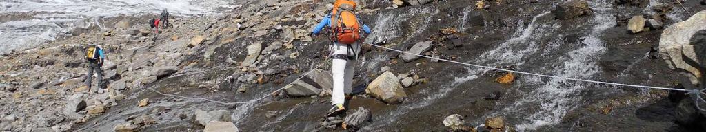
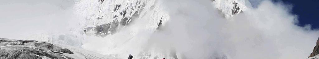
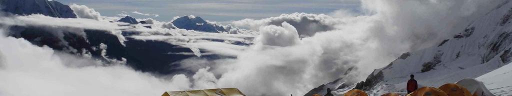
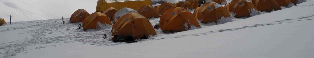
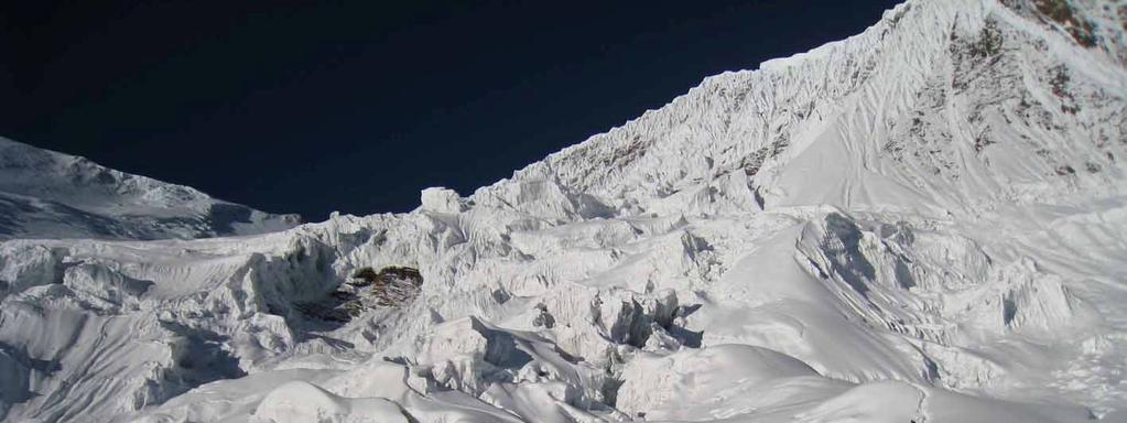
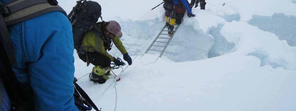
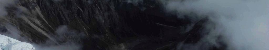
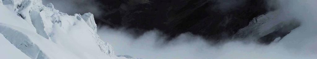
4 Description of the expedition The expedition begins with a helicopter flight from Kathmandu directly to Samagon (3780 m), a small village set in a valley directly below Manaslu. We spend 3 days camping and doing acclimatization walks (4100 m 4400 m) into the adjacent side valleys. The trek to Base Camp (4700m) leads up steep paths passing through rhododendron trees. Leaving a glacial lake on the left hand side, the route runs on the slope and ridge of the cliffs, then further passing hanging glaciers and rugged icefalls in the distance on the left hand side. Base camp is situated in a sheltered hollow in a comfortable position on a rock. It is protected from strong winds, but because of its particular location is susceptible to daily precipitation as the valley cloud condenses at this altitude. Rain was common during the afternoons and on the last days of September there was a snowfall. Having spent a few days in the Base Camp we depart on the first acclimatization trip to Camp I (5500 m). The path continues as before on a rocky ridge of the cliff along the glacier, however, upon the arrival to the edge of the glacier (approx m) we attach crampons. When potentially dangerous crevasses and steeper slopes have to be crossed, we use fixed ropes. Camp I is situated on a comfortable col that is generated by a series of cliffs from Northern and North-western sides, on East there is a steep drop. We spend approximately three hours on the way, one hour in the Camp and then return to Base Camp. We make the second acclimatization trip to Camp I and spend three nights there. As part of the trip we also climb to 5800 m height. When going up more than Camp I we experience steeper slopes, technically more difficult crossing of icefalls and crevasses, hence having to use fixed ropes. We spend in total four nights outside the Base camp when going on the third acclimatization trip to Camp II (6300 m). Upon the departure from Camp I, the track leads around the rocks and up to a glacier. We continue the route by passing underneath a massive icefall therefore gaining a steep snow slope. Sometimes the steepness of the slope is up to 60-70, moreover, there is a lot of crevasses so for almost half of the time we use fixed ropes, once even ladders in order to get across a wide crevasse. Camp II is situated on a sheltered hollow that is produced by the series of ice cliffs. We spend about 6 hours on this difficult path where the average steepness of the slope is During this acclimatization we also ascend to Camp III (6700 m) which is located on a vast snow slope, right before a col. The track is easier and takes about 3 hours from Camp II. It first travels through a series of snow shelves before ascending to a steeper snow slope and then reaching the Camp which provides spectacular views of the surrounding peaks. During a drizzle, the group departs for the peak September 23, Having arrived to Camp I we note the continuous snowfall that (in contrary to weather forecast) continues throughout the night as well as the next day. In the evening we are forced to return to Base camp which has also received heavy snowfall while we were away. Group I who departed for the peak one day before us and had already reached Camp II when snowfall started, returned to Base camp on September 25, The depth of the snow reached 1m at some points therefore covering our track and ropes. We spend the next few days not knowing if the weather is going to change and whether there will be another chance for an attempt to ascent. However, eventually we receive good news the weather will be good to reach the peak around 4 th and 5 th October. 4
5 This time as Group I (previously Group II ) we begin the second attempt to ascend the peak on September 30, Having completed the route to Camp III in three days, we continue the route by climbing the steeper North-eastern slopes. It passes through a series of short ice bulges to reach the upper snow slope, which leads to a traverse to Camp IV (7400 m). On this difficult route we spend approximately five hours climbing slopes of steepness of 40-50, using oxygen and half of the time being secured with fixed ropes. We can finally clearly see the peak Manaslu from Camp IV (due to the specificity of the route it was not always visible to us). Using oxygen, we depart for the peak on an early morning around 5.30 am on October 4, Before getting to the foot of the peak, we spend approximately four hours climbing up steep snow slopes. Sometimes, however, we need to cross steeper (approx. 60 ) parts of the route which altogether lead us to a snow shoulder 100 m before the peak. From here the sharp and steep cliff of the peak is at the end of a path on a ridge. We use fixed ropes for the steepest parts of the track along the way as well as for the final 100 m ascent and reach the peak just before 10 am. The weather is good and the peak is cover in deep snow. The descent is fairly easy and we reach Camp II in about five hours. We spend the night there before continuing to Base camp and arriving on October 5 th, Having spent a few days at the Base camp, on the early morning of October 8, 2011, we go down to Samagon village from where we take a helicopter flight and arrive to Kathmandu at noon. 5
6 Scheme of the route No. Stage Height Steepness of slope Characteristics Date difference 1 BC C I 800 m 30 (periodically ) Rocks, snow, ice C I C II 800 m (periodically ) Snow, ice C II C III 400 m (periodically 50 ) Snow C III C IV 700 m (periodically 60 ) Snow, ice C IV Peak 763 m (periodically 60 ) Snow, ice Peak C II 1863 m (periodically 60 ) Snow, ice C II - BC 1600 m (periodically ) Rocks, snow, ice

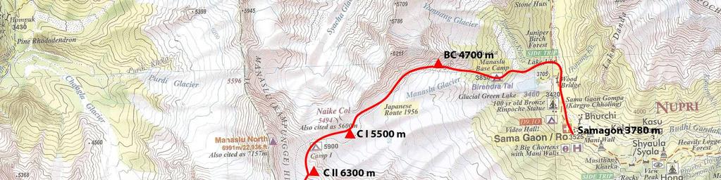
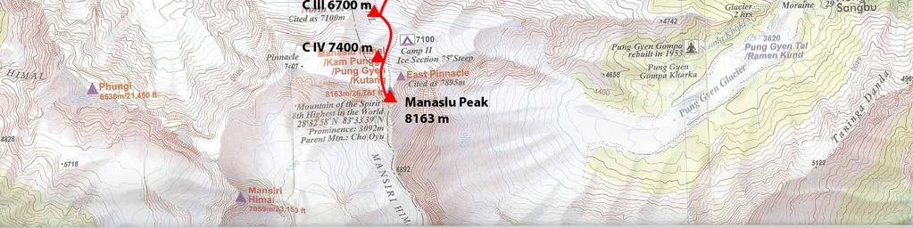
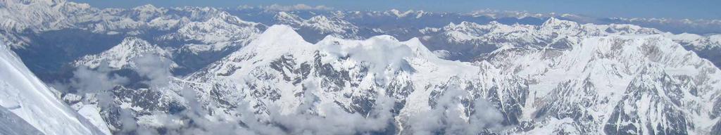
7 Map of the route 7

8 Map of the region 8

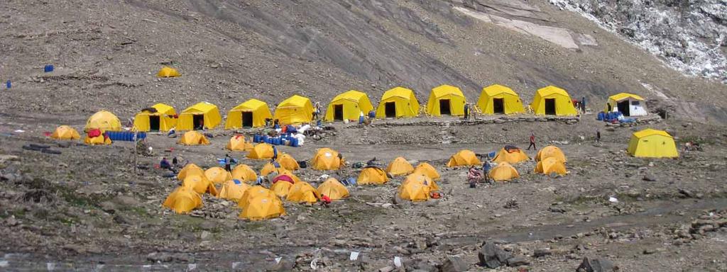

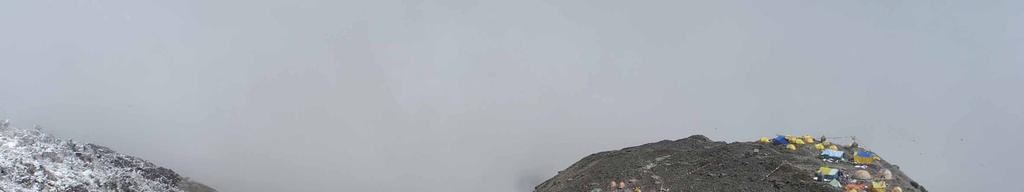
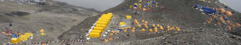
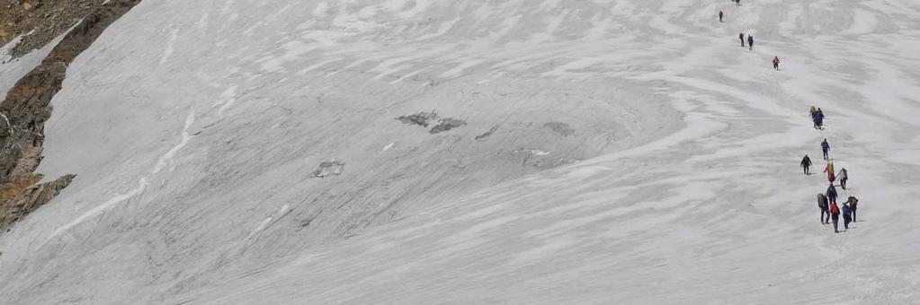
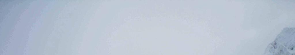
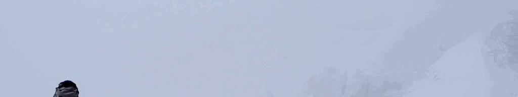
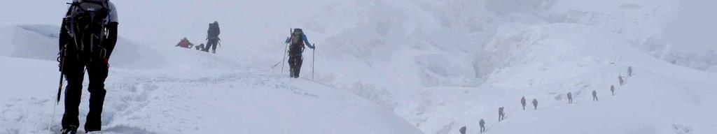
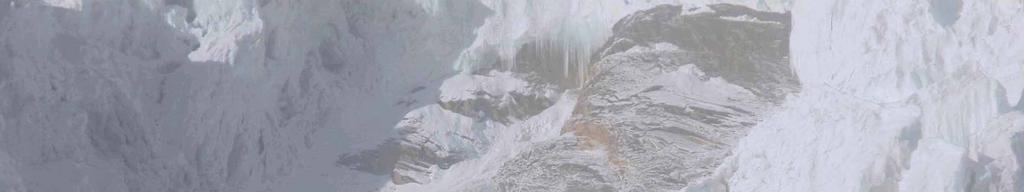
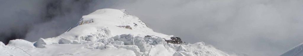
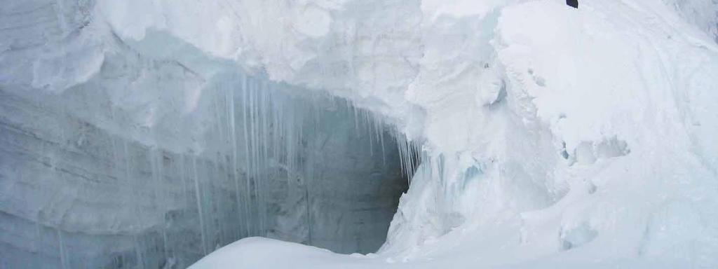
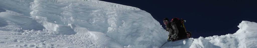
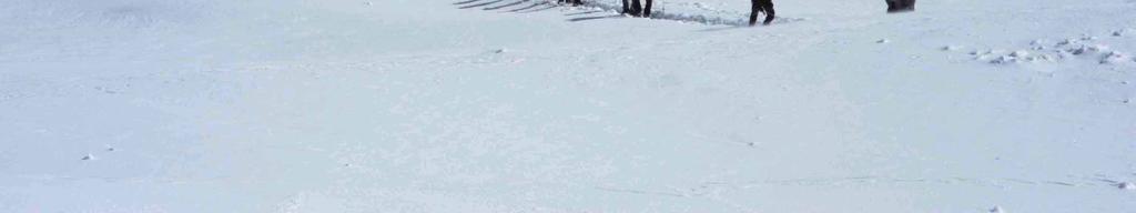
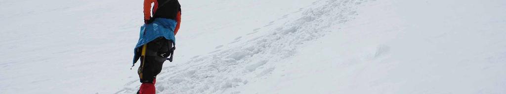
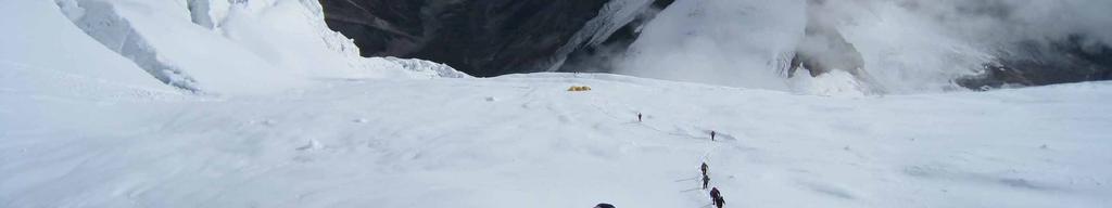
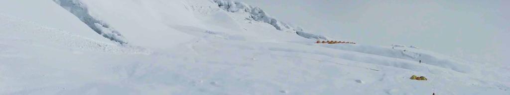
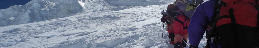
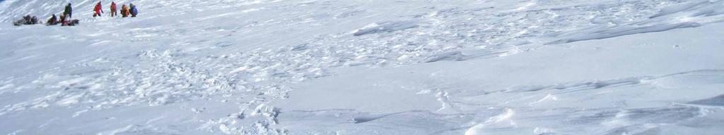
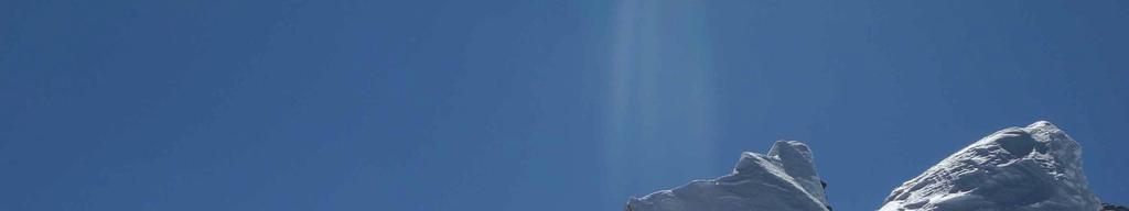
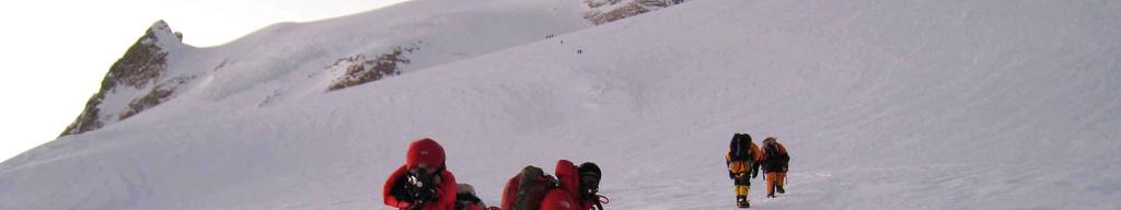
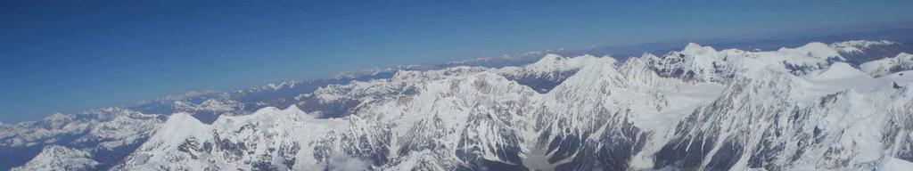
9 Pictures Base camp 9

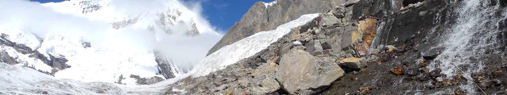

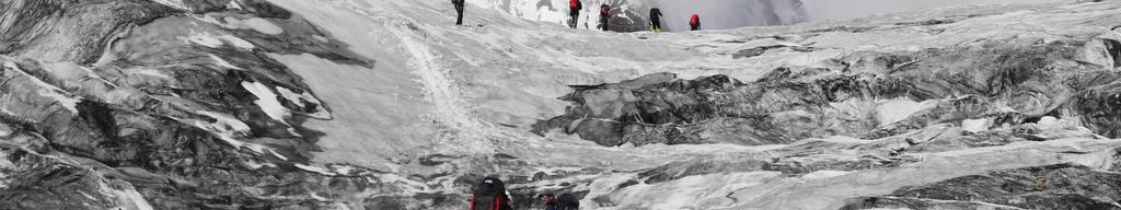
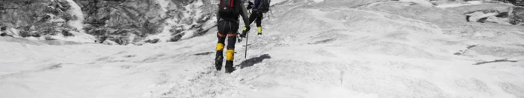
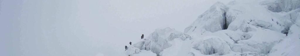
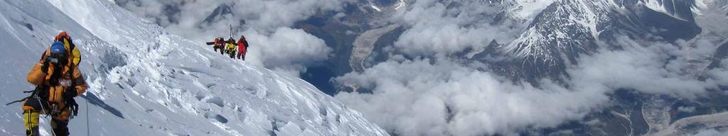
10 Stage BC C I 10

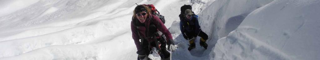
11 Kristīne Kravcova 11

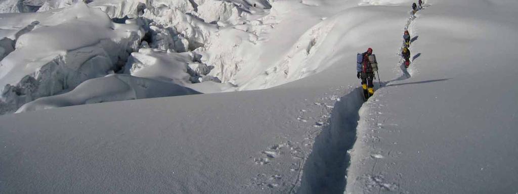
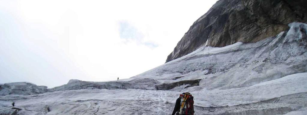
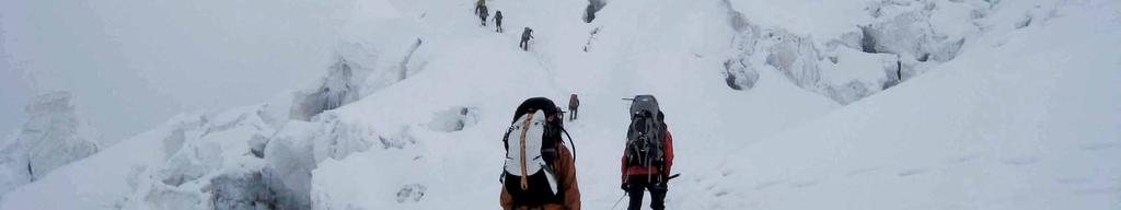
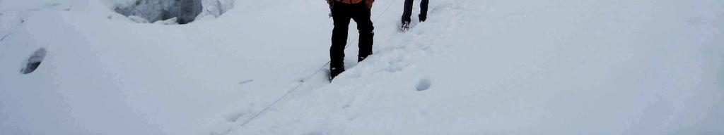
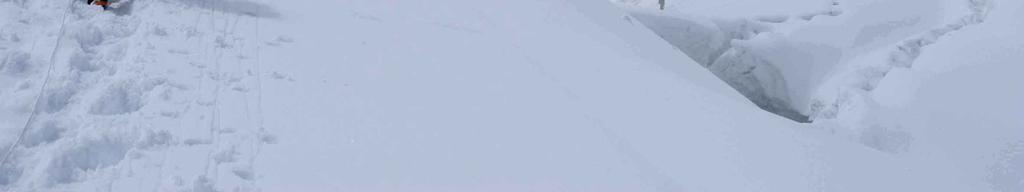
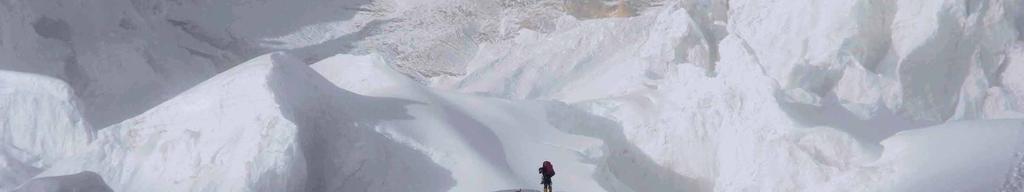
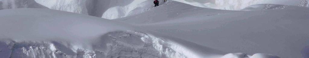
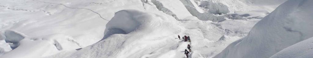
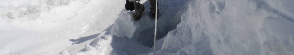
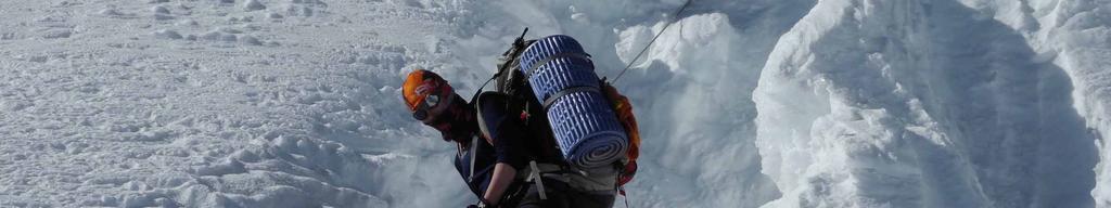
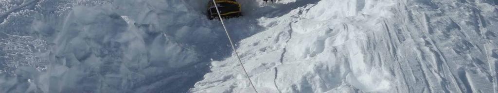
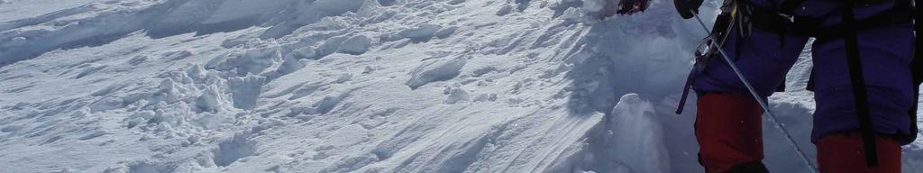
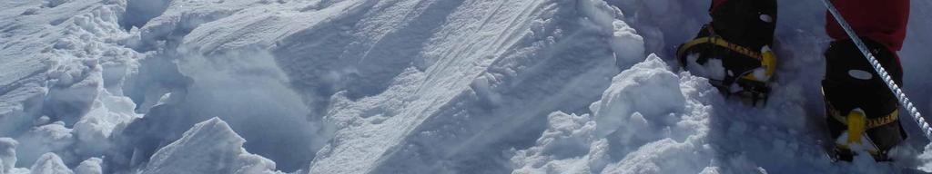
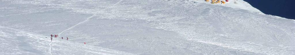
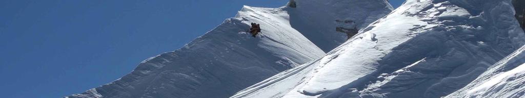
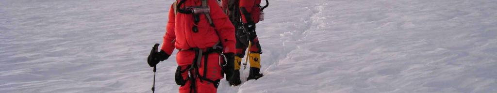
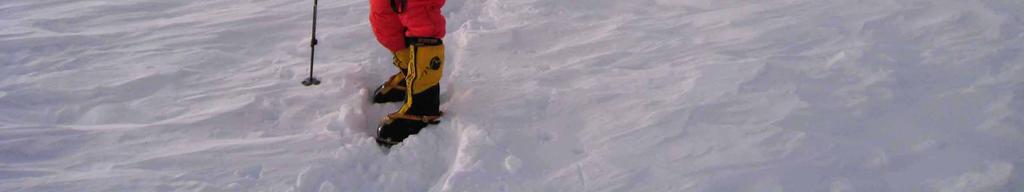
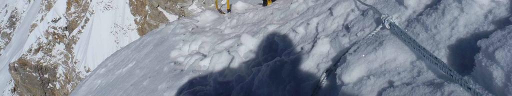
12 Stage C I C II CI 12
13 13


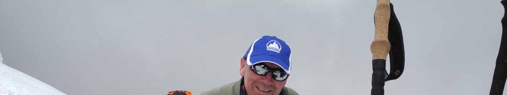
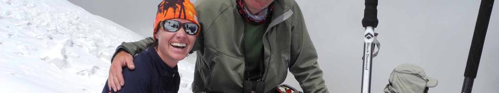
14 Kristīne Kravcova Kristīne Kravcova and Voldemārs Sprūžs 14
15 15

16 Kristīne Kravcova 16

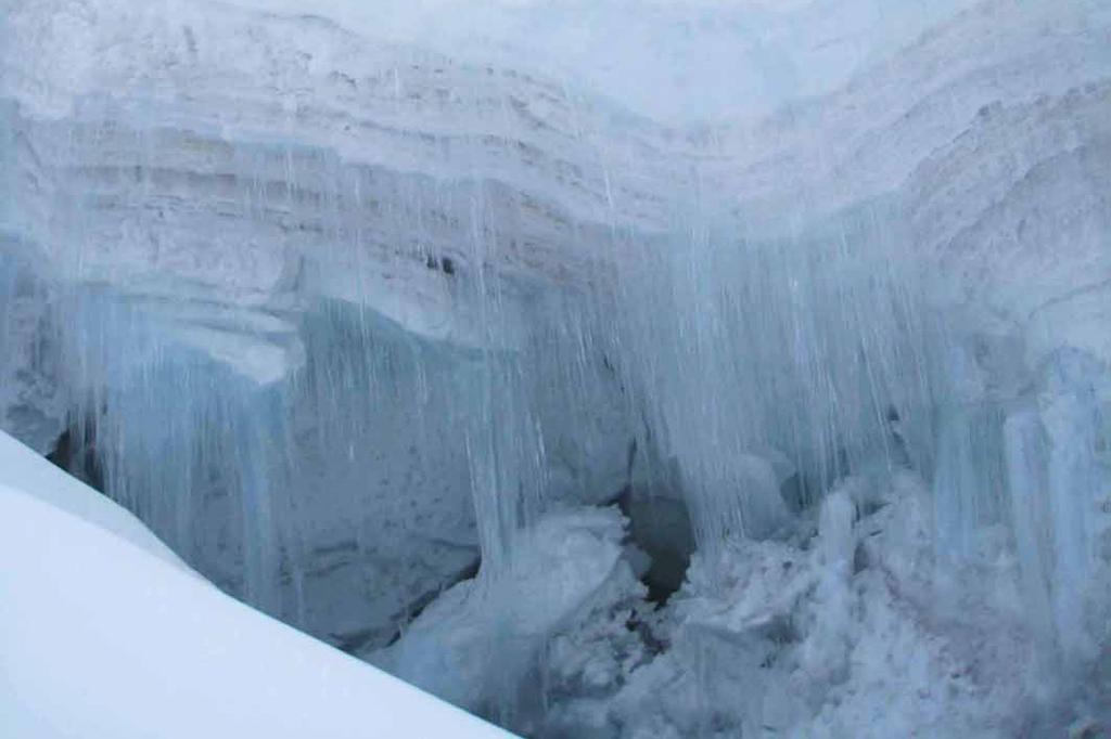

17 Kristīne Kravcova 17


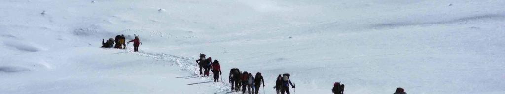


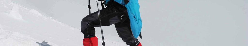
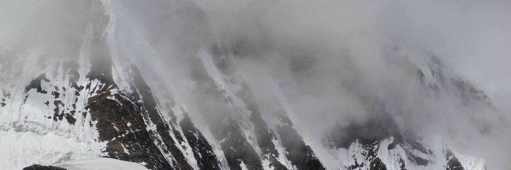
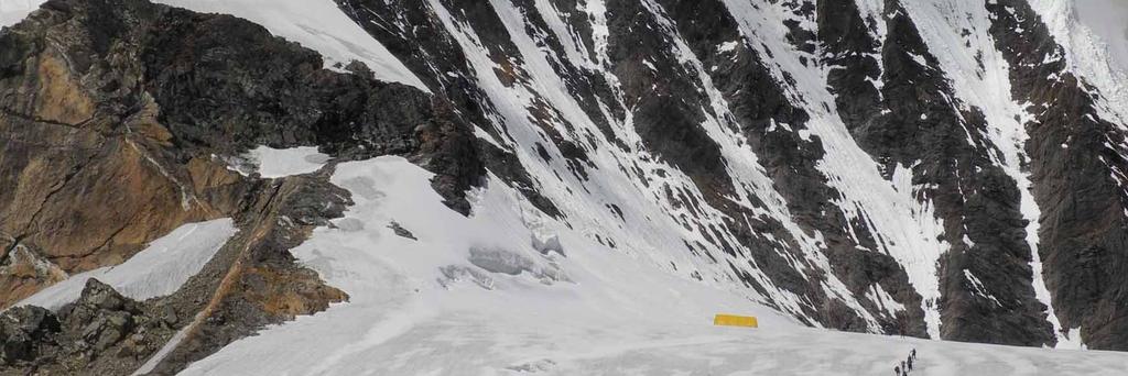
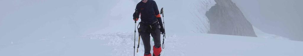
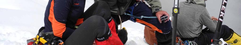
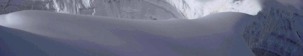
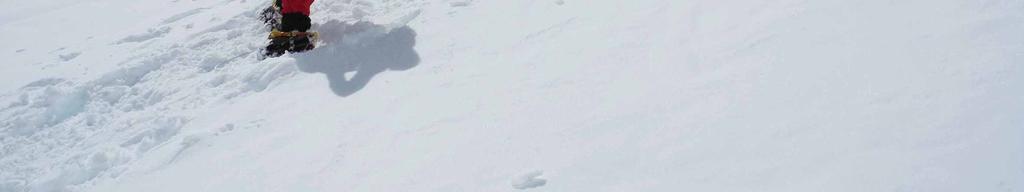
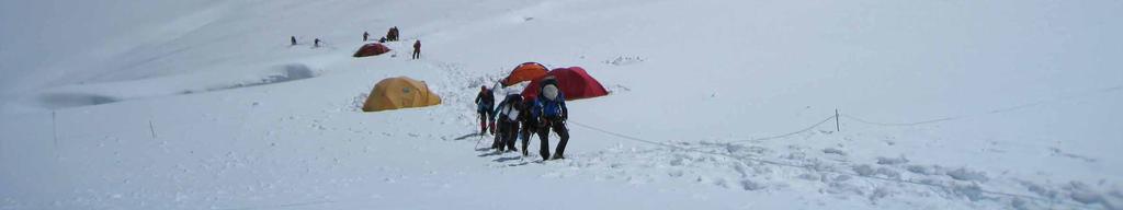
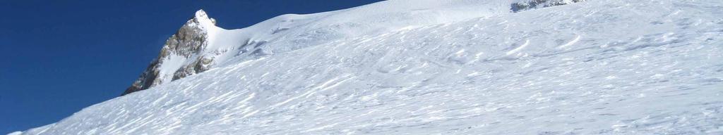
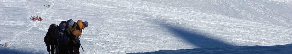
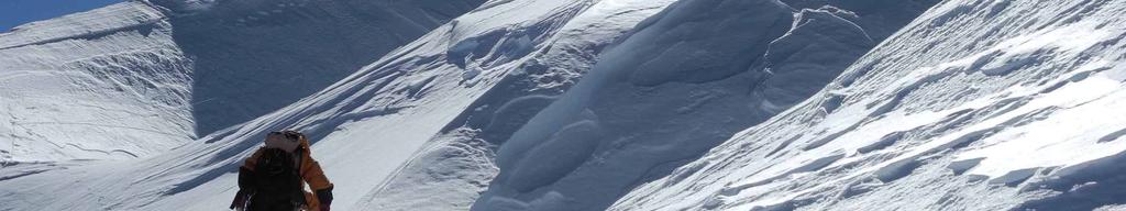
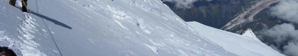
18 Stage C II C III Kristīne Kravcova 18


19 Kristīne Kravcova 19
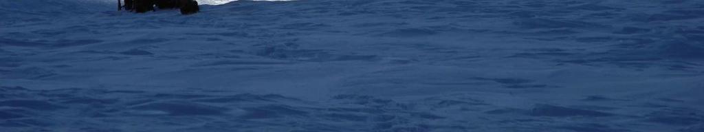
20 20

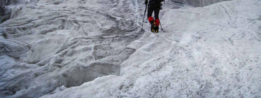
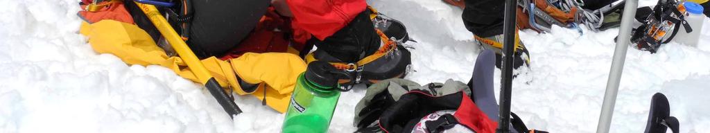
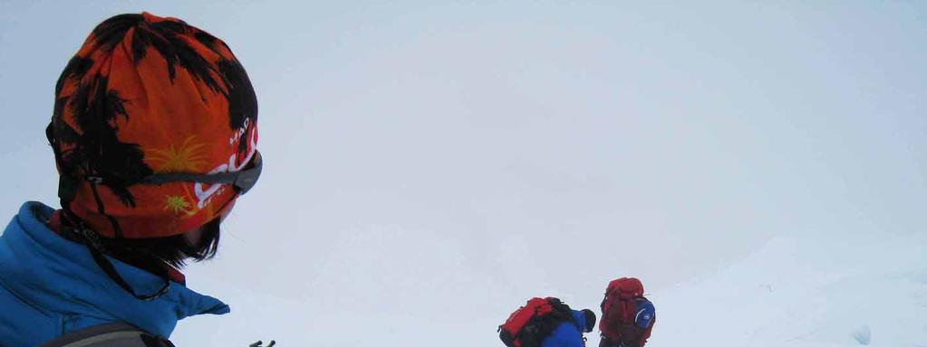
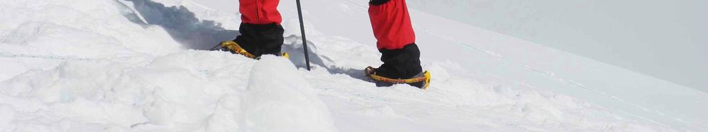
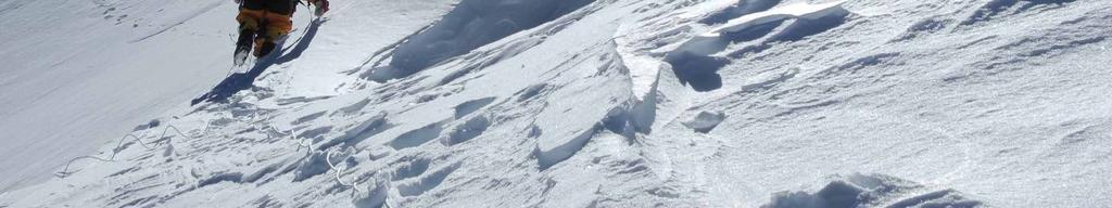
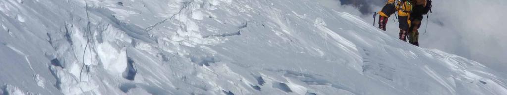
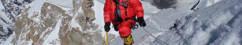
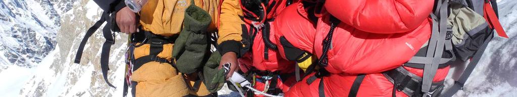
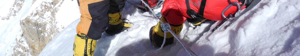
21 Stage C III C IV 21

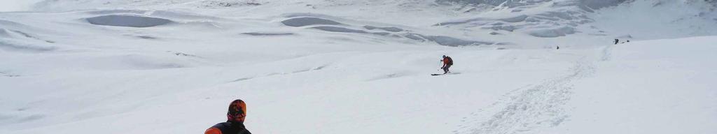
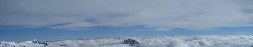
22 Stage C IV Peak 22

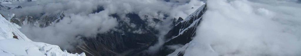
23 Kristīne Kravcova 23


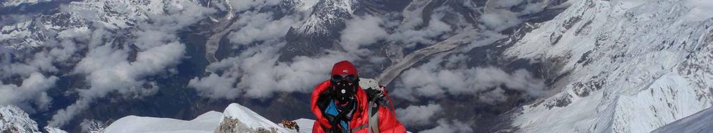
24 Peak Kristīne Kravcova and Voldemārs Sprūžs Kristīne Kravcova 24


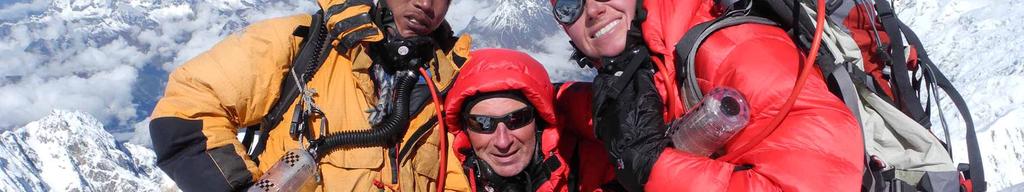
25 Kristīne Kravcova and Voldemārs Sprūžs Kristīne Kravcova, Voldemārs Sprūžs and Urken 25
PERUVIAN ANDES ADVENTURES. ARTESONRAJU CLIMB 6025m (19767 ft) Grade: D+ to TD/ Technical. Routes: The two routes to climb Artesonraju are;
 Grade: D+ to TD/ Technical. Routes: The two routes to climb Artesonraju are;") PERUVIAN ANDES ADVENTURES ARTESONRAJU CLIMB 6025m (19767 ft) Grade: D+ to TD/ Technical Routes: The two routes to climb Artesonraju are; *Via the Paron Valley South East Ridge 5 days (option for 6 with
PERUVIAN ANDES ADVENTURES ARTESONRAJU CLIMB 6025m (19767 ft) Grade: D+ to TD/ Technical Routes: The two routes to climb Artesonraju are; *Via the Paron Valley South East Ridge 5 days (option for 6 with
Island Peak (Imja Tse )
") Popularly known as Imja Tse, Island Peak is the most climbing peaks in Nepal. It appears as an island of the icy sea while viewing form Dingbuche and on close inception, it exposes itself to be the most
Popularly known as Imja Tse, Island Peak is the most climbing peaks in Nepal. It appears as an island of the icy sea while viewing form Dingbuche and on close inception, it exposes itself to be the most
PERUVIAN ANDES ADVENTURES. TOCLLARAJU CLIMB or ISHINCA + TOCLLARAJU CLIMBING. Tocllaraju 4 Days Ishinca + Tocllaraju 5 or 6 days
 PERUVIAN ANDES ADVENTURES TOCLLARAJU CLIMB or ISHINCA + TOCLLARAJU CLIMBING Tocllaraju 4 Days Ishinca + Tocllaraju 5 or 6 days PEAKS Tocllaraju: 6034m (19797 ft) Grade: D / Hard / Some steep & technical
PERUVIAN ANDES ADVENTURES. EXPEDITION Climbing Alpamayo & Huascaran. PEAKS: Maparaju 5350m Alpamayo 5947m Huascaran Sur 6768m
 PERUVIAN ANDES ADVENTURES EXPEDITION Climbing Alpamayo & Huascaran PEAKS: Maparaju 5350m Alpamayo 5947m Huascaran Sur 6768m 23 days Huaraz to Huaraz Grade: Technical, physically demanding This is a comprehensive
TUPPER DESIGNATED ACCESS ROUTE
 TUPPER DESIGNATED ACCESS ROUTE 1 FOR ACCESS/EGRESS TO CONNAUGHT, LOOKOUT, STONE ARCH, PORTAL PATHS AND TUPPER TRAVERSE EGRESS Length: 2.6km Vertical Gain: +162m / -83m (Values are for access. For egress,
Two Peaks in the Headwaters of Karcha Nala JAC Tokai to the Indian Himalayas
 KAZUO HOSHI Two Peaks in the Headwaters of Karcha Nala JAC Tokai to the Indian Himalayas The Tokai Section of the Japanese Alpine Club (hereinafter described as JAC Tokai) conducted 11 expeditions to the
KILIMANJARO 2018 RUN & TREK February 28 March 12
 KILIMANJARO 2018 RUN & TREK February 28 March 12 Wednesday 28 Feb Depart USA to Kilimanjaro International Airport, Tanzania, Africa Thursday 01 March Arrive Kilimanjaro. Met upon arrival at the Kilimanjaro
MT KILIMANJARO TREK- LEMOSHO ROUTE
 #Trekking MT KILIMANJARO TREK- LEMOSHO ROUTE 10 Days 9 Nights Overview Take the challenging and less-travelled Lemosho route up to the highest peak in Africa, considered by many to be the most beautiful
Tent Peak / Tharpu Chuli Peak Climbing
 Tent Peak / Tharpu Chuli Peak Climbing Introduction Tharpu Chuli (5663m) also known as the Tent Peak lies at the center of Annapurna Sanctuary. This peak is perfect gateways for those who are reluctant
Route #2) Mt. Massive - Southwest Slopes
 Mt. Massive - Southwest Slopes") Route #2) Mt. Massive - Southwest Slopes Difficulty: Class 2 Ski: Advanced, D6 / R2 / III Exposure: Summit Elevation: Trailhead Elevation: Elevation Gain: Round-trip Length: Trailhead: County Sheriff:
Route #2) Mt. Massive - Southwest Slopes Difficulty: Class 2 Ski: Advanced, D6 / R2 / III Exposure: Summit Elevation: Trailhead Elevation: Elevation Gain: Round-trip Length: Trailhead: County Sheriff:
! Kilimanjaro Expedition
 ! Kilimanjaro Expedition Tanzania 2016 Climb Only: $4,350 (land costs) Feb 4-12; June 12-20; July 10-18; Aug 6-14; Sept 11-19; Dec 4-12 2016 Climb & Safari: $5,850 (land costs) Feb 4-15; June 12-23; July
Annapurna Base Camp and Mardi Himal Trekking
 Annapurna Base Camp and Mardi Himal Trekking Package Highlights Famous Trekking destination in Annapurna region, Annapurna Base Camp and Mardi Himal Exploration of UNESCO heritage sites in Kathmandu and
TREK THE ROCKIES ABOUT THE CHALLENGE TREK THE ROCKIES FOR HIGHLAND HOSPICE CANADA TREK DEMANDING
 TREK THE ROCKIES CANADA TREK DEMANDING ABOUT THE CHALLENGE The Canadian Rockies are justifiably world-famous for their magnificent scenery: the combination of impressive, jagged mountains, bright turquoise
TREK KILIMANJARO ABOUT THE CHALLENGE KILIMANJARO TREK - 11 DAY TANZANIA TREK RED 3
 TREK KILIMANJARO TANZANIA TREK RED 3 ABOUT THE CHALLENGE Climb the highest freestanding mountain in the world! Kilimanjaro is the highest mountain on the African continent at 5896m. Its snow-capped summit
Dnigi Hut. Dnigi is Dnaina for Moose. Location:
 Dnigi Hut in places. Stay on the main thoroughfare. Continue along the ridge top, going east to a pass above Knob Creek. Just beyond here look for a left turn which descends north-northwest (61,45.578,-148,52.414,2081
Mt. Kilimanjaro Trek. WanderTours P.O. Box Seattle WA Itinerary dates: January 23 - February 1, 2019 Tour Escort: Beth Whitman
 WanderTours P.O. Box 16102 Seattle WA 98116 Mt. Kilimanjaro Trek Itinerary dates: January 23 - February 1, 2019 Tour Escort: Beth Whitman HIGHLIGHTS The six-day Machame Route to Uhuru Peak, considered
ANUMC Ski Mountaineering Expedition. Classic Haute Route ANUMC Expedition Fund Application By Andrew Gough
 ANUMC Ski Mountaineering Expedition Classic Haute Route 2010 ANUMC Expedition Fund Application By Andrew Gough Introduction: The Haute route (or High Mountaineers Route ) is one of the worlds most famous
GUIDE NEPAL EVEREST BASE CAMP 21 DAYS SUMMER 2019
 GUIDE NEPAL EVEREST BASE CAMP SUMMER 2019 21 DAYS WHERE ARE YOU GOING? NEPAL Birthplace of Buddha and home of Everest, the tiny kingdom of Nepal is the greatest adventure paradise of all! Discover the
climb Mount Elbrus at a glance trip highlights
 climb actionchallenge on Our ascent of begins in the foothills of the lower Caucasus. Elbrus, an inactive volcano, is one of the famous Seven Summits and, at 5,642 m, is the highest mountain in Europe.
Base Camp Trek. Trek dates October to early December and end of February to May
 Base Camp Trek This special version of the trek to Everest Base Camp is designed for anyone who is very fit and has some trekking experience. The route to base camp is the same as the longer trek but with
MOUNT KILIMANJARO TREK
 TANZANIA TREK EXTREME ABOUT THE CHALLENGE Climb the highest freestanding mountain in the world! Kilimanjaro is the highest mountain on the African continent at 5896m. Its snow-capped summit rises high
RUSSIA. Elbrus. I
 RUSSIA Elbrus RUSSIA Elbrus Mount Elbrus is the highest peak in Russia and Europe and although many mountaineers visit the area to climb the mountain, there are also many other attractions here. On the
Everest Base Camp, Nepal
 Everest Base Camp, Nepal This outstanding trek to the base camp of the world s highest mountain will take you through the lush valleys of Sagarmatha National Park, with time to explore its villages and
MOUNT VINSON ANTARCTICA S
 MOUNT VINSON ANTARCTICA S HIGHEST PEAK Imagine yourself on the summit of Mount Vinson 16,050 ft (4892 m), the highest peak in Antarctica and one of the coveted Seven Summits. Majestic, snow-covered peaks
Trail Phasing Plan. Note: Trails in the Clear Creek Canyon area (Segments will be finalized in the future to minimize wildlife impacts
 Note: Trails in the Clear Creek Canyon area (Segments 2 5 and a future JCOS connection) will be finalized in the future to minimize wildlife impacts Trail Phasing Plan P Parking 3 Easy Trail Intermediate
Machame 7 Days 6 Nights
 Machame 7 Days 6 Nights If Marangu is the Coca Cola route, then the Machame Route is the Whiskey route. It is the second most popular and one of the most scenic routes on the mountain. All climbers sleep
Stok Kangri Peak (6120m) 2 to 16 September 2018 Explore the hidden kingdom of Ladakh with Stok Kangri Peak
 2 to 16 September 2018 Explore the hidden kingdom of Ladakh with Stok Kangri Peak") Stok Kangri Peak (6120m) 2 to 16 September 2018 Explore the hidden kingdom of Ladakh with Stok Kangri Peak Stok Kangri is a perfect objective for fit trekkers without climbing experience, and is one of
Stok Kangri Peak (6120m) 2 to 16 September 2018 Explore the hidden kingdom of Ladakh with Stok Kangri Peak Stok Kangri is a perfect objective for fit trekkers without climbing experience, and is one of
Summer Haute Route Trek 2018 TRIP NOTES
 Summer Haute Route Trek 2018 TRIP NOTES Summer Haute Route Trek 9 days (7 days trekking, 2 travel days) 2018 Trip Notes All material Copyright Adventure Consultants Ltd 2017/2018 This alpine classic follows
ANNAPURNA SANCTUARY The Jewel in the Crown
 COMMUNITY ACTION TREKS LTD Stewart Hill Cottage, Near Hesket Newmarket, Wigton, Cumbria, CA7 8HX Tel: 01768 484842 Email: info@catreks.com Web: www.catreks.com ANNAPURNA SANCTUARY The Jewel in the Crown
Mt. Thielsen Trip Report: April 29, 2012
 Mt. Thielsen Trip Report: April 29, 2012 Outing Organizer: Geoff Hance, with Brent McGregor Elevation Gain: 3,800 feet, over warming snow, with an exposed summit block Distance: About 9 miles round trip
Aconcagua Leadership and Guide Training Course
 Aconcagua Leadership and Guide Training Course Cerro Aconcagua is located in the central Andes of Argentina near the border with Chile. At 22,841ft (6,962m), it is one of the seven summits and the only
18 day itinerary: ACONCAGUA Normal Route 15 day trek. T r i p I t i n e r a r y
 T r i p I t i n e r a r y HIGHLIGHTS Summit the highest mountain in South America, and the second highest of the Seven Summits Breath-taking views of the Andes Three days set aside for the summit attempt
FROM JUTA TO ROSHKA via Chaukhi pass
 FROM JUTA TO ROSHKA via Chaukhi pass Duration: 1-2 days The hike can take one or two days, depending on how you plan it. I will focus on the 1-day version of the trek which takes 8-9 hours and starts in
(west) onto Charleston Boulevard. Drive 16 miles on Charleston and turn right into Red Rock
 onto Charleston Boulevard. Drive 16 miles on Charleston and turn right into Red Rock") Hike: North Peak and Ice Box Overlook up and back Trailhead: 2.5 miles up the Rocky Gap Road not mark Distance: 5 miles round trip Elevation gain: 2,694 feet Elevation Peak: 7,094 feet Time: 3 to 5 hours
Hike: North Peak and Ice Box Overlook up and back Trailhead: 2.5 miles up the Rocky Gap Road not mark Distance: 5 miles round trip Elevation gain: 2,694 feet Elevation Peak: 7,094 feet Time: 3 to 5 hours
Mount Kilimanjaro Climbing via Marangu Route 6 day-itinerary
 Mount Kilimanjaro Climbing via Marangu Route 6 day-itinerary (For the 5-day route, simply exclude the additional acclimatisation day at Horombo hut - day 3 on the itinerary below.) Total hiking distance:
The height of Machu is 6630m on the Swiss map, 6612m on the Russian map and 6603m on Google Earth.
 Hispar Expedition 2017 Expedition Final Report MEF reference: 17-42 Country and region visited: Pakistan, Hunza Valley, Karakoram. Objective To make the first ascent of Machu (6630m) by the southwest and
Nanda Devi East Base Trek Photo Log - October 2016
 Nanda Devi East Base Trek Photo Log - October 2016 As one drives through Kumaon the most noticeable aspect is how different the terrain is as compared to Garhwal. The foothills are a lot more gentle in
LANGTANG, GANJA LA & YALA PEAK
 COMMUNITY ACTION TREKS LTD Stewart Hill Cottage, Near Hesket Newmarket, Wigton, Cumbria, CA7 8HX Tel: 01768 484842 Email: info@catreks.com Web: www.catreks.com LANGTANG, GANJA LA & YALA PEAK Grade: Strenuous
Future Climbing Park Nyainbo Yuze in Qinghai
 JAPANESE ALPINE NEWS 2014 HENGDUANG MAOUNTAINS CLUB Future Climbing Park Nyainbo Yuze in Qinghai A GUIDE TO MOUNTAINEERING IN CHINA (jointly edited and published by the China Mountaineering Association
STOK KANGRI 5490M STOK KANGRI TREK Aug 03-15, 2019
 STOK KANGRI 5490M STOK KANGRI TREK Aug 03-15, 2019 STOK KANGRI TREK: INTRODUCTION One of the most popular trekking peaks in the Indian Himalayas and on the planet, the proximity to Leh (the capital of
Morning Star Peak Avalanche Accident
 Morning Star Peak Avalanche Accident Saturday, December 4, 2010 Date: 2010-12-13 Submitted by: Oyvind Henningsen Everett Mountain Rescue and Mark Moore NWAC Place: Morning Star Peak, north-central WA Cascades
Grizzly Peak A - East Ridge July 15, 2012
 Grizzly Peak A - East Ridge July 15, 2012 Difficulty: Difficult Class 2/Class 3 Upper Elevation: 13,995 feet Trailhead Elevation: 11,360 feet Elevation Gain: 3,000 feet Round-trip Length: 6.0 miles Trailhead:
Lesson 5: Ice in Action
 Everest Education Expedition Curriculum Lesson 5: Ice in Action Created by Montana State University Extended University and Montana NSF EPSCoR http://www.montana.edu/everest Lesson Overview: Explore glaciers
From Rassa to Sumur..a journey of exploration and climbing.
 From Rassa to Sumur..a journey of exploration and climbing. In 2001, a glimpse of Rassa glacier, during our expedition to Arganglas valley indicated great opportunity for exploration and climbing. In July
REPORT for Championships of Mountaineering of Baltic States Khan-Tengri and West-Pobeda 2008
 REPORT for Championships of Mountaineering of Baltic States Khan-Tengri and West-Pobeda 2008 alpinism.ee 1 Club MTÜ Matkamise ja Mägironimise Edendamise Klubi www.alpinism.ee Passport Class of the route
NEPAL LANGTANG TREK ABOUT THE CHALLENGE NEPAL TREK TOUGH
 NEPAL TREK TOUGH ABOUT THE CHALLENGE This magnificent trek, with the ultimate combination of spectacular scenery and fascinating culture, takes us to the magnificent Langtang region of the Himalayas, open
VINSON MASSIF EXPEDITIONS 2017/2018 TRIP NOTES
 VINSON MASSIF EXPEDITIONS 2017/2018 TRIP NOTES VINSON MASSIF 2017/2018 Expedition Notes All material Copyright Adventure Consultants Ltd 2017/2018 During the southern summer of 2017/2018, Adventure Consultants
S2Kilimanjaro 8220 Barningham Road Richmond VA / /
 S2Kilimanjaro 8220 Barningham Road Richmond VA 23235 / 505.670.1441 Adventures @S2Mountaineering.com / www.s2mountaineering.com Lemosho Route The Lemosho Route is a remote, unspoiled and very beautiful
Mt. Rainier Three-Day Muir Climb
 Mt. Rainier Three-Day Muir Climb Details below provided by AAI Elevation: 14,411 feet Guide Service: Alpine Ascents International (AAI) Fundraising minimum: $5,000.00 USD Muir Three-Day Overview Our three-day
Langtang Valley to Kyanjin Gompa Trek
 The Langtang Valley sits within the first national park designated in Nepal the Langtang National Park. The valley offers some of the most spectacular mountain trekking and scenery near to Kathmandu. Just
Annapurna Circuit Trek 17D/16N
 Annapurna Circuit Trek 17D/16N Pre Trek: Travel to Kathmandu (1,300m) : At 5:00 pm, a rickshaw will pick you up from your hotel and bring you to the trekking offices for a safety briefing on the nature
Chasing Skylines in Kyrgyzstan BMC Reference: 15/ 02
 Chasing Skylines in Kyrgyzstan 2015 BMC Reference: 15/ 02 21/02/2015 to 15/03/2015 Contact: Sophie Nunn Email: Sophienunn@gmail.com, Phone: 07540454054 Address: 7 Richmond Lodge, 6 Victoria Avenue, Swanage,
2016 Snowcraft Course Information
 2016 Snowcraft Course Information Dates Beginner 21 st 23 rd July, 28 th 30 th July, 18 th 20 th August Intermediate 18 th 20 th August, 25 th 27 th August Advanced 25 th 27 th August Beginner Course Information
ASIAN ALPINE E NEWS. Issue No. 27 June 2018
 ASIAN ALPINE E NEWS Issue No. 27 June 2018 Extract published in last AAE25 with permission from Roli Books from the book "Legendary Maps from the Himalayan Club", edited by Harish Kapadia. Available from
Trek the highest mountain in Africa. Mt Kilimanjaro. for a trip of a life time!
 Trek the highest mountain in Africa Mt Kilimanjaro for a trip of a life time! Trip outline The expedition offers you the challenge of trekking the highest free standing mountain in the world and Africa
Mount Kilimanjaro Climbing via Rongai Route 8 day-itinerary
 Mount Kilimanjaro Climbing via Rongai Route 8 day-itinerary Total hiking distance: Approximately 70 kms The Rongai route ascends Kilimanjaro from the north-eastern side of the mountain, along the border
Guthega to Mt Twynam. 2183m. 1583m. 6 hrs 45 mins 14.8 km Return. Experienced only. 913m
 Guthega to Mt Twynam 6 hrs 45 mins 14.8 km Return Experienced only 5 913m This walk starts from Guthega and makes its way along the Snowy River to the Illawong Lodge, via the Blue Cow Creek flying fox.
CHALLENGE OVERVIEW. ACCOMMODATION. You will be accommodated in friendly, simple hotels and tents whilst on the mountain.
 CHALLENGE OVERVIEW Mount Kilimanjaro is one of the seven Natural Wonders of the World and for many people, standing on its summit is a life-long ambition. The snow-capped peak was first reached by German
6 DAYS MACHAME ROUTES ON KILIMANJARO
 6 DAYS MACHAME ROUTES ON KILIMANJARO Day 1: Moshi Machame camp In the morning, we depart from our base hotel at approximately 8:00 AM for the Machame village where you begin the trek. From the park entrance
L U N C H C R E E K T R A I L GLACIER NATIONAL PARK
 D I R T I N M Y S H O E S L U N C H C R E E K T R A I L GLACIER NATIONAL PARK Lunch Creek "Secret" Hike This short hike on the Lunch Creek Trail will knock your socks off! It's the perfect mix of length,
Punta Union Pass Santa Cruz Ulta Trek
 PERUVIAN ANDES ADVENTURES SANTA CRUZ QUEBRADA ULTA TREK & PISCO CLIMB 10 days (plus one rest day in Huaraz) Santa Cruz Ulta Trek 6 Days Grade: Moderate to Hard Punta Union Pass Santa Cruz Ulta Trek This
ANCHORAGE, ALASKA N, W. northern SUMMER lights
 ANCHORAGE, ALASKA 61.2181 N, 149.9003 W northern lights trip overview Wilderness of a completely different scale sets the scene for our most challenging and thrilling experience in Alaska. This Northern
Route #1) Mt. of the Holy Cross - North Ridge
 Mt. of the Holy Cross - North Ridge") Climbing 14ers can be very dangerous, please read the Mountaineering Safety Page and make sure you have a map+compass and can use them effectively, without the help of electronic devices. Route #1) Mt.
Climbing 14ers can be very dangerous, please read the Mountaineering Safety Page and make sure you have a map+compass and can use them effectively, without the help of electronic devices. Route #1) Mt.
Nepal 7-Day Hiking Adventure. 7 Days
 Nepal 7-Day Hiking Adventure 7 Days Nepal 7-Day Hiking Adventure A world of thrilling adventure awaits on this great introduction to Nepal's mighty Himalaya, ideal for trekkers with limited time. Kick
Note: Coordinates are provided as Universal Transverse Mercator UTM Zone U21, North American Datum 1983 (NAD 83).
.") Northern Traverse Route Description The Northern Traverse (formerly the North Rim Traverse) is an unmarked and rugged backcountry hiking route. It is known be a demanding hike, because of its terrain and
Northern Traverse Route Description The Northern Traverse (formerly the North Rim Traverse) is an unmarked and rugged backcountry hiking route. It is known be a demanding hike, because of its terrain and
The trek & climb combination allows you to experience the grandeur of both mountain ranges the Cordillera Huayhuash and the Cordillera Blanca
 PERUVIAN ANDES ADVENTURES HUAYHUASH MINI TREK & CLIMB ISHINCA 10 days trek & climb (plus a rest day in Huaraz) For those clients who would like to enjoy the spectacular scenery offered by the Cordillera
Main Range Walk - Charlotte Pass to Mount Kosciuszko
 Main Range Walk - Charlotte Pass to Mount Kosciuszko 9 hrs Hard track 21.9 km Circuit 4 920m This full day walk explores some of the greatest alpine country on offer in NSW. The walk grants views of Blue,
Ecuador Volcanoes 6310m
 Ecuador Volcanoes 6310m Climb of Cayambe Climb of Chimborazo, (furthest point from the centre of the earth) Colourful markets & hot springs EXPEDITION OVERVIEW Ecuador is an astonishingly beautiful country
Mt. Gunnbjörn, Dome and Cone (IMG66)
") 2018 The Peaks of Greenland: Mt. Gunnbjörn, Dome and Cone (IMG66) Ski ascent of the highest peaks in the Greenland Arctic - Expedition manual - Content overview Expedition overview Further information
2018 The Peaks of Greenland: Mt. Gunnbjörn, Dome and Cone (IMG66) Ski ascent of the highest peaks in the Greenland Arctic - Expedition manual - Content overview Expedition overview Further information
HB/VS-078 Üssers Barrhorn
 HB/VS-078 Üssers Barrhorn Paul HB9DST, August 23, 2015 Summary: This was a HB9SOTA club project, an activation of the highest summit in Europe you can hike up without ropes or other equipment. The headline
Mountaineering in the Cordillera Blanca, Peru
 Mountaineering in the Cordillera Blanca, Peru ANUMC Expedition Proposal June-July 2019 Introduction: The Andes of South America form the world s highest mountain range outside of Asia and, as the longest
Adventure Travel Trip Itinerary
 Adventure Travel Trip Itinerary Mt. Kilimanjaro & Mt. Meru Climbs, Tanzania July 8 23, 2017 Leader: Bill Blazek Date Activity (distances are approximate) Accommodation, Notes Meals 1 Saturday July 8, 2017
GUIDE INDIA HIMALAYA STOK KANGRI ASCENT 21 DAYS SUMMER 2019
 GUIDE INDIA HIMALAYA STOK KANGRI ASCENT SUMMER 2019 21 DAYS WHERE ARE YOU GOING? INDIA HIMALAYA No words can describe the overwhelming experience of being among the world s greatest mountains you really
ASIAN ALPINE E NEWS. Issue No.35, September 2018
 ASIAN ALPINE E NEWS Issue No.35, September 2018 Unexplored Mekong Headwaters: Sunshine Glacier no 3 and largest of the Glaciers showing here the upper Neve portion centre top, our campsite was under the
THE THREE PEAKS OF TANZANIA
 THE THREE PEAKS OF TANZANIA Longido, Mt Meru, and Kilimanjaro in 13 days Day 1 Arrival Longido approx 10kms trekking FBA can arrange your flights to Nairobi or Kilimanjaro. If booking your own flights,
Nepal. Annapurna Circuit Trek
 Nepal Annapurna Circuit Trek Nepal Annapurna Circuit Trek TRIP GRAD MODERAT-HARD DATES: 11th-28th March 2019 DURATION: 18 Days This trek offers fascinating landscape, Bhotia (Tibetan) Buddhist culture
MT. KILIMANJARO SHIRA ROUTE 8 days
 MT. KILIMANJARO SHIRA ROUTE 8 days Activities: Trekking Difficulty: Moderate to Adventurous Max Elevation: 5,895m/ 19,340 ft at summit Meal: Full board on trek Accommodation: Hotel in Moshi/ tent on trek
MT FRIENDSHIP TREK. A Mountaineering Expedition in Pir Panjal Range of Himalayas!
 MT FRIENDSHIP TREK A Mountaineering Expedition in Pir Panjal Range of Himalayas! With a view to promote Youth into the less explored field of Mountaineering or Mountain Hiking, Invincible the youth run
GOLDEN EARS PROVINCIAL PARK
 GOLDEN EARS PROVINCIAL PARK Trail Information as of October 10 th 2015 Do not underestimate the mountainous wilderness of Golden Ears Provincial Park. The combination of rugged terrain and rapidly changing
Langtang Trek (Central Himalayan s)
") (Central Himalayan s) This trek gives you the opportunity to get right in among the Himalayan peaks. It offers an exceptional diversity of scenery and culture. The combination of two treks gives great
(Central Himalayan s) This trek gives you the opportunity to get right in among the Himalayan peaks. It offers an exceptional diversity of scenery and culture. The combination of two treks gives great
SEVEN SUMMITS TRAINING COURSE NEW ZEALAND 2017 / 2018 COURSE NOTES
 SEVEN SUMMITS TRAINING COURSE NEW ZEALAND 2017 / 2018 COURSE NOTES Seven Summits Training Course 2017/2018 Course Notes All material Copyright Adventure Consultants Ltd 2016-2017 Welcome to Adventure Consultants
MARIPOSA SUMMIT 6D/5N
 MARIPOSA SUMMIT 6D/5N DAY 1: CUSCO HUAMPOCOCHA We leave Cusco early in the morning, on a private car along the fertile valley of the Vilcanota River, towards Cusipata. After a 2-hour driving trip, we will
Staunton River Trail to Hoover Camp and Fork Mtn. Relay Tower (Based on September 18, 2013 hike by Ron Singleton, Fredericksburg, Va.
 Staunton River Trail to Hoover Camp and Fork Mtn. Relay Tower (Based on September 18, 2013 hike by Ron Singleton, Fredericksburg, Va.) The President's Cabin (The "Brown" House) at Camp Hoover. Sign on
Mt. Gunnbjörn, Dome and Cone (IMG66)
") 2015 The Peaks of Greenland: Mt. Gunnbjörn, Dome and Cone (IMG66) Ski ascent of the highest peaks in the Greenland Arctic - Expedition manual - Content overview Expedition overview Further information
2015 The Peaks of Greenland: Mt. Gunnbjörn, Dome and Cone (IMG66) Ski ascent of the highest peaks in the Greenland Arctic - Expedition manual - Content overview Expedition overview Further information
ACONCAGUA PEAK TREK ACONCAGUA Jan 2019
 ACONCAGUA PEAK TREK ACONCAGUA 12-29 Jan 2019 ACONCAGUA PEAK: INTRODUCTION Cerro Aconcagua, the jagged, humpbacked peak is the tallest mountain in the Western and Southern hemispheres - or anywhere else
Glaciers. Reading Practice
 Reading Practice A Glaciers Besides the earth s oceans, glacier ice is the largest source of water on earth. A glacier is a massive stream or sheet of ice that moves underneath itself under the influence
Tiger Mountain State Forest:
 98 60 hikes within 60 miles: SEATTLE 20 Tiger Mountain State Forest: West Tiger Mountain Three Loop i KEY AT-A-GLANCE INFORMATION Length: 5.1 miles round-trip Configuration: Loop Difficulty: Moderate difficult
Glaciers. Clicker Question. Glaciers and Glaciation. How familiar are you with glaciers? West Greenland. Types of Glaciers.
 Chapter 21 Glaciers A glacier is a large, permanent (nonseasonal) mass of ice that is formed on land and moves under the force of gravity. Glaciers may form anywhere that snow accumulation exceeds seasonal
Me at Annapurna Base Camp at dawn (June 21, 2012)
") This diary continues from ABC Trekking Diary (Day 1-4). Day 5 (June 21, 2012): Annapurna Base Camp (ABC) to Bamboo On June 21, I got up at 4:30 AM, and went outside the lodge. It was about the break of
This diary continues from ABC Trekking Diary (Day 1-4). Day 5 (June 21, 2012): Annapurna Base Camp (ABC) to Bamboo On June 21, I got up at 4:30 AM, and went outside the lodge. It was about the break of
Trek: Mardi Himal. Duration: 10 Days Max Elevation: 4500 meters Grade: medium Cost: USD$ 1250
 Trek: Mardi Himal Duration: 10 Days Max Elevation: 4500 meters Grade: medium Cost: USD$ 1250 Trip Introduction Mardi Himal Trek is located just east of one of the most legendary trekking destination of
KUSHILAND Expeditions & Tour Safaris Ltd
 KILIMANJARO TREK MACHAME ROUTE TOUR CODE KMC 02 7 DAYS MACHAME ROUTE Kilimanjaro s Machame Route, often referred to as the Whiskey route, is more scenic and is longer than Marangu. The minimum duration
Exploration of RANGTIK TOKPO and SHIMLNIG TOKPO alpine climbing potentials in Zanskar
 Haptal mountains 2016 Slovenian expedition Exploration of RANGTIK TOKPO and SHIMLNIG TOKPO alpine climbing potentials in Zanskar In summer 2016 Anastasija Davidova Nastja and I (Matija Jošt Matic) spent
Global Adventure Trekking A best holiday maker
 Everest Base Camp trekking Everest Base Camp trekking goes through Sherpa village, Trans Himalayan trade centre Namche Bazar into the Alpine climatic zone to Kalapather and Everest base camp in Khumbu
PERUVIAN ANDES ADVENTURES SANTA CRUZ LLANGANUCO CLASSIC TREK. 4 or 5 days trekking Grade: Medium Highest Point: 4750m
 PERUVIAN ANDES ADVENTURES SANTA CRUZ LLANGANUCO CLASSIC TREK 4 or 5 days trekking Grade: Medium Highest Point: 4750m A classic trek within the Cordillera Blanca, the popularity of this shortish expedition
Himalayan Holyland Treks & Expedition Pvt. Ltd.
 Everest Base Camp Trek-15 Days Duration: 15 Days Overview Trip Grade: Strenuous Max Altitude: 5,545m/18,192ft Activity: Sightseeing, Trekking, Hiking Group Size: Min 02 pax Arrival On: Kathmandu, Nepal
Doug Scott THE SIKLIS TREK NEPAL MARCH 2011
 Doug Scott THE SIKLIS TREK NEPAL MARCH 2011 Charity reg: 1108298 Grade: Moderate / Fairly Strenuous Duration: 10 days land-only Trekking Days: 6 Maximum Altitude: 3500m This bespoke Thames Hospicecare
Rongai 6 Days 5 Nights
 Rongai 6 Days 5 Nights The Rongai Route is one of the easiest routes and the success rate is very high. The route starts on the North side of the mountain just South of the Kenyan border and is one of
Itinerary Overview. Sawatch Range Mountaineering Ages days
 Itinerary Overview Sawatch Range Mountaineering Ages 14-16 22 days Course Description Welcome, you re in for an experience of a lifetime! Imagine hiking through rolling forests, sharing alpine meadows
Mt. Massive Southwest Slopes
 Mt. Massive Southwest Slopes Difficulty: Class 2 Exposure: Summit Elevation: 14,421 feet Trailhead Elevation: 10,500 feet Elevation Gain: 4,050 feet Round-trip Length: 8.00 miles Trailhead: N. Halfmoon
TENZING HILLARY EVEREST ULTRA-MARATHON
 DAY 1-15 MAY: ARRIVAL INTO KATHMANDU On arrival at Kathmandu Tribhuvan International Airport you will be received by our staff and transfer you to the Hotel, where our guide will give you a brief orientation