Chapter 7: Parks, Trails and Open Space Plan
|
|
|
- Darcy Greer
- 6 years ago
- Views:
Transcription
1 Chapter 7: Parks, Trails and Open Space Plan 7.1. INTRODUCTION The City of Hugo has an abundance of natural resources and open space areas including a large number of lakes, wetlands, woodlands and other natural amenities that make it a prime location for outdoor activity and recreation. The City has made an effort to preserve many of these spaces as active and passive parks, conservation areas and protected waters. As Hugo grows, the City will need to provide additional park and recreation opportunities that meet the needs of its residents. The Parks, Trails and Open Space chapter provides a broad vision and an overall framework that will guide the City in the development of its parks, trails and open space system. Planning Process Summary This chapter serves as an update to the City s Parks Master Plan, which was adopted in 1998 after an extensive public planning process. The process included a community needs assessment survey, the formation of a steering committee and a series of open houses and workshops. This plan was also developed based on feedback received from the public through a series of work sessions and open houses in EXISTING PARKS, TRAILS AND OPEN SPACE SYSTEM The City has made a concentrated effort to provide adequate parks, open spaces and trails to satisfy the recreational needs of this growing community. The following section provides an inventory and an overview of the existing system. Existing Parks The following table inventories all of the local public parks in the community, describes the type of park, acreage and facilities offered: Chapter Parks, Trails & Open Spaces
2 Table 7-1. City of Hugo Local Public Parks Type Active=A Passive=P Size in Acres Restroom Facilities Playground Facilities Picnic Shelter Baseball/Softba ll Fields Multi-Use Athletic Field Open Space Sand Volleyball Tennis Courts Basketball Courts Picnic Tables& Benches Park Name Arbre Park A 2.2 X X X X X X Beaver Ponds Park A 8.7 X X X X X Diamond Point Park A 12.6 X X X X X X X Frog Hollow Park A 21.6 X X X Lions Park A 8.1 X X X X X X X X X Oneka Lake Park A 10.3 X X X X X Rice Lake Park P 70 X X Tower #2 Park P 1.2 X X Val Jean Park A 1.8 X X X X X Victor Square Park A 1.1 X X Clearwater Creek P 96.4 X Preserve Oak Shore Park A 10 X X X Heritage Ponds Park A 14.7 X X Source: City of Hugo, April 2007 There are also some private parks and community gathering centers located within the City s residential neighborhoods that are privately owned and maintained by the homeowners associations. These parks augment the City s system and serve the residents of these neighborhoods. Other City Property In addition to the above described City parks, the City owns other properties - some of which could possibly be developed into parks or remain as open space. A brief description of other City-owned property follows: 1. Sunset Lake Access. The City owns two parcels of land on Sunset Lake. The north parcel is located at the north end of Homestead Drive North. It is roughly 4 acres and has a boat launch that is now closed. The boat launch was closed after many residents who live on Homestead Drive North became frustrated with the traffic, parking, trespassing, and litter problems associated with the boat launch. The site is a difficult location for a boat launch because it is located at the end of long dead-end road. There is not sufficient room for on-site parking and allowing on-street parking for the boat launch could create a safely issue because emergency vehicles and school buses do not have adequate room to turn around at the end of the drive if the drive is congested with vehicles and boat trailers. The City is in the process of evaluating the site for less intensive park uses but at this point has not dismissed the possibility of reopening the boat launch in the future. Building Facilities Chapter 7 7-2
3 The south parcel of city land on Sunset Lake is near the intersection of 125th Street North and Homestead Drive North. It is roughly 1 acre of undeveloped land. The site's relatively small size makes development of recreation facilities at the site difficult. In addition, the site is constrained by the lake and road, so there is little room for it to expand without relocating the road. It is possible for the City to construct a boat launch or a less intense use such as a fishing pier at this location if the adjacent parcel, which is slightly less than acre, is acquired by the City. The City required this parcel to be dedicated to the City as parkland as part of a recent development proposal on the surrounding site. If the development proceeds, the City will hold this land until the future use of the site is determined School House Site. A 1920 schoolhouse is located on a 1.5-acre parcel of land near the intersection of County Road 4 (170 th Street) and Highway 61. The school house is occasionally used as a meeting place for community groups. The building is not fully accessible by handicapped people and has no working well or septic. The building has had a number of remodels over the years and the City has determined that the building has been altered too much over the years to be eligible for a historic preservation site. A small drive and parking area exists at the site. The City has discussed the possibility of using the site as a trailhead for the Hardwood Creek Trail or possibly using the site as a park and ride location. 3. Goodview and Egg Lake Road Site. This 2.5-acre, undeveloped parcel was dedicated to the City for park development. The parcel is bounded by private land to the north and south, developed residential lots to the west and Goodview Avenue to the east. Safe and convenient access from the adjacent neighborhood to the site does not exist. Poor site access hampers the usability of this site for a small neighborhood park th Street Holding Pond Site. This 4-acre lot was dedicated to the City by the developer of the adjacent housing development. It is located near 125th Street North and Highway 61. The site is primarily used for storm water management and has little potential for park development. State Lands and Private Recreational Areas The following table inventories all of the regional park and recreation areas in Hugo and describes ownership, acreage and major activities. The City does not have direct control over the future of these park and recreation areas since they are not owned by the City. These areas have regional significance because they draw visitors from within the City and from the surrounding areas. Chapter 7 7-3
4 Table 7-2. State Lands and Private Recreation Areas in Hugo Name Park or Recreation Type Size in Acres Major Activities Paul Hugo Farms Wildlife Management Area State Conservatory Area 360 acres Hunting and nature observation Wild Wings of Oneka Private Recreation Area 505 acres Hunting Bald Eagle Sportsman Association Private Recreation Area 80 acres Target practice and rifle sighting Oneka Ridge Golf Course Private Recreation Area 75 acres Golf course Oneka Boat Launch Public Lake Access 1.01 Boat Launch Source: City of Hugo, April 2007 Paul Hugo Farms Wildlife Management Area. The Paul Hugo Farms Wildlife Management Area (WMA) is located near the center of the City. This 360-acre property is owned and managed by the Minnesota Department of Natural Resources. Wild Wings of Oneka. This is a 505-acre game farm and hunting club located in eastern Hugo. The site contains excellent wildlife habitat. Rare animal species, like the Blanding's Turtle, have been found in this area. Wild Wings of Oneka is a private club. Bald Eagle Sportsman Association. This is an 80-acre site located near the southern border of Hugo. It is used, in part, for target practice and rifle sighting. Oneka Ridge Golf Course. This is a privately owned and operated golf course located near the southern border of Hugo. The property owner has expressed interest in redeveloping this site in the future. Oneka Boat Launch. The Oneka Boat Launch is a Minnesota Department of Natural Resources site. It is located on the south end of Oneka Lake. The boat launch is used primarily by duck hunters and anglers and provides roughly ten parking spaces. Nearby Parks and State Lands(within 10 mile radius) There are also several parks that are not located in Hugo but are within 10 miles of the City borders (see Map 7-A -- Regional Parks and Trails). Regional parks generally serve populations within a one-half hour to one hour travel time. They are in areas that have high scenic or natural qualities. In the Hugo area, most regional parks relate to lakes and existing natural communities. Following is a list of the regional parks within close proximity (less than 10 miles) to the borders of Hugo: Hardwood Creek Wildlife Management Area. The 350-acre Hardwood Creek Wildlife Management Area (WMA) formerly known as Corries Swamp is north of Hugo in Forest Lake. It is an important wildlife area that contains significant natural plant communities. It has been designated by the Minnesota Department of Natural Resources (DNR) as a scientific and natural area. As such, it will be left in an undisturbed state. No active recreation facilities are planned for the area. There have been discussions that the DNR may consider expanding the Hardwood Creek WMA area into northern Hugo. However, specific plans have not been made. If this land is acquired by the DNR, it will most likely be treated as a scientific and natural area or as a Chapter 7 7-4
5 wildlife management area and the land would essentially be left as is. No recreation facilities have been discussed. Big Marine Park Reserve. It is located just east of Hugo and contains roughly 1,920 acres. Big Marine Park Reserve is in the acquisition stage as well as the early development stage. When completed, 80 percent of the park area will be set aside for preservation and protection. The park is owned and operated by Washington County and is part of the Metropolitan Council's Regional Park System. From Hugo, the park can be easily accessed by County Road 4. William O'Brien State Park. William O'Brien State Park is approximately 10 miles east of Hugo. It offers many recreation opportunities including camping, boating, hiking, biking, swimming, and nature interpretation. County Road 4 provides easy access to the park from Hugo. Rice Creek Chain of Lakes. Located in the Lino Lakes area to the west, the Rice Creek Chain of Lakes provides water related recreation opportunities including boating, fishing, swimming, camping, picnicking, and nature interpretation. Square Lake. Square Lake is a small, 27-acre regional park. The park provides waterrelated recreation facilities including swimming, boating, fishing, and picnicking. The water clarity of Square Lake is very good. As a result the lake is heavily used for swimming, scuba diving, and fishing. Bald Eagle/Otter Lake. Bald Eagle and Otter Lake are located near the southwest corner of Hugo. These parks offer boating, fishing and swimming. They also offer opportunities for hiking and picnicking. Pine Point Park. Located southeast of Hugo, this 296-acre park offers hiking, crosscountry skiing, and equestrian trails. This is one of the few parks in the immediate area that provides equestrian trails. A trailhead for the Gateway Segment of the Munger State Trail is found at the park. Existing Trail System The City s existing trail system consists of multi-use county trails and a series of cityowned pedestrian-bicycle paths, bicycle lanes, bicycle routes, snowmobile trails, equestrian trails and nature paths. The Hardwood Creek Regional Trail runs along the former Burlington-Northern Railroad line adjacent to Highway 61 extending from 145 th Street in Hugo to the Washington/Chisago County Line in Forest Lake. The trail is located within the Rush Line Corridor, which is designated for a future commuter rail or rapid buss service line. The trail currently consists of a paved trail and parallel turf trail. The paved portion is for bikers, hikers, and in-line skaters. The turf portion is for horses in the summer and snowmobiles in the winter. The trail provides access to local trails and parks, residential Chapter 7 7-5
6 neighborhoods, natural areas, and the commercial areas of Hugo and neighboring Forest Lake. Glacial Hills Regional Trail runs along the north side of CSAH 8, west of TH 61 to the Washington County Boarder. The trail currently consists of a paved trail for bikers, hikers, and in-line skaters. The trail provides access to local trails, residential neighborhoods, natural areas, and the commercial areas of Hugo. The majority of Hugo s trail system consists of city-owned bituminous bicycle-pedestrian paths that are separated from roads. These trails have been constructed as residential development has occurred within the City and provide links between local neighborhoods and parks. There are also bicycle lanes along portions of Highway 61, CSAH 4 and CSAH 8 that consist of 8-foot wide paved shoulders or separated trail. Snowmobile trails provide winter recreation opportunities for many residents and nonresidents. Snowmobiles are allowed on the outside shoulder of County and State roads and ditches, on private land with landowner permission and on the Hardwood Creek Regional Trail. There is also a snowmobile trail that runs across along Egg Lake Road and across Egg Lake that connects to the Hardwood Creek Regional Trail in downtown Hugo. The snowmobile trails in the City of Hugo are maintained by an independent snowmobile association. Horses are an important part of the rural character of the City and provide recreational opportunities for many residents and nonresidents. Horses are allowed on the sides of rural roads and on the Hardwood Creek Regional Trail. There are also some private horse trails in the rural part of the city that have not been mapped. Nearby Regional Trails In addition to the Hardwood Creek regional trail, there are several regional trails are located near Hugo, including: Munger State Trail, which is located roughly 2 miles southeast of the City, and Washington County Greenway Regional Trail, which runs in a north-south direction east of Hugo along County Road 15 through the middle of Washington County. Access to these trails from Hugo is limited to the City and County road system. The future trails plan discussed later in this chapter shows potential trail linkages to these regional trails FUTURE OPEN SPACE PLAN The future open space plan builds upon the existing development patterns and future land uses within the City and the City s natural resources framework. The parks and open space plan includes an inventory of existing natural resources within the Chapter 7 7-6
7 community, the siting of neighborhood and community parks and the proposed location of wildlife and open space corridors. Natural Resources Inventory Hugo is located in an ecologically diverse area of Minnesota known as the St. Croix River Valley-Anoka Sand Plain. The natural lakes, wetlands, and hills in the area were formed by the glaciers that came through the region during a period roughly 5,000 to 10,000 years ago. As the glacier advanced and receded several times, it deposited sediments of sand, gravel, and rock that eventually produced the rolling hills that are found in eastern Hugo. Most of the natural wetlands and lakes in the area were formed by large blocks of ice that broke from the glacier. These ice blocks were buried by sediment pushed down in subsequent advances of the glacier. As the buried ice blocks slowly melted, the sediment on top of the ice collapsed leaving depressions that filled with water and eventually formed lakes and wetlands. Some soils in Hugo, like the soils in the low lying, nearly level area around Hardwood Creek, Oneka Lake, Egg Lake, and Rice Lake, were formed from the outwash of the melting glacier. The soils in the hilly areas of Hugo were formed from the glacial till itself. Over hundreds of years, several different types of plant communities began to develop based in part on these landforms and soils. In the early 1800s, the vegetation in this area consisted primarily of oak barrens, conifer bogs, and a variety of wetlands. The following section describes the natural plant communities that are found in Hugo today. Natural Communities The Minnesota Department of Natural Resources defines natural communities as groups of native plants and native animals that interact with each other and with the surrounding nonliving environment, generally in ways not greatly altered by humans or introduced plants or animals. Many of the natural communities that once existed in Hugo have been eliminated. However, Hugo still has several significant areas that contain natural communities. Following is a brief description of the types of natural communities that exist in Hugo. Deciduous Forests Deciduous forests are upland communities with stands of deciduous (broad-leaved) trees such as oak, aspen, basswood, maple, and birch. Oak forests are the predominant deciduous forests in Hugo. These forests are found in dry to mesic habitats and they consist mostly of northern red oak, northern pin oak, white oak, and bur oak. They occasionally contain wild black cherry, aspen, basswood, green ash, and paper birch. Before European-American settlement, oak trees in the Hugo area were generally found in savanna or woodland habitats as opposed to forest habitats. The oak forests of today filled in around mature savanna and woodland oaks. Therefore most Chapter 7 7-7
8 oaks in the oak forests are relatively young. The forests are located in relatively steep areas that are not well suited to cultivated crops. Oak forests provide habitat for rare plant species including stemless tick-trefoil, goldies fern, and ginseng. They also provide habitat for rare animal species like red-shouldered hawks, fox snakes, bull snakes, and milk snakes. Threats to the existing oak forests in the area include invasion of nonnative plants, the spread of oak wilt, and fragmentation by development. Forested Wetlands Two types of forested wetland communities exist in Hugo: conifer swamps and hardwood swamps. Conifer swamps are found on organic soils in low wet areas and along slow moving streams. They consist mostly of tamarack or tamarack mixed with paper birch and black ash. Conifer swamps provide habitat for rare plant species including waterwillow and club-spur orchid. They also provide habitats for rare animals like Blanding's turtles and snapping turtles. Hardwood swamps are found on organic soil in low wet areas usually at the edge of wetlands. They consist mostly of trees with shallow root systems that can survive saturated soil conditions black ash, red maple, yellow birch, and American elm. Hardwood swamps provide habitat for rare plants like water willow and bog bluegrass. They also provide habitat for rare animals like red shouldered hawks and Louisiana waterthrushes. Threats to existing conifer swamps and hardwood swamps include alteration of natural drainage systems, invasion of nonnative species, sediments, nutrient runoff, and, in the case of the American elm, disease. Open Water Wetlands Open water wetlands consist of wet meadows, fens, and emergent marshes. Wet meadows, rich fens, and poor fens are found in relatively flat areas that are poorly drained. These communities consist mostly of sedges and grasses. They differ from each other in that wet meadows occur on peat or muck that is generally less than two feet deep, rich fens occur on peat that is usually more than two feet deep, and poor fens have a layer of sphagnum moss across the top of the peat. Wet meadows and fens were historically present throughout much of the region. However, several of these areas were drained and converted to other uses. Many of the remaining wet meadows and fens are threatened by drainage systems and roads, increases in sediments and nutrients from adjacent land uses, and invasion by cattails or purple loosestrife. Wet meadows and fens provide habitat for rare plant species such as twisted yelloweyed grass and marginated rush. They also provide habitat for rare animal species including American bitterns, sandhill cranes, and Blanding's turtles. Chapter 7 7-8
9 Emergent marshes and cattail marshes occur in deeper water than wet meadows and fens. These areas often have standing water in them throughout the growing season. Cattails are present in both emergent marshes and cattail marshes. However, emergent marshes contain more diverse plant species, whereas cattail marshes are dominated by cattails. Cattail marshes are more common today than they were historically. Unfortunately, many of today's cattail marshes were created by dikes and impoundments and they have a low diversity of wetland plant species. Emergent marshes and cattail marshes provide habitat for rare plant species such as waterwillow and walter's barnyard grass. They also provide habitat for rare animals including american bitterns, common moorhens, sandhill cranes, snapping turtles and Blanding's turtles. Shrub Wetlands Shrub wetlands are shallow wetlands dominated by tall shrubs. Generally, shrub wetlands are too wet to support trees and they do not have deep enough water to support the vegetation found in marshes. Most shrub wetlands in the region have patches or are almost completed covered by shrubs that are six to ten feet tall. The most common shrubs include speckled alder, slender willow, red-osier dogwood, and poison sumac. Saplings and a few mature trees of tamarack, paper birch, quaking aspen and black ash are sometimes present. Threats to remaining shrub wetlands include fluctuations in water level caused by drainage systems and roads, increases of sedimentation and nutrients from adjacent land uses, and invasion of buckthorn and purple loosestrife. Rare animal species that may inhabit shrub wetlands include woodland and Blanding's turtles. Aquatic Communities Lake bed communities are found in shallow-water lakes. These communities are different from wetland habitats in that water is continuously present in lake bed communities. Water is not always present throughout the year in wetlands. Lake beds usually have a cover of floating-leaved plants (waterlily), submergent plants (pondweed) and free-floating plants (duckweed). Many lake beds have been altered by dredging, filling, nutrients, sediments, and invasion by weeds. Aquatic communities, however, provide important habitat for a variety of plant and animal species and are well worth protecting. Hardwood Creek is listed as impaired for aquatic life, specifically, dissolved oxygen for the entire reach and biota for the lower reach. Peltier Lake and Bald Eagle Lake are impaired for nutrients and mercury. Clearwater Creek is impaired for biota and Fish Lake is impaired for nutrients. Chapter 7 7-9
10 Guidelines for protection of natural communities As discussed earlier, only a few fragmented areas of natural communities exist in Hugo. Unless measures are taken to protect these areas, many of them may be completely lost or severely degraded. Housing developments, road construction, alteration of drainage systems, chemical runoff, sedimentation, and succession due to the lack of fire, threaten the area's remaining natural communities. Wooded upland communities are particularly threatened because they are more easily developed than wet areas. The City should work with landowners to coordinate efforts to protect natural areas and other ecologically important areas including wetlands, flood plain areas, and areas adjacent to creeks and lakes. Following are guidelines for protecting natural areas in Hugo: 1. Encourage landowners to voluntarily participate in land protection programs like the Land and Water Legacy Program. 2. Promote conservation practices through educational programs like the ones discussed earlier in this chapter. 3. Continue to enforce existing zoning ordinances and subdivision regulations that help protect natural areas. 4. Work with developers to provide ecologically sensitive developments. The City should seek assistance from the Minnesota Department of Natural Resources or private consultants if they are unsure how a development proposal may affect natural areas. The City should set a good example by designing and constructing all City projects in an ecologically sensitive manner. For example, the City should use native plantings on public projects and the City should restore natural areas at sites like Rice Lake Park. 5. Provide money in the City's budget to purchase conservation easements or acquire natural areas from willing sellers. Also, acquire natural areas through park dedication. 6. Create overlay districts that protect the City s significant natural resources as wildlife and open space corridors. Greenway Corridors The City s residents expressed a strong desire to preserve significant open spaces and natural resources as top goal of the City. The creation of greenway corridors will go a long way to accomplishing this goal. The significant natural resources identified by the County data (Minnesota county biological survey map-natural communities and rare species), MLCCS data and prioritized by the study recently completed by Rice Creek Watershed District provide the framework for these corridors (see Map 7-B -- Significant Natural Resources). The desire is to preserve large intact blocks of natural resources as open space and to link them to larger corridors that can be used by both humans and Chapter
11 animals. These corridors become the backbone of the park and trail system and can also serve a secondary use as natural stormwater management areas (see Map 7-C -- Greenway Corridors). The greenway corridors generally be developed though the use of park dedication as development occurs and voluntary participation by landowners and will not be developed through eminent domain or active acquisition of land. Prospective developers will be required incorporate the greenway features into the design of the site within these areas or, when appropriate, to allow future accommodations of these corridors. It may also be possible to implement portions of these corridors through grant applications, direct purchase, and in collaboration with other jurisdictions such as the Department of Natural Resources, Washington County and the Minnesota Land Trust. Greenway Corridors have a right-of-way that is significantly larger than a typical trail and consists primarily of native vegetation. These corridors may vary in width, depending on the land or easement available, but will generally have a forested or vegetative buffer on each side of the trail. The wildlife areas are to be left undeveloped and unimproved except for the development of trails. This parkway and greenway will be more landscaped and urban in nature than the proposed corridors in the rural parts of the City. Where the corridor runs adjacent to wetlands, the wetland system would provide a large, scenic natural area for trail users. Where the corridor crosses wetlands, the trail would be built on a boardwalk to minimize impacts to the ecosystem. These corridors should be fully integrated into the regional and intercommunity trail systems FUTURE PARKS PLAN It is important to recognize that most new development will occur in areas where municipal sewer and water area available. Hugo can, therefore, expect a denser population and a higher demand for neighborhood parks and trails in these urban areas of the City. Hugo's neighborhood parks should relate to residential developments. The park system could also serve to buffer incompatible land uses. For example, a park could help provide a buffer between industrial development and residential development. The chapter will serve as a guide to developing a park system that will meet the needs of the residents of Hugo. This following section identifies the park and recreation trends and needs for the City of Hugo and recommends general locations for proposed parks and it briefly describes the facilities that each park should provide. Parks and Recreation Trends and Needs Several sources have been used to determine general recreation trends and specific park and recreation needs in Hugo. These sources include the following: 1. National Recreation and Park Association standards, 2. The Statewide Comprehensive Outdoor Recreation Plan (SCORP), 3. The Metropolitan Council Leisure Survey, Chapter
12 4. Interviews with key stakeholders and Parks and Recreation Commission, 5. Public Visioning and Goal Setting Workshops. National and Regional Standards The National Recreation and Park Association (NRPA) publishes standards to help communities in planning, acquisition, and development of park and open space. The NRPA standards are based on the number of recreation facilities (or acres of park land) per 1,000 people. For example, the NRPA standard for tennis courts is one tennis court for every 2,000 residents. Therefore, a town of 10,000 people should have, based on this standard, five tennis courts (10,000 residents divided by 2,000 = 5 tennis courts). It is important to recognize, however, certain recreation activities are more significant in different regions of the country and that national standards should be adjusted for local conditions. These standards also should only be viewed as a guide and they address minimum, not maximum, goals to be achieved. The following is a sampling of the standards: Chapter
13 Table 7-3. National Recreation and Park Minimum Standards Activity/Facility Minimum Space Units per Service Location Notes Requirements Population Radius Basketball Court 2, sq. ft. 1 per 5,000 ¼ - ½ mile In neighborhood and community parks, plus active recreation areas and other park settings Ice Hockey Rink 22,000 sq. ft. including support area Indoor 1 per 100,000 Outdoor depends on ½ - 1 hour travel time Best as part of multipurpose facility Tennis Court 7,200 sq. ft. single court or 2 acres for complex climate 1 per 2,000 ¼ - ½ mile Same as other court activities (basketball) Volleyball Court 4,000 sq. ft. 1 per 5,000 ¼ - ½ mile Same as other court activities (basketball, tennis) Baseball Field - Official acres 1 per 5,000, Lighted 1 per 30,000 ¼ - ½ mile Part of neighborhood complex Lighted fields part of community complex Baseball Field Little League 1.2 acres 1 per 5,000 ¼ - ½ mile Same as for official baseball fields Softball Field acres 1 per 5,000 ¼ - ½ mile Same as for little league and official baseball fields Field Hockey 1.5 acres 1 per 20, minutes travel time Usually part of baseball, football, soccer complex in community park or adjacent Football Field 1.5 acres 1 per 20, minutes travel time Soccer Field acres 1 per 10,000, depends on popularity Archery Range 0.65 acres 1 per 50, minute travel time Combination Skeet 30 acres 1 per 50, minute and Trap Field (8 travel time stations) Golf Course 9 holes Golf Course 18 holes 50 acres 1 per 25, minutes travel time 100 acres 1 per 50, minutes travel time Golf-driving Range 13.5 acres 1 per 50, minute travel time Swimming Pool acres 1 per 20, to 30 minutes travel time Source: NRPA Park, Recreation, Open Space and Greenway Guidelines, 1996 to high school Same as for field hockey 1-2 miles Youth soccer on smaller fields adjacent to schools or neighborhood parks Part of regional/metro park complex Part of regional/metro park complex In community or district park, but not more than 20 miles from population center Same as for 9-hole golf course Part of golf course complex or as separate private owned unit Located in community park or school site Chapter
14 Trail standards are not shown in Table 7-3. These standards vary widely. For example, the National Park and Recreation Association suggests that communities provide 5 miles of trails for every 10,000 residents. Due to local conditions, it is difficult to apply single trails standards to all communities. Perhaps, it is more important to recognize that trail use is growing at a fast rate. In national, state, and local surveys, people identify trail use as one of their top recreation activities. Therefore, the development of trails should be seriously considered in developing a park and open space system plan for Hugo. Parks and Recreation Trends The Minnesota Statewide Comprehensive Outdoor Recreation Plan (SCORP) and the Metropolitan Council Leisure Survey provide general information about recreation trends in Hugo. It is important to note that the survey data from the SCORP was originally collected in 1990 and the Metropolitan Leisure Survey was prepared in Emphasis on some trends has likely change over the years. The Minnesota Statewide Comprehensive Outdoor Recreation Plan (SCORP) provides an overview of outdoor recreation issues facing Minnesota and it describes policies and funding mechanisms to address those issues. Because state and federal agencies often review local funding requests in relation to the SCORP, it is important for the City to recognize how its park system plan relates to the SCORP. Following is a summary of key findings from the SCORP: 1. Minnesotans were asked to identify the importance of various recreation facilities. Table 7-4 provides a rank order list of those facilities that Minnesotans most frequently identified as important to their household. Facilities and activities dealing with natural areas are at the top of the list. Because Hugo has a high percentage of undeveloped open space and several areas that contain significant natural communities, the City has a unique opportunity to protect these remaining natural areas and, where appropriate, incorporate them into its park system plan. 2. Based on a 1985 survey, Minnesotans spend an average of 225 hours per capita per year in outdoor recreation activities. Children between the ages of 7-14 spend the most time (345 hours per year) in participating in recreation activities. Generally, as a person ages, the number of hours spent on outdoor recreation activities decreases. People over the age of 65 spend an average of 160 hours per year in outdoor recreation activities. The difference in time that each age class spends outdoors is important in planning park and recreation facilities. Roughly one-quarter of the population of Hugo is under 19 years old. Providing adequate recreation activities for children (athletic fields, areas for biking and other active forms of recreation) is important. Likewise, roughly one-half of the population of Hugo is between the ages of 25 and 64. As these middleaged adults grow older, they will spend more time in passive recreation activities like walking, hiking, nature observation, and golfing. Chapter
15 3. Roughly 73% of the time a Minnesotan spends on recreation is spent within onehalf hour of home. People prefer to participate in recreation activities that are close to home. It is especially important for children to have safe and easy access to recreation facilities. Also, many adults who work long hours and commute to work have more time to participate in recreation activities that are closer to home. Hugo's park master plan should consider providing recreation opportunities close to existing or proposed residential developments. 4. Trails are becoming an increasingly important part of recreation plans at all levels of government. The City has a chance to provide city trail connections to existing regional trails that are in or near Hugo. Trails may also provide residents with convenient access to proposed recreation areas in Hugo. Table 7-4. Percentage of Minnesotans that View Recreation Activity as Important 1. Natural Park Areas Wildlife and Nature Observation Walking Paths Picnic Grounds Nature and History Interpretation Swimming Beaches Lake Accesses Bicycle Paths and Trails Paved Shoulders for Bicycles Flower Gardens Campgrounds Hiking Trails Athletic Fields Skating and Hockey Rinks Shore Fishing Areas River and Stream Access Cross Country Ski Trails Playgrounds Swimming Pools Downhill Ski Areas Tennis Courts Golf Courses Waterfowl Hunting Areas Snowmobile Trails Big Game Hunting Areas Basketball Courts Horseback Trails Upland Game Hunting Areas Shooting Ranges ATV Trails and Areas Field Dog Training Areas Scuba Diving Areas WD Trails and Areas...17 Source: Minnesota SCORP, Metropolitan Council Leisure Survey Chapter
16 The Metropolitan Council Leisure Survey was conducted in the fall of The University of Minnesota Center for Survey Research surveyed a sample of 5,400 households in the seven county metropolitan region regarding their interest and participation in leisure activities. The purpose of the study was to help local and regional governments in planning and implementing park systems. One survey question asked households to identify leisure activities that they were interested in and had participated in at least once over the last 12 months. Table 7-5 lists the responses in rank order. Passive activities and activities related to natural areas were ranked highest. Another survey question asked households to identify leisure activities that they would like to participate in, but were limited in participating in because of cost, time constraints, or lack of facilities. Table 7-6 lists those responses in rank order. Again, many passive and nature oriented activities were ranked highest. Some activities, like horseback riding, were ranked higher than in Table 7-6. This suggests that more people would like to participate in other activities but they feel constrained by time, cost, or lack of facilities. The City can help minimize these constraints by providing adequate facilities in conveniently accessed locations. Table 7-5. Percent Interest and Participation in Activities in Last 12 Months 1. Walking in Natural Area/Large Park Picnicking Visiting Zoos Visiting Conservatory, Arboretums, Gardens Swimming or Sunbathing at a Beach Informal Nature Observation Camping Fishing Biking Paved Trails in Parks and Natural Areas Power Boating and Water Skiing Sledding Jogging and Running Non-Power Boating Inline Skating, Skateboarding Cross Country Skiing Snowmobiling Horseback Riding on Trails Formal Nature Study...5 Source: Metropolitan Council Leisure Survey, 1996 Chapter
17 Table 7-6. Percent Interest in Activity but Constrained in Participating 1. Visiting Zoos Visiting Conservatories and Gardens Fishing Non-Power Boating Camping Biking Paved Trails in Natural Areas Picnicking Swimming or Sunbathing at a Beach Walking in Natural Areas Horseback Riding on Trails Sledding Power Boating and Water Skiing Cross Country Skiing Informal Nature Study Snowmobiling Inline Skating and Skateboarding Jogging and Running Formal Nature Study...9 Source: Metropolitan Council Leisure Survey, 1996 Needs Assessment In 1993, the City conducted an extensive parks and recreation needs assessment that included surveys to residents and interest groups. The survey results suggested that protection of the natural environment and access to parks and trails are important to residents of Hugo, which is consistent with the City s park and recreation goals and objectives that were developed through the current comprehensive plan update process. The survey to interest groups also identified some local park and recreation needs that are consistent with the current needs identified by the City s Parks and Recreation Commission and the White Bear Lake School District. These include needs for the following facilities: Multi-Use Soccer Complex There are a significant number of Hugo residents who participate in soccer club activities, hosted by the White Bear Soccer Association. Hugo has a number of multiuse fields and open areas that are being used for soccer, but there is a strong sentiment that the size of these facilities is inadequate based on the level of demand. Club participation has grown every year and participation by Hugo residents is expected to continue to grow. The City s Parks and Recreation Commission and the White Bear Soccer Association have suggested that a soccer complex would be beneficial because it would allow Hugo to host soccer tournaments. The City is working to construct a soccer complex at Rice Lake Park with 5 multi-directional play fields. The multi-use soccer complex will also be available for other sports uses such as baseball and football. Chapter
18 Community Park Facility The development of community park facility conveniently located near residential populations is a major component of the park and recreation vision expressed by the residents of Hugo. Residents envision large, multi-use complexes that would provide a variety of indoor or outdoor recreation facilities. These recreation facilities could include, but are not limited to, the following: An indoor recreation facility with a gymnasium, fitness center, swimming pool and community gathering space. A multi-use indoor arena that could be used to support equestrian activities, indoor hockey and recreation shows. This might be a separate facility or it could be integrated with the community center. An outdoor multi-use athletic complex with baseball and soccer fields of varying sizes, hockey and skating rinks and multi-use court facilities for basketball, tennis and/or volleyball. Park areas for passive activities like picnicking, walking, and nature observation integrated within wetlands and other natural communities. Dog Parks There has been an increasing interest in the community for an off-leash dog park developed in the community where both dog owners and dogs can go to enjoy the outdoors. Dog parks provide an excellent alternative to dogs running off-leash through neighborhoods and crowded park areas. The City Parks Commission is supportive of developing one or more dog parks in the community. Dog parks typically require between 1 and 6 acres of land, but can range from as small as 10,000 square feet to as large as 25 acres. One of the largest problems associated with dog parks is their popularity. Although dog parks typically do not require much infrastructure investment, (fencing, signage, trash receptacles, etc) overuse can create a maintenance burden. There have been a number of recent innovations in dog park design such as irrigation systems for turf areas and alternatives surfaces such as decomposed granite and mulch that help to reduce maintenance costs. According to the National Recreation and Park Association, the best kept parks are often self-policed by informal groups of dog owners, run by a volunteer association or a citizen appointed committee. If a dog park or parks are added to the Hugo park system, they will need to be adequately sized and designed to accommodate the level of demand from the community. Recommendations The national and local standards described earlier in this chapter were used as a rough guide in determining park and recreation needs in Hugo. The standards were reviewed and refined based on public input expressed through surveys and workshops. Table 7-7 shows the master plan's recommended standards for recreation facilities in Hugo. Chapter
19 Table 7-7. Recommended Standards for City of Hugo Facility / Activity NRPA Minimum Number of Units Per Population Recommended Units Per Population for Hugo Baseball Fields - Official 1 per 5,000 1 per 4,500 Baseball Fields Informal / Little 1 per 5,000 1 per 4,500 League Softball Fields / Youth Fields 1 per 5,000 1 per 4,500 Football 1 per 20,000 1 per 11,000 Tennis Courts 1 per 2,000 1 per 3,000 Soccer Fields 1 per 10,000 1 per 4,000 Outdoor volley ball 1 per 5,000 1 per 6,000 Outdoor Hockey Rinks per 3,500 Outdoor Skating Rinks per 5,000 Picnic Shelters per 5,000 Sliding Hill per 15,000 Dog Park per 40,000 Outdoor Basketball 1 per 5,000 1 per 2,000 Swimming Pool 1 per 20,000 1 per 10,000 Indoor Ice Arena 1 per 100,000 1 per 40,000 Multi Use Athletic Field (soccer, football, field hockey) --- See individual standards above Sources: NRPA Park, Recreation, Open Space and Greenway Guidelines, 1996 City of Hugo Public Works Department, 2007 Table 7-8 compares the number of recreation facilities that Hugo currently has and the total number of facilities that are needed to meet Hugo's recommended standards. Table 7-8. Recreation Facilities Needed in Hugo Facility / Activity Existing Number of Facilities in Hugo Total need to serve projected 2030 population of 40,000 Baseball Fields - Official 0 9 Baseball Fields Informal / Little League 1 9 Softball Fields / Youth Fields 2 9 Football 0 4 Tennis Courts 2 13 Soccer Fields 1 10 Outdoor volley ball 2 7 Outdoor Hockey Rinks 2 11 Outdoor Skating Rinks 0 8 Picnic Shelters 8 8 Sliding Hill 1 3 Dog Park 0 1 Outdoor Basketball 3 20 Swimming Pool 0 4 Indoor Ice Arena 0 1 Multi Use Athletic Field (soccer, football, field hockey) 1 4 Sources: NRPA Park, Recreation, Open Space and Greenway Guidelines, 1996 City of Hugo Public Works Department, 2007 Chapter
20 Park Classifications The park system plan proposes that the City develop a system of neighborhood and community parks that are integrated with existing park and recreation areas in Hugo. Both neighborhood and community parks could include either passive or active parks. Active Parks have playground facilities, athletic fields or other similar facilities and Passive Parks are larger, natural areas or smaller green spaces without formal activity areas. Neighborhood and Community parks and are defined below. Description of Neighborhood Parks Neighborhood parks offer neighborhoods easy access to a variety of recreation facilities including play equipment, informal ballfields, athletic fields, court games, and picnic facilities. They typically service an area of roughly one-quarter to one-half mile radius and a population of up to 5,000 people. Physical features like major roads and rivers also define the service areas of neighborhood parks. In Hugo, for example, Highway 61 defines an edge between neighborhoods. Residents should not be expected to cross the highway to get to their neighborhood park. If neighborhood parks are to be used and enjoyed, they must be carefully located for safe and convenient access. Typically, neighborhood parks range in size from 5-20 acres. Hugo's neighborhood parks should generally be within or near the urban service area. This is where most people live. Although residential developments are scattered throughout the rural areas of the city, justifying the expense of providing neighborhood parks throughout the rural areas is difficult. As discussed earlier, neighborhood parks should be in areas that can be safely and conveniently accessed by residents. Residents should not have to cross busy roads nor travel long distances to get to their neighborhood park. Ideally, residents should be able to access neighborhood parks by trails. Safe and convenient access should be an important determinant in locating Hugo's neighborhood parks. Neighborhood parks should service the following general areas (see Map 7-D -- Neighborhood Park Service Areas). Table 7-8, shown in the park needs section, lists some of the recreation facilities that should be included in the parks. Neighborhood Park Area 1 This area is expected to be developed prior to The Land Use Plan shows a variety of residential, commercial, business park and industrial uses in the area. Neighborhood parks will be required to serve the neighborhood as new homes are developed. Neighborhood Park Area 2 The City has experienced substantial residential growth in this area recently. A number of public and private neighborhood parks have been provided in this area as Chapter
21 development has occurred, including Heritage Ponds Park, Lions Park, Frog Hollow Park and the Oneka Elementary School. The existing neighborhood parks are adequate to serve the existing development, but additional neighborhood parks will be required if additional development is allowed. Neighborhood Park Area 3 The City has experienced substantial residential growth in this area recently. A number of public and private neighborhood parks have been provided in this area as development has occurred, including Arbre Park, Val Jean Park and Victor Square Park. The existing neighborhood parks are adequate to serve the existing development, but additional neighborhood parks will be required if additional development is allowed. Neighborhood Park Area 4 Oak Shore Park is the primary park servicing this area. This neighborhood park was acquired by the City in 2007 from the Oak Shore Park Homeowners' Association for inclusion in the City s park system. It is roughly 10 acres in size and is located near Exhall Avenue. The park is divided into two halves. The east half will include a picnic shelter, play equipment, an informal field for ball games, half court basketball and parking areas. The west half will include trails and an area for picnicking. Neighborhood Park Area 5 Beaver Ponds Park is the neighborhood park serving this area. The park includes playground equipment, a picnic shelter and soccer fields. Residential development will likely occur in this area in the near future. The existing neighborhood park is adequate to serve the existing development, but additional neighborhood parks will be required if additional development is allowed. Neighborhood Park Area 6 The residential neighborhoods to the south of Egg Lake Road do not have safe and convenient access to parks. An existing parcel of land near the intersection of Egg Lake Road and Goodview Avenue North was dedicated to the City for park land, but access to the parcel is poor and the land is not well-suited for a neighborhood park. There is a strong and immediate need for a park in this neighborhood. If future development occurs in the area, the City should insist on acquiring suitable dedicated park land. If development is not expected to occur in the near future, the City should consider acquiring suitable land from a willing seller in the area. The park should be roughly 5-15 acres and it should be centrally located so that it is easily accessible from the neighborhoods in the area. Chapter
22 Neighborhood Park Area 7 This area is served by Diamond Point Park. The City should consider strengthening the trail connections in the area to connect to Paul Hugo Farms Wildlife Area and Rice Lake Community Park located to the east. Neighborhood Park Area 8 The existing Hugo Elementary School currently serves as a neighborhood park. It provides play equipment, informal fields, and hockey facilities. It also provides facilities for indoor activities including recreation and community meetings. The school was recently renovated by the White Bear Lake school district and includes a new gymnasium, additional meeting space for school and community activities and new playground equipment. The other park serving this neighborhood is Oneka Lake Park, which has playground equipment, picnic facilities and multi-use fields. Neighborhood Park Area 9 This area is expected to be developed prior to The Land Use Plan shows a variety of residential, commercial, business park and industrial uses in the area. Neighborhood parks will be required to serve the neighborhood as new homes are developed. Neighborhood Park Area 10 This area is expected to be developed prior to The Land Use Plan shows a variety of residential, commercial, business park and industrial uses in the area. Neighborhood parks will be required to serve the neighborhood as new homes are developed. Existing Withrow Elementary School Withrow Elementary School is located in the extreme southeast comer of Hugo. The school serves as a neighborhood park for residents in the area. It has informal ball fields, a hockey rink, two tennis courts and play equipment. This plan does not propose any city initiated changes to the existing outdoor recreation facilities at the school. General Planning Guidelines for the proposed neighborhood parks Following are general guidelines the City should follow when planning for proposed neighborhood parks: 1. Accept only suitable land as dedicated parkland. The City might accept some wetlands and undevelopable land areas that could be incorporated into the park system but dedication credit will not be given for these areas. Chapter
23 2. Locate parks in areas where they can be expanded to accommodate future residential growth in the area. 3. Try to locate parks in a central area that provides safe and convenient access to all residents of the neighborhood. 4. Integrate trails and natural areas into the parks. Where wetlands exist, consider locating parks next to wetlands to expand the visual area of the park. 5. When possible, involve residents in the park planning process. 6. Park land should preserve natural resources and wildlife corridors. 7. Trails or sidewalk connections should be provided between parks and neighborhoods and along wildlife and greenway corridors. Description of Community Parks Community parks are different from neighborhood parks in several ways. Community parks service several neighborhoods or the community as a whole. As such, they provide facilities that will attract people throughout the community. They typically service an area that encompasses a one to two mile radius and serve a population of 15,000 people or more. Some community parks focus on passive activities like hiking and picnicking. They are often found in areas that offer unique natural amenities such as lakes or woodlands. Other community parks focus on active forms of recreation. They often provide a series of athletic fields for organized sports and tournaments. Community parks attract more people than neighborhood parks so they are generally near arterial or collector roads. Ideally, residents should have the opportunity to access community parks via trails, but most people who use community parks live far enough away from these parks that they will likely drive to them. Thus, these parks need to provide adequate parking and restroom facilities. Typically, community parks range in size from 20 to 100 acres. This plan classifies the City s future parks based on function. If the park system functions to meet the needs of its residents, it is unimportant if the park meets typical acreage and service area standards for community and neighborhood parks. In short, neighborhood parks provide desired recreation facilities that are safely and conveniently accessed by the residents of a neighborhood, and community parks provide recreation facilities that are of interest to the community as a whole. Community Park 1: Lions Park Lions Park currently serves as a community park. Since the previous Comprehensive Plan update, the old City hall building and water tower have been torn down and the new City Hall building and parking area has been constructed at the south of the park. Chapter
24 The park continues to function as a significant central gathering area for the community and hosts large events such as Good Neighbor Days. Community Park 2: Oneka Lake Park This park is adjacent to the Bernin tree farm, which was dedicated to the City as park land. The tree farm operation will be discontinued. Expansion of the park to extend along the eastern edge of Oneka Lake as development occurs will allow the City to preserve the existing shoreline of Oneka Lake as a linear park and provide recreational opportunities to a large population that lives within close proximity of the park. Community Park 3: Rice Lake Park Rice Lake Community Park provides unique opportunities for passive, nature oriented recreation. It consists of 70 acres of land, much of which is in its native state. The park was formerly developed and used as a private gun club. There is currently facility within the park, built in 2004, that houses the City s public works operations and the Rice Creek Community Center, which is used by the City and some community groups as a meeting facility. A soccer complex is planned to be constructed on site in Community Park 4: Sunset Lake Park It is the intent of the City to establish a community park on Sunset Lake in order to allow public access to the lake. As previously discussed, the City owns two parcels of land on Sunset Lake. The City is in the process of evaluating these two sites to decide how to best take advantage of parkland benefits. Several options have been identified. a. Reopen the northern site as a boat launch and design and maintain it accordingly. Bathroom facilities and trash container should be provided. One or 2 parking spaces could be constructed on-site and street parking prohibited. This would reduce the number of people using the lake and it would also reduce parking problems on the street. Another option would be to restrict site access to specific times of the day, week, and year. Unfortunately, people would still need to drive through the residential neighborhood to gain access to the site. This option would reduce some, but not all of the problems associated with the site. b. Reopen the northern site for less intensive parks use such as a nature preserve and establish a community park, with a boat launch or a fishing pier at the south end of the lake. As it exists, the south end of the lake is constrained by 125 th Street so there is not enough area for a park unless additional land is acquired. However, if the land to the south of 125 th is developed into a residential subdivision, there would be an opportunity to reroute 125 th Street and provide a park on the south shore of the lake. This option would reduce or eliminate the traffic and parking problems associated with the northern boat launch and it would allow public access to the lake. Boat launch parking could still be limited to a few spaces to reduce the number of boats that could be on the lake at once. If a boat launch is included in the park area than Chapter
25 the City will work with the Department of Natural resources and the lake association to determine if any access limitations are necessary. Community Park 5: Clearwater Creek Preserve Park Clearwater Creek Preserve Community Park provides unique opportunities for passive, nature oriented recreation. It consists of 96.4 acres of land, much of which is in its native state. This park is located along a planned greenway corridor and provides opportunities for hiking and other passive activities conveniently located near downtown Hugo. Future Community Park Search Locations Hugo's community parks should take advantage of the city's unique natural resources (for example, its lakes and woodlands) and its cultural resources (for example, the old school house). They do not need to be within the urban service area. Providing trail access to community parks is appropriate, but many of Hugo's residents may find it easier to drive to these parks. Therefore, community parks should be near arterial or collector roads. The City should not develop community parks in areas that may conflict with surrounding land uses. For example, a large athletic complex with lighted fields would not function well in the midst of a single family residential neighborhood. These facility plans reflect a long-term approach to park planning. Some recreation facilities described may take decades to realize, but these descriptions give the City an overall vision needed to start developing community parks. The parks and open space plan does not dictate which parcels of land the City must acquire, but rather guides the City in working with developers and landowners in finding desirable park land. The City has identified the following general search areas for proposed community parks (see Map 7-E -- Community Parks Search Areas). Community Park Search Area 1: Downtown Park at Egg Lake Hugo s Downtown Plan and Design Guidelines, which was adopted in 2007, recommends that a park be located in the downtown area along the shores of Egg Lake on property that has already been acquired by the City. This park would serve as a central gathering place for the community and would be surrounded by a mixed use town center development. It also provides a way for the downtown area to take advantage of the natural amenities provided by Egg Lake. The park should incorporate the design elements recommended in the Plan and include a connection to the Hardwood Creek trail and internal trails and sidewalks and such uses such as a linear boardwalk with fishing pier, a farmer market and. Chapter
26 Community Park Search Area 2: Community Park with Athletic Fields The development of a centralized recreation complex is a major component of the park and recreation vision expressed by the residents of Hugo. Residents envision a large, multi-use complex that would provide a variety of indoor and outdoor recreation facilities. The plan recommends that most of the City's athletic fields be developed at this complex for several reasons: a) It would draw more people to gather and promote a stronger sense of community, b) It would provide efficiencies in acquisition, development, and maintenance of fields and support facilities (like restrooms), c) It would allow the City to host athletic tournaments which would in turn draw more people and business to Hugo. The City should consider expanding the concept of an indoor recreation facility to also serve as a community center. As such, it would not only provide indoor recreation facilities (like gymnasiums or a swimming pool), but it would also provide meeting rooms and places for residents to participate in community classes and events. Activities for Good Neighbor Days could be held in the community center and at the adjacent athletic fields. It should be noted that development of a community center would be highly dependent on having sufficient population to support center. The City may consider working with adjacent communities to develop a center that could be used and supported by two or more communities. The complex might also include a multi-use arena that could be used to support equestrian activities, indoor hockey, recreation shows, and the like. This might be a separate facility or it could be integrated with the community center. Although the park would focus on active recreation activities, it should also be designed to include passive activities like picnicking, walking, and nature observation. Wetlands and other natural communities should be integrated into the park. The community center / recreation complex described above may require up to 80 acres of land to develop. It would have a major impact on the character of the community and how the community grows. Therefore, it is important that the City carefully analyze where this facility should be located. The following should be considered when choosing a site: a) Strengthens downtown identity. Hugo's strategy for downtown development recommends that "downtown should be a center for civic life" and that "downtown should offer a safe and convenient place where residents, young and old, can lay and learn together". If the community center were located in a more rural area, away from downtown, it would end to draw people way from downtown and Chapter
27 weaken its identity. A community center in the downtown area would strengthen the identity of downtown. b) Access from major roads. Access to major roads is especially important if the community center park is to host athletic tournaments and community events like Good Neighbor Days. The proposed location should also provide convenient access to trails. c) Supports and promotes local business. A community center with athletic fields would draw more people into the downtown area benefiting stores and restaurants. Also, businesses may be more apt to locate where they know employees would have convenient access to recreation facilities. d) Convenient access to sewer, water, and other services like fire protection. The City should acquire acres of land. The City should also prepare a detailed site analysis and conceptual design to determine how the complex might be developed and how its development would affect future growth and development in Hugo. Proposed recreation facilities for the park are listed in Table 5-A at the end of this chapter. In general, the active forms of recreation (for example, baseball fields) should be located in areas of the park that do not conflict with adjacent land use. The passive forms of recreation should relate to the natural areas of the site. The community center building should relate strongly to the downtown area. The building should include multi purpose rooms, locker rooms, support facilities, and possibly a swimming pool. A multi-use arena could be integrated with the community center or it could be designed as a separate facility. The arena should support equestrian uses. This is a grand vision for Hugo. The City should consider developing a master plan that would identify how such a complex might be developed over a period of years. Chapter 13 discusses implementation issues in more detail. Community Park Search Area 3: Lake Plaisted/School Section Lake Park Hugo's lakes should be available for all Hugo residents to enjoy. It is likely that residential development will occur near Lake Plaisted and School Section Lakes. Therefore, the City could acquire lake property through its park dedication regulations. The City did acquire the Rice property on Lake Plaisted, but the property has limited upland area is not conductive to use as a community park facility. The City should look to acquire roughly 5-30 acres of land depending on how much land is available through park dedication. The park should be designed for passive activities like picnicking, hiking, and informal play. It should contain natural areas left undisturbed. Limited boat access could be provided at the park. The City should work with developers to ensure that dedicated park land will work well for a community park and that it will also function as a neighborhood park for residents in the area. Chapter
28 7.5. FUTURE TRAIL AND SIDEWALK PLAN Hugo residents have consistently expressed a strong interest in developing a network of multi-purpose trails connecting neighborhoods to existing and proposed parks and open space areas in the City. This section will provide the framework for the establishment of a comprehensive trail system for the City of Hugo. The chapter will prioritize and locate potential trail connections in relation to existing and propose parks and open space corridors, examine the benefits and impacts of the trails system and provide guidelines and recommendations for the implementation of this trail system. Trails will be constructed as surrounding development occurs or as general funding is provided through park dedication fees. It is not the City s intention to condemn land for trails. Sidewalk Plan Sidewalks serve several purposes within a community, including providing alternative transportation routes for individuals who choose not to drive, provide safe routes for exercise, provide connections to neighborhood parks and provide opportunities for neighbors to connect with each other. The City should encourage sidewalks as part of new developments within the urban area. Trail System Plan The City has completed an update to the existing Trail System Plan (see Map 7-F Trail and Sidewalk Plan). This new plan shows the potential trail routes in the City that are desired by the community. The majority of the trails will be constructed as surrounding development occurs or as general funding is provided through park dedication fees. It is important to display these trails on a map so that developers and landowners are aware that the city will require construction and dedication of these trail corridors when the land is developed. Regional Trail Improvement Projects Hardwood Creek Regional Trail. It is possible that this trail could be extended further south in the future. However, the future trail extension is proposed along a portion of the Burlington Northern Railroad tracks that is still active. Further extension of the trail is on hold pending a change in the use of the railroad, but the City has identified other local trail and sidewalk connections to allow pedestrian and bicyclist traffic south of this regional trail. Glacial Hills Regional Trail. This proposed regional trail will connect the Central Anoka County Regional Trail to the west in Lino Lakes through Hugo to Big Marine Park Reserve to the east. There is no master plan approved for this trail at this time. According to the Metropolitan Council, Washington County and Anoka County will conduct the master planning process for this trail in the future. It is important for the City to be aware of this proposed regional trail and be involved in the master planning Chapter

29 process. A portion of this trail was constructed on the north side of CSAH 8 as part of the road improvement project in The following map from the Metropolitan Council shows the general alignment of the proposed Hardwood Creek Trail extension and the Glacial Hills Regional Trail. Figure 7-1. Regional Trail Corridor Map Source: Metropolitan Council, 2030 Regional Development Framework Public Support for Trails Hugo residents have expressed a strong need for a trail system in Hugo. However, throughout the park planning process, many landowners expressed concern over preliminary plans that showed potential trail corridors on or near their property. Working with landowners and addressing landowner concerns are important parts of the trail system planning process. Public support for trails is critical to successfully planning and implementing a trail system plan. Generally, landowners support trail systems when they are part of the planning process and when they are aware of the benefits that trails offer. Although this Chapter
30 master plan recommends a framework for a trail system, the City should work closely with residents and landowners when designing and constructing specific trails. Coordination with State and Regional Trails Hugo's trail system should relate to other trails in and around Hugo. For example, the Hardwood Creek Trail is a regional trail that follows the abandoned Burlington-Northern Railroad. Where possible, city trails should connect into the county trail to give residents a wider range of trail experiences. The City of Hugo and Washington County should work together to provide a trailhead for the trail in an area that works well for the County and the residents of Hugo. The Gateway Trail does not pass through Hugo, but a trail that connects the Gateway trail head at Pine Point Park with the future Hardwood Creek trail head in Hugo may be desirable. Also, Anoka County and the City of Lino Lakes have expressed interest in connecting their trail system into the Hardwood Creek Trail at Hugo. Working with adjacent communities and regional governments can help enrich and extend Hugo's trail system. This trail system plan is a first step in identifying possible trail connections to adjacent communities. Trail classifications People use trails for several purposes. Some use trails primarily for transportation (traveling from a home to a school, park, or place of business). Others use trails for recreation (nature walks, cross-country skiing, and horseback riding). Although a trail can function for transportation and recreation, transportation trails are mostly concerned with getting trail users from one place to another safely and efficiently. As a result, they often follow the road system. Recreation trails, on the other hand, are mostly concerned with the recreational experience of the user. These trails take advantage of a variety of natural and cultural amenities. For example, they are often found next to creeks, lakes, and woodlands. Hugo's trail system should provide both transportation and recreation trails. A list of specific trail types as defined in this plan follows: 1. Bicycle Lane: Part of a road designated for use by bicycles. The lane is identified by signage and separated from motor vehicle lanes by striping. 2. Bicycle Route: A road signed to encourage bicycle use. A separate lane or path would not need to be provided. 3. Bicycle-Pedestrian Path: A path constructed separate from the road or shoulder and designated for use by bicycles and pedestrians. Often a bicycle-pedestrian path is in a road right-of- way, but it does not necessarily have to follow the road system. A sidewalk is a good example of a bicycle-pedestrian path. Chapter
31 4. Snowmobile Trail: A trail approved by the City and County for use by snowmobiles. Snowmobile trails are often found on the outside ditches of road right-of-ways, but, if approved by the landowner, can also be found on other public or private land. 5. Equestrian Trail: A trail designated for exclusive or preferential use by equestrians. 6. Nature Paths. A path designated for pedestrian use and designed to provide access to natural areas for hiking and nature observation. 7. Multi-Use Trail: A trail constructed to accommodate a variety of users including pedestrians, bicyclists, snowmobilers, and equestrians. Multi-use trails should provide separate, but parallel, paths or lanes for incompatible uses. For example, bicyclists and equestrians should have separate paths. General layout of trails This trail system plan provides a broad vision and an overall framework for the development of Hugo's trails. As such, it identifies general locations for proposed trails and it guides the City in working with developers and landowners in finding specific areas for trails. The plan proposes developing most City trails in existing and future road right-of-ways. There are several reasons for this: 1. Sufficient right-of-way space is generally available for trails. In most cases, additional land would not have to be acquired. 2. Reduced construction costs can be expected when trails are constructed with new roads and road improvements. Also, construction obstacles (for example, wetlands, steep grades, creeks, and so on) are more easily dealt with. 3. Trail crossings are generally easier and safer where the trails are integrated with the road system. 4. Landowners are often more accepting of trails that are integrated with the road system rather than trails that run through the landowner's backyard. Hugo's trail system, however, should not be limited to trails along the road system. Residents have expressed a strong need for a variety of trails that connect parks and natural areas. They want trails where they can walk, hike, cross country ski and ride horses. Trails along roads are not suitable for all trail users, so the trail system should also include off-road trails. This plan recommends that the City acquire land for most trails as development is proposed in an area rather than after development has occurred. For example, if a developer proposes to subdivide an 80-acre parcel of land for housing, it is much easier for the City to work with the developer to integrate a trail into the development before, rather than after, it is constructed. In this way, the City works with one landowner as Chapter
32 opposed to many landowners. Not all trails would need to be designed and constructed as part of a development project. For example, snowmobile and equestrian trails may be best suited in areas where development is not expected to occur. In these cases, trail easements could be negotiated with individual landowners. It is not the intent of this plan, however, to acquire land through eminent domain. General Guidelines for trail development The following guidelines apply to Hugo's trail system as a whole: 1. Use the Trail System Plan as a general guide for trail development, but work with residents, landowners, and developers in designing and constructing specific trails. This plan does not recommend acquiring land for trails through eminent domain. 2. Provide trails that link important areas of the City. For example, provide trails that link major residential areas to schools, the downtown area, parks, and regional trails. 3. Do not expect the City to design, fund, build, and maintain every trail in Hugo. Snowmobilers and equestrians, in particular, have worked with private landowners to provide trails on private land and they should continue to do this. The City can help coordinate planning efforts between the various organizations that are interested in developing trails in Hugo. 4. Design the trail system to be accessible to people with physical disabilities. Guidelines for developing accessible trails are available from many sources, including the Minnesota Department of Natural Resources. 5. Provide trail loops of various lengths that allow users to return to their starting point without backtracking. 6. Although topography can add interest to a trail, avoid constructing trails in areas that will require extensive cut and fill. 7. Design and construct trails with proposed development. Do not wait until after development has already occurred. 8. Provide a maintenance program that ensures trails will be properly maintained. Poorly maintained trails are more of a liability than an asset. 9. Trails should be planned to connect to other nearby regional trials and trails in other communities. Chapter
33 Trail descriptions and specific guidelines Following is a brief description of existing and proposed trails in Hugo (see Figure 6-A for a map of the trails). 1. Bicycle Lanes. The following guidelines will help the City in designing and constructing bicycle lanes: a) Provide bicycle lanes on both sides of designated roads. b) Pave lanes with bituminous or concrete. Bituminous paving is the less expensive of the two and is most commonly used. c) Provide a minimum 8-foot wide lane where the lane is intended to serve as a bicycle lane and as an emergency pull-off. If an emergency pull-off is not desired, provide a minimum 4-foot wide lane. Generally, provide as wide a lane as is feasible. d) Avoid on-street parking on roads that have bicycle lanes. If on-street parking is needed, provide a minimum 5-foot bicycle lane between the parking area and the driving lane or provide a bicycle-pedestrian path separate from the road. e) Provide striping to visually separate bicycle lanes from driving lanes and parking areas. Also provide signage that identifies the lane as a bicycle lane. f) Avoid physical obstructions in bicycle lanes such as pavement rumble strips, signs, and so on. 2. Bicycle Routes. A bicycle route simply encourages bicyclists to use a designated road for bicycle travel. Guidelines for designating a road as a bicycle route follow: a) Designate a road as a bicycle route if the road provides good reasons to encourage bicycle traffic on it. For example, if a trail is needed in a general area, consider designating the safest, the most efficient, or the most scenic road in the area as a bicycle route. This will encourage bicyclists to use the best possible road to get to where they want to go. b) Provide adequate signage so that bicyclists know which roads are bicycle routes. 3. Bicycle Pedestrian Paths. This plan proposes most of Hugo's bicyclepedestrian paths be developed within the portion of Hugo that is served by municipal sewer and water. This is where the densest development and the Chapter
34 heaviest traffic occur. Because paths are separated from roads, they provide many trail users (especially pedestrians, children, and average bicyclists) with a safe and enjoyable way to use the trail system. The following guidelines will help the City design and construct bicycle-pedestrian paths: a) Provide bicycle-pedestrian paths in areas where they are most needed. For example, provide paths that link residential neighborhoods to parks, schools and the downtown area. b) Where paths runs parallel to the road system, provide paths on both sides of busy or wide roads that are difficult or unsafe to cross. c) On lightly traveled, low-speed roads, provide a minimum 5-foot separation between paths and roads. Where paths are next to heavily traveled, highspeed roads, consider providing a minimum 10-foot separation between paths and roads and providing berms and plantings to buffer the paths from the roads. d) Pave paths with bituminous or concrete. Bituminous paving is the less expensive of the two and is most commonly used. In some cases, for example where a path is short and is not expected to carry much traffic, a compacted aggregate surface may be acceptable. e) Avoid obstacles like mailboxes, signs, and power poles. f) Provide a minimum 10-foot wide path where the path is intended to accommodate both pedestrians and bicyclists. g) If a path is expected to be heavily used by both pedestrians and bicyclists, consider providing separate paths for each user. The two uses could be separated by striping, or they could be physically separated by distance. The pedestrian portion of the path should be at least 5-feet wide and the bicycle portion of the trail should be at least 8-feet wide. h) Limit the number of areas that paths cross streets. Where crossings are required, provide crossings in highly visible areas and where street traffic can be controlled. Provide curb cuts where there are existing curbs. 4. Snowmobile Trails. The existing snowmobile trails in Hugo provide winter recreation opportunities for many people. Washington County and the City of Hugo approve snowmobile trails in Hugo. The private snowmobile clubs maintain the trails with support from the Minnesota Department of Natural Resources. In general, snowmobiles are allowed on the outside shoulder of county and state road ditches. They are also allowed on private land with landowner permission. This plan does not recommend eliminating snowmobile trails in Hugo, but the City should recognize that the potential for snowmobile accidents and conflicts Chapter
35 will increase as Hugo continues to grow. To reduce conflicts, snowmobile trails must be properly designed and maintained, and snowmobilers must use the trails in a safe and respectful manner. The City should work with snowmobile associations and Washington County to address concerns related to snowmobiling. The following guidelines are intended to assist the City in evaluating existing and proposed snowmobile trails: a) Avoid trails in areas where the potential for conflicts is high - for example, in densely populated areas, near schools, and so on. An exception has been made to allow snowmobiles to access the downtown area via the Hardwood Creek Trail, but speed limits, signage, and other safety issues should be adequately addressed in these areas. b) Avoid trails in significant natural areas as identified in the natural system plan. Where possible, provide a minimum 200-foot buffer between trails and significant natural areas. The existing trail system shows two trails that cross significant natural areas: one along Hardwood Creek north of County Road 4 and the other at Egg Lake near downtown Hugo. These trails should be carefully evaluated for potential damage to the existing natural areas and alternate routes should be explored. c) Separate snowmobile trails from other trails, including cross-country ski trails. d) Minimize road crossings. Where trails must cross roads, provide designated crossing areas that have adequate visibility and are properly signed. e) Provide signage as needed to identify trail boundaries and reduce the potential for trespassing. f) Maintain trails regularly to ensure they are safe. g) Where safety, noise, or other concerns may exist, consider reducing speed limits and limiting the 'hours that trails can be used. h) Consider sponsoring a meeting with snowmobiling associations that would focus on addressing the concerns of residents and also on promoting safe and respectful use of the trail system. The snowmobile trails in the Hugo area are designed and maintained by the snowmobiling associations with assistance from the Minnesota Department of Natural Resources. The City of Hugo does not need to develop city-owned and maintained snowmobile trails. Rather the City should work with residents and snowmobiling associations to ensure that trails are properly designed, maintained, and used. Chapter
36 5. Equestrian Trails. Horses are an important part of Hugo. Equestrian activities provide recreation opportunities for many residents and nonresidents. Most equestrian activities in Hugo occur on private land, but equestrians also ride their horses on the side of rural roads and on Hardwood Creek Trail. Horses are considered a legal form of transportation and can use roads throughout the city. Equestrians have expressed a need for additional horse trails in Hugo. Perhaps the most effective way for the City to provide horse trails is to construct the trails in conjunction with City road improvements. Those roads that are most used by horses should include a minimum 4-foot wide, level path in the ditch. If road improvements include an 8-foot wide paved shoulder, then an additional 4 feet of unpaved area immediately adjacent to the shoulder could be designated for use by equestrians. Similar to the snowmobile associations, equestrians should continue to negotiate with landowners to develop trails on private lands. The Minnesota Horse Council can provide information on obtaining grant money to help fund these trails. Equestrian trails, like all trails, must be designed to be safe and enjoyable for the users. They must also be designed to minimize potential negative impacts including soil erosion and soil compaction, damage to vegetation, trespassing, disposal of manure, and conflicts with motor vehicles. The following guidelines will help the City in planning or evaluating proposed equestrian trails in Hugo: a) Involve the Minnesota Horse Council and Hugo's equestrians in the city road improvement planning process. Where appropriate provide trails along city roads as road improvements are made. b) Avoid horse trails in areas where erosion or compaction may be a problem; for example in creek beds or on steep slopes. c) Avoid trails in significant natural areas. Heavily used equestrian trails can compact soil and damage sensitive vegetation. d) Avoid trails in wetlands or trails that are immediately adjacent to creeks or lakes where soil erosion and sedimentation may become a problem. e) Limit where equestrian trails cross roads. Where trails must cross roads, provide crossings in areas with high visibility and where road traffic can be controlled. Also provide signs that identify trail crossings. f) Maintain trails regularly to ensure they are safe. g) Provide signage as needed to identify trail boundaries and reduce the potential for trespassing. 6. Nature Paths. The following guidelines will assist the City in designing and constructing nature paths: Chapter
37 a) Locate nature paths to maximize enjoyment to the user, but minimize impact to the natural area. For example, set trails away from sensitive areas, but allow trail users the opportunity to view the area from a reasonable distance. b) Minimize the number of areas where paths cross creeks or wetlands, or where paths traverse steep slopes. Where paths occur in these areas, provide bridges, boardwalks, and steps to provide a path that is safe to pedestrians and also sensitive to the natural environment. c) Limit nature paths to foot traffic only. Do not allow bicycles, snowmobiles, or horses on nature paths. d) Provide interpretive signs along the paths. Also provide signs that encourage people to stay on the paths. e) Where appropriate provide some seating areas for resting or wildlife observation. f) Provide a variety of nature paths that accommodate various users and are sensitive to the natural environment. For example, provide some paths that are accessible to physically disabled people. These paths should be 6-feet wide and paved with an appropriate material like concrete or bituminous. Other paths may not be fully accessible to all people, but would be more sensitive to the natural environment. For example, some nature paths could be as little as 2-feet wide and covered with wood mulch. g) Maintain nature paths to ensure that they are safe. 7. Multi-Use Trails. Hardwood Creek Trail is a multi-use regional trail located on the abandoned Burlington-Northern Railroad that runs parallel to Highway 61. The trail begins in Hugo and extends north of Forest Lake. It is possible that one day the trail could run from St Paul to Duluth. However, several segments of the railroad have not yet been abandoned and may never be abandoned. One such segment runs from White Bear Lake to downtown Hugo. This segment will likely remain active to service Hugo's industrial park. Washington County is responsible for constructing and maintaining the segment of the trail that runs through Hugo and Washington County. The following recommendations pertain to how the City of Hugo should respond to Hardwood Creek Trail: a) Where possible, tie city trails into Hardwood Creek Trail. This will expand trail opportunities for Hugo residents. Chapter
38 b) Work with the County to provide a trailhead in the downtown area. A trailhead in the downtown area would help support downtown businesses and help build Hugo's downtown core. c) Use Hardwood Creek Trail as a tool to promote Hugo. For example, encourage horse rides from downtown Hugo to the old school house on County Road 4A. Or sponsor a running or bicycle event that goes from downtown Hugo to Forest Lake and back. d) Consider working with the County to provide plantings along the trail to make it more scenic and enjoyable. The City should also work with Washington County to provide a multi-use trail that connects the Bald Eagle Lake area to downtown Hugo. Also, the City should provide a multiuse trail that connects to Anoka County and Lino Lakes trails. Specific locations for these trails should be determined in conjunction with development plans for southwest Hugo. Trail funding sources There are many government and private sources for funding trail development. The City should contact the Minnesota Department of Natural Resources, Trails and Waterways Unit for a detailed list of funding sources. Following is a brief description of possible funding opportunities: a) The Intermodal Surface Transportation Efficiency Act (ISTEA) provides federal funds that can be used for trail development. Hardwood Creek Trail was constructed, in part, with ISTEA funds. The City should consider teaming with Washington, Anoka, and Ramsey Counties to apply for federal funding to provide multi-use trails that would link Hardwood Creek trail to Ramsey and Anoka Counties. b) The State of Minnesota and the Metropolitan Council also appropriate funds through the county for acquisition and development of regional trails and parks and may contribute to Hugo's trail building efforts. c) There are also many private funding sources including foundations and clubs. For example, the Minnesota Horse Council can provide money for development of equestrian trails and the National Bicycle and Pedestrian Advocacy Campaign Grant can provide financial assistance for developing trails. d) Also volunteers can be used to help build and maintain trails. Obtaining grants has become very competitive. Therefore, the City of Hugo should look at ways that they can fund trail development on their own. The City can require trail dedication as part of the subdivision process. The City can also include trail Chapter
39 construction in the road improvement budget. The City may even want to consider funding trails through a City bond. Funding sources are always changing. The City should contact the Minnesota Department of Natural Resources for updated funding information. And the City should work closely with trail organizations and adjacent communities to coordinate trail development efforts IMPLEMENTATION This master plan guides the City of Hugo in developing a park system that meets the needs and desires of its residents. Park and Recreation Commission Many city parks and trails will be designed and developed as Hugo continues to grow. The City has established a Park and Recreation Commission that serves as advisors to the City Council. The Commission has a good understanding of the park master plan and the City's subdivision regulations and zoning ordinances. The Commission works with residents, organizations, and developers to ensure that Hugo's park and recreation needs are met. Maintenance and Staffing As Hugo's park system develops, the City will need to be diligent in maintaining the system. A poorly maintained park and trail system can be more of a liability than an asset. Park and trail designs should be prepared with maintenance concerns in mind. Also as Hugo's park system develops, the City will need to hire additional staff to help oversee and maintain its park system. Seasonal and part-time staff may contribute to park staffing. Chapter
40 This page intentionally left blank. Chapter
41 East Bethel Chisago County Washington County Ham Lake Long Lake qp Park Blaine Mounds View Circle Pines Lexington Blaine St. Anthony Arden Hills qp Carlos Avery WMA Columbus qp qp Lamprey Pass WMA Rice Creek Chain of Lakes Park Reserve Lino Lakes Centerville Anoka County Ramsey County North Oaks White Bear Twp. Bald Eagle - Otter Lake Park qp Hugo Forest Lake qp qp Hardwood Creek WMA Paul Hugo Farms WMA Shoreview White Bear Twp. White Bear Lake Mahtomedi Vadnais-Snail qp Lake Park Gem Lake Birchwood Village White Bear LakeWillernie Vadnais Heights White Bear Lake Little Canada Hardwood Creek Regional Trail Hardwood Creek Regional Trail Glacial Hills Regional Trail Dellwood Pine Springs Grant qp Big Marine Park Reserve Scandia qp qp Pine Point Park Fall Creek SNA Wilder Forest Nature Center-Private Non-Profit May Twp. qp Park Square Lake Stillwater Twp. Stillwater qp Rustrum WMA qp qp William O'Brian State Park Marine on St. Croix Oak Park Heights qp Trails 2 Mile Radius of Downtown Hugo 5 Mile Radius of Downtown Hugo 10 Mile Radius of Downtown Hugo Existing Parks/State Lands City/Township Boundaries County Boundaries Regional Existing Regional Planned Regional Proposed State Existing Miles Regional Parks and Trails Map Map 7-A St. Anthony Minneapolis Roseville Maplewood North St. Paul Oakdale Lake Elmo Baytown Twp. BayportBaytown Twp. City of Hugo March 15, 2010
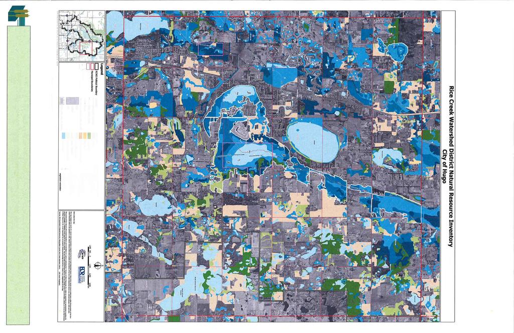
42
43 City of Hugo March 15, 2010 Greenway Corridor Plan Map 7-C Greenway Corridor
44 Neighborhood Parks NP-1 NP-10 NP General Service Area of Existing or Proposed Neighborhood Park 1920 Country School House Horseshoe NP-1 Park needed as area develops NP-9 NP-2 NP-3 Served by existing Lions Park, Frog Hollow Park, Oneka Elementary School and Heritage Ponds Park Served by Victor Square Park, Arbre Park, Val Jean Park, Future Fable Hill Park, and 100 Acre Park/Openspace Heritage Ponds Park Oneka Elementary School St. John's Cemetary Victor Square Park Lions Park Val Jean Park NP-2 Arbre Park Fire Department Clearwater Creek Park Frog Hollow Park City Hall Egg NP-8 Oneka Lake Park Hugo Elementary NP-7 Rice Diamond Point Park Rice Lake Centre Oneka Oneka Lake Boat Launch Paul Hugo Farms Rice Lake Park Walker Cemetary Wild Wings of Oneka Game Farm Plaisted Barker NP-4 NP-5 NP-6 NP-7 NP-8 NP-9 NP-10 Served by Park at Water Tower #2 and Oak Shore Park Served by Beaver Ponds Park Strong immediate need for park Eastern portion served by Diamond Point Park. Need for Park on western side of Egg Lake Served by Oneka Lake Park and undeveloped adjacent openspace. Park needed as area develops Park needed as area develops City Facility Public Recreation Private Recreation School City Owned Properties - Undeveloped Neighborhood Park Service Areas Map 7-D Future Park Watertower Park NP-3 NP-6 Lake Access North School Section South School Section Oakshore Park Beaver Ponds Park - NP-4 Bald Eagle NP-5 Oneka Ridge Golf Course Bald Eagle Sportsmans Association Lake Access Sunset Round Long Withrow School Miles City of Hugo March 15, 2010

45 GREYSTONE INGERSOLL KEYSTONE KEYSTONE FARNHAM 180TH 174TH FOXHILL FOREST 177TH 175TH 177TH Horseshoe HENNA 180TH INWOOD 175TH 180TH 180TH 170TH KEYSTONE KEYSTONE ELMCREST GARDEN ELMCREST EVERTON FRENCHMAN VICTOR 129TH 158TH HERITAGE VALJEAN ETHAN Bald Eagle FABLE HILL EVERTON ONEKA ELM 126TH EUROPA 122ND 149TH 121ST FAIROAKS FRENCH FALCON ONEKA FRENCHMAN EXHALL 132ND EUROPA FARNHAM FENWAY FENSON FREEDOM 142ND FENWAY FINALE 159TH FINLEY 134TH 130TH FERRARA 125TH FIONA FOREST 142ND 141ST 140TH 138TH FIONA 157TH 147TH FLAY 150TH 127TH 152ND 148TH 147TH Egg GENEVA GENEVA EGG LAKE 135TH 151ST 150TH 145TH GOODVIEW 152ND 150TH 130TH 132ND 165TH Oneka HADLEY Rice ONEKA LAKE HARROW 137TH 125TH HEATHER HENNA 128TH 157TH HILO HOMESTEAD HYDE HOMESTEAD Sunset ILLIES INGERSOLL 147TH 140TH INGERSOLL 155TH IRISH IRISH Round 136TH 126TH ISLETON IVAN ISLETON Long JANERO JEFFREY 152ND 130TH 125TH Plaisted North School Section JODY 122ND JULY KELLER Barker KERRY South School Section KEYSTONE City Park City Facility Undeveloped City Land School DNR Private Recreation General Search Area for Proposed Community Park Miles City of Hugo March 15, 2010 Community Parks Search Areas Map 7-E
2. Goals and Policies. The following are the adopted Parks and Trails Goals for Stillwater Township:
 D. PARKS AND TRAILS 1. Introduction Stillwater Township s population is relatively low, with most residents living on rural residences on large lots. The need for active park space has been minimal in
Park Design and Location Criteria
 Park Design and Location Criteria This section is presented in the interest of assisting park and recreation agencies in the development of a system of parks and recreation areas. A recreation system is
Trail Etiquette. Hours of Operation. Trail Accessibility
 Trail Guide The Elmhurst Park District, with 28 parks and over 460 acres of land, offers nearly six miles of paved or asphalt park trails and maintains an additional 3.6 miles of trails within Elmhurst.
Chapter eight. Parks and Recreation. Introduction. Crystal Lake Park District
 Chapter eight Parks and Recreation Introduction One of the indicators of quality of life in a city is the parks and recreation system. The City of Crystal Lake is fortunate to have an excellent parks and
Northeast Quadrant Distinctive Features
 NORTHEAST QUADRANT Northeast Quadrant Distinctive Features LAND USE The Northeast Quadrant includes all the area within the planning area that is east of Interstate 5 and to the north of State Route 44.
J. Recreation Plan of Conservation and Development. The Town of Hebron. Section 2. Preservation of Unique Assets. 1 P a g e
 The Town of Hebron Section 2 2014 Plan of Conservation and Development Preservation of Unique Assets J. Recreation Open spaces, parks, sports fields, and recreational programs are considered essential
Southwest Quadrant Distinctive Features
 SOUTHWEST QUADRANT Southwest Quadrant Distinctive Features LAND USE The 31.17 square mile Southwest Quadrant includes all the area within the planning area west of I-5 and south of the Sacramento River.
Segment 2: La Crescent to Miller s Corner
 goal of the USFWS refuges is to conserve, protect and enhance fish, wildlife and plants and their habitats for the continuing benefit of the American people. Refuge lands are used largely for fishing,
City of Durango 5.8 FUNDING TRAILS DEVELOPMENT
 5.8 FUNDING TRAILS DEVELOPMENT The City has been successful in establishing dedicated local funding sources as well as applying for grants to develop the City s trail system, having received nearly $2.4
Lake Myra County Park. Wake County, North Carolina Community Forum #2 June 12, 2008
 Lake Myra County Park Wake County, North Carolina Community Forum #2 June 12, 2008 Welcome and Introduction Meeting Agenda Welcome Introductions of Project Team Master Plan Process Community Forum #1 Updates
Understanding user expectations And planning for long term sustainability 1
 Understanding user expectations And planning for long term sustainability 1 What is a natural surface trail? It can be as simple has a mineral soil, mulched or graveled pathway, or as developed as elevated
Appendix 3. Greenway Design Standards. The Whitemarsh Township Greenway Plan
 Appendix 3 Greenway Design Standards This chapter discusses two design standards for the greenway types discussed above. First, trail design standards are presented together with trailhead facilities and
Chapter 9 Recreation
 Chapter 9 Chapter 9 1.0 INTRODUCTION The Town of Littleton is within one of New England s most important recreation areas. More than three million people live within 100 miles of the area. Local residents
CHAPTER 5. Chapter 5 Recreation Element
 CHAPTER 5 Recreation Element Chapter 5 Recreation Element The Recreation Element of the Meyers Area Plan is a supplement to the Recreation Element of the TRPA Regional Plan and the El Dorado County General
MASTER PLAN EXECUTIVE SUMMARY
 Biscuit Run State Park Scottsville Road (State Route 20) Charlottesville, VA 22902 Biscuit Run State Park MASTER PLAN EXECUTIVE SUMMARY Department of Conservation and Recreation Division of Planning and
Public Park System. Township of Derry. Providing natural open space for the recreational use of our residents and guests.
 Township of Derry Public Park System Providing natural open space for the recreational use of our residents and guests. Directory of Recreational Amenities Hershey s Commitment to Recreation Famous candy
City of Haslett. City of East Lansing. City of East Lansing
 Central Park North (Nancy L. Moore Park) Lake Park North Expansion White Park Expansion #2 White Park Expansion #1 County East East Haslett East East TF87-212 Acquisition $90,000.00 Park. TF08-138 Acquisition
MORGAN CREEK GREENWAY Final Report APPENDICES
 APPENDICES MORGAN CREEK GREENWAY Appendix A Photos of Existing Conditions in Trail Corridor Photos of existing conditions Main trail corridor - February 2009 Photos of existing conditions south bank Morgan
Stephens Rd. Nature Preserve
 Stephens Rd. Nature Preserve History Stephens Road Nature Preserve (SRNP) is a 350-acre nature preserve in Huntersville that comprises nine properties purchased between 1994 and 2008. Parcels included
10/25/2013. What is the SCORP?! 2013 Local Government Survey 2013 Statewide Public Survey Advisory Group Priority Areas Your Suggestions!
 COLORADO OUTDOOR RECREATION TRENDS RESULTS FROM THE SCORP AND STATEWIDE Colorado Outdoor Recreation Resource Partnership September 2013 PRESENTATION What is the SCORP?! 2013 Local Government Survey 2013
Silver Lake Park An Environmental Jewel for the Citizens of Prince William County
 Silver Lake Park An Environmental Jewel for the Citizens of Prince William County The Prince William Park Authority Mission Statement states: The Prince William County Park Authority will create quality
Acquisition in fee simple of approximately one-half acre of property on the shore of Spring Lake to expand the Lakeside Beach Park.
 Lakeside Beach TF00-136 $122,550.00 in fee simple of approximately one-half acre of property on the shore of Spring Lake to exp the Lakeside Beach. 2000 River Ravines TF00-150 $910,000.00 in fee simple
ROAD AND TRAIL PROJECT APPROVAL
 ROAD AND TRAIL PROJECT APPROVAL www.marincountyparks.org Marin County Parks, 3501 Civic Center Dr, Suite 260, San Rafael, CA 94903 DATE: July 12, 2017 PRESERVE: Gary Giacomini Open Space Preserve PROJECT:
FEASIBILITY CRITERIA
 This chapter describes the methodology and criteria used to evaluate the feasibility of developing trails throughout the study areas. Land availability, habitat sensitivity, roadway crossings and on-street
Auburn Trail / Ontario Pathways Trail Connector Feasibility Study Public Information Meeting Wednesday, August 22, 2012
 Auburn Trail / Ontario Pathways Trail Connector Feasibility Study Public Information Meeting Wednesday, August 22, 2012 Purpose of Feasibility Study Purpose Evaluate the feasibility of constructing a multiuse
Classifications, Inventory and Level of Service
 Classifications, Inventory and Level of Service Section 3 Kenmore Park, Recreation and Open Space Plan 1 P a g e Classifications and Inventory Park Classifications Kenmore classifies its parks based upon
Business Item No
 Metropolitan Parks and Open Space Commission Meeting date: February 6, 2018 For the Community Development Committee meeting of February 20, 2018 For the Metropolitan Council meeting of February 28, 2018
Map 1.1 Wenatchee Watershed Land Ownership
 Map 1.1 Wenatchee Watershed Land Ownership Map 1.1 Wenatchee Watershed Land Ownership The Wenatchee watershed lies in the heart of Washington state in Chelan County. Just larger than the state of Rhode
Flow Stand Up Paddle Board Parkway Plan Analysis
 Regional Parks Department Jeffrey R. Leatherman, Director County of Sacramento Divisions Administration Golf Leisure Services Maintenance Rangers Therapeutic Recreation Services Flow Stand Up Paddle Board
3.0 EXISTING PARK & RECREATION SPACE
 3.0 EXISTING PARK & RECREATION SPACE TOWN PARK & RECREATION SPACE An inventory of current parks and recreation area in the Town of Cedarburg is shown in Table 3. These areas total roughly 381.89 acres.
6.5 DURANGO EXCELS AT PARK CONNECTIVITY
 City of Durango 6.5 DURANGO EXCELS AT PARK CONNECTIVITY The City of Durango excels at park connectivity as evidenced by the success of the Animas River Trail (ART) project. While it is clear there are
~,t;b i D34 Vs33 SB 482
 ., SB 482 ~,t;b i D34 Vs33 This document is made available electronically by the Minnesota Legislative Reference Library as part of an ongoing digital archiving project. http://www.leg.state.mn.us/lrl/lrl.asp
NORTHWEST SECTION CONTENTS: CLEVELAND PARK FOLWELL PARK RYAN LAKE PARK VICTORY PRAIRIE DOG PARK VICTORY PARK
 NORTHWEST SECTION CONTENTS: CLEVELAND PARK FOLWELL PARK RYAN LAKE PARK VICTORY PRAIRIE DOG PARK VICTORY PARK LUCY LANEY COMMUNITY SCHOOL N 33RD AVE N 33RD AVE SINGLE-FAMILY RESIDENTIAL MULTI-USE DIAMOND
Dungeness Recreation Area County Park Master Plan
 Dungeness Recreation Area County Park Public Outreach Meeting October 10, 2007 Project Overview USFWS Site Dungeness Recreation Area County Park Meeting Objectives: Re-Introduce project; provide status
SOUTH INTERCHANGE AREA
 Santaquin City General Plan 1 Location and Characteristics The South Interchange Area of Santaquin is located west of Interstate 15 and south of 500 South (Figure 1). It includes properties already annexed
NAVAJO COMMUNITY PLAN
 NAVAJO COMMUNITY PLAN Prepared by the NAVAJO COMMUNITY PLANNERS and THE CITY OF SAN DIEGO City of San Diego Planning Department 202 C Street, MS 4A San Diego, CA 92101 Printed on recycled paper. This information,
Webber Park Master Plan Charrette Summary
 SMALL GROUP #1 - September 29, 2011 Webber Park Master Plan Charrette Summary More trash cans, especially near picnic grounds A year round pool is very needed-physical & mental health are significantly
Wilds. Headwaters. Lakes. Oxbows. Falls
 56 5 4 3 Wilds Headwaters Lakes Oxbows Falls 57 Zones It could be said the on-the-ground essence of this master plan appears within the next 6 pages of this report. As we learned in the preceding Cultural
PIONEER PARK. City of Des Peres Parks Master Plan. SWT Design 46 INTRODUCTION
 PIONEER PARK INTRODUCTION Pioneer Park is a 7 acre neighborhood park located east of Interstate 270 and south of Manchester Road along Tallie Road. The park is situated in a residential neighborhood with
P a r k s, R e c r e a t i o n a n d O p e n S p a c e C o m m i s s i o n. A Year in Review
 2013 Annual Report 2013 Parks Commissioners Jim Taylor, Chair Rachel Berger, Vice Chair Nicole Schmid Tom Windisch Kris Birch Matthew Rauschendorfer David Strub Christian Boland Joan Benner Inside this
City of Keller Parks and Facilities Inventory
 City of Keller Parks and Facilities Inventory April 2013 1. BEAR CREEK PARK 44 ACRES 1 Basketball Court with 2 goals 4 Drinking Fountains 1 Large Pavilion with 4 picnic tables, electricity and fireplace
CRAZY HORSE TRAIL GUIDE
 CRAZY HORSE TRAIL GUIDE Abridged Version: July 2016 This is a short form of our interpretive trail guide for the Crazy Horse Trail. The full version of the guide has a more detailed description of the
IOWA ORNITHOLOGISTS' UNION - Birding Sites in Dallas County
 IOWA ORNITHOLOGISTS' UNION - Birding Sites in Dallas County Printed on 7/19/2018 Beaver Bottoms Wetland (restricted) (Important Bird Area) GPS Coordinates:, Ownership: Private (see directions for access)
Chapter 6. Action Program. Heart of the Lakes Area Recreation Plan
 Heart of the Lakes Area Recreation Plan 1. Design and construct the following trails (please see the following map): a. the Speedway Trail 1) primary pathway the main trail 2) secondary pathway the proposed
Chapter 2: Summary of Existing Open Space System
 Chapter 2: Summary of Existing Open Space System In 1976, the Wake County Board of Commissioners established the Wake County Parks and Recreation Department in order to provide park facilities and programs
Dover Park Master Plan. Community Design Event Tuesday, May 22, 5 7 pm
 Dover Park Master Plan Community Design Event Tuesday, May 22, 5 7 pm Agenda I. Introduction / Overview 20 minutes II. Small Group Design Activity 60 minutes III. Small Group Report Out IV. Conclusion
Preferred Recreation Recommendations Stemilt-Squilchuck Recreation Plan March 2018
 Preferred Recreation Recommendations Stemilt-Squilchuck Recreation Plan March 2018 Below are the recommended recreation ideas and strategies that package together the various recreation concepts compiled
National Recreation Trail Update Form
 National Recreation Trail Update Form Introduction Thank you for taking the time to complete this form. Your assistance will help ensure that the National Recreation Trail (NRT) database is complete and
4.19 Parks, Recreation, and Conservation Lands
 interchange would have on the Reed Paige Clark Homestead located on the north side of Stonehenge Road. Alternative D would also affect Palmer Homestead, E.F. Adams House, and Knapp Brothers Shoe Manufacturing
Blueways: Rivers, lakes, or streams with public access for recreation that includes fishing, nature observation, and opportunities for boating.
 Parks, Open Space and Trails PRINCE WILLIAM COUNTY 2008 COMPREHENSIVE PLAN TRAILS PLAN CONTENTS The components of the trails plan are: Intent Definitions Goals, Policies, and Action Strategies Trails Map
F. Forest Recreation Management
 F. Forest Recreation Management F.1) Park and Recreation Management F.1.A. Program Overview. The park and recreation program has been in existence since 1980. With ever increasing outdoor recreation demands
APPENDIX E: SUMMARY OF PUBLIC MEETING QUESTIONNAIRE RESULTS
 Appendices Gwinnett County 2004 Comprehensive Parks and Recreation Master Plan APPENDIX E: SUMMARY OF PUBLIC MEETING QUESTIONNAIRE RESULTS March 2004 Monteith Brown Planning Consultants & The Jaeger Company
National Recreation Trail Application for Designation
 National Recreation Trail Application for Designation Introduction Thank you for your interest in the National Recreation Trail (NRT) program. Completed NRT application packages must be submitted by December
Conservation Area Management Statement
 Conservation Area Management Statement Miller Creek Wildlife Area Resolution #: Approval: Issue Date: Date of Last Revision: Table of Contents 1. Purpose....... 1 2. Property Description...... 1 2.1. Legal
Pinellas County Environmental Lands
 Pinellas County Environmental Lands In addition to traditional parks and recreation facilities, Pinellas County owns and manages a system of environmental lands that provides specialized resource-based
Welcome to the future of Terwillegar Park a Unique Natural Park
 Welcome to the future of Terwillegar Park a Unique Natural Park 1 Introduction The Terwillegar Park Concept Plan study will develop an overall concept plan, management objectives and development guidelines
AMERICAN S PARTICIPATION IN OUTDOOR RECREATION: Results From NSRE 2000 (With weighted data) (Round 1)
 (Round 1)") AMERICAN S PARTICIPATION IN OUTDOOR RECREATION: Results From NSRE 2000 (With weighted data) (Round 1) The emphasis of this report is on participation patterns across activities and segments of our society.
AMERICAN S PARTICIPATION IN OUTDOOR RECREATION: Results From NSRE 2000 (With weighted data) (Round 1) The emphasis of this report is on participation patterns across activities and segments of our society.
Wallace Falls State Park Classification and Management Planning Stage 3 Preliminary Recommendations July 18, 2018 Sultan City Hall
 Wallace Falls State Park Classification and Management Planning Stage 3 Preliminary Recommendations July 18, 2018 Sultan City Hall Thanks for coming! This document contains State Parks preliminary recommendations
$866,000. $1,400,000 Health Benefits $13,156,000 TOTAL ANNUAL DIRECT BENEFITS. $10,890,000 Economic Benefits
 SINGING RIVER TRAIL Trails Create Value + Generate Economic Activity Trails generate economic returns through improved health, safety, and environmental conditions, raise property values, and attract visitors.
Town of Oakfield Agricultural and Farmland Protection Plan
 SECTION III COMMUNITY OVERVIEW A. Regional Setting / Location The Town of Oakfield is located in the northwestern portion of Genesee County. Located west of New York's Finger Lakes, the Town is uniquely
WEST JORDAN PARKS, RECREATION AND TRAILS MASTER PLAN Advisory Committee Meeting #2
 WEST JORDAN PARKS, RECREATION AND TRAILS MASTER PLAN Advisory Committee Meeting #2 MONDAY, NOVEMBER 5, 2018, 6:00 P.M.; PARKS DEPT. CONFERENCE ROOM ATTENDEES: Lisa Dean Larry Gardner Duane Harding David
The City of Durango Community Interest and Opinion Survey Executive Summary
 The City of Durango Community Interest and Opinion Survey Executive Summary Overview ETC Institute administered a community interest and opinion survey for the City of Durango between January and March
BASSETTS CREEK SECTION CONTENTS: BASSETTS CREEK BRYN MAWR LUCE LINE
 BASSETTS CREEK SECTION CONTENTS: BASSETTS CREEK BRYN MAWR LUCE LINE GLENWOOD AVE MULTI-USE DIAMONDS VINCENT AVE N MORGAN AVE N PENN AVE N DOG PARK MULTI-USE FIELDS PLAYGROUND AK E RD S CHESTNUT AVE DA
Langton Lake Park Implementation Planning Session One 6 June Attendees signed in
 27 Attendees signed in Meeting summary Following an overview of the Parks and Recreation Renewal Program and the key directions of the Parks and Recreation System Master Plan, meeting participants were
Blue River Trail Master Plan JSA to Town Hall June 2004
 Blue River Trail Master Plan JSA to Town Hall June 2004 Prepared for: Silverthorne Town Council Silverthorne SPORT Committee Department of Recreation and Culture Silverthorne Public Works Silverthorne
APPENDIX OFFICIAL MAP ORDINANCE OF HAMILTONBAN TOWNSHIP OFFICIAL MAP NARRATIVE
 APPENDIX A OFFICIAL MAP ORDINANCE OF HAMILTONBAN TOWNSHIP OFFICIAL MAP NARRATIVE INTRODUCTION: The Official Map of Hamiltonban Township has been prepared to identify those lands and features that Hamiltonban
THOMAS A. SWIFT METROPARK Introductions History Present Conditions Future Development Plans Implementation Strategies Statistics
 THOMAS A. SWIFT METROPARK Introductions History Present Conditions Future Development Plans Implementation Strategies Statistics Introduction As an open meadow park positioned along the Mahoning River,
CHAPTER III: TRAIL DESIGN STANDARDS, SPECIFICATIONS & PERMITS
 CHAPTER III Trail Design Standards, Specifications & Permits This chapter discusses trail standards, preferred surface types for different activities, permits, and other requirements one must consider
AGENDA ITEM 5 D WAKULLA ENVIRONMENTAL INSTITUTE (WEI) TRAIL FEASIBILITY STUDY
 TRAIL FEASIBILITY STUDY") March 19, 2018 AGENDA ITEM 5 D WAKULLA ENVIRONMENTAL INSTITUTE (WEI) TRAIL FEASIBILITY STUDY TYPE OF ITEM: Action STATEMENT OF ISSUE The Wakulla Environmental Institute (WEI) Trail is one of several trails
March 19, 2018 AGENDA ITEM 5 D WAKULLA ENVIRONMENTAL INSTITUTE (WEI) TRAIL FEASIBILITY STUDY TYPE OF ITEM: Action STATEMENT OF ISSUE The Wakulla Environmental Institute (WEI) Trail is one of several trails
Rogue River Access and Management Plan Draft Alternatives
 Rogue River Access and Management Plan Draft Alternatives The Rogue River Access and Management Plan was initiated in December, 2011 and is being led by Jackson County Parks (JCP) and Oregon Department
Rock Creek State Park
 Rock Creek State Park Rock Creek State Park Rock Creek State Park, located five miles west of Grinnell, consists of a large man-made lake and a surrounding fringe of land. There are several access points
13.1 REGIONAL TOURISM ISSUES AND SUMMARY OF FINDINGS
 13 REGIONAL TOURISM T he County of Mariposa s recreation needs and facilities fall within two categories: regional tourism and local recreation. This Element focuses on regional tourism issues related
2030 Comprehensive Plan A Policy Guide to 2030
 2030 Comprehensive Plan A Policy Guide to 2030 Parks and Open Spaces Approved by Board of Commissioners May 26, 2009 Adopted by Board of Commissioners September 7, 2010 Washington County Mission To provide
Parks, Recreation, Trails and Open Space Master Plan Survey Results. October 2018
 Parks, Recreation, Trails and Open Space Master Plan Survey Results October 2018 Conducted by Qualtrics subconsultant 300 completed responses Random attempt to get a balanced response from all four Council
DRAFT - APRIL 13, 2007 ROUTING STUDY FOR TRAIL CONNECTIONS BETWEEN CALAIS AND AYERS JUNCTION
 DRAFT - APRIL 13, 2007 ROUTING STUDY FOR TRAIL CONNECTIONS BETWEEN CALAIS AND AYERS JUNCTION Abstract The vision for the East Coast Greenway is an off-road urban trail system running from Calais, Maine
A CASE FOR COMPLETING THE JORDAN RIVER PARKWAY: A
 A CASE FOR COMPLETING THE JORDAN RIVER PARKWAY: A safe crossing at 9000 South and 850 West Proposed 9000 South Underpass Parkway Timeline Parkway, Trail, and Tourism Facts Blueprint Jordan River 1971 1973
Clearwater Lake Provincial Park. Draft Management Plan
 Clearwater Lake Provincial Park Draft Management Plan Clearwater Lake Provincial Park Draft Management Plan Table of Contents 1. Introduction... 3 2. Park History... 4 3. Park Attributes... 4 3.1 Location/Access...4
Airport Planning Area
 PLANNING AREA POLICIES l AIRPORT Airport Planning Area LOCATION AND CONTEXT The Airport Planning Area ( Airport area ) is a key part of Boise s economy and transportation network; it features a multi-purpose
A Vision for South Skunk River and Chichaqua Bottoms Greenbelt
 A Vision for South Skunk River and Chichaqua Bottoms Greenbelt Photo: Jim Pease Chichaqua Bottoms Booklet 7 of 8 Greater Des Moines Water Trails and Greenways 1 2016 Table of Contents Booklet 1: Water
Parks & Recreation Areas Program
 PARKS & RECREATION Parks & Recreation Areas Program As part of its mission to conserve and protect natural resources, the Upper Big Blue Natural Resources District (NRD) has been involved in several large-scale
2.0 Physical Characteristics
 _ 2.0 Physical Characteristics 2.1 Existing Land Use for the Project The site is comprised of approximately 114 acres bounded by Highway 101 to the north, the existing town of Los Alamos to the east, State
Procedure for the Use of Power-Driven Mobility Devices on Mass Audubon Sanctuaries 1 September 17, 2012
 Procedure for the Use of Power-Driven Mobility Devices on Mass Audubon Sanctuaries 1 September 17, 2012 Background As part of Mass Audubon s mission to preserve the nature of Massachusetts for people and
PALO CORONA REGIONAL PARK MPRPD BOARD MEETING AUGUST 8, 2018
 PALO CORONA REGIONAL PARK MPRPD BOARD MEETING AUGUST 8, 2018 ACKNOWLEDGEMENTS AGENCIES AND ORGANIZATIONS The Trust for Public Land Big Sur Land Trust Santa Lucia Conservancy California State Parks Point
This Passport: Revised October 20, 2017, EAM # Discovering the Trails of Webster, NY
 This Passport: Revised October 20, 2017, EAM #161923 Discovering the Trails of Webster, NY The Town of Webster invites you to explore and experience our diverse outdoor adventures! Here s your opportunity
Fossil Creek Wild & Scenic River Comprehensive River Management Plan Forest Service Proposed Action - details March 28, 2011
 Fossil Creek Wild & Scenic River Comprehensive River Management Plan Forest Service Proposed Action - details March 28, 2011 Primary Goals of the Proposed Action 1. Maintain or enhance ORVs primarily by
Welcome to the Cross County Trail Public Input Session!
 Welcome to the Cross County Trail Public Input Session! Please sign in on the table below! What are we doing here? Camden County has proposed a bicycle and pedestrian trail spanning across the entire county.
Welcome and thank you for being here! Kick-Off Public Workshop November 19, 2014
 Welcome and thank you for being here! Kick-Off Public Workshop November 19, 2014 OPEN SPACE MATTERS: Boise s First Reserve Master Plan Julia Grant Foothills and Open Space Manager City of Boise Ellen Campfield
4.0 FACILITIES INVENTORY
 4.0 FACILITIES INVENTORY 4.1 PARK LEVEL OF SERVICE STANDARDS (LOS) Based on current City of Longview Parks and Recreation Level of Service (LOS) Standards (Figure G), the City currently has a deficiency
WASHINGTON STATE PARKS LAND CLASSIFICATION SYSTEM
 WASHINGTON STATE PARKS LAND CLASSIFICATION SYSTEM Administrative Code Establishing Land Classification System WAC 352-16-020 Land classification system. State park areas are of statewide natural, cultural,
Participant Responses April 19, 2017 Open House Meeting
 Hugo 2040 Comprehensive Plan Update Participant Responses April 19, 2017 Open House Meeting Thank you for participating in Hugo s Comprehensive Plan Update. The Comprehensive Plan is the document that
City of Mahtomedi Park System Plan Public Hearing Draft: September 13, 2006
 Chapter 4: TRAIL SYSTEM PLAN INTRODUCTION Mahtomedi developed in the late 1800s and early 1900s as a summer resort and vacation community. As such, the transportation system included narrow, winding roads
Section II. Planning & Public Process Planning for the Baker/Carver Regional Trail began in 2010 as a City of Minnetrista initiative.
 Section II Planning & Public Process Planning for the began in 2010 as a City of initiative. city staff began discussions with the Park District on the possibility of a north/south regional trail connection
METROPOLITAN COUNCIL 390 North Robert Street, St. Paul, MN Phone (651) TDD (651)
 TDD (651)") METROPOLITAN COUNCIL 390 North Robert Street, St. Paul, MN 55101 Phone (651) 602 1000 TDD (651) 291 0904 DATE: June 19, 2007 TO: Metropolitan Parks and Open Space Commission FROM: Jan Youngquist, Senior
METROPOLITAN COUNCIL 390 North Robert Street, St. Paul, MN 55101 Phone (651) 602 1000 TDD (651) 291 0904 DATE: June 19, 2007 TO: Metropolitan Parks and Open Space Commission FROM: Jan Youngquist, Senior
Chuckanut Ridge Fairhaven Highlands EIS Scoping Concerns
 Chuckanut Ridge Fairhaven Highlands EIS Scoping Concerns Coalition of Southside Neighborhoods CSN Comments for Fairhaven Highlands EIS Scope Hearing, Jan 16, 2008 1 Chuckanut Ridge Hilly Terrain: Potential
Business Item No XXX. Proposed Action That the Metropolitan Council approve the Coon Creek Regional Trail Master Plan.
 Business Item No. 2015-XXX Metropolitan Parks and Open Space Commission Meeting date: July 7, 2015 For the Community Development Committee meeting of July 20, 2015 For the Metropolitan Council meeting
Webinar Series for Comprehensive Plan Updates. Making Your Plan a Walk in the Park
 Webinar Series for Comprehensive Plan Updates Making Your Plan a Walk in the Park Presented by Jan Youngquist and Michael Peterka September 15, 2016 Today s Presentation Importance of Parks and Trails
At the time, the portion of the line through Eagle County remains wholly under the ownership of Union Pacific Railroad (UP).
.") Chapter 5 The Railroad Corridor as a Trail Corridor The intent of this chapter is to identify how the rail corridor, if available for lease or purchase in all or part, could be incorporated into the core
Chapter 5 The Railroad Corridor as a Trail Corridor The intent of this chapter is to identify how the rail corridor, if available for lease or purchase in all or part, could be incorporated into the core
Lincoln County ORP Survey Response Summary
 Lincoln County ORP Survey Response Summary North Central Wisconsin Regional Planning Commission Q1 Which recreational activities did you participate in during 2015? (Choose all that apply.) Answered: 125
Appendix B - Undeveloped Parks and Existing Parks with Remaining Development Programming
 Appendix B - Undeveloped Parks and Existing Parks with Remaining Development Programming Table of Contents Appendix B - Undeveloped Parks and Existing Parks with Remaining Development Programming Table
COASTAL CONSERVANCY. Staff Recommendation December 2, 2004 COYOTE HELLYER COUNTY PARK BAY AREA RIDGE TRAIL
 COASTAL CONSERVANCY Staff Recommendation December 2, 2004 COYOTE HELLYER COUNTY PARK BAY AREA RIDGE TRAIL File No. 04-057 Project Manager: Amy Hutzel RECOMMENDED ACTION: Authorization to disburse up to