This Passport: Revised March 20, 2017, EAM # Discover the Trails of Perinton, NY
|
|
|
- Gabriel Butler
- 6 years ago
- Views:
Transcription


1 This Passport: Revised March 20, 2017, EAM # Discover the Trails of Perinton, NY
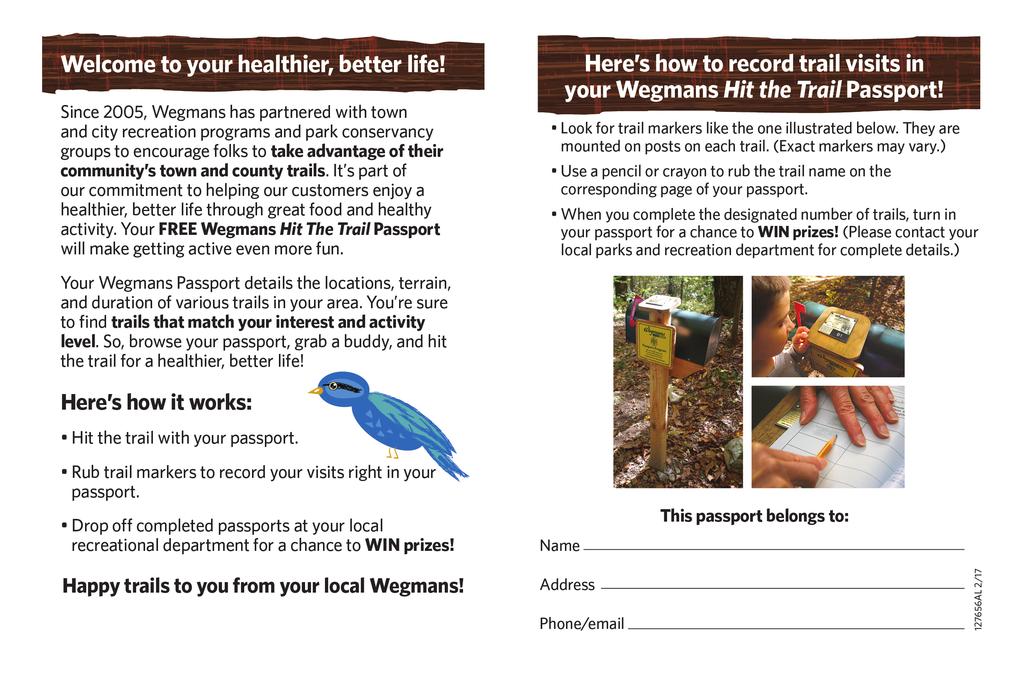
2 The Town of Perinton invites you to explore and experience our diverse outdoor adventures! Here s your opportunity to discover the beauty and solitude of nature, a variety of wildlife, the magnificence of natural settings and the health benefits of being more active all in your own backyard! Share the wonders of the great outdoors with family and friends and get to know Perinton up close and personal. The Wegmans Hit the Trail Passport program runs May 1 October 31. If you d like to enter your completed passport for a chance to win a $250 Wegmans gift card, please bring it to the Perinton Community Center, 1350 Turk Hill Road, by November 1. To be eligible for the $250 Wegmans Gift Card drawing, please complete 10 trails between May 1 October 31. Any questions? Give us a call at (585) or stop in to the Perinton Community Center. Disclaimer: The producers and sponsors of the maps and texts in this booklet have made every effort to present accurate, up-to-date information. However, trail and access conditions may vary because of weather, property ownership, management and maintenance practices, or other factors. Due to re-sizing, the maps are not to scale. The producers and sponsors of this booklet and the PASSPORT program are in no way responsible for personal injury, damage to property, or violation of law in connection with the use of this booklet. Remember to only use open and designated trails. When in doubt, ask for permission.

3 The hikes presented and described in this Wegmans- Perinton Passport booklet are short-distance walks of less than two hours each. Most of them follow looping routes that start and end at each of the listed sites. As part of an exercise and fitness regimen you may wish to try longer circular or point X to point Y outings that take advantage of pedestrian linkages between the Crescent Trail, the RS&E Trolley Trail, and the Erie Canalway Trail. You can do hikes of 4, 5, and up to 16 or more miles, all within Perinton. Maps of the Crescent Trail may be purchased for $1 each at the Perinton Community Center or Town Hall, or viewed and downloaded at: www. perinton.org/ Departments/Parks/hikingctha The Crescent Trail Association (CTA, a.k.a. Crescent Trail Hiking Association) contributed to planning, mapping, and describing the hike routes included in the Wegmans-Perinton Passport program and this booklet. The Association is an allvolunteer, tax-exempt, non-profit, organization that partners with the Town of Perinton to create, promote, and maintain the network of footpaths known as the Crescent Trail. Members of the Association pay annual dues (as low as $5.) which provide funds for most trail expenses and activities. Many members volunteer for work on trail maintenance, repairs and other projects. For more information about the Association or the Crescent Trail, or to consider becoming a CTA member, please call their voice mailbox , find them on Facebook, or visit their website

4 Perinton Passport Program map of trail sites A. B. C. D. E. F. Beechwoods Park Howell Road Park High Acres Nature Area White Brook Nature Area Lollypop Farm at Egypt Park Mason Valley G. H. I. J. K. Indian Hill Center Park Garnsey Road Arboretum Horizon Hill Powder Mills Park * Numbers are Town Parks
.")
5 Beechwoods Park Beechwoods Park -Town of Perinton north footbridge N southfootbridge P HAMILTON ROAD MACEDON CENTER ROAD P Park at Squirrel s Heath Road trailhead. Trail Marker is located at north footbridge (see map).
6 Beechwoods Park Location: Between High Street Extension and Macedon Center Road, east of Squirrel s Heath Road. From Macedon Center Road, turn north on Chadwell Circle, then make two left turns, to small parking area on Squirrel s Heath Road. Hiking Time: 40 minutes or less. Difficulty: Easy trails, sheltered by canopy of trees. Pleasant, short hike, a nice outing for families with youngsters. Length: Approximately 3/4 mile. Features: Quiet haven, surrounded by residential neighborhoods. Most trails improved with gravel or woodchips. Directions: Follow left branch of trail and red blazes on trees. At first junction, go left, down across south footbridge, then turn right (north) and walk along edge of open grassy area adjacent to the woodland. Watch for north footbridge and find Trail Marker. Cross bridge into woods and turn right on red trail. Continue heading south to return to the parking area. MAKE TRAIL MARKER RUBBING HERE

7 Beechwoods Park -Road Town of Perinton Howell Park P Park in gravel lot on east side of Howell road. Trail Marker is on tree by red and orange intersection
8 Howell Road Park Location: Start from parking area (see map). Hiking Time: About 1 hour, or less. Difficulty: Mostly flat trails. Some areas may be muddy. Length: Approximately 1¼ mile. Features: The hike route winds through a former Christmas tree farm and adjacent wooded wetlands. Directions: From parking area, go north following white blazes on trees. At junction with blue trail (marker post), continue north to orange trail. Turn left and cross Howell Road. Go straight (west) on blue trail. Trail enters woods and bends right. At map post, begin following orange trail bending right, up hill, and east along hedgerow. Near Howell Road, turn right and then left to cross Howell Road. Continue straight ahead on orange trail to red trail intersection. Trail Marker located on tree. Follow red trail along drainage ditch to utility service road, turn right. Service road turns into orange trail. Take orange trail right into woods. Where orange trail leaves pine woods, go left on blue trail and back to white trail to parking area. MAKE TRAIL MARKER RUBBING HERE


9 High Acres Nature Area Beechwoods Park -Town of Perinton yellow trail Orange/ blue trail blue trail Red trail blue trail Red trail Orange/ blue trail blue trail blue trail Green trail HIGH ACRES LAND FILL P Use trail head parking lot on north side of Perinton Parkway. Trail Marker is on sheltered bench at east end of berm.
10 High Acres Nature Area Location: Perinton Parkway, north of the High Acres landfill. Hiking Time: About 1 hour or more if you add trails. Difficulty: Easy, flat trails. Some areas may be wet or muddy. Length: Approximately 1 ½ miles. Features: These public trails, on Waste Management property, invite exploration of diverse ecosystems and habitats. Directions: From parking area walk along grassy path to green arrow marker. Follow the green trail around pond (pond on left side) and turn right on red trail leading into wooded area. Continue on red trail until a major junction of several trails. Turn right on the blue trail going between two large ponds. The blue trail will pass an old quonset style building and over footbridge. Turn right on yellow trail and hike up a small berm to a sheltered bench to find the Trail Marker. Continue on yellow trail until orange/ blue trail junction, turn left. Follow orange/ blue trail until blue trail enters wooded area. Exit trail on right leading back to parking lot. MAKE TRAIL MARKER RUBBING HERE
 P Enter gravel driveway, off Aldrich Road, and park near shelter. Trail Marker is located on trail post north side of meadow.")
11 White Brook White Nature Brook Nature Area Area Crescent Trail Town of Perinton (cattail marsh) (cattail marsh) Orange-blazed trail (meadow) (map post) Blue-blazed trail N yellow trail continues east (meadow) P Enter gravel driveway, off Aldrich Road, and park near shelter. Trail Marker is located on trail post north side of meadow.
12 White Brook Nature Area Location: On east side of Aldrich Road, north of Rt. 31. Hiking Time: About 1 hour. Difficulty: Mostly flat trails. Wet areas, after heavy rains. Length: Approximately 1¼ mile. Features: Trail route ventures across boardwalks and berms, then around meadows, adjacent to cattail wetlands. Interesting and diverse habitats for birds, amphibians, and wetland plants. Directions: Enter White Brook Nature Area orange trail on north side of parking lot. Trail goes down short slope, turns right (east) along a stream, crosses a footbridge, then traverses a boardwalk to another bridge and berm. Continue on orange trail between the wetlands and a shrubby meadow, then into a small wooded area, to a large open meadow. Turn right (east) on blue trail. Trail Marker is on outside loop of blue trail, north side. Follow the blue trail, looping around the outer edge of the meadow, then return on the orange trail to the parking lot. MAKE TRAIL MARKER RUBBING HERE
 VICTOR ROAD (woodlands) Red-blazed Trail White ring around tree P Park in main lot at Egypt Park (enter off the Victor Road).")
13 Egypt Park & Lollypop Farm PITTSFORD-PALMYRA ROAD Lollypop Farm N service road P (fenced corral) Blue-blazed trail Waddle Pool Pet cemetery enter Nature Trail main building (woodlands) VICTOR ROAD (woodlands) Red-blazed Trail White ring around tree P Park in main lot at Egypt Park (enter off the Victor Road). Trail Marker is located at junction of red trail.
14 Lollypop Farm at Egypt Park Location: Start from parking lot in Egypt Park (off Victor Road). Hike through Lollypop Farm and along their Nature Trail. Hiking Time: About 1 hour or more reading interpretive panels. Difficulty: Moderate climbs and hills on the Nature Trail, but otherwise an easy walk along flat trails and service roads. Length: Approximately 1 ¼ miles. Features: Visit animal corrals and stockades at Lollypop Farm, plus enjoy a shady walk in a wooded area. During business hours the Lollypop main building offers displays, restrooms and drinking water. Directions: From west end of parking lot at Egypt Park, find gravel walkway and cross over RS&E Trolley Trail into Lollypop Farm complex. Turn right on farm road, then go left past the Waddle Pool and walk through Pet Cemetery. Head south toward split-rail fence to Nature Trail. Find Trail Marker at first junction. Head left on red trail and go over two bridges. At blue arrow marker turn left uphill to a ridge on top. Follow blue trail downhill past a fenced in corral. Continue down to service road and return to Egypt Park parking lot. MAKE TRAIL MARKER RUBBING HERE
 Mason Valley neighborhood Orange-blazed trail goes to White Brook Nature Area P OK to park temporarily on grassy shoulder of Broadmoor Trail.")
15 Mason Valley Area Trails Mason Valley Crescent Trail - Town of Perinton open space White-blazed access path (wooded area) Blue-blazed trail (marsh) N Red-blazed trail BROADMOOR P (pond) Orange-blazed trail (pond) Mason Valley neighborhood Orange-blazed trail goes to White Brook Nature Area P OK to park temporarily on grassy shoulder of Broadmoor Trail. Trail Marker is on bridge along the Blue trails.
16 Mason Valley Location: Enter the Mason Valley neighborhood, turning north onto Broadmoor Trail, from NY 31 (Pittsford-Palmyra Road) one block west of the traffic light near Egypt Park/Lollypop Farm. Hiking Time: About 40 minutes, or less. Difficulty: Easy, flat trails. Length: Less than 1 mile. Features: A scenic loop around ponds, marshes, and wooded wetlands. Look for birds, wildflowers, and evidence of beavers. Directions: Park on grassy shoulder along north side of Broadmoor Trail, where the street crosses a small stream. Go north on orange trail, past a small pond (on right) to post with trail map. Continue straight on blue trail into a wooded area. The blue trail bends east, then south, crosses several footbridges (one of the footbridges has the Trail Marker), and ends at a junction with the orange trail. Turn right on orange trail and cross another footbridge. Continue on the orange trail, along the berm between two ponds. Turn left at the map post and return to your starting point. MAKE TRAIL MARKER RUBBING HERE
 Yellow-blazed trail Blue-blazed trail (hedgerow) N (wooded area) (wooded area) (farm field) (hedgerow) P Trailhead and off-road parking, on south side of Pittsford-Palmyra Road (NY Rt.")
17 Indian Hill Indian Hill Recreation Area Crescent Trail - Town of Perinton Pittsford-Palmyra Road (NY Rt. 31) Yellow-blazed trail Blue-blazed trail (hedgerow) N (wooded area) (wooded area) (farm field) (hedgerow) P Trailhead and off-road parking, on south side of Pittsford-Palmyra Road (NY Rt. 31), one-half mile east of Turk Hill Road. Trail Marker located on post at bottom south end of field.
18 Indian Hill Location: Trailhead parking area is on south side of NY 31 (Pittsford-Palmyra Road), one-half mile east of Turk Hill Road. Hiking Time: About 1 hour, or less. Difficulty: Moderate but extended climb to summit of Indian Hill. End of hike is steep descent back to parking area. Length: 1 mile. Features: Trail route climbs to the top of a glacial moraine, for scenic views northwest toward downtown Rochester and south to the JLD Equine (horse farm and pastures). Directions: From trailhead parking area, go left on the yellow trail for a gentle climb to a high meadow at summit of Indian Hill (scenic view). Then head southeast, continuing on yellow trail, downhill along edge of wooded area. At bottom of hill, you will find the Trail Marker on a post. At Trail Marker, turn right on blue trail along hedgerow. Near top of farm field, turn right across the field and enter a wooded area. At end of wooded area turn left and continue on blue trail, downhill, back to the parking area. MAKE TRAIL MARKER RUBBING HERE
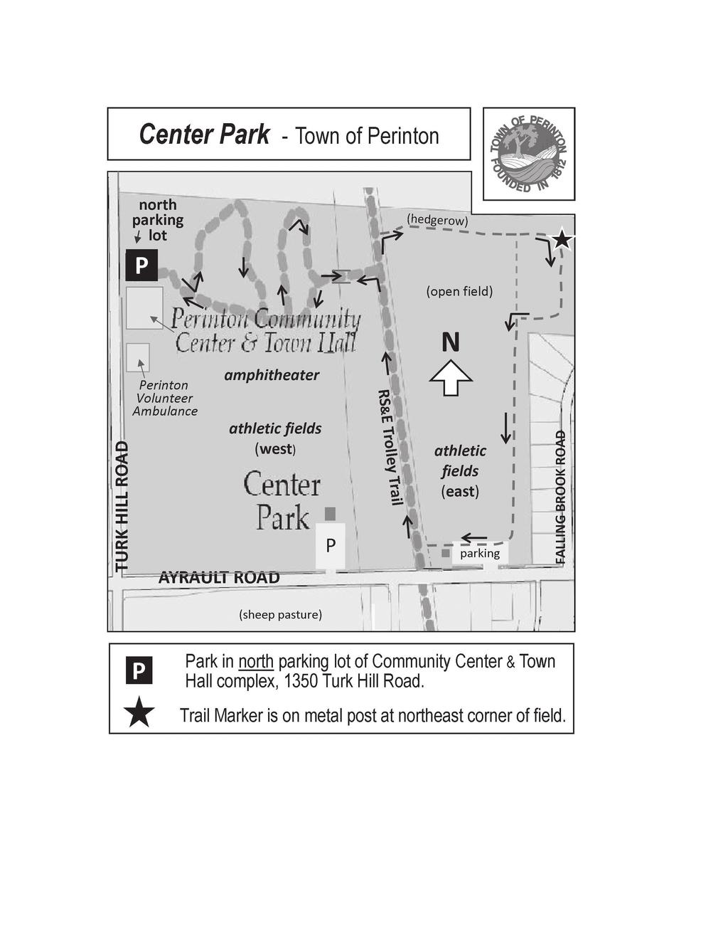
19 Center Park Center Park
20 Center Park Location: Use north parking lot at Perinton Community Center. Hiking Time: 1 hour or less. Difficulty: Moderate to gentle slopes and flat trails. No trail markers or blazes, but not difficult to follow. Refer to arrows on map. Length: About 1 mile. Features: Trail route winds downhill through pine and deciduous forest, then crosses bridge and loops around open field. Return along RS&E Trolley Trail, then on wooded pathways uphill to parking lot. Directions: From southeast corner of north parking lot, go down short section of asphalt path, then immediately turn left onto woodchip paths winding through wooded area. At bottom of hill on paved path, turn left and cross bridge. Go north a short distance on RS & E Trolley Trail, then turn right at opening to meadow. Climb hill along hedgerow. At corner of field, turn right (south) toward Ayrault Road and look for Trail Marker on post. Continue south then right to evergreen trees, turn left and follow trail along soccer fields. Once near parking area, turn right and follow grass path to Trolley Trail. Go right on Trolley Trail, cross the bridge, and return uphill on paths back to parking lot. MAKE TRAIL MARKER RUBBING HERE

21 Garnsey Arboretum
22 Garnsey Road Arboretum Location: The entrance to the Arboretum area is on north side of Garnsey Road, two blocks west of Moseley Road. Hiking Time: About 45 minutes. Difficulty: Gentle to moderate slopes. May be muddy or wet. Length: 1 mile. Features: A small stream flows north, bisecting entire area. South half of Arboretum is open grassy area, with no defined trails. Explore the area by using the tree inventory at perinton.org (under Parks-park info and maps). North half is woodland area with a marked white trail. Directions: From Garnsey Road entrance, go down hill and head right towards footbridge across stream. Wander north and find trail through woods. Trail Marker is at entrance of wooded path. Follow white trail to north of property. Loop left, downhill along a small stream, then follow path circling back up to the main trail. When leaving woods, head back in the same direction. After crossing footbridge, turn right to explore the back portion field of Garnsey Arboretum and return to parking area at roadside. MAKE TRAIL MARKER RUBBING HERE

23 Horizon Hill
24 Horizon Hill Location: Off Garnsey Road, park in gravel, fenced parking area north of Sully s Trail (road). Hiking Time: About 1 hour or add extension for 2 hours. Difficulty: Moderate to steep hills. May be muddy in spots. Length: 1 ½ miles or added portion 2 ½ miles. Features: Trails traverse forested glacial hills and valleys of south Perinton. Extended hike goes to magnificent overlook behind the Woodcliff Hotel & Spa. Directions: From trail parking area, follow orange trail into hilly wooded area. At scenic view you will find the Trail Marker at bench. Follow red trail to blue trail. Turn left on orange trail to parking area. For an extended hike, after passing the bench, turn left and continue on the orange trail for an additional climb to the scenic view behind the Woodcliff Hotel & Spa. Back track for return on orange trail but turn left at blue trail (short-cut). Go slowly and carefully down steep descent along the blue trail. Continue on the blue trail to orange trail and return to parking area. MAKE TRAIL MARKER RUBBING HERE


25 Powder Mills Park
26 Powder Mills Park Location: Start from Fish Hatchery parking lot, along Park Road. Hiking Time: About 1 hour. Difficulty: Hilly trails in mostly wooded areas of the Park. Length: Approximately 1¼ mile. Features: The hiking trail was constructed by Crescent Trail Volunteers. Please visit the Fish Hatchery after your hike. Directions: Cautiously cross Park Road a short distance west of the Hatchery. Enter the trail at ski marker #46. Turn right at top of short steep climb and follow blue trail. Continue on blue trail, bear right at ski marker #33, right at #31 and right at #29 to site of old stone chimney. Find Trail Marker at the chimney. Continue on blue trail and exit woods at ski marker #27. Turn left on grassy section of trail along edge of woods. Begin following blue trail where grassy path bends left and enters the woods. Continue and turn right (west) at ski marker #31. Continue on blue trail until ski marker #34, turn left and back to access path down to Park Road. MAKE TRAIL MARKER RUBBING HERE
27 Tips for Packing Healthy Picnic Baskets Whole wheat breads are high in fiber and contain more nutrients than white bread. Also, try whole grain tortillas or wraps for variety. Bring fruits and vegetables in a variety of colors to get optimal nutrients. Pack a container full of colorful fruit salad for a healthy and delicious desert! Bring a whole watermelon, cantaloupe, or honeydew and slice it open on the spot. Nature s packaging works beautifully to keep these fruits cool and fresh. Cut up veggies for dipping. Carrots, broccoli crowns, bell pepper strips and cucumbers are just a few options to try. Dip into low-fat dips, hummus or salsa for flavor! Consider alternatives for burgers and hot dogs. Turkey, poultry sausages, leaner ground beef, veggie burgers and grilled chicken are available and are lower in fat. Instead of sweetened sodas or fruit juices, bring seltzer mixed with all-natural fruit juice, unsweetened iced tea, or bottles of water. Freeze the bottled water the night before to use as cold packs to keep food cold. When you re ready to eat, you will have an icy bottle of water ready to drink. From Wegmans Nutrition Team
28 Walking Tips Dress in Layers The weather and even your own body temperature can fluctuate as you walk or hike. Layering allows you to comfortably add or remove clothing as needed during your activity. Stay Hydrated If you plan to be active for an hour or less, plain water is typically the best option to keep you hydrated. If your activity will last for more than 1 hour (or the outside temperature is high) a sports drink, juice or milk provide important nutrients and electrolytes to prevent dehydration. Pack a Snack Keeping a healthy snack on hand is a good idea just in case your walk goes a little longer than planned. Snacks that travel well include an apple, banana, granola bar or small snack bag filled with nuts, trail mix or pretzels. Wear Sunscreen Anytime you are out in the sun no matter what time of year it is, it is important to protect your skin by wearing sunscreen. Bring a Buddy Having someone to walk with makes the journey safer and more enjoyable. Good luck on your journey to better health!
29 Thank you for completing the Wegmans Hit the Trail Passport Program. We hope you enjoyed your time in nature and discovered something new. Please complete the following registration form to enter to win the Wegmans Gift Card. Name Address City State Zip Phone Please share any feedback on the program: Hit the Trails Passport Program
30
Discovering the Trails of Henrietta, NY
 This Passport: Revised June 8, 2017, EAM #161919 The Town of Henrietta is fortunate to have many wonderful trails to explore. We hope you will enjoy and protect our environment. Always be safe and please
The Quest begins Welcome to Frederick County s Docs in the Park Quest and the Wegmans Passport to Family Wellness. This booklet provides an opportunit
 The Quest begins Welcome to Frederick County s Docs in the Park Quest and the Wegmans Passport to Family Wellness. This booklet provides an opportunity to experience nature, the outdoors and be active
This Passport: Revised October 20, 2017, EAM # Discovering the Trails of Webster, NY
 This Passport: Revised October 20, 2017, EAM #161923 Discovering the Trails of Webster, NY The Town of Webster invites you to explore and experience our diverse outdoor adventures! Here s your opportunity
Walking Tips. Locations. Good luck on your journey to better health! Earleigh Heights Ranger Station
 Walking Tips Dress in Layers The weather and even your own body temperature can fluctuate as you walk or hike. Layering allows you to comfortably add or remove clothing as needed during your activity.
BOOK 2. Discover Wayne County Trails. Trail Works, Inc. is a volunteer group dedicated to trail development and use.
 Trail Works, Inc. is a volunteer group dedicated to trail development and use. Your membership in Trail Works insures that healthy programs like this continue to thrive. Join today at www.trailworks.org
This Passport: Revised October 20, 2017, EAM # Discovering the Trails of Penfield, NY
 This Passport: Revised October 20, 2017, EAM #161922 Discovering the Trails of Penfield, NY The Town of Penfield is fortunate to have a wide variety of natural resources which make for many unique and
PASSPORT. Discovering the Trails of Webster, NY
 PASSPORT to family wellness Discovering the Trails of Webster, NY Join the Friends of Webster Trails, Webster Health and Education Network, The Town of Webster and Wegmans to get moving more and enjoy
Stephens State Park Trails
 TRAILS OF ALLAMUCHY MOUNTAIN & STEPHENS STATE PARKS Allamuchy Mountain and Stephens State Parks contain 28 marked trails providing access to diverse landscapes for walking, hiking, biking, bird-watching,
A Publication of Friends of Sleeping Bear Dunes
 A Publication of Friends of Sleeping Bear Dunes 2014, Friends of Sleeping Bear Dunes, P.O. Box 545, Empire, MI 49630 www.friendsofsleepingbear.org info@friendsofsleepingbear.org Learn more about the Friends
Little Grand Canyon near Pomona, Illinois
 Little Grand Canyon near Pomona, Illinois Below: View of the trail and the terrain created using the Map My Hike app Below: Summary of the hike created using the Map My Hike app Presented by: Jennifer
ASRA 2018 Hike Schedule
 ASRA 2018 Hike Schedule Date/Day Destination Hike Info Meeting Info Leader Feb 10, Saturday Stagecoach and 9:00 at the Confluence kiosk. Manzanita trails Parking fee required. We ll hike along the trail
2019 DAY HIKE AT IRON MOUNTAIN SATURDAY, JANUARY 19
 WHERE? In Google Maps, paste the following coordinates for Iron Mountain: 32.978215,-116.972593 or CLICK ON THIS LINK. I. Purpose of the Day Hike A. THE WBC Day Hike is a relatively short trail hike to
beach. Make the ford and follow the trail out to the junction with Red Creek Tr in an open grassy area.
 Description: This is a moderate to slightly strenuous 22.8 mile backpack (add 2.6 miles if you do the packless out and back to the Lion s Head) that will have you exploring nearly every thing that is The
S H A W A N G U N K R I D G E T R A I L
 214 Shawangunk Ridge Trail The Shawangunk Ridge Trail was originally conceived as a relocation of the Long Path from Harriman State Park to Minnewaska State Park. Now part of the Long Path system, the
Baltimore County Nature Quest NEW TRAILS 2014
 Baltimore County Nature Quest NEW TRAILS 2014 Nature Quest Park Locations Robert E. Lee Park Cromwell Valley Park Agricultural Ctr. & Farm Park Honeygo Regional Park Marshy Point Park and Nature Center
CRAZY HORSE TRAIL GUIDE
 CRAZY HORSE TRAIL GUIDE Abridged Version: July 2016 This is a short form of our interpretive trail guide for the Crazy Horse Trail. The full version of the guide has a more detailed description of the
Marilla Reservoir to Chestnut Ridge via Marilla Trails and Bullis Hollow Trail east to west
 USGS topographic maps useful to this hike are the Bradford and Stickney 7.5 minute sectionals. These notes are designed to assist in identifying distance and location using geophysical and man-made characteristics
Calvert Regional Park - Tari Moore Recreational Trail. Calvert Regional Park - Woodland Trail. miles from Rising Sun
 Calvert Regional Park - Tari Moore Recreational Trail 304 Brick Meeting House Road, North East, MD 21901 5.2 about 1.1 mile Paved parking lot, plentiful Easy, paved path with slight incline. Easy, paved
Tiger Mountain State Forest:
 98 60 hikes within 60 miles: SEATTLE 20 Tiger Mountain State Forest: West Tiger Mountain Three Loop i KEY AT-A-GLANCE INFORMATION Length: 5.1 miles round-trip Configuration: Loop Difficulty: Moderate difficult
Discovering the Trails of Prince George s County
 Discovering the Trails of Prince George s County Happy Trails! Since 2005, Wegmans has been partnering with town and city recreation programs and park conservancy groups to encourage folks to get moving
Piestewa Peak/Dreamy Draw Trail Guide
 Piestewa Peak/Dreamy Draw Trail Guide Trail #1A - Perl Charles Memorial Trail Length: 4.8 miles Elevation: 2,200 ft. - 1,340 ft. Difficulty: Moderate to difficult The Perl Charles trailhead is located
Section 7: Pick Up Where You Left Off! S-Tree Road over the Todd Road
 2018 TRACE NOTES Helpful information for your adventure on Section 7 of the Hiker Challenge. Start Point S-Tree Rd. End Point Intersection Todd Rd. / Hale Ridge Rd. WEATHER DECISION Weather Alert!!!! Potential
BISHOPSTONE CIRCULAR WALK
 BISHOPSTONE CIRCULAR WALK 4½ miles (7¼ km) - allow 2 hours (see maps on final pages) Introduction This walk is within the North Wessex Downs Area of Outstanding Natural Beauty and starts from the small,
Suggested Day Hikes. Mount Greylock State Reservation 3, 4 1, 2. Take a Hike! Things to remember:
 Suggested Day Hikes Mount Greylock State Reservation Take a Hike! This guide offers suggested day hike routes in two parts: 1) Year-round Hikes and 2) Seasonal Hikes (late-may to Nov.1). Use this guide
Asheville & WNC Hikes
 Asheville & WNC Hikes Amazingly, we have 3,000+ miles of free public hiking trails near Asheville, including 1,600 miles in the Pisgah and Nantahala National Forests, 850 miles in Great Smokey Mountains
MONTGOMERY TOWNSHIP OPEN SPACE & PATHWAYS COMMITTEE
 MONTGOMERY TOWNSHIP OPEN SPACE & PATHWAYS COMMITTEE Meetings: 2 nd Wednesday of each month @ 6:30 PM in the Municipal Building Questions? Call the Open Space Coordinator, Lauren Wasilauski, at (908) 359-8211
Trail Phasing Plan. Note: Trails in the Clear Creek Canyon area (Segments will be finalized in the future to minimize wildlife impacts
 Note: Trails in the Clear Creek Canyon area (Segments 2 5 and a future JCOS connection) will be finalized in the future to minimize wildlife impacts Trail Phasing Plan P Parking 3 Easy Trail Intermediate
Rating: 5.0 (scale of 1-10)
") 95 Community Trail System Groundcover: 2-metre paved path, 1- metre grass buffer on either side. Location: Fort St. John Ownership: City of Fort St. John Rating: 5.0 (scale of 1-10) Strategic value: Linear
95 Community Trail System Groundcover: 2-metre paved path, 1- metre grass buffer on either side. Location: Fort St. John Ownership: City of Fort St. John Rating: 5.0 (scale of 1-10) Strategic value: Linear
This path goes past an old tree nursery and sawmill. After 800m it crosses over a lane. Follow the bridleway fingerpost into the woods.
 FRENSHAM PONDS 11K CIRCULAR TRAIL 2½ HRS GU10 2DA This magnificent heathland trail starts in woodland and then brings you out onto the open heather of Frensham Common, with no roadwork! The route runs
(/ 12 (/ 18 (/ 18 (/ 12 (/ 51 (/ 14 Æ%106 Æ% 106 Æ% 213 Æ% 104 Æ% 89 Æ% 26 Æ% 73 Æ% 59 Æ% 138 Æ% 92 Æ% 26 Æ% 67 Æ% 11 Æ% 11 Æ% 11. Æÿ H Æÿ Z.
 WAUKESHA Existing Ice Age Trail, subject to change as it evolves toward completion Glacial Drumlin Rail-Trail 94 Ice Age Trail Rock, Walworth and Jefferson Counties Other Trail Unofficial Connecting Route
Black Hill Regional Park, Little Seneca Lake
 Black Hill Regional Park, ittle Seneca ake ittle Seneca ake, in Black Hill Regional Park, is a reservoir created after a previous drought struck the Washington area. The park is under Maryland-National
Merritts Traverse. 1928m
 Merritts Traverse 3 hrs Hard track 5.8 km Circuit 4 167m This walk starts with a scenic journey to the top of the hill on the chairlift. Starting along Merritts Nature walk, this walk soon detours down
C E N T R A L C A T S K I L L S
 120 C E N T R A L C A T S K I L L S Central Catskills Once out of the southern parts of the Catskills, the Long Path enters the more well traveled and civilized regions. The trail joins the Devil s Path,
Lewis and Clark Recreation Area
 Lewis and Clark Recreation Area Bicycle/Pedestrian Trail Also part of the Pierson Ranch Recreation Area trail Type of trail: Walking, biking and rollerblading Trail surface: Asphalt Rated: Mostly flat.
Greenbush Town Hall / Fire Station
 Page 1 of 18 Course Description Greenbush Town Hall / Fire Station Both races start in front of the Greenbush Town Hall / Fire Station, just south of Highway 23 on Sugarbush Road. Parking will be in the
Difficult Run Stream Valley Park
 Difficult Run Stream Valley Park The more intense mountain bikers have known about for Difficult Run for some time. Equestrians have known it longer. Eight miles of unpaved trail, the Rails to River Trail
Ystwyth and Rheidol Bridleway Routes. Route 2:Llanilar Circular
 Ystwyth and Rheidol Bridleway Routes Route 2:Llanilar Circular Route overview and terrain: A long circle using connecting ridges with fine views to link the Rheidol and Ystwyth river valleys. The route
Trail Accessibility Guide
 Trail Accessibility Guide Programs and Events The s will make every effort, with two weeks advance notice, to provide reasonable accommodations so that people with disabilities may participate in special
Beaver Creek State Park
 GENERAL INFORMATION Name of Park/Forest/Facility: Beaver Creek State Park County: Columbiana (St. Clair Township) Address: 12816 Sprucevale Road (ie County Rd 428) (street #, city) East Liverpool, Ohio
Centred Outdoors is an open invitation for people of all ages and fitness levels to explore ten outdoor destinations in Centre County, Pennsylvania,
 Centred Outdoors is an open invitation for people of all ages and fitness levels to explore ten outdoor destinations in Centre County, Pennsylvania, throughout the summer of 2018. Together, we ll stress
UMASS CROSS-COUNTRY Trails
 UMASS CROSS-COUNTRY Trails 1) EGG (43 min) (A) From Cage proceed to North Pleasant street (by campus pond). Make left and head toward LGRT and pass School of Education. Pass Puffton Apt complex (on left)
Hiking Trail Descriptions
 Hiking Trail Descriptions For ye shall go out with joy. And be led forth with peace. The mountains and the hills shall break forth before you in singing. And all the trees of the fields shall clap their
Columbia, Maryland - Village of Owen Brown
 Columbia, Maryland - Village of Owen Brown From the Village of Owen Brown, good trails stretch to other neighboring Columbia villages. Mostly following stream valleys, the trails go to and from schools
BRACEVILLE NATURE PRESERVE Introductions History Present Conditions Future Development Plans Implementation Strategies Statistics
 BRACEVILLE NATURE PRESERVE Introductions History Present Conditions Future Development Plans Implementation Strategies Statistics Introduction Braceville Nature Preserve is one of MetroParks largest preserves.
Griffith Park Trail Run Trail Guide Click for
 The Griffith Park Trail Run by Hike- LosAngeles.com Griffith Park Trail Run Trail Guide Click for downloadable cell phone guide and map from EveryTrail. DISTANCE: 4.55 Miles ELEVATION: 1280' ELEVATION
CELEBRATE WEST GREENWICH GEOCACHING THROUGHOUT WEST GREENWICH
 CELEBRATE WEST GREENWICH GEOCACHING THROUGHOUT WEST GREENWICH The West Greenwich Land Trust (WGLT) is sponsoring Celebrate West Greenwich, an event designed to celebrate the beauty and history of scenic
AOTA ArtTrek Locations
 AOTA ArtTrek Locations ArtTrek is a summer-long Grand County, CO art adventure. Highlighted by snow-covered mountain vistas and rolling meadows threaded with sparkling streams and rivers, numerous sites
To Wellness. To Wellness PASSPORT PASSPORT. Partners. Partners. Ashland County Health & Human Services 630 Sanborn Avenue, Ashland, WI
 Partners Ashland County Health & Human Services 630 Sanborn Avenue, Ashland, WI Ashland Bretting Center 320 4th Avenue W., Ashland, WI PASSPORT Bayfield County Health Department 117 E. 6th Street, Washburn,
Map 9 - Sherborn, Medfield - BAY CIRCUIT TRAIL route (as shown on map 9 dated March 2013) (text updated May 2014)
 (text updated May 2014)") Disclaimer and Cautions: The Bay Circuit Alliance, as the advocate and promoter of the Bay Circuit Trail, expressly disclaims responsibility for injuries or damages that may arise from using the trail.
Disclaimer and Cautions: The Bay Circuit Alliance, as the advocate and promoter of the Bay Circuit Trail, expressly disclaims responsibility for injuries or damages that may arise from using the trail.
Southern Utah University Hike Brochure
 Southern Utah University Hike Brochure Taylor Creek Trail Twenty minutes from Cedar City Red Hollow An hour and a half from Cedar City Fees: Entrance fee to Kolb Canyon Length: 5 miles round trip Length:
INFO FOR GROUP LEADERS
 INFO FOR GROUP LEADERS COMMUNICATE EARLY & OFTEN: Let us know ahead of time if your group size has changed or the ages within your group have changed. Also, let us know in advance if your group has any
HIKING/BIKING IN MERRITT AREA
 HIKING/BIKING IN MERRITT AREA Coquihalla Lakes: Just inside the southern boundary of BC Park's Coquihalla Summit Park, a nice little twin lakes paddle with a private campground & lodge is the Coquihalla
The Mendip Way. Route Directions and Maps Uphill to Wells
 The Mendip Way Route Directions and Maps Uphill to Wells Website: www.mendiphillsaonb.org.uk Email: mendip@mendiphillsaonb.org.uk Facebook & Twitter: @MendipHillsAONB Phone: 01761462338 1 Uphill to Loxton
IOWA ORNITHOLOGISTS' UNION - Birding Sites in Dallas County
 IOWA ORNITHOLOGISTS' UNION - Birding Sites in Dallas County Printed on 7/19/2018 Beaver Bottoms Wetland (restricted) (Important Bird Area) GPS Coordinates:, Ownership: Private (see directions for access)
Non-motorized Trail Plan & Proposal. August 8, 2014
 Town of Star Valley Ranch, Wyoming and the Star Valley Ranch Association in partnership with the USDA Forest Service, Bridger-Teton National Forest, Greys River Ranger District Non-motorized Trail Plan
Aeron & Arth walks 4 walks for all the family to enjoy
 Aeron & Arth walks walks for all the family to enjoy Please take note that the maps illustrating these walks are intended as a rough guide only. You should use the most recent version of the relevant Ordnance
Blue Ridge Hiking Club - First Quarter 2018 Hikes
 Blue Ridge Hiking Club - First Quarter 2018 Hikes Monday, Jan 1: Trout Lake to Manor House & Figure 8 Trail: Meet at Trout Lake parking lot, at 9:30. (1st exit left off Parkway just south of Cone Manor
Route #2) Mt. Massive - Southwest Slopes
 Mt. Massive - Southwest Slopes") Route #2) Mt. Massive - Southwest Slopes Difficulty: Class 2 Ski: Advanced, D6 / R2 / III Exposure: Summit Elevation: Trailhead Elevation: Elevation Gain: Round-trip Length: Trailhead: County Sheriff:
Route #2) Mt. Massive - Southwest Slopes Difficulty: Class 2 Ski: Advanced, D6 / R2 / III Exposure: Summit Elevation: Trailhead Elevation: Elevation Gain: Round-trip Length: Trailhead: County Sheriff:
Explore your Town With The Kingston Area Trail Passport
 Explore your Town With The Kingston Area Trail Passport Don t forget to stop at the children's room in the library for your prize when you collect 5 Passport Stamps! For more natural resource related information,
throu Booth Hill Green Belt
 s k r a p s l l u b m u r T Explore gh Geocaching throu Booth Hill Green Belt This was originally a concept to try and preserve some of the land in our town, without hurting the developers that are creating
proof Northwest District
 1 Northwest District The Northwest Florida Water Management District is the most rural of all five water management districts. From just east of Tallahassee west to the Florida/Alabama line, and from the
Ardingly Lake, Ouse Valley, Borde Hill
 point your feet on a new path Ardingly Lake, Ouse Valley, Borde Hill Distance: 14 km=9 miles or 12½ km=8 miles Region: West Sussex Author: Hautboy Refreshments: Borde Hill Map: Explorer 135 (Ashdown Forest)
PLACES TO WALK IN PORT COQUITLAM
 Places to Walk in Port Coquitlam Port Coquitlam is a walker s paradise, whether you re looking for a leisurely stroll or a challenging trek. Lace up your sneakers and try out these 18 walks submitted by
Guide to. Suffolk. Walking. Trails. Lake Meade Park
 Walking Lake Meade Park Guide to Suffolk Trails Lake Meade Park Lonestar Lake Regional Park Walking Safety Tips Avoid walking alone on trails. Walking with friends is recommended. Tell someone where you
Children's Discovery Trail Guide - Lost Creek
 Children's Discovery Trail Guide - Lost Creek Thank you for spending time learning and observing some of the secrets of Red Rock Canyon Conservation Area has to offer. Feel free to talk to a ranger if
Trailside Park, Herndon
 Trailside Park, Herndon Herndon is not the little rail stop it used to be. Like many of the smaller towns around Washington, D.C. Herndon has grown and changed. It even installed it s own little beltway,
Beautiful Walks from the Blue Ball Inn
 Walk No. 5 RIVER VALLEYS AND MOOR Countisbury, Watersmeet, Hillsford Bridge, Cheriton, Shilstone Hill, Rockford and Chiselcombe. 8.5 MILES APPROX. Walking time four and a half hours approx. OS 1;25,000
West Trails Trek Guide. Chief Pontiac Trail Credential Hikes
 West Trails Trek Guide Kensington Start Edition Chief Pontiac Trail Credential Hikes RDS.WTW.110609 WP# Dist. Accum. Dist. Accum. Feet Miles Meters Meters 1 0 0.0 0 0 2 410 0.1 125 125 3 164 0.1 150 275
GOLDEN EARS PROVINCIAL PARK
 GOLDEN EARS PROVINCIAL PARK Trail Information as of October 10 th 2015 Do not underestimate the mountainous wilderness of Golden Ears Provincial Park. The combination of rugged terrain and rapidly changing
Eakin Community Park. Getting There
 Eakin Community Park Quiet woods along the Accotink Creek are the hallmark of Eakin Community Park. Actually a string of smaller parks, Eakin is made-up of Mantua Park, Kern Drive Park, Eakin Park, Woodburn
Family Hiking Day on the Appalachian Trail
 Family Hiking Day on the Appalachian Trail September 30, 2017 Guided Hikes and Trail Celebrations In celebration of National Public Lands Day, September 30th is Family Hiking Day on the Appalachian Trail!
F.O.K.O.S. Friends of Kingston Open Space A GUIDE TO KINGSTON OPEN SPACE
 F.O.K.O.S. Friends of Kingston Open Space A GUIDE TO KINGSTON OPEN SPACE Friends of Kingston Open Space (FOKOS) was formed when a handful of concerned citizens joined together to learn what could be done
Park Activity Book. Start your adventure with Buddy Bison. Explore outdoors, the parks are yours!
 Park Activity Book Start your adventure with Buddy Bison. Explore outdoors, the parks are yours! National Park Trust www.parktrust.org Park Adventure Booklet Visit www.buddybison.org to get your own Buddy
TART Trails, Inc. (231)
") TART Trail System TART Trails, Inc. www.traversetrails.org (231) 941-4300 Leelanau Trail Stretching 15 miles along a former railroad corridor, the TART-owned Leelanau Trail connects Traverse City and Suttons
TART Trail System TART Trails, Inc. www.traversetrails.org (231) 941-4300 Leelanau Trail Stretching 15 miles along a former railroad corridor, the TART-owned Leelanau Trail connects Traverse City and Suttons
H U D S O N P A L I S A D E S
 14 H U D S O N P A L I S A D E S Hudson Palisades The southernmost sections of the Long Path follow the Hudson River and the Hudson Palisades north, staying close to the river and to civilization. Although
A Publication of Friends of Sleeping Bear Dunes
 2019, Friends of Sleeping Bear Dunes, P.O. Box 545, Empire, MI 49630 www.friendsofsleepingbear.org info@friendsofsleepingbear.org Learn more about the Friends of Sleeping Bear Dunes, our mission, projects,
Welcome to North Harpersfield NY Pg 1. General Information Directions Map of Property.Lodging.Area Attractions. General Information
 Welcome to North Harpersfield NY Pg 1 General Information Directions Map of Property.Lodging.Area Attractions General Information Welcome to North Harpersfield. George Rand and Pamela Ryder invite Fyke
Staples Lookout to Mt Wondabyne loop
 Staples Lookout to Mt Wondabyne loop 4 hrs 3 mins 1.8 km Circuit Hard track 337m This walk starts and finishes at Staples Lookout, on Woy Woy Rd. The walk follows sections of the Great North Walk around
Drive and Stop Routes
 Drive and Stop Routes Limantour Road 1 - easy and likely productive. From Bear Valley Visitor Center drive back out and turn left onto Bear Valley Rd. Turn left at Limantour Road (the first road). Drive
Municipal Park Descriptions: 1. Bear Hollow Park 4100 Bear Hollow Park Court, Murrysville, PA acres
 MUNICIPAL PARK DESCRIPTIONS Murrysville has a wide variety of parks and recreational facilities including sports fields, neighborhood parks, community parks, a Community Center, and extensive natural areas
KETTLEBOWL - Distance: Approximately 13 miles Highway 52 to Polar at Highway 64.
 LANGLADE COUNTY ICE AGE NATIONAL SCENIC TRAIL CONDITIONS (As of September 7, 2017) Due to situations beyond the control of the Langlade County Chapter of the Ice Age Trail Alliance, conditions are constantly
San Luis Obispo. Bishop Peak Felsman Loop Eagle Rock Maino Open Space Poly Canyon Poly P Other Areas
 San Luis Obispo Bishop Peak Felsman Loop Eagle Rock Maino Open Space Poly Canyon Poly P Other Areas 1 JCT. ELEV. 72 400 00 0 FELSMAN LOOP GATE LOOP RIDGE 600 FENCE JCT. ELEV. 860 1000 1200 BISHOP PEAK
Walk 1. Cotswold Water Park. Gateway Centre to Cerney Wick, railway track to Lake 6, Gateway Centre.
 Cotswold Water ark Walk way A Swindon/ Cirencester Thomas and Severn Canal way to Cerney Wick, railway track to Lake, way. Spine Road East Hotel Time: hours (short walk km) Distance: km A level walk along
Field Trips General Information
 Field Trips General Information Individuals planning to participate in a field trip are encouraged to contact the trip leader in advance so the leader knows who is planning to come. Please do not call
2. Goals and Policies. The following are the adopted Parks and Trails Goals for Stillwater Township:
 D. PARKS AND TRAILS 1. Introduction Stillwater Township s population is relatively low, with most residents living on rural residences on large lots. The need for active park space has been minimal in
Understanding user expectations And planning for long term sustainability 1
 Understanding user expectations And planning for long term sustainability 1 What is a natural surface trail? It can be as simple has a mineral soil, mulched or graveled pathway, or as developed as elevated
BANFF NATIONAL PARK, ALBERTA, CANADA LYC ADVENTURE TRIP ITINERARY 2016
 BANFF NATIONAL PARK, ALBERTA, CANADA LYC ADVENTURE TRIP ITINERARY 2016 Tuesday, July 5, 2016 Anytime prior to 5:00pm Staff & Camper Arrival (Airport pick-up Calgary International Airport Calgary, Alberta,
Photo Credit: Banff Lake Louise Tourism / Paul Zizka Photography MOUNTAIN ADVENTURES
 Photo Credit: Banff Lake Louise Tourism / Paul Zizka Photography MOUNTAIN ADVENTURES MOUNTAIN ADVENTURE PROGRAM Operated by Fairmont Chateau Lake Louise Fairmont Chateau Lake Louise has a long and proud
Hiking. Lesson 4.1. Fitness. Hiking
 Lesson 4.1 By Carone Fitness If you enjoy walking, you will probably enjoy hiking. The main difference between hiking and fitness walking is the change in terrain. is typically done in a forest, wilderness,
City of Haslett. City of East Lansing. City of East Lansing
 Central Park North (Nancy L. Moore Park) Lake Park North Expansion White Park Expansion #2 White Park Expansion #1 County East East Haslett East East TF87-212 Acquisition $90,000.00 Park. TF08-138 Acquisition
AGENDA LANARK COUNTY MUNICIPAL TRAILS CORPORATION BOARD OF DIRECTORS
 AGENDA LANARK COUNTY MUNICIPAL TRAILS CORPORATION BOARD OF DIRECTORS Monday, September 17, 2012 8:30 a.m. to 10:00 a.m. Lanark County Administration Building Drummond/North Elmsley Boardroom Page President,
CAMELBACK MOUNTAIN: CHOLLA TRAIL
 CITY OF PHOENIX :: Camelback Mountain: Cholla T rail 21 CAMELBACK MOUNTAIN: CHOLLA TRAIL IN BRIEF Camelback Mountain is the tallest point in the city of Phoenix. From the 2,704-foot summit of Camelback,
Watch Your Paws! A Young Person s Guide to Respecting Nature. Written and Illustrated By Steve Reid
 Watch Your Paws! A Young Person s Guide to Respecting Nature Written and Illustrated By Steve Reid Watch Your Paws It can be fun to play outdoors. There is lots of room to run around, and there is so much
GIFFORD PINCHOT NATIONAL FOREST
 GIFFORD PINCHOT NATIONAL FOREST 9341 Wright Meadow 93 Spencer Meadow Spencer Butte 4247' 30 30A 19 24 80 31C Lewis River Lower Falls 5 Quartz Creek 90 Taidnapam Falls Upper Falls 31 Spencer Peak 3861'
Hindhead, Keffolds Copse and Gibbet Hill
 point your feet on a new path, Keffolds Copse and Gibbet Hill Distance: 6 km=4 miles Region: Surrey Author: Schwebefuss Refreshments: Punch Bowl Café moderate walking Date written: 14-apr-2015 Last update:
Route #1) Mt. of the Holy Cross - North Ridge
 Mt. of the Holy Cross - North Ridge") Climbing 14ers can be very dangerous, please read the Mountaineering Safety Page and make sure you have a map+compass and can use them effectively, without the help of electronic devices. Route #1) Mt.
Climbing 14ers can be very dangerous, please read the Mountaineering Safety Page and make sure you have a map+compass and can use them effectively, without the help of electronic devices. Route #1) Mt.
43 STONE MOUNTAIN LOOP
 204 60 hikes within 60 miles: atlanta 43 STONE MOUNTAIN LOO i KEY AT-A-GLANCE INFORMATION LENGTH: 5.5 miles CONFIGURATION: Loop DIFFICULTY: Easy SCENERY: Views of Stone Mountain and Confederate Memorial;
7 DAYS RONGAI ROUTE ON KILIMANJARO ROUTE
 7 DAYS RONGAI ROUTE ON KILIMANJARO ROUTE Day 1: Drive to Kilimanjaro National Park Rongai Gate (Nale Moru), Hike to Simba Camp Drive to the attractive wooden village of Nale Moru (about 2 hours including
MORGAN CREEK GREENWAY Final Report APPENDICES
 APPENDICES MORGAN CREEK GREENWAY Appendix A Photos of Existing Conditions in Trail Corridor Photos of existing conditions Main trail corridor - February 2009 Photos of existing conditions south bank Morgan
Below is an example of a well laid-out template of a route card used by the Sionnach Team which is a good format to begin with.
 Route Card A route card is used as a navigational aid to hill walkers by setting out a step by step plan for an intended hike. It is good practice to make out a route card before every hike you or your