Appendix A: San Francisco River Photos Gila National Forest
|
|
|
- Verity Chambers
- 6 years ago
- Views:
Transcription
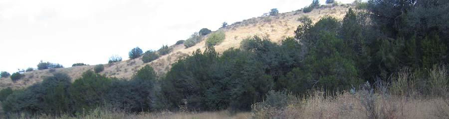
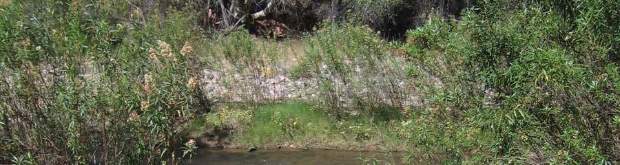
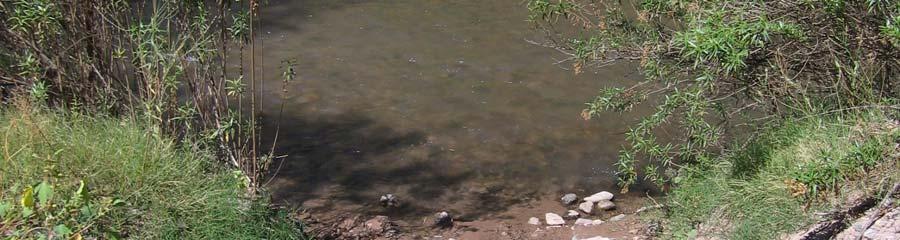
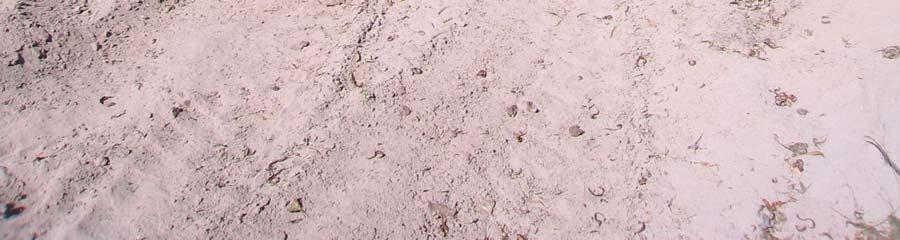
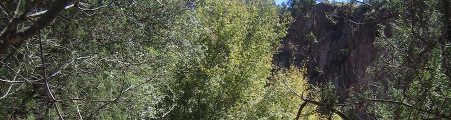
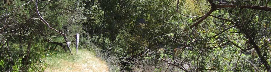
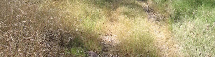
1 Appendix A: San Francisco River Photos Gila National Forest These photos accompany our request for closure to demonstrate both the the outstanding ecological values associated with this area, as well as the ongoing damage due to ORV use in riparian areas. All photos were taken October 6 or 7, 2007 by Chris Kassar and all GPS points were taken using NAD 27 Datum. The photo point numbers match up with the red triangles found on the associated map of the area (Appendix C: Map #3- Gila NF Photo Points). Appendix A. SF River Photos Gila NF 1

2 Photo 1.12S //UTM FR 68 heading west toward Big Dry Creek from intersection with Hwy 180. Appendix A. SF River Photos Gila NF 2

3 Photo 2. 12S //UTM Gate on FR 68 separating Gila National Forest property from private property. Route travels into and becomes Big Dry Creek. Appendix A. SF River Photos Gila NF 3


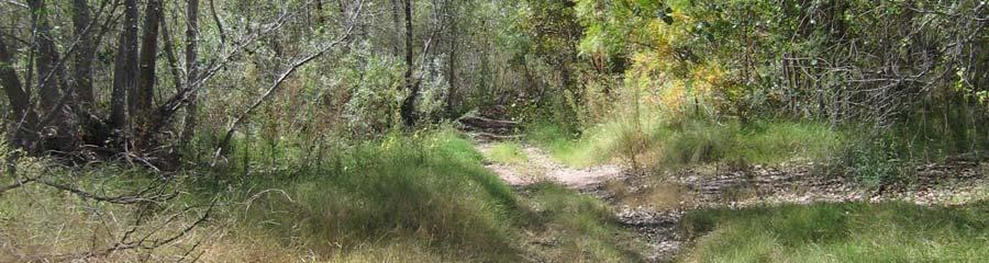
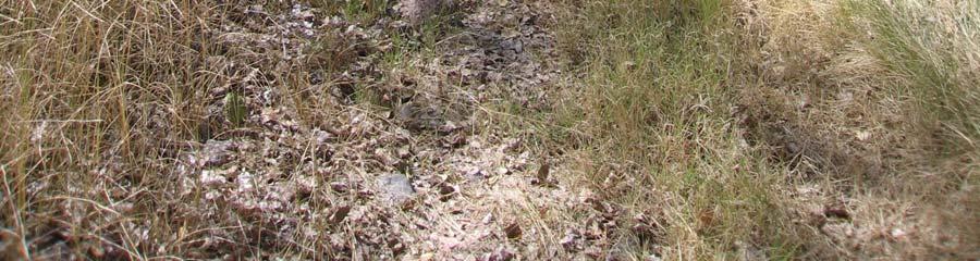
4 Photo 3. 12S //UTM Further down Big Dry Creek where road and the creek are the same. Signs of recent use, including quad tracks, cow prints and scat. Appendix A. SF River Photos Gila NF 4

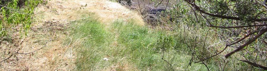
5 Photo 4. 12S //UTM First intersection with water on this trip. Appendix A. SF River Photos Gila NF 5


6 Photo 5. 12S //UTM Vehicle tracks continue to travel in and out of the creek. Noted erosion and cut banks of 1 to 2 feet. Many birds and small mammals present including Gila and Acorn woodpeckers, squirrels and rabbits. Appendix A. SF River Photos Gila NF 6

7 Photo 6. 12S //UTM Tracks continue down the creek bed. Evidence of erosion, bank cutting and rutting. Appendix A. SF River Photos Gila NF 7


8 Photo 7. 12S //UTM Tracks continue down wash. Note erosion and sedimentation when route enters the creek. Appendix A. SF River Photos Gila NF 8

9 Photo 8. 12S //UTM Tracks traveling into creek causing cut banks and runoff of sediment into creek. Appendix A. SF River Photos Gila NF 9


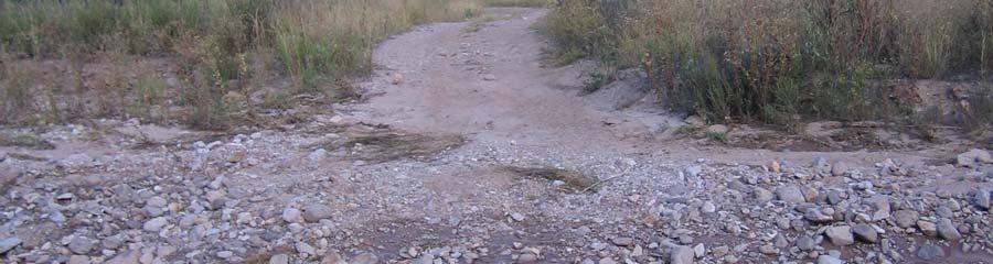
10 Photo 9. 12S //UTM Motor vehicle tracks into river as Big Dry Creek travels toward the San Francisco River. Appendix A. SF River Photos Gila NF 10


11 Photo S //UTM Multiple tracks into creek causing rutting and stirring up rocks. Appendix A. SF River Photos Gila NF 11


12 Photo S //UTM Man on ATV after having driven down and in the creek for a ½ mile or more.. Appendix A. SF River Photos Gila NF 12


13 Photo S //UTM Area rancher on ATV heading down the creek bed. Explained that he was looking for 10 to 15 of his cattle that had been on the river for about a week. This area is closed to grazing. Appendix A. SF River Photos Gila NF 13


14 Photo S //UTM Route travels parallel and then into creek. Note cut banks of 2 to 4 feet and increased erosion and sedimentation off of banks. Appendix A. SF River Photos Gila NF 14

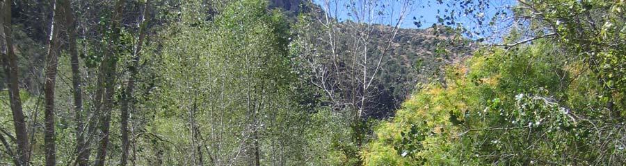
15 Photo S //UTM Beautiful scenery of the area and the creek. Note vehicle tracks paralleling and then entering the water. Appendix A. SF River Photos Gila NF 15

 and Big Dry")


16 Photo S //UTM Confluence of the San Francisco River (from North) and Big Dry Creek (from East). Evidence of people driving directly down the San Francisco River as well as parallel to it on the south side of the river. Appendix A. SF River Photos Gila NF 16


17 Photo S //UTM San Francisco River below confluence with Big Dry Creek. Note riparian vegetation and tracks into and paralleling the river. Appendix A. SF River Photos Gila NF 17


18 Photo S //UTM Sign posted on fence next to river by off-road interests. Sign warns users that the area is being considered for closure by the Forest Service and warns of the potential for losing motorized access. It also asks riders to join their organizations (GRATA and the Mogollon Apache Gila Riders). Appendix A. SF River Photos Gila NF 18


19 Photo S //UTM Off-road vehicle tracks continue into and down the river. Appendix A. SF River Photos Gila NF 19


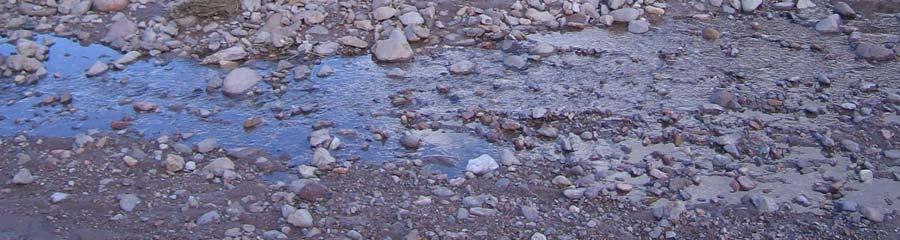
20 Photo S //UTM Tracks across the first large crossing of the San Francisco River. Significant amount of mud, bank cuts, obvious sedimentation and increased turbidity that could potentially negatively impact fish and other aquatic organisms. Appendix A. SF River Photos Gila NF 20


21 Photo S //UTM Same as photo 19, different view. Appendix A. SF River Photos Gila NF 21


,")

22 Photo S //UTM Looking back at crossing described in photo 19 & 20. Note deep bank cuts (1 to 2 feet), erosion, unstable soil and increased turbidity. Appendix A. SF River Photos Gila NF 22


23 Photo S //UTM Redundant crossing just downstream of previous crossing (Photos 19-21). Evidence of users continuing to drive down the river and to drive wherever they want on the banks of the river. Appendix A. SF River Photos Gila NF 23


24 Photo S //UTM Other side of crossing in Photo 22. Note evidence of recent use and bank cuts. Appendix A. SF River Photos Gila NF 24


25 Photo S //UTM Trail travels along and above river on right side and heads to cave and fire pit. Appendix A. SF River Photos Gila NF 25


26 Photo S //UTM Another view of renegade route in photo 24. Appendix A. SF River Photos Gila NF 26


27 Photo 26 &27, 12S //UTM Crossing further down river with significant evidence of livestock presence and off-road vehicle use. Note cumulative impacts of grazing and ORVs causing bank cutting, sedimentation, increased turbidity and likely loss of habitat. Appendix A. SF River Photos Gila NF 27


28 Photo 28 & S //UTM Twenty feet downstream of 26 &27 showing multiple tracks into river, cut banks, increased erosion & sedimentation due to livestock and off-road vehicles Appendix A. SF River Photos Gila NF 28


29 Photo S //UTM Tracks traveling into river. This is yet another point in the river where there is no other option, but for vehicles to drive directly in the water. River bottom is very unstable and there is significant evidence of erosion and turbidity. Appendix A. SF River Photos Gila NF 29

30 Photo S //UTM Tracks paralleling the river showing low use. Appendix A. SF River Photos Gila NF 30


31 Photo 32 &33. 12S // UTM Further downstream more evidence of livestock presence and off-road vehicle use. Note damage to bank and increased erosion. Appendix A. SF River Photos Gila NF 31


32 Photo S //UTM Vehicle tracks heading down to river. Note crushed vegetation and cow tracks. Appendix A. SF River Photos Gila NF 32


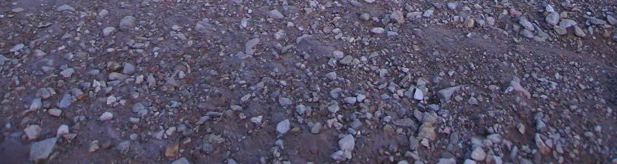
33 Photo S //UTM Very muddy crossing with increased erosion, sedimentation and stream turbidity. Appendix A. SF River Photos Gila NF 33


34 Photo S //UTM Very muddy crossing with increased erosion, sedimentation and stream turbidity. Appendix A. SF River Photos Gila NF 34
. Appendix A.")
35 Photo S //UTM Proliferation of routes off of the bank of the San Francisco River. There are tracks heading up to left and away from river as well as those heading toward the river (next photo). Appendix A. SF River Photos Gila NF 35
36 Photo S //UTM Proliferation of routes off of the bank of the San Francisco River. There are tracks heading up to left and away from river (previous photo) as well as those heading toward the river as in this photo. Appendix A. SF River Photos Gila NF 36


")

37 Photo S //UTM Vehicle tracks adjacent to river. Note extreme ruts (1 to 1.5 feet in depth) and muddiness, as well as livestock tracks. Appendix A. SF River Photos Gila NF 37


38 Photo S //UTM Vehicle tracks into river. Note extreme ruts (1 to 1.5 feet in depth) and muddiness, as well as livestock tracks. Appendix A. SF River Photos Gila NF 38


39 Photo S //UTM Photo of river showing ecological values that need to be preserved, including healthy riparian vegetation and potential habitat for fish, birds and mammals. Appendix A. SF River Photos Gila NF 39
Final Recreation Report. Sunflower Allotment Grazing Analysis. July 2015
 Final Recreation Report Sunflower Allotment Grazing Analysis July 2015 Table of Contents Introduction... 3 Affected Environment... 3 Four Peaks Wilderness Area... 3 Dispersed Recreation... 3 Environmental
General Implementation
 Features 1 General Implementation Allow vehicle travel for the purposes of dispersed camping within 300 feet of designated Forest roads and motorized trails except for the fen areas identified above, and
Table of Contents. page 3 Long term Goals Project Scope Project History. 4 User Groups Defined Trail Representative Committee. 5 Trail Users Breakdown
 Launched April 27th, 2010 1 Table of Contents page 3 Long term Goals Project Scope Project History 4 User Groups Defined Trail Representative Committee 5 Trail Users Breakdown 13 Trail Users Desires 16
Yard Creek Provincial Park. Management Plan
 Yard Creek Provincial Park Management Plan Draft January 2010 Yard Creek Provincial Park Management Plan Approved by: telàlsemkin/siyam/chief Scott Benton Bill Williams Squamish Executive Director ation
The following criteria were used to identify Benchmark Areas:
 7.0 BENCHMARK AREAS The Churn Creek Protected Area offers a significant opportunity to learn more about how grassland ecosystems function. One of the key tools that will be used to monitor larger grassland
Pole Mountain Travel Management Scoping Document
 United States Department of Agriculture Forest Service Pole Mountain Travel Management Scoping Document Laramie Ranger District Medicine Bow-Routt National Forests and Thunder Basin National Grassland
Fossil Creek Wild & Scenic River Comprehensive River Management Plan Forest Service Proposed Action - details March 28, 2011
 Fossil Creek Wild & Scenic River Comprehensive River Management Plan Forest Service Proposed Action - details March 28, 2011 Primary Goals of the Proposed Action 1. Maintain or enhance ORVs primarily by
Appendix 1: Best Management Practices For Hang Gliding and Paragliding in Jasper National Parks
 Appendix 1: Best Management Practices For Hang Gliding and Paragliding in Jasper National Parks Name of Best Management Practice Best Management Practices for Hang Gliding and Paragliding in Jasper National
Finn Creek Park. Management Direction Statement Amendment
 Finn Creek Park Management Direction Statement Amendment November 2013 Management Direction Statement Amendment Approved by: Jeff Leahy Regional Director, Thompson Cariboo BC Parks November 12, 2013 Date
Appendix A Appendix A (Project Specifications) Auk Auk / Black Diamond (Trail 44) Reroute
 Auk Auk / Black Diamond (Trail 44) Reroute") Appendix A (Project Specifications) Auk Auk / Black Diamond (Trail 44) Reroute I. Proposed Action: This project proposes to reroute approximately 1,800 feet of a 50 inch wide trail, off of private property
Appendix A (Project Specifications) Auk Auk / Black Diamond (Trail 44) Reroute I. Proposed Action: This project proposes to reroute approximately 1,800 feet of a 50 inch wide trail, off of private property
Aboriginal Traditional Knowledge
 Aboriginal Traditional Knowledge Manitoba Hydro recognizes the unique relationship Aboriginal communities have with their areas of use and is appreciative to all the communities who took time to share
ETOBICOKE CREEK NORTH TRAIL PROJECT. May 18, 2017 at Michael Power High School 105 Eringate Drive, Etobicoke ON M9C 3Z7
 ETOBICOKE CREEK NORTH TRAIL PROJECT May 18, 2017 at Michael Power High School 105 Eringate Drive, Etobicoke ON M9C 3Z7 1 Purpose of Open House The purpose of today s open house is to present the design
APPENDIX F List of Commitments
 APPENDIX F List of Commitments s Table F.1 Standard Mitigation Measures Mitigation Measure MnDOT Specification Number Status Update Description Status Update Utilities Provide early notice to utility operators
Bear Creek Habitat Improvement Project
 06/10/10 Bear Creek Habitat Improvement Project El Paso County, Colorado Pike National Forest and Colorado Springs Utilities Owned Land Report prepared by: Eric Billmeyer Executive Director Rocky Mountain
BOULDER CREEK CATTLE FENCING FOR KOKANEE HABITAT ENHANCEMENT 2010
 BOULDER CREEK CATTLE FENCING FOR KOKANEE HABITAT ENHANCEMENT 2010 Prepared for the: FISH & WILDLIFE COMPENSATION PROGRAM, NELSON, B.C. Prepared by: Marc André Beaucher CRESTON VALLEY WILDLIFE MANAGEMENT
DECISION NOTICE. Sled Springs OHV Trail System and Road Management Plan
 DECISION NOTICE For Sled Springs OHV Trail System and Road Management Plan USDA - Forest Service Wallowa Valley Ranger District Wallowa-Whitman National Forest Wallowa County, Oregon This Decision Notice
MANAGEMENT DIRECTION STATEMENT
 Skeena District MAAGEMET DIRECTIO STATEMET July, 2000 for Driftwood Canyon Provincial Park Ministry of Environment Lands and Parks BC Parks Division i Table of Contents Driftwood Canyon Park Approvals
Topo Map Explorer. Adapted from: An original Creek Connections activity. Creek Connections, Box E, Allegheny College, Meadville, Pennsylvania, 16335
 Topo Map Explorer Adapted from: An original Creek Connections activity. Creek Connections, Box E, Allegheny College, Meadville, Pennsylvania, 16335 Review of major topographic map concepts Grade Level:
Conservation of Critical Environmental Resources in Chatham Park
 Conservation of Critical Environmental Resources in Chatham Park Elaine Chiosso, Haw Riverkeeper Haw River Assembly Haw River As Seen From Chatham Park "Spreading southwestward from the banks of the Haw
Cat Island Chain Background & Access Guide
 Cat Chain Background & Access Guide Brown County Port & Resource Recovery Department 2561 S. Broadway, Green Bay, WI 54304 (920) 492-4950 www.portofgreenbay.com January 2018 1 Restoration of the Cat Chain
Trail Assessment Report
 Trail Assessment Report Trail Options for the Bear Creek Canyon located in Pikes Peak Ranger District, Pike National Forest and on Colorado Springs Utility Lands Due to the presence of a unique species
Theme: Predominately natural/natural appearing; rustic improvements to protect resources. Size*: 2,500 + acres Infrastructure**:
 Recreation Opportunity Spectrum (ROS) Classes The Recreation Opportunity Spectrum (ROS) provides a way to describe the variations in the degree of isolation from the sounds and influences of people, and
Cultural Resource Management Report Deer Valley 4wd Restoration and Blue Lakes Road Maintenance Project R
 Cultural Resource Management Report R2015-05-03-10005 Undertaking Description: The proposes to perform road maintenance and meadow restoration on the Deer Valley 4wd trail and road maintenance on the Blue
Chuckanut Ridge Fairhaven Highlands EIS Scoping Concerns
 Chuckanut Ridge Fairhaven Highlands EIS Scoping Concerns Coalition of Southside Neighborhoods CSN Comments for Fairhaven Highlands EIS Scope Hearing, Jan 16, 2008 1 Chuckanut Ridge Hilly Terrain: Potential
Case Study: 1. The Clarence River Catchment
 Case Study: 1. The Clarence River Catchment The NSW coastline is a great natural asset, making an enormous contribution to the economy. The resources of coastal catchments such as the Clarence River Catchment,
San Juan Resource Area Recreation Impact Inventory/Monitoring
 San Juan Resource Area Recreation Impact Inventory/Monitoring Indian Creek Climbing Area Overview & Summary of Findings 2007 Pam Foti, Professor Aaron Divine, Lecturer Janet Lynn, Program Coordinator Northern
APPENDIX D: SUSTAINABLE TRAIL DESIGN. APPENDICES Town of Chili Parks and Recreation Master Plan Update
 APPENDIX D: SUSTAINABLE TRAIL DESIGN APPENDICES Town of Chili Parks and Recreation Master Plan Update Sustainable Trail Construction Sustainable trails are defined by the US Forest Service as trails having
MORGAN CREEK GREENWAY Final Report APPENDICES
 APPENDICES MORGAN CREEK GREENWAY Appendix A Photos of Existing Conditions in Trail Corridor Photos of existing conditions Main trail corridor - February 2009 Photos of existing conditions south bank Morgan
ALBERTA WILDERNESS ASSOCIATION
 MOTORIZED RECREATION ON PUBLIC LANDS (AWA) only supports the safe and responsible use of motorized recreational vehicles on designated trails in appropriate areas where there is no impact on other recreational
SHELBY RANCH. unique places. Offered By: real estate
 SHELBY RANCH Offered By: SHELBY RANCH The Shelby Ranch is a great opportunity to acquire 702 +/- acres of northern New Mexico property that is less than 1.5 hours from Albuquerque and Durango and offers
Crook County Oregon. Natural Resources Planning Committee Draft Report
 Crook County Oregon Natural Resources Planning Committee Draft Report September 17, 2009 Ochoco Summit OHV Trail Planning field Review September 3, 2009 The Dechutes Provincial Advisory Committee invited
Rule Governing the Designation and Establishment of All-Terrain Vehicle Use Trails on State Land
 Rule Governing the Designation and Establishment of All-Terrain Vehicle Use Trails on State Land 1.0 Authority 1.1 This rule is promulgated pursuant to 23 V.S.A. 3506. Section 3506 (b)(4) states that an
FEASIBILITY CRITERIA
 This chapter describes the methodology and criteria used to evaluate the feasibility of developing trails throughout the study areas. Land availability, habitat sensitivity, roadway crossings and on-street
UNIVERSITY OF CALIFORNIA, DAVIS
 UNIVERSITY OF CALIFORNIA, DAVIS BERKELEY DAVIS IRVINE LOS ANGELES MERCED RIVERSIDE SAN DIEGO SAN FRANCISCO SANTA BARBARA SANTA CRUZ SCHOOL OF MEDICINE UC DAVIS MEDICAL CENTER DEPARTMENT OF EMERGENCY MEDICINE
To all our cooperators from across California. be they ranchers, growers, or regulators, activists, resource managers, and the public THANK YOU!
 Managing Rangeland sheds for Agricultural Production, Quality, and Food Safety To all our cooperators from across California be they ranchers, growers, or regulators, activists, resource managers, and
Independent Technical Reference Group Wild Horse Damage around Currango Homestead Made by: Friends of Currango Inc. (FoC) Date: 13 April 2015
 Date: 13 April 2015") Submission to: Dr Mark Lonsdale Independent Chair Independent Technical Reference Group Re: Wild Horse Damage around Currango Homestead Made by: Friends of Currango Inc. (FoC) Date: 13 April 2015 Background
Submission to: Dr Mark Lonsdale Independent Chair Independent Technical Reference Group Re: Wild Horse Damage around Currango Homestead Made by: Friends of Currango Inc. (FoC) Date: 13 April 2015 Background
USDI, BUREAU OF LAND MANAGEMENT BURNS DISTRICT HINES, OREGON 97738
 USDI, BUREAU OF LAND MANAGEMENT BURNS DISTRICT HINES, OREGON 97738 FINDING OF NO SIGNIFICANT IMPACT AND DECISION RECO/FINAL DECISION FOR STEENS MOUNTAIN TRAVEL MANAGEMENT PLAN ENVIRONMENTAL ASSESSMENT
2018 Goldwedge Mines Inc. Licence of Occupation Management Plan. Photo: xxxx. Goldwedge Mines Inc.
 2018 2018 Goldwedge Mines Inc. Licence of Occupation Management Plan Photo: xxxx Goldwedge Mines Inc. March 2018 TABLE OF CONTENTS TABLE OF CONTENTS... i Figures... i 1. Background... 2 Project Overview...
APPENDIX C RECREATION OPPORTUNITY SPECTRUM PROCESS AND CLASSES
 APPENDIX C RECREATION OPPORTUNITY SPECTRUM PROCESS AND CLASSES RECREATION OPPORTUNITY SPECTRUM PROCESS Recreation area management objectives are defined through a planning process referred to as the Recreation
ROAD AND TRAIL PROJECT APPROVAL
 ROAD AND TRAIL PROJECT APPROVAL www.marincountyparks.org Marin County Parks, 3501 Civic Center Dr, Suite 260, San Rafael, CA 94903 DATE: July 12, 2017 PRESERVE: Gary Giacomini Open Space Preserve PROJECT:
Mazatzal Wilderness Trail Maintenance and Exploration
 Mazatzal Wilderness Trail Maintenance and Exploration March 15-19 (Wednesday - Sunday) Difficulty: Beginner Camping: Car Camping Mileage: Wednesday ~4 miles Thursday ~4-6 miles Friday ~4-6 miles Saturday
5.0 OUTDOOR RECREATION OPPORTUNITIES AND MANAGEMENT
 5.0 OUTDOOR RECREATION OPPORTUNITIES AND MANAGEMENT 5.1 Introduction This section describes the range of recreational activities that currently take place in Marble Range and Edge Hills Parks, as well
GREENWOOD VEGETATION MANAGEMENT
 APPENDIX G GREENWOOD VEGETATION MANAGEMENT PROJECT RECREATION RESOURCE REPORT Prepared by: Laurie A. Smith Supervisory Forester Stearns Ranger District Daniel Boone National Forest August 4, 2016 The
Summary of prescribed fires in Prince Albert National Park 2015
 Summary of prescribed fires in Prince Albert National Park 2015 Prince Albert National Park conducted four controlled fires in spring 2015, plus an additional fire in October. Fuel Management for Hazard
National Forests and Grasslands in Texas
 United States Department of Agriculture Forest Service National Forests and Grasslands in Texas Sam Houston NF 394 FM 1375 West New Waverly, Texas 77358 Phone 936-344-6205 Dear Friends, File Code: 1950
w f^(f 3<fSflO >^-.0-o i.
 dobs4)n Engineering Ltd. w f^(f 3^-.0-o i. File: 206-001/27022 May 25,2007 Ministry ofenvironment 102 Industrial Place PentictonBC V2A7C8 ^Qoeived MAY 3 1 2007 Attention: Solveij Patschke Dear
Daisy Dean Trail 628/619 ATV Trail Construction
 Background and Purpose and Need The Daisy Dean ATV Trail Construction Project is located in the Little Belt Mountains, Musselshell Ranger District, Lewis and Clark National Forest approximately 32 miles
Colorado s forests are slated to lose thousands of miles of roads through the new OHV Route Designation process. DON T LET IT HAPPEN!
 Colorado s forests are slated to lose thousands of miles of roads through the new OHV Route Designation process. DON T LET IT HAPPEN! This packet identifies many roads that you may lose if you don t act.
Procedure for the Use of Power-Driven Mobility Devices on Mass Audubon Sanctuaries 1 September 17, 2012
 Procedure for the Use of Power-Driven Mobility Devices on Mass Audubon Sanctuaries 1 September 17, 2012 Background As part of Mass Audubon s mission to preserve the nature of Massachusetts for people and
Trail Beginning Elevation: 7553 ft The Poison Creek Trailhead is located at the end of National Forest Road 646E (NF-646E).
.") West Mountain Trails Poison Creek Trail #134 Length: 2.9 miles (4.7 km) Difficulty Horseback: A good trail for the first time west mountain rider, some steep sections Hiking: Most Difficult USGS Maps:
West Mountain Trails Poison Creek Trail #134 Length: 2.9 miles (4.7 km) Difficulty Horseback: A good trail for the first time west mountain rider, some steep sections Hiking: Most Difficult USGS Maps:
Public Notice ISSUED: December 10, 2018 EXPIRES: January 9, 2019
 APPLICANT: REFER TO: St. Louis and Lake Counties Regional Rail Authority 2018-01942-ARC Public Notice ISSUED: December 10, 2018 EXPIRES: January 9, 2019 SECTION:404 - Clean Water Act 1. APPLICATION FOR
U.S. National Forest Campground Guide
 U.S. National Forest Campground Guide Southwestern Region Arizona, New Mexico, Oklahoma and Texas National Forests and Grasslands in the Southwestern Region NF = National Forest NG = National Grassland
--- FINAL --- Platte Petroleum Project RECREATION TECHNICAL REPORT. Prepared by:
 --- FINAL --- Platte Petroleum Project RECREATION TECHNICAL REPORT Prepared by: David S. Hatch Forest Landscape Architect and Recreation Planner Uinta-Wasatch-Cache National Forest U.S. Forest Service
Colorado s Instream Flow Program at 40. Celebrating 40 Years of Success and Challenges January 15, 2014 Denver, Colorado
 Colorado s Instream Flow Program at 40 Celebrating 40 Years of Success and Challenges January 15, 2014 Denver, Colorado ISF Program established in 1973 by Senate Bill 97 Recognized the need to correlate
Snowmobiling's Endless Winter:
 August 2002 prepared for Swan View Coalition 3165 Foothill Road Kalispell, MT 59901 www.swanview.org Snowmobiling's Endless Winter: Facilitating Physical Access Also Extends The Snowmobile Season, Resulting
2.0 PARK VISION AND ROLES
 2.0 PARK VISION AND ROLES 2.1 Significance in the Protected Area System Marble Range and Edge Hills provincial parks protect 6.8% of the Pavillion Ranges Ecosection, which is located in the Southern Interior
DECISION MEMO Whetstone Ridge Trail #8020 Relocation
 Page 1 of 7 Background DECISION MEMO Whetstone Ridge Trail #8020 Relocation USDA Forest Service Pintler Ranger District Granite County T4N, R16W, Sections 4,9,29 and T4N, R17W, Section 36 Whetstone Ridge
Version Isolated & Non-Waters Only 1 of 3
 APPROVED JURISDICTIONAL DETERMINATION FORM U.S. Army Corps of Engineers SECTION I: BACKGROUND INFORMATION A. REPORT COMPLETION DATE FOR APPROVED JURISDICTIONAL DETERMINATION (JD): July 6, 2010. B. DISTRICT
Oregon Department of Human Services HEALTH EFFECTS INFORMATION
 Oregon Department of Human Services Office of Public Health Systems (503) 731-4030 Emergency 800 NE Oregon Street #611 (503) 731-4381 Portland, OR 97232-2162 (503) 731-4077 FAX (503) 731-4031 TTY-Nonvoice
Bacteria Contamination of Surface Waters Due to Livestock Grazing in the Stanislaus National Forest, California (Second Year of Study)
") Bacteria Contamination of Surface Waters Due to Livestock Grazing in the Stanislaus National Forest, California (Second Year of Study) Lindsey Myers, staff biologist Central Sierra Environmental Resource
Bacteria Contamination of Surface Waters Due to Livestock Grazing in the Stanislaus National Forest, California (Second Year of Study) Lindsey Myers, staff biologist Central Sierra Environmental Resource
DIDYMO SURVEY, LOWER FRYINGPAN RIVER, BASALT, COLORADO 2015
 DIDYMO SURVEY, LOWER FRYINGPAN RIVER, BASALT, COLORADO 2015 Second Annual Report PREPARED FOR: ROARING FORK CONSERVANCY PREPARED BY: COLORADO MOUNTAIN COLLEGE NATURAL RESOURCE MANAGEMENT PROGRAM TIMBERLINE
Recreational Carrying Capacity
 9 th Annual Caribbean Sustainable Tourism Conference Recreational Carrying Capacity Graham C Barrow What is Recreational Carrying Capacity? It s not about fixing absolute numbers of visitors/tourists that
STREAMWALKS REVISITED
 STREAMWALKS REVISITED Maggie A. Kendrick, Department of Earth Sciences, University of South Alabama, Mobile, AL, 36688. Email: mak0209@aol.com. The goal of my research is to have a system of streamwalks
Buford / New Castle Motorized Trail
 Buford / New Castle Motorized Trail Rifle Ranger District, White River National Forest Garfield County, Colorado Comments Welcome The Rifle Ranger District of the White River National Forest welcomes your
DECISION MEMO. Rawhide Trail #7073 Maintenance and Reconstruction
 Page 1 of 6 Background DECISION MEMO USDA Forest Service Jefferson Ranger District Jefferson County, Montana Rawhide Trail #7073 is located in the Elkhorn Mountain Range approximately 10 miles east of
Permeable RECREATIONAL TRAILS
 SMART EARTH SOLUTIONS Permeable RECREATIONAL TRAILS GEOWEB GEOPAVE GEOTERRA Innovative Solutions for Designing & Building Trails. Trail Surface Stabilization The key to planning and building trails into
National Recreation Trail Update Form
 National Recreation Trail Update Form Introduction Thank you for taking the time to complete this form. Your assistance will help ensure that the National Recreation Trail (NRT) database is complete and
Geoscape Toronto The Oak Ridges Moraine Activity 2 - Page 1 of 10 Information Bulletin
 About 13,000 years ago as the Laurentide Ice Sheet melted, glacial meltwater accumulated between the ice sheet and the Niagara Escarpment. This formed a lake basin into which gravel and sand were deposited.
Attendance Presentation
 TO The Community of Saanich FROM District of Saanich DATE January 30, 2017 RE Meeting Notes Haro Woods Jan 28th Community Engagement Goward House, 2495 Arbutus Road, Victoria BC Attendance In total, 18
Recreational Use Attainability Analysis Summary of Findings & Public Comment
 The Neches River Above Lake Palestine, Prairie Creek, Mud Creek, and West Mud Creek Recreational Use Attainability Analysis Summary of Findings & Public Comment Texas Institute for Applied Environmental
RIO VISTA MUNICIPAL AIRPORT
 DRAINAGE TECHNICAL MEMORANDUM RIO VISTA MUNICIPAL AIRPORT RIO VISTA, CALIFORNIA Prepared for: City of Rio Vista 1 Main Street Rio Vista, CA 94571 (707) 374-5337 Prepared by: August 2012 Copyright 2012
KP Lasnaya 1 River
 KP 370.2 Lasnaya 1 River The Lasnaya 1 River crossing is protected by Reno mattings and a gabion wall on the north bank (Photo 1). The south bank consists of natural river gravel deposits on top of Reno
MOLLUSC RECORDS FROM
 MOLLUSC RECORDS FROM Colin-Cornwall Cornwall s Wildland Park ( ) Mollusc habitat along Creek (Photo by ) ( ) Prepared by Wayne Nordstrom Alberta Natural Heritage Information Centre November 2003 Parks
WIFSS research on E. coli O157:H7 in central coastal California. Rob Atwill, D.V.M., Ph.D. University of California-Davis
 WIFSS research on E. coli O157:H7 in central coastal California Rob Atwill, D.V.M., Ph.D. University of California-Davis To all cooperators: ranchers, growers, regulators, environmentalists, resource managers,
Meeting Minutes. Participants:
 Dufferin Aggregates Meeting Minutes Event: Date & Time: Place: Chair: Participants: Community Advisory Panel (CAP) Paris Pit CAP # 9 Operation and Ecology Update Tuesday September 17, 2013 7:00-9:00 PM
HIGH COUNTRY L-BAR RANCH
 HIGH COUNTRY L-BAR RANCH Sandoval and mckinley counties N e w m e x i c o Jim Haworth, Ranch Team Lead Broker ~ 505-235-5236 3613 NMSR 528 NW, Ste. H, Albuquerque, NM 87114 505-792-3713 www.wwrealty.com
566± acres total - WILL DIVIDE Volusia County, FL
 L IC E N S E D HUNTING P RESERVE ts Q u a i l ahi ul anb l e are av r info! fo CALL TODAY LAKEFRONT PROPERTY PERFECTION This ranch lies on a natural sand ridge in North Volusia County, Florida and has
Disaster Skokomish Indian Tribe. Photos of Roads around the Core Reservation Area. December 2007 Storm: Skokomish Tribe
 Disaster 1734 Skokomish Indian Tribe Photos of Roads around the Core Reservation Area Monday, 12/03/07: Agency Road / Tribal Center Road intersection. Monday, 12/03/07: Flood waters rising in front of
Park Updates 1. Cavalero 2. Lundeen 3. Frontier Heights Citizen Advisory Committee
 Page 1 of 10 PARK BOARD AGENDA Community Center 1808 Main Street, Lake Stevens Monday, April 11, 2016 CALL TO ORDER: 6:00 pm ROLL CALL: GUEST BUSINESS: ACTION ITEMS: A. B. C. Approval of February 8, 2016
June 6, 2013 BOARD MATTER D - 5 CONSIDER AMENDMENT OF SPECIAL USE LEASE NO. SU-639 AND REQUEST FOR PUBLIC USE RESTRICTION TO MOTORIZED VEHICULAR USE
 June 6, 2013 BOARD MATTER D - 5 ACTION: AUTHORITY: CONSIDER AMENDMENT OF SPECIAL USE LEASE NO. SU-639 AND REQUEST FOR PUBLIC USE RESTRICTION TO MOTORIZED VEHICULAR USE W.S. 36-5-114; Board of Land Commissioners
FINAL TESTIMONY 1 COMMITTEE ON RESOURCES UNITED STATES HOUSE OF REPRESENTATIVES. July 13, 2005 CONCERNING. Motorized Recreational Use of Federal Lands
 FINAL TESTIMONY 1 STATEMENT OF DALE BOSWORTH CHIEF Of the FOREST SERVICE UNITED STATES DEPARTMENT OF AGRICULTURE Before the SUBCOMMITTEE ON FORESTS AND FOREST HEALTH And the SUBCOMMITTEE ON NATIONAL PARKS,
MANAGEMENT DIRECTION STATEMENT June, 1999
 Thompson River District MANAGEMENT DIRECTION STATEMENT June, 1999 for Roche Lake Provincial Park Ministry of Environment Lands and Parks BC Parks Division Table of Contents I. Introduction A. Setting
Segment 2: La Crescent to Miller s Corner
 goal of the USFWS refuges is to conserve, protect and enhance fish, wildlife and plants and their habitats for the continuing benefit of the American people. Refuge lands are used largely for fishing,
Monterey Coast-Sierra de Salinas Linkage Study. Conducted by The Big Sur Land Trust & Pathways for Wildlife
 Monterey Coast-Sierra de Salinas Linkage Study Conducted by The Big Sur Land Trust & Pathways for Wildlife Objectives & Goals 1) To increase our understanding of wildlife movement throughout the Central
October Polhill consultation on new tracks
 October 2016 Polhill consultation on new tracks Brooklyn Trail Builders (BTB) is a community volunteer group that has been building and maintaining trails, planting trees, and removing rubbish in Polhill
A Vision for South Skunk River and Chichaqua Bottoms Greenbelt
 A Vision for South Skunk River and Chichaqua Bottoms Greenbelt Photo: Jim Pease Chichaqua Bottoms Booklet 7 of 8 Greater Des Moines Water Trails and Greenways 1 2016 Table of Contents Booklet 1: Water
Survey of Rodman Reservoir and middle-ocklawaha River springs during spring 2008 draw-down conditions: FWC and FWS
 Survey of Rodman Reservoir and middle-ocklawaha River springs during spring 2008 draw-down conditions: FWC and FWS Date of Survey: February 26, 2008 Survey conducted by: Dawn Jennings, USFWS Nicole Adimey,
Decision Notice & Finding of No Significant Impact Middle Citico Equestrian Trail Network
 Decision Notice & Finding of No Significant Impact Middle Citico Equestrian Trail Network USDA Forest Service Tellico Ranger District, Cherokee National Forest Monroe County, Tennessee Decision and Reasons
Mud Creek and West Mud Creek
 Mud Creek and West Mud Creek Recreational Use Attainability Analysis Summary of Findings Texas Institute for Applied Environmental Research Stephenville, Texas September 15, 2014 1 Project Partners Texas
National Recreation Trail Application for Designation
 National Recreation Trail Application for Designation Introduction Thank you for your interest in the National Recreation Trail (NRT) program. Completed NRT application packages must be submitted by December
Porter Fk. #1. All unauthorized items removed as per FS & Rec Res guidelines. Footbridge may be needed for wheel chair access and for safety
 APPENDIX D Lot Specific Permit Compliance & Forest Plan (FP) Requirements Porter Fork Recreation Residence Tract (Items noted were documented in compliance letter, 8/12/2005, sent to all Rec. Residence
LAS VARAS RANCH CA COASTAL TRAIL PROPOSED ALIGNMENT
 LAS VARAS RANCH CA COASTAL TRAIL PROPOSED ALIGNMENT Santa Barbara Trails Council * Prepared by Ray Ford February 1,2012 The following notes accompany the Santa Barbara Trails Council map for the Las Varas
Appendices A (Our ambition for nature (A3 plan) and further information)
 and further information)") Appendices A (Our ambition for nature (A3 plan) and further information) Penny Hill Farm Nature Conservation vision Key: Tenancy boundary Meadow restoration & Mowing/meadow F33 Mowing/meadow Progress towards
Appendices A (Our ambition for nature (A3 plan) and further information) Penny Hill Farm Nature Conservation vision Key: Tenancy boundary Meadow restoration & Mowing/meadow F33 Mowing/meadow Progress towards
Uinta-Wasatch-Cache National Forest Salt Lake Ranger District
 United States Department of Agriculture Forest Service Uinta-Wasatch-Cache National Forest Salt Lake Ranger District 6944 South 3000 East Salt Lake City, UT 84121 801-733-2660 File Code: 1950/2300 Date:
A summary of Draft Makara Peak Mountain Bike Park Master Plan
 A summary of Draft Makara Peak Mountain Bike Park Master Plan OVEMBER 216 Image: Peter Marshall 2 3 Introduction Since it was established in 1998, the Makara Peak Mountain Bike Park (Makara Peak) has grown
LIFE+ URBANCOWS - Restoration of urban coastal meadow complex in Pärnu town, Estonia. Bert Holm, PhD.
 LIFE+ URBANCOWS - Restoration of urban coastal meadow complex in Pärnu town, Estonia Bert Holm, PhD. bert.holm@saaremaavald.ee Pärnu town, West-Estonia A coastal town, the population of ca 40 000 inhabitants;
MAA 5 Year Approved Projects List FY through FY
 MAA 5 Year Approved Projects List FY 2018 19 through FY 2022 23 AA01 Miramontes Ridge: Gateway to the Coast Public Access, Stream Restoration and Agriculture Enhancement AA01 Miramontes Ridge: Gateway
Camping (Primitive) Camping (RV) Electrical Potable Water Grill Established Fire Pit Picnic Table
 Camping (RV) Electrical Potable Water Grill Established Fire Pit Picnic Table") Alden - 9th Road River Mile 777 Map: 38.20833, -98.32031 Managing Agency: Kansas Department of Wildlife, Parks & Tourism Nearest Community: Alden, Rice County Kansas Developed Amenities Provided Parking
Alden - 9th Road River Mile 777 Map: 38.20833, -98.32031 Managing Agency: Kansas Department of Wildlife, Parks & Tourism Nearest Community: Alden, Rice County Kansas Developed Amenities Provided Parking
The implementation of this Master Plan will be undertaken in logical stages to meet passenger and workforce demands.
 The implementation of this Master Plan will be undertaken in logical stages to meet passenger and workforce demands. Connecting People Building Opportunities 198 Brisbane Airport Corporation CHAPTER 10
Description of the Proposed Action for the Big Creek / Yellow Pine Travel Plan (Snow-free Season) and Big Creek Ford Project
 and Big Creek Ford Project") Description of the Proposed Action for the Big Creek / Yellow Pine Travel Plan (Snow-free Season) and Big Creek Ford Project Payette National Forest Krassel Ranger District Valley and Idaho Counties, Idaho
Description of the Proposed Action for the Big Creek / Yellow Pine Travel Plan (Snow-free Season) and Big Creek Ford Project Payette National Forest Krassel Ranger District Valley and Idaho Counties, Idaho