ST. CLOUD LAKE WOBEGON TRAIL OPEN HOUSE
|
|
|
- Shannon Palmer
- 6 years ago
- Views:
Transcription


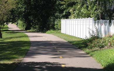
1 ST. CLOUD LAKE WOBEGON TRAIL OPEN HOUSE PROJECT INTRODUCTION Project partners: St. Cloud Area Planning Organiza on (APO) and the City of St. Cloud. The project area is approximately 2.5 miles long, extending from 44th Avenue N./Waite Avenue N. to the Mississippi River. Saintly Seven is the term given to the seven mile stretch of undeveloped trail between St. Joseph and the Mississippi River. The en re uncompleted trail segment from St. Joseph to the Mississippi River is included in local transporta on plans and the St. Cloud Area Planning Organiza on 2035 Bicycle and Pedestrian Plan. PROJECT GOAL LAKE WOBEGON TRAIL BACKGROUND Stearns County s manages the Lake Wobegon Trail segments from St. Joseph to Osakis and from Albany to Holdingford. The Lake Wobegon Trail is a 46-mile long, 10-foot wide, bituminous surfaced hike-and-bike pathway. The trail opened on September 30, The trail extends through Central MN from the city of St. Joseph to the city of Osakis. The trail also has an extension on the west side of Albany heading northeast to Holdingford and beyond. Snowmobiling is allowed on the exis ng segments of the Lake Wobegon Trail Stearns County s is planning to extend the Lake Wobegon Trail from St. Joseph to River s Edge in Waite The goal of the study is to iden fy a preferred alignment for a proposed extension of the Lake Wobegon Trail from 44th Avenue to the Beaver Island Trail in the City of St. Cloud, along the Mississippi River. Otter Tail County Todd County Douglas County Grant County Morrison County Stearns County 3rd Street 5th St/BNSF Corridor 10th Street PROJECT INTRODUCTION

2 PROJECT APPROACH
3 15th St N Madison Northway Mississippi River 12th St N Jaycee 33rd Ave N 29th Ave N 25th Ave N Wilson 10th St N ALTERNATIVE ROUTE 3 Hester Apollo High School State Highway 15 St. Peter Madison M.S. Pantown Elementary 9th St N Centennial Saint Cloud Spalt 8th Street N/Veterans Dr 7th St N Fountain ALTERNATIVE ROUTE 2 5th St N 4th St N 3rd St N Waite Avenue N. Central 4th St N ALTERNATIVE ROUTE 1 3rd St N 25th Ave N Beaver Island Trail Alternative Route 1 Alternative Route 2 Alternative Route ,000 2,000 Existing Conditions ion ns Seberger Scenic River Trail Cooper Ave. ROUTE ALTERNATIVES
4 ISSUES & OPPORTUNITIES FOR ALTERNATIVE ROUTE 2 ISSUES OPPORTUNITIES Need to cross tracks west of CSAH 15 Right of way issues behind businesses west of CSAH 15 BNSF right of way needed west of 33rd Right of way issues at 25th Avenue Challenging crossing at 3rd Street with tracks 9th Avenue pedestrian bridge not compliant Tight right of way around Post Office property 6th Avenue N RR track crossing U lity conflicts Not scenic- adjacent to railroad and switchyard opera ons Direct approach to downtown from River s Edge City project proposed along 5th Avenue Connec on to Scenic River Trail Waite Avenue N Railroad Sightline & ROW Issues 33rd Ave N BNSF Railroad 5th Street N State Highway 15 Central Challenging Intersec on 3rd Street N Tight Right of Way Alternative Route 1 Alternative Route ISSUES & OPPORTUNITIES FOR ALTERNATIVE ROUTE 1 ISSUES OPPORTUNITIES 37 intersec ons Direct approach to downtown from River s West of CSAH 15 street cross-sec on u lizes Edge most of right of way Connec on to Seberger CSAH 15 crossing Linkage through commercial area west of 46 driveway/alley crossings (north side) 33rd Avenue N and residen al east of 33rd 29 driveway/alley crossings (south side) Connec on to Scenic River Trail 9th Avenue pedestrian bridge not compliant Minimal right of way around Post Office property for 10 trail 6th Avenue N RR track crossing ALTERNATIVE ROUTES 1 2-A
5 25th Ave N BNSF Railroad 5th Street N Cooper Ave N Right of Way Issues Breckenridge Avenue Central 5th Street N 17th Avenue N 4th Street N 3rd Street N Challenging Intersec on 3rd Street N Alternative Route 1 Alternative Route 2 Seberger Cooper Ave N Scenic River Trail ALTERNATIVE ROUTES 1 2-B
6 Mississippi River 4th Street N 6th Ave N 7th Ave N BNSF Railroad Non-Compliant Pedestrian Bridge At-Grade Railroad Crossing Breckenridge Ave 2nd Street N. 4th Street N Right of Way Issues 3rd Street N 9th Ave N 2nd Street N Beaver Island Trail Alternative Route 1 Alternative Route ALTERNATIVE ROUTES 1 2-C
7 Older-Style Ramps 10th St N Apollo High School State Highway 15 38th Ave N 36th Ave N 33rd Ave N St. Peter Middle School 30th Ave N Pantown Madison Elementary 27th Ave N 9th St N Waite Avenue N 8th St N Fountain ISSUES & OPPORTUNITIES FOR ALTERNATIVE ROUTE 3 ISSUES OPPORTUNITIES Alternative Route 3 Furthest away from exis ng/planned trail CSAH 15 pedestrian bridge ramps are outdated 51 driveway/alley crossings (north side) 59 driveway/alley crossings (south side) Exis ng trail between Waite Avenue and CSAH 15 Exis ng bike route along 10th/11th Streets Connec ons to Pantown, Centennial and Hester s Connec ons to Madison Elementary and St Peter Middle School ALTERNATIVE ROUTE 3-A
8 10th St N St. Peter Middle School 9th St N 30th Ave N Pantown Madison Elementary 10th St N 25th Ave N 20th Ave N Centennial 11th St N 10th Ave N Centennial Dr. Alternative Route Corridor Segments Map ALTERNATIVE ROUTE 3-B
9 7th Ave N Hester Wilson 10th Ave N Centennial 10th St N 9th St N Mississippi River 11th St N Beaver Island Trail Alternative Route 3 8th St N ALTERNATIVE ROUTE 3-C


10 Connec ons School Connec ons Trail Connec ons Scenic River Trail Ten-Foot Wide Paved Trail Rest Stop Trail Signage TRAIL AMENITIES/ASSETS


11 Trail Roadway 66 Right-of-Way Boulevard Trail Roadway 66 Right-of-Way 15 Boulevard 0 10 NORTH SOUTH Boulevard Thru Lane Thru Lane Boulevard Trail 27 Roadway 66 Right-of-Way 3rd Street N. Poten al Cross-Sec on Existing Sidewalk 5th Street N. Poten al Cross-Sec on 10th Street N. Poten al Cross-Sec on 3rd Street Waite Avenue N 5th Street 28th Avenue N 10th Street 32nd Avenue N 3rd Street 30th Avenue N Cooper Avenue at 21st Avenue N Centennial 19th Avenue N 3rd Street 14th Avenue N Breckenridge Avenue at 14th Avenue N 11th Street 9th Avenue N TYPICAL CROSS-SECTIONS


12 Typical Exis ng Residen al Street Half and Half, Two-way Road, ing and Buffered Bike Lane Half and Half Two-way Road (No ing) and Separated Trail Half and Half, Two-way Road, ing and Cycle Track ALTERNATIVE CROSS-SECTIONS
Minnesota Great River Road Transportation Alternatives Local Project Summaries December 19, 2016
 Minnesota Great River Road Transportation Alternatives Local Project Summaries December 19, 2016 For MN-MRPC Consideration on January 5, 2017 and Potential Letters of Support Aitkin pg. 2 Brainerd pg.
Non-Motorized Transportation
 Non-Motorized Transportation Non-motorized facilities are important components to the transportation system. They provide an environmentally-friendly, low-cost mode of travel. Some of the facilities can
Becker County Trail Routing Feasibility Study
 2016 Becker County Trail Routing Feasibility Study CONNECTING DETROIT MOUNTAIN AND MOUNTAIN VIEW RECREATIONAL AREA TO THE HEARTLAND TRAIL BECKER COUNTY ULTEIG ENGINEERS Contents Acknowledgements...2 INTRODUCTION...3
Welcome to the Cross County Trail Public Input Session!
 Welcome to the Cross County Trail Public Input Session! Please sign in on the table below! What are we doing here? Camden County has proposed a bicycle and pedestrian trail spanning across the entire county.
City of Madison, Buckeye Road Monona Drive to Stoughton Road County AB Dane County Public Involvement Meeting
 City of Madison, Buckeye Road Monona Drive to Stoughton Road County AB Dane County Public Involvement Meeting Wednesday, May 31, 2017 6:30 to 8 P.M. Frank Allis Elementary School 4201 Buckeye Road Madison,
Glacial Lakes State Trail Master Plan Amendment Trail Extension into Downtown Willmar
 Glacial Lakes State Trail Master Plan Amendment Trail Extension into Downtown Willmar Minnesota Department of Natural Resources Division of Parks and Trails July 2012 Glacial Lakes State Trail Master Plan
MEETING MINUTES District 1 Trail Planning Meeting 1
 MEETING MINUTES District 1 Trail Planning Meeting 1 June 1, 2017 2:00 PM 3:30 PM City of Two Harbors 2:00 Introductions Attendees: Lisa Austin, MnDOT Bryan Anderson, MnDOT Jasna Hadzic-Stanek, MnDOT Justin
Macleod Trail Corridor Study. Welcome. Macleod Trail Corridor Study Open House. Presentation of Proposed Design Concepts
 Macleod Trail Corridor Study Welcome Macleod Trail Corridor Study Open House Presentation of Proposed Design Concepts Study Purpose Develop a corridor plan for Macleod Trail that aligns with The City s:
Auburn Trail / Ontario Pathways Trail Connector Feasibility Study Public Information Meeting Wednesday, August 22, 2012
 Auburn Trail / Ontario Pathways Trail Connector Feasibility Study Public Information Meeting Wednesday, August 22, 2012 Purpose of Feasibility Study Purpose Evaluate the feasibility of constructing a multiuse
TRAFALGAR PARK. 78: p.140 W 99th St FLAT ROCK CREEK PARK. W 103rd St OVERLAND PARK. Quivira Rd. College Blvd. Shared use path. Mountain bike trail
 Lenexa: overview TRAFALGAR PARK 78: p.140 As the Westport Route crosses over Lenexa's boundaries with Olathe and Overland Park several times, approximately 2.75 or 3 miles of the historic route of the
University Region Non-Motorized Plan 2015
 Non-Motorized Transportation Non-motorized facilities are important components to the transportation system. They provide an environmentally-friendly, low-cost mode of travel. Some of the facilities can
Greater Minnesota Regional Parks and Trails Commission Designation Application
 Greater Minnesota Regional Parks and Trails Commission Designation Application General Section Designation Application #: 15-050D Date Submitted: 06/30/2015 Park or Trail Name: Perham to Pelican Rapids
METROPOLITAN COUNCIL 390 North Robert Street, St. Paul, MN Phone (651) TDD (651)
 TDD (651)") METROPOLITAN COUNCIL 390 North Robert Street, St. Paul, MN 55101 Phone (651) 602 1000 TDD (651) 291 0904 DATE: June 19, 2007 TO: Metropolitan Parks and Open Space Commission FROM: Jan Youngquist, Senior
METROPOLITAN COUNCIL 390 North Robert Street, St. Paul, MN 55101 Phone (651) 602 1000 TDD (651) 291 0904 DATE: June 19, 2007 TO: Metropolitan Parks and Open Space Commission FROM: Jan Youngquist, Senior
QEW - ALTERNATIVE 3. Ÿ Widen QEW by one HOV lane in both direc ons through Freeman Interchange to North Shore Boulevard Interchange.
 SKYVIEW DRIVE KERNS and Highway 403 Freeman Interchange - ALTERNATIVE 3 Ÿ Widen by one HOV lane in both direc ons through Freeman Interchange to North Shore Boulevard Interchange. Ÿ Widen Highway 403 by
Each picture below has a brief explanation of the alignment. Please review and feel free to send any questions you might have.
 TO: Golden Parks, Recreation and Museums Advisory Board FR: Al Head & Ben Davis, Golden Giddyup Tim Waters & Jerry Harcek, Golden Community Members RE: Singletrack Sidewalks Pilot Proposal 3.0, January,
Figure San Dimas Bonita at San Dimas Avenue (view looking west)
") The adjoining neighborhood has an eclectic assortment of building types and uses, including: the historically significant but not architecturally or visually noteworthy San Dimas Lemon Association Packing
The adjoining neighborhood has an eclectic assortment of building types and uses, including: the historically significant but not architecturally or visually noteworthy San Dimas Lemon Association Packing
Raytown: overview. map. Santa Fe, Oregon, and California National Historic Trails KANSAS CITY KANSAS CITY. 38 Trail alignments: Raytown.
 Raytown: overview Blue Ridge Cut-off map 18: p.42 RICE- TREMOTI HOME Raytown Tfwy KASAS 17: p.41 JUCTIO WITH ROCK ISLAD LIE RIGHT OF WAY 16: p.40 BUS STOP AT E 51ST AD BLUE RIDGE (KASAS ) Sterling Ave
OR MISSION TRAIL ELEMENTARY
 Leawood: overview OVERLAD PARK 24: p.70 I-LA PARK 32: p.72 TOMAHAWK PARK 23: p.69 31: p.71 GEZER PARK OR MISSIO TRAIL ELEMETARY 22: p.68 W 133rd St W 135th St KASAS CITY MO - other segments Beginning/end
Greater Minnesota Regional Parks and Trails Commission Designation Application
 Greater Minnesota Regional Parks and Trails Commission Designation Application General Section Designation Application #: 15-059D Date Submitted: 06/16/2015 Park or Trail Name: Mesabi Trail District #:
Business Item No
 Metropolitan Parks and Open Space Commission Meeting date: February 6, 2018 For the Community Development Committee meeting of February 20, 2018 For the Metropolitan Council meeting of February 28, 2018
Chicago St. Louis High-Speed Rail. Braidwood Construction. Local Officials Briefing August 7, 2014
 Chicago St. Louis High-Speed Rail Braidwood Construction Local Officials Briefing August 7, 2014 1 Chicago-St. Louis Corridor Goals and Benefits» Reduction in travel time by about an hour» Enhanced reliability»
NORTHEAST CARLTON COUNTY BICYCLE ROUTE PLAN
 NORTHEAST CARLTON COUNTY BICYCLE ROUTE PLAN 5/31/2014 and St. Louis River Trail Plan Update Produced by the Arrowhead Regional Development Commission (ARDC) in Partnership with the State Health Improvement
2. Goals and Policies. The following are the adopted Parks and Trails Goals for Stillwater Township:
 D. PARKS AND TRAILS 1. Introduction Stillwater Township s population is relatively low, with most residents living on rural residences on large lots. The need for active park space has been minimal in
US 19 Sunset Point Rd to Countryside Blvd.
 Frontage Lanes Alternative Six-Lane Roadway Two-Lane, One-Way Frontage Lanes Close All Median Openings w/ Concrete Median Barrier Construct Within Existing Right-of-Way Status Update Construction started
A History of the Construction of the Radial Expressway System in Cook County
 ILLINOIS ASSOCIATION OF STATE HIGHWAY ENGINEERS 2017 ANNUAL CONFERENCE SEPTEMBER 29, 2017 A History of the Construction of the Radial Expressway System in Cook County 1948-1964 Andrew Plummer Transportation
Environment and Natural Resources Trust Fund 2019 Request for Proposals (RFP)
") Environment and Natural Resources Trust Fund 2019 Request for Proposals (RFP) Project Title: Glacial Edge Trail and Downtown Pedestrian Bridge Category: G. Land Acquisition for Habitat and Recreation ENRTF
Environment and Natural Resources Trust Fund 2019 Request for Proposals (RFP) Project Title: Glacial Edge Trail and Downtown Pedestrian Bridge Category: G. Land Acquisition for Habitat and Recreation ENRTF
Mohawk Hudson Bike Hike Trail Crossroad Connection Study
 Summary Report - April 21, 2003 Mohawk Hudson Bike Hike Trail Crossroad Connection Study Summary Report Introduction The Capital District Transportation Committee (CDTC), in partnership with Albany County,
Segment 2: La Crescent to Miller s Corner
 goal of the USFWS refuges is to conserve, protect and enhance fish, wildlife and plants and their habitats for the continuing benefit of the American people. Refuge lands are used largely for fishing,
San Pedro Waterfront Development Efforts Presentation for Trade, Commerce & Technology Committee
 San Pedro Waterfront Development Efforts Presentation for Trade, Commerce & Technology Committee November 17, 2015 Ports O Call Area Redevelopment Ports O Call Area Redevelopment Implementation Schedule
METRO Orange Line Update Metro Transit, BRT/Small Starts Projects Christina Morrison & Natalie Westberg Transportation Committee July 10, 2017
 METRO Orange Line Update Metro Transit, BRT/Small Starts Projects Christina Morrison & Natalie Westberg Transportation Committee July 10, 2017 Orange Line BRT Project What is the Orange Line project? 17-mile
Site Location and Setting
 Memorandum Date: To: From: Subject: Kristy Le, Gary Black Steve Orem Santa Teresa County Park Historic Area Traffic and Parking Study Hexagon Transportation Consultants, Inc. has completed a traffic and
Community Development Committee
 C Community Development Committee For the Metropolitan Council meeting of October 31, 2012 Committee Report Item:2012-316 ADVISORY INFORMATION October 16, 2012 Date Prepared: Subject: Intercity Regional
chapter - Hex Highway Touring Route Hamburg to Strausstown Overview
 chapter - 2 Hex Highway Touring Route Hamburg to Strausstown Overview The on-road Hex Highway automobile and bicycle touring route begins on State Street in downtown Hamburg. The route continues west on
Acquisition in fee simple of approximately one-half acre of property on the shore of Spring Lake to expand the Lakeside Beach Park.
 Lakeside Beach TF00-136 $122,550.00 in fee simple of approximately one-half acre of property on the shore of Spring Lake to exp the Lakeside Beach. 2000 River Ravines TF00-150 $910,000.00 in fee simple
I-94 East Corridor Performance
 Corridor Context The corridor runs 16 miles between downtown St. Paul and the Wisconsin state border. The corridor serves as an important East-West connection for the Metro area, serving the communities
FINCH HYDRO CORRIDOR TRAIL PROJECT
 FINCH HYDRO CORRIDOR TRAIL PROJECT Pharmacy Avenue to Birchmount Road January 29 th, 2018 L Amoreaux Community Centre (2000 McNicoll Avenue) 1 Purpose of Drop In Event The purpose of today s drop-in event
City of Mahtomedi Park System Plan Public Hearing Draft: September 13, 2006
 Chapter 4: TRAIL SYSTEM PLAN INTRODUCTION Mahtomedi developed in the late 1800s and early 1900s as a summer resort and vacation community. As such, the transportation system included narrow, winding roads
4.0 Context for the Crossing Project
 4.0 Context for the Crossing Project This section provides background information about key features of the North Douglas Crossing project area, and opportunities and constraints. This information is important
Independence: overview
 : overview Kentucky Ave 8: p.30 SUGAR CREEK SATA FE. OREGO, CALIFORIA 7: p.29 6: p.28 9: p.31 10: p.32 Square, Jackson County Courthouse. Photo: Vireo Trail swale area, Santa Fe Trail. Photo: Vireo HISTORIC
CITY COUNCIL AGENDA MEMORANDUM
 To: Mayor and City Council From: Charles Ozaki, City and County Manager Prepared By: Kevin Standbridge, Deputy City and County Manager Katie Allen, City and County Engineer David Shinneman, Community Development
Carlisle Connectivity Projects Communication Plan and Project Status
 Carlisle Connectivity Projects Communication Plan and Project Status Overview Communication Plan Communication Plan Communication Plan Objective The Borough staff will develop and execute timely and effective
SAN RAFAEL City Council January 20, 2015
 SONOMA MARIN AREA RAIL TRANSIT SMART CENTRAL SAN RAFAEL STATUS UPDATE SAN RAFAEL City Council January 20, 2015 CENTRAL SAN RAFAEL SMART SOUTH OF PUERTO SUELLO TUNNEL 1. Active Construction 2. Construction
A BOAT RAMP TO NOWHERE
 A BOAT RAMP TO NOWHERE A PROPOSAL FOR ACCESS TO HARVIE PASSAGE A Presentation to the City of Calgary December 2017 Presented by: Peter Crowe-Swords Bow River Trout Foundation Background: The Bow River
Crystal City Station Improvements. Project Overview. Table 2: North Entrance. Table 1: South Entrance. 20th St. S 18th St. S.
 Table 1: South Entrance Table 2: North Entrance 20th St. S 18th St. S Proposed Second Entrance Crystal Drive Existing Station Location Platform Future 4 th Track Future New Airport Connection (by others)
Welcome to the Downtown Fort Lauderdale Neighborhood Working Group Meeting. First meeting june 17, 2010
 Welcome to the Downtown Fort Lauderdale Neighborhood Working Group Meeting First meeting june 17, 2010 State of the Project Draft Environmental Impact Statement Study Phase This study is NOT the final
Sacramento Placerville Transportation Corridor Alternatives Analysis
 Sacramento Placerville Transportation Corridor Alternatives Analysis EL DORADO COUNTY TRANSPORTATION COMMISSION 1 Sacramento Placerville Transportation Corridor 2 Goal of the Project To give public officials
Southwest Quadrant Distinctive Features
 SOUTHWEST QUADRANT Southwest Quadrant Distinctive Features LAND USE The 31.17 square mile Southwest Quadrant includes all the area within the planning area west of I-5 and south of the Sacramento River.
Georgetown-Lewes Rail/Trail Study. Rail/Trail Study: Cool Spring to Cape Henlopen State Park New Road Extension (House Resolution No.
 Georgetown-Lewes Rail/Trail Study Rail/Trail Study: Cool Spring to Cape Henlopen State Park New Road Extension (House Resolution No. 47) August 22, 2011 Presentation Outline Background Benefits Statewide
Business Item No XXX. Proposed Action That the Metropolitan Council approve the Coon Creek Regional Trail Master Plan.
 Business Item No. 2015-XXX Metropolitan Parks and Open Space Commission Meeting date: July 7, 2015 For the Community Development Committee meeting of July 20, 2015 For the Metropolitan Council meeting
1.2 Corridor History and Current Characteristics
 SECTION 1 Description and Background of Study Area 1.1 Introduction This preliminary engineering report was prepared for the Alaska Department of Transportation and Public Facilities (ADOT&PF). It is part
Hudson Highlands Fjord Trail Draft Master Plan. April 29, 2015
 Hudson Highlands Fjord Trail Draft Master Plan April 29, 2015 Agenda Route Overview Proposed Segment Results of Community Survey on that Segment Next Steps Municipal Endorsement Environmental Review Implementation
4.19 Parks, Recreation, and Conservation Lands
 interchange would have on the Reed Paige Clark Homestead located on the north side of Stonehenge Road. Alternative D would also affect Palmer Homestead, E.F. Adams House, and Knapp Brothers Shoe Manufacturing
Chapter 1. Master Plan Vision & Process
 Chapter 1. Master Plan Vision & Process View of the Otter Tail River from George B. Wright Park Creating the Glacial Edge Trail The Glacial Edge Trial is a planned 14-mile regional destination trail in
Committee Report. Community Development Committee For the Metropolitan Council meeting of April 13, Business Item No.
 Committee Report Business Item No. 2016-48 Community Development Committee For the Metropolitan Council meeting of April 13, 2016 Subject: Harriet Island-South St. Paul Regional Trail Master Plan, Saint
Proposed Bicycle Lanes on Yonge Street from Queens Quay to Front Street
 STAFF REPORT ACTION REQUIRED Proposed Bicycle Lanes on Yonge Street from Queens Quay to Front Street Date: March 12, 2007 To: From: Toronto and East York Community Council Director, Transportation Infrastructure
AGENDA ITEM 5 D WAKULLA ENVIRONMENTAL INSTITUTE (WEI) TRAIL FEASIBILITY STUDY
 TRAIL FEASIBILITY STUDY") March 19, 2018 AGENDA ITEM 5 D WAKULLA ENVIRONMENTAL INSTITUTE (WEI) TRAIL FEASIBILITY STUDY TYPE OF ITEM: Action STATEMENT OF ISSUE The Wakulla Environmental Institute (WEI) Trail is one of several trails
March 19, 2018 AGENDA ITEM 5 D WAKULLA ENVIRONMENTAL INSTITUTE (WEI) TRAIL FEASIBILITY STUDY TYPE OF ITEM: Action STATEMENT OF ISSUE The Wakulla Environmental Institute (WEI) Trail is one of several trails
Project Summary 2009
 Project Summary 2009 SB-2009-MN-55360: Lady Slipper Scenic Byway Pedestrian Walkway State Submission Date not submitted Division Submission Date not submitted State Priority 0 This application must be
Perham to Pelican Rapids Regional Trail
 Perham to Pelican Rapids Regional Trail Master Plan Otter Tail County September 9, 2014 Perham to Pelican Rapids Regional Trail Master Plan Otter Tail County, MN September 9, 2014 Prepared for: In Association
FEASIBILITY CRITERIA
 This chapter describes the methodology and criteria used to evaluate the feasibility of developing trails throughout the study areas. Land availability, habitat sensitivity, roadway crossings and on-street
Blue River Trail Master Plan JSA to Town Hall June 2004
 Blue River Trail Master Plan JSA to Town Hall June 2004 Prepared for: Silverthorne Town Council Silverthorne SPORT Committee Department of Recreation and Culture Silverthorne Public Works Silverthorne
DRAFT Cuyuna Lakes State Trail Master Plan Amendment
 DRAFT Cuyuna Lakes State Trail Master Plan Amendment Trail Extension from Crosby to Deerwood Minnesota Department of Natural Resources Division of Parks and Trails June 2013 Cuyuna Lakes State Trail Master
SCOPING INFORMATION PACKET
 SCOPING INFORMATION PACKET Project Description The proposed project would provide a direct link connecting several light rail lines in operation or in construction, including the Metro Gold Line to Pasadena,
Auburn Trail/Ontario Pathways Trail Connector Feasibility Study Project Advisory Group Meeting August 25, 2011 Farmington Town Hall Approved Minutes
 Auburn Trail/Ontario Pathways Trail Connector Feasibility Study Project Advisory Group Meeting August 25, 2011 Farmington Town Hall Approved Minutes Committee Members Attending: Ronald L. Brand, Director
Gardner: overview. Santa Fe, Oregon, and California National Historic Trails UNINCORPORATED JOHNSON COUNTY OLATHE UNINCORPORATED JOHNSON COUNTY
 Santa Fe, Oregon, and California ational Historic Trails : overview 99: p.134 100: p.135 GARDER JUCTIO 102: p.137 56: p.126 EDGERTO Burlington orthern Intermodal and Logistics 98: p.133 101: p.136 S Waverly
Abbott Rd Rehabilitation Phase II - Elmore Rd to Birch Rd
 Abbott Rd Rehabilitation Phase II - Elmore Rd to Birch Rd Project ID SOA07003 Department State of Alaska Project Type Improvement Start Date December 2017 Location Assembly: Section 4, Seats F & G, Assembly:
Environment and Natural Resources Trust Fund (ENRTF) M.L ENRTF Work Plan (Main Document)
 M.L ENRTF Work Plan (Main Document)") Environment and Natural Resources Trust Fund (ENRTF) M.L. 2018 ENRTF Work Plan (Main Document) Today s Date: December 8, 2017 Date of Next Status Update Report: January 31, 2019 Date of Work Plan Approval:
Environment and Natural Resources Trust Fund (ENRTF) M.L. 2018 ENRTF Work Plan (Main Document) Today s Date: December 8, 2017 Date of Next Status Update Report: January 31, 2019 Date of Work Plan Approval:
COASTAL CONSERVANCY. Staff Recommendation September 22, 2011 BAY AREA RIDGE TRAIL: HOOD MOUNTAIN TO HIGHWAY 12
 COASTAL CONSERVANCY Staff Recommendation September 22, 2011 BAY AREA RIDGE TRAIL: HOOD MOUNTAIN TO HIGHWAY 12 File No. 11-039-001 Project Manager: Betsy Wilson RECOMMENDED ACTION: Authorization to disburse
Grade Crossings in High Speed Rail Corridors
 Grade Crossings in High Speed Rail Corridors 59 th ANNUAL ILLINOIS TRAFFIC ENGINEERING & SAFETY CONFERENCE October 21, 2010 Champaign, IL Michael E. Stead Rail Safety Section Illinois Commerce Commission
Welcome! INTRODUCTION. Tell us what you think! Comment forms are provided for your feedback
 Welcome! Comment forms are provided for your feedback Tell us what you think! INTRODUCTION The City of Salmon Arm s O cial Community Plan (OCP) and its Parks and Recrea on Master Plan (2012) both iden
SR 934 Project Development And Environment (PD&E) Study
 Study") SR 934 Project Development And Environment (PD&E) Study Project Advisory Group Meeting March 1, 2018 State Road 934/NE/NW 79th Street from west of I-95 (NW 13th CT) to N. Bayshore Drive PD&E STUDY SR 934/NE/NW
SR 934 Project Development And Environment (PD&E) Study Project Advisory Group Meeting March 1, 2018 State Road 934/NE/NW 79th Street from west of I-95 (NW 13th CT) to N. Bayshore Drive PD&E STUDY SR 934/NE/NW
The Baker/Carver Regional Trail is intended to
 Section V Design Guidance The Baker/Carver Regional Trail is intended to safely accommodate 183,000 annual visits, an array of non-motorized uses, a variety of skill levels, and persons with special needs.
At the time, the portion of the line through Eagle County remains wholly under the ownership of Union Pacific Railroad (UP).
.") Chapter 5 The Railroad Corridor as a Trail Corridor The intent of this chapter is to identify how the rail corridor, if available for lease or purchase in all or part, could be incorporated into the core
Chapter 5 The Railroad Corridor as a Trail Corridor The intent of this chapter is to identify how the rail corridor, if available for lease or purchase in all or part, could be incorporated into the core
City of Durango 5.8 FUNDING TRAILS DEVELOPMENT
 5.8 FUNDING TRAILS DEVELOPMENT The City has been successful in establishing dedicated local funding sources as well as applying for grants to develop the City s trail system, having received nearly $2.4
Current Corridor Characteristics
 Current Corridor Characteristics Corridor Context Highway 2009 AADT: 2,350 21,000 2009 HCADT: 130 970 Key Highway Connections: MN-371, US-10, US-59, US-71 Number of lanes: 2 Public Transit Becker County
Our Region. Mountains of Northeast Tennessee
 Rails to Trail Our Region Our Region Mountains of Northeast Tennessee Brief History / Whose Idea David Ornduff, City of Elizabethton 1991 Protect the corridor *Steve Darden, Mayor of Johnson City 2005,
3. Trail Alignments and Connections
 3. Trail Alignments and Connections Overview of the Trail Alignment Study Area The CRVST is a legislatively authorized state trail which, when complete, will provide a connection between the Paul Bunyan
Alliant Energy Center Visioning Workshop Input Madison, WI July 20, 2017
 Alliant Energy Center Visioning Workshop Input Madison, WI July 2, 217 A neighborhood meeting was held on July 18 and 19 th, 217 to gather community feedback on the topics of connections, destination district,
ANNUAL REPORT FISCAL YEAR 2015
 ANNUAL REPORT FISCAL YEAR 2015 Dania Beach Community Redevelopment Agency March 31, 2016 DANIA BEACH CRA STAFF Rachel Bach, Execu ve Director Dan Murphy, Economic Development Manager Kathleen Weekes, CRA
Lincoln County ORP Survey Response Summary
 Lincoln County ORP Survey Response Summary North Central Wisconsin Regional Planning Commission Q1 Which recreational activities did you participate in during 2015? (Choose all that apply.) Answered: 125
FHWA Actions on Past Interstate Requests that were approved by the USRN were presented and conditions were lifted. FHWA Approval Date
 SPECIAL COMMITTEE ON US ROUTE NUMBERING MEETING MINUTES FOR OCTOBER 17, 2013 AND REPORT TO SCOH OCTOBER 18, 2013 SHERATON DOWNTOWN DENVER, DENVER, COLORADO ADDENDUM OCTOBER 28, 2013 The meeting of the
CHAPTER 4 -- THE LAND USE PLAN: DESCRIPTIONS AND POLICIES FOR THIRTEEN PLANNING AREAS
 CHAPTER 4 -- THE LAND USE PLAN: DESCRIPTIONS AND POLICIES FOR THIRTEEN PLANNING AREAS NORTH CENTRAL CAC AREA LITTLE VALLEY ROAD TO JUG HANDLE CREEK PLANNING AREA This planning area includes Cleone, Noyo,
Appendix E. Build Alternative Design Information
 Appendix E. Build Alternative Design Information NORTHERN LIGHTS EXPRESS C/L SHIFTED MAINLINE TRACK C/L MAINLINE TRACK 5" 24: PROFILE GRADE 24: 24: PROFILE GRADE 24: 22' - 0" 22' - 0" SINGLE TRACK ON CURVES
Damen Elston Fullerton Reconstruction, Intersection Improvements CDOT Project B-1-501
 Damen Elston Fullerton Reconstruction, Intersection Improvements CDOT Project B-1-501 Bird s Eye View of Existing INTRODUCTION This project is part of the City s Building a New Chicago initiative in conjunction
Route 141 and I-44 Design-Build Project Community Involvement Group. March 21, 2016
 Route 141 and I-44 Design-Build Project Community Involvement Group March 21, 2016 Purpose of CIG 1. Share information with major stakeholders 2. Keep stakeholders informed of the process 3. Reduce uncertainty
11. Recreational Trails and Pathways Needs
 11. Recreational Trails and Pathways Needs Background Walking, biking, hiking, in-line skating, canoeing, and other trail- and pathway-related activities are important to Boiseans. This importance is demonstrated
25 th Avenue Grade Separation. September 13, 2017
 25 th Avenue Grade Separation September 13, 2017 Agenda I. Overview II. III. IV. Project Description Project Benefits Project Construction V. Next Steps VI. Questions 2 Overview Project Location 4 E. 25
$866,000. $1,400,000 Health Benefits $13,156,000 TOTAL ANNUAL DIRECT BENEFITS. $10,890,000 Economic Benefits
 SINGING RIVER TRAIL Trails Create Value + Generate Economic Activity Trails generate economic returns through improved health, safety, and environmental conditions, raise property values, and attract visitors.
Major Projects Overview
 Major Projects Overview Miami-Dade Expressway Authority February 2018 About MDX MDX operates 5 roads in Miami Dade County SR 924, SR 112, SR 836, SR 874 and SR 878 MDX Primary Source of Revenue: User Fees-Tolls
China Creek North Park Upgrades and Glen Pump Station. Park Board Committee Meeting Monday, July 10, 2017
 China Creek North Park Upgrades and Glen Pump Station Park Board Committee Meeting Monday, July 10, 2017 Purpose The purpose of this presentation is to: Share the results of the public engagement processes;
Community Advisory Panel Meeting #
 Community Advisory Panel Meeting # 6 02.13.19.. Agenda Welcome and Introductions Community Conversations City Council Meeting Debrief Review Citywide Tunnel Video (North Portal Only) Churchill Pedestrian
Committee Report. Community Development Committee For the Metropolitan Council meeting of August 12, Business Item No.
 Committee Report Business Item No. 2015-168 Community Development Committee For the Metropolitan Council meeting of August 12, 2015 Subject: Coon Creek Regional Trail Master Plan, Anoka County Proposed
I-70/I-71 Project Public Meeting Presented By
 I-70/I-71 Project Public Meeting Presented By Ohio Department of Transportation ms consultants, inc. engineers, architects, planners MSI Design June 9, 2010 W e l c o m e Thom Slack Planning Administrator,
A number of goals were identified during the initial work on this Big Lake Transportation Plan.
 C. Transportation General Background Information Big Lake s transportation system includes all the roads, paths and facilities that allow the movement of private vehicles, trains and planes, as well as
DULLES AREA HIGHLIGHTS. Gary Garczynski Commonwealth Transportation Board Northern Virginia District. Committee for Dulles August 4, 2016
 DULLES AREA HIGHLIGHTS Gary Garczynski Commonwealth Transportation Board Northern Virginia District Committee for Dulles August 4, 2016 Smart Scale (formerly HB2) Overview Round 1 completed with the adoption
FHWA P/N Guidelines. Corridor Relationship. Highway 22 Segment 1 - US 169 to CSAH 2 Relevance / Documentation of Need
 Highway 22 Segment 1 - US 169 to CSAH 2 Vehicle Mobility Congestion Intersection Congestion Existing Conditions - Based on Highway Capacity Manual methodology, corridor level of service is currently LOS
ANCLOTE COASTAL TRAIL ALTERNATIVES ANALYSIS STUDY
 ANCLOTE COASTAL TRAIL ALTERNATIVES ANALYSIS STUDY PASCO COUNTY MPO JULY 2015 PROJECT OVERVIEW... INTRODUCTION EXECUTIVE SUMMARY CONTEXT... TAMPA BAY AREA, PINELLAS, & PASCO COUNTY S MULTI-USE TRAIL PLANS
LANCASTER CORRIDOR REDEVELOPMENT ROSEDALE STREET REDESIGN PEACH STREET RAILROAD CROSSINGS
 LANCASTER CORRIDOR REDEVELOPMENT ROSEDALE STREET REDESIGN PEACH STREET RAILROAD CROSSINGS Presented at the SEE Development Excellence Workshop By Councilmember Wendy Davis, City of Fort Worth March 24,
CHAPTER FOUR: TRANSPORTATION
 CHAPTER FOUR: TRANSPORTATION Barron County Comprehensive Plan: Transportation Page 61 Background Transportation facilities have a significant influence on land use, development and quality of life for
3. COLTA / HUGA CONNECTIONS - PRELIMINARY
 9 3. COLTA / HUGA CONNECTIONS - PRELIMINARY 3.1 COLTA The Chain of Lakes Trail Association (COLTA) trail, formerly identified as the Chester Spur Line, was completed and opened for use in June 2011. The
City Council Workshop July 26, 2010
 Des Moines Trails Connecting a Community City Council Workshop July 26, 2010 1 OVERVIEW Trail Benefits Trails Progress How We Fund Trails What s Next for Trails 2 What is a trail? Paved Trails 10 wide